net gain - gov.uk
TRANSCRIPT
1
Annex I4 Direct impacts arising from individual Marine Conservation Zones (MCZs) (Option 1 - Net Gain) 1 Introduction 1.1.1 This annex sets out the direct impacts of each of the Net Gain recommended Marine Conservation Zones (rMCZs) being
proposed only for designation in Option 1 of the Impact Assessment.
1.1.2 Four sets of tables are provided for each rMCZ as follows:
• Table 1 – sets out an ecological description of the site, and specifies what ecological features are to be protected by the rMCZ and their conservation objectives;
• Table 2 – sets out the cost impacts of the rMCZ by sector.
• Table 3 – lists the sectors that have activities currently occurring within or near to the rMCZ but for which no mitigation is required and therefore no cost impacts are anticipated.
• Table 4 – sets out the contribution to the Ecological Network Guidance undertaken by the Statutory Nature Conservation Bodies (SNCBs)
• Table 5 – sets out the beneficial impacts to ecosystem services of the rMCZ
2 Impact Assessment 2.1.1 The remainder of this document sets out the individual rMCZ and rMCZ Reference Area assessments.
2
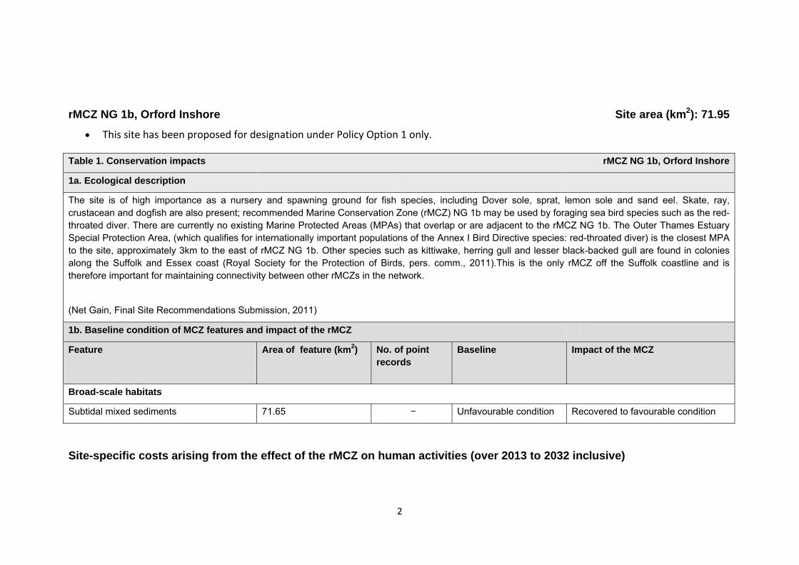
rMCZ NG 1b, Orford Inshore
Site area (km2): 71.95
• This site has been proposed for designation under Policy Option 1 only.
Site-specific costs arising from the effect of the rMCZ on human activities (over 2013 to 2032 inclusive)
Table 1. Conservation impacts rMCZ NG 1b, Orford Inshore
1a. Ecological description
The site is of high importance as a nursery and spawning ground for fish species, including Dover sole, sprat, lemon sole and sand eel. Skate, ray, crustacean and dogfish are also present; recommended Marine Conservation Zone (rMCZ) NG 1b may be used by foraging sea bird species such as the red-throated diver. There are currently no existing Marine Protected Areas (MPAs) that overlap or are adjacent to the rMCZ NG 1b. The Outer Thames Estuary Special Protection Area, (which qualifies for internationally important populations of the Annex I Bird Directive species: red-throated diver) is the closest MPA to the site, approximately 3km to the east of rMCZ NG 1b. Other species such as kittiwake, herring gull and lesser black-backed gull are found in colonies along the Suffolk and Essex coast (Royal Society for the Protection of Birds, pers. comm., 2011).This is the only rMCZ off the Suffolk coastline and is therefore important for maintaining connectivity between other rMCZs in the network.
(Net Gain, Final Site Recommendations Submission, 2011)
1b. Baseline condition of MCZ features and impact of the rMCZ
Feature Area of feature (km2) No. of point records
Baseline Impact of the MCZ
Broad-scale habitats
Subtidal mixed sediments 71.65 − Unfavourable condition Recovered to favourable condition
3
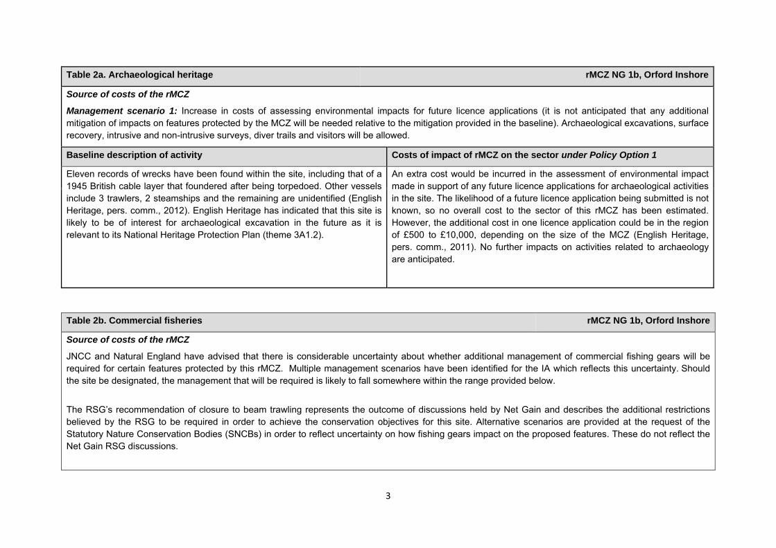
Table 2a. Archaeological heritage rMCZ NG 1b, Orford Inshore
Source of costs of the rMCZ
Management scenario 1: Increase in costs of assessing environmental impacts for future licence applications (it is not anticipated that any additional mitigation of impacts on features protected by the MCZ will be needed relative to the mitigation provided in the baseline). Archaeological excavations, surface recovery, intrusive and non-intrusive surveys, diver trails and visitors will be allowed.
Baseline description of activity Costs of impact of rMCZ on the sector under Policy Option 1
Eleven records of wrecks have been found within the site, including that of a 1945 British cable layer that foundered after being torpedoed. Other vessels include 3 trawlers, 2 steamships and the remaining are unidentified (English Heritage, pers. comm., 2012). English Heritage has indicated that this site is likely to be of interest for archaeological excavation in the future as it is relevant to its National Heritage Protection Plan (theme 3A1.2).
An extra cost would be incurred in the assessment of environmental impact made in support of any future licence applications for archaeological activities in the site. The likelihood of a future licence application being submitted is not known, so no overall cost to the sector of this rMCZ has been estimated. However, the additional cost in one licence application could be in the region of £500 to £10,000, depending on the size of the MCZ (English Heritage, pers. comm., 2011). No further impacts on activities related to archaeology are anticipated.
Table 2b. Commercial fisheries rMCZ NG 1b, Orford Inshore
Source of costs of the rMCZ
JNCC and Natural England have advised that there is considerable uncertainty about whether additional management of commercial fishing gears will be required for certain features protected by this rMCZ. Multiple management scenarios have been identified for the IA which reflects this uncertainty. Should the site be designated, the management that will be required is likely to fall somewhere within the range provided below.
The RSG’s recommendation of closure to beam trawling represents the outcome of discussions held by Net Gain and describes the additional restrictions believed by the RSG to be required in order to achieve the conservation objectives for this site. Alternative scenarios are provided at the request of the Statutory Nature Conservation Bodies (SNCBs) in order to reflect uncertainty on how fishing gears impact on the proposed features. These do not reflect the Net Gain RSG discussions.
4
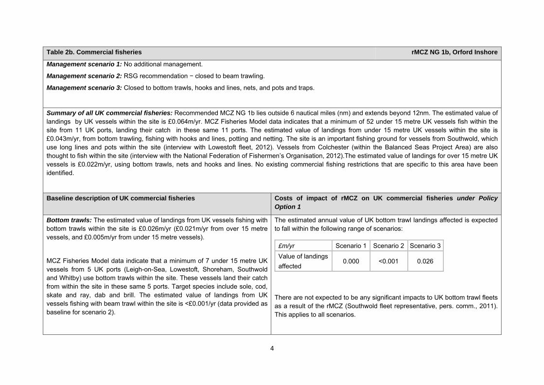
Table 2b. Commercial fisheries rMCZ NG 1b, Orford Inshore
Management scenario 1: No additional management.
Management scenario 2: RSG recommendation − closed to beam trawling.
Management scenario 3: Closed to bottom trawls, hooks and lines, nets, and pots and traps.
Summary of all UK commercial fisheries: Recommended MCZ NG 1b lies outside 6 nautical miles (nm) and extends beyond 12nm. The estimated value of landings by UK vessels within the site is £0.064m/yr. MCZ Fisheries Model data indicates that a minimum of 52 under 15 metre UK vessels fish within the site from 11 UK ports, landing their catch in these same 11 ports. The estimated value of landings from under 15 metre UK vessels within the site is £0.043m/yr, from bottom trawling, fishing with hooks and lines, potting and netting. The site is an important fishing ground for vessels from Southwold, which use long lines and pots within the site (interview with Lowestoft fleet, 2012). Vessels from Colchester (within the Balanced Seas Project Area) are also thought to fish within the site (interview with the National Federation of Fishermen’s Organisation, 2012).The estimated value of landings for over 15 metre UK vessels is £0.022m/yr, using bottom trawls, nets and hooks and lines. No existing commercial fishing restrictions that are specific to this area have been identified.
Baseline description of UK commercial fisheries Costs of impact of rMCZ on UK commercial fisheries under Policy Option 1
Bottom trawls: The estimated value of landings from UK vessels fishing with bottom trawls within the site is £0.026m/yr (£0.021m/yr from over 15 metre vessels, and £0.005m/yr from under 15 metre vessels).
MCZ Fisheries Model data indicate that a minimum of 7 under 15 metre UK vessels from 5 UK ports (Leigh-on-Sea, Lowestoft, Shoreham, Southwold and Whitby) use bottom trawls within the site. These vessels land their catch from within the site in these same 5 ports. Target species include sole, cod, skate and ray, dab and brill. The estimated value of landings from UK vessels fishing with beam trawl within the site is <£0.001/yr (data provided as baseline for scenario 2).
The estimated annual value of UK bottom trawl landings affected is expected to fall within the following range of scenarios:
There are not expected to be any significant impacts to UK bottom trawl fleets as a result of the rMCZ (Southwold fleet representative, pers. comm., 2011). This applies to all scenarios.
£m/yr Scenario 1 Scenario 2 Scenario 3Value of landings affected
0.000 <0.001 0.026
5
Table 2b. Commercial fisheries rMCZ NG 1b, Orford Inshore
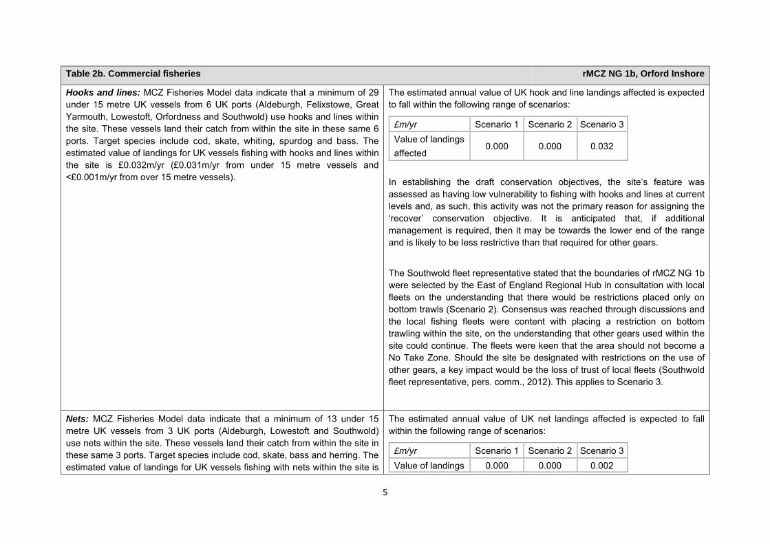
Hooks and lines: MCZ Fisheries Model data indicate that a minimum of 29 under 15 metre UK vessels from 6 UK ports (Aldeburgh, Felixstowe, Great Yarmouth, Lowestoft, Orfordness and Southwold) use hooks and lines within the site. These vessels land their catch from within the site in these same 6 ports. Target species include cod, skate, whiting, spurdog and bass. The estimated value of landings for UK vessels fishing with hooks and lines within the site is £0.032m/yr (£0.031m/yr from under 15 metre vessels and <£0.001m/yr from over 15 metre vessels).
The estimated annual value of UK hook and line landings affected is expected to fall within the following range of scenarios:
£m/yr Scenario 1 Scenario 2 Scenario 3Value of landings affected
0.000 0.000 0.032
In establishing the draft conservation objectives, the site’s feature was assessed as having low vulnerability to fishing with hooks and lines at current levels and, as such, this activity was not the primary reason for assigning the ‘recover’ conservation objective. It is anticipated that, if additional management is required, then it may be towards the lower end of the range and is likely to be less restrictive than that required for other gears.
The Southwold fleet representative stated that the boundaries of rMCZ NG 1b were selected by the East of England Regional Hub in consultation with local fleets on the understanding that there would be restrictions placed only on bottom trawls (Scenario 2). Consensus was reached through discussions and the local fishing fleets were content with placing a restriction on bottom trawling within the site, on the understanding that other gears used within the site could continue. The fleets were keen that the area should not become a No Take Zone. Should the site be designated with restrictions on the use of other gears, a key impact would be the loss of trust of local fleets (Southwold fleet representative, pers. comm., 2012). This applies to Scenario 3.
Nets: MCZ Fisheries Model data indicate that a minimum of 13 under 15 metre UK vessels from 3 UK ports (Aldeburgh, Lowestoft and Southwold) use nets within the site. These vessels land their catch from within the site in these same 3 ports. Target species include cod, skate, bass and herring. The estimated value of landings for UK vessels fishing with nets within the site is
The estimated annual value of UK net landings affected is expected to fall within the following range of scenarios:
£m/yr Scenario 1 Scenario 2 Scenario 3Value of landings 0.000 0.000 0.002
6
Table 2b. Commercial fisheries rMCZ NG 1b, Orford Inshore
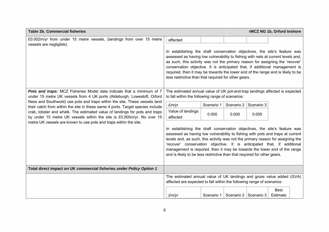
£0.002m/yr from under 15 metre vessels, (landings from over 15 metre vessels are negligible).
affected In establishing the draft conservation objectives, the site’s feature was assessed as having low vulnerability to fishing with nets at current levels and, as such, this activity was not the primary reason for assigning the ‘recover’ conservation objective. It is anticipated that, if additional management is required, then it may be towards the lower end of the range and is likely to be less restrictive than that required for other gears.
Pots and traps: MCZ Fisheries Model data indicate that a minimum of 7 under 15 metre UK vessels from 4 UK ports (Aldeburgh, Lowestoft, Orford Ness and Southwold) use pots and traps within the site. These vessels land their catch from within the site in these same 4 ports. Target species include crab, lobster and whelk. The estimated value of landings for pots and traps by under 15 metre UK vessels within the site is £0.005m/yr. No over 15 metre UK vessels are known to use pots and traps within the site.
The estimated annual value of UK pot-and-trap landings affected is expected to fall within the following range of scenarios:
£m/yr Scenario 1 Scenario 2 Scenario 3Value of landings affected
0.000 0.000 0.005
In establishing the draft conservation objectives, the site’s feature was assessed as having low vulnerability to fishing with pots and traps at current levels and, as such, this activity was not the primary reason for assigning the ‘recover’ conservation objective. It is anticipated that, if additional management is required, then it may be towards the lower end of the range and is likely to be less restrictive than that required for other gears.
Total direct impact on UK commercial fisheries under Policy Option 1
The estimated annual value of UK landings and gross value added (GVA) affected are expected to fall within the following range of scenarios:
£m/yr Scenario 1 Scenario 2 Scenario 3Best
Estimate
7
Table 2b. Commercial fisheries rMCZ NG 1b, Orford Inshore
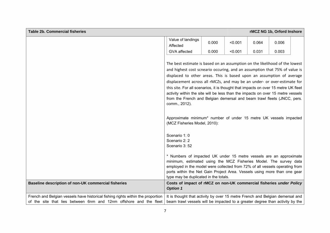
Value of landings Affected
0.000 <0.001 0.064 0.006
GVA affected 0.000 <0.001 0.031 0.003 The best estimate is based on an assumption on the likelihood of the lowest and highest cost scneario occuring, and an assumption that 75% of value is displaced to other areas. This is based upon an assumption of average displacement across all rMCZs, and may be an under‐ or over‐estimate for this site. For all scenarios, it is thought that impacts on over 15 metre UK fleet activity within the site will be less than the impacts on over 15 metre vessels from the French and Belgian demersal and beam trawl fleets (JNCC, pers. comm., 2012).
Approximate minimum* number of under 15 metre UK vessels impacted (MCZ Fisheries Model, 2010):
Scenario 1: 0 Scenario 2: 2 Scenario 3: 52 * Numbers of impacted UK under 15 metre vessels are an approximate minimum, estimated using the MCZ Fisheries Model. The survey data employed in the model were collected from 72% of all vessels operating from ports within the Net Gain Project Area. Vessels using more than one gear type may be duplicated in the totals.
Baseline description of non-UK commercial fisheries Costs of impact of rMCZ on non-UK commercial fisheries under Policy Option 1
French and Belgian vessels have historical fishing rights within the proportion of the site that lies between 6nm and 12nm offshore and the fleet
It is thought that activity by over 15 metre French and Belgian demersal and beam trawl vessels will be impacted to a greater degree than activity by the
8
Table 2b. Commercial fisheries rMCZ NG 1b, Orford Inshore
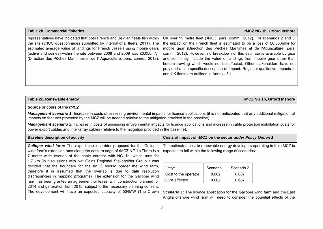
representatives have indicated that both French and Belgian fleets fish within the site (JNCC questionnaires submitted by international fleets, 2011). The estimated average value of landings for French vessels using mobile gears (active and seines) within the site between 2008 and 2009 was £0.056m/yr (Direction des Pêches Maritimes et de l' Aquaculture, pers. comm., 2012).
UK over 15 metre fleet (JNCC, pers. comm., 2012). For scenarios 2 and 3, the impact on the French fleet is estimated to be a loss of £0.056m/yr for mobile gear (Direction des Pêches Maritimes et de l'Aquaculture, pers. comm., 2012). However, no breakdown of this estimate is available by gear and so it may include the value of landings from mobile gear other than bottom trawling which would not be affected. Other stakeholders have not provided a site-specific description of impact. Regional qualitative impacts to non-UK fleets are outlined in Annex J3d.
Table 2c. Renewable energy rMCZ NG 1b, Orford Inshore
Source of costs of the rMCZ Management scenario 1: Increase in costs of assessing environmental impacts for licence applications (it is not anticipated that any additional mitigation of impacts on features protected by the MCZ will be needed relative to the mitigation provided in the baseline). Management scenario 2: Increase in costs of assessing environmental impacts for licence applications and increase in cable protection installation costs for power export cables and inter-array cables (relative to the mitigation provided in the baseline).
Baseline description of activity Costs of impact of rMCZ on the sector under Policy Option 1
Galloper wind farm: The export cable corridor proposed for the Galloper wind farm’s extension runs along the eastern edge of rMCZ NG 1b.There is a 7 metre wide overlap of the cable corridor with NG 1b, which runs for 1.7 km (in discussions with Net Gains Regional Stakeholder Group it was decided that the boundary for the rMCZ should border the wind farm, therefore it is assumed that the overlap is due to data resolution discrepancies in mapping programs). The extension for the Galloper wind farm has been granted an agreement for lease, with construction planned for 2014 and generation from 2015, subject to the necessary planning consent. The development will have an expected capacity of 504MW (The Crown
The estimated cost to renewable energy developers operating in this rMCZ is expected to fall within the following range of scenarios:
£m/yr Scenario 1 Scenario 2 Cost to the operator 0.002 0.687 GVA affected 0.002 0.687
Scenario 1: The licence application for the Galloper wind farm and the East Anglia offshore wind farm will need to consider the potential effects of the
9
Table 2c. Renewable energy rMCZ NG 1b, Orford Inshore
Estate and SSE RWE Npower, pers. comm., 2011).
East Anglia offshore wind farm: The search area for the East Anglia Round 3 wind farm cable route overlaps with rMCZ NG 1b. The wind farm is in its pre-planning stage and the exact location of the cable corridor has not yet been assigned. It is estimated that 24 cable routes will be placed in the search area, some of which could potentially pass through or near rMCZ NG 1b. Construction of the wind farm is planned for 2015 and generation from 2016 (subject to the necessary planning consent), with an expected capacity of 7,200MW (The Crown Estate and the developer, pers. comm., 2011).
Greater Gabbard wind farm: The Greater Gabbard Round 2 wind farm export cable corridor is close to the site. This wind farm is currently under construction and should be completed in 2012, with 30 turbines generating 504MW at capacity (The Crown Estate and SSE RWE Npower, pers. comm., 2011). The National Grid 2011 Offshore Development Information Statement indicates that an offshore DC cable will be required in the vicinity of rMCZ NG1b within the 20-year period of the Impact Assessment (IA) analysis in order to connect the East Anglia offshore wind farm to the National Electricity Transmission System. No further information is available.
development on achieving the conservation objectives of the rMCZ’s features. This is expected to result in an additional one-off cost for extra consultant/staff time. Additional costs are also expected for the Greater Gabbard wind farm but these will be incurred before 2013. At the request of the developer details of the additional costs for licence applications are not provided here.
Scenario 2: In addition to the increased costs for assessment set out under scenario 1, under scenario 2 costs of additional mitigation are anticipated. This additional mitigation entails use of alternative cable protection for export cables and inter-array cables that have not yet been consented. This is expected to result in an additional one-off cost. At the request of the developer details of the additional mitigation costs are not provided here. No inter-array cabling is anticipated to be required in this rMCZ. These costs are included in scenario 2 to reflect uncertainty over whether this additional mitigation will be required. However, JNCC and Natural England (pers. comm., 2012) state that the likelihood of this cost occurring is very low. Further details are provided in Annex H14.
The impacts that are assessed in both scenarios are based on JNCC and Natural England’s advice on the mitigation that could be required.
Comments from the developers of the Greater Gabbard and Galloper wind farms (personal communication, 2011): The developers of the Greater Gabbard and Galloper wind farms is concerned that further surveys and monitoring may be required to adequately complete the Environmental Impact Assessment (EIA), adding an estimated additional £0.025m per development to cover consultancy/staff time needed per EIA. The developer indicated that there is a low risk that mitigation will be required that involves increasing the length of cable routes to avoid rMCZ NG 1b. The estimated
10
Table 2c. Renewable energy rMCZ NG 1b, Orford Inshore
cost of this is £0.600m per 132kV cable. If more specialised vessels need to be used in the construction process this would further increase costs by £0.300m per km of cable layed. If the preferred construction methods could not be used because of mitigation requirements, this would result in an increase in costs of £150.000m to £200m for every 3-months delay in construction. Any delay to cable repairs would come at an additional cost of several million pounds per day (SSE RWE Npower, pers. comm., 2011).
Comments from the developer of the East Anglia wind farm (personal communication, 2011): The East Anglia offshore wind farm developers estimate that additional cost may arise if further surveys and monitoring are required to adequately inform the EIA. Should the length of the cable route need to be increased to avoid rMCZ NG 1b, additional costs would also be incurred. If additional restrictions are placed on cable laying or maintenance to ensure no adverse effect on protected features, such that usual and preferred methods cannot be used, this could also lead to additional costs for the developers(the developer of the East Anglia wind farm, pers. comm., 2011). At the request of the developer, estimates of these costs are not provided here.
Table 2d. Other impacts that are assessed for the suite of MCZs and not for this site alone rMCZ NG 1b, Orford Inshore
Cables (interconnectors and telecom cables) Future interconnectors and telecom cables may pass through the rMCZ. Impacts of rMCZs on future interconnectors and telecom cables are assessed in the Evidence Base, Annex H3 and Annex N3 (they are not assessed for this site alone).
11
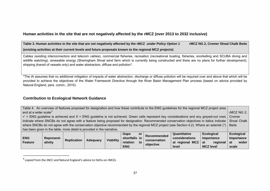
Human activities in the site that are not negatively affected by the rMCZ (over 2013 to 2032 inclusive)
Contribution to Ecological Network Guidance Table 4. An overview of features proposed for designation and how these contribute to the ENG guidelines for the regional MCZ project area and at a wider scale1
= ENG guideline is achieved and X = ENG guideline is not achieved. Green cells represent key considerations and any greyed-out rows indicate where SNCBs do not agree with a feature being proposed for designation. Recommended conservation objectives in italics indicate where SNCBs do not agree with the conservation objective recommended by the regional MCZ project (see Section 4.2). Where an asterisk (*) has been given in the table, more detail is provided in the narrative.
rMCZ NG 1b, Orford Inshore
ENG Feature
Represent-ativity Replication Adequacy Viability
Gaps or shortfalls in relation to ENG minimum guidelines
Recommended conservation objective
Quantitative considerations at regional MCZ level
Ecological Importance at regional MCZ level
Ecological Importance at wider scale
1 copied from the JNCC and Natural England’s advice to Defra on rMCZs
Table 3. Human activities in the site that are not negatively affected by the rMCZ under Policy Option 1
(existing activities at their current levels and future proposals known to the regional MCZ projects)
rMCZ NG 1b, Orford Inshore
Cables (existing interconnectors and telecom cables), recreation (recreational fisheries) and shipping (transit of vessels).
12
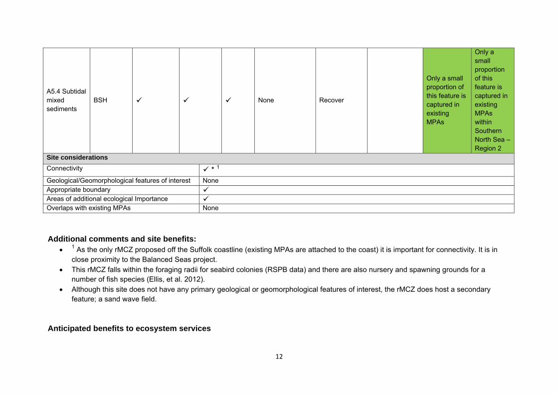
A5.4 Subtidal mixed sediments
BSH None Recover
Only a small proportion of this feature is captured in existing MPAs
Only a small proportion of this feature is captured in existing MPAs within Southern North Sea – Region 2
Site considerations Connectivity * 1 Geological/Geomorphological features of interest None Appropriate boundary Areas of additional ecological Importance Overlaps with existing MPAs None Additional comments and site benefits:
• 1 As the only rMCZ proposed off the Suffolk coastline (existing MPAs are attached to the coast) it is important for connectivity. It is in close proximity to the Balanced Seas project.
• This rMCZ falls within the foraging radii for seabird colonies (RSPB data) and there are also nursery and spawning grounds for a number of fish species (Ellis, et al. 2012).
• Although this site does not have any primary geological or geomorphological features of interest, the rMCZ does host a secondary feature; a sand wave field.
Anticipated benefits to ecosystem services
13
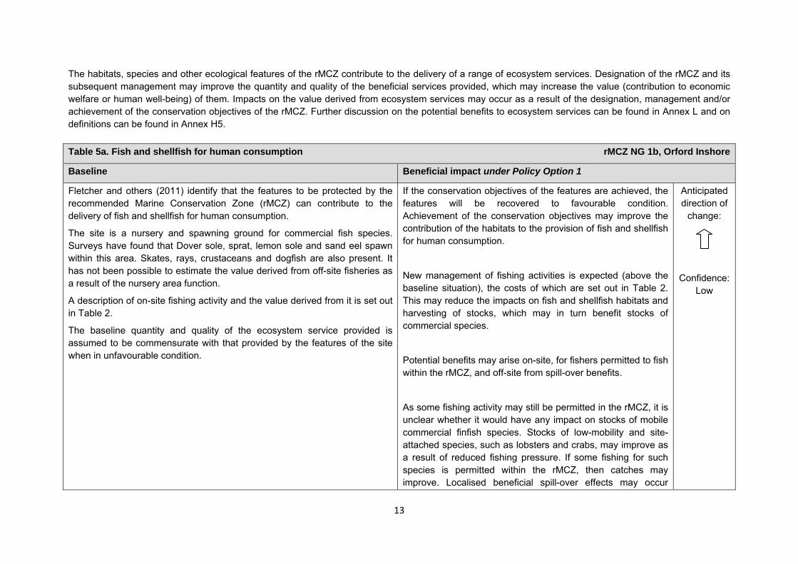
The habitats, species and other ecological features of the rMCZ contribute to the delivery of a range of ecosystem services. Designation of the rMCZ and its subsequent management may improve the quantity and quality of the beneficial services provided, which may increase the value (contribution to economic welfare or human well-being) of them. Impacts on the value derived from ecosystem services may occur as a result of the designation, management and/or achievement of the conservation objectives of the rMCZ. Further discussion on the potential benefits to ecosystem services can be found in Annex L and on definitions can be found in Annex H5. Table 5a. Fish and shellfish for human consumption rMCZ NG 1b, Orford Inshore
Baseline Beneficial impact under Policy Option 1
Fletcher and others (2011) identify that the features to be protected by the recommended Marine Conservation Zone (rMCZ) can contribute to the delivery of fish and shellfish for human consumption.
The site is a nursery and spawning ground for commercial fish species. Surveys have found that Dover sole, sprat, lemon sole and sand eel spawn within this area. Skates, rays, crustaceans and dogfish are also present. It has not been possible to estimate the value derived from off-site fisheries as a result of the nursery area function.
A description of on-site fishing activity and the value derived from it is set out in Table 2.
The baseline quantity and quality of the ecosystem service provided is assumed to be commensurate with that provided by the features of the site when in unfavourable condition.
If the conservation objectives of the features are achieved, the features will be recovered to favourable condition. Achievement of the conservation objectives may improve the contribution of the habitats to the provision of fish and shellfish for human consumption.
New management of fishing activities is expected (above the baseline situation), the costs of which are set out in Table 2. This may reduce the impacts on fish and shellfish habitats and harvesting of stocks, which may in turn benefit stocks of commercial species.
Potential benefits may arise on-site, for fishers permitted to fish within the rMCZ, and off-site from spill-over benefits.
As some fishing activity may still be permitted in the rMCZ, it is unclear whether it would have any impact on stocks of mobile commercial finfish species. Stocks of low-mobility and site-attached species, such as lobsters and crabs, may improve as a result of reduced fishing pressure. If some fishing for such species is permitted within the rMCZ, then catches may improve. Localised beneficial spill-over effects may occur
Anticipated direction of
change:
Confidence: Low
14
Table 5a. Fish and shellfish for human consumption rMCZ NG 1b, Orford Inshore
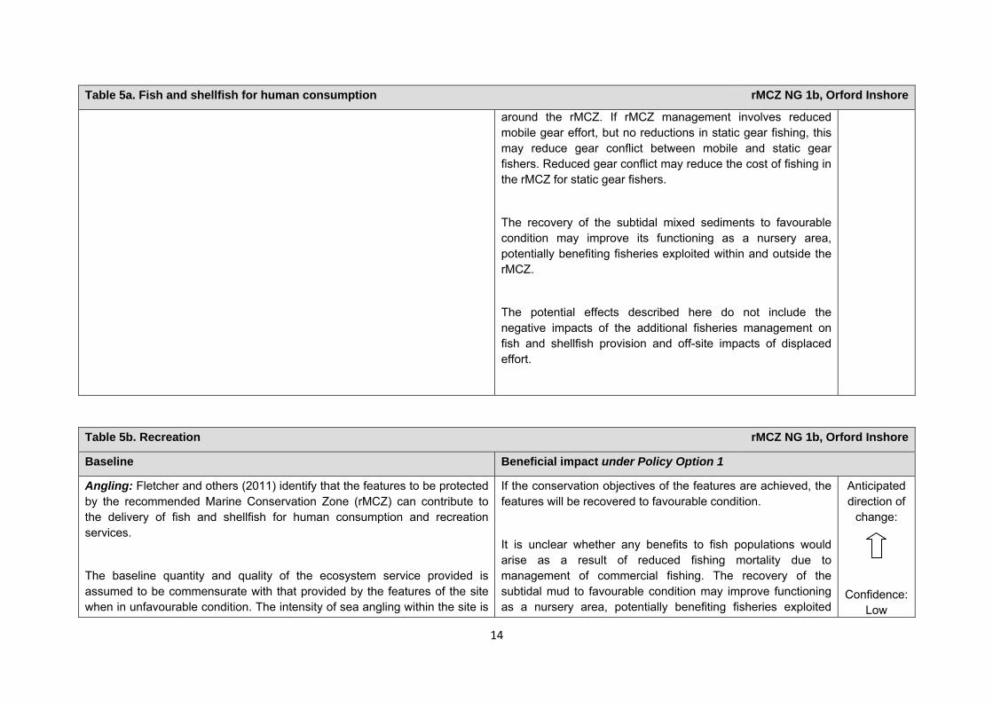
around the rMCZ. If rMCZ management involves reduced mobile gear effort, but no reductions in static gear fishing, this may reduce gear conflict between mobile and static gear fishers. Reduced gear conflict may reduce the cost of fishing in the rMCZ for static gear fishers.
The recovery of the subtidal mixed sediments to favourable condition may improve its functioning as a nursery area, potentially benefiting fisheries exploited within and outside the rMCZ.
The potential effects described here do not include the negative impacts of the additional fisheries management on fish and shellfish provision and off-site impacts of displaced effort.
Table 5b. Recreation rMCZ NG 1b, Orford Inshore
Baseline Beneficial impact under Policy Option 1
Angling: Fletcher and others (2011) identify that the features to be protected by the recommended Marine Conservation Zone (rMCZ) can contribute to the delivery of fish and shellfish for human consumption and recreation services.
The baseline quantity and quality of the ecosystem service provided is assumed to be commensurate with that provided by the features of the site when in unfavourable condition. The intensity of sea angling within the site is
If the conservation objectives of the features are achieved, the features will be recovered to favourable condition.
It is unclear whether any benefits to fish populations would arise as a result of reduced fishing mortality due to management of commercial fishing. The recovery of the subtidal mud to favourable condition may improve functioning as a nursery area, potentially benefiting fisheries exploited
Anticipated direction of
change:
Confidence: Low
15
Table 5b. Recreation rMCZ NG 1b, Orford Inshore
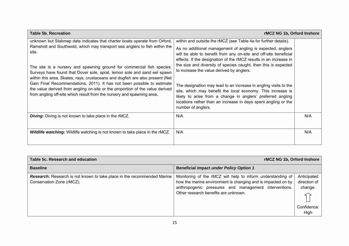
unknown but Stakmap data indicates that charter boats operate from Orford, Ramsholt and Southwold, which may transport sea anglers to fish within the site.
The site is a nursery and spawning ground for commercial fish species. Surveys have found that Dover sole, sprat, lemon sole and sand eel spawn within this area. Skates, rays, crustaceans and dogfish are also present (Net Gain Final Recommendations, 2011). It has not been possible to estimate the value derived from angling on-site or the proportion of the value derived from angling off-site which result from the nursery and spawning area.
within and outside the rMCZ (see Table 4a for further details).
As no additional management of angling is expected, anglers will be able to benefit from any on-site and off-site beneficial effects. If the designation of the rMCZ results in an increase in the size and diversity of species caught, then this is expected to increase the value derived by anglers.
The designation may lead to an increase in angling visits to the site, which may benefit the local economy. This increase is likely to arise from a change in anglers’ preferred angling locations rather than an increase in days spent angling or the number of anglers.
Diving: Diving is not known to take place in the rMCZ.
N/A N/A
Wildlife watching: Wildlife watching is not known to take place in the rMCZ. N/A
N/A
Table 5c. Research and education rMCZ NG 1b, Orford Inshore
Baseline Beneficial impact under Policy Option 1
Research: Research is not known to take place in the recommended Marine Conservation Zone (rMCZ).
Monitoring of the rMCZ will help to inform understanding of how the marine environment is changing and is impacted on by anthropogenic pressures and management interventions. Other research benefits are unknown.
Anticipated direction of
change:
Confidence:
High
16
Table 5c. Research and education rMCZ NG 1b, Orford Inshore
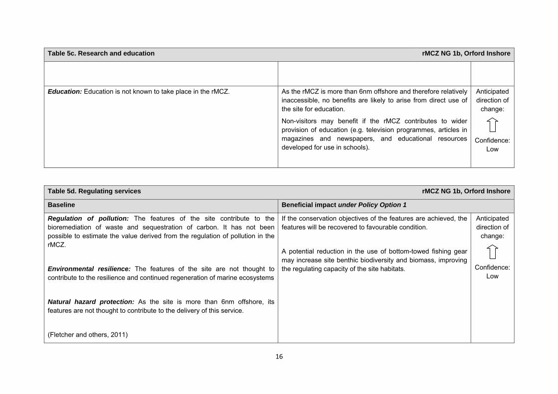
Education: Education is not known to take place in the rMCZ. As the rMCZ is more than 6nm offshore and therefore relatively inaccessible, no benefits are likely to arise from direct use of the site for education.
Non-visitors may benefit if the rMCZ contributes to wider provision of education (e.g. television programmes, articles in magazines and newspapers, and educational resources developed for use in schools).
Anticipated direction of
change:
Confidence:
Low
Table 5d. Regulating services rMCZ NG 1b, Orford Inshore
Baseline Beneficial impact under Policy Option 1
Regulation of pollution: The features of the site contribute to the bioremediation of waste and sequestration of carbon. It has not been possible to estimate the value derived from the regulation of pollution in the rMCZ.
Environmental resilience: The features of the site are not thought to contribute to the resilience and continued regeneration of marine ecosystems
Natural hazard protection: As the site is more than 6nm offshore, its features are not thought to contribute to the delivery of this service.
(Fletcher and others, 2011)
If the conservation objectives of the features are achieved, the features will be recovered to favourable condition.
A potential reduction in the use of bottom-towed fishing gear may increase site benthic biodiversity and biomass, improving the regulating capacity of the site habitats.
Anticipated direction of
change:
Confidence:
Low
17
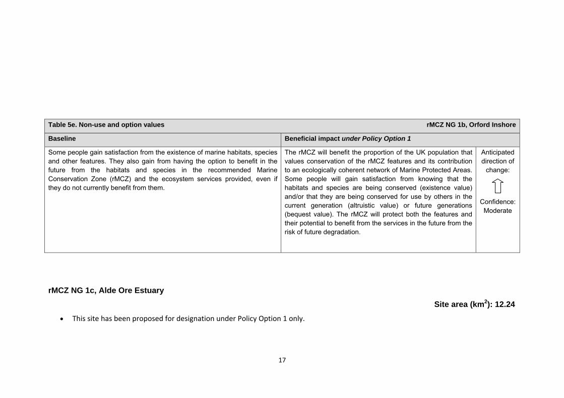
Table 5e. Non-use and option values rMCZ NG 1b, Orford Inshore
Baseline Beneficial impact under Policy Option 1
Some people gain satisfaction from the existence of marine habitats, species and other features. They also gain from having the option to benefit in the future from the habitats and species in the recommended Marine Conservation Zone (rMCZ) and the ecosystem services provided, even if they do not currently benefit from them.
The rMCZ will benefit the proportion of the UK population that values conservation of the rMCZ features and its contribution to an ecologically coherent network of Marine Protected Areas. Some people will gain satisfaction from knowing that the habitats and species are being conserved (existence value) and/or that they are being conserved for use by others in the current generation (altruistic value) or future generations (bequest value). The rMCZ will protect both the features and their potential to benefit from the services in the future from the risk of future degradation.
Anticipated direction of
change:
Confidence:
Moderate
rMCZ NG 1c, Alde Ore Estuary
Site area (km2): 12.24
• This site has been proposed for designation under Policy Option 1 only.
18
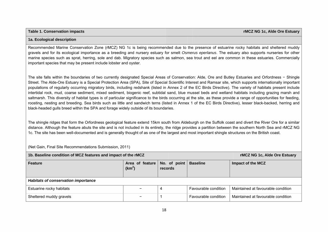
Table 1. Conservation impacts rMCZ NG 1c, Alde Ore Estuary
1a. Ecological description
Recommended Marine Conservation Zone (rMCZ) NG 1c is being recommended due to the presence of estuarine rocky habitats and sheltered muddy gravels and for its ecological importance as a breeding and nursery estuary for smelt Osmerus eperlanus. The estuary also supports nurseries for other marine species such as sprat, herring, sole and dab. Migratory species such as salmon, sea trout and eel are common in these estuaries. Commercially important species that may be present include lobster and oyster.
The site falls within the boundaries of two currently designated Special Areas of Conservation: Alde, Ore and Butley Estuaries and Orfordness − Shingle Street. The Alde-Ore Estuary is a Special Protection Area (SPA), Site of Special Scientific Interest and Ramsar site, which supports internationally important populations of regularly occurring migratory birds, including redshank (listed in Annex 2 of the EC Birds Directive). The variety of habitats present include intertidal rock, mud, coarse sediment, mixed sediment, biogenic reef, subtidal sand, blue mussel beds and wetland habitats including grazing marsh and saltmarsh. This diversity of habitat types is of particular significance to the birds occurring at the site, as these provide a range of opportunities for feeding, roosting, nesting and breeding. Sea birds such as little and sandwich terns (listed in Annex 1 of the EC Birds Directive), lesser black-backed, herring and black-headed gulls breed within the SPA and forage widely outside of its boundaries.
The shingle ridges that form the Orfordness geological feature extend 15km south from Aldeburgh on the Suffolk coast and divert the River Ore for a similar distance. Although the feature abuts the site and is not included in its entirety, the ridge provides a partition between the southern North Sea and rMCZ NG 1c. The site has been well-documented and is generally thought of as one of the largest and most important shingle structures on the British coast.
(Net Gain, Final Site Recommendations Submission, 2011)
1b. Baseline condition of MCZ features and impact of the rMCZ rMCZ NG 1c, Alde Ore Estuary
Feature Area of feature (km2)
No. of point records
Baseline Impact of the MCZ
Habitats of conservation importance
Estuarine rocky habitats − 4 Favourable condition Maintained at favourable condition
Sheltered muddy gravels − 1 Favourable condition Maintained at favourable condition
19
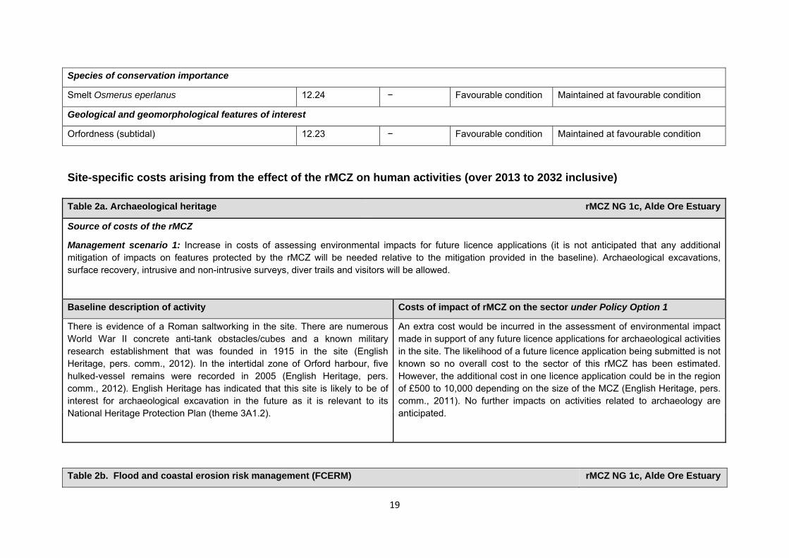
Site-specific costs arising from the effect of the rMCZ on human activities (over 2013 to 2032 inclusive) Table 2a. Archaeological heritage rMCZ NG 1c, Alde Ore Estuary
Source of costs of the rMCZ
Management scenario 1: Increase in costs of assessing environmental impacts for future licence applications (it is not anticipated that any additional mitigation of impacts on features protected by the rMCZ will be needed relative to the mitigation provided in the baseline). Archaeological excavations, surface recovery, intrusive and non-intrusive surveys, diver trails and visitors will be allowed.
Baseline description of activity Costs of impact of rMCZ on the sector under Policy Option 1
There is evidence of a Roman saltworking in the site. There are numerous World War II concrete anti-tank obstacles/cubes and a known military research establishment that was founded in 1915 in the site (English Heritage, pers. comm., 2012). In the intertidal zone of Orford harbour, five hulked-vessel remains were recorded in 2005 (English Heritage, pers. comm., 2012). English Heritage has indicated that this site is likely to be of interest for archaeological excavation in the future as it is relevant to its National Heritage Protection Plan (theme 3A1.2).
An extra cost would be incurred in the assessment of environmental impact made in support of any future licence applications for archaeological activities in the site. The likelihood of a future licence application being submitted is not known so no overall cost to the sector of this rMCZ has been estimated. However, the additional cost in one licence application could be in the region of £500 to 10,000 depending on the size of the MCZ (English Heritage, pers. comm., 2011). No further impacts on activities related to archaeology are anticipated.
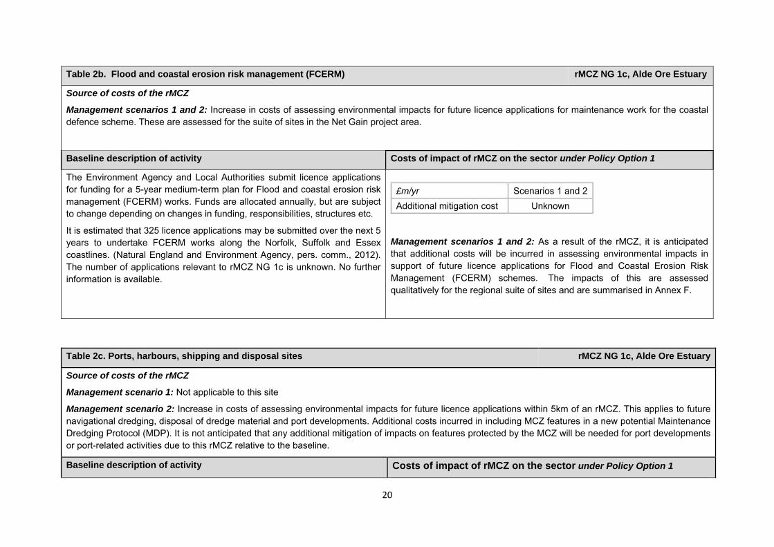
Table 2b. Flood and coastal erosion risk management (FCERM) rMCZ NG 1c, Alde Ore Estuary
Species of conservation importance
Smelt Osmerus eperlanus 12.24 − Favourable condition Maintained at favourable condition
Geological and geomorphological features of interest
Orfordness (subtidal) 12.23 − Favourable condition Maintained at favourable condition
20
Table 2b. Flood and coastal erosion risk management (FCERM) rMCZ NG 1c, Alde Ore Estuary
Source of costs of the rMCZ
Management scenarios 1 and 2: Increase in costs of assessing environmental impacts for future licence applications for maintenance work for the coastal defence scheme. These are assessed for the suite of sites in the Net Gain project area.
Baseline description of activity Costs of impact of rMCZ on the sector under Policy Option 1
The Environment Agency and Local Authorities submit licence applications for funding for a 5-year medium-term plan for Flood and coastal erosion risk management (FCERM) works. Funds are allocated annually, but are subject to change depending on changes in funding, responsibilities, structures etc.
It is estimated that 325 licence applications may be submitted over the next 5 years to undertake FCERM works along the Norfolk, Suffolk and Essex coastlines. (Natural England and Environment Agency, pers. comm., 2012). The number of applications relevant to rMCZ NG 1c is unknown. No further information is available.
Management scenarios 1 and 2: As a result of the rMCZ, it is anticipated that additional costs will be incurred in assessing environmental impacts in support of future licence applications for Flood and Coastal Erosion Risk Management (FCERM) schemes. The impacts of this are assessed qualitatively for the regional suite of sites and are summarised in Annex F.
£m/yr Scenarios 1 and 2Additional mitigation cost Unknown
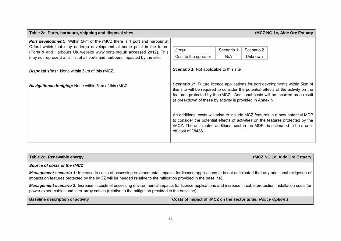
Table 2c. Ports, harbours, shipping and disposal sites rMCZ NG 1c, Alde Ore Estuary
Source of costs of the rMCZ
Management scenario 1: Not applicable to this site
Management scenario 2: Increase in costs of assessing environmental impacts for future licence applications within 5km of an rMCZ. This applies to future navigational dredging, disposal of dredge material and port developments. Additional costs incurred in including MCZ features in a new potential Maintenance Dredging Protocol (MDP). It is not anticipated that any additional mitigation of impacts on features protected by the MCZ will be needed for port developments or port-related activities due to this rMCZ relative to the baseline.
Baseline description of activity Costs of impact of rMCZ on the sector under Policy Option 1
21
Table 2c. Ports, harbours, shipping and disposal sites rMCZ NG 1c, Alde Ore Estuary
Port development: Within 5km of the rMCZ there is 1 port and harbour at Orford which that may undergo development at some point in the future (Ports & and Harbours UK website www.ports.org.uk accessed 2012). This may not represent a full list of all ports and harbours impacted by the site.
Disposal sites: None within 5km of this rMCZ.
Navigational dredging: None within 5km of this rMCZ.
£m/yr Scenario 1 Scenario 2 Cost to the operator N/A Unknown
Scenario 1: Not applicable to this site
Scenario 2: Future licence applications for port developments within 5km of this site will be required to consider the potential effects of the activity on the features protected by the rMCZ. Additional costs will be incurred as a result (a breakdown of these by activity is provided in Annex N.
An additional costs will arise to include MCZ features in a new potential MDP to consider the potential effects of activities on the features protected by the rMCZ. The anticipated additional cost in the MDPs is estimated to be a one-off cost of £8438.
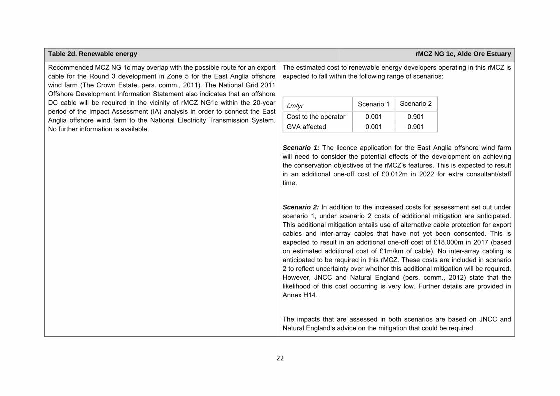
Table 2d. Renewable energy rMCZ NG 1c, Alde Ore Estuary
Source of costs of the rMCZ
Management scenario 1: Increase in costs of assessing environmental impacts for licence applications (it is not anticipated that any additional mitigation of impacts on features protected by the rMCZ will be needed relative to the mitigation provided in the baseline).
Management scenario 2: Increase in costs of assessing environmental impacts for licence applications and increase in cable protection installation costs for power export cables and inter-array cables (relative to the mitigation provided in the baseline).
Baseline description of activity Costs of impact of rMCZ on the sector under Policy Option 1
22
Table 2d. Renewable energy rMCZ NG 1c, Alde Ore Estuary
Recommended MCZ NG 1c may overlap with the possible route for an export cable for the Round 3 development in Zone 5 for the East Anglia offshore wind farm (The Crown Estate, pers. comm., 2011). The National Grid 2011 Offshore Development Information Statement also indicates that an offshore DC cable will be required in the vicinity of rMCZ NG1c within the 20-year period of the Impact Assessment (IA) analysis in order to connect the East Anglia offshore wind farm to the National Electricity Transmission System. No further information is available.
The estimated cost to renewable energy developers operating in this rMCZ is expected to fall within the following range of scenarios:
£m/yr Scenario 1 Scenario 2
Cost to the operator 0.001 0.901 GVA affected 0.001 0.901
Scenario 1: The licence application for the East Anglia offshore wind farm will need to consider the potential effects of the development on achieving the conservation objectives of the rMCZ’s features. This is expected to result in an additional one-off cost of £0.012m in 2022 for extra consultant/staff time.
Scenario 2: In addition to the increased costs for assessment set out under scenario 1, under scenario 2 costs of additional mitigation are anticipated. This additional mitigation entails use of alternative cable protection for export cables and inter-array cables that have not yet been consented. This is expected to result in an additional one-off cost of £18.000m in 2017 (based on estimated additional cost of £1m/km of cable). No inter-array cabling is anticipated to be required in this rMCZ. These costs are included in scenario 2 to reflect uncertainty over whether this additional mitigation will be required. However, JNCC and Natural England (pers. comm., 2012) state that the likelihood of this cost occurring is very low. Further details are provided in Annex H14.
The impacts that are assessed in both scenarios are based on JNCC and Natural England’s advice on the mitigation that could be required.
23
Table 2d. Renewable energy rMCZ NG 1c, Alde Ore Estuary
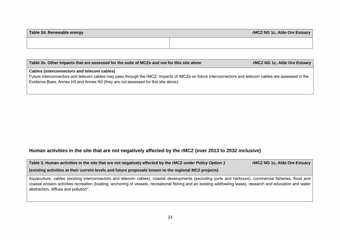
Human activities in the site that are not negatively affected by the rMCZ (over 2013 to 2032 inclusive) Table 3. Human activities in the site that are not negatively affected by the rMCZ under Policy Option 1
(existing activities at their current levels and future proposals known to the regional MCZ projects)
rMCZ NG 1c, Alde Ore Estuary
Aquaculture, cables (existing interconnectors and telecom cables), coastal developments (excluding ports and harbours), commercial fisheries, flood and coastal erosion activities recreation (boating, anchoring of vessels, recreational fishing and an existing wildfowling lease), research and education and water abstraction, diffuse and pollution*.
Table 2e. Other impacts that are assessed for the suite of MCZs and not for this site alone rMCZ NG 1c, Alde Ore Estuary
Cables (interconnectors and telecom cables) Future interconnectors and telecom cables may pass through the rMCZ. Impacts of rMCZs on future interconnectors and telecom cables are assessed in the Evidence Base, Annex H3 and Annex N3 (they are not assessed for this site alone).
24
*The IA assumes that no additional mitigation of impacts of water abstraction, discharge or diffuse pollution will be required over and above that which will be provided to achieve the objectives of the Water Framework Directive through the River Basin Management Plan process (based on advice provided by Natural England, pers. comm., 2010).
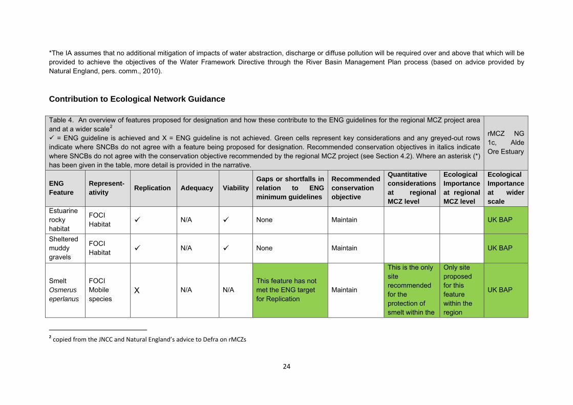
Contribution to Ecological Network Guidance Table 4. An overview of features proposed for designation and how these contribute to the ENG guidelines for the regional MCZ project area and at a wider scale2
= ENG guideline is achieved and X = ENG guideline is not achieved. Green cells represent key considerations and any greyed-out rows indicate where SNCBs do not agree with a feature being proposed for designation. Recommended conservation objectives in italics indicate where SNCBs do not agree with the conservation objective recommended by the regional MCZ project (see Section 4.2). Where an asterisk (*) has been given in the table, more detail is provided in the narrative.
rMCZ NG 1c, Alde Ore Estuary
ENG Feature
Represent-ativity Replication Adequacy Viability
Gaps or shortfalls in relation to ENG minimum guidelines
Recommended conservation objective
Quantitative considerations at regional MCZ level
Ecological Importanceat regional MCZ level
Ecological Importance at wider scale
Estuarine rocky habitat
FOCI Habitat N/A None Maintain UK BAP
Sheltered muddy gravels
FOCI Habitat N/A None Maintain UK BAP
Smelt Osmerus eperlanus
FOCI Mobile species
X N/A N/A This feature has not met the ENG target for Replication
Maintain
This is the only site recommended for the protection of smelt within the
Only site proposed for this feature within the region
UK BAP
2 copied from the JNCC and Natural England’s advice to Defra on rMCZs
25
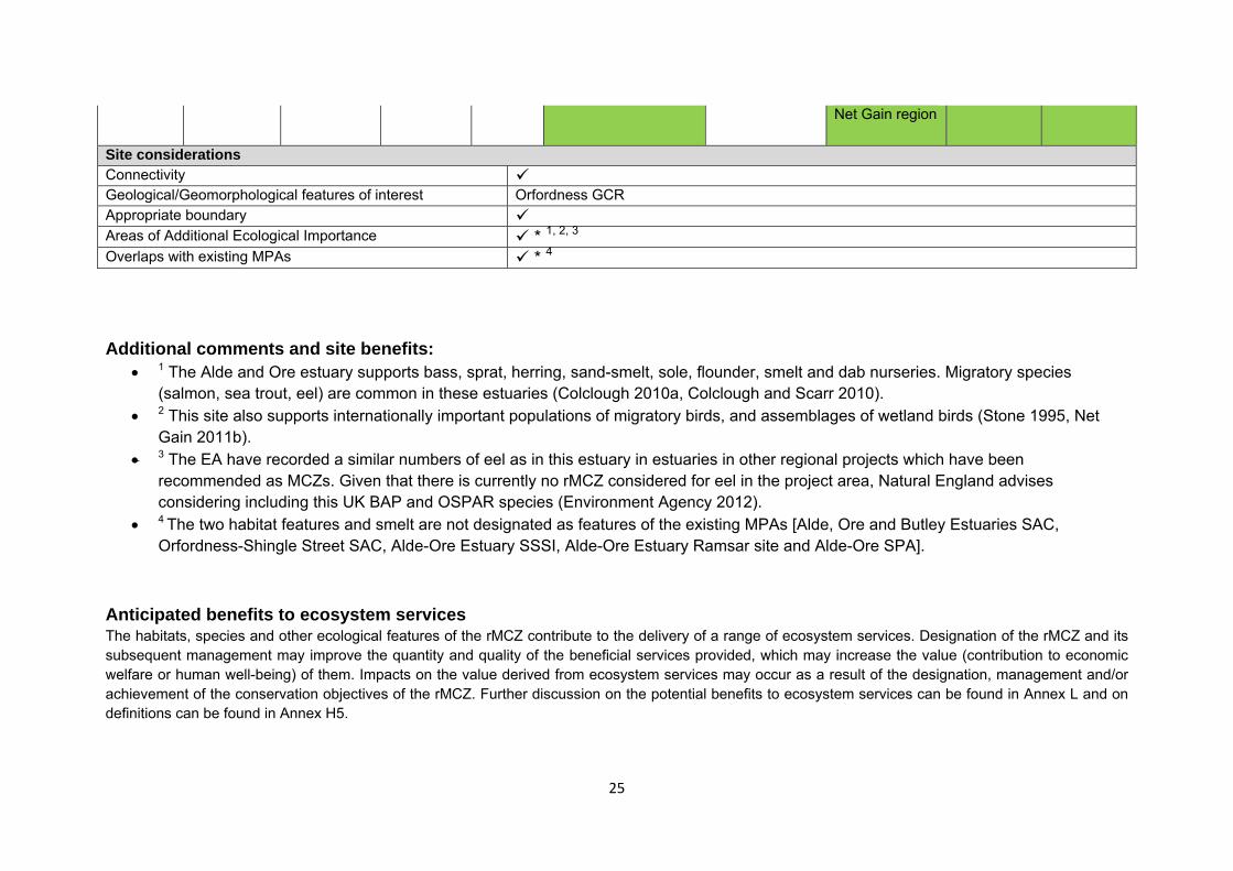
Net Gain region
Site considerations Connectivity Geological/Geomorphological features of interest Orfordness GCR Appropriate boundary Areas of Additional Ecological Importance * 1, 2, 3 Overlaps with existing MPAs * 4 Additional comments and site benefits:
• 1 The Alde and Ore estuary supports bass, sprat, herring, sand-smelt, sole, flounder, smelt and dab nurseries. Migratory species (salmon, sea trout, eel) are common in these estuaries (Colclough 2010a, Colclough and Scarr 2010).
• 2 This site also supports internationally important populations of migratory birds, and assemblages of wetland birds (Stone 1995, Net Gain 2011b).
• 3 The EA have recorded a similar numbers of eel as in this estuary in estuaries in other regional projects which have been recommended as MCZs. Given that there is currently no rMCZ considered for eel in the project area, Natural England advises considering including this UK BAP and OSPAR species (Environment Agency 2012).
• 4 The two habitat features and smelt are not designated as features of the existing MPAs [Alde, Ore and Butley Estuaries SAC, Orfordness-Shingle Street SAC, Alde-Ore Estuary SSSI, Alde-Ore Estuary Ramsar site and Alde-Ore SPA].
Anticipated benefits to ecosystem services The habitats, species and other ecological features of the rMCZ contribute to the delivery of a range of ecosystem services. Designation of the rMCZ and its subsequent management may improve the quantity and quality of the beneficial services provided, which may increase the value (contribution to economic welfare or human well-being) of them. Impacts on the value derived from ecosystem services may occur as a result of the designation, management and/or achievement of the conservation objectives of the rMCZ. Further discussion on the potential benefits to ecosystem services can be found in Annex L and on definitions can be found in Annex H5.
26
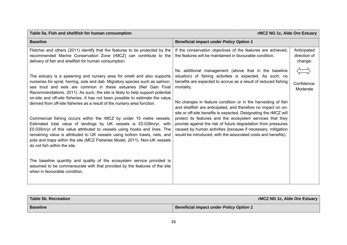
Table 5a. Fish and shellfish for human consumption rMCZ NG 1c, Alde Ore Estuary
Baseline Beneficial impact under Policy Option 1
Fletcher and others (2011) identify that the features to be protected by the recommended Marine Conservation Zone (rMCZ) can contribute to the delivery of fish and shellfish for human consumption.
The estuary is a spawning and nursery area for smelt and also supports nurseries for sprat, herring, sole and dab. Migratory species such as salmon, sea trout and eels are common in these estuaries (Net Gain Final Recommendations, 2011). As such, the site is likely to help support potential on-site and off-site fisheries. It has not been possible to estimate the value derived from off-site fisheries as a result of the nursery area function.
Commercial fishing occurs within the rMCZ by under 15 metre vessels. Estimated total value of landings by UK vessels is £0.039m/yr, with £0.035m/yr of this value attributed to vessels using hooks and lines. The remaining value is attributed to UK vessels using bottom trawls, nets, and pots and traps within the site (MCZ Fisheries Model, 2011). Non-UK vessels do not fish within the site.
The baseline quantity and quality of the ecosystem service provided is assumed to be commensurate with that provided by the features of the site when in favourable condition.
If the conservation objectives of the features are achieved, the features will be maintained in favourable condition.
No additional management (above that in the baseline situation) of fishing activities is expected. As such, no benefits are expected to accrue as a result of reduced fishing mortality.
No changes in feature condition or in the harvesting of fish and shellfish are anticipated, and therefore no impact on on-site or off-site benefits is expected. Designating the rMCZ will protect its features and the ecosystem services that they provide against the risk of future degradation from pressures caused by human activities (because if necessary, mitigation would be introduced, with the associated costs and benefits).
Anticipated direction of
change:
Confidence: Moderate
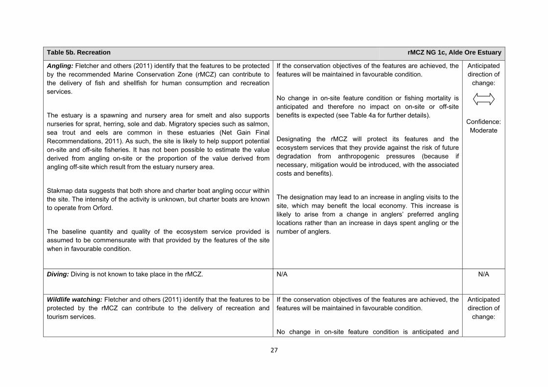
Table 5b. Recreation rMCZ NG 1c, Alde Ore Estuary
Baseline Beneficial impact under Policy Option 1
27
Table 5b. Recreation rMCZ NG 1c, Alde Ore Estuary
Angling: Fletcher and others (2011) identify that the features to be protected by the recommended Marine Conservation Zone (rMCZ) can contribute to the delivery of fish and shellfish for human consumption and recreation services.
The estuary is a spawning and nursery area for smelt and also supports nurseries for sprat, herring, sole and dab. Migratory species such as salmon, sea trout and eels are common in these estuaries (Net Gain Final Recommendations, 2011). As such, the site is likely to help support potential on-site and off-site fisheries. It has not been possible to estimate the value derived from angling on-site or the proportion of the value derived from angling off-site which result from the estuary nursery area.
Stakmap data suggests that both shore and charter boat angling occur within the site. The intensity of the activity is unknown, but charter boats are known to operate from Orford.
The baseline quantity and quality of the ecosystem service provided is assumed to be commensurate with that provided by the features of the site when in favourable condition.
If the conservation objectives of the features are achieved, the features will be maintained in favourable condition.
No change in on-site feature condition or fishing mortality is anticipated and therefore no impact on on-site or off-site benefits is expected (see Table 4a for further details).
Designating the rMCZ will protect its features and the ecosystem services that they provide against the risk of future degradation from anthropogenic pressures (because if necessary, mitigation would be introduced, with the associated costs and benefits).
The designation may lead to an increase in angling visits to the site, which may benefit the local economy. This increase is likely to arise from a change in anglers’ preferred angling locations rather than an increase in days spent angling or the number of anglers.
Anticipated direction of
change:
Confidence: Moderate
Diving: Diving is not known to take place in the rMCZ.
N/A N/A
Wildlife watching: Fletcher and others (2011) identify that the features to be protected by the rMCZ can contribute to the delivery of recreation and tourism services.
If the conservation objectives of the features are achieved, the features will be maintained in favourable condition.
No change in on-site feature condition is anticipated and
Anticipated direction of
change:
28
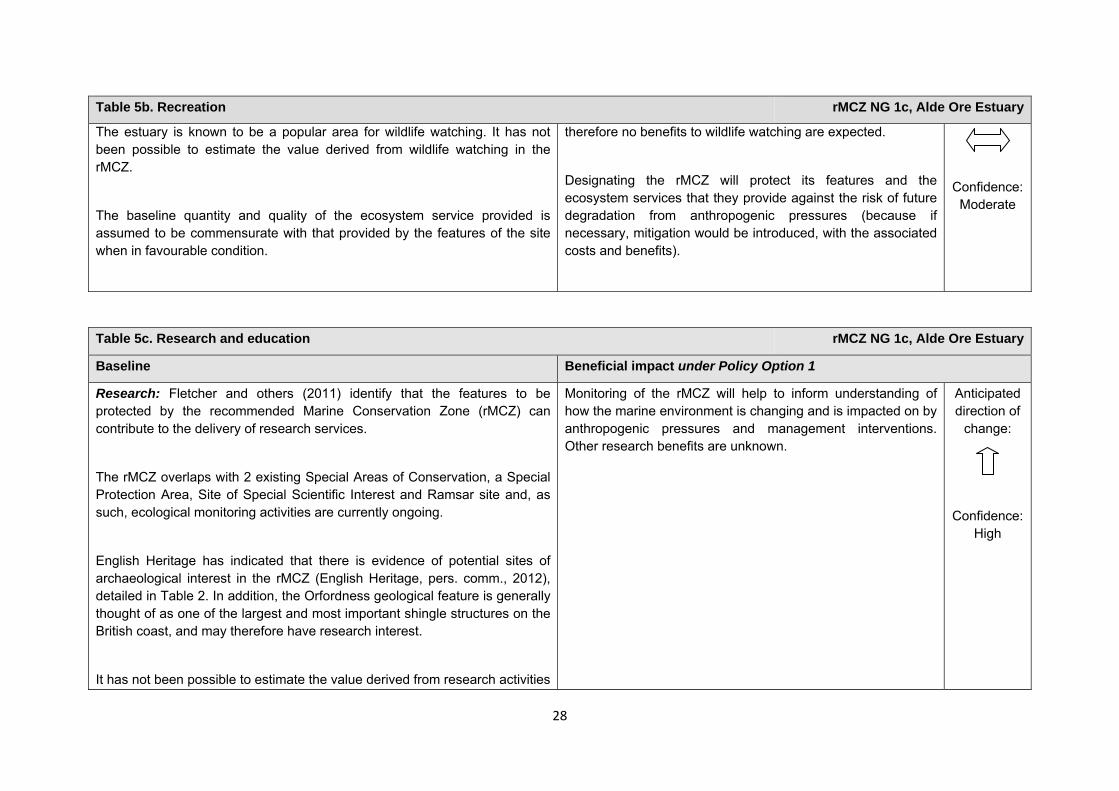
Table 5b. Recreation rMCZ NG 1c, Alde Ore Estuary
The estuary is known to be a popular area for wildlife watching. It has not been possible to estimate the value derived from wildlife watching in the rMCZ.
The baseline quantity and quality of the ecosystem service provided is assumed to be commensurate with that provided by the features of the site when in favourable condition.
therefore no benefits to wildlife watching are expected.
Designating the rMCZ will protect its features and the ecosystem services that they provide against the risk of future degradation from anthropogenic pressures (because if necessary, mitigation would be introduced, with the associated costs and benefits).
Confidence: Moderate
Table 5c. Research and education rMCZ NG 1c, Alde Ore Estuary
Baseline Beneficial impact under Policy Option 1
Research: Fletcher and others (2011) identify that the features to be protected by the recommended Marine Conservation Zone (rMCZ) can contribute to the delivery of research services.
The rMCZ overlaps with 2 existing Special Areas of Conservation, a Special Protection Area, Site of Special Scientific Interest and Ramsar site and, as such, ecological monitoring activities are currently ongoing.
English Heritage has indicated that there is evidence of potential sites of archaeological interest in the rMCZ (English Heritage, pers. comm., 2012), detailed in Table 2. In addition, the Orfordness geological feature is generally thought of as one of the largest and most important shingle structures on the British coast, and may therefore have research interest.
It has not been possible to estimate the value derived from research activities
Monitoring of the rMCZ will help to inform understanding of how the marine environment is changing and is impacted on by anthropogenic pressures and management interventions. Other research benefits are unknown.
Anticipated direction of
change:
Confidence: High
29
Table 5c. Research and education rMCZ NG 1c, Alde Ore Estuary
associated with the rMCZ.
Education: Fletcher and others (2011) identify that the features to be protected by the rMCZ can contribute to the delivery of education services.
The extent of current educational activity carried out at the estuary is unknown. However, English Heritage has indicated that there is evidence of potential sites of archaeological interest in the rMCZ (English Heritage, pers. comm., 2012), detailed in Table 2. In addition, the Orfordness geological feature is generally regarded as one of the largest and most important shingle structures on the British coast, and may therefore have educational interest (Net Gain Final Recommendations, 2011). Two Royal Yachting Association training centres are also known to be present on the estuary (Stakmap, 2011).
It has not been possible to estimate the value derived from education activities associated with the rMCZ.
MCZ designation may provide an opportunity to expand the focus of education events into the marine environment.
Designation may aid additional local (to the rMCZ) provision of education (e.g. events and interpretation boards), from which visitors would derive benefit.
Non-visitors may benefit if the rMCZ contributes to wider provision of education (e.g. television programmes, articles in magazines and newspapers, and educational resources developed for use in schools).
Anticipated direction of
change:
Confidence: Moderate
Table 5d. Regulating services rMCZ NG 1c, Alde Ore Estuary
Baseline Beneficial impact under Policy Option 1
Regulation of pollution: The features of the site are not thought to contribute to the bioremediation of waste and sequestration of carbon.
Environmental resilience: The features of the site are not thought to
If the conservation objectives of the features are achieved, the features will be maintained in favourable condition.
No change in feature condition and management of human
Anticipated direction of
change:
30
contribute to the resilience and continued regeneration of marine ecosystems.
Natural hazard protection: The features of the site contribute to local flood and storm protection. It has not been possible to estimate the value derived from natural hazard protection in the rMCZ.
(Fletcher and others, 2011)
activities is expected and therefore no benefit to the regulatory capacity of the site is expected.
Designating the recommended Marine Conservation Zone will protect its features and the ecosystem services that they provide against the risk of future degradation from anthropogenic pressures (because if necessary, mitigation would be introduced, with the associated costs and benefits).
Confidence: Moderate
Table 5e. Non-use and option values rMCZ NG 1c, Alde Ore Estuary
Baseline Beneficial impact under Policy Option 1
31
Some people gain satisfaction from the existence of marine habitats, species and other features. They also gain from having the option to benefit in the future from the habitats and species in the recommended Marine Conservation Zone (rMCZ) and the ecosystem services provided, even if they do not currently benefit from them.
The rMCZ will benefit the proportion of the UK population that values conservation of the rMCZ features and its contribution to an ecologically coherent network of Marine Protected Areas. Some people will gain satisfaction from knowing that the habitats and species are being conserved (existence value) and/or that they are being conserved for use by others in the current generation (altruistic value) or future generations (bequest value). The rMCZ will protect both the features and their option to benefit from the services in the future from the risk of future degradation.
Examples of these values are shown in Ranger and others (2011). In the Marine Conservation Society ‘Your Seas Your Voice’ campaign, 2 ‘nominated sites’ are located within rMCZ NG 1c. Features of the natural environment were strong motivators for reasons why people thought that these locations should be protected, with people attaching value to allowing species recovery as an important management reason to protect the site.
Anticipated direction of
change:
Confidence: Moderate
32
rMCZ NG 2, Cromer Shoal Chalk Beds Site area (km2): 315.64
• This site has been proposed for designation under Policy Option 1 only.
Table 1. Conservation impacts rMCZ NG 2, Cromer Shoal Chalk Beds
1a. Ecological description
This site encompasses some of the best examples of subtidal chalk within the North Sea, forming part of the longest chalk reef in Europe, and includes arch formations in chalk walls. The chalk within and surrounding this area hosts a high diversity of flora and fauna, including large communities of crustaceans, sponges, squirts and cnidarians. Seasearch dives within this area have identified sponges, abundant numbers of green and brown algae species, a good range of sea anemone species (including an unusually frequent number of dahlia) as well as sandmason, colonial squirt, dragonet, finger bryozoans and squat lobster. Lesser sand eel and piddock have also been seen in large numbers. The sea bed is composed of a variety of rock, sediment, chalk, blue mussel beds and peat and clay exposures. The North Norfolk Coast has a great diversity of high-quality freshwater, intertidal and marine habitats which result in very large numbers of sea birds throughout the year.
The site is likely to provide foraging opportunities for sea birds, such as sea duck and tern (tern are listed in Annex 1 of the EC Birds Directive). It is also within the range of important colonies of breeding tern along the Norfolk coast, such as Sandwich tern and little tern, although is not within what may be considered the core range for these species. Research has shown the site to be an important spawning ground for Dover sole, lemon sole, whiting and sand eel. There are frequent sightings of whale, dolphin, porpoise and seal (listed on Annex 2 of the EC Habitats Directive), and occasional sightings of species such as sunfish and basking shark.
The western boundary of the site aligns with the Wash and North Norfolk Coast SAC. Between the low water mark and the land, the following geological Sites of Special Scientific Interest are present: Sidestrand and Trimmingham Cliffs, Weybourne Cliffs, Beeston Cliffs, East Runton Cliffs and West Runton Cliffs, although these are not within rMCZ NG 2. Recommended MCZ (rMCZ) Reference Area 1 lies entirely within the site.
(Net Gain, Final Site Recommendations Submission, 2011)
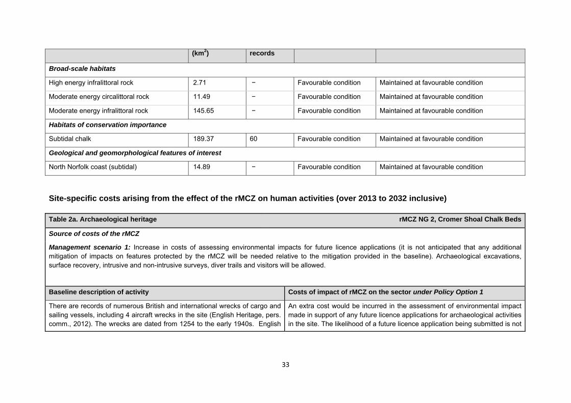
1b. Baseline condition of MCZ features and impact of the rMCZ
Feature Area of feature No. of point Baseline Impact of the MCZ
33
Site-specific costs arising from the effect of the rMCZ on human activities (over 2013 to 2032 inclusive) Table 2a. Archaeological heritage rMCZ NG 2, Cromer Shoal Chalk Beds
Source of costs of the rMCZ
Management scenario 1: Increase in costs of assessing environmental impacts for future licence applications (it is not anticipated that any additional mitigation of impacts on features protected by the rMCZ will be needed relative to the mitigation provided in the baseline). Archaeological excavations, surface recovery, intrusive and non-intrusive surveys, diver trails and visitors will be allowed.
Baseline description of activity Costs of impact of rMCZ on the sector under Policy Option 1
There are records of numerous British and international wrecks of cargo and sailing vessels, including 4 aircraft wrecks in the site (English Heritage, pers. comm., 2012). The wrecks are dated from 1254 to the early 1940s. English
An extra cost would be incurred in the assessment of environmental impact made in support of any future licence applications for archaeological activities in the site. The likelihood of a future licence application being submitted is not
(km2) records
Broad-scale habitats
High energy infralittoral rock 2.71 − Favourable condition Maintained at favourable condition
Moderate energy circalittoral rock 11.49 − Favourable condition Maintained at favourable condition
Moderate energy infralittoral rock 145.65 − Favourable condition Maintained at favourable condition
Habitats of conservation importance
Subtidal chalk 189.37 60 Favourable condition Maintained at favourable condition
Geological and geomorphological features of interest
North Norfolk coast (subtidal) 14.89 − Favourable condition Maintained at favourable condition
34
Table 2a. Archaeological heritage rMCZ NG 2, Cromer Shoal Chalk Beds
Heritage has indicated that this site is likely to be of interest for archaeological excavation in the future as it is relevant to its National Heritage Protection Plan (theme 3A3.202).
known, so no overall cost to the sector of this rMCZ has been estimated. However, the additional cost in one licence application could be in the region of £500 to £10,000 depending on the size of the MCZ (English Heritage, pers. comm., 2011). No further impacts on activities related to archaeology are anticipated.
Table 2b. Ports, harbours, shipping and disposal sites rMCZ NG 2, Cromer Shoal Chalk Beds
Source of costs of the rMCZ
Management scenario 1: Not applicable to this site
Management scenario 2: Increase in costs of assessing environmental impacts for future licence applications. This applies to future licence applications for disposal of dredged material within 5km of an rMCZ. The regional MCZ projects are not aware of activities related to ports, harbours and shipping for which additional mitigation of impacts on features protected by the MCZ will be needed relative to the mitigation provided in the baseline.
Baseline description of activity Costs of impact of rMCZ on the sector under Policy Option 1
Disposal sites: There are two 2 disposal sites within 5km of the rMCZ, both of which are linked to Mundesley No licence applications were received for these disposal sites between 2001 and 2010 but they are not closed to disposal in the future (Centre for Environment, Fisheries and Aquaculture Science (Cefas), pers. comm., 2011).
Port development: None within 5km of this rMCZ.
Navigational dredging: None within 5km of this rMCZ.
£/yr Scenario 1 Scenario 2
Cost to the operator N/A 0.000 Scenario 1: Not applicable to this site
Scenario 2: Although the disposal sites have not been used in the last ten year, they might be used during the 20 year period covered by the IA. Future licence applications for disposal of material in the disposal site will need to consider the potential effects of the activity on the features protected by the rMCZ. Additional costs will be incurred as a result (a breakdown of these by
35
Table 2b. Ports, harbours, shipping and disposal sites rMCZ NG 2, Cromer Shoal Chalk Beds activity is provided in Annex N).
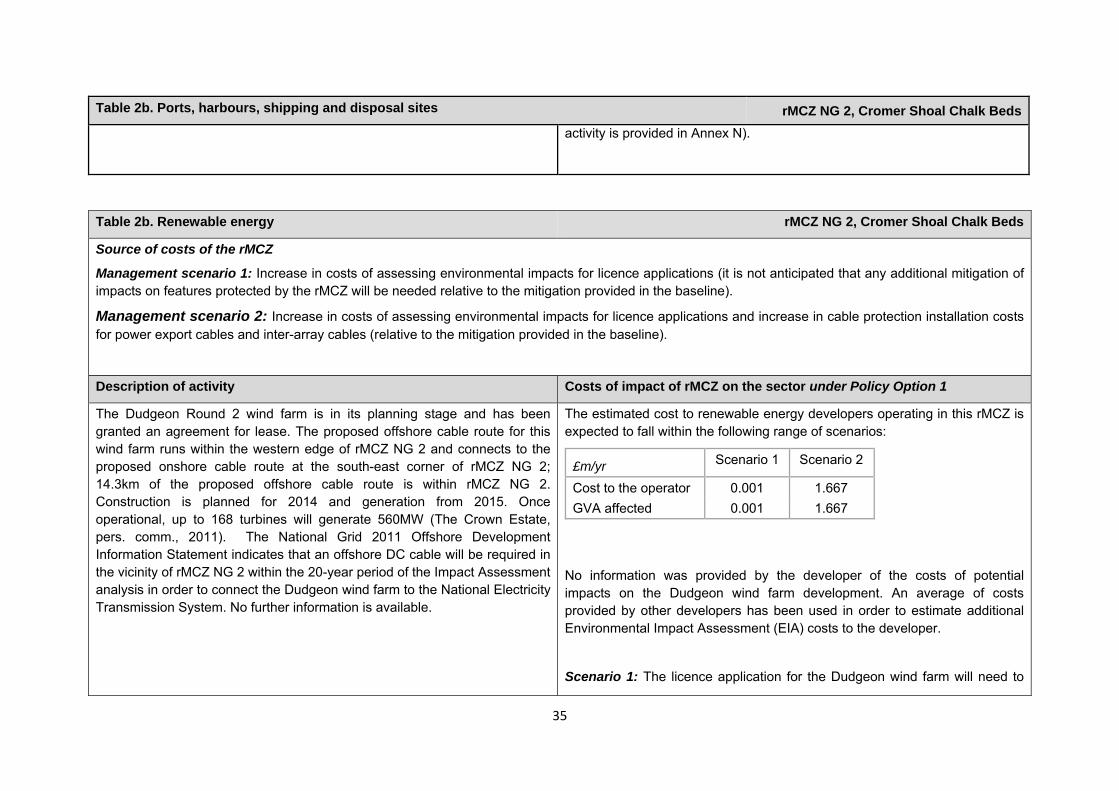
Table 2b. Renewable energy rMCZ NG 2, Cromer Shoal Chalk Beds
Source of costs of the rMCZ
Management scenario 1: Increase in costs of assessing environmental impacts for licence applications (it is not anticipated that any additional mitigation of impacts on features protected by the rMCZ will be needed relative to the mitigation provided in the baseline).
Management scenario 2: Increase in costs of assessing environmental impacts for licence applications and increase in cable protection installation costs for power export cables and inter-array cables (relative to the mitigation provided in the baseline).
Description of activity Costs of impact of rMCZ on the sector under Policy Option 1
The Dudgeon Round 2 wind farm is in its planning stage and has been granted an agreement for lease. The proposed offshore cable route for this wind farm runs within the western edge of rMCZ NG 2 and connects to the proposed onshore cable route at the south-east corner of rMCZ NG 2; 14.3km of the proposed offshore cable route is within rMCZ NG 2. Construction is planned for 2014 and generation from 2015. Once operational, up to 168 turbines will generate 560MW (The Crown Estate, pers. comm., 2011). The National Grid 2011 Offshore Development Information Statement indicates that an offshore DC cable will be required in the vicinity of rMCZ NG 2 within the 20-year period of the Impact Assessment analysis in order to connect the Dudgeon wind farm to the National Electricity Transmission System. No further information is available.
The estimated cost to renewable energy developers operating in this rMCZ is expected to fall within the following range of scenarios:
No information was provided by the developer of the costs of potential impacts on the Dudgeon wind farm development. An average of costs provided by other developers has been used in order to estimate additional Environmental Impact Assessment (EIA) costs to the developer.
Scenario 1: The licence application for the Dudgeon wind farm will need to
£m/yr Scenario 1 Scenario 2
Cost to the operator 0.001 1.667 GVA affected 0.001 1.667
36
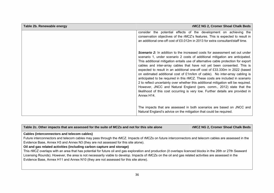
Table 2b. Renewable energy rMCZ NG 2, Cromer Shoal Chalk Beds
consider the potential effects of the development on achieving the conservation objectives of the rMCZ’s features. This is expected to result in an additional one-off cost of £0.012m in 2013 for extra consultant/staff time.
Scenario 2: In addition to the increased costs for assessment set out under scenario 1, under scenario 2 costs of additional mitigation are anticipated. This additional mitigation entails use of alternative cable protection for export cables and inter-array cables that have not yet been consented. This is expected to result in an additional one-off cost of £33.330m in 2022 (based on estimated additional cost of £1m/km of cable). No inter-array cabling is anticipated to be required in this rMCZ. These costs are included in scenario 2 to reflect uncertainty over whether this additional mitigation will be required. However, JNCC and Natural England (pers. comm., 2012) state that the likelihood of this cost occurring is very low. Further details are provided in Annex H14.
The impacts that are assessed in both scenarios are based on JNCC and Natural England’s advice on the mitigation that could be required.
Table 2c. Other impacts that are assessed for the suite of MCZs and not for this site alone rMCZ NG 2, Cromer Shoal Chalk Beds
Cables (interconnectors and telecom cables) Future interconnectors and telecom cables may pass through the rMCZ. Impacts of rMCZs on future interconnectors and telecom cables are assessed in the Evidence Base, Annex H3 and Annex N3 (they are not assessed for this site alone). Oil and gas related activities (including carbon capture and storage) This rMCZ overlaps with an area that has potential for future oil and gas exploration and production (it overlaps licenced blocks in the 26th or 27th Seaward Licensing Rounds). However, the area is not necessarily viable to develop. Impacts of rMCZs on the oil and gas related activities are assessed in the Evidence Base, Annex H11 and Annex N10 (they are not assessed for this site alone).
37
Human activities in the site that are not negatively affected by the rMCZ (over 2013 to 2032 inclusive)
*The IA assumes that no additional mitigation of impacts of water abstraction, discharge or diffuse pollution will be required over and above that which will be provided to achieve the objectives of the Water Framework Directive through the River Basin Management Plan process (based on advice provided by Natural England, pers. comm., 2010). Contribution to Ecological Network Guidance Table 4. An overview of features proposed for designation and how these contribute to the ENG guidelines for the regional MCZ project area and at a wider scale3
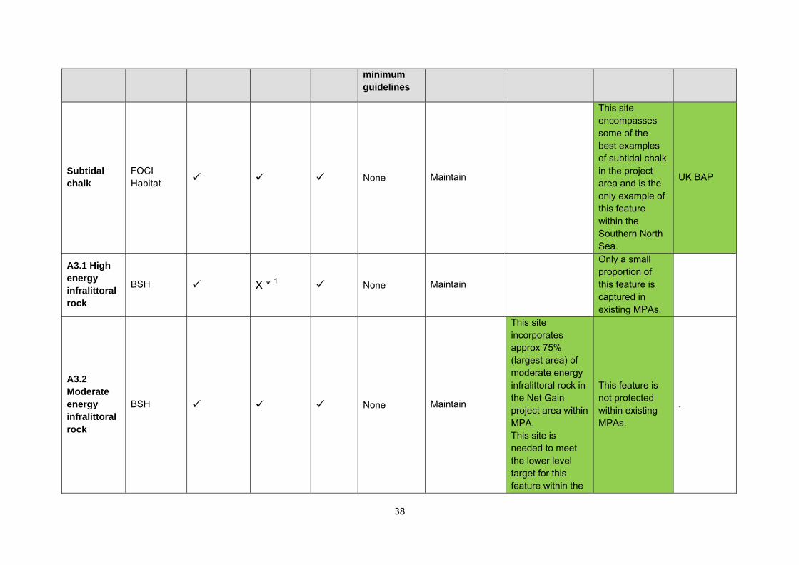
= ENG guideline is achieved and X = ENG guideline is not achieved. Green cells represent key considerations and any greyed-out rows indicate where SNCBs do not agree with a feature being proposed for designation. Recommended conservation objectives in italics indicate where SNCBs do not agree with the conservation objective recommended by the regional MCZ project (see Section 4.2). Where an asterisk (*) has been given in the table, more detail is provided in the narrative.
rMCZ NG 2, Cromer Shoal Chalk Beds
ENG Feature
Represent-ativity Replication Adequacy Viability
Gaps or shortfalls in relation to ENG
Recommended conservation objective
Quantitative considerations at regional MCZ level
Ecological Importance at regional MCZ level
Ecological Importance at wider scale
3 copied from the JNCC and Natural England’s advice to Defra on rMCZs
Table 3. Human activities in the site that are not negatively affected by the rMCZ under Policy Option 1
(existing activities at their current levels and future proposals known to the regional MCZ projects)
rMCZ NG 2, Cromer Shoal Chalk Beds
Cables (existing interconnectors and telecom cables), commercial fisheries, recreation (recreational boating, fisheries, snorkelling and SCUBA diving and wildlife watching), renewable energy (Sheringham Shoal wind farm which is currently being constructed and there are no plans for further development), shipping (transit of vessels only) and water abstraction, diffuse and pollution*.
38
minimum guidelines
Subtidal chalk
FOCI Habitat None Maintain
This site encompasses some of the best examples of subtidal chalk in the project area and is the only example of this feature within the Southern North Sea.
UK BAP
A3.1 High energy infralittoral rock
BSH X * 1 None Maintain
Only a small proportion of this feature is captured in existing MPAs.
A3.2 Moderate energy infralittoral rock
BSH None Maintain
This site incorporates approx 75% (largest area) of moderate energy infralittoral rock in the Net Gain project area within MPA. This site is needed to meet the lower level target for this feature within the
This feature is not protected within existing MPAs.
.
39
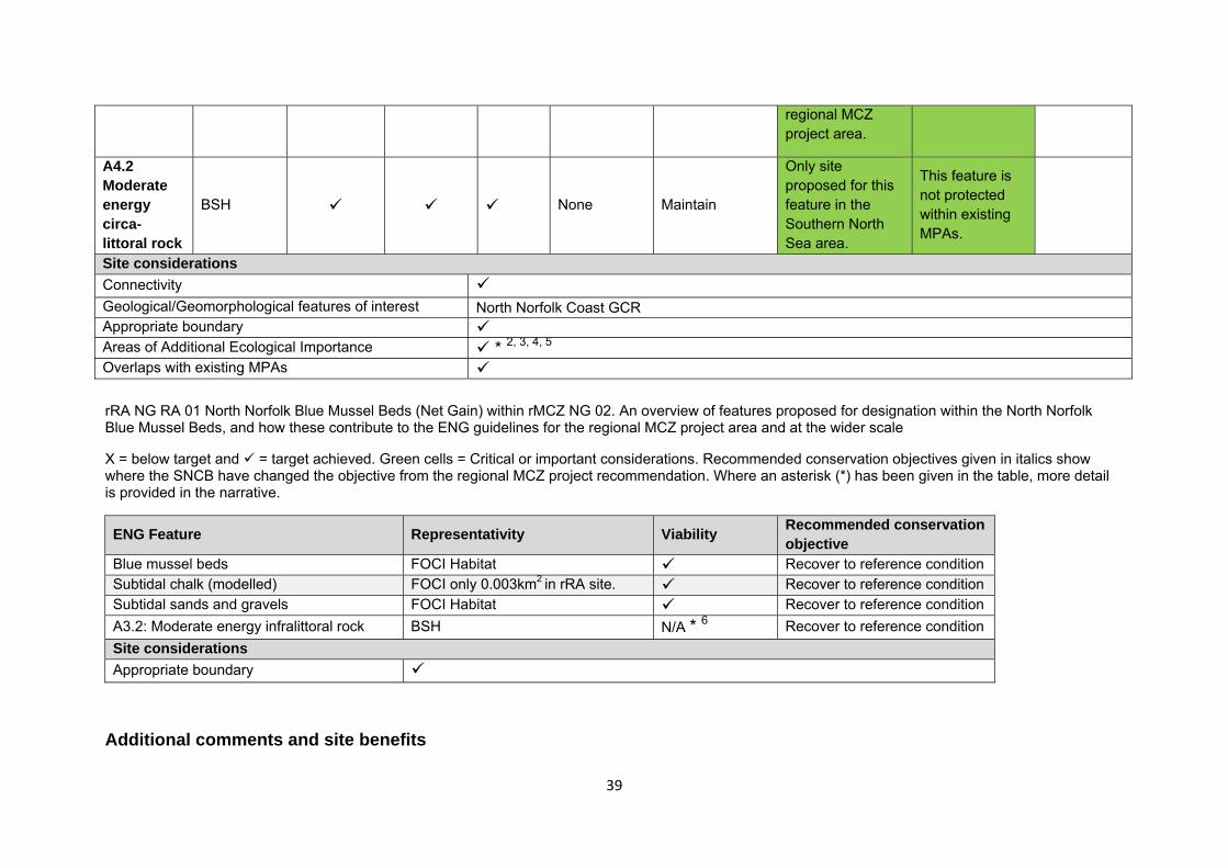
regional MCZ project area.
A4.2 Moderate energy circa-littoral rock
BSH None Maintain
Only site proposed for this feature in the Southern North Sea area.
This feature is not protected within existing MPAs.
Site considerations Connectivity Geological/Geomorphological features of interest North Norfolk Coast GCR Appropriate boundary Areas of Additional Ecological Importance * 2, 3, 4, 5 Overlaps with existing MPAs rRA NG RA 01 North Norfolk Blue Mussel Beds (Net Gain) within rMCZ NG 02. An overview of features proposed for designation within the North Norfolk Blue Mussel Beds, and how these contribute to the ENG guidelines for the regional MCZ project area and at the wider scale
X = below target and = target achieved. Green cells = Critical or important considerations. Recommended conservation objectives given in italics show where the SNCB have changed the objective from the regional MCZ project recommendation. Where an asterisk (*) has been given in the table, more detail is provided in the narrative.
ENG Feature Representativity Viability Recommended conservation objective
Blue mussel beds FOCI Habitat Recover to reference condition Subtidal chalk (modelled) FOCI only 0.003km2 in rRA site. Recover to reference condition Subtidal sands and gravels FOCI Habitat Recover to reference condition A3.2: Moderate energy infralittoral rock BSH N/A * 6 Recover to reference condition Site considerations Appropriate boundary
Additional comments and site benefits
40
• Opportunity to protect this unique and rare example of classic subtidal chalk reef which supports a high diversity of flora and fauna. • 1 Within the project area the BSH High energy infralittoral rock (A3.1) does not achieve the higher level target for adequacy. The
contribution of this site is 2.71km2, approximately 2.5% of the total extent of this feature in the regional project area. • 2 Blue mussel beds form within the site (Eastern IFCA 2011). A reference area (RA 1) has been proposed for blue mussel beds within
the site. • 3 The subtidal chalk feature forms part of the longest chalk reef in Europe. SeaSearch dives ground-truthed part of the modelled data for
subtidal chalk feature (Spray and Watson 2010a, Spray and Watson 2010b). • 4There is high biodiversity associated with the chalk reef including communities of crustaceans, sponges, squirts and cnidarians found
on recent Seasearch surveys at Runton (Spray and Watson, Seasearch 2010b). During the intertidal seasweed and sponge Seasearch surveys, it was noted that seaweed diversity in the site is high and that a unique purple sponge was present at the site.
• 5 The rMCZ includes subtidal sands and gravels and peat and clay exposures FOCI which are not proposed for designation. • This is the only recommended reference area for blue mussel beds in the project area and therefore contributes to meeting the design
principles. • Data for the site [Reference Area] came from a recent Eastern Inshore Fisheries and Conservation Authority survey (Eastern IFCA
2011). The EIFCA already monitor the site, and are likely to continue to do so in to the future. • 6 Viability for the BSH Moderate energy infralittoral rock [within the Reference Area] is met as the site lies within an rMCZ where this
habitat is represented on a wider scale. • rRA 01: is located within rMCZ NG2 and is therefore afforded additional protection and a buffer.
Anticipated benefits to ecosystem services The habitats, species and other ecological features of the rMCZ contribute to the delivery of a range of ecosystem services. Designation of the rMCZ and its subsequent management may improve the quantity and quality of the beneficial services provided, which may increase the value (contribution to economic welfare or human well-being) of them. Impacts on the value derived from ecosystem services may occur as a result of the designation, management and/or achievement of the conservation objectives of the rMCZ. Further discussion on the potential benefits to ecosystem services can be found in Annex L and on definitions can be found in Annex H5. Table 5a. Fish and shellfish for human consumption rMCZ NG 2, Cromer Shoal Chalk Beds
41
Table 5a. Fish and shellfish for human consumption rMCZ NG 2, Cromer Shoal Chalk Beds
Baseline Beneficial impact under Policy Option 1
Fletcher and others (2011) identify that the features to be protected by the recommended Marine Conservation Zone (rMCZ) can contribute to the delivery of fish and shellfish for human consumption.
The site is an important spawning ground for Dover sole, lemon sole, whiting and sand eel (Net Gain Final Recommendations, 2011) and, as such, is likely to help support potential on-site and off-site fisheries. It has not been possible to estimate the value derived from off-site fisheries as a result of the nursery area function.
Commercial fishing occurs within the rMCZ almost exclusively by under 15 metre UK vessels. Estimated total value of landings by UK vessels within the site is £0.551m/yr. At £0.456m/yr, the majority of the value can be attributed to vessels using pots and traps and the rest can be attributed to vessels using bottom trawls, dredges, nets, and hooks and lines (MCZ Fisheries Model, 2011).
The baseline quantity and quality of the ecosystem service provided is assumed to be commensurate with that provided by the features of the site when in favourable condition.
If the conservation objectives of the features are achieved, the features will be maintained in favourable condition.
No additional management (above that in the baseline situation) of fishing activities is expected. As such, no benefits are expected to accrue as a result of reduced fishing mortality. No change in on-site feature condition is anticipated and therefore no impact on on-site or off-site benefits is expected.
Designating the rMCZ will protect its features and the ecosystem services that they provide against the risk of future degradation from anthropogenic pressures (because if necessary, mitigation would be introduced, with the associated costs and benefits).
Anticipated direction of
change:
Confidence: Moderate
Table 5b. Recreation rMCZ NG 2, Cromer Shoal Chalk Beds
Baseline Beneficial impact under Policy Option 1
42
Table 5b. Recreation rMCZ NG 2, Cromer Shoal Chalk Beds
Angling: Fletcher and others (2011) identify that the features to be protected by the recommended Marine Conservation Zone (rMCZ) can contribute to the delivery of fish and shellfish for human consumption and recreation services.
The site is an important spawning ground for Dover sole, lemon sole, whiting and sand eel (Net Gain Final Recommendations, 2011) and, as such, is likely to help support potential on-site and off-site fisheries. It has not been possible to estimate the value derived from angling on-site or the proportion of the value derived from angling off-site which result from the estuary nursery area.
Sea angling is known to occur within the rMCZ. The intensity of the activity is unknown, but charter boats are known to operate from various locations on the north Norfolk coast including Brancaster Staithe, Morston and Wells (Stakmap, 2011).
The baseline quantity and quality of the ecosystem service provided is assumed to be commensurate with that provided by the features of the site when in favourable condition.
If the conservation objectives of the features are achieved, the features will be maintained in favourable condition.
No change in on-site feature condition or fishing mortality is anticipated and therefore no impact on on-site or off-site benefits is expected (see Table 4a for further details).
Designating the rMCZ will protect its features and the ecosystem services that they provide against the risk of future degradation from anthropogenic pressures (because if necessary, mitigation would be introduced, with the associated costs and benefits).
The designation may lead to an increase in angling visits to the site, which may benefit the local economy. This increase is likely to arise from a change in anglers’ preferred angling locations rather than an increase in days spent angling or the number of anglers.
Anticipated direction of
change:
Confidence: Moderate
Diving: The chalk beds are a popular dive site and Seasearch surveys are known to be carried out there. The intensity of the activity within the site is unknown (Stakmap, 2011).
It has not been possible to estimate the value derived from diving in the rMCZ.
If the conservation objectives of the features are achieved, the features will be maintained in favourable condition.
No change in on-site feature condition is anticipated. However, designation may result in an increase in dive trips to the area, which may have beneficial effects on the local economy. This increase may represent a redistribution of dive location
Anticipated direction of
change:
Confidence:
43
Table 5b. Recreation rMCZ NG 2, Cromer Shoal Chalk Beds
preferences rather than an overall increase in days spent diving or the number of divers.
Designating the rMCZ will protect its features and the ecosystem services that they provide against the risk of future degradation from anthropogenic pressures (because if necessary, mitigation would be introduced, with the associated costs and benefits).
In the Marine Conservation Society (MCS) ‘Your Seas Your Voice’ campaign, 4 MCS ‘recommended sites’ and 13 ‘nominated sites’ are located within rMCZ NG 2. For the ‘nominated sites’, features of the natural environment were strong motivators for reasons why people thought that these locations should be protected, with people frequently attaching value to its spectacular undersea fauna and flora and to the ‘unspoilt’ nature of the area. An emotional attachment to the area was also a strong motivator.
For the ‘recommended sites’, features of the natural environment were again strong motivators for reasons why people thought that these locations should be protected. Many highlighted the ‘spectacular scenery’ and the beauty of the underwater environment as reasons why they believed that the locations should be protected.
The value of protection for future generations of recreational users was also a strong motivator, as were the vulnerability of features and the threat of increased human use within the site.
Moderate
44
Table 5b. Recreation rMCZ NG 2, Cromer Shoal Chalk Beds
The potential to protect archaeological sites and the spill-over effects of wider environmental and economic benefits were also highlighted as motivators for protection. Regarding non-extractive use value, ease of access was considered an important reason to protect this site.
Wildlife watching: Fletcher and others (2011) identify that the features to be protected by the rMCZ can contribute to the delivery of recreation and tourism services.
The baseline quantity and quality of the ecosystem service provided is assumed to be commensurate with that provided by the features of the site when in favourable condition.
Wildlife watching is thought to occur within the site but the intensity of the activity is unknown. There are frequent sightings of whales, dolphins and porpoises within the site (Net Gain Final Recommendations, 2011).
It has not been possible to estimate the value derived from wildlife watching in the rMCZ.
If the conservation objectives of the features are achieved, the features will be maintained in favourable condition.
No change in on-site feature condition is anticipated and therefore no benefits to wildlife watching are expected.
Designating the rMCZ will protect its features and the ecosystem services that they provide against the risk of future degradation from anthropogenic pressures (because if necessary, mitigation would be introduced, with the associated costs and benefits).
Anticipated direction of
change:
Confidence: Moderate
Table 5c. Research and education rMCZ NG 2, Cromer Shoal Chalk Beds
Baseline Beneficial impact under Policy Option 1
45
Table 5c. Research and education rMCZ NG 2, Cromer Shoal Chalk Beds
Research: Fletcher and others (2011) identify that the features to be protected by the recommended Marine Conservation Zone (rMCZ) can contribute to the delivery of research services.
The site has been subject to Eastern Inshore Fisheries and Conservation Authority surveys, and Gardline has also conducted survey transects within the boundaries. Seasearch dive surveys are also carried out in the site (Stakmap, 2011).
English Heritage has indicated that this site is more likely to be of interest for archaeological excavation in the future (see Table 2 for further information,) as it is relevant to its National Heritage Protection Plan (theme 3A3.202) (English Heritage, pers. comm., 2012).
It has not been possible to estimate the value derived from research activities associated with the rMCZ.
Monitoring of the rMCZ will help to inform understanding of how the marine environment is changing and is impacted on by anthropogenic pressures and management interventions. Other research benefits are unknown.
In the Marine Conservation Society ‘Your Seas Your Voice’ campaign, 4 ‘recommended sites’ and 13 ‘nominated sites’ are located within rMCZ NG 2. For the ‘nominated sites’, features of the natural environment were strong motivators for reasons why people thought that these locations should be protected, with people frequently attaching value to its spectacular undersea fauna and flora and to the ‘unspoilt’ nature of the area. An emotional attachment to the area was also a strong motivator.
For the ‘recommended sites’, features of the natural environment were strong motivators for reasons why people thought that these locations should be protected. Many highlighted the ‘spectacular scenery’ and the beauty of the underwater environment as reasons why they believed that the location should be protected.
The value of protection for future generations of recreational users was also a strong motivator, as were the vulnerability of features and the threat of increased human use within the site. The potential to protect archaeological sites and the spill-over effects of wider environmental and economic benefits were also highlighted as motivators for protection. Regarding non-extractive use value, ease of access was considered an important reason to protect this site.
Anticipated direction of
change:
Confidence:
High
46
Table 5c. Research and education rMCZ NG 2, Cromer Shoal Chalk Beds
Education: Fletcher and others (2011) identify that the features to be protected by the rMCZ can contribute to the delivery of education services.
The extent of current educational activity carried out in the site is unknown. Educational visits are known to take place in the intertidal area near to the rMCZ (Natural England, pers. comm., 2012). It has not been possible to estimate the value derived from educational activities associated with the rMCZ.
MCZ designation may provide an opportunity to expand the focus of educational events into the marine environment.
Designation may aid additional local (to the rMCZ) provision of education (e.g. events and interpretation boards), from which visitors would derive benefit.
Non-visitors may benefit if the rMCZ contributes to wider provision of education (e.g. television programmes, articles in magazines and newspapers, and educational resources developed for use in schools).
Anticipated direction of
change:
Confidence: Low
Table 5d. Regulating services rMCZ NG 2, Cromer Shoal Chalk Beds
Baseline Beneficial impact under Policy Option 1
Regulation of pollution: The features of the site contribute to the bioremediation of waste and sequestration of carbon It has not been possible to estimate the value derived from the regulation of pollution in the rMCZ.
Environmental resilience: The features of the site contribute to the resilience and continued regeneration of marine ecosystems It has not been possible to estimate the value derived from environmental resilience in the rMCZ.
Natural hazard protection: The features of the site contribute to local flood
If the conservation objectives of the features are achieved, the features will be maintained in favourable condition.
No change in feature condition and management of human activities is expected and therefore no benefit to the regulatory capacity of the site is expected.
Designating the recommended Marine Conservation Zone will protect its features and the ecosystem services that they provide against the risk of future degradation from
Anticipated direction of
change:
Confidence: Moderate
47
Table 5d. Regulating services rMCZ NG 2, Cromer Shoal Chalk Beds
and storm protection It has not been possible to estimate the value derived from natural hazard protection in the rMCZ.
(Fletcher and others, 2011)
anthropogenic pressures (because if necessary, mitigation would be introduced, with the associated costs and benefits).
Table 5e. Non-use and option values rMCZ NG 2, Cromer Shoal Chalk Beds
Baseline Beneficial impact under Policy Option 1
Some people gain satisfaction from the existence of marine habitats, species and other features. They also gain from having the option to benefit in the future from the habitats and species in the recommended Marine Conservation Zone (rMCZ) and the ecosystem services provided, even if they do not currently benefit from them.
The rMCZ will benefit the proportion of the UK population that values conservation of the rMCZ features and its contribution to an ecologically coherent network of Marine Protected Areas. Some people will gain satisfaction from knowing that the habitats and species are being conserved (existence value) and/or that they are being conserved for use by others in the current generation (altruistic value) or future generations (bequest value). The rMCZ will protect both the features and their option to benefit from the services in the future from the risk of future degradation.
In the Marine Conservation Society ‘Your Seas Your Voice’ campaign, 4 ‘recommended sites’ and 13 ‘nominated sites’ are located within rMCZ NG 2. For the ‘nominated sites’, features of the natural environment were strong motivators for reasons why people thought that these locations should be protected, with people frequently attaching value to its spectacular undersea fauna and flora and to the ‘unspoilt’ nature of the area. An emotional attachment to the area was also a strong motivator.
Anticipated direction of
change:
Confidence: Moderate
48
Table 5e. Non-use and option values rMCZ NG 2, Cromer Shoal Chalk Beds
For the ‘recommended sites’, features of the natural environment were strong motivators for reasons why people thought that these locations should be protected. Many highlighted the ‘spectacular scenery’ and the beauty of the underwater environment as reasons why they believed that the location should be protected.
The value of protection for future generations of recreational users was also a strong motivator, as were the vulnerability of features and the threat of increased human use within the site. The potential to protect archaeological sites and the spill-over effects of wider environmental and economic benefits were also highlighted as motivators for protection. Regarding non-extractive use value, ease of access was considered an important reason to protect this site.
rMCZ NG 4, Wash Approach Site area (km2): 724.52
• This site has been proposed for designation under Policy Option 1 only.
Table 1. Conservation impacts rMCZ NG 4, Wash Approach
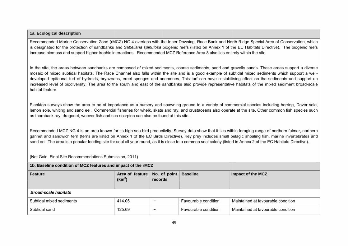
49
1a. Ecological description
Recommended Marine Conservation Zone (rMCZ) NG 4 overlaps with the Inner Dowsing, Race Bank and North Ridge Special Area of Conservation, which is designated for the protection of sandbanks and Sabellaria spinulosa biogenic reefs (listed on Annex 1 of the EC Habitats Directive). The biogenic reefs increase biomass and support higher trophic interactions. Recommended MCZ Reference Area 8 also lies entirely within the site.
In the site, the areas between sandbanks are composed of mixed sediments, coarse sediments, sand and gravelly sands. These areas support a diverse mosaic of mixed subtidal habitats. The Race Channel also falls within the site and is a good example of subtidal mixed sediments which support a well-developed epifaunal turf of hydroids, bryozoans, erect sponges and anemones. This turf can have a stabilising effect on the sediments and support an increased level of biodiversity. The area to the south and east of the sandbanks also provide representative habitats of the mixed sediment broad-scale habitat feature.
Plankton surveys show the area to be of importance as a nursery and spawning ground to a variety of commercial species including herring, Dover sole, lemon sole, whiting and sand eel. Commercial fisheries for whelk, skate and ray, and crustaceans also operate at the site. Other common fish species such as thornback ray, dragonet, weever fish and sea scorpion can also be found at this site.
Recommended MCZ NG 4 is an area known for its high sea bird productivity. Survey data show that it lies within foraging range of northern fulmar, northern gannet and sandwich tern (terns are listed on Annex 1 of the EC Birds Directive). Key prey includes small pelagic shoaling fish, marine invertebrates and sand eel. The area is a popular feeding site for seal all year round, as it is close to a common seal colony (listed in Annex 2 of the EC Habitats Directive).
(Net Gain, Final Site Recommendations Submission, 2011)
1b. Baseline condition of MCZ features and impact of the rMCZ
Feature Area of feature (km2)
No. of point records
Baseline Impact of the MCZ
Broad-scale habitats
Subtidal mixed sediments 414.05 − Favourable condition Maintained at favourable condition
Subtidal sand 125.69 − Favourable condition Maintained at favourable condition
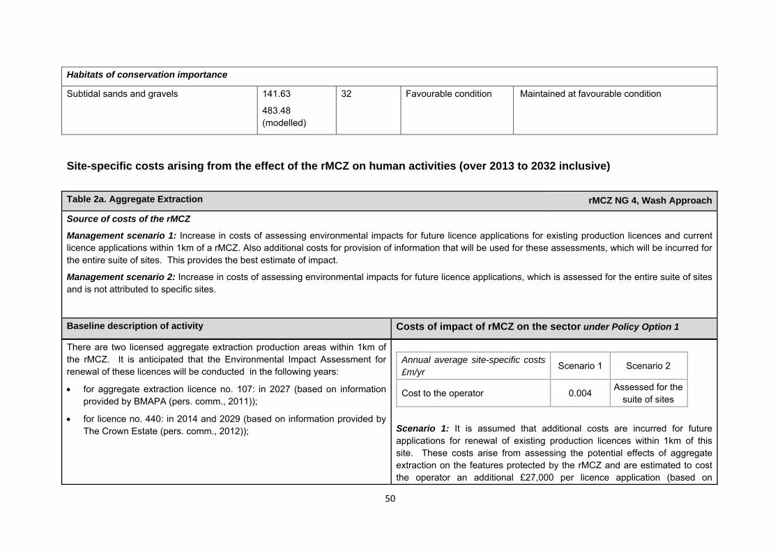
50
Site-specific costs arising from the effect of the rMCZ on human activities (over 2013 to 2032 inclusive)
Table 2a. Aggregate Extraction rMCZ NG 4, Wash Approach
Source of costs of the rMCZ
Management scenario 1: Increase in costs of assessing environmental impacts for future licence applications for existing production licences and current licence applications within 1km of a rMCZ. Also additional costs for provision of information that will be used for these assessments, which will be incurred for the entire suite of sites. This provides the best estimate of impact.
Management scenario 2: Increase in costs of assessing environmental impacts for future licence applications, which is assessed for the entire suite of sites and is not attributed to specific sites.
Baseline description of activity Costs of impact of rMCZ on the sector under Policy Option 1
There are two licensed aggregate extraction production areas within 1km of the rMCZ. It is anticipated that the Environmental Impact Assessment for renewal of these licences will be conducted in the following years:
• for aggregate extraction licence no. 107: in 2027 (based on information provided by BMAPA (pers. comm., 2011));
• for licence no. 440: in 2014 and 2029 (based on information provided by The Crown Estate (pers. comm., 2012));
Scenario 1: It is assumed that additional costs are incurred for future applications for renewal of existing production licences within 1km of this site. These costs arise from assessing the potential effects of aggregate extraction on the features protected by the rMCZ and are estimated to cost the operator an additional £27,000 per licence application (based on
Annual average site-specific costs £m/yr
Scenario 1 Scenario 2
Cost to the operator 0.004 Assessed for the suite of sites
Habitats of conservation importance
Subtidal sands and gravels 141.63
483.48 (modelled)
32 Favourable condition Maintained at favourable condition
51
Table 2a. Aggregate Extraction rMCZ NG 4, Wash Approach
information provided by BMAPA (pers. comm., 2011). An additional cost will also be incurred in provision of information by the British Marine Aggregate Producers Association for these assessments. This cost will be incurred as a result of the entire suite of MCZs and is not included here. Further details of the costs are provided in Annex N.
Scenario 2: An assessment of the additional costs of Scenario 2 is provided for the entire suite of sites, which is summarised in the Evidence Base. Details are provided in Annex H2 and N1.
Table 2b. Archaeological heritage rMCZ NG 4, Wash Approach
Source of costs of the rMCZ
Management scenario 1: Increase in costs of assessing environmental impacts for future licence applications (it is not anticipated that any additional mitigation of impacts on features protected by the MCZ will be needed relative to the mitigation provided in the baseline). Archaeological excavations, surface recovery, intrusive and non-intrusive surveys, diver trails and visitors will be allowed.
Baseline description of activity Costs of impact of rMCZ on the sector under Policy Option 1
The site also includes HMS Umpire, a British submarine lost in 1941 which is designated as a protected wreck under the Protection of Military Remains Act 1986. There are also numerous cargo, sailing and fishing vessels, of both
An extra cost would be incurred in the assessment of environmental impact made in support of any future licence applications for archaeological activities in the site. The likelihood of a future licence application being submitted is not
52
Table 2b. Archaeological heritage rMCZ NG 4, Wash Approach
British and international origin, that date from 1763 to 1945. Aircraft losses from World War II are also recorded at this location (English Heritage, pers. comm., 2012).
English Heritage has indicated that this site is likely to be of interest for archaeological excavation in the future as it is relevant to its National Heritage Protection Plan (theme 3A1.2).
known, so no overall cost to the sector of this rMCZ has been estimated. However, the additional cost in one licence application could be in the region of £500 to £10,000 depending on the size of the MCZ (English Heritage, pers. comm., 2011). No further impacts on activities related to archaeology are anticipated.
Table 2c. Ports, harbours, shipping and disposal sites rMCZ NG 4, Wash Approach
Source of costs of the rMCZ
Management scenario 1: Not applicable to this site
Management scenario 2: Increase in costs of assessing environmental impacts for future licence applications. This applies for future licence application to disposal of dredged material within 5km of the rMCZ. The regional MCZ projects are not aware of activities related to ports, harbours and shipping for which additional mitigation of impacts on features protected by the MCZ will be needed relative to the mitigation provided in the baseline.
Baseline description of activity Costs of impact of rMCZ on the sector under Policy Option 1
53
Table 2c. Ports, harbours, shipping and disposal sites rMCZ NG 4, Wash Approach
Disposal sites: There are 2 disposal sites within 5km of the rMCZ (Dudgeon and North West Zone Area 107). No licence applications were received for these disposal sites between 2001 and 2010 but they are not closed to disposal in future (Cefas, pers. comm., 2011).
Port development: None within 5km of this rMCZ.
Navigational dredging: None takes place within 5km of this rMCZ.
£m/yr Scenario 1 Scenario 2
Cost to the operator N/A 0.000 Scenario 1: Not applicable to this site
Scenario 2: Future licence applications for disposal of material within 5km of this rMCZ will need to consider the potential effects of the activity on the features protected by the rMCZ. Additional costs will be incurred as a result (a breakdown of these by activity is provided in Annex N).
Although the disposal site rMCZ has not been used in the last ten years, it might be used during the 20 year period covered by the IA. Future licence applications for disposal of material in the disposal site will need to consider the potential effects of the activity on the features protected by the rMCZ.
Table 2d. Renewable energy rMCZ NG 4, Wash Approach
Source of costs of the rMCZ
Management scenario 1: Increase in costs of assessing environmental impacts for licence applications (it is not anticipated that any additional mitigation of impacts on features protected by the MCZ will be needed relative to the mitigation provided in the baseline).
54
Table 2d. Renewable energy rMCZ NG 4, Wash Approach
Management scenario 2: Increase in costs of assessing environmental impacts for licence applications and increase in cable protection installation costs for power export cables and inter-array cables (relative to the mitigation provided in the baseline).
Baseline description of activity Costs of impact of rMCZ on the sector under Policy Option 1
Triton Knoll wind farm: The Triton Knoll Round 2 wind farm is in the pre-planning stage and has been granted an agreement for lease; rMCZ NG 4 overlaps with the possible cable route. Construction is planned for 2017 and generation is anticipated to start in 2018 (subject to the necessary planning consent). Once operational, 195 turbines will generate 1,200MW (The Crown Estate and RWE Npower, pers. comm., 2011). The National Grid 2011 Offshore Development Information Statement indicates that an offshore DC cable will be required in the vicinity of rMCZ NG 4 within the 20-year period of the Impact Assessment analysis in order to connect the Triton Knoll wind farm to the National Electricity Transmission System. No further information is available.
Race Bank wind farm: The Environmental Impact Assessment (EIA) for Race Bank Round 2 wind farm was completed in 2008 and the EIA is currently being considered within the planning system. The wind farm site is entirely within rMCZ NG 4. Construction would take place over a period of 3 to 4 years and, once operational, between 88 and 206 turbines will generate up to 260MW (The Crown Estate and Centrica, pers. comm., 2011). The National Grid 2011 Offshore Development Information Statement indicates that an offshore DC cable will be required in the vicinity of rMCZ NG 4 within the 20-year period of the Impact Assessment analysis in order to connect the Race Bank wind farm to the National Electricity Transmission System. No further information is available.
Hornsea wind farm: The Hornsea Round 3 wind farm is in the pre-planning stage. Construction is planned for 2015 and generation from 2016 (subject to
The estimated cost to renewable energy developers operating in this rMCZ is expected to fall within the following range of scenarios:
£m/yr Scenario 1 Scenario 2
Cost to the operator 0.001 1.301 GVA affected 0.001 1.301
Scenario 1: The licence application for the Hornsea wind farm and the Triton Knoll wind farm will need to consider the potential effects of the development on achieving the conservation objectives of the rMCZ’s features. This is expected to result in an additional one-off cost of £0.008m in 2013 for extra consultant/staff time (RWE NPower, pers. comm., 2011). For the Race Bank wind farm, there is an additional one-off cost of £0.003m in 2013 for extra consultant/staff time (Centrica, pers. comm., 2011).
Scenario 2: In addition to the increased costs for assessment set out under scenario 1, under scenario 2 costs of additional mitigation are anticipated. This additional mitigation entails use of alternative cable protection for export cables and inter-array cables that have not yet been consented. This is expected to result in an additional one-off cost of £26.000m (based on estimated additional cost of £1m/km of cable) in 2014 for the Hornsea wind farm, the Triton Knoll wind farm and the Race Bank wind farm. These costs are included in scenario 2 to reflect uncertainty over whether this additional mitigation will be required. However, JNCC and Natural England (pers.
55
Table 2d. Renewable energy rMCZ NG 4, Wash Approach
the necessary planning consent). Once operational, 668 turbines will generate 4,000MW (The Crown Estate and the developer, pers. comm., 2011). The exact cable routes are not yet known, but the National Grid 2011 ODIS indicates that an offshore DC cable route will be required in the vicinity of rMCZ NG 4 within the 20-year period of the Impact Assessment (IA) analysis in order to connect the Hornsea wind farm to the National Electricity Transmission System. No further information is available.
Docking Shoal wind farm: The wind farm runs parallel to the south-western edge of rMCZ NG 4. The cable route for the wind farm is not anticipated to overlap with rMCZ NG 4.
comm., 2012) state that the likelihood of this cost occurring is very low. Further details are provided in Annex H14.
The impacts that are assessed in both scenarios are based on JNCC and Natural England’s advice on the mitigation that could be required.
Comments from the developers of the Triton Knoll wind farm (personal communication, 2011): Should additional restrictions be placed on the methods used in the installation and maintenance of cables to ensure there are no adverse effects on the protected features, it may be that the preferred and quickest methods cannot be used. If more specialised vessels need to be used in the cable laying process this will add £0.300m per km of additional cable layed. A cost of £0.300m per km of cable could be incurred for delays that arise from added time needed to gain permission to lay cable within the MCZ. In addition to the costs outlined above, delays in cable installation resulting in delays to energising the wind farm are estimated to cost between £150m and £200m per 3 month delay. These costs arise from potential lost days when the wind farm is in operation. Should additional costs be incurred to repairs, this could cost several million pounds (RWE Npower, pers. comm., 2011).
Table 2e. Other impacts that are assessed for the suite of MCZs and not for this site alone rMCZ NG 4, Wash Approach
Oil and gas related activities (including carbon capture and storage)
This rMCZ overlaps with an area that has potential for future oil and gas exploration and production (it overlaps licenced blocks in the 26th or 27th Seaward Licensing Rounds). However, the area is not necessarily viable to develop. Impacts of rMCZs on the oil and gas related activities are assessed in the Evidence Base, Annex H11 and Annex N10 (they are not assessed for this site alone).
56
Human activities in the site that are not negatively affected by the rMCZ (over 2013 to 2032 inclusive)
Anticipated benefits to ecosystem services The habitats, species and other ecological features of the rMCZ contribute to the delivery of a range of ecosystem services. Designation of the rMCZ and its subsequent management may improve the quantity and quality of the beneficial services provided, which may increase the value (contribution to economic welfare or human well-being) of them. Impacts on the value derived from ecosystem services may occur as a result of the designation, management and/or achievement of the conservation objectives of the rMCZ. Further discussion on the potential benefits to ecosystem services can be found in Annex L and on definitions can be found in Annex H5. Table 4a. Fish and shellfish for human consumption rMCZ NG 4, Wash Approach
Baseline Beneficial impact under Policy Option 1
Fletcher and others (2011) identify that the features to be protected by the recommended Marine Conservation Zone (rMCZ) can contribute to the delivery of fish and shellfish for human consumption.
The site is of moderate importance as a nursery and spawning ground to a variety of species including herring, Dover sole, lemon sole, whiting and sand
If the conservation objectives of the features are achieved, the features will be maintained in favourable condition.
No additional management (above that in the baseline situation) of fishing activities is expected. As such, no benefits are expected to accrue as a result of reduced fishing mortality.
Anticipated direction of
change:
Table 3. Human activities in the site that are not negatively affected by the rMCZ under Policy Option 1
(existing activities at their current levels and future proposals known to the regional MCZ projects)
rMCZ NG 4, Wash Approach
Commercial fisheries, recreation (recreational boating, fisheries, snorkelling, SCUBA diving and wildlife watching), renewables (Sheringham Shoal wind farm (the already constructed western section of the wind farm is within rMCZ NG 4and there are no plans for extending the wind farm) and the cable route for the Docking Shoal wind farm (which runs near to but not within rMCZ NG 4) and shipping (transit of vessels only).
57
Table 4a. Fish and shellfish for human consumption rMCZ NG 4, Wash Approach
eel (Net Gain Final Recommendations, 2011) and, as such, is likely to help support potential on-site and off-site fisheries. It has not been possible to estimate the value derived from off-site fisheries as a result of the nursery area function.
Commercial fishing occurs within the rMCZ by UK under and over 15 metre vessels. Estimated total value of landings by UK vessels is £0.437m/yr. The vast majority of this value can be attributed to vessels using pots and traps at £0.388m/yr and bottom trawls at £0.042m/yr. Small values can be attributed to vessels using dredges, hooks and lines, and nets within the site (MCZ Fisheries Model, 2011). Non-UK bottom trawlers are also thought to fish within the site.
The baseline quantity and quality of the ecosystem service provided is assumed to be commensurate with that provided by the features of the site when in favourable condition.
No change in on-site feature condition is anticipated and therefore no impact on on-site or off-site benefits is expected.
Designating the rMCZ will protect its features and the ecosystem services that they provide against the risk of future degradation from anthropogenic pressures (because if necessary, mitigation would be introduced, with the associated costs and benefits).
Confidence: Moderate
Table 4b. Recreation rMCZ NG 4, Wash Approach
Baseline Beneficial impact under Policy Option 1
Angling: Fletcher and others (2011) identify that the features to be protected by the recommended Marine Conservation Zone (rMCZ) can contribute to the delivery of fish and shellfish for human consumption and recreation services.
The site is of moderate importance as a nursery and spawning ground to a variety of species including herring, Dover sole, lemon sole, whiting and sand
If the conservation objectives of the features are achieved, the features will be maintained in favourable condition.
No change in on-site feature condition or fishing mortality is anticipated and therefore no impact on on-site or off-site benefits is expected (see Table 4a for further details).
Anticipated direction of
change:
Confidence:
58
Table 4b. Recreation rMCZ NG 4, Wash Approach
eel (Net Gain Final Recommendations, 2011) and, as such, is likely to help support potential on-site and off-site fisheries. It has not been possible to estimate the value derived from angling on-site or the proportion of the value derived from angling off-site which result from the nursery and spawning area.
Sea angling is thought to occur within the site, although the intensity of the activity is unknown. Charter boats, operating from the north Norfolk and Lincolnshire coastlines, transport sea anglers to fish over wrecks within the site (Stakmap, 2011).
The baseline quantity and quality of the ecosystem service provided is assumed to be commensurate with that provided by the features of the site when in favourable condition.
Designating the rMCZ will protect its features and the ecosystem services that they provide against the risk of future degradation from anthropogenic pressures (because if necessary, mitigation would be introduced, with the associated costs and benefits).
Moderate
Diving: Diving and snorkelling are known to take place in the rMCZ but the intensity of the activity is unknown (Stakmap, 2011). It has not been possible to estimate the value derived from diving in the rMCZ.
If the conservation objectives of the features are achieved, the features will be maintained in favourable condition.
No change in on-site feature condition is anticipated. However, designation may result in an increase in dive trips to the area, which may have beneficial effects on the local economy. This increase may represent a redistribution of dive location preferences rather than an overall increase in days spent diving or the number of divers.
Designating the rMCZ will protect its features and the ecosystem services that they provide against the risk of future degradation from anthropogenic pressures (because if
Anticipated direction of
change:
Confidence: Moderate
59
Table 4b. Recreation rMCZ NG 4, Wash Approach
necessary, mitigation would be introduced, with the associated costs and benefits).
Wildlife watching: Fletcher and others (2011) identify that the features to be protected by the rMCZ can contribute to the delivery of recreation and tourism services.
The baseline quantity and quality of the ecosystem service provided is assumed to be commensurate with that provided by the features of the site when in favourable condition.
The extent of wildlife watching activity within the site is unknown. It has not been possible to estimate the value derived from wildlife watching in the rMCZ.
If the conservation objectives of the features are achieved, the features will be maintained in favourable condition.
No change in on-site feature condition is anticipated and therefore no benefits to wildlife watching are expected.
Designating the rMCZ will protect its features and the ecosystem services that they provide against the risk of future degradation from anthropogenic pressures (because if necessary, mitigation would be introduced, with the associated costs and benefits).
Anticipated direction of
change:
Confidence: Moderate
Table 4c. Research and education rMCZ NG 4, Wash Approach
Baseline Beneficial impact under Policy Option 1
Research: Fletcher and others (2011) identify that the features to be protected by the recommended Marine Conservation Zone (rMCZ) can contribute to the delivery of research services.
Recommended MCZ NG 4 overlaps with the Inner Dowsing, Race Bank and North Ridge Special Area of Conservation and, as such, ecological monitoring occurs within the site. It has not been possible to estimate the value derived from research activities associated with the rMCZ.
Monitoring of the rMCZ will help to inform understanding of how the marine environment is changing and is impacted on by anthropogenic pressures and management interventions. Other research benefits are unknown.
Anticipated direction of
change:
Confidence: High
60
Table 4c. Research and education rMCZ NG 4, Wash Approach
Education: Fletcher and others (2011) identify that the features to be protected by the rMCZ can contribute to the delivery of education services.
The extent of current educational activity carried out in the site is unknown. It has not been possible to estimate the value derived from educational activities associated with the rMCZ.
As the rMCZ is offshore and therefore relatively inaccessible, no benefits are likely to arise from direct use of the site for education. Non-visitors may benefit if the rMCZ contributes to wider provision of education (e.g. television programmes, articles in magazines and newspapers, and educational resources developed for use in schools).
Anticipated direction of
change:
Confidence: Low
Table 4d. Regulating services rMCZ NG 4, Wash Approach
Baseline Beneficial impact under Policy Option 1
Regulation of pollution: The features of the site are not thought to contribute to the bioremediation of waste and sequestration of carbon. Environmental resilience: The features of the site contribute to the resilience and continued regeneration of marine ecosystems. It has not been possible to estimate the value derived from the environmental resilience in the rMCZ. Natural hazard protection: As the site is offshore, its features are not thought to contribute to the delivery of this service.
(Fletcher and others, 2011)
If the conservation objectives of the features are achieved, the features will be maintained in favourable condition.
No change in feature condition and management of human activities is expected and therefore no benefit to the regulatory capacity of the site is expected.
Designating the recommended Marine Conservation Zone will protect its features and the ecosystem services that they provide against the risk of future degradation from anthropogenic pressures (because if necessary, mitigation
Anticipated direction of change:
Confidence: Moderate
61
Table 4d. Regulating services rMCZ NG 4, Wash Approach
would be introduced, with the associated costs and benefits).
Table 4e. Non-use and option values rMCZ NG 4, Wash Approach
Baseline Beneficial impact under Policy Option 1
Some people gain satisfaction from the existence of marine habitats, species and other features. They also gain from having the option to benefit in the future from the habitats and species in the recommended Marine Conservation Zone (rMCZ) and the ecosystem services provided, even if they do not currently benefit from them.
The rMCZ will benefit the proportion of the UK population that values conservation of the rMCZ features and its contribution to an ecologically coherent network of Marine Protected Areas. Some people will gain satisfaction from knowing that the habitats and species are being conserved (existence value) and/or that they are being conserved for use by others in the current generation (altruistic value) or future generations (bequest value). The rMCZ will protect both the features and their option to benefit from the services in the future from the risk of future degradation.
Anticipated direction of
change:
Confidence: Moderate
62
rMCZ name: rMCZ NG 5, Lincs Belt
Site area (km2): 175.50
• This site has been proposed for designation under Policy Option 1 only.
Table 1. Conservation impacts rMCZ NG 5, Lincs Belt
1a. Ecological description
The habitats present within the site support a good diversity of both benthic and pelagic species, including polychaetes, worms, amphipods, molluscs and nemerteans. Anecdotal evidence for peat and clay exposures present within the site suggest that they may form a blocky clay reef, providing habitat for burrowing bivalves. Several fish species have been recorded, including sprat, golden grey mullet, lesser pipefish and thornback ray. Commercially important species include brown shrimp, lemon sole, plaice and herring. The latter two are UK Biodiversity Action Plan species. In regional hub meetings, the commercial fishing representatives suggested the importance of the site for spawning and nursery grounds for sole, herring and edible crab. Surveys confirm this, with species that actively use the inshore area being found in a small-bodied or juvenile form.
Recommended Marine Conservation Zone (rMCZ) NG 5 receives an annual influx of several tern species, all of which are listed on Annex 1 of the EC Birds Directive. The little tern, a UK species of high conservation concern, has breeding colonies in the Saltfleetby-Theddlethorpe Dunes Site of Special Scientific Interest (SSSI). The little tern has a limited foraging range and rMCZ NG 5 would encompass the greater part, if not all, of their feeding area. The site has the potential to be utilised by several other sea bird species, including puffin, common guillemot, black-legged kittiwake, fulmar and northern gannet.
The site’s north-western boundary borders the Humber Estuary Special Area of Conservation and SSSI and a portion of the Humber Estuary Special Protection Area lies within the western area of the site along with the Saltfleetby-Theddlethorpe Dunes SSSI. Recommended MCZ NG 5 borders several national nature reserves. Of these, Donna Nook is of great importance for marine mammals, as it is used as a ‘haul out’ and breeding site by grey seal throughout the year. It is a major UK site with approximately 4,000 grey seals present and over 1,300 seal pups born every year; rMCZ NG 5 may be used as a foraging site due to its close proximity, especially by newly weaned pups. It is also worth noting that common seal may utilise the southern part of rMCZ NG 5 during foraging from their breeding site near the Wash (both grey and common seal are listed in Annex 2 of the EC Habitats Directive).
63
Site-specific costs arising from the effect of the rMCZ on human activities (over 2013 to 2032 inclusive)
(Net Gain, Final Site Recommendations Submission, 2011)
1b. Baseline condition of MCZ features and impact of the rMCZ
Feature Area of feature (km2)
No. of point records
Baseline Impact of the MCZ
Broad-scale habitats
Subtidal coarse sediment 33.83 − Favourable condition Maintained at favourable condition
Subtidal mixed sediments 66.14 − Favourable condition Maintained at favourable condition
Subtidal sand 74.30 − Favourable condition Maintained at favourable condition
Habitats of conservation importance
Peat and clay exposures 0.10
Present (local knowledge)
Favourable condition Maintained at favourable condition
Subtidal sands and gravels 4.42
19.77 (modelled)
− Favourable condition Maintained at favourable condition
Table 2a. Archaeological heritage rMCZ NG 5, Lincs Belt
Source of costs of the rMCZ
Management scenario 1: Increase in costs of assessing environmental impacts for future licence applications (it is not anticipated that any additional mitigation of impacts on features protected by the MCZ will be needed relative to the mitigation provided in the baseline). Archaeological excavations, surface recovery, intrusive and non-intrusive surveys, diver trails and visitors will be allowed.
64
Table 2b. National defence rMCZ NG 5, Lincs Belt
Source of costs of the rMCZ
Management scenario 1: Mitigation of impacts of Ministry of Defence activities on features protected by the suite of rMCZs will be provided by additional planning considerations during operations and training. It is not known whether mitigation will be required for features protected by this site. The Ministry of Defence will also incur costs in revising environmental tools and charts to include rMCZs.
Baseline description of activity Costs of impact of rMCZ on the sector under Policy Option 1
The Ministry of Defence is known to make use of the site for military practice, as a firing range for RAF Donna Nook. This site contains a barge which is used as a bombing target.
It is not known whether this rMCZ will impact on the Ministry of Defence’s use of the site. Impacts of rMCZs on the Ministry of Defence’s activities are assessed in the Evidence Base and Annex N9.
Baseline description of activity Costs of impact of rMCZ on the sector under Policy Option 1
There are records of numerous wrecks in the site (English Heritage, 2009). The wrecks are of British and European origin and are a variety of cargo, sailing and fishing vessels dating from 1256 to 1943. Aircraft losses from World War II are also recorded in the site. There are iron age and Roman occupation areas recorded in the site. Evidence includes Roman pottery and a hoard containing coins dating from Augustus to the mid-4th century AD. Neolithic evidence, such as axes, has also been recorded in the site (English Heritage, 2009; Lee and others, 2010). An early, well-preserved example of a holiday cottage constructed in 1901, using two Great Eastern Railway carriages, is located within the site (English Heritage, 2009).
English Heritage has indicated that this site is likely to be of interest for archaeological excavation in the future as it is relevant to its National Heritage Protection Plan (theme 3A1.2).
An extra cost would be incurred in the assessment of environmental impact made in support of any future licence applications for archaeological activities in the site. The likelihood of a future licence application being submitted is not known, so no overall cost to the sector of this rMCZ has been estimated. However, the additional cost in one licence application could be in the region of £500 to £10,000 depending on the size of the MCZ (English Heritage, pers. comm., 2011). No further impacts on activities related to archaeology are anticipated.
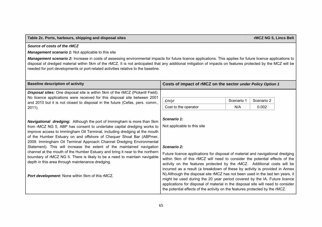
65
Table 2c. Ports, harbours, shipping and disposal sites rMCZ NG 5, Lincs Belt
Source of costs of the rMCZ Management scenario 1: Not applicable to this site Management scenario 2: Increase in costs of assessing environmental impacts for future licence applications. This applies for future licence applications to disposal of dredged material within 5km of the rMCZ. It is not anticipated that any additional mitigation of impacts on features protected by the MCZ will be needed for port developments or port-related activities relative to the baseline.
Baseline description of activity Costs of impact of rMCZ on the sector under Policy Option 1
Disposal sites: One disposal site is within 5km of the rMCZ (Pickerill Field). No licence applications were received for this disposal site between 2001 and 2010 but it is not closed to disposal in the future (Cefas, pers. comm., 2011).
Navigational dredging: Although the port of Immingham is more than 5km from rMCZ NG 5, ABP has consent to undertake capital dredging works to improve access to Immingham Oil Terminal, including dredging at the mouth of the Humber Estuary on and offshore of Chequer Shoal Bar (ABPmer, 2009. Immingham Oil Terminal Approach Channel Dredging Environmental Statement). This will increase the extent of the maintained navigation channel at the mouth of the Humber Estuary and bring it near to the northern boundary of rMCZ NG 5. There is likely to be a need to maintain navigable depth in this area through maintenance dredging.
Port development: None within 5km of this rMCZ.
£m/yr Scenario 1 Scenario 2
Cost to the operator N/A 0.002 Scenario 1:
Not applicable to this site
Scenario 2:
Future licence applications for disposal of material and navigational dredging within 5km of this rMCZ will need to consider the potential effects of the activity on the features protected by the rMCZ. Additional costs will be incurred as a result (a breakdown of these by activity is provided in Annex N).Although the disposal site rMCZ has not been used in the last ten years, it might be used during the 20 year period covered by the IA. Future licence applications for disposal of material in the disposal site will need to consider the potential effects of the activity on the features protected by the rMCZ.
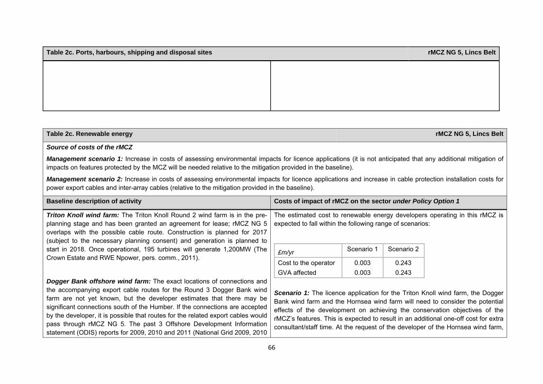
66
Table 2c. Ports, harbours, shipping and disposal sites rMCZ NG 5, Lincs Belt
Table 2c. Renewable energy rMCZ NG 5, Lincs Belt
Source of costs of the rMCZ
Management scenario 1: Increase in costs of assessing environmental impacts for licence applications (it is not anticipated that any additional mitigation of impacts on features protected by the MCZ will be needed relative to the mitigation provided in the baseline).
Management scenario 2: Increase in costs of assessing environmental impacts for licence applications and increase in cable protection installation costs for power export cables and inter-array cables (relative to the mitigation provided in the baseline).
Baseline description of activity Costs of impact of rMCZ on the sector under Policy Option 1
Triton Knoll wind farm: The Triton Knoll Round 2 wind farm is in the pre-planning stage and has been granted an agreement for lease; rMCZ NG 5 overlaps with the possible cable route. Construction is planned for 2017 (subject to the necessary planning consent) and generation is planned to start in 2018. Once operational, 195 turbines will generate 1,200MW (The Crown Estate and RWE Npower, pers. comm., 2011).
Dogger Bank offshore wind farm: The exact locations of connections and the accompanying export cable routes for the Round 3 Dogger Bank wind farm are not yet known, but the developer estimates that there may be significant connections south of the Humber. If the connections are accepted by the developer, it is possible that routes for the related export cables would pass through rMCZ NG 5. The past 3 Offshore Development Information statement (ODIS) reports for 2009, 2010 and 2011 (National Grid 2009, 2010
The estimated cost to renewable energy developers operating in this rMCZ is expected to fall within the following range of scenarios:
£m/yr Scenario 1 Scenario 2
Cost to the operator 0.003 0.243 GVA affected 0.003 0.243
Scenario 1: The licence application for the Triton Knoll wind farm, the Dogger Bank wind farm and the Hornsea wind farm will need to consider the potential effects of the development on achieving the conservation objectives of the rMCZ’s features. This is expected to result in an additional one-off cost for extra consultant/staff time. At the request of the developer of the Hornsea wind farm,
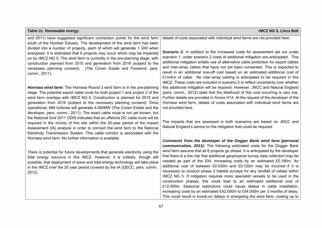
67
Table 2c. Renewable energy rMCZ NG 5, Lincs Belt
and 2011) have suggested significant connection points for the wind farm south of the Humber Estuary. The development of the wind farm has been divided into a number of projects, each of which will generate 1 GW when energised. It is estimated that 6 projects may occur which may be impacted on by rMCZ NG 5. The wind farm is currently in the pre-planning stage, with construction planned from 2015 and generation from 2016 (subject to the necessary planning consent). (The Crown Estate and Forewind, pers. comm., 2011).
Hornsea wind farm: The Hornsea Round 3 wind farm is in the pre-planning stage. The potential export cable route for both project 1 and project 2 of the wind farm overlaps with rMCZ NG 5. Construction is planned for 2015 and generation from 2016 (subject to the necessary planning consent). Once operational, 668 turbines will generate 4,000MW (The Crown Estate and the developer, pers. comm., 2011). The exact cable route is not yet known, but the National Grid 2011 ODIS indicates that an offshore DC cable route will be required in the vicinity of this site within the 20-year period of the Impact Assessment (IA) analysis in order to connect the wind farm to the National Electricity Transmission System. This cable corridor is associated with the Hornsea wind farm. No further information is available.
There is potential for future developments that generate electricity using the tidal energy resource in this rMCZ. However, it is unlikely, though still possible, that deployment of wave and tidal energy technology will take place in the rMCZ over the 20 year period covered by the IA (DECC, pers. comm., 2012).
details of costs associated with individual wind farms are not provided here.
Scenario 2: In addition to the increased costs for assessment set out under scenario 1, under scenario 2 costs of additional mitigation are anticipated. This additional mitigation entails use of alternative cable protection for export cables and inter-array cables that have not yet been consented. This is expected to result in an additional one-off cost based on an estimated additional cost of £1m/km of cable. No inter-array cabling is anticipated to be required in this rMCZ. These costs are included in scenario 2 to reflect uncertainty over whether this additional mitigation will be required. However, JNCC and Natural England (pers. comm., 2012) state that the likelihood of this cost occurring is very low. Further details are provided in Annex H14. At the request of the developer of the Hornsea wind farm, details of costs associated with individual wind farms are not provided here.
The impacts that are assessed in both scenarios are based on JNCC and Natural England’s advice on the mitigation that could be required.
Comments from the developer of the Dogger Bank wind farm (personal communication, 2011): The following estimated costs for the Dogger Bank wind farm assume that all 6 projects go ahead. It is anticipated by the developer that there is a low risk that additional geophysical survey data collection may be needed as part of the EIA, increasing costs by an estimated £0.180m. An additional cost of between £0.030m and £0.120m may be incurred if it is necessary to conduct phase 2 habitat surveys for any landfall of cables within rMCZ NG 5. If mitigation requires more specialist vessels to be used in the construction phases, this could lead to an estimated additional cost of £12.000m. Seasonal restrictions could cause delays in cable installation, increasing costs by an estimated £42.000m to £54.000m per 3 months of delay. This could result in knock-on delays in energising the wind farm, costing up to
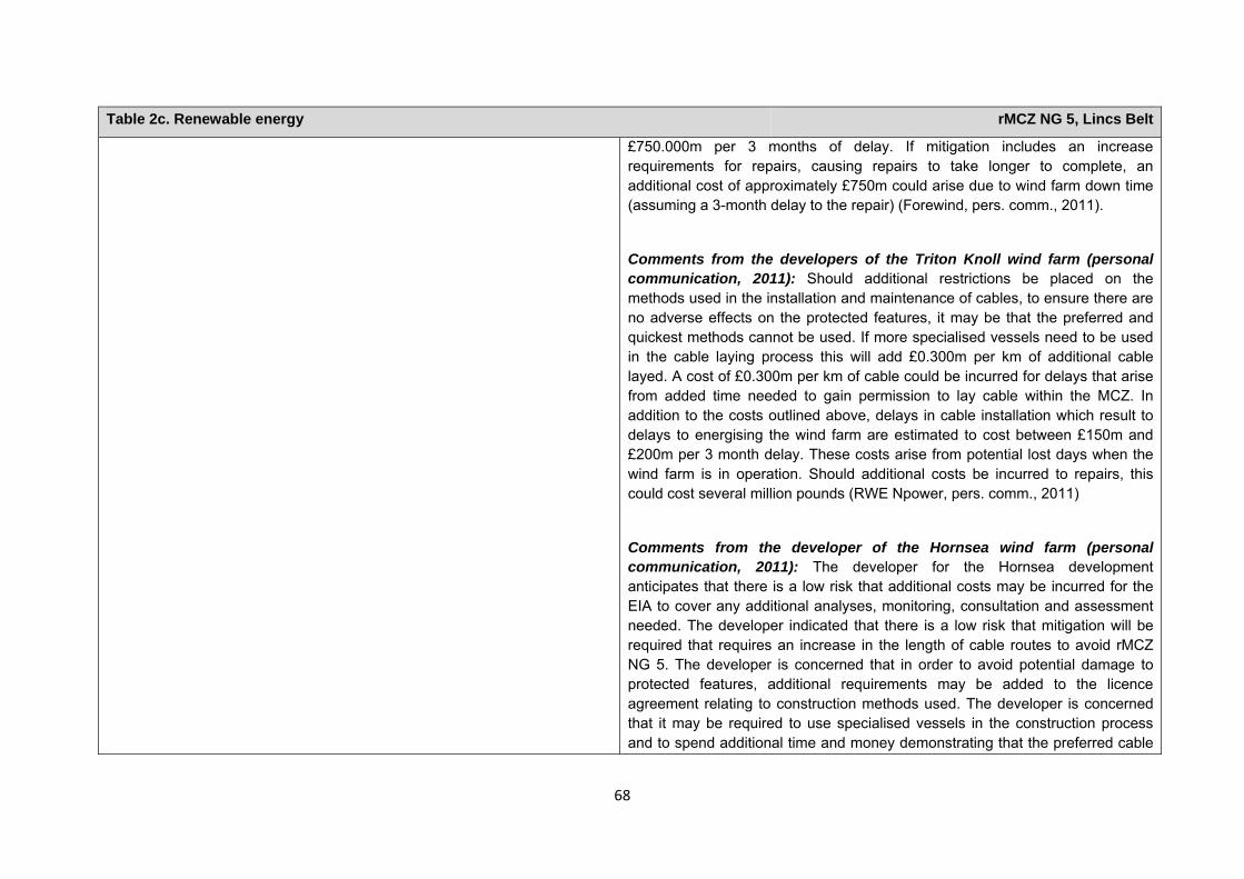
68
Table 2c. Renewable energy rMCZ NG 5, Lincs Belt
£750.000m per 3 months of delay. If mitigation includes an increase requirements for repairs, causing repairs to take longer to complete, an additional cost of approximately £750m could arise due to wind farm down time (assuming a 3-month delay to the repair) (Forewind, pers. comm., 2011).
Comments from the developers of the Triton Knoll wind farm (personal communication, 2011): Should additional restrictions be placed on the methods used in the installation and maintenance of cables, to ensure there are no adverse effects on the protected features, it may be that the preferred and quickest methods cannot be used. If more specialised vessels need to be used in the cable laying process this will add £0.300m per km of additional cable layed. A cost of £0.300m per km of cable could be incurred for delays that arise from added time needed to gain permission to lay cable within the MCZ. In addition to the costs outlined above, delays in cable installation which result to delays to energising the wind farm are estimated to cost between £150m and £200m per 3 month delay. These costs arise from potential lost days when the wind farm is in operation. Should additional costs be incurred to repairs, this could cost several million pounds (RWE Npower, pers. comm., 2011)
Comments from the developer of the Hornsea wind farm (personal communication, 2011): The developer for the Hornsea development anticipates that there is a low risk that additional costs may be incurred for the EIA to cover any additional analyses, monitoring, consultation and assessment needed. The developer indicated that there is a low risk that mitigation will be required that requires an increase in the length of cable routes to avoid rMCZ NG 5. The developer is concerned that in order to avoid potential damage to protected features, additional requirements may be added to the licence agreement relating to construction methods used. The developer is concerned that it may be required to use specialised vessels in the construction process and to spend additional time and money demonstrating that the preferred cable
69
Table 2c. Renewable energy rMCZ NG 5, Lincs Belt
laying method and protection method are not adversely affecting protected features. Should additional restrictions be placed on methods used in the installation and maintenance of cables in order to ensure no adverse effect on the protected features, it may be that the preferred and quickest methods cannot be used. Delays in cable installation and construction of the wind farm could lead to delays in energising the wind farm. Further costs could be incurred for any repairs to cables (the developer, pers. comm., 2011). Estimates of the costs are not provided here at the request of the developer.
Human activities in the site that are not negatively affected by the rMCZ (over 2013 to 2032 inclusive)
Table 2d. Other impacts that are assessed for the suite of MCZs and not for this site alone rMCZ NG 5, Lincs Belt
Cables (interconnectors and telecom cables)
Future interconnectors and telecom cables may pass through the rMCZ. Impacts of rMCZs on future interconnectors and telecom cables are assessed in the Evidence Base, Annex H3 and Annex N3 (they are not assessed for this site alone).
Oil and gas related activities (including carbon capture and storage)
This rMCZ overlaps with an area that has potential for future oil and gas exploration and production (it overlaps licenced blocks in the 26th or 27th Seaward Licensing Rounds). However, the area is not necessarily viable to develop. Impacts of rMCZs on the oil and gas related activities are assessed in the Evidence Base, Annex H11 and Annex N10 (they are not assessed for this site alone).
Table 3. Human activities in the site that are not negatively affected by the rMCZ under Policy Option 1
(existing activities at their current levels and future proposals known to the regional MCZ projects)
rMCZ NG 5, Lincs Belt
Commercial fisheries, flood and coastal erosion activities (Lincshore project), recreation (recreational boating, fishing, snorkelling and SCUBA diving, an

70
*The IA assumes that no additional mitigation of impacts of water abstraction, discharge or diffuse pollution will be required over and above that which will be provided to achieve the objectives of the Water Framework Directive through the River Basin Management Plan process (based on advice provided by Natural England, pers. comm., 2010). Contribution to Ecological Network Guidance Table 4. An overview of features proposed for designation and how these contribute to the ENG guidelines for the regional MCZ project area and at a wider scale4
= ENG guideline is achieved and X = ENG guideline is not achieved. Green cells represent key considerations and any greyed-out rows indicate where SNCBs do not agree with a feature being proposed for designation. Recommended conservation objectives in italics indicate where SNCBs do not agree with the conservation objective recommended by the regional MCZ project (see Section 4.2). Where an asterisk (*) has been given in the table, more detail is provided in the narrative.
rMCZ NG 5, Lincs Belt
ENG Feature
Represent-ativity
Replication Adequacy Viability
Gaps or shortfalls in relation to ENG minimum guidelines
Recommended conservation objective
Quantitative considerations at regional MCZ level
Ecological Importanceat regional MCZ level
Ecological Importance at wider scale
A5.1 Subtidal coarse sediment
BSH None Maintain
A5.2 Subtidal sand BSH None Maintain
A5.4 Subtidal mixed sediments
BSH None Maintain
4 copied from the JNCC and Natural England’s advice to Defra on rMCZs
existing wildfowling lease and wildlife watching), research and education, shipping (transit of vessels only) and water abstraction, diffuse and pollution*.
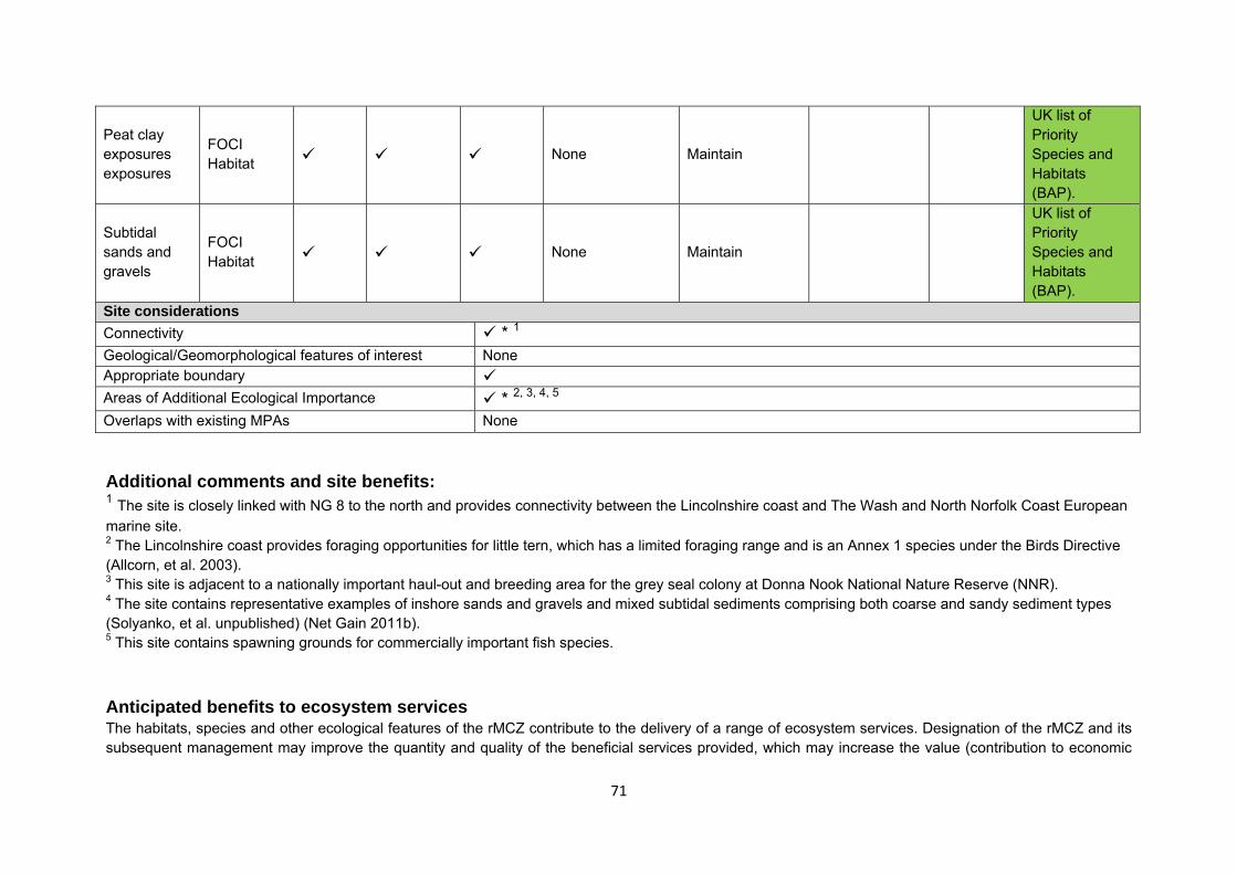
71
Peat clay exposures exposures
FOCI Habitat None Maintain
UK list of Priority Species and Habitats (BAP).
Subtidal sands and gravels
FOCI Habitat None Maintain
UK list of Priority Species and Habitats (BAP).
Site considerations Connectivity * 1 Geological/Geomorphological features of interest None Appropriate boundary Areas of Additional Ecological Importance * 2, 3, 4, 5 Overlaps with existing MPAs None
Additional comments and site benefits: 1 The site is closely linked with NG 8 to the north and provides connectivity between the Lincolnshire coast and The Wash and North Norfolk Coast European marine site. 2 The Lincolnshire coast provides foraging opportunities for little tern, which has a limited foraging range and is an Annex 1 species under the Birds Directive (Allcorn, et al. 2003). 3 This site is adjacent to a nationally important haul-out and breeding area for the grey seal colony at Donna Nook National Nature Reserve (NNR). 4 The site contains representative examples of inshore sands and gravels and mixed subtidal sediments comprising both coarse and sandy sediment types (Solyanko, et al. unpublished) (Net Gain 2011b). 5 This site contains spawning grounds for commercially important fish species. Anticipated benefits to ecosystem services The habitats, species and other ecological features of the rMCZ contribute to the delivery of a range of ecosystem services. Designation of the rMCZ and its subsequent management may improve the quantity and quality of the beneficial services provided, which may increase the value (contribution to economic
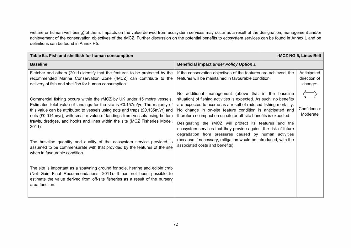
72
welfare or human well-being) of them. Impacts on the value derived from ecosystem services may occur as a result of the designation, management and/or achievement of the conservation objectives of the rMCZ. Further discussion on the potential benefits to ecosystem services can be found in Annex L and on definitions can be found in Annex H5. Table 5a. Fish and shellfish for human consumption rMCZ NG 5, Lincs Belt
Baseline Beneficial impact under Policy Option 1
Fletcher and others (2011) identify that the features to be protected by the recommended Marine Conservation Zone (rMCZ) can contribute to the delivery of fish and shellfish for human consumption.
Commercial fishing occurs within the rMCZ by UK under 15 metre vessels. Estimated total value of landings for the site is £0.157m/yr. The majority of this value can be attributed to vessels using pots and traps (£0.135m/yr) and nets (£0.014m/yr), with smaller value of landings from vessels using bottom trawls, dredges, and hooks and lines within the site (MCZ Fisheries Model, 2011).
The baseline quantity and quality of the ecosystem service provided is assumed to be commensurate with that provided by the features of the site when in favourable condition.
The site is important as a spawning ground for sole, herring and edible crab (Net Gain Final Recommendations, 2011). It has not been possible to estimate the value derived from off-site fisheries as a result of the nursery area function.
If the conservation objectives of the features are achieved, the features will be maintained in favourable condition.
No additional management (above that in the baseline situation) of fishing activities is expected. As such, no benefits are expected to accrue as a result of reduced fishing mortality. No change in on-site feature condition is anticipated and therefore no impact on on-site or off-site benefits is expected.
Designating the rMCZ will protect its features and the ecosystem services that they provide against the risk of future degradation from pressures caused by human activities (because if necessary, mitigation would be introduced, with the associated costs and benefits).
Anticipated direction of
change:
Confidence: Moderate
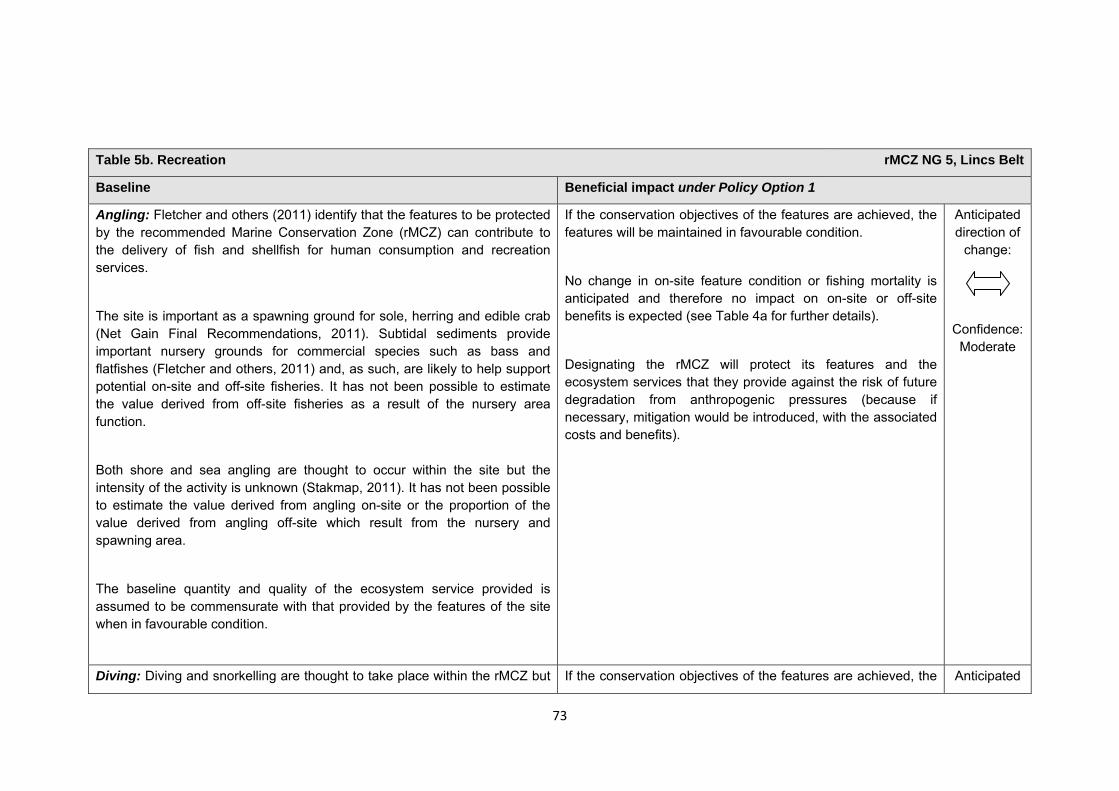
73
Table 5b. Recreation rMCZ NG 5, Lincs Belt
Baseline Beneficial impact under Policy Option 1
Angling: Fletcher and others (2011) identify that the features to be protected by the recommended Marine Conservation Zone (rMCZ) can contribute to the delivery of fish and shellfish for human consumption and recreation services.
The site is important as a spawning ground for sole, herring and edible crab (Net Gain Final Recommendations, 2011). Subtidal sediments provide important nursery grounds for commercial species such as bass and flatfishes (Fletcher and others, 2011) and, as such, are likely to help support potential on-site and off-site fisheries. It has not been possible to estimate the value derived from off-site fisheries as a result of the nursery area function.
Both shore and sea angling are thought to occur within the site but the intensity of the activity is unknown (Stakmap, 2011). It has not been possible to estimate the value derived from angling on-site or the proportion of the value derived from angling off-site which result from the nursery and spawning area.
The baseline quantity and quality of the ecosystem service provided is assumed to be commensurate with that provided by the features of the site when in favourable condition.
If the conservation objectives of the features are achieved, the features will be maintained in favourable condition.
No change in on-site feature condition or fishing mortality is anticipated and therefore no impact on on-site or off-site benefits is expected (see Table 4a for further details).
Designating the rMCZ will protect its features and the ecosystem services that they provide against the risk of future degradation from anthropogenic pressures (because if necessary, mitigation would be introduced, with the associated costs and benefits).
Anticipated direction of
change:
Confidence: Moderate
Diving: Diving and snorkelling are thought to take place within the rMCZ but If the conservation objectives of the features are achieved, the Anticipated
74
Table 5b. Recreation rMCZ NG 5, Lincs Belt
the intensity of the activity is unknown (Stakmap, 2011). features will be maintained in favourable condition.
No change in on-site feature condition is anticipated. However, designation may result in an increase in dive trips to the area, which may have beneficial effects on the local economy. This increase may represent a redistribution of dive location preferences rather than an increase in days spent diving or the number of divers.
Designating the rMCZ will protect its features and the ecosystem services that they provide against the risk of future degradation from anthropogenic pressures (because if necessary, mitigation would be introduced, with the associated costs and benefits).
direction of change:
Confidence: Moderate
75
Table 5b. Recreation rMCZ NG 5, Lincs Belt
Wildlife watching: Fletcher and others (2011) identify that the features to be protected by the rMCZ can contribute to the delivery of recreation and tourism services.
The site is popular for wildlife enthusiasts such as bird watchers (Net Gain Final Recommendations, 2011). Recommended MCZ NG 5 borders several national nature reserves and, of these, Donna Nook is of great importance for marine mammals, as it is used for ‘haul out’ by grey seal throughout the year and as a breeding site. It is a major UK site with approximately 4,000 grey seals present (Lincolnshire Wildlife Trust, pers. comm., 2011) and over 1,300 seal pups born every year (Net Gain Final Recommendations, 2011). As such, it is a popular area for watching seals.
It has not been possible to estimate the value derived from wildlife watching in the rMCZ. The baseline quantity and quality of the ecosystem service provided is assumed to be commensurate with that provided by the features of the site when in favourable condition.
If the conservation objectives of the features are achieved, the features will be maintained in favourable condition.
No change in on-site feature condition is anticipated and therefore no benefits to wildlife watching are expected.
Designating the rMCZ will protect its features and the ecosystem services that they provide against the risk of future degradation from anthropogenic pressures (because if necessary, mitigation would be introduced, with the associated costs and benefits).
Anticipated direction of
change:
Confidence: Moderate
Table 5c. Research and education rMCZ NG 5, Lincs Belt
Baseline Beneficial impact under Policy Option 1
Research: Fletcher and others (2011) identify that the features to be protected by the recommended Marine Conservation Zone (rMCZ) can contribute to the delivery of research services.
Monitoring of the rMCZ will help to inform understanding of how the marine environment is changing and is impacted on by anthropogenic pressures and management interventions. Other research benefits are unknown.
Anticipated direction of
change:
76
Table 5c. Research and education rMCZ NG 5, Lincs Belt
The site overlaps with a Special Protection Area and a Site of Special Scientific Interest and, as such, ecological monitoring activities are ongoing. It has not been possible to estimate the value derived from research activities associated with the rMCZ.
Confidence: High
Education: Fletcher and others (2011) identify that the features to be protected by the rMCZ can contribute to the delivery of education services.
The extent of current educational activity carried out in the site is unknown. It has not been possible to estimate the value derived from educational activities associated with the rMCZ.
Designation may aid additional local (to the rMCZ) provision of education (e.g. events and interpretation boards), from which visitors would derive benefit.
Non-visitors may benefit if the rMCZ contributes to wider provision of education (e.g. television programmes, articles in magazines and newspapers, and educational resources developed for use in schools).
Anticipated direction of
change:
Confidence: Moderate
Table 5d. Regulating services rMCZ NG 5, Lincs Belt
Baseline Beneficial impact under Policy Option 1
Regulation of pollution: The features of the site contribute to the bioremediation of waste and sequestration of carbon. It has not been possible to estimate the value derived from the regulation of pollution in the rMCZ.
Environmental resilience: The features of the site contribute to the resilience and continued regeneration of marine ecosystems. It has not been possible to estimate the value derived from environmental resilience in the rMCZ.
If the conservation objectives of the features are achieved, the features will be maintained in favourable condition.
No change in feature condition and management of human activities is expected and therefore no benefit to the regulatory capacity of the site is expected.
Designating the rMCZ will protect its features and the ecosystem services that they provide against the risk of future
Anticipated direction of
change:
Confidence: Moderate
77
Table 5d. Regulating services rMCZ NG 5, Lincs Belt
Natural hazard protection: The features of the site contribute to local flood and storm protection, assuming that the recommended Marine Conservation Zone (rMCZ) is compatible with existing local flood and coastal erosion risk management activity (such as the Lincshore project). It has not been possible to estimate the value derived from the natural hazard protection in the rMCZ.
(Fletcher and others, 2011)
degradation from anthropogenic pressures (because if necessary, mitigation would be introduced, with the associated costs and benefits).
Table 5e. Non-use and option values rMCZ NG 5, Lincs Belt
Baseline Beneficial impact under Policy Option 1
Some people gain satisfaction from the existence of marine habitats, species and other features. They also gain from having the option to benefit in the future from the habitats and species in the recommended Marine Conservation Zone (rMCZ) and the ecosystem services provided, even if they do not currently benefit from them.
The rMCZ will benefit the proportion of the UK population that values conservation of the rMCZ features and its contribution to an ecologically coherent network of Marine Protected Areas. Some people will gain satisfaction from knowing that the habitats and species are being conserved (existence value) and/or that they are being conserved for use by others in the current generation (altruistic value) or future generations (bequest value). The rMCZ will protect both the features and their option to benefit from the services in the future from the risk of future degradation.
In the Marine Conservation Society ‘Your Seas Your Voice’ campaign, 4 ‘nominated sites’ are located within rMCZ NG 5. Features of the natural environment were strong motivators for reasons why people thought that these locations should be
Anticipated direction of
change:
Confidence: Moderate
78
Table 5e. Non-use and option values rMCZ NG 5, Lincs Belt
protected, with people frequently attaching value to biodiversity and the ‘spectacular scenery’.
rMCZ NG 6, Silver Pit
Site area (km2): 168.09
• This site has been proposed for designation under Policy Option 1 only.
Table 1. Conservation impacts rMCZ NG 6, Silver Pit
1a. Ecological description
The site has been recommended for the Silver Pit North Sea post-glacial tunnel valley feature. The channel morphology includes areas of thin sediment cover and rock on the sea bed, small sand waves, hummocky glacial deposits, slope failure deposits and glacial terraces. The steeply sloping sides and the valley floor of the Silver Pit feature are comprised of mixed sediments and areas of biogenic reef.
The site supports diverse and abundant benthic communities, including mussel beds, brittle star, sea squirt, hydroid and bryozoans. The mixed sediment habitats also contain a range of polychaetes, bivalves, amphipods and sipunculids. The Ross worm Sabellaria spinulosa biogenic reef habitats at the site support a range of species including the queen scallop, squat lobster, blue mussel beds and the commercially important pink shrimp, along with other polychaetes, encrusting hydroids and bryozoans.
The area is also known to provide spawning grounds for several commercial species, including lemon sole, sprat, whiting, cod, Dover sole, plaice and herring, with the latter five being part of a grouped species UK Biodiversity Action Plan. Recommended Marine Conservation Zone (rMCZ) NG 6 has the potential to be utilised by many sea bird species for foraging and resting, including puffin, common guillemot, black-legged kittiwake, fulmar and northern gannet, along with several migratory species, including shearwater, petrel and skua. White-beaked dolphin, minke whale and harbour porpoise (listed in Annex 2 of the EC Habitats Directive) have been sighted within rMCZ NG 6.
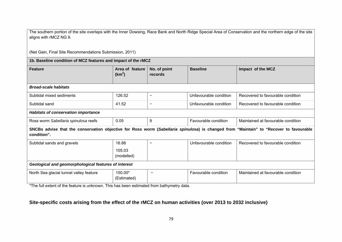
79
*The full extent of the feature is unknown. This has been estimated from bathymetry data. Site-specific costs arising from the effect of the rMCZ on human activities (over 2013 to 2032 inclusive)
The southern portion of the site overlaps with the Inner Dowsing, Race Bank and North Ridge Special Area of Conservation and the northern edge of the site aligns with rMCZ NG 9.
(Net Gain, Final Site Recommendations Submission, 2011)
1b. Baseline condition of MCZ features and impact of the rMCZ
Feature Area of feature (km2)
No. of point records
Baseline Impact of the MCZ
Broad-scale habitats
Subtidal mixed sediments 126.52 − Unfavourable condition Recovered to favourable condition
Subtidal sand 41.52 − Unfavourable condition Recovered to favourable condition
Habitats of conservation importance
Ross worm Sabellaria spinulosa reefs 0.05 9 Favourable condition Maintained at favourable condition
SNCBs advise that the conservation objective for Ross worm (Sabellaria spinulosa) is changed from “Maintain” to “Recover to favourable condition”.
Subtidal sands and gravels 16.88
105.03 (modelled)
− Unfavourable condition Recovered to favourable condition
Geological and geomorphological features of interest
North Sea glacial tunnel valley feature 150.00* (Estimated)
− Favourable condition Maintained at favourable condition
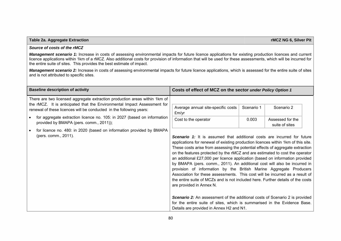
80
Table 2a. Aggregate Extraction rMCZ NG 6, Silver Pit
Source of costs of the rMCZ Management scenario 1: Increase in costs of assessing environmental impacts for future licence applications for existing production licences and current licence applications within 1km of a rMCZ. Also additional costs for provision of information that will be used for these assessments, which will be incurred for the entire suite of sites. This provides the best estimate of impact. Management scenario 2: Increase in costs of assessing environmental impacts for future licence applications, which is assessed for the entire suite of sites and is not attributed to specific sites.
Baseline description of activity Costs of effect of MCZ on the sector under Policy Option 1
There are two licensed aggregate extraction production areas within 1km of the rMCZ. It is anticipated that the Environmental Impact Assessment for renewal of these licences will be conducted in the following years:
• for aggregate extraction licence no. 105: in 2027 (based on information provided by BMAPA (pers. comm., 2011));
• for licence no. 480: in 2020 (based on information provided by BMAPA (pers. comm., 2011).
Average annual site-specific costs £m/yr
Scenario 1 Scenario 2
Cost to the operator 0.003 Assessed for the suite of sites
Scenario 1: It is assumed that additional costs are incurred for future applications for renewal of existing production licences within 1km of this site. These costs arise from assessing the potential effects of aggregate extraction on the features protected by the rMCZ and are estimated to cost the operator an additional £27,000 per licence application (based on information provided by BMAPA (pers. comm., 2011). An additional cost will also be incurred in provision of information by the British Marine Aggregate Producers Association for these assessments. This cost will be incurred as a result of the entire suite of MCZs and is not included here. Further details of the costs are provided in Annex N. Scenario 2: An assessment of the additional costs of Scenario 2 is provided for the entire suite of sites, which is summarised in the Evidence Base. Details are provided in Annex H2 and N1.
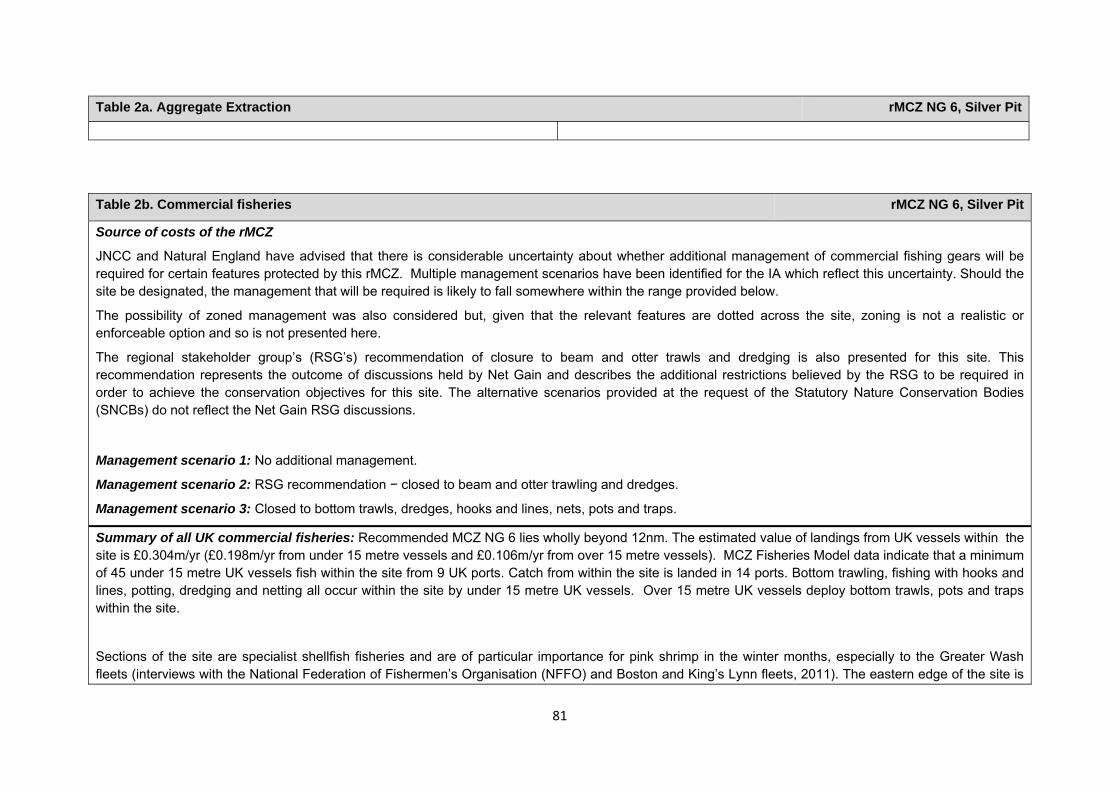
81
Table 2a. Aggregate Extraction rMCZ NG 6, Silver Pit
Table 2b. Commercial fisheries rMCZ NG 6, Silver Pit
Source of costs of the rMCZ
JNCC and Natural England have advised that there is considerable uncertainty about whether additional management of commercial fishing gears will be required for certain features protected by this rMCZ. Multiple management scenarios have been identified for the IA which reflect this uncertainty. Should the site be designated, the management that will be required is likely to fall somewhere within the range provided below.
The possibility of zoned management was also considered but, given that the relevant features are dotted across the site, zoning is not a realistic or enforceable option and so is not presented here.
The regional stakeholder group’s (RSG’s) recommendation of closure to beam and otter trawls and dredging is also presented for this site. This recommendation represents the outcome of discussions held by Net Gain and describes the additional restrictions believed by the RSG to be required in order to achieve the conservation objectives for this site. The alternative scenarios provided at the request of the Statutory Nature Conservation Bodies (SNCBs) do not reflect the Net Gain RSG discussions.
Management scenario 1: No additional management.
Management scenario 2: RSG recommendation − closed to beam and otter trawling and dredges.
Management scenario 3: Closed to bottom trawls, dredges, hooks and lines, nets, pots and traps.
Summary of all UK commercial fisheries: Recommended MCZ NG 6 lies wholly beyond 12nm. The estimated value of landings from UK vessels within the site is £0.304m/yr (£0.198m/yr from under 15 metre vessels and £0.106m/yr from over 15 metre vessels). MCZ Fisheries Model data indicate that a minimum of 45 under 15 metre UK vessels fish within the site from 9 UK ports. Catch from within the site is landed in 14 ports. Bottom trawling, fishing with hooks and lines, potting, dredging and netting all occur within the site by under 15 metre UK vessels. Over 15 metre UK vessels deploy bottom trawls, pots and traps within the site.
Sections of the site are specialist shellfish fisheries and are of particular importance for pink shrimp in the winter months, especially to the Greater Wash fleets (interviews with the National Federation of Fishermen’s Organisation (NFFO) and Boston and King’s Lynn fleets, 2011). The eastern edge of the site is
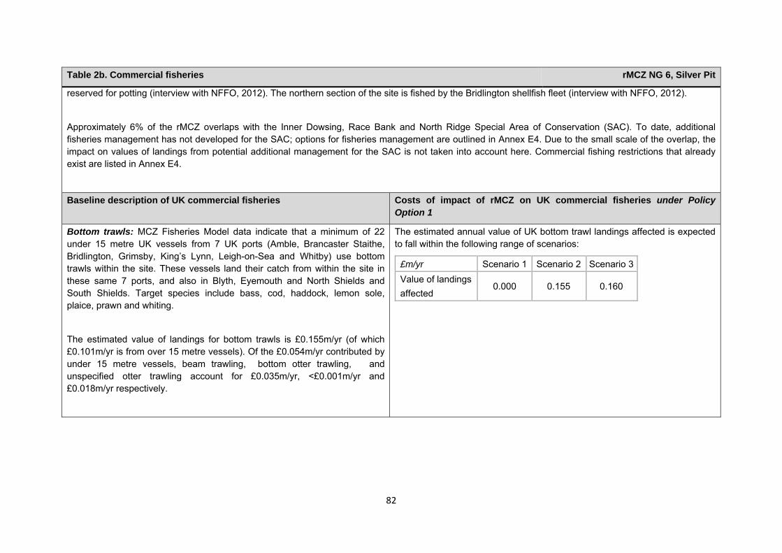
82
Table 2b. Commercial fisheries rMCZ NG 6, Silver Pit
reserved for potting (interview with NFFO, 2012). The northern section of the site is fished by the Bridlington shellfish fleet (interview with NFFO, 2012).
Approximately 6% of the rMCZ overlaps with the Inner Dowsing, Race Bank and North Ridge Special Area of Conservation (SAC). To date, additional fisheries management has not developed for the SAC; options for fisheries management are outlined in Annex E4. Due to the small scale of the overlap, the impact on values of landings from potential additional management for the SAC is not taken into account here. Commercial fishing restrictions that already exist are listed in Annex E4.
Baseline description of UK commercial fisheries Costs of impact of rMCZ on UK commercial fisheries under Policy Option 1
Bottom trawls: MCZ Fisheries Model data indicate that a minimum of 22 under 15 metre UK vessels from 7 UK ports (Amble, Brancaster Staithe, Bridlington, Grimsby, King’s Lynn, Leigh-on-Sea and Whitby) use bottom trawls within the site. These vessels land their catch from within the site in these same 7 ports, and also in Blyth, Eyemouth and North Shields and South Shields. Target species include bass, cod, haddock, lemon sole, plaice, prawn and whiting.
The estimated value of landings for bottom trawls is £0.155m/yr (of which £0.101m/yr is from over 15 metre vessels). Of the £0.054m/yr contributed by under 15 metre vessels, beam trawling, bottom otter trawling, and unspecified otter trawling account for £0.035m/yr, <£0.001m/yr and £0.018m/yr respectively.
The estimated annual value of UK bottom trawl landings affected is expected to fall within the following range of scenarios:
£m/yr Scenario 1 Scenario 2 Scenario 3Value of landings affected
0.000 0.155 0.160
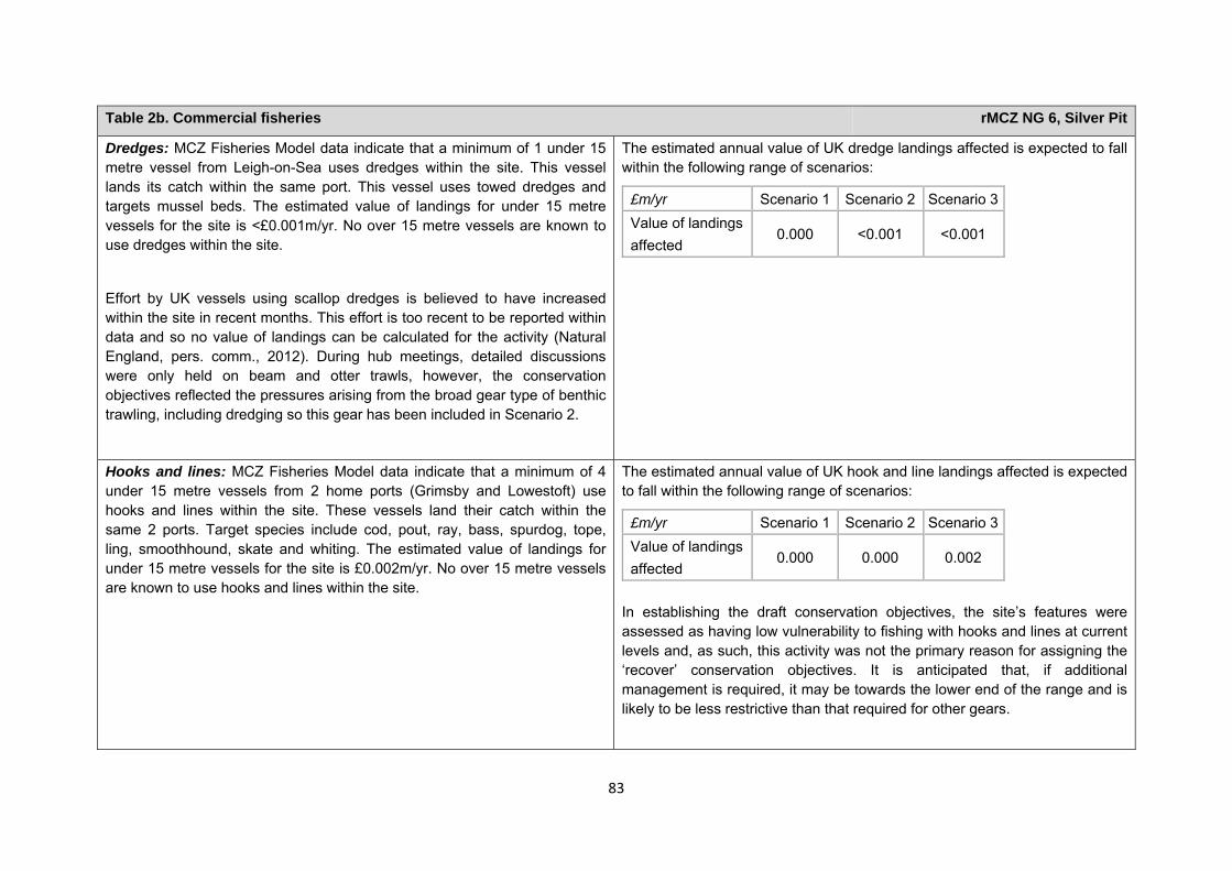
83
Table 2b. Commercial fisheries rMCZ NG 6, Silver Pit
Dredges: MCZ Fisheries Model data indicate that a minimum of 1 under 15 metre vessel from Leigh-on-Sea uses dredges within the site. This vessel lands its catch within the same port. This vessel uses towed dredges and targets mussel beds. The estimated value of landings for under 15 metre vessels for the site is <£0.001m/yr. No over 15 metre vessels are known to use dredges within the site.
Effort by UK vessels using scallop dredges is believed to have increased within the site in recent months. This effort is too recent to be reported within data and so no value of landings can be calculated for the activity (Natural England, pers. comm., 2012). During hub meetings, detailed discussions were only held on beam and otter trawls, however, the conservation objectives reflected the pressures arising from the broad gear type of benthic trawling, including dredging so this gear has been included in Scenario 2.
The estimated annual value of UK dredge landings affected is expected to fall within the following range of scenarios:
£m/yr Scenario 1 Scenario 2 Scenario 3Value of landings affected
0.000 <0.001 <0.001
Hooks and lines: MCZ Fisheries Model data indicate that a minimum of 4 under 15 metre vessels from 2 home ports (Grimsby and Lowestoft) use hooks and lines within the site. These vessels land their catch within the same 2 ports. Target species include cod, pout, ray, bass, spurdog, tope, ling, smoothhound, skate and whiting. The estimated value of landings for under 15 metre vessels for the site is £0.002m/yr. No over 15 metre vessels are known to use hooks and lines within the site.
The estimated annual value of UK hook and line landings affected is expected to fall within the following range of scenarios:
£m/yr Scenario 1 Scenario 2 Scenario 3Value of landings affected
0.000 0.000 0.002
In establishing the draft conservation objectives, the site’s features were assessed as having low vulnerability to fishing with hooks and lines at current levels and, as such, this activity was not the primary reason for assigning the ‘recover’ conservation objectives. It is anticipated that, if additional management is required, it may be towards the lower end of the range and is likely to be less restrictive than that required for other gears.
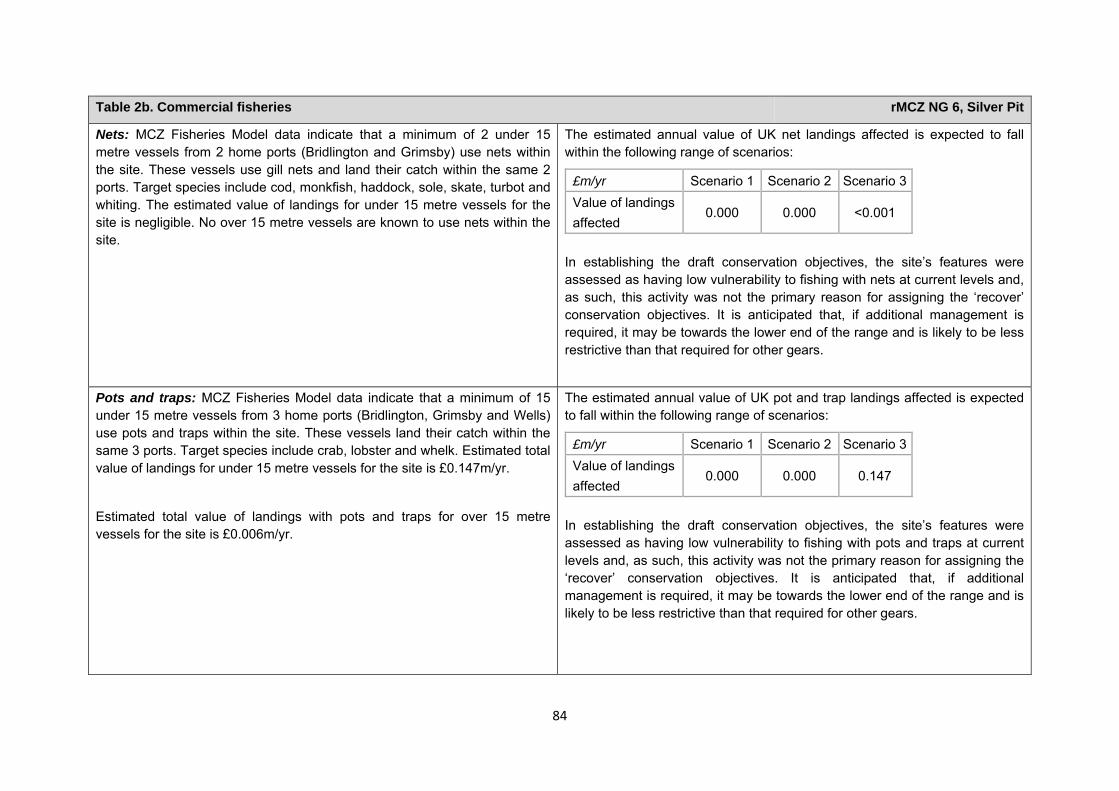
84
Table 2b. Commercial fisheries rMCZ NG 6, Silver Pit
Nets: MCZ Fisheries Model data indicate that a minimum of 2 under 15 metre vessels from 2 home ports (Bridlington and Grimsby) use nets within the site. These vessels use gill nets and land their catch within the same 2 ports. Target species include cod, monkfish, haddock, sole, skate, turbot and whiting. The estimated value of landings for under 15 metre vessels for the site is negligible. No over 15 metre vessels are known to use nets within the site.
The estimated annual value of UK net landings affected is expected to fall within the following range of scenarios:
£m/yr Scenario 1 Scenario 2 Scenario 3Value of landings affected
0.000 0.000 <0.001
In establishing the draft conservation objectives, the site’s features were assessed as having low vulnerability to fishing with nets at current levels and, as such, this activity was not the primary reason for assigning the ‘recover’ conservation objectives. It is anticipated that, if additional management is required, it may be towards the lower end of the range and is likely to be less restrictive than that required for other gears.
Pots and traps: MCZ Fisheries Model data indicate that a minimum of 15 under 15 metre vessels from 3 home ports (Bridlington, Grimsby and Wells) use pots and traps within the site. These vessels land their catch within the same 3 ports. Target species include crab, lobster and whelk. Estimated total value of landings for under 15 metre vessels for the site is £0.147m/yr.
Estimated total value of landings with pots and traps for over 15 metre vessels for the site is £0.006m/yr.
The estimated annual value of UK pot and trap landings affected is expected to fall within the following range of scenarios:
£m/yr Scenario 1 Scenario 2 Scenario 3Value of landings affected
0.000 0.000 0.147
In establishing the draft conservation objectives, the site’s features were assessed as having low vulnerability to fishing with pots and traps at current levels and, as such, this activity was not the primary reason for assigning the ‘recover’ conservation objectives. It is anticipated that, if additional management is required, it may be towards the lower end of the range and is likely to be less restrictive than that required for other gears.
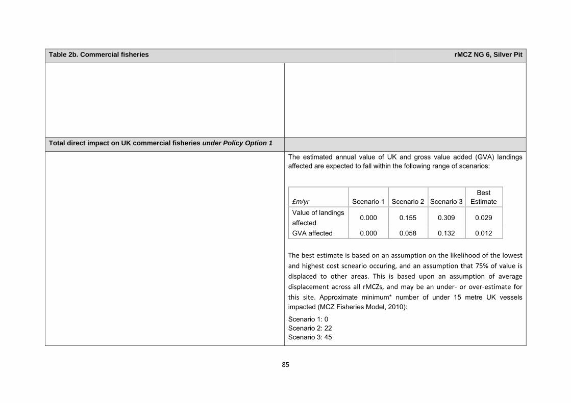
85
Table 2b. Commercial fisheries rMCZ NG 6, Silver Pit
Total direct impact on UK commercial fisheries under Policy Option 1
The estimated annual value of UK and gross value added (GVA) landings affected are expected to fall within the following range of scenarios:
£m/yr Scenario 1 Scenario 2 Scenario 3Best
Estimate Value of landings affected
0.000 0.155 0.309 0.029
GVA affected 0.000 0.058 0.132 0.012 The best estimate is based on an assumption on the likelihood of the lowest and highest cost scneario occuring, and an assumption that 75% of value is displaced to other areas. This is based upon an assumption of average displacement across all rMCZs, and may be an under‐ or over‐estimate for this site. Approximate minimum* number of under 15 metre UK vessels impacted (MCZ Fisheries Model, 2010):
Scenario 1: 0 Scenario 2: 22 Scenario 3: 45
86
Table 2b. Commercial fisheries rMCZ NG 6, Silver Pit
* Numbers of impacted UK under 15 metre vessels are an approximate minimum, estimated using the MCZ Fisheries Model. The survey data employed in the model were collected from 72% of all vessels operating from ports within the Net Gain Project Area. Vessels using more than one gear type may be duplicated in the totals.
Baseline description of non-UK commercial fisheries Costs of impact of rMCZ on non-UK commercial fisheries under Policy Option 1
Recommended MCZ NG 6 is known to be fished by the Belgian, Dutch, French and German fleets (interview with NFFO, 2011). French vessels target whiting seasonally and in sporadic years, depending on fishing quotas (Net Gain, Large Group Meeting, 2011). An informal agreement has been in existence between the French and the UK fleets since October 2006 in order to avoid conflict between static and mobile gear vessels. Under the informal agreement, the central area of the site is reserved for non-UK vessels using bottom trawls (interview with NFFO, 2012). This section of the site is predominantly trawled by French and German vessels (interview with NFFO,
If additional management for bottom trawls and dredges is pursued through a voluntary agreement, it is anticipated that the French fleet may investigate the possibility of using lighter gear types (Net Gain, Large Group Meeting, 2011).
For scenarios 2 and 3, the impact on the French fleet is estimated to be a loss of £0.012m/yr for mobile gear (Direction des Pêches Maritimes et de l'Aquaculture, pers. comm., 2012). However, no breakdown of this estimate is available by gear and so it may include the value of landings from mobile gear other than bottom trawling which would not be affected. Other stakeholders have not provided a site-specific description of impact, but it can be assumed
87
Table 2b. Commercial fisheries rMCZ NG 6, Silver Pit
2012). Estimated average value of landings for French vessels using mobile gears (active and seines) within the site between 2008 and 2009 was £0.012m/yr (Direction des Pêches Maritimes et de l’ Aquaculture, pers. comm., 2012).
that non-UK fleets will be impacted upon by fisheries management within this site. Regional qualitative impacts to non-UK fleets are outlined in Annex J3d.
Table 2c. National defence rMCZ NG 6, Silver Pit
Source of costs of the rMCZ
Management scenario 1: Mitigation of impacts of Ministry of Defence activities on features protected by the suite of rMCZs will be provided by additional planning considerations during operations and training. It is not known whether mitigation will be required for features protected by this site. The Ministry of Defence will also incur costs in revising environmental tools and charts in order to include MCZs.
Baseline description of activity Costs of impact of rMCZ on the sector under Policy Option 1
The Ministry of Defence is known to make use of the site as a military practice area, both by the RAF and for submarine exercises involving surface explosions.
It is not known whether this rMCZ will impact on the Ministry of Defence’s use of the site. Impacts of rMCZs on the Ministry of Defence’s activities are assessed in the Evidence Base and Annex N9.
Table 2d.Ports, harbours, shipping and disposal sites rMCZ NG 6, Silver Pit
Source of costs of the rMCZ
Management scenario 1: Not applicable to this site
Management scenario 2: Increase in costs of assessing environmental impacts for future licence applications. This applies for future licence applications to disposal of dredged material within 5km of the rMCZ. The regional MCZ projects are not aware of activities related to ports, harbours and shipping for which additional mitigation of impacts on features protected by the MCZ will be needed relative to the mitigation provided in the baseline.
Baseline description of activity Costs of impact of rMCZ on the sector under Policy Option 1
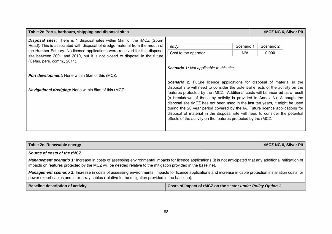
88
Table 2d.Ports, harbours, shipping and disposal sites rMCZ NG 6, Silver Pit
Disposal sites: There is 1 disposal sites within 5km of the rMCZ (Spurn Head). This is associated with disposal of dredge material from the mouth of the Humber Estuary. No licence applications were received for this disposal site between 2001 and 2010, but it is not closed to disposal in the future (Cefas, pers. comm., 2011).
Port development: None within 5km of this rMCZ.
Navigational dredging: None within 5km of this rMCZ.
Scenario 1: Not applicable to this site
Scenario 2: Future licence applications for disposal of material in the disposal site will need to consider the potential effects of the activity on the features protected by the rMCZ. Additional costs will be incurred as a result (a breakdown of these by activity is provided in Annex N). Although the disposal site rMCZ has not been used in the last ten years, it might be used during the 20 year period covered by the IA. Future licence applications for disposal of material in the disposal site will need to consider the potential effects of the activity on the features protected by the rMCZ.
£m/yr Scenario 1 Scenario 2
Cost to the operator N/A 0.000
Table 2e. Renewable energy rMCZ NG 6, Silver Pit
Source of costs of the rMCZ
Management scenario 1: Increase in costs of assessing environmental impacts for licence applications (it is not anticipated that any additional mitigation of impacts on features protected by the MCZ will be needed relative to the mitigation provided in the baseline).
Management scenario 2: Increase in costs of assessing environmental impacts for licence applications and increase in cable protection installation costs for power export cables and inter-array cables (relative to the mitigation provided in the baseline).
Baseline description of activity Costs of impact of rMCZ on the sector under Policy Option 1
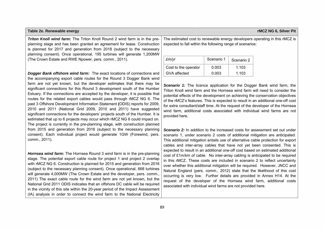
89
Table 2e. Renewable energy rMCZ NG 6, Silver Pit
Triton Knoll wind farm: The Triton Knoll Round 2 wind farm is in the pre-planning stage and has been granted an agreement for lease. Construction is planned for 2017 and generation from 2018 (subject to the necessary planning consent). Once operational, 195 turbines will generate 1,200MW (The Crown Estate and RWE Npower, pers. comm., 2011).
Dogger Bank offshore wind farm: The exact locations of connections and the accompanying export cable routes for the Round 3 Dogger Bank wind farm are not yet known, but the developer estimates that there may be significant connections for this Round 3 development south of the Humber Estuary. If the connections are accepted by the developer, it is possible that routes for the related export cables would pass through rMCZ NG 6. The past 3 Offshore Development Information Statement (ODIS) reports for 2009, 2010 and 2011 (National Grid 2009, 2010 and 2011) have suggested significant connections for the developers’ projects south of the Humber. It is estimated that up to 6 projects may occur which rMCZ NG 6 could impact on. The project is currently in the pre-planning stage, with construction planned from 2015 and generation from 2016 (subject to the necessary planning consent). Each individual project would generate 1GW (Forewind, pers. comm., 2011).
Hornsea wind farm: The Hornsea Round 3 wind farm is in the pre-planning stage. The potential export cable route for project 1 and project 2 overlap with rMCZ NG 6. Construction is planned for 2015 and generation from 2016 (subject to the necessary planning consent). Once operational, 668 turbines will generate 4,000MW (The Crown Estate and the developer, pers. comm., 2011) The exact cable route for the wind farm are not yet known, but the National Grid 2011 ODIS indicates that an offshore DC cable will be required in the vicinity of this site within the 20-year period of the Impact Assessment (IA) analysis in order to connect the wind farm to the National Electricity
The estimated cost to renewable energy developers operating in this rMCZ is expected to fall within the following range of scenarios:
£m/yr Scenario 1 Scenario 2
Cost to the operator 0.003 1.103 GVA affected 0.003 1.103
Scenario 1: The licence application for the Dogger Bank wind farm, the Triton Knoll wind farm and the Hornsea wind farm will need to consider the potential effects of the development on achieving the conservation objectives of the rMCZ’s features. This is expected to result in an additional one-off cost for extra consultant/staff time. At the request of the developer of the Hornsea wind farm, additional costs associated with individual wind farms are not provided here.
Scenario 2: In addition to the increased costs for assessment set out under scenario 1, under scenario 2 costs of additional mitigation are anticipated. This additional mitigation entails use of alternative cable protection for export cables and inter-array cables that have not yet been consented. This is expected to result in an additional one-off cost based on estimated additional cost of £1m/km of cable. No inter-array cabling is anticipated to be required in this rMCZ. These costs are included in scenario 2 to reflect uncertainty over whether this additional mitigation will be required. However, JNCC and Natural England (pers. comm., 2012) state that the likelihood of this cost occurring is very low. Further details are provided in Annex H14. At the request of the developer of the Hornsea wind farm, additional costs associated with individual wind farms are not provided here.
90
Table 2e. Renewable energy rMCZ NG 6, Silver Pit
Transmission System. No further information is available. The impacts that are assessed in both scenarios are based on JNCC and Natural England’s advice on the mitigation that could be required.
Comments from the developers of the Triton Knoll wind farm (personal communication, 2011): The developer of the Triton Knoll wind farm anticipates that there is a low risk that up to an additional £0.275m may be required for the EIA in order to cover any additional analyses, consultation and assessment needed. The developer also anticipates that there is a low risk that mitigation will be required that calls for an increase in length of cable routes to avoid rMCZ NG 6 (a total cost of £5.400m estimated based on £0.600m per km for offshore 132kV) and the use of more specialised vessels in the construction process (adding £0.300m per km) (RWE Npower pers. comm., 2011)
Comments from the developer of the Dogger Bank wind farm (personal communication, 2011): The following estimated costs for the Dogger Bank wind farm assume that all 6 projects go ahead. It is anticipated by the developer that there is a low risk that additional geophysical survey data collection may be needed as part of the EIA, increasing costs by an estimated £0.360m. If mitigation requires more specialist vessels to be used in the construction phases, this could lead to an estimated additional cost of £35.000m. Seasonal restrictions could cause delays in cable installation, increasing costs by an estimated £42.000m to £54.000m per 3 months of delay. This could result in knock-on delays in energising the wind farm, costing up to £750m per 3 months of delay. If mitigation includes an increase requirements for repairs, causing repairs to take longer to complete, an additional cost of approximately £750m could arise due to wind farm down time (assuming a 3-month delay to the repair) (Forewind, pers. comm., 2011).
Comments from the developer of the Hornsea wind farm (personal
91
Table 2e. Renewable energy rMCZ NG 6, Silver Pit
communication, 2011): The developer of the Hornsea wind farm anticipates that there is a low risk that additional costs may be incurred for the EIA to cover any additional analyses, monitoring, consultation and assessment needed. The developer indicated that there is a low risk that mitigation will be required that requires an increase in the length of cable routes to avoid rMCZ NG 6. The developer is concerned that in order to avoid potential damage to protected features, additional requirements may be added to the licence agreement relating to construction methods used. The developer is concerned that it may be required to use specialised vessels in the construction process and to spend additional time and money demonstrating that the preferred cable installation method and protection method are not adversely affecting protected features. Should additional restrictions be placed on methods used in the installation and maintenance of cables in order to ensure no adverse effect on the protected features, it may be that the preferred and quickest methods cannot be used. Delays in cable installation and construction of the wind farm could lead to delays in energising the wind farm. Further costs could be incurred for any repairs to cables (the developer, pers. comm., 2011). Estimates of the costs are not provided here at the request of the developer.
Human activities in the site that are not negatively affected by the rMCZ (over 2013 to 2032 inclusive)
Table 2f. Other impacts that are assessed for the suite of MCZs and not for this site alone rMCZ NG 6, Silver Pit
Cables (interconnectors and telecom cables) Future interconnectors and telecom cables may pass through the rMCZ. Impacts of rMCZs on future interconnectors and telecom cables are assessed in the Evidence Base, Annex H3 and Annex N3 (they are not assessed for this site alone).

92
Contribution to Ecological Network Guidance Table 4. An overview of features proposed for designation and how these contribute to the ENG guidelines for the regional MCZ project area and at a wider scale5
= ENG guideline is achieved and X = ENG guideline is not achieved. Green cells represent key considerations and any greyed-out rows indicate where SNCBs do not agree with a feature being proposed for designation. Recommended conservation objectives in italics indicate where SNCBs do not agree with the conservation objective recommended by the regional MCZ project (see Section 4.2). Where an asterisk (*) has been given in the table, more detail is provided in the narrative.
rMCZ NG 6, Silver Pit
ENG Feature
Represent-ativity
Replication Adequacy Viability
Gaps or shortfalls in relation to ENG minimum guidelines
Recommended conservation objective
Quantitative considerations at regional MCZ level
Ecological Importance at regional MCZ level
Ecological Importance at wider scale
Ross worm Sabellaria spinulosa reefs
FOCI None Maintain BAP and OSPAR habitat
Subtidal sands FOCI None Recover BAP habitat
5 copied from the JNCC and Natural England’s advice to Defra on rMCZs
Table 3. Human activities in the site that are not negatively affected by the rMCZ under Policy Option 1
(existing activities at their current levels and future proposals known to the regional MCZ projects)
rMCZ NG 6, Silver Pit
Cables (existing interconnectors and telecom cables), recreation (recreational boating, fishing and wildlife watching) and shipping (transit of vessels only).
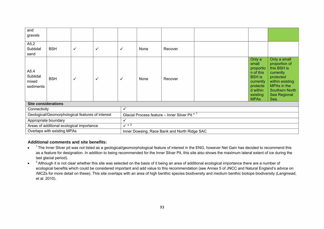
93
and gravels
A5.2 Subtidal sand
BSH None Recover
A5.4 Subtidal mixed sediments
BSH None Recover
Only a small proportion of this BSH is currently protected within existing MPAs
Only a small proportion of this BSH is currently protected within existing MPAs in the Southern North Sea Regional Sea.
Site considerations Connectivity Geological/Geomorphological features of interest Glacial Process feature – Inner Silver Pit * 1 Appropriate boundary Areas of additional ecological importance * 2 Overlaps with existing MPAs Inner Dowsing, Race Bank and North Ridge SAC Additional comments and site benefits: • 1 The Inner Silver pit was not listed as a geological/geomorphological feature of interest in the ENG, however Net Gain has decided to recommend this
as a feature for designation. In addition to being recommended for the Inner Silver Pit, this site also shows the maximum lateral extent of ice during the last glacial period).
• 2 Although it is not clear whether this site was selected on the basis of it being an area of additional ecological importance there are a number of ecological benefits which could be considered important and add value to this recommendation (see Annex 5 of JNCC and Natural England’s advice on rMCZs for more detail on these). This site overlaps with an area of high benthic species biodiversity and medium benthic biotope biodiversity (Langmead, et al. 2010).
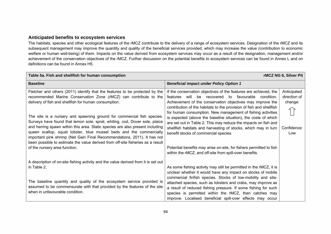
94
Anticipated benefits to ecosystem services The habitats, species and other ecological features of the rMCZ contribute to the delivery of a range of ecosystem services. Designation of the rMCZ and its subsequent management may improve the quantity and quality of the beneficial services provided, which may increase the value (contribution to economic welfare or human well-being) of them. Impacts on the value derived from ecosystem services may occur as a result of the designation, management and/or achievement of the conservation objectives of the rMCZ. Further discussion on the potential benefits to ecosystem services can be found in Annex L and on definitions can be found in Annex H5. Table 5a. Fish and shellfish for human consumption rMCZ NG 6, Silver Pit
Baseline Beneficial impact under Policy Option 1
Fletcher and others (2011) identify that the features to be protected by the recommended Marine Conservation Zone (rMCZ) can contribute to the delivery of fish and shellfish for human consumption.
The site is a nursery and spawning ground for commercial fish species. Surveys have found that lemon sole, sprat, whiting, cod, Dover sole, plaice and herring spawn within this area. Static species are also present including queen scallop, squat lobster, blue mussel beds and the commercially important pink shrimp (Net Gain Final Recommendations, 2011). It has not been possible to estimate the value derived from off-site fisheries as a result of the nursery area function.
A description of on-site fishing activity and the value derived from it is set out in Table 2.
The baseline quantity and quality of the ecosystem service provided is assumed to be commensurate with that provided by the features of the site when in unfavourable condition.
If the conservation objectives of the features are achieved, the features will be recovered to favourable condition. Achievement of the conservation objectives may improve the contribution of the habitats to the provision of fish and shellfish for human consumption. New management of fishing activities is expected (above the baseline situation), the costs of which are set out in Table 2. This may reduce the impacts on fish and shellfish habitats and harvesting of stocks, which may in turn benefit stocks of commercial species.
Potential benefits may arise on-site, for fishers permitted to fish within the rMCZ, and off-site from spill-over benefits.
As some fishing activity may still be permitted in the rMCZ, it is unclear whether it would have any impact on stocks of mobile commercial finfish species. Stocks of low-mobility and site-attached species, such as lobsters and crabs, may improve as a result of reduced fishing pressure. If some fishing for such species is permitted within the rMCZ, then catches may improve. Localised beneficial spill-over effects may occur
Anticipated direction of
change:
Confidence: Low
95
Table 5a. Fish and shellfish for human consumption rMCZ NG 6, Silver Pit
around the rMCZ. If rMCZ management involves reduced mobile gear effort, but no reductions in static gear fishing, this may reduce gear conflict between mobile and static gear fishers. Reduced gear conflict may reduce the cost of fishing in the rMCZ for static gear fishers.
The recovery of the subtidal sand, subtidal mixed sediments and subtidal sands and gravels to favourable condition may improve its functioning as a nursery area, potentially benefiting fisheries exploited within and outside the rMCZ.
The potential effects described here do not include the negative impacts of the additional fisheries management on fish and shellfish provision and off-site impacts of displaced effort.
Table 5b. Recreation rMCZ NG 6, Silver Pit
Baseline Beneficial impact under Policy Option 1
Angling: Fletcher and others (2011) identify that the features to be protected by the recommended Marine Conservation Zone (rMCZ) can contribute to the delivery of fish and shellfish for human consumption and recreation services.
The baseline quantity and quality of the ecosystem service provided is assumed to be commensurate with that provided by the features of the site when in unfavourable condition. The intensity of sea angling within the site is
If the conservation objectives of the features are achieved, the features will be recovered to favourable condition.
It is unclear whether any benefits to fish populations would arise as a result of reduced fishing mortality due to management of commercial fishing. The recovery of the subtidal sand, subtidal mixed sediments and subtidal sand and gravel to favourable condition may improve functioning as a
Anticipated direction of
change:
Confidence: Low
96
Table 5b. Recreation rMCZ NG 6, Silver Pit
unknown.
The site is a nursery and spawning ground for commercial fish species. Surveys have found that lemon sole, sprat, whiting, cod, Dover sole, plaice and herring spawn within this area (Net Gain Final Recommendations, 2011). It has not been possible to estimate the value derived from angling on-site or the proportion of the value derived from angling off-site which result from the nursery and spawning area.
nursery area, potentially benefiting fisheries exploited within and outside the rMCZ (see Table 4a for further details).
As no additional management of angling is expected, anglers will be able to benefit from any on-site and off-site beneficial effects. If the rMCZ results in an increase in the size and diversity of species caught, then this is expected to increase the value derived by anglers.
The designation may lead to an increase in angling visits to the site, which may benefit the local economy. This increase is likely to arise from a change in anglers’ preferred angling locations rather than an increase in days spent angling or the number of anglers.
Diving: Diving is not known to take place in the rMCZ. N/A
N/A
Wildlife watching: Fletcher and others (2011) identify that the features to be protected by the rMCZ can contribute to the delivery of recreation and tourism services.
The extent of wildlife watching within rMCZ NG 6 is unknown; the site has the potential to be utilised by many sea bird species for foraging and resting, including puffin, common guillemot, black-legged kittiwake, fulmar and northern gannet, along with several migratory species, including shearwater, petrel and skua. The site is within the foraging range for species utilising existing protected areas which are popular for wildlife watching, including Flamborough Head and Bempton Cliffs and Spurn Point (Net Gain Final
If the conservation objectives of the features are achieved, the features will be recovered to favourable condition.
As the site is offshore, with limited wildlife watching taking place within it, benefits are expected to be minimal, but the recovery of the features within the site is expected to support foraging bird populations enjoyed by wildlife watchers in nearby protected areas.
Anticipated direction of
change:
Confidence: Moderate
97
Table 5b. Recreation rMCZ NG 6, Silver Pit
Recommendations, 2011).
The baseline quantity and quality of the ecosystem service provided is assumed to be commensurate with that provided by the features of the site when not in favourable condition.
Table 5c. Research and education rMCZ NG 6, Silver Pit
Baseline Beneficial impact under Policy Option 1
Research: Fletcher and others (2011) identify that the features to be protected by the recommended Marine Conservation Zone (rMCZ) can contribute to the delivery of research services.
The southern area of the site overlaps with the Inner Dowsing, Race Bank and North Ridge Special Area of Conservation (a total of 11.02km2 overlap) and, as such, ecological monitoring activities are ongoing. It has not been possible to estimate the value derived from research activities associated with the rMCZ.
Monitoring of the rMCZ will help to inform understanding of how the marine environment is changing and is impacted on by anthropogenic pressures and management interventions. Other research benefits are unknown.
Anticipated direction of
change:
Confidence: High
98
Table 5c. Research and education rMCZ NG 6, Silver Pit
Education: Education is not known to take place in the rMCZ. As the rMCZ is more than 12nm offshore and therefore relatively inaccessible, no benefits are likely to arise from direct use of the site for education.
Non-visitors may benefit if the rMCZ contributes to wider provision of education (e.g. television programmes, articles in magazines and newspapers, and educational resources developed for use in schools).
Anticipated direction of
change:
Confidence: Low
Table 5d. Regulating services rMCZ NG 6, Silver Pit
Baseline Beneficial impact under Policy Option 1
Regulation of pollution: The features of the site are not thought to contribute to the bioremediation of waste and sequestration of carbon.
Environmental resilience: The features of the site contribute to the resilience and continued regeneration of marine ecosystems. It has not been possible to estimate the value derived from environmental resilience in the rMCZ.
Natural hazard protection: As the site is offshore, its features are not thought to contribute to the delivery of this service.
(Fletcher and others, 2011)
If the conservation objectives of the features are achieved, the features will be recovered to favourable condition.
A potential reduction in the use of bottom-towed fishing gear may increase site benthic biodiversity and biomass, improving the regulating capacity of the site habitats.
Anticipated direction of
change:
Confidence: Low
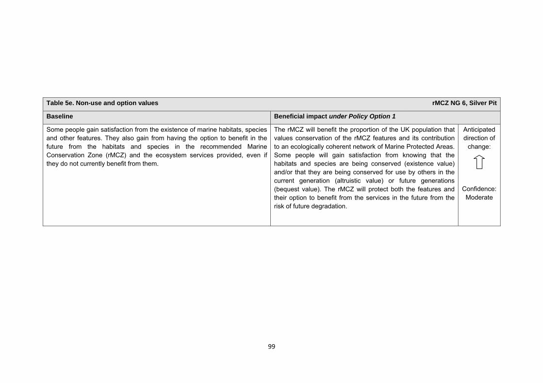
99
Table 5e. Non-use and option values rMCZ NG 6, Silver Pit
Baseline Beneficial impact under Policy Option 1
Some people gain satisfaction from the existence of marine habitats, species and other features. They also gain from having the option to benefit in the future from the habitats and species in the recommended Marine Conservation Zone (rMCZ) and the ecosystem services provided, even if they do not currently benefit from them.
The rMCZ will benefit the proportion of the UK population that values conservation of the rMCZ features and its contribution to an ecologically coherent network of Marine Protected Areas. Some people will gain satisfaction from knowing that the habitats and species are being conserved (existence value) and/or that they are being conserved for use by others in the current generation (altruistic value) or future generations (bequest value). The rMCZ will protect both the features and their option to benefit from the services in the future from the risk of future degradation.
Anticipated direction of
change:
Confidence: Moderate
100
rMCZ NG 7, Markham’s Triangle
Site area (km2): 200.13
• This site has been proposed for designation under Policy Option 1 only.
Table 1. Conservation impacts rMCZ NG 7, Markham’s Triangle
1a. Ecological description
Two broad-scale habitats are recommended for designation: subtidal coarse sediment and subtidal sand. The flora and fauna associated with these habitats is dependent upon the level of local environmental stress. Areas of strong tidal action have little flora, so the resident species tend to be burrowers such as polychaetes, bivalves and amphipods. This abundance of burrowing species provides ideal prey for mobile predators such as crab, seal and dolphin (the latter two are listed in Annex 2of the EC Habitats Directive). Shallow sandy sediments are also an ideal habitat for sand eel, which form an important diet constituent for marine mammals and sea birds.
Although relatively little is known directly about the flora and fauna of recommended Marine Conservation Zone (rMCZ) NG 7, it shares boundaries with the Outer Silver Pit and the Cleaver Bank. The Dutch Cleaver Bank Special Area of Conservation is being designated for the protection of harbour porpoise, grey seal and common seal (all listed in Annex 2 of the EC Habitats Directive), and it is very likely that these species will be present within rMCZ NG 7 given the similarities of coarse sediment habitats. Cleaver Bank has some of the highest macrobenthos diversity in the Dutch Exclusive Economic Zone (EEZ), with 44% of the species being endemic to this area. To the north of the site lies the Outer Silver Pit (North Sea glacial tunnel valley feature), which supports communities of crustaceans, marine mammals, fish, algae and other species. The Outer Silver Pit provides some of the richest fishing grounds in the North Sea because of the productivity associated with the geological feature and water depths exceeding 80 metres.
(Net Gain, Final Site Recommendations Submission, 2011)
1b. Baseline condition of MCZ features and impact of the rMCZ
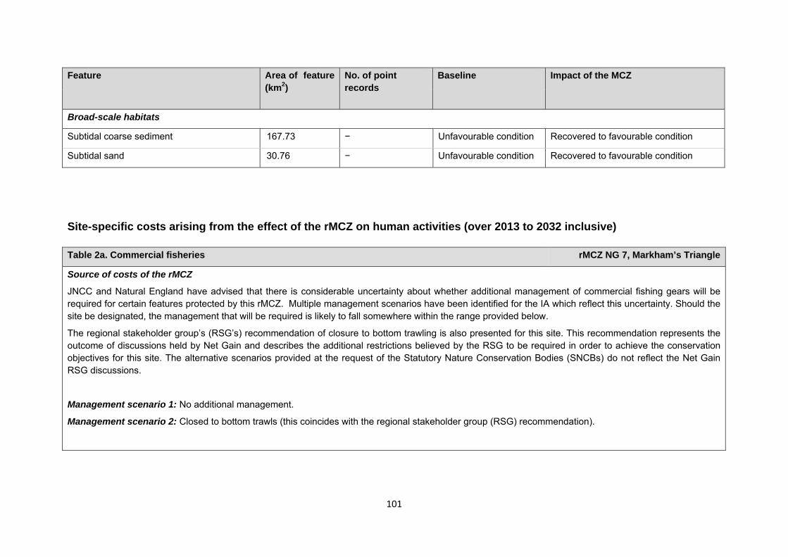
101
Site-specific costs arising from the effect of the rMCZ on human activities (over 2013 to 2032 inclusive) Table 2a. Commercial fisheries rMCZ NG 7, Markham’s Triangle
Source of costs of the rMCZ
JNCC and Natural England have advised that there is considerable uncertainty about whether additional management of commercial fishing gears will be required for certain features protected by this rMCZ. Multiple management scenarios have been identified for the IA which reflect this uncertainty. Should the site be designated, the management that will be required is likely to fall somewhere within the range provided below.
The regional stakeholder group’s (RSG’s) recommendation of closure to bottom trawling is also presented for this site. This recommendation represents the outcome of discussions held by Net Gain and describes the additional restrictions believed by the RSG to be required in order to achieve the conservation objectives for this site. The alternative scenarios provided at the request of the Statutory Nature Conservation Bodies (SNCBs) do not reflect the Net Gain RSG discussions.
Management scenario 1: No additional management.
Management scenario 2: Closed to bottom trawls (this coincides with the regional stakeholder group (RSG) recommendation).
Feature Area of feature (km2)
No. of point records
Baseline Impact of the MCZ
Broad-scale habitats
Subtidal coarse sediment 167.73 − Unfavourable condition Recovered to favourable condition
Subtidal sand 30.76 − Unfavourable condition Recovered to favourable condition
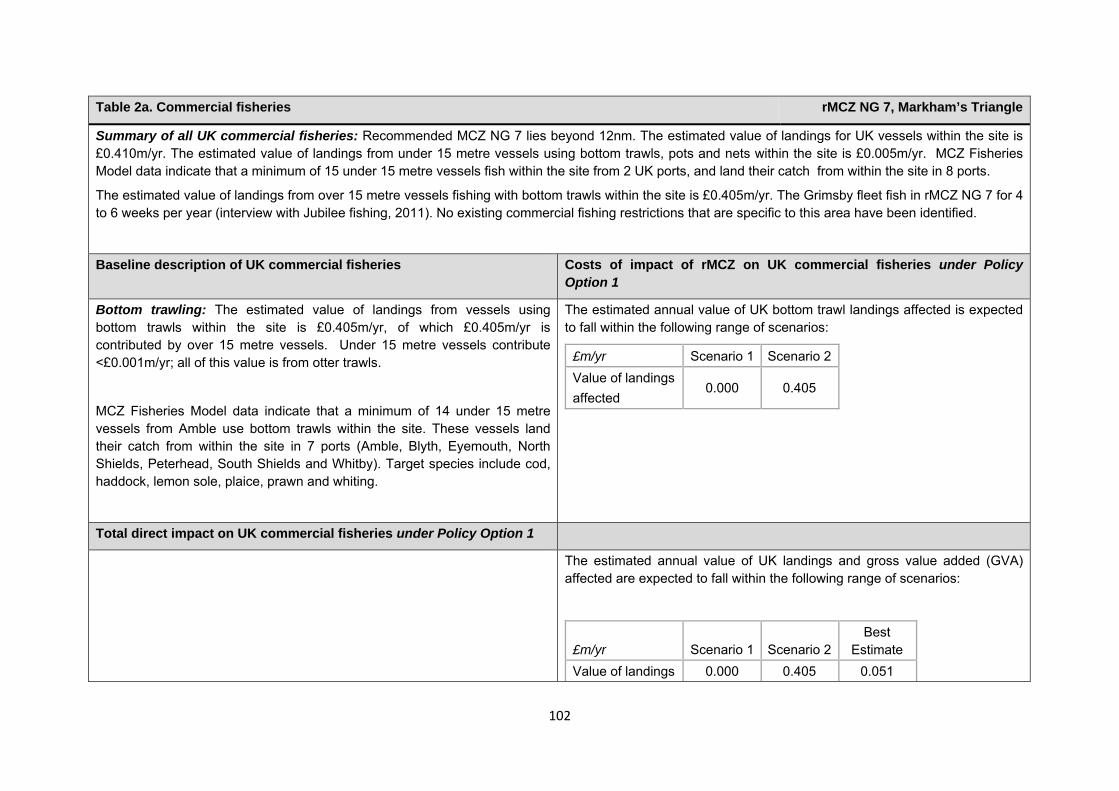
102
Table 2a. Commercial fisheries rMCZ NG 7, Markham’s Triangle
Summary of all UK commercial fisheries: Recommended MCZ NG 7 lies beyond 12nm. The estimated value of landings for UK vessels within the site is £0.410m/yr. The estimated value of landings from under 15 metre vessels using bottom trawls, pots and nets within the site is £0.005m/yr. MCZ Fisheries Model data indicate that a minimum of 15 under 15 metre vessels fish within the site from 2 UK ports, and land their catch from within the site in 8 ports.
The estimated value of landings from over 15 metre vessels fishing with bottom trawls within the site is £0.405m/yr. The Grimsby fleet fish in rMCZ NG 7 for 4 to 6 weeks per year (interview with Jubilee fishing, 2011). No existing commercial fishing restrictions that are specific to this area have been identified.
Baseline description of UK commercial fisheries Costs of impact of rMCZ on UK commercial fisheries under Policy Option 1
Bottom trawling: The estimated value of landings from vessels using bottom trawls within the site is £0.405m/yr, of which £0.405m/yr is contributed by over 15 metre vessels. Under 15 metre vessels contribute <£0.001m/yr; all of this value is from otter trawls.
MCZ Fisheries Model data indicate that a minimum of 14 under 15 metre vessels from Amble use bottom trawls within the site. These vessels land their catch from within the site in 7 ports (Amble, Blyth, Eyemouth, North Shields, Peterhead, South Shields and Whitby). Target species include cod, haddock, lemon sole, plaice, prawn and whiting.
The estimated annual value of UK bottom trawl landings affected is expected to fall within the following range of scenarios:
£m/yr Scenario 1 Scenario 2Value of landings affected
0.000 0.405
Total direct impact on UK commercial fisheries under Policy Option 1
The estimated annual value of UK landings and gross value added (GVA) affected are expected to fall within the following range of scenarios:
£m/yr Scenario 1 Scenario 2Best
Estimate Value of landings 0.000 0.405 0.051
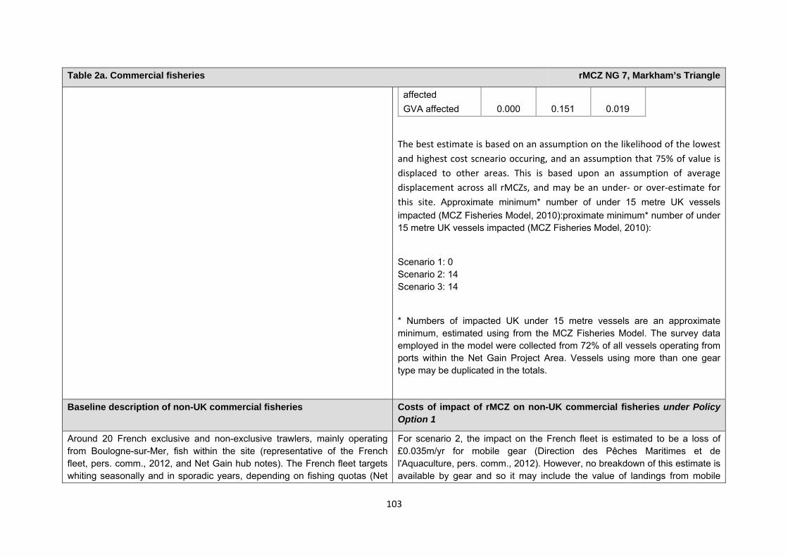
103
Table 2a. Commercial fisheries rMCZ NG 7, Markham’s Triangle
The best estimate is based on an assumption on the likelihood of the lowest and highest cost scneario occuring, and an assumption that 75% of value is displaced to other areas. This is based upon an assumption of average displacement across all rMCZs, and may be an under‐ or over‐estimate for this site. Approximate minimum* number of under 15 metre UK vessels impacted (MCZ Fisheries Model, 2010):proximate minimum* number of under 15 metre UK vessels impacted (MCZ Fisheries Model, 2010):
Scenario 1: 0 Scenario 2: 14 Scenario 3: 14
* Numbers of impacted UK under 15 metre vessels are an approximate minimum, estimated using from the MCZ Fisheries Model. The survey data employed in the model were collected from 72% of all vessels operating from ports within the Net Gain Project Area. Vessels using more than one gear type may be duplicated in the totals.
affected GVA affected 0.000 0.151 0.019
Baseline description of non-UK commercial fisheries Costs of impact of rMCZ on non-UK commercial fisheries under Policy Option 1
Around 20 French exclusive and non-exclusive trawlers, mainly operating from Boulogne-sur-Mer, fish within the site (representative of the French fleet, pers. comm., 2012, and Net Gain hub notes). The French fleet targets whiting seasonally and in sporadic years, depending on fishing quotas (Net
For scenario 2, the impact on the French fleet is estimated to be a loss of £0.035m/yr for mobile gear (Direction des Pêches Maritimes et de l'Aquaculture, pers. comm., 2012). However, no breakdown of this estimate is available by gear and so it may include the value of landings from mobile
104
Table 2a. Commercial fisheries rMCZ NG 7, Markham’s Triangle
Gain, Large Group Meeting, 2011). The Dutch and Belgian fleets also operate and up to 10 Danish vessels seine net in rMCZ NG 7 (Net Gain, regional hub meeting, 2011). The Danish fleet also fishes for sprat using mid-water trawls and the site is a sand eel fishery (JNCC questionnaire with non-UK fleets – Denmark, 2011). Estimated average value of landings for French vessels using mobile gears (active and seines) within the site between 2008 and 2009 was £0.035m/yr (Direction des Pêches Maritimes et de l’ Aquaculture, pers. comm., 2012).
gear other than bottom trawling which would not be affected. Other, stakeholders have not provided a site-specific description of impact, but it can be assumed that non-UK fleets will be impacted upon by fisheries management within this site. Regional qualitative impacts to non-UK fleets are outlined in Annex J3d.
Table 2c. Renewable energy rMCZ NG 7, Markham’s Triangle
Table 2b. National defence rMCZ NG 7, Markham’s Triangle
Source of costs of the rMCZ:
Management scenario 1: Mitigation of impacts of Ministry of Defence activities on features protected by the suite of rMCZs will be provided by additional planning considerations during operations and training. It is not known whether mitigation will be required for features protected by this site. The Ministry of Defence will also incur costs in revising environmental tools and charts to include MCZs.
Baseline description of activity Costs of impact of rMCZ on the sector under Policy Option 1
The Ministry of Defence is known to make use of the site as a military practice area, both by the Royal Air Force and for submarine exercises involving surface explosions.
It is not known whether this rMCZ will impact on the Ministry of Defence’s use of the site. Impacts of rMCZs on the Ministry of Defence’s activities are assessed in the Evidence Base and Annex N9.

105
Table 2c. Renewable energy rMCZ NG 7, Markham’s Triangle
Source of costs of the rMCZ
Management scenario 1: Increase in costs of assessing environmental impacts for licence applications (it is not anticipated that any additional mitigation of impacts on features protected by the MCZ will be needed relative to the mitigation provided in the baseline).
Management scenario 2: Increase in costs of assessing environmental impacts for licence applications and increase in cable protection installation costs for power export cables and inter-array cables (relative to the mitigation provided in the baseline).
Baseline description of activity Costs of impact of rMCZ on the sector under Policy Option 1
The Hornsea Round 3 wind farm is in the pre-planning stage; rMCZ NG 7 lies wholly within the Hornsea Round 3 zone. Construction is planned for 2015 and generation from 2016 (subject to the necessary planning consent). Once operational, 668 turbines will generate 4,000MW (The Crown Estate and the developer, pers. comm., 2011).
The estimated cost to renewable energy developers operating in this rMCZ is expected to fall within the following range of scenarios:
£m/yr Scenario 1 Scenario 2 Cost to the operator Omitted – not publicly available
at the request of the developer of the Hornsea windfarm GVA affected
Scenario 1: The licence application for the Hornsea wind farm and will need to consider the potential effects of the development on achieving the conservation objectives of the rMCZ’s features. This is expected to result in an additional one-off cost for extra consultant/staff time. At the request of the developer details of the additional costs are not provided here.
Scenario 2: In addition to the increased costs for assessment set out under scenario 1, under scenario 2 costs of additional mitigation are anticipated. This additional mitigation entails use of alternative cable protection for export cables and inter-array cables that have not yet been consented. No inter-array cabling is anticipated to be required in this rMCZ. These costs are included in scenario 2 to reflect uncertainty over whether this additional mitigation will be required. However, JNCC and Natural England (pers.
106
Table 2c. Renewable energy rMCZ NG 7, Markham’s Triangle
comm., 2012) state that the likelihood of this cost occurring is very low. Further details are provided in Annex H14. At the request of the developer details of the additional costs are not provided here.
The impacts that are assessed in both scenarios are based on JNCC and Natural England’s advice on the mitigation that could be required.
Comments from the developer of the Hornsea wind farm (personal communication, 2011): The Hornsea wind farm developer has concerns that there is a low risk that additional costs may be incurred for the EIA in order to cover any additional analyses, monitoring, consultation and assessment needed. The developer is concerned that it may be required to use specialised vessels in the construction process and to spend additional time and money to demonstrate that the preferred cable installation method and protection method are not adversely affecting protected features. Should additional restrictions be placed on cable installation and maintenance methods in order to ensure no adverse effect on the protected features, it may be that the preferred and quickest methods cannot be used. The developer is concerned that delays in cable installation, in constructing the windfarm, energising it and any repairs needed could arise as a result of this. Should mitigation be such that turbines cannot be located in the rMCZ, there would be a loss of the developable area and loss of revenue from electricity development (the developer, pers. comm., 2011). Estimates of the costs are not provided here at the request of the developer.
Table 2d. Other impacts that are assessed for the suite of MCZs and not for this site alone rMCZ NG 7, Markham’s Triangle
107
Human activities in the site that are not negatively affected by the rMCZ (over 2013 to 2032 inclusive)
Contribution to Ecological Network Guidance Table 4. An overview of features proposed for designation and how these contribute to the ENG guidelines for the regional MCZ project area and at a wider scale6
= ENG guideline is achieved and X = ENG guideline is not achieved. Green cells represent key considerations and any greyed-out rows indicate where SNCBs do not agree with a feature being proposed for designation. Recommended conservation objectives in italics indicate where SNCBs do not agree with the conservation objective recommended by the regional MCZ project (see Section 4.2). Where an asterisk (*) has been given in the table, more detail is provided in the narrative.
rMCZ NG 7, Markham’s Triangle
6 copied from the JNCC and Natural England’s advice to Defra on rMCZs
Cables (interconnectors and telecom cables) Future interconnectors and telecom cables may pass through the rMCZ. Impacts of rMCZs on future interconnectors and telecom cables are assessed in the Evidence Base, Annex H3 and Annex N3 (they are not assessed for this site alone). Oil and gas related activities (including carbon capture and storage) This rMCZ overlaps with an area that has potential for future oil and gas exploration and production (it overlaps licenced blocks in the 26th or 27th Seaward Licensing Rounds). However, the area is not necessarily viable to develop. Impacts of rMCZs on the oil and gas related activities are assessed in the Evidence Base, Annex H11 and Annex N10 (they are not assessed for this site alone).
Table 3. Human activities in the site that are not negatively affected by the rMCZ under Policy Option 1
(existing activities at their current levels and future proposals known to the regional MCZ projects)
rMCZ NG 7, Markham’s Triangle
Cables (existing interconnectors and telecom cables), commercial fisheries (excluding bottom trawls) and shipping (transit of vessels only).
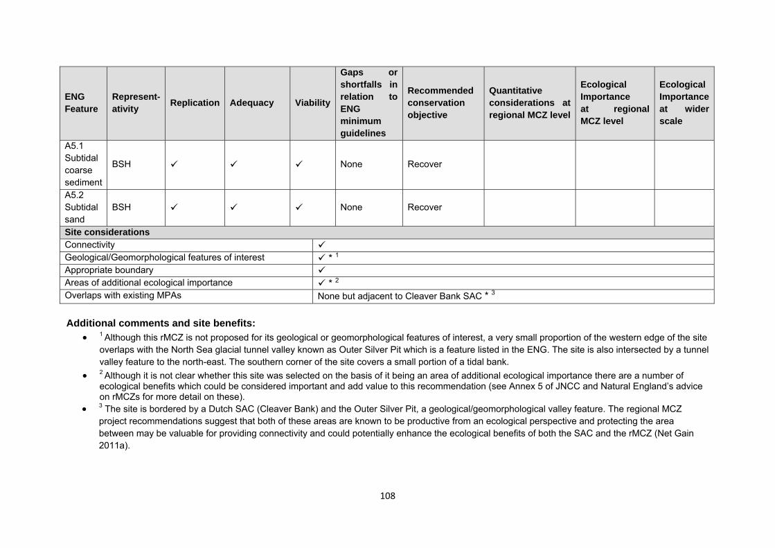
108
ENG Feature
Represent-ativity Replication Adequacy Viability
Gaps or shortfalls in relation to ENG minimum guidelines
Recommended conservation objective
Quantitative considerations at regional MCZ level
Ecological Importance at regional MCZ level
Ecological Importance at wider scale
A5.1 Subtidal coarse sediment
BSH None Recover
A5.2 Subtidal sand
BSH None Recover
Site considerations Connectivity Geological/Geomorphological features of interest * 1 Appropriate boundary Areas of additional ecological importance * 2 Overlaps with existing MPAs None but adjacent to Cleaver Bank SAC * 3 Additional comments and site benefits:
• 1 Although this rMCZ is not proposed for its geological or geomorphological features of interest, a very small proportion of the western edge of the site overlaps with the North Sea glacial tunnel valley known as Outer Silver Pit which is a feature listed in the ENG. The site is also intersected by a tunnel valley feature to the north-east. The southern corner of the site covers a small portion of a tidal bank.
• 2 Although it is not clear whether this site was selected on the basis of it being an area of additional ecological importance there are a number of ecological benefits which could be considered important and add value to this recommendation (see Annex 5 of JNCC and Natural England’s advice on rMCZs for more detail on these).
• 3 The site is bordered by a Dutch SAC (Cleaver Bank) and the Outer Silver Pit, a geological/geomorphological valley feature. The regional MCZ project recommendations suggest that both of these areas are known to be productive from an ecological perspective and protecting the area between may be valuable for providing connectivity and could potentially enhance the ecological benefits of both the SAC and the rMCZ (Net Gain 2011a).
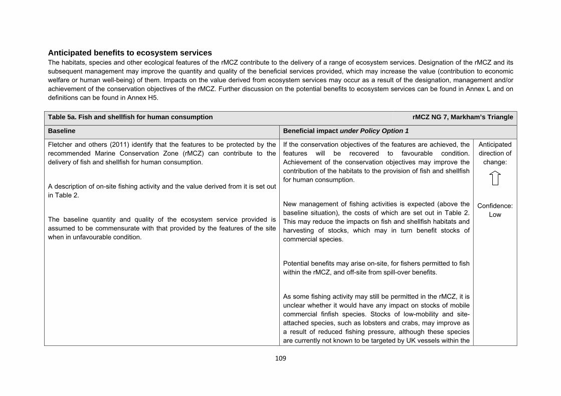
109
Anticipated benefits to ecosystem services The habitats, species and other ecological features of the rMCZ contribute to the delivery of a range of ecosystem services. Designation of the rMCZ and its subsequent management may improve the quantity and quality of the beneficial services provided, which may increase the value (contribution to economic welfare or human well-being) of them. Impacts on the value derived from ecosystem services may occur as a result of the designation, management and/or achievement of the conservation objectives of the rMCZ. Further discussion on the potential benefits to ecosystem services can be found in Annex L and on definitions can be found in Annex H5. Table 5a. Fish and shellfish for human consumption rMCZ NG 7, Markham’s Triangle
Baseline Beneficial impact under Policy Option 1
Fletcher and others (2011) identify that the features to be protected by the recommended Marine Conservation Zone (rMCZ) can contribute to the delivery of fish and shellfish for human consumption.
A description of on-site fishing activity and the value derived from it is set out in Table 2.
The baseline quantity and quality of the ecosystem service provided is assumed to be commensurate with that provided by the features of the site when in unfavourable condition.
If the conservation objectives of the features are achieved, the features will be recovered to favourable condition. Achievement of the conservation objectives may improve the contribution of the habitats to the provision of fish and shellfish for human consumption.
New management of fishing activities is expected (above the baseline situation), the costs of which are set out in Table 2. This may reduce the impacts on fish and shellfish habitats and harvesting of stocks, which may in turn benefit stocks of commercial species.
Potential benefits may arise on-site, for fishers permitted to fish within the rMCZ, and off-site from spill-over benefits.
As some fishing activity may still be permitted in the rMCZ, it is unclear whether it would have any impact on stocks of mobile commercial finfish species. Stocks of low-mobility and site-attached species, such as lobsters and crabs, may improve as a result of reduced fishing pressure, although these species are currently not known to be targeted by UK vessels within the
Anticipated direction of
change:
Confidence: Low
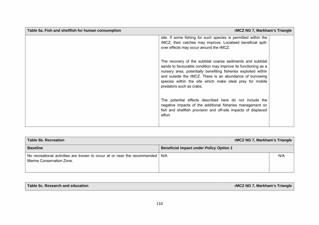
110
Table 5a. Fish and shellfish for human consumption rMCZ NG 7, Markham’s Triangle
site. If some fishing for such species is permitted within the rMCZ, then catches may improve. Localised beneficial spill-over effects may occur around the rMCZ.
The recovery of the subtidal coarse sediments and subtidal sands to favourable condition may improve its functioning as a nursery area, potentially benefiting fisheries exploited within and outside the rMCZ. There is an abundance of burrowing species within the site which make ideal prey for mobile predators such as crabs.
The potential effects described here do not include the negative impacts of the additional fisheries management on fish and shellfish provision and off-site impacts of displaced effort.
Table 5b. Recreation rMCZ NG 7, Markham’s Triangle
Baseline Beneficial impact under Policy Option 1
No recreational activities are known to occur at or near the recommended Marine Conservation Zone.
N/A N/A
Table 5c. Research and education rMCZ NG 7, Markham’s Triangle
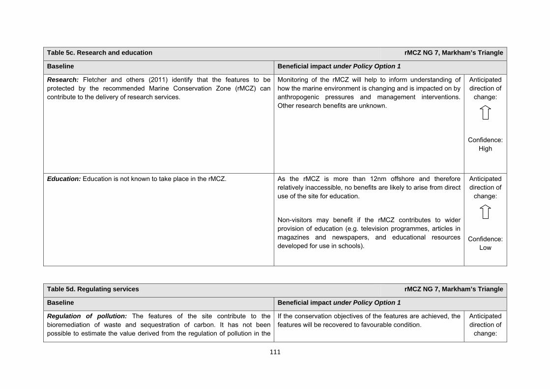
111
Table 5c. Research and education rMCZ NG 7, Markham’s Triangle
Baseline Beneficial impact under Policy Option 1
Research: Fletcher and others (2011) identify that the features to be protected by the recommended Marine Conservation Zone (rMCZ) can contribute to the delivery of research services.
Monitoring of the rMCZ will help to inform understanding of how the marine environment is changing and is impacted on by anthropogenic pressures and management interventions. Other research benefits are unknown.
Anticipated direction of
change:
Confidence: High
Education: Education is not known to take place in the rMCZ. As the rMCZ is more than 12nm offshore and therefore relatively inaccessible, no benefits are likely to arise from direct use of the site for education.
Non-visitors may benefit if the rMCZ contributes to wider provision of education (e.g. television programmes, articles in magazines and newspapers, and educational resources developed for use in schools).
Anticipated direction of
change:
Confidence: Low
Table 5d. Regulating services rMCZ NG 7, Markham’s Triangle
Baseline Beneficial impact under Policy Option 1
Regulation of pollution: The features of the site contribute to the bioremediation of waste and sequestration of carbon. It has not been possible to estimate the value derived from the regulation of pollution in the
If the conservation objectives of the features are achieved, the features will be recovered to favourable condition.
Anticipated direction of
change:
112
Table 5d. Regulating services rMCZ NG 7, Markham’s Triangle
rMCZ.
Environmental resilience: The features of the site contribute to the resilience and continued regeneration of marine ecosystems. It has not been possible to estimate the value derived from the environmental resilience in the rMCZ.
Natural hazard protection: As the site is offshore, its features are not thought to contribute to the delivery of this service.
(Fletcher and others, 2011)
A potential reduction in the use of bottom-towed fishing gear may increase site benthic biodiversity and biomass, improving the regulating capacity of the site habitats.
Confidence: Low
Table 5e. Non-use and option values rMCZ NG 7, Markham’s Triangle
Baseline Beneficial impact under Policy Option 1
Some people gain satisfaction from the existence of marine habitats, species and other features. They also gain from having the option to benefit in the future from the habitats and species in the recommended Marine Conservation Zone (rMCZ) and the ecosystem services provided, even if they do not currently benefit from them.
The rMCZ will benefit the proportion of the UK population that values conservation of the rMCZ features and its contribution to an ecologically coherent network of Marine Protected Areas. Some people will gain satisfaction from knowing that the habitats and species are being conserved (existence value) and/or that they are being conserved for use by others in the current generation (altruistic value) or future generations (bequest value). The rMCZ will protect both the features and their option to benefit from the services in the future from the risk of future degradation.
Anticipated direction of
change:
Confidence: Moderate
113
rMCZ NG 8, Holderness Inshore
Site area (km2): 307.14
• This site has been proposed for designation under Policy Option 1 only.
Table 1. Conservation impacts rMCZ NG 8, Holderness Inshore
1a. Ecological description
Recommended Marine Conservation Zone (rMCZ) NG 8 is located on the Holderness coast, north of the Humber Estuary, and includes the offshore element of the Spurn Head geological feature, known as The Binks. The Holderness coast is an important geomorphological feature, with rapid coastal and sea bed erosion releasing large quantities of material, some of which is transported south into the Humber Estuary where it forms important mudflat habitats.The sea bed is composed of sediment, subtidal chalk (although only one point record has been identified), and cobble/stony habitats, which can support a diverse and dense coverage of epibiotic hydroid/bryozoan turf, filamentous red algae, sponges and other encrusting fauna. Recommended MCZ NG 8 also contains several areas of Ross worm Sabellaria spinulosa and honeycomb worm Sabellaria alveolata; honeycomb worm reefs are most abundant on the south and west coasts with only isolated records from the east coast. Ross worm and honeycomb worm reefs are listed under Annex 1 of the EC Habitats Directive and as such are UK Biodiversity Action Plan priority habitats.
The site encompasses an Inshore Fisheries and Conservation Authorities no-trawl zone and would be likely to provide a good example of low impacted sea bed. A nationally important shellfishery operates within the site, with abundant crustaceans: lobster, edible crab and velvet swimming crab are abundant over much of the area. Several fish species have been recorded within rMCZ NG 8 including sand eel, dab, goby, pipefish, dragonet, wrasse and small numbers of elasmobranch. Whiting, poor cod, saithe and pouting are associated with mixed sediment habitats. High numbers of small or juvenile gadoid fish species including codling are also present, particularly in areas with red algae. The adjacent Humber Estuary is recognised as an important nursery area for several fish species. As such, rMCZ NG 8 may be used as a migratory path in progression of life stages in young gadoids and may account for numbers of codling in
114
this area.
The southern end of rMCZ NG 8 includes small portions of the Humber Estuary Special Area of Conservation (SAC), Special Protection Area (SPA) and Site of Special Scientific Interest (SSSI), Dimlington Cliffs SSSI, the Lagoons SSSI and the northern portion of the site includes Withow Gap, Skipsea SSSI. Recommended MCZ NG 8 is of particular importance as a foraging and roosting area for a variety of resident, wintering and passage migrant birds utilising the Lagoons SSSI, Spurn Head National Nature Reserve, and Flamborough Head and Bempton Cliffs SPA and Royal Society for the Protection of Birds reserve. Little tern (listed on Annex 1 of the EC Birds Directive) from the colony at the Lagoons SSSI are likely to use the site for the majority of their foraging and may also breed at the site. Other species that may be utilising the site include European shag and great cormorant (both listed on Annex 1 of the EC Birds Directive), Atlantic puffin, common guillemot, black-legged kittiwake, northern fulmar and northern gannet. This area is on an important migration route and consequently some birds stop in the area if bad weather blows them inshore, particularly birds en route to the Humber Estuary SPA including little tern, brent goose, golden plover, knot, dunlin, curlew and redshank (all of which are listed on Annex I or 2 of the Birds Directive)
(Net Gain, Final Site Recommendations Submission, 2011)
1b. Baseline condition of MCZ features and impact of the rMCZ
Feature Area of feature (km2) No. of point records
Baseline Impact of the MCZ
Broad-scale habitats
Intertidal mixed sediments 1.66 − Favourable condition Maintained at favourable condition
Subtidal coarse sediment 217.54 − Favourable condition Maintained at favourable condition
Subtidal sand 14.04 − Favourable condition Maintained at favourable condition
Habitats of conservation importance
Peat and clay exposures N/A 1 Favourable condition Maintained at favourable condition
Ross worm Sabellaria spinulosa reefs N/A 4 Favourable condition Maintained at favourable condition
Subtidal chalk 182.40 (modelled) 1 Favourable condition Maintained at favourable condition
115
Subtidal sands and gravels 98.43 (modelled) 101 Favourable condition Maintained at favourable condition
Geological and geomorphological features of interest
Spurn head (subtidal) 16.11 − Favourable condition Maintained at favourable condition
Site-specific costs arising from the effect of the rMCZ on human activities (over 2013 to 2032 inclusive) Table 2a. Archaeological heritage rMCZ NG 8, Holderness Inshore
Source of costs of the rMCZ
Management scenario 1: Increase in costs of assessing environmental impacts for future licence applications (it is not anticipated that any additional mitigation of impacts on features protected by the MCZ will be needed relative to the mitigation provided in the baseline). Archaeological excavations, surface recovery, intrusive and non-intrusive surveys, diver trails and visitors will be allowed.
Baseline description of activity Costs of impact of rMCZ on the sector under Policy Option 1
World War II anti-tank cubes are found at 15 separate locations in the site, as well as other defences such as pillboxes (verified via archived aerial photographs). There is also a railway dating back to 1915 that was later used in World War II (English Heritage, pers. comm., 2012). There are records of numerous shipwrecks, dating from 1703 to 1978 (English Heritage, pers. comm., 2012) and of other historic/archaeological interests in this rMCZ. Medieval settlement sites are also known to have existed in the area, as are neolithic occupation sites, and mesolithic flint collections have been discovered (English Heritage, pers. comm., 2012), however it has not been confirmed whether these are in the rMCZ. Coins such as denarii, which date as far back as 68−66BC, have been discovered as has prehistoric amber (English Heritage, pers. comm., 2012). Peat database records at this site include Spurn, Sand-le-Mere and Kilnsea Warren. It is understood that local archaeological groups are active in this area (English Heritage, pers. comm., 2012). English Heritage has indicated that this site is likely to be of interest for archaeological excavation in the future as it is relevant to its National
An extra cost would be incurred in the assessment of environmental impact made in support of any future licence applications for archaeological activities in the site. The likelihood of a future licence application being submitted is not known, so no overall cost to the sector of this rMCZ has been estimated. However, the additional cost in one licence application could be in the region of £500 to £10,000 depending on the size of the MCZ (English Heritage, pers. comm., 2011). No further impacts on activities related to archaeology are anticipated.
116
Table 2a. Archaeological heritage rMCZ NG 8, Holderness Inshore
Heritage Protection Plan (theme 3A1.2).
Table 2b. Flood and coastal erosion risk management (FCERM) rMCZ NG 8, Holderness Inshore
Source of costs of the rMCZ
Management scenarios 1 and 2: Increase in costs of assessing environmental impacts for future licence applications for maintenance work for the coastal defence scheme. These are assessed for the suite of sites in the Net Gain project area.
Baseline description of activity Costs of impact of rMCZ on the sector under Policy Option 1
The Environment Agency and Local Authorities submit applications for funding for a 5-year medium-term plan for Flood and coastal erosion risk management (FCERM) works. Funds are allocated annually, but are subject to change depending on changes in funding, responsibilities, structures etc.
There are currently 3 Local Authority projects associated with rMCZ NG 8 (Natural England and Environment Agency, pers. comm., 2012).
Management scenarios 1 and 2: As a result of the rMCZ, it is anticipated that additional costs will be incurred in assessing environmental impacts in support of future licence applications for Flood and Coastal Erosion Risk Management (FCERM) schemes. There are 3 Local Authority projects which may be impacted by the designation of rMCZ NG 8. The impacts of this are assessed qualitatively for the regional suite of sites and are summarised in Annex F.
£m/yr Scenarios 1 and 2Additional mitigation cost Unknown
Table 2c. National defence rMCZ NG 8, Holderness Inshore
117
Table 2c. National defence rMCZ NG 8, Holderness Inshore
Source of costs of the rMCZ
Management scenario 1: Mitigation of impacts of Ministry of Defence activities on features protected by the suite of rMCZs will be provided by additional planning considerations during operations and training. It is not known whether mitigation will be required for features protected by this site. The Ministry of Defence will also incur costs in revising environmental tools and charts to include MCZs.
Baseline description of activity Costs of impact of rMCZ on the sector under Policy Option 1
The Ministry of Defence is known to make use of the site as a military practice area, as a rifle range and for ordnance demolition in the intertidal area of the site.
It is not known whether this rMCZ will impact on the Ministry of Defence’s use of the site. Impacts of rMCZs on the Ministry of Defence’s activities are assessed in the Evidence Base and Annex N9.
Table 2d. Ports, harbours, shipping and disposal sites rMCZ NG 8, Holderness Inshore
Source of costs of the rMCZ
Management scenario 1: Not applicable to this site
Management scenario 2: Increase in costs of assessing environmental impacts for future licence applications. This applies for future licence applications disposal of dredged material within 5km of the rMCZ. The regional MCZ projects are not aware of activities related to ports, harbours and shipping for which additional mitigation of impacts on features protected by the MCZ will be needed relative to the mitigation provided in the baseline.
Baseline description of activity Costs of impact of rMCZ on the sector under Policy Option 1
Disposal sites: There are 2 disposal sites within 5km of the rMCZ (Bull Sand Fort and Humber 1). These sites are both within the Humber Estuary. The total average number of licence applications received for these disposal sites is 0.1 per year (based on the number of applications received for these disposal sites between 2001 and 2010 (Cefas, pers. comm., 2011).
Navigational dredging: Although the port of Immingham is more than 5km
Scenario 1: Not applicable to this site
£m/yr Scenario 1 Scenario 2 Cost to the operator N/A 0.003
118
Table 2d. Ports, harbours, shipping and disposal sites rMCZ NG 8, Holderness Inshore
from rMCZ NG 8, ABP has consent to undertake capital dredging works to improve access to Immingham Oil Terminal, including dredging at the mouth of the Humber Estuary on and offshore of Chequer Shoal Bar (ABPmer, 2009. Immingham Oil Terminal Approach Channel Dredging Environmental Statement). This will increase the extent of the maintained navigation channel at the mouth of the Humber Estuary and bring it to within 1.6km of the southern boundary of NG 8.There is likely to be a need to maintain navigable depth in this area through maintenance dredging.
Port development: None within 5km of this rMCZ.
Scenario 2: Future licence applications for disposal of material and navigational dredging within 5km of this rMCZ will need to consider the potential effects of the activity on the features protected by the rMCZ. Additional costs will be incurred as a result (a breakdown of these by activity is provided in Annex N.
Table 2e. Renewable energy rMCZ NG 8, Holderness Inshore
Source of costs of the rMCZ
Management scenario 1: Increase in costs of assessing environmental impacts for licence applications (it is not anticipated that any additional mitigation of impacts on features protected by the MCZ will be needed relative to the mitigation provided in the baseline).
Management scenario 2: Increase in costs of assessing environmental impacts for licence applications and increase in cable protection installation costs for power export cables and inter-array cables (relative to the mitigation provided in the baseline).
Baseline description of activity Costs of impact of rMCZ on the sector under Policy Option 1
Dogger Bank offshore wind farm: The exact locations of connections and the accompanying export cable routes for the Round 3 Dogger Bank wind farm are not yet known, but the developer estimates that there may be significant connections for this Round 3 development south of the Humber. If the connections are accepted by the developer, it is possible that routes for the related export cables would pass through rMCZ NG 8 (the exact location of all the connections and so the export cable route are not yet known). The past 3 Offshore Development Information Statement (ODIS) reports for 2009,
The estimated cost to renewable energy developers operating in this rMCZ is expected to fall within the following range of scenarios:
£m/yr Scenario 1 Scenario 2 Cost to the operator 0.002 0.752 GVA affected 0.002 0.752
119
Table 2e. Renewable energy rMCZ NG 8, Holderness Inshore
2010 and 2011 (National Grid 2009, 2010 and 2011) have suggested significant connections for wind farm south of the Humber Estuary. The wind farm has been divided into separate projects, each of which would generate 1 GW when operational. It is estimated that rMCZ NG 8 may impact on 6 projects, all of which are currently in the pre-planning stage, with construction planned from 2015 and generation from 2016 (subject to the necessary planning consent). To date, one connectivity point for one of the 6 projects has been assigned at Creyke Beck, near Cottingham in the East Riding of Yorkshire. A scoping envelope for the export cable route for this project has also been identified, which overlaps with rMCZ NG 8, however, the developer has indicated that this cable route is unlikely to pass through rMCZ NG 8 (Forewind, pers. comm., 2011).
Humber Gateway wind farm: The Humber Gateway Round 2 wind farm is in the pre-planning stage and has been granted an agreement for lease. The planned cable route passes through rMCZ NG 8 and will connect to the grid at Saltend, East Riding of Yorkshire. Once operational 77 turbines will generate up to 230MW (The Crown Estate and the developer, pers. comm., 2011).
Westermost Rough wind farm: The Westermost Rough Round 2 wind farm is in the pre-planning stage and has been granted an agreement for lease. The planned cable route passes through rMCZ NG 8, north of Tunstall, East Riding of Yorkshire. Construction is planned for 2014 and generation from 2015 (subject to the necessary planning consent). Once operational, between 30 and 80 turbines will generate between 240 and 245MW (The Crown Estate and DONG, pers. comm., 2011).
There is potential for future developments that generate electricity using the tidal energy resource in this rMCZ. However, it is unlikely, though still
Scenario 1: The licence application for the Dogger Bank offshore wind farm will need to consider the potential effects of the developments on achieving the conservation objectives of the rMCZ’s features. For the Dogger Bank offshore wind farm, this is expected to result in an additional one-off cost of £0.034m (£0.023m in 2013 and £0.011m in 2014). These costs arise for extra consultant/staff time. The licence applications for the Humber Gateway wind farm and the Westermost rough wind farm have already been consented, so no additional costs to the developers are incurred in this scenario.
Scenario 2: In addition to the increased costs for assessment set out under scenario 1, under scenario 2 costs of additional mitigation are anticipated. This additional mitigation entails use of alternative cable protection for export cables and inter-array cables that have not yet been consented. For the Dogger Bank offshore wind farm, this is expected to result in an additional one-off cost of £15.000m in 2015 (based on estimated additional cost of £1m/km of cable). The Humber Gateway wind farm and the Westermost Rough wind farm have already been consented. No inter-array cabling is anticipated to be required in this rMCZ. Therefore no costs are assumed to occur to the developers under this scenario. These costs are included in scenario 2 to reflect uncertainty over whether this additional mitigation will be required. However, JNCC and Natural England (pers. comm., 2012) state that the likelihood of this cost occurring is very low. Further details are provided in Annex H14.
The impacts that are assessed in both scenarios are based on JNCC and Natural England’s advice on the mitigation that could be required.
Comments from the developer of the Dogger Bank wind farm (personal
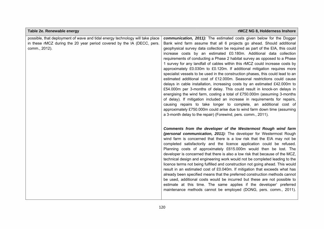
120
Table 2e. Renewable energy rMCZ NG 8, Holderness Inshore
possible, that deployment of wave and tidal energy technology will take place in these rMCZ during the 20 year period covered by the IA (DECC, pers. comm., 2012).
communication, 2011): The estimated costs given below for the Dogger Bank wind farm assume that all 6 projects go ahead. Should additional geophysical survey data collection be required as part of the EIA, this could increase costs by an estimated £0.180m. Additional data collection requirements of conducting a Phase 2 habitat survey as opposed to a Phase 1 survey for any landfall of cables within this rMCZ could increase costs by approximately £0.030m to £0.120m. If additional mitigation requires more specialist vessels to be used in the construction phases, this could lead to an estimated additional cost of £12.000m. Seasonal restrictions could cause delays in cable installation, increasing costs by an estimated £42.000m to £54.000m per 3-months of delay. This could result in knock-on delays in energising the wind farm, costing a total of £750.000m (assuming 3-months of delay). If mitigation included an increase in requirements for repairs, causing repairs to take longer to complete, an additional cost of approximately £750.000m could arise due to wind farm down time (assuming a 3-month delay to the repair) (Forewind, pers. comm., 2011).
Comments from the developer of the Westermost Rough wind farm (personal communication, 2011): The developer for Westermost Rough wind farm is concerned that there is a low risk that the EIA may not be completed satisfactorily and the licence application could be refused. Planning costs of approximately £615.000m would then be lost. The developer is concerned that there is also a low risk that because of the MCZ, technical design and engineering work would not be completed leading to the licence terms not being fulfilled and construction not going ahead. This would result in an estimated cost of £0.040m. If mitigation that exceeds what has already been specified means that the preferred construction methods cannot be used, additional costs would be incurred but these are not possible to estimate at this time. The same applies if the developer’ preferred maintenance methods cannot be employed (DONG, pers. comm., 2011).
121
Human activities in the site that are not negatively affected by the rMCZ (over 2013 to 2032 inclusive)
*The IA assumes that no additional mitigation of impacts of water abstraction, discharge or diffuse pollution will be required over and above that which will be provided to achieve the objectives of the Water Framework Directive through the River Basin Management Plan process (based on advice provided by Natural England, pers. comm., 2010). Contribution to Ecological Network Guidance
Table 2f. Other impacts that are assessed for the suite of MCZs and not for this site alone rMCZ NG 8, Holderness Inshore
Oil and gas related activities (including carbon capture and storage) This rMCZ overlaps with an area that has potential for future oil and gas exploration and production (it overlaps licenced blocks in the 26th or 27th Seaward Licensing Rounds). However, the area is not necessarily viable to develop. Impacts of rMCZs on the oil and gas related activities are assessed in the Evidence Base, Annex H11 and Annex N10 (they are not assessed for this site alone).
Table 3. Human activities in the site that are not negatively affected by the rMCZ under Policy Option 1
(existing activities at their current levels and future proposals known to the regional MCZ projects)
rMCZ NG 8, Holderness Inshore
Cables (existing interconnectors and telecom cables), commercial fisheries (based on current level of activity), recreation (recreational boating, fisheries, snorkelling and SCUBA diving, an existing wildfowling lease and wildlife watching), renewables (the cable route for the Humber gateway wind farm (for which consent has already been granted; construction will be completed before 2013), research and education, shipping (transit of vessels only)and water abstraction, diffuse and pollution*.
122
Table 4. An overview of features proposed for designation and how these contribute to the ENG guidelines for the regional MCZ project area and at a wider scale7
= ENG guideline is achieved and X = ENG guideline is not achieved. Green cells represent key considerations and any greyed-out rows indicate where SNCBs do not agree with a feature being proposed for designation. Recommended conservation objectives in italics indicate where SNCBs do not agree with the conservation objective recommended by the regional MCZ project (see Section 4.2). Where an asterisk (*) has been given in the table, more detail is provided in the narrative.
rMCZ NG 8, Holderness Inshore
ENG Feature
Represent-ativity Replication Adequacy Viability
Gaps or shortfalls in relation to ENG minimum guidelines
Recommended conservation objective
Quantitative considerations at regional MCZ level
Ecological Importance at regional MCZ level
Ecological Importance at wider scale
A2.4 Intertidal mixed sediments
BSH None Maintain
This provides the largest contribution of this BSH out of all the rMCZs
A5.1 Subtidal coarse sediment
BSH None Maintain
A5.2 Subtidal sand
BSH None Maintain
Peat clay exposures
FOCI Habitat None Maintain
All replicates occur within rMCZs
UK BAP
Subtidal chalk
FOCI Habitat None Maintain UK BAP
7 copied from the JNCC and Natural England’s advice to Defra on rMCZs
123
Subtidal sands and gravels
FOCI Habitat None Maintain UK BAP
Ross worm Sabellaria spinulosa reefs
FOCI Habitat None Maintain UK BAP/ OSPAR
Site considerations Connectivity Geological/Geomorphological features of interest Spurn Head GCR * 1 Appropriate boundary Areas of Additional Ecological Importance * 2,3,4 Overlaps with existing MPAs Additional comments and site benefits:
• 1 The offshore element of the Spurn Head Geological feature incorporates a moraine ridge formed of glacial deposits, known as the Binks. This ridge traps sediment resulting from the erosion of the Holderness Coast allowing the formation and maintenance of the Spurn Head spit whilst protecting it from the waves and tidal currents that would wash it away, or prevent it from forming in the first place (IECS 1994).
• 2 Includes foraging area for the little tern which is an Annex 1 species under the Bird Directive and has a limited foraging range (Allcorn, et al. 2003). • 3 Supports a high abundance of commercial shellfish species such as Homarus gammarus (lobster), Cancer pagurus (edible crab) and Necora puber
(velvet crab) (J. H. Allen 2008). • 4 Site mainly comprises coarser mixed sediment made up of cobbles, pebbles, gravel and boulders with a varying silt content. There is potentially
cobble/stony reef within the site which is known to support a wide range of species (J. H. Allen 2008). • As an existing Prohibited Trawl Area the site may already have undergone an element of recovery and may include examples of natural/non-
damaged habitat.
124
Anticipated benefits to ecosystem services The habitats, species and other ecological features of the rMCZ contribute to the delivery of a range of ecosystem services. Designation of the rMCZ and its subsequent management may improve the quantity and quality of the beneficial services provided, which may increase the value (contribution to economic welfare or human well-being) of them. Impacts on the value derived from ecosystem services may occur as a result of the designation, management and/or achievement of the conservation objectives of the rMCZ. Further discussion on the potential benefits to ecosystem services can be found in Annex L and on definitions can be found in Annex H5. Table 5a. Fish and shellfish for human consumption rMCZ NG 8, Holderness Inshore
Baseline Beneficial impact under Policy Option 1
Fletcher and others (2011) identify that the features to be protected by the recommended Marine Conservation Zone (rMCZ) can contribute to the delivery of fish and shellfish for human consumption.
A nationally important shellfishery operates within the site, with abundant crustaceans present: lobster, edible crab and velvet swimming crab are found over much of the area. Several fish species have been recorded within rMCZ NG 8 including sand eel, dab, gobies, pipefish, dragonets, wrasse and small numbers of elasmobranchs. Mixed sediment contains whiting, poor cod, saithe and pouting. High numbers of small or juvenile gadoid fish species, including codling, are also present, particularly in areas with red algae. The adjacent Humber Estuary is recognised as an important nursery area for several fish species. As such, rMCZ NG 8 may be used as a migratory path in progression of life stages in young gadoids and may account for numbers of codling in this area. It has not been possible to estimate the value derived from off-site fisheries as a result of the nursery area function (Net Gain Final Recommendations, 2011).
If the conservation objectives of the features are achieved, the features will be maintained in favourable condition.
No additional management (above that in the baseline situation) of fishing activities is expected. As such, no benefits are expected to accrue as a result of reduced fishing mortality. No change in on-site feature condition is anticipated and therefore no impact on on-site or off-site benefits is expected.
Designating the rMCZ will protect its features and the ecosystem services that they provide against the risk of future degradation from anthropogenic pressures (because if necessary, mitigation would be introduced, with the associated costs and benefits).
Anticipated direction of
change:
Confidence: Moderate
125
Table 5a. Fish and shellfish for human consumption rMCZ NG 8, Holderness Inshore
Commercial fishing occurs within the rMCZ by UK under and over 15 metre vessels. Estimated total value of landings for the site is £1.234m/yr. The majority of this value can be attributed to vessels using pots and traps (£1.074m/yr). The rest can be attributed to bottom trawls (£0.064m/yr), hooks and lines (£0.019m/yr) and nets (£0.076m/yr) (MCZ Fisheries Model, 2011).
The baseline quantity and quality of the ecosystem service provided is assumed to be commensurate with that provided by the features of the site when in favourable condition.
Table 5b. Recreation rMCZ NG 8, Holderness Inshore
Baseline Beneficial impact under Policy Option 1
Angling: Fletcher and others (2011) identify that the features to be protected by the recommended Marine Conservation Zone (rMCZ) can contribute to the delivery of fish and shellfish for human consumption and recreation services.
The baseline quantity and quality of the ecosystem service provided is assumed to be commensurate with that provided by the features of the site when in favourable condition.
The intensity of sea angling within the site is unknown, but shore angling is known to take place and at least 10 charter boats are known to operate from Bridlington (to the north of rMCZ NG 8) and at least 3 charter boats from
If the conservation objectives of the features are achieved, the features will be maintained in favourable condition.
No change in on-site feature condition or fishing mortality is anticipated and therefore no impact on on-site or off-site benefits is expected (see Table 4a for further details).
Designating the rMCZ will protect its features and the ecosystem services that they provide against the risk of future degradation from anthropogenic pressures (because if necessary, mitigation would be introduced, with the associated costs and benefits).
Anticipated direction of
change:
Confidence: Moderate
126
Table 5b. Recreation rMCZ NG 8, Holderness Inshore
Grimsby (to the south of the site). There are also known sea angling clubs operating from the Holderness coastline (Stakmap, 2011).
It has not been possible to estimate the value derived from angling on-site or the proportion of the value derived from angling off-site.
The designation may lead to an increase in angling visits to the site, which may benefit the local economy. This increase is likely to arise from a change in anglers’ preferred angling locations rather than an increase in days spent angling or the number of anglers.
Diving: Diving is known to take place in the rMCZ but the intensity of the activity is unknown (Stakmap, 2011).
If the conservation objectives of the features are achieved, the features will be maintained in favourable condition.
No change in on-site feature condition is anticipated. However, designation may result in an increase in dive trips to the area, which may have beneficial effects on the local economy. This increase may represent a redistribution of dive location preferences rather than an increase in days spent diving or the number of divers.
Designating the rMCZ will protect its features and the ecosystem services that they provide against the risk of future degradation from anthropogenic pressures (because if necessary, mitigation would be introduced, with the associated costs and benefits).
Anticipated direction of
change:
Confidence: Moderate
Wildlife watching: Fletcher and others (2011) identify that the features to be protected by the rMCZ can contribute to the delivery of recreation and tourism services.
The baseline quantity and quality of the ecosystem service provided is
If the conservation objectives of the features are achieved, the features will be maintained in favourable condition.
No change in on-site feature condition is anticipated and therefore no benefits to wildlife watching are expected.
Anticipated direction of
change:
127
Table 5b. Recreation rMCZ NG 8, Holderness Inshore
assumed to be commensurate with that provided by the features of the site when in favourable condition.
Wildlife watching is thought to occur within the site but the intensity of the activity is unknown. The southern end of rMCZ NG 8 overlaps in part with the shingle spit at Spurn Head, which is popular for wildlife watching, as are accessible beaches along the length of the Holderness coastline (Net Gain Final Recommendations, 2011). There are a number of popular seaside resorts abutting the site, including Hornsea and Withernsea, which may be used by wildlife watchers.
It has not been possible to estimate the value derived from wildlife watching in the rMCZ.
Designating the rMCZ will protect its features and the ecosystem services that they provide against the risk of future degradation from anthropogenic pressures (because if necessary, mitigation would be introduced, with the associated costs and benefits).
Confidence: Moderate
Table 5c. Research and education rMCZ NG 8, Holderness Inshore
Baseline Beneficial impact under Policy Option 1
Research: Fletcher and others (2011) identify that the features to be protected by the recommended Marine Conservation Zone (rMCZ) can contribute to the delivery of research services.
The site overlaps with the Humber Estuary Special Area of Conservation, Special Protection Area and Site of Special Scientific Interest (SSSI) and the Dimlington Cliff, The Lagoons and Withow Gap, Skipsea SSSIs and, as such, ecological monitoring activities are ongoing. The southern portion of the site includes The Binks and Spurn Head geological features. The Holderness coast is an important geomorphological feature important for education and
Monitoring of the rMCZ will help to inform understanding of how the marine environment is changing and is impacted on by anthropogenic pressures and management interventions. Other research benefits are unknown.
Anticipated direction of
change:
Confidence: High
128
Table 5c. Research and education rMCZ NG 8, Holderness Inshore
research (Net Gain Final Recommendations, 2011).
It has not been possible to estimate the value derived from research activities associated with the rMCZ.
Education: Fletcher and others (2011) identify that the features to be protected by the rMCZ can contribute to the delivery of education services.
The extent of current educational activity carried out in the site is unknown. It has not been possible to estimate the value derived from education activities associated with the rMCZ.
Designation may aid additional local (to the rMCZ) provision of education (e.g. events and interpretation boards), from which visitors would derive benefit.
Non-visitors may benefit if the rMCZ contributes to wider provision of education (e.g. television programmes, articles in magazines and newspapers, and educational resources developed for use in schools).
Anticipated direction of
change:
Confidence: Moderate
Table 5d. Regulating services rMCZ NG 8, Holderness Inshore
Baseline Beneficial impact under Policy Option 1
Regulation of pollution: The features of the site contribute to the bioremediation of waste and sequestration of carbon. It has not been possible to estimate the value derived from the regulation of pollution in the rMCZ.
Environmental resilience: The features of the site contribute to the resilience and continued regeneration of marine ecosystems. It has not been possible to estimate the value derived environmental resilience in the rMCZ.
If the conservation objectives of the features are achieved, the features will be maintained in favourable condition.
No change in feature condition and management of human activities is expected and therefore no benefit to the regulatory capacity of the site is expected.
Designating the recommended Marine Conservation Zone will
Anticipated direction of
change:
Confidence: Moderate
129
Table 5d. Regulating services rMCZ NG 8, Holderness Inshore
Natural hazard protection: The features of the site contribute to the local flood and storm protection of the Holderness coastline, which is one of the fastest-eroding coastlines in Europe. It has not been possible to estimate the value derived from the natural hazard protection in the rMCZ.
(Fletcher and others, 2011)
protect its features and the ecosystem services that they provide against the risk of future degradation from anthropogenic pressures (because if necessary, mitigation would be introduced, with the associated costs and benefits).
Table 5e. Non-use and option values rMCZ NG 8, Holderness Inshore
Baseline Beneficial impact under Policy Option 1
Some people gain satisfaction from the existence of marine habitats, species and other features. They also gain from having the option to benefit in the future from the habitats and species in the recommended Marine Conservation Zone (rMCZ) and the ecosystem services provided, even if they do not currently benefit from them.
The rMCZ will benefit the proportion of the UK population that values conservation of the rMCZ features and its contribution to an ecologically coherent network of Marine Protected Areas. Some people will gain satisfaction from knowing that the habitats and species are being conserved (existence value) and/or that they are being conserved for use by others in the current generation (altruistic value) or future generations (bequest value). The rMCZ will protect both the features and their option to benefit from the services in the future from the risk of future degradation.
Anticipated direction of
change:
Confidence: Moderate
130
rMCZ NG 9, Holderness Offshore Site area (km2): 1,176.10
• This site has been proposed for designation under Policy Option 1 only.
Table 1. Conservation impacts rMCZ NG 9, Holderness Offshore
1a. Ecological description
The sea bed is mostly composed of coarse and mixed sediment habitats, which can support a number of different infaunal and epifaunal communities including polychaetes, worm, bivalve, burrowing amphipod, bloodworm, sea squirt, tube worm and a range of encrusting bryozoans. The Ross worm Sabellaria spinulosa has a wide distribution over the area; it occurs mainly in a low-lying encrusting form, with one record in biogenic reef form.
There is an internationally important shellfishery within the site for species such as European lobster, brown crab and scallop. Fish species including lemon sole, plaice and sprat are known to have spawning and nursery areas in recommended Marine Conservation Zone (rMCZ) NG 9.
The site encompasses the northern portion of the Inner Silver Pit glacial tunnel valley feature (the southern portion of the feature is within rMCZ NG 6). The Inner Silver Pit has high species biodiversity on the canyon walls, and is an ecologically important area that provides substrate and habitat for many species.

131
The northern portion of rMCZ NG 9 also captures the ‘Flamborough front’, which is an area of the sea where upwelling occurs: colder, deeper, stratified waters of the northern North Sea meet the warmer, shallower, well-mixed waters of the southern North Sea. This may give the site increased ecological significance as it provides nutrient-rich warm waters, enhancing primary production via plankton growth, providing food for birds and cetaceans. There are no existing Marine Protected Areas within or adjacent to the site. However, due to the proximity to the ‘Flamborough front’ and the sea bird colonies at Flamborough Head and Bempton Cliffs Special Protection Area and Royal Society for the Protection of Birds reserve, the northern part of this site is likely to be well used by foraging sea birds, including European shag and great cormorant (both listed in Annex 1 of the EC Birds Directive), Atlantic puffin, common guillemot, black-legged kittiwake, northern fulmar and northern gannet. Common and grey seal and harbour porpoise (all listed in Annex 2 of the EC Habitats Directive) have been documented in the site. Although their distribution is seasonally variable, harbour porpoise have been shown to follow a dispersal pattern similar to foraging aggregations of kittiwake and auk species trailing the ‘Flamborough front’ especially further offshore.
(Net Gain, Final Site Recommendations Submission, 2011)
1b. Baseline condition of MCZ features and impact of the rMCZ
Feature Area of feature (km2) No. of point records
Baseline Impact of the MCZ
Broad-scale habitats
Subtidal coarse sediment 536.45 − Unfavourable condition Recover to favourable condition
Subtidal mixed sediments 610.36 − Unfavourable condition Recover to favourable condition
Site-specific costs arising from the effect of the rMCZ on human activities (over 2013 to 2032 inclusive) Table 2a. Archaeological heritage rMCZ NG 9, Holderness Offshore
Source of costs of the rMCZ
Management scenario 1: Increase in costs of assessing environmental impacts for future licence applications (it is not anticipated that any additional mitigation of impacts on features protected by the MCZ will be needed relative to the mitigation provided in the baseline). Archaeological excavations, surface recovery, intrusive and non-intrusive surveys, diver trails and visitors will be allowed.
132
Table 2a. Archaeological heritage rMCZ NG 9, Holderness Offshore
Baseline description of activity Costs of impact of rMCZ on the sector under Policy Option 1
There are records of numerous vessel wrecks in the site (English Heritage, pers. comm., 2012). These include known wrecks of a World War I German submarine, a 1940 English collier wreck, and numerous cargo, steamer and fishing vessels.
English Heritage has indicated that this site is likely to be of interest for archaeological excavation in the future as it is relevant to its National Heritage Protection Plan (theme 3A1.2).
An extra cost would be incurred in the assessment of environmental impact made in support of any future licence applications for archaeological activities in the site. The likelihood of a future licence application being submitted is not known, so no overall cost to the sector of this rMCZ has been estimated. However, the additional cost in one licence application could be in the region of £500 to £10,000 depending on the size of the MCZ (English Heritage, pers. comm., 2011). No further impacts on activities related to archaeology are anticipated.
Table 2b. Commercial fisheries rMCZ NG 9, Holderness Offshore
Source of costs of the rMCZ
JNCC and Natural England have advised that there is considerable uncertainty about whether additional management of commercial fishing gears will be required for certain features protected by this rMCZ. Multiple management scenarios have been identified for the IA which reflect this uncertainty. Should the site be designated, the management that will be required is likely to fall somewhere within the range provided below.
For static gears, the most likely scenario is that of no additional management. The possibility of zoned management was also considered but, given that the relevant features are dotted across the site, zoning is not a realistic or enforceable option, so is not presented here.
The regional stakeholder group’s (RSG’s) recommendation of closure to bottom trawls and dredging is also presented for this site. This recommendation represents the outcome of discussions held by Net Gain and describes the additional restrictions believed by the RSG to be required in order to achieve the conservation objectives for this site. The alternative scenarios provided at the request of the Statutory Nature Conservation Bodies (SNCBs) do not reflect the Net Gain RSG discussions.
Management scenario 1: No additional management.
Management scenario 2: RSG recommendation − closed to bottom trawls and dredging.
Management scenario 3: Closed to bottom trawls, dredges, hooks and lines, nets, pots and traps.
133
Table 2b. Commercial fisheries rMCZ NG 9, Holderness Offshore
Summary of all UK commercial fisheries: Recommended MCZ NG 9 lies within 6−12nm and extends beyond 12nm. The estimated value of landings for the site is £2.770m/yr (of which £1.950m/yr is from under 15 metre vessels and £0.820m/yr is from over 15 metre vessels).
MCZ Fisheries Model data indicate that a minimum of 90 under 15 metre vessels fish within the site from 11 UK ports, landing their catch from within the site in 16 ports. Under 15 metre vessels fish with bottom trawls, dredges, hooks and lines, pots, and nets within the rMCZ. Although the vast majority of the benthic trawling vessels operating here are UK scallop dredges, some vessels fish the site for whiting and cod (interview with MFV Emulator, 2011). Over 15 metre vessels fish using bottom trawls, dredges and pots and traps within the site.
The site is a specialist shellfish fishery and the majority of the site is fished by static gear, apart from the eastern edge, which is open to mobile gear. A closure to mobile gear is believed to have led to a recovery of whiting in the immediate area (interview with National Federation of Fishermen’s Organisations, 2012). The site is a key fishing ground for the UK’s largest shellfishery (for crab and lobster) and Europe’s largest shellfishery (for lobster), with significant associated infrastructure at Bridlington (interview with NFFO, 2012).
No existing formal commercial fishing restrictions that are specific to this area have been identified. French vessels have historic fishing rights for herring in the part of the site lying within 6nm and 12nm, although this area is reserved for static gear under an informal agreement which has been in place between the French and UK fleets since October 2006, which covers static and mobile gear vessels.
Baseline description of UK commercial fisheries Costs of impact of rMCZ on UK commercial fisheries under Policy Option 1
Bottom trawls: The estimated value of landings from bottom trawls within the site is £0.053m/yr, with £0.026m/yr contributed from over 15 metre vessels. Of the £0.027m/yr contributed from under 15 metre vessels using bottom trawls within the site, £0.007m/yr is from beam trawling and £0.020m/yr is from otter trawling.
The estimated annual value of UK bottom trawl landings affected is expected to fall within the following range of scenarios:
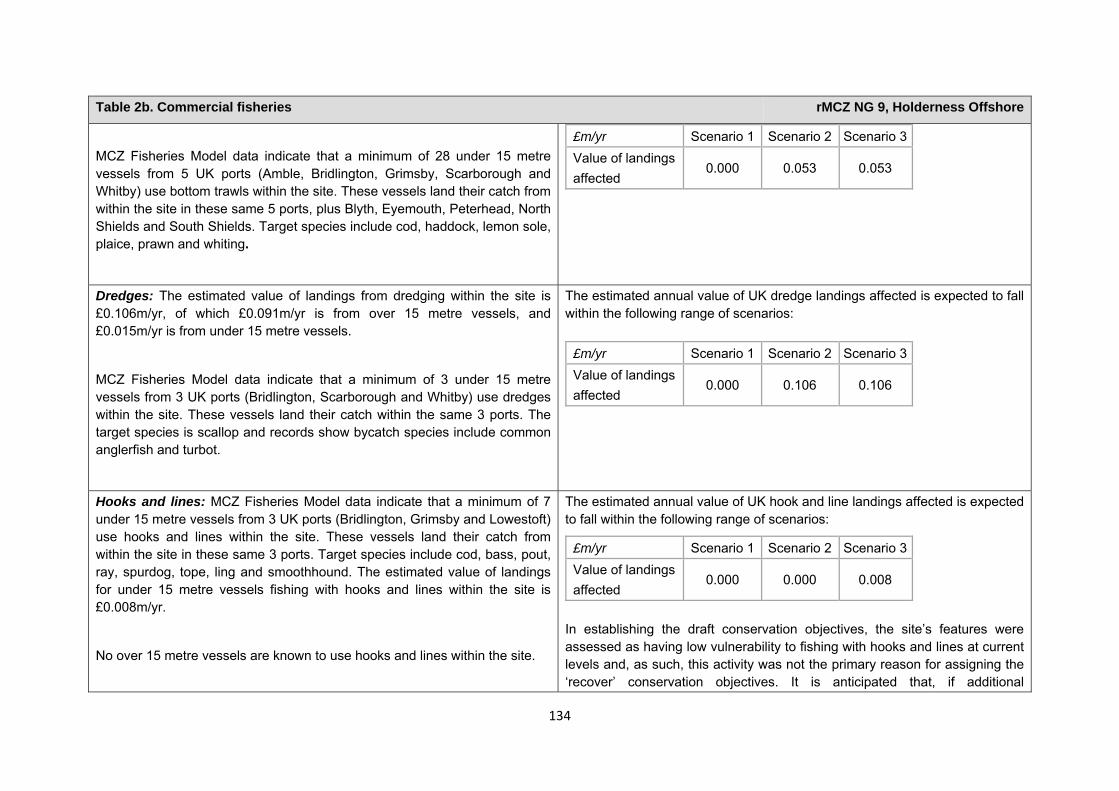
134
Table 2b. Commercial fisheries rMCZ NG 9, Holderness Offshore
MCZ Fisheries Model data indicate that a minimum of 28 under 15 metre vessels from 5 UK ports (Amble, Bridlington, Grimsby, Scarborough and Whitby) use bottom trawls within the site. These vessels land their catch from within the site in these same 5 ports, plus Blyth, Eyemouth, Peterhead, North Shields and South Shields. Target species include cod, haddock, lemon sole, plaice, prawn and whiting.
£m/yr Scenario 1 Scenario 2 Scenario 3Value of landings affected
0.000 0.053 0.053
Dredges: The estimated value of landings from dredging within the site is £0.106m/yr, of which £0.091m/yr is from over 15 metre vessels, and £0.015m/yr is from under 15 metre vessels.
MCZ Fisheries Model data indicate that a minimum of 3 under 15 metre vessels from 3 UK ports (Bridlington, Scarborough and Whitby) use dredges within the site. These vessels land their catch within the same 3 ports. The target species is scallop and records show bycatch species include common anglerfish and turbot.
The estimated annual value of UK dredge landings affected is expected to fall within the following range of scenarios:
£m/yr Scenario 1 Scenario 2 Scenario 3
Value of landings affected
0.000 0.106 0.106
Hooks and lines: MCZ Fisheries Model data indicate that a minimum of 7 under 15 metre vessels from 3 UK ports (Bridlington, Grimsby and Lowestoft) use hooks and lines within the site. These vessels land their catch from within the site in these same 3 ports. Target species include cod, bass, pout, ray, spurdog, tope, ling and smoothhound. The estimated value of landings for under 15 metre vessels fishing with hooks and lines within the site is £0.008m/yr.
No over 15 metre vessels are known to use hooks and lines within the site.
The estimated annual value of UK hook and line landings affected is expected to fall within the following range of scenarios:
£m/yr Scenario 1 Scenario 2 Scenario 3Value of landings affected
0.000 0.000 0.008
In establishing the draft conservation objectives, the site’s features were assessed as having low vulnerability to fishing with hooks and lines at current levels and, as such, this activity was not the primary reason for assigning the ‘recover’ conservation objectives. It is anticipated that, if additional
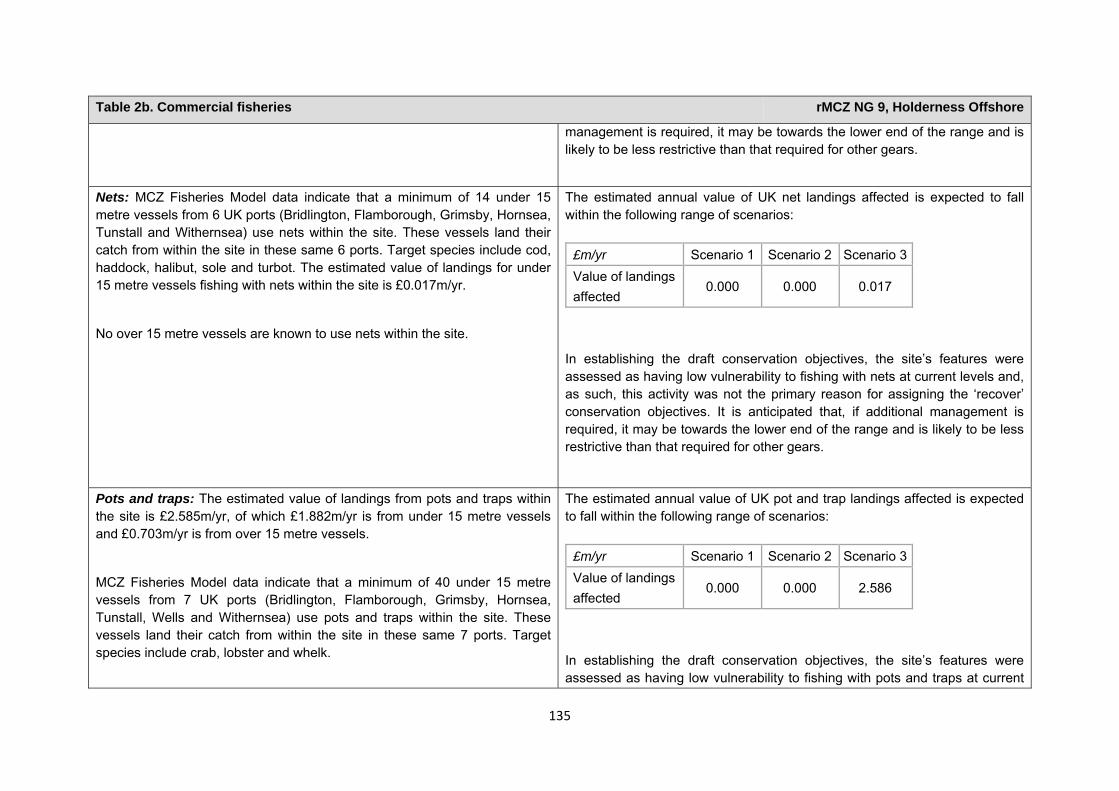
135
Table 2b. Commercial fisheries rMCZ NG 9, Holderness Offshore
management is required, it may be towards the lower end of the range and is likely to be less restrictive than that required for other gears.
Nets: MCZ Fisheries Model data indicate that a minimum of 14 under 15 metre vessels from 6 UK ports (Bridlington, Flamborough, Grimsby, Hornsea, Tunstall and Withernsea) use nets within the site. These vessels land their catch from within the site in these same 6 ports. Target species include cod, haddock, halibut, sole and turbot. The estimated value of landings for under 15 metre vessels fishing with nets within the site is £0.017m/yr.
No over 15 metre vessels are known to use nets within the site.
The estimated annual value of UK net landings affected is expected to fall within the following range of scenarios:
In establishing the draft conservation objectives, the site’s features were assessed as having low vulnerability to fishing with nets at current levels and, as such, this activity was not the primary reason for assigning the ‘recover’ conservation objectives. It is anticipated that, if additional management is required, it may be towards the lower end of the range and is likely to be less restrictive than that required for other gears.
£m/yr Scenario 1 Scenario 2 Scenario 3Value of landings affected
0.000 0.000 0.017
Pots and traps: The estimated value of landings from pots and traps within the site is £2.585m/yr, of which £1.882m/yr is from under 15 metre vessels and £0.703m/yr is from over 15 metre vessels.
MCZ Fisheries Model data indicate that a minimum of 40 under 15 metre vessels from 7 UK ports (Bridlington, Flamborough, Grimsby, Hornsea, Tunstall, Wells and Withernsea) use pots and traps within the site. These vessels land their catch from within the site in these same 7 ports. Target species include crab, lobster and whelk.
The estimated annual value of UK pot and trap landings affected is expected to fall within the following range of scenarios:
In establishing the draft conservation objectives, the site’s features were assessed as having low vulnerability to fishing with pots and traps at current
£m/yr Scenario 1 Scenario 2 Scenario 3Value of landings affected
0.000 0.000 2.586
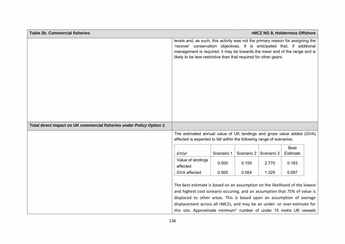
136
Table 2b. Commercial fisheries rMCZ NG 9, Holderness Offshore
levels and, as such, this activity was not the primary reason for assigning the ‘recover’ conservation objectives. It is anticipated that, if additional management is required, it may be towards the lower end of the range and is likely to be less restrictive than that required for other gears.
Total direct impact on UK commercial fisheries under Policy Option 1
The estimated annual value of UK landings and gross value added (GVA) affected is expected to fall within the following range of scenarios:
£m/yr Scenario 1 Scenario 2 Scenario 3Best
Estimate Value of landings affected
0.000 0.159 2.770 0.183
GVA affected 0.000 0.064 1.329 0.087 The best estimate is based on an assumption on the likelihood of the lowest and highest cost scneario occuring, and an assumption that 75% of value is displaced to other areas. This is based upon an assumption of average displacement across all rMCZs, and may be an under‐ or over‐estimate for this site. Approximate minimum* number of under 15 metre UK vessels
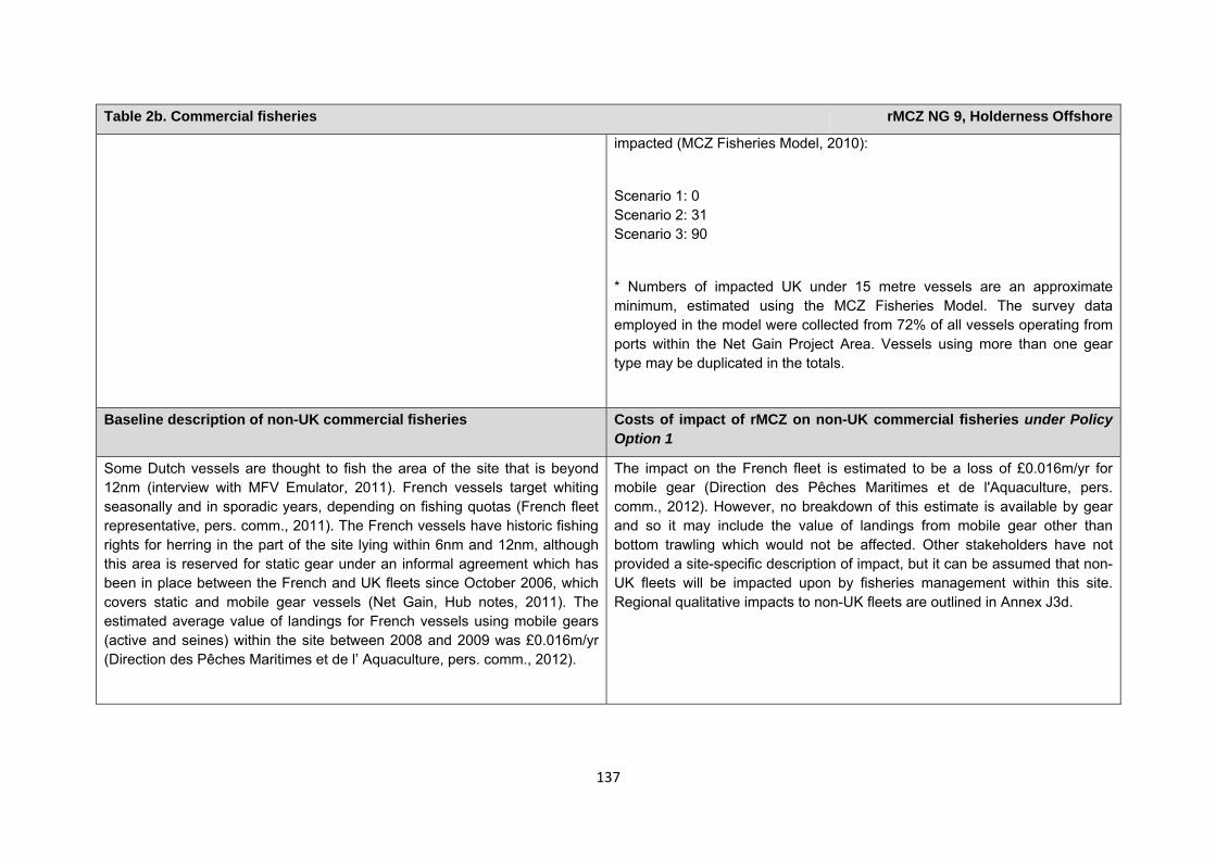
137
Table 2b. Commercial fisheries rMCZ NG 9, Holderness Offshore
impacted (MCZ Fisheries Model, 2010):
Scenario 1: 0 Scenario 2: 31 Scenario 3: 90
* Numbers of impacted UK under 15 metre vessels are an approximate minimum, estimated using the MCZ Fisheries Model. The survey data employed in the model were collected from 72% of all vessels operating from ports within the Net Gain Project Area. Vessels using more than one gear type may be duplicated in the totals.
Baseline description of non-UK commercial fisheries Costs of impact of rMCZ on non-UK commercial fisheries under Policy Option 1
Some Dutch vessels are thought to fish the area of the site that is beyond 12nm (interview with MFV Emulator, 2011). French vessels target whiting seasonally and in sporadic years, depending on fishing quotas (French fleet representative, pers. comm., 2011). The French vessels have historic fishing rights for herring in the part of the site lying within 6nm and 12nm, although this area is reserved for static gear under an informal agreement which has been in place between the French and UK fleets since October 2006, which covers static and mobile gear vessels (Net Gain, Hub notes, 2011). The estimated average value of landings for French vessels using mobile gears (active and seines) within the site between 2008 and 2009 was £0.016m/yr (Direction des Pêches Maritimes et de l’ Aquaculture, pers. comm., 2012).
The impact on the French fleet is estimated to be a loss of £0.016m/yr for mobile gear (Direction des Pêches Maritimes et de l'Aquaculture, pers. comm., 2012). However, no breakdown of this estimate is available by gear and so it may include the value of landings from mobile gear other than bottom trawling which would not be affected. Other stakeholders have not provided a site-specific description of impact, but it can be assumed that non-UK fleets will be impacted upon by fisheries management within this site. Regional qualitative impacts to non-UK fleets are outlined in Annex J3d.
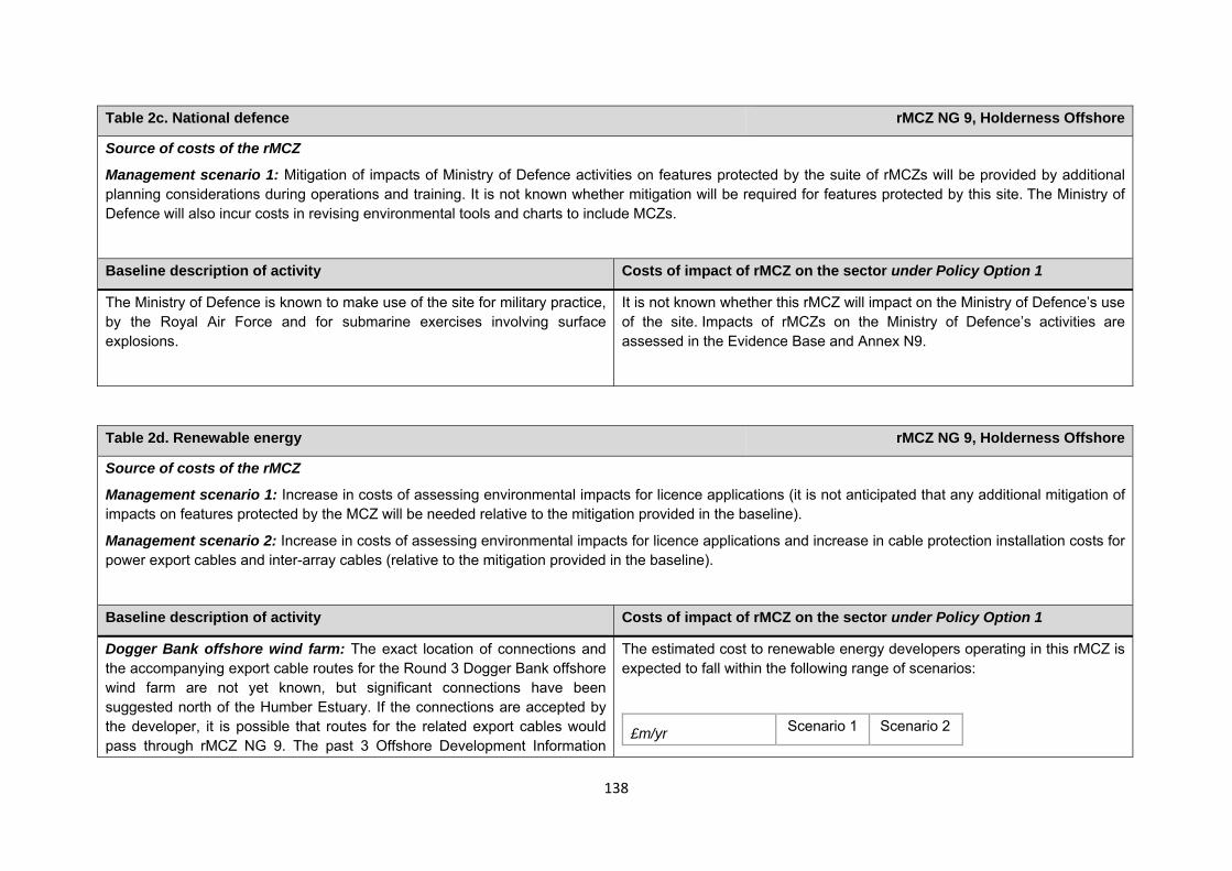
138
Table 2c. National defence rMCZ NG 9, Holderness Offshore
Source of costs of the rMCZ
Management scenario 1: Mitigation of impacts of Ministry of Defence activities on features protected by the suite of rMCZs will be provided by additional planning considerations during operations and training. It is not known whether mitigation will be required for features protected by this site. The Ministry of Defence will also incur costs in revising environmental tools and charts to include MCZs.
Baseline description of activity Costs of impact of rMCZ on the sector under Policy Option 1
The Ministry of Defence is known to make use of the site for military practice, by the Royal Air Force and for submarine exercises involving surface explosions.
It is not known whether this rMCZ will impact on the Ministry of Defence’s use of the site. Impacts of rMCZs on the Ministry of Defence’s activities are assessed in the Evidence Base and Annex N9.
Table 2d. Renewable energy rMCZ NG 9, Holderness Offshore
Source of costs of the rMCZ
Management scenario 1: Increase in costs of assessing environmental impacts for licence applications (it is not anticipated that any additional mitigation of impacts on features protected by the MCZ will be needed relative to the mitigation provided in the baseline).
Management scenario 2: Increase in costs of assessing environmental impacts for licence applications and increase in cable protection installation costs for power export cables and inter-array cables (relative to the mitigation provided in the baseline).
Baseline description of activity Costs of impact of rMCZ on the sector under Policy Option 1
Dogger Bank offshore wind farm: The exact location of connections and the accompanying export cable routes for the Round 3 Dogger Bank offshore wind farm are not yet known, but significant connections have been suggested north of the Humber Estuary. If the connections are accepted by the developer, it is possible that routes for the related export cables would pass through rMCZ NG 9. The past 3 Offshore Development Information
The estimated cost to renewable energy developers operating in this rMCZ is expected to fall within the following range of scenarios:
£m/yr Scenario 1 Scenario 2
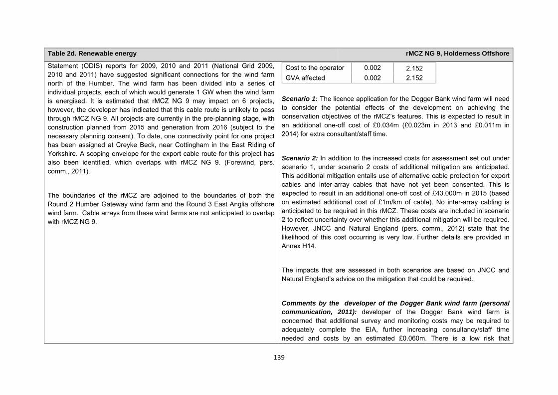
139
Table 2d. Renewable energy rMCZ NG 9, Holderness Offshore
Statement (ODIS) reports for 2009, 2010 and 2011 (National Grid 2009, 2010 and 2011) have suggested significant connections for the wind farm north of the Humber. The wind farm has been divided into a series of individual projects, each of which would generate 1 GW when the wind farm is energised. It is estimated that rMCZ NG 9 may impact on 6 projects, however, the developer has indicated that this cable route is unlikely to pass through rMCZ NG 9. All projects are currently in the pre-planning stage, with construction planned from 2015 and generation from 2016 (subject to the necessary planning consent). To date, one connectivity point for one project has been assigned at Creyke Beck, near Cottingham in the East Riding of Yorkshire. A scoping envelope for the export cable route for this project has also been identified, which overlaps with rMCZ NG 9. (Forewind, pers. comm., 2011).
The boundaries of the rMCZ are adjoined to the boundaries of both the Round 2 Humber Gateway wind farm and the Round 3 East Anglia offshore wind farm. Cable arrays from these wind farms are not anticipated to overlap with rMCZ NG 9.
Cost to the operator 0.002 2.152 GVA affected 0.002 2.152
Scenario 1: The licence application for the Dogger Bank wind farm will need to consider the potential effects of the development on achieving the conservation objectives of the rMCZ’s features. This is expected to result in an additional one-off cost of £0.034m (£0.023m in 2013 and £0.011m in 2014) for extra consultant/staff time.
Scenario 2: In addition to the increased costs for assessment set out under scenario 1, under scenario 2 costs of additional mitigation are anticipated. This additional mitigation entails use of alternative cable protection for export cables and inter-array cables that have not yet been consented. This is expected to result in an additional one-off cost of £43.000m in 2015 (based on estimated additional cost of £1m/km of cable). No inter-array cabling is anticipated to be required in this rMCZ. These costs are included in scenario 2 to reflect uncertainty over whether this additional mitigation will be required. However, JNCC and Natural England (pers. comm., 2012) state that the likelihood of this cost occurring is very low. Further details are provided in Annex H14.
The impacts that are assessed in both scenarios are based on JNCC and Natural England’s advice on the mitigation that could be required.
Comments by the developer of the Dogger Bank wind farm (personal communication, 2011): developer of the Dogger Bank wind farm is concerned that additional survey and monitoring costs may be required to adequately complete the EIA, further increasing consultancy/staff time needed and costs by an estimated £0.060m. There is a low risk that
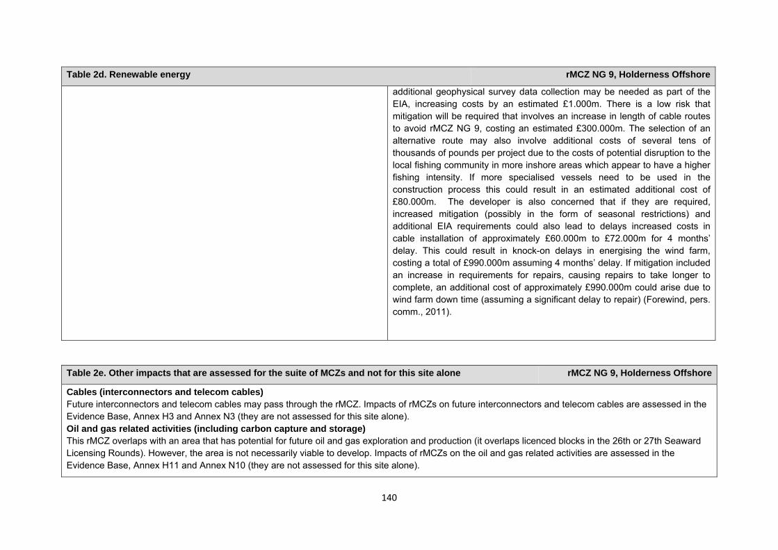
140
Table 2d. Renewable energy rMCZ NG 9, Holderness Offshore
additional geophysical survey data collection may be needed as part of the EIA, increasing costs by an estimated £1.000m. There is a low risk that mitigation will be required that involves an increase in length of cable routes to avoid rMCZ NG 9, costing an estimated £300.000m. The selection of an alternative route may also involve additional costs of several tens of thousands of pounds per project due to the costs of potential disruption to the local fishing community in more inshore areas which appear to have a higher fishing intensity. If more specialised vessels need to be used in the construction process this could result in an estimated additional cost of £80.000m. The developer is also concerned that if they are required, increased mitigation (possibly in the form of seasonal restrictions) and additional EIA requirements could also lead to delays increased costs in cable installation of approximately £60.000m to £72.000m for 4 months’ delay. This could result in knock-on delays in energising the wind farm, costing a total of £990.000m assuming 4 months’ delay. If mitigation included an increase in requirements for repairs, causing repairs to take longer to complete, an additional cost of approximately £990.000m could arise due to wind farm down time (assuming a significant delay to repair) (Forewind, pers. comm., 2011).
Table 2e. Other impacts that are assessed for the suite of MCZs and not for this site alone rMCZ NG 9, Holderness Offshore
Cables (interconnectors and telecom cables) Future interconnectors and telecom cables may pass through the rMCZ. Impacts of rMCZs on future interconnectors and telecom cables are assessed in the Evidence Base, Annex H3 and Annex N3 (they are not assessed for this site alone). Oil and gas related activities (including carbon capture and storage) This rMCZ overlaps with an area that has potential for future oil and gas exploration and production (it overlaps licenced blocks in the 26th or 27th Seaward Licensing Rounds). However, the area is not necessarily viable to develop. Impacts of rMCZs on the oil and gas related activities are assessed in the Evidence Base, Annex H11 and Annex N10 (they are not assessed for this site alone).

141
Human activities in the site that are not negatively affected by the rMCZ (over 2013 to 2032 inclusive)
Contribution to Ecological Network Guidance Table 4. An overview of features proposed for designation and how these contribute to the ENG guidelines for the regional MCZ project area and at a wider scale8
= ENG guideline is achieved and X = ENG guideline is not achieved. Green cells represent key considerations and any greyed-out rows indicate where SNCBs do not agree with a feature being proposed for designation. Recommended conservation objectives in italics indicate where SNCBs do not agree with the conservation objective recommended by the regional MCZ project (see Section 4.2). Where an asterisk (*) has been given in the table, more detail is provided in the narrative.
rMCZ NG 9, Holderness Offshore
ENG Feature
Represent-ativity Replication Adequacy Viability
Gaps or shortfalls in relation to ENG minimum guidelines
Recommended conservation objective
Quantitative considerations at regional MCZ level
Ecological Importance at regional MCZ level
Ecological Importance at wider scale
8 copied from the JNCC and Natural England’s advice to Defra on rMCZs
Table 3. Human activities in the site that are not negatively affected by the rMCZ under Policy Option 1
(existing activities at their current levels and future proposals known to the regional MCZ projects)
rMCZ NG 9, Holderness Offshore
Recreation (recreational boating, fisheries, snorkelling and SCUBA diving and wildlife watching) and shipping (transit of vessels only).
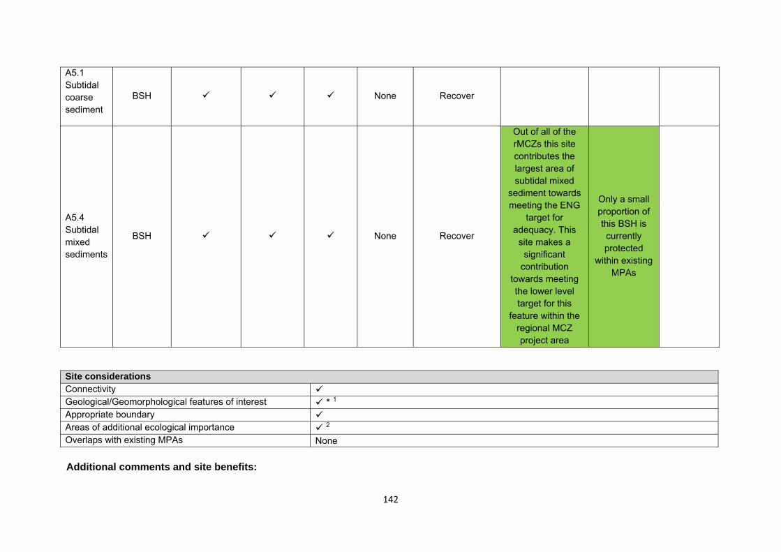
142
A5.1 Subtidal coarse sediment
BSH None Recover
A5.4 Subtidal mixed sediments
BSH None Recover
Out of all of the rMCZs this site contributes the largest area of subtidal mixed
sediment towards meeting the ENG
target for adequacy. This
site makes a significant
contribution towards meeting the lower level target for this
feature within the regional MCZ project area
Only a small proportion of this BSH is currently protected
within existing MPAs
Site considerations Connectivity Geological/Geomorphological features of interest * 1 Appropriate boundary Areas of additional ecological importance 2 Overlaps with existing MPAs None Additional comments and site benefits:
143
• 1 Although not proposed directly as an MCZ for geology/geomorphology, the Glacial Process feature called the Inner Silver Pit crosses the south-east portion of the site. Most of this feature is incorporated as a feature for designation in an adjacent site Silver Pit rMCZ, however compared to some other, more extensive geological features that could be protected in their entirety (such as the English Channel outburst flood feature), this feature would be well-served if included as a contiguous feature and not divided; glacial tunnel valleys are not specifically included elsewhere in the MCZ project area, specifically as recommended features for geology. Its origin and the precise formation mechanisms are not yet completely understood, adding to its conservation value, and in helping to understand the unravelling of the history of ice-age events in the North Sea.
• 2 Areas of additional ecological importance were considered in the identification of this site. There are a number of ecological benefits which could be considered important and add value to this recommendation (see Annex 5 of JNCC and Natural England’s advice on recommended Marine Conservation zones for more detail on these). The regional MCZ project states that the Silver Pit geological feature which is captured within this rMCZ has good species diversity (Net Gain 2011a), and data do show an overlap with an area of high biodiversity (Langmead, et al. 2010).
Anticipated benefits to ecosystem services The habitats, species and other ecological features of the rMCZ contribute to the delivery of a range of ecosystem services. Designation of the rMCZ and its subsequent management may improve the quantity and quality of the beneficial services provided, which may increase the value (contribution to economic welfare or human well-being) of them. Impacts on the value derived from ecosystem services may occur as a result of the designation, management and/or achievement of the conservation objectives of the rMCZ. Further discussion on the potential benefits to ecosystem services can be found in Annex L and on definitions can be found in Annex H5. Table 5a. Fish and shellfish for human consumption rMCZ NG 9, Holderness Offshore
Baseline Beneficial impact under Policy Option 1
Fletcher and others (2011) identify that the features to be protected by the recommended Marine Conservation Zone (rMCZ) can contribute to the delivery of fish and shellfish for human consumption.
There is a nationally important shellfishery within the site for species such as European lobster, brown crab and scallops. Fish species including lemon sole, plaice and sprat have known spawning and nursery areas in rMCZ NG 9 (Net Gain Final Recommendations, 2011).
If the conservation objectives of the features are achieved, the features will be recovered to favourable condition. Achievement of the conservation objectives may improve the contribution of the habitats to the provision of fish and shellfish for human consumption.
New management of fishing activities is expected (above the baseline situation), the costs of which are set out in Table 2. This may reduce the impacts on fish and shellfish habitats and harvesting of stocks, which may in turn benefit stocks of
Anticipated direction of
change:
Confidence: Low
144
Table 5a. Fish and shellfish for human consumption rMCZ NG 9, Holderness Offshore
A description of on-site fishing activity and the value derived from it is set out in Table 2.
The baseline quantity and quality of the ecosystem service provided is assumed to be commensurate with that provided by the features of the site when in unfavourable condition.
commercial species.
Potential benefits may arise on-site, for fishers permitted to fish within the rMCZ, and off-site from spill-over benefits.
As some fishing activity may still be permitted in the rMCZ, it is unclear whether it would have any impact on stocks of mobile commercial finfish species. Stocks of low-mobility and site-attached species, such as lobsters and crabs, may improve as a result of reduced fishing pressure. If some fishing for such species is permitted within the rMCZ, then catches may improve. Localised beneficial spill-over effects may occur around the rMCZ. If rMCZ management involves reduced mobile gear effort, but no reductions in static gear fishing, this may reduce gear conflict between mobile and static gear fishers. Reduced gear conflict may reduce the cost of fishing in the rMCZ for static gear fishers.
The recovery of the subtidal coarse sediments and subtidal mixed sediments to favourable condition may improve its functioning as a nursery area, potentially benefiting fisheries exploited within and outside the rMCZ.
The potential effects described here do not include the negative impacts of the additional fisheries management on fish and shellfish provision and off-site impacts of displaced effort.
145
Table 5b. Recreation rMCZ NG 9, Holderness Offshore
Baseline Beneficial impact under Policy Option 1
Angling: Fletcher and others (2011) identify that the features to be protected by the recommended Marine Conservation Zone (rMCZ) can contribute to the delivery of fish and shellfish for human consumption and recreation services.
The baseline quantity and quality of the ecosystem service provided is assumed to be commensurate with that provided by the features of the site when in unfavourable condition. The intensity of sea angling within the site is unknown, but a minimum of 10 charter boats are known to operate from nearby Bridlington (Stakmap, 2011).
Fish species including lemon sole, plaice and sprat have known spawning and nursery areas in rMCZ NG 9 (Net Gain Final Recommendations, 2011). It has not been possible to estimate the value derived from angling on-site or the proportion of the value derived from angling off-site which result from the nursery and spawning area.
If the conservation objectives of the features are achieved, the features will be recovered to favourable condition.
It is unclear whether any benefits to fish populations would arise as a result of reduced fishing mortality due to management of commercial fishing. The recovery of the subtidal coarse sediment and subtidal mixed sediment to favourable condition may improve functioning as a nursery area, potentially benefiting fisheries exploited within and outside the rMCZ (see Table 4a for further details).
As no additional management of angling is expected, anglers will be able to benefit from any on-site and off-site beneficial effects. If the rMCZ results in an increase in the size and diversity of species caught, then this is expected to increase the value derived by anglers.
The designation may lead to an increase in angling visits to the site, which may benefit the local economy. This increase is likely to arise from a change in anglers’ preferred angling locations rather than an increase in days spent angling or the number of anglers.
Anticipated direction of
change:
Confidence: Low
Diving: Diving is known to take place in the rMCZ but the intensity of the activity is unknown (Stakmap, 2011).
If the conservation objectives of the features are achieved, the features will be recovered to favourable condition.
Anticipated direction of
146
Table 5b. Recreation rMCZ NG 9, Holderness Offshore
If the rMCZ results in an increase in biodiversity, which may include recovery of fragile and slow-growing species, as a result of reduced pressure from mobile fishing gears, then this is expected to increase the value derived by divers visiting the site.
Improved local diving experiences may increase dive trips to the area, which may have beneficial effects on the local economy. This increase may arise from a change in divers’ preferred diving locations rather than an increase in dive trips or number of divers.
change:
Confidence: Low
Wildlife watching: Wildlife watching is known to take place in the rMCZ but the intensity of the activity is unknown.
Due to the proximity to the ‘Flamborough front’ and the RSPB reserve at Bempton Cliffs, the site is of particular importance as a foraging ground for sea birds, including puffin, common guillemot, European shag, great cormorant, black-legged kittiwake, fulmar (RSPB, pers. comm. 2010, 2011 and 2012) and northern gannet (East Yorkshire Ringing Group, pers. comm., 2010). Three main species of marine mammals have been documented in rMCZ NG 9, common seal, grey seal and harbour porpoise, although it is unknown if local wildlife boat trips occur within the site (Net Gain Final Recommendations, 2011).
If the conservation objectives of the features are achieved, the features will be recovered to favourable condition.
As the site is offshore, with limited wildlife watching taking place within it, benefits are expected to be minimal, but the recovery of the features within the site is expected to support foraging bird populations enjoyed by wildlife watchers in nearby protected areas.
Anticipated direction of
change:
Confidence: Moderate
147
Table 5c. Research and education rMCZ NG 9, Holderness Offshore
Baseline Beneficial impact under Policy Option 1
Research: Fletcher and others (2011) identify that the features to be protected by the recommended Marine Conservation Zone (rMCZ) can contribute to the delivery of research services.
Monitoring of the rMCZ will help to inform understanding of how the marine environment is changing and is impacted on by anthropogenic pressures and management interventions. Other research benefits are unknown.
Anticipated direction of
change:
Confidence: High
Education: Education is not known to take place in the rMCZ. As the rMCZ is more than 6nm offshore and therefore relatively inaccessible, no benefits are likely to arise from direct use of the site for education.
Non-visitors may benefit if the rMCZ contributes to wider provision of education (e.g. television programmes, articles in magazines and newspapers, and educational resources developed for use in schools).
Anticipated direction of
change:
Confidence: Low
Table 5d. Regulating services rMCZ NG 9, Holderness Offshore
Baseline Beneficial impact under Policy Option 1
Regulation of pollution: The features of the site contribute to the bioremediation of waste and sequestration of carbon. It has not been possible to estimate the value derived from the regulation of pollution in the rMCZ.
If the conservation objectives of the features are achieved, the features will be recovered to favourable condition.
A potential reduction in the use of bottom-towed fishing gear
Anticipated direction of
change:
148
Table 5d. Regulating services rMCZ NG 9, Holderness Offshore
Environmental resilience: The features of the site contribute to the resilience and continued regeneration of marine ecosystems. It has not been possible to estimate the value derived from environmental resilience in the rMCZ.
Natural hazard protection: As the site is offshore, its features are not thought to contribute to the delivery of this service.
(Fletcher and others, 2011)
may increase site benthic biodiversity and biomass, improving the regulating capacity of the site habitats.
Confidence: Low
Table 5e. Non-use and option values rMCZ NG 9, Holderness Offshore
Baseline Beneficial impact under Policy Option 1
Some people gain satisfaction from the existence of marine habitats, species and other features. They also gain from having the option to benefit in the future from the habitats and species in the recommended Marine Conservation Zone (rMCZ) and the ecosystem services provided, even if they do not currently benefit from them.
The rMCZ will benefit the proportion of the UK population that values conservation of the rMCZ features and its contribution to an ecologically coherent network of Marine Protected Areas. Some people will gain satisfaction from knowing that the habitats and species are being conserved (existence value) and/or that they are being conserved for use by others in the current generation (altruistic value) or future generations (bequest value). The rMCZ will protect both the features and their option to benefit from the services in the future from the risk of future degradation.
Anticipated direction of
change:
Confidence: Moderate
149
rMCZ NG 10, Castle Ground
Site area (km2): 3.70
• This site has been proposed for designation under Policy Option 1 only.
Table 1. Conservation impacts rMCZ NG 10, Castle Ground
1a. Ecological description
This site was proposed due to its mosaic of intertidal features. This includes 6 broad-scale habitats and intertidal underboulder communities. The site has good benthic biodiversity. For example, 225 species were found belonging to 10 different phyla in and around Filey Brigg. The greatest number of species belonged to the mollusca, algae and arthropoda phyla. Mussel beds have been recorded at Filey Brigg since 1965. The coastal areas in and around recommended Marine Conservation Zone (rMCZ) NG 10 are rich in plankton, providing ideal inshore and offshore habitats for fish spawning and nursery grounds for species including herring, sprat, cod, lemon sole, whiting and plaice.
Recommended MCZ NG 10 overlaps with the following 5 Sites of Special Scientific Interest (SSSIs): Filey Brigg; Cayton, Cornelian and South Bays; North
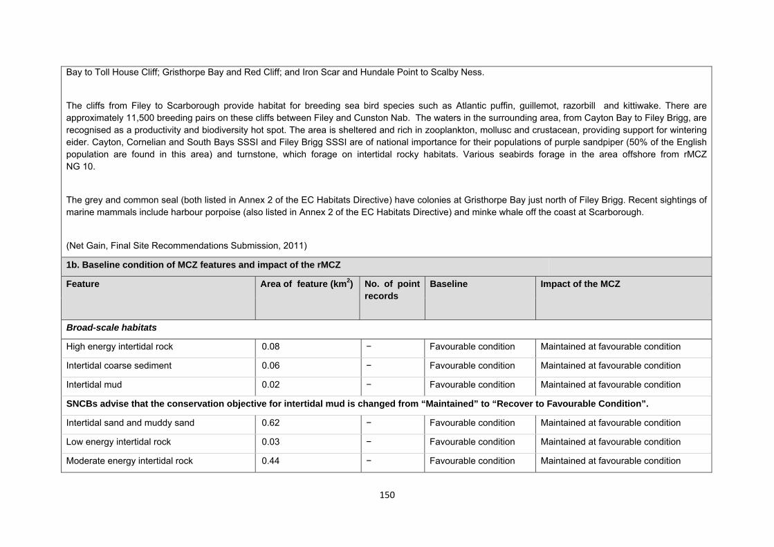
150
Bay to Toll House Cliff; Gristhorpe Bay and Red Cliff; and Iron Scar and Hundale Point to Scalby Ness.
The cliffs from Filey to Scarborough provide habitat for breeding sea bird species such as Atlantic puffin, guillemot, razorbill and kittiwake. There are approximately 11,500 breeding pairs on these cliffs between Filey and Cunston Nab. The waters in the surrounding area, from Cayton Bay to Filey Brigg, are recognised as a productivity and biodiversity hot spot. The area is sheltered and rich in zooplankton, mollusc and crustacean, providing support for wintering eider. Cayton, Cornelian and South Bays SSSI and Filey Brigg SSSI are of national importance for their populations of purple sandpiper (50% of the English population are found in this area) and turnstone, which forage on intertidal rocky habitats. Various seabirds forage in the area offshore from rMCZ NG 10.
The grey and common seal (both listed in Annex 2 of the EC Habitats Directive) have colonies at Gristhorpe Bay just north of Filey Brigg. Recent sightings of marine mammals include harbour porpoise (also listed in Annex 2 of the EC Habitats Directive) and minke whale off the coast at Scarborough.
(Net Gain, Final Site Recommendations Submission, 2011)
1b. Baseline condition of MCZ features and impact of the rMCZ
Feature Area of feature (km2) No. of point records
Baseline Impact of the MCZ
Broad-scale habitats
High energy intertidal rock 0.08 − Favourable condition Maintained at favourable condition
Intertidal coarse sediment 0.06 − Favourable condition Maintained at favourable condition
Intertidal mud 0.02 − Favourable condition Maintained at favourable condition
SNCBs advise that the conservation objective for intertidal mud is changed from “Maintained” to “Recover to Favourable Condition”.
Intertidal sand and muddy sand 0.62 − Favourable condition Maintained at favourable condition
Low energy intertidal rock 0.03 − Favourable condition Maintained at favourable condition
Moderate energy intertidal rock 0.44 − Favourable condition Maintained at favourable condition

151
Habitats of conservation importance
Intertidal underboulder communities − 3 Favourable condition Maintained at favourable condition
Site-specific costs arising from the effect of the rMCZ on human activities (over 2013 to 2032 inclusive) Table 2a. Archaeological heritage rMCZ NG 10, Castle Ground
Source of costs of the rMCZ
Management scenario 1: Increase in costs of assessing environmental impacts for future licence applications (it is not anticipated that any additional mitigation of impacts on features protected by the MCZ will be needed relative to the mitigation provided in the baseline). Archaeological excavations, surface recovery, intrusive and non-intrusive surveys, diver trails and visitors will be allowed.
Baseline description of activity Costs of impact of rMCZ on the sector under Policy Option 1
There are records of numerous wrecks in the site, dating from 1322 to 1942. They are a variety of English and international cargo and fishing vessels. Two aircraft wrecks are also reported in the site (English Heritage, pers. comm., 2012). There are other records in the site, including World War II defence structures such as pillboxes and anti-tank obstacles (English Heritage, pers. comm., 2012). Remains of Romano-English settlements, including baths and spa sites, have also been identified in the site. A bronze age/early iron age settlement and a neolithic chambered cairn are also recorded in the site (English Heritage, pers. comm., 2012). It is understood that local archaeological groups are active in this area.
English Heritage has indicated that this site is likely to be of interest for archaeological excavation in the future as it is relevant to its National Heritage Protection Plan (theme 3A1.2).
An extra cost would be incurred in the assessment of environmental impact made in support of any future licence applications for archaeological activities in the site. The likelihood of a future licence application being submitted is not known, so no overall cost to the sector of this rMCZ has been estimated. However, the additional cost in one licence application could be in the region of £500 to £10,000 depending on the size of the MCZ (English Heritage, pers. comm., 2011). No further impacts on activities related to archaeology are anticipated.
152
Table 2b. Flood and coastal erosion risk management (FCERM) rMCZ NG 10, Castle Ground
Source of costs of the rMCZ
Management scenario 1: No impacts arise, as maintenance of existing coastal defence schemes are not impacting on the conservation objectives of the features of the rMCZ. Increase in costs of assessing environmental impacts for future licence applications for maintenance work for the coastal defence scheme. These are assessed for the suite of sites in the Net Gain project area.
Management scenario 2: Provision of equivalent environmental benefit by the body that is undertaking maintenance of an existing FCERM scheme in order to compensate for the impact that the maintenance would have on features protected by the MCZ. The Impact Assessment assumes that compensation would be required for the impact of maintenance but not for the impact of the existing scheme. Also, increase in costs of assessing environmental impacts for future licence applications for maintenance work for the coastal defence scheme. These are assessed for the suite of sites in the Net Gain project area.
Baseline description of activity Costs of impact of rMCZ on the sector under Policy Option 1
The economic analysis of the current Shoreline Management Plan (SMP) relevant to this rMCZ supports ‘holding the line’ and investing in defences for Scarborough in both the North and South Bays. This is required to provide essential protection to property.
The South Bay defences protect the main frontage of Scarborough, where there are 105 commercial properties at risk of flood damage. Protecting these properties, associated roads and tourism assets, such as the promenade, is essential to maintain the economic viability of the town. Major works in South Bay are currently being considered to strengthen and raise defences.
To prevent flooding in the South Bay, beach management moves sand from the north end to the south end of the bay. This stops accretion of the beach and the flooding that would arise from overtopping the defences. If beach management stopped, the defences would need to be raised to match beach accretion rates, which would devalue the frontage as a tourist attraction and add significant costs.
To reflect the current uncertainty over the magnitude of impact that FCERM activity upon the conservation objective of the features, 2 scenarios have been considered.
£m/yr Scenario 1 Scenario 2 Additional mitigation cost Unknown Unknown
Scenario 1: It is assumed that the existing FCERM scheme impacts on the MCZ features but is maintained because of its social and economic importance. It is assumed that impacts on the MCZ features would not be mitigated. It is assumed that the maintenance of existing coastal defence schemes will not impact on the achievement of conservation objectives for the features within the rMCZ. Therefore no impacts arise. As a result of the rMCZ, it is anticipated that additional costs will be incurred in assessing environmental impacts in support of future licence applications for Flood and Coastal Erosion Risk Management (FCERM) schemes. There are 17 Local Authority projects which may be impacted by the designation of rMCZ NG 10. The impacts of this are assessed qualitatively for the regional suite of sites
153
Table 2b. Flood and coastal erosion risk management (FCERM) rMCZ NG 10, Castle Ground
The current defences present a significant hazard to public safety when waves overtop the defences. Recommended standards for pedestrians are 0.1 litre per second per metre (l/s/m) of defence for a 10-year flood event, but rates at the site are currently 18 l/s/m. These will rise to 77 l/s/m by 2108. The SMP recommends considering ‘advancing the line’, which would further impact on features.
In North Bay, the current hard defences impact on intertidal features through reflected energy displacing intertidal sand. The SMP recommends ‘holding the line’ to protect 4 important commercial properties and tourism amenities. This will help to maintain the value of the area and its value as a tourism centre.
More detailed proposals are being prepared for this area and future works are likely to upgrade defences, including considering options for flood walls that would include ‘advancing the line’ in places. This would make it difficult to avoid impacts on intertidal features and would prevent favourable condition being achieved.
For the remainder of the rMCZ, south of Scarborough south bay, the SMP policy supports No Active Intervention.
The Environment Agency and Local Authorities submit applications for funding for a 5-year medium-term plan for Flood and coastal erosion risk management (FCERM) works. Funds are allocated annually, but are subject to change depending on changes in funding, responsibilities, structures etc. There are currently 17 projects associated with rMCZ NG 10 (detailed in the Shoreline Management Plan (SMP) medium-term plan) that may result in
and are summarised in Annex F.
Scenario 2: The costs are estimated in the IA in terms of the costs to the operator of providing benefit that is equivalent to the impact that maintenance of the existing FCERM scheme would have on features protected by the rMCZ. The costs of this have not been assessed because it is not yet known whether achievement of the conservation objective of features in the rMCZ will definitely be impacted on by maintenance of the current scheme and, if so, the magnitude of that impact (these will be established through Natural England’s monitoring of the site). Also, as a result of the rMCZ, it is anticipated that additional costs will be incurred in assessing environmental impacts in support of future licence applications for Flood and Coastal Erosion Risk Management (FCERM) schemes. There are 17 Local Authority projects which may be impacted by the designation of rMCZ NG 10. The impacts of this are assessed qualitatively for the regional suite of sites and are summarised in Annex F.
The SMP policy for the remaining areas of the site is not thought to be impacted by the rMCZ. The impacts have been assessed in this way because the assessment is of the impacts of the regional MCZ projects’ site recommendations that were submitted in September 2011. The Minister’s decision about designating this site will be also informed by Natural England’s and JNCC’s statutory advice on MCZs that was published on 18 July 2012. Where it is feasible, it is anticipated that the advice will suggest that the site recommendation is adjusted to increase the likelihood that the MCZ features’ conservation objectives can be achieved. Such adjustment is not included in the IA because the IA is an assessment of the regional MCZ projects’ recommendations.
154
Table 2b. Flood and coastal erosion risk management (FCERM) rMCZ NG 10, Castle Ground
FCERM works (Natural England and Environment Agency, pers. comm., 2012).
Table 2c. National defence rMCZ NG 10, Castle Ground
Source of costs of the rMCZ
Management scenario 1: Mitigation of impacts of Ministry of Defence activities on features protected by the suite of rMCZs will be provided by additional planning considerations during operations and training. It is not known whether mitigation will be required for features protected by this site. The Ministry of Defence will also incur costs in revising environmental tools and charts to include MCZs.
Baseline description of activity Costs of impact of rMCZ on the sector under Policy Option 1
The Ministry of Defence is known to make use of the site for military practice by the Royal Air Force.
It is not known whether this rMCZ will impact on the Ministry of Defence’s use of the site. Impacts of rMCZs on the Ministry of Defence’s activities are assessed in the Evidence Base and Annex N9.
Table 2d. Ports, harbours, shipping and disposal sites rMCZ NG 10, Castle Ground
Source of costs of the rMCZ
Management scenario 1: Not applicable to this site. Management scenario 2: Increase in costs of assessing environmental impacts for future licence applications within 5km of an rMCZ. This applies to future navigational dredging, disposal of dredge material and port developments. Additional costs incurred in including MCZ features in a new potential Maintenance Dredging Protocol (MDP). It is not anticipated that any additional mitigation of impacts on features protected by the MCZ will be needed for port developments or port-related activities due to this rMCZ relative to the baseline.
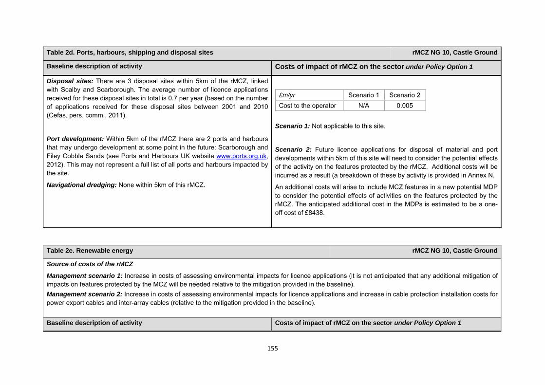
155
Table 2d. Ports, harbours, shipping and disposal sites rMCZ NG 10, Castle Ground
Baseline description of activity Costs of impact of rMCZ on the sector under Policy Option 1
Disposal sites: There are 3 disposal sites within 5km of the rMCZ, linked with Scalby and Scarborough. The average number of licence applications received for these disposal sites in total is 0.7 per year (based on the number of applications received for these disposal sites between 2001 and 2010 (Cefas, pers. comm., 2011).
Port development: Within 5km of the rMCZ there are 2 ports and harbours that may undergo development at some point in the future: Scarborough and Filey Cobble Sands (see Ports and Harbours UK website www.ports.org.uk, 2012). This may not represent a full list of all ports and harbours impacted by the site.
Navigational dredging: None within 5km of this rMCZ.
£m/yr Scenario 1 Scenario 2 Cost to the operator N/A 0.005
Scenario 1: Not applicable to this site.
Scenario 2: Future licence applications for disposal of material and port developments within 5km of this site will need to consider the potential effects of the activity on the features protected by the rMCZ. Additional costs will be incurred as a result (a breakdown of these by activity is provided in Annex N.
An additional costs will arise to include MCZ features in a new potential MDP to consider the potential effects of activities on the features protected by the rMCZ. The anticipated additional cost in the MDPs is estimated to be a one-off cost of £8438.
Table 2e. Renewable energy rMCZ NG 10, Castle Ground
Source of costs of the rMCZ
Management scenario 1: Increase in costs of assessing environmental impacts for licence applications (it is not anticipated that any additional mitigation of impacts on features protected by the MCZ will be needed relative to the mitigation provided in the baseline). Management scenario 2: Increase in costs of assessing environmental impacts for licence applications and increase in cable protection installation costs for power export cables and inter-array cables (relative to the mitigation provided in the baseline). Baseline description of activity Costs of impact of rMCZ on the sector under Policy Option 1
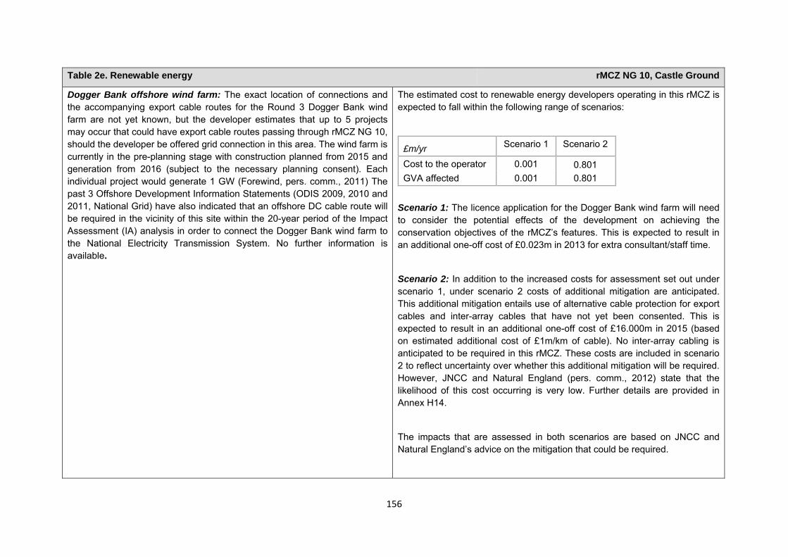
156
Table 2e. Renewable energy rMCZ NG 10, Castle Ground
Dogger Bank offshore wind farm: The exact location of connections and the accompanying export cable routes for the Round 3 Dogger Bank wind farm are not yet known, but the developer estimates that up to 5 projects may occur that could have export cable routes passing through rMCZ NG 10, should the developer be offered grid connection in this area. The wind farm is currently in the pre-planning stage with construction planned from 2015 and generation from 2016 (subject to the necessary planning consent). Each individual project would generate 1 GW (Forewind, pers. comm., 2011) The past 3 Offshore Development Information Statements (ODIS 2009, 2010 and 2011, National Grid) have also indicated that an offshore DC cable route will be required in the vicinity of this site within the 20-year period of the Impact Assessment (IA) analysis in order to connect the Dogger Bank wind farm to the National Electricity Transmission System. No further information is available.
The estimated cost to renewable energy developers operating in this rMCZ is expected to fall within the following range of scenarios:
£m/yr Scenario 1 Scenario 2
Cost to the operator 0.001 0.801 GVA affected 0.001 0.801
Scenario 1: The licence application for the Dogger Bank wind farm will need to consider the potential effects of the development on achieving the conservation objectives of the rMCZ’s features. This is expected to result in an additional one-off cost of £0.023m in 2013 for extra consultant/staff time.
Scenario 2: In addition to the increased costs for assessment set out under scenario 1, under scenario 2 costs of additional mitigation are anticipated. This additional mitigation entails use of alternative cable protection for export cables and inter-array cables that have not yet been consented. This is expected to result in an additional one-off cost of £16.000m in 2015 (based on estimated additional cost of £1m/km of cable). No inter-array cabling is anticipated to be required in this rMCZ. These costs are included in scenario 2 to reflect uncertainty over whether this additional mitigation will be required. However, JNCC and Natural England (pers. comm., 2012) state that the likelihood of this cost occurring is very low. Further details are provided in Annex H14.
The impacts that are assessed in both scenarios are based on JNCC and Natural England’s advice on the mitigation that could be required.
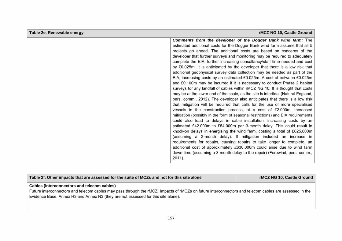
157
Table 2e. Renewable energy rMCZ NG 10, Castle Ground
Comments from the developer of the Dogger Bank wind farm: The estimated additional costs for the Dogger Bank wind farm assume that all 5 projects go ahead. The additional costs are based on concerns of the developer that further surveys and monitoring may be required to adequately complete the EIA, further increasing consultancy/staff time needed and cost by £0.025m. It is anticipated by the developer that there is a low risk that additional geophysical survey data collection may be needed as part of the EIA, increasing costs by an estimated £0.025m. A cost of between £0.025m and £0.100m may be incurred if it is necessary to conduct Phase 2 habitat surveys for any landfall of cables within rMCZ NG 10. It is thought that costs may be at the lower end of the scale, as the site is intertidal (Natural England, pers. comm., 2012). The developer also anticipates that there is a low risk that mitigation will be required that calls for the use of more specialised vessels in the construction process, at a cost of £2.000m. Increased mitigation (possibly in the form of seasonal restrictions) and EIA requirements could also lead to delays in cable installation, increasing costs by an estimated £42.000m to £54.000m per 3-month delay. This could result in knock-on delays in energising the wind farm, costing a total of £625.000m (assuming a 3-month delay). If mitigation included an increase in requirements for repairs, causing repairs to take longer to complete, an additional cost of approximately £630.000m could arise due to wind farm down time (assuming a 3-month delay to the repair) (Forewind, pers. comm., 2011).
Table 2f. Other impacts that are assessed for the suite of MCZs and not for this site alone rMCZ NG 10, Castle Ground
Cables (interconnectors and telecom cables) Future interconnectors and telecom cables may pass through the rMCZ. Impacts of rMCZs on future interconnectors and telecom cables are assessed in the Evidence Base, Annex H3 and Annex N3 (they are not assessed for this site alone).
158
Human activities in the site that are not negatively affected by the rMCZ (over 2013 to 2032 inclusive)
*The IA assumes that no additional mitigation of impacts of water abstraction, discharge or diffuse pollution will be required over and above that which will be provided to achieve the objectives of the Water Framework Directive through the River Basin Management Plan process (based on advice provided by Natural England, pers. comm., 2010). Contribution to Ecological Network Guidance Table 4. An overview of features proposed for designation and how these contribute to the ENG guidelines for the regional MCZ project area and at a wider scale9
= ENG guideline is achieved and X = ENG guideline is not achieved. Green cells represent key considerations and any greyed-out rows indicate where SNCBs do not agree with a feature being proposed for designation. Recommended conservation objectives in italics indicate where SNCBs do not agree with the conservation objective recommended by the regional MCZ project (see Section 4.2). Where an asterisk (*) has been given in the table, more detail is provided in the narrative.
rMCZ NG 10, Castle Ground
ENG Feature Represent-ativity Replication Adequacy Viability
Gaps or shortfalls in relation
Recommended conservation objective
Quantitative considerations at regional
Ecological Importance at regional
Ecological Importance at wider scale
9 copied from the JNCC and Natural England’s advice to Defra on rMCZs
Table 3. Human activities in the site that are not negatively affected by the rMCZ under Policy Option 1
(existing activities at their current levels and future proposals known to the regional MCZ projects)
rMCZ NG 10, Castle Ground
Cables (existing interconnectors and telecom cables), commercial fisheries, recreation (recreational boating, fisheries, snorkelling and SCUBA diving, and wildlife watching), research and education and water abstraction, diffuse and pollution*.
159
to ENG minimum guidelines
MCZ level MCZ level
A1.1 High energy intertidal rock
BSH * 1 None Maintain
Only two replicates of this BSH in the MPA network (only one in rMCZs).The site is needed to meet adequacy guidelines
Limited distribution throughout the region and across English waters more widely
Limited distribution throughout the region and across English waters more widely
A1.2 Moderate energy intertidal rock
BSH * 1 None Maintain
A1.3 Low energy intertidal rock
BSH * 1 None Maintain
A2.1 Intertidal coarse sediment
BSH * 1 None Maintain
A2.2 Intertidal sand and muddy sand
BSH * 1 None Maintain
A2.3 Intertidal mud BSH * 1 None Recover
Not a true representative of the intertidal mud BSH
Intertidal underboulder communities
FOCI Habitat * 2 None Maintain UK BAP
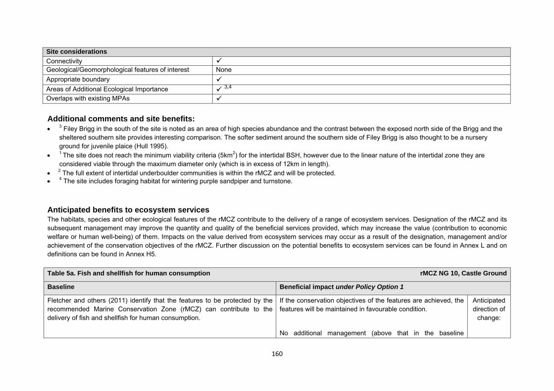
160
Site considerations Connectivity Geological/Geomorphological features of interest None Appropriate boundary Areas of Additional Ecological Importance 3,4 Overlaps with existing MPAs Additional comments and site benefits: • 3 Filey Brigg in the south of the site is noted as an area of high species abundance and the contrast between the exposed north side of the Brigg and the
sheltered southern site provides interesting comparison. The softer sediment around the southern side of Filey Brigg is also thought to be a nursery ground for juvenile plaice (Hull 1995).
• 1 The site does not reach the minimum viability criteria (5km2) for the intertidal BSH, however due to the linear nature of the intertidal zone they are considered viable through the maximum diameter only (which is in excess of 12km in length).
• 2 The full extent of intertidal underboulder communities is within the rMCZ and will be protected. • 4 The site includes foraging habitat for wintering purple sandpiper and turnstone. Anticipated benefits to ecosystem services The habitats, species and other ecological features of the rMCZ contribute to the delivery of a range of ecosystem services. Designation of the rMCZ and its subsequent management may improve the quantity and quality of the beneficial services provided, which may increase the value (contribution to economic welfare or human well-being) of them. Impacts on the value derived from ecosystem services may occur as a result of the designation, management and/or achievement of the conservation objectives of the rMCZ. Further discussion on the potential benefits to ecosystem services can be found in Annex L and on definitions can be found in Annex H5. Table 5a. Fish and shellfish for human consumption rMCZ NG 10, Castle Ground
Baseline Beneficial impact under Policy Option 1
Fletcher and others (2011) identify that the features to be protected by the recommended Marine Conservation Zone (rMCZ) can contribute to the delivery of fish and shellfish for human consumption.
If the conservation objectives of the features are achieved, the features will be maintained in favourable condition.
No additional management (above that in the baseline
Anticipated direction of
change:
161
Table 5a. Fish and shellfish for human consumption rMCZ NG 10, Castle Ground
The coastal areas in and around rMCZ NG 10 are rich in plankton, providing ideal inshore and offshore habitats for fish spawning and nursery grounds for species including herring, sprat, cod, lemon sole, whiting and plaice (Net Gain Final Recommendations, 2011).
Commercial fishing occurs within the rMCZ by UK under 15 metre vessels. Estimated total value of landings for the site is £0.157m/yr. The majority of this value can be attributed to vessels using pots and traps (£0.135m/yr) and nets (£0.014m/yr), with smaller value of landings from vessels using bottom trawls, dredges, and hooks and lines within the site (MCZ Fisheries Model, 2011).
The baseline quantity and quality of the ecosystem service provided is assumed to be commensurate with that provided by the features of the site when in favourable condition.
situation) of fishing activities is expected. As such, no benefits are expected to accrue as a result of reduced fishing mortality. No change in on-site feature condition is anticipated and therefore no impact on on-site or off-site benefits is expected.
Designating the rMCZ will protect its features and the ecosystem services that they provide against the risk of future degradation from anthropogenic pressures (because if necessary, mitigation would be introduced, with the associated costs and benefits).
Confidence: Moderate
Table 5b. Recreation rMCZ NG 10, Castle Ground
Baseline Beneficial impact under Policy Option 1
Angling: Fletcher and others (2011) identify that the features to be protected by the recommended Marine Conservation Zone (rMCZ) can contribute to the delivery of fish and shellfish for human consumption and recreation services.
The coastal areas in and around rMCZ NG 10 are rich in plankton, providing
If the conservation objectives of the features are achieved, the features will be maintained in favourable condition.
No change in on-site feature condition or fishing mortality is anticipated and therefore no impact on on-site or off-site benefits is expected (see Table 4a for further details).
Anticipated direction of
change:
162
Table 5b. Recreation rMCZ NG 10, Castle Ground
ideal inshore and offshore habitats for fish spawning and nursery grounds for species including herring, sprat, cod, lemon sole, whiting and plaice, and for crustaceans (Net Gain Final Recommendations, 2011). As such, they are likely to help support potential on-site and off-site fisheries. It has not been possible to estimate the value derived from off-site fisheries as a result of the nursery area function.
Both shore and sea angling are thought to occur within the site but the intensity of the activity is unknown; a minimum of 7 charter boats are known to operate from Whitby, which is north of the site (Stakmap, 2011). It has not been possible to estimate the value derived from angling on-site or the proportion of the value derived from angling off-site which result from the nursery and spawning area.
The baseline quantity and quality of the ecosystem service provided is assumed to be commensurate with that provided by the features of the site when in favourable condition.
Designating the rMCZ will protect its features and the ecosystem services that they provide against the risk of future degradation from anthropogenic pressures (because if necessary, mitigation would be introduced, with the associated costs and benefits).
Confidence: Moderate
Diving: Diving and snorkelling are thought to take place within the rMCZ but the intensity of the activity is unknown (Stakmap, 2011).
If the conservation objectives of the features are achieved, the features will be maintained in favourable condition.
No change in on-site feature condition is anticipated. However, designation may result in an increase in dive trips to the area, which may have beneficial effects on the local economy. This increase may represent a redistribution of dive location preferences rather than an increase in days spent diving or the number of divers.
Anticipated direction of
change:
Confidence: Moderate
163
Table 5b. Recreation rMCZ NG 10, Castle Ground
Designating the rMCZ will protect its features and the ecosystem services that they provide against the risk of future degradation from anthropogenic pressures (because if necessary, mitigation would be introduced, with the associated costs and benefits).
Wildlife watching: Fletcher and others (2011) identify that the features to be protected by the rMCZ can contribute to the delivery of recreation and tourism services. The site includes the popular tourist destinations of Scarborough, Cayton Bay and Filey. The site is popular for wildlife enthusiasts, particularly those observing wildlife in the rock pools within the site, and they are an important contributor to the local tourism offer. The area from Cayton Bay to Filey Brigg is recognised as a productivity and biodiversity hot spot, supporting feeding grounds for Flamborough and Bempton Cliffs breeding sea bird colonies. The grey and harbour seal both have colonies at Gristhorpe Bay, which is just north of Filey Brigg (Net Gain Final Recommendations, 2011). Recent sightings of marine mammals include harbour porpoise and minke whale off the coast at Scarborough (Sea Watch Foundation, 2011). It has not been possible to estimate the value derived from wildlife watching in the rMCZ.
The baseline quantity and quality of the ecosystem service provided is assumed to be commensurate with that provided by the features of the site when in favourable condition.
If the conservation objectives of the features are achieved, the features will be maintained in favourable condition.
No change in on-site feature condition is anticipated and therefore no benefits to wildlife watching are expected.
Designating the rMCZ will protect its features and the ecosystem services that they provide against the risk of future degradation from anthropogenic pressures (because if necessary, mitigation would be introduced, with the associated costs and benefits).
Anticipated direction of
change:
Confidence: Moderate
164
Table 5c. Research and education rMCZ NG 10, Castle Ground
Baseline Beneficial impact under Policy Option 1
Research: Fletcher and others (2011) identify that the features to be protected by the recommended Marine Conservation Zone (rMCZ) can contribute to the delivery of research services.
The site overlaps with the following Sites of Special Scientific Interest: Filey Brigg, Cayton, Cornelian and South Bays, North Bay to South Toll House Cliff, Gristhorpe Bay and Red Cliff, and Iron Scar and Hundale Point to Scalby Ness (Net Gain Final Recommendations, 2011). As such, ecological monitoring activities are ongoing.
It has not been possible to estimate the value derived from research activities associated with the rMCZ.
Monitoring of the rMCZ will help to inform understanding of how the marine environment is changing and is impacted on by anthropogenic pressures and management interventions. Other research benefits are unknown.
Anticipated direction of
change:
Confidence: High
Education: Fletcher and others (2011) identify that the features to be protected by the rMCZ can contribute to the delivery of education services.
Filey Brigg is very popular, and easily accessible, for school visits (Natural England, pers. comm., 2012).
The extent of current educational activity carried out in the site is unknown. It has not been possible to estimate the value derived from education activities associated with the rMCZ.
Designation may aid additional local (to the rMCZ) provision of education (e.g. events and interpretation boards), from which visitors would derive benefit.
Non-visitors may benefit if the rMCZ contributes to wider provision of education (e.g. television programmes, articles in magazines and newspapers, and educational resources developed for use in schools).
Anticipated direction of
change:
Confidence: Moderate
Table 5d. Regulating services rMCZ NG 10, Castle Ground
165
Table 5d. Regulating services rMCZ NG 10, Castle Ground
Baseline Beneficial impact under Policy Option 1
Regulation of pollution: The features of the site are not thought to contribute to the bioremediation of waste and sequestration of carbon.
Environmental resilience: The features of the site contribute to the resilience and continued regeneration of marine ecosystems. It has not been possible to estimate the value derived from environmental resilience in the rMCZ.
Natural hazard protection: The features of the site contribute to local flood and storm protection, in areas of the site in which recommended Marine Conservation Zones (rMCZs) are not thought to be impacting on current flood and coastal erosion risk management activity. It has not been possible to estimate the value derived from natural hazard protection in the rMCZ.
(Fletcher and others, 2011)
If the conservation objectives of the features are achieved, the features will be maintained in favourable condition.
No change in feature condition and management of human activities is expected and therefore no benefit to the regulatory capacity of the site is expected.
Designating the rMCZ will protect its features and the ecosystem services that they provide against the risk of future degradation from anthropogenic pressures (because if necessary, mitigation would be introduced, with the associated costs and benefits).
Anticipated direction of
change:
Confidence: Moderate
Table 5e. Non-use and option values rMCZ NG 10, Castle Ground
Baseline Beneficial impact under Policy Option 1
Some people gain satisfaction from the existence of marine habitats, species and other features. They also gain from having the option to benefit in the future from the habitats and species in the recommended Marine Conservation Zone (rMCZ) and the ecosystem services provided, even if they do not currently benefit from them.
The rMCZ will benefit the proportion of the UK population that values conservation of the rMCZ features and its contribution to an ecologically coherent network of Marine Protected Areas. Some people will gain satisfaction from knowing that the habitats and species are being conserved (existence value) and/or that they are being conserved for use by others in the current generation (altruistic value) or future generations
Anticipated direction of
change:
166
Table 5e. Non-use and option values rMCZ NG 10, Castle Ground
(bequest value). The rMCZ will protect both the features and their option to benefit from the services in the future from the risk of future degradation.
In the Marine Conservation Society ‘Your Seas Your Voice’ campaign, 17 ‘nominated sites’ are located within rMCZ NG 10. Features of the natural environment were strong motivators for reasons why people thought that these locations should be protected, with people frequently attaching value to its ‘spectacular scenery’ and to the biodiversity of the site. Allowing species recovery was perceived as an important management reason to protect the site. An emotional attachment to the area was also a strong motivator. Regarding non-extractive use value, ease of access to an ‘unspoilt’ area was considered important.
Confidence: Moderate
167
rMCZ NG 11, Runswick Bay
Site area (km2): 67.92
• This site has been proposed for designation under Policy Option 1 only.
Table 1. Conservation impacts rMCZ NG 11, Runswick Bay
1a. Ecological description
The sea bed in the site is composed of rock and sediment features creating a mosaic of habitats, which support diverse and abundant communities composed of numerous algal species, sponges, sea squirts, sea mats, sea firs, mussels and barnacles. Brittlestars, bristleworms, amphipods, polychaetes and bivalves are also present, which are themselves important for supporting larger predators higher up the food chain. The waters of recommended Marine Conservation Zone (rMCZ) NG 11 provide suitable spawning areas for herring and lemon sole and nursery areas for sprat, cod, whiting and plaice. The site boundaries are clipped to an existing year-round no-trawl zone, helping to protect the benthic environment within the site.
There are two Sites of Special Scientific Interest (SSSIs) located within rMCZ NG 11, which have both been designated for their geological interest. The first, Runswick Bay SSSI, contains internationally important ‘geological fossil remains’ and the second, Staithes-Port Mulgrave SSSI, has an internationally significant layer of stratified rocks, exposing the ‘geological Pliensbachian-Toarcian stage boundary’. The exposed rocks on the coast of rMCZ NG 11 are from the Lower Jurassic and predominantly made up of shale and sandstone. These rocks are important for stratigraphy and hold many important fish, ammonite and reptile fossils. Recommended MCZ NG 11 lies adjacent to the North Yorkshire Moors National Park and to a 58km stretch of coast known as the North Yorkshire and Cleveland Heritage Coast. The sandstone cliffs adjacent to rMCZ NG 11 are ideal habitats for cliff-nesting birds such as kittiwake and northern fulmar. Although the cliffs are not a feature listed for designation, nesting birds may utilise rMCZ NG 11 for foraging. There have also been recent sightings of harbour porpoise (listed in Annex 2 of the EC Habitats Directive) both north and south of rMCZ NG 11, suggesting that marine mammals

168
may also frequent these waters.
(Net Gain, Final Site Recommendations Submission, 2011)
1b. Baseline condition of MCZ features and impact of the rMCZ
Feature Area of feature (km2) No. of point records
Baseline Impact of the MCZ
Broad-scale habitats
High energy circalittoral rock 0.05 − Favourable condition Maintained at favourable condition
High energy infralittoral rock 10.66 − Favourable condition Maintained at favourable condition
Moderate energy circalittoral rock 19.55 − Favourable condition Maintained at favourable condition
Moderate energy infralittoral rock 8.59 − Favourable condition Maintained at favourable condition
Subtidal coarse sediment 13.47 − Favourable condition Maintained at favourable condition
Subtidal mixed sediments 7.80 − Favourable condition Maintained at favourable condition
Subtidal sand 6.86 − Favourable condition Maintained at favourable condition
Species of conservation importance
Ocean quahog Arctica islandica − 8 Favourable condition Maintain at favourable condition
Site-specific costs arising from the effect of the rMCZ on human activities (over 2013 to 2032 inclusive) Table 2a. Archaeological heritage rMCZ NG 11, Runswick Bay
Source of costs of the rMCZ
169
Table 2a. Archaeological heritage rMCZ NG 11, Runswick Bay
Management scenario 1: Increase in costs of assessing environmental impacts for future licence applications (it is not anticipated that any additional mitigation of impacts on features protected by the MCZ will be needed relative to the mitigation provided in the baseline). Archaeological excavations, surface recovery, intrusive and non-intrusive surveys, diver trails and visitors will be allowed.
Baseline description of activity Costs of impact of rMCZ on the sector under Policy Option 1
There are records of numerous wrecks in the site including cargo, sailing, fishing vessels and the remains of a 1918 German submarine (UC 70). The earliest on record is for a 1281 wooden sailing vessel and the latest is a 1941 British cargo ship. The site also includes a lost timber pier, the post holes of which are still visible in the shore platforms. Part of the 1866 Whitby, Redcar and Middlesbrough Union Railway, which was later completed by North-Eastern Railway, is contained within the site (English Heritage, pers. comm., 2012). World War II defence structures are recorded within the site, including anti-tank obstacles, pillboxes and 5 known weapons pits (now destroyed (English Heritage, pers. comm., 2012)). It is understood that local archaeological groups are active in this area.
English Heritage has indicated that this site is likely to be of interest for archaeological excavation in the future as it is relevant to its National Heritage Protection Plan (theme 3A1.2).
An extra cost would be incurred in the assessment of environmental impact made in support of any future licence applications for archaeological activities in the site. The likelihood of a future licence application being submitted is not known, so no overall cost to the sector of this rMCZ has been estimated. However, the additional cost in one licence application could be in the region of £500 to £10,000 depending on the size of the MCZ (English Heritage, pers. comm., 2011). No further impacts on activities related to archaeology are anticipated.
Table 2b. National defence rMCZ NG 11, Runswick Bay
Source of costs of the rMCZ
Management scenario 1: Mitigation of impacts of Ministry of Defence activities on features protected by the suite of rMCZs will be provided by additional planning considerations during operations and training. It is not known whether mitigation will be required for features protected by this site. The Ministry of Defence will also incur costs in revising environmental tools and charts to include MCZs.
170
Table 2b. National defence rMCZ NG 11, Runswick Bay
Baseline description of activity Costs of impact of rMCZ on the sector under Policy Option 1
The Ministry of Defence is known to make use of the site for military practice, by the Royal Air Force and the CAA.
It is not known whether this rMCZ will impact on the Ministry of Defence’s use of the site. Impacts of rMCZs on the Ministry of Defence’s activities are assessed in the Evidence Base and Annex N9.
Table 2c. Ports, harbours, shipping and disposal sites rMCZ NG 11, Runswick Bay
Source of costs of the rMCZ
Management scenario 1: Increase in costs of assessing environmental impacts for future licence applications. This applies for future licence applications to disposal of dredged material that takes place within 1km of the rMCZ. The regional MCZ projects are not aware of activities related to ports, harbours and shipping for which additional mitigation of impacts on features protected by the MCZ that will be needed relative to the mitigation provided in the baseline.
Management scenario 2: Increase in costs of assessing environmental impacts for future licence applications within 5km of an rMCZ. This applies to future navigational dredging, disposal of dredge material and port developments. Additional costs incurred in including MCZ features in a new potential Maintenance Dredging Protocol (MDP). It is not anticipated that any additional mitigation of impacts on features protected by the MCZ will be needed for port developments or port-related activities due to this rMCZ relative to the baseline.
Baseline description of activity Costs of impact of rMCZ on the sector under Policy Option 1
Disposal sites: There is 1 disposal site within 1km of rMCZ NG 11, which is a licenced outfall from the Cleveland Potash Mine. The average number of licence applications received for this disposal site in total is 0.6 per year (based on number received between 2001 and 2010 (Cefas, 2011)).
£m/yr Scenario 1 Scenario 2 Cost to the operator 0.004 0.009
171
Table 2c. Ports, harbours, shipping and disposal sites rMCZ NG 11, Runswick Bay
There are 2 disposal sites within 5km of the rMCZ, which are linked to the Cleveland Potash Mine and Whitby Harbour. The average number of licence applications received for these disposal sites in total is 1.4 per year (based on the number of applications received for these disposal sites between 2001 and 2010 (Cefas, 2011)).
Port development: Within 5km of the rMCZ there are 2 ports and harbours that may undergo development at some point in the future: Staithes and Whitby (Ports and Harbours UK website www.ports.org.uk, accessed 2012). This may not represent a full list of all ports and harbours impacted by the site.
Navigational dredging: None within 5km of this rMCZ.
Scenario 1: Future licence applications for disposal of material within 1km of this site will need to consider the potential effects of the activity on the features protected by the rMCZ. Additional costs will be incurred as a result (a breakdown of these by activity is provided in Annex N).
Scenario 2: Future licence applications for disposal of material and port developments within 5km of this site will need to consider the potential effects of the activity on the features protected by the rMCZ. Additional costs will be incurred as a result (a breakdown of these by activity is provided in Annex N).
An additional costs will arise to include MCZ features in a new potential MDP to consider the potential effects of activities on the features protected by the rMCZ. The anticipated additional cost in the MDPs is estimated to be a one-off cost of £8438.
Table 2d. Renewable energy rMCZ NG 11, Runswick Bay
Source of costs of the rMCZ
Management scenario 1: Increase in costs of assessing environmental impacts for licence applications (it is not anticipated that any additional mitigation of impacts on features protected by the MCZ will be needed relative to the mitigation provided in the baseline).
Management scenario 2: Increase in costs of assessing environmental impacts for licence applications and increase in cable protection installation costs for power export cables and inter-array cables (relative to the mitigation provided in the baseline).
Baseline description of activity Costs of impact of rMCZ on the sector under Policy Option 1
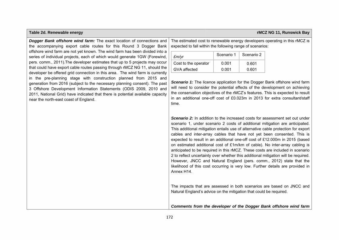
172
Table 2d. Renewable energy rMCZ NG 11, Runswick Bay
Dogger Bank offshore wind farm: The exact location of connections and the accompanying export cable routes for this Round 3 Dogger Bank offshore wind farm are not yet known. The wind farm has been divided into a series of individual projects, each of which would generate 1GW (Forewind, pers. comm., 2011).The developer estimates that up to 5 projects may occur that could have export cable routes passing through rMCZ NG 11, should the developer be offered grid connection in this area. The wind farm is currently in the pre-planning stage with construction planned from 2015 and generation from 2016 (subject to the necessary planning consent). The past 3 Offshore Development Information Statements (ODIS 2009, 2010 and 2011, National Grid) have indicated that there is potential available capacity near the north-east coast of England.
The estimated cost to renewable energy developers operating in this rMCZ is expected to fall within the following range of scenarios:
£m/yr Scenario 1 Scenario 2
Cost to the operator 0.001 0.601 GVA affected 0.001 0.601
Scenario 1: The licence application for the Dogger Bank offshore wind farm will need to consider the potential effects of the development on achieving the conservation objectives of the rMCZ’s features. This is expected to result in an additional one-off cost of £0.023m in 2013 for extra consultant/staff time.
Scenario 2: In addition to the increased costs for assessment set out under scenario 1, under scenario 2 costs of additional mitigation are anticipated. This additional mitigation entails use of alternative cable protection for export cables and inter-array cables that have not yet been consented. This is expected to result in an additional one-off cost of £12.000m in 2015 (based on estimated additional cost of £1m/km of cable). No inter-array cabling is anticipated to be required in this rMCZ. These costs are included in scenario 2 to reflect uncertainty over whether this additional mitigation will be required. However, JNCC and Natural England (pers. comm., 2012) state that the likelihood of this cost occurring is very low. Further details are provided in Annex H14.
The impacts that are assessed in both scenarios are based on JNCC and Natural England’s advice on the mitigation that could be required.
Comments from the developer of the Dogger Bank offshore wind farm
173
Table 2d. Renewable energy rMCZ NG 11, Runswick Bay
(personal communication, 2011): The estimated additional costs for the Dogger Bank wind farm assume that all 5 projects go ahead. The Dogger Bank wind farm developer is concerned that there is a low risk that additional geophysical survey data collection may be needed as part of the EIA, increasing costs by an estimated £0.150m. Additional data collection requirements of conducting a Phase 2 habitat survey as opposed to a Phase 1 survey for any landfall of cables within this rMCZ would increase costs by approximately £0.025m to £0.100m. If mitigation requires that more specialist vessels are used in the construction phases, this could lead to an estimated additional cost of £10.000m. Seasonal restrictions could cause delays in cable installation, increasing costs by an estimated £35.000m to £45.000m per 3 months of delay. This could result in knock-on delays in energising the wind farm, costing up to £625.000m per 3 months of delay. If mitigation included an increase in repair requirements, causing repairs to take longer to complete, an additional cost of approximately £625.000m could arise due to wind farm down time (assuming a 3-month delay to the repair) (Forewind, pers. comm., 2011).
Human activities in the site that are not negatively affected by the rMCZ (over 2013 to 2032 inclusive) Table 3. Human activities in the site that are not negatively affected by the rMCZ under Policy Option 1
(existing activities at their current levels and future proposals known to the regional MCZ projects)
rMCZ NG 11, Runswick Bay
Coastal developments (excluding ports and harbours), commercial fisheries (based on current level of activity), flood and coastal erosion activities, ports and harbours, recreation (recreational boating, fisheries, and snorkelling and SCUBA diving), research and education, shipping (transit of vessels only). and water abstraction, diffuse and pollution*.
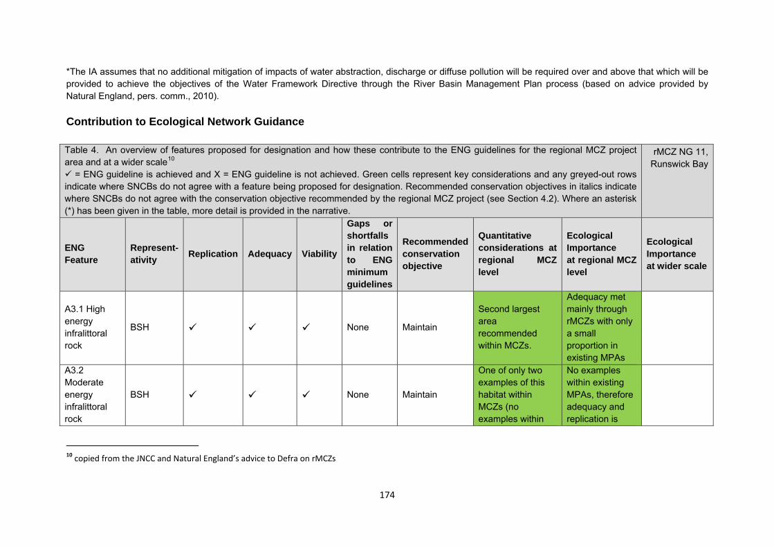
174
*The IA assumes that no additional mitigation of impacts of water abstraction, discharge or diffuse pollution will be required over and above that which will be provided to achieve the objectives of the Water Framework Directive through the River Basin Management Plan process (based on advice provided by Natural England, pers. comm., 2010). Contribution to Ecological Network Guidance Table 4. An overview of features proposed for designation and how these contribute to the ENG guidelines for the regional MCZ project area and at a wider scale10
= ENG guideline is achieved and X = ENG guideline is not achieved. Green cells represent key considerations and any greyed-out rows indicate where SNCBs do not agree with a feature being proposed for designation. Recommended conservation objectives in italics indicate where SNCBs do not agree with the conservation objective recommended by the regional MCZ project (see Section 4.2). Where an asterisk (*) has been given in the table, more detail is provided in the narrative.
rMCZ NG 11, Runswick Bay
ENG Feature
Represent-ativity Replication Adequacy Viability
Gaps or shortfalls in relation to ENG minimum guidelines
Recommended conservation objective
Quantitative considerations at regional MCZ level
Ecological Importance at regional MCZ level
Ecological Importance at wider scale
A3.1 High energy infralittoral rock
BSH None Maintain
Second largest area recommended within MCZs.
Adequacy met mainly through rMCZs with only a small proportion in existing MPAs
A3.2 Moderate energy infralittoral rock
BSH None Maintain
One of only two examples of this habitat within MCZs (no examples within
No examples within existing MPAs, therefore adequacy and replication is
10 copied from the JNCC and Natural England’s advice to Defra on rMCZs
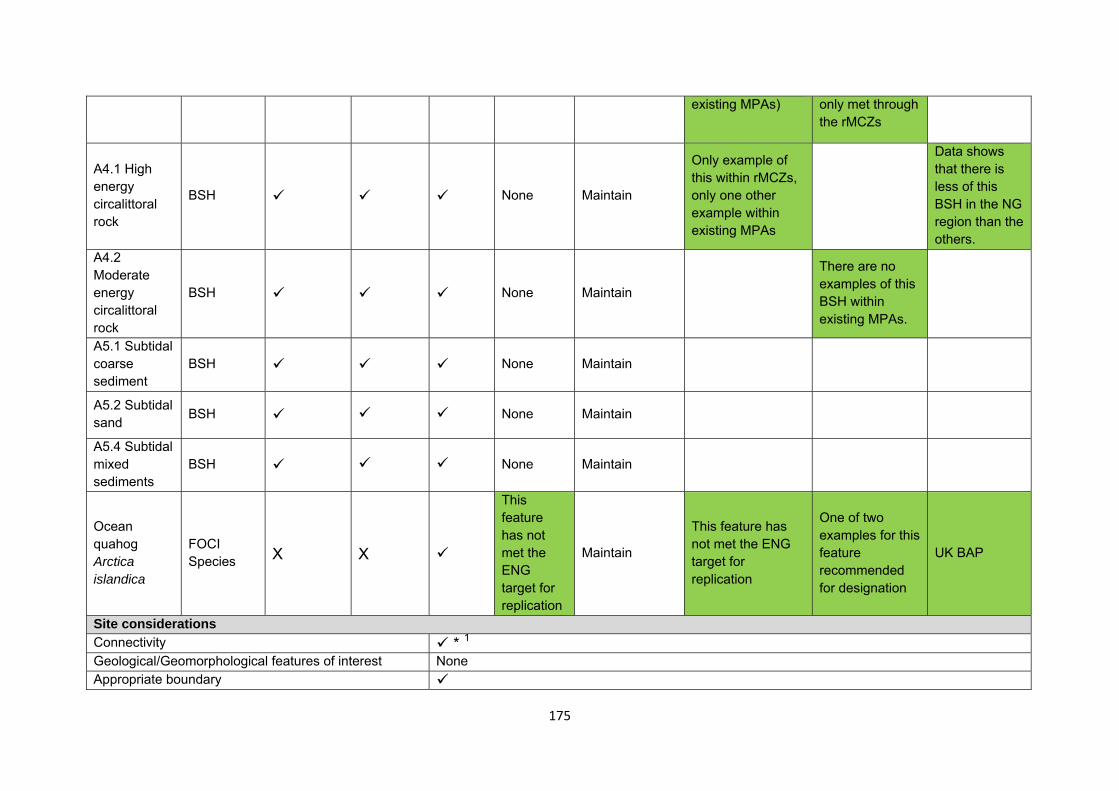
175
existing MPAs) only met through the rMCZs
A4.1 High energy circalittoral rock
BSH None Maintain
Only example of this within rMCZs, only one other example within existing MPAs
Data shows that there is less of this BSH in the NG region than the others.
A4.2 Moderate energy circalittoral rock
BSH None Maintain
There are no examples of this BSH within existing MPAs.
A5.1 Subtidal coarse sediment
BSH None Maintain
A5.2 Subtidal sand BSH None Maintain
A5.4 Subtidal mixed sediments
BSH None Maintain
Ocean quahog Arctica islandica
FOCI Species X X
This feature has not met the ENG target for replication
Maintain
This feature has not met the ENG target for replication
One of two examples for this feature recommended for designation
UK BAP
Site considerations Connectivity * 1 Geological/Geomorphological features of interest None Appropriate boundary
176
Areas of Additional Ecological Importance * 2,3 Overlaps with existing MPAs Additional comments and site benefits:
• 1 Runswick Bay rMCZ is important for MPA network connectivity in the Net Gain Region. • 2 Rocky habitats within this site are important for meeting ENG guidelines for replication and adequacy. • 3 The distribution of soft sediment BSH across this site may not be fully reflected by the BSH modelling. Level 2 A5 habitats are likely to have a
broader distribution across the site, creating a mosaic of A4 and A5 subtidal habitats that are likely to contribute to the site’s pelagic and benthic biodiversity.
• Site aligns with an existing prohibited trawl area (PTA). It is believed that there is a higher level of species abundance and diversity inside the PTA than outside (JH Allen 2008).
Anticipated benefits to ecosystem services The habitats, species and other ecological features of the rMCZ contribute to the delivery of a range of ecosystem services. Designation of the rMCZ and its subsequent management may improve the quantity and quality of the beneficial services provided, which may increase the value (contribution to economic welfare or human well-being) of them. Impacts on the value derived from ecosystem services may occur as a result of the designation, management and/or achievement of the conservation objectives of the rMCZ. Further discussion on the potential benefits to ecosystem services can be found in Annex L and on definitions can be found in Annex H5. Table 5a. Fish and shellfish for human consumption rMCZ NG 11, Runswick Bay
Baseline Beneficial impact under Policy Option 1
Fletcher and others (2011) identify that the features to be protected by the recommended Marine Conservation Zone (rMCZ) can contribute to the delivery of fish and shellfish for human consumption.
The waters of rMCZ NG 11 provide suitable spawning areas for herring and
If the conservation objectives of the features are achieved, the features will be maintained in favourable condition.
No additional management (above that in the baseline situation) of fishing activities is expected. As such, no benefits
Anticipated direction of
change:
177
Table 5a. Fish and shellfish for human consumption rMCZ NG 11, Runswick Bay
lemon sole and nursery areas for sprat, cod, whiting and plaice (Net Gain Final Recommendations, 2011). The site boundaries are clipped to a year-round no-trawl zone, helping to protect the benthic environment within the site (Net Gain Final Recommendations, 2011).
Subtidal sediments provide important nursery grounds for commercial species (Fletcher and others, 2011) and, as such, are likely to help support potential on-site and off-site fisheries. It has not been possible to estimate the value derived from off-site fisheries as a result of the nursery area function.
Commercial fishing occurs within the rMCZ by UK under and over 15 metre vessels. Estimated total value of landings for the site is £0.382m/yr. The majority of this value can be attributed to vessels using bottom trawls (£0.154m/yr) and pots and traps (£0.212 m/yr), with smaller value of landings from vessels using nets, hooks and lines within the site (MCZ Fisheries Model, 2011).
The baseline quantity and quality of the ecosystem service provided is assumed to be commensurate with that provided by the features of the site when in favourable condition.
are expected to accrue as a result of reduced fishing mortality. No change in on-site feature condition is anticipated and therefore no impact on on-site or off-site benefits is expected.
Designating the rMCZ will protect its features and the ecosystem services that they provide against the risk of future degradation from anthropogenic pressures (because if necessary, mitigation would be introduced, with the associated costs and benefits).
Confidence: Moderate
Table 5b. Recreation rMCZ NG 11, Runswick Bay
Baseline Beneficial impact under Policy Option 1
178
Table 5b. Recreation rMCZ NG 11, Runswick Bay
Angling: Fletcher and others (2011) identify that the features to be protected by the recommended Marine Conservation Zone (rMCZ) can contribute to the delivery of fish and shellfish for human consumption and recreation services.
The site is important as a spawning ground for herring and lemon sole and as a nursery area for sprat, cod, whiting and plaice (Net Gain Final Recommendations, 2011). Subtidal sediments provide important nursery grounds for commercial species (Fletcher and others, 2011) and, as such, are likely to help support potential on-site and off-site fisheries. It has not been possible to estimate the value derived from off-site fisheries as a result of the nursery area function.
Both shore and sea angling are thought to occur within the site but the intensity of the activity is unknown; a minimum of 7 charter boats are known to operate from nearby Whitby (Stakmap, 2011). It has not been possible to estimate the value derived from angling on-site or the proportion of the value derived from angling off-site which result from the nursery and spawning area.
The baseline quantity and quality of the ecosystem service provided is assumed to be commensurate with that provided by the features of the site when in favourable condition.
If the conservation objectives of the features are achieved, the features will be maintained in favourable condition.
No change in on-site feature condition or fishing mortality is anticipated and therefore no impact on on-site or off-site benefits is expected (see Table 4a for further details).
Designating the rMCZ will protect its features and the ecosystem services that they provide against the risk of future degradation from anthropogenic pressures (because if necessary, mitigation would be introduced, with the associated costs and benefits).
Anticipated direction of
change:
Confidence: Moderate
Diving: Diving and snorkelling are thought to take place within the rMCZ but the intensity of the activity is unknown (Stakmap, 2011).
If the conservation objectives of the features are achieved, the features will be maintained in favourable condition.
No change in on-site feature condition is anticipated. However,
Anticipated direction of
change:
179
Table 5b. Recreation rMCZ NG 11, Runswick Bay
designation may result in an increase in dive trips to the area, which may have beneficial effects on the local economy. This increase may represent a redistribution of dive location preferences rather than an increase in days spent diving or the number of divers.
Designating the rMCZ will protect its features and the ecosystem services that they provide against the risk of future degradation from anthropogenic pressures (because if necessary, mitigation would be introduced, with the associated costs and benefits).
Confidence: Moderate
180
Table 5b. Recreation rMCZ NG 11, Runswick Bay
Wildlife watching: Fletcher and others (2011) identify that the features to be protected by the rMCZ can contribute to the delivery of recreation and tourism services.
The site is popular for wildlife enthusiasts such as bird watchers. The sandstone cliffs adjacent to rMCZ NG 11 are ideal habitats for cliff-nesting birds such as kittiwake, fulmar and gannet (English Nature, not dated), which utilise rMCZ NG 11 for foraging (Net Gain Final Recommendations, 2011). There have also been recent sightings of harbour porpoise, both north and south of rMCZ NG 11 (Sea Watch Foundation, 2011), so marine mammals may frequent these waters. It has not been possible to estimate the value derived from wildlife watching in the site.
The baseline quantity and quality of the ecosystem service provided is assumed to be commensurate with that provided by the features of the site when in favourable condition.
If the conservation objectives of the features are achieved, the features will be maintained in favourable condition.
No change in on-site feature condition is anticipated and therefore no benefits to wildlife watching are expected.
Designating the rMCZ will protect its features and the ecosystem services that they provide against the risk of future degradation from anthropogenic pressures (because if necessary, mitigation would be introduced, with the associated costs and benefits).
Anticipated direction of
change:
Confidence: Moderate
Table 5c. Research and education rMCZ NG 11, Runswick Bay
Baseline Beneficial impact under Policy Option 1
181
Table 5c. Research and education rMCZ NG 11, Runswick Bay
Research: Fletcher and others (2011) identify that the features to be protected by the recommended Marine Conservation Zone (rMCZ) can contribute to the delivery of research services.
Recommended MCZ NG 11 contains Runswick Bay and Staithes-Port Mulgrave Sites of Special Scientific Interest (SSSIs), which have both been designated for their geological interest (Net Gain Final Recommendations, 2011). Runswick Bay SSSI contains internationally important geological fossil remains and Staithes-Port Mulgrave SSSI has an internationally significant layer of stratified rocks, exposing the geological Pliensbachian-Toarcian stage boundary (Net Gain Final Recommendations, 2011). The exposed rocks on the coast of rMCZ NG 11 are from the Lower Jurassic and predominantly made up of shale and sandstone. These rocks are important for stratigraphy and hold many important fish, ammonite and reptile fossils (English Nature, not dated).
Monitoring of the rMCZ will help to inform understanding of how the marine environment is changing and is impacted on by anthropogenic pressures and management interventions. Other research benefits are unknown.
Anticipated direction of
change:
Confidence: High
Education: Fletcher and others (2011) identify that the features to be protected by the rMCZ can contribute to the delivery of education services.
The extent of current educational activity carried out in the site is unknown. It has not been possible to estimate the value derived from education activities associated with the rMCZ.
Designation may aid additional local (to the rMCZ) provision of education (e.g. events and interpretation boards), from which visitors would derive benefit.
Non-visitors may benefit if the rMCZ contributes to wider provision of education (e.g. television programmes, articles in magazines and newspapers, and educational resources developed for use in schools).
Anticipated direction of
change:
Confidence: Moderate
182
Table 5d. Regulating services rMCZ NG 11, Runswick Bay
Baseline Beneficial impact under Policy Option 1
Regulation of pollution: The features of the site contribute to the bioremediation of waste and sequestration of carbon. It has not been possible to estimate the value derived from the regulation of pollution in the rMCZ.
Environmental resilience: The features of the site contribute to the resilience and continued regeneration of marine ecosystems. It has not been possible to estimate the value derived from environmental resilience in the rMCZ.
Natural hazard protection: The features of the site contribute to local flood and storm protection. It has not been possible to estimate the value derived from natural hazard protection in the rMCZ.
(Fletcher and others, 2011)
If the conservation objectives of the features are achieved, the features will be maintained in favourable condition.
No change in feature condition and management of human activities is expected and therefore no benefit to the regulatory capacity of the site is expected.
Designating the recommended Marine Conservation Zone will protect its features and the ecosystem services that they provide against the risk of future degradation from anthropogenic pressures (because if necessary, mitigation would be introduced, with the associated costs and benefits).
Anticipated direction of
change:
Confidence: Moderate
Table 5e. Non-use and option values rMCZ NG 11, Runswick Bay
Baseline Beneficial impact under Policy Option 1
Some people gain satisfaction from the existence of marine habitats, species and other features. They also gain from having the option to benefit in the future from the habitats and species in the recommended Marine Conservation Zone (rMCZ) and the ecosystem services provided, even if they do not currently benefit from them.
The rMCZ will benefit the proportion of the UK population that values conservation of the rMCZ features and its contribution to an ecologically coherent network of Marine Protected Areas. Some people will gain satisfaction from knowing that the habitats and species are being conserved (existence value) and/or that they are being conserved for use by others in the
Anticipated direction of
change:
183
Table 5e. Non-use and option values rMCZ NG 11, Runswick Bay
current generation (altruistic value) or future generations (bequest value). The rMCZ will protect both the features and their option to benefit from the services in the future from the risk of future degradation.
In the Marine Conservation Society ‘Your Seas Your Voice’ campaign, 1 ‘nominated site’ is located within rMCZ NG 11. Features of the natural environment were strong motivators for reasons why people thought that these locations should be protected, with people frequently attaching value to biodiversity and ‘spectacular scenery’. The relative isolation of the site was also considered an important motivator for protection.
Confidence: Moderate
184
rMCZ NG 12, Compass Rose Site area (km2): 551.56
• This site has been proposed for designation under Policy Option 1 only.
Table 1. Conservation impacts rMCZ NG 12, Compass Rose
1a. Ecological description
The feature for this recommended Marine Conservation Zone (rMCZ), moderate energy circalittoral rock, can support primarily algal species in shallow waters while deeper waters with insufficient sunlight for algal growth support high densities of animal communities. Such communities can include cup coral, sea-fans, anemones, sponges, mussels, worms, starfish, brittle stars and sea urchins.
The site captures a small portion of the Flamborough frontal system, which is most prevalent during spring/summer/autumn. The Flamborough frontal system is defined by the distinct temperature gradient between the waters to the north and south of Flamborough Head, where mixing of the warmer waters of the southern North Sea and the cooler waters of the northern North Sea occurs. The upwelling in locations such as this allows nutrients to be transported to the surface from deeper, colder waters, which creates a site of increased primary biomass production.
Recommended MCZ NG 12 provides foraging grounds for species including Atlantic puffin, black-legged kittiwake, common guillemot, northern fulmar, northern gannet and razorbill. The site contains spawning grounds for plaice, herring, lemon sole, sand eel and sprat. It is also a nursery ground for cod, whiting, lemon sole, sand eel and sprat.
There are no existing Marine Protected Areas in or adjacent to the site, although rMCZ Reference Area 10 lies entirely within rMCZ NG 12.
(Net Gain, Final Site Recommendations Submission, 2011)
1b. Baseline condition of MCZ features and impact of the rMCZ
185
Site-specific costs arising from the effect of the rMCZ on human activities (over 2013 to 2032 inclusive) Table 2a. Commercial fisheries rMCZ NG 12, Compass Rose
Source of costs of the rMCZ
JNCC and Natural England have advised that there is considerable uncertainty about whether additional management of commercial fishing gears will be required for certain features protected by this rMCZ. Multiple management scenarios have been identified for the IA which reflect this uncertainty. Should the site be designated, the management that will be required is likely to fall somewhere within the range provided below.
The regional stakeholder group’s (RSG’s) recommendation of closure of the moderate energy circalittoral rock to bottom trawling is also presented for this site. This recommendation represents the outcome of discussions held by Net Gain and describes the additional restrictions believed by the RSG to be required in order to achieve the conservation objectives for this site. The alternative scenarios provided at the request of the Statutory Nature Conservation Bodies (SNCBs) do not reflect the Net Gain RSG discussions.
Management scenario 1: No additional management.
Management scenario 2: RSG suggestion - Closure of moderate energy circalittoral rock to bottom trawls.
Management scenario 3: Zoned management − closure of moderate energy circalittoral rock to bottom trawls, nets, pots and traps.
Feature Area of feature (km2) No. of point records
Baseline Impact of the MCZ
Broad-scale habitats
Moderate energy circalittoral rock 244.88 − Unfavourable condition Recovered to favourable condition
186
Table 2a. Commercial fisheries rMCZ NG 12, Compass Rose
Management scenario 4: Closed to bottom trawls, nets, pots and traps.
Summary of all UK commercial fisheries: Recommended MCZ NG 12 lies wholly beyond 12nm. The estimated value of landings for the site is £0.068m/yr (MCZ Fisheries Model). The MCZ Fisheries Model data indicate that a minimum of 21 under 15 metre vessels fish within the site from 5 UK ports, landing their catch from within the site in 10 ports. The estimated value of landings by under 15 metre vessels fishing with bottom trawls, pots and nets within the site is £0.018m/yr. The estimated value of landings by over 15 metre vessels fishing with bottom trawls, mid-water trawls and pots within the site is £0.050m/yr. Recommended MCZ NG 12 is regarded as an important area for safe winter fishing (interview with National Federation of Fishermen’s Organisations (NFFO), 2011) and is mainly fished for cod and haddock and various species of flatfish (interview with Scarborough fleet representative, 2011). Trawling prevents static gear activity over much of the site; static gear vessels fishing the site tend to do so using pots and traps over the western portion (interview with NFFO, 2012). No existing formal commercial fishing restrictions that are specific to this area have been identified.
Baseline description of UK commercial fisheries Costs of impact of rMCZ on UK commercial fisheries under Policy Option 1
187
Table 2a. Commercial fisheries rMCZ NG 12, Compass Rose
Bottom trawls: The estimated value of landings from bottom trawls within the site is £0.035m/yr.MCZ Fisheries Model data indicate that a minimum of 18 under 15 metre vessels from 5 UK ports (Amble, Bridlington, Grimsby, Hartlepool and Whitby) use bottom trawls within the site. These vessels land their catch from within the site in 10 ports (the 5 listed above and Blyth, Eyemouth, North Shields, Peterhead and South Shields). Target species include cod, haddock, lemon sole, plaice, prawn and whiting. The estimated value of landings for bottom trawls within the site by under 15 metre vessels is £0.015m/yr. All of this value is attributed to bottom otter trawling.
The estimated value of landings by over 15 metre vessels using bottom trawls within the site is £0.020m/yr.
The estimated annual value of UK bottom trawl landings affected is expected to fall within the following range of scenarios:
£m/yr Scenario 1 Scenario 2 Scenario 3 Scenario 4Value of landings affected
0.000 0.024 0.024 0.034
Nets: MCZ Fisheries Model data indicate that a minimum of 1 under 15 metre vessel from Bridlington uses nets within the site, landing its catch from within the site in Bridlington. Target species include cod, haddock, monkfish, sole, bonito, skate and turbot. The estimated value of landings for nets within the site by under 15 metre vessels is negligible.
No over 15 metre vessels are known to use nets within the site.
The estimated annual value of UK net landings affected is expected to fall within the following range of scenarios:
£m/yr Scenario 1 Scenario 2 Scenario 3 Scenario 4Value of landings affected
0.000 0.000 0.000 <0.001
In establishing the draft conservation objectives, the site’s features were assessed as having low vulnerability to fishing with nets at current levels and, as such, this activity was not the primary reason for assigning the ’recover’ conservation objectives. It is anticipated that, if additional management is required, it may be towards the lower end of the range and is likely to be less restrictive than that required for other gears.
Pots and traps: The estimated value of landings from vessels fishing with pots and traps within the site is £0.021m/yr, of which £0.018m/yr is from over 15 metre vessels.
The estimated annual value of UK pots and traps landings affected is expected to fall within the following range of scenarios:
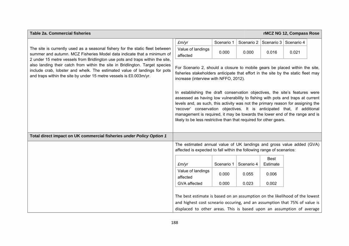
188
Table 2a. Commercial fisheries rMCZ NG 12, Compass Rose
The site is currently used as a seasonal fishery for the static fleet between summer and autumn. MCZ Fisheries Model data indicate that a minimum of 2 under 15 metre vessels from Bridlington use pots and traps within the site, also landing their catch from within the site in Bridlington. Target species include crab, lobster and whelk. The estimated value of landings for pots and traps within the site by under 15 metre vessels is £0.003m/yr.
£m/yr Scenario 1 Scenario 2 Scenario 3 Scenario 4Value of landings affected
0.000 0.000 0.016 0.021
For Scenario 2, should a closure to mobile gears be placed within the site, fisheries stakeholders anticipate that effort in the site by the static fleet may increase (interview with NFFO, 2012).
In establishing the draft conservation objectives, the site’s features were assessed as having low vulnerability to fishing with pots and traps at current levels and, as such, this activity was not the primary reason for assigning the ‘recover’ conservation objectives. It is anticipated that, if additional management is required, it may be towards the lower end of the range and is likely to be less restrictive than that required for other gears.
Total direct impact on UK commercial fisheries under Policy Option 1
The estimated annual value of UK landings and gross value added (GVA) affected is expected to fall within the following range of scenarios:
£m/yr Scenario 1 Scenario 4Best
Estimate Value of landings affected
0.000 0.055 0.006
GVA affected 0.000 0.023 0.002 The best estimate is based on an assumption on the likelihood of the lowest and highest cost scneario occuring, and an assumption that 75% of value is displaced to other areas. This is based upon an assumption of average
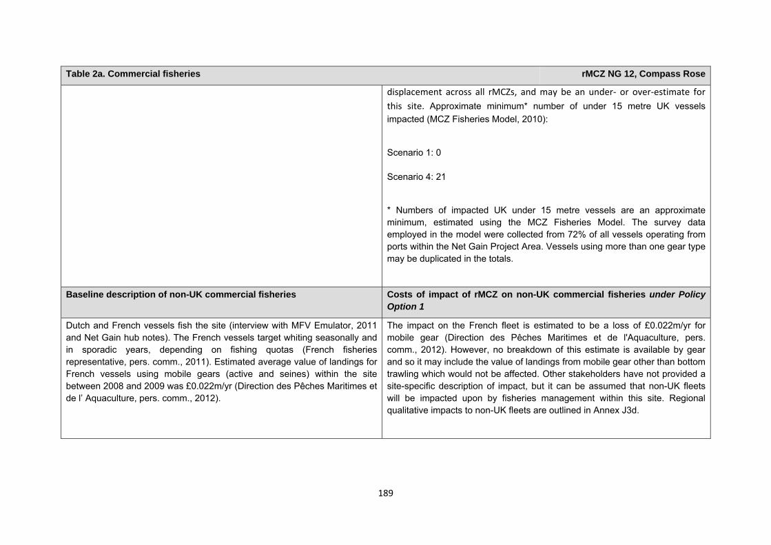
189
Table 2a. Commercial fisheries rMCZ NG 12, Compass Rose
displacement across all rMCZs, and may be an under‐ or over‐estimate for this site. Approximate minimum* number of under 15 metre UK vessels impacted (MCZ Fisheries Model, 2010):
Scenario 1: 0 Scenario 4: 21
* Numbers of impacted UK under 15 metre vessels are an approximate minimum, estimated using the MCZ Fisheries Model. The survey data employed in the model were collected from 72% of all vessels operating from ports within the Net Gain Project Area. Vessels using more than one gear type may be duplicated in the totals.
Baseline description of non-UK commercial fisheries Costs of impact of rMCZ on non-UK commercial fisheries under Policy Option 1
Dutch and French vessels fish the site (interview with MFV Emulator, 2011 and Net Gain hub notes). The French vessels target whiting seasonally and in sporadic years, depending on fishing quotas (French fisheries representative, pers. comm., 2011). Estimated average value of landings for French vessels using mobile gears (active and seines) within the site between 2008 and 2009 was £0.022m/yr (Direction des Pêches Maritimes et de l’ Aquaculture, pers. comm., 2012).
The impact on the French fleet is estimated to be a loss of £0.022m/yr for mobile gear (Direction des Pêches Maritimes et de l'Aquaculture, pers. comm., 2012). However, no breakdown of this estimate is available by gear and so it may include the value of landings from mobile gear other than bottom trawling which would not be affected. Other stakeholders have not provided a site-specific description of impact, but it can be assumed that non-UK fleets will be impacted upon by fisheries management within this site. Regional qualitative impacts to non-UK fleets are outlined in Annex J3d.
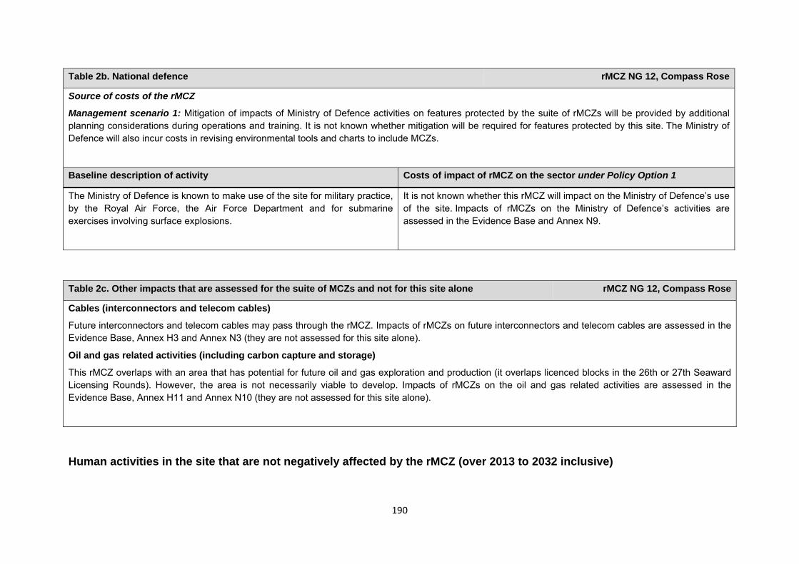
190
Table 2b. National defence rMCZ NG 12, Compass Rose
Source of costs of the rMCZ
Management scenario 1: Mitigation of impacts of Ministry of Defence activities on features protected by the suite of rMCZs will be provided by additional planning considerations during operations and training. It is not known whether mitigation will be required for features protected by this site. The Ministry of Defence will also incur costs in revising environmental tools and charts to include MCZs.
Baseline description of activity Costs of impact of rMCZ on the sector under Policy Option 1
The Ministry of Defence is known to make use of the site for military practice, by the Royal Air Force, the Air Force Department and for submarine exercises involving surface explosions.
It is not known whether this rMCZ will impact on the Ministry of Defence’s use of the site. Impacts of rMCZs on the Ministry of Defence’s activities are assessed in the Evidence Base and Annex N9.
Human activities in the site that are not negatively affected by the rMCZ (over 2013 to 2032 inclusive)
Table 2c. Other impacts that are assessed for the suite of MCZs and not for this site alone rMCZ NG 12, Compass Rose
Cables (interconnectors and telecom cables)
Future interconnectors and telecom cables may pass through the rMCZ. Impacts of rMCZs on future interconnectors and telecom cables are assessed in the Evidence Base, Annex H3 and Annex N3 (they are not assessed for this site alone).
Oil and gas related activities (including carbon capture and storage)
This rMCZ overlaps with an area that has potential for future oil and gas exploration and production (it overlaps licenced blocks in the 26th or 27th Seaward Licensing Rounds). However, the area is not necessarily viable to develop. Impacts of rMCZs on the oil and gas related activities are assessed in the Evidence Base, Annex H11 and Annex N10 (they are not assessed for this site alone).
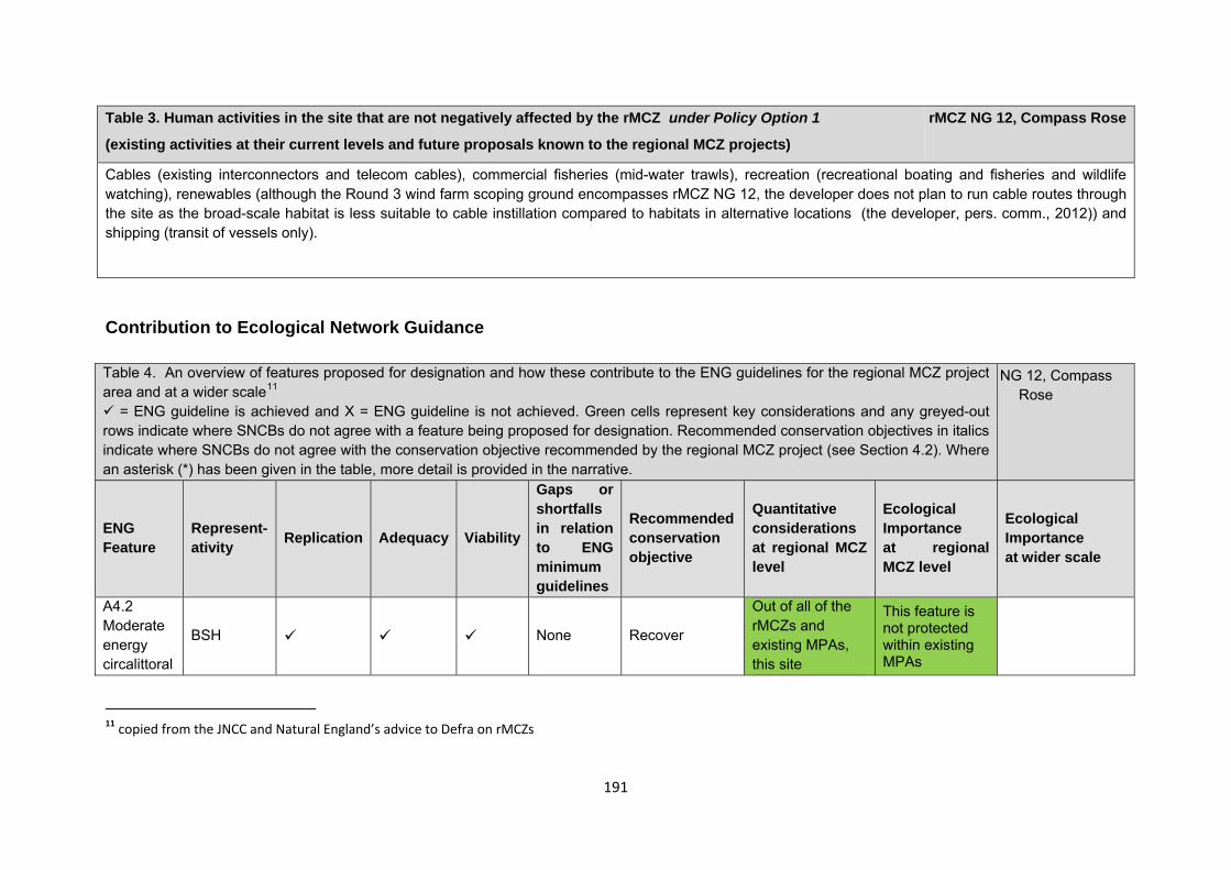
191
Contribution to Ecological Network Guidance Table 4. An overview of features proposed for designation and how these contribute to the ENG guidelines for the regional MCZ project area and at a wider scale11
= ENG guideline is achieved and X = ENG guideline is not achieved. Green cells represent key considerations and any greyed-out rows indicate where SNCBs do not agree with a feature being proposed for designation. Recommended conservation objectives in italics indicate where SNCBs do not agree with the conservation objective recommended by the regional MCZ project (see Section 4.2). Where an asterisk (*) has been given in the table, more detail is provided in the narrative.
NG 12, Compass Rose
ENG Feature
Represent-ativity Replication Adequacy Viability
Gaps or shortfalls in relation to ENG minimum guidelines
Recommended conservation objective
Quantitative considerations at regional MCZ level
Ecological Importance at regional MCZ level
Ecological Importance at wider scale
A4.2 Moderate energy circalittoral
BSH None Recover
Out of all of the rMCZs and existing MPAs, this site
This feature is not protected within existing MPAs
11 copied from the JNCC and Natural England’s advice to Defra on rMCZs
Table 3. Human activities in the site that are not negatively affected by the rMCZ under Policy Option 1
(existing activities at their current levels and future proposals known to the regional MCZ projects)
rMCZ NG 12, Compass Rose
Cables (existing interconnectors and telecom cables), commercial fisheries (mid-water trawls), recreation (recreational boating and fisheries and wildlife watching), renewables (although the Round 3 wind farm scoping ground encompasses rMCZ NG 12, the developer does not plan to run cable routes through the site as the broad-scale habitat is less suitable to cable instillation compared to habitats in alternative locations (the developer, pers. comm., 2012)) and shipping (transit of vessels only).
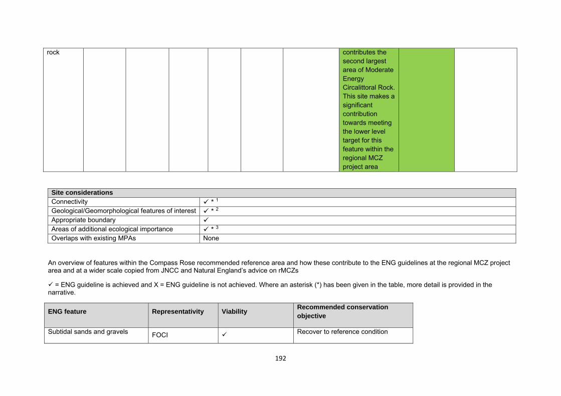
192
rock contributes the second largest area of Moderate Energy Circalittoral Rock. This site makes a significant contribution towards meeting the lower level target for this feature within the regional MCZ project area
Site considerations Connectivity * 1 Geological/Geomorphological features of interest * 2 Appropriate boundary Areas of additional ecological importance * 3 Overlaps with existing MPAs None
An overview of features within the Compass Rose recommended reference area and how these contribute to the ENG guidelines at the regional MCZ project area and at a wider scale copied from JNCC and Natural England’s advice on rMCZs
= ENG guideline is achieved and X = ENG guideline is not achieved. Where an asterisk (*) has been given in the table, more detail is provided in the narrative.
ENG feature Representativity Viability Recommended conservation objective
Subtidal sands and gravels FOCI Recover to reference condition
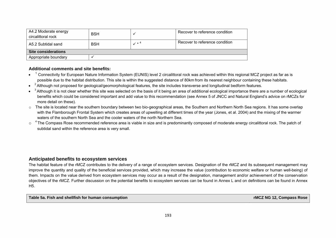
193
A4.2 Moderate energy circalittoral rock BSH Recover to reference condition
A5.2 Subtidal sand BSH * 4 Recover to reference condition
Site considerations Appropriate boundary Additional comments and site benefits: • 1 Connectivity for European Nature Information System (EUNIS) level 2 circalittoral rock was achieved within this regional MCZ project as far as is
possible due to the habitat distribution. This site is within the suggested distance of 80km from its nearest neighbour containing these habitats. • 2 Although not proposed for geological/geomorphological features, the site includes transverse and longitudinal bedform features. • 3 Although it is not clear whether this site was selected on the basis of it being an area of additional ecological importance there are a number of ecological
benefits which could be considered important and add value to this recommendation (see Annex 5 of JNCC and Natural England’s advice on rMCZs for more detail on these).
o The site is located near the southern boundary between two bio-geographical areas, the Southern and Northern North Sea regions. It has some overlap with the Flamborough Frontal System which creates areas of upwelling at different times of the year (Jones, et al. 2004) and the mixing of the warmer waters of the southern North Sea and the cooler waters of the north Northern Sea.
o 4 The Compass Rose recommended reference area is viable in size and is predominantly composed of moderate energy circalittoral rock. The patch of subtidal sand within the reference area is very small.
Anticipated benefits to ecosystem services The habitat feature of the rMCZ contributes to the delivery of a range of ecosystem services. Designation of the rMCZ and its subsequent management may improve the quantity and quality of the beneficial services provided, which may increase the value (contribution to economic welfare or human well-being) of them. Impacts on the value derived from ecosystem services may occur as a result of the designation, management and/or achievement of the conservation objectives of the rMCZ. Further discussion on the potential benefits to ecosystem services can be found in Annex L and on definitions can be found in Annex H5. Table 5a. Fish and shellfish for human consumption rMCZ NG 12, Compass Rose
194
Table 5a. Fish and shellfish for human consumption rMCZ NG 12, Compass Rose
Baseline Beneficial impact under Policy Option 1
Fletcher and others (2011) identify that the feature to be protected by the recommended Marine Conservation Zone (rMCZ) can contribute to the delivery of fish and shellfish for human consumption.
The site contains spawning grounds for plaice, herring, lemon sole, sand eel and sprat. This site is also a nursery ground for cod, whiting, lemon sole, sand eel and sprat (Net Gain Final Recommendations, 2011). It has not been possible to estimate the value derived from off-site fisheries as a result of the nursery area function.
A description of on-site fishing activity and the value derived from it is set out in Table 2.
The baseline quantity and quality of the ecosystem service provided is assumed to be commensurate with that provided by the feature of the site when in unfavourable condition.
If the conservation objective of the feature is achieved, the feature will be recovered to favourable condition. Achievement of the conservation objective may improve the contribution of the habitat to the provision of fish and shellfish for human consumption.
New management of fishing activities is expected (above the baseline situation), the costs of which are set out in Table 2. This may reduce the impacts on fish and shellfish habitats and harvesting of stocks, which may in turn benefit stocks of commercial species.
Potential benefits may arise on-site, for fishers permitted to fish within the rMCZ, and off-site from spill-over benefits.
As some fishing activity may still be permitted in the rMCZ, it is unclear whether it would have any impact on stocks of mobile commercial finfish species. Stocks of low-mobility and site-attached species, such as lobsters and crabs, may improve as a result of reduced fishing pressure. If some fishing for such species is permitted within the rMCZ, then catches may improve. Localised beneficial spill-over effects may occur around the rMCZ. If rMCZ management involves reduced mobile gear effort, but no reductions in static gear fishing, this may reduce gear conflict between mobile and static gear fishers. Reduced gear conflict may reduce the cost of fishing in the rMCZ for static gear fishers.
The recovery of the moderate energy circalittoral rock to
Anticipated direction of
change:
Confidence: Low
195
Table 5a. Fish and shellfish for human consumption rMCZ NG 12, Compass Rose
favourable condition may improve its functioning as a nursery area, potentially benefiting fisheries exploited within and outside the rMCZ.
The potential effects described here do not include the negative impacts of the additional fisheries management on fish and shellfish provision and off-site impacts of displaced effort.
Table 5b. Recreation rMCZ NG 12, Compass Rose
Baseline Beneficial impact under Policy Option 1
Angling: Fletcher and others (2011) identify that the feature to be protected by the recommended Marine Conservation Zone (rMCZ) can contribute to the delivery of fish and shellfish for human consumption and recreation services.
The baseline quantity and quality of the ecosystem service provided is assumed to be commensurate with that provided by the feature of the site when in unfavourable condition.
The intensity of sea angling within the site is unknown but 7 charter boats are known to operate from Whitby, which may transport sea anglers to fish within the site (Stakmap, 2011).
The site contains spawning grounds for plaice, herring, lemon sole, sand eel
If the conservation objective of the feature is achieved, the feature will be recovered to favourable condition.
It is unclear whether any benefits to fish populations would arise as a result of reduced fishing mortality due to management of commercial fishing. The recovery of the moderate energy circalittoral rock to favourable condition may improve functioning as a nursery area, potentially benefiting fisheries exploited within and outside the rMCZ (see Table 4a for further details).
As no additional management of angling is expected, anglers will be able to benefit from any on-site and off-site beneficial effects. If the rMCZ results in an increase in the size and diversity of species caught, then this is expected to increase
Anticipated direction of
change:
Confidence: Low
196
Table 5b. Recreation rMCZ NG 12, Compass Rose
and sprat. This site is also a nursery ground for cod, whiting, lemon sole, sand eel and sprat (Net Gain Final Recommendations, 2011). It has not been possible to estimate the value derived from angling on-site or the proportion of the value derived from angling off-site which result from the nursery and spawning area.
the value derived by anglers.
The designation may lead to an increase in angling visits to the site, which may benefit the local economy. This increase is likely to arise from a change in anglers’ preferred angling locations rather than an increase in days spent angling or the number of anglers.
Diving: Diving is not known to take place in the rMCZ.
N/A N/A
Wildlife watching: Wildlife watching is known to take place in the rMCZ but the intensity of the activity is unknown (Stakmap, 2011).
If the conservation objective of the feature is achieved, the feature will be recovered to favourable condition.
As the site is offshore, with limited wildlife watching taking place within it, benefits are expected to be minimal, but the recovery of the feature within the site is expected to support foraging bird populations enjoyed by wildlife watchers in nearby protected areas.
Anticipated direction of
change:
Confidence: Moderate
Table 5c. Research and education rMCZ NG 12, Compass Rose
Baseline Beneficial impact under Policy Option 1
Research: Research is not known to take place in the recommended Marine Conservation Zone (rMCZ).
Monitoring of the rMCZ will help to inform understanding of how the marine environment is changing and is impacted on by
Anticipated direction of
197
Table 5c. Research and education rMCZ NG 12, Compass Rose
anthropogenic pressures and management interventions. Other research benefits are unknown.
change:
Confidence: High
Education: Education is not known to take place in the rMCZ. As the rMCZ is more than 6nm offshore and therefore relatively inaccessible, no benefits are likely to arise from direct use of the site for education.
Non-visitors may benefit if the rMCZ contributes to wider provision of education (e.g. television programmes, articles in magazines and newspapers, and educational resources developed for use in schools).
Anticipated direction of
change:
Confidence: Low
Table 5d. Regulating services rMCZ NG 12, Compass Rose
Baseline Beneficial impact under Policy Option 1
Regulation of pollution: The features of the site are not thought to contribute to the bioremediation of waste and sequestration of carbon.
Environmental resilience: The features of the site are not thought to contribute to the resilience and continued regeneration of marine ecosystems.
N/A N/A
198
Natural hazard protection: As the site is beyond 12nm, the features of the site do not contribute to local flood and storm protection. (Fletcher and others, 2011)
Table 5e. Non-use and option values rMCZ NG 12, Compass Rose
Baseline Beneficial impact under Policy Option 1
Some people gain satisfaction from the existence of marine habitats, species and other features. They also gain from having the option to benefit in the future from the habitats and species in the recommended Marine Conservation Zone (rMCZ) and the ecosystem services provided, even if they do not currently benefit from them.
The rMCZ will benefit the proportion of the UK population that values conservation of the rMCZ feature and its contribution to an ecologically coherent network of Marine Protected Areas. Some people will gain satisfaction from knowing that the habitats and species are being conserved (existence value) and/or that they are being conserved for use by others in the current generation (altruistic value) or future generations (bequest value). The rMCZ will protect both the feature and its option to benefit from the services in the future from the risk of future degradation.
Anticipated direction of
change:
Confidence: Moderate
199
rMCZ NG 13, Coquet – St Mary’s
Site area (km2): 198.75
• This site has been proposed for designation under Policy Option 1 only.
Table 1. Conservation impacts rMCZ NG 13, Coquet – St Mary’s
1a. Ecological description
The sea bed is a mosaic of intertidal and subtidal rock and sediment features, including diverse intertidal underboulder communities of conservation importance. Hard-rock cliffs are a feature in this area with many of the headlands fronted by rocky shore platforms. The area contains a number of estuary mouths that support sediment-influenced communities.
Within the site there are the following 9 Sites of Special Scientific Interest (SSSIs): Alnmouth Saltmarsh and Dunes; Coquet Island; Cresswell and Newbiggin Shores; Cresswell Ponds; Hadston Links; Low Hauxley Shore; Northumberland Shore; Tynemouth to Seaton Sluice; and Warkworth Dunes and Saltmarsh. A number of these are designated for their geological importance for features that include coal measures, sedimentary features and volcanic glacial till. A sublittoral ridge of limestone known locally as the Trink occurs offshore at Blyth. It is partly covered by gravels, cobbles and some boulders. The species Copidognathus reticulates reported to be found on the Trink (English Nature, 1998) is rare . The northern boundary of recommended Marine Conservation Zone (rMCZ) NG 13 aligns with the Berwickshire and North Northumberland Coast Special Area of Conservation (SAC).
The Northumberland Shore SSSI, which is within the rMCZ, is notified for its nationally important populations of turnstone, purple sandpiper, golden plover (which are listed on Annex 1 of the EC Birds), ringed plover, redshank (listed on Annex 2 of the EC Birds Directive) and sanderling. The SSSI as a whole is used by a wide variety of other shorebirds in winter, including curlew, oystercatcher, knot, bar-tailed godwit (which are all listed on Annex I or 2 of the EC Birds Directive), dunlin, and lapwing.
Recommended MCZ NG 13 overlaps with the Northumbria Coast Special Protection Area (SPA), which is of European importance for purple sandpiper and turnstone, and includes the Coquet Island SPA, SSSI and Royal Society for the Protection of Birds reserve, which is a site of European importance for terns (sandwich, roseate, Arctic and common) and Atlantic puffin, and is of national importance for eider and black-headed gull (it contains more than 1% of their British breeding populations). Coquet Island SPA and SSSI contains approximately 90% of the UK breeding population of roseate tern (listed on Annex 1 of
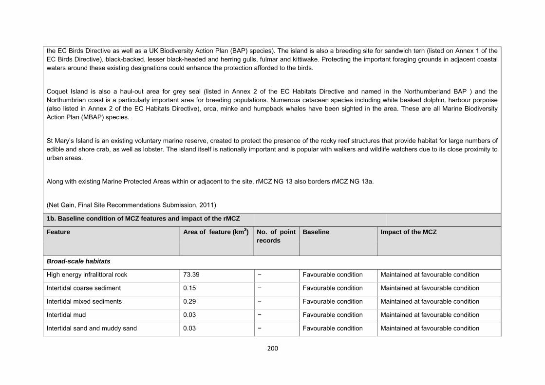
200
the EC Birds Directive as well as a UK Biodiversity Action Plan (BAP) species). The island is also a breeding site for sandwich tern (listed on Annex 1 of the EC Birds Directive), black-backed, lesser black-headed and herring gulls, fulmar and kittiwake. Protecting the important foraging grounds in adjacent coastal waters around these existing designations could enhance the protection afforded to the birds.
Coquet Island is also a haul-out area for grey seal (listed in Annex 2 of the EC Habitats Directive and named in the Northumberland BAP ) and the Northumbrian coast is a particularly important area for breeding populations. Numerous cetacean species including white beaked dolphin, harbour porpoise (also listed in Annex 2 of the EC Habitats Directive), orca, minke and humpback whales have been sighted in the area. These are all Marine Biodiversity Action Plan (MBAP) species.
St Mary’s Island is an existing voluntary marine reserve, created to protect the presence of the rocky reef structures that provide habitat for large numbers of edible and shore crab, as well as lobster. The island itself is nationally important and is popular with walkers and wildlife watchers due to its close proximity to urban areas.
Along with existing Marine Protected Areas within or adjacent to the site, rMCZ NG 13 also borders rMCZ NG 13a.
(Net Gain, Final Site Recommendations Submission, 2011)
1b. Baseline condition of MCZ features and impact of the rMCZ
Feature Area of feature (km2) No. of point records
Baseline Impact of the MCZ
Broad-scale habitats
High energy infralittoral rock 73.39 − Favourable condition Maintained at favourable condition
Intertidal coarse sediment 0.15 − Favourable condition Maintained at favourable condition
Intertidal mixed sediments 0.29 − Favourable condition Maintained at favourable condition
Intertidal mud 0.03 − Favourable condition Maintained at favourable condition
Intertidal sand and muddy sand 0.03 − Favourable condition Maintained at favourable condition
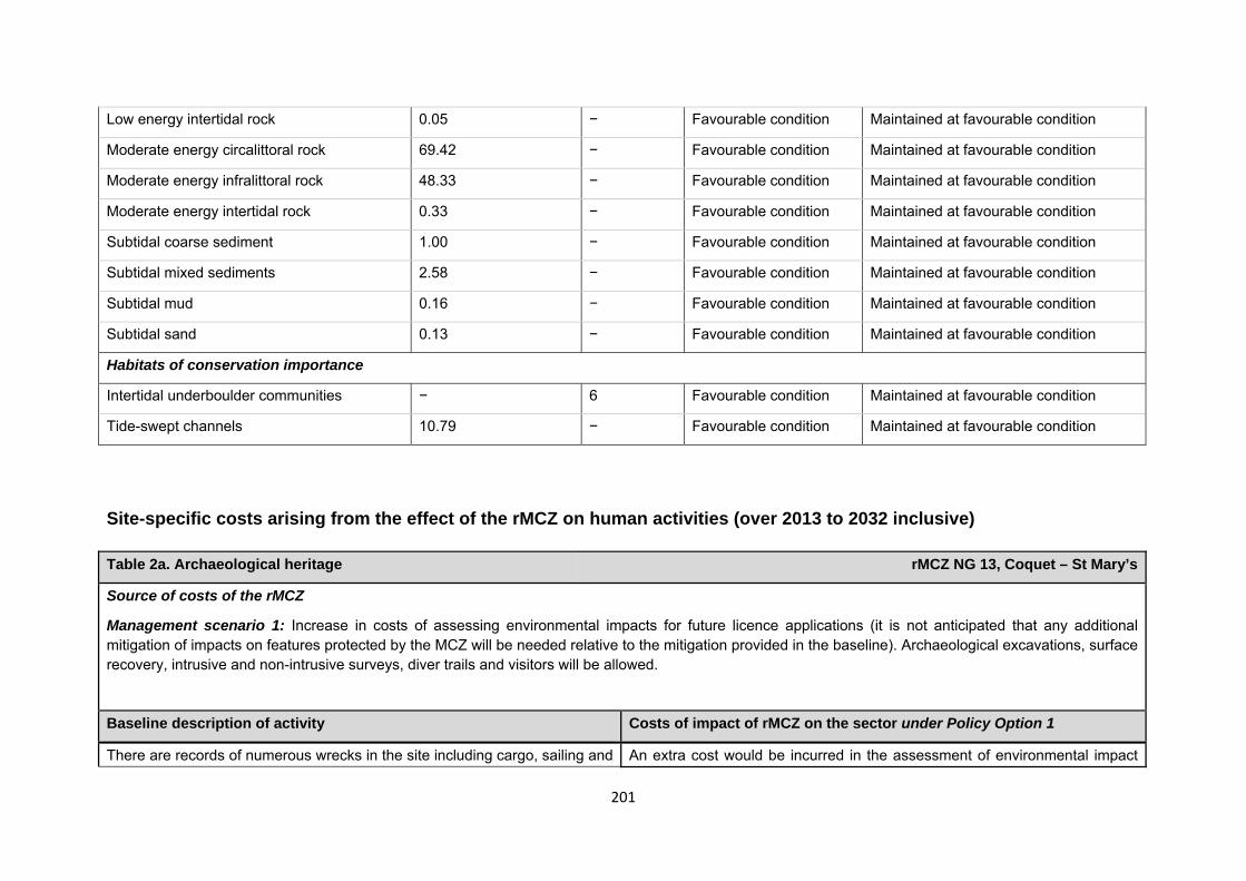
201
Low energy intertidal rock 0.05 − Favourable condition Maintained at favourable condition
Moderate energy circalittoral rock 69.42 − Favourable condition Maintained at favourable condition
Moderate energy infralittoral rock 48.33 − Favourable condition Maintained at favourable condition
Moderate energy intertidal rock 0.33 − Favourable condition Maintained at favourable condition
Subtidal coarse sediment 1.00 − Favourable condition Maintained at favourable condition
Subtidal mixed sediments 2.58 − Favourable condition Maintained at favourable condition
Subtidal mud 0.16 − Favourable condition Maintained at favourable condition
Subtidal sand 0.13 − Favourable condition Maintained at favourable condition
Habitats of conservation importance
Intertidal underboulder communities − 6 Favourable condition Maintained at favourable condition
Tide-swept channels 10.79 − Favourable condition Maintained at favourable condition
Site-specific costs arising from the effect of the rMCZ on human activities (over 2013 to 2032 inclusive) Table 2a. Archaeological heritage rMCZ NG 13, Coquet – St Mary’s
Source of costs of the rMCZ
Management scenario 1: Increase in costs of assessing environmental impacts for future licence applications (it is not anticipated that any additional mitigation of impacts on features protected by the MCZ will be needed relative to the mitigation provided in the baseline). Archaeological excavations, surface recovery, intrusive and non-intrusive surveys, diver trails and visitors will be allowed.
Baseline description of activity Costs of impact of rMCZ on the sector under Policy Option 1
There are records of numerous wrecks in the site including cargo, sailing and An extra cost would be incurred in the assessment of environmental impact
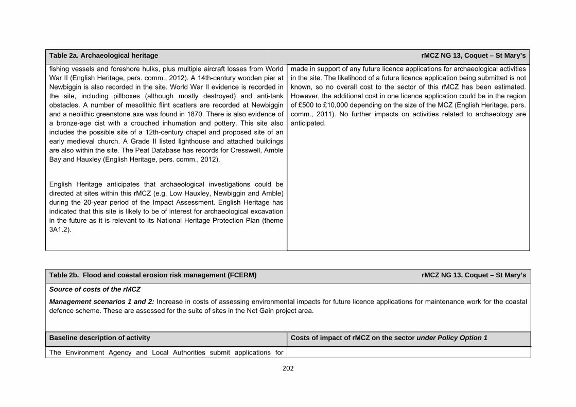
202
Table 2a. Archaeological heritage rMCZ NG 13, Coquet – St Mary’s
fishing vessels and foreshore hulks, plus multiple aircraft losses from World War II (English Heritage, pers. comm., 2012). A 14th-century wooden pier at Newbiggin is also recorded in the site. World War II evidence is recorded in the site, including pillboxes (although mostly destroyed) and anti-tank obstacles. A number of mesolithic flint scatters are recorded at Newbiggin and a neolithic greenstone axe was found in 1870. There is also evidence of a bronze-age cist with a crouched inhumation and pottery. This site also includes the possible site of a 12th-century chapel and proposed site of an early medieval church. A Grade II listed lighthouse and attached buildings are also within the site. The Peat Database has records for Cresswell, Amble Bay and Hauxley (English Heritage, pers. comm., 2012).
English Heritage anticipates that archaeological investigations could be directed at sites within this rMCZ (e.g. Low Hauxley, Newbiggin and Amble) during the 20-year period of the Impact Assessment. English Heritage has indicated that this site is likely to be of interest for archaeological excavation in the future as it is relevant to its National Heritage Protection Plan (theme 3A1.2).
made in support of any future licence applications for archaeological activities in the site. The likelihood of a future licence application being submitted is not known, so no overall cost to the sector of this rMCZ has been estimated. However, the additional cost in one licence application could be in the region of £500 to £10,000 depending on the size of the MCZ (English Heritage, pers. comm., 2011). No further impacts on activities related to archaeology are anticipated.
Table 2b. Flood and coastal erosion risk management (FCERM) rMCZ NG 13, Coquet – St Mary’s
Source of costs of the rMCZ
Management scenarios 1 and 2: Increase in costs of assessing environmental impacts for future licence applications for maintenance work for the coastal defence scheme. These are assessed for the suite of sites in the Net Gain project area.
Baseline description of activity Costs of impact of rMCZ on the sector under Policy Option 1
The Environment Agency and Local Authorities submit applications for
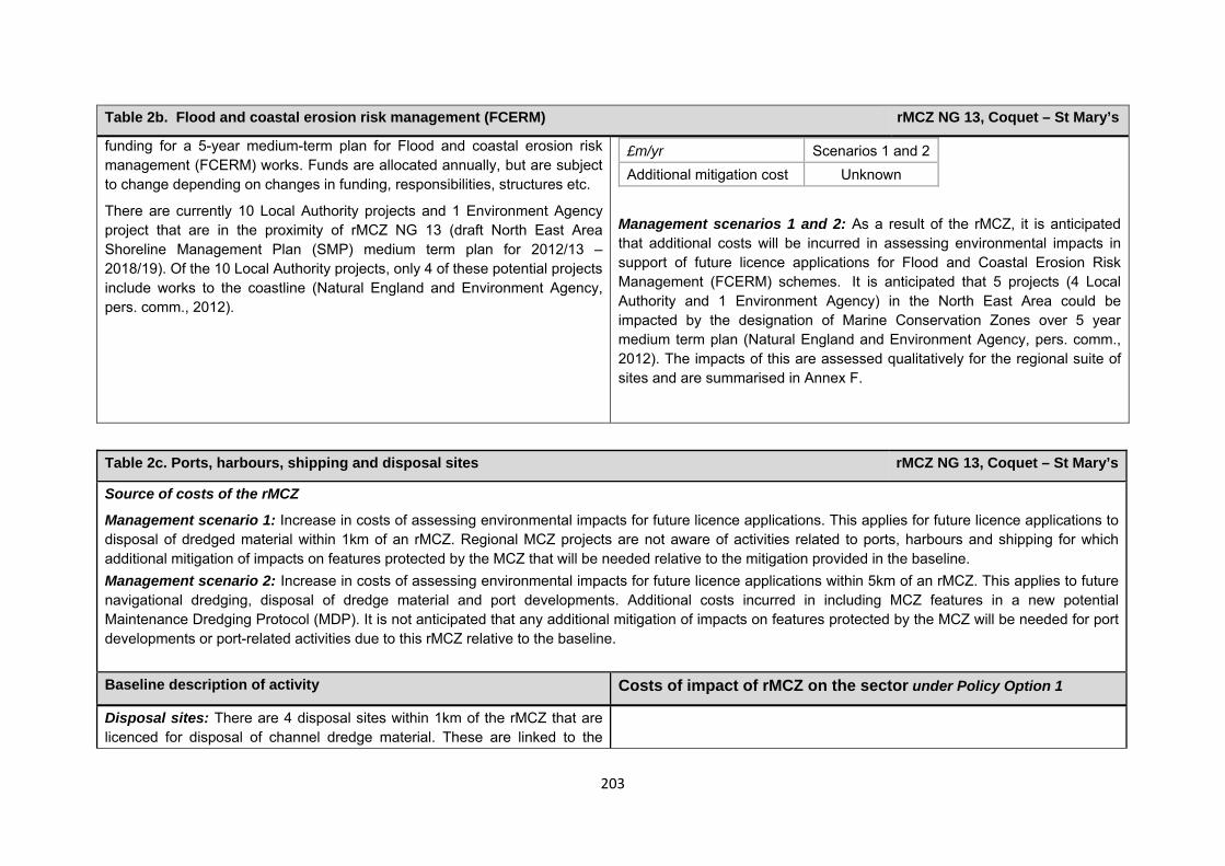
203
Table 2b. Flood and coastal erosion risk management (FCERM) rMCZ NG 13, Coquet – St Mary’s
funding for a 5-year medium-term plan for Flood and coastal erosion risk management (FCERM) works. Funds are allocated annually, but are subject to change depending on changes in funding, responsibilities, structures etc.
There are currently 10 Local Authority projects and 1 Environment Agency project that are in the proximity of rMCZ NG 13 (draft North East Area Shoreline Management Plan (SMP) medium term plan for 2012/13 – 2018/19). Of the 10 Local Authority projects, only 4 of these potential projects include works to the coastline (Natural England and Environment Agency, pers. comm., 2012).
Management scenarios 1 and 2: As a result of the rMCZ, it is anticipated that additional costs will be incurred in assessing environmental impacts in support of future licence applications for Flood and Coastal Erosion Risk Management (FCERM) schemes. It is anticipated that 5 projects (4 Local Authority and 1 Environment Agency) in the North East Area could be impacted by the designation of Marine Conservation Zones over 5 year medium term plan (Natural England and Environment Agency, pers. comm., 2012). The impacts of this are assessed qualitatively for the regional suite of sites and are summarised in Annex F.
£m/yr Scenarios 1 and 2Additional mitigation cost Unknown
Table 2c. Ports, harbours, shipping and disposal sites rMCZ NG 13, Coquet – St Mary’s
Source of costs of the rMCZ
Management scenario 1: Increase in costs of assessing environmental impacts for future licence applications. This applies for future licence applications to disposal of dredged material within 1km of an rMCZ. Regional MCZ projects are not aware of activities related to ports, harbours and shipping for which additional mitigation of impacts on features protected by the MCZ that will be needed relative to the mitigation provided in the baseline. Management scenario 2: Increase in costs of assessing environmental impacts for future licence applications within 5km of an rMCZ. This applies to future navigational dredging, disposal of dredge material and port developments. Additional costs incurred in including MCZ features in a new potential Maintenance Dredging Protocol (MDP). It is not anticipated that any additional mitigation of impacts on features protected by the MCZ will be needed for port developments or port-related activities due to this rMCZ relative to the baseline. Baseline description of activity Costs of impact of rMCZ on the sector under Policy Option 1
Disposal sites: There are 4 disposal sites within 1km of the rMCZ that are licenced for disposal of channel dredge material. These are linked to the
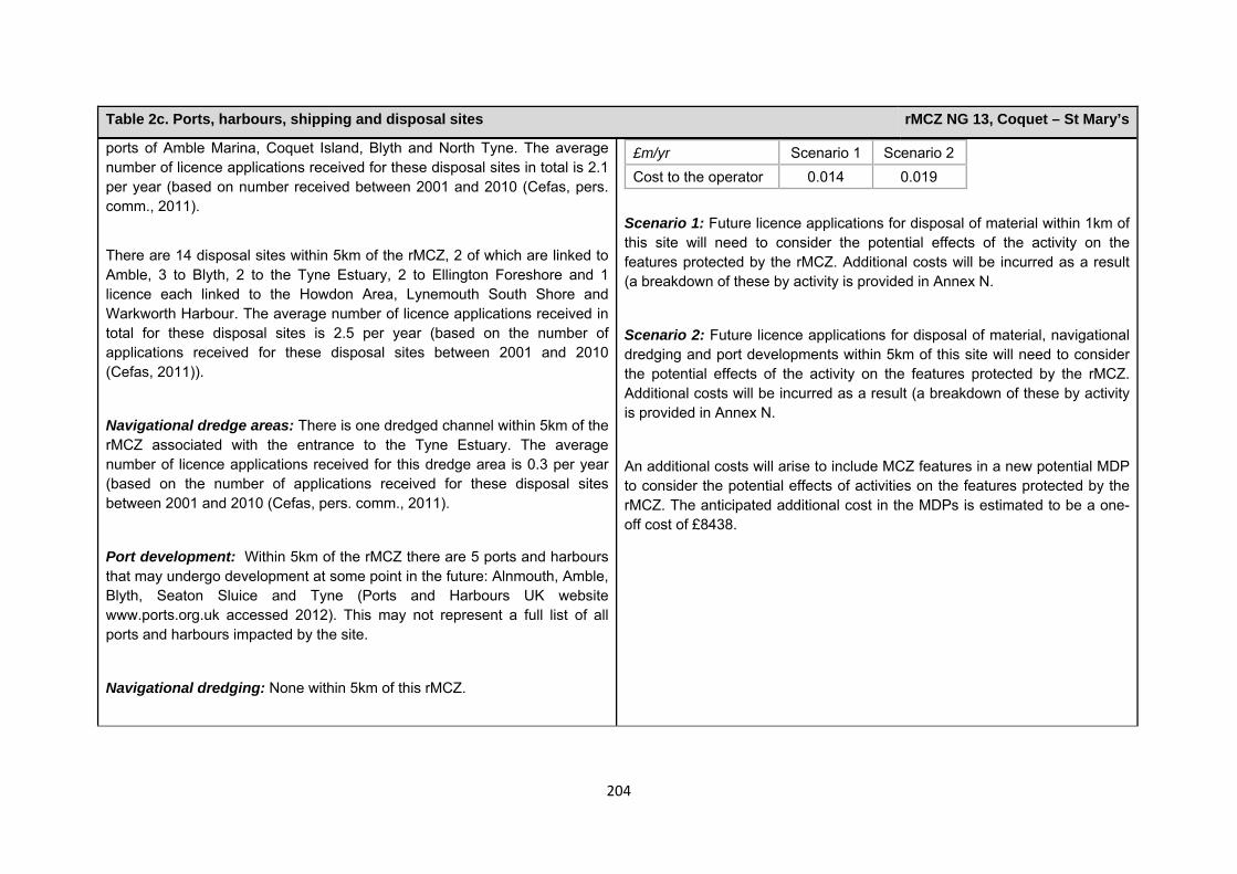
204
Table 2c. Ports, harbours, shipping and disposal sites rMCZ NG 13, Coquet – St Mary’s
ports of Amble Marina, Coquet Island, Blyth and North Tyne. The average number of licence applications received for these disposal sites in total is 2.1 per year (based on number received between 2001 and 2010 (Cefas, pers. comm., 2011).
There are 14 disposal sites within 5km of the rMCZ, 2 of which are linked to Amble, 3 to Blyth, 2 to the Tyne Estuary, 2 to Ellington Foreshore and 1 licence each linked to the Howdon Area, Lynemouth South Shore and Warkworth Harbour. The average number of licence applications received in total for these disposal sites is 2.5 per year (based on the number of applications received for these disposal sites between 2001 and 2010 (Cefas, 2011)).
Navigational dredge areas: There is one dredged channel within 5km of the rMCZ associated with the entrance to the Tyne Estuary. The average number of licence applications received for this dredge area is 0.3 per year (based on the number of applications received for these disposal sites between 2001 and 2010 (Cefas, pers. comm., 2011).
Port development: Within 5km of the rMCZ there are 5 ports and harbours that may undergo development at some point in the future: Alnmouth, Amble, Blyth, Seaton Sluice and Tyne (Ports and Harbours UK website www.ports.org.uk accessed 2012). This may not represent a full list of all ports and harbours impacted by the site.
Navigational dredging: None within 5km of this rMCZ.
£m/yr Scenario 1 Scenario 2 Cost to the operator 0.014 0.019
Scenario 1: Future licence applications for disposal of material within 1km of this site will need to consider the potential effects of the activity on the features protected by the rMCZ. Additional costs will be incurred as a result (a breakdown of these by activity is provided in Annex N.
Scenario 2: Future licence applications for disposal of material, navigational dredging and port developments within 5km of this site will need to consider the potential effects of the activity on the features protected by the rMCZ. Additional costs will be incurred as a result (a breakdown of these by activity is provided in Annex N.
An additional costs will arise to include MCZ features in a new potential MDP to consider the potential effects of activities on the features protected by the rMCZ. The anticipated additional cost in the MDPs is estimated to be a one-off cost of £8438.
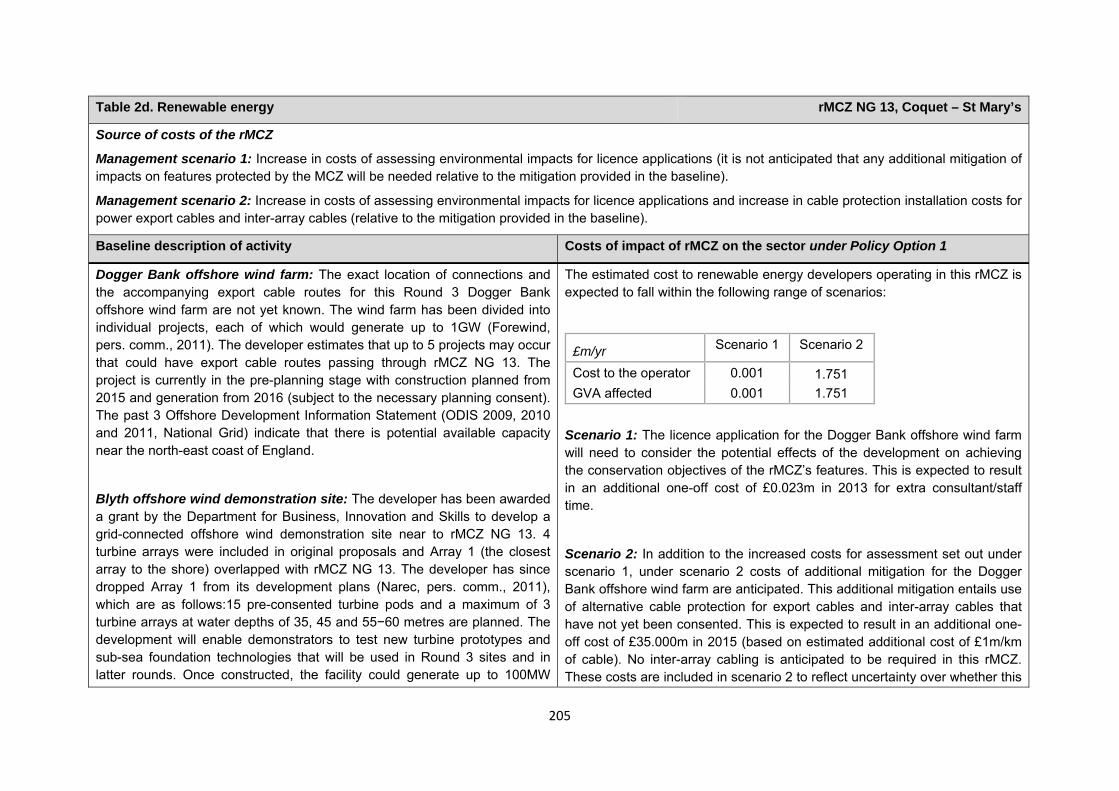
205
Table 2d. Renewable energy rMCZ NG 13, Coquet – St Mary’s
Source of costs of the rMCZ
Management scenario 1: Increase in costs of assessing environmental impacts for licence applications (it is not anticipated that any additional mitigation of impacts on features protected by the MCZ will be needed relative to the mitigation provided in the baseline).
Management scenario 2: Increase in costs of assessing environmental impacts for licence applications and increase in cable protection installation costs for power export cables and inter-array cables (relative to the mitigation provided in the baseline).
Baseline description of activity Costs of impact of rMCZ on the sector under Policy Option 1
Dogger Bank offshore wind farm: The exact location of connections and the accompanying export cable routes for this Round 3 Dogger Bank offshore wind farm are not yet known. The wind farm has been divided into individual projects, each of which would generate up to 1GW (Forewind, pers. comm., 2011). The developer estimates that up to 5 projects may occur that could have export cable routes passing through rMCZ NG 13. The project is currently in the pre-planning stage with construction planned from 2015 and generation from 2016 (subject to the necessary planning consent). The past 3 Offshore Development Information Statement (ODIS 2009, 2010 and 2011, National Grid) indicate that there is potential available capacity near the north-east coast of England.
Blyth offshore wind demonstration site: The developer has been awarded a grant by the Department for Business, Innovation and Skills to develop a grid-connected offshore wind demonstration site near to rMCZ NG 13. 4 turbine arrays were included in original proposals and Array 1 (the closest array to the shore) overlapped with rMCZ NG 13. The developer has since dropped Array 1 from its development plans (Narec, pers. comm., 2011), which are as follows:15 pre-consented turbine pods and a maximum of 3 turbine arrays at water depths of 35, 45 and 55−60 metres are planned. The development will enable demonstrators to test new turbine prototypes and sub-sea foundation technologies that will be used in Round 3 sites and in latter rounds. Once constructed, the facility could generate up to 100MW
The estimated cost to renewable energy developers operating in this rMCZ is expected to fall within the following range of scenarios:
£m/yr Scenario 1 Scenario 2
Cost to the operator 0.001 1.751 GVA affected 0.001 1.751
Scenario 1: The licence application for the Dogger Bank offshore wind farm will need to consider the potential effects of the development on achieving the conservation objectives of the rMCZ’s features. This is expected to result in an additional one-off cost of £0.023m in 2013 for extra consultant/staff time.
Scenario 2: In addition to the increased costs for assessment set out under scenario 1, under scenario 2 costs of additional mitigation for the Dogger Bank offshore wind farm are anticipated. This additional mitigation entails use of alternative cable protection for export cables and inter-array cables that have not yet been consented. This is expected to result in an additional one-off cost of £35.000m in 2015 (based on estimated additional cost of £1m/km of cable). No inter-array cabling is anticipated to be required in this rMCZ. These costs are included in scenario 2 to reflect uncertainty over whether this
206
Table 2d. Renewable energy rMCZ NG 13, Coquet – St Mary’s
(The Crown Estate, pers. comm., 2011). The developer submitted the planning application in early 2012 and work on the Environmental Impact Assessment (EIA) is on-going (Narec, pers. comm., 2011).
additional mitigation will be required. However, JNCC and Natural England (pers. comm., 2012) state that the likelihood of this cost occurring is very low. Further details are provided in Annex H14.
The impacts that are assessed in both scenarios are based on JNCC and Natural England’s advice on the mitigation that could be required.
Comments from the developer of the Dogger Bank offshore wind farm (personal communication, 2011): The following estimated costs for the Dogger Bank wind farm assume that all 5 projects go ahead. The additional costs are based on the developer’s concerns that further surveys and monitoring may be required to adequately complete the EIA, further increasing consultancy/staff time needed and increasing costs by £0.075m. It is anticipated by the developer that there is a low risk that additional geophysical survey data collection may be needed as part of the EIA, increasing costs by an estimated £0.075m. Additional data collection requirements of conducting a Phase 2 habitat survey as opposed to a Phase 1 survey for any landfall of cables within this rMCZ would further increase costs by approximately £0.025m to £0.100m. The developer also anticipates that there is a low risk that mitigation will be required that involves use of more specialised vessels in the construction process, increasing costs by an estimated £5.000m. If it is required, additional mitigation (possibly in the form of seasonal restrictions) and additional EIA requirements could also lead to delays in cable installation, increasing costs by an estimated £42.000m to £54.000m per 3-month delay. This could result in knock-on delays in energising the wind farm, costing a total of £625.000m (assuming a 3-month delay). If mitigation included an increase in requirements for repairs, causing repairs to take longer to complete, an additional cost of approximately £625.000m could arise due to wind farm down time (assuming a 3-month delay to the repair) (Forewind, pers. comm., 2011).
207
Table 2d. Renewable energy rMCZ NG 13, Coquet – St Mary’s
The developer for the Blyth offshore wind demonstration platform did not identify potential impacts arising from the rMCZ.
Human activities in the site that are not negatively affected by the rMCZ (over 2013 to 2032 inclusive)
*The IA assumes that no additional mitigation of impacts of water abstraction, discharge or diffuse pollution will be required over and above that which will be provided to achieve the objectives of the Water Framework Directive through the River Basin Management Plan process (based on advice provided by Natural England, pers. comm., 2010). Contribution to Ecological Network Guidance Table 4. An overview of features proposed for designation and how these contribute to the ENG guidelines for the regional MCZ project area and at a wider scale12
= ENG guideline is achieved and X = ENG guideline is not achieved. Green cells represent key considerations and any greyed-out rows indicate where SNCBs do not agree with a feature being proposed for designation. Recommended conservation objectives in italics indicate where SNCBs do not agree with the conservation objective recommended by the regional MCZ project (see Section 4.2). Where an asterisk (*) has been given in the table, more detail is provided in the narrative.
rMCZ NG 13, Coquet – St Mary’s
12 copied from the JNCC and Natural England’s advice to Defra on rMCZs
Table 3. Human activities in the site that are not negatively affected by the rMCZ under Policy Option 1
(existing activities at their current levels and future proposals known to the regional MCZ projects)
rMCZ NG 13, Coquet – St Mary’s
Coastal developments excluding ports and harbours (Newcastle Airport), commercial fisheries, recreation (recreational boating and fishing, snorkelling and SCUBA diving, and an existing wildfowling lease), research and education, sea coal extraction, shipping (transit of vessels only) and water abstraction, diffuse and pollution*.

208
ENG Feature
Represent-ativity Replication Adequacy Viability
Gaps or shortfalls in relation to ENG minimum guidelines
Recommended conservation objective
Quantitative considerations at regional MCZ level
Ecological Importance at regional MCZ level
Ecological Importance at wider scale
A1.2 Moderate energy intertidal rock
BSH * 1 None Maintain
A1.3 Low energy intertidal rock
BSH * 1 None Maintain
This site contributes over 50% of the total area of this BSH in MCZs
A2.1 Intertidal coarse sediment
BSH * 1 None Maintain
This site contributes over 50% of the total area of this BSH in MCZs
A2.2 Intertidal sand and muddy sand
BSH * 1 None Maintain
A2.3 Intertidal mud
BSH * 1 None Maintain
A2.4 Intertidal mixed sediments
BSH * 1 None Maintain
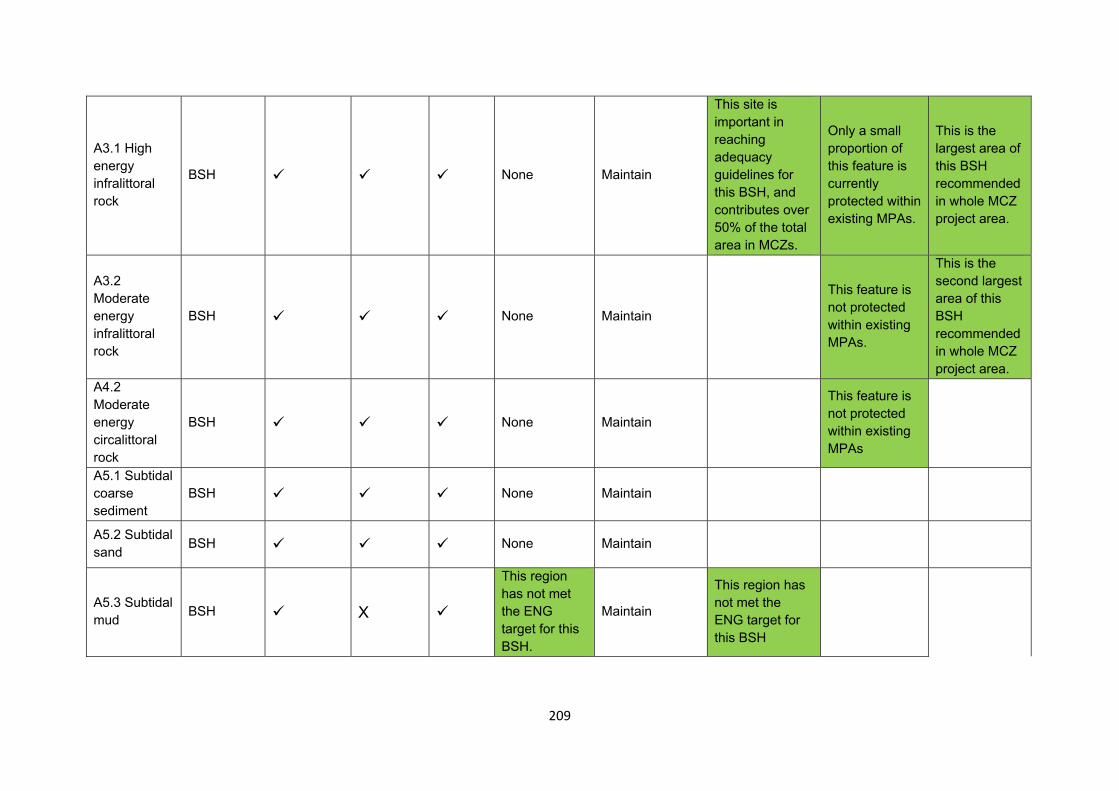
209
A3.1 High energy infralittoral rock
BSH None Maintain
This site is important in reaching adequacy guidelines for this BSH, and contributes over 50% of the total area in MCZs.
Only a small proportion of this feature is currently protected within existing MPAs.
This is the largest area of this BSH recommended in whole MCZ project area.
A3.2 Moderate energy infralittoral rock
BSH None Maintain
This feature is not protected within existing MPAs.
This is the second largest area of this BSH recommended in whole MCZ project area.
A4.2 Moderate energy circalittoral rock
BSH None Maintain
This feature is not protected within existing MPAs
A5.1 Subtidal coarse sediment
BSH None Maintain
A5.2 Subtidal sand BSH None Maintain
A5.3 Subtidal mud BSH X
This region has not met the ENG target for this BSH.
Maintain
This region has not met the ENG target for this BSH
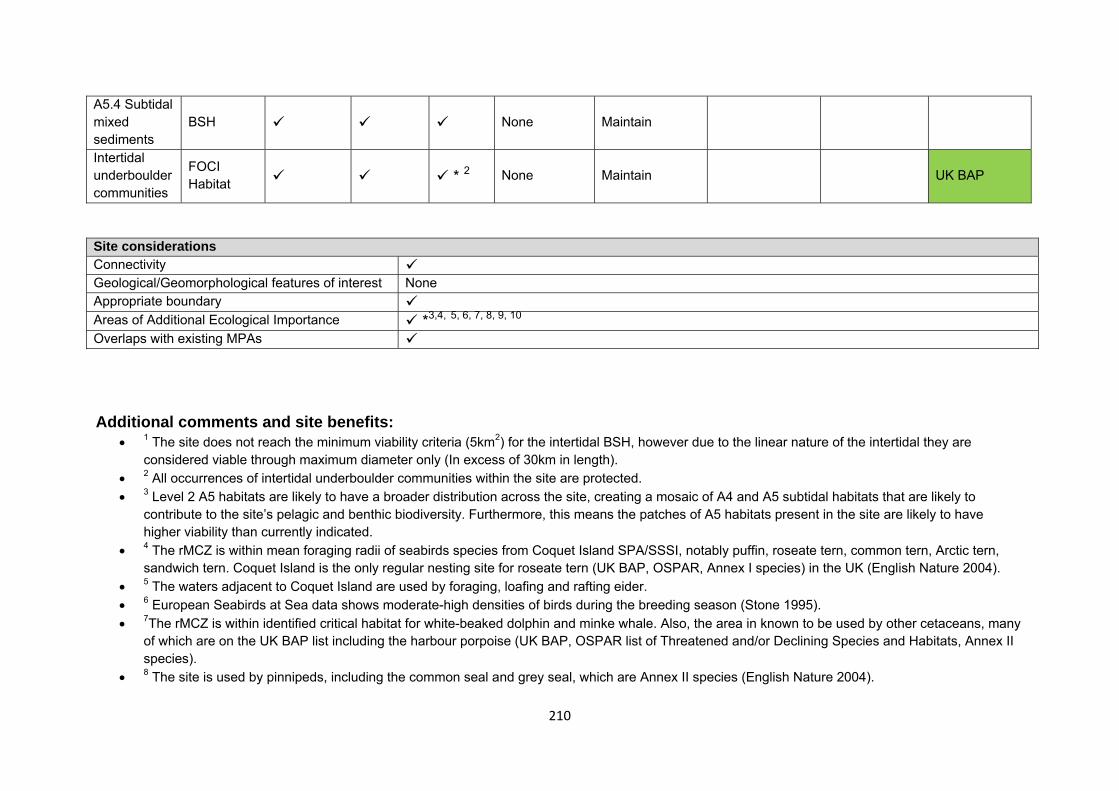
210
A5.4 Subtidal mixed sediments
BSH None Maintain
Intertidal underboulder communities
FOCI Habitat * 2 None Maintain UK BAP
Site considerations Connectivity Geological/Geomorphological features of interest None Appropriate boundary Areas of Additional Ecological Importance *3,4, 5, 6, 7, 8, 9, 10 Overlaps with existing MPAs Additional comments and site benefits:
• 1 The site does not reach the minimum viability criteria (5km2) for the intertidal BSH, however due to the linear nature of the intertidal they are considered viable through maximum diameter only (In excess of 30km in length).
• 2 All occurrences of intertidal underboulder communities within the site are protected. • 3 Level 2 A5 habitats are likely to have a broader distribution across the site, creating a mosaic of A4 and A5 subtidal habitats that are likely to
contribute to the site’s pelagic and benthic biodiversity. Furthermore, this means the patches of A5 habitats present in the site are likely to have higher viability than currently indicated.
• 4 The rMCZ is within mean foraging radii of seabirds species from Coquet Island SPA/SSSI, notably puffin, roseate tern, common tern, Arctic tern, sandwich tern. Coquet Island is the only regular nesting site for roseate tern (UK BAP, OSPAR, Annex I species) in the UK (English Nature 2004).
• 5 The waters adjacent to Coquet Island are used by foraging, loafing and rafting eider. • 6 European Seabirds at Sea data shows moderate-high densities of birds during the breeding season (Stone 1995). • 7The rMCZ is within identified critical habitat for white-beaked dolphin and minke whale. Also, the area in known to be used by other cetaceans, many
of which are on the UK BAP list including the harbour porpoise (UK BAP, OSPAR list of Threatened and/or Declining Species and Habitats, Annex II species).
• 8 The site is used by pinnipeds, including the common seal and grey seal, which are Annex II species (English Nature 2004).

211
• 9 The rMCZ is within identified spawning areas for plaice and sand eel, and nursery areas for cod, ling, anglerfish and sand eel (English Nature 2004). • 10 The site has several point records as well as modelled data areas for BSH Subtidal sand and gravel. Subtidal sands and gravels could therefore be
considered as an additional habitat FOCI feature of the site. • Potential to include ocean quahog as a feature and therefore meet adequacy requirement for this species.
Anticipated benefits to ecosystem services The habitats, species and other ecological features of the rMCZ contribute to the delivery of a range of ecosystem services. Designation of the rMCZ and its subsequent management may improve the quantity and quality of the beneficial services provided, which may increase the value (contribution to economic welfare or human well-being) of them. Impacts on the value derived from ecosystem services may occur as a result of the designation, management and/or achievement of the conservation objectives of the rMCZ. Further discussion on the potential benefits to ecosystem services can be found in Annex L and on definitions can be found in Annex H5. Table 5a. Fish and shellfish for human consumption rMCZ NG 13, Coquet – St Mary’s
Baseline Beneficial impact under Policy Option 1
Fletcher and others (2011) identify that the features to be protected by the recommended Marine Conservation Zone (rMCZ) can contribute to the delivery of fish and shellfish for human consumption.
Commercial fishing occurs within the rMCZ by UK under and over 15 metre vessels. Estimated total value of landings for the site is £0.964m/yr. This value can be attributed to vessels using pots and traps (£0.756m/yr), bottom trawls (£0.100m/yr), nets (£0.083m/yr), dredges (£0.023m/yr) and hooks and lines (£0.001m/yr) within the site (MCZ Fisheries Model, 2011).
The baseline quantity and quality of the ecosystem service provided is assumed to be commensurate with that provided by the features of the site when in favourable condition.
If the conservation objectives of the features are achieved, the features will be maintained in favourable condition.
No additional management (above that in the baseline situation) of fishing activities is expected. As such, no benefits are expected to accrue as a result of reduced fishing mortality. No change in on-site feature condition is anticipated and therefore no impact on on-site or off-site benefits is expected.
Designating the rMCZ will protect its features and the ecosystem services that they provide against the risk of future degradation from anthropogenic pressures (because if necessary, mitigation would be introduced, with the associated costs and benefits).
Anticipated direction of
change:
Confidence: Moderate
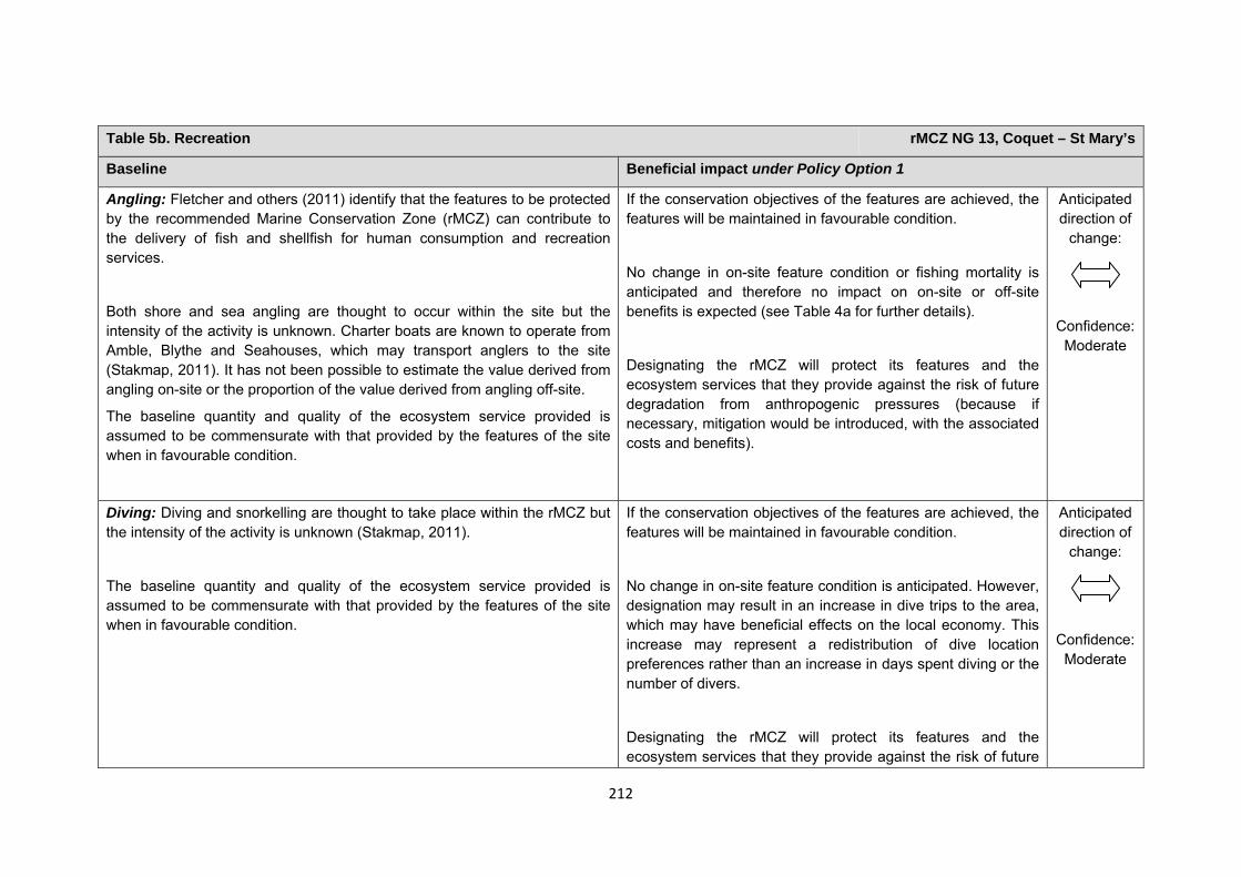
212
Table 5b. Recreation rMCZ NG 13, Coquet – St Mary’s
Baseline Beneficial impact under Policy Option 1
Angling: Fletcher and others (2011) identify that the features to be protected by the recommended Marine Conservation Zone (rMCZ) can contribute to the delivery of fish and shellfish for human consumption and recreation services.
Both shore and sea angling are thought to occur within the site but the intensity of the activity is unknown. Charter boats are known to operate from Amble, Blythe and Seahouses, which may transport anglers to the site (Stakmap, 2011). It has not been possible to estimate the value derived from angling on-site or the proportion of the value derived from angling off-site.
The baseline quantity and quality of the ecosystem service provided is assumed to be commensurate with that provided by the features of the site when in favourable condition.
If the conservation objectives of the features are achieved, the features will be maintained in favourable condition.
No change in on-site feature condition or fishing mortality is anticipated and therefore no impact on on-site or off-site benefits is expected (see Table 4a for further details).
Designating the rMCZ will protect its features and the ecosystem services that they provide against the risk of future degradation from anthropogenic pressures (because if necessary, mitigation would be introduced, with the associated costs and benefits).
Anticipated direction of
change:
Confidence: Moderate
Diving: Diving and snorkelling are thought to take place within the rMCZ but the intensity of the activity is unknown (Stakmap, 2011).
The baseline quantity and quality of the ecosystem service provided is assumed to be commensurate with that provided by the features of the site when in favourable condition.
If the conservation objectives of the features are achieved, the features will be maintained in favourable condition.
No change in on-site feature condition is anticipated. However, designation may result in an increase in dive trips to the area, which may have beneficial effects on the local economy. This increase may represent a redistribution of dive location preferences rather than an increase in days spent diving or the number of divers.
Designating the rMCZ will protect its features and the ecosystem services that they provide against the risk of future
Anticipated direction of
change:
Confidence: Moderate
213
Table 5b. Recreation rMCZ NG 13, Coquet – St Mary’s
degradation from anthropogenic pressures (because if necessary, mitigation would be introduced, with the associated costs and benefits).
214
Table 5b. Recreation rMCZ NG 13, Coquet – St Mary’s
Wildlife watching: Fletcher and others (2011) identify that the features to be protected by the rMCZ can contribute to the delivery of recreation and tourism services.
The site is popular with wildlife enthusiasts, particularly for birds and seals in the RSPB reserve at Coquet Island. This area is also a haul-out area for grey seal and the Northumbrian coast is a particularly important area for breeding populations (McConnell, 1999; Thompson, 2010). Numerous cetacean species including white-beaked dolphin, harbour porpoise, orca, minke and humpback whales (Bereton, 2010; Evans, 2003; Sea Watch Foundation) have been sighted in the area.
St Mary’s Island is currently a voluntary marine reserve, created in order to protect the presence of the rocky reef structures which provide habitat for large numbers of edible and shore crabs as well as some lobsters. The island itself is nationally important and is popular with walkers and wildlife watchers due to its close proximity to urban areas (Net Gain Final Recommendations, 2011).
It has not been possible to estimate the value derived from wildlife watching in the rMCZ.
The baseline quantity and quality of the ecosystem service provided is assumed to be commensurate with that provided by the features of the site when in favourable condition.
If the conservation objectives of the features are achieved, the features will be maintained in favourable condition.
No change in on-site feature condition is anticipated and therefore no benefits to wildlife watching are expected.
Designating the rMCZ will protect its features and the ecosystem services that they provide against the risk of future degradation from anthropogenic pressures (because if necessary, mitigation would be introduced, with the associated costs and benefits).
Anticipated direction of
change:
Confidence: Moderate
Table 5c. Research and education rMCZ NG 13, Coquet – St Mary’s
215
Table 5c. Research and education rMCZ NG 13, Coquet – St Mary’s
Baseline Beneficial impact under Policy Option 1
Research: Fletcher and others (2011) identify that the features to be protected by the recommended Marine Conservation Zone (rMCZ) can contribute to the delivery of research services.
The site contains the Berwickshire and North Northumberland Coast Special Area of Conservation, Coquet Island Special Protection Area and the following 9 Sites of Special Scientific Interest: Alnmouth Saltmarsh and Dunes, Coquet Island, Cresswell and Newbiggin Shores, Cresswell Ponds, Hadston Links, Low Hauxley Shore, Northumberland Shore, Tynemouth to Seaton Sluice, and Warkworth Dunes and Saltmarsh (Net Gain Final Recommendations, 2011). A number of these are designated for their geological importance, noted for features such as coal measures, sedimentary features and volcanic glacial till (Natural England, 2011). A sublittoral ridge of limestone known locally as ‘the Trink’ occurs offshore at Blyth. It is partly covered by gravels, cobbles and some boulders and has been found to support a number of rare species including the sea spider (English Nature, 1998). The voluntary marine reserve at St Mary’s Island also offers the potential for increased research activity. As such, ecological monitoring activities are ongoing. It has not been possible to estimate the value derived from research activities associated with the rMCZ.
Monitoring of the rMCZ will help to inform understanding of how the marine environment is changing and is impacted on by anthropogenic pressures and management interventions. Other research benefits are unknown.
Anticipated direction of
change:
Confidence: High
Education: Fletcher and others (2011) identify that the features to be protected by the rMCZ can contribute to the delivery of education services.
The extent of current educational activity carried out in the site is unknown. It has not been possible to estimate the value derived from education activities associated with the rMCZ.
Designation may aid additional local (to the rMCZ) provision of education (e.g. events and interpretation boards), from which visitors would derive benefit. Non-visitors may benefit if the rMCZ contributes to wider provision of education (e.g. television programmes, articles in magazines and newspapers, and educational resources developed for use in schools).
Anticipated direction of
change:
Confidence:
216
Table 5c. Research and education rMCZ NG 13, Coquet – St Mary’s
Moderate
Table 5d. Regulating services rMCZ NG 13, Coquet – St Mary’s
Baseline Beneficial impact under Policy Option 1
Regulation of pollution: The features of the site contribute to the bioremediation of waste and sequestration of carbon. It has not been possible to estimate the value derived from the regulation of pollution in the rMCZ.
Environmental resilience: The features of the site contribute to the resilience and continued regeneration of marine ecosystems. It has not been possible to estimate the value derived from environmental resilience in the rMCZ.
Natural hazard protection: The features of the site contribute to local flood and storm protection. It has not been possible to estimate the value derived from natural hazard protection in the rMCZ.
(Fletcher and others, 2011)
If the conservation objectives of the features are achieved, the features will be maintained in favourable condition.
No change in feature condition and management of human activities is expected and therefore no benefit to the regulatory capacity of the site is expected.
Designating the recommended Marine Conservation Zone will protect its features and the ecosystem services that they provide against the risk of future degradation from anthropogenic pressures (because if necessary, mitigation would be introduced, with the associated costs and benefits).
Anticipated direction of
change:
Confidence: Moderate
Table 5e. Non-use and option values rMCZ NG 13, Coquet – St Mary’s
Baseline Beneficial impact under Policy Option 1
217
Table 5e. Non-use and option values rMCZ NG 13, Coquet – St Mary’s
Some people gain satisfaction from the existence of marine habitats, species and other features. They also gain from having the option to benefit in the future from the habitats and species in the recommended Marine Conservation Zone (rMCZ) and the ecosystem services provided, even if they do not currently benefit from them.
The rMCZ will benefit the proportion of the UK population that values conservation of the rMCZ features and its contribution to an ecologically coherent network of Marine Protected Areas. Some people will gain satisfaction from knowing that the habitats and species are being conserved (existence value) and/or that they are being conserved for use by others in the current generation (altruistic value) or future generations (bequest value). The rMCZ will protect both the features and their option to benefit from the services in the future from the risk of future degradation.
In the Marine Conservation Society ‘Your Seas Your Voice’ campaign, 25 ‘nominated sites’ are located within rMCZ NG 13. Features of the natural environment were strong motivators for reasons why people thought that these locations should be protected, with people frequently attaching value to its ‘spectacular scenery’ and to the biodiversity of the site. Allowing species recovery was perceived as an important management reason to protect the site. Other themes included an emotional attachment to the site. Regarding non-extractive use value, ease of access to an ‘unspoilt’ area was considered an important reason for protection.
Anticipated direction of
change:
Confidence: Moderate
218
rMCZ NG 14, Farnes East Site area (km2): 944.92
• This site has been proposed for designation under Policy Option 1 only.
Table 1. Conservation impacts rMCZ NG 14, Farnes East
1a. Ecological description
Recommended Marine Conservation Zone (rMCZ) NG 14 consists predominantly of rock, coarse/mixed sediment, sand and mud along with peat and clay exposures. Examples of circalittoral rock habitat in deep water such as this can support animal communities that include cup coral, sea-fan and anemone, as well as mobile animals such as starfish, brittlestar and sea urchin. Peat and clay exposures are unusual communities of limited extent in the UK, featuring on the UK List of Priority Habitats (UK BAP). These unique and fragile habitats are irreplaceable, arising from former lake bed sediments and ancient forested peatland (or ‘submerged forests’). The extent and maximum depth of subtidal peat and clay exposures is not known. There is little information on the communities associated with subtidal examples of peat and clay exposures, but the flora and fauna is likely to be different to those found associated with intertidal examples (Maddock, 2008). Therefore, special care should be taken to preserve these fragile habitats.
The mud within this site is an important fishing ground for nephrops. This area also has a high level of pelagic ecological importance, and supports diverse marine life communities. With burrowing mega fauna proliferating, a variety of worms, sea snails and paired-shelled bivalves are present. Sea pen are also present in this area, which are particularly vulnerable to the type of trawls used in nephrops fisheries.
Recommended MCZ NG 14 contains a small part of the glacial feature Farne Deeps, a trench that contains the deepest sea water in the region. White-beaked dolphin have been sighted in the area and local knowledge suggests that the Farne Deeps could be an important breeding area for this species. Numerous other cetacean species including orca, harbour porpoise (listed in Annex 2of the EC Habitats Directive), minke whale and humpback whale have been sighted in the area, all of which are Marine Biodiversity Action Plan (MBAP) species in the UK. The site is in close proximity to the Berwickshire and North Northumberland Coast Special Area of Conservation (SAC), which includes the grey seal (listed in Annex 2 of the EC Habitats Directive) breeding colony at the Farne Islands. The grey seal is also named in the Northumberland BAP. It is thought that the area within and around rMCZ NG 14, with its high pelagic diversity, is an important feeding and foraging ground for the seals of the Farne Islands, with numerous sightings having been made. Recommended
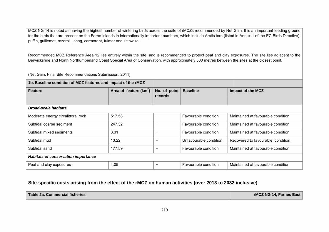
219
MCZ NG 14 is noted as having the highest number of wintering birds across the suite of rMCZs recommended by Net Gain. It is an important feeding ground for the birds that are present on the Farne Islands in internationally important numbers, which include Arctic tern (listed in Annex 1 of the EC Birds Directive), puffin, guillemot, razorbill, shag, cormorant, fulmar and kittiwake.
Recommended MCZ Reference Area 12 lies entirely within the site, and is recommended to protect peat and clay exposures. The site lies adjacent to the Berwickshire and North Northumberland Coast Special Area of Conservation, with approximately 500 metres between the sites at the closest point.
(Net Gain, Final Site Recommendations Submission, 2011)
1b. Baseline condition of MCZ features and impact of the rMCZ
Feature Area of feature (km2) No. of point records
Baseline Impact of the MCZ
Broad-scale habitats
Moderate energy circalittoral rock 517.58 − Favourable condition Maintained at favourable condition
Subtidal coarse sediment 247.32 − Favourable condition Maintained at favourable condition
Subtidal mixed sediments 3.31 − Favourable condition Maintained at favourable condition
Subtidal mud 13.22 − Unfavourable condition Recovered to favourable condition
Subtidal sand 177.59 − Favourable condition Maintained at favourable condition
Habitats of conservation importance
Peat and clay exposures 4.05 − Favourable condition Maintained at favourable condition
Site-specific costs arising from the effect of the rMCZ on human activities (over 2013 to 2032 inclusive) Table 2a. Commercial fisheries rMCZ NG 14, Farnes East
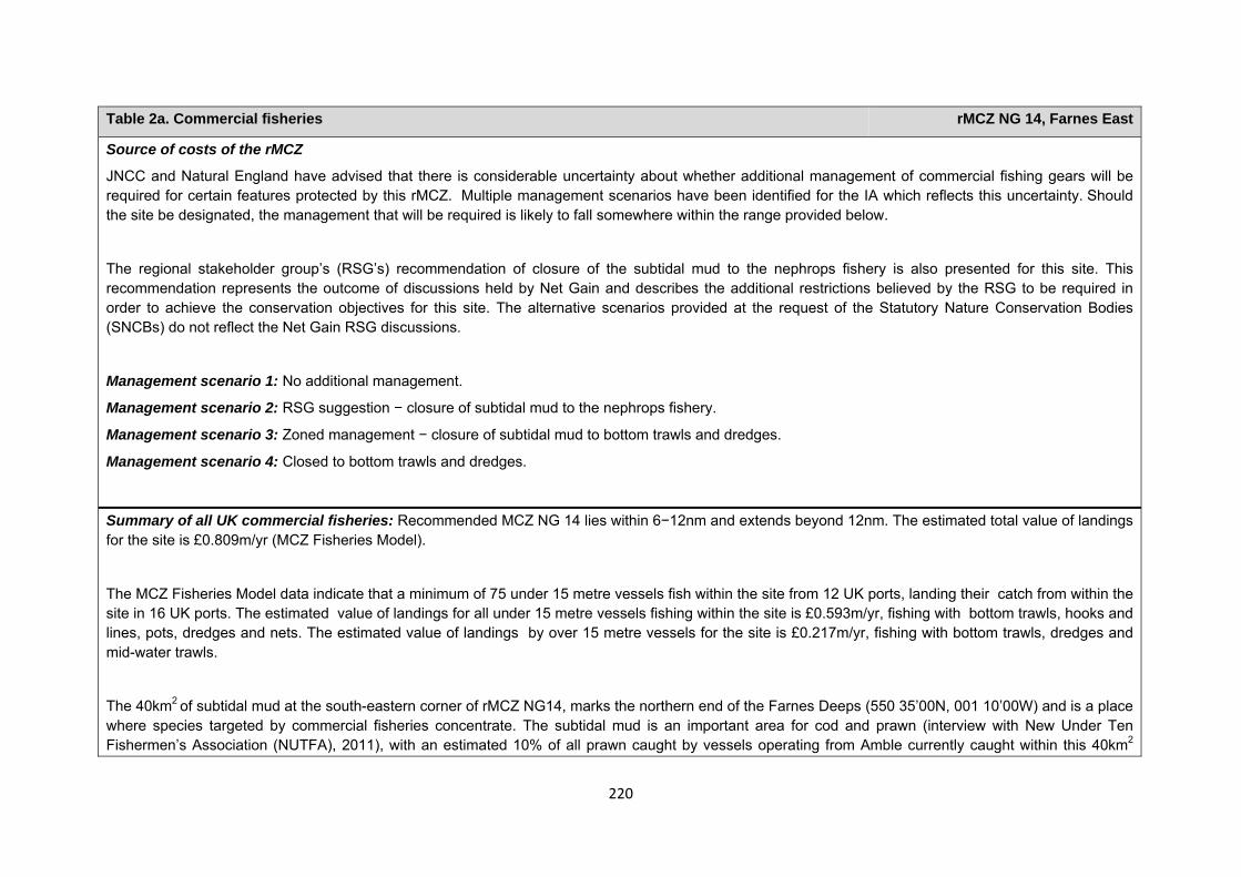
220
Table 2a. Commercial fisheries rMCZ NG 14, Farnes East
Source of costs of the rMCZ
JNCC and Natural England have advised that there is considerable uncertainty about whether additional management of commercial fishing gears will be required for certain features protected by this rMCZ. Multiple management scenarios have been identified for the IA which reflects this uncertainty. Should the site be designated, the management that will be required is likely to fall somewhere within the range provided below.
The regional stakeholder group’s (RSG’s) recommendation of closure of the subtidal mud to the nephrops fishery is also presented for this site. This recommendation represents the outcome of discussions held by Net Gain and describes the additional restrictions believed by the RSG to be required in order to achieve the conservation objectives for this site. The alternative scenarios provided at the request of the Statutory Nature Conservation Bodies (SNCBs) do not reflect the Net Gain RSG discussions.
Management scenario 1: No additional management.
Management scenario 2: RSG suggestion − closure of subtidal mud to the nephrops fishery.
Management scenario 3: Zoned management − closure of subtidal mud to bottom trawls and dredges.
Management scenario 4: Closed to bottom trawls and dredges.
Summary of all UK commercial fisheries: Recommended MCZ NG 14 lies within 6−12nm and extends beyond 12nm. The estimated total value of landings for the site is £0.809m/yr (MCZ Fisheries Model).
The MCZ Fisheries Model data indicate that a minimum of 75 under 15 metre vessels fish within the site from 12 UK ports, landing their catch from within the site in 16 UK ports. The estimated value of landings for all under 15 metre vessels fishing within the site is £0.593m/yr, fishing with bottom trawls, hooks and lines, pots, dredges and nets. The estimated value of landings by over 15 metre vessels for the site is £0.217m/yr, fishing with bottom trawls, dredges and mid-water trawls.
The 40km2 of subtidal mud at the south-eastern corner of rMCZ NG14, marks the northern end of the Farnes Deeps (550 35’00N, 001 10’00W) and is a place where species targeted by commercial fisheries concentrate. The subtidal mud is an important area for cod and prawn (interview with New Under Ten Fishermen’s Association (NUTFA), 2011), with an estimated 10% of all prawn caught by vessels operating from Amble currently caught within this 40km2
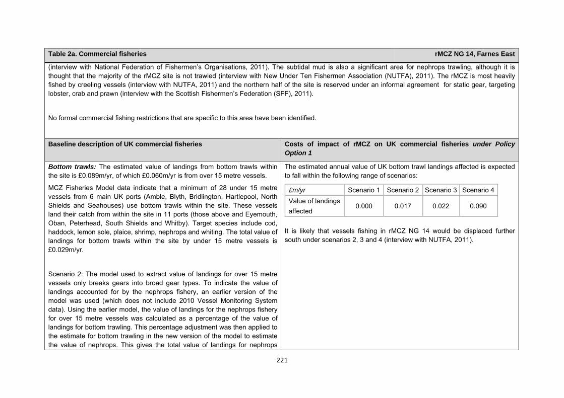
221
Table 2a. Commercial fisheries rMCZ NG 14, Farnes East
(interview with National Federation of Fishermen’s Organisations, 2011). The subtidal mud is also a significant area for nephrops trawling, although it is thought that the majority of the rMCZ site is not trawled (interview with New Under Ten Fishermen Association (NUTFA), 2011). The rMCZ is most heavily fished by creeling vessels (interview with NUTFA, 2011) and the northern half of the site is reserved under an informal agreement for static gear, targeting lobster, crab and prawn (interview with the Scottish Fishermen’s Federation (SFF), 2011).
No formal commercial fishing restrictions that are specific to this area have been identified.
Baseline description of UK commercial fisheries Costs of impact of rMCZ on UK commercial fisheries under Policy Option 1
Bottom trawls: The estimated value of landings from bottom trawls within the site is £0.089m/yr, of which £0.060m/yr is from over 15 metre vessels.
MCZ Fisheries Model data indicate that a minimum of 28 under 15 metre vessels from 6 main UK ports (Amble, Blyth, Bridlington, Hartlepool, North Shields and Seahouses) use bottom trawls within the site. These vessels land their catch from within the site in 11 ports (those above and Eyemouth, Oban, Peterhead, South Shields and Whitby). Target species include cod, haddock, lemon sole, plaice, shrimp, nephrops and whiting. The total value of landings for bottom trawls within the site by under 15 metre vessels is £0.029m/yr.
Scenario 2: The model used to extract value of landings for over 15 metre vessels only breaks gears into broad gear types. To indicate the value of landings accounted for by the nephrops fishery, an earlier version of the model was used (which does not include 2010 Vessel Monitoring System data). Using the earlier model, the value of landings for the nephrops fishery for over 15 metre vessels was calculated as a percentage of the value of landings for bottom trawling. This percentage adjustment was then applied to the estimate for bottom trawling in the new version of the model to estimate the value of nephrops. This gives the total value of landings for nephrops
The estimated annual value of UK bottom trawl landings affected is expected to fall within the following range of scenarios:
£m/yr Scenario 1 Scenario 2 Scenario 3 Scenario 4 Value of landings affected
0.000 0.017 0.022 0.090
It is likely that vessels fishing in rMCZ NG 14 would be displaced further south under scenarios 2, 3 and 4 (interview with NUTFA, 2011).
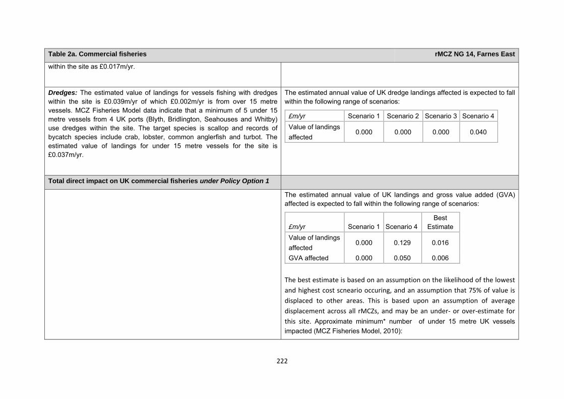
222
Table 2a. Commercial fisheries rMCZ NG 14, Farnes East
within the site as £0.017m/yr.
Dredges: The estimated value of landings for vessels fishing with dredges within the site is £0.039m/yr of which £0.002m/yr is from over 15 metre vessels. MCZ Fisheries Model data indicate that a minimum of 5 under 15 metre vessels from 4 UK ports (Blyth, Bridlington, Seahouses and Whitby) use dredges within the site. The target species is scallop and records of bycatch species include crab, lobster, common anglerfish and turbot. The estimated value of landings for under 15 metre vessels for the site is £0.037m/yr.
The estimated annual value of UK dredge landings affected is expected to fall within the following range of scenarios:
£m/yr Scenario 1 Scenario 2 Scenario 3 Scenario 4 Value of landings affected
0.000 0.000 0.000 0.040
Total direct impact on UK commercial fisheries under Policy Option 1
The estimated annual value of UK landings and gross value added (GVA) affected is expected to fall within the following range of scenarios:
£m/yr Scenario 1 Scenario 4Best
Estimate Value of landings affected
0.000 0.129 0.016
GVA affected 0.000 0.050 0.006 The best estimate is based on an assumption on the likelihood of the lowest and highest cost scneario occuring, and an assumption that 75% of value is displaced to other areas. This is based upon an assumption of average displacement across all rMCZs, and may be an under‐ or over‐estimate for this site. Approximate minimum* number of under 15 metre UK vessels impacted (MCZ Fisheries Model, 2010):
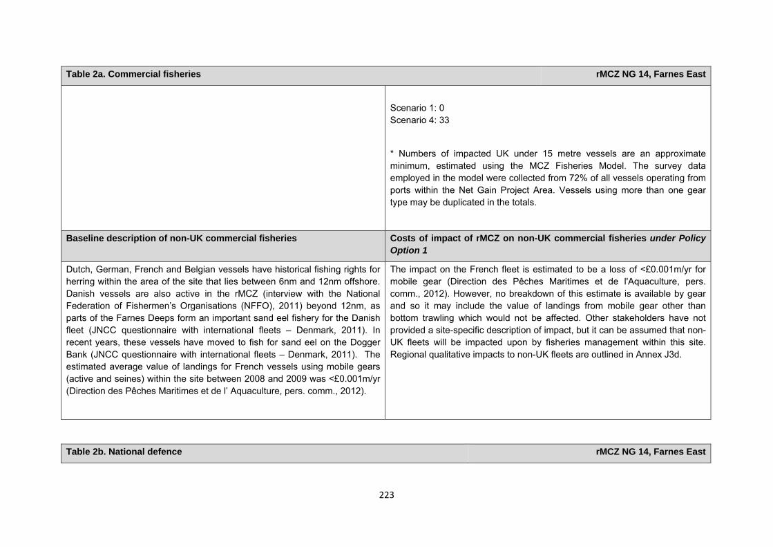
223
Table 2a. Commercial fisheries rMCZ NG 14, Farnes East
Scenario 1: 0 Scenario 4: 33
* Numbers of impacted UK under 15 metre vessels are an approximate minimum, estimated using the MCZ Fisheries Model. The survey data employed in the model were collected from 72% of all vessels operating from ports within the Net Gain Project Area. Vessels using more than one gear type may be duplicated in the totals.
Baseline description of non-UK commercial fisheries Costs of impact of rMCZ on non-UK commercial fisheries under Policy Option 1
Dutch, German, French and Belgian vessels have historical fishing rights for herring within the area of the site that lies between 6nm and 12nm offshore. Danish vessels are also active in the rMCZ (interview with the National Federation of Fishermen’s Organisations (NFFO), 2011) beyond 12nm, as parts of the Farnes Deeps form an important sand eel fishery for the Danish fleet (JNCC questionnaire with international fleets – Denmark, 2011). In recent years, these vessels have moved to fish for sand eel on the Dogger Bank (JNCC questionnaire with international fleets – Denmark, 2011). The estimated average value of landings for French vessels using mobile gears (active and seines) within the site between 2008 and 2009 was <£0.001m/yr (Direction des Pêches Maritimes et de l’ Aquaculture, pers. comm., 2012).
The impact on the French fleet is estimated to be a loss of <£0.001m/yr for mobile gear (Direction des Pêches Maritimes et de l'Aquaculture, pers. comm., 2012). However, no breakdown of this estimate is available by gear and so it may include the value of landings from mobile gear other than bottom trawling which would not be affected. Other stakeholders have not provided a site-specific description of impact, but it can be assumed that non-UK fleets will be impacted upon by fisheries management within this site. Regional qualitative impacts to non-UK fleets are outlined in Annex J3d.
Table 2b. National defence rMCZ NG 14, Farnes East
224
Table 2b. National defence rMCZ NG 14, Farnes East
Source of costs of the rMCZ
Management scenario 1: Mitigation of impacts of Ministry of Defence activities on features protected by the suite of rMCZs will be provided by additional planning considerations during operations and training. It is not known whether mitigation will be required for features protected by this site. The Ministry of Defence will also incur costs in revising environmental tools and charts to include MCZs.
Baseline description of activity Costs of impact of rMCZ on the sector under Policy Option 1
The Ministry of Defence is known to make use of the site for military practice, for aerial activity which does not involve the release of weapons.
It is not known whether this rMCZ will impact on the Ministry of Defence’s use of the site. Impacts of rMCZs on the Ministry of Defence’s activities are assessed in the Evidence Base and Annex N9.
Human activities in the site that are not negatively affected by the rMCZ (over 2013 to 2032 inclusive)
Table 2c. Other impacts that are assessed for the suite of MCZs and not for this site alone rMCZ NG 14, Farnes East
Cables (interconnectors and telecom cables)
Future interconnectors and telecom cables may pass through the rMCZ. Impacts of rMCZs on future interconnectors and telecom cables are assessed in the Evidence Base, Annex H3 and Annex N3 (they are not assessed for this site alone).
Table 3. Human activities in the site that are not negatively affected by the rMCZ under Policy Option 1 rMCZ NG 14, Farnes East
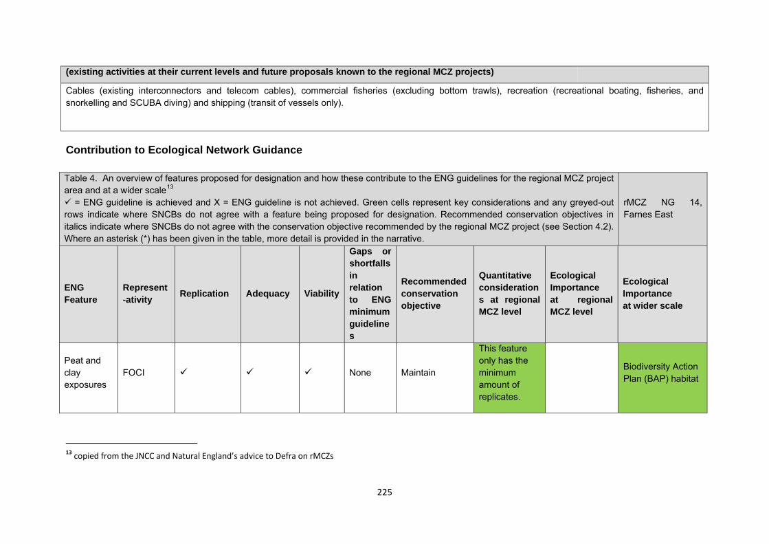
225
Contribution to Ecological Network Guidance Table 4. An overview of features proposed for designation and how these contribute to the ENG guidelines for the regional MCZ project area and at a wider scale13
= ENG guideline is achieved and X = ENG guideline is not achieved. Green cells represent key considerations and any greyed-out rows indicate where SNCBs do not agree with a feature being proposed for designation. Recommended conservation objectives in italics indicate where SNCBs do not agree with the conservation objective recommended by the regional MCZ project (see Section 4.2). Where an asterisk (*) has been given in the table, more detail is provided in the narrative.
rMCZ NG 14, Farnes East
ENG Feature
Represent-ativity Replication Adequacy Viability
Gaps or shortfalls in relation to ENG minimum guidelines
Recommended conservation objective
Quantitative considerations at regional MCZ level
Ecological Importance at regional MCZ level
Ecological Importance at wider scale
Peat and clay exposures
FOCI None Maintain
This feature only has the minimum amount of replicates.
Biodiversity Action Plan (BAP) habitat
13 copied from the JNCC and Natural England’s advice to Defra on rMCZs
(existing activities at their current levels and future proposals known to the regional MCZ projects)
Cables (existing interconnectors and telecom cables), commercial fisheries (excluding bottom trawls), recreation (recreational boating, fisheries, and snorkelling and SCUBA diving) and shipping (transit of vessels only).
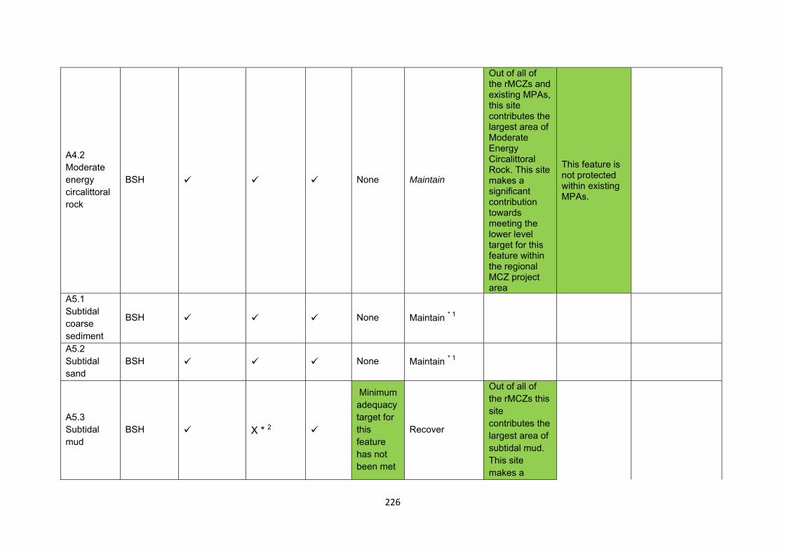
226
A4.2 Moderate energy circalittoral rock
BSH None Maintain
Out of all of the rMCZs and existing MPAs, this site contributes the largest area of Moderate Energy Circalittoral Rock. This site makes a significant contribution towards meeting the lower level target for this feature within the regional MCZ project area
This feature is not protected within existing MPAs.
A5.1 Subtidal coarse sediment
BSH None Maintain * 1
A5.2 Subtidal sand
BSH None Maintain * 1
A5.3 Subtidal mud
BSH X * 2
Minimum adequacy target for this feature has not been met
Recover
Out of all of the rMCZs this site contributes the largest area of subtidal mud. This site makes a
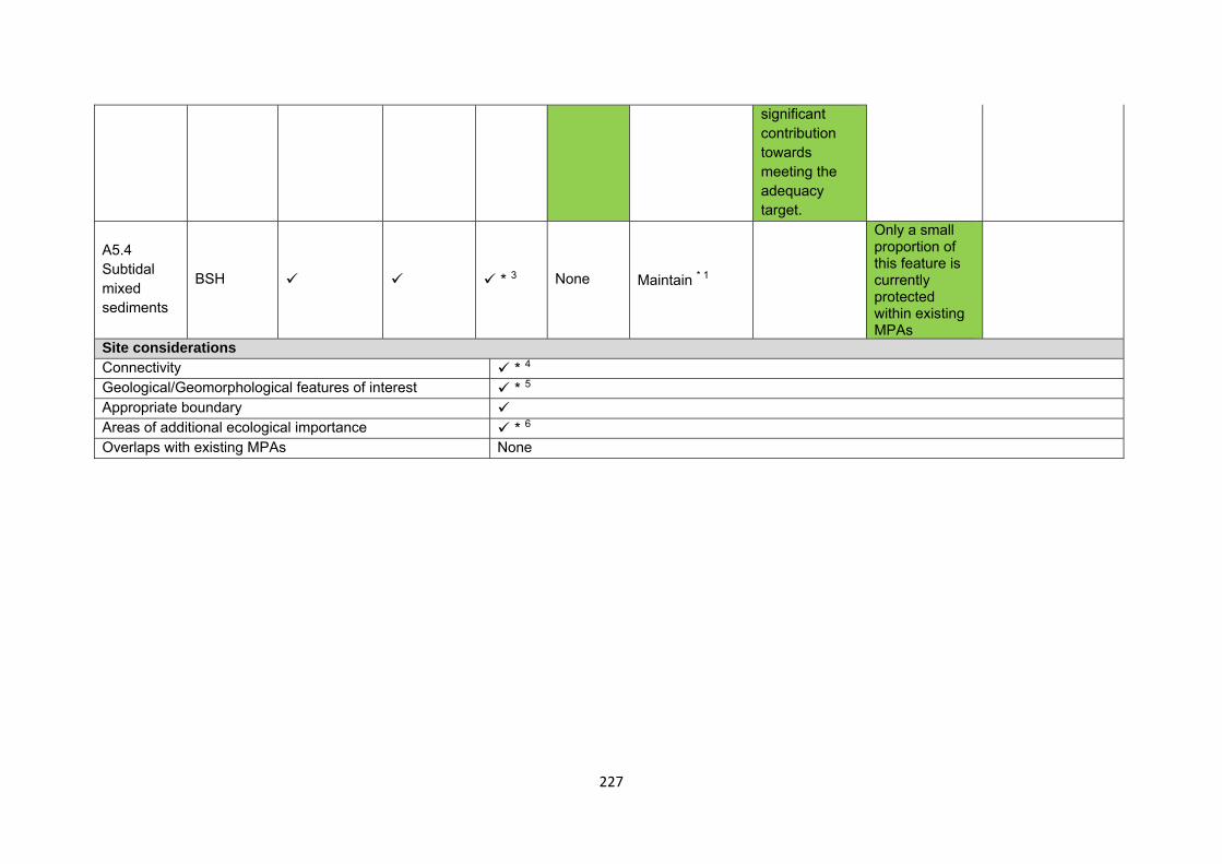
227
significant contribution towards meeting the adequacy target.
A5.4 Subtidal mixed sediments
BSH * 3 None Maintain * 1
Only a small proportion of this feature is currently protected within existing MPAs
Site considerations Connectivity * 4 Geological/Geomorphological features of interest * 5 Appropriate boundary Areas of additional ecological importance * 6Overlaps with existing MPAs None
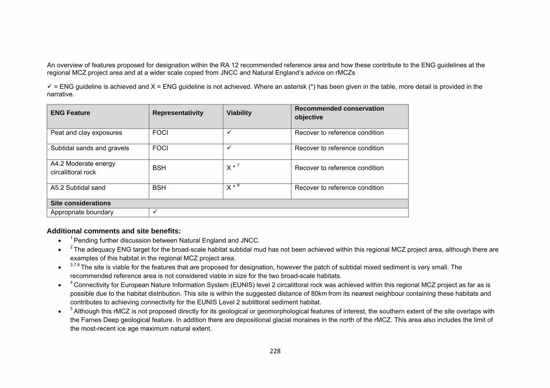
228
An overview of features proposed for designation within the RA 12 recommended reference area and how these contribute to the ENG guidelines at the regional MCZ project area and at a wider scale copied from JNCC and Natural England’s advice on rMCZs
= ENG guideline is achieved and X = ENG guideline is not achieved. Where an asterisk (*) has been given in the table, more detail is provided in the narrative.
ENG Feature Representativity Viability Recommended conservation objective
Peat and clay exposures FOCI Recover to reference condition
Subtidal sands and gravels FOCI Recover to reference condition
A4.2 Moderate energy circalittoral rock BSH X * 7 Recover to reference condition
A5.2 Subtidal sand BSH X * 8 Recover to reference condition
Site considerations Appropriate boundary
Additional comments and site benefits:
• 1 Pending further discussion between Natural England and JNCC. • 2 The adequacy ENG target for the broad-scale habitat subtidal mud has not been achieved within this regional MCZ project area, although there are
examples of this habitat in the regional MCZ project area. • 3,7,8 The site is viable for the features that are proposed for designation, however the patch of subtidal mixed sediment is very small. The
recommended reference area is not considered viable in size for the two broad-scale habitats. • 4 Connectivity for European Nature Information System (EUNIS) level 2 circalittoral rock was achieved within this regional MCZ project as far as is
possible due to the habitat distribution. This site is within the suggested distance of 80km from its nearest neighbour containing these habitats and contributes to achieving connectivity for the EUNIS Level 2 sublittoral sediment habitat.
• 5 Although this rMCZ is not proposed directly for its geological or geomorphological features of interest, the southern extent of the site overlaps with the Farnes Deep geological feature. In addition there are depositional glacial moraines in the north of the rMCZ. This area also includes the limit of the most-recent ice age maximum natural extent.
229
• 6There are a number of ecological benefits which could be considered important and add value to this recommendation (see Annex 5 of JNCC and Natural England’s advice on recommended Marine Conservation zones for more detail on these). This site overlaps with an area of medium species biodiversity and an area of medium benthic biotope biodiversity (Langmead, et al. 2010). Peat and Clay exposures have been identified as promoting species diversity and forming species habitats, for example, burrowing piddocks and associated unique microhabitats (Fletcher, et al. 2012).
Anticipated benefits to ecosystem services The habitats, species and other ecological features of the rMCZ contribute to the delivery of a range of ecosystem services. Designation of the rMCZ and its subsequent management may improve the quantity and quality of the beneficial services provided, which may increase the value (contribution to economic welfare or human well-being) of them. Impacts on the value derived from ecosystem services may occur as a result of the designation, management and/or achievement of the conservation objectives of the rMCZ. Further discussion on the potential benefits to ecosystem services can be found in Annex L and on definitions can be found in Annex H5. Table 5a. Fish and shellfish for human consumption rMCZ NG 14, Farnes East
Baseline Beneficial impact under Policy Option 1
Fletcher and others (2011) identify that the features to be protected by the recommended Marine Conservation Zone (rMCZ) can contribute to the delivery of fish and shellfish for human consumption.
A description of on-site fishing activity and the value derived from it is set out in Table 2.
The subtidal mud in the south-eastern area of the site is a highly productive spawning ground and nursery for Nephrops. Local knowledge suggests that the Farne Deeps could be an important breeding area (Bereton, 2010).
The baseline quantity and quality of the ecosystem service provided is assumed to be commensurate with that provided by the features of the site when in unfavourable condition.
If the conservation objective of the subtidal mud is achieved, it will be recovered to favourable condition and the remaining features will be maintained in favourable condition.
For the subtidal mud, most of the commercial species targeted by fishers in this area are Nephrops. It is therefore likely that the scale of habitat recovered and the magnitude of reduced (on-site) fishing mortality will be enough to have a significant positive impact on commercial stocks. Potential benefits may arise on-site, for fishers permitted to fish within the remaining area of the rMCZ, and off-site from spill-over benefits, particularly in the remaining areas of subtidal mud to the south of the site. This is because the recovery of the subtidal mud to favourable condition may improve its functioning as a nursery area, potentially benefiting fisheries exploited within and
Anticipated direction of
change:
Confidence: Low
230
Table 5a. Fish and shellfish for human consumption rMCZ NG 14, Farnes East
outside the rMCZ.
New management of fishing activities is also suggested for bottom trawls and dredges across the entire site (above the baseline situation), the costs of which are set out in Table 2, which may reduce the impacts on fish and shellfish habitats and harvesting of stocks.
Potential benefits may arise on-site, for fishers permitted to fish within the rMCZ, and off-site from spill-over benefits.
As some fishing activity may still be permitted in the rMCZ, it is unclear whether it would have any impact on stocks of mobile commercial finfish species. Stocks of low-mobility and site-attached species, such as lobsters and crabs, may improve as a result of reduced fishing pressure. If some fishing for such species is permitted within the rMCZ, then catches may improve. Localised beneficial spill-over effects may occur around the rMCZ. If rMCZ management involves reduced mobile gear effort, but no reductions in static gear fishing, this may reduce gear conflict between mobile and static gear fishers. Reduced gear conflict may reduce the cost of fishing in the rMCZ for static gear fishers.
The potential effects described here do not include the negative impacts of the additional fisheries management on fish and shellfish provision and off-site impacts of displaced effort.
231
Table 5b. Recreation rMCZ NG 14, Farnes East
Baseline Beneficial impact under Policy Option 1
Angling: Fletcher and others (2011) identify that the features to be protected by the recommended Marine Conservation Zone (rMCZ) can contribute to the delivery of fish and shellfish for human consumption and recreation services.
The baseline quantity and quality of the ecosystem service provided is assumed to be commensurate with that provided by the features of the site when in unfavourable condition.
The intensity of sea angling within the site is unknown but charter boats are known to operate from Amble, Blythe and Seahouses, which may transport sea anglers to fish within the site (Stakmap, 2011).
It has not been possible to estimate the value derived from angling on-site or the proportion of the value derived from angling off-site which result from the nursery and spawning area.
If the conservation objectives of the features are achieved, the subtidal mud will be recovered to favourable condition and the remaining features will be maintained at favourable condition.
It is unclear whether any benefits to fish populations would arise as a result of reduced fishing mortality due to management of commercial fishing. The recovery of the subtidal mud to favourable condition may improve functioning as a nursery area, potentially benefiting fisheries exploited within and outside the rMCZ (see Table 4a for further details).
As no additional management of angling is expected, anglers will be able to benefit from any on-site and off-site beneficial effects. If the rMCZ results in an increase in the size and diversity of species caught, then this is expected to increase the value derived by anglers.
The designation may lead to an increase in angling visits to the site, which may benefit the local economy. This increase is likely to arise from a change in anglers’ preferred angling locations rather than an increase in days spent angling or the number of anglers.
Anticipated direction of
change:
Confidence: Low
Diving: Diving is known to take place in the rMCZ but the intensity of the activity is unknown (Stakmap, 2011).
If the conservation objectives of the features are achieved, the subtidal mud will be recovered to favourable condition and the remaining features will be maintained at favourable condition.
For the subtidal mud, if the rMCZ results in an increase in species richness and/or diversity, this is expected to increase
Anticipated direction of
change:
232
Table 5b. Recreation rMCZ NG 14, Farnes East
the quality of the diving experience for divers in the site.
For the remaining features, no change in on-site feature condition is anticipated. However, designation may result in an increase in dive trips to the area, which may have beneficial effects on the local economy. This increase may represent a redistribution of dive location preferences rather than an increase in days spent diving or the number of divers.
Designating the rMCZ will protect its features and the ecosystem services that they provide against the risk of future degradation from anthropogenic pressures (because if necessary, mitigation would be introduced, with the associated costs and benefits).
Confidence: Low
233
Table 5b. Recreation rMCZ NG 14, Farnes East
Wildlife watching: Wildlife watching is known to take place in the rMCZ but the intensity of the activity is unknown (Stakmap, 2011).
White-beaked dolphin, harbour porpoise and orca, minke and humpback whales have been sighted within the rMCZ. It is thought that the site is an important feeding and foraging ground for grey seal colonies on the nearby Farne Islands, which are a popular location for wildlife watching (Net Gain Final Recommendations, 2011); rMCZ NG 14 is noted as having the highest number of wintering birds across the suite of MCZs recommended by Net Gain (Kober, 2010) and is important for breeding colonies of guillemot, razorbill, little auk and puffin. It is an important feeding ground for the birds present on the Farne Islands in internationally important numbers including puffin, guillemot, razorbill, Arctic tern, shag, cormorant, fulmar, kittiwake and auk (Kober, 2010) (Net Gain Final Recommendations, 2011).
If the conservation objectives of the features are achieved, the subtidal mud will be recovered to favourable condition and the remaining features will be maintained in favourable condition.
As the site is offshore, with limited wildlife watching taking place within it, benefits are expected to be minimal, but the recovery of the features within the site are expected to support foraging bird and seal populations enjoyed by wildlife watchers in nearby protected areas.
Anticipated direction of
change:
Confidence: Moderate
Table 5c. Research and education rMCZ NG 14, Farnes East
Baseline Beneficial impact under Policy Option 1
Research: Research is not known to take place in the recommended Marine Conservation Zone (rMCZ).
Monitoring of the rMCZ will help to inform understanding of how the marine environment is changing and is impacted on by anthropogenic pressures and management interventions. Other research benefits are unknown.
Anticipated direction of
change:
Confidence: High
234
Table 5c. Research and education rMCZ NG 14, Farnes East
Education: Education is not known to take place in the rMCZ. As the rMCZ is more than 6nm offshore and therefore relatively inaccessible, no benefits are likely to arise from direct use of the site for education.
Non-visitors may benefit if the rMCZ contributes to wider provision of education (e.g. television programmes, articles in magazines and newspapers, and educational resources developed for use in schools).
Anticipated direction of
change:
Confidence: Low
Table 5d. Regulating services rMCZ NG 14, Farnes East
Baseline Beneficial impact under Policy Option 1
Regulation of pollution: The features of the site contribute to the bioremediation of waste and sequestration of carbon. It has not been possible to estimate the value derived from the regulation of pollution in the rMCZ.
Environmental resilience: The features of the site contribute to the resilience and continued regeneration of marine ecosystems. It has not been possible to estimate the value derived from environmental resilience in the rMCZ.
Natural hazard protection: As the site is offshore, its features are not thought to contribute to the delivery of this service.
If the conservation objectives of the features are achieved, the subtidal mud will be recovered to favourable condition and the remaining features will be maintained in favourable condition.
A potential reduction in the use of bottom-towed fishing gear may increase site benthic biodiversity and biomass, improving the regulating capacity of the subtidal mud. For the remaining features, no change in feature condition and management of human activities is expected and therefore no benefit to the regulatory capacity of the site is expected.
Designating the recommended Marine Conservation Zone will protect its features and the ecosystem services that they provide against the risk of future degradation from
Anticipated direction of
change:
Confidence: Low
235
Table 5d. Regulating services rMCZ NG 14, Farnes East
(Fletcher and others, 2011)
anthropogenic pressures (because if necessary, mitigation would be introduced, with the associated costs and benefits).
Table 5e. Non-use and option values rMCZ NG 14, Farnes East
Baseline Beneficial impact under Policy Option 1
Some people gain satisfaction from the existence of marine habitats, species and other features. They also gain from having the option to benefit in the future from the habitats and species in the recommended Marine Conservation Zone (rMCZ) and the ecosystem services provided, even if they do not currently benefit from them.
The rMCZ will benefit the proportion of the UK population that values conservation of the rMCZ features and its contribution to an ecologically coherent network of Marine Protected Areas. Some people will gain satisfaction from knowing that the habitats and species are being conserved (existence value) and/or that they are being conserved for use by others in the current generation (altruistic value) or future generations (bequest value). The rMCZ will protect both the features and their option to benefit from the services in the future from the risk of future degradation.
Anticipated direction of
change:
Confidence: Moderate
236
rMCZ NG 17, Fulmar
Site area (km2): 2,437.12
• This site has been proposed for designation under Policy Option 1 only.
Table 1. Conservation impacts rMCZ NG 17, Fulmar
1a. Ecological description
The sea bed of recommended Marine Conservation Zone (rMCZ) NG 17 is composed of subtidal coarse sediment, sand and gravels. Due to the depth of the site, the sea bed is likely to be subject to low tidal stress and as a result the sediment could provide a stable habitat, supporting a diverse range of marine flora and fauna. Subtidal coarse sediments such as these are likely to include communities of anemones, worms, bivalve molluscs, sea urchins and both mobile and sessile epifauna. Sand and gravel habitats in the North Sea are often characterised by the presence of Venus bivalve communities. Sandy habitats are likely to be characterised by the thin-shelled bivalve mollusc Fabulina fabula, polychaetes, sand hopper and worms. The site also supports foraging sea birds, fulmar and northern gannet.
There are no existing Marine Protected Areas within or adjacent to the site.
(Net Gain, Final Site Recommendations Submission, 2011)
1b. Baseline condition of MCZ features and impact of the rMCZ
Feature Area of feature (km2)
No. of point records
Baseline Impact of the MCZ
Broad-scale habitats
Subtidal coarse sediment 45.32 − Favourable condition Maintained at favourable condition
Subtidal sand 2,389.91 − Favourable condition Maintained at favourable condition
237
Habitats of conservation importance
Subtidal sands and gravels 2,402.31 (modelled) − Favourable condition Maintained at favourable condition
Species of conservation importance
Ocean quahog Arctica islandica − 48 Favourable condition Maintained at favourable condition
Site-specific costs arising from the effect of the rMCZ on human activities (over 2013 to 2032 inclusive) Table 2a. National defence rMCZ NG 17, Fulmar
Source of costs of the rMCZ
Management scenario 1: Mitigation of impacts of Ministry of Defence activities on features protected by the suite of rMCZs will be provided by additional planning considerations during operations and training. It is not known whether mitigation will be required for features protected by this site. The Ministry of Defence will also incur costs in revising environmental tools and charts to include MCZs. Baseline description of activity Costs of impact of rMCZ on the sector under Policy Option 1
The Ministry of Defence is known to make use of the site for military practice, for RAF operations and by the Navy for submarine exercises.
It is not known whether this rMCZ will impact on the Ministry of Defence’s use of the site. Impacts of rMCZs on the Ministry of Defence’s activities are assessed in the Evidence Base and Annex N9.
Table 2b. Other impacts that are assessed for the suite of MCZs and not for this site alone rMCZ NG 17, Fulmar
Cables (interconnectors and telecom cables)
Future interconnectors and telecom cables may pass through the rMCZ. Impacts of rMCZs on future interconnectors and telecom cables are assessed in the
238
Human activities in the site that are not negatively affected by the rMCZ (over 2013 to 2032 inclusive)
Contribution to Ecological Network Guidance Table 4. An overview of features proposed for designation and how these contribute to the ENG guidelines for the regional MCZ project area and at a wider scale14
= ENG guideline is achieved and X = ENG guideline is not achieved. Green cells represent key considerations and any greyed-out rows indicate where SNCBs do not agree with a feature being proposed for designation. Recommended conservation objectives in italics indicate where SNCBs do not agree with the conservation objective recommended by the regional MCZ project (see Section 4.2). Where an asterisk (*) has been given in the table, more detail is provided in the narrative.
rMCZ NG 17, Fulmar
ENG Feature
Represent-ativity Replication Adequacy Viability
Gaps or shortfalls in relation to ENG minimum
Recommended conservation objective
Quantitative considerations at regional MCZ level
Ecological Importance at regional MCZ level
Ecological Importance at wider scale
14 copied from the JNCC and Natural England’s advice to Defra on rMCZs
Evidence Base, Annex H3 and Annex N3 (they are not assessed for this site alone).
Oil and gas related activities (including carbon capture and storage) This rMCZ overlaps with an area that has potential for future oil and gas exploration and production (it overlaps licenced blocks in the 26th or 27th Seaward Licensing Rounds). However, the area is not necessarily viable to develop. Impacts of rMCZs on the oil and gas related activities are assessed in the Evidence Base, Annex H11 and Annex N10 (they are not assessed for this site alone).
Table 3. Human activities in the site that are not negatively affected by the rMCZ under Policy Option 1
(existing activities at their current levels and future proposals known to the regional MCZ projects)
rMCZ NG 17, Fulmar
Cables (existing interconnectors and telecom cables), commercial fisheries and shipping (transit of vessels only).
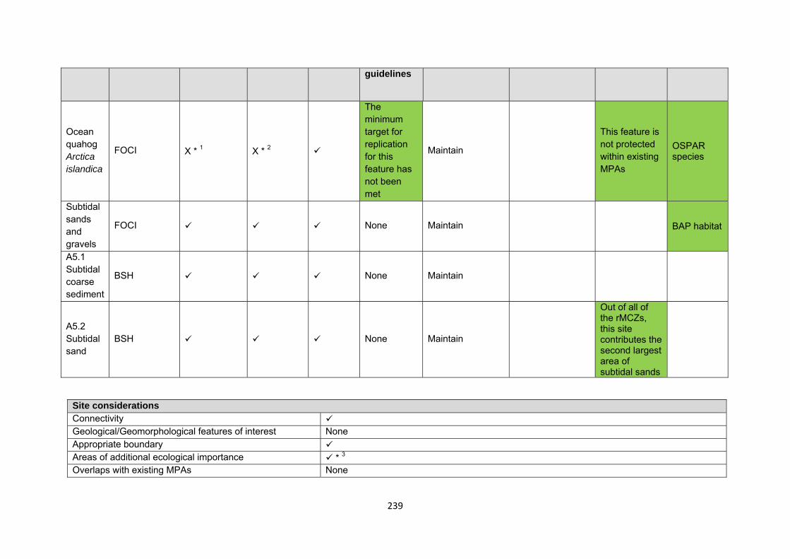
239
guidelines
Ocean quahog Arctica islandica
FOCI X * 1 X * 2
The minimum target for replication for this feature has not been met
Maintain
This feature is not protected within existing MPAs
OSPAR species
Subtidal sands and gravels
FOCI None Maintain BAP habitat
A5.1 Subtidal coarse sediment
BSH None Maintain
A5.2 Subtidal sand
BSH None Maintain
Out of all of the rMCZs, this site contributes the second largest area of subtidal sands
Site considerations Connectivity Geological/Geomorphological features of interest None Appropriate boundary Areas of additional ecological importance * 3 Overlaps with existing MPAs None
240
Additional comments and site benefits: • 1 Fulmar rMCZ provides one of two replicates of Arctica islandica in the regional MCZ project area. Currently the minimum recommended number of
replicates for this feature has not been met within this regional MCZ project area. There is potential for other sites within the Northern North Seas biogeographic region to contain replicates of this feature, as Arctica islandica is a MPA search feature for the Scottish MPA project.
• 2 As the replication guideline has not been achieved for Arctica islandica the recommendations also fail to meet the guidelines on adequacy for this FOCI.
• 3Although it is not clear whether this site was selected on the basis of it being an area of additional ecological importance there are a number of ecological benefits which could be considered important and add value to this recommendation (see Annex 5 of JNCC and Natural England’s advice on rMCZs for more detail on these). This site overlaps with an area of high species biodiversity (Langmead, et al. 2010).
Anticipated benefits to ecosystem services The habitats, species and other ecological features of the rMCZ contribute to the delivery of a range of ecosystem services. Designation of the rMCZ and its subsequent management may improve the quantity and quality of the beneficial services provided, which may increase the value (contribution to economic welfare or human well-being) of them. Impacts on the value derived from ecosystem services may occur as a result of the designation, management and/or achievement of the conservation objectives of the rMCZ. Further discussion on the potential benefits to ecosystem services can be found in Annex L and on definitions can be found in Annex H5. Table 4a. Fish and shellfish for human consumption rMCZ NG 17, Fulmar
Baseline Beneficial impact under Policy Option 1
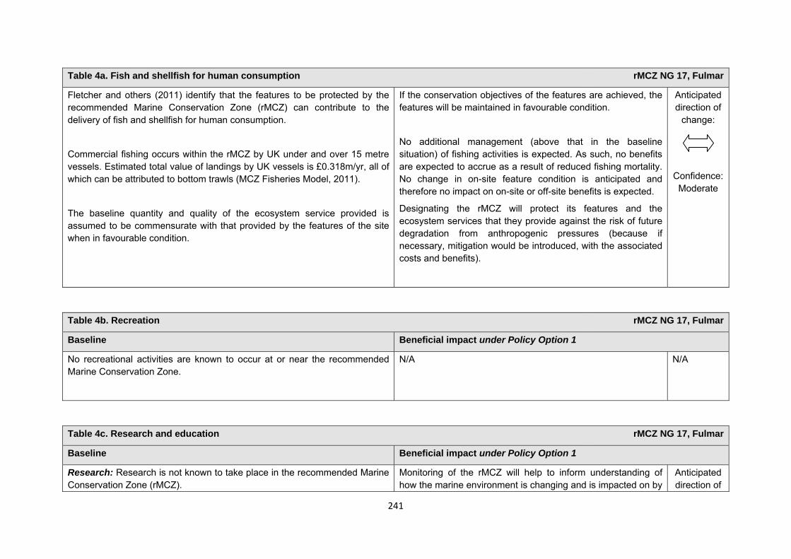
241
Table 4a. Fish and shellfish for human consumption rMCZ NG 17, Fulmar
Fletcher and others (2011) identify that the features to be protected by the recommended Marine Conservation Zone (rMCZ) can contribute to the delivery of fish and shellfish for human consumption.
Commercial fishing occurs within the rMCZ by UK under and over 15 metre vessels. Estimated total value of landings by UK vessels is £0.318m/yr, all of which can be attributed to bottom trawls (MCZ Fisheries Model, 2011).
The baseline quantity and quality of the ecosystem service provided is assumed to be commensurate with that provided by the features of the site when in favourable condition.
If the conservation objectives of the features are achieved, the features will be maintained in favourable condition.
No additional management (above that in the baseline situation) of fishing activities is expected. As such, no benefits are expected to accrue as a result of reduced fishing mortality. No change in on-site feature condition is anticipated and therefore no impact on on-site or off-site benefits is expected.
Designating the rMCZ will protect its features and the ecosystem services that they provide against the risk of future degradation from anthropogenic pressures (because if necessary, mitigation would be introduced, with the associated costs and benefits).
Anticipated direction of
change:
Confidence: Moderate
Table 4b. Recreation rMCZ NG 17, Fulmar
Baseline Beneficial impact under Policy Option 1
No recreational activities are known to occur at or near the recommended Marine Conservation Zone.
N/A N/A
Table 4c. Research and education rMCZ NG 17, Fulmar
Baseline Beneficial impact under Policy Option 1
Research: Research is not known to take place in the recommended Marine Conservation Zone (rMCZ).
Monitoring of the rMCZ will help to inform understanding of how the marine environment is changing and is impacted on by
Anticipated direction of
242
Table 4c. Research and education rMCZ NG 17, Fulmar
anthropogenic pressures and management interventions. Other research benefits are unknown.
change:
Confidence: High
Education: Education is not known to take place in the rMCZ. As the rMCZ is more than 6nm offshore and therefore relatively inaccessible, no benefits are likely to arise from direct use of the site for education.
Non-visitors may benefit if the rMCZ contributes to wider provision of education (e.g. television programmes, articles in magazines and newspapers, and educational resources developed for use in schools).
Anticipated direction of
change:
Confidence: Low
Table 4d. Regulating services rMCZ NG 17, Fulmar
Baseline Beneficial impact under Policy Option 1
Regulation of pollution: The features of the site contribute to the bioremediation of waste and sequestration of carbon. It has not been possible to estimate the value derived from the regulation of pollution in the rMCZ.
Environmental resilience: The features of the site contribute to the resilience and continued regeneration of marine ecosystems. It has not been
If the conservation objectives of the features are achieved, the features will be maintained in favourable condition.
No change in feature condition and management of human activities is expected and therefore no benefit to the regulatory capacity of the site is expected.
Anticipated direction of
change:
Confidence: Moderate
243
Table 4d. Regulating services rMCZ NG 17, Fulmar
possible to estimate the value derived from environmental resilience in the rMCZ.
Natural hazard protection: As the site is offshore, its features are not thought to contribute to the delivery of this service.
(Fletcher and others, 2011)
Designating the recommended Marine Conservation Zone will protect its features and the ecosystem services that they provide against the risk of future degradation from anthropogenic pressures (because if necessary, mitigation would be introduced, with the associated costs and benefits).
Table 4e. Non-use and option values rMCZ NG 17, Fulmar
Baseline Beneficial impact under Policy Option 1
Some people gain satisfaction from the existence of marine habitats, species and other features. They also gain from having the option to benefit in the future from the habitats and species in the recommended Marine Conservation Zone (rMCZ) and the ecosystem services provided, even if they do not currently benefit from them.
The rMCZ will benefit the proportion of the UK population that values conservation of the rMCZ features and its contribution to an ecologically coherent network of Marine Protected Areas. Some people will gain satisfaction from knowing that the habitats and species are being conserved (existence value) and/or that they are being conserved for use by others in the current generation (altruistic value) or future generations (bequest value). The rMCZ will protect both the features and their option to benefit from the services in the future from the risk of future degradation.
Anticipated direction of
change:
Confidence: Moderate

244
rMCZ Reference Area 1, North Norfolk Blue Mussel Beds
Site area (km2): 0.25
• This site has been proposed for designation under Policy Option 1 only.
Table 1. Conservation impacts rMCZ Reference Area 1, North Norfolk Blue Mussel Beds
1a. Ecological description
The presence of blue mussel beds in this recommended Marine Conservation Zone (rMCZ) Reference Area was confirmed in 2011 by Eastern Inshore Fisheries and Conservation Authorities (IFCA) surveys using a ‘day grab’ sampling method. The blue mussel beds provide a habitat for species such as seaweed, anemone, barnacle, gastropod, starfish and worm, creating an area that supports biodiverse fauna and flora. Should the site be designated, the existing surrounding ‘No trawl zone’ would provide a buffer and increased protection of the beds. The subtidal chalk within the site forms part of the longest chalk reef in Europe and contains some of the best examples of subtidal chalk in the North Sea. The chalk is highly biodiverse, hosting large communities of
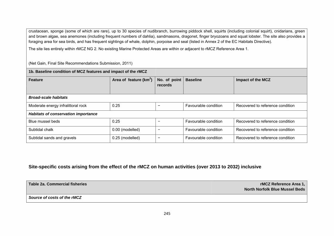
245
crustacean, sponge (some of which are rare), up to 30 species of nudibranch, burrowing piddock shell, squirts (including colonial squirt), cnidarians, green and brown algae, sea anemones (including frequent numbers of dahlia), sandmasons, dragonet, finger bryozoans and squat lobster. The site also provides a foraging area for sea birds, and has frequent sightings of whale, dolphin, porpoise and seal (listed in Annex 2 of the EC Habitats Directive).
The site lies entirely within rMCZ NG 2. No existing Marine Protected Areas are within or adjacent to rMCZ Reference Area 1.
(Net Gain, Final Site Recommendations Submission, 2011)
1b. Baseline condition of MCZ features and impact of the rMCZ
Feature Area of feature (km2) No. of point records
Baseline Impact of the MCZ
Broad-scale habitats
Moderate energy infralittoral rock 0.25 − Favourable condition Recovered to reference condition
Habitats of conservation importance
Blue mussel beds 0.25 − Favourable condition Recovered to reference condition
Subtidal chalk 0.00 (modelled) − Favourable condition Recovered to reference condition
Subtidal sands and gravels 0.25 (modelled) − Favourable condition Recovered to reference condition
Site-specific costs arising from the effect of the rMCZ on human activities (over 2013 to 2032) inclusive Table 2a. Commercial fisheries rMCZ Reference Area 1,
North Norfolk Blue Mussel Beds
Source of costs of the rMCZ
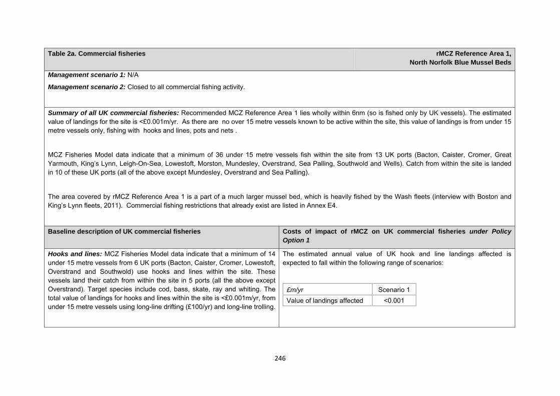
246
Table 2a. Commercial fisheries rMCZ Reference Area 1, North Norfolk Blue Mussel Beds
Management scenario 1: N/A
Management scenario 2: Closed to all commercial fishing activity.
Summary of all UK commercial fisheries: Recommended MCZ Reference Area 1 lies wholly within 6nm (so is fished only by UK vessels). The estimated value of landings for the site is <£0.001m/yr. As there are no over 15 metre vessels known to be active within the site, this value of landings is from under 15 metre vessels only, fishing with hooks and lines, pots and nets .
MCZ Fisheries Model data indicate that a minimum of 36 under 15 metre vessels fish within the site from 13 UK ports (Bacton, Caister, Cromer, Great Yarmouth, King’s Lynn, Leigh-On-Sea, Lowestoft, Morston, Mundesley, Overstrand, Sea Palling, Southwold and Wells). Catch from within the site is landed in 10 of these UK ports (all of the above except Mundesley, Overstrand and Sea Palling).
The area covered by rMCZ Reference Area 1 is a part of a much larger mussel bed, which is heavily fished by the Wash fleets (interview with Boston and King’s Lynn fleets, 2011). Commercial fishing restrictions that already exist are listed in Annex E4.
Baseline description of UK commercial fisheries Costs of impact of rMCZ on UK commercial fisheries under Policy Option 1
Hooks and lines: MCZ Fisheries Model data indicate that a minimum of 14 under 15 metre vessels from 6 UK ports (Bacton, Caister, Cromer, Lowestoft, Overstrand and Southwold) use hooks and lines within the site. These vessels land their catch from within the site in 5 ports (all the above except Overstrand). Target species include cod, bass, skate, ray and whiting. The total value of landings for hooks and lines within the site is <£0.001m/yr, from under 15 metre vessels using long-line drifting (£100/yr) and long-line trolling.
The estimated annual value of UK hook and line landings affected is expected to fall within the following range of scenarios:
£m/yr Scenario 1 Value of landings affected <0.001
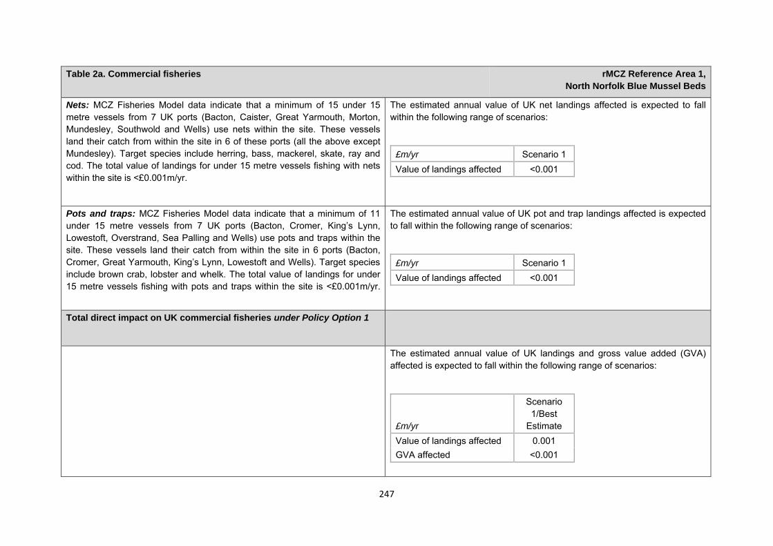
247
Table 2a. Commercial fisheries rMCZ Reference Area 1, North Norfolk Blue Mussel Beds
Nets: MCZ Fisheries Model data indicate that a minimum of 15 under 15 metre vessels from 7 UK ports (Bacton, Caister, Great Yarmouth, Morton, Mundesley, Southwold and Wells) use nets within the site. These vessels land their catch from within the site in 6 of these ports (all the above except Mundesley). Target species include herring, bass, mackerel, skate, ray and cod. The total value of landings for under 15 metre vessels fishing with nets within the site is <£0.001m/yr.
The estimated annual value of UK net landings affected is expected to fall within the following range of scenarios:
£m/yr Scenario 1 Value of landings affected <0.001
Pots and traps: MCZ Fisheries Model data indicate that a minimum of 11 under 15 metre vessels from 7 UK ports (Bacton, Cromer, King’s Lynn, Lowestoft, Overstrand, Sea Palling and Wells) use pots and traps within the site. These vessels land their catch from within the site in 6 ports (Bacton, Cromer, Great Yarmouth, King’s Lynn, Lowestoft and Wells). Target species include brown crab, lobster and whelk. The total value of landings for under 15 metre vessels fishing with pots and traps within the site is <£0.001m/yr.
The estimated annual value of UK pot and trap landings affected is expected to fall within the following range of scenarios:
£m/yr Scenario 1 Value of landings affected <0.001
Total direct impact on UK commercial fisheries under Policy Option 1
The estimated annual value of UK landings and gross value added (GVA) affected is expected to fall within the following range of scenarios:
£m/yr
Scenario 1/Best
Estimate Value of landings affected 0.001 GVA affected <0.001
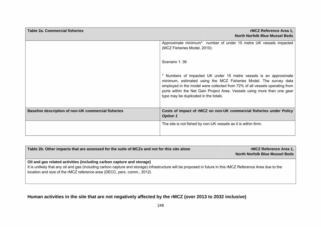
248
Table 2a. Commercial fisheries rMCZ Reference Area 1, North Norfolk Blue Mussel Beds
Approximate minimum* number of under 15 metre UK vessels impacted (MCZ Fisheries Model, 2010):
Scenario 1: 36
* Numbers of impacted UK under 15 metre vessels is an approximate minimum, estimated using the MCZ Fisheries Model. The survey data employed in the model were collected from 72% of all vessels operating from ports within the Net Gain Project Area. Vessels using more than one gear type may be duplicated in the totals.
Baseline description of non-UK commercial fisheries Costs of impact of rMCZ on non-UK commercial fisheries under Policy Option 1
The site is not fished by non-UK vessels as it is within 6nm.
Human activities in the site that are not negatively affected by the rMCZ (over 2013 to 2032 inclusive)
Table 2b. Other impacts that are assessed for the suite of MCZs and not for this site alone rMCZ Reference Area 1, North Norfolk Blue Mussel Beds
Oil and gas related activities (including carbon capture and storage) It is unlikely that any oil and gas (including carbon capture and storage) infrastructure will be proposed in future in this rMCZ Reference Area due to the location and size of the rMCZ reference area (DECC, pers. comm., 2012)
249
Contribution to Ecological Network Guidance
This rRA sits within an rMCZ. For information on how this reference area contributes towards the guidelines in the Ecological Network Guidance please see the information provided underneath rMCZ NG 02 – Cromer Shoal Chalk Beds. This is also taken from Annex 5 in JNCC and Natural England’s Advice on rMCZs
Anticipated benefits to ecosystem services The habitats, species and other ecological features of the rMCZ contribute to the delivery of a range of ecosystem services. Designation of the rMCZ and its subsequent management may improve the quantity and quality of the beneficial services provided, which may increase the value (contribution to economic welfare or human well-being) of them. Impacts on the value derived from ecosystem services may occur as a result of the designation, management and/or achievement of the conservation objectives of the rMCZ. Further discussion on the potential benefits to ecosystem services can be found in Annex L and on definitions can be found in Annex H5.
Table 4a. Fish and shellfish for human consumption rMCZ Reference Area 1,
North Norfolk Blue Mussel Beds
Baseline Beneficial impact under Policy Option 1
Fletcher and others (2011) identify that the features to be protected by the recommended Marine Conservation Zone (rMCZ) contribute to the delivery of fish and shellfish services.
If the conservation objectives of the features are achieved, the features will be recovered to reference condition.
Achievement of the conservation objectives may improve the
Anticipated direction of
change:
Table 3. Human activities in the site that are not negatively affected by the rMCZ under Policy Option 1
(existing activities at their current levels and future proposals known to the regional MCZ projects)
rMCZ Reference Area 1, North Norfolk Blue Mussel Beds
Recreation (recreational boating, snorkelling and SCUBA diving − based on currently known level of activities) and shipping (transit of vessels only).
250
Table 4a. Fish and shellfish for human consumption rMCZ Reference Area 1,
North Norfolk Blue Mussel Beds
Blue mussel beds are the predominant habitat in the rMCZ, providing a firm substrate for species attachment and creating structurally complex habitats that provide refuge for a range of flora and fauna not observed on surrounding sediments.
The baseline quantity and quality of service provided is assumed to be commensurate with that provided by the features of the site when in favourable condition.
A description of on-site fishing activity and the value derived from it is set out in Table 2.
contribution of the habitats to the provision of fish and shellfish for human consumption.
Additional management (above that in the baseline situation) of fishing activities is expected, which will prohibit fishing within the rMCZ, the costs of which are set out in Table 2. Management of fishing activity within the rMCZ may reduce the on-site fishing mortality of species, which may benefit commercial stocks.
As the rMCZ is small, it is unclear whether it would have any impact on stocks of mobile commercial finfish species. Stocks of low-mobility and site-attached species, such as blue mussels, may improve as a result of reduced fishing pressure. Localised beneficial spill-over effects may occur around the rMCZ.
As no fishing will be permitted within the rMCZ, no on-site benefits will be realised.
Benefits defined here are not net of potential costs of the rMCZ and off-site impacts of displaced effort.
Confidence: Low
Table 4b. Recreation rMCZ Reference Area 1,
North Norfolk Blue Mussel Beds
251
Table 4b. Recreation rMCZ Reference Area 1,
North Norfolk Blue Mussel Beds
Baseline Beneficial impact under Policy Option 1
Angling: Fletcher and others (2011) identify that the features to be protected by the recommended Marine Conservation Zone (rMCZ) can contribute to the delivery of fish and shellfish for human consumption and recreation services.
The baseline quantity and quality of the ecosystem service provided is assumed to be commensurate with that provided by features of the site when in favourable condition (see Table 1).
There is no known recreational angling activity carried out within the rMCZ.
If the conservation objectives of the features are achieved, the features will be recovered to reference condition.
Recovery of habitats may have benefits to fish populations. It is unclear whether any benefits to fish populations would arise as a result of reduced fishing mortality due to management of commercial fishing (see Table 4a for further information).
As angling will not be permitted within the rMCZ, any benefits will be limited to those occurring as a result of spill-over effects of finfish species targeted by anglers. Such benefits may be insignificant.
Anticipated direction of
change:
Confidence: Low
Diving: The area is a popular site for diving but the intensity of the activity is unknown (Stakmap, 2011).
If the conservation objectives of the features are achieved, the features will be recovered to reference condition.
If the rMCZ results in an increase in biodiversity, which may include recovery of fragile and slow-growing species as a result of reduced pressure from mobile fishing gears, this is expected to increase the value derived by divers visiting the site.
Improved local diving experiences may increase dive trips to the area, which may have beneficial effects on the local economy. This increase may arise from a change in divers’
Anticipated direction of
change:
Confidence: Low
252
Table 4b. Recreation rMCZ Reference Area 1,
North Norfolk Blue Mussel Beds
preferred diving locations rather than an increase in dive trips or numbers of divers.
Wildlife watching: Wildlife watching is not known to take place in the rMCZ.
N/A N/A
Table 4c. Research and education rMCZ Reference Area 1,
North Norfolk Blue Mussel Beds
Baseline Beneficial impact under Policy Option 1
Research: Fletcher and others (2011) identify that the features to be protected by the recommended Marine Conservation Zone (rMCZ) can contribute to the delivery of research services.
The site has been subject to Eastern Inshore Fisheries and Conservation Authority surveys, and Gardline has also conducted survey transects in the vicinity (Stakmap, 2011).
It has not been possible to estimate the value derived from research activities associated with the rMCZ.
As a Reference Area, the rMCZ will provide an opportunity to demonstrate the state of designated marine features in the absence of many anthropogenic pressures (Natural England and Joint Nature Conservation Committee, 2010)(Natural England and JNCC, 2010). It will provide a control area against which the impacts of pressures caused by human activities can be compared as part of long-term monitoring and assessment. Other research benefits are unknown.
Anticipated direction of
change:
Confidence: High
Education: Fletcher and others (2011) identify that the features to be protected by the rMCZ can contribute to the delivery of education services.
No known education activity is focused on the area of the rMCZ.
As the rMCZ is 5km offshore and therefore relatively inaccessible, no benefits are likely to arise from direct use of the site for education.
Anticipated direction of
change:
253
Table 4c. Research and education rMCZ Reference Area 1,
North Norfolk Blue Mussel Beds
Non-visitors may benefit if the rMCZ contributes to wider provision of education (e.g. television programmes, articles in magazines and newspapers, and educational resources developed for use in schools).
Confidence: Low
Table 4d. Regulating services rMCZ Reference Area 1,
North Norfolk Blue Mussel Beds
Baseline Beneficial impact under Policy Option 1
Regulation of pollution: The features of the site contribute to the bioremediation of waste and sequestration of carbon. It has not been possible to estimate the value derived from the regulation of pollution in the rMCZ.
Environmental resilience: The features of the site contribute to the resilience and continued regeneration of marine ecosystems. It has not been possible to estimate the value derived from environmental resilience in the rMCZ.
Natural hazard protection: As the site is offshore, its features are not thought to contribute to the delivery of this service.
(Fletcher and others, 2011)
If the conservation objectives of the features are achieved, the features will be recovered to reference condition.
A reduction in the use of bottom-towed fishing gear may increase site benthic biodiversity and biomass, improving the regulating capacity of the site habitats.
Anticipated direction of
change:
Confidence: Low
254
Table 4e. Non-use and option values rMCZ Reference Area 1,
North Norfolk Blue Mussel Beds
Baseline Beneficial impact under Policy Option 1
Some people gain satisfaction from the existence of marine habitats, species and other features. They also gain from having the option to benefit in the future from the habitats and species in the recommended Marine Conservation Zone (rMCZ) and the ecosystem services provided, even if they do not currently benefit from them.
The rMCZ will benefit the proportion of the UK population that values conservation of the rMCZ features and its contribution to an ecologically coherent network of Marine Protected Areas. Some people will gain satisfaction from knowing that the habitats and species are being conserved (existence value) and/or that they are being conserved for use by others in the current generation (altruistic value) or future generations (bequest value). The rMCZ will recover and then protect the features in reference condition and the ecosystem services provided, and thereby the option to benefit from these services in the future, from the risk of future degradation.
Anticipated direction of
change:
Confidence: Moderate
rMCZ Reference Area 2a&b, Seahorse Lagoon and Arnold’s Marsh
Site area (km2): 0.14
• This site has been proposed for designation under Policy Option 1 only.
Table 1. Conservation impacts rMCZ Reference Area 2a&b,
Seahorse Lagoon and Arnold’s Marsh
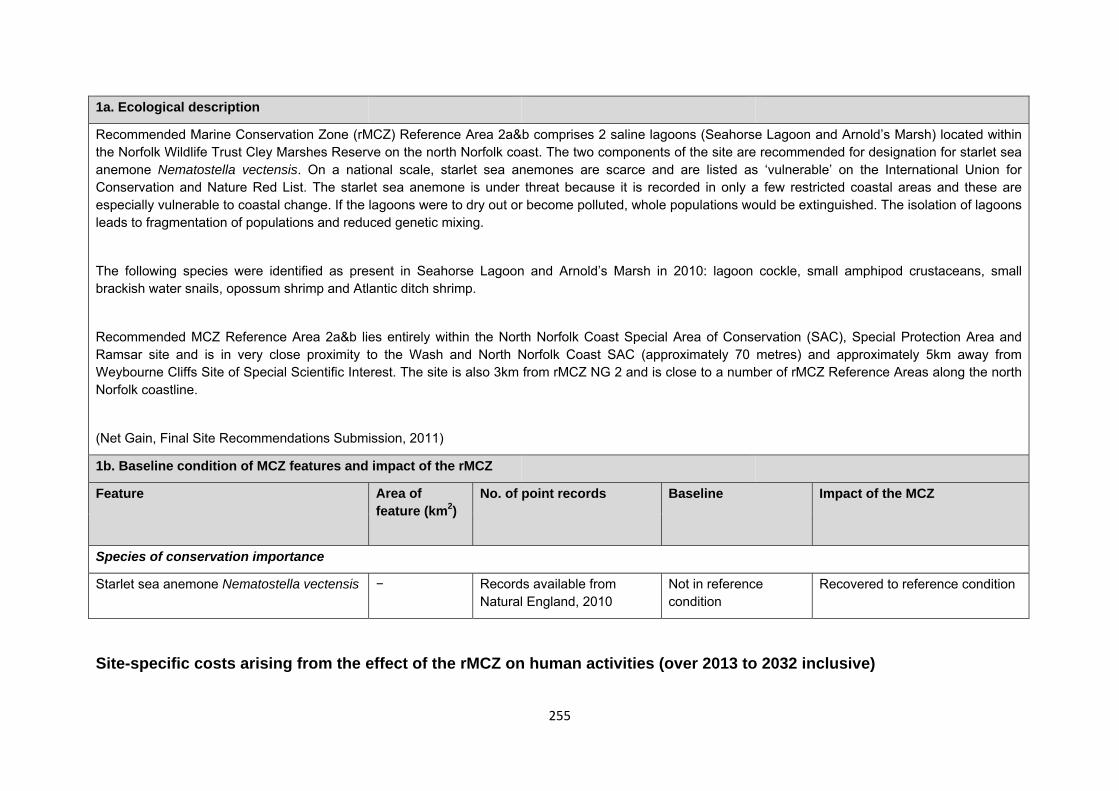
255
1a. Ecological description
Recommended Marine Conservation Zone (rMCZ) Reference Area 2a&b comprises 2 saline lagoons (Seahorse Lagoon and Arnold’s Marsh) located within the Norfolk Wildlife Trust Cley Marshes Reserve on the north Norfolk coast. The two components of the site are recommended for designation for starlet sea anemone Nematostella vectensis. On a national scale, starlet sea anemones are scarce and are listed as ‘vulnerable’ on the International Union for Conservation and Nature Red List. The starlet sea anemone is under threat because it is recorded in only a few restricted coastal areas and these are especially vulnerable to coastal change. If the lagoons were to dry out or become polluted, whole populations would be extinguished. The isolation of lagoons leads to fragmentation of populations and reduced genetic mixing.
The following species were identified as present in Seahorse Lagoon and Arnold’s Marsh in 2010: lagoon cockle, small amphipod crustaceans, small brackish water snails, opossum shrimp and Atlantic ditch shrimp.
Recommended MCZ Reference Area 2a&b lies entirely within the North Norfolk Coast Special Area of Conservation (SAC), Special Protection Area and Ramsar site and is in very close proximity to the Wash and North Norfolk Coast SAC (approximately 70 metres) and approximately 5km away from Weybourne Cliffs Site of Special Scientific Interest. The site is also 3km from rMCZ NG 2 and is close to a number of rMCZ Reference Areas along the north Norfolk coastline.
(Net Gain, Final Site Recommendations Submission, 2011)
1b. Baseline condition of MCZ features and impact of the rMCZ
Feature Area of feature (km2)
No. of point records Baseline Impact of the MCZ
Species of conservation importance
Starlet sea anemone Nematostella vectensis − Records available from Natural England, 2010
Not in reference condition
Recovered to reference condition
Site-specific costs arising from the effect of the rMCZ on human activities (over 2013 to 2032 inclusive)
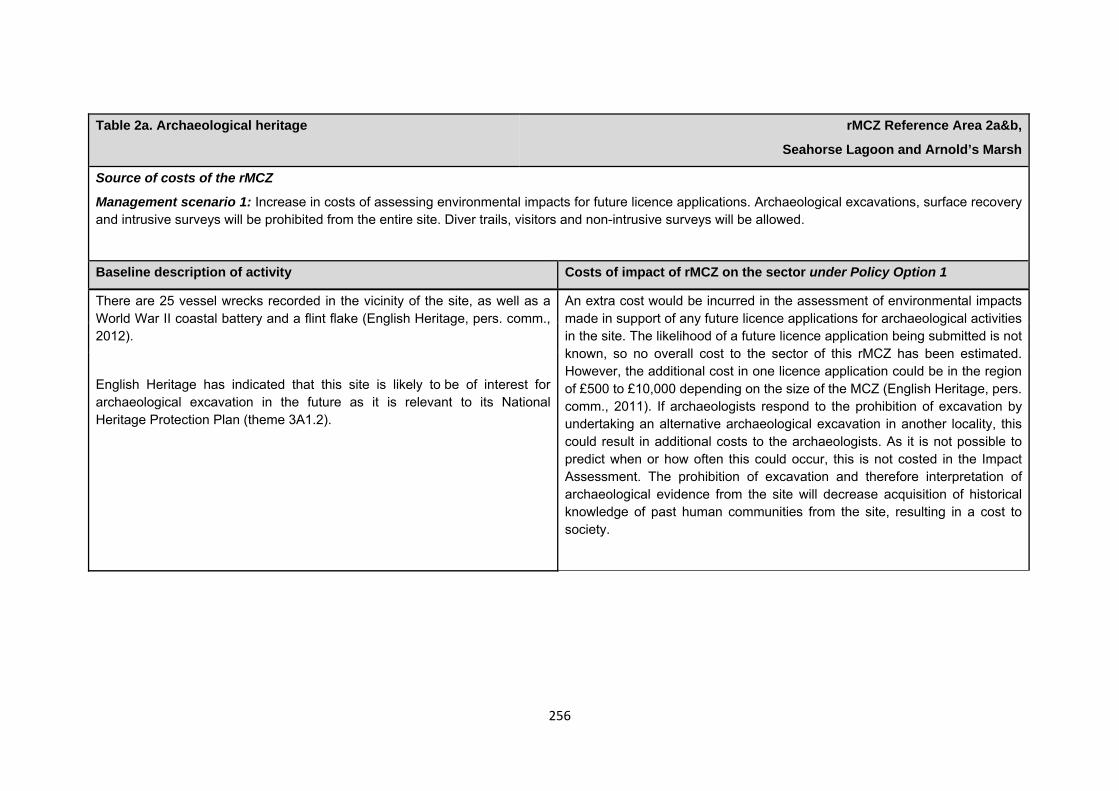
256
Table 2a. Archaeological heritage rMCZ Reference Area 2a&b,
Seahorse Lagoon and Arnold’s Marsh
Source of costs of the rMCZ
Management scenario 1: Increase in costs of assessing environmental impacts for future licence applications. Archaeological excavations, surface recovery and intrusive surveys will be prohibited from the entire site. Diver trails, visitors and non-intrusive surveys will be allowed.
Baseline description of activity Costs of impact of rMCZ on the sector under Policy Option 1
There are 25 vessel wrecks recorded in the vicinity of the site, as well as a World War II coastal battery and a flint flake (English Heritage, pers. comm., 2012).
English Heritage has indicated that this site is likely to be of interest for archaeological excavation in the future as it is relevant to its National Heritage Protection Plan (theme 3A1.2).
An extra cost would be incurred in the assessment of environmental impacts made in support of any future licence applications for archaeological activities in the site. The likelihood of a future licence application being submitted is not known, so no overall cost to the sector of this rMCZ has been estimated. However, the additional cost in one licence application could be in the region of £500 to £10,000 depending on the size of the MCZ (English Heritage, pers. comm., 2011). If archaeologists respond to the prohibition of excavation by undertaking an alternative archaeological excavation in another locality, this could result in additional costs to the archaeologists. As it is not possible to predict when or how often this could occur, this is not costed in the Impact Assessment. The prohibition of excavation and therefore interpretation of archaeological evidence from the site will decrease acquisition of historical knowledge of past human communities from the site, resulting in a cost to society.
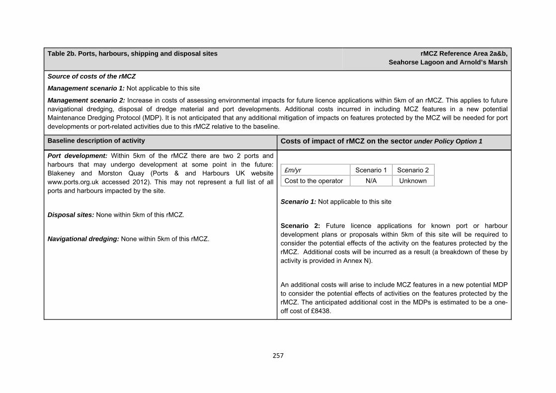
257
Table 2b. Ports, harbours, shipping and disposal sites rMCZ Reference Area 2a&b, Seahorse Lagoon and Arnold’s Marsh
Source of costs of the rMCZ
Management scenario 1: Not applicable to this site
Management scenario 2: Increase in costs of assessing environmental impacts for future licence applications within 5km of an rMCZ. This applies to future navigational dredging, disposal of dredge material and port developments. Additional costs incurred in including MCZ features in a new potential Maintenance Dredging Protocol (MDP). It is not anticipated that any additional mitigation of impacts on features protected by the MCZ will be needed for port developments or port-related activities due to this rMCZ relative to the baseline.
Baseline description of activity Costs of impact of rMCZ on the sector under Policy Option 1
Port development: Within 5km of the rMCZ there are two 2 ports and harbours that may undergo development at some point in the future: Blakeney and Morston Quay (Ports & and Harbours UK website www.ports.org.uk accessed 2012). This may not represent a full list of all ports and harbours impacted by the site.
Disposal sites: None within 5km of this rMCZ.
Navigational dredging: None within 5km of this rMCZ.
£m/yr Scenario 1 Scenario 2 Cost to the operator N/A Unknown
Scenario 1: Not applicable to this site
Scenario 2: Future licence applications for known port or harbour development plans or proposals within 5km of this site will be required to consider the potential effects of the activity on the features protected by the rMCZ. Additional costs will be incurred as a result (a breakdown of these by activity is provided in Annex N).
An additional costs will arise to include MCZ features in a new potential MDP to consider the potential effects of activities on the features protected by the rMCZ. The anticipated additional cost in the MDPs is estimated to be a one-off cost of £8438.
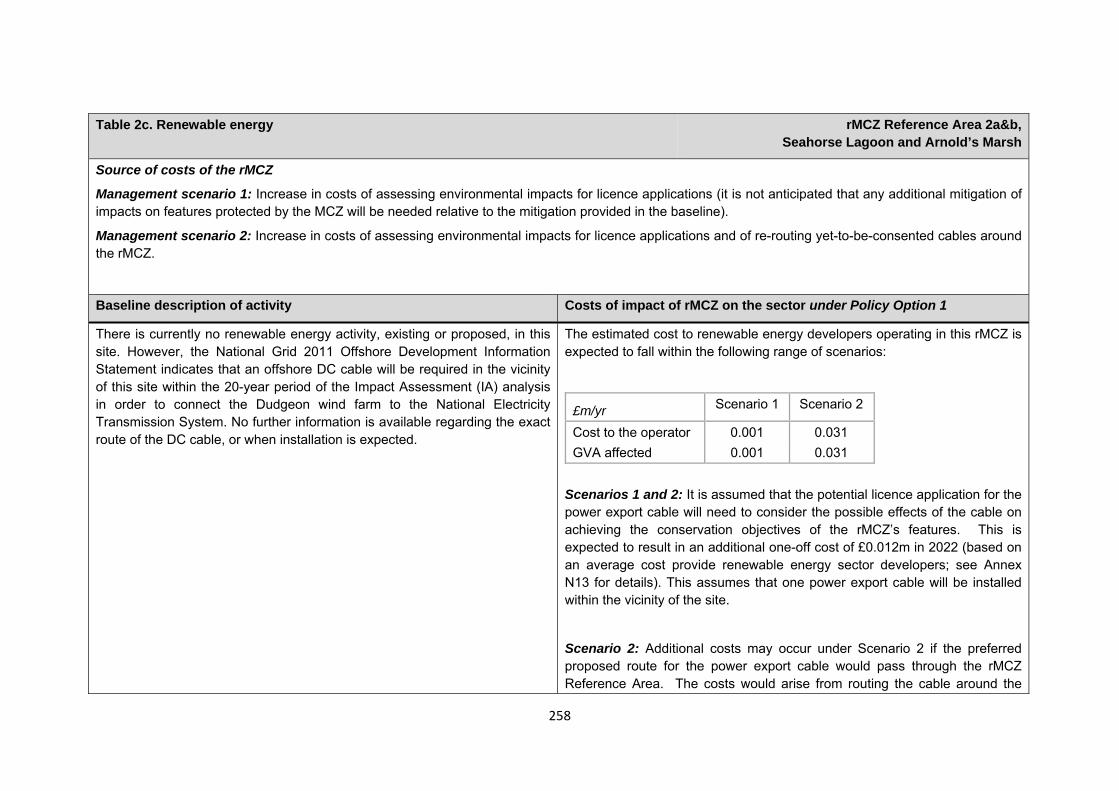
258
Table 2c. Renewable energy rMCZ Reference Area 2a&b,
Seahorse Lagoon and Arnold’s Marsh
Source of costs of the rMCZ
Management scenario 1: Increase in costs of assessing environmental impacts for licence applications (it is not anticipated that any additional mitigation of impacts on features protected by the MCZ will be needed relative to the mitigation provided in the baseline).
Management scenario 2: Increase in costs of assessing environmental impacts for licence applications and of re-routing yet-to-be-consented cables around the rMCZ.
Baseline description of activity Costs of impact of rMCZ on the sector under Policy Option 1
There is currently no renewable energy activity, existing or proposed, in this site. However, the National Grid 2011 Offshore Development Information Statement indicates that an offshore DC cable will be required in the vicinity of this site within the 20-year period of the Impact Assessment (IA) analysis in order to connect the Dudgeon wind farm to the National Electricity Transmission System. No further information is available regarding the exact route of the DC cable, or when installation is expected.
The estimated cost to renewable energy developers operating in this rMCZ is expected to fall within the following range of scenarios:
£m/yr Scenario 1 Scenario 2
Cost to the operator 0.001 0.031 GVA affected 0.001 0.031
Scenarios 1 and 2: It is assumed that the potential licence application for the power export cable will need to consider the possible effects of the cable on achieving the conservation objectives of the rMCZ’s features. This is expected to result in an additional one-off cost of £0.012m in 2022 (based on an average cost provide renewable energy sector developers; see Annex N13 for details). This assumes that one power export cable will be installed within the vicinity of the site.
Scenario 2: Additional costs may occur under Scenario 2 if the preferred proposed route for the power export cable would pass through the rMCZ Reference Area. The costs would arise from routing the cable around the
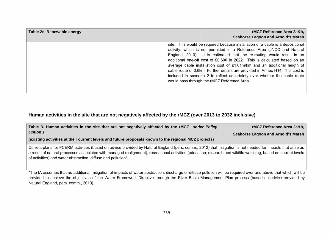
259
Table 2c. Renewable energy rMCZ Reference Area 2a&b, Seahorse Lagoon and Arnold’s Marsh
site. This would be required because installation of a cable is a depositional activity, which is not permitted in a Reference Area (JNCC and Natural England, 2010). It is estimated that the re-routing would result in an additional one-off cost of £0.606 in 2022. This is calculated based on an average cable installation cost of £1.01m/km and an additional length of cable route of 0.6km. Further details are provided in Annex H14. This cost is included in scenario 2 to reflect uncertainty over whether the cable route would pass through the rMCZ Reference Area.
Human activities in the site that are not negatively affected by the rMCZ (over 2013 to 2032 inclusive)
*The IA assumes that no additional mitigation of impacts of water abstraction, discharge or diffuse pollution will be required over and above that which will be provided to achieve the objectives of the Water Framework Directive through the River Basin Management Plan process (based on advice provided by Natural England, pers. comm., 2010).
Table 3. Human activities in the site that are not negatively affected by the rMCZ under Policy Option 1
(existing activities at their current levels and future proposals known to the regional MCZ projects)
rMCZ Reference Area 2a&b,
Seahorse Lagoon and Arnold’s Marsh
Current plans for FCERM activities (based on advice provided by Natural England (pers. comm., 2012) that mitigation is not needed for impacts that arise as a result of natural processes associated with managed realignment), recreational activities (education, research and wildlife watching, based on current levels of activities) and water abstraction, diffuse and pollution*.
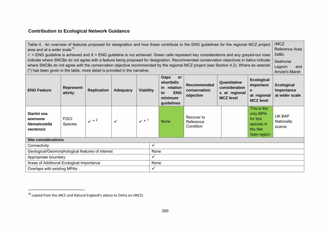
260
Contribution to Ecological Network Guidance Table 4. An overview of features proposed for designation and how these contribute to the ENG guidelines for the regional MCZ project area and at a wider scale15
= ENG guideline is achieved and X = ENG guideline is not achieved. Green cells represent key considerations and any greyed-out rows indicate where SNCBs do not agree with a feature being proposed for designation. Recommended conservation objectives in italics indicate where SNCBs do not agree with the conservation objective recommended by the regional MCZ project (see Section 4.2). Where an asterisk (*) has been given in the table, more detail is provided in the narrative.
rMCZ Reference Area 2a&b,
Seahorse Lagoon and Arnold’s Marsh
ENG Feature Represent-ativity Replication Adequacy Viability
Gaps or shortfalls in relation to ENG minimum guidelines
Recommended conservation objective
Quantitative considerations at regional MCZ level
Ecological Importance at regional MCZ level
Ecological Importance at wider scale
Starlet sea anemone Nematostella vectensis
FOCI Species * 2 * 1 None
Recover to Reference Condition
This is the only MPA for this species in the Net Gain region
UK BAP Nationally scarce
Site considerations Connectivity Geological/Geomorphological features of interest None Appropriate boundary Areas of Additional Ecological Importance None Overlaps with existing MPAs 15 copied from the JNCC and Natural England’s advice to Defra on rMCZs
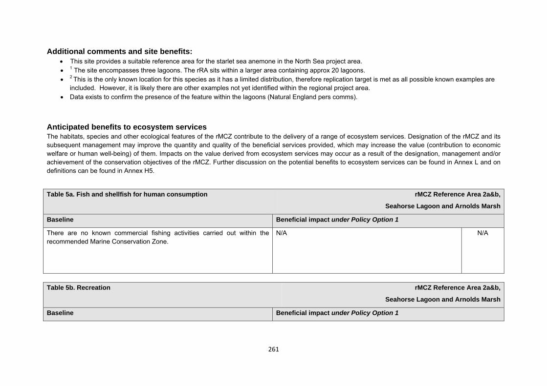
261
Additional comments and site benefits: • This site provides a suitable reference area for the starlet sea anemone in the North Sea project area. • 1 The site encompasses three lagoons. The rRA sits within a larger area containing approx 20 lagoons. • 2 This is the only known location for this species as it has a limited distribution, therefore replication target is met as all possible known examples are
included. However, it is likely there are other examples not yet identified within the regional project area. • Data exists to confirm the presence of the feature within the lagoons (Natural England pers comms).
Anticipated benefits to ecosystem services The habitats, species and other ecological features of the rMCZ contribute to the delivery of a range of ecosystem services. Designation of the rMCZ and its subsequent management may improve the quantity and quality of the beneficial services provided, which may increase the value (contribution to economic welfare or human well-being) of them. Impacts on the value derived from ecosystem services may occur as a result of the designation, management and/or achievement of the conservation objectives of the rMCZ. Further discussion on the potential benefits to ecosystem services can be found in Annex L and on definitions can be found in Annex H5.
Table 5a. Fish and shellfish for human consumption rMCZ Reference Area 2a&b,
Seahorse Lagoon and Arnolds Marsh
Baseline Beneficial impact under Policy Option 1
There are no known commercial fishing activities carried out within the recommended Marine Conservation Zone.
N/A N/A
Table 5b. Recreation rMCZ Reference Area 2a&b,
Seahorse Lagoon and Arnolds Marsh
Baseline Beneficial impact under Policy Option 1
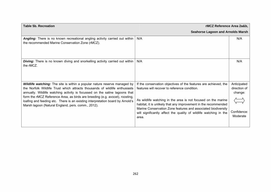
262
Table 5b. Recreation rMCZ Reference Area 2a&b,
Seahorse Lagoon and Arnolds Marsh
Angling: There is no known recreational angling activity carried out within the recommended Marine Conservation Zone (rMCZ).
N/A N/A
Diving: There is no known diving and snorkelling activity carried out within the rMCZ.
N/A N/A
Wildlife watching: The site is within a popular nature reserve managed by the Norfolk Wildlife Trust which attracts thousands of wildlife enthusiasts annually. Wildlife watching activity is focussed on the saline lagoons that form the rMCZ Reference Area, as birds are breeding (e.g. avocet), roosting, loafing and feeding etc. There is an existing interpretation board by Arnold’s Marsh lagoon (Natural England, pers. comm., 2012).
If the conservation objectives of the features are achieved, the features will recover to reference condition.
As wildlife watching in the area is not focused on the marine habitat, it is unlikely that any improvement in the recommended Marine Conservation Zone features and associated biodiversity will significantly affect the quality of wildlife watching in the area.
Anticipated direction of
change:
Confidence: Moderate
263
Table 5c. Research and education rMCZ Reference Area 2a&b,
Seahorse Lagoon and Arnolds Marsh
Baseline Beneficial impact under Policy Option 1
Research: Fletcher and others (2011) identify that the features to be protected by the recommended Marine Conservation Zone (rMCZ) can contribute to the delivery of research services.
Recommended MCZ Reference Area 2a&b lies entirely within the North Norfolk Coast Special Area of Conservation (SAC), Special Protection Area (SPA) and Ramsar site, and within the Norfolk Wildlife Trust Cley Marshes reserve (Net Gain Final Recommendations, 2011), and, as such, monitoring activity is ongoing. Natural England has conducted surveys in the saline lagoons, with two people visiting once per year (Natural England interview with Norfolk Wildlife Trust, 2011).
It has not been possible to estimate the value derived from research activities associated with the rMCZ.
As a Reference Area, the rMCZ will provide an opportunity to demonstrate the state of designated marine features in the absence of many anthropogenic pressures (Natural England and Joint Nature Conservation Committee, 2010)(Natural England and JNCC, 2010). It will provide a control area against which the impacts of pressures caused by human activities can be compared as part of long-term monitoring and assessment. Other research benefits are unknown.
Anticipated direction of
change:
Confidence: High
Education: Fletcher and others (2011) identify that the features to be protected by the rMCZ can contribute to the delivery of education services.
Recommended MCZ Reference Area 2a&b lies entirely within the North Norfolk Coast SAC, SPA and Ramsar site, and within the Norfolk Wildlife Trust Cley Marshes reserve (Net Gain Final Recommendations, 2011). Visitors to the reserve may benefit from educational resources. There is an existing visitor centre at the Cley Marshes reserve, which houses a viewing camera from the reserve and an exhibition area for wildlife education (Norfolk Wildlife Trust, 2011).
MCZ designation may provide an opportunity to expand the focus of education events into the marine environment.
Designation may aid additional local (to the rMCZ) provision of education (e.g. events and interpretation boards), from which visitors would derive benefit.
Non-visitors may benefit if the rMCZ contributes to wider provision of education (e.g. television programmes, articles in
Anticipated direction of
change:
Confidence: Moderate
264
Table 5c. Research and education rMCZ Reference Area 2a&b,
Seahorse Lagoon and Arnolds Marsh
It has not been possible to estimate the value derived from educational activities associated with the rMCZ.
magazines and newspapers, and educational resources developed for use in schools).
Table 5d. Regulating services rMCZ Reference Area 2a&b,
Seahorse Lagoon and Arnolds Marsh
Baseline Beneficial impact under Policy Option 1
Regulation of pollution: The features of the site contribute to the bioremediation of waste and sequestration of carbon. The sediment in lagoons becomes the sink for biogeochemical nutrient cycles because water depth is low and the intertidal zone is extended. It has not been possible to estimate the value derived from the regulation of pollution in the rMCZ.
Environmental resilience: The features of the site contribute to the resilience and continued regeneration of marine ecosystems. It has not been possible to estimate the value derived from environmental resilience in the rMCZ.
Natural hazard protection: As the sites are lagoons which are subject to change through natural hazards, the features are not thought to contribute to the delivery of this service.
(Fletcher and others, 2011)
If the conservation objectives of the features are achieved, the features will be recovered to reference condition, which may improve the regulating capacity of the site habitats.
Anticipated direction of
change:
Confidence: Low

265
Table 5e. Non-use and option values rMCZ Reference Area 2a&b,
Seahorse Lagoon and Arnolds Marsh
Baseline Beneficial impact under Policy Option 1
Some people gain satisfaction from the existence of marine habitats, species and other features. They also gain from having the option to benefit in the future from the habitats and species in the recommended Marine Conservation Zone (rMCZ) and the ecosystem services provided, even if they do not currently benefit from them.
The rMCZ will benefit the proportion of the UK population that values conservation of the rMCZ features and its contribution to an ecologically coherent network of Marine Protected Areas. Some people will gain satisfaction from knowing that the habitats and species are being conserved (existence value) and/or that they are being conserved for use by others in the current generation (altruistic value) or future generations (bequest value). The rMCZ will recover and then protect the features in reference condition and the ecosystem services provided, and thereby the option to benefit from these services in the future, from the risk of future degradation.
Anticipated direction of
change:
Confidence: Moderate
266
rMCZ Reference Area 3, Glaven Reedbed
Site area (km2): 0.04
• This site has been proposed for designation under Policy Option 1 only.
Table 1. Conservation impacts rMCZ Reference Area 3,
Glaven Reedbed
1a. Ecological description
Recommended Marine Conservation Zone (rMCZ) Reference Area 3 is recommended for the protection of saline reedbeds, which are listed under the UK BAP list of priority habitats. The reedbed on this site is not regularly cut and harvested, and there are existing pathways within the reserve which allow the site to be easily monitored.
Saline reedbeds are wetlands dominated by stands of the common reed; filamentous green algae and charophytes may be found in association with the feature. Reedbeds develop stable organic sediments by providing a litter layer which improves primary productivity in the aquatic ecosystem, making it a key structural species.
Reedbeds are among the most important habitats for birds in the UK, supporting a distinctive breeding bird assemblage including 3 nationally rare Red Data Book birds: the bittern and marsh harrier (both listed in Annex 1 of the EC Birds Directive) and the common crane. In winter, the reedbeds are used as roosting sites for several raptor species such as the merlin, peregrine and the protected hen harrier (all of which are listed in Annex 1 of the EC Birds Directive). Five Red Data Book invertebrates are also closely associated with reedbeds, including red leopard moth and rove beetle.
The rMCZ is located within the Cley Marshes Reserve in northern Norfolk and is currently managed by Norfolk Wildlife Trust. The site lies within the North Norfolk Coast Special Area of Conservation (SAC), Special Protection Area, Site of Special Scientific Interest (SSSI) and Ramsar site. A very small portion of the site overlaps with the Wash and Norfolk Coast SAC. The site is approximately 1km from rMCZ Reference Area 2a&b, 2km from rMCZ Reference Area 4 and 4.75km from rMCZ NG 2.
267
(Net Gain, Final Site Recommendations Submission, 2011)
1b. Baseline condition of MCZ features and impact of the rMCZ
Feature Area of feature (km2)
No. of point records
Baseline Impact of the MCZ
Broad-scale Habitats
Coastal saltmarshes and saline reedbeds 0.04 − Not in reference condition
Recovered to reference condition
Table 2a. Flood and coastal erosion risk management (FCERM) rMCZ Reference Area 3,
Glaven Reedbed
Source of costs of the rMCZ
Management scenario 1: No impact arises from the proposed management realignment. The proposed managed realignment scheme does not impact on achieving the conservation objectives of the features. Note that provision of equivalent environmental benefit is not needed for impacts that arise from natural processes. Increase in costs of assessing environmental impacts for future licence applications for maintenance work for the coastal defence scheme. These are assessed for the suite of sites in the Net Gain project area.
Management scenario 2: Provision of equivalent environmental benefit by the body undertaking the proposed management re-alignment scheme to compensate for the impacts that the scheme has on features protected by the MCZ. Also, increase in costs of assessing environmental impacts for future licence applications for maintenance work for the coastal defence scheme. These are assessed for the suite of sites in the Net Gain project area.
Baseline description of activity Costs of impact of rMCZ on the sector under Policy Option 1
The site is situated between the village of Cley-upon-Sea and existing coastal defences which are in place to protect the village from flooding. The relevant Shoreline Management Plan II (SMPII) policy for the site is to ‘hold the line’, and it is known that the site is immediately adjacent to an area of
£m/yr Scenario 1 Scenario 2 Additional mitigation cost Unknown Unknown
268
Table 2a. Flood and coastal erosion risk management (FCERM) rMCZ Reference Area 3,
Glaven Reedbed
planned ‘managed realignment’ at Blakeney Freshes, but it is unknown when this will occur.
There are potential changes in the local tidal regime arising from proposed managed re-alignment outside of the rMCZ if this scheme is implemented before 2033. This is a precautionary view, based on advisor sight knowledge. This is likely to result in habitat change, and may impact on the habitat integrity of the site, although this is not known for certain at this time. Monitoring will determine the extent to which the feature is being impacted on by coastal processes. A change in the tidal regime may change the site to salt marsh or alter the character of the site features (Environment Agency and Natural England, pers. comm., 2011).
The Environment Agency and Local Authorities submit applications for funding for a 5-year medium-term plan for Flood and coastal erosion risk management (FCERM) works. Funds are allocated annually, but are subject to change depending on changes in funding, responsibilities, structures etc. There are no significant programmed capital works affecting rMCZ Reference Area 3 within the current medium-term plan, but it is likely there could be maintenance repair works needed in the future (Natural England and Environment Agency, pers. comm., 2012).
Scenario 1: No impact arises from the proposed management realignment. As a result of the rMCZ, it is anticipated that additional costs will be incurred in assessing environmental impacts in support of future licence applications for Flood and Coastal Erosion Risk Management (FCERM) schemes. It is estimated that 5 applications may be submitted over the next 5 years to undertake maintenance repair works (Natural England and Environment Agency, pers. comm., 2012). The impacts of this are assessed qualitatively for the regional suite of sites and are summarised in Annex F.
Scenario 2: It is assumed that the proposed management re-alignment scheme impacts on the MCZ features but proceeds because of its social and economic importance. It is assumed that impacts on the MCZ features would not be mitigated. For the purpose of the impact assessment (IA), the impact is assessed as the cost to the operator of providing environmental benefit that is equivalent to the impact that the proposed managed realignment scheme would have on features protected by the rMCZ. The costs of this have not been assessed because it is not yet known whether achievement of the conservation objective of features in the rMCZ would definitely be impacted upon by the proposed scheme and if so, the magnitude of that impact (these will be established through Natural England’s monitoring of the site).
If damage to the features occurs as a result of the rMCZ, a representative example of tidal reedbed could potentially be designated at an alternative similar location elsewhere within the Net Gain Project Area. It is anticipated that significant costs would not arise from designating an alternative site. It would involve the input of time from stakeholders, landowners and Natural
269
Table 2a. Flood and coastal erosion risk management (FCERM) rMCZ Reference Area 3,
Glaven Reedbed
England. This would be a feasible and effective option if it was well managed (Environment Agency and Natural England, pers. comm., 2011).
Also, as a result of the rMCZ, it is anticipated that additional costs will be incurred in assessing environmental impacts in support of future licence applications for Flood and Coastal Erosion Risk Management (FCERM) schemes. It is esteemed that 5 applications may be submitted over the next 5 years to undertake maintenance repair works (Natural England and Environment Agency, pers. comm., 2012). The impacts of this are assessed qualitatively for the regional suite of sites and are summarised in Annex F.
The impacts have been assessed in this way because the assessment is of the impacts of the regional MCZ projects’ site recommendations that were submitted in September 2011. The Minister’s decision about designating this site will be also informed by Natural England’s and JNCC’s statutory advice on MCZs that was published on 18 July 2012. Where it is feasible, it is anticipated that the advice will suggest that the site recommendation is adjusted to increase the likelihood that the MCZ features’ conservation objectives can be achieved. Such adjustment is not included in the IA because the IA is an assessment of the regional MCZ projects’ recommendations.
Table 2b. Ports, harbours, shipping and disposal sites rMCZ Reference Area 3,
Glaven Reedbed
270
Table 2b. Ports, harbours, shipping and disposal sites rMCZ Reference Area 3,
Glaven Reedbed
Source of costs of the rMCZ
Management scenario 1: Not applicable to this site
Management scenario 2: Increase in costs of assessing environmental impacts for future licence applications within 5km of an rMCZ. This applies to future navigational dredging, disposal of dredge material and port developments. Additional costs incurred in including MCZ features in a new potential Maintenance Dredging Protocol (MDP). It is not anticipated that any additional mitigation of impacts on features protected by the MCZ will be needed for port developments or port-related activities due to this rMCZ relative to the baseline.
Baseline description of activity Costs of impact of rMCZ on the sector under Policy Option 1
Port development: Within 5km of the rMCZ there are two 2 ports and harbours that may undergo development at some point in the future: Blakeney and Morston Quay (Ports & and Harbours UK website www.ports.org.uk accessed 2012). This may not represent a full list of all ports and harbours impacted by the site.
Disposal sites: None within 5km of this rMCZ.
Navigational dredging: None within 5km of this rMCZ.
£m/yr Scenario 1 Scenario 2 Cost to the operator N/A Unknown
Scenario 1: Not applicable to this site
Scenario 2: Future licence applications for port developments within 5km of this site will be required to consider the potential effects of the activity on the features protected by the rMCZ. Additional costs will be incurred as a result (a breakdown of these by activity is provided in Annex N).
An additional costs will arise to include MCZ features in a new potential MDP to consider the potential effects of activities on the features protected by the rMCZ. The anticipated additional cost in the MDPs is estimated to be a one-off cost of £8438.
271
Table 2c. Recreation rMCZ Reference Area 3,
Glaven Reedbed
Source of costs of the rMCZ
Management scenario 1: Closure of the rMCZ Reference Area to wildfowling.
Baseline description of activity Costs of impact of rMCZ on the sector under Policy Option 1
Wildfowling: Approximately 200 wildfowlers (including members of the Blakeney Wildfowlers Club) operate in the site (North Norfolk District Council interview with Blakeney Wildfowlers Club, 2011). The wildfowling season begins on 1 September and ends on 20 February. Shooting can take place during dawn and dusk on any day with appropriate weather conditions during the season but Norfolk Wildlife Trust, which manages the site, has commented that only a few shoots per season occur within the rMCZ Reference Area (Natural England interview with Norfolk Wildlife Trust, 2011). Greylag and pink-footed geese, widgeon, teal, gadwall, pintail, mallard and snipe are targeted (North Norfolk District Council interview with Blakeney Wildfowlers Club, 2011).
The site is close to the village of Cley and local residents have previously complained about the proximity of shooting to the village (Natural England interview with Norfolk Wildlife Trust, pers. comm., 2011).
Blakeney Wildfowlers Club has existing rights for wildfowling in the site, including consent to carry out wildfowling on its entire lease holdings from Natural England, agreed in 2005, with no time limit. The consent is based on an assessment which ensures that wildfowling at the site complies with the conservation objectives of the existing designation of the site as a Site of Special Scientific Interest. Current leases do not specify the geographic extent of the permitted activity (Natural England, pers. comm., 2012). The
Recommended MCZ Reference Area 3 forms part of the reedbed where the wildfowlers have consent to shoot, but only a few shoots occur within the site each year (Natural England interview with Norfolk Wildlife Trust, 2011). The site is not considered to be a preferred location within the wider lease area as it is near to the village of Cley-next-to-the-Sea, where residents have previously raised concerns over shooting close to the village (Natural England, pers. comm., 2011). In addition, wildfowling could still occur on the remainder of the lease area surrounding rMCZ Reference Area 3 and therefore the impacts of the restriction are assumed to be negligible, should the rMCZ be designated.
272
Table 2c. Recreation rMCZ Reference Area 3,
Glaven Reedbed
club also operates under the British Association for Shooting and Conservation recommended codes of practice (North Norfolk District Council interview with Blakeney Wildfowlers Club, 2011).
Table 2d. Renewable energy rMCZ Reference Area 3,
Glaven Reedbed
Source of costs of the rMCZ
Management scenario 1: Increase in costs of assessing environmental impacts for licence applications (it is not anticipated that any additional mitigation of impacts on features protected by the MCZ will be needed relative to the mitigation provided in the baseline).
Management scenario 2: Increase in costs of assessing environmental impacts for licence applications and of re-routing yet-to-be-consented cables around the rMCZ.
Baseline description of activity Costs of impact of rMCZ on the sector under Policy Option 1
There is currently no renewable energy activity, existing or proposed, in this site. However, the National Grid 2011 Offshore Development Information Statement indicates that an offshore DC cable will be required in the vicinity of this site within the 20-year period of the Impact Assessment (IA) analysis in order to connect the Dudgeon wind farm to the National Electricity Transmission System. No further information is available regarding the exact route of the DC cable, or when it is likely to be installed.
The estimated cost to renewable energy developers operating in this rMCZ is expected to fall within the following range of scenarios:
£m/yr Scenario 1 Scenario 2
Cost to the operator 0.001 0.023 GVA affected 0.001 0.023
Scenarios 1 and 2: It is assumed that the potential licence application for the power export cable will need to consider the possible effects of the cable on
273
Table 2d. Renewable energy rMCZ Reference Area 3,
Glaven Reedbed
achieving the conservation objectives of the rMCZ’s features. This is expected to result in an additional one-off cost of £0.012m in 2022 (based on an average cost provide renewable energy sector developers; see Annex N13 for details). This assumes that one power export cable will be installed within the vicinity of the site.
Scenario 2: Additional costs may occur under Scenario 2 if the preferred proposed route for the power export cable would pass through the rMCZ Reference Area. The costs would arise from routing the cable around the site. This would be required because installation of a cable is a depositional activity, which is not permitted in a Reference Area (JNCC and Natural England, 2010). It is estimated that the re-routing would result in an additional one-off cost of £0.455m in 2022. This is calculated based on an average cable installation cost of £1.01m/km and an additional length of cable route of 0.45km. Further details are provided in Annex H14. This costs is included in scenario 2 to reflect uncertainty over whether the cable route would pass through the rMCZ Reference Area.
Human activities in the site that are not negatively affected by the rMCZ (over 2013 to 2032 inclusive) Table 3. Human activities in the site that are not negatively affected by the rMCZ under Policy Option 1
(existing activities at their current levels and future proposals known to the regional MCZ projects)
rMCZ Reference Area 3, Glaven Reedbed
Recreational activities (education, research, wildlife watching, walking and dog walking, based on current levels of activities) and water abstraction, diffuse and pollution * (there is an existing catch-water drain within the site).
274
*The IA assumes that no additional mitigation of impacts of water abstraction, discharge or diffuse pollution will be required over and above that which will be provided to achieve the objectives of the Water Framework Directive through the River Basin Management Plan process (based on advice provided by Natural England, pers. comm., 2010). Contribution to Ecological Network Guidance Table 4. An overview of features proposed for designation and how these contribute to the ENG guidelines for the regional MCZ project area and at a wider scale16
= ENG guideline is achieved and X = ENG guideline is not achieved. Green cells represent key considerations and any greyed-out rows indicate where SNCBs do not agree with a feature being proposed for designation. Recommended conservation objectives in italics indicate where SNCBs do not agree with the conservation objective recommended by the regional MCZ project (see Section 4.2). Where an asterisk (*) has been given in the table, more detail is provided in the narrative.
rMCZ Reference Area 3, Glaven Reedbed
ENG Feature
Represent-ativity Replication Adequacy Viability
Gaps or shortfalls in relation to ENG minimum guidelines
Recommended conservation objective
Quantitative considerations at regional MCZ level
Ecological Importance at regional MCZ level
Ecological Importance at wider scale
A2.5 Coastal salt marshes and saline reedbed
BSH N/A X
This site has not met the target for viability
Recover to Reference Condition
This site has not met the target for viability
The reedbeds support a number of important birds
Reedbeds support IUCN Red list birds.
Site considerations Connectivity Geological/Geomorphological features of interest None Appropriate boundary Areas of Additional Ecological Importance N/A
16 copied from the JNCC and Natural England’s advice to Defra on rMCZs
275
Overlaps with existing MPAs Additional comments and site benefits:
• The site contributes to the Net Gain Project achieving the requirements of the ENG for reference areas. • This site incorporates a small portion of saline reedbed, which is listed as UKBAP habitats. Reedbeds are amongst the most important habitats for
birds in the UK and support a distinctive breeding bird assemblage (Hawke and Jose 1996) (Net Gain 2011b). Anticipated benefits to ecosystem services The habitats, species and other ecological features of the rMCZ contribute to the delivery of a range of ecosystem services. Designation of the rMCZ and its subsequent management may improve the quantity and quality of the beneficial services provided, which may increase the value (contribution to economic welfare or human well-being) of them. Impacts on the value derived from ecosystem services may occur as a result of the designation, management and/or achievement of the conservation objectives of the rMCZ. Further discussion on the potential benefits to ecosystem services can be found in Annex L and on definitions can be found in Annex H5.
Table 5a. Fish and shellfish for human consumption rMCZ Reference Area 3,
Glaven Reedbed
Baseline Beneficial impact under Policy Option 1
There are no known commercial fishing activities carried out within the recommended Marine Conservation Zone.
N/A N/A
Table 5b. Recreation rMCZ Reference Area 3,
Glaven Reedbed
276
Table 5b. Recreation rMCZ Reference Area 3,
Glaven Reedbed
Baseline Beneficial impact under Policy Option 1
Angling: There is no known recreational angling activity carried out within the recommended Marine Conservation Zone (rMCZ).
N/A N/A
Diving: There is no known diving and snorkelling activity carried out within the rMCZ.
N/A N/A
Wildlife watching: Wildlife watching is known to take place within the rMCZ Reference Area, but the intensity of the activity is unknown (Stakmap, 2011).
If the conservation objectives of the features are achieved, the features will be recovered to reference condition.
As wildlife watching in the area is not focused on the marine habitat, it is unlikely that any improvement in the rMCZ features and associated biodiversity will significantly affect the quality of wildlife watching in the area.
Anticipated direction of
change:
Confidence: Moderate
Table 5c. Research and education rMCZ Reference Area 3,
Glaven Reedbed
Baseline Beneficial impact under Policy Option 1
277
Table 5c. Research and education rMCZ Reference Area 3,
Glaven Reedbed
Research: Fletcher and others (2011) identify that the features to be protected by the recommended Marine Conservation Zone (rMCZ) can contribute to the delivery of research services.
Recommended MCZ Reference Area 3 lies entirely within the North Norfolk Coast Special Area of Conservation (SAC), Special Protection Area (SPA), Site of Special Scientific Interest (SSSI) and Ramsar site, and The Wash and North Norfolk Coast SAC (Net Gain Final Recommendations, 2011). and, as such, monitoring activity is ongoing.
It has not been possible to estimate the value derived from research activities associated with the rMCZ.
As a Reference Area, the rMCZ will provide an opportunity to demonstrate the state of designated marine features in the absence of many anthropogenic pressures (Natural England and Joint Nature Conservation Committee, 2010)(Natural England and JNCC, 2010). It will provide a control area against which the impacts of pressures caused by human activities can be compared as part of long-term monitoring and assessment. Other research benefits are unknown.
Anticipated direction of
change:
Confidence: High
Education: Fletcher and others (2011) identify that the features to be protected by the rMCZ can contribute to the delivery of education services.
Recommended MCZ Reference Area 3 lies entirely within the North Norfolk Coast SAC, SPA, SSSI and Ramsar site and The Wash and North Norfolk Coast SAC (Net Gain Final Recommendations, 2011). Visitors may benefit from educational resources however no known education events currently take place.
It has not been possible to estimate the value derived from educational activities associated with the rMCZ.
MCZ designation may provide an opportunity to expand the focus of education events into the marine environment.
Designation may aid additional local (to the rMCZ) provision of education (e.g. events and interpretation boards), from which visitors would derive benefit.
Non-visitors may benefit if the rMCZ contributes to wider provision of education (e.g. television programmes, articles in magazines and newspapers, and educational resources developed for use in schools).
Anticipated direction of
change:
Confidence: Moderate
278
Table 5d. Regulating services rMCZ Reference Area 3,
Glaven Reedbed
Baseline Beneficial impact under Policy Option 1
Regulation of pollution: The features of the site contribute to the bioremediation of waste and sequestration of carbon. Reedbeds are known to be particularly efficient carbon sinks. It has not been possible to estimate the value derived from the regulation of pollution in the rMCZ.
Environmental resilience: The features of the site contribute to the resilience and continued regeneration of marine ecosystems. Reedbeds develop stable organic sediments by providing a litter layer, which improves primary productivity in the aquatic ecosystem, making it a key structural species. It has not been possible to estimate the value derived from environmental resilience in the rMCZ.
Natural hazard protection: The features of the site (reedbeds) contribute to local flood and storm protection. It has not been possible to estimate the value derived from natural hazard protection in the rMCZ.
(Fletcher and others, 2011)
If the conservation objectives of the features are achieved, the features will be recovered to reference condition, which may improve the regulating capacity of the site habitats.
Anticipated direction of
change:
Confidence: Low
Table 5e. Non-use and option values rMCZ Reference Area 3,
Glaven Reedbed
279
Table 5e. Non-use and option values rMCZ Reference Area 3,
Glaven Reedbed
Baseline Beneficial impact under Policy Option 1
Some people gain satisfaction from the existence of marine habitats, species and other features. They also gain from having the option to benefit in the future from the habitats and species in the recommended Marine Conservation Zone (rMCZ) and the ecosystem services provided, even if they do not currently benefit from them.
The rMCZ will benefit the proportion of the UK population that values conservation of the rMCZ features and its contribution to an ecologically coherent network of Marine Protected Areas. Some people will gain satisfaction from knowing that the habitats and species are being conserved (existence value) and/or that they are being conserved for use by others in the current generation (altruistic value) or future generations (bequest value). The rMCZ will recover and then protect the features in reference condition and the ecosystem services provided, and thereby the option to benefit from these services in the future, from the risk of future degradation.
Anticipated direction of
change:
Confidence: Moderate
280
rMCZ Reference Area 4, Blakeney Marsh
Site area (km2): 1.00
• This site has been proposed for designation under Policy Option 1 only.
Table 1. Conservation impacts rMCZ Reference Area 4, Blakeney Marsh
1a. Ecological description
The site has been recommended for intertidal sand and muddy sand, intertidal mud and for coastal saltmashes and reedbeds. The north Norfolk coast contains some of the best examples of saltmarsh in Europe. Saltmarsh receives protection under the Ramsar Convention, the EC Birds Directive (2009/147/EC) and Annex 1 of the Habitats Directive (92/43/EEC) and is protected through the Sites of Special Scientific Interest, under the UK Wildlife and Countryside Act 1981, plus it is a UK Biodiversity Action Plan Priority Habitat. Saltmarshes form a natural coastal defence because they trap and stabilise sediments and also dampen the effects of waves.
The boundaries of the site were proposed so as to capture the succession sequence from scarcely vegetated mud at the seaward boundary of the marsh to maritime grassland on the upper marsh. The vegetation is diverse and is thought to include 2 rare species: matted sea lavender and sea heath.
Saltmarshes are protected under the Birds Directive (2009/147/EC) as they are important for wading birds and wildfowl, which take refuge there when the tide covers the mudflats in which they feed. Breeding birds such as little, common and sandwich tern (terns are listed in Annex 1 of the EC Birds Directive), ringed plover, oystercatcher, shelduck, brent goose (which are listed in Annex 2 of the EC Birds Directive) and wader use the area in winter. Bittern and marsh harrier (both listed in Annex 1 of the EC Birds Directive) and bearded tit, are regular breeders in small numbers and garganey and black-tailed godwit (both listed in Annex 2of the EC Birds Directive) breed on occasion in the site.
Recommended MCZ Reference Area 4 lies within the North Norfolk Coast Special Area of Conservation (SAC), Special Protection Area and Ramsar site and
281
the Wash and North Norfolk Coast SAC. The site is approximately 2km south-east of rMCZ Reference Area 5 and 2km west of rMCZ Reference Area 3.
(Net Gain, Final Site Recommendations Submission, 2011)
1b. Baseline condition of MCZ features and impact of the rMCZ
Feature Area of feature (km2) No. of point records
Baseline Condition Conservation objective
Broad-scale habitats
Intertidal sand and muddy sand 0.04 − Not in reference condition Recover to reference condition
Intertidal mud 0.03 − Not in reference condition Recover to reference condition
Coastal saltmarshes and saline reedbeds 0.90 − Not in reference condition Recover to reference condition
Habitats of conservation importance
Littoral chalk communities − − Not in reference condition Recover to reference condition
Site-specific costs arising from the effect of the rMCZ on human activities (over 2013 to 2032 inclusive) Table 2a. Commercial fisheries rMCZ Reference Area 4,
Blakeney Marsh
Source of costs of the rMCZ
Management scenario 1: Closed to all commercial fishing activity and bait collection.
282
Table 2a. Commercial fisheries rMCZ Reference Area 4, Blakeney Marsh
Summary of all UK commercial fisheries: Recommended MCZ Reference Area 4 lies wholly within 6nm (so is fished only by UK vessels). Hand collection occurs within the site. The resolution of the MCZ Fisheries Model is not sufficient to identify the fisheries that occur only within the rMCZ Reference Area and not the surrounding area. Though the model suggests that bottom trawling, dredging, hooks and lines, nets, pots and traps are used within the site it is assumed that these do not occur given that the site is intertidal and only accessible by small vessels on very high tides. Commercial fishing restrictions that already exist are listed in Annex E4.
Baseline description of UK commercial fisheries Costs of impact of rMCZ on UK commercial fisheries under Policy Option 1
Hand collection: Cockle collection, seed mussel collection and bait digging in winter for lug worm are thought to occur in the rMCZ Reference Area (National Trust, pers. comm., 2011). It has not been possible to obtain an estimate of the value of these activities. The relative inaccessibility of the site means that the intensity of this activity is likely to be low. However, commercial bait collection in the wider area provides an important additional source of income to local cottage industries (Local Government Association Coastal Special Interest Group, pers. comm., 2012).
It is recognised that bait collection may not be for commercial fisheries but it is listed here in the absence of further information. Bait may be collected for use in commercial or recreational fisheries
The estimated annual value of UK hand collection landings affected is expected to fall within the following range of scenarios:
Though the impact on the UK economy is not likely to be significant, the impacts on individual stakeholders who collect shellfish and bait in the site could be significant.
£m/yr Scenario 1 Value of landings affected Unknown
Total direct impact on UK commercial fisheries
283
Table 2a. Commercial fisheries rMCZ Reference Area 4, Blakeney Marsh
The estimated annual value of UK landings and gross value added (GVA) affected is expected to fall within the following range of scenarios:
Though the impact on the UK economy is not likely to be significant, the impacts on individual stakeholders who collect shellfish and bait in the site could be significant.
£m/yr Scenario 1 Value of landings affected Unknown GVA affected Unknown
Baseline description of non-UK commercial fisheries Costs of impact of rMCZ on non-UK commercial fisheries under Policy Option 1
The site is not fished by non-UK vessels as it is within 6nm.
Table 2b. Ports, harbours, shipping and disposal sites rMCZ Reference Area 4, Blakeney Marsh
Source of costs of the rMCZ
Management scenario 1: Not applicable to this site
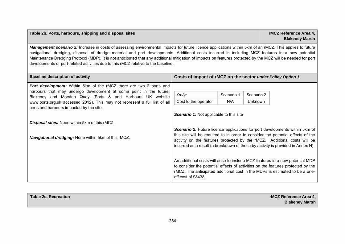
284
Table 2b. Ports, harbours, shipping and disposal sites rMCZ Reference Area 4, Blakeney Marsh
Management scenario 2: Increase in costs of assessing environmental impacts for future licence applications within 5km of an rMCZ. This applies to future navigational dredging, disposal of dredge material and port developments. Additional costs incurred in including MCZ features in a new potential Maintenance Dredging Protocol (MDP). It is not anticipated that any additional mitigation of impacts on features protected by the MCZ will be needed for port developments or port-related activities due to this rMCZ relative to the baseline. Baseline description of activity Costs of impact of rMCZ on the sector under Policy Option 1
Port development: Within 5km of the rMCZ there are two 2 ports and harbours that may undergo development at some point in the future: Blakeney and Morston Quay (Ports & and Harbours UK website www.ports.org.uk accessed 2012). This may not represent a full list of all ports and harbours impacted by the site.
Disposal sites: None within 5km of this rMCZ.
Navigational dredging: None within 5km of this rMCZ.
£m/yr Scenario 1 Scenario 2 Cost to the operator N/A Unknown
Scenario 1: Not applicable to this site
Scenario 2: Future licence applications for port developments within 5km of this site will be required to in order to consider the potential effects of the activity on the features protected by the rMCZ. Additional costs will be incurred as a result (a breakdown of these by activity is provided in Annex N).
An additional costs will arise to include MCZ features in a new potential MDP to consider the potential effects of activities on the features protected by the rMCZ. The anticipated additional cost in the MDPs is estimated to be a one-off cost of £8438.
Table 2c. Recreation rMCZ Reference Area 4,
Blakeney Marsh
285
Table 2c. Recreation rMCZ Reference Area 4, Blakeney Marsh
Source of costs of the rMCZ
Management scenario 1: Closure of entire rMCZ Reference Area to angling, bait collection, samphire collection and wildfowling. People walking through the rMCZ will be encouraged to use marked routes.
Baseline description of activity Costs of impact of rMCZ on the sector under Policy Option 1
Recreational angling: Recreational angling is known to occur in the rMCZ Reference Area, but stakeholder discussions during hub meetings suggest that activity is at a low level. Data from Stakmap record that shore angling activity takes place both within and adjacent to the site and that shore fishing and private boat fishing have occurred within the vicinity of the site for at least 100 years. A minimum of 1 recreational angler shore fishes within the vicinity site, less than once a month throughout the year. Target species include cod, dab, flounder, whiting and bass. This activity has occurred for at least 20 years.
A minimum of 1 recreational angler private boat fishes within or adjacent to the site, more than once a month between May and September. Target species include bass and mackerel. This activity has occurred within the site for at least 10 years. Bait collection also occurs within or adjacent to the site. Target species include crab, limpet, lug-worm, mussel and ragworm. It is recognised that bait collection may not be for recreational fisheries but it is listed here in the absence of further information. Bait may be collected for use in commercial or recreational fisheries
An old cattle path provides walking access to part of the site but the centre of the site is difficult to assess as there is no bridge in place (information collected by Natural England from stakeholders, 2011). The site can also be
No anglers provided comment on how the restriction on recreational angling could impact on them or the local area. However, the same fishing conditions extend beyond the rMCZ Reference Area, with car parking nearby. As such, it is assumed that those who currently fish in the site would continue to fish in close proximity to the site. Therefore impacts are assumed to be negligible.
Though the impact on the UK economy is not likely to be significant, the impacts on individual stakeholders who collect shellfish and bait in the site could be significant. However, bait species are present along the entire length of the North Norfolk coast, so it is likely that those collecting bait within the site could continue the activity in close proximity to the site.
Management costs for implementing management scenario 1 are assessed in the Evidence Base, Annex H9 and Annex N6.
286
Table 2c. Recreation rMCZ Reference Area 4, Blakeney Marsh
accessed via a car park which is within 1km of the site and via various water channels. The degree of impact that sea anglers are currently having on the features of the site when accessing fishing marks is unknown.
There is an existing code of conduct in place by the Angling Trust (Angling Trust, pers. comm., 2012).
Samphire collection: Samphire collection takes place within the site daily during July and August (Morston Parish Council, pers. comm., 2011). It is collected mostly for personal use but also for sale in the village of Morston, with profits going to local charities (Blakeney Parish Council, pers. comm., 2011).
It is recognised that samphire collection may not be a recreational activity but it is listed here in the absence of further information. Samphire may be collected for sale or for personal consumption.
Samphire collection could take place in the surrounding area, so impacts of restricting this activity within the site are assumed to be minimal. It is noted, however, that it is important to rotate the areas that Samphire is collected from in order to maintain a good future supply (Blakeney Parish Council, pers. comm., 2011). It is possible then that designation of the site may impact on future supply.
Though the impact on the UK economy is not likely to be significant, the impacts on individual stakeholders who collect samphire in the site could be significant. Management costs for implementing management scenario 1 are assessed in the Evidence Base, Annex H9 and Annex N6.
Walking: It is estimated that 1 or 2 people walk through the rMCZ Reference Area a couple of times a week. There is a public bridleway passing through the rMCZ Reference Area, which was previously used to bring sheep onto the marsh for grazing. The central part of the site is not easily accessible as there is no longer a bridge over the creek. Therefore this part of the rMCZ Reference Area is visited very infrequently. A path runs through the northern part of the site and is used by boat owners to return to Blakeney from the harbour. The frequency of use for this pathway has not been established. In the accessible part of the rMCZ Reference Area, the protected features of
Given that walking would still be allowed in the site, impacts are likely to be negligible, visitors would be encouraged to use existing routes through or around all the features protected by the MCZ, to avoid adverse effects.
Though the impact on the UK economy is not likely to be significant, the impacts on individual stakeholders walking within the site could be significant.
Management costs for implementing management scenario 1 are assessed in
287
Table 2c. Recreation rMCZ Reference Area 4, Blakeney Marsh
the site could be impacted by trampling.
the Evidence Base, Annex H9 and Annex N6.
Wildfowling: The site is regarded as very important for wildfowling and wildfowling has taken place at the site for ‘as long as local people can remember’ (Blakeney Wildfowlers Club, pers. comm., 2011). It is used by the Blakeney Wildfowlers Club, which currently has a membership of 140. The rMCZ Reference Area covers the section of an area of marsh that is probably the most productive for wildfowling (North Norfolk District Council interview with Blakeney Wildfowlers Club, 2011).
The wildfowling season lasts from 1 September until the end of January/start of February. Shooting takes place during dawn and dusk on any day with appropriate weather conditions during this season. Species targeted in the rMCZ Reference Area include ducks and geese (British Association for Shooting and Conservation, pers. comm., 2011). A considerable amount of wildfowling tourism is generated through rental days and the sale of guest tickets at the site (North Norfolk District Council interview with Blakeney Wildfowlers Club, 2011).
The club has existing rights for wildfowling in the site, including a lease agreement from the National Trust which is due for renewal in 6 years; a lease agreement with Norfolk Wildlife Trust which is due for renewal in 5 years; and consent to carry out wildfowling on its entire lease holdings from Natural England, agreed in 2005, with no time limit. The consent is based on an assessment that ensures that wildfowling at the site complies with the conservation objectives of the site under existing designations as a Site of Special Scientific Interest and Special Area of Conservation. All wildfowling is carried out in accordance to statutory legislation (Blakeney Wildfowlers Club, pers. comm., 2011). Current leases do not specify the geographic extent of
Recommended MCZ Reference Area 4 forms part of the saltmarsh where the wildfowlers have consent to shoot. Should the rMCZ be designated, wildfowling could still occur on the remainder of the lease area surrounding rMCZ Reference Area 4. As such, the impacts of the restriction are assumed to be negligible. However, the quality of the wildfowling within the site is believed to be higher than nearby locations, so impacts to the activity may be underestimated.
Though the impact on the UK economy is not likely to be significant, the impacts on individual stakeholders’ wildfowling within the site could be significant.
Management costs for implementing management scenario 1 are assessed in the Evidence Base, Annex H9 and Annex N6.
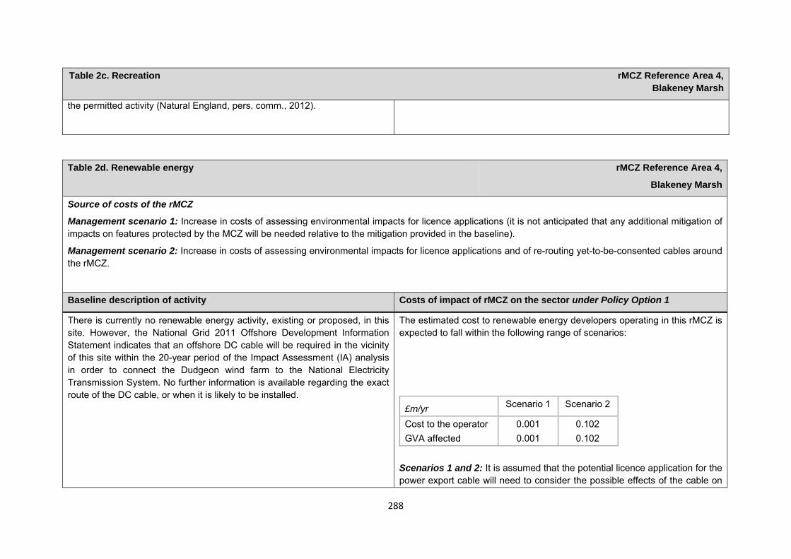
288
Table 2c. Recreation rMCZ Reference Area 4, Blakeney Marsh
the permitted activity (Natural England, pers. comm., 2012).
Table 2d. Renewable energy rMCZ Reference Area 4,
Blakeney Marsh
Source of costs of the rMCZ
Management scenario 1: Increase in costs of assessing environmental impacts for licence applications (it is not anticipated that any additional mitigation of impacts on features protected by the MCZ will be needed relative to the mitigation provided in the baseline).
Management scenario 2: Increase in costs of assessing environmental impacts for licence applications and of re-routing yet-to-be-consented cables around the rMCZ.
Baseline description of activity Costs of impact of rMCZ on the sector under Policy Option 1
There is currently no renewable energy activity, existing or proposed, in this site. However, the National Grid 2011 Offshore Development Information Statement indicates that an offshore DC cable will be required in the vicinity of this site within the 20-year period of the Impact Assessment (IA) analysis in order to connect the Dudgeon wind farm to the National Electricity Transmission System. No further information is available regarding the exact route of the DC cable, or when it is likely to be installed.
The estimated cost to renewable energy developers operating in this rMCZ is expected to fall within the following range of scenarios:
£m/yr Scenario 1 Scenario 2
Cost to the operator 0.001 0.102 GVA affected 0.001 0.102
Scenarios 1 and 2: It is assumed that the potential licence application for the power export cable will need to consider the possible effects of the cable on
289
Table 2d. Renewable energy rMCZ Reference Area 4,
Blakeney Marsh
achieving the conservation objectives of the rMCZ’s features. This is expected to result in an additional one-off cost of £0.012m in 2022 (based on an average cost provide renewable energy sector developers; see Annex N13 for details). This assumes that one power export cable will be installed within the vicinity of the site.
Scenario 2: Additional costs may occur under Scenario 2 if the preferred proposed route for the power export cable would pass through the rMCZ Reference Area. The costs would arise from routing the cable around the site. This would be required because installation of a cable is a depositional activity, which is not permitted in a Reference Area (JNCC and Natural England, 2010). It is estimated that the re-routing would result in an additional one-off cost of £2.020m in 2022. This is calculated based on an average cable installation cost of £1.01m/km and an additional length of cable route of 2km. Further details are provided in Annex H14. This cost is included in scenario 2 to reflect uncertainty over whether the cable route would pass through the rMCZ Reference Area.
Human activities in the site that are not negatively affected by the rMCZ (over 2013 to 2032 inclusive) Table 3. Human activities in the site that are not negatively affected by the rMCZ under Policy Option 1
(existing activities at their current levels and future proposals known to the regional MCZ projects)
rMCZ Reference Area 4, Blakeney Marsh
Flood and coastal erosion activities, recreational activities (recreational boating and permanent moorings for recreational boats, based on current levels of activities) and water abstraction, diffuse and pollution*.
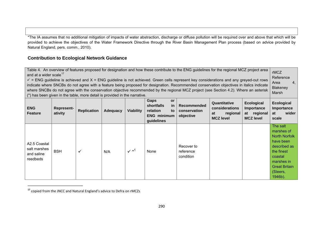
290
*The IA assumes that no additional mitigation of impacts of water abstraction, discharge or diffuse pollution will be required over and above that which will be provided to achieve the objectives of the Water Framework Directive through the River Basin Management Plan process (based on advice provided by Natural England, pers. comm., 2010). Contribution to Ecological Network Guidance Table 4. An overview of features proposed for designation and how these contribute to the ENG guidelines for the regional MCZ project area and at a wider scale17
= ENG guideline is achieved and X = ENG guideline is not achieved. Green cells represent key considerations and any greyed-out rows indicate where SNCBs do not agree with a feature being proposed for designation. Recommended conservation objectives in italics indicate where SNCBs do not agree with the conservation objective recommended by the regional MCZ project (see Section 4.2). Where an asterisk (*) has been given in the table, more detail is provided in the narrative.
rMCZ Reference Area 4, Blakeney Marsh
ENG Feature
Represent-ativity Replication Adequacy Viability
Gaps or shortfalls in relation to ENG minimum guidelines
Recommended conservation objective
Quantitative considerations at regional MCZ level
Ecological Importance at regional MCZ level
Ecological Importance at wider scale
A2.5 Coastal salt marshes and saline reedbeds
BSH N/A *1 None Recover to reference condition
The salt marshes of North Norfolk have been described as the finest coastal marshes in Great Britain (Steers, 1946b).
17 copied from the JNCC and Natural England’s advice to Defra on rMCZs
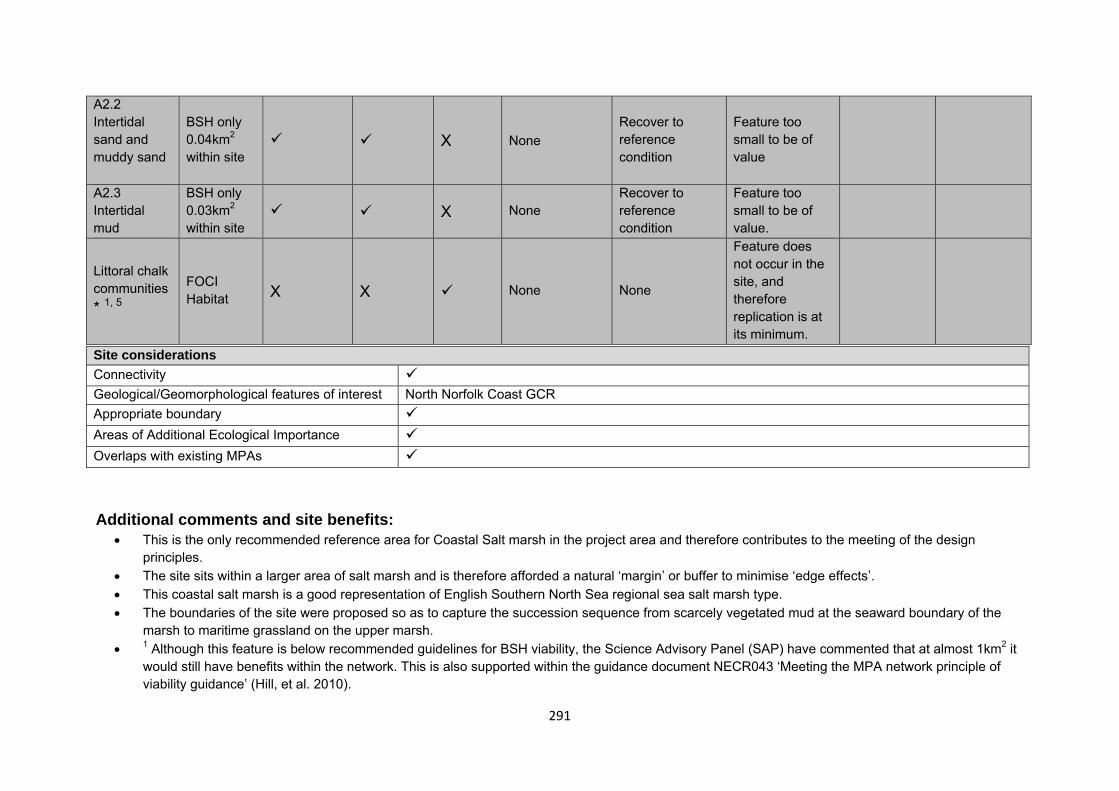
291
A2.2 Intertidal sand and muddy sand
BSH only 0.04km2 within site
X None Recover to reference condition
Feature too small to be of value
A2.3 Intertidal mud
BSH only 0.03km2 within site
X None Recover to reference condition
Feature too small to be of value.
Littoral chalk communities* 1, 5
FOCI Habitat X X None None
Feature does not occur in the site, and therefore replication is at its minimum.
Site considerations Connectivity Geological/Geomorphological features of interest North Norfolk Coast GCRAppropriate boundary Areas of Additional Ecological Importance Overlaps with existing MPAs Additional comments and site benefits:
• This is the only recommended reference area for Coastal Salt marsh in the project area and therefore contributes to the meeting of the design principles.
• The site sits within a larger area of salt marsh and is therefore afforded a natural ‘margin’ or buffer to minimise ‘edge effects’. • This coastal salt marsh is a good representation of English Southern North Sea regional sea salt marsh type. • The boundaries of the site were proposed so as to capture the succession sequence from scarcely vegetated mud at the seaward boundary of the
marsh to maritime grassland on the upper marsh. • 1 Although this feature is below recommended guidelines for BSH viability, the Science Advisory Panel (SAP) have commented that at almost 1km2 it
would still have benefits within the network. This is also supported within the guidance document NECR043 ‘Meeting the MPA network principle of viability guidance’ (Hill, et al. 2010).
292
Anticipated benefits to ecosystem services The habitats, species and other ecological features of the rMCZ contribute to the delivery of a range of ecosystem services. Designation of the rMCZ and its subsequent management may improve the quantity and quality of the beneficial services provided, which may increase the value (contribution to economic welfare or human well-being) of them. Impacts on the value derived from ecosystem services may occur as a result of the designation, management and/or achievement of the conservation objectives of the rMCZ. Further discussion on the potential benefits to ecosystem services can be found in Annex L and on definitions can be found in Annex H5.
Table 5a. Fish and shellfish for human consumption rMCZ Reference Area 4,
Blakeney Marsh
Baseline Beneficial impact under Policy Option 1
Fletcher and others (2011) identify that the features to be protected by the recommended Marine Conservation Zone (rMCZ) contribute to the delivery of fish and shellfish services.
Coastal saltmarsh is the predominant habitat in the rMCZ. The saltmarsh and muddy habitats provide substrate for cockles and seed mussels as well as burrowing species, which are collected for bait. Saltmarsh also provides important nursery grounds for commercial species (e.g. sea bass) (Fletcher and others, 2011).
The baseline quantity and quality of service provided is assumed to be commensurate with that provided by the features of the site when not in reference condition.
A description of on-site fishing activity and the value derived from it is set out in Table 2.
If the conservation objectives of the features are achieved, the features will be recovered to reference condition. Achievement of the conservation objectives may improve the contribution of the habitats to the provision of fish and shellfish for human consumption.
Additional management (above that in the baseline situation) of fishing activities is expected, which will prohibit fishing within the rMCZ, the costs of which are set out in Table 2.
Management of fishing activity within the rMCZ may reduce the on-site fishing mortality of species, which may benefit commercial stocks.
As the rMCZ is small, it is unclear whether it would have any impact on stocks of mobile commercial finfish species.
Anticipated direction of
change:
Confidence: Low
293
Table 5a. Fish and shellfish for human consumption rMCZ Reference Area 4,
Blakeney Marsh
Stocks of low-mobility and site-attached species, such as cockles and seed mussels, may improve as a result of reduced fishing pressure. Localised beneficial spill-over effects may occur around the rMCZ. As no fishing will be permitted within the rMCZ, no on-site benefits will be realised.
Benefits defined here are not net of potential costs of the rMCZ and off-site impacts of displaced effort.
Table 5b. Recreation rMCZ Reference Area 4,
Blakeney Marsh
Baseline Beneficial impact under Policy Option 1
Angling: Fletcher and others (2011) identify that the features to be protected by the recommended Marine Conservation Zone (rMCZ) can contribute to the delivery of fish and shellfish for human consumption and recreation services.
Coastal saltmarsh is the predominant habitat in the rMCZ. The saltmarsh and muddy habitats provide substrate for cockles and seed mussels as well as burrowing species, which are collected for bait. Saltmarsh also provides important nursery grounds for commercial species (e.g. sea bass) (Fletcher and others, 2011).
If the conservation objectives of the features are achieved, the features will be recovered to reference condition.
Recovery of habitats may have benefits to fish and shellfish populations. It is unclear whether any benefits to fish populations would arise as a result of reduced fishing mortality due to management of commercial fishing (see Table 4a for further details).
As angling will not be permitted within the rMCZ, any benefits will be limited to those occurring as a result of spill-over effects
Anticipated direction of
change:
Confidence: Low
294
Table 5b. Recreation rMCZ Reference Area 4,
Blakeney Marsh
The baseline quantity and quality of the ecosystem service provided is assumed to be commensurate with that provided by features of the site when not in reference condition (see Table 1).
A description of on-site fishing activity it is set out in Table 2. It has not been possible to estimate the value derived from angling at the rMCZ.
of finfish species targeted by anglers. Such benefits may be insignificant.
Diving: There is no known diving and snorkelling activity carried out within the rMCZ.
N/A N/A
Wildlife watching: Wildlife watching is known to take place with the rMCZ Reference Area, but the intensity of the activity is unknown (Stakmap, 2011). The saltmarsh is believed to be a focus for wildlife watching activity in the surrounding area (Natural England, pers. comm., 2012).
If the conservation objectives of the features are achieved, the features will be recovered to reference condition.
As wildlife watching in the area is not focused on the marine habitat, it is unlikely that any improvement in the rMCZ features and associated biodiversity will significantly affect the quality of wildlife watching in the area.
Anticipated direction of
change:
Confidence: Moderate
295
Table 5c. Research and education rMCZ Reference Area 4,
Blakeney Marsh
Baseline Beneficial impact under Policy Option 1
Research: Fletcher and others (2011) identify that the features to be protected by the recommended Marine Conservation Zone (rMCZ) can contribute to the delivery of research services.
Recommended MCZ Reference Area 4 lies within the North Norfolk Coast Special Area of Conservation (SAC), Special Protection Area (SPA) and Ramsar site as well as the Wash and North Norfolk Coast SAC (Net Gain Final Recommendations, 2011). and, as such, monitoring activity is ongoing. There is no known other research activity occurring in the site.
It has not been possible to estimate the value derived from research activities associated with the rMCZ.
As a Reference Area, the rMCZ will provide an opportunity to demonstrate the state of designated marine features in the absence of many anthropogenic pressures (Natural England and Joint Nature Conservation Committee, 2010) (Natural England and JNCC, 2010). It will provide a control area against which the impacts of pressures caused by human activities can be compared as part of long-term monitoring and assessment. Other research benefits are unknown.
Anticipated direction of
change:
Confidence: High
Education: Fletcher and others (2011) identify that the features to be protected by the rMCZ can contribute to the delivery of education services.
Recommended MCZ Reference Area 4 lies within the North Norfolk Coast SAC, SPA and Ramsar site as well as the Wash and North Norfolk Coast SAC (Net Gain Final Recommendations, 2011). There is no known education activity occurring in the site.
It has not been possible to estimate the value derived from educational activities associated with the rMCZ.
MCZ designation may provide an opportunity to expand the focus of education events into the marine environment.
Designation may aid additional local (to the rMCZ) provision of education (e.g. events and interpretation boards), from which visitors would derive benefit.
Non-visitors may benefit if the rMCZ contributes to wider provision of education (e.g. television programmes, articles in magazines and newspapers, and educational resources developed for use in schools).
Anticipated direction of
change:
Confidence: Moderate
296
Table 5d. Regulating services rMCZ Reference Area 4,
Blakeney Marsh
Baseline Beneficial impact under Policy Option 1
Regulation of pollution: The features of the site contribute to the bioremediation of waste and sequestration of carbon. Saltmarshes are known to be particularly efficient carbon sinks. It has not been possible to estimate the value derived from the regulation of pollution in the rMCZ.
Environmental resilience: The features of the site contribute to the resilience and continued regeneration of marine ecosystems. It has not been possible to estimate the value derived from environmental resilience in the rMCZ.
Natural hazard protection: The features of the site contribute to local flood and storm protection. Saltmarshes form a natural coastal defence because they trap and stabilise sediments and also dampen the effects of waves. It has not been possible to estimate the value derived from natural hazard protection in the rMCZ.(Fletcher and others, 2011)
If the conservation objectives of the features are achieved, the features will be recovered to reference condition, which may improve the regulating capacity of the site habitats.
Anticipated direction of
change:
Confidence: Low
Table 4e. Non-use and option values rMCZ Reference Area 4,
Blakeney Marsh
Baseline Beneficial impact under Policy Option 1
297
Table 4e. Non-use and option values rMCZ Reference Area 4,
Blakeney Marsh
Some people gain satisfaction from the existence of marine habitats, species and other features. They also gain from having the option to benefit in the future from the habitats and species in the recommended Marine Conservation Zone (rMCZ) and the ecosystem services provided, even if they do not currently benefit from them.
The rMCZ will benefit the proportion of the UK population that values conservation of the rMCZ features and its contribution to an ecologically coherent network of Marine Protected Areas. Some people will gain satisfaction from knowing that the habitats and species are being conserved (existence value) and/or that they are being conserved for use by others in the current generation (altruistic value) or future generations (bequest value). The rMCZ will recover and then protect the features in reference condition and the ecosystem services provided, and thereby the option to benefit from these services in the future, from the risk of future degradation.
Anticipated direction of
change:
Confidence: Moderate
rMCZ Reference Area 5, Blakeney Seagrass
Site area (km2): 0.03
• This site has been proposed for designation under Policy Option 1 only.
Table 1. Conservation impacts rMCZ Reference Area 5, Blakeney Seagrass
298
1a. Ecological description
Recommended Marine Conservation Zone Reference Area 5 is located within the inlet of Blakeney Point. The site has been recommended for designation due to the presence of Zostera seagrass beds. Seagrass beds are a UK Biodiversity Action Plan Priority Habitat; three species of Zostera occur in the UK, and all are considered to be scarce.
Seagrass beds are recognised internationally as important coastal ecosystems, stabilising the substratum and trapping fine sediments, which reduces particle load in the water column and improves water quality. The detrital matter produced from the seagrass is an important source of organic matter to the sea bed. Seagrass provides a habitat and nursery areas for juvenile fish, adult fish, shellfish and invertebrates.
Within the vicinity of the site, sandwich, common, Arctic and little terns (which are all listed in Annex 1 of the EC Birds Directive) are regular visitors to Blakeney National Nature Reserve, with Blakeney Point providing an internationally important habitat for breeding. Overwintering wildfowl and waders include brent goose, wigeon, dunlin and curlew (all listed on Annex I or 2 of the EC Birds Directive). Common seal (listed in Annex 2 of the EC Habitats Directive, use Blakeney Point as a haul-out site for resting and sleeping and form part of the much larger breeding population in the Wash. The population of the grey seal (also listed in Annex 2 of the EC Habitats Directive, but not specifically protected in the North Norfolk’s seas) has increased rapidly, from just occasional sightings in the 1980s to a booming breeding colony since 2000.
Recommended C lies within the Wash and North Norfolk Coast Special Area of Conservation (SAC) and the North Norfolk Coast Special Protection Area, SAC, Site of Special Scientific Interest and Ramsar site. The recommended location is a stable, monitored site, which increases its suitability as an rMCZ Reference Area. The site also lies approximately 2km north-west of rMCZ Reference Area 4 and approximately 5.3km north-west of rMCZ Reference Area 3.
(Net Gain, Final Site Recommendations Submission, 2011)
1b. Baseline condition of MCZ features and impact of the rMCZ
Feature Area of feature (km2)
No. of point records
Baseline Impact of the MCZ
Broad-scale habitats
Intertidal sand and muddy sand 0.00 − Not in reference condition Recovered to reference condition
299
Intertidal mud 0.03 − Not in reference condition Recovered to reference condition
Habitats of conservation importance
Seagrass beds 0.02 − Not in reference condition Recovered to reference condition
Geological and geomorphological features of interest
North Norfolk coast (subtidal) − − Not in reference condition Recovered to reference condition
Site-specific costs arising from the effect of the rMCZ on human activities (over 2013 to 2032 inclusive) Table 2a. Commercial fisheries rMCZ Reference Area 5,
Blakeney Seagrass
Source of costs of the rMCZ
Management scenario 1: Closed to all commercial fishing activity.
Summary of all UK commercial fisheries: Recommended MCZ Reference Area 5 lies wholly within 6nm. Collection by hand and bait digging occur in the site. The MCZ Fisheries Model does not record the value of these activities, The shellfish and bait may be for personal use and some may be sold. The resolution of the MCZ Fisheries Model is not sufficient to identify the fisheries that occur only within the rMCZ Reference Area and not the surrounding area. The model suggests that hooks and lines, nets, pots and traps are used within the site but, as the maximum water depth is 2 metres at high tide, these activities are assumed not to occur within the rMCZ Reference Area. Commercial fishing restrictions that already exist are listed in Annex E4.
Baseline description of UK commercial fisheries Costs of impact of rMCZ on UK commercial fisheries under Policy Option 1
Collection by hand: MCZ Fisheries Model data indicates that hand collection and bait digging occur within the site. Target species include cockle and mussel. Estimates for value of landings for this activity are unavailable.
The estimated annual value of UK hand collection landings affected is expected to fall within the following range of scenarios:
£m/yr Scenario 1
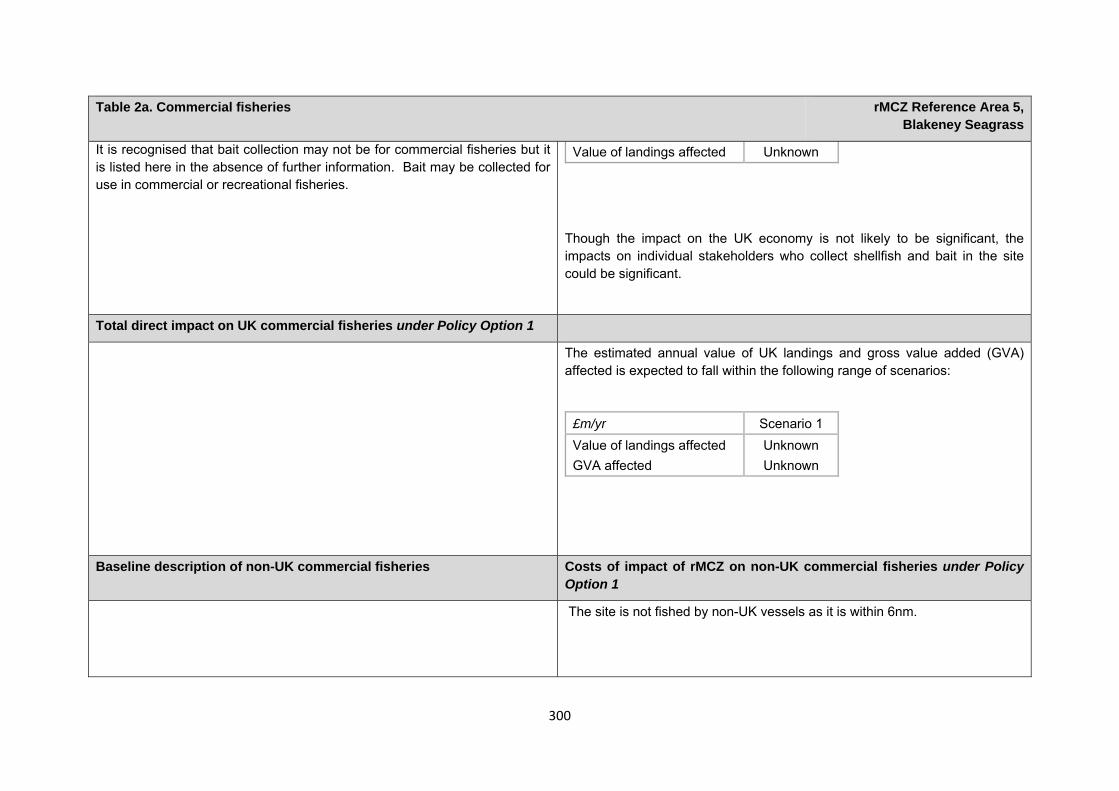
300
Table 2a. Commercial fisheries rMCZ Reference Area 5, Blakeney Seagrass
It is recognised that bait collection may not be for commercial fisheries but it is listed here in the absence of further information. Bait may be collected for use in commercial or recreational fisheries.
Though the impact on the UK economy is not likely to be significant, the impacts on individual stakeholders who collect shellfish and bait in the site could be significant.
Value of landings affected Unknown
Total direct impact on UK commercial fisheries under Policy Option 1
The estimated annual value of UK landings and gross value added (GVA) affected is expected to fall within the following range of scenarios:
£m/yr Scenario 1 Value of landings affected Unknown GVA affected Unknown
Baseline description of non-UK commercial fisheries Costs of impact of rMCZ on non-UK commercial fisheries under Policy Option 1
The site is not fished by non-UK vessels as it is within 6nm.
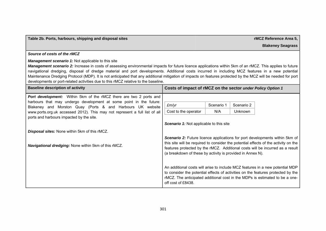
301
Table 2b. Ports, harbours, shipping and disposal sites rMCZ Reference Area 5,
Blakeney Seagrass
Source of costs of the rMCZ
Management scenario 1: Not applicable to this site Management scenario 2: Increase in costs of assessing environmental impacts for future licence applications within 5km of an rMCZ. This applies to future navigational dredging, disposal of dredge material and port developments. Additional costs incurred in including MCZ features in a new potential Maintenance Dredging Protocol (MDP). It is not anticipated that any additional mitigation of impacts on features protected by the MCZ will be needed for port developments or port-related activities due to this rMCZ relative to the baseline. Baseline description of activity Costs of impact of rMCZ on the sector under Policy Option 1
Port development: Within 5km of the rMCZ there are two 2 ports and harbours that may undergo development at some point in the future: Blakeney and Morston Quay (Ports & and Harbours UK website www.ports.org.uk accessed 2012). This may not represent a full list of all ports and harbours impacted by the site.
Disposal sites: None within 5km of this rMCZ.
Navigational dredging: None within 5km of this rMCZ.
£m/yr Scenario 1 Scenario 2 Cost to the operator N/A Unknown
Scenario 1: Not applicable to this site
Scenario 2: Future licence applications for port developments within 5km of this site will be required to consider the potential effects of the activity on the features protected by the rMCZ. Additional costs will be incurred as a result (a breakdown of these by activity is provided in Annex N).
An additional costs will arise to include MCZ features in a new potential MDP to consider the potential effects of activities on the features protected by the rMCZ. The anticipated additional cost in the MDPs is estimated to be a one-off cost of £8438.
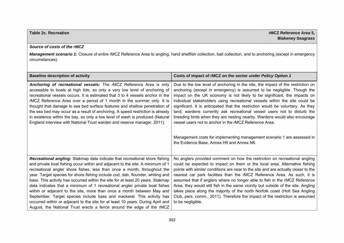
302
Table 2c. Recreation rMCZ Reference Area 5, Blakeney Seagrass
Source of costs of the rMCZ
Management scenario 1: Closure of entire rMCZ Reference Area to angling, hand shellfish collection, bait collection, and to anchoring (except in emergency circumstances).
Baseline description of activity Costs of impact of rMCZ on the sector under Policy Option 1
Anchoring of recreational vessels: The rMCZ Reference Area is only accessible to boats at high tide, so only a very low level of anchoring of recreational vessels occurs. It is estimated that 3 to 4 vessels anchor in the rMCZ Reference Area over a period of 1 month in the summer only. It is thought that damage to sea bed surface features and shallow penetration of the sea bed may occur as a result of anchoring. A speed restriction is already in existence within the bay, so only a low level of wash is produced (Natural England interview with National Trust warden and reserve manager, 2011).
Due to the low level of anchoring in the site, the impact of the restriction on anchoring (except in emergency) is assumed to be negligible. Though the impact on the UK economy is not likely to be significant, the impacts on individual stakeholders using recreational vessels within the site could be significant. It is anticipated that the restriction would be voluntary. As they land, wardens currently ask recreational vessel users not to disturb the breeding birds when they are nesting nearby. Wardens would also encourage vessel users not to anchor in the rMCZ Reference Area.
Management costs for implementing management scenario 1 are assessed in the Evidence Base, Annex H9 and Annex N6.
Recreational angling: Stakmap data indicate that recreational shore fishing and private boat fishing occur within and adjacent to the site. A minimum of 1 recreational angler shore fishes, less than once a month, throughout the year. Target species for shore fishing include cod, dab, flounder, whiting and bass. This activity has occurred within the site for at least 20 years. Stakmap data indicates that a minimum of 1 recreational angler private boat fishes within or adjacent to the site, more than once a month between May and September. Target species include bass and mackerel. This activity has occurred within or adjacent to the site for at least 10 years. During April and August, the National Trust erects a fence around the edge of the rMCZ
No anglers provided comment on how the restriction on recreational angling could be expected to impact on them or the local area. Alternative fishing points with similar conditions are near to the site and are actually closer to the nearest car park facilities than the rMCZ Reference Area. As such, it is assumed that if anglers where no longer able to fish in the rMCZ Reference Area, they would still fish in the same vicinity but outside of the site. Angling takes place along the majority of the north Norfolk coast (Holt Sea Angling Club, pers. comm., 2011). Therefore the impact of the restriction is assumed to be negligible.
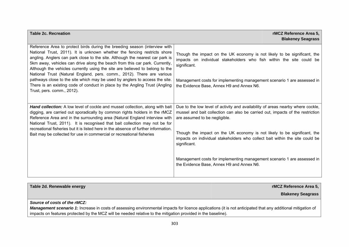
303
Table 2c. Recreation rMCZ Reference Area 5, Blakeney Seagrass
Reference Area to protect birds during the breeding season (interview with National Trust, 2011). It is unknown whether the fencing restricts shore angling. Anglers can park close to the site. Although the nearest car park is 5km away, vehicles can drive along the beach from this car park. Currently, Although the vehicles currently using the site are believed to belong to the National Trust (Natural England, pers. comm., 2012). There are various pathways close to the site which may be used by anglers to access the site. There is an existing code of conduct in place by the Angling Trust (Angling Trust, pers. comm., 2012).
Though the impact on the UK economy is not likely to be significant, the impacts on individual stakeholders who fish within the site could be significant.
Management costs for implementing management scenario 1 are assessed in the Evidence Base, Annex H9 and Annex N6.
Hand collection: A low level of cockle and mussel collection, along with bait digging, are carried out sporadically by common rights holders in the rMCZ Reference Area and in the surrounding area (Natural England interview with National Trust, 2011). It is recognised that bait collection may not be for recreational fisheries but it is listed here in the absence of further information. Bait may be collected for use in commercial or recreational fisheries
Due to the low level of activity and availability of areas nearby where cockle, mussel and bait collection can also be carried out, impacts of the restriction are assumed to be negligible.
Though the impact on the UK economy is not likely to be significant, the impacts on individual stakeholders who collect bait within the site could be significant.
Management costs for implementing management scenario 1 are assessed in the Evidence Base, Annex H9 and Annex N6.
Table 2d. Renewable energy rMCZ Reference Area 5,
Blakeney Seagrass
Source of costs of the rMCZ: Management scenario 1: Increase in costs of assessing environmental impacts for licence applications (it is not anticipated that any additional mitigation of impacts on features protected by the MCZ will be needed relative to the mitigation provided in the baseline).
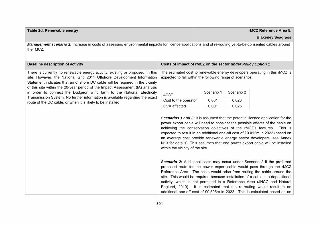
304
Table 2d. Renewable energy rMCZ Reference Area 5,
Blakeney Seagrass
Management scenario 2: Increase in costs of assessing environmental impacts for licence applications and of re-routing yet-to-be-consented cables around the rMCZ.
Baseline description of activity Costs of impact of rMCZ on the sector under Policy Option 1
There is currently no renewable energy activity, existing or proposed, in this site. However, the National Grid 2011 Offshore Development Information Statement indicates that an offshore DC cable will be required in the vicinity of this site within the 20-year period of the Impact Assessment (IA) analysis in order to connect the Dudgeon wind farm to the National Electricity Transmission System. No further information is available regarding the exact route of the DC cable, or when it is likely to be installed.
The estimated cost to renewable energy developers operating in this rMCZ is expected to fall within the following range of scenarios:
£m/yr Scenario 1 Scenario 2
Cost to the operator 0.001 0.026 GVA affected 0.001 0.026
Scenarios 1 and 2: It is assumed that the potential licence application for the power export cable will need to consider the possible effects of the cable on achieving the conservation objectives of the rMCZ’s features. This is expected to result in an additional one-off cost of £0.012m in 2022 (based on an average cost provide renewable energy sector developers; see Annex N13 for details). This assumes that one power export cable will be installed within the vicinity of the site.
Scenario 2: Additional costs may occur under Scenario 2 if the preferred proposed route for the power export cable would pass through the rMCZ Reference Area. The costs would arise from routing the cable around the site. This would be required because installation of a cable is a depositional activity, which is not permitted in a Reference Area (JNCC and Natural England, 2010). It is estimated that the re-routing would result in an additional one-off cost of £0.505m in 2022. This is calculated based on an
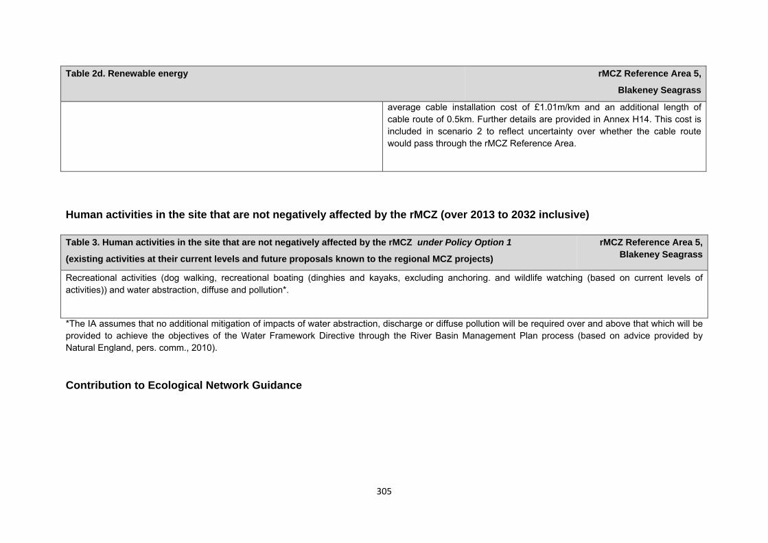
305
Table 2d. Renewable energy rMCZ Reference Area 5,
Blakeney Seagrass
average cable installation cost of £1.01m/km and an additional length of cable route of 0.5km. Further details are provided in Annex H14. This cost is included in scenario 2 to reflect uncertainty over whether the cable route would pass through the rMCZ Reference Area.
Human activities in the site that are not negatively affected by the rMCZ (over 2013 to 2032 inclusive)
*The IA assumes that no additional mitigation of impacts of water abstraction, discharge or diffuse pollution will be required over and above that which will be provided to achieve the objectives of the Water Framework Directive through the River Basin Management Plan process (based on advice provided by Natural England, pers. comm., 2010). Contribution to Ecological Network Guidance
Table 3. Human activities in the site that are not negatively affected by the rMCZ under Policy Option 1
(existing activities at their current levels and future proposals known to the regional MCZ projects)
rMCZ Reference Area 5, Blakeney Seagrass
Recreational activities (dog walking, recreational boating (dinghies and kayaks, excluding anchoring. and wildlife watching (based on current levels of activities)) and water abstraction, diffuse and pollution*.
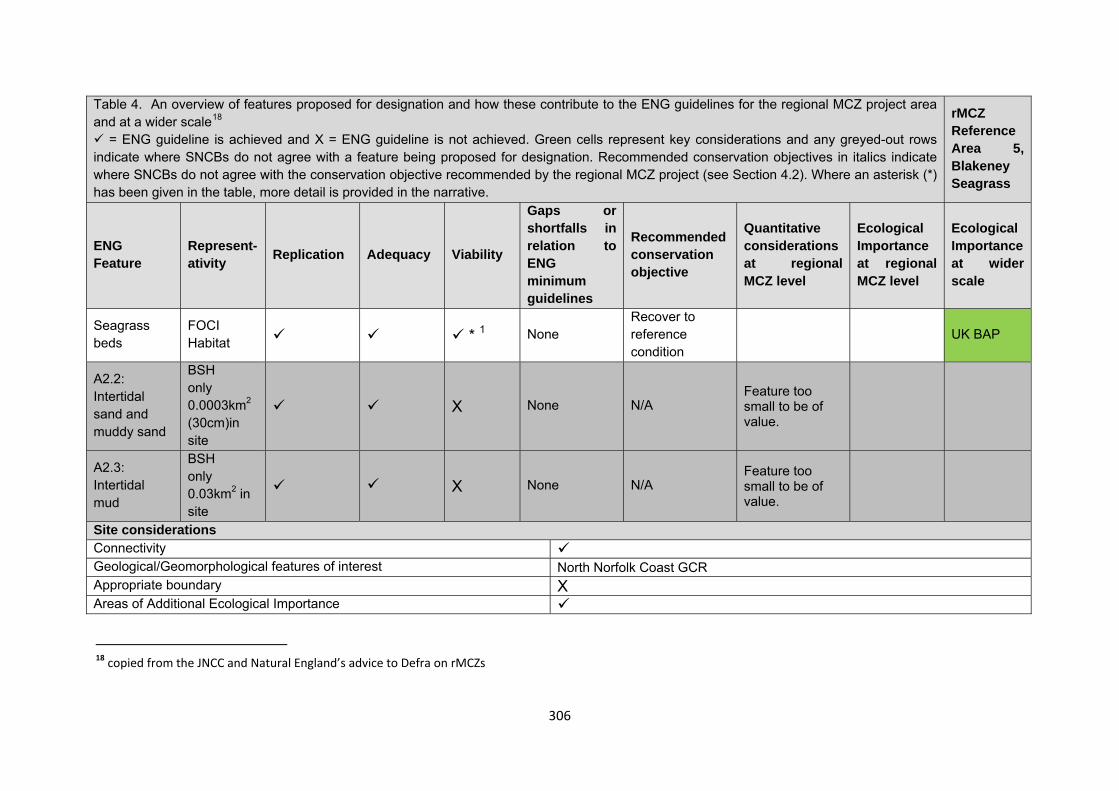
306
Table 4. An overview of features proposed for designation and how these contribute to the ENG guidelines for the regional MCZ project area and at a wider scale18
= ENG guideline is achieved and X = ENG guideline is not achieved. Green cells represent key considerations and any greyed-out rows indicate where SNCBs do not agree with a feature being proposed for designation. Recommended conservation objectives in italics indicate where SNCBs do not agree with the conservation objective recommended by the regional MCZ project (see Section 4.2). Where an asterisk (*) has been given in the table, more detail is provided in the narrative.
rMCZ Reference Area 5, Blakeney Seagrass
ENG Feature
Represent-ativity Replication Adequacy Viability
Gaps or shortfalls in relation to ENG minimum guidelines
Recommended conservation objective
Quantitative considerations at regional MCZ level
Ecological Importance at regional MCZ level
Ecological Importance at wider scale
Seagrass beds
FOCI Habitat * 1 None
Recover to reference condition UK BAP
A2.2: Intertidal sand and muddy sand
BSH only 0.0003km2 (30cm)in site
X None N/A Feature too small to be of value.
A2.3: Intertidal mud
BSH only 0.03km2 in site
X None N/A Feature too small to be of value.
Site considerations Connectivity Geological/Geomorphological features of interest North Norfolk Coast GCR Appropriate boundary X Areas of Additional Ecological Importance
18 copied from the JNCC and Natural England’s advice to Defra on rMCZs
307
Overlaps with existing MPAs Additional comments and site benefits: • This is the only recommended reference area for seagrass beds in the project area and therefore contributes to meeting the design principles. • 1 Viability for the FOCI habitat seagrass beds is dependent on a minimum patch size (0.5km) which is not met at this site (approx 0.12 x 0.4km). However,
this boundary incorporates the entire patch so it is considered viable. • The location of the seagrass bed remains relatively stable, compared to other ephemeral seagrass beds on the North Norfolk Coast (West 2010). • The site has been monitored three times in the last 10 years. • The site sits within Blakeney Point, an area managed and wardened by the National Trust (West, Grenham and Kirby 2010).
308
Anticipated benefits to ecosystem services The habitats, species and other ecological features of the rMCZ contribute to the delivery of a range of ecosystem services. Designation of the rMCZ and its subsequent management may improve the quantity and quality of the beneficial services provided, which may increase the value (contribution to economic welfare or human well-being) of them. Impacts on the value derived from ecosystem services may occur as a result of the designation, management and/or achievement of the conservation objectives of the rMCZ. Further discussion on the potential benefits to ecosystem services can be found in Annex L and on definitions can be found in Annex H5.
Table 5a. Fish and shellfish for human consumption rMCZ Reference Area 5,
Blakeney Seagrass
Baseline Beneficial impact under Policy Option 1
Fletcher and others (2011) identify that the features to be protected by the recommended Marine Conservation Zone (rMCZ) contribute to the delivery of fish and shellfish services.
Seagrass is the predominant habitat in the rMCZ, which provides habitat and nursery areas for juvenile and adult fish, shellfish and invertebrates and, as such, is likely to help support potential on-site and off-site fisheries. It has not been possible to estimate the value derived from off-site fisheries as a result of the nursery area function.
The baseline quantity and quality of service provided is assumed to be commensurate with that provided by the features of the site when not in reference condition.
A description of on-site fishing activity and the value derived from it is set out in Table 2.
If the conservation objectives of the features are achieved, the features will be recovered to reference condition. Achievement of the conservation objectives may improve the contribution of the habitats to the provision of fish and shellfish for human consumption.
The recovery of the seagrass beds to reference condition may improve their functioning as a nursery area, potentially benefiting fisheries exploited within and outside the rMCZ.
Additional management (above that in the baseline situation) of fishing activities is expected, which will prohibit fishing within the rMCZ, the costs of which are set out in Table 2.
Management of fishing activity within the rMCZ may reduce the on-site fishing mortality of species, which may benefit
Anticipated direction of
change:
Confidence: Low
309
Table 5a. Fish and shellfish for human consumption rMCZ Reference Area 5,
Blakeney Seagrass
commercial stocks.
As the rMCZ is small, it is unclear whether it would have any impact on stocks of mobile commercial finfish species. Stocks of low-mobility and site-attached species, such as cockles and seed mussels, may improve as a result of reduced fishing pressure. Localised beneficial spill-over effects may occur around the rMCZ.
As no fishing will be permitted within the rMCZ, no on-site benefits will be realised.
Benefits defined here are not net of potential costs of the rMCZ and off-site impacts of displaced effort.
Table 5b. Recreation rMCZ Reference Area 5,
Blakeney Seagrass
Baseline Beneficial impact under Policy Option 1
Angling: Fletcher and others (2011) identify that the features to be protected by the recommended Marine Conservation Zone (rMCZ) can contribute to the delivery of fish and shellfish for human consumption and recreation services.
If the conservation objectives of the features are achieved, the features will be recovered to reference condition.
Recovery of habitats may have benefits to fish and shellfish populations. It is unclear whether any benefits to fish
Anticipated direction of
change:
310
Table 5b. Recreation rMCZ Reference Area 5,
Blakeney Seagrass
The baseline quantity and quality of the ecosystem service provided is assumed to be commensurate with that provided by features of the site when not in reference condition (see Table 1).
Seagrass is the predominant habitat in the rMCZ, which provides habitat and nursery areas for juvenile and adult fish, shellfish and invertebrates and, as such, is likely to help support potential on-site and off-site fisheries. It has not been possible to estimate the value derived from off-site fisheries as a result of the nursery area function.
A description of on-site fishing activity is set out in Table 2. It has not been possible to estimate the value derived from angling at the rMCZ.
populations would arise as a result of reduced fishing mortality due to management of commercial fishing (see Table 4a for further details).
The recovery of the seagrass beds to reference condition may improve their functioning as a nursery area, potentially benefiting fisheries exploited outside the rMCZ. As no additional management is expected, anglers will be able to benefit from off-site beneficial impacts on commercial fish and shellfish stocks.
As angling will not be permitted within the rMCZ, any benefits will be limited to those occurring as a result of spill-over effects to finfish species targeted by anglers. Such benefits may be insignificant.
Confidence: Low
Diving: There is no known diving and snorkelling activity carried out within the rMCZ.
N/A N/A
Wildlife watching: Blakeney Point is a popular area for wildlife watchers, who observe the internationally important sea bird breeding colonies on the spit (Net Gain Final Recommendations, 2011). There has also been a more recent trend in arranged visits to view the seal colonies on the point (Natural England, pers. comm., 2012).
If the conservation objectives of the features are achieved, the features will be recovered to reference condition.
As wildlife watching in the area is not focused on the marine habitat, it is unlikely that any improvement in the rMCZ features and associated biodiversity will significantly affect the
Anticipated direction of
change:
311
Table 5b. Recreation rMCZ Reference Area 5,
Blakeney Seagrass
quality of wildlife watching in the area. Confidence: Moderate
Table 5c. Research and education rMCZ Reference Area 5,
Blakeney Seagrass
Baseline Beneficial impact under Policy Option 1
Research: Fletcher and others (2011) identify that the features to be protected by the recommended Marine Conservation Zone (rMCZ) can contribute to the delivery of research services.
Recommended MCZ Reference Area 5 lies within the Wash and North Norfolk Coast Special Area of Conservation (SAC) and the North Norfolk Coast Special Protection Area, SAC, Site of Special Scientific Interest and Ramsar site (Net Gain Final Recommendations, 2011). and, as such, monitoring activity is ongoing.
It has not been possible to estimate the value derived from research activities associated with the rMCZ.
As a Reference Area, the rMCZ will provide an opportunity to demonstrate the state of designated marine features in the absence of many anthropogenic pressures (Natural England and JNCC, 2010). It will provide a control area against which the impacts of pressures caused by human activities can be compared as part of long-term monitoring and assessment. Other research benefits are unknown.
Anticipated direction of
change:
Confidence: High
Education: There are educational visits made to Blakeney Point, with ‘infrequent’ educational activity happening around rMCZ Reference Area 5 (Natural England, pers. comm., 2012), but the intensity of the activity is unknown.
MCZ designation may provide an opportunity to expand the focus of education events into the marine environment.
Designation may aid additional local (to the rMCZ) provision of education (e.g. events and interpretation boards), from which
Anticipated direction of
change:
312
Table 5c. Research and education rMCZ Reference Area 5,
Blakeney Seagrass
visitors would derive benefit.
Non-visitors may benefit if the rMCZ contributes to wider provision of education (e.g. television programmes, articles in magazines and newspapers, and educational resources developed for use in schools).
Confidence: Moderate
Table 5d. Regulating services rMCZ Reference Area 5,
Blakeney Seagrass
Baseline Beneficial impact under Policy Option 1
Regulation of pollution: The features of the site contribute to the bioremediation of waste and sequestration of carbon. Seagrass habitats are thought to be particularly efficient carbon sinks. It has not been possible to estimate the value derived from the regulation of pollution in the rMCZ.
Environmental resilience: The features of the site contribute to the resilience and continued regeneration of marine ecosystems. It has not been possible to estimate the value derived from environmental resilience in the rMCZ.
Natural hazard protection: The features of the site, and in particular the seagrass, contribute to local flood and storm protection. It has not been possible to estimate the value derived from natural hazard protection in the
If the conservation objectives of the features are achieved, the features will be recovered to reference condition, which may improve the regulating capacity of the site habitats.
Anticipated direction of
change:
Confidence: Low
313
Table 5d. Regulating services rMCZ Reference Area 5,
Blakeney Seagrass
rMCZ.
(Fletcher and others, 2011)
Table 5e. Non-use and option values rMCZ Reference Area 5,
Blakeney Seagrass
Baseline Beneficial impact under Policy Option 1
Some people gain satisfaction from the existence of marine habitats, species and other features. They also gain from having the option to benefit in the future from the habitats and species in the recommended Marine Conservation Zone (rMCZ) and the ecosystem services provided, even if they do not currently benefit from them.
The rMCZ will benefit the proportion of the UK population that values conservation of the rMCZ features and its contribution to an ecologically coherent network of Marine Protected Areas. Some people will gain satisfaction from knowing that the habitats and species are being conserved (existence value) and/or that they are being conserved for use by others in the current generation (altruistic value) or future generations (bequest value). The rMCZ will recover and then protect the features in reference condition and the ecosystem services provided, and thereby the option to benefit from these services in the future, from the risk of future degradation.
In the Marine Conservation Society ‘Your Seas Your Voice’ campaign, some ‘nominated sites’ are located within rMCZ Reference Area 5. Features of the natural environment were strong motivators for reasons why people thought that these locations should be protected, with people frequently attaching value to the biodiversity, ‘spectacular scenery’ and ‘unspoilt’ nature of the site. A strong emotional attachment to the site
Anticipated direction of
change:
Confidence: Moderate
314
Table 5e. Non-use and option values rMCZ Reference Area 5,
Blakeney Seagrass
was also considered a motivator for protection.
rMCZ Reference Area 6, Dogs Head Sandbanks
Site area (km2): 12.31
• This site has been proposed for designation under Policy Option 1 only.
Table 1. Conservation impacts rMCZ Reference Area 6, Dogs Head Sandbanks
1a. Ecological description
Recommended Marine Conservation Zone (rMCZ) Reference Area 6 at Inner and Outer Dogs Head is recommended as an rMCZ Reference Area for designation of the intertidal sandbanks composed of intertidal sand and muddy sand19. The sandbank features support diverse infaunal polychaetes and opportunistic species adapted to the conditions of mobile intertidal sediments that are subject to periodic natural change. Accretions of muddy sand are found in the more sheltered areas, and are likely to be less mobile. Muddier sands support hinged shelled bivalves, including the common cockle, and sea snails like the laver spire shell.
Sea bird species such as common scoter, eider, gull, tern (which are listed in Annex 1 EC Birds Directive (2009/147/EC)) and cormorant use the sandbank
19 The site boundaries were developed based on UK Hydrographic Office charts to include only intertidal areas. The boundaries were validated by local
knowledge of the site. The habitat data that Net Gain holds however, suggests that many of the features present within the boundary as drawn are subtidal. The features included in Table 1b reflect the habitat data held by Net Gain and are therefore not consistent with the features described in Table 1a which are recommended for designation.
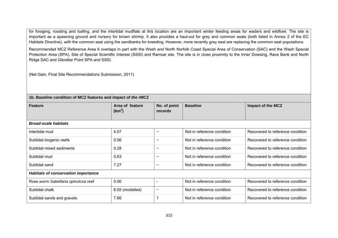
315
for foraging, roosting and loafing, and the intertidal mudflats at this location are an important winter feeding areas for waders and wildfowl. The site is important as a spawning ground and nursery for brown shrimp. It also provides a haul-out for grey and common seals (both listed in Annex 2 of the EC Habitats Directive), with the common seal using the sandbanks for breeding. However, more recently grey seal are replacing the common seal populations.
Recommended MCZ Reference Area 6 overlaps in part with the Wash and North Norfolk Coast Special Area of Conservation (SAC) and the Wash Special Protection Area (SPA), Site of Special Scientific Interest (SSSI) and Ramsar site. The site is in close proximity to the Inner Dowsing, Race Bank and North Ridge SAC and Gibraltar Point SPA and SSSI.
(Net Gain, Final Site Recommendations Submission, 2011)
1b. Baseline condition of MCZ features and impact of the rMCZ
Feature Area of feature (km2)
No. of point records
Baseline Impact of the MCZ
Broad-scale habitats
Intertidal mud 4.07 − Not in reference condition Recovered to reference condition
Subtidal biogenic reefs 0.06 − Not in reference condition Recovered to reference condition
Subtidal mixed sediments 0.28 − Not in reference condition Recovered to reference condition
Subtidal mud 0.63 − Not in reference condition Recovered to reference condition
Subtidal sand 7.27 − Not in reference condition Recovered to reference condition
Habitats of conservation importance
Ross worm Sabellaria spinulosa reef 0.06 - Not in reference condition Recovered to reference condition
Subtidal chalk 8.05 (modelled) − Not in reference condition Recovered to reference condition
Subtidal sands and gravels 7.66 1 Not in reference condition Recovered to reference condition
316
11.00 (modelled)
Geological and geomorphological features of interest
Gibraltar Point (subtidal) 1.30 − Not in reference condition Recovered to reference condition
Note: This site has been proposed for intertidal features only. Nautical charts were used to define boundaries of intertidal features; however, habitat data do not correspond to the bathymetry and suggest that several subtidal features are present within the boundaries. This is a dynamic coastal feature and may therefore require further boundary modification to align with actual feature extent. Site-specific costs arising from the effect of the rMCZ on human activities (over 2013 to 2032 inclusive) Table 2a. Archaeological heritage rMCZ Reference Area 6,
Dogs Head Sandbanks
Source of costs of the rMCZ:
Management scenario 1: Increase in costs of assessing environmental impacts for future licence applications. Archaeological excavations, surface recovery and intrusive surveys will be prohibited from the entire site. Diver trails, visitors and non-intrusive surveys will be allowed.
Baseline description of activity Costs of impact of rMCZ on the sector under Policy Option 1
Three wrecks are recorded in the vicinity of the site (early English schooners dating from 1881 and 1885). There is also 1 known wreck of a 1912 Norwegian cargo ship (English Heritage, pers. comm., 2012).
English Heritage has indicated that this site is likely to be of interest for archaeological excavation in the future as it is relevant to its National Heritage Protection Plan (theme 3A1.2).
An extra cost would be incurred in the assessment of environmental impacts made in support of any future licence applications for archaeological activities in the site. The likelihood of a future licence application being submitted is not known, so no overall cost to the sector of this rMCZ has been estimated. However, the additional cost in one licence application could be in the region of £500 to £10,000 depending on the size of the MCZ (English Heritage, pers. comm., 2011). If archaeologists respond to the prohibition of excavation by undertaking an alternative archaeological excavation in another locality, this could result in additional costs to the archaeologists. As it is not possible to predict when or how often this could occur, this is not costed in the Impact
317
Table 2a. Archaeological heritage rMCZ Reference Area 6, Dogs Head Sandbanks
Assessment. The prohibition of excavation and therefore interpretation of archaeological evidence from the site will decrease acquisition of historical knowledge of past human communities from the site, resulting in a cost to society.
Table 2b. Flood and coastal erosion risk management (FCERM) rMCZ Reference Area 6,
Dogs Head Sandbanks
Source of costs of the rMCZ
Management scenario 1: no impact arises. This is because material from the re-nourishment is not found to be impacting on achieving the conservation objective of the rMCZ Reference Area’s features. Note that provision of equivalent environmental benefit is not required for impacts that arise from natural processes.
Management scenario 1: Provision of equivalent environmental benefit by the body that is implementing a beach re-nourishment project to compensate for the impact that the maintenance would have on features protected by the MCZ. The Impact Assessment assumes that compensation would be required for the impact of maintenance but not for the impact of existing interventions.
Baseline description of activity Costs of impact of rMCZ on the sector under Policy Option 1
The Environment Agency has been implementing a beach re-nourishment project (the Lincshore Project) between Mablethorpe and Skegness since 1994. Replacement of lost sand occurs annually at locations with low beach level. Sand is dredged from a licenced site offshore, pumped onto beaches through a submerged pipeline, and then levelled by a bulldozer.
This activity provides protection against a 1-in-200-year flood event for 30,000 properties and 35,000ha of land (including agricultural land and
Scenario 1: No cost, as the rMCZ Reference Area is assumed to have no impact on the beach re-nourishment project.
£m/yr Scenario 1 Scenario 2 Additional mitigation cost 0.000 Unknown
318
Table 2b. Flood and coastal erosion risk management (FCERM) rMCZ Reference Area 6, Dogs Head Sandbanks
wildlife sites) along the Lincolnshire coast. It also protects the clay foreshore against further erosion and encourages tourism.
Anecdotal evidence from Environmental Impact Assessment monitoring suggests that the re-nourishment material moves to the vicinity of rMCZ Reference Area 6. The proportion of sediment introduced to the system through anthropogenic activity and subsequently transported southwards down the east coast by natural processes and depositing itself within rMCZ Reference Area 6 as a result of the Lincshore Project is currently unknown, but is assumed to be very small. The vast majority of deposited sediment in the site is assumed to be attributed to natural erosion of the Holderness coast, north of the Humber Estuary (Environment Agency and Natural England, pers. comm., 2011).
Scenario 2: It is assumed that the beach re-nourishment impacts on the MCZ features but continues because of its social and economic importance. It is assumed that impacts on the MCZ features would not be mitigated. The impact is assessed in the impact assessment (IA) in terms of the cost to the operator of providing environmental benefit that is equivalent to the impact that implementing the beach re-nourishment project has on features protected by the rMCZ. The costs of this have not been assessed because it is not yet known whether achievement of the conservation objective of features in the rMCZ will definitely be impacted upon by maintenance of the scheme and if so, the magnitude of that impact (these facts will be established through the Environment Agency’s monitoring programme for the Lincshore Project).
The impacts have been assessed in this way because the assessment is of the impacts of the regional MCZ projects’ site recommendations that were submitted in September 2011. The Minister’s decision about designating this site will be also informed by Natural England’s and JNCC’s statutory advice on MCZs that was published on 18 July 2012. Where it is feasible, it is anticipated that the advice will suggest that the site recommendation is adjusted to increase the likelihood that the MCZ features’ conservation objectives can be achieved. Such adjustment is not included in the IA because the IA is an assessment of the regional MCZ projects’ recommendations.
319
Table 2c. National defence rMCZ Reference Area 6, Dogs Head Sandbanks
Source of costs of the rMCZ
Management scenario 1: Mitigation of impacts of Ministry of Defence activities on features protected by the suite of rMCZs will be provided by additional planning considerations during operations and training. It is not known whether mitigation will be required for features protected by this site. The Ministry of Defence will also incur costs in revising environmental tools and charts to include MCZs.
Baseline description of activity Costs of impact of rMCZ on the sector under Policy Option 1
The Ministry of Defence is known to make use of the site for military practice, for bombing and ordnance demolition.
It is not known whether this rMCZ will impact on the Ministry of Defence’s use of the site. Impacts of rMCZs on the Ministry of Defence’s activities are assessed in the Evidence Base and Annex N9.
Table 2d. Ports, harbours, shipping and disposal sites rMCZ Reference Area 6, Dogs Head Sandbanks
Source of costs of the rMCZ
Management scenario 1: Not applicable to this site
Management scenario 2: Increase in costs of assessing environmental impacts for future licence applications within 5km of an rMCZ. This applies to future navigational dredging, disposal of dredge material and port developments. Additional costs incurred in including MCZ features in a new potential Maintenance Dredging Protocol (MDP). It is not anticipated that any additional mitigation of impacts on features protected by the MCZ will be needed for port developments or port-related activities due to this rMCZ relative to the baseline. Baseline description of activity Costs of impact of rMCZ on the sector under Policy Option 1
Port development: Within 5km of the rMCZ there is one 1 port and harbour, Wainfleet Haven, that may undergo development at some point in the future (Ports & and Harbours UK website www.ports.org.uk accessed 2012). This
£m/yr Scenario 1 Scenario 2
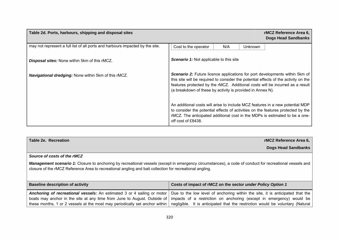
320
Table 2d. Ports, harbours, shipping and disposal sites rMCZ Reference Area 6, Dogs Head Sandbanks
may not represent a full list of all ports and harbours impacted by the site.
Disposal sites: None within 5km of this rMCZ.
Navigational dredging: None within 5km of this rMCZ.
Cost to the operator N/A Unknown Scenario 1: Not applicable to this site
Scenario 2: Future licence applications for port developments within 5km of this site will be required to consider the potential effects of the activity on the features protected by the rMCZ. Additional costs will be incurred as a result (a breakdown of these by activity is provided in Annex N).
An additional costs will arise to include MCZ features in a new potential MDP to consider the potential effects of activities on the features protected by the rMCZ. The anticipated additional cost in the MDPs is estimated to be a one-off cost of £8438.
Table 2e. Recreation rMCZ Reference Area 6,
Dogs Head Sandbanks
Source of costs of the rMCZ
Management scenario 1: Closure to anchoring by recreational vessels (except in emergency circumstances), a code of conduct for recreational vessels and closure of the rMCZ Reference Area to recreational angling and bait collection for recreational angling.
Baseline description of activity Costs of impact of rMCZ on the sector under Policy Option 1
Anchoring of recreational vessels: An estimated 3 or 4 sailing or motor boats may anchor in the site at any time from June to August. Outside of these months, 1 or 2 vessels at the most may periodically set anchor within
Due to the low level of anchoring within the site, it is anticipated that the impacts of a restriction on anchoring (except in emergency) would be negligible. It is anticipated that the restriction would be voluntary (Natural
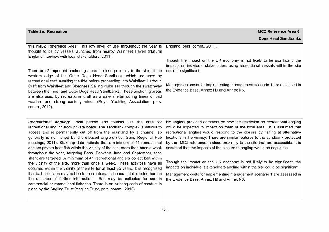
321
Table 2e. Recreation rMCZ Reference Area 6,
Dogs Head Sandbanks
this rMCZ Reference Area. This low level of use throughout the year is thought to be by vessels launched from nearby Wainfleet Haven (Natural England interview with local stakeholders, 2011).
There are 2 important anchoring areas in close proximity to the site, at the western edge of the Outer Dogs Head Sandbank, which are used by recreational craft awaiting the tide before proceeding into Wainfleet Harbour. Craft from Wainfleet and Skegness Sailing clubs sail through the swatchway between the Inner and Outer Dogs Head Sandbanks. These anchoring areas are also used by recreational craft as a safe shelter during times of bad weather and strong easterly winds (Royal Yachting Association, pers. comm., 2012).
England, pers. comm., 2011).
Though the impact on the UK economy is not likely to be significant, the impacts on individual stakeholders using recreational vessels within the site could be significant.
Management costs for implementing management scenario 1 are assessed in the Evidence Base, Annex H9 and Annex N6.
Recreational angling: Local people and tourists use the area for recreational angling from private boats. The sandbank complex is difficult to access and is permanently cut off from the mainland by a channel, so generally is not fished by shore-based anglers (Net Gain, Regional Hub meetings, 2011). Stakmap data indicate that a minimum of 41 recreational anglers private boat fish within the vicinity of the site, more than once a week throughout the year, targeting Bass. Between June and September, tope shark are targeted. A minimum of 41 recreational anglers collect bait within the vicinity of the site, more than once a week. These activities have all occurred within the vicinity of the site for at least 35 years. It is recognised that bait collection may not be for recreational fisheries but it is listed here in the absence of further information. Bait may be collected for use in commercial or recreational fisheries. There is an existing code of conduct in place by the Angling Trust (Angling Trust, pers. comm., 2012).
No anglers provided comment on how the restriction on recreational angling could be expected to impact on them or the local area. It is assumed that recreational anglers would respond to the closure by fishing at alternative locations in the vicinity. There are similar features to the sandbank protected by the rMCZ reference in close proximity to the site that are accessible. It is assumed that the impacts of the closure to angling would be negligible.
Though the impact on the UK economy is not likely to be significant, the impacts on individual stakeholders angling within the site could be significant.
Management costs for implementing management scenario 1 are assessed in the Evidence Base, Annex H9 and Annex N6.
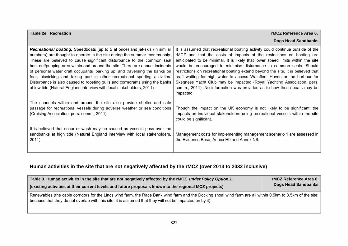
322
Table 2e. Recreation rMCZ Reference Area 6,
Dogs Head Sandbanks
Recreational boating: Speedboats (up to 5 at once) and jet-skis (in similar numbers) are thought to operate in the site during the summer months only. These are believed to cause significant disturbance to the common seal haul-out/pupping area within and around the site. There are annual incidents of personal water craft occupants ‘parking up’ and traversing the banks on foot, picnicking and taking part in other recreational sporting activities. Disturbance is also caused to roosting gulls and cormorants using the banks at low tide (Natural England interview with local stakeholders, 2011).
The channels within and around the site also provide shelter and safe passage for recreational vessels during adverse weather or sea conditions (Cruising Association, pers. comm., 2011).
It is believed that scour or wash may be caused as vessels pass over the sandbanks at high tide (Natural England interview with local stakeholders, 2011).
It is assumed that recreational boating activity could continue outside of the rMCZ and that the costs of impacts of the restrictions on boating are anticipated to be minimal. It is likely that lower speed limits within the site would be encouraged to minimise disturbance to common seals. Should restrictions on recreational boating extend beyond the site, it is believed that craft waiting for high water to access Wainfleet Haven or the harbour for Skegness Yacht Club may be impacted (Royal Yachting Association, pers. comm., 2011). No information was provided as to how these boats may be impacted.
Though the impact on the UK economy is not likely to be significant, the impacts on individual stakeholders using recreational vessels within the site could be significant.
Management costs for implementing management scenario 1 are assessed in the Evidence Base, Annex H9 and Annex N6.
Human activities in the site that are not negatively affected by the rMCZ (over 2013 to 2032 inclusive) Table 3. Human activities in the site that are not negatively affected by the rMCZ under Policy Option 1
(existing activities at their current levels and future proposals known to the regional MCZ projects)
rMCZ Reference Area 6, Dogs Head Sandbanks
Renewables (the cable corridors for the Lincs wind farm, the Race Bank wind farm and the Docking shoal wind farm are all within 0.5km to 3.5km of the site; because that they do not overlap with this site, it is assumed that they will not be impacted on by it).
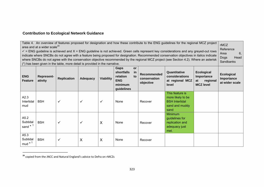
323
Contribution to Ecological Network Guidance Table 4. An overview of features proposed for designation and how these contribute to the ENG guidelines for the regional MCZ project area and at a wider scale20
= ENG guideline is achieved and X = ENG guideline is not achieved. Green cells represent key considerations and any greyed-out rows indicate where SNCBs do not agree with a feature being proposed for designation. Recommended conservation objectives in italics indicate where SNCBs do not agree with the conservation objective recommended by the regional MCZ project (see Section 4.2). Where an asterisk (*) has been given in the table, more detail is provided in the narrative.
rMCZ Reference Area 6, Dogs Head Sandbanks
ENG Feature
Represent-ativity Replication Adequacy Viability
Gaps or shortfalls in relation to ENG minimum guidelines
Recommended conservation objective
Quantitative considerations at regional MCZ level
Ecological Importance at regional MCZ level
Ecological Importance at wider scale
A2.3 Intertidal mud
BSH None Recover
This feature is more likely to be BSH Intertidal sand and muddy sand
A5.2 Subtidal sand * 1
BSH X None Recover
Minimum guidelines for replication and adequacy just met.
A5.3 Subtidal mud * 1
BSH X X None Recover
20 copied from the JNCC and Natural England’s advice to Defra on rMCZs
324
A5.4 Subtidal mixed sediments * 1
BSH X None Recover
A5.6 Subtidal biogenic reefs * 1
BSH X X None Recover Replication for this BSH is at it minimum.
Ross worm Sabellaria spinulosa reefs * 1
FOCI Habitat X X None Recover
Subtidal sands and gravels * 1
FOCI Habitat None Recover
Minimum guidelines for replication and adequacy just met
Subtidal chalk (modelled) * 1
FOCI Habitat None Recover
Feature unlikely to exist in this site.
Site considerations Connectivity Geological/Geomorphological features of interest Gibraltar point GCR Appropriate boundary Areas of Additional Ecological Importance N/A
325
Overlaps with existing MPAs Additional comments and site benefits:
• 1 The reference area is viable for the main feature proposed BSH Intertidal mud, and the recommended reference area also contains small areas of other features.
• This Dog’s Head sandbanks provide an important grey seal haul-out area at the Gibraltar Point National Nature Reserve (Linconshire Wildlife Trust, Pers. Comm., 2011).
• The site is relatively inaccessible as it comprises a sandbank complex separated from the mainland by a deep channel. For this reason the recommended intertidal feature is more likely to be undisturbed by existing human activities relative to alternative intertidal sites and may therefore be appropriate for the purposes of scientific reference and have higher naturalness/ecological quality.
Anticipated benefits to ecosystem services The habitats, species and other ecological features of the rMCZ contribute to the delivery of a range of ecosystem services. Designation of the rMCZ and its subsequent management may improve the quantity and quality of the beneficial services provided, which may increase the value (contribution to economic welfare or human well-being) of them. Impacts on the value derived from ecosystem services may occur as a result of the designation, management and/or achievement of the conservation objectives of the rMCZ. Further discussion on the potential benefits to ecosystem services can be found in Annex L and on definitions can be found in Annex H5.
Table 5a. Fish and shellfish for human consumption rMCZ Reference Area 6,
Dogs Head Sandbanks
Baseline Beneficial impact under Policy Option 1
There are no known commercial fishing activities carried out within the N/A N/A
326
recommended Marine Conservation Zone.
Table 5b. Recreation rMCZ Reference Area 6,
Dogs Head Sandbanks
Baseline Beneficial impact under Policy Option 1
Angling: Fletcher and others (2011) identify that the features to be protected by the recommended Marine Conservation Zone (rMCZ) can contribute to the delivery of fish and shellfish for human consumption and recreation services.
The baseline quantity and quality of the ecosystem service provided is assumed to be commensurate with that provided by features of the site when not in reference condition (see Table 1).
A description of on-site fishing activity and the value derived from it is set out in Table 2. It has not been possible to estimate the value derived from angling in the site.
If the conservation objectives of the features are achieved, the features will be recovered to reference condition.
Recovery of habitats may have benefits to fish and shellfish populations. It is unclear whether any benefits to fish populations would arise as a result of reduced fishing mortality due to management of commercial fishing (see Table 4a for further details).
Assuming that a voluntary restriction on angling is adhered to, any benefits will be limited to those occurring as a result of off-site spill-over effects of finfish species targeted by anglers. Such benefits may be insignificant.
Anticipated direction of
change:
Confidence: Low
Diving: There is no known diving and snorkelling activity carried out within the rMCZ.
N/A N/A
327
Table 5b. Recreation rMCZ Reference Area 6,
Dogs Head Sandbanks
Wildlife watching: Nearby Gibraltar Point is a popular area for wildlife watchers, who observe the internationally important bird breeding colonies on the headland; rMCZ Reference Area 6 itself is largely cut off from the mainland and so wildlife watching activity within the site is limited. The site is however used by sea bird species such as common scoter, eider, gulls, terns and cormorants; they use the sandbanks for foraging, roosting and loafing. The intertidal mudflats at this location are an important winter feeding area for waders and wildfowl. The site is also a haul-out for grey and common seals, with the common seal using the sandbanks for breeding (Net Gain Final Recommendations, 2011). More recently, grey seal are replacing the common seal populations (Lincolnshire Wildlife Trusts, pers. comm., 2011).
If the conservation objectives of the features are achieved, the features will be recovered to reference condition.
As wildlife watching in the area is not focused on the marine habitat, it is unlikely that any improvement in the rMCZ features and associated biodiversity will significantly affect the quality of wildlife watching in the area.
Anticipated direction of
change:
Confidence: Moderate
Table 5c. Research and education rMCZ Reference Area 6,
Dogs Head Sandbanks
Baseline Beneficial impact under Policy Option 1
Research: Fletcher and others (2011) identify that the features to be protected by the recommended Marine Conservation Zone (rMCZ) can contribute to the delivery of research services.
Recommended MCZ Reference Area 6 overlaps in part with the Wash and North Norfolk Coast Special Area of Conservation and the Wash Special Protection Area, Site of Special Scientific Interest and Ramsar site (Net Gain Final Recommendations, 2011). and, as such, monitoring activity is ongoing.
It has not been possible to estimate the value derived from research activities associated with the rMCZ.
As a Reference Area, the rMCZ will provide an opportunity to demonstrate the state of designated marine features in the absence of many anthropogenic pressures (Natural England and Joint Nature Conservation Committee, 2010). It will provide a control area against which the impacts of pressures caused by human activities can be compared as part of long-term monitoring and assessment. Other research benefits are unknown.
Anticipated direction of
change:
Confidence: High
328
Table 5c. Research and education rMCZ Reference Area 6,
Dogs Head Sandbanks
Education: There is no known educational activity occurring in the site. MCZ designation may provide an opportunity to expand the focus of education events into the marine environment.
Designation may aid additional local (to the rMCZ) provision of education (e.g. events and interpretation boards), from which visitors would derive benefit, although the site is largely inaccessible.
Non-visitors may benefit if the rMCZ contributes to wider provision of education (e.g. television programmes, articles in magazines and newspapers, and educational resources developed for use in schools).
Anticipated direction of
change:
Confidence: Moderate
Table 5d. Regulating services rMCZ Reference Area 6,
Dogs Head Sandbanks
Baseline Beneficial impact under Policy Option 1
Regulation of pollution: The features of the site contribute to the bioremediation of waste and sequestration of carbon. It has not been possible to estimate the value derived from the regulation of pollution in the rMCZ.
Environmental resilience: The features of the site contribute to the
If the conservation objectives of the features are achieved, the features will be recovered to reference condition, which may improve the regulating capacity of the site habitats.
Anticipated direction of
change:
329
Table 5d. Regulating services rMCZ Reference Area 6,
Dogs Head Sandbanks
resilience and continued regeneration of marine ecosystems. It has not been possible to estimate the value derived from environmental resilience in the rMCZ.
Natural hazard protection: The features of the site contribute to local flood and storm protection. It has not been possible to estimate the value derived from the natural hazard protection in the rMCZ.
(Fletcher and others, 2011)
Confidence: Low
Table 5e. Non-use and option values rMCZ Reference Area 6,
Dogs Head Sandbanks
Baseline Beneficial impact under Policy Option 1
Some people gain satisfaction from the existence of marine habitats, species and other features. They also gain from having the option to benefit in the future from the habitats and species in the recommended Marine Conservation Zone (rMCZ) and the ecosystem services provided, even if they do not currently benefit from them.
The rMCZ will benefit the proportion of the UK population that values conservation of the rMCZ features and its contribution to an ecologically coherent network of Marine Protected Areas. Some people will gain satisfaction from knowing that the habitats and species are being conserved (existence value) and/or that they are being conserved for use by others in the current generation (altruistic value) or future generations (bequest value). The rMCZ will recover and then protect the features in reference condition and the ecosystem services provided, and thereby the option to benefit from these services in the future, from the risk of future degradation.
Anticipated direction of
change:
Confidence: Moderate
330
rMCZ Reference Area 7, Seahenge Peat and Clay Site area (km2): 0.26km2
• This site has been proposed for designation under Policy Option 1 only.
Table 1. Conservation impacts rMCZ Reference Area 7, Seahenge Peat and Clay
331
1a. Ecological description
Recommended rMCZ Reference Area 7 has been recommended for designation due to the presence of peat and clay exposures. Peat and clay exposures are unusual communities of limited extent in the UK, featuring on the UK List of Priority Habitats (UK BAP) (Natural England, 2012, pers. comm.). These unique and fragile habitats are irreplaceable, arising from former lake bed sediments and ancient forested peatland (or ‘submerged forests’). In general, peat tends to be firm and relatively erosion resistant. The clay exposures within the site are less frequent than the petrified wood. Interesting features found within the site include branch structures, tree stumps and blue mussel beds. Evidence of burrowing activity indicates the presence piddocks (Davis and Dinwiddy, 2011). Burrowing activities of piddocks are thought to contribute to the relatively high silt environment, and abandoned burrows are often used by other invertebrate species. Communities present on the exposures include dense mats of red seaweed and gut weed. Damp areas within the algal mat have aggregations of sand mason worm and fan worm. Small pools on the peat may contain hydroids and prawn. Crab occur in crevices in the peat and are the predominant mobile species, scavenging for food.
Within the vicinity of the site, approximately 40,000 sea birds overwinter. Tern (listed in Annex 1 of the EC Birds Directive) are a significant feature of the Holme Dunes Nature Reserve. Arctic terns, which feed on a wide variety of small fish, crustaceans and zooplankton, have a feeding range across this site. Other birds that utilise this coast include the sandwich, common and roseate tern, and the northern fulmar.
Recommended Marine Conservation Zone (rMCZ) Reference Area 7 lies within the Wash and North Norfolk Coast Special Area of Conservation, the North Norfolk Coast Special Protection Area, Site of Special Scientific Interest and Ramsar site, and the Holme Dunes National Nature Reserve. The site lies adjacent to Seahenge archaeological sites (Holme I and Holme II).
(Net Gain, Final Site Recommendations Submission, 2011)
1b. Baseline condition of MCZ features and impact of the rMCZ
Feature Area of feature (km2)
No. of point records
Baseline Impact of the MCZ
Broad-scale habitats
Intertidal sand and muddy sand 0.25 − Not in reference condition Recovered to reference condition
Subtidal sand 0.00 − Not in reference condition Recovered to reference condition
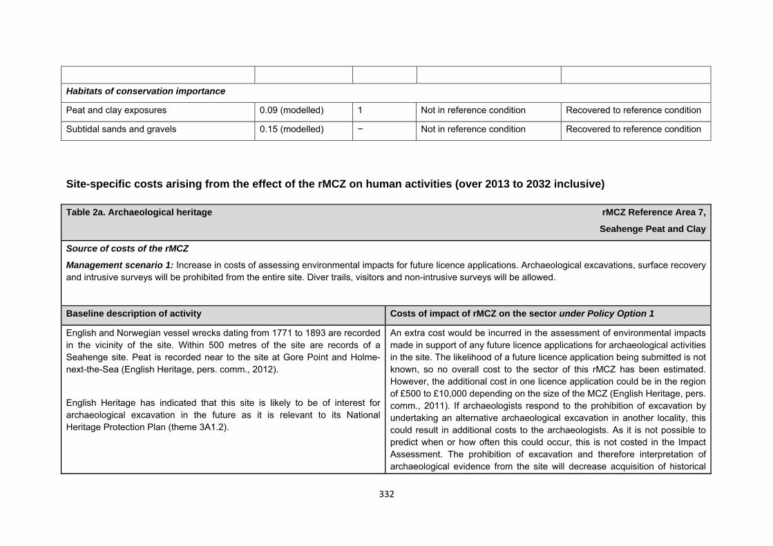
332
Habitats of conservation importance
Peat and clay exposures 0.09 (modelled) 1 Not in reference condition Recovered to reference condition
Subtidal sands and gravels 0.15 (modelled) − Not in reference condition Recovered to reference condition
Site-specific costs arising from the effect of the rMCZ on human activities (over 2013 to 2032 inclusive) Table 2a. Archaeological heritage rMCZ Reference Area 7,
Seahenge Peat and Clay
Source of costs of the rMCZ
Management scenario 1: Increase in costs of assessing environmental impacts for future licence applications. Archaeological excavations, surface recovery and intrusive surveys will be prohibited from the entire site. Diver trails, visitors and non-intrusive surveys will be allowed.
Baseline description of activity Costs of impact of rMCZ on the sector under Policy Option 1
English and Norwegian vessel wrecks dating from 1771 to 1893 are recorded in the vicinity of the site. Within 500 metres of the site are records of a Seahenge site. Peat is recorded near to the site at Gore Point and Holme-next-the-Sea (English Heritage, pers. comm., 2012).
English Heritage has indicated that this site is likely to be of interest for archaeological excavation in the future as it is relevant to its National Heritage Protection Plan (theme 3A1.2).
An extra cost would be incurred in the assessment of environmental impacts made in support of any future licence applications for archaeological activities in the site. The likelihood of a future licence application being submitted is not known, so no overall cost to the sector of this rMCZ has been estimated. However, the additional cost in one licence application could be in the region of £500 to £10,000 depending on the size of the MCZ (English Heritage, pers. comm., 2011). If archaeologists respond to the prohibition of excavation by undertaking an alternative archaeological excavation in another locality, this could result in additional costs to the archaeologists. As it is not possible to predict when or how often this could occur, this is not costed in the Impact Assessment. The prohibition of excavation and therefore interpretation of archaeological evidence from the site will decrease acquisition of historical
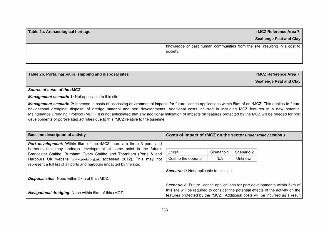
333
Table 2a. Archaeological heritage rMCZ Reference Area 7,
Seahenge Peat and Clay
knowledge of past human communities from the site, resulting in a cost to society.
Table 2b. Ports, harbours, shipping and disposal sites rMCZ Reference Area 7,
Seahenge Peat and Clay
Source of costs of the rMCZ
Management scenario 1: Not applicable to this site.
Management scenario 2: Increase in costs of assessing environmental impacts for future licence applications within 5km of an rMCZ. This applies to future navigational dredging, disposal of dredge material and port developments. Additional costs incurred in including MCZ features in a new potential Maintenance Dredging Protocol (MDP). It is not anticipated that any additional mitigation of impacts on features protected by the MCZ will be needed for port developments or port-related activities due to this rMCZ relative to the baseline.
Baseline description of activity Costs of impact of rMCZ on the sector under Policy Option 1
Port development: Within 5km of the rMCZ there are three 3 ports and harbours that may undergo development at some point in the future: Brancaster Staithe, Burnham Overy Staithe and Thornham (Ports & and Harbours UK website www.ports.org.uk accessed 2012). This may not represent a full list of all ports and harbours impacted by the site.
Disposal sites: None within 5km of this rMCZ.
Navigational dredging: None within 5km of this rMCZ.
£m/yr Scenario 1 Scenario 2 Cost to the operator N/A Unknown
Scenario 1: Not applicable to this site
Scenario 2: Future licence applications for port developments within 5km of this site will be required to consider the potential effects of the activity on the features protected by the rMCZ. Additional costs will be incurred as a result
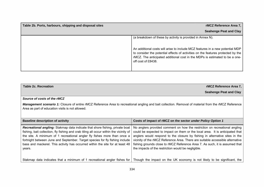
334
Table 2b. Ports, harbours, shipping and disposal sites rMCZ Reference Area 7,
Seahenge Peat and Clay
(a breakdown of these by activity is provided in Annex N).
An additional costs will arise to include MCZ features in a new potential MDP to consider the potential effects of activities on the features protected by the rMCZ. The anticipated additional cost in the MDPs is estimated to be a one-off cost of £8438.
Table 2c. Recreation rMCZ Reference Area 7,
Seahenge Peat and Clay
Source of costs of the rMCZ
Management scenario 1: Closure of entire rMCZ Reference Area to recreational angling and bait collection. Removal of material from the rMCZ Reference Area as part of education visits is not allowed.
Baseline description of activity Costs of impact of rMCZ on the sector under Policy Option 1
Recreational angling: Stakmap data indicate that shore fishing, private boat fishing, bait collection, fly fishing and crab tiling all occur within the vicinity of the site. A minimum of 1 recreational angler fly fishes more than once a fortnight between June and September. Target species for fly fishing include bass and mackerel. This activity has occurred within the site for at least 48 years.
Stakmap data indicates that a minimum of 1 recreational angler fishes for
No anglers provided comment on how the restriction on recreational angling could be expected to impact on them or the local area. It is anticipated that anglers would respond to the closure by fishing in alternative sites in the vicinity of the rMCZ Reference Area. There are suitable accessible alternative fishing grounds close to rMCZ Reference Area 7. As such, it is assumed that the impacts of the restriction would be negligible.
Though the impact on the UK economy is not likely to be significant, the
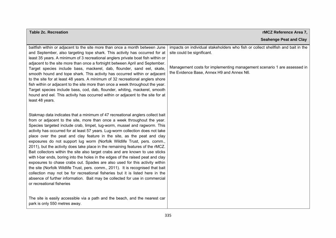
335
Table 2c. Recreation rMCZ Reference Area 7,
Seahenge Peat and Clay
baitfish within or adjacent to the site more than once a month between June and September, also targeting tope shark. This activity has occurred for at least 35 years. A minimum of 3 recreational anglers private boat fish within or adjacent to the site more than once a fortnight between April and September. Target species include bass, mackerel, dab, flounder, sand eel, skate, smooth hound and tope shark. This activity has occurred within or adjacent to the site for at least 48 years. A minimum of 32 recreational anglers shore fish within or adjacent to the site more than once a week throughout the year. Target species include bass, cod, dab, flounder, whiting, mackerel, smooth hound and eel. This activity has occurred within or adjacent to the site for at least 48 years.
Stakmap data indicates that a minimum of 47 recreational anglers collect bait from or adjacent to the site, more than once a week throughout the year. Species targeted include crab, limpet, lug-worm, mussel and ragworm. This activity has occurred for at least 57 years. Lug-worm collection does not take place over the peat and clay feature in the site, as the peat and clay exposures do not support lug worm (Norfolk Wildlife Trust, pers. comm., 2011), but the activity does take place in the remaining features of the rMCZ. Bait collectors within the site also target crabs and are known to use sticks with t-bar ends, boring into the holes in the edges of the raised peat and clay exposures to chase crabs out. Spades are also used for this activity within the site (Norfolk Wildlife Trust, pers. comm., 2011). It is recognised that bait collection may not be for recreational fisheries but it is listed here in the absence of further information. Bait may be collected for use in commercial or recreational fisheries
The site is easily accessible via a path and the beach, and the nearest car park is only 550 metres away.
impacts on individual stakeholders who fish or collect shellfish and bait in the site could be significant.
Management costs for implementing management scenario 1 are assessed in the Evidence Base, Annex H9 and Annex N6.
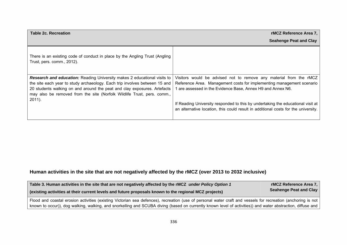
336
Table 2c. Recreation rMCZ Reference Area 7,
Seahenge Peat and Clay
There is an existing code of conduct in place by the Angling Trust (Angling Trust, pers. comm., 2012).
Research and education: Reading University makes 2 educational visits to the site each year to study archaeology. Each trip involves between 15 and 20 students walking on and around the peat and clay exposures. Artefacts may also be removed from the site (Norfolk Wildlife Trust, pers. comm., 2011).
Visitors would be advised not to remove any material from the rMCZ Reference Area. Management costs for implementing management scenario 1 are assessed in the Evidence Base, Annex H9 and Annex N6.
If Reading University responded to this by undertaking the educational visit at an alternative location, this could result in additional costs for the university.
Human activities in the site that are not negatively affected by the rMCZ (over 2013 to 2032 inclusive) Table 3. Human activities in the site that are not negatively affected by the rMCZ under Policy Option 1
(existing activities at their current levels and future proposals known to the regional MCZ projects)
rMCZ Reference Area 7, Seahenge Peat and Clay
Flood and coastal erosion activities (existing Victorian sea defences), recreation (use of personal water craft and vessels for recreation (anchoring is not known to occur)), dog walking, walking, and snorkelling and SCUBA diving (based on currently known level of activities)) and water abstraction, diffuse and
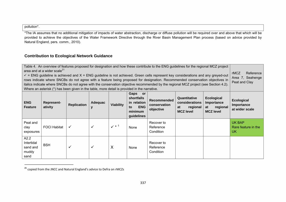
337
*The IA assumes that no additional mitigation of impacts of water abstraction, discharge or diffuse pollution will be required over and above that which will be provided to achieve the objectives of the Water Framework Directive through the River Basin Management Plan process (based on advice provided by Natural England, pers. comm., 2010). Contribution to Ecological Network Guidance Table 4. An overview of features proposed for designation and how these contribute to the ENG guidelines for the regional MCZ project area and at a wider scale21
= ENG guideline is achieved and X = ENG guideline is not achieved. Green cells represent key considerations and any greyed-out rows indicate where SNCBs do not agree with a feature being proposed for designation. Recommended conservation objectives in italics indicate where SNCBs do not agree with the conservation objective recommended by the regional MCZ project (see Section 4.2). Where an asterisk (*) has been given in the table, more detail is provided in the narrative.
rMCZ Reference Area 7, Seahenge Peat and Clay
ENG Feature
Represent-ativity Replication Adequac
y Viability
Gaps or shortfalls in relation to ENG minimum guidelines
Recommended conservation objective
Quantitative considerations at regional MCZ level
Ecological Importance at regional MCZ level
Ecological Importance at wider scale
Peat and clay exposures
FOCI Habitat * 1 None Recover to Reference Condition
UK BAP Rare feature in the UK
A2.2 Intertidal sand and muddy sand
BSH X None
Recover to Reference Condition
21 copied from the JNCC and Natural England’s advice to Defra on rMCZs
pollution*.
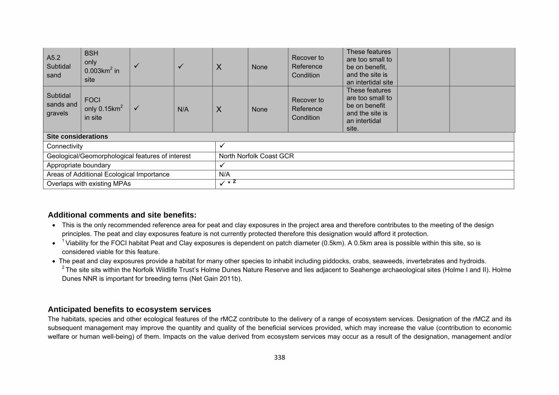
338
A5.2 Subtidal sand
BSH only 0.003km2 in site
X None Recover to Reference Condition
These features are too small to be on benefit, and the site is an intertidal site
Subtidal sands and gravels
FOCI only 0.15km2 in site
N/A X None Recover to Reference Condition
These features are too small to be on benefit and the site is an intertidal site.
Site considerations Connectivity Geological/Geomorphological features of interest North Norfolk Coast GCR Appropriate boundary Areas of Additional Ecological Importance N/A Overlaps with existing MPAs * 2 Additional comments and site benefits: • This is the only recommended reference area for peat and clay exposures in the project area and therefore contributes to the meeting of the design
principles. The peat and clay exposures feature is not currently protected therefore this designation would afford it protection. • 1 Viability for the FOCI habitat Peat and Clay exposures is dependent on patch diameter (0.5km). A 0.5km area is possible within this site, so is
considered viable for this feature. • The peat and clay exposures provide a habitat for many other species to inhabit including piddocks, crabs, seaweeds, invertebrates and hydroids.
2 The site sits within the Norfolk Wildlife Trust’s Holme Dunes Nature Reserve and lies adjacent to Seahenge archaeological sites (Holme I and II). Holme Dunes NNR is important for breeding terns (Net Gain 2011b).
Anticipated benefits to ecosystem services The habitats, species and other ecological features of the rMCZ contribute to the delivery of a range of ecosystem services. Designation of the rMCZ and its subsequent management may improve the quantity and quality of the beneficial services provided, which may increase the value (contribution to economic welfare or human well-being) of them. Impacts on the value derived from ecosystem services may occur as a result of the designation, management and/or
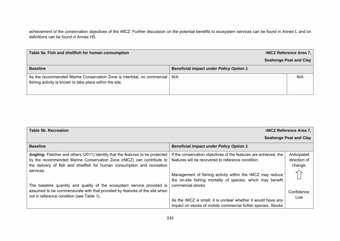
339
achievement of the conservation objectives of the rMCZ. Further discussion on the potential benefits to ecosystem services can be found in Annex L and on definitions can be found in Annex H5.
Table 5a. Fish and shellfish for human consumption rMCZ Reference Area 7,
Seahenge Peat and Clay
Baseline Beneficial impact under Policy Option 1
As the recommended Marine Conservation Zone is intertidal, no commercial fishing activity is known to take place within the site.
N/A N/A
Table 5b. Recreation rMCZ Reference Area 7,
Seahenge Peat and Clay
Baseline Beneficial impact under Policy Option 1
Angling: Fletcher and others (2011) identify that the features to be protected by the recommended Marine Conservation Zone (rMCZ) can contribute to the delivery of fish and shellfish for human consumption and recreation services.
The baseline quantity and quality of the ecosystem service provided is assumed to be commensurate with that provided by features of the site when not in reference condition (see Table 1).
If the conservation objectives of the features are achieved, the features will be recovered to reference condition.
Management of fishing activity within the rMCZ may reduce the on-site fishing mortality of species, which may benefit commercial stocks.
As the rMCZ is small, it is unclear whether it would have any impact on stocks of mobile commercial finfish species. Stocks
Anticipated direction of
change:
Confidence: Low
340
Table 5b. Recreation rMCZ Reference Area 7,
Seahenge Peat and Clay
A description of on-site fishing activity and the value derived from it is set out in Table 2. It has not been possible to estimate the value derived from angling in the site.
of low-mobility and site-attached species, such as cockles and seed mussels, may improve as a result of reduced fishing pressure. Localised beneficial spill-over effects may occur around the rMCZ.
As angling will not be permitted within the rMCZ, any benefits will be limited to those occurring as a result of spill-over effects of finfish species targeted by anglers. Such benefits may be insignificant.
Diving: As the site is intertidal, there is no known diving and snorkelling activity carried out within the site.
N/A N/A
Wildlife watching: The site is an existing nature reserve, popular for wildlife watchers, and is a regular location for dog walking throughout the year (Natural England interview with Norfolk Wildlife Trust, 2011). Approximately 40,000 sea birds overwinter within the vicinity of the site. Terns are a significant feature of Holme Dunes National Nature Reserve. Arctic terns, which feed on a wide variety of small fish, crustaceans and zooplankton, would have a feeding range across this site (Kirkham and Nisbet, 1987; Hatch, 2002). Other birds noted to utilise this area of coast are the Sandwich, common and roseate tern, and the northern fulmar (Net Gain Final Recommendations, 2011). It has not been possible to estimate the value derived from wildlife watching in the site.
If the conservation objectives of the features are achieved, the features will be recovered to reference condition.
As wildlife watching in the area is not focused on the marine habitat, it is unlikely that any improvement in the rMCZ features and associated biodiversity will significantly affect the quality of wildlife watching in the area.
Anticipated direction of
change:
Confidence: Moderate
341
Table 5c. Research and education rMCZ Reference Area 7,
Seahenge Peat and Clay
Baseline Beneficial impact under Policy Option 1
Research: Fletcher and others (2011) identify that the features to be protected by the recommended Marine Conservation Zone (rMCZ) can contribute to the delivery of research services.
Recommended MCZ Reference Area 7 lies within the Wash and North Norfolk Coast Special Area of Conservation, the North Norfolk Coast Special Protection Area, Site of Special Scientific Interest and Ramsar site and the Holme Dunes National Nature Reserve (NNR) (Net Gain Final Recommendations, 2011). and, as such, monitoring activity is ongoing. The site lies within an important archaeological landscape and is around 500 metres from the important Seahenge archaeological sites (Holme I and Holme II) (English Heritage, pers. comm., 2012).
It has not been possible to estimate the value derived from research activities associated with the rMCZ.
As a Reference Area, the rMCZ will provide an opportunity to demonstrate the state of designated marine features in the absence of many anthropogenic pressures (Natural England and Joint Nature Conservation Committee, 2010). It will provide a control area against which the impacts of pressures caused by human activities can be compared as part of long-term monitoring and assessment. Other research benefits are unknown.
Anticipated direction of
change:
Confidence: High
Education: Reading University is known to make 2 trips per year to the Holme Dunes NNR; 15−20 students are thought to attend each trip. There are infrequent archaeological visits to the site (6 visits or fewer per year, depending on interest features) (Natural England interview with Norfolk Wildlife Trust, 2011).
MCZ designation may provide an opportunity to expand the focus of education events into the marine environment.
Designation may aid additional local (to the rMCZ) provision of education (e.g. events and interpretation boards), from which visitors would derive benefit.
Non-visitors may benefit if the rMCZ contributes to wider
Anticipated direction of
change:
Confidence: Moderate
342
Table 5c. Research and education rMCZ Reference Area 7,
Seahenge Peat and Clay
provision of education (e.g. television programmes, articles in magazines and newspapers, and educational resources developed for use in schools).
Table 5d. Regulating services rMCZ Reference Area 7,
Seahenge Peat and Clay
Baseline Beneficial impact under Policy Option 1
Regulation of pollution: The features of the site contribute to the bioremediation of waste and sequestration of carbon. It has not been possible to estimate the value derived from the regulation of pollution in the rMCZ.
Environmental resilience: The features of the site contribute to the resilience and continued regeneration of marine ecosystems. It has not been possible to estimate the value derived from environmental resilience in the rMCZ.
Natural hazard protection: The features of the site contribute to local flood and storm protection. It has not been possible to estimate the value derived from natural hazard protection in the rMCZ.
(Fletcher and others, 2011)
If the conservation objectives of the features are achieved, the features will be recovered to reference condition, which may improve the regulating capacity of the site habitats.
Anticipated direction of
change:
Confidence: Low
343
Table 5e. Non-use and option values rMCZ Reference Area 7,
Seahenge Peat and Clay
Baseline Beneficial impact under Policy Option 1
Some people gain satisfaction from the existence of marine habitats, species and other features. They also gain from having the option to benefit in the future from the habitats and species in the recommended Marine Conservation Zone (rMCZ) and the ecosystem services provided, even if they do not currently benefit from them.
The rMCZ will benefit the proportion of the UK population that values conservation of the rMCZ features and its contribution to an ecologically coherent network of Marine Protected Areas. Some people will gain satisfaction from knowing that the habitats and species are being conserved (existence value) and/or that they are being conserved for use by others in the current generation (altruistic value) or future generations (bequest value). The rMCZ will recover and then protect the features in reference condition and the ecosystem services provided, and thereby the option to benefit from these services in the future, from the risk of future degradation.
Anticipated direction of
change:
Confidence: Moderate
344
rMCZ Reference Area 8, Wash Approach
Site area (km2): 25.01
• This site has been proposed for designation under Policy Option 1 only.
Table 1. Conservation impacts rMCZ Reference Area 8, Wash Approach
1a. Ecological description
The sea bed is composed of subtidal mixed sediments, sands and gravels. The sediments support diverse communities of flora and fauna, including worms, bivalves, echinoderms, anemones, hydroids, sea firs and sea mats, bryozoans and starfish among other benthic organisms. Biogenic reefs of Ross worm are also present.
The site is of moderate ecological importance and data show that the area may be an important nursery and spawning ground for a variety of species such as herring, Dover sole, lemon sole, whiting and sand eel. Survey data show that this site lies within the foraging range of the sandwich tern (listed in Annex 1 of the EC Birds Directive), Atlantic puffin, common guillemot, northern fulmar and northern gannet. The wider area is a popular feeding site for seals (listed in Annex 2of the EC Habitats Directive) throughout the year, as it is close to a colony of common seal at the entrance of the Inner Wash, and sightings are common. Harbour porpoise (also listed in Annex 2 of the EC Habitats Directive) sightings are also regularly observed.
345
Recommended Marine Conservation Zone (rMCZ) Reference Area 8 lies entirely within rMCZ NG 4. The northern boundary of the site is in close proximity (approximately 200 metres) to the Inner Dowsing, Race Bank and North Ridge Special Area of Conservation.
(Net Gain, Final Site Recommendations Submission, 2011)
1b. Baseline condition of MCZ features and impact of the rMCZ
Feature Area of feature (km2)
No. of point records
Baseline Impact of the MCZ
Broad-scale habitats
Subtidal mixed sediments 25.00 − Favourable condition Recovered to reference condition
Habitats of conservation importance
Subtidal sands and gravels 25.00 (modelled) − Favourable condition Recovered to reference condition
Site-specific costs arising from the effect of the rMCZ on human activities (over 2013 to 2032 inclusive) Table 2a. Commercial fisheries rMCZ Reference Area 8,
Wash Approach
Source of costs of the rMCZ
Management scenario 1: Closed to all commercial fishing activity.
Summary of all UK commercial fisheries: Recommended MCZ Reference Area 8 is wholly outside 12nm. The estimated value of landings for the site is
346
Table 2a. Commercial fisheries rMCZ Reference Area 8, Wash Approach
£0.014m/yr, all of which is contributed by under 15 metre vessels (the MCZ Fisheries Model does not record any activity by over 15 metre vessels within the site).
MCZ Fisheries Model data indicate that a minimum of 14 under 15 metre vessels fish within the site from 7 UK ports, landing their catch from within the site in 6 ports. Bottom trawling, hooks and lines and potting by under 15 metre vessels occur within the site.
The site is heavily fished for crab by the Cromer fleet and is an important shrimping ground for the King’s Lynn fleet (interview with Boston and King’s Lynn fleets, 2011). Recommended MCZ Reference Area 8 is within one of the most productive areas for potting by the Wells and surrounding fleets (interview with Wells fleet, 2011). The nomadic nature of shrimp, cockle and mussel means that in any given year, these species, which are targeted by the Wash fleets, may locate within rMCZ Reference Area 8. No existing commercial fishing restrictions that are specific to this area have been identified.
There is a proposal for wind farm activity close to rMCZ Reference Area 8, which will reduce the fishing grounds of the North Norfolk fleets. As such, the remaining area, including rMCZ Reference Area 8, will become increasingly important for these fleets (interview with Wells fleet, 2011).
Baseline description of UK commercial fisheries Costs of impact of rMCZ on UK commercial fisheries under Policy Option 1
Bottom trawls: MCZ Fisheries Model data indicate that a minimum of 4 under 15 metre vessels from 3 UK ports (Grimsby, King’s Lynn and Wells) use bottom trawls within the site. These vessels land their catch from within the site in these same 3 ports. The target species is shrimp. The total value of landings for bottom trawls within the site is £0.001m/yr, all from under 15 metre vessels. Beam trawling accounts for the majority of this value (£0.001m/yr). A negligible amount is attributed to bottom otter trawling.
The estimated annual value of UK bottom trawl landings affected is expected to fall within the following range of scenarios:
£m/yr Scenario 1 Value of landings affected 0.001
347
Table 2a. Commercial fisheries rMCZ Reference Area 8, Wash Approach
Pots and traps: MCZ Fisheries Model data indicate that a minimum of 10 under 15 metre vessels from 5 UK ports (Blakeney, Bridlington, Cromer, Morston and Wells) use pots and traps within the site. These vessels land their catch from within the site in 4 of these ports (all of the above except Blakeney). Target species are crab and lobster. The total value of landings for pots and traps within the site for under 15 metre vessels is £0.013m/yr.
The estimated annual value of UK pot and trap landings affected is expected to fall within the following range of scenarios:
£m/yr Scenario 1 Value of landings affected 0.013
Hooks and lines: MCZ Fisheries Model data indicate that a minimum of 2 under 15 metre vessels from Lowestoft use hooks and lines within the site. These vessels land their catch from within the site in Lowestoft. Target species include cod, ling, pout, ray, spurdog, bass, tope, starry smoothhound and whiting. The total value of landings for hooks and lines within the site is <£0.001m/yr, all of which can be attributed to long-lines.
The estimated annual value of UK hook and line landings affected is expected to fall within the following range of scenarios:
£m/yr Scenario 1 Value of landings affected <0.001
Total direct impact on UK commercial fisheries under Policy Option 1
The estimated annual value of UK landings and GVA affected is expected to fall within the following range of scenarios:
£m/yr Scenario 1 Value of landings affected <0.001 GVA affected <0.001
348
Table 2a. Commercial fisheries rMCZ Reference Area 8, Wash Approach
Under scenario 1, the nomadic nature of shrimp, cockles and mussels means that in any given year, these species, which are targeted by the Wash fleets, may locate within rMCZ reference area 8. This would have a significant impact on the Wash fleets, with many vessels being unable to continue (interview with King’s Lynn and Boston fleets, 2011).
Approximate minimum* number of under 15 metre UK vessels impacted (MCZ Fisheries Model, 2010):
Scenario 1: 14
* Numbers of impacted UK under 15 metre vessels is an approximate minimum, estimated using the MCZ Fisheries Model. The survey data employed in the model were collected from 72% of all vessels operating from ports within the Net Gain Project Area. Vessels using more than one gear type may be duplicated in the totals.
Baseline description of non-UK commercial fisheries Costs of impact of rMCZ on non-UK commercial fisheries under Policy Option 1
The Spanish fleet is thought to fish within rMCZ Reference Area 8 (interview with Wells inshore fleet, 2011).
Stakeholders have not provided a site-specific description of impact. Regional qualitative impacts on non-UK fleets are outlined in Annex J3d.
349
Table 2b. Recreation rMCZ Reference Area 8, Wash Approach
Source of costs of the rMCZ
Management scenario 1: Closed to recreational angling.
Baseline description of activity Costs of impact of rMCZ on the sector under Policy Option 1
Recreational angling: Recreational fishing is known to occur but stakeholder discussions during hub meetings suggest that activity is at a low level. Stakmap data indicate that a minimum of 1 recreational angler private boat fishes within or adjacent to the site more than once a week between October and June, targeting whiting. A minimum of 1 recreational angler fishes over wrecks within or adjacent to the site more than once a week throughout the year, targeting cod. Both activities have occurred within or adjacent to the site for at least 35 years. A vessel owner from Wells takes anglers to fish over wrecks in the site each fortnight for 4 months of the year (Norfolk Sea Fishing, pers. comm., 2012)
There is an existing code of conduct in place by the Angling Trust (Angling Trust, pers. comm., 2012).
A vessel owner from Wells, who takes anglers to fish over wrecks in the site rMCZ Reference Area estimated that the nearest comparable site would increase steaming time by 1.5 hours per trip, and that he uses approximately 22 gallons of fuel per hour (Norfolk Sea Fishing, pers. comm., 2012). It is thought that this would significantly impact on the popularity of trips. Increased travelling times to alternative sites would result in anglers spending less time fishing, and a restriction would also reduce the revenue accrued by the vessel owner due to increased fuel costs. It is unknown whether a restriction of angling within the site would make this activity unviable in the wider area.
Table 2c. Renewable energy rMCZ Reference Area 8,
Wash Approach
Source of costs of the rMCZ
Management scenario 1: Increase in costs of assessing environmental impacts for licence applications (it is not anticipated that any additional mitigation of impacts on features protected by the MCZ will be needed relative to the mitigation provided in the baseline).
Management scenario 2: Increase in costs of assessing environmental impacts for licence applications and of re-routing yet-to-be-consented cables around
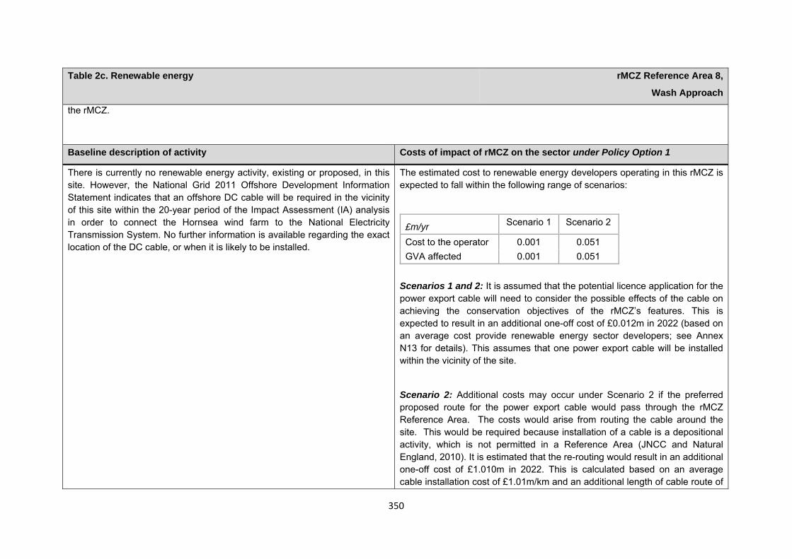
350
Table 2c. Renewable energy rMCZ Reference Area 8,
Wash Approach
the rMCZ.
Baseline description of activity Costs of impact of rMCZ on the sector under Policy Option 1
There is currently no renewable energy activity, existing or proposed, in this site. However, the National Grid 2011 Offshore Development Information Statement indicates that an offshore DC cable will be required in the vicinity of this site within the 20-year period of the Impact Assessment (IA) analysis in order to connect the Hornsea wind farm to the National Electricity Transmission System. No further information is available regarding the exact location of the DC cable, or when it is likely to be installed.
The estimated cost to renewable energy developers operating in this rMCZ is expected to fall within the following range of scenarios:
£m/yr Scenario 1 Scenario 2
Cost to the operator 0.001 0.051 GVA affected 0.001 0.051
Scenarios 1 and 2: It is assumed that the potential licence application for the power export cable will need to consider the possible effects of the cable on achieving the conservation objectives of the rMCZ’s features. This is expected to result in an additional one-off cost of £0.012m in 2022 (based on an average cost provide renewable energy sector developers; see Annex N13 for details). This assumes that one power export cable will be installed within the vicinity of the site.
Scenario 2: Additional costs may occur under Scenario 2 if the preferred proposed route for the power export cable would pass through the rMCZ Reference Area. The costs would arise from routing the cable around the site. This would be required because installation of a cable is a depositional activity, which is not permitted in a Reference Area (JNCC and Natural England, 2010). It is estimated that the re-routing would result in an additional one-off cost of £1.010m in 2022. This is calculated based on an average cable installation cost of £1.01m/km and an additional length of cable route of
351
Table 2c. Renewable energy rMCZ Reference Area 8,
Wash Approach
1km. Further details are provided in Annex H14. This cost is included in scenario 2 to reflect uncertainty over whether the cable route would pass through the rMCZ Reference Area.
Human activities in the site that are not negatively affected by the rMCZ (over 2013 to 2032 inclusive)
Table 2d. Other impacts that are assessed for the suite of MCZs and not for this site alone rMCZ Reference Area 8, Wash Approach
Cables (interconnectors and telecom cables)
Future interconnectors and telecom cables may pass through the rMCZ. Impacts of rMCZs on future interconnectors and telecom cables are assessed in the Evidence Base, Annex H3 and Annex N3 (they are not assessed for this site alone).
Oil and gas related activities (including carbon capture and storage) It is unlikely that any oil and gas (including carbon capture and storage) infrastructure will be proposed in future in this rMCZ Reference Area due to the location and size of the rMCZ reference area (DECC, pers. comm., 2012).
Table 3. Human activities in the site that are not negatively affected by the rMCZ under Policy Option 1
(existing activities at their current levels and future proposals known to the regional MCZ projects)
rMCZ Reference Area 8, Wash Approach
Recreation (recreational boating) and shipping (transit of vessels only).
352
Contribution to Ecological Network Guidance
This rRA sits within an rMCZ. For information on how this reference area contributes towards the guidelines in the Ecological Network Guidance please see the information provided underneath NG 04 Wash Approach. This is also taken from Annex 5 in JNCC and Natural England’s Advice on rMCZs.
Anticipated benefits to ecosystem services The habitats, species and other ecological features of the rMCZ contribute to the delivery of a range of ecosystem services. Designation of the rMCZ and its subsequent management may improve the quantity and quality of the beneficial services provided, which may increase the value (contribution to economic welfare or human well-being) of them. Impacts on the value derived from ecosystem services may occur as a result of the designation, management and/or achievement of the conservation objectives of the rMCZ. Further discussion on the potential benefits to ecosystem services can be found in Annex L and on definitions can be found in Annex H5.
Table 4a. Fish and shellfish for human consumption rMCZ Reference Area 8,
Wash Approach
Baseline Beneficial impact under Policy Option 1
Fletcher and others (2011) identify that the features to be protected by the recommended Marine Conservation Zone (rMCZ) contribute to the delivery of fish and shellfish services.
Data show that the area may be an important nursery and spawning ground for a variety of species such as herring, Dover sole, lemon sole, whiting and sand eel (Net Gain Final Recommendations, 2011). It has not been possible to estimate the value derived from off-site fisheries as a result of the nursery area function.
The baseline quantity and quality of service provided is assumed to be commensurate with that provided by the features of the site when in
If the conservation objectives of the features are achieved, the features will be recovered to reference condition. Achievement of the conservation objectives may improve the contribution of the habitats to the provision of fish and shellfish for human consumption.
Management of fishing activity within the rMCZ may reduce the on-site fishing mortality of species, which may benefit commercial stocks. Therefore, the recovery of the site to reference condition may improve its functioning as a nursery area, potentially benefiting fisheries exploited outside the Reference Area.
Anticipated direction of
change:
Confidence: Low
353
Table 4a. Fish and shellfish for human consumption rMCZ Reference Area 8,
Wash Approach
favourable condition.
A description of on-site fishing activity and the value derived from it is set out in Table 2.
Additional management (above that in the baseline situation) of fishing activities is expected, which will prohibit fishing within the rMCZ, the costs of which are set out in Table 2.
As the rMCZ is small, it is unclear whether it would have any impact on stocks of mobile commercial finfish species. Stocks of low-mobility and site-attached species may improve as a result of reduced fishing pressure. Localised beneficial spill-over effects may occur around the rMCZ.
As no fishing will be permitted within the rMCZ, no on-site benefits will be realised.
Benefits defined here are not net of potential costs of the rMCZ and off-site impacts of displaced effort.
Table 4b. Recreation rMCZ Reference Area 8,
Wash Approach
Baseline Beneficial impact under Policy Option 1
Angling: Fletcher and others (2011) identify that the features to be protected by the recommended Marine Conservation Zone (rMCZ) can contribute to the delivery of fish and shellfish for human consumption and recreation services.
If the conservation objectives of the features are achieved, the features will be recovered to reference condition.
Recovery of habitats may have benefits to fish and shellfish
Anticipated direction of
change:
354
Table 4b. Recreation rMCZ Reference Area 8,
Wash Approach
Data show that the area may be an important nursery and spawning ground for a variety of species such as herring, Dover sole, lemon sole, whiting and sand eel (Net Gain Final Recommendations, 2011).
The baseline quantity and quality of the ecosystem service provided is assumed to be commensurate with that provided by features of the site when in favourable condition (see Table 1). It has not been possible to estimate the value derived from off-site fisheries as a result of the nursery area function.
A description of on-site fishing activity and the value derived from it is set out in Table 2. It has not been possible to estimate the value derived from angling in the site.
populations. It is unclear whether any benefits to fish populations would arise as a result of reduced fishing mortality due to management of commercial fishing (see Table 4a).
The recovery of the site to reference condition may improve its functioning as a nursery area, potentially benefiting fisheries exploited outside the rMCZ.
As angling will not be permitted within the rMCZ, any benefits will be limited to those occurring as a result of spill-over effects of finfish species targeted by anglers. Such benefits may be insignificant.
Confidence: Low
Diving: There is no known diving and snorkelling activity carried out within the rMCZ.
N/A N/A
Wildlife watching: As the rMCZ is offshore, there is no known wildlife watching activity carried out within the site. Survey data show that this site lies within the foraging range of Atlantic puffin, common guillemot, northern fulmar, northern gannet and Sandwich tern (RSPB, 2010). The wider area is a popular feeding site for seals all year round; it is close to a colony of common seal at the entrance of the Inner Wash and sightings are common (Natural England, 2010; Centrica, 2007; Scira Offshore Energy, 2006). Harbour porpoise are also regularly observed (Natural England, 2010). It has not been possible to estimate the value derived from wildlife watching in the site.
N/A N/A
355
Table 4b. Recreation rMCZ Reference Area 8,
Wash Approach
Table 4c. Research and education rMCZ Reference Area 8,
Wash Approach
Baseline Beneficial impact under Policy Option 1
Research: Fletcher and others (2011) identify that the features to be protected by the recommended Marine Conservation Zone (rMCZ) can contribute to the delivery of research services.
Recommended MCZ Reference Area 8 lies entirely within rMCZ NG 4 and, as such, it is assumed that there will be ongoing monitoring of the site.
It has not been possible to estimate the value derived from research activities associated with the rMCZ.
As a Reference Area, the rMCZ will provide an opportunity to demonstrate the state of designated marine features in the absence of many anthropogenic pressures (Natural England and Joint Nature Conservation Committee, 2010). It will provide a control area against which the impacts of pressures caused by human activities can be compared as part of long-term monitoring and assessment. Other research benefits are unknown.
Anticipated direction of
change:
Confidence: High
Education: There is no known educational activity occurring in the site. As the rMCZ is more than 6nm offshore and therefore relatively inaccessible, no benefits are likely to arise from direct use of the site for education.
Non-visitors may benefit if the rMCZ contributes to wider provision of education (e.g. television programmes, articles in magazines and newspapers, and educational resources developed for use in schools).
Anticipated direction of
change:
Confidence: Low
356
Table 4d. Regulating services rMCZ Reference Area 8,
Wash Approach
Baseline Beneficial impact under Policy Option 1
Regulation of pollution: The features of the site contribute to the bioremediation of waste and sequestration of carbon. It has not been possible to estimate the value derived from the regulation of pollution in the rMCZ. Environmental resilience: The features of the site contribute to the resilience and continued regeneration of marine ecosystems. It has not been possible to estimate the value derived from environmental resilience in the rMCZ. Natural hazard protection: As the site is offshore, its features do not contribute to local flood and storm protection. (Fletcher and others, 2011)
If the conservation objectives of the features are achieved, the features will be recovered to reference condition, which may improve the regulating capacity of the site habitats.
Anticipated direction of
change:
Confidence: Low
Table 4e. Non-use and option values rMCZ Reference Area 8,
Wash Approach
Baseline Beneficial impact under Policy Option 1
Some people gain satisfaction from the existence of marine habitats, species and other features. They also gain from having the option to benefit in the future from the habitats and species in the recommended Marine Conservation Zone (rMCZ) and the ecosystem services provided, even if they do not currently benefit from them.
The rMCZ will benefit the proportion of the UK population that values conservation of the rMCZ features and its contribution to an ecologically coherent network of Marine Protected Areas. Some people will gain satisfaction from knowing that the habitats and species are being conserved (existence value) and/or that they are being conserved for use by others in the current generation (altruistic value) or future generations (bequest value). The rMCZ will recover and then protect the
Anticipated direction of
change:
Confidence:
357
Table 4e. Non-use and option values rMCZ Reference Area 8,
Wash Approach
features in reference condition and the ecosystem services provided, and thereby the option to benefit from these services in the future, from the risk of future degradation.
Moderate

358
rMCZ Reference Area 9, Flamborough Head No Take Zone Site area (km2): 0.94
• This site has been proposed for designation under Policy Option 1 only.
Table 1. Conservation impacts rMCZ Reference Area 9, Flamborough Head No Take Zone
1a. Ecological description
The site is recommended for the protection of littoral chalk communities that provide substrate for unique communities of seaweeds and invertebrate species. Chalk communities are protected under the UK Biodiversity Action Plan (BAP) Priority Habitat and the OSPAR List of Threatened and/or Declining Species and Habitats (Region II – Greater North Sea). The erosion of chalk exposures on the coast has resulted in the formation of vertical cliffs and gently sloping intertidal platforms with a range of microhabitats of biological importance. Such coastal exposures of chalk are rare in Europe: over half of these seascapes are recorded from the southern and eastern coasts of England. Throughout the site there is a high diversity of algae including kelp, which provides important nursery areas for fish such as wrasse and shelter for bryozoans, anemones and sea squirts. Communities of yellowish-brown flagellates are also present.
A Seasearch survey found that crustaceans dominate the site, with 13 species recorded, including the spiny squat lobster, velvet swimming crab, common shore crab, harbour crab and edible crab. The site has a high diversity of other species that includes blue mussel, barnacles, limpets, whelks, winkles, fish, bryozoans and sea squirts. Closer to the low-water mark, specialised rock-boring animals such as the common piddock and the chalk-boring yellow sponge are found. They are only able to survive in these soft rock biotopes. Old burrows providing refuge for other species.
Recommended Marine Conservation Zone (rMCZ) Reference Area 9 lies within the Flamborough Head Special Area of Conservation and Site of Special Scientific Interest, and the Flamborough Head and Bempton Cliffs Special Protection Area. During the summer, the chalk cliffs support England's only, and the UK's largest, mainland gannet colony. Species present also include the internationally important kittiwake (12% of the UK population), along with nationally important populations of razorbill, guillemot and puffin. During winter, the cliffs are utilised by shag and throughout the year by herring gull.
Flamborough Head is known for harbour porpoise (listed in Annex 2 of the EC Habitats Directive) sightings. Although porpoises generally occupy deeper waters, due to the highly migratory nature of this species, it can be assumed that they may utilise the inshore waters in rMCZ Reference Area 9. As a part of the frontal system, which mixes warmer water from the southern North Sea and colder water from the northern North Sea, an upwelling of nutrients around the headland occurs, resulting in a food chain of plankton, fish, sea birds and cetaceans. This process relates to the wider Flamborough Headland, including the area of rMCZ Reference Area 9. Other sightings from Flamborough Head have included common dolphin. Recommended MCZ Reference Area 9 is also
359
in close proximity to rMCZ NG 8 and rMCZ NG 9.
The existing North Eastern Inshore Fisheries and Conservation Authority No Take Zone (NTZ), which overlaps with the majority of rMCZ Reference Area 9, prohibits the removal of seafish, including shellfish but excluding the removal of fauna and flora from the intertidal area, by any method. The NTZ aims to examine any changes to populations of marine species and to help the area return to a more ‘natural’ state. Due to this, the area is currently monitored and good baseline data are available.
(Net Gain, Final Site Recommendations Submission, 2011)
1b. Baseline condition of MCZ features and impact of the rMCZ
Feature Area of feature (km2)
No. of point records
Baseline Impact of the MCZ
Broad-scale habitats
High energy infralittoral rock 0.15 − Not in reference condition Recover to reference condition
Intertidal coarse sediments 0.00046 − Not in reference condition Recover to reference condition
Intertidal sand and muddy sand 0.000012 − Not in reference condition Recover to reference condition
Moderate energy infralittoral rock 0.79 − Not in reference condition Recover to reference condition
Moderate energy intertidal rock 0.000047 − Not in reference condition Recover to reference condition
Habitats of conservation importance
Littoral chalk communities 0.53 (modelled) − Not in reference condition Recover to reference condition
Subtidal sands and gravels 0.40 − Not in reference condition Recover to reference condition
360
Site-specific costs arising from the effect of the rMCZ on human activities (over 2013 to 2032 inclusive) Table 2a. Archaeological heritage rMCZ Reference Area 9,
Flamborough Head No Take Zone
Source of costs of the rMCZ
Management scenario 1: Increase in costs of assessing environmental impacts for future licence applications. Archaeological excavations, surface recovery and intrusive surveys will be prohibited from the entire site. Diver trails, visitors and non-intrusive surveys will be allowed.
Baseline description of activity Costs of impact of rMCZ on the sector under Policy Option 1
There are records of numerous middle palaeolithic and late neolithic to early bronze-age flint cores in the vicinity of the site. Discoid flint knifes and sickles have been uncovered in Sewerby. Surface finds of Romano-British pottery and quern have also been recorded. Historic aerial photography has identified a potential 20th-century gun emplacement and surrounding obstructions as earthworks in the site (English Heritage, pers. comm., 2012).
English Heritage has indicated that this site is likely to be of interest for archaeological excavation in the future as it is relevant to its National
An extra cost would be incurred in the assessment of environmental impacts made in support of any future licence applications for archaeological activities in the site. The likelihood of a future licence application being submitted is not known, so no overall cost to the sector of this rMCZ has been estimated. However, the additional cost in one licence application could be in the region of £500 to £10,000 depending on the size of the MCZ (English Heritage, pers. comm., 2011). If archaeologists respond to the prohibition of excavation by undertaking an alternative archaeological excavation in another locality, this could result in additional costs to the archaeologists. As it is not possible to predict when or how often this could occur, this is not costed in the Impact Assessment. The prohibition of excavation and therefore interpretation of

361
Table 2a. Archaeological heritage rMCZ Reference Area 9, Flamborough Head No Take Zone
Heritage Protection Plan (theme 3A1.2). archaeological evidence from the site will decrease acquisition of historical knowledge of past human communities from the site, resulting in a cost to society.
Table 2b. Commercial fisheries rMCZ Reference Area 9,
Flamborough Head No Take Zone
Source of costs of the rMCZ
Management scenario 1: Closed to all commercial fishing activity.
Summary of all UK commercial fisheries: An existing byelaw for the entire site prohibits all extraction of sea fish from the site by use of any instrument, excluding hand collection. This byelaw (for the Flamborough Head No Take Zone) came into force in July 2010. In the absence of the rMCZ, it is expected
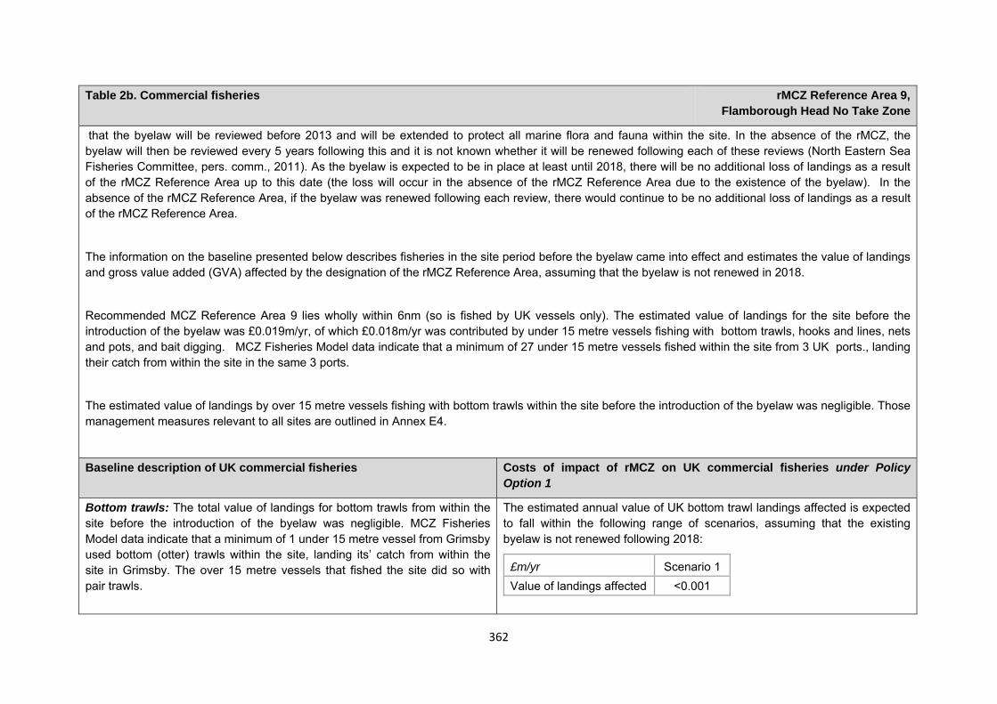
362
Table 2b. Commercial fisheries rMCZ Reference Area 9, Flamborough Head No Take Zone
that the byelaw will be reviewed before 2013 and will be extended to protect all marine flora and fauna within the site. In the absence of the rMCZ, the byelaw will then be reviewed every 5 years following this and it is not known whether it will be renewed following each of these reviews (North Eastern Sea Fisheries Committee, pers. comm., 2011). As the byelaw is expected to be in place at least until 2018, there will be no additional loss of landings as a result of the rMCZ Reference Area up to this date (the loss will occur in the absence of the rMCZ Reference Area due to the existence of the byelaw). In the absence of the rMCZ Reference Area, if the byelaw was renewed following each review, there would continue to be no additional loss of landings as a result of the rMCZ Reference Area.
The information on the baseline presented below describes fisheries in the site period before the byelaw came into effect and estimates the value of landings and gross value added (GVA) affected by the designation of the rMCZ Reference Area, assuming that the byelaw is not renewed in 2018.
Recommended MCZ Reference Area 9 lies wholly within 6nm (so is fished by UK vessels only). The estimated value of landings for the site before the introduction of the byelaw was £0.019m/yr, of which £0.018m/yr was contributed by under 15 metre vessels fishing with bottom trawls, hooks and lines, nets and pots, and bait digging. MCZ Fisheries Model data indicate that a minimum of 27 under 15 metre vessels fished within the site from 3 UK ports., landing their catch from within the site in the same 3 ports.
The estimated value of landings by over 15 metre vessels fishing with bottom trawls within the site before the introduction of the byelaw was negligible. Those management measures relevant to all sites are outlined in Annex E4.
Baseline description of UK commercial fisheries Costs of impact of rMCZ on UK commercial fisheries under Policy Option 1
Bottom trawls: The total value of landings for bottom trawls from within the site before the introduction of the byelaw was negligible. MCZ Fisheries Model data indicate that a minimum of 1 under 15 metre vessel from Grimsby used bottom (otter) trawls within the site, landing its’ catch from within the site in Grimsby. The over 15 metre vessels that fished the site did so with pair trawls.
The estimated annual value of UK bottom trawl landings affected is expected to fall within the following range of scenarios, assuming that the existing byelaw is not renewed following 2018:
£m/yr Scenario 1 Value of landings affected <0.001
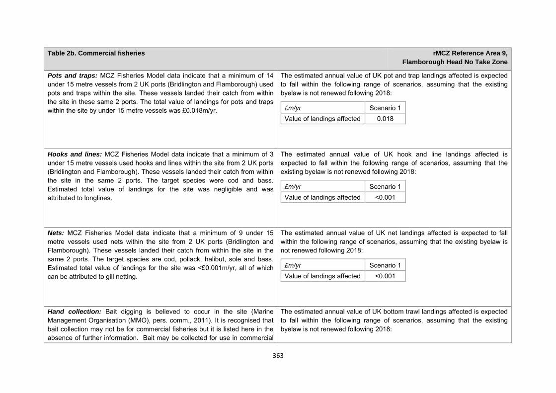
363
Table 2b. Commercial fisheries rMCZ Reference Area 9, Flamborough Head No Take Zone
Pots and traps: MCZ Fisheries Model data indicate that a minimum of 14 under 15 metre vessels from 2 UK ports (Bridlington and Flamborough) used pots and traps within the site. These vessels landed their catch from within the site in these same 2 ports. The total value of landings for pots and traps within the site by under 15 metre vessels was £0.018m/yr.
The estimated annual value of UK pot and trap landings affected is expected to fall within the following range of scenarios, assuming that the existing byelaw is not renewed following 2018:
£m/yr Scenario 1 Value of landings affected 0.018
Hooks and lines: MCZ Fisheries Model data indicate that a minimum of 3 under 15 metre vessels used hooks and lines within the site from 2 UK ports (Bridlington and Flamborough). These vessels landed their catch from within the site in the same 2 ports. The target species were cod and bass. Estimated total value of landings for the site was negligible and was attributed to longlines.
The estimated annual value of UK hook and line landings affected is expected to fall within the following range of scenarios, assuming that the existing byelaw is not renewed following 2018:
£m/yr Scenario 1 Value of landings affected <0.001
Nets: MCZ Fisheries Model data indicate that a minimum of 9 under 15 metre vessels used nets within the site from 2 UK ports (Bridlington and Flamborough). These vessels landed their catch from within the site in the same 2 ports. The target species are cod, pollack, halibut, sole and bass. Estimated total value of landings for the site was <£0.001m/yr, all of which can be attributed to gill netting.
The estimated annual value of UK net landings affected is expected to fall within the following range of scenarios, assuming that the existing byelaw is not renewed following 2018:
£m/yr Scenario 1 Value of landings affected <0.001
Hand collection: Bait digging is believed to occur in the site (Marine Management Organisation (MMO), pers. comm., 2011). It is recognised that bait collection may not be for commercial fisheries but it is listed here in the absence of further information. Bait may be collected for use in commercial
The estimated annual value of UK bottom trawl landings affected is expected to fall within the following range of scenarios, assuming that the existing byelaw is not renewed following 2018:
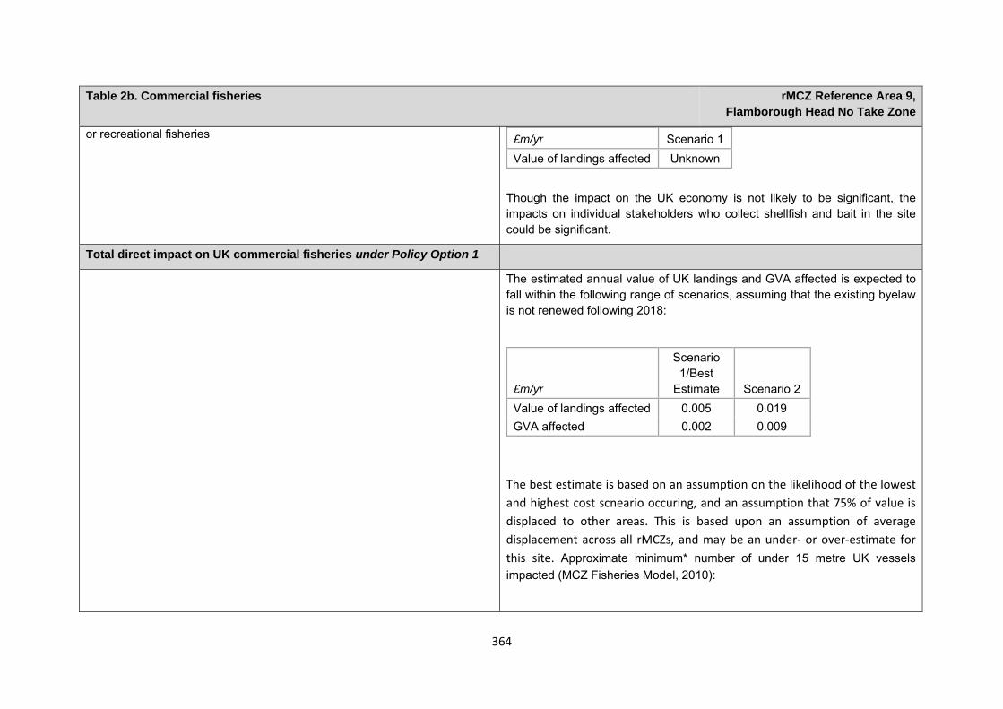
364
Table 2b. Commercial fisheries rMCZ Reference Area 9, Flamborough Head No Take Zone
or recreational fisheries
Though the impact on the UK economy is not likely to be significant, the impacts on individual stakeholders who collect shellfish and bait in the site could be significant.
£m/yr Scenario 1 Value of landings affected Unknown
Total direct impact on UK commercial fisheries under Policy Option 1
The estimated annual value of UK landings and GVA affected is expected to fall within the following range of scenarios, assuming that the existing byelaw is not renewed following 2018:
The best estimate is based on an assumption on the likelihood of the lowest and highest cost scneario occuring, and an assumption that 75% of value is displaced to other areas. This is based upon an assumption of average displacement across all rMCZs, and may be an under‐ or over‐estimate for this site. Approximate minimum* number of under 15 metre UK vessels impacted (MCZ Fisheries Model, 2010):
£m/yr
Scenario 1/Best
Estimate Scenario 2 Value of landings affected 0.005 0.019 GVA affected 0.002 0.009
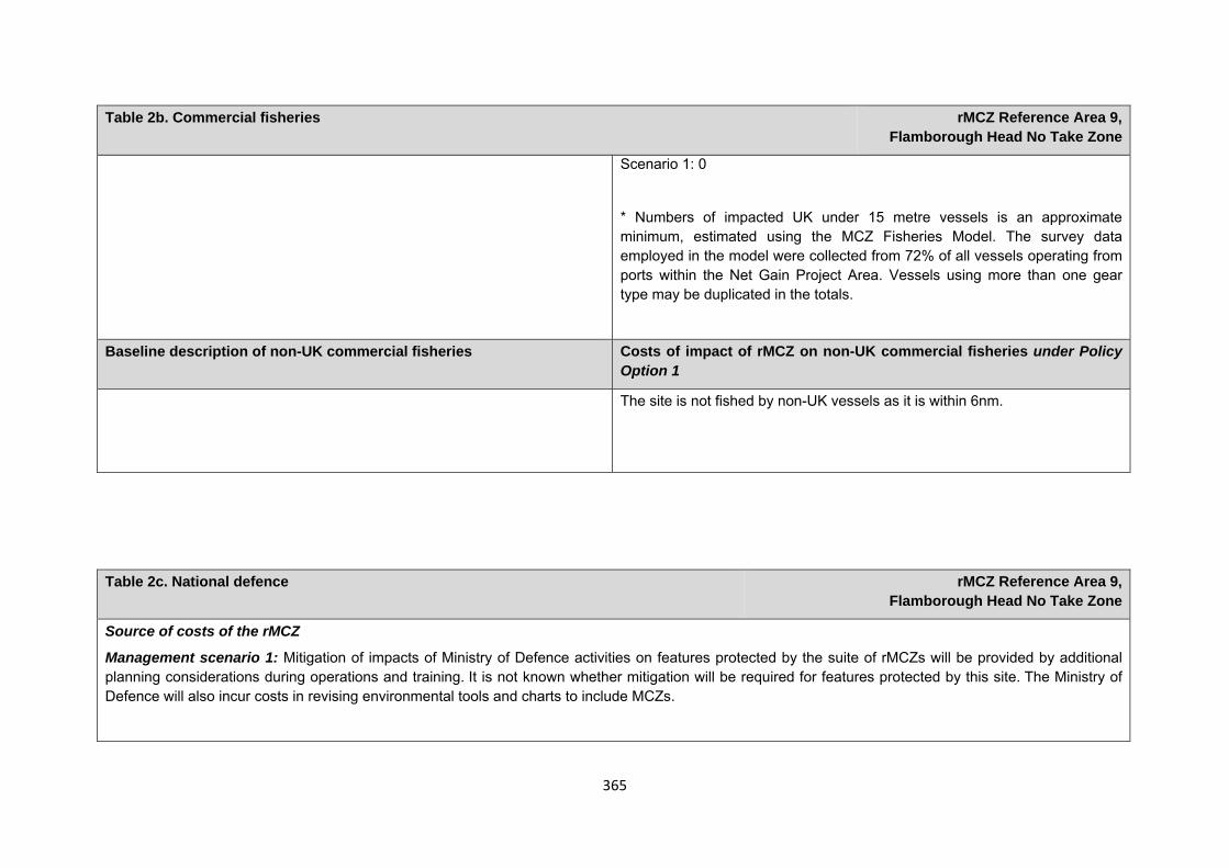
365
Table 2b. Commercial fisheries rMCZ Reference Area 9, Flamborough Head No Take Zone
Scenario 1: 0
* Numbers of impacted UK under 15 metre vessels is an approximate minimum, estimated using the MCZ Fisheries Model. The survey data employed in the model were collected from 72% of all vessels operating from ports within the Net Gain Project Area. Vessels using more than one gear type may be duplicated in the totals.
Baseline description of non-UK commercial fisheries Costs of impact of rMCZ on non-UK commercial fisheries under Policy Option 1
The site is not fished by non-UK vessels as it is within 6nm.
Table 2c. National defence rMCZ Reference Area 9,
Flamborough Head No Take Zone
Source of costs of the rMCZ
Management scenario 1: Mitigation of impacts of Ministry of Defence activities on features protected by the suite of rMCZs will be provided by additional planning considerations during operations and training. It is not known whether mitigation will be required for features protected by this site. The Ministry of Defence will also incur costs in revising environmental tools and charts to include MCZs.
366
Table 2c. National defence rMCZ Reference Area 9, Flamborough Head No Take Zone
Baseline description of activity Costs of impact of rMCZ on the sector under Policy Option 1
The Ministry of Defence is known to make use of the site for military practice, for Royal Air Force operations.
It is not known whether this rMCZ will impact on the Ministry of Defence’s use of the site. Impacts of rMCZs on the Ministry of Defence’s activities are assessed in the Evidence Base and Annex N9.
Table 2d. Ports, harbours, shipping and disposal sites rMCZ Reference Area 9, Flamborough Head No Take Zone
Source of costs of the rMCZ
Management scenario 1: Increase in costs of assessing environmental impacts for future licence applications. This applies for future licence applications to disposal of dredged material within 1km of the rMCZ. The regional MCZ projects are not aware of activities related to ports, harbours and shipping for which additional mitigation of impacts on features protected by the MCZ that will be needed relative to the mitigation provided in the baseline.
Management scenario 2: Increase in costs of assessing environmental impacts for future licence applications within 5km of an rMCZ. This applies to future navigational dredging, disposal of dredge material and port developments. Additional costs incurred in including MCZ features in a new potential Maintenance Dredging Protocol (MDP). It is not anticipated that any additional mitigation of impacts on features protected by the MCZ will be needed for port developments or port-related activities due to this rMCZ relative to the baseline.
Baseline description of activity Costs of impact of rMCZ on the sector under Policy Option 1
Disposal sites: There is 1 disposal site within 1km of the rMCZ that is licenced for disposal of channel dredge material. This is linked to the port of Bridlington. The average number of licence applications received for this disposal site in total is 0.6 per year (based on number received between 2001 and 2010 (Centre for Environment, Fisheries and Aquaculture Science (Cefas), 2011).
£m/yr Scenario 1 Scenario 2 Cost to the operator 0.004 0.004
Scenario 1: Future licence applications for disposal of material within 1km of this site will need to consider the potential effects of the activity on the features protected by the rMCZ. Additional costs will be incurred as a result
367
Table 2d. Ports, harbours, shipping and disposal sites rMCZ Reference Area 9, Flamborough Head No Take Zone
There are no further disposal sites within 5km of the rMCZ (based on number received between 2001 and 2010 (Cefas, 2011)).
Bridlington Harbour Commissioners (BHCs) are permitted under licences from the Marine Management Organisation (MMO) to deposit up to 20,000 tonnes of sediment per annum from Bridlington harbour within 1km of rMCZ Reference Area 9. In winter, disposal is usually daily, weather permitting, although recently the frequency of dredging operations has reduced due to lack of resources and inadequate dredging equipment. The maintenance dredging activity has been carried out for over 20 years. Disposal is only carried out at the site when the tide is moving sediment away from the rMCZ Reference Area (Cefas and BHC, pers. comm., 2011). Recent monitoring of the disposal site by Cefas in 2009 to assess impacts on another protected area (the Flamborough Head Special Area of Conservation) indicated that there is little evidence that the disposal operation is adversely affecting the rMCZ Reference Area (Cefas and BHC, pers. comm., 2011).
Port development: Within 5km of the rMCZ there are 2 ports and harbours that may undergo development at some point in the future: Bridlington and Flamborough Landing (Ports and Harbours UK website www.ports.org.uk accessed 2012). This may not represent a full list of all ports and harbours impacted by the site.
Navigational dredging: None within 5km of this rMCZ.
(a breakdown of these by activity is provided in Annex N).
Scenario 2: Future licence applications for disposal of material and known port or harbour development plans or proposals within 5km of this site will need to consider the potential effects of the activity on the features protected by the rMCZ. Additional costs will be incurred as a result (a breakdown of these by activity is provided in Annex N).
For the purposes of the impact assessment, it is assumed that disposal of dredged material at the disposal site (which is within 1km of the rMCZ Reference Area) will not impact on its features, This is based on the findings of recent monitoring because disposal is only carried out when the tide is moving sediment away from rMCZ reference area 9 (Bridlington Harbour Commission, 2011, pers. comm.). Should future monitoring indicate any adverse effects on the rMCZ, it may be necessary to introduce a restriction such that only the eastern half of the disposal site can be used. As it is not yet known when or if this mitigation will be needed, no cost has been estimated.
An additional costs will arise to include MCZ features in a new potential MDP to consider the potential effects of activities on the features protected by the rMCZ. The anticipated additional cost in the MDPs is estimated to be a one-off cost of £8438.
368
Table 2e. Recreation rMCZ Reference Area 9, Flamborough Head No Take Zone
Source of costs of the rMCZ
Management scenario 1: Personal water craft users are encouraged to not use crafts in the site, no removal of material from the site by people who are rock-pooling. People walking in the site are encouraged to use marked routes to avoid impacts on the site’s features. Closure of entire rMCZ Reference Area to angling.
Baseline description of activity Costs of impact of rMCZ on the sector under Policy Option 1
Recreational angling: The existing byelaw covering the site prevents the removal of any type of sea fish (except salmon and sea trout), by any instrument, including the use of rods and lines. Details of this byelaw are outlined in table 2b. It is assumed that recreational angling does not occur within the site. Costs have been included due to the uncertainty of whether the existing byelaw will be extended beyond 2018,
Stakmap indicates that shore, wreck, charter and private boat fishing occurs within the site. More than 200 anglers are thought to fish within the site, at varying degrees of regularity, throughout the year. Target species include bass, cod, dab, flounder, ling, mackerel, plaice, pollack, skates, soles, and whiting. This activity has occurred within the site for at least 50 years.
No anglers provided comment on how the restriction on recreational angling could be expected to impact on them or the local area. However, the same fishing conditions extend beyond the rMCZ reference area with car parking nearby. As such, it is assumed that those who currently fish in the site would continue to fish in close proximity to the site. Therefore impacts are assumed to be negligible. Though the impact on the UK economy is not likely to be significant, the impacts on individual stakeholders who fish or collect shellfish and bait in the site could be significant.
Management costs for implementing management scenario 1 are assessed in the Evidence Base, Annex H9 and Annex N6.
Recreational boating (use of personal water craft): A large number of personal water crafts are used close to the rMCZ Reference Area and could potentially enter into the site. Although vessels tend to concentrate in other areas of the headland, where sea caves are present (interview with MMO, 2011). The nature of the impact that personal water craft are having on the
Personal water craft users would be encouraged not to use crafts within the site. Given that crafts could still be used in various locations just outside of the site, the impacts of the restrictions are assumed to be negligible. Though the impact on the UK economy is not likely to be significant, the impacts on individual stakeholders who use personal watercraft in the site could be

369
Table 2e. Recreation rMCZ Reference Area 9, Flamborough Head No Take Zone
features of the site is unknown. significant.
Management costs for implementing management scenario 1 are assessed in the Evidence Base, Annex H9 and Annex N6.
Rock-pooling: The rMCZ Reference Area is a popular rock-pooling spot, as the rock-pools are shallow and relatively safe for young children (interview with MMO, 2011).
It is anticipated that the existing byelaw already in place for the No Take Zone will be extended in 2012 to prevent the removal of all fauna and flora. This byelaw will last for at least 5 years and it is not known whether it will be renewed following this period in the absence of the rMCZ Reference Area.
If the existing byelaw is extended in 2012 to prevent removal of all flora and fauna, no additional impacts will arise from the management for the rMCZ Reference Area for as long as the byelaw would have been in place in the absence of the rMCZ. If the byelaw is not extended in 2012, impacts may arise from the management for the rMCZ. Impacts will include the costs of notifying visitors that no material can be removed from the site. Management costs for implementing management scenario 1 are assessed in the Evidence Base, Annex H9 and Annex N6. If visitors respond by rock-pooling in other areas in the vicinity, where rock pools are deeper, this could increase the risks to the safety of young rock-poolers (interview with MMO, 2011). Though the impact on the UK economy is not likely to be significant, the impacts on individual stakeholders who do rock-pooling in the site could be significant.
Walking (including dog walking): This is an easily accessed and popular site for walking (interview with MMO, 2011). The site is a popular spot for dog walking. It is estimated that there are 3 or 4 dog walkers at any time in the site at low tide (interview with Marine Management Organisation (MMO), 2011). This activity could impact on the features of the site at each low tide.
Visitors would be encouraged to use marked routes through or around protected habits in order to avoid adverse effects on these habitats. Given that walkers would still be allowed in the site, it is assumed that any impacts of this would be negligible. Though the impact on the UK economy is not likely to be significant, the impacts on individual stakeholders walking within the site could be significant.
Management costs for implementing management scenario 1 are assessed

370
Table 2e. Recreation rMCZ Reference Area 9, Flamborough Head No Take Zone
in the Evidence Base, Annex H9 and Annex N6.
Table 2f. Research and Education rMCZ Reference Area 9,
Flamborough Head No Take zone
Source of costs of the rMCZ
Management scenario 1: Code of conduct for research and education activities
Baseline description of activity Costs of impact of rMCZ on the sector under Policy Option 1
Research and education: East Riding of Yorkshire Council runs Sea Shore Safari education trips for groups of 20 to 30 children within the rMCZ Reference Area. It is estimated that there may be 60 children on the beach at any one time during these trips. Local schools are also known to undertake field trips (often without informing the site managers). In 2013, Yorkshire Wildlife Trust will be opening a new visitor centre close to the rMCZ Reference Area and it is expected that it will use the intertidal area for education/research. It is probable that material is removed from the site for educational and research purposes (interview with MMO, 2011).
It is anticipated that the existing byelaw already in place for the No Take Zone will be extended in 2012 to prevent the removal of all fauna and flora. This byelaw will last for at least 5 years and it is not known whether it will be renewed following this period in the absence of the rMCZ Reference Area.
If the existing byelaw is extended in 2012 to prevent removal of all flora and fauna, no additional impacts will arise from the management for the rMCZ Reference Area for as long as the byelaw would have been in place in the absence of the rMCZ. If the byelaw is not extended in 2012, impacts may arise from the management for the rMCZ. East Riding of Yorkshire Council may respond to the prohibition on removal of flora and fauna for the rMCZ by undertaking educational visits at another location, which may result in an additional cost to the Council. Because of the high uncertainty about whether this impact will be attributed to the rMCZ (as opposed to management that would occur in the absence of the rMCZ) the costs have not been estimated.
371
Human activities in the site that are not negatively affected by the rMCZ (over 2013 to 2032 inclusive)
*The IA assumes that no additional mitigation of impacts of water abstraction, discharge or diffuse pollution will be required over and above that which will be provided to achieve the objectives of the Water Framework Directive through the River Basin Management Plan process (based on advice provided by Natural England, pers. comm., 2010). This includes the existing sewage discharge pipeline within the site, which passed its EIA consents in 2008/9.The effluence from the pipeline creates artificial blue mussel beds which are not a feature proposed for designation. Further survey work may be required to assess the impacts of the pipeline on the condition of features and costs for rerouting the pipeline may be incurred if discharges are found to be negatively impacting the features of the site. Due to uncertainty over the nature of impacts and whether mitigation will be required, it has not been costed in the impact assessment. Contribution to Ecological Network Guidance Table 4. An overview of features proposed for designation and how these contribute to the ENG guidelines for the regional MCZ project area and at a wider scale22
= ENG guideline is achieved and X = ENG guideline is not achieved. Green cells represent key considerations and any greyed-out rows indicate where SNCBs do not agree with a feature being proposed for designation. Recommended conservation objectives in italics indicate where SNCBs do not agree with the conservation objective recommended by the regional MCZ project (see Section 4.2). Where an asterisk (*) has been given in the table, more detail is provided in the narrative.
rMCZ Reference Area 9, Flamborough Head No Take Zone
ENG Feature Represent-ativity Replication Adequac
y Viability Gaps or shortfalls in relation
Recommended conservation
Quantitative considerations at regional
Ecological Importance at regional
Ecological Importance at wider scale
22 copied from the JNCC and Natural England’s advice to Defra on rMCZs
Table 3. Human activities in the site that are not negatively affected by the rMCZ under Policy Option 1
(existing activities at their current levels and future proposals known to the regional MCZ projects)
rMCZ Reference Area 9, Flamborough Head No Take Zone
Flood and coastal erosion activities, other recreation (snorkelling and SCUBA diving (existing code of conduct and signage in place), wildlife watching and swimming (based on current levels of activities)), shipping (transit of vessels only) and water abstraction, diffuse and pollution*.
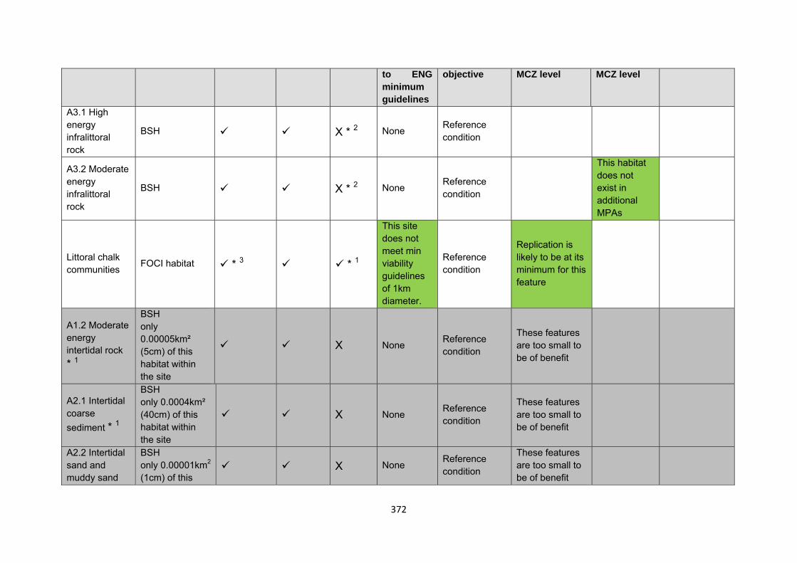
372
to ENG minimum guidelines
objective MCZ level MCZ level
A3.1 High energy infralittoral rock
BSH X * 2 None Reference condition
A3.2 Moderate energy infralittoral rock
BSH X * 2 None Reference condition
This habitat does not exist in additional MPAs
Littoral chalk communities FOCI habitat * 3 * 1
This site does not meet min viability guidelines of 1km diameter.
Reference condition
Replication is likely to be at its minimum for this feature
A1.2 Moderate energy intertidal rock * 1
BSH only 0.00005km² (5cm) of this habitat within the site
X None Reference condition
These features are too small to be of benefit
A2.1 Intertidal coarse sediment * 1
BSH only 0.0004km² (40cm) of this habitat within the site
X None Reference condition
These features are too small to be of benefit
A2.2 Intertidal sand and muddy sand
BSH only 0.00001km2
(1cm) of this X None Reference
condition
These features are too small to be of benefit
373
* 1 habitat within the site
Subtidal sands and gravels*1 FOCI habitat X X * 2 None Reference
condition
Site considerations Connectivity Geological/Geomorphological features of interest None Appropriate boundary Areas of Additional Ecological Importance N/A Overlaps with existing MPAs Additional comments and site benefits:
• 1 Although this example falls short of the minimum viable patch size for the FOCI Littoral Chalk communities (1km diameter), this is met in length. Due to the linear nature of this intertidal habitat, it is considered viable. The recommended reference area lies within the Flamborough Head European marine site, which would provide a buffer to the reference area should it be designated.
• 2 Although viability is not met for the BSH, it should be noted that this site lies within a European marine site (littoral chalk, intertidal rock, high energy infralittoral and circalittoral rock), and as such could be considered to have a large buffer. Due to the nature of this feature it may be difficult to find an area larger than 1km in diameter for these BSH habitats, so there is still some conservation value here.
• The site is an existing No Take Zone (NTZ).

374
Anticipated benefits to ecosystem services The habitats, species and other ecological features of the rMCZ contribute to the delivery of a range of ecosystem services. Designation of the rMCZ and its subsequent management may improve the quantity and quality of the beneficial services provided, which may increase the value (contribution to economic welfare or human well-being) of them. Impacts on the value derived from ecosystem services may occur as a result of the designation, management and/or achievement of the conservation objectives of the rMCZ. Further discussion on the potential benefits to ecosystem services can be found in Annex L and on definitions can be found in Annex H5.
Table 5a. Fish and shellfish for human consumption rMCZ Reference Area 9,
Flamborough Head No Take Zone
Baseline Beneficial impact under Policy Option 1
Fletcher and others (2011) identify that the features to be protected by the recommended Marine Conservation Zone (rMCZ) contribute to the delivery of fish and shellfish services.
As a No Take Zone, there is a high diversity of algae (including kelp) which provides important nursery areas for fish such as wrasse and for crustaceans, of which there are 13 species recorded, including the spiny squat lobster, velvet swimming crab, common shore crab, harbour crab and edible crab (Net Gain Final Recommendations, 2011). It has not been possible to estimate the value derived from off-site fisheries as a result of the nursery area function.
The baseline quantity and quality of service provided is assumed to be commensurate with that provided by the features of the site when not in reference condition.
If the conservation objectives of the features are achieved, the features will be recovered to reference condition. Achievement of the conservation objectives may improve the contribution of the habitats to the provision of fish and shellfish for human consumption.
The recovery of the littoral chalk communities to reference condition may improve their functioning as a nursery area, potentially benefiting fisheries exploited outside the rMCZ.
Additional management (above that in the baseline situation) of fishing activities is expected, which will extend the current No Take Zone to include the removal of fauna and flora from within the site and (if the byelaw is not renewed) to beyond 2018. The costs of this are set out in Table 2.
Anticipated direction of
change:
Confidence: Low
375
Table 5a. Fish and shellfish for human consumption rMCZ Reference Area 9,
Flamborough Head No Take Zone
A description of on-site fishing activity and the value derived from it is set out in Table 2.
Taking a precautionary approach and assuming that the current byelaw will not be extended, additional management of fishing activity within the rMCZ may further reduce the on-site fishing mortality of species, which may benefit commercial stocks.
As the rMCZ is small, it is unclear whether it would have any impact on stocks of mobile commercial finfish species. Stocks of low-mobility and site-attached species, such as crabs and lobsters, may improve as a result of reduced fishing pressure. Localised beneficial spill-over effects may occur around the rMCZ.
As no fishing will be permitted within the rMCZ, no on-site benefits will be realised.
Benefits defined here are not net of potential costs of the rMCZ and off-site impacts of displaced effort.
Table 5b. Recreation rMCZ Reference Area 9,
Flamborough Head No Take Zone
Baseline Beneficial impact under Policy Option 1
Angling: Fletcher and others (2011) identify that the features to be protected by the recommended Marine Conservation Zone (rMCZ) can contribute to
If the conservation objectives of the features are achieved, the features will be recovered to reference condition.
Anticipated direction of
376
Table 5b. Recreation rMCZ Reference Area 9,
Flamborough Head No Take Zone
the delivery of fish and shellfish for human consumption and recreation services.
As a No Take Zone, there is a high diversity of algae (including kelp) which provides important nursery areas for fish such as wrasse and for crustaceans, of which there are 13 species recorded, including the spiny squat lobster, velvet swimming crab, common shore crab, harbour crab and edible crab (Net Gain Final Recommendations, 2011). The baseline quantity and quality of the ecosystem service provided is assumed to be commensurate with that provided by features of the site when not in reference condition (see Table 1).
It has not been possible to estimate the value derived from off-site fisheries as a result of the nursery area function.
A description of on-site fishing activity and the value derived from it is set out in Table 2. It has not been possible to estimate the value derived from angling in the site.
Recovery of habitats may have benefits to fish and shellfish populations. It is unclear whether any benefits to fish populations would arise as a result of reduced fishing mortality due to management of commercial fishing (see Table 4a).
The recovery of the site to reference condition may improve its functioning as a nursery area, potentially benefiting fisheries exploited outside the rMCZ.
As angling will not be permitted within the rMCZ, any benefits will be limited to those occurring as a result of spill-over effects of finfish species targeted by anglers. Such benefits may be insignificant.
change:
Confidence: Low
Diving: Diving and snorkelling activity is carried out within the site, although it is not a favoured location for divers and so the numbers using it are believed to be low. Those that do dive within the site do so towards the eastern side of rMCZ Reference Area 9, as there is a sewage outflow on the western edge. There is some activity by Seasearch and monitoring work involving dives is carried out by Natural England (Net Gain interview with Marine Management Organisation (MMO), 2011). It has not been possible to estimate the value derived from diving in the site.
If the conservation objectives of the features are achieved, the features will be recovered to reference condition.
If the rMCZ results in an increase in biodiversity, which may include recovery of fragile and slow-growing species as a result of reduced pressure from mobile fishing gears, this is expected to increase the value derived by divers visiting the site.
Anticipated direction of
change:
Confidence: Low
377
Table 5b. Recreation rMCZ Reference Area 9,
Flamborough Head No Take Zone
Improved local diving experiences may increase dive trips to the area, which may have beneficial effects on the local economy. This increase may arise from a change in divers’ preferred diving locations rather than an increase in dive trips or number of divers.
Wildlife watching: Wildlife watching is popular along the whole of the Flamborough headland. The site is easily accessed and popular for walkers. The site is also a popular rockpooling spot, as the rock pools are shallow and safer for young children (Net Gain interview with MMO, 2011). The chalk cliffs have been weathered by wind and sea, creating nesting ledges for sea birds during the summer months. During summer, the cliffs support England's only, and the UK's largest, mainland gannet colony. Species present also include the internationally important kittiwake, with an average of 44,000 pairs present (2000−2004 average; 12% of the UK population), along with nationally important razorbill (7,700 individuals), guillemot (45,000 individuals) and puffin (7,000 individuals). During winter, the cliffs are utilised by shag, and by herring gull all-year round (Net Gain Final Recommendations, 2011). It has not been possible to estimate the value derived from wildlife watching in the site.
Flamborough Head is known for harbour porpoise sightings and, due to the highly migratory nature of this species, it can be assumed that they may utilise the waters in rMCZ Reference Area 9.
The mixing of water causes an upwelling of nutrients around the headland, resulting in a food chain of plankton, fish, sea birds and cetaceans. Other
If the conservation objectives of the features are achieved, the features will be recovered to reference condition.
Recovery of the site features to reference condition may increase the biodiversity of the rock pools within the site, increasing the quality and experience of those visiting the site for its rock pools.
Anticipated direction of
change:
Confidence: Low
378
Table 5b. Recreation rMCZ Reference Area 9,
Flamborough Head No Take Zone
sightings from Flamborough Head have included minke whale and common dolphin (Net Gain Final Recommendations, 2011).
Table 5c. Research and education rMCZ Reference Area 9,
Flamborough Head No Take Zone
Baseline Beneficial impact under Policy Option 1
Research: Fletcher and others (2011) identify that the features to be protected by the recommended Marine Conservation Zone (rMCZ) can contribute to the delivery of research services.
Recommended MCZ Reference Area 9 lies within the Flamborough Head Special Area of Conservation and Site of Special Scientific Interest, the Flamborough Head, Bempton Cliffs Special Protection Area and RSPB reserve, and is also an existing No Take Zone for commercial fisheries (Net Gain Final Recommendations, 2011). Some research activity is carried out by Seasearch and monitoring is carried out by Natural England (Net Gain interview with Marine Management Organisation, 2011). As such, monitoring activity is ongoing.
It has not been possible to estimate the value derived from research activities associated with the rMCZ.
As a Reference Area, the rMCZ will provide an opportunity to demonstrate the state of designated marine features in the absence of many anthropogenic pressures (Natural England and Joint Nature Conservation Committee, 2010). It will provide a control area against which the impacts of pressures caused by human activities can be compared as part of long-term monitoring and assessment. Other research benefits are unknown.
Anticipated direction of
change:
Confidence: High
Education: East Riding of Yorkshire Council runs Seashore Safari education trips for groups of 20 to 30 children. It is estimated that there may be 60
MCZ designation may provide an opportunity to expand the focus of education events into the marine environment.
Anticipated direction of
379
Table 5c. Research and education rMCZ Reference Area 9,
Flamborough Head No Take Zone
children on the beach at any one time during these trips. Local schools are also known to undertake field trips. Yorkshire Wildlife Trust will be opening a new visitor centre next year close to the rMCZ Reference Area and it is expected that it will use the intertidal area more for education/research (Net Gain interview with MMO, 2011).
Designation may aid additional local (to the rMCZ) provision of education (e.g. events and interpretation boards), from which visitors would derive benefit.
Non-visitors may benefit if the rMCZ contributes to wider provision of education (e.g. television programmes, articles in magazines and newspapers, and educational resources developed for use in schools).
change:
Confidence: Moderate
Table 5d. Regulating services rMCZ Reference Area 9,
Flamborough Head No Take Zone
Baseline Beneficial impact under Policy Option 1
Regulation of pollution: The features of the site contribute to the bioremediation of waste and sequestration of carbon. Seagrass habitats are thought to be particularly efficient carbon sinks. It has not been possible to estimate the value derived from the regulation of pollution in the rMCZ.
Environmental resilience: The features of the site contribute to the resilience and continued regeneration of marine ecosystems. It has not been possible to estimate the value derived from environmental resilience in the rMCZ.
Natural hazard protection: The features of the site contribute to local flood
If the conservation objectives of the features are achieved, the features will be recovered to reference condition, which may improve the regulating capacity of the site habitats.
Anticipated direction of
change:
Confidence: Low
380
Table 5d. Regulating services rMCZ Reference Area 9,
Flamborough Head No Take Zone
and storm protection. It has not been possible to estimate the value derived from natural hazard protection in the rMCZ.
(Fletcher and others, 2011)
Table 5e. Non-use and option values rMCZ Reference Area 9,
Flamborough Head No Take Zone
Baseline Beneficial impact under Policy Option 1
Some people gain satisfaction from the existence of marine habitats, species and other features. They also gain from having the option to benefit in the future from the habitats and species in the recommended Marine Conservation Zone (rMCZ) and the ecosystem services provided, even if they do not currently benefit from them.
The rMCZ will benefit the proportion of the UK population that values conservation of the rMCZ features and its contribution to an ecologically coherent network of Marine Protected Areas. Some people will gain satisfaction from knowing that the habitats and species are being conserved (existence value) and/or that they are being conserved for use by others in the current generation (altruistic value) or future generations (bequest value). The rMCZ will recover and then protect the features in reference condition and the ecosystem services provided, and thereby the option to benefit from these services in the future, from the risk of future degradation.
In the Marine Conservation Society ‘Your Seas Your Voice’ campaign, 10 ‘nominated sites’ are located within rMCZ Reference Area 9. Features of the natural environment were strong motivators for reasons why people thought that these locations should be protected, with people frequently attaching value to biodiversity, ‘spectacular scenery’, the ‘unspoilt’ nature
Anticipated direction of
change:
Confidence: Moderate
381
Table 5e. Non-use and option values rMCZ Reference Area 9,
Flamborough Head No Take Zone
of the site and a need to allow for species recovery. A strong emotional attachment to the site was also considered a motivator for protection. The non-extractive use value of ease of access to the site was considered an important motivator for protection.
382
rMCZ Reference Area 10, Compass Rose
Site area (km2): 25.00
• This site has been proposed for designation under Policy Option 1 only.
Table 1. Conservation impacts rMCZ Reference Area 10,
Compass Rose
1a. Ecological description
Recommended MCZ Reference Area 10 is being recommended for designation primarily for the presence of moderate energy circalittoral rock, with subtidal sand and gravels also present. Moderate-energy circalittoral rock supports primarily algal species in shallow waters while deeper waters with insufficient sunlight for algal growth support high densities of animal communities. Such communities can include cup coral, sea-fans, anemones, sponges, mussels, worms, starfish, brittle stars and sea urchins. Subtidal coarse sediments and subtidal sands are the 2 most common habitats below the lowest low-level tide around the UK. The flora and fauna associated with these habitats is dependent upon the level of local environmental stress. Areas of strong tidal action have little flora, so the resident species tend to be burrowers such as polychaetes, bivalve and amphipod. This abundance of burrowing species makes ideal prey for mobile predators such as seal and dolphin (both listed in Annex 2 of the EC Habitats Directive) and crab. Shallow sandy sediments are an ideal habitat for sand eel, which form an important diet constituent for marine mammals (particularly seals) and an important food source for sea birds.
Recommended Marine Conservation Zone (rMCZ) Reference Area 10 provides foraging grounds for species including Atlantic puffin, black kittiwake, common guillemot, northern fulmar, northern gannet and razorbill. The site contains spawning grounds for plaice, herring, lemon sole, sand eel and sprat. As well as being a spawning ground, this site is also a nursery ground for cod, whiting, lemon sole, sand eel and sprat.
The site captures a small portion of the Flamborough frontal system, which is most prevalent during spring/summer/autumn. The Flamborough frontal system is defined by the distinct temperature gradient between the waters to the north and south of Flamborough Head, where mixing of the warmer waters of the southern North Sea and the cooler waters of the northern North Sea occurs. The upwelling in locations such as this allows nutrients to be transported to the surface from deeper, colder waters, which creates a site of increased primary biomass production.
Recommended MCZ Reference Area 10 is entirely within rMCZ NG 12 and does not overlap with any existing Marine Protected Areas.
383
(Net Gain, Final Site Recommendations Submission, 2011)
1b. Baseline condition of MCZ features and impact of the rMCZ
Feature Area of feature (km2)
No. of point records
Baseline Impact of the MCZ
Broad-scale habitats
Moderate energy circalittoral rock 21.80 − Unfavourable condition Recover to reference condition
Subtidal sand 3.20 − Unfavourable condition Recover to reference condition
Habitats of conservation importance
Subtidal sands and gravels 25.00 (modelled) − Unfavourable condition Recover to reference condition
Site-specific costs arising from the effect of the rMCZ on human activities (over 2013 to 2032 inclusive) Table 2a. Commercial fisheries rMCZ Reference Area 10,
Compass Rose
Source of costs of the rMCZ
The Joint Nature Conservation Committee (JNCC) and Natural England have advised that there is considerable uncertainty about whether additional management of mid-water trawling will be required for certain features potentially protected by the rMCZ Reference Area. Therefore, different scenarios have been employed in the Impact Assessment in order to reflect this uncertainty at the request of JNCC and Natural England: open to mid-water trawling but closed to all other gears; and closed to all commercial fishing activity. Should the site be designated, the management that will be required will fall somewhere within this range.
384
Table 2a. Commercial fisheries rMCZ Reference Area 10,
Compass Rose
Management scenario 1: Open to mid-water trawling but closed to all other gears.
Management scenario 2: Closed to all commercial fishing activity.
Summary of all UK commercial fisheries: Recommended MCZ Reference Area 10 lies wholly beyond 12nm. The estimated value of landings for the site is £0.004m/yr. Of this, £0.002m/yr is contributed by over 15 metre vessels fishing with bottom trawls and mid-water trawls.
MCZ Fisheries Model data indicate that a minimum of 17 under 15 metre vessels fish within the site from 3 UK ports, landing their catch from within the site is landed in 8 ports. Total value of landings for all fisheries by under 15 metre vessels within the site is <0.001m/yr, using bottom trawls and pots.
No existing commercial fishing restrictions that are specific to this area have been identified.
Baseline description of UK commercial fisheries Costs of impact of rMCZ on UK commercial fisheries under Policy Option 1
Bottom trawls: The estimated value of landings for the site is £0.003m/yr, of which £0.002m/yr is contributed by over 15 metre vessels.
MCZ Fisheries Model data indicate that a minimum of 16 under 15 metre vessels from 3 UK ports (Amble, Bridlington and Whitby) use bottom trawls within the site. These vessels land their catch from within the site in 8 ports (those listed above and Blyth, Eyemouth, North Shields, Peterhead and South Shields). The estimated value of landings by under 15 metre vessels within the site is <£0.001m/yr, which is attributed to bottom otter trawling.
The estimated annual value of UK bottom trawl landings affected is expected to fall within the following range of scenarios:
£m/yr Scenario 1 Scenario 2 Value of landings affected 0.003 0.003
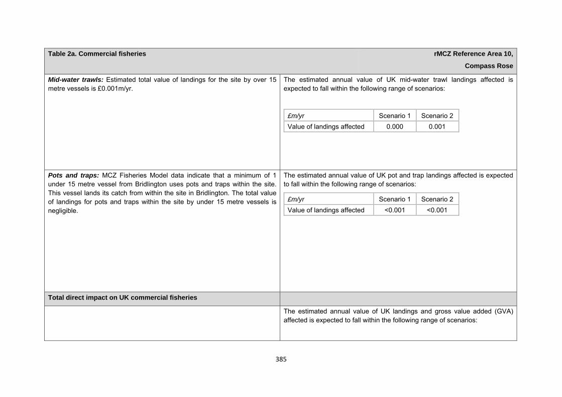
385
Table 2a. Commercial fisheries rMCZ Reference Area 10,
Compass Rose
Mid-water trawls: Estimated total value of landings for the site by over 15 metre vessels is £0.001m/yr.
The estimated annual value of UK mid-water trawl landings affected is expected to fall within the following range of scenarios:
£m/yr Scenario 1 Scenario 2 Value of landings affected 0.000 0.001
Pots and traps: MCZ Fisheries Model data indicate that a minimum of 1 under 15 metre vessel from Bridlington uses pots and traps within the site. This vessel lands its catch from within the site in Bridlington. The total value of landings for pots and traps within the site by under 15 metre vessels is negligible.
The estimated annual value of UK pot and trap landings affected is expected to fall within the following range of scenarios:
£m/yr Scenario 1 Scenario 2 Value of landings affected <0.001 <0.001
Total direct impact on UK commercial fisheries
The estimated annual value of UK landings and gross value added (GVA) affected is expected to fall within the following range of scenarios:
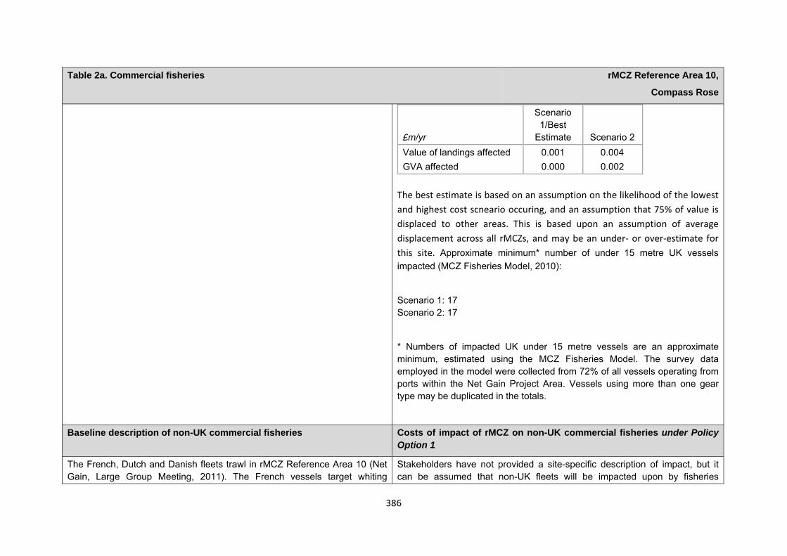
386
Table 2a. Commercial fisheries rMCZ Reference Area 10,
Compass Rose
The best estimate is based on an assumption on the likelihood of the lowest and highest cost scneario occuring, and an assumption that 75% of value is displaced to other areas. This is based upon an assumption of average displacement across all rMCZs, and may be an under‐ or over‐estimate for this site. Approximate minimum* number of under 15 metre UK vessels impacted (MCZ Fisheries Model, 2010):
Scenario 1: 17 Scenario 2: 17
* Numbers of impacted UK under 15 metre vessels are an approximate minimum, estimated using the MCZ Fisheries Model. The survey data employed in the model were collected from 72% of all vessels operating from ports within the Net Gain Project Area. Vessels using more than one gear type may be duplicated in the totals.
£m/yr
Scenario 1/Best
Estimate Scenario 2 Value of landings affected 0.001 0.004 GVA affected 0.000 0.002
Baseline description of non-UK commercial fisheries Costs of impact of rMCZ on non-UK commercial fisheries under Policy Option 1
The French, Dutch and Danish fleets trawl in rMCZ Reference Area 10 (Net Gain, Large Group Meeting, 2011). The French vessels target whiting
Stakeholders have not provided a site-specific description of impact, but it can be assumed that non-UK fleets will be impacted upon by fisheries
387
Table 2a. Commercial fisheries rMCZ Reference Area 10,
Compass Rose
seasonally and in sporadic years, depending on fishing quotas (French fisheries representative, pers. comm., 2011).
management within this site. Regional qualitative impacts to non-UK fleets are outlined in Annex J3d.
Table 2b. National defence rMCZ Reference Area 10,
Compass Rose
Source of costs of the rMCZ
Management scenario 1: Mitigation of impacts of Ministry of Defence activities on features protected by the suite of rMCZs will be provided by additional planning considerations during operations and training. It is not known whether mitigation will be required for features protected by this site. The Ministry of Defence will also incur costs in revising environmental tools and charts to include MCZs.
Baseline description of activity Costs of impact of rMCZ on the sector under Policy Option 1
The Ministry of Defence is known to make use of the site for military practice, by the Royal Air Force, the Air Force Department and by the Navy for submarine exercises and surface explosions.
It is not known whether this rMCZ will impact on the Ministry of Defence’s use of the site. Impacts of rMCZs on the Ministry of Defence’s activities are assessed in the Evidence Base and Annex N9.
Table 2c. Other impacts that are assessed for the suite of MCZs and not for this site alone rMCZ Reference Area 10,
Compass Rose
Cables (interconnectors and telecom cables)
388
Human activities in the site that are not negatively affected by the rMCZ (over 2013 to 2032 inclusive)
Contribution to Ecological Network Guidance
This rRA sits within an rMCZ. For information on how this reference area contributes towards the guidelines in the Ecological Network Guidance please see the information provided underneath rMCZ NG12 Compass Rose. This is also taken from Annex 5 in JNCC and Natural England’s Advice on rMCZs.
Anticipated benefits to ecosystem services The habitats, species and other ecological features of the rMCZ contribute to the delivery of a range of ecosystem services. Designation of the rMCZ and its subsequent management may improve the quantity and quality of the beneficial services provided, which may increase the value (contribution to economic welfare or human well-being) of them. Impacts on the value derived from ecosystem services may occur as a result of the designation, management and/or achievement of the conservation objectives of the rMCZ. Further discussion on the potential benefits to ecosystem services can be found in Annex L and on definitions can be found in Annex H5.
Future interconnectors and telecom cables may pass through the rMCZ. Impacts of rMCZs on future interconnectors and telecom cables are assessed in the Evidence Base, Annex H3 and Annex N3 (they are not assessed for this site alone).
Oil and gas related activities (including carbon capture and storage) It is unlikely that any oil and gas (including carbon capture and storage) infrastructure will be proposed in future in this rMCZ Reference Area due to the location and size of the rMCZ reference area (DECC, pers. comm., 2012
Table 3. Human activities in the site that are not negatively affected by the rMCZ under Policy Option 1
(existing activities at their current levels and future proposals known to the regional MCZ projects)
rMCZ Reference Area 10, Compass Rose
Recreation (recreational boating and wildlife watching) and shipping (transit of vessels).
389
Table 4a. Fish and shellfish for human consumption rMCZ Reference Area 10,
Compass Rose
Baseline Beneficial impact under Policy Option 1
Fletcher and others (2011) identify that the features to be protected by the recommended Marine Conservation Zone (rMCZ) contribute to the delivery of fish and shellfish services.
The site contains spawning grounds for plaice, herring, lemon sole, sand eel and sprat. As well as being a spawning ground, this site is also a nursery ground for cod, whiting, lemon sole, sand eel and sprat (Net Gain final Recommendations, 2011).
The baseline quantity and quality of service provided is assumed to be commensurate with that provided by the features of the site when in unfavourable condition.
A description of on-site fishing activity and the value derived from it is set out in Table 2.
If the conservation objectives of the features are achieved, the features will be recovered to reference condition. Achievement of the conservation objectives may improve the contribution of the habitats to the provision of fish and shellfish for human consumption.
Additional management (above that in the baseline situation) of fishing activities is expected, which will prohibit fishing within the rMCZ, the costs of which are set out in Table 2.
The recovery of the site features to reference condition may improve their functioning as a nursery area, potentially benefiting fisheries exploited outside the rMCZ.
Management of fishing activity within the rMCZ may reduce the on-site fishing mortality of species, which may benefit commercial stocks.
As the rMCZ is small, it is unclear whether it would have any impact on stocks of mobile commercial finfish species. Stocks of low-mobility and site-attached species, such as crabs and lobsters, may improve as a result of reduced fishing pressure. Localised beneficial spill-over effects may occur around the rMCZ.
Anticipated direction of
change:
Confidence: Low
390
Table 4a. Fish and shellfish for human consumption rMCZ Reference Area 10,
Compass Rose
As no fishing will be permitted within the rMCZ, no on-site benefits will be realised.
Benefits defined here are not net of potential costs of the rMCZ and off-site impacts of displaced effort.
Table 4b. Recreation rMCZ Reference Area 10, Compass Rose
Baseline Beneficial impact under Policy Option 1
No recreational activities are known to occur at or near the recommended Marine Conservation Zone.
N/A N/A
Table 4c. Research and education rMCZ Reference Area 10,
Compass Rose
Baseline Beneficial impact under Policy Option 1
Research: Fletcher and others (2011) identify that the features to be protected by the recommended Marine Conservation Zone (rMCZ) can contribute to the delivery of research services.
Recommended MCZ Reference Area 10 is entirely within rMCZ NG 12 and,
As a Reference Area, the rMCZ will provide an opportunity to demonstrate the state of designated marine features in the absence of many anthropogenic pressures (Natural England and Joint Nature Conservation Committee, 2010). It will provide a control area against which the impacts of pressures caused by human activities can be compared as part of long-
Anticipated direction of
change:
391
Table 4c. Research and education rMCZ Reference Area 10,
Compass Rose
as such, it is assumed that monitoring activity will be ongoing.
It has not been possible to estimate the value derived from research activities associated with the rMCZ.
term monitoring and assessment. Other research benefits are unknown.
Confidence: High
Education: As the site is offshore, there is no known educational activity occurring in the site.
As the rMCZ is more than 6nm offshore and therefore relatively inaccessible, no benefits are likely to arise from direct use of the site for education.
Non-visitors may benefit if the rMCZ contributes to wider provision of education (e.g. television programmes, articles in magazines and newspapers, and educational resources developed for use in schools).
Anticipated direction of
change:
Confidence: Low
Table 4d. Regulating services rMCZ Reference Area 10,
Compass Rose
Baseline Beneficial impact under Policy Option 1
Regulation of pollution: The features of the site contribute to the bioremediation of waste and sequestration of carbon. It has not been possible to estimate the value derived from the regulation of pollution in the rMCZ.
Environmental resilience: The features of the site contribute to the resilience and continued regeneration of marine ecosystems. It has not been
If the conservation objectives of the features are achieved, the features will be recovered to reference condition, which may improve the regulating capacity of the site habitats.
Anticipated direction of
change:
Confidence:
392
Table 4d. Regulating services rMCZ Reference Area 10,
Compass Rose
possible to estimate the value derived from environmental resilience in the rMCZ.
Natural hazard protection: As the site is offshore, its features do not contribute to local flood and storm protection.
(Fletcher and others, 2011)
Low
Table 4e. Non-use and option values rMCZ Reference Area 10,
Compass Rose
Baseline Beneficial impact under Policy Option 1
Some people gain satisfaction from the existence of marine habitats, species and other features. They also gain from having the option to benefit in the future from the habitats and species in the recommended Marine Conservation Zone (rMCZ) and the ecosystem services provided, even if they do not currently benefit from them.
The rMCZ will benefit the proportion of the UK population that values conservation of the rMCZ features and its contribution to an ecologically coherent network of Marine Protected Areas. Some people will gain satisfaction from knowing that the habitats and species are being conserved (existence value) and/or that they are being conserved for use by others in the current generation (altruistic value) or future generations (bequest value). The rMCZ will recover and then protect the features in reference condition and the ecosystem services provided, and thereby the option to benefit from these services in the future, from the risk of future degradation.
Anticipated direction of
change:
Confidence: Moderate
393
Table 4e. Non-use and option values rMCZ Reference Area 10,
Compass Rose
rMCZ Reference Area 11, Berwick Coast
Site area (km2): 0.46
• This site has been proposed for designation under Policy Option 1 only.
Table 1. Conservation impacts rMCZ Reference Area 11,
Berwick Coast
1a. Ecological description
Recommended MCZ Reference Area 11 is being proposed in order to protect the mosaic of high-, moderate- and low energy intertidal rock broad-scale habitats and intertidal underboulder communities characterised by sponges, bryozoans, ascidians, crustaceans, bivalves, worms and small fish. Although there is a small number of species present due to the exposure levels and wave action, those that are able to survive are in high abundance. The rocks in rMCZ Reference Area 11 have populations within cracks and crevices of the blue mussel, limpet and barnacle. The moderately exposed intertidal rock is characterised by kelp beneath, in which can be found red seaweeds such as horn weed and sea oak. These areas are grazed by echinoderms with encrusting algae present on rock surfaces. Sea slugs are present, including the orange clubbed sea slug. The cliffs are utilised by a number of bird populations protected under the Northumberland Shore SSSI, including redshank (listed in Annex 2 of the EC Birds Directive), purple sandpiper, sanderling and turnstone. Summer populations include little tern (listed in Annex 1 of the EC Birds Directive) and kittiwake. All of these populations rely on marine species as prey including crustaceans, winkles, molluscs, marine worms and fish. The exposed rock at low tide provides access for birds, making it a key foraging area. Recommended MCZ Reference Area 11 lies just north of the Tweed estuary and as such is an important area for juvenile diadromous species such as salmon and trout. Recommended Marine Conservation Zone (rMCZ) Reference Area 11 falls within the Berwickshire and North Northumberland Coast Special Area of Conservation and the Northumberland Shore Site of Special Scientific Interest (SSSI). There are examples of intertidal and submerged caves in the cliffs bordering the site. Although sea caves are distributed throughout Europe where rocky coastlines occur, they are a relatively scarce habitat. The UK has the most varied and extensive sea caves on the Atlantic coast of Europe. Caves that are subject to strong wave surge are characterised by communities of mussel, barnacles, cushion sponges, encrusting bryozoans and colonial ascidians, depending on the degree of water movement and scour at particular
394
points in the cave system. (Net Gain, Final Site Recommendations Submission, 2011)
1b. Baseline condition of MCZ features and impact of the rMCZ
Feature Area of feature (km2) No. of point records
Baseline Conservation objective
Broad-scale habitats
High energy intertidal rock 0.13 − Not in reference condition Recover to reference condition
Low energy intertidal rock 0.00 − Not in reference condition Recover to reference condition
Moderate energy intertidal rock 0.15 − Not in reference condition Recover to reference condition
Habitats of conservation importance
Intertidal underboulder communities − 3 Not in reference condition Recover to reference condition
Tide-swept channels 0.05 − Not in reference condition Recover to reference condition
*The boundary for rMCZ Reference Area 11 has been developed to cover intertidal features down to the kelp line only. Boundaries were set using bathymetry data for the intertidal zone. However, the broad-scale habitat data that are held by Net Gain indicate that there are ‘subtidal’ features present within these boundaries. Ground-truthing of the intertidal area and the features that are present is required to ensure that this site is only protecting ‘intertidal’ species (for this reason, please disregard the presence of ‘subtidal’ features within the site). Boundaries for the site were suggested by local commercial fishing representatives to border the known kelp zone, in order to limit the loss of any fishing grounds for local vessels using static gears.
395
Site-specific costs arising from the effect of the rMCZ on human activities (over 2013 to 2032 inclusive) Table 2a. Archaeological heritage rMCZ Reference Area 11,
Berwick Coast
Source of costs of the rMCZ
Management scenario 1: Increase in costs of assessing environmental impacts for future licence applications. Archaeological excavations, surface recovery and intrusive surveys will be prohibited from the entire site. Diver trails, visitors and non-intrusive surveys will be allowed.
Baseline description of activity Costs of impact of rMCZ on the sector under Policy Option 1
The historic Hermitage of Segden, dating from 1296, lies within the vicinity of the site (English Heritage, pers. comm., 2012). There are records of wrecks 250 metres to the north of the site (English Heritage, pers. comm., 2012).
English Heritage has indicated that this site is likely to be of interest for archaeological excavation in the future as it is relevant to its National Heritage Protection Plan (theme 3A1.2).
An extra cost would be incurred in the assessment of environmental impacts made in support of any future licence applications for archaeological activities in the site. The likelihood of a future licence application being submitted is not known, so no overall cost to the sector of this rMCZ has been estimated. However, the additional cost in one licence application could be in the region of £500 to £10,000 depending on the size of the MCZ (English Heritage, pers. comm., 2011). If archaeologists respond to the prohibition of excavation by undertaking an alternative archaeological excavation in another locality, this could result in additional costs to the archaeologists. As it is not possible to predict when or how often this could occur, this is not costed in the Impact Assessment. The prohibition of excavation and therefore interpretation of archaeological evidence from the site will decrease acquisition of historical knowledge of past human communities from the site, resulting in a cost to society.
Table 2b. Commercial fisheries rMCZ Reference Area 11,
Berwick Coast
396
Table 2b. Commercial fisheries rMCZ Reference Area 11,
Berwick Coast
Source of costs of the rMCZ
Management scenario 1: Closed to all commercial fishing activity.
Summary of all UK commercial fisheries: Recommended MCZ Reference Area 11 lies wholly within 6nm (so is fished by UK vessels only). MCZ Fisheries Model data indicate that a minimum of 8 under 15 metre vessels fish within the site from 3 UK ports. Catch from within the site is landed in 2 of these UK ports and 1 other UK port. Total value of landings for the site by under 15 metre vessels is £0.008m/yr. Pots and traps and hand collection are used within the site. No over 15 metre vessels are known to fish within the site. The only vessels that currently fish close to rMCZ Reference Area 11 are from either Berwick or Burnmouth and landing of the catch goes into these ports. Vessels from Eyemouth and Holy Island could fish close to the site; they would also land into their home ports. No trawling has been observed near this site within the last 15 years (Norhumberland Inshore Fisheries and conservation Association (NIFCA), pers. comm., 2012). Management measures for fisheries which are relevant to the site are outlined in Annex E4.
Baseline description of UK commercial fisheries Costs of impact of rMCZ on UK commercial fisheries under Policy Option 1
Pots and traps: The site boundary was drawn to the modelled extent of kelp seaweed, which is avoided by vessels deploying pots, so it is unlikely that pots and traps are used within the site. However, as the data is modelled, it may not portray the exact extent of the kelp within the site. Should potting and trapping occur, it is likely to be below the low water mark (NIFCA, pers. comm., 2011). MCZ Fisheries Model data indicate that a minimum of 8 under 15 metre vessels from 2 UK home ports (Berwick and Holy Island) use pots and traps within the site. These vessels land their catch from within the site in 2 ports (Berwick and Eyemouth). Target species include crab, lobster and whelk. It is believed that vessels from Holy Island and Eyemouth are not currently fishing within or around the site, but vessels from Berwick and Burnmouth are believed to currently be fishing adjacent to the site (NIFCA, pers. comm., 2012). The total value of landings for pots and traps within the site is £0.008m/yr.
The estimated annual value of UK pot and trap landings affected is expected to fall within the following range of scenarios:
£m/yr Scenario 1 Value of landings affected 0.008
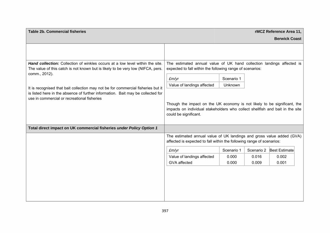
397
Table 2b. Commercial fisheries rMCZ Reference Area 11,
Berwick Coast
Hand collection: Collection of winkles occurs at a low level within the site. The value of this catch is not known but is likely to be very low (NIFCA, pers. comm., 2012).
It is recognised that bait collection may not be for commercial fisheries but it is listed here in the absence of further information. Bait may be collected for use in commercial or recreational fisheries
The estimated annual value of UK hand collection landings affected is expected to fall within the following range of scenarios:
Though the impact on the UK economy is not likely to be significant, the impacts on individual stakeholders who collect shellfish and bait in the site could be significant.
£m/yr Scenario 1 Value of landings affected Unknown
Total direct impact on UK commercial fisheries under Policy Option 1
The estimated annual value of UK landings and gross value added (GVA) affected is expected to fall within the following range of scenarios:
£m/yr Scenario 1 Scenario 2 Best Estimate Value of landings affected 0.000 0.016 0.002 GVA affected 0.000 0.009 0.001
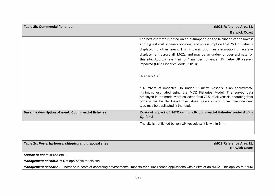
398
Table 2b. Commercial fisheries rMCZ Reference Area 11,
Berwick Coast
The best estimate is based on an assumption on the likelihood of the lowest and highest cost scneario occuring, and an assumption that 75% of value is displaced to other areas. This is based upon an assumption of average displacement across all rMCZs, and may be an under‐ or over‐estimate for this site. Approximate minimum* number of under 15 metre UK vessels impacted (MCZ Fisheries Model, 2010):
Scenario 1: 8
* Numbers of impacted UK under 15 metre vessels is an approximate minimum, estimated using the MCZ Fisheries Model. The survey data employed in the model were collected from 72% of all vessels operating from ports within the Net Gain Project Area. Vessels using more than one gear type may be duplicated in the totals.
Baseline description of non-UK commercial fisheries Costs of impact of rMCZ on non-UK commercial fisheries under Policy Option 1
The site is not fished by non-UK vessels as it is within 6nm.
Table 2c. Ports, harbours, shipping and disposal sites rMCZ Reference Area 11, Berwick Coast
Source of costs of the rMCZ
Management scenario 1: Not applicable to this site
Management scenario 2: Increase in costs of assessing environmental impacts for future licence applications within 5km of an rMCZ. This applies to future
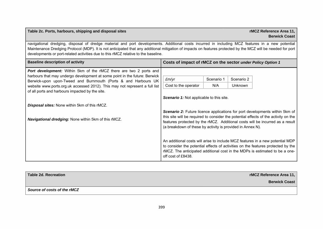
399
Table 2c. Ports, harbours, shipping and disposal sites rMCZ Reference Area 11, Berwick Coast
navigational dredging, disposal of dredge material and port developments. Additional costs incurred in including MCZ features in a new potential Maintenance Dredging Protocol (MDP). It is not anticipated that any additional mitigation of impacts on features protected by the MCZ will be needed for port developments or port-related activities due to this rMCZ relative to the baseline.
Baseline description of activity Costs of impact of rMCZ on the sector under Policy Option 1
Port development: Within 5km of the rMCZ there are two 2 ports and harbours that may undergo development at some point in the future: Berwick Berwick-upon upon-Tweed and Burnmouth (Ports & and Harbours UK website www.ports.org.uk accessed 2012). This may not represent a full list of all ports and harbours impacted by the site.
Disposal sites: None within 5km of this rMCZ.
Navigational dredging: None within 5km of this rMCZ.
£m/yr Scenario 1 Scenario 2 Cost to the operator N/A Unknown
Scenario 1: Not applicable to this site.
Scenario 2: Future licence applications for port developments within 5km of this site will be required to consider the potential effects of the activity on the features protected by the rMCZ. Additional costs will be incurred as a result (a breakdown of these by activity is provided in Annex N).
An additional costs will arise to include MCZ features in a new potential MDP to consider the potential effects of activities on the features protected by the rMCZ. The anticipated additional cost in the MDPs is estimated to be a one-off cost of £8438.
Table 2d. Recreation rMCZ Reference Area 11,
Berwick Coast
Source of costs of the rMCZ
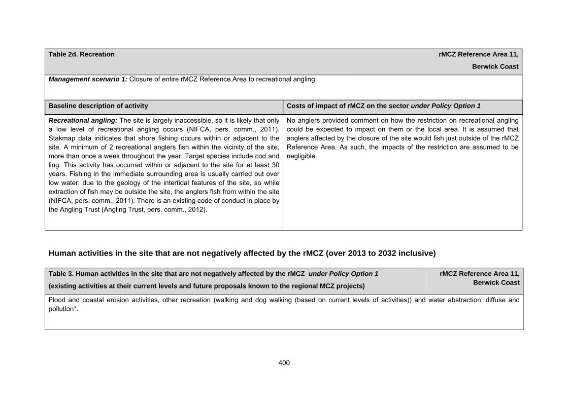
400
Table 2d. Recreation rMCZ Reference Area 11,
Berwick Coast
Management scenario 1: Closure of entire rMCZ Reference Area to recreational angling.
Baseline description of activity Costs of impact of rMCZ on the sector under Policy Option 1
Recreational angling: The site is largely inaccessible, so it is likely that only a low level of recreational angling occurs (NIFCA, pers. comm., 2011). Stakmap data indicates that shore fishing occurs within or adjacent to the site. A minimum of 2 recreational anglers fish within the vicinity of the site, more than once a week throughout the year. Target species include cod and ling. This activity has occurred within or adjacent to the site for at least 30 years. Fishing in the immediate surrounding area is usually carried out over low water, due to the geology of the intertidal features of the site, so while extraction of fish may be outside the site, the anglers fish from within the site (NIFCA, pers. comm., 2011). There is an existing code of conduct in place by the Angling Trust (Angling Trust, pers. comm., 2012).
No anglers provided comment on how the restriction on recreational angling could be expected to impact on them or the local area. It is assumed that anglers affected by the closure of the site would fish just outside of the rMCZ Reference Area. As such, the impacts of the restriction are assumed to be negligible.
Human activities in the site that are not negatively affected by the rMCZ (over 2013 to 2032 inclusive) Table 3. Human activities in the site that are not negatively affected by the rMCZ under Policy Option 1
(existing activities at their current levels and future proposals known to the regional MCZ projects)
rMCZ Reference Area 11, Berwick Coast
Flood and coastal erosion activities, other recreation (walking and dog walking (based on current levels of activities)) and water abstraction, diffuse and pollution*.
401
*The IA assumes that no additional mitigation of impacts of water abstraction, discharge or diffuse pollution will be required over and above that which will be provided to achieve the objectives of the Water Framework Directive through the River Basin Management Plan process (based on advice provided by Natural England, pers. comm., 2010). Contribution to Ecological Network Guidance Table 4. An overview of features proposed for designation and how these contribute to the ENG guidelines for the regional MCZ project area and at a wider scale23
= ENG guideline is achieved and X = ENG guideline is not achieved. Green cells represent key considerations and any greyed-out rows indicate where SNCBs do not agree with a feature being proposed for designation. Recommended conservation objectives in italics indicate where SNCBs do not agree with the conservation objective recommended by the regional MCZ project (see Section 4.2). Where an asterisk (*) has been given in the table, more detail is provided in the narrative.
rMCZ Reference Area 11, Berwick Coast
ENG Feature
Represent-ativity
Replication
Adequacy
Viability
Gaps or shortfalls in relation to ENG minimum guidelines
Recommended conservation objective
Quantitative considerations at regional MCZ level
Ecological Importance at regional MCZ level
Ecological Importance at wider scale
A1.1 High energy intertidal rock
BSH X * 1 See comments below
Reference condition
Site is relatively inaccessible compared to other stretches of open coast so more likely to be undisturbed/non-damaged.
A1.2 Moderate BSH X * 1
See comments
Reference condition
Site is relatively inaccessible
23 copied from the JNCC and Natural England’s advice to Defra on rMCZs
402
energy intertidal rock
below compared to other stretches of open coast so more likely to be undisturbed /non-damaged.
A1.3 Low energy intertidal rock
BSH X * 1 See comments below
Reference condition
Site is relatively inaccessible compared to other stretches of open coast so more likely to be undisturbed/non-damaged.
Intertidal under-boulder communi-ties
FOCI Habitat N/A
See comments below
Reference condition
Site is relatively inaccessible compared to other stretches of open coast so likely to be undisturbed/non-damaged.
UK BAP
A5.1 Subtidal coarse sediment
BSH X See comments below
Reference condition
This BSH should not be included in the rRA as the site is intertidal.
Subtidal sands and gravels
FOCI Habitat N/A
See comments below
Reference condition
This FOCI should not be included in the rRA as the site is intertidal.
UK BAP
Site considerations Connectivity Geological/Geomorphological features of interest None Appropriate boundary Areas of Additional Ecological Importance N/A
403
Overlaps with existing MPAs Additional comments and site benefits: Due to its relative inaccessibility, the recommended reference area may provide scientifically-important baseline data, for example, undisturbed biotopes. 1 Although viability is not met, it should be noted that this is the only recommended reference area for the intertidal BSH A1.1 high energy intertidal rock, A1.3 low energy intertidal rock and FOCI habitat intertidal underboulder community. This site was selected due to its relative inaccessibility which has prevented disturbance to date, and it is highly unlikely that an area 5km long for this habitat could be found anywhere without significant ongoing activity. It should also be noted that this recommended reference area is situated within a large Special Area of Conservation (SAC), the Berwickshire and North Northumberland Coast European marine site.
Anticipated benefits to ecosystem services The habitats, species and other ecological features of the rMCZ contribute to the delivery of a range of ecosystem services. Designation of the rMCZ and its subsequent management may improve the quantity and quality of the beneficial services provided, which may increase the value (contribution to economic welfare or human well-being) of them. Impacts on the value derived from ecosystem services may occur as a result of the designation, management and/or achievement of the conservation objectives of the rMCZ. Further discussion on the potential benefits to ecosystem services can be found in Annex L and on definitions can be found in Annex H5.
Table 5a. Fish and shellfish for human consumption rMCZ Reference Area 11,
Berwick Coast
Baseline Beneficial impact under Policy Option 1
Fletcher and others (2011) identify that the features to be protected by the recommended Marine Conservation Zone (rMCZ) contribute to the delivery of fish and shellfish services.
Recommended MCZ Reference Area 11 lies just north of the Tweed Estuary
If the conservation objectives of the features are achieved, the features will be recovered to reference condition. Achievement of the conservation objectives may improve the contribution of the habitats to the provision of fish and shellfish for human consumption.
Anticipated direction of
change:
404
Table 5a. Fish and shellfish for human consumption rMCZ Reference Area 11,
Berwick Coast
and is an important area for juvenile diadromous species such as salmon and trout and, as such, is likely to help support potential off-site fisheries (Net Gain Final Recommendations, 2011). It has not been possible to estimate the value derived from off-site fisheries as a result of the nursery area function.
The baseline quantity and quality of service provided is assumed to be commensurate with that provided by the features of the site when not in reference condition.
A description of on-site fishing activity and the value derived from it is set out in Table 2.
The recovery of the site features to reference condition may improve their functioning as a nursery area for salmon and sea trout, potentially benefiting fisheries exploited outside the rMCZ, although benefits are likely to favour recreational rather than commercial fisheries.
Additional management (above that in the baseline situation) of fishing activities is expected, which will prohibit fishing within the rMCZ, the costs of which are set out in Table 2.
Management of fishing activity within the rMCZ may reduce the on-site fishing mortality of species, which may benefit commercial stocks.
As the rMCZ is small, it is unclear whether it would have any impact on stocks of mobile commercial finfish species. Stocks of low-mobility and site-attached species may improve as a result of reduced fishing pressure. Localised beneficial spill-over effects may occur around the rMCZ.
As no fishing will be permitted within the rMCZ, no on-site benefits will be realised.
Benefits defined here are not net of potential costs of the rMCZ and off-site impacts of displaced effort.
Confidence: Low
405
Table 5a. Fish and shellfish for human consumption rMCZ Reference Area 11,
Berwick Coast
Table 5b. Recreation rMCZ Reference Area 11,
Berwick Coast
Baseline Beneficial impact under Policy Option 1
Angling: Fletcher and others (2011) identify that the features to be protected by the recommended Marine Conservation Zone (rMCZ) can contribute to the delivery of fish and shellfish for human consumption and recreation services.
The baseline quantity and quality of the ecosystem service provided is assumed to be commensurate with that provided by features of the site when not in reference condition (see Table 1).
Recommended MCZ Reference Area 11 lies just north of the Tweed Estuary and, as such, is an important area for juvenile diadromous species such as salmon and trout (Net Gain Final Recommendations, 2011). It has not been possible to estimate the value derived from off-site fisheries as a result of the nursery area function.
A description of on-site fishing activity and the value derived from it is set out in Table 2.
It has not been possible to estimate the value derived from angling in the site.
If the conservation objectives of the features are achieved, the features will be recovered to reference condition.
Recovery of habitats may have benefits to fish and shellfish populations. It is unclear whether any benefits to fish populations would arise as a result of reduced fishing mortality due to management of commercial fishing (see Table 4a).
The recovery of the site features to reference condition may improve their functioning as a nursery area for salmon and sea trout, potentially benefiting fisheries exploited outside the rMCZ.
As angling will not be permitted within the rMCZ, any benefits will be limited to those occurring as a result of spill-over effects of finfish species targeted by anglers. Such benefits may be insignificant.
Anticipated direction of
change:
Confidence: Low
406
Table 5b. Recreation rMCZ Reference Area 11,
Berwick Coast
Diving: There is no known diving and snorkelling activity carried out within the site.
N/A N/A
Wildlife watching: As rMCZ Reference Area 11 is largely inaccessible, wildlife watching activity is not thought to occur within the site.
N/A N/A
Table 5c. Research and education rMCZ Reference Area 11,
Berwick Coast
Baseline Beneficial impact under Policy Option 1
Research: Fletcher and others (2011) identify that the features to be protected by the recommended Marine Conservation Zone (rMCZ) can contribute to the delivery of research services.
Recommended MCZ Reference Area 11 falls within the Berwickshire and North Northumberland Coast Special Area of Conservation and the Northumberland Shore Site of Special Scientific Interest (Net Gain Final Recommendations, 2011) and, as such, monitoring activity is ongoing.
It has not been possible to estimate the value derived from research activities
As a Reference Area, the rMCZ will provide an opportunity to demonstrate the state of designated marine features in the absence of many anthropogenic pressures (Natural England and Joint Nature Conservation Committee, 2010). It will provide a control area against which the impacts of pressures caused by human activities can be compared as part of long-term monitoring and assessment. Other research benefits are unknown.
Anticipated direction of
change:
Confidence: High
407
Table 5c. Research and education rMCZ Reference Area 11,
Berwick Coast
associated with the rMCZ.
Education: There is no known educational activity occurring in the site. MCZ designation may provide an opportunity to expand the focus of education events into the marine environment.
Designation may aid additional local (to the rMCZ) provision of education (e.g. events and interpretation boards), from which visitors would derive benefit, although the site is largely inaccessible.
Non-visitors may benefit if the rMCZ contributes to wider provision of education (e.g. television programmes, articles in magazines and newspapers, and educational resources developed for use in schools).
Anticipated direction of
change:
Confidence: Moderate
Table 5d. Regulating services rMCZ Reference Area 11,
Berwick Coast
Baseline Beneficial impact under Policy Option 1
Regulation of pollution: The features of the site do not contribute to the bioremediation of waste and sequestration of carbon.
Environmental resilience: The features of the site contribute to the resilience and continued regeneration of marine ecosystems. It has not been
If the conservation objectives of the features are achieved, the features will be recovered to reference condition, which may improve the regulating capacity of the site habitats.
Anticipated direction of
change:
408
Table 5d. Regulating services rMCZ Reference Area 11,
Berwick Coast
possible to estimate the value derived from environmental resilience in the rMCZ.
Natural hazard protection: The features of the site contribute to local flood and storm protection. It has not been possible to estimate the value derived from natural hazard protection in the rMCZ.
(Fletcher and others, 2011)
Confidence: Low
Table 5e. Non-use and option values rMCZ Reference Area 11,
Berwick Coast
Baseline Beneficial impact under Policy Option 1
Some people gain satisfaction from the existence of marine habitats, species and other features. They also gain from having the option to benefit in the future from the habitats and species in the recommended Marine Conservation Zone (rMCZ) and the ecosystem services provided, even if they do not currently benefit from them.
The rMCZ will benefit the proportion of the UK population that values conservation of the rMCZ features and its contribution to an ecologically coherent network of Marine Protected Areas. Some people will gain satisfaction from knowing that the habitats and species are being conserved (existence value) and/or that they are being conserved for use by others in the current generation (altruistic value) or future generations (bequest value). The rMCZ will recover and then protect the features in reference condition and the ecosystem services provided, and thereby the option to benefit from these services in the future, from the risk of future degradation.
In the Marine Conservation Society ‘Your Seas Your Voice’ campaign, 1 ‘nominated site’ is located within rMCZ Reference Area 11. The non-extractive use value of ease of access to the site was considered an important motivator for protection.
Anticipated direction of
change:
Confidence: Moderate
409
Table 5e. Non-use and option values rMCZ Reference Area 11,
Berwick Coast
rMCZ Reference Area 12, Farnes Clay
Site area (km2): 3.43
• This site has been proposed for designation under Policy Option 1 only.
Table 1. Conservation impacts rMCZ Reference Area 12,
Farnes Clay
1a. Ecological description
Recommended Marine Conservation Zone (rMCZ) Reference Area 12 is located within rMCZ NG 14 and was recommended to protect the subtidal peat and clay exposures which provide habitat for species such as burrowing piddock. The holes that these piddock leave behind can provide unique microhabitats for species such as small crabs and anemones. These are nationally rare communities with a limited distribution in the North Sea area. Currently, very little is known about the distribution of subtidal peat and clay exposures: their full extent and maximum depth is unknown, and it is thought that the flora and fauna of the subtidal examples are likely to differ from those found on intertidal examples.
Deeper examples of moderate circalittoral rock habitat such as this support animal communities including cup coral, sea-fans and anemones, as well as mobile animals such as starfish, brittlestars and sea urchins.
Recommended MCZ Reference Area 12 lies entirely within rMCZ NG 14 and is not within or adjacent to any existing Marine Protected Areas.
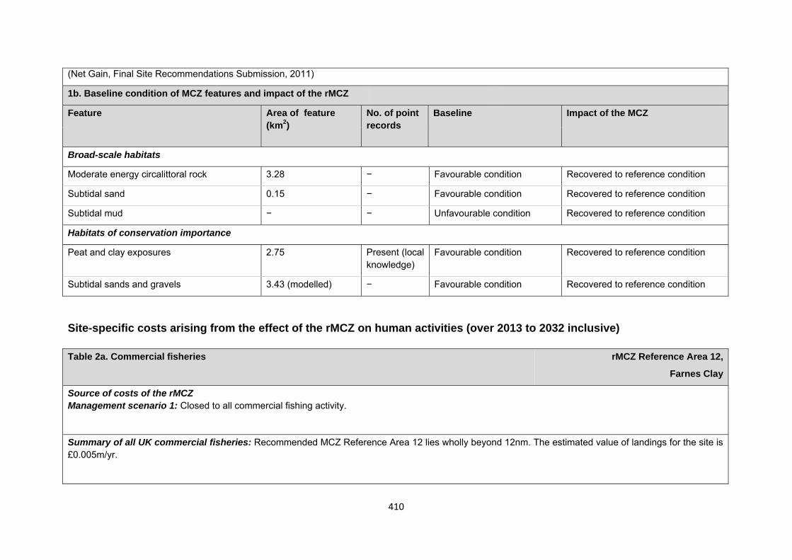
410
(Net Gain, Final Site Recommendations Submission, 2011)
1b. Baseline condition of MCZ features and impact of the rMCZ
Feature Area of feature (km2)
No. of point records
Baseline Impact of the MCZ
Broad-scale habitats
Moderate energy circalittoral rock 3.28 − Favourable condition Recovered to reference condition
Subtidal sand 0.15 − Favourable condition Recovered to reference condition
Subtidal mud − − Unfavourable condition Recovered to reference condition
Habitats of conservation importance
Peat and clay exposures 2.75 Present (local knowledge)
Favourable condition Recovered to reference condition
Subtidal sands and gravels 3.43 (modelled) − Favourable condition Recovered to reference condition
Site-specific costs arising from the effect of the rMCZ on human activities (over 2013 to 2032 inclusive) Table 2a. Commercial fisheries rMCZ Reference Area 12,
Farnes Clay
Source of costs of the rMCZ Management scenario 1: Closed to all commercial fishing activity.
Summary of all UK commercial fisheries: Recommended MCZ Reference Area 12 lies wholly beyond 12nm. The estimated value of landings for the site is £0.005m/yr.
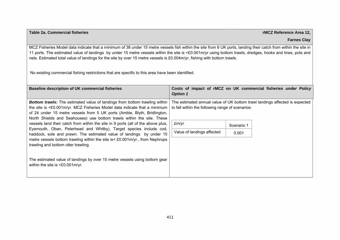
411
Table 2a. Commercial fisheries rMCZ Reference Area 12,
Farnes Clay
MCZ Fisheries Model data indicate that a minimum of 38 under 15 metre vessels fish within the site from 6 UK ports, landing their catch from within the site in 11 ports. The estimated value of landings by under 15 metre vessels within the site is <£0.001m/yr using bottom trawls, dredges, hooks and lines, pots and nets. Estimated total value of landings for the site by over 15 metre vessels is £0.004m/yr, fishing with bottom trawls.
No existing commercial fishing restrictions that are specific to this area have been identified.
Baseline description of UK commercial fisheries Costs of impact of rMCZ on UK commercial fisheries under Policy Option 1
Bottom trawls: The estimated value of landings from bottom trawling within the site is <£0.001m/yr. MCZ Fisheries Model data indicate that a minimum of 24 under 15 metre vessels from 5 UK ports (Amble, Blyth, Bridlington, North Shields and Seahouses) use bottom trawls within the site. These vessels land their catch from within the site in 9 ports (all of the above plus, Eyemouth, Oban, Peterhead and Whitby). Target species include cod, haddock, sole and prawn. The estimated value of landings by under 15 metre vessels bottom trawling within the site is< £0.001m/yr., from Nephrops trawling and bottom otter trawling.
The estimated value of landings by over 15 metre vessels using bottom gear within the site is <£0.001m/yr.
The estimated annual value of UK bottom trawl landings affected is expected to fall within the following range of scenarios:
£m/yr Scenario 1 Value of landings affected 0.001
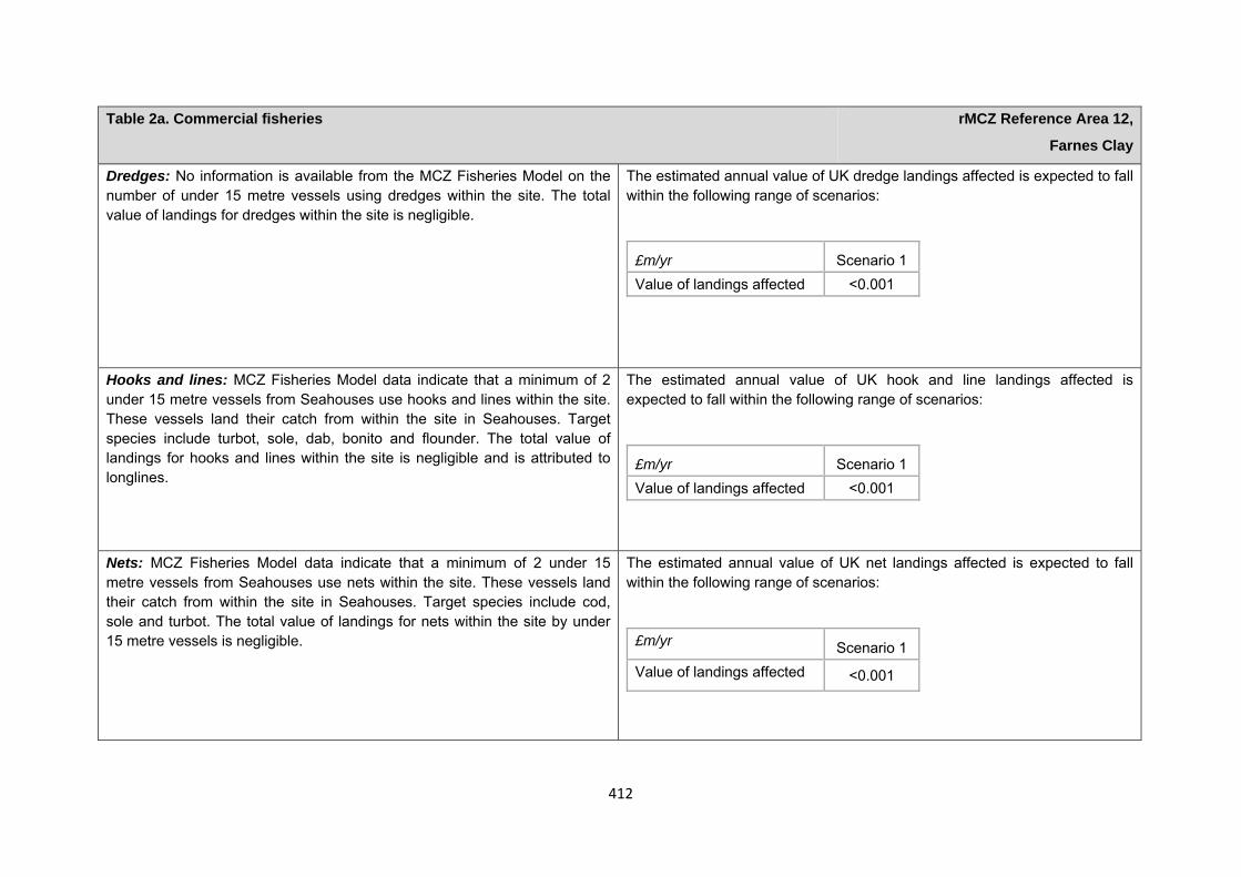
412
Table 2a. Commercial fisheries rMCZ Reference Area 12,
Farnes Clay
Dredges: No information is available from the MCZ Fisheries Model on the number of under 15 metre vessels using dredges within the site. The total value of landings for dredges within the site is negligible.
The estimated annual value of UK dredge landings affected is expected to fall within the following range of scenarios:
£m/yr Scenario 1 Value of landings affected <0.001
Hooks and lines: MCZ Fisheries Model data indicate that a minimum of 2 under 15 metre vessels from Seahouses use hooks and lines within the site. These vessels land their catch from within the site in Seahouses. Target species include turbot, sole, dab, bonito and flounder. The total value of landings for hooks and lines within the site is negligible and is attributed to longlines.
The estimated annual value of UK hook and line landings affected is expected to fall within the following range of scenarios:
£m/yr Scenario 1 Value of landings affected <0.001
Nets: MCZ Fisheries Model data indicate that a minimum of 2 under 15 metre vessels from Seahouses use nets within the site. These vessels land their catch from within the site in Seahouses. Target species include cod, sole and turbot. The total value of landings for nets within the site by under 15 metre vessels is negligible.
The estimated annual value of UK net landings affected is expected to fall within the following range of scenarios:
£m/yr Scenario 1 Value of landings affected <0.001
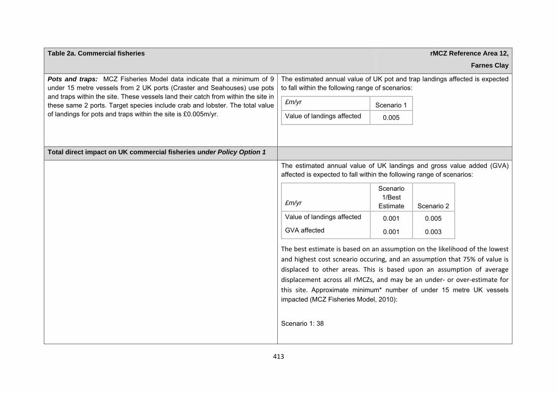
413
Table 2a. Commercial fisheries rMCZ Reference Area 12,
Farnes Clay
Pots and traps: MCZ Fisheries Model data indicate that a minimum of 9 under 15 metre vessels from 2 UK ports (Craster and Seahouses) use pots and traps within the site. These vessels land their catch from within the site in these same 2 ports. Target species include crab and lobster. The total value of landings for pots and traps within the site is £0.005m/yr.
The estimated annual value of UK pot and trap landings affected is expected to fall within the following range of scenarios:
£m/yr Scenario 1 Value of landings affected 0.005
Total direct impact on UK commercial fisheries under Policy Option 1
The estimated annual value of UK landings and gross value added (GVA) affected is expected to fall within the following range of scenarios:
The best estimate is based on an assumption on the likelihood of the lowest and highest cost scneario occuring, and an assumption that 75% of value is displaced to other areas. This is based upon an assumption of average displacement across all rMCZs, and may be an under‐ or over‐estimate for this site. Approximate minimum* number of under 15 metre UK vessels impacted (MCZ Fisheries Model, 2010):
Scenario 1: 38
£m/yr
Scenario 1/Best
Estimate Scenario 2 Value of landings affected 0.001 0.005
GVA affected 0.001 0.003
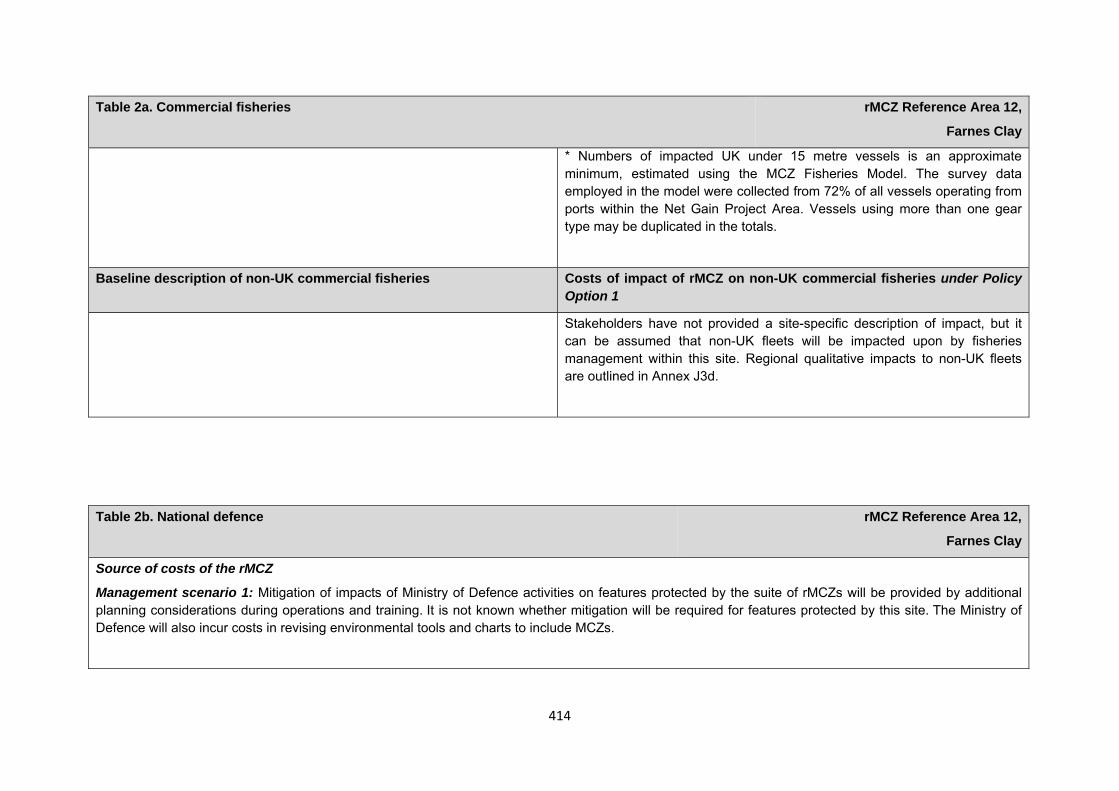
414
Table 2a. Commercial fisheries rMCZ Reference Area 12,
Farnes Clay
* Numbers of impacted UK under 15 metre vessels is an approximate minimum, estimated using the MCZ Fisheries Model. The survey data employed in the model were collected from 72% of all vessels operating from ports within the Net Gain Project Area. Vessels using more than one gear type may be duplicated in the totals.
Baseline description of non-UK commercial fisheries Costs of impact of rMCZ on non-UK commercial fisheries under Policy Option 1
Stakeholders have not provided a site-specific description of impact, but it can be assumed that non-UK fleets will be impacted upon by fisheries management within this site. Regional qualitative impacts to non-UK fleets are outlined in Annex J3d.
Table 2b. National defence rMCZ Reference Area 12,
Farnes Clay
Source of costs of the rMCZ
Management scenario 1: Mitigation of impacts of Ministry of Defence activities on features protected by the suite of rMCZs will be provided by additional planning considerations during operations and training. It is not known whether mitigation will be required for features protected by this site. The Ministry of Defence will also incur costs in revising environmental tools and charts to include MCZs.
415
Table 2b. National defence rMCZ Reference Area 12,
Farnes Clay
Baseline description of activity Costs of impact of rMCZ on the sector under Policy Option 1
The Ministry of Defence is known to make use of the site for military practice, by the Air Force Department, for aerial activity which does not involve the release of weapons. The site is also a firing danger area.
It is not known whether this rMCZ will impact on the Ministry of Defence’s use of the site. Impacts of rMCZs on the Ministry of Defence’s activities are assessed in the Evidence Base and Annex N9.
Human activities in the site that are not negatively affected by the rMCZ (over 2013 to 2032 inclusive)
Contribution to Ecological Network Guidance
Table 2c. Other impacts that are assessed for the suite of MCZs and not for this site alone rMCZ Reference Area 12, Farnes Clay
Cables (interconnectors and telecom cables)
Future interconnectors and telecom cables may pass through the rMCZ. Impacts of rMCZs on future interconnectors and telecom cables are assessed in the Evidence Base, Annex H3 and Annex N3 (they are not assessed for this site alone).
Table 3. Human activities in the site that are not negatively affected by the rMCZ under Policy Option 1
(existing activities at their current levels and future proposals known to the regional MCZ projects)
rMCZ Reference Area 12, Farnes Clay
Cables (existing interconnectors and telecom cables), recreation (recreational boating) and shipping (transit of vessels only).
416
This rRA sits within an rMCZ. For information on how this reference area contributes towards the guidelines in the Ecological Network Guidance please see the information provided underneath NG14 Farnes East rMCZ. This is also taken from Annex 5 in JNCC and Natural England’s Advice on rMCZs.
Anticipated benefits to ecosystem services The habitats, species and other ecological features of the rMCZ contribute to the delivery of a range of ecosystem services. Designation of the rMCZ and its subsequent management may improve the quantity and quality of the beneficial services provided, which may increase the value (contribution to economic welfare or human well-being) of them. Impacts on the value derived from ecosystem services may occur as a result of the designation, management and/or achievement of the conservation objectives of the rMCZ. Further discussion on the potential benefits to ecosystem services can be found in Annex L and on definitions can be found in Annex H5.
Table 4a. Fish and shellfish for human consumption rMCZ Reference Area 12,
Farnes Clay
Baseline Beneficial impact under Policy Option 1
Fletcher and others (2011) identify that the features to be protected by the recommended Marine Conservation Zone (rMCZ) contribute to the delivery of fish and shellfish services.
The baseline quantity and quality of service provided is assumed to be commensurate with that provided by the features of the site when in unfavourable condition.
A description of on-site fishing activity and the value derived from it is set out in Table 2.
If the conservation objectives of the features are achieved, the features will be recovered to reference condition. Achievement of the conservation objectives may improve the contribution of the habitats to the provision of fish and shellfish for human consumption.
Additional management (above that in the baseline situation) of fishing activities is expected, which will prohibit fishing within the rMCZ, the costs of which are set out in Table 2.
Management of fishing activity within the rMCZ may reduce the on-site fishing mortality of species, which may benefit commercial stocks.
Anticipated direction of
change:
Confidence: Low
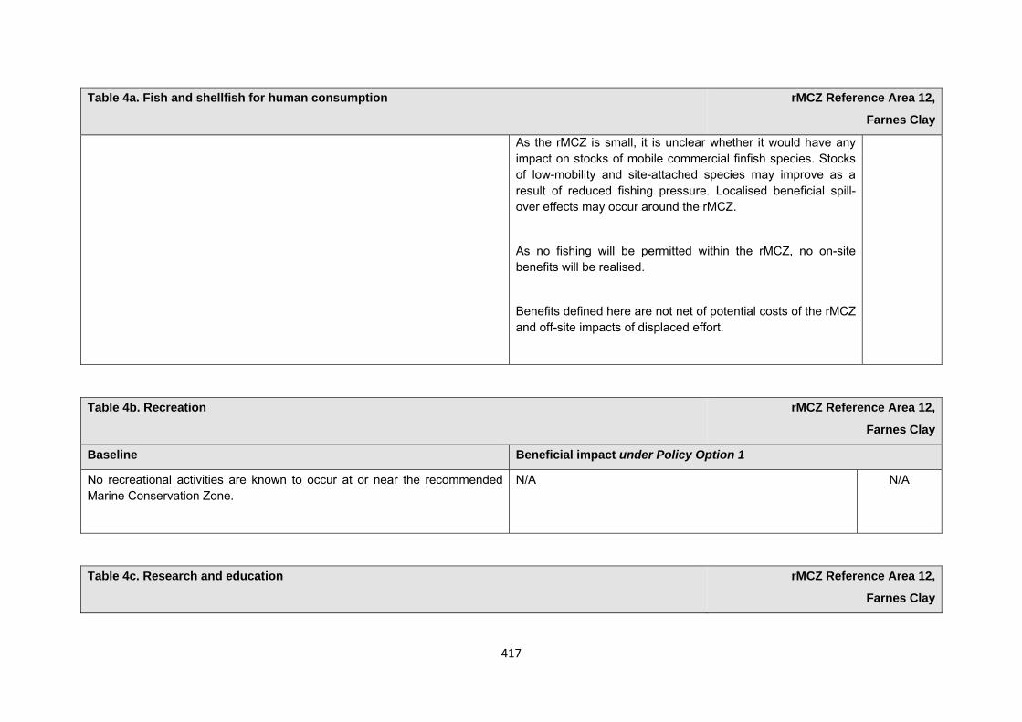
417
Table 4a. Fish and shellfish for human consumption rMCZ Reference Area 12,
Farnes Clay
As the rMCZ is small, it is unclear whether it would have any impact on stocks of mobile commercial finfish species. Stocks of low-mobility and site-attached species may improve as a result of reduced fishing pressure. Localised beneficial spill-over effects may occur around the rMCZ.
As no fishing will be permitted within the rMCZ, no on-site benefits will be realised.
Benefits defined here are not net of potential costs of the rMCZ and off-site impacts of displaced effort.
Table 4b. Recreation rMCZ Reference Area 12,
Farnes Clay
Baseline Beneficial impact under Policy Option 1
No recreational activities are known to occur at or near the recommended Marine Conservation Zone.
N/A N/A
Table 4c. Research and education rMCZ Reference Area 12,
Farnes Clay
418
Table 4c. Research and education rMCZ Reference Area 12,
Farnes Clay
Baseline Beneficial impact under Policy Option 1
Research: Fletcher and others (2011) identify that the features to be protected by the recommended Marine Conservation Zone (rMCZ) can contribute to the delivery of research services.
Recommended MCZ Reference Area 12 lies entirely within rMCZ NG 14 and, as such, it is assumed that monitoring activity will be ongoing.
It has not been possible to estimate the value derived from research activities associated with the rMCZ.
As a Reference Area, the rMCZ will provide an opportunity to demonstrate the state of designated marine features in the absence of many anthropogenic pressures (Natural England and Joint Nature Conservation Committee, 2010). It will provide a control area against which the impacts of pressures caused by human activities can be compared as part of long-term monitoring and assessment. Other research benefits are unknown.
Anticipated direction of
change:
Confidence: High
Education: As rMCZ Reference Area 12 is more than 12nm offshore, there is no known educational activity occurring in the site.
As the rMCZ is more than 12nm offshore and therefore relatively inaccessible, no benefits are likely to arise from direct use of the site for education.
Non-visitors may benefit if the rMCZ contributes to wider provision of education (e.g. television programmes, articles in magazines and newspapers, and educational resources developed for use in schools).
Anticipated direction of
change:
Confidence: Low
Table 4d. Regulating services rMCZ Reference Area 12,
Farnes Clay
419
Table 4d. Regulating services rMCZ Reference Area 12,
Farnes Clay
Baseline Beneficial impact under Policy Option 1
Regulation of pollution: The features of the site contribute to the bioremediation of waste and sequestration of carbon. It has not been possible to estimate the value derived from the regulation of pollution in the rMCZ.
Environmental resilience: The features of the site contribute to the resilience and continued regeneration of marine ecosystems. It has not been possible to estimate the value derived from environmental resilience in the rMCZ.
Natural hazard protection: As rMCZ Reference Area 12 is more than 12nm offshore, the features of the site do not contribute to local flood and storm protection.
(Fletcher and others, 2011)
If the conservation objectives of the features are achieved, the features will be recovered to reference condition, which may improve the regulating capacity of the site habitats.
Anticipated direction of
change:
Confidence: Low
Table 4e. Non-use and option values rMCZ Reference Area 12,
Farnes Clay
Baseline Beneficial impact under Policy Option 1
Some people gain satisfaction from the existence of marine habitats, species and other features. They also gain from having the option to benefit in the
The rMCZ will benefit the proportion of the UK population that values conservation of the rMCZ features and its contribution
Anticipated direction of
420
Table 4e. Non-use and option values rMCZ Reference Area 12,
Farnes Clay
future from the habitats and species in the recommended Marine Conservation Zone (rMCZ) and the ecosystem services provided, even if they do not currently benefit from them.
to an ecologically coherent network of Marine Protected Areas. Some people will gain satisfaction from knowing that the habitats and species are being conserved (existence value) and/or that they are being conserved for use by others in the current generation (altruistic value) or future generations (bequest value). The rMCZ will recover and then protect the features in reference condition and the ecosystem services provided, and thereby the option to benefit from these services in the future, from the risk of future degradation.
change:
Confidence: Moderate
rMCZ Reference Area 13, Rock Unique
Site area (km2): 52.49
• This site has been proposed for designation under Policy Option 1 only.
Table 1. Conservation impacts rMCZ Reference Area 13,
Rock Unique
1a. Ecological description
Recommended Marine Conservation Zone (rMCZ) Reference Area 13 lies within rMCZ NG 15 and was recommended in order to protect the low energy circalittoral rock, as it is the only example of this feature present within the Net Gain region. This habitat is extremely rare around the UK, with a few examples being found in the Scottish lochs and a few isolated sites around the south-west of England and the west coast of Ireland. Due to the low energy associated
421
with this rocky habitat and the depth at which it occurs, a unique animal community is able to persist. With areas too deep for algae to obtain the light they need to grow, animal communities of sea squirts, dead man’s finger and plumose anemone are able to proliferate as well as peacock worm, bristleworms, squat lobster, hermit crab and a number of species of urchin.
Subtidal sands and gravel habitats are identified as a priority habitat in the UK Biodiversity Action Plan (BAP). Coarse sediment habitats are characterised by worms, mobile crustaceans, for example squat lobster, bivalve molluscs and a number of species of sea cucumber. Sandy sea beds further offshore are not usually disturbed by waves and tides in the same way that inshore areas are and so are able to support worms, bivalve molluscs and amphipod crustaceans within them.
Cetacean sightings for this area include year-round sightings of white-beaked dolphin, along with harbour porpoise (listed in Annex 2 of the EC Habitats Directive), minke whale and humpback whale, all of which are Marine Biodiversity Action Plan species in the UK. Sightings in the area coupled with known foraging distances of grey seal (listed in Annex 2 of the EC Habitats Directive and named in the Northumberland BAP) suggest that this site could be used by the grey seal population present on the Farne Islands. The site supports high densities of winter foraging birds, and moderate densities during the summer, including guillemot, kittiwake and puffin. Foraging ranges of these birds suggest that these could be birds from the Farne Islands using this area for feeding.
Recommended MCZ Reference Area 13 lies entirely within rMCZ NG 15 and there are no existing Marine Protected Areas within or adjacent to the site.
(Net Gain, Final Site Recommendations Submission, 2011)
1b. Baseline condition of MCZ features and impact of the rMCZ
Feature Area of feature (km2)
No. of point records
Baseline Impact of the MCZ
Broad-scale habitats
Low energy circalittoral rock 13.88 − Not in reference condition Recovered to reference condition
422
Subtidal coarse sediment 1.99 − Not in reference condition Recovered to reference condition
Subtidal sand 36.63 − Not in reference condition Recovered to reference condition
Habitats of conservation importance
Subtidal sands and gravels 48.07 (modelled) − Not in reference condition Recovered to reference condition
Site-specific costs arising from the effect of the rMCZ on human activities (over 2013 to 2032 inclusive) Table 2a. Commercial fisheries rMCZ Reference Area 13,
Rock Unique
Source of costs of the rMCZ
The Joint Nature Conservation Committee (JNCC) and Natural England have advised that there is considerable uncertainty about whether additional management of mid-water trawling will be required for certain features potentially protected by the rMCZ Reference Area. Therefore, different scenarios have been employed in the Impact Analysis in order to reflect this uncertainty at the request of JNCC and Natural England: open to mid-water trawling but closed to all other gears; and closed to all commercial fishing activity. Should the site be designated, the management that will be required will fall somewhere within this range.
Management scenario 1: Open to mid-water trawling but closed to all other gears.
Management scenario 2: Closed to all commercial fishing activity.
Summary of all UK commercial fisheries: Recommended MCZ Reference Area 13 lies wholly beyond 12nm. The estimated value of landings for the site is £0.016m/yr (of which £0.016m/yr is contributed by over 15 metre vessels fishing with bottom trawls and mid-water trawls and <£0.001m/yr is from
under 15 metre vessels fishing with bottom trawls and pots.
MCZ Fisheries Model data indicate that a minimum of 17 under 15 metre vessels fish within the site from 4 UK ports. These vessels land their catch from within the site in 9 ports.
423
Table 2a. Commercial fisheries rMCZ Reference Area 13,
Rock Unique
Recommended MCZ Reference Area 13 is heavily fished for whitefish by the UK fleet (interview with the Scottish Fishermen’s Federation (SFF), 2011). A number of commercial fishing restrictions are already in existence (outlined in Annex E4).
Baseline description of UK commercial fisheries Costs of impact of rMCZ on UK commercial fisheries under Policy Option 1
Bottom trawls: The estimated value of landings for bottom trawls within the site is <£0.001m/yr. Estimated total value of landings for the site by both over and under 15 metre vessels is <£0.001m/yr.
MCZ Fisheries Model data indicate that a minimum of 16 under 15 metre vessels from 3 UK ports (Amble, Blyth and Bridlington) use bottom otter trawls within the site. These vessels land their catch from within the site in 8 ports (all of the above plus Eyemouth, North Shields, Peterhead, South Shields and Whitby). Target species include cod, haddock, sole, plaice and prawn.
The estimated annual value of UK bottom trawl landings affected is expected to fall within the following range of scenarios:
£m/yr Scenario 1 Scenario 2Value of landings affected <0.001 <0.001
Mid-water trawls: No under 15 metre vessels are known to operate this gear type in the site. Estimated total value of landings by over 15 metre vessels within the site is £0.016m/yr.
The estimated annual value of UK mid-water trawl landings affected is expected to fall within the following range of scenarios:
£m/yr Scenario 1 Scenario 2Value of landings affected 0.001 0.016
424
Table 2a. Commercial fisheries rMCZ Reference Area 13,
Rock Unique
Pots and traps: MCZ Fisheries Model data indicate that a minimum of 1 under 15 metre vessel from Seahouses uses pots and traps within the site. This vessel lands its catch from within the site in Seahouses. Target species includes crab, lobster and whelk. Estimated total value of landings for pots and traps within the site is negligible.
The estimated annual value of UK pot and trap landings affected is expected to fall within the following range of scenarios:
£m/yr Scenario 1 Scenario 2Value of landings affected <0.001 <0.001
Total direct impact on UK commercial fisheries under Policy Option 1
The estimated annual value of UK landings and gross value added (GVA) affected is expected to fall within the following range of scenarios:
The best estimate is based on an assumption on the likelihood of the lowest and highest cost scneario occuring, and an assumption that 75% of value is displaced to other areas. This is based upon an assumption of average displacement across all rMCZs, and may be an under‐ or over‐estimate for this site. Approximate minimum* number of under 15 metre UK vessels impacted (MCZ Fisheries Model, 2010):
Scenario 1: 17 Scenario 2: 17
£m/yr Scenario 1 Scenario 2Best
Estimate Value of landings affected <0.001 0.016 0.002
GVA affected <0.001 0.009 0.001
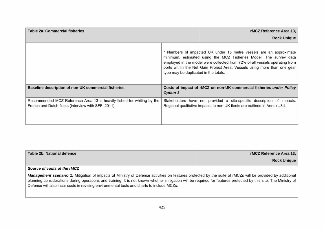
425
Table 2a. Commercial fisheries rMCZ Reference Area 13,
Rock Unique
* Numbers of impacted UK under 15 metre vessels are an approximate minimum, estimated using the MCZ Fisheries Model. The survey data employed in the model were collected from 72% of all vessels operating from ports within the Net Gain Project Area. Vessels using more than one gear type may be duplicated in the totals.
Baseline description of non-UK commercial fisheries Costs of impact of rMCZ on non-UK commercial fisheries under Policy Option 1
Recommended MCZ Reference Area 13 is heavily fished for whiting by the French and Dutch fleets (interview with SFF, 2011).
Stakeholders have not provided a site-specific description of impacts. Regional qualitative impacts to non-UK fleets are outlined in Annex J3d.
Table 2b. National defence rMCZ Reference Area 13,
Rock Unique
Source of costs of the rMCZ
Management scenario 1: Mitigation of impacts of Ministry of Defence activities on features protected by the suite of rMCZs will be provided by additional planning considerations during operations and training. It is not known whether mitigation will be required for features protected by this site. The Ministry of Defence will also incur costs in revising environmental tools and charts to include MCZs.
426
Table 2b. National defence rMCZ Reference Area 13,
Rock Unique
Baseline description of activity Costs of impact of rMCZ on the sector under Policy Option 1
The Ministry of Defence is known to make use of the site for military practice, by the Air Force Department for aerial activity that does not involve the release of weapons. The site is also a firing danger area.
It is not known whether this rMCZ will impact on the Ministry of Defence’s use of the site. Impacts of rMCZs on the Ministry of Defence’s activities are assessed in the Evidence Base and Annex N9.
Human activities in the site that are not negatively affected by the rMCZ (over 2013 to 2032 inclusive)
Contribution to Ecological Network Guidance
This rRA sits within an rMCZ. For information on how this reference area contributes towards the guidelines in the Ecological Network Guidance please see the information provided underneath NG 15 Rock Unique rMCZ. This is also taken from Annex 5 in JNCC and Natural England’s Advice on rMCZs.
Anticipated benefits to ecosystem services The habitats, species and other ecological features of the rMCZ contribute to the delivery of a range of ecosystem services. Designation of the rMCZ and its subsequent management may improve the quantity and quality of the beneficial services provided, which may increase the value (contribution to economic
Table 3. Human activities in the site that are not negatively affected by the rMCZ under Policy Option 1
(existing activities at their current levels and future proposals known to the regional MCZ projects)
rMCZ Reference Area 13, Rock Unique
Shipping (transit of vessels only).
427
welfare or human well-being) of them. Impacts on the value derived from ecosystem services may occur as a result of the designation, management and/or achievement of the conservation objectives of the rMCZ. Further discussion on the potential benefits to ecosystem services can be found in Annex L and on definitions can be found in Annex H5.
Table 4a. Fish and shellfish for human consumption rMCZ Reference Area 13,
Rock Unique
Baseline Beneficial impact under Policy Option 1
Fletcher and others (2011) identify that the features to be protected by the recommended Marine Conservation Zone (rMCZ) contribute to the delivery of fish and shellfish services.
The baseline quantity and quality of service provided is assumed to be commensurate with that provided by the features of the site when in favourable condition.
A description of on-site fishing activity and the value derived from it is set out in Table 2.
If the conservation objectives of the features are achieved, the features will be recovered to reference condition. Achievement of the conservation objectives may improve the contribution of the habitats to the provision of fish and shellfish for human consumption.
Additional management (above that in the baseline situation) of fishing activities is expected, which will prohibit fishing within the rMCZ, the costs of which are set out in Table 2.
Management of fishing activity within the rMCZ may reduce the on-site fishing mortality of species, which may benefit commercial stocks.
As the rMCZ is small, it is unclear whether it would have any impact on stocks of mobile commercial finfish species. Stocks of low-mobility and site-attached species may improve as a result of reduced fishing pressure. Localised beneficial spill-over effects may occur around the rMCZ.
As no fishing will be permitted within the rMCZ, no on-site
Anticipated direction of
change:
Confidence: Low
428
Table 4a. Fish and shellfish for human consumption rMCZ Reference Area 13,
Rock Unique
benefits will be realised.
Benefits defined here are not net of potential costs of the rMCZ and off-site impacts of displaced effort.
Table 4b. Recreation rMCZ Reference Area 13,
Rock Unique
Baseline Beneficial impact under Policy Option 1
No recreational activities are known to occur at or near the recommended Marine Conservation Zone.
N/A N/A
Table 4c. Research and education rMCZ Reference Area 13,
Rock Unique
Baseline Beneficial impact under Policy Option 1
Research: Fletcher and others (2011) identify that the features to be protected by the recommended Marine Conservation Zone (rMCZ) can contribute to the delivery of research services.
As a Reference Area, the rMCZ will provide an opportunity to demonstrate the state of designated marine features in the absence of many anthropogenic pressures (Natural England and Joint Nature Conservation Committee, 2010). It will provide a control area against which the impacts of pressures
Anticipated direction of
change:
429
Table 4c. Research and education rMCZ Reference Area 13,
Rock Unique
The low energy circalittoral rock is the only example of this feature present within the Net Gain region. This habitat is extremely rare around the UK and so may be important for future research (Net Gain Final Recommendations, 2011).
Recommended MCZ Reference Area 13 lies entirely within rMCZ 15 and, as such, it is assumed that monitoring activity will be ongoing.
It has not been possible to estimate the value derived from research activities associated with the rMCZ.
caused by human activities can be compared as part of long-term monitoring and assessment. Other research benefits are unknown.
Confidence: High
Education: As rMCZ Reference Area 13 is more than 12nm offshore, there is no known educational activity occurring in the site.
As the rMCZ is more than 12nm offshore and therefore relatively inaccessible, no benefits are likely to arise from direct use of the site for education.
Non-visitors may benefit if the rMCZ contributes to wider provision of education (e.g. television programmes, articles in magazines and newspapers, and educational resources developed for use in schools).
Anticipated direction of
change:
Confidence: Low
Table 4d. Regulating services rMCZ Reference Area 13,
Rock Unique
Baseline Beneficial impact under Policy Option 1
430
Table 4d. Regulating services rMCZ Reference Area 13,
Rock Unique
Regulation of pollution: The features of the site contribute to the bioremediation of waste and sequestration of carbon. It has not been possible to estimate the value derived from the regulation of pollution in the rMCZ.
Environmental resilience: The features of the site contribute to the resilience and continued regeneration of marine ecosystems. It has not been possible to estimate the value derived from environmental resilience in the rMCZ.
Natural hazard protection: As the site is more than 12nm offshore, its features do not contribute to local flood and storm protection.
(Fletcher and others, 2011)
If the conservation objectives of the features are achieved, the features will be recovered to reference condition, which may improve the regulating capacity of the site habitats.
Anticipated direction of
change:
Confidence: Low
Table 4e. Non-use and option values rMCZ Reference Area 13,
Rock Unique
Baseline Beneficial impact under Policy Option 1
Some people gain satisfaction from the existence of marine habitats, species and other features. They also gain from having the option to benefit in the future from the habitats and species in the recommended Marine Conservation Zone (rMCZ) and the ecosystem services provided, even if they do not currently benefit from them.
The rMCZ will benefit the proportion of the UK population that values conservation of the rMCZ features and its contribution to an ecologically coherent network of Marine Protected Areas. Some people will gain satisfaction from knowing that the habitats and species are being conserved (existence value) and/or that they are being conserved for use by others in the current generation (altruistic value) or future generations (bequest value). The rMCZ will recover and then protect the
Anticipated direction of
change:
Confidence:
431
Table 4e. Non-use and option values rMCZ Reference Area 13,
Rock Unique
features in reference condition and the ecosystem services provided, and thereby the option to benefit from these services in the future, from the risk of future degradation.
Moderate
Net Gain has proposed a series of additional sites (see Annexes 1, 2, 3a and 3b). The boundaries for these sites have not been assigned and, as such, the Impact Assessment cannot accurately cost these.
References ABPmer, 2009. Immingham Oil Terminal Approach Channel Dredging Environmental Statement Bereton, T., Macleod, C., Kitching, M., Tait, A., Steel, D., Quigley, M. And Scott, C., 2010, Importance of the Farne Deeps and surrounding waters off the Northumberland coast for White-beaked Dolphin and other cetaceans and seabirds of Conservation Concern. Natural England Biodiversity Reporting and Information Group (BRIG) to the UK standing Committee, June 2007, Report on the Species and Habitat Review: http://jncc.defra.gov.uk/page-5705 [accessed March 2012] Centrica, 2007, Lincs Offshore Windfarm Environmental Statement
432
Council Directive 92/43/EEC of 21 May 1992 on the conservation of natural habitats and of wild fauna and flora: http://ec.europa.eu/environment/nature/legislation/habitatsdirective/index_en.htm [accessed March 2012] Davis, D. And Dinwiddy, J. 2011. Visit to potential reference site – Holme Next The Sea (Gore Point); survey records of peat and clay exposures Direction des Pêches Maritimes et de l’ Aquaculture, http://dpma-11-0339-mcz-zonesbritanniques.wemake.fr/ [password protected]
Directive 2009/147/EC of the European Parliament and the Council of 30 November 2009 on the conservation of wild birds: http://ec.europa.eu/environment/nature/legislation/birdsdirective/index_en.htm [accessed March 2012] English Nature, 1998, Eastern Scottish Border to North Bank of the River Tyne Maritime Natural Area Profile Evans, P., Anderwald, P. and Bains, M., 2003, UK Cetacean Status Review. Sea Watch Foundation Hatch, J.J., 2002, Arctic Tern (Sterna paradisaea), The Birds of North America online (A. Pool, ed.). Ireland 1988-1991. Poyser, London JNCC and Natural England (2010) Marine Conservation Zone Reference Areas: Guidance document for regional MCZ projects. Version 1.1. Kirkham, I.R and Nesbit, !.C.T., 1987, Feeding techniques and field identification of Arctic, Common and Roseate Terns. British Birds 80:41-47 Kober, K., Webb, A., Win, I., Lewis, M., O’Brien, S., Wilson, L.J. and Reid, J.B., 2010, An analysis of the numbers and distribution of seabirds within the British Fishery Limit aimed at identifying areas that qualify as possible marine SPAs. JNCC report No. 431
433
Maddock, A. 2008. UK Biodiversity Action Plan Priority Habitat Descriptions, Peat and Clay Exposures with Piddocks: http://jncc.defra.gov.uk/page-5706 [accessed June 2012] McConnell, B.J., Fedak, M.A., Lovell, P. And Hammond, P.S., 1999, Movements and foraging area of grey seals in the north Sea. Journal of Applied Ecology, 36, 573-590 National Grid, 2009, 2010 and 2011, Offshore Development Information Statements (ODIS): http://www.nationalgrid.com/uk/Electricity/OffshoreTransmission/ODIS/ [accessed June 2012] Natural England, 2010. Evidence Base for designation of Inner Dowsing, Race Bank and North Ridge Special Area of Conservation. Natural England, 2010, Special Area of conservation (SAC): Inner Dowsing, Race Bank and North Ridge. SAC Selection Assessment. Version 5.0. 1-34 Natural England, 2011, Nature on the map: http://www.natureonthemap.naturalengland.org.uk/ [Accessed June 2012]
Net Gain, August 2011, Final Recommendation Submission to Natural England and JNCC. North East Coastal Authorities Group, 2007, Shoreline Management Plan 2: River Tyne to Flamborough Head: http://www.northeastsmp2.org.uk/finalSMP2.htm [accessed January 2012] Norfolk Wildlife Trust: http://www.norfolkwildlifetrust.org.uk/cley.aspx [accessed April 2012] East Anglia Coastal Group, 2011, Managing the Coast: North Norfolk Shoreline Management Plan 2, Non-Technical Summary of Final Plan Old Hunstanton to Kelling Hard: http://www.northnorfolk.org/coastal/810.asp [accessed January 2012]
434
East Anglia Coastal Group, 2011, Managing the Coast: Summary: The Wash Shoreline Management Plan 2, Gibraltar Point to Old Hunstanton: http://www.eacg.org.uk/index.php?Itemid=124 [accessed January 2012] Scrica Offshore Energy Ltd, 2006. Sheringham Shoal Offshore Windfarm Environmental Statement Sea Watch Foundation: http://www.seawatchfoundation.org.uk/recentsightings.php [accessed June 2012] Thompson, D. and Duck, C., 2010, Berwickshire and North Northumberland Coast European Marine Site: grey seal population status. Report to Natural England UK ports and Harbours; http://ports.org.uk/allareas.asp [accessed April 2012]