multi-transducer sediment echo sounder for 3d
TRANSCRIPT
Erwin Heine
Institute of Surveying, Remote Sensing and Land Information (IVFL)
University of Natural Resources and Life Sciences, Vienna
AUSTRIA
Multi-transducer sediment echo sounder
for 3D documentation of submerged archaeological sites
- a case study at
a prehistoric pile dwelling at Lake Mondsee (Austria)
Presented at th
e FIG W
orking Week 2017,
May 29 - June 2, 2
017 in Helsinki, F
inland
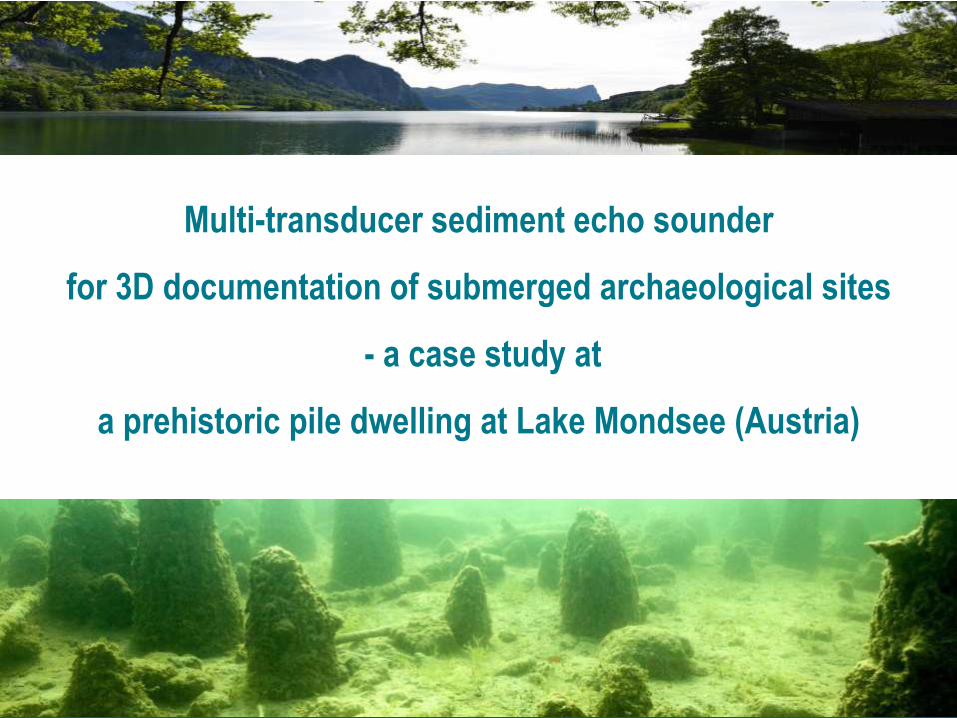
FIG working week 2017, Helsinki, Finland, 29 May – 2 June 2017 Erwin Heine, BOKU University Vienna
Multi-transducer sediment echo sounder
for 3D documentation of submerged archaeological sites
- a case study at
a prehistoric pile dwelling at Lake Mondsee (Austria)
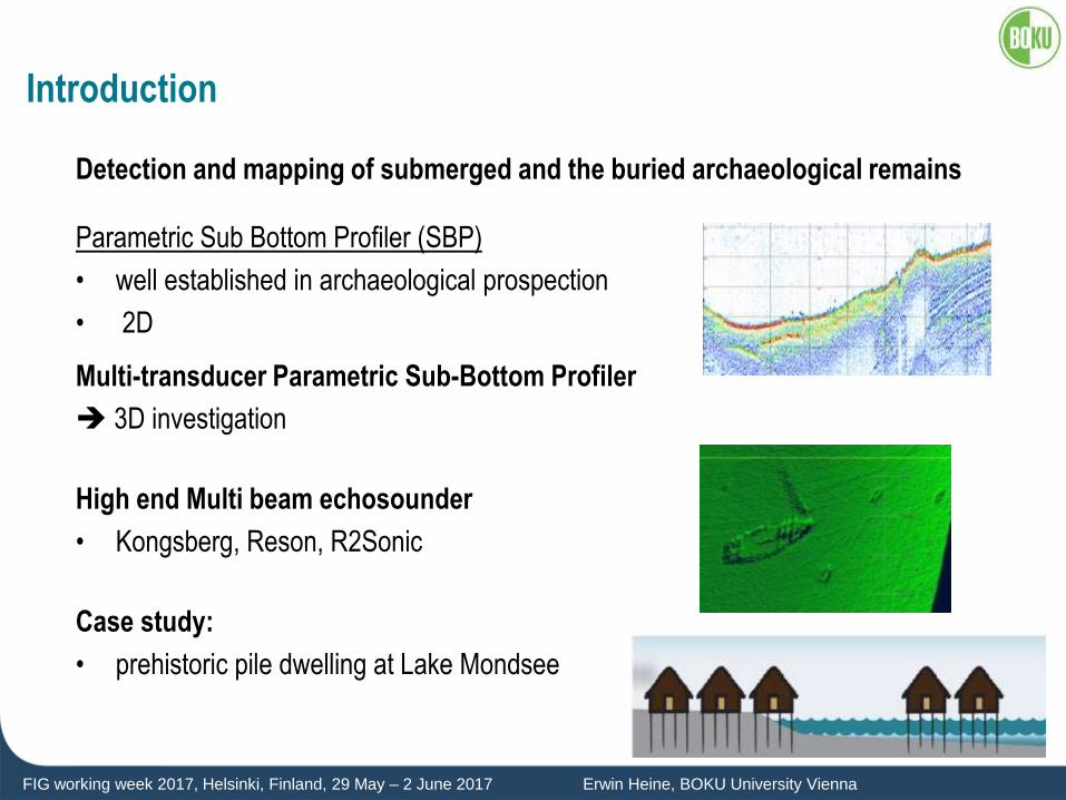
FIG working week 2017, Helsinki, Finland, 29 May – 2 June 2017 Erwin Heine, BOKU University Vienna
Introduction
Detection and mapping of submerged and the buried archaeological remains
Parametric Sub Bottom Profiler (SBP)
• well established in archaeological prospection
• 2D
Multi-transducer Parametric Sub-Bottom Profiler
3D investigation
High end Multi beam echosounder
• Kongsberg, Reson, R2Sonic
Case study:
• prehistoric pile dwelling at Lake Mondsee
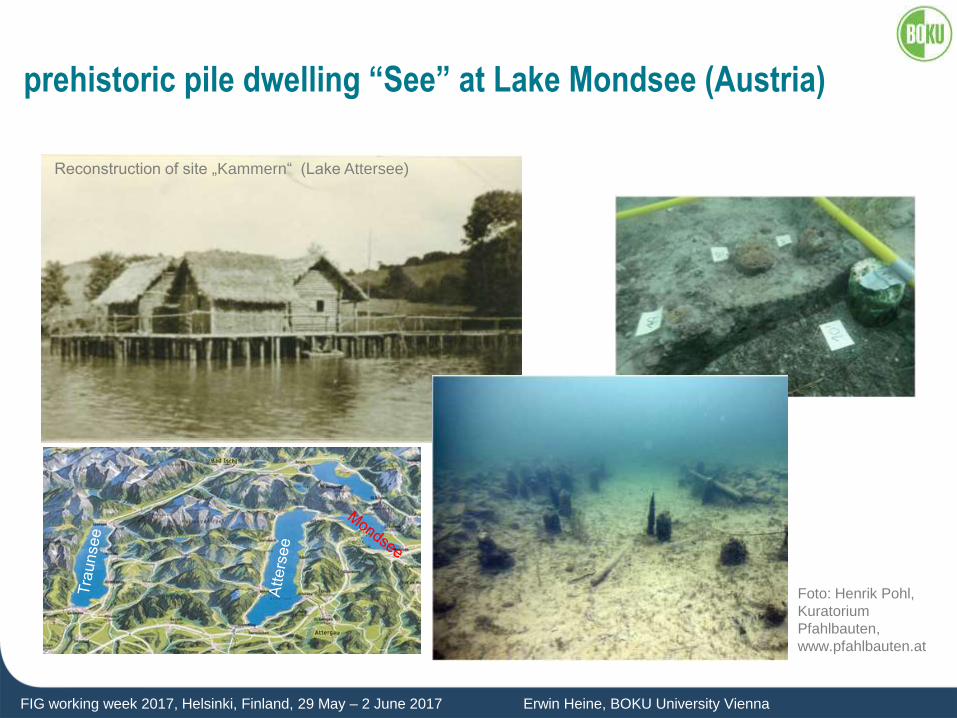
FIG working week 2017, Helsinki, Finland, 29 May – 2 June 2017 Erwin Heine, BOKU University Vienna
prehistoric pile dwelling “See” at Lake Mondsee (Austria)
Reconstruction of site „Kammern“ (Lake Attersee)
Foto: Henrik Pohl,
Kuratorium
Pfahlbauten,
www.pfahlbauten.at
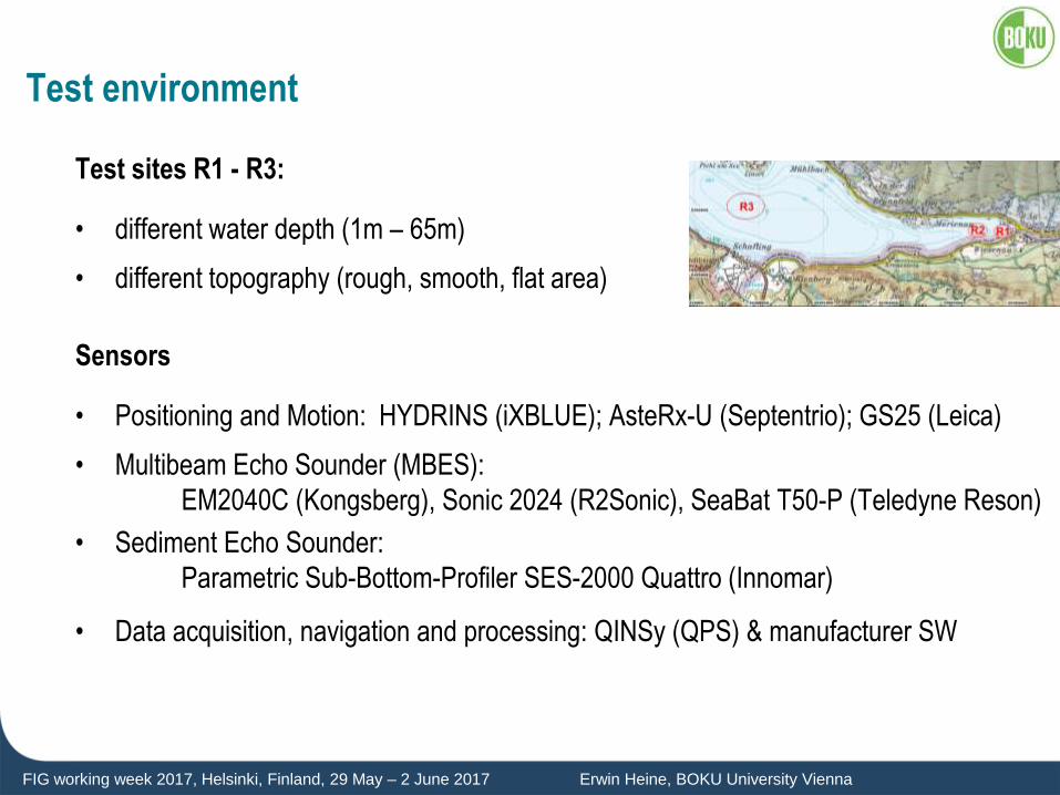
FIG working week 2017, Helsinki, Finland, 29 May – 2 June 2017 Erwin Heine, BOKU University Vienna
Test environment
Test sites R1 - R3:
• different water depth (1m – 65m)
• different topography (rough, smooth, flat area)
Sensors
• Positioning and Motion: HYDRINS (iXBLUE); AsteRx-U (Septentrio); GS25 (Leica)
• Multibeam Echo Sounder (MBES):
EM2040C (Kongsberg), Sonic 2024 (R2Sonic), SeaBat T50-P (Teledyne Reson)
• Sediment Echo Sounder:
Parametric Sub-Bottom-Profiler SES-2000 Quattro (Innomar)
• Data acquisition, navigation and processing: QINSy (QPS) & manufacturer SW
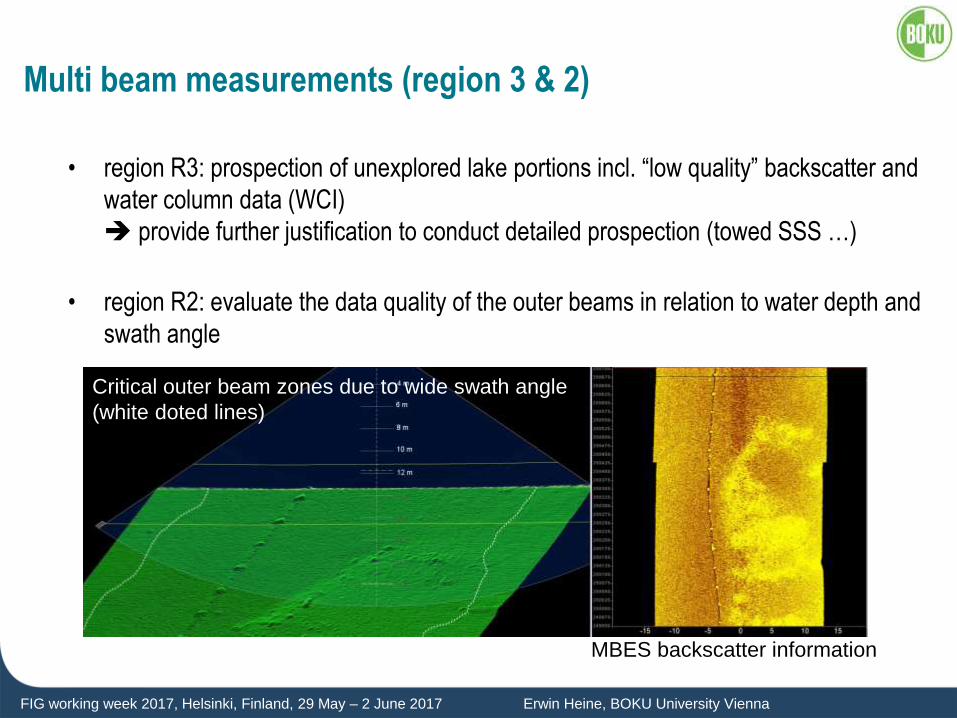
FIG working week 2017, Helsinki, Finland, 29 May – 2 June 2017 Erwin Heine, BOKU University Vienna
Multi beam measurements (region 3 & 2)
• region R3: prospection of unexplored lake portions incl. “low quality” backscatter and
water column data (WCI)
provide further justification to conduct detailed prospection (towed SSS …)
• region R2: evaluate the data quality of the outer beams in relation to water depth and
swath angle
Critical outer beam zones due to wide swath angle
(white doted lines)
MBES backscatter information
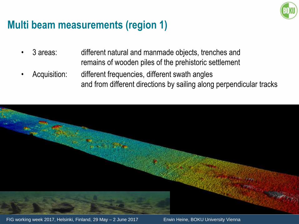
FIG working week 2017, Helsinki, Finland, 29 May – 2 June 2017 Erwin Heine, BOKU University Vienna
Multi beam measurements (region 1)
• 3 areas: different natural and manmade objects, trenches and
remains of wooden piles of the prehistoric settlement
• Acquisition: different frequencies, different swath angles
and from different directions by sailing along perpendicular tracks
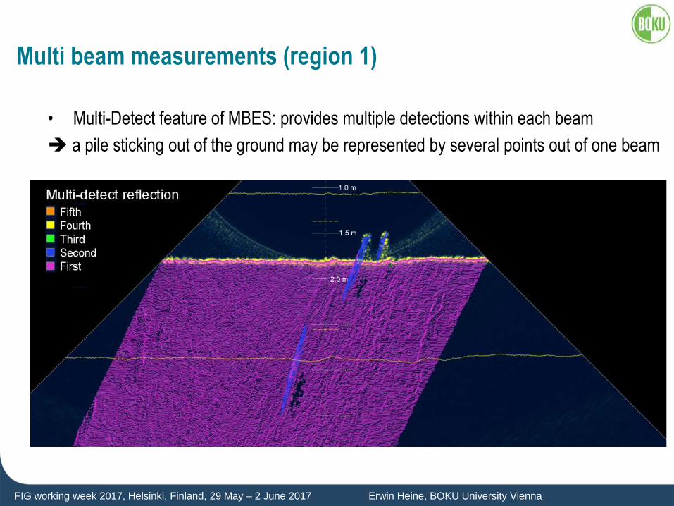
FIG working week 2017, Helsinki, Finland, 29 May – 2 June 2017 Erwin Heine, BOKU University Vienna
Multi beam measurements (region 1)
• Multi-Detect feature of MBES: provides multiple detections within each beam
a pile sticking out of the ground may be represented by several points out of one beam
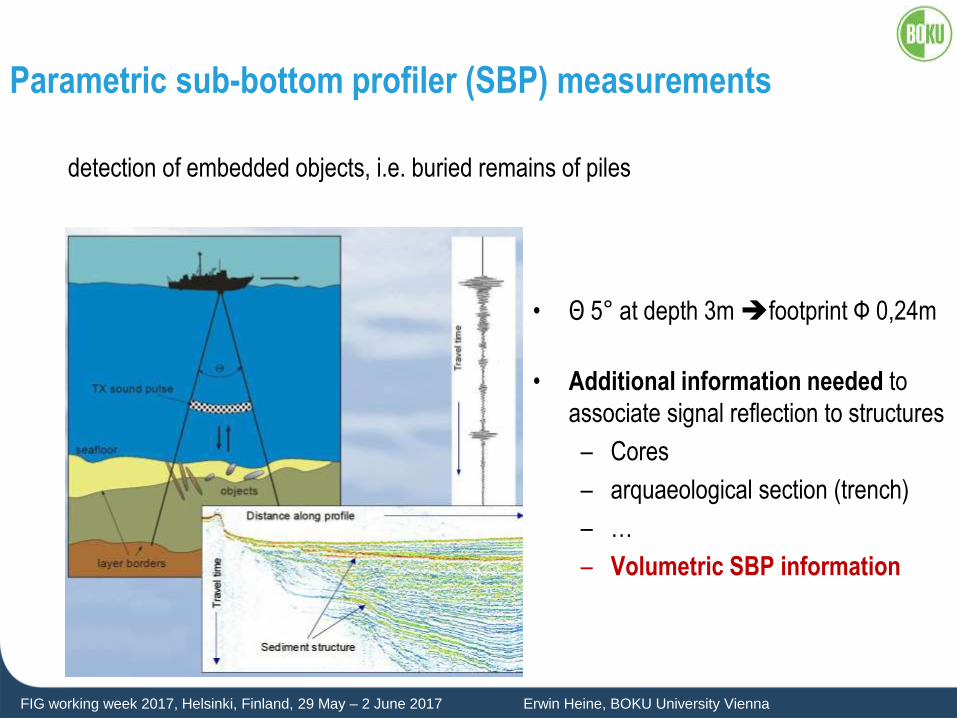
FIG working week 2017, Helsinki, Finland, 29 May – 2 June 2017 Erwin Heine, BOKU University Vienna
Parametric sub-bottom profiler (SBP) measurements
detection of embedded objects, i.e. buried remains of piles
• Θ 5° at depth 3m footprint Ф 0,24m
• Additional information needed to
associate signal reflection to structures
– Cores
– arquaeological section (trench)
– …
– Volumetric SBP information
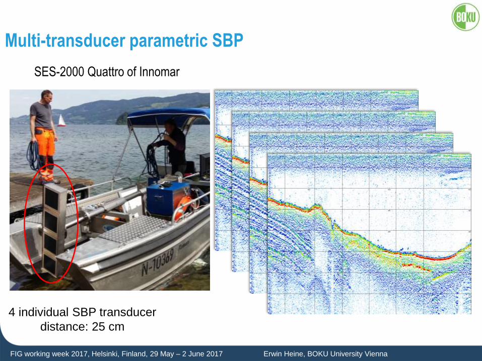
FIG working week 2017, Helsinki, Finland, 29 May – 2 June 2017 Erwin Heine, BOKU University Vienna
Multi-transducer parametric SBP
SES-2000 Quattro of Innomar
4 individual SBP transducer
distance: 25 cm
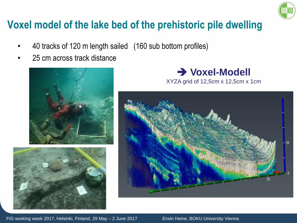
FIG working week 2017, Helsinki, Finland, 29 May – 2 June 2017 Erwin Heine, BOKU University Vienna
Voxel model of the lake bed of the prehistoric pile dwelling
• 40 tracks of 120 m length sailed (160 sub bottom profiles)
• 25 cm across track distance
Voxel-Modell XYZA grid of 12,5cm x 12,5cm x 1cm
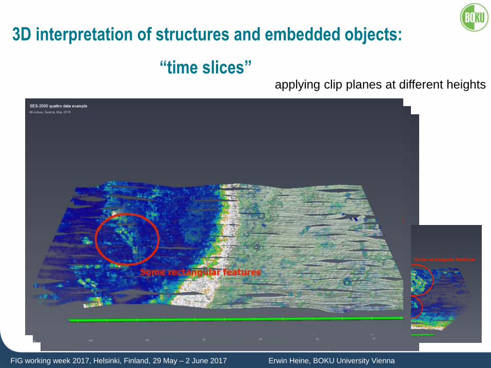
FIG working week 2017, Helsinki, Finland, 29 May – 2 June 2017 Erwin Heine, BOKU University Vienna
3D interpretation of structures and embedded objects:
“time slices” applying clip planes at different heights
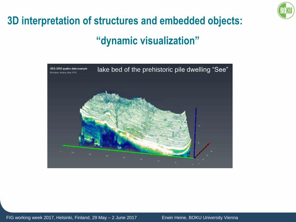
FIG working week 2017, Helsinki, Finland, 29 May – 2 June 2017 Erwin Heine, BOKU University Vienna
3D interpretation of structures and embedded objects:
“dynamic visualization”
lake bed of the prehistoric pile dwelling “See”
FIG working week 2017, Helsinki, Finland, 29 May – 2 June 2017 Erwin Heine, BOKU University Vienna
Conclusion
multi-transducer sub-bottom-profiler
• is able to provide detailed and accurate information of structures and objects
embedded in sediments
• resulting voxel model offers possibilities for 3D acoustic investigation of the sediment
submerged archaeological sites