initial environmental examination sri lanka - asian
TRANSCRIPT
Initial Environmental Examination
July 2018
Sri Lanka: Northern Province Sustainable Fisheries
Development Project: Athikovilady Protected Landing Site in Jaffna District
Prepared by Ministry of Fisheries and Aquatic Resources Development and Rural Economic Affairs for the Asian Development Bank.
This initial environmental examination is a document of the borrower. The views expressed herein do not necessarily represent those of ADB's Board of Directors, Management, or staff, and may be preliminary in nature. Your attention is directed to the “terms of use” section on ADB’s website. In preparing any country program or strategy, financing any project, or by making any designation of or reference to a particular territory or geographic area in this document, the Asian Development Bank does not intend to make any judgments as to the legal or other status of any territory or area.
1
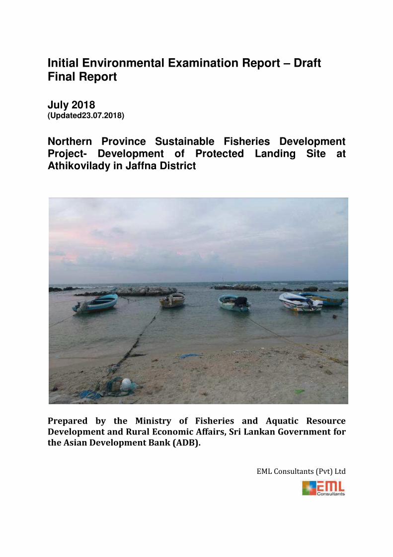
Initial Environmental Examination Report – Draft Final Report
July 2018 (Updated23.07.2018)
Northern Province Sustainable Fisheries Development Project- Development of Protected Landing Site at Athikovilady in Jaffna District
Prepared by the Ministry of Fisheries and Aquatic Resource
Development and Rural Economic Affairs, Sri Lankan Government for
the Asian Development Bank (ADB).
EML Consultants (Pvt) Ltd
2
CURRENCY EQUIVALENTS (AS OF 10 May 2018)
Currency Unit Sri Lanka Rupee 1 US$ = 157.6 LKR
0.0067US$ = 1 LKR
ADB Asian Development Bank
BPPE Business Promoters and Partners Engineering
CCCRMD Coast Conservation and Coastal Resources Management Department
CD Chart Datum
CEA Central Environment Authority
CEB Ceylon Electricity Board
DFAR Department of Fisheries and Aquatic Resources
DO dissolved oxygen
DoA Department of Archaeology
DS District Secretariat
DWC Department of Wildlife Conservation
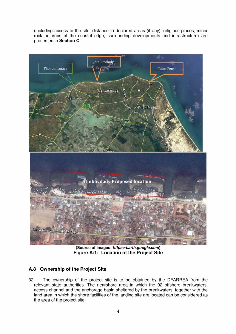
EEZ Exclusive Economic Zone
FD Forest Department
GN Grama Niladhari
GOSL Government of Sri Lanka
GSMB Geological Survey and Mines Bureau
IEE Initial Environmental Examination
IMT Incident Management Team
MEPA Marine Environment Protection Authority
MFARDREA Ministry of Fisheries and Aquatic Resources Development and Rural Economic Affairs
MHWS Mean High-Water Spring Tides
MoA Minister of Agriculture
MoL Ministry of Lands
NPC Northern Provincial Council
NWSDB National Water Supply and Drainage Board
PAA Project Approving Authority
PAI Project Area of Influence
PS Pradeshiya Sabha
RDA Road Development Authority
SMA Special Management Areas
SPS Safeguard Policy Statement
TDS Total Suspended Solids
iii
GLOSSARY
Adaptation The process of adjustment to actual or expected climate and its
effects. In human systems, adaptation seeks to moderate or avoid harm or exploit beneficial opportunities. In some natural systems, human intervention may facilitate adjustment to expected climate and its effects (IPCC, 2014).
Anchorage (fishery)
A location/development that includes Marine Structures or Dredging to provide shelter for Fiber Reinforced Plastic Boats with Outboard Engines OFRP boats and Traditional Crafts (TCs) with or without OBEs (i.e. Mechanized or Non-Mechanized)
Aquatic Resources
Living aquatic organisms and includes any seaweed, phytoplankton or other aquatic flora and non-living substances found in an aquatic medium (Government of Sri Lanka, 2016).
Biological diversity
Variability among living organisms from all sources including, inter alia, terrestrial, marine and other aquatic ecosystems and the ecological complexes of which they are part; this includes diversity within species, between species and of ecosystems. (UN, 1992b).
Climate Climate in a narrow sense is usually defined as the average weather, or more rigorously, as the statistical description in terms of the mean and variability of relevant quantities over a period of time ranging from months to thousands or millions of years. The classical period for averaging these variables is 30 years, as defined by the World Meteorological Organization. The relevant quantities are most often surface variables such as temperature, precipitation and wind. Climate in a wider sense is the state, including a statistical description, of the climate system. {WGI, II, III}, (IPCC, 2014).
Climate change
Change in the state of the climate that can be identified (e.g., by using statistical tests) by changes in the mean and/or the variability of its properties and that persists for an extended period, typically decades or longer. Climate change may be due to natural internal processes or external forcing such as modulations of the solar cycles, volcanic eruptions and persistent anthropogenic changes in the composition of the atmosphere or in land use. Note that the Framework Convention on Climate Change (UNFCCC), in its Article 1, defines climate change as: „a change of climate which is attributed directly or indirectly to human activity that alters the composition of the global atmosphere and which is in addition to natural climate variability observed over comparable time periods‟. The UNFCCC thus makes a distinction between climate change attributable to human activities altering the atmospheric composition and climate variability attributable to natural causes. See also Detection and Attribution. {WGI, II, III}, (IPCC, 2014).
Coastal access
The right of the public, to approach, enter or use an approach to enter into, or to go along a coastal margin in a physical and visual sense and also includes access along the shoreline, usually a strip of plan parallel to the waters edge or path or trail which connects the nearest public roadway with a shoreline destination along a reasonable direct route or access to the shoreline from a public road to the Mean High Water Level (Government of Sri Lanka, 2011).
Coastal zone The area lying within a limit of three hundred metres landwards of
iv
the Mean High Water line and a limit of two kilometres seawards of the Mean Low Water Line and in the case of rivers, streams, lagoons, or any other body of water connected to the sea either permanently or periodically, the landward boundary shall extend to a limit of two kilometres measured perpendicular to the straight base line drawn between the natural entrance points thereof and shall include the waters of such rivers, streams and lagoons or any other body of water so connected to the sea, and shall also include the area lying within a further extended limit of one hundred metres inland from the zero Mean Sea Level along the periphery;" (Government of Sri Lanka, 2011).
Critical habitat A subset of both natural and modified habitat that deserves particular attention. Critical habitat includes areas with high biodiversity value, including habitat required for the survival of critically endangered or endangered species; areas having special significance for endemic or restricted-range species; sites that are critical for the survival of migratory species; areas supporting globally significant concentrations or numbers of individuals of congregatory species; areas with unique assemblages of species or that are associated with key evolutionary processes or provide key ecosystem services; and areas having biodiversity of significant social, economic, or cultural importance to local communities (ADB, 2009).
Fish Any water dwelling aquatic or marine animal, alive or not, and includes their eggs, spawn, spat and juvenile stages, and any of their parts, and includes all organisms belonging to sedentary species (Government of Sri Lanka, 2016).
Fishery landing site
A location/development that includes only Shore Facilities to provide shelter for OFRP Boats and Traditional Crafts (TCs) with or without OBEs (i.e. Mechanized or Non-Mechanized) (UoM, 2016a).
Impacts Effects on natural and human systems. In this report, the term impacts is used primarily to refer to the effects on natural and human systems of extreme weather and climate events and of climate change. Impacts generally refer to effects on lives, livelihoods, health, ecosystems, economies, societies, cultures, services and infrastructure due to the interaction of climate changes or hazardous climate events occurring within a specific time period and the vulnerability of an exposed society or system. Impacts are also referred to as consequences and outcomes. The impacts of climate change on geophysical systems, including floods, droughts and sea-level rise, are a subset of impacts called physical impacts (IPCC, 2014).
Physical cultural resources
Defined as movable or immovable objects, sites, structures, groups of structures, and natural features and lanSCapes that have archaeological, paleontological, historical, architectural, religious, aesthetic, or other cultural significance. Physical cultural resources may be located in urban or rural settings and may be above or below ground or under water. Their cultural interest may be at the local, provincial, national, or international level (ADB, 2009).
Precautionary principle
Noting also that where there is a threat of significant reduction or loss of biological diversity, lack of full scientific certainty should not be used as a reason for postponing measures to avoid or minimize such a threat (UN, 1992b).
Project Area/s Is defined for this report as the physical area (marine, coastal and land) of the project that is directly impacted by the projects scope of
v
works. It includes associated areas that are directly impacted such as quarry sites.
Project Area of Influence
Is defined for this report as the physical area (marine, coastal and land) that surrounds the Project Area that maybe impacted by the projects scope of works. This as defined under Sri Lankan regulations (Sir Lankan Coast Conseravtion and Coastal Zone Management Act, 2011, ADB 2015 & 2016a) is limited to an area extending up to 500 periphery from the boundary of the harbor, and 02 km on either sides on coastal belt and one km toward sea from the boundary of the project site.
Resilience The capacity of social, economic and environmental systems to cope with a hazardous event or trend or disturbance, responding or reorganizing in ways that maintain their essential function, identity and structure, while also maintaining the capacity for adaptation, learning and transformation{WGII, III}. (IPCC, 2014).
Risk The potential for consequences where something of value is at stake and where the outcome is uncertain, recognizing the diversity of values. Risk is often represented as probability or likelihood of occurrence of hazardous events or trends multiplied by the impacts if these events or trends occur. (IPCC, 2014).
Vulnerability The propensity or predisposition to be adversely affected. Vulnerability encompasses a variety of concepts and elements including sensitivity or susceptibility to harm and lack of capacity to cope and adapt (IPCC, 2014). The Government of Sri Lanka (GoSL, 2015) specific “Vulnerability refers to the degree to which a system is susceptible to, and unable to cope with, adverse effects of climate change”.
NOTES
This Initial Environmental Examination (IEE) is a document of the borrower. The views expressed herein do not necessarily represent those of ADB's Board of Directors, Management, or staff, and may be preliminary in nature. In preparing any country program or strategy, financing any project, or by making any designation of or reference to a particular territory or geographic area in this document, the association does not intend to make any judgments as to the legal or other status of any territory or area.
vi
Table of Content
A. Introduction and General Information ........................................................................... 1
A.1 Name of the Project ................................................................................................................. 1
A.2 Name of the Developer ........................................................................................................... 2
A.3 Nature of the Project ............................................................................................................... 2
A.3.1 Aim and Scope of the Report, Objectives and Justification ................................... 2
Aim and Scope of the Report ............................................................................................................ 2
A.3.2 Objectives and Justification of the Proposed Project .............................................. 3
A.4 Investment and Funding Sources ...................................................................................... 3
A.5 Location of the Project ........................................................................................................... 3
A.6 Designs of the Project Site with the Extent of the Project Area ............................. 3
A.7 Location Map of the Project Site ......................................................................................... 3
A.8 Ownership of the Project Site .............................................................................................. 4
A.9 Institutional, legal and policy framework ....................................................................... 5
A.10 Environmental and Resource Legislation and Regulations of Sri Lanka ............ 5
A.10.1 National Regulations and Laws ....................................................................................... 5
A.10.2 Constitution of the Democratic Socialist Republic of Sri Lanka 1978 .............. 6
A.10.3 National Environmental Act No 47 of 1980 and Amended Act, No. 53 of
2000 ........................................................................................................................................... 6
A.10.4 Coastal Conservation (Amendment) Act, No. 49 of 2011...................................... 9
A.10.5 Fisheries and Aquatic Resources Act (FARA) as amended to 2016 ................ 11
A.10.6 Fauna and Flora Protection (Amendment) Ordinance, No. 22 of 2009 ......... 12
A.10.7 Marine Pollution Prevention Act, No. 35 of 2008. .................................................. 14
A.10.8 Pradeshiya Sabha Act No. 15 of 1987 ......................................................................... 14
A.10.9 The Ma-del (beach seine) Regulations of 1984 ....................................................... 14
A.10.10 Mines and Mineral Act No 33 of 1992 ........................................................................ 15
A.10.11 Antiquities (Amendment) Act No. 24 of 2008 ......................................................... 15
A.10.12 Land Acquisition Act No. 9 of 1950 ............................................................................. 15
A.10.13 Soil Conservation (Amendment) Act No. 24 of 1996 ............................................ 16
A.11 National Environmental and Resource Policies ......................................................... 16
A.11.1 Northern Province Integrated Strategic Environmental Assessment (ISEA)
16
A.11.2 Climate Change Policies ................................................................................................... 16
A.11.3 Coastal Resource Policy ................................................................................................... 17
A.11.4 Biodiversity, Protected Areas and Species Policies ............................................... 18
A.12 ADB Safeguard Policy (SPS) ............................................................................................... 19
A.13 Sir Lanka Environmental Clearance and Permits Requirements ........................ 20
vii
A.14 Conformity to Coastal Resources Management Plan................................................ 21
A.15 Contingency Plan of Marine Environmental Protection Agency and Other
Conservation/Development Plans .................................................................................. 21
B. Description of the Project ................................................................................................. 24
B.1 Description of the Main Project Components ............................................................. 24
B.2 Detailed Drawings of the Project ..................................................................................... 25
B.3 Time Period for Development and Construction ....................................................... 26
B.4 Financial Allocation and Investments ............................................................................ 26
B.5 Water and Disposal of Waste ............................................................................................. 26
B.5.1 Water ....................................................................................................................................... 26
B.5.2 Waste Water ......................................................................................................................... 27
B.5.3 Solid Waste ............................................................................................................................ 27
B.6 Electricity Requirement ....................................................................................................... 28
B.7 Natural Resources Consumption ..................................................................................... 28
B.8 Labor Requirement during Construction and Operational Periods ................... 28
B.9 Methodologies to be adopted for Construction .......................................................... 29
B.10 Sources of Construction Materials and Transportation .......................................... 29
B.11 Infrastructure Facilities Required/Provided .............................................................. 33
B.12 Aesthetic and Visual Environment .................................................................................. 34
B.13 Future Expansions ................................................................................................................. 34
B.14 Evaluation of the Alternatives ........................................................................................... 35
C. Description of the Existing Environment in the Study Area ............................. 36
C.1 Physical Features ................................................................................................................... 36
C.1.1 Topography and Drainage/Geology/Soil .................................................................. 36
C.1.2 Hydrology .............................................................................................................................. 39
C.1.3 Coastal Features (Environment) .................................................................................. 41
C.2 Ecological Environment ....................................................................................................... 47
C.2.1 Land Based Ecological Environment ........................................................................... 47
C.2.2 Aquatic Ecological Environment................................................................................... 52
C.3 Historical and Archeologically Significant Sites ......................................................... 58
C.4 Present Land Use in the Area............................................................................................. 59
C.5 Social and Economic Aspects ............................................................................................. 61
C.5.1 Socio-Economic Profile in the Area ............................................................................. 61
C.5.2 Diversity of population. .................................................................................................... 61
C.5.3 Nature of Households and Principal Economic Activities .................................. 62
C.5.4 Existing Infrastructure Facilities .................................................................................. 62
C.6 Existing Environmental Issues and Social Conflicts ................................................. 66
viii
D. Description of Anticipated Environmental Aspects .............................................. 67
D.1 Physical Resources ................................................................................................................ 67
D.1.1 Impacts to the Beach and Shoreline ............................................................................ 67
D.1.2 Changes in drainage patterns ........................................................................................ 69
D.1.3 Impacts on water quality ................................................................................................. 70
D.1.4 Impacts due to coastal hazard events-tsunamis, cyclones, storm surges etc
in the area and sea level rise .......................................................................................... 70
D.2 Transportation of Materials ............................................................................................... 70
D.3 Handling and Stockpiling of Materials ........................................................................... 71
D.4 Anticipated Problems related to Solid Waste Disposal ........................................... 72
D.5 Ecological Resources (Land Based and Aquatic) ....................................................... 72
D.5.1 Impacts on Land Based Ecological Resources ......................................................... 72
D.5.2 Impacts on Aquatic Ecological Resources ................................................................. 73
D.6 Impacts related to Noise, Vibration, Dust and Air Quality Generation .............. 73
D.7 Impacts due to Changes of Land Use .............................................................................. 76
D.8 Socio-Economic Aspects ...................................................................................................... 76
D.8.1 Direct and Indirect Impacts of the Project on other Development Projects in
the Area .................................................................................................................................. 76
D.8.2 Impacts on Fishing Industry, including Beach Seine Fishery related
activities, and Fishing Community (during Construction and Operation) ... 77
D.8.3 Impacts to other Beach Users in the Area ................................................................. 77
D.8.4 Impacts due to Relocation and Loss of Livelihood ................................................ 78
D.8.5 Details on the Employment Generation in the Local Community .................... 78
D.9 Impacts on Archeological and Cultural Resources .................................................... 78
D.10 Potential Impacts of Climate Change on Proposed Investments ......................... 78
D.10.1 Disaster/Emergency Response Measures ................................................................ 79
E. Proposed Mitigatory Measures ...................................................................................... 81
E.1 Mitigation Measures for Impacts on Physical Resources ....................................... 81
E.2 Mitigation Measures for Impacts due to Transportation of Materials .............. 82
E.3 Mitigation Measures for Impacts due to Handling and Stockpiling of Materials
...................................................................................................................................................... 83
E.4 Mitigation Measures for Impacts due to Impacts of Sewage, Waste Oil Spills,
Surface Run-off, Waste Water Disposal on the Environment............................... 83
E.5 Mitigation Measures for Anticipated Problems related to Solid Waste
Disposal ..................................................................................................................................... 83
E.6 Mitigation Measures for Impacts on Ecological Resources (Land Based and
Aquatic) ..................................................................................................................................... 83
E.6.1 Mitigation Measures for Impacts on Land Based Ecological Resources ....... 83
ix
E.6.2 Mitigation Measures for Impacts on Aquatic Ecological Resources .............. 84
E.7 Mitigation Measures for Impacts related to Noise, Vibration, Dust and Air
Quality ........................................................................................................................................ 84
E.8 Mitigation Measures for Impacts due to Changes of Land Use ............................. 85
E.9 Mitigation Measures for Impacts on Socio-Economic Aspects ............................. 85
E.9.1 Mitigation Measures for Direct and Indirect Impacts of the Project on other
Development Projects in the Area................................................................................ 85
E.9.2 Mitigation Measures for Impacts on Fishing Industry, including Beach Seine
Fishery related activities, and Fishing Community (during Construction and
Operation) ............................................................................................................................. 85
E.9.3 Mitigation Measures for Impacts to other Beach Users in the Area ............... 85
E.9.4 Mitigation Measures for Impacts due to Relocation and Loss of Livelihood
85
E.10 Mitigation Measures for Impacts on Archeological and Cultural Resources .. 86
E.11 Mitigation Measures for Potential Impacts of Climate Change on Proposed
Investments ............................................................................................................................. 86
E.12 Mitigation Measures for Potential Impacts of Climate Change on Proposed
Investments ............................................................................................................................. 86
F. Information Disclosure, Consultation and Participation ..................................... 87
G. Grievance Redress Mechanism .................................................................................... 90
H. Environment Management Plan .................................................................................... 91
H.1 Institutional Arrangements to Oversee the Implementation of the Monitoring
Plan .......................................................................................................................................... 106
H.2 Institutional Arrangements ............................................................................................. 106
H.2.1 Sri Lankan Government................................................................................................. 106
H.2.2 Contractor ........................................................................................................................... 107
I. Conclusions and Recommendations ....................................................................... 108
List of Figures Figure A:1: Location of the Project Site........................................................................... 4 Figure A:2: Coastal Zone Definition (Government of Sri Lanka, 2016b) ........................ 10 Figure A:3: Development Permit Requirements (Coast Conservation Act No. 57 of 1981 (and its amendments). ................................................................................................... 18 Figure B:1:Athikovilady Fishery Landing Site ................................................................. 24 Figure B:2: Sample cross section of Breakwater Sections ............................................. 25 Figure B:3 : Construction Schedule ............................................................................... 26 Figure B:4: Quantity of rock armor requirement ............................................................. 29 Figure B:5: Location of Quarries and Transportation Routes of Rock Material .............. 30 Figure B:6: The route starts from the Srisena Quarry to Rambewa Kandy-Jaffna A9 road (light green colour route) ................................................................................................ 31 Figure B:7: The route starts from the Meganaguma Quarry site to RambewaJuction (A9) road. .............................................................................................................................. 31
x
Figure B:8: Routes starts from BPPE quarry to Mankulam Junction A9 road. ................ 32 Figure B:9: Access Roads to the Project Site from the A2 Road ................................... 32 Figure C:1: Topographic Characteristics in the vicinity of the Project Site ..................... 36 Figure C:2 Soil Map of Northern Province ................................................................... 38 Figure C:3: Soil Profile at the Project Site ...................................................................... 39 Figure C:4: Rainfall Characteristics in the Study Area ................................................... 40 Figure C:5 Longshore Sediment Transport Rates in Point Pedro Area ........................ 42 Figure C:6 : Beach Profile at the Athikovilady Fishery Landing Site .............................. 43 Figure C:7 (Source: Report on Delft3D model based alongshore sediment transport rates at Pesalai, Gurunagar, Point Pedro and Mullaitivu, Sri Lanka (Phase 2 Final Report) Sri: Northern Province Sustainable Fisheries Development Project Prepared by UNESCO-IHE for the Asian Development Bank) ........................................................... 44 Figure C:8: Nearshore Wave Conditions in Point Pedro ................................................ 44 Figure C:9: Shoreline changes in Athikovilady ............................................................... 45 Figure C:10: Tracks of Past Cyclones/Storms across Sri Lanka .................................... 47 Figure C:11: Major Habitats in the Project Site and the Project Area of Influence ......... 48 Figure C:12: Plant Species on the Sandy Beach of the Project Site .............................. 49 Figure C:13 .................................................................................................................... 53 Figure C:14: : Reefs associated with the shallow water coastal areas within the proposed Adikoviladi anchorage site. ............................................................................................ 55 Figure C:15: Existing reef channels associated with the Adikoviladi anchorage site. . 55 Figure C:16: Intertidal reef systems associated with the Adikoviladi anchorage site. . 56 Figure C:17: Examples of hard coral coverage associated with the majority of the sub tidal reef system associated with the Adikoviladi Anchorage site. Note the bleaching on the 3rd and 4th photos. .................................................................................................... 57 Figure C:18 Summary of the findings ........................................................................ 58 Figure C:19: Places of Historical Significance in the Area ............................................. 59 Figure C:20 Land use pattern of the area. ................................................................. 60 Figure C:21: Congested Coastal Areas along the beach road Velvettithurai ................. 63 Figure D:1: Coastline Response to Offshore Breakwaters ............................................. 68 Figure D:2 The location of Munai and the Athikovilady ............................................ 68 Figure D:3: Maximum Permissible Noise Levels during Construction Activities ............. 74 Figure G:1: Grievance Redress Mechanism .................................................................. 90
List of Tables Table A-1: Summary of key environmental laws associated with the PPPDP. ................. 5 Table A-2: Key government agencies associated with project development consent applications. ..................................................................................................................... 7 Table A-3: Approvals, Permits required to implement the Proposed Project .................. 20 Table C-1: Ground Water Quality in the vicinity of the Project Site ................................ 41 Table C-2: Summary of Floral Species recorded in the Study Area ............................... 49 Table C-3: Details of Floral Species Recorded in project are and project area of influence, indicating taxonomic Status and National Conservation Status. .................... 51 Table C-4: Summary of the Faunal Species Recorded During the Study in both Project Area and Project Area of Influence ................................................................................ 52 Table C-5: Details of Faunal Species Recorded in the Proposed Project Area and Project Area of Influence ............................................................................................... 52 Table C-6 summary of details of the sites investigated sites. ..................................... 54 Table C-7: Places of Historical or Archeological Significance in the Point Pedro-Vadamarachchi North Divisional Secretariat (DS) Division ............................................ 59
xi
Table C-8: Present Land Use Pattern in the Point Pedro-Vadamarachchi North Divisional Secretariat (DS) Division ............................................................................................... 60 Table C-9: Gender Diversity and Age Distribution of the Population .............................. 61 Table C-10: Employment Pattern in the Point Pedro-Vadamarachchi North Divisional Secretariat (DS) Division ............................................................................................... 62 Table C-11: Income Levels of the Population in the Point Pedro East-J/403 GramaNiladhari (GN) Division ....................................................................................... 62 Table C-12: Other typical facilities available in the area ................................................ 63 Table C-13: Welfare and Religious institutions available in DSD area. .......................... 64 Table C-14: Structure of the Fishing population in Point Pedro DSD ............................. 65 Table C-15: Details on the Fisheries Sector-2015- Point Pedro-Vadamarachchi North Divisional Secretariat (DS) Division ............................................................................... 66 Table D-1: Typical Noise Levels of Construction Equipment ......................................... 73 Table D-2 Maximum Permissible Vibration level ............................................................ 75 Table F-1: Meetings with government authorities .......................................................... 88 Table F-2: Concerns and Responses - Fishery Harbors Consultations ......................... 88 Table F-3: Stakeholder consultation .............................................................................. 89 Table F-4: Responses to the community consultation ................................................... 89 Table G-1: Persons and Agencies that can be contacted by the Affected Persons for Assistance with a Grievance .......................................................................................... 91 Table H-1: Proposed Environmental Management Plan ................................................ 92
xii
LIST OF ANNEXURES Annex 01 TOR Annex 02 Topographic Map Annex 03 Geotechnical Report Annex 04 Ground Water test report Annex 05 Sea water test report Annex 06 Bathymetric map Annex 07 Terrestrial Report Annex 08 Marine Ecology Report Annex 10 List of persons interviewed Annex 11 Community Consultation Annex 12 Layout Plan Annex 13 Terms of Reference Environmental Safety Officer (ESO)
for Anchorages Annex 14 List of IEE preparers
xiii
Executive Summary 1. The Asian Development Bank (ADB) is assisting the Government of Sri Lanka (GoSL) to
upgrade and improve the infrastructure and services for the development of fisheries infrastructure facilities in the Northern Province under the Northern Province Sustainable Fisheries Development Project (NPSFDP). The NPSFDP Project Design Advance (PDA) Loan supports the preparation of detailed designs on harbors, anchorages and landing sites for the ensuing loans and also supports the updating of environment assessments prepared under the Project Preparatory Technical Assistance (PPTA). Eight IEEs have been prepared for this project.
2. This report presents the details of the Initial Environmental Examination (IEE) carried out
for the Proposed Development of the protected landing site at Athikovilady in Jaffna District. The IEE has been carried out in accordance with the Terms of Reference provided by the Coast Conservation and Coastal Resource Management Department and the ADB.
3. This report presents the details of the Initial Environmental Examination (IEE) carried out
for the Proposed Development of Fishery Anchorage Facilities at Athikovilady in Jaffna District. The IEE has been carried out in accordance with the Terms of Reference provided by the Coast Conservation and Coastal Resource Management Department .
4. The proposed development is a part of the project on developing sustainable fisheries
infrastructure in the northern province. Fishery activities in the northern province had been severely affected by the conflict that prevailed in the region for nearly 03 decades and, with many of the fisheries infrastructure facilities currently in a dilapidated state, a strong need exists for rehabilitation and development of appropriate fisheries infrastructure. In view of these circumstances, a project on developing sustainable fisheries infrastructure in the northern province is being carried by the Ministry of Fisheries and Aquatic Resources Development and Rural Economic Affairs in which a number of fishery landing sites have been identified for further development, based on a feasibility study conducted earlier. The Athikovilady fishery landing site has been identified by the feasibility study as a site to be developed with off shore protection structures.
5. The Athikovilady fishery landing site is located in a shallow basin sheltered by a reef
formation located close and parallel to the coastline in the nearshore area. The access to the sheltered basin is provided by a channel located at a gap in the reef formation. Fishing boats are mainly moored/anchored in the shallow basin. Beach landing of boats is also carried out by the fishing community. Calm water conditions exist in the sheltered basin for the mooring/anchoring of fishing boats during the non-monsoon period from February to September. However, difficulties in maneuvering and mooring of fishing boats are encountered during the north-east monsoon period, mainly due to wave overtopping over the low crested reef formation. Scattered debris of broken reef from severe climatic events in the past and silting in the basin area have also caused difficulties in access and mooring of boats. In order to address these issues, based on consultations with the stakeholders and subsequent assessments of future needs, the following developments have been identified the to meet the needs of the fishing community and develop the site as a fishery anchorage:
i. Construction of 03 offshore breakwater along the reef formation to reduce wave
overtopping and disturbances in the sheltered basin to provide safe mooring
xiv
conditions throughout the year. The breakwaters and revetment are to be of rubble mound structures.
ii. Dredging of access channel and shallow areas within sheltered basin to provide improved and safe conditions of access and mooring
6. The main natural resource requirement for the proposed development would be rocks of
different sizes as required by breakwater design considerations. No large scale quarries are located in Jaffna district to obtain the rocks for and the quarries in Mullaithivu and Anuradhapura districts, with the potential to supply the rocks required, have been identified as the source. The rocks obtained from the identified quarries are to be transported by trucks of adequate capacity, along the road network of the area.
7. Only a small workforce would be required for the proposed construction activities. A land
based methodology is to be used for breakwater and revetment construction and dredging. A temporary access way is to be built to the location of the breakwaters for delivery, dumping and/or placement of breakwater materials for the core and outer layers. Stockpiling of rocks transported from the quarries would be required for uninterrupted progress of construction. The possibility exists for small stockpiles to be maintained in the project site-in the beach nearshore areas of the basin. However, a larger land area may be required to maintain temporary stockpiles of rock materials. A suitable site (land), preferably in close proximity of the project site, is to be identified/used by the contractor(s) to maintain such stockpiles.
8. In view of the nature of construction-breakwater/revetment construction with dumping
and/or placement of rocks and dredging-except dredged material, no significant quantities of solid waste or waste water will be regularly generated by the construction activities. The dredged material would be a mix of sand and reef material maximum of 600,000 m3 are envisaged in view of the existing depths in the areas of dredging. The possibilities given below are to be explored and adopted for the disposal of dredged material with the approval of relevant authorities.
i. Disposed along the beach area of the landing site where possible
ii. Filling of the nearby coastal recreational area used by the local community
iii. Disposal along the coastline, particularly in the areas of erosion, with the approval of
the CCCRMD
9. Predominantly flat topographic conditions exist in the vicinity of the project site and the study area. No rivers, streams or marshy areas are located in the study area. No drainage paths from surround areas pass through the project site. The coastal bathymetry in the project site and the study area is mainly characterized by shallow nearshore areas sheltered by the reef (with depths mainly less than 1.0 m) and the seaward edge of the reef rising above the mean sea level at many locations with heights reaching in excess of 1 m at several locations. Deeper areas exist beyond the reef formation. Sediment transport modeling, field investigations and review of available information indicate a net longshore sediment transport pattern westwards along the coastline in the vicinity of the project site and the study area. In view of the shelter provided by the reef against wave, a possibility exists for significantly low levels of sediment transport in the nearshore area between the coastline and the edge of the reef formation.
xv
10. The main habitat types identified in the project site are beaches consisting of sand stone corals and sandy beaches. The natural habitats in the project site are highly disturbed due to human interaction. No fauna and flora typical for rocky shores and sandy beaches are recorded in the project site and the natural flora consists of very a few species. A very low floristic diversity exists in the study area. The reefs found are not true (typical) fringing coral reefs but mostly limestone reefs and rock boulder reefs are found in submerged deeper areas. A course sand bottom extends from the edge of the reefs and towards offshore areas, the bottom mainly consists mostly fine sand and mud. The reefs are rather low in structural complexity and diversity compared to the sub-tidal reefs elsewhere in the country. The biodiversity in most of the reefs is low as such reefs are subject to periodic smothering by regular accreting/eroding coastline that prevents continuous colonization by corals. However, some rich coral growth can be observed towards the reef edge.
11. The coastal communities around the project site are heavily dependent on fisheries for
their livelihood. The population in the study area is entirely Tamil with Hinduism and Christianity being the dominant religions. No sites of historical or archeological significance are located in the immediate vicinity of the project site.
12. The potential environmental impacts arising from activities of the proposed development
were identified as 'Positive', 'No' „Low‟, „Moderate‟ and „High‟, mainly based on criteria such as magnitude, spatial extent, duration, reversibility etc. In view of the nature and scale of the development activities and the characteristics and/or features in the environment in the study area, many of the impacts can be rated as Low‟, or „Moderate‟ during both construction and operational stages. The „Moderate‟ impacts mainly include those associated with material transport over long distances, stockpiling of materials, noise, vibration and dust emission levels and disturbances to current fisheries activities at the project site during the construction stage. Such a level of impact is also associated with solid waste disposal in the operational stage.
13. The impact mitigation measures for the anticipated environmental impacts were
identified and which are mainly in the form of proper planning/design aspects, proper construction practices and proper operational practices. Proper planning/design aspects include compliance with regulations, incorporation of services/facilities/systems into the proposed developments. Proper construction/operational practices include proper methods obtaining natural resources, proper waste disposal practices, measures to minimize disturbances to the surrounding environment, contingency plans for emergencies and providing facilities and benefits to local communities.
14. The IEE study also describes the institutional structure to ensure the implementation of
the environment management and monitoring program.. The impact mitigation measures proposed are incorporated to form the proposed Environmental Management Plan..
15. On the basis of the analysis of these elements and on the assumption that the recommendations for the mitigation of identified impacts are adopted and adequately implemented, the IEE has concluded that there are no major environmental impacts associated with the construction and operation of proposed fishery landing site development project in Athikovilady in the Jaffna district on the northern coast
1
A. Introduction and General Information A.1 Name of the Project 16. The Northern Province Sustainable Fisheries Development project is aligned with the
following impacts: (i) investments in the fisheries sector promoted; and (ii) employment
and livelihood opportunities in the Northern Province promoted1 The project will have the
following outcome: Fisheries production in the Northern Province sustainably increased.
There are three outputs under this project.
17. Output 1: Marine fisheries infrastructure constructed. Two harbors in Point Pedro, Jaffna District and Pesalai, Mannar District; one anchorage in Jaffna District in Mandativu, and 23 landing sites (8 in Jaffna2, 6 in Mannar3, 6 in Mullaitivu4, and 3 in Kilinochchi5) will be constructed.
18. Output 2: Aquaculture developed. Detailed designs, construction and operational start-up of artificial breeding production facilities, to provide the necessary seed stock for three target species. A sea cucumber hatchery with a production capacity of one million juveniles per year will be established in Mullaitivu; a mud crab hatchery with a production capacity of one million crablets per year will be established in Mannar; a sea weed tissue culture laboratory capable of producing 30,000-50,000kg of propagules will be established in Jaffna. The first coastal aquaculture training center in the country will also be established in Mannar district.
19. Output 3: Entrepreneurial skills, market links and credit access for local
communities; and capacities of government staff strengthened. Of the 264 grama
niladhari divisions (GND) that comprise the project area, following a ranking based on a
vulnerability criterion developed, 141 GND’s were identified for targeted support.
Communities in these GNDs will be supported through: (i) provision of small-scale
infrastructure and replanting of mangroves to support livelihoods; (ii) identification of
potential livelihood opportunities based on market requirements and provision of training
to develop relevant skills; (iii) improving and facilitating access to credit through greater
awareness on available credit facilities and supporting preparation of documentation
including business plans to access credit; (iv) supporting the establishment of three
model enterprises in partnership with the private sector capable of generating
employment opportunities for the community; and (v) provision of psycho-social trauma
support for communities impacted due to the prolonged conflict
20. Seven environment assessments are being undertaken for output 1. 1 each of the harbor
sites, 1 for the anchorage site and three individual IEEs for the landing sites that have off
shore protection (Munai, Athikoviladi and Thalaithurai), and one IEE for all other landing
sites. Another IEE is being undertaken for investments under output 2. An environment
assessment review framework has been prepared for investments under output 3.
1 Government of Sri Lanka. 2017. Vision 2025: A Country Enriched. Colombo. 2 Sampoladi, Chullipuram West, Aralithurai, Thuriyor, Punkuduthivu, Munai, Thalathurai, and
Athikoviladi 3 Thalimannar, Sirithoppu, Minarappadu, Wankalai, Arippu, Kodachchikuda 4 Iranapalai, Kallappadu North, Kallappadu South, Theethakarai, Silawathai, and Kokilai 5 Pallikuda, Valaipadu, and Nachchikuda
2
21. This IEE is developed for the Development of Fishery landing site at Athikovilady in Jaffna District.
A.2 Name of the Developer 22. Department of Fisheries and Aquatic Resources Development and Rural Economic
Affairs (DFARDREA) 3rd Floor, New Secretariat Maligawatta, Colombo 10
Sri Lanka.
A.3 Nature of the Project 23. The project involves the development of appropriate infrastructure facilities at the
Athikovilady fishery landing site in Jaffna district. The proposed development activities include the construction of 03 offshore breakwaters and dredging of 3 access channels and the shallow areas of the anchorage basin. The details of the proposed development are presented in Section B of the report. Land based facilities will not be constructed as sufficient facilities are available.
A.3.1 Aim and Scope of the Report, Objectives and Justification
Aim and Scope of the Report
24. The primary aim of the IEE report is to provide environmental information to decision
makers with respect to the environmental acceptability and sustainability of the proposed project. In meeting this primary aim, the IEE is defined as having the following objectives:
To describe the proposed project and the key activities associated with the
construction and operational phases
To identify existing and future sensitive receivers, resources, activities and land uses that may be adversely or beneficially affected by the project
To identify, predict and evaluate the potential impacts of the project on sensitive receivers, resources, activities and land uses
To propose appropriate mitigation measures to reduce or minimize any adverse impacts that have been identified, taking into account any associated constraints or consequential environmental or social implications of such measures
To identify, predict and evaluate the acceptability of the residual impacts of the project after the implementation of selected mitigation measures and to evaluate any cumulative environmental impacts to which the project may contribute
To identify, develop and specify methods, measures and standards to be included in the detailed design, construction and operational phases of the project in order to reduce environmental impacts to acceptable levels
To specify appropriate environmental monitoring and audit requirements for the
implementation of the project activities
3
A.3.2 Objectives and Justification of the Proposed Project 25. The proposed project is a part of the project on developing sustainable fisheries
infrastructure in the Northern Province. 26. Prior to the conflict that prevailed in the region, Northern Province was one of the
most productive fishing regions in the country. Its contribution to the national fish production of 40 % had declined since mid-1980s due to the disruptions caused to fisheries activities by the conflict. Fisheries activities have resumed/expanded in the Northern Province since the end of the conflict in 2009.However as many of the facilities in a dilapidated state, a strong need exists for rehabilitation and development of appropriate fisheries infrastructure. In view of these circumstances, a project on developing sustainable fisheries infrastructure in the northern province is being carried by the Ministry of Fisheries and Aquatic Resources Development and Rural Economic Affairs (MFARDREA) in which a number of fishery landing sites have been identified for further development, based on a feasibility study conducted earlier.
27. The Athikovilady fishery landing site has been identified by the feasibility study as
one of the sites to be developed to improve boat safety based on the Equivalent score assessment used during the feasibility study6.
A.4 Investment and Funding Sources 28. The investment required for the proposed development of Athikovilady fishery
anchorage is estimated as Rs. 123,555,546 29. The funding for the proposed development is to be provided by the Asian
Development Bank (ADB) as a loan facility to the Government of Sri Lanka (GOSL). GOSL will cover the taxes and duties.
A.5 Location of the Project
i. GramaNiladhari Division: Valvetithurai Northwest -J/388 ii. Local Authority: Point Pedro Urban Council iii. Divisional Secretariat: Point Pedro-Vadamarachchi North iv. District Secretariat: Jaffa
A.6 Designs of the Project Site with the Extent of the Project Area 30. The details on designs of the project site and the extent of the project area are
presented in Section B.
A.7 Location Map of the Project Site 31. The location of the project site in the Jaffna peninsula is shown in Figure A:1. The
details on physical, ecological and socio-economic environments in the study area
6 Equivalent score is determined based on number of boats by type and the fish catch for that type of boat
weighted by type of boat. The sites with an Equivalent Score in the range of 0-225 are classified as 'Small',
those with a score in the range 226-550 are classified as 'Medium' and those with a score in the range
551-775 are classified as 'Large'. Shore facilities are proposed, based on the classification of sites. The
basis for anchorage design is to provide a safe anchorage responding to local meet vessel requirements as
determined by the vessel needs and local coastal conditions
4
(including access to the site, distance to declared areas (if any), religious places, minor rock outcrops at the coastal edge, surrounding developments and infrastructure) are presented in Section C.
(Source of Images: https://earth.google.com)
Figure A:1: Location of the Project Site A.8 Ownership of the Project Site 32. The ownership of the project site is to be obtained by the DFARREA from the
relevant state authorities. The nearshore area in which the 02 offshore breakwaters, access channel and the anchorage basin sheltered by the breakwaters, together with the land area in which the shore facilities of the landing site are located can be considered as the area of the project site.
Athikovilady
Point Petro Thondamanaru
Athikovilady Proposed location
5
A.9 Institutional, legal and policy framework 33. The implementation of the proposed project activities will be administered by the
environmental laws and regulations of Sri Lanka and the ADB safeguard policies. 34. This chapter therefore describes Sri Lankan national laws, regulations and policies
relevant to this project and the ADB SPS and as well as international agreements that are pertinent to the construction and operation of the project.
A.10 Environmental and Resource Legislation and Regulations of Sri Lanka
A.10.1 National Regulations and Laws 35. A number of national environmental laws and regulations are directly relevant to the
proposed Thalitthurai investment. The 36. Table A-1 provides a summary of these key laws which are described in greater detail
below (summarized from ADB, 2017).7
Table A-1: Summary of key environmental laws associated with the PPPDP.
Law Project Relevance Government Focal Point
Constitution (1978). Fish and fisheries within territorial waters are under concurrent control.
MFARDREA, NPC
The National Environmental Act No 47 of 1980 and Amendment Act, No. 53 of 2000.
Environmental Approval for projects outside the coastal zone. Pollution prevention and control from land based sources.
CEA
The Coast Conservation (Amendment) Act, No. 49 of 2011.
Development permits in the coastal zone. Coastal resources inventory and management plan.
CCCRMD
Fisheries and Aquatic Resources Act amended (2016)
Fisheries policy, monitoring, and management.
MFARDREA
The Fauna and Flora Protection (Amendment) Act, No. 22 of 2009.
Wildlife conservation areas and protected species.
DWC
Forest Ordinance, No. 17 of 1907 (as amended).
Conservation and management of forests, felling of trees.
FD
The Marine Pollution Prevention Act, No, 35 of 2008.
Pollution prevention and control from marine sources.
MEPA
Pradeshiya Sabha Act No. 15 of 1987.
Local authority responsibility for health and sanitation and public thoroughfares.
PS
The Ma-del (beach seine) Regulations of 1984.
Managers and licenses beach seine fishing in coastal areas.
MFARD, DS
Mines and Mineral Act No 33 Licenses the extraction of quarry GSMB
7 ADB -2017, Initial Environmental Examination Report, Final, Northern Province Sustainable Fisheries
Development project, August 2017.
6
of 1992. material. Antiquities (Amendment) Act No. 24 of 1998.
Antiquities conservation. DoA
Land Acquisition Act No. 9 of 1950.
Acquisition of lands for public purposes – includes compensation payments.
ML, DS
Soil Conservation (Amendment) Act, No. 24 of 1996.
Conservation of soil resources and mitigation of soil erosion and usage.
MA
CCCRMD = Coast Conservation and Coastal Resources Management Department; CEA = Central Environment Authority; DoA = Department of Archaeology; DWC = Department of Wildlife Conservation; GSMB = Geological Survey and Mines Bureau MEPA = Marine Environment Protection Authority; MFARD = Ministry of Fisheries and Aquatic Resources Development; MoL = Ministry of Lands; NPC = Northern Provincial Council; PS = Pradeshiya Sabha; FD = Forest Department; MoA = Minister of Agriculture; DS = District Secretariat.
37. The protection, management and responsibility of the nation‟s environment are documented in the Constitution (GoSL 1978-10). Chapter VI (Directive Principles of State Policy and Fundamental Duties), Sections 27 (14) and 28 (f) declare that: “The State shall protect, preserve and improve the environment for the benefit of the community” and “it is the duty of every person in Sri Lanka to protect nature and conserve its riches”.
A.10.2 Constitution of the Democratic Socialist Republic of Sri Lanka 1978 38. The Constitution of Sri Lanka (Government of Sri Lanka, 1987) specifies that fish and
fisheries are not on the provincial council list (under the Provincial Council mandate), rather fish and fisheries resources within territorial waters are on the concurrent list (central government and province). Fish and fisheries beyond territorial waters are on the reserve list (central government).
A.10.3 National Environmental Act No 47 of 1980 and Amended Act, No. 53 of 2000
39. The National Environmental Act (NEA), (Government of Sri Lanka, 1980) provides the administrative arrangements “for the protection, management and enhancement of the environment, for the regulation, maintenance and control of the quality of the environment, for the prevention, abatement and control of pollution”.
40. The NEA is implemented by the Central Environmental Authority (CEA), which functions under the Ministry of Mahaweli Development and Environment (MMDE). The scope of this law virtually covers all aspects necessary to safeguard the environment and natural resources in the country.
41. The Act entrusts the CEA with responsibilities regarding the use of lands and the management and conservation of natural resources outside of the coastal zone, however under the instruction of the Coastal Conservation and Coastal Resources Management Department (CCCRMD) the CEA or other Project Approving Agencies (PAA) can be delegated to process development permits within or partly in the zone. Moreover, the CEA manages the standards of wastewater discharges into coastal water bodies and fresh water bodies and monitoring for environmental degradation. Part IV B, of the Act provides the provisions for the maintenance of environmental quality and to control the environmental pollution by setting relevant standards.
42. The NEA includes two main regulatory provisions through which the environmental impacts of development projects are assessed, mitigated and managed: This includes:
7
i. The Environmental Impact Assessment (EIA) procedure for major development projects - regulations published in Government Gazette Extraordinary No 772/22 of 23rd June 1993 and in subsequent amendments;
ii. The Environmental Protection License (EPL) procedure for the control of pollution - regulations published in Government Gazette Extraordinary No 1533/16 of 25 January 2008.
43. The provisions for EIA is contained in Part IV C of the NEA, which requires the submission of an IEE or EIA report in respect of certain “prescribed projects”. These are specified in Gazette Extraordinary No 772/22 of 23rd June 1993.
44. The PPPDP scope of works (derived from the PPTA) has been evaluated by the CCCRMD resulting in a determination that an Environmental Impact Assessment (EIA) is required. This determination categorization represents the ADB SPS categorization of an Initial Environmental Examination (IEE) and as such one specific environmental report has been produced for the PPPDP which ensures both processes are met.
45. The Ministry of Mahaweli Development and Environment (MMDE) is tasked with policy formulation on the environment and natural resources in Sri Lanka and as such will be the lead agency, through a number of the ministry‟s divisions. The Coast Conservation and Coastal Resource Management (CCCRM) division will be responsible for issuing the project Development Consent (DC) approvals for the developments is the coastal area defined in the Coast Conservation and Coastal Resource Management Act. (CCCRMA).
46. Table A-2 provides a summary of key Ministries and their divisions associated with the approval decisions for the PPPDP.
Table A-2: Key government agencies associated with project development consent applications.
Agency Roles Associated with the PPPDP
MFARD
Is the project EA and through its PIMU will implement the project.
Ceylon Fishery Harbors Corporation (CFHC): CFHC is the government agency responsible for managing fishery harbors in Sri Lanka. It is the proponent for the fishery harbors, anchorage and landing site investments under output 1 of NPSFDP. There is, currently, no permanent CFHC representation in any of the Districts of Northern Province. Department of Fisheries and Aquatic Resources (DFAR): DFAR has overall responsibility for implementation of the Fisheries and Aquatic Resources Act (FARA) with a particular focus on ensuring compliance with international and regional treaty obligations. At the di strict level, district offices of DFAR are headed by Assistant Director of Fisheries. Jaffna District has a permanent DFAR representation. National Aquatic Resources Research and Development Agency (NARA): NARA is “the principal national institute charged with the responsibility of carrying out and coordinating research, development and management activities on the subject of aquatic resources in Sri Lanka”. NARA includes a number of research divisions relevant to NPSFDP such as “Marine Biological Resources Division”; “Socio-economic & marketing research division”; “fishing technology division”; “environmental studies division”; “institute of post-harvest technology”; “national institute of oceanography and marine science”; “national hydrographic office”, “monitoring and evaluation division” and a number of regional research centers. NARA has no offices in Northern Province.
MMDE Is responsible for the management of the environment and natural resources.
The ministry includes the divisions of: Biodiversity; Environmental Pollution Control and Chemical Management, Climate Change; Natural Resource
8
Management; Sustainable Development and Sustainable Environment. The Ministries Implementing Agencies include;
Central Environment Authority (CEA): The CEA and is responsible for administering the provisions of the National Environmental (Amendment) Act, No. 53 of 2000 (Government of Sri Lanka, 2000). The CEA is mandated to manage the Environmental Protection Licensing (EPL) system nationally; the Initial Environmental Examination/Environment Impact Assessment (IEE/EIA) process outside the coastal zone using Project Approving Agencies (PAA) where appropriate; the environmental recommendations system regarding non-prescribed activities; and the scheduled waste management licensing system. CEA is also responsible for ensuring compliance with air quality, and noise, regulations. Representation of CEA at the Northern Province and Northern Province District level includes offices in all Districts.
Coast Conservation and Coastal Resource Management Department (CCCRMD): The department is mandated under the Coast Conservation (Amendment) Act, No. 49 of 2011 (Government of Sri Lanka, 2011) to conserve the “coastal zone”, as defined in the Act (see glossary) including the survey of resources within the coastal zone, the production of a coastal zone and coastal resources management plan, and the issuing of “permits” for developments within the coastal zone. Unlike the CEA the CCCRMD does not have access to Project Approving Agencies (PAA) to support the development permit process within the coastal zone although it can assign responsibilities. CCCRMD can also declare “Affected Areas”, “Beach Parks”, “Conservation Areas”, and “Special Management Areas” and develop and implement plans for these areas including “Coastal Access Plan(s)” and “Special Area Management Plans (SAMP)”. CCCRMD is divided into three divisions. (i) Coastal Research and Design Division responsible for monitoring and research; (ii) Coastal Works Division responsible for shoreline management projects and maintenance of the existing coast protective structures; (iii) Planning Division responsible for the development permit system and for the formulation and implementation of Special Area Management Plans (SAMP). CCCRMD has a unit in Jaffna District Secretariat. There are CCCRMD officers in Kilinochchi and Mannar Districts that are attached to the District Secretariats.
Marine Environment Protection Authority (MEPA): MEPA is mandated under the Marine Pollution Prevention Act (Government of Sri Lanka, 2008) to effectively and efficiently administer and implement the provisions of the Act and the regulations made there under. It is responsible for addressing marine sourced pollution and not pollution from land based sources which is the responsibility of the CEA. MEPA is responsible for: the Sri Lanka National Oil Spill Contingency Plan; waste reception services and bunkering permits. Representation of MEPA at the Northern Province and Northern Province District level is one regional office in Jaffna.
Central Engineering Consultancy Bureau (CECB): The CECB operates as a self- financed government corporation and provides engineering consultancy, construction and related services. Areas of specialization include, buildings, roads, bridges, railway bridges, hydropower,
9
irrigation, coastal, ports and water Supply. CECB has a laboratory for testing engineering materials and a geological investigations unit. CECB has one regional office in Kilinochchi.
MSDW The Ministry of Sustainable Development and Wildlife (MSDW) Department of Wildlife Conservation (DWC) is mandated under the under the Fauna and Flora Protection (Amendment) Act, No. 22 of 2009 (Government of Sri Lanka, 2009) to identify, gazette and manage national reserves and sanctuaries, and also to ensure that fauna and flora are identified for listing in the schedules of the Act and are protected accordingly. DWC Marine Unit includes marine operation centers at a number of national parks and reserves in Northern Province including Vankalai Sanctuary, Adam‟s Bridge national park, Chandikulam National Park, and Kokilai Sanctuary. The Management and Technical Authority for CITES in Sri Lanka, and the national focal points for the CMS/Bonn Convention and the RAMSAR Convention is DWC. DWC protected areas and species are administered in local areas (branches) that match, but not exactly, the districts. There is a regional Assistant Directors office in Kilinochchi administering three of the Northern Province Districts (Jaffna, Mullaitivu and Kilinochchi) and an Assistant Directors office at Maddu (Vavuyina District) dealing with Vavuniya and Mannars District in Northern Province.
MDM The Ministry of Disaster Management (MDM) and the Disaster Management Centre (DMC) within the Ministry, is mandated under the Disaster Management Act No. 13 of 2005 (Government of Sri Lanka, 2005). The DMC works closely with the Climate Change Secretariat (CCS) on climate change related disaster management issues. The DMC produced a national hazards profile report (Government of Sri Lanka, 2012a) including hazard profiles for sea-level rise, storm surge, coastal erosion, drought etc. There is a disaster management unit in each District Secretariat under the MDM/DMC.
MIADCA The Ministry of Internal Affairs, Wayamba Development and Cultural Affairs (MIADCA) is responsible for cultural affairs in Sri Lanka. The ministry is responsible for the management of all cultural sites and issues associated with development activities throughout the nation.
DoA The Department of Archaeology (DoA) is responsible for all archaeological matters in Sri Lanka. It is not under any Ministry and is a non-ministerial government department
A.10.4 Coastal Conservation (Amendment) Act, No. 49 of 2011. 47. The Coast Conservation (Amendment) (CCA) Act, No. 49 of 2011 (Government
of Sri Lanka, 2011) provides the administrative arrangements for conserving the
“coastal zone”. Key provisions under the Act are the survey of resources within the coastal zone, the production of a coastal zone and coastal resources
management plans, and the mechanisms for issuing “permits” for developments within the coastal zone. Coastal resource as defined under the act includes all living and non-living resources found within the Coastal Zone. (Government of Sri
Lanka, 2016b). It should be noted that the definition of “management” under the Act “means the managing of renewable and non-renewable coastal resources,
either separately or in an integrated fashion but excluding fisheries and aquatic resources which fall within the provisions of the Fisheries and Aquatic Resources
Act, No. 2 of 1996.” (as amended). 48. The Act also allows for the declaration of “Affected areas”, “Beach Parks”,
“Conservation Areas”, and “Special Management Areas (SMA)” and for the development and implementation of “Coastal Access Plan(s)” and “Special Area

10
Management Plans (SAMP)”. The Act also includes restrictions on the extraction of coastal resources including coral (31.A (1)), and sand (31, E (1).
49. Section 14 of the CCA identifies that “no person shall engage in any development activity other than a prescribed development activity within the Coastal Zone
except under the authority of a permit issued in that behalf by the Director, Coast
Conservation.” The Coastal Zone is defined as “the area lying within a limit of 300
m landward of the Mean High Water Line (MHWL) and a limit of 2 km seaward of the Mean Low Water Line (MLWL); and in the case of rivers, streams, lagoons or
any other body of water connected to the sea either permanently or periodically,
the landward boundary shall extend to a limit of 2 km measured perpendicular to
the straight base line drawn between the natural entrance points identified by the
Mean Low Water line thereof and shall include waters of such rivers, streams and lagoons or any other body of water so connected to the sea.” These areas are shown diagrammatically in Figure A:2
Figure A:2: Coastal Zone Definition (Government of Sri Lanka, 2016b)
50. The proposed development scope of works associated with the PPPDP fall within
the coastal zone and as such the project will require a development permit to be issued by the Coast Conservation and Coastal Resources Management
Department (CCCRMD) according to criteria prescribed by the Minister. In
addition, CEA is responsible for issuing Environmental Protection licenses for
prescribed activities that may cause pollution within the coastal zone and all land-
based activities associated with the project. Marine Environmental Protection Authority (MEPA) is responsible for the prevention and control of marine
pollution.
51. The project is a prescribed development under the NEA as indicated above, but
development guidelines issued by the Coast Conservation Department (CCD)

11
state that “all public works within the coastal zone are subject to CCD permit procedure. Hence Public Institutions must consult CCD prior to commencing the
development activities.” The guidelines indicate that there are two types of permits, “Minor Permits” are required for small dwelling houses, small scale commercial structures, and removal of sand and sand bars; and “major permits” are required for 19 larger-scale specified undertakings. These include ten
activities that will or may be part of the PPPDP project: i) Dwelling houses and related structures of total floor area 1000 sq. feet (93 Sq. m) or more; ii) Harbour
structures and navigational channels; iii) Public and religious structures; iv)
Shoreline protection works; v) Sewage treatment facilities and ocean outfalls; vi)
Disposal of solid wastes; vii) Dredging, filling landscaping and grading; viii)
Removal of sand, sea shells or vegetation; ix) Breaching of sand bars; and x) Reclamation
52. The guidelines provide specific development requirements for fisheries related
buildings and infrastructures. This includes specifically set back area (buffer
zone) of 200 m for all fisheries structures. However, set back (buffer zone)
exceptions can be granted by the Director for nationally important projects and fisheries related building and infrastructure, both of which are significant factors
for the PPPDP.
53. In addition, the development guidelines include seven specific activities that are
prohibited within the coastal zone. One of which is required within the PPPDP scope of works, i) the removal of corals other than for research purposes. The
construction of the port will include the reclamation of coral reef including corals
and as such a detailed assessment of the impacts of the project activities on the
corals and their ecosystem is included in this IEE and results presented. This
issue will be presented and discussed with the CCD when the application for a Major Permit is submitted.
A.10.5 Fisheries and Aquatic Resources Act (FARA) as amended to 2016 54. The Fisheries and Aquatic Resources Act (Government of Sri Lanka, 2016)
provides for the management, regulation, conservation and development of fisheries and aquatic resources in Sri Lanka and to give effect to Sri Lanka‟s obligations under certain international and regional fisheries agreements. The Act
includes definitions of “Aquaculture”, “Aquatic Resources” and “Fish” (see Glossary).
55. The Ministry responsible for implementing the provisions of the Fisheries and Aquatic Resources Act is Ministry of Fisheries and Aquatic Resource
Development (MFARD). The Act makes a number of administrative provisions
including, many of which are relevant to proposed investments in the NPSFDP:
i. Licensing: the “licensing of fishing operations” including the refusal of licenses, the granting of licenses with conditions and the renewal on grounds of sustainability;
ii. “Protection of fish and other aquatic resources”: including the designation of “Fisheries Management Areas” (FMA) and associated fisheries management “coordinating committees” responsible for the development of a “fisheries development and management plan”; formation and operation of “fisheries committees”; designation of “closed or open season for fishing”;
iii. “Conservation”: including the designation of “fisheries reserves”;
12
iv. “Aquaculture”: including the leasing of state lands and licensing of aquaculture operations.
v. Other administrative provisions cover the “settlement of disputes”, “offences and penalties” and “general” matters including regulations (section 61) and use of terms (section 66).
vi. Regulations: Directions regarding regulations are wide ranging covering matters such as: (a) the taking and landing of fish and other aquatic resources and the control and management of landing areas (61.1); (b) the collection of statistics and the provision of information by persons who are engaged in fishing, marketing or processing of fish and aquaculture enterprises (61.s) including – the protection of fish breeding ecosystems (61.sc); the prevention of the disposal of industrial and domestic waste in Sri Lanka waters, and the prevention of the filling of Sri Lanka Waters, in a manner detrimental to fish and aquatic resources in such waters (61.sd); the establishment of the National Fisheries Federation and Fisheries Organizations at District and village levels (61.si); (c) implementing conservation and management measures adopted including those under UNCLOS (Section 61 (t)(i)); IOTC (Section 61 (t)(ii): the fish stocks agreement (Section 61 (t)(iii)); and the United Nations Agreement on Port State Measures to Prevent, Deter and Eliminate Illegal Unreported and Unregulated Fishing IUU (Section 61 (t)(iv).
A.10.6 Fauna and Flora Protection (Amendment) Ordinance, No. 22 of 2009 56. The Fauna and Flora Protection (Amendment) Ordinance, No. 22 of 2009
(Government of Sri Lanka, 2009) enables the creation and management of national reserves and sanctuaries and also provides schedules of fauna and flora
that are protected. A National Reserve can be made only on state land while a
sanctuary can be declared on state and/or private land. The ordinance provides
the protection, conservation and preservation of the fauna and flora of Sri Lanka and prevention of the commercial exploitation of such fauna and flora.
Amendments have been made to include the control and management of national
reserves, the protection of elephants and buffaloes in areas outside national
reserves and sanctuaries, the capture and keeping protected animals, offences
and penalties, prohibition of the import or export of protected animals, and protection of plants.
57. The Department of Wildlife Conservation (DWC) is the agency responsible for
implementing the provisions under the Act which includes the responsible for all
fauna and flora within national parks, reserves, sanctuaries and for all protected
species throughout Sri Lanka that are listed in the schedules to the Act.
A number of national parks, reserves and sanctuaries exist in the Northern Province.
The Vankalai Sanctuary (Vankellei), which was declared 2008 and has a total area of 4839 hectares (ha) and is a RAMSAR wetland site. The sanctuary is located in the Mannar District and as such is outside of the PPPDP site.
Adam‟s Bridge National Park was declared in 2015 and has a total area of 18,990 ha. The sanctuary is located in the Mannar District and as such is outside of the PPPDP site.
13
Chundikulam National Park was declared in 2015 and has a total area of 19,565.33 ha. The sanctuary is located in the District of Kilinochchi and as such is outside of the PPPDP site.
Kokilai Sanctuary was declared in 1951 and has a total area of 1,995 ha. The sanctuary is located in the District Mullaitivu and as such is outside of the PPPDP site.
Vedithalathivu Nature Reserve was declared in 2016 and has a total area of 29,180 ha. The sanctuary is located in the District of Mannar and as such is outside of the PPPDP site.
58. Section 75 of the 1970‟s Fauna and Flora Protection Ordinance (Chapter 469) specifies that “The Provisions of the Fisheries Ordinance shall cease to be in operation in any National Reserve or Sanctuary as from the date on which such
National Reserve of Sanctuary is duly constituted under section 2; but subject as
aforesaid, the provisions of the Ordinance shall continue to be in operation in any
area outside a National Reserve or a Sanctuary”. 59. The Fauna and Flora Act also stipulates that “no person or organization, whether
private or State shall within a distance of one mile of the boundary of any
National Reserve declared by Order made under section 2, carry out any
development activity of any description whatsoever without obtaining the prior
written approval of the Director General”. 60. Sir Lankan protected fauna and flora in the schedules of the Act, of particular
relevance to the PPPDP, include: (i) Marine Mammals: including and number of Whales and Dolphins
(Ballaenopteridae, Physeteridae, Delphinidae) and the Dugong (Dugong dugon).
(ii) Reptiles: Two species of Crocodiles Crocodylus palustris - Marsh or Mugger and C. porosus - estuarine and 5 marine turtles Caretta caretta - Loggerhead, Chelonia mydas - Green, Eretmochelys imbricata - Hawksbill, Lepidochelys olivacea - Olive ridley and Dermochelys coriacea - Leatherback.
(iii) Birds: Large number, 240 are breeding residents with 46 endemic. (iv) Fish: Several species of fish including certain reef fish (sharks are not
mentioned). (v) Invertebrates: All species of Lepidoptera; A number of coelenterates including
certain corals; certain annelids (fan worms); certain molluscs including giant clams (Tridacna sp.), chambered nautilus (Nautilus sp.) and the paper nautilus (Agronauta sp.); certain echinoderms including the slate pencil urchin and the royal sea cucumber (Pseudicolochirus sp.)
(vi) Plants: Various plants including plants associated with mangrove environments such as Nipa palm (Nypa fruticans), and the common mangrove trees (Lumnitzera littorea, Ceriops decandra and Sonneratia aptelata), 28 species in total.
61. In addition, the Forest Ordinance, one of the oldest ordinances in the country,
first enacted in 1887 under which the Forest Department. This act has been
amended several times in the past. The Forest Reserves gazetted under the
provisions of the ordinance and all proposed reserves that are not gazetted under
these provisions but selected for conservation based on biological and
hydrological importance should be taken into account in implementation of this project.
14
A.10.6.1 Felling of Trees (control) Act No. 9 of 1951 62. The Felling of Trees (Control) Act published by the Minister of Agriculture, Land,
Irrigation and Power in the Gazette No. 18856 of October 13, 1962 under the
Felling of Trees (Control) Act No. 9 of 1951 (Chapter 452) controls the prohibition, regulation or control of feeling trees. Trees to be removed (felled)
require a valid permit issued by an authorized officer.
A.10.7 Marine Pollution Prevention Act, No. 35 of 2008. 63. The Marine Pollution Prevention Act, No, 35 of 2008 (Government of Sri Lanka,
2008) provides the mechanism to establish the Marine Environmental Protection
Authority (MEPA) and the Marine Environmental Council (MEC), with the function
(among other things) of: the “prevention, reduction, control and management of pollution arising out of ship based activity and shore based maritime related
activity, in the territorial waters or any other maritime zone, its fore-shore and the
coastal zone of Sri Lanka”; and taking “measures to manage, safeguard and preserve the territorial waters of Sri Lanka or any other maritime zone, its fore-
shore and the coastal zone from any pollution caused by any oil, harmful substance or any other pollution.”
64. Preventative measures against pollution, maritime casualties, prevention of
pollution in respect of criminal and civil liability, and prevention of pollution when
engaged in exploration of natural resources including petroleum or any related activity are inclusive including monetary offence penalties for all convictions (Part
VII – Prevention of Pollution – Criminal Liability).
65. Paragraph 28 of the Act establishes that the owner or operator of a ship, offshore
installation or pipeline may apply to MEPA for a permit to dump oil, any harmful
substance or other pollutant into the coastal zone; and the preceding paragraph (29) indicates that MEPA takes into account the type of pollutant and the disposal
location, and grants the permit where it is satisfied that there will be no harm to
any living species or effect on water quality and no disruption of any marine
activity. The application procedure is established by the Marine Environmental Protection (Issuance of Permits for Dumping at Sea) Regulations No 01/2013,
published in Gazette Extraordinary No 1816/3719 of 28 June 2013. Similarly,
Schedule I of the Regulations provides quality standards that have to be met by
any discharge from land based industries including fishing and port activities.
A.10.8 Pradeshiya Sabha Act No. 15 of 1987 66. The Pradeshiya Sabha Act provides the legal mechanism to provide each
Pradeshiya Sabha (PS) area the local authority within such area and be charged
with the regulation, control and administration of all matters relating to public
health, public utility services and public thoroughfares and generally with the
protection and promotion of the comfort, convenience and welfare of the people and all amenities within such area. The construction of roads, causeways,
bridges, buildings, waste water and sewage systems come under the purview of
the PS and as such need its approval to be developed.
A.10.9 The Ma-del (beach seine) Regulations of 1984 67. Ma-del (beach seine) fishing regulations of 1984 and subsequent amendments
are applicable to the beach seine fishery in the entire island. The key features of
these regulations are the designation and protection of special areas where
15
beach seining can be carried out and the limitation of entry into beach seine
fisheries. These features are in line with the principles of community-based
fisheries management and incorporate the traditional management practices of this fishery in the past.
68. All beach seine fishing operations are to be carried out exclusively from
designated beach seine warayas (bays or harbors) identified in the regulations by
name and an assigned number and only by beach seine owners who are registered and issued with permits for such operations at those warayas which
are reserved for their use. Many warayas have more than one padu (the reserved
portion of the beach for a registered beach seine owner). The length of a padu,
reserved by law for the beach seine owner‟s exclusive use, ranges from 500 m to 1 km. A common feature of most of these regulations is the prominence given to the concept of community-based management in the ordinances, which in many
cases approved and legalized the rules made by the inhabitants of the concerned
areas where the rules would apply to their fishing grounds. Key features of the
beach seine regulation include:
Where there are two or more registered owners or groups for a padu, a
system rotation of turns, agreed upon by all owners, shall be observed. Within a beach seine waraya, the use of mechanized craft for the operation of
a beach seine is prohibited. While a beach seine is in operation, no mechanized boats are to navigate
within the waters of a beach seine waraya. Boats other than those used exclusively for the operation of beach seines are
prohibited to be anchored in the beach seine waraya or to be beached on the foreshore adjoining the beach seine waraya.
Within the beach seine waraya, the use of any fishing gear or fishing boat other than those prescribed by these regulations are prohibited.
A.10.10 Mines and Mineral Act No 33 of 1992 69. The Mines and Mineral Act No 33 of 1992 requires that all mining and exploitation
for minerals in Sri Lanka is licensed by the Geological Survey and Mines Bureau
(GSMB). This applies to earth and quarry materials excavated for use in
construction. For the PPPDP site all quarry material used, the site will required to
possess an Industrial Mining License category A permit.
A.10.11 Antiquities (Amendment) Act No. 24 of 2008 70. The Antiquities (Amendment) Act No 24 of 1998, and the implementing
regulations published in Gazette Extraordinary No 1152/14 of 4 October 2000
require that an Archaeological Impact Assessment is conducted in relation to
every proposed development project with a land area of over 0.25 ha. The purpose of the assessment is to examine whether there are antiquities in the
land, to determine the impact of the proposed development and to provide
alternative measures if necessary.
A.10.12 Land Acquisition Act No. 9 of 1950 71. Land Acquisition Act No. 9 of 1950 falls under the responsibility of the Ministry of
Lands (MoL) in partnership with other relevant ministries and District and
Divisional Secretaries to manage land acquisition for public purposes and is
16
guided by the provisions and procedures outlined in the Act. The Act includes a
national involuntary resettlement policy and a mechanism for payment for
compensation which includes crop damages. The Local Authority Regulations of 2008 provides further guidelines for the local management and arrangements for
the acquisition of land.
A.10.13 Soil Conservation (Amendment) Act No. 24 of 1996 72. Soil Conservation (Amendment) Act, No. 24 of 1996 falls under the responsibility
of the Department of Agriculture (DoA) and provides the mechanism to; (i)
Enhancement and substance of productive capacity of the Soil; (ii) to restore
degraded land for the prevention and mitigation of soil erosion; and (iii) for the
Conservation of soil resources and protection of land against damage by floods, salinity, alkalinity water logging. The Act provides the authority to declare land as
conservation areas and provides soil conservation guidelines associated with
plantation crops in conservation areas.
A.11 National Environmental and Resource Policies A.11.1 Northern Province Integrated Strategic Environmental Assessment
(ISEA) 73. The Integrated Strategic Environmental Assessment for Northern Province was
produced by the Central Environmental Agency (CEA) and Disaster Management
Center (DMC) in 2014 (CEA, DMC, 2014). It is more an approach than a policy
and includes three development scenarios proposed in the context of the impact
of a number of proposed activities on Strategic Environmental Objectives (SEOs). The three scenarios include: (i) Business as usual scenario; (ii) Conservation
scenario; and (iii) Development scenario.
74. The ISEA has colour coded the likely effects of the three scenarios on the SEOs
and includes: White: Likely to improve their status; Red: Probable Conflict with
their status and is unlikely to be mitigated, therefore needing special attention; Amber: indicating Potential Conflict with their status with mitigation options
possible; and Green: No Likely interaction with their status.
75. Sea Fisheries and all water and land based activities associated with this industry
is one activity identified under the ISEA that is directly relevant to the PPPDP.
None of the three ISEA scenarios indicate a likely improvement in SEOs. Under the business as usual scenario sea fisheries is in probable conflict with the status
of SEOs in respect of “marine biodiversity”, is unlikely to have an interaction with respect to “disaster prone” and is in potential conflict with the other SEOs. Marine fisheries are in potential conflict with all SEOs in the conservation scenario and the development scenario.
76. The ISEA highlighted the development of fisheries facilities. Opportunity Areas
and Catchment Areas map page 47 of the ISEA map atlas). Nevertheless the
ISEA provides extensive information on the current status of the Northern
Province and provides clear mechanisms to be considered for implementation to ensure environmental sustainable development.
A.11.2 Climate Change Policies 77. The Climate Change Secretariat (CCS) produced the National Climate Change
Adaptation strategy for Sri Lanka (CCS, 2010), the National Climate Change Policy for Sri Lanka (CCS, 2012), and the National Adaptation Plan for Climate
Change Impacts in Sri Lanka (CCS, 2016a). A key instrument for implementing
17
climate change policy is the Intended Nationally Determined Contributions (INDC)
process under the Paris Agreement of September 2015.
78. Sri Lanka submitted an initial assessment of (INDCs) in April 2016 (Government of Sri Lanka, 2016c). All INDCs are relevant to the PPPDP and in particular: (i)
mitigation measures in respect of forestry (mangroves and coastal vegetation);
(ii) adaptation measures in respect of food security in fisheries, coastal and
marine sector, biodiversity sector and tourism and recreation sector; (iii) compensation for loss and damage resulting from climate change.
79. Sri Lanka INDCs are now Nationally Determined Contributions (NDCs) since Sri
Lanka has signed the Paris Agreement. A “Readiness Plan” for implementation of INDCs was produced in August 2016 (CCS, 2016b).
A.11.2.1 Fisheries Policy. 80. To improve nutritional status and food security of the population of Sri Lanka by
increasing the national fish production. To minimize post-harvest losses and to improve quality and safety of fish products to standardized status. To increase
employment opportunities in fisheries and related industries, and to improve the
socioeconomic status of the fisher community. To increase foreign exchange
earnings by promoting value added fish exports. Management and conservation
of fisheries and aquatic environmental resources and ensuring the biological sustainability of Fish resources.
A.11.3 Coastal Resource Policy 81. The principal instrument of coastal resources management policy is the Coastal
Zone and Coastal Resource Management Plan (CCCRMD) which is legally
mandated to produce at regular intervals. The latest draft version of the plan was issued in the summer of 2016 (Government of Sri Lanka, 2016). The following is
extracted from the Plan.
82. Key instruments for the delivery of the plan are: a requirement for a permit for
development activities (refer Figure 28) ; permit conditions including coastal setback and other zoning conditions; and the development and delivery of
management plans including for “Affected Areas”, “Beach Parks”, “Coastal Access Plans”, “Conservation Areas”, and “Special Management Areas (SMA)”.
83. The plan provides updated coastal setbacks for Sri Lanka including for Northern
Province. No “Affected Areas”, “Beach Parks”, “Coastal Access Plans”, “Conservation Areas”, and “Special Management Areas (SMA)” are currently specified for Northern Province. The setback distances specified in the updated
coastal setbacks are not applicable in respect of Protected Areas where any
protected area falls within coastal segment; it will be considered a “no build zone”.
84. Protected Areas include RAMSAR Wetland sites, Buffer Zones, Sanctuaries,
Reserved Forests, Conservation Forests, National Heritage Wilderness Areas,
Strict Nature Reserves, National Parks, Nature Reserves, Jungle Corridors,
Refuges, and Marine Reserves. 85. It is indicated that a 300m setback shall be applied to FMA, Fisheries Reserves
or any other designated area or site declared by the Government of Sri Lanka. A
total of 200 m setback shall be applied to all coastal archaeological sites
designated by the Department of Archaeology.
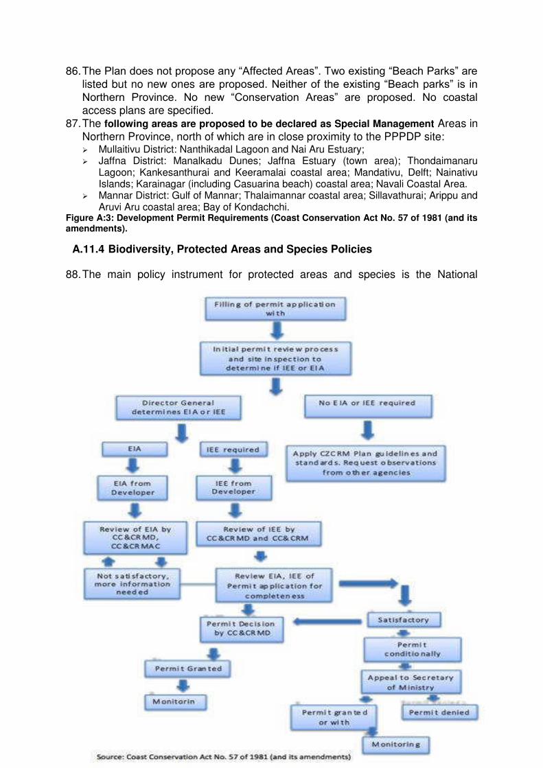
18
86. The Plan does not propose any “Affected Areas”. Two existing “Beach Parks” are listed but no new ones are proposed. Neither of the existing “Beach parks” is in Northern Province. No new “Conservation Areas” are proposed. No coastal access plans are specified.
87. The following areas are proposed to be declared as Special Management Areas in
Northern Province, north of which are in close proximity to the PPPDP site: Mullaitivu District: Nanthikadal Lagoon and Nai Aru Estuary; Jaffna District: Manalkadu Dunes; Jaffna Estuary (town area); Thondaimanaru
Lagoon; Kankesanthurai and Keeramalai coastal area; Mandativu, Delft; Nainativu Islands; Karainagar (including Casuarina beach) coastal area; Navali Coastal Area.
Mannar District: Gulf of Mannar; Thalaimannar coastal area; Sillavathurai; Arippu and Aruvi Aru coastal area; Bay of Kondachchi.
Figure A:3: Development Permit Requirements (Coast Conservation Act No. 57 of 1981 (and its amendments).
A.11.4 Biodiversity, Protected Areas and Species Policies 88. The main policy instrument for protected areas and species is the National
19
Biodiversity Strategic Action Plan (NBSAP) and responds to Convention of the
Parties (COP) requirements under the CBD. The NBSAP (Government of Sri
Lanka, 2016) covers the period 2016-2022. 12 targets are proposed to be delivered by 2022. No target is quantified. Targets of particular relevance to
PPPDP include:
Target 3 relates to protected areas: 0.3% of marine areas are indicated to be protected by law compared with the Aichi target of 10%. There is no indication of any proposed additions to the coastal and marine protected areas network.
Target 4 relates to species: The priority action is to update the Red List. No
species are specifically proposed for additional protection. However, Target 4 action 6 specifies “regularize turtle hatcheries with appropriate guidelines for scientific management and a monitoring system established”.
Target 6 relates to the sustainable use of biodiversity, including fisheries: Note is made of “improving harvesting methods and preventing overexploitation through proper resource management, especially in the marine sector”. Target 6 action 4 specifies “Promote best practices to minimize the destructive harvesting methods used for biological resources from terrestrial, aquatic and marine systems” and target 6 action 5 specifies “Assess the present levels of harvesting of freshwater and marine finfish/ shell fish and develop and implement recovery plans for finfish/ shell fish species stocks that are depleted due to overexploitation”.
Target 7 relates to strengthening the traditional use of biodiversity: It is proposed to be achieved, in part, by improving community-based resource management. Target 7 action 6 specifies “Identify gaps in FMA and implement programs to address the identified gaps”.
Target 11 relates to enhancing resilience and adaptation in ecosystems, such as forests, wetlands, mangroves and coral reefs through ecosystem-based adaptation, including in respect of climate change. Target 11 action 1 specifies “Initiate research and monitoring programs on the impacts of climate change, infrastructure development, and natural hazards on biodiversity” and Target 11 action 43 specifies “Implement mangrove and river bank restoration and forest conservation projects for watersheds”.
A.12 ADB Safeguard Policy (SPS) 89. The ADB Safeguard Policy Statement 2009 (SPS) has the objectives to (i) avoid
adverse impacts of projects on the environment and affected people; (ii) where
possible; minimize, mitigate, and/or compensate for adverse project impacts on
the environment and affected people when avoidance is not possible; and (iii)
help borrowers/clients to strengthen their safeguard systems and develop the capacity to manage environmental and social risks. The environment safeguard
requires due diligence which entails addressing environmental concerns, if any,
of a proposed activity in the initial stages of project preparation.
90. The SPS categorizes potential projects or activities into categories of impact (A, B or C) to determine the level of environmental assessment required to address
the potential impacts. The ABD SPS is aligned with and compliments the country
safeguard system (CSS) of the Government of Sri Lanka (GoS).
20
91. ADB and the PPTA consultant assigned an Environment Category B
classification for the full scope of works to be undertaken within the NPSFDP
project indicating that potential adverse environmental impacts are site-specific, few if any of them are irreversible, and in most cases mitigation measures can be
designed readily.
92. ADB‟s SPS applies pollution prevention and control technologies and practices consistent with good practices as reflected in internationally recognized standards, such as the World Bank Group‟s Environmental, Health and Safety Guidelines (EHSG). The EHSG provide the context of international best practice
and contribute to establishing targets for environmental performance. Standards
incorporated into the EHSG will be used in parallel with Sri Lankan government
environmental standards throughout this document with the principals of due diligence and a precautionary approach adopted. Application of occupational and
community health and safety measures, as laid out in the EHSG is required
under the SPS.
A.13 Sir Lanka Environmental Clearance and Permits Requirements 93. The PPPDP will need to apply for a development activity permit from the relevant
permit authority. The Coastal Conservation and Coastal Resources Management
Department (CCCRMD) is the development permit authority within the “Coastal Zone” (see Glossary) and the Central Environmental Authority (CEA) is the development permit authority outside the coastal zone. In addition, the i) Ministry of Fisheries and Aquatic Resources Development (MFARD) is the permitting
authority in respect of fish and certain aspects of marine pollution; (ii) CEA in
respect of land based sources of pollution including within the coastal zone; (iii)
Marine Environmental Protection Authority (MEPA) in respect of marine sources
of pollution and; (iv) Department of Wildlife Conservation (DWC) in respect of biodiversity protection areas under the Fauna and Flora Act. Detailed clearance
and permits required for the Thalaithurai are listed in Error! Reference source ot found..
Table A-3: Approvals, Permits required to implement the Proposed Project
Clearance/Approval/Permit Current Status
1 Preliminary Planning Clearance from the Urban Development Authority (UDA)
To be obtained
2 Clearance from the Marine Environmental Protection Agency (MEPA)
To be obtained
3 Consent from the National Water Supply and Drainage Board (NWSDB) for water supply
To be obtained
4 Consent from the Ceylon Electricity Board (CEB) for electricity supply
To be obtained
5 Consent from the Local Authority for solid waste collection and disposal
To be obtained
6 Development Permit from the Coast Conservation and Coastal Resources Management Department (CCCRMD)
To be obtained after the acceptance of the IEE Report
7 Environmental Protection Licence from the To be obtained prior to the
21
Clearance/Approval/Permit Current Status
Central Environmental Authority (CEA) commencement of operations
A.14 Conformity to Coastal Resources Management Plan 94. The principal instrument of coastal resources management policy is the Coastal
Zone and Coastal Resource Management Plan (CCCRMD), which is legally
mandated to produce (update) at regular intervals. The latest draft version of the
plan was issued in 2016. The details below are extracts from the plan: Key instruments for the delivery of the plan are: a requirement for a permit for
development activities; permit conditions including coastal setback and other zoning conditions; and the development and delivery of management plans including for “Affected Areas”, “Beach Parks”, “Coastal Access Plans”, “Conservation Areas”, and “Special Management Areas (SMA)”.
The plan provides updated coastal setbacks for Sri Lanka including for Northern Province. No “Affected Areas”, “Beach Parks”, “Coastal Access Plans”, “Conservation Areas” and “Special Management Areas (SMA)” are currently specified for Northern Province. The setback distances specified in the updated coastal setbacks are not applicable in respect of Protected Areas where any protected area falls within coastal segment; it will be considered a “no build zone”.
Protected Areas include RAMSAR Wetland sites, Buffer Zones, Sanctuaries, Reserved Forests, Conservation Forests, National Heritage Wilderness Areas, Strict Nature Reserves, National Parks, Nature Reserves, Jungle Corridors, Refuges and Marine Reserves.
It is indicated that a 300 m setback shall be applied to Fisheries Management Areas, Fisheries Reserves or any other designated area or site declared by the Government of Sri Lanka. A total of 200 m setback shall be applied to all coastal archaeological sites designated by the Department of Archaeology.
The Plan does not propose any “Affected Areas”. Two existing “Beach Parks” are listed but no new ones are proposed. Neither of the existing “Beach parks” is in Northern Province. No new “Conservation Areas” are proposed. No coastal access plans are specified.
The following areas are proposed to be declared as Special Management Areas in Northern Province:
Mullaitivu District: Nanthikadal Lagoon and Nai Aru Estuary;
Jaffna District: Manalkadu Dunes; Jaffna Estuary (town area); Thondaimanaru Lagoon; Kankesanthurai and Keeramalai coastal area; Mandativu, Delft; Nainativu Islands; Karainagar (including Casuarina beach) coastal area; Navali Coastal Area.
Mannar District: Gulf of Mannar; Thalaimannar coastal area; Sillavathurai; Arippu and Aruvi Aru coastal area; Bay of Kondachchi.
A.15 Contingency Plan of Marine Environmental Protection Agency and Other Conservation/Development Plans
95. “The Marine Pollution Prevention Act No. 35 of 2008” has designated the Marine
Environment Protection Authority (MEPA) as the “Agency responsible for marine
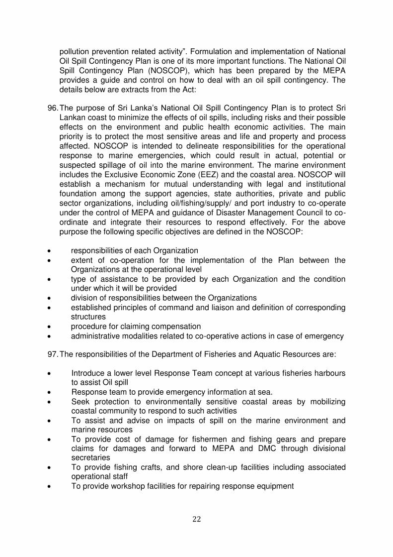
22
pollution prevention related activity”. Formulation and implementation of National Oil Spill Contingency Plan is one of its more important functions. The National Oil
Spill Contingency Plan (NOSCOP), which has been prepared by the MEPA provides a guide and control on how to deal with an oil spill contingency. The
details below are extracts from the Act:
96. The purpose of Sri Lanka‟s National Oil Spill Contingency Plan is to protect Sri
Lankan coast to minimize the effects of oil spills, including risks and their possible
effects on the environment and public health economic activities. The main priority is to protect the most sensitive areas and life and property and process
affected. NOSCOP is intended to delineate responsibilities for the operational
response to marine emergencies, which could result in actual, potential or
suspected spillage of oil into the marine environment. The marine environment
includes the Exclusive Economic Zone (EEZ) and the coastal area. NOSCOP will establish a mechanism for mutual understanding with legal and institutional
foundation among the support agencies, state authorities, private and public
sector organizations, including oil/fishing/supply/ and port industry to co-operate
under the control of MEPA and guidance of Disaster Management Council to co-
ordinate and integrate their resources to respond effectively. For the above purpose the following specific objectives are defined in the NOSCOP:
responsibilities of each Organization
extent of co-operation for the implementation of the Plan between the Organizations at the operational level
type of assistance to be provided by each Organization and the condition under which it will be provided
division of responsibilities between the Organizations
established principles of command and liaison and definition of corresponding structures
procedure for claiming compensation
administrative modalities related to co-operative actions in case of emergency 97. The responsibilities of the Department of Fisheries and Aquatic Resources are:
Introduce a lower level Response Team concept at various fisheries harbours to assist Oil spill
Response team to provide emergency information at sea.
Seek protection to environmentally sensitive coastal areas by mobilizing coastal community to respond to such activities
To assist and advise on impacts of spill on the marine environment and marine resources
To provide cost of damage for fishermen and fishing gears and prepare claims for damages and forward to MEPA and DMC through divisional secretaries
To provide fishing crafts, and shore clean-up facilities including associated operational staff
To provide workshop facilities for repairing response equipment
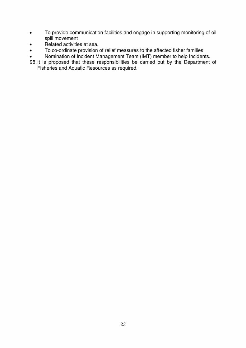
23
To provide communication facilities and engage in supporting monitoring of oil spill movement
Related activities at sea.
To co-ordinate provision of relief measures to the affected fisher families
Nomination of Incident Management Team (IMT) member to help Incidents. 98. It is proposed that these responsibilities be carried out by the Department of
Fisheries and Aquatic Resources as required.
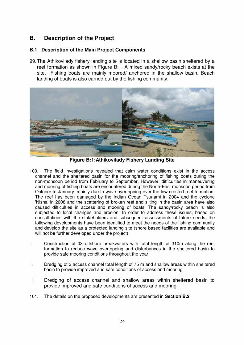
24
B. Description of the Project B.1 Description of the Main Project Components 99. The Athikovilady fishery landing site is located in a shallow basin sheltered by a
reef formation as shown in Figure B:1. A mixed sandy/rocky beach exists at the
site. Fishing boats are mainly moored/ anchored in the shallow basin. Beach landing of boats is also carried out by the fishing community.
Figure B:1:Athikovilady Fishery Landing Site
100. The field investigations revealed that calm water conditions exist in the access
channel and the sheltered basin for the mooring/anchoring of fishing boats during the non-monsoon period from February to September. However, difficulties in maneuvering and mooring of fishing boats are encountered during the North-East monsoon period from October to January, mainly due to wave overtopping over the low crested reef formation. The reef has been damaged by the Indian Ocean Tsunami in 2004 and the cyclone 'Nisha' in 2008 and the scattering of broken reef and silting in the basin area have also caused difficulties in access and mooring of boats. The sandy/rocky beach is also subjected to local changes and erosion. In order to address these issues, based on consultations with the stakeholders and subsequent assessments of future needs, the following developments have been identified to meet the needs of the fishing community and develop the site as a protected landing site (shore based facilities are available and will not be further developed under the project):
i. Construction of 03 offshore breakwaters with total length of 310m along the reef
formation to reduce wave overtopping and disturbances in the sheltered basin to provide safe mooring conditions throughout the year
ii. Dredging of 3 access channel total length of 75 m and shallow areas within sheltered
basin to provide improved and safe conditions of access and mooring
iii. Dredging of access channel and shallow areas within sheltered basin to provide improved and safe conditions of access and mooring
101. The details on the proposed developments are presented in Section B.2.
25
B.2 Detailed Drawings of the Project 102. The layout of the breakwaters, access channel and the area of dredging are shown in
Error! Reference source not found..
(Source of Image: https://earth.google.com)
103. As indicated in Error! Reference source not found., the There will be three egments of breakwaters with 75m, 100m and 135m. The distance between breakwater and the beach is varies from 60m to 65mFigure B:2.
Figure B:2: Sample cross section of Breakwater Sections 104. The access channel is to be dredged to a depth in the range of 1.5-2.0 m and
the shallow areas within the sheltered anchorage basin are to be dredged to a depth in the range of 0.5-1.5 m. The areas of dredging are shown in Error! eference source not found..
105. The dredged material would be a mix of sand and reef material and no
significant quantities are envisaged in view of the existing depths in the areas of dredging. The possibilities given below are to be explored and adopted for the disposal of dredged material with the approval of relevant authorities.
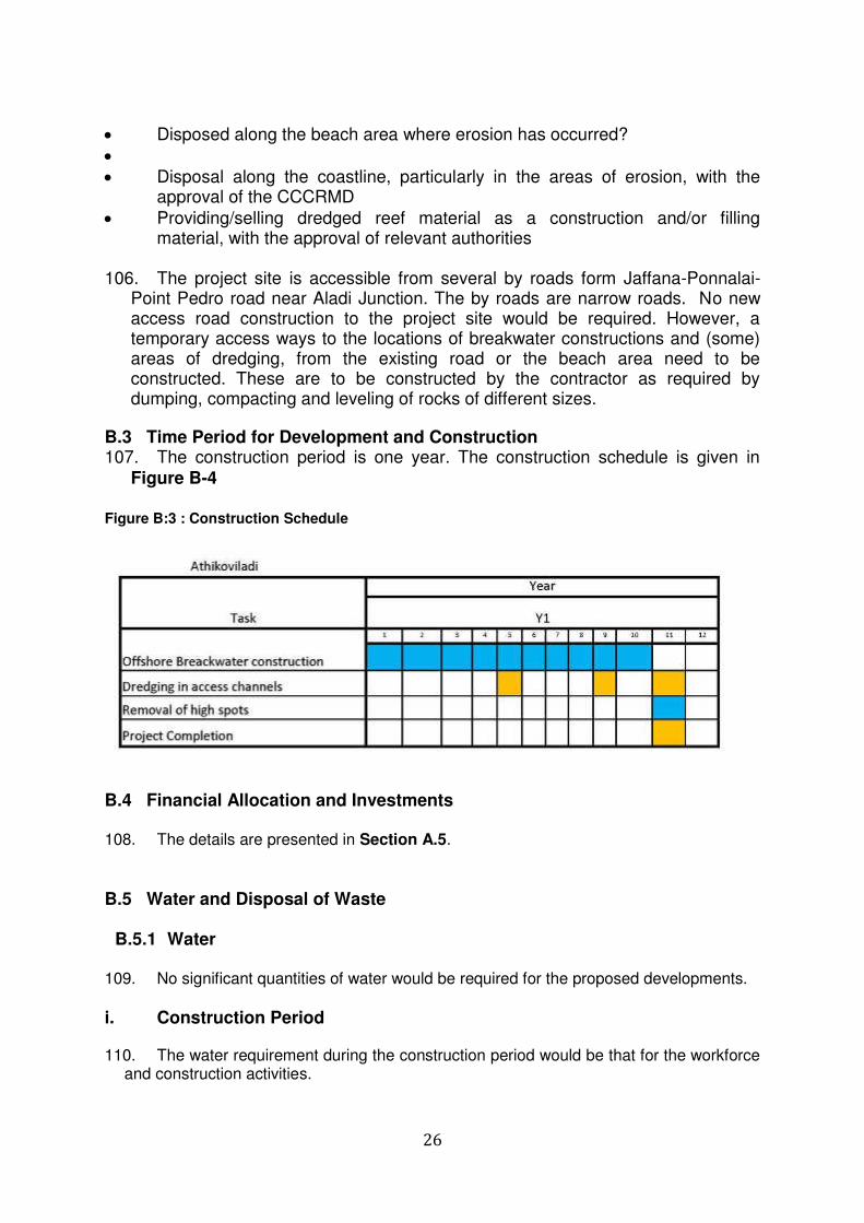
26
Disposed along the beach area where erosion has occurred?
Disposal along the coastline, particularly in the areas of erosion, with the approval of the CCCRMD
Providing/selling dredged reef material as a construction and/or filling material, with the approval of relevant authorities
106. The project site is accessible from several by roads form Jaffana-Ponnalai-
Point Pedro road near Aladi Junction. The by roads are narrow roads. No new access road construction to the project site would be required. However, a temporary access ways to the locations of breakwater constructions and (some) areas of dredging, from the existing road or the beach area need to be constructed. These are to be constructed by the contractor as required by dumping, compacting and leveling of rocks of different sizes.
B.3 Time Period for Development and Construction 107. The construction period is one year. The construction schedule is given in
Figure B-4
Figure B:3 : Construction Schedule
B.4 Financial Allocation and Investments 108. The details are presented in Section A.5.
B.5 Water and Disposal of Waste
B.5.1 Water 109. No significant quantities of water would be required for the proposed developments.
i. Construction Period 110. The water requirement during the construction period would be that for the workforce
and construction activities.
27
111. Considering the workforce of 20, with 05 residential workers and 15 day time workers and water consumption rates of 120 liters/person/day and 60 liters/person/day respectively for such workers, the water requirement for the workforce can be estimated as (05x0.120+15x0.060 m3/day) 1.56 m3/day.
112. In view of the nature of construction-breakwater construction with dumping and/or
placement of rocks and dredging-water will not be regularly required for construction activities. However, considering miscellaneous water needs related to construction activities, a water requirement of 2 m3 can be assumed as a conservative estimate.
113. The water requirement is to be provided by the contractor and water obtained from
the National Water Supply and Drainage Board (NWSDB) or other authorized sources and portable storage tanks are to be used.
ii. Operational Period 114. No water will be required for the operation/maintenance of the proposed
developments. The water requirement would be that required by the fishery community and/or activities based in the anchorage.
B.5.2 Waste Water
115. No significant quantities of waste water would be generated by the proposed
developments.
i. Construction Period 116. Considering a wastewater generation rate of 90 % of the water requirement, the
quantity of waste water generated by the workforce can be estimated as approximately 1.8m3/day. A block of toilets is currently available in the fishery landing site and a possibility exists for the workforce to use such a facility. However, according to the community, the existing facilities are not adequate even for the local people in the area. However, if necessary, temporary toilet and washing facilities with septic tanks and soakage pits are to be provided to the workforce by the contractor at the site or another appropriate location, as required. Any waste water generated from construction related
activities is also being directed to the soakage pits. ii. Operational Period 117. No wastewater will be generated by the operation/maintenance of the proposed
developments. The wastewater generated would be that by the fishery community and/or activities based in the anchorage.
B.5.3 Solid Waste
118. No significant quantities of solid waste would be generated by the proposed
developments.
i. Construction Period 119. Considering the workforce of 20 and a solid waste generation rate of
0.85 kg/person/day, which commonly used in solid waste computations in Sri Lanka, the quantity of solid waste generated by the workforce can be estimated as 17 kg/day, which
28
includes both bio degradable as well as non-biodegradable waste. the solid waste generated by the workforce is to be temporarily stored at appropriate locations in the work site and regularly disposed by the contractor through the services offered by the local authority of the area (Point Pedro Urban Council).
120. In view of the nature of construction-breakwater/revetment construction with dumping
and/or placement of rocks and dredging-no significant quantities of solid waste (except dredged material) will be regularly generated by the construction activities. The details on dredging are presented in Section B.9 of the report.
ii. Operational Period 121. No solid waste will be generated by the operation/maintenance of the proposed
developments. The solid waste generated would be that by the fishery community and/or activities based at the anchorage and mainly include that generated by the fishing community and any fish processing/preparation activities.
B.6 Electricity Requirement i. Construction Period 122. Electricity supply from the Ceylon Electricity Board (CEB) is available in the area. In
view of the nature of constructions and the types of machinery to be used, no significant quantity of electricity would be required for construction purposes. If necessary, a temporary electricity connection is to be obtained by the contractor for the activities in the
project site. ii. Operational Period 123. No electricity will be required by the operation/maintenance of the proposed
developments. The electricity requirement would be that for the fishery community and/or other activities in the landing site which are ongoing and there will be no additional requirement.
B.7 Natural Resources Consumption 124. In view of the nature of construction-breakwater/revetment construction, the main
natural resource requirement would be rocks of different sizes as required by design considerations. In addition, water is the other natural resource required for the proposed development.
B.8 Labor Requirement during Construction and Operational Periods 125. Considering the type, scale and the methodology of construction it is estimated that a
workforce of up to 15 would be required during the construction period. 126. No regular operational/maintenance staff would be associated with the proposed
developments (breakwaters/revetment and dredged areas). However, periodic inspection and rehabilitation activities would be required. The regular operational activities (fisheries activities) are usually carried out under the guidance of the local fisheries societies based at the Anchorage.
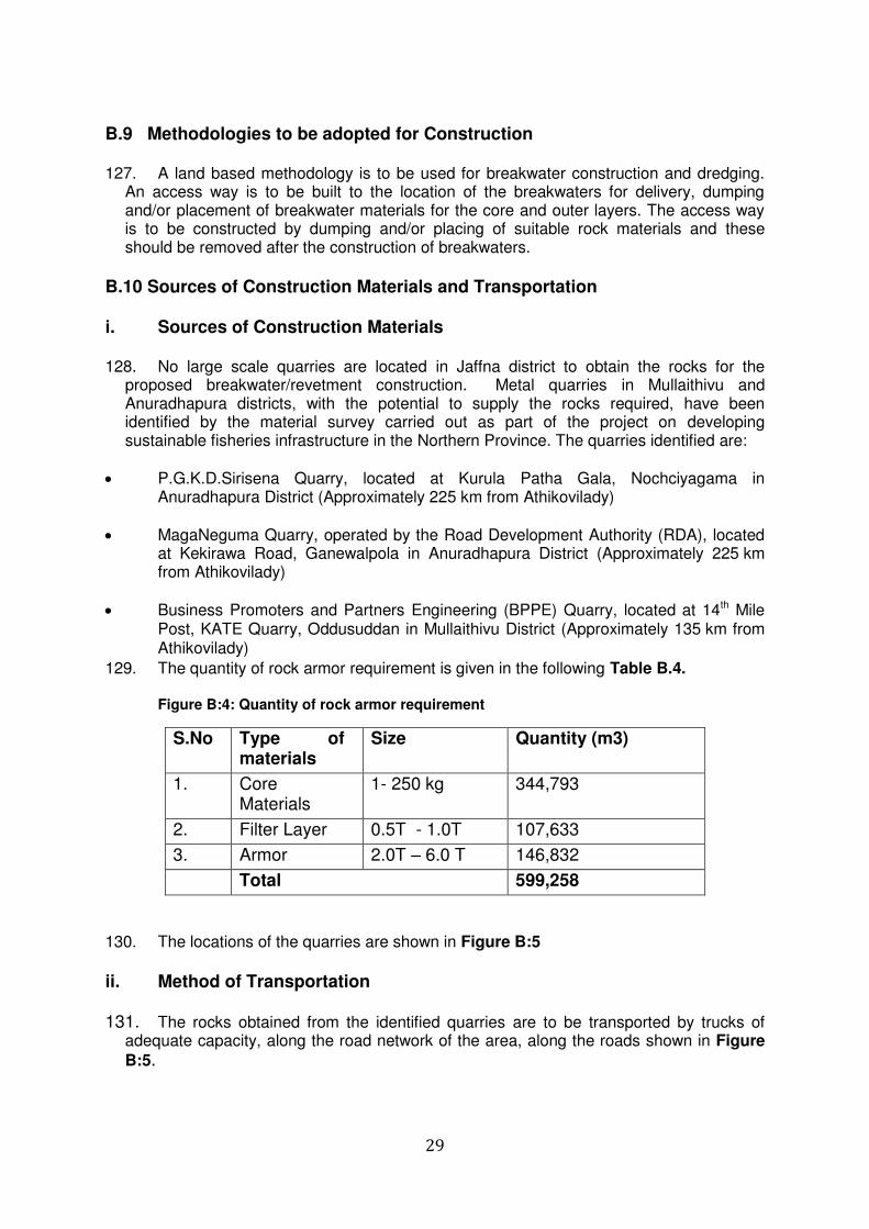
29
B.9 Methodologies to be adopted for Construction 127. A land based methodology is to be used for breakwater construction and dredging.
An access way is to be built to the location of the breakwaters for delivery, dumping and/or placement of breakwater materials for the core and outer layers. The access way is to be constructed by dumping and/or placing of suitable rock materials and these should be removed after the construction of breakwaters.
B.10 Sources of Construction Materials and Transportation i. Sources of Construction Materials 128. No large scale quarries are located in Jaffna district to obtain the rocks for the
proposed breakwater/revetment construction. Metal quarries in Mullaithivu and Anuradhapura districts, with the potential to supply the rocks required, have been identified by the material survey carried out as part of the project on developing sustainable fisheries infrastructure in the Northern Province. The quarries identified are:
P.G.K.D.Sirisena Quarry, located at Kurula Patha Gala, Nochciyagama in Anuradhapura District (Approximately 225 km from Athikovilady)
MagaNeguma Quarry, operated by the Road Development Authority (RDA), located at Kekirawa Road, Ganewalpola in Anuradhapura District (Approximately 225 km from Athikovilady)
Business Promoters and Partners Engineering (BPPE) Quarry, located at 14th Mile Post, KATE Quarry, Oddusuddan in Mullaithivu District (Approximately 135 km from Athikovilady)
129. The quantity of rock armor requirement is given in the following Table B.4.
Figure B:4: Quantity of rock armor requirement
S.No Type of materials
Size Quantity (m3)
1. Core Materials
1- 250 kg 344,793
2. Filter Layer 0.5T - 1.0T 107,633
3. Armor 2.0T – 6.0 T 146,832
Total 599,258
130. The locations of the quarries are shown in Figure B:5
ii. Method of Transportation 131. The rocks obtained from the identified quarries are to be transported by trucks of
adequate capacity, along the road network of the area, along the roads shown in Figure
B:5.
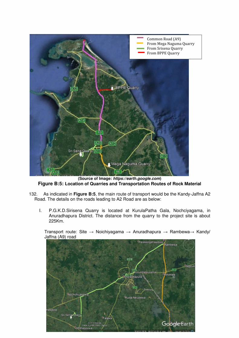
30
(Source of Image: https://earth.google.com)
Figure B:5: Location of Quarries and Transportation Routes of Rock Material 132. As indicated in Figure B:5, the main route of transport would be the Kandy-Jaffna A2
Road. The details on the roads leading to A2 Road are as below:
I. P.G.K.D.Sirisena Quarry is located at KurulaPatha Gala, Nochciyagama, in Anuradhapura District. The distance from the quarry to the project site is about 225Km.
Transport route: Site → Noichiyagama → Anuradhapura → Rambewa→ Kandy/ Jaffna (A9) road
Common Road (A9)
From Mega Naguma Quarry
From Srisena Quarry
From BPPE Quarry
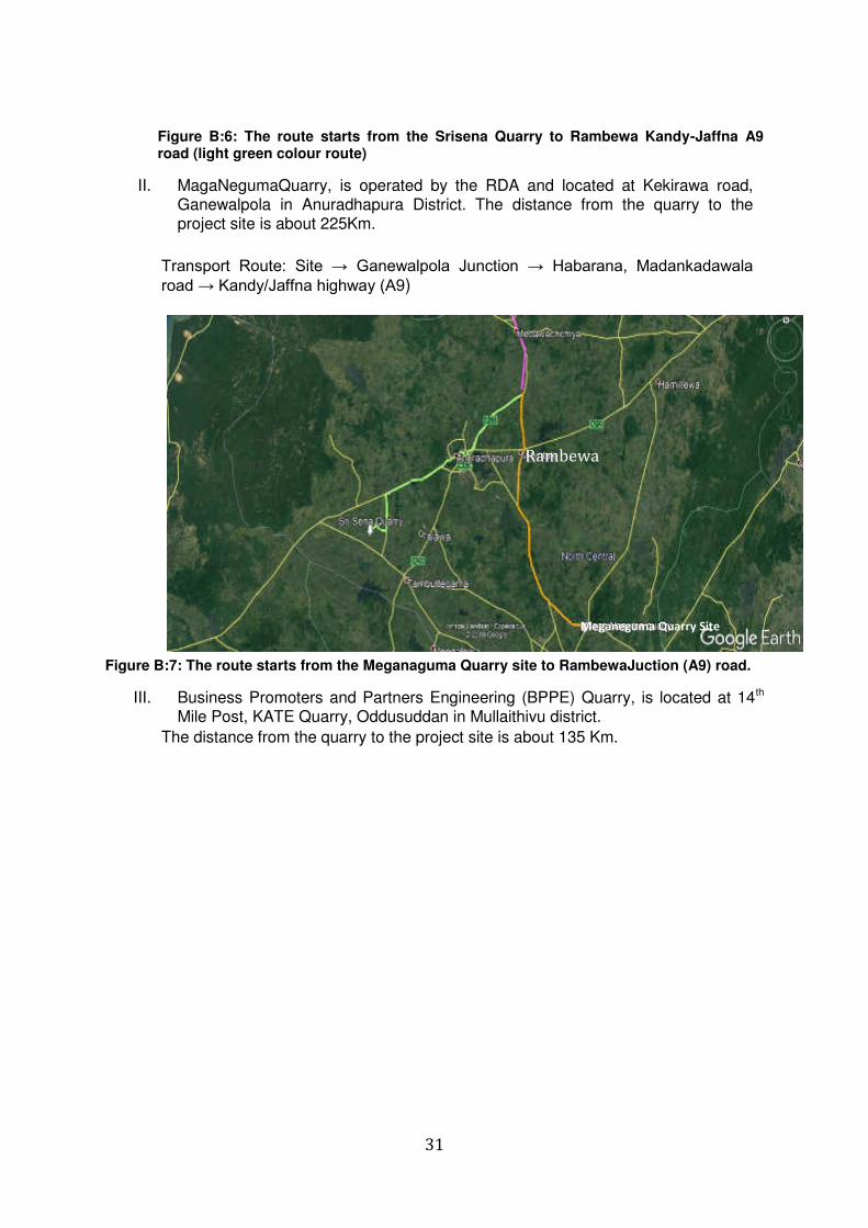
31
Figure B:6: The route starts from the Srisena Quarry to Rambewa Kandy-Jaffna A9 road (light green colour route)
II. MagaNegumaQuarry, is operated by the RDA and located at Kekirawa road, Ganewalpola in Anuradhapura District. The distance from the quarry to the project site is about 225Km.
Transport Route: Site → Ganewalpola Junction → Habarana, Madankadawala road → Kandy/Jaffna highway (A9)
Figure B:7: The route starts from the Meganaguma Quarry site to RambewaJuction (A9) road.
III. Business Promoters and Partners Engineering (BPPE) Quarry, is located at 14th Mile Post, KATE Quarry, Oddusuddan in Mullaithivu district.
The distance from the quarry to the project site is about 135 Km.
Rambewa
Meganeguma Quarry Site
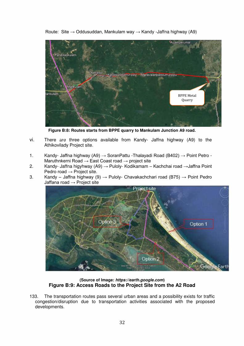
32
Route: Site → Oddusuddan, Mankulam way → Kandy -Jaffna highway (A9)
Figure B:8: Routes starts from BPPE quarry to Mankulam Junction A9 road.
vi. There are three options available from Kandy- Jaffna highway (A9) to the Athikovilady Project site.
1. Kandy- Jaffna highway (A9) → SoranPattu -Thalayadi Road (B402) → Point Petro -
Maruthnkerni Road → East Coast road → project site 2. Kandy- Jaffna higyhway (A9) → Puloly- Kodikamam – Kachchai road →Jaffna Point
Pedro road → Project site. 3. Kandy – Jaffna highway (9) → Puloly- Chavakachchari road (B75) → Point Pedro
Jaffana road → Project site
(Source of Image: https://earth.google.com)
Figure B:9: Access Roads to the Project Site from the A2 Road 133. The transportation routes pass several urban areas and a possibility exists for traffic
congestion/disruption due to transportation activities associated with the proposed developments.
A9
BPPE Metal
Quarry
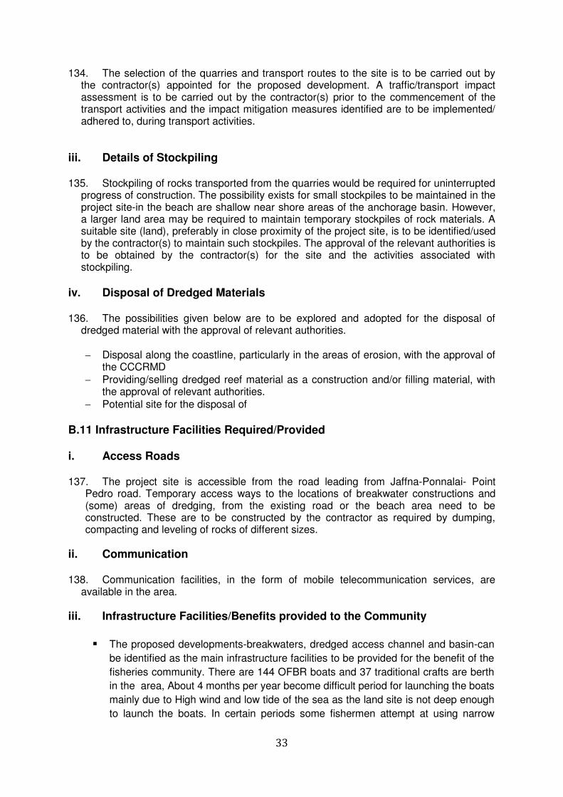
33
134. The selection of the quarries and transport routes to the site is to be carried out by the contractor(s) appointed for the proposed development. A traffic/transport impact assessment is to be carried out by the contractor(s) prior to the commencement of the transport activities and the impact mitigation measures identified are to be implemented/ adhered to, during transport activities.
iii. Details of Stockpiling 135. Stockpiling of rocks transported from the quarries would be required for uninterrupted
progress of construction. The possibility exists for small stockpiles to be maintained in the project site-in the beach are shallow near shore areas of the anchorage basin. However, a larger land area may be required to maintain temporary stockpiles of rock materials. A suitable site (land), preferably in close proximity of the project site, is to be identified/used by the contractor(s) to maintain such stockpiles. The approval of the relevant authorities is to be obtained by the contractor(s) for the site and the activities associated with stockpiling.
iv. Disposal of Dredged Materials 136. The possibilities given below are to be explored and adopted for the disposal of
dredged material with the approval of relevant authorities.
Disposal along the coastline, particularly in the areas of erosion, with the approval of the CCCRMD
Providing/selling dredged reef material as a construction and/or filling material, with the approval of relevant authorities.
Potential site for the disposal of
B.11 Infrastructure Facilities Required/Provided i. Access Roads 137. The project site is accessible from the road leading from Jaffna-Ponnalai- Point
Pedro road. Temporary access ways to the locations of breakwater constructions and (some) areas of dredging, from the existing road or the beach area need to be constructed. These are to be constructed by the contractor as required by dumping, compacting and leveling of rocks of different sizes.
ii. Communication 138. Communication facilities, in the form of mobile telecommunication services, are
available in the area.
iii. Infrastructure Facilities/Benefits provided to the Community
The proposed developments-breakwaters, dredged access channel and basin-can
be identified as the main infrastructure facilities to be provided for the benefit of the
fisheries community. There are 144 OFBR boats and 37 traditional crafts are berth
in the area, About 4 months per year become difficult period for launching the boats
mainly due to High wind and low tide of the sea as the land site is not deep enough
to launch the boats. In certain periods some fishermen attempt at using narrow
34
channels and it involves high risk. There have been several fatal accidents reported
in launching boats during high wind season. This activity also causes large scale
damages to the boats. The anchoring point along the Aathikoviladi area is not
properly established and therefore, damages occur during anchoring of the boats
along the improper.
iv. Borrow Sites and Disposal Sites 139. The project needs about 12,000m3 of rocks. No large-scale metal quarries are
available in the entire district of Jaffna. Therefore, the material has to be sourced from Mullaithivu, Anuradhapura and Vavuniya Districts which are generally located about 200-250km away from the project site. The identified quarries are capable of supply require quantity of materials. But, the government, has proposed several development projects in the region which also may require large quantities of rocks/aggregates/metals. In that scenario, new quarry sites may require to be identified.
140. The details on disposal sites of dredged material
Discussion in progress to identify suitable disposal sites. However, the following alternatives for the disposal of dredged materials are proposed.
Disposed along the beach area of the anchorage where possible
Filling of the nearby coastal recreational area used by the local community
Disposal along the coastline, particularly in the areas of erosion, with the approval of the CCCRMD.
- A potential site at Vallipuram in the Vadamarachai North DSD has been identified by DS for the disposal of dredged materials. The PMU is in the process of obtain the consent from the DS Vadamarachi North
v. Operational and Maintenance Requirements 141. In view of the nature of proposed constructions (breakwaters and revetments) no
regular operational/maintenance staff would be required. However, periodic inspection and rehabilitation activities need to be carried out. In the dredged areas, periodic maintenance dredging may be required. Any maintenance and rehabilitation activities are to be carried out by agencies with required facilities (machinery) and expertise under the guidance/supervision of the Department of Fisheries,.
B.12 Aesthetic and Visual Environment
142. The coastal area is highly built up obstructing sea view of the area. Further, there will be 03 offshore breakwaters to be constructed, the crest level is limited to 2.5m above mean sea level and the view of the sea is not totally obstructed from the nearby coastal areas with an elevation in excess of 2 m, No significant impact on the aesthetic and visual
environment in the area is thus envisaged due to the proposed development. B.13 Future Expansions
35
143. The proposed developments identified were based on consultations with the stakeholders and also to meet subsequent assessments of future of the fishing community. Any restrictions imposed by existing laws, regulations etc were also considered in identifying the proposed developments. No future developments are proposed
B.14 Evaluation of the Alternatives 144. As presented in Section A.4.2, the proposed development project at the Athikovilady
fishery landing site is part of the project on developing sustainable fisheries infrastructure in the Northern Province, carried by the Ministry of Fisheries and Aquatic Recourses Development Rural Economic Affairs (MFARDREA). The alternatives considered were thus confined to the level of fishery infrastructure development in the form of either as a fishery harbor, anchorage or a landing site. The level of development at each site was identified by a feasibility study conducted earlier. Technical, socio-economic and environmental aspects have been considered in identifying the level of fishery infrastructure development.
145. The Athikovilady fishery landing site has been identified by the feasibility study as a
site to be developed with off shore protection.
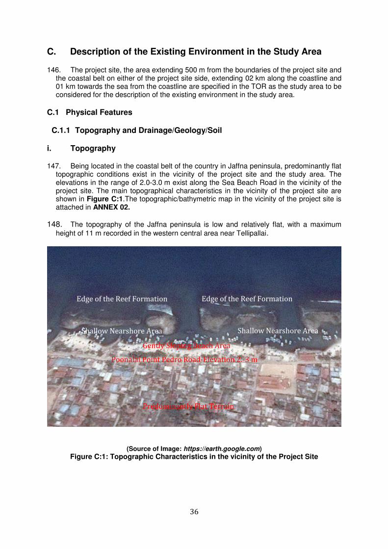
36
C. Description of the Existing Environment in the Study Area
146. The project site, the area extending 500 m from the boundaries of the project site and the coastal belt on either of the project site side, extending 02 km along the coastline and 01 km towards the sea from the coastline are specified in the TOR as the study area to be considered for the description of the existing environment in the study area.
C.1 Physical Features
C.1.1 Topography and Drainage/Geology/Soil i. Topography 147. Being located in the coastal belt of the country in Jaffna peninsula, predominantly flat
topographic conditions exist in the vicinity of the project site and the study area. The elevations in the range of 2.0-3.0 m exist along the Sea Beach Road in the vicinity of the project site. The main topographical characteristics in the vicinity of the project site are shown in Figure C:1.The topographic/bathymetric map in the vicinity of the project site is attached in ANNEX 02.
148. The topography of the Jaffna peninsula is low and relatively flat, with a maximum
height of 11 m recorded in the western central area near Tellipallai.
(Source of Image: https://earth.google.com)
Figure C:1: Topographic Characteristics in the vicinity of the Project Site
Predominantly Flat Terrain
Poonalai Point Pedro Road-Elevation 2.-3 m
Gently Sloping Beach Area
Shallow Nearshore Area
Edge of the Reef Formation
Shallow Nearshore Area
Edge of the Reef Formation
37
ii. Drainage 149. No rivers, streams or marshy areas are located in the study area. There are several
small drains leading to the sea from the residential area. The drains are constructed by the Point Pedro Urban Council. The rain water flow in the area is discharged to the sea by these drains. High infiltration of rain water also takes place in the areas of sandy soil in the study area.
iii. Geology/Soil (a) Geological Aspects 150. The geology of Jaffna peninsula is comprised of 05 types of significantly
distinguished features: Lagoonal deposits, Estuarine deposits, Unconsolidated brownish grey coastal sands, Red beds and Dune sands.
151. Miocene limestone and red beds cover the top middle part of the peninsula whilst
dune sand/beach sand is restricted to eastern coastal region and as a thin layer in the northern coastal part from Karainagar to Point Pedro. The dominant underlying bedrock throughout the Jaffna peninsula is a high-grade Precambrian crystalline metamorphic rock although in some areas it is underlain by sedimentary layers of upper Jurassic age.
152. Jaffna limestone is of Miocene age coral reef formation and is poorly bedded and
generally flat, except in some areas where it shows a slight dip to the west. It is massive in places but some layers are richly fossiliferous, forming a honeycombed structure and the ready solubility of the limestone produces a number of underground solution caverns, which contain the main groundwater reserves on the island. The upper surface of the limestone slopes gently to the south-east from the relatively high areas in the north-west where it forms the land surface in the general vicinity of Chunnakam. To the east of the UppuAru Lagoon, the limestone is generally obscured by younger formations.
153. The surface cover of unconsolidated deposits is the youngest of the geological layers
and produces the sandy soil that is present over much of the peninsula. The sediments north east of the Vadamarachchi lagoon form deeper beds, which can reach 8-17 m in places.
154. The soils map of Northern Province shows that the coastal areas of the Jaffna
peninsula and the part of the Vanni mainland (Mannar, Kilinochchi, Mullaitivu districts), overburden mantle is covered with 05 different types of soils classified according to agricultural suitability, namely-Regosols on recent beach and dune sands, Soils on recent marine calcareous sediments, SolodizedSolonetz and Solonchaks, Calcic Red Yellow Latosols and Red Yellow Latosols. The soil Map of Northern Province is given in Figure C.2
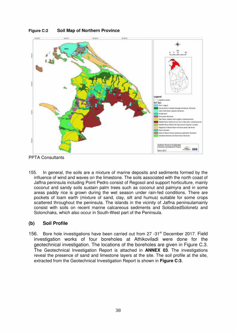
38
Figure C:2 Soil Map of Northern Province
PPTA Consultants 155. In general, the soils are a mixture of marine deposits and sediments formed by the
influence of wind and waves on the limestone. The soils associated with the north coast of Jaffna peninsula including Point Pedro consist of Regosol and support horticulture, mainly coconut and sandy soils sustain palm trees such as coconut and palmyra and in some areas paddy rice is grown during the wet season under rain-fed conditions. There are pockets of loam earth (mixture of sand, clay, silt and humus) suitable for some crops scattered throughout the peninsula. The islands in the vicinity of Jaffna peninsulamainly consist with soils on recent marine calcareous sediments and SolodizedSolonetz and Solonchaks, which also occur in South-West part of the Peninsula.
(b) Soil Profile
156. Bore hole investigations have been carried out from 27 -31st December 2017. Field investigation works of four boreholes at Athikoviladi were done for the geotechnical investigation. The locations of the boreholes are given in Figure C.3. The Geotechnical Investigation Report is attached in ANNEX 03. The investigations reveal the presence of sand and limestone layers at the site. The soil profile at the site,
extracted from the Geotechnical Investigation Report is shown in Figure C:3.
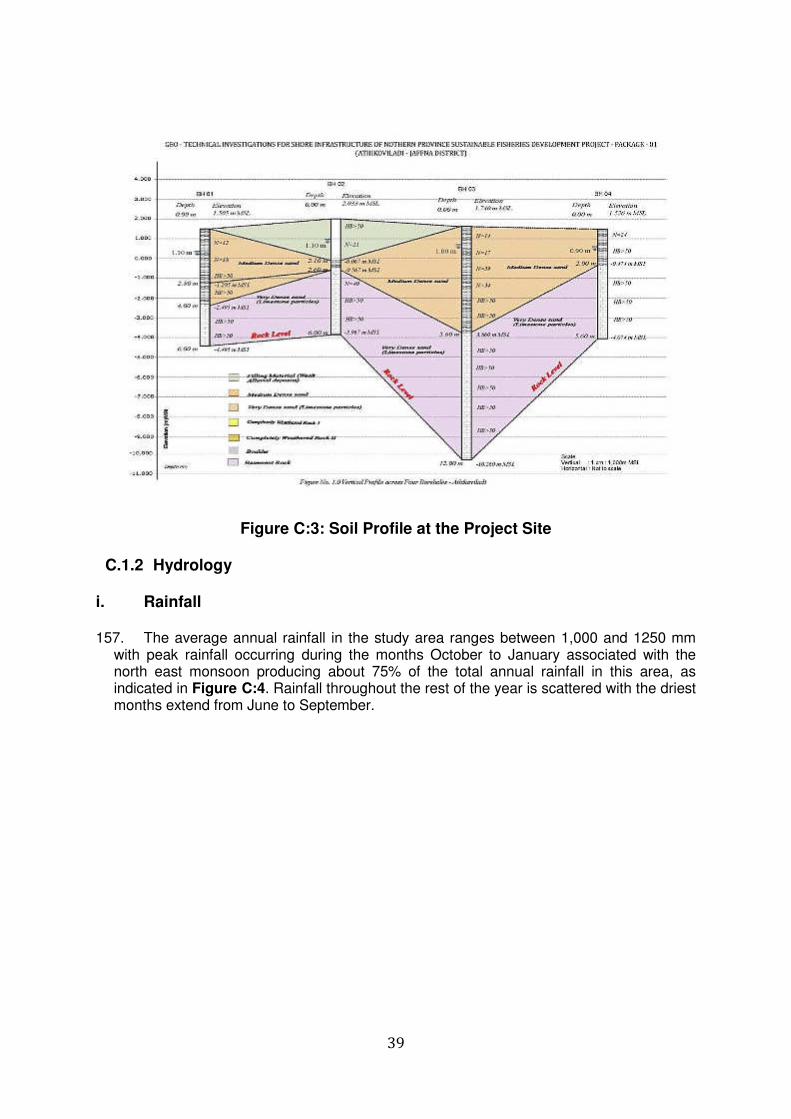
39
Figure C:3: Soil Profile at the Project Site
C.1.2 Hydrology
i. Rainfall 157. The average annual rainfall in the study area ranges between 1,000 and 1250 mm
with peak rainfall occurring during the months October to January associated with the north east monsoon producing about 75% of the total annual rainfall in this area, as indicated in Figure C:4. Rainfall throughout the rest of the year is scattered with the driest months extend from June to September.
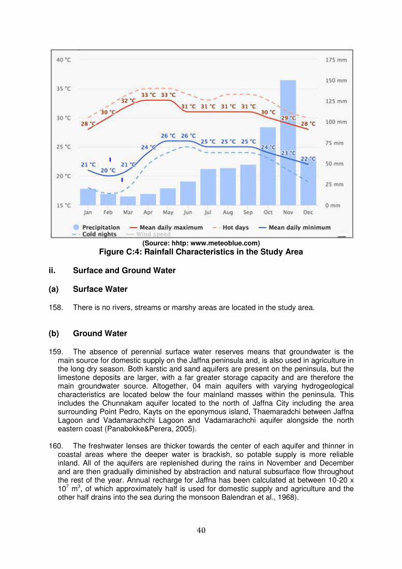
40
(Source: hhtp: www.meteoblue.com)
Figure C:4: Rainfall Characteristics in the Study Area ii. Surface and Ground Water (a) Surface Water 158. There is no rivers, streams or marshy areas are located in the study area.
(b) Ground Water 159. The absence of perennial surface water reserves means that groundwater is the
main source for domestic supply on the Jaffna peninsula and, is also used in agriculture in the long dry season. Both karstic and sand aquifers are present on the peninsula, but the limestone deposits are larger, with a far greater storage capacity and are therefore the main groundwater source. Altogether, 04 main aquifers with varying hydrogeological characteristics are located below the four mainland masses within the peninsula. This includes the Chunnakam aquifer located to the north of Jaffna City including the area surrounding Point Pedro, Kayts on the eponymous island, Thaemaradchi between Jaffna Lagoon and Vadamarachchi Lagoon and Vadamarachchi aquifer alongside the north eastern coast (Panabokke&Perera, 2005).
160. The freshwater lenses are thicker towards the center of each aquifer and thinner in
coastal areas where the deeper water is brackish, so potable supply is more reliable inland. All of the aquifers are replenished during the rains in November and December and are then gradually diminished by abstraction and natural subsurface flow throughout the rest of the year. Annual recharge for Jaffna has been calculated at between 10-20 x 107 m3, of which approximately half is used for domestic supply and agriculture and the other half drains into the sea during the monsoon Balendran et al., 1968).
41
161. Measurements of surface water and ground water quality levels in the vicinity of the project site have been carried out and the test reports are attached in ANNEX 04, The
water quality levels, extracted from the reports are given in Error! Reference source ot found. The most of the parameters tested Chloride, Electrical Conductivity, Total solid, E-
Coli and Total Coliform , are well above the (Sri Lanka Standards for potable water – SLS 614: 2013) indicating the water is not suitable for drinking purposes. Further, presence of E.coli and the total coliforms indicated that operation of unsafe septic tanks in the area.
Table C-1: Ground Water Quality in the vicinity of the Project Site
No. Parameters Unit Tested value Standards
1. Chloride (as Cl) Mg/l 1014 250
2. Hardness (asCaCO3)
mg/l 1404 250
3, Electrical Conductivity
mg/l 3000
4, Total solid mg/l 2044 500
5. E-Coli MPN/100 3.5x10² Not Detected
6 Total Coliform MPN/100ml 2.5x10² Shall not exceed 3 in any
100ml sample
C.1.3 Coastal Features (Environment) 162. The coastal area along the northern side of the Jaffna peninsula, in which the project
site is located, is characterized by rocky/sandy beaches and a reef formation is located close and parallel to the coastline as shown in Figure C:1. The presence of reef formation has also resulted in a number of naturally sheltered shallow basins in the area, suitable for mooring of fishing craft. Many of the fisheries landing sites, including the site in Athikovilady in the area are located in such basins.
i. Coastal Bathymetry and Sediment Transportation (a) Coastal Bathymetry 163. The coastal bathymetry in the project site and the study area is mainly
characterized by shallow nearshore areas sheltered by the reef (with depths mainly less than 1.0 m) and the seaward edge of the reef rising above the mean sea level at many locations with heights reaching in excess of 1 m at several locations. Deeper areas exist beyond the reef formation. Bathymetric surveys have been carried out and the bathymetric map in the vicinity of the project site is attached in ANNEX 06
(b) Sediment Transportation 164. Sediment transport modeling, field investigations and review of available
information indicate a net longshore sediment transport pattern westwards along the coastline in the vicinity of the project site and the study area. As indicated in Figure C:1, the nearshore area is characterized by a reef formation that runs roughly parallel and at a distance in the order of 50 m-150 m from the coastline. The crest level at the edge of the reef formation extends above the mean sea level
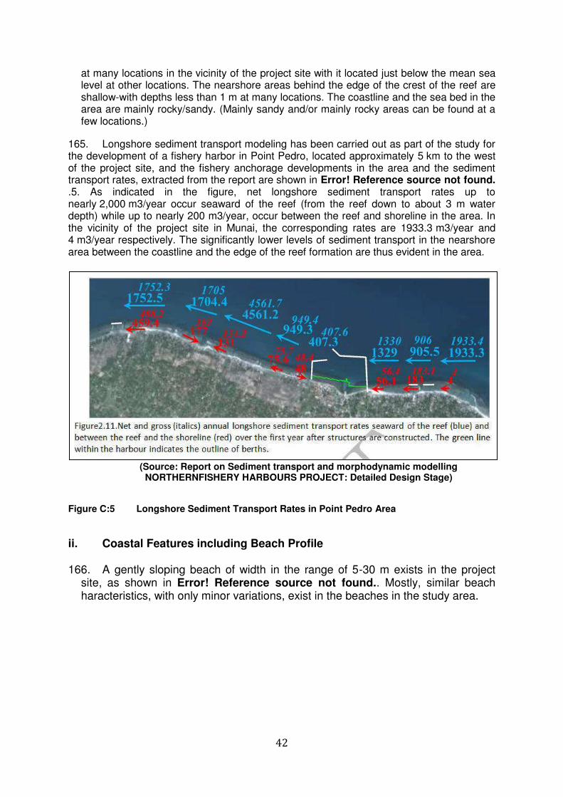
42
at many locations in the vicinity of the project site with it located just below the mean sea level at other locations. The nearshore areas behind the edge of the crest of the reef are shallow-with depths less than 1 m at many locations. The coastline and the sea bed in the area are mainly rocky/sandy. (Mainly sandy and/or mainly rocky areas can be found at a few locations.)
165. Longshore sediment transport modeling has been carried out as part of the study for the development of a fishery harbor in Point Pedro, located approximately 5 km to the west of the project site, and the fishery anchorage developments in the area and the sediment transport rates, extracted from the report are shown in Error! Reference source not found. .5. As indicated in the figure, net longshore sediment transport rates up to nearly 2,000 m3/year occur seaward of the reef (from the reef down to about 3 m water depth) while up to nearly 200 m3/year, occur between the reef and shoreline in the area. In the vicinity of the project site in Munai, the corresponding rates are 1933.3 m3/year and 4 m3/year respectively. The significantly lower levels of sediment transport in the nearshore area between the coastline and the edge of the reef formation are thus evident in the area.
(Source: Report on Sediment transport and morphodynamic modelling
NORTHERNFISHERY HARBOURS PROJECT: Detailed Design Stage)
Figure C:5 Longshore Sediment Transport Rates in Point Pedro Area
ii. Coastal Features including Beach Profile 166. A gently sloping beach of width in the range of 5-30 m exists in the project
site, as shown in Error! Reference source not found.. Mostly, similar beach haracteristics, with only minor variations, exist in the beaches in the study area.
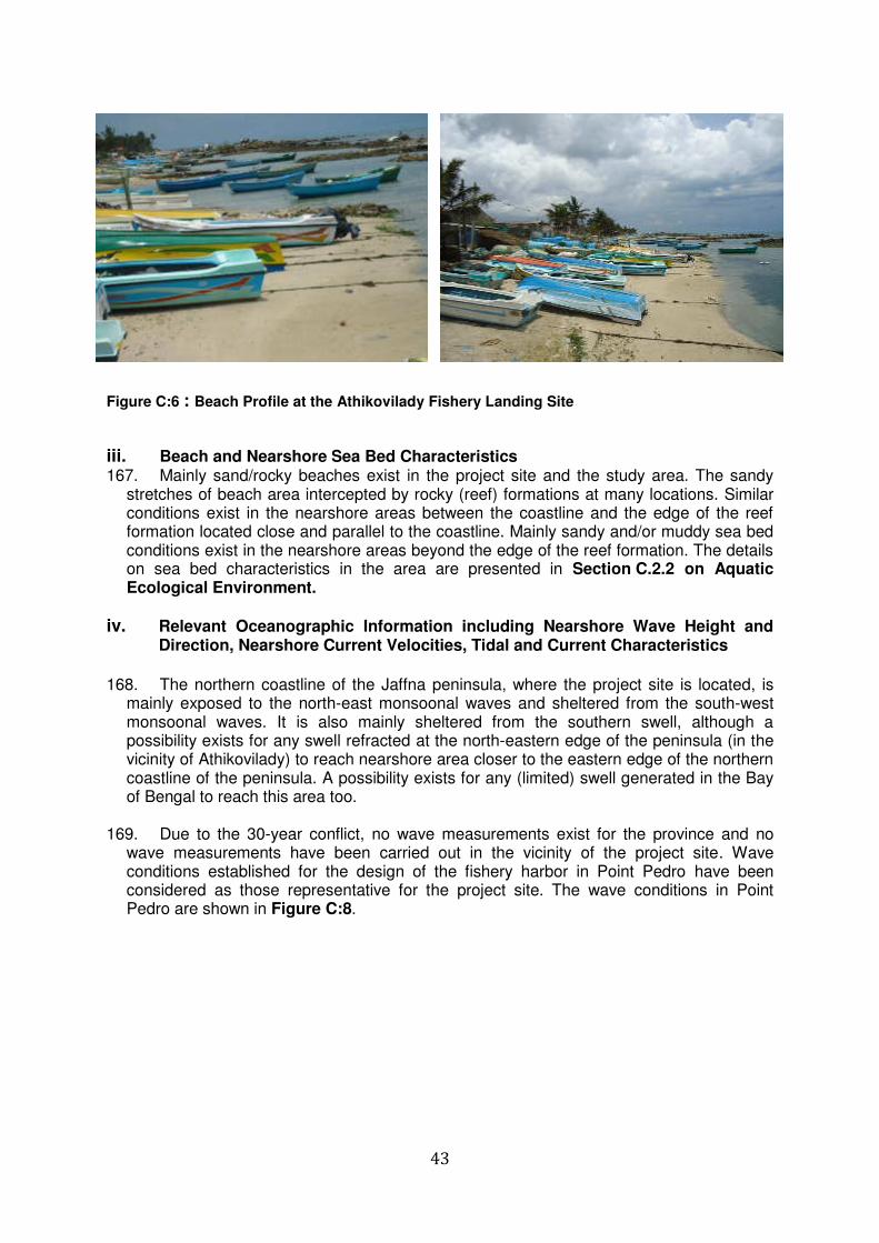
43
Figure C:6 : Beach Profile at the Athikovilady Fishery Landing Site
iii. Beach and Nearshore Sea Bed Characteristics 167. Mainly sand/rocky beaches exist in the project site and the study area. The sandy
stretches of beach area intercepted by rocky (reef) formations at many locations. Similar conditions exist in the nearshore areas between the coastline and the edge of the reef formation located close and parallel to the coastline. Mainly sandy and/or muddy sea bed conditions exist in the nearshore areas beyond the edge of the reef formation. The details on sea bed characteristics in the area are presented in Section C.2.2 on Aquatic Ecological Environment.
iv. Relevant Oceanographic Information including Nearshore Wave Height and Direction, Nearshore Current Velocities, Tidal and Current Characteristics
168. The northern coastline of the Jaffna peninsula, where the project site is located, is
mainly exposed to the north-east monsoonal waves and sheltered from the south-west monsoonal waves. It is also mainly sheltered from the southern swell, although a possibility exists for any swell refracted at the north-eastern edge of the peninsula (in the vicinity of Athikovilady) to reach nearshore area closer to the eastern edge of the northern coastline of the peninsula. A possibility exists for any (limited) swell generated in the Bay of Bengal to reach this area too.
169. Due to the 30-year conflict, no wave measurements exist for the province and no
wave measurements have been carried out in the vicinity of the project site. Wave conditions established for the design of the fishery harbor in Point Pedro have been considered as those representative for the project site. The wave conditions in Point Pedro are shown in Figure C:8.
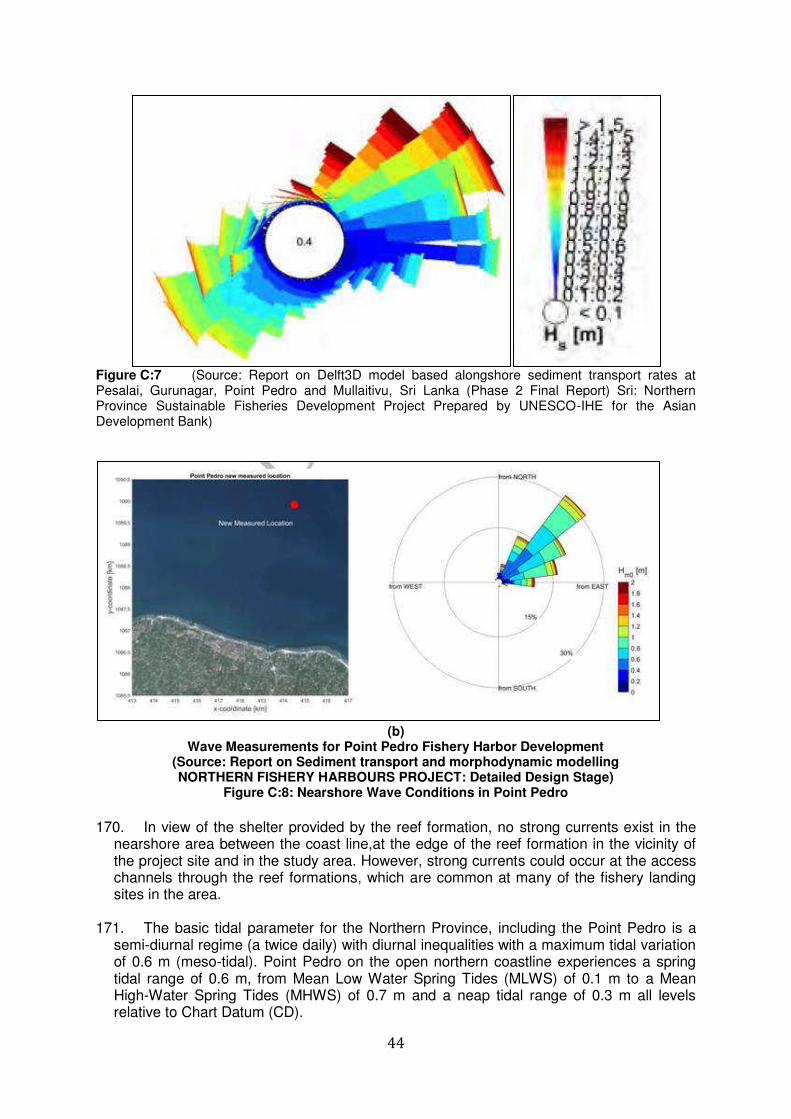
44
Figure C:7 (Source: Report on Delft3D model based alongshore sediment transport rates at Pesalai, Gurunagar, Point Pedro and Mullaitivu, Sri Lanka (Phase 2 Final Report) Sri: Northern Province Sustainable Fisheries Development Project Prepared by UNESCO-IHE for the Asian Development Bank)
(b)
Wave Measurements for Point Pedro Fishery Harbor Development (Source: Report on Sediment transport and morphodynamic modelling NORTHERN FISHERY HARBOURS PROJECT: Detailed Design Stage)
Figure C:8: Nearshore Wave Conditions in Point Pedro
170. In view of the shelter provided by the reef formation, no strong currents exist in the
nearshore area between the coast line,at the edge of the reef formation in the vicinity of the project site and in the study area. However, strong currents could occur at the access channels through the reef formations, which are common at many of the fishery landing sites in the area.
171. The basic tidal parameter for the Northern Province, including the Point Pedro is a
semi-diurnal regime (a twice daily) with diurnal inequalities with a maximum tidal variation of 0.6 m (meso-tidal). Point Pedro on the open northern coastline experiences a spring tidal range of 0.6 m, from Mean Low Water Spring Tides (MLWS) of 0.1 m to a Mean High-Water Spring Tides (MHWS) of 0.7 m and a neap tidal range of 0.3 m all levels relative to Chart Datum (CD).
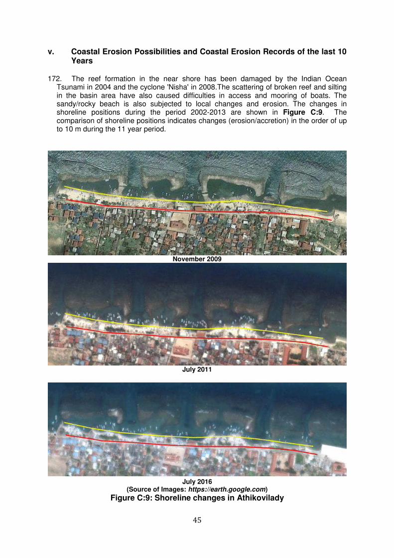
45
v. Coastal Erosion Possibilities and Coastal Erosion Records of the last 10 Years
172. The reef formation in the near shore has been damaged by the Indian Ocean
Tsunami in 2004 and the cyclone 'Nisha' in 2008.The scattering of broken reef and silting in the basin area have also caused difficulties in access and mooring of boats. The sandy/rocky beach is also subjected to local changes and erosion. The changes in shoreline positions during the period 2002-2013 are shown in Figure C:9. The comparison of shoreline positions indicates changes (erosion/accretion) in the order of up to 10 m during the 11 year period.
November 2009
July 2011
July 2016
(Source of Images: https://earth.google.com)
Figure C:9: Shoreline changes in Athikovilady
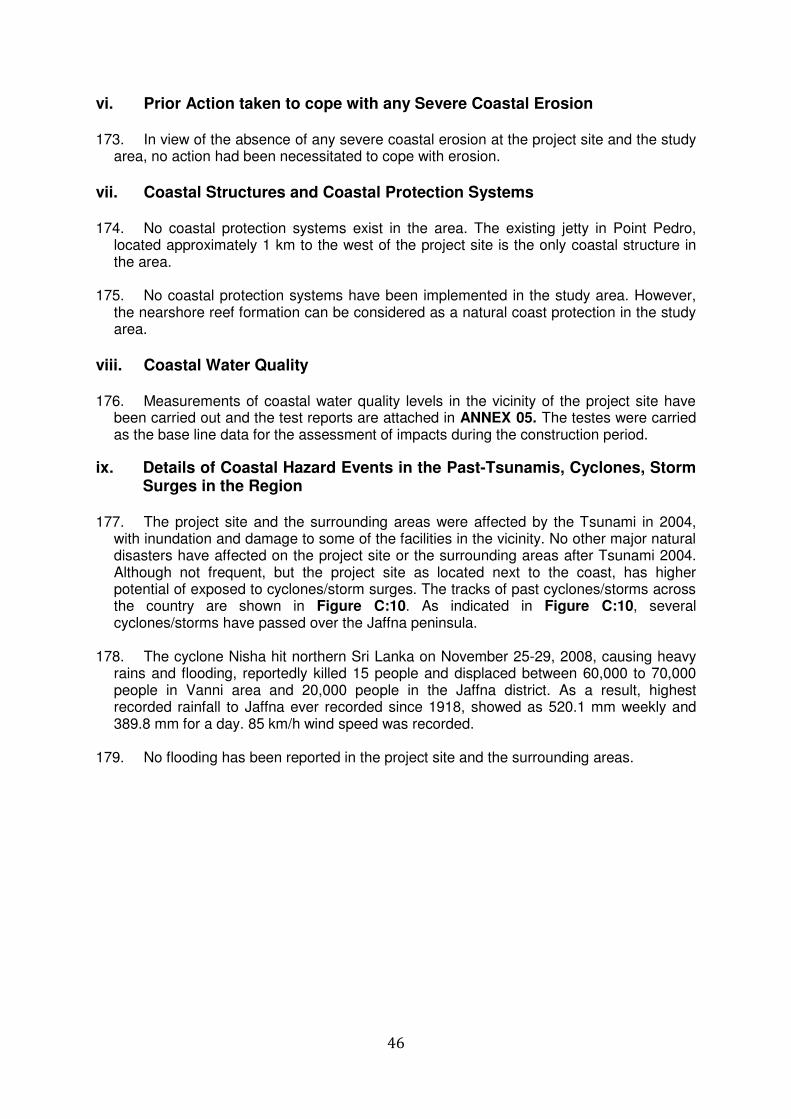
46
vi. Prior Action taken to cope with any Severe Coastal Erosion 173. In view of the absence of any severe coastal erosion at the project site and the study
area, no action had been necessitated to cope with erosion.
vii. Coastal Structures and Coastal Protection Systems 174. No coastal protection systems exist in the area. The existing jetty in Point Pedro,
located approximately 1 km to the west of the project site is the only coastal structure in the area.
175. No coastal protection systems have been implemented in the study area. However,
the nearshore reef formation can be considered as a natural coast protection in the study area.
viii. Coastal Water Quality 176. Measurements of coastal water quality levels in the vicinity of the project site have
been carried out and the test reports are attached in ANNEX 05. The testes were carried as the base line data for the assessment of impacts during the construction period.
ix. Details of Coastal Hazard Events in the Past-Tsunamis, Cyclones, Storm Surges in the Region
177. The project site and the surrounding areas were affected by the Tsunami in 2004,
with inundation and damage to some of the facilities in the vicinity. No other major natural disasters have affected on the project site or the surrounding areas after Tsunami 2004. Although not frequent, but the project site as located next to the coast, has higher potential of exposed to cyclones/storm surges. The tracks of past cyclones/storms across the country are shown in Figure C:10. As indicated in Figure C:10, several cyclones/storms have passed over the Jaffna peninsula.
178. The cyclone Nisha hit northern Sri Lanka on November 25-29, 2008, causing heavy
rains and flooding, reportedly killed 15 people and displaced between 60,000 to 70,000 people in Vanni area and 20,000 people in the Jaffna district. As a result, highest recorded rainfall to Jaffna ever recorded since 1918, showed as 520.1 mm weekly and 389.8 mm for a day. 85 km/h wind speed was recorded.
179. No flooding has been reported in the project site and the surrounding areas.
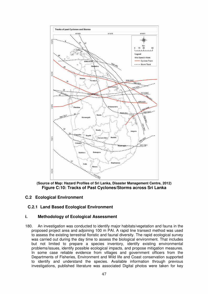
47
(Source of Map: Hazard Profiles of Sri Lanka, Disaster Management Centre, 2012)
Figure C:10: Tracks of Past Cyclones/Storms across Sri Lanka
C.2 Ecological Environment
C.2.1 Land Based Ecological Environment i. Methodology of Ecological Assessment 180. An investigation was conducted to identify major habitats/vegetation and fauna in the
proposed project area and adjoining 100 m PAI. A rapid line transect method was used to assess the existing terrestrial floristic and faunal diversity. The rapid ecological survey was carried out during the day time to assess the biological environment. That includes but not limited to prepare a species inventory, identify existing environmental problems/issues, identify possible ecological impacts, and propose mitigation measures. In some case reliable evidence from villages and government officers from the Departments of Fisheries, Environment and Wild life and Coast conservation supported to identify and understand the species. Available information through previous investigations, published literature was associated Digital photos were taken for key
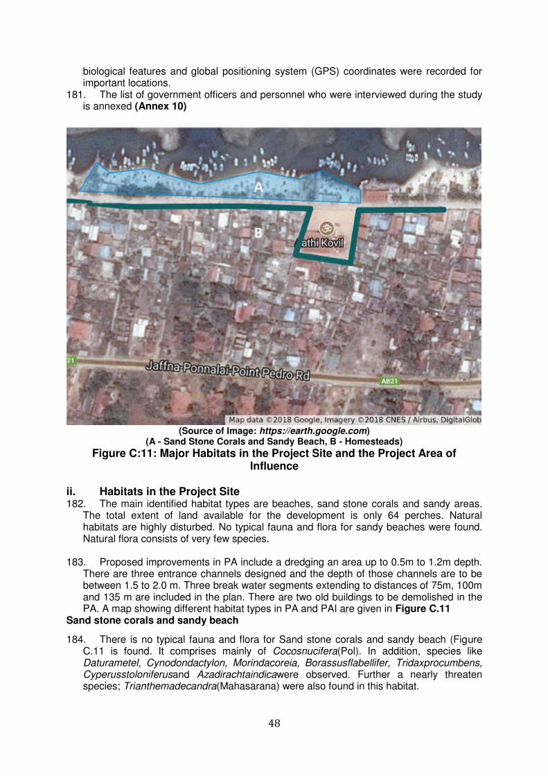
48
biological features and global positioning system (GPS) coordinates were recorded for important locations.
181. The list of government officers and personnel who were interviewed during the study is annexed (Annex 10)
(Source of Image: https://earth.google.com)
(A - Sand Stone Corals and Sandy Beach, B - Homesteads)
Figure C:11: Major Habitats in the Project Site and the Project Area of Influence
ii. Habitats in the Project Site 182. The main identified habitat types are beaches, sand stone corals and sandy areas.
The total extent of land available for the development is only 64 perches. Natural habitats are highly disturbed. No typical fauna and flora for sandy beaches were found. Natural flora consists of very few species.
183. Proposed improvements in PA include a dredging an area up to 0.5m to 1.2m depth. There are three entrance channels designed and the depth of those channels are to be between 1.5 to 2.0 m. Three break water segments extending to distances of 75m, 100m and 135 m are included in the plan. There are two old buildings to be demolished in the PA. A map showing different habitat types in PA and PAI are given in Figure C.11
Sand stone corals and sandy beach
184. There is no typical fauna and flora for Sand stone corals and sandy beach (Figure C.11 is found. It comprises mainly of Cocosnucifera(Pol). In addition, species like Daturametel, Cynodondactylon, Morindacoreia, Borassusflabellifer, Tridaxprocumbens, Cyperusstoloniferusand Azadirachtaindicawere observed. Further a nearly threaten species; Trianthemadecandra(Mahasarana) were also found in this habitat.
49
Figure C:12: Plant Species on the Sandy Beach of the Project Site iii. Habitats in the Project Area of Influence 185. Sand stone corals and sandy beach and homesteads dominate the Project Area of
Influence. Homesteads are very closely located and hardly there is any space for home gardens. Extended families are very popular in the area. Only very few tiny home gardens were observed with very low diversity in fauna and flora.
Homesteads 186. Homesteads are dominated with species such as Cocosnucifera (Pol), Plumeria
obtuse, Carica papaya, Euphorbia antiquorum, Hibiscus rosa-sinensis, Musa x paradisiaca, Jasminumsambac, Pandanusamaryllifolius and Murrayakoenigii.
iv. Vegetation in the Study Area 187. Floristic diversity of the proposed project area is very low. Total numbers of 18 plant
species including one nationally near threatened (NT) plant species were recorded during the field ecological survey within the study area (Table 1). Majority of the plant species recorded are trees (9) followed by herbaceous species (7) and shrubs (2) (Table C.2). Further, about 38.9 % of the recorded flora species are natives and about 61.1% of the recoded flora species are exotic to the country. Plant species recorded during the field study are listed in Table C.4 with necessary information.
Table C-2: Summary of Floral Species recorded in the Study Area
(CR - Critically Endangered, EN - Endangered, VU - Vulnerable, NT - Near Threatened)
Type of Flora No of
Species
Conservation Status Endemic
Native Exotic CR EN VU NT
Tree 9 0 0 0 0 0 03 6
Shrub 2 0 0 0 0 0 01 01
Herb 7 0 0 0 1 0 03 04
Climbers or Creepers
0 0 0 0 0 0 01 00
Total 18 0 0 0 01 0 07 11
% 38.9% 61.1%
50
CR - Critically Endangered, EN - Endangered, VU - Vulnerable, NT - Near Threatened
188. The species Trianthemadecandra, a nearly threatened species in IUCN national conservation status, was observed at 9.825472 N and 80.162472 E. These plants are loosely mat forming and are found interwoven. Several previous studies confirmed the significant existence of these species in Jaffna, Mannar, Vavuniya, Kilinochhi and Batticaloa Districts (Asela et al, 2014; Joseph, 2003, Department of Wildlife Conservation, 2017; IUCN, 2012; IUCN, 2011; CEB, 2016; GOSL, 2017). This plant can be removed during construction and be replanted in the areas marked for green belt establishment under the guidance of a horticulturist.
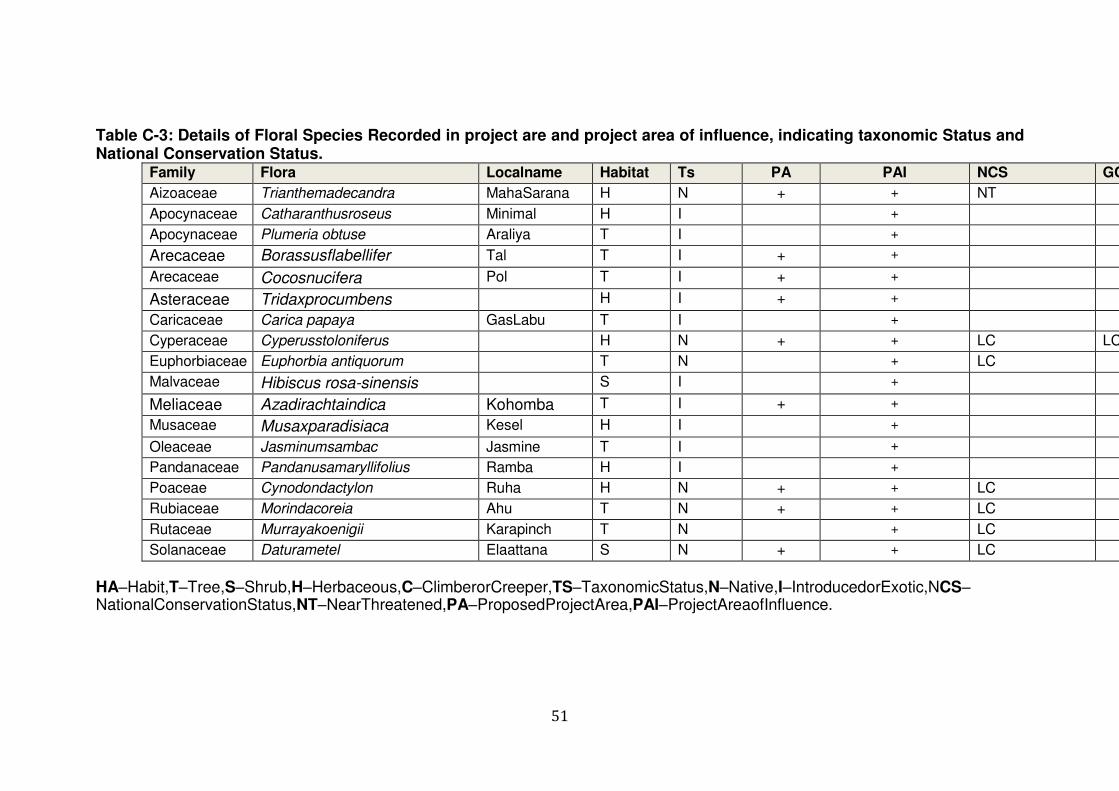
51
Table C-3: Details of Floral Species Recorded in project are and project area of influence, indicating taxonomic Status and National Conservation Status.
Family Flora Localname Habitat Ts PA PAI NCS GC
Aizoaceae Trianthemadecandra MahaSarana H N + + NT
Apocynaceae Catharanthusroseus Minimal H I +
Apocynaceae Plumeria obtuse Araliya T I +
Arecaceae Borassusflabellifer Tal T I + +
Arecaceae Cocosnucifera Pol T I + +
Asteraceae Tridaxprocumbens H I + +
Caricaceae Carica papaya GasLabu T I +
Cyperaceae Cyperusstoloniferus H N + + LC LC
Euphorbiaceae Euphorbia antiquorum T N + LC
Malvaceae Hibiscus rosa-sinensis S I +
Meliaceae Azadirachtaindica Kohomba T I + +
Musaceae Musaxparadisiaca Kesel H I +
Oleaceae Jasminumsambac Jasmine T I +
Pandanaceae Pandanusamaryllifolius Ramba H I +
Poaceae Cynodondactylon Ruha H N + + LC
Rubiaceae Morindacoreia Ahu T N + + LC
Rutaceae Murrayakoenigii Karapinch T N + LC
Solanaceae Daturametel Elaattana S N + + LC
HA–Habit,T–Tree,S–Shrub,H–Herbaceous,C–ClimberorCreeper,TS–TaxonomicStatus,N–Native,I–IntroducedorExotic,NCS–NationalConservationStatus,NT–NearThreatened,PA–ProposedProjectArea,PAI–ProjectAreaofInfluence.
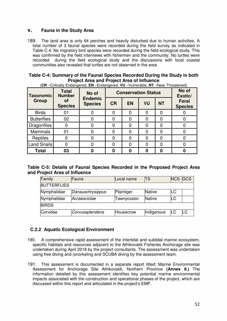
52
v. Fauna in the Study Area
189. The land area is only 64 perches and heavily disturbed due to human activities. A total number of 3 faunal species were recorded during the field survey as indicated in Table C.4. No migratory bird species were recorded during the field ecological study. This was confirmed by the field interviews with fishermen and the community. No turtles were recorded during the field ecological study and the discussions with local coastal communities also revealed that turtles are not observed in the area
Table C-4: Summary of the Faunal Species Recorded During the Study in both
Project Area and Project Area of Influence (CR –Critically Endangered, EN –Endangered, VU –Vulnerable, NT –Near Threatened)
Taxonomic Group
Total Number
of Species
No of Endemic Species
Conservation Status No of Exotic/ Feral
Species CR EN VU NT
Birds 01 0 0 0 0 0 0
Butterflies 02 0 0 0 0 0 0
Dragonflies 0 0 0 0 0 0 0
Mammals 01 0 0 0 0 0 0
Reptiles 0 0 0 0 0 0 0
Land Snails 0 0 0 0 0 0 0
Total 03 0 0 0 0 0 0
Table C-5: Details of Faunal Species Recorded in the Proposed Project Area and Project Area of Influence
C.2.2 Aquatic Ecological Environment 190. A comprehensive rapid assessment of the intertidal and subtidal marine ecosystem,
specific habitats and resources adjacent to the Athikovaldi Fisheries Anchorage site was undertaken during April 2018 by the project consultants. The assessment was undertaken using free diving and (snorkeling and SCUBA diving by the assessment team.
191. This assessment is documented in a separate report titled: Marine Environmental Assessment for Anchorage Site Athikovaldi, Northern Province (Annex 8.) The information detailed by this assessment identifies key potential marine environmental impacts associated with the construction and operational phases of the project, which are discussed within this report and articulated in the project‟s EMP.
Family Fauna Local name TS NCS GCS
BUTTERFLIES
Nymphalidae Danauschrysippus Plaintiger Native LC
Nymphalidae Acraeaviolae Tawnycostor Native LC
BIRDS
Corvidae Corvussplendens Housecrow Indigenous LC LC
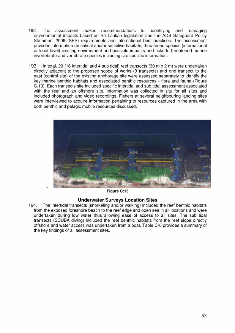
53
192. The assessment makes recommendations for identifying and managing environmental impacts based on Sri Lankan legislation and the ADB Safeguard Policy Statement 2009 (SPS) requirements and international best practices. The assessment provides information on critical and/or sensitive habitats, threatened species (international or local level) existing environment and possible impacts and risks to threatened marine invertebrate and vertebrate species including site specific information.
193. In total, 20 (16 intertidal and 4 sub tidal) reef transects (30 m x 2 m) were undertaken directly adjacent to the proposed scope of works (3 transects) and one transect to the east (control site) of the existing anchorage site were assessed separately to identify the key marine benthic habitats and associated benthic resources - flora and fauna (Figure C.13). Each transects site included specific intertidal and sub tidal assessment associated with the reef and an offshore site. Information was collected in situ for all sites and included photograph and video recordings. Fishers at several neighbouring landing sites were interviewed to acquire information pertaining to resources captured in the area with
both benthic and pelagic mobile resources discussed.
- Figure C:13
Underwater Surveys Location Sites 194. The intertidal transects (snorkeling and/or walking) included the reef benthic habitats
from the exposed foreshore beach to the reef edge and open sea in all locations and were undertaken during low water thus allowing ease of access to all sites. The sub tidal transects (SCUBA diving) included the reef benthic habitats from the reef slope directly offshore and water access was undertaken from a boat. Table C-6 provides a summary of the key findings of all assessment sites.

54
Table C-6 summary of details of the sites investigated sites.
195. Information documented from the rapid assessments included the identification of major benthic habitats, flora and fauna biodiversity, hard and soft coral percentage coverage, morphological form, dominant species, macro algae and invertebrate species. In addition basic water quality parameters, including temperature, salinity, pH, conductivity, dissolved oxygen (DO) and total suspended solids (TDS) were recorded using a multi-parameter reader.
196. Coralline limestone and sandstone reefs were found running parallel to the shore, protecting the shore from waves and providing habitats for intertidal biota including soft and hard corals. Sandstone, limestone and rocky reefs are one of the common features of the northern coast of Sri Lanka. The project site has a sandy beach foreshore area that is low lying and narrow (barley exceeds 20 m in width) (Figure C:14).
197. The Adikoviladi anchorage site consists of several sheltered areas with five natural
access channels dissecting the reef. The reef was been damaged by the Indian Ocean Tsunami in 2004 and it has been repaired by the reconstructing of a wave barrier using broken limestone to provide shelter for mooring. The narrow beach area is subjected to erosion and retaining walls has been constructed in several areas. Access to the site is provided by a narrow road and as such due to narrow entrance of the road and limited space between the road and sea, further expansion of shore facilities cannot be undertaken.
198. The intertidal reef flat width varies (averages 300 m), terminates at the reef edge (2-
4 m depth) and descended down the short reef slope at an angle of 450 to terminate at the benthic substrate at around 6-8 m depth at which point the substrate is dominated by sand and is devoid of a hard substrate, structures (coral rocks, rubble) and associated benthic invertebrates.
199. The offshore substrate is covered with fine sand and mud resulting in poor water
quality and visibility due to fine suspended particles. The sandy bottom is devoid of any sessile benthic flora and fauna communities. Mobile invertebrates (e.g. sea cucumbers,
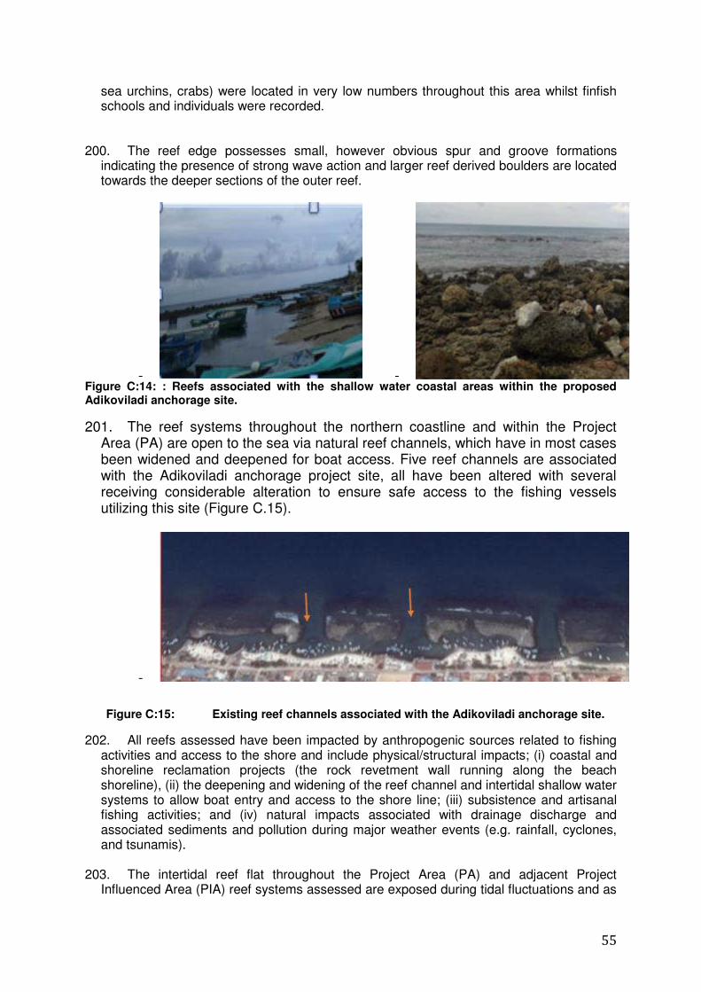
55
sea urchins, crabs) were located in very low numbers throughout this area whilst finfish schools and individuals were recorded.
200. The reef edge possesses small, however obvious spur and groove formations indicating the presence of strong wave action and larger reef derived boulders are located towards the deeper sections of the outer reef.
- - Figure C:14: : Reefs associated with the shallow water coastal areas within the proposed Adikoviladi anchorage site.
201. The reef systems throughout the northern coastline and within the Project Area (PA) are open to the sea via natural reef channels, which have in most cases been widened and deepened for boat access. Five reef channels are associated with the Adikoviladi anchorage project site, all have been altered with several receiving considerable alteration to ensure safe access to the fishing vessels utilizing this site (Figure C.15).
-
Figure C:15: Existing reef channels associated with the Adikoviladi anchorage site.
202. All reefs assessed have been impacted by anthropogenic sources related to fishing activities and access to the shore and include physical/structural impacts; (i) coastal and shoreline reclamation projects (the rock revetment wall running along the beach shoreline), (ii) the deepening and widening of the reef channel and intertidal shallow water systems to allow boat entry and access to the shore line; (iii) subsistence and artisanal fishing activities; and (iv) natural impacts associated with drainage discharge and associated sediments and pollution during major weather events (e.g. rainfall, cyclones, and tsunamis).
203. The intertidal reef flat throughout the Project Area (PA) and adjacent Project Influenced Area (PIA) reef systems assessed are exposed during tidal fluctuations and as
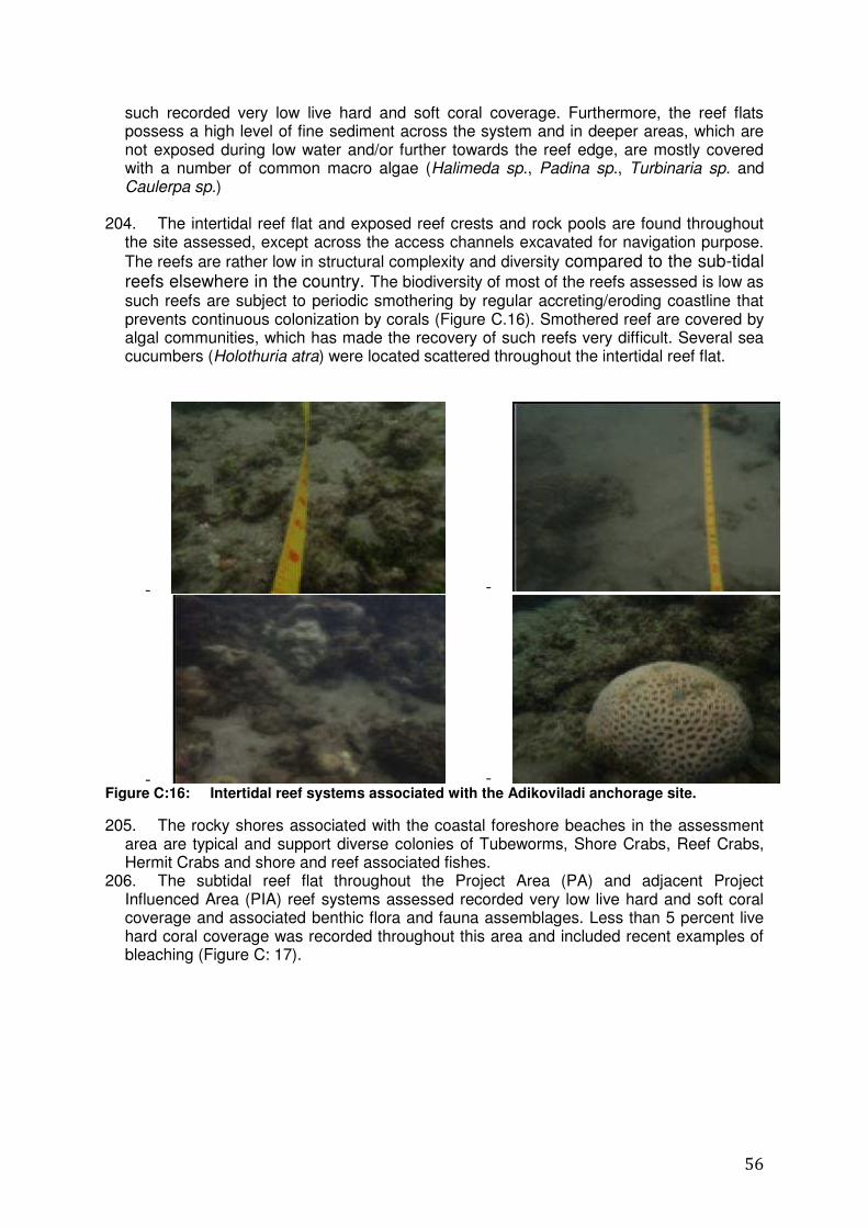
56
such recorded very low live hard and soft coral coverage. Furthermore, the reef flats possess a high level of fine sediment across the system and in deeper areas, which are not exposed during low water and/or further towards the reef edge, are mostly covered with a number of common macro algae (Halimeda sp., Padina sp., Turbinaria sp. and Caulerpa sp.)
204. The intertidal reef flat and exposed reef crests and rock pools are found throughout
the site assessed, except across the access channels excavated for navigation purpose.
The reefs are rather low in structural complexity and diversity compared to the sub-tidal reefs elsewhere in the country. The biodiversity of most of the reefs assessed is low as such reefs are subject to periodic smothering by regular accreting/eroding coastline that prevents continuous colonization by corals (Figure C.16). Smothered reef are covered by algal communities, which has made the recovery of such reefs very difficult. Several sea cucumbers (Holothuria atra) were located scattered throughout the intertidal reef flat.
- -
- - Figure C:16: Intertidal reef systems associated with the Adikoviladi anchorage site.
205. The rocky shores associated with the coastal foreshore beaches in the assessment area are typical and support diverse colonies of Tubeworms, Shore Crabs, Reef Crabs, Hermit Crabs and shore and reef associated fishes.
206. The subtidal reef flat throughout the Project Area (PA) and adjacent Project Influenced Area (PIA) reef systems assessed recorded very low live hard and soft coral coverage and associated benthic flora and fauna assemblages. Less than 5 percent live hard coral coverage was recorded throughout this area and included recent examples of bleaching (Figure C: 17).
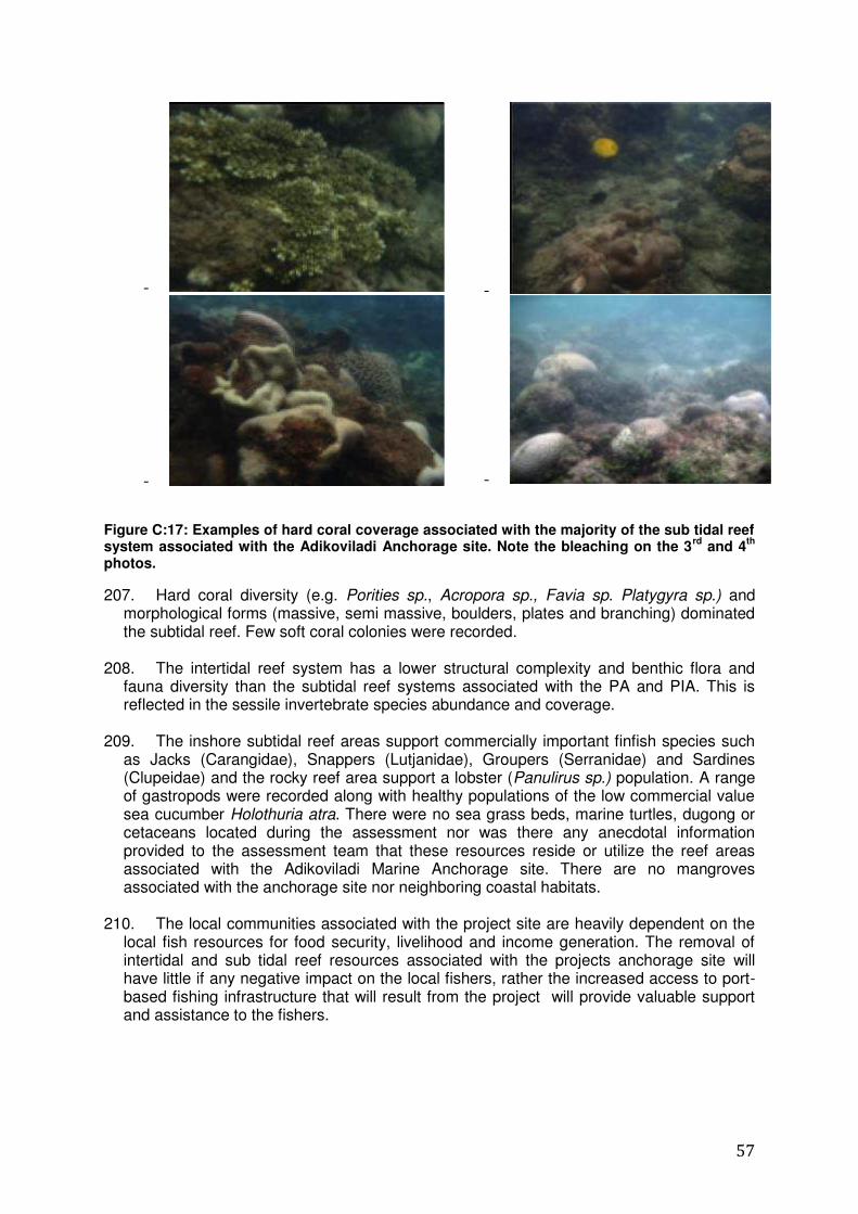
57
- -
- -
Figure C:17: Examples of hard coral coverage associated with the majority of the sub tidal reef system associated with the Adikoviladi Anchorage site. Note the bleaching on the 3
rd and 4
th
photos.
207. Hard coral diversity (e.g. Porities sp., Acropora sp., Favia sp. Platygyra sp.) and morphological forms (massive, semi massive, boulders, plates and branching) dominated the subtidal reef. Few soft coral colonies were recorded.
208. The intertidal reef system has a lower structural complexity and benthic flora and fauna diversity than the subtidal reef systems associated with the PA and PIA. This is reflected in the sessile invertebrate species abundance and coverage.
209. The inshore subtidal reef areas support commercially important finfish species such
as Jacks (Carangidae), Snappers (Lutjanidae), Groupers (Serranidae) and Sardines (Clupeidae) and the rocky reef area support a lobster (Panulirus sp.) population. A range of gastropods were recorded along with healthy populations of the low commercial value sea cucumber Holothuria atra. There were no sea grass beds, marine turtles, dugong or cetaceans located during the assessment nor was there any anecdotal information provided to the assessment team that these resources reside or utilize the reef areas associated with the Adikoviladi Marine Anchorage site. There are no mangroves associated with the anchorage site nor neighboring coastal habitats.
210. The local communities associated with the project site are heavily dependent on the
local fish resources for food security, livelihood and income generation. The removal of intertidal and sub tidal reef resources associated with the projects anchorage site will have little if any negative impact on the local fishers, rather the increased access to port-based fishing infrastructure that will result from the project will provide valuable support and assistance to the fishers.
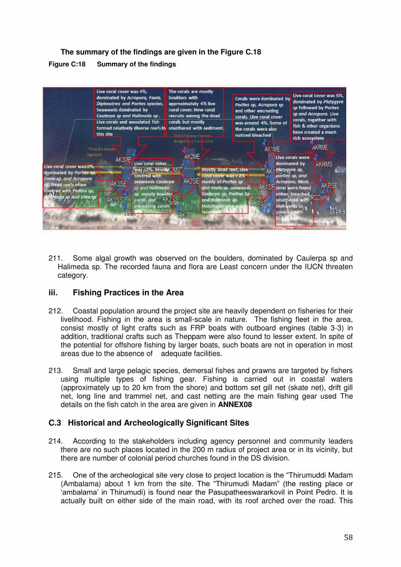
58
The summary of the findings are given in the Figure C.18
Figure C:18 Summary of the findings
211. Some algal growth was observed on the boulders, dominated by Caulerpa sp and Halimeda sp. The recorded fauna and flora are Least concern under the IUCN threaten category.
iii. Fishing Practices in the Area 212. Coastal population around the project site are heavily dependent on fisheries for their
livelihood. Fishing in the area is small-scale in nature. The fishing fleet in the area, consist mostly of light crafts such as FRP boats with outboard engines (table 3-3) in addition, traditional crafts such as Theppam were also found to lesser extent. In spite of the potential for offshore fishing by larger boats, such boats are not in operation in most areas due to the absence of adequate facilities.
213. Small and large pelagic species, demersal fishes and prawns are targeted by fishers using multiple types of fishing gear. Fishing is carried out in coastal waters (approximately up to 20 km from the shore) and bottom set gill net (skate net), drift gill net, long line and trammel net, and cast netting are the main fishing gear used The details on the fish catch in the area are given in ANNEX08
C.3 Historical and Archeologically Significant Sites 214. According to the stakeholders including agency personnel and community leaders
there are no such places located in the 200 m radius of project area or in its vicinity, but there are number of colonial period churches found in the DS division.
215. One of the archeological site very close to project location is the “Thirumuddi Madam
(Ambalama) about 1 km from the site. The “Thirumudi Madam” (the resting place or „ambalama‟ in Thirumudi) is found near the Pasupatheeswararkovil in Point Pedro. It is actually built on either side of the main road, with its roof arched over the road. This
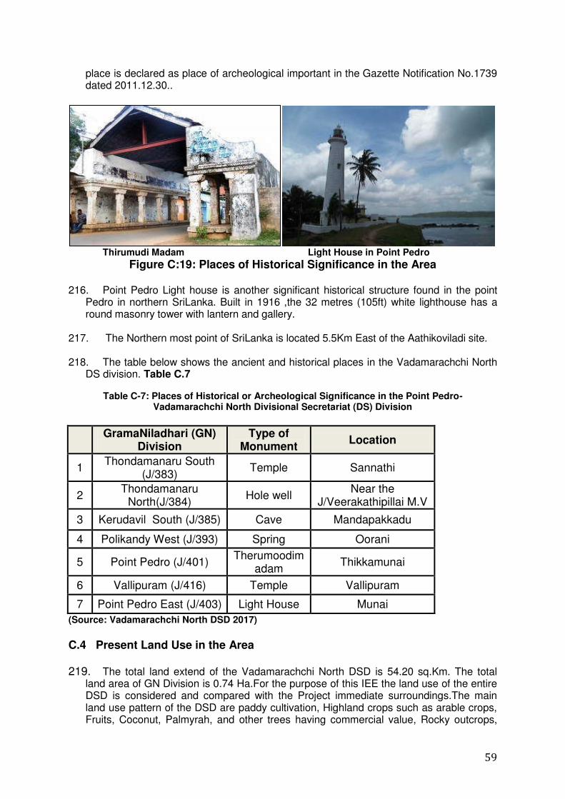
59
place is declared as place of archeological important in the Gazette Notification No.1739 dated 2011.12.30..
Thirumudi Madam Light House in Point Pedro
Figure C:19: Places of Historical Significance in the Area 216. Point Pedro Light house is another significant historical structure found in the point
Pedro in northern SriLanka. Built in 1916 ,the 32 metres (105ft) white lighthouse has a round masonry tower with lantern and gallery.
217. The Northern most point of SriLanka is located 5.5Km East of the Aathikoviladi site.
218. The table below shows the ancient and historical places in the Vadamarachchi North DS division. Table C.7
Table C-7: Places of Historical or Archeological Significance in the Point Pedro-Vadamarachchi North Divisional Secretariat (DS) Division
GramaNiladhari (GN)
Division Type of
Monument Location
1 Thondamanaru South
(J/383) Temple Sannathi
2 Thondamanaru
North(J/384) Hole well
Near the J/Veerakathipillai M.V
3 Kerudavil South (J/385) Cave Mandapakkadu
4 Polikandy West (J/393) Spring Oorani
5 Point Pedro (J/401) Therumoodim
adam Thikkamunai
6 Vallipuram (J/416) Temple Vallipuram
7 Point Pedro East (J/403) Light House Munai
(Source: Vadamarachchi North DSD 2017)
C.4 Present Land Use in the Area 219. The total land extend of the Vadamarachchi North DSD is 54.20 sq.Km. The total
land area of GN Division is 0.74 Ha.For the purpose of this IEE the land use of the entire DSD is considered and compared with the Project immediate surroundings.The main land use pattern of the DSD are paddy cultivation, Highland crops such as arable crops, Fruits, Coconut, Palmyrah, and other trees having commercial value, Rocky outcrops,
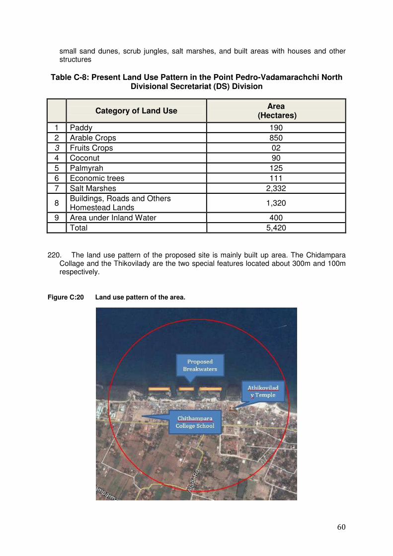
60
small sand dunes, scrub jungles, salt marshes, and built areas with houses and other structures
Table C-8: Present Land Use Pattern in the Point Pedro-Vadamarachchi North
Divisional Secretariat (DS) Division
Category of Land Use
Area (Hectares)
1 Paddy 190
2 Arable Crops 850
3 Fruits Crops 02
4 Coconut 90
5 Palmyrah 125
6 Economic trees 111
7 Salt Marshes 2,332
8 Buildings, Roads and Others Homestead Lands
1,320
9 Area under Inland Water 400
Total 5,420
220. The land use pattern of the proposed site is mainly built up area. The Chidampara
Collage and the Thikovilady are the two special features located about 300m and 100m respectively.
Figure C:20 Land use pattern of the area.
61
C.5 Social and Economic Aspects
C.5.1 Socio-Economic Profile in the Area 221. Entire population in studied locations are Tamil according to the data available with
the GN, and Hinduism and Christianity are the two dominant religions in the area. According to the Resource profile (2015) the total population of the Vadamarachchi North DSD is 45,989 and the number of total families are 14,091. The gender diversity of the population of the DSD is as follows, Male 22,193 , which is 48.25% of the total population, and the female population is higher than the male population as 23,796 which is 51.74% of the total population. The male female distribution of the GN division is almost follow the same pattern in the DSD. The data related to this aspect is shown in Table C.9
222. Majority of the population in the relevant areas covered in this study falls under age category 19- 60 as shown in Table C-9
Table C-9: Gender Diversity and Age Distribution of the Population
Age Group Gender
Total Male Female
0-4 Years 788 831 1,619
05-19 Years 2,404 2,486 4,890
20-39 Years 4,317 4,657 8,974
40-59 Years 8,672 9,285 17,957
60-74 Years 5,342 5,712 11,054
75 Years and Over 670 825 1,495
Total 22,193 23,796 45,989
Source: Vadamarachi North DSD-2017
223. The population in the Point Pedro East-J/403 Grama Niladhari (GN) Division, in
which the project site is located, is 2,533 representing 5.5 % of the population of the Point Pedro-Vadamarachchi North Divisional Secretariat (DS) Division.
C.5.2 Diversity of population.
The Education level:
224. There are 32 schools in the Vadamarachchy North Division. There are five (05) grade 1 AB, four (04) grade 1C, eleven (11) grade 11, and eleven (11) grade 1I1 schools in the DSD. Out of these schools , most of the schools are mixed.
225. At present, there are 69 pre schools in our area. Schools and pre schools are controlled by Vadamaradchy Zonal Education Office. There is not enough building facilities, Laboratory facilities and Equipment facilities.
226. The educational level of the fishing community is low in general, and this observation
is equally relevant to fishing community in the studied area under the this project.
62
C.5.3 Nature of Households and Principal Economic Activities 227. The details on principal economic activities, in the form of employment sectors, in the
Point Pedro-Vadamarachchi North Divisional Secretariat (DS) Division aregiven in 228. Table C-10. The majority of the community in coastal areas is employed in the
fisheries sector.
Table C-10: Employment Pattern in the Point Pedro-Vadamarachchi North
Divisional Secretariat (DS) Division
Sector of Employment Number %
1 Government 1,492 20.8
2 Private 190 2.7
3 Agriculture 1,838 25.7
4 Fisheries 1,322 18.5
5 Overseas 596 8.3
6 Labor 1,630 22.8
7 Self Employed 97 1.4
8 Total 7,165 100
Source: Vadamarachi North DSD-2017 229. The details on income levels of the population in the Point Pedro East-J/403 Grama
Niladhari (GN) Division are shown in Table C-11. Except among the owners of larger fishing boats-One Day Boats and Multi Day Boats-no higher levels of income are reported among the fishery community.
Table C-11: Income Levels of the Population in the Point Pedro East-J/403
GramaNiladhari (GN) Division
Monthly Income
(Rs)
Below 3,000/=
3,000/= to 5,000/=
5,001/= to 10,000/=
10,001/= to 25,000/=
Above 25,000/=
No of Persons
168 80 423 154 48
Source: Vadamarachi North DSD-2017
C.5.4 Existing Infrastructure Facilities i. Roads The project area can be reached through a narrow coastal road that is connected to Jaffna-Ponnalai-Point Pedro road. The Jaffna-Ponnalai-Point Pedro road is improved but, its width is about 8m. Even the width of this road gets narrow down up to about 4m towards coastal area. The coastal road is extremely narrow due to houses very close to the edge of the road. .
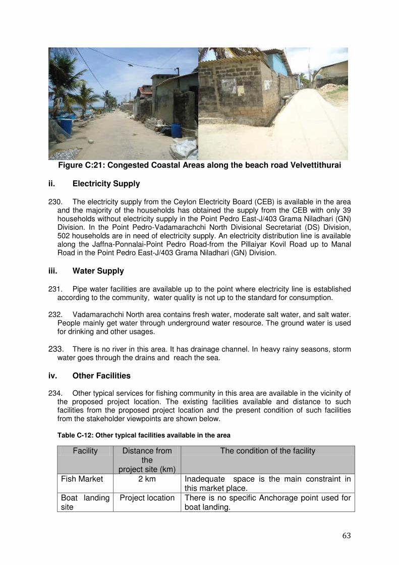
63
Figure C:21: Congested Coastal Areas along the beach road Velvettithurai
ii. Electricity Supply 230. The electricity supply from the Ceylon Electricity Board (CEB) is available in the area
and the majority of the households has obtained the supply from the CEB with only 39 households without electricity supply in the Point Pedro East-J/403 Grama Niladhari (GN) Division. In the Point Pedro-Vadamarachchi North Divisional Secretariat (DS) Division, 502 households are in need of electricity supply. An electricity distribution line is available along the Jaffna-Ponnalai-Point Pedro Road-from the Pillaiyar Kovil Road up to Manal Road in the Point Pedro East-J/403 Grama Niladhari (GN) Division.
iii. Water Supply 231. Pipe water facilities are available up to the point where electricity line is established
according to the community, water quality is not up to the standard for consumption.
232. Vadamarachchi North area contains fresh water, moderate salt water, and salt water. People mainly get water through underground water resource. The ground water is used for drinking and other usages.
233. There is no river in this area. It has drainage channel. In heavy rainy seasons, storm water goes through the drains and reach the sea.
iv. Other Facilities 234. Other typical services for fishing community in this area are available in the vicinity of
the proposed project location. The existing facilities available and distance to such facilities from the proposed project location and the present condition of such facilities from the stakeholder viewpoints are shown below.
Table C-12: Other typical facilities available in the area
Facility Distance from the
project site (km)
The condition of the facility
Fish Market 2 km Inadequate space is the main constraint in this market place.
Boat landing site
Project location There is no specific Anchorage point used for boat landing.
64
Fuel stations 2 km There are adequate number s of fuel stations available within 3 km radius from the boat landing sites.
Ice factory
3 Inadequate capacity is the main problem.
Other institutions 235. Point Pedro East GN division comes under the jurisdiction of Point Pedro Urban
Council. Most of the public service delivery institutions are available within 2.5km radius from the project implementing area. The religious institutions available in this area are shown in table C.13
Table C-13: Welfare and Religious institutions available in DSD area.
Urban Council ,Valvettithurai
J/ValvaiSivaguruvid
CustomSubOffice
J/RomanCatholicSchool
ThampuravalaiSithiVinsayakarTemple
PalavathaiVairavarTemple
MamparathaiVairavarTemple
236. The Point Pedro and Puloly Multipurpose Co-operative shops are located close to the project site, with branches in every village. There are four banks in the DS division. These are Peoples Bank, Bank of Ceylon, National Savings Bank and Hatton National Bank. Peoples bank branches are in Point Pedro and Valvettithurai.
237. The Closest city centre is Point Pedro. There are two markets, such as Fish &
Vegetable markets. Valvettithurai & Point Pedro Vegetable markets are functioning in Permanent buildings. Last year a new super market has been constructed in Point Pedro town.
There are 16 fish markets in the DSD including one in Munai.
iv. Existing Fishing Activities in the Area 238. Northern boundary of the Vadamarachchi Divisional Secretariat has 19Km long
coastal area. There are many fish varieties caught in the coastal areas. the fishermen earn a good income due to trading with southern fish traders. There is 1 jetty and 14 Anchoring points in the vadamarachchi DSD. Most of the anchorage points are not constructed upto standard.
Fishing population 239. The total number of fishery families in the DSD is 3,192 and the population involved
in the fishing activities is 14,313. The total members in the Aathikoviladi Fisheries Cooperative Society is 750- 800. The Aathikoviladi landing area is a large area and the
65
approximate length is 500m. The following table giving the details of fishing population of the Point Pedro DSD.
Table C-14: Structure of the Fishing population in Point Pedro DSD
Type
2015
1. No.of Fisheries family 3,192
2. No.of FishingPopulation 14,313
3. Engine Boat (in) 55
4. Engine Boat(out) 830
5.Boat (With out engine) 952
6. No.of Fisheries villages 13
7. No.of fisheries societies 13
8. Members of fisheries societies 4,923
9. Fisheries Pensioners 1,050
10. Production of Fresh Fish(mt) 4920
11. Fishing Harbours 1
12. Drivedfish Production(mt) 365
Seasonal variation of fish catch 240. During the southwest monsoonal period (May) fish production increased by about 13.
The high wind period with the onset of North-East Monsoon usually avoid the fishing by
the fishermen. During high wind season it is very much difficult to launch the boats into the sea, as the channels are very narrow and most of the boats get damaged in the reef area. With the deepening of anchorage and construction of Breakwaters , the situation will be improved. The fishermen could launch their boats in most of the time period of the year.
The large pelagic off shore fishery
The reef associated fishery
Fishery for ornamental species
Squid fishery
Small-meshed gillnet fishery
The constraints faced by the fishermen in the area
241. The fishermen in the area are faced with various constrains that are mentioned below.
About 4 months per year become difficult period for launching the boats mainly
due to High wind and low tide of the sea as the land site is not deep enough to
launch the boats.
66
In certain periods some fishermen attempt at using narrow channels and it involves
high risk. There have been several fatal accidents reported in launching boats
during high wind season. This activity also causes large scale damages to the
boats.
The anchoring point along the Aathikoviladi area is not properly
established and therefore, damages occur during anchoring of the boats
along the improper.
In general, non- availability of proper anchoring facility is a serious issue in the
area.
Table C-15: Details on the Fisheries Sector-2015- Point Pedro-Vadamarachchi North Divisional Secretariat (DS) Division
1 No. of Fisheries Families 3,192
2 Population engaged in Fisheries Sector 14,313
3 No. of Boats with Inboard Engines 55
4 No. of Boats with Outoard Engines 830
5 Non-Mechanized Boats 952
6 No. of FisheriesVillages 13
7 No. of Fisheries Societies 13
8 No. of Members in Fisheries Societies 4,923
9 Pensioners in the Fisheries Sector 1,050
10 Production of Fresh Fish 4,920 Metric Tons
11 Production of Dried Fish 365 Metric Tons
C.6 Existing Environmental Issues and Social Conflicts 242. Athikovilady area is highly congested and no space for the infrastructure
development. Because of this, there is no proper toilet facilities, fisheries infrastructures, and also no lands for road widening. The difficulties encountered by the fishing community due to lack of lands , resulting impacts on livelihood of the local fishing community.
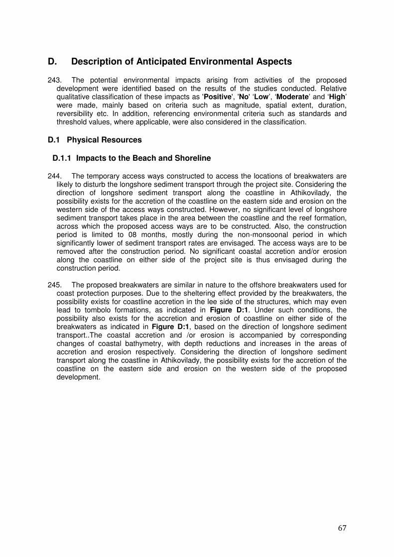
67
D. Description of Anticipated Environmental Aspects 243. The potential environmental impacts arising from activities of the proposed
development were identified based on the results of the studies conducted. Relative qualitative classification of these impacts as 'Positive', 'No' „Low‟, „Moderate‟ and „High‟ were made, mainly based on criteria such as magnitude, spatial extent, duration, reversibility etc. In addition, referencing environmental criteria such as standards and threshold values, where applicable, were also considered in the classification.
D.1 Physical Resources
D.1.1 Impacts to the Beach and Shoreline 244. The temporary access ways constructed to access the locations of breakwaters are
likely to disturb the longshore sediment transport through the project site. Considering the direction of longshore sediment transport along the coastline in Athikovilady, the possibility exists for the accretion of the coastline on the eastern side and erosion on the western side of the access ways constructed. However, no significant level of longshore sediment transport takes place in the area between the coastline and the reef formation, across which the proposed access ways are to be constructed. Also, the construction period is limited to 08 months, mostly during the non-monsoonal period in which significantly lower of sediment transport rates are envisaged. The access ways are to be removed after the construction period. No significant coastal accretion and/or erosion along the coastline on either side of the project site is thus envisaged during the construction period.
245. The proposed breakwaters are similar in nature to the offshore breakwaters used for
coast protection purposes. Due to the sheltering effect provided by the breakwaters, the possibility exists for coastline accretion in the lee side of the structures, which may even lead to tombolo formations, as indicated in Figure D:1. Under such conditions, the possibility also exists for the accretion and erosion of coastline on either side of the breakwaters as indicated in Figure D:1, based on the direction of longshore sediment transport..The coastal accretion and /or erosion is accompanied by corresponding changes of coastal bathymetry, with depth reductions and increases in the areas of accretion and erosion respectively. Considering the direction of longshore sediment transport along the coastline in Athikovilady, the possibility exists for the accretion of the coastline on the eastern side and erosion on the western side of the proposed development.
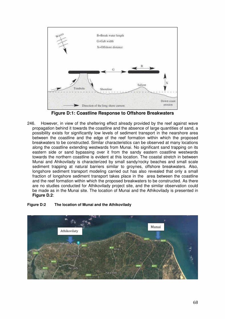
68
Figure D:1: Coastline Response to Offshore Breakwaters
246. However, in view of the sheltering effect already provided by the reef against wave
propagation behind it towards the coastline and the absence of large quantities of sand, a possibility exists for significantly low levels of sediment transport in the nearshore area between the coastline and the edge of the reef formation within which the proposed breakwaters to be constructed. Similar characteristics can be observed at many locations along the coastline extending westwards from Munai. No significant sand trapping on its eastern side or sand bypassing over it from the sandy eastern coastline westwards towards the northern coastline is evident at this location. The coastal stretch in between Munai and Ahikovilady is characterized by small sandy/rocky beaches and small scale sediment trapping at natural barriers similar to groynes, offshore breakwaters. Also, longshore sediment transport modeling carried out has also revealed that only a small fraction of longshore sediment transport takes place in the area between the coastline and the reef formation within which the proposed breakwaters to be constructed. As there are no studies conducted for Athikovilady project site, and the similar observation could be made as in the Munai site. The location of Munai and the Athikovilady is presented in Figure D.2:
Figure D:2 The location of Munai and the Athikovilady
Munai Athikovilaty
69
247. Also, the proposed developments will enhance the protection/sheltering from the waves already provided by the natural reef for the activities of the Athikoviladi fishery landing site.
248. In view of the above considerations, the impacts due to
i. Erosion of adjacent beaches and lands due to change of current wave height
regimes attributed to proposed structures ii. Erosion effects on either sides of the coastal stretch during construction period as
well as in the long run iii. Coastal/accretion and bathymetric changes (on either side of the breakwaters0 in the
area iv. Changes in hydrodynamic pattern such as current and wave patterns, wave height
and direction, nearshore current velocity, direction and tides v. Changes in the sediment transport patterns in both periods (short term and long
term)can be rated as 'Low' during both construction and operational stages of the project.
D.1.2 Changes in drainage patterns 249. The proposed developments are mainly carried out in the nearshore area, as
opposed to overland areas. Only the beach area of the project site and an overland site selected by the contractor are to be used for stockpiling of rocks/construction materials. The possibility exists to maintain any existing drainage paths (or divert where necessary) in the overland areas used for project activities. No overland operational activities, except for those currently carried out at the Athikovilady fishery landing site, would be associated with the proposed development. Changes in drainage patterns, if any, would not be significant and, if any, would be highly localized.
250. The impact due to changes in drainage patterns can thus be rated as 'Low' during
both construction and operational stages of the project. 251. Impacts of sewage or waste water, solid disposal, waste oil spills, surface runoff on
coastal environment and coastal waters 252. No significant quantities of wastewater, sewage or solid waste are to be generated
and, with the existing/proposed disposal methods implemented, no direct disposal of waste into the environment is to be carried out. Oil spills could occur mainly due to the operation of machinery and at the temporary storage facilities in the construction site. However, in view of the type/nature and scale of construction-with only a few plants/machinery, no significant levels of waste oil spills are envisaged during the construction stage.
253. Although the possibility exists for increased level of waste oil spills during the
operational stage due to the activities of an increased number of fishing boats expected to be anchored, in view of the improved operational conditions in the basin (i.e. a calm basin, with enhanced shelter provided by the breakwaters constructed), a lower risk level of accidental spills of oil can be expected.
254. The impacts of sewage or waste water, solid disposal, waste oil spills, surface runoff
on coastal environment and coastal waters can thus be rated as 'Low' during both construction and operational stages of the project.
70
D.1.3 Impacts on water quality 255. An increase in turbidity of water would occur in the vicinity of proposed project
activities-breakwater constructions and dredging-mainly in the basin area of the landing site and nearby areas to the breakwaters, during the construction stage. However, as presented in Section D.1.1-vii, no significant water pollution is envisaged due to the disposal of waste water, sewage, solid waste and waste oil during both construction and operational stages. Also, due to the dredging of the access channel, water circulation is likely to increase, causing a dilution of any pollution levels in the basin. No large scale fishing activities are also carried out in the immediate vicinity of the proposed constructions.
256. In view of these considerations, the impacts on water quality can be rated as 'Low'
during both construction and operational stages of the project.
D.1.4 Impacts due to coastal hazard events-tsunamis, cyclones, storm surges etc in the area and sea level rise
257. The impacts due to coastal hazards are highly dependent on the propagation
characteristics of tsunamis and storm surges (associated with cyclones) over nearshore and overland areas. Reef formations, sand dunes and coastal vegetation can be considered as natural measures of protection against adverse impacts due to coastal hazards, while offshore breakwaters and sea walls can be considered as artificial measures of impact mitigation. Although the proposed breakwaters are similar in nature to coast protection and/or coastal hazard mitigation structures, such structures have been designed with a limited crest height and length, only to provide enhanced shelter to a limited/highly localized area (of the proposed fishery anchorage) and are not expected to provide significant protection from coastal hazard events in the area. Also, the existing reef formation in the area provides partial protection to the coastal areas and the proposed developments are expected to provide only enhanced protection to a highly localized area and no such protection is to be provided to the areas on either side of the developments. However, the break water is designed to accommodate storm surge of 0.69m and sea-level rise of 0.45m. No' significant change in the current impact levels due to coastal hazard events-tsunamis, cyclones, storm surges etc in the area, in general, is thus envisaged due to the proposed development. Due to similar considerations, 'No' significant change in the current impact levels due to sea level rise is also envisaged.
D.2 Transportation of Materials 258. The details on sources of construction materials and transportation are presented in
259. The rocks required for the proposed development are to be obtained from quarries
operated under authorized conditions. The required approvals should be obtained by the quarry operators and the quarry operations are to be carried out under specified conditions.
260. A significant quantity of rocks need to be transported for which frequent use of heavy
vehicles (6, 9 or 12 Ton Trucks) would be required. The transportation route(s), with different options, are mainly developed roads, paved and of adequate width, maintained by the Road Development Authority (RDA) and/or the Road Development Department (RDD) of the Northern Provincial, capable of bearing the loaded trucks used for transportation activities of the proposed development. However, some of the roads in the vicinity of the project site and the study area are unpaved and/or less developed and
71
difficulties could be encountered in using such roads for project related transportation activities.
261. The materials are transported from Mullativu and Anuradhapura districts. The
transportation routes pass several urban areas and a possibility exists for traffic congestion/disruption due to transportation activities associated with the proposed developments. However, except for certain periods of the day-mainly the morning and evening rush hours-in the urban/built-up areas, no high levels of traffic along the transportation routes are encountered.
262. Although the possible transportation routes consist of existing roads of adequate capability to accommodate the transportation activities associated with the project, the possibility exists for impacts due to increased level of vibrations on the buildings located along the roadside due to the frequent movement of heavy vehicles.
263. The access roads to the site from the Jaffana- Ponnalai Road are narrow roads with the width less than 2 m roads. The transportation of materials in heavy vehicle is not possible. Therefore, the stocking should be done near the Jaffna -Ponnalai road and materials should be transported in in smaller vehicles, such as tractor trailers. The contractor should inform the residents in advance of selected routes and inform them of the timing of the transport.
264. The selection of the quarries and transport routes to the site is to be carried out by
the contractor(s) appointed for the proposed development. A traffic/transport impact assessment is to be carried out by the contractor(s) prior to the commencement of the transport activities and the impact mitigation measures identified are to be implemented /adhered to, during transport activities.
265. In view of the above considerations, the overall impact to transportation of materials
can be rated as 'Moderate' during the construction stage.
D.3 Handling and Stockpiling of Materials
266. The handling of materials would involve unloading, sorting, stockpiling and loading
activities of rocks required for construction and iincrease in noise, vibration and dust emissions are envisaged due to such activities. Also the activities at the sites of stockpiling could lead to changes in natural drainage patterns through the site. The impacts would depend on the level of disturbances created as well as the type and proximity of sensitive receivers in the area.
267. The possibility exists for small stockpiles to be maintained in the project site-in the
beach are shallow nearshore areas of the anchorage basin. However, a larger land area may be required to maintain temporary stockpiles of rock materials. A suitable site (land), preferably in close proximity of the project site, is to be identified/used by the contractor(s) to maintain such stockpiles. The approval of the relevant authorities is to be obtained by the contractor(s) for the site and the activities associated with stockpiling.
268. The project site is located in a built up area but only small stockpiles are to be maintained at the site. The possibility exists for selection a site away from close proximity of sensitive receivers for larger stockpiles. The overall impact associated with handling and stockpiling of materials can thus be rated as 'Moderate' during the construction stage. (However, the level of impact is to be assessed after the selection of the site for larger stockpiling and appropriate impact mitigation need to be implemented).
72
D.4 Anticipated Problems related to Solid Waste Disposal 269. In view of the small quantity of solid waste generated and the disposal methods to be
adopted, as presented in Section B.5.3, the impacts associated with solid waste can be rated as 'Low' during the construction stage.
270. As presented in Section B.5.3, no solid waste will be generated by the
operation/maintenance of the proposed developments and the solid waste generated would be that by the fishery community due to existing activities based at the site and mainly include that generated by the fishing community and any fish processing/preparation activities (for dry fish). Unpleasant odour, spreading of waste by scavengers could result from improper solid waste practices and considering the scale of activities at the anchorage (not very large scale) and the presence of built-up areas in the vicinity, the impacts associated with solid waste can be rated as 'Moderate' during the operational stage.
271. The solid waste management activities are to be the responsibility of the fisheries
society based at the site and appropriate facilities at the site need to be developed. The required facilities include latrine facilities, fish waste collection facilities and disposal measures. Scarcity of land in the area is constraining the investment proposed by the project.
D.5 Ecological Resources (Land Based and Aquatic)
D.5.1 Impacts on Land Based Ecological Resources 272. The details on land based ecological resources are presented in Section C.2.1. 273. The natural habitats in the project site are highly disturbed due to human interaction.
A very low floristic diversity exists in the study area. No fauna and flora typical for rocky shores and sandy beaches are recorded in the project site and the natural flora consists of very a few species.
i. Construction Stage 274. Proposed improvements include a dredging are upto 0.5 m to 1.2 m depth. There are
three entrance channels designed and the depth of those channels are between 1.5 to 2.0m. Three breakwater segments are extending to distances of 75m ,100m and 135m.
275. The beach area does not include any significant vegetation or fauna. The sand stone
coral substrate does not have any established fauna and flora. The mainly available plant species are in this area includes Cocosnucifera(Pol). Total number of 13 coconut trees (Girthsizerange 90-135) No impacts to the terrestrial area could be expected as there is no land based activities. The temporary access will be selected through the open beach area in the beach.
ii. Operational Stage
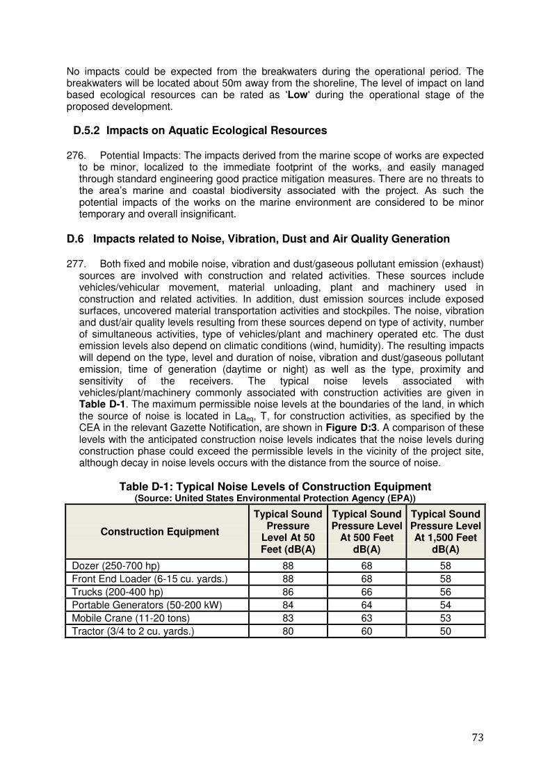
73
No impacts could be expected from the breakwaters during the operational period. The breakwaters will be located about 50m away from the shoreline, The level of impact on land based ecological resources can be rated as 'Low' during the operational stage of the proposed development.
D.5.2 Impacts on Aquatic Ecological Resources 276. Potential Impacts: The impacts derived from the marine scope of works are expected
to be minor, localized to the immediate footprint of the works, and easily managed through standard engineering good practice mitigation measures. There are no threats to the area‟s marine and coastal biodiversity associated with the project. As such the potential impacts of the works on the marine environment are considered to be minor temporary and overall insignificant.
D.6 Impacts related to Noise, Vibration, Dust and Air Quality Generation 277. Both fixed and mobile noise, vibration and dust/gaseous pollutant emission (exhaust)
sources are involved with construction and related activities. These sources include vehicles/vehicular movement, material unloading, plant and machinery used in construction and related activities. In addition, dust emission sources include exposed surfaces, uncovered material transportation activities and stockpiles. The noise, vibration and dust/air quality levels resulting from these sources depend on type of activity, number of simultaneous activities, type of vehicles/plant and machinery operated etc. The dust emission levels also depend on climatic conditions (wind, humidity). The resulting impacts will depend on the type, level and duration of noise, vibration and dust/gaseous pollutant emission, time of generation (daytime or night) as well as the type, proximity and sensitivity of the receivers. The typical noise levels associated with vehicles/plant/machinery commonly associated with construction activities are given in Table D-1. The maximum permissible noise levels at the boundaries of the land, in which the source of noise is located in Laeq, T, for construction activities, as specified by the CEA in the relevant Gazette Notification, are shown in Figure D:3. A comparison of these levels with the anticipated construction noise levels indicates that the noise levels during construction phase could exceed the permissible levels in the vicinity of the project site, although decay in noise levels occurs with the distance from the source of noise.
Table D-1: Typical Noise Levels of Construction Equipment (Source: United States Environmental Protection Agency (EPA))
Construction Equipment
Typical Sound Pressure
Level At 50 Feet (dB(A)
Typical Sound Pressure Level
At 500 Feet dB(A)
Typical Sound Pressure Level At 1,500 Feet
dB(A)
Dozer (250-700 hp) 88 68 58 Front End Loader (6-15 cu. yards.) 88 68 58 Trucks (200-400 hp) 86 66 56 Portable Generators (50-200 kW) 84 64 54 Mobile Crane (11-20 tons) 83 63 53 Tractor (3/4 to 2 cu. yards.) 80 60 50
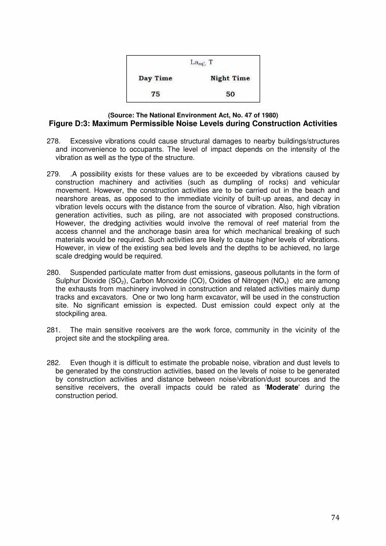
74
(Source: The National Environment Act, No. 47 of 1980)
Figure D:3: Maximum Permissible Noise Levels during Construction Activities 278. Excessive vibrations could cause structural damages to nearby buildings/structures
and inconvenience to occupants. The level of impact depends on the intensity of the vibration as well as the type of the structure.
279. .A possibility exists for these values are to be exceeded by vibrations caused by
construction machinery and activities (such as dumpling of rocks) and vehicular movement. However, the construction activities are to be carried out in the beach and nearshore areas, as opposed to the immediate vicinity of built-up areas, and decay in vibration levels occurs with the distance from the source of vibration. Also, high vibration generation activities, such as piling, are not associated with proposed constructions. However, the dredging activities would involve the removal of reef material from the access channel and the anchorage basin area for which mechanical breaking of such materials would be required. Such activities are likely to cause higher levels of vibrations. However, in view of the existing sea bed levels and the depths to be achieved, no large scale dredging would be required.
280. Suspended particulate matter from dust emissions, gaseous pollutants in the form of
Sulphur Dioxide (SO2), Carbon Monoxide (CO), Oxides of Nitrogen (NOx) etc are among the exhausts from machinery involved in construction and related activities mainly dump tracks and excavators. One or two long harm excavator, will be used in the construction site. No significant emission is expected. Dust emission could expect only at the stockpiling area.
281. The main sensitive receivers are the work force, community in the vicinity of the
project site and the stockpiling area. 282. Even though it is difficult to estimate the probable noise, vibration and dust levels to
be generated by the construction activities, based on the levels of noise to be generated by construction activities and distance between noise/vibration/dust sources and the sensitive receivers, the overall impacts could be rated as 'Moderate' during the construction period.
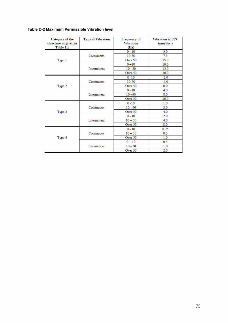
75
Table D-2 Maximum Permissible Vibration level
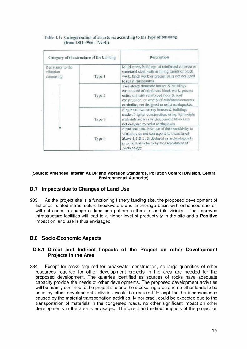
76
(Source: Amended Interim ABOP and Vibration Standards, Pollution Control Division, Central Environmental Authority)
D.7 Impacts due to Changes of Land Use 283. As the project site is a functioning fishery landing site, the proposed development of
fisheries related infrastructure-breakwaters and anchorage basin with enhanced shelter-will not cause a change of land use pattern in the site and its vicinity. The improved infrastructure facilities will lead to a higher level of productivity in the site and a Positive impact on land use is thus envisaged.
D.8 Socio-Economic Aspects
D.8.1 Direct and Indirect Impacts of the Project on other Development Projects in the Area
284. Except for rocks required for breakwater construction, no large quantities of other
resources required for other development projects in the area are needed for the proposed development. The quarries identified as sources of rocks have adequate capacity provide the needs of other developments. The proposed development activities will be mainly confined to the project site and the stockpiling area and no other lands to be used by other development activities would be required. Except for the inconvenience caused by the material transportation activities, Minor crack could be expected due to the transportation of materials in the congested roads. no other significant impact on other developments in the area is envisaged. The direct and indirect impacts of the project on
77
other development projects in the area can thus be rated as 'Low' due to the proposed development.
D.8.2 Impacts on Fishing Industry, including Beach Seine Fishery related
activities, and Fishing Community (during Construction and Operation)
D.8.2.1 Positive Impacts on fishing industry and the fishing community 285. The area in general will be benefitted by having an essential infrastructure facility for
the population in the DS area in which most prominent livelihood activity is fisheries. Opportunities for anchoring boats all- round the year. Facilitating undisturbed passage to enter the sea for all size of boats throughout the year is along expectation fishers in the area.
286. About 600 fishing boats are available within this Valvetithurai Northeast GN division. The fishermen in this area have difficulties to launch boats from the anchoring site to the sea for about 3 months/year due to rough sea. The average daily income from a boat is about Rs 7,000 to 8,000. This income is lost during the period in which they cannot launch the boats to the sea. Most of the fishermen perceive that this problem will be fully addressed by the proposed project.. If the anchoring site deepened and broadened the proposed project activities will help to increase the income of the fishermen. Some of the active fishermen perceive that present income can become double.
287. The sea become very rough in about 3 to 4 months intervals. About 50% to 75% of
fishermen are compelled stop launching their boats during this period. The fishermen also will not compel to spend additional cost for parking their Boats in the sea during rough sea condition and pay additional money to the security labour
D.8.2.2 Possible Negative Impacts on fishing industry and the fishing community
288. Some concerns were identified during the IEE study specially through the
discussions and meetings with the fishing community of the project area. Those concerns are; 1. During breakwater construction and dredging activities, there will be difficulties for the
boats when using the navigation path at anchoring point to enter the sea from the anchoring point and vice versa.
2. Transportation of construction material either by road or ferrying through sea may interrupt fishing activities especially via Northern coast navigational path. Use of Point Pedro East coast road in material transportation would disrupt their peaceful and general living environment.
3. There may be disturbances to the existing coastal access, the traditional operators involved in fishing will have difficulties to carry out their activities near sea opening.
D.8.3 Impacts to other Beach Users in the Area 289. No tourism, recreational or any other activities other than fishery related activities in
this part of the beach. Breakwater construction, dredging of access channel and equipment and will impact on fishing activities if not properly coordinated with the community.
78
D.8.4 Impacts due to Relocation and Loss of Livelihood 290. No relocation of communities would be required for the proposed development.
Although the fisheries activities based on the project site are temporarily disturbed, no permanent losses of livelihood are envisaged. An enhancement of livelihood activities is envisaged due to the improved facilities provided for the fishing community and 'No' adverse impacts associated with relocation and loss of livelihood is thus envisaged due to the proposed development.
291. Construction of three breakwaters are proposed at the site. The construction will be
carried out in 3 phases in order to avoid the unnecessary disturbances to the fishers. The
total length of the landing site is about one km,
D.8.5 Details on the Employment Generation in the Local Community
292. There will be short-term employment opportunities for the local population in the
construction phase, which will bring a short-term positive impact for individuals and a secondary positive impact to the local economy.
293. With the implementation of this project, opportunities for anchoring and launching boats with no risks and also number of days possible for launching boats to the sea will get increased. With the implementation of planned Aathikoviladi anchoring developments, more opportunities will be generated. .
D.9 Impacts on Archeological and Cultural Resources 294. There are no recorded places of Archaeological importance within the project impact
area and therefore no specific mitigatory measures are needed.
D.10 Potential Impacts of Climate Change on Proposed Investments 295. The climate change projections for Sri Lanka (CCS, 2016) indicate that there are 03
major types of atmospheric changes:
i. Gradual increase in ambient air temperature ii. Changes in distribution pattern of rainfall iii. Increase in frequency and severity of extreme weather events.
296. In addition, sea level rise within the Asian region that includes Sri Lanka has been
observed at 1-3mm/year and is expected to continue to rise throughout the 21st century (15-20 cm by 2050). Ocean acidification is also expected to increase in the future, with negative impacts on coral reef ecosystems.
297. Out of these changes, sea level rise and increase in frequency and severity of extreme weather events are likely to have a direct impact on the proposed developments. The impacts would be mainly related to the effectiveness and the stability of the proposed developments. Increased levels of wave overtopping of the breakwaters constructed are envisaged due to these changes, leading to a reduced effectiveness in providing sheltered conditions in the anchorage basin required for fisheries activities. Also a possibility exists for higher levels of sediment movement into the anchorage and siltation leading to reduced depths in the basin which may require dredging to facilitate fisheries activities. In addition, higher levels of exposure of the breakwaters to adverse sea
79
conditions at more frequent intervals are likely to affect the structural stability, leading to damages which may require rehabilitation and/or strengthening of such structures.
D.10.1 Disaster/Emergency Response Measures
298. The project site and the surrounding areas were affected by the tsunami in 2004. ,
which caused several deaths and damages to the houses in the vicinity of the project site. As presented in Section B.1, the reef in the area has also been damaged by the cyclone 'Nisha' in 2008 and the scattering of broken reef and silting in the basin area have also caused difficulties in access and mooring of boats. No other major natural disasters have affected the project site or the surrounding areas in the recent past. Although not frequent, the project site, being located next to the coast, is potentially exposed to cyclones/storm surges. No flooding has been reported in the project site and the surrounding areas.
299. The potential disasters relevant to the site during construction and operation phases
include:
Cyclones
Tsunamis
Fires
(Transport and stockpiling of construction material (Construction Phase)) 300. The potential impacts arising from these hazards can be mitigated by planning and
design and the adoption of best practices. 301. The region, in which the project site is located, is potentially exposed to both
cyclones and tsunamis although the frequency of occurrence of a mega tsunami such as the Indian Ocean Tsunami in 2004 is very low. A two pronged approach is recommended for the mitigation of impacts of these hazards. In the case of structural design, due attention needs to be focused on design measures to minimize the impacts against cyclones and tsunamis. Given the frequency of occurrence of extreme hazard events, which is not very high, it is not economical to adopt disaster proof design. However, sufficient structural engineering measures need to be incorporated to develop hazard resilient infrastructure, thereby minimizing potential impacts.
302. In the case of both cyclones and tsunamis, the Disaster Management Centre (DMC)
and the Meteorological Department provide warnings well in advance of the events. For tsunamis arising from earthquakes in the Sunda Arc, the warning time exceeds 90 minutes which provides sufficient time to evacuate.
303. Accidents arising from transport and stockpiling of construction material can be best
mitigated by good practices which include:
The speed of the delivery vehicles to be limited and the materials transported in a properly secured manner, with adequate protection, to prevent the materials falling down
The load must be properly covered to minimize emission of dust due to vibration of the vehicle
304. In order to prevent any accidents at the site, a high priority needs to be given to
implement proper health and safety practices. Only those who are directly involved with ongoing work are to be permitted within the operational area which should be clearly

80
marked and barricaded to prevent unauthorized entry. The workers need to be provided with safety equipment.
81
E. Proposed Mitigatory Measures 305. The potential environmental impacts associated with the construction and operations
of the proposed development were identified in Section D of the report. The mitigation and best practice measures that should be developed in order to avoid or minimize any such adverse impacts are presented in this section.
306. The proposed mitigation measures are mainly based on the level of impacts identified in Section D of the report and practicality of implementation of such measures.
E.1 Mitigation Measures for Impacts on Physical Resources The mitigation measures proposed for impacts to the beach and shoreline that include i. Erosion of adjacent beaches and lands due to change of current wave height
regimes attributed to proposed structures ii. Erosion effects on either sides of the coastal stretch during construction period as
well as in the long run iii. Coastal/accretion and bathymetric changes (on either side of the breakwaters0 in the
area iv. Changes in hydrodynamic pattern such as current and wave patterns, wave height
and direction, near shore current velocity, direction and tides v. Changes in the sediment transport patterns in both periods (short term and long
term)are as below:
Regular monitoring and measurement of coastline positions/coastal profiles on either side of the project site in the study area specified in the TOR or in the area specified by the CCCRMD
Removal of sand from the areas of coastal accretion (if any) and disposal in the areas of coastal erosion (if any), under the guidance of and/or as specified by the CCCRMD
307. It is proposed that the measurements (visual and google maps) of coastline
positions/coastal profiles be carried out immediately prior to construction activities, monthly during the construction period, at least twice, immediately prior to and after the north-east monsoon, over a period at least 01 year or as specified by CCCRMD during the operational stage
vi. Mitigation measures for changes in drainage patterns
Carrying out material stockpiling and other construction activities in the project site and the land identified for stockpiling causing minimal disturbance to any natural drainage paths
Diverting any natural drainage paths if any disturbed by stockpiling and other construction activities
vii. Mitigation measures for impacts of sewage or waste water, solid disposal, waste oil
spills, surface runoff on coastal environment and coastal waters
Provision of toilet and washing facilities with septic tanks and soakage pits to the workforce and the fishery community based at the anchorage
82
Storage of solid waste generated (by the workforce and construction waste during construction stage and by the fishery community and activities during the operational stage)at appropriate locations in the site and regular disposal(by the contractor during the construction stage and by the fishery community/society based at the anchorage during the operation stage) through the services offered by the local authority of the area (Point Pedro Urban Council)
Providing guidance/information on proper oil handling practices to the workforce and the fishery community
Limiting/avoid in oil handling activities in the nearshore/beach and ecologically sensitive areas (if any) in the project site
Preparation and implementation of a contingency plan to manage the impacts due to any accidental spillages
viii. Mitigation measures for impacts on water quality
Mitigation measures for impacts of sewage or waste water, solid disposal, waste oil spills, surface runoff on coastal environment and coastal waters will also cover this section.
Provision of silt screens to restrict suspended sediments spreading into ecologically sensitive areas ( areas of rich growth)
ix. Mitigation measures for impacts due to coastal hazard events-tsunamis, cyclones, storm surges etc in the area and sea level rise
308. No significant change in the current impact levels due to coastal hazard events-
tsunamis, cyclones, storm surges etc and sea level rise in the area, in general, is envisaged due to the proposed development. No specific impact mitigation measures would thus be required.
E.2 Mitigation Measures for Impacts due to Transportation of Materials
Obtaining materials from authorized dealers
Carrying out a traffic/transport impact assessment by the contractor(s) prior to the commencement of the transport activities and implementing the impact mitigation measures identified during transport activities, which may include:
Limiting the loads carried by on transport vehicles to ensure the load limits specified for the transport routes are not exceeded
scheduling material transport activities to avoid daily peak traffic hours and the days of high traffic levels
Use smaller vehicles to transport armors for the stockpiling area in suitable sites near Ponnala Point Pedro road.
Maintaining the operating standards of the transport vehicles to ensure that the resulting noise and vibration levels are within specified standards
Providing covers to dust emitting materials transported
providing warning/safety signs/lights on possible traffic congestions near the entrance to the project site and the stockpiling area
providing entrance facilities of adequate capacity to the project site directly from the access road(s) to minimize heavy vehicles waiting on public roads prior to entry to the project site and the stockpiling area
providing adequate turning and parking space in the project site and the stockpiling area for transport vehicles
providing trained traffic control personnel at the entrance, with the assistance of the Police, if necessary, to minimize disruption to traffic in the public roads
83
Carrying out a pre-crack survey prior to commencement of the transport activities along the by road from the Ponnalai Point Petro to the project site to make compensations, if required, for the damages of buildings due to project activities.
E.3 Mitigation Measures for Impacts due to Handling and Stockpiling of
Materials Obtaining approval of the relevant authorities for the site to be used for stockpiling
Implementation of recommendation in sections “Changes in drainage patterns and to reduce the impacts related to noise, vibration, dust and air quality generation
E.4 Mitigation Measures for Impacts due to Impacts of Sewage, Waste Oil
Spills, Surface Run-off, Waste Water Disposal on the Environment 309. This is covered in Mitigation Measures for Impacts related to Noise, Vibration,
Dust and Air Quality section
E.5 Mitigation Measures for Anticipated Problems related to Solid Waste
Disposal 310. Storage of solid waste generated (by the workforce and construction waste during
construction stage and by the fishery community and activities during the operational stage) at appropriate locations in the site and regular disposal (by the contractor during the construction stage and by the fishery community/society based at the anchorage during the operation stage) through the services offered by the local authority of the area (Point Pedro Urban Council). The required facilities include latrine facilities, fish waste collection facilities and disposal measures.
E.6 Mitigation Measures for Impacts on Ecological Resources (Land Based
and Aquatic)
E.6.1 Mitigation Measures for Impacts on Land Based Ecological Resources 311. Solid waste pollution is an increasing threat to the biodiversity. It is recommended that
solid waste management programme is established for the anchorage site. The programme should focus on minimizing waste generation, effective collection (separated in to reusable, on degradable, and biodegradable) and utilization of fish waste to produce fish
silage .Even at present the landing site is heavily polluted with solid wastes. Thought the project is not building any new land based structure, the project will improve awareness of fisher community on segregation of waste and provide necessary bins Dredging material has to be disposed carefully not to affect the environment.
312. Although the available are is very limited (64perches), developing Green areas wherever possible, should be encouraged in and around the anchorage site to minimize air pollution within the harbor. The proposed green belt development/ plantation in the area willf unction primarily as a landscape feature. In addition, it acts as a pollution sink /noise barrier, reduces soil erosion and makes the ecosystem more diversified and functionally more stable and healthy. The spesiapopulnea(Suriya) is widely accepted as a shading plant in the area. Awareness programs of all stakeholders on environmental protection, biodiversity and nature conservation a real so suggested Environmental
84
Management Plan(EMP) should include monitoring plan for solid waste pollution and the available limited biodiversity.
E.6.2 Mitigation Measures for Impacts on Aquatic Ecological Resources
Not to carry out any dredging in the area of live corals on the right bank of the proposed access channel, with dredging along its left bank to provide the required access facilities
Appropriate dredging machinery and/or techniques to minimize the levels of turbidity resulting from dredging activities
Regular monitoring of dredging activities and provision of silt curtains and/or sediment traps to prevent the silt/sediment plume reaching the areas of live coral
Locating the temporary disposal sites of dredged materials on the beach area and taking measures (e.g. providing covering) to prevent silt/sediment run-off into the anchorage basin area and the areas of live coral
Not to dispose any dredged materials in ecologically sensitive areas in the sea and obtaining the permission of the Marine Environmental Protection Agency (MEPA) for any disposals to be carried out in the sea
E.7 Mitigation Measures for Impacts related to Noise, Vibration, Dust and Air
Quality 313. The potential impacts relating to noise, vibration and dust from construction related
activities are minimized by adopting best practices. 314. For noise and vibration, mitigation measures include:
Operating well maintained plants at the site and regular servicing of such plants during the construction period
Shutting down and/or throttling down of machines and plant that may be in intermittent use, between work periods
Providing temporary noise barriers on site to control noise from particularly noisy operations
Limiting the project activities and vehicular movement during certain periods of the day and in the night
If required, carrying out a pre-crack survey of the buildings in the surrounding area of the project site and the stockpiling area with photographic evidence of existing conditions immediately prior to the commencement of constructions, use of low vibration causing machinery/techniques for construction and stockpiling purposes, regular monitoring of vibration levels and providing compensation to the parties affected by vibration related damages due to project activities
Restricting noise/dust/vibration generating construction activities during religious/cultural activities/festivals in the area.
315. For dust emissions and air quality, mitigation measures include:
Enforcing vehicle speed limits to minimize dust generation and the safety of workers and road users
Providing covers in vehicles carrying dust emitting materials to minimize dust emissions
85
The contractor should ensure the vehicle used possess vehicle emission test certificates.
E.8 Mitigation Measures for Impacts due to Changes of Land Use 316. The proposed development will not cause a change of land use pattern in the site
and its vicinity. No land use changers in the area are expected. Low impact on land use
is thus envisaged. No mitigation measures would thus be required. E.9 Mitigation Measures for Impacts on Socio-Economic Aspects
E.9.1 Mitigation Measures for Direct and Indirect Impacts of the Project on other Development Projects in the Area
Confining the construction and related activities within the project site and the
material stockpiling area
Not to use other spaces, resources allocated for other development activities in the vicinity
E.9.2 Mitigation Measures for Impacts on Fishing Industry, including Beach Seine Fishery related activities, and Fishing Community (during Construction and Operation)
317. It is proposed that the impacts on fishing industry and/or fishing community be
mitigated by carrying out the proposed constructions in consultation with the fisheries community/society based and the existing landing site to reduce the disturbances to regular fishery activities. The specific mitigation measures would include:
scheduling the construction activities to minimize the disturbances to regular fishery activities
informing the fishing community in advance, the construction activities that are likely to cause disturbances to regular fishery activities
demarcation of the areas directly used for construction and related areas and providing warning signs/notices to reduce the risk of accidents
minimal usage of beach/nearshore area for stockpiling of rocks and dredged material to minimize the disturbances to regular fishery activities
locating the temporary access ways to minimize the disturbances to in and out movement and anchoring of boats
E.9.3 Mitigation Measures for Impacts to other Beach Users in the Area
informing the local community in advance, the construction activities that are likely to cause disturbances to regular activities in the vicinity
demarcation of the areas directly used for construction and related areas and providing warning signs/notices to reduce the risk of accidents
E.9.4 Mitigation Measures for Impacts due to Relocation and Loss of
Livelihood
86
318. No relocation of communities would be required for the proposed development and,also, no permanent losses of livelihood are envisaged due to the proposed
development. No specific impact mitigation measures would thus be required. Providing employment opportunities to the local community, whenever possible
E.10 Mitigation Measures for Impacts on Archeological and Cultural Resources 319. There are no archaeological structures in the project area. Restricting
noise/dust/vibration generating construction related activities (e.g. material transport) during religious/cultural activities/festivals in the area (on the routes of material transport)
E.11 Mitigation Measures for Potential Impacts of Climate Change on Proposed Investments
320. Incorporation of climate change resilient measures in the structural design of
breakwaters, by considering potential sea level rise and increased frequency and intensity of extreme events (e.g. tsunamis, storm surges)
321. Regular monitoring of the facilities provided-breakwaters and dredged areas of the anchorage-and carrying out required maintenance activities
322. Inspection of the facilities provided-breakwaters and dredged areas of the
anchorage-after severe climatic events and carrying out rehabilitation, strengthening and/or modifications as required
E.12 Mitigation Measures for Potential Impacts of Climate Change on
Proposed Investments 323. Incorporation of climate change resilient measures in the structural design of
breakwaters, by considering potential sea level rise and increased frequency and intensity of extreme events (e.g. tsunamis, storm surges)
324. Regular monitoring of the facilities provided-breakwaters and dredged areas of the anchorage-and carrying out required maintenance activities. It is proposed such monitoring (inspection of the breakwaters and dredged areas) and any repairs be carried out prior to the onset on the north-east monsoon, immediately after north-east monsoon and after a severe climatic event such as a cyclone.
325. Inspection of the facilities provided-breakwaters and dredged areas of the
anchorage-after severe climatic events and carrying out rehabilitation, strengthening and/or modifications as required.
Any cumulative impacts
326. The project is located about 5km from the proposed Point Pedro Fisheries Harbor
Development Project (PPFHDP) and 6 km the Munai Protected landing Site
Development Project. The sediment transportation study conducted for the PPFHDP
indicates that there is no major impact to the Kottady and Munai beach areas due to the
Pint Pedro Fisheries Harbor Development Project. Therefore, no cumulative impacts
could be expected due to the construction of Athikovilady Protected landing site
development project.
87
F. Information Disclosure, Consultation and Participation
F.1 Information Disclosure
327. The IEE Report documenting the impact mitigation measures and consultation process will be submitted to CCCRMD and ADB and will also be made available for public review. The public comments received will be incorporated into the final report. The final document will be placed at the CEA and CCCRMD library for reference after approval in three languages Tamil, Sinhala and English and also make available in the ADB Website. The preliminary communication consultations with stakeholders and the local communities have revealed the support for the project. Additional consultations are required to be held with project stakeholders and communities in respect to implementation the project and to incorporate community feedback as well as continued community awareness associated with the project implementation of activities and help to resolve complaints and grievances. Further consultation and disclosure will be carried out during implementation process.
328. A brochure including key information on the project will be disseminated among the public. Once the project implementation is started grievance redress committees will be established.
329. As the project is assisted by the ADB, Disclosure will conform to the Safeguard Policy Statement (SPS) and Public Communications Policy of the ADB: The project‟s IEE, as part of ADB project documents will be uploaded onto the ADB website while the IEE will be made available to the public upon request. The IEE Report will also be made available to the public from MFARDREA upon request.
F.2 Consultation and Participation 330. Continuous consultations with relevant stakeholder were conducted during the
project preparatory technical assistance (PPTA) and the detailed design stages. Consultations will continue during implementation as well. The details are as follows:
PPTA
331. Consultation activities conducted during the PPTA are: meetings with relevant government authorities for specific issues, concerns, and information collection; public meetings with a wide range of participants for the proposed project Public meetings were conducted for Anchorages sites.
Meetings with government authorities Table F.1: provides a summary of the main meetings and consultations with relevant government authorities.
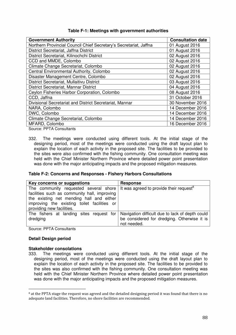
88
Table F-1: Meetings with government authorities
Government Authority Consultation date Northern Provincial Council Chief Secretary‟s Secretariat, Jaffna 01 August 2016 District Secretariat, Jaffna District 01 August 2016 District Secretariat, Kilinochchi District 02 August 2016 CCD and MMDE, Colombo 02 August 2016 Climate Change Secretariat, Colombo 02 August 2016 Central Environmental Authority, Colombo 02 August 2016 Disaster Management Centre, Colombo 02 August 2016 District Secretariat, Mullaitivu District 03 August 2016 District Secretariat, Mannar District 04 August 2016 Ceylon Fisheries Harbor Corporation, Colombo 08 August 2016 CCD, Jaffna 31 October 2016 Divisional Secretariat and District Secretariat, Mannar 30 November 2016 NARA, Colombo 14 December 2016 DWC, Colombo 14 December 2016 Climate Change Secretariat, Colombo 14 December 2016 MFARD, Colombo 16 December 2016 Source: PPTA Consultants
332. The meetings were conducted using different tools. At the initial stage of the
designing period, most of the meetings were conducted using the draft layout plan to explain the location of each activity in the proposed site. The facilities to be provided to the sites were also confirmed with the fishing community. One consultation meeting was held with the Chief Minister Northern Province where detailed power point presentation was done with the major anticipating impacts and the proposed mitigation measures.
Table F-2: Concerns and Responses - Fishery Harbors Consultations
Key concerns or suggestions Response The community requested several shore facilities such as community hall, improving the existing net mending hall and either improving the existing toilet facilities or providing new facilities.
It was agreed to provide their request8
The fishers at landing sites request for dredging
Navigation difficult due to lack of depth could be considered for dredging. Otherwise it is not needed.
Source: PPTA Consultants
Detail Design period Stakeholder consolations 333. The meetings were conducted using different tools. At the initial stage of the
designing period, most of the meetings were conducted using the draft layout plan to explain the location of each activity in the proposed site. The facilities to be provided to the sites was also confirmed with the fishing community. One consultation meeting was held with the Chief Minister Northern Province where detailed power point presentation was done with the major anticipating impacts and the proposed mitigation measures.
8 at the PPTA stage the request was agreed and the detailed designing period it was found that there is no
adequate land facilities. Therefore, no shore facilities are recommended.
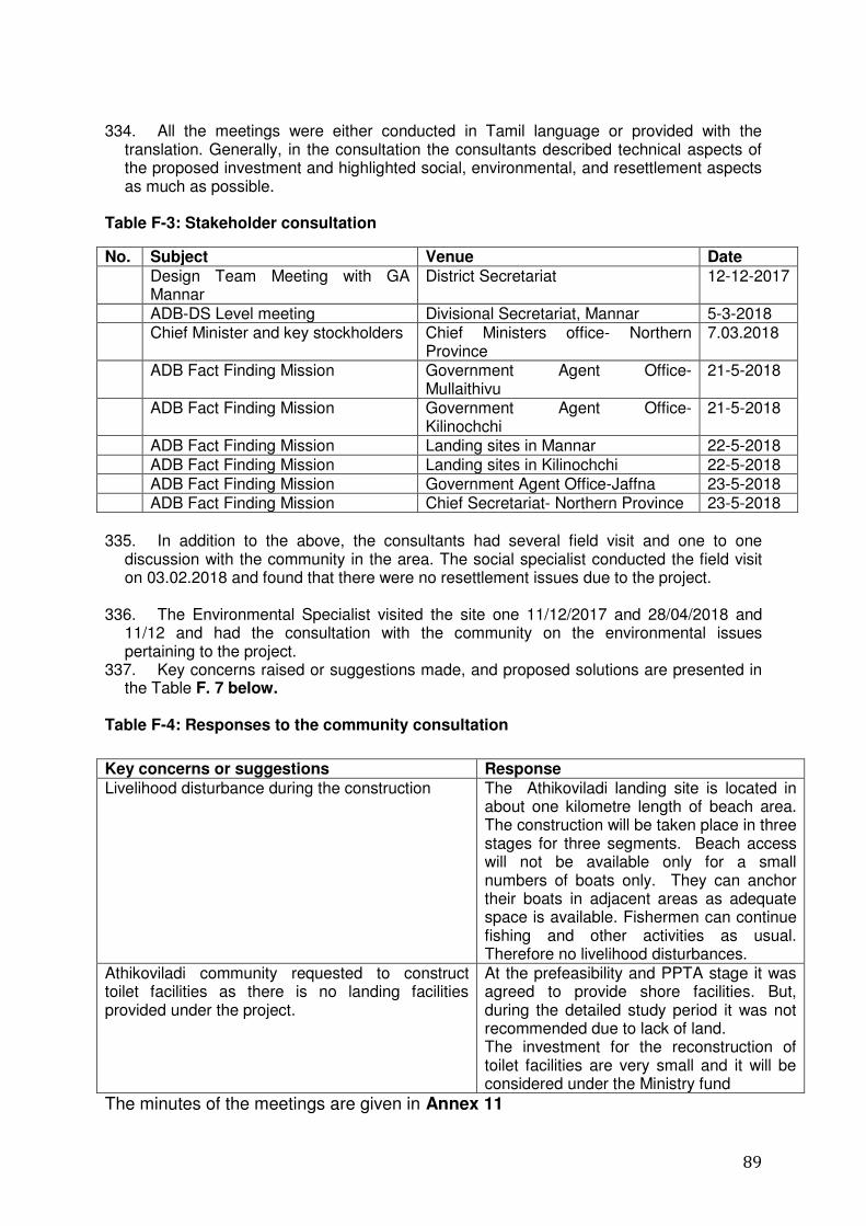
89
334. All the meetings were either conducted in Tamil language or provided with the
translation. Generally, in the consultation the consultants described technical aspects of the proposed investment and highlighted social, environmental, and resettlement aspects as much as possible.
Table F-3: Stakeholder consultation
No. Subject Venue Date
Design Team Meeting with GA Mannar
District Secretariat 12-12-2017
ADB-DS Level meeting Divisional Secretariat, Mannar 5-3-2018 Chief Minister and key stockholders Chief Ministers office- Northern
Province 7.03.2018
ADB Fact Finding Mission Government Agent Office- Mullaithivu
21-5-2018
ADB Fact Finding Mission Government Agent Office- Kilinochchi
21-5-2018
ADB Fact Finding Mission Landing sites in Mannar 22-5-2018 ADB Fact Finding Mission Landing sites in Kilinochchi 22-5-2018 ADB Fact Finding Mission Government Agent Office-Jaffna 23-5-2018 ADB Fact Finding Mission Chief Secretariat- Northern Province 23-5-2018 335. In addition to the above, the consultants had several field visit and one to one
discussion with the community in the area. The social specialist conducted the field visit on 03.02.2018 and found that there were no resettlement issues due to the project.
336. The Environmental Specialist visited the site one 11/12/2017 and 28/04/2018 and 11/12 and had the consultation with the community on the environmental issues pertaining to the project.
337. Key concerns raised or suggestions made, and proposed solutions are presented in the Table F. 7 below.
Table F-4: Responses to the community consultation
The minutes of the meetings are given in Annex 11
Key concerns or suggestions Response
Livelihood disturbance during the construction The Athikoviladi landing site is located in about one kilometre length of beach area. The construction will be taken place in three stages for three segments. Beach access will not be available only for a small numbers of boats only. They can anchor their boats in adjacent areas as adequate space is available. Fishermen can continue fishing and other activities as usual. Therefore no livelihood disturbances.
Athikoviladi community requested to construct toilet facilities as there is no landing facilities provided under the project.
At the prefeasibility and PPTA stage it was agreed to provide shore facilities. But, during the detailed study period it was not recommended due to lack of land. The investment for the reconstruction of toilet facilities are very small and it will be considered under the Ministry fund

90
G. Grievance Redress Mechanism 338. During the course of the project, it is possible that people may have concerns with
the environmental management, including the implementation of the Environmental Management Plan (EMP). Issues may occur during construction and operational stages. Any concerns will need to be addressed quickly and transparently, and without retribution to the Affected Person (AP).
339. A Grievance Redress Mechanism (GRM) therefore is to be established to resolve
disputes and grievances relating to environmental concerns and complaints associated with the proposed development. It is based on a multi-tiered approach as outlined in Figure G:1, with each tier possessing a time bound schedule with the responsible persons identified to address the grievance and consult appropriate persons at each stage as required. The objective of the GRM is to support genuine claimants (AP) to resolve their problems through mutual understanding and consensus building process with relevant parties. This is in addition to the available legal institutions for resolving issues. The APs using the project GRM can choose to use legal systems at any point in the project GRM process.
Figure G:1: Grievance Redress Mechanism
340. The first step is to attempt to sort out the problem directly at the local and/or project
site level Grievance Redress Committee (GRC) by the AP directly contacting the project site managers and/or the site representative of the contractor, if the AP believes the issue
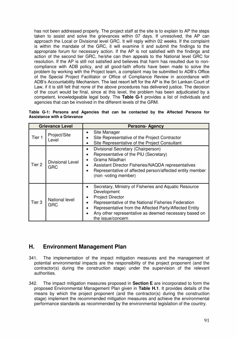
91
has not been addressed properly. The project staff at the site is to explain to AP the steps taken to assist and solve the grievances within 07 days. If unresolved, the AP can approach the Local or Divisional level GRC. It will reply within 02 weeks. If the complaint is within the mandate of the GRC, it will examine it and submit the findings to the appropriate forum for necessary action. If the AP is not satisfied with the findings and action of the second tier GRC, he/she can then appeals to the National level GRC for resolution. If the AP is still not satisfied and believes that harm has resulted due to non-compliance with ADB policy, and all good-faith efforts have been made to solve the problem by working with the Project team, a complaint may be submitted to ADB‟s Office of the Special Project Facilitator or Office of Compliance Review in accordance with ADB‟s Accountability Mechanism. The last resort left for the AP is the Sri Lankan Court of Law, if it is still felt that none of the above procedures has delivered justice. The decision of the court would be final, since at this level, the problem has been adjudicated by a competent, knowledgeable legal body. The Table G-1 provides a list of individuals and agencies that can be involved in the different levels of the GRM.
Table G-1: Persons and Agencies that can be contacted by the Affected Persons for Assistance with a Grievance
Grievance Level Persons- Agency
Tier 1 Project/Site Level
Site Manager
Site Representative of the Project Contractor
Site Representative of the Project Consultant
Tier 2 Divisional Level GRC
Divisional Secretary (Chairperson)
Representative of the PIU (Secretary)
Grama Niladhari
Assistant Director Fisheries/NAQDA representatives
Representative of affected person/affected entity member (non -voting member)
Tier 3 National level GRC
Secretary, Ministry of Fisheries and Aquatic Resource Development
Project Director
Representative of the National Fisheries Federation
Representative from the Affected Party/Affected Entity
Any other representative as deemed necessary based on the issue/concern
H. Environment Management Plan
341. The implementation of the impact mitigation measures and the management of potential environmental impacts are the responsibility of the project proponent (and the contractor(s) during the construction stage) under the supervision of the relevant authorities.
342. The impact mitigation measures proposed in Section E are incorporated to form the
proposed Environmental Management Plan given in Table H.1. It provides details of the means by which the project proponent (and the contractor(s) during the construction stage) implement the recommended mitigation measures and achieve the environmental performance standards as recommended by the environmental legislation of the country.
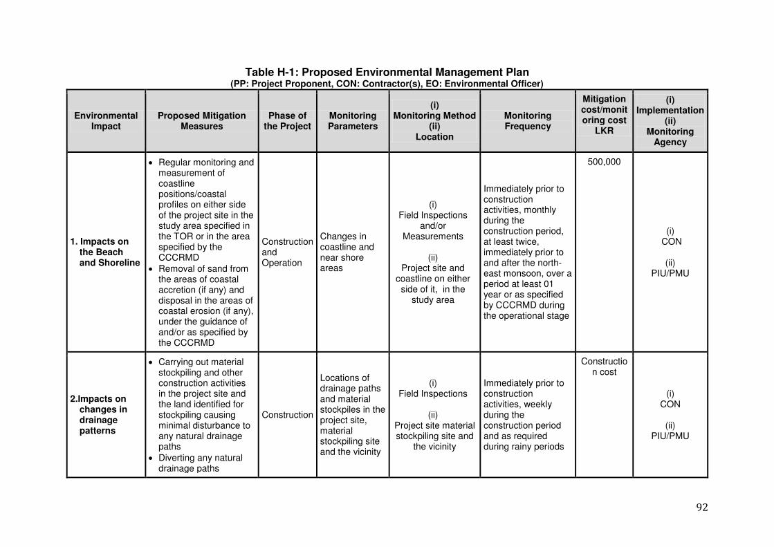
92
Table H-1: Proposed Environmental Management Plan (PP: Project Proponent, CON: Contractor(s), EO: Environmental Officer)
Environmental Impact
Proposed Mitigation Measures
Phase of the Project
Monitoring Parameters
(i) Monitoring Method
(ii) Location
Monitoring Frequency
Mitigation cost/monitoring cost
LKR
(i) Implementation
(ii) Monitoring
Agency
1. Impacts on the Beach and Shoreline
Regular monitoring and measurement of coastline positions/coastal profiles on either side of the project site in the study area specified in the TOR or in the area specified by the CCCRMD
Removal of sand from the areas of coastal accretion (if any) and disposal in the areas of coastal erosion (if any), under the guidance of and/or as specified by the CCCRMD
Construction and Operation
Changes in coastline and near shore areas
(i) Field Inspections
and/or Measurements
(ii)
Project site and coastline on either
side of it, in the study area
Immediately prior to construction activities, monthly during the construction period, at least twice, immediately prior to and after the north-east monsoon, over a period at least 01 year or as specified by CCCRMD during the operational stage
500,000
(i) CON
(ii)
PIU/PMU
2.Impacts on changes in drainage patterns
Carrying out material stockpiling and other construction activities in the project site and the land identified for stockpiling causing minimal disturbance to any natural drainage paths
Diverting any natural drainage paths
Construction
Locations of drainage paths and material stockpiles in the project site, material stockpiling site and the vicinity
(i) Field Inspections
(ii)
Project site material stockpiling site and
the vicinity
Immediately prior to construction activities, weekly during the construction period and as required during rainy periods
Construction cost
(i) CON
(ii)
PIU/PMU
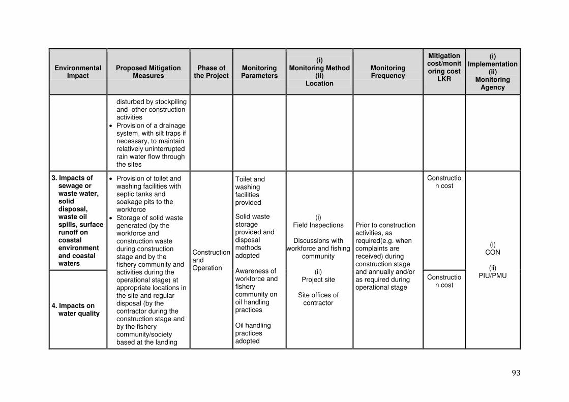
93
Environmental Impact
Proposed Mitigation Measures
Phase of the Project
Monitoring Parameters
(i) Monitoring Method
(ii) Location
Monitoring Frequency
Mitigation cost/monitoring cost
LKR
(i) Implementation
(ii) Monitoring
Agency
disturbed by stockpiling and other construction activities
Provision of a drainage system, with silt traps if necessary, to maintain relatively uninterrupted rain water flow through the sites
3. Impacts of sewage or waste water, solid disposal, waste oil spills, surface runoff on coastal environment and coastal waters
Provision of toilet and washing facilities with septic tanks and soakage pits to the workforce
Storage of solid waste generated (by the workforce and construction waste during construction stage and by the fishery community and activities during the operational stage) at appropriate locations in the site and regular disposal (by the contractor during the construction stage and by the fishery community/society based at the landing
Construction and Operation
Toilet and washing facilities provided
Solid waste storage provided and disposal methods adopted Awareness of workforce and fishery community on oil handling practices Oil handling practices adopted
(i) Field Inspections
Discussions with
workforce and fishing community
(ii)
Project site
Site offices of contractor
Prior to construction activities, as required(e.g. when complaints are received) during construction stage and annually and/or as required during operational stage
Construction cost
(i) CON
(ii)
PIU/PMU
4. Impacts on water quality
Construction cost
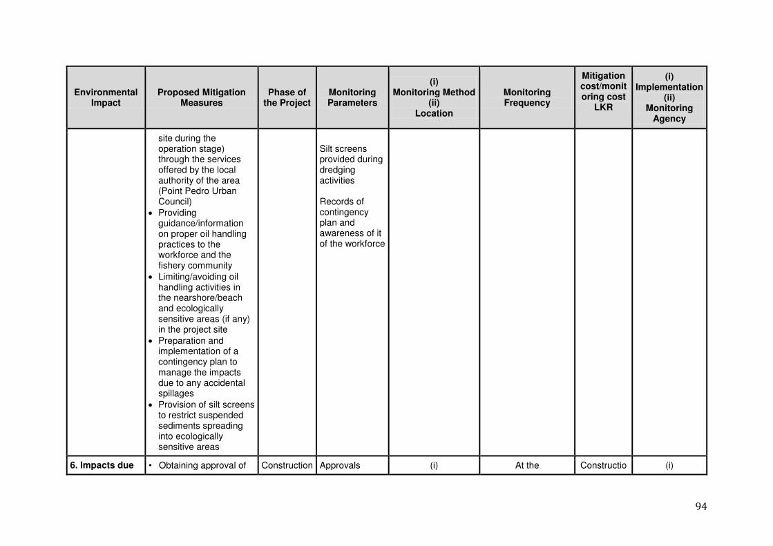
94
Environmental Impact
Proposed Mitigation Measures
Phase of the Project
Monitoring Parameters
(i) Monitoring Method
(ii) Location
Monitoring Frequency
Mitigation cost/monitoring cost
LKR
(i) Implementation
(ii) Monitoring
Agency
site during the operation stage) through the services offered by the local authority of the area (Point Pedro Urban Council)
Providing guidance/information on proper oil handling practices to the workforce and the fishery community
Limiting/avoiding oil handling activities in the nearshore/beach and ecologically sensitive areas (if any) in the project site
Preparation and implementation of a contingency plan to manage the impacts due to any accidental spillages
Provision of silt screens to restrict suspended sediments spreading into ecologically sensitive areas
Silt screens provided during dredging activities Records of contingency plan and awareness of it of the workforce
6. Impacts due • Obtaining approval of Construction Approvals (i) At the Constructio (i)
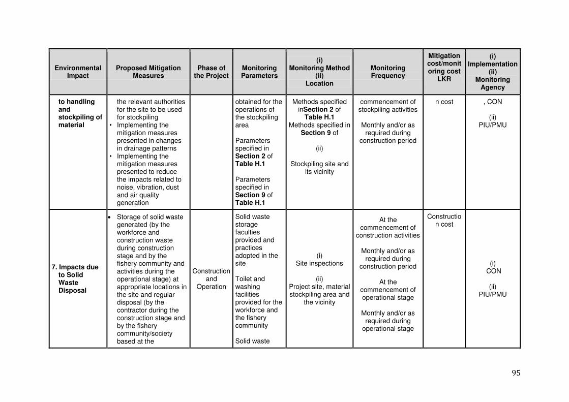
95
Environmental Impact
Proposed Mitigation Measures
Phase of the Project
Monitoring Parameters
(i) Monitoring Method
(ii) Location
Monitoring Frequency
Mitigation cost/monitoring cost
LKR
(i) Implementation
(ii) Monitoring
Agency
to handling and stockpiling of material
the relevant authorities for the site to be used for stockpiling
• Implementing the mitigation measures presented in changes in drainage patterns
• Implementing the mitigation measures presented to reduce the impacts related to noise, vibration, dust and air quality generation
obtained for the operations of the stockpiling area Parameters specified in Section 2 of Table H.1 Parameters specified in Section 9 of Table H.1
Methods specified inSection 2 of
Table H.1 Methods specified in
Section 9 of
(ii)
Stockpiling site and its vicinity
commencement of stockpiling activities
Monthly and/or as
required during construction period
n cost , CON
(ii) PIU/PMU
7. Impacts due to Solid Waste Disposal
Storage of solid waste generated (by the workforce and construction waste during construction stage and by the fishery community and activities during the operational stage) at appropriate locations in the site and regular disposal (by the contractor during the construction stage and by the fishery community/society based at the
Construction and
Operation
Solid waste storage faculties provided and practices adopted in the site Toilet and washing facilities provided for the workforce and the fishery community Solid waste
(i) Site inspections
(ii)
Project site, material stockpiling area and
the vicinity
At the commencement of
construction activities
Monthly and/or as required during
construction period
At the commencement of operational stage
Monthly and/or as
required during operational stage
Construction cost
(i) CON
(ii)
PIU/PMU
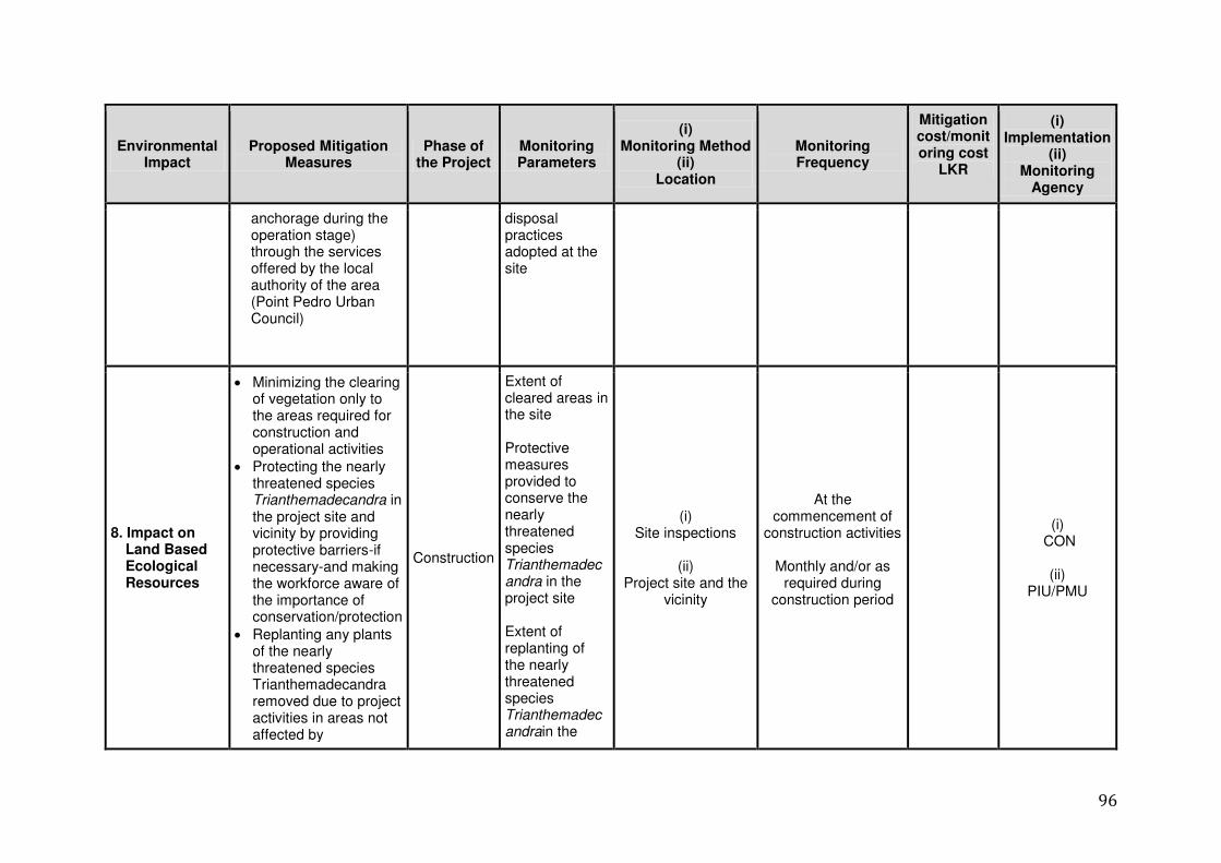
96
Environmental Impact
Proposed Mitigation Measures
Phase of the Project
Monitoring Parameters
(i) Monitoring Method
(ii) Location
Monitoring Frequency
Mitigation cost/monitoring cost
LKR
(i) Implementation
(ii) Monitoring
Agency
anchorage during the operation stage) through the services offered by the local authority of the area (Point Pedro Urban Council)
disposal practices adopted at the site
8. Impact on Land Based Ecological Resources
Minimizing the clearing of vegetation only to the areas required for construction and operational activities
Protecting the nearly threatened species Trianthemadecandra in the project site and vicinity by providing protective barriers-if necessary-and making the workforce aware of the importance of conservation/protection
Replanting any plants of the nearly threatened species Trianthemadecandra removed due to project activities in areas not affected by
Construction
Extent of cleared areas in the site Protective measures provided to conserve the nearly threatened species Trianthemadecandra in the project site Extent of replanting of the nearly threatened species Trianthemadecandrain the
(i) Site inspections
(ii)
Project site and the vicinity
At the commencement of
construction activities
Monthly and/or as required during
construction period
(i) CON
(ii)
PIU/PMU
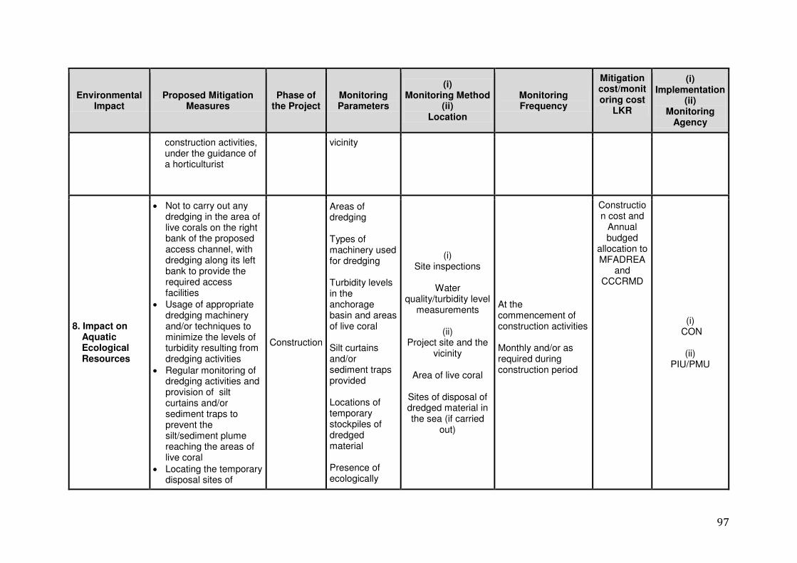
97
Environmental Impact
Proposed Mitigation Measures
Phase of the Project
Monitoring Parameters
(i) Monitoring Method
(ii) Location
Monitoring Frequency
Mitigation cost/monitoring cost
LKR
(i) Implementation
(ii) Monitoring
Agency
construction activities, under the guidance of a horticulturist
vicinity
8. Impact on Aquatic Ecological Resources
Not to carry out any dredging in the area of live corals on the right bank of the proposed access channel, with dredging along its left bank to provide the required access facilities
Usage of appropriate dredging machinery and/or techniques to minimize the levels of turbidity resulting from dredging activities
Regular monitoring of dredging activities and provision of silt curtains and/or sediment traps to prevent the silt/sediment plume reaching the areas of live coral
Locating the temporary disposal sites of
Construction
Areas of dredging Types of machinery used for dredging Turbidity levels in the anchorage basin and areas of live coral Silt curtains and/or sediment traps provided Locations of temporary stockpiles of dredged material Presence of ecologically
(i) Site inspections
Water
quality/turbidity level measurements
(ii)
Project site and the vicinity
Area of live coral
Sites of disposal of dredged material in the sea (if carried
out)
At the commencement of construction activities Monthly and/or as required during construction period
Construction cost and
Annual budged
allocation to MFADREA
and CCCRMD
(i) CON
(ii)
PIU/PMU
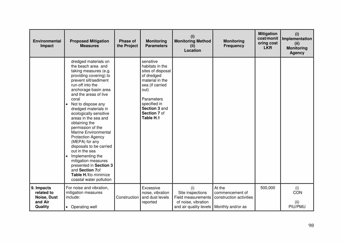
98
Environmental Impact
Proposed Mitigation Measures
Phase of the Project
Monitoring Parameters
(i) Monitoring Method
(ii) Location
Monitoring Frequency
Mitigation cost/monitoring cost
LKR
(i) Implementation
(ii) Monitoring
Agency
dredged materials on the beach area and taking measures (e.g. providing covering) to prevent silt/sediment run-off into the anchorage basin area and the areas of live coral
Not to dispose any dredged materials in ecologically sensitive areas in the sea and obtaining the permission of the Marine Environmental Protection Agency (MEPA) for any disposals to be carried out in the sea
Implementing the mitigation measures presented in Section 3 and Section 7of Table H.1to minimize coastal water pollution
sensitive habitats in the sites of disposal of dredged material in the sea (if carried out) Parameters specified in Section 3 and Section 7 of Table H.1
9. Impacts related to Noise, Dust and Air Quality
For noise and vibration, mitigation measures include:
Operating well
Construction
Excessive noise, vibration and dust levels reported
(i) Site inspections
Field measurements of noise, vibration
and air quality levels
At the commencement of construction activities Monthly and/or as
500,000 (i) CON
(ii)
PIU/PMU
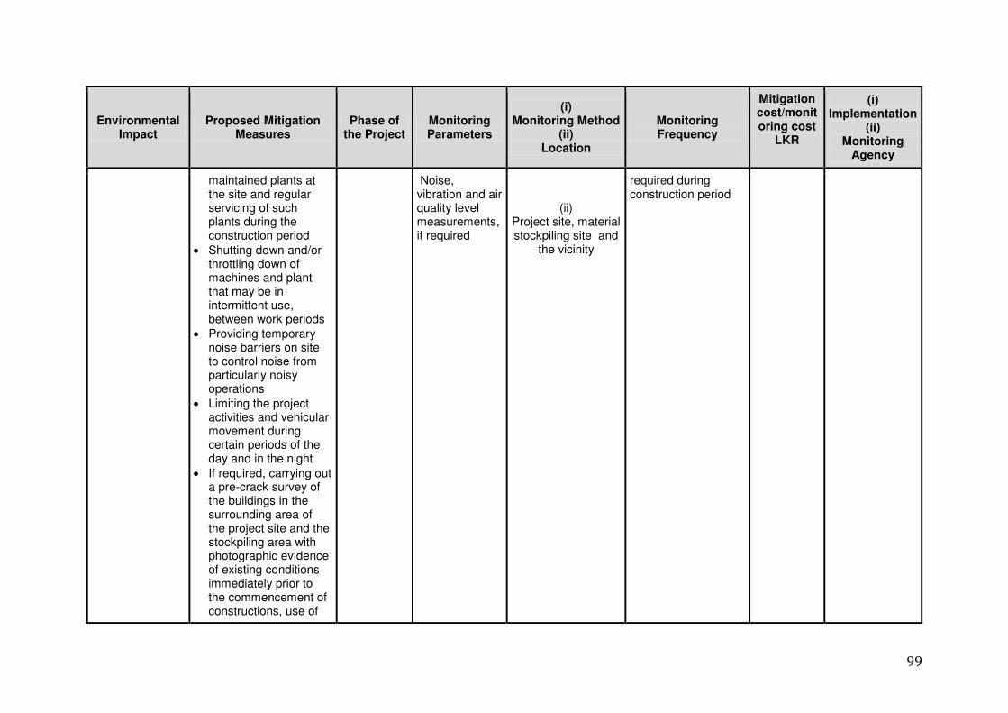
99
Environmental Impact
Proposed Mitigation Measures
Phase of the Project
Monitoring Parameters
(i) Monitoring Method
(ii) Location
Monitoring Frequency
Mitigation cost/monitoring cost
LKR
(i) Implementation
(ii) Monitoring
Agency
maintained plants at the site and regular servicing of such plants during the construction period
Shutting down and/or throttling down of machines and plant that may be in intermittent use, between work periods
Providing temporary noise barriers on site to control noise from particularly noisy operations
Limiting the project activities and vehicular movement during certain periods of the day and in the night
If required, carrying out a pre-crack survey of the buildings in the surrounding area of the project site and the stockpiling area with photographic evidence of existing conditions immediately prior to the commencement of constructions, use of
Noise, vibration and air quality level measurements, if required
(ii) Project site, material stockpiling site and
the vicinity
required during construction period
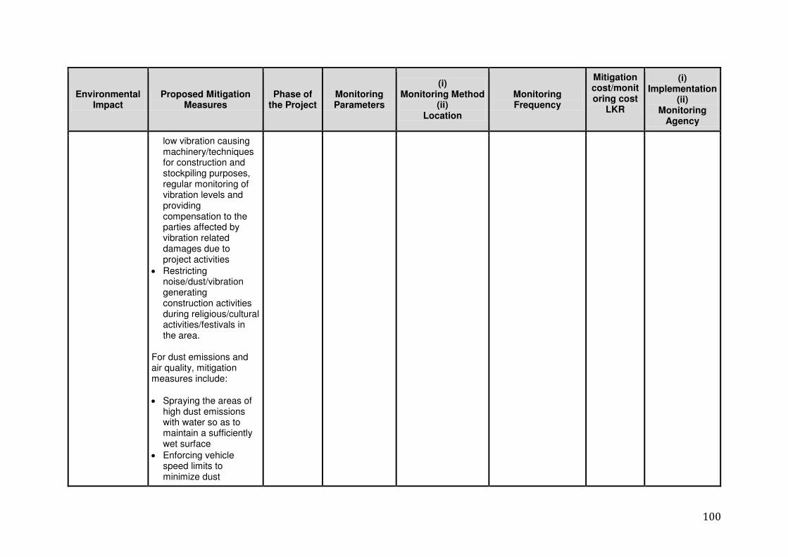
100
Environmental Impact
Proposed Mitigation Measures
Phase of the Project
Monitoring Parameters
(i) Monitoring Method
(ii) Location
Monitoring Frequency
Mitigation cost/monitoring cost
LKR
(i) Implementation
(ii) Monitoring
Agency
low vibration causing machinery/techniques for construction and stockpiling purposes, regular monitoring of vibration levels and providing compensation to the parties affected by vibration related damages due to project activities
Restricting noise/dust/vibration generating construction activities during religious/cultural activities/festivals in the area.
For dust emissions and air quality, mitigation measures include:
Spraying the areas of high dust emissions with water so as to maintain a sufficiently wet surface
Enforcing vehicle speed limits to minimize dust
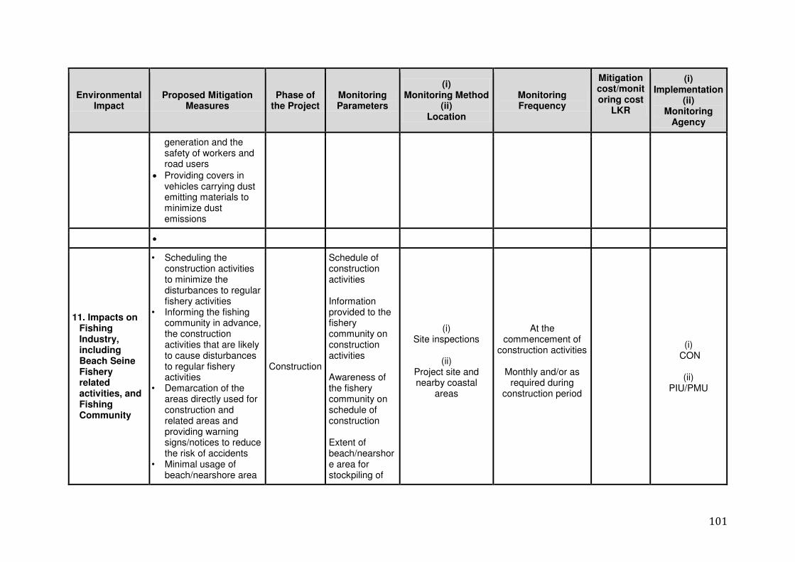
101
Environmental Impact
Proposed Mitigation Measures
Phase of the Project
Monitoring Parameters
(i) Monitoring Method
(ii) Location
Monitoring Frequency
Mitigation cost/monitoring cost
LKR
(i) Implementation
(ii) Monitoring
Agency
generation and the safety of workers and road users
Providing covers in vehicles carrying dust emitting materials to minimize dust emissions
11. Impacts on Fishing Industry, including Beach Seine Fishery related activities, and Fishing Community
• Scheduling the construction activities to minimize the disturbances to regular fishery activities
• Informing the fishing community in advance, the construction activities that are likely to cause disturbances to regular fishery activities
• Demarcation of the areas directly used for construction and related areas and providing warning signs/notices to reduce the risk of accidents
• Minimal usage of beach/nearshore area
Construction
Schedule of construction activities Information provided to the fishery community on construction activities Awareness of the fishery community on schedule of construction Extent of beach/nearshore area for stockpiling of
(i) Site inspections
(ii)
Project site and nearby coastal
areas
At the commencement of
construction activities
Monthly and/or as required during
construction period
(i) CON
(ii)
PIU/PMU
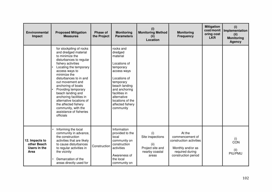
102
Environmental Impact
Proposed Mitigation Measures
Phase of the Project
Monitoring Parameters
(i) Monitoring Method
(ii) Location
Monitoring Frequency
Mitigation cost/monitoring cost
LKR
(i) Implementation
(ii) Monitoring
Agency
for stockpiling of rocks and dredged material to minimize the disturbances to regular fishery activities
• Locating the temporary access ways to minimize the disturbances to in and out movement and anchoring of boats
• Providing temporary beach landing and anchoring facilities in alternative locations of the affected fishery community, with the assistance of fisheries officials
rocks and dredged material Locations of temporary access ways Locations of temporary beach landing and anchoring facilities in alternative locations of the affected fishery community
12. Impacts to other Beach Users in the Area
• Informing the local community in advance, the construction activities that are likely to cause disturbances to regular activities in the vicinity
• Demarcation of the
areas directly used for
Construction
Information provided to the local community on construction activities Awareness of the local community on
(i) Site inspections
(ii)
Project site and nearby coastal
areas
At the commencement of
construction activities
Monthly and/or as required during
construction period
(i) CON
(ii)
PIU/PMU
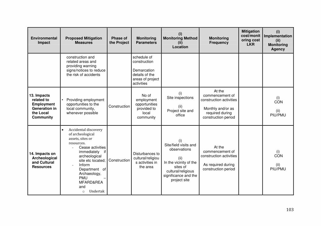
103
Environmental Impact
Proposed Mitigation Measures
Phase of the Project
Monitoring Parameters
(i) Monitoring Method
(ii) Location
Monitoring Frequency
Mitigation cost/monitoring cost
LKR
(i) Implementation
(ii) Monitoring
Agency
construction and related areas and providing warning signs/notices to reduce the risk of accidents
schedule of construction Demarcation details of the areas of project activities
13. Impacts related to Employment Generation in the Local Community
• Providing employment opportunities to the local community, whenever possible
Construction
No of employment opportunities provided to
local community
(i) Site inspections
(ii)
Project site and office
At the commencement of
construction activities
Monthly and/or as required during
construction period
(i) CON
(ii)
PIU/PMU
14. Impacts on Archeological and Cultural Resources
Accidental discovery
of archeological
assets, sites or
resources. - Cease activities
immediately if archeological site etc located;
- Inform Department of Archaeology, PMU – MFARD&REA and o Undertak
Construction
Disturbances to cultural/religious activities in
the area
(i) Site/field visits and
observations
(ii) In the vicinity of the
sites of cultural/religious
significance and the project site
At the commencement of
construction activities
As required during construction period
(i) CON
(ii)
PIU/PMU
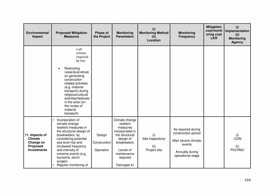
104
Environmental Impact
Proposed Mitigation Measures
Phase of the Project
Monitoring Parameters
(i) Monitoring Method
(ii) Location
Monitoring Frequency
Mitigation cost/monitoring cost
LKR
(i) Implementation
(ii) Monitoring
Agency
e all
actions
required
by law.
Restricting noise/dust/vibration generating construction related activities (e.g. material transport) during religious/cultural activities/festivals in the area (on the routes of material transport)
11. Impacts of Climate Change on Proposed Investments
• Incorporation of climate change resilient measures in the structural design of breakwaters, by considering potential sea level rise and increased frequency and intensity of extreme events (e.g. tsunamis, storm surges)
• Regular monitoring of
Design
Construction
Operation
Climate change resilient
measures incorporated in the structural
design of breakwaters
Levels of
maintenance required
Damages to
(i) Site inspections
(ii)
Project site
As required during construction period
After severe climatic
events
Annually during operational stage
(i) CON
(ii)
PIU/PMU
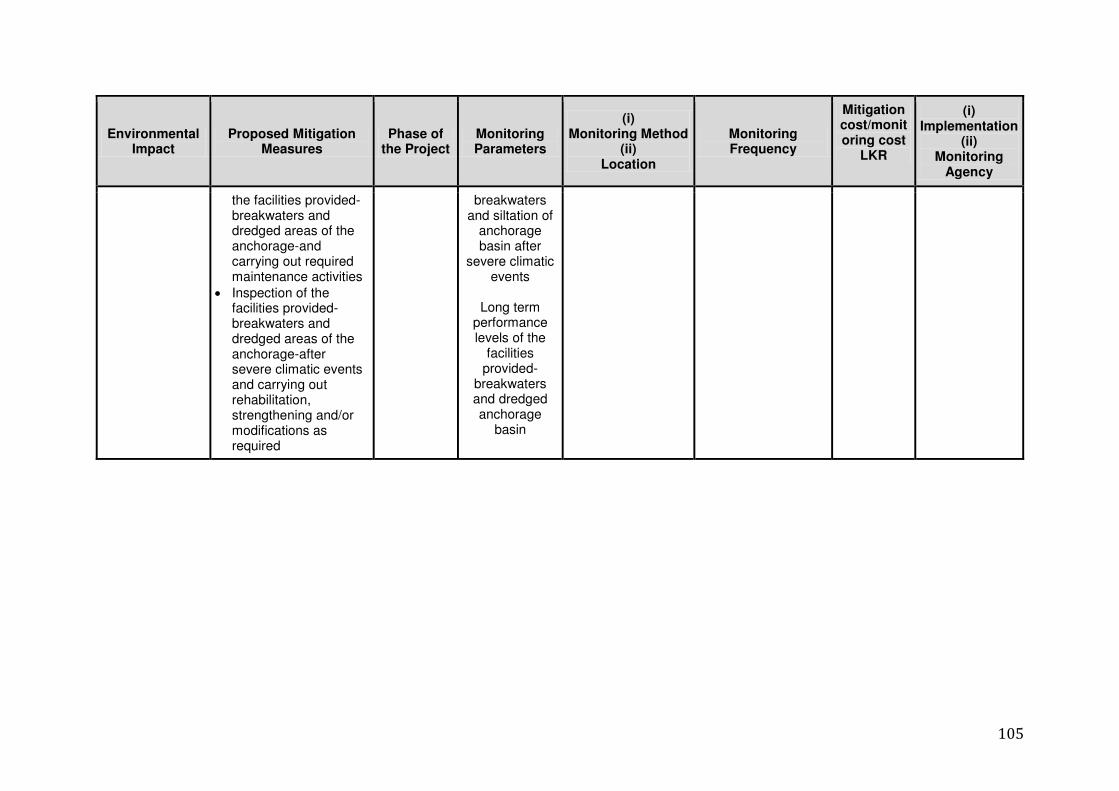
105
Environmental Impact
Proposed Mitigation Measures
Phase of the Project
Monitoring Parameters
(i) Monitoring Method
(ii) Location
Monitoring Frequency
Mitigation cost/monitoring cost
LKR
(i) Implementation
(ii) Monitoring
Agency
the facilities provided-breakwaters and dredged areas of the anchorage-and carrying out required maintenance activities
Inspection of the facilities provided-breakwaters and dredged areas of the anchorage-after severe climatic events and carrying out rehabilitation, strengthening and/or modifications as required
breakwaters and siltation of
anchorage basin after
severe climatic events
Long term
performance levels of the
facilities provided-
breakwaters and dredged anchorage
basin
106
H.1 Institutional Arrangements to Oversee the Implementation of the
Monitoring Plan
H.2 Institutional Arrangements
H.2.1 Sri Lankan Government 343. The MFARDREA will be the projects Executive Agency (EA) and has the overall
responsibility for all project related activities including inter-ministry coordination. MFARD will exercise its functions through its Project Management Unit (PMU), which will undertake the day to day management of the project. The PMU will be supported by a PIU based in Jaffna to support this output as well as other outputs under the project. The PIU includes a safeguards Manager who is supported by three environmental officers to supervise the entire project of which the harbor construction is one. The PMU will be assisted by consultancy team that provides support for the construction supervision management and administration for harbors, anchorages and landing package, which includes a full time Environmental Specialist (ES) to supervise and monitor all day to day construction works. The ES will monitor the implementation of the environmental management plan and support the PMU in the preparation and submit semi-annual environmental monitoring reports to ADB and government.
344. MFARDREA with assistance from the PMU/PIU will be responsible to acquire the
necessary governmental Development Consent (DC) clearances required under the Coast Conservation and Coastal Resources Management Act, through the Ministry of Mahaweli Development and Environment (MMDE) prior to awarding of contract.
345. The projects EMP will be included in the bidding documents and form part of the
contract documents. All bid documents will include a requirement to incorporate necessary resources into the contractor‟s bid to implement mitigation measures specified in the EMP. Where unanticipated environmental impacts become apparent during project implementation, the IEE including EMP will be updated by the environment specialists. Any updates to the IEE or EMP will be submitted to ADB for review.
346. The EA, through the PMU and PIU, with the support of the environmental specialists
and environmental safeguards officers attached to the PMU, will be responsible to:
i) Provide oversight on environmental management aspects of the project and ensure that the EMP is implemented by the contractors:
ii) Facilitate and ensure contractors comply with all government rules and regulations and obtain any relevant approvals required for works;
iii) Supervise and guide contractors on implementation of the EMP; iv) Review, monitor and evaluate the effectiveness with which the EMP is implemented,
and recommend necessary corrective actions to be taken as necessary; v) Submit semi-annual monitoring reports to ADB and government approval authorities; vi) Ensure timely disclosure of the IEE in locations and forms accessible to the public; vii) Take corrective actions when necessary when unforeseen negative environmental
impacts occur; viii) Conduct ongoing consultation with the community during implementation of the
project; and ix) Establish a Grievance Redress Mechanism (GRM) and ensure it is operated
satisfactorily.
107
347. PMU and PIU will be responsible for ensuring that the contractor does not start construction activities until all requisite approvals have been received from MMDE and other government agencies.
348. Quarterly Progress Reports will be issued by the Supervising Consultants (SC) to the
government and ADB. These will report on all aspects of the project, including those documented in the Contractor‟s monthly reports and environmental monitoring reports prepared by the SC and Contractor. In addition, the ADB will review progress of implementation of the EMP during regular review missions and review periodic monitoring reports and officially disclose the IEE and monitoring reports on ADB‟s website.
349. After the completion of construction, MFARDREA will be responsible for operations
and ongoing maintenance of all assets.
H.2.2 Contractor 350. The civil works Contractor will be responsible for interpreting the EMP in preparing a
Construction Environmental Management Plan (CEMP), after contract award. Where changes or additional engineering information is available, these shall be taken into account in the CEMP. The SC (as the Supervising Engineer) will approve the CEMP, upon advice from the EO within the PMU and ADB, before any physical works are undertaken.
351. The Contractor will be required to assign an Environmental Safety Officer (ESO) whose responsibilities for the contractor will include:
Coordinating with PMU and PIU, the EO and/or SC for updating the CEMP when
required; Ensuring that the contractor engages a suitable organization to undertake
STI/HIV/AIDS briefings and awareness raising amongst the Contractor‟s employees. Ensuring that the Contractor complies with the clauses in the contract and bidding
documents in respect of the environment and OH&S issues; Coordinating with MFARDREA and/or PMU in respect of continued community
consultation; Participating in monitoring and coordinating with PMU and PIU and the SC to ensure
that environmental management activities are reported as required; Ensuring that the Contractor does not commence construction activities until all
requisite approvals have been received from MMDE and other government agencies; and
Maintaining a log of all grievances received and action taken to address these issues.
352. Coordinating and communicating with the Contractor‟s Community Liaison Officer (CLO), as required, to facilitate consultation with the affected communities, various stakeholders (public, private and government), and ensuring smooth implementation of the individual subproject.
353. As identified in the EMP the Contractor and MFARDREA and/or the PMU and PIU,
may be responsible for the execution of various aspects of the project‟s environmental monitoring during the construction phase of project.
108
I. Conclusions and Recommendations 354. The IEE Report presents a detailed assessment of the potential environment impacts
associated with the proposed fishery anchorage development project in Athikovilady in the Jaffna district on the northern coast. The IEE has been carried out in accordance to the TOR provided by the CCCRMD. The details related to mitigation measures proposed for the identified adverse impacts are also presented in the report.
355. The potential impacts associated with both construction and operational phases have
been assessed, mitigation measures presented in accordance with the strategic approach described above. Where necessary, mitigation measures and the requirements for developing monitoring plans have been recommended.
356. The project will be implemented in the vicinity of a sensitive aquatic environment and
efforts have been taken to preserve the environmental qualities of the study area in which the development will take place. The study has given attention to the environmental aspects of the study area and ensured that the project will not contribute significantly to environmental degradation. The study has proposed an Environmental Management Plan for sustaining multiple uses of the study area.
357. On the basis of the analysis of these elements and on the assumption that the
recommendations for the mitigation of identified impacts are adopted and adequately implemented, the IEE has concluded that there are no major environmental impacts associated with the construction and operation of proposed fishery anchorage development project in Athikovilady in the Jaffna district on the northern coast.
Annex 01- TOR

Annex 02-a- Topo Map
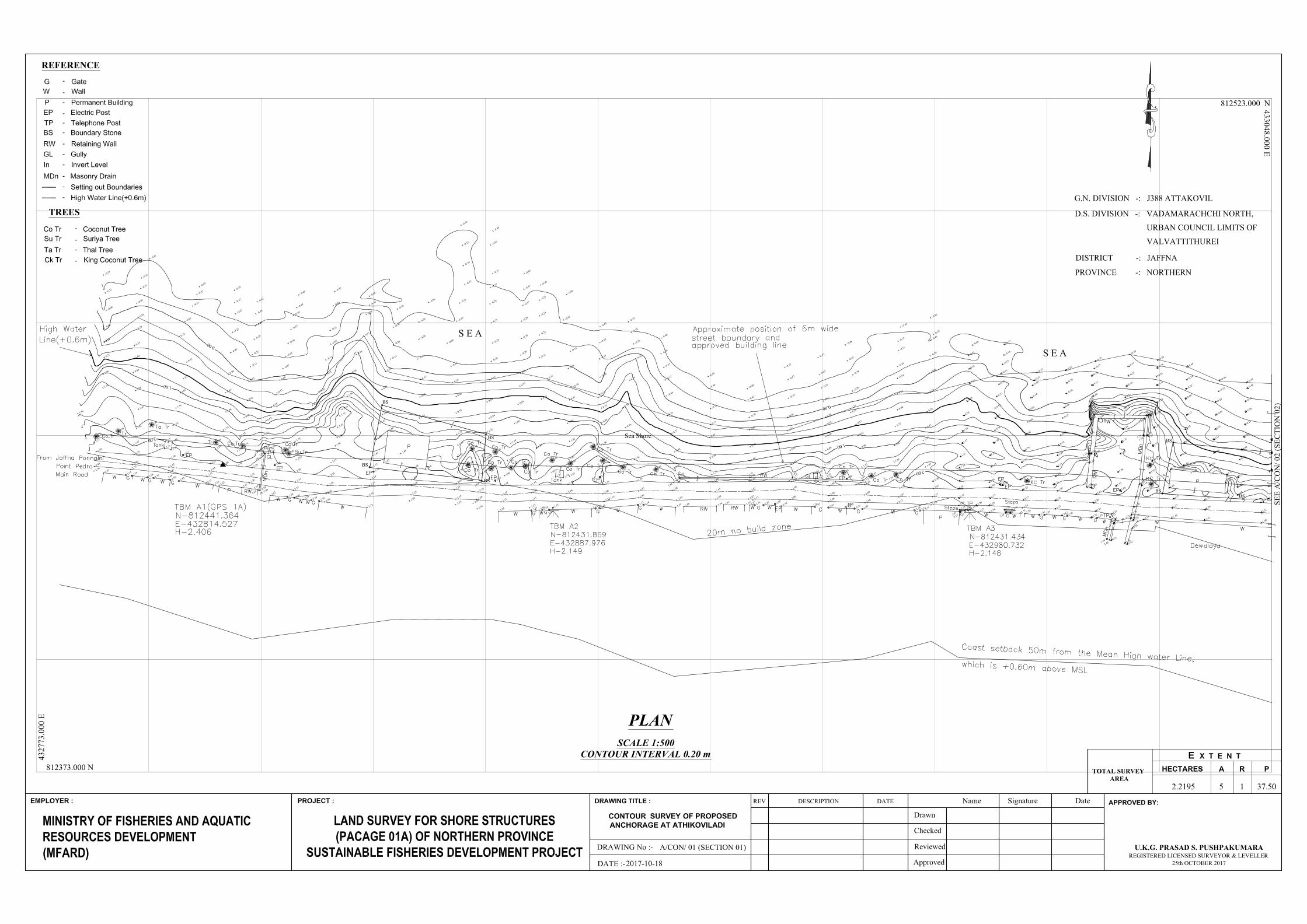

Annex 02-bp
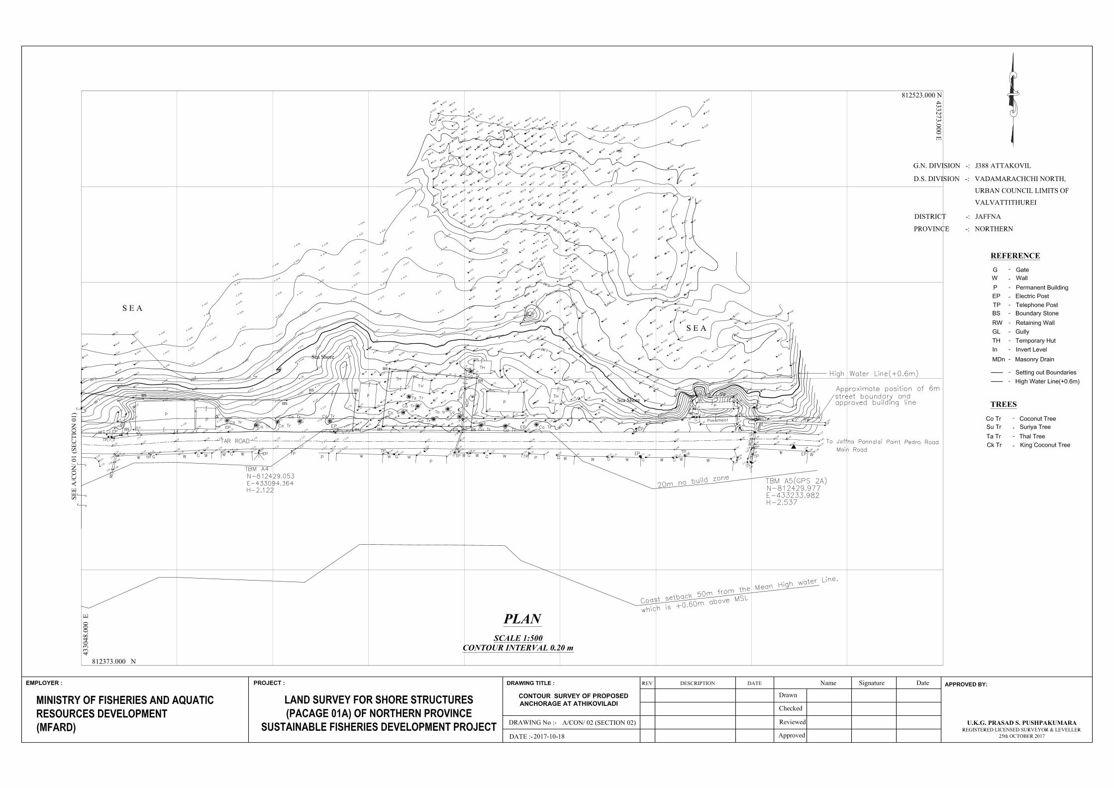
Annex 03-
Geotechnical Report
Annex 04- Water
Test Report (Ground
Water)
REPORT ON GEOTECHNICAL INVESTIGATIONS FOR
SHORE INFRASTRUCTURE OF NOTHERN PROVINCE
SUSTAINABLE FISHERIES DEVELOPMENT PROJECT
PACKAGE 01- ATHIKOVILADI
Client
MINISTRY OF FISHERIES AND AQUATIC RESOURCES
DEVELOPMENT GEO ENGINEERING CONSULTANTS (PVT) LTD Geotechnical Investigation, Geological Surveys, Ground Improvement & Laboratory Testing
[
12 th January 2018
No.929/ 18, Kahandawala Road, Thalangam a North, Malabe
Sri Lanka.
HOTLINE: 0113 093377
Tel: + 94 11 2 077844 (Accounts Dept .) + 94 11 2 077900 (Eng. Dept .)
+ 94 11 2 077908 (Lab) + 94 71 2 843843 (Mobile) Fax: + 94 11 2 077845
E-m ail: geoeng2009@gm ail.com , geoeng2009@sltnet . lk
CONTENT
Page No
1.0 INTRODUCTION 1 1.1 SCOPE OF WORK 1
1.2 BOREHOLE LOCATIONS 2
1.3 FIELD INVESTIGATIONS 2
Vertical profile across borehole 3
2.0 BOREHOLE STRATIGRAPHY 4 - 7 3.0 RECOMMENDATIONS 8 - 11 3.1 Project and Site Investigation Details 8
3.2 Borehole Investigations 8
3.3 Sub-surface Condition 8
3.4 Recommendations for geotechnical design parameters 9
3.5 Recommendations for foundations 9 - 10
3.6 Recommendations for Quary Wall 10 - 11
Location Plan 12
Borehole logs 13 - 17
Test Results for soil 11 - 27 Summary of the Soil Tests 18 Sieve Analysis 19 - 23 Atterberg Limits 24 - 25 Free Swell Index 26 Chemical test for water 27
Report
Prepared By:-
NIshantha Hikkaduwa B.Sc. P.G. (Dip.) Eng. Geo. MGS (SL)
Managing Director / Engineering Geologist
Geo Engineering Consultants (Pvt) Ltd
Recommended By:
Prof. B. L. Tennakoon B.Sc. (Eng), Ceylon, Ph.D. (Cantab) C.Eng.,F.I.E.(SL).
Consultant
Geo Engineering Consultants (Pvt) Ltd
Soil Investigation Report For Fisheries Development Project - Athikoviladi
Geo Engineering Consultants (Pvt) Ltd., No. 929/18, Kahandawala Road, Thalangama North, Malabe. Hotline: 011 3093377, 011 2077900, Fax: 0112077845
REPORT ON GEOTECHNICAL INVESTIGATIONS FOR SHORE INFRASTRUCTURE OF
NOTHERN PROVINCE SUSTAINABLE FISHERIES DEVELOPMENT PROJECT
PACKAGE 01- ATHIKOVILADI
CLIENT: MINISTRY OF FISHERIES AND AQUATIC RESOURCES DEVELOPMENT
1.0 INTRODUCTION
Request was received from Mr. Channa Fernando, Team Leader - Northern Province
Sustainable Fisheries Development Project, to submit a quotation to carry out the
borehole investigation for the Shore Infrastructure of Northern Province Sustainable
Fisheries development Project - Package 01.
The quotation was submitted for 37 boreholes in sixteen locations on 23rdNovember
2017 and the quotation was accepted on 26th December 2017
Personnel and equipment with five drilling machine was mobilized to the site on
27thDecember 2017 and investigation was started on 28thDecember 2017.
Field investigation works of four boreholes at Athikoviladi were completed on
31stDecember 2017.
This report includes four boreholes for Fishery harbor at Athikoviladi.
1.1 SCOPE OF WORK
Four numbers of boreholes were recommended to be drilled and the purpose of this
investigation is to evaluate sub-surface conditions for the foundations of the buildings
and quay walls in Fishery harbor at Athikoviladi.
The investigations were carried out under the direct supervision of authorized
representative of the Client.
BH - 01 was drilled up to 6.00 m depth, BH - 02 was drilled up to 6.00 m depth,
BH - 30 was drilled up to 12.00 m depth and BH- 04 was drilled up to 5.60 m depth.
Sieve with Hydrometer Analysis, Atterberg limits and Free swell index test were
carried out for available selected samples.
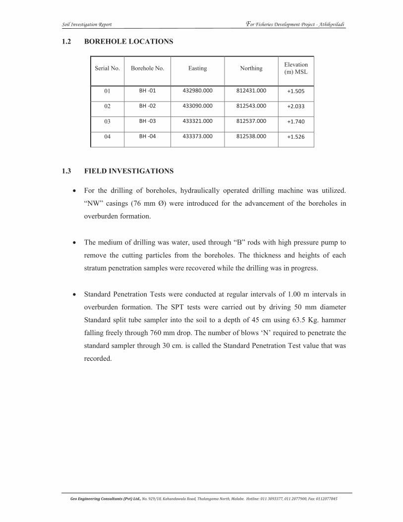
Soil Investigation Report For Fisheries Development Project - Athikoviladi
Geo Engineering Consultants (Pvt) Ltd., No. 929/18, Kahandawala Road, Thalangama North, Malabe. Hotline: 011 3093377, 011 2077900, Fax: 0112077845
1.2 BOREHOLE LOCATIONS
Serial No. Borehole No. Easting Northing Elevation (m) MSL
01 BH -01 432980.000 812431.000 +1.505
02 BH -02 433090.000 812543.000 +2.033
03 BH -03 433321.000 812537.000 +1.740
04 BH -04 433373.000 812538.000 +1.526
1.3 FIELD INVESTIGATIONS
For the drilling of boreholes, hydraulically operated drilling machine was utilized.
“NW” casings (76 mm Ø) were introduced for the advancement of the boreholes in
overburden formation.
The medium of drilling was water, used through “B” rods with high pressure pump to
remove the cutting particles from the boreholes. The thickness and heights of each
stratum penetration samples were recovered while the drilling was in progress.
Standard Penetration Tests were conducted at regular intervals of 1.00 m intervals in
overburden formation. The SPT tests were carried out by driving 50 mm diameter
Standard split tube sampler into the soil to a depth of 45 cm using 63.5 Kg. hammer
falling freely through 760 mm drop. The number of blows ‘N’ required to penetrate the
standard sampler through 30 cm. is called the Standard Penetration Test value that was
recorded.
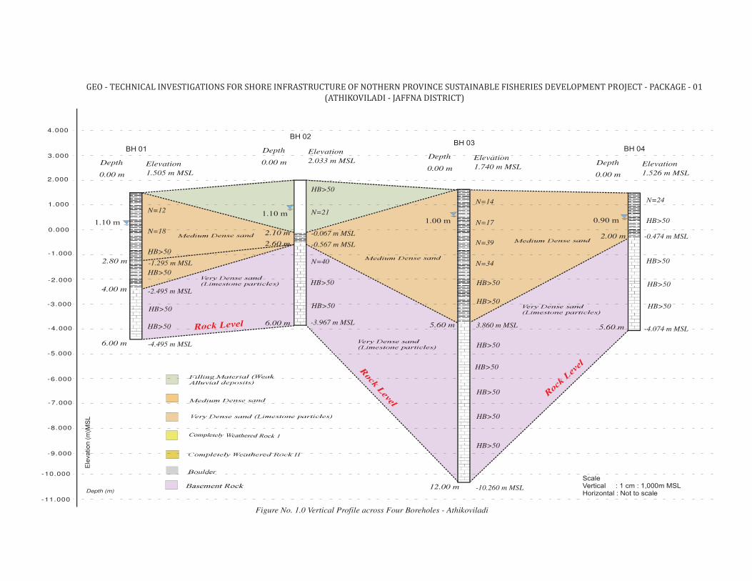
Depth (m)
4.000
Figure No. 1.0 Vertical Profile across Four Boreholes - Athikoviladi
1.505 m MSL0.00 m
Depth Elevation
ScaleVertical : 1 cm : 1,000m MSLHorizontal : Not to scale
BH 013.000
2.000
1.000
0.000
-1.000
-2.000
-3.000
-4.000
-5.000
-6.000
1.10 m
-4.495 m MSL6.00 m
2.033 m MSL0.00 m
Depth Elevation
BH 02
-7.000
-8.000
-9.000
1.10 m
-3.967 m MSL6.00 m
HB>50
HB>50
HB>50
HB>50
-2.495 m MSL4.00 m
HB>50
-0.067 m MSL2.10 m
HB>50
HB>50
N=12
N=18
1.740 m MSL0.00 m
Depth Elevation
BH 03
1.00 m
-10.260 m MSL12.00 m
1.526 m MSL0.00 m
Depth Elevation
BH 04
0.90 m
-4.074 m MSL5.60 m
HB>50
HB>50
3.860 m MSL5.60 m
HB>50
-0.474 m MSL2.00 m
HB>50
N=14
N=17
-0.567 m MSL2.60 m
N=21
N=40
-10.000
-11.000
N=39
N=34
HB>50
HB>50
HB>50
HB>50
HB>50
HB>50
HB>50
N=24
-1.295 m MSL2.80 m
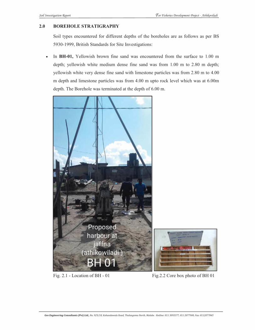
Soil Investigation Report For Fisheries Development Project - Athikoviladi
Geo Engineering Consultants (Pvt) Ltd., No. 929/18, Kahandawala Road, Thalangama North, Malabe. Hotline: 011 3093377, 011 2077900, Fax: 0112077845
2.0 BOREHOLE STRATIGRAPHY
Soil types encountered for different depths of the boreholes are as follows as per BS
5930-1999, British Standards for Site Investigations:
In BH-01, Yellowish brown fine sand was encountered from the surface to 1.00 m
depth; yellowish white medium dense fine sand was from 1.00 m to 2.80 m depth;
yellowish white very dense fine sand with limestone particles was from 2.80 m to 4.00
m depth and limestone particles was from 4.00 m upto rock level which was at 6.00m
depth. The Borehole was terminated at the depth of 6.00 m.
Fig. 2.1 - Location of BH - 01 Fig.2.2 Core box photo of BH 01
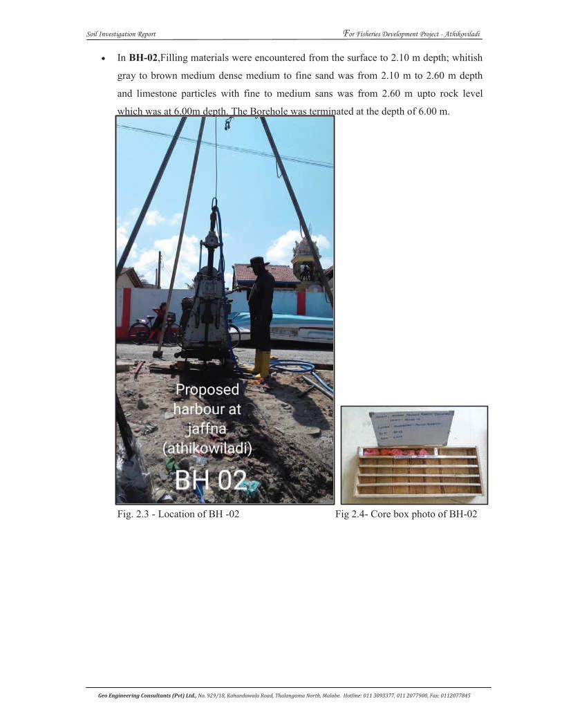
Soil Investigation Report For Fisheries Development Project - Athikoviladi
Geo Engineering Consultants (Pvt) Ltd., No. 929/18, Kahandawala Road, Thalangama North, Malabe. Hotline: 011 3093377, 011 2077900, Fax: 0112077845
In BH-02,Filling materials were encountered from the surface to 2.10 m depth; whitish
gray to brown medium dense medium to fine sand was from 2.10 m to 2.60 m depth
and limestone particles with fine to medium sans was from 2.60 m upto rock level
which was at 6.00m depth. The Borehole was terminated at the depth of 6.00 m.
Fig. 2.3 - Location of BH -02 Fig 2.4- Core box photo of BH-02
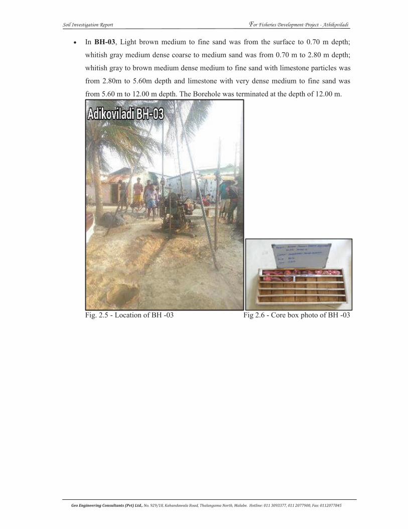
Soil Investigation Report For Fisheries Development Project - Athikoviladi
Geo Engineering Consultants (Pvt) Ltd., No. 929/18, Kahandawala Road, Thalangama North, Malabe. Hotline: 011 3093377, 011 2077900, Fax: 0112077845
In BH-03, Light brown medium to fine sand was from the surface to 0.70 m depth;
whitish gray medium dense coarse to medium sand was from 0.70 m to 2.80 m depth;
whitish gray to brown medium dense medium to fine sand with limestone particles was
from 2.80m to 5.60m depth and limestone with very dense medium to fine sand was
from 5.60 m to 12.00 m depth. The Borehole was terminated at the depth of 12.00 m.
Fig. 2.5 - Location of BH -03 Fig 2.6 - Core box photo of BH -03
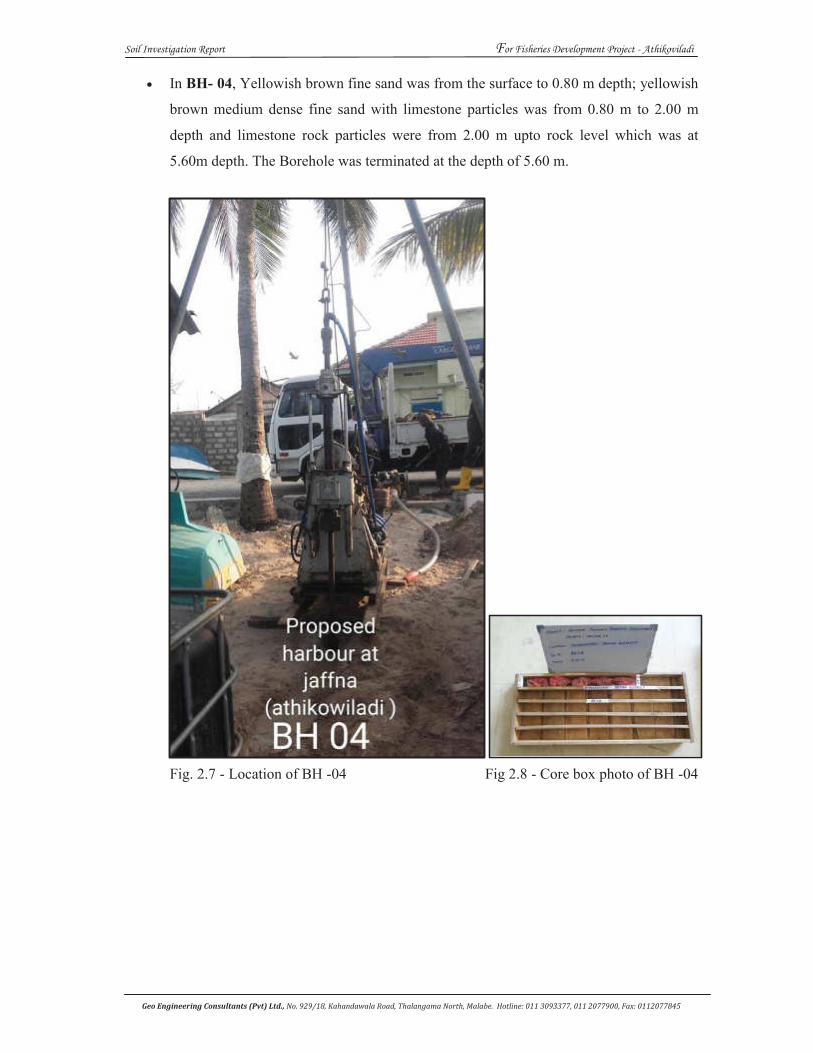
Soil Investigation Report For Fisheries Development Project - Athikoviladi
Geo Engineering Consultants (Pvt) Ltd., No. 929/18, Kahandawala Road, Thalangama North, Malabe. Hotline: 011 3093377, 011 2077900, Fax: 0112077845
In BH- 04, Yellowish brown fine sand was from the surface to 0.80 m depth; yellowish
brown medium dense fine sand with limestone particles was from 0.80 m to 2.00 m
depth and limestone rock particles were from 2.00 m upto rock level which was at
5.60m depth. The Borehole was terminated at the depth of 5.60 m.
Fig. 2.7 - Location of BH -04 Fig 2.8 - Core box photo of BH -04
Soil Investigation Report For Fisheries Development Project - Athikoviladi
Geo Engineering Consultants (Pvt) Ltd., No. 929/18, Kahandawala Road, Thalangama North, Malabe. Hotline: 011 3093377, 011 2077900, Fax: 0112077845
3.0 RECOMMENDATION
3.1 Project & Site Investigation details
The project is to construct a series of (1-2)-storey structures and a quay wall for the Fishery
Harbour at Athikoviladi in the Jaffna District.
The construction area is a relatively flat land facing the sea.
3.2 Borehole Investigation
Four Nos. boreholes had been done at this site at locations marked BH-01, BH-02, BH-03 and
BH-04 in the Location Plan. BH-03was terminated before reaching hard Limestone rock, whilst
the other three boreholes were drilled up to hard Limestone rock.
The details of depths of drilling are indicated below. The depth to ground water level (GWL) is
also shown in the table. ‘Elev.’ in this table refers to the elevation at top of borehole.
Location BH-01 BH-02 BH-03 BH-04
Elev. (m MSL) +1.505 +2.033 +1.740 +1.526
Depth to GWL (m) 1.10 1.10 1.00 0.90
Depth to Limestone rock (m) 6.00 6.00 - 5.60
Depth of borehole (m) 6.00 6.00 12.00 5.60
3.3 Sub-surface conditions
From a study of the borehole log, it is concluded that the overburden at location of BH-01 can
be modeled by successive layers as indicated below.
Layer
Position (m)
Layer description
SPT
No. No.
1a 0.0-2.8 Medium dense sand 15
1b 2.8-6.0 Very dense sand > 50
Ground water level (GWL) was at a depth of 1.10 m.
Similar layering, with some minor differences is observed in other boreholes with an
exception of a fill layer of thickness 2.1m present in BH-02 as Layer No. 1a.
Ground water levels (GWL)varied between depths of 0.9m and 1.1m.
Soil Investigation Report For Fisheries Development Project - Athikoviladi
Geo Engineering Consultants (Pvt) Ltd., No. 929/18, Kahandawala Road, Thalangama North, Malabe. Hotline: 011 3093377, 011 2077900, Fax: 0112077845
3.4 Recommendations for geotechnical design parameters
Based on the visual observation of the soil samples collected, the measured SPT values, and
experience with similar sub-surface conditions, the recommendations for the geotechnical
design parameters for the founding layer are given in the table below.
Layer
No. Layer description
Average
SPT
Shear strength
parameters
Ultimate bearing
Capacity (kN/m2)
Elastic
Modulus
E (kN/m2)
1a Medium dense sand 15 c' =0 kPa, φ' >28 >200 12000
1b Very dense sand > 50 c' =0 kPa, φ' = 43 2000 > 25000
3.5 Recommendations for foundations
3.5.1 Factors to be considered
The significant factors affecting the selection of the foundation type are:
o The overburden up to the depths investigated consisted of ‘medium dense sand’ underlain by
‘very dense sand’;
o The Ground water levels (GWL) were at depths of 0.90m to 1.10m at the four borehole
locations;
o The loads being transferred are from a series of (1-2)-storied structures and quay wall;
o The site is overlooking the sea in which the ‘High Water Level’ is at about 0.9m below site
elevation.
3.5.2 Recommendations for foundation type and design
It is recommended that the foundations consist of strip footings, or individual pad
footings connected at ground level by beams, or combined footings. The footings
should be placed at a depth of 0.6m below Existing Ground Level (EGL) and designed for an
allowable bearing capacity of 150 kN/m2, after carrying out site development as
described below.
Soil Investigation Report For Fisheries Development Project - Athikoviladi
Geo Engineering Consultants (Pvt) Ltd., No. 929/18, Kahandawala Road, Thalangama North, Malabe. Hotline: 011 3093377, 011 2077900, Fax: 0112077845
Method of site development
It is recommended that the method of site development consist of ground improvement as
described below.
It is recommended that excavation is carried out under the foundations. The length and width
of the excavation should be 20% more than the foundation dimensions. The excavation should
be adequately shored, and the excavation done to a depth of 0.75m below EGL in areas of ‘no
fill’ and up to bottom of fill in areas of ‘fill’. In the ground improvement proposed, no ground
water lowering is required.
Instead, it is recommended that rubble packing (6”-9”) be done in 300 mm thick layers. Each
layer should be pushed into the sub-surface beneath with the excavator bucket until further
penetration into the overburden is not possible. Each layer should then be overlaid by 50 mm
of ABC material and compacted with the excavator bucket. This process should be completed
in layers until foundation elevation is reached.
3.6 Recommendations for Quay Wall
3.6.1 Factors to be considered
The significant factors affecting the selection of the foundation type are:
o No particular borehole can be identified as representing the quay wall. Under these
circumstances, the geotechnical design parameters in the overburden can be assumed to be
the same as identified in Section 3.4;
o The loads being transferred are from the quay wall for which no details were available to the
undersigned.
Soil Investigation Report For Fisheries Development Project - Athikoviladi
Geo Engineering Consultants (Pvt) Ltd., No. 929/18, Kahandawala Road, Thalangama North, Malabe. Hotline: 011 3093377, 011 2077900, Fax: 0112077845
3.6.2 Recommendations for foundation type and design
Since no details of the quay wall structure were available, the recommendations given
in this section are limited to those of the geotechnical design parameters of the sub-
surface layers. These were given previously in Section 3.4.
……………………..…………
Prof. B. L. TennekoonB.Sc. (Eng), Ceylon, Ph.D. (Cantab) C.Eng.,F.I.E.(SL).
Consultant
Geo Engineering Consultants (Pvt.) Ltd
……………………..…………
Mr. Nishantha Hikkaduwa (B.Sc. P.G. Dip. Eng. Geo. MGS(SL)
Managing Director/Engineering Geologist
Geo Engineering Consultants (Pvt.) Ltd
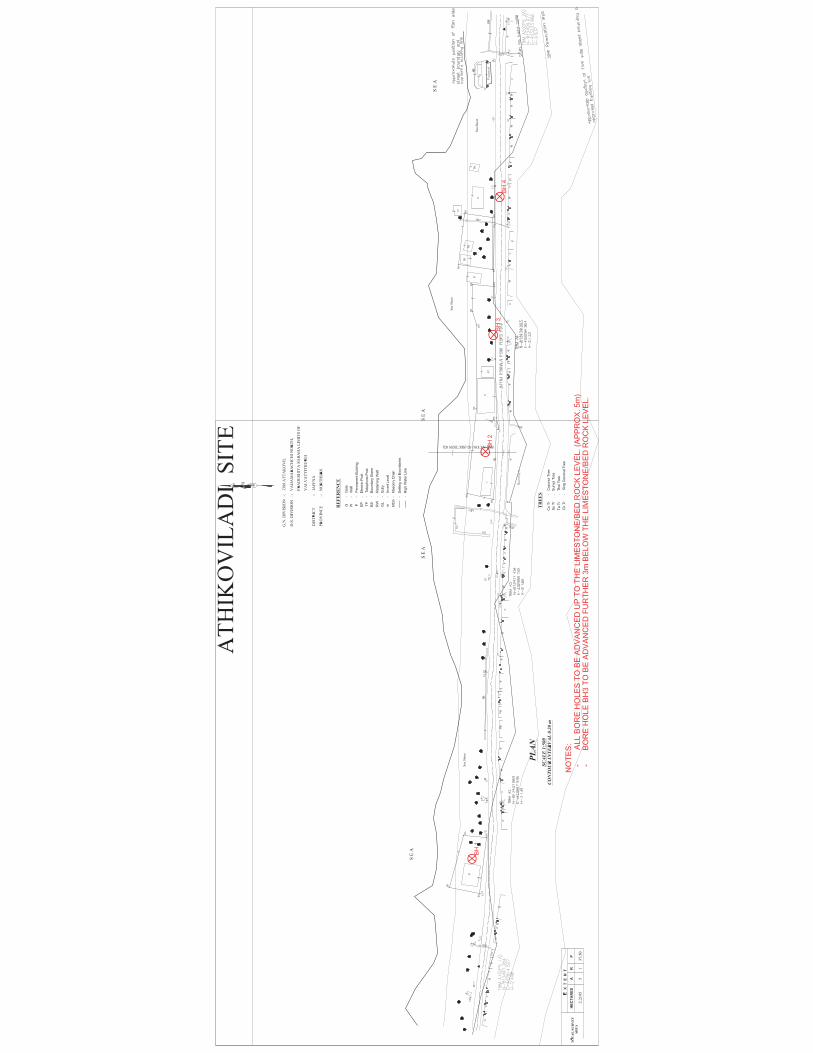
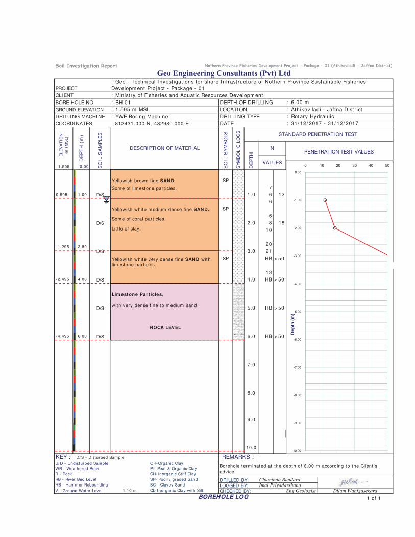
GROUND ELEVATION
DRI LLI NG MACHI NE
COORDI NATES
1.505 0.00
SP
7
D/S 1.0 6 12
6
SP
6
D/S 2.0 8 18
10
20
D/S 3 0 21
VALUES
: 812431.000 N; 432980.000 E
: 1.505 m MSL
PENETRATION TEST VALUES
STANDARD PENETRATI ON TEST
SY
MB
OLIC
LO
GS
Geo Engineering Consultants (Pvt) Ltd
: 6.00 m
DRILLING TYPE
: Geo - Technical I nvest igat ions for shore I nfrast ructure of Nothern Province Sustainable Fisheries
Development Project - Package - 01
DE
PT
H (
m)
PROJECT
: Minist ry of Fisheries and Aquat ic Resources DevelopmentCLI ENT
BORE HOLE NO
: 31/ 12/ 2017 - 31/ 12/ 2017
: Athikoviladi - Jaffna Dist r ict
DATE
: BH 01 DEPTH OF DRILLING
: Rotary Hydraulic: YWE Boring Machine
LOCATION
ELE
VA
TIO
N
m (
MS
L)
SO
IL S
AM
PLE
S
SO
IL S
YM
BO
LS
DE
PT
H
NDESCRI PTI ON OF MATERI AL
-2.00
-1.00
0.00
0 10 20 30 40 50
-1.295 2.80
Yellowish brown fine SAND .
Some of limestone part icles.
Yellowish white medium dense fine SAND.
Some of coral part icles.
Lit t le of clay.
0.505 1.00
D/S 3.0 21
SP HB > 50
13
D/S 4.0 HB > 50
D/S 5.0 HB > 50
D/S 6.0 HB > 50
7.0
8.0
9.0
10.0
KEY : D/ S - Disturbed Sam ple
RB - River Bed Level DRILLED BY:HB - Ham m er Rebounding LOGGED BY:
1.10 m CL- I norganic Clay with Silt
SC - Clayey Sand
REMARKS :OH-Organic Clay
Dilum Wanigasekara
U/ D - Undisturbed Sam pleBorehole term inated at the depth of 6.00 m according to the Client 's
advice.WR - Weathered Rock
Imal Priyadarshana
Pt- Peat & Organic Clay
BOREHOLE LOG
CHECKED BY: Eng.Geologist
SP- Poorly graded Sand Chaminda Bandara
R - Rock CH-I norganic St iff Clay
V - Ground Water Level -
-10.00
-9.00
-8.00
-7.00
-6.00
-5.00
-4.00
-3.00
Dep
th (m
)
1 of 1
-4.495 6.00
Lim estone Part icles.
with very dense fine to medium sand
ROCK LEVEL
-2.495 4.00
Yellowish white very dense fine SAND withlimestone part icles.
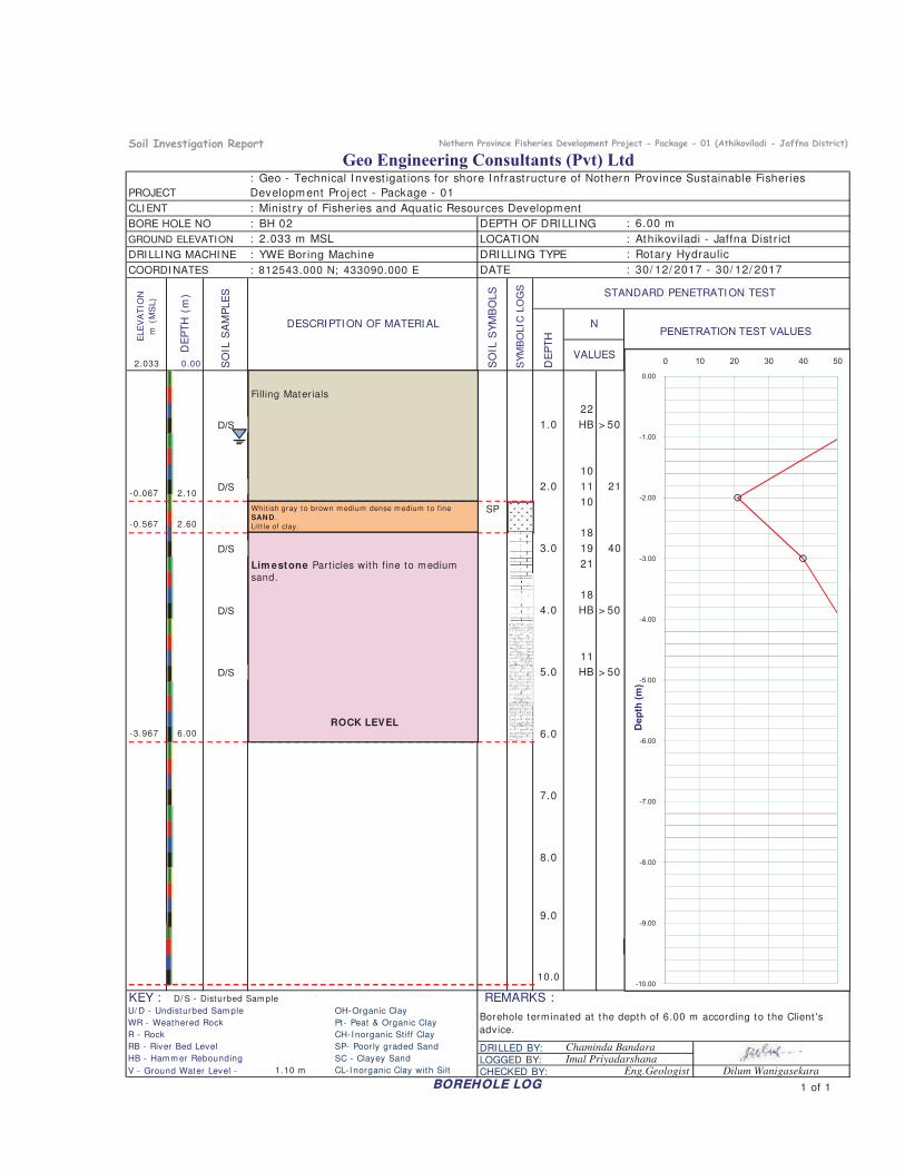
GROUND ELEVATION
DRI LLI NG MACHI NE
COORDI NATES
2.033 0.00
22
D/S 1.0 HB > 50
10
D/S 2.0 11 21
10
18
D/S 3 0 19 40
VALUES
: 812543.000 N; 433090.000 E
: 2.033 m MSL
PENETRATION TEST VALUES
STANDARD PENETRATI ON TEST
SY
MB
OLIC
LO
GS
Geo Engineering Consultants (Pvt) Ltd
: 6.00 m
DRILLING TYPE
: Geo - Technical I nvest igat ions for shore I nfrast ructure of Nothern Province Sustainable Fisheries
Development Project - Package - 01D
EP
TH
(m
)PROJECT
: Minist ry of Fisheries and Aquat ic Resources DevelopmentCLI ENT
BORE HOLE NO
: 30/ 12/ 2017 - 30/ 12/ 2017
: Athikoviladi - Jaffna Dist r ict
DATE
: BH 02 DEPTH OF DRILLING
: Rotary Hydraulic: YWE Boring Machine
LOCATION
ELE
VA
TIO
N
m (
MS
L)
SO
IL S
AM
PLE
S
SO
IL S
YM
BO
LS
DE
PT
H
NDESCRI PTI ON OF MATERI AL
SP-2.00
-1.00
0.00
0 10 20 30 40 50
-0.567 2.60
Filling Materials
-0.067 2.10
Whit ish gray to brown m edium dense m edium to f ineSAND .Lit t le of clay.
D/S 3.0 19 40
21
18
D/S 4.0 HB > 50
11
D/S 5.0 HB > 50
6.0
7.0
8.0
9.0
10.0
KEY : D/ S - Disturbed Sam ple
RB - River Bed Level DRILLED BY:HB - Ham m er Rebounding LOGGED BY:
1.10 m CL- I norganic Clay with Silt
WR - Weathered Rock
REMARKS :OH-Organic Clay
Dilum Wanigasekara
SC - Clayey Sand
V - Ground Water Level -
U/ D - Undisturbed Sam pleBorehole term inated at the depth of 6.00 m according to the Client 's
advice.
Imal Priyadarshana
Pt- Peat & Organic Clay
BOREHOLE LOG
CHECKED BY: Eng.Geologist
SP- Poorly graded Sand Chaminda Bandara
R - Rock CH-I norganic St iff Clay
-10.00
-9.00
-8.00
-7.00
-6.00
-5.00
-4.00
-3.00
Dep
th (m
)
1 of 1
-3.967 6.00
Lim estone Part icles with fine to mediumsand.
ROCK LEVEL
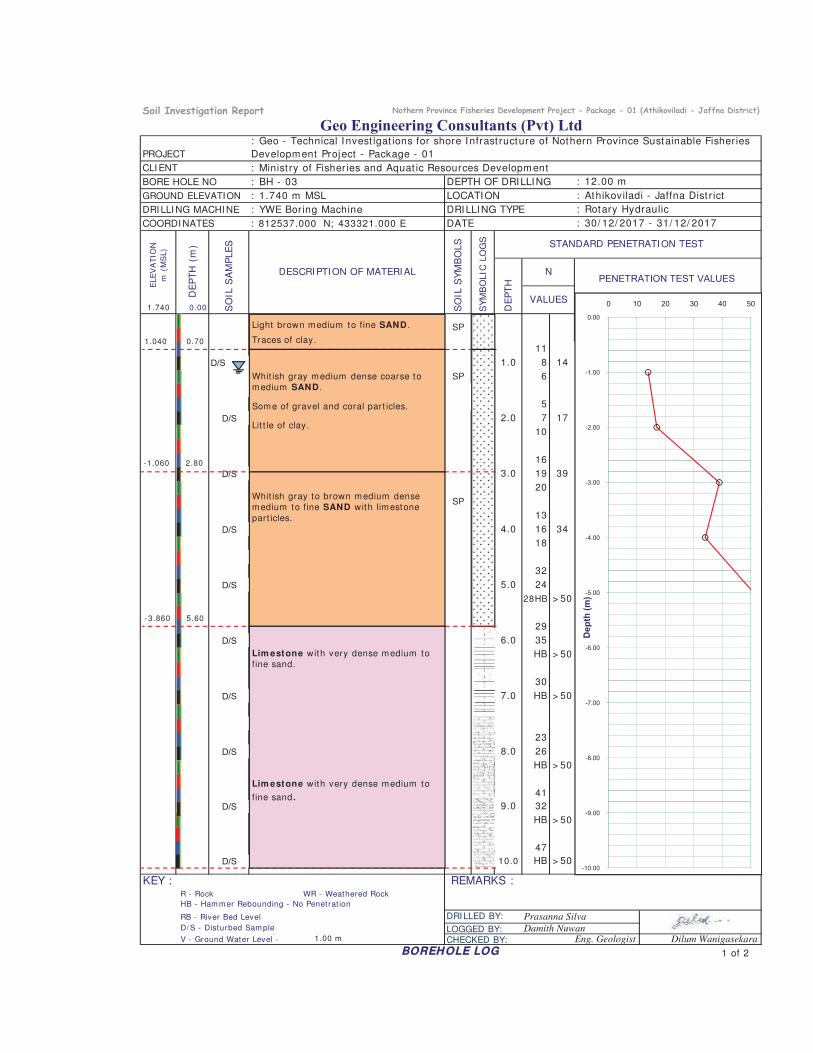
1.740 0.00
11
D/S 1.0 8 14
SP 6
5
D/S 2.0 7 17
10
16
D/S 3.0 19 39
20
DESCRI PTI ON OF MATERI AL
DE
PT
H (
m)
GROUND ELEVATION
: Minist ry of Fisheries and Aquat ic Resources Development
ELE
VA
TIO
N
m (
MS
L)
COORDI NATESS
OIL
SA
MP
LE
SDATE
: 1.740 m MSL LOCATION
BORE HOLE NO DEPTH OF DRILLING
PROJECT
SO
IL S
YM
BO
LS
VALUES
: YWE Boring MachineDRI LLI NG MACHI NE
: BH - 03
: 812537.000 N; 433321.000 E
: Geo - Technical I nvest igat ions for shore I nfrast ructure of Nothern Province Sustainable Fisheries
Development Project - Package - 01
: Athikoviladi - Jaffna Dist r ict
Geo Engineering Consultants (Pvt) Ltd
CLI ENT
: 12.00 m
DRILLING TYPE : Rotary Hydraulic
SY
MB
OLIC
LO
GS STANDARD PENETRATI ON TEST
: 30/ 12/ 2017 - 31/ 12/ 2017
DE
PT
H
NPENETRATION TEST VALUES
SP
-3.00
-2.00
-1.00
0.00
0 10 20 30 40 50
Light brown medium to fine SAND .
Traces of clay.1.040 0.70
Whit ish gray medium dense coarse tomedium SAND .
Some of gravel and coral part icles.
Lit t le of clay.
-1.060 2.80
SP
13
D/S 4.0 16 34
18
32
D/S 5.0 24
28HB > 50
29
D/S 6.0 35
HB > 50
30
D/S 7.0 HB > 50
23
D/S 8.0 26
HB > 50
41
D/S 9.0 32
HB > 50
47
D/S 10.0 HB > 50
KEY : R - Rock WR - Weathered Rock
RB - River Bed Level DRILLED BY:
D/ S - Disturbed Sam ple LOGGED BY:V - Ground Water Level - 1.00 m
REMARKS :
HB - Ham m er Rebounding - No Penetrat ion
BOREHOLE LOG
CHECKED BY: Eng. Geologist
Prasanna Silva
Damith NuwanDilum Wanigasekara
-10.00
-9.00
-8.00
-7.00
-6.00
-5.00
-4.00
Dep
th (m
)
1 of 2
Whit ish gray to brown medium densemedium to fine SAND with limestonepart icles.
Lim estone with very dense medium tofine sand.
Lim estone with very dense medium to
fine sand
-3.860 5.60
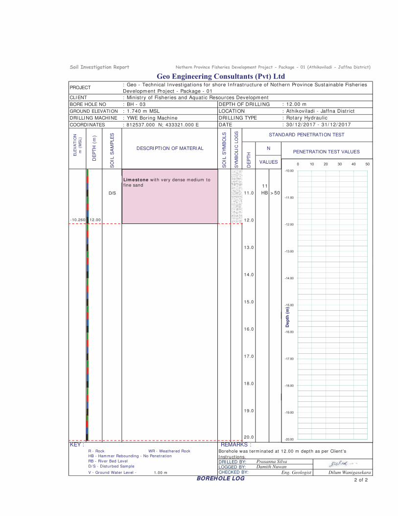
11
D/S 11.0 HB > 50
12.0
PROJECT: Geo - Technical I nvest igat ions for shore I nfrast ructure of Nothern Province Sustainable Fisheries
Development Project - Package - 01
Geo Engineering Consultants (Pvt) Ltd
DEPTH OF DRILLING
STANDARD PENETRATI ON TEST
: Rotary Hydraulic
: 30/ 12/ 2017 - 31/ 12/ 2017
LOCATION : Athikoviladi - Jaffna Dist r ict
DATE
: 12.00 m
DRILLING TYPE
: Minist ry of Fisheries and Aquat ic Resources Development
VALUES
GROUND ELEVATION : 1.740 m MSL
DRI LLI NG MACHI NE : YWE Boring Machine
DE
PT
H
CLI ENTD
EP
TH
(m
)
BORE HOLE NO : BH - 03
SO
IL S
YM
BO
LS
SY
MB
OLIC
LO
GS
COORDI NATES : 812537.000 N; 433321.000 E
DESCRI PTI ON OF MATERI AL
SO
IL S
AM
PLE
S
NPENETRATION TEST VALUES
ELE
VA
TIO
N
m (
MS
L)
-12.00
-11.00
-10.00
0 10 20 30 40 50
-10.260 12.00
Lim estone with very dense medium tofine sand
13.0
14.0
15.0
16.0
17.0
18.0
19.0
20.0
KEY : R - Rock WR - Weathered Rock
RB - River Bed Level DRILLED BY: D/ S - Disturbed Sam ple LOGGED BY:V - Ground Water Level - 1.00 m CHECKED BY: Eng. Geologist
Borehole was term inated at 12.00 m depth as per Client 's
Inst ruct ions.
BOREHOLE LOG
REMARKS :
HB - Ham m er Rebounding - No Penetrat ion
Prasanna SilvaDamith Nuwan
Dilum Wanigasekara
-20.00
-19.00
-18.00
-17.00
-16.00
-15.00
-14.00
-13.00
Dep
th (m
)
2 of 2
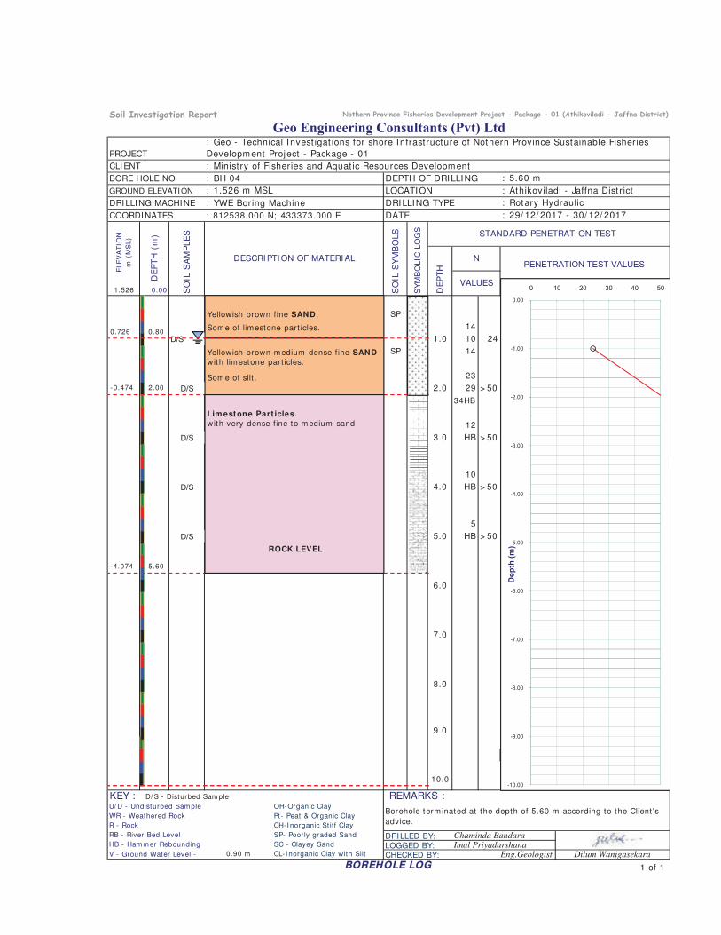
GROUND ELEVATION
DRI LLI NG MACHI NE
COORDI NATES
1.526 0.00
SP
14
D/S 1.0 10 24
SP 14
23
D/S 2.0 29 > 50
34HB
12
D/S 3 0 HB > 50
ELE
VA
TIO
N
m (
MS
L)
SO
IL S
AM
PLE
S
SO
IL S
YM
BO
LS
DE
PT
H
NDESCRI PTI ON OF MATERI AL
: 29/ 12/ 2017 - 30/ 12/ 2017
: Athikoviladi - Jaffna Dist r ict
DATE
: BH 04 DEPTH OF DRILLING
: Rotary Hydraulic: YWE Boring Machine
LOCATION
Geo Engineering Consultants (Pvt) Ltd
: 5.60 m
DRILLING TYPE
: Geo - Technical I nvest igat ions for shore I nfrast ructure of Nothern Province Sustainable Fisheries
Development Project - Package - 01D
EP
TH
(m
)PROJECT
: Minist ry of Fisheries and Aquat ic Resources DevelopmentCLI ENT
BORE HOLE NO
VALUES
: 812538.000 N; 433373.000 E
: 1.526 m MSL
PENETRATION TEST VALUES
STANDARD PENETRATI ON TEST
SY
MB
OLIC
LO
GS
-2.00
-1.00
0.00
0 10 20 30 40 50
-0.474 2.00
Yellowish brown fine SAND .
Some of limestone part icles.
Yellowish brown medium dense fine SAND
with limestone part icles.
Some of silt .
0.726 0.80
Lim estone Part icles.
with very dense fine to medium sand
D/S 3.0 HB > 50
10
D/S 4.0 HB > 50
5
D/S 5.0 HB > 50
6.0
7.0
8.0
9.0
10.0
KEY : D/ S - Disturbed Sam ple
RB - River Bed Level DRILLED BY:HB - Ham m er Rebounding LOGGED BY:
0.90 m CL- I norganic Clay with SiltImal Priyadarshana
Pt- Peat & Organic Clay
BOREHOLE LOG
CHECKED BY: Eng.Geologist
SP- Poorly graded Sand Chaminda Bandara
R - Rock CH-I norganic St iff Clay
V - Ground Water Level -
U/ D - Undisturbed Sam pleBorehole term inated at the depth of 5.60 m according to the Client 's
advice.
Dilum Wanigasekara
SC - Clayey Sand
REMARKS :OH-Organic Clay
WR - Weathered Rock
-10.00
-9.00
-8.00
-7.00
-6.00
-5.00
-4.00
-3.00
Dep
th (m
)
1 of 1
-4.074 5.60
ROCK LEVEL
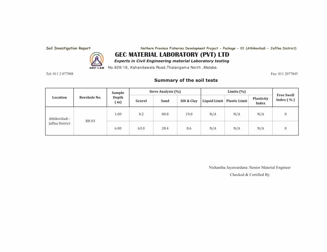
. . . . N/A N/A N/A6. 6 . . .6 N/A N/A N/A
Nishantha Jayawardana /Senior Material Engineer
Checked & Certified By
Limits (%)Free Swell
Index ( % )Gravel Sand Silt & Clay
Soil Investigation Report Nothern Province Fisheries Development Project - Package - 01 (Athikoviladi - Jaffna District)
GEC MATERIAL LABORATORY (PVT) LTDExperts in Civil Engineering material Laboratory testing
No.929/ 18, Kahandawala Road,Thalangam a North ,Malabe.
Liquid Limit Plastic LimitPlasticity
Index
Tel: 011 2 077908 Fax: 011 2077845
Summary of the soil tests
Location Borehole No.
Sample
Depth
( m)
Sieve Analysis (%)
Athikoviladi - Jaffna District BH
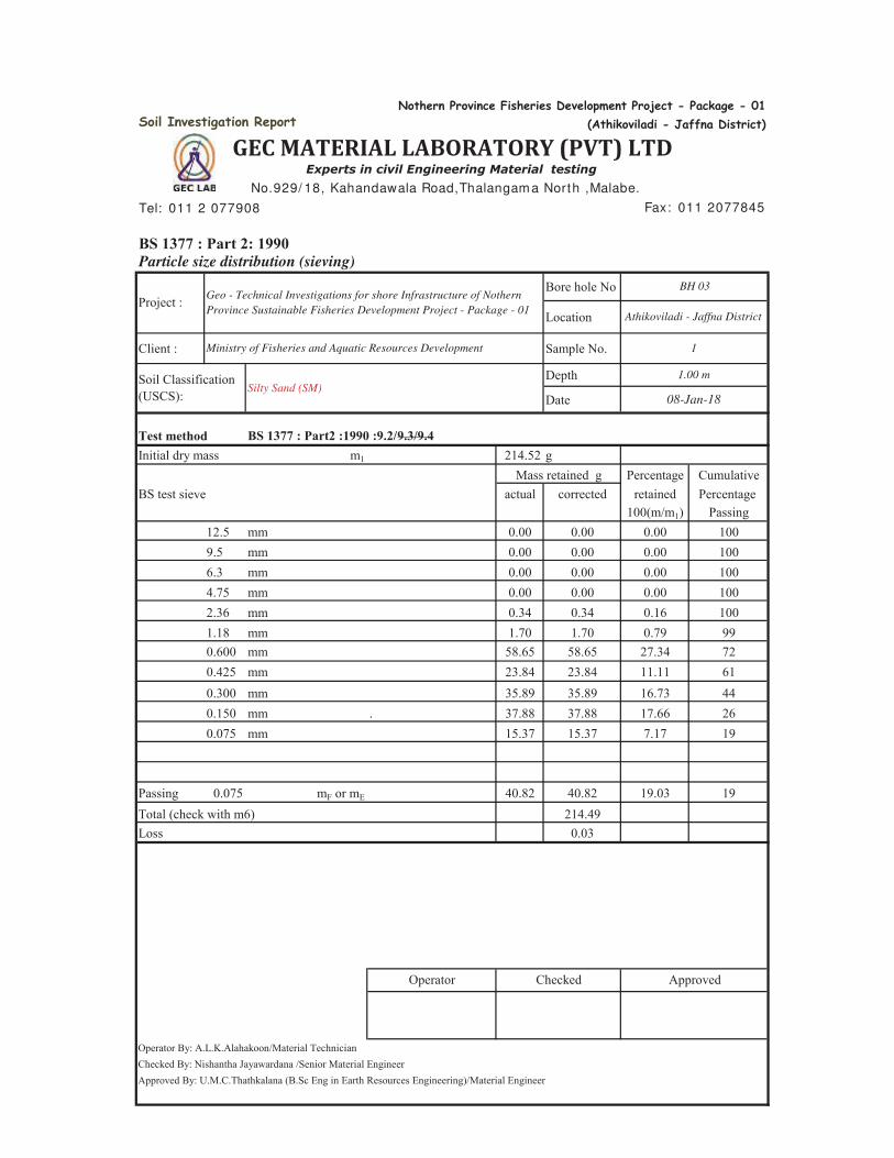
Soil Investigation Report
Tel: 011 2 077908
BS 1377 : Part 2: 1990Particle size distribution (sieving)
Bore hole No
Location
Client : Sample No.
Depth
Date
Test methodInitial dry mass m1 214.52 g
Percentage CumulativeBS test sieve actual corrected retained Percentage
100(m/m1) Passing12.5 mm 0.00 0.00 0.00 1009.5 mm 0.00 0.00 0.00 1006.3 mm 0.00 0.00 0.00 1004.75 mm 0.00 0.00 0.00 1002.36 mm 0.34 0.34 0.16 1001.18 mm 1.70 1.70 0.79 990.600 mm 58.65 58.65 27.34 720.425 mm 23.84 23.84 11.11 610.300 mm 35.89 35.89 16.73 440.150 mm . 37.88 37.88 17.66 260.075 mm 15.37 15.37 7.17 19
Passing 0.075 mF or mE 40.82 40.82 19.03 19Total (check with m6) 214.49Loss 0.03
Operator By: A.L.K.Alahakoon/Material TechnicianChecked By: Nishantha Jayawardana /Senior Material EngineerApproved By: U.M.C.Thathkalana (B.Sc Eng in Earth Resources Engineering)/Material Engineer
Mass retained g
1
08-Jan-18
Ministry of Fisheries and Aquatic Resources Development
Soil Classification (USCS):
BS 1377 : Part2 :1990 :9.2/9.3/9.4
1.00 m
Operator Checked Approved
Silty Sand (SM)
Project : Geo - Technical Investigations for shore Infrastructure of Nothern
Province Sustainable Fisheries Development Project - Package - 01
GEC MATERIAL LABORATORY (PVT) LTDExperts in civil Engineering Material testing
No.929/ 18, Kahandawala Road,Thalangam a North ,Malabe.
Fax: 011 2077845
BH 03
Athikoviladi - Jaffna District
Nothern Province Fisheries Development Project - Package - 01
(Athikoviladi - Jaffna District)
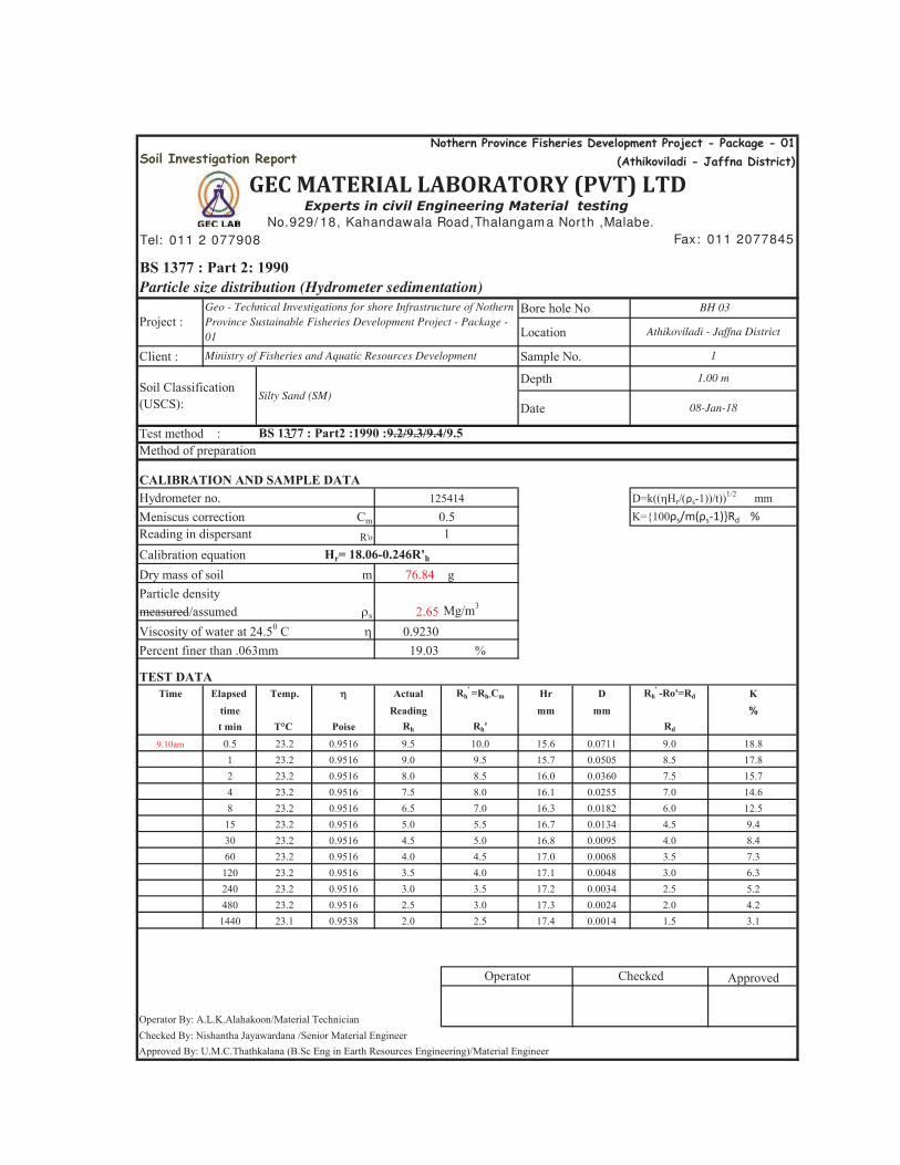
Soil Investigation Report
Tel: 011 2 077908
BS 1377 : Part 2: 1990Particle size distribution (Hydrometer sedimentation)
Bore hole No
Location
Client : Sample No.
Depth
Date
Test method :Method of preparation
CALIBRATION AND SAMPLE DATAHydrometer no.Meniscus correction CmReading in dispersant R'o
Calibration equationDry mass of soil m 76.84 gParticle density
s 2.65 Mg/m3
Viscosity of water at 24.50 C 0.9230Percent finer than .063mm 19.03 %
TEST DATATime Elapsed Temp. Actual Rh
' =Rh-Cm Hr D Rh' -Ro'=Rd K
time Reading mm mm %t min T°C Poise Rh Rh' Rd
9.10am 0.5 23.2 0.9516 9.5 10.0 15.6 0.0711 9.0 18.81 23.2 0.9516 9.0 9.5 15.7 0.0505 8.5 17.82 23.2 0.9516 8.0 8.5 16.0 0.0360 7.5 15.74 23.2 0.9516 7.5 8.0 16.1 0.0255 7.0 14.68 23.2 0.9516 6.5 7.0 16.3 0.0182 6.0 12.5
15 23.2 0.9516 5.0 5.5 16.7 0.0134 4.5 9.430 23.2 0.9516 4.5 5.0 16.8 0.0095 4.0 8.460 23.2 0.9516 4.0 4.5 17.0 0.0068 3.5 7.3
120 23.2 0.9516 3.5 4.0 17.1 0.0048 3.0 6.3240 23.2 0.9516 3.0 3.5 17.2 0.0034 2.5 5.2480 23.2 0.9516 2.5 3.0 17.3 0.0024 2.0 4.2
1440 23.1 0.9538 2.0 2.5 17.4 0.0014 1.5 3.1
Approved
Operator By: A.L.K.Alahakoon/Material TechnicianChecked By: Nishantha Jayawardana /Senior Material EngineerApproved By: U.M.C.Thathkalana (B.Sc Eng in Earth Resources Engineering)/Material Engineer
measured/assumed
Ministry of Fisheries and Aquatic Resources Development
CheckedOperator
0.51
Project :Athikoviladi - Jaffna District
BH 03
BS 1377 : Part2 :1990 :9.2/9.3/9.4/9.5
125414
1.00 mSoil Classification (USCS):
Silty Sand (SM)08-Jan-18
D=k(( r ρs-1))/t))1/2 mm
Hr= 18.06-0.246R'h
Nothern Province Fisheries Development Project - Package - 01
(Athikoviladi - Jaffna District)
GEC MATERIAL LABORATORY (PVT) LTDExperts in civil Engineering Material testing
No.929/ 18, Kahandawala Road,Thalangam a North ,Malabe.
Fax: 011 2077845
1
Geo - Technical Investigations for shore Infrastructure of Nothern
Province Sustainable Fisheries Development Project - Package -
01
K={100ρs/m(ρs-1)}Rd %
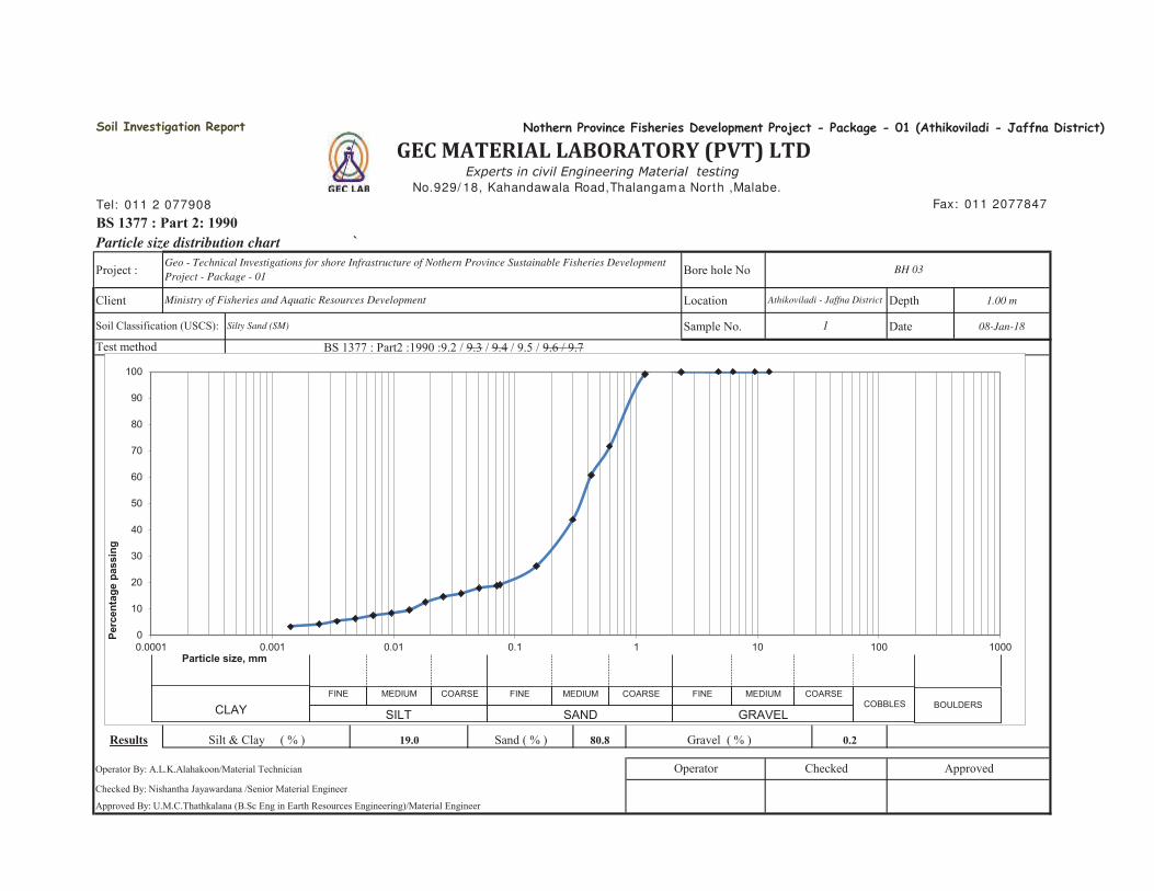
Tel: 011 2 077908
BS 1377 : Part 2: 1990Particle size distribution chart `
Project : Bore hole No
Client Location Depth 1.00 m
Sample No. Date 08-Jan-18
Results 19.0 80.8 0.2
Operator By: A.L.K.Alahakoon/Material Technician
Checked By: Nishantha Jayawardana /Senior Material Engineer
Approved By: U.M.C.Thathkalana (B.Sc Eng in Earth Resources Engineering)/Material Engineer
Silt & Clay ( % ) Sand ( % )
Test method
Geo - Technical Investigations for shore Infrastructure of Nothern Province Sustainable Fisheries Development
Project - Package - 01
Ministry of Fisheries and Aquatic Resources Development
Soil Classification (USCS): Silty Sand (SM)
Operator
BH 03
BS 1377 : Part2 :1990 :9.2 / 9.3 / 9.4 / 9.5 / 9.6 / 9.7
Soil Investigation Report
1
GEC MATERIAL LABORATORY (PVT) LTDExperts in civil Engineering Material testing
No.929/ 18, Kahandawala Road,Thalangam a North ,Malabe.
Nothern Province Fisheries Development Project - Package - 01 (Athikoviladi - Jaffna District)
Fax: 011 2077847
Athikoviladi - Jaffna District
Gravel ( % )
ApprovedChecked
0
10
20
30
40
50
60
70
80
90
100
0.0001 0.001 0.01 0.1 1 10 100 1000
Perc
enta
ge p
assi
ng
Particle size, mm
CLAYFINE MEDIUM COARSE FINE MEDIUM COARSE FINE MEDIUM COARSE
COBBLES BOULDERSSILT SAND GRAVEL
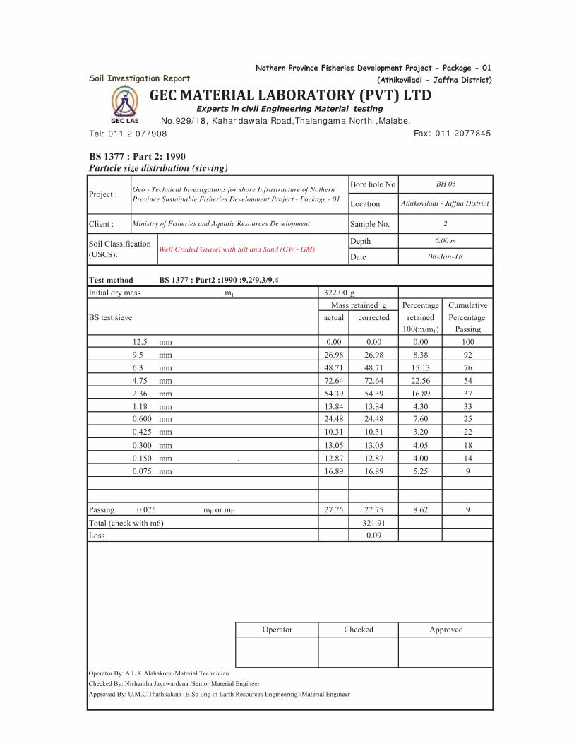
Soil Investigation Report
Tel: 011 2 077908
BS 1377 : Part 2: 1990Particle size distribution (sieving)
Bore hole No
Location
Client : Sample No.
Depth
Date
Test methodInitial dry mass m1 322.00 g
Percentage CumulativeBS test sieve actual corrected retained Percentage
100(m/m1) Passing12.5 mm 0.00 0.00 0.00 1009.5 mm 26.98 26.98 8.38 926.3 mm 48.71 48.71 15.13 764.75 mm 72.64 72.64 22.56 542.36 mm 54.39 54.39 16.89 371.18 mm 13.84 13.84 4.30 330.600 mm 24.48 24.48 7.60 250.425 mm 10.31 10.31 3.20 220.300 mm 13.05 13.05 4.05 180.150 mm . 12.87 12.87 4.00 140.075 mm 16.89 16.89 5.25 9
Passing 0.075 mF or mE 27.75 27.75 8.62 9Total (check with m6) 321.91Loss 0.09
Operator By: A.L.K.Alahakoon/Material TechnicianChecked By: Nishantha Jayawardana /Senior Material EngineerApproved By: U.M.C.Thathkalana (B.Sc Eng in Earth Resources Engineering)/Material Engineer
6.00 m
Geo - Technical Investigations for shore Infrastructure of Nothern
Province Sustainable Fisheries Development Project - Package - 01
Mass retained g
2
08-Jan-18
Ministry of Fisheries and Aquatic Resources Development
Soil Classification (USCS):
BS 1377 : Part2 :1990 :9.2/9.3/9.4
Experts in civil Engineering Material testing
No.929/ 18, Kahandawala Road,Thalangam a North ,Malabe.
Fax: 011 2077845
BH 03
Athikoviladi - Jaffna District
Operator Checked Approved
Well Graded Gravel with Silt and Sand (GW - GM)
Project :
Nothern Province Fisheries Development Project - Package - 01
(Athikoviladi - Jaffna District)
GEC MATERIAL LABORATORY (PVT) LTD
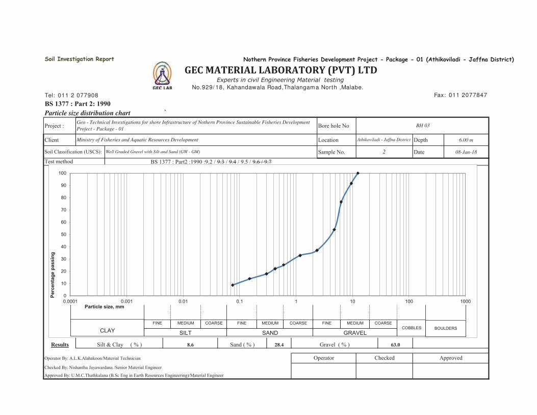
Tel: 011 2 077908
BS 1377 : Part 2: 1990Particle size distribution chart `
Project : Bore hole No
Client Location Depth 6.00 m
Sample No. Date 08-Jan-18
Results 8.6 28.4 63.0
Operator By: A.L.K.Alahakoon/Material Technician
Checked By: Nishantha Jayawardana /Senior Material Engineer
Approved By: U.M.C.Thathkalana (B.Sc Eng in Earth Resources Engineering)/Material Engineer
Silt & Clay ( % ) Sand ( % )
Test method
Geo - Technical Investigations for shore Infrastructure of Nothern Province Sustainable Fisheries Development
Project - Package - 01
Ministry of Fisheries and Aquatic Resources Development
Soil Classification (USCS): Well Graded Gravel with Silt and Sand (GW - GM)
Operator
BH 03
BS 1377 : Part2 :1990 :9.2 / 9.3 / 9.4 / 9.5 / 9.6 / 9.7
Soil Investigation Report
2
GEC MATERIAL LABORATORY (PVT) LTDExperts in civil Engineering Material testing
No.929/ 18, Kahandawala Road,Thalangam a North ,Malabe.
Nothern Province Fisheries Development Project - Package - 01 (Athikoviladi - Jaffna District)
Fax: 011 2077847
Athikoviladi - Jaffna District
Gravel ( % )
ApprovedChecked
0
10
20
30
40
50
60
70
80
90
100
0.0001 0.001 0.01 0.1 1 10 100 1000
Perc
enta
ge p
assi
ng
Particle size, mm
CLAYFINE MEDIUM COARSE FINE MEDIUM COARSE FINE MEDIUM COARSE
COBBLES BOULDERSSILT SAND GRAVEL
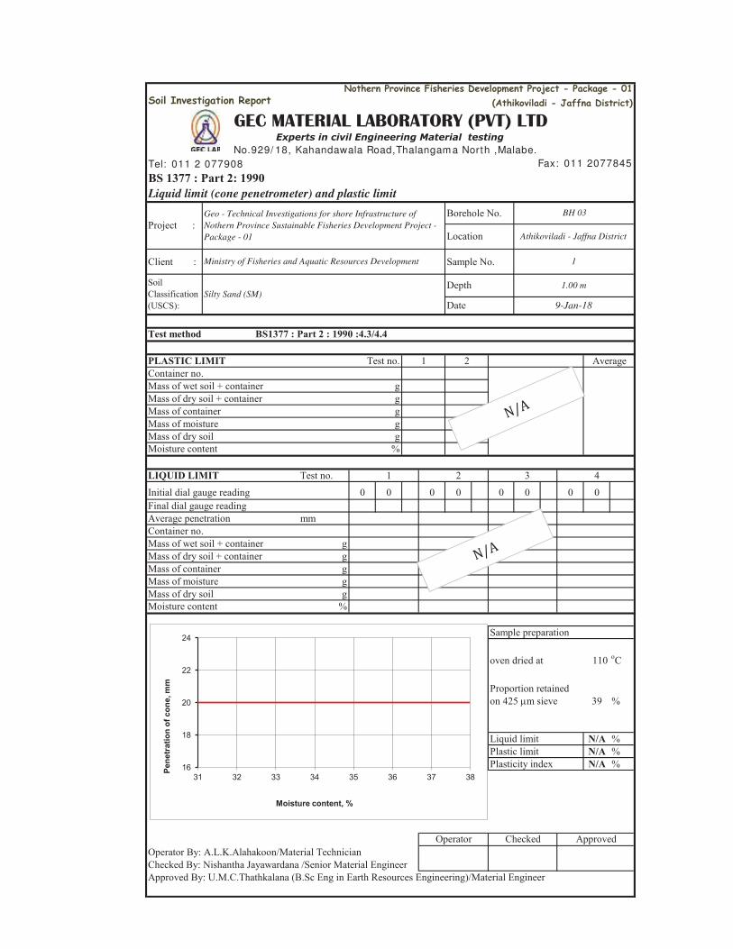
Soil Investigation Report
Tel: 011 2 077908
BS 1377 : Part 2: 1990Liquid limit (cone penetrometer) and plastic limit
Borehole No.
Client : Sample No.
Test method
PLASTIC LIMIT Test no.Container no.Mass of wet soil + container gMass of dry soil + container gMass of container gMass of moisture gMass of dry soil g Moisture content %
LIQUID LIMIT Test no. 1 2 3 4Initial dial gauge reading 0 0 0 0 0 0 0 0Final dial gauge readingAverage penetration mmContainer no.Mass of wet soil + container gMass of dry soil + container gMass of container gMass of moisture gMass of dry soil gMoisture content %
Sample preparation
oven dried at 110 oC
Proportion retainedon 425 m sieve 39 %
Liquid limit N/A %Plastic limit N/A %Plasticity index N/A %
Operator By: A.L.K.Alahakoon/Material TechnicianChecked By: Nishantha Jayawardana /Senior Material EngineerApproved By: U.M.C.Thathkalana (B.Sc Eng in Earth Resources Engineering)/Material Engineer
Ministry of Fisheries and Aquatic Resources Development
GEC MATERIAL LABORATORY (PVT) LTD
9-Jan-18
BH 03
Athikoviladi - Jaffna District
1
1.00 m
Fax: 011 2077845
Experts in civil Engineering Material testing
1 2
Geo - Technical Investigations for shore Infrastructure of
Nothern Province Sustainable Fisheries Development Project -
Package - 01
Project :
Operator Checked
Approved
Nothern Province Fisheries Development Project - Package - 01
(Athikoviladi - Jaffna District)
Soil Classification (USCS):
Silty Sand (SM)Depth
Date
BS1377 : Part 2 : 1990 :4.3/4.4
No.929/ 18, Kahandawala Road,Thalangam a North ,Malabe.
Average
Location
16
18
20
22
24
31 32 33 34 35 36 37 38
Pene
trat
ion
of c
one,
mm
Moisture content, %

Soil Investigation Report
Tel: 011 2 077908
BS 1377 : Part 2: 1990Liquid limit (cone penetrometer) and plastic limit
Borehole No.
Client : Sample No.
Test method
PLASTIC LIMIT Test no.Container no.Mass of wet soil + container gMass of dry soil + container gMass of container gMass of moisture gMass of dry soil g Moisture content %
LIQUID LIMIT Test no. 1 2 3 4Initial dial gauge reading 0 0 0 0 0 0 0 0Final dial gauge readingAverage penetration mmContainer no.Mass of wet soil + container gMass of dry soil + container gMass of container gMass of moisture gMass of dry soil gMoisture content %
Sample preparation
oven dried at 110 oC
Proportion retainedon 425 m sieve 78 %
Liquid limit N/A %Plastic limit N/A %Plasticity index N/A %
Operator By: A.L.K.Alahakoon/Material TechnicianChecked By: Nishantha Jayawardana /Senior Material EngineerApproved By: U.M.C.Thathkalana (B.Sc Eng in Earth Resources Engineering)/Material Engineer
Ministry of Fisheries and Aquatic Resources Development
GEC MATERIAL LABORATORY (PVT) LTD
9-Jan-18
BH 03
Athikoviladi - Jaffna District
2
6.00m
Fax: 011 2077845
Experts in civil Engineering Material testing
1 2
Geo - Technical Investigations for shore Infrastructure of
Nothern Province Sustainable Fisheries Development Project -
Package - 01
Project :
Operator Checked Approved
Nothern Province Fisheries Development Project - Package - 01
(Athikoviladi - Jaffna District)
Soil Classification (USCS):
Well Graded Gravel with Silt and Sand (GW - GM)Depth
Date
BS1377 : Part 2 : 1990 :4.3/4.4
No.929/ 18, Kahandawala Road,Thalangam a North ,Malabe.
Average
Location
16
18
20
22
24
31 32 33 34 35 36 37 38
Pene
trat
ion
of c
one,
mm
Moisture content, %
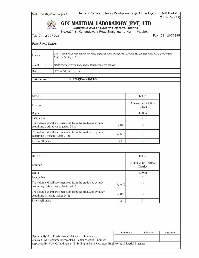
Soil Investigation Report
Tel: 011 2 077908
Free Swell Index
Client :
Date :
Test method
BH No
Location
DepthSample No
Vd (ml)
Vk (ml)
(%)
BH No
Location
DepthSample No
Vd (ml)
Vk (ml)
(%)
Operator By: A.L.K.Alahakoon/Material TechnicianChecked By: Nishantha Jayawardana /Senior Material EngineerApproved By: U.M.C.Thathkalana (B.Sc Eng in Earth Resources Engineering)/Material Engineer
The volume of soil specimen read from the graduated cylinder containing distilled water (After 24 h)
The volume of soil specimen read from the graduated cylinder containing kerosene (After 24 h)
Free swell index
Operator Checked Approved
The volume of soil specimen read from the graduated cylinder containing distilled water (After 24 h) 10
The volume of soil specimen read from the graduated cylinder containing kerosene (After 24 h) 10
10
10
0
BH 03
Athikoviladi - Jaffna District
6.00 m2
2018.01.08 - 2018.01.10
IS: 2720(Part 40)-1985
Athikoviladi - Jaffna District
1.00 m1
BH 03
Free swell index 0
Nothern Province Fisheries Development Project - Package - 01 (Athikoviladi -
Jaffna District)
GEC MATERIAL LABORATORY (PVT) LTDExperts in civil Engineering Material testing
No.929/ 18, Kahandawala Road,Thalangam a North ,Malabe.
Fax: 011 2077845
Project : Geo - Technical Investigations for shore Infrastructure of Nothern Province Sustainable Fisheries Development
Project - Package - 01
Ministry of Fisheries and Aquatic Resources Development
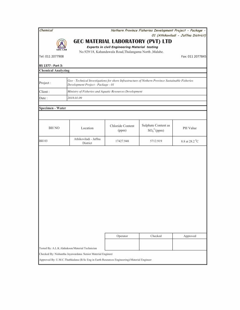
Fax: 011 2077845
Project :
Client :
Date :
Location Chloride Content (ppm)
Sulphate Content as SO4
2-(ppm) PH Value
Athikoviladi - Jaffna District 17427.948 5712.919 8.8 at 28.2 0C
Operator Checked Approved
Tested By: A.L.K.Alahakoon/Material Technician
Checked By: Nishantha Jayawardana /Senior Material Engineer
Approved By: U.M.C.Thathkalana (B.Sc Eng in Earth Resources Engineering)/Material Engineer
Specimen - Water
BH NO
BH 03
BS 1377 : Part 3:
Chemical Analyzing
Geo - Technical Investigations for shore Infrastructure of Nothern Province Sustainable Fisheries
Development Project - Package - 01
Ministry of Fisheries and Aquatic Resources Development
2018.01.09
Tel: 011 2077908
Chemical
GEC MATERIAL LABORATORY (PVT) LTDExperts in civil Engineering Material testing
No.929/18, Kahandawala Road,Thalangama North ,Malabe.
Nothern Province Fisheries Development Project - Package -
01 (Athikoviladi - Jaffna District)
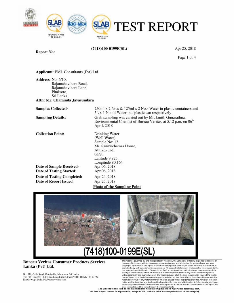
TEST REPORT
Report No: (7418)100-0199E(SL) Apr 25, 2018
Page 1 of 4
Bureau Veritas Consumer Products Services Lanka (Pvt) Ltd.
No. 570, Galle Road, Katubedda, Moratuwa, Sri Lanka Tel: (9411) 2350111-115 (dedicated lines), Fax: (9411) 112622198 & 199 Email: [email protected]
This report is governed by, and incorporates by reference, the Conditions of Testing as posted at the date of issuance of this report at http://www.cps.bureauveritas.com and is intended for your exclusive use. Any copying or replication of this report to or for any other person or entity, or use of our name or trademark, is permitted only with our prior written permission. This report sets forth our findings solely with respect to the test samples identified herein. The results set forth in this report are not indicative or representative of the quality or characteristics of the lot from which a test sample was taken or any similar or identical product unless specifically and expressly noted. Our report includes all of the tests requested by you and the results thereof based upon the information that you provided to us. You have 60 days from date of issuance of this report to notify us of any material error or omission caused by our negligence; provided, however, that such notice shall be in writing and shall specifically address the issue you wish to raise. A failure to raise such issue within the prescribed time shall constitute you unqualified acceptance of the completeness of this report, the tests conducted and the correctness of the report contents.
The content of this PDF file is in accordance with the original issued reports for reference only.
This Test Report cannot be reproduced, except in full, without prior written permission of the company.
Applicant: EML Consultants (Pvt) Ltd.
Address: No. 6/10, Rajamahavihara Road, Rajamahavihara Lane, Pitakotte, Sri Lanka.
Attn: Mr. Chaminda Jayasundara
Samples Collected: 250ml x 2 No.s & 125ml x 2 No.s Water in plastic containers and 5L x 1 No. of Water in a plastic can respectively
Sampling Details:
Collection Point:
Grab sampling was carried out by Mr. Janith Gunarathna, Environmental Chemist of Bureau Veritas, at 5.12 p.m. on 06
th
April, 2018
Drinking Water (Well Water) Sample No: 12 Mr. Sanmucharasa House, Athikoviladi GPS: Latitude 9.825, Longitude 80.164
Date of Sample Received: Apr 06, 2018
Date of Testing Started: Apr 06, 2018
Date of Testing Completed: Apr 24, 2018
Date of Report Issued: Apr 25, 2018
Photo of the Sampling Point
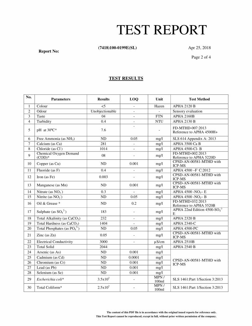
TEST REPORT
Report No: (7418)100-0199E(SL) Apr 25, 2018
Page 2 of 4
The content of this PDF file is in accordance with the original issued reports for reference only.
This Test Report cannot be reproduced, except in full, without prior written permission of the company.
TEST RESULTS
No. Parameters Results LOQ Unit Test Method
1 Colour <5 - Hazen APHA 2120 B
2 Odour Unobjectionable - - Sensory evaluation
3 Taste 04 - FTN APHA 2160B
4 Turbidity 0.4 - NTU APHA 2130 B
5 pH at 30ºC* 7.6 -
- FD-MTHD-007:2013 Reference to APHA 4500H+
6 Free Ammonia (as NH3) ND 0.05 mg/l SLS 614 Appendix A: 2013
7 Calcium (as Ca) 281 - mg/l APHA 3500 Ca B
8 Chloride (as Cl-) 1014 - mg/l APHA 4500-Cl- B
9 Chemical Oxygen Demand (COD)*
08 - mg/l FD-MTHD-002:2013 Reference to APHA 5220D
10 Copper (as Cu) ND 0.001 mg/l CPSD-AN-00581-MTHD with ICP-MS
11 Fluoride (as F) 0.4 - mg/l APHA 4500 –F- C:2012
12 Iron (as Fe) 0.003 - mg/l CPSD-AN-00581-MTHD with ICP-MS
13 Manganese (as Mn) ND 0.001 mg/l CPSD-AN-00581-MTHD with ICP-MS
14 Nitrate (as NO3-) 0.3 - mg/l APHA 4500 -NO3– E
15 Nitrite (as NO2-) ND 0.05 mg/l APHA 4500 -NO2– B
16 Oil & Grease * ND 0.2 mg/l FD-MTHD-032:2013 Reference to APHA 5520B
17 Sulphate (as SO42-
) 183 - mg/l APHA 22nd Edition 4500-SO4
2- E
18 Total Alkalinity (as CaCO3) 232 - mg/l APHA 2320 B
19 Total Hardness (as CaCO3) 1404 - mg/l APHA 2340-C
20 Total Phosphates (as PO43-
) ND 0.05 mg/l APHA 4500-PC
21 Zinc (as Zn) 0.05 - mg/l CPSD-AN-00581-MTHD with ICP-MS
22 Electrical Conductivity 3000 - µS/cm APHA 2510B
23 Total Solid 2044 mg/l APHA 2540 B
24 Arsenic (as As) ND 0.001 mg/l
CPSD-AN-00581-MTHD with ICP-MS
25 Cadmium (as Cd) ND 0.0001 mg/l
26 Chromium (as Cr) ND 0.001 mg/l
27 Lead (as Pb) ND 0.001 mg/l
28 Selenium (as Se) ND 0.001 mg/l
29 Escherichia coli* 3.5x10² -
MPN / 100ml
SLS 1461:Part 1/Section 3:2013
30 Total Coliform* 2.5x10² -
MPN / 100ml
SLS 1461:Part 1/Section 3:2013
TEST REPORT
Report No: (7418)100-0199E(SL) Apr 25, 2018
Page 3 of 4
The content of this PDF file is in accordance with the original issued reports for reference only.
This Test Report cannot be reproduced, except in full, without prior written permission of the company.
Remark - *ISO 17025 :2005 ACCREDITED TEST BY SRI LANKA ACCREDITATION BOARD FOR
CONFORMITY ASSESSMENT (SLAB)
NOTE:
APHA: American Public Health Association, SLS: Sri Lanka Standard, ND: Not Detected,
LOQ: Limit of Quantification, mg/l: milligrams per liter, NTU: Nephelometric Turbidity Units,
MPN / 100ml- Most Probable Number per hundred milliliter, FTN: flavor threshold number,
ICP-MS: Inductively Coupled Plasma – Mass Spectroscopy,
ºC : Celcius, µS/cm : microsiemens per centimeter.
Contact information for this report (Technical and General Inquiries and Feedback)
GENERAL INQUIRIES:
MAHIJITH PERERA TEL: +94 112 350 158 E-MAIL: [email protected]
TECHNICAL INQUIRIES:
INDRAJITH HATHURUSINGHA TEL: + 94 769 603 814 E-MAIL: [email protected]
FEED BACK:
DHANUKA PERERA –EXECUTIVE QHSE TEL: +94 768 229 479 E-MAIL:
[email protected] REVIEWED BY: SHYAMIKA WICKRAMASINGHE
BUREAU VERITAS CONSUMER PRODUCTS SERVICES LANKA (PVT) LTD.
AUTHORIZED SIGNATORY
APPROVED BY: RUWINI AMARASINGHE APPROVED BY: INDRAJITH HATHURUSINGHA
MICROBIOLOGIST MANAGER-
FOOD LABORATORY
TEST REPORT
Report No: (7418)100-0199E(SL) Apr 25, 2018
Page 4 of 4
The content of this PDF file is in accordance with the original issued reports for reference only.
This Test Report cannot be reproduced, except in full, without prior written permission of the company.
END OF THE REPORT.
Annex 05- Water
Test Report (Sea
Water)
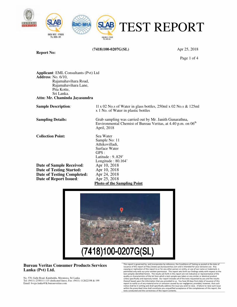
TEST REPORT
Report No: (7418)100-0207G(SL) Apr 25, 2018
Page 1 of 4
Bureau Veritas Consumer Products Services Lanka (Pvt) Ltd. No. 570, Galle Road, Katubedda, Moratuwa, Sri Lanka Tel: (9411) 2350111-115 (dedicated lines), Fax: (9411) 112622198 & 199 Email: [email protected]
This report is governed by, and incorporates by reference, the Conditions of Testing as posted at the date of issuance of this report at http://www.cps.bureauveritas.com and is intended for your exclusive use. Any copying or replication of this report to or for any other person or entity, or use of our name or trademark, is permitted only with our prior written permission. This report sets forth our findings solely with respect to the test samples identified herein. The results set forth in this report are not indicative or representative of the quality or characteristics of the lot from which a test sample was taken or any similar or identical product unless specifically and expressly noted. Our report includes all of the tests requested by you and the results thereof based upon the information that you provided to us. You have 60 days from date of issuance of this report to notify us of any material error or omission caused by our negligence; provided, however, that such notice shall be in writing and shall specifically address the issue you wish to raise. A failure to raise such issue within the prescribed time shall constitute you unqualified acceptance of the completeness of this report, the tests conducted and the correctness of the report contents.
Applicant: EML Consultants (Pvt) Ltd Address: No. 6/10, Rajamahavihara Road, Rajamahavihara Lane, Pita Kotte, Sri Lanka. Attn: Mr. Chaminda Jayasundra Sample Description:
1l x 02 No.s of Water in glass bottles, 250ml x 02 No.s & 125ml x 1 No. of Water in plastic bottles
Sampling Details: Collection Point:
Grab sampling was carried out by Mr. Janith Gunarathna, Environmental Chemist of Bureau Veritas, at 4.40 p.m. on 06th April, 2018 Sea Water Sample No: 11 Athikovilladi, Surface Water GPS : Latitude : 9..829’ Longitude : 80.164’
Date of Sample Received: Apr 10, 2018 Date of Testing Started: Apr 10, 2018 Date of Testing Completed: Apr 24, 2018 Date of Report Issued: Apr 25, 2018
Photo of the Sampling Point
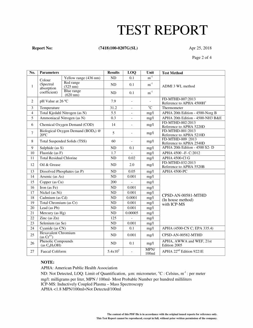
TEST REPORTReport No: (7418)100-0207G(SL) Apr 25, 2018
Page 2 of 4
The content of this PDF file is in accordance with the original issued reports for reference only.
This Test Report cannot be reproduced, except in full, without prior written permission of the company.
NOTE:
APHA: American Public Health Association
ND: Not Detected, LOQ: Limit of Quantification, µm: micrometer, oC : Celsius, m-1 : per meter
mg/l: milligrams per liter, MPN / 100ml- Most Probable Number per hundred milliliters
ICP-MS: Inductively Coupled Plasma – Mass Spectroscopy
APHA <1.8 MPN/100ml=Not Detected/100ml
No. Parameters Results LOQ Unit Test Method
1
Colour (Spectral absorption coefficient)
Yellow range (436 nm) ND 0.1 m-1
ADMI 3 WL method Red range (525 nm)
ND 0.1 m-1
Blue range (620 nm)
ND 0.1 m-1
2 pH Value at 26 ºC 7.9 - - FD-MTHD-007:2013 Reference to APHA 4500H
+
3 Temperature 31.2 - oC Thermometer
4 Total Kjedahl Nitrogen (as N) 5.5 - mg/l APHA 20th Edition - 4500-Norg B
5 Ammoniacal Nitrogen (as N) 0.3 - mg/l APHA 20th Edition - 4500-NH3 B&E
6 Chemical Oxygen Demand (COD) 14 - mg/l FD-MTHD-002:2013 Reference to APHA 5220D
7 Biological Oxygen Demand (BOD5) @ 20ºC
5 - mg/l FD-MTHD-001:2013 Reference to APHA 5210D
8 Total Suspended Solids (TSS) 60 - mg/l FD-MTHD-009 :2013 Reference to APHA 2540D
9 Sulphide (as S) ND 0.1 mg/l APHA 20th Edition - 4500 S2- D
10 Fluoride (as F) 1.7 - mg/l APHA 4500 –F- C:2012
11 Total Residual Chlorine ND 0.02 mg/l APHA 4500-Cl G
12 Oil & Grease ND 2.0 mg/l FD-MTHD-032:2013 Reference to APHA 5520B
13 Dissolved Phosphates (as P) ND 0.05 mg/l APHA 4500-PC
14 Arsenic (as As) ND 0.001 mg/l
CPSD-AN-00581-MTHD (In house method) with ICP-MS
15 Copper (as Cu) 200 - mg/l
16 Iron (as Fe) ND 0.001 mg/l
17 Nickel (as Ni) ND 0.001 mg/l
18 Cadmium (as Cd) ND 0.0001 mg/l
19 Total Chromium (as Cr) ND 0.001 mg/l
20 Lead (as Pb) ND 0.001 mg/l
21 Mercury (as Hg) ND 0.00005 mg/l
22 Zinc (as Zn) 125 - mg/l
23 Selenium (as Se) ND 0.001 mg/l
24 Cyanide (as CN) ND 0.1 mg/l APHA (4500-CN C; EPA 335.4)
25 Hexavalent Chromium (as Cr
6+)
ND 0.001 mg/l CPSD-AN-00582-MTHD
26 Phenolic Compounds (as C6H5OH)
ND 0.1 mg/l APHA, AWWA and WEF, 21st Edition 2005
27 Faecal Coliform 5.4x10² - MPN/ 100ml
APHA 22nd Edition 9221E
TEST REPORT
Report No: (7418)100-0207G(SL) Apr 25, 2018
Page 3 of 4
The content of this PDF file is in accordance with the original issued reports for reference only.
This Test Report cannot be reproduced, except in full, without prior written permission of the company.
Contact information for this report (Technical and General Inquiries and Feedback)
GENERAL INQUIRIES:
SHYAMICA WICKRAMASINGHE TEL: +94 112 350 158 E-MAIL: [email protected]
TECHNICAL INQUIRIES:
INDRAJITH HATHURUSINGHA TEL: + 94 769 603 814 E-MAIL: [email protected]
FEED BACK:
DHANUKA PERERA –EXECUTIVE QHSE
TEL: +94 112 350 111 E-MAIL: E-MAIL: [email protected]
REVIEWED BY: MAHIJITH PERERA
BUREAU VERITAS CONSUMER PRODUCTS SERVICES LANKA (PVT) LTD.
AUTHORIZED SIGNATORY
APPROVED BY: RUWINI AMARASINGHE APPROVED BY: INDRAJITH HATHURUSINGHA
MICROBIOLOGIST
MANAGER-
FOOD LABORATORY
TEST REPORTReport No: (7418)100-0207G(SL) Apr 25, 2018
Page 4 of 4
The content of this PDF file is in accordance with the original issued reports for reference only.
This Test Report cannot be reproduced, except in full, without prior written permission of the company.
END OF THE REPORT.
Annex 06-
Bathymetric Map
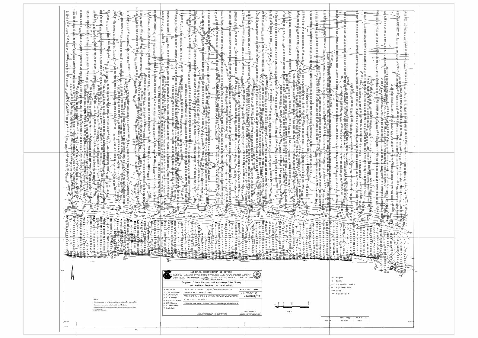
Annex 07-
Terrestrial Ecology
Report
TERRESTRIAL, ECOLOGICAL AND BIOLOGICAL
ASSESSMENT OF THE ANCHORAGE SITE IN
ATHIKOVILADY
i | P a g e
Acronyms
ADB – Asian Development Bank
IUCN - International Union for Conservation of Nature
NPSFDP - Northern Provincial Sustainable Fisheries Development Project
NBSAP- National Biodiversity Strategic Action Plan
PAI- Project area of influence.
PA – Project Area
ii | P a g e
List of Tables
Table 1. Summary of the Floral Species Recorded during the Study in both Project
Area and Project Area of Influence
7
Table 2. Details of Floral Species Recorded in both Project Area and Project Area
of Influence
8
Table 3. Summary of the Faunal Species Recorded During the Study in both
Project Area and Project Area of Influence
9
Table 4. Details of Faunal Species Recorded in in both Project Area and Project
Area of Influence
10
Table 5. Typical potential waste streams identified in anchorage sites that can
affect the terrestrial habitat and biodiversity in surrounding areas
13
iii | P a g e
List of Figures
Fig. 1. A map indicating the locations of proposed Fishery harbors, Anchorages
and Landing sites in the Northern Province
3
Fig. 2. Google map indicating the major habitats observed in the project area and
project area of influence.
4
Fig. 3. Highly disturbed sand stone corals and sandy beach 6
Fig. 4. Proposed infrastructure facility to be developed in Athikovilady anchorage
site
11
iv | P a g e
Table of Contents
1.0. Executive Summary .................................................................................................................. 1
2. 0. Introduction ............................................................................................................................ 2
2.1. Methodology ........................................................................................................................ 3
3.0. Detailed findings for project area and project area of influence ............................................ 5
3.1. Project area and the major habitat types observed ............................................................ 5
3.2. Project area of influence and the major habitat types observed ........................................ 5
3.4. Fauna .................................................................................................................................... 9
4.0. Impacts due to project activities during construction and operational stage ...................... 11
4.1. Construction period. .......................................................................................................... 11
4.2. Operational period ............................................................................................................. 12
5.0. Mitigation measures .............................................................................................................. 14
6.0. Summary ................................................................................................................................ 15
7.0. Bibliography ........................................................................................................................... 16
8.0. Appendices ............................................................................................................................. 18
Annex 1. The list of government officers and personnel were interviewed during the study . 18
1 | P a g e
1.0 . Executive Summary
Development of an anchorage site at Athikoviladi is one of the activities identified by the
Northern Provincial Sustainable Fisheries Development Project (NPSFDP) to revive the fisheries
sector. Proposed improvements include a dredging of an area up to 0.5m to 1.2m depth. There
are three entrance channels designed and the depth of those channels are between 1.5 to 2.0
m. Three break water segments are extending to distances of 75m, 100m and 135 m.
Demolition of two buildings is also planned.
Other developments are to be carried out in a narrow strip of the beach area. Although
detailed designs are not available the facilities proposed to develop are auction hall (15x 6m),
net mending hall and community hall (Two old buildings to be demolished and a new two-story
building to be constructed), Administrative office for CFHC and office for fisheries inspector
(15x 8m), public toilets and showers (6x5m), and water tank and pumps. Noise and dust
pollution is expected during construction. The land area available for development is only 64
perches
The beach area does not include any significant vegetation or fauna. The sand stone coral
substrate does not have any established fauna and flora. The mainly available plant species are
in this area includes Cocos nucifera (Pol).
Sand stone reefs and sandy beach habitat was predominated by Cocos nucifera. Since the
project area of influence is dominated by homesteads the vegetation recorded are mainly
confined to home gardens. A total number of 03 faunal species including a bird and 02
butterflies.
Total number of 13 coconut trees (Girth size range 90-135) to be interfere with the design and
construction phase. These trees in the PA can be considered to integrate as landscape feature
in planning of infrastructure.
Establishment of Green belts and green areas where possible and planting of suitable tree
species within the project area will contribute towards improving the terrestrial biodiversity.
Cocos nucifera (Coconut), Borassus flabellifer (Palmyra) and Thespesia populnea (Suriya) are the
tree species most acceptable to the community for replanting/green belt development.
Adhering to green building concepts during planning and construction and addressing the
pollution issues from main waste streams during the harbor operation are recommended to
reduce adverse impacts on terrestrial ecosystems.
Designing and implementing a detailed Environmental Management Plan (EMP) will help to
minimize and control adverse impacts. Monitoring of terrestrial biodiversity together with air
quality and noise levels and implementation of waste management plan will contribute towards
2 | P a g e
improving terrestrial biodiversity of the area. Awareness programs for all stakeholders on
environmental protection, biodiversity and nature conservation is also suggested. These
strategies will promote sustainable development goals and the targets of the current National
Biodiversity Strategic Action Plan (NBSAP) of Sri Lanka while improving the terrestrial habitats.
2. 0. Introduction
The Northern Provincial Sustainable Fisheries Development Project (NPSFDP) has identified
Athikovilay anchorage site in Jaffna fisheries District (Fig.1) to be upgraded. Biogeographically,
the proposed project area lies in the Low Country Dry Zone. Floristically it lies in the Coastal and
Marine Belt Floristic Zone. The soil and water resource of the area are both related to the lime
stone geology of the land. The soils are formed on the marine deposits and sediments under
the influence of sea waves and winds on lime stones. Alkaline saline soil and Regasol are the
dominant soil types in the area. However, the proposed project area is highly man modified.
The present investigation concentrates on the terrestrial environment and associated
biodiversity of the project area(PA) and the Project Area of Influence (PAI).
Climate
The climate of the region is mainly governed by the monsoonal system. Annual precipitation
ranges from 696 mm to 1125 mm and more than 90 % of this annual rainfall occurs due to the
north-east monsoon that takes place between October and January. The temperature ranges
from 26°C to 33°C.
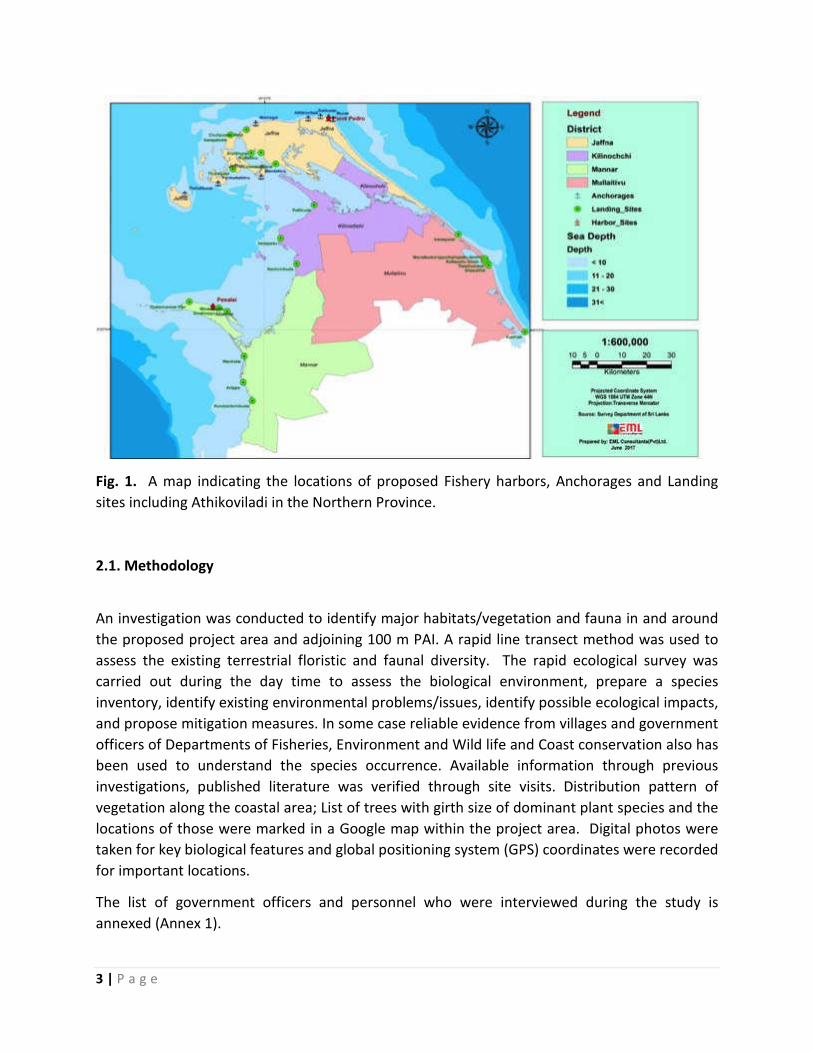
3 | P a g e
Fig. 1. A map indicating the locations of proposed Fishery harbors, Anchorages and Landing
sites including Athikoviladi in the Northern Province.
2.1. Methodology
An investigation was conducted to identify major habitats/vegetation and fauna in and around
the proposed project area and adjoining 100 m PAI. A rapid line transect method was used to
assess the existing terrestrial floristic and faunal diversity. The rapid ecological survey was
carried out during the day time to assess the biological environment, prepare a species
inventory, identify existing environmental problems/issues, identify possible ecological impacts,
and propose mitigation measures. In some case reliable evidence from villages and government
officers of Departments of Fisheries, Environment and Wild life and Coast conservation also has
been used to understand the species occurrence. Available information through previous
investigations, published literature was verified through site visits. Distribution pattern of
vegetation along the coastal area; List of trees with girth size of dominant plant species and the
locations of those were marked in a Google map within the project area. Digital photos were
taken for key biological features and global positioning system (GPS) coordinates were recorded
for important locations.
The list of government officers and personnel who were interviewed during the study is
annexed (Annex 1).
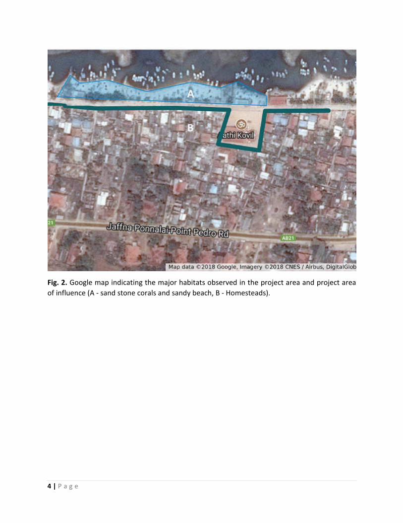
4 | P a g e
Fig. 2. Google map indicating the major habitats observed in the project area and project area
of influence (A - sand stone corals and sandy beach, B - Homesteads).
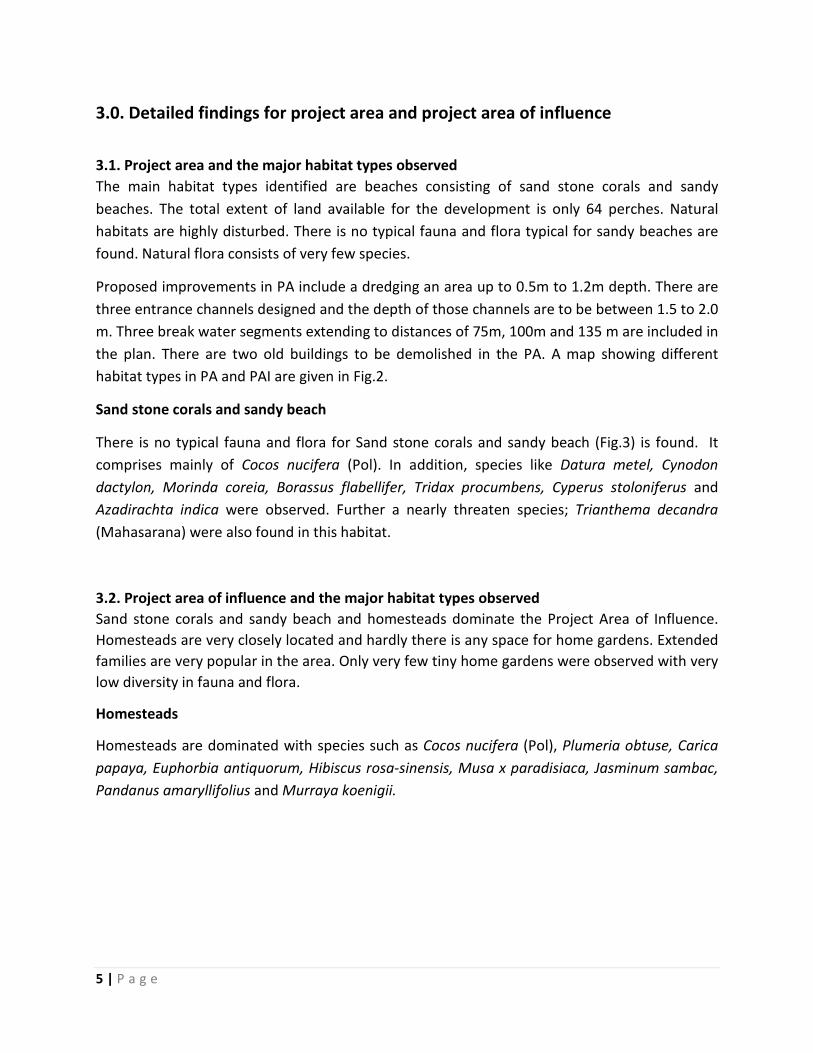
5 | P a g e
3.0. Detailed findings for project area and project area of influence
3.1. Project area and the major habitat types observed
The main habitat types identified are beaches consisting of sand stone corals and sandy
beaches. The total extent of land available for the development is only 64 perches. Natural
habitats are highly disturbed. There is no typical fauna and flora typical for sandy beaches are
found. Natural flora consists of very few species.
Proposed improvements in PA include a dredging an area up to 0.5m to 1.2m depth. There are
three entrance channels designed and the depth of those channels are to be between 1.5 to 2.0
m. Three break water segments extending to distances of 75m, 100m and 135 m are included in
the plan. There are two old buildings to be demolished in the PA. A map showing different
habitat types in PA and PAI are given in Fig.2.
Sand stone corals and sandy beach
There is no typical fauna and flora for Sand stone corals and sandy beach (Fig.3) is found. It
comprises mainly of Cocos nucifera (Pol). In addition, species like Datura metel, Cynodon
dactylon, Morinda coreia, Borassus flabellifer, Tridax procumbens, Cyperus stoloniferus and
Azadirachta indica were observed. Further a nearly threaten species; Trianthema decandra
(Mahasarana) were also found in this habitat.
3.2. Project area of influence and the major habitat types observed
Sand stone corals and sandy beach and homesteads dominate the Project Area of Influence.
Homesteads are very closely located and hardly there is any space for home gardens. Extended
families are very popular in the area. Only very few tiny home gardens were observed with very
low diversity in fauna and flora.
Homesteads
Homesteads are dominated with species such as Cocos nucifera (Pol), Plumeria obtuse, Carica
papaya, Euphorbia antiquorum, Hibiscus rosa-sinensis, Musa x paradisiaca, Jasminum sambac,
Pandanus amaryllifolius and Murraya koenigii.
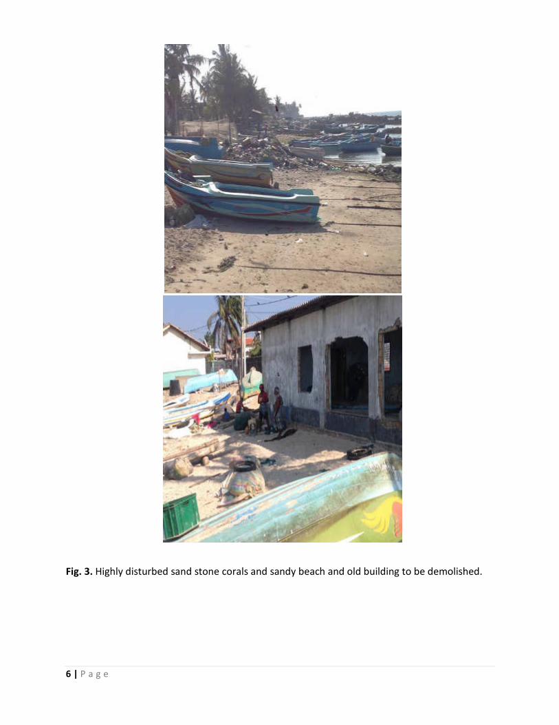
6 | P a g e
Fig. 3. Highly disturbed sand stone corals and sandy beach and old building to be demolished.
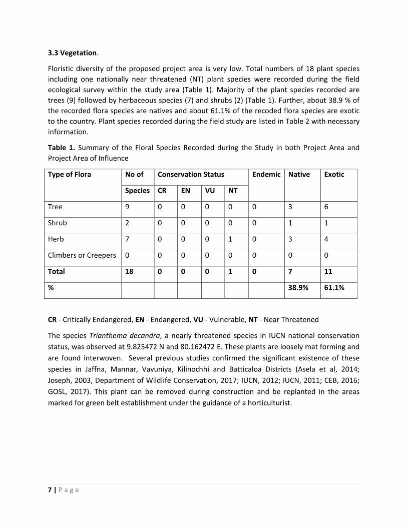
7 | P a g e
3.3 Vegetation.
Floristic diversity of the proposed project area is very low. Total numbers of 18 plant species
including one nationally near threatened (NT) plant species were recorded during the field
ecological survey within the study area (Table 1). Majority of the plant species recorded are
trees (9) followed by herbaceous species (7) and shrubs (2) (Table 1). Further, about 38.9 % of
the recorded flora species are natives and about 61.1% of the recoded flora species are exotic
to the country. Plant species recorded during the field study are listed in Table 2 with necessary
information.
Table 1. Summary of the Floral Species Recorded during the Study in both Project Area and
Project Area of Influence
Type of Flora No of Conservation Status Endemic Native Exotic
Species CR EN VU NT
Tree 9 0 0 0 0 0 3 6
Shrub 2 0 0 0 0 0 1 1
Herb 7 0 0 0 1 0 3 4
Climbers or Creepers 0 0 0 0 0 0 0 0
Total 18 0 0 0 1 0 7 11
% 38.9% 61.1%
CR - Critically Endangered, EN - Endangered, VU - Vulnerable, NT - Near Threatened
The species Trianthema decandra, a nearly threatened species in IUCN national conservation
status, was observed at 9.825472 N and 80.162472 E. These plants are loosely mat forming and
are found interwoven. Several previous studies confirmed the significant existence of these
species in Jaffna, Mannar, Vavuniya, Kilinochhi and Batticaloa Districts (Asela et al, 2014;
Joseph, 2003, Department of Wildlife Conservation, 2017; IUCN, 2012; IUCN, 2011; CEB, 2016;
GOSL, 2017). This plant can be removed during construction and be replanted in the areas
marked for green belt establishment under the guidance of a horticulturist.
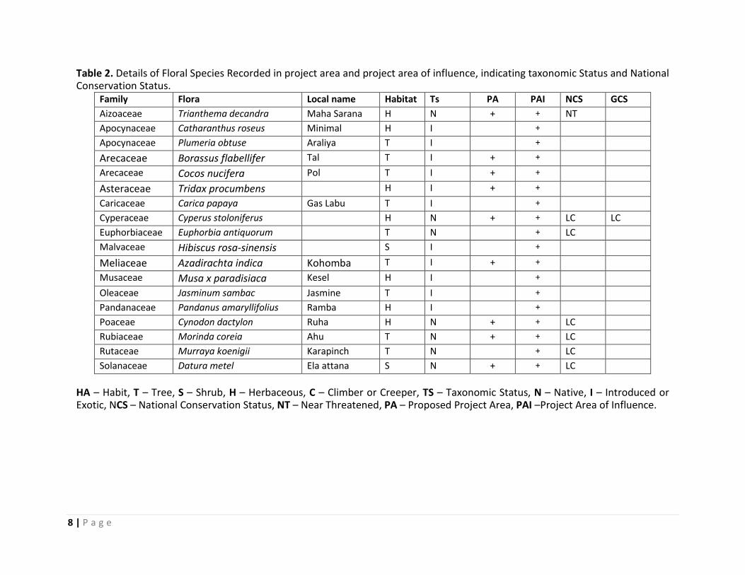
8 | P a g e
Table 2. Details of Floral Species Recorded in project area and project area of influence, indicating taxonomic Status and National Conservation Status.
Family Flora Local name Habitat Ts PA PAI NCS GCS
Aizoaceae Trianthema decandra Maha Sarana H N + + NT
Apocynaceae Catharanthus roseus Minimal H I +
Apocynaceae Plumeria obtuse Araliya T I +
Arecaceae Borassus flabellifer Tal T I + +
Arecaceae Cocos nucifera Pol T I + +
Asteraceae Tridax procumbens H I + +
Caricaceae Carica papaya Gas Labu T I +
Cyperaceae Cyperus stoloniferus H N + + LC LC
Euphorbiaceae Euphorbia antiquorum T N + LC
Malvaceae Hibiscus rosa-sinensis S I +
Meliaceae Azadirachta indica Kohomba T I + +
Musaceae Musa x paradisiaca Kesel H I +
Oleaceae Jasminum sambac Jasmine T I +
Pandanaceae Pandanus amaryllifolius Ramba H I +
Poaceae Cynodon dactylon Ruha H N + + LC
Rubiaceae Morinda coreia Ahu T N + + LC
Rutaceae Murraya koenigii Karapinch T N + LC
Solanaceae Datura metel Ela attana S N + + LC
HA – Habit, T – Tree, S – Shrub, H – Herbaceous, C – Climber or Creeper, TS – Taxonomic Status, N – Native, I – Introduced or Exotic, NCS – National Conservation Status, NT – Near Threatened, PA – Proposed Project Area, PAI –Project Area of Influence.
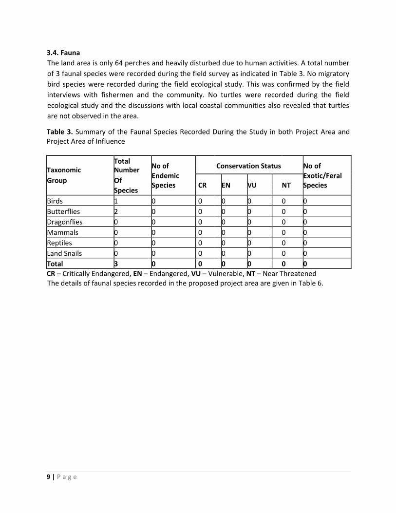
9 | P a g e
3.4. Fauna
The land area is only 64 perches and heavily disturbed due to human activities. A total number
of 3 faunal species were recorded during the field survey as indicated in Table 3. No migratory
bird species were recorded during the field ecological study. This was confirmed by the field
interviews with fishermen and the community. No turtles were recorded during the field
ecological study and the discussions with local coastal communities also revealed that turtles
are not observed in the area.
Table 3. Summary of the Faunal Species Recorded During the Study in both Project Area and
Project Area of Influence
Total No of Conservation Status
No of
Taxonomic Number Endemic Exotic/Feral
Group Of CR EN VU NT Species
Species
Species
Birds 1 0 0 0 0 0 0
Butterflies 2 0 0 0 0 0 0
Dragonflies 0 0 0 0 0 0 0
Mammals 0 0 0 0 0 0 0
Reptiles 0 0 0 0 0 0 0
Land Snails 0 0 0 0 0 0 0
Total 3 0 0 0 0 0 0
CR – Critically Endangered, EN – Endangered, VU – Vulnerable, NT – Near Threatened
The details of faunal species recorded in the proposed project area are given in Table 6.
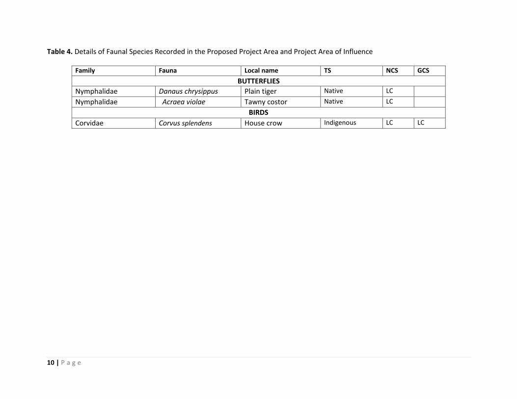
10 | P a g e
Table 4. Details of Faunal Species Recorded in the Proposed Project Area and Project Area of Influence
Family Fauna Local name TS NCS GCS
BUTTERFLIES
Nymphalidae Danaus chrysippus Plain tiger Native LC
Nymphalidae Acraea violae
Tawny costor Native LC
BIRDS
Corvidae Corvus splendens House crow Indigenous LC LC
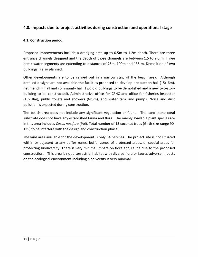
11 | P a g e
4.0. Impacts due to project activities during construction and operational stage
4.1. Construction period.
Proposed improvements include a dredging area up to 0.5m to 1.2m depth. There are three
entrance channels designed and the depth of those channels are between 1.5 to 2.0 m. Three
break water segments are extending to distances of 75m, 100m and 135 m. Demolition of two
buildings is also planned.
Other developments are to be carried out in a narrow strip of the beach area. Although
detailed designs are not available the facilities proposed to develop are auction hall (15x 6m),
net mending hall and community hall (Two old buildings to be demolished and a new two-story
building to be constructed), Administrative office for CFHC and office for fisheries inspector
(15x 8m), public toilets and showers (6x5m), and water tank and pumps. Noise and dust
pollution is expected during construction.
The beach area does not include any significant vegetation or fauna. The sand stone coral
substrate does not have any established fauna and flora. The mainly available plant species are
in this area includes Cocos nucifera (Pol). Total number of 13 coconut trees (Girth size range 90-
135) to be interfere with the design and construction phase.
The land area available for the development is only 64 perches. The project site is not situated
within or adjacent to any buffer zones, buffer zones of protected areas, or special areas for
protecting biodiversity. There is very minimal impact on flora and Fauna due to the proposed
construction. This area is not a terrestrial habitat with diverse flora or fauna, adverse impacts
on the ecological environment including biodiversity is very minimal.
12 | P a g e
Fig. 4. Proposed infrastructure facility to be developed in Athikovilady anchorage site.
4.2. Operational period
The anchorage sites are considered as an interface between the harvesting of fish and its
distribution and consumption. Fishery anchorages can be focal points of pollution of the
surrounding terrestrial habitats and can affect the flora and fauna of the project area and the
influencing area during operational period.
Within the fish anchorage site there are many activities that can take place related to waste
generation as indicated in Table 6. These wastes can cause several adverse impacts on the
terrestrial coastal environment and biodiversity in and around anchorages, related to waste
generation. Disposal of waste that is generated during operation, in the anchorage site or in
the influencing area can affect the terrestrial environment and biodiversity.
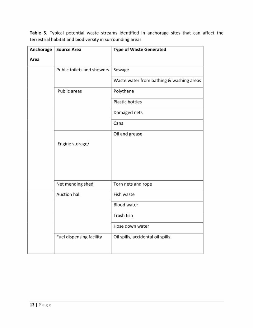
13 | P a g e
Table 5. Typical potential waste streams identified in anchorage sites that can affect the
terrestrial habitat and biodiversity in surrounding areas
Anchorage
Area
Source Area Type of Waste Generated
Public toilets and showers Sewage
Waste water from bathing & washing areas
Public areas Polythene
Plastic bottles
Damaged nets
Cans
Engine storage/
Oil and grease
Net mending shed Torn nets and rope
Auction hall Fish waste
Blood water
Trash fish
Hose down water
Fuel dispensing facility Oil spills, accidental oil spills.
14 | P a g e
5.0. Mitigation measures
Solid waste pollution is an increasing threat to the biodiversity. It is recommended that solid
waste management programme is established for the anchorage site. The programme should
focus on minimizing waste generation, effective collection (separated into reusable, on
degradable, and biodegradable) and utilization of fish waste to produce fish silage. Even at
present the landing site is heavily polluted with solid wastes.
Dredging material has to be disposed carefully not to affect the environment.
Although the available are is very limited (64 perches), developing Green areas wherever
possible, should be encouraged in and around the anchorage site to minimize air pollution
within the harbor. The proposed greenbelt development/plantation in the area will function
primarily as a landscape feature. In addition, it acts as a pollution sink/noise barrier, reduces
soil erosion and makes the ecosystem more diversified and functionally more stable and
healthy. Thespesia populnea (Suriya) is widely accepted as a shading plant in the area.
Awareness programs for all stakeholders on environmental protection, biodiversity and nature
conservation are also suggested
Environmental Management Plan (EMP) should include monitoring plan for solid waste
pollution and the available limited biodiversity.
15 | P a g e
6.0. Summary
Upgrading of the facility in the anchorage site in Athikoviladi is one of the activities identified by
the Northern Provincial Sustainable Fisheries Development Project (NPSFDP) to revive the
fisheries sector.
Proposed improvements include a dredging area up to 0.5m to 1.2m depth. There are three
entrance channels designed and the depth of those channels are between 1.5 to 2.0 m. Three
break water segments are extending to distances of 75m, 100m and 135 m. Demolition of two
buildings is also planned.
Floristic and Faunal diversity of the proposed project area is very low. Total numbers of 18 plant
species including one nationally near threatened (NT) plant species were recorded during the
field ecological survey within the study area. A total number of 5 faunal species including 01 a
bird and 2 butterflies.
The adverse impacts on terrestrial biodiversity will be very minimal in anchorage area
development.
Cocos nucifera trees located in the PA can be considered to integrate as landscape feature in
planning of infrastructure. Green Buffer Zones should be established. Open spaces within the
harbor should be converted to green areas in the form of lawns and shading areas to enhance
the terrestrial biodiversity.
Incorporating monitoring of terrestrial biodiversity in designing and implementing the
environmental Management Plan (EMP) will help to control and minimize the adverse impacts
on terrestrial biodiversity of the anchorage site and will contribute towards the sustainable
development goals and the targets of the National Biodiversity Strategic Action Plan of Sri
Lanka.
16 | P a g e
7.0. Bibliography
ADB (2009): Safeguard Policy Statement, 92pp
(https://www.adb.org/documents/safeguard-olicystatement?ref=site/safeguards/main)
ADB (2011): Conflict-Affected Region Emergency Project Sri Lanka - Conflict Affected
Region Emergency (CARE) Project Initial Environmental Examination Report (IEER) for
the Rehabilitation of Damaged Urban Council Roads in Northern Province , Sri Lanka.
ADB (2012): Environment Safeguards: A Good Practice Sourcebook (Draft Working
Document), 76pp (https://www.adb.org/documents/environment-safeguards-good-
practice-sourcebook)
Asela, M. D. C., Peiris, T. N., Kasige, A., & Weerakoon, D. K. (2014). Butterfly Diversity in
the Jaffna Peninsula and the Surrounding Islets, Journal of the Department of Wildlife
Conservation, 2014-2: 65–76.
(http://journals.dwc.gov.lk/index.php/wildlanka/article/view/27/14)
Ashton M.S., Gunatilleke, S., de Zoysa, N., Dassanayake, M.D., Gunatilleke, N. and
Wijesundera, S. (1997): A field guide to the common Trees and Shrubs of Sri Lanka. WHT
Publications (http://www.wht.lk/ebooks/singlegallery/15475786)
Ashton, P.S. and Gunatilleke, C.V.S. (1987): New Light on the Plant Geography of Ceylon.
I. Historical Plant Geography. J Biogeog, 14 (3), 249-285
(http://sirismm.si.edu/ctfs/Ashton_Gunatilleke_1987_JoBiogeog.pdf).
BOBLME. (2011). Biodiversity and Socio-economic Information of Selected Areas of Sri
Lankan Side of the Gulf of Mannar. BOBLME-2011-Socioec-03
CEB. (2015). EIA for Trincomalee Thermal Power Project (2x250 MW) Trincomalee, Sri
Lanka
CEB. (2016). IEE for Proposed 220 kV Transmission line from Polpitiya to Hambantota
Draft Initial Environmental Examination, Sri Lanka
CEB. (2017). Terrestrial Ecology Survey Report, EIA Wind Power Generation Project, Sri
Lanka
Central Environmental Agency & Disaster Management Centre of Sri Lanka Supported by
UNDP & UNEP, 2014. Integrated Strategic Environmental Assessment of the Northern
Province of Sri Lanka
Ceylon Electricity Board, (2016). Initial Environmental Examination report on Proposed
220kV Transmission Line Project from Nadukuda to Mannar
(http://www.ceb.lk/index.php?aam_media=10220).
Dassanayake, M.D. (and others), Editors (1980-2005): A Revised Handbook to the Flora
of Ceylon, Volumes 1-15. (Revisions of the original series by Trimen and Hooker, first
published in 1893-1900)
de Silva, A. (2006): Marine Turtles of Sri Lanka: A Historical Account. In: Marine Turtles
of the Indian Subcontinent (Eds: Shanker K and Choudhury BC), Universities Press, India,
324-353
Dela, J.D. S. (2009): Fourth Country Report from Sri Lanka to the United Nations
Convention on Biological Diversity. Government of Sri Lanka
(https://www.cbd.int/doc/world/lk/lk-nr-04-en.pdf)
17 | P a g e
Department of Wildlife Conservation, (2017). Wilpattu Protected Area Complex,
Strategic Management Framework 2017-2021
(https://info.undp.org/docs/pdc/Documents/LKA/Wilpattu%20Stragegic%20Manageme
nt%20Framework%2018%2001%202017.pdf).
Ekanayake, L. (2016). Environmental status and issues of Puttalam Lagoon – A case
study in six coastal villages. Sri Lanka Turtle Conservation Project.
GOSL. (2017). Sri Lanka: Jaffna And Kilinochchi Water Supply Project, Additional
Financing - Seawater Desalination Plant and Potable Water Conveyance System, (July).
(https://www.adb.org/sites/default/files/project-documents/37378/37378-014-eia-
en.pdf)
Government of Sri Lanka: National Environmental Act No 47 (1980) and amendments;
and Environmental Impact Assessment Regulations (1993).
Gunatilleke, I.A.U.N. and Gunatilleke, C.V.S (1990): Distribution of Floristic Richness and
its Conservation in Sri Lanka. Conservation Biology, 4 (1) 21-32
(http://onlinelibrary.wiley.com/doi/10.1111/j.1523-1739.1990.tb00262.x/abstract)
Hewavisenthi, S. (1990): Exploitation of Marine Turtles in Sri Lanka: Historic Background
and the Present Status. Marine Turtle Newsletter, 48, 14-19
(http://www.seaturtle.org/mtn/archives/mtn48/mtn48p14.shtml)
IUCN (2011). An Appraisal of Mangrove Management in Micro-tidal Estuaries and
Lagoons in Sri Lanka. IUCN Sri Lanka Country Office, Colombo. viii + 116pp
(https://portals.iucn.org/library/sites/library/files/documents/2011-112.pdf).
IUCN (2012). An Environmental and Fisheries Profile of the Puttalam Lagoon System.
Regional Fisheries Livelihoods Programme for South and Southeast Asia
(GCP/RAS/237/SPA) Field Project Document 2011/LKA/CM/06. xvii+237 pp
(http://www.fao.org/3/a-ar443e.pdf).
IUCN (2016): The IUCN Red List of Threatened Species. International Union for
Conservation of Nature, Gland, Switzerland (http://www.iucnredlist.org/)
JICA. (2015). Environmental Checklist for Power Transmission and Distribution Lines /
Roads 400 kV Sampoor – New Habarana T / L Project.
Joseph, L. (2003). National report of Sri Lanka on the Formulation of a Transboundary
Diagnostic Analysis and Strategic Action Plan for the Bay of Bengal Large Marine
Ecosystem Programme
(http://www.boblme.org/documentRepository/Nat_Sri_Lanka.pdf).
Ministry of Irrigation and Water Resources Management. (2015). Environmental
Assessment for Rehabilitation of Padaviya Dam. Dam Safety and Water Resources
Planning Project. (DSWRPPAF/CS/QCBS/0305A)
MOE (2012): The National Red List 2012 of Sri Lanka; Conservation Status of the Fauna
and Flora. Ministry of Environment, Colombo, 476 pp
(http://www.cea.lk/web/images/pdf/redlist2012.pdf)
Ratnayeke, S., & Manen, F. T. V. (2006). Assessing sloth bears as surrogates for carnivore
conservation in Sri Lanka, 206–217.
Senaratne, L. K. (2001): A Checklist of the Flowering Plants of Sri Lanka. National Science
Foundation Sri Lanka
18 | P a g e
8.0. Appendices
Annex 1. The list of government officers and personnel were interviewed during the study
Name Position Contact Details
Mr. Suthakaran Assistant Director for
Fisheries, Jaffna District
+94779072967
Mr. Susanthan High Sea Unit Operating
Officer
+94774273983
Mr. Vijayakumar High Sea Unit Operating
Officer
+94772370272
Mr. Arulchandran Member, Athikoviladi Co-
operative Fisheries Society
+94771366062
Annex 08- Marine
Ecology Report
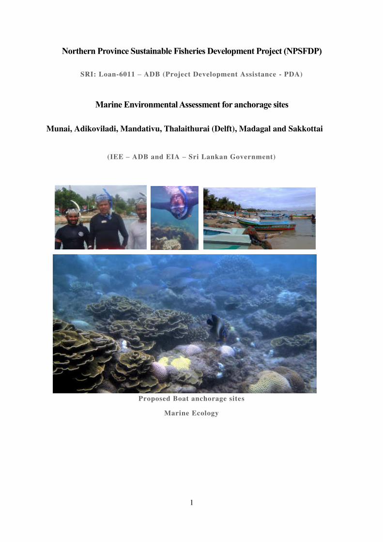
1
Northern Province Sustainable Fisheries Development Project (NPSFDP)
SRI: Loan-6011 – ADB (Project Development Assistance - PDA)
Marine Environmental Assessment for anchorage sites
Munai, Adikoviladi, Mandativu, Thalaithurai (Delft), Madagal and Sakkottai
(IEE – ADB and EIA – Sri Lankan Government)
Proposed Boat anchorage sites
Marine Ecology
2
Contents
The study area and sampling design ........................................................................... 4 1.1
2 Existing environment .......................................................................................................... 6
Description to the project site and area of influence ................................................... 6 2.1
General area usage ...................................................................................................... 7 2.2
Detail descriptions to sites......................................................................................... 10 2.3
2.3.1 AK1: ................................................................................................................... 10
2.3.2 AK2- .................................................................................................................. 13
2.3.3 AK3: ................................................................................................................... 15
2.3.4 AKR ................................................................................................................... 19
Noteworthy fauna and flora within project impact area. ........................................... 21 2.4
Overview of the fishing practices of the study area .................................................. 28 2.5
Summary of the key findings .................................... 2.6
List of tables
Table 2-1: Site descriptions ...................................................................................................... 4
Table 3-1: Summery of the descriptions of the Munai study sites
Table 3-2 : Coral species recorded during the survey ..............
Table 3-3: Types of fishing vessels ......................................................................................... 28
Table 3-4: Fishing gear and other infrastructure found in Munai ............................................ 29
List of figures
Figure 2-8: Map of the sampling sites, AK1 to AK3 and AKR. In each location, two sampling
sites were selected representing shallow waters (“S” , mid water (“M”) AK1 to AK3 and AKR are the land marks to identify the locations . .................................................................... 4
Figure 2-9: View of the project site from the main road. ........ .
Figure 3-1: Reefs running along the shallow coastal area ......................................................... 6
Figure 3-2: Existing channels cut open through the reefs for small craft navigation ................ 7
Figure 3-3 Munai is used by single day boat operations and for anchorage without any infra-
structure...................................................................................................................................... 8
Figure 3-4: Landward and seaward views of the site AK1-S. ................................................. 10
3
Figure 3-5: Nature of the benthic substrate in the three major habitats in the study area ....... 10
Figure 3-6: Habitat characteristics and noteworthy biota in site AK1-S along the transect. ... 11
Figure 3-7: Habitat characteristics and noteworthy biota in site AK1-M along the transect .. 12
Figure 3-8: Seaward view of the site AK2-S from the shore ................................................... 13
Figure 3-9: Habitat characteristics and noteworthy biota in site AK2-S along the transect .... 14
Figure 3-10: Habitat characteristics and noteworthy biota in site AK2-S along the transect .. 15
Figure 3-11: View of the location AK3 around the marker pole. ........................................... 16
Figure 3-12: Nature of the substrate of the site ........................................................................ 16
Figure 3-13: Habitat characteristics and noteworthy biota of the site AK3-S along the transect
.................................................................................................................................................. 17
Figure 3-14: Habitat characteristics of the site AK3-S along the transect ............................... 18
Figure 3-15: View of the site around the marker pole at AKR ............................................... 19
Figure 3-16: Habitat characteristics of the site AKR-S along the transect .............................. 20
Figure 3-17: Habitat characteristics of the site AKR-M along the transect ............................. 20
Figure 3-18: Rich coral growth in the right bank of the existing channel and dead coral in the
change left of the one used by fishers. .....................................
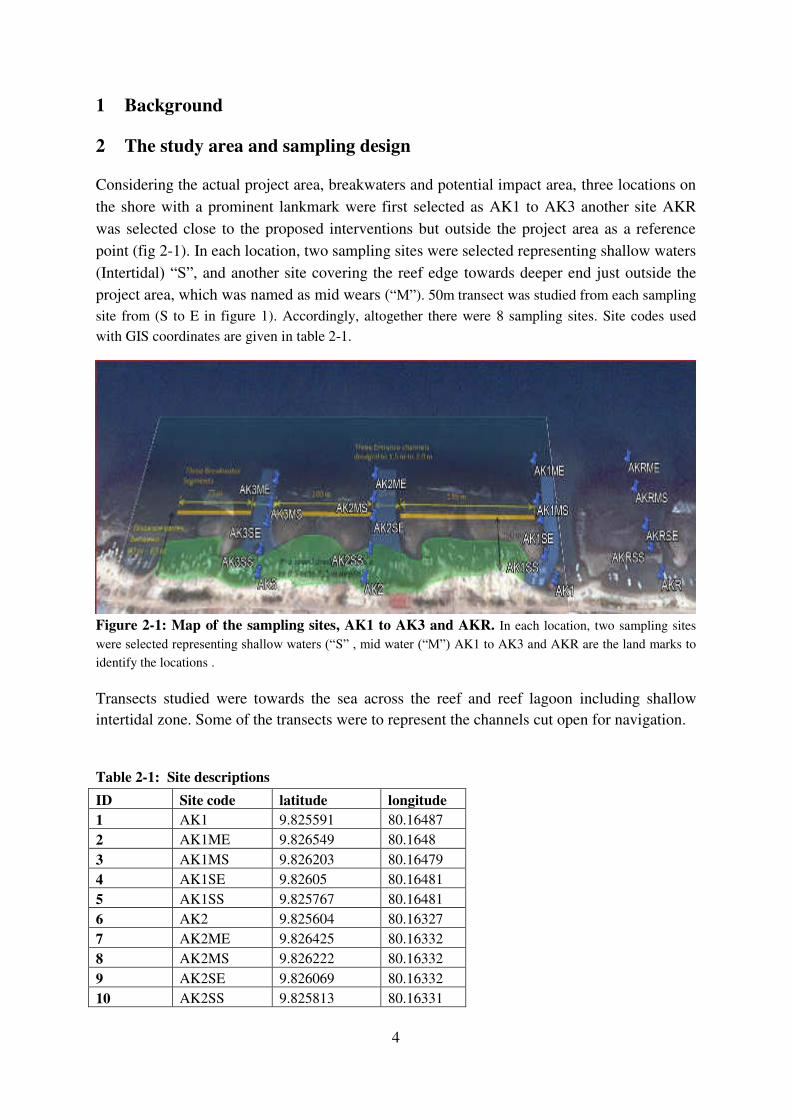
4
1 Background
2 The study area and sampling design
Considering the actual project area, breakwaters and potential impact area, three locations on
the shore with a prominent lankmark were first selected as AK1 to AK3 another site AKR
was selected close to the proposed interventions but outside the project area as a reference
point (fig 2-1). In each location, two sampling sites were selected representing shallow waters
(Intertidal) “S”, and another site covering the reef edge towards deeper end just outside the
project area, which was named as mid wears (“M”). 50m transect was studied from each sampling
site from (S to E in figure 1). Accordingly, altogether there were 8 sampling sites. Site codes used
with GIS coordinates are given in table 2-1.
Figure 2-1: Map of the sampling sites, AK1 to AK3 and AKR. In each location, two sampling sites
were selected representing shallow waters (“S” , mid water (“M”) AK1 to AK3 and AKR are the land marks to
identify the locations .
Transects studied were towards the sea across the reef and reef lagoon including shallow
intertidal zone. Some of the transects were to represent the channels cut open for navigation.
Table 2-1: Site descriptions
ID Site code latitude longitude
1 AK1 9.825591 80.16487
2 AK1ME 9.826549 80.1648
3 AK1MS 9.826203 80.16479
4 AK1SE 9.82605 80.16481
5 AK1SS 9.825767 80.16481
6 AK2 9.825604 80.16327
7 AK2ME 9.826425 80.16332
8 AK2MS 9.826222 80.16332
9 AK2SE 9.826069 80.16332
10 AK2SS 9.825813 80.16331

5
11 AK3 9.825638 80.16237
12 AK3ME 9.826376 80.16241
13 AK3MS 9.826174 80.16239
14 AK3SE 9.826023 80.16238
15 AK3SS 9.825805 80.16236
16 AKR 9.825632 80.16577
17 AKRME 9.826569 80.16568
18 AKRMS 9.826308 80.1657
19 AKRSE 9.825998 80.16572
20 AKRSS 9.825833 80.16573
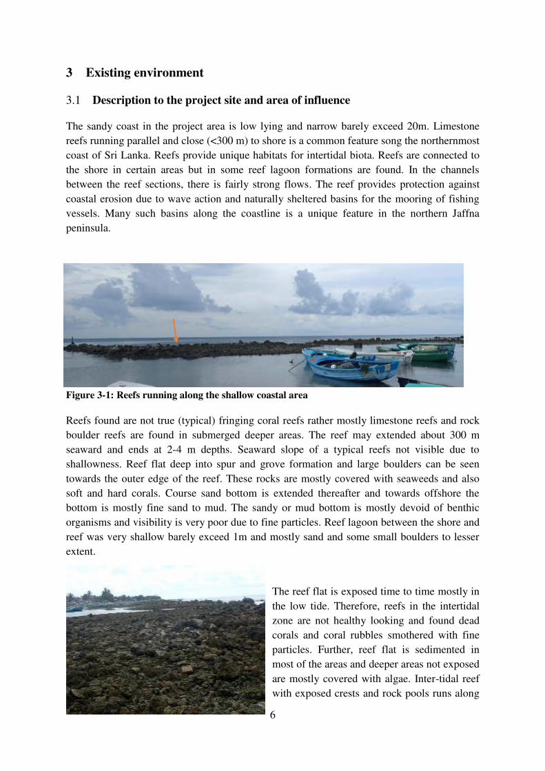
6
3 Existing environment
Description to the project site and area of influence 3.1
The sandy coast in the project area is low lying and narrow barely exceed 20m. Limestone
reefs running parallel and close (<300 m) to shore is a common feature song the northernmost
coast of Sri Lanka. Reefs provide unique habitats for intertidal biota. Reefs are connected to
the shore in certain areas but in some reef lagoon formations are found. In the channels
between the reef sections, there is fairly strong flows. The reef provides protection against
coastal erosion due to wave action and naturally sheltered basins for the mooring of fishing
vessels. Many such basins along the coastline is a unique feature in the northern Jaffna
peninsula.
Figure 3-1: Reefs running along the shallow coastal area
Reefs found are not true (typical) fringing coral reefs rather mostly limestone reefs and rock
boulder reefs are found in submerged deeper areas. The reef may extended about 300 m
seaward and ends at 2-4 m depths. Seaward slope of a typical reefs not visible due to
shallowness. Reef flat deep into spur and grove formation and large boulders can be seen
towards the outer edge of the reef. These rocks are mostly covered with seaweeds and also
soft and hard corals. Course sand bottom is extended thereafter and towards offshore the
bottom is mostly fine sand to mud. The sandy or mud bottom is mostly devoid of benthic
organisms and visibility is very poor due to fine particles. Reef lagoon between the shore and
reef was very shallow barely exceed 1m and mostly sand and some small boulders to lesser
extent.
The reef flat is exposed time to time mostly in
the low tide. Therefore, reefs in the intertidal
zone are not healthy looking and found dead
corals and coral rubbles smothered with fine
particles. Further, reef flat is sedimented in
most of the areas and deeper areas not exposed
are mostly covered with algae. Inter-tidal reef
with exposed crests and rock pools runs along
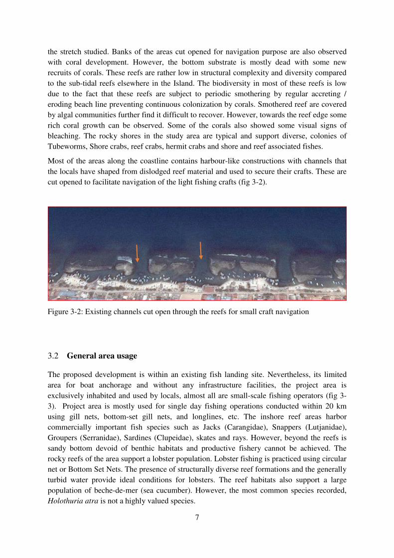
7
the stretch studied. Banks of the areas cut opened for navigation purpose are also observed
with coral development. However, the bottom substrate is mostly dead with some new
recruits of corals. These reefs are rather low in structural complexity and diversity compared
to the sub-tidal reefs elsewhere in the Island. The biodiversity in most of these reefs is low
due to the fact that these reefs are subject to periodic smothering by regular accreting /
eroding beach line preventing continuous colonization by corals. Smothered reef are covered
by algal communities further find it difficult to recover. However, towards the reef edge some
rich coral growth can be observed. Some of the corals also showed some visual signs of
bleaching. The rocky shores in the study area are typical and support diverse, colonies of
Tubeworms, Shore crabs, reef crabs, hermit crabs and shore and reef associated fishes.
Most of the areas along the coastline contains harbour-like constructions with channels that
the locals have shaped from dislodged reef material and used to secure their crafts. These are
cut opened to facilitate navigation of the light fishing crafts (fig 3-2).
Figure 3-2: Existing channels cut open through the reefs for small craft navigation
General area usage 3.2
The proposed development is within an existing fish landing site. Nevertheless, its limited
area for boat anchorage and without any infrastructure facilities, the project area is
exclusively inhabited and used by locals, almost all are small-scale fishing operators (fig 3-
3). Project area is mostly used for single day fishing operations conducted within 20 km
using gill nets, bottom-set gill nets, and longlines, etc. The inshore reef areas harbor
commercially important fish species such as Jacks (Carangidae), Snappers (Lutjanidae),
Groupers (Serranidae), Sardines (Clupeidae), skates and rays. However, beyond the reefs is
sandy bottom devoid of benthic habitats and productive fishery cannot be achieved. The
rocky reefs of the area support a lobster population. Lobster fishing is practiced using circular
net or Bottom Set Nets. The presence of structurally diverse reef formations and the generally
turbid water provide ideal conditions for lobsters. The reef habitats also support a large
population of beche-de-mer (sea cucumber). However, the most common species recorded,
Holothuria atra is not a highly valued species.
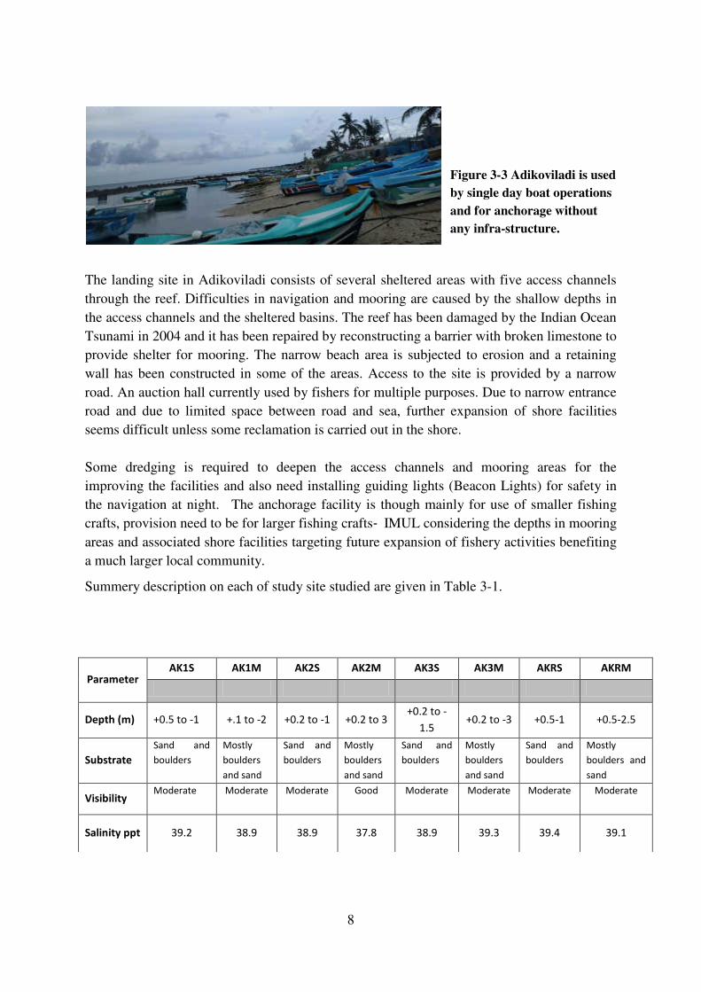
8
Figure 3-3 Adikoviladi is used
by single day boat operations
and for anchorage without
any infra-structure.
The landing site in Adikoviladi consists of several sheltered areas with five access channels
through the reef. Difficulties in navigation and mooring are caused by the shallow depths in
the access channels and the sheltered basins. The reef has been damaged by the Indian Ocean
Tsunami in 2004 and it has been repaired by reconstructing a barrier with broken limestone to
provide shelter for mooring. The narrow beach area is subjected to erosion and a retaining
wall has been constructed in some of the areas. Access to the site is provided by a narrow
road. An auction hall currently used by fishers for multiple purposes. Due to narrow entrance
road and due to limited space between road and sea, further expansion of shore facilities
seems difficult unless some reclamation is carried out in the shore.
Some dredging is required to deepen the access channels and mooring areas for the
improving the facilities and also need installing guiding lights (Beacon Lights) for safety in
the navigation at night. The anchorage facility is though mainly for use of smaller fishing
crafts, provision need to be for larger fishing crafts‐ IMUL considering the depths in mooring
areas and associated shore facilities targeting future expansion of fishery activities benefiting
a much larger local community.
Summery description on each of study site studied are given in Table 3-1.
Parameter AK1S AK1M AK2S AK2M AK3S AK3M AKRS AKRM
Depth (m) +0.5 to -1 +.1 to -2 +0.2 to -1 +0.2 to 3 +0.2 to -
1.5 +0.2 to -3 +0.5-1 +0.5-2.5
Substrate
Sand and
boulders
Mostly
boulders
and sand
Sand and
boulders
Mostly
boulders
and sand
Sand and
boulders
Mostly
boulders
and sand
Sand and
boulders
Mostly
boulders and
sand
Visibility Moderate Moderate Moderate Good Moderate Moderate Moderate Moderate
Salinity ppt 39.2 38.9 38.9 37.8 38.9 39.3 39.4 39.1

9
Table 3-1: Summery description on each of study site studied
Site names with „S” represent shallow, “M” represent mid (reef edge)
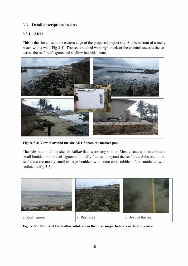
10
Detail descriptions to sites 3.3
3.3.1 AK1:
This is the site close to the eastern edge of the proposed project site. Site is in front of a rocky
beach with a wall (Fig 3-4). Transects studied were right bank of the channel towards the sea
across the reef, reef lagoon and shallow intertidal zone.
Figure 3-4: View of around the site AK1-S from the marker pole.
The substrate in all the sites in Adikoviladi were very similar. Mostly sand with intermittent
small boulders in the reef lagoon and totally fine sand beyond the reef area. Substrate in the
reef areas are mostly small to large boulders with some coral rubbles often smothered with
sediments (fig 3-5).
a. Reef lagoon c. Reef area b. Beyond the reef
Figure 3-5: Nature of the benthic substrate in the three major habitats in the study area
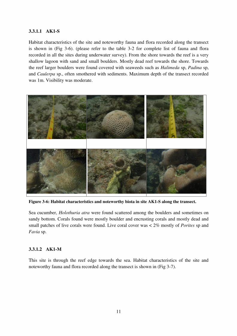
11
3.3.1.1 AK1-S
Habitat characteristics of the site and noteworthy fauna and flora recorded along the transect
is shown in (Fig 3-6). (please refer to the table 3-2 for complete list of fauna and flora
recorded in all the sites during underwater survey). From the shore towards the reef is a very
shallow lagoon with sand and small boulders. Mostly dead reef towards the shore. Towards
the reef larger boulders were found covered with seaweeds such as Halimeda sp, Padina sp,
and Caulerpa sp., often smothered with sediments. Maximum depth of the transect recorded
was 1m. Visibility was moderate.
Figure 3-6: Habitat characteristics and noteworthy biota in site AK1-S along the transect.
Sea cucumber, Holothuria atra were found scattered among the boulders and sometimes on
sandy bottom. Corals found were mostly boulder and encrusting corals and mostly dead and
small patches of live corals were found. Live coral cover was < 2% mostly of Porites sp and
Favia sp.
3.3.1.2 AK1-M
This site is through the reef edge towards the sea. Habitat characteristics of the site and
noteworthy fauna and flora recorded along the transect is shown in (Fig 3-7).
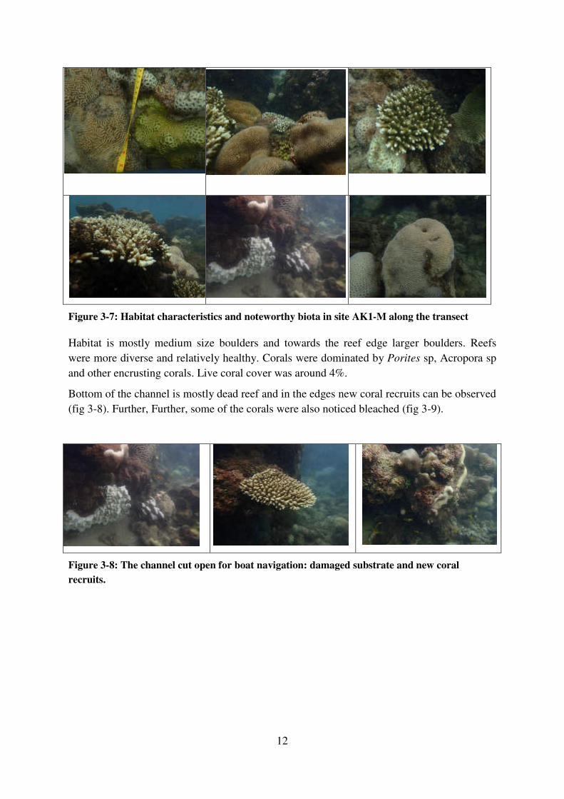
12
Figure 3-7: Habitat characteristics and noteworthy biota in site AK1-M along the transect
Habitat is mostly medium size boulders and towards the reef edge larger boulders. Reefs
were more diverse and relatively healthy. Corals were dominated by Porites sp, Acropora sp
and other encrusting corals. Live coral cover was around 4%.
Bottom of the channel is mostly dead reef and in the edges new coral recruits can be observed
(fig 3-8). Further, Further, some of the corals were also noticed bleached (fig 3-9).
Figure 3-8: The channel cut open for boat navigation: damaged substrate and new coral
recruits.
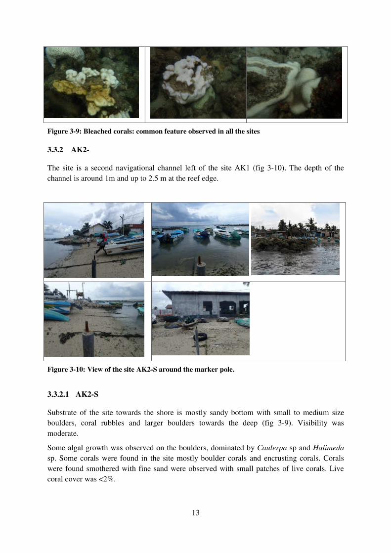
13
Figure 3-9: Bleached corals: common feature observed in all the sites
3.3.2 AK2-
The site is a second navigational channel left of the site AK1 (fig 3-10). The depth of the
channel is around 1m and up to 2.5 m at the reef edge.
Figure 3-10: View of the site AK2-S around the marker pole.
3.3.2.1 AK2-S
Substrate of the site towards the shore is mostly sandy bottom with small to medium size
boulders, coral rubbles and larger boulders towards the deep (fig 3-9). Visibility was
moderate.
Some algal growth was observed on the boulders, dominated by Caulerpa sp and Halimeda
sp. Some corals were found in the site mostly boulder corals and encrusting corals. Corals
were found smothered with fine sand were observed with small patches of live corals. Live
coral cover was <2%.
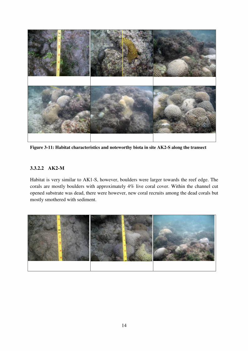
14
Figure 3-11: Habitat characteristics and noteworthy biota in site AK2-S along the transect
3.3.2.2 AK2-M
Habitat is very similar to AK1-S, however, boulders were larger towards the reef edge. The
corals are mostly boulders with approximately 4% live coral cover. Within the channel cut
opened substrate was dead, there were however, new coral recruits among the dead corals but
mostly smothered with sediment.
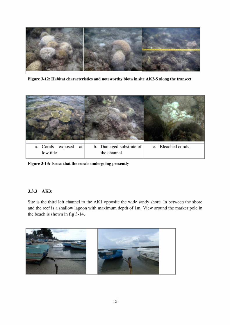
15
Figure 3-12: Habitat characteristics and noteworthy biota in site AK2-S along the transect
a. Corals exposed at
low tide
b. Damaged substrate of
the channel
c. Bleached corals
Figure 3-13: Issues that the corals undergoing presently
3.3.3 AK3:
Site is the third left channel to the AK1 opposite the wide sandy shore. In between the shore
and the reef is a shallow lagoon with maximum depth of 1m. View around the marker pole in
the beach is shown in fig 3-14.
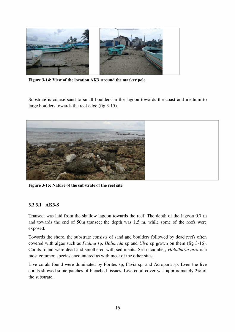
16
Figure 3-14: View of the location AK3 around the marker pole.
Substrate is course sand to small boulders in the lagoon towards the coast and medium to
large boulders towards the reef edge (fig 3-15).
Figure 3-15: Nature of the substrate of the reef site
3.3.3.1 AK3-S
Transect was laid from the shallow lagoon towards the reef. The depth of the lagoon 0.7 m
and towards the end of 50m transect the depth was 1.5 m, while some of the reefs were
exposed.
Towards the shore, the substrate consists of sand and boulders followed by dead reefs often
covered with algae such as Padina sp, Halimeda sp and Ulva sp grown on them (fig 3-16).
Corals found were dead and smothered with sediments. Sea cucumber, Holothuria atra is a
most common species encountered as with most of the other sites.
Live corals found were dominated by Porites sp, Favia sp, and Acropora sp. Even the live
corals showed some patches of bleached tissues. Live coral cover was approximately 2% of
the substrate.
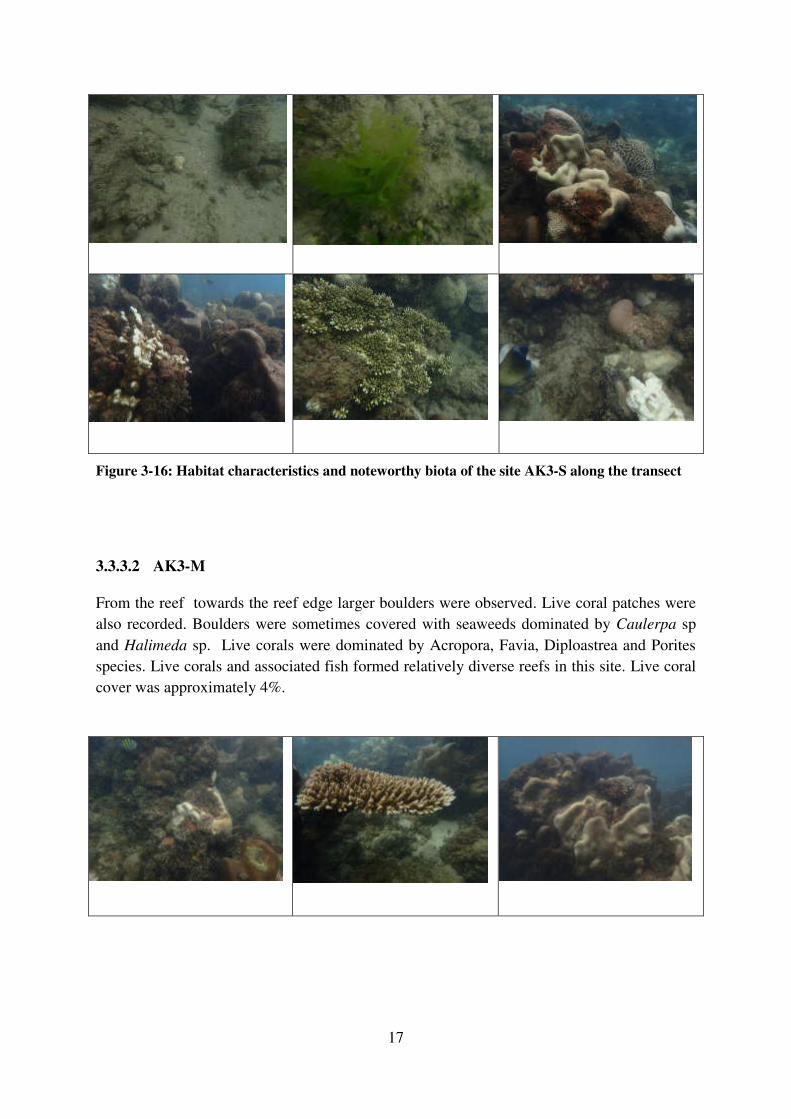
17
Figure 3-16: Habitat characteristics and noteworthy biota of the site AK3-S along the transect
3.3.3.2 AK3-M
From the reef towards the reef edge larger boulders were observed. Live coral patches were
also recorded. Boulders were sometimes covered with seaweeds dominated by Caulerpa sp
and Halimeda sp. Live corals were dominated by Acropora, Favia, Diploastrea and Porites
species. Live corals and associated fish formed relatively diverse reefs in this site. Live coral
cover was approximately 4%.
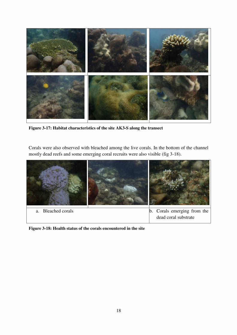
18
Figure 3-17: Habitat characteristics of the site AK3-S along the transect
Corals were also observed with bleached among the live corals. In the bottom of the channel
mostly dead reefs and some emerging coral recruits were also visible (fig 3-18).
a. Bleached corals b. Corals emerging from the
dead coral substrate
Figure 3-18: Health status of the corals encountered in the site
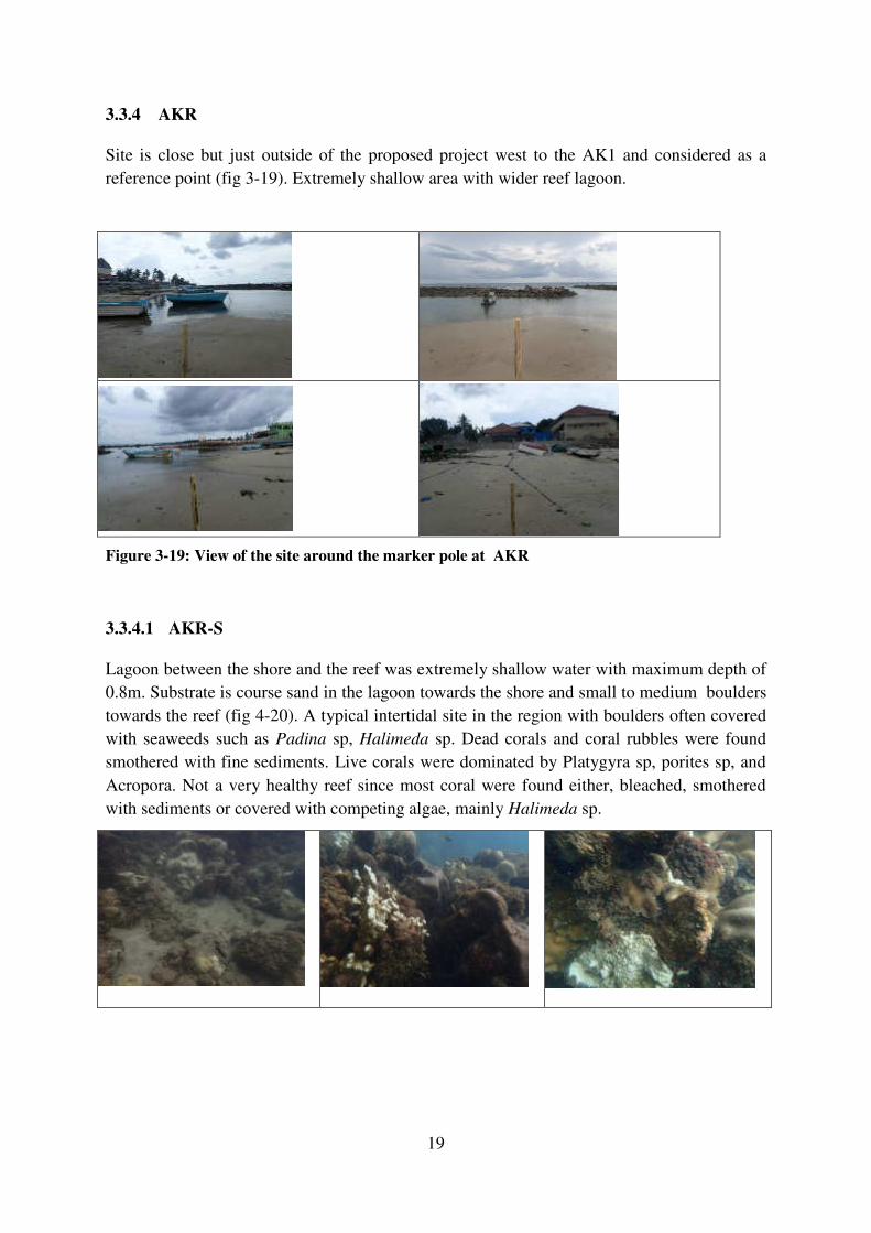
19
3.3.4 AKR
Site is close but just outside of the proposed project west to the AK1 and considered as a
reference point (fig 3-19). Extremely shallow area with wider reef lagoon.
Figure 3-19: View of the site around the marker pole at AKR
3.3.4.1 AKR-S
Lagoon between the shore and the reef was extremely shallow water with maximum depth of
0.8m. Substrate is course sand in the lagoon towards the shore and small to medium boulders
towards the reef (fig 4-20). A typical intertidal site in the region with boulders often covered
with seaweeds such as Padina sp, Halimeda sp. Dead corals and coral rubbles were found
smothered with fine sediments. Live corals were dominated by Platygyra sp, porites sp, and
Acropora. Not a very healthy reef since most coral were found either, bleached, smothered
with sediments or covered with competing algae, mainly Halimeda sp.
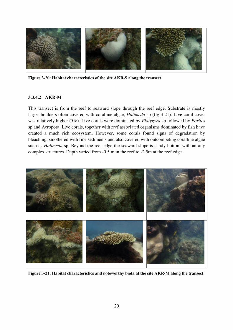
20
Figure 3-20: Habitat characteristics of the site AKR-S along the transect
3.3.4.2 AKR-M
This transect is from the reef to seaward slope through the reef edge. Substrate is mostly
larger boulders often covered with coralline algae, Halimeda sp (fig 3-21). Live coral cover
was relatively higher (5%). Live corals were dominated by Platygyra sp followed by Porites
sp and Acropora. Live corals, together with reef associated organisms dominated by fish have
created a much rich ecosystem. However, some corals found signs of degradation by
bleaching, smothered with fine sediments and also covered with outcompeting coralline algae
such as Halimeda sp. Beyond the reef edge the seaward slope is sandy bottom without any
complex structures. Depth varied from -0.5 m in the reef to -2.5m at the reef edge.
Figure 3-21: Habitat characteristics and noteworthy biota at the site AKR-M along the transect
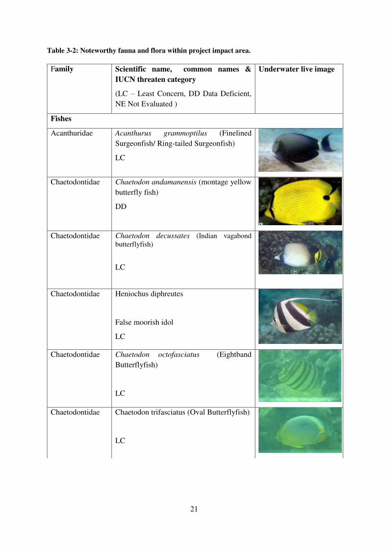
21
Table 3-2: Noteworthy fauna and flora within project impact area.
Family Scientific name, common names &
IUCN threaten category
(LC – Least Concern, DD Data Deficient,
NE Not Evaluated )
Underwater live image
Fishes
Acanthuridae Acanthurus grammoptilus (Finelined
Surgeonfish/ Ring-tailed Surgeonfish)
LC
Chaetodontidae Chaetodon andamanensis (montage yellow
butterfly fish)
DD
Chaetodontidae Chaetodon decussates (Indian vagabond
butterflyfish)
LC
Chaetodontidae Heniochus diphreutes
False moorish idol
LC
Chaetodontidae Chaetodon octofasciatus (Eightband
Butterflyfish)
LC
Chaetodontidae Chaetodon trifasciatus (Oval Butterflyfish)
LC

22
Labridae
(Wrasses)
Labroides dimidiatus
Bluestreak cleaner wrasse
LC
Lutjanidae
(Snappers)
Lutjanus decussatus
Checkered snapper
LC
Mullidae
(Goatfishes)
Parupeneus macronema
Stripe spot goatfish
LC
Pinguipedidae
(Sand perches)
Parapercis clathrata
Latticed sandperch
NE
Pomacanthidae
Pomacanthus semicirculatus
Blue angelfish (juvenile)
LC
Pomacentridae Abudefduf vaigiensis
The Sergeant-major or Indo-Paific
SergentFive-banded damselfish
LC
Pomacentrus similis
Similar damsel
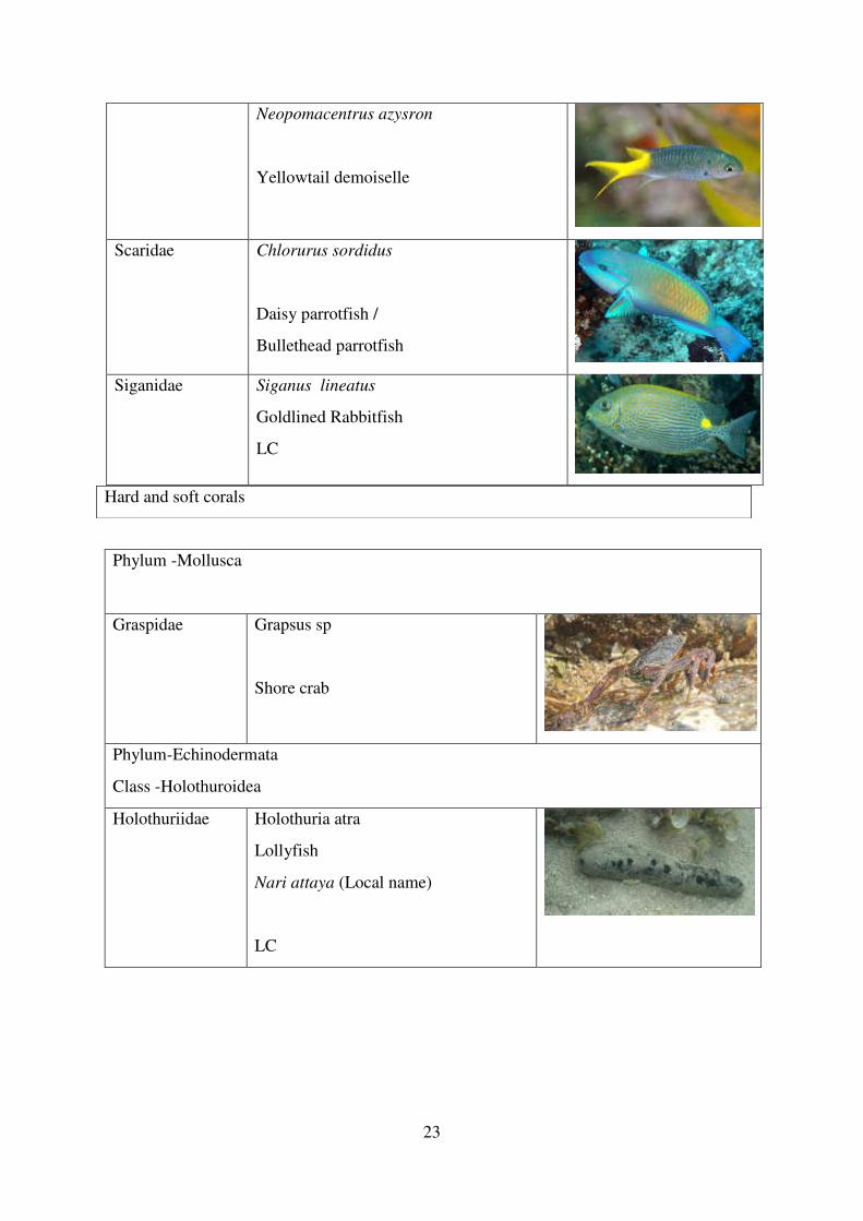
23
Neopomacentrus azysron
Yellowtail demoiselle
Scaridae Chlorurus sordidus
Daisy parrotfish /
Bullethead parrotfish
Siganidae Siganus lineatus
Goldlined Rabbitfish
LC
Phylum -Mollusca
Graspidae Grapsus sp
Shore crab
Phylum-Echinodermata
Class -Holothuroidea
Holothuriidae Holothuria atra
Lollyfish
Nari attaya (Local name)
LC
Hard and soft corals
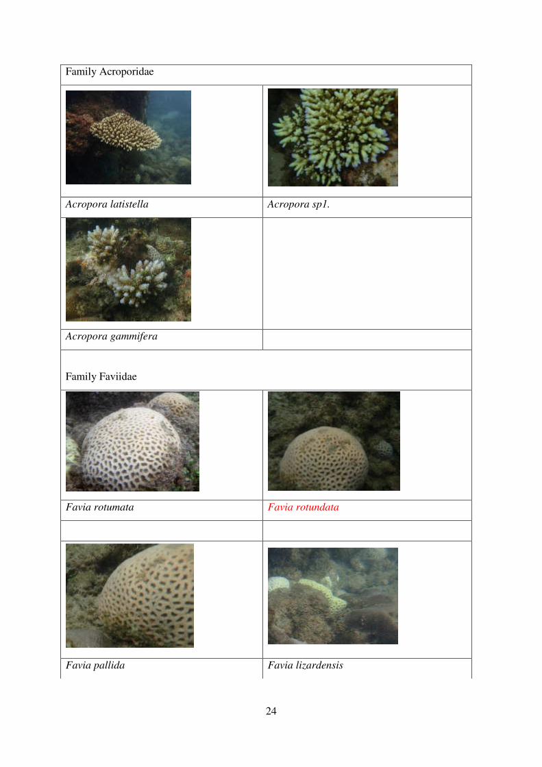
24
Family Acroporidae
Acropora latistella Acropora sp1.
Acropora gammifera
Family Faviidae
Favia rotumata Favia rotundata
Favia pallida Favia lizardensis
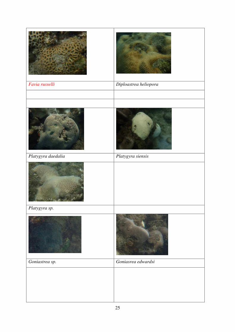
25
Favia russelli Diploastrea heliopora
Platygyra daedalia Platygyra siensis
Platygyra sp.
Goniastrea sp. Goniasrea edwardsi
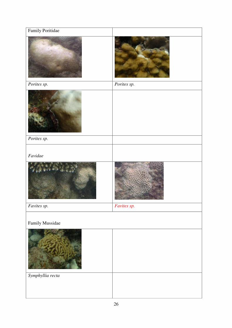
26
Family Poritidae
Porites sp. Porites sp.
Porites sp.
Favidae
Favites sp. Favites sp.
Family Mussidae
Symphyllia recta
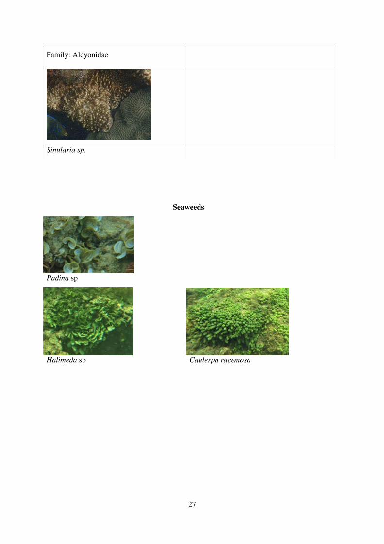
27
Seaweeds
Padina sp
Halimeda sp Caulerpa racemosa
Family: Alcyonidae
Sinularia sp.
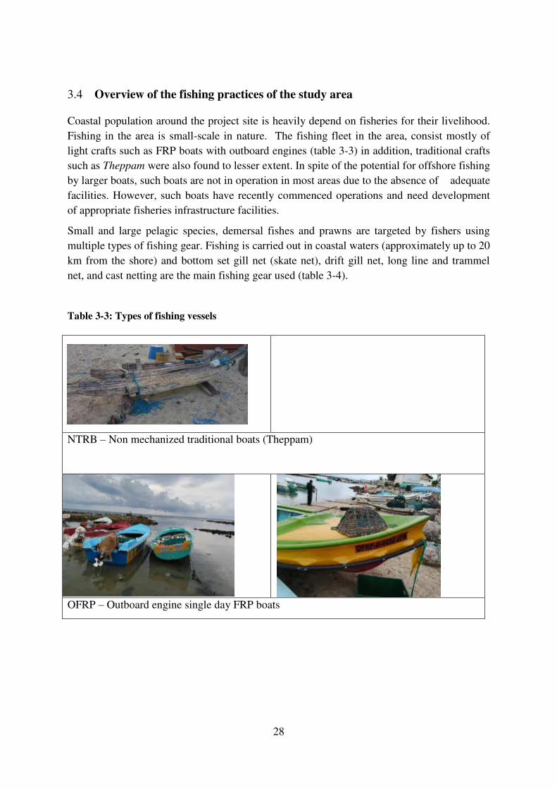
28
Overview of the fishing practices of the study area 3.4
Coastal population around the project site is heavily depend on fisheries for their livelihood.
Fishing in the area is small-scale in nature. The fishing fleet in the area, consist mostly of
light crafts such as FRP boats with outboard engines (table 3-3) in addition, traditional crafts
such as Theppam were also found to lesser extent. In spite of the potential for offshore fishing
by larger boats, such boats are not in operation in most areas due to the absence of adequate
facilities. However, such boats have recently commenced operations and need development
of appropriate fisheries infrastructure facilities.
Small and large pelagic species, demersal fishes and prawns are targeted by fishers using
multiple types of fishing gear. Fishing is carried out in coastal waters (approximately up to 20
km from the shore) and bottom set gill net (skate net), drift gill net, long line and trammel
net, and cast netting are the main fishing gear used (table 3-4).
Table 3-3: Types of fishing vessels
NTRB – Non mechanized traditional boats (Theppam)
OFRP – Outboard engine single day FRP boats
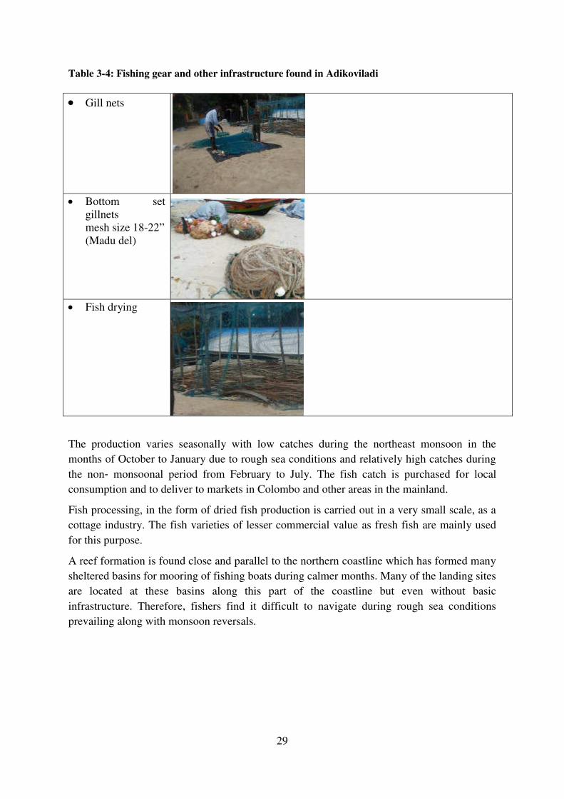
29
Table 3-4: Fishing gear and other infrastructure found in Adikoviladi
Gill nets
Bottom set
gillnets
mesh size 18-22”
(Madu del)
Fish drying
The production varies seasonally with low catches during the northeast monsoon in the
months of October to January due to rough sea conditions and relatively high catches during
the non‐ monsoonal period from February to July. The fish catch is purchased for local
consumption and to deliver to markets in Colombo and other areas in the mainland.
Fish processing, in the form of dried fish production is carried out in a very small scale, as a
cottage industry. The fish varieties of lesser commercial value as fresh fish are mainly used
for this purpose.
A reef formation is found close and parallel to the northern coastline which has formed many
sheltered basins for mooring of fishing boats during calmer months. Many of the landing sites
are located at these basins along this part of the coastline but even without basic
infrastructure. Therefore, fishers find it difficult to navigate during rough sea conditions
prevailing along with monsoon reversals.
4 Identification, Prediction and Evaluation of Environmental Impacts
This section includes a description of baseline conditions, identification and evaluation of potential impacts, and recommended mitigation measures where necessary, on marine ecology resulting from the construction and operation of the proposed project.
This assessment is based mainly on the information collected during field surveys and feasibility report. Desktop review on the latest relevant literatures was conducted, however, there were a lot of information gaps for proper assessment and most of the impact predictions and mitigations are based on the available information.
National legislations that applies to marine ecology and fisheries
National legislations that applies to marine ecology and fisheries assessment include the Fauna and Flora Protection Act, the Coastal Conservation Act, the Marine Pollution Prevention Act and the Fisheries and Aquatic Resources Act. The provisions of the Customs Ordinance relating to export of prohibited goods may also apply.
4.1.1 Fauna and Flora Protection Ordinance (FFPO)
According to Section 31B of amended Fauna and Flora Protection Ordinance No. 49 of 1993, all invertebrates listed in schedule iv A are given protection. This schedule lists not only the reef building true corals but also all the corals found in the sea around Sri Lanka.
4.1.2 Coast Conservation Act
The law that directly protects all corals is the Coast Conservation Act (No. 57 of 1981, amended by act No. 64 of 1988). Corals are protected under Section 31A which come in by the amendment. Under this section, it is on offense to mine, collect, possess, store or keep, transport and process corals in any form. It also covers the use of any implement to break corals, or the use of any craft, boat or vehicle to transport corals. This section has an important restriction, that these are deemed as offenses if committed within the coastal zone. This limitation is there because unlike in the Fauna and Flora Protection Ordinance, the Coast Conservation Act covers all coral deposits found within the coastal zone.
4.1.3 Fisheries and Aquatic Resources Act No. 2 of 1996
The Act uses the phrase - "aquatic resources" which is defined in Sec. 66 as "living aquatic organisms and includes and seaweed, phytoplankton or other aquatic flora and non-living substances found in an aquatic medium".
Part IV deals with the protection of fish and other aquatic resources, Part V deals with conservation while Part VIII grants powers to authorized officers to carry out the protective provisions in the preceding parts.
Sec. 27(1) No person shall a) use or attempt to use any poisonous, explosive or stupefying substance or other noxious or harmful material or substance in Sri Lanka Waters for the purpose of poisoning, killing, stunning or disabling any fish or other aquatic resources.
The section further prohibits possessing such substances for the above purpose, as well as prohibiting landing, selling, buying, receiving, possessing or transporting any such aquatic resources if the person has reasonable cause to believe that they were taken using the methods outlined in Sec.27 (1).
4.1.4 Marine Pollution Prevention Act
The Marine Pollution Prevention Act though it does not deal specifically with corals, it deals with one of the causes for reef destruction, water pollution. The Act was enacted in 1982 to limit the discharge of effluents into the ocean.
Use of international best practices for dredging
In addition to local legislation, it is important to adhere tointernational best practices documented. United Nations Environment Program (UNEP) and PIANC EnviCom Working Group 15 have developed guidelines for the implementation of best practice methodology in environmental assessment and environmental management for dredging and port construction activities around Coral Reefs and their associated communities.
Methodology for Identification and Assessment of Environmental Impacts
The project’s potential impacts on environmental resources will vary in nature, duration, type, extent, and overall significance. Impact is defined as an environmental and/or socioeconomic consequence that can be reasonably foreseen as a result of the proposed project’s implementation. The determination of the overall significance of the impacts was based on a combination of impact criteria as described below. Nature of the impact is expressed as direct or indirect. The nature of the impact refers to the impact’s origin, and is dependent upon whether the project activity directly or indirectly influences the resource or condition. Duration of the impact is expressed as long-term or short-term. Short–term impacts are temporary, occur during the construction phase of the project, and recover naturally within 3 years. Long-term impacts are characterized as those impacts that will be chronic due to ongoing activities on the property. Long-term impacts are those resulting in a permanent and irreversible change to existing environmental resources in the project vicinity. Type of impact is indicated as positive or negative. Positive impacts will enhance the environmental and/or socio-economic setting or conditions beyond those expected without the project. Negative impacts are those impacts that have an adverse effect on the resource or condition. Extent refers to the impact’s geographic reach or area of influence. Extent indicates if the impact is restricted to the project site, extends to other areas of the property, or has a broader island-wide or Country wide context. The overall significance of the impact as significant or not was determined based on the combination of the above criteria:
Proposed major interventions
Major interventions that would have negative bearing on marine environment are listed below
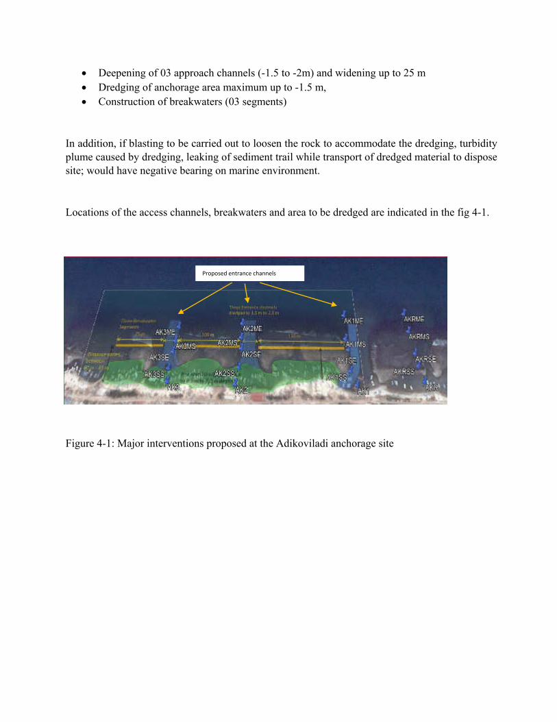
Deepening of 03 approach channels (-1.5 to -2m) and widening up to 25 m Dredging of anchorage area maximum up to -1.5 m, Construction of breakwaters (03 segments)
In addition, if blasting to be carried out to loosen the rock to accommodate the dredging, turbidity plume caused by dredging, leaking of sediment trail while transport of dredged material to dispose site; would have negative bearing on marine environment.
Locations of the access channels, breakwaters and area to be dredged are indicated in the fig 4-1.
Figure 4-1: Major interventions proposed at the Adikoviladi anchorage site
Proposed entrance channels
Marine ecological and fisheries impacts anticipated in proposed development
Major sources of adverse impacts can be categorized as, construction and operation impacts. Construction activities include, dredging, disposal of dredged materials, spills and leakage from construction equipment, handling equipment and some temporarily disturbances to fishing operations and boat movements. Operation impacts are limited and includes boat-related factors such as vessel traffic, discharges and emissions.
4.5.1 Construction impacts
4.5.1.1 Impacts caused by dredging
One of the major interventions in the Adikoviladi proposed anchor site is to dredge the shallow area in between the reef and shore line up to -1.2 m. This area is mostly sandy bottom with some small to medium sized boulders and no sensitive receptors and noteworthy fauna or flora that would directly impact by dredging. However, sediment flume generate will have indirect impacts to nearby sensitive receptors mainly coral reefs. These dredging impacts are mostly localized and short-term to medium term and limited to construction phase.
Dredging will involve the excavation and relocation of sediment from the lagoon. Since the main focus of dredging is to remove the submerged deposits, environmental impacts are also mainly cause by sediments. Dredging will re-suspend sediments, but the level of re-suspension and associated impacts depend on the physical and chemical characteristics of the sediment, as well as type of equipment and dredging method. The impacts of dredging may strongly influenced by the local factors like water depth, rate of flow, tidal currents, wave action, amount of sediment, etc.
Short-term impacts include the increase of the turbidity due to excavation works and sediment disposal. Medium and long-term impacts include habitat removal and impacts due to changes in flow and sediment budgets especially affecting the tidal propagation and changes to the geometry of channels. The degree of the impacts of dredging depends on the extent of the areas dredged, the frequency and duration of dredging activities, the characteristics and the sensitivity of the areas dredged and their surroundings, the dredging techniques applied as well. The coastline in the study site is directly exposed to severe wave conditions during the northeast monsoon period. Its behavior indicates high levels of sediment transport and likely to cause damages particularly to the coral reefs within and around the project site.
Re-suspension of sediments and increase of turbidity.
The potential impacts include spreading of sediments and associated contaminants in the surroundings, remobilization of contaminants in the water and direct impact on organisms due to reduced transparency.
Dredging and construction activities potentially affect not only the site itself, but also surrounding areas, through a large number of impact vectors (e.g. turbid plumes, sedimentation, release of contaminants, bathymetric changes). Effects may be immediate or develop over a longer timeframe and may be temporary or permanent in nature, depending on a large number of factors.
Changes in water quality Indirect impacts on the fisheries resources would be associated with changes of water quality due to temporary reclamation, dredging, and site runoff from land-based construction works. The major water quality issue is elevation of suspended solids. Elevation of Suspended Solids (SS)
SS occur naturally in the marine environment by wave action and vertical flux of water current. Concentration of SS generated by dredging is expected to be higher in the immediate vicinity of the dredger. Dispersion would cause rapid decrease in SS level beyond active dredging area.
Effects of SS on marine organisms could be lethal or sublethal through reduction in survivorship, growth rate and reproductive potential due to stress incurred by the need to constantly flush out deposited material. High SS level may kill the sensitive receptors such as coral reef and may clog hills and respiratory organs and hinder transfer of oxygen. Fish egg and larval fish (fry) are more susceptible to deleterious impacts from sedimentation through smothering and clogging of their respiratory systems.
Adult organisms are more likely to move away when they detect certain SS level and therefore less sensitive to the effects from SS and some have evolved adaptation to tolerate changes in SS, i.e. flushing water through their gills or simply moving to less turbid waters.
If SS levels exceed tolerance thresholds of aquatic fauna unable to move away from the area, corals for example, may become stressed or even die. The rate, timing and duration of SS elevations will influence the type and extent of impacts. However, guideline values identified for fisheries and selected marine ecological sensitive receivers in Consultancy
Study on Fisheries and Marine Ecological Criteria for Impact Assessment based on international marine water quality guidelines for the ecosystem protection. The recommended value is 50 mg/L (Agriculture Fisheries and Conservation Department (Hong Kong), 2001).
For the determination of extent, a sediment plume modelling results is needed and changes with monsoon cycle has to be studied. However, the SS concentration is expected to decrease shortly after completion of dredging activities. The impact due to SS elevation is considered to be very significant though they are mostly localized and temporary in nature. Some mitigation method are proposed.
However, impact to sensitive receivers in the distant is not expected as the impacts are expected to be localized.
No important spawning or nursery grounds of commercial fish species were identified within
and in the vicinity of the proposed marine works. In view of the temporary nature of such impact, only minor impact on capture fisheries is anticipated.
Release of contaminant from marine sediment
Dredging activities can potentially cause the release of contaminants from marine sediments. Potential impacts on marine biota include the accumulation of contaminants in the tissues, resulting in sublethal effects which may alter behaviour, reproduction and increase susceptibility to disease. Eggs, larvae and juveniles are particularly susceptible to the sublethal effects of contaminants, and elevated levels may lead to increased mortality.
In the view that mobile subtidal fauna like fish and crab is likely to avoid the dredging area
and recolonize after construction works and refuge habitats would be available in nearby coastal waters for the affected resources, adverse impact due to the release of contaminant on fisheries resources would be minimal.
Release of nutrients from marine sediment
High nutrient levels in marine water can trigger rapid increase in phytoplankton, resulting in algal bloom. As the algae die, it will be degraded, depleting dissolved oxygen. When a large number of algae die, sudden drop in dissolved oxygen leads to suffocation of fish and other organisms. Sometimes, algal blooms are caused by phytoplankton which produces biotoxin. When degraded, toxin released could be lethal to other biota. Increased nutrients will badly impact on the corals
4.5.1.2 Impacts of dredged material disposal
Dredged material would be major source of pollution if not managed properly. These are preferably be used for some land filling or beach nourishments. However, particle size and any containments to be investigated before disposal.
Impacts from the dredged material would be significant and if disposed properly, after scientific investigations, impacts would be minimal.
4.5.1.3 Construction breakwaters
Another key intervention is to build breakwaters for safe navigation of the vessels as well as stability. Apparently breakwater is going to be somewhere through the reef which would again impact on corals and need mitigation methods. Construction method and design would have direct impact on the marine environment, corals in particular and strong mitigatory measures are proposed.
4.5.1.4 Direct loss of biota
Alteration of the bathymetry and hydrography, and thus destruction of local habitats and the risk of direct physical/mechanical stress to species is expected. Further, dredging will permanently remove some sensitive species such as corals from the channels that need dredging and widening. Direct loss of biota due to dredging and construction is significant and mitigation methods are proposed.
4.5.1.5 Alteration of hydrology
Dredging changes the natural flow of a body of water. While this is sometimes the specific purpose for a dredging operation, disturbing the natural water flow may have unintended and unknown effects.
4.5.1.6 Disposal of solid waste
Solid waste from the construction, temporary camps, as well as during operations would cause deleterious impact to marine environment if they are not disposed properly. Therefore, impacts results from solid waste disposal would be significant.
4.5.1.7 Impact on fisheries
The proposed marine works required under the Project might result in impacts to fisheries resources. The potential impacts to the fisheries resources within the assessment area may include:
Temporary loss of fishing ground; Loss of fish stock; Impact to livelihood of fishermen;
Indirect impact on fisheries resources due to change in water quality and sedimentation
Noise disturbance impact to fisheries resources.
Temporary loss of fishing grounds or access to fishing grounds and loss of livelyhood Construction works would limit the access of the vessels, causing loss of fishing ground. The potentially affected fishing ground would include: However, the project area and in the vicinity is not a significant fishing ground and there would not be loss of fishing grounds. However, the access to fishing grounds from the proposed site would be temporarily unavailable for fishing. In view of the low importance of the area as fishing ground and the temporary nature of the impact, the impact to fisheries resources is considered to be minor. Dredging and construction would affect the mobilization of fishing boats and fishing operations. In addition, any support vessels for the project will also interfere with fishing boat operations. This needs to be considered during construction phase. The impact on mobilization of fishing boats is localized but can be frequent during construction phase and impact will be low to moderate. Since the affected vessels could be move to nearby landing sites, the impact to livelihood of the fishermen would be temporary and minor.
Loss of fish stock It is not yet determined if the underwater blasting activities might be taken place at some locations along the project site to remove bedrock in the area proposed for dredging in the basin and navigation channel. If the project decided to conduct blasting, the shock waves generated from underwater blasting could kill the fish, mainly those with air bladders and other aquatic biota. Whilst, the quantity of fish and shellfish could be killed by the detonation of explosives is believed to be very low and would be insignificant (in terms of fisheries point) since the project area is not a fishing ground.
Noise Disturbance Impact Apart from shock waves, underwater dredging (and blasting in decided to carry out) would
also generate noise. Many fishes are known to be sensitive to sounds. They would minimize the use of areas affected by underwater noise. However, after the noicy construction work, fishes are likely to recruit the affected area. Therefore, the impact would be short term and reversible in nature. Moreover, the fisheries habitat has been subject to noisy environment due to heavy marine traffic. Fishes have probably been adapted to the noisy environment. Since the area of fisheries habitat affected constitutes a small proportion of the total fisheries resources, the impact is considered to be minor and acceptable.
Operation Phase
Other discharges – oily; bilge water
Wash-down, oil, grease, and concrete curing waters are considered as potential contaminants arising from flooding and draining of the casting basin. To reduce or eliminate these potential contaminants, measures including settlement of washed waters and oil removal prior to discharge to the sea. With proper implementation of the above measures, the water quality impact and thus impact on biota due to the wash down, flooding and draining of the considered insignificant.
The protective breakwater would protrude above the natural seabed. The presence of the protective layers might obstruct fishing activities such as trawling in the area. Nevertheless, since no trawling activities were identified within the footprint of the proposed project and its vicinity and the protrusion is not expected to significantly affect fishing operation. Therefore, impacts on fisheries resources would not be expected in the operation phase.
Other than these the direct or indirect impact to the fisheries would be expected during operation phase is positive.
5 Mitigation of anticipated impacts
It was observed that the entrance channel proposed to be deepen up to to -2m and widener to 25 m. However, banks of the channels contain some healthy corals which would directly loss by the interventions. Since all the three channels within the project site contain live corals, some direct loss of corals is inevitable. Since there is no mitigatory measures, some compensatory measure are suggested in 5.9 to be followed.
Impacts from sediments
Ensuring that no or minimal adverse impacts are caused by dredging works requires a careful monitoring and assessment of the dredging works. It is important to use the right dredgers. For example, the hopper dredgers that suction out the deposits are considered to be a major cause for turbidity in the dredged waters. It has been recommended that those dredgers which present a chance for pollution and extensive contamination be avoided and replaced with other safer methodologies. Timing of the dredging to be carefully planned to avoid rainy season and least impact on small-scale fishing operations.
Construction site runoff and drainage should be prevented or minimized in accordance with international best practices and standards. Sand/silt retaining facilities such as traps and sediment basins should be provided to limit the runoff.
Exposed slope/soil surface, dredged material in particular, should be covered to reduce the potential runoff. Arrangements should always be in place to ensure that adequate surface protection measures can be safely carried out well before the arrival of a rain.
Proactive and informed management of the dredging programme as it is executed can often significantly reduce the risk of or minimize the negative impacts. Through modelling and monitoring during execution, impacts may be predicted before being realized, and the dredging programme may be optimized to achieve the environmental objectives. A combination of monitoring, both of the dredge plume and at receptor sites, and dredge plume modeling to guide the dredging works need to be conducted before the beginning of dredging operations.
Potential impacts on sensitive receptors would also be minimized by conducting dredging works in phases in order to minimize the long term smothering.
Silt curtain or sediment trap to be used as practical as possible to minimize sediment plume and run off to sensitive receptors (in live coral areas)
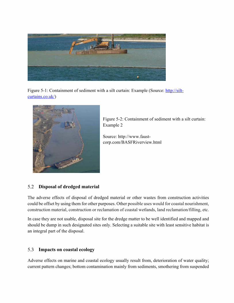
Figure 5-1: Containment of sediment with a silt curtain: Example (Source: http://silt-curtains.co.uk/)
Figure 5-2: Containment of sediment with a silt curtain: Example 2
Source: http://www.faust-corp.com/BASFRiverview.html
Disposal of dredged material
The adverse effects of disposal of dredged material or other wastes from construction activities could be offset by using them for other purposes. Other possible uses would for coastal nourishment, construction material, construction or reclamation of coastal wetlands, land reclamation/filling, etc.
In case they are not usable, disposal site for the dredge matter to be well identified and mapped and should be dump in such designated sites only. Selecting a suitable site with least sensitive habitat is an integral part of the disposal.
Impacts on coastal ecology
Adverse effects on marine and coastal ecology usually result from, deterioration of water quality; current pattern changes; bottom contamination mainly from sediments, smothering from suspended
particles; physical loss of vegetations and land area; and changes in natural habitats and these activities to be monitored and managed properly.
Any crushing and physical damages to fauna and flora due to dredging and construction cannot be mitigated and will be recovered over time.
Disposal of solid waste
In order to proper manage the solid waste disposal to sea, various waste reception facilities to be developed. Which may include facilities for utilization of fish waste (for fish meal, silage etc.) or disposal, debris collection facility (mainly for plastic waste from fishing operations (Plastic bottles, bouy, damaged nets and ropes, fiberglass waste from boat building and repair etc).
Impacts to fishing and fishing operations
The general policy for alleviating fisheries impacts in order of priority are avoidance, minimization and compensation.
Construction or dredging timing and equipment handling to be properly planned to be least impact on small-scale fishing operations. Alternative sites to be identified and provided temporarily for fish landing and other operations.
Impact during operational phase
Stringent control on boat discharges and provision of reception facilities are indispensable for proper control of emissions and effluent from the boats. Detection of spills is also important for regulating boat discharges. Since accidental spills are unavoidable, recovery facilities, oil fences, and treatment chemicals should be prepared with a view to minimizing dispersal.
Harbours are requested to provide sufficient reception facilities to receive residues and oily mixtures generated from boat operations according to provisions of the International Convention for the Prevention of Pollution from Ships (MARPOL).
Sound strategic planning
Impacts can be minimized by planning ahead. An initial risk assessment based on available secondary data, initial field surveys, preliminary numerical modelling and an understanding of local and regional coastal processes should be conducted in conjunction with Coral Reef and impact
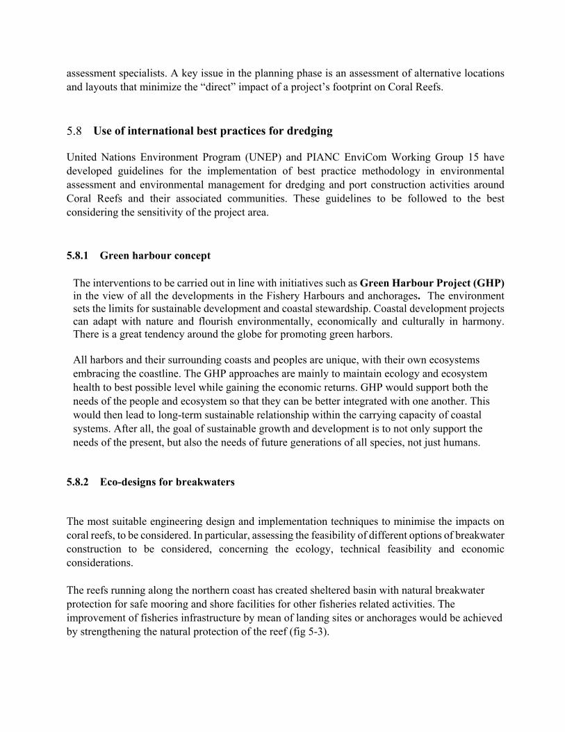
assessment specialists. A key issue in the planning phase is an assessment of alternative locations and layouts that minimize the “direct” impact of a project’s footprint on Coral Reefs.
Use of international best practices for dredging
United Nations Environment Program (UNEP) and PIANC EnviCom Working Group 15 have developed guidelines for the implementation of best practice methodology in environmental assessment and environmental management for dredging and port construction activities around Coral Reefs and their associated communities. These guidelines to be followed to the best considering the sensitivity of the project area.
5.8.1 Green harbour concept
The interventions to be carried out in line with initiatives such as Green Harbour Project (GHP) in the view of all the developments in the Fishery Harbours and anchorages. The environment sets the limits for sustainable development and coastal stewardship. Coastal development projects can adapt with nature and flourish environmentally, economically and culturally in harmony. There is a great tendency around the globe for promoting green harbors.
All harbors and their surrounding coasts and peoples are unique, with their own ecosystems embracing the coastline. The GHP approaches are mainly to maintain ecology and ecosystem health to best possible level while gaining the economic returns. GHP would support both the needs of the people and ecosystem so that they can be better integrated with one another. This would then lead to long-term sustainable relationship within the carrying capacity of coastal systems. After all, the goal of sustainable growth and development is to not only support the needs of the present, but also the needs of future generations of all species, not just humans.
5.8.2 Eco-designs for breakwaters
The most suitable engineering design and implementation techniques to minimise the impacts on coral reefs, to be considered. In particular, assessing the feasibility of different options of breakwater construction to be considered, concerning the ecology, technical feasibility and economic considerations. The reefs running along the northern coast has created sheltered basin with natural breakwater protection for safe mooring and shore facilities for other fisheries related activities. The improvement of fisheries infrastructure by mean of landing sites or anchorages would be achieved by strengthening the natural protection of the reef (fig 5-3).
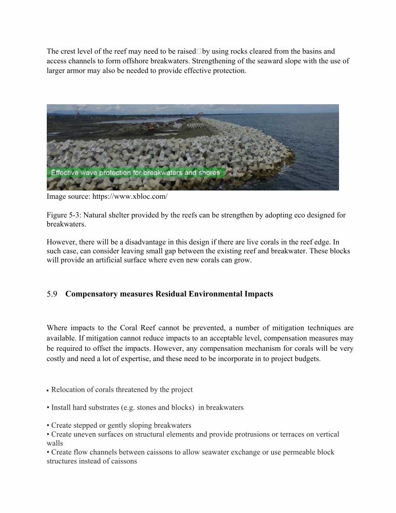
The crest level of the reef may need to be raisedby using rocks cleared from the basins and access channels to form offshore breakwaters. Strengthening of the seaward slope with the use of larger armor may also be needed to provide effective protection.
Image source: https://www.xbloc.com/
Figure 5-3: Natural shelter provided by the reefs can be strengthen by adopting eco designed for breakwaters.
However, there will be a disadvantage in this design if there are live corals in the reef edge. In such case, can consider leaving small gap between the existing reef and breakwater. These blocks will provide an artificial surface where even new corals can grow.
Compensatory measures Residual Environmental Impacts
Where impacts to the Coral Reef cannot be prevented, a number of mitigation techniques are available. If mitigation cannot reduce impacts to an acceptable level, compensation measures may be required to offset the impacts. However, any compensation mechanism for corals will be very costly and need a lot of expertise, and these need to be incorporate in to project budgets.
Relocation of corals threatened by the project • Install hard substrates (e.g. stones and blocks) in breakwaters • Create stepped or gently sloping breakwaters • Create uneven surfaces on structural elements and provide protrusions or terraces on vertical walls • Create flow channels between caissons to allow seawater exchange or use permeable block structures instead of caissons
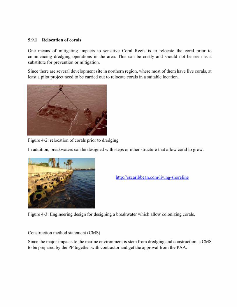
5.9.1 Relocation of corals
One means of mitigating impacts to sensitive Coral Reefs is to relocate the coral prior to commencing dredging operations in the area. This can be costly and should not be seen as a substitute for prevention or mitigation.
Since there are several development site in northern region, where most of them have live corals, at least a pilot project need to be carried out to relocate corals in a suitable location.
Figure 4-2: relocation of corals prior to dredging
In addition, breakwaters can be designed with steps or other structure that allow coral to grow.
http://escaribbean.com/living-shoreline
Figure 4-3: Engineering design for designing a breakwater which allow colonizing corals.
Construction method statement (CMS)
Since the major impacts to the marine environment is stem from dredging and construction, a CMS to be prepared by the PP together with contractor and get the approval from the PAA.
Recommendations
Considering the ecological sensitivity of ecosystem, proper dredging methods to be applied to minimize the dredging related impacts
Dredged material should be used for beneficial use such as coastal nourishment, land reclamation or wetland creation, etc.
Bathymetry survey need to be carried out before any dredging and historical changes in bathymetry.
Dumping license to be obtained from MEPA if any discharges to open sea. Contractor should take special care in selecting dredging equipment to be environmental friendly
as possible, and training and guidelines to be given for operators.
Proper operation of dredging equipment with minimum disturbances to fine particles in the bottom which will raise the turbidity substantially.
Monitoring should be conducted in the sensitive ecosystems for turbidity and possible impacts, rather than the site of the plume or hopper.
Construction Method Statement to be prepared by the PP along with contractor and get approval from PAA before commencing any construction work

References
Davis et al (1990). Environmental Considerations for Port and Harbor Developments, WORLD BANK TECHNICAL PAPER NUMBER 126 TRANSPORT AND THE ENVIRONMENT SERIES, The World Bank Washington, D.C; 131p.
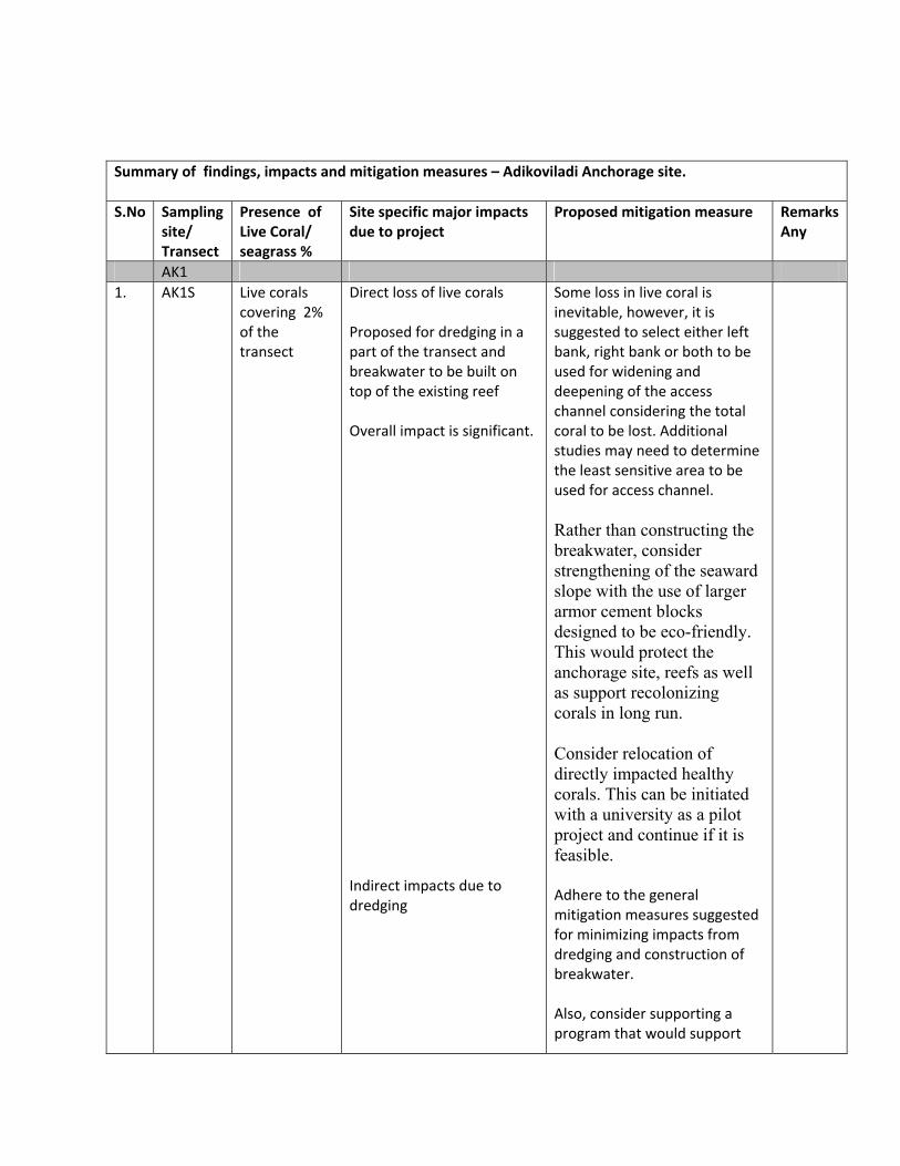
Summary of findings, impacts and mitigation measures – Adikoviladi Anchorage site. S.No Sampling
site/ Transect
Presence of Live Coral/ seagrass %
Site specific major impacts due to project
Proposed mitigation measure Remarks Any
AK1 1. AK1S Live corals
covering 2% of the transect
Direct loss of live corals Proposed for dredging in a part of the transect and breakwater to be built on top of the existing reef Overall impact is significant. Indirect impacts due to dredging
Some loss in live coral is inevitable, however, it is suggested to select either left bank, right bank or both to be used for widening and deepening of the access channel considering the total coral to be lost. Additional studies may need to determine the least sensitive area to be used for access channel. Rather than constructing the breakwater, consider strengthening of the seaward slope with the use of larger armor cement blocks designed to be eco-friendly. This would protect the anchorage site, reefs as well as support recolonizing corals in long run. Consider relocation of directly impacted healthy corals. This can be initiated with a university as a pilot project and continue if it is feasible. Adhere to the general mitigation measures suggested for minimizing impacts from dredging and construction of breakwater. Also, consider supporting a program that would support
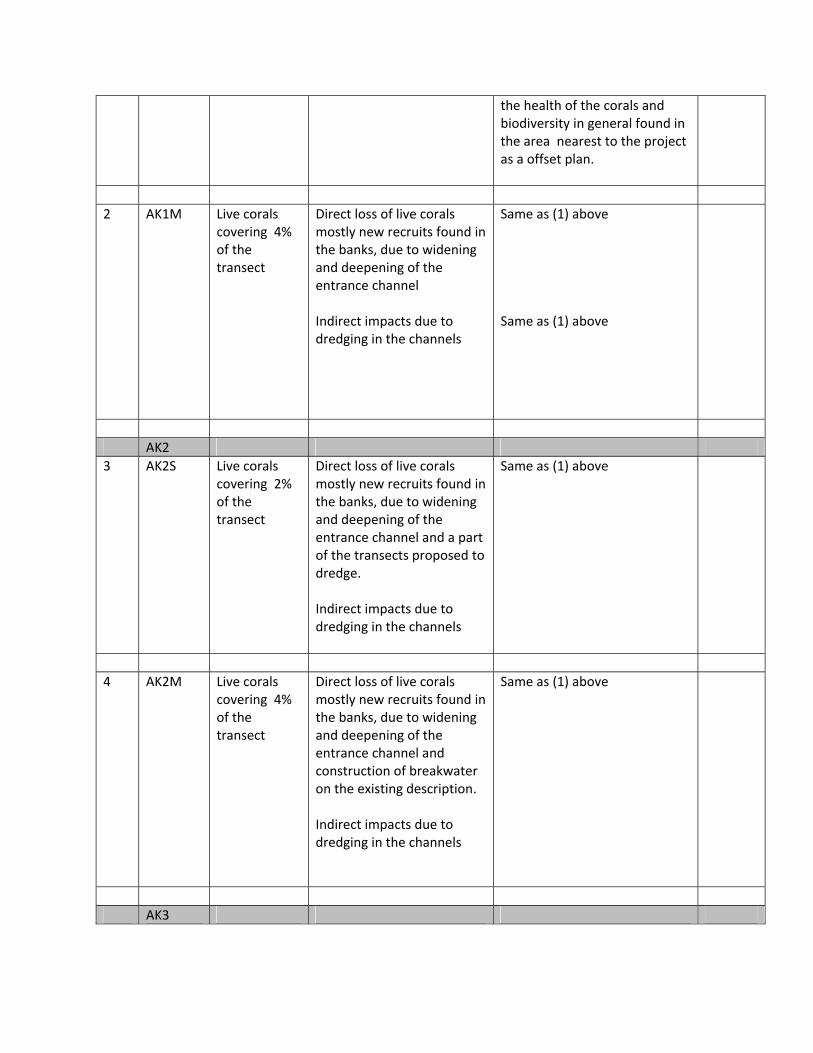
the health of the corals and biodiversity in general found in the area nearest to the project as a offset plan.
2 AK1M Live corals
covering 4% of the transect
Direct loss of live corals mostly new recruits found in the banks, due to widening and deepening of the entrance channel Indirect impacts due to dredging in the channels
Same as (1) above Same as (1) above
AK2 3 AK2S Live corals
covering 2% of the transect
Direct loss of live corals mostly new recruits found in the banks, due to widening and deepening of the entrance channel and a part of the transects proposed to dredge. Indirect impacts due to dredging in the channels
Same as (1) above
4 AK2M Live corals
covering 4% of the transect
Direct loss of live corals mostly new recruits found in the banks, due to widening and deepening of the entrance channel and construction of breakwater on the existing description. Indirect impacts due to dredging in the channels
Same as (1) above
AK3
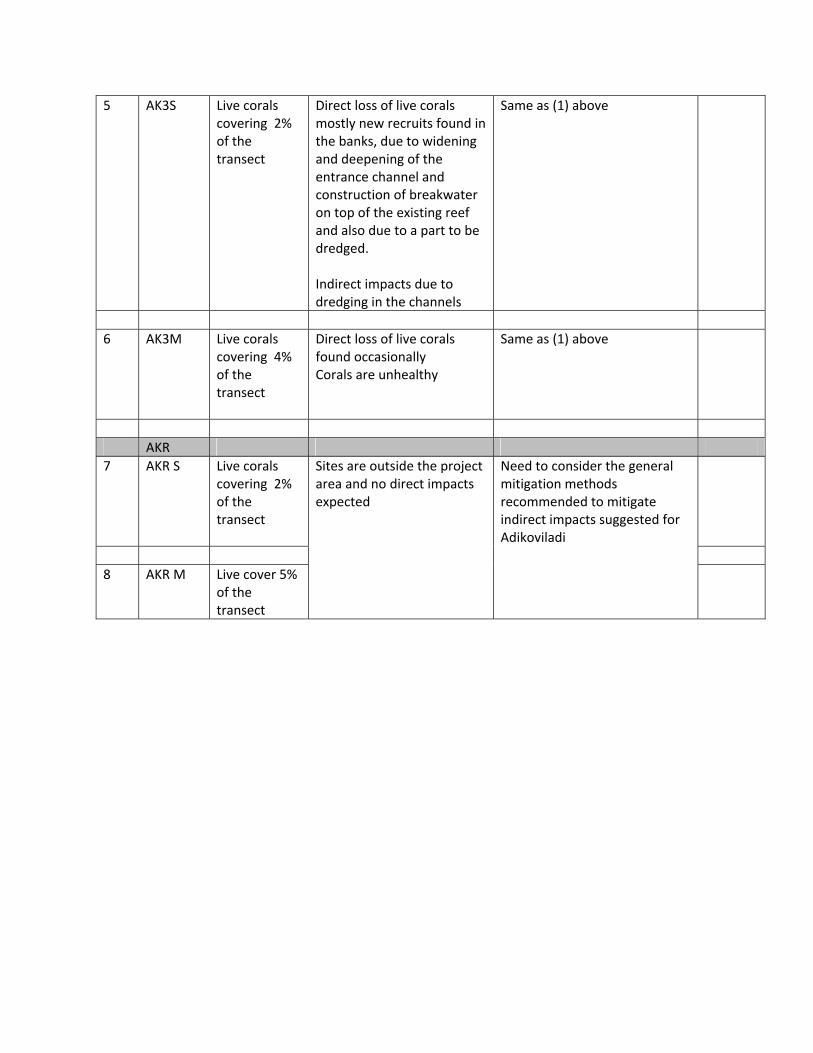
5 AK3S Live corals covering 2% of the transect
Direct loss of live corals mostly new recruits found in the banks, due to widening and deepening of the entrance channel and construction of breakwater on top of the existing reef and also due to a part to be dredged. Indirect impacts due to dredging in the channels
Same as (1) above
6 AK3M Live corals
covering 4% of the transect
Direct loss of live corals found occasionally Corals are unhealthy
Same as (1) above
AKR 7 AKR S Live corals
covering 2% of the transect
Sites are outside the project area and no direct impacts expected
Need to consider the general mitigation methods recommended to mitigate indirect impacts suggested for Adikoviladi
8 AKR M Live cover 5%
of the transect

Annex 10- List of
people interviewed
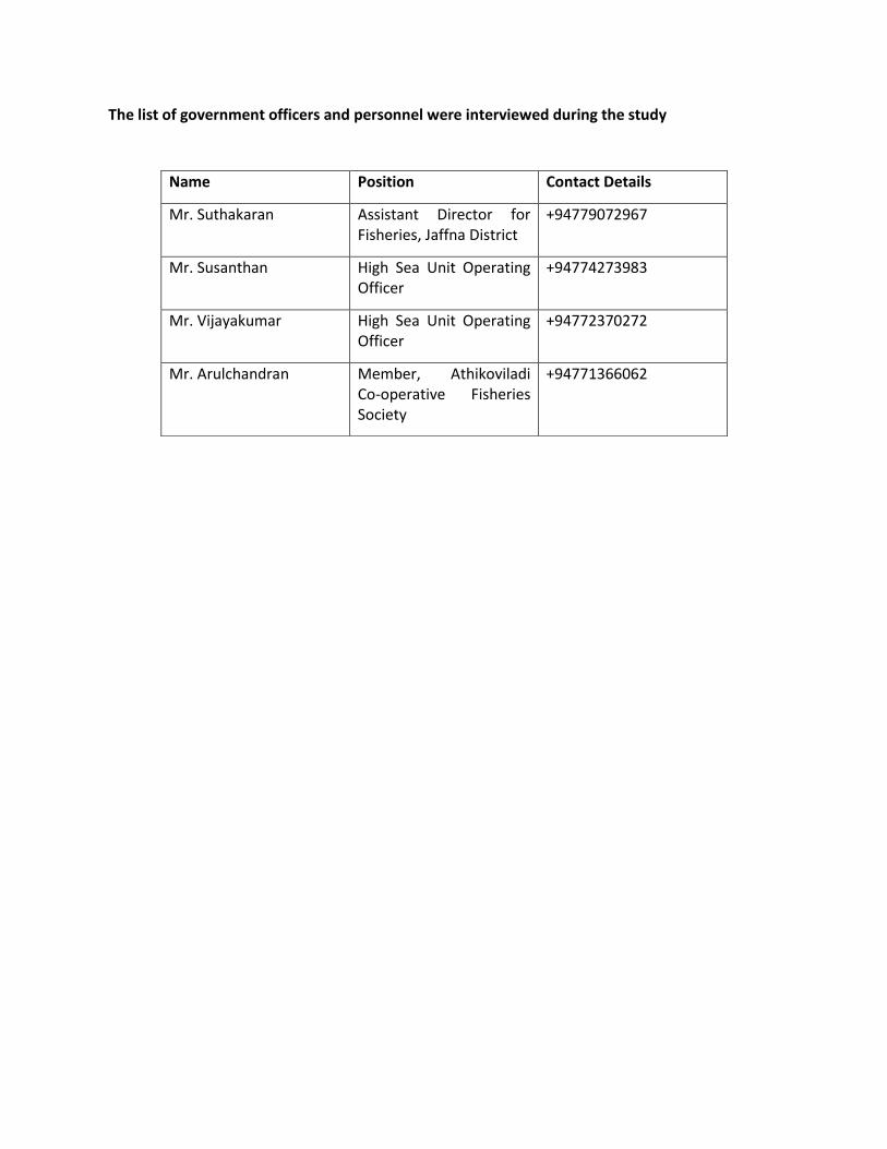
The list of government officers and personnel were interviewed during the study
Name Position Contact Details
Mr. Suthakaran Assistant Director for
Fisheries, Jaffna District
+94779072967
Mr. Susanthan High Sea Unit Operating
Officer
+94774273983
Mr. Vijayakumar High Sea Unit Operating
Officer
+94772370272
Mr. Arulchandran Member, Athikoviladi
Co-operative Fisheries
Society
+94771366062
Annex 11- Community
Consultation and minutes of the
meeting
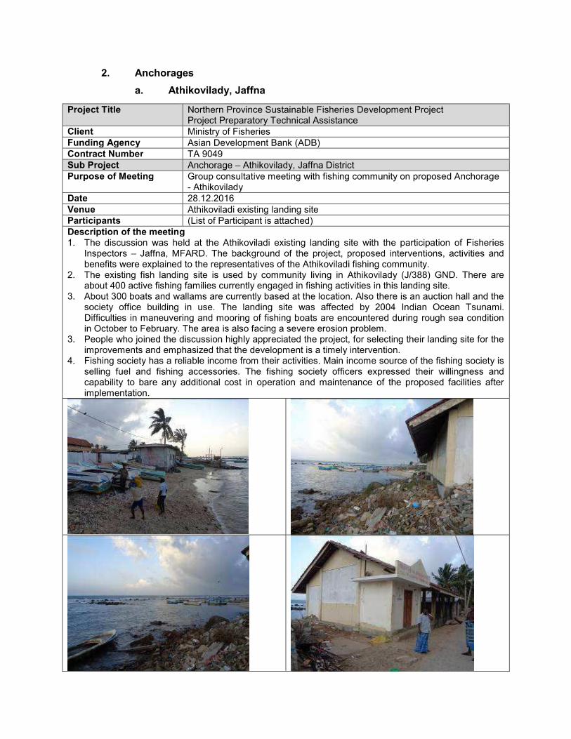
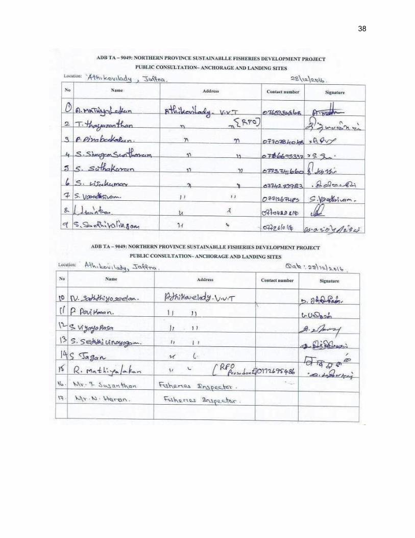
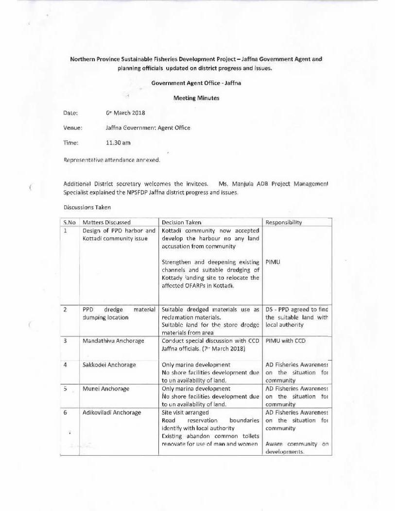
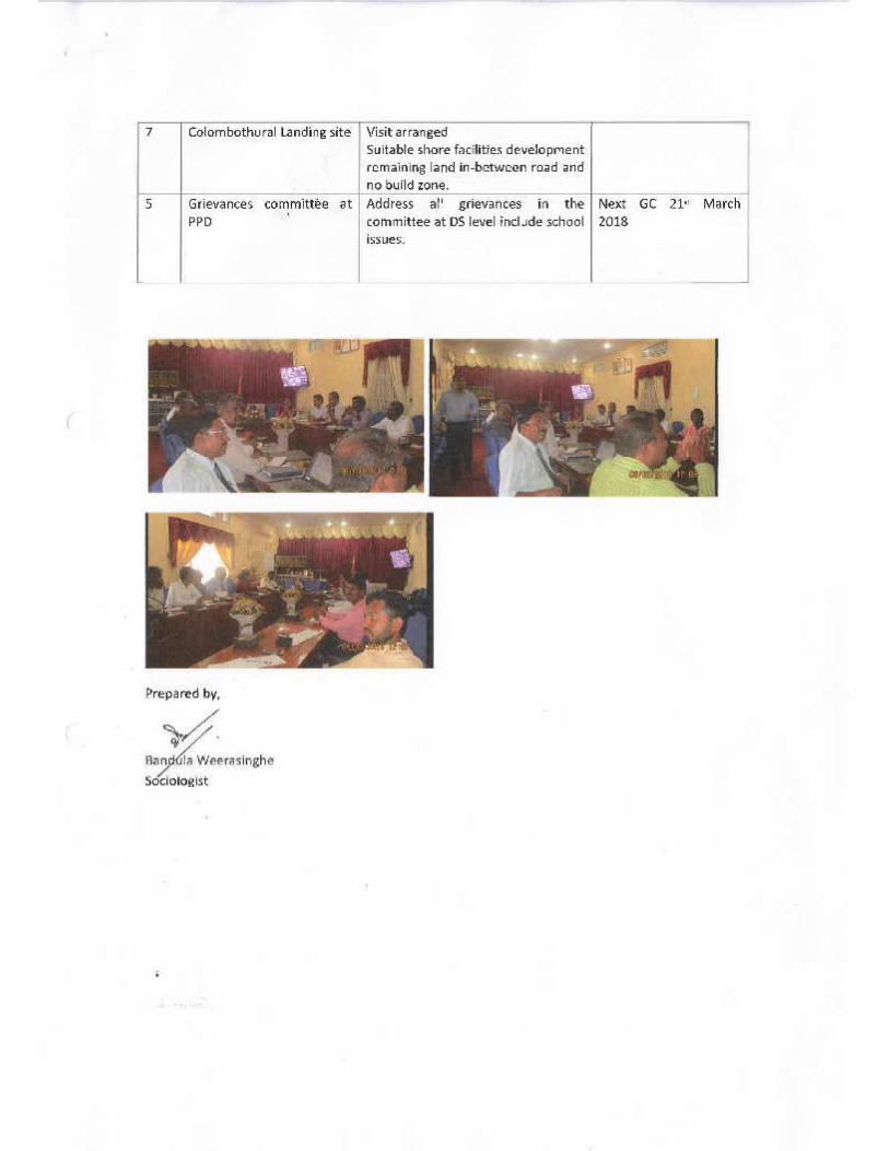

Annex 12 a-Layout Plan
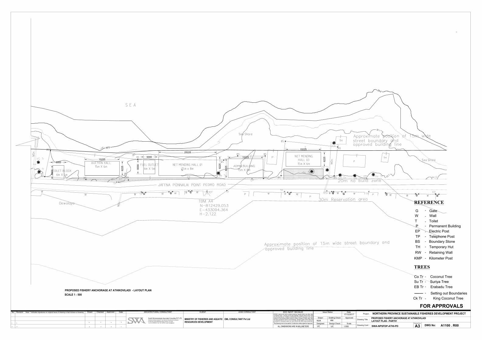
25225
82
25
15225
62
25
60
00
5000
82
25
15225
15225
62
255000
60
00
GHD STANDARD A1 ATTRIBUTE BLOCK CAD File No.: GHD_G_0045_T Updated: 08-07-03 Version: 1.1GHD STANDARD A1 SHEET CAD File No.: GHD_G_0045 Updated: 08-07-03 Version: 1.1
DateApprovedCheckedDrawnRevisionNo Note: * indicates signatures on original issue of drawing or last revision of drawing
© SWA reserves all rights to these drawings, designs and/or any other datacontained herein. No part of the said drawings, designs and/or other datamay be reproduced, modified, transmitted or used in any form or by anymeans for any purpose without the prior written consent of SWA other thanthe sole purpose for which such drawings, designs and/or other data areprovided to licensed users on such terms as SWA may prescribe.
DWG No:A3Original Size
Project :
Drawing Title :
Drawing Cord :
DO NOT SCALE
ALL DIMENSIONS ARE IN MILLIMETERS
This Drawing must not be used for Construction unless signed as Approved
Drawn
Designed
Drafting Check
Design Check
Approved
Scale
DateIssue StatusNORTHERN PROVINCE SUSTAINABLE FISHERIES DEVELOPMENT PROJECT
Surath Wickramasinghe Associates Consulting PVT LTDChartered Architects, Engineers, Town Planners & Development Consultants
P.O.Box 403, NO.65 Walukarama Road, Colombo 3, Sri Lanka
Tel: +94 112575007-9 Fax: +94 112575010 email: [email protected]
ARCHITECTURAL CONSULTANT CLIENT
MINISTRY OF FISHERIES AND AQUATIC
RESOURCES DEVELOPMENT
LEAD CONSULTANT
EML CONSULTANT Pvt Ltd PROPOSED FISHERY ANCHORAGE AT ATHIKOVILADI
LAYOUT PLAN - PART01
SWA-NPSFDP-ATHI-PD A1100 . R00
FOR APPROVALS
1:500
NUK HM
UC UC
17/12/2017
- - - - - -
- - - - - -
REFERENCE
G Gate
W Wall
P Permanent Building
TH Temporary Hut
EP Electric Post
-TP Telephone Post
-
-
-
-
-
-KMP Kilometer Post
RW Retaining Wall-
-BS Boundary Stone
T Toilet-
Co Tr Coconut Tree
Su Tr Suriya Tree
EB Tr Erabadu Tree
-
-
-
TREES
Setting out Boundaries-PROPOSED FISHERY ANCHORAGE AT ATHIKOVILADI - LAYOUT PLAN
SCALE 1 : 500
Ck Tr King Coconut Tree-
Annex 12 b-Layout Plan
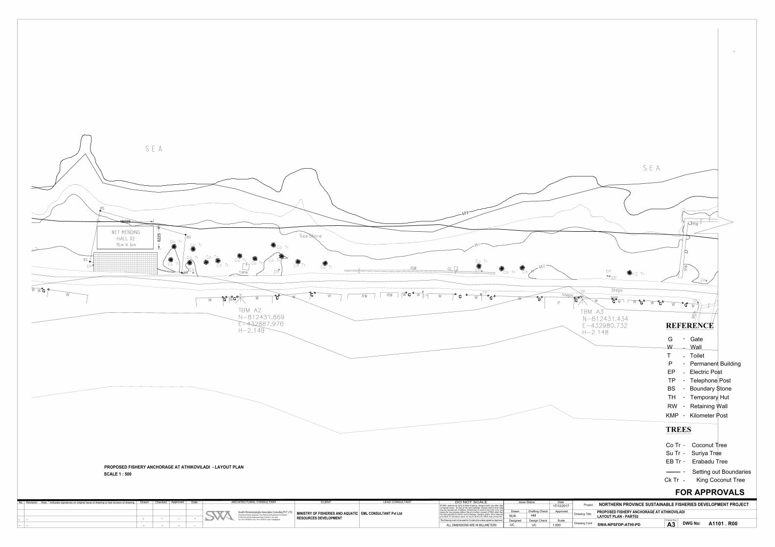
15225
62
25
GHD STANDARD A1 ATTRIBUTE BLOCK CAD File No.: GHD_G_0045_T Updated: 08-07-03 Version: 1.1GHD STANDARD A1 SHEET CAD File No.: GHD_G_0045 Updated: 08-07-03 Version: 1.1
DateApprovedCheckedDrawnRevisionNo Note: * indicates signatures on original issue of drawing or last revision of drawing
© SWA reserves all rights to these drawings, designs and/or any other datacontained herein. No part of the said drawings, designs and/or other datamay be reproduced, modified, transmitted or used in any form or by anymeans for any purpose without the prior written consent of SWA other thanthe sole purpose for which such drawings, designs and/or other data areprovided to licensed users on such terms as SWA may prescribe.
DWG No:A3Original Size
Project :
Drawing Title :
Drawing Cord :
DO NOT SCALE
ALL DIMENSIONS ARE IN MILLIMETERS
This Drawing must not be used for Construction unless signed as Approved
Drawn
Designed
Drafting Check
Design Check
Approved
Scale
DateIssue StatusNORTHERN PROVINCE SUSTAINABLE FISHERIES DEVELOPMENT PROJECT
Surath Wickramasinghe Associates Consulting PVT LTDChartered Architects, Engineers, Town Planners & Development Consultants
P.O.Box 403, NO.65 Walukarama Road, Colombo 3, Sri Lanka
Tel: +94 112575007-9 Fax: +94 112575010 email: [email protected]
ARCHITECTURAL CONSULTANT CLIENT
MINISTRY OF FISHERIES AND AQUATIC
RESOURCES DEVELOPMENT
LEAD CONSULTANT
EML CONSULTANT Pvt Ltd PROPOSED FISHERY ANCHORAGE AT ATHIKOVILADI
LAYOUT PLAN - PART02
SWA-NPSFDP-ATHI-PD A1101 . R00
FOR APPROVALS
1:500
NUK HM
UC UC
17/12/2017
- - - - - -
- - - - - -
REFERENCE
G Gate
W Wall
P Permanent Building
TH Temporary Hut
EP Electric Post
-TP Telephone Post
-
-
-
-
-
-KMP Kilometer Post
RW Retaining Wall-
-BS Boundary Stone
T Toilet-
Co Tr Coconut Tree
Su Tr Suriya Tree
EB Tr Erabadu Tree
-
-
-
TREES
Setting out Boundaries-
Ck Tr King Coconut Tree-
PROPOSED FISHERY ANCHORAGE AT ATHIKOVILADI - LAYOUT PLAN
SCALE 1 : 500
Annex 14 –
Terms of Reference Environmental Safety Officer (ESO) for Anchorages
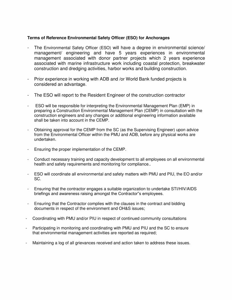
Terms of Reference Environmental Safety Officer (ESO) for Anchorages
- The Environmental Safety Officer (ESO) will have a degree in environmental science/ management/ engineering and have 5 years experiences in environmental management associated with donor partner projects which 2 years experience associated with marine infrastructure work including coastal protection, breakwater construction and dredging activities, harbor works and building construction.
- Prior experience in working with ADB and /or World Bank funded projects is considered an advantage.
- The ESO will report to the Resident Engineer of the construction contractor
- ESO will be responsible for interpreting the Environmental Management Plan (EMP) in preparing a Construction Environmental Management Plan (CEMP) in consultation with the construction engineers and any changes or additional engineering information available shall be taken into account in the CEMP.
- Obtaining approval for the CEMP from the SC (as the Supervising Engineer) upon advice
from the Environmental Officer within the PMU and ADB, before any physical works are undertaken.
- Ensuring the proper implementation of the CEMP.
- Conduct necessary training and capacity development to all employees on all environmental health and safety requirements and monitoring for compliance..
- ESO will coordinate all environmental and safety matters with PMU and PIU, the EO and/or SC.
- Ensuring that the contractor engages a suitable organization to undertake STI/HIV/AIDS briefings and awareness raising amongst the Contractor‟s employees.
- Ensuring that the Contractor complies with the clauses in the contract and bidding
documents in respect of the environment and OH&S issues;
- Coordinating with PMU and/or PIU in respect of continued community consultations
- Participating in monitoring and coordinating with PMU and PIU and the SC to ensure that environmental management activities are reported as required;
- Maintaining a log of all grievances received and action taken to address these issues.

List Of IEE Preparers
Annex 15–
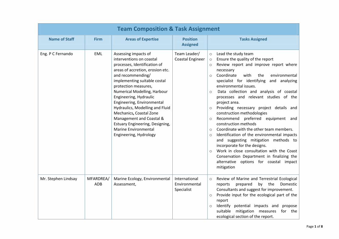
Page 1 of 8
Team Composition & Task Assignment
Name of Staff Firm Areas of Expertise Position
Assigned
Tasks Assigned
Eng. P C Fernando
EML Assessing impacts of
interventions on coastal
processes, Identification of
areas of accretion, erosion etc.
and recommending/
implementing suitable costal
protection measures,
Numerical Modelling, Harbour
Engineering, Hydraulic
Engineering, Environmental
Hydraulics, Modelling and Fluid
Mechanics, Coastal Zone
Management and Coastal &
Estuary Engineering, Designing,
Marine Environmental
Engineering, Hydrology
Team Leader/
Coastal Engineer
o Lead the study team
o Ensure the quality of the report
o Review report and improve report where
necessary
o Coordinate with the environmental
specialist for identifying and analyzing
environmental issues.
o Data collection and analysis of coastal
processes and relevant studies of the
project area.
o Providing necessary project details and
construction methodologies
o Recommend preferred equipment and
construction methods
o Coordinate with the other team members.
o Identification of the environmental impacts
and suggesting mitigation methods to
incorporate for the designs.
o Work in close consultation with the Coast
Conservation Department in finalizing the
alternative options for coastal impact
mitigation
Mr. Stephen Lindsay MFARDREA/
ADB
Marine Ecology, Environmental
Assessment,
International
Environmental
Specialist
o Review of Marine and Terrestrial Ecological
reports prepared by the Domestic
Consultants and suggest for improvement.
o Provide input for the ecological part of the
report
o Identify potential impacts and propose
suitable mitigation measures for the
ecological section of the report.
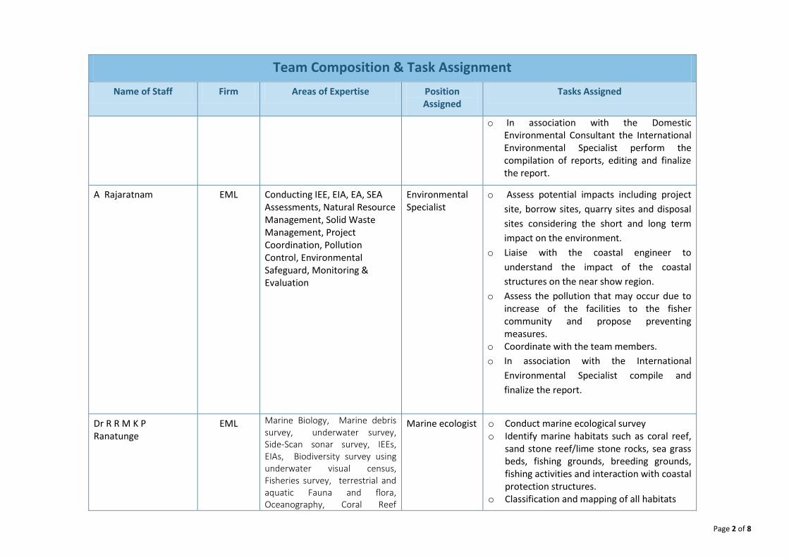
Page 2 of 8
Team Composition & Task Assignment
Name of Staff Firm Areas of Expertise Position
Assigned
Tasks Assigned
o In association with the Domestic
Environmental Consultant the International
Environmental Specialist perform the
compilation of reports, editing and finalize
the report.
A Rajaratnam EML Conducting IEE, EIA, EA, SEA
Assessments, Natural Resource
Management, Solid Waste
Management, Project
Coordination, Pollution
Control, Environmental
Safeguard, Monitoring &
Evaluation
Environmental
Specialist
o Assess potential impacts including project
site, borrow sites, quarry sites and disposal
sites considering the short and long term
impact on the environment.
o Liaise with the coastal engineer to
understand the impact of the coastal
structures on the near show region.
o Assess the pollution that may occur due to
increase of the facilities to the fisher
community and propose preventing
measures.
o Coordinate with the team members.
o In association with the International
Environmental Specialist compile and
finalize the report.
Dr R R M K P
Ranatunge
EML Marine Biology, Marine debris
survey, underwater survey,
Side-Scan sonar survey, IEEs,
EIAs, Biodiversity survey using
underwater visual census,
Fisheries survey, terrestrial and
aquatic Fauna and flora,
Oceanography, Coral Reef
Marine ecologist o Conduct marine ecological survey
o Identify marine habitats such as coral reef,
sand stone reef/lime stone rocks, sea grass
beds, fishing grounds, breeding grounds,
fishing activities and interaction with coastal
protection structures.
o Classification and mapping of all habitats
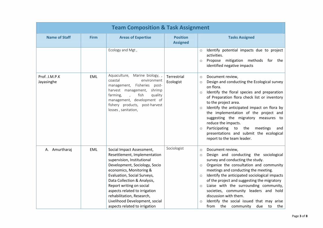
Page 3 of 8
Team Composition & Task Assignment
Name of Staff Firm Areas of Expertise Position
Assigned
Tasks Assigned
Ecology and Mgt ,
o Identify potential impacts due to project
activities.
o Propose mitigation methods for the
identified negative impacts
Prof. J.M.P.K
Jayasinghe
EML Aquaculture, Marine biology, ,
coastal environment
management, Fisheries post-
harvest management, shrimp
farming, , fish quality
management, development of
fishery products, post-harvest
losses , sanitation,
Terrestrial
Ecologist
o Document review,
o Design and conducting the Ecological survey
on flora.
o Identify the floral species and preparation
of Preparation flora check list or inventory
to the project area.
o Identify the anticipated impact on flora by
the implementation of the project and
suggesting the migratory measures to
reduce the impacts.
o Participating to the meetings and
presentations and submit the ecological
report to the team leader.
A. Amurtharaj EML Social Impact Assessment,
Resettlement, Implementation
supervision, Institutional
Development, Sociology, Socio
economics, Monitoring &
Evaluation, Social Surveys,
Data Collection & Analysis,
Report writing on social
aspects related to irrigation
rehabilitation, Research,
Livelihood Development, social
aspects related to irrigation
Sociologist
o Document review,
o Design and conducting the sociological
survey and conducting the study.
o Organize the consultation and community
meetings and conducting the meeting.
o Identify the anticipated sociological impacts
of the project and suggesting the migratory
o Liaise with the surrounding community,
societies, community leaders and hold
discussion with them.
o Identify the social issued that may arise
from the community due to the
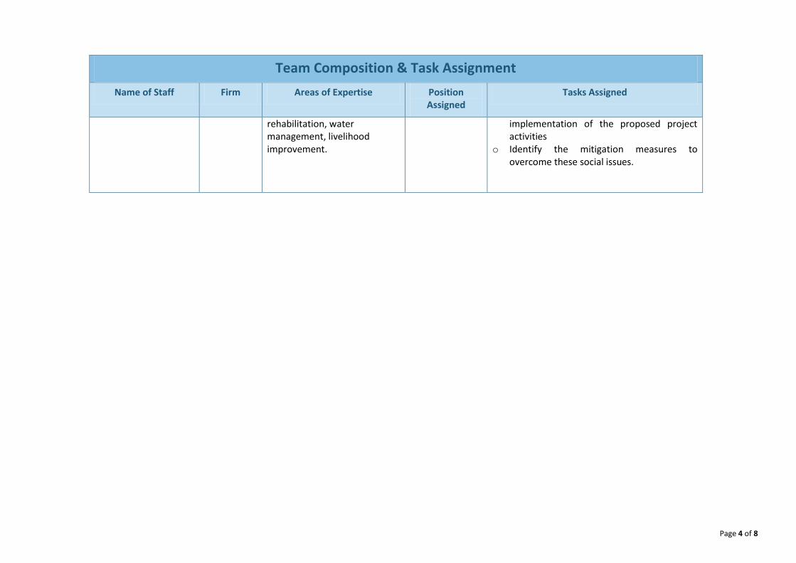
Page 4 of 8
Team Composition & Task Assignment
Name of Staff Firm Areas of Expertise Position
Assigned
Tasks Assigned
rehabilitation, water
management, livelihood
improvement.
implementation of the proposed project
activities
o Identify the mitigation measures to
overcome these social issues.

Page 5 of 8
Team Composition & Task Assignment
Name of Staff Firm Areas of Expertise Position
Assigned
Tasks Assigned
Eng. P C Fernando
EML Assessing impacts of
interventions on coastal
processes, Identification of
areas of accretion, erosion etc.
and recommending/
implementing suitable costal
protection measures,
Numerical Modelling, Harbour
Engineering, Hydraulic
Engineering, Environmental
Hydraulics, Modelling and Fluid
Mechanics, Coastal Zone
Management and Coastal &
Estuary Engineering, Designing,
Marine Environmental
Engineering, Hydrology
Team Leader/
Coastal Engineer
o Lead the study team
o Review report and improve report where
necessary
o Coordinate with the environmental
specialist for identifying and analyzing
environmental issues.
o Providing necessary project details and
construction methodologies
o Recommend preferred equipment and
construction methods
o Coordinate with the other team members.
o Data collection and analysis of coastal
processes and relevant studies of the
project area.
o Identification of the environmental impacts
and suggesting mitigation methods to
incorporate for the designs.
o Work in close consultation with the Coast
Conservation Department in finalizing the
alternative options for coastal impact
mitigation
Mr. Stephen Lindsay MFARDREA/
ADB
Marine Ecology, Environmental
Assessment,
International
Environmental
Specialist
o Provide input for the marine and ecological
part of the report for existing environment.
o Identify potential impacts and propose
suitable mitigation measures for the marine
ecological section of the report.
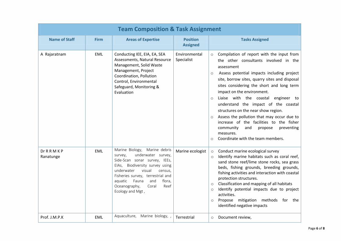
Page 6 of 8
Team Composition & Task Assignment
Name of Staff Firm Areas of Expertise Position
Assigned
Tasks Assigned
A Rajaratnam EML Conducting IEE, EIA, EA, SEA
Assessments, Natural Resource
Management, Solid Waste
Management, Project
Coordination, Pollution
Control, Environmental
Safeguard, Monitoring &
Evaluation
Environmental
Specialist
o Compilation of report with the input from
the other consultants involved in the
assessment
o Assess potential impacts including project
site, borrow sites, quarry sites and disposal
sites considering the short and long term
impact on the environment.
o Liaise with the coastal engineer to
understand the impact of the coastal
structures on the near show region.
o Assess the pollution that may occur due to
increase of the facilities to the fisher
community and propose preventing
measures.
o Coordinate with the team members.
Dr R R M K P
Ranatunge
EML Marine Biology, Marine debris
survey, underwater survey,
Side-Scan sonar survey, IEEs,
EIAs, Biodiversity survey using
underwater visual census,
Fisheries survey, terrestrial and
aquatic Fauna and flora,
Oceanography, Coral Reef
Ecology and Mgt ,
Marine ecologist o Conduct marine ecological survey
o Identify marine habitats such as coral reef,
sand stone reef/lime stone rocks, sea grass
beds, fishing grounds, breeding grounds,
fishing activities and interaction with coastal
protection structures.
o Classification and mapping of all habitats
o Identify potential impacts due to project
activities.
o Propose mitigation methods for the
identified negative impacts
Prof. J.M.P.K EML Aquaculture, Marine biology, , Terrestrial o Document review,
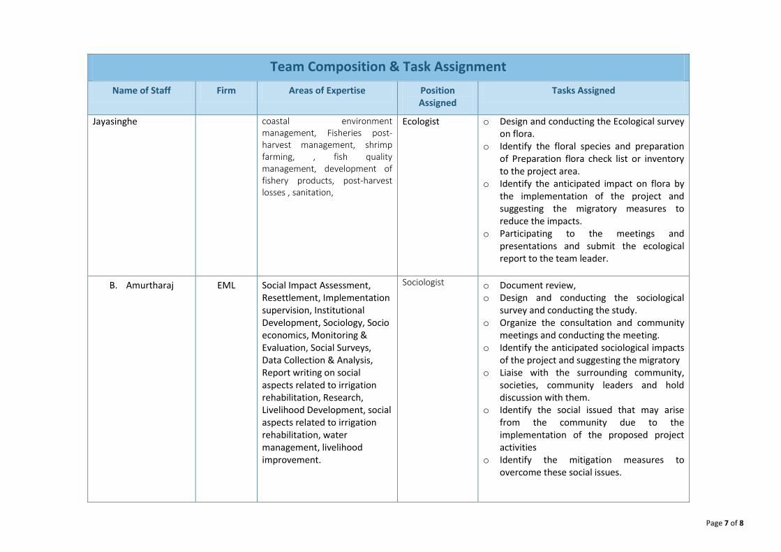
Page 7 of 8
Team Composition & Task Assignment
Name of Staff Firm Areas of Expertise Position
Assigned
Tasks Assigned
Jayasinghe coastal environment
management, Fisheries post-
harvest management, shrimp
farming, , fish quality
management, development of
fishery products, post-harvest
losses , sanitation,
Ecologist o Design and conducting the Ecological survey
on flora.
o Identify the floral species and preparation
of Preparation flora check list or inventory
to the project area.
o Identify the anticipated impact on flora by
the implementation of the project and
suggesting the migratory measures to
reduce the impacts.
o Participating to the meetings and
presentations and submit the ecological
report to the team leader.
B. Amurtharaj EML Social Impact Assessment,
Resettlement, Implementation
supervision, Institutional
Development, Sociology, Socio
economics, Monitoring &
Evaluation, Social Surveys,
Data Collection & Analysis,
Report writing on social
aspects related to irrigation
rehabilitation, Research,
Livelihood Development, social
aspects related to irrigation
rehabilitation, water
management, livelihood
improvement.
Sociologist
o Document review,
o Design and conducting the sociological
survey and conducting the study.
o Organize the consultation and community
meetings and conducting the meeting.
o Identify the anticipated sociological impacts
of the project and suggesting the migratory
o Liaise with the surrounding community,
societies, community leaders and hold
discussion with them.
o Identify the social issued that may arise
from the community due to the
implementation of the proposed project
activities
o Identify the mitigation measures to
overcome these social issues.