excavations at the mound of van fortress 2011
TRANSCRIPT
COLLOQUIUMANATOLICUM
XI
2012
ANADOLU SOHBETLERİ
INSTITUTUM TURCICUM SCIENTIAE ANTIQUITATIS
TÜRK ESKİÇAĞ BİLİMLERİ ENSTİTÜSÜ
Ayrıbasım /Offprint
INSTITUTUM TURCICUM SCIENTIAE ANTIQUITATISTÜRK ESKİÇAĞ BİLİMLERİ ENSTİTÜSÜ
COLLOQUIUM ANATOLICUMANADOLU SOHBETLERİ
XI
TÜRK ESKİÇAĞ BİLİMLERİ ENSTİTÜSÜİstiklal Cad. No. 181 Merkez Han Kat: 2 34433 Beyoğlu-İstanbul
Tel: + 90 (212) 292 0963 / + 90 (212) 514 [email protected] www.turkinst.org
ISSN 1303-8486
COLLOQUIUM ANATOLICUM dergisi, TÜBİTAK-ULAKBİM Sosyal Bilimler Veri Tabanında taranmaktadır.
COLLOQUIUM ANATOLICUM dergisi hakemli bir dergi olup, yılda bir kez yayınlanmaktadır.
© 2012 Türk Eskiçağ Bilimleri Enstitüsü
Her hakkı mahfuzdur. Bu yayının hiçbir bölümü kopya edilemez. Dipnot vermeden alıntı yapılamaz ve izin alınmadan elektronik, mekanik,
fotokopi vb. yollarla kopya edilip yayınlanamaz.
Editörler/EditorsMetin Alparslan
Ali Akkaya
Baskı / PrintingMAS Matbaacılık A.Ş.
Hamidiye Mah. Soğuksu Cad. No. 3 Kağıthane - İstanbulTel: +90 (212) 294 10 00 Fax: +90 (212) 294 90 80
Sertifika No: 12055
Yapım ve Dağıtım/Production and DistributionZero Prodüksiyon Kitap-Yayın-Dağıtım Ltd. Şti.
Tel: +90 (212) 244 7521 Fax: +90 (212) 244 [email protected] www.zerobooksonline.com

COLLOQUIUMANATOLICUM
XI
2012
ANADOLU SOHBETLERİ
INSTITUTUM TURCICUM SCIENTIAE ANTIQUITATIS
TÜRK ESKİÇAĞ BİLİMLERİ ENSTİTÜSÜ
Ayrıbasım /Offprint

INSTITUTUM TURCICUM SCIENTIAE ANTIQUITATISTÜRK ESKİÇAĞ BİLİMLERİ ENSTİTÜSÜ
COLLOQUIUM ANATOLICUMANADOLU SOHBETLERİ
XI
TÜRK ESKİÇAĞ BİLİMLERİ ENSTİTÜSÜİstiklal Cad. No. 181 Merkez Han Kat: 2 34433 Beyoğlu-İstanbul
Tel: + 90 (212) 292 0963 / + 90 (212) 514 [email protected] www.turkinst.org
ISSN 1303-8486
COLLOQUIUM ANATOLICUM dergisi, TÜBİTAK-ULAKBİM Sosyal Bilimler Veri Tabanında taranmaktadır.
COLLOQUIUM ANATOLICUM dergisi hakemli bir dergi olup, yılda bir kez yayınlanmaktadır.
© 2012 Türk Eskiçağ Bilimleri Enstitüsü
Her hakkı mahfuzdur. Bu yayının hiçbir bölümü kopya edilemez. Dipnot vermeden alıntı yapılamaz ve izin alınmadan elektronik, mekanik,
fotokopi vb. yollarla kopya edilip yayınlanamaz.
Editörler/EditorsMetin Alparslan
Ali Akkaya
Baskı / PrintingMAS Matbaacılık A.Ş.
Hamidiye Mah. Soğuksu Cad. No. 3 Kağıthane - İstanbulTel: +90 (212) 294 10 00 Fax: +90 (212) 294 90 80
Sertifika No: 12055
Yapım ve Dağıtım/Production and DistributionZero Prodüksiyon Kitap-Yayın-Dağıtım Ltd. Şti.
Tel: +90 (212) 244 7521 Fax: +90 (212) 244 [email protected] www.zerobooksonline.com
Uluslararası Akademiler Birliği Muhabir ÜyesiCorresponding Member of the International Union of Academies
TÜRK ESKİÇAĞ BİLİMLERİ ENSTİTÜSÜ
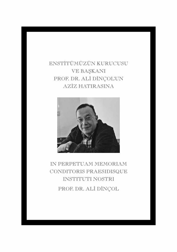
ENST‹TÜMÜZÜN KURUCUSU
VE BAfiKANI
PROF. DR. AL‹ D‹NÇOL’UN
AZ‹Z HATIRASINA
IN PERPETUAM MEMORIAM
CONDITORIS PRAESIDISQUE
INSTITUTI NOSTRI
PROF. DR. AL‹ D‹NÇOL
İçindekiler / Index Generalis
Konferanslar / ColloquiaIlısu Barajı Etki Alanında Kalan Salat Tepe Kazıları Işığında Yukarı Dicle Havzası’nın Orta Tunç ÇağıA. Tuba Ökse .................................................................................................................................................................................................. 1Orta Anadolu’da Coğrafya ve Ekonomi: Hititlerin Bıçak Sırtındaki İmparatorluğuAndreas Schachner ............................................................................................................................................................................ 25Menderes Bölgesinde MÖ 2. Binyıl Kenti: Çine-TepecikSevinç Günel ................................................................................................................................................................................................ 55Smyrna (İzmir) Yakınlarında Birçok Kültürü Barındıran Dağ: Nif (Olympos)Elif Tül Tulunay ....................................................................................................................................................................................... 81
Makaleler / CommentationesA Pre-Pottery Neolithic Site in Southeastern Anatolia: PapazgölüÇiler Altınbilek-Algül ................................................................................................................................................................ 101Adana Müzesi’nde Korunan Kalıp Yapımı Kâseler Aynur Civelek – H. Yener Taş ........................................................................................................................................ 123Oluz Höyük Kazısı Beşinci Dönem (2011) Çalışmaları: Değerlendirmeler ve SonuçlarŞevket Dönmez .................................................................................................................................................................................... 151İç Kuzeybatı Anadolu İlk Tunç Çağı Gözlü Süs İğneleri (Toggle Pin)Erkan Fidan ............................................................................................................................................................................................... 1791985’ten Günümüze İstanbul Üniversitesi Prehistorya Laboratuvarı Koleksiyonuna Eklenen Sürtmetaş Alet Endüstrisi Buluntuları Üzerine DeğerlendirmeEmre Güldoğan ................................................................................................................................................................................... 205Excavations at the Mound of Van Fortress - 2011Erkan Konyar – İsmail Ayman – Can Avcı – Davut Yiğitpaşa Bülent Genç – Rıza Gürler Akgün .......................................................................................................................... 219
viii
Le rituel d’Allī d’Arzawa contre un ensorcellement (CTH 402): texte et contexteAlice Mouton .......................................................................................................................................................................................... 247Kapadokya MÖ 6. Binyıl Kronolojisinin Kayıp Halkası: Gelveri Çanak Çömleği Üzerine En Son ÇalışmalarOzan Özbudak ...................................................................................................................................................................................... 267Hitit Kenti HARzivana’nın Yeri HakkındaSüleyman Özkan ................................................................................................................................................................................ 299Kantuzzili: “Genç” Tutḫaliya İçin Kral Naibi ?Oğuz Soysal ............................................................................................................................................................................................... 309Coins from Allianoi Excavations: Campaign of 1998Oğuz Tekin – Aliye Erol-Özdizbay ........................................................................................................................ 347Suluca Karahöyük İdolleriAtila Türker ................................................................................................................................................................................................ 403Lycian Forms of the Enclitic Pronoun of the 3rd Person: An Overview of the Relevant DataFred C. Woudhuizen .................................................................................................................................................................... 415
Kitap Eleştirileri / RecensionesPalumbi, G., The Red and Black: Social Social and Cultural Interaction Between the Upper Euphrates and the Southern Caucasus Communities in the Fourth and Third Millennium B.C., Sapienza Universita di Roma (SPO) Vol. 2, (Roma, 2008).(Mehmet Işıklı) .................................................................................................................................................................................... 437Dariusz Maliszewski, New Light on the Bronze Age Ceramics from H. Schliemann’s Excavations at Troy. Studies on the Munich and Poznań Collections within the Anatolian-Aegean Cultural Context. British Archaeological Reports International Series 2119, Oxford 2010, pp. I-IV, 1-402, 15 tables, 1 map, 117 black and white drawings, 181 black & white photographs, 63 color photographs.(Jak Yakar) ................................................................................................................................................................................................... 449
CollAn XI 2012 219-245
Excavations at the Mound of Van Fortress - 2011*
Erkan KONYAR – İsmail AYMAN – Can AVCI – Davut YİĞİTPAŞA Bülent GENÇ – Rıza Gürler AKGÜN
Keywords: Tuspa/Van Fortress Mound, Urartu Mimarisi, Ortaçağ Mezarlığı, İlk Tunç Çağı Buluntuları, Urartu Buluntuları
Anahtar Kelimeler: Tuşpa/Van Kalesi Höyüğü, Urartian Architecture, Medieval Cemetery, Early Bronze Age Finds, Urartian Finds
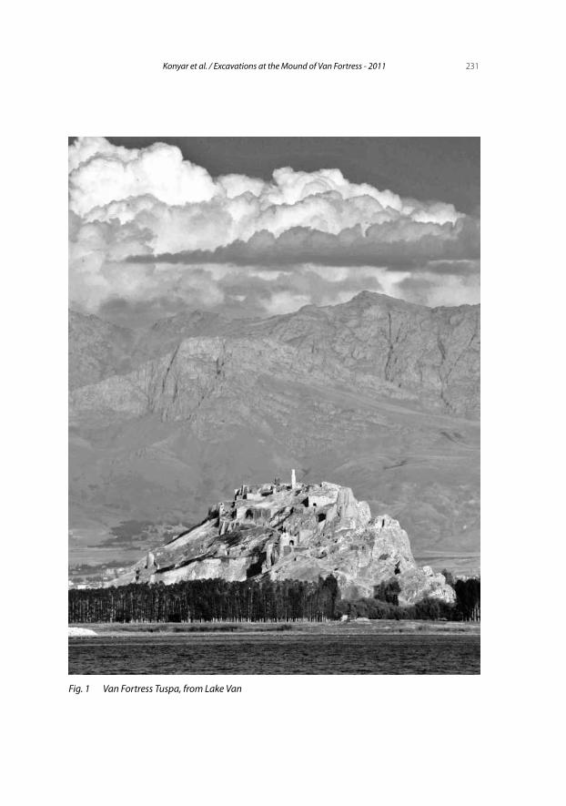
Van Fortress or Tuspa was the capital city of the Urartians, the founders of the Urartian Kingdom centered in the Lake Van Basin between the ninth and the sixth centuries BC. It rises on the eastern shore of Lake Van on a conglomerate rocky outcrop, measuring approximately 1250 m in length and 70-80 m in width (Fig. 1). Every corner of this outcrop was utilized by the Urartian architects. Here the royal rock tombs, monumental open air sanc-tuaries, palaces and other architectural remains are the major features that immediately attract attention. Inscriptions, cuneiform stelae and other im-pressive monuments cement Tuspa’s importance as the Urartian capital. It is possible to trace the material remains of 200 years of Urartian domination in, and the cultural and historical chronology of the lower settlement layers, i.e. the mound of Van fortress, which spread throughout the fortress and its surroundings.
Located immediately to the north of Tuspa, the 750 m long mound lies in the east-west direction and extends parallel to the citadel. Its southern part is named as the Old City of Van. Both “the Mound” and the Old City of Van formed the lower settlement of Tuspa in the Urartian period.
* This work was supported by Scientific Research Projects Coordination Unit of Istanbul University (Project nos. 24872 - 24874), Ministry of Culture General Directorate of Cultural Assests and Museums – DÖSİMM and AYGAZ. We would like to thank all the organizations, which contrib-uted to the excavation.
220 Colloquium Anatolicum XI 2012
During the excavations at the westernmost tip of the mound between 1989 and 1991 an area of 400 m2 was investigated, where a building consisting of 15 rooms was unearthed. This architectural complex with stone foundations and mud-brick walls was named “Early Architectural Phase”, which is above a conflagration layer dating to the eighth century BC. A later phase, the “Late Architectural Phase” as it is called, was extremely destroyed by later burials and is dated to seventh century BC.
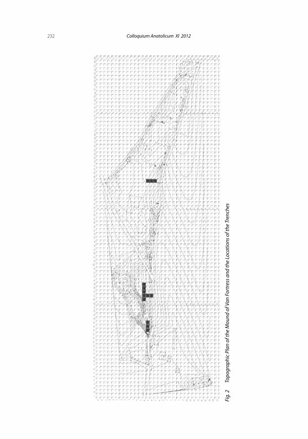
The 2011 excavation at the Tuspa-Van fortress was conducted in 10 trenches (10 x 10 m) within Area A in the west, and in the middle section of Area B to the east of the mound.
Excavations at Area AIn 2011 campaign excavations were carried out in trenches N19, N20,
M27, M28, M29, M30, N27 and O27 in the west end of the mound (Fig. 2). Between 1989 and 1991, in three trenches excavated by Prof. M. Taner Tarhan at the westernmost tip of the area, the Urartian and Early Bronze Age burial layers were partly studied. Belonging to the early phase of the two-phase Urartian layer, an architectural complex consisting of 15 rooms was unearthed (Tarhan 1989; 1994; 2000; 2001; 2003; Tarhan-Sevin 1990; 1991; 1992; 1993; Sevin 1994). During the second season of the excavations in 2010, the architectural remains discovered in the 1989-1991 campaigns were reo-pened and cleaned; passive conservation was also applied (Konyar 2011).
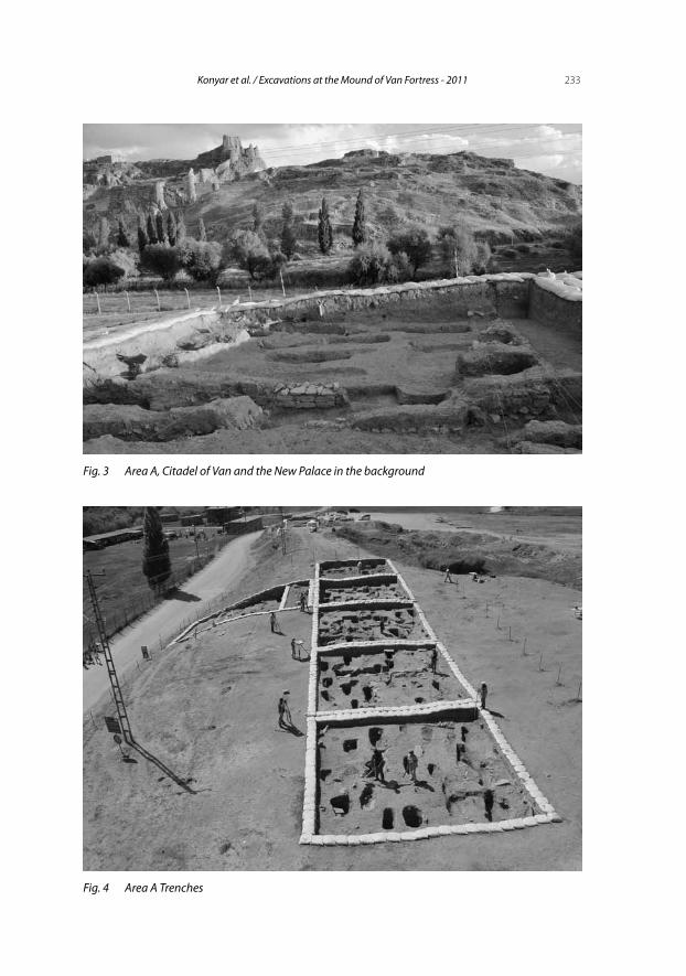
Area A is located at the highest point from the plain level, where the stra-tigraphy could be observed better. Here, new work would be very important for questioning the results from the previous campaigns and planning future excavations. Based on the areas unearthed in the 1989-1991campaign, the ex-cavation area was expanded. The area is situated approximately 90 m north from the point where Tuspa Citadel gets closest to the plain level (Fig. 3). From this point it is possible to observe Urartian structures descending on terraces from the north of citadel, wall remains on the plain and foundations carved into the bedrock.
Topographically, the most convenient areas for access to the citadel are also situated in this area. Area A stands out as one of the most convenient points for the connection of the capital Tuspa’s Lower City with the fortress. Taner Tarhan, Veli Sevin and other scholars point out that here the access to the palace was from the “Ramp” on the low slopes of “New Palace” facing the mound (Tarhan – Sevin 1990: 357-358). Its proximity to Sardur Wall further emphasize the relation between here and the citadel.
221Konyar et al. / Excavations at the Mound of Van Fortress - 2011
The CemeteryThe cemetery in the Mound’s upper layer is 340 m long, extending in west-
east direction and covering the western and the middle parts of the Mound. It measures 250 m in width, though its boundaries have not been firmly deter-mined (Fig. 4).
Exactly when the cemetery began to be used in the Medieval Period can-not be established from the available data, but it is possible to say that the burials continued until the middle of the 20th century.
Excavations have revealed 122 Late Phase burials, 54 of which are Muslim and 29 of Christian. It was not possible to determine the religious identity of the remaining 38 graves due to destruction and the bad state of adult and infant skeletons.
The graves typologically differ from each other. The covers are mostly flat sandstones. In some cases gravestones were placed at the head and feet of the deceased. They are plain stones without any inscription or ornament.
They fall into five typological groups:
1- Earth graves covered with flagstones,2- Earth graves without flagstones, 3- Mudbrick Cist Graves, 4- Cist Graves, 5- Burials with gravestones lined with partly dressed small stones with
small rubble stones in the middle.Muslim burials in the cemetery are oriented in west-east direction with
heads facing south, bodies slightly turned to south and knees slightly drawn into stomach, while in Christian examples, where the body also lies in west-east direction, bodies rest on their back with head elevated by stone or a hump of soil or mud.
It is understood from the frequency of the grave pits that there had been an intense burial activity at the area, hence intersecting graves. New graves were usually dug carefully in order not to damage the old burials. Sometimes skeletal remains belonging to the previous burial were gathered at a differ-ent spot in the same grave. Similar structural features and the lack of eleva-tion difference make it hard to distinguish the graves chronologically from each other. It was found, however, that in lower levels the Christian burials are more intense sometimes intersecting with Muslim graves. it would not be wrong to say, therefore, that the cemetery was first used by Christians.
222 Colloquium Anatolicum XI 2012
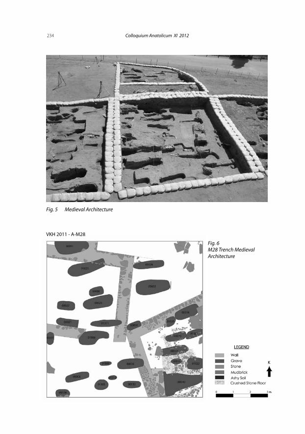
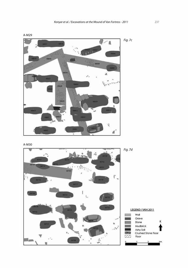
Medieval ArchitectureStarting from the western tip of the mound, at the M27-M30 trenches, a
number of architectural features were revealed beneath the burial layers. Two phases, severely disturbed by graves, were identified here, which we have ten-tatively defined as phases I and II. The latter gives a more intelligible plan (Fig. 5).
The 80 cm thick Phase I walls indicate the existence of a rather large place. They were built using partly dressed large stones with small rubble stones as filling, and mud as binding material. They seemingly belong to a large place with a square plan, which possibly lies on the northeast-southwest axis. Faint architectural traces, lacks of in-situ finds and of a solid pottery context make it difficult to speculate about the function and the chronology of the place.
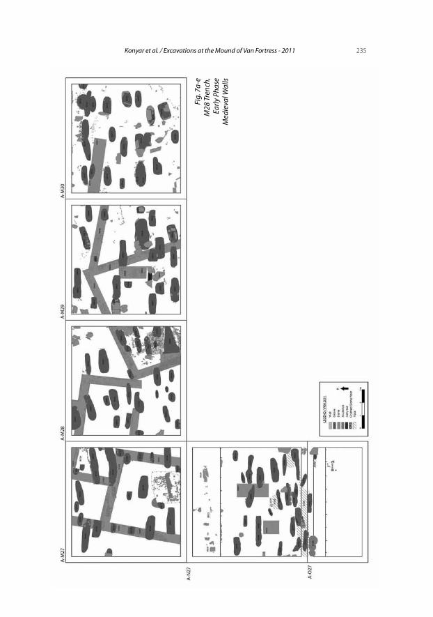
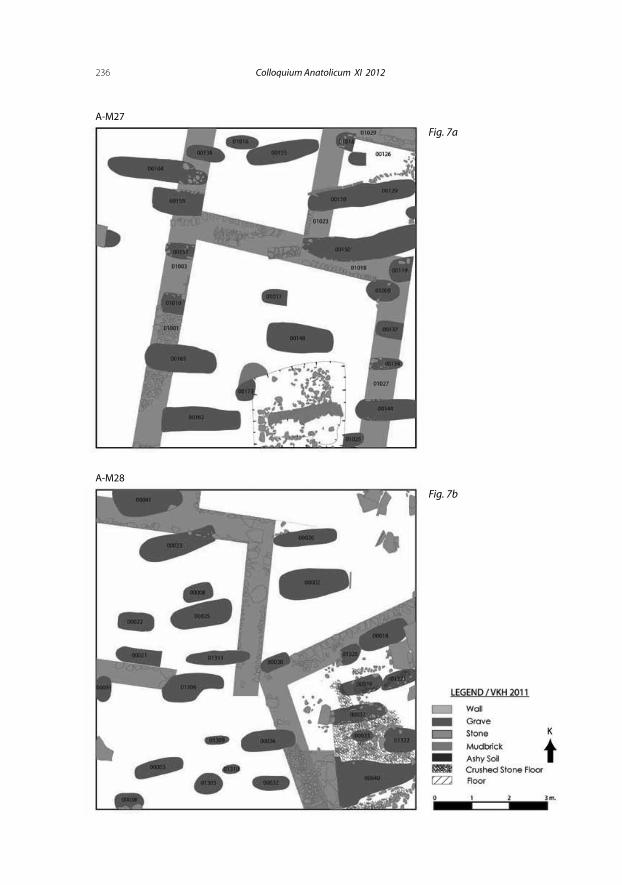
The Phase II architecture consists of rooms that offer a clearer pattern compared to the Phase I architecture. The 80-90 cm thick walls were built with small stones (Fig. 6). At some parts, it is possible to find one or two lines of mud brick (Fig. 7). They too were destroyed severely by the grave pits. In ad-dition, it contains several architectural features of varying dimensions, formed by main and mid-walls lying on northeast-southwest/southeast-northwest axis. Features or walls unearthed in four trenches indicate a structural pattern that could cover over a huge part of Area A (Fig. 8). Pottery from all layers or the phases at the mound is mixed. Glazed and unglazed wares are dominant, though Urartian and Early Bronze Age ceramics are also represented.
Urartian LayerThe 1989-1991 campaigns had revealed a Urartian building with two
phases (“early” and “late”) at Area A, characterized by their depth, finds and architecture. The “Late Phase” produced architecturally weak traces due to the destruction by burials. In contrast, the assemblage is rich with iron and bronze arrowheads, a fibula, armor scales, a bone seal, a stone amulet, a lead pin and big storage jars, pottery, a horse-shaped rhyton and twin pots. Lack of architectural evidence, however, does not allow further speculation.
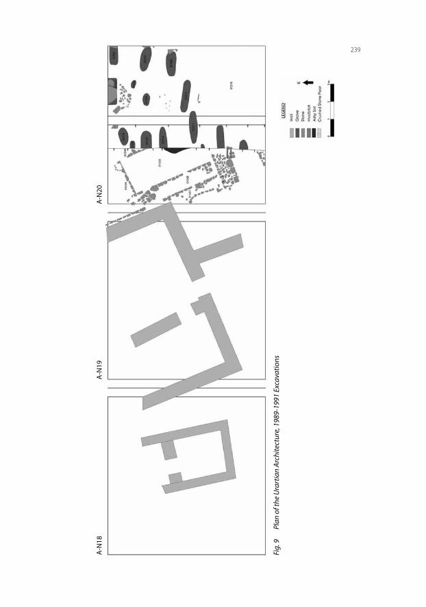
Beneath the Late Phase is a building level (the “Early Phase”) that gives a more explicit architectural plan and (Fig. 9-10). It contains a building with 15 rooms, which seems to be an Urartian house or a building complex formed by several houses. They have stone-paved, shed-like spaces. There is also a small storeroom with two big jars buried in the floor and a room with mud brick-paved floor. Due to its proximity to the Tuspa Citadel, the characteristics
223Konyar et al. / Excavations at the Mound of Van Fortress - 2011
of the stone foundations and number of the rooms it comprises, it has been it has been claimed that the building belonged to “distinguished families” (Tarhan 2011: 331).
Similar buildings were encountered at the city of Teişebaini-Uru (Karmir-Blur/Armenia) (Forbes 1983: fig 67). Houses at the lower settlement of Teişebaini-Uru consist of several rooms and a large hall. They are entered through sheds supported by wooden posts. Large quarters were formed by combination of houses, which were presumably settled by smaller families were using those houses. These quarters are divided by streets (Martirosjan 1964: 265-266). Similar houses have been excavated the southwest quarter of the lower settlement of Argiştihinili (Armavir-Blur/Armenia). Although it is thought that they belonged to soldiers who were living in the city, this view is no more than an assumption. It was the lack of finds from the houses that gave the impression that these could be residences of soldiers (Martirosjan 1964: 233). But alternatively, this phenomenon can also be explained by ex-istence of poor families –probably with portable belongings- living in these houses. Furthermore, it is also possible that they were somehow evacuated or looted. Architecturally speaking, house plans and building materials at Argiştihinili suggest a similarity to those of houses located at the Mound of Van Fortress. Similar house types were observed at Rusa-i Uru Tur (Bastam-Iran). Like at Teişebaini-Uru, some sort of the street plan can be discerned seen at Rusa-i Uru-Tur. The above-mentioned cities too have houses, which were presumably by the “elites”. They are surrounded by thick walls are sup-ported by buttresses placed at regular intervals and risalites at the corners
Comparing the Urartian houses of this type with the simpler houses at the Mound, it seems that buttressed walls, a common characteristic of Urartian architecture, are only an aesthetical detail, i.e. an architectural ornament, not a functional element to support the walls (Kleiss 1978: 399).
The Urartian settlement at Bastam consists of simple houses of rectangu-lar plan with unsupported walls, similar to the examples at the Mound of Van Fortress. However, while the architectural layers of the lower settlement in Bastam are evident, this is not the case at the Mound of Van Fortress. The use of the Mound as a cemetery for a long time and burial activities certainly caused depredation of the architectural remains, though an apparent dissimi-larity can be observed.
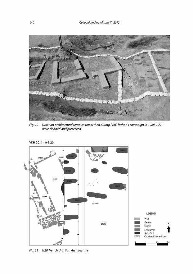
A 1 meter-thick stone wall (numbered 01521) was discovered to the west of the trench and an extent of 7 m was unearthed (Fig. 11). 2.3 meters-extent of another wall in the east-west direction, which meets the former, was also
224 Colloquium Anatolicum XI 2012
excavated. An iron arrowhead from beneath the foundation level of the wall 01521 point to a later date for the wall.
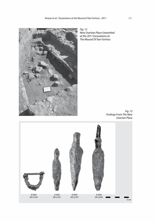
Parallel and immediately to the east of this wall is a platform or a bench, measuring 5x0.80 cm. To the north, it joins a 3-meters wall lying in east-west direction. Opposing it, is yet a another wall to the west of the trench lying in north-south direction with a length of 1.80 m. These together form a room measuring 10 sq. m (Fig. 12). The deposit from this area is characterized by traces of debris and conflagration traces, various animal bones and Urartian pottery, all in a mixed condition. Judging from several marks on the animal bones, they seem to be production refuses.
Near the eastern wall an intact bronze fibula (VK 12739) was discovered. It is observed that this deposit layer and the finds extend well under the archi-tectural remains. That is to say, the evidence initially suggests that this struc-ture in the N20 trench was built on a Urartian deposit.
The 2011 excavation at the trench N20 revealed typical Urartian finds be-neath the Early Phase building, in an ash layer that could be precursor of a new phase earth. They include consist a bronze fibula, iron arrowheads, a fish hook and red slip pottery fragments (Fig. 13).
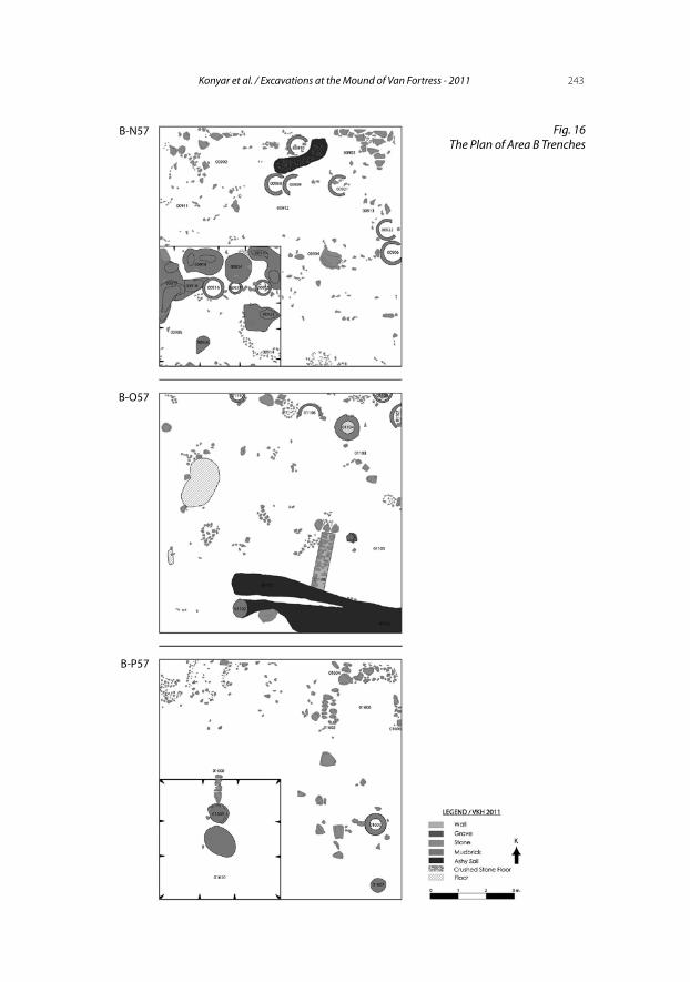
In addition to the Urartian structure that was found last year in the trench N27 at the center of Area A, Urartian walls were excavated in trenches M28 and M29. They were built with medium-sized, partly-worked stones that are 95-100 cm in thickness (Fig. 14) and debris was used as the filling material. They run in north-east direction, on which a layer of clay and gravel mixture. Considering another Urartian building unearthed in the previous campaign, a 1.20-1.70 meter thick Urartian layer is now evident over whole excavation area. Based on these discoveries and the Urartian walls in the trenches M28 and M29, we can safely assume the existence of an Urartian architectural lay-er spread through the Mound.
Early Bronze Age LayerAs it is well known, The Mound of the Van Fortress includes characteris-
tic ceramic types and typologies of Early Bronze Age. In excavations carried out so far, however, no architectural traces relevant to the period have been discovered. One of the most important results of this year’s campaign was the discovery of Early Bronze Age architectural remains, albeit faint. At the trenches N27 and O27 on the south slope of the Mound, a pressed clay floor was found. Evidence for renovation and traces belonging to a second floor
225Konyar et al. / Excavations at the Mound of Van Fortress - 2011
can easily be observed. An orange colored and bright dark-faced Karaz pot-tery fragment, characteristic of Early Bronze Age, was found on the floor.
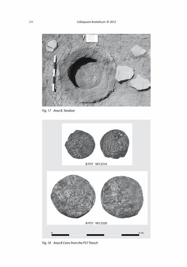
Area B ExcavationsAt Area B at the central part of the mound (approximately 270 m east of
Area A), excavations were carried out in three adjacent trenches in north-south direction (Fig. 15-16). All of them produced wall fragments probably related to each other; floors of pressed clay or stone paving; a high number of tandoors, hearths and ash pits. Buildings or architectural features reflect two phases, namely Early and Late Medieval. The latter is represented by a wall, tandoors and ash pits, whereas the former includes a hearth found beneath one of the late phase walls. The ceramic repertoire, three coins found on the same level with the building, and the elements belonging to the late phase are important evidence for dating.
Due to the reasons explained in detail, we could not achieve any plans of buildings that these walls belong. However, the 15 tandoors and many ash pits found in the area, suggest that they could have been used as a kitchen for public services or a tandoor house used by the people in a settlement. Edges of the tandoors are approximately 40-50 cm in width, which increases to 0.90-1 m around the body. Their wall thickness varies between 3 and 10 cm. Their ledges are adorned with fingerprint technique. Ash pits are found around almost every tandoor (Fig. 17).
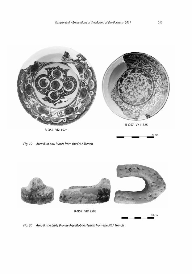
Three coins found at the same level with the wall, tandoors, ash pits and floor fragments belong to the İlhanlı Period (Fig. 18). The initial analysis showed that they belong to the 13th century. In addition to the coins, two in-situ glazed plates supports this dating (Fig. 19).
Urartian and Early Bronze Age FindsThe 2011 campaign did not yield architectural evidence for Urartian and
Early Bronze Age layers in Area B. Nevertheless Urartian and Early Bronze Age ceramics from the Late Phase ash pits in particular, a baked clay hearth and a baked clay animal figurine are the precursors of architectural evidence to be found in future excavations. Another important Early Bronze Age find is a mobile hearth. It was found in pieces at the bottom of one of the ash pits in trench N57. The horseshoe-shaped hearth is made of baked clay and adorned with fingerprint technique (Fig. 20). Similar types were unearthed at the centers like Tepecik, Pulur and Sakyol in the Elazığ and Malatya region.
226 Colloquium Anatolicum XI 2012
Erkan Konyarİstanbul Üniversitesi, Edebiyat Fakültesi, Eskiçağ Tarihi Anabilim Dalı34134 Fatih-İstanbul/Tü[email protected]
İsmail Aymanİstanbul Üniversitesi, Edebiyat Fakültesi, Eskiçağ Tarihi Anabilim Dalı34134 Fatih-İstanbul/Tü[email protected]
Can Avcıİstanbul Üniversitesi, Edebiyat Fakültesi, Eskiçağ Tarihi Anabilim Dalı34134 Fatih-İstanbul/Tü[email protected]
Davut YiğitpaşaOndokuz Mayıs Üniversitesi Fen-Edebiyat Fakültesi Arkeoloji Bölümü Protohistorya ve Önasya Arkeolojisi ABD Kurupelit Kampüsü/Samsun/Tü[email protected]
Bülent GençMarmara Üniversitesi, Fen-Edebiyat FakültesiEskiçağ Tarihi Anabilim DalıGöztepe-Kadıköy/Tü[email protected]
Rıza Gürler Akgünİstanbul Üniversitesi, Edebiyat Fakültesi, Eskiçağ Tarihi Anabilim Dalı34134 Fatih-İstanbul/Tü[email protected]
227Konyar et al. / Excavations at the Mound of Van Fortress - 2011
Van Kalesi Höyüğü
Van Kalesi Höyüğü, Tuşpa Sitadeli’nin hemen kuzeyinde, onunla aynı doğrultuda uzanır. Doğu-batı ekseninde ise yaklaşık 750 m uzunluğunda olan höyüğün, güneyinden geçen yol ve kuzeyindeki modern yapılaşma güney-kuzey eksenindeki sınırlarının saptanmasını zorlaştırmaktadır. Höyük bel-geleme sistemi, topografik özellikleri ve yüzey bulguları göz önüne alınarak üç ana bölgeye ayrılmıştır. Batısından başlayarak ortalarına kadar uzanan ve modern bir yol tarafından bölünen alan A Alanı, orta kısmı “B Alanı” ve en doğudaki bölümü ise “C Alanı” olarak adlandırılmıştır (Fig. 2).
1989-1991 yılları arasında Prof. Dr. M. Taner Tarhan başkanlığında A Alanı’nın batı uç noktasında açılan 3 açmada Ortaçağ, Geç Demir Çağ, Urartu ve İlk Tunç Çağı tabakaları kısmen incelenebilmiş; iki evreli olarak tanımla-nan Urartu tabakasının erken evresine ait, açma sınırları dahilinde 15 odadan oluşan bir mimari kompleks ortaya çıkarılmıştır. Tarafımızdan 2010 yılında başlayan ikinci sezon kazı çalışmaları da aynı alanlarda sürdürülmüştür. 2011 kazı sezonunda yine A Alanı’ndaki çalışmaların yanı sıra B Alanı’nda da kazı çalışmalarına başlanmıştır.
A Alanı höyüğün ova düzeyinden en yüksek olduğu bölgedir. Bu neden-le tabakalanmanın daha iyi izlenebileceği ön görülmüştür. A Alanı Tuşpa Sitadeli’nin mimari unsurlarının da ova düzeyine en yakın konumlandığı böl-gedir. Höyüğün hemen güneyinde (Yaklaşık 90 m) teraslar yaparak ova dü-zeyine kadar inen Urartu yapılarının, surlarının duvar kalıntıları, ana kayaya açılmış temel yatakları açık bir şekilde izlenebilmektedir. Topografik açıdan kaleye erişim için en uygun alanlar yine bu bölümde yer alır. Prof. Dr. Tarhan başta olmak üzere birçok araştırmacı bu alanda, Yeni Saray bölümünün, hö-yüğe bakan alçak yamaçlarında “Rampalı Yol” olarak tanımlanan alandan ka-leye ulaşımın sağlandığını öne sürmektedirler. Dolayısıyla A Alanı, başkent Tuşpa’nın Aşağı Kenti’nin kaleyle bağlantısına yaya ve araç ulaşımına olanak tanıyan en elverişli bölge olarak ön plana çıkmaktadır.
2011 çalışmalarında Höyüğün tüm tabakalarına ilişkin mimari katman-lar ve buluntulara ulaşılmıştır. Yukarıda da değindiğimiz gibi geç tabakayı iki farklı evrede kullanılan mezarlık alanı oluşturmaktadır. Hıristiyan ve İslami Dönem gömüleri aynı alanda izlenebilmektedir. Buluntu ve tabakalanmanın ön verileri, mezarlık alanının kullanımının kronolojisi konusunda henüz net bilgiler vermemekle birlikte; Hıristiyan gömülerin daha erken olduğuna dair stratigrafik veriler ve buluntular mevcuttur.
228 Colloquium Anatolicum XI 2012
Mezarlar hemen hemen tüm açmalarda izlenebilen iki evreli bir mimari tabakayı büyük oranda tahrip etmiştir. İşlenmemiş taşlardan 80-100 cm ka-lınlıkta inşa edilen temel üzerinde yükselen kerpiç bedenli duvarların oluştur-duğu mimari, birbirileriyle bağlantılı kare ve dikdörtgen oda ve salonlardan meydana gelir. Söz konusu yapı katının kronolojisiyle ilgili kimi ön veriler elde edilmekle birlikte gelecek kazı sezonlarında tarihlendirme noktasında daha net bilgilere ulaşacağımızı umut etmekteyiz.
Söz konusu yapı katlarının altında, A Alanı’nın çeşitli noktalarında Urartu dönemi yapı katlarına ulaşılmıştır. Höyüğün büyük bölümüne yayıldığı anla-şılan Urartu yapıları yaklaşık 1 m kalınlığında duvarlara sahiptir. Tabanı ki-reçtaşı kırıntılarının sıkıştırılmasıyla oluşturulan bu yapılar da birçok alanda mezar çukurları tarafından tahrip edilmiştir. Bu noktada 1989-1991 kazı se-zonundan edinilen Urartu tabakalanmasıyla ilgili veriler de değerlendirildi-ğinde en azından üç evreli bir Urartu mimarisi karşımıza çıkmaktadır. 2011 yılı kazılarında da 1989-1991 yılı kazılarında ortaya çıkarılan ve Urartu’nun erken evresi olarak tanımlanan yapı kalıntılarının altında, daha erken bir ev-reye ait olabilecek buluntu ve mimarinin izleri saptanmıştır. Bu durum höyü-ğün tabakalanmasında yeni bir veri olarak karşımıza çıkmaktadır.
Yine kronolojiyi yansıtması açısından önceki kazı çalışmalarında erken Urartu katmanı olarak tanımlanan mimarinin altından gelen dolgu toprak ve onunla ilişkili mimari, Urartu yapı katlarının kronolojisini daha erkene gö-türmektedir. Ancak bu alanda bulunan fibula biçim olarak 7. yüzyıl katman-larında ortaya çıkarılanlarla aynı özellikleri göstermektedir. Aynı alanda or-taya çıkarılan kırmızı astarlı çanak çömlekler, demirden ok uçları ile bir olta iğnesi, Urartu karakterini yansıtan diğer buluntulardandır.
Höyükte yine A Alanı’ndaki bazı açmalarda Urartu tabakasının altında, değişik noktalarda yine Ortaçağ mezarları tarafından tahrip edilmiş bir İlk Tunç Çağı tabanı da ortaya çıkarılmıştır. Böylelikle Van Kalesi Höyüğü’nün İlk Tunç Çağı’ndan 20. yüzyıla kadar uzanan tabakalanmasına dair mimari bulgular ortaya çıkarılmıştır. Söz konusu tabakaların kronolojisi üzerindeki tespitlerimiz gelecek kazı sezonunda yapacağımız çalışmalar ile daha da net-leşecektir.
Höyüğün ortasına denk gelen B Alanı’nda (A Alanının yaklaşık 270 m ka-dar doğusunda) 10x10 m boyutlarında üç açma açılmıştır. B Alanı’nda sürdü-rülen kazı çalışmalarında yüzey toprağının hemen altında mimari kalıntılara rastlanmıştır. Yine bu mimariyle ilişkili çok sayıda tandır, ocak ve yan dona-nımları ortaya çıkarılmıştır. Yüzey toprağına çok yakın bu mimari tabakanın
229Konyar et al. / Excavations at the Mound of Van Fortress - 2011
büyük bölümü plan vermeyecek durumda tahrip olmuştur. Geçmiş yıllarda bu alanda sürdürüldüğünü bildiğimiz tarım faaliyetleri bu tahribata neden ol-muştur. Açılan üç açmanın daha çok doğu plan bölümlerinde izlenebilen 15 adet tandır, ocak ve bunlarla ilişkili depolama ve kül çukurları buranın ola-sılıkla kamusal alana hizmet eden, ihtiyaçlarını karşılayan bir üretim birimi olduğu fikrini güçlendirmektedir.
Söz konusu alanda bulunan İlhanlı Dönemi’ne ait sikkeler 13-14. yüzyıla tarihlenmektedir. Yine bir tandırın hemen yanı başında in-situ durumda bu-lunan 2 adet sırlı tabak 13-14. yüzyıl Selçuklu üslubunu yansıtmaktadır.
2011 kazı sezonu buluntularının en dikkat çekeni, bir Ortaçağ çukuru içinden çıkan İlk Tunç Çağı seyyar ocağı olmuştur. Elazığ-Malatya, Erzurum-Sos Höyük gibi merkezlerde de ortaya çıkarılan at nalı biçimli ocak Van Gölü Havzası için bir ilktir.
230 Colloquium Anatolicum XI 2012
BibliographyForbes, T. B. 1983 Urartian Architecture, Oxford, B.A.R.Kleiss, W. 1978 “Bastam and the East of Urartu”, G. Leni – L. B. Zekiyan (eds.), Atti del
Primo Simposio Internazionale di Arte Armena, 28-30 Giugno 1975,Venice, San Lazzaro: 395-402.
1979 (ed) Bastam I: Ausgrabungen in den urartaischen Anlagen 1972-1975, Berlin.1980 “Bastam, an Urartian Citadel Complex of the Seventh Century, B.C.”,
American Journal of Archaeology 84: 299-304.Konyar, E.2011 “Excavations at the Mound of Van Fortress / Tuspa”, Colloquium
Anatolicum X: 147-166.Martirosjan, A. A. 1964 Armenia in the Bronze Age and Early Iron Age (in Russian), Erevan,
Academy of Science of the Armenian Soviet Socialist Republic.Sevin, V. 1994 “The Excavations at the Van Castle Mound”, A. Çilingiroğlu – D. H.
French (eds.), Anatolian Iron Ages III. Anadolu Demir Çağları 3. The Proceedings of the Third Anatolian Iron Ages Colloquium held at Van, 6-12 August 1990/ III. Anadolu Demir Çağları Sempozyumu Bildirileri Van, 6-12 Ağustos 1990, Ankara: 221-228.
Tarhan, M. T. 1989 “Van Kalesi ve Eski Van Şehri Kazıları - 1987”, KST X/1: 369-428.1994 “Recent Research at the Urartian Capital Tushpa”, Tel Aviv 21: 22-57.2000 “Tuşpa-Van Kalesi Demirçağ’ın Gizemli Başkentinde Yapılan Araştırmalar
ve Kazılar”, O. Belli (ed.), Türkiye Arkeolojisi ve İstanbul Üniversitesi, Ankara: 191-200.
2003 “Urartu Başkenti Tuşpa-Van Kalesi/The Urartu Capital Tushpa: Van Citadel”, F. Özdem (ed.), Urartu: Savas ve estetik/ Urartu: War and Aesthetics, İstanbul: 85-105.
2011 “Başkent Tuşpa / The Capital City Tushpa”, K. Köroğlu – E. Konyar (eds.), Urartu: Doğu’da Değişim / Transformation in the East, İstanbul: 286-333.
Tarhan, M. T. – V. Sevin 1990 “Van Kalesi ve Eski Van Şehri Kazıları 1988”, KST XI/I: 355-375.1991 “Van Kalesi ve Eski Van Şehri Kazıları, 1989”, KST XII/II: 429-456.1992 “Van Kalesi ve Van Şehri Kazıları 1990 Yılı Çalışmaları”, Belleten LVI(217):
1081-1099.1993 “Van Kalesi ve Eski Van Şehri Kazıları, 1991”, KST XIV/I: 407-429.
231Konyar et al. / Excavations at the Mound of Van Fortress - 2011
Fig. 1 Van Fortress Tuspa, from Lake Van
232 Colloquium Anatolicum XI 2012
Fig.
2
Topo
grap
hic
Plan
of t
he M
ound
of V
an F
ortr
ess a
nd th
e Lo
catio
ns o
f the
Tre
nche
s
233Konyar et al. / Excavations at the Mound of Van Fortress - 2011
Fig. 3 Area A, Citadel of Van and the New Palace in the background
Fig. 4 Area A Trenches
234 Colloquium Anatolicum XI 2012
Fig. 5 Medieval Architecture
Fig. 6M28 Trench Medieval Architecture
VKH 2011 - A-M28
235Konyar et al. / Excavations at the Mound of Van Fortress - 2011
Fig.
7a-
eM
28 T
renc
h,
Early
Pha
se
Med
ieva
l Wal
ls
236 Colloquium Anatolicum XI 2012
A-M27
A-M28
Fig. 7a
Fig. 7b
237Konyar et al. / Excavations at the Mound of Van Fortress - 2011
A-M29
A-M30
Fig. 7c
Fig. 7d
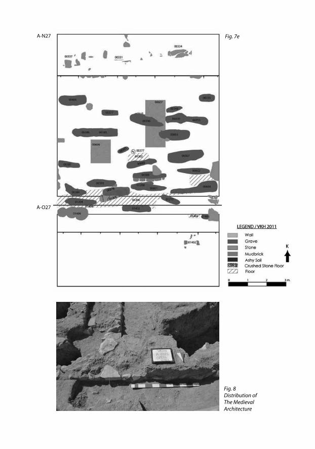
Fig. 8Distribution of The Medieval Architecture
A-N27
A-O27
Fig. 7e
239
Fig.
9
Plan
of t
he U
rart
ian
Arch
itect
ure,
198
9-19
91 E
xcav
atio
ns
A-N
18A
-N19
A-N
20
240 Colloquium Anatolicum XI 2012
Fig. 10 Urartian architectural remains unearthed during Prof. Tarhan’s campaign in 1989-1991 were cleaned and preserved.
Fig. 11 N20 Trench Urartian Architecture
VKH 2011 - A-N20
241Konyar et al. / Excavations at the Mound of Van Fortress - 2011
A-N20VK12739
A-N20VK12741
A-N20VK12747
A-N20VK12293
5 cm
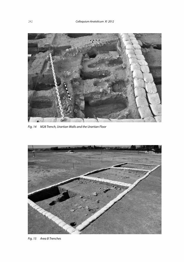
Fig. 12New Urartian Place Unearthed at the 2011 Excavations at The Mound Of Van Fortress
Fig. 13Findings From The New
Urartian Place
242 Colloquium Anatolicum XI 2012
Fig. 14 M28 Trench, Urartian Walls and the Urartian Floor
Fig. 15 Area B Trenches
243Konyar et al. / Excavations at the Mound of Van Fortress - 2011
Fig. 16The Plan of Area B Trenches
B-N57
B-O57
B-P57
244 Colloquium Anatolicum XI 2012
Fig. 17 Area B, Tandoor
Fig. 18 Area B Coins from the P57 Trench
B-P57 VK12316
B-P57 VK12320
5 cm0
245Konyar et al. / Excavations at the Mound of Van Fortress - 2011
Fig. 20 Area B, the Early Bronze Age Mobile Hearth from the N57 Trench
B-N57 VK1250320 cm
Fig. 19 Area B, in-situ Plates from the O57 Trench
B-O57 VK11524
B-O57 VK11525
20 cm