development of the euref velocity model-status and roadmap for future work
TRANSCRIPT

1
Development of the EUREF Velocity Model Development of the EUREF Velocity Model --
Status and Roadmap for Future WorkStatus and Roadmap for Future Work
Holger Steffen, Martin Lidberg, Zuheir Altamimi, Carine Bruyninx, Alessandro Caporali, Jan Dousa,
Heinz Habrich, Ambrus Kenyeres, Rui Manuel da Silva Fernandes, and Günter Stangl
[email protected]@lm.se

2
Deformation in Europe
(Ågren & Svensson, 2007)
Example:Glacial isostatic adjustment
Example:Earthquake deformation
(Guglielmino et al., 2012)

3
Deformation in Europe
(Doornhof et al., 2006)
Example:Subsidence & compaction due to oil/gas extraction
Example:Volcanic deformation
(Lanari et al., 2002)

http://egvap.dmi.dkhttp://egvap.dmi.dk
GNSS stations in Europe
More stations in Europe, i.e. in the south and east can be included!(more in the next slides)
EUREF Permanent Network, EPN to be used as ”backbone”.
Possibly useful permanent GNSS stationsBut for geodynamics, stability and reliable metadata on equipment etc. are issues.
From E-GVAP

5
The dual purposes of the working group (WG):
•First, there are pure scientific interests in improving the knowledge of surface deformations in Eurasia and adjacent areas•Second, a reliable velocity model will potentially be a valuable tool for management and use of national realizations of the ETRS89 GNSS-based station velocity (and time series) solutions:•Is not the topic for this WG! •Will build on results and products from the EUREF EPN Reference Frame Coordinator (Ambrus Kenyeres, FOMI) as “backbone” for velocity model(s).•Managers of GNSS networks are invited to submit weekly (daily) SINEX-solutions to be included in the combined products. Contact to EUREF/Ambrus! Objectives of the WG:1.Evaluation of GNSS derived station velocities2.Work towards model(s) of crustal deformations in Europe3.Consideration of a deformation model in maintenance and use of national realizations of the ETRS89
Note the common interest with EPOS and the WG4 (GNSS and other geodetic...)
EUREF working group on deformation models

6
About models of crustal deformations: Preferred are geophysical meaningful models which explain the observed deformations. Second option are models based on reliable interpolation (e.g. collocation/kriging) of observed deformations (based on dense GNSS stations).Specific areas of interest:
�Mediterranean area�Fennoscandia�Iceland – Greenland
Not trivial to include earthquake events into a spatial (ex. gridded) model of crustal deformations
First steps forward…•The first step is inventory of performed and published work on deformations in the area
EUREF working group on deformation models (2)

7
• Collected 60 published local/regional velocity fields• Most peer-reviewed publications since early 90s included
• Reanalysed BIFROST/SWEPOS will be included once available• Still missing: Germany (SAPOS)• Currently analysis of reports and conference proceedings
WG status

8
To be added:• Fennoscandia (SWEPOS etc.)
• Germany (SAPOS)• France
May need:• North Africa• Eastern Europe
Stations with velocity values

Data mainly from •Avallone et al. (2004, CRG)
•Clarke et al. (1998, GJI)
•Hollenstein et al. (2006, 2007, GJI, Tectonophys.)
•McClusky et al. (2000, JGR)
•Reilinger et al. (1997, JGR)
•Rontogianni (2010, J. Geodyn.)
Stations in Greece
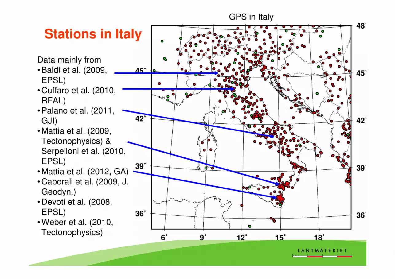
Data mainly from •Baldi et al. (2009, EPSL)
•Cuffaro et al. (2010, RFAL)
•Palano et al. (2011, GJI)
•Mattia et al. (2009, Tectonophysics) & Serpelloni et al. (2010, EPSL)
•Mattia et al. (2012, GA)•Caporali et al. (2009, J. Geodyn.)
•Devoti et al. (2008, EPSL)
•Weber et al. (2010, Tectonophysics)
Stations in Italy
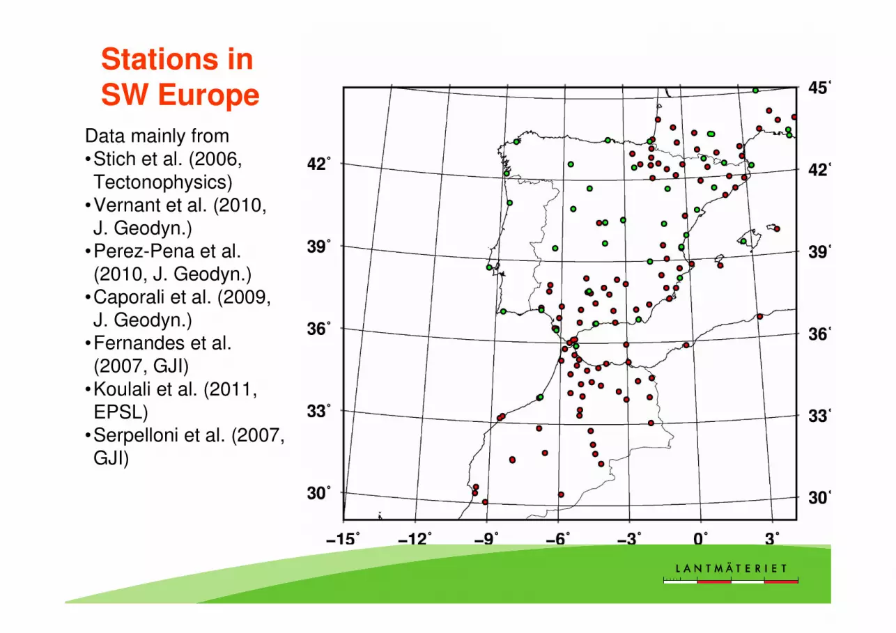
Data mainly from •Stich et al. (2006, Tectonophysics)
•Vernant et al. (2010, J. Geodyn.)
•Perez-Pena et al. (2010, J. Geodyn.)
•Caporali et al. (2009, J. Geodyn.)
•Fernandes et al. (2007, GJI)
•Koulali et al. (2011, EPSL)
•Serpelloni et al. (2007, GJI)
Stations in SW Europe

Data mainly from• Asensio et al. (2012, GJI) - many campaign data
Stations in the Pyrenees

13
• Collected 60 published local/regional velocity fields• Most peer-reviewed publications since early 90s included
• Reanalysed BIFROST/SWEPOS will be included once available• Still missing: Germany (SAPOS)• Currently analysis of reports and conference proceedings
• Analysis of bugs in data, correction of coordinates
WG status

14
Status 2012/11/09
32 GPS data sets incl. recent EPN (green)
Stations with velocity values

15
Stations with velocity values
Status 2013/03/20
60 GPS data sets incl. recent EPN (green)

16
• Collected 60 published local/regional velocity fields• Most peer-reviewed publications since early 90s included
• Reanalyzed BIFROST/SWEPOS will be included once available• Still missing: Germany (SAPOS)• Currently analysis of reports and conference proceedings
• Analysis of bugs in data, correction of coordinates• Started analysis of reference frame, Euler pole rotation etc.
• Common problem: tables have missing data, wrong labeling, reference frame undefined
• Analysis of geodynamic situation in certain areas
Motivation for this exercise is to see if the different studies can be reasonable
merged to a common reference frame. This could be a first test for transforming
the geophysical based deformation models to the geodetic reference frame.
NOTE: it is by no means the intention to derive a European velocity/deformation
model based on “patch-work” of local/regional GNSS results.
WG status
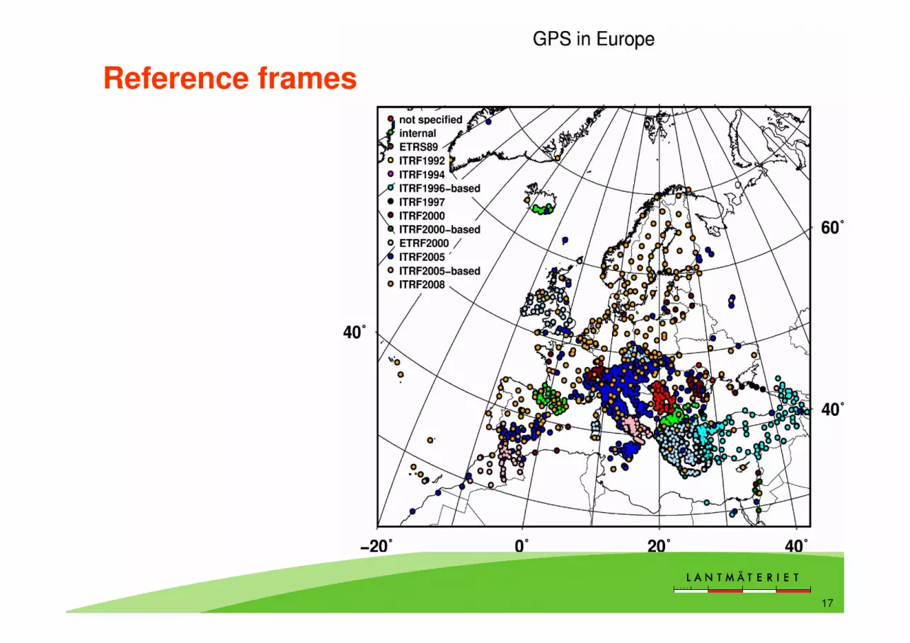
17
Reference frames

18
Velocity field combination
• Eurasian frame• Backbone: EPN
Method used in this test:
Horizontal velocities of local/regional studies are transformed to the ETRS89 (ETRF2000) velocities of the EPN.
The “velrot” program from GAMIT/GLOBK was applied.
Note: for vertical velocities a similar transformation is more complicated with more difficult traps to avoid.

19
Velocity field combination
• Eurasian frame• Backbone: EPN• Added data sets:
• Caporali et al. (2008)• Lidberg et al. (2010)

20
Velocity field combination
• Eurasian frame• Backbone: EPN• Added data sets:
• Caporali et al. (2008)• Lidberg et al. (2010)• Van der Hoeven et
al. (2005)• Serpelloni et al.
(2006)• Fernandes et al.
(2007)• Schenk et al. (2009)

• The EPN alone are not enough to get the complete picture of crustal deformations within the geographical scope of EUREF
• Managers of GNSS networks are invited to submit weekly (daily) SINEX-solutions to be included in combined products. Contact to EUREF / Ambrus Kenyeres !
• “WG on deformation models” are aiming for a high resolution velocity field model for Europe and adjacent areas, together with uncertainty estimates. The model should preferably be geophysical meaningful.
• First step is inventory of published work, and some simple assessment by merging velocity field data sets to a common reference frame.
Hopefully, EPOS will facilitate improved access to GNSS data (RINEX), solutions
(SINEX), time series, and velocities with known uncertainty, for the benefit of
improved knowledge of geodynamics in Europe!
Even more important: The possible multi-disciplinary data sets and scientific
efforts and results are potentially fostered by the EPOS initiative!!!
Conclusions
22
EUREF Community
EUREF Technical Working Group
EPOS Working Group 4 members
Operators of permanent GNSS stations
And all authors who have published velocity fields and models used in this study (so far)
Thank you for your attention!
Acknowledgments