community perception on climate change and climate-related disaster preparedness in kathmandu...
TRANSCRIPT

JOURNAL OF NATURAL RESOURCES AND DEVELOPMENT
Community perception on climate change and climate-related disaster preparedness in Kathmandu Valley, Nepal
Udo Nehren a, Jishnu Subedi b, Ina Yanakieva a, Simone Sandholz c, Jibraj Pokharel b, Ajay Chandra Lal b, Inu
Pradhan-Salike b, Muh Aris Marfai d, Danang Sri Hadmoko d, Günther Straub a
a Cologne University of Applied Sciences, Institute for Technology and Resources Management in the Tropics and Subtropics (ITT), Betzdorfer Str. 2, 50679 Köln, Germany
b Pulchowk Campus, Institute of Engineering, Tribhuvan University, Pulchowk, Nepal
c Workgroup Development Studies and Sustainability Science, Institute of Geography, University of Innsbruck, Innrain 52, 6020 Innsbruck, Austria
d Faculty of Geography, Universitas Gadjah Mada, Bulaksumur 55281 Yogyakarta, Indonesia
* Corresponding author : [email protected]
Article history Abstract
Received 25.07.2012Accepted 09.01.2013Published 08.04.2013
Within the last decades, Kathmandu Valley in Nepal has been characterized by rapid population growth and related urbanization processes, leading to environmental degradation, pollution and supply bottlenecks in the metropolitan area. Effects of climate change are now putting additional stress on the urban system. In our research in Kathmandu, we carried out community and household surveys to analyze community perception on climate change and climate-related disaster preparedness. For this purpose, three categories of communities, 12 in all, were surveyed and interviewed: Squatter settlements, agricultural villages, and traditional villages. All settlements are located close to main rivers and therefore especially exposed to floods and droughts, and in slope position also to landslides. As a main result, we can conclude that people are generally aware of climate change and its potential consequences, such as climate change-related disasters. However, in their daily lives, climate change does not play a significant role and most communities have not taken any adaptation measures so far.
Climate changeKathmandu ValleyDisaster riskCommunity perceptionPreparedness
Journal of Natural Resources and Development 2013; 04: 35-57 35
Keywords

36Journal of Natural Resources and Development 2013; 04: 35-57
Nepal, situated in the Himalayas between China in the North and India in the South, is highly exposed to natural disasters such as floods, droughts, earthquakes, landslides, avalanches, and glacial lake outburst floods (GLOFs). Although only ranked 99th out of the 173 countries in the World Risk Index (Alliance Development Works 2011), the country is a “hotspot for geophysical and climatic hazards” (NSET 2008) as stated in the Global Risk Analysis report by the World Bank in 2005 (Dilley et al. 2005). In the Natural Disasters Risk Index (NDRI) published by the British risk advisory firm Maplecroft, Nepal is listed as number 18 of 229 countries, based on the frequency of natural disasters that occurred between 1980 and 2010 and related human losses in proportion to the total population (Maplecroft 2011).Nepal is also highly vulnerable to climate change impacts, ranked 13th in the Global Climate Risk Index 2010 (Germanwatch 2010). According to the IPCC (2012, p. 5), “a changing climate leads to changes in the frequency, intensity, spatial extent, duration, and timing of extreme weather and climate events, and can result in unprecedented extreme weather and climate events.” Already in 1999, Shrestha et al. predicted increased temperatures and higher variability of rainfall for the country based on climate data of the 1971-1994 period. Current regional climate models based on the Global Circulation Model (GCM) support these trends and predict a temperature increase between 0.5° C and 2.0° C by the 2030s and 3.0° C and 6.3° C by the 2090s. Moreover, the GCM predicts precipitation changes due to the monsoon shift associated with more erratic rainfall and increasing storm intensity (NCVST 2009).According to NCVST (2009), climate change impacts are particularly strong in the highlands and midlands, and increasing temperatures above average in higher elevations of the Himalayas may regionally lead to increased glacier melt and a higher risk of flashfloods, GLOFs, and landslides. However, there is much uncertainty about glacier melt in the Himalayas, and only little research has been carried out to prove a general trend of glacier retreat (Inman 2010). A recent publication by Bolch et al. (2012) comes to the result that the majority of Himalayan glaciers are melting, but corresponding to the global average, and much less rapidly than predicted by IPCC (2007), which has already been stated by other researchers before. Based on satellite data, they calculated a glacier area of about 40,800 km², 20% less than assumed, and point out a heterogeneous behavior of the glaciers in the northwestern Himalayas. With respect to the drainage of the major rivers Indus, Ganges, and Brahmaputra, they assume that the glacier shrinkage will not a have major impact in the coming decades. However, a greater variability in seasonal water drainage can be expected in the medium term, and single valleys can dry up seasonally.But what about the midlands, or “Hills”, as the Nepali say, the densely populated belt between 1,500 and 3,000 m a.s.l with the country´s political and cultural center of Kathmandu Valley?Kathmandu Valley (KV) is administratively divided into Kathmandu District, Lalitpur District and Bhaktapur District with a total area of 665 km². Rapid population growths from 1.6 million in 2001 to 2.5 million in 2011 (Government of Nepal, National Planning Commission Secretariat 2011) in the valley, related urbanization and suburbanization process and the lack of investments in infrastructure,
planning, and environmental protection have led to severe problems which are ever-present and interdependent: Massive air and water pollution, lack of waste disposal and wastewater treatment, bad hygienic conditions , run-down buildings, poor road conditions, traffic gridlock during rush hours, and power shortages, among others. This untenable situation is an aftermath of the ten-year civil war from 1996 to 2006, and the still very fragile political situation today. During the civil war, KV received many refugees and migrants from other parts of the country, and also victims of natural disasters, which contributed to population growth in addition to the pull-effects of the metropolitan area. Many refugees are still living in squatter areas, often along the river banks, and are among the most vulnerable to disasters (Pradhan 2004, Thapa & Murayama 2010).Climate change will likely have additional negative impacts on living conditions in general and on climate-dependent disaster risk in KV in particular. With increasing temperatures and drier climate conditions in the non-monsoon seasons, as predicted by the regional climate model for the middle hills, the risk of droughts and forest fires will increase as well, and agriculture will face major challenges (NCVST 2009). Furthermore, erratic rainfall and increasing storm intensity in the monsoon season will exacerbate risks and uncertainties for farmers (NAPA 2010). Floods in the monsoon season are natural events in Nepal, but a shift of the monsoon pattern may also increase the floods risk (NCVST 2009).The land use / land cover change in urban Kathmandu between 1976 and 2009, as shown in figure 1, reflects the rapid urbanization in the valley, and the dramatic loss of cultivated land and forests associated with it. This urbanization and suburbanization process will likely continue for the next years (Thapa & Murayama 2009, Thapa & Murayama 2010). The already severe situation with continuous loss of agricultural land due to built-up areas (planned and often unplanned), increase of population and dramatic disaster risk preparedness (bad traffic infrastructure, food supply) may decline even more in a continuous downward spiral due to climate change impacts. Without suitable urban and regional planning strategies and instruments as well as investments in urban infrastructure, the vulnerability to climate change impacts and climate-related disasters will probably increase. A study carried out by the Pacific Disaster Center (2005) already noted that many houses in KV were constructed inappropriately to guard against environmental impacts, such as floods and landslides. Moreover, poor maintenance of traditional brick nogged timber frame buildings with open fire places will likely have high risks of fires in dry seasons. Because of the poor drainage and settlements near polluted rivers, epidemics like malaria and other diseases might occur or spread. Poor access to health facilities makes epidemics more dangerous, particularly in remote areas and for poor people (United Nations Development Program 2009). In addition, the loss of forest and agricultural land in KV will lead to a further deterioration of urban climate, water and soil resources, higher disaster exposure, and more difficult post-disaster recovery. Due to land scarcity, particularly the urban poor will be forced to settle in disaster exposed areas, such as floodplains and steep slopes. In our presented studies in KV, we analyzed the community
Introduction

perception about climate change and disaster preparedness in different settlement types along the main rivers Bagmati, Bishnumati, and Manohara. With our research we aim at gaining a better
understanding of risk awareness and possible adaptation strategies to climate change and climate-related disaster in a highly vulnerable area.
37Journal of Natural Resources and Development 2013; 04: 35-57
Methodology
Figure 1. Land use / land cover change in urban Kathmandu 1976 to 2009 (source: Rimal 2012)
Methodological approach and study sitesUrban and peri-urban settlements along rivers are among the most vulnerable to climatic changes and climate-dependent disasters.
Therefore study sites in urban and peri-urban KV were selected along the main rivers: Bagmati, Bishnumati, and Manohara. Two principal investigations were carried out in settlements along these rivers:

38Journal of Natural Resources and Development 2013; 04: 35-57
Bagmati River corridor Manohara River corridor Bishnumati River corridor
Squatter settlement Balkhu Paurakhi Gaun Jagriti
Agricultural settlement Sainbu village Bode Gaun Manamaiju settlement
Old traditional settlement Basnyat village Tikathali village Tankeshwor settlement
(1) Community survey in nine selected communities within the three river corridors of the main rivers Bagmati, Manohara and Bishnumati;(2) Household survey in three squatter settlements along the Bagmati river.This paper is bringing together the results from both studies to draw conclusions on the current situation and risk perception in different communities that have in common a highly vulnerable location, but that differ mainly in economic and social patterns.
Community surveyThe community survey was carried out in September 2011 in the framework of a joint student project of three universities: Tribhuvan
University (Kathmandu, Nepal), Gadjah Mada University (Yogyakarta, Indonesia), and Cologne University of Applied Sciences (Cologne, Germany). The objective of the survey was to obtain knowledge about community perception related to climate change and disaster preparedness in three different types of communities with respect to settlement history, dependence on agriculture, and average living standard of the population: (a) Recent squatter settlements with low living standards, (b) established settlements that depend on agriculture with moderate living standards, and (c) old traditional settlements with moderate to elevated living standards. In each of the three river corridors, one type of settlement was selected (see table 1, figures 2-4 give an overview of the variety of settlements). Figures 5-7 show the location of the study sites in the three river corridors.
Table 1. Selected settlements in the three river corridors
Figure 2. Squatter house construction in Balkhu Figure 3. Established houses in Sainbu village
Figure 4. One a few remaining traditional houses in Tikhatali village

39Journal of Natural Resources and Development 2013; 04: 35-57
Figure 5. Location of the three squatter settlements from the community survey. Source of the satellite images: Google Earth (2012).

40Journal of Natural Resources and Development 2013; 04: 35-57
Figure 6. Location of the three agricultural settlements from the community survey. Source of the satellite images: Google Earth (2012).

41Journal of Natural Resources and Development 2013; 04: 35-57
Figure 7. Location of the three traditional settlements from the community survey. Source of the satellite images: Google Earth (2012).
Household survey in three squatter settlements The goal of the household survey was the assessment of vulnerability and risks to climate change-related impacts of slum dwellers in selected squatter settlements in Kathmandu. With the help of a flood-risk map provided by Full Bright Consultancy and GEO Consult (2009), three squatter communities were selected, whereby their
locations in the flood prone areas along the Bagmati and Manohara Rivers and their ages were taken into consideration (see table 2). The age of the squatter settlements is closely related to their building and road infrastructure and community organization, which are in turn of particular importance for vulnerability and adaptation potential to climate change-related hazards. The household survey was carried out from September to December 2010.

42Journal of Natural Resources and Development 2013; 04: 35-57
Bagmati River corridor Bagmati River corridor Manohara River corridor
Squatter settlement Thapathali Sankhamul Manohara
Established 2007 > 30 years 2002
Table 2. Selected squatter settlements for the household survey
Figure 8. Location of the three squatter settlements from the household survey. Source of the satellite images: Google Earth (2012).

43Journal of Natural Resources and Development 2013; 04: 35-57
Community surveyThe community survey includes:
(1) Inventory of infrastructure, living conditions, and key demographic figures in the settlement based on satellite images, field observations, secondary data, and questioning in the communities, (2) Identification of hazards in the community based on secondary data and questioning in the communities, (3) Assessment of community perception about climate change and disaster preparedness based on semi-structured interviews.
The inventory includes relevant information on road and building infrastructure, water supply, sanitation, waste and energy, as well as living standards and employment in the settlements to allow a comparison of the living environment. For the identification of hazards, particularity older community members who have lived a long time in the settlement were asked. This way information about past and present hazards in the area, sensitivity of the people to these events (self-evaluation), and likelihood of disasters in the past and present (estimation) was gathered.The collected survey data were compared to secondary data, such as disaster reports and press releases. Also details about the severity of disaster events were taken from secondary sources. The assessment questions are listed in box 1 in the appendix.The interviews took place as group interviews with community representatives in a community room or in public space. In some cases, particularly in the squatter settlements, the community representatives were not willing to answer all questions and digressed to other topics, which seemed to be more important for their lives. Furthermore in the squatter settlements, women were underrepresented during the interviews or stayed in the background. In some cases women groups joined the meetings and expressed their opinions, but usually the interviews displayed the traditional organizational structures of the settlements, which are dominated by men, e.g., as wards. However, interest in participating in the survey was apparent and there was a particular interest in wanting to communicate with foreign students and researchers. A major barrier for the foreign researchers was the language, as the interviews had to be carried out in Nepali language. However, Nepali researchers translated into English, which always took time but ensured the active participation of the foreign researchers. On-site visits with representatives of the communities were very informative and useful.
Household survey in three squatter settlements
The household survey obtained key information on:
1. Living environment and education;2. Climate-related hazards (direct and indirect);3. Sanitation, hygiene, and diseases;4. Squatter dwellers’ own perception of climate-related hazards /
risks;5. Adaptation to climate change induced hazards.
The survey is based on semi-structured household interviews in the squatter settlements, interviews with key informants, as well as field observations. The questionnaire for the semi-structured interviews consisted of 30 questions related to the five main topics mentioned above (the complete set of questions is included in box 2 in the appendix). Additionally, secondary data on infrastructure, population, and living conditions (satellite images, maps, and census data) were included. The questionnaire form was translated from English into Nepali language and the survey was carried out with the help of Nepali students organized by the Nepal Centre for Disaster Management.The three squatter settlements differed much in the number of households and it was not possible to include all household in the survey. To ensure representativeness with a minimum sample of 10%, but at the same take into account limited human resources for the field campaigns (interviewers and translators) as well as time constraints, the questionnaires were distributed to 60 households in Thapathali (16.4% of total households), 63 households in Sankhamul (52.5% of total households), and 75 households in the Manohara Squatter Settlement (10.0% of total households). The surveyed households were randomly selected, whereas effort was made to interview families living in different types of housing structures. Additionally, representatives of youth community groups in Sankhamul and Manohara squatter settlements were interviewed, as well as experts from Lumanti, Child Watabaran Center Nepal and Full Bright Consultancy.
Community survey: Risk awareness, environmental changes, and community response
In the following, we present the results of the community survey for the three different settlement types. The settlement inventory is presented in the form of short settlement profiles in tables 3 to 5, while the hazard identification and the community assessment on perception about climate change and disaster preparedness are presented in text form right behind each profile.
Squatter settlementsTable 3 gives a brief overview of the three squatter settlements regarding location, population, infrastructure, water and energy supply, sewage, water management, as well as living standards and employment. The interviewed community members in all squatter settlements were aware of disaster risk and climate change impacts. They stated that they have heard about climate change in the television, radio, newspaper, or from other people. The community members of Balkhu stated that the flood level has increased but the settlement has not yet been affected. With respect to climate change, they observed a lengthening of the summer, a shortening of the winter and in average less rainfall. They said that until now this development caused just small droughts but they fear that droughts could get more severe in the future.
Results
Research methods

44Journal of Natural Resources and Development 2013; 04: 35-57
Balkhu
Location, population, infrastructure
Located in the Bagmati River Corridor, Balkhu consists of ~300 households. Access is provided by an earthen road mostly in fair condition. Almost all buildings are single storey; poor ones are made of plastic sheet, better ones of brick wall in cement mortar. Other materials (tin/metal sheet, bamboo, ply/wood board) are also used.
Water supply, sanitation, waste, energy
No access to the city water supply system and underground system. Five tanks with a capacity between 12,000-15,000 liters are placed in the central area. Most buildings share public toilets; few have private toilets inside. All of the toilets are drained to the river. No solid waste collection. 70% of energy consumption is covered by electricity, 1% by firewood and the rest by fossil fuels (gas, kerosene).
Living standard and employment
The living standard is very low. Most people have low educations and find jobs only as day laborers. Due to poor economic levels, individuals are not able to invest in any kind of business or vocational training.
Parauki Gaun
Location, population, infrastructure
Located in the floodplain of Manohara River, access is given by a sealed road in good condition. Inside the squatter, earthen roads are in bad condition, particularly in wet seasons. Mainly single storey buildings with temporary roof structures made of tin, metal or plastic sheets. 60% of the buildings are permanent, 30% semi-permanent, and 10% temporary. There are few shops, a community office building and a school.
Water supply, sanitation, waste, energy
Use of groundwater, a water tank and river water. Most households use hand pumps; public taps are hardly available. Consume of about 20 liters per person/day. No proper drainage system. Customized drainage system with a pipe; outflow to the river or to the main road. Public sanitation system directly connected to the river. Most households use shared toilets, only few buildings have individual toilets. No solid waste collection. No access to city electricity grid; generators used.
Living standard and employment
Very low living standard. In addition to unskilled labor on a daily basis, there are a few skilled laborers and small businesses. Few inhabitants work in a department store, some in the field of construction and street vendors.
Jagriti
Location, population, infrastructure
Located in the floodplain of the Bishnumati River, the squatter is already 30 years old and consists of ~300 households. Access is provided by an all weather gravel road linked with an arterial road. Almost all buildings are single storey; poor ones are made of plastic sheet, better ones of brick wall in cement mortar. Other materials such as tin/metal sheets, bamboo, and ply/wood board are also used.
Water supply, sanitation, waste, energy
Access to the public water supply system; one concrete water tank (20,000 liters). Additionally three tube wells. In summer, water is rationed to 40 liters/family/day. Most buildings have private toilets draining to the river. There is a solid waste collection point; anybody caught throwing waste into the river gets two slaps in public. Around 40% of energy consumption is covered by electricity, 50% (cooking) by fossil fuels (gas, kerosene), and rest by firewood, petrol and diesel.
Living standard and employment
The living standard and education level are very low. Most people are semi- or unskilled and find jobs only as day laborers, house helpers or drivers. Only a few are running shops. Due to the poor economic level, people are not able to invest in business or vocational training. However, NGOs are running vocational trainings.
Table 3. Profiles of the squatter settlements.
In Paurakhi Gaun, floods occurred three times within the last four years. Moreover, two medium-sized earthquakes without human victims but some material damage hit the area. Epidemics, in particular typhoid, diarrhea, and water borne diseases are common due to bad sanitation conditions with open defecation and unprocessed drinking water. Wind, which damages the roofs, has a medium impact.Although aware of possible climate change impacts, climate is not of main importance at the local community level. Economic and social problems, water and energy resources, and settlement status are major problems. Asked for a ranking of main risks for the settlement and its inhabitants, the community members named traffic accidents first, followed by water supply and energy, land tenure and legal
status of the settlement, and theft and drug addiction. Only at the fifth place were climate change and related disasters mentioned. In this context, the increasing appearance of snakes was pointed out as a major threat and seen as an indicator for a rain pattern change and rising temperatures. To reduce flood risk, the residents have taken the initiative to build an earthen dam along the riverside to prevent floods from reaching the houses.The community members of Jagriti provided very detailed information on their climate observations, which is probably due to the fact that this settlement has already existed for 30 years. However, with respect to rainfall, their statements were more related to wetter and drier years and seasonal variations than to long-term climatic changes.

45Journal of Natural Resources and Development 2013; 04: 35-57
The information about temperatures also referred more to weather extremes than to climatic changes. However, people agreed that winters have been coming later within the last years. While changes in snowfall and hailstorm had not been observed, people had noticed less wind blow compared to the past years.Asked about changes in animal species diversity, people complained about substantial loss particularly of different species of birds along the river corridor that they associated with climate change. However, it is much more likely that the real reasons are loss of habitats and breeding places due to ongoing urbanization processes as well as massive pollution of the rivers and degradation of the riverine ecosystems. Concerning hazards and risks, the community members mentioned tuberculosis, malnutrition and water borne diseases as the main health risks. In contrast to the past, the flood risk seems to be reduced due to a decrease of the water level. People think that this is caused by sand mining in the riverbed and less rainfall. Related to that, the groundwater table has significantly dropped so that water scarcity has become a major problem. With respect to disaster risks, people are aware of living in a highly vulnerable settlement structure. However, they see the highest natural disaster risk in earthquakes
and not in climate-related disasters. Therefore they assume that people living in apartments and multistoried buildings are even at a higher risk.Apart from the predefined questions, people in the squatter settlements complained about insufficient national and international aid. In their daily life unemployment, miserable living conditions, insecure land tenure, insufficient water and energy supply, the horrible traffic situation, and epidemics are among the major problems. Therefore, from the perspective of the slum dwellers, climate change and climate change-related disasters are only additional problems. With respect to natural disasters, earthquakes are even seen as the greater threat. In Jagriti, people told us that in case of a flood they will be warned by upstream communities via mobile phones, but for earthquakes there is no early warning system.Finally it must be stressed that the answers from the community members about already apparent climatic changes rather refer to natural climate variations and weather phenomena than to a long-term climatic change. Effects, such as changes in the water table and species diversity cannot clearly be assigned to climate change; they are more likely results of land and ecosystem degradation, maybe overlapping with climate phenomena.
Figure 9. Main road in the squatter settlement of Balkhu. Figure 10. Houses made of plastic and metal sheets (front) and bricks (back) in Balkhu.
Figure 11. Open drainage system in Balkhu. Figure 12. Bagmati river bank near Balkhu.

46Journal of Natural Resources and Development 2013; 04: 35-57
Agricultural settlementsTable 4 gives a brief overview of the agricultural settlements. In Sainbu village, the last flooding was in 1981 after heavy rainfall towards the eastern side of Nakhu Khola River. After that no natural disasters have occurred in the community. The residents reported that they mainly suffer from bad environmental conditions, in particular a lack of clean drinking water. They are aware that their settlement is exposed to floods due to the location along the Bagmati River, but they are less concerned about the landslide risk, which is also given as the village is situated in the middle slope of the Bhainsepati hill.The vast majority of the interviewed community members were also aware of climate change, but people had no clear idea about the difference between climate change and changing weather conditions
and therefore often. People perceive a change in rainfall intensity and reported that higher rainfall is positive for agriculture. They think they already feel a shift of the monsoon season and longer lasting summers compared to the past. One community member reported about earlier blossoming of some flowers and trees in higher mountain regions.Despite the knowledge about climate change and related disasters, the community has not taken any preventive measures. The main concern is in fulfilling basic needs related to nutrition, housing, and clothing. According to statements of educated people during the interview, community segregation is the main reason behind the unwillingness to act against climate change. They say that people of the community are grouped in various ways like social, economical
Sainbu village
Location, population, infrastructure
The village is located on the eastern side of the Bagmati River. According to the Ward profile of Lalitpur Sub-Metropolitan City (LSMC) 2006-2007, Sainbu has a population of 10,971. The village has access to the motorway, but only 30-40% of the roads are black topped; the rest is earthen or graveled. Most of the houses are traditional with load bearing walls using brick in mud and brick in cement. Only a few recent houses (around 10-20%) are framed structures; they are mainly located near the market area.
Water supply, sanitation, waste, energy
The water supply system has reached the settlement. However, water is available only once every four days. So, people depend on deep bores and wells. Collection of solid waste is organized by the community organization, but unfortunately waste is deposited in the valley. Almost 100% of the households are connected to the national electricity grid, but 15-20% still use firewood. Some households also use gas or kerosene, about 1% solar energy.
Living standard and employment
The settlement is located in an elevated position; the floodplain is used for agriculture. Today only 15% of the population, especially women, works in agriculture. Most people are employed in the service sector or work on a daily wage basis. About 10% are engaged in small businesses such as grocery stores.
Bode Gaun
Location, population, infrastructure
Located in the Manohara river corridor, the settlement consists of 1,275 households with a population of around 7,000 people (Census 2001). It is linked to the old metal road from Bhaktapur to Thimi and Kathmandu. In the village brick and stone pavement is common; gravel and earthen roads are dominant in newly developed areas. Most buildings in the core area are traditional load bearing structures with sloped roofs, but modern flat roofs out of reinforced concrete are replacing the old traditional ones.
Water supply, sanitation, waste, energy
75% of the population is connected to the municipal water supply line; the rest use groundwater. Water quality is satisfactory, but the quantity is insufficient. The number of water-borne diseases is decreasing. The settlement has a sewer system in fair condition. Most of the sewer lines are connected to the treatment plant and solid waste is collected by the municipal authority. A biogas plant has been constructed but is not yet in operation. Electricity is the main source of light. 90% of the people use gas for cooking, the rest kerosene stoves and very few biogas.
Living standard and employment
More than 60% of the population is based on agriculture; the majority of the remaining population is engaged in business, especially agro-business. Around 5-7% are involved in pottery industries and few people work in the service sector and as day laborers. A shift in cash crop farming can be observed as mushroom farming, hatcheries and unseasonal vegetable farming have been increasing.
Manamaiju settlement
Location, population, infrastructure
The village is surrounded by two rivers, Mahadev Khola and Sangle Khola, both affluents of the Bishnumati. 995 of 2,539 households are engaged in agriculture, livestock and poultry farming (Census 2001). The roads of the core settlement are brick paved, but in a poor condition. The access road is in good condition.
Water supply, sanitation, waste, energy
The village depends on groundwater (wells, tube wells) and the community members said that water supply is sufficient. There is no organized waste management and no access to the public energy grid.
Living standard and employment
Most of the dwellers of the settlement work in the agricultural sector; few also work in private businesses and service sectors.
Table 4. Profiles of the agricultural settlements.

47Journal of Natural Resources and Development 2013; 04: 35-57
and political, which is, in their opinion, the main barrier for common action. However, on the other hand, people in the community collect money each year to further asphalt the main graveled road.Bode Gaun is less vulnerable to floods since the Manohara River, which ruined property in 1993 and in 1999, has been deepened. In the hilly north side of the core settlement, some landslides can be observed. In the past, people suffered severely from water-borne diseases, but nowadays this problem is decreasing. In contrast, more people are facing problems with civilization diseases such as diabetes, hypertension, and high blood cholesterol. The younger generation is also facing drug problems.Direct climate-related disaster risk is relatively low. Environmental problems such as depletion of groundwater, biodiversity loss, and loss of agricultural and green areas are predominately the result of suburbanization processes and land pressure, as the municipality is among the fastest growing areas in KV. Agricultural land is being converted into building plots day by day. Due to sand mining for construction works, the riverbed is cutting deeper, which makes surface irrigation almost impossible on the remaining agricultural plots. Therefore, farmers use mainly groundwater for irrigation. Probably due to the moderate immediate climate-related disaster risk, the community is not much aware of possible climate change impacts. However, the settlement is currently in a transformation process from an agricultural to a commercial and residential area. Decreasing open spaces and less agricultural production for self-supply as well as degradation of water and soil resources make the settlement more vulnerable to disasters, such as droughts.In Manamaiju about 60% of the people are engaged in agriculture; the others work in the business and services sectors and fewer in the craft trade sector. According to the community members, unplanned urbanization and environmental degradation have become a threat to their livelihood. They think that there should be more support
from the central and local governments to improve this unsatisfying situation.With respect to climate change, the inhabitants provided very detailed information, but as in the other communities, they mixed to some extent climate change with weather events, and also explained environmental degradation as a result of urbanization with climate change impacts. In detail, people felt moderate changes in rainfall compared to 30 years ago, but in their explanations, they only compared the present year with previous ones and referred to seasonal variations in rainfall throughout the year. Related to temperatures, they felt that there are higher temperatures than before in Ashad (June-July) and complained that in the recent winter season there was no formation of ice crusts like before. Moreover, they observed less wind and a higher frequency of hailstorms compared to the past years, but no changes in snowfall.People observed a rapid decrease of animals in the community lands. They reported that only few of the formerly many bird species are still abundant, and that seasonal birds, such as the Koel (Eudynamys scolopaceus) are completely extinct. Moreover they stated that ants are increasing and no fishes are seen in ponds and rivers.When asked about health risks, people referred to a wide range of widespread illnesses such as diabetes, hypertension, sight and hearing problems, as well as neurological diseases. However, they also mentioned diseases which are typically related to unclean water and poor hygiene, such as typhoid, gastric problems, and dysentery.Floods have decreased recently due to sinking water levels, and community members are now more concerned about the drop of the groundwater table and resulting water scarcity as well as contamination of drinking water. Moreover, wind storms are still a threat for the community. However, the greatest natural risk for the inhabitants comes from earthquakes.
Figure 14. In the agricultural village of Sainbu.Figure 13. Traditional house in Sainbu village.

48Journal of Natural Resources and Development 2013; 04: 35-57
Figure 15. Small house gardening in Sainbu village. Figure 16. Urban agriculture is being pushed back by ongoing urbanization in Kathmandu Valley.
Basnyat village
Location, population, infrastructure
Located on the eastern side of the Bagmati river, the 200-300 year old village consists of 75 households with a total population of about 350 (Ward profile of Lalitpur Sub-Metropolitan City 2006-2007). The village has good access to the motorway and roads are black topped. Buildings are permanent and in a good shape.
Water supply, sanitation, waste, energy
Basnyat was among the first villages in KV with access to tap water. Today, only 5% of the households use tap water, the rest depends on wells. Sewage is directly drained to the Bagmati River. Waste is collected. The village has a 100% electricity supply.
Living standard and employment
The community was traditionally based on agriculture. However, in 1975 most of the agricultural land was converted to a waste water treatment plant. The consequence was a loss of agricultural land resulting in a loss of income sources, changing the livelihoods of the community members from agriculture to services and private business. At present around 95% of the population has shifted to the service sector and only 5% still work in agriculture.
Tikathali village
Location, population, infrastructure
Tikathali village is located at the confluence of three rivers: Manohara, Hanumante, and Godawari. The settlement has existed for more than 300 years and currently consists of ~1,000 households. The main road is asphalted, but only 4 m wide; secondary roads are very narrow, unsealed, and often not suitable for four wheelers. Houses are nowadays constructed with modern construction materials (cement, RCC, metal, etc.). Most of the traditional houses have been demolished and replaced by modern ones.
Water supply, sanitation, waste, energy
The main water sources are wells and tube wells. Deep boring for water distribution in every household is under construction. UNICEF supports the village with 118 public toilets. There is no waste management. The government has provided electric facilities; 80% of the energy consumption is represented by LPG, 20% by kerosene. Few bio-gas plants are under construction.
Living standard and employment
The share of agriculture was around 75% in the past, but has dropped to presently 25%. About 20% of the households practice animal husbandry; in the past it was almost 90%.
Tankeshwor
Location, population, infrastructure
The medieval settlement is located along the Bishnumati River. The majority of residents belong to the ethnic minority of the Newars who are involved in business rather than in agriculture. According to the respondents, 60% of the inhabitants are enrolled in business and about 20% in services. Due to an unmanaged dump site, there is a pungent smell in the village.
Water supply, sanitation, waste, energy
The dwellers of Tankeshwor depend on the municipal water supply. Sanitation is taken care of at the individual household level. There is a plant that could convert waste from slaughter houses to gas that could be used for cooking and lighting. There are still gas pipe connections in some of the nearby houses. However, it has never been in operation except for a demo project.
Living standard and employment
Most of the inhabitants are business and service oriented. Few are involved in agriculture.
Table 5. Profiles of the traditional settlements.
49Journal of Natural Resources and Development 2013; 04: 35-57
Old traditional settlementsTable 5 provides an overview of the traditional settlements. The community members of Basnyat reported about the last flood event in 1981. After this, no more flood events have occurred. According to the residents, until the early 1980s the water in the Bagmati River was so clean that it could be drunk without any treatment. Nowadays people suffer from the bad smell and mosquitoes are breeding in the polluted river. In 1975, land for waste water treatment was acquired by the government of Nepal, but due to technical problems, the project failed and the former agricultural land turned into fallow land that looks like a pond. The conversion of a large area of agriculture land for this project resulted in a loss of income from agriculture in the community, and many people changed their livelihoods to service and business oriented sectors. Although there is no official awareness program on climate change, almost all inhabitants have heard about it on TV and radio. However, they usually perceive it as weather change and do not take any adaptive measures. They expressed that the natural disasters are dependent on the future. They further added that the Bagmati River is not connected to any glaciers, so that a severe flood may not occur. In general, people are busy earning their livelihoods and their main concern is to fulfill basic needs. Although the community receives support for physical and social infrastructure development, they felt that they do not get sufficient financial support from the national government.
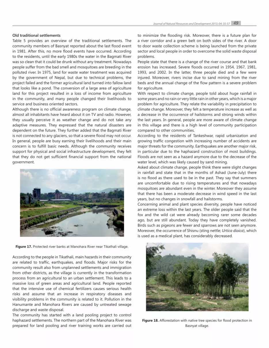
Figure 17. Protected river banks at Manohara River near Tikathali village.
According to the people in Tikathali, main hazards in their community are related to traffic, earthquakes, and floods. Major risks for the community result also from unplanned settlements and immigration from other districts, as the village is currently in the transformation process from an agricultural to an urban settlement. This leads to a massive loss of green areas and agricultural land. People reported that the intensive use of chemical fertilizers causes serious health risks and assume that an increase in respiratory diseases and visibility problems in the community is related to it. Pollution in the Hanumante and Manohara Rivers are caused by untreated sewage discharge and waste disposal.The community has started with a land pooling project to control haphazard settlements. The northern part of the Manohara River was prepared for land pooling and river training works are carried out
to minimize the flooding risk. Moreover, there is a future plan for a river corridor and a green belt on both sides of the river. A door to door waste collection scheme is being launched from the private sector and local people in order to overcome the solid waste disposal problems.People state that there is a change of the river course and that bank erosion has increased. Severe floods occurred in 1954, 1967, 1981, 1993, and 2002. In the latter, three people died and a few were injured. Moreover, rivers incise due to sand mining from the river beds and the annual change of the flow pattern is a severe problem for agriculture.With respect to climate change, people told about huge rainfall in some years and no rain or very little rain in other years, which is a major problem for agriculture. They relate the variability in precipitation to climate change. Moreover, they felt a temperature increase as well as a decrease in the occurrence of hailstorms and strong winds within the last years. In general, people are more aware of climate change in this village and there is a high level of community participation compared to other communities.According to the residents of Tankeshwar, rapid urbanization and growing traffic congestion with increasing number of accidents are major threats for the community. Earthquakes are another major risk, in particular due to the haphazard construction of most buildings. Floods are not seen as a hazard anymore due to the decrease of the water level, which was likely caused by sand mining.Asked about climate change, people think there were slight changes in rainfall and state that in the months of Ashad (June-July) there is no flood as there used to be in the past. They say that summers are uncomfortable due to rising temperatures and that nowadays mosquitoes are abundant even in the winter. Moreover they assume that there has been a moderate decrease in wind speed in the last years, but no changes in snowfall and hailstorms.Concerning animal and plant species diversity, people have noticed an extreme loss within the last years. The older people said that the fox and the wild cat were already becoming rarer some decades ago, but are still abundant. Today they have completely vanished. Birds such as pigeons are fewer and sparrows are not seen anymore. Moreover, the occurrence of Shisnu (sting nettle; Urtica dioica), which is used as a medical plant, has considerably decreased.
Figure 18. Afforestation with native tree species for flood protection in Basnyat village.

50Journal of Natural Resources and Development 2013; 04: 35-57
Regarding health risks, people complain about typhoid, malaria, dengue, Japanese encephalitis and asthma. With respect to water availability, they report about the drop in the water table, which has caused water scarcity in drier months. They think that the construction of buildings near dry river beds has resulted in the fallen water table. In general, they think that the stakeholders, such as the central and local government, are responsible for supporting their livelihood.
Household survey in three squatter settlements
Infrastructure, population and living conditionsTable 6 provides an overview about basic parameters of the three squatter settlements, as well as literacy rate, income generation and motivation to move to Kathmandu from the hills where the people from all three sites came from.Thapathali squatter settlement is one of the most recent squatter settlements in urban Kathmandu. Since 2007 it has been situated on the floodplain of Bagmati River, opposite a big solid waste dumping site. All buildings in the settlement are one storey and either temporary (built with plastics, flash sheets, Corrugated Galvanised Iron [CGI] sheets, or bamboo) or permanent (built with bricks or cement; roof from CGI sheets or concrete).The Thapathali squatter settlement has no access to the city water and electricity supply system. A community water tank has been built, which, at the time of the survey, was not water-supplied due to difficult access of the water tankers to the settlement. Drinking water is collected from public stone spouts or bought in plastic jars from informal water vendors. For household usage, groundwater is extracted with the help of hand pumps. The settlement has no developed toilet facilities. People practice open defecation on the bank of Bagmati River. Furthermore, there is no functioning waste collection and the wastes are mainly dumped into the river, sometimes also burned or buried. This creates a polluted environment.The Shankhamul squatter settlement is located in the Kathmandu District along the Bagmati River bank, opposite the Shankhamul
Ghat. Almost all of the houses in the settlement have a single storey build with bricks and cement, and CGI sheet for roofing (permanent). There is electricity provided in the settlement and the main water sources are water tanks, tube wells and dug wells. Open defecation is less practiced in the community, since there are pit latrines for each household or shared between several families. Some latrines, however, drain directly into the nearby river. The solid waste in the community is burned, buried, and less disposed on the banks of the river. Traditional composting of organic matter is also popular among the households.The Manohara squatter settlement is situated on an open field at the bank of the Manohara close to the Tribhuwan International Airport. The settlement appeared in 2002 as a consequence of the Maoist insurgency in the country, when a large population wave migrated to the capital city in the search of security and economic stability. Due to the ongoing process of settling, there are different types of housing structures in the community, as well as different sanitation conditions. All buildings in the settlement are one storey, with the exception of one big three-storey building. The housing structures are temporary, semi-permanent, or permanent, which clearly shows that economic and social differences still exist in the community. There is no legal water supply to the settlement, however, electricity is available. Main drinking water sources are stone spouts owned by another neighborhood. To avoid conflicts of water ownership, women fetch water very early in the morning. Some households also buy water jars. For domestic purposes groundwater is used, extracted with hand pumps. Open defecation is widely practiced as there are not enough pit latrines to serve the whole population. The pit latrines built are private or shared between several families. Most of them are not deep enough and they have been used for years, thus they are almost filled up; others drain directly into the nearby river. The solid waste in the settlement is mainly dumped on the riverside. Traditional composting of organic materials is practiced in the community as well.
Thapathali squatter settlement Shankhamul squatter settlement Manohara squatter settlement
Approximate size of settlement
17,500 m2 of public land 16,700 m2 of public land 37,900 m2 of public land
Number of households 366 households 120 households 750 households
Overall population Around 2,200 people Around 660 people Around 5,000 people
Number of households and people interviewed
60 households including 272 people
63 households including 357 people
75 households including 418 people
Illiteracy rate among interviewed people
More than half of the women (75 out of 127) and more than a third
of the men (65 out of 145)
20 out of 174 men and 42 out of 183 women in the interviewed
households
Almost half of the women (90 out of 210) and a quarter of the men (60 out
of 208)
Main reason for moving to Kathmandu
Poverty and disaster risk in the previous place of living, as well as better job opportunities in the city
Better job opportunities in the city and escaping from conflicts and disasters at the previous place of
living
Better job opportunities in the city, and escaping from conflicts, poverty and
disasters in the previous place of living
Main source of income generation
Daily wages Services and small businessesDaily wages, but main sources of
income were more evenly distributed
Table 6. Profiles of the three squatter settlements.

51Journal of Natural Resources and Development 2013; 04: 35-57
Identification of climate-related hazards
As determined in the semi-structured interviews, the squatter dwellers in Thapathali face regular water shortage during the dry season and are forced to use the water from the Bagmati River for washing clothes, vegetables that they have for sale, cleaning the house and other domestic purposes. Flooding in the settlement happens once or more times during every monsoon season, causing loss of cultivated land and household property. Five households reported that their houses had been washed away by bigger flooding events. Heavy rains produce house inundation and water stagnation in the settlement that often lasts for days or weeks after the rainfall. Typical health problems during the monsoon were reported to be diarrhea (39 out of 60 households), typhoid fever (31 households) and jaundice (8 households). Two families have experienced cholera, one family malaria, since they settled at the present place.
The squatter dwellers in Sankhmul struggle with limited drinking water supply during the dry season and the households of the upper part of the squatter experience lack of groundwater as well. The community experienced the big flood event in 2002, during which many houses in the lower part of the settlement were completely flooded with water that reached over a meter. No help was received at that time from the local authorities or NGOs and many families had to move to neighbors and relatives until the water pooled away. According to the respondents, flooding happens in the area once in a few years and the last flooding event was in 2009. Consequences of such events were losses of properties, agricultural land and domestic
animals, as well as house inundation and water stagnation for more than a week. The older squatter dwellers have observed increases in the population of mosquitoes and flies in recent years that could be due to both higher pollution of Bagmati River and its banks, and the changing temperature and precipitation pattern in the valley. Common diseases during the monsoon were reported to be diarrhea (25 out of 63 households) and intestinal worms (11 households). Three families had cases of typhoid fever, one of cholera, one of malaria, and one of jaundice.The squatter dwellers of Manohara experience a lack of drinking and sanitation water every dry season and they still use the polluted water of the Manohara River for washing clothes, domestic animals, utensils, for religious and other purposes.The settlement witnesses one or more flooding events every monsoon season. Flooding has already washed houses away and has caused loss of properties, domestic animals and cultivated land. Open drainage overflow, house inundation and water stagnation are the typical consequences of heavy rainfall in the area.The squatter dwellers have already observed an increase in the number of mosquitoes and flies in the area, reasons for which may be the polluted environment and changing climate conditions favorable for the insects’ breeding. Common health problems during the monsoon were reported to be diarrhea (58 out of 75 households), typhoid fever (27 households), intestinal worms (12 households), as well as two cases of malaria, two cases of cholera, two cases of dengue, one case of jaundice, one case of filariasis, and one case of viral encephalitis.
Table 7. Squatter dwellers’ own perception of climate related risks.
Settlement Perception of climate-related risks
Thapathali
Water-borne diseases, floods and drought events are considered as very high risks by most of the respondents, whereas vector-borne diseases are seen as medium risk for the squatter population.
According to the surveyed households, the main reasons for health problems in the family are rather environmental, such as polluted river and river bank, contaminated drinking water, and poor hygiene and open defecation.
Sankhamul
The majority of surveyed households consider draughts/drinking water deficiency as a very high risk, whereas vector- , water-borne diseases, and floods are seen as medium risks for the squatter community.
Main reasons for the health problems in the family are believed to be mainly polluted river and river bank, contaminated drinking water, and increased number of mosquitoes and flies.
ManoharaFlood events and water-borne diseases are seen as very high risks in the community, followed by vector-borne diseases (medium) and droughts/lack of drinking water (some risk). Main reasons for health problems in the family are believed to be poor hygiene and open defecation, polluted river and river bank, and contaminated drinking water.
Applied adaptation strategies to climate related risks
In the Thapathali squatter settlement there are no significant adaptation strategies to climate-related hazards. The settlement is located on the floodplain of the river and no protection measures have been taken against potential flooding during the monsoon season. Most of the households practice subsistence agriculture on the narrow band of land between the river and their houses. Limited or no protection space has been left between the cultivated land and
the river or between the cultivated land and the toilet spots (fugire 19). Considering water- and vector-borne diseases, the majority of respondents (38 out of 60 households) did not treat water in any way before drinking (compare figure 21). The rest used water disinfection techniques, such as filtering with filter candle, Solar Water Disinfection (SODIS), boiling or applying chlorine solution (PIYUSH). On the question if they wash hands after going to the toilet and before eating, the responses varied from “yes, with soap” to “only sometimes”. Most of the domestic work in the settlement is

Unmanaged and unplanned urban development is a well-known source of emerging environmental problems in developing countries (Marfai & King 2008). Uncontrolled and unplanned urban growth, partly due to an unstable political environment, has led to severe environmental problems in KV, such as a loss and degradation of urban ecosystems, degradation of water resources, sealing and contamination of soils, air pollution, and waste problems (ICIMOD/MoEST/UNEP 2007). The change of the settlements patterns in the valley is mainly characterized by a loss of green open spaces and urban agriculture in favor of built-up areas. Beside environmental degradation, ongoing urbanization in KV is
also characterized by a change in socioeconomic conditions. The concentration of the industry and service sectors in Kathmandu as well as the unpredictable political situation in rural areas during past years has attracted and still attracts immigrants from other regions. This has led further population growth in the valley and growing land demands for housing, business, and transport infrastructure. As a result, more agricultural land is being converted to built-up land, with the consequence of job losses in the agricultural sector. At the same time land prices continue to rise, so that poor immigrants have been forced to live in squatter settlements in highly vulnerable and disasters prone areas, such as floodplains and landslide-prone slopes. The expansion of squatter settlements, in turn, has contributed partially to further environmental degradation particularly along the
52Journal of Natural Resources and Development 2013; 04: 35-57
done outside the house due to lack of lighting and tap water. Families cook, wash and bathe behind or next to their houses, which highly increase their exposure to disease vectors. Children are considered at highest risk, as 22 out of 46 families with children (under 16 years of age) replied that their kids usually played on the bank of polluted Bagmati River.In the past, the Sankhamul squatter settlement was located closer to the river. However, due to serious flooding, the squatter dwellers moved upwards, away from the river for better safety. The housing structures have also changed during the more than 30 years of squatter existence. In the beginning, the shelters were simply built from locally available materials, such as bamboo, plastic sheets and hard boards (temporary housing structures). Later, with time and the growing sense of security that they would not be evicted, the squatter dwellers have invested in their houses. After 2004, a stronger squatter community has formed that decided to restrict further squatting in the area (Full Bright Consultancy, 2010). Several community water tanks have been constructed in the settlement. They are easily accessible by water tankers through the city-side road. Considering water- and vector-borne diseases, the majority of interviewed households (43 out of 63) applied drinking water treatment techniques, such as filtering, SODIS, boiling or PIYUSH. The population practices hand-
washing after defecation; nevertheless, hand-washing with soap, has been observed to be rare and hand-washing before eating has not been regularly practiced.Due to its location in an open field, the Manohara squatter settlement has been able to expand towards the land away from the riverside which reduces the risk for squatter dwellers of river flooding during the monsoon. Further protection against flooding has been accomplished through the elevation of the river bank with the help of sandbags (figure 20). Even considering the risk of water- and vector-borne disease, the big majority of interviewed households do not treat drinking water in any way; the rest of the respondents filter or boiled the water before drinking. Hand washing after defecation and before eating is practiced irregularly among the family members. Badly maintained open drainage systems in some parts of the settlement result in permanent water stagnation close to the households and along the squatter paths that not only look unpleasant, but may have negative effects on the health of the local population regarding vector breeding. Furthermore, children younger than five years of age are considered highly vulnerable to water- and vector-borne diseases as they were observed to play on the bank of the polluted river during the day of the survey.
Figure 19. Unprotected cultivated land next to toilet spot and river, Thapathali squatter settlement.
Figure 20. Sandbagging of river bank, Manohara squatter settlement.
Discussion

rivers (sewage discharge, waste disposal, etc.). Additionally, the valley had been devastated by earthquakes in the past and hence is one of the major concerns for the habitants. KV has also been severely affected by floods and fire in the past and the current unplanned urban growth has further aggravated the risk. Against this background, climate change can be just seen as another problem or stress factor in addition to the numerous ones that already exist in KV. Hence, the question arises if people are aware of this new threat and already take adequate measures to reduce its (future) negative impacts, in particular with respect to natural disasters. This question was the starting-point of this research carried out in 2010 and 2011 in 12 communities of three different types (six squatter settlements, three agricultural settlement, and three traditional settlements) in KV.As a main result, we determined that people in KV are in general aware of climate change and its possible impacts. They are informed by the media or relatives, friends and community members. However, when asked for observed climate changes and impacts they often cannot distinguish between climate and weather phenomena and describe seasonal changes or single weather events as manifestation of climate change. Nevertheless, it was frequently mentioned that the flowering period started earlier and winters arrived later within the last years. This observation is confirmed by climate models (compare section 1).Residents of all settlement types mentioned about observed changes
related to water resources. As for water quality of rivers, people generally complain about a significant deterioration of the status in the past years. Inhabitants of the squatter settlements are aware of the high flood risk due to the exposed location of the settlements and have adopted some affordable protective measures, such as protective walls made of sand sacks. However, people in the Jagriti squatter settlement reported that the flood risk seems to be reduced due to a sinking groundwater level, which might be caused by sand mining in the river bed and less rainfall. A sinking groundwater table has also been observed in the agricultural and traditional villages of Bode Gaun, Manamaiju, Tikathali, and Tankeshwar. Apart from sand mining in the river and reduced rainfall, people in Bode Gaun mentioned soil sealing as a further cause for groundwater depletion. Most communities see droughts as a major problem, in particular for domestic water supply and agriculture. This situation could further deteriorate with increasing urbanization and in addition, with increasing dry periods, as forecasted in the regional climate models (NCVST 2009, IPCC 2012).With respect to flora, fauna and biodiversity, people of all communities observe habitat and species losses. In general the observations in older settlements, which have a high proportion of agricultural land use and longer duration of residency, are more precise. People mention losses of habitats, animal and plant species, and often relate those with climate change impacts. However, it seems obvious that most species losses are rather related to ecosystem loss, fragmentation,
53Journal of Natural Resources and Development 2013;04: 35-57
Figure 21. Drinking water treatment practices in households in the Thapathali, Sankhamul, and Manohara squatter settlements.

degradation and pollution than to climate change. Particularly in agricultural and traditional villages, people are concerned about the loss and degradation of urban green areas.Although people are aware of climate change, it does not play an important role in their daily lives. Inhabitants of squatter settlements are facing more severe immediate threats, such as unemployment, social insecurity, and diseases, while people in agricultural and traditional settlements are moving forward with their daily business. Compared to studies in other third world countries, such as those by Marfai (2011) and Ward et al. (2011) in Indonesia, very similar conditions have been identified. Although some of the communities in Indonesia are in climate-hazard prone areas, the people there are not very worried about these risks and do not pay much attention to the alerts that are provided. This condition is a reflection of people in third world countries who usually have a higher tolerance to hazard conditions. They feel relatively safe from climate-related disasters, in particular floods, as their houses are mainly located in higher elevations, not in the floodplain. However, community members complain about environmental problems, such as a loss of green area and agricultural land, bad water conditions, and waste problems. Moreover they criticize the insufficient infrastructure, in particular bad road conditions and energy supply, and make the government at least partly responsible for this undesirable development. In squatter settlements, people complain about insufficient national and international aid to improve their living conditions. Over all hangs a cloud of fatalism.Only occasionally communities take the initiative to adapt to changing environmental conditions and related hazards. This is primarily the case in the event of an imminent threat, such as a flood, when the community takes joint protective measures in form of river bank protection. However, due to the insecure future and limited financial resources, most of the measures are low cost solutions with very limited effectiveness. In some of the agricultural and traditional villages environmental initiatives have been established, for example in Thikatali. However, community members of Sainbu village see political segregation within the community as the main obstacle for joint action. Adaptation measures to climate change impacts in the mid or long term are not taken by any of the investigated communities.Asked about disaster preparedness, residents of all settlements were particularly concerned about earthquakes and floods. However, in the squatter settlements people were also very worried about diseases, traffic hazards, and thefts than natural disasters. The household survey clearly states that the polluted environment and the bad sanitation and hygiene conditions already cause a number of water- and vector-borne diseases particularly in flood-affected areas, among others malaria, dengue, cholera, typhoid fever, viral encephalitis, and diarrhea. Despite of the fact that the water is the main source for many of these diseases, many households still use unsafe water without treatment or with treatments such as filtering which is ineffective against bacteria (figure 21). Although particularly the squatter settlements are exposed to climate-related disasters, only one settlement has implemented adaptation measures to reduce flood risk at a notable scale. This is the settlement of Shankhamul, which is the oldest among the surveyed squatters. Here the houses have been changed to more
robust types of structures and the settlement has shifted up to avoid flood water. The community is also managing water supply through water tanks. Only 20% of the surveyed households, compared to 38% and 50% in Thapathali and Manohara settlements, respectively, are using un-treated water for drinking. This is partly due to sense of security of the land ownership and also partly due to increased community value because of age of the settlement.Considering the difficulties and obstacles, local communities have at least partly developed strategies to adapt to climate change impacts, but the measures are insufficient for an effective protection. Moreover, the present measures only focus on short term conditions, but initiating mid- and long-term adaptation strategies is very important as well. As stated by Marfai and King (2007) and Ward et al. (2011), local governments play vital roles in traditional hazard management, especially by usingstructural-technical measurements. Unfortunately, due to the high cost and effort, this is still a very difficult task in developing countries. Mapping the hazard and projected impact can be used to increase stakeholder awareness and involvement in ensuring the safety of the society from the hazards, as it´s given the most priority.
Environmental degradation and pollution will continue and even accelerate in KV if no adequate political control mechanisms and planning instruments are introduced in the very near future. Population growth, lack of perspectives in rural areas and economic development will lead to further urbanization, which needs to be sustainably managed. However, currently politicians and urban planners seem unable to cope with these challenges. Against this background, climate change must be seen as only another stress factor in addition to the many that already exist. Therefore it is understandable that people in squatter settlements, although aware of climate change, do not care too much about it, as they are caught up in their daily struggle for survival. Furthermore their information mainly stems from informal sources that might also deliver partly wrong or incoherent information, thus a lack of adequate awareness raising is apparent especially in the most vulnerable communities. Members of the middle class in the agricultural and traditional villages are more concerned about the degradation of their living environment, but pass the buck to the politicians and show little self-initiative. It is obvious that the 10 year civil war (1996-2006) has left its traces also in insufficient environmental policy and urban planning and an internal rift of the society, which prevents joint action. The Kathmandu Environmental Outlook (ICIMOD/MoEST/UNEP 2007) listed numerous problems and recommendations for policy and action, in particular to minimize emissions from vehicles, improve urban land use and ecosystem management, ensure safe and sufficient drinking water resources, improve waste management, and prepare people for natural disasters. In this context, they promoted institutional strengthening and resource allocation, but unfortunately success remains elusive for the most part. Therefore it seems also questionable, if the recommendations from the NAPA (2010) that are related to climate change adaptation will be sufficiently implemented
54Journal of Natural Resources and Development 2013; 04: 35-57
Conclusions and outlook

in planning processes and action at regional and urban scale. However, awareness is already present, and the different ways of perceiving and dealing with climate change and other environmental impacts by different communities show that there is potential for concerted action if the preparedness measures taken are locally adapted to the respective communities. The high variability of perception that can be seen in this study shows that adaptation on a regional scale has to be downscaled to the community and household levels to be effective.
The authors would like to acknowledge the student groups from Nepal, Indonesia and Germany who did the site surveys, namely:
Albert Beele, Alicia Bustillos, Gretel Clausen, Louisa Kistemaker, Henning Korte, Nico Pährisch (Cologne University of Applied Sciences).
Nursakti Adhi Pratomoatmojo, Kusuma Rahmawati, Fahrudin Hanafi, Anang Widhi Nirwansyah, Taufik HIdayatullah (Universitas Gadjah Mada).
Shreema Rana, Nirjana Shrestha, Nisha Shrestha, Dipa Shakya, Shradha Tashniwal, Gita G.C., Sulav Nepal, Archana Bade Shrestha, Pratigya Shakya, Lijeena Shakya, Niyanta Shrestha, Asha Shree Rajbhandari, Smriti Rajbhandari, Shova Thapa, Leena Koirala, Pratigya Manandhar, Madhusudhan Baral, Yek Raj Adhikari, Suraj Shrestha (Tribhuvan University Kathmandu).
Furthermore the field trips would not have been possible without the support of the Center for Natural Resources and Development – CNRD (http://www.cnrd.info), financed by German Federal Ministry for Economic Cooperation and Development (BMZ) and managed by German Academic Exchange Service (DAAD).
Alliance Development Networks, 2011. WorldRiskReport 2011. Available online: http://
www.ehs.unu.edu/article/read/worldriskreport-2011 (last access: 15th July 2012).
Bolch T., Kulkarni A., Kaab A., Huggel C., Paul F., Cogley J.G., Frey H., Kargel J.S., Fujita K.,
Scheel M., Bajracharya S., Stoffel M. 2012. The State and Fate of Himalayan Glaciers.
Science, 2012; 336 (6079): 310 DOI: 10.1126/science.1215828.
Dilley M., Chen R. S., Deichmann U., Lerner-Lam A. L., Arnold M., 2005. Natural Disaster
Hotspots: A Global Risk Analysis, The World Bank.
Full Bright Consultancy and GEO Consult, 2009. The preparation of flood risk and
vulnerability map of the Kathmandu Valley. Department of Water Induced Disaster
Prevention, Ministry of Water Resources, Government of Nepal.
Full Bright Consultancy, 2010. Safer and affordable housing for urban poor: A case for
Kathmandu Valley. Draft report.
Germanwatch, 2010. Global Climate Risk index 2010.
Government of Nepal, Ministry of Environment, 2010. National Adaptation Programme
of Action (NAPA) to Climate Change. Available online: http://www.napanepal.gov.np/
pdf_reports/NAPA_Report.pdf (last access: 15th July 2012).
Government of Nepal, National Planning Commission Secretariat, Central Bureau of
Statistics (CBS), 2011. National Population Census 2011. Available online: http://
census.gov.np (last access: 15th July 2012).
Inman M., 2010. Settling the science on Himalayan glaciers. Nature Reports Climate
Change, published online 2 March 2010, doi:10.1038/climate.2010.19.
IPCC - Intergovernmental Panel on Climate Change, 2007. Climate Change 2007: Synthesis
Report - Contribution of Working Groups I, II and III to the Fourth Assessment
Report of IPCC.
IPCC – Intergovernmental Panel on Climate Change, 2012. Special Report on Managing
the Risks of Extreme Events and Disasters to advance Climate Change Adaptation
(SREX).
Maplecroft 2011. Natural Hazards Risk Atlas 2011.
Marfai M.A., 2011. Community’s adaptive capacity due to coastal flooding in Semarang
Coastal City, Indonesia. International Journal of Seria Geografie. Annals of the
University of Oradea. E-ISSN 2065-1619. Year XXI, no. 2/2011 (December), pp. 209-
221.
Marfai M.A., King L, 2008. Potential vulnerability implications of coastal inundation due
to sea level rise for the coastal zone of Semarang city, Indonesia. Environmental
Geology, 54:1235-1245. http://dx.doi.org/10.1007/s00254-007-0906-4.
Marfai M.A., King L., 2007. Monitoring land subsidence in Semarang, Indonesia.
Environmental Geology 53. Pp. 651-659. http://dx.doi.org/10.1007/s00254-007-
0680-3.
NCVST - Nepal Climate Vulnerability Study Team, 2009. Climate Change Induced
Uncertainties and Nepal’s Development Predicaments.
NSET - National Society for Earthquake Technology-Nepal, 2008. National strategy for
disaster risk management in Nepal- final draft. Available online http://www.undp.
org.np/pdf/NSDRMFinalDraft.pdf (last access: 15th July 2012).
Pacific Disaster Center (2005): Kathmandu Valley, Nepal, Disaster Risk Management
Profile. Available at http://emi.pdc.org/cities/CP-Kathmandu-08-05.pdf (last access:
15th July 2012).
Pradhan, P. K. (2004). Population growth, migration and urbanisation. Environmental
consequences in Kathmandu valley, Nepal. In J. D. Unruh, M. S. Krol, & N. Kliot (Eds.),
Environmental change and its implications for population migration (pp. 177–199).
Dordrecht: Kluwer Academic Publishers.
Rimal B., 2012: Dynamics of land cover change in Kathmandu, Nepal. Geospatial World
– Geospatial Communication Network. Published online 20/02/2012, http://www.
geospatialworld.net/index.php?option=com_content&view=article&id=24089:d
ynamics-of-land-cover-change-in-kathmandu-nepal&catid=158:urban-planning-
urban-sprawl (last access: 15th June 2012).
Shrestha A. B., Wake C, P., Mayewski P. A., Dibb J. E., 1999. Maximum Temperature Trends
in the Himalaya and its Vicinity: An Analysis Based on Temperature Records from
Nepal for the Period 1971-94. Journal of Climate, Vol. 12, pp. 2775-2786.
Thapa B.R., Murayama, Y. 2009. Examining Spatiotemporal Urbanization Patterns in
Kathmandu Valley, Nepal: Remote Sensing and Spatial Metrics Approaches, Remote
Sensing, ISSN 2072-4292.
Thapa R. B., Murayama Y. 2010. Drivers of urban growth in the Kathmandu valley, Nepal:
Examining the efficacy of the analytic hierarchy process. Applied Geography 30,
70–83.
Thapa R. B., Murayama Y. 2012. Scenario based urban growth allocation in Kathmandu
Valley, Nepal. Landscape and Urban Planning 105, 140– 148.
United Nations Development Program (UNDP), 2009. Global Assessment of Risk
– Nepal Country Report. Available online: http://www.undp.org.np/uploads/
publication/2010102909383499.pdf (last access: 15th June 2012).
Ward P.J., Marfai M.A., Poerbandono, A.E., 2011. Flood-risk in Jakarta. In: Aerts, J.C.J.H.,
Botzen W., Bowman M., Dircke P., Ward P.J. (eds.). Climate adaptation and flood-risk
in coastal cities. Earthscan, London, UK, forthcoming.
55Journal of Natural Resources and Development 2013; 04: 35-57
Acknowledgments
References

Interview questions from community and household survey
Box 1: Interview questions related to community perception about climate change and disaster preparedness
56Journal of Natural Resources and Development 2013; 04: 35-57
Appendix
1. Are you aware of climate change?
2. What is your expression for climate change?
3. Have you observed changes within the last years in:
- Temperature - Precipitation - Wind - Floods - Other natural Disasters - Birds behavior - Live stock behavior - Occurrence of plants - Occurrence of animals - Agricultural productivity - Green area - Water availability - Water quality - Depth of groundwater table - Epidemics
4. What are the major risks for the community and its members? The following answer choices are given:
- Earthquake - Flood - Drought - Health risks / epidemics - Traffic - Loss of employment - Decreasing public security / crime - Others
5. How do you estimate future risks?
6. How do you respond do these risks?
7. Do you take any prevention measure to natural risks?
8. Are there public institutions supporting you in your daily life?

Box 2: Questions of the household survey
57Journal of Natural Resources and Development 2013; 04: 35-57
I. Living environment and education
(1) House construction (temporary, semi permanent, permanent) (2) Number of floors (3) Number of rooms (4) Number of household members (gender, age) (5) Number of years living in the squatter settlement (6) Place of origin (7) Reasons for moving to Kathmandu (8) Number of literate / illiterate persons in the family
II. Climate-related hazards (direct and indirect)
(9) Experienced water scarcity in dry seasons (yes/no; frequency) (10) Experienced flooding in wet seasons (yes/no; frequency) (11) Material losses / dead or injured people during flood events (12) Water stagnation after flooding/ heavy rainfall (yes/no; duration) (13) Observed changes in mosquito population (14) Observed changes in fly population (15) Experienced natural disasters apart from floods and droughts (yes/no; frequency)
III. Sanitation, hygiene, and diseases
(16) Household with/out toilet (17) Sources of water for domestic use and drinking / use of river water (18) Treatment of potable water (19) Washing hands after defecation (yes/no; with/without soap) (20) Washing hands before eating (yes/no; with/without soap) (21) Discharge of solid waste? (place; treatment) (22) Kids play on the river bank (yes/ no) (23) Type of health problems encountered in the family (24) Frequency of diseases in the family since living in the squatter settlement (25) Types of diseases since living in the squatter settlement (diarrhea, intestinal worms, cholera, typhoid, viral encephalitis, malaria, dengue, filariasis) (26) Reasons for diseases / health problems (own perception) (27) Place of medical treatment (hospital, clinic, healer, self-treatment, etc.)
IV. Own perception of risks
(28) Level of risk due to floods, droughts, vector-borne diseases, water-borne diseases, others
V. Adaptation to climate change induced hazards
(29) Sources of family income and expenditures for different purposes (30) Expenditures for adaptation measures due to climate change induced hazards