arkadia in transition - university of birmingham
TRANSCRIPT
ARKADIA IN TRANSITION:
EXPLORING LATE BRONZE AGE AND EARLY IRON AGE
HUMAN LANDSCAPES
By
CATHERINE RUTH PARKER
A thesis submitted to
The University of Birmingham
For the degree of
DOCTOR OF PHILOSOPHY
Institute of Archaeology and Antiquity
School of Historical Studies
The University of Birmingham
January 2008

University of Birmingham Research Archive
e-theses repository This unpublished thesis/dissertation is copyright of the author and/or third parties. The intellectual property rights of the author or third parties in respect of this work are as defined by The Copyright Designs and Patents Act 1988 or as modified by any successor legislation. Any use made of information contained in this thesis/dissertation must be in accordance with that legislation and must be properly acknowledged. Further distribution or reproduction in any format is prohibited without the permission of the copyright holder.
ABSTRACT
This research explores the region of Arkadia in the Late Bronze Age and Early Iron Age using
an interpretative and phenomenologically inspired approach. It is region associated with
many myths pointing to a continuing population throughout the period, yet beset with a
problematic archaeological record. This has been the result of a number of factors ranging
from the nature of the landscape to the history of research. However, the ability to locate sites
of the Late Bronze Age and Early Iron Age within the landscape, allows insight into a region
we had little hope of enlightening using more conventional approaches to the archaeological
record. This theoretical and methodological stance is illustrated through an exploration of
different aspects of the human experience such as religion, death and burial and the everyday.
The ways in which these aspects can and usually are interpreted are considered, followed by a
number of case studies, which are employed to explore how human actions were embedded
within and informed by the very physicality of the landscape, and the differences apparent
throughout time.

DEDICATIONS
Ian, Leila, Gabriel and Thalia
ACKNOWLEDGMENTS
I begin by thanking my supervisor Dr Ken Wardle for giving me the opportunity to undertake
this study, for accommodating my leaves of absence and allowing me to find my own way. I
would also like to thank the Arts and Humanities Research Council, for funding my research
and for flexibility over maternity leave and study visits beyond the stipulated terms. Such
understanding has made the completion of this project possible. To those guides in Arkadia
without whom many a site would not have been found, you have my heartfelt gratitude.
Susanna Karountzou, Stavros Boulougouris, Zoë Roumelioti, Yioryios Tzemis, and Michalis
Koutromanos, not only led the way but also gave me a helping hand and kept me safe as I
waddled around the Arkadian landscape pregnant with my son Gabriel. I would also like to
thank those scholars working on Arkadia who have answered my queries throughout the
course of this study: - Catherine Morgan, Hector Williams, James Roy, Stephen Hodkinson
Yiannis Pikoulas and Knut Ødegard. Particular thanks go to Yioryios Rigopoulos, with
whom Hector Williams kindly put me in touch, for showing Ms Teather and me the greatest
hospitality after leading the way to the Lafka tholos. To those who accompanied me during
my fieldtrips and gave me their valuable insight, assistance and support I thank, from the
bottom of my heart: my parents, Sheila and Colin Parker; my daughter Alexandra Leila; Ian
(all too briefly); and my friend and colleague Anne Teather. For comments on drafts of my
work, I thank Helena Berry, Anne Teather, Sarah Lewis and Ian Heath. I fully appreciate
your time and support. Most of all I could not have done any of this without the love,
support, and most of all the patience of my family. That is why I dedicate this work to Ian,
Alexandra Leila, Gabriel Dashiell and Thalia Grace.
CONTENTS
TABLE OF CONTENTS
CHAPTER 1: INTRODUCTION...........................................................................................1
PART 1 ....................................................................................................................................12
CHAPTER 2: BACKGROUND...........................................................................................13
2.1 Introduction ................................................................................................................13
2.2 Mythology and language ............................................................................................14
2.2.1 Arkadian Autochthony ........................................................................................14
2.2.2 Problems with mythology and language as basis for history ..............................15
2.3 The Problematic Archaeological Record of Arkadia .................................................20
2.3.1 Arkadia in the ancient literature ..........................................................................20
2.3.2 Consequences of the literary record for archaeological research ........................22
2.3.3 Recent Research ..................................................................................................29
2.4 Geology Geography and Topography ........................................................................33
2.4.1 Barren Arkadia ....................................................................................................33
2.4.2 Topography and Geography ................................................................................39
2.4.3 Topography and visibility....................................................................................41
2.5 Conclusions ................................................................................................................43
CHAPTER 3: THEORY AND METHODOLOGY.............................................................47
3.1: Introduction ...............................................................................................................47
3.1.1: Theoretical Underpinnings .................................................................................47
3.2: Spatiality....................................................................................................................51
3.2.1: Landscape and Landscape studies ......................................................................51
3.2.2: Objective Landscapes.........................................................................................52
3.2.3: Subjective Landscapes........................................................................................55
3.2.4: Arkadian Landscapes .........................................................................................59
3.2.5: Site Definition ....................................................................................................65
Site Type 1:...............................................................................................................68
Site type 2 .................................................................................................................69
3.2.6: Site Visits ...........................................................................................................72
3.3: Temporality ...............................................................................................................76
3.3.1: Time and timescales ...........................................................................................76
3.3.2: Chronology.........................................................................................................80
3.3.2a: Late Helladic.................................................................................................82
3.3.2b: Sub-Mycenaean ............................................................................................82
3.3.2c: Protogeometric and Geometric .....................................................................84
3.3.3: Arkadian time .....................................................................................................85
3.4: Conclusions ...............................................................................................................86
PART 2 ....................................................................................................................................89
CHAPTER 4: LANDSCAPES OF RELIGION AND SACRED SPACE ...........................90
4.1: Introduction ...............................................................................................................90
4.2: Overview ...................................................................................................................90
4.2.1: Late Helladic religious and sacred sites in Greece.............................................90
4.2.2: Late Helladic religious and sacred sites in Arkadia ...........................................92
4.2.3: Sub Mycenaean and Protogeometric religious and sacred sites in Greece ........99
4.2.4: Sub Mycenaean and Protogeometric religious and sacred sites in Arkadia.....101
4.2.5: Geometric religious and sacred sites in Greece................................................102
4.2.6: Geometric religious and sacred sites in Arkadia ..............................................104
4.3: Interpretation of Religious sites...............................................................................114
4.4: Case Studies ............................................................................................................125
4.4.1: Case Study A: Asea-Ayios Elias (46)(Map 4.1) ..............................................125
4.4.2: Case Study B: Vlakherna Petra (13)(Map 4.2).................................................135
4.4.3: Case Study C: Ptolis-Gortsouli (27) .................................................................142
4.5: Conclusions .............................................................................................................148
CHAPTER 5: LANDSCAPES OF DEATH AND BURIAL.............................................152
5.1 Introduction ..............................................................................................................152
5.2 Overview ..................................................................................................................152
5.2.1 Late Helladic burial evidence in Greece............................................................152
5.2.2: Late Helladic burial evidence in Arkadia.........................................................155
5.2.3: Sub-Mycenaean burial evidence in Greece ......................................................157
5.2.4: Sub-Mycenaean burial evidence in Arkadia.....................................................158
5.2.5: Protogeometric and Geometric burial evidence in Greece...............................158
5.2.6: Protogeometric and Geometric burial evidence in Arkadia .............................160
5.3: Interpreting burial evidence.....................................................................................161
5.4: Case Studies ............................................................................................................167
5.4.1: Case Study A: Stymphalia, the Pheneatike and the Lafka tholos (5). ..............167
5.4.2: Case Study B: SE Arkadia (Vourvoura-Analipsis (44) and Alea-Palaiokhori
(40)) ............................................................................................................................175
5.4.3: Case Study C: Chamber Tomb cemeteries of the West ...................................187
5.4.4: Case Study D: Artemision-Ayios Ilias (26) and Milea/Milia (28) ...................197
5.5: Conclusions .............................................................................................................204
CHAPTER 6: LANDSCAPES OF EVERYDAY LIVES..................................................209
6.1: Introduction .............................................................................................................209
6.2: Overview .................................................................................................................209
6.2.1: Late Helladic evidence of the everydayin Greece............................................209
6.2.2: Late Helladic evidence of the everyday in Arkadia .........................................212
6.2.3: Sub Mycenaean evidence of the everyday in Greece.......................................217
6.2.4: Sub Mycenaean evidence of the everyday in Arkadia .....................................218
6.2.5: Protogeometric evidence of the everyday in Greece........................................219
6.2.6: Protogeometric evidence of the everyday in Arkadia ......................................219
6.2.7: Geometric evidence of the everydayin Greece.................................................220
6.2.8: Geometric evidence of the everyday in Arkadia ..............................................222
6.3: Interpreting the evidence .........................................................................................225
6.4: Case Studies ............................................................................................................233
6.4.1: Case Study A: Orchomenos .............................................................................233
6.4.2: Case Study B: The Mantinean Plain (Map 6.4)................................................246
6.4.3: Case Study C: Loukas-Ayios Yioryios and Nestani-Paniyiristra (Map 6.4)....253
6.3.4: Case Study D: NE Arkadia – Stymphalos and Pheneos (Map 6.5)..................261
6.5: Conclusions .............................................................................................................270
PART 3 ..................................................................................................................................273
CHAPTER 7: SUMMARY AND CONCLUSION............................................................274
7.1 Introduction ..............................................................................................................274
7.2: Arkadia in Transition...............................................................................................274
7.3: Problems and Resolutions .......................................................................................280
7.3: Final thoughts ..........................................................................................................292
APPENDICES.......................................................................................................................295
APPENDIX 1: GIS AND ARCHAEOLOGY....................................................................296

APPENDIX 2: TABLES ....................................................................................................310
A2.1: Site type 1 categorisations ....................................................................................310
A2.2: Site type 2 categorisations ....................................................................................315
A2.3: Sites by period ......................................................................................................320
APPENDIX 3: INSTRUCTIONS FOR USING THE CD-ROM.......................................324
REFERENCES ...................................................................................................................325
Ancient Sources..............................................................................................................325
Modern Sources..............................................................................................................326
LIST OF ILLUSTRATIONS
Fig.1.1: Section of table showing Arkadia in total obscurity for much of the period 1150-
700BCE taken from Snodgrass, 2000, p.135) ............................................................................2
Fig.2.1: Ditch dug on lower Orchomenos plain, October 2003 (photo: author). .....................42
Fig.4.1: view of Asklepeion at the site of ancient Pheneos (photo: author).............................94
Fig.4.2: view of ‘structure’ to E (photo: author). .....................................................................96
Fig.4.3: line of S wall to W (photo: author). ............................................................................96
Fig.4.4: line of N wall to W (photo: author).............................................................................96
Fig.4.5: probable Neolithic sherd (photo: author). ...................................................................96
Fig.4.6: PG apsidal ‘temple’ at Poseidi (source:
http://alexander.macedonia.culture.gr/2/21/211/21116/00/lk162021.jpg ..............................100
Fig.4.7: site of Orchomenos-Palaiopyrgos (photo: author). ...................................................101
Fig.4.8: site of Temple of Poseidon or Aphrodite (?) west of the church of Kalpakion
(anc.Orchomenos) looking to East (photo: author). ...............................................................106
Fig.4.9: view of the cutting at Portes from Argolid travelling into Arkadia (photo: author). 107
Fig.4.10: view of the cutting at Portes looking E into the Argolid (photo: author). ..............107
Fig.4.11: plan of the early structures found within the later temple of Athena Alea at Tegea
(source: Østby, 1994: 56-57). .................................................................................................109
Fig.4.12: view to the north from the site of the temple of Artemis Knakeatis(?) near Mavriki
(photo: author). .......................................................................................................................109
Fig.4.13: site of Asea Palaiokastro looking to the East (photo: author).................................112
Fig.4.14: panoramic view from the Temple of Athena at Alipheira (photo: author). ............112
Fig.4.15: panoramic view from the temple at Psophis-Ayios Petros with E in the centre
(photo: author). .......................................................................................................................112
Fig.4.16: view from the Lower Asklepeion at Gortys to SW along Lousios. ........................113
Fig.4.18: Temple of Poseidon Hippias (?) at Petrovouni (photo: author). .............................114
Fig.4.19: view from Ayios Nikolaos of Manaris, the peak of Ayios Elias in the centre distance
(photo: author). .......................................................................................................................127
Fig.4.20: view to NE from Ayios Yioryios of Athenaion (photo: author). ............................127
Fig.4.21: panoramic view with Ayios Elias to E from site AVS 67 (photo: author) .............127
Fig.4.22: sketch plan of Asea-Ayios Elias by Bjorn Forsen, courtesy of Museum of Tegea.129
Fig.4.23: the ash altar cut through by bulldozed road. The scale of 50cm is highlighted in
yellow (photo: author). ...........................................................................................................133
Fig.4.24: panoramic view from the position of the ash altar, with the view to the east in the
centre (photo: author) .............................................................................................................133
Fig.4.25: view to the west from the ruins of the classical temple (photo: author). ................133
Fig.4.26: view from Ayios Elias to the N and towards Peraitheis (photo: author). ...............134
Fig.4.27: view of Vlakherna-Petra looking to the East (photo: author). ................................135
Fig.4.28: possible votive niche in S face of rock (photo: author). .........................................138
Fig.4.29: possible votive niche in S face of rock (photo: author). .........................................138
Fig.4.30: view from the site of Vlakherna Plessa towards the NW, Vlakherna-Petra visible to
the left (photo: author)............................................................................................................140
Fig.4.31: panoramic view from Khotoussa Ayios Yioryios with Vlakherna-Petra situated to
the right (SW) (photo: author). ...............................................................................................140
Fig.4.32: view from platform on Vlakherna-Petra looking SW to NE. Centre of photo towards
ancient Kaphyae and modern Khotoussa to the NW (photo: author).....................................140
Fig.4.33: view of Ptolis from Artemision-Ayios Elias looking to the S (photo: author) .......142
Fig.4.34: view from the eastern slopes of Artemision-Ayios Yioryios towards the small
adjoining hill (photo: author)..................................................................................................143
Fig.4.35: view to the south, west and north from west of the church on the summit of
Gortsouli, the site of ancient Ptolis (photo: author) ...............................................................145
Fig.5.1: view from the site of ancient Stymphalos across the lake to South (photo: Yioryios
Rigopoulos). ...........................................................................................................................168
Fig.5.2 views from the site of ancient Stymphalos across the lake to East (photo: author)...168
Fig.5.3: views from the site of ancient Stymphalos across the lake to West (photos: author).
................................................................................................................................................169
Fig.5.4: possible tholos near the modern village of Lafka (photo: author). ...........................171
Fig.5.5: the gulley with possible tholos in centre on right bank (photo: author)....................171
Fig.5.6: plan of large tholos (source: Kalogeropoulos 1998, tafel 4).....................................177
Fig.5.7: plans of small tholoi (source: Kalogeropoulos 1998, tafel 5). ..................................177
Fig.5.8: the large tholos at Vourvoura-Analipsis (photo: author). .........................................178
Fig.5.9: View to SW and Sarandapotamos river from Vourvoura-Analipsis (photo: author).
................................................................................................................................................182
Fig.5.10: View to N with Sarandapotamos river bed to the L and settlement site to R & above
off view (photo: author)..........................................................................................................184
Fig.5.11: View to south along dry bed of the Sarandapotamos (photo: author).....................184
Fig.5.12: view of chamber tomb cemetery at Palaiokastro-Palaiopyrgos (tombs), from
Palaiokastro –Palaiopyrgos (settlement) (photo: author). ......................................................189
Fig.5.13: view of excavated tombs from behind looking to the south west (photo: author)..189
Fig.5.14: Inside the so-named Necromanteion (source:
http://www.culture.gr/2/21/211/21105a/e211ea05.html). ......................................................191
Fig.5.15: robbed tomb at Kalliani-Ayios Yioryios (70) with 0.5m scale (photo: author)......193
Fig.5.16: view of area believed to be the possible site of a chamber tomb cemetery, made up
of three hillocks, to left, left of centre and right in picture (photo: author)............................194
Fig.5.17: view of Artemision-Ayios Ilias (centre) from Ptolis looking N (photo: author). ...197
Fig.5.18: view of pines at the site of Artemision-Ayios Ilias (photo: author)........................199
Fig.6.1: plan of Karvouni-Sfakovouni (source: Spyropoulos 2000, p.8). ..............................215
Fig.6.2: view of the Ladon gorge from the site of Vaklia-Palaiokastro looking west (photo:
author).....................................................................................................................................224
Fig.6.3: Remains of ancient road above the village of Sangas at Portes looking N (photo:
author).....................................................................................................................................225
Fig.6.4: LH foundations at Orchomenos-Palaiopyrgos (photo author). .................................234
Fig.6.5: view to the S from the site of Orchomenos-Palaiopyrgos (25) with Mt Mainalon
touched by cloud in the distance (photo: author). ..................................................................234
Fig.6.6: view of the hill of Classical Orchomenos from Pyrgos (photo: author). ..................235
Fig.6.7: plan of hydraulic works and ‘settlements’ in the lower plain of Orchomenos (source:
Knauss, 1989: 117) .................................................................................................................236
Fig.6.8: channel running past an EH tumulus (22) (photo: author)........................................238
Fig.6.9: LBA mill? (21) to the E of Classical Orchomenos (photo: author). .........................238
Fig.6.10: panoramic view from Khotoussa Ayios Yioryios (photo: author)..........................239
Fig.6.11: panoramic view from the summit of Orchomenos with the upper plain (Levidi) to
left (SE, S) and lower plain (Kaphyae/Kandhila) to centre right & right (W, N, NE) (photo:
author).....................................................................................................................................239
Fig.6.12: view from Merkovouni-Ayiolias (photo: author). ..................................................247
Fig.6.13: view of the Mantinean plain from Ptolis-Gortsouli (photo: author ........................247
Fig.6.14: view of Ptolis from Artemision-Ayios Elias looking to the S (photo: author). ......249
Fig.6.15: View of ridge of Loukas – Ayios Yioryios (photo: author)....................................253
Fig.6.16: View along ridge to church of Ayios Yioryios looking to the north (photo: author).
................................................................................................................................................254
Fig.6.17: View from ridge to the west showing the plain of Louka and Mantinean plain
beyond (photo: author). ..........................................................................................................256
Fig.6.18: Rock of Kentraki to the SE of Nestani-Paniyiristra (photo: author). ......................258
Fig.6.19 and Fig.6.20: View of the rock of Kentraki in association with the later gateway
(photos: author). .....................................................................................................................259
Fig.6.21: view from Nestani-Paniyiristra across the plain (photo: author). ...........................260
Fig.6.22: View to north and Mt Kyllene across the Stymphalian plain from the site of Ayios
Konstantinos, possibly ‘Old Stymphalia’ (photo: author)......................................................260
Fig.6.23: apsidal structure 1 side view looking W (photo: author). .......................................263
Fig.6.24: apsidal structure 3 looking to N (photo: author). ....................................................264
Fig.6.25: apsidal structure 1, curved end looking to S (photo: author). .................................264
Fig.6.26: ‘entrance’ at Tsoukka (photo: author).....................................................................266
Fig.6.27: church of Ayios Kharalambos (photo: author)........................................................266
Fig.6.28: view to the south and Pheneos plain from the site (photo: author).........................267
Fig.6.29: panoramic view of Lakkomata, spring centre right to NE (photo: author).............267
Fig.7.1: Excerpt from Fieldwalkers, by M. Given, inspired by the Boeotia survey Greece
(Poetic TAG, Glasgow: TAG 2004).......................................................................................289
Fig. 7.2: drawing of S90 made in the field by Antonis Papardukakis (source: Forsen 2003,
p.119)......................................................................................................................................290
Fig. 7.3: Water Mill at Marmaria (SM1) from the south-west. Drawing made by Arja
Karivieri in the field (source: Forsen, 2003). .........................................................................290
Fig.A1.1: view from the top of Artemision-Ayios Ilias (photo: author). ...............................297
Fig.A1.2: Example of line-of-sight analyses (source: Exon et al 2000, p.41, figure 4.11 ‘long
barrow ‘short’ intervisibility patterns)....................................................................................301
LIST OF MAPS
Map 2.1: Map of ancient Arkadia showing distribution of sites from the LH – G period
(source: Google Earth) .............................................................................................................40
Map 3.1: map showing the boundaries of modern Arkadia and the ancient region as used in
this study...................................................................................................................................61
Map 3.2: Upper Orchomenos plain/Plain of Caphyae..............................................................63
Map 3.3: Plain of Pheneos........................................................................................................63
Map 3.4: NE Mantinean Plain ..................................................................................................63
Map 4.1: sites in the Asea Valley with evidence ranging from LH – G period (source:
Hellenic Military Map Service 1:50 000, Tripolis & Megalopolis sheets). ...........................126
Map 4.2: showing sites in proximity to Vlakherna-Petra (source: Hellenic Military Map
Service 1:50 000, Tripolis and Kandhila sheets)....................................................................139
Map 4.3: map of sites in Mantinean plain of Geometric period (source: Hellenic Military Map
Service 1:50 000, Tripolis sheet)............................................................................................146
Map 5.1: position of Lafka tholos in immediate landscape (source: Hellenic Military Map
Service 1:50,000 Kandhila sheet)...........................................................................................170
Map 5.2: Plains of Stymphalos and Pheneos, (source: Hellenic Military Map Service 1:50 000
Kandhila sheet). ......................................................................................................................174
Map 5.3: SE Arkadia (source: Hellenic Military Map Service 1:50,000 Kollinai sheet). .....186
Map 5.4: Palaiokastro-Palaiopyrgos (source: Hellenic Military Map Service 1:50 000, Tropaia
sheet).......................................................................................................................................188
Map 5.5: site of Kalliani-Ayios Yioryios (70) – possible chamber tomb cemetery (source:
Hellenic Military Map Service 1:50,000, section from Tropaia sheet) ..................................194
Map 5.6: position of sites of period in question on the Mantinean Plain (source: Hellenic
Military Map Service 1:50 000, Tripolis sheet). ....................................................................198
Map 6.1: Map of the Arkadian road-network (source: Pikoulas, 1999: Map 3). ...................226
Map 6.2: LBA sites in and around the Orchomenos plains (source: Hellenic Military Map
Service 1:50 000: Tripolis and Kandhila sheets)....................................................................237
Map 6.3: sites of the PG (green dots) and G (blue dots) on the Orchomenos plains (source:
Hellenic Military Map Service 1:50 000, Tripolis and Kandhila sheets). ..............................245
Map 6.4: site of the LBA (red dots) PG (green dots) and G (blue dots) on and around the
Mantinean Plain (source: Hellenic Military Map Service 1:50 000 Tripolis sheet)...............248

Map 6.5: plains of Pheneos and Stymphalos (source: Hellenic Military Map Service 1:50 000
Kandhila sheet). ......................................................................................................................262
Map 6.6: Map showing region to south of Pheneos plain and location of site of Lakkomata
(11) (source: Hellenic Military Map Service 1:50 000 Kandhila sheet). ...............................269
LIST OF TABLES
Table 3.1 and Table 3.2: showing site types and number of sites of each type........................70
Table 3.3: sites according to sub region ...................................................................................71
Table 3.4: Absolute Chronology for the period in question with select references. ................81
Table 4.1: LH sites of religious/sacred activity........................................................................93
Table 4.2: Sub-Mycenaean sites of religious/sacred activity. ................................................101
Table 4.3: PG sites of religious/sacred activity. .....................................................................102
Table 4.4: G sites of religious/sacred activity. .......................................................................105
Table 5.1: LH burials, showing type, rite where known and number of tombs/burials not of
bodies, which is unknown. .....................................................................................................155
Table 5.2: PG burials, showing type, rite and number of graves/burials where know, not
number of bodies which is unknown......................................................................................160
Table 5.3: G burials, showing type, rite and number of graves/burials where know, not
number of bodies which is unknown......................................................................................160
Table 6.1: LH sites of the everyday........................................................................................213
Table 6.2: SM sites of the everyday. ......................................................................................218
Table 6.3: PG evidence of the everyday.................................................................................220
Table 6.4: G evidence of the everyday. ..................................................................................223
Table A2.1: all findspots. .......................................................................................................310
Table A2.2: all scatters. ..........................................................................................................311
Table A2.3: all assemblages. ..................................................................................................312
Table A2.4: all structures. ......................................................................................................313
Table A2.5: all structure+findspot..........................................................................................314
Table A2.6: all structure+scatter. ...........................................................................................314
Table A2.7: all structure+assemblage. ...................................................................................314
Table A2.8: all ?activity). .......................................................................................................315
Table A2.9: all hydraulic works. ............................................................................................316
Table A2.10: all religious ritual..............................................................................................317
Table A2.11: all burial............................................................................................................318
Table A2.12: all settlements. ..................................................................................................318
Table A2.13: all ?activity+ritual.............................................................................................319
Table A2.14: all ?activity+burial............................................................................................319

Table A2.15: all settlement+ritual. .........................................................................................319
Table A2.16: all settlement+burial+ritual. .............................................................................319
Table A2.17: all ritual+burial. ................................................................................................319
Table A2.18: All Late Helladic Sites. ....................................................................................321
Table A2.19: All sub-Mycenaean sites. .................................................................................321
Table A2.20: All Protogeometric sites. ..................................................................................322
Table A2.21: All Geometric sites. ..........................................................................................323

LIST OF TRANSCRIPTS
Transcript 1: Vourvoura-Analipsis.........................................................................................175
Transcript 2: Merkovouni-Ayiolias ........................................................................................246
Transcript 3: Conversation with Anne Teather at Loukas Ayios Yioryios. ...........................254
LIST OF ABBREVIATIONS
LBA Late Bronze Age
EIA Early Iron Age
EH Early Helladic
MH Middle Helladic
LH Late Helladic
SM Sub Mycenaean
PG Protogeometric
G Geometric
LG Late Geometric
AAA Athens Annals of Archaeology
AA Archaologischer Anzeiger
AM Athenische Mitteilungen
Ant.W Antike Welt
AR Journal of Hellenic Studies, Archaeological Reports
ArchDelt Archaeologikon Deltion
BCH Bulletin de Correspondance Hellénique
BICS Bulletin of the Institute of Classical Studies of the University of London
BSA Annual of the British School at Athens
DAJ Derbyshire Archaeological Journal
EchCl Echo du Monde Classique
HSCP Harvard Studies in Classical Philology
IG Inscriptiones Graecae
JdI Jahrbuch des Deutschen Archäologischen Instituts
JFA Journal of Field Archaeology
JHS Journal of Hellenic Studies
MAA Mediterranean Archaeology and Archaeometry
NAR Norwegian Archaeological Review
OpAth Opuscula Atheniensia
PCPS Papers of the Cambridge Philological Society

RDAC Report of the Department of Antiquities of Cyprus
SEG Supplementum Epigraphicum Graecum
TAPA Transactions of the American Philological Association
TUAS Temple University Aegean Symposium
ZPE Zeitschrift für Papyrologie und Epigraphik
CHAPTER 1: INTRODUCTION
People far removed from all things Greek might be forgiven for thinking that Arkadia is
perhaps not a real place at all. In many people’s minds, it looms large as an imaginary,
idealized landscape; an invention of poets and painters. This view is not entirely wrong.
Indeed, this is the Arkadia described by Virgil in the first Century BCE (Eclogues) and by
Early Modern poets such as Jacopo Sannazaro (1458 – 1530) and Sir Philip Sydney (1554 -
1586) in the fifteenth and sixteenth centuries. This is the Arkadia employed as the setting or
theme of paintings, such as Nicolas Poussin’s ‘The Arcadian shepherds` of the 17th Century
and is still the subject of modern novels about journeys to ‘paradise’ (Okri, 2002). However,
Arkadia is more than this. Unlike the comparable Elysian, Arkadian ‘fields’ are tangible, with
varying degrees of correlation to the creative or metaphorical portrayals alluded to above. It
is a real place, a region of both modern and ancient Greece that can be visited in person, not
just through the imagination of others.
This thesis is an investigation into the ‘real’ landscapes of this region as opposed to those
imaginary and idealized. Hence, the starting point of the study is the physical and material
landscapes of the region of Arkadia. These real landscapes are situated in the Peloponnese
abutting the territories of Korinthia, the Argolid, Lakonia, Messenia, Elis and Achaea, today
as they did in the past, despite fluctuations in the boundaries over time ((Nielsen 1999, p.60;
Morgan 2003, p.39; Voyatzis 2005). However, the landscapes under scrutiny are those
belonging to the LBA and EIA, a period of time ranging from c.1600 to c.700BCE. To claim
to be investigating the ‘real’ landscapes belonging to a region so distant in time may seem an
arrogant one, not least because it may be anachronistic to use the name Arkadia at all at this
time (Roy 1968, p.20; Nielsen 1999, p.47). In addition, it is a region intertwined with
beguiling myths pointing to a continuing population throughout the period, yet beset with a
1
problematic archaeological record. These may be reasons enough to avoid studying the area
during the LBA and EIA but they are, in fact, the very impetus behind the project presented
here.
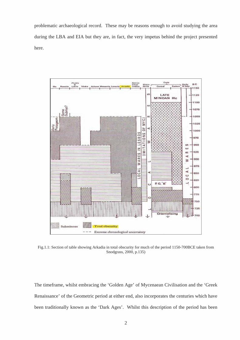
Fig.1.1: Section of table showing Arkadia in total obscurity for much of the period 1150-700BCE taken from
Snodgrass, 2000, p.135)
The timeframe, whilst embracing the ‘Golden Age’ of Mycenaean Civilisation and the ‘Greek
Renaissance’ of the Geometric period at either end, also incorporates the centuries which have
been traditionally known as the ‘Dark Ages’. Whilst this description of the period has been
2
put aside for many regions of Greece due to an increasing body of archaeological evidence
(e.g. Lemos 1999, p.24, Papadopoulos 2004), it remains an apt term for many scholars when
dealing with Arkadia (John Bintliff pers. comm. February 1999; Birgitte Eder pers comm.
September 2002). Until recently, overviews of the period in question have noted that little, if
anything, happened in Arkadia at this time and a scanty amount of remains were known for
the preceding Mycenaean period (e.g. John Prag pers. comm. December 1998; Osborne 1996,
p.71; Snodgrass [1971] 2000, p.90; Coldstream 2003, p.156; Howell 1970). Indeed,
Dickinson (1994, p.3) shows a map of the regions of Greece in the BA with Arkadia omitted
and in Snodgrass’ seminal work of 1971 `The Greek Dark Ages`, Arkadia is described as
residing in ‘total obscurity’ between the dates of 1050 and 750BCE ([1971] 2000 p.135, see
Fig.1.1). The cumulative impression has been that Arkadia was thinly inhabited in the BA,
practically deserted and thus sliding into ‘total obscurity’ in the so-called Dark Ages, and only
gaining any prominence when Sparta was spreading its wings in the seventh century BCE,
which led to numerous conflicts with Tegea (e.g. Herodotus Histories 1.64; Snodgrass [1971]
2000; Osborne 1996, p.184).
A conclusion such as this does not develop by accident. In the late 1960s and early 1970s, the
available archaeological evidence for the period was negligible and the overriding perception
of Arkadia was as an antiquated backwater. It can be argued today that the material record for
the LBA and EIA in Arkadia and particularly for the middle years ranging from
approximately 1100 – 800BCE remains sparse indeed. This is especially in relation to some
other areas of Greece, such as Messenia with Nichoria (Coulson et al. 1983) and Euboea with
Lefkandi (Popham et al. 1979, 1990, 1993, 1996) and to that from later periods i.e. Classical
and Roman, both in Arkadia and beyond (e.g. Megalopolis, Gardner et al. 1892). For some
scholars this has been enough to deter investigation into the region: the perceived lack of
archaeological evidence means their preference is for those areas believed to offer more
3
results (Bintliff pers. comm.). This then becomes a circular argument: it is believed little
evidence exists in Arkadia for the period in question, therefore excavations or surveys are not
undertaken, therefore little evidence is unearthed and therefore little evidence exists. Much of
Arkadia has not been subject to intensive, diachronic and systematic field survey. For
instance, individuals (Howell 1970; Hodkinson & Hodkinson 1981) have only extensively
surveyed the plains around Mantinea and Orchomenos.
If this study followed a conventional route, relying on relatively full material records and
artefactual analyses, then the following pages would be rather empty. In some areas it
actually proves difficult to apply standard chronology so that in many cases it is not even
possible to date sites of the LBA more precisely than to a general LH period (see Chapter 3
Section 3.3.2a). Although, Coulson’s (1985, 1986, 1990) Dark Age chronology may be more
suited to the region of Arkadia, the standard chronology has been kept in order to allow
published evidence to be utilised, without re-assigning it (see Chapter 3.3.2). In addition, the
aim of this project is to work with the existing material record, not to find new sites and
consequently the situation regarding material evidence has not changed. The methodology
(more fully explained in Chapter 3) thus concentrates on location. The most important part of
this methodology was fieldwork allowing for immersion in the landscape. Sites were visited,
their positions recorded using a GPS, and significant aspects of the surrounding landscape and
the sites relative position within it were analysed and noted (Tilley 1994, p.73; Exon et al.
p.25). Video-clips, panoramic photographs and taped conversations attempt to capture some
of the impressions gained. In addition, a database was compiled, which can be accessed
through the accompanying CD-ROM. At the outset, the use of a Geographical Information
System in order to further analyse positions of sites within the landscape was also thoroughly
considered, but based on a number of factors including time and efficacy, the technology was
dismissed at this time. This consideration is set out in Appendix 1.
4
Such an approach based on whole landscapes, which emphasises the position of sites already
known, allows insight into a region and period that had little hope of being enlightened by
more conventional ways of interpreting the archaeological record. Using interpretative and
phenomenologically inspired ideas enables consideration of how human actions were
embedded within and informed by the very physicality of the landscape. Where detailed
artefactual analyses have been possible, albeit on no more than a handful of sites (e.g. Tegea,
Voyatzis 1990), or for part of the period under question (e.g. Morgan 1999), then the
approach taken here can be considered complementary. Such an approach allows the period
to be illuminated perhaps in a way not previously thought possible, permitting new insights as
a consequence. This approach also has the added advantage of engaging with recent trends in
archaeological method and theory that have been tried and tested in other places and for other
times (e.g. Thomas 1991, 1997; Tilley 1994; Edmonds 1999; Exon et al 2000; Gillings 2005).
Moreover, the largely prehistoric, or at the very least proto-historic period, ranging from the
LH down to and including the G has been seen, in most respects, in terms of long term
processes. In a similar way, this study looks at this period in its entirety, as Desborough
(1964) and Snodgrass ([1971] 2000) have done before. However, although it is an attempt to
see a time span beyond the lives of individuals to investigate changes in the material record
from c1600 to c700 BCE, the application of phenomenologically-derived ideas distinguishes
this work by recognizing the sweep of approximately 900 years was lived and experienced by
real people (Gosden 1994, p.122). Bradley (1991, p.209), drawing on structuralist traditions,
states that measuring and describing time through chronologies and dates allow history to
exist, but a clearer conception of time and what it means on a human level is needed to enable
interpretation to take place. Therefore, it is not only viable, but also necessary to investigate
more closely particular points during the longer timescale with which this study is concerned.
By scrutinising the material record and its position in the landscape, it becomes possible to
5
think in terms of how individuals interacted with one another and the world around them,
created the communities of which they formed a part and how they may have perceived their
world. From these investigations, it is then possible to think out again over the long term and
consider how the relationship people had with one another and the world around them was
negotiated, changed, and adapted over the whole period in question. The approach applied
thus allows an exploration of aspects of past peoples’ experience, despite problems with the
archaeology, and avoids falling into the impossible trap of attempting to prove or disprove the
prevailing myths through archaeology.
This thesis is divided into three parts. Part 1 serves to introduce the region, the period, and
the approach taken towards exploring the landscapes of Arkadia. The archaeological
evidence for the period under question is not prolific in this region of Greece, especially in
relation to those regions surrounding it such as the Argolid and Messenia. Arkadia as a quiet
mountainous backwater where little ever happened is a theme found throughout ancient and
modern literature. Chapter 2 considers this recurrent motif through an investigation of
Arkadia in myth and the history of research into this region, questioning why there is a lack of
material evidence. It is suggested that the kind of attention Arkadia received in antiquity and
the region’s portrayal in subsequent literary and artistic genres may be responsible for how
Arkadia has been approached in archaeological studies until relatively recently. It is argued
that the view of Arkadia, as described in the first paragraph, had once been enough to satisfy
questions regarding lack of archaeology, whereas now questions regarding visibility and
methodology are taking its place. Scholars have in fact long studied Arkadia, both as a
physical entity (e.g. Nielson and Roy, 1999) and as a literary or metaphorical one (e.g. Snell
1953; Alpers 1979). However, no studies have considered the period or the area in quite the
same way as is set out in this thesis, despite a seemingly similar focus on landscape that can
be found in some (e.g. Howell 1970; Jost 1985; Lloyd 1991). Through looking at the
6
historiography on the region, the significance it has for the present study is illuminated. In
this way, influences and assumptions, both explicit and implicit, are uncovered, highlighting
the fissures present in our understanding and, which are addressed during the course of the
thesis.
Following on from this critique, the third chapter describes the methodology used and the
theory that has driven it. The chapter outlines how the region, the period, and the evidence
for each have been approached in this project. Of particular concern in the first part is
landscape and how, in this study, it is considered as always more than a backdrop to events or
a resource to be exploited. It was (and is) interacted with: people do not walk upon it; they
are enveloped within it. This is an attitude very much informed by phenomenological or
existentialist viewpoints (e.g. Husserl e.g.1917 Heidegger 1962; Krell 1993; Ingold 2000;
Merleau-Ponty 2002), ideas which archaeologists have employed in studies of landscape for
other places and periods (e.g. Thomas 1991, 1997; Tilley 1994; Edmonds 1999; Exon et al
2000; Gillings 2005). However, whilst certainly coming from a position that is heavily
influenced by post-processual and interpretive approaches, as the list of scholars above
testifies, the current study does not declare allegiance to any particular ‘school’. Different
approaches, or at least elements of them, are allowed to collaborate.
The second part of Chapter 3 addresses the problematic of dividing human experience into
discreet timeframes often dictated by pottery styles. Consequently, the difficulties caused by
thinking in terms of processes and time spans that are visible beyond the level of human
interaction are considered. These abstract notions of time are balanced by contemplating
what living through such periods and their transitions may well have meant to people - groups
and individuals - living in Arkadia at a particular time. Such an approach ultimately achieves
an understanding of measured time and experienced time (Gosden 1994, p.2). It takes into
7
account questions regarding the timescales with which we can be viably concerned and how
far the evidence, archaeological and otherwise dictates this. In order to achieve this analysis
the work of the Annalistes, (e.g. Braudel 1969, 1972, 1983; Le Roy Ladurie 1997), Bourdieu
(1977), Giddens (1984) and Ingold, (2000), is consulted. Many of these scholars have worked
under the influence of phenomenologists such as Heidegger (1962; Krell 1993) and Merleau-
Ponty (1962), thus complementing and supporting the position adopted towards landscape and
space
Part 2 is the application of the approach outlined in Part 1 and consists of three chapters, each
concentrating on different aspects of life and social interaction within the landscapes of
Arkadia. The somewhat arbitrary but predictable categories that form the chapters are
religious and sacred space (Chapter 4), death and burial (Chapter 5) and the everyday
(Chapter 6). Each chapter initially outlines the evidence from Arkadia before moving on to
discuss how sites and material culture in each category have been and can be interpreted.
Following this, the chapters explore aspects of a particular landscape, in which one or more
sites are set, through a number of case studies. Given that not all sites have evidence for each
of the major divisions of the period, specific areas of Arkadia have been chosen to encompass
as much of it as possible. For instance, in Chapters 4 and 5, the Mantinean Plain and the
Pheneatike are treated as wholes rather than simply Ptolis or Pheneos respectively. Through
approaching the evidence in this way, it is possible to discuss change and continuity through
the period in question on a number of different levels: the first halves of the chapters allow
trends to be visible on large scale, whereas the case studies allow a consideration of what may
have been important to individual people and communities.
The first of these chapters, Chapter 4, is concerned with religious and sacred landscapes. The
evidence pertaining to sites with religious or sacred use is outlined, and assessed with
8
reference to similarly interpreted sites in other parts of Greece. Integral to discussion is the
changing nature of sites that can be ascribed as having a religious or sacred use. It is argued
that many do not simply show a continuation of such activity, and that a number only acquire
a suggestion of such use in the period under study due to later, namely Archaic, and Classical,
activity. The validity of assigning such interpretations in hindsight is a matter for debate.
The case studies that follow this discussion, concentrating on the sites of Asea Ayios Elias,
Vlakherna-Petra, and Ptolis-Gortsouli, enable an investigation into what can be seen as the
changing nature of religious sites in Arkadia and how specific landscapes might have been
integral to their use in this way by communities.
The fifth chapter is concerned with landscapes of death and burial. There is burial evidence
from Arkadia for most of the period 1600-700BCE, thus it is possible to say something for
each of the major cultural phases. From a consideration of general trends that can be seen
throughout the period in question and how this has been and might be interpreted, the chapter
considers how people may have approached or perceived death through an exploration of the
landscape in which such sites are set. The case studies focus on Stymphalia and the
Pheneatike, southeast Arkadia, the chamber tomb cemeteries of the west and Artemision-
Ayios Ilias and the Mantinean Plain.
Chapter 6 is concerned with the everyday (the profane). The chapter starts with a
consideration of different types of evidence for each period and of how this evidence changes
over time. This is done with reference to other parts of Greece and then concentrates on
Arkadia. Like the previous two chapters, the second part of the chapter is concerned with a
number of case studies. Here, the Orchomenos plains, the Mantinean plain, Loukas-Ayios
Yioryios and Nestani, the Stymphalian plain and the Pheneatike are explored. This is
9
essentially an investigation into how the physical environment could have informed the
practice and affected the experiences of those who lived their everyday lives in these places.
Part 3 comprises the summary and conclusions. Chapter 7 brings together the main points
raised in the body of the thesis. It is apparent throughout that many concerns in separate
chapters do overlap to some extent and this chapter reiterates some of the recurring themes. It
is also acknowledged that exploring and subsequently presenting the approach through the
themes of religion and sacred space, death and burial and the everyday, could not possibly
cover all there is to say on the period in question. Nevertheless, the conclusions reiterate and
clarify issues that have been particularly prominent throughout, perhaps repeatedly. What this
chapter does not do, however, is provide a definitive narrative of processes or events that
occurred between 1600 and 700 BCE in Arkadia, nor does it discuss in detail economic or
social systems that may have been in place. This chapter also highlights perceived problems
and outlines some avenues for further research. This chapter brings to a close a thesis that,
through an exploration of human landscapes in the LBA and EIA, has gone some way to
provide fresh insights into a period in a region that has often been overlooked.
To complement the main text and illustrations, transcripts of taped conversations at a number
of sites have been included in the chapters where appropriate. A number of Appendices have
also been added to supplement the main body of the thesis. Appendix 1 discusses
Geographical Information Systems and their use in archaeology, a discussion that was deemed
necessary in light of the initial aims of the study and the way research progressed (see Chapter
3). Appendix 2 consists of a number of tables, which the reader may find useful for reference
whilst reading the text. In addition, there is a CD-ROM on which is a PDF document of the
text of the thesis and attachments of video clips, a Google Earth tour and a database of all the
sites, from which the tables of Appendix 2 have been taken. The points at which these can be
10

accessed are indicated by a paperclip icon in the PDF document and highlighted in the
hardcopy. Appendix 3 gives instructions on how to use the CDROM. It is hoped that these
additions will enable an understanding of and an engagement with the landscapes of Arkadia
that would otherwise not be possible. I would also like to bring to attention the fact that
Dickinson’s latest publication The Aegean from the Bronze Age to the Iron Age published in
2006 reached me too late to be included in the present study. However, this work will be
fully considered and incorporated before publication.
11

PART 1
12
CHAPTER 2: BACKGROUND
2.1 Introduction
This chapter explores the beguiling myths and problematic archaeological record brought to
attention in the first chapter. It begins in Section 2.2 by considering Arkadian mythology and
the claims to autochthony found in many sources. The existence of this mythology traversing
the period of the LBA and EIA encouraged in part the research presented here. In reflecting
upon such mythology, it is necessary to question whether there is any historical basis for such
an assertion and in doing so looks at modern approaches to myth. This examination also
extends to the existence of an Arkado-Cypriot dialect detectable from the seventh century
onwards and connections with the Linear B script of the LBA, querying the extent to which
these factors support the myth. Following this, attention focuses on the archaeological record
(Section 2.3), which, as stated in the first chapter, compared to other regions and periods is
relatively sparse. Examination of underlying reasons for this situation begins with outlining
the way Arkadia appears in the ancient sources including a précis of the way the period has
been considered (section 2.3.1). Following this Section 2.3.2 considers the effect the literary
record has had on archaeological research, and in particular archaeological research into
Arkadia. Subsequently, Section 2.3.3 considers recent research that has begun to change the
prevailing view of Arkadia and looks at some of the recent methodologies used, particularly
of the surveys undertaken over the past decade. The emphasis changes slightly in Section 2.4,
when the focus is on the geology, geography and topology of Arkadia. Within this section,
the view of Arkadia as barren and unyielding is questioned and recent ethnographic and
archaeological research that has turned around this long-standing view is highlighted (Section
2.4.1). Section 2.4.2 considers how the geography and topography of the region has effected
where archaeological research has taken place, and in Section 2.4.3, the effect of these aspects
on visibility of the archaeology is illuminated. The chapter concludes in Section 2.5 where it
is contended that a multitude of factors has contributed to the archaeological record as it
13
stands today. In addition, it is stated that even though further fieldwork is welcome, a
phenomenologically inspired approach can be productive with the record as it stands.
2.2 Mythology and language
2.2.1 Arkadian Autochthony
Traditions recorded in the ancient sources claim the people of Arkadia were indigenous (e.g.
Hellanikos FGrHist 4 fr.37; Ephorus FGrHist 70 fr.18c.6; Herodotus 8.72-73). According to
the account given by Pausanias, writing in the second century CE, the land was originally
called Pelasgia after Pelasgos, the very first inhabitant and king (8.1.4) and the people were
named Arkadians, and the land Arkadia, after Arkas, the great-grandson of Pelasgos and son
of Callisto (8.4.1). For many ancients, Pelasgos was considered to have been born from the
land itself (e.g. Asios: Nielsen 1999, p.34; Apollodorus 3.8.1; Aeschylus Suppl. 7.99) and as
the original ‘Arkadian’ linked all subsequent Arkadians firmly to a geographical entity.
Furthermore, a similar tradition describes Arkadians as proselenoi or ‘people before the
moon’ (Hippys of Rhegion FGrHist 554, fr.7:73; Aristotle fr.591 (Rose)) and a reference to
Pelasgos describes him as proselenaios (Nielsen 1999, p.35). The mythical genealogy that
follows Pelasgos, describes how his sons, grandchildren and great-grandchildren had specific
functions in terms of the development and advancement of Arkadia and the Arkadians.
Hence, Lykaon founded the very first polis, Lykosoura, established the cult of Zeus Lykaios
and founded the Lykaian Games (Pausanias 8.2.1). Subsequently, his sons each established
cities, for example, Pallas, Orestheus, Phigalus and Tegeates founded Pallantium,
Oresthasium, Phigalia and Tegea respectively. Callisto, his only daughter, gave birth to
Arkas who, in addition to giving his name to Arkadia and the Arkadians, introduced
agriculture and “other things besides” (Pausanias 8.4.1). The family tree continues in a
similar vein until figures emerge connected to historical events such as the Messenian Wars
during the eighth century and the Battle of Plataea in 479BCE verifiable through independent
14
sources. This mythical genealogy and claims to autochthony are supported by traditions that
maintain the Arkadians had escaped the effects of migrations and upheavals of the LBA and
EIA to which much of the Greek World and beyond had been subject. For instance,
Herodotus (2.170 see also 8.73) states that the Arkadians “were not driven from their homes
by the invaders” and Thucydides (1.2) writes that there were frequent changes of population
“in most of the Peloponnese, except Arkadia.”
There appears to have been a deep-rooted general belief in an Arkadian population having
lived continuously in the same place, a belief that gains increasing significance given the
apparent support from modern linguistic analyses (Wyatt 1970; Bartonek 1972; Chadwick
1975). Such analyses have shown that the Arkado-Cypriot dialect used in Arkadia and
Cyprus, detected through inscriptions of the Archaic and Classical periods and described by
ancient sources, is closely connected to the early form of Greek employed on the Linear B
tablets of the LBA. This conviction is particularly pertinent for this study as any correlation
traverses the very period under examination. It suggests that a population did indeed continue
living in Arkadia throughout the Dark Ages and that the myths and genealogies surrounding
the Arkadians reflect some sort of historical reality. In addition, it suggests that if people
really had lived continuously in Arkadia unaffected by migrations occurring all around them
at the end of the BA, then to pursue the material remains of this particular period and area
should undoubtedly promise to be interesting and worthwhile. However, this is not quite the
case and the picture is more complex.
2.2.2 Problems with mythology and language as basis for history
The value of myth and pseudo-historical accounts in the ancient sources for recreating history
and society has been questioned by many scholars especially those working on the LBA and
EIA (e.g. Snodgrass [1971]2000; Osborne 1996), because of the lack of contemporary
15
sources. Scholars working primarily on the subject of Greek Mythology rather than
archaeology have expounded the ineffectiveness of such attempts. This applies especially to
those of the structuralist school who have tended to ignore any historical elements to myth
(e.g. Vernant 1980 1983; Detienne 1986; Vidal-Naquet 1986; and see Buxton 1994). Others
such as Burkert (1979) have appreciated the importance of history, although in terms of the
creation of myth rather than as its subject, and the significance of rites has been investigated
in studies by Bremmer (1983, 1984) and Graf (1985). There are those who have questioned
the category of myth and claim it to be a particularly modern notion (Detienne 1986; Calame
1990) and feminist critiques and understanding of myths have been developed (Pomeroy
1975; Loraux 1981, 1987, 1989; Cameron & Kuhrt 1983; Halperin et al. 1990). In addition,
Paul Veyne has approached the question of whether the ancients actually believed in myths
and how this would have affected their purpose (1988). Fuller discussions of the
development of theories and approaches toward myth can be found elsewhere (e.g. Dowden
1992, ch.2). In sympathy with the research presented here, however, is the approach taken by
Buxton (1994). He believes (1994, p.4) myth should be contextualized and the stories should
be relocated ‘within the largely peasant communities in which they were told’ and the ‘old
historicism debate’ is seen, by Dowden (1992, p.23) at least, as a particular folly of naïve
prehistorians.
If this approach is applied to the Arkadian origin myths and their context is examined, we find
that the genealogy as outlined above is only found in its full form in Pausanias’ ‘Description
of Greece’ written in the second century CE (8.1.4-8.6.3). There are references to various
aspects in earlier writers, such as Herodotus and Thucydides as illustrated above, and in
fragments of Hesiod (fr.161; fr.162 (MW)), Asios (as quoted in Pausanias 8.1.4) and
Pherekydes (FGrHist 3 fr.156). However, the connection with Pelasgos as ascertained from
these earlier sources may, in fact, be an outsider’s rather than an insider’s view - none of the
16
sources referring to him in the Arkadian context come from Arkadia, at least not in the sixth
and fifth centuries. Moreover, later Arkadian sources although acknowledging Pelasgos, tend
to refer more readily to Lykaon and Arkas, who are more likely to be Arkadian in origin
because of their links with place names (Kopp 1992, cited by Nielsen 1999, p.34). In
addition, other areas of the ancient Greek world also claimed Pelasgos as king and people
known as Pelasgians are stated to be located in places as far apart as Crete and Thrace (e.g.
Homer Il 2.840-843, Od 17.175-177; Herodotus 1.57; Thucydides 4.106; Aeschylus Suppl.
5.22, 10.79). Also, the word Pelasgic is used in a variety of ways in the ancient sources from
Homer onwards, some of which have little or no exclusive connection to Arkadia (e.g. Homer
Il 2.840-843, Herodotus 1.57). It seems Pelasgian may have been a generic term referring to
all inhabitants of an earlier Greece, rather than specifically to early Arkadians (i.e. before
Arkas).
Nielsen (1999, p.35) explains these difficulties as arising because the creation of the mythical
complex explaining Arkadian origins did not actually occur until the sixth and fifth centuries
BCE. This was at a time when pan-Arkadian identity was being forged largely in response to
outside aggression (Morgan 1999b, p.425). In a similar manner, Scott (2004) argues that
Arkadian claims to autochthony and a specifically Arkadian connection with Pelasgos became
particularly politically salient in the 4th century BCE, when a new identity for the Arkadian
Confederacy was being constructed. This identity was expressed monumentally in the
Arkadian victory monument at Delphi and it was here that Triphylos appears for the first time,
represented as one of the sons of Arkas. Thus, it seems Arkadian mythical genealogy could
be manipulated when necessary on political grounds, in this case to give credence to the
Triphylian’s presence in the Arkadian Confederacy (Scott 2004, p.14). In addition, as stated
by Roy (1968) and reiterated by Nielsen (1999, p.47), Arkadia was in the first instance a
human concept not a geographical one. For this reason, although Arkadia can be connected to
17
a specific place detectable from Homer onwards, (Il 2.603-14), claims to autochthony may be
deemed at odds with fluctuating boundaries over the centuries. The fact that it was relatively
easy to incorporate and accept varying regions (e.g. Triphylia) into their geographical arena
implies that the myths were indeed expedient creations.
Returning to the question of the Arkado-Cypriot dialect and its tantalising connections with
Linear B, initial enthusiasm for such supporting evidence is diminished when other factors are
taken into account. For instance, in order to explain the distribution of the dialects - West
Greek, Aiolic, Arkado-Cypriot and Attic-Ionic - by movements and migrations of people as
related in ancient texts, it is necessary to assume that the divisions were already in place by
the end of the second millennium. In addition, whilst it is true that the Greek-speaking world
in the Archaic and Classical periods can be divided into dialect groups based on extant
inscriptions, some traditional conclusions regarding isoglosses, the linguistic features that
distinguish one dialect from another, may be too simplistic and could mask an intensely
complicated development and divergence (Jeffrey 1990). Moreover, an abundance of extant
epigraphy in one region over another, (e.g. Attica) may skew groupings, and difficulty in
dating individual inscriptions may cause linguistic features that never co-existed to be linked.
Similarly, if alternative isoglosses were deemed more important that those that actually are,
dialects may be categorised in other ways entirely. As Hall (1997, p.175) states, if an isogloss
were drawn to distinguish dialects that preserved intervocalic –rr- and those which innovate
to –rs- or between the preposition peda and meda then the Arkado-Cypriot dialect would not
be related (intervocalic –rs- and preposition peda are present in Arkadian but not Cypriot).
Moreover, there exists a high level of linguistic diversity within a dialect group and even
within an epichoric dialect (Jeffery 1990, p.207). For example, at Tegea, the original
labiovelar is represented by - (t)z-, but by –s- at Mantinea, and infinitives end in –en at Tegea
but – n at Lykosoura. It is also significant that the script used in Arkadia during the Archaic
18
and Classical periods shows close links with other areas of the Peloponnese. For example, the
crooked iota is found in use in Arkadia, Achaea and Korinth and various inscriptions from
Olympia cannot be readily identified as specifically Arkadian or Eleian (Jeffery 1990, pp.207-
208; 215; Hall 1997, p.146 fig.21). These observations show that Arkadia certainly was not
isolated from its neighbours. Regarding Linear B, it may have had or at least masked more
variation than can be ascertained and it is difficult to regard it as indicative of how people
spoke at that time: it was a script used in a limited fashion mainly for inventories, and as such
could not possibly reflect how people actually spoke. Linguists heavily influenced by myths
and traditions in the literary sources may be too ready to confirm a particular relationship.
For example, an inscription discovered in a chamber tomb in ancient Paphos in Cyprus is
often used to support the myth of the foundation of this site by Agapenor of Tegea. It is
Greek written in Cypriot syllabary, with the genitive –u ending reflective of a dialect similar
to that spoken in Arkadia. Hall (1997, p.136) argues that its appearance is rather an active
attempt on the part of the inhabitants to forge links with the Greek mainland, than a reflection
of their ethnicity.
Such contradictions to Arkadian mythology and linguistic evidence prevent taking the
traditional accounts too literally. Whilst claims to autochthony may have been encouraged by
a collective memory of escaping the worst of any upheavals at the end of the LBA, they make
it increasingly difficult to imagine an indigenous population continuing to speak a dialect of
Greek directly descended from that found on the Linear B tablets, protected by its remote and
mountainous location, especially if this occurred through a period where the art of writing
seems to have been lost. If, therefore, we do not necessarily expect a continuing population in
the region of Arkadia at the end of the BA and beginning of the IA, perhaps the region was
indeed deserted and a full archaeological record need not be expected. In this case, the
project can be concluded here.
19
However, in spite of the fact that it proves difficult to use mythology and linguistic evidence
to recreate a history of continuous occupation through the ‘Dark Ages’, it is contended that
the archaeological record is currently problematic, not because the region was deserted and no
material culture remains, but because a number of other factors have influenced opinions of
the region and period and thus archaeological practice and successful recovery of evidence.
These factors are examined below.
2.3 The Problematic Archaeological Record of Arkadia
2.3.1 Arkadia in the ancient literature
The starting point is the treatment of Arkadia in the ancient literature. The region generally
does not hold a prominent place in the ancient literary record in historical or pseudo-historical
terms, at least not in comparison to regions such as Athens and Sparta. The majority of the
extant sources focus on these well-known city-states, (e.g. Herodotus, Thucydides, Aristotle),
which are well known precisely because they were often written about. Arkadia is first
mentioned in the ‘Catalogue of Ships’ of Homer’s Iliad, in the guise of a list of place names:
the men of Pheneos, Orchomenos, Rhipe, Stratie, Enispe, Tegea, Mantinea, Stymphalos and
Parrhasie are stated to have been led to Troy by King Agapenor in some sixty ships (Il. 2.
604-5). It is indeed enlightening to have the names of early towns, especially when these can
perhaps be associated with the period of interest here. In fact, many of these places have been
located. They are particularly focussed in the eastern part of the region, which has raised
interesting questions as to the extent of an Arkadian ‘territory’ at this time. However, little
else is learned other than that the area was considered landlocked (Morgan 1999b, pp.383-
384).
In later sources, such as Herodotus (fifth century BCE) and indeed Pausanias (second century
CE), the many struggles between Sparta and Arkadia, and Tegea in particular, are testified.
20
We learn that Tisamenus led the Spartans against the Tegeans, whilst on the other hand
Cleomenes threatened the Spartans with Arkadian support, and the procuring of the bones of
Orestes finally allowed the Spartans to gain the upper hand over Tegea (Histories 9.35; 6.74;
1.66, respectively). The people of Arkadia are also shown fighting alongside other Greeks.
The region’s involvement in the Trojan War has already been mentioned. Of the much later
battle at Thermopylae, Herodotus (7.20) states that a total of 2120 Arkadians fought against
the Persians, five hundred from Tegea, five hundred from Mantinea, one hundred and twenty
from Orchomenos and one thousand from the rest of Arkadia. It is also stated that many
deserted to the Persian side afterwards (8.25), although, “all the Arkadians” were apparently
present to help the rest of the Greek population build a wall across the Isthmus to stop their
common enemy from attacking the Peloponnese (8.72). Arkadians can also be found in
Xenophon’s works the Hellenika and particularly the Anabasis, where we are told that the
Arkadians constituted a significant number of the ‘Ten Thousand’. Not surprisingly from the
contexts in which Arkadia and her inhabitants appear, Arkadians acquired a reputation for
being mercenaries, with perhaps the readiness to be so, encouraged by the limitations of living
in a ‘marginal’ mountainous area (although see Section 2.4 and Roy 1967, 1999, p.346).
Apart from these sources, other works have Arkadia as part of a wider theme and on occasion
as the sole topic. Nevertheless, these are largely fragmentary. Hekataios of Miletos (FGrHist
1 frr 6, 9, 29a, 29b, 6a?), Pherekydes (FrGrHist 3, frr 5, 82a, 135a 156-161), Hellanikos
(FGrHist 4 fr.37), Ariaithos of Tegea (FGrHist 316, frr1, 2a, 2b, 4, 5, 7) and Aristippos
(FGrHist 317 frr 1, 2, 3) are some examples. If more of these works were extant we may
have a different concept of how Arkadia appeared to the ancients, although the fragments that
do exist show a concern for Arkadian mythology and genealogy of mythical ancestors, in
some cases in order to prove the autochthony of Arkadians (e.g. Hellanikos FrGrHist 4 fr.37).
Aristotle’s The Common Constitution of the Arkadians is the only surviving work that deals
21
with political matters, which is rather late for the period being considered here, discussing as
it does the Confederacy founded in 370BCE (Nielsen 1999, p.17).
It is perhaps with the bucolic poetry of the Roman author Virgil at the end of the first century
BCE, following the genre instigated by the Hellenistic poet Theocritus, that Arkadia becomes
particularly prominent in its own right, most visibly in the Eclogues. One scholar (Snell
1953, p.281) has even gone as far to say that Arkadia was discovered in the year 41 or 42
BCE. However, the region is already at this stage an instrument in the creation of the literary
idealized landscape, filled with shepherds playing panpipes, a portrayal also apparent in other
ancient works such as Ovid’s Metamorphoses. It seems Arkadia was chosen as the setting for
Virgil’s poetry due to a line of Polybius (4.19.13-21.12), an Arkadian himself, which stated
that all people from this area were musicians. There is also the influence of the physical
landscape that suited pastoralism, which was particularly highlighted, exaggerated and
enhanced. The ‘otherness’ of Greece was used as a canvas on which Roman authors could
project their ideals (Alcock 1993, p.226). Arkadia was part of a land that was physically near
and sufficiently real to engage the audience, but which was far away enough, whose glory and
renown (of Greece as a whole) were placed well enough in the past for the ‘truth’ not to
matter nor threaten. Thus, an idealization was born that was to continue up until the present
day, where we find ‘Arkadia’ still used synonymously with ‘Elysian fields’ ‘paradise’ and
‘nirvana’.
2.3.2 Consequences of the literary record for archaeological research
This state of affairs has had an influence on the way archaeological research has, or has not
been undertaken in Arkadia. As stated above Arkadia was not prominent in Homer and
although scholars, both modern and ancient (Herodotus, Thucydides, Grote 1846, Schliemann
[1875]1994; Finley 1956; Osborne 1996), have disagreed as to the amount of faith which can
22
be put in the narratives as told by Homer, they have still focused attention on certain regions.
Fitton (1995) argues that the discovery of the BA occurred through a desire to prove or
disprove the truth of the Trojan War. In fact, in the nineteenth century this emerged as a key
function of the archaeological pursuits in Greece. The kings of legend such as Minos and
Agamemnon and the myths that surrounded them spurred on archaeologists, most famously
Schliemann, with his excavations at Hisarlik and Mycenae (e.g. Schliemann 1994; Fitton
1995). The (re)discovery of the large BA ‘palatial’ sites, such as Mycenae and Tiryns in the
Argolid (Wace 1923; Mylonas 1973; Muller 1912), Pylos in Messenia (Blegen 1966), and
Thebes and Orchomenos (Keramopoulos 1917; Schliemann 1880-1886) in Boeotia,
fundamentally convinced those who excavated them that there was truth to be found in the
stories. Testimony to this are the names given to the various buildings and finds, for instance
the “Palace of Nestor”, the “Menelaion”, “Treasury of Atreus”, “Tomb of Clytemnestra” and
the death mask of Agamemnon himself upon which Schliemann gazed. Consequently, these
areas were studied for their relevance to the late BA, the period of Mycenaean Civilization.
Remote and/or inland areas, such as Arkadia, which possessed no evidence of ‘palaces’ were
relatively ignored for this period.
The period following the LBA, the ‘Dark Ages’, is a period that until recently was generally
thought of as ‘dark’ both in literary terms and archaeologically speaking, not to mention being
a time of abject misery for those who lived through it (Snodgrass [1971] 2000, p.2, p.21;
Nowicki 2000, p.16). Scholars in the past such as Grote (1846) and Murray (1907) believed
that there were few sources, which would shed light upon these years. The primary basis for
this stance is the interpretation of the ancient literary sources, which did not explicitly
recognise such a period; rather, extant narratives recorded fewer events than both preceding
and subsequent phases. Thus, it was doubted that archaeology would be able to rectify this
situation. The common pattern then, was that at one time academia had little recognisable
23
evidence for the period from across all areas of Greece, and Arkadia was not alone. Recent
work has of course produced a very different picture for the period in question.
A large volume of evidence pertaining to this period now exists, at least for some sites and
areas. Large-scale excavations have been carried out at Lefkandi (Popham et al.1980, 1990,
1993, Evely 2006) and Nichoria (Coulson & McDonald 1975, Rapp & Aschenbrenner 1980,
Coulson, McDonald & Rosser 1983, McDonald & Wilkie 1994) and diachronic field surveys
from the 1970s onwards have brought to light evidence to one extent or another covering the
whole of the period. For example, in the Peloponnese, the first large-scale survey carried out
was the Minnesota Messenia Expedition in the district that is home to the Mycenaean citadel
at Pylos and the results of this survey were published as early as 1972 (McDonald & Rapp
1972; see Fotiadis 1995 for the importance of this survey in the history of archaeological
investigation in Greece). Likewise, Jameson, Runnels, & van Andel (1994) undertook a full
diachronic and systematic survey in the Southern Argolid, famous for its LH citadels at
Tiryns and the eponymous Mycenae, as well as for the later city of Argos and published the
results soon after it had been completed. Another large-scale diachronic survey covered
Lakonia, where Sparta and the Menalaion are situated (Cavanagh et al. 1996). Regions of the
wider Greek World have been subject to similar intensive archaeological investigation with
Boeotia (Bintliff 1985; Bintliff & Snodgrass 1997), Melos (Renfrew & Wagstaff 1982), Keos
(Cherry et al. 1991) and Rhodes (Mee 1982) all having undergone systematic survey over the
years, each with a published volume devoted to the recovered and analysed data.
Because these surveys were diachronic, they revealed data from all periods including the
‘Dark Age’ that allowed study of this period in those regions where the survey had been
carried out. However, Arkadia due to limited evidence for the BA, and having little to reveal
for subsequent periods presumably did not appear to be a particularly desirable place to focus
24
one’s attention. Such fieldwork may have changed scholars’ understanding of the period,
even causing some to call for a rejection of the term ‘Dark Age’ altogether (e.g. Lemos 1999,
p.24, Papadopoulos 2004) but the situation for Arkadia has remained largely the same until
recently (see Section 2.4).
In addition, the majority of ancient writers concentrated their narratives on either the city-
states such as Athens, Sparta, their interactions with each other and outsiders (e.g. Persian
Wars – Herodotus, Peloponnesian war – Thucydides) or else the authors themselves have
originated from these places (e.g. the playwrights, Aristophanes, Euripides and Aeschylus).
Democratic Athens in particular has benefited from not only the literary sources, in this case
especially Aristotle’s Constitution, but also from the desire of modern liberal democratic
societies to look back to its perceived predecessor as illustrated above (Hodkinson & Brock
2000, p.4). Arkadia, a mountainous and rural area with a few urban centres comparable to
Athens or Sparta, could not and did not receive the same kind of attention in this climate
Fortunately, the extant book eight of Pausanias’ Description of Greece is an exception, to the
trends outlined above. It is a source of immense importance in identifying the history,
mythology and indeed standing remains of Arkadia. In addition, Virgil’s use of Arkadia as
the setting for much of his work, especially the Eclogues, has ensured that the region has not
been not totally ignored. Indeed poets and painters have promoted Virgil’s idyllic image of
Arkadia throughout the ages (e.g. Sannazaro, Sidney, and Poussin). When archaeological
research did take place in the region, it was with Pausanias as guide and armed with the hope
that the perceived glories of the past, particularly in terms of art and architecture, could be
rediscovered. Of course, in comparison to the ideal, depicted in literature and art, the real
geographic Arkadia was thought of as “humdrum” (Snell 1954, n.29).
25
Initial researches took place in the eighteenth century. The first, albeit ultimately
unsuccessful, expedition into Arkadia was led by the Frenchman J Bocher. This was an
attempt to find the temple of Apollo at Bassae. Pausanias had written that the architect who
had designed the Parthenon had also designed the Temple at Bassae (8.41.7-8) and
presumably, the possibility of finding a building that rivalled the Athenian temple was
overwhelmingly enticing in the latter half of the 18th century. This is particularly pertinent
when the expedition is set against the background of Stuart & Revett’s delineation of
antiquities in Greece (1762-1816) and Winckelmann’s History of Ancient Art amongst the
Greeks (1764). Although these works concentrated on Athens, they set the tone for other
contemporary works and encouraged the view that the past of Greece, including that of
Arkadia, belonged to a Golden Age. Any remains found in Arkadia could be used as other
exemplars of excellence in art.
Interest in Arkadia and the temple of Bassae re-emerged in earnest in 1811 when two English
architects C. R. Cockerell and John Foster along with European counterparts from Germany
and Denmark set out on an expedition to finally locate the ancient temple. Like Bocher
before him, Cockerell’s Arkadian expedition, was especially motivated by the passage in
Pausanias that referred to the architect of the Parthenon (8.41.7-8). However, by this time
there was added incentive: the Elgin Marbles had arrived in Britain in 1807 and were seen as
the embodiment of excellence in ancient art. It was in accordance with these sculptures from
the Parthenon that other examples of ancient Greek and Roman art were judged (Jenkyns
1980, p.5). The possibility that something similar was awaiting discovery at Bassae was too
much to resist, despite tales of malaria and marauding bandits. Subsequently, a frieze was
discovered at the site, duly acquired and shipped back to England where it was sold to the
British Museum. It now resides in a room adjoining those containing the Elgin marbles
(rooms 16 and 18 respectively).
26
In many ways, however, the fact that the temple of Apollo at Bassae stood in ancient Arkadia
was largely immaterial. The temple and art works were of importance. Seeing Cockerell’s
researches at Bassae in conjunction with his studies of the temple of Jupiter Panhellenius at
Aegina (1860), and at the Temple of Jupiter Olympius at Agrigentum (1830) as well as
Elgin’s appropriation of the Parthenon frieze helps to acquire an understanding of the
aesthetic imperative behind such expeditions. This was the desire to collect and record
physical achievements of the ancient Greeks, to admire and from which to learn, rather than
the beginnings of an interest in understanding a temple site let alone the region, the landscape
in which it was situated and the people that might have lived there in the past.
As the ancient literary sources were the starting point of archaeological research for pioneers
like Bocher and Cockerell, they provided the starting point for other investigations into the
area. Consequently, the towns of Arkadia referred to in the literary sources, namely
Mantinea, Megalopolis, Tegea and Stymphalos, were the first to be investigated. The 1880s
saw the first foreign school in Greece, the Ecole Française, commence upon systematic
excavations, at Mantinea in eastern Arkadia, a town well known from the literary sources (e.g.
Xenophon Hell. 4.5.18; 5.2.1-7, Thucydides, 5.81.1 Pausanias, 8.8.5-12.9). These
excavations concentrated on uncovering the theatre, agora, the temple of Hera and the town
walls, as a way of illustrating the literary record. Many pieces of sculpture and relief work
were also found that depicted scenes from known mythological stories. As is testified in the
Journal of Hellenic Studies of 1887-1888, these investigations took place under the impetus of
Pausanias’ writings in an effort to identify particular pieces of sculpture with known ancient
architects and artists, such as Praxiteles (‘Archaeology in Greece’, JHS 1888, p.131;
Pausanias 8.9.1). It was also Pausanias’ descriptions of various shrines in Arkadia that
underlined the purpose of excavations carried out by Leonardos in 1892, which resulted in the
27
discovery of temples near Vaklia and Voutsa (‘Archaeology in Greece’, JHS 1892; Pausanias
8.25).
The British School at Athens began its archaeological excavations in Arkadia in 1890 at
Megalopolis (Gardner et al. 1892), a Roman town and the birthplace of the historian Polybius,
(b. ca 200 BCE). Broadly contemporary with this the Ecole Française undertook work at
Tegea another town prominent in the ancient sources, and in keeping with the nature of
excavations at the end of the nineteenth century, they sought to ascertain the position of the
town walls (‘Archaeology in Greece’ JHS 1889-90, p.214). In the early twentieth century,
Prof. Orlandos carried out excavations at Stymphalos (1924-1930). The aim of
archaeological investigation was still essentially the same – to uncover various structures of
the site including a temple and a possible propylon and the town walls (‘Archaeology in
Greece’ JHS 1925, p.225; 1926, p.247). Again, the site at Stymphalos was well known
through literary works and the legend of Herakles (e.g. Apollodorus 2.5.6; Diodorus 4.13.2;
Pausanias 8.22.4; Strabo 8.6.8).
Names of Arkadian towns mentioned in Homer’s Iliad (2.603-14), as outlined above, aroused
some interest in this area for the BA. For instance, the town of Enispe has been located, albeit
at two different places (Howell 1970, n.45; Syriopoulos 1973) and the reference to Arkadian
Orchomenos has ensured that this site is relatively well known, at least for the Classical and
Hellenistic periods after excavation by a French team in the early twentieth Century (Blum &
Plassart 1914, 1915; Winter 1987, 1989). The prehistoric site of Orchomenos is discussed in
more detail in Chapter 6. There are of course exceptions: Romaios’ discovery at the turn of
the century of a number of LH chamber tombs at Vourvoura-Analipsis, (AR 1989, p.34) and
the discovery in the early twentieth century of a Neolithic mound at Ayioryitika between
Mantinea and Tegea (‘Archaeology in Greece’ JHS, 1919-1920, p.261) indicate an early
28

interest in the prehistory of Arkadia, one unknown from any literary sources. Additionally, in
the 1930s, excavations at Asea began, directed by Holmberg (1944; ‘Archaeology in Greece’,
JHS 1936, p.145), under the auspices of the Swedish School, where a number of successive
settlements dating from the Neolithic to the MH period that had not been the subject of
ancient literature were unearthed.
2.3.3 Recent Research
Antiquarians and Culture-historians undertaking much of the work above, in the main
concentrated their efforts on sites of which they had previous knowledge, usually gained from
the literary sources. With the advent of New Archaeology in the 1970s and 1980s came
diachronic, systematic field survey. As stated above, the initial surveys of this type had a
tendency to be carried out in areas that already had sites of interest such as Pylos (Minnesota
Messenia Expedition McDonald & Rapp 1972). However, by this time there had already
been a long history of interest in the Greek landscape seen for example in early nineteenth
century traveller’s accounts, such as those of Dodwell (1819), Leake (1830) and Puillon de
Boblaye (1835), all of whom visited Arkadia. Of course, the idealised landscapes of Arkadia
had also been particularly significant in seventeenth and eighteenth century painting (Clark,
1979). The late 1960s witnessed the first regional survey in Arkadia undertaken by Roger
Howell in the eastern plains (1970). Although its execution would not satisfy standards of
survey today, due to the fact it was undertaken unsystematically largely by one man, once put
in context, it can be appreciated as a product of its time; reminiscent of antiquarian travels but
also appreciating the totality of a region, landscapes and continuity of time. The survey
undertaken by Stephen Hodkinson and his wife (Hodkinson & Hodkinson 1981) can also be
seen in this light.
29
Intensive, systematic survey as extolled by processualism eventually did reach Arkadia, but
the majority of these were not carried out until the 1990s with the exception of Lloyd, Owens
& Roy’s Megalopolis survey in the early 1980s (Lloyd et al.1985; Roy et al. 1992; AR 1981-
2, p.24; 1982-3, p.28; 1983-4, p.26). The aim of this survey was to reconstruct settlement
pattern in the area and through examining 77 sq km, the survey recorded 294 sites where
previously only a handful had been known (Lloyd et al. 1985, p.217 although see p.220 for
site definition). This suggested that in the Archaic to Hellenistic times the pattern of
settlement included nucleated settlements as well as dispersed farmsteads, a situation that
could not have been gleaned from the available literary or epigraphic sources (Lloyd et al.
1985, p.217). Unfortunately very little was unearthed pertinent to the period under question
here. However, sampling described as ‘purposive or judgement sampling’ was chosen over
other strategies such as probability sampling, concentrating observation in areas where
Classical settlement was thought likely (Lloyd et al. 1985, p.219-220). As acknowledged by
the directors (Lloyd et al. 1985 p.220) this may well have biased the results. In addition, it
seems that ground visibility was particularly poor due to large wooded areas and a decline in
agricultural practice in the Megalopolitikan area in the 1980s and therefore ploughed fields.
More recently, the Swedish Institute carried out a survey in the Asea Valley beginning in
1994 (Forsen & Forsen 2003). This survey followed a methodology developed by a number
of earlier projects in Greece, namely those carried out on Keos (Cherry et al. 1991) and at
Berbati-Limnes (Wells et al. 1990). This meant that all accessible parts of the survey area
were searched on foot for artefacts. Walkers at a distance of 10-15 metres apart covered tracts
of 200x200 metres or 100x200metres using hand-held counters to record all sherds and tile, of
which diagnostic samples were made. At points where artefact density, ‘discreteness’ and
‘continuity’ suggested a site, the area was further investigated through total coverage,
sampling in quadrants or site grabs (Forsen & Forsen 2003, p.17). This survey has
30

contributed to knowledge of six sites from the period in question that were previously
unknown (see database).
The Pheneos and Lousoi Survey (Tausend 1999), following a similar methodology and
sampling procedure, has as a result contributed to knowledge of four sites dating to the period
under study. The Partheni Topographical Survey led by Susan Petrakis and Christine
Salowey, which had its first season in 1996 (AR 1997, p.34; AR 1998, p.34) unfortunately is
not yet fully published and the methodology is thus not clear. However, the Tegea survey led
by Knut Ødegard of Oslo University began in 1999 (AR 1999) and from preliminary reports
(Cracolici 2005; Ødegard 2005) it appears this survey too followed a similar methodology to
that of the Asea Valley Survey (Forsen & Forsen 2003). As a result pottery dating from the
BA to the Medieval period has been recovered. Both the Partheni Topographical Survey and
the survey at Tegea are using a Geographic Information System (GIS) to input, analyse and
present the data, a technology that has been closely associated with processualist views of
archaeology, but which has been embraced more recently by archaeologists utilising post-
processual methodologies. After all, GIS in itself is not fundamentally linked with a
particular perspective, but those who employ it within their methodology (see Appendix 1).
It is clear from the examples above that these surveys have brought to light a number of sites
belonging to the period under question. Of course, the point at which sherd-counts actually
represent sites is a controversial one (e.g. Gallant 1986; Cherry et al. 1991, Ch 3; Alcock
Cherry & Davis 1994; Mattingly 2000). As Forsen (2003, p.16) states a site could only be
postulated when a number of factors coincided. In the first place, a high density of artefacts
compared to the immediately surrounding area was necessary and this had to have a discrete
ascertainable edge. Whilst this definition would locate places of repeated or intense activity,
it may not find nor deem important instances of activity of a more fleeting nature. The
31
Megalopolis survey on the other hand had a more encompassing definition: ‘the remains of
significant human activity’ (Roy et al. 1985). Whilst the use of the word significant is key,
Roy believed that this approach would not exclude the debris of mobile groups, transhumant
shepherds or hunter-gatherers and in the first instance described all ‘significant remains’ as
findspots rather than sites. However, as Cherry (1983, p.280) states, translating a discrete
area of tiles or a ‘low grade’ scatter into a ‘site’ has implications for the ways the
archaeological and historical record is appraised.
More is said about the definition of sites for this study in Chapter 3 and the implications for
ascertaining settlement patterns are discussed in Chapter 6. However, such surveys have
started to rectify the position of Arkadia in current archaeological thought and have begun to
increase knowledge of the period in question. In addition, they begin to allow sites to be
considered in their wider landscape setting, which is particularly welcome for this study.
However, the projects outlined above have strong processual ties, often focussing
explanations for choice of location on economic or political reasons for example, and other
influences often connected to relatively recent post-processual thinking such as structuration
theory (Giddens 1984) and phenomenology (Merleau-Ponty 1962; Heidegger 1962) are not
common. Exceptions are Cruz Cardete del Olmo’s (2005) contribution to the Ancient
Arkadia seminar in 2002 in Athens and Fählander’s consideration in his brief analysis of
burials for the Asea Valley Survey (2003, pp. 353-358. However, Fählander’s analysis is
relatively superficial. Granted this is a field survey report, not necessarily the place for
systematic theoretical discussion, but it is the lack of evidence that Fählander blames for the
inability to engage in such a discussion not the limiting nature of the format in which he is
writing (Fählander 2003, p.358).
32
There have also been continuing excavations, a number of which have produced evidence of
enormous importance for this period, such as Palaiokastro-Palaiopyrgos (Christou 1957;
Demakopoulou & Crouwel 1998), Karvouni-Sfakovouni (Spyropoulos 2000) and prehistoric
Orchomenos (Spyropoulos 1982). Unfortunately, not one of these sites has been published in
detail despite being excavated in the 1980s and 1990s. For instance, the potentially
illuminating site of Orchomenos-Palaiopyrgos is known only from notices in Archaeological
Reports (1984-5) and a few paragraphs in Archaeologikon Deltion (1982). In some respects,
the lack of evidence for Arkadia during the period in question may actually be a perception
borne of inadequate publication of sites that have yielded material evidence rather than as a
reflection of the real archaeological record.
Nonetheless, whilst this work has begun to increase knowledge of the period, there are factors
relating to the physical geography of the area that affects the archaeology and which no
amount of intensive field survey, excavation or publication of results will rectify. This
geography has also given rise to preconceptions both of Arkadia as an idyll and of it as barren
and unyielding, to which we will now turn.
2.4 Geology Geography and Topography
2.4.1 Barren Arkadia
The view of Arkadia as an antiquated backwater view follows a cliché first exploited in
Classical Antiquity (e.g. Polybius, 4. 21.1; Arrian 7.9.2-3; cf Buxton 1992) where mountain
dwellers in general, were understood to be backward and poor in comparison to civilized plain
dwellers. Arkadia is appropriately and certainly overwhelmingly mountainous, even
accounting for fluctuations in the boundaries over time and thus such a view is encouraged by
the physical characteristics of much of Arkadia. The Peloponnese is predominantly limestone
and it is from these accumulated marine sediments that the mountains of this region were
33
formed during the Alpine Orogeny – the most recent mountain-building phase of geological
activity. In Greece a number of ridges and furrows were formed through this activity, and it is
one of these ridges, the Gavrovo-Tripolitsa ridge overlain by an earlier furrow of the Pindos
Zone that compile much of the landscape of Arkadia. The relatively rapid rate at which this
limestone has subsequently weathered has provided the plains and valleys with deep Neogene
flysch deposits, which are relatively impermeable and which are covered by valuable alluvial
soils (Bintliff 1977, ch.1; Hodkinson 1981, p.267).
The eastern plains all stand at more than 600m above sea level, with Lousoi as one of the
highest at 950m. These high altitudes mean winter weather can be severe and frost can
remain for a significant amount of time during the winter months (Roy 1999, p.367 n.8
quoting Pikoulas pers com.). The combinations of altitude, terrain and climate thus have
consequences for the types of vegetation that grows naturally or is cultivated. This is true for
the past as it is for today. As such the olive, for example, could only be cultivated in a limited
fashion. In fact, Hodkinson notes that no olives are cultivated today on the Mantinean plain
because of the low temperatures (1981, p.270). The obvious presence of olive trees in parts of
the region today, it is warned, should not be taken as indicative of ancient practice as they are
examples of varieties developed to be more resistant to cold winters (Settas 1975, p.352).
Recent work, however, has highlighted the potential of mountainous places that has been, and
is still often overlooked (Roy 1999, p.321; Morgan 2003, p.169). Studies of pre-industrial
Arkadia show that a significant proportion of families (21%) lived at an altitude of 1000m or
over, and over 100 years later in 1961 this proportion had decreased little (19.06%)
(Frangakis-Syrett & Wagstaff, 1992 cited in Roy 1999, p.326). Thus, for generations families
have felt able to subsist using what the landscape around them could offer. For instance,
despite the cold winters and problems with inundation, the highland plains of Arkadia offer
34
much potential for agriculture, especially if floods are anticipated and managed. Literary and
epigraphic sources, such as those dated to the fourth century BCE (Xenophon Hell. 5.2.2,4)
and second century (SEG 11 1107), certainly attest to cereal production on the eastern plains
(see also: IG v.2 437.6; 515Bb.13-14; 268.16-18) and a type of semidalis wheat is known to
have been grown at Tegea (Roy 1999, p.329, p.369 n.42). However, barley was perhaps the
most popular cereal due to it being one of the hardier varieties. In fact, barley cakes seem to
have been a typical Arkadian meal (Hekataios, FGrHist; Jameson, Runnels & Van Andel
1994, p.265). Vines are also common in Arkadia, especially on the eastern plains: many
roads across the Mantinean plain today are “wine roads”, and ancient sources refer to
Arkadian wine. Aristotle attests to wine from Arkadia as being so thick it had to be scraped
from the skins (Meteorologica 388b), and wine from Heraia was considered by Theophrastus
enough to turn men mad and make women fertile (Hist.pl. 9.18.10).
The more undulating areas of central and western Arkadia offered resources and ways of
using the land in addition to the potentially fertile plains of the east. For example, there are a
number of sources, ancient and modern, which have created an image of ancient Arkadia as a
region ‘rich in flocks of sheep and goats’ (e.g. Hymn.Hom. 4.2, 18.2; 19.30; Pindar Ol. 6.169;
Theokritos 22.157; Homer Il 2.605). The landscape is certainly used for pastoralism today
and has been for a number of centuries, where sheep and goats are reared for their secondary
products as well as meat. Evidence that may support such a reputation in antiquity is
equivocal especially for the period in question, although, faunal evidence from Stymphalos
and Lousoi (albeit dating to the Classical and Hellenistic period) suggest that the most
numerous species of animals were indeed sheep and goats. In addition, bronze shepherd
figurines from the western uplands have been variably interpreted as sheep barons and elite
initiates playing at being shepherds (Lamb 1925; Jost 1975; Hübinger 1993). That
pastoralism has been used in Arkadia throughout the centuries up until and including the
35
present day, leads to the assumption that once such species were introduced into Greece in the
seventh millennium BCE, the presence of ovicaprids was a feature of this mountain
landscape. The question of whether the inhabitants practiced long-distance transhumance or
sheltered their animals over the winter months is a matter still much debated for Greece in
general (Alcock 1994; Forbes, 1995; Halstead 1996; Osborne 1996; Roy, 1999: 349).
Nevertheless, Chang (1993) shows that in the Pindos Mountains, in modern times at least, the
options of taking flocks down to lower levels in winter (transhumance) or wintering them at
high altitudes are equally open to herdsmen with variation existing over relatively short
periods of time. Similarly, both transhumance and the wintering of flocks take place in
Arkadia today, the choice largely dictated by the size of the flock (Psichoyios & Papapetrou
1984, map16-17, pp.20-21; Koster 1976; Roy 1999, p.354). Unless the flock was few in
number the cost of transporting and buying huge amounts of fodder to feed animals over
winter is seen as restrictive and certainly would have been in antiquity, especially in terms of
transportation. Thus, for Arkadia to have deserved a reputation for being rich in flocks, long-
distance transhumance was perhaps the norm creating a situation where large flocks would
have been visible moving across the landscape (Roy 1999, p.356).
However, goat and sheep were not the only domestic species evident in Arkadia. At
Stymphalos and Lousoi, excavation has revealed that in addition to the significant numbers of
ovicaprids there is evidence of cattle, pigs (domestic and wild boar), horse and donkey,
(Williams 1996, pp.87-88, pp.96-97; Forstenpointer 1990). At Lousoi the remains of two
dogs were also found, which may very well have been eaten: at least one ancient source
indicates the fact that dogs were sometimes used for their meat (Hippocrates Mul, 41, 43, 52;
Roy 1999, p.371 n.79). Non-domesticates are also known, with deer, hare, and wild boar
found at both at Stymphalos and Lousoi with the addition of red fox at Stymphalos and snails
at Lousoi (Williams 1996, pp.87-88, pp. 96-97; Forstenpointer 1990, p.43). In addition, it has
36
been documented that Pikoulas has caught fish in the Alpheios and captured and eaten land
crabs (Roy 1999, p.367). There is also evidence for the production of honey, with honey
combs used as offerings at temples in the Classical period as witnessed by Pausanias at
Phigalia (8.42.11) and recorded in an inscription from Lykosoura (IG V.2 514). Today,
apiculture is a prevalent activity and areas of the Mainalon practically buzz with the sound of
bees.
Evidence from modern ethnographers, such as the work by Hamish Forbes (1996) indicates
that the mountainous areas of Arkadia are also sources of timber, brushwood, fuel and resin.
Although there is relatively little evidence from the ancient sources of any period, Pausanias
(8.12.1) does describe cork oaks in Arkadia, the bark from which was used to make floats for
nets. Thompson (1951, p.50) refers to this Arkadian resource in regards to an extant cork
stopper positioned in a fifth century BCE jug that had been found in a well in the Athenian
Agora. At this date Arkadia may well have been a source of such cork, used as stoppers, net
floats and according to the comic poet Alexis (fl. c. 344-288BCE) as soles in the shoes of
prostitutes to give them extra height (Thompson 1951, pp.50-51). Other trees and woods are
also attested. Theophrastus refers to oak, fir, silver-fir, yew, willow, Phoenician cedar, elm,
lime, box and pine trees (Hist.Pl. 3.1.2, 3.4.5, 3.6.4-5, 3.7.1, 3.9.4, 3.9.7-8, 3.10.2, 3.12.4,
3.13.3, 5.4.6, 16.2.3). He describes, for example, how silver firs at Pheneos could be used if
treated in different ways: if barked before budding it gave wood that did not decay over
winter and if damaged on its lower trunk it produce a hard black wood from which bowls
were made (Hist.Pl. 3.7.1, 5.4.6). There were also various controls exercised over who had
the right to exploit certain woodlands. For example, both Thisoa and Orchomenos were
granted the right to cut wood as a privilege in honorific decrees (IG V.2 510; SEG 11 470.13).
37
The use of herbs is also known and Theophrastus (Hist.Pl.9.15.5-8) describes not only those
used in cooking, but also medicinal herbs as a particular feature of Arkadia. Spurge is
described as growing around Kleitor and Tegea as well as moly in the vicinity of Pheneos and
Mount Kyllene. The latter is equated with the herb given to Odysseus to protect him from
Circe by Hermes, a god associated with this part of Arkadia (Od.10.277-307).
Moreover, the mountains of Arkadia are a source of stone. Ancient evidence includes that
from the Athenian Agora where part of the paving of the Odeion was of a black slate-like
stone said to be found at Vytina in Arkadia and on Mt Taygetos (Thompson 1950, p.60).
Marble from the Dholiana quarries was also well known, and used within Arkadia in the
temples at Tegea and at Ayios Elias near Asea. In addition, the Temple of Apollo at Bassae
was built from the local limestone. It is true, however, that Arkadia lacked certain natural
resources, such as metals, which meant that contact with outside regions was necessary, at
least for full participation in Classical Greek life (Roy 1999, p.321). There is also evidence
for the use of metals as fundamental to ways of life during the period in question in this study.
A considerable amount of the early evidence from sanctuary sites is in the form of G bronzes
(Voyatzis 1990). Workshops have been found at Tegea (Voyatzis 1990; 1999, p.131; Østby
1997; Østby et al 1994) and possibly also at Lousoi, identifiable by the debris left during the
creative process (Voyatzis 1990, pp.35-7, pp.133-8, pp.155-6, ch.5; Morgan 1999b, p.417). It
is possible to identify style groups produced by these workshops, for instance Tegean bronzes
have been found far and wide (Voyatzis 1990; Morgan 1999, p.397). This confirms contact
with other regions of Greece, where metal resources may have been traded for goat and sheep
for which Arkadia was well-recognized (e.g. Hymn.Hom. 4.2, 18.2; 19.30; Pindar Ol. 6.169;
Theokritos 22.157; Homer Il 2.605; Roy, ibid;). Given this range of evidence, despite the
lack of corroboration for the period in question, it is easy to imagine that the people who lived
38
there did not consider the mountains of Arkadia as barren and unproductive during the LBA
and EIA.
2.4.2 Topography and Geography
Despite the general uniformity of origin (see section 2.4.1), Arkadia is effectively spilt into
two zones, the east, and west. In the east of the region, subsidence in the ridges has created a
number of relatively large flat plains. The west by contrast, is mountainous, and although in
general lies at a much lower altitude (the descending of the ridge to a furrow), it is much more
difficult to navigate. An exception is the large plain of Megalopolis, the result of the same
subsidence as mentioned above. The River Alpheios and its tributaries, such as the River
Ladon and River Erymanthos, punctuate the mountains and although this accounts for the
complexity of terrain, the valleys are well drained as a result.
A simple distribution map suggests that settlement is much denser in the East (see map 2.1).
However, it is possible that this reflects pattern of research rather than pattern of settlement
itself. The eastern area has certainly been more thoroughly investigated than the west with a
number of the plains having undergone some survey (Eastern Arkadia, Howell 1970; Pheneos
and Lousoi, Tausend 1999; Asea Valley, Forsen & Forsen 2003; Tegea, Ødegard 2005).
Again, the exception is the large plain of Megalopolis, which has also been surveyed (Lloyd
1985; Pikoulas 1988). Travelling around the region is enough to explain why this may be so.
The navigable landscape in the east and that around Megalopolis, is more conducive to
archaeological survey. It would take a radically innovative strategy to undertake such field
surveys in the west to the same extent as has been undertaken in the east. Thus, the
archaeological knowledge we have of the western region is in the main acquired through
chance finds and individual site excavations. For example, the bronzes from possible graves
at Andritsaina (Payne 1940, p.71 n. 3; Jacobsthal 1956, p.4, pp.7-9 no.16; Morgan 1999b,
39
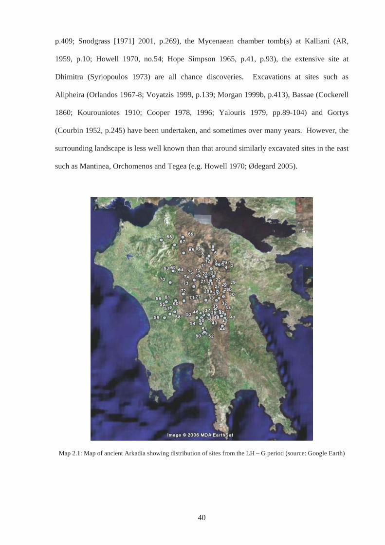
p.409; Snodgrass [1971] 2001, p.269), the Mycenaean chamber tomb(s) at Kalliani (AR,
1959, p.10; Howell 1970, no.54; Hope Simpson 1965, p.41, p.93), the extensive site at
Dhimitra (Syriopoulos 1973) are all chance discoveries. Excavations at sites such as
Alipheira (Orlandos 1967-8; Voyatzis 1999, p.139; Morgan 1999b, p.413), Bassae (Cockerell
1860; Kourouniotes 1910; Cooper 1978, 1996; Yalouris 1979, pp.89-104) and Gortys
(Courbin 1952, p.245) have been undertaken, and sometimes over many years. However, the
surrounding landscape is less well known than that around similarly excavated sites in the east
such as Mantinea, Orchomenos and Tegea (e.g. Howell 1970; Ødegard 2005).
Map 2.1: Map of ancient Arkadia showing distribution of sites from the LH – G period (source: Google Earth)
40
2.4.3 Topography and visibility
The nature of the landscapes particularly in the east is responsible for other difficulties with
the archaeological record. These are associated with the visibility of surface archaeology.
This issue has been recently highlighted by Forsen (2003, p.183, p.199) referring in particular
to the Asea Valley. In addition, Morgan (2003 p.39, p174) points out that sanctuary sites such
as that at Tegea, where at one time the EIA was represented by very few surface remains, now
boasts relatively full material records after excavation. This is because in the east, the plains
are particularly prone to flooding. The impermeable flysch layer, as a consequence of
weathering, overlying a substratum of low-grade schists also impervious and the relatively flat
character of the plains means inundations are inevitable (Hodkinson 1981, p.257). Drainage
on these plains occurs only through katavothras or sinkholes, but these are not always
sufficient to prevent flooding. Pausanias in the second century CE referred to the Plain of
Nestane as the Untilled Plain due to flooding (8.8.1) and travellers in the nineteenth century
referred to the inundation of plains and the management needed to render them fertile (e.g.
Leake 1830, p.84). In the late 1960s, Howell experienced flooding on the lower Orchomenos
plain, which prevented him from reaching the site of Vlakherna-Petra (Howell 1970, n.2).
Today, inundation no longer causes as many problems, particularly in the plain of Tripolis,
due to the lowering of the water table largely attributable to the demands of the population on
the water supply (Ødegard pers. comm. May 2005).
Nonetheless, past deluges and the character of these upland basins means alluvial soils
covering the flysch are particularly deep. Archaeologists working in the area have
encountered these layers. Forsen (2003, p.54) reported that local workers cutting a ditch on
the lower slopes of Asea-Palaiokastro revealed a cultural layer by chance under plough soil.
The alluvium itself contained very few finds, which were largely nineteenth century, but cores
showed that archaeological material lay beneath to a considerable depth (six metres). This
41
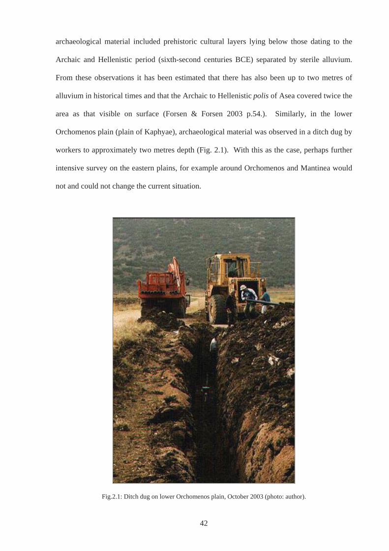
archaeological material included prehistoric cultural layers lying below those dating to the
Archaic and Hellenistic period (sixth-second centuries BCE) separated by sterile alluvium.
From these observations it has been estimated that there has also been up to two metres of
alluvium in historical times and that the Archaic to Hellenistic polis of Asea covered twice the
area as that visible on surface (Forsen & Forsen 2003 p.54.). Similarly, in the lower
Orchomenos plain (plain of Kaphyae), archaeological material was observed in a ditch dug by
workers to approximately two metres depth (Fig. 2.1). With this as the case, perhaps further
intensive survey on the eastern plains, for example around Orchomenos and Mantinea would
not and could not change the current situation.
Fig.2.1: Ditch dug on lower Orchomenos plain, October 2003 (photo: author).
42
There is also some debate as to how well known pottery of the period is. Forsen (2003, p.)
has blamed the relative scarcity of G pottery materialising during survey on the lack of
familiarity with pottery of this period, especially local coarse wares. However, this is a
situation that can be rectified. For instance, Voyatzis (2005) has begun qualitative and
quantitative analysis of the local G pottery from Tegea (Cracolici 2005, p.125), a process that
could be extended across other regions of Arkadia.
2.5 Conclusions
Until very recently the history of archaeological research in other areas of Greece has been
much fuller than that of Arkadia. Other regions and temporal/cultural periods have been the
focus of greater in-depth study, and for longer. Examples are Athens and Corinth in the
Classical and Roman periods, excavated from the 1930’s onwards. This is true not only in the
present but also in the past (e.g. Herodotus, Thucydides for histories focusing on the larger
city-states; Aeschylus, Sophocles, Euripides, Plato, Aristotle, for tragedians and philosophers
from and living in predominantly Classical Athens). There are some exceptions to this, for
example, the description of Arkadia by Pausanias (Book 8) is a full and invaluable source and
other regions, such as Lokris and Elis, apparently receive even less attention in the ancient
literature and subsequently modern studies (Nielsen & Roy 1999, p.8). The ancient literary
record has of course played a great role in determining where scholars have focused their
efforts and although Arkadia does have a significant role particularly in the bucolic poetry of
Virgil’s Eclogues, perhaps fame as an idealised landscape has cushioned the area from
consideration as a real place to be investigated archaeologically. There is also the nature of
the physical landscape itself and how this may have limited research in a practical sense or at
least confirmed the ideal of a peaceful, pastoral landscape, retarded from development by its
geography and therefore not worth investigating (e.g. Petronotis 1985-6, p.393).
43
Democratic Athens in particular has benefited from not only the literary sources, in this case
especially Aristotle’s Constitution, but also from the desire of modern liberal democratic
societies to look back to its perceived predecessor as illustrated above (Hodkinson and Brock,
2000: 4). Arkadia, a mountainous and rural area with a few urban centres comparable to
Athens or Sparta, could not and did not receive the same kind of attention in this climate.
Until recently, Arkadia was thought of as a place where the polis was a particularly late
development (Parke, 1993: 14 and Stronk, 1995: 32 34-35, 37 in Nielsen, 1999: 75 n.209), a
view somewhat rectified by Nielsen’s recent work (1996a,b; 1999, p.43). More
fundamentally, however, is the challenge of recent years to the idea of the polis as the
ultimate form of social and political organisation in ancient Greece with Athens as the prime
example. The recognition of ethne as tiers of identity co-existing with poleis in the same
region, has replaced the traditional view that they were alternative forms of state or an early
stage in the development of the polis (e.g. Hodkinson & Brock 2000, p.21; Morgan 2003,
p.168).
During the last decade, the situation for Arkadia has begun to be rectified with the publishing
of the Pheneos and Lousoi Survey (Tausend & Erath, 1999) and the Asea Valley Survey
(Forsen & Forsen, 2003). In addition, it is to be hoped that a number of other surveys
recently completed or still underway will be published in full as soon as possible (Partheni
topographical survey by Petrakis; Tegea survey by Ødegard). Because of, and in addition to
these surveys, there is now a substantial body of work concerning Arkadia and this continues
to be added to by scholars such as, Madeleine Jost, Catherine Morgan, Thomas Heine
Nielsen, Knut Ødegard, Yanis Pikoulas, James Roy and Maria Voyatzis to name but a few.
These scholars are all working on Arkadia addressing many issues. They also appear to be
committed to shedding light on this area and in some cases on the period in question too, at
least in part. Nonetheless, rather than satisfying the study of ancient Arkadia, these factors
44
inspire the idea that here is much more to be said about this region at the end of the BA and
beginning of the IA than previously thought, even though the evidence in many ways is still
somewhat limited in quantity and/or accessibility. The meta-narrative of Classical and Greek
Archaeology has determined how the discipline and thus the study of the archaeology of
Arkadia have developed. It is important that this is understood in order to reassess the
evidence and say different things, not in an effort to dismiss all that has gone before but to
investigate different possibilities and plausibilities (cf Soja 1996, p.1). Therefore, despite an
increasingly rosy picture for the archaeology of Arkadia, there are issues to be addressed.
There are still gaps; not only in the archaeological record, but also in the way this has been
understood, particularly in relation to the question of understanding the relationship between
people, sites and the landscape.
For the most part, evidence that which belongs to the LH period down to and sometimes
including the G period, is usually catalogued, summarized and dismissed as not being of
enough quantity or value to consider in any detail. However, Morgan (1999b) and Voyatzis
(1999) largely consider that from the G to the Archaic period. This supposed lack of evidence
seems to have deterred archaeologists from looking at Arkadia throughout the period of the
Dark Ages and if there were no evidence at all, it would prove futile to do so at least in
archaeological terms, except perhaps to explain the absence. However, evidence does exist
from throughout the period in question from the LBA period to the G to one degree or
another, albeit largely in the form of scatters. Admittedly, there is some problem with the SM
period where different scholars have assigned the same pots to different periods (Spyropoulos
1982, p.113-5; Mountjoy 1999, pp.51-52, p.55; Morgan 2003), but this will be considered in
more detail in Chapter 3.
45
Compared to other regions and/or periods this evidence is quantifiably not staggering, but
nevertheless it exists and this is the pertinent point. Lack of evidence was the excuse used for
continuing with the way things were going when there was a call for a ‘new archaeology’ in
1913 and the 1930s, as if somehow, by amassing more and more data the answers would
come (Wylie 1993, p.20). This of course has not been the case. Instead it often seems the
reverse has happened in that more data either seems to complicate and confuse the picture or
occupy so much time in order to acquire it and then process it afterwards that it never gets
published and whiles away its time in dusty storerooms or unlabelled on museum shelves.
Much of the recent work on the region also tends to fall under what can be termed a
processual framework. This work is valuable and as will become apparent these ideas and
concepts are not dismissed throughout this thesis. However, it is also possible to consider the
evidence using ideas that are commonly used by those under the post-processual umbrella in
British prehistory, such as Julian Thomas (1991), Christopher Tilley (1994), John Barrett
(1994), Mark Edmonds (1999) and Mark Gillings (2005), who attempt to engage with the
evidence where location and landscape setting can be of paramount importance.
This then is the motivation for this study: a perceived need for assembling and reconsidering
the already available evidence, using approaches and ideas from a wide variety of sources, but
particularly those that pertain to the physicality of the landscape. This is a move from the
general to the particular, a thorough consideration of the specific landscape settings of
individual sites and a recognition and acknowledgement that these places were lived by
people. The following chapter explains in detail how I have approached this geographical and
temporal subject area.
46
CHAPTER 3: THEORY AND METHODOLOGY
3.1: Introduction
This chapter gives an account of the theory and methodology underlying the research
presented in this thesis, the application of which has been an ongoing process of development,
discovery and insight. Rather than outlining the theory and then the methodology, this
chapter begins by examining spatiality and then temporality, appraising both the theories
applied to the study and the way in which these have informed the methodology in both
spheres. Dealing with each in turn proves to be an effective way of explicating the reasons
for the way the region of Arkadia in the LBA and EIA is approached in this study. The
general underlying theoretical position is clarified in Section 3.1.1 following which is a
consideration of the spatial aspects of the research. Section 3.2 is a deliberation upon the
ways in which landscape has been and is approached in archaeology and related disciplines
and how it is considered in this thesis (Sections 3.2.1-3.2.3). The landscapes of Arkadia are
described in Section 3.2.4 and an explanation of the site definitions used in the study appears
in Section 3.2.5, before elucidation of how the approach was applied to fieldwork (3.2.5).
Secondly, in Section 3.3 the temporal aspects of the research are reflected upon. The concept
of time and different approaches to it are discussed in Section 3.3.1, where the validity of
looking at different timescales to understand past human behaviour and experience is
assessed. Some thoughts on the chronology used within this thesis are set out in Section 3.3.2
and what this means for the Arkadian evidence is confronted in 3.3.3 before conclusions are
made in Section 3.4.
3.1.1: Theoretical Underpinnings
Underlying and reinforced by the research for this thesis is the application of what could be
termed an eclectic approach towards uncovering and explaining the archaeological record,
47
one that is open to and tolerant of ideas from different sources. This has been encouraged and
called for in other, arguably relevant, disciplines and areas of study, such as sociology (e.g.
Giddens 1984; Layder 1994), psychology (e.g. Norcross & Goldfried 1992), philosophy (e.g.
Baggini 2004), anthropology (Ingold 2000), and Greek mythology (e.g. Buxton 1994). It
appears to be the only way forward within the discipline of archaeology, and perhaps in many
areas of modern life. It is hoped that throughout this study it is clear that all ‘schools’ of
thought have not been amalgamated as an easy replacement for serious thought, a feature that
characterizes Johnson’s reticence for such an approach (Johnson 1999, p.187), but rather that
both the subject and object have been approached after carefully considering various
standpoints. As Giddens points out, the objection to using ideas from different sources even
if they (the sources) are in many ways fundamentally opposed to each other, is unfounded; the
origins of ideas is not what matters, but how they are used and subsequently honed that gives
them continued importance and allows them to become particularly enlightening (1984,
p.xxii).
However, although I have a certain amount of sympathy for various ways of interpreting the
archaeological record, the overall standpoint is one that considers absolute truths as
unattainable. ‘Facts’ may arguably exist, but mean little without interpretation (e.g. Latour
1986; Feyerabend 1988; Kuhn 1996, p.192). What is described as ‘Truth’ and ‘Objectivity’ is
based on experience, individual and collective, the ‘natural attitude’ described by Husserl
(e.g. 1988) and discussed by Webster (2001a), to explain how we ‘know’ the world. This
‘natural attitude’ is socially and culturally constituted and necessarily subjective, therefore
concluding the impossibility of universal truths and total objectivity. This, I accept, is tending
towards a relativism that many seem to fear (e.g. Berglund 2000; Peebles 1991, p.108),
which at first glance always appears to be postulating that all interpretations, ideas, and
48
opinions are as valid as the next. However, this is not my standpoint, nor do I believe it is
possible to apply this notion as we go about our day-to-day lives.
While archaeology attempts to reconstruct the past, it is generally understood that this
reconstruction exists only in the present (Hodder 1989, p.75; Johnson 1999, p.175; Pearson &
Shanks 2001, p.11). Views or explanations of the past change constantly with each new
‘generation’; a cycle of the avant-garde becoming the accepted view, seen for example in the
change from culture-historical perspectives, processualist explanations, and then post-
processualist interpretations, each taking the place of the other. Each trend can be said to be
relative to time and place, as can the very discipline of archaeology (Thomas 2004).
Nonetheless, taken to its extreme (or perhaps just its logical conclusion), relativism renders us
incapable of going any further. A philosophy which asserts that all ideas and opinions are as
valid as the next, in practice leaves us without meaning, unable to assess the merits of ideas,
at a loss and feeling unable to oppose anyone else’s viewpoint with any certainty. Therefore,
we have and need points of reference. These points of reference are things, from which we
cannot very easily escape. In fact, Heidegger states that we should not even try (Dreyfus
1991, p.3). They are contextual and differ depending on time and place, and they are part of
who we are. It is these points of reference that define what is ‘common sense’ to us or that
makes ’more sense’ or is ‘more likely’ (Gosden 1994, p.122).
Feyerabend (1988) extols what has been termed ‘democratic relativism’ an idea, which
upholds that all traditions are, or should be, debated and decided upon by all citizens. In other
words, in an inclusive democracy, people should decide for themselves which paradigm or set
of ideas better corresponds to reality based on, for example, their knowledge and experience
(Fotopoulos 1997). This may be enacted formally as is suggested above, but it also happens
as a result of simply being-in-the-world with other people, and is explained by aspects of the
49
work of philosophers and social theorists such as Heidegger, Merleau-Ponty, and Giddens,
some of which will be considered in due course.
In terms of archaeology, a material resistance exists to the number of ways archaeological
data can be interpreted. Although ‘facts’ or ‘data’ may exist, they only mean something
within a contextual scheme (Kluckjohn 1940, p.47 cited by Wylie 1993, p.21); they are
‘constituted in theory’ (Shanks & Tilley 1987, p.193). Indeed, an artefact can be measured
and weighed in various ways by different people who will then attain the same answers, but
these same people will have different understandings of the artefact in terms of both
preconscious and conscious apprehensions. Because of the materiality of archaeology (and
the world), there is a restriction as to what may be stated about the past, but it also means that
there are a myriad of ways in which the ‘data’ can be used to create different pasts. This
situation should not be seen as problematic but as liberating.
The underlying view, outlined here, has grounded the approach to landscape as set out in this
thesis. It is an acceptance of the physicality of the world, recognising that there is material
constraint to interpretation, both natural, in terms of ecofacts, and cultural in terms of
artefacts. It is a world that is already ‘known’, and of which there is a pre-understanding. It
is an investigation into how people interact and live within landscape, not only how it is used
as a resource (ecofacts) and not only how these are perceived (ecoconstructs), but how people
are thoroughly enmeshed within it. These points are fully considered below. Throughout the
following chapters, many different ideas have been brought to bear on the evidence in order to
explain its presence, but there are some fundamental concepts that have influenced the way in
which work and thought has progressed. These are associated with the Annales tradition (e.g.
Braudel 1969; Bintliff 1991a; Knapp 1992), Giddens’ Theory of Structuration (Giddens
1984), and the more phenomenologically based ideas of Heidegger (1962; Krell 1993) and
50
Merleau-Ponty (2002). In addition, Bourdieu’s concept of habitus (1977) and Gibson’s
approach to perception and the environment, implemented by Ingold (Gibson 1979; Ingold
2000) are also essential to the way in which both place and time are considered.
3.2: Spatiality
3.2.1: Landscape and Landscape studies
It has long been recognised that the physical nature of the landscape - the environment - has
an effect on the people living within it. From Strabo’s Geography (e.g. 8.8.1) and Polybius’
assertion that Arkadians were musical to protect themselves from the detrimental effects of
their harsh environment (4.19.13-21.12), to Bintliff’s treatise `Natural Environment and
Human Settlement in Prehistoric Greece` (1977) and more recent trends in landscape studies
that involve thinking-through-the-body (e.g. Hamilakis et al. 2002), scholars have explored
and continue to explore humanity’s attachment to the physical world. What is of primary
importance in understanding landscape in the past, however, is how we as archaeologists
engage with and explain it in the present. Landscape and landscape studies have often been
approached from the predominant position embedded within the modern western world that
propounds culture as separate from nature, detaching humans from their environment. This is
in opposition to a pre-modern view, which in general terms saw all things as the product of
divine creation (e.g. Bell 1992; Thomas 1993a, 1993b, 2004). This shift in view, identified
with the Enlightenment, built on philosophies such as Cartesian Dualism and purported a
world governed by rules that were there to be discovered (by human beings) and that human
beings were unique for possessing a mind and soul as separate from the body and the material
world. This has served to position humankind as an observer, with the outside world (the
landscape) as an object, not only to be studied, but also owned and consumed. The
emergence of landscape art and cartography and particularly of vision as the pre-eminent
51
sense has been informed by this way of understanding the world and how we create the past
(Thomas 1993a, p.22; Moser 2001).
This has not meant that all views on landscape have been homogenous or static within the
‘modern western world’, and as the majority of, if not all, phenomenological thinkers and
post-processual archaeologists are part of this world, their views could be claimed to be as
modern and as western as the rest. For instance, as part of this ‘modern’ approach to
landscape, nineteenth century travellers such as Dodwell (1819) Leake (1830) Cockerell
(1830) and Puillon de Boblaye (1835) who visited Arkadia, had an inspirational, romantic,
and aesthetic view of landscape. It was a personal relationship with the places under
exploration, but one comparable to appreciating a landscape painting. Likewise, culture-
historic archaeologists often viewed the world with an uncritical eye, and indeed archaeology
was considered as losing its innocence when the New Archaeology of the 1970s and 1980s
insisted on rigorous scientific method (see Piggott 1976; and Bradley 2000, ch.2 commenting
on Arthur Evans; Clarke 1973). These were outsiders looking in. Although still the
‘observer’, this kind of sentimentality and subjectivity was discouraged by the New
Archaeology, which sought to view landscape in a more objective way (e.g. Binford 1983).
Only the measurable, quantifiable aspects were of importance. These ‘things’ could be
understood on the same level by everyone, the natural and the physical and what people then
did to or with them. The environment or landscape as a resource, which is possible to own
and consume, has been at the root of environmental determinism that has been particularly
associated with New Archaeology or Processualism.
3.2.2: Objective Landscapes
Although such projects began to investigate ‘whole’ landscapes, they have been heavily
influenced by processualist methodologies and positivist principles: landscapes are explained
52
in detached ways, as a backdrop to events and the activities of humans, as a resource to be
exploited, a stage waiting to be peopled. In this model, the environment can be perceived as
objective fact, a measurable space usually depicted in two-dimensional map forms, universal
and unchanging over time (Gregory 1994, p.53; Exon et al 2000, p.9). That this is one way of
viewing the world should not be doubted: we certainly do possess the ability to distance
ourselves from our surroundings, to have an objective relationship with the world (Gibson
1968, p.200; Webster 2001a). An area can be described as being so many metres squared;
flora and fauna can be classified using categories that are scientific and standard; distribution
maps can be used for illustrating and explaining arguments and conclusions, and the latter is
something from which this study certainly does not shy away. However, this does not make
this the way of looking the ‘truth’ or the only ‘truth’ (cf Heidegger 1993, p.115). As argued
above, total objectivity or universal truth is unattainable, although ‘truths’ can exist, in the
sense that they correspond to ‘someone’s’ reality. Explanations can hold the essence of truth,
which, in the case of archaeology, is measured against material facts. We are able to see
ourselves as separate from the landscape, to objectify it and for example to use measurements
that others can repeat; but we see this from our place within the world, which makes it
necessarily a subjective experience. The landscape is never neutral.
Explanations associated with the New Archaeology and similar processual standpoints (e.g.
Brown & Rubin 1982; Sabloff 1994), have a limited, objective view of the world. The
cultural miasma through which people view the world around them is not explored in any
depth. They lack an understanding of the significance that may have been attached to aspects
of the landscape or environmental variables, and fail to consider the experience people in the
past may have had within their environment/landscape. For such environmentally
deterministic explanations ‘landscape as a resource’ is often as far as it goes, without
accepting that the Cartesian viewing of the world is as socially and culturally determined as
53
any other. There is nothing wrong per se with thinking that the environment in terms of
economic resources affects human behaviour, which in turn affects where people choose to be
for whatever activity in the landscape. This is known from our own experiences of living in
the world. However, this view does not allow a full or even a rounded understanding of the
world today or that which people may have experienced in the past. Different cultures across
time and space have various ways of perceiving their environments, their landscapes, their
worlds. Rodaway (1994) for example, analyses how three contemporary cultures (American,
Japanese and Arab) view, move through, sense and experience the places in which they live
and this illustrates very different notions of space. Factors such as power relations, outside
threat, ritual significance attached to parts of the landscape and a multitude of other beliefs
have a bearing on where people choose to interact and carry out certain activities and with
whom. The economic resources and potentiality of the environment/landscape certainly play
an important part in this choice, but people do not always choose to live, interact and ‘be’ in
places that are most beneficial to them as determined by modern western academics (e.g.
Bintliff 1977, p.111). In Arkadian terms, Roy (1999, pp.324-327) has illustrated that ancient
and modern views relating to the harshness of mountain environments has masked the
potential of such areas and the fact that families in pre-industrial Arkadia were quite able to
support themselves at high altitudes (see also Frangakis-Syrett & Wagstaff 1992; Sauerwein
1994; Hempel 1996).
Processual approaches have relied on modern values and assumptions such as least
cost/minimum effort to produce the familiar halo patterns around sites and Thiessen polygons
superimposed on distribution maps (e.g. Bintliff 1977, p.111; 1985, p.198). However, with
some of the critiques outlined above in mind, variables such as time and terrain have been
added in an attempt to bring in a human dimension (e.g. Gaffney & Stan i 1991; Witcher
1999, p.15). Nonetheless, although such modifications may serve to remind that it is human
54
beings living in the landscapes under discussion, an inescapable fact is that in this particular
instance, least cost/minimum effort is a predominantly modern value and one that is very
much connected with the environment as an exploitable economic resource. This value may
not have held much relevance to people living within the past landscape under scrutiny. Even
if it can be shown that without exception, sites were placed near fertile soils and further away
from less profitable landscape types (Bintliff 1977), this surely is not the whole picture of past
populations’ relationships with their physical worlds.
3.2.3: Subjective Landscapes
As a reaction to the objectification of landscape, a clarion call has gone out (e.g. Thomas
1991, 1996; Ingold 1993; Bender 1993a, 1993b; Tilley 1993, 1994) for thinking of landscape
not only in terms of an analysis of the topography, geology, soil or climate, but also in terms
of the social construction of space and place and the perceptions of those experiencing the
landscape, both today and in the past. The result has been a plethora of studies,
archaeological and anthropological, into perception and subjective, personalised views of
space (see Gudeman 1986; Bird-David 1990; 1992b; Bender 1993; Tilley 1994; Thomas
2001). However, as Exon et al (2000) state, this ‘backlash’ to positivistic principles and
environmentally deterministic views of landscape has resulted in the setting up of a binary
opposition. As such, many studies have continued the dualism between nature and culture
that is so characteristic of the modern western worldview. For example the geographer Smith
(quoted in Gregory 1994, p.5) refers to ‘material space` and `metaphorical space`, failing to
take into account the bodily experience and the materiality of landscape, thus continuing a
false separation of the body and the physical from the mind and cognitive processes. Ingold
(2000, p.44) likewise recognises that even those trying to be sensitive towards present-day
hunter-gatherer perceptions, have ended up couching ‘landscape’ in terms of a modern
western world view that separates the cultural from the natural.
55
Soja (1996, p.10) characterises these two orthodox ways of viewing landscape or environment
as first space (real and measurable) and second space (imagined and subjective). The former
is concerned with a landscape that can be measured and mapped, i.e. the physical ‘facts’,
whereas the latter is conceived as purely in the mind, the representation of space. The latter
asserts that personal reading and subjective experience is the only way in which space can be
approached (e.g. Tilley 1994). Soja (1996) goes on to suggest an alternative way –
‘thirdspace’. This is an attempt to approach space that involves the real and imagined worlds
of the first and second space, thus breaking down the binary oppositions. It is an attempt to
encapsulate the absolute fundamentality of the spatial aspect to all human lives, that goes
beyond being measured and real, and imagined and subjective (1996, p.11). Similarly, Ingold
(2000), following Gibson (1968), sees the value in getting away from such oppositions. The
work of Rodaway (1994), Soja (1996) and Ingold (2000) therefore allows the materiality of
the world to have a central role in discussions of space, and represents an attempt to explain
how this materiality or physicality impacts on human life, recognising that human beings are
immersed within it, sensing it with their whole beings, learning about it through action. To
varying degrees, these theories bring the agency of animals and vegetation into the equation.
It has been often been stated for example that not only do trees reduce visibility in a landscape
for example, but they also restrict movement and distort sounds (e.g. Cummings 2004).
Different species of trees also reflect seasonality in different ways, which would in turn affect
how people and communities responded to their environments, perhaps even affecting moods
(Richer & Walsh 2005). This has very strong links with phenomenological approaches of
being-in-the-world associated with the work of Heidegger (1962 &1993) and Merleau-Ponty
(2002).
In this view, human beings do not arrive somewhere, take in the objective facts and then
interpret them in the mind; ‘perception’ is taking place all the time, often without conscious
56
awareness. A space is not entered into and then given meaning, it already has meaning
(Dreyfus 1991, p.67). For Thomas (2001b), meaning permeates all aspects of our lives. This
view has been criticised by Webster (2001), as imposing conscious acts of interpretation onto
mundane, habitual, daily activity. However, Thomas is not positing that everything we do in
the world or sense as we go about our daily lives is consciously interpreted and given explicit
meaning – this would be preposterous. He unequivocally states, “We ‘get on’ with the world
without having to constantly reflect on it” (Thomas 2001b). He also argues that the use of the
word perception excludes a whole range of experience that people have, preferring the words
`disclosure` or `experience,` to explain the way in which humans `know` their landscape
without necessarily entailing any conscious awareness on the part of the one experiencing or
perceiving. Others, such as Gosden (1994, p.38,) see such habitual action as being
`unthought` whilst Johnson (1998, p.57) uses `inherent perception` to distinguish from
`explicit perception` and Ingold (1998, p.39) `direct perception` to explain the same
phenomenon. Nonetheless, whatever term is used the meaning is the same: landscape is
something that is lived day to day; it becomes familiar so not consciously apprehended.
Unfortunately, this claim is very difficult to qualify, as when a person is made aware of their
surroundings, perhaps by being questioned, the apprehension has been altered in that instant.
This has to be equated with Webster’s (Husserl’s) ‘natural attitude’ and should not be
mistaken, as perhaps Thomas has done (2001b), as meaning it to be natural and thus hard-
wired biologically (Webster explicitly states he does not mean it in this way, 2001). The way
we-are-in-the-world is socially and culturally constructed. That we are interpretative beings
means that nothing is ‘objective’ and meaningless. Likewise, ‘natural attitude’ is neither
‘objective’ nor meaningless.
Ingold approaches landscape through his term ‘taskscape’ (1993, p.158), which encompasses
both the physicality of landscape and how it is apprehended by organisms living within it
57
through time. This approach is an adaptation of Gibson’s (1979, ch.5) ‘affordances’ where
perception begins with the invariant optical ambient array that is directly ‘picked-up’ through
movement of a variant (an organism), not a representation in the mind as described in
conventional explanations. However, instead of picking up the invariants that are wholly
present, an organism is tuned to resonate to the invariants that are significant for it, as a result
of ‘hands-on’ training in everyday life, an “education of attention” (Gibson 1979, p.254).
Other elements may be there, but a person (or animal or other organism) moving through
what becomes their taskscape will not experience them all. Different aspects of landscape
will afford themselves at different times, depending on whether the organism is ‘fine-tuned’
to pick them up. A particular feature such as a river may have different physical
characteristics during the year, which will thus create, give or afford different significances to
those living with them, but other features that may be ‘static’ will also afford different
meanings at different times. Thus, a prominent geological feature may gain a particular
significance at one time in the year, through practices associated with community rituals, at
others it fades away, but acting as a latent reminder of the order of things that the yearly ritual
underlines.
Through studies of various ‘hunter-gatherer’ communities (e.g. Cree of northeastern Canada,
Mbuti Pygmies of the Ituri Forest, Pintupi of Western Australia), Ingold (e.g. 2000, ch.3) has
recognised a fundamentally different way of relating to the world. Humans are not separated
from the animal or physical world, i.e. culture as opposed to nature, but are part of a whole.
Animals, plants, and geology are not just imbued with, or have metaphors of humanity and
personhood inscribed upon them by humans; they are-in-the-world alongside and with
humans. This is best understood through a dwelling perspective, which taskscape envelops
(Ingold 2000, p.57). In this perspective, landscape and environment are negotiated by an
organism’s practices within it and exist through our engagement and relationship with it.
58
‘Nature’ is a disembodied landscape. It may be analysed, viewed under a microscope, and
described in detail and the mechanisms at work may be understood, but this does not disclose
a whole range of other ways in which the world is engaged with, of which we are part. It is
only ‘nature’ because humans have categorised it as such; human beings have determined
relevant characteristics. The idea of ‘taskscape’ allows an appreciation of the way in which
‘landscape’ becomes through us. Elements of the landscape present themselves at different
times, through our actions within it. Also useful for understanding landscape in a similar way
is the concept of ‘lifeworld’ developed by a number of theorists (e.g. Agre & Horswill 1997;
Habermas 1981; Husserl 1970). Although each definition differs from the other, they are all
based on the notion that a ‘lifeworld’ is borne of bodily experience, praxis in the world.
Likewise Bourdieu’s (1977) ‘habitus’ contains the notion of experience as being particularly
embodied: that it is through physical action that we come to know the world, not through
conceptual schemata
3.2.4: Arkadian Landscapes
How do these ideas relate to a study of landscape in Arkadia? As outlined above, the
physicality of the landscape is crucial in applying a phenomenologically inspired approach,
thus in the first instance, an area of Arkadia has to be defined in order to discuss the physical
characteristics. It may seem redundant to set upon establishing the boundaries of an area
existing today and which, as a consequence, has parameters already in place. However, even
though Arkadia is, and always has been, situated in the central Peloponnese, attempting to
delineate the exact area is not as simple as it may at first appear. In fact, where and when the
name Arkadia can be applied to a coherent region is a much-debated issue in itself (e.g.
Nielsen & Roy 1999). The boundaries have fluctuated numerous times, and as such, the
contemporary geopolitical and administrative district of Arkadia does not correspond exactly
to that described in the ancient sources. The modern region of Arkadia occupies a relatively
59
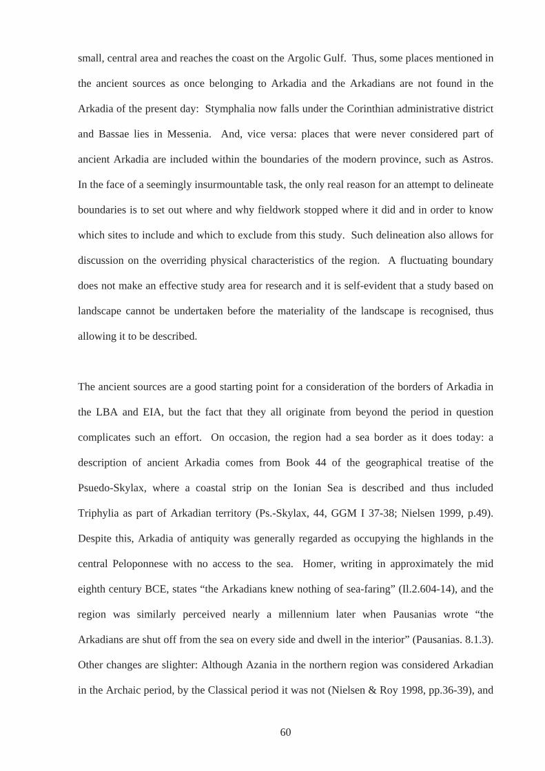
small, central area and reaches the coast on the Argolic Gulf. Thus, some places mentioned in
the ancient sources as once belonging to Arkadia and the Arkadians are not found in the
Arkadia of the present day: Stymphalia now falls under the Corinthian administrative district
and Bassae lies in Messenia. And, vice versa: places that were never considered part of
ancient Arkadia are included within the boundaries of the modern province, such as Astros.
In the face of a seemingly insurmountable task, the only real reason for an attempt to delineate
boundaries is to set out where and why fieldwork stopped where it did and in order to know
which sites to include and which to exclude from this study. Such delineation also allows for
discussion on the overriding physical characteristics of the region. A fluctuating boundary
does not make an effective study area for research and it is self-evident that a study based on
landscape cannot be undertaken before the materiality of the landscape is recognised, thus
allowing it to be described.
The ancient sources are a good starting point for a consideration of the borders of Arkadia in
the LBA and EIA, but the fact that they all originate from beyond the period in question
complicates such an effort. On occasion, the region had a sea border as it does today: a
description of ancient Arkadia comes from Book 44 of the geographical treatise of the
Psuedo-Skylax, where a coastal strip on the Ionian Sea is described and thus included
Triphylia as part of Arkadian territory (Ps.-Skylax, 44, GGM I 37-38; Nielsen 1999, p.49).
Despite this, Arkadia of antiquity was generally regarded as occupying the highlands in the
central Peloponnese with no access to the sea. Homer, writing in approximately the mid
eighth century BCE, states “the Arkadians knew nothing of sea-faring” (Il.2.604-14), and the
region was similarly perceived nearly a millennium later when Pausanias wrote “the
Arkadians are shut off from the sea on every side and dwell in the interior” (Pausanias. 8.1.3).
Other changes are slighter: Although Azania in the northern region was considered Arkadian
in the Archaic period, by the Classical period it was not (Nielsen & Roy 1998, pp.36-39), and
60
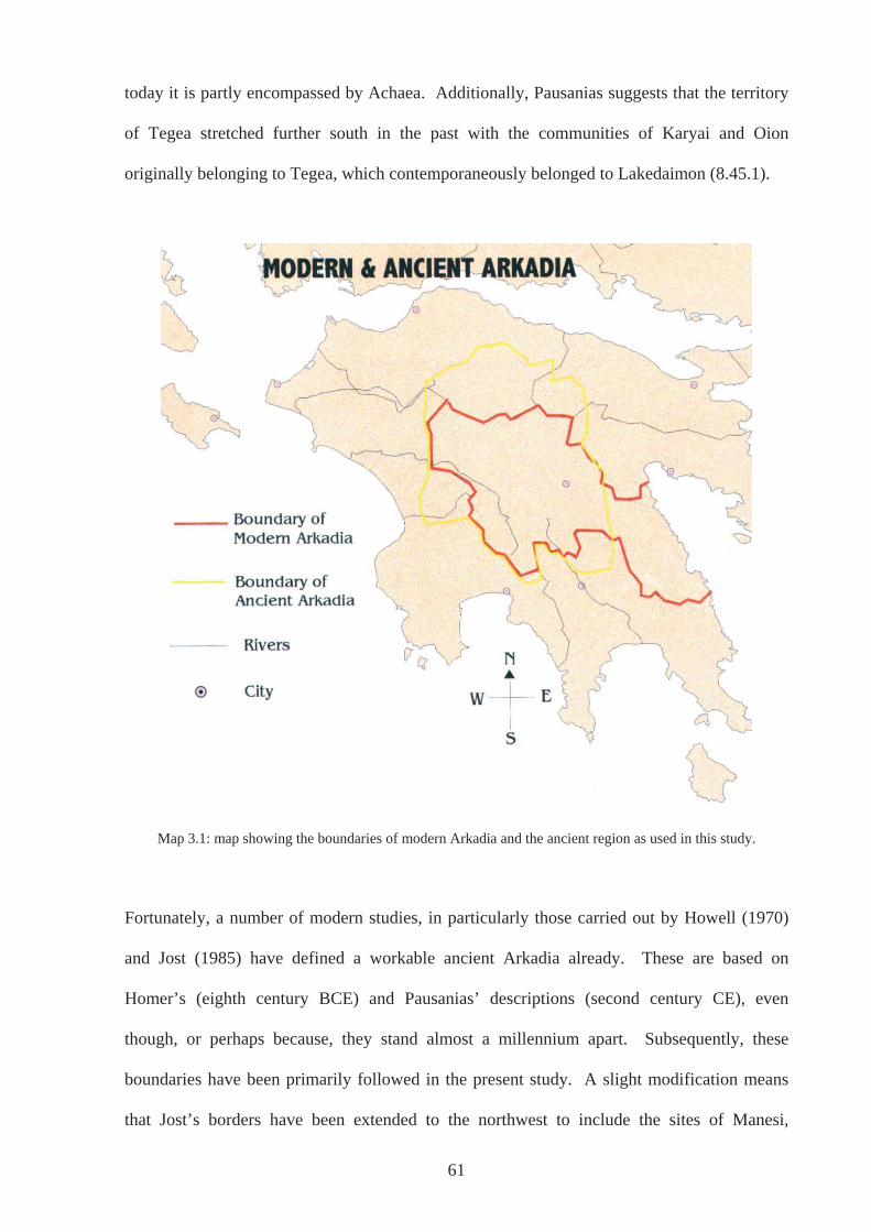
today it is partly encompassed by Achaea. Additionally, Pausanias suggests that the territory
of Tegea stretched further south in the past with the communities of Karyai and Oion
originally belonging to Tegea, which contemporaneously belonged to Lakedaimon (8.45.1).
Map 3.1: map showing the boundaries of modern Arkadia and the ancient region as used in this study.
Fortunately, a number of modern studies, in particularly those carried out by Howell (1970)
and Jost (1985) have defined a workable ancient Arkadia already. These are based on
Homer’s (eighth century BCE) and Pausanias’ descriptions (second century CE), even
though, or perhaps because, they stand almost a millennium apart. Subsequently, these
boundaries have been primarily followed in the present study. A slight modification means
that Jost’s borders have been extended to the northwest to include the sites of Manesi,
61
Kompegadhi and Dhrosato Vrisariou-Lakes, sites considered by Morgan in an overview of
EIA Arkadia (1999, pp.419-420). In this way, the borders of ancient Arkadia adhere closely
to natural features. The region is bounded by the mountain ranges of Erymanthos, Aroania,
(or Khelmos) and Kyllene to the north, Artemision and the northern reaches of the Parnon
range to the east, the western edge of Parnon and northern Taygetos to the south and the
Ladon River and the Tetrazi mountains to the West. That it is the physicality of the
landscape, defining the limits of the region, suits very well the idea of the importance of the
materiality of landscape upon which much of this study is centred. In some instances, sites
have been included that are slightly beyond this, thus allowing for the fluidity of peoples`
lives and thus borders and, in all probability, the area was not seen as a united Arkadia at the
end of the LBA and EIA, neither by the people living in this area nor from outside (Nielsen
1999, p.60; Map.3.1).
In the preceding chapter, the character of the landscape of Arkadia was considered as a reason
for lack of evidence pertaining to the period in question. This rested mainly on the fact that
deep alluvial layers could be covering archaeology that would enhance understanding of the
LBA and EIA. Such accumulation of alluvium has also resulted in many rivers changing their
course throughout the centuries. For example, it is believed that the Sarandapotamos, which
today flows north and drains into katavothra to the east of Tripolis, may very well have
flowed west into Lake Taka in antiquity, thus running very close to the Temple of Athena
Alea (Ødegard, 2005). Recent work around Tegea has also shown that the landscape was
significantly more undulating in the past than it is today, caused by build up of sedimentations
through fluctuating river courses and flooding (Ødegard 2005). In addition, this work has
shown that at least part of the area around the sanctuary of Athena Alea was in the past
characterised by wetlands, ponds and riverine activity and therefore very unsuitable for
inhabitation, another reason why finds may be limited. Today, river courses are managed
62
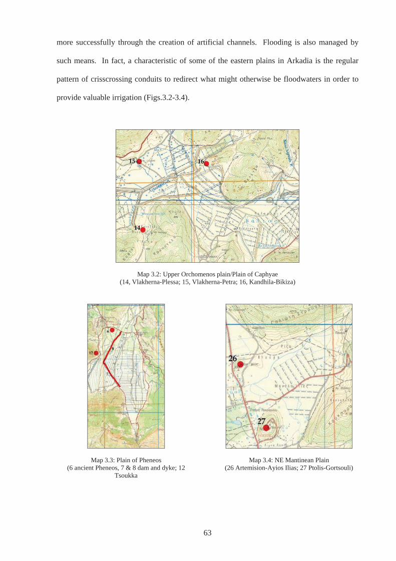
63
more successfully through the creation of artificial channels. Flooding is also managed by
such means. In fact, a characteristic of some of the eastern plains in Arkadia is the regular
pattern of crisscrossing conduits to redirect what might otherwise be floodwaters in order to
provide valuable irrigation (Figs.3.2-3.4).
Map 3.2: Upper Orchomenos plain/Plain of Caphyae (14, Vlakherna-Plessa; 15, Vlakherna-Petra; 16, Kandhila-Bikiza)
Map 3.4: NE Mantinean Plain Map 3.3: Plain of Pheneos (6 ancient Pheneos, 7 & 8 dam and dyke; 12
Tsoukka (26 Artemision-Ayios Ilias; 27 Ptolis-Gortsouli)
Despite changes in the landscape, such as the build up of alluvium in the plains and changing
river courses (see Chapter 2), much of the Arkadian landscape as it is seen today is the same
as that in that in Classical Antiquity, with little degradation having taken place (Rackham
1996; Roy 1999 p.320). Thus, with knowledge of how the landscape has changed in mind,
the fact that I or anyone else should bring into play the evidence from our own experiences of
the landscape is a legitimate approach. This in turn allows an acknowledgment and
understanding of potential differences in the way people used and moved around such
physically contrasting environments, the east and the west. At the same time, however, the
alternative ways people in the past may have viewed their surroundings should be
acknowledged. Where the commodification of time permeates nearly all aspects of modern
western ways of life, convenience is a huge factor and underlies most innovations of the
twentieth and twenty-first centuries. Today, much personal and commercial travelling is done
in relatively fast moving vehicles, and where such speed cannot be realised on the local roads
of Arkadia the difficulty of terrain, particularly in Western Arkadia, is heightened quite
markedly. In Palaiokastro, a village situated above the Alpheios, an elderly married couple
encountered during fieldwork spoke of the frustration of shopping trips to the nearest
supermarket in Megalopolis. If, for example, it was realised once reaching home that an
‘essential’ item had been forgotten, this would result in another journey of over an hour each
way. This particular couple however, had spent much of their adult lives in Sydney and
London, and had retired to the village from which the husband had originated. The contrast in
ways of life would have been very much apparent to them. This kind of disparity would not
have existed in the LBA and EIA, and as such, our perceived difficulty of access to places
should not be imposed on ancient populations. Terrain did not, for example, discourage
visitors to the temple at Ayios Petros located on a small plateau high in the Aphrodision
Mountains. In addition, the temple of Artemis Hemera at Lousoi attracted visitors from the
64
LG period onwards, a site that although lying on a plain approximately 950 metres above sea
level, was situated just above a major communication route (Roy 1999, p.323).
3.2.5: Site Definition
It is self-evident that humans do not live life limited to sites defined by archaeologists, but
much archaeological work has and does stop at the site edge (Cherry 1984, p.119; Alcock et
al. 1994, p.138). Often this is the first step in landscape studies. After sites have been
defined and located, their place in the wider setting can be investigated and analysed.
However, the definition of a site varies depending on the survey, the area and the nature of the
evidence. Most intensive systematic field surveys have minimum sherd counts in order for
there to be a site defined, the rest of the sherd count being relegated to ‘offsite’ activity, or
‘background noise’ (e.g. Bintliff 1985, pp.201ff; Cherry et al. 1991; Garton & Malone 1999,
p.200). In this study, the definition of a site is a rather broad one. All instances of
archaeological material have been included, even where it has been only a single sherd. It is
true that in some instances, single finds and small scatters, as part of a wider survey, may be
considered as general background noise but much of Arkadia has not been subjected to
intensive, systematic survey. This archaeological material represents activity of some sort.
However, there may be a number of post-depositional factors resulting in the present location
of artefacts, and a scatter or assemblage may contain numerous artefacts with widely different
life histories, and these factors must be kept in mind (e.g. Cagle 2003, ch.3). Nevertheless, to
dismiss any evidence, however slight, even where its nature is unsure, would be counter
productive in a study such as this. The material evidence is considered as the centre of a
‘taskscape’, to use Ingold’s term (1993, p.158; 2001), and it is from these physically located
positions that the nature and experience of the landscape around can begin to be explored.
65

The data available for a consideration of the human landscape of Arkadia from the end of the
BA and beginning of the IA is finite. The starting point was the published information, which
enabled a list to be compiled of all sites in ancient Arkadia that dated approximately from
1600 to 700BCE, thus covering the LH period down to and including the G. This was
accomplished through a detailed consideration of Howell’s survey of Eastern Arkadia (1970),
the Gazetteers of Hope Simpson (1965) and Hope Simpson & Dickinson (1979), Pikoulas’
publication on the Megalopolitan Chora (1988) and Syriopoulos’ catalogue on prehistoric
settlement (1988). These major catalogues and gazetteers were supplemented by the work of
Morgan and Voyatzis, especially the chapters in Defining in Ancient Arkadia (1999), and
relevant notices in Archaeologikon Deltion (AD) and Archaeological Reports (AR). These of
course led to various other articles and publications, many of which reiterated the information
already gleaned from those named above. The list compiled from these publications forms
the root of the database on the accompanying CD-ROM, (see also tables in Appendix 2).
A number of maps, such as the Hellenic Military maps (1:50 000 scale) and Geological maps
(1:50 000 scale), aided greatly in locating the sites and were useful for attaining information
regarding the physical landscape. Whilst reviewing the published literature particular note
was taken of the description of the location. Each ‘site’ was then located on the paper maps
before searching for them on the ground. Often the description of the location of finds or
structures seemed to be quite specific such as a tholos `6km from Kalpakion, 200m beyond
kilometre stone 34, to left of the road to Kandhila`(Howell 1970, n.5a) and seemed straight
forward enough to pencil in on the map, but on the ground problems were evident. In the case
noted here, there was no sign of a kilometre stone and there was another ‘mound’ in the
vicinity. On some occasions, if potential sites hitherto unrecorded on the site list were
discovered, the literature was re-examined to see if information could be found that related to
these previously unknown entities. In addition to details of site location, the nature of the
66
evidence was also recorded, in order for it to be classified and render it usable: Was the
evidence structural, for example walls, houses or tombs; was it in the form of sherds, lithics,
or metal, or a mixture of one or more of these? The quantity was also important in the
classification process, as were the characteristics of each ‘class’, for example whether the
pottery was in the form of miniatures, sherds or complete pots.
Many authors had also openly interpreted the evidence, albeit some more convincingly than
others and these interpretations were particularly interesting. How and on what basis had they
been made? Many of these interpretations were based on the presence of evidence from other
periods, in addition to knowledge of the landscape, the setting of the sites themselves and on
what could be called intuition or a subjective experience. Although the interpretations of the
sites can and must be questioned, they are judged as a valid way of considering the evidence.
This prompted the decision to include two site-type fields within the database: an ‘objective’
type based on strict definitions and a more ‘interpretive’ type. However, this is not to imply
that the ‘objective’ type is without bias or essentially without meaning ascribed to it. This is
not the case. It is merely an attempt to limit the level of explicit explanation. The
classifications could have gone a number of different ways and a multitude of combinations
could have been considered. These would have held different meanings for me and everyone
else. Describing a site as a scatter or a findspot does not reduce its meaning. It may give it an
alternative meaning from that if it were described as a settlement - one is clearly more
comprehensible, especially to those outside archaeology, but a scatter still has meaning for the
layperson even if it is a feeling of alienation, a non-understanding. Referring back to
Thomas’ arguments, interpretation is not just something that we do (alongside other things), it
is what we are (Thomas 2001b; Heidegger 1996, p.141; also Gadamer 1975, p.235).
However, by reducing explanation to something that is quantifiable, for example number of
sherds, and to the barest description, for example ‘findspot’ or ‘scatter’, there is the
67
assumption that peers will all understand the material being described on the same level and
that biases and preconceptions brought to it will be limited. The resulting categories and
explanations for them are as follows:
Site Type 1:
Findspot: one or two artefacts found through reconnaissance, survey or chance discovery.
Scatter: three or more artefacts found through reconnaissance, survey or chance discovery.
Assemblage: a number of artefacts found through excavation or by chance, but deposited
within the ground therefore not a scatter.
Structure: where structures, whether walls, banks, house foundations and/or built tombs are
or were present.
Structure+findspot: walls, banks, building foundations and/or tombs in addition to one or
two artefacts.
Structure+scatter: walls, banks, building foundations and/or tombs in addition to three or
more artefacts
Structure+assemblage: walls, banks, building foundations and/or tombs in addition to a
number of artefacts found through excavation or by chance, but deposited in the ground
therefore not a scatter.
A scatter proved difficult to quantify. Many descriptions, especially those in the gazetteers, do
not use absolute numbers but terms such as ‘a number’ (e.g. Howell 1970, n.16 Loukas-Ayios
Yioryios) ‘a few’ (e.g. Howell 1970, n.14 Nestane; Hope Simpson & Dickinson 1979, p.76
B3 Vounon) ‘several’ (e.g. Hope Simpson 1965, p.38 n.83 Pheneos) or simply ‘a scatter’ (e.g.
Howell 1970, n. 17 Merkovouni-Ayiolias; Hope Simpson & Dickinson 1979, p.82 B27).
68
These definitions changed throughout the research and were finally settled on to cover the
range of evidence apparent for the sites in as few categories as possible.
Site type 2
activity?: a site where evidence proves difficult to interpret and simply acknowledges that
some activity took place at the site
hydraulic works: refers to structures that have been interpreted as such in the main by
Knauss (1986, 1988, 1989, 1990)
ritual: site that has evidence of a specifically religious nature, associated with the worship of
deities
burial: evidence of burial ritual specifically.
settlement: sites that have been denoted as such in the published literature or where structure
and scatters or assemblages of material may suggest long lasting inhabitation.
?activity+ritual: both unknown activity and ritual activity occurring at the same site.
?activity+burial: both unknown activity and burial occurring at the same site.
Settlement+ritual: both settlement and ritual activity occurring at the same site.
Settlement+burial+ritual: settlement, burial and ritual activity at the same site.
Ritual+burial: both religious ritual and burial at the same site
The ‘interpretative’ site type 2 categories are less easy to explain, but mainly come from
previous descriptions of the sites. What must be understood and will be clear from the
numbers is that they do not correspond to the objective categories. Thus, a site described as a
`findspot` in site type 1 may very well be interpreted as a settlement in site type 2 for one site
or as unknown activity for another (see tables 3.1 & 3.2 below). However, all the sites
69
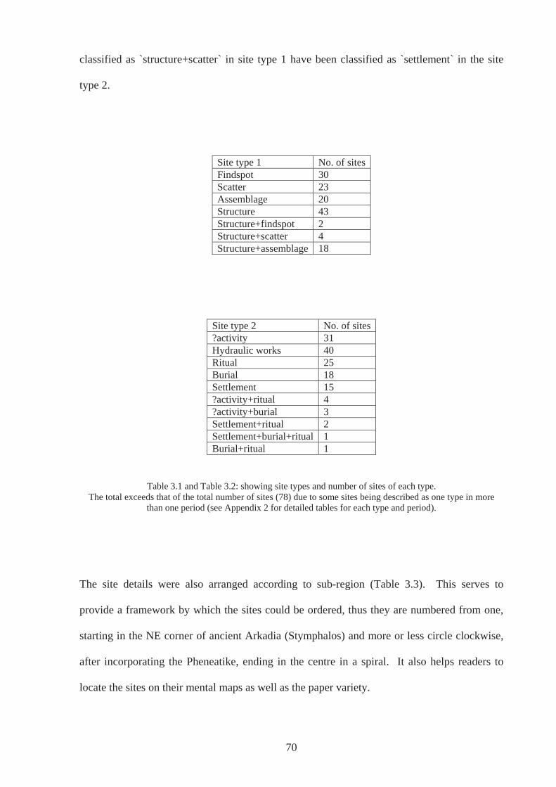
70
classified as `structure+scatter` in site type 1 have been classified as `settlement` in the site
type 2.
Site type 1 No. of sitesFindspot 30 Scatter 23 Assemblage 20 Structure 43 Structure+findspot 2 Structure+scatter 4 Structure+assemblage 18
Site type 2 No. of sites?activity 31 Hydraulic works 40 Ritual 25 Burial 18 Settlement 15 ?activity+ritual 4 ?activity+burial 3 Settlement+ritual 2 Settlement+burial+ritual 1 Burial+ritual 1
Table 3.1 and Table 3.2: showing site types and number of sites of each type. The total exceeds that of the total number of sites (78) due to some sites being described as one type in more
than one period (see Appendix 2 for detailed tables for each type and period).
The site details were also arranged according to sub-region (Table 3.3). This serves to
provide a framework by which the sites could be ordered, thus they are numbered from one,
starting in the NE corner of ancient Arkadia (Stymphalos) and more or less circle clockwise,
after incorporating the Pheneatike, ending in the centre in a spiral. It also helps readers to
locate the sites on their mental maps as well as the paper variety.

Site Name Sub-region
Stymphalia a - Stymphalos NE Stymphalia b - hydraulic works NE NE Stymphalia c - hydraulic works SW NE Stymphalia d - Karterion, Ay. Konstantinos
NE
Stymphalia e - Lafka, tholos NE Pheneos a - Kalyvia - Pyrgos (anc. Pheneos)
NE
Pheneos b - dam NE Pheneos c - channel NE Pheneos d - Ay Kharalambos NE Mt Kyllene NE Lakkomata NE Tsoukka NE Vlakherna a - Petra E Vlakherna b - Plessa E Khotoussa - Ayios Yioryios E Kandhila - Bikiza E Orchomenos a - summit E Orchomenos b - Kalpakion church E Orchomenos c - peripteral building E Orchomenos d - tumulus E Orchomenos e - hydraulic works/mill E Orchomenos f - drainage channel E Orchomenos g - dyke E Orchomenos h - dam E Orchomenos - Palaiopyrgos E Artemision - Ayios Ilias E Ptolis - Gortsouli E Milea/Mantinea E Nestane - Sangas E Nestani - Paniyiristra E Loukas - Ayios Yioryios E Merkovouni a - Ayiolias E Merkouvouni b - hydraulic works E Alea (Tegea) - Temple of Athena Alea
SE
Thanas - Stoyia SE Vounon SE Lake Takka SE Manthyrea - Panayia SE Alea Palaiochori - a SE Alea - Palaiochori - b SE Psili Vrysi SE Mavriki SE
Site Name Sub-region
Vourvoura-Analipsis a SE Vourvoura-Analipsis b SE Kato Asea - Palaiokastro S Asea-Ayios Elias S Palaiokhoraki, Ayios Nikolaos of Manaris
S
Ayios Athanasios of Dorizas S Ayios Yioryios of Athenaion S AVS S67 S Skortsinos - Khelmos S Kyparissi Yiannolakka S Mallota Kokkaliara S Anemodhouri S AVS S62 S Kanelaki S Andritsaina SW Alipheira SW Kretea SW Bassae SW Figaleia SW Palaiokastro - Ay. Sotira W Palaiopyrgos W Dhimitra NW Vaklia - Palaiokastro NW Vrisarion-Gamenitsa N Psophis - Ayios Petros N Priolithos N Lousoi N Manesi N Kompegadi N Drosato Vrisariou - Lakes N Kalliani - Ayios Yioryios W Gortys C Dimitsana C Petrovouni C Lasta - Kollinos C Karvouni - Sfakovouni C Bougrianou C Dhavia - Kastro C
Table 3.3: sites according to sub region
71
3.2.6: Site Visits
The predominant view of landscape, as being both acted on and acting upon human beings,
discussed above, informed practice in respect of visiting and data collection and dictated how
and what information was gathered for analysis. A phenomenologically inspired approach
emerged as the most productive, especially in an area where archaeological evidence is
limited. This allowed a site to become more than a name and number in a catalogue. This
approach also required neither the location of new sites nor the discovery of more artefacts,
and emphasised sites as places lived in and experienced by people, using evidence already
available. Despite criticisms of the approach made by Fleming (1999, 2005), directed
particularly at Tilley (1994), and Cummings & Whittle’s (2004) application of it to the Welsh
Neolithic, it was felt that a successful attempt could be made at applying it to LBA & EIA
Arkadia. Confidence can be had that the existence of qualities which can be experienced by
someone standing at a site today, created by the physical surroundings, are the same as those
that could very well have been recognised, appreciated and used by people standing at the
same place in the LBA and EIA. This is in spite of the fact that landscapes are not static. It is
known that alluvial deposits have accumulated on the eastern plains, river courses have
changed and erosion has occurred particularly in the north (Ødegard 2005, pers. comm.) but
these can be taken into account. The mountains, the plains and the sites in question are in the
same relative positions: they are fixed in space. And, as Ingold states, such an approach is
valid in archaeology as well as anthropology, despite the people and communities in question
being no longer alive, precisely because there is this connection to the physical landscape in
the present: We too are-in-the-world (1993, p.152). This is why such an approach cannot be
undertaken as a desktop study; the landscape needs to be experienced first-hand. It is clear
that although some sites have evidence for activity throughout the period, there is a difference
in location from one period to the next depending on the use of the site. From this standpoint
different aspects of the same landscape can begin to be investigated, aspects that could have
72
been predominant in one period rather than another. This allows a consideration of how
people’s relationship with their surroundings may have influenced and may reflect attitudes,
for example to the dead, their gods, and other people in the community; in sum their
cosmological beliefs and how these may have changed over time (Garwood 2002).
Bradley, in An Archaeology of Natural Places (2000) uses Pausanias and his Guide to Greece
as an example of an ethnographic study; one where the traditions were understood within
living memory and sites that had been the centre of activity for centuries were still in use. In
nearly every page, Pausanias illustrates how the landscape in which people lived was
intimately tied into their beliefs and everyday practice, how the landscape was their taskscape.
For example, take this passage describing the route from Pheneos to Stymphalos:
“Going east from Pheneos you come to a mountain peak called Geronteium and a road by it. This mountain is the boundary between the territories of Pheneos and Stymphalos. On the left of it as you travel through the land of Pheneos are mountains of the Pheneatians called Tricrena (Three Springs), and here are three springs. In them, says the legend, Hermes was washed after birth by the nymphs of the mountain, and for this reason they are considered sacred to Hermes. Not far from Tricrena is another mountain called Sepia, where they say that Aepytus, the son of Elatus, was killed by the snake, and they also made his grave on the spot, for they could not carry the body away. These snakes are still to be found, the Arcadians say, on the mountain, even at the present day…” (Pausanias, 8.16.2).
Here is a description that has little to do with objective resources, economics, categorisations
and classifications. Here is a landscape that lived and breathed with life, past, present and
future, with beliefs, stories, myths and expectations. Brewster (1997, p.1), in his book River
Gods of Ancient Greece, states that the mythology of the ancients has a `unique sense of
intimacy as well as familiarity, not merely with nature as a whole but with the individual
features of that landscape`. Arkadia is the source of most of the major rivers of the
Peloponnese. It is also rich in springs, and perhaps because of these aspects of the landscape
the region is rich in myth (Brewster 1997, p.58). Even if the courses of rivers cannot be
followed above ground for much of their way, there were, in antiquity, strong beliefs in an
73
Arkadian origin, many of which have been confirmed by modern geologists. For example,
the Argive Erasinos, virtually no longer existing today due to modern irrigation, was believed
to have originated from Lake Stymphalia (Pausanias 8.22.3), where the waters sank
underground through a single katavothra. This has been confirmed in recent times (Brewster
1997, p.62; Pritchett 1968, p.122). That the ancient Greeks were thoroughly attached to their
environment, imbuing it with numerous meanings, which in turn shaped who they were,
cannot be in doubt, and the Arkadians in particular had a special attachment to their land
(Nielsen 1999, p.43). Much of Arkadian mythology is concerned with the origins of the
people and how they came from the very land itself, even though much of it may have
originated later than the period under discussion here (e.g. Hekataios of Miletos, FGrHist 1 frr
6, 9, 29a, 29b; Pherekydes FGrHist 3, frr 5, 82a, 135a 156-161; Hellanikos FGrHist 4 fr.37;
Ariaithos of Tegea FGrHist 316, frr1, 2a, 2b, 4, 5, 7; Aristippos FGrHist 317 frr 1, 2, 3).
Nonetheless, landscape and environment are inextricably connected with the lives of people.
Almost all sites in the database were visited, only those unable to be located on the ground
were, understandably, not. At each site, a GPS reading was taken. Initially this was to enable
accurate location of sites in a Geographical Information System (GIS). However, as research
progressed, the high expectations for the use of such technology fell and a number of
inhibiting factors decided against the full use of a GIS in this study. In brief, these were
connected to time and resources, as well as the usefulness in a regional study such as this.
These issues are discussed fully in Appendix 1, where Archaeology and GIS are considered in
detail, including a discussion of what might be achieved in the future. Nonetheless, the GPS
readings were kept, because they locate the sites physically in the landscape in a way that
others can utilise. They also proved invaluable in positioning sites into satellite imagery
software, the results of which can be found on the accompanying CD-ROM.
74
Given the constraints of this study, only a number of the sites were investigated thoroughly in
terms of a phenomenological inspired approach and this was on sites that had been visited
more than once. Such an approach requires an amount of familiarity with the landscape and
given the detail and attention required for such an approach to be meaningful, it is impossible
for everything to be considered in a single visit. Additional aspects came to mind on
subsequent visits. In terms developed from the work of Gibson and Ingold, the landscape had
different ‘affordances’ each time a site was visited. In order to record these experiences, tapes
of conversations were made at a number of sites. In addition, panoramic photographs, and
video clips help to illustrate the location and features in the landscape in a way that a GIS
could not (see Appendix 1). The thought process started with a systematized description of
the surroundings, which ensured as far as possible that as many aspects of the landscape could
be brought to mind and not just those that were most striking at first, although of course these
experiences were not ignored. In a way, this was an attempt to control the affordances of the
environment by consciously trying to bring them forth. This consideration of the landscape
did not stop once the field visits were over. For example daily driving around the region of
Levidi, where I was based for most of the field visits, meant a particular familiarity with the
area around Mantinea and Orchomenos, which is why the sites in these plains figure
particularly prominently in the case studies in Part Two. It also served well to visit the area at
different times of the year, which occurred more by accident than by design. Three field
visits in total were undertaken, the first two of approximately six weeks duration (late April –
early June, 2001; October-November 2003) and the third, twelve days (May 2005) covering
the late spring, early summer, late summer and autumn. This enabled an appreciation of the
variability of the weather in Arkadia even in summer, when thunderstorms are frequent. In
addition, the weather and temperature can change quickly, especially at the end of summer
and during the autumn. This allowed the effect of weather on visibility to be experienced at
75
first hand, to see the seasonal variability in vegetation and rivers and how these affected the
way in which I engaged with the landscape.
It should perhaps be also noted that for the first two field trips I was approximately six-seven
months pregnant with my first and then second child. For the last trip, I was not and thus the
difference between how a person physically moves through the landscape, and how it can be
engaged with at different life-stages was enlightening. Being pregnant, the landscape felt
much more inhospitable and I, particularly vulnerable, heightening my unease travelling along
Greek roads and climbing mountains. Whether this is an immutable condition of imminent
motherhood, I cannot say for all time. Not pregnant, I was more at ease with my
surroundings, confident at my ability to negotiate the landscape through which I moved.
However, this was also the final field trip and the last of numerous trips to Greece and
Arkadia.
3.3: Temporality
3.3.1: Time and timescales
The discussion of time in archaeology has often been concerned with which timescales
archaeologists can be viably concerned, especially in prehistory (e.g. Bradley 1991; Bintliff,
1991a; Ingold 1993; Gosden, 1994). In order to look at both the long and short term, a
number of concepts have proved useful, particularly those associated with the Annales
‘school’(e.g. Braudel 1969), Giddens’ theory of Structuration (Giddens 1984), Heidegger’s
thoughts on time (Heidegger 1962) and to a certain extent Bourdieu’s concept of habitus
(Bourdieu 1977).
The Annalistes elucidate a number of timescales: the longue durée, how society relates to the
environment and natural rhythms; social time, the history of social groups persisting beyond
76
the life of an individual; and events that belong to day-to-day activities (e.g. Braudel 1969,
1972, 1983). Bintliff (1991, p.4) sees the Annales approach as providing a way of reconciling
two aspects of time: that of observed time seen from the outside, the reserve of the New
Archaeology; and that of experienced time from the inside, characteristic of traditional
approaches and some of which post-processualism is trying to recapture. Some archaeologists
(e.g. Binford 1981, Schiffer 1985) believe however that it is only the longue durée with which
archaeology can be viably concerned, especially when looking at the prehistoric past, and that
it is impossible for other scales to be reconstructed. Scholars such as Binford (1981) and
Schiffer (1985) state that attempting to look at the small-scale renders us guilty of the
“Pompeii premise.” This is only possible at sites like Pompeii, hence the name, where a
moment in time is truly captured. As such, it has been the longue durée and in particular
Braudel‘s (e.g.1972) work that has been used most in archaeological circles.
Despite this, there has been some concern over whether Braudel’s preference for the pre-
eminence of the longue durée suggests an actual causal relationship in that it largely
determines the lives of individuals, for example, the influence of demographics on social
change during the 15th to 18th centuries in The Structures of Everyday Life (1983).
However, other Annales scholars such as Le Roy Ladurie (1997) do focus upon daily routines
and thus the small scale. This is perhaps the place to warn against the assumption of Annales
as a unified school. Common ground can perhaps be found in the belief that a variety of
approaches to the past is preferable to the single view that traditionally focussed on ‘great
men’ and individual events. Nonetheless, the tripartite scheme of events, social life and the
long term, if not deterministic, reveals a picture of different levels spinning on their own axes
completely independently, unaware of the existence of the other levels and where changes in
one have no effect on others (Thomas 1996, p.35). There are also problems with such a
scheme in that it is difficult to see how the archaeological evidence relates to each timescale,
77
and Bradley (1991, p.212) suggests that to apply Annales notions, more refined chronologies
than we have at present, are needed.
However, although the different timescales are somewhat abstract notions and an `historian’s
writing of periodicity` rather than `the experience of temporality` (Thomas 1996, p.35) they
can provide a useful framework for thinking about the past. Other scholars, recognising that
time can be seen on different levels, do mediate successfully between them. Giddens’
Structuration theory (1984) also allows an investigation of different temporal levels (1984,
1991). His analysis of society, of how structure is created by individuals, which in turn
affects how people act, and his idea of a double hermeneutic – the understanding of the world
at societal level and an understanding on an individual level borne of experience - can be
equated with the Annaliste longue durée and/or social time (the division between which
Bradley sees as being blurred at the edges, 1991, p.210), and events which belongs to
individual time. From a Heideggerian stance, this has similarities with ‘private’ or
‘existentialist’ time and ‘public’ or ‘pragmatic’ time (Thomas 1996, p.44). The connection
this theory has to the Annales tradition is its ability to allow a systemic way of looking at
things to take place, connected to the large scale, but that also allow a consideration of the
small-scale events and actions.
Both Giddens and scholars associated with the Annales School, see human existence as
operating at different levels and are concerned with the interrelationship of these levels.
However, the Annales School although recognizes cognition, the role of agency in the
creation of structure, which in turn affects how people act, as Giddens explains it, is absent.
Instead, Annales historians, and in particular Febvre, (1928; 1942, see Bintliff, 1993, p.5)
consider cognition, not on an individual basis at all, but as a mentalité, referring largely to the
psychology of an epoch. There are aspects of this with which I agree, particularly the strong
78
influence the environment (in the widest possible sense) has over individual mindsets or
psyches, but this is not to dismiss the idea that humans are innovative and creative, albeit
within and with reference to the rest (other individuals, the groups to which they belong and
so on). It is after all individuals acting together and repeatedly that create the mentalité. In
the same way that Bintliff extols the Annalistes, I believe Giddens creates a link between the
views of processual and post-processual theorists.
Nonetheless, there are problems with Gidden’s Structuration theory that some archaeologists
have been quick to notice. Mizoguchi (2000, p.15) has suggested that aspects of Gidden’s
work such as that concerned with large-scale macro facets or structure are not as thoroughly
explained as the individual or agent, but a particular problem with this theory and other social
theories has been their tendency to conflate the character and nature of pre-modern societies
and make gross generalisations. For example, Giddens (1991, p.54) says that in the post-
traditional order, self-identity becomes a reflexive project - an endeavour that we
continuously work and reflect on. We create, maintain and revise a set of biographical
narratives - the story of who we are, and how we came to be where we are now (Gauntlett
2002). The implication is that people did not do this in the past. However, from ancient
sources, and with specific reference to Arkadia, the establishment of genealogies (Hekataios
of Miletos FGrHist 1 frr 6, 9, 29a, 29b, 6a?; Pherekydes FrGrHist 3, frr 5, 82a, 135a 156-161;
Hellanikos FGrHist 4 fr.37; Ariaithos of Tegea FGrHist 316, frr1, 2a, 2b, 4, 5, 7; Aristippos
FGrHist 317 frr 1, 2, 3), the appropriation of sites that would have had visible evidence of
earlier inhabitation (e.g. Ptolis-Gortsouli), in addition to evidence from the rest of Greece
regarding hero cult (Antonaccio 1995) for example, all certainly suggests that groups of
people were creating biographical narratives for the group, and probably also individuals
within it, working out their place within the established mythology. As Barrett (2000) points
out, however, this does not invalidate the ideas behind Structuration theory as a way of
79
approaching past societies. He believes that the ontological basis is sound in that the way
structure is created by agents and in turn creates a framework in which those agents are able
to act, can be used as a basis for examining the past.
A particularly captivating and illuminating way of approaching different timescales has been
given by Ingold (1993: 164). He sees the rhythm of life from the largest scale to the smallest
scale as being nested one within the other. Likening the passage of time to a film that is
quickened, the world and life in all its forms is seen as one. The film would show geological
transformations, the emergence of mountains, the ebb and flow of glaciers, the rise and fall of
sea levels, rise and fall of peoples and built environments, the growth and decay of plants, the
movement, life and death of animals and humans seen as a whole, as a living organism, as
existence, as Being. Humans are just one element in a whole (Richer & Walsh 2005). From
this standpoint, measured time can be seen as an attempt to order the rhythms experienced by
humans. The important point is the relationship between experienced and measured time; that
it is through habitual, experienced action that public time is created. As Gosden states,
measured time, of minutes, seconds, months and years, is the product of cultural manipulation
and management of natural cycles, in the same way that gender is the “cultural use made of
sexual differences” (1994, p.122). Public time or measured time is not an arbitrary creation,
but an attempt to solve problems that are encountered through everyday practice. The line
between such timescales as public time/social time and the longue durée on the one hand and
experienced time and daily life on the other becomes dashed. The objectivity of measured
time is borne of subjective experience.
3.3.2: Chronology
The chronological parameters of this study from 1600BCE – 700BCE were dictated by and
divided into four orthodox chronological and/or cultural periods based on pottery styles: Late
80
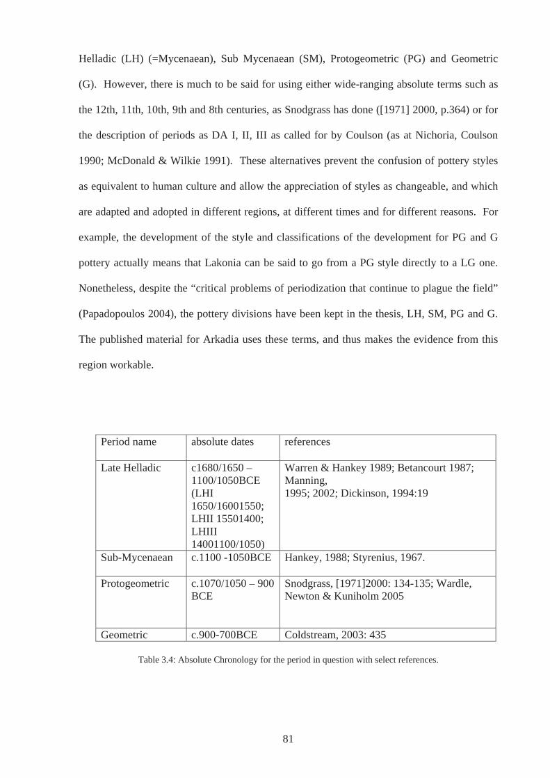
Helladic (LH) (=Mycenaean), Sub Mycenaean (SM), Protogeometric (PG) and Geometric
(G). However, there is much to be said for using either wide-ranging absolute terms such as
the 12th, 11th, 10th, 9th and 8th centuries, as Snodgrass has done ([1971] 2000, p.364) or for
the description of periods as DA I, II, III as called for by Coulson (as at Nichoria, Coulson
1990; McDonald & Wilkie 1991). These alternatives prevent the confusion of pottery styles
as equivalent to human culture and allow the appreciation of styles as changeable, and which
are adapted and adopted in different regions, at different times and for different reasons. For
example, the development of the style and classifications of the development for PG and G
pottery actually means that Lakonia can be said to go from a PG style directly to a LG one.
Nonetheless, despite the “critical problems of periodization that continue to plague the field”
(Papadopoulos 2004), the pottery divisions have been kept in the thesis, LH, SM, PG and G.
The published material for Arkadia uses these terms, and thus makes the evidence from this
region workable.
Period name absolute dates references
Late Helladic c1680/1650 – 1100/1050BCE (LHI 1650/16001550; LHII 15501400; LHIII 14001100/1050)
Warren & Hankey 1989; Betancourt 1987; Manning, 1995; 2002; Dickinson, 1994:19
Sub-Mycenaean c.1100 -1050BCE Hankey, 1988; Styrenius, 1967.
Protogeometric c.1070/1050 – 900 BCE
Snodgrass, [1971]2000: 134-135; Wardle, Newton & Kuniholm 2005
Geometric c.900-700BCE Coldstream, 2003: 435
Table 3.4: Absolute Chronology for the period in question with select references.
81
3.3.2a: Late Helladic
The period with which this thesis is concerned starts in absolute dates at approximately 1600-
1650 BCE, the beginning of the LHI period. This date has been challenged over the last two
decades, resulting in a reassignment of the traditional date of 1600 BCE (Warren & Hankey
1989) by Betancourt (1987) and Manning (1995, 2002) to as early as 1680BCE or even
1700BCE according to Cline (1994). However, for the purposes of this thesis the controversy
of this date does not concern us as this stage. Initially it was intended that the study should
began at the LHIIIB period, at approximately the start of the 13th century BCE, which is
generally considered to be the height of Mycenaean civilisation based on evidence from
outside of Arkadia. For example, this was a time when settlements were at their most
numerous and pottery style was largely homogeneous across all regions of the Mycenaean
world and most widespread in the Aegean World and beyond (Dickinson 1994, p.251; Wardle
& Wardle 1997, p.7). This was also the period prior to any destruction at many large centres
c.1200BCE (e.g. Pylos, Mycenae, Tiryns, Midea). However, very few sites in Arkadia have
this detailed chronology published. The evidence from many sites of the LBA period is
described as simply Mycenaean or LH, proving impossible to divide into phases, even where
the evidence had been photographed (e.g. Howell 1970, n.1 plate 27a.6, n.14 plate 29c.pp.10-
12). In order to encompass such sites it was expedient to have an all- inclusive LH period.
3.3.2b: Sub-Mycenaean
The following period characterised by pottery described as SM is most controversial. Debate
has raged between believing that the pottery represents a true chronological phase, and it
being simply a pottery style found in certain areas of mainland Greece (Desborough 1964,
pp.17-20; Mountjoy 1999, p.56; Rutter 1978; Snodgrass [1971] 2000, pp.28-34; Styrenius
1967, pp.127-8; Coulson 1990). Mountjoy (1999, p.56) briefly outlines the history of this
debate stating that Desborough (1964), having initially disputed the existence of Sub-
82
Mycenaean as a cultural phase, later retracted and allowed it much greater presence over
mainland Greece (1972). However, Mountjoy (1999, p.56) also states that many of the
characteristics that have been assigned to a SM period other than the pottery decoration and
shapes, such as long dress pins, arched fibulae, shield rings, double spiral finger rings, cist
tomb cemeteries and the practice of burial in destroyed Mycenaean settlements, were actually
present in the preceding LHIIIC phase. If then the SM period can only be defined by its
pottery, then surely, it simply is a pottery style (see Coulson 1990). Chronological periods are
not comprised of only pottery styles. Even if the style existed, as has been shown in the
Argolid in levels above LHIIIC levels and therefore not contemporary with LHIIIC period, as
argued by Rutter (1978), this still does not presuppose SM to have existed at all places at the
same time, and this includes Arkadia.
Although a SM style of pottery can certainly be said to exist, it does not appear to exist to the
exclusion of local styles derived from LHIIIC or that can be considered to be part of the late
Mycenaean repertoire, except perhaps in Attica and Salamis, albeit where enough similarities
exist with the previous phase as to call it ‘Sub-Mycenaean’. Much of the discussion is
without reference to the people who made and used pottery except in terms of skill or lack of
it. The spread of style or cultural phases is seen almost in terms of catching a virus, whereby
no one has a choice in whether it is acquired or not, although admittedly cultural transmission
does occur. If the ‘phase’ is put into the context of following LHIIIB and LHIIIC pottery
which became increasingly localised, then the need to ascribe ‘Sub-Mycenaean’ pottery to a
discreet phase, expected across the old Mycenaean sphere of influence, does not make much
sense. The uniformity of LHIIIB, i.e. the decorated fine ware, is explicable by strongly
connected communities that not only enjoyed regular contact but also was encouraged by
strength of ties between leading families to share in a similar material culture that did not just
stop at pottery style. In the following period, in the aftermath of destructions, disturbances,
83
abandonment and movements of people, on whatever scale and over whatever time period, the
resulting picture of fragmentation in the material record (LHIIIC), less uniformity and
increasing local variations, is not surprising and somewhat expected. That we should find in
some areas a continuing denudation of the LHIIIC repertoire into something archaeologists
today have called ‘Sub-Mycenaean’ again is to be expected. That we then expect a style
developing out of LHIIIC to be uniform across the old regions of Mycenaean Greece is not.
It is necessary to move away from thinking of pots and styles as having a life of their own and
acknowledge that it is people who make decisions regarding which pots to use and which
decoration to employ and copy, albeit this is done in reference to their temporal and spatial
environments. Communities living in Arkadia at the time may have chosen not to adopt, for
example, a wavy line within a narrow decorative band, typical of sub-Mycenaean pottery
(Mountjoy 2000, p.57). The possible examples of Sub-Mycenaean found in Arkadia could be
the result of very limited copying and adaptation, or a purposeful choice not to use a pottery
style that their close neighbours in the Argolid were utilising?. On the other hand, a decrease
in quality of LHIIIC pottery may have been classified as SM by archaeologists in order to fill
a perceived gap. For a style that has a history of debate over its existence as a cultural phase,
we need not imagine that there were periods with no inhabitation in a region simply because
we do not have the presence of SM. It seems much more a leap of imagination to assume that
the region was completely abandoned or deserted.
3.3.2c: Protogeometric and Geometric
The PG period and G period are more straightforward. The periods and the pottery have been
fully analysed by Desborough (1952) and Coldstream (1968, 2003) respectively. PG is
generally dated from 1050 BCE to 900BCE (Snodgrass [1971] 2000, pp.134-135; table 3.3)
and Geometric from c.900BCE to c. 700BCE (Coldstream 2003, p.435; table 3.3) based
84
primarily on Attic sequences. These chronological divisions however do vary depending on
the region to which one is referring and there are regions of the Aegean where for example
there is no discernable PG pottery style (Papadopolous 2004). As stated above, in Lakonia a
PG style can be seen to develop relatively late in c.850 and continue in use until c.750 BCE
when a style that can be described as LG appears (Snodgrass [1971] 2000, p.135). For this
reason, I have also included sites in the inventory that have the presence of Proto-Korinthian
pottery considering that the beginning of this style has been dated before the end of the eighth
century c.720BCE thus overlapping ‘conventional Geometric’ (Coldstream 2003, p.435).
3.3.3: Arkadian time
The phases which have been outlined above have been subdivided again and again to create
very tight chronologies, in some case lasting a few decades, or less than a generation (e.g.
LHIIIA2, IIIB1, IIIB2 covering approximately a century, Dickinson 1994 p.19; LGIa, Ib, IIa
and IIb covering approximately 10-15 years each, Coldstream 2003, p.435). However, the
material from Arkadia cannot be fitted into this scheme with much success: as stated above
the reason for having an all-inclusive LH period was to ensure evidence was not excluded.
This is why in many ways there has been a lack of interpretation surrounding the archaeology
of this and the subsequent periods. It was through a realisation that the material as it stood
could not be approached in ‘standard’ ways, through detailed stylistic and chronological
analysis, that the approach concentrates on landscape as perceived and lived by the people
who made and used the material record. One thing certainly known about the material
evidence is its position in space.
Nonetheless, the chronological phase for which sites had been assigned was of the utmost
importance. For each site, it was necessary to know whether evidence pertained to a single
phase or many, and a separate record in the database was made for each general phase of a
85
site. Basic information regarding evidence of other periods was also recorded both prior to
and later than those under study, as this proved to be particularly pertinent in the
interpretation of the evidence pertaining to the LBA/EIA transition. The sites considered in
the case studies often have evidence for more than one period. This evidence was not always
of a similar nature and in most cases engaged a different explanation and thus different use for
the site. Thus in this way it becomes possible to see how change occurred over the whole
period.
The chapters in Part Two of this thesis look at the longue durée and the small scale.
Discussion of the evidence and changes in it over time allows a certain understanding of the
material evidence and the case studies enable an alternative understanding to emerge. Actions
on a small scale are not simply determined by general trends seen over time, although they are
certainly not unrelated. However, all action is determined in relation to the landscape in
which such praxis is situated.
3.4: Conclusions
The above is the basis on which the rest of the thesis lies. I do not wish to subscribe to any
particular ‘school’ and find that different approaches or at least elements of them are not
necessarily contradictory as has sometimes been postulated. Often such ‘schools’ are
depicted more as caricatures of themselves, built up as straw men rather than being accurate
representations of ideas associated with such ‘schools’ (Holtoff & Karlsson 2000, p.5). Many
scholars appreciate that the either/or attitude that is encouraged by such oppositions is neither
helpful nor desirable and that a both/and approach is the way forward (Soja 1996, p.61; Exon
et al, 2000, p.11; Hodder 1999, p.39). Of particular concern in this study, however, is the
intention to supplement the almost standard ‘processual’ accounts with an in-depth look at
how landscape is more than a backdrop to events or a resource to be exploited. It was (and is)
86
interacted with, people are ‘in-the-world’, an attitude very much in line with
phenomenological or existentialist viewpoints (e.g. Heidegger 1978; Merleau-Ponty 2002).
The problematic of dividing human experience into discreet timeframes often dictated by
pottery styles, thinking in terms of processes and long time spans that are visible beyond the
level of human interaction, is of course pertinent, as well as what living through such periods
and their transitions might have meant to various individuals living in Arkadia. It is believed
that we can go some way to achieving this with the available evidence and thus approach
various timescales. This study is not attempting to recreate daily events but does think in
terms of how the landscape figured in people’s daily and seasonal lives. Measured, abstracted
time is used and accepted in this study: it allows archaeologists today to manage time, and to
obtain a sense of the period as a whole. But also embraced is human, experienced time, a
consideration of how people in the past marked time and submitted themselves to the passage
of time (Bradley 1991, p.209). Bourdieu (1977) sees time as dependent upon the observer.
Those looking back on a period can move backwards and forwards throughout time,
observing things that those living through it cannot, whilst the ‘insider’ experiences
something of the time that those observing cannot. This does posit a potential problem for
this study whereby any attempt by the author to capture something of the times that were
lived is impossible. However, this is acceptable. What merits the enterprise are the very long
term geological processes, that have not yet altered the landscape of Arkadia significantly
from what would have been observable in the LBA and EIA. It is this general ‘permanence’
of the physical landscape, the bodily experience we have of it today, that is the starting point.
I make no claim to discovering the truth, but it is a truth, as much my engagement with the
material culture of the time and the places in which it was found; archaeology can be nothing
else even when objectivity is the aim (Pearson & Shanks 2001, p.11). As Ingold (1993,
p.152) states in a discussion on his ‘dwelling perspective’, it is possible to use such an
approach in archaeology, where the people are no longer living, because “the practice of
87

archaeology is itself a form of dwelling”. Subsequently, I hope to present something of a
‘real’ world that is `familiar and compatible with our experience of it` (Bintliff 1991b, p.4).
Gregory explains two ways of approaching space and landscape as `mapping` and `travelling`,
which goes someway to summarising what is presented here. This is also an analogy than can
be applied to time, where `mapping` refers to the measured chronologies and `travelling` is an
attempt to scrutinise and understand a particular point on the way.
88

PART 2
89
CHAPTER 4: LANDSCAPES OF RELIGION AND SACRED SPACE
4.1: Introduction
This chapter concentrates on evidence for religious and sacred places in Arkadia in the LBA
and EIA. Section 4.2 presents an initial survey and description of the evidence for sacred or
religious activity for each of the main periods in general followed by that for Arkadia in
particular. Subsequently, section 4.3 discusses how this evidence has and can be used in
gaining an understanding of ancient religious practice. After a consideration of recent
interpretations, which although important and valid often leave out much that can be said
regarding particular sites and their settings, section 4.4 illustrates, through a number of case
studies how people may have regarded and negotiated the landscape in which they lived and
how that landscape may have influenced and informed their religious and ritual practice. The
chapter concludes with section 4.5.
4.2: Overview
4.2.1: Late Helladic religious and sacred sites in Greece
Mycenaean religion has been a subject of study for well over a century (e.g. Evans 1901;
Nilsson 1927, 1932; Persson 1942; Yavis 1949; Mylonas 1977; Murray 1980; Palmer 1981
1983; Goodison 1989; Sourvinou-Inwood 1993; Kontorli-Papadopoulou 1996; Hägg and
Laffineur 2001). Structures associated with religious activity have been found on mainland
Greece at Mycenae (Mylonas 1981), Tiryns (Kilian 1981), and Asine (Hägg 1981). Together
with similar ‘shrines’ at Ayia Irini on Keos (Caskey 1971; 1972) and Phylakopi on Melos
(Renfrew 1985) in the Cyclades, they share a number of similarities. Architectural additions,
such as benches and platforms on which religious idols may have been placed, are common,
features which have caused Hägg (1992, p.212) to classify them as ‘bench shrines’. In
addition, hearths, daïses or tripod tables of offerings are also frequently found in the centres of
the major cult rooms. Moreover, many of the structures follow a basic tripartite or megaroid
90
ground plan, in particular the House of the Idols and House of the Frescoes at Mycenae and
the LHIIIC cult building and cult room BB at Ayia Irini, and to a lesser extent the cult room at
Tiryns and the West Shrine at Phylakopi (see Albers 1994, p.123). However, there is no strict
canonical form comparable to temples of the late Archaic and Classical periods (Albers 1994,
p.121). It may be that religious activity also took place at open-air shrines, as is suggested at
Asea-Ayios Elias in Arkadia. Alternatively, in cases where activity has a long and largely
unbroken history, later religious buildings could have destroyed earlier LH structures.
Mycenaean religion is recognised archaeologically not only by architecture but also by the
assemblage of artefacts found. The types of artefacts associated with Mycenaean ritual and
religion are figurines, rhyta, gemstones, sealstones and rings. The latter often depict scenes
interpreted as religiously significant, such as the example from Tiryns where demons bearing
jugs approach a ‘goddess’. The figurines, however, are of many types, only some of which
appear to be specifically devoted to religious activity. The large figurines from Ayia Irini on
Keos (Caskey, 1986) and those found at the cult centre at Mycenae (Moore & Taylour 1999)
are examples. Other figurines, such as the psi, phi and tau types, are ubiquitous and are found
in many contexts. These figurine types are found in religious contexts, perhaps used in
worship, and are found in other ritually significant places such as in burials and at transitional
places (e.g. doorways), but they are also found discarded ‘unceremoniously’ in rubbish dumps
and reused as stoppers and temper in mud bricks (Tzounou–Herbst 2002). Thus, by
themselves they are not indicative of a place of worship, temple or shrine, religious practice or
even indicative of religious sentiment.
There are a number of models that outline criteria by which religious function may be
inferred, such as Renfrew’s (1985) classifications, and Pilafidis-Williams (1998) adaptation of
them, some of which will be explored more fully in section 4.4. Suffice to say, it is often a
91
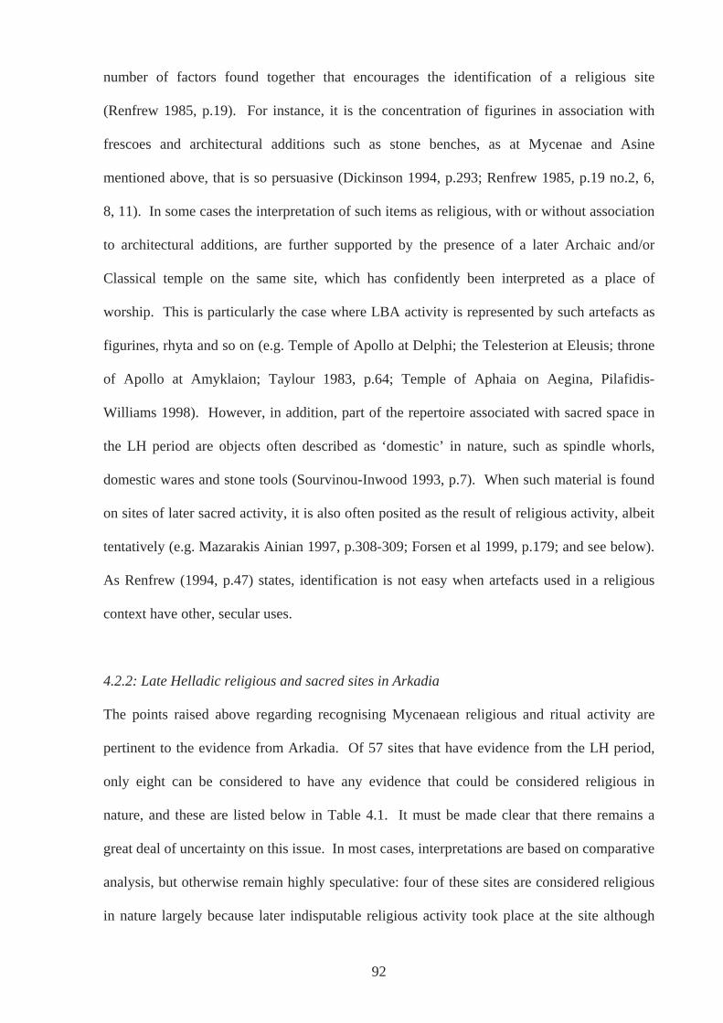
number of factors found together that encourages the identification of a religious site
(Renfrew 1985, p.19). For instance, it is the concentration of figurines in association with
frescoes and architectural additions such as stone benches, as at Mycenae and Asine
mentioned above, that is so persuasive (Dickinson 1994, p.293; Renfrew 1985, p.19 no.2, 6,
8, 11). In some cases the interpretation of such items as religious, with or without association
to architectural additions, are further supported by the presence of a later Archaic and/or
Classical temple on the same site, which has confidently been interpreted as a place of
worship. This is particularly the case where LBA activity is represented by such artefacts as
figurines, rhyta and so on (e.g. Temple of Apollo at Delphi; the Telesterion at Eleusis; throne
of Apollo at Amyklaion; Taylour 1983, p.64; Temple of Aphaia on Aegina, Pilafidis-
Williams 1998). However, in addition, part of the repertoire associated with sacred space in
the LH period are objects often described as ‘domestic’ in nature, such as spindle whorls,
domestic wares and stone tools (Sourvinou-Inwood 1993, p.7). When such material is found
on sites of later sacred activity, it is also often posited as the result of religious activity, albeit
tentatively (e.g. Mazarakis Ainian 1997, p.308-309; Forsen et al 1999, p.179; and see below).
As Renfrew (1994, p.47) states, identification is not easy when artefacts used in a religious
context have other, secular uses.
4.2.2: Late Helladic religious and sacred sites in Arkadia
The points raised above regarding recognising Mycenaean religious and ritual activity are
pertinent to the evidence from Arkadia. Of 57 sites that have evidence from the LH period,
only eight can be considered to have any evidence that could be considered religious in
nature, and these are listed below in Table 4.1. It must be made clear that there remains a
great deal of uncertainty on this issue. In most cases, interpretations are based on comparative
analysis, but otherwise remain highly speculative: four of these sites are considered religious
in nature largely because later indisputable religious activity took place at the site although
92
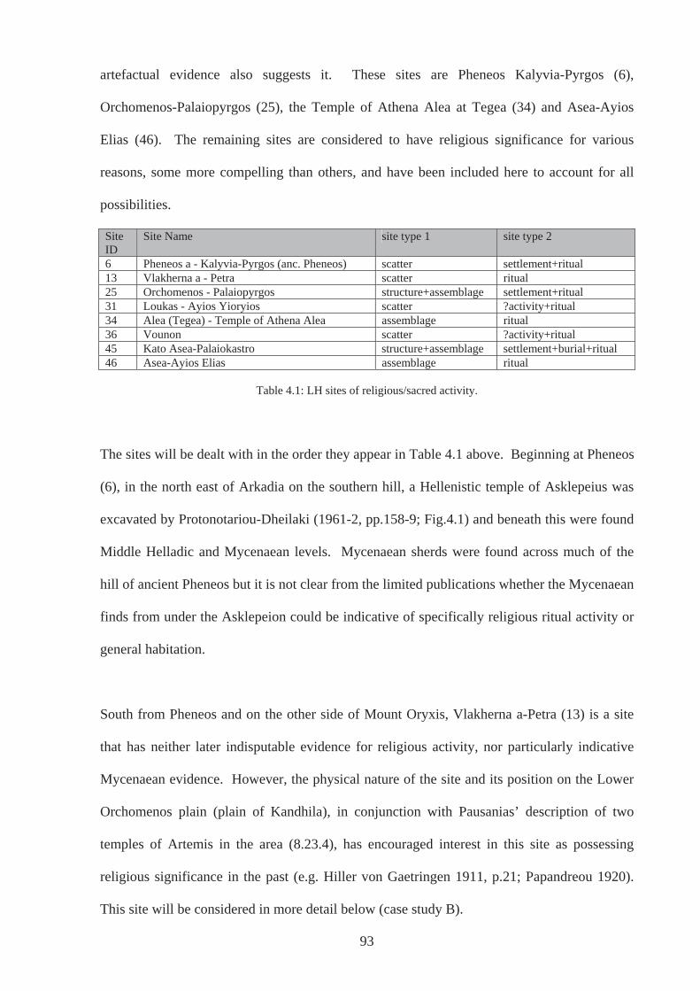
93
artefactual evidence also suggests it. These sites are Pheneos Kalyvia-Pyrgos (6),
Orchomenos-Palaiopyrgos (25), the Temple of Athena Alea at Tegea (34) and Asea-Ayios
Elias (46). The remaining sites are considered to have religious significance for various
reasons, some more compelling than others, and have been included here to account for all
possibilities.
Site ID
Site Name site type 1 site type 2
6 Pheneos a - Kalyvia-Pyrgos (anc. Pheneos) scatter settlement+ritual 13 Vlakherna a - Petra scatter ritual 25 Orchomenos - Palaiopyrgos structure+assemblage settlement+ritual 31 Loukas - Ayios Yioryios scatter ?activity+ritual 34 Alea (Tegea) - Temple of Athena Alea assemblage ritual 36 Vounon scatter ?activity+ritual 45 Kato Asea-Palaiokastro structure+assemblage settlement+burial+ritual 46 Asea-Ayios Elias assemblage ritual
Table 4.1: LH sites of religious/sacred activity.
The sites will be dealt with in the order they appear in Table 4.1 above. Beginning at Pheneos
(6), in the north east of Arkadia on the southern hill, a Hellenistic temple of Asklepeius was
excavated by Protonotariou-Dheilaki (1961-2, pp.158-9; Fig.4.1) and beneath this were found
Middle Helladic and Mycenaean levels. Mycenaean sherds were found across much of the
hill of ancient Pheneos but it is not clear from the limited publications whether the Mycenaean
finds from under the Asklepeion could be indicative of specifically religious ritual activity or
general habitation.
South from Pheneos and on the other side of Mount Oryxis, Vlakherna a-Petra (13) is a site
that has neither later indisputable evidence for religious activity, nor particularly indicative
Mycenaean evidence. However, the physical nature of the site and its position on the Lower
Orchomenos plain (plain of Kandhila), in conjunction with Pausanias’ description of two
temples of Artemis in the area (8.23.4), has encouraged interest in this site as possessing
religious significance in the past (e.g. Hiller von Gaetringen 1911, p.21; Papandreou 1920).
This site will be considered in more detail below (case study B).
Fig.
4.1:
vie
w o
f Ask
lepe
ion
at th
e si
te o
f anc
ient
Phe
neos
(pho
to: a
utho
r)
94
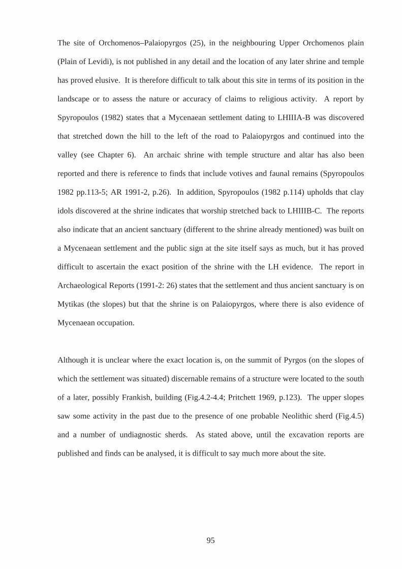
The site of Orchomenos–Palaiopyrgos (25), in the neighbouring Upper Orchomenos plain
(Plain of Levidi), is not published in any detail and the location of any later shrine and temple
has proved elusive. It is therefore difficult to talk about this site in terms of its position in the
landscape or to assess the nature or accuracy of claims to religious activity. A report by
Spyropoulos (1982) states that a Mycenaean settlement dating to LHIIIA-B was discovered
that stretched down the hill to the left of the road to Palaiopyrgos and continued into the
valley (see Chapter 6). An archaic shrine with temple structure and altar has also been
reported and there is reference to finds that include votives and faunal remains (Spyropoulos
1982 pp.113-5; AR 1991-2, p.26). In addition, Spyropoulos (1982 p.114) upholds that clay
idols discovered at the shrine indicates that worship stretched back to LHIIIB-C. The reports
also indicate that an ancient sanctuary (different to the shrine already mentioned) was built on
a Mycenaean settlement and the public sign at the site itself says as much, but it has proved
difficult to ascertain the exact position of the shrine with the LH evidence. The report in
Archaeological Reports (1991-2: 26) states that the settlement and thus ancient sanctuary is on
Mytikas (the slopes) but that the shrine is on Palaiopyrgos, where there is also evidence of
Mycenaean occupation.
Although it is unclear where the exact location is, on the summit of Pyrgos (on the slopes of
which the settlement was situated) discernable remains of a structure were located to the south
of a later, possibly Frankish, building (Fig.4.2-4.4; Pritchett 1969, p.123). The upper slopes
saw some activity in the past due to the presence of one probable Neolithic sherd (Fig.4.5)
and a number of undiagnostic sherds. As stated above, until the excavation reports are
published and finds can be analysed, it is difficult to say much more about the site.
95
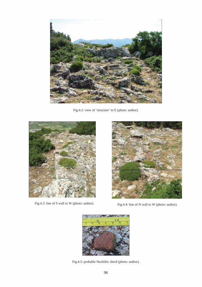
96
Fig.4.2: view of ‘structure’ to E (photo: author).
Fig.4.3: line of S wall to W (photo: author). Fig.4.4: line of N wall to W (photo: author).
Fig.4.5: probable Neolithic sherd (photo: author).
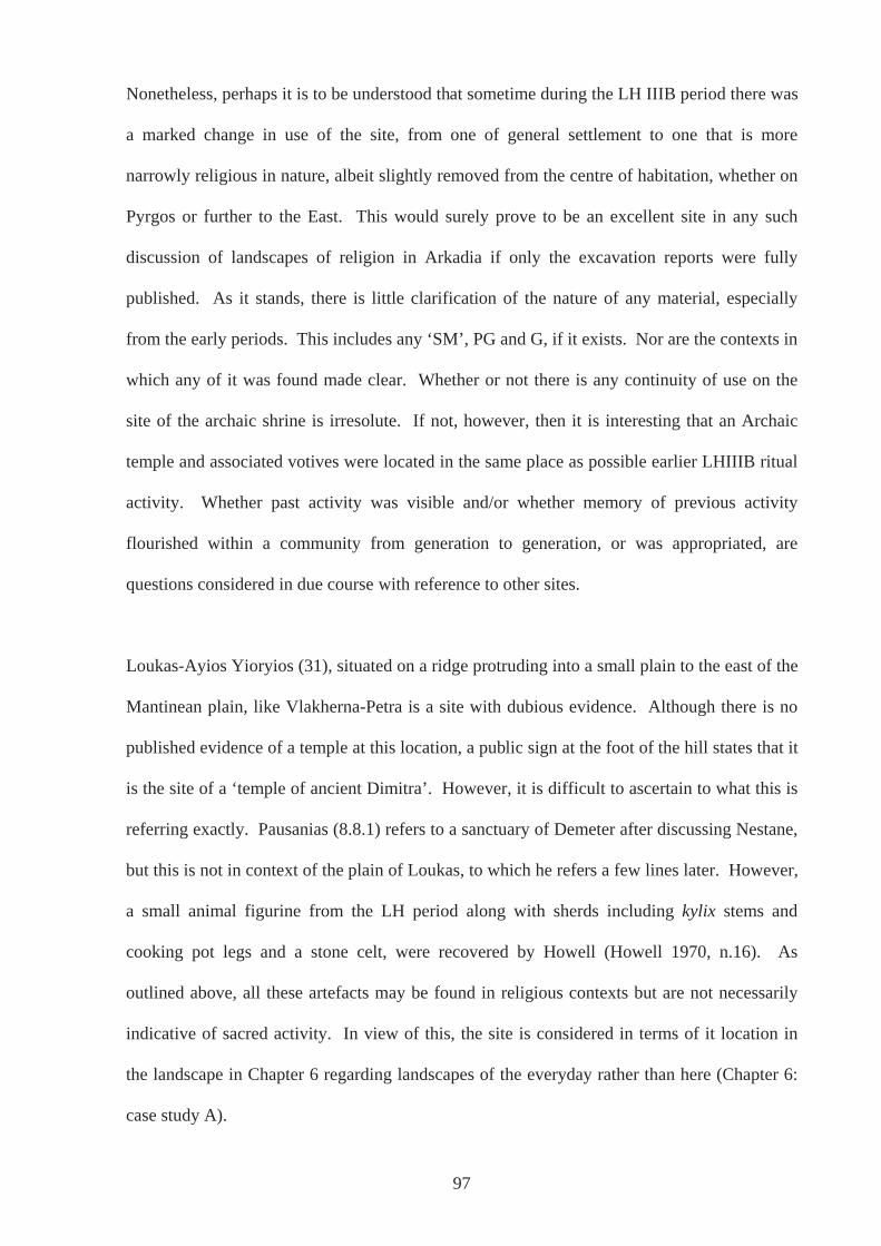
Nonetheless, perhaps it is to be understood that sometime during the LH IIIB period there was
a marked change in use of the site, from one of general settlement to one that is more
narrowly religious in nature, albeit slightly removed from the centre of habitation, whether on
Pyrgos or further to the East. This would surely prove to be an excellent site in any such
discussion of landscapes of religion in Arkadia if only the excavation reports were fully
published. As it stands, there is little clarification of the nature of any material, especially
from the early periods. This includes any ‘SM’, PG and G, if it exists. Nor are the contexts in
which any of it was found made clear. Whether or not there is any continuity of use on the
site of the archaic shrine is irresolute. If not, however, then it is interesting that an Archaic
temple and associated votives were located in the same place as possible earlier LHIIIB ritual
activity. Whether past activity was visible and/or whether memory of previous activity
flourished within a community from generation to generation, or was appropriated, are
questions considered in due course with reference to other sites.
Loukas-Ayios Yioryios (31), situated on a ridge protruding into a small plain to the east of the
Mantinean plain, like Vlakherna-Petra is a site with dubious evidence. Although there is no
published evidence of a temple at this location, a public sign at the foot of the hill states that it
is the site of a ‘temple of ancient Dimitra’. However, it is difficult to ascertain to what this is
referring exactly. Pausanias (8.8.1) refers to a sanctuary of Demeter after discussing Nestane,
but this is not in context of the plain of Loukas, to which he refers a few lines later. However,
a small animal figurine from the LH period along with sherds including kylix stems and
cooking pot legs and a stone celt, were recovered by Howell (Howell 1970, n.16). As
outlined above, all these artefacts may be found in religious contexts but are not necessarily
indicative of sacred activity. In view of this, the site is considered in terms of it location in
the landscape in Chapter 6 regarding landscapes of the everyday rather than here (Chapter 6:
case study A).
97
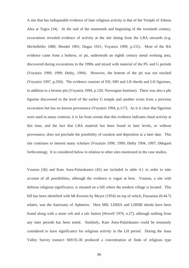
A site that has indisputable evidence of later religious activity is that of the Temple of Athena
Alea at Tegea (34). At the end of the nineteenth and beginning of the twentieth century,
excavations revealed evidence of activity at the site dating from the LBA onwards (e.g.
Michelhöfer 1880; Mendel 1901; Dugas 1921; Voyatzis 1999, p.131). Most of the BA
evidence came from a bothros, or pit, underneath an eighth century metal working area,
discovered during excavations in the 1990s and mixed with material of the PG and G periods
(Voyatzis 1990, 1999; Østby, 1994). However, the bottom of the pit was not reached
(Voyatzis 1997, p.350). The evidence consists of EH, MH and LH sherds and LH figurines,
in addition to a bronze pin (Voyatzis 1994, p.120; Norwegian Institute). There was also a phi
figurine discovered in the level of the earlier G temple and another exists from a previous
excavation but has no known provenance (Voyatzis 1994, p.117). As it is clear that figurines
were used in many contexts, it is far from certain that this evidence indicates ritual activity at
this time, and the fact that LBA material has been found in later levels, or without
provenance, does not preclude the possibility of curation and deposition at a later date. This
site continues to interest many scholars (Voyatzis 1990, 1999; Østby 1994, 1997; Ødegard
forthcoming). It is considered below in relation to other sites mentioned in the case studies.
Vounon (36) and Kato Asea-Palaiokastro (45) are included in table 4.1 in order to take
account of all possibilities, although the evidence is vague at best. Vounon, a site with
dubious religious significance, is situated on a hill where the modern village is located. This
hill has been identified with Mt Kresion by Meyer (1954) on top of which, Pausanias (8.44.7)
relates, was the Sanctuary of Aphneios. Here MH, LHIIIA and LHIIIB sherds have been
found along with a stone celt and a talc button (Howell 1970, n.27), although nothing from
any later periods has been noted. Similarly, Kato Asea-Palaiokastro could be tenuously
considered to have significance for religious activity in the LH period. During the Asea
Valley Survey transect S69/35-36 produced a concentration of finds of religious type
98
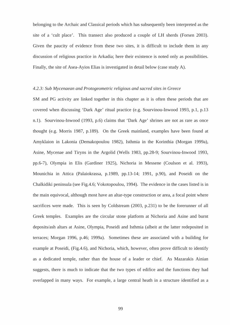
belonging to the Archaic and Classical periods which has subsequently been interpreted as the
site of a ‘cult place’. This transect also produced a couple of LH sherds (Forsen 2003).
Given the paucity of evidence from these two sites, it is difficult to include them in any
discussion of religious practice in Arkadia; here their existence is noted only as possibilities.
Finally, the site of Asea-Ayios Elias is investigated in detail below (case study A).
4.2.3: Sub Mycenaean and Protogeometric religious and sacred sites in Greece
SM and PG activity are linked together in this chapter as it is often these periods that are
covered when discussing ‘Dark Age’ ritual practice (e.g. Sourvinou-Inwood 1993, p.1, p.13
n.1). Sourvinou-Inwood (1993, p.6) claims that ‘Dark Age’ shrines are not as rare as once
thought (e.g. Morris 1987, p.189). On the Greek mainland, examples have been found at
Amyklaion in Lakonia (Demakopoulou 1982), Isthmia in the Korinthia (Morgan 1999a),
Asine, Mycenae and Tiryns in the Argolid (Wells 1983, pp.28-9; Sourvinou-Inwood 1993,
pp.6-7), Olympia in Elis (Gardiner 1925), Nichoria in Messene (Coulson et al. 1993),
Mounichia in Attica (Palaiokrassa, p.1989, pp.13-14; 1991, p.90), and Poseidi on the
Chalkidiki peninsula (see Fig.4.6; Vokotopoulou, 1994). The evidence in the cases listed is in
the main equivocal, although most have an altar-type construction or area, a focal point where
sacrifices were made. This is seen by Coldstream (2003, p.231) to be the forerunner of all
Greek temples. Examples are the circular stone platform at Nichoria and Asine and burnt
deposits/ash altars at Asine, Olympia, Poseidi and Isthmia (albeit at the latter redeposited in
terraces; Morgan 1996, p.46; 1999a). Sometimes these are associated with a building for
example at Poseidi, (Fig.4.6), and Nichoria, which, however, often prove difficult to identify
as a dedicated temple, rather than the house of a leader or chief. As Mazarakis Ainian
suggests, there is much to indicate that the two types of edifice and the functions they had
overlapped in many ways. For example, a large central heath in a structure identified as a
99
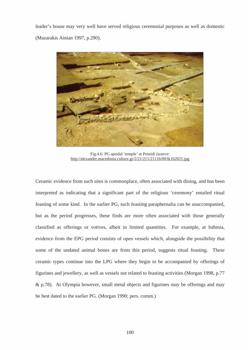
leader’s house may very well have served religious ceremonial purposes as well as domestic
(Mazarakis Ainian 1997, p.290).
Fig.4.6: PG apsidal ‘temple’ at Poseidi (source: http://alexander.macedonia.culture.gr/2/21/211/21116/00/lk162021.jpg
Ceramic evidence from such sites is commonplace, often associated with dining, and has been
interpreted as indicating that a significant part of the religious ‘ceremony’ entailed ritual
feasting of some kind. In the earlier PG, such feasting paraphernalia can be unaccompanied,
but as the period progresses, these finds are more often associated with those generally
classified as offerings or votives, albeit in limited quantities. For example, at Isthmia,
evidence from the EPG period consists of open vessels which, alongside the possibility that
some of the undated animal bones are from this period, suggests ritual feasting. These
ceramic types continue into the LPG where they begin to be accompanied by offerings of
figurines and jewellery, as well as vessels not related to feasting activities (Morgan 1998, p.77
& p.78). At Olympia however, small metal objects and figurines may be offerings and may
be best dated to the earlier PG. (Morgan 1990; pers. comm.)
100
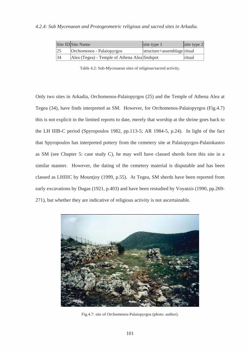
4.2.4: Sub Mycenaean and Protogeometric religious and sacred sites in Arkadia.
Site ID Site Name site type 1 site type 2 25 Orchomenos - Palaiopyrgos structure+assemblage ritual 34 Alea (Tegea) - Temple of Athena Alea findspot ritual
Table 4.2: Sub-Mycenaean sites of religious/sacred activity.
Only two sites in Arkadia, Orchomenos-Palaiopyrgos (25) and the Temple of Athena Alea at
Tegea (34), have finds interpreted as SM. However, for Orchomenos-Palaiopyrgos (Fig.4.7)
this is not explicit in the limited reports to date, merely that worship at the shrine goes back to
the LH IIIB-C period (Spyropoulos 1982, pp.113-5; AR 1984-5, p.24). In light of the fact
that Spyropoulos has interpreted pottery from the cemetery site at Palaiopyrgos-Palaiokastro
as SM (see Chapter 5: case study C), he may well have classed sherds form this site in a
similar manner. However, the dating of the cemetery material is disputable and has been
classed as LHIIIC by Mountjoy (1999, p.55). At Tegea, SM sherds have been reported from
early excavations by Dugas (1921, p.403) and have been restudied by Voyatzis (1990, pp.269-
271), but whether they are indicative of religious activity is not ascertainable.
Fig.4.7: site of Orchomenos-Palaiopyrgos (photo: author).
101
Site ID Site Name site type 1 site type 2 25 Orchomenos - Palaiopyrgos structure+assemblage ritual 34 Alea (Tegea) - Temple of Athena Alea structure+assemblage ritual 46 Asea-Ayios Elias assemblage ritual 56 Alipheira findspot ritual
Table 4.3: PG sites of religious/sacred activity.
The PG period at Orchomenos-Palaiopyrgos (25) (Fig.4.7) is, like the SM, a possibility only
through inference, whereas at Asea-Ayios Elias (46) (considered in more detail below as case
study A) and the Temple of Athena Alea at Tegea (34) ceramic evidence of this period has
been found. At Tegea the period is largely represented by pottery found in the bothros under
the eighth century metal workshop along with sherds of the LBA and EG period, as well as
from the later temple area. Some of these sherds are from open shapes, suggestive of ritual
feasting mentioned above in section 4.2.3 in context of general Dark Age religious activity
(Voyatzis 1994, p.126) but other than this, and the fact these artefacts are found on a site of
later religious activity, there is little else to support ritual use in this period.
At the last of these sites, Alipheira (56), there has been only a single find dating to the PG – a
bronze pin found at the site of the later temple of Athena, along with bronzes of a G date
(Orlandos 1967-8; Voyatzis 1999, p.139; Morgan 1999, p.413). This may be an early votive
object or could well have been curated and deposited at a later date.
4.2.5: Geometric religious and sacred sites in Greece
The G and in particular the LG (eighth century BCE) is seen as a time of renewed vigour at
some religious sites and the foundation of many new. In Arkadia alone, anywhere from none
to four sites of religious ritual existed in the eleventh and tenth centuries BCE (see above),
whereas by 700BCE the possibilities number well over ten (Table 4.1 & 4.4; see also
102
Coldstream 2003, p.317). Religious activity is represented by pottery, where open shapes,
often associated with drinking and dining are usually interpreted as evidence of ritual feasting,
as in the previous period, and closed shapes and miniatures are frequently interpreted as
offerings. There is also an abundance of votives of many kinds, such as terracotta figurines,
but particularly those of bronze. The increase in offerings at sanctuaries during this period,
especially artefacts in bronze, far exceed the number of similar artefacts in settlements and
burials. Morgan (1996; 1998), referring to the Korinthia in particular, sees this as highly
significant evidence of changing attitudes to life and death, and where it was appropriate to
deposit and/or display wealth. Great importance could have been attached to an individual or
group’s ability to make conspicuous and visible dedications to the gods, and as bronze was
increasingly equated with religious observance, it became inappropriate to use in everyday
circumstances or even for dead relatives.
Some sites also have evidence for a building at this time, usually interpreted as a temple. The
construction and development of temples has been seen as a feature of the eighth century,
although there are examples from the preceding period (see above; Coldstream 2003, p.317
and see discussion below). Commonly, temples of the eighth century take the form of an
apsidal structure, sometimes with a porch or ante room. However, as apsidal structures were
a popular house style when these early temples were being built, the designation of a building
as having religious significance rather than a dwelling, albeit probably of a chief or leader is
fraught with difficulties and controversy (Sourvinou-Inwood 1993; Mazarakis Ainian 1997,
ch. 4). Often associated with such structures was a bothros or sacrificial pit, which may point
to a specifically religious function, although these have also been found in association with
so-called leader’s houses also (e.g. Zagora and Emporio, Mazarakis Ainian 1997, p.287).
However, in most cases, a corresponding altar aids identification. Many of these could have
originated in the earlier PG period (see above; Coldstream 2003, p.321).
103
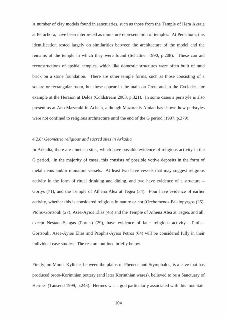
A number of clay models found in sanctuaries, such as those from the Temple of Hera Akraia
at Perachora, have been interpreted as miniature representation of temples. At Perachora, this
identification rested largely on similarities between the architecture of the model and the
remains of the temple in which they were found (Schattner 1990, p.208). These can aid
reconstructions of apsidal temples, which like domestic structures were often built of mud
brick on a stone foundation. There are other temple forms, such as those consisting of a
square or rectangular room, but these appear in the main on Crete and in the Cyclades, for
example at the Heraion at Delos (Coldstream 2003, p.321). In some cases a peristyle is also
present as at Ano Mazaraki in Achaia, although Mazarakis Ainian has shown how peristyles
were not confined to religious architecture until the end of the G period (1997, p.279).
4.2.6: Geometric religious and sacred sites in Arkadia
In Arkadia, there are nineteen sites, which have possible evidence of religious activity in the
G period. In the majority of cases, this consists of possible votive deposits in the form of
metal items and/or miniature vessels. At least two have vessels that may suggest religious
activity in the form of ritual drinking and dining, and two have evidence of a structure –
Gortys (71), and the Temple of Athena Alea at Tegea (34). Four have evidence of earlier
activity, whether this is considered religious in nature or not (Orchomenos-Palaiopyrgos (25),
Ptolis-Gortsouli (27), Asea-Ayios Elias (46) and the Temple of Athena Alea at Tegea, and all,
except Nestane-Sangas (Portes) (29), have evidence of later religious activity. Ptolis–
Gortsouli, Asea-Ayios Elias and Psophis-Ayios Petros (64) will be considered fully in their
individual case studies. The rest are outlined briefly below.
Firstly, on Mount Kyllene, between the plains of Pheneos and Stymphalos, is a cave that has
produced proto-Korinthian pottery (and later Korinthian wares), believed to be a Sanctuary of
Hermes (Tausend 1999, p.243). Hermes was a god particularly associated with this mountain
104
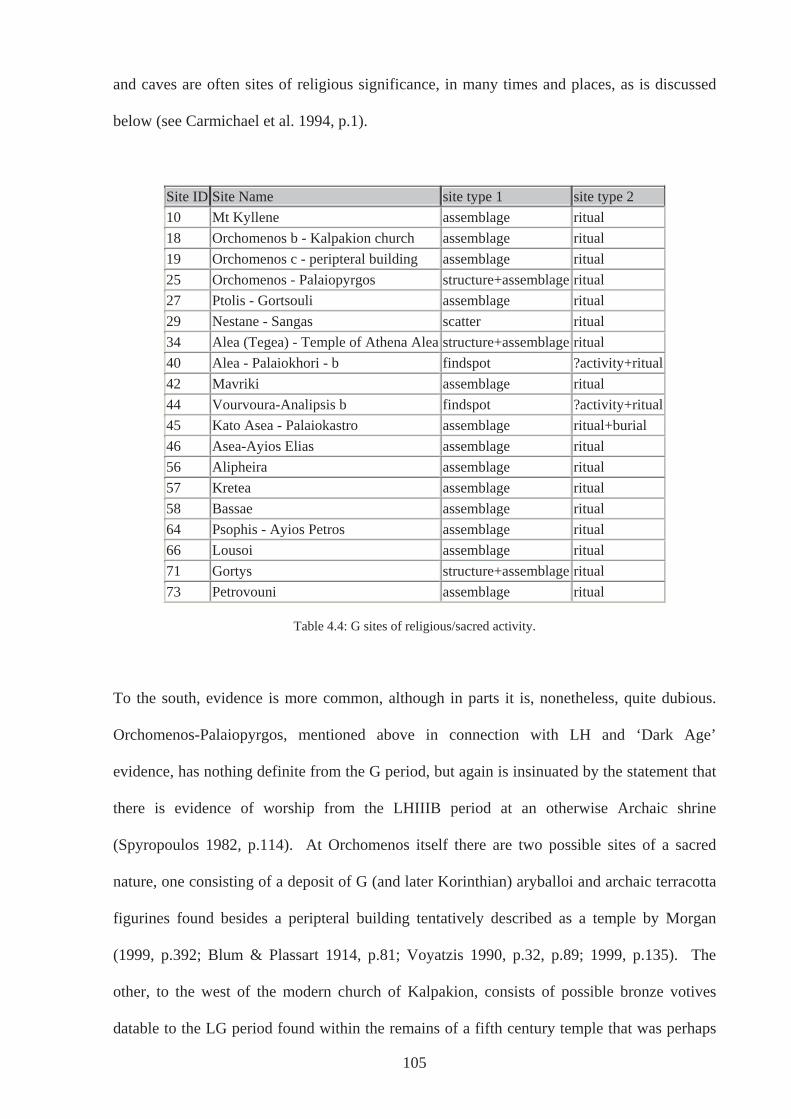
and caves are often sites of religious significance, in many times and places, as is discussed
below (see Carmichael et al. 1994, p.1).
Site ID Site Name site type 1 site type 2 10 Mt Kyllene assemblage ritual 18 Orchomenos b - Kalpakion church assemblage ritual 19 Orchomenos c - peripteral building assemblage ritual 25 Orchomenos - Palaiopyrgos structure+assemblage ritual 27 Ptolis - Gortsouli assemblage ritual 29 Nestane - Sangas scatter ritual 34 Alea (Tegea) - Temple of Athena Alea structure+assemblage ritual 40 Alea - Palaiokhori - b findspot ?activity+ritual42 Mavriki assemblage ritual 44 Vourvoura-Analipsis b findspot ?activity+ritual45 Kato Asea - Palaiokastro assemblage ritual+burial 46 Asea-Ayios Elias assemblage ritual 56 Alipheira assemblage ritual 57 Kretea assemblage ritual 58 Bassae assemblage ritual 64 Psophis - Ayios Petros assemblage ritual 66 Lousoi assemblage ritual 71 Gortys structure+assemblage ritual 73 Petrovouni assemblage ritual
Table 4.4: G sites of religious/sacred activity.
To the south, evidence is more common, although in parts it is, nonetheless, quite dubious.
Orchomenos-Palaiopyrgos, mentioned above in connection with LH and ‘Dark Age’
evidence, has nothing definite from the G period, but again is insinuated by the statement that
there is evidence of worship from the LHIIIB period at an otherwise Archaic shrine
(Spyropoulos 1982, p.114). At Orchomenos itself there are two possible sites of a sacred
nature, one consisting of a deposit of G (and later Korinthian) aryballoi and archaic terracotta
figurines found besides a peripteral building tentatively described as a temple by Morgan
(1999, p.392; Blum & Plassart 1914, p.81; Voyatzis 1990, p.32, p.89; 1999, p.135). The
other, to the west of the modern church of Kalpakion, consists of possible bronze votives
datable to the LG period found within the remains of a fifth century temple that was perhaps
105
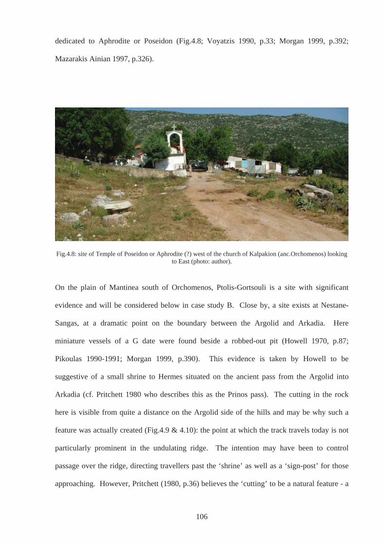
dedicated to Aphrodite or Poseidon (Fig.4.8; Voyatzis 1990, p.33; Morgan 1999, p.392;
Mazarakis Ainian 1997, p.326).
Fig.4.8: site of Temple of Poseidon or Aphrodite (?) west of the church of Kalpakion (anc.Orchomenos) looking to East (photo: author).
On the plain of Mantinea south of Orchomenos, Ptolis-Gortsouli is a site with significant
evidence and will be considered below in case study B. Close by, a site exists at Nestane-
Sangas, at a dramatic point on the boundary between the Argolid and Arkadia. Here
miniature vessels of a G date were found beside a robbed-out pit (Howell 1970, p.87;
Pikoulas 1990-1991; Morgan 1999, p.390). This evidence is taken by Howell to be
suggestive of a small shrine to Hermes situated on the ancient pass from the Argolid into
Arkadia (cf. Pritchett 1980 who describes this as the Prinos pass). The cutting in the rock
here is visible from quite a distance on the Argolid side of the hills and may be why such a
feature was actually created (Fig.4.9 & 4.10): the point at which the track travels today is not
particularly prominent in the undulating ridge. The intention may have been to control
passage over the ridge, directing travellers past the ‘shrine’ as well as a ‘sign-post’ for those
approaching. However, Pritchett (1980, p.36) believes the ‘cutting’ to be a natural feature - a
106
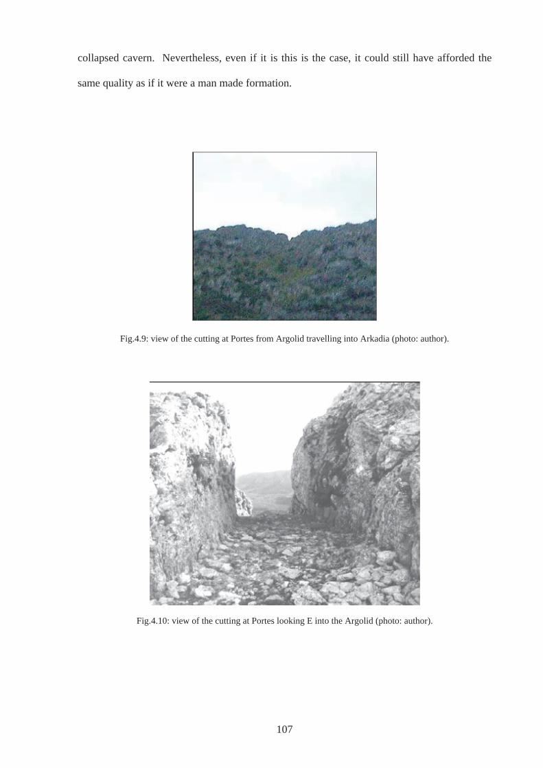
collapsed cavern. Nevertheless, even if it is this is the case, it could still have afforded the
same quality as if it were a man made formation.
Fig.4.9: view of the cutting at Portes from Argolid travelling into Arkadia (photo: author).
Fig.4.10: view of the cutting at Portes looking E into the Argolid (photo: author).
107
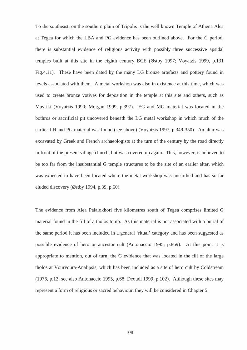
108
To the southeast, on the southern plain of Tripolis is the well known Temple of Athena Alea
at Tegea for which the LBA and PG evidence has been outlined above. For the G period,
there is substantial evidence of religious activity with possibly three successive apsidal
temples built at this site in the eighth century BCE (Østby 1997; Voyatzis 1999, p.131
Fig.4.11). These have been dated by the many LG bronze artefacts and pottery found in
levels associated with them. A metal workshop was also in existence at this time, which was
used to create bronze votives for deposition in the temple at this site and others, such as
Mavriki (Voyatzis 1990; Morgan 1999, p.397). EG and MG material was located in the
bothros or sacrificial pit uncovered beneath the LG metal workshop in which much of the
earlier LH and PG material was found (see above) (Voyatzis 1997, p.349-350). An altar was
excavated by Greek and French archaeologists at the turn of the century by the road directly
in front of the present village church, but was covered up again. This, however, is believed to
be too far from the insubstantial G temple structures to be the site of an earlier altar, which
was expected to have been located where the metal workshop was unearthed and has so far
eluded discovery (Østby 1994, p.39, p.60).
The evidence from Alea Palaiokhori five kilometres south of Tegea comprises limited G
material found in the fill of a tholos tomb. As this material is not associated with a burial of
the same period it has been included in a general ‘ritual’ category and has been suggested as
possible evidence of hero or ancestor cult (Antonaccio 1995, p.869). At this point it is
appropriate to mention, out of turn, the G evidence that was located in the fill of the large
tholos at Vourvoura-Analipsis, which has been included as a site of hero cult by Coldstream
(1976, p.12; see also Antonaccio 1995, p.68; Deoudi 1999, p.102). Although these sites may
represent a form of religious or sacred behaviour, they will be considered in Chapter 5.
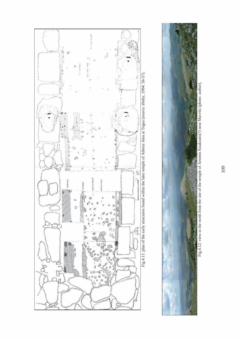
Fi
g.4.
11: p
lan
of th
e ea
rly st
ruct
ures
foun
d w
ithin
the
late
r tem
ple
of A
then
a A
lea
at T
egea
(sou
rce:
Øst
by, 1
994:
56-
57).
Fi
g.4.
12: v
iew
to th
e no
rth fr
om th
e si
te o
f the
tem
ple
of A
rtem
is K
nake
atis
(?) n
ear M
avrik
i (ph
oto:
aut
hor)
.
109
Another prominent site within the territory of the later Tegea is the site of Mavriki, situated
close to the summit of Psili Korfi (Fig.4.12). Excavated by Romaios (1952), finds of a late
eighth century BCE date were found at the site of the earliest all marble temple in Arkadia
(560-550 BCE), situated close to the Dholiana marble quarries and possibly to be equated
with Artemis Knakeatis mentioned by Pausanias (8.53.11). The finds here show many
similarities to those from Tegea as well as some affinities with Laconia, with the majority of
the bronze votives being made at the workshops at the Temple of Athena Alea mentioned
above.
In southern Arkadia, Kato Asea–Palaiokastro (45) has G evidence suggestive of religious or
sacred activity, but at a point different to that where possible evidence of LH religious or
sacred activity was found. On the akropolis itself (Fig.4.13), bronzes of the LG along with
pots and sherds have been interpreted as evidence of a possible shrine or burials on the
plateau (Forsen 2003, p.199; Morgan 1999, p.400). Unfortunately, despite Holmberg’s
excavations in the 1930’s (Holmberg 1944), the akropolis has not been excavated fully to help
clear up this issue. Also in the Asea Valley, Asea-Ayios Elias (46) has evidence of G activity.
This site will be considered in more detail in case study A below.
In the south west of Arkadia, there are three sites of religious significance. At Kretea (57), on
Mount Lykaion, sherds of Lakonian type found alongside bronzes indicate that a cult,
possibly of Apollo Parrhasios (Pausanias. 8.38.2), began in the LG period at a site where a
later Archaic shrine is situated (Kourouniotes 1903, 1910; Jost 1985, p.185-6; Voyatzis 1990,
p.43-44; 1999, p.138-9; Morgan 1999, p.408). At the temple of Apollo at Bassae (58), a
small amount of bronze votives with Lakonian influence have been dated to the LG by
Voyatzis (1999, p.137; see also Kourouniotes 1910; Cooper 1996, pp.66-73). Finally, there
are the LG votives found at the site of the Temple of Athena at Alipheira (56) (Fig.4.14),
110
111
along with possible earlier G bronze spirals and repoussée bands, but again limited excavation
at the site may be hiding much more early material. Morgan (1999, p.413) suggests further
excavation may be enlightening.
To the north, in the region known as Azania in antiquity, numerous votives were found at the
site of Psophis-Ayios Petros (64) (Fig.4.15; Voyatzis 1999, p.136), high in the Aphrodisiac
Mountains. The later temple is believed to be an extra-urban shrine of Erykine Aphrodite
belonging to the polis of Psophis (Kardara 1988, pp.111-182), although Jost argues there is
insufficient evidence to suggest to which deity the temple may have been dedicated (Jost
1985, p.58). Its position too does not clearly point in the direction of Psophis, although as the
polis of Psophis developed and accrued territory, a monumental temple situated here would
have been the first impressive indication to people that they had crossed the boundary.
Situated on a small plateau by a spring, that may have been the focus of early sacred activity,
on a route through the mountains, it would also have served as a convenient resting place and
continued as such, a function this site has today, observed during fieldwork.
Also in Azania is the site of the sanctuary of Artemis Hemera at Lousoi (66) situated in the
foothills of Mt Khelmos Here a large number of small bronzes were found with a similar
range to types found at Tegea, although probably made locally (Mitsopoulos-Leon &
Ladstatter 1996, Mitsopoulos-Leon, 1997). Pottery and terracotta figurines have also been
recovered to the north east of the later temple. In addition, there may be an ‘altar’ or focal
point for sacrifices indicated by an area of burning west of the later Bouleuterion (AR 1987-
88, p.24; Mitsopoulos-Leon & Ladstatter 1996, pp.44-46; Mitsopoulos-Leon, 1997).
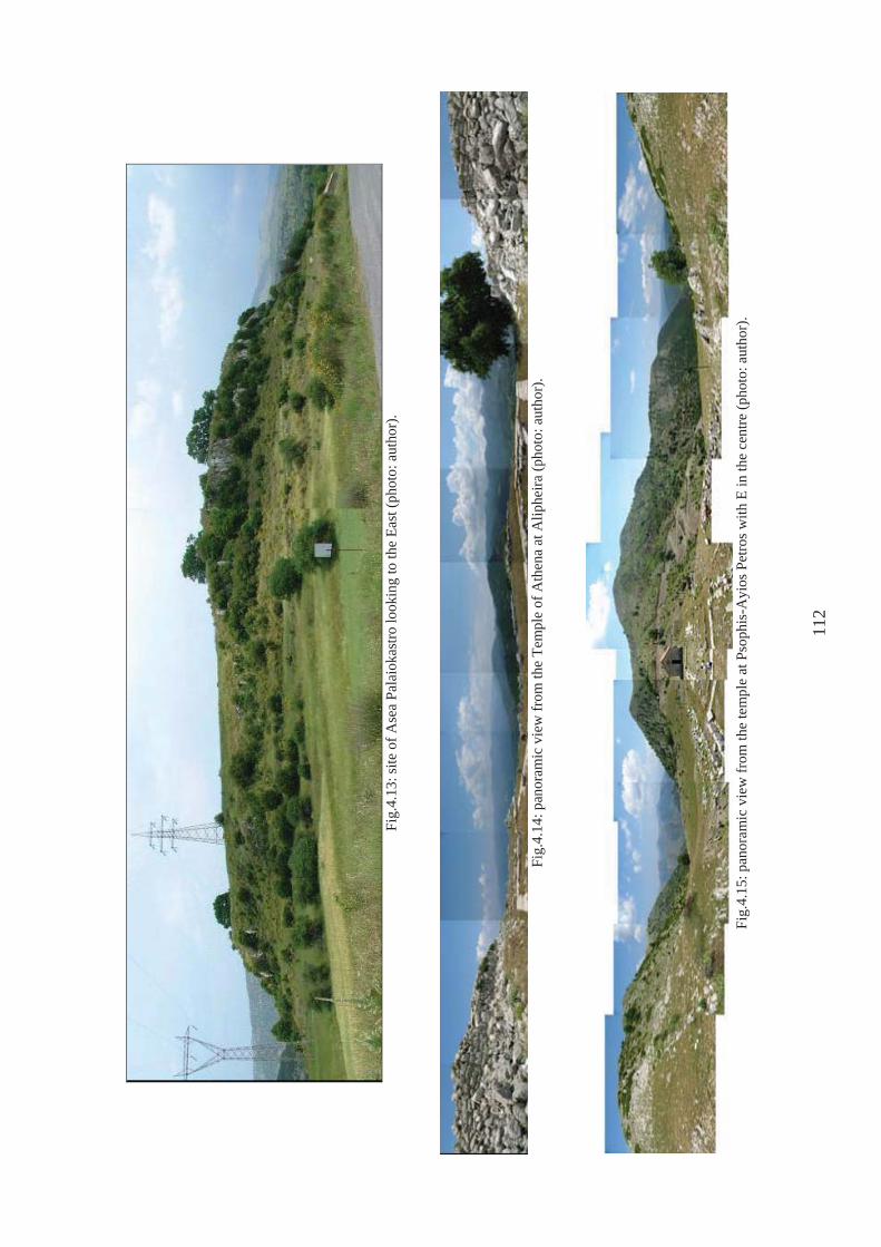
Fi
g.4.
13: s
ite o
f Ase
a Pa
laio
kast
ro lo
okin
g to
the
East
(pho
to: a
utho
r).
Fi
g.4.
14: p
anor
amic
vie
w fr
om th
e Te
mpl
e of
Ath
ena
at A
liphe
ira (p
hoto
: aut
hor)
.
Fi
g.4.
15: p
anor
amic
vie
w fr
om th
e te
mpl
e at
Pso
phis
-Ayi
os P
etro
s with
E in
the
cent
re (p
hoto
: aut
hor)
.
112
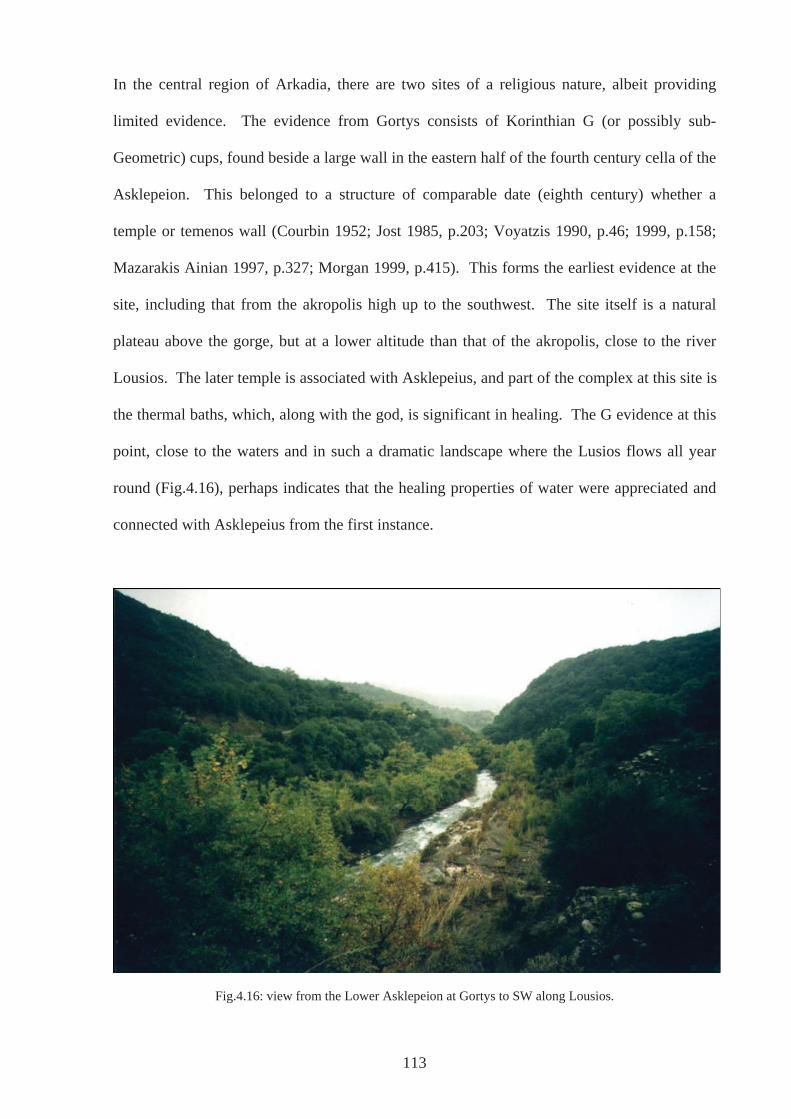
In the central region of Arkadia, there are two sites of a religious nature, albeit providing
limited evidence. The evidence from Gortys consists of Korinthian G (or possibly sub-
Geometric) cups, found beside a large wall in the eastern half of the fourth century cella of the
Asklepeion. This belonged to a structure of comparable date (eighth century) whether a
temple or temenos wall (Courbin 1952; Jost 1985, p.203; Voyatzis 1990, p.46; 1999, p.158;
Mazarakis Ainian 1997, p.327; Morgan 1999, p.415). This forms the earliest evidence at the
site, including that from the akropolis high up to the southwest. The site itself is a natural
plateau above the gorge, but at a lower altitude than that of the akropolis, close to the river
Lousios. The later temple is associated with Asklepeius, and part of the complex at this site is
the thermal baths, which, along with the god, is significant in healing. The G evidence at this
point, close to the waters and in such a dramatic landscape where the Lusios flows all year
round (Fig.4.16), perhaps indicates that the healing properties of water were appreciated and
connected with Asklepeius from the first instance.
Fig.4.16: view from the Lower Asklepeion at Gortys to SW along Lousios.
113

Finally, northeast of Gortys is Petrovouni (Fig.4.19), approximately three kilometres west of
ancient Methydrion. Evidence for the period is characterised by only one find of LG date - a
group of four bronze masked figures, interpreted as horse masks by Voyatzis and thus
associated with rituals performed in honour of Poseidon Hippios (Pausanias 8.36.2; Hiller von
Gaertringen & Latterman 1911, pp.24-32; Jost 1985, pp.215-216; Morgan 1999, p.415;
Voyatzis 1990, p.118).
Fig.4.18: Temple of Poseidon Hippias (?) at Petrovouni (photo: author).
4.3: Interpretation of Religious sites
Greek religion and its origins has been the subject of scholarly interest for centuries. Through
the study of ancient literature and mythology further supported by the decipherment of Linear
B, it has long been accepted that many aspects of Classical Greek religion are the result of the
survival, transmission and adaptation of cults, traditions, rites, festivals and gods throughout
the LBA and EIA (e.g. Nilsson 1932; Dietrich 1974). Archaeological investigations have
114
supported this notion with many sanctuary and temple sites producing evidence of continuity
of use from the BA onwards. As has been mentioned at various points in the outline of sites
above, sometimes these have been interpreted as having a sacred nature throughout the site’s
history (e.g. Snodgrass [1971]2000, p.394). However, on many of these sites, the focus of
attention is on the monumental buildings of the Archaic and Classical periods, interest often
being sparked off by passages in the ancient sources, most notably Pausanias. In addition, an
art historical approach has often been a more apparent motive for excavation than an
understanding of how they functioned throughout time. The familiar architecture of the
Greek temple and the treasures it may hold capture the imagination and no doubt the time of
those working on them, more so than other periods, although this has been addressed more
recently (Morgan 1990; Shanks 1996, p.50).
Much of the evidence pertinent to Arkadia during the period in question has been considered
in light of Renfrew’s (1985) classifications regarding cult and Pilafidis-Williams’ (1998)
adaptation of them. However, such classifications assume that if all the boxes are ticked there
exists an undisputable sacred place and the less that are ticked the more equivocal is the
identification. Although much of the Arkadian evidence corresponds with the categories,
even where there is limited material evidence, this in no way formulates certain
identifications, only that there are possibilities to assess. For example, factors such as
attention focussing devices, special aspects of the liminal zone, the presence of a focal point
indicating the transcendent, elements of participation and expressive behaviour through such
actions as offerings can be found at sites such as Vlakherna-Petra and Asea-Ayios Elias in the
LBA. These are sites which many archaeologists would not confidently interpret based on
artefactual evidence. This highlights the usefulness of Renfrew’s classification for the
purposes of this study – it allows is a full consideration of the landscape in which a site is set,
that can be explored within all factors outlined above, aspects of the landscape, which may
115
have been employed during religious ritual. Even where evidence of offerings is scanty or
questionable (most of the LH sites), this does not have to rule out elements of participation or
expressive behaviour.
Many of the sanctuaries in Arkadia have undergone some excavation, but it is in a limited
number of cases that excavation has gone on to uncover levels and evidence pertaining to
earlier activity at the site. The Temple of Athena Alea at Tegea is one of these exceptions,
where renewed interest throughout the 1990’s has enabled a substantial amount of the earlier
evidence to be unearthed, and tentatively understood (Østby 1997). Asea-Ayios Elias is
promising also (Forsen et al. 1999), as are the long running excavations at Lousoi
(Mitsopoulos-Leon 1997). Excavations at Alipheira, on the other hand, have stopped short of
discovering earlier levels, even when finds point towards the probable positive outcome of
further exploration (Morgan 1999, p.413).
Nonetheless, where evidence for the LBA and EIA has been forthcoming, the interpretation of
this evidence has not been straightforward, whether it dates to the LH, PG, and/or G periods.
A particular problem is that associated with the assumption of continuity of function(s)
highlighted by Mazarakis Ainian (1997) when much of the earlier evidence is scanty. In
some cases outside of Arkadia for example at Dodona, Mazarakis Ainian (1997, pp.308-309)
has reinterpreted evidence from temple sites of the Archaic and Classical period, previously
taken as indicative of religious activity, as evidence of settlement. Similar situations exist in
Arkadia. The Temple of Athena Alea at Tegea is a site where all periods appear to be
represented and thus continuity of function is a tempting albeit tentative proposition (Østby
1997; Voyatzis 1999, p.131). In addition, there is a well-established tradition of the cult at
this site as preserved in Pausanias (8.45.4-47.4; Preztler 1999). However, a situation where
early evidence is firmly interpreted as habitation rather than anything specifically religious is
116
the BA evidence at the site of Ptolis-Gortsouli, despite the fact that this is the site of an
Archaic and Classical sanctuary. This identification is aided by remains of a fortification wall
as well as the definite break in the material record between the LBA and G material, except
for one possible PG sherd (Howell 1970, n.11), preventing the inference of continuity of
function. At Orchomenos-Palaiopyrgos the ‘ancient sanctuary’ is situated over a BA
habitation site and although the reports state that the Archaic shrine site has evidence of a
religious nature dating from the LHIIIB (Spyropoulos 1982, pp.113-5; AR 1991-2, p.26) this
may well be following a similar pattern to that at Ptolis-Gortsouli outlined above rather than
indicative of continuity of religious practice. On the other hand, the evidence from this
particular site may better fit the picture outlined by Mazarakis Ainian, where the division
between domestic and sacred space within settlements is not sharply defined before the first
half of the eighth century BCE (Mazarakis Ainian, 1997).
An often-important indication of a site of religious significance is the presence of a structure
identified as a ‘temple’, such as the apsidal buildings at Tegea (see no.2 in Renfrew’s list of
correlates, 1985, p.19). Traditionally the view has been that temples were not built until the G
period (Morris, 1987; Whitley, 1993; Coldstream 2003, p.317), or at least until this time,
sacred space was not strictly delineated. This has led to many early structures not being
identified as having sacred significance when they may well have had (Mazarakis Ainian
1997, p.393). Sourvinou-Inwood (1993, p.2) has challenged the traditional claim regarding
the definition of religious space and believes that many Dark Age sacred places have been
thus misinterpreted. The criteria Mazarakis Ainian (1997, ch. 2) gives for designating a
building that of a chieftain very much coincides with what might be expected from a sacred
building, such as great size or position, including proximity to open air sanctuaries. Even
bronze artefacts such as tripods can be seen as either votive offerings thus indicating a temple,
or prizes belonging to the owner of the house and therefore signifying a chieftains dwelling
117
(Mazarakis Ainian 1997, p.274). Similarly, possible hearths could be altars thus having either
a domestic or religious function or even both concomitantly. Additionally, items with a
domestic nature - cooking pots, storage vessels, spindle whorls, loom weights – are items long
associated with sacred places from the LBA (Sourvinou-Inwood 1993, p.7). The structure in
Nichoria (Unit IV-1) and the question of whether it is best interpreted as a chief’s house, a
temple, or both shows the difficulty in ascribing such identifications (Coulson 1975, pp.85-
92; Sourvinou-Inwood 1993, p.6).
Such uncertainty is likely to be more problematic in situations where there is no subsequent
indisputable evidence such as an Archaic or Classical temple that may suggest continuity of
use. In addition, there is an expectation of a distinction between roles of leadership and those
of a religious nature that was not only ‘real’ in the past but also ascertainable from the
material remains. If this expectation were erroneous, then sacred buildings and spaces would
not necessarily have been defined in a way recognisable to archaeologists today, although
they may have been so for people in the past: both artefacts and structures encountered in
everyday life can become the focus of an intense awareness, thus very clearly defined, during
religious ritual (Thomas, 2004b). This scenario has been suggested for the megaron
complexes at the Mycenaean citadels where they could have served as both places of
residence for the elite or ruler/chief and places of religious significance. The community
depending upon the context or occasion would have apprehended the megaron in different
ways. This does not go against Sourvinou-Inwood’s (1993) argument for the strong
demarcation of sacred space in the Dark Ages, and also takes into account Mazarakis’ (1997,
p.393) conclusions. Sacred space could still be well defined and communal (as opposed to
indeterminate and domestic) even if part of the dwelling of the leader of a community.
118
Apart from physical structures, much of the interpretation of a site as having religious
significance is based on items being explicable as votive objects (no. 11 & 12 on Renfrew’s
list of correlates 1985, p.19). From anthropological as well as archaeological investigations
(Carmichael et al. 1994), the idea of offerings has been shown to be universal in time and
space. Studies show tremendous uniformity in the types of artefacts used in sacred activity,
for example, miniatures, figurines/dolls, highly portable objects and also the use of bronze
and copper, which lend weight to the interpretation of such artefacts in the LBA and EIA as
‘ritual’ in nature and their classification as votive objects. The anthropological and
ethnographic evidence for using bronze or copper votive items illuminate further the more or
less universal practice of dedicating artefacts in this metal in sanctuaries from the LPG
onwards, for example at Isthmia (Morgan 1999a). Although this practice may have
something to do with changing economic circumstances and the changing role of bronze
within society where iron was becoming the utilitarian metal (Snodgrass 2000, p.221; cf
Kayafa 2006; ), there are many testimonies throughout modern and ancient societies that hold
a belief in the magical properties of bronze, copper and even tin (Sheridan, 2003). These
factors may have contributed to the ubiquity of such items, alongside the physical properties
that rendered bronze easier to decorate (Snodgrass, 2000: 237).
Turning briefly to the literary record, it has often been used to elucidate the archaeological
record and, although there are no contemporary literary sources, the later record has still
proved thought provoking in many instances. In Arkadia, Pausanias in particular has been
used repeatedly in support of identifying religious sites of the LBA, EIA and later, with
varying degrees of success. His work has been used to identify sites as having religious
importance when other evidence is very sparse indeed such as at Vlakherna-Petra (8.23.4-8),
Vounon (8.44.7) and perhaps Loukas, (8.8.1) and more successfully in the case of the temple
of Athena Alea at Tegea. Here, Pausanias, testifies to a tradition of an early sanctuary at the
119
site, retelling the myth of its foundation by King Aleos, the grandson of Arcas (8.4.8), before
any temple building. This supports the interpretation of early evidence being indicative of
religious activity rather than any other, but of course does not actually prove it. The
ambiguity of the LH evidence with figurines and sherds being found in many contexts, and
the failure to locate an EIA altar do nothing to secure identification of a cult that was founded
in the LBA and continued in the same place. However the structures most probably to be
interpreted as sacred buildings, the votive finds and evidence ranging in date from the BA to
LG (and beyond) all found underneath the site of the later Archaic and Classical temples sited
on a natural high point more noticeable in antiquity, allows such an interpretation to stand.
It has also been pointed out on a number of occasions (e.g. Sourvinou-Inwood 1993, p.1- 2;
1995, pp.27-30) that continuity does not mean unchanging. Even where there seems to be
continuity in gods worshipped, for example Poseidon who figures on Linear B tablets, it
cannot be expected that his traits or personality as known in the Classical period had remained
the same for centuries. Morgan (1996, p.44) points out that ritual, in this case religious ritual,
has commonly meant ‘time-defying’ or ‘traditional’, the assumed opposite of innovative. Yet
change is normal in all social, political, and cultural behaviour. Ritual can preserve the
message and prevent information from being challenged, but it does happen (Bloch 1974).
Thomas (2004b) states that although ritual action may be prescribed and agreed upon, the
content is less so: ritual is not simply a way of communicating a particular message
unambiguously, it is a ‘prescribed expression’ open to interpretation from all concerned.
Perhaps this occurs even more so than with other forms of ‘communication’ because the
prearranged manner in which ritual must be performed does not allow for clarification, for
someone to stop and question whether they have grasped the correct meaning or not. Thus,
separate individuals partaking in the same ritual at any one time may have very different ideas
about the meaning of their actions, or they may simply not know. Ritual is more about doing
120
the right things and performing them in the right order rather than about beliefs and ideas.
Archaeologists are fortunate in that ritual is a physical act in a physical and material world
and therefore has material expression and as thus can be studied. Unfortunately, it also means
that to be clear about what this physical expression reveals about beliefs is an almost
insurmountable challenge. Thus, even when there is strong evidence indicating that religious
activity has taken place at a site throughout the period in question, it is difficult to understand
what this activity meant or symbolised to the participants at any one time. In addition, the
process is complicated by the knowledge that the beliefs being expressed may have changed
over time.
However, this does not, and should not prevent an attempt to understand the physical
manifestations of religious behaviour. The various developments at the sanctuary of Athena
Alea at Tegea illustrate how the cult altered over time and, as argued by Voyatzis (1999,
p.143), represents the various developments of the community at Tegea. Voyatzis suggests
that the eighth century structures may show a desire for the community to (re)assert its
identity after a period of ‘strong’ Lakonian influence suggested by the pottery of the ninth
century BCE. The following synoecism of Tegea (seventh century BCE?) and formulation of
the political community both needed and led to the erection of the first monumental stone
temple to further differentiate itself, not only from Lakonia but also from the Argolid and
emerging political communities within Arkadia itself (Voyatzis 1999, p.144). The literary
sources also indicate that the sanctuary and temple figured heavily in ‘quarrels’ with Lakonia
and was a physical manifestation of Tegean identity. Many of the items that were displayed
within and on the temple walls referred back to the myth-history of Tegea, for example the
fetters of the Spartans, the tusks and hide of Kalydonian boar, the shield of Marpessa, and the
local version of the Kalydonian boar-hunt depicted on the walls (Pausanias, 8.47.2; Pretzler
1999, p.107).
121
There has been much anthropological and ethnographic work undertaken on the position of
sacred places, with evidence from across the world showing broad similarities.
Archaeological evidence also indicates that types of places chosen as sacred sites incline
towards particular locations, suggesting that such decisions are neither historically nor
culturally significant but indicative of a general human inclination (Carmichael et al. 1994,
p.1). These are sites of natural features and include mountain peaks, springs, rivers, woods,
and caves, all features significant in many sites of religious significance in Arkadia. For
example, Asea-Ayios Elias is situated on a mountain peak (Forsen 1999), the Temple of
Athena Alea at Tegea is located by a spring (Østby 1994, p.46), Psophis-Ayios Petros is
located in a high place and close to a spring (Karadara 1988), and the possible shrine of
Hermes on Mount Kyllene is situated in a cave (Tausend 1999). It is largely due to these
factors that it was felt worthwhile to investigate further sites such as Vlakherna-Petra (case
study B).
This is not to say that all sacred places belong in such locations. The necessity of proximity
to population for religious places means that not all sacred places are located according to
natural features. Modern experience shows that this is not the case, although the gross
urbanisation so characteristic of modern society, both West and East, is peculiar to our times,
masking the ‘natural’ landscapes. However, although there are undoubtedly aspects of the
settings of modern religious buildings/spaces that are peculiarly modern, it is also true that
urbanisation and concentration of populations in one place in ancient contexts would have
increased the need for intra-urban sanctuaries, located for reasons other than natural features.
Nonetheless, the setting would still inform religious practice and sentiment as people used and
moved throughout the space. It has also been suggested that those settlements, which did not
develop an intra-urban temple, were short-lived (Snodgrass 1977; Mazarakis Ainian 1997).
On the other hand, many modern societies also have religious buildings located on sites of
122
prominent natural features, sometimes indeed where there is evidence of earlier religious
activity, for example the multitude of Greek churches positioned on mountaintops today,
some of which stand beside the foundations of Classical temples (e.g. Asea-Ayios Elias,
Psophis-Ayios Petros).
In a particularly ancient Greek context, there has been research undertaken on the location of
religious sites, including those in Arkadia. However, much of this has been general in nature,
explicable in functional terms or predominantly descriptive. For example, Jost has
highlighted how the locations of sanctuaries were associated with the ‘appropriate’ deities:
“This is especially clearly marked in the case of plains liable to flooding…In these areas
Artemis, the goddess associated with dampness, and Poseidon, the master of underground
waters, are particularly often found. Other parts of the plains and valleys are home to the cult
of Demeter, goddess associated with the fertility of the soil and vegetation… In the
mountains, the deities to whom pastoralists address themselves are Artemis, the goddess of
border areas and of hunting, Hermes, honoured on Mt Kyllene as the rustic god of shepherds,
and Pan, the divine goatherd and hunter.” (Jost 1994, p.220).
Jost (1985, p.83) has also stressed the importance of rural shrines in physically highly
fragmented landscapes for unifying territories, such as the role played by the Temple of
Apollo at Bassae. The evidence at this site in southwestern Arkadia is situated on a small
plateau in an area, which today could be described as isolated and difficult to reach if it were
not for the modern road. In ancient times however, it seems the temple was not the only
structure situated here. Archaeological Reports (1959, p.10) informs of traces of iron working
(cf Temple of Athena at Tegea), but furthermore, Petronotis (1985-6) asks in his article if
Bassae, was merely a place name or the name of an ancient settlement, suggesting that the
way we view the temple today as isolated was neither a perception of nor a reality for the
123
ancients, at least not for those who may well have resided there. Another example of studies
on location in Arkadia is the position of the temple near Mavriki, which has been used to
illuminate the development of the polis of Tegea. This sanctuary of Artemis is situated on a
major route from Tegea to Sparta and the early activity, although showing strong affinities
with Tegea also has Lakonian elements, indicating that it was not particularly controlled by
either place. However, from the time of the synoecism it became more closely connected to
Tegea being situated in the deme of the Phylakeans, one of the nine ancient demes (Voyatzis
1999, p.138, p.145). The temple on the sacred site en route from Lakonia to Tegea, now a
visible monument, would have been seen by those passing by. The views from the top of the
mountain on which the temple at Mavriki was situated are far-reaching, focussing upon the
whole of the territory of Tegea, watching over, situated on the outskirts, and defining the
boundaries. Its position would have promoted its role as a frontier sanctuary, as well as being
physical expression of the synoecised Tegea to which it belonged (Morgan 1999, p.397).
Out of eighty sites that make up this study, twenty-three are pertinent to the question of
religion and cult. All of these sites, except that at Portes (Nestane-Sangas), have multi-period
evidence that has been interpreted as ritual in nature to one degree or another. In addition,
most possess evidence of a sanctuary and/or temple of the Archaic and Classical periods.
Understandably, in most cases, the earlier evidence has been tentatively interpreted, often
only described then dismissed as being of too little import to explain anything other than
possible early evidence of the cult of later periods, with little discussion as to why and what
this might mean. When unstratified evidence has been found this has made the task even
more difficult (Forsen 1999, p.179). However, what is assured about this early evidence is
that the position in the landscape is known and from this point, it is possible to begin to
explore and expand upon the available data in a number of case studies.
124
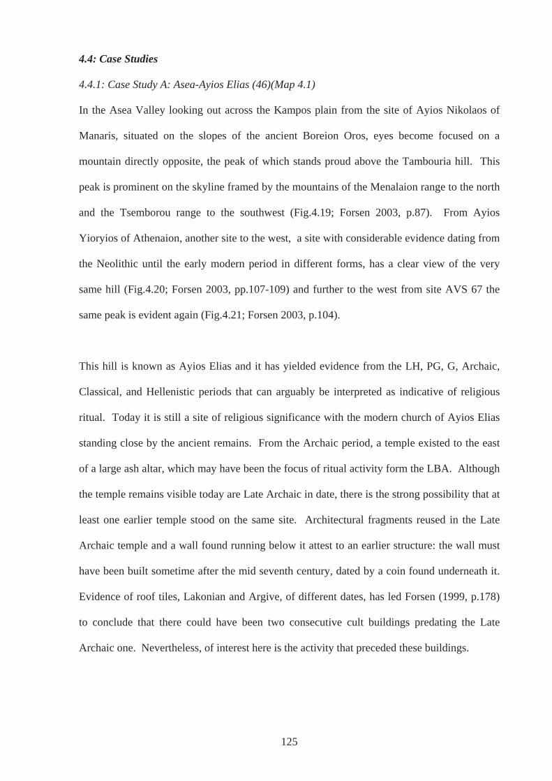
125
4.4: Case Studies
4.4.1: Case Study A: Asea-Ayios Elias (46)(Map 4.1)
In the Asea Valley looking out across the Kampos plain from the site of Ayios Nikolaos of
Manaris, situated on the slopes of the ancient Boreion Oros, eyes become focused on a
mountain directly opposite, the peak of which stands proud above the Tambouria hill. This
peak is prominent on the skyline framed by the mountains of the Menalaion range to the north
and the Tsemborou range to the southwest (Fig.4.19; Forsen 2003, p.87). From Ayios
Yioryios of Athenaion, another site to the west, a site with considerable evidence dating from
the Neolithic until the early modern period in different forms, has a clear view of the very
same hill (Fig.4.20; Forsen 2003, pp.107-109) and further to the west from site AVS 67 the
same peak is evident again (Fig.4.21; Forsen 2003, p.104).
This hill is known as Ayios Elias and it has yielded evidence from the LH, PG, G, Archaic,
Classical, and Hellenistic periods that can arguably be interpreted as indicative of religious
ritual. Today it is still a site of religious significance with the modern church of Ayios Elias
standing close by the ancient remains. From the Archaic period, a temple existed to the east
of a large ash altar, which may have been the focus of ritual activity form the LBA. Although
the temple remains visible today are Late Archaic in date, there is the strong possibility that at
least one earlier temple stood on the same site. Architectural fragments reused in the Late
Archaic temple and a wall found running below it attest to an earlier structure: the wall must
have been built sometime after the mid seventh century, dated by a coin found underneath it.
Evidence of roof tiles, Lakonian and Argive, of different dates, has led Forsen (1999, p.178)
to conclude that there could have been two consecutive cult buildings predating the Late
Archaic one. Nevertheless, of interest here is the activity that preceded these buildings.
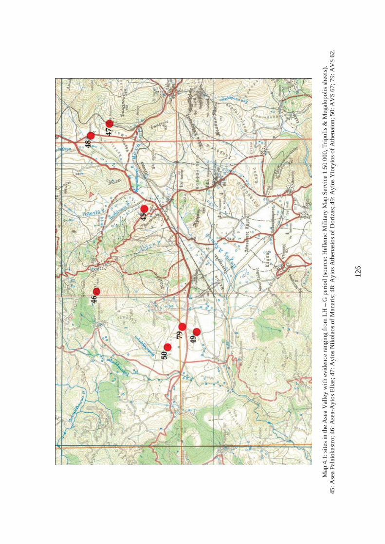
Map
4.1
: site
s in
the
Ase
a V
alle
y w
ith e
vide
nce
rang
ing
from
LH
– G
per
iod
(sou
rce:
Hel
leni
c M
ilita
ry M
ap S
ervi
ce 1
:50
000,
Trip
olis
& M
egal
opol
is sh
eets
). 45
: Ase
a Pa
laio
kast
ro; 4
6: A
sea-
Ayi
os E
lias;
47:
Ayi
os N
ikol
aos o
f Man
aris
; 48:
Ayi
os A
then
asio
s of D
oriz
as; 4
9: A
yios
Yio
ryio
s of A
then
aion
; 50:
AV
S 67
; 79:
AV
S 62
.
126
Fig.
4.19
: vie
w fr
om A
yios
Nik
olao
s of M
anar
is, t
he p
eak
of A
yios
Elia
s in
the
cent
re d
ista
nce
(pho
to: a
utho
r).
Fig.
4.20
: vie
w to
NE
from
Ayi
os Y
iory
ios o
f Ath
enai
on (p
hoto
: aut
hor)
.
Fig.
4.21
: pan
oram
ic v
iew
with
Ayi
os E
lias t
o E
from
site
AV
S 67
(pho
to: a
utho
r)
127
Abundant finds of the eighth-seventh centuries BCE in the form of pottery and metal votives,
are centred on and around the ash altar mentioned above. This continued in use after the
temple had been built suggesting that the site had been home to similar, albeit open-air, cult
activity before the monumental structures were built. From the ash altar came Lakonian PG
or ‘Dark Age’ sherds, such as a skyphos rim, and large amounts of LG and Archaic votive
offerings in a wide range of material, including bronze, lead, iron, bone, glass, and terracotta,
gold and possibly ivory. There has also been a handful of unstratified Mycenaean and PG
artefacts, including what has been described as a beautiful LHIII conical conulus of steatite
and probable LHIIIC sherds of a large closed vessel, a jar or amphora (Forsen 1999, p.179).
Altars and bonfires are a feature at many ancient Greek sacred places, particularly at Minoan
peak sanctuaries (Peatfield 1983). These may have had links with animal sacrifices, but may
just as well have been the focus of dumping refuse after a sacral meal. It has been pointed out
that bonfires would not be particularly well suited to conducting animal sacrifices, as
participants would not be able to get closer than five metres to carry out such proceedings
(Peatfield 1983, p.30). The remains at Asea-Ayios Elias may be the remains of small
controlled fires, outdoor hearths where people could conceivably gather. The altar as we see
it today may be the result of hundreds of such episodes. There will be more information when
the excavation reports are published. However, it appears that many votives were thrown into
the fires; whether these were ‘new’ votives is unsure. Such objects may have been thrown in
as part of a purification rite, which entailed a cleaning out of the sanctuary. Votives that had
been given on previous occasions were perhaps ‘re-dedicated’ in a ‘festival of renewal’
(Bergquist 1988, pp.49-50).
The mountain on which the sanctuary stands is approximately 1090m above sea level. There
is evidence of habitation in the medieval period (see Fig.4.22) but none from before this date.
If the evidence of the LBA and PG periods is accepted as sacred in nature then this hill has
128
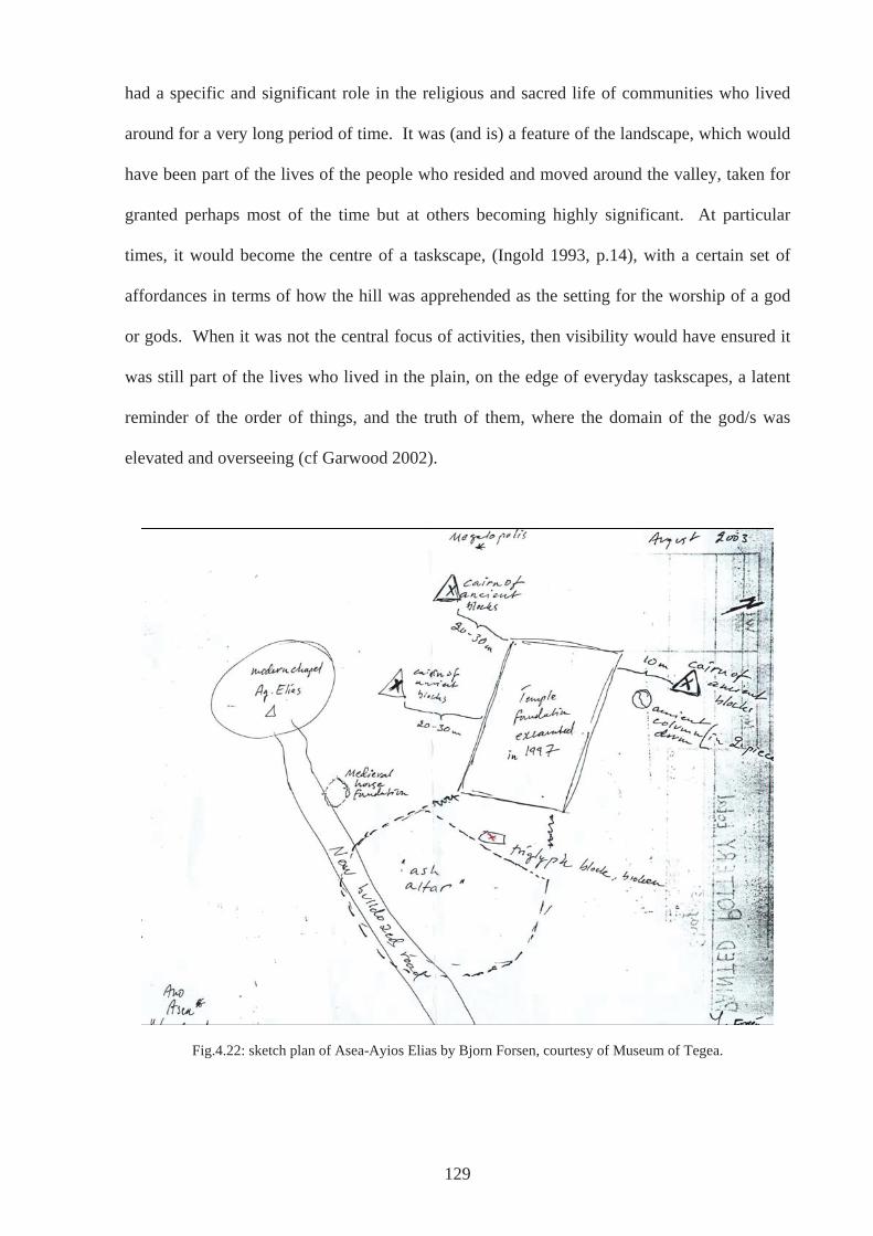
had a specific and significant role in the religious and sacred life of communities who lived
around for a very long period of time. It was (and is) a feature of the landscape, which would
have been part of the lives of the people who resided and moved around the valley, taken for
granted perhaps most of the time but at others becoming highly significant. At particular
times, it would become the centre of a taskscape, (Ingold 1993, p.14), with a certain set of
affordances in terms of how the hill was apprehended as the setting for the worship of a god
or gods. When it was not the central focus of activities, then visibility would have ensured it
was still part of the lives who lived in the plain, on the edge of everyday taskscapes, a latent
reminder of the order of things, and the truth of them, where the domain of the god/s was
elevated and overseeing (cf Garwood 2002).
Fig.4.22: sketch plan of Asea-Ayios Elias by Bjorn Forsen, courtesy of Museum of Tegea.
129
The surrounding valley stands at approximately 650m above sea level and thus the climb to
the peak is a noteworthy one, not particularly difficult and one in which most could
participate, but a journey that needed some planning nonetheless. Sacred sites in high places
is a feature in many periods and places (Carmichael 1994): many divinities are thought of as
residing in the ‘heavens’ or on top of imaginary high places for example, Mount Olympus in a
ancient Greek context. It seems that height indicated closeness to the divinity (or divinities)
being worshipped. It also separated places of worship from the places of everyday.
The aspect of the journey is significant when considering the artefacts used and deposited on
the summit. Most offerings and votives were miniatures, and therefore highly portable. A
person could quite easily transport the conulus of steatite found, for example, that belongs to
the LHIIIB period. Unfortunately this particular piece was found unstratified (Forsen 1999,
p.179), presumably being relocated when the road was bulldozed through the edge of the ash
altar (Fig.4.22 & 4.23). It could have been curated and deposited at a later date, perhaps
passed on for a number of generations and given as an offering at an event of particular
significance for the person to whom it belonged. There is an instance in Arkadia, at
Pallantion, where a LBA head was dedicated c.500-475 BCE dated by an inscription on it,
indicating that such behaviour did occur (Jeffrey 1990, p.449, Arkadia no.11; Iozzo & Pagano
1995, cat. 196; Morgan 1999, pp.397-8). Of course, the conulus could also have been either
lost, in the LH period or later, without ever having particular religious meaning attached to it.
The ash altar (Fig.4.23) is positioned on the eastern side of the hill, to the west of the remains
of the stone temple. Before the first temple was built this area presumably was an open space,
an area in which the participants of the rites being practised stood, watched, took part, and
performed, although such rituals could also have been performed on the very summit, where
the modern chapel of Ayios Elias is situated. One reason that the ash altar may have been
130
positioned in the place it was, may have been dictated in part or wholly by practical reasons
such as local winds. Participants would not want to be disabled by choking smoke and so the
eastern side may have made sure that smoke was blown free of the ‘performance area’
This would have had consequences, intended and/or unintended, both for those taking part on
the summit and those in the valleys and plains around, who could or could not see the results
of burning. As has been recognised at peak sanctuaries in Crete (Peatfield 1983, p.276), fires
that may have been burnt on top of Ayios Elias may well have been intended as beacons, lit in
order to be seen. The first sign of smoke wafting from the peak of Ayios Elias would have
been visible to many in the Asea Valley but also to those beyond in the eastern valleys and the
plain of Tripolis, which can easily be seen from the top when the weather is clear. Because it
would be visible from a long distance, particularly at certain times of the year, it was perhaps
used by communities from quite far afield. The beacon and smoke ‘signal’ could have been a
call at certain times for people to begin a journey from the eastern plains to that of Asea and
the mountain of Ayios Elias. The length of journey may have dictated whether people began
at all: if activities had ceased on arrival, presumably they would not return the next year or
would have negotiated a lengthening of rites over a number of days. Travellers may have
been welcomed and encouraged to come repeatedly, or limited to only certain times of the
year, or perhaps they were rejected from the outset. Subsequent sightings of fire and smoke
would have been a message to others that they were outside and beyond the acts and the
landscapes in which they were taking place.
However, the fire and smoke from burning sacrifices, or partaking in sacred feasting seen to
the east, would not have been so visible from the west, towards the plain of Megalopolis. If
the ‘altar’ was lit as a beacon and was meant to be seen then the fact it was obscured from the
west may very well have been quite deliberate (cf Peatfield 1983, p.276). This would have
131
132
affected relations between participants on Ayios Elias and those who lived on the edge of, or
on, the Megalopolis plain, although at present there is no evidence from the plain itself and
very little from the edge datable to the period in question (Roy et al. 1992). In part, these
people may not have been aware of any activity if it was not seen and thus not affected, as
those to the east would have been had they seen and been refused access. On the other hand,
those to the west may have heard from others, thus aware of their exclusion, not knowing
through any visible means when such activity was taking place, maybe only hearing after the
event. This may have been an unintended consequence of positioning the altar where it was,
but one that was real and would have affected the lives of those living to the west of the hill
and those living in the valley and using the hill. Once on the hill, the group of participants
performing rituals, although they would have their view of the east obscured by smoke and
the altar would have been facing in this direction with their attention on the sacrifices, their
backs turned physically towards the west (Fig.4.24 & 4.25).
Of course, these are things about which we can only conjecture, although the existence of
Lakonian PG may suggest that people from over the Tsemborou range, could have joined in
with activities. This inclusion or exclusion could have changed quite frequently, depending
on relations that were sustained or broken with groups in contact with one another from
neighbouring valleys or further afield. Forsen (1999, p.186) argues that this site, from the
beginning, was the focal point of several communities in the southern Mainalon district of
Arkadia and continued as such when poleis in the region were developing. This is in contrast
to an earlier suggestion that the sanctuary was extra-urban in nature, delimiting the territory of
the polis of Asea or according to Jost (1985, p.200) the territory of Peraitheis to the north
(Fig.4.26).
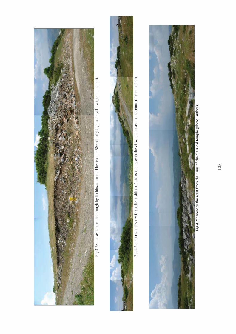
Fi
g.4.
23: t
he a
sh a
ltar c
ut th
roug
h by
bul
ldoz
ed ro
ad.
The
scal
e of
50c
m is
hig
hlig
hted
in y
ello
w (p
hoto
: aut
hor)
.
Fi
g.4.
24: p
anor
amic
vie
w fr
om th
e po
sitio
n of
the
ash
alta
r, w
ith th
e vi
ew to
the
east
in th
e ce
ntre
(pho
to: a
utho
r)
Fi
g.4.
25: v
iew
to th
e w
est f
rom
the
ruin
s of t
he c
lass
ical
tem
ple
(pho
to: a
utho
r).
133
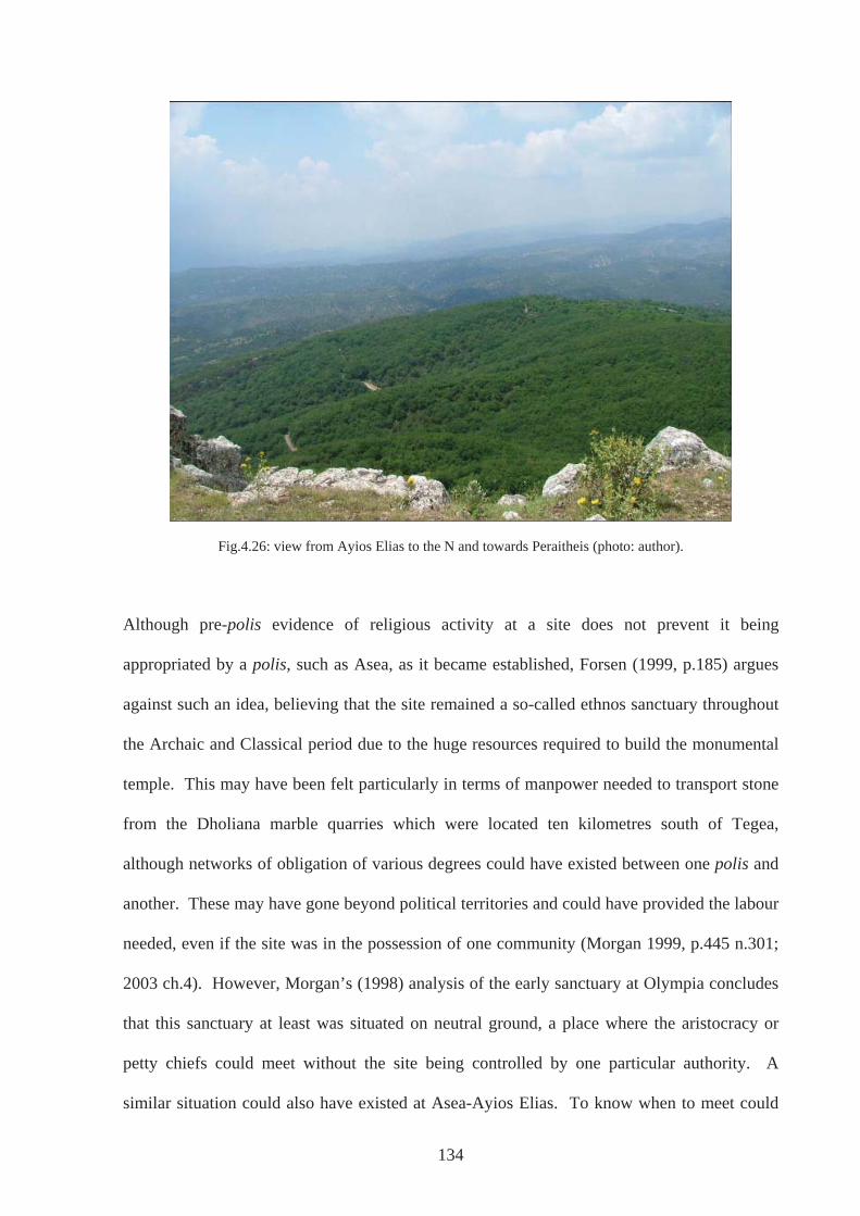
Fig.4.26: view from Ayios Elias to the N and towards Peraitheis (photo: author).
Although pre-polis evidence of religious activity at a site does not prevent it being
appropriated by a polis, such as Asea, as it became established, Forsen (1999, p.185) argues
against such an idea, believing that the site remained a so-called ethnos sanctuary throughout
the Archaic and Classical period due to the huge resources required to build the monumental
temple. This may have been felt particularly in terms of manpower needed to transport stone
from the Dholiana marble quarries which were located ten kilometres south of Tegea,
although networks of obligation of various degrees could have existed between one polis and
another. These may have gone beyond political territories and could have provided the labour
needed, even if the site was in the possession of one community (Morgan 1999, p.445 n.301;
2003 ch.4). However, Morgan’s (1998) analysis of the early sanctuary at Olympia concludes
that this sanctuary at least was situated on neutral ground, a place where the aristocracy or
petty chiefs could meet without the site being controlled by one particular authority. A
similar situation could also have existed at Asea-Ayios Elias. To know when to meet could
134
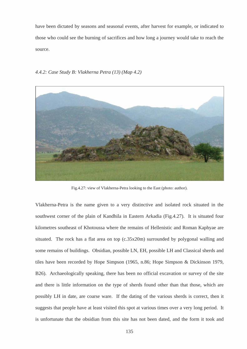
have been dictated by seasons and seasonal events, after harvest for example, or indicated to
those who could see the burning of sacrifices and how long a journey would take to reach the
source.
4.4.2: Case Study B: Vlakherna Petra (13) (Map 4.2)
Fig.4.27: view of Vlakherna-Petra looking to the East (photo: author).
Vlakherna-Petra is the name given to a very distinctive and isolated rock situated in the
southwest corner of the plain of Kandhila in Eastern Arkadia (Fig.4.27). It is situated four
kilometres southeast of Khotoussa where the remains of Hellenistic and Roman Kaphyae are
situated. The rock has a flat area on top (c.35x20m) surrounded by polygonal walling and
some remains of buildings. Obsidian, possible LN, EH, possible LH and Classical sherds and
tiles have been recorded by Hope Simpson (1965, n.86; Hope Simpson & Dickinson 1979,
B26). Archaeologically speaking, there has been no official excavation or survey of the site
and there is little information on the type of sherds found other than that those, which are
possibly LH in date, are coarse ware. If the dating of the various sherds is correct, then it
suggests that people have at least visited this spot at various times over a very long period. It
is unfortunate that the obsidian from this site has not been dated, and the form it took and
135
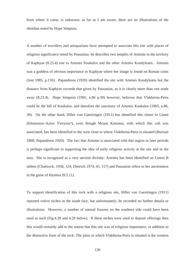
from where it came, is unknown: as far as I am aware, there are no illustrations of the
obsidian noted by Hope Simpson.
A number of travellers and antiquarians have attempted to associate this site with places of
religious significance noted by Pausanias: he describes two temples of Artemis in the territory
of Kaphyae (8.23.4) one to Artemis Knakalos and the other Artemis Kondyleatis. Artemis
was a goddess of obvious importance to Kaphyae where her image is found on Roman coins
(Jost 1985, p.110). Papandreou (1920) identified the site with Artemis Kondyleatis but the
distance from Kaphyae exceeds that given by Pausanias, as it is clearly more than one stade
away (8.23.4). Hope Simpson (1965, n.86 p.39) however, believes that Vlakherna-Petra
could be the hill of Knakalos, and therefore the sanctuary of Artemis Knakalos (1965, n.86,
39). On the other hand, Hiller von Gaertringen (1911) has identified this closer to Limni
(Khotoussa–Ayios Yioryios?), even though Mount Kastania, with which this cult was
associated, has been identified to the west close to where Vlakherna-Petra is situated (Bursian
1868; Papandreou 1920). The fact that Artemis is associated with this region in later periods
is perhaps significant in supporting the idea of early religious activity at the site and in the
area. She is recognised as a very ancient divinity: Artemis has been identified on Linear B
tablets (Chadwick, 1958, 124; Dietrich 1974, 65, 157) and Pausanias refers to her ancientness
in the guise of Hymnia (8.5.11).
To support identification of this rock with a religious site, Hiller von Gaertringen (1911)
reported votive niches in the south face, but unfortunately, he recorded no further details or
illustrations. However, a number of natural fissures on the southern side could have been
used as such (Fig.4.28 and 4.29 below). If these niches were used to deposit offerings then
this would certainly add to the notion that this site was of religious importance, in addition to
the distinctive form of the rock. The plain in which Vlakherna-Petra is situated is the western
136
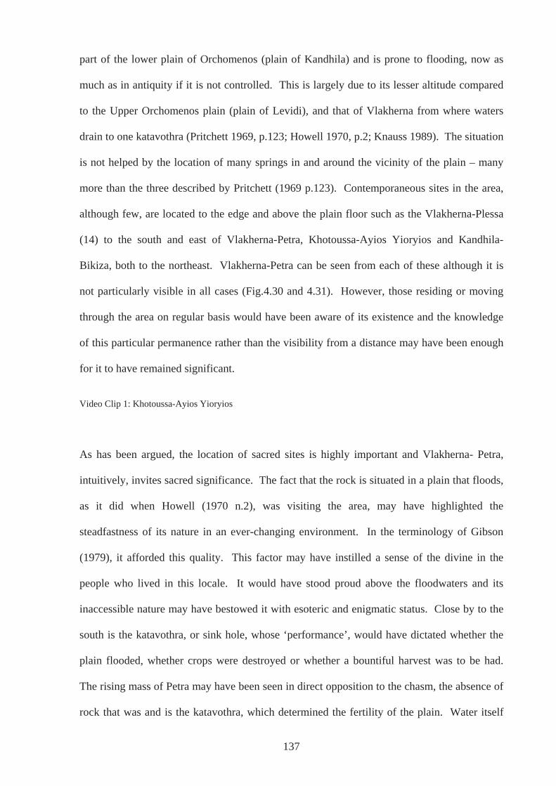
part of the lower plain of Orchomenos (plain of Kandhila) and is prone to flooding, now as
much as in antiquity if it is not controlled. This is largely due to its lesser altitude compared
to the Upper Orchomenos plain (plain of Levidi), and that of Vlakherna from where waters
drain to one katavothra (Pritchett 1969, p.123; Howell 1970, p.2; Knauss 1989). The situation
is not helped by the location of many springs in and around the vicinity of the plain – many
more than the three described by Pritchett (1969 p.123). Contemporaneous sites in the area,
although few, are located to the edge and above the plain floor such as the Vlakherna-Plessa
(14) to the south and east of Vlakherna-Petra, Khotoussa-Ayios Yioryios and Kandhila-
Bikiza, both to the northeast. Vlakherna-Petra can be seen from each of these although it is
not particularly visible in all cases (Fig.4.30 and 4.31). However, those residing or moving
through the area on regular basis would have been aware of its existence and the knowledge
of this particular permanence rather than the visibility from a distance may have been enough
for it to have remained significant.
Video Clip 1: Khotoussa-Ayios Yioryios
As has been argued, the location of sacred sites is highly important and Vlakherna- Petra,
intuitively, invites sacred significance. The fact that the rock is situated in a plain that floods,
as it did when Howell (1970 n.2), was visiting the area, may have highlighted the
steadfastness of its nature in an ever-changing environment. In the terminology of Gibson
(1979), it afforded this quality. This factor may have instilled a sense of the divine in the
people who lived in this locale. It would have stood proud above the floodwaters and its
inaccessible nature may have bestowed it with esoteric and enigmatic status. Close by to the
south is the katavothra, or sink hole, whose ‘performance’, would have dictated whether the
plain flooded, whether crops were destroyed or whether a bountiful harvest was to be had.
The rising mass of Petra may have been seen in direct opposition to the chasm, the absence of
rock that was and is the katavothra, which determined the fertility of the plain. Water itself
137
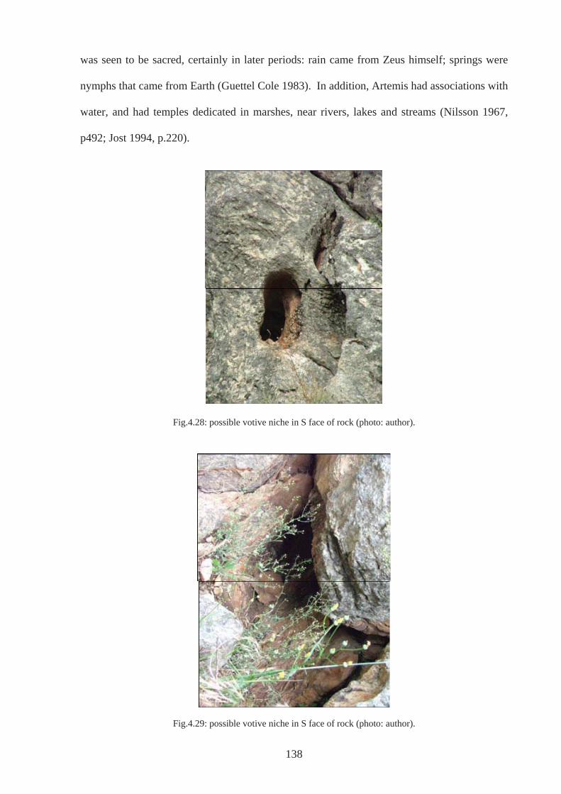
138
was seen to be sacred, certainly in later periods: rain came from Zeus himself; springs were
nymphs that came from Earth (Guettel Cole 1983). In addition, Artemis had associations with
water, and had temples dedicated in marshes, near rivers, lakes and streams (Nilsson 1967,
p492; Jost 1994, p.220).
Fig.4.28: possible votive niche in S face of rock (photo: author).
Fig.4.29: possible votive niche in S face of rock (photo: author).
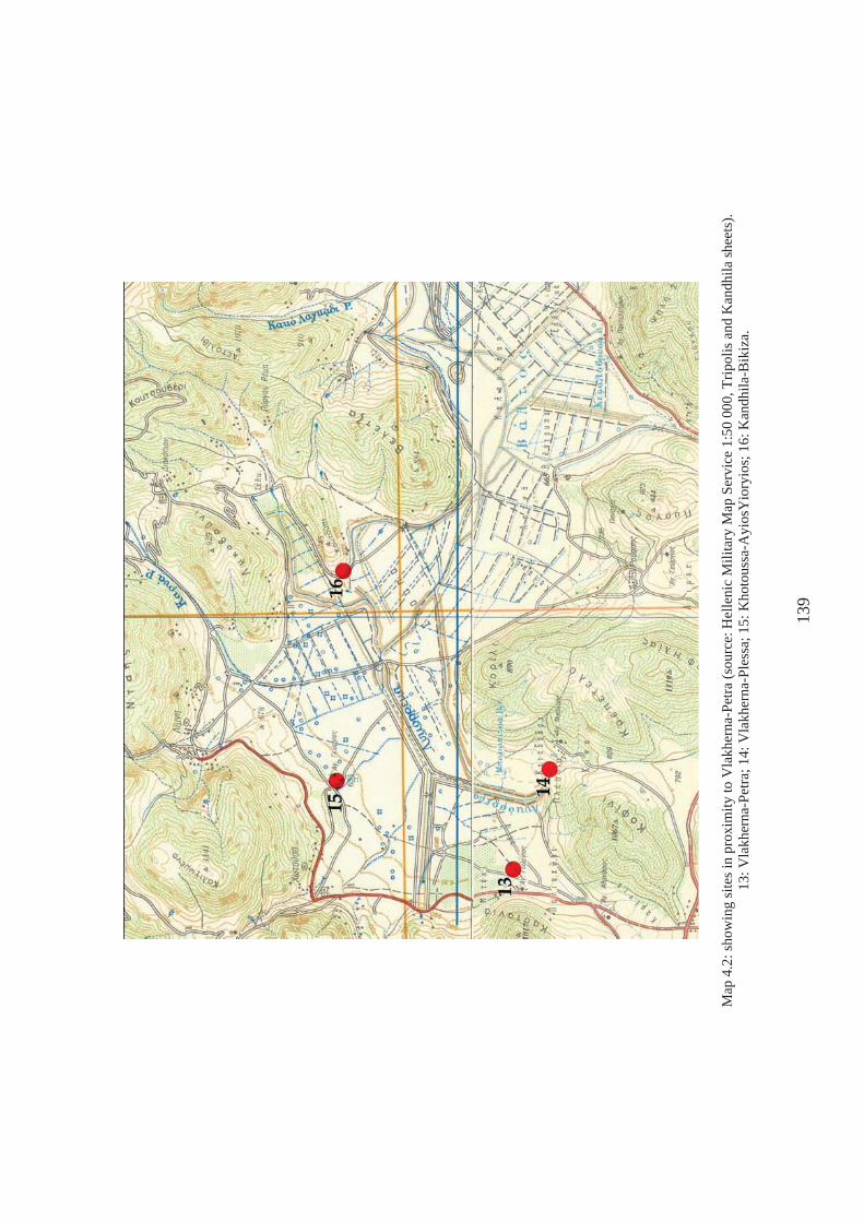
Map
4.2
: sho
win
g si
tes i
n pr
oxim
ity to
Vla
kher
na-P
etra
(sou
rce:
Hel
leni
c M
ilita
ry M
ap S
ervi
ce 1
:50
000,
Trip
olis
and
Kan
dhila
shee
ts).
13: V
lakh
erna
-Pet
ra; 1
4: V
lakh
erna
-Ple
ssa;
15:
Kho
tous
sa-A
yios
Yio
ryio
s; 1
6: K
andh
ila-B
ikiz
a.
139
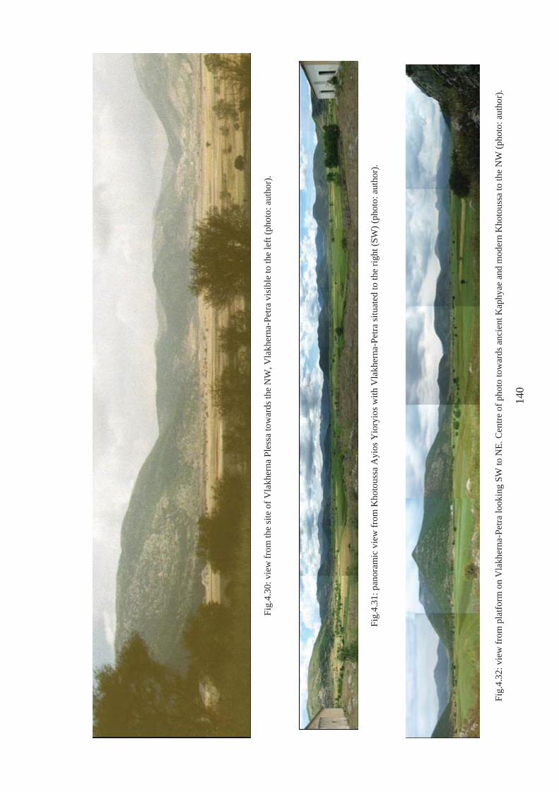
Fig.
4.30
: vie
w fr
om th
e si
te o
f Vla
kher
na P
less
a to
war
ds th
e N
W, V
lakh
erna
-Pet
ra v
isib
le to
the
left
(pho
to: a
utho
r).
Fig.
4.31
: pan
oram
ic v
iew
from
Kho
tous
sa A
yios
Yio
ryio
s with
Vla
kher
na-P
etra
situ
ated
to th
e rig
ht (S
W) (
phot
o: a
utho
r).
Fig.
4.32
: vie
w fr
om p
latfo
rm o
n V
lakh
erna
-Pet
ra lo
okin
g SW
to N
E. C
entre
of p
hoto
tow
ards
anc
ient
Kap
hyae
and
mod
ern
Kho
tous
sa to
the
NW
(pho
to: a
utho
r).
140
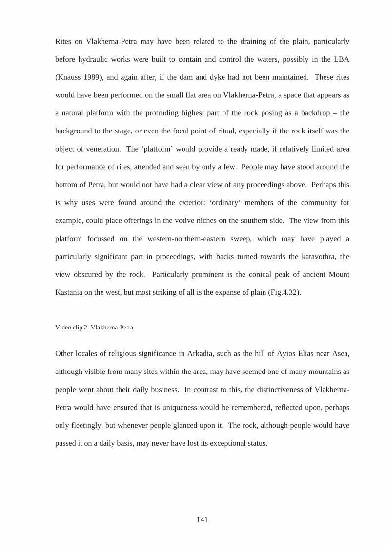
Rites on Vlakherna-Petra may have been related to the draining of the plain, particularly
before hydraulic works were built to contain and control the waters, possibly in the LBA
(Knauss 1989), and again after, if the dam and dyke had not been maintained. These rites
would have been performed on the small flat area on Vlakherna-Petra, a space that appears as
a natural platform with the protruding highest part of the rock posing as a backdrop – the
background to the stage, or even the focal point of ritual, especially if the rock itself was the
object of veneration. The ‘platform’ would provide a ready made, if relatively limited area
for performance of rites, attended and seen by only a few. People may have stood around the
bottom of Petra, but would not have had a clear view of any proceedings above. Perhaps this
is why uses were found around the exterior: ‘ordinary’ members of the community for
example, could place offerings in the votive niches on the southern side. The view from this
platform focussed on the western-northern-eastern sweep, which may have played a
particularly significant part in proceedings, with backs turned towards the katavothra, the
view obscured by the rock. Particularly prominent is the conical peak of ancient Mount
Kastania on the west, but most striking of all is the expanse of plain (Fig.4.32).
Video clip 2: Vlakherna-Petra
Other locales of religious significance in Arkadia, such as the hill of Ayios Elias near Asea,
although visible from many sites within the area, may have seemed one of many mountains as
people went about their daily business. In contrast to this, the distinctiveness of Vlakherna-
Petra would have ensured that is uniqueness would be remembered, reflected upon, perhaps
only fleetingly, but whenever people glanced upon it. The rock, although people would have
passed it on a daily basis, may never have lost its exceptional status.
141
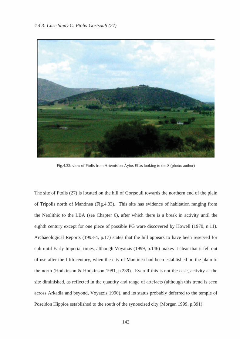
4.4.3: Case Study C: Ptolis-Gortsouli (27)
Fig.4.33: view of Ptolis from Artemision-Ayios Elias looking to the S (photo: author)
The site of Ptolis (27) is located on the hill of Gortsouli towards the northern end of the plain
of Tripolis north of Mantinea (Fig.4.33). This site has evidence of habitation ranging from
the Neolithic to the LBA (see Chapter 6), after which there is a break in activity until the
eighth century except for one piece of possible PG ware discovered by Howell (1970, n.11).
Archaeological Reports (1993-4, p.17) states that the hill appears to have been reserved for
cult until Early Imperial times, although Voyatzis (1999, p.146) makes it clear that it fell out
of use after the fifth century, when the city of Mantinea had been established on the plain to
the north (Hodkinson & Hodkinson 1981, p.239). Even if this is not the case, activity at the
site diminished, as reflected in the quantity and range of artefacts (although this trend is seen
across Arkadia and beyond, Voyatzis 1990), and its status probably deferred to the temple of
Poseidon Hippios established to the south of the synoecised city (Morgan 1999, p.391).
142
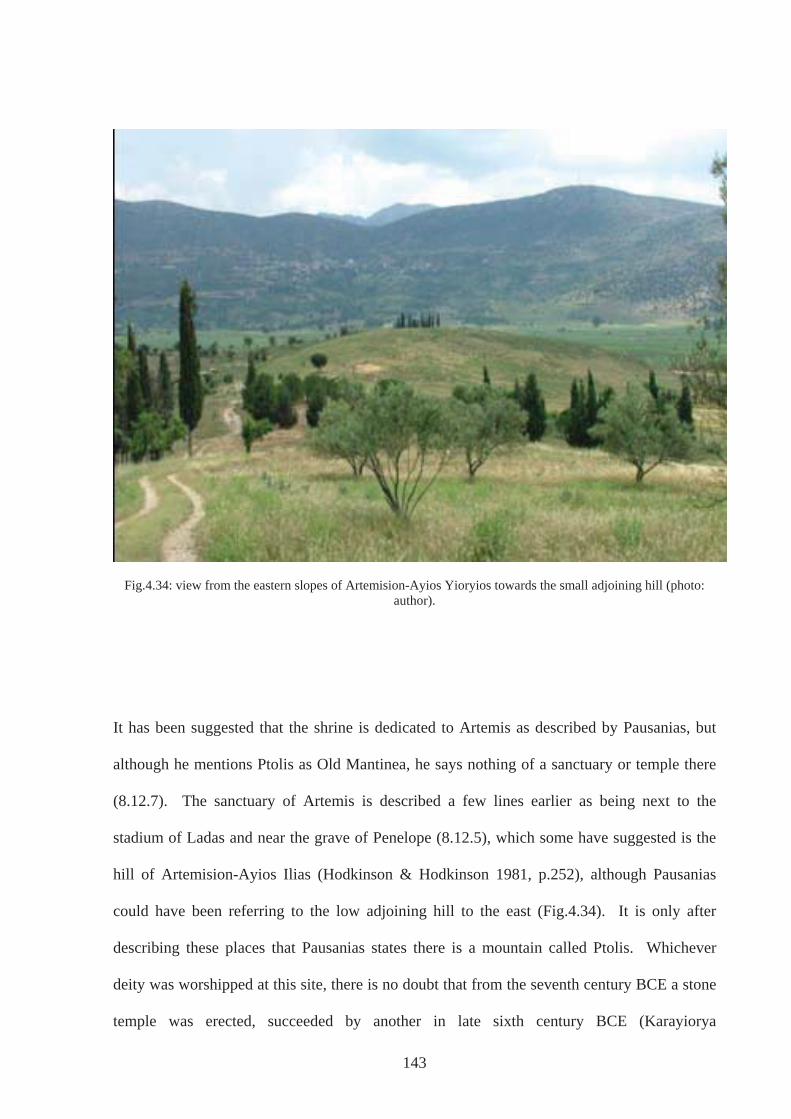
Fig.4.34: view from the eastern slopes of Artemision-Ayios Yioryios towards the small adjoining hill (photo: author).
It has been suggested that the shrine is dedicated to Artemis as described by Pausanias, but
although he mentions Ptolis as Old Mantinea, he says nothing of a sanctuary or temple there
(8.12.7). The sanctuary of Artemis is described a few lines earlier as being next to the
stadium of Ladas and near the grave of Penelope (8.12.5), which some have suggested is the
hill of Artemision-Ayios Ilias (Hodkinson & Hodkinson 1981, p.252), although Pausanias
could have been referring to the low adjoining hill to the east (Fig.4.34). It is only after
describing these places that Pausanias states there is a mountain called Ptolis. Whichever
deity was worshipped at this site, there is no doubt that from the seventh century BCE a stone
temple was erected, succeeded by another in late sixth century BCE (Karayiorya
143
144
Stathakopoulou 1989; 1992-3; Voyatzis 1999, p.133). Deposits of G or sub-Geometric
material at the same site are votive in nature. There is some debate over the position of this
evidence and whether deposits of the late eighth/early seventh century evidence were found at
two separate temple sites on the hill, as suggested by Mazarakis Ainian (1997, p.336), in
addition to indicating habitation. However, both Morgan (1999, p.390) and Voyatzis (1999,
p.133) believe that there was indeed one sanctuary that dated back to the end of the eighth
century with the hill having a specifically sacred function from this time onwards.
That a sacred site has been located on a hill that was a settlement in the LH period raises the
question as to why this place? In accordance with other authors (e.g. Gadolou, 2002), this
would certainly have been significant and particularly pertinent if, as evidence so far suggests,
the area saw little activity in the years following the end of the BA. The single sherd of PG
pottery noted by Howell (1970, no.11) does not go far in changing this picture although it
may indicate that the locale was not entirely deserted. Choosing this place to dedicate
offerings to a divinity, a group was (re)stating its connections with the area and legitimising
its claim - a return of the same people whether perceived or actual. Although the worship
may have been to a particular divinity from the outset, there may also have been a sense of
ancestor worship, again almost irrelevant whether real or appropriated. If there were a few
inhabitants around, such acts may have convinced them of the truth others were espousing or
a growing population may have needed an increasingly common site for religious activity.
Such a placing may support the idea of memory and tradition kept alive, that a group moving
away had always meant to come back. Perhaps they could see remains that either convinced
them they had come to right place or that inspired such tales
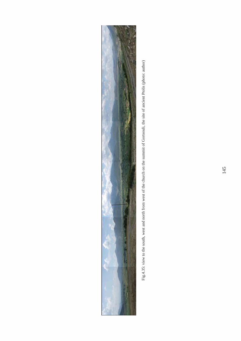
Fig.
4.35
: vie
w to
the
sout
h, w
est a
nd n
orth
from
wes
t of t
he c
hurc
h on
the
sum
mit
of G
orts
ouli,
the
site
of a
ncie
nt P
tolis
(pho
to: a
utho
r)
145
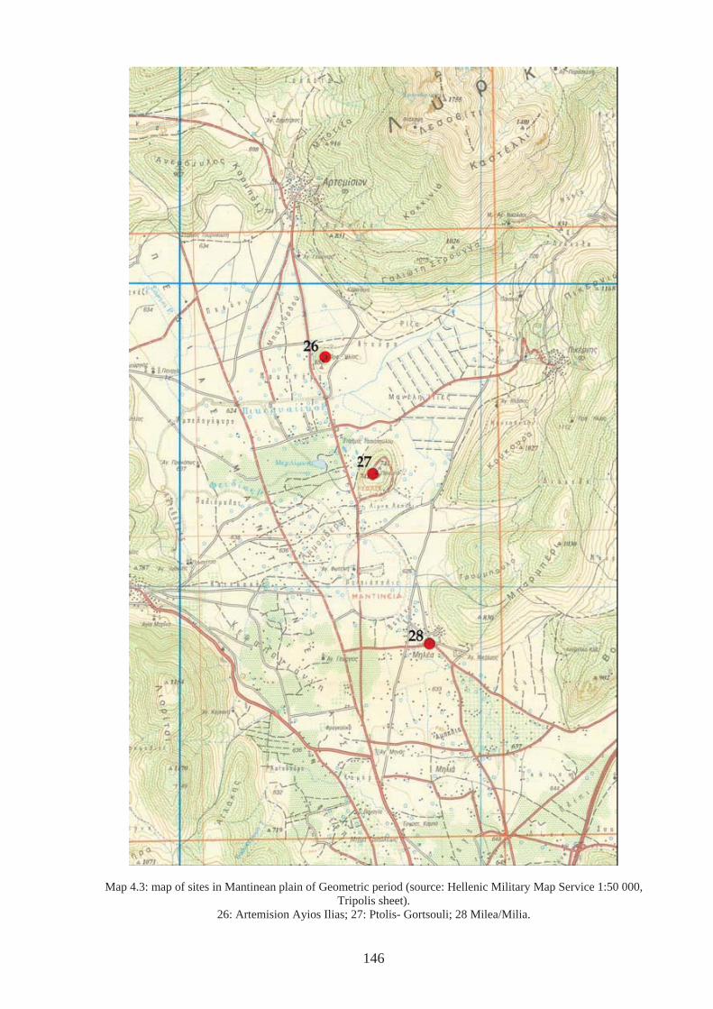
Map 4.3: map of sites in Mantinean plain of Geometric period (source: Hellenic Military Map Service 1:50 000, Tripolis sheet).
26: Artemision Ayios Ilias; 27: Ptolis- Gortsouli; 28 Milea/Milia.
146
However, Ptolis was also an elevated place. Perhaps not a high place in terms of a peak
sanctuary or of the same ‘stature’ as Asea-Ayios Yioryios, but if as yet undiscovered
settlements were dotted around the plain for the G and following periods (until the foundation
of Mantinea) as Morgan (1999, p.390) believes, then its location meant the sanctuary was
distanced from the everyday. This is comparable to the way the dead was buried on the
neighbouring hill to the north (Artemision-Ayios Ilias (26) Map 4.3 & see Chapter 5), in both
cases in a very physical way. The height also means there are incredible views across the
whole of the Mantinean plain, especially from the summit (Fig.4.36 and video clip 3).
However, from the site of the temple, views to the south are somewhat obscured by a rise in
the natural level, so that views around are limited to the west and northern sections of the
surrounding landscape (video clip 4). If, as has been suggested (e.g. Voyatzis 1999, p.146),
the sanctuary was abandoned when the city of Mantinea was formed in plain at the end of the
Archaic or early Classical period, the positioning of the temple may have been significant.
If it could not be seen from the city site in the plain it may have fallen out of the new
community’s consciousness, especially when concerned with developing new sanctuaries
within the city limits. This is not to say that religious life became circumscribed within the
physical boundaries of the city, indeed a new sanctuary of Poseidon Hippios was constructed
to south of the city walls (Jost 1985, pp.132-134; 1999, p.226). However, the site of Ptolis
may have been outside the physical taskscape or temporal landscape of those living in its
proximity. As Voyatzis (1999, p.146) points out, Ptolis, although considered to be ancient
Mantinea was not included within the new city’s walls built in the 4th century. This was
significant. Perhaps the old site had too many links with the past and a particular community,
group or family. It may have acquired negative values, which prohibited future activity, or
which had contributed to a decline (Chapman 2000, p.188). If it was too politically charged
and a neutral ground including neutral sanctuaries were called for, onto which new political
147
and power arrangements could be mapped, it was physically excluded from the newly
founded city. Indeed, the change in focus from Artemis on Ptolis to Poseidon south of
Mantinea may have reflected the overwhelmingly patriarchal nature of the polis. However,
even in cases where there is continuity in cult, it would need to be reinterpreted ‘within the
new world of the Greek city’ (Bruit Zaidman & Schmitt Pantel 2002, p.6). Here, religious
authority belonged to the people or the citizen body as a whole (demos) and performed by a
number of personnel on their behalf. Their role would have involved collaboration with other
city officials such as organising great festivals (Bruit Zaidman & Schmitt Pantel 2002, p 47).
The old order and previous mechanisms of control would not fit in with the new organisation.
Video clip 3: from summit of Ptolis-Gortsouli. Video clip 4: from temple site on Ptolis-Gortsouli
4.5: Conclusions
In the LH period, eight sites have possible associations with ritual activity as have been
outlined above. A number of these are associated with settlements: ancient Pheneos (6),
Orchomenos-Palaiopyrgos (25) and Kato Asea-Palaiokastro (45). Two others that have
proved difficult to interpret (?activity+ritual) are Loukas-Ayios Yioryios (31) and Vounon
(36). These sites are known through limited reconnaissance (Loring 1895, p.34; Meyer 1954,
p.667; Howell 1970, no.16, no.27) and further exploration may prove enlightening. The
positions of the latter two sites certainly suggest favourable locations for settlement or, as has
been argued at least typical of the locations of Mycenaean settlements (e.g. Salavoura 2005
and see Chapter 6). The sites of Vlakherna-Petra (13), Temple of Athena Alea (34) and Asea-
Ayios Elias (46) appear to have had no association with a settlement, despite difficulties in
interpretation as discussed in section 4.3.
148
The majority of G religious sites are located in places different to those of the LH period.
Only one site has evidence pertaining to the whole period in question and that is the Temple
of Athena Alea at Tegea (34), although excavations at the site of Asea-Ayios Elias (46) have
revealed evidence from all except the SM period. The G ritual sites in all cases show
religious evidence un-associated with habitation, as far as can be ascertained, although in two
cases activity is related to earlier BA burials (Alea-Palaiokhori (40) and Vourvoura Analipsis
(44)). Although the SM and PG evidence is limited, and in the case of Orchomenos-
Palaiopyrgos very doubtful, the sites show perhaps the beginning of a trend away from
religious sites that are incorporated into or have associated settlements. What is tentatively
suggested from the above overviews of the various periods (4.2) and highlighted especially in
the case study of Ptolis-Gortsouli, is the change in organisation of the landscape in which
people lived and thus the relationship they had with it. As has been argued by Mazarakis
Ainian (1997, p.290), in the LH period religious activity was located close to habitation, often
sharing in space the chieftain or leader’s dwelling, and for this reason it may very well have
had much more integration into everyday life. Although, religious ritual activity by its very
definition consists of atypical behaviour that is removed from the everyday (Garwood 2002)
the landscape in which activity took place would have been familiar, albeit affording different
characteristics depending on the circumstances. Aspects of the landscape that may have been
passed over in the course of everyday activity would become the focus of intense awareness
during religious ritual (Thomas 2004b, p.175),
In contrast, although there is limited evidence of settlement in the PG and the following G
period (see Chapter 6), sites, based on current evidence, have the sole purpose of being
locations of religious activity and worship. The physical separation of these sites would have
been apparent. Aspects of the landscape that would not have been apprehended through
mundane everyday activity, or at least not at close quarters, would thus physically and
149
metaphorically remove deities away from the realm of human beings. Most of the G evidence
also belongs to sites that have continuity of evidence into the Archaic and Classical periods,
and have recognisable deities attached to them, belonging to an increasingly pan-Hellenic
pantheon, such as the Temples of Athena Alea at Tegea (34), and Alipheira (56), and the
Temple of Poseidon Hippios (?) at Petrovouni (73). The change from specific local deities
perhaps reflected in the epithets of gods and goddesses, for example, Alea at Tegea, may be a
reflection of the desire of communities to assimilate themselves and their religion into an
ever-more integrated far-reaching society that shared in a similar material culture, reflected in
an increasingly similar style of pottery. New elites emerging through innovative ways of
organising communities may have realised this was a way in which power could be
legitimated and authority validated, by being tied into a wider network of relations that would
be harder to refute or to undermine. Thinking in terms of Giddens’ work (e.g. 1984, passim),
the wider structure of ‘society’ was continually being formed and reproduced by the actions
of individuals whilst also restraining the possibilities of action.
However despite the general trends that can be seen, the case studies that have concentrated
on Asea-Ayios Elias and Vlakherna-Petra, show that generalisations naturally miss the
particular, so that when these are focussed upon a different picture of religious activity in the
LBA emerges. Both these sites have evidence, albeit not definite, of religious ritual in very
particular, visible, and isolated positions. They can be seen from a number of sites in the
vicinity and thus could very well have provided focal points for a number of communities that
lived around, as Forsen has suggested for Asea-Ayios Elias (1999, p.182). Both the lower
Orchomenos plain and the Asea Valley have afforded evidence of LBA sites in the vicinity
(sites 14, 15, 16, 17 around Vlakherna-Petra; sites 45, 47, 48, 49, 50 and 79 in the Asea
Valley). However the individual nature of each location, should warn against uniting the two
together as the same type of site. Vlakherna-Petra is strikingly unique and as such would
150
have had a unique affect on the consciousness of those who lived in the vicinity. As
suggested above, this particular site may have had particular association with the katavothra
to the south, an association that was alien and incomparable to other sites of religious
importance. On the other hand, the hill of Ayios Elias is a mountain in the vicinity of other
mountains, and the scale is significantly larger than that at Vlakherna. It is this balance of the
general and particular that should be constantly addressed. Not only would such different
situations have different affects on the consciousness of those experiencing them, these
locales would have had influenced the nature of rituals practised there, in terms of numbers,
frequency and visibility.
151
CHAPTER 5: LANDSCAPES OF DEATH AND BURIAL
5.1 Introduction
In the region of Arkadia, burial evidence exists for most of the period with which this study is
concerned. In this chapter, this evidence is explored. Section 5.2 is an overview and notes
the typical burial forms for each period in the Greek world in general, before naming and
giving a brief description of the sites that are found in Arkadia. Section 5.3 offers a critical
analysis of disciplinary approaches to burial and outlines the ways burial evidence has been
used to understand the past, which has usually involved discussion as to how and to what
extent burial evidence reflects the situation of the living. Following on from this Section 5.4
draws on four landscape ‘areas’ as case studies: the northeast (plains of Stymphalos and
Pheneos (5, 5.4.1); the south east (Vourvoura Analipsis (44) and Alea Palaiokhori (40),
5.4.2); the west (Palaiokastro (61) and Kalliani–Ayios Yioryios (70) 5.4.3); and the east
(Milea (28) and Artemision – Ayios Ilias (26) 5.4.4). These are explored using the approach
to landscape as clarified in Chapter 3 in an effort to enable further understandings of how
living people and communities dealt with death and the dead.
5.2 Overview
5.2.1 Late Helladic burial evidence in Greece
Late Helladic or Mycenaean burials have been categorized as either monumental tombs or
simple graves (Lewartowski 2000, p.1). The monumental tombs category includes tholoi,
chamber tombs and any variations on these types (Dickinson 1994, p.225). These have been
the subject of most studies on Mycenaean burial customs (e.g. Pelon 1976; Muller 1989;
Kontorli-Papadopoulou 1995; Branigan 1998; Cavanagh & Mee 1998). Simple graves have
received less attention in the literature, despite the fact that there are over 2000 examples
(Lewartowski 2000, p.1). This type includes pit and cist graves, shaft graves, pithos burials,
152
urn-burials (in-urned cremations), pit caves, pit shafts and burials in wells and caves. In
general terms, monumental tombs were intended for multiple burials over a period of time,
whereas simple forms were intended for a single burial at one moment in time. However, the
division between ‘monumental’ and ‘simple’ graves is somewhat arbitrary: simple burial
types have been found within the multiple tomb types, such as pit graves or urn burials (in-
urned cremations) within chamber tombs; and in a few cases more than one burial has been
found in simple grave types (Lewartowski 1995, p.104). In addition, it is not unusual for cist
graves and pithos burials to be found grouped with multiple types.
Due to the focus of most studies of Mycenaean burial practices and despite the range of types,
this period is often connected solely with large monumental tombs and multiple burials, and
whilst it may be true that the chamber tomb and tholos tomb are the most common tomb types
in regions within the Mycenaean koine, regional differences are readily apparent. For
instance, Messenia is often cited as the centre of development for the tholos tomb with one of
the earliest examples of a tholos located at Koryphasion near Pylos (Korres 1981-82, p.378-
81; Lolos 1989) and the region is home to most of the known examples (Snodgrass [1971]
2000, p.171; Dickinson 1994, p.225). However, chamber tombs are rare. In contrast, there
are, as of yet, no known examples of tholoi at Thebes in Boeotia. In addition, the use of pit
and cist graves persisted throughout the period in Messenia, a practice that in other regions,
such as the Argolid, became less common in LH III (Voutsaki 1995). Achaea also had a
tradition of using cist and pit graves, but here they were employed throughout the Mycenaean
period and beyond, and were often grouped together either by a surrounding enclosure or
under tumuli, and existed alongside large chamber tomb cemeteries (see case study C below;
Snodgrass [1971] 2000, p.170- 171). Although the above examples do not present a
comprehensive list, these few instances serve to illustrate some of the variations that existed
between regions during the Mycenaean period.
153
As for rite, most burials of the LBA are inhumations and are found in all regions of Greece
that fall within the sphere of Mycenaean influence. In some communal tombs, inhumations
are obviously secondary: once devoid of flesh, bones were moved to another part of the tomb
to make way for other interments, a process that could have required a further ritual involving
fires. Cases are numerous (Gallou 2005, p.113 n.1244), but examples exist at Mycenae
(Wace 1932; Gallou 2005, p.114), Prosymna (Blegen 1937; Gallou 2005, p.114) and
particularly with regard to the use of fires, in the Mesara tholoi (Branigan 1987, p.44ff; 1993,
p.124ff; 1998, p25-26; Gallou 2005, p.112). Bones could also have been brought to the tomb
after having been subject to excarnation elsewhere, which again perhaps involved a secondary
ritual (Dickinson 1994, p.209; Lewartowski 2000, p.54). It has been suggested that
excarnation may be one of the reasons why numbers of the dead, where detectable, are low,
compared with what might be expected (Dickinson 1994, p.208). Cremations are not
unknown but, as Dickinson (1994, p.209) states, they are so rare as to “invite special
explanation” (see also Snodgrass [1971] 2000, p.189). Isolated examples are known in areas
of the Peloponnese such as Elis (Agrapidokhori) Achaea (Kallithea) and Messenia (Tragana)
where they were found in chamber tombs (c.f. Palaiokastro (61 in Arkadia below) and a
number of urn cremations have been discovered under a tumulus at Khania near Mycenae
(AR 1984-5, p.21). In LHIIIC, the rite of cremation becomes more common, particularly in
the eastern regions of Greece such as the Argolid, Boeotia, Attica (e.g. Perati), the Aegean
Islands (e.g. Kos and Rhodes), and various sites on Crete (Snodgrass [1971] 2000, p.189;
Dickinson 1994, p.231).
The presence of grave goods is typical, at least in adult burials. Ornaments, sealstones,
various metal items, including weapons, are common, and in the LHIII period, figurines are
often found (Dickinson 1994, p.228). Gold items accompany bodies in the richest tombs such
as pieces of jewellery or seal rings (e.g. Dendra, Mycenae) and in some cases richly decorated
154
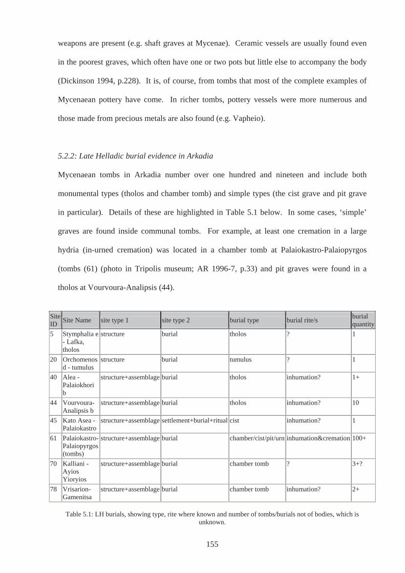
weapons are present (e.g. shaft graves at Mycenae). Ceramic vessels are usually found even
in the poorest graves, which often have one or two pots but little else to accompany the body
(Dickinson 1994, p.228). It is, of course, from tombs that most of the complete examples of
Mycenaean pottery have come. In richer tombs, pottery vessels were more numerous and
those made from precious metals are also found (e.g. Vapheio).
5.2.2: Late Helladic burial evidence in Arkadia
Mycenaean tombs in Arkadia number over one hundred and nineteen and include both
monumental types (tholos and chamber tomb) and simple types (the cist grave and pit grave
in particular). Details of these are highlighted in Table 5.1 below. In some cases, ‘simple’
graves are found inside communal tombs. For example, at least one cremation in a large
hydria (in-urned cremation) was located in a chamber tomb at Palaiokastro-Palaiopyrgos
(tombs (61) (photo in Tripolis museum; AR 1996-7, p.33) and pit graves were found in a
tholos at Vourvoura-Analipsis (44).
Site ID Site Name site type 1 site type 2 burial type burial rite/s burial
quantity5 Stymphalia e
- Lafka, tholos
structure burial tholos ? 1
20 Orchomenos d - tumulus
structure burial tumulus ? 1
40 Alea - Palaiokhori b
structure+assemblage burial tholos inhumation? 1+
44 Vourvoura-Analipsis b
structure+assemblage burial tholos inhumation? 10
45 Kato Asea - Palaiokastro
structure+assemblage settlement+burial+ritual cist inhumation? 1
61 Palaiokastro-Palaiopyrgos (tombs)
structure+assemblage burial chamber/cist/pit/urn inhumation&cremation 100+
70 Kalliani - Ayios Yioryios
structure+assemblage burial chamber tomb ? 3+?
78 Vrisarion-Gamenitsa
structure+assemblage burial chamber tomb inhumation? 2+
Table 5.1: LH burials, showing type, rite where known and number of tombs/burials not of bodies, which is
unknown.
155
As can be seen from Table 5.1, most Mycenaean burials in Arkadia are found at Palaiokastro-
Palaiopyrgos (tombs) (61) in the west of the region, where over 100 examples have been
excavated. These consist of chamber tombs in the main, but also cist and pit graves and at
least one urn-burial from a chamber tomb (Tripolis museum; AR 1996-7, p.33;
Demakopoulou & Crouwel 1998, p.272). In addition to these, at least two examples of
chamber tombs have been uncovered at Kalliani-Ayios Yioryios (70), also in the west of
Arkadia (Howell 1970, n.54), where a local man revealed an example that had been
completely robbed out. The last two sites will be considered in more detail below (case study
C). There are also a number of chamber tombs near Vrisarion-Gamenitsa (78) on the border
with modern Achaea, two of which were excavated in 1954 by Yalouris (JHS 1954, p.157;
BCH 1961, p.682).
As for tholos tombs, there is a relatively large example at Vourvoura-Analipsis (44) (Fig.5.3)
accompanied by nine smaller tholoi (Hope Simpson 1965, p.50, n.135; Howell 1970, n.36;
Hope Simpson & Dickinson 1979, p.123, c58). Further occurrences of the smaller tombs
were found at the site of Alea-Palaiokhori (40), although only one has been excavated. The
total number of tombs here is unknown. What may be another tholos of diminutive size is
located close to Lafka (5) at the western edge of the plain of Stymphalia (Hector Williams
pers. com.; Michopoulou 2004, p.41). These are all sites that will be closely considered
below (case study A & case study B).
A cist grave has been located at Vourvoura-Analipsis (44), although later dated to the Middle
Helladic by Hope Simpson & Dickinson (1979, p.123, c58; see also Romaios in Howell 1970,
n.36) and at least one has been found at Kato Asea-Palaiokastro (45 (Holmberg 1944, p.22-
26; Snodgrass [1971] 2000, p.182). There is a possible Mycenaean tumulus (20), quite
obviously excavated on the lower Orchomenos plain (plain of Kandhila), but no discernible
156
report has yet been published. However, a similar tumulus on the upper Orchomenos plain
(Plain of Levidi) also excavated, has been reported as being of an Early Helladic date and
therefore outside the scope of this study (AR 1996-7, p.33). The proximity and similarity of
the two tumuli perhaps indicates that the unreported one is of a similar date.
5.2.3: Sub-Mycenaean burial evidence in Greece
It is difficult to describe the typical sub-Mycenaean burial largely due to the controversy over
whether sub-Mycenaean is a distinct cultural phase in its own right or not. The most
information we have regarding any kind of ‘sub-Mycenaean’ burials comes from Attica, in
particular the Kerameikos in Athens and the island of Salamis, so much so that sub-
Mycenaean was at first considered to be a wholly Attic phenomenon (e.g. Desborough 1964,
p.17-20; Snodgrass [1971] 2000, p.31). Since these tombs were first excavated in the 1930’s,
further examples of the same style of pottery have been found in many other areas of Greece
(e.g. the Argolid). This has been understood by some scholars to mean that sub-Mycenaean is
a specific cultural phase rather than simply the preferred style of pottery in some areas (e.g.
Desborough 1972; Mountjoy 2000, p.56. However, as stated in chapter three, positing the
existence of a specific sub-Mycenaean phase seems to oversimplify what is perhaps a much
more complicated picture. Moreover, assuming the existence of such a phase presupposes a
chronological gap in any area where the style is absent. With these points in mind, it is
difficult to describe any typical sub-Mycenaean burials in Greece as a whole. However, a
trend, largely contemporary with Attic sub-Mycenaean and a phase before the appearance of a
distinct Protogeometric pottery (whether this is considered to be sub-Mycenaean or the last
phases of LHIIIC), shows an increasing use of single burial, (e.g. Argos, Mycenae, Korinth,
Ancient Elis, Lefkandi, Chalkis; Snodgrass [1971] 2000, p.152; Mountjoy 1999, p.55). It is
also the case in some areas, however, that pottery with sub-Mycenaean decorative elements
can be found in existing chamber tombs (e.g. Asine, Tiryns, Epidauros, Limera, Pellana,
157
Thebes; see Mountjoy 1999, p.55). This is perhaps indicative of continuity of use by an
enduring population rather than re-use after an interruption in habitation of the area.
5.2.4: Sub-Mycenaean burial evidence in Arkadia
Spyropoulos dated the use of some of the tombs at the Palaiokastro-Palaiopyrgos (61) site to
this ‘period’ (AR 1996-7, p.33-4). However, Mountjoy (2000) has (re)classified as LHIIIC,
all the pots considered by Spyropoulos as sub-Mycenaean, without exception. In this case,
the use of the term sub-Mycenaean may reflect a desire to fill an assumed chronological gap,
which may very well be nonexistent, only created by the belief that a sub-Mycenaean phase
ought to exist in all regions. It appears to be a matter of terminology, depending on a
preference for the use of sub-Mycenaean as a classification term rather than LHIIIC to
describe the same pots.
5.2.5: Protogeometric and Geometric burial evidence in Greece
PG and G burials are considered together because traits identifiable in the PG period continue
into the following G period, particularly in the case of the adoption of single burials in much
of Greece. Single burials were placed in cists/boulder-cists, slab-covered pits and pithoi and
are found in most regions of the Greek world. There are, as always, regional variations and
exceptions. For example, in Thessaly tholoi continued to be built and although cists do occur
here they seem to be used exclusively for children, at least initially, and often within the
settlement as is observed at Athens for much of the earlier G (Snodgrass [1971] 2000, p.154 -
155; Coldstream 2003, p.122). Similarly, Elateia also used chamber tombs without break
from the Mycenaean period to the PG (Dakoronia et al. 2000-2001) and in modern Achaea,
the substantial chamber tomb cemeteries, favoured at the end of the Bronze Age may well
have continued in use until the tenth century (Snodgrass [1071]2000, p.170). Also in modern
Achaea and adding to a picture of unusual traits, vaulted chambers under tumuli near
158

Chalandritsa and tholoi from Bartolomio have been allocated to the Geometric period
(Snodgrass [1971]2000, p.171). These are located in an area that in ancient times was part of
Azania, and was therefore Arkadian. This fact is particularly interesting in light of the LH
chamber tomb cemeteries at Palaiokastro-Palaiopyrgos (61), Kalliani-Ayios Yioryios (70) and
Vrisarion-Gamenitsa (78) in the west and northwest of modern Arkadia, although there is no
material of this late date found in any tomb so far discovered at any of these three sites.
These sites and the relevance to sites in modern Achaea will be discussed in more detail in
case study C below. Other variations can be found in the Argolid and Messenia, where
boulder-cists are used alongside pithos burials, and grouped under tumuli or by an enclosure
(Snodgrass [1971] 2000, p.171). Also in Messenia, new small tholoi were constructed at Kato
Englianos and Karpophora, alongside the boulder-cists. In addition, a Mycenaean tholos was
reused for a PG burial at Tragana (Kourouniotes 1914, p.100-101 in Antonaccio 1995, p.79
n.292).
In terms of rite, cremation has been cited as a feature of the EIA and has been used as
evidence of incoming Dorians in the assumption that change in rite signifies change in
population (Snodgrass [1971] 2000, p.146 and see below). However, cremation is only
commonplace in Athens, the Cyclades, Phokis and Vranesi Kopaidos in Boeotia, the last an
exception to other Boeotian sites where all burials were inhumations down to the 7th century
BCE, with one exception: at Thebes there is one Late Helladic IIIC cremation in tomb 16 of
the Kolonaki chamber tomb cemetery (see above and Snodgrass [1971] 2000, p.178, p.160).
Moreover, as the period progressed inhumation becomes common again and in Athens this
custom supersedes cremation by the LG (Coldstream 2003, p.119).
159
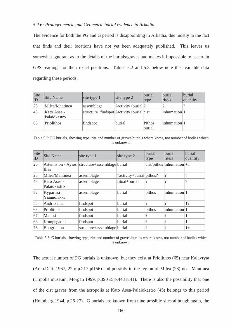
5.2.6: Protogeometric and Geometric burial evidence in Arkadia
The evidence for both the PG and G period is disappointing in Arkadia, due mostly to the fact
that finds and their locations have not yet been adequately published. This leaves us
somewhat ignorant as to the details of the burials/graves and makes it impossible to ascertain
GPS readings for their exact positions. Tables 5.2 and 5.3 below note the available data
regarding these periods.
Site ID Site Name site type 1 site type 2 burial
type burial rite/s
burial quantity
28 Milea/Mantinea assemblage ?activity+burial ? ? ? 45 Kato Asea -
Palaiokastro structure+findspot ?activity+burial cist inhumation 1
65 Priolithos findspot burial Pithos burial
inhumation 1
Table 5.2: PG burials, showing type, rite and number of graves/burials where know, not number of bodies which
is unknown. Site ID Site Name site type 1 site type 2 burial
type burial rite/s
burial quantity
26 Artemision - Ayios Ilias
structure+assemblage burial cist/pithos inhumation +1
28 Milea/Mantinea assemblage ?activity+burial pithos? ? ? 45 Kato Asea -
Palaiokastro assemblage ritual+burial ? ? ?
52 Kyparissi Yiannolakka
assemblage burial pithos inhumation 1
55 Andritsaina findspot burial ? ? 1? 65 Priolithos findspot burial pithos inhumation 1 67 Manesi findspot burial ? ? 1 68 Kompegadhi findspot burial ? ? 1 76 Bougrianou structure+assemblage burial ? ? 1+
Table 5.3: G burials, showing type, rite and number of graves/burials where know, not number of bodies which
is unknown.
The actual number of PG burials is unknown, but they exist at Priolithos (65) near Kalavryta
(Arch.Delt. 1967, 22b: p.217 pl156) and possibly in the region of Milea (28) near Mantinea
(Tripolis museum, Morgan 1999, p.390 & p.443 n.41). There is also the possibility that one
of the cist graves from the acropolis at Kato Asea-Palaiokastro (45) belongs to this period
(Holmberg 1944, p.26-27). G burials are known from nine possible sites although again, the
160
actual number of graves is unknown. Most of these seem to have been pithos burials
(Artemision-Ayios Ilias (26), Priolithos (65) and Kyparissa Yiannolakka (52)) although cist
graves are known from Artemision-Ayios Ilias (26) (see table 5.3). The types of G burials
located at Bougrianou (76) near Kamenitsa (Spyropoulos 1987-88, p.5-6; Morgan 1999,
p.424) and Kompegadhi (68) (JHS 1954, p.157; Morgan 1999, p.419) are, as of yet, unknown.
Hodkinson & Hodkinson (1981) also noted some pithos burials on the Mantinean plain, which
were uncovered during a road construction in 1980. Other than noting them here I can say no
more regarding their date and nothing is known now of their whereabouts (Steven Hodkinson
pers. comm. 26th September 2003).
5.3: Interpreting burial evidence
The archaeology of death can almost be considered a sub-discipline in itself and a wealth of
literature has been published in the last three decades both within the world of Greek
archaeology and beyond (e.g. Morris 1987; Whitley 1991; Cavanagh and Mee 1998; Parker
Pearson 1999; Tarlow 1999). Burial evidence is considered indispensable in a quest to
understand past societies, in a large part due to the prominence of tombs and graves in the
archaeological record. If they have escaped the attention of robbers both ancient and modern,
then they exist as a sealed deposit and are the remains of a single act, or at least represent use
over a short period of time. In contrast, settlements can often be continuously occupied,
covering and/or destroying evidence of earlier periods, leaving an often intensely complicated
set of remains with which to contend.
Despite their obvious value however, burials represent one of the most difficult aspects of the
material record to interpret. A burial that an archaeologist comes to excavate is the result of a
number of certain acts, namely the physical remains of funerary and mortuary ritual.
Archaeologists and sociologists alike have long discussed the purposes of the funeral, how it
161
ties to the living society and how the material record reflects this. Van Gennep (1960)
describes the funeral process as a rite of passage composed of a tripartite structure: the rite of
separation; the rite de marge; and the rite of aggregation (see also Morris 1987, p.31-32).
This tripartite structure is involved in other life changes, such as coming of age and marriage,
not just death. This is a particularly functional way of viewing the funeral and describes it as
a way of playing out, clarifying and reaffirming the ideal norms of the group. In a similar
way, Bloch (in Morris, 1987 p.33) sees the funeral as a way of legitimising the position of
certain groups within society, especially in traditional types of society where authority is seen
to derive from a divinity or from nature. Following on from this, Bloch ascertains that in
egalitarian societies, or in those where authority comes from outside the group, the need for
such ritual is negated. This reasoning has been disputed by some (e.g. Van Gennep 1960,
193), and it is argued that the negation of such ritual applies only to modern western societies
where the tripartite ritual structure can be seen to have declined.
Ideas relating to funerary rites as a way of legitimising social groups, reaffirming hierarchies
and restating ideal norms, such as those above, have underlined the idea of tombs as
indicators of the social status and wealth of the individuals buried within them. They have
also supported the idea that the material remains of funerary ritual can be considered as an
expression of the predominant economic system of the group to which the dead individual
once belonged. In relation to LBA Greece for example, Voutsaki (1992 cited in Sjoberg
2004, p.83) considers the increasing use of the chamber tomb in the Late Helladic IIIB period,
but with smaller and poorer types, as reflecting an increasingly hierarchical society, where
more wealth was channelled into palaces and less into burial. This is somewhat different,
though not necessarily mutually exclusive, to the conclusions of Cavanagh & Mee (1998,
p.126, p.234) who propose that the same phenomenon was due to legislation made against
ostentatious aristocratic burial by rulers who felt threatened. Alternatively Sjoberg (2004,
162
p.84, p.88) follows Alden (1981, 218; 322-324; Sjoberg 2004, 82) in suggesting that the
increase in number of chamber tombs in LHIIIA2 Argolid was the result of better-organised
agriculture imposed upon society by the palaces.
In a similar manner, it may be suggested that ‘simple’ tomb types, such as the cist grave, are
indicative of the lower social status and wealth of a group in a hierarchical society, because
they would perhaps need less skill to build. However, Lewartowski (1995, p.104) states that
the construction of ‘simple’ graves such as cist tombs requires a great investment of time and
energy in comparison to the reopening and reusing of an already built chamber or tholos
tomb. If low social status was to be equated with simple tomb types, then it seems skill or
lack of resources would not be the defining factor, but rather whether permission to reopen
existing monumental tombs had been granted to certain sectors of society. Moreover, there is
reason to suppose that tomb type did not strictly correspond to the status or wealth of the
person buried as assumed, or at least not in the same way that grave goods could, although
this is discussed below. This is something that cannot be assumed for the whole of the Greek
world in the LBA. Dickinson (1994, p.228) concludes that although tholoi may have had
particular connections with the elite at some places, choice of tomb may have more to do with
regional or family tradition and preferences than purely wealth or status. He uses examples of
cist graves at Athens and Iolkos that are as richly endowed as some chamber and tholos
tombs.
There is, however, a problem with directly relating wealth in a grave to wealth of the living
person. Voutsaki (1995) in her analysis of grave goods accepts that there is risk in ascribing
value to objects based on modern concepts of wealth. The argument that objects not made of
high value metals are therefore not of great worth ignores how value may have been assigned
in the past (1995, p.56). In addition, designating value on basis of quality is strongly tied to
163
the idea of labour cost in modern societies, which may or may not have been relevant to other
societies, including LBA and EIA Greece. It is because of the difficulty in using such
characteristics that Voutsaki (1995) uses the diversity of objects in tombs to reconstruct socio-
political change. There is also much to be said for the importance and significance of how the
living wished to remember the deceased person or how they wanted that person to be
remembered by others, not to forget any instructions issued by the deceased before they died.
Discussions based on how burial evidence reflects the wealth and status of the buried
individual or the society from where he/she came, are certainly of value and interest, but can
and usually do take place with little mention of the people behind the material culture and
their attitudes and motives. Communities and the individuals within them are portrayed as
being at the disposal of wider, often economic, processes. In addition, types of explanations
such as those few presented above centre on processes where only “those features which are
positively and repeatedly apparent” (Snodgrass [1971] 2000, p.177) are significant. This
practically silences people in the past whose choices about how they lived their lives, treated
and felt about their dead, created and used material culture, perhaps show up more in the
noticeable idiosyncrasies. For example, in Bloch’s divisions between types of society and
funerary ritual, the Modern West is linked with the Nuer of Sudan as societies that only
emphasise the rite of separation at funerals. Whilst this may be true when looked at from this
angle, such a statement also dismisses observances that Nuer funerary behaviour is very
different from that of Europe and North America. General processes are highlighted at the
expense of the particular. Individual differences that may help our understanding of how
human agency comes into play and of how and why people make the decisions they do as part
of their community, are played down. In an area like Arkadia in the LBA and EIA, where
evidence is limited, assigning norms and generalities becomes a particular problem, so much
so that in many general accounts of the period, scholars decide that nothing much can be said
164
about the area at this time or exclude it altogether (e.g. Snodgrass [1971]2000, p.90;
Dickinson 1994, p.3; Osborne 1996, p.71; Coldstream 2003, p.156).
Variations in tomb type in Greece during the period in question warn against making gross
generalisations too lightly. The chamber tomb and tholos may be the most prevalent types of
tomb in the Mycenaean period, with a general shift towards single burial in the LH IIIC and
PG periods, but this should not obscure the variations that do exist. In some circumstances,
statements made about attitude to death are actually based on specific, local examples, which
have then been applied to the whole Greek world. For example, it has often been taken for
granted that Mycenaean elite or ‘royalty’ were exclusively buried in tholoi in all regions.
However, this conclusion only fits the evidence from the Argolid, Thessaly and the
Dodecanese in LHIIIB (Voutsaki 1995, p.56) and overlooks specific evidence such as the fact
that tholos tombs do not exist at Thebes (Dickinson 1994, p.227).
The importance of the particular can also be illustrated by the way burial rite has been and can
be interpreted. The change in rite from inhumation to cremation has in the past been taken as
a highly significant factor in reconstructing past societies, indicative of a new population or
racial group or a reflection of new religious beliefs. Attica is a prime example of the
wholesale conversion from inhumation in the LBA to cremation in the EIA. However,
Snodgrass ([1971] 2000, p.144) has shown quite clearly that the evidence here does not
support a theory of a new population nor a fundamental change in religious belief: rite can
change without it being a reflection of such fundamental upheavals. Although indicators of
belief, such as material culture, grave goods and evidence of grave cult, do change, they do
not do so at the same time as the change in rite and instead of indicating a new population at
this time, the evidence largely suggests continuity. Nonetheless, although this is the case in
Athens, we should not presuppose that such changes in rite could never be an indication of
165
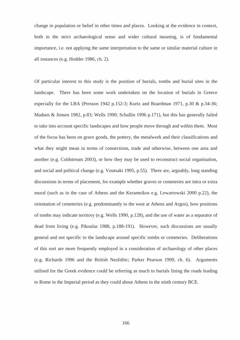
change in population or belief in other times and places. Looking at the evidence in context,
both in the strict archaeological sense and wider cultural meaning, is of fundamental
importance, i.e. not applying the same interpretation to the same or similar material culture in
all instances (e.g. Hodder 1986, ch. 2).
Of particular interest to this study is the position of burials, tombs and burial sites in the
landscape. There has been some work undertaken on the location of burials in Greece
especially for the LBA (Persson 1942 p.152-3; Kurtz and Boardman 1971, p.30 & p.34-36;
Madsen & Jensen 1982, p.83; Wells 1990; Schallin 1996 p.171), but this has generally failed
to take into account specific landscapes and how people move through and within them. Most
of the focus has been on grave goods, the pottery, the metalwork and their classifications and
what they might mean in terms of connections, trade and otherwise, between one area and
another (e.g. Coldstream 2003), or how they may be used to reconstruct social organisation,
and social and political change (e.g. Voutsaki 1995, p.55). There are, arguably, long standing
discussions in terms of placement, for example whether graves or cemeteries are intra or extra
mural (such as in the case of Athens and the Kerameikos e.g. Lewartowski 2000 p.22), the
orientation of cemeteries (e.g. predominantly to the west at Athens and Argos), how positions
of tombs may indicate territory (e.g. Wells 1990, p.128), and the use of water as a separator of
dead from living (e.g. Pikoulas 1988, p.188-191). However, such discussions are usually
general and not specific to the landscape around specific tombs or cemeteries. Deliberations
of this sort are more frequently employed in a consideration of archaeology of other places
(e.g. Richards 1996 and the British Neolithic; Parker Pearson 1999, ch. 6). Arguments
utilised for the Greek evidence could be referring as much to burials lining the roads leading
to Rome in the Imperial period as they could about Athens in the ninth century BCE.
166
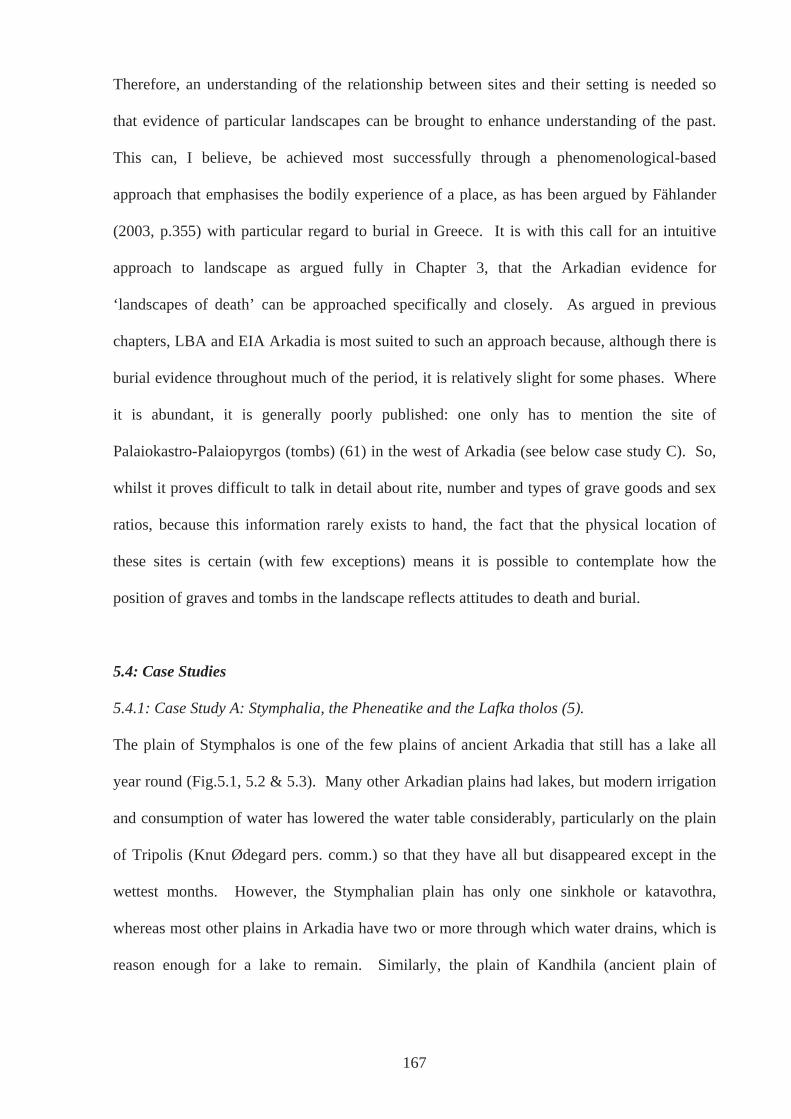
Therefore, an understanding of the relationship between sites and their setting is needed so
that evidence of particular landscapes can be brought to enhance understanding of the past.
This can, I believe, be achieved most successfully through a phenomenological-based
approach that emphasises the bodily experience of a place, as has been argued by Fählander
(2003, p.355) with particular regard to burial in Greece. It is with this call for an intuitive
approach to landscape as argued fully in Chapter 3, that the Arkadian evidence for
‘landscapes of death’ can be approached specifically and closely. As argued in previous
chapters, LBA and EIA Arkadia is most suited to such an approach because, although there is
burial evidence throughout much of the period, it is relatively slight for some phases. Where
it is abundant, it is generally poorly published: one only has to mention the site of
Palaiokastro-Palaiopyrgos (tombs) (61) in the west of Arkadia (see below case study C). So,
whilst it proves difficult to talk in detail about rite, number and types of grave goods and sex
ratios, because this information rarely exists to hand, the fact that the physical location of
these sites is certain (with few exceptions) means it is possible to contemplate how the
position of graves and tombs in the landscape reflects attitudes to death and burial.
5.4: Case Studies
5.4.1: Case Study A: Stymphalia, the Pheneatike and the Lafka tholos (5).
The plain of Stymphalos is one of the few plains of ancient Arkadia that still has a lake all
year round (Fig.5.1, 5.2 & 5.3). Many other Arkadian plains had lakes, but modern irrigation
and consumption of water has lowered the water table considerably, particularly on the plain
of Tripolis (Knut Ødegard pers. comm.) so that they have all but disappeared except in the
wettest months. However, the Stymphalian plain has only one sinkhole or katavothra,
whereas most other plains in Arkadia have two or more through which water drains, which is
reason enough for a lake to remain. Similarly, the plain of Kandhila (ancient plain of
167
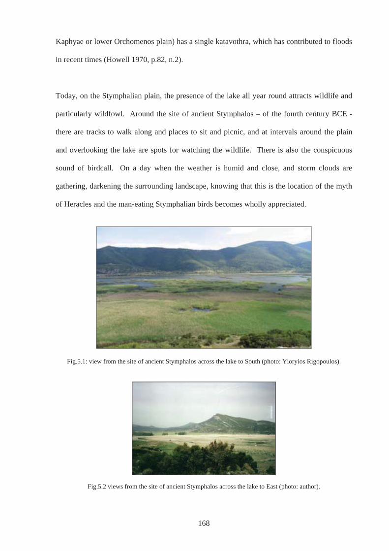
Kaphyae or lower Orchomenos plain) has a single katavothra, which has contributed to floods
in recent times (Howell 1970, p.82, n.2).
Today, on the Stymphalian plain, the presence of the lake all year round attracts wildlife and
particularly wildfowl. Around the site of ancient Stymphalos – of the fourth century BCE -
there are tracks to walk along and places to sit and picnic, and at intervals around the plain
and overlooking the lake are spots for watching the wildlife. There is also the conspicuous
sound of birdcall. On a day when the weather is humid and close, and storm clouds are
gathering, darkening the surrounding landscape, knowing that this is the location of the myth
of Heracles and the man-eating Stymphalian birds becomes wholly appreciated.
Fig.5.1: view from the site of ancient Stymphalos across the lake to South (photo: Yioryios Rigopoulos).
Fig.5.2 views from the site of ancient Stymphalos across the lake to East (photo: author).
168
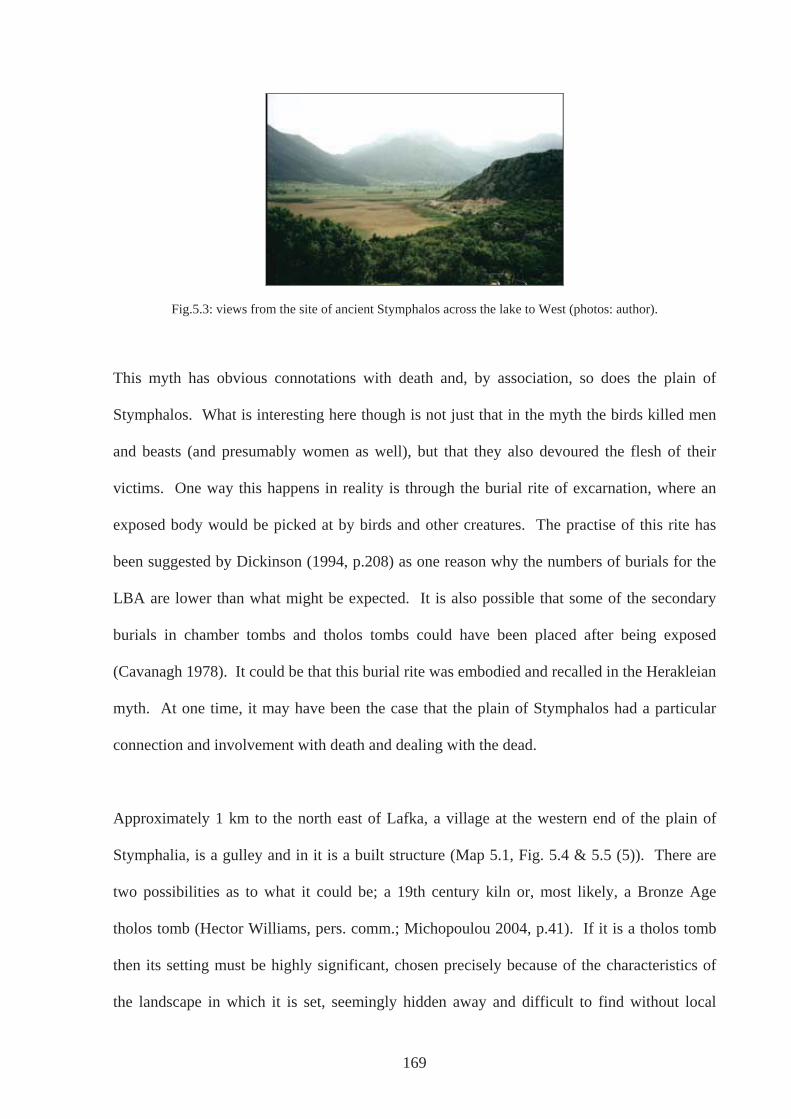
Fig.5.3: views from the site of ancient Stymphalos across the lake to West (photos: author).
This myth has obvious connotations with death and, by association, so does the plain of
Stymphalos. What is interesting here though is not just that in the myth the birds killed men
and beasts (and presumably women as well), but that they also devoured the flesh of their
victims. One way this happens in reality is through the burial rite of excarnation, where an
exposed body would be picked at by birds and other creatures. The practise of this rite has
been suggested by Dickinson (1994, p.208) as one reason why the numbers of burials for the
LBA are lower than what might be expected. It is also possible that some of the secondary
burials in chamber tombs and tholos tombs could have been placed after being exposed
(Cavanagh 1978). It could be that this burial rite was embodied and recalled in the Herakleian
myth. At one time, it may have been the case that the plain of Stymphalos had a particular
connection and involvement with death and dealing with the dead.
Approximately 1 km to the north east of Lafka, a village at the western end of the plain of
Stymphalia, is a gulley and in it is a built structure (Map 5.1, Fig. 5.4 & 5.5 (5)). There are
two possibilities as to what it could be; a 19th century kiln or, most likely, a Bronze Age
tholos tomb (Hector Williams, pers. comm.; Michopoulou 2004, p.41). If it is a tholos tomb
then its setting must be highly significant, chosen precisely because of the characteristics of
the landscape in which it is set, seemingly hidden away and difficult to find without local
169
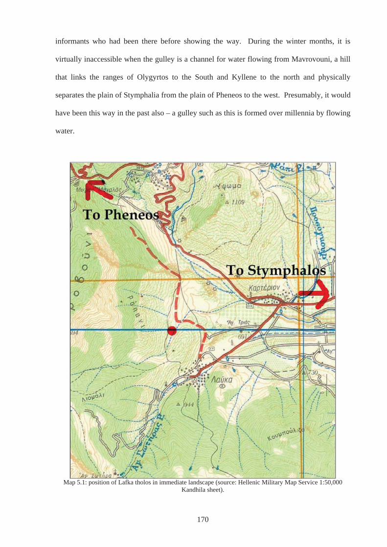
informants who had been there before showing the way. During the winter months, it is
virtually inaccessible when the gulley is a channel for water flowing from Mavrovouni, a hill
that links the ranges of Olygyrtos to the South and Kyllene to the north and physically
separates the plain of Stymphalia from the plain of Pheneos to the west. Presumably, it would
have been this way in the past also – a gulley such as this is formed over millennia by flowing
water.
Map 5.1: position of Lafka tholos in immediate landscape (source: Hellenic Military Map Service 1:50,000
Kandhila sheet).
170
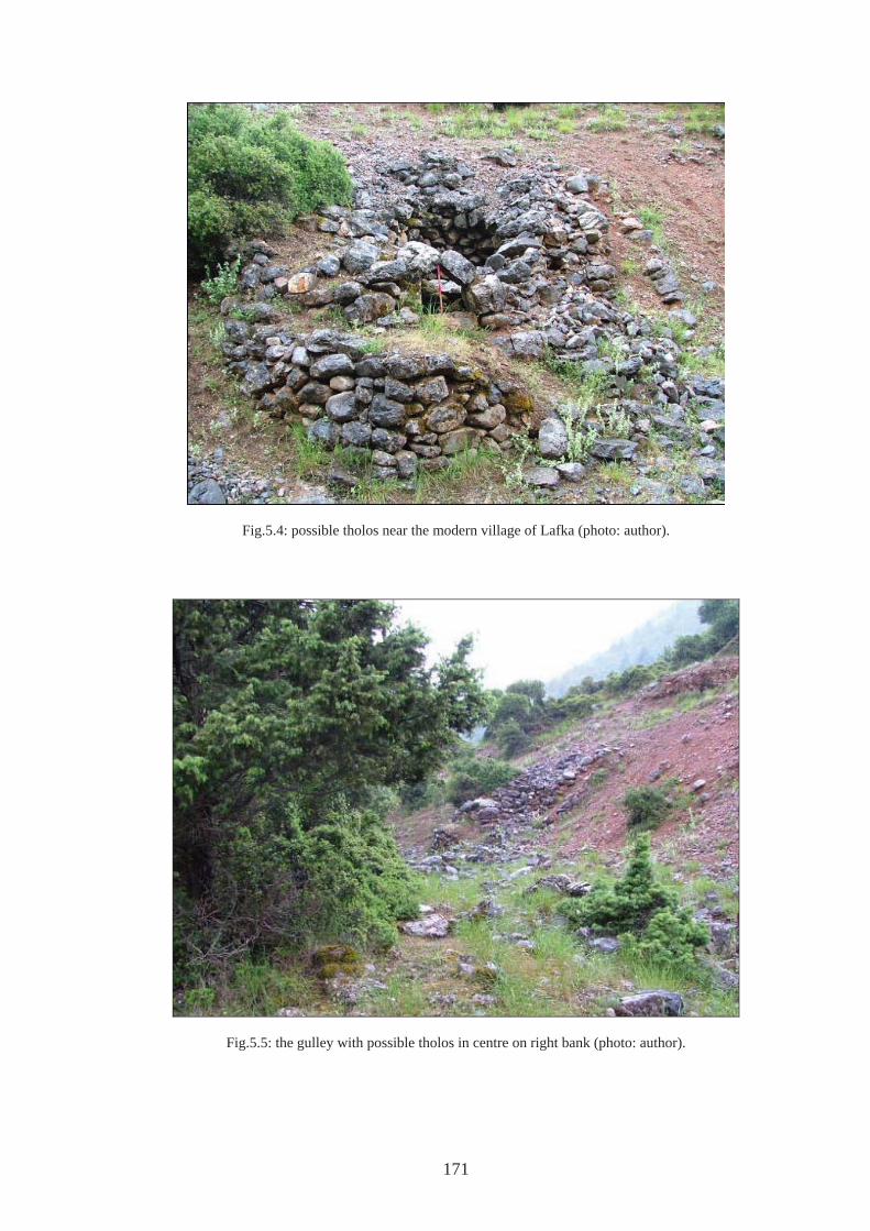
Fig.5.4: possible tholos near the modern village of Lafka (photo: author).
Fig.5.5: the gulley with possible tholos in centre on right bank (photo: author).
171
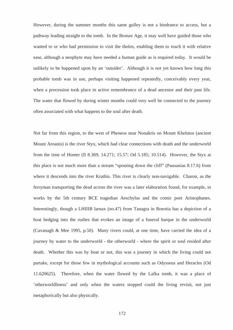
However, during the summer months this same gulley is not a hindrance to access, but a
pathway leading straight to the tomb. In the Bronze Age, it may well have guided those who
wanted to or who had permission to visit the tholos, enabling them to reach it with relative
ease, although a neophyte may have needed a human guide as is required today. It would be
unlikely to be happened upon by an ‘outsider’. Although it is not yet known how long this
probable tomb was in use, perhaps visiting happened repeatedly, conceivably every year,
when a procession took place in active remembrance of a dead ancestor and their past life.
The water that flowed by during winter months could very well be connected to the journey
often associated with what happens to the soul after death.
Not far from this region, to the west of Pheneos near Nonakris on Mount Khelmos (ancient
Mount Aroanis) is the river Styx, which had clear connections with death and the underworld
from the time of Homer (Il 8.369; 14.271; 15.57; Od 5.185; 10.514). However, the Styx at
this place is not much more than a stream “spouting down the cliff” (Pausanias 8.17.6) from
where it descends into the river Krathis. This river is clearly non-navigable. Charon, as the
ferryman transporting the dead across the river was a later elaboration found, for example, in
works by the 5th century BCE tragedian Aeschylus and the comic poet Aristophanes.
Interestingly, though a LHIIIB larnax (no.47) from Tanagra in Boeotia has a depiction of a
boat hedging into the rushes that evokes an image of a funeral barque in the underworld
(Cavanagh & Mee 1995, p.50). Many rivers could, at one time, have carried the idea of a
journey by water to the underworld - the otherworld - where the spirit or soul resided after
death. Whether this was by boat or not, this was a journey in which the living could not
partake, except for those few in mythological accounts such as Odysseus and Heracles (Od
11.620625). Therefore, when the water flowed by the Lafka tomb, it was a place of
‘otherworldliness’ and only when the waters stopped could the living revisit, not just
metaphorically but also physically.
172
In addition, the suggestion of returning to the site repeatedly has some resonance with an idea
of regeneration, posited by Vermeule (cited by Cavanagh & Mee 1995, p.47) as a belief held
in LBA Greece. The resurgence of a river each winter and the return of people each summer
could be part of a performance that ensured the regeneration of the soul or spirit of the
deceased each year. Such a performance does not necessarily have to be connected with a
cult of the dead that required a reopening of the tomb or leaving of offerings, which has been
largely disputed for the LBA (e.g. Kurtz & Boardman 1971, p.22 but see below and Gallou
2005), so much as with a revisiting, implied by the nature of the landscape.
Further support for the idea that the plain of Stymphalos had a particular link with death and
the dead is that there is very little evidence to suggest habitation. The neighbouring plain of
Pheneos, in comparison, has a much fuller record for the period under study and especially for
the Bronze Age, with much of it interpretable as settlement (e.g. ancient Pheneos (6) and
Tsouka (12) Map 5.2). These sites will be discussed in more detail in Chapter 6. However,
the plain of Stymphalos has not been subject to the same level of survey as has the plain of
Pheneos and it may be that evidence for habitation in the Bronze Age may yet be discovered.
This argument cannot be taken much further given the problems associated with arguing from
absence of evidence, but it is still worthwhile moving away from ideas associated with
territoriality that suggest each plain or discreet geographical area was controlled by one
settlement or group of people. If this is not assumed, then there is nothing to prevent the plain
of Stymphalos from being used for a specific purpose by a community or communities living
on the plain of Pheneos or indeed from any other area around. It may not be the case that
Stymphalos did have associations with death in the way proposed here, but the fact that the
tholos is situated at the edge of the plain of Stymphalos does not mean we should necessarily
be looking on the plain of Stymphalos for the group that built and used it.
173
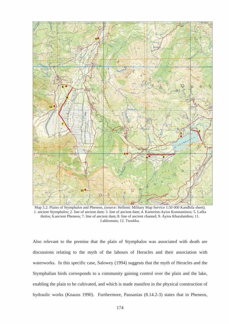
Map 5.2: Plains of Stymphalos and Pheneos, (source: Hellenic Military Map Service 1:50 000 Kandhila sheet). 1. ancient Stymphalos; 2. line of ancient dam; 3. line of ancient dam; 4. Karterion-Ayios Konstantinos; 5. Lafka
tholos; 6.ancient Pheneos; 7. line of ancient dam; 8. line of ancient channel; 9. Ayios Kharalambos; 11. Lakkomata; 12. Tsoukka.
Also relevant to the premise that the plain of Stymphalos was associated with death are
discussions relating to the myth of the labours of Heracles and their association with
waterworks. In this specific case, Salowey (1994) suggests that the myth of Heracles and the
Stymphalian birds corresponds to a community gaining control over the plain and the lake,
enabling the plain to be cultivated, and which is made manifest in the physical construction of
hydraulic works (Knauss 1990). Furthermore, Pausanias (8.14.2-3) states that in Pheneos,
174
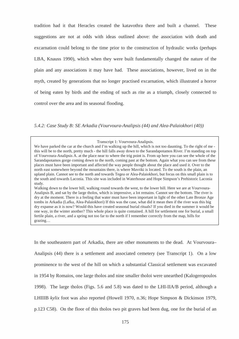
tradition had it that Heracles created the katavothra there and built a channel. These
suggestions are not at odds with ideas outlined above: the association with death and
excarnation could belong to the time prior to the construction of hydraulic works (perhaps
LBA, Knauss 1990), which when they were built fundamentally changed the nature of the
plain and any associations it may have had. These associations, however, lived on in the
myth, created by generations that no longer practised excarnation, which illustrated a horror
of being eaten by birds and the ending of such as rite as a triumph, closely connected to
control over the area and its seasonal flooding.
5.4.2: Case Study B: SE Arkadia (Vourvoura-Analipsis (44) and Alea-Palaiokhori (40))
Transcript 1: Vourvoura-Analipsis.
We have parked the car at the church and I’m walking up the hill, which is not too daunting. To the right of me - this will be to the north, pretty much - the hill falls away down to the Sarandapotamos River. I’m standing on top of Vourvoura-Analipsis A. at the place near to where the trig point is. From up here you can see the whole of the Sarandapotamos gorge coming down to the north, coming past at the bottom. Again what you can see from these places must have been important and affected the way people thought about the place and used it. Over to the north east somewhere beyond the mountains there, is where Mavriki is located. To the south is the plain, an upland plain. Cannot see to the north and towards Tegea or Alea-Palaiokhori, but focus on this small plain is to the south and towards Laconia. This site was included in Waterhouse and Hope Simpson’s Prehistoric Laconia study. Walking down to the lower hill, walking round towards the west, to the lower hill. Here we are at Vourvoura-Analipsis B, and sat by the large tholos, which is impressive, a lot remains. Cannot see the bottom. The river is dry at the moment. There is a feeling that water must have been important in light of the other Late Bronze Age tombs in Arkadia (Lafka, Alea-Palaiokhori) If this was the case, what did it mean then if the river was this big dry expanse as it is now? Would this have created seasonal burial rituals? If you died in the summer it would be one way, in the winter another? This whole place is quite contained. A hill for settlement one for burial, a small fertile plain, a river, and a spring not too far to the north if I remember correctly from the map, hills for grazing…
In the southeastern part of Arkadia, there are other monuments to the dead. At Vourvoura–
Analipsis (44) there is a settlement and associated cemetery (see Transcript 1). On a low
prominence to the west of the hill on which a substantial Classical settlement was excavated
in 1954 by Romaios, one large tholos and nine smaller tholoi were unearthed (Kalogeropoulos
1998). The large tholos (Figs. 5.6 and 5.8) was dated to the LHI-IIA/B period, although a
LHIIIB kylix foot was also reported (Howell 1970, n.36; Hope Simpson & Dickinson 1979,
p.123 C58). On the floor of this tholos two pit graves had been dug, one for the burial of an
175
adult, the other a child, and in the centre a number of bones from more than one individual
had been placed (Howell 1970, p.114; Romaios 1956, p.185; 1957, p.111).
The smaller tholoi (Fig.5.7) were distributed around the hill, although one was positioned on
the bank of the Sarandapotamos fifty metres below. These were dated to LHI-IIIB, thus
overlapping the large tholos in use, dated by grave goods that included bronze swords, steatite
spindle whorls, terracotta figurines and a sealstone of jasper engraved with a running bull. In
the fill of the large tholos were found Geometric sherds, which will be discussed in due
course. On this hill a cist grave with the burial of a child was also excavated, described as
Mycenaean by Howell (1970, n.36), but later ascribed a Middle Helladic date by Hope
Simpson & Dickinson (1979, p.123 c.58). This may suggest the site was used for a long
period as a place of burial, although continuity cannot be claimed with any certainty from
such scant remains. Groups may have returned or new groups reused a site, and depending on
how visible existing graves were, it may have been unknowingly. Neolithic sherds suggest an
even longer period of use, although Howell (1970, n.36) suggests that its use changed from
habitation to burial.
The people, who built the tholoi on this low hill above the Sarandapotamos, may very well
have been aware of the long history of the site, even with interruptions in use. Perhaps
individuals came across discarded artefacts, the odd stone tool and broken pottery. It remains
a mystery how these were explained; perhaps the stone tools were explained as natural
phenomenon or the result of work of non-human creatures as they were in the 18th century in
parts of Europe – thunderbolts or elf shots. More likely, however, they recognised such tools
as part of a repertoire of material artefacts that they themselves made and used – stone
arrowheads were found alongside ones made of bronze in the large tholos (Howell 1970,
p.115).
176
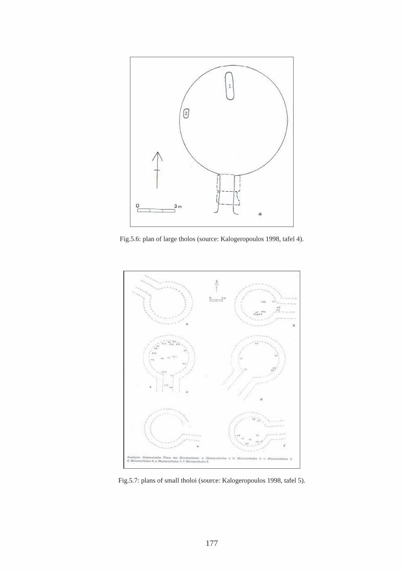
177
Fig.5.6: plan of large tholos (source: Kalogeropoulos 1998, tafel 4).
Fig.5.7: plans of small tholoi (source: Kalogeropoulos 1998, tafel 5).
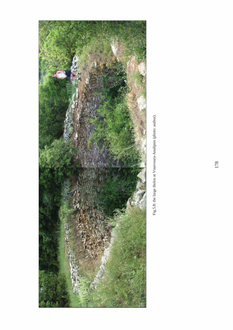
Fig.
5.8:
the
larg
e th
olos
at V
ourv
oura
-Ana
lipsi
s (ph
oto:
aut
hor)
.
178
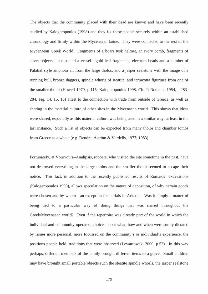
The objects that the community placed with their dead are known and have been recently
studied by Kalogeropoulos (1998) and they fix these people securely within an established
chronology and firmly within the Mycenaean koine. They were connected to the rest of the
Mycenaean Greek World. Fragments of a boars tusk helmet, an ivory comb, fragments of
silver objects – a disc and a vessel - gold leaf fragments, electrum beads and a number of
Palatial style amphora all from the large tholos, and a jasper sealstone with the image of a
running bull, bronze daggers, spindle whorls of steatite, and terracotta figurines from one of
the smaller tholoi (Howell 1970, p.115; Kalogeropoulos 1998, Ch. 2; Romaios 1954, p.283-
284, Fig. 14, 15, 16) attest to the connection with trade from outside of Greece, as well as
sharing in the material culture of other sites in the Mycenaean world. This shows that ideas
were shared, especially as this material culture was being used in a similar way, at least in the
last instance. Such a list of objects can be expected from many tholoi and chamber tombs
from Greece as a whole (e.g. Dendra, Åström & Verdelis, 1977; 1983).
Fortunately, at Vourvoura–Analipsis, robbers, who visited the site sometime in the past, have
not destroyed everything in the large tholos and the smaller tholoi seemed to escape their
notice. This fact, in addition to the recently published results of Romaios’ excavations
(Kalogeropoulos 1998), allows speculation on the nature of deposition, of why certain goods
were chosen and by whom - an exception for burials in Arkadia. Was it simply a matter of
being tied to a particular way of doing things that was shared throughout the
Greek/Mycenaean world? Even if the repertoire was already part of the world in which the
individual and community operated, choices about what, how and when were surely dictated
by issues more personal, more focussed on the community’s or individual’s experience, the
positions people held, traditions that were observed (Lewartowski 2000, p.53). In this way
perhaps, different members of the family brought different items to a grave. Small children
may have brought small portable objects such the steatite spindle whorls, the jasper sealstone
179
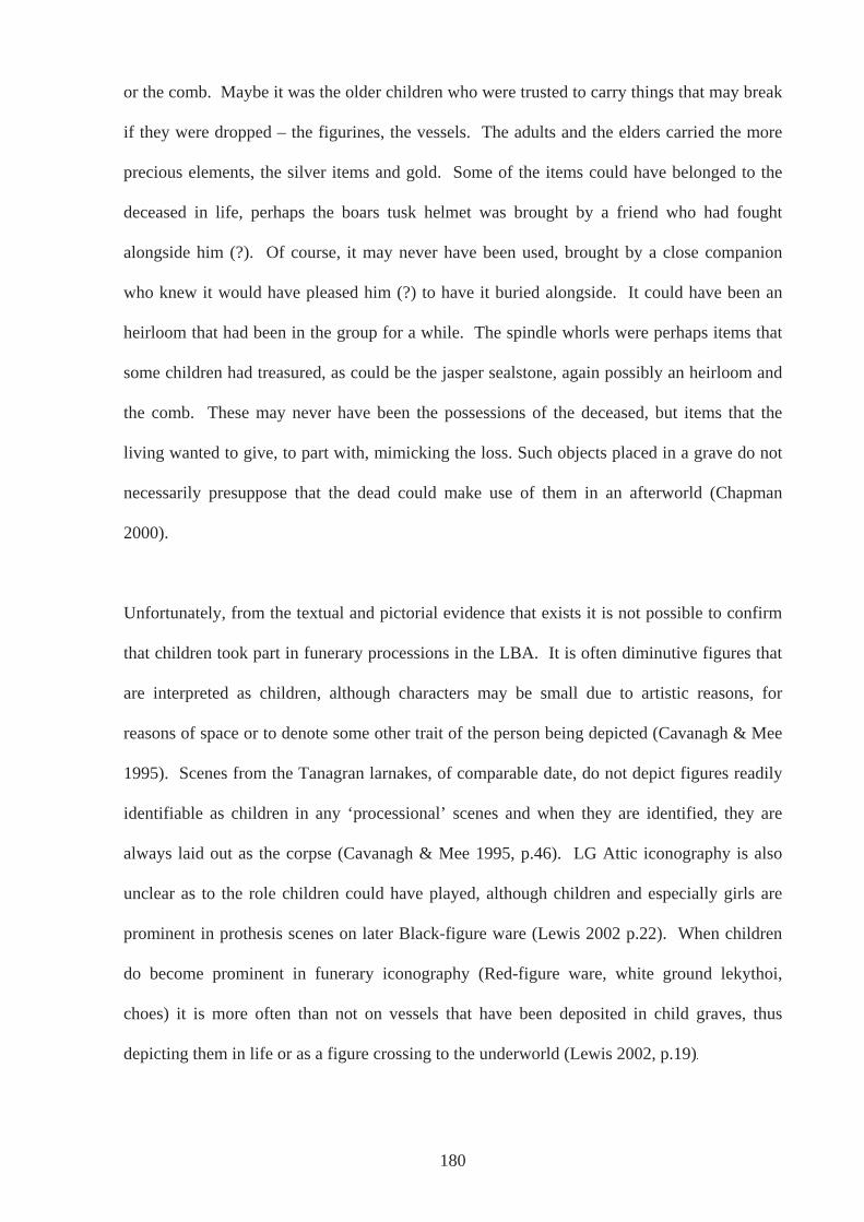
or the comb. Maybe it was the older children who were trusted to carry things that may break
if they were dropped – the figurines, the vessels. The adults and the elders carried the more
precious elements, the silver items and gold. Some of the items could have belonged to the
deceased in life, perhaps the boars tusk helmet was brought by a friend who had fought
alongside him (?). Of course, it may never have been used, brought by a close companion
who knew it would have pleased him (?) to have it buried alongside. It could have been an
heirloom that had been in the group for a while. The spindle whorls were perhaps items that
some children had treasured, as could be the jasper sealstone, again possibly an heirloom and
the comb. These may never have been the possessions of the deceased, but items that the
living wanted to give, to part with, mimicking the loss. Such objects placed in a grave do not
necessarily presuppose that the dead could make use of them in an afterworld (Chapman
2000).
Unfortunately, from the textual and pictorial evidence that exists it is not possible to confirm
that children took part in funerary processions in the LBA. It is often diminutive figures that
are interpreted as children, although characters may be small due to artistic reasons, for
reasons of space or to denote some other trait of the person being depicted (Cavanagh & Mee
1995). Scenes from the Tanagran larnakes, of comparable date, do not depict figures readily
identifiable as children in any ‘processional’ scenes and when they are identified, they are
always laid out as the corpse (Cavanagh & Mee 1995, p.46). LG Attic iconography is also
unclear as to the role children could have played, although children and especially girls are
prominent in prothesis scenes on later Black-figure ware (Lewis 2002 p.22). When children
do become prominent in funerary iconography (Red-figure ware, white ground lekythoi,
choes) it is more often than not on vessels that have been deposited in child graves, thus
depicting them in life or as a figure crossing to the underworld (Lewis 2002, p.19)
180
However, the idea of children being barred from events surrounding the death of others is tied
up with modern notions, where euphemisms abound. Ariés (1974 & 1981 quoted in Morris
1987, p.35) described this way of dealing with death as the twentieth century Western
‘Invisible Death’, where death is sanitised in hospitals and funeral parlours, not mentioned in
polite company and hidden from children. In contrast, Ariés describes the attitude to death up
until the eleventh century CE as the ‘Tame Death’ where death is familiar, accepted and not
feared, and dealt with through a rite of passage, such as that described by Bloch (in Morris,
1987 p.33). It should not be assumed, therefore, that children were sheltered or kept away
from death as they are today, simply because they are not obviously depicted in funerary
iconography. The lack of children in funerary scenes of the LBA and EIA may have more to
do with the difficulty artists had in depicting children. As Lewis (2002 p.19) states, it was not
until the emergence of Red-figure ware that the range of scenes in which children were
depicted widened. Until this time children are distinguished by, and shown with, their toys
and pets, motifs which were perhaps not considered suitable for funerary scenes.
Nonetheless, scenes depicted on the larnakes from Tanagra, belong to the same period as the
smaller tholoi (LH IIIA-B) and show what has been widely interpreted as the funeral
procession (Cavanagh 1995 p.46). Figures with outstretched arms have been interpreted as
women in mourning, whereas the male figures with one hand aloft appear to be gesturing
‘farewell’ in a much more controlled manner. As a group processed, maybe separated by
gender and assigned certain roles and ways of behaving, as indicated by such scenes, they
may have been aware of the landscape around them to a greater or lesser extent. This may
have been dependent upon the relationship they had with the deceased. Subsequently, the
landscape may have had different affordances according to varied associations and/or the
intensity of emotional attachment an individual had to the departed. The Sarandapotamos
River that furnished the community with water for most of the year perhaps was assigned, or
181
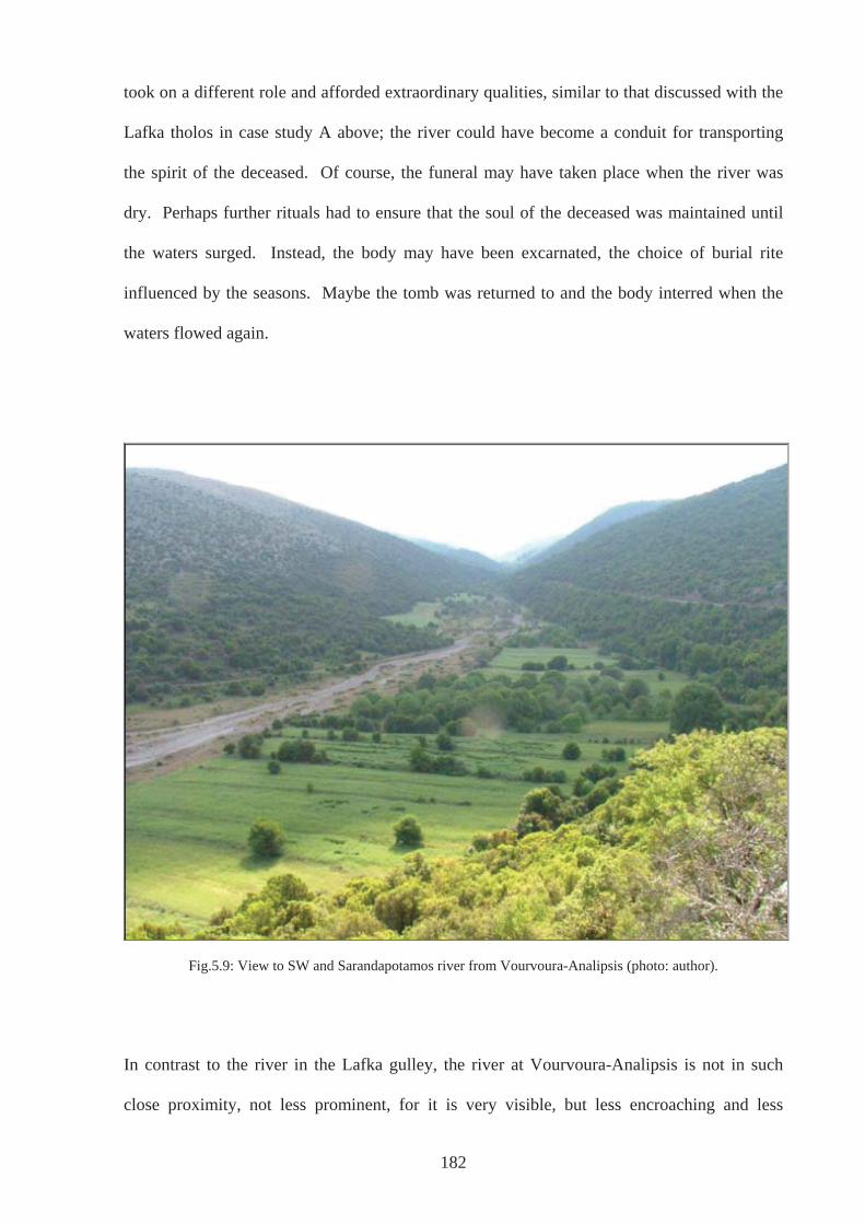
took on a different role and afforded extraordinary qualities, similar to that discussed with the
Lafka tholos in case study A above; the river could have become a conduit for transporting
the spirit of the deceased. Of course, the funeral may have taken place when the river was
dry. Perhaps further rituals had to ensure that the soul of the deceased was maintained until
the waters surged. Instead, the body may have been excarnated, the choice of burial rite
influenced by the seasons. Maybe the tomb was returned to and the body interred when the
waters flowed again.
Fig.5.9: View to SW and Sarandapotamos river from Vourvoura-Analipsis (photo: author).
In contrast to the river in the Lafka gulley, the river at Vourvoura-Analipsis is not in such
close proximity, not less prominent, for it is very visible, but less encroaching and less
182
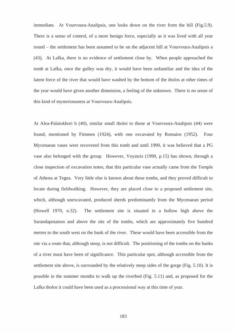
immediate. At Vourvoura-Analipsis, one looks down on the river from the hill (Fig.5.9).
There is a sense of control, of a more benign force, especially as it was lived with all year
round – the settlement has been assumed to be on the adjacent hill at Vourvoura-Analipsis a
(43). At Lafka, there is no evidence of settlement close by. When people approached the
tomb at Lafka, once the gulley was dry, it would have been unfamiliar and the idea of the
latent force of the river that would have washed by the bottom of the tholos at other times of
the year would have given another dimension, a feeling of the unknown. There is no sense of
this kind of mysteriousness at Vourvoura-Analipsis.
At Alea-Palaiokhori b (40), similar small tholoi to those at Vourvoura-Analipsis (44) were
found, mentioned by Fimmen (1924), with one excavated by Romaios (1952). Four
Mycenaean vases were recovered from this tomb and until 1990, it was believed that a PG
vase also belonged with the group. However, Voyatzis (1990, p.15) has shown, through a
close inspection of excavation notes, that this particular vase actually came from the Temple
of Athena at Tegea. Very little else is known about these tombs, and they proved difficult to
locate during fieldwalking. However, they are placed close to a proposed settlement site,
which, although unexcavated, produced sherds predominantly from the Mycenaean period
(Howell 1970, n.32). The settlement site is situated in a hollow high above the
Sarandapotamos and above the site of the tombs, which are approximately five hundred
metres to the south west on the bank of the river. These would have been accessible from the
site via a route that, although steep, is not difficult. The positioning of the tombs on the banks
of a river must have been of significance. This particular spot, although accessible from the
settlement site above, is surrounded by the relatively steep sides of the gorge (Fig. 5.10). It is
possible in the summer months to walk up the riverbed (Fig. 5.11) and, as proposed for the
Lafka tholos it could have been used as a processional way at this time of year.
183
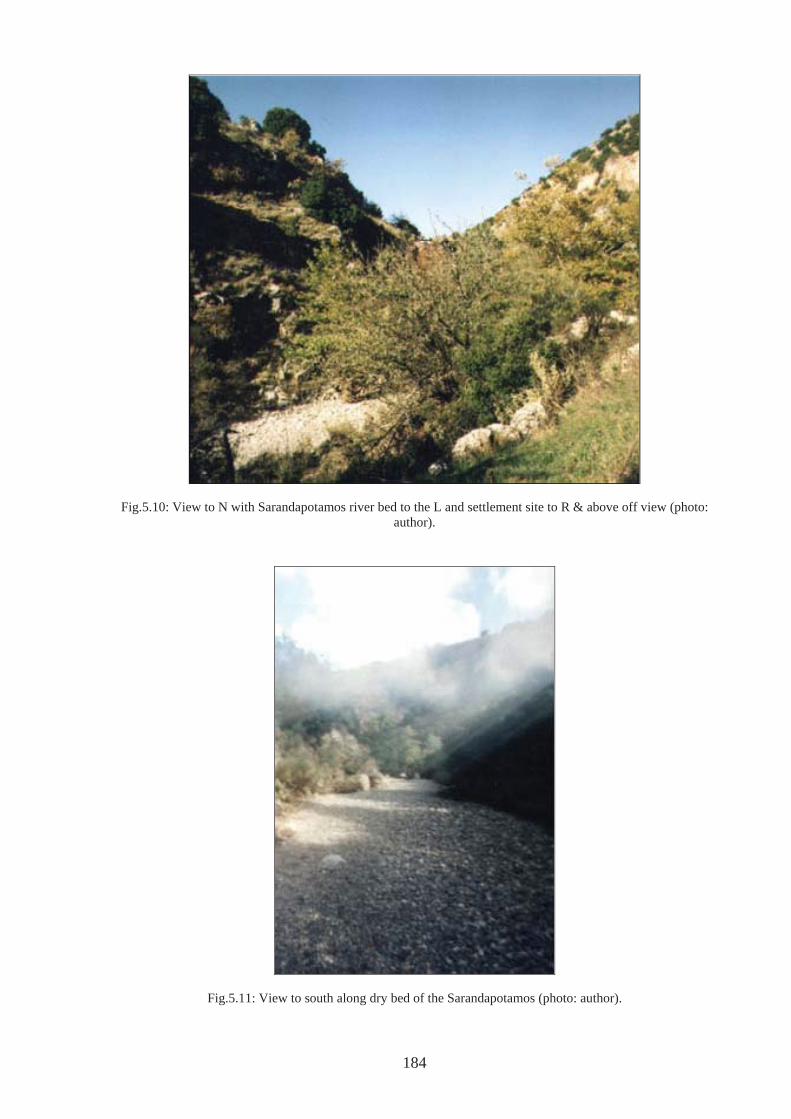
Fig.5.10: View to N with Sarandapotamos river bed to the L and settlement site to R & above off view (photo: author).
Fig.5.11: View to south along dry bed of the Sarandapotamos (photo: author).
184
There is further weight here for the importance of rivers in dealing with the dead, in terms of
the movement of water and the journey of the soul. The river at Alea-Palaiokhori is not
particularly visible from the settlement above, although when in full flow may have been
audible (unfortunately, I only visited during the summer months when the river was dry).
When in the gorge itself the sides are steep and domineering, suggesting a power greater than
that of mere mortals. The place for settlement may not have been chosen with this thought in
mind, but during funerary rituals it may have been prevalent in the minds of those taking part
that the body of the deceased was being laid to rest down below. The body was given over to
the river and the gorge through which it flowed, giving a sense of otherworldliness, one that
was dark and forbidding. After completing funerary rituals, the walk back up the steep slope
may have felt very much like coming back from the otherworld, returning into the light and
land of everyday.
The Vourvoura-Analipsis and Alea-Palaiokhori ‘cemeteries’ lie in relatively close proximity
to each other, approximately 10 km distance (Map 5.3). Not only do they have similar types
of tholos tombs, diminutive in size, but they also lie on the route of the same river, the
Sarandapotamos. In both cases, there is evidence of habitation in close proximity, which
suggests that these tombs form an organised cemetery for the nearby settlement. However,
despite similarities in many aspects of their respective landscapes, there are very real
differences. Such differences were lived by the communities that used the tombs and formed
part of a peoples’ pre-consciousness. The environment would be pre-objective and apparent
in how they lived their lives (e.g. Ingold 1998; 2000, p.169; Merleau Ponty 1962, p.153). At
each site, the differences in the nature of the immediate landscape would have brought
different essences to rituals that were undertaken.
185
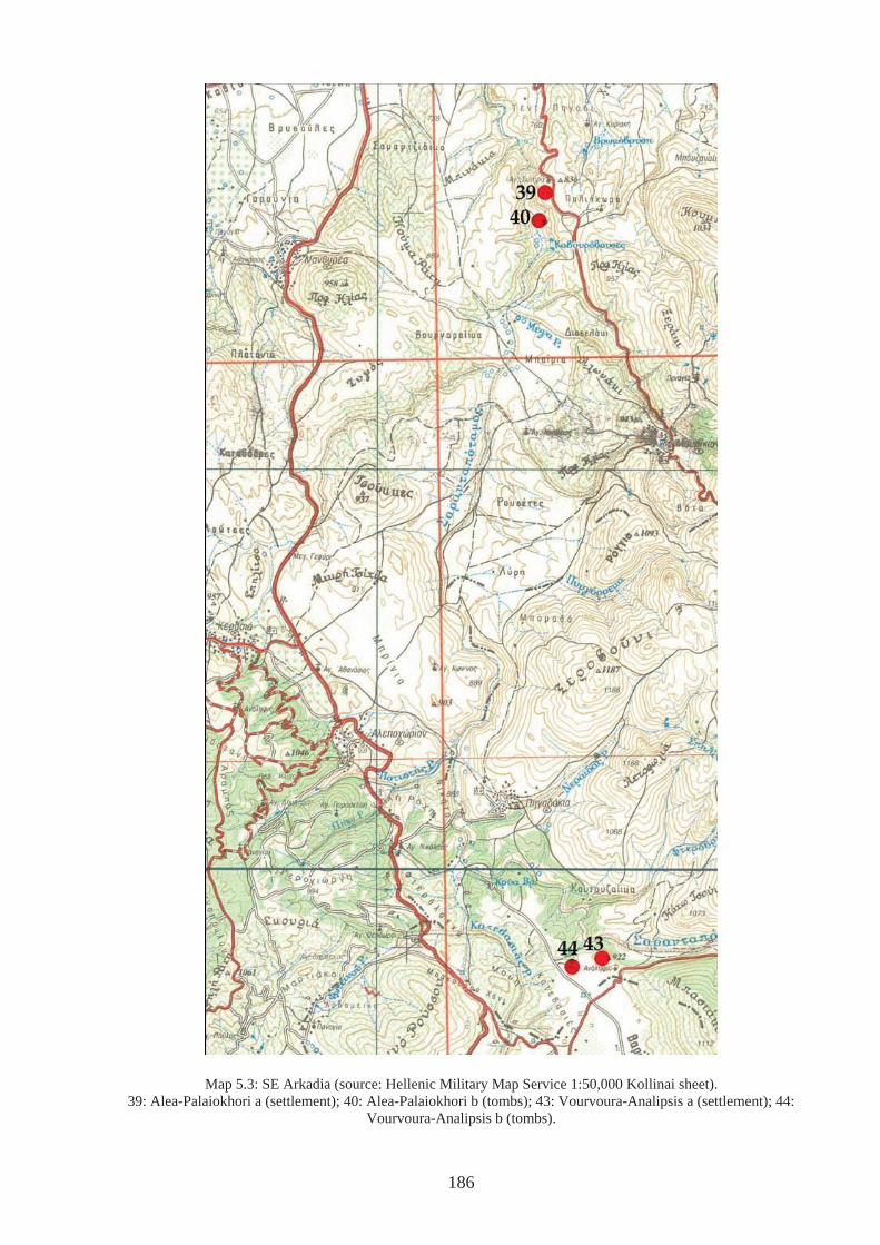
Map 5.3: SE Arkadia (source: Hellenic Military Map Service 1:50,000 Kollinai sheet). 39: Alea-Palaiokhori a (settlement); 40: Alea-Palaiokhori b (tombs); 43: Vourvoura-Analipsis a (settlement); 44:
Vourvoura-Analipsis b (tombs).
186
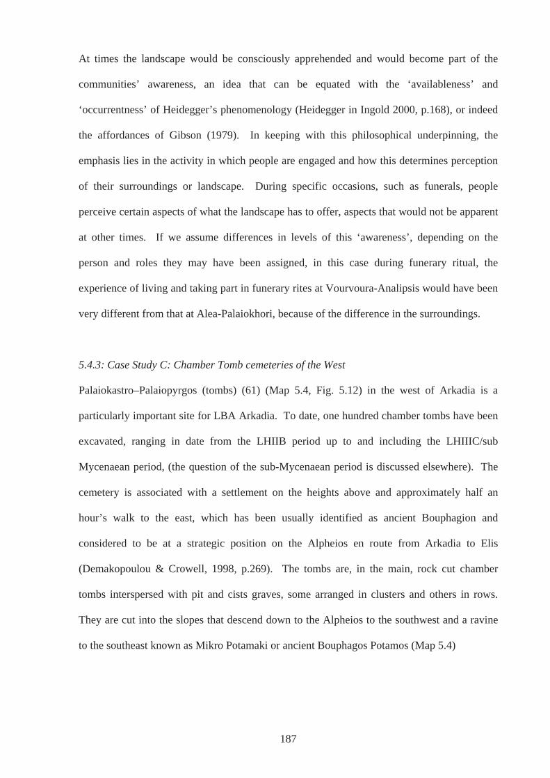
At times the landscape would be consciously apprehended and would become part of the
communities’ awareness, an idea that can be equated with the ‘availableness’ and
‘occurrentness’ of Heidegger’s phenomenology (Heidegger in Ingold 2000, p.168), or indeed
the affordances of Gibson (1979). In keeping with this philosophical underpinning, the
emphasis lies in the activity in which people are engaged and how this determines perception
of their surroundings or landscape. During specific occasions, such as funerals, people
perceive certain aspects of what the landscape has to offer, aspects that would not be apparent
at other times. If we assume differences in levels of this ‘awareness’, depending on the
person and roles they may have been assigned, in this case during funerary ritual, the
experience of living and taking part in funerary rites at Vourvoura-Analipsis would have been
very different from that at Alea-Palaiokhori, because of the difference in the surroundings.
5.4.3: Case Study C: Chamber Tomb cemeteries of the West
Palaiokastro–Palaiopyrgos (tombs) (61) (Map 5.4, Fig. 5.12) in the west of Arkadia is a
particularly important site for LBA Arkadia. To date, one hundred chamber tombs have been
excavated, ranging in date from the LHIIB period up to and including the LHIIIC/sub
Mycenaean period, (the question of the sub-Mycenaean period is discussed elsewhere). The
cemetery is associated with a settlement on the heights above and approximately half an
hour’s walk to the east, which has been usually identified as ancient Bouphagion and
considered to be at a strategic position on the Alpheios en route from Arkadia to Elis
(Demakopoulou & Crowell, 1998, p.269). The tombs are, in the main, rock cut chamber
tombs interspersed with pit and cists graves, some arranged in clusters and others in rows.
They are cut into the slopes that descend down to the Alpheios to the southwest and a ravine
to the southeast known as Mikro Potamaki or ancient Bouphagos Potamos (Map 5.4)
187
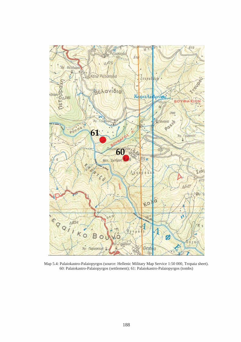
.
Map 5.4: Palaiokastro-Palaiopyrgos (source: Hellenic Military Map Service 1:50 000, Tropaia sheet). 60: Palaiokastro-Palaiopyrgos (settlement); 61: Palaiokastro-Palaiopyrgos (tombs)
188
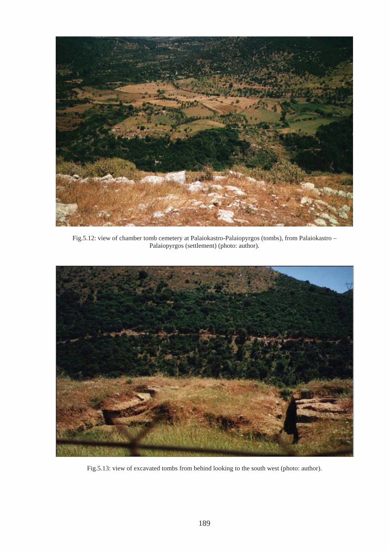
Fig.5.12: view of chamber tomb cemetery at Palaiokastro-Palaiopyrgos (tombs), from Palaiokastro –Palaiopyrgos (settlement) (photo: author).
Fig.5.13: view of excavated tombs from behind looking to the south west (photo: author).
189
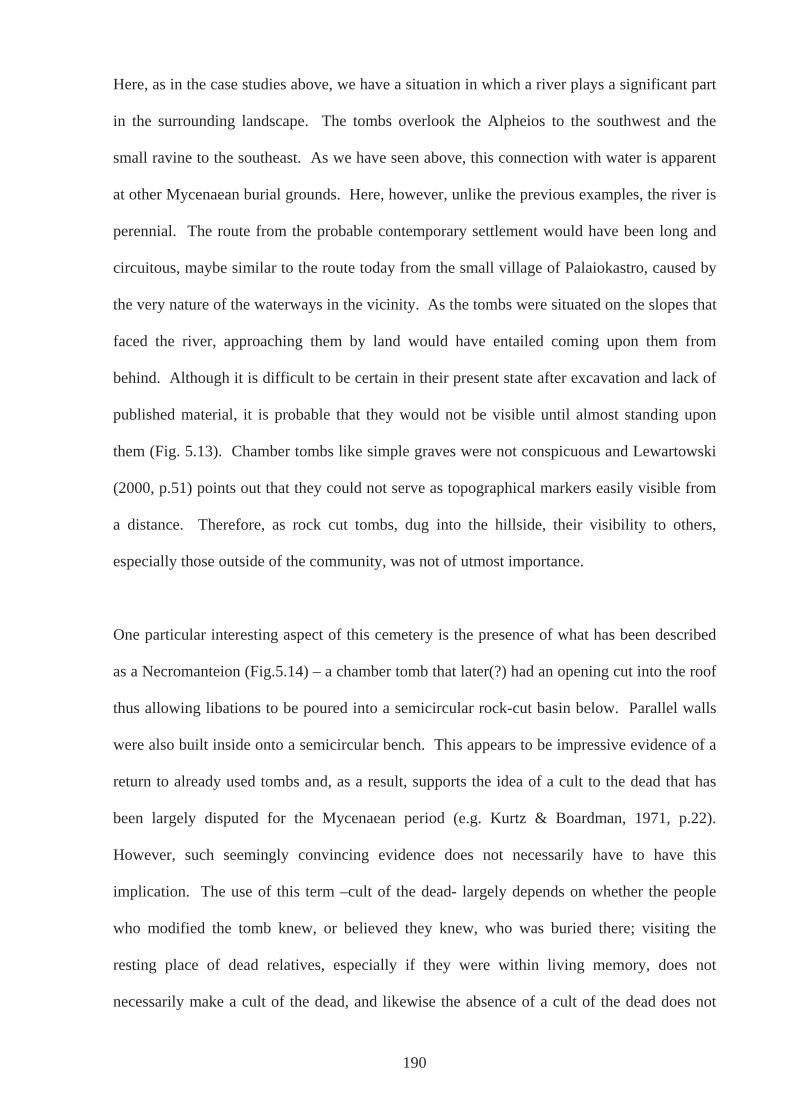
Here, as in the case studies above, we have a situation in which a river plays a significant part
in the surrounding landscape. The tombs overlook the Alpheios to the southwest and the
small ravine to the southeast. As we have seen above, this connection with water is apparent
at other Mycenaean burial grounds. Here, however, unlike the previous examples, the river is
perennial. The route from the probable contemporary settlement would have been long and
circuitous, maybe similar to the route today from the small village of Palaiokastro, caused by
the very nature of the waterways in the vicinity. As the tombs were situated on the slopes that
faced the river, approaching them by land would have entailed coming upon them from
behind. Although it is difficult to be certain in their present state after excavation and lack of
published material, it is probable that they would not be visible until almost standing upon
them (Fig. 5.13). Chamber tombs like simple graves were not conspicuous and Lewartowski
(2000, p.51) points out that they could not serve as topographical markers easily visible from
a distance. Therefore, as rock cut tombs, dug into the hillside, their visibility to others,
especially those outside of the community, was not of utmost importance.
One particular interesting aspect of this cemetery is the presence of what has been described
as a Necromanteion (Fig.5.14) – a chamber tomb that later(?) had an opening cut into the roof
thus allowing libations to be poured into a semicircular rock-cut basin below. Parallel walls
were also built inside onto a semicircular bench. This appears to be impressive evidence of a
return to already used tombs and, as a result, supports the idea of a cult to the dead that has
been largely disputed for the Mycenaean period (e.g. Kurtz & Boardman, 1971, p.22).
However, such seemingly convincing evidence does not necessarily have to have this
implication. The use of this term –cult of the dead- largely depends on whether the people
who modified the tomb knew, or believed they knew, who was buried there; visiting the
resting place of dead relatives, especially if they were within living memory, does not
necessarily make a cult of the dead, and likewise the absence of a cult of the dead does not
190
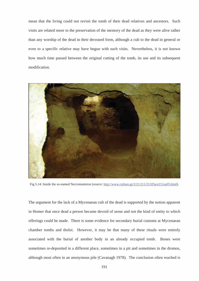
mean that the living could not revisit the tomb of their dead relatives and ancestors. Such
visits are related more to the preservation of the memory of the dead as they were alive rather
than any worship of the dead in their deceased form, although a cult to the dead in general or
even to a specific relative may have begun with such visits. Nevertheless, it is not known
how much time passed between the original cutting of the tomb, its use and its subsequent
modification.
Fig.5.14: Inside the so-named Necromanteion (source: http://www.culture.gr/2/21/211/21105a/e211ea05.html).
The argument for the lack of a Mycenaean cult of the dead is supported by the notion apparent
in Homer that once dead a person became devoid of sense and not the kind of entity to which
offerings could be made. There is some evidence for secondary burial customs at Mycenaean
chamber tombs and tholoi. However, it may be that many of these rituals were entirely
associated with the burial of another body in an already occupied tomb. Bones were
sometimes re-deposited in a different place, sometimes in a pit and sometimes in the dromos,
although most often in an anonymous pile (Cavanagh 1978). The conclusion often reached is
191
that once devoid of flesh, the remains were impotent, likewise their ‘souls’ (Sourvinou-
Inwood 1995, p.91). On the other hand, it may be that at this site, at this tomb, there was a
cult of the dead. This could have been a cult specifically for the person who lay there,
focussed on a specific individual relative or ‘relatives’ in a generic sense, as a focal point for
offerings for the whole of the cemetery; it is not clear if any burials were found here at all
(AR 1996-7: 33-4). Sourvinou-Inwood’s (1995, p.83) interpretation of Homer provides some
evidence that an old belief existed which held that the dead could only be contacted after
drinking a blood offering, a belief not current in the poet’s own time. Before such an offering
was made, the dead were the ‘witless shades’ referred to above, and as such would be
ineffectual oracles (see e.g. Odyssey Book 11). An opening and libation basin, such as that in
the Necromanteion could have been used for such blood libations and would thus accord with
this early belief. Interestingly, Gallou (2005) has recently published a volume arguing in
favour of a Mycenaean cult of the dead. However, if the evidence at Palaiokastro-
Palaiopyrgos (tombs) is to be interpreted as such, it need not apply to the rest of the
Mycenaean world
This site has been described by more than one scholar (Desborough 1964 p.92; Hope Simpson
& Dickinson 1979, p.381 b75; Demakopoulou & Crouwel 1998, p.283) as the cemetery of a
refuge site, to where people fled as a result of troubles at the end of the 13th century BC.
However, although there may have been a vast increase in evidence datable to the end of the
LHIIIC, we need not envisage a mass panic as people escaped marauding invaders, as is
suggested by the term ‘refuge’; evidence suggests the tombs were in use from the LHIIB
period (AR 1996-7, p.33). Movement certainly happened and new people probably would
have settled here. They could have been welcomed to settle, perhaps coming from
communities already known and with who they were in contact, people who had begun to
struggle in their old settlements due to events beyond their control.
192
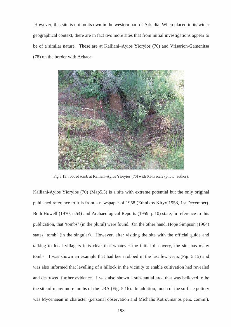
193
However, this site is not on its own in the western part of Arkadia. When placed in its wider
geographical context, there are in fact two more sites that from initial investigations appear to
be of a similar nature. These are at Kalliani–Ayios Yioryios (70) and Vrisarion-Gamenitsa
(78) on the border with Achaea.
Fig.5.15: robbed tomb at Kalliani-Ayios Yioryios (70) with 0.5m scale (photo: author).
Kalliani-Ayios Yioryios (70) (Map5.5) is a site with extreme potential but the only original
published reference to it is from a newspaper of 1958 (Ethnikos Kiryx 1958, 1st December).
Both Howell (1970, n.54) and Archaeological Reports (1959, p.10) state, in reference to this
publication, that ‘tombs’ (in the plural) were found. On the other hand, Hope Simpson (1964)
states ‘tomb’ (in the singular). However, after visiting the site with the official guide and
talking to local villagers it is clear that whatever the initial discovery, the site has many
tombs. I was shown an example that had been robbed in the last few years (Fig. 5.15) and
was also informed that levelling of a hillock in the vicinity to enable cultivation had revealed
and destroyed further evidence. I was also shown a substantial area that was believed to be
the site of many more tombs of the LBA (Fig. 5.16). In addition, much of the surface pottery
was Mycenaean in character (personal observation and Michalis Kotroumanos pers. comm.).
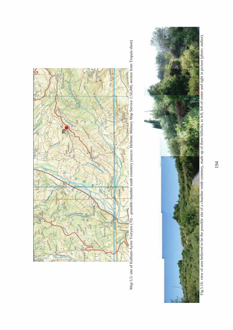
M
ap 5
.5: s
ite o
f Kal
liani
-Ayi
os Y
iory
ios (
70) –
pos
sibl
e ch
ambe
r tom
b ce
met
ery
(sou
rce:
Hel
leni
c M
ilita
ry M
ap S
ervi
ce 1
:50,
000,
sect
ion
from
Tro
paia
shee
t)
Fi
g.5.
16: v
iew
of a
rea
belie
ved
to b
e th
e po
ssib
le si
te o
f a c
ham
ber t
omb
cem
eter
y, m
ade
up o
f thr
ee h
illoc
ks, t
o le
ft, le
ft of
cen
tre a
nd ri
ght i
n pi
ctur
e (p
hoto
: aut
hor)
.
194
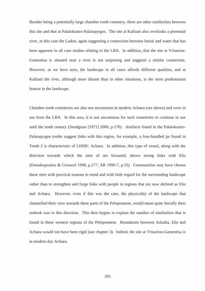
Besides being a potentially large chamber tomb cemetery, there are other similarities between
this site and that at Palaiokastro-Palaiopyrgos. The site at Kalliani also overlooks a perennial
river, in this case the Ladon, again suggesting a connection between burial and water that has
been apparent in all case studies relating to the LBA. In addition, that the site at Vrisarion-
Gamenitsa is situated near a river is not surprising and suggests a similar connection.
However, as we have seen, the landscape in all cases affords different qualities, and at
Kalliani the river, although more distant than in other situations, is the most predominant
feature in the landscape.
Chamber tomb cemeteries are also not uncommon in modern Achaea (see above) and were in
use from the LBA. In this area, it is not uncommon for such cemeteries to continue in use
until the tenth century (Snodgrass [1971] 2000, p.170). Artefacts found in the Palaiokastro-
Palaiopyrgos tombs suggest links with this region, for example, a four-handled jar found in
Tomb 2 is characteristic of LHIIIC Achaea. In addition, this type of vessel, along with the
direction towards which the sites of are focussed, shows strong links with Elis
(Demakopoulou & Crouwel 1998, p.277; AR 1996-7, p.33). Communities may have chosen
these sites with practical reasons in mind and with little regard for the surrounding landscape
rather than to strengthen and forge links with people in regions that are now defined as Elis
and Achaea. However, even if this was the case, the physicality of the landscape that
channelled their view towards these parts of the Peloponnese, would mean quite literally their
outlook was in this direction. This then begins to explain the number of similarities that is
found in these western regions of the Peloponnese. Boundaries between Arkadia, Elis and
Achaea would not have been rigid (see chapter 3). Indeed, the site at Vrisarion-Gamenitsa is
in modern day Achaea.
195
Of course, the sites reviewed above are not the only places in the Mycenaean world that have
chamber tomb cemeteries: the chamber tomb was the most prevalent type of tomb in the
Mycenaean world. A striking example is the Kalkani chamber tomb cemetery at Mycenae,
which, interestingly, is positioned on the banks of a river, and in particular, where it separates
into two, highlighting the recurrent theme of the importance of water (Dickinson 1994, p.226
Fig. 6.9). However, despite the prevalence of this tomb type in the Mycenaean World in
general, they are, in fact, peculiar to this part of the Peloponnese and in particular to the west
of Arkadia; no such rock cut chamber tombs are found in other parts of the region. The
similarities suggest that particular connections existed between the communities in this
specific area, that they were in contact, perhaps on a regular basis, and in other areas of life,
all reflected in the material remains of death. Those living in this part of Arkadia would have
considered the communities in modern day Elis and Achaea to be in their wider ‘taskscape’
rather than those living in other regions of Arkadia. This is perhaps a fitting reminder of the
fact that Arkadia as a discreet entity may have been unknown, unrecognised and virtually
non-existent at this time. But it also reminds us that even if people did consider themselves as
Arkadian, boundaries were fluid and permeable: if the physical landscape encouraged
communication and contact more readily in one direction rather than in another, ideas about
territoriality would not prevent it – not in the LBA at least. In addition, these communities
also belonged to a wider network of connections and communications, which conveyed ideas
about attitudes to the dead and how to dispose of them. However, such ideas and attitudes
were not imposed: people were able to make choices and these choices in turn influenced
customs practiced by others and contributed to such a koine. The region we now know of as
Arkadia was fully part of this exchange and interaction.
196
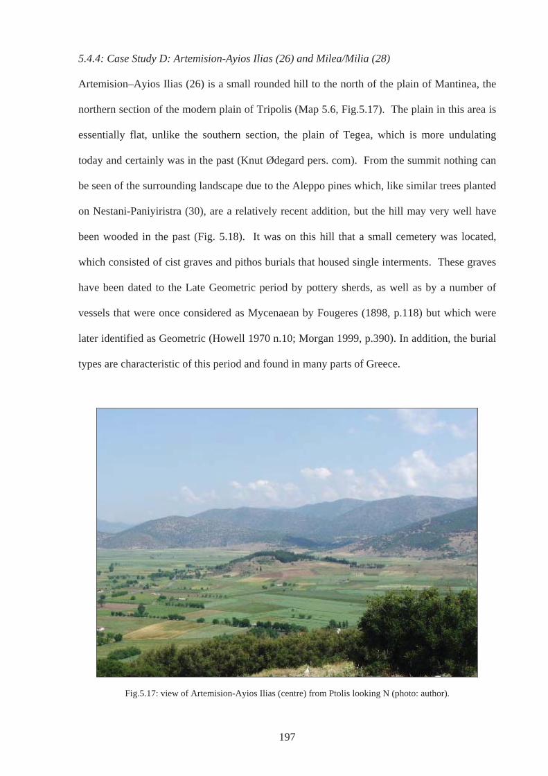
5.4.4: Case Study D: Artemision-Ayios Ilias (26) and Milea/Milia (28)
Artemision–Ayios Ilias (26) is a small rounded hill to the north of the plain of Mantinea, the
northern section of the modern plain of Tripolis (Map 5.6, Fig.5.17). The plain in this area is
essentially flat, unlike the southern section, the plain of Tegea, which is more undulating
today and certainly was in the past (Knut Ødegard pers. com). From the summit nothing can
be seen of the surrounding landscape due to the Aleppo pines which, like similar trees planted
on Nestani-Paniyiristra (30), are a relatively recent addition, but the hill may very well have
been wooded in the past (Fig. 5.18). It was on this hill that a small cemetery was located,
which consisted of cist graves and pithos burials that housed single interments. These graves
have been dated to the Late Geometric period by pottery sherds, as well as by a number of
vessels that were once considered as Mycenaean by Fougeres (1898, p.118) but which were
later identified as Geometric (Howell 1970 n.10; Morgan 1999, p.390). In addition, the burial
types are characteristic of this period and found in many parts of Greece.
Fig.5.17: view of Artemision-Ayios Ilias (centre) from Ptolis looking N (photo: author).
197
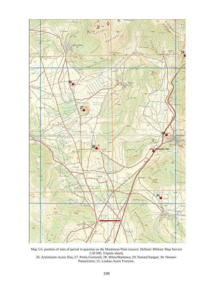
Map 5.6: position of sites of period in question on the Mantinean Plain (source: Hellenic Military Map Service 1:50 000, Tripolis sheet).
26: Artemision-Ayios Ilias; 27: Ptolis-Gortsouli; 28: Milea/Mantinea; 29: Nestani/Sangas; 30: Nestani-Panayiristra; 31: Loukas-Ayios Yioryios.
198
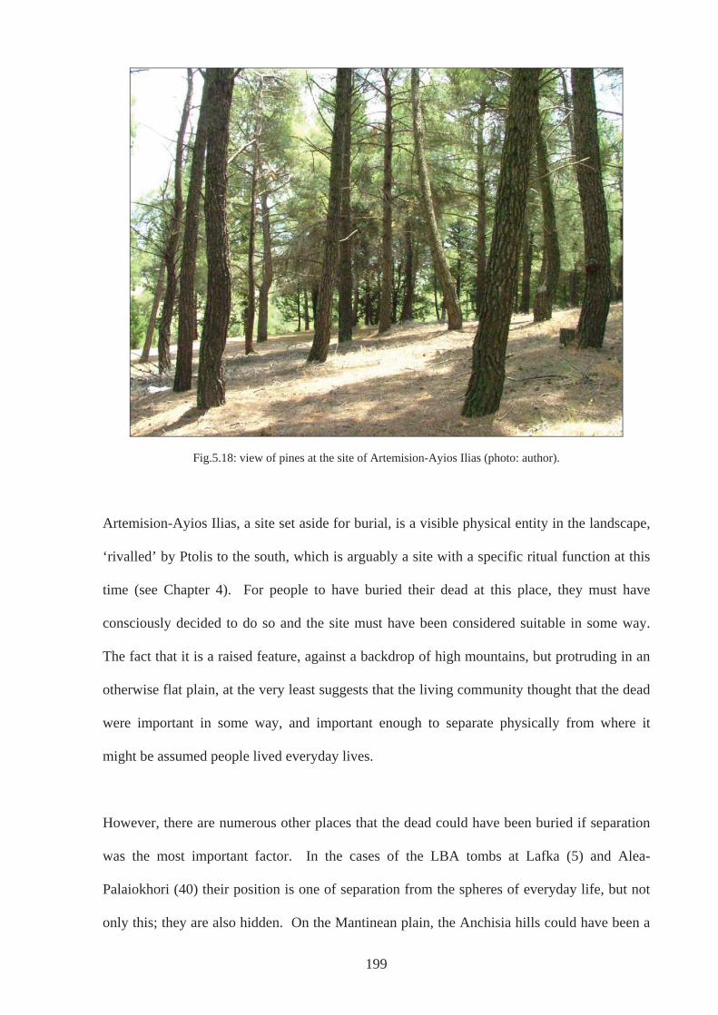
Fig.5.18: view of pines at the site of Artemision-Ayios Ilias (photo: author).
Artemision-Ayios Ilias, a site set aside for burial, is a visible physical entity in the landscape,
‘rivalled’ by Ptolis to the south, which is arguably a site with a specific ritual function at this
time (see Chapter 4). For people to have buried their dead at this place, they must have
consciously decided to do so and the site must have been considered suitable in some way.
The fact that it is a raised feature, against a backdrop of high mountains, but protruding in an
otherwise flat plain, at the very least suggests that the living community thought that the dead
were important in some way, and important enough to separate physically from where it
might be assumed people lived everyday lives.
However, there are numerous other places that the dead could have been buried if separation
was the most important factor. In the cases of the LBA tombs at Lafka (5) and Alea-
Palaiokhori (40) their position is one of separation from the spheres of everyday life, but not
only this; they are also hidden. On the Mantinean plain, the Anchisia hills could have been a
199
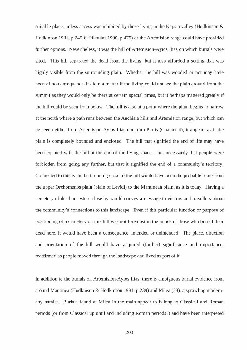
suitable place, unless access was inhibited by those living in the Kapsia valley (Hodkinson &
Hodkinson 1981, p.245-6; Pikoulas 1990, p.479) or the Artemision range could have provided
further options. Nevertheless, it was the hill of Artemision-Ayios Ilias on which burials were
sited. This hill separated the dead from the living, but it also afforded a setting that was
highly visible from the surrounding plain. Whether the hill was wooded or not may have
been of no consequence, it did not matter if the living could not see the plain around from the
summit as they would only be there at certain special times, but it perhaps mattered greatly if
the hill could be seen from below. The hill is also at a point where the plain begins to narrow
at the north where a path runs between the Anchisia hills and Artemision range, but which can
be seen neither from Artemision-Ayios Ilias nor from Ptolis (Chapter 4); it appears as if the
plain is completely bounded and enclosed. The hill that signified the end of life may have
been equated with the hill at the end of the living space – not necessarily that people were
forbidden from going any further, but that it signified the end of a community’s territory.
Connected to this is the fact running close to the hill would have been the probable route from
the upper Orchomenos plain (plain of Levidi) to the Mantinean plain, as it is today. Having a
cemetery of dead ancestors close by would convey a message to visitors and travellers about
the community’s connections to this landscape. Even if this particular function or purpose of
positioning of a cemetery on this hill was not foremost in the minds of those who buried their
dead here, it would have been a consequence, intended or unintended. The place, direction
and orientation of the hill would have acquired (further) significance and importance,
reaffirmed as people moved through the landscape and lived as part of it.
In addition to the burials on Artemision-Ayios Ilias, there is ambiguous burial evidence from
around Mantinea (Hodkinson & Hodkinson 1981, p.239) and Milea (28), a sprawling modern-
day hamlet. Burials found at Milea in the main appear to belong to Classical and Roman
periods (or from Classical up until and including Roman periods?) and have been interpreted
200
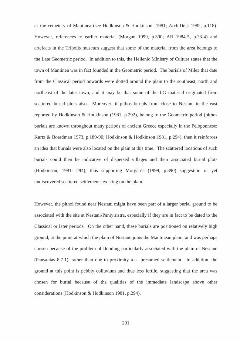
as the cemetery of Mantinea (see Hodkinson & Hodkinson 1981; Arch.Delt. 1982, p.118).
However, references to earlier material (Morgan 1999, p.390; AR 1984-5, p.23-4) and
artefacts in the Tripolis museum suggest that some of the material from the area belongs to
the Late Geometric period. In addition to this, the Hellenic Ministry of Culture states that the
town of Mantinea was in fact founded in the Geometric period. The burials of Milea that date
from the Classical period onwards were dotted around the plain to the southeast, north and
northeast of the later town, and it may be that some of the LG material originated from
scattered burial plots also. Moreover, if pithos burials from close to Nestani to the east
reported by Hodkinson & Hodkinson (1981, p.292), belong to the Geometric period (pithos
burials are known throughout many periods of ancient Greece especially in the Peloponnese:
Kurtz & Boardman 1973, p.189-90; Hodkinson & Hodkinson 1981, p.294), then it reinforces
an idea that burials were also located on the plain at this time. The scattered locations of such
burials could then be indicative of dispersed villages and their associated burial plots
(Hodkinson, 1981: 294), thus supporting Morgan’s (1999, p.390) suggestion of yet
undiscovered scattered settlements existing on the plain.
However, the pithoi found near Nestani might have been part of a larger burial ground to be
associated with the site at Nestani-Paniyiristra, especially if they are in fact to be dated to the
Classical or later periods. On the other hand, these burials are positioned on relatively high
ground, at the point at which the plain of Nestane joins the Mantinean plain, and was perhaps
chosen because of the problem of flooding particularly associated with the plain of Nestane
(Pausanias 8.7.1), rather than due to proximity to a presumed settlement. In addition, the
ground at this point is pebbly colluvium and thus less fertile, suggesting that the area was
chosen for burial because of the qualities of the immediate landscape above other
considerations (Hodkinson & Hodkinson 1981, p.294).
201
Burials and cemeteries of the Geometric period could be located in two different types of
places: in elevated positions as at Artemision-Ayios Ilias; or on the level as around Milea and
the area close to Nestani. This situation is not peculiar to Arkadia but is typical of southern
Greece as a whole. In all places, the different locations of burials would have invoked
different experiences of death and the dead. Burials on a plain close to proposed settlements
indicate a physical closeness with the dead that would not have been experienced at the LBA
sites examined above, nor with those buried at Artemision-Ayios Ilias. However, although
we can see differences between the burial landscapes of the LBA and the LG periods, it has
been suggested that similarities existed between funerary rituals of both ages, as seen in the
depiction of ritual funerary behaviour on the Tanagran larnakes, on sherds from Ayia Triadha
in Elis and on Geometric pithoi (Cavanagh & Mee, 1995). This may be the case, but such
pictorial evidence comes from relatively isolated examples – the LBA larnakes from Tanagra
in Boeotia, scenes from seven pottery sherds from the LBA chamber tomb 5 at Ayia Triadha
and Geometric vases of the eighth century from Athens. Nonetheless, lamentation with arms
outstretched, touching heads, the suggestion of procession in the lines of figures and the laid
out body, as well as assigned roles to men and women during the funerary rites, has been used
to indicate continuity in, and of, ritualised behaviour. In addition, evidence from the later
Classical period regarding ritual mourning of kinswomen, has indicated to many scholars that
the ritual lamenting, particularly by female mourners (cf figures on Athenian geometric vases)
during a funeral procession, was an old and widely observed custom (Dickinson 1994, p.229;
Cavanagh and Mee, 1995; Kurtz and Boardman, 1973).
If funeral processions were the means used to bury those on the hill of Artemision-Ayios Ilias,
then such a procession would have been widely seen, a public spectacle even, more so than
any processions that may have taken place at Lafka (5), Alea-Palaiokhori (40) and even
Vourvoura (44). The nature of the landscape, of the wide-open plain, would have enabled
202
people who were not directly involved to watch from a distance. Those organising and taking
part in proceedings probably had very little control about who could do this and perhaps had
very little desire to exert any either. In addition, although there is a stream relatively close to
the site, it is not prominent, and the association with water is not apparent, as it had been in
the LBA. Again, the openness of the landscape may have facilitated the importance of the
sky, its expanse very evident as one moves from place to place on the plain. Rather than
water as the transporter of the soul, it may have been the air, enhancing the ethereal quality of
the spirit of the deceased (cf. Goodison 1989, p.179).
The only contemporary literary evidence that we have for attitudes towards their dead of those
living in the 8th century is Homer. Sourvinou-Inwood (1995, p.116), after full consideration
of the context in which the Homeric stories were transmitted and told, argues that at this
period there is an apparent belief in the dead as retaining reason and wisdom as opposed to the
earlier belief in the witless dead. The change from multiple to single burials may go some
way to support this. If the spirit retained its sense, it would not be wise to interfere with its
remains with which it may have kept a connection. Multiple burials by their very nature were
revisited to deposit more remains, often with the earlier burials being disturbed as at many
LBA chamber and tholos tombs. There is no evidence of multiple burials in the graves of this
site, despite the fact that there are cases of two or more in ‘simple’ grave types of the
Mycenaean period (Lewartowski 1995, p.104). However, even if the burials possessed single
interments, revisiting the graves was not prohibited. Presumably, they were also marked out
in some way, perhaps by a small mound of stones or earth: the pithoi reported by Hodkinson
& Hodkinson (1981, p.148) had evidence of a covering of stones as grave markers.
Whatever the grave marker, the fact that the dead were buried in a specific place meant that
they still had a material presence and occupied a location in space. When that space was
203
approached or looked upon during the course of everyday living, the memory of the dead
would have come to the fore. When on the hill and observing individual grave markers, the
memory of that particular individual would be brought to mind. When on the plain, the whole
hill may have served to recall the memory of past members of the community collectively, as
the marker over a multiple tombs of the late Bronze Age may have done. The extent to which
this occurred for individuals would have been dependent on numerous factors, i.e. whether
one had recently buried a relative or prominent member of the community, the age of the
person remembering, and the knowledge of the person doing the experiencing. Perhaps in
situations where prominent members were buried, the whole hill, for a time a least, could be
synonymous with that certain individual.
5.5: Conclusions
Death and burial were, and are, aspects of existence that people, as part of communities and
on an individual level, have to confront. The case studies above have allowed an exploration
of how people did this at various times and in various places through the period in question.
In all cases, it has been possible to glimpse something of how landscapes might have been
manipulated by people responding to the physicality of place in which they moved, in an
effort to confront such an inevitable task.
Generalisations can always be made from the available evidence, but the variety of landscapes
in which tombs were set should allow an appreciation of the differences people living in such
places would have experienced. At Lafka (5) and Alea Palaiokhori (40), access may have
been limited and experience removed from the everyday. At Vourvoura-Analipsis (44),
despite the hill on which the tholoi were located being separate from that which had
settlement evidence, it was visibly and physically much more accessible than the other
examples. Surely this would have created a different relationship with the dead even within
204
the same period and same region. The importance of controlling passage and procession,
limiting the numbers of people who could approach and dictating who they might be, could
have been of vital importance for the tomb in the Lafka gulley. The seasonality of rivers in all
these cases may have been seen to be in the control of certain groups, those whose ancestors
were believed to be buried in tombs of certain types and in certain places. In this way,
cosmological beliefs were reinforced by actual experience as people encountered the
landscape everyday as well as through specialised rituals. The tombs, for example at Alea
Palaiokhori (40), could have been part of rituals that were not funerary in nature but which
invoked, created and reinforced ideas of the social and cosmological order, by using tombs of
ancestors, the past, the way things were and had always been. During everyday activities,
people would have been conscious and aware of the location of these tombs, to some extent at
least, a latent reminder of the order of things (cf Darvill 1997, p.197; Garwood 2002). In this
way we appreciate not only the importance of agency of people, but also how non-human
‘objects’, the landscape and material culture, act back with an agency of their own, informing
and influencing people as life is lived. For the PG and G period, we have limited evidence
and much has not been located precisely enough for a detailed assessment. However, an
investigation into Artemision-Ayios Ilias and the surrounding area has allowed an exploration
into the effect death and dying may have had on those living in this landscape, where the sky
and the air may have been the important element in transporting the soul.
At the LBA tombs of Vourvoura Analipsis and Alea-Palaiokhori there is evidence of visitors
to the tombs some four centuries later. Although this evidence is scanty and limited to a few
sherds, they have been interpreted as evidence of hero-cult/ancestor worship by more than one
scholar (e.g. Antonaccio 1995, p.68; Deoudi 1999, p.102; Coldstream 2003, p.346). This
practice is seen as a feature of the eighth century and one that insinuates a belief in the power
of the deceased. As touched upon in the above case studies, the belief in such power is in
205
contrast to that posited for the Mycenaean period. For this period evidence from Homer (e.g.
Odyssey, Book 11) and the treatment of bones after death in some Bronze Age tombs, testify
to the dead as being senseless (Sourvinou-Inwood 1995, p.92). In the eighth century,
however, it has been argued by Sourvinou-Inwood (1995 p.117) that belief was in the
importance of an individual, an individual that had potency after death, even retained within
the bones themselves: the power and importance that the bones of Orestes held for Tegea and
Sparta is particularly striking example (Herodotus, 1.67-68; Pausanias 3.3.6, 3.11.10; 8.54.4).
Sourvinou-Inwood (1995, p.117 cf Calligas 1988, p.229) sees one of the first manifestations
of this change in belief in the heroon at Lefkandi, where the grave of an individual was
marked out and their social persona symbolised (in this case, but not always, so
monumentally), and the widespread practice of hero cult and ancestor worship in the eighth
century was a continuation of the same idea, albeit with different articulation. Also valid in
this respect are ideas that have explained the appearance of hero cult in the eighth century in
terms of legitimising claims to land, whether by a new emerging, incoming elite or a
desperate indigenous community trying to retain control over their land (Calligas 1988, p.232;
Antonaccio 1995).
However, in Arkadia there is very limited evidence for hero cult as it is recognised for other
areas of Greece, and the arguments used to explain its occurrence in these other places give
food for thought regarding the Arkadian situation. Hero cult has been interpreted largely as
either a new elite legitimising their position, or an existing population that needed to cement
ties to the lands on which they already lived in the face of new uncertainties (Calligas 1988,
p.232; Antonaccio 1995). Both could have been influenced by the circulation of Homeric
epic at this time, posited by Coldstream (2003, p.346) as being a highly significant factor in
the emergence of this tradition. He concludes that in places such as Argolid and Laconia the
difference in tholoi and contemporary burial practice in the 8th century meant that people
206
were awestruck when such structures were chanced upon. Likewise, in Attica, where there
was a wholly different burial practice in the Geometric period to that in the Mycenaean
alongside a strong sense of ‘always-having-been-present’, there are very strong indications of
hero-cult; an existing population, inspired by Homeric poems, rooting themselves firmly in
the land. On the other hand, in areas that had continued burying in tholoi such as Thessaly,
such tombs were commonplace and ‘hero-cult’ did not have the opportunity to flourish; the
circulation of epic tales was not inspirational in the same way.
In terms of Arkadia, the sites where hero-cult has tentatively been suggested are in the
borderlands with Laconia, precisely a place where it is widespread (Coldstream 2003, p.346).
The chamber tombs at Palaiokastro-Palaiopyrgos (tombs) in the west, on the other hand, show
no such tendencies. Similarly, chamber tombs in modern Achaea (but in the same
geographical area as the western chamber tombs of Arkadia) have very little evidence of hero-
cult. If we remember that this is an area, which, like Thessaly, continued using monumental
tombs for centuries after the Mycenaean period ended, then the lack of such cult comes as no
surprise given Coldstream’s conclusions. Perhaps such tombs were lost to site and memory,
or the same uncertainties did not arise in these areas negating the need for an existing
population to ‘re-root’ themselves with their ancestors. As the evidence shows, the tombs at
Palaiokastro-Palaiopyrgos were in use from the heyday of Mycenaean civilisation in the 13th
century BCE (LHIIIB) to the LHIIIC period in the 12th century and perhaps beyond.
Although there is evidence of an increase in population at this particular site, in central areas
the geographical position of Arkadia may have prevented such fluidity of movement as was
probable in other areas. If there were no newcomers trying to stake their claim, there would
be no need for any group to legitimise their position or for existing populations to reinforce
theirs. However, in connection with the evidence at a number of religious sites (Chapter 4),
207
any reinforcing of roots or appropriating memories and ancestors may have been expressed
through the deliberate location of sacred sites on top of earlier settlements.
In addition, during the period in question, there is a change in the predominant burial type,
from multiple to single. Changes in belief, from a senseless soul to a sentient spirit, is one
way of understanding the changes, but as well as giving insight into how the living related to
the dead they can perhaps also highlight how the living related to the living. In the Late
Bronze Age, the most important relationships in which an individual participated seems to
have been kin and family, and it was these relationships, which were emphasised in multiple
tombs. Single graves, on the other hand, suggest the importance of the individual, and when
placed in a communal cemetery, which is what the Artemision-Ayios Ilias site may be
optimistically called, imply the importance of more community based, ‘political’ alliances
that emphasised the participation of individual members. These ties to the wider group were
more important than that of family or kinship and power and prestige, the status of an
individual was achieved, not ascribed. These changes perhaps reflect and can be associated
with the emergence of the polis, where participation in public life was valued.
Such interpretations of the evidence allow generalisations to be made and enable an
understanding of how the Arkadian evidence can fit in with trends seen throughout the Greek
world during this period. However, a consideration of the particular, of the specific landscape
contexts in which changes in belief and practice were taking place, gives a renewed and
deeper understanding of this period in this place - Arkadia.
208
CHAPTER 6: LANDSCAPES OF EVERYDAY LIVES
6.1: Introduction
This chapter concentrates on aspects of the landscape that are associated with everyday living,
and considers sites that have neither an overt, nor specific, ritual function, whether in terms of
religion and the sacred, or death and burial; aspects that have been covered in previous
chapters. In other words, evidence originates from sites that are usually interpreted as
settlements or as having a utilitarian function, such as hydraulic works and roads. However,
structures such as hydraulic works, which undoubtedly did have a utilitarian function, could
also have great sacred significance. Moreover, landscapes apprehended in everyday
circumstances cannot be separated from the religious, cosmological and mythological beliefs
of the communities and individuals who dwell within them without causing artificial
boundaries. With these points in mind, Section 6.2 begins with a consideration of the general
evidence we have for settlement and utilitarian works in Greece as whole and outlines the
sites in Arkadia for each of the periods in question. After a discussion in Section 6.3 of how
this evidence can be, and often is, interpreted in terms of changing settlement patterns,
demographics, economy, and social structure, Section 6.4 investigates, through a number of
case studies, how people may have lived, used and been affected by aspects of the landscape
which were part of their everyday lives. The case studies concentrate on Orchomenos (Case
Study A), the Mantinean Plain (Case Study B), Loukas-Ayios Yioryios and Nestani-
Paniyiristra (Case Study C) and the plains of Stymphalos and Pheneos (Case Study D).
6.2: Overview
6.2.1: Late Helladic evidence of the everyday in Greece
The typical picture of Mycenaean settlement is of a citadel or palace often with surrounding
‘town’, presiding over a territory in which small farmsteads or villages were situated (Wardle
209
1997, p.15). This general pattern can be seen in areas such as Messenia (centred on Pylos),
the Argolid (centred on Mycenae), and Boeotia (centred on Thebes), and it is one that is
clarified by Linear B tablets discovered at these centres. However, as Dickinson (1994, p.52)
states, from the very beginning of the Bronze Age there is much variation within and between
regions, and even this ‘typical’ picture may not have been a reality in most places. In the
Argolid for example, Tiryns has often been cited as being subservient to Mycenae, largely due
it lying in close proximity, and its presence has usually been explained in terms of defence of
a harbour. It is certainly true that in the LBA, Tiryns lay close to the coast and it may have
come under the authority of Mycenae for at least part of the LBA, but not necessarily for the
totality of its existence. Thus, other explanations may need to be sought to explain the
situation (Dickinson 1994, p.78 & p.86). Likewise, in Boeotia, sites that lie within areas
where the ‘typical’ pattern has been posited e.g. Orchomenos, Gla, and Thebes, and the
relationship between them, are far from clear. In areas such as Achaea, Elis and Arkadia,
there is even less evidence for the ‘typical’ pattern and less organised principalities may well
have been the norm.
Most areas saw the greatest number of settlements in the LHIIIA and LHIIIB period,
particularly in terms of rural sites (e.g. Cavanagh 2005). The end of this phase
(LHIIIB/LHIIIC transition) is characterised by a destruction horizon at a number of the large
centres. This horizon is found at Mycenae, Tiryns and Berbati in the Argolid (Wace 1949;
Åkerström 1987; Kilian 1990), Zygouries in Korinthia (Blegen 1928), the Menelaion in
Lakonia (Catling 1976-77), Pylos and Nichoria in Messenia (Blegen 1966; McDonald 1991),
and Thebes and Gla in Boeotia (Kienast 1987; Keramopoulos 1917). In addition, smaller
settlements all but disappear from the record (MacDonald and Rapp 1972; Dickinson 1994,
p.86; Jameson, Runnels and van Andel 1994; Cavanagh 2005). However, despite destruction
at a number of centres and a general reduction in size and number of settlements, organised
210
society continued. In some areas, there actually seems to have been an increase in population,
a scenario suggested for Achaea based on the cemetery evidence (Papadopoulos 1978-79). In
addition, in the Argolid, Tiryns was rebuilt and grew to its greatest size, and perhaps became
the most prominent site at this time (Killian 1988, p.135). Moreover, a number of other
significant sites existed in this period, such as Lefkandi, which covered large areas (up to six
ha) and which incorporated substantial two-storey buildings (Popham & Sackett, 1968;
Dickinson 1994, p.86).
Within the palaces and settlements, buildings consisted largely of square and rectangular
rooms. A particular arrangement of rooms known as the megaron was a particular feature of
the palaces, with the largest room often interpreted as the throne room (e.g. at Pylos and
Mycenae). Unsurprisingly, the quality of architecture in the palaces was generally of very
high quality but average houses seem to be especially poor (Dickinson 1994, p.80, p.153-
157). Exceptions can be found in buildings of the ‘corridor house’ class (Hiesel 1990,
pp.111-115), and although the Panayia house of this class at Mycenae seems to have been
purely residential, others may have been storehouses and offices.
Fortifications can be found at a number of LH sites, although they are rare before the end of
the LHIIIB phase. Those at Mycenae, Tiryns and Gla, are constructed in Cyclopean’ masonry
and, where they incorporated water supplies and wide open spaces that could act as refuges
for the local population, a specific defensive purpose may be postulated with some certainty.
However, there is no doubt that such structures also served as an expression of power to those
who observed them. Such fortifications have supported theories of invaders entering
mainland Greece, often identified with the Sea peoples and/or Dorians, which caused the
collapse of Mycenaean Civilisation (e.g. Taylour 1964, p160-1). Whilst it cannot be denied
that the evidence suggests unrest at the end of the LHIIIB, fortifications were never built at
211
this time at major sites such as Orchomenos in Boeotia and Pylos in Messenia, although an
earlier wall made of relatively small blocks built in LHI period could have still existed at the
latter (Blegen 1966).
Hydraulic works and roads are among the archaeological remains of a profane nature in the
LBA. Research carried out by Kilian at Gla (1988, p.133), has enabled hydraulic works to be
dated to the LBA, a time when the Kopais basin was drained in order to provide land for
cultivation. A similar type of construction exists at Tiryns but, although there is little certain
dating evidence for these structures, they share a comparable building style. Likewise, a road
system centring on Mycenae that includes bridges and culverts is built using similar
construction techniques. In addition, Dickinson (1994, p.162) argues that hydraulic works
and roads must date to the LBA as they focus on sites of the period such as Gla, Tiryns and
Mycenae. Similarly, hydraulic works in Arkadia are dated to the LBA because not only is
their construction comparable to other BA hydraulic works, they are also found in areas that
have evidence of settlement and which would otherwise be uninhabitable due to flooding (see
below). Furthermore, aqueducts at Pylos and Thebes and drains associated with houses at
Mycenae and Tiryns attest to the existence of practical engineering skills needed to control
water (Blegen 1966, p.332-6; Iakovides 1983, p.15-17, p.67-8; Symeonoglou 1985, p.50-2).
6.2.2: Late Helladic evidence of the everyday in Arkadia
Some of the points raised above are pertinent to Arkadia, although there is no evidence of the
typical settlement pattern focussed on palaces. In fact, regions such as Arkadia attest to the
variation found throughout the Mycenaean koine. However, evidence for settlement and
other sites that have no obvious religious or burial associations is minimal. The details can be
found in Table 6.1. Of 45 sites 16 are little more than scatters and 11 are findspots. The
212
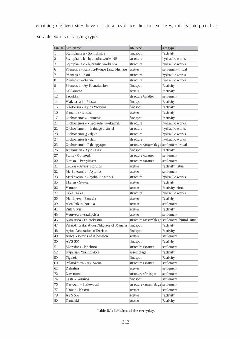
remaining eighteen sites have structural evidence, but in ten cases, this is interpreted as
hydraulic works of varying types.
Site ID Site Name site type 1 site type 2 1 Stymphalia a - Stymphalos findspot ?activity 2 Stymphalia b - hydraulic works NE structure hydraulic works 3 Stymphalia c - hydraulic works SW structure hydraulic works 6 Pheneos a - Kalyvia-Pyrgos (anc. Pheneos) scatter settlement+ritual 7 Pheneos b - dam structure hydraulic works 8 Pheneos c - channel structure hydraulic works 9 Pheneos d - Ay Kharalambos findspot ?activity 11 Lakkomata scatter ?activity 12 Tsoukka structure+scatter settlement 14 Vlakherna b - Plessa findspot ?activity 15 Khotoussa - Ayios Yioryios findspot ?activity 16 Kandhila - Bikiza scatter ?activity 17 Orchomenos a - summit findspot ?activity 21 Orchomenos e - hydraulic works/mill structure hydraulic works 22 Orchomenos f - drainage channel structure hydraulic works 23 Orchomenos g - dyke structure hydraulic works 24 Orchomenos h - dam structure hydraulic works 25 Orchomenos - Palaiopyrgos structure+assemblage settlement+ritual 26 Artemision - Ayios Ilias findspot ?activity 27 Ptolis - Gortsouli structure+scatter settlement 30 Nestani - Paniyiristra structure+scatter settlement 31 Loukas - Ayios Yioryios scatter ?activity+ritual 32 Merkovouni a - Ayiolias scatter settlement 33 Merkovouni b - hydraulic works structure hydraulic works 35 Thanas - Stoyia scatter ?activity 36 Vounon scatter ?activity+ritual 37 Lake Takka structure hydraulic works 38 Manthyrea - Panayia scatter ?activity 39 Alea Palaiokhori - a scatter settlement 41 Psili Vrysi scatter ?activity 43 Vourvoura-Analipsis a scatter settlement 45 Kato Asea - Palaiokastro structure+assemblage settlement+burial+ritual 47 Palaiokhoraki, Ayios Nikolaos of Manaris findspot ?activity 48 Ayios Athanasios of Dorizas findspot ?activity 49 Ayios Yioryios of Athenaion scatter settlement 50 AVS S67 findspot ?activity 51 Skortsinos - Khelmos structure+scatter settlement 52 Kyparissi Yiannolakka assemblage ?activity 59 Figaleia findspot ?activity 60 Palaiokastro - Ay. Sotira structure+scatter settlement 62 Dhimitra scatter settlement 72 Dimitsana structure+findspot settlement 74 Lasta - Kollinos findspot settlement 75 Karvouni - Sfakovouni structure+assemblage settlement 77 Dhavia - Kastro scatter settlement 79 AVS S62 scatter ?activity 80 Kanelaki scatter ?activity
Table 6.1: LH sites of the everyday.
213
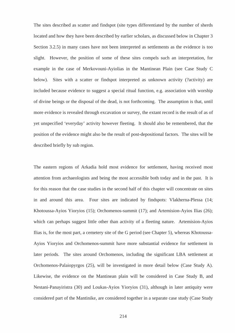
The sites described as scatter and findspot (site types differentiated by the number of sherds
located and how they have been described by earlier scholars, as discussed below in Chapter 3
Section 3.2.5) in many cases have not been interpreted as settlements as the evidence is too
slight. However, the position of some of these sites compels such an interpretation, for
example in the case of Merkovouni-Ayiolias in the Mantinean Plain (see Case Study C
below). Sites with a scatter or findspot interpreted as unknown activity (?activity) are
included because evidence to suggest a special ritual function, e.g. association with worship
of divine beings or the disposal of the dead, is not forthcoming. The assumption is that, until
more evidence is revealed through excavation or survey, the extant record is the result of as of
yet unspecified ‘everyday’ activity however fleeting. It should also be remembered, that the
position of the evidence might also be the result of post-depositional factors. The sites will be
described briefly by sub region.
The eastern regions of Arkadia hold most evidence for settlement, having received most
attention from archaeologists and being the most accessible both today and in the past. It is
for this reason that the case studies in the second half of this chapter will concentrate on sites
in and around this area. Four sites are indicated by findspots: Vlakherna-Plessa (14;
Khotoussa-Ayios Yioryios (15); Orchomenos-summit (17); and Artemision-Ayios Ilias (26);
which can perhaps suggest little other than activity of a fleeting nature. Artemision-Ayios
Ilias is, for the most part, a cemetery site of the G period (see Chapter 5), whereas Khotoussa-
Ayios Yioryios and Orchomenos-summit have more substantial evidence for settlement in
later periods. The sites around Orchomenos, including the significant LBA settlement at
Orchomenos-Palaiopyrgos (25), will be investigated in more detail below (Case Study A).
Likewise, the evidence on the Mantinean plain will be considered in Case Study B, and
Nestani-Panayiristra (30) and Loukas-Ayios Yioryios (31), although in later antiquity were
considered part of the Mantinike, are considered together in a separate case study (Case Study
214
C). The eight sites in the northeastern region namely those found on and around the plains of
Stymphalos and Pheneos will be considered in Case Study D.
In central Arkadia, there is a range of evidence for settlement of the LBA. Lasta-Kollinos
(74) and Davio-Kastro (77) have very limited evidence for the LBA, but considerable
evidence exists for later settlement on the same sites. In addition, both are on significant
mountain/hill tops that in the Hellenistic period, at least, had fortifications (Howell 1970,
n.46; n.49). The only sites with structural remains, however, are Dimitsana (72) and
Karvouni-Sfakovouni (75). Pikoulas (1986, p.113) analysed remains of ancient walls at
Dimitsana, but only assigns one to the Mycenaean period. The others he dates to the late
sixth and fourth centuries BCE. The possible Mycenaean example may well correspond to
that described as Cyclopean by Ellingham et al. (2000, p.228). However, the site at
Karvouni-Sfakovouni is undoubtedly a settlement and is composed of a conglomeration of
structures interpreted as houses. This particular site has evidence of inhabitation from the
Neolithic until the Mycenaean period (Spyropoulos 2000, p.8 and see Fig.6.1 below).
Fig.6.1: plan of Karvouni-Sfakovouni (source: Spyropoulos 2000, p.8).
215
In the south east of Arkadia, the sites at Alea-Palaiokhori a (39) and Vourvoura-Analipsis a
(43) have been interpreted as settlements (Howell 1970, n.32; Waterhouse & Hope Simpson
1961, p.130). However, evidence at these places is confined to a handful of sherds datable to
the Mycenaean period and lithics. The interpretation of such evidence as representing
settlement in this period has much to do with the close proximity of cemeteries: the
assumption is that a living community resided close to where they buried their dead (see
Chapter 5). At Vourvoura Analipsis, the later Classical settlement situated on the same site
(Romaios 1950; 1952) adds weight to this explanation. Further to the north, in the area of
Lake Takka (37), hydraulic works have been located and dated to the LBA (Knauss 1989a).
Unfortunately, these no longer exist due to ongoing irrigation works (Zoë Roumelioti of
Tegea Museum, November 2003, pers. comm.). Another four sites in the region are scatters
of material with little else to indicate the nature of activity (Thanas–Stoyia (35), Vounon (36),
Manthyrea–Panayia (38) and Psili Vrysi (41)).
In the south of Arkadia, Kato Asea–Palaiokastro (45) in the Asea Valley has produced LHI-II
and LHIIIB sherds on a site that has more prolific evidence from the Neolithic, Early Helladic
and Middle Helladic periods (PG, G sherds were also found at this site, see below). Also in
the Asea Valley, five sites were located during a recent survey (Forsen 2003). All, except the
substantial scatter at Ayios Yioryios of Athenaion (49), and the scatter at AV62 (79), were
findspots of LH material, although these were found in association with more substantial
material from later periods. Still, in the south of the region and close to the borders of
Laconia, LHIIIA-B sherds were found on the slopes of Skortsinos–Khelmos (51) and
although Hope-Simpson (1965, p.50) describes this site as a settlement, Howell (1970, n.53)
is less optimistic. Fortifications built around the summit have been variously dated over the
years: Loring (1895) stated he was of the opinion they were Classical, whereas Waterhouse &
Hope Simpson (1961, p.125) believed them to be Medieval. However, Pikoulas, like
216
Dörpfeld before him (1988, p.116 no.70), argues for a Mycenaean date, thus strongly
supporting the idea that this site was indeed a settlement in the LBA and a substantial one at
that.
In the western regions of Arkadia, there are only three sites with evidence pertaining to
settlement. From Figaleia (59) there is only one item and this has no clear provenance. This
is a rock crystal sealstone dated as Mycenaean by Ridgeway (1896), which has been in the
Rousopoulos collection in Athens since 1875 (Howell 1970, no.57). Further north on the
banks of the Alpheios, Palaiokastro-Ayia Sotira (60), the hill above the cemetery site of
Palaiokastro-Palaiopyrgos (61), has been interpreted as a settlement. LH sherds were found
here and although the visible walls are predominantly Classical (Demakopoulou & Crouwel
1998) traces of earlier structures have been dated to the Mycenaean period by Howell (1970,
no.55) and Hope-Simpson (1983). Finally, near the village of Dhimitra (62) in the north
western region of Arkadia, a substantial settlement dating from the Neolithic to the LBA was
discovered when the current road was built (Syriopoulos 1973).
6.2.3: Sub Mycenaean evidence of the everyday in Greece
Most SM evidence is actually in the form of burials and their contents and consequently there
is very little that can be discussed in terms of settlement and everyday activity. However,
material datable to the SM period has been found in a closed context above levels of a LHIIIC
Late date at Mycenae and Tiryns (Mountjoy 1999, p.56) and three deposits from the Agora in
Athens have produced ‘SM’ material that is recognised as the result of everyday living
(Smithson 1977). This material is described by Smithson (1977, p.79) as being
“chronologically intermediate between the earliest Protogeometric wells and the latest LHIIIC
deposits in Athens”, but the author then goes on to say that the term ‘sub-Mycenaean’ may
actually prove to be superfluous. In addition, depending on the area in question and the
217
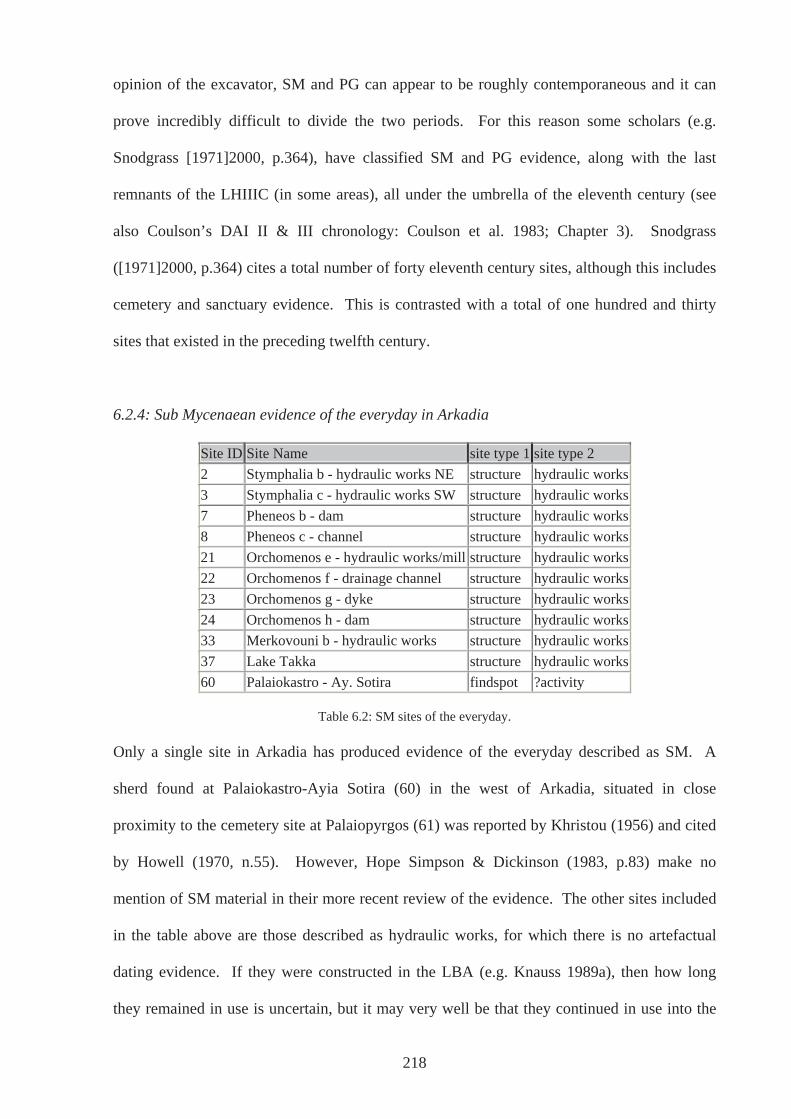
opinion of the excavator, SM and PG can appear to be roughly contemporaneous and it can
prove incredibly difficult to divide the two periods. For this reason some scholars (e.g.
Snodgrass [1971]2000, p.364), have classified SM and PG evidence, along with the last
remnants of the LHIIIC (in some areas), all under the umbrella of the eleventh century (see
also Coulson’s DAI II & III chronology: Coulson et al. 1983; Chapter 3). Snodgrass
([1971]2000, p.364) cites a total number of forty eleventh century sites, although this includes
cemetery and sanctuary evidence. This is contrasted with a total of one hundred and thirty
sites that existed in the preceding twelfth century.
6.2.4: Sub Mycenaean evidence of the everyday in Arkadia
Site ID Site Name site type 1 site type 2 2 Stymphalia b - hydraulic works NE structure hydraulic works 3 Stymphalia c - hydraulic works SW structure hydraulic works 7 Pheneos b - dam structure hydraulic works 8 Pheneos c - channel structure hydraulic works 21 Orchomenos e - hydraulic works/mill structure hydraulic works 22 Orchomenos f - drainage channel structure hydraulic works 23 Orchomenos g - dyke structure hydraulic works 24 Orchomenos h - dam structure hydraulic works 33 Merkovouni b - hydraulic works structure hydraulic works 37 Lake Takka structure hydraulic works 60 Palaiokastro - Ay. Sotira findspot ?activity
Table 6.2: SM sites of the everyday.
Only a single site in Arkadia has produced evidence of the everyday described as SM. A
sherd found at Palaiokastro-Ayia Sotira (60) in the west of Arkadia, situated in close
proximity to the cemetery site at Palaiopyrgos (61) was reported by Khristou (1956) and cited
by Howell (1970, n.55). However, Hope Simpson & Dickinson (1983, p.83) make no
mention of SM material in their more recent review of the evidence. The other sites included
in the table above are those described as hydraulic works, for which there is no artefactual
dating evidence. If they were constructed in the LBA (e.g. Knauss 1989a), then how long
they remained in use is uncertain, but it may very well be that they continued in use into the
218
eleventh century BCE. However, general consensus, supported by comparison to hydraulic
works at Gla, asserts that they went out of use sometime at the end of the LHIIIB period or in
the LHIIIC period (e.g. Knauss 1988; 1999; 1990; Knauss et al. 1986; Dickinson 1994, p.163-
4; Iakovides 2003).
6.2.5: Protogeometric evidence of the everyday in Greece
Evidence that can be dated to the PG period is slightly more plentiful than that designated as
SM. In the Peloponnese there are examples of houses at Nichoria (Coulson et al. 1983),
Argos (Caskey 1971), and Asine (Wells 1983). Snodgrass ([1971]2000, p.58) also suggests
that habitation continued at Isthmia and Old Korinth. Unfortunately, it is not clear on what
evidence this view is based, although at Korinth a SM/EPG house was excavated in 1959
(Weinberg 1960). Nichoria is a particularly important site and this period sees the
construction of the ‘chieftains’ large apsidal dwelling (Unit IV-I; Coulson et al. 1983) and,
outside of the Peloponnese, at Lefkandi, evidence exists for resettlement of Xeropolis later in
the period (Popham 1979, p.3). At Dimini, a PG settlement (Iolkos) stood beside the
Mycenaean palace (Volos-Palia) (Adrimi-Sismani, 1992, 1994, 2000, 2002) where houses,
unusually for mainland Greece, were stone built and rectangular, similar to those at sites on
Crete (e.g. Karfi) and at Grotta on Naxos, where the LHIIIC settlement was rebuilt
(Desborough 1964, p.149; Snodgrass 2000, p.363).
6.2.6: Protogeometric evidence of the everyday in Arkadia
PG sites in Arkadia are few in number and those that do exist have produced very little
evidence. At Khotoussa-Ayios Yioryios (15) in the lower Orchomenos plain and Ptolis-
Gortsouli (27) in the Mantinean plain, evidence is limited to one or two sherds (Howell 1970,
n.1 & n.11) which can indicate very little other than these areas were not entirely deserted at
this time. Both these areas will be considered in more detail in Case Study A and B.
219
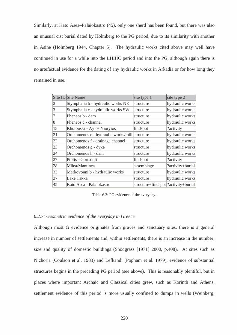
Similarly, at Kato Asea–Palaiokastro (45), only one sherd has been found, but there was also
an unusual cist burial dated by Holmberg to the PG period, due to its similarity with another
in Asine (Holmberg 1944, Chapter 5). The hydraulic works cited above may well have
continued in use for a while into the LHIIIC period and into the PG, although again there is
no artefactual evidence for the dating of any hydraulic works in Arkadia or for how long they
remained in use.
Site ID Site Name site type 1 site type 2 2 Stymphalia b - hydraulic works NE structure hydraulic works 3 Stymphalia c - hydraulic works SW structure hydraulic works 7 Pheneos b - dam structure hydraulic works 8 Pheneos c - channel structure hydraulic works 15 Khotoussa - Ayios Yioryios findspot ?activity 21 Orchomenos e - hydraulic works/mill structure hydraulic works 22 Orchomenos f - drainage channel structure hydraulic works 23 Orchomenos g - dyke structure hydraulic works 24 Orchomenos h - dam structure hydraulic works 27 Ptolis - Gortsouli findspot ?activity 28 Milea/Mantinea assemblage ?activity+burial 33 Merkovouni b - hydraulic works structure hydraulic works 37 Lake Takka structure hydraulic works 45 Kato Asea - Palaiokastro structure+findspot ?activity+burial
Table 6.3: PG evidence of the everyday.
6.2.7: Geometric evidence of the everyday in Greece
Although most G evidence originates from graves and sanctuary sites, there is a general
increase in number of settlements and, within settlements, there is an increase in the number,
size and quality of domestic buildings (Snodgrass [1971] 2000, p.408). At sites such as
Nichoria (Coulson et al. 1983) and Lefkandi (Popham et al. 1979), evidence of substantial
structures begins in the preceding PG period (see above). This is reasonably plentiful, but in
places where important Archaic and Classical cities grew, such as Korinth and Athens,
settlement evidence of this period is more usually confined to dumps in wells (Weinberg,
220
1949; Brann 1961). In fact, most evidence of settlement in this period presents itself in the
form of scatters found in later contexts (Coldstream 2003, p.303).
It has been argued (Mazarakis Ainian, 1997) that where structures do exist, particularly on the
mainland and early in the period (EG, ninth century BCE), they may be, in some cases, the
first post BA examples of temples (see Chapter 4). For instance, Building ST at Mende
Poseidi certainly suggests sacred significance rather than domestic use (Moschonissioti 1998,
p.265-7; Hall, 2006, p.86) Alternatively, such structures may have served more than one
function, being both a ‘chieftain’s’ house and a sacred building, such as has been suggested
for the PG chieftain’s house at Nichoria (Coulson et al. 1983). The hypothesis is that these
early structures were built more substantially than the dwellings of ordinary people, because
of the high status they held within the community, and as such, they have survived in the
archaeological record.
The plan of most buildings on mainland Greece, especially in the earlier G, whether domestic
or sacred, is generally apsidal, following the trend seen in the preceding PG period. Examples
have been found at Argos and Nichoria, as well as an isolated oval house of the 9th century in
the Agora at Athens. As stated in Chapter 4, although both domestic and sacred buildings
appear to have a similar form in the late PG and early G, as the period progressed, the two
types developed distinctive architecture. Temple buildings developed the peristyle and
became increasingly isolated and imposing, such as that at Ano Mazaraki-Rakita in Achaea
dated to the later eighth century (Mazarakis Ainian 1997, p.279; Hall 2006, p.86). Domestic
buildings on the other hand become gradually clustered and, in some cases, increasingly
rectangular. Some scholars have interpreted this as resulting from an increase in population
and as indicating a degree of planning (Snodgrass [1971]2000, p.413). Whilst both clustering
and the change from apsidal to rectangular may very well be responses to population increase,
221
there are problems with this. It is apparent elsewhere that evidence of such forms existed
early in the period when populations are thought to be still small (e.g. Emborio on Chios,
Zagora on Andros; Coldstream 2003, p.306). There is also no reason why rectangular
buildings should have the monopoly on forethought and planning. Houses in Smyrna were
largely apsidal until the seventh century BCE, but the walls of the ninth century show that the
Smyrnians were quite capable of planning and construction on a grand scale at an early date.
In addition, on Crete, stone-built rectangular structures were the common form throughout the
G, visible from the preceding sub-Minoan and PG period onwards (e.g. Karfi, Pendlebury et
al. 1937/8). The choice in type of domestic building may have had more connection with
regional trends and available building material than on increasing organisation and foresight.
6.2.8: Geometric evidence of the everyday in Arkadia
Like much of the evidence for the G period in the wider Greek world, most of that from
Arkadia comes from sanctuary and temple sites. However, there are a number of findspots
and scatters discovered on sites that have later, substantial evidence of settlement. Although
this evidence is scanty, it could be suggestive of early settlement where unsubstantial
buildings have been destroyed by later structures. At the very least, nothing suggests that
such scatters are the result of activity that was particularly religious or ritual in nature.
From the northern region of Arkadia, the only evidence for settlement of this period comes
from a site at Drosato Vrisariou-Lakes (69). Here, substantial surface material ranging in date
from the eighth to the first century BCE was discovered (Arch.Delt. 42 B 1982, p.164-5;
Morgan 1999, p.420). Close by, settlement evidence in the northeast has been found in and
around the plains of Pheneos and Stymphalos, evidence that is considered in Case Study D
below. In the east, settlement evidence has been found at three places. Kandhila–Bikiza (16),
and Khotoussa-Ayios Yioryios (15) are considered with the Orchomenos plains in Case Study
222
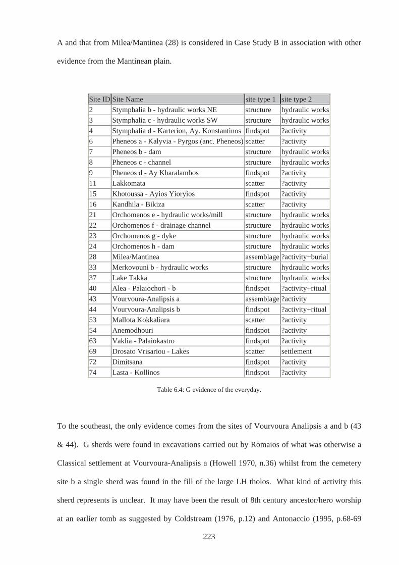
A and that from Milea/Mantinea (28) is considered in Case Study B in association with other
evidence from the Mantinean plain.
Site ID Site Name site type 1 site type 2 2 Stymphalia b - hydraulic works NE structure hydraulic works 3 Stymphalia c - hydraulic works SW structure hydraulic works 4 Stymphalia d - Karterion, Ay. Konstantinos findspot ?activity 6 Pheneos a - Kalyvia - Pyrgos (anc. Pheneos) scatter ?activity 7 Pheneos b - dam structure hydraulic works 8 Pheneos c - channel structure hydraulic works 9 Pheneos d - Ay Kharalambos findspot ?activity 11 Lakkomata scatter ?activity 15 Khotoussa - Ayios Yioryios findspot ?activity 16 Kandhila - Bikiza scatter ?activity 21 Orchomenos e - hydraulic works/mill structure hydraulic works 22 Orchomenos f - drainage channel structure hydraulic works 23 Orchomenos g - dyke structure hydraulic works 24 Orchomenos h - dam structure hydraulic works 28 Milea/Mantinea assemblage ?activity+burial 33 Merkovouni b - hydraulic works structure hydraulic works 37 Lake Takka structure hydraulic works 40 Alea - Palaiochori - b findspot ?activity+ritual 43 Vourvoura-Analipsis a assemblage ?activity 44 Vourvoura-Analipsis b findspot ?activity+ritual 53 Mallota Kokkaliara scatter ?activity 54 Anemodhouri findspot ?activity 63 Vaklia - Palaiokastro findspot ?activity 69 Drosato Vrisariou - Lakes scatter settlement 72 Dimitsana findspot ?activity 74 Lasta - Kollinos findspot ?activity
Table 6.4: G evidence of the everyday.
To the southeast, the only evidence comes from the sites of Vourvoura Analipsis a and b (43
& 44). G sherds were found in excavations carried out by Romaios of what was otherwise a
Classical settlement at Vourvoura-Analipsis a (Howell 1970, n.36) whilst from the cemetery
site b a single sherd was found in the fill of the large LH tholos. What kind of activity this
sherd represents is unclear. It may have been the result of 8th century ancestor/hero worship
at an earlier tomb as suggested by Coldstream (1976, p.12) and Antonaccio (1995, p.68-69
223
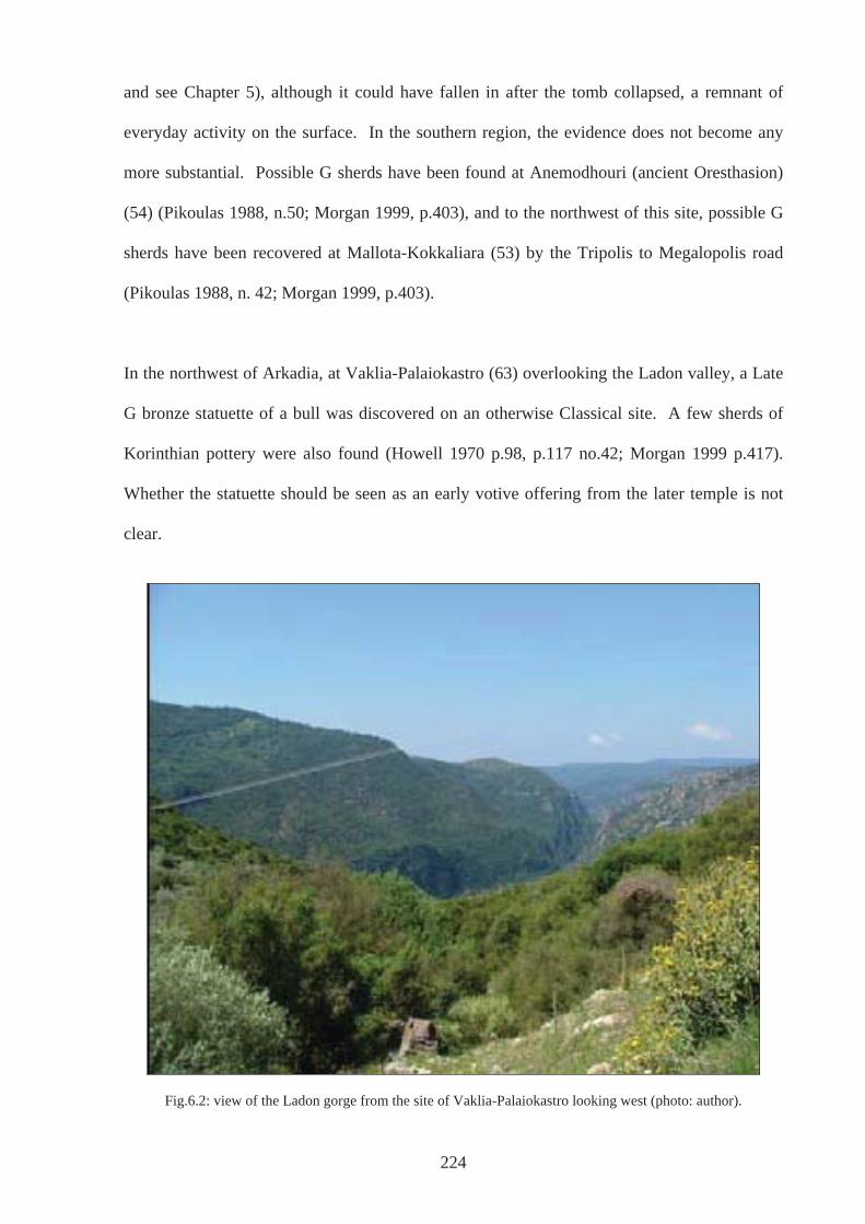
and see Chapter 5), although it could have fallen in after the tomb collapsed, a remnant of
everyday activity on the surface. In the southern region, the evidence does not become any
more substantial. Possible G sherds have been found at Anemodhouri (ancient Oresthasion)
(54) (Pikoulas 1988, n.50; Morgan 1999, p.403), and to the northwest of this site, possible G
sherds have been recovered at Mallota-Kokkaliara (53) by the Tripolis to Megalopolis road
(Pikoulas 1988, n. 42; Morgan 1999, p.403).
In the northwest of Arkadia, at Vaklia-Palaiokastro (63) overlooking the Ladon valley, a Late
G bronze statuette of a bull was discovered on an otherwise Classical site. A few sherds of
Korinthian pottery were also found (Howell 1970 p.98, p.117 no.42; Morgan 1999 p.417).
Whether the statuette should be seen as an early votive offering from the later temple is not
clear.
Fig.6.2: view of the Ladon gorge from the site of Vaklia-Palaiokastro looking west (photo: author).
224
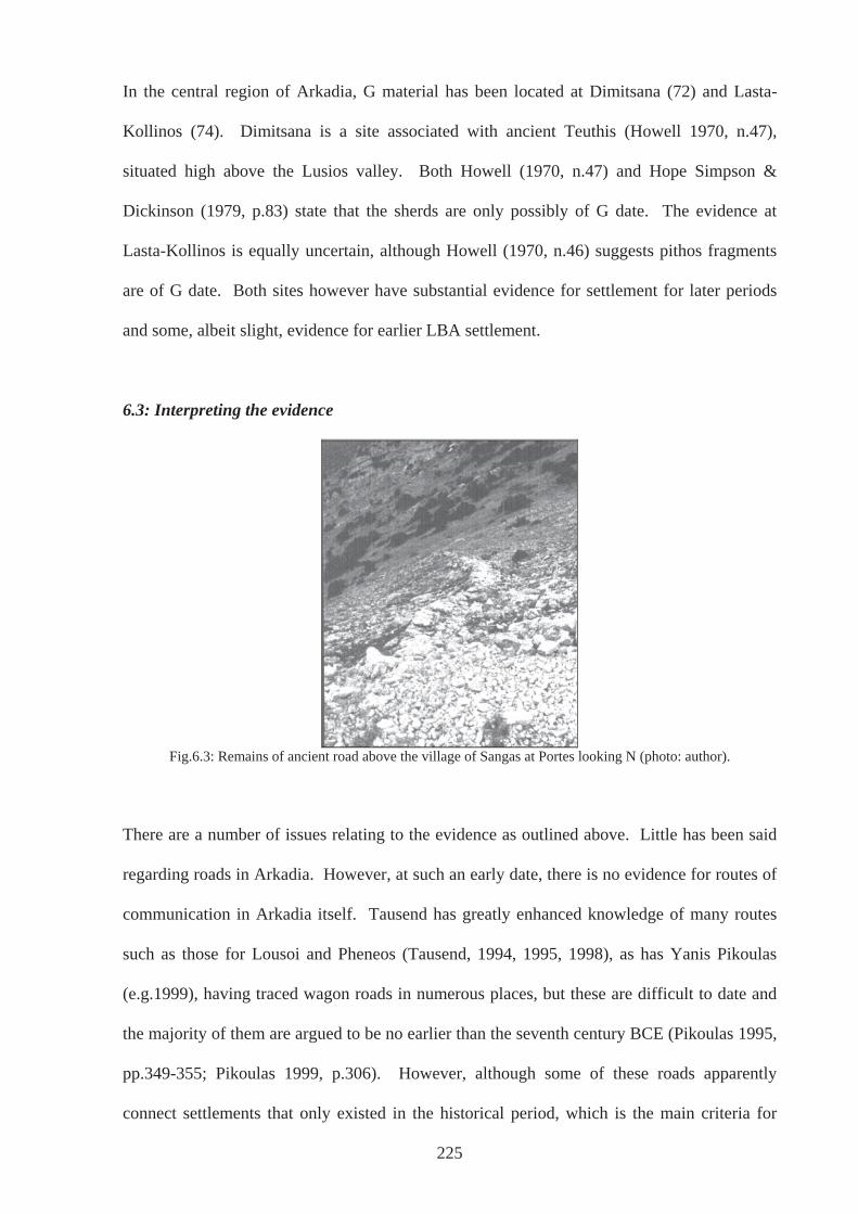
In the central region of Arkadia, G material has been located at Dimitsana (72) and Lasta-
Kollinos (74). Dimitsana is a site associated with ancient Teuthis (Howell 1970, n.47),
situated high above the Lusios valley. Both Howell (1970, n.47) and Hope Simpson &
Dickinson (1979, p.83) state that the sherds are only possibly of G date. The evidence at
Lasta-Kollinos is equally uncertain, although Howell (1970, n.46) suggests pithos fragments
are of G date. Both sites however have substantial evidence for settlement for later periods
and some, albeit slight, evidence for earlier LBA settlement.
6.3: Interpreting the evidence
Fig.6.3: Remains of ancient road above the village of Sangas at Portes looking N (photo: author).
There are a number of issues relating to the evidence as outlined above. Little has been said
regarding roads in Arkadia. However, at such an early date, there is no evidence for routes of
communication in Arkadia itself. Tausend has greatly enhanced knowledge of many routes
such as those for Lousoi and Pheneos (Tausend, 1994, 1995, 1998), as has Yanis Pikoulas
(e.g.1999), having traced wagon roads in numerous places, but these are difficult to date and
the majority of them are argued to be no earlier than the seventh century BCE (Pikoulas 1995,
pp.349-355; Pikoulas 1999, p.306). However, although some of these roads apparently
connect settlements that only existed in the historical period, which is the main criteria for
225
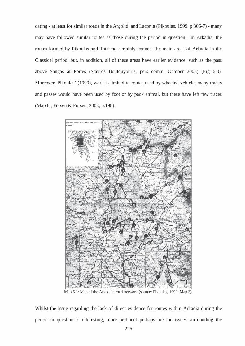
dating - at least for similar roads in the Argolid, and Laconia (Pikoulas, 1999, p.306-7) - many
may have followed similar routes as those during the period in question. In Arkadia, the
routes located by Pikoulas and Tausend certainly connect the main areas of Arkadia in the
Classical period, but, in addition, all of these areas have earlier evidence, such as the pass
above Sangas at Portes (Stavros Boulouyouris, pers comm. October 2003) (Fig 6.3).
Moreover, Pikoulas’ (1999), work is limited to routes used by wheeled vehicle; many tracks
and passes would have been used by foot or by pack animal, but these have left few traces
(Map 6.; Forsen & Forsen, 2003, p.198).
Map 6.1: Map of the Arkadian road-network (source: Pikoulas, 1999: Map 3).
Whilst the issue regarding the lack of direct evidence for routes within Arkadia during the
period in question is interesting, more pertinent perhaps are the issues surrounding the
226
evidence that does exist for other ‘mundane’ activities. For instance, most evidence for the
everyday is discovered through survey and exists as scatters. What such surface evidence
means in terms of past human activity is far from clear for all periods and places. As has been
illustrated a number of times already (e.g. Alcock et al. 1994, p.138; Mattingly 2000, p.6),
although field survey is an important and widespread method of investigating a landscape, it
is a method which is by no means executed in a standard way, neither throughout the world
nor within Greece. Each survey utilises or has utilised differing methodologies and each
archaeologist remains confident in their own process of site-definition, which is after all an
interpretative act (for a thorough consideration of the surveys undertaken in Arkadia see
Chapter 2, Section 2.3.3). Of course, it is understood that these definitions are directly
relevant to the way the evidence has then been used to discuss settlement patterns, hierarchy
and economy.
As pointed out in Chapter 2 Section 2.3.3 and Chapter 3 Section 3.2.5, there has been much
discussion over the significance of scatters, in particular regarding the point at which sherd-
counts actually represent sites and in turn, what kind of activity a site signifies (e.g. Gallant
1986; Cherry et al. 1991, Ch 3; Alcock Cherry & Davis 1994; Mattingly 2000). In Greece,
past estimates have held that approximately 30 -50 sherds per 100 sq m are needed to
constitute a site (Bintliff 1985). This is particularly pertinent to Arkadia because the vast
majority of sites are little more than findspots or scatters and if found as part of an intensive
survey, depending on the area and period in question, would amount to no more than
background noise, (Gallant 1986; Alcock Cherry & Davis 1994 p.138). Whilst this may seem
worrying for Arkadia at first glance, the majority of sites in Arkadia have not been located
during intensive surveys but have come to the attention of those undertaking extensive and
unsystematic reconnaissance. A key example is Howell’s survey of the Eastern Plains (1970
and see Chapter 2). More to the point, survey methodology increasingly allows for
227
identification and definition to be made in the field depending on local circumstances and in
some cases the description ‘site’ is avoided completely. M. G. Parker Pearson (pers. comm.
14 November 2007) states that during fieldwork in the Hebrides a site was deemed to exist
wherever pottery was found, whereas in Madagascar five or more sherds were needed before
such a definition was applied. Clearly, in these cases not all sites could possibly be evidence
of settlement. Field survey is often employed as a way of looking at the distribution of
activity and different practices across a landscape, within which activity areas or ‘Places of
Special Interest’ can be defined that may then be deemed suitable for excavation (e.g. the
Troodos Archaeological and Environmental Survey Project, Given et al. 2001; Julian Thomas
pers. comm. 13 November 2007). In the present study, site is meant in this way, as a place of
activity, however transitory, and it is evident that not all ‘sites’ are indicators of settlement. In
fact many of the findspots and scatters (site-type 1) in Arkadia have avoided association with
settlement (site type 2) and have been given the non-judgemental title of ‘?activity’ (site type
2 unknown activity see Chapter 3 Section 3.2.5 for further clarification). Of course, where
material has been identified through intensive survey, such as the Asea Valley Survey, the
definition of site=settlement/farmstead has already been applied (e.g. AVS67, Forsen 2003).
Despite inherent problems in site definition, it is true that the number of known sites or
activity areas drastically reduces from the LBA onwards. The Nemea Valley Survey, for
example, observed PG and G artefacts at only one of 25 sites also assigned to the preceding
LH period (Cherry et al. 2000), and areas like Messenia and the Berbati-Limnes region in the
Argolid, which have also been systematically surveyed, have produced little if any
archaeology of post-LHIIIB date (Wells 1996; Wright 1990, p.645). In Arkadia, the total
number of sites for the LH period is fifty-seven, whereas for the PG it is nineteen, increasing
again in the G period to fifty. The crux of the matter, of course, is what these numbers
represent. The relative scarcity of ‘Dark Age’(SM & PG) sites could be the result of a
228
reduction in number of settlements and therefore population, a theory that has found
prominence in the past (e.g. Snodgrass [1971]2000, p.364; Dickinson 1994, p.87). However,
when the equation of site=settlement is uncertain, as is the case in many Arkadian instances,
the record may rather be reflecting change in use and behaviour across a landscape. Of
course, it may be that farmsteads and villages are undetectable in the record due to a change
in construction: as stated above many of the structures of the PG and G periods are built of
mud-brick, but this would not explain the absence or lack of pottery and other material
distribution. Forsen (2003, p.183) referring to the Asea Valley Survey, has suggested that
pottery of the PG and G period is as of yet unrecognisable in the record, because the fabric of
such pottery is hard to see during fieldwalking (cf Gaffney, Bintliff & Slapsak 1991;
Terrenato 2000). If much of the local PG and G pottery, not just of Arkadia but also of other
regions, is not decorated as finely or uniformly as that of the LH period, or even the PG and G
pottery in some places, then such material is likely to be missed, or simply counted but not
dated. A more sensitive methodology where all sherds are picked up (e.g. Gaffney, Bintliff &
Slapsak 1991; Fentress 2000) and where ceramic analysis concentrates on fabric as a
diagnostic category rather than relying on decoration or even form, alongside further study
into local ceramics, may help solve some of these problems (cf Leveau 1984 quoted in
Mattingly 2000, p.9). Understanding post-depositional processes may also need to be
prioritised (Taylour 2000, p16). In Arkadia, for example, deep alluvial layers, up to 2 metres
thick, are known to be covering archaeological layers in some areas (see Chapter 2 Section
2.4).
The depopulation theory is also undermined, even where many of the sites located through
survey have been associated with settlement. One of the most pertinent questions relating to
settlement in the period under study is concerned with the demise of the Mycenaean
Civilisation. In the archaeological record of mainland Greece, various levels of destruction at
229
the citadels have been found. There is copious evidence of burning, collapsed walls, floors
and ceilings, and broken artefacts, which have been identified within the same or closely
connected archaeological contexts at centres such as Mycenae, Tiryns, Pylos and Thebes (see
section 6.2.1). The depopulation theory holds that with the demise of these centres, people
either migrated or perished. However, Lin Foxhall (1995), looking at sites mainly in terms of
continuity in agricultural practice, concludes that outlying sites fared differently depending on
their proximity to or involvement in their local palatial economy and although sites and
possibly population did decrease in some areas, it is without doubt not the case in all.
The area of Berbati-Limnes, very close to Mycenae, certainly did not fare very well (Wells
and Runnels 1996). During the LH period, survey evidence indicates that this region was
quite densely populated by a number of individual farmsteads. After the LHIIIB period,
however, there is a gap in the record until the LG period. A possible explanation is that
farmsteads, which perhaps relied heavily on the palace for survival or existed solely to serve
the palace economy, could not survive without it and the population may indeed have moved
on. However, regions that show a different pattern can be found on the Methana peninsula
(Mee & Forbes 1997) and at Lefkandi (Popham et al., 1979), both places that were not
involved in a local palatial economy, based on current evidence. In these places, the
archaeological record shows an increase of activity after the demise of Mycenaean
Civilisation. While it appears that the defining factor for depopulation may be the presence or
absence of a major site in close proximity, evidence from Nichoria complicates the picture.
This site in Messenia, relatively near and most likely subject to the palace at Pylos during the
LH period, seems to have prospered as a substantial site in its own right after LHIIIB
(McDonald 1991). Differentiation in burials and houses suggest that Nichoria had its own
elite, and floral and faunal evidence indicates that agriculture and animal husbandry continued
in much the same way that it had when subject to Pylos (Coulson et al. 1983). Foxhall (1995)
230
argues that Nichoria’s prosperity resulted directly from the removal of impositions put in
place by palace authorities, and perhaps as a town did not rely on the palace for its
fundamental existence, or at least not in the same way as the farmsteads close to Mycenae did.
However, despite variations in numbers of sites, some general trends in the material record
are recognisable, especially on the mainland. Changes in burial have been outlined in Chapter
5 and other, possible concomitant changes in material culture included a change in the metal
used for practical, cutting implements from bronze to iron, pottery styles become more
regionalised, a departure from the preceding widespread and uniform Mycenaean style, and
on present evidence, it also appears that monumental architecture largely ceases. Exceptions
exist in the heroon at Lefkandi dated to c.1000BCE, a similar building at Halos in southern
Thessaly (Malakasioti & Mousioni 2004) and Megaron B at Thermon (Papapostolou 2006).
However, these examples are associated with burials, as are the monumental tombs that
continue to be built and used in some regions (e.g. Central Greece – Elateia, Thessaly, as well
as Kefallonia; see Chapter 5), and not settlement or everyday living. In any case, there is no
suggestion that changes in burial rite, metal, pottery style and architecture happened
simultaneously in all areas that had once been under the sphere of Mycenaean influence.
Instead, it appears that a wide variety of events, negotiations, relations and actions had
intended and unintended consequences, which contributed to the creation of the material
record, as it is found today.
Any attempts to make sense of this record are not helped by problems inherent in survey.
Those pertaining to site definition have been outlined above, but in addition, survey is
generally not a mode by which particularly well refined chronologies can be developed.
Alcock (2000, p.2) states, perhaps we should be wary of expecting too much from the data.
This is particularly true of Arkadia. As stated in Chapter 3 Section 3.3.2, chronological
231
divisions in the present study are particularly wide due to this very fact. The redeeming
feature however, is that even where artefacts are few in number and not closely dated, such as
those in Arkadia, it is still possible to locate them in space. The assumption is that an
individual or group acted within, moved through and viewed the landscape at a particular
point, just as it can be acted within, moved through and viewed today. Of course,
acknowledgement of post-depositional processes must be made and considered, processes that
can shift material some distance (English Heritage 2000, p.3). However, this would not
generally detract from the ability to visit an area in which scatters were found. In many cases,
the locations have not been particularly accurately recorded anyway and any post-depositional
shift that may have taken place is therefore not particularly worrying. In addition, taking the
context of each site into consideration, allows investigation into possible post-depositional
events. Especially where the sites are multi-period sites, these assumptions is a starting point.
To some extent, sites of the period, and sometimes the area in question, have been considered
in terms of their setting in the landscape. However, until recently, studies into settlements
have largely been concerned with population numbers and production capabilities (Dickinson
1994, p.51) and the focus has been their economic function (Bintliff 1977). For example, the
location of a site on good, fertile soil has been taken as indicative of a farm, even where the
evidence is slight, or the establishment of new settlements is seen from an economic
standpoint, where a desire to exploit more land is considered to be of paramount importance.
Where sites have been found on poor land, the possibility that they may be ritual sites, guard
posts, seasonal or temporary camps of hunters, woodcutters, craft specialists or herders camps
has been entertained (McDonald and Rapp, 1972, p.182 re Messenian LH sites), and this
approach certainly goes some way in elucidating aspects of the material record. Surely a
deeper understanding of the way people engaged with their environment can be reached.
Even in situations where choice of site was overwhelmingly dictated by economic concerns,
232
233
the distinct physicality of the landscape would have influenced choice. How people
approached a particular place, how the mythology of that specific place had developed, how it
had been encountered in the past or how so-called place-images of the decision makers had
evolved, may have been important factors (Chapman 2000). Such considerations of
landscape have found their place in studies of the Neolithic in the British Isles (e.g. Thomas,
1991; Edmonds, 1999; Cooney, 2000; Exon et al, 2000), where specifics of place are
contemplated and it is this type of consideration that is set out in the case studies below.
6.4: Case Studies
6.4.1: Case Study A: Orchomenos
On the slopes of Mytikas, overlooking the lower Orchomenos plain, lie the remains of a
Mycenaean settlement known as Orchomenos-Palaiopyrgos (25) (Map 6.1 & Fig.6.4 below).
In its heyday, this settlement spread down onto the plain, in a setting somewhat different to
the ‘typical’ Mycenaean pattern, which focussed on an elevated citadel or palace.
Unfortunately, publication of the relatively extensive excavations is in short supply, but the
reports that do exist inform us that this settlement was extensive. Spyropoulos (1982, p.114)
suggests it is here that we should be looking for the Homeric Orchomenos (Il 2.603-14). The
focus of this community was towards the Levidi plain, a plain that did not suffer from
flooding like so many in eastern Arkadia (Fig.6.5). Water drained from these plains to the
lower Orchomenos plain to the north. It may have been for this very reason that such a
settlement grew up on the slopes of Mytikas, directed towards a plain that was naturally
beneficial for arable farming, where a community could reside without the worry, as the
seasons changed, as to whether this year the rains would overwhelm the ever-changing river
courses and flood the whole plain. This would have been a real concern for those who lived
on and around the lower Orchomenos plain.
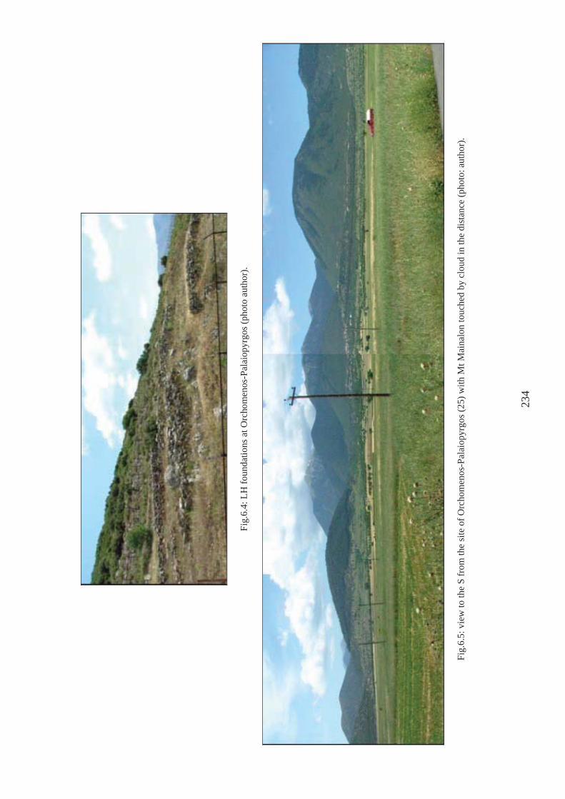
Fig.
6.4:
LH
foun
datio
ns a
t Orc
hom
enos
-Pal
aiop
yrgo
s (ph
oto
auth
or).
Fig.
6.5:
vie
w to
the
S fr
om th
e si
te o
f Orc
hom
enos
-Pal
aiop
yrgo
s (25
) with
Mt M
aina
lon
touc
hed
by c
loud
in th
e di
stan
ce (p
hoto
: aut
hor)
.
234
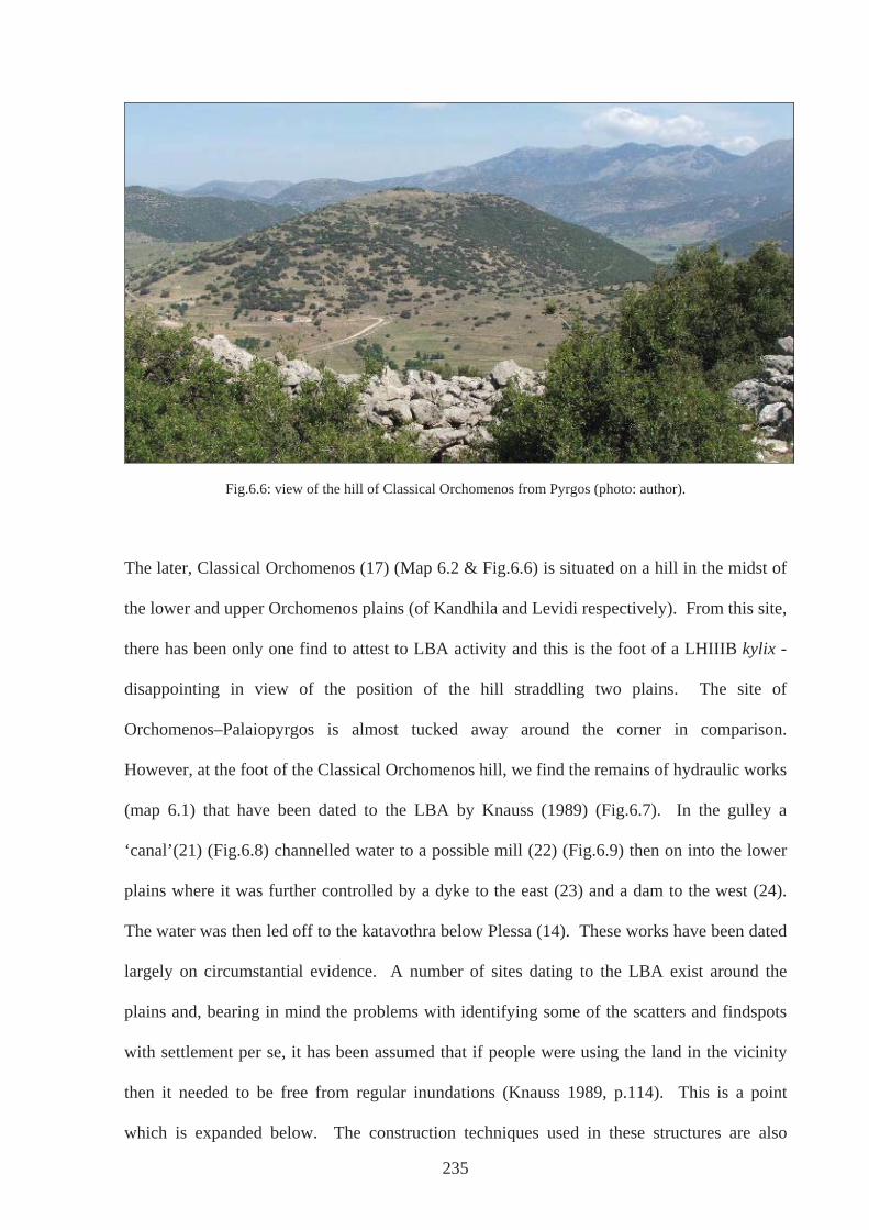
Fig.6.6: view of the hill of Classical Orchomenos from Pyrgos (photo: author).
The later, Classical Orchomenos (17) (Map 6.2 & Fig.6.6) is situated on a hill in the midst of
the lower and upper Orchomenos plains (of Kandhila and Levidi respectively). From this site,
there has been only one find to attest to LBA activity and this is the foot of a LHIIIB kylix -
disappointing in view of the position of the hill straddling two plains. The site of
Orchomenos–Palaiopyrgos is almost tucked away around the corner in comparison.
However, at the foot of the Classical Orchomenos hill, we find the remains of hydraulic works
(map 6.1) that have been dated to the LBA by Knauss (1989) (Fig.6.7). In the gulley a
‘canal’(21) (Fig.6.8) channelled water to a possible mill (22) (Fig.6.9) then on into the lower
plains where it was further controlled by a dyke to the east (23) and a dam to the west (24).
The water was then led off to the katavothra below Plessa (14). These works have been dated
largely on circumstantial evidence. A number of sites dating to the LBA exist around the
plains and, bearing in mind the problems with identifying some of the scatters and findspots
with settlement per se, it has been assumed that if people were using the land in the vicinity
then it needed to be free from regular inundations (Knauss 1989, p.114). This is a point
which is expanded below. The construction techniques used in these structures are also
235
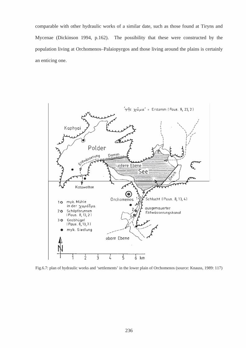
comparable with other hydraulic works of a similar date, such as those found at Tiryns and
Mycenae (Dickinson 1994, p.162). The possibility that these were constructed by the
population living at Orchomenos–Palaiopyrgos and those living around the plains is certainly
an enticing one.
Fig.6.7: plan of hydraulic works and ‘settlements’ in the lower plain of Orchomenos (source: Knauss, 1989: 117)
236
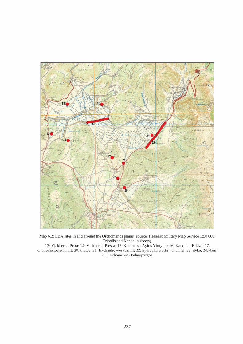
Map 6.2: LBA sites in and around the Orchomenos plains (source: Hellenic Military Map Service 1:50 000: Tripolis and Kandhila sheets).
13: Vlakherna-Petra; 14: Vlakherna-Plessa; 15: Khotoussa-Ayios Yioryios; 16: Kandhila-Bikiza; 17. Orchomenos-summit; 20: tholos; 21: Hydraulic works/mill; 22: hydraulic works –channel; 23: dyke; 24: dam;
25: Orchomenos- Palaiopyrgos.
237
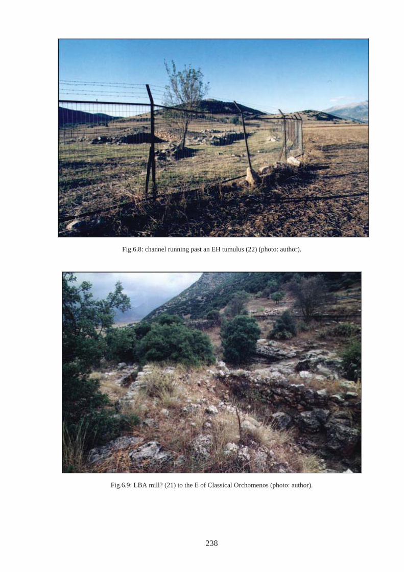
238
Fig.6.8: channel running past an EH tumulus (22) (photo: author).
Fig.6.9: LBA mill? (21) to the E of Classical Orchomenos (photo: author).
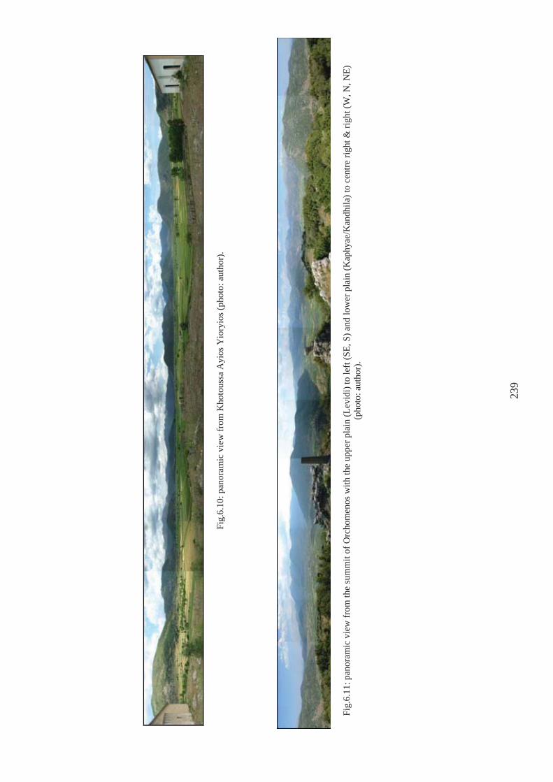
Fig.
6.10
: pan
oram
ic v
iew
from
Kho
tous
sa A
yios
Yio
ryio
s (ph
oto:
aut
hor)
.
Fig.
6.11
: pan
oram
ic v
iew
from
the
sum
mit
of O
rcho
men
os w
ith th
e up
per p
lain
(Lev
idi)
to le
ft (S
E, S
) and
low
er p
lain
(Kap
hyae
/Kan
dhila
) to
cent
re ri
ght &
righ
t (W
, N, N
E)
(pho
to: a
utho
r).
239
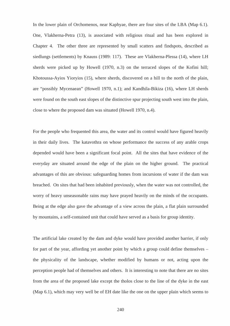
In the lower plain of Orchomenos, near Kaphyae, there are four sites of the LBA (Map 6.1).
One, Vlakherna-Petra (13), is associated with religious ritual and has been explored in
Chapter 4. The other three are represented by small scatters and findspots, described as
siedlungs (settlements) by Knauss (1989: 117). These are Vlakherna-Plessa (14), where LH
sherds were picked up by Howell (1970, n.3) on the terraced slopes of the Kofini hill;
Khotoussa-Ayios Yioryios (15), where sherds, discovered on a hill to the north of the plain,
are “possibly Mycenaean” (Howell 1970, n.1); and Kandhila-Bikiza (16), where LH sherds
were found on the south east slopes of the distinctive spur projecting south west into the plain,
close to where the proposed dam was situated (Howell 1970, n.4).
For the people who frequented this area, the water and its control would have figured heavily
in their daily lives. The katavothra on whose performance the success of any arable crops
depended would have been a significant focal point. All the sites that have evidence of the
everyday are situated around the edge of the plain on the higher ground. The practical
advantages of this are obvious: safeguarding homes from incursions of water if the dam was
breached. On sites that had been inhabited previously, when the water was not controlled, the
worry of heavy unseasonable rains may have prayed heavily on the minds of the occupants.
Being at the edge also gave the advantage of a view across the plain, a flat plain surrounded
by mountains, a self-contained unit that could have served as a basis for group identity.
The artificial lake created by the dam and dyke would have provided another barrier, if only
for part of the year, affording yet another point by which a group could define themselves –
the physicality of the landscape, whether modified by humans or not, acting upon the
perception people had of themselves and others. It is interesting to note that there are no sites
from the area of the proposed lake except the tholos close to the line of the dyke in the east
(Map 6.1), which may very well be of EH date like the one on the upper plain which seems to
240
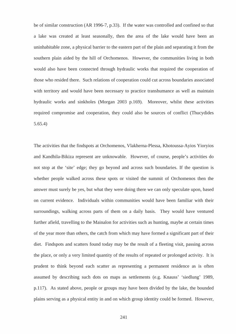
be of similar construction (AR 1996-7, p.33). If the water was controlled and confined so that
a lake was created at least seasonally, then the area of the lake would have been an
uninhabitable zone, a physical barrier to the eastern part of the plain and separating it from the
southern plain aided by the hill of Orchomenos. However, the communities living in both
would also have been connected through hydraulic works that required the cooperation of
those who resided there. Such relations of cooperation could cut across boundaries associated
with territory and would have been necessary to practice transhumance as well as maintain
hydraulic works and sinkholes (Morgan 2003 p.169). Moreover, whilst these activities
required compromise and cooperation, they could also be sources of conflict (Thucydides
5.65.4)
The activities that the findspots at Orchomenos, Vlakherna-Plessa, Khotoussa-Ayios Yioryios
and Kandhila-Bikiza represent are unknowable. However, of course, people’s activities do
not stop at the ‘site’ edge; they go beyond and across such boundaries. If the question is
whether people walked across these spots or visited the summit of Orchomenos then the
answer must surely be yes, but what they were doing there we can only speculate upon, based
on current evidence. Individuals within communities would have been familiar with their
surroundings, walking across parts of them on a daily basis. They would have ventured
further afield, travelling to the Mainalon for activities such as hunting, maybe at certain times
of the year more than others, the catch from which may have formed a significant part of their
diet. Findspots and scatters found today may be the result of a fleeting visit, passing across
the place, or only a very limited quantity of the results of repeated or prolonged activity. It is
prudent to think beyond each scatter as representing a permanent residence as is often
assumed by describing such dots on maps as settlements (e.g. Knauss’ ‘siedlung’ 1989,
p.117). As stated above, people or groups may have been divided by the lake, the bounded
plains serving as a physical entity in and on which group identity could be formed. However,
241
it may also be that the sites in the lower plain signify temporary activity, and that the people
whose behavioural residue we see, were the same as those who lived at the more substantial
settlement at Orchomenos-Palaiopyrgos. A group or part of the group may have been
itinerant, if even over short distances, especially before any water control measures were
taken. They may have stayed for the summer seasons on the plain, when the risk of flooding
was low, returning with successful harvests before the plain turned into marsh or lake for the
winter. When the decision was made to control the water, perhaps when harvests had been
ruined too many times, it was part of the same group who settled there. The ties of kin and
friendship would stretch over generations and help keep cooperation alive.
Video clip 5: from summit of Orchomenos (Fig.6.10)
Therefore, despite the fact that the outlook from the site of Orchomenos-Palaiopyrgos is
towards the southeast, people living here would have walked up to Pyrgos and beyond. The
community would have known what was around the corner and over the hill and would have
recognised the people who resided there. Some may even have been related. It would have
been a prerequisite for them to cooperate in order to create the complex of hydraulic works
that we believe was put in place, especially to create a habitable and farmable plain near
Kaphyae, or one that was reliably so, even if they themselves were not to benefit directly. In
the light of the hydraulic works postulated for the eastern plains further south at Mantinea (see
Case Study B) and Tegea, and those further north at Pheneos and Stymphalos (see Case Study
C and Chapter 5), it was likely that people from this whole region communicated readily,
passing on knowledge and expertise, even giving assistance. Differing levels of obligation
may have existed across territorial boundaries associated with the land (Morgan 2003, Ch.4).
The katavothras around which much of these works were focused, the channelling of water to
them and keeping them clear of debris, must have figured heavily in the mythology of the
242
area. For people who lived in a similar physical landscape a shared mythology developed that
was directly informed by it. The stories associated with Herakles are testament to this
(Salowey 1994; Morgan 2003, p.170). This mythology would have permeated the everyday
where such modern abstract divisions between the sacred and secular come crashing down.
This shared mythology, this apprehension of the surroundings in which they all lived, would
have bonded groups. The very materiality of the landscape, what it meant to those living
within it and the shared experience of it, may have formed a coherence to the eastern regions
of Arkadia, a coherence that can be seen in later quasi- and true historical records (e.g. Homer
ll 2: 603-14). In this way, there may have been an ‘Arkadian’ identity, as far back as the
LBA, at least in the eastern plains, a cohesiveness that has been recognised in the material
record from the G period, reflected in Homer (ll. 2 603-614) and found in the epigraphic and
literary sources of later times (Morgan 1999, p.382; Nielsen 1999). In addition, the
prominence of the Mainalon range in the viewshed of many sites, such as that of
Orchomenos-Palaiopyrgos, would have been highly significant in a developing sense of
‘Arkadianness’ that encompassed the whole region of ancient Arkadia, beyond a community’s
immediate surroundings, accepting that boundaries and definitions of such would have been
fluid and negotiable.
The PG period is characterised for the most part by a relatively few pieces of undiagnostic
material and it may well lead us to interpret the Orchomenos plains as being all but deserted
(Map 6.3). It is not clear what the decrease in number of sites in Arkadia and regions such as
the Argolid (Wright 1990, p.645) and Messenia (Wells 1996) actually represent (see above)
nor is it possible to know how events surrounding the end of Mycenaean Civilisation affected
Arkadia. However, the telling of stories deeply rooted to the landscape may have cemented
ties between diminishing populations at the end of the BA. Perhaps people moving through
or wanting to create a new life where they now found themselves had disturbed these
243
populations. Conflicts were perhaps inevitable and in some instances, individuals may have
felt impelled to join the travellers in a move to find a new place, or a new way of life, that was
less tied to an unpredictable land. Those staying behind would have kept old stories alive.
Conceivably, at a time when labour was diminished, breached dams could not be repaired in
time for the next wet season, or perhaps no one was left to teach the new generation how to do
it effectively. If communities were significantly reduced then the requirement for reclaiming
land for arable farming would also have been reduced. Individuals or groups may have
passed through on occasion, communicating knowledge to other individuals or groups they
met by chance or to whom they were travelling. New people arriving may have heard the old
stories and myths and saw the by now old remains. Alternatively, perhaps a new generation
of the old population had been inspired from tales elsewhere that they found applicable to
themselves, tales of heroes. It may have taken an exceptional individual to think that if their
ancestors could have lived in substantial settlements on the plain, then they could do so again.
To begin a process of regeneration, the starting point would have been the gods; the spirits
that lived in the landscape that inhabited the natural places, the springs, the rivers, the
sinkholes, the mountains – all places where we see evidence of early religious ritual (see
Chapter 4). The significant evidence from sanctuary sites may reflect a real concern with
propitiating the gods in order to embark on what was conceived of as a new beginning. Not a
beginning that commenced at the same chronological point in all areas of Arkadia or Greece
as a whole, but acts by individuals or communities that inspired and spiralled, acting back
upon communities that were in contact with one another. Maybe we should not underestimate
the now traditional theory (Coldstream 1976) that the Homeric poems circulating at the time
were a catalyst, or perhaps served as reinforcement. This did not need to be a one-way
movement, but a phenomenon that was constantly being reworked. Different understandings
would have been created and changed, one group seeing significance in some tales more than
244
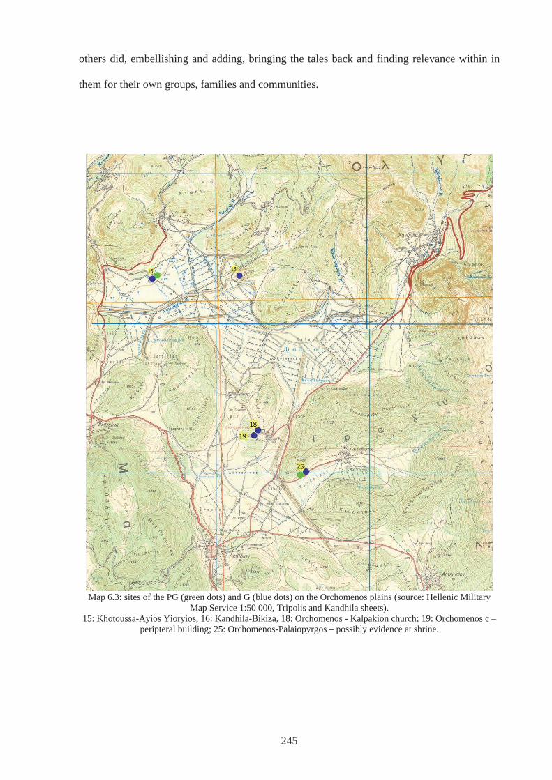
others did, embellishing and adding, bringing the tales back and finding relevance within in
them for their own groups, families and communities.
Map 6.3: sites of the PG (green dots) and G (blue dots) on the Orchomenos plains (source: Hellenic Military
Map Service 1:50 000, Tripolis and Kandhila sheets). 15: Khotoussa-Ayios Yioryios, 16: Kandhila-Bikiza, 18: Orchomenos - Kalpakion church; 19: Orchomenos c –
peripteral building; 25: Orchomenos-Palaiopyrgos – possibly evidence at shrine.
245
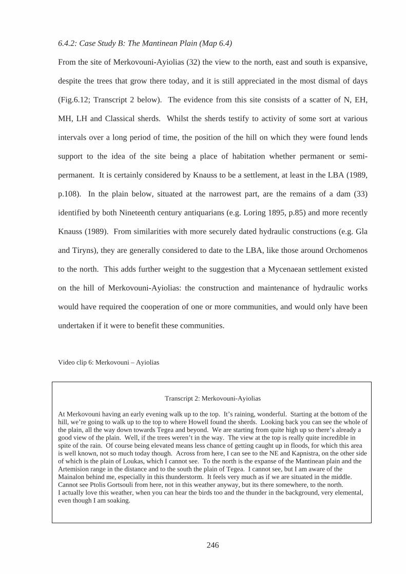
246
6.4.2: Case Study B: The Mantinean Plain (Map 6.4)
From the site of Merkovouni-Ayiolias (32) the view to the north, east and south is expansive,
despite the trees that grow there today, and it is still appreciated in the most dismal of days
(Fig.6.12; Transcript 2 below). The evidence from this site consists of a scatter of N, EH,
MH, LH and Classical sherds. Whilst the sherds testify to activity of some sort at various
intervals over a long period of time, the position of the hill on which they were found lends
support to the idea of the site being a place of habitation whether permanent or semi-
permanent. It is certainly considered by Knauss to be a settlement, at least in the LBA (1989,
p.108). In the plain below, situated at the narrowest part, are the remains of a dam (33)
identified by both Nineteenth century antiquarians (e.g. Loring 1895, p.85) and more recently
Knauss (1989). From similarities with more securely dated hydraulic constructions (e.g. Gla
and Tiryns), they are generally considered to date to the LBA, like those around Orchomenos
to the north. This adds further weight to the suggestion that a Mycenaean settlement existed
on the hill of Merkovouni-Ayiolias: the construction and maintenance of hydraulic works
would have required the cooperation of one or more communities, and would only have been
undertaken if it were to benefit these communities.
Video clip 6: Merkovouni – Ayiolias
Transcript 2: Merkovouni-Ayiolias At Merkovouni having an early evening walk up to the top. It’s raining, wonderful. Starting at the bottom of the hill, we’re going to walk up to the top to where Howell found the sherds. Looking back you can see the whole of the plain, all the way down towards Tegea and beyond. We are starting from quite high up so there’s already a good view of the plain. Well, if the trees weren’t in the way. The view at the top is really quite incredible in spite of the rain. Of course being elevated means less chance of getting caught up in floods, for which this area is well known, not so much today though. Across from here, I can see to the NE and Kapnistra, on the other side of which is the plain of Loukas, which I cannot see. To the north is the expanse of the Mantinean plain and the Artemision range in the distance and to the south the plain of Tegea. I cannot see, but I am aware of the Mainalon behind me, especially in this thunderstorm. It feels very much as if we are situated in the middle. Cannot see Ptolis Gortsouli from here, not in this weather anyway, but its there somewhere, to the north. I actually love this weather, when you can hear the birds too and the thunder in the background, very elemental, even though I am soaking.
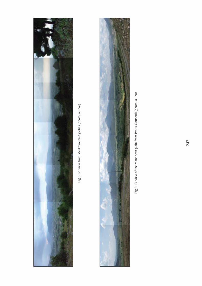
Fig.
6.12
: vie
w fr
om M
erko
voun
i-Ayi
olia
s (ph
oto:
aut
hor)
.
Fig.
6.13
: vie
w o
f the
Man
tinea
n pl
ain
from
Pto
lis-G
orts
ouli
(pho
to: a
utho
r
247
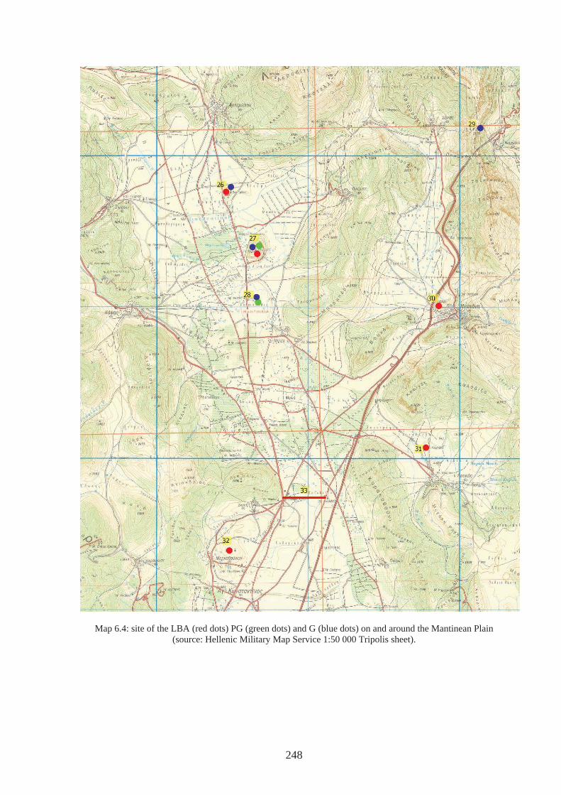
Map 6.4: site of the LBA (red dots) PG (green dots) and G (blue dots) on and around the Mantinean Plain (source: Hellenic Military Map Service 1:50 000 Tripolis sheet).
248
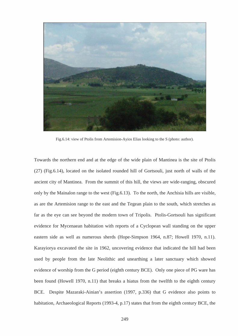
Fig.6.14: view of Ptolis from Artemision-Ayios Elias looking to the S (photo: author).
Towards the northern end and at the edge of the wide plain of Mantinea is the site of Ptolis
(27) (Fig.6.14), located on the isolated rounded hill of Gortsouli, just north of walls of the
ancient city of Mantinea. From the summit of this hill, the views are wide-ranging, obscured
only by the Mainalon range to the west (Fig.6.13). To the north, the Anchisia hills are visible,
as are the Artemision range to the east and the Tegean plain to the south, which stretches as
far as the eye can see beyond the modern town of Tripolis. Ptolis-Gortsouli has significant
evidence for Mycenaean habitation with reports of a Cyclopean wall standing on the upper
eastern side as well as numerous sherds (Hope-Simpson 1964, n.87; Howell 1970, n.11).
Karayiorya excavated the site in 1962, uncovering evidence that indicated the hill had been
used by people from the late Neolithic and unearthing a later sanctuary which showed
evidence of worship from the G period (eighth century BCE). Only one piece of PG ware has
been found (Howell 1970, n.11) that breaks a hiatus from the twelfth to the eighth century
BCE. Despite Mazaraki-Ainian’s assertion (1997, p.336) that G evidence also points to
habitation, Archaeological Reports (1993-4, p.17) states that from the eighth century BCE, the
249
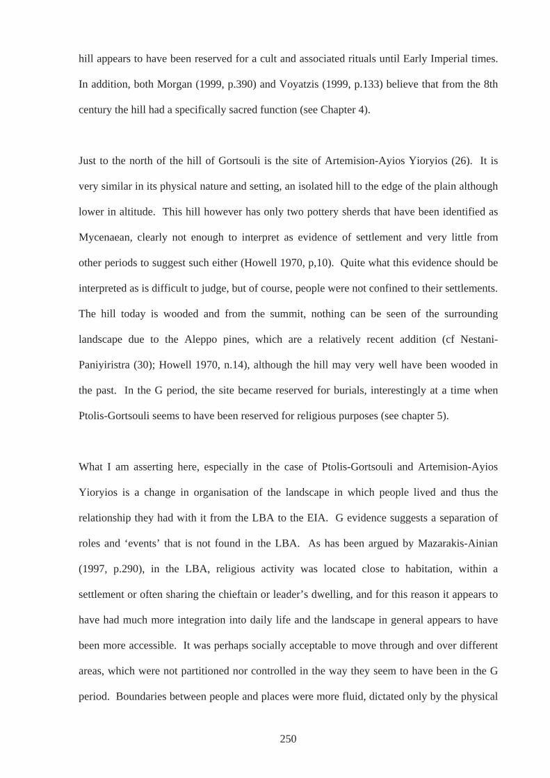
hill appears to have been reserved for a cult and associated rituals until Early Imperial times.
In addition, both Morgan (1999, p.390) and Voyatzis (1999, p.133) believe that from the 8th
century the hill had a specifically sacred function (see Chapter 4).
Just to the north of the hill of Gortsouli is the site of Artemision-Ayios Yioryios (26). It is
very similar in its physical nature and setting, an isolated hill to the edge of the plain although
lower in altitude. This hill however has only two pottery sherds that have been identified as
Mycenaean, clearly not enough to interpret as evidence of settlement and very little from
other periods to suggest such either (Howell 1970, p,10). Quite what this evidence should be
interpreted as is difficult to judge, but of course, people were not confined to their settlements.
The hill today is wooded and from the summit, nothing can be seen of the surrounding
landscape due to the Aleppo pines, which are a relatively recent addition (cf Nestani-
Paniyiristra (30); Howell 1970, n.14), although the hill may very well have been wooded in
the past. In the G period, the site became reserved for burials, interestingly at a time when
Ptolis-Gortsouli seems to have been reserved for religious purposes (see chapter 5).
What I am asserting here, especially in the case of Ptolis-Gortsouli and Artemision-Ayios
Yioryios is a change in organisation of the landscape in which people lived and thus the
relationship they had with it from the LBA to the EIA. G evidence suggests a separation of
roles and ‘events’ that is not found in the LBA. As has been argued by Mazarakis-Ainian
(1997, p.290), in the LBA, religious activity was located close to habitation, within a
settlement or often sharing the chieftain or leader’s dwelling, and for this reason it appears to
have had much more integration into daily life and the landscape in general appears to have
been more accessible. It was perhaps socially acceptable to move through and over different
areas, which were not partitioned nor controlled in the way they seem to have been in the G
period. Boundaries between people and places were more fluid, dictated only by the physical
250

constraints, such as the mountains, the changing watercourses and the efficiency of the
katavothra in draining the plain. This fluidity, however, could have been drastically altered
when the dam was built, and the realisation that the elements could be controlled in this way
may have raised awareness of the possibility that control could be imposed on other aspects of
dwelling in the landscape. The materiality of the dam, a boundary built for practical purposes
at the narrowest part of the plain, paved the way for boundaries between people, their
identities and relations with one another. Communities either lived to the north or to the
south of the dam; on the Mantinean or Tegean plain – names and identities that are not
inherent but acquired, created by the people who dwelt there. The materiality of the
landscape was enhanced by the materiality of the structure, having agency of its own, and
acted upon the people who experienced it in their day-to-day lives
From the available evidence, it seems there was little activity in the region from the end of the
LBA until the G period; PG sherds found on Ptolis and on the site of the later town of
Mantinea, may suggest little other than that the area was not entirely deserted. People may
have passed through, either living a more mobile seasonally routine-based life within the
eastern plains and mountains of central Arkadia, or moving through to settle elsewhere, from
Messenia or other regions that had been particularly affected by the unsettled times at the end
of the BA. Those choosing to settle here on the Mantinean plain in the G period, who
assigned Artemis-Ayios Yioryios for burials and Ptolis-Gortsouli for religious worship, did so
whilst acknowledging the past that they could see around them. The substantial remains of
walls on Gortsouli, presumably more upstanding in the eighth century BCE than they are
today, could have prompted the decision to define this hill as a sacred place at a time when
hero-cult was evident and Homeric epic was circulating (Chapter 4). In addition, if
populations were new, then emerging elites aligning themselves with appropriated ancestors
could justify claims to power. Access to sacred places would now be controlled to preserve
251
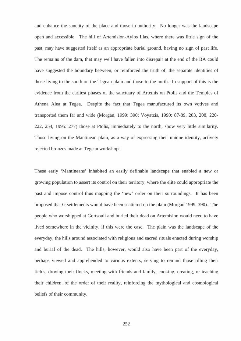
and enhance the sanctity of the place and those in authority. No longer was the landscape
open and accessible. The hill of Artemision-Ayios Ilias, where there was little sign of the
past, may have suggested itself as an appropriate burial ground, having no sign of past life.
The remains of the dam, that may well have fallen into disrepair at the end of the BA could
have suggested the boundary between, or reinforced the truth of, the separate identities of
those living to the south on the Tegean plain and those to the north. In support of this is the
evidence from the earliest phases of the sanctuary of Artemis on Ptolis and the Temples of
Athena Alea at Tegea. Despite the fact that Tegea manufactured its own votives and
transported them far and wide (Morgan, 1999: 390; Voyatzis, 1990: 87-89, 203, 208, 220-
222, 254, 1995: 277) those at Ptolis, immediately to the north, show very little similarity.
Those living on the Mantinean plain, as a way of expressing their unique identity, actively
rejected bronzes made at Tegean workshops.
These early ‘Mantineans’ inhabited an easily definable landscape that enabled a new or
growing population to assert its control on their territory, where the elite could appropriate the
past and impose control thus mapping the ‘new’ order on their surroundings. It has been
proposed that G settlements would have been scattered on the plain (Morgan 1999, 390). The
people who worshipped at Gortsouli and buried their dead on Artemision would need to have
lived somewhere in the vicinity, if this were the case. The plain was the landscape of the
everyday, the hills around associated with religious and sacred rituals enacted during worship
and burial of the dead. The hills, however, would also have been part of the everyday,
perhaps viewed and apprehended to various extents, serving to remind those tilling their
fields, droving their flocks, meeting with friends and family, cooking, creating, or teaching
their children, of the order of their reality, reinforcing the mythological and cosmological
beliefs of their community.
252
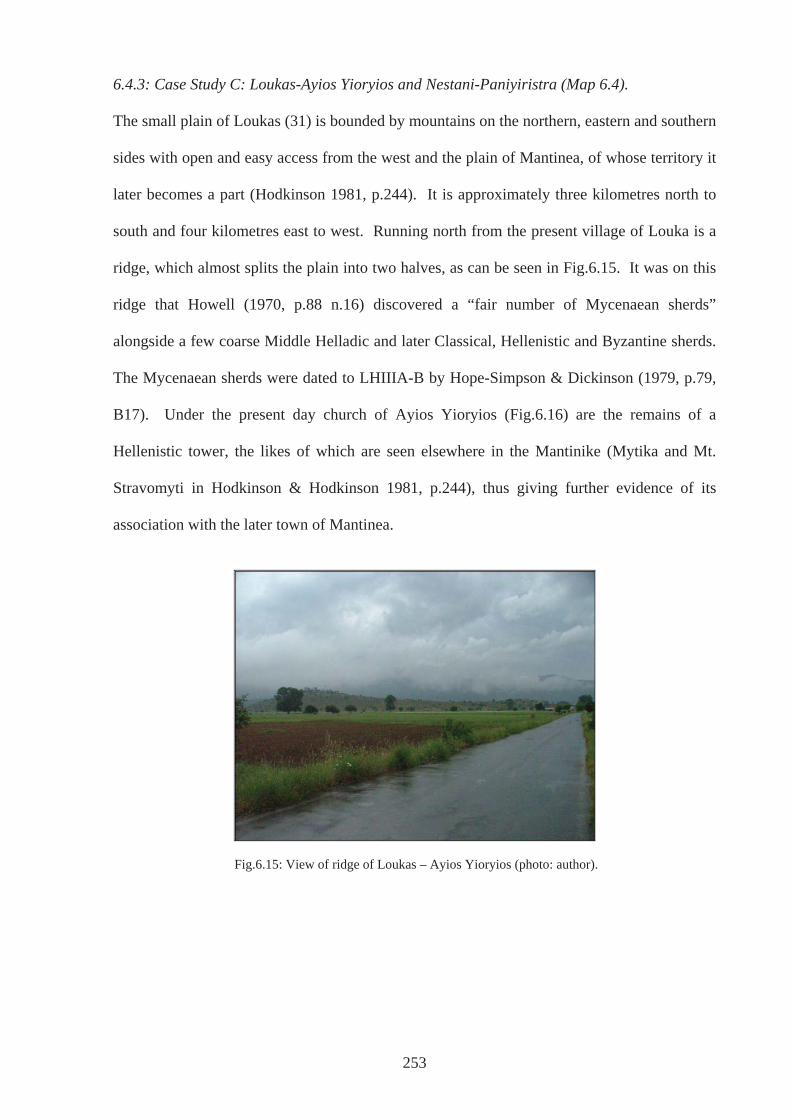
6.4.3: Case Study C: Loukas-Ayios Yioryios and Nestani-Paniyiristra (Map 6.4).
The small plain of Loukas (31) is bounded by mountains on the northern, eastern and southern
sides with open and easy access from the west and the plain of Mantinea, of whose territory it
later becomes a part (Hodkinson 1981, p.244). It is approximately three kilometres north to
south and four kilometres east to west. Running north from the present village of Louka is a
ridge, which almost splits the plain into two halves, as can be seen in Fig.6.15. It was on this
ridge that Howell (1970, p.88 n.16) discovered a “fair number of Mycenaean sherds”
alongside a few coarse Middle Helladic and later Classical, Hellenistic and Byzantine sherds.
The Mycenaean sherds were dated to LHIIIA-B by Hope-Simpson & Dickinson (1979, p.79,
B17). Under the present day church of Ayios Yioryios (Fig.6.16) are the remains of a
Hellenistic tower, the likes of which are seen elsewhere in the Mantinike (Mytika and Mt.
Stravomyti in Hodkinson & Hodkinson 1981, p.244), thus giving further evidence of its
association with the later town of Mantinea.
Fig.6.15: View of ridge of Loukas – Ayios Yioryios (photo: author).
253
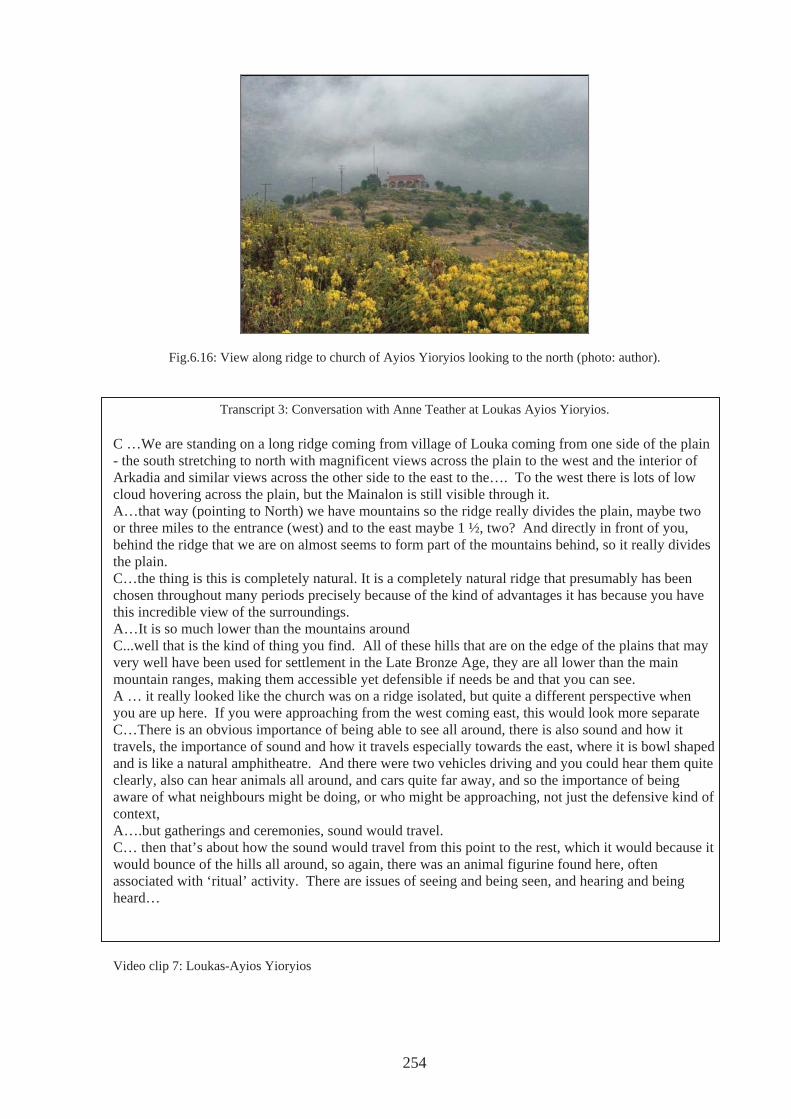
Fig.6.16: View along ridge to church of Ayios Yioryios looking to the north (photo: author).
Transcript 3: Conversation with Anne Teather at Loukas Ayios Yioryios. C …We are standing on a long ridge coming from village of Louka coming from one side of the plain - the south stretching to north with magnificent views across the plain to the west and the interior of Arkadia and similar views across the other side to the east to the…. To the west there is lots of low cloud hovering across the plain, but the Mainalon is still visible through it. A…that way (pointing to North) we have mountains so the ridge really divides the plain, maybe two or three miles to the entrance (west) and to the east maybe 1 ½, two? And directly in front of you, behind the ridge that we are on almost seems to form part of the mountains behind, so it really divides the plain. C…the thing is this is completely natural. It is a completely natural ridge that presumably has been chosen throughout many periods precisely because of the kind of advantages it has because you have this incredible view of the surroundings. A…It is so much lower than the mountains around C...well that is the kind of thing you find. All of these hills that are on the edge of the plains that may very well have been used for settlement in the Late Bronze Age, they are all lower than the main mountain ranges, making them accessible yet defensible if needs be and that you can see. A … it really looked like the church was on a ridge isolated, but quite a different perspective when you are up here. If you were approaching from the west coming east, this would look more separate C…There is an obvious importance of being able to see all around, there is also sound and how it travels, the importance of sound and how it travels especially towards the east, where it is bowl shaped and is like a natural amphitheatre. And there were two vehicles driving and you could hear them quite clearly, also can hear animals all around, and cars quite far away, and so the importance of being aware of what neighbours might be doing, or who might be approaching, not just the defensive kind of context, A….but gatherings and ceremonies, sound would travel. C… then that’s about how the sound would travel from this point to the rest, which it would because it would bounce of the hills all around, so again, there was an animal figurine found here, often associated with ‘ritual’ activity. There are issues of seeing and being seen, and hearing and being heard… Video clip 7: Loukas-Ayios Yioryios
254
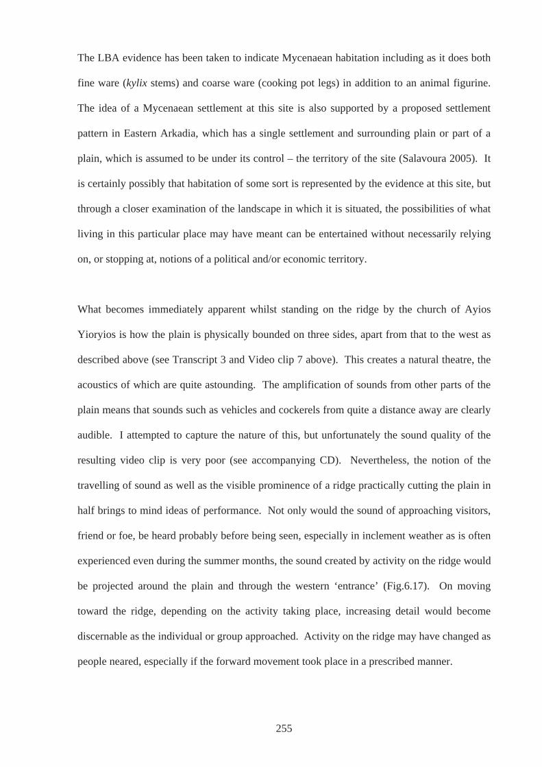
The LBA evidence has been taken to indicate Mycenaean habitation including as it does both
fine ware (kylix stems) and coarse ware (cooking pot legs) in addition to an animal figurine.
The idea of a Mycenaean settlement at this site is also supported by a proposed settlement
pattern in Eastern Arkadia, which has a single settlement and surrounding plain or part of a
plain, which is assumed to be under its control – the territory of the site (Salavoura 2005). It
is certainly possibly that habitation of some sort is represented by the evidence at this site, but
through a closer examination of the landscape in which it is situated, the possibilities of what
living in this particular place may have meant can be entertained without necessarily relying
on, or stopping at, notions of a political and/or economic territory.
What becomes immediately apparent whilst standing on the ridge by the church of Ayios
Yioryios is how the plain is physically bounded on three sides, apart from that to the west as
described above (see Transcript 3 and Video clip 7 above). This creates a natural theatre, the
acoustics of which are quite astounding. The amplification of sounds from other parts of the
plain means that sounds such as vehicles and cockerels from quite a distance away are clearly
audible. I attempted to capture the nature of this, but unfortunately the sound quality of the
resulting video clip is very poor (see accompanying CD). Nevertheless, the notion of the
travelling of sound as well as the visible prominence of a ridge practically cutting the plain in
half brings to mind ideas of performance. Not only would the sound of approaching visitors,
friend or foe, be heard probably before being seen, especially in inclement weather as is often
experienced even during the summer months, the sound created by activity on the ridge would
be projected around the plain and through the western ‘entrance’ (Fig.6.17). On moving
toward the ridge, depending on the activity taking place, increasing detail would become
discernable as the individual or group approached. Activity on the ridge may have changed as
people neared, especially if the forward movement took place in a prescribed manner.
255

Fig.6.17: View from ridge to the west showing the plain of Louka and Mantinean plain beyond (photo: author).
This plain and this site therefore could very well have held special importance in the locality
because of the sound quality and stage-like nature of the ridge and surrounding arena. People
living in and around the plains of Nestane and Mantinea would have heard the sounds of
everyday activities taking place here. However, perhaps these people were specifically
‘beckoned’ by noise that was produced, expected at and associated with certain times of the
year, for example harvest, movement of herds and flocks, everyday or seasonal activities that
would have been accompanied by ritual. In addition, ceremonies associated with life events
such as marriage, initiation, death, or the summer and winter solstices, could have been
important. There could have been a two way process where people occupying the ridge could
be seen and heard by those on plain who, in turn, could be seen and heard by those above.
There may indeed have been a community for whom this ridge was home all year round;
indeed the plain, being higher than the connecting plain of Nestane would not have suffered
as greatly from flooding, and therefore more suitable for arable farming (Pausanias 8.7.1).
However, how this place was used may have always been unavoidably tied closely to other
aspects of the immediate landscape. Such uses could have included greater numbers of
256
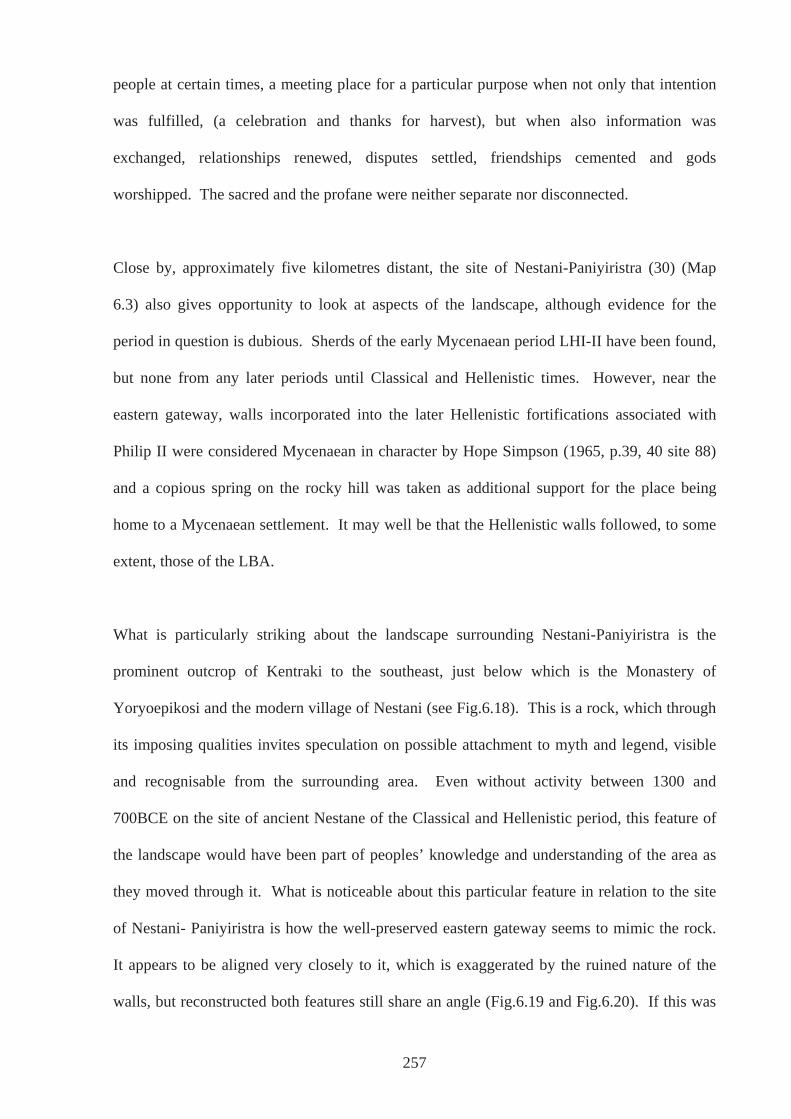
people at certain times, a meeting place for a particular purpose when not only that intention
was fulfilled, (a celebration and thanks for harvest), but when also information was
exchanged, relationships renewed, disputes settled, friendships cemented and gods
worshipped. The sacred and the profane were neither separate nor disconnected.
Close by, approximately five kilometres distant, the site of Nestani-Paniyiristra (30) (Map
6.3) also gives opportunity to look at aspects of the landscape, although evidence for the
period in question is dubious. Sherds of the early Mycenaean period LHI-II have been found,
but none from any later periods until Classical and Hellenistic times. However, near the
eastern gateway, walls incorporated into the later Hellenistic fortifications associated with
Philip II were considered Mycenaean in character by Hope Simpson (1965, p.39, 40 site 88)
and a copious spring on the rocky hill was taken as additional support for the place being
home to a Mycenaean settlement. It may well be that the Hellenistic walls followed, to some
extent, those of the LBA.
What is particularly striking about the landscape surrounding Nestani-Paniyiristra is the
prominent outcrop of Kentraki to the southeast, just below which is the Monastery of
Yoryoepikosi and the modern village of Nestani (see Fig.6.18). This is a rock, which through
its imposing qualities invites speculation on possible attachment to myth and legend, visible
and recognisable from the surrounding area. Even without activity between 1300 and
700BCE on the site of ancient Nestane of the Classical and Hellenistic period, this feature of
the landscape would have been part of peoples’ knowledge and understanding of the area as
they moved through it. What is noticeable about this particular feature in relation to the site
of Nestani- Paniyiristra is how the well-preserved eastern gateway seems to mimic the rock.
It appears to be aligned very closely to it, which is exaggerated by the ruined nature of the
walls, but reconstructed both features still share an angle (Fig.6.19 and Fig.6.20). If this was
257
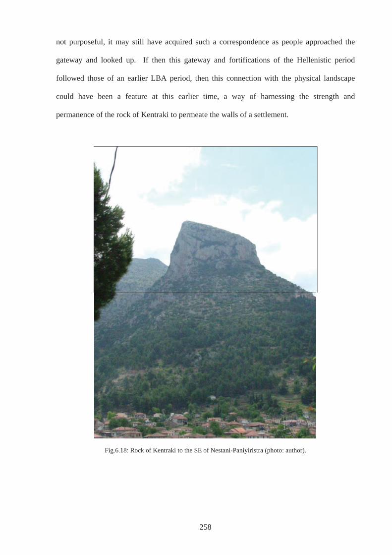
not purposeful, it may still have acquired such a correspondence as people approached the
gateway and looked up. If then this gateway and fortifications of the Hellenistic period
followed those of an earlier LBA period, then this connection with the physical landscape
could have been a feature at this earlier time, a way of harnessing the strength and
permanence of the rock of Kentraki to permeate the walls of a settlement.
Fig.6.18: Rock of Kentraki to the SE of Nestani-Paniyiristra (photo: author).
258
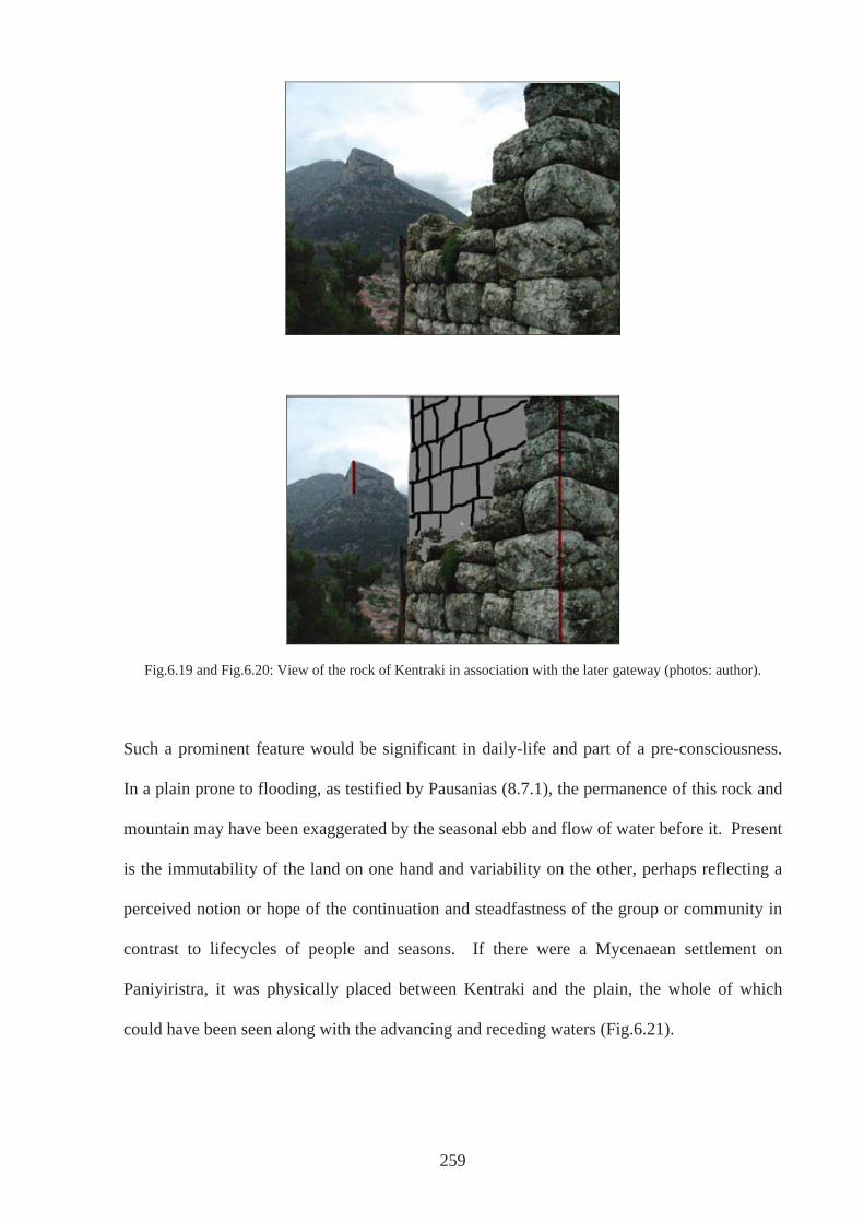
259
Fig.6.19 and Fig.6.20: View of the rock of Kentraki in association with the later gateway (photos: author).
Such a prominent feature would be significant in daily-life and part of a pre-consciousness.
In a plain prone to flooding, as testified by Pausanias (8.7.1), the permanence of this rock and
mountain may have been exaggerated by the seasonal ebb and flow of water before it. Present
is the immutability of the land on one hand and variability on the other, perhaps reflecting a
perceived notion or hope of the continuation and steadfastness of the group or community in
contrast to lifecycles of people and seasons. If there were a Mycenaean settlement on
Paniyiristra, it was physically placed between Kentraki and the plain, the whole of which
could have been seen along with the advancing and receding waters (Fig.6.21).
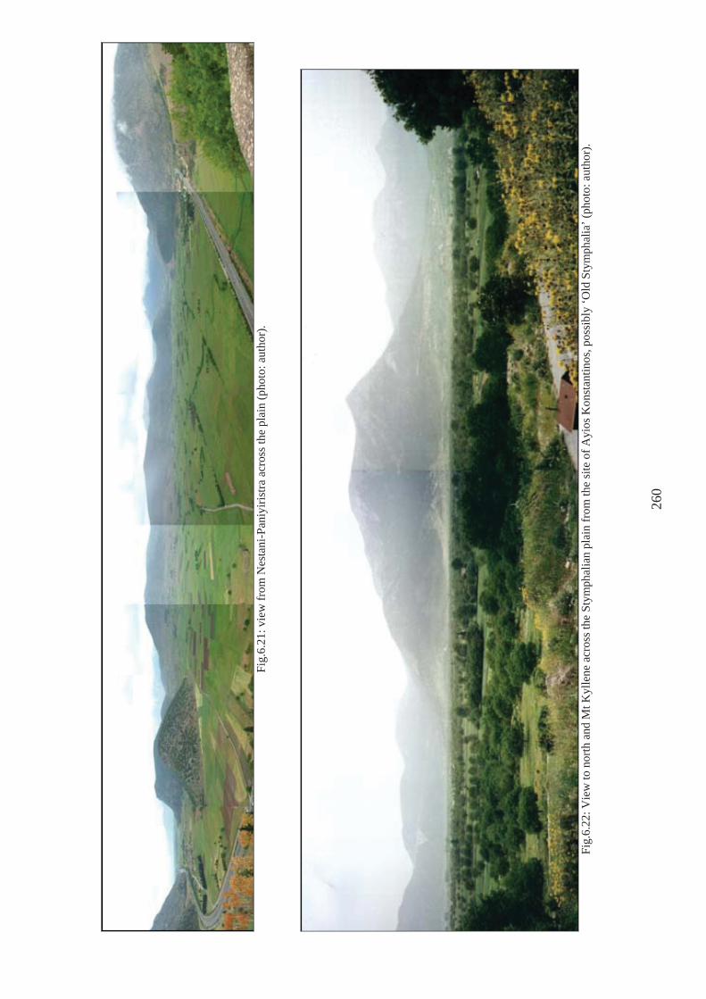
Fi
g.6.
21: v
iew
from
Nes
tani
-Pan
iyiri
stra
acr
oss t
he p
lain
(pho
to: a
utho
r).
Fi
g.6.
22: V
iew
to n
orth
and
Mt K
ylle
ne a
cros
s the
Sty
mph
alia
n pl
ain
from
the
site
of A
yios
Kon
stan
tinos
, pos
sibl
y ‘O
ld S
tym
phal
ia’ (
phot
o: a
utho
r).
260
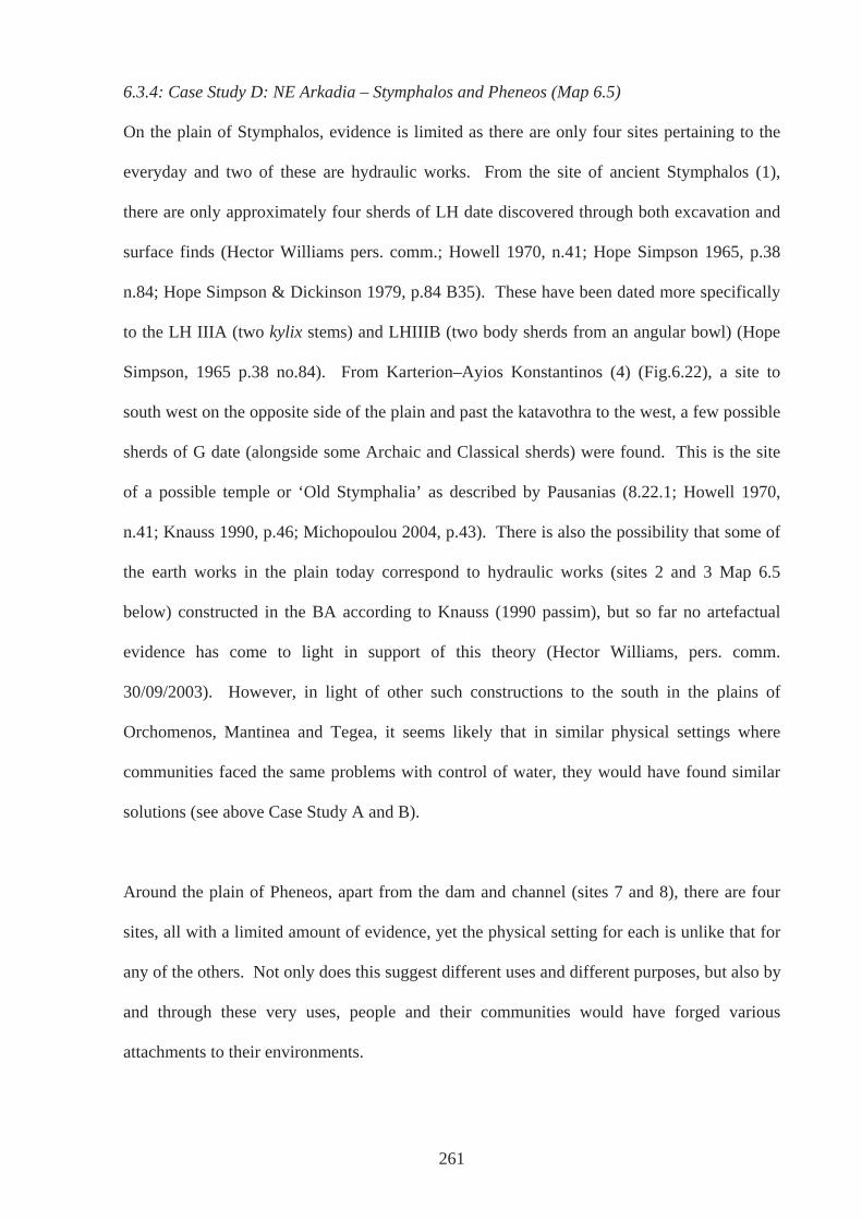
6.3.4: Case Study D: NE Arkadia – Stymphalos and Pheneos (Map 6.5)
On the plain of Stymphalos, evidence is limited as there are only four sites pertaining to the
everyday and two of these are hydraulic works. From the site of ancient Stymphalos (1),
there are only approximately four sherds of LH date discovered through both excavation and
surface finds (Hector Williams pers. comm.; Howell 1970, n.41; Hope Simpson 1965, p.38
n.84; Hope Simpson & Dickinson 1979, p.84 B35). These have been dated more specifically
to the LH IIIA (two kylix stems) and LHIIIB (two body sherds from an angular bowl) (Hope
Simpson, 1965 p.38 no.84). From Karterion–Ayios Konstantinos (4) (Fig.6.22), a site to
south west on the opposite side of the plain and past the katavothra to the west, a few possible
sherds of G date (alongside some Archaic and Classical sherds) were found. This is the site
of a possible temple or ‘Old Stymphalia’ as described by Pausanias (8.22.1; Howell 1970,
n.41; Knauss 1990, p.46; Michopoulou 2004, p.43). There is also the possibility that some of
the earth works in the plain today correspond to hydraulic works (sites 2 and 3 Map 6.5
below) constructed in the BA according to Knauss (1990 passim), but so far no artefactual
evidence has come to light in support of this theory (Hector Williams, pers. comm.
30/09/2003). However, in light of other such constructions to the south in the plains of
Orchomenos, Mantinea and Tegea, it seems likely that in similar physical settings where
communities faced the same problems with control of water, they would have found similar
solutions (see above Case Study A and B).
Around the plain of Pheneos, apart from the dam and channel (sites 7 and 8), there are four
sites, all with a limited amount of evidence, yet the physical setting for each is unlike that for
any of the others. Not only does this suggest different uses and different purposes, but also by
and through these very uses, people and their communities would have forged various
attachments to their environments.
261
262
Map 6.5: plains of Pheneos and Stymphalos (source: Hellenic Military Map Service 1:50 000 Kandhila sheet). 1: Ancient Stymphalos; 2: NE dam; 3: SW dam; 4: Karterion-Ayios Konstantinos; 5: Lafka tholos; 6: Ancient
Pheneos, 7: dam ; 8: channel; 9: Ayios Kharalambos; 11: Lakkomata, 12 Tsoukka.
At the site of ancient Pheneos (6), underneath and to the north of the 2nd century BCE
Asklepeion on the SE slopes of the southern hill, excavations in the late 1950s and early
1960s uncovered a complete sequence covering the Middle Helladic. Also unearthed were
Mycenaean levels dating to the LHIIIA2-B (Hope Simpson & Dickinson 1979, p.122, B34)
(Protonotariou-Dheilaki 1961-2, p.60; 1965 p.158). Both Howell and Hope Simpson report
Mycenaean sherds all over the hill and Howell also found a few possible G sherds (Howell
1970, n.40; Hope Simpson & Dickinson 1979, B34). More recent survey work (Tausend &
Erath 1999) has identified a further three and possibly four sites in other parts of the plain in
addition to the hydraulic works posited as Mycenaean in construction by Knauss (1990).
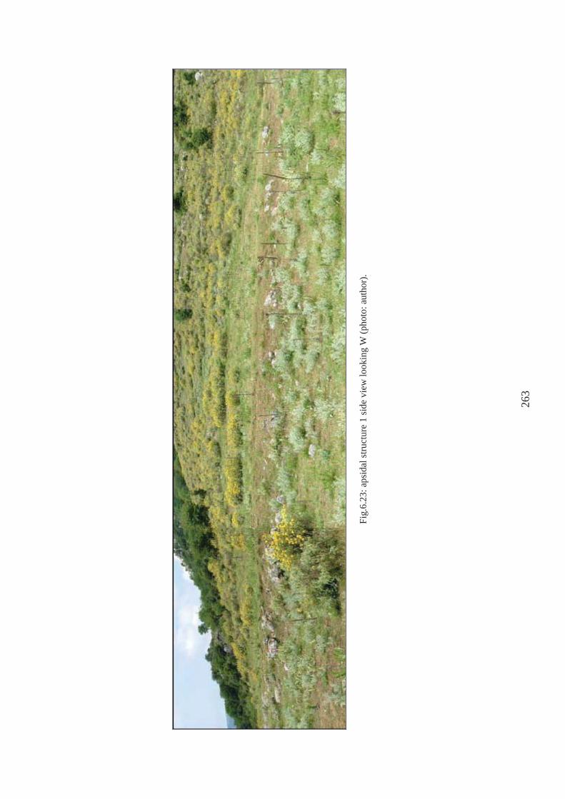
Fig.
6.23
: aps
idal
stru
ctur
e 1
side
vie
w lo
okin
g W
(pho
to: a
utho
r).
263
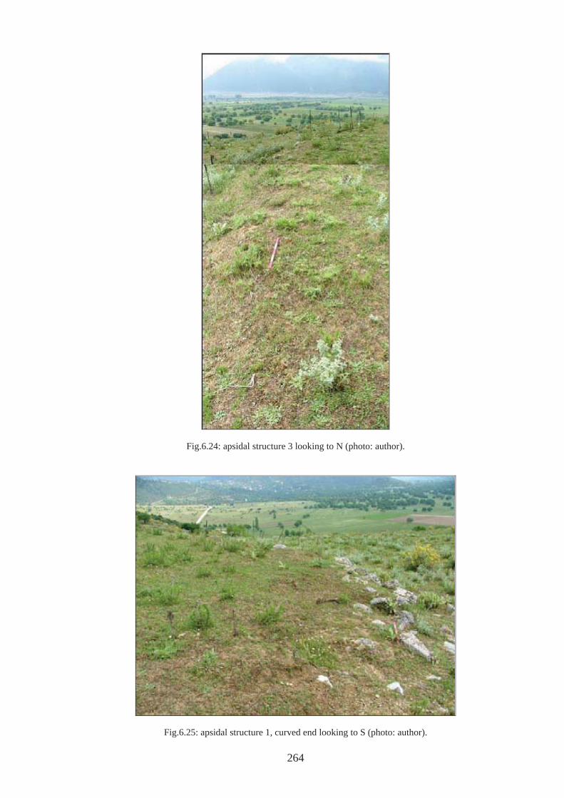
Fig.6.24: apsidal structure 3 looking to N (photo: author).
Fig.6.25: apsidal structure 1, curved end looking to S (photo: author).
264
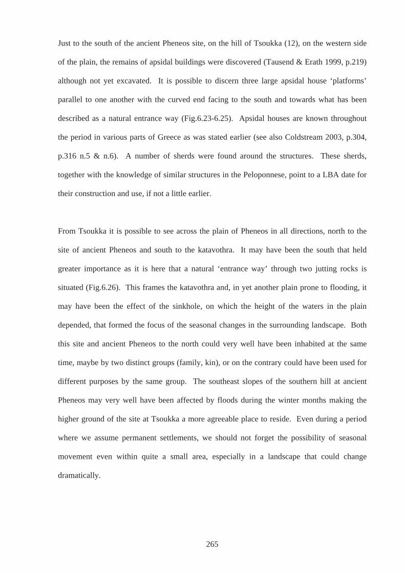
Just to the south of the ancient Pheneos site, on the hill of Tsoukka (12), on the western side
of the plain, the remains of apsidal buildings were discovered (Tausend & Erath 1999, p.219)
although not yet excavated. It is possible to discern three large apsidal house ‘platforms’
parallel to one another with the curved end facing to the south and towards what has been
described as a natural entrance way (Fig.6.23-6.25). Apsidal houses are known throughout
the period in various parts of Greece as was stated earlier (see also Coldstream 2003, p.304,
p.316 n.5 & n.6). A number of sherds were found around the structures. These sherds,
together with the knowledge of similar structures in the Peloponnese, point to a LBA date for
their construction and use, if not a little earlier.
From Tsoukka it is possible to see across the plain of Pheneos in all directions, north to the
site of ancient Pheneos and south to the katavothra. It may have been the south that held
greater importance as it is here that a natural ‘entrance way’ through two jutting rocks is
situated (Fig.6.26). This frames the katavothra and, in yet another plain prone to flooding, it
may have been the effect of the sinkhole, on which the height of the waters in the plain
depended, that formed the focus of the seasonal changes in the surrounding landscape. Both
this site and ancient Pheneos to the north could very well have been inhabited at the same
time, maybe by two distinct groups (family, kin), or on the contrary could have been used for
different purposes by the same group. The southeast slopes of the southern hill at ancient
Pheneos may very well have been affected by floods during the winter months making the
higher ground of the site at Tsoukka a more agreeable place to reside. Even during a period
where we assume permanent settlements, we should not forget the possibility of seasonal
movement even within quite a small area, especially in a landscape that could change
dramatically.
265
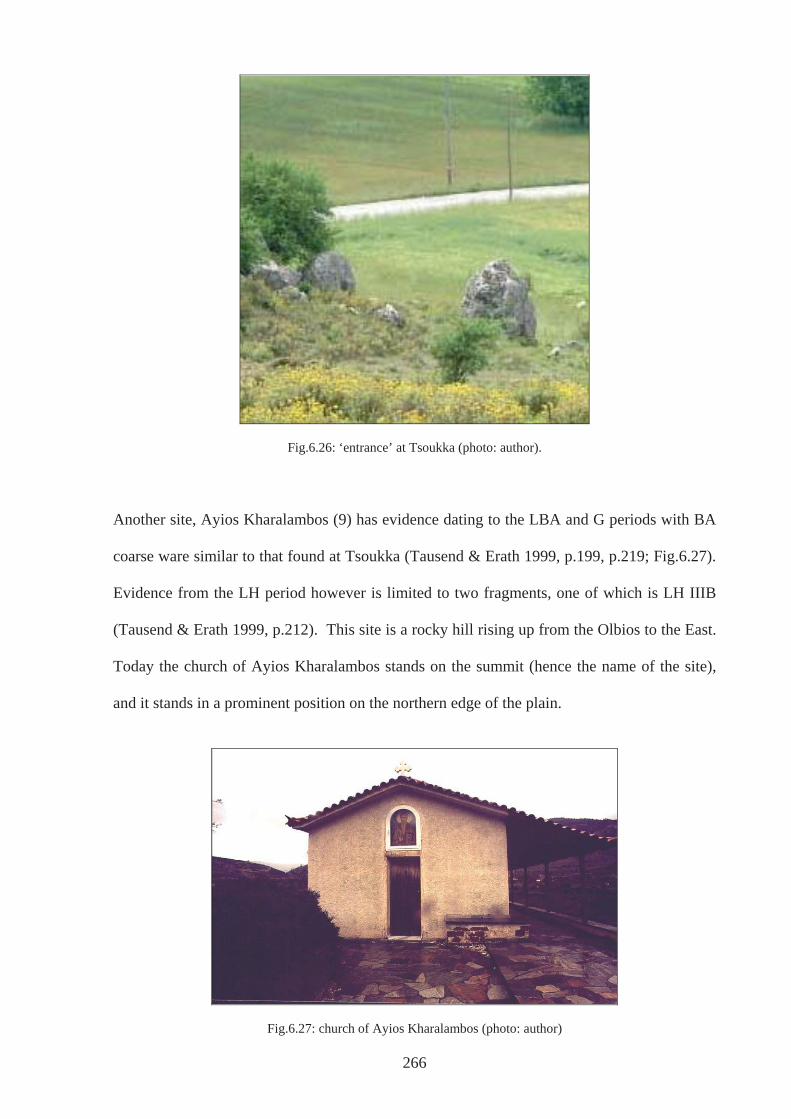
266
Fig.6.26: ‘entrance’ at Tsoukka (photo: author).
Another site, Ayios Kharalambos (9) has evidence dating to the LBA and G periods with BA
coarse ware similar to that found at Tsoukka (Tausend & Erath 1999, p.199, p.219; Fig.6.27).
Evidence from the LH period however is limited to two fragments, one of which is LH IIIB
(Tausend & Erath 1999, p.212). This site is a rocky hill rising up from the Olbios to the East.
Today the church of Ayios Kharalambos stands on the summit (hence the name of the site),
and it stands in a prominent position on the northern edge of the plain.
Fig.6.27: church of Ayios Kharalambos (photo: author)
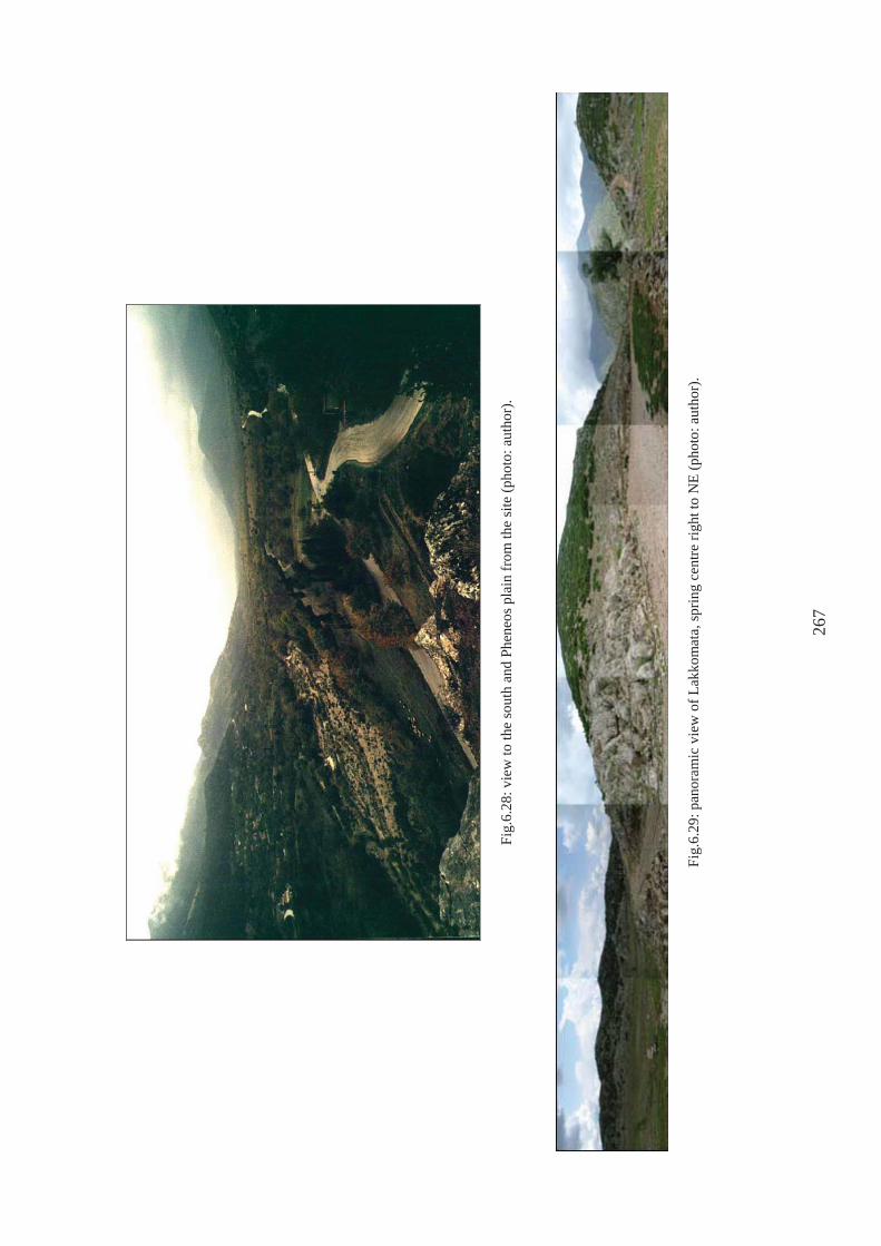
Fig.
6.28
: vie
w to
the
sout
h an
d Ph
eneo
s pla
in fr
om th
e si
te (p
hoto
: aut
hor)
.
Fig.
6.29
: pan
oram
ic v
iew
of L
akko
mat
a, sp
ring
cent
re ri
ght t
o N
E (p
hoto
: aut
hor)
.
267
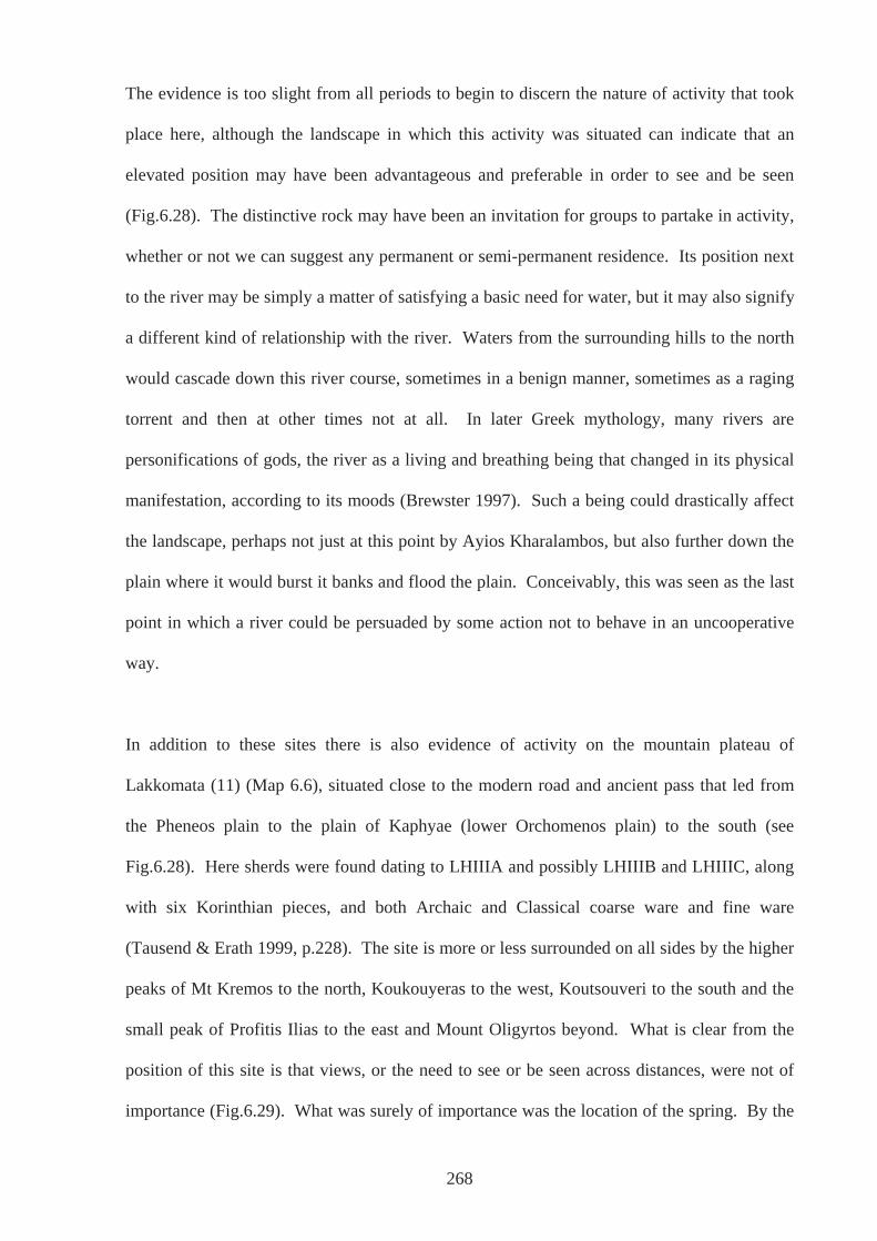
The evidence is too slight from all periods to begin to discern the nature of activity that took
place here, although the landscape in which this activity was situated can indicate that an
elevated position may have been advantageous and preferable in order to see and be seen
(Fig.6.28). The distinctive rock may have been an invitation for groups to partake in activity,
whether or not we can suggest any permanent or semi-permanent residence. Its position next
to the river may be simply a matter of satisfying a basic need for water, but it may also signify
a different kind of relationship with the river. Waters from the surrounding hills to the north
would cascade down this river course, sometimes in a benign manner, sometimes as a raging
torrent and then at other times not at all. In later Greek mythology, many rivers are
personifications of gods, the river as a living and breathing being that changed in its physical
manifestation, according to its moods (Brewster 1997). Such a being could drastically affect
the landscape, perhaps not just at this point by Ayios Kharalambos, but also further down the
plain where it would burst it banks and flood the plain. Conceivably, this was seen as the last
point in which a river could be persuaded by some action not to behave in an uncooperative
way.
In addition to these sites there is also evidence of activity on the mountain plateau of
Lakkomata (11) (Map 6.6), situated close to the modern road and ancient pass that led from
the Pheneos plain to the plain of Kaphyae (lower Orchomenos plain) to the south (see
Fig.6.28). Here sherds were found dating to LHIIIA and possibly LHIIIB and LHIIIC, along
with six Korinthian pieces, and both Archaic and Classical coarse ware and fine ware
(Tausend & Erath 1999, p.228). The site is more or less surrounded on all sides by the higher
peaks of Mt Kremos to the north, Koukouyeras to the west, Koutsouveri to the south and the
small peak of Profitis Ilias to the east and Mount Oligyrtos beyond. What is clear from the
position of this site is that views, or the need to see or be seen across distances, were not of
importance (Fig.6.29). What was surely of importance was the location of the spring. By the
268
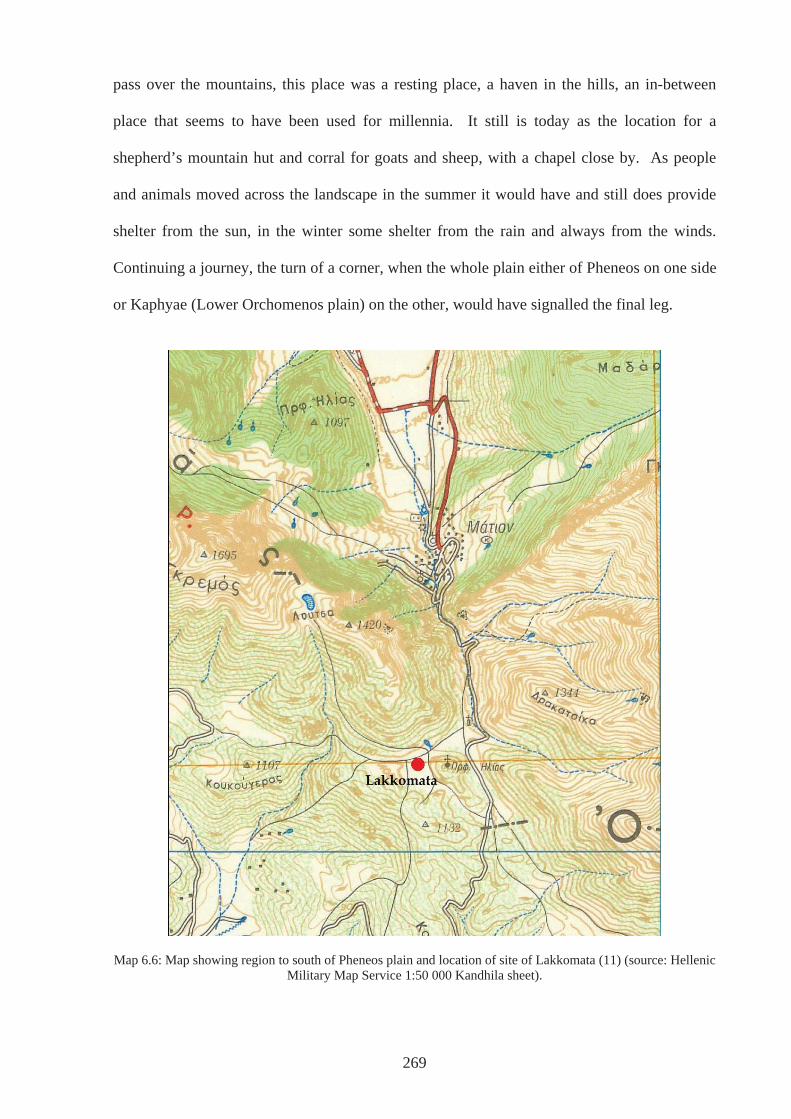
pass over the mountains, this place was a resting place, a haven in the hills, an in-between
place that seems to have been used for millennia. It still is today as the location for a
shepherd’s mountain hut and corral for goats and sheep, with a chapel close by. As people
and animals moved across the landscape in the summer it would have and still does provide
shelter from the sun, in the winter some shelter from the rain and always from the winds.
Continuing a journey, the turn of a corner, when the whole plain either of Pheneos on one side
or Kaphyae (Lower Orchomenos plain) on the other, would have signalled the final leg.
Map 6.6: Map showing region to south of Pheneos plain and location of site of Lakkomata (11) (source: Hellenic Military Map Service 1:50 000 Kandhila sheet).
269
6.5: Conclusions
This chapter serves well as the last of three that have investigated aspects of landscape and the
way in which people are thoroughly enmeshed within their environments. The case studies in
particular have brought together many strands that have been introduced in previous chapters,
where everyday lives are as connected with religion and death as they are with mundane
activities. Secularisation of the past is very much a modern activity (King, 2003). The
evidence and explorations have shown that there were adaptations and changes throughout the
period. People moved, lived and settled in various ways at various times. Certain aspects of
the landscape figure more heavily in one period than they do in another, reflecting the
different concerns and thus experiences of communities at various times.
The everyday evidence of LH period in Arkadia originates from forty-six sites (table 6.1),
sixteen of which have been interpreted as ‘settlement’ at some time (e.g. Howell 1970; Hope
Simpson & Dickinson 1979). The typical type of Mycenaean settlement in Arkadia has been
considered as located on the top of steep sided hills (Salavoura 2005), and this certainly
appears to be the case in the eastern plains. Of the sixteen described as settlements, however,
only seven can be described to be on steep-sided hills. For example, those in the Asea Valley
are certainly not except for Kato Asea-Palaiokastro (45), and that at Orchomenos-
Palaiopyrgos (25) is located on the slopes and spreads down into the Upper Orchomenos
plain. Again, it is the general that needs to be balanced by the particular; otherwise, a wealth
of evidence becomes lost. In terms of settlement, it proves exceedingly problematic to
discuss the other periods and thus it has served well to break down the barriers between the
everyday, religion and death in order to investigate, for example, the Mantinean plain for the
G period through a consideration of the evidence from the hill of Gortsouli (Ptolis) and
Artemision-Ayios Ilias.
270
Nonetheless, in terms of altering perceptions throughout the period, in the LBA, there is a
noteworthy concern with the behaviour of water shown by the position of sites. Although
dating is not accurate, settlements may have been founded at a time when the hydraulic works
were not yet constructed and so were located above flood lines. Continuity of community
ensured continuity of inhabitation or use at sites, even after various dams had been built and
the water controlled. The sites that are situated around the lower Orchomenos plain for
example, may be the result of activity associated with a need to be close by, to be able to
attend to the dynamics of the plain in a similar way to that suggested by Mark Gillings in
South East Hungary (Gillings 2005). It may be expected that the plains would flood, in
Gillings’ terms, a potential, as opposed to an actual, affordance, but the exact timing would
not be known unless close surveillance was carried out. It would have been through detailed
knowledge of the activities of the katavothras and the patterns of flooding over many years
that would enable communities to construct dams in the right places, for the right reasons.
As the period progressed, the behaviour of water on the plains was still certainly attended to,
and writers including Pausanias talk of the katavothras and various inundations (8.7.1; 8.14.1-
3; 8.22.3). Thucydides too describes the battle of Mantinea (385BCE) which was won by a
Spartan general Agesipolis by manipulating the river Ophis (see also Pausanias. 8.8.6). In
addition, he states (5.64.4) that the control of water between the territories of Mantinea and
Tegea was so contentious that it was the cause of war between them. The physical properties
of the landscape would have informed divisions perceived between peoples. Groups were
acting against and with the agency of ‘nature’. Their attempts to control it gave definition to
their identity. As stated above, the physical barrier of a dam between what was to become the
territories of Mantinea and Tegea would have made manifest the division between people.
Maybe such a structure encouraged it in the first place, but suggested already by the
narrowing of the plain at Mytikas.
271
Perhaps with growing communities from the G period onwards and new ways of living, the
landscape was divided into roles as much as the people who populated it were. A growing
population who were making a plain more inhabitable would have allowed settlement to exist
upon it. In addition, where one community controlled the whole area, the need to be on hills
that could be defended was negated. Even in periods where warfare and skirmishes were rife,
the old places were not sufficient in size. They may have had particular associations,
memories, and myths attached to them, so that they could not be used as places of settlement
again. These ideas can be seen in terms of new social structures, to be associated with the
emergence of the polis. It is still possible to discuss traditional problems and accept old ideas,
but approaching from an angle that humanises the explanation, and one that begins to take
notice of the places in which such changes occurred.
272

PART 3
273
CHAPTER 7: SUMMARY AND CONCLUSION
7.1 Introduction
Much of the work in this thesis could be framed as an answer to the question “why were
particular locations chosen for past activity rather than others?” (cf Tilley 1994, p.1). If there
has not been one answer for each site, in each time and place, then there is no apology for
this. The study is an exploration, an exercise in interpretation, an immersion in the landscape
of a particular area where people chose to act at particular points of time in the past. What
this thesis has done is bring out the diversity of the Arkadian landscape, the diversity of sites
within it and the diversity of use throughout the time frame in question. In this final chapter, I
summarize what the research presented here has achieved (Section 7.2), followed by a debate
into what may be considered potential problems and how these have been resolved in order to
legitimise the approach (Section 7.3). The chapter, and therefore the thesis, concludes with a
précis of the value of the study and its worthwhile in understanding the early history and
society of Greece as whole.
7.2: Arkadia in Transition
Although this study is entitled Arkadia in Transition, in reference to a particular time and
place, it can be rightly argued that all life is in transition on a day-to-day basis. Not only are
people dynamic, but landscapes too are in a constant state of flux, in terms of both long-term
geological processes and shorter-term ecological cycles (Ingold 1993, p.164). To talk about
Arkadia being in transition between the LBA and the EIA is largely trite and superficial when
all situations and places are seen as being in a condition of change. From the privileged 21st
century viewpoint, it is possible, as Bourdieu (1977) suggested, to apprehend the sweeping
changes from one century to the next and to anticipate events. The old cultural-evolutionary
ideas see history as a progression from one thing to another (e.g. Morgan, 1877), a proposal
which has essentially originated the idea of Arkadia in transition during the LBA and EIA; it
274
is the no-man’s land between the Mycenaean Civilisation of the past and the Classical
Civilisation to come (cf Snodgrass [1971] 2000, xxiv). Rather than considering the period
and place in these terms, this work has embraced a respect for the period and the extant
material evidence for what it is – the fragments of past lives, the existence of which are
important and valuable for themselves, even if not to the way history has tended to see them.
One of the main points to come from this research is that although generalisations can be
made, the particular should not be forgotten. From the case studies, a step back can be taken,
allowing the period as whole to be grasped and changes throughout to be apprehended, but
hopefully this occurs with a deeper sense of the period than would otherwise be possible. It is
hoped that an appreciation of the complexity of Arkadia in the LBA and EIA can be achieved,
alongside a respect for the people and an understanding of something of what it may have
been like to experience these times and places. Nonetheless, through charting the differences
in the places in which people engaged in activity apparent over time, enhanced by the case
studies, the idea of change and transition is one that was always going to be addressed. The
conclusions of each chapter have discussed ways in which change was made manifest, the
transformations in the way people and communities negotiated their surroundings,
worshipped their gods, (Chapter 4) treated their dead (Chapter 5) and organised themselves
into settlements (Chapter 6).
For the LBA, it is postulated that settlements in Arkadia were on top of steep-sided,
defendable hills (Salavoura 2005), and certainly there is a pattern of settlements situated on
top of hills distinguishable on and around the Mantinean plain (Ptolis Gortsouli (27), Nestani-
Paniyiristra (30), Loukas-Ayios Yioryios (31), Merkovouni-Ayiolias (32) Chapter Six). This
may suggest that individual communities inhabited the plain, sharing certain aspects of it,
perhaps grazing rights for example, who came together to cooperate on certain occasions,
275
such as to construct the hydraulic works (33) needed to make the place reliably inhabitable
(Morgan 2003, chapter 4). However, through the medium of the case studies the awareness of
a range of qualities and characteristics of specific landscapes have opened up the possibility
that variations existed in the way settlements were apprehended by those living in the area. In
this way, if Loukas-Ayios Yioryios was home to a settlement in the LBA, the qualities of this
relatively small plain may have afforded this place a particular role in the activities of the
wider community, and that of Nestani-Panayiristra (30), may have gained particular status
because of the imposing rock towering above. Appreciating variations still, the pattern of
activity in the Asea Valley is different from the ‘usual’, where sites, except for Kato Asea-
Palaiokastro (45), are positioned on hill slopes (Ayios Nikolaos of Manaris (47)) or on the
valley floor (Ayios Athenasios of Dorizas (48), Ayios Yioryios of Athenaion (49), AVS62
(79) and AVS67 (50)). In another variation, the physical landscape in the central regions is
highly fragmented, thus at Karvouni-Sfakovouni (75) and Lasta-Kollinos (74), not only would
there have been incredibly different vistas and ways of moving around physically, but this
would have contributed to the way inhabitants of these diverse locations apprehended one
another. These few examples have served to illustrate the variation that exists within one
period, over a relatively small area.
For the G period, it is possible to focus on the Mantinean plain where a distinct pattern
emerges in the way the land is inhabited, as shown in Chapters 4, 5 and 6. Although there is
limited evidence for settlement in any part of Arkadia for this period, bringing together the
aspects dealt with in separate chapters allows for some consideration. In the G period, it
appears that the whole plain served as the territory for one community, which, although may
have been living in scattered farmsteads on the plain (Milea/Mantinea (28); Morgan 1999,
390), divided areas of it for distinct purposes. For the community to whom Ptolis was a site
of religious importance, and Artemision-Ayios Ilias was a burial site, there is an apparent
276
need to control and divide territory into definable units. This is something very different from
the pattern in the LBA.
Some sites were used continuously, such as the Temple of Athena Alea at Tegea (34) and
perhaps Orchomenos-Palaiopyrgos (25) (Chapter 4). If activity did occur at the latter
throughout the period in question, it was a use that changed in nature. Where a shrine might
have once been incorporated into the fabric of the town, it stood alone as the centuries moved
on. People moved away but ties were kept through the recurrence of religious practice, a site
that once stood home for distant ancestors, real or appropriated. The idea of remembering
ancestors and forging links with places already old in the G period is played through at sites
to which people returned, such as that of Ptolis-Gortsouli (27). Here, a site with visible
remains of a previous settlement was appropriated by those who choose to focus religious
activity here in the 8th century, probably, but not certainly, exclusively (AR 1993-4, p.17;
Voyatzis 1999, p.146). In the southeastern region, there are hints that people in the 8th
century returned to LBA tombs (Chapter 5) – both at Vourvoura-Analipsis (44) and Alea
Palaiokhori (40) where fragments of G material have been found in the fill of the tholoi
(Antonaccio 1995, p.68; Coldstream 2003, p356). Processions and ritual around death may
have had some continuity, as argued by Cavanagh (1978), but the locations in which burials
were placed changed significantly, not to mention the type from multiple to largely singular.
None of the cemeteries continued in use throughout the period. In the LBA, there is a definite
sense of proximity to water, seen at all the tomb sites. However, as before, the landscapes at
these sites afford different qualities, characteristics that could not have been unimportant.
Thus, the experience of Vourvoura-Analipsis b is very different to that of Alea Palaiokhori b,
two sites in very close proximity to one another (Chapter 5).
277
If there was continuity of population in Arkadia as supported by myth and linguistic criteria
(Chapter 2), then the way they approached their world and the landscapes around them
certainly changed. The dialect may be strong indication that this area was unaffected by
movements of various populations, but the evidence as it stands does not show an undisturbed
area that prospered and flourished. Much of the myth of Arkadian autochthony (e.g.
Thucydides, 1.2.3.; Herodotus, 2.171), may have been more an “ideological statement of
antiquity” (Morgan 1999, p.387) than a reflection of real events. Wider influences and
networks, into which the lives of the people of Arkadia were woven, played back on their
lives. Decisions that people and communities made affected those in other areas.
Disturbances at the end of the Bronze Age did affect Arkadia. People may have dispersed,
moved on and arrived, but people also stayed. However, if there was an influx, as posited for
Cyprus at the end of LHIIIC period (e.g. Dickinson, 1994: 232), then the remains of these
communities are lost and unrecognisable archaeologically or not yet found.
The landscape surely played its part in events and it has long been argued that the Arkadian
mountains may very well have sheltered the region from the large-scale effects of movements
of peoples, but they are not impenetrable and have rarely represented an immutable boundary
(Chapter 2). The picture of hardship and confusion of communities re-learning to sustain
themselves after collapse of centralised redistributive palaces is probably not one which
applies exactly to Arkadia. Although they would have been tied into wider networks of trade
and exchange, the reliance that the LBA communities of Arkadia had on palatial centres
would not have been direct, and evidence in other areas shows that not all small communities
were at the mercy of the palaces or were affected in the same way (Foxhall 1995). In the G
period however, the picture is one that is repeated in many areas of the Greek world, where an
increase in number of and activity in sanctuary sites, on present evidence is a defining
characteristic (Coldstream 2003, p.156, p.317). Particular communities in Arkadia were
278
living within a wider network of influences, as shown by artefacts deposited at Tegea, Ptolis
and Lousoi (66), which have Argive, Lakonian and Korinthian connections to varying degrees
(Coldstream 2003, p.156-7; Morgan 1999, p.395-6; Voyatzis 1999, p.144). Nevertheless, this
generalisation should not mask the peculiar circumstances and landscape settings for each site
that would have figured in the recreation and reproduction of activity.
As was acknowledged in Chapter 2, the evidence for this area and period is quantifiably not
staggering. Also acknowledged was the possible need for a more sensitive methodology in
order to assess the archaeological record for the period from the end of the BA and the
beginning of the IA, in order to enable light to be shed on this temporal and geographic entity.
As Forsen (2003, p.183) states, there is little knowledge of local coarse wares for the period,
and analyses focussed more on fabric than on decoration may prove worthwhile. Pikoulas
also suggests that this may be the reason for the lack of sites in and around the Megalopolitan
plain (Pikoulas, cited by Morgan, 1999, p.402). In addition, surveys in the west may prove
profitable, although this may have to rely on an innovative methodology whereby
fieldwalkers are driven to walkable areas that may only have one or two transects worth of
space. Moreover, scatters that may seem unimpressive in the world of Greek archaeology, re-
deposited in the 16th-8th century BCE of other places, for example prehistoric Britain, would
be the focus of intense interest. Greek archaeology has been habituated to the wealth of
evidence, is immune to or at least expects the multitude of sherds that are strewn across every
archaeological site. When only a few sherds are found, for a Greek archaeologist, not much
can be said about them. For an archaeologist working on the British Neolithic, it is only the
starting point (Anne Teather, pers. comm.).
279
7.3: Problems and Resolutions
The approach taken in this thesis will not be without its criticisms, and by promoting an
almost eclectic point of view, attack may come from all sides. Central to this study of
Arkadia has been the concept of landscape - in this case, the landscape(s) of Arkadia during
what is considered a transitional period at the end of the BA and beginning of the IA.
Research of a discreet geographical region (Arkadia) over a period of time (the transition
from BA to IA) is typical of a processual approach. It is a desire to look at the whole
landscape, identifying systems and the longue durée, processes that might be discernable from
looking at the archaeological evidence from a whole region and over a substantial swathe of
time - the 900 years from 1600–700BCE. Likewise, the idea of looking at a period that is
relatively understudied, the Greek ‘Dark-Ages’ (as well as an area that is relatively
understudied) is an adjunct of the processual. In this way it acclaims the importance of the
archaeological record of all times and all places not just those that are indicative of ‘golden
ages’, whether the preceding Mycenaean or the following Archaic and Classical in the realm
of Greek archaeology (Binford 1968).
However, as many a post-processualist has expounded (e.g. Shanks and Tilley 1987; Hodder
1999; Tilley, 1987, 1994; Thomas, 1991, 1996), although processualism has been optimistic
in its aim of reaching into the past and making sense of it, the concern has been with
generalisations and rules that could be ascertained and applied universally. As Bintliff
(1991b, p.3) has pointed out, New Archaeology has had little to say about the individual or
the agency of people. Short-lived events were omitted from discussion and the tenets of
positivism obscured the ‘personal, time-conditioned, subjective needs of individual
researchers’ which is reflected in data collection and interpretation. Although settlement
patterns can be mapped and changes charted over time, proximity to resources measured,
280
subsistence patterns posited, the notion that these landscapes and times were experienced and
lived through by people was largely left out of discussions.
Through presenting the case studies in Chapters 4, 5 and 6, the positions of sites in various
periods has allowed investigations into elements of landscape that may have played an
important role. However, this has not been to the exclusion of considering the evidence in a
standard way. Throughout the body of the thesis there have been tables drawn up and
distribution maps employed to help explain the evidence; an objectifying stance that employs
a modern western world view based on notions of Cartesian dualism. Sites types have been
discussed and in some cases with little reference to the people creating the material evidence.
It has followed various avenues of enquiry, of engagement with the remains of the past.
By using both of these angles, there is a potential contradiction, a dichotomy that needs
explaining. In the first place, there is the need to recognise that Cartesian dualisms do not
simply constitute one way of looking at the world, and a phenomenological based approach
another. People always have and always will dwell in the world and this is a state of being
which cannot be escaped. People never do live ‘outside’ their environment (Ingold 2000,
p.173). Whilst landscape and environment may be objectified through Cartesian notions, this
does not stop it ‘being there’ for each and every one of us. All of us are in-the-world today as
people were in the past (Heidegger 1962). Consequently, this premise allows a dwelling
perspective to have its place in archaeological studies (Ingold 2000, p.189). It is viable
because the landscape of Arkadia today can be approached and experienced, and little of the
‘natural’ environment has altered: the mountains are in the same relative position, as are the
plains, despite a considerable accumulation of alluvium. The katavothras, although now
mainly enclosed, behave in similar ways, and if anything there were less trees in the period
under consideration than there are today (Rackham 1996, p.26, p.31; Roy 1999, p.320).
281
Although speaking with reference to the British landscape, as Tilley (1994, p.73) states the
skin of the land may have changed but not the shape.
Nonetheless, on another interpretative scale, there is a need to recognise that the way people
view space and place is unavoidably tied up to the times and places in which they live
(Rodaway 1994). Consequently, the fundamental difference in the character of the past
should be recognised and not be dismissed (King 2003; Shanks 1996, p.155). The case
studies cannot simply be an exercise in describing and explaining a personal attachment to
and experience of the Arkadian landscape and environment, although this plays it part - it
does for all engaged with the past and past material culture. What prevents the case studies
being simply a poetic task is the existence of past material evidence. The artefacts, structures
and locations they were found focus our attention on particular times and places.
It is hoped that the present study has not fallen into the trap whereby the past is normalised
and given a modern coating of explanation. Trying to avoid such an error has formed the
greatest struggle and a sometimes-overwhelming paradox when formulating explanations for
past material culture. This is the case in all interpretations of the past, not just here. Even
though there is a general acceptance of the relative context of our viewpoint, explanations for
the material record of the past are still often posited as universal, absolute truths and as
evidence for universal human nature. Many ‘schools’ of archaeology have dedicated time to
highlighting and preventing such a modern ‘whitewash’. For example, the recognition and
unveiling of an unquestioning and assumed universality is prominent within feminist
archaeology, which has highlighted that the past has been and still is written largely from a
white western male perspective and presented as objective truth. Women, for example, are
represented as an ‘unchanging essence’ carrying out the same roles in the past as they do (or
ought to do?) today (Gero & Conkey 1991). This white male perspective in writing the past
282
has been challenged over the last fifteen years as archaeology has caught up to some extent
with other disciplines in the use of feminist and other critical approaches. However, even
publications such as The Meaning of Things, the result of a World Archaeology Conference
(Hodder 1989), which attempted to give voice to many different groups, was still controlled
and ultimately edited by a white, middleclass male. Hodder (1989) chose papers that fitted
his theme and fitted most closely to the style of western academic writing, despite mixing up
chapters to give an illusion of random inclusivity.
Okri (2002) illustrates well the way in which our perceptions of situations and people (in this
case, of a Nigerian man), are informed by a constant drip of (mis)information from everyday
experiences, which becomes accepted as ‘fact’; people become unquestioning and accepting
of ‘the-way-things-are’:
“Be aware that there are secret laws for different people and that these secret laws are carried out by the most innocent of citizens… Be aware of how much you are secretly conscripted into complicity through fear, misinformation, lack of contact, casual demonisation, distortions of history, irresponsible novelists and journalists and poets and film-makers….” (Okri 2002, p.111).
To this list, we can add archaeologists, a point that highlights the responsibility we have in
interpreting the past and disseminating what we conclude, why and how, to the public. In
terms of Greek Archaeology, the view of ancient Greece for the wider public is still very
much as it was for scholars a hundred years ago. Even recent productions such as Troy
(Peterson 2004), depict an age complete with motivations and values with which we can fully
sympathise. Thus, the Iliad was turned into a love story between Achilles and Briseis, which
showed a lack of understanding for the difference of the past, with values, and situations that
are in many ways alien to us today (Winkler 2006). Achilles did not ‘love’ Briseis, at least
not in our understanding of romantic love; he wept when she was taken away because
Agamemnon had humiliated him by taking his prize and Homer states as much (Il I.338).
This may be done in scholarly circles, but it is not always disseminated. Nietzsche (1873-6,
283
p.175) states in his essay ‘We Philologists’ that a false idealisation of the Greeks exists and
that people would be horrified by the real nature of antiquity if they could only comprehend it.
Of course, Hollywood blockbusters are not known for accuracy, but in the case of Arkadia
there have also long been overriding images that have little to do with any contextual analysis
or consideration of material ’facts’. If we revisit the opening paragraph (Chapter 1) we are
reminded of one view readily recognisable. This is the portrayal of Arkadia as Elysian, or
paradise, as reflected in literary and artistic works from Virgil onwards. This is the view that
many early travellers, antiquarians and culture historians had in mind when embarking on
expeditions and researches. However, these same pioneers also experienced a very different
Arkadia from the one they imagined, an Arkadia that can be seen in direct contrast to the
Elysian expected and which also tapped into ancient views of the region. This view was of
Arkadia as a barren, antiquated backwater, as considered in Chapter 2. However, unlike the
reinterpretation of Homer referred to above, the latter image in particular was one to which
scholars until recently subscribed. It is hoped that this study has provided an alternative way
of considering the region.
Examining the Arkadian evidence by means of the case studies has enabled the particular to
be emphasised. Thus, in Chapter 4, I considered evidence from the hill of Ayios Ilias in the
Asea Valley (Case Study A). This focussed on analysis of how the hill may have been
apprehended from other sites in the area, as well as how the perceptions of participants could
have been affected by being on the summit. In a similar way, the site of Ptolis-Gortsouli was
considered in terms of its position in the landscape, as was Vlakherna-Petra. However,
conclusions reached for each differed quite markedly. The same can be observed for the case
studies in Chapter 5, where conclusions reached for Alea Palaiochori and Vourvoura-
Analipsis, Artemision-Ayios Ilias, the western cemeteries and the Lafka tholos, whilst
284
recognising corresponding themes such as the importance of water, were varied. Again in
Chapter 6 analysis of evidence for the everyday resulted in diverse conclusions for sites
around the Mantinean plain, Orchomenos and Pheneos. The concentration on the particular,
on the specific characteristics of each sites and an awareness of the individual contexts
created through an interplay of site, evidence, location and date has prevented the ‘whitewash’
to which the previous paragraph alluded.
One consequence of the present research and the approach applied is that increasingly, I have
come to believe that there is little that is ‘universal’ and very little that can be put down solely
to an essential human ‘nature’. Most of human behaviour is to one degree or another learned
through experience and therefore culturally constructed, not inevitable and therefore subject
to an, if not infinite, then overwhelming amount of variations. In addition, and very
importantly, is the fact that our learning and experiencing takes place within and through our
bodies, affecting our biology and therefore nature (e.g. aggressive behaviour creates more
testosterone which in turn creates aggressive behaviour; neglect in childhood can cause high
cortisone levels, which encourages unruly behaviour or thrill-seeking to maintain the high
levels, Bremner & Vermetten 2001 quoted in James 2002, p.6 p.315). Moreover, there is
much to be said about the modern dualisms of nature/nurture and body/mind as unhelpful, or
even disabling. Perhaps the reason why it is seemingly impossible to discern or agree upon
which aspects of ourselves are due to nature and which to nurture, is precisely because the
division is a false one (Shanks and Tilley 1992, p.120, Ingold 2000, p.3).
There will always be certain things that humans need, largely in order to survive and survive
well. Maslow (1968) placed these in an order known as the ‘hierarchy of needs’, some which
must be addressed before others. Even if we can agree that the needs themselves are universal
in time and space, and therefore the essence of what it means to be human, the manner in
285
which they are achieved are significantly varied. Perhaps this is one reason why humans have
such a long childhood (although ‘childhood’ as we see it today is also a cultural construction)
in order that we have time to learn the behaviour that is required for us to engage successfully
with the particular group and time into which we are born. In many ways this must be what it
is to be human – the ability to be highly adaptive to context, that we can learn and adapt and
thus create a multitude of different behaviours or ‘cultures’, which in turn means we have the
potential to survive and flourish in all kinds of scenarios, as long as we can breathe, drink, eat,
and procreate.
By stating that the way human beings think is contextual perhaps gives the impression that the
past is unknowable and therefore nothing can be said about it. If care needs to be taken in
imposing modern values onto the past, where can sense begin to be made of past people, their
material remains and the locations in which they acted? In answer, what should emerge from
the above and the thesis as a whole is that there should be no pretence, which states the past
can be known as-it-actually-was, or where views are posited as absolutes, which ultimately
deceive all into thinking that through positivist principles the Truth will be found. Instead,
the many and varied ways of getting to grips with the past, namely the material past through
archaeology (but also through literary and documentary evidence, where they exist) should be
welcomed and explored. This includes engaging with ideas that can be pigeonholed as
culture-historic, processual, post-processual, or scientific, non-scientific, inspirational or
poetic and whatever other labels may come to mind.
In a sense this is what John Bintliff (2000, p.161), proposes through his use of Wittgenstein’s
philosophy, which he sees as a way of allowing different views on the past to prevail. Julian
Thomas (2004, p.224, p.235), a scholar often placed in an opposing camp to Bintliff, agrees
that different approaches to the past should be ‘allowed’ and encouraged, comparing different
286
ways of looking at the past to looking though the many sides of a crystal. This view is not at
odds with Bintliff’s proposal, nor that of other scholars (e.g. Chippendale 1993, p.30).
However, Bintliff, with his feet planted firmly in a positivist camp, seems to dismiss use of
imagination or poetics as useful ways of describing the past. For him things that can be
measured and drawn are most valid; ‘things’ he sees as unaffected by micro-politics or bigger
politics of the present, thus dismissing Kuhnian notions on the social construction of scientific
facts. Through using the example of an aeroplane, Bintliff argues that the fact it was invented
by white western males is irrelevant to a statement about its technology in the ‘thing-
language’ of science (in Wittgenstein’s terminology). This may be a valid way of looking at
the world, but implies that all the ‘thing-language’ of science or rather science itself can do is
to describe measurable things, devoid of meaning. Thomas (2004, p.224) sees this approach
as leaving archaeology “impoverished and etiolated”. But even more fundamentally, although
an attempt at objectivity may for some seem to be the only way, it can never be realised, as
‘things’ are embedded with meaning, for us today and for those in the past (Thomas 2001b).
Measuring and describing has its place, allows standards to be set and enables others to
understand that which is being described, but this is not done devoid of meaning. Fletcher
(1992, p.35) regarding the dissemination of generalisations and explanations about the past
that result from scientific method states, “one thing is clear no one will want to know” except
perhaps other like-minded individuals (i.e. academics of the same leaning). Ask any member
of the public or child what they want to know about the past and it is likely that they will ask
about the people, the everyday and their experiences. This is not to say that academic
research should be set by the general public, only that it may serve us well to remember what
it was that interested us about the past in the first place (e.g. Spector 1993). As Bowkett et al.
(2001, p.1) state of Classical archaeology “Almost everyone who has explored the Classical
World feels an increasing wonder and excitement about the lives of our distant ancestors….”
287
Although such statements maybe considered ‘unscientific’ and have nothing to do with the
‘past-as-it-was’, for many trying to be an objective archaeologist, it may do well to remember
that the initial impetus to enter into research probably began through such an emotive
response when first engaging with the material remains and ancient literature. There is no
shame in admitting it.
In some ways, this emotional, subjective view of the past is characteristic of traditional
archaeology, the innocent stage and in many ways is still a trait of Classical archaeology. The
effect of processualism was to ‘disallow’ this kind of engagement with the past as being
unscientific, and therefore incorrect and inviable. Perhaps the point now reached is one where
the ‘science’ or scientific method behind archaeology is appreciated, such as the need for
standards in archaeological practice, Munsell charts, Harris matrices, Carbon 14 dating,
thermo-luminescence, careful excavation and recording and so on, but not see this as a
limitation on creative thoughts and imagination. With the existence of the material record,
alongside peers and colleagues limiting the possibilities of explanation, there is no necessary
pretence, no fighting a losing battle on a journey to attaining a truth that can never be tested.
No fictional archaeologist referred to by Richard Bradley need ever have a nervous
breakdown after ‘waking-up’ to the uncertainty of knowledge (1993, p.131-133).
Imaginations can breathe, and along with a plethora of ideas out there already, they can
engage with the material record and the people who created, used and negotiated their lives
through it. Scholars who have experimented with narratives such as Mark Edmonds (1999,
2001) and novel sessions at TAG (e.g. Poetic TAG, TAG 2004, Fig. 7.1) show viable ways of
investigating past lives and landscape. This does not, nor ever will, take the place of field
survey and excavation, but it does allow insights and connections that are otherwise lost.
Encouragingly, the publication of the Asea Valley Survey (Forsen & Forsen 2003) included
sketches produced by students in the field, not official or scientific illustrations, but
288
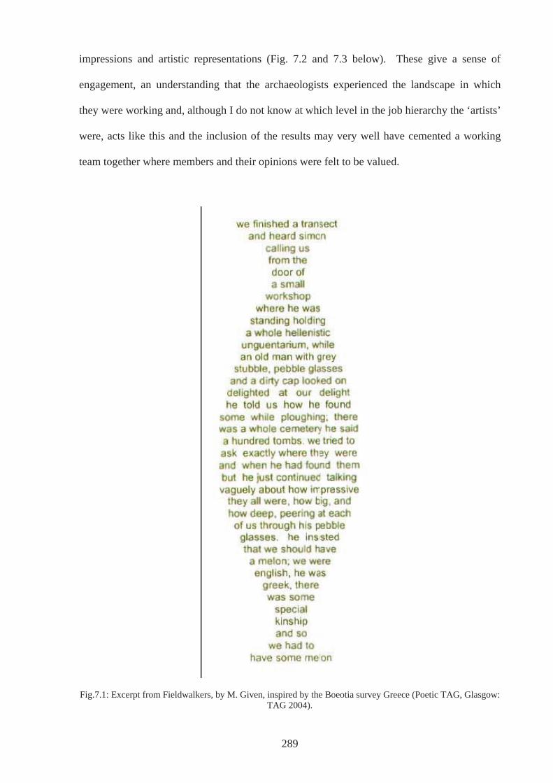
impressions and artistic representations (Fig. 7.2 and 7.3 below). These give a sense of
engagement, an understanding that the archaeologists experienced the landscape in which
they were working and, although I do not know at which level in the job hierarchy the ‘artists’
were, acts like this and the inclusion of the results may very well have cemented a working
team together where members and their opinions were felt to be valued.
Fig.7.1: Excerpt from Fieldwalkers, by M. Given, inspired by the Boeotia survey Greece (Poetic TAG, Glasgow: TAG 2004).
289
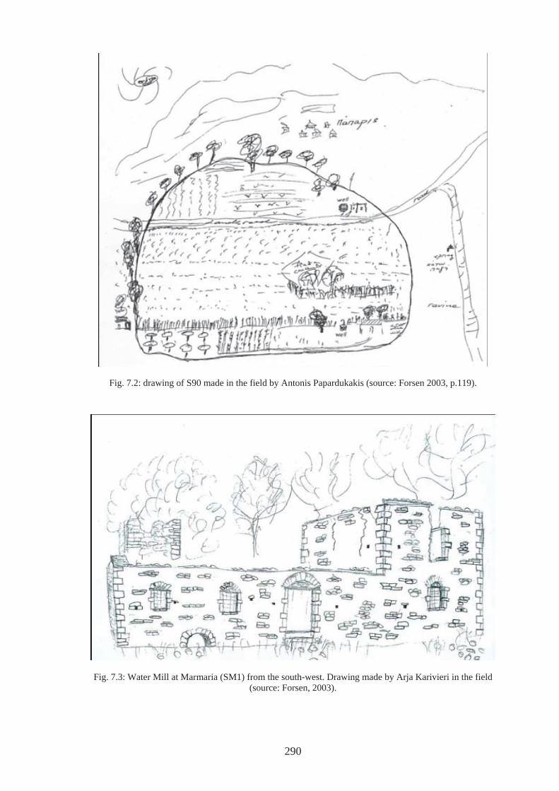
Fig. 7.2: drawing of S90 made in the field by Antonis Papardukakis (source: Forsen 2003, p.119).
Fig. 7.3: Water Mill at Marmaria (SM1) from the south-west. Drawing made by Arja Karivieri in the field (source: Forsen, 2003).
290
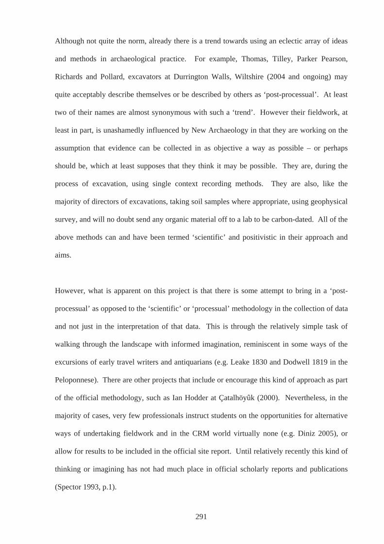
Although not quite the norm, already there is a trend towards using an eclectic array of ideas
and methods in archaeological practice. For example, Thomas, Tilley, Parker Pearson,
Richards and Pollard, excavators at Durrington Walls, Wiltshire (2004 and ongoing) may
quite acceptably describe themselves or be described by others as ‘post-processual’. At least
two of their names are almost synonymous with such a ‘trend’. However their fieldwork, at
least in part, is unashamedly influenced by New Archaeology in that they are working on the
assumption that evidence can be collected in as objective a way as possible – or perhaps
should be, which at least supposes that they think it may be possible. They are, during the
process of excavation, using single context recording methods. They are also, like the
majority of directors of excavations, taking soil samples where appropriate, using geophysical
survey, and will no doubt send any organic material off to a lab to be carbon-dated. All of the
above methods can and have been termed ‘scientific’ and positivistic in their approach and
aims.
However, what is apparent on this project is that there is some attempt to bring in a ‘post-
processual’ as opposed to the ‘scientific’ or ‘processual’ methodology in the collection of data
and not just in the interpretation of that data. This is through the relatively simple task of
walking through the landscape with informed imagination, reminiscent in some ways of the
excursions of early travel writers and antiquarians (e.g. Leake 1830 and Dodwell 1819 in the
Peloponnese). There are other projects that include or encourage this kind of approach as part
of the official methodology, such as Ian Hodder at Çatalhöyûk (2000). Nevertheless, in the
majority of cases, very few professionals instruct students on the opportunities for alternative
ways of undertaking fieldwork and in the CRM world virtually none (e.g. Diniz 2005), or
allow for results to be included in the official site report. Until relatively recently this kind of
thinking or imagining has not had much place in official scholarly reports and publications
(Spector 1993, p.1).
291
7.3: Final thoughts
McDavid (2000, p.287) states that “truth is made, not found”. This thesis would never have
been written if it had been a search for such a truth. To expect answers to be forthcoming,
through using correct ‘scientific’ methodology, is frustrating at the least. On the other hand,
the realisation that the archaeological process is one involving the necessary use of an
‘archaeological imagination’ is, in Julian Thomas’ words “a profoundly liberating
proposition” (Thomas 1993, p.74). To be afraid of the criticism of relativism, of alternative
truths or even abhorrent explanations of the past means there is little faith in our abilities to
show weaknesses in other types of explanations and the strengths of our own. Whether they
involve aliens, fascist agendas or prehistoric super-races, contending with alternative
explanations and refuting them, means our arguments must be sharpened, which is no bad
thing. As Feyerabend states:
‘. . . knowledge is not a gradual approach to Truth. It is rather an ever-increasing ocean of mutually incompatible alternatives, each single theory, each fairy-tale, each myth that is part of the collection forcing the others into greater articulation, and all of them contributing, via this process of competition, to the development of our consciousness’ (1988, p.32).
Surely, it is this that makes disciplines such as archaeology dynamic and full of vitality. It
should not be expected that one day the truth and the answers will be realised, for they do not
exist in that they cannot be validated by a return to ‘what-actually-happened’. The past will
never be known as it ‘really was’ for there is no ‘really was’. Even if a time machine could be
built and time was traversed, it would still only be viewed through 21st Century eyes;
archaeology and the desire to ‘know’ the past is after all a modern phenomenon. Thomas
(2004) attempts to unravel what is ‘modern’ about our views on the past and questions
whether it is possible to extricate ourselves from them or indeed whether even archaeology
itself can exist without ‘modernity’. Even if it proves difficult, if not impossible, to transcend
archaeology’s attachment to modernity and still call it ‘archaeology’, being able to approach
292
the archaeological record with an awareness of our own and the discipline’s circumstances
may be enough and should be seen as a way of unrestricting our imaginations and ourselves.
This enables the exploration of a multitude of possibilities without restriction to particular
ways of looking because it is the way we have been conditioned. This is what has been
achieved through the case studies in Chapters 4, 5 and 6. Still, there is the sneaking suspicion
that thinking in the way outlined above is the result of being in a ‘post-modern’ world, where
‘multi-vocality’ seems to have become a maxim, and ‘anything-goes’ is a code for living.
Nonetheless, the results of our endeavours will be a matter for debate, a debate that is or
should be vital to the discipline.
In conclusion, this study is an important contribution to the realm of Greek Archaeology.
There are many works to date that have tackled the past from the ‘participants’ point of view
and with a particular focus on landscape. This study is not a breakthrough, pioneering work
in the field of archaeology in general (e.g. Thomas, 1993a, 1993b, 1996; Tilley, 1993b, 1994;
Barrett, 1994, 2000; Exon et al 2000; Gillings, 1996, 1999, 2005), but it applies an already
legitimised approach to the Greek sphere and in particular to the evidence from Arkadia. It
introduces an approach and applies ideas that are seen as almost standard in other areas and if
this study focussed on Neolithic and Bronze Age Wessex, it would be travelling down a well-
trodden path (Thomas, 1997; Parker Pearson, 1998; Exon et al. 2000; Pitts 2001). However,
an approach using phenomenological insights alongside traditional analysis, works
particularly well in Arkadia during the period in question as limited material culture exists
compared to other regions and periods. Where sites have produced an ample body of
material, such as that from the Temple of Athena Alea at Tegea, scholars such as Voyatzis
(2005) have concentrated on undertaking detailed analysis. In these cases, the present study
compliments this work. In those cases where what does exist has been poorly published, the
phenomenological approach particularly suited as the focus is on the location of sites in space.
293

The research presented here illuminates an area and a period in a way that has not been done
or, to my knowledge, has not been attempted to date. This study looks at a region in a way
that perhaps every region of Greece could or should be looked at, a study that recognizes that
all aspects of life were interrelated, and that acknowledges all levels within a community, but
most of all locates past peoples in the landscapes they once inhabited.
294
APPENDICES
295
APPENDIX 1: GEOGRAPHICAL INFORMATION SYSTEMS AND
ARCHAEOLOGY
It may seem a natural adjunct to approaching landscape in the way it has been in this thesis, to
use a Geographic Information System (GIS), and at the outset, this was the intention. There
has been however, a significant amount of debate around the use of GIS in archaeology and
criticisms over its shortcomings in light of post-processual theories are constantly being
addressed (e.g. Llobera 1996). As research progressed it became apparent for the study I
wanted to do, GIS would prove to be little more than glorified illustrations, for which Google
Earth has been found to be more than competent. In addition, the validity of such functions as
viewshed and line-of-site analysis, in bringing understandings of how the landscape might
have been perceived at different times during the period was not such to convince me of its
worth.
Although one of the main advantages of GIS is that it allows large amounts of data (and often
data not usually found together) to be accessed quickly and easily so that it can be analysed
and presented, in order to reach this stage takes a very long time. Preparing paper maps, for
example, via a scanner or digitising tablet for use within a GIS can take months. Likewise,
where attribute data (‘additional’ information describing spatial data) is not already stored
digitally in databases, input via the keyboard can take many tedious hours. This issue of time
resources plays a large part in determining which data should be loaded and how detailed that
data will be, especially in terms of background information. The largest scale maps for the
area of ancient Arkadia are the 1:50,000 editions from the Hellenic Military Map Service.
Contours on these are at intervals of 20 metres, which is enough to give a reasonably detailed
impression of the physical geography of the region. Given such a mountainous region
however, coupled with the initial intention of covering the whole area, this would have been a
296
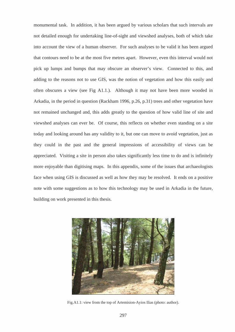
monumental task. In addition, it has been argued by various scholars that such intervals are
not detailed enough for undertaking line-of-sight and viewshed analyses, both of which take
into account the view of a human observer. For such analyses to be valid it has been argued
that contours need to be at the most five metres apart. However, even this interval would not
pick up lumps and bumps that may obscure an observer’s view. Connected to this, and
adding to the reasons not to use GIS, was the notion of vegetation and how this easily and
often obscures a view (see Fig A1.1.). Although it may not have been more wooded in
Arkadia, in the period in question (Rackham 1996, p.26, p.31) trees and other vegetation have
not remained unchanged and, this adds greatly to the question of how valid line of site and
viewshed analyses can ever be. Of course, this reflects on whether even standing on a site
today and looking around has any validity to it, but one can move to avoid vegetation, just as
they could in the past and the general impressions of accessibility of views can be
appreciated. Visiting a site in person also takes significantly less time to do and is infinitely
more enjoyable than digitising maps. In this appendix, some of the issues that archaeologists
face when using GIS is discussed as well as how they may be resolved. It ends on a positive
note with some suggestions as to how this technology may be used in Arkadia in the future,
building on work presented in this thesis.
Fig.A1.1: view from the top of Artemision-Ayios Ilias (photo: author).
297
The problems start with the paper maps. Often they are very detailed and decisions relating to
which information is needed for digitization always have to be made before any work can
progress. The implications of this are important: paper maps are simply a representation of
the “real” world perceived a certain way at a particular moment of time. They have been
compiled as a result of decisions made by the cartographer as to how physical features should
be represented, and indeed which ones should be included, often dictated and informed by the
authorities who commission the maps. Nowadays there are certain standards to which the
cartographer must adhere depending on the mapping authority, and the scale of the map
largely dictates whether for example a city is characterized by a dot or by many polygons
representing individual features within the city. Maps reduce the landscape in which we live
to a version of reality that purports to be accurate and true.
Digitising the paper map is another step away from the physical landscape, where further
decisions need to be made that relate to which features should be used within a GIS, and how
accurate they are required to be, depending on the purpose for which the particular project is
being designed. In addition, data from maps may not show all the possibilities required in
order to answer questions the GIS will be asked. For example, some topographical maps may
not indicate whether a water source is seasonal or perennial, and certainly will not say
anything directly about the quality of the water. Although geological maps may indicate the
possibility of mineral inclusions in water, this depends on many other factors such as the flow
of water, and whether it is ground water in the form of a river or lake or a deeper source
accessed via a spring or well. Although there is very little that can be done about this, it is
important to be aware of the fact that map information is and can be nothing else other than
subjective and as such needs to be used critically. This is especially pertinent for the purposes
of GIS in archaeology where the act of digitising and then using the results to say things about
that landscape in the past, creates a version of a version of a version. In addition, where it is
298
the past landscape and often a distant past landscape that is in question, the modern landscape
and present-day environment and how it relates to the past should not be taken for granted
(Church et al. 2000, p.139).
There is an obvious problem with using contemporary environmental conditions as a basis for
extrapolating about the past. How these conditions might have changed is often not taken into
account thus giving only an unreliable static picture. The environment is dynamic and
without evidence of how it might have altered over time predicting site locations based on this
evidence, especially those prehistoric, is tenuous to say the least. As Church et al. (2000,
p.139) point out “the present day environment is a good place to start but a poor place to end,”
and often models have been more useful in predicting present-day campsites than positions of
past sites, let alone providing any insight into past human behaviour (Church et al. 2000,
p.137). It is not all doom and gloom however, and archaeologists working alongside
geologists, geographers, and environmentalists should be able to make some headway into
reconstructing past environments (Kvamme 1995, p.9).
Nonetheless, reconstructing past environments using information regarding types of
vegetation and resources available, has often been at the route of environmental determinism,
associated with processualism which, as was discussed in Chapter 3, has a particularly
modernist way of viewing the world at its root. For example, the belief that the proximity of
environmental factors is particularly important rests, for the most part, on principles of least
cost/minimum effort, which are laden with modern values that might not necessarily have had
any relevance in the past. In many ways, it has been the availability and popularity of
software packages such as cost-surface analyses that has meant that this and similar tenets
have been frequently applied in GIS applications (Witcher 1999, p.15). In addition, different
types of sites or different types of activity that the archaeological record represents are not
299
always taken into account. For instance, a ‘ritual’ site might not need the same proximity to
water or fertile soils as a habitation site and unquestioned assumptions regarding where sites
are expected could result in an unbalanced picture: do habitation sites always need to be in
environments close to water, fertile land and so on, as determined by modern academics. An
example from Britain serves to illustrate this point. Lismore Fields in Buxton, an important
Neolithic habitation site, would most certainly have been missed in any GIS predictive
modelling of where to expect Neolithic houses. Although this site lies close to the River
Wye, the heavier clay soils, on which it stands, was thought to be unsuitable for the ‘first
farmers’. Thus during construction of a new housing estate in the 1980’s, there was complete
surprise when it was found that the same spot had been used for a similar purpose
approximately 6000 years ago (Garton 1991).
Most of the criticisms above can be seen as part of a ‘post-processual’ challenge to
‘processualism’ and the use of GIS, and feature heavily in most recent publications involving
this technology due to a relatively recent upsurge in the use of GIS and with it a questioning
of its use (e.g. Exon et al.2000 ch. 2). In fact 2005, was the first Theoretical Archaeology
Group Conference of the last four years that did not have separate session on GIS, which may
be an indication of the general acceptance of it use by many and varied archaeologists.
However, GIS as it first appeared seemed to stand shoulder to shoulder with processual
archaeology by being both generalised and somewhat dehumanised, long after these ideas in
other areas of archaeology had apparently moved on. In the main, a more explicit recognition
of the human experience in the past has been called for, rather than reducing it merely to
statistical analyses that sees human behaviour as being both deterministic and as being a cog
in the wheels of a bigger system.
300
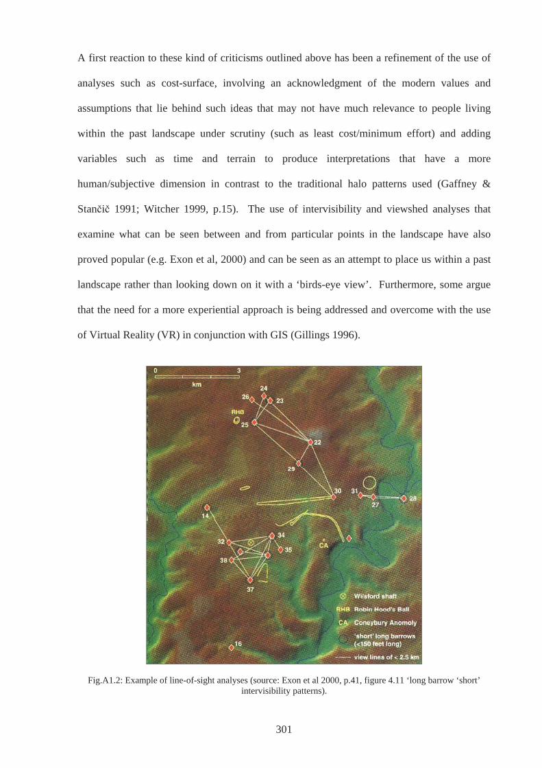
A first reaction to these kind of criticisms outlined above has been a refinement of the use of
analyses such as cost-surface, involving an acknowledgment of the modern values and
assumptions that lie behind such ideas that may not have much relevance to people living
within the past landscape under scrutiny (such as least cost/minimum effort) and adding
variables such as time and terrain to produce interpretations that have a more
human/subjective dimension in contrast to the traditional halo patterns used (Gaffney &
Stan i 1991; Witcher 1999, p.15). The use of intervisibility and viewshed analyses that
examine what can be seen between and from particular points in the landscape have also
proved popular (e.g. Exon et al, 2000) and can be seen as an attempt to place us within a past
landscape rather than looking down on it with a ‘birds-eye view’. Furthermore, some argue
that the need for a more experiential approach is being addressed and overcome with the use
of Virtual Reality (VR) in conjunction with GIS (Gillings 1996).
Fig.A1.2: Example of line-of-sight analyses (source: Exon et al 2000, p.41, figure 4.11 ‘long barrow ‘short’ intervisibility patterns).
301
However, VR falls short of what most may have imagined it would or could do, and even if
we ever reach a stage where we can experience a Star Trek – The Next Generation
‘Holodeck’ there would still be issues relating to authenticity and interpretation and the need
to recognise that we can never know what it was like in the past or experience it as it was. It
will always be only a reconstruction in the present of what we suppose it might have been like
for somebody in the past. There has been a recognition that GIS is often used merely to make
“pretty pictures” and this danger is apparent also with using VR - the only goal in some case
can appear to be to produce high quality computer graphics (Kvamme 1995, p.6). Not only
does this cause problems in the sense that interpretation may be lacking (Gaffney et al. 1995),
but also in the perceived credence of such images.
There are many studies on how important visualisation is in the production and dissemination
of knowledge, including those that pertain specifically to GIS (e.g. Davis & Medyckyj-Scott
1994; Hearnshaw 1994; Medyckyj-Scott 1994; Petch 1994). Computer generated images in
particular are powerful tools, holding an often-unjustified authority over other types of image;
when data is presented in this way they are often perceived as being more “correct” than they
actually are. This is not to belittle the intelligence of the general public or even academics,
but studies such as those mentioned above testify to the influence images have. No television
programme about archaeology is complete these days without a computer-generated
reconstruction of individual pots or of sites and regions. The question of how far these
images can represent any kind of reality is rarely questioned by the programmes themselves
and the impression of accuracy is even promoted by the language used that accompanies such
images. Rarely is there room made for words such as “might”, “based on this persons
interpretation of the evidence”, and so on. Gillings (2000) outlined the difficulties an
archaeologist might face when involved with the use of virtual reality in television
programmes and explained how he had refused work in order to preserve his integrity -
302
programme producers wanted images so as to grab audiences, for which he felt there was
plainly not the evidence.
For many archaeologists, especially those working within a phenomenological framework and
those sympathetic to their ideas, working both within and outside the use of GIS (e.g. Thomas
1993, 2001; Tilley 1993; Gillings 1999), these ‘solutions’ have not gone far enough and have
proved unsatisfactory. This dissatisfaction, for the most part, has stemmed from recent
theoretical debate in landscape archaeology in general (Thomas 2001, p.166), a branch of
archaeology that might seem to have most affinity with GIS even though the use of GIS has
been left out of this debate until very recently (Gillings et al. 1999). By addressing the need
to acknowledge the human experience, archaeologists have now taken on board ideas
associated with a more ‘post-processual’ hermeneutic archaeology of the present day that has
‘re-peopled’ the past, not only by recognising that people in the past might have perceived
their landscape in a different way, but also by understanding that that different groups within
that landscape would have had differing perceptions. In practical terms this has meant a call
for not just creating maps that pertain to topography, geology, soil, climate and so on, and
analysing these to provide explanations of the archaeology found, but creating additional
maps that represent so called ‘landscapes of perception’, that is maps that represent abstract
landscapes that relate to such notions as power, resistance and ritual, as suggested by Witcher
(1999, p.18).
However, landscapes and human experiences of them are complex and work on many
different levels. Is a landscape ever just to be perceived in terms of power relations only or
those of ritual? Such abstract notions often undoubtedly overlap and are inherently connected
(see also Morgan 2003, ch.4). Some of the answer to this may lie in overlaying, for instance,
a ritual landscape map with a power map and others in order to create new insights into how
303
humans interacted with the physical landscape in the past. Nevertheless, what also needs to be
acknowledged is whose perceptions are we concerned with; which particular group’s
perception within the past culture are we dealing with? In addition it must be kept in mind
that the way a landscape was intended to be looked upon and how it actually was can be poles
apart and resistance to intended ways of using and looking would create alternative ways of
doing so. Bender (1993, p.1-17), using Naipaul’s The Enigma of Arrival I as an illustration,
also points out that differing perceptions do not just occur between groups but between
individuals and that an individual’s perceptions change over time. How can these issues be
explored using a GIS? Is it possible and is it necessary or even desirable to try?
Perhaps a number of these ideas can be explored by moving away from purely the visual that
is so closely bound up with modernity, possibly by mapping sounds and smells of the
landscape. Although any sounds can, in the main, only be informed from modern day
examples, there is the opportunity to investigate the importance of when, for example, the
sound of a trickling stream becomes obvious as we move through a landscape. Perhaps the
importance of smell can be investigated by exploring how activities that we can assume
emitted certain smells affected how people moved about the landscape. Perhaps Thomas’s
(1993) suggestion that causewayed enclosures were positioned at transitional locations where
activities perceived as hazardous or polluting could take place could have some connection to
the olfactory sense. Maybe there is also scope to map general wind directions and speeds,
which involves the sense of touch and smell, which also has an as environmental aspect.
With direct relevance to this study, part of the reason ancient Enispe (Karvouni-Sfakovouni)
has been identified where it has, is because of its epithet ‘windy’ in Homer’s Iliad (II, 605)
and the position of the site on the north slopes of the hill of Sfakovouni (AR 1990-1, 25).
Likewise the position of the ash altar on top of Asea-Ayios Elias could be mapped with
different wind directions imposed on top.
304
Although the ideas outlined above may help to get away from thinking in terms of vision and
sight we still cannot get away from the fact that in using a GIS all these qualities have to be
mapped. This is a fundamental problem some have seen with GIS: phenomena have to be
mapped and given coordinates that correspond to their place in the ‘real world’. This in itself
is a product of modernity based on Descartes development of the coordinate system.
Therefore if, as has been argued by Gillings, the problem is this overwhelmingly Cartesian
view of the world on which modern cartography is based, that is also bound up with other
aspects of modernity such as the separation of nature from culture and so on, then peopling
the past and recognising that they and others had different and personal perceptions of the
world does not solve it within the world of GIS. But more than this, a modern Western vision
of the world and in particular the representation of land in map form, if it is a problem, then it
is a problem with the discipline of archaeology as a whole and in itself. The discipline would
not exist without this background.
This Cartesian view of the world that some archaeologists are keen to question and refute is
the very framework that enabled archaeology as a discipline to emerge in the first place
(Thomas 1996, 12; Thomas 2004, passim). It may well be recognised that there needs to be
an approach to past landscapes from different perspectives than our own ingrained ones, to
inform a more coherent, if varied explanation of the past, but ironically our very desire to
attempt this is bound up in the self-same factors that inform a modernist western view of the
world. The very discipline of archaeology has evolved because of this world-view.
Therefore, if we try to abandon Cartesian based philosophy and the ideological shifts of the
Enlightenment do we then have to abandon archaeology, as we know it? It can only be
‘wrong’ to use GIS in archaeology if archaeology with its constant collection of
environmental data, geophysical data, surveying, inventories, map making, Munsell charts
and Harris matrices is in the wrong. The dilemma here is not simply GIS, but also
305
archaeology. Is archaeology without the methods developed to gather information about the
past, such as field survey and excavation any longer archaeology? Does it not become a
different discipline altogether if we take away the “spatial technologies which seek to lay bare
and penetrate the land” that trouble Thomas (2001, p.169). Although Thomas gives three
examples - GIS, satellite imagery and aerial photography - surely, excavation is the very
epitome of laying bare and penetrating the land, even if not strictly a technology, and it is
something I have seen Thomas do with his own bare hands.
In this manner, the way archaeology is practised must take responsibility for the way GIS has
been used. There seems to be a strong link between survey methodologies and the data it
produces and GIS that has made GIS a most suitable and almost natural progression in terms
of utilising modern technologies. However, rather than stating simply that GIS’s have strong
environmental tendencies, GIS’s perhaps have exacerbated the propensity for surveys to
collect environmental data. Specifically in terms of its use in archaeology this predilection
has continued not necessarily because of a inherently environmentally deterministic nature of
GIS but because of inherently environmentally tendencies of archaeological survey
methodologies (which themselves have their origins within the New Archaeology of the 60’s
and 70’s) and hence the data that they throw up. What must be made clear though is that no
one, to my knowledge, is suggesting or has suggested that data pertaining to the natural
environment should be ignored and not collected. To disregard a whole range of valuable and
possibly relevant material would be just as amiss as not taking into account ideas of the many
ways in which landscapes can be defined and might be perceived and lived within and
through. The point is, it cannot possibly be expected that the best explanations will come
from one type of evidence alone. Therefore, it is not so much the data that has to change or
the way it is collected or stored necessarily, but the way that it is looked at, used and
interpreted. Leaving aside issues of how the implicit or explicit theory of individual
306
archaeologists can affect how, why and what data is even thought to be deemed worthy of
collection, it is how we approach the data once we have it that is at stake here, and how we
might use it to produce and support more coherent explanations of the past that are not
lacking in understanding and sensitivity of many possibilities and probabilities. To be sure, it
is not that GIS and archaeological practice are necessarily environmentally deterministic, it is
the explanations and interpretations thought up by archaeologists who use them that are.
Thomas (2001, p.171) states that through using modern technologies, there is an implication
that “through our objective, high-tech methodologies we [archaeologists] have access to a
stratum of reality which was unavailable to people in the past. Their perceptions of these
landscapes would necessarily have been distorted and impoverished versions of a reality
which we can more fully grasp.” However, the arrogance that the uses of such technologies
seem to give us as archaeologists surely does not have to be an expected and accepted adjunct.
The methodologies that have been developed to investigate past landscapes is a way of
discovering aspects that otherwise we would not have known, as we often do not live or dwell
for any length of time within these areas ourselves and definitely not without modern
structures and alterations of the landscapes.
Aspects of the landscape such as vegetation, altitude, proximity to water or a number of other
environmental variables, or proximity to or visibility of other sites in the area might, or might
not, have had any importance to past individuals, groups or communities. Past populations
may have been aware of some factors and not of others and almost certainly not by the same
categorisations that we use. There will be aspects of the landscape to which we are
completely blind, that may have been the most obvious to past people, and of course, we will
never know this. It may well be the case that the data our modern technologies produce may
307
be of little relevance or use at all, but if we did not employ them, we would never know this
data or have the opportunity to investigate different possibilities.
As argued in Chapter 7, the way forward in archaeology has to be a more explicit
acknowledgement that an interpretation is only one of many possible other ways of explaining
the same evidence, that there are no absolutes, even with the use of all the best high-tech
instruments in the world. Archaeology is all about possibilities and probabilities and the ideas
we have about these. Assumptions must be made if one is to get anywhere at all, but it is
necessary for these assumptions to be made explicit, and by becoming aware of them
ourselves, we are able to question their validity. It is in this light that a GIS should be used.
By and in itself, the use of one will not give the answers – it provides a framework in which
ideas such as those relating to perception, experience and dwelling within a landscape can be
explored in one way. The danger is that information technology, in this case, GIS or VR,
gives the illusion of being authoritative and right, when it should be recognised and used as a
tool and a platform in which ideas can be explored and illustrated.
In the end, in a study such as this that is concerned with the physical nature of the world in
which people lived in the past and how that acted upon them, their perceptions and the way
they lived, nothing can take the place of actually being there, visiting the sites in person and
very unscientifically soaking up the atmosphere. Exon et al (2000, p.105), describe how they
developed the concept of a “quality view” through their fieldwork, which referred to views
and vistas that were visually ‘more stunning’ than others, from which a gut reaction was felt
when the view was revealed. Quality views could not be picked up by computer-generated
viewsheds, but involved elements of the landscape that could only be recognised by a person,
being there. A GIS Digital Elevation Model in the present study, given the constraints of time
and money would have been little more than a very time consuming and expensive way of
308
illustrating the text, of explaining to the reader exactly where the sites were and what was
meant by, for example “an isolated rounded hill” in the text. This has been done well enough
by providing panoramic photographs at certain points as well as video clips, in addition to the
Google Earth images and tour, which does nearly everything that would have been done with
a GIS.
However, this is not the end. It has not been argued that GIS can never be useful in
archaeology as a whole or for Arkadia. Quite the contrary, this study has highlighted
numerous possibilities now for looking more closely at particular landscapes perhaps to be
focussed on plains that can be geared to answering particular problems, and through using
larger scale maps with much narrower contours. What Google Earth of course cannot do is
enable the position of observer to be pinpointed, so the view is always hovering above the
landscape, a very ‘unnatural’ place from which to explore a landscape in terms of past
peoples’ experiences. However, the possibilities of mapping abstract landscapes, for example
sound-scapes (TAG 2004 session Audioscapes: Sound in/of Antiquity), is an interesting one,
and there is a strong future for GIS in intra-site analysis, as well as inter-site. The use of GIS
to explore the Arkadian landscape may prove to be an interesting and worthwhile avenue to
take in the future, but not one that could be fully utilised in this study.
309
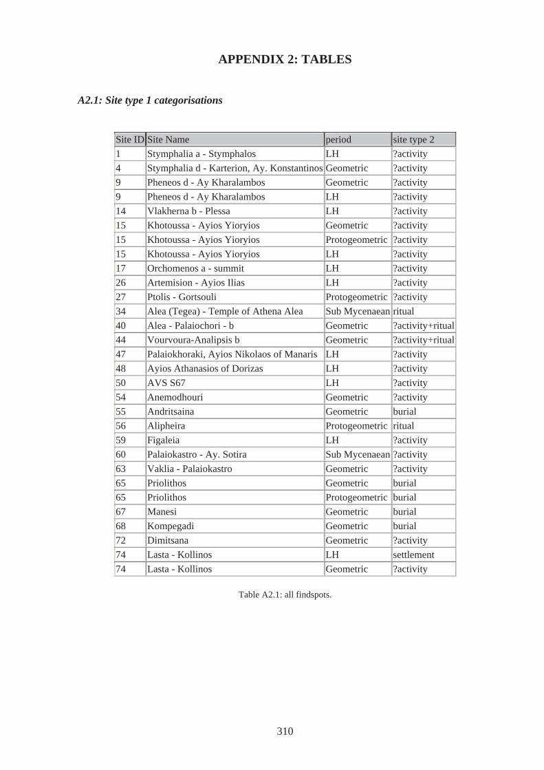
APPENDIX 2: TABLES
A2.1: Site type 1 categorisations
Site ID Site Name period site type 2 1 Stymphalia a - Stymphalos LH ?activity 4 Stymphalia d - Karterion, Ay. Konstantinos Geometric ?activity 9 Pheneos d - Ay Kharalambos Geometric ?activity 9 Pheneos d - Ay Kharalambos LH ?activity 14 Vlakherna b - Plessa LH ?activity 15 Khotoussa - Ayios Yioryios Geometric ?activity 15 Khotoussa - Ayios Yioryios Protogeometric ?activity 15 Khotoussa - Ayios Yioryios LH ?activity 17 Orchomenos a - summit LH ?activity 26 Artemision - Ayios Ilias LH ?activity 27 Ptolis - Gortsouli Protogeometric ?activity 34 Alea (Tegea) - Temple of Athena Alea Sub Mycenaean ritual 40 Alea - Palaiochori - b Geometric ?activity+ritual44 Vourvoura-Analipsis b Geometric ?activity+ritual47 Palaiokhoraki, Ayios Nikolaos of Manaris LH ?activity 48 Ayios Athanasios of Dorizas LH ?activity 50 AVS S67 LH ?activity 54 Anemodhouri Geometric ?activity 55 Andritsaina Geometric burial 56 Alipheira Protogeometric ritual 59 Figaleia LH ?activity 60 Palaiokastro - Ay. Sotira Sub Mycenaean ?activity 63 Vaklia - Palaiokastro Geometric ?activity 65 Priolithos Geometric burial 65 Priolithos Protogeometric burial 67 Manesi Geometric burial 68 Kompegadi Geometric burial 72 Dimitsana Geometric ?activity 74 Lasta - Kollinos LH settlement 74 Lasta - Kollinos Geometric ?activity
Table A2.1: all findspots.
310
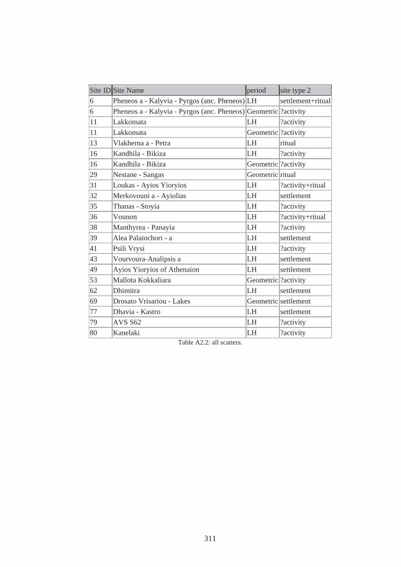
Site ID Site Name period site type 2 6 Pheneos a - Kalyvia - Pyrgos (anc. Pheneos) LH settlement+ritual 6 Pheneos a - Kalyvia - Pyrgos (anc. Pheneos) Geometric ?activity 11 Lakkomata LH ?activity 11 Lakkomata Geometric ?activity 13 Vlakherna a - Petra LH ritual 16 Kandhila - Bikiza LH ?activity 16 Kandhila - Bikiza Geometric ?activity 29 Nestane - Sangas Geometric ritual 31 Loukas - Ayios Yioryios LH ?activity+ritual 32 Merkovouni a - Ayiolias LH settlement 35 Thanas - Stoyia LH ?activity 36 Vounon LH ?activity+ritual 38 Manthyrea - Panayia LH ?activity 39 Alea Palaiochori - a LH settlement 41 Psili Vrysi LH ?activity 43 Vourvoura-Analipsis a LH settlement 49 Ayios Yioryios of Athenaion LH settlement 53 Mallota Kokkaliara Geometric ?activity 62 Dhimitra LH settlement 69 Drosato Vrisariou - Lakes Geometric settlement 77 Dhavia - Kastro LH settlement 79 AVS S62 LH ?activity 80 Kanelaki LH ?activity
Table A2.2: all scatters.
311
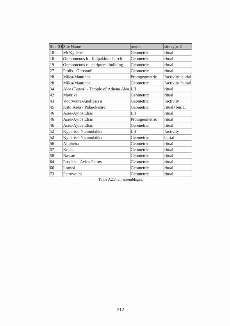
Site ID Site Name period site type 2 10 Mt Kyllene Geometric ritual 18 Orchomenos b - Kalpakion church Geometric ritual 19 Orchomenos c - peripteral building Geometric ritual 27 Ptolis - Gortsouli Geometric ritual 28 Milea/Mantinea Protogeometric ?activity+burial28 Milea/Mantinea Geometric ?activity+burial34 Alea (Tegea) - Temple of Athena Alea LH ritual 42 Mavriki Geometric ritual 43 Vourvoura-Analipsis a Geometric ?activity 45 Kato Asea - Palaiokastro Geometric ritual+burial 46 Asea-Ayios Elias LH ritual 46 Asea-Ayios Elias Protogeometric ritual 46 Asea-Ayios Elias Geometric ritual 52 Kyparissi Yiannolakka LH ?activity 52 Kyparissi Yiannolakka Geometric burial 56 Alipheira Geometric ritual 57 Kretea Geometric ritual 58 Bassae Geometric ritual 64 Psophis - Ayios Petros Geometric ritual 66 Lousoi Geometric ritual 73 Petrovouni Geometric ritual
Table A2.3: all assemblages.
312
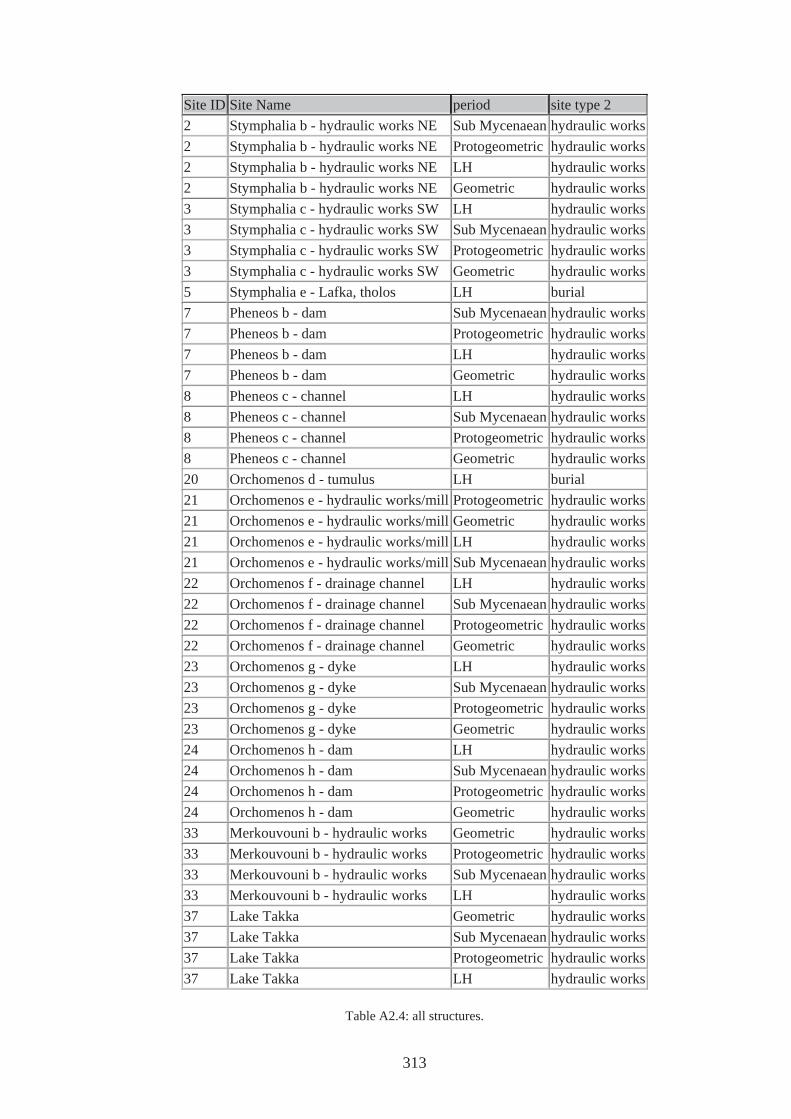
Site ID Site Name period site type 2 2 Stymphalia b - hydraulic works NE Sub Mycenaean hydraulic works 2 Stymphalia b - hydraulic works NE Protogeometric hydraulic works 2 Stymphalia b - hydraulic works NE LH hydraulic works 2 Stymphalia b - hydraulic works NE Geometric hydraulic works 3 Stymphalia c - hydraulic works SW LH hydraulic works 3 Stymphalia c - hydraulic works SW Sub Mycenaean hydraulic works 3 Stymphalia c - hydraulic works SW Protogeometric hydraulic works 3 Stymphalia c - hydraulic works SW Geometric hydraulic works 5 Stymphalia e - Lafka, tholos LH burial 7 Pheneos b - dam Sub Mycenaean hydraulic works 7 Pheneos b - dam Protogeometric hydraulic works 7 Pheneos b - dam LH hydraulic works 7 Pheneos b - dam Geometric hydraulic works 8 Pheneos c - channel LH hydraulic works 8 Pheneos c - channel Sub Mycenaean hydraulic works 8 Pheneos c - channel Protogeometric hydraulic works 8 Pheneos c - channel Geometric hydraulic works 20 Orchomenos d - tumulus LH burial 21 Orchomenos e - hydraulic works/mill Protogeometric hydraulic works 21 Orchomenos e - hydraulic works/mill Geometric hydraulic works 21 Orchomenos e - hydraulic works/mill LH hydraulic works 21 Orchomenos e - hydraulic works/mill Sub Mycenaean hydraulic works 22 Orchomenos f - drainage channel LH hydraulic works 22 Orchomenos f - drainage channel Sub Mycenaean hydraulic works 22 Orchomenos f - drainage channel Protogeometric hydraulic works 22 Orchomenos f - drainage channel Geometric hydraulic works 23 Orchomenos g - dyke LH hydraulic works 23 Orchomenos g - dyke Sub Mycenaean hydraulic works 23 Orchomenos g - dyke Protogeometric hydraulic works 23 Orchomenos g - dyke Geometric hydraulic works 24 Orchomenos h - dam LH hydraulic works 24 Orchomenos h - dam Sub Mycenaean hydraulic works 24 Orchomenos h - dam Protogeometric hydraulic works 24 Orchomenos h - dam Geometric hydraulic works 33 Merkouvouni b - hydraulic works Geometric hydraulic works 33 Merkouvouni b - hydraulic works Protogeometric hydraulic works 33 Merkouvouni b - hydraulic works Sub Mycenaean hydraulic works 33 Merkouvouni b - hydraulic works LH hydraulic works 37 Lake Takka Geometric hydraulic works 37 Lake Takka Sub Mycenaean hydraulic works 37 Lake Takka Protogeometric hydraulic works 37 Lake Takka LH hydraulic works
Table A2.4: all structures.
313
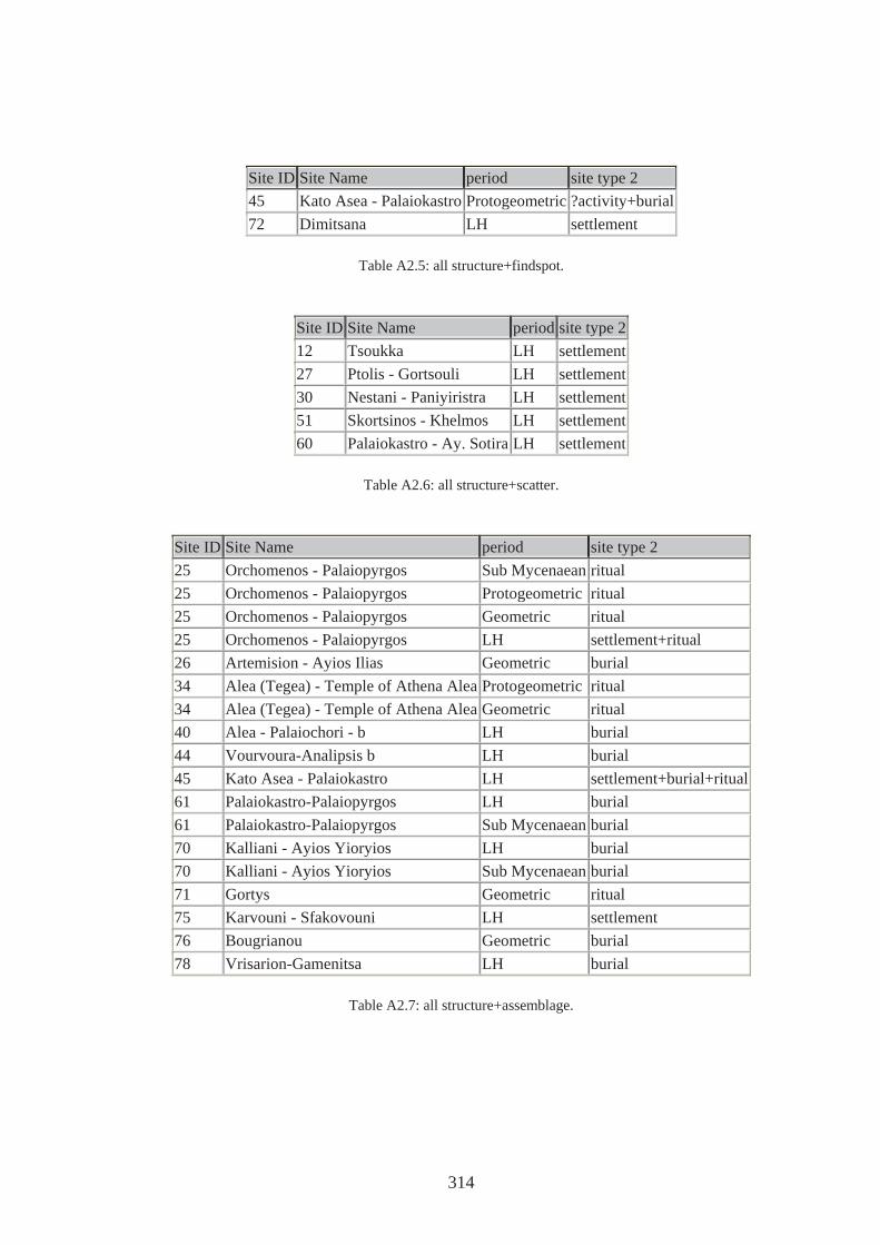
Site ID Site Name period site type 2 45 Kato Asea - Palaiokastro Protogeometric ?activity+burial 72 Dimitsana LH settlement
Table A2.5: all structure+findspot.
Site ID Site Name period site type 2 12 Tsoukka LH settlement 27 Ptolis - Gortsouli LH settlement 30 Nestani - Paniyiristra LH settlement 51 Skortsinos - Khelmos LH settlement 60 Palaiokastro - Ay. Sotira LH settlement
Table A2.6: all structure+scatter.
Site ID Site Name period site type 2 25 Orchomenos - Palaiopyrgos Sub Mycenaean ritual 25 Orchomenos - Palaiopyrgos Protogeometric ritual 25 Orchomenos - Palaiopyrgos Geometric ritual 25 Orchomenos - Palaiopyrgos LH settlement+ritual 26 Artemision - Ayios Ilias Geometric burial 34 Alea (Tegea) - Temple of Athena Alea Protogeometric ritual 34 Alea (Tegea) - Temple of Athena Alea Geometric ritual 40 Alea - Palaiochori - b LH burial 44 Vourvoura-Analipsis b LH burial 45 Kato Asea - Palaiokastro LH settlement+burial+ritual61 Palaiokastro-Palaiopyrgos LH burial 61 Palaiokastro-Palaiopyrgos Sub Mycenaean burial 70 Kalliani - Ayios Yioryios LH burial 70 Kalliani - Ayios Yioryios Sub Mycenaean burial 71 Gortys Geometric ritual 75 Karvouni - Sfakovouni LH settlement 76 Bougrianou Geometric burial 78 Vrisarion-Gamenitsa LH burial
Table A2.7: all structure+assemblage.
314
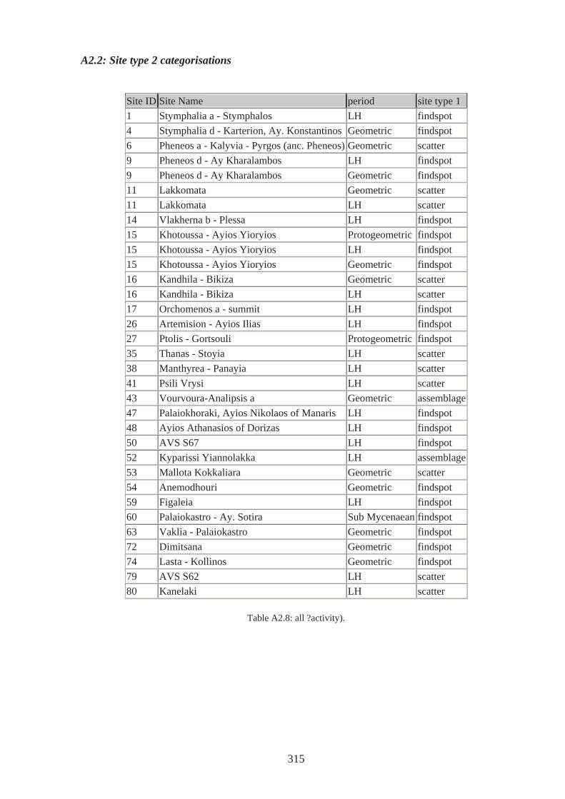
A2.2: Site type 2 categorisations
Site ID Site Name period site type 1 1 Stymphalia a - Stymphalos LH findspot 4 Stymphalia d - Karterion, Ay. Konstantinos Geometric findspot 6 Pheneos a - Kalyvia - Pyrgos (anc. Pheneos) Geometric scatter 9 Pheneos d - Ay Kharalambos LH findspot 9 Pheneos d - Ay Kharalambos Geometric findspot 11 Lakkomata Geometric scatter 11 Lakkomata LH scatter 14 Vlakherna b - Plessa LH findspot 15 Khotoussa - Ayios Yioryios Protogeometric findspot 15 Khotoussa - Ayios Yioryios LH findspot 15 Khotoussa - Ayios Yioryios Geometric findspot 16 Kandhila - Bikiza Geometric scatter 16 Kandhila - Bikiza LH scatter 17 Orchomenos a - summit LH findspot 26 Artemision - Ayios Ilias LH findspot 27 Ptolis - Gortsouli Protogeometric findspot 35 Thanas - Stoyia LH scatter 38 Manthyrea - Panayia LH scatter 41 Psili Vrysi LH scatter 43 Vourvoura-Analipsis a Geometric assemblage 47 Palaiokhoraki, Ayios Nikolaos of Manaris LH findspot 48 Ayios Athanasios of Dorizas LH findspot 50 AVS S67 LH findspot 52 Kyparissi Yiannolakka LH assemblage 53 Mallota Kokkaliara Geometric scatter 54 Anemodhouri Geometric findspot 59 Figaleia LH findspot 60 Palaiokastro - Ay. Sotira Sub Mycenaean findspot 63 Vaklia - Palaiokastro Geometric findspot 72 Dimitsana Geometric findspot 74 Lasta - Kollinos Geometric findspot 79 AVS S62 LH scatter 80 Kanelaki LH scatter
Table A2.8: all ?activity).
315
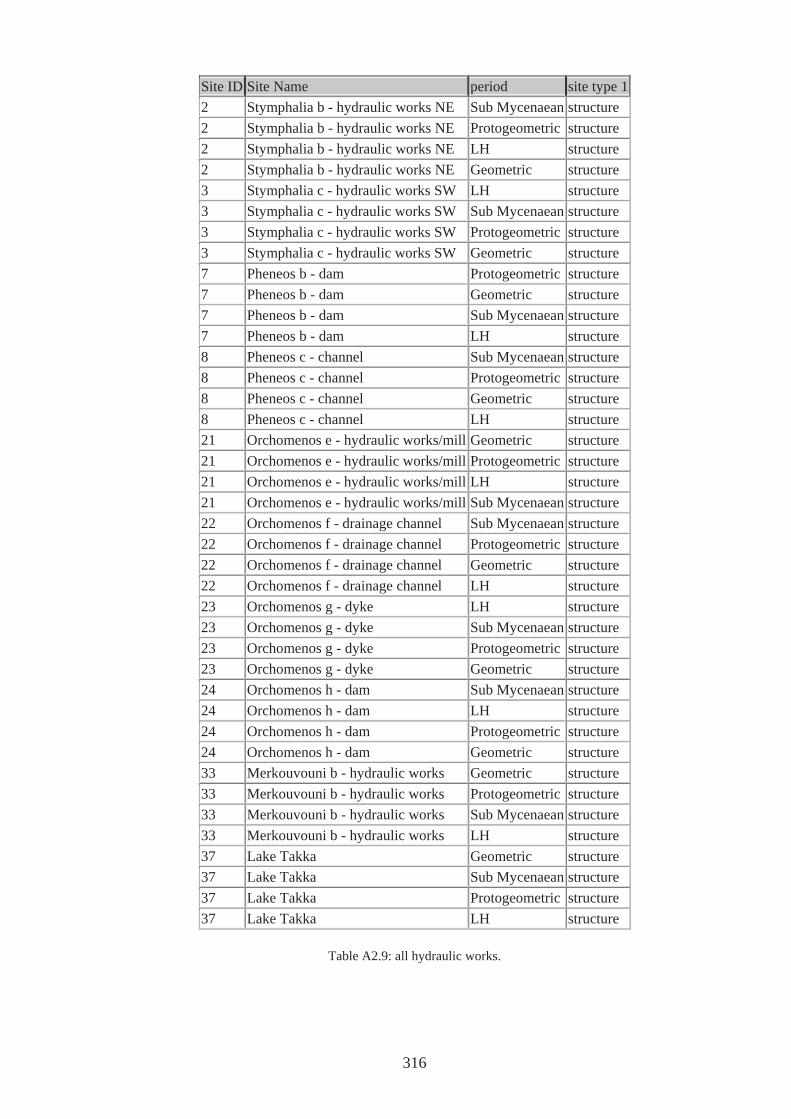
Site ID Site Name period site type 1 2 Stymphalia b - hydraulic works NE Sub Mycenaean structure 2 Stymphalia b - hydraulic works NE Protogeometric structure 2 Stymphalia b - hydraulic works NE LH structure 2 Stymphalia b - hydraulic works NE Geometric structure 3 Stymphalia c - hydraulic works SW LH structure 3 Stymphalia c - hydraulic works SW Sub Mycenaean structure 3 Stymphalia c - hydraulic works SW Protogeometric structure 3 Stymphalia c - hydraulic works SW Geometric structure 7 Pheneos b - dam Protogeometric structure 7 Pheneos b - dam Geometric structure 7 Pheneos b - dam Sub Mycenaean structure 7 Pheneos b - dam LH structure 8 Pheneos c - channel Sub Mycenaean structure 8 Pheneos c - channel Protogeometric structure 8 Pheneos c - channel Geometric structure 8 Pheneos c - channel LH structure 21 Orchomenos e - hydraulic works/mill Geometric structure 21 Orchomenos e - hydraulic works/mill Protogeometric structure 21 Orchomenos e - hydraulic works/mill LH structure 21 Orchomenos e - hydraulic works/mill Sub Mycenaean structure 22 Orchomenos f - drainage channel Sub Mycenaean structure 22 Orchomenos f - drainage channel Protogeometric structure 22 Orchomenos f - drainage channel Geometric structure 22 Orchomenos f - drainage channel LH structure 23 Orchomenos g - dyke LH structure 23 Orchomenos g - dyke Sub Mycenaean structure 23 Orchomenos g - dyke Protogeometric structure 23 Orchomenos g - dyke Geometric structure 24 Orchomenos h - dam Sub Mycenaean structure 24 Orchomenos h - dam LH structure 24 Orchomenos h - dam Protogeometric structure 24 Orchomenos h - dam Geometric structure 33 Merkouvouni b - hydraulic works Geometric structure 33 Merkouvouni b - hydraulic works Protogeometric structure 33 Merkouvouni b - hydraulic works Sub Mycenaean structure 33 Merkouvouni b - hydraulic works LH structure 37 Lake Takka Geometric structure 37 Lake Takka Sub Mycenaean structure 37 Lake Takka Protogeometric structure 37 Lake Takka LH structure
Table A2.9: all hydraulic works.
316
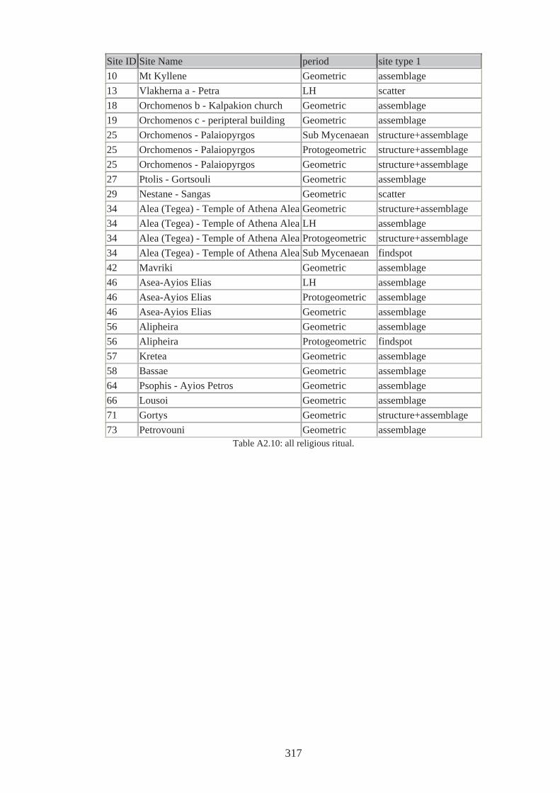
Site ID Site Name period site type 1 10 Mt Kyllene Geometric assemblage 13 Vlakherna a - Petra LH scatter 18 Orchomenos b - Kalpakion church Geometric assemblage 19 Orchomenos c - peripteral building Geometric assemblage 25 Orchomenos - Palaiopyrgos Sub Mycenaean structure+assemblage 25 Orchomenos - Palaiopyrgos Protogeometric structure+assemblage 25 Orchomenos - Palaiopyrgos Geometric structure+assemblage 27 Ptolis - Gortsouli Geometric assemblage 29 Nestane - Sangas Geometric scatter 34 Alea (Tegea) - Temple of Athena Alea Geometric structure+assemblage 34 Alea (Tegea) - Temple of Athena Alea LH assemblage 34 Alea (Tegea) - Temple of Athena Alea Protogeometric structure+assemblage 34 Alea (Tegea) - Temple of Athena Alea Sub Mycenaean findspot 42 Mavriki Geometric assemblage 46 Asea-Ayios Elias LH assemblage 46 Asea-Ayios Elias Protogeometric assemblage 46 Asea-Ayios Elias Geometric assemblage 56 Alipheira Geometric assemblage 56 Alipheira Protogeometric findspot 57 Kretea Geometric assemblage 58 Bassae Geometric assemblage 64 Psophis - Ayios Petros Geometric assemblage 66 Lousoi Geometric assemblage 71 Gortys Geometric structure+assemblage 73 Petrovouni Geometric assemblage
Table A2.10: all religious ritual.
317
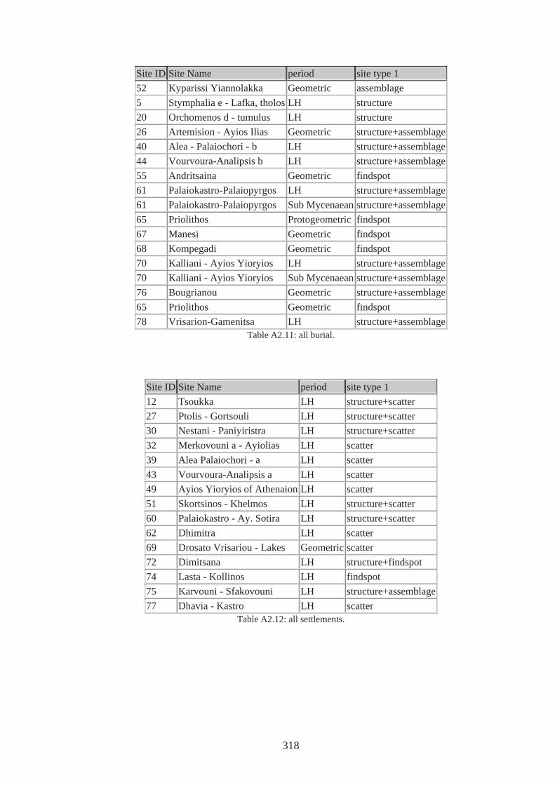
Site ID Site Name period site type 1 52 Kyparissi Yiannolakka Geometric assemblage 5 Stymphalia e - Lafka, tholos LH structure 20 Orchomenos d - tumulus LH structure 26 Artemision - Ayios Ilias Geometric structure+assemblage 40 Alea - Palaiochori - b LH structure+assemblage 44 Vourvoura-Analipsis b LH structure+assemblage 55 Andritsaina Geometric findspot 61 Palaiokastro-Palaiopyrgos LH structure+assemblage 61 Palaiokastro-Palaiopyrgos Sub Mycenaean structure+assemblage 65 Priolithos Protogeometric findspot 67 Manesi Geometric findspot 68 Kompegadi Geometric findspot 70 Kalliani - Ayios Yioryios LH structure+assemblage 70 Kalliani - Ayios Yioryios Sub Mycenaean structure+assemblage 76 Bougrianou Geometric structure+assemblage 65 Priolithos Geometric findspot 78 Vrisarion-Gamenitsa LH structure+assemblage
Table A2.11: all burial.
Site ID Site Name period site type 1 12 Tsoukka LH structure+scatter 27 Ptolis - Gortsouli LH structure+scatter 30 Nestani - Paniyiristra LH structure+scatter 32 Merkovouni a - Ayiolias LH scatter 39 Alea Palaiochori - a LH scatter 43 Vourvoura-Analipsis a LH scatter 49 Ayios Yioryios of Athenaion LH scatter 51 Skortsinos - Khelmos LH structure+scatter 60 Palaiokastro - Ay. Sotira LH structure+scatter 62 Dhimitra LH scatter 69 Drosato Vrisariou - Lakes Geometric scatter 72 Dimitsana LH structure+findspot 74 Lasta - Kollinos LH findspot 75 Karvouni - Sfakovouni LH structure+assemblage 77 Dhavia - Kastro LH scatter
Table A2.12: all settlements.
318
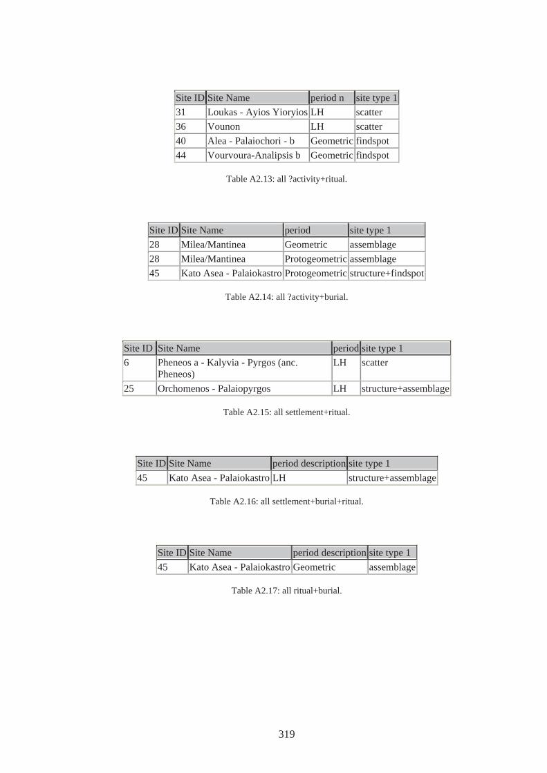
Site ID Site Name period n site type 1 31 Loukas - Ayios Yioryios LH scatter 36 Vounon LH scatter 40 Alea - Palaiochori - b Geometric findspot 44 Vourvoura-Analipsis b Geometric findspot
Table A2.13: all ?activity+ritual.
Site ID Site Name period site type 1 28 Milea/Mantinea Geometric assemblage 28 Milea/Mantinea Protogeometric assemblage 45 Kato Asea - Palaiokastro Protogeometric structure+findspot
Table A2.14: all ?activity+burial.
Site ID Site Name period site type 1 6 Pheneos a - Kalyvia - Pyrgos (anc.
Pheneos) LH scatter
25 Orchomenos - Palaiopyrgos LH structure+assemblage
Table A2.15: all settlement+ritual.
Site ID Site Name period description site type 1 45 Kato Asea - Palaiokastro LH structure+assemblage
Table A2.16: all settlement+burial+ritual.
Site ID Site Name period description site type 1 45 Kato Asea - Palaiokastro Geometric assemblage
Table A2.17: all ritual+burial.
319
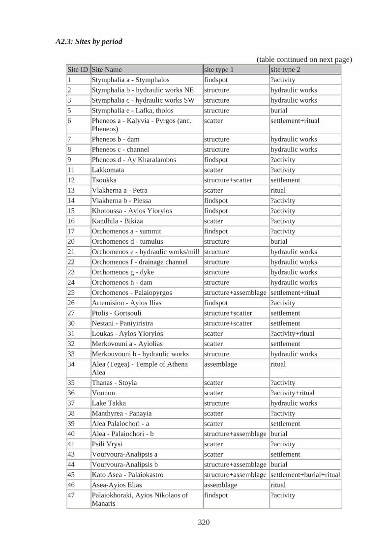
A2.3: Sites by period
(table continued on next page) Site ID Site Name site type 1 site type 2 1 Stymphalia a - Stymphalos findspot ?activity 2 Stymphalia b - hydraulic works NE structure hydraulic works 3 Stymphalia c - hydraulic works SW structure hydraulic works 5 Stymphalia e - Lafka, tholos structure burial 6 Pheneos a - Kalyvia - Pyrgos (anc.
Pheneos) scatter settlement+ritual
7 Pheneos b - dam structure hydraulic works 8 Pheneos c - channel structure hydraulic works 9 Pheneos d - Ay Kharalambos findspot ?activity 11 Lakkomata scatter ?activity 12 Tsoukka structure+scatter settlement 13 Vlakherna a - Petra scatter ritual 14 Vlakherna b - Plessa findspot ?activity 15 Khotoussa - Ayios Yioryios findspot ?activity 16 Kandhila - Bikiza scatter ?activity 17 Orchomenos a - summit findspot ?activity 20 Orchomenos d - tumulus structure burial 21 Orchomenos e - hydraulic works/mill structure hydraulic works 22 Orchomenos f - drainage channel structure hydraulic works 23 Orchomenos g - dyke structure hydraulic works 24 Orchomenos h - dam structure hydraulic works 25 Orchomenos - Palaiopyrgos structure+assemblage settlement+ritual 26 Artemision - Ayios Ilias findspot ?activity 27 Ptolis - Gortsouli structure+scatter settlement 30 Nestani - Paniyiristra structure+scatter settlement 31 Loukas - Ayios Yioryios scatter ?activity+ritual 32 Merkovouni a - Ayiolias scatter settlement 33 Merkouvouni b - hydraulic works structure hydraulic works 34 Alea (Tegea) - Temple of Athena
Alea assemblage ritual
35 Thanas - Stoyia scatter ?activity 36 Vounon scatter ?activity+ritual 37 Lake Takka structure hydraulic works 38 Manthyrea - Panayia scatter ?activity 39 Alea Palaiochori - a scatter settlement 40 Alea - Palaiochori - b structure+assemblage burial 41 Psili Vrysi scatter ?activity 43 Vourvoura-Analipsis a scatter settlement 44 Vourvoura-Analipsis b structure+assemblage burial 45 Kato Asea - Palaiokastro structure+assemblage settlement+burial+ritual46 Asea-Ayios Elias assemblage ritual 47 Palaiokhoraki, Ayios Nikolaos of
Manaris findspot ?activity
320
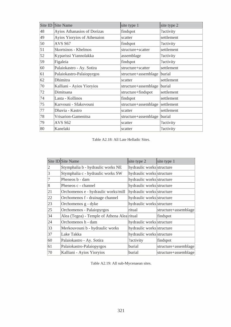
Site ID Site Name site type 1 site type 2 48 Ayios Athanasios of Dorizas findspot ?activity 49 Ayios Yioryios of Athenaion scatter settlement 50 AVS S67 findspot ?activity 51 Skortsinos - Khelmos structure+scatter settlement 52 Kyparissi Yiannolakka assemblage ?activity 59 Figaleia findspot ?activity 60 Palaiokastro - Ay. Sotira structure+scatter settlement 61 Palaiokastro-Palaiopyrgos structure+assemblage burial 62 Dhimitra scatter settlement 70 Kalliani - Ayios Yioryios structure+assemblage burial 72 Dimitsana structure+findspot settlement 74 Lasta - Kollinos findspot settlement 75 Karvouni - Sfakovouni structure+assemblage settlement 77 Dhavia - Kastro scatter settlement 78 Vrisarion-Gamenitsa structure+assemblage burial 79 AVS S62 scatter ?activity 80 Kanelaki scatter ?activity
Table A2.18: All Late Helladic Sites.
Site ID Site Name site type 2 site type 1 2 Stymphalia b - hydraulic works NE hydraulic works structure 3 Stymphalia c - hydraulic works SW hydraulic works structure 7 Pheneos b - dam hydraulic works structure 8 Pheneos c - channel hydraulic works structure 21 Orchomenos e - hydraulic works/mill hydraulic works structure 22 Orchomenos f - drainage channel hydraulic works structure 23 Orchomenos g - dyke hydraulic works structure 25 Orchomenos - Palaiopyrgos ritual structure+assemblage34 Alea (Tegea) - Temple of Athena Alea ritual findspot 24 Orchomenos h - dam hydraulic works structure 33 Merkouvouni b - hydraulic works hydraulic works structure 37 Lake Takka hydraulic works structure 60 Palaiokastro - Ay. Sotira ?activity findspot 61 Palaiokastro-Palaiopyrgos burial structure+assemblage70 Kalliani - Ayios Yioryios burial structure+assemblage
Table A2.19: All sub-Mycenaean sites.
321
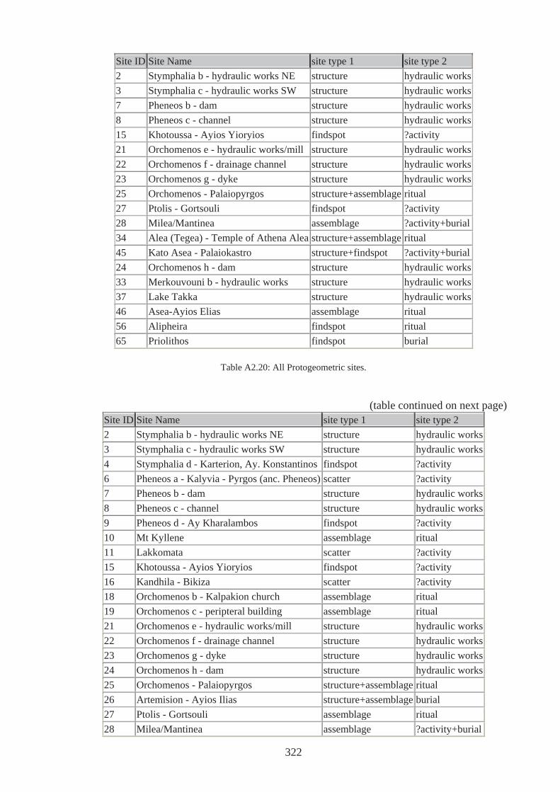
Site ID Site Name site type 1 site type 2 2 Stymphalia b - hydraulic works NE structure hydraulic works3 Stymphalia c - hydraulic works SW structure hydraulic works7 Pheneos b - dam structure hydraulic works8 Pheneos c - channel structure hydraulic works15 Khotoussa - Ayios Yioryios findspot ?activity 21 Orchomenos e - hydraulic works/mill structure hydraulic works22 Orchomenos f - drainage channel structure hydraulic works23 Orchomenos g - dyke structure hydraulic works25 Orchomenos - Palaiopyrgos structure+assemblage ritual 27 Ptolis - Gortsouli findspot ?activity 28 Milea/Mantinea assemblage ?activity+burial34 Alea (Tegea) - Temple of Athena Alea structure+assemblage ritual 45 Kato Asea - Palaiokastro structure+findspot ?activity+burial24 Orchomenos h - dam structure hydraulic works33 Merkouvouni b - hydraulic works structure hydraulic works37 Lake Takka structure hydraulic works46 Asea-Ayios Elias assemblage ritual 56 Alipheira findspot ritual 65 Priolithos findspot burial
Table A2.20: All Protogeometric sites.
(table continued on next page) Site ID Site Name site type 1 site type 2 2 Stymphalia b - hydraulic works NE structure hydraulic works3 Stymphalia c - hydraulic works SW structure hydraulic works4 Stymphalia d - Karterion, Ay. Konstantinos findspot ?activity 6 Pheneos a - Kalyvia - Pyrgos (anc. Pheneos) scatter ?activity 7 Pheneos b - dam structure hydraulic works8 Pheneos c - channel structure hydraulic works9 Pheneos d - Ay Kharalambos findspot ?activity 10 Mt Kyllene assemblage ritual 11 Lakkomata scatter ?activity 15 Khotoussa - Ayios Yioryios findspot ?activity 16 Kandhila - Bikiza scatter ?activity 18 Orchomenos b - Kalpakion church assemblage ritual 19 Orchomenos c - peripteral building assemblage ritual 21 Orchomenos e - hydraulic works/mill structure hydraulic works22 Orchomenos f - drainage channel structure hydraulic works23 Orchomenos g - dyke structure hydraulic works24 Orchomenos h - dam structure hydraulic works25 Orchomenos - Palaiopyrgos structure+assemblage ritual 26 Artemision - Ayios Ilias structure+assemblage burial 27 Ptolis - Gortsouli assemblage ritual 28 Milea/Mantinea assemblage ?activity+burial
322
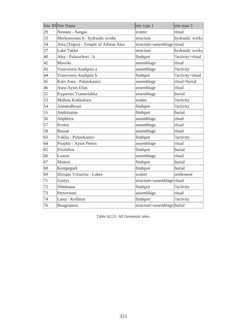
Site ID Site Name site type 1 site type 2 29 Nestane - Sangas scatter ritual 33 Merkouvouni b - hydraulic works structure hydraulic works34 Alea (Tegea) - Temple of Athena Alea structure+assemblage ritual 37 Lake Takka structure hydraulic works40 Alea - Palaiochori - b findspot ?activity+ritual42 Mavriki assemblage ritual 43 Vourvoura-Analipsis a assemblage ?activity 44 Vourvoura-Analipsis b findspot ?activity+ritual45 Kato Asea - Palaiokastro assemblage ritual+burial 46 Asea-Ayios Elias assemblage ritual 52 Kyparissi Yiannolakka assemblage burial 53 Mallota Kokkaliara scatter ?activity 54 Anemodhouri findspot ?activity 55 Andritsaina findspot burial 56 Alipheira assemblage ritual 57 Kretea assemblage ritual 58 Bassae assemblage ritual 63 Vaklia - Palaiokastro findspot ?activity 64 Psophis - Ayios Petros assemblage ritual 65 Priolithos findspot burial 66 Lousoi assemblage ritual 67 Manesi findspot burial 68 Kompegadi findspot burial 69 Drosato Vrisariou - Lakes scatter settlement 71 Gortys structure+assemblage ritual 72 Dimitsana findspot ?activity 73 Petrovouni assemblage ritual 74 Lasta - Kollinos findspot ?activity 76 Bougrianou structure+assemblage burial
Table A2.21: All Geometric sites.
323
APPENDIX 3: INSTRUCTIONS FOR USING THE CD-ROM
This thesis is accompanied by a CD-ROM. This CD has a copy of the thesis complete with
hyperlinks to video clips, database and a Google Earth tour of Arkadia in a PDF document.
In order to view the document Adobe reader is required. This can be downloaded free form
http://www.download-it-free.com/acrobat/ . To view the clips, click on the text at the
appropriate places in the PDF document. The clip is embedded and will start playing
automatically. The database has been created in MS Access and can be opened by clicking on
the paper clip icon below and interrogated either through the tables, forms and queries already
created or through new queries devised by the reader.
In order to view the Google Earth tour, a free version of Google Earth is required. This can
be downloaded from http://earth.google.com/download-earth.html (if reading this from the
CD this can be accessed by clicking on the link above). Once Google Earth has been
downloaded, double click Arkadia Tour to open the programme. On the left hand side
of the screen are two panels, the top one displays files including that named Arkadia Tour.
Double click on this and a list appears beneath. Make sure all check boxes are ticked, and then
click on the start tour button below – an arrow pointing to the right. The tour can be stopped
at any time. Double clicking on any site in the list will take you straight to that site. It is also
possible to negotiate the landscape independently by panning and zooming using the buttons
at the bottom of the screen.
324
REFERENCES
Ancient Sources
Ariaithos of Tegea (FGrHist 316, frr1, 2a, 2b, 4, 5, 7),
Aristippos (FGrHist 317 frr 1, 2, 3).
Aristotle, (The Common Constitution of the Arkadians)
Arrian, Anabasis
Hekataios of Miletos (FGrHist 1 frr 6, 9, 29a, 29b, 6a?)
Hellanikos (FGrHist 4 fr.37),
Herodotus, The Histories
Homer, Iliad
Homer, Odyssey
Ovid, Metamorphoses
Pausanias, Description of Greece, Book 8
Pherekydes (FrGrHist 3, frr 5, 82a, 135a 156-161),
Pindar, Olympian Odes
Polybius, History
Theokritus, Idylls
Theophrastus, On the History of Plants
Thucydides, History of the Peloponnesian War
Virgil, Eclogues
Xenophon, Anabasis
Xenophon, Hellenica
325
Modern Sources
Adrimi-Sismani, B., (1992). i. In: Proceedings of an International Conference for Ancient Thessaly to the memory of D. R. Theochari Athens, p.271-78. Adrimi-Sismani, B.,(1994). H i. In:
., May 12, 1993, Volos, pp.17-45. Adrimi-Sismani, B. (2000) ‘ .’
. . (1990–1998), 1 , Volos p.279–291
Adrimi-Sismani, B. (2002). " . ."
, „ “, Volos 11–13 May 2001, pp.94–107.
Agre P. & Horswill, I. (1997). ‘Lifeworld Analysis’. J Artif Intell Res 6, pp. 111-145. Åkerström, Å. (1987) Berbati vol. 2: the pictorial pottery. Stockholm: Swedish Institute at Athens. Alcock, S. E. (1993) Graecia Capta: The Landscapes of Roman Greece, Cambridge, Cambridge University Press. Alcock, S. E. (2000) Extracting meaning from ploughsoil assemblages: assessment of the past, strategies for the future. In: R. Francovich & H. Patterson (eds.) Extracting Meaning from Ploughsoil Assemblages, Archaeology of Mediterranean Landscapes 5. Oxford: Oxbow, pp.1-4. Alcock, S. E., Cherry, J. F. & Davis, J. L. (1994) Intensive survey, agricultural practice and the Classical landscape of Greece. In: I. Morris (ed.) Classical Greece: ancient histories and modern analogies. Cambridge, Cambridge University Press, pp.137-170. Alcock, S. E. & Osborne, R. eds. (1994) Placing the Gods. Oxford: Clarendon Press. Alden, M. J. (1981) Bronze Age Population fluctuations in the Argolid from the Evidence of Mycenaean Tombs. SIMA 15. Göteberg: Paul Åströms Förlag. Ålin, P. (1962) Das Ende der Mykenischen Fundstatten auf dem Griechischen Festland. SIMA 1. Lund: Blom. Allen, K. M., Green, S. W. & Zubrow, E. B. W., (1990) Interpreting Space: GIS and Archaeology. London: Taylor & Francis. Alpers, P. (1979). The Singer of the Eclogues: A study of Virgilian Pastoral. Berkley: University of California Press. Alroth, B. (1988). ‘The positioning of Greek votive figurines’ In: R. Hägg, N. Marinatos, & G.C. Nordquist, (eds.). Early Greek cult practice: proceedings of the Fifth International Symposium at the Swedish Institute at Athens, 26-29 June, 1986, Stockholm: Swedish Institute at Athens, pp.195-203.
326
Amyx, D. A., (1988). Corinthian Vase-Painting of the Archaic Period, Berkeley: University of California Press. Antonaccio, C., (1995). An Archaeology of Ancestors: tomb cult and hero cult in early Greece, London/Maryland: Rowman & Littlefield. Arens, W. (1988). ‘An anthropological approach to ritual: Evidence, context and interpretation.’ In: R. Hägg, N. Marinatos, & G.C. Nordquist, (eds.). Early Greek cult practice: proceedings of the Fifth International Symposium at the Swedish Institute at Athens, 26-29 June, 1986, Stockholm: Swedish Institute at Athens, pp.223-228. Ariès, P., (1974). Western attitudes toward death: from the Middle Ages to the present, translated by. Patricia M. Ranum, London/Baltimore: Johns Hopkins University Press. Ariès, P., (1981). The hour of our death, translated by Helen Weaver, London: Allen Lane. Åström, P. & Verdelis, N., (1977). Cuirass Tomb and Other Finds at Dendra Part I: The Chamber Tombs, SIMA 4/1, Göteberg: Paul Åströms Förlag. Åström, P. & Verdelis, N., (1983). Cuirass Tomb and Other Finds at Dendra Part II: Excavations in the Cemeteries, the Lower Town and the Citadel, SIMA 4/2, Göteberg: Paul Åströms Förlag. Baggini, J., (2004). ‘Reason to End the Truth Wars: Rationality Reconsidered’, Humanism East and West Conference, Oslo 4-5 June 2004 [online] available at at: <www.julianbaginni.com/stuff.htm> (accessed March 2005) Baker-Penoyre, J., (1902). ‘Pheneos and the Pheneatike’, JHS 22, pp.228-240. Barker G. & Lloyd J., (eds.) (1991). Roman Landscapes: Archaeological Survey in the Mediterranean Region, Archaeological Monographs of BSR 2, London: British School at Rome. Barrett, J. C., (1994). Fragments from Antiquity: an archaeology of social life in Britain 2900-1200BC, Oxford: Blackwell. Barrett, J. C. & Fewster K. J., (2000), ‘Intimacy and Structural Transformation: Giddens and Archaeology.’ In: C. Holtorf & H. Karlsson, Philosophy and Archaeological Practice: Perspectives for the 21st century, Lindome: Bricoleur Press. Bartonek, A., (1972). Classification of the West Greek Dialects at the time about 350BC, Amsterdam: A. D. Hakkert. Beard, M., & Henderson, J., (1995). Classics: A very short introduction, Oxford: Oxford University Press. Beazley, J. D. (1964). The development of Attic black-figure, Berkeley: University of California Press.
327
Belcher, M., Harrison, A. & Stoddart, S., (1999). ‘Analyzing Rome’s Hinterland.’ In: M. Gillings, D. Mattingly & J. van Dalen (eds.), Geographical Information Systems and Landscape Archaeology, Archaeology of Mediterranean Landscapes 3, Oxbow: Oxford, pp.95-101. Bell, J. (1992). ‘On Capturing Agency in Theories about Prehistory.’ In: J-C. Gardin & C. S. Peebles (eds.), Representations in Archaeology. Bloomington: Indiana University Press, pp.30-55. Bender, B. (ed.), (1993a). Landscape; Politics and Perspectives, Oxford: Berg. Bender, B., (1993b). ‘Introduction: Landscape: Meaning and Action.’ In: B. Bender (ed.), Landscape; Politics and Perspectives, Oxford: Berg, pp.1-17. Berglund, M. H. (2000). ‘Consequences of styles of thinking’, NAR 33 no.2, pp.105-115. Bergquist, (1988). ‘The Archaeology of sacrifice: Minoan-Mycenaean versus Greek.’ In: R. Hägg, N. Marinatos, & G.C. Nordquist, (eds.). Early Greek cult practice: proceedings of the Fifth International Symposium at the Swedish Institute at Athens, 26-29 June, 1986, Stockholm: Swedish Institute at Athens, pp.21-34. Betancourt, P. P., (1976). ‘The End of the Greek Bronze Age’, Antiquity 50, pp.40-47. Betancourt, P. P., (1987). ‘Dating the Aegean Late Bronze Age with Radiocarbon’, Archaeometry 29, pp.45-49. Biers, W. R., (1978). ‘Water from Stymphalos?’ Hesperia 47, pp.171-184. Binford, L. R., (1981). ‘Behavioural archaeology and the "Pompeii Premise"’ J Anthropol Res 37, pp.195-208. Binford, L. R., (1983). In pursuit of the past: decoding the archaeological record, London: Thames & Hudson. Binford, L. R. & Binford S. R. (eds.) (1968). New Perspectives in Archaeology, Chicago: Aldine Publishing Company. Bintliff, J. L., (1977). Natural Environment and Human Settlement in Prehistoric Greece: based on original fieldwork, BAR Supplementary Series 28, Oxford: British Archaeological Reports. Bintliff, J. L., (1985). ‘The Boeotia Survey.’ In: S. Macready & F. H. Thompson (eds.), Archaeological Field Survey in Britain and Abroad, London: Society of Antiquaries, pp.196-216. Bintliff, J. L., (ed.), (1988). Extracting Meaning from the Past, Oxford: Oxbow Bintliff, J. L. (ed.), (1991a). The ‘Annales’ School and Archaeology, Leicester: Leicester University Press.
328
Bintliff, J. L., (1991b). ‘The contribution of an Annaliste/structural history approach to archaeology.’ In: J. L. Bintliff (ed.), The ‘Annales’ School and Archaeology, Leicester: Leicester University Press. Bintliff, J., (1997). ‘Regional Survey, Demography and the Rise of Complex Societies in the Ancient Aegean: Core-Periphery, Neo Malthusian and Other Interpretive Models’, JFA 24, pp.1-38. Bintliff, J., (2000). ‘Archaeology and the philosophy of Wittgenstein.’ In: C. Holtorf & H. Karlsson, Philosophy and Archaeological Practice: Perspectives for the 21st century, Bricoleur Press: Lindome, pp.153-172. Bintliff, J. L. & Snodgrass, A. M., (1985). ‘The Cambridge/Bradford Boeotian Expedition: The First Four Years’, JFA 12, pp.123–161. Bird-David, N., (1990). ‘The giving environment: another perspective on the economic system of gatherer-hunters’, Curr Anthropol 31, pp.189-96. Bird-David, N., (1992). ‘Beyond ‘the hunting and gathering mode of subsistence’: culture-sensitive observations on the Nayaka and other modern hunter-gatherers’, Man 27, pp.19-44. Blegen, C. W., (1928). Zygouries: a prehistoric settlement in the valley of Cleonae, Cambridge, Mass: Harvard University Press. Blegen, C. W., (1966). The Palace of Nestor at Pylos in Western Messenia., Vol 1. Princeton: Princeton University Press. Bloch, M. (1974). ‘Symbols, song, dance and features of articulation’, Archives of European Sociology 15, pp.55-81. Bloch, M., (1986). From Blessing to Violence: history and ideology in the circumcision ritual of the Merina at Madagascar, Cambridge: Cambridge University Press. Blomberg, M. & Henriksson, G., (2005). ‘Orientations at the Late Bronze Age Villa Complex at Vathypetro in Crete,’ MAA 5 no.1, pp.51-61 Blum G. & Plassart, A., (1914). ‘Orchomène D’Arcadie: Fouilles de 1913’, BCH 38, pp.71-88 & pp.447-448. Blum G. & Plassart, A., (1915). ‘Orchomene D’Arcadie’, BCH 39, pp.53-127. Bourdieu, P., (1977). Outline of a Theory of Practice. Cambridge: Cambridge University Press. Bowkett, Hill, Wardle, K & Wardle D. (2001). Classical archaeology in the field: Approaches, Bristol: Bristol Classical Press. Bradley, R., (1993). ‘Archaeology: the loss of nerve.’ In: N. Yoffee & A. Sherratt, (eds.) Archaeological theory: who sets the agenda?, Cambridge: Cambridge University Press, pp.131-133 Bradley, R., (2000). An Archaeology of Natural Places, London: Routledge.
329
Brann E., (1961). ‘Late Geometric Well Groups from the Athenian Agora’, Hesperia 30, pp.93-146. Branigan, K., (ed.) (1998). Cemetery and society in the Aegean Bronze Age, Sheffield Studies in Aegean Archaeology 1, Sheffield: Sheffield Academic Press. Braudel, F., (1972). The Mediterranean and the Mediterranean World in the age of Phillip II, London: Collins. Braudel, F., (1980). On History, London: Weidenfeld and Nicolson. Braudel, F., (1983). The Structures of Everyday Life, London: Collins. Bremmer, J., (1983). ‘Scapegoat rituals in ancient Greece’, in HSCP 87, pp.299 -320. Bremmer, J., (1984). ‘Greek maenadism reconsidered’, ZPE 55, pp.267-86. Brown, P. E. & Rubin, B. H., (1982). ‘Patterns of desert resource use: and integrated approach to settlement analysis.’ In: P. E. Brown & C. L. Stone, (eds.) Granite Reef: a Study in Desert Archaeology, Anthropological Research Papers No. 28, Tempe: Arizona State University, pp.267-305. Bruit Zaidman, L. & Schmitt Pantel, P., (1992). Religion in the Ancient Greek City, Cambridge: Cambridge University Press. Bullock, A. & Trombley, S. (eds.) (1999). The New Fontana Dictionary of Modern Thought, London: Harper Collins. Burkert, W., (1979). Structure and History in Greek. Mythology and Ritual, Berkley: University of California Press. Burkow, J., Cosmides, L. & Tooby, J. (eds.) (1992). The Adapted Mind: Evolutionary Psychology and the Generation of Culture, Oxford: Oxford University Press. Bursian, C., (1868). Geographie von Griechenland ii, Leipzig: B. G. Teubner. Burton–Brown, T., (1954). The Coming of Iron to Greece, Wincle, Cheshire: Burton-Brown. Buxton, R. G. A., (1992). ‘Imaginary Greek Mountains’, JHS 112, pp.1-15. Buxton, R. G. A., (1994). Imaginary Greece: The Contexts of Mythology, Cambridge: Cambridge University Press. Cagle, A. J. (2003). The Spatial Structure of Kom el-Hisn: An Old Kingdom town in the Western Nile Delta, Egypt, BAR International Series, Oxford: Archaeo Press. Calame, C., (1990). ‘Illusions de la mythologie’, Nouveaux Actes Sémiotique 12, Université de Limoges 12, pp.5-35.
330
Calligas, (1988). ‘Hero cult in Early Iron Age Greece.’ In: R. Hägg, N. Marinatos, & G.C. Nordquist, (eds.). Early Greek cult practice: proceedings of the Fifth International Symposium at the Swedish Institute at Athens, 26-29 June, 1986, Stockholm: Swedish Institute at Athens, pp.229-234. Cameron, A. & Kuhrt, A., (1983). Images of Women in Antiquity, London: Croom Helm. Carmichael, D. L., (1994). Sacred Sites, Sacred Places, One World Archaeology 23 Oxford: Routledge. Carothers, J. & McDonald, W. A., (1979). ‘Size and distribution of the population in Late Bronze Age Messenia: Some Statistical Approaches’, JFA 6, pp.433-454. Cartledge, P., (1979). Sparta and Lakonia: a regional history, 1300-362 BC, London: Routledge. Caskey, J. L., (1971), ‘Investigations in Keos. Part I: Excavations and Explorations, 1966-70,’ Hesperia 40, pp.359-396. Caskey, M. E., (1971) ‘Newsletter from Greece’, AJA, Vol. 75, pp.295-317 Caskey, M. E., (1986) Keos II,1: The Temple at Ayia Irini: The Statues, Princeton: Princeton University Press. Catling, H. (1976-77), ‘Excavations at the Menelaion, Sparta,’ AR 1976-77, pp.24-42. Catling, H. W., (1980). Cyprus and the West 1600-1050 BC, Ian Sandars Memorial Lecture, Sheffield: University of Sheffield Catling, H. W., (1989). BSA 84, pp.177-85. Catling, H. W., (1990). BSA 85, pp.37-46. Cavanagh, W. G., (1978). ‘A Mycenaean Burial Custom?’ BICS 25, pp.171-2. Cavanagh W. G. & Mee, C., (1990). ‘The location of Mycenaean Chamber Tombs.’ In: R. Hägg & G. C. Nordquist, (eds.) Celebrations of Death and Divinity in the Bronze Age Argolid. Proceedings of the Sixth International Symposium at the Swedish Institute at Athens 11-13 June 1988. Stockholm: Swedish Institute at Athens, pp.58-63. Cavanagh, W. G., & Mee, C. (1995). ‘Mourning before and after the Dark Age.’ In: C. Morris (ed.), Klados. Essays in honour of J. N. Coldstream, London: BICS Suppl. 63. Cavanagh, W. G. & Mee, C., (1998). A Private Place: Death in Prehistoric Greece, SIMA 125, Jonsered: Paul Astroms Forlag. Cavanagh, W. G., et al. (1996). The Laconia survey: continuity and change in a Greek rural landscape, London: British School at Athens. Cavanagh, W. G., et al. (2005). The Laconia Rural Sites Project, London: British School at Athens.
331
Chadwick, J., (1967). The decipherment of Linear B, 2nd edition Cambridge: Cambridge University Press. Chadwick, J., (1975). ‘The prehistory of the Greek Language’ CAH 3rd edition, 2.2, pp.805-819. Chadwick, J., (1976). The Mycenaean World, Cambridge: Cambridge University Press. Chadwick, J. & Ventris M., (1973), Documents in Mycenaean Greek, 2nd edition. Cambridge: Cambridge University Press. Chang, C., (1993). ‘Pastoral Transhumance in the Southern Balkans as social ideology: Ethnoarchaeological research in Northern Greece,’ American Anthropologist 95, pp.687-703. Chang, C. & Koster, H. A., (1986). ‘Beyond Bones: Towards and Archaeology of Pastoralism.’ In: M. B. Schiffer, Advances in Archaeological Method and Theory 9, New York: Academic Press, pp.97-148. Chapman, J. C., (2000). Fragmentation in Archaeology: people, places, and broken objects in the prehistory of south-eastern Europe, London: Routledge. Cherry, J. F., (1983). ‘The Melos aarchaeological survey.’ In: D. R. Keller & D. W. Rupp (1983). Archaeological Survey in the Eastern Mediterranean Area, BAR International Series 155, Oxford: Archaeo Press. Cherry, J. F., (1984). ‘Commonsense in Mediterranean Survey’, JFA 11, pp.117-120. Cherry, J. F., Davis, J. L. & Mantzourani, E., (1991). Landscape Archaeology as long-term History: Northern Keos in the Cycladic Islands, Los Angeles: UCLA Institute of Archaeology. Cherry, J. F., Davis, J. L. & Mantzourani, E. (2000) Mycenaean Nemea: The Results of the Nemea Valley Archaeological Project Archaeological Survey, Internet Edition [online]. Available at: < http://river.blg.uc.edu/nvap/MycNVAP.html> (accessed 13th November 2007) Chippendale, C., (1993). ‘Ambition, deference, discrepancy, consumption; the intellectual background to a post-processual archaeology.’ In: N. Yoffee & A. Sherratt, (eds.) Archaeological theory: who sets the agenda?, Cambridge: Cambridge University Press, pp.27-36. Church, T., Brandon, R. J. & Burgett, G. R., (2000). ‘GIS Applications in Archaeology: Method in Search of Theory.’ In: Westcott, K. L. Brandon, R. J. (eds.), Practical applications of GIS for Archaeologists: A predictive modelling toolkit, Taylor & Francis: London, pp.135-155. Clark, K., (1979). Landscape into Art, London: John Murray Clarke, D. L., (1973). ‘Archaeology: the loss of innocence.’ Antiquity 47, pp.6-18. Clarke, D. L., (1977). Spatial Archaeology, London: Academic Press.
332
Cline E. H., (1994). Sailing the Wine-dark Sea: International Trade and the Late Bronze Age Aegean, BAR International Series 591, Oxford: Archaeo Press. Cockerell, C. R., (1830). Temple of Jupiter Olympius at Agrigentum commonly called the Temple of the Giants, London: Priestly & Weale. Cockerell, C. R. & Lloyd, W. W. (1860). The Temples of Jupiter Panhellenius at Aegina and of Apollo Epicurius at Bassae. near Phigaleia in Arcadia, London: Weale. Coldstream, J. N., (1968). Greek Geometric Pottery: a survey of ten local styles and their chronology, London: Methuen & Co. Ltd. Coldstream, J., N., (1976). ‘Hero-cults in the age of Homer,’ JHS 96, pp.8-17. Coldstream, J. N., (2003). Geometric Greece, 2nd edition, London: Routledge. Coldstream J. N. & Colledge, M. A. R (eds.), (1979). Greece and Italy in the Classical World Acta of the XI International Congress of Classical Archaeology, London, 3-9 September, 1978, London. Connerton, P. (1976). Critical sociology: selected readings, Harmondsworth: Penguin Cooney, G., (2000). Landscapes of Neolithic Ireland, London & New York: Routledge. Cooper, F., (1978). The Temple of Apollo at Bassai, New York: Garland Cooper, F., (1996). The Temple of Apollo Bassitas I. The Architecture, Princeton: Princeton University Press. Cooper, F. A. & Myers, J. W., (1981). ‘Reconnaissance of a Greek Mountain Village’, JFA 8, pp.123-134 Cosgrove, D., (1993). ‘Landscape and Myths, Gods and Humans.’ In: B. Bender (ed.), Landscape: Politics and Perspectives, Oxford: Berg, pp.281-305. Coulson, W. D. E., (1985). ‘The Dark Age Pottery of Sparta’, BSA 80, pp.29–84. Coulson, W. D. E., (1986). The Dark Age Pottery of Messenia, SIMA, Göteborg: Paul Åström. Coulson, W. D. E., The Greek Dark Ages: A Review of the Evidence and Suggestions for Future Research, Athens, 1990. Coulson, W. D. E. & McDonald, W. A. (1975). ‘Excavations at Nichoria in Messenia, 1972-1973,’ Hesperia 44, pp.85-92. Coulson, W. D. E., McDonald, W. A., & Rosser, J., (1983). Excavations at Nichoria in southwest Greece, Vol. 3: Dark Age and Byzantine occupation, Minneapolis: University of Minnesota Press. Courbin, P., (1952). ‘Chronique des fouilles en 1951: Gortys d’Arcadie,’ BCH 76, pp.245-247.
333
Cracolici, (2005). ‘Pottery from the Norwegian Asea Survey.’ In: E. Østby (ed.), Ancient Arkadia: Acts of a research seminar organised by the Norwegian Institute of Athens 7-10 May 2002, Jonsered: Paul Astrom, Curtis, L. C. (1961) ‘Some aspects of Greek Geometric Bronzes,’ Harvard Studies 65, pp.372-5. Curtius, E., (1851). Peloponnesos. Eine historisch-geographische Beschreibung der Halbinsel Vol I. Gotha Dakoronia, Ph., Deger-Jalkotzy, S. & Fabrizii-Reuer, S.‚ (2000-2001). Beisetzungen mit Leichenbrand aus der Felskammernekropole von Elateia-Alonaki, Griechenland,’ Archaeologia Austriaca 84-85 pp.137-153. Daniel, G., (1975). A Hundred and Fifty Years of Archaeology, 2nd edition London: Duckworth. Daniel, G., (1981). A Short History of Archaeology, London: Thames & Hudson. Davis, C. & Medyckyj-Scott, (1994). ‘Introduction: the Importance of Human Factors.’ In: H. M. Hearnshaw & D. J. Unwin, Visualisation in Geographic Information Systems, Chichester: John Wiley & Sons Ltd, pp.189-192. Davis J. K. &. Foxhall L., (eds.), (1984). The Trojan War. Its Historicity and Context, Bristol: Bristol University Press. Davis, J. L. & Alcock, S. E., (1997). ‘The Pylos Regional Archaeological Project, Part I: Overview and the Archaeological Survey’, Hesperia 66, pp.391-494. Demakopoulou K. (1982), YE IIIC
, PhD thesis, Athens. Demakopoulou, K. A. & Crouwel, J. H., (1998). ‘Some Mycenaean tombs at Palaiokastro, Arcadia’ BSA 93, pp.269-283. Desborough, V. R. d’A., (1952). Protogeometric Pottery, Oxford: Desborough, V. R. d’A., (1964). The Last Mycenaeans and Their Successors: An Archaeological Survey, c1200-1000BC, Oxford: Clarendon Press. Desborough, V. R. d’A., (1972).The Greek Dark Ages, London: Ernest Benn Ltd. Desborough, V. R. d’A, (1973). ‘Late Burials from Mycenae’, BSA 68, pp.87-101. Descartes, R., (1994). Discourse on method and meditations, introduced by Tom Sorell, translated by John Veitch, London: Dent. Detienne, M., (1986). The Creation of Mythology, Chicago: Chicago University Press. Dickinson, O. T. P. K., (1980). ‘The Peloponnese in the Bronze Age: What we know and what we need to know’ 8, 1, pp.358-362.
334
Dickinson, O. T. P. K., (1994). The Aegean Bronze Age, Cambridge: Cambridge University Press. Dietrich, B. C., (1974). The Origins of Greek Religion, Berlin/New York: de Gruyter. Diniz, M., (2005). ‘Beyond the concrete fence: giving voice to the doozers,’ Enterprising Archaeologists: thinking outside of the trench, TAG 2005, 19th - 21st December 2005. Dodwell, E., (1819). A Classical and Topographical Tour through Greece, during the years 1801, 1805, and 1806, London: Rodwell & Martin. Donald, M., (1991). Origins of the Modern Mind: three stages in the Evolution of Culture and Cognition, Cambridge Mass./London: Harvard University Press. Dowden, K., (1992). The Uses of Greek Mythology, London: Routledge. Drews, R., (1982). The Coming of the Greeks: Indo-European conquests in the Aegean and the Near East, Princeton: Princeton University Press. Drews, R., (1995). The End of the Bronze Age, Princeton: Princeton University Press. Dreyfus, H., (1991). Being-in-the-World: a Commentary on Heidegger’s Being and Time, Division I. Cambridge, Massachusetts: Massachusetts Institute of Technology Press. Dugas, C., (1921). ‘Le sanctuaire de Alea Athéna a Tégée avant le IVe siècle,’ BCH 45, pp.335-435. Dugas, C., (1924). Le Sanctuaire d’Alea Athena a Tegee, Paris: Librairie Orientaliste Paul Geuthner. Eder, B., (1998). Argolis, Lakonien, Messenien: Vom Ende der Mykenischen Palastzeit bis zur Einwanderung der Dorier, Wien. Edmonds, M., (1999). Ancestral Geographies, London: Routledge. Edmonds, M. & Seaborne, T., (2001). Prehistory in the Peak, Stroud: Tempus. Eisner, R., (1991). Travellers to an Antique Land: The History and Literature of Travel to Greece, Ann Arbor: University of Michigan Press. Ekstein, F. & Meyer, E.,’Eine Villa rustica bei Kalliani in Westarkadien’, AM 75, 1960, pp.9-67. Ellingham, M., Dubin, M., Jansz, N., & Fisher, J., (2000). The Rough Guide to Greece, London: Rough Guides. English Heritage (2000). Managing Lithic Scatters: Archaeological Guidance for planning authorities and developers, 2000.01, English Heritage. Evans, A., (1901). The Mycenaean Tree and Pillar Cult and its Mediterranean relations, London: Macmillan.
335
Evans, A. J., (1912). ‘The Minoan & Mycenaean Elements in Hellenic Life’, JHS 32, pp.277-297. Exon, S., Gaffney, V., Woodward, A. & Yorston, R., (2000). Stonehenge Landscapes: Journeys through real-and-imagined worlds, Oxford: Archaeopress. Fagerstrom, K. (1988). Greek Iron Age Architecture developments through changing times, SIMA 81, Göteborg: Paul Åström Fählander, (2003). ‘Mortuary Data: Structural relatosn between burials, Settlements and the landscape.’ In: J. Forsen & B. Forsen (eds.) The Asea Valley Survey: An Arcadian Mountain Valley from the Palaeolithic Period until Modern Times, Stockholm: Skrifter Utgivna av Svenska Institutet I Athen, 4°, LI, pp.353-358. Fairclough, N., (1992a). Critical language awareness, London: Longman. Fairclough, N., (1992b). Discourse and social change, Cambridge: Polity Press. Febvre, L., (1942). Le Problème de la l’incroyance au XVIe siècle: La religion de Rabelais, Coll. L’Evolution de l’Humanité, Paris: A Michel. Fentress, E., (2000). ‘What are we counting for?’ In: R. Francovich & H. Patterson (eds.), Extracting Meaning from Ploughsoil Assemblages, Archaeology of Mediterranean Landscapes 5, Oxford: Oxbow, pp.44-52 Feyerabend, P. K., (1988). Against Method, revised edition, London/New York: Verso. Finley, M., (1956). The World of Odysseus, London: Chatto & Windus. Fisher, P. F., (1999). ‘Geographical Information Systems: Today and Tomorrow?’ in M. Gillings., D. Mattingly & J. van Dalen, Geographical Information Systems and Landscape Archaeology, Archaeology of Mediterranean Landscapes 3, Oxford: Oxbow, pp.5-11. Fisiak, J., (ed.), (1988). Historical dialectology: regional and social trends in linguistics, Berlin: Mouton de Gruyter. Fimmen, D., (1924). Die Kretisch-Mykenische Kultur, Leipzig-Berlin: BG Teubner. Finley, M., (1981). Economy and Society in Ancient Greece, London: Chatto & Windus. Fitton, J. L., (1995). The Discovery of the Greek Bronze Age, London: British Museum Press. Fletcher, (1992). ‘Time perspectivism, Annales and archaeology.’ In: A. B. Knapp (ed.), Archaeology, Annales, and ethnohistory, Cambridge: Cambridge University Press, pp.35-49. Forbes, H., (1995). ‘The identification of pastoralist sites within the context of estate- based agriculture in ancient Greece: beyond the transhumance versus agropastoralism debate’, BSA 90, pp.325-38.
336
Forbes, H. (1996). ‘The Uses of the Uncultivated Landscape in Modern Greece: a pointer to the value of wilderness.’ In: G. Shipley, & J. Salmon, (eds.), Human Landscapes in Classical Antiquity. Environment and Culture, Leicester-Nottingham studies in Ancient Society 6, London: Routledge. Forsen, J, (1996). ‘The Asea. Valley from Archaic to Hellenistic times’, Acts of the V International Congress of Peloponnesian Studies, 1994, pp.289-297. Forsen, J. (1998), ‘The discovery of an Archaic sanctuary in the Asea Valley in Arkadia’, AJA 102, p.370. Forsen, J., Forsen, B. & Lavento, M., (1996). ‘The Asea. Valley survey – a preliminary report of the 1994 season’, OpAth 21, pp.73-97. Forsen, J. & Forsen, B., (1997). ‘The Polis of Asea.. a case-study of how archaeology can expand our knowledge of the history of a Polis.’ In: T. H. Nielsen, (ed.) Yet more studies in the ancient Greek polis, Papers from the Copenhagen Polis Centre 4; Historia Einzelschriften 117, Stuttgart: F. Steiner, pp.163-176. Forsen, J., Forsen, B & Ostby, E., (1999). ‘The Sanctuary of Agios Elias – Its significance, and its relations to surrounding sanctuaries and settlements.’ In: T. H. Nielsen & J. Roy (eds.), Defining Ancient Arkadia, Acts of the Copenhagen Polis Centre 6, Copenhagen: KDVS, pp.169-191. Forsen, J. & Forsen, B., (2003). The Asea Valley Survey: An Arcadian Mountain Valley from the Palaeolithic Period until Modern Times, Skrifter Utgivna av Svenska Institutet I Athen, 4°, LI, Stockholm: Svenska Institutet I Athen. Forster, (1941). A Short History of Modern Greece, 1821-1940, London: Methuen & Company. Forstenpointner, G. (1990). ‘Tierknochenfunde aus der arkadischen Ansiedlung Lousoi.: erste Ergebnisse,’ ÖJh 66, Grabungen, pp.37-47. Fotiadis, M., (1995). ‘Modernity and the past still present: politics of time in the birth of regional archaeological projects in Greece’, AJA 99, pp.59-78. Fotopoulos, T., (1997). Towards an Inclusive Democracy: the crisis of the growth economy and the need for a new liberatory project, London: Cassell. Fougeres, G., (1898). Mantinea et l’Arcadie Orientale, Paris: Fontemoing. Foxhall, L., (1995). ‘Bronze to Iron: Agricultural systems and political structures in Late Bronze Age and Early Iron Age Greece’, BSA 90, pp.239-59. Francovich, R. & Patterson, H., (eds.), Extracting Meaning from Ploughsoil Assemblages, Archaeology of Mediterranean Landscapes 5, Oxford: Oxbow. Frangakis-Syrett, E. & Wagstaff, J. M., (1992). ‘The Height Zonation of Population in the Morea ca. 1830’, BSA 87, pp.439-446.
337
French, E. B. & Wardle, K., (1988). Problems in Greek Prehistory, Bristol: Bristol Classical. Press. Friedman, J. (1992). ‘The Past in the Future: History and the Politics of Identity’. AA, 94 (4), pp.837-859. Furumark, A., (1941). The Mycenaean Pottery: Analysis and Classification, Stockholm: Kungl. Vitterhets, historie och antikvitets akademien Furumark, A., (1944). ‘The Mycenaean IIIC pottery & its relation to Cypriot fabrics’, Opscula Archaeologica 3. Furumark, A., (1972). Mycenaean Pottery, Stockholm. Gadolou, A., (2002) ‘The Formation of the Sacred Landscape of the Eastern Argolid, 900-700 B.C.: A Religious, Social and Political Survey’. In: R Hägg (ed.), Peloponnesian Sanctuaries and Cults. Proceedings of the Ninth International Symposium at the Swedish Institute at Athens, 11-13 June 1994. Acta Instituti Atheniensis Regni Sueciae, Series 4, 48. Stockholm: Svenska Institutet i Athen, pp.37-43. Gadamer, H-G., (2004). Truth and Method, London/New York: Continuum. Gaffney, V., Bintliff, J & Slapsak, B. (1991). ‘Site formation processes and the Hvar Survey Project, Yugoslavia. In: A. J. Schofield (ed.) Interpreting Artefact Scatters: Contributions to Ploughzone Archaeology, Oxford: Oxbow, p.59-77. Gaffney, V & Stan i , Z., (1991). GIS Approaches to Regional Analysis: A case study of the island of Hvar, Ljubljana: Filozofska fakulteta. Gaffney, V., Stan i , Z. & Watson, H., (1995). ‘The impact of GIS on archaeology: a personal perspective.’ In: G. Lock & Z. Stan i (eds.) Archaeology and Geographic Information Systems: a European Perspective, London: Taylor & Francis, pp.211-229. Gaffney, V. & Stan i , Z., (1999). ‘GIS Based Analysis of the Population Trends on the island of Brac in Central Dalmatia.’ In: M. Gillings., D. Mattingly, & J. van Dalen, Geographical Information Systems and Landscape Archaeology, Archaeology of Mediterranean Landscapes 3 Oxford: Oxbow, pp.85 94. Gallant, T. W., (1986). ‘“Background Noise” and site definition: a contribution to survey methodology.,’ JFA 13, pp.403-418. Gallou, C., (2005). The Mycenaean Cult of the Dead, BAR International Series 1372, Oxford: Archaeopress. Gamba, P., (1975). A narrative of Lord Byron’s Last Journey to Greece, Folcroft, Pa: Folcroft Library Editions Gardiner E. N., (1925) Olympia: It’s History & Remains, Oxford: Clarendon Press. Gardner, E. A., Loring, W., Richards, G. C. & Woodhouse; W. J., (1892) Excavations at Megalopolis 1890-1891, JHS supplementary papers 1, London.
338
Garton, D. (1991). ‘Neolithic Settlement in the Peak District: Perspective and Prospects.’ In: R Hodges & K Smith (eds.). Recent Developments in the Archaeology of the Peak District, Sheffield Archaeological Monographs 2. J R Sheffield: Collis Publications. Garton, D. & Malone, S. J., (1999). ‘Romano-British and Prehistoric discoveries from test pitting at Lees Bottom, Taddington, DAJ 119, pp.194-202 Garwood, P., (2002). ‘Round barrows and funerary traditions in Late Neolithic and Bronze Age Sussex.’ In: D. Rudling, (ed.), The Archaeology of Sussex to AD 2000, Sussex: University of Sussex. Gathercole, P. & Lowenthal, D. (eds.), (1994). The Politics of the Past, London: Routledge Gauntlett, D. (2002), Media, Gender and Identity: An Introduction, London: Routledge Gero, J. M. & Conkey, M. W., (eds.) (1991). Engendering Archaeology: Women and Prehistory, Oxford: Blackwell. Gibson, J. J. (1968). The Senses Considered as Perceptual Systems. London: George Allen & Unwin. Gibson, J. J., (1979). The Ecological Approach to Visual Perception. New Jersey, London: Lawrence Erlbaum Associates. Giddens., A., (1984). The Constitution of Society: Outline of the theory of structuration, Cambridge: Polity Press. Giddens., A., (1991). Modernity and Self Identity, Cambridge: Polity Press. Gillings., M. (2000). Envisioning the Past, University of Southampton, 10th-12th November 2000. Gillings., M., ‘Embracing uncertainty and challenging dualism in the GIS-based study of a palaeo-flood plain’, European Journal of Archaeology 1/1, pp.117-144. Gillings., M., (2005). ‘Rising from the reedbeds: tempos of life in the early Neolithic floodplains of southeast Hungary,’ Unpublished paper, TAG 2005, Sheffield, 19th- 21st December 2005. Gillings., M., & Goodrick, G. T., (1996). ‘Sensuous and Reflexive GIS: exploring visualisation and VRML’, Internet Archaeology 1, [online]. Available at: <http://intarch.ac.uk/journal/issue1/gillings_index.html> (accessed May 2003). Gillings., M., Mattingly, D. & van Dalen, J., (eds.) (1999). Geographical Information Systems and Landscape Archaeology, Archaeology of Mediterranean landscapses 3, Oxford: Oxbow. Gillings., M. & Sbonias, K., (1999). ‘Regional Survey and GIS: The Boeotia Project.’ In: M. Gillings., D. Mattingly, & J. van Dalen (eds.), Geographical Information Systems and Landscape Archaeology, Archaeology of Mediterranean landscapses 3, Oxford: Oxbow, pp.35-54.
339
Given, M., et al. (2001) Troodos Archaeological and Environmental Survey Project: first preliminary report (June-July 2000). Report of the Department of Antiquities of Cyprus pp.425-440. Goodison, L., (1989). Death, women and the sun: symbolism of regeneration in early Aegean religion., BICS supplement, London: University of London, Institute of Classical Studies Gosden., C., (1994). Social Being and Time, Oxford: Blackwell. Graf, F., (1985). Griechische Mythologie, Munich: Artemis. Gregory, D., (1994). Geographical Imaginations, Oxford: Blackwell. Grote, G. (1846). History of Greece, London: John Murray. Gudeman, S., (1986). Economics as Culture: models and metaphors of livelihood, London: Routledge & Kegan Paul. Guettel Cole, S., (1988). ‘The Uses of Water in Greek Sanctuaries.’ In: R. Hägg & N. Marinatos (eds.) (1988). Early Greek cult practice: proceedings of the Fifth International Symposium at the Swedish Institute at Athens, 26-29 June, 1986, Stockholm: Swedish Institute at Athens, pp.161-165. Hägg R., (1974). Die Graber der Argolis in submykenischer, protogeometrischer und geometrischer Zeit I: Lage und Form der Graber, Uppsala: University of Uppsala. Hägg, R., (1981). ‘The house sanctuary. at Asine revisted.’ In: R. Hägg, & N. Marinatos (eds.) ,Sanctuaries and Cults in the Aegean Bronze Age, Stockholm: Swedish Institute at Athens. Hägg, R., (1983). The Greek Renaissance of the Eighth Century BC: tradition and innovation, Stockholm: Paul Åströms Förlag Hägg, R., (1988). ‘Mycenaean Religion: the Helladic and the Minoan Components.’ In: A. Morpurgo Davies & Y. Duhoux (eds.), Linear B: A 1984 survey, Louvain-la-Neuve: Peeters, pp.203-225. Hägg, R., (1996). The role of religion in the early Greek polis: proceedings of the Third International Seminar on Ancient Greek cult organized by the Swedish Institute at Athens, 16-18 October 1992, Stockholm: Paul Åströms Förlag. Hägg, R., (ed.), (1998). Ancient Greek Cult Practice from the Archaeological Evidence, Stockholm: Paul Åströms Förlag. Hägg, R., (ed.) (2002). Peloponnesian Sanctuaries and Cults, proceedings of the 9th International Symposium ,Stockholm: Swedish Institute at Athens. Hägg, R. & Laffineur (eds.), (2001). Potnia: deities and religion. in the Aegean Bronze Age; proceedings of the 8th International Aegean Conference, Bruxelles: Austin: Université de Liège, Histoire de l'art et archéologie de la Grèce antique, University of Texas at Austin, Program in Aegean Scripts and Prehistory.
340
Hägg, R. & Marinatos, N. (eds.), (1981). Sanctuaries and Cults in the Aegean Bronze Age, Stockholm: Swedish Institute at Athens. Hägg, R., Marinatos, N. & G. C. Nordquist (eds.), (1988). Early Greek cult practice: proceedings of the Fifth International Symposium at the Swedish Institute at Athens, 26-29 June, 1986, Stockholm: Swedish Institute at Athens. Hägg, R. & Nordquist, G. C., (eds.) (1990). Celebrations of Death and Divinity in the Bronze Age Argolid. Proceedings of the Sixth International Symposium at the Swedish Institute at Athens 11-13 June 1988. Stockholm: Swedish Institute at Athens. Hägg, R. & Marinatos, N. (eds.) (1993). Greek sanctuaries: new approaches, London: Routledge. Hall, J. M., (1997). Ethnic Identity in Greek Antiquity, Cambridge: Cambridge University Press. Hall, J. M. (2006) A History of the Archaic Greek World: Ca. 1200-479 BCE, Oxford: Blackwell. Halperin, D. M., Winkler J. J. & Zeitlin, F. I. (eds.), (1990). Before Sexuality, Princeton: Princeton University Press. Halstead, P., (1987). ‘Traditional & ancient Rural Economy in the Mediterranean Europe; plus ca change?’, JHS 107 pp.77-87. Halstead, P., (1992a). ‘Agriculture in the Bronze Age: towards a model of palatial economy.’ In: B. Wells (ed.), Agriculture in Ancient Greece Proceedings of the Seventh International Symposium at the Swedish Institute at Athens, 42, Stockholm: Swedish Institute at Athens: pp.105-17. Halstead, P., (1992b). ‘The Mycenaean palatial economy: making the most of the gaps in the evidence’, PCPS 38, pp.57-86. Halstead, P. & O’Shea, J., (1989). Bad Year Economics: Cultural Responses to Risk and Uncertainty, Cambridge: Cambridge University Press. Hamilakis, Y., (2000). ‘Monumental visions: Photography and the reception of classical antiquity in the 19th century’, unpublished paper, Envisioning the Past, University of Southampton, 10th-12th November 2000. Hamilakis, Y. Pluciennik, M. & Tarlow, S (2002). Thinking through the Body, archaeologies of corporeality, New York/London: Kluwer Academic/Plenum. Hankey, V., (1988). ‘Note on the Chronology of LH IIIC Late and Submycenaean,’ JdI 103, pp.33-37. Hankey, V., (1984). ‘Archaeological Comments on A. R. Millard’s Paper.’ In: J. K. Davis & L. Foxhall (eds.), The Trojan War. Its Historicity and Context, Bristol: Bristol University Press. Hardy, D., (1984). Arcadia for all: the legacy of a makeshift landscape., London: Mansell.
341
Hearnshaw, H., (1994). ‘Psychology and displays in GIS.’ In: H. M. Hearnshaw & D. J. Unwin, Visualisation in Geographic Information Systems, Chichester: John Wiley & Sons Ltd, pp.193-199. Hearnshaw, H. M. & Unwin, D. J. (eds.) (1994). Visualisation in Geographic Information Systems, Chichester: John Wiley & Sons Ltd. Heidegger, M., (1962). Being and Time, translated by J. Macquarrie & E. Robinson, Oxford: Blackwell. Heidegger, M., (1993). ‘On the Essence of Truth.’ In: D. F. Krell, Martin Heidegger: Basic Writings, London: Routledge, pp.115-138. Held, D. (1990). Introduction to critical theory.: Horkheimer to Habermas, London: Polity Hellenic Ministry of Culture. [online] Available at: <http://www.culture.gr/2/21/211/21105a/e211ea09.html> (accessed June 2005). Hellström P. & Alroth B. (eds.) (1996). Religion and Power in the ancient Greek World, proceedings of the Uppsala Symposium 1993, Uppsala: Ubsaliensis S. Academiae. Hempel, L., (1996). ‘Natürlich Höhenstufen und Siedlungsplätze in griechischen Hochgebirgen.’ In: E. Olshausen & H. Sonnabend (eds.), Gebirgsland als lebensraum, Stuttgarter Kolloquium zur historischen Geographir des Altertums 5 (1993), Geographica historica 8, Amsterdam pp.29-52. Herzfeld, M., (1982). Ours Once More: Folklore, Ideology and the Making of Modern Greece, Austin: University of Texas. Herzfeld, M., (1987). Anthropology through the Looking Glass: Critical ethnography at the margins of Europe, Cambridge: Cambridge University Press. Higgins, M. D. & Higgins, R., (1996). A Geological Companion to Greece, London: Duckworth. Hiller von Gaertringen, F. & Latterman, H., (1911). Arkadische Forschungen, Berlin: K. Akademie der Wissenschaften. Hirsch, E & O’Hanlon, (eds.), (1995). The Anthropology of Landscape: perspectives on place and space, Oxford: Oxford University Press. Hirth, K. G., (1978). ‘Problems in Data Recovery and Measurement in Settlement Archaeology’, JFA 5, pp.125-131. Hodder, I., (1986). Reading the Past: current approaches to interpretation in archaeology, Cambridge: Cambridge University Press. Hodder, I., (ed.), (1989). The Meanings of Things, London: Routledge. Hodder, I., (1999). The Archaeological Process, Oxford: Blackwell.
342
Hodder, I (ed.) (2000) Towards Reflexive Method in Archaeology: The Example at Çatalhöyük, McDonald Institute for Archaeological Research/British Institute of Archaeology at Ankara Monograph No.28. Hodder, I. & Orton, C., (1977). Spatial Analysis in Archaeology, Cambridge: Cambridge University Press. Hodkinson, S. & Hodkinson, H., (1981). ‘Mantineia and the Mantinike: Settlement and Society in a Greek. Polis’, BSA, 76, pp.239-96. Hodkinson, S. & Brock, R. (eds.), (2000). Alternatives to Athens: varieties of political organization and community in ancient Greece., Oxford: Oxford University Press. Holmberg, E. J., (1939). ‘Excavations at Asea in Arcadia 1936-1938: Preliminary report’, Göteborgs Högskolas Årsskrift 45, Göteborg. Holmberg, E., (1941). ‘A Doric Temple near Asea in Arcadia,’ Göteborgs Högskolas Årsskrift 47, Göteborg, pp.2-25. Holmberg, E., (1944). The Swedish Excavations at Asea in Arcadia, Lund: Gleerup. Holtorf, C., & Karlsson, H., (2000). ‘Changing configurations of archaeological theory: an introduction.’ In: C. Holtorf & H. Karlsson, Philosophy and Archaeological Practice: Perspectives for the 21st century, Lindome: Bricoleur Press, pp.1-12. Hood, M. S. F., (1960). ‘Tholos tombs of the Aegean’, Antiquity 34, pp.166-176. Hooker, J. T., (1977). Mycenaean Greece, London: Routledge. Hope Simpson, R., (1965). A Gazetteer and Atlas of Mycenaean Sites, London: Institute of Classical Studies. Hope Simpson, R., (1984). ‘The Analysis of Data from Surface finds,’ JFA 11, pp.115-117. Hope Simpson, R. & Dickinson, O. T. P. K., (1979). Gazetteer of Aegean Civilisation in the Bronze Age. 1: the Mainland and Islands, SIMA, Göteborg: Paul Åström Hope Simpson, R., (1981). Mycenaean Greece, London: Noyes Press. Howell., R., (1970). ‘A Survey of Eastern Arcadia in Prehistory’, BSA, 65, pp.79-127. Hübinger, U., (1993). ‘Überlegungen zu den Bronzestatuetten aus dem ‘Pan’-Heiligtum am Südabhang des Lykaion.’ In: O. Palagia & W. Coulson (eds.), Sculpture from Arkadia and Lakonia, Oxford: Oxbow, pp.25-31. Husserl, E., (1988) [1931]. Cartesian Meditations, translated by D. Cairns, Dordrecht: Kluwer Husserl, E., (1970), Logical investigations, translated by J.N. Findlay, London: Routledge & Kegan Paul. Iakovides, S. E., (1983), Late Helladic Citadels on Mainland Greece, Leiden: Brill.
343
Iakovides, S.E. (2003). Gla and the Kopais in the 13th Century B.C. Archaeologial Society of Athens, Greece. Ingold., T., (1986). The Appropriation of Nature: Essays on Human Ecology and Social Relations, Manchester: Manchester University Press. Ingold., T., (1993). ‘The temporality of the landscape’, World Archaeology 25 no.2. pp.152-174. Ingold., T., (2000). The Perception of the Environment: Essays in livelihood, dwelling and skill, London & New York: Routledge. James, P. et al., (1991). Centuries of Darkness: A Challenge to the Conventional Chronology of Old World Archaeology, London: Jonathan Cape Jameson, M. H., Runnels, C. N. & Van Andel, T. H., (1994). A Greek. Countryside: the Southern Argolid from Prehistory to the Present Day, Stanford: Stanford University Press. Jenkyns, R., (1980). The Victorians and Ancient Greece, Oxford: Blackwell. Jenkyns, R., (1989). ‘Virgil. & Arcadia’, JRS 79, pp.26-39. Jensen, O. W., (2000). ‘Between body and artefacts. Merleau-Ponty and archaeology.’ In: C. Holtorf & H. Karlsson, Philosophy and Archaeological Practice: Perspectives for the 21st century, Lindome: Bricoleur Press, pp.53-62. Johnson, M., (1999). Archaeological Theory: an introduction, Oxford: Blackwell. Jost, M., (1975). ‘Statuettes de bronze archaïques provenant de Lykosoura,’ BCH 99, pp.339-364. Jost., M., (1985). Sanctuaires et Cultes d’Arcadie, Etudes Peloponnesiennes 9, Paris: Ecole Française d’Athènes Jost., M., (1994). ‘The distribution of sanctuaries in civic space in Arcadia.’ In: S. Alcock & R. Osborne, Placing the Gods, Oxford: Clarendon Press. Jost., M., (1999). ‘Les schémas de peuplement de l’Arcadie aux époques archaïque et classique.’ In: Nielsen. & J. Roy., Defining Ancient Arkadia, Acts of the Copenhagen Polis Centre Vol.6, Copenhagen: KDVS, pp.192-247. Kalogeropoulos, (1998). Die frühmykenischen Grabfunde von Analipsis (südöstliches Arkadien): mit einem Beitrag zu den palatialen Amphoren des griechischen Festlandes, Athens: Archaiologike Etaireia. Karayiorya-Stathakopoulou, T., (1989). ‘ ,’ AAA 22, pp.113-122. Karayiorya-Stathakopoulou, T., (1992-3). ‘ ,’
II, Athens, pp.97-115. Kardara, Ch., (1988). . . . , Athens.
344
Kayafa, M., (2006) ‘From Late Bronze Age to Early Iron Age Copper Metallurgy in Mainland Greede and Offshore Aegean.’ In: S. Deger-Jalkotzy (ed.), Ancient Greece: from the Mycenaean Palaces to the Age of Homer, Edinburgh: Edinburgh University Press, pp.213-232. Keller, D. R. & Rupp, D. W., (1983). Archaeological Survey in the Eastern Mediterranean Area, BAR International Series 155, Oxford: Archaeo Press. Kelly, N. J., (1995). ‘The Archaic. Temple of Apollo at Bassai: Correspondences to the Classical. temple’, Hesperia 64, pp.227-277. Keramopoulos, A., (1917). ‘ ’, ArchDelt 3. Khristou, Kh., (1956). BCH 80, p.523. Khristou, Kh., (1958). BCH 82: 712. Kienast, H., (1987). ‘Neue Forschungen im Kopais-Becken.’ In: R. Hagg & N. Marinatos (eds.), The Function of the Minoan Palaces, Stockholm: Swedish Institute in Athens, pp121-122. Kilian, K., (1981). ‘Zeugnisse mykenische Kultausubung in Tiryns.’ In: R. Hägg, & N. Marinatos (eds.), Sanctuaries and Cults in the Aegean Bronze Age, Stockholm: Swedish Institute at Athens. Killian, K., (1988). ‘Mycenaeans up to date, trends and changes in recent research.’ In: E. B. French & K. Wardle, Problems in Greek. Prehistory, Bristol: Bristol Classical. Press. Kilian, K., (1990). Tiryns, Vol 11, Berlin: Deutches Archaeologisches Institut: Abteilung Athens. Kilian, K. (1992). ‘Mykenische Heiligtümer der Peloponnes.’ In: H. Froning, T. Holscher, & H. Mielsch (eds.), Kotinos: Festschrift für Erika Simon, Mainz/Rhein: von Zabern, pp.49-58. King, M., (2003). Unparalleled behaviour: Britain and Ireland during the 'Mesolithic' and 'Neolithic', BAR British series 355. Kirk, G. S. (1977). ‘Methodological reflexion on the myths of Heracles.’ In: B Gentili & G. Paioni (eds.). Il Mito Greco: Atti del convegno Internazionale, Urbino 7-12 maggio 1973, Roma, pp.285-97. Klacyk, H., & Heinrich, B., (1986). ‘Hochwasserschutzbauten in Arkadien,’ AntW 17.2, Sondernummer: Antiker Wasserbau:, pp.3-14. Knapp, A. B., (1992). Archaeology, Annales, and ethnohistory, Cambridge: Cambridge University Press. Knauss, J., (1988). ‘Der Damm in Takka-See beim alten Tegea. (Arkadien, Peloponnes),’ AM 103, pp.25-36. Knauss, J., (1989). ‘Die Mykenische Talsperre im Becken von Mantinea. und ihre zerstörung während des Peloponnesischen Krieges im Jahr 418 v. chr.,’ AA, pp.107 141.
345
Knauss, J., (1990), ‘Der Graben des Herakles im Becken von Pheneos. und die Vertriebung der Stymphalishen Vogel,’ AM 105, pp.1-52. Knauss, J., Heinrich, B & Kalcyle, H., (1986). ‘Der Damm bei Kaphyai und Orchomenos. in Arkadien’, AntW, pp.583-611. Kohl, P. L. & Fawcett, C. (1995). Nationalism, politics and the practice of archaeology, Cambridge: Cambridge University Press. Kontorli-Papadopoulou, L. (1995). ‘Mycenaean Tholos tombs: some thoughts on burial. custom and rights.’ In: C. Morris (ed.), Klados. Essays in honour of J. N. Coldstream, BICS Suppl. 63, London: University of London, Institute of Classical Studies. Kontorli-Papadopoulou, L. (1996) Aegean Frescoes of Religious Character, SIMA 117, Göteberg: Paul Åstroms Förlag. Kopp, M., (1992). Mythische Genealogie und politische Identität. Studien zur Bedeutung des Mythos für die Entwicklung arkadischer Staaten Freiburg: Unpublished dissertation. Koster, H., (1976). ‘The Thousand Year Road,’ Expedition 19, pp.19-28. Kourouniotes, K., (1903). ‘ ,’ Prakt, pp.51-52. Kourouniotes, (1910). ‘ ,’ ArchEph pp.272-232. Krigas, E. J., (1984). , Athens. Krigas, E. J., (1987). ‘Annota and Rota: Road transport in Mycenaean Arkadia,’ Kadmos 26, pp.74-83. Kuhn, T. S., (1996). The structure of scientific revolutions, 3rd edition.London; Chicago: University of Chicago Press. Kurtz, D. C. & Boardman, J. (1971). Greek Burial Customs, London: Thames & Hudson. Kvamme, K. L., (1995). ‘A view from across the water: the North American experience in archaeological GIS.’ In: G. Lock & Z. Stancic (eds.), Archaeology and Geographic Information Systems: A European Perspective, London: Taylor & Francis, pp.1-14. Kvamme, K. L., (1990) ‘The fundamental principles and practice of predictive modelling.’ In: A. Voorrips (ed.), Mathematics and Information Science in Archaeology: a flexible framework, Bonn, Holos-Verlag, Studies in Modern Archaeology Vol 3, pp.257-295. Lamb, W., (1925). ‘Arcadian Bronze Statuettes’ BSA, 27, pp.133-148. Langdon, S., (1995). Artifact and Assemblage: the finds from a regional survey of the Southern Argolid, Vol1: The prehistoric and early Iron Age pottery and the lithic artefacts, California: Stanford University Press. Langdon, S., (1997). New Light on a Dark Age: Exploring the Culture of Geometric Greece, Columbia: University of Missouri Press.
346
Latour, B. & Woolgar, S., (1986). Laboratory life: the social construction of scientific facts, 2nd edition, Beverly Hills, London: Sage Publications. Layder, D., (1994). Understanding Social Theory, London: Sage Publications. Leach, E., (1974). Virgil’s Eclogues: Landscapes of Experience, Ithaca: Cornel University Press. Leake., W. M., (1830). Travels in the Morea, London: J. Murray. Le Bas (1888). Voyage archaeologique en Grece et Asie Mineure faiat par ordre du Government Francais (1843-7), Paris : Firmin-Didot & cie Lefebvre, H. (1991). The Production of Space, translated by Donald Nicholson- Smith, Oxford: Blackwell. Lemos, I. (1999) ‘Some Apsects of the Transition from the LBA to the EIA in Central Greece.’ In: The Periphery of the Mycenaean World. An International Conference, Lamia 25-29 September 1994, Lamia, pp.21-25 Lemos, I., (2002). The Protogeometric Aegean: the archaeology of the late eleventh and tenth centuries BC, Oxford: Oxford University Press Le Roy. Ladurie, E. (1997). The Beggar and the Professor: A Sixteenth-Century Family Saga, translated by Arthur Goldhammer, Chicago: University of Chicago Press. Leveau, P., (1984). Caesarea de Maurétanie: une Ville Romaine et ses Campagnes, Paris/Rome: Ecole Français de Rome. Lewartowski, K., (2000). Late Helladic Simple Graves: A study of Mycenaean Burial Customs, BAR International Series, Oxford: Archaeo Press. Llobera, M. (1996). ‘Exploring the topography of the mind: GIS social space and archaeology,’ Antiquity 70, pp.612-622. Lloyd, J., (1991). ‘Farming the Highlands: Samium and Arcadia in the Hellenistic. and Early Roman Imperial Periods.’ In: G. Barker & J. Lloyd, Roman Landscapes: Archaeological Survey in the Mediterranean Region, London: Archaeological Monographs of BSR 2. Lloyd, J. A., Owens, E. J. & Roy., J., (1985). ‘The Megalopolis. Survey in Arcadia: Problems of Strategy and Tactics.’ In: S. Macready & F. H. Thompson, Archaeological Field Survey in Britain and Abroad, London: Thames & Hudson, pp.217-224. Lock, G & Stancic Z. (eds.) (1995). Archaeology and Geographic Information Systems: A European Perspective, London: Taylor & Francis. Lock, G., Bell, T. & Lloyd, J., (1999). ‘Towards a Methodology for Modelling Surface Survey Data: The Sangro Valley Project.’ In: M. Gillings., D. Mattingly & J. van Dalen, Geographical Information Systems and Landscape Archaeology, Archaeology of Mediterranean Landscapes 3, Oxford: Oxbow, pp.55-63. Loraux, N., (1981). Les Enfants d’Athena, Paris: Maspero.
347
Loraux, N., (1987). Tragic Ways of Killing a Woman, Cambridge, Mass.: Harvard University Press. Loraux, N., (1989). Les expériences de Tirésias, Paris: Gallimard. Loring, W., (1895), ‘Some ancient routes in the Peloponnese.’, JHS 15, pp.25-89. Lowenthal, D. & Ingold., T., (1994). The past is a foreign country, Manchester: Group for Debates in Anthropological Theory Lyotard, J.-F., (1984). The Postmodern Condition: A Report on Knowledge, Manchester: Manchester University Press. Madsen, T. & Jensen, H.J. (1982). ‘Settlement and land use in Early Neolithic Denmark’, Annalecta Praehistorica Leidensia 15, pp.63-86. Malakasioti, Z & Mousioni, A., (2004). ‘
’. In: N. Stampolides & A. Yannikouri (eds.) Athens: University of Crete Archaeological Institute of Aegean
Studies. Manning W., Ramsey, C. B., Doumas, C., Marketou, T., Cadogan, G. & Pearson, C. L., (2002). ‘New Evidence for an Early Date for the Aegean Late Bronze Age and Thera Eruption’, Antiquity 76, pp.733-744. Marcade, J. (1986). ‘Tegeatika,’ BCH 110, pp.317-329. Maran, J., (2000). ‘Tiryns. Mauern und Paläste für namenlose Herrscher,’ Archäologische Entdeckungen. Die Forschungen des deutschen Archäologischen Seminars im 20. Jahrhundert .pp.118 ff. Manning, S. W., (1995). The absolute chronology of the Aegean Early Bronze Age: archaeology, radiocarbon and history, Sheffield: Sheffield Academic Press. Massagrande, F., (1995). ‘Using GIS with non-systematic survey data.’ In: G. Lock & Z. Stancic (eds.) 1995, Archaeology and Geographic Information Systems: A European Perspective, London: Taylor & Francis, pp.55-65. Mattingly, D. (2000). ‘Methods of collection, recording and quantification.’ In: R. Francovich & H. Patterson (eds.), Extracting Meaning from Ploughsoil Assemblages, Archaeology of Mediterranean Landscapes 5, Oxford: Oxbow, pp.5-15. Mazarakis Ainian, A., (1988). ‘Early Greek. Temples, their origin and function.’ In: R. Hägg N. Marinatos, & G. C. Nordquist, (eds.) Early Greek cult practice: proceedings of the Fifth International Symposium at the Swedish Institute at Athens, 26-29 June, 1986, Stockholm: Swedish Institute at Athens, pp.105-119. Mazarakis Ainian, A., (1997). From Rulers Dwellings to Temples: architecture religion. and society in Early Iron Age Greece. (1100-700BC), SIMA: Jonsered: Paul Astrom.
348
McDavid, C., (2000). ‘Archaeology as Cultural Critique: Pragmatism and the Archaeology of a Southern United States Plantation.’ In: C. Holtorf & H. Karlsson (eds.), Philosophy and Archaeological Practice: Perspectives for the 21st century, Lindome: Bricoleur Press, pp.221-240. McDonald, W. A. & Rapp, G. R. (1972). The Minnesota Messenia Expedition: reconstructing a Bronze Age regional environment, London; Minneapolis: Oxford University Press; University of Minnesota Press. McDonald, W. A. & Wilkie, N. C., (1991). Excavations of Nichoria in Southwest Greece.. Volume II: The Bronze Age Occupation, Minnesota: University of Minnesota Press. Medyckyj-Scott, D., (1994). ‘Visualisation and Human-Computer Interaction in GIS.’ In: H. M. Hearnshaw & D. J. Unwin, Visualisation in Geographic Information Systems, Chichester: John Wiley & Sons Ltd, pp.200-211. Mee, C. B., (1982). Rhodes in the Bronze Age: an archaeological survey, Warminster: Aris & Phillips. Mee, C.B., & Forbes, H.A. (eds.), (1997). A Rough and Rocky Place: The Landscape and Settlement History of the Methana Peninsula, Greece., Liverpool: Liverpool University Press. Mendel, G. (1901). ’Fouilles de Tégée,’ BCH 25, pp.241-281. Merleau-Ponty, M., (1962). Phenomenology of Perception, London: Routledge & Kegan Paul. Meyer, E., (1939). Peloponnesische Wanderungen, Zurich & Leipzig. Meyer, E., (1954). Pausanias. Beschreibung Griechenlands, Zurich: Artemis-Verlag. Meyer, E., (1957). Neue Peloponnesische Wanderungen. Bern. Millard, A. R., (1984) ‘Events at the end of the LBA in the Near East’ in J. K. Davis & L. Foxhall (eds.), The Trojan War. Its Historicity and Context, Bristol: Bristol Classical Press. Mitchell, L. G. & Rhodes, P. J., (1997). The Development of the Polis in Archaic Greece, London: Routledge. Mitsopoulos-Leon, V., (1997). ‘Lousoi., Artemisheiligtum-Tempel,’ ÖJh 66: Grab, pp.57 64. Mitsopoulos-Leon, V. & Ladstatter, G., (1996). ‘Lousoi., Artemisheiligtum-Tempel,’ ÖJh 65: Grab, pp.40-46. Mizoguchi, K (2000). ‘Anthony Giddens and Niklas Luhmann.’ In: C. Holtorf & H. Karlsson, Philosophy and Archaeological Practice: Perspectives for the 21st century, Bricoleur Press: Lindome, pp. 13-24 Moore, A. D. & Taylour, W. D., (1999). Well Built Mycenae 10: The Temple Complex, Oxford: Oxbow. Morgan., C., (1990). Athletes and Oracles: the Transformation of Olympia and Delphi in the Eighth Century BC, Cambridge: Cambridge University Press.
349
Morgan, C., (1999a). Isthmia VIII: The Late Bronze Age Settlement and Early Iron Age Sanctuary, American School of Classical Studies at Athens: Princeton University Press. Morgan., C., (1999b). ‘Cultural Subzones in Early Iron Age and Archaic Arkadia?’ In: T. H. Nielsen. & J. Roy., Defining Ancient Arkadia, Acts of the Copenhagen Polis Centre Vol.6, Copenhagen: KDVS, pp.382-456. Morgan, C., (2003). Early Greek States beyond the Polis, London: Routledge. Morgan., L. H., (1877). Ancient Society or Researches in the Lines of Human Progress from Savagery through Barbarism to Civilization, London: MacMillan & Co. Morris, C. (ed.), (1995). Klados. Essays in honour of J. N. Coldstream, BICS Suppl. 63, London. Morris, I., (1987). Burial and Ancient Society: The Rise of the Greek City State, Cambridge: Cambridge University Press. Morris, I., (1989). ‘Circulation, Deposition and the Formation of the Greek. Iron Age’, Man 24, pp.502-19. Morris, I., (ed.) (1994). Classical Greece: ancient histories and modern analogies, Cambridge: Cambridge University Press. Moschonissioti, S., (1998). ‘Excavation at Anceint Mende.’ In: M. Bats & B. d'Agostino (eds.) Euboica: L'Eubea e la presenza euboica in Calcidica e in Occidente: Atti del convegno internazionale di Napoli, 13-16 Nov. 1996, Coll. CJB 16/ AION ArchAtAnt- Quaderno 12 pp.251-271. Moser, S. (2001). ‘Archaeological Representation. The Visual Conventions for Constructing Knowledge about the Past.’ In: I Hodder (ed.) Archaeological Theory Today, Cambridge: Polity Press, pp.262-283. Mountjoy, P. A., (1986). Mycenaean Decorated Pottery: A guide to identification, SIMA, Göteborg: Paul Åström Mountjoy, P. A., (1988). ‘LHIIIC versus SubMycenaean: the Kerameikos Pompeion cemetery reviewed,’ JdI 103, pp.1-33. Mountjoy, P. A., (1990). ‘Mycenaean Regional Pottery’, BSA 85, pp.245-70. Mountjoy, P. A., (1993). Mycenaean Pottery, An Introduction, Oxford: Oxford University Committee for Archaeology. Mountjoy, P., (1999). Regional Mycenaean Decorated Pottery, Rahden: Marie Leidorf. Mouzelis, N. P., (1978). Modern Greece: Facets of underdevelopment, London: MacMillan. Muller, W. & Oelman, F., (1912).Tiryns I, Athens: Deutsches Archäological Institut. Muller, S. (1989). ‘Les tumuli helladiques: Ou? Quand? Comment?’ BCH 112, pp.1-42.
350
Murray, C. M., (1980). Mycenaean religion.: the evidence of the Linear B tablets, Cambridge: University of Cambridge. Murray, G., (1907). The Rise of the Greek Epic, Oxford: Oxford University Press. Murray, O. & Price, S., (eds.), (1990). The Greek City: From Homer to Alexander, Oxford: Clarendon Press Murray, O., (1993). Early Greece, London: Fontana Mylonas, G. E., (1966). Mycenae and the Mycenaean Age, Princeton: Princeton University Press. Mylonas, G. E., (1977). Mycenaean Religion, Treatises of the Academy of Athens 39, Athens. Mylonas, G. E., (1981). ‘The Cult Centre of Mycenae’, Proceedings of the British Academy, 67, pp.307-20. Nielsen, T. H., (1996a). ’Arkadia, City-Ethnics and Tribalism’ in Acts of the Copenhagen Polis Centre 3, pp.117-163. Nielsen, T. H., (1996b). ‘A survey of Dependent Poleis in Classical. Arkadia’ Papers of the Copenhagen Polis Centre (CPC) 3, pp.63-105. Nielsen, T. H., (1996c), ’Was there an Arkadian. Confederacy in the Fifth Century BC?’ Papers of the Copehagen Polis Centre (CPC) 3, pp.39-61. Nielsen, T. H., (1997). ‘Triphylia.. An Experiment in Ethnic Construction and Political Organisation’ in Papers of Copenhagen Polis Centre (CPC) 4 pp.129-162. Nielsen, T. H., (1999). ‘The concept of Arkadia- the People, their land and their organisation,’ in T. H. Nielsen & J. Roy (eds.)., Defining Ancient Arkadia, Acts of the Copenhagen Polis Centre Vol.6, Copenhagen: KDVS, pp.16-79. Nielsen, T. H., (2002). Arkadia and its Poleis in the Archaic. and Classical. Periods, Hypomnemata 140, Göttingen: Vandenhoeck & Ruprecht. Nielsen, T. H. & Roy, J., (1998). ‘The Azanians of Northern Arkadia’, ClMed 49, pp.5 44. Nielsen, T. H. & Roy, J., (eds.), (1999). Defining Ancient Arkadia, Acts of the Copenhagen Polis Centre Vol.6, Copenhagen: KDVS. Nilsson, M. P., (1927). The Minoan-Mycenaean Religion and its survival in Greek Religion, Lund: Gleerup. Nilsson, M. P., (1932). Mycenaean Origin of Greek Religion, Cambridge: Cambridge University Press. Nilsson, M. P., (1967). Geschichte der griechischen Religion, 3rd edition, Munchen: Beck Norcross, J. C. & Goldfried, M. R. (1992). Psychotherapy Integration, New York: Basic Books.
351
Norwegian Institute, Tegea [online]. Available from: <http://www.norwinst.gr/Feltarbeid/Tegea.htm> [accessed 29th November 2007]. Nowicki., K., (2000). Defensible Sites in Crete c1200-800BC, Liége: Université de Liége. Ødegard, K (2005). ‘The topography of Ancient Tegea: New Discoveries and Old Problems,’ in E. Østby (ed.), Acts of a research seminar organised by the Norwegian Institute of Athens 7-10 May 2002, Jonsered: Paul Astrom. Okri, B., (2002). In Arkadia, London: Wiedenfeld & Nicolson. Orlandos, A., (1924). ‘ ’ Praktika 1924, pp.117-123. Orlandos, A., (1925). ‘ ’ Praktika 1925, pp.51-55. Orlandos, A., (1926). ‘ ’ Praktika 1926, pp.131-136. Orlandos, A., (1927). ‘ ’ Praktika 1927, pp.53-56. Orlandos, A., (1928). ‘ ’ Praktika 1928, pp.120-123. Orlandos, A., (1929). ‘ ’ Praktika 1929, p.92. Orlandos, A., (1930). ‘ ’ Praktika 1930, pp.88-91. Orlandos, A., (1967-8). , Athens. Osborne, R., (1992). ‘Is it a farm?’ The Definition of Agricultural Sites and Settlements in Ancient Greece,’ In: B. Wells, (ed.). Agriculture in ancient Greece, Stockholm: Acta Instituti Atheniensis regni Sueciae, series in 4°, 42. Osborne, R., (1996). Greece in the Making: 1200-479BC, London: Routledge. Østby., E., (1997). ‘Early Iron Age in the Sanctuary of Athena Alea at Tegea,’ Acta ad archaeologiam et artium historiam pertinentia 9:, pp.79-107. Østby., E., et al. (1994). ‘The Sanctuary of Athena Alea at Tegea: First Preliminary Report (1990-1992),’ OpAth 20, pp.89-141. Outhwaite, W., (1996). The Habermas Reader, Oxford: Polity. Outhwaite, W. & Bottomore, T. (eds), (1993). The Blackwell dictionary of twentieth- century social thought, Oxford: Blackwell. Palaiokrassa, L. (1989). ‘Neue Befunde aus dem heligtum der Artemis Munichia,’ AM 104: pp.13-14 Palaiokrassa, L., (1991 , Athens. Palmer, L. R., (1972). Descriptive and Comparative Linguistics: a critical introduction, London: Faber and Faber
352
Palmer, L. R., (1980). The Greek Language, London & Boston: Faber and Faber. Palmer, L. R., (1981). Some New Minoan-Mycenaean Gods, Innsbruck: Institut für Sprachwissenschaft der Universität Innsbruck. Palmer, L. R., (1983) Studies in Mycenaean Religion., Innsbruck: Institut für Sprachwissenschaft der Universiät Innsbruck. Papadopoulos, J. K., (2004). ‘Review of Irene Lemos The Protogeometric Aegean: The Archaeology of the Late Eleventh and Tenth Centuries B.C. Oxford: Oxford University Press, 2002,’ Bryn Mawr Classical Review [online]. Available from <http://ccat.sas.upenn.edu/bmcr/2004/2004-03-40.html#n16 > [accessed October 2007] Papandhreou, G., 1920a, ‘ - ,’ , pp.114–20. Papandhreou, G., 1920b. ‘
,’Prakt. pp.95-146. Papapostolou, I.A. 2006. ' ’ . 2003. Parke, H. W., (1933). Greek Mercenary Soldiers from the Earliest Times to the Battle of Ipsus, Oxford: Oxford University Press. Parker Pearson, M. & Richards, C., (1994). Architecture and Order: approaches to social space, London: Routledge. Parker Pearson, M, & Ramilisonina, 1998 'Stonehenge for the ancestors: the stones pass on the message'. Antiquity 72, pp.308-26. Parker Pearson, M., (1999). The Archaeology of Death and Burial, Stroud: Sutton. Payne, H. G. G., (1940). Perachora I,.Athens: British School at Athens. Pearson, M & Shanks, M., (2001). Theatre/Archaeology, London; New York: Routledge. Peebles, C. (1991). ‘Annalistes, hermeneutics and positivists: squaring circles or dissolving problems.’ In: J. Bintliff, (ed.) The Annales School and Archaeology, Leicester: Leicester University Press, pp108-124. Pelon, O., (1976). Tholoi, tumuli et circles funeraires, Paris: de Bocard Pendlebury, H. W., Pendlebury, J. D. S & Money-Coutts, M. B., (1937/8). ‘Excavations in the Plain of Lasithi II,’ BSA 38, pp.75-6. Persson, A. W., (1942). The Religion of Greece in Prehistoric Times, Berkeley, Los Angeles: University of California Press Persson, A. W., (1942), New Tombs at Dendra near Midea, Lund: Gleerup.
353
Petch, J., (1994). ‘Epistemological Aspects of Visualisation.’ In: H. M. Hearnshaw & D. J. Unwin, Visualisation in Geographic Information Systems, Chichester: John Wiley & Sons Ltd, pp.212-219. Petronotis, A., (1985-6). ‘Bassai: merely a place-name or the name of an ancient settlement.?,
pp.385-394. Pickles, J. (ed.), (1995). Ground Truth: The Social Implication of Geographical Information Systems, New York: The Guilford Press Piggot, S., (1976). Ruins in a Landscape: Essays in Antiquarianism. Edinburgh: Edinburgh University Press. Pikoulas, Y. A., (1981-2). ‘ ,’
, Athens, pp.313-318. Pikoulas, Y. A., (1983). ‘ ,’ 1, pp.45-55. Pikoulas, Y. A., (1986). ‘ ,’ 4, pp.99-123. Pikoulas, Y. A., (1988). 8 4
, , .1, Athens. Pikoulas, Y. A., (1990). ‘ . ,’
,’ Athens, pp.474-480 Pikoulas, Y. A., (1990-1991). ‘ ,’ 8-9, pp.279-283. Pikoulas, Y. A., (1995 . ,
, 2, Athens. Pikoulas, Y. A., (1999). ‘The Road-Network of Arkadia.’ In: T. H. Nielsen. & J. Roy., (eds.), Defining Ancient Arkadia, Acts of the Copenhagen Polis Centre Vol.6, Copenhagen: KDVS, pp.248-319. Pilafidis-Williams K. (1998). The Sanctuary of Aphaia on Aigina in the Bronze Age. Munich: Hirmer. Pitts, M, 2001. Hengeworld. London: Arrow. Polignac, F. de, (1995) Cults, Territory and the Origins of the Greek City-State, Chicago: University of Chicago Press. Pomeroy, S. B., (1975). Goddesses, Whores, Wives and Slaves, New York: Shocken Books. Popham, M. et al. (1979). Lefkandi I: the Iron Age: the settlement., London: Thames & Hudson: British School of Archaeology at Athens. Popham M. R., Sackett, L. H. & Calligas, P. G., (eds.), (1990). Lefkandi II: The Protogeometric Building at Toumba: I., The pottery, London: Thames & Hudson
354
Popham M. R., Sackett, L. H. & Calligas, P. G., (eds.), (1993). Lefkandi II: The Protogeometric Building at Toumba: The Excavation, Architecture and Finds, London: Thames & Hudson Popham M. R., Sackett, L. H. & Themetis, P. G., (eds.), (1996). Lefkandi III: The Early Iron Age Cemetery at Toumba: Plates, London: Thames & Hudson. Pretzler, M., (1999). ‘Myth and History at Tegea – Local tradition and Community Identity.’ In: H. Nielsen & J. Roy, Defining Ancient Arkadia, Acts of the Copenhagen Polis Centre Vol.6, Copenhagen: KDVS, pp.89-129. Pritchett, W. K., (1969). Studies in Ancient Greek. Topography Part II: Battlefields, California: University of California Press. Pritchett, W. K., (1980). Studies in Ancient Greek. Topography Part III: Roads, California: University of California Press. Protonatariou-Dheilaki, E., (1961-2). ArchDelt 17 Chronika: p.60 Protonatariou-Dheilaki, E., (1965). ArchDelt 20 Chronika: p.158. Psichoyios, D & Papapetrou, G., (1984). ,’
53, pp.3-23. Puillon Boblaye, M. E., (1834). Reserches geographique sur le Ruines de la Moree, Paris. Rackham, O., (1990). ‘Ancient Landscapes.’ In: O. Murray & S. Price (eds.), The Greek. City from Homer. to Alexander, Oxford: Clarendon Press, pp.85-111. Rackham, O., (1996). ‘Ecology and Pseudo-Ecology: the example of Ancient Greece..’ In: Shipley, G. & Salmon, J., (eds.) Human Landscapes in Classical Antiquity Environment and Culture, Leicester-Nottingham studies in Ancient Society 6, London: Routledge pp.16-43. Rapp, G. & Aschenbrenner, S. E., (1978). Excavations at Nichoria in Southwest Greece, Minneapolis: University of Minnesota Press. Renfrew, A. C., (1980). ‘The great tradition versus the great divide: archaeology as anthropology?’ AJA 84: pp.287-298. Renfrew, A. C., (1985). The Archaeology of Cult: the sanctuary at Phylakopi, The British School of Archaeology at Athens Suppl. 18, London: Thames & Hudson. Renfrew, A. C., (1994) ‘The Archaelogy of Religion.’ In: C. Renfrew & E. B. W. Zubrow, The Ancient Mind: elements of cognitive archaeology, Cambridge: Cambridge University Press, pp.47-54. Renfrew, A. C., (2006). ‘Brief reply Leo S. Klejn (Debate)’, Antiquity 80, p985. Renfrew, A. C. & Bahn, P. (1991). Archaeology: Theories, Method and Practice London: Routledge.
355
Renfrew, A. C. & Wagstaff, M., (1982). An Island Polity: The Archaeology of Exploitation in Melos, Cambridge: Cambridge University Press. Richer, S. & Walsh, K., (2005). ‘Attitudes to Altitude: the meaning and perception of risk in a “marginal” Alpine Landscape – the integration of palaeoecological and archaeological data at 2200m’, Unpublished paper TAG 2005, Sheffield. Richards, C., (1996). ‘Henges and Water: Towards an Elemental Understanding of Monumentality and Landscape in Late Neolithic Britain’ Journal of Material Culture 1, pp.313-336. Ridgeway, W., (1896). ‘What People Produced the Objects Called Mycenaean.,’ JHS 16, pp.77-119. Robinson, F., (ed.), (1996). The Cambridge Illustrated History of the Islamic World, Cambridge: Cambridge University Press. Rodaway, P., (1994). Sensuous Geographies: body, sense, place, London: Routledge. Roebuck, C., (1972). ‘Some Aspects of Urbanization in Corinth’, Hesperia, Vol. 41, pp. 96-127. Romaios, K., (1950). PAE, p.234. Romaios, K., (1952). Archaiologike Ephemeris 2, p.3. Romaios, K., (1954a). PAE, p.270. Romaios, K., (1954b). Ergon, p.38. Romaios, K., (1956a). PAE, p.241. Romaios, K., (1956b). Ergon, p.81 Romaios, K., (1957a). PAE, p.110. Romaios, K., (1957b). Ergon, p56. Roy., J., (1967). ‘The mercenaries of Cyrus,’ Historia 16, pp.287-323. Roy., J., (1968). ‘The sons of Lycaon in Pausanias’ Arcadian King list’, BSA, 63, pp.287- 292. Roy., J., (1972). ‘Ethnics of NE Arcadia (Pheneos., Caphyae and Alea),’ Athenaeum 50, pp.330-36. Roy., J., (1999). ‘The Economies of Arkadia.’ In: T. H. Nielsen. & J. Roy, Defining Ancient Arkadia, Acts of the Copenhagen Polis Centre Vol.6, Copenhagen: KDVS, pp.320-381. Roy., J., Lloyd, J. A. & Owens, E. J., (1992). ‘Two Sites in the Megalopolis. Basin. Suggested locations for Haemoniae and Cromnus.’ In: J. M. Sanders, Philolakon: Laconian Studies in Honour of Hector Catling, London: British School at Athens, pp.185 -194.
356
Runnels, C. & van Andel, T., (1987). ‘The Evolution of Settlement in the Southern Argolid, Greece.: An Economic Explanation,’ Hesperia 56, pp 303-334. Runnels, C. & Murray, P. M., (2001). Greece before History: An archaeological Companion and Guide, Stanford, California: Stanford University Press. Rutter, J. B., (1978). ‘A Plea for the Abandonment of the Term Sub Mycenaean’, TUAS 3, pp.58-65. Said, E., (1995). Orientalism, London: Penguin. Sakellarakis, J., (1991). Archanes, Athens: Ekdotike Athenon. Salavoura, E., (2005). ‘Mycenaean Arcadia: Evaluation of our knowledge.’ In: E. Østby (ed.), Ancient Arkadia: Acts of a research seminar organised by the Norwegian Institute of Athens 7-10 May 2002, Jonsered: Paul Astrom, pp.35-50. Sallares, J. R., (1991). The Ecology of the Ancient Greek World, London: Duckworth. Salowey, C., (1994). ‘Herakles and the Waterworks: Mycenaean Dams, Classical Fountains, Roman acqueducts.’ In: K. Sheedy (ed.), Archaeology in the Peloponnese. New Excavations and Research, Oxford: Oxbow, pp.77-94. Sandars, G. D. R. & Whitbread, I. R., (1990). ‘Central Places and Major Roads in the Peloponnese’, BSA 85, pp.348–49. Sandars, N. K., (1964). ‘The Last Mycenaeans and the European Late Bronze Age’, Antiquity 38. Sandars, N. K., (1978). The Sea peoples: Warriors of the ancient Mediterranean, London: Thames & Hudson. Sannazaro, J., (1504). Arcadia, Naples. Sauerwein, F., (1994). ‘Geographische Grenzen im heutigen griechischen Lebensraum. Versuch einer räumlichen Differenzierung aus naturgeographischer und anthropologischer Sicht.’ In: E. Olshausen and O. Sonnabend (eds.), Stuttgarter Kolloquium zum historischen Geographie des Altertums 4 (1990), Geographica Historica 7, pp.609-621. Schiffer, M. B., (1985). ‘Is there a "Pompeii Premise" in archaeology?’ Journal of Anthropological Research 41, pp.18-41. Schilardi, D. U., (1988). The temple of Athena at Koukounaries: observations on the cult of Athena on Paros.’ In: R. Hägg, N. Marinatos, & G.C. Nordquist, (eds.). Early Greek cult practice: proceedings of the Fifth International Symposium at the Swedish Institute at Athens, 26-29 June, 1986, Stockholm: Swedish Institute at Athens, pp.41-48. Schliemann, H., ([1875]1994) Troy and its Remains, New York: Dover. Schliemann, H., (1878). Mycenae, London Routledge & Kegan.. Schnapp, A., (1996). The Discovery of the Past. London: British Museum.
357
Schoinas Ch., (1999). "Eikonistike parastase se ostraka kratera apo ten Agia Triada Eleias," in H periphereia tou mykenaïkou kosmou A' Diethnes Diepistemoniko Symposio, Lamia, 25-29 Septembriou 1994, Lamia pp.257-262. Scott, M., (2004). Constructing Identities in Sacred Interstate Space: The Case of the Arkadian Victory Monument at DelphiI paper given at the Hellenic Society Colloquium, UCL, June 2004. [online]. Available from <www.michaelcscott.com/papers.htm> (accessed July 2007). Settas, N. C., (1975). , Athens. Shanks, M., (1996). Classical Archaeology of Greece.: Experiences of a discipline, London: Routledge. Shanks, M. & Tilley., C., (1987). Social Theory and Archaeology, Cambridge: Polity & Blackwell Sheedy K., (ed.), (1994). Archaeology in the Peloponnese. New Excavations and Research, Oxford: Oxbow Sheridan, A., (2003).’Supernatural power-dressing,’ British Archaeology Magazine 70, May.2003. Shipley, G. & Salmon, J., (eds.) (1996). Human Landscapes in Classical Antiquity: Environment and Culture, Leicester-Nottingham studies in Ancient Society 6, London: Routledge. Sidney, P, (1590) The Countess of Pembroke’s Arcadia, London. Showleh, T., (2007). Water management in the Bronze Age: Greece and Anatolia Water Science & Technology: Water Supply, Vol 7 No 1 pp.77–84. Sjoberg, B., (2004). Asine and the Argolid in the Late Helladic III period: a socioeconomic study, BAR international series 1225, Oxford: Archaeopress. Smith, N., (1995). ‘Towards a study of ancient Greek Landscapes: the Perseus GIS’, in G. Lock & Z. Stancic (eds.) Archaeology and Geographic Information Systems: A European Perspective, London: Taylor & Francis. Smithson, E. L., (1977). ‘Sub Mycenaean and LHIIIC domestic deposits in Athens’, AJA 81, pp.78-79. Snell, B., (1953). ‘Arcadia: the discovery of a spiritual landscape’, in B. Snell (ed.), The Discovery of the Mind: the Greek Origins of European Thought, New York: Harper & Row, Snodgrass, A. M., (1974). ‘An Historical Homeric Society?’, JHS 94. Snodgrass, A. M., (1977). Archaeology and the Rise of the Greek State, Cambridge: Cambridge University Press Snodgrass, A. M., (1992). An Archaeology of Greece: The present state & future scope of a discipline, California: University of California Press.
358
Snodgrass, A. M., ([1971] 2000). The Dark Age of Greece: An Archaeological Survey of the 11th- 8th Centuries BC, 2nd edition, Edinburgh: Edinburgh University Press. Soja, E. W., (1996). Thirdspace: Journeys to Los Angeles and other Real-and imagined Places, Oxford: Blackwell. Sourvinou-Inwood, C., (1979). ‘The Myth of the First Temples at Delphi’, Classical Quarterly, New Series, Vol. 29, No. 2, pp.231-251. Sourvinou-Inwood, C., (1993). ‘Early sanctuaries, the eighth century and ritual space: fragments of a discourse.’ In: Hägg & Marinatos, Greek. Sanctuaries: New Approaches, London: Routledge. Sourvinou-Inwood, C., (1995). “Reading" Greek death: to the end of the classical period, Oxford: Clarendon Press. Spencer, T., (1954). Fair Greece, Sad Relic: literary philhellenism from Shakespeare to Byron, Bath: Chivers. Spyropoulos, T., (1982). ‘ ,’ ArchDelt 37 B1 pp.113-121. Spyropoulos, T., (1987-8). ‘ ’, , , 3-7. Spyropoulos, T., (1988). . Tripolis. Spyroploulos, T., (1991). Monuments archaeologiques et musees d’Arcadie, Tripolis. Spyropoulos, T., (2000). , Strom, I., (1998). The early sanctuary of the Argive Heraion and its external relations 8th - early 6th century B.C Bronze imports and Archaic Greek bronzes, Proceedings of the Danish Institute at Athens:Aarhus University Press Stuart, J. & Revett, N., (1762-1816). The Antiquities of Athens and other monuments of Greece., as measured and delineated, Vols. I-IV, London: Henry G. Bohn. Styrenius, C. G., (1967). Submycenaean Studies: Examination of finds from mainland Greece with a chapter on Attic protogeometric graves. Lund: Gleerup. Styrenius, C.-G. & Viden, A., (1971). ‘New excavations at Asine’, AAA 4. Symeonoglou, S., (1985). The Topography of Thebes from the Bronze Age to Modern Times, Princeton: Princeton University Press. Syriopoulos, C. T., (1973). ‘The Homeric ‘Windy Enispe’: a prehistoric settlement in NW Arcadia near the River Ladon,’ (Pl.45-48), BSA, 68,1, pp.93-205. Syriopoulos, C. T., (1994)
, Athens: . Tarlow, S., (1999). Bereavement and commemoration: an archaeology of mortality, Oxford: Blackwell.
359
Tausend, K., (1994). ‘Ein antiker Weg über den Chelmos.?’, ÖJh 63, Beiblatt, pp.41-52. Tausend, K., (1995). ’Von Artemis zu Artemis? Der antike Weg von Pheneos. nach Orchomenos.’, ÖJh 64, Beiblatt, pp.1-20. Tausend, K., (1998). ‘Der antike Weg von Pheneos nach Orchomenos’, ÖJh 67, Hauptblatt, pp.109-116. Tausend, K., & Erath, G. (1999). Pheneos. und Lousoi: Untersuchungen zu Geschichte und Topographie Nordostarkadiens, Frankfurt am Main; New York: Peter Lang. Taylor, J., (2000). ‘Cultural depositional processes and post-depositional problems.’ In: R. Francovich & H. Patterson (eds.), Extracting Meaning from Ploughsoil Assemblages, Archaeology of Mediterranean Landscapes 5, Oxford: Oxbow, pp.16-28. Taylour, W., (1983). The Mycenaeans, London: Thames & Hudson Terrenato, N., (2000). ‘The visibility of sites and the interpretation of field survey results.’ In: R. Francovich & Helen Patterson (eds.), Extracting Meaning from Ploughsoil Assemblages, The Archaeology of Mediterranean Landscapes 5, Oxford: Oxbow, pp.60-71 Thomas, J., (1991). Rethinking the Neolithic, Cambridge: Cambridge University Press. Thomas, J., (1993a). ‘The Politics of Vision and the Archaeologies of Landscape.’ In: B. Bender, (ed.), Landscape: Politics and Perspectives, Oxford: Berg, pp.19-48. Thomas, J., (1993b). ‘The Hermeneutics of Megalithic Space.’ In: C. Tilley (ed.), Interpretative Archaeology, Oxford: Berg, pp.73-98. Thomas, J., (1996). Time, Culture and Identity; an interpretive archaeology, London: Routledge. Thomas, J., (2000). ‘Response.’ In: C. Holtorf & H. Karlsson (eds.), Philosophy and Archaeological Practice: Perspectives for the 21st century, Lindome: Bricoleur Press. Thomas, J., (2001a). ‘Archaeologies of Place and Landscape.’ In: I. Hodder, (ed.), Archaeological Theory Today, Cambridge: Polity Press, pp.165-186. Thomas, J. (2001b). ‘A return from madness or a retreat into Cartesianism?’ Assemblage 6, [online]. Available at <www.shef.ac.uk/assem/issue6/thomas_web.html> (accssessed June 2005) Thomas, J., (2004a). Archaeology and Modernity, London: Routledge. Thomas, J., (2004b). ‘The ritual universe.’ In: I. Shepherd & G. Barclay (eds.) Scotland in Ancient Europe, Edinburgh: Society of Antiquaries of Scotland: pp.171-178. Thompson, H. A., (1950). ‘The Odeion in the Athenian agora’, Hesperia, 19, pp.31-141. Thompson, H. A., (1951). ‘Excavations in the Athenian Agora’, Hesperia, 20, pp.45- 60.
360
Tilley, C., (1993a). ‘Art, Architecture and Landscape (Neolithic Sweden).’ In: B. Bender, (ed.), Landscape; Politics and Perspectives, Oxford: Berg, pp.49-84. Tilley, C. (ed.), (1993b). Interpretative Archaeology. Oxford: Berg. Tilley, C., (1994). A Phenomenology of Landscape: Places, Paths and Monuments, Oxford: Berg. Trigger B. G., (1989). A History of Archaeological Thought, Cambridge: Cambridge University Press. Tzounou-Herbst, I. N., (2002). A Contextual Analysis of Mycenaean Terracotta Figurines, PhD thesis, University of Cincinnati, [online]. Available at <http://www.ohiolink.edu/etd/view.cgi?acc_num=ucin1015883060> (accessed September 2005). University of Southampton, (2000). Envisioning the Past: constructing knowledge through pictorial traditions of representation, 10-12 November 2000. Van Gennep, A ([1909]1960). The Rites of Passage, Chicago, Ill.: University of Chicago Press Verdelis, N., (1963). ‘Neue geometrische Graber in Tiryns’, Mitteilungen des Deutschen Archaeologischen Instituts, Athenische, Abteilung 78, pp.1-62. Vermuele, E., (1972). Greece in the Bronze Age, Chicago: Chicago University Press. Vernant, J-P., (1980). Myth and Society in Ancient Greece, Brighton: Harvester. Vernant, J-P., (1983). Myth and Thought among the Greeks, London: Routledge. Veyne, P (1988). Did the Greeks believe in their Myths? Chicago: Chicago University Press. Vidal-Naquet, P., (1986). The Black Hunter, Baltimore: John Hopkins University Press. Vita-Finzi, C., (1978). Archaeological Sites in Their Setting, London: Thames and Hudson Vokotopoulo, I. (1994). . kai 8 1994. Voutsaki, S., (1995). ‘Social and political processes. In the Mycenaean. Argolid: the evidence from the mortuary practices.’ In: R. Laffineur & W. D. Niemeier (eds.) POLITEIA: Society and State in the Aegean Bronze Age [Aegaeum 12]. Liège: Université de Liège, pp.55-65. Voyatzis, M. E., (1985). ‘Arcadia and Cyprus: Aspects of their interrelationship between the 12th and 8th centuries BC.’ Report of the Department of Antiquities of Cyprus, pp.155-163. Voyatzis, M. E., (1990). The Early Sanctuary of Athena Alea at Tegea and Other Archaic Sanctuaries in Arcadia, SIMA 97, Goteborg: Paul Åström Voyatzis,. M. E., (1995). ‘Geometric Arcadia.’ In: C. Morris (ed.), Klados. Essays in Honour of J. N. Coldstream, BICS Suppl. 63, London: Institute of Classical Studies pp.271-283.
361
Voyatzis, M. E., (1997). ‘Illuminating the Dark Age: An Examination of the Early Iron Age Pottery from Tegea.,’ AJA 101, pp.349-350. Voyatzis, M. E., (1999). ‘The Role of Temple Building in Consolidating Arkadian Communities’, in T. H. Nielsen & J. Roy, Defining Ancient Arkadia, Acts of the Copenhagen Polis Centre Vol.6, Copenhagen: KDVS, pp.130-168. Voyatzis, M. E., (2005). ‘Pottery at the Crossroads: Ceramic Trends in Southeast Arcadia.’ In: E. Østby (ed.), Ancient Arkadia: Acts of a research seminar organised by the Norwegian Institute of Athens 7-10 May 2002, Jonsered: Paul Astrom, Wace, A. J. B., (1923) ‘Excavations at Mycenae: The Lion Gate and Grave Circle Area,’ BSA 25, pp.103-26 Wace, A. J. B., (1949). Mycenae: an archaeological history and guide, Princeton: Princeton University Press. Wagstaff, J. M., (1975). ‘A Note on Settlement Numbers in Ancient Greece.,’ JHS 95, pp.163-168. Ward, W. A. & Joukowsky, M. S. (eds.), (1992). The 12th century BC, the crisis years, From the Danube to the Tigris. Dubuque: Kendall/Hunt. Wardle, K. A. & Wardle, D., (1997). Cities of Legend: The Mycenaean World, Bristol: Bristol Classical Press. Wardle, K. A., Newton, M. & Kuniholm, P. I., (2005). Dendrochronology and Radiocarbon determinations from Assiros and the beginning of the Greek Iron Age,
kai 17, pp.173-190. Warren, P & Hankey, V., (1989). Aegean Bronze Age Chronology, Bristol: Bristol Classical Press. Waterhouse, H. & Hope Simpson, R., (1961).Prehistoric Laconia: Part II, BSA 56, pp.114-175. Webster, D. S., (2001a). ‘In defence of the ‘Natural Attitude’: charting a return from the madness of interpretation’ Assemblage 6 [online] Available at: <http://www.shef.ac.uk/assem/issue6/webster_web.html> (accessed June 2005) Webster, D. S., (2001b). ‘The unbearable lightness of a Heideggerian meditation: Hermeneutic failings and the idle content of would-be avant-garde theorising’ Assemblage 6 [online]. Available at <http://www.shef.ac.uk/assem/issue6/webster2_web.html> (accessed June 2005) Weinberg S.S., (1949). ‘Investigations at Corinth, 1947-1948’ Hesperia, 18, pp. 148-157 Weinberg, S S., (1960) Corinth I, 5. Princeton: Princeton University Press. Wells, B., (1976) Asine II: Protogeometric Period. Part 1: The Tombs, Stockholm: Svenska institutet i Athen; Lund: Paul Aströms Förlag.
362
Wells, B., (1983) Asine II: Protogeometric Period. Part 2: An Analysis of the Settlement, Stockholm: Svenska institutet i Athen; Lund: Paul Aströms Förlag. Wells, B. (1990). in R. Hägg & G. C. Nordquist, (eds.) Celebrations of Death and Divinity in the Bronze Age Argolid. Proceedings of the Sixth International Symposium at the Swedish Institute at Athens 11-13 June 1988. Stockholm: Swedish Institute at Athens. Wells, B., (ed.), (1992). Agriculture in ancient Greece., Stockholm: Acta Instituti Atheniensis regni Sueciae, series in 4°, 42. Wells, B. & Runnels, C., eds., (1996), The Berbati-Limnes Archaeological Survey 1988-1990, Stockholm: Skrifter Utgivna av Svenska Institutet i Athen, Acta Ath-4. Wertime, T. A. & Muhly, J. D. (eds.), (1980). The Coming of the Age of Iron, New Haven, London: Yale University Press. West, M. L. (1988). ‘The Rise of the Greek. Epic,’ JHS 108: 151-172. Westcott, K. L. & Brandon, R. J. (eds.), (2000). Practical applications of GIS for Archaeologists: A predictive modelling toolkit, London: Taylor & Francis. Whitley, A. J. M., (1991). Style and Society in Dark Age Greece: the changing face of a pre-literate society 1100-700 BC, Cambridge: Cambridge University Press. Whitley, A. J. M., (1993). ‘Woods, Trees and Leaves in the Early Iron Age of Greece’, JMA 6, pp.223-229. Whittaker, H. (1997). Mycenaean cult buildings: a study of their architecture and function in the context of the Aegean and the Eastern Mediterranean, Bergen: Norwegian Institute at Athens. Williams, E. H., (1982). ‘Stymphalos,’ Prakt., pp.184-6. Williams, E. H., (1983) ‘Stymphalos: A planned city of Arcadia,’ EchCl 27, pp.94-205. Williams, E. H., (1985). ‘Investigations at Stymphalos, 1984,’ EchCl 29, pp.215-224. Williams, E. H., (1996). ‘Excavations at Stymphalos, 1995,’ EchCl 15, pp.75-98. Williams, E. H. (2004). ‘ ,’ :
, 31-33, December 2004, translated by K. Michopoulou,.pp.39-43. Williams E. H. & Cronkite Price, S. M., (1995). ‘Excavations at Stymphalos, 1994’, EchCl 39, pp.1-22. Williams, E. H. et al., (1997). ‘Excavations at Ancient Stymphalos. 1996’, EchCl 41, pp.23-73. Williams, E. H. et al., (1998). ‘Excavations at Ancient Stymphalos. 1997,’ EchCl 42, pp.261-319.
363
364
Winckelmann, J. J., (1764 German edition), (1850 English editions) History of Ancient Art among the Greeks. London: George Bell & Sons. Winter, F. E., (1987). ‘Arkadian Notes I: Identification of the Agora buildings at Orchomenos and Mantinea,’ EchCl 31, pp.235-246. Winter, F. E., (1989). ‘Arkadian Notes II: the Walls of Mantinea, Orchomenos and Kleitor,’ EchCl 33, pp.189-200. Winter, N. A., (1993). Greek Architectural Terracottas from the Prehistoric to the end of the Archaic Period, Oxford: Clarendon Press. Witcher, R. E., (1999). ‘GIS and landscapes of Perception.’ In: M. Gillings, D. Mattingly, & J. van Dalen, Geographical Information Systems and Landscape Archaeology, Archaeology of Mediterranean Landscapes 3, Oxford: Oxbow, pp.13-22. Woodhouse, C. M., (1968). The Story of Modern Greece. London: Faber. Woodhouse, C. M., (1986). Modern Greece: A Short History, London: Faber. Wright Jr., H. E., (1968). ‘Climatic Change in Mycenaean Greece’, Antiquity 42, pp.123- 127. Wright, J. C. & Cherry, J. F., et al., (1990). ‘The Nemea Valley Archaeological Project: A preliminary report’, Hesperia 59, pp.479-559. Wyatt, W. J., (1970). ‘The prehistory of Greek. Dialects’, TAPA 101, pp.557-632. Wylie, A. (1993). ‘A proliferation of new archaeologies: “Beyond objectivism and realism.”’ In: N. Yoffee & A. Sherratt (eds.), Archaeological theory: who sets the agenda? Cambridge: Cambridge University Press, pp.20-26. Yalouris, N., (1979). ‘Problems relating to the temple of Apollo Epikoutios at Bassai.’ In: J.N. Coldstream & M. A. R. Colledge (eds.) Greece and Itlay in the Classical World: Acts of the XI International Congress of Classical Archaeology, London, 3-9 September 1978, London: National Organizing Committee, XI International Congress of Classical Archaeology, pp.89-104. Yavis, C. G., (1949). Greek Altars: Origins and Typology, including the Minoan- Mycenaean offertory apparatus; an archaeological study in the history of religion., St. Louis: St. Louis University Press. Yoffee, N. & Sherratt, A. (eds.) (1993). Archaeological theory: who sets the agenda?, Cambridge: Cambridge University Press.