a report on physical and socio – economic analysis of boro-koyer village ,baria union, gazipur...
TRANSCRIPT
A Report on Physical and Socio – Economic Analysis of Boro-koyer village ,Baria Union, Gazipur Sadar Upazilla Supervisor :
Professor Dr. Hafiza Khatun
Professor Dr. Md. Humayun Kabir Prepared by
MoshiurB.S 1st year
Session- 2013-2014
Class roll:FH-23
Registration number:2013-216-618
Abstract
Geography is a multi-disciplinary subject . It dealswith the relationship between man and environment .Physical environment and human environment bothare the main theme of this subject. To introducethe students to the various aspects of fieldstudies the department Geography and Environmentarranges field trip every year.
This year , the first year (session 2013-2014)students, dept. of Geography andEnvironment ,University of Dhaka ,arranged field trip.We visited Boro-koyer village under Baria Union inGazipur Sadar Upazilla under Gazipur district. The datewas 20th September,2014. The significant benefit ofthis field trip is to increase our knowledge on ruralarea of Boro-koyer village. In this trip we have triedto observe the physical features, environmental issues,
social economic issues, man-made features of Boro-koyer village under Gazipur district. We have tried tocollect the data on various purposes.
In this report , I have tried to represent myrealization and acquired knowledge with a briefdescription including with maps, photos ,tables etc .After analyzing data , I have tried to give a clearview about the physical and social-economic conditionof Boro-koyer village .
Acknowledgement:
Every report is a package of huge information whichis provided by some persons whose contribution is so much important directly or indirectly. My report aboutBoro-koyer Village, Baria Union ,Gazipur sadar Upazillawould have never been completed without the help of some persons.
First of all, I am owed to my department for arranging such a wonderful field trip, which was beneficial for complete understanding of different techniques and methods of field studies. The trip was ahuge learning experience for the students.
I am grateful and showing my profound gratitude to both of our course teachers , Professor Dr. Hafiza Khatun and Associate Professor Dr. Md. Humayun Kabir,for guiding us properly and teaching us various aspectsof field studies and report writing. Our teachers lead us in the survey in a befitting manner and helped us aswell we advised us a lot both in the field and also in the class. We are also grateful to our another teacher lecturer Md. Faruk Hossain and Lecturer Asib Ahmed whoguided us throughout the tour and supervised us fairly in many aspects and made this tour more enjoyable and successful.
We are really grateful to the village people of Boro-koyer who helped us providing the information about their socio-economic condition made different services available to us. We are also thankful to the teachers and students of Boro-koyer High School for helping us . Definitely no acknowledgement would be completed without recognizing our friends each other for the support and encouragement.
And finally, last but not the least, my classmates were so much resourceful. They also provided much assistance in preparing the report. Without them, it
would have been impossible to collect all the information and present them in this report. Not only that, they also helped me in writing the report accordingly.
IndexField observation of Physical and Socio-Economic Analysis of Boro-koyer village
Chapter One: Introduction1.1 Introduction1.2 Objectives of study1.3 Research Methodology1.4 Justification1.5 Limitations of the research
Chapter Two: Physical Features 2.1 Introduction 2.2 Harvest product
2.3 Physiography
Chapter Three: Socio-Economic Analysis of Boro-koyerVillage
3.1 Introduction 3.2 Settlement Pattern 3.3 Settlement condition
3.4 Economic Activities 3.5 Education Level
3.6 Manmade Features 3.7 Socio-Economic issues
Chapter Four: Environmental Issues 4.1 Pollution 4.2 Natural Disaster
Chapter five: Respondent’s condition5.1 Introduction5.2 Respondent’s occupation5.3 Respondent’s Age
5.4 Male/Female
Chapter Six: Conclusion and Recommendation 6.1 Conclusion
6.2 Recommendation
Chapter 1: Introduction1.1 General Background:
Geography is important so that people can better understandthe land and environmental structures around them.Geography allows for the learning discovery of newresources and places. So field studies become mandatory.Field studies are an essential part of geographicalstudies. For this reason, the students of the Department ofGeography and Environment of the University of Dhaka are
taken to field trips. The first year students are taken toa day-long field trip in order introduce different aspectsof field studies. This year (session 2013-14), the studentsare taken to Boro koyer village located in BariaUnion ,Gazipur Sadar Upazilla.
1.2 Objectives of study:
This is not an extensive research work. So the objectivesof this field trip were very simple. In short, they arelisted below-
To know about various aspects of field studies; To gain experience on various forms of data collection; To see the features, both physical and human, and gain
primary knowledge about them; To meet people of various types and learn how to
communicate with them; To learn the basics of data manipulation and data
analysis; To formulate ideas based on the observation and data
collection; To write a report covering everything gained and
experienced.
1.3 Research Methodology:
The study is based on a field analysis in Borokoyarvillage. The whole process was conducted in the following way:
1.3.1 Selection of the area:For field trip our honorable teachers selected Borokoyar village .
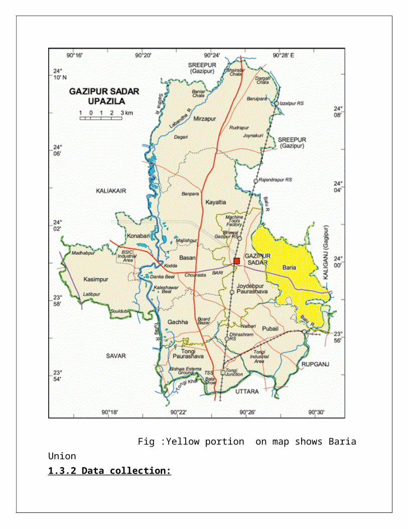
Fig :Yellow portion on map shows BariaUnion1.3.2 Data collection:

All the students were supplied three copies of questionnaire form. The students were told to formulategroups having 2 members each. So we created groups and worked in groups to collect data. We went to different parts of the village and interviewed the villagers. Different physical and socio-cultural features were perceived.
Physical features:a)Physiographyb)Land use (existing land utilization)c)Harvest product
Social features:a)Settlementsb)Major economic activitiesc)Education leveld)Infrastructures
1.4 Justification:
Physical and Socio-Economic analysis is the betterway of knowing about the man-environment relation ofany region or area. We completed a socio-economicobservation and land use pattern in the Borokoyervillage which is in Baria Union under Gazipur district.This is a better rural area for our research because of
its good communication system. But that’s a muchundeveloped area. So, this a perfect able area to knowthe land use pattern and socio-economic condition.
1.5 Limitations of the Research:
A number of limitations were faced at the time ofconcluding the observation;
- This was a short research by the students of 1st
year that’s why the study the interview were notproper skilled.
- Time limitation, we got only few hours which is notenough to cover the whole area.
- The students went to the village at a very wrongtime. Most of the male members of the houses wereoutside their houses. The female members eitherfelt shy or reluctant to answer the questions askedby the students;
- Some of the villagers did not respond well enoughand seemed to be quite bothered or irritated by thesudden presence of so many new faces.
These limitations hampered the purpose of the trip tosome extent. But overall, the trip was just fine.
Chapter Two: Physical Features of Boro-koyar village
2.1 Introduction:
Physical features means land related features.Borokoyar village has some distinctive physicalfeatures, which make the village easily separable fromthe surrounding areas. Physical features are related toPhysiography, land use (existind land utilization),
agricultural or cropping pattern, soil characteristicsetc.
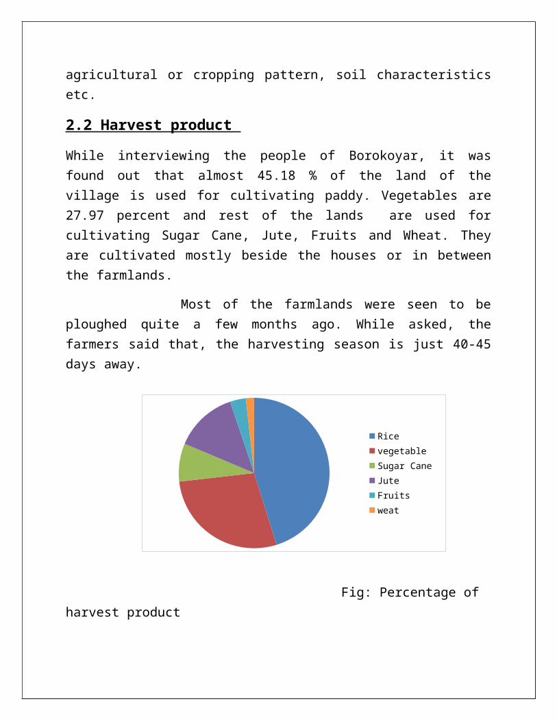
2.2 Harvest product
While interviewing the people of Borokoyar, it wasfound out that almost 45.18 % of the land of thevillage is used for cultivating paddy. Vegetables are27.97 percent and rest of the lands are used forcultivating Sugar Cane, Jute, Fruits and Wheat. Theyare cultivated mostly beside the houses or in betweenthe farmlands.
Most of the farmlands were seen to beploughed quite a few months ago. While asked, thefarmers said that, the harvesting season is just 40-45days away.
Fig: Percentage of harvest product
Rice vegetable Sugar Cane JuteFruitsweat
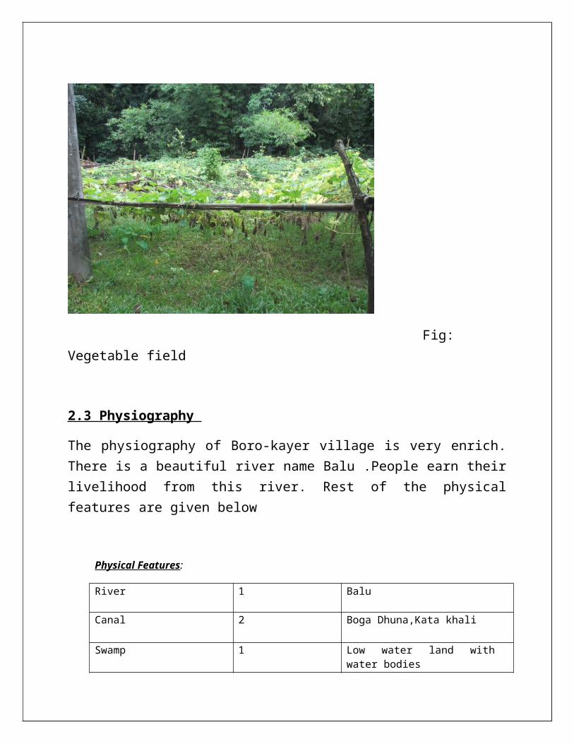
Fig: Vegetable field
2.3 Physiography
The physiography of Boro-kayer village is very enrich.There is a beautiful river name Balu .People earn theirlivelihood from this river. Rest of the physicalfeatures are given below
Physical Features:
River 1 Balu
Canal 2 Boga Dhuna,Kata khali
Swamp 1 Low water land withwater bodies
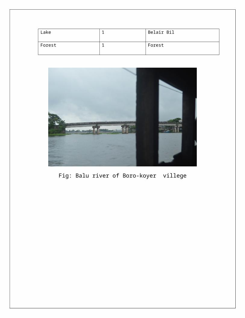
Lake 1 Belair Bil
Forest 1 Forest
Fig: Balu river of Boro-koyer villege
Chapter Three: Socio-Economic conditionof Borokoyar village
3.1 Introduction
Socio-Economic analysis is related to a man socialcondition, economic condition, occupation, educationsystem, settlements, communication system etc. Varioussocial features were studied in order to properly studythe village. The findings of the study are discussedbelow.
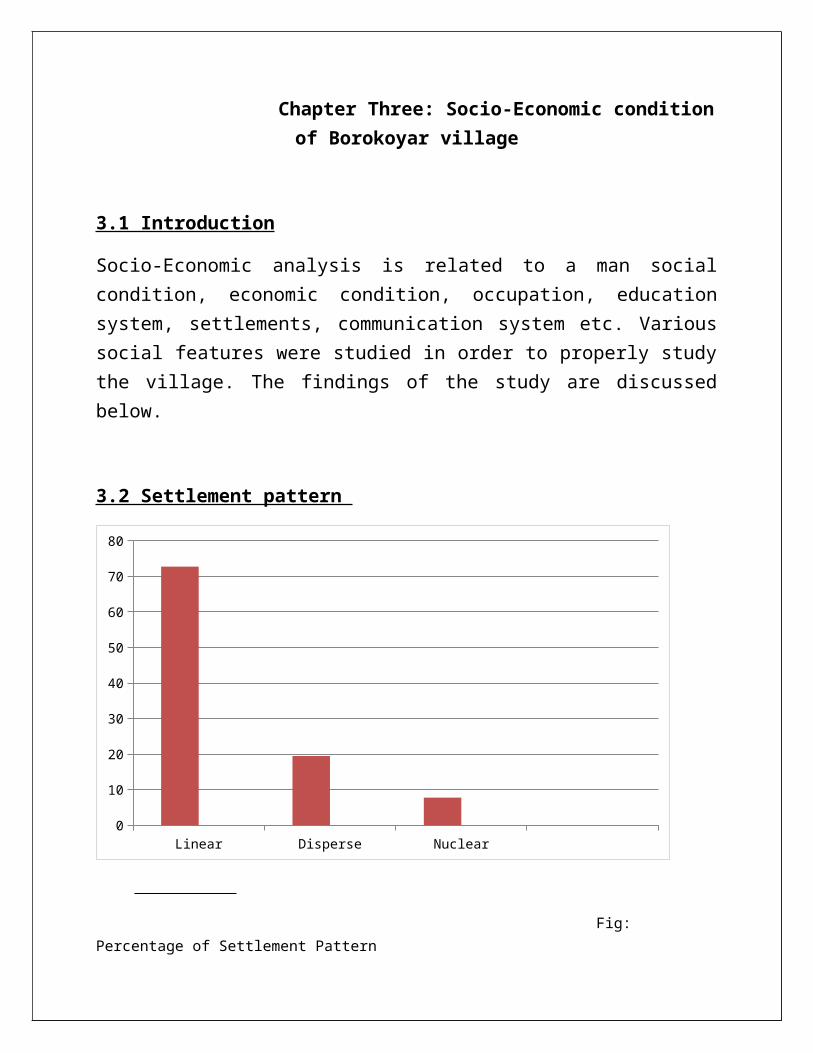
3.2 Settlement pattern
Linear Disperse Nuclear0
10
20
30
40
50
60
70
80
Fig: Percentage of Settlement Pattern
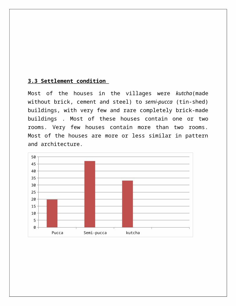
3.3 Settlement condition
Most of the houses in the villages were kutcha(madewithout brick, cement and steel) to semi-pucca (tin-shed)buildings, with very few and rare completely brick-madebuildings . Most of these houses contain one or tworooms. Very few houses contain more than two rooms.Most of the houses are more or less similar in patternand architecture.
Pucca Semi-pucca kutcha05101520253035404550
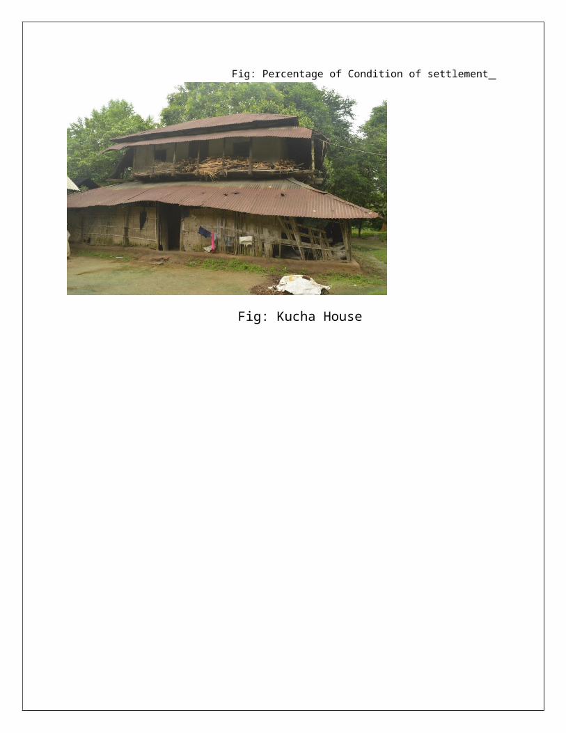
Fig: Percentage of Condition of settlement
Fig: Kucha House
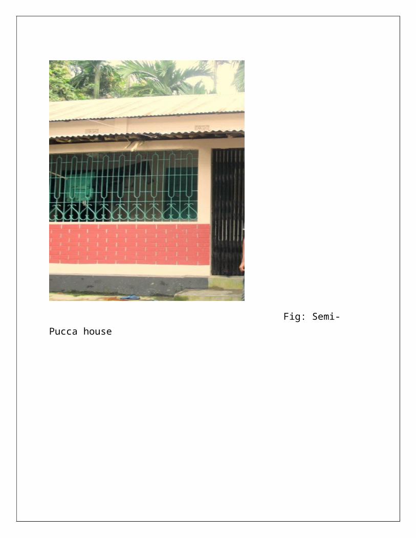
Fig: Semi-Pucca house

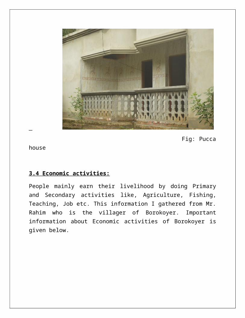
Fig: Puccahouse
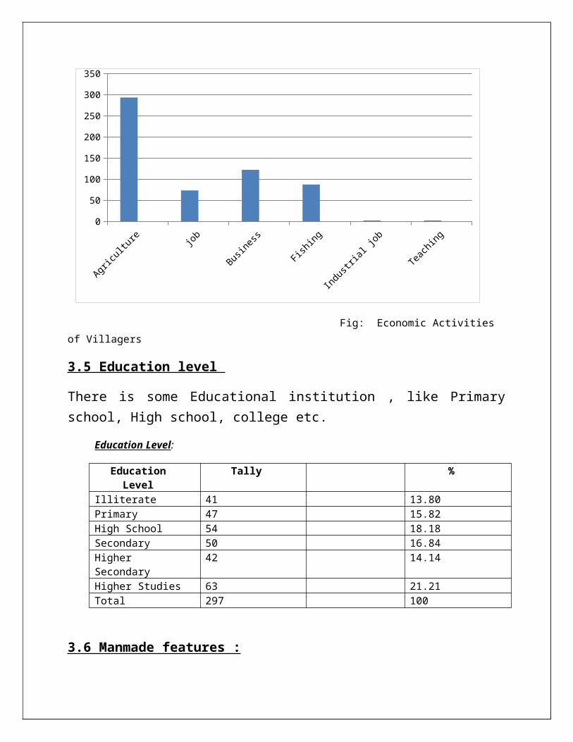
3.4 Economic activities:
People mainly earn their livelihood by doing Primaryand Secondary activities like, Agriculture, Fishing,Teaching, Job etc. This information I gathered from Mr.Rahim who is the villager of Borokoyer. Importantinformation about Economic activities of Borokoyer isgiven below.
0
50
100
150
200
250
300
350
Fig: Economic Activities of Villagers
3.5 Education level
There is some Educational institution , like Primaryschool, High school, college etc.
Education Level:
EducationLevel
Tally %
Illiterate 41 13.80Primary 47 15.82High School 54 18.18Secondary 50 16.84HigherSecondary
42 14.14
Higher Studies 63 21.21Total 297 100
3.6 Manmade features :
As observing man made elements I saw every possibleelements where there to be located like primary school,high school, madrasah, temple, clinic, mosque, shop,graveyard etc. But there is no reputed school andcollege to gain standard education.
Man Made Features:
Primary Schools 1High Schools 1Madrasah 1Picnic Spot 1Temple 2Clinic 1Medical Centre 1Mosque 3Pond 8-10Private School 7Graveyard 1Pucca Road 1Bridges 1Shop SomeAutistic School 1Club 1Marie Stopes Satellite Clinic 1
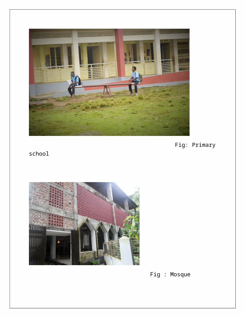
Fig: Primaryschool
Fig : Mosque
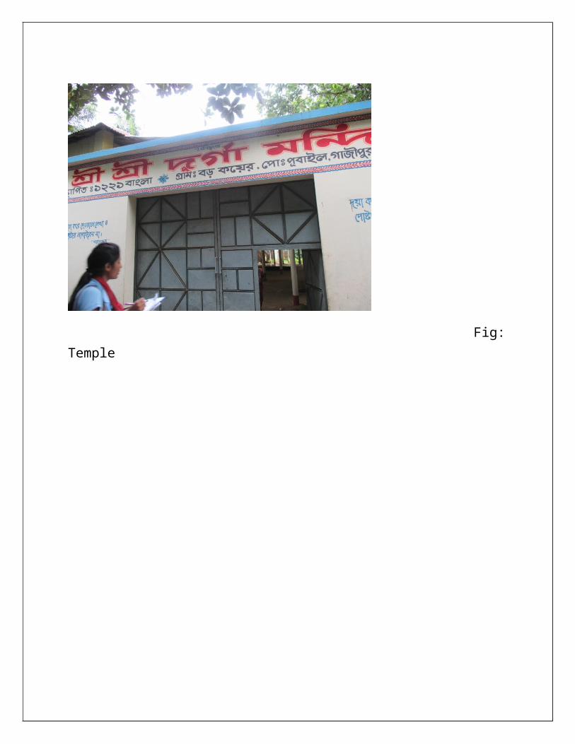
Fig:Temple
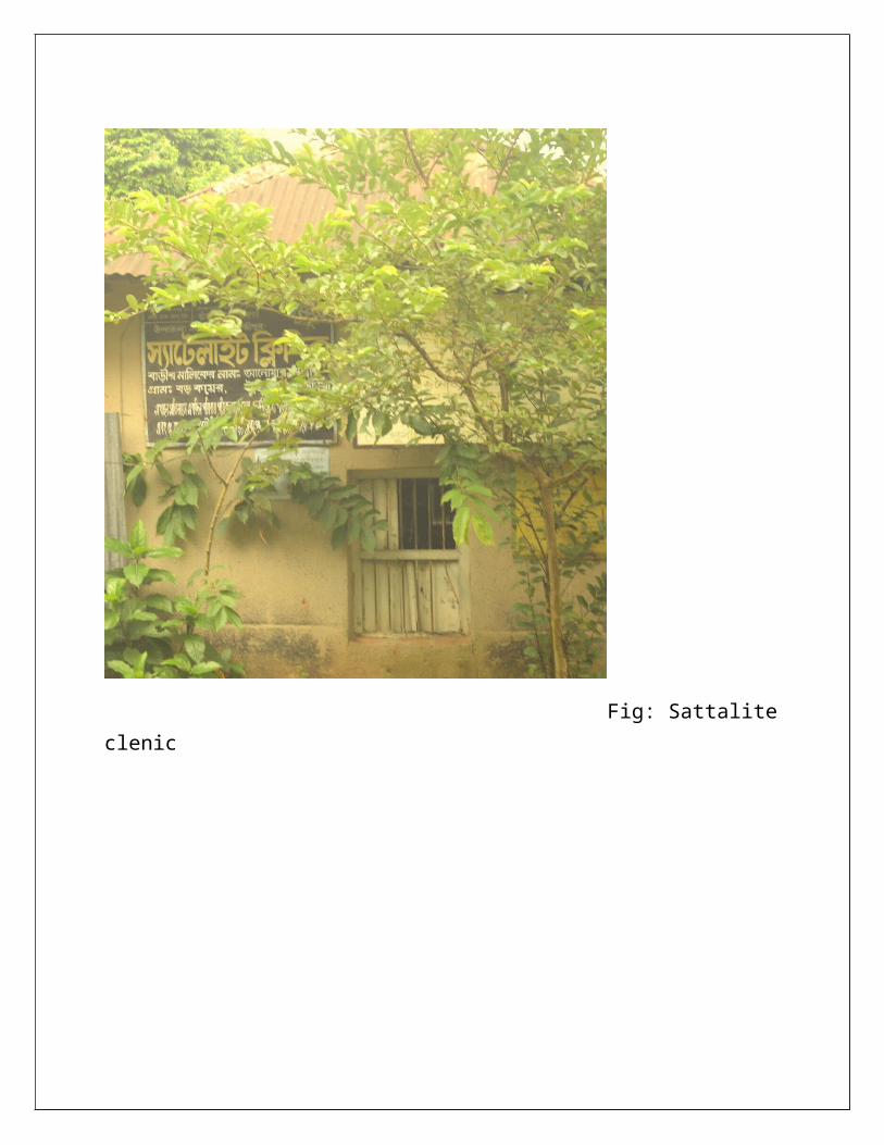
Fig: Sattaliteclenic
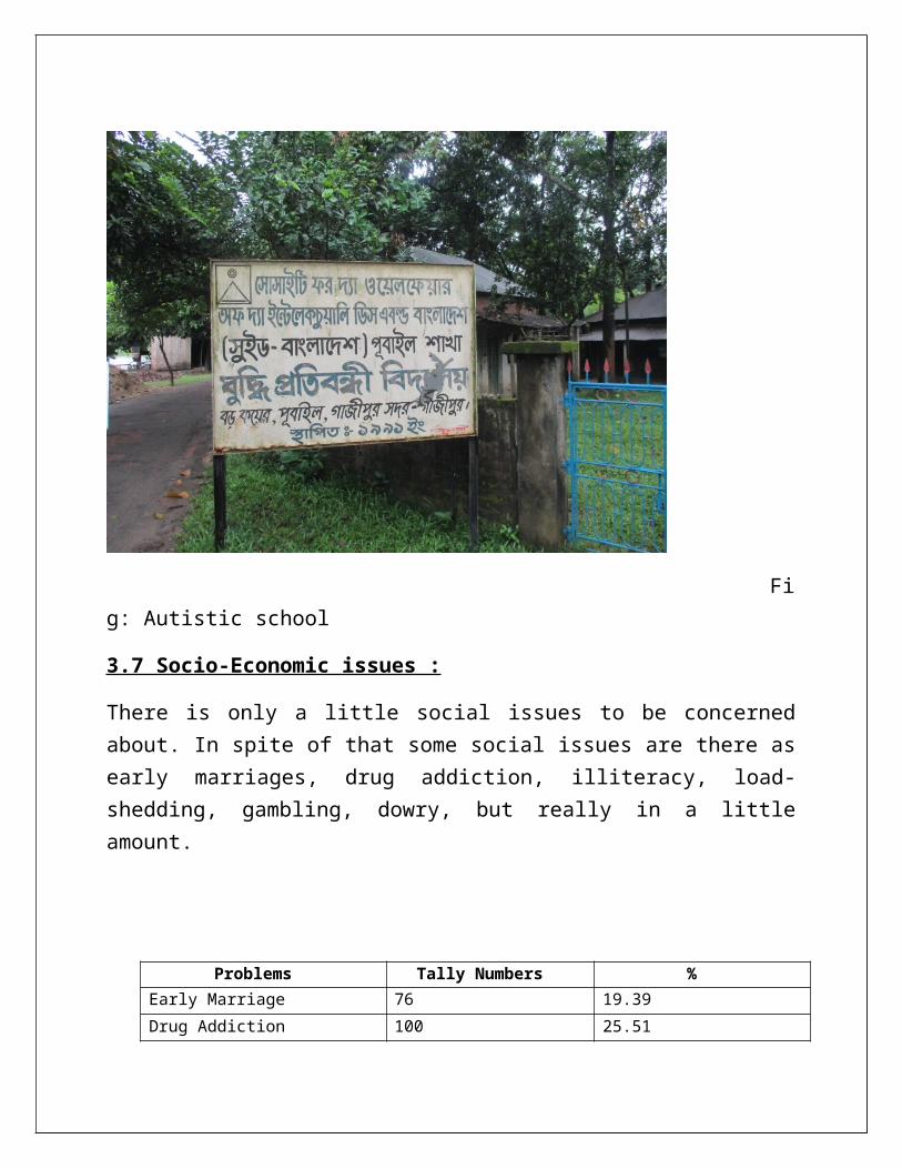
Fig: Autistic school
3.7 Socio-Economic issues :
There is only a little social issues to be concernedabout. In spite of that some social issues are there asearly marriages, drug addiction, illiteracy, load-shedding, gambling, dowry, but really in a littleamount.
Problems Tally Numbers %Early Marriage 76 19.39Drug Addiction 100 25.51
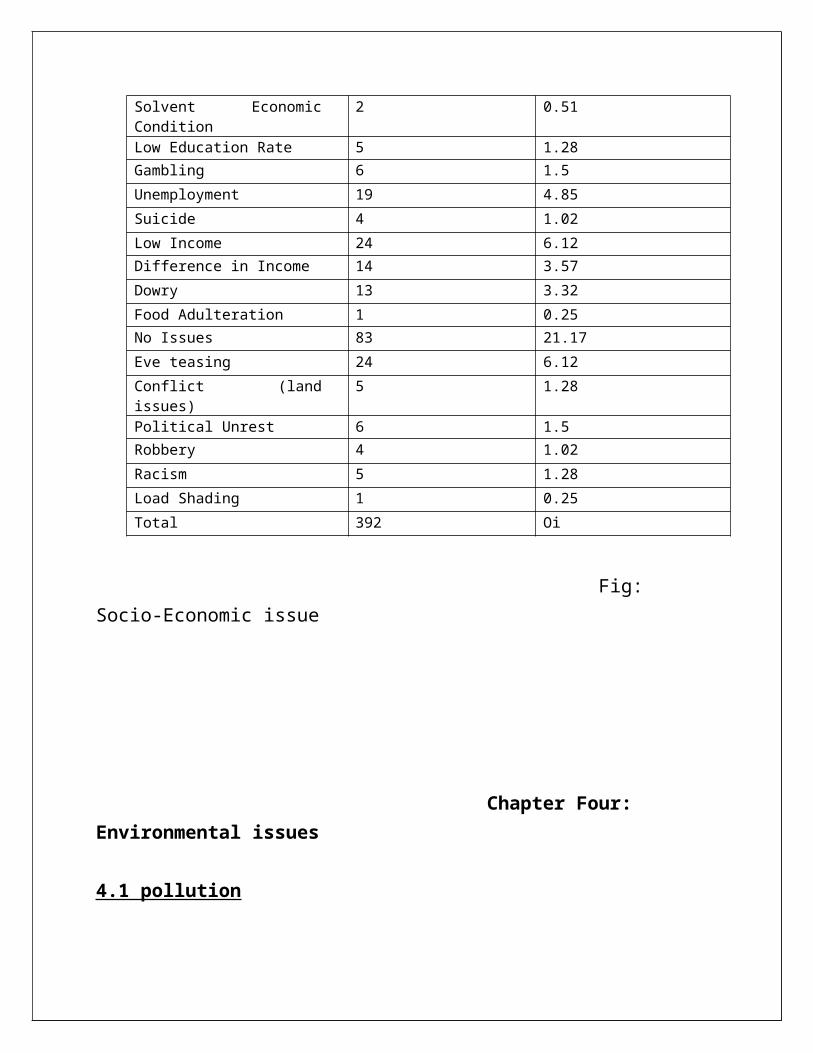
Solvent EconomicCondition
2 0.51
Low Education Rate 5 1.28Gambling 6 1.5Unemployment 19 4.85Suicide 4 1.02Low Income 24 6.12Difference in Income 14 3.57Dowry 13 3.32Food Adulteration 1 0.25No Issues 83 21.17Eve teasing 24 6.12Conflict (landissues)
5 1.28
Political Unrest 6 1.5Robbery 4 1.02Racism 5 1.28Load Shading 1 0.25Total 392 Oi
Fig: Socio-Economic issue
Chapter Four: Environmental issues
4.1 pollution
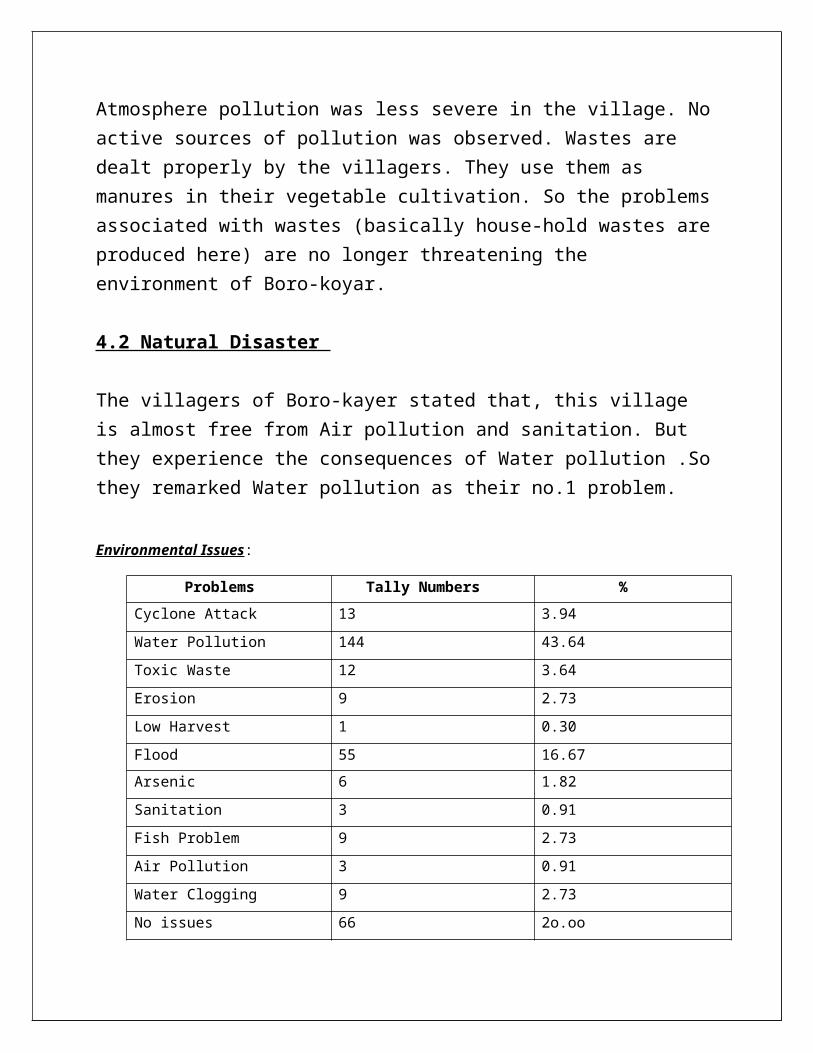
Atmosphere pollution was less severe in the village. Noactive sources of pollution was observed. Wastes are dealt properly by the villagers. They use them as manures in their vegetable cultivation. So the problemsassociated with wastes (basically house-hold wastes areproduced here) are no longer threatening the environment of Boro-koyar.
4.2 Natural Disaster
The villagers of Boro-kayer stated that, this village is almost free from Air pollution and sanitation. But they experience the consequences of Water pollution .Sothey remarked Water pollution as their no.1 problem.
Environmental Issues:
Problems Tally Numbers %Cyclone Attack 13 3.94Water Pollution 144 43.64Toxic Waste 12 3.64Erosion 9 2.73Low Harvest 1 0.30Flood 55 16.67Arsenic 6 1.82Sanitation 3 0.91Fish Problem 9 2.73Air Pollution 3 0.91Water Clogging 9 2.73No issues 66 2o.oo

Total 330
Chapter Five: Respondent’s condition
5.1 Introduction We have experienced various kinds of respondents regarding different types of occupations ,age ,gender.
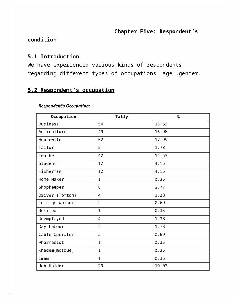
5.2 Respondent’s occupation
Respondent’s Occupation:
Occupation Tally %Business 54 18.69Agriculture 49 16.96Housewife 52 17.99Tailor 5 1.73Teacher 42 14.53Student 12 4.15Fisherman 12 4.15Home Maker 1 0.35Shopkeeper 8 2.77Driver (Tomtom) 4 1.38Foreign Worker 2 0.69Retired 1 0.35Unemployed 4 1.38Day Labour 5 1.73Cable Operator 2 0.69Pharmacist 1 0.35Khadem(mosque) 1 0.35Imam 1 0.35Job Holder 29 10.03

Poultry Farming 4 1.38Total 289
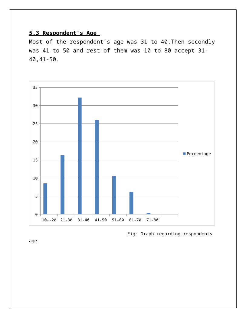
5.3 Respondent’s Age Most of the respondent’s age was 31 to 40.Then secondlywas 41 to 50 and rest of them was 10 to 80 accept 31-40,41-50.
10--20 21-30 31-40 41-50 51-60 61-70 71-800
5
10
15
20
25
30
35
Percentage
Fig: Graph regarding respondents age
5.4 Male/Female
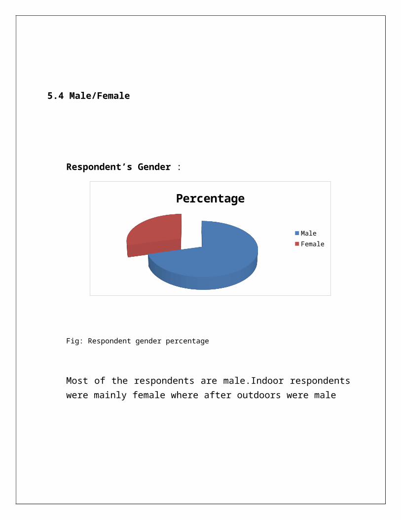
Respondent’s Gender :
Percentage
MaleFemale
Fig: Respondent gender percentage
Most of the respondents are male.Indoor respondentswere mainly female where after outdoors were male

6.1 Conclusion:
As explained earlier, this field trip was introduced tous to gain basic knowledge of field studies. But at theend of the day we have acquired some excellentexperiences, field research related basics.
The findings of the trip are discussed below :
After the nostalgic fieldtrip we have achieved someextra ordinary features on field studies. During datacollections we had to interact with different peoplethough the villagers were very hospitable and helpful.Our task was to observe the physical and human elementsand collecting data regarding questionnaire. We noticedevery things, asked questions, noted down the data andmade assumptions.
During data collections and observing the physical and human features I came to know about networking I mean how to interact with people we have never met before. Human connectivity is a key methodology to be succeededin field studies. My outlook towards physical and environment have been changed a lot
6.2 Recommendations:
It is quite inappropriate for an elementary learnerto make any comments or recommendations without havingnot in-depth knowledge or enough information. But basedon the findings of this short field trip, some usefulrecommendations are available for sorting out a fewproblems conceived by me. They are listed below-
At Boro-koyer, there is a problem associated withground water. The administrators should pay heed tothis problem and find out necessary solutions inthis regard;
Only rice is cultivated widely and a little amountof vegetables are also cultivated in Boro-koyer.But no other crops are grown in here. There aremany cultivable lands in Boro-koyer. So other cropsshould be grown in these lands;
There is no school in the locality. The nearestschool is about 2-3 kilometers away. There is nohospital or clinic in the locality too. So there is
a need for building schools and hospital in thevillage.
References
1.Previous report From Seminar library Dept. of Geography & Environment University of Dhaka
2.Provided data by analyzing supplied questionnaire. 3.Provided map collected from Google Map
{Gazipur+Sadar+Upazilla+Map.GIF(GIF Image , 869*1081 pixels)….Google map}.