description of wms watershed modeling system. what model does integrates gis and hydrologic models...
TRANSCRIPT

Description of WMS
Watershed Modeling System

What Model DoesIntegrates GIS and hydrologic models
Uses digital terrain data to define watershed and sub basin characteristicsProvides interface for hydrologic models widely used in industry
Provides useful calculators for hydrologists and engineers
Digital Terrain ModelsInput
Three primary sources for model development Geographic Information Systems (GIS) Data Digital Elevation Models (DEMs) Triangulated Irregular Networks (TINs)
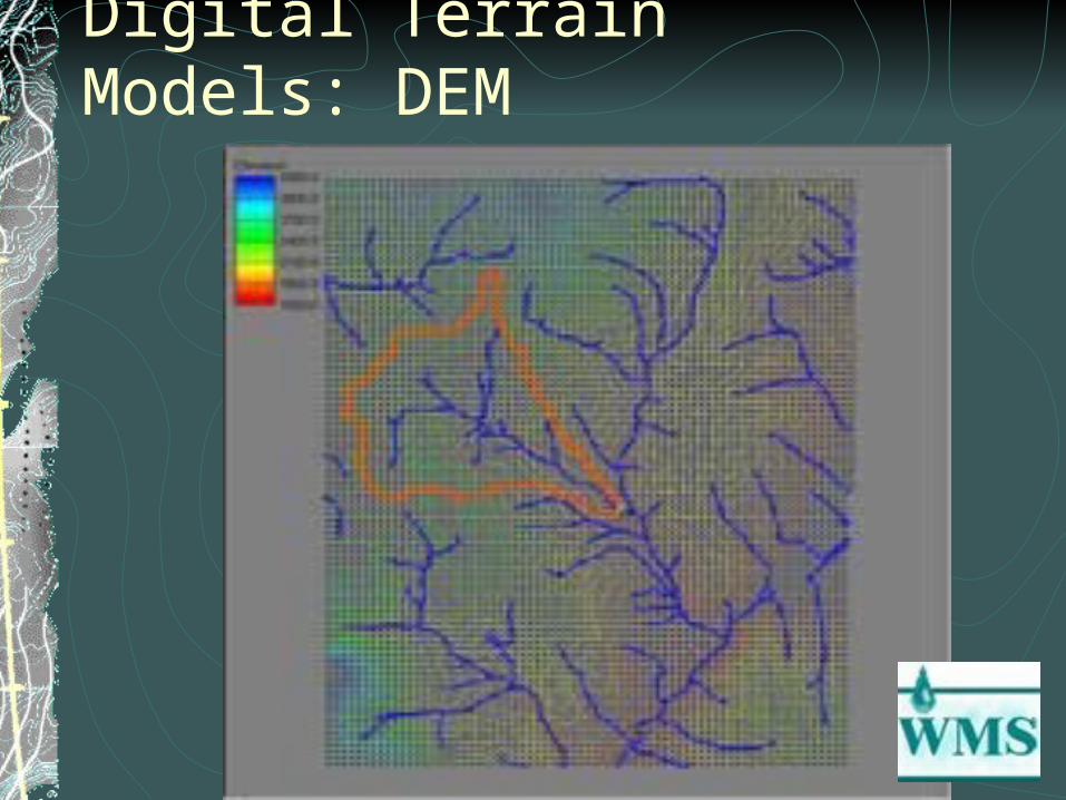
Digital Terrain Models: DEM
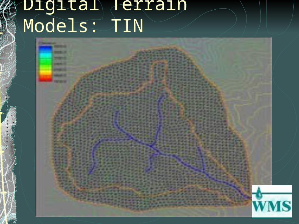
Digital Terrain Models: TIN
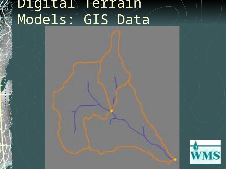
Digital Terrain Models: GIS Data

Digital Terrain ModelsOutput:
Delineates basin boundariesTool for obtaining basin characteristics such as:
Land Use Lag Times Time Area Curves Curve Numbers Areas Slopes Runoff Distances
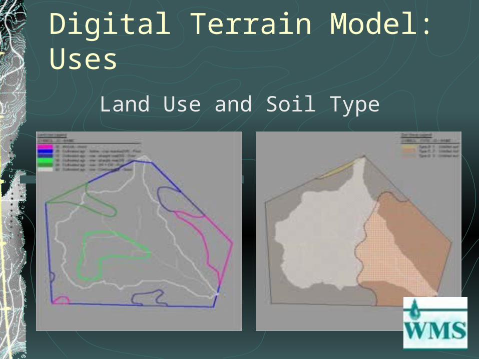
Digital Terrain Model: Uses
Land Use and Soil Type
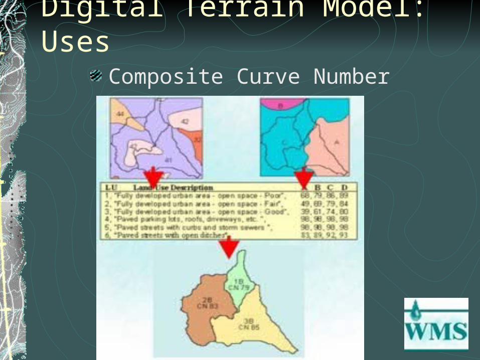
Digital Terrain Model: UsesComposite Curve Number
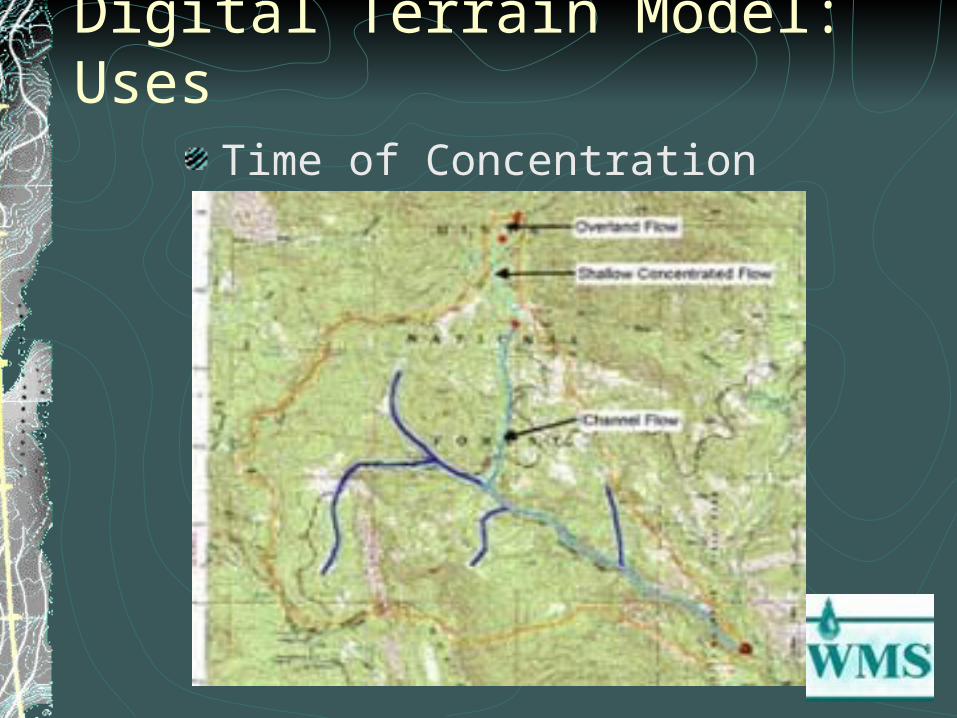
Digital Terrain Model: UsesTime of Concentration
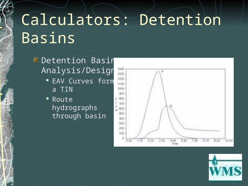
Calculators: Detention BasinsDetention Basin Analysis/Design
EAV Curves form a TIN Route hydrographs
through basin

Calculators: Channels“Cut” cross sections from DEM or TIN
Examine hydraulic properties
Export for use in other applications (i.e. RAS)
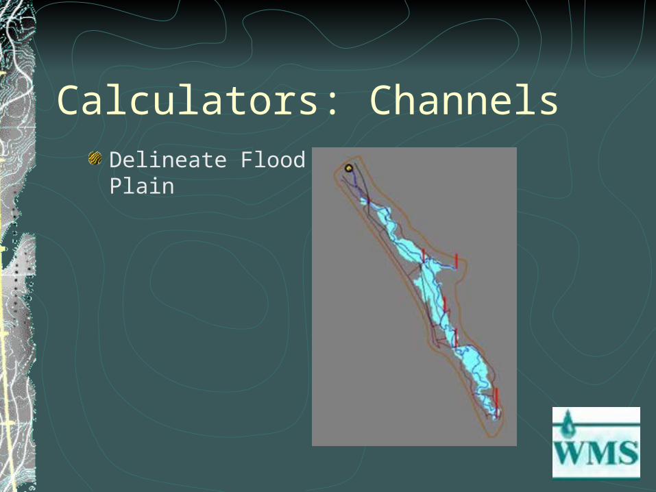
Calculators: ChannelsDelineate Flood Plain
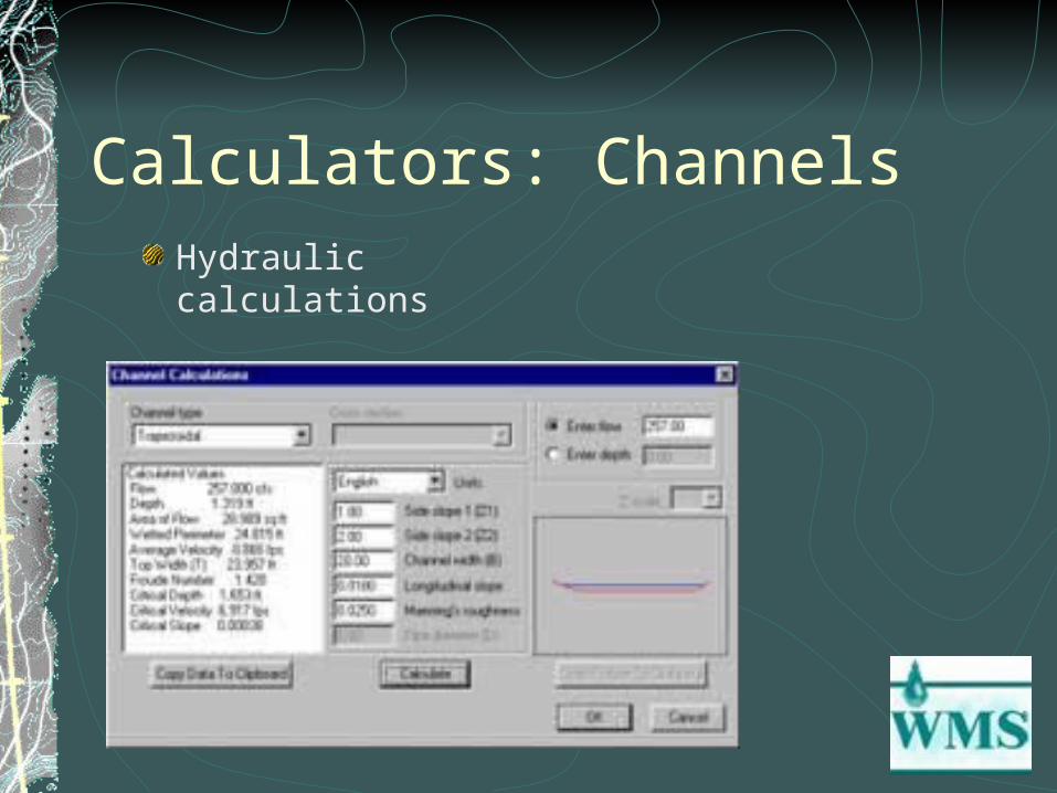
Calculators: ChannelsHydraulic calculations

Calculators: CulvertsHY8 culvert analysis program included in WMS
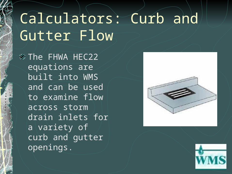
Calculators: Curb and Gutter FlowThe FHWA HEC22 equations are built into WMS and can be used to examine flow across storm drain inlets for a variety of curb and gutter openings.
Hydrologic ModelsProvides graphical interfaces and actual following models :
HEC-1HSPFTR-20 and TR-55Rational MethodNFF
Hydrologic Models: HEC-1Description
Flood hydrograph program that models the rainfall-runoff process
Input:
Basin model Many characteristics obtained from digital terrain model
Precipitation modelControl specifications
OutputHydrographs at any hydrologic feature

Hydrologic Models: HSPFDescription:
Model developed by the USGS Simulates hydrologic and water quality processes
on land surfaces, streams and impoundments Generally used to assess the effects of land-use
change, reservoir operations, point or nonpoint source treatment alternatives, flow diversions, etc.

Hydrologic Models: HSPFInput:
Time history of rainfall, temperature and solar radiation, land use characteristics
Output:Time history of the quantity and quality of runoff from an urban or agricultural watershed.
Flow rates, sediment loads, nutrient and pesticide concentrations
Hydrologic Models: TR-55, TR-20Description:
TR-55 and TR-20 both model the rainfall runoff process with TR-55 being used especially for small, urban or urbanizing watersheds.
Input:Land characteristics to calculate curve numbersRainfall modelBasin model
Output:Hydrographs
Hydrologic Models: Rational MethodQ = CiA (I’m assuming we are all familiar with this)WMS provides a rational method calculator
Generates IDF curves for eastern USFHA Kinematic wave equation can estimate Tc of basin given:
Manning’s n, basin length, slope
Output is peak flow of basin

Hydrologic Models: NFFDescription:
Developed by FEMA, FHA, and USGS
Uses regression equations to estimate T-year flood-peak discharges for rural and urban watersheds
Most of the equations are a function of basin area, stream length, and other parameters easily computed from digital terrain models.
Hydrologic Models: NFFInput:
Basin characteristicsBasin location (State and region)
OutputPeak flood flows for basin
Typical flood hydrographs for given T-year peak discharge
More on WMSContains Hydrology for LA County and Maricopa CountyHydrographs and other data produced in WMS can be exported for use in standard spreadsheet softwareFree extension to Arcview GIS program “WMS Hydro”
This extension can be used to prepare land use, soil, or elevation data for use by WMS and it can also be used to manage/view results produced by WMS.
SummaryPowerful ModelIntegrates GIS technology with hydrologic modelsUseful calculatorsAccording to Ryan, fairly easy to use