chapter 1. essentials of...
TRANSCRIPT
© 2015 Pearson Education, Inc.
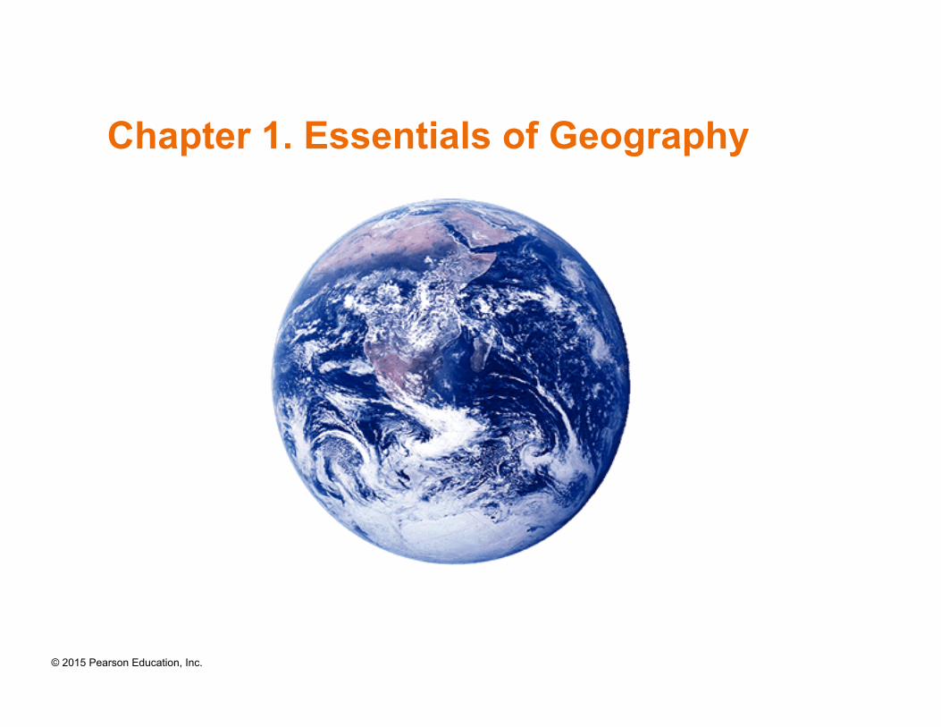
Chapter 1. Essentials of Geography

© 2015 Pearson Education, Inc.
Learning Objectives
• Define geography in general and physical geography in particular. • Discuss human activities and human population growth as they
relate to geographic science, and summarize the scientific process.
• Describe systems analysis, open and closed systems, and feedback information, and relate these concepts to Earth systems.
• Explain Earth’s reference grid: latitude and longitude and latitudinal geographic zones and time.
• Define cartography and mapping basics: map scale and map projections.
• Describe modern geoscience techniques—the Global Positioning System (GPS), remote sensing, and geographic information systems (GIS)—and explain how these tools are used in geographic analysis.
© 2015 Pearson Education, Inc.
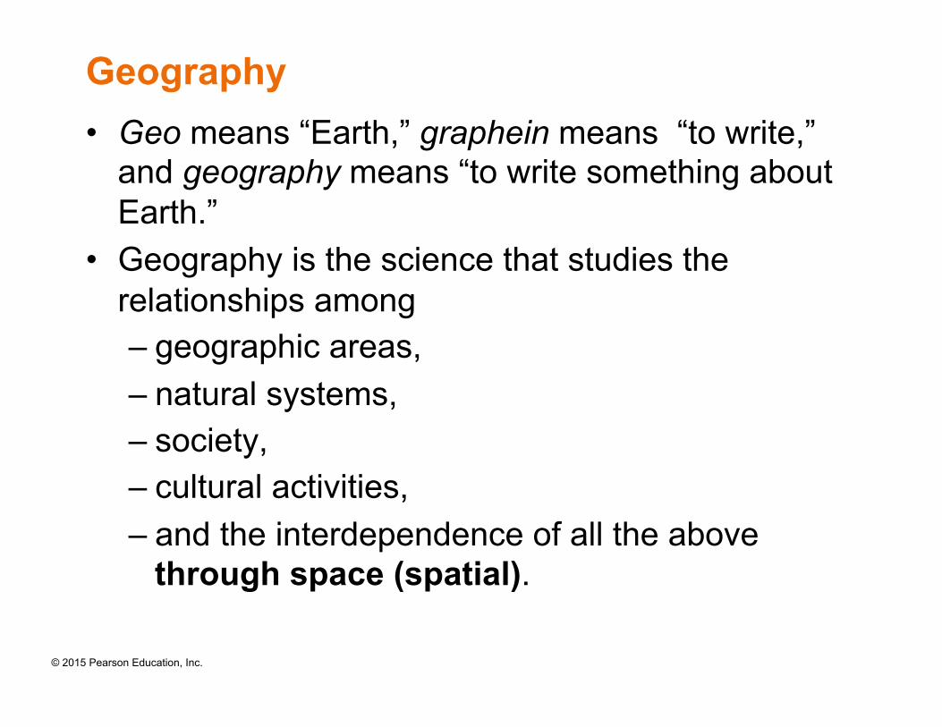
Geography • Geo means “Earth,” graphein means “to write,”
and geography means “to write something about Earth.”
• Geography is the science that studies the relationships among – geographic areas, – natural systems, – society, – cultural activities, – and the interdependence of all the above
through space (spatial).
© 2015 Pearson Education, Inc.
What is Spatial?
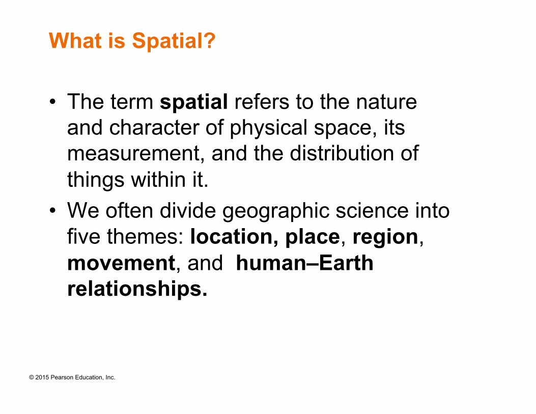
• The term spatial refers to the nature and character of physical space, its measurement, and the distribution of things within it.
• We often divide geographic science into five themes: location, place, region, movement, and human–Earth relationships.
© 2015 Pearson Education, Inc.
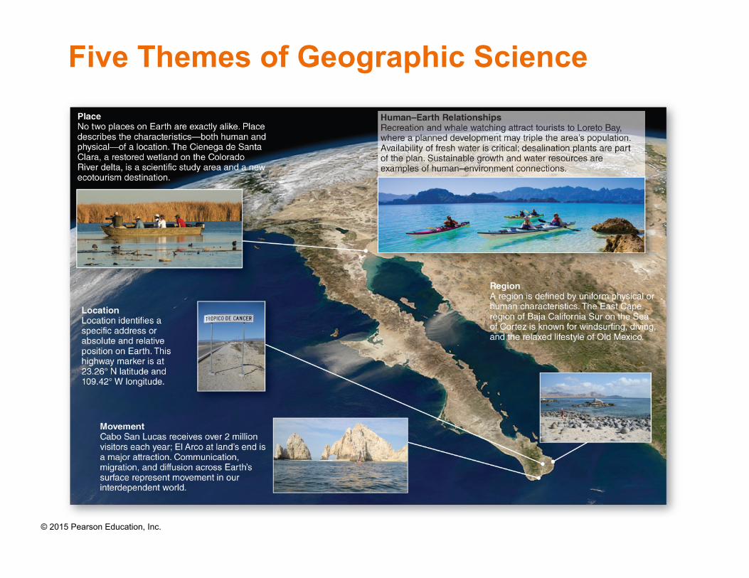
Five Themes of Geographic Science
© 2015 Pearson Education, Inc.
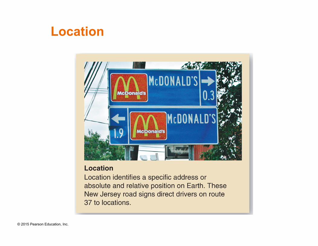
Location
© 2015 Pearson Education, Inc.
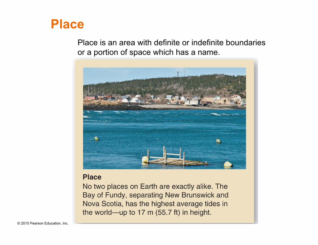
Place Place is an area with definite or indefinite boundaries or a portion of space which has a name.
© 2015 Pearson Education, Inc.
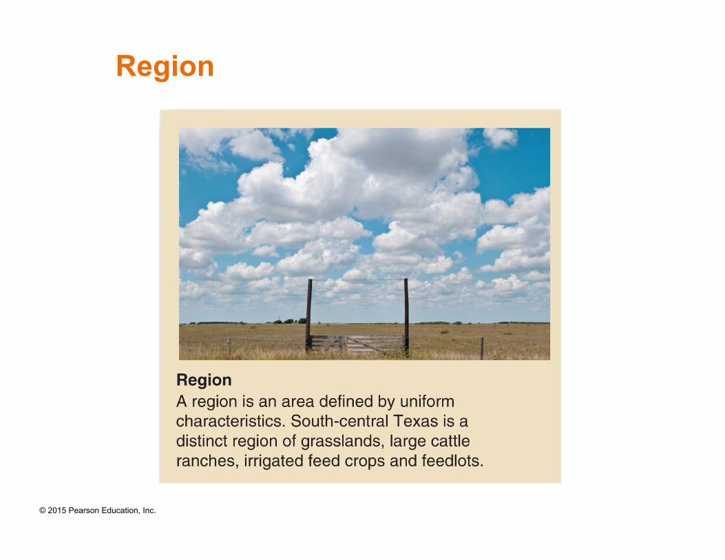
Region
© 2015 Pearson Education, Inc.
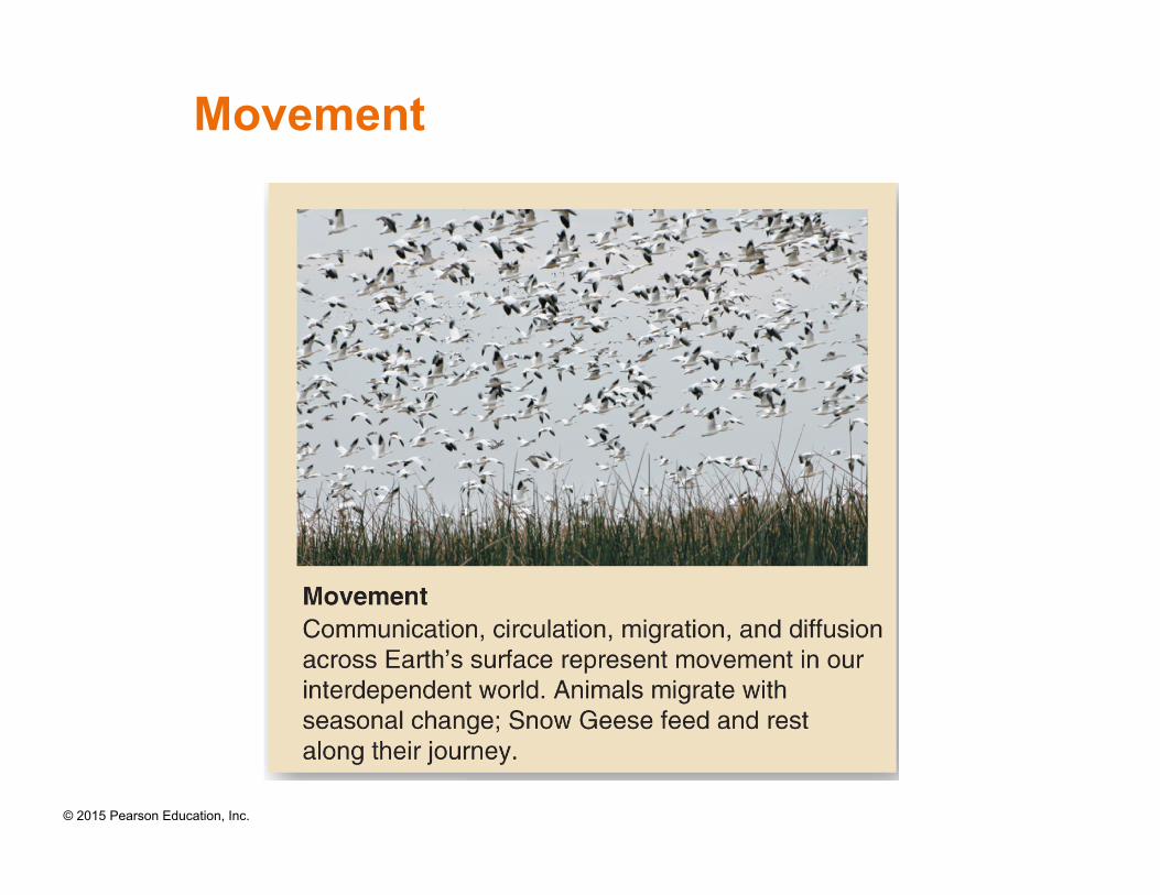
Movement
© 2015 Pearson Education, Inc.
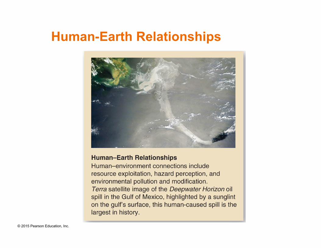
Human-Earth Relationships
© 2015 Pearson Education, Inc.
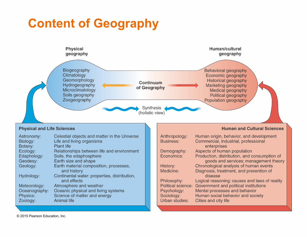
Content of Geography
© 2015 Pearson Education, Inc.
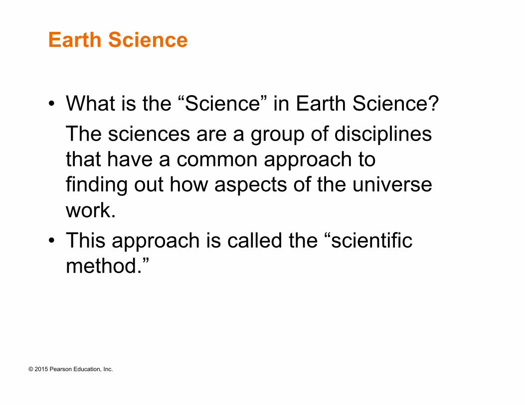
Earth Science
• What is the “Science” in Earth Science? The sciences are a group of disciplines
that have a common approach to finding out how aspects of the universe work.
• This approach is called the “scientific method.”
© 2015 Pearson Education, Inc.
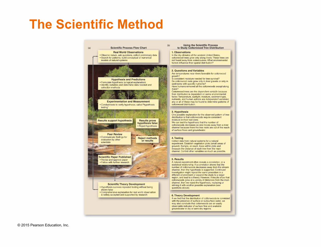
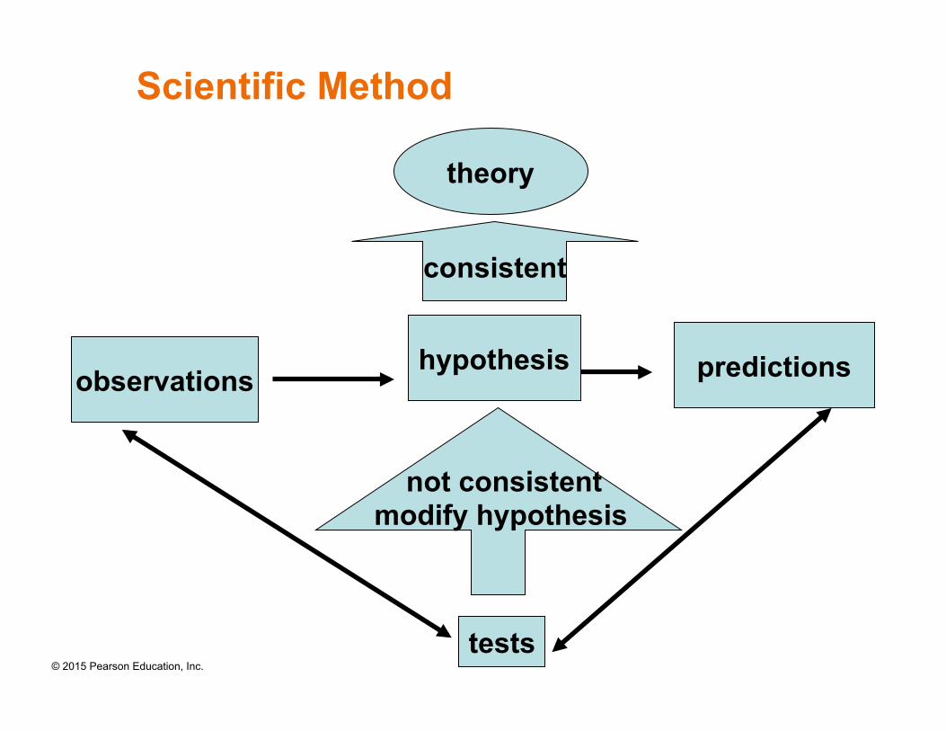
The Scientific Method
© 2015 Pearson Education, Inc.
Scientific Method
theory
consistent
observations hypothesis predictions
tests
not consistent modify hypothesis
© 2015 Pearson Education, Inc.
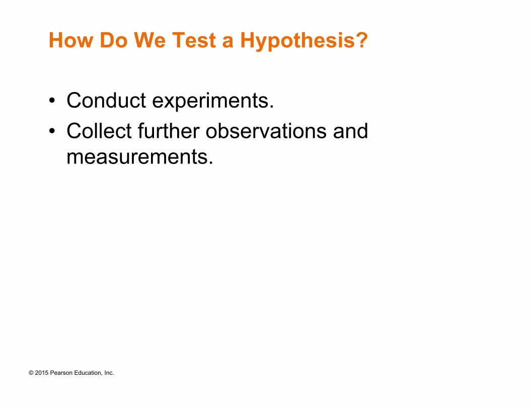
How Do We Test a Hypothesis?
• Conduct experiments. • Collect further observations and
measurements.
© 2015 Pearson Education, Inc.
Scientific Theory
• A scientific theory must be “falsifiable”, i.e., there must be some experiments or possible observations that could invalidate the theory.
• No matter how good a theory is, it can not be "absolute truth”.
• When a theory is said to be "true" it means that it agrees with all known experimental and/or observational evidence. When a theory cannot explain new observations it will have to be replaced by a new theory.
© 2015 Pearson Education, Inc.
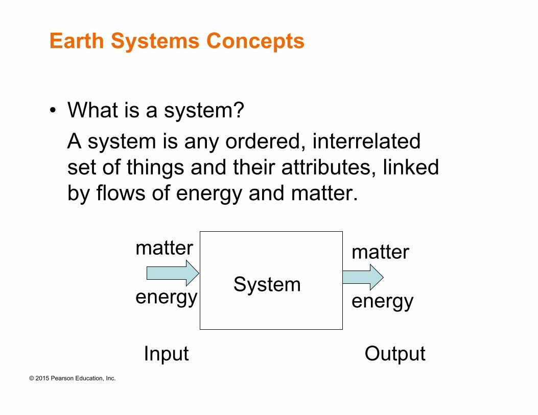
Earth Systems Concepts
• What is a system? A system is any ordered, interrelated
set of things and their attributes, linked by flows of energy and matter.
energy energy
matter matter
System
Input Output
© 2015 Pearson Education, Inc.
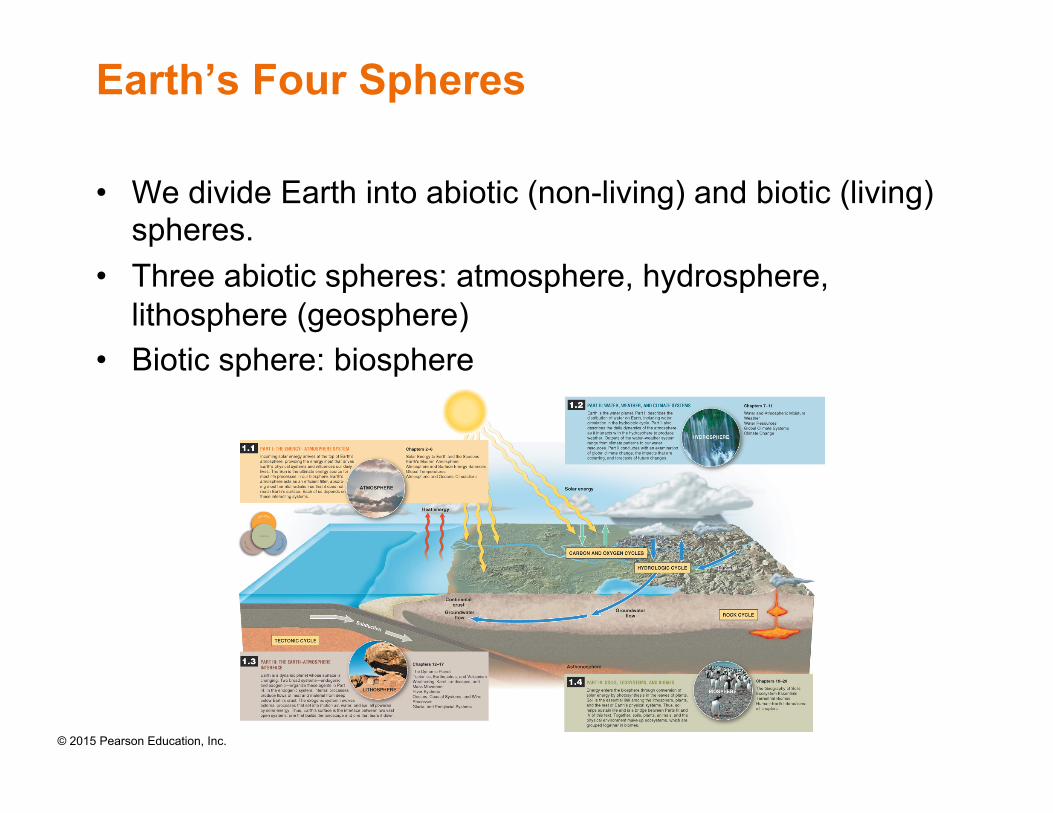
Earth’s Four Spheres
• We divide Earth into abiotic (non-living) and biotic (living) spheres.
• Three abiotic spheres: atmosphere, hydrosphere, lithosphere (geosphere)
• Biotic sphere: biosphere
© 2015 Pearson Education, Inc.
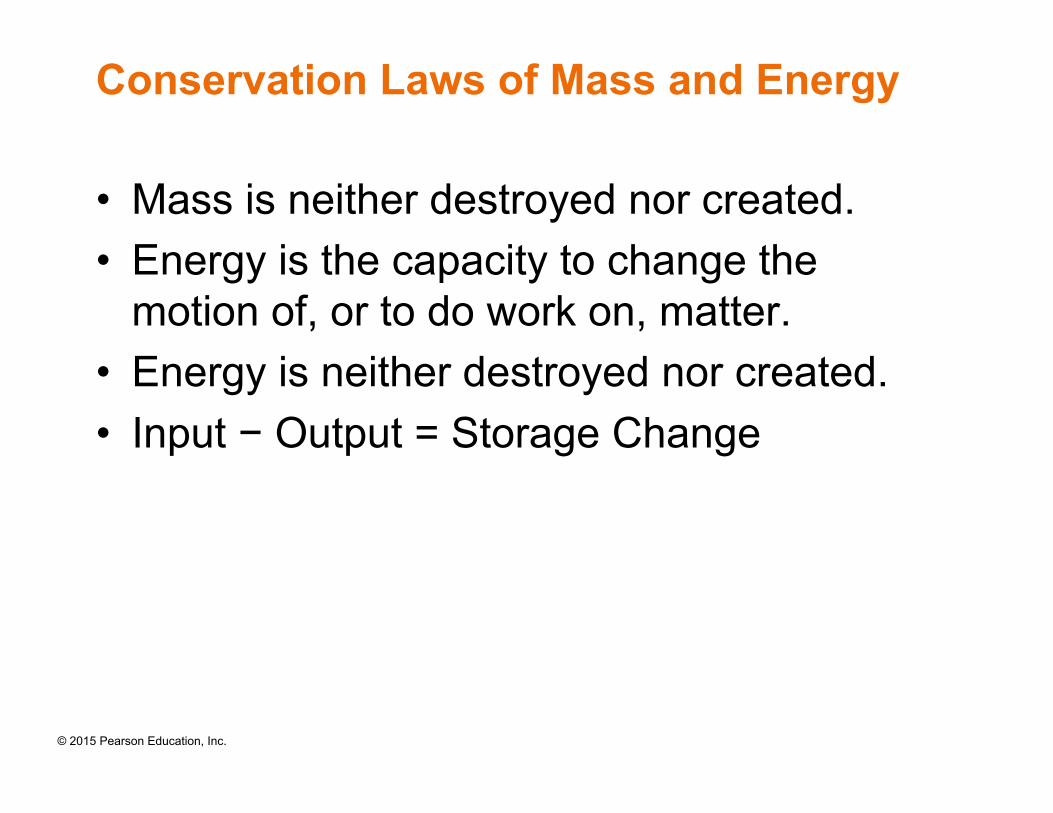
Conservation Laws of Mass and Energy
• Mass is neither destroyed nor created. • Energy is the capacity to change the
motion of, or to do work on, matter. • Energy is neither destroyed nor created. • Input − Output = Storage Change
© 2015 Pearson Education, Inc.
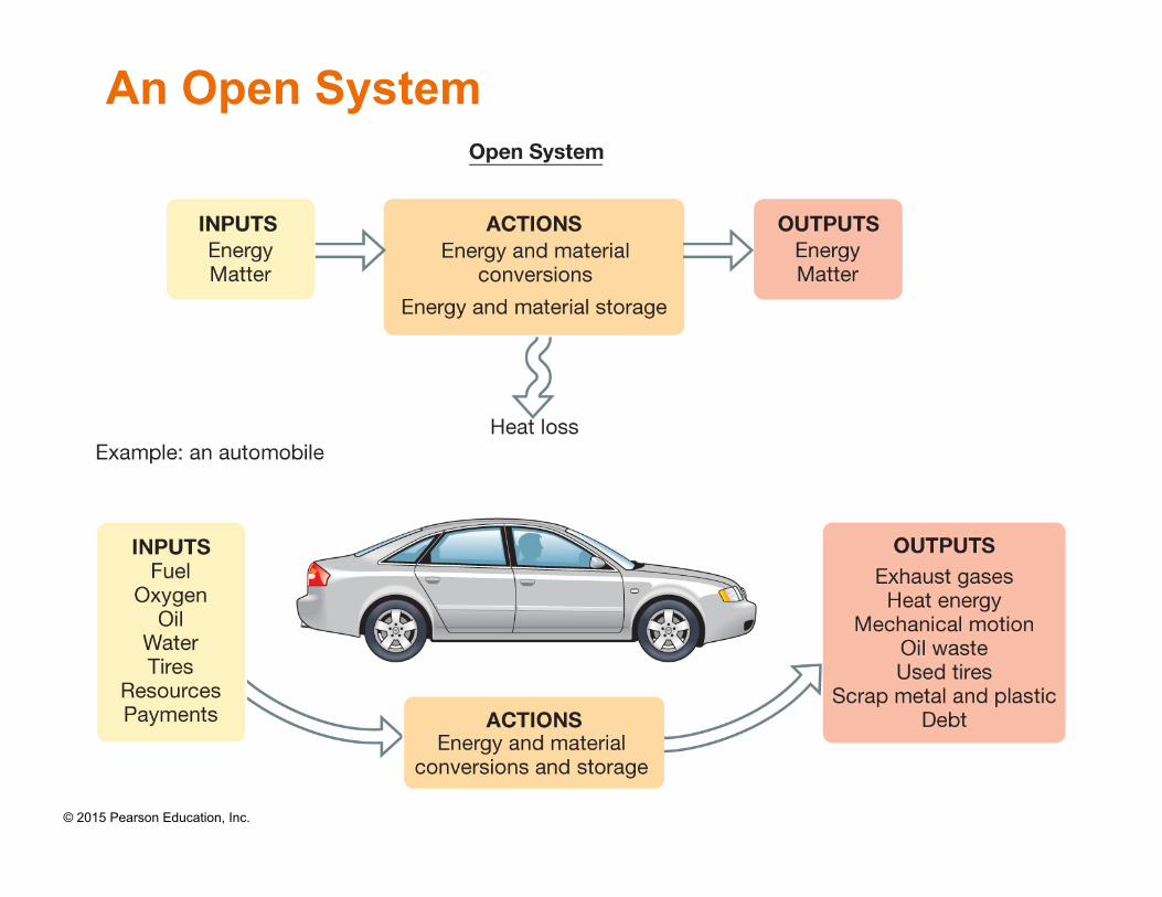
An Open System
© 2015 Pearson Education, Inc.
Open System and Closed System
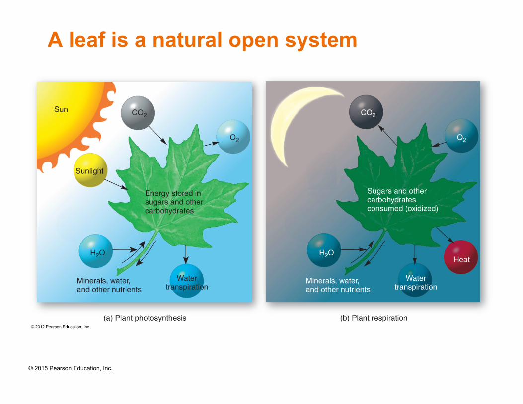
• An open system is a system with inputs of energy or matter and outputs of energy or matter.
• A closed system is shut off from the surrounding environment so that it is self-contained. Closed systems are rare in nature.
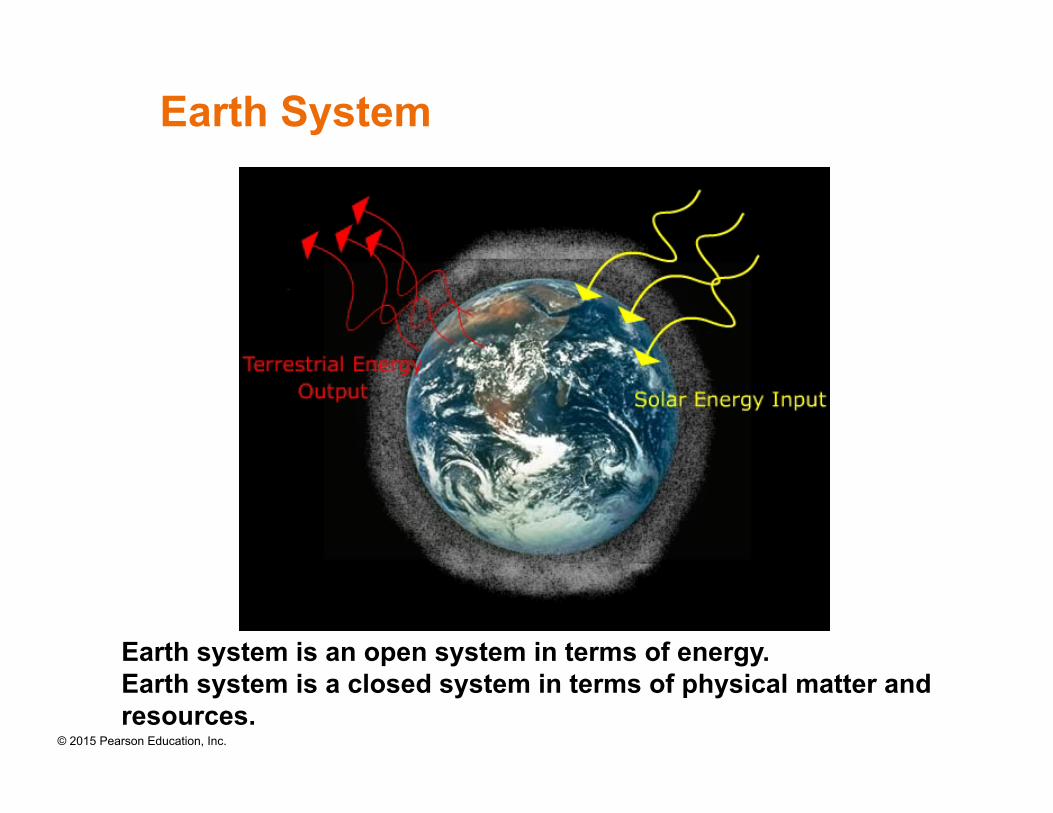
• Earth system is an open system in terms of energy.
• Earth system is a closed system in terms of physical matter and resources.
© 2015 Pearson Education, Inc.
A leaf is a natural open system
© 2015 Pearson Education, Inc.
Earth System
Earth system is an open system in terms of energy. Earth system is a closed system in terms of physical matter and resources.
© 2015 Pearson Education, Inc.
System Feedback
• Feedback loop: Outputs of a system influence the system’s operation through a pathway.
• Negative feedback: The feedback information discourages response in the system. — a self regulation, stable condition
• Positive feedback: The feedback information increased response in the system. — a runaway condition (snowballing)
© 2015 Pearson Education, Inc.
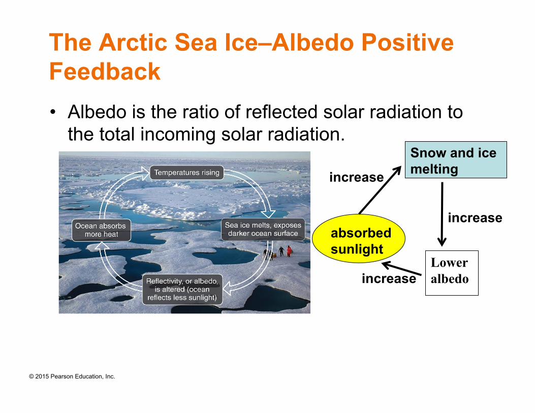
The Arctic Sea Ice–Albedo Positive Feedback • Albedo is the ratio of reflected solar radiation to
the total incoming solar radiation.
Snow and ice melting
Lower albedo
absorbed sunlight
increase
increase
increase
© 2015 Pearson Education, Inc.
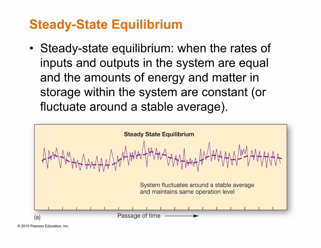
Steady-State Equilibrium
• Steady-state equilibrium: when the rates of inputs and outputs in the system are equal and the amounts of energy and matter in storage within the system are constant (or fluctuate around a stable average).
© 2015 Pearson Education, Inc.
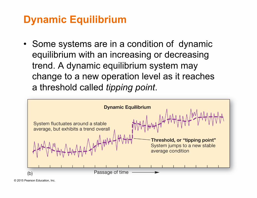
Dynamic Equilibrium
• Some systems are in a condition of dynamic equilibrium with an increasing or decreasing trend. A dynamic equilibrium system may change to a new operation level as it reaches a threshold called tipping point.
© 2015 Pearson Education, Inc.
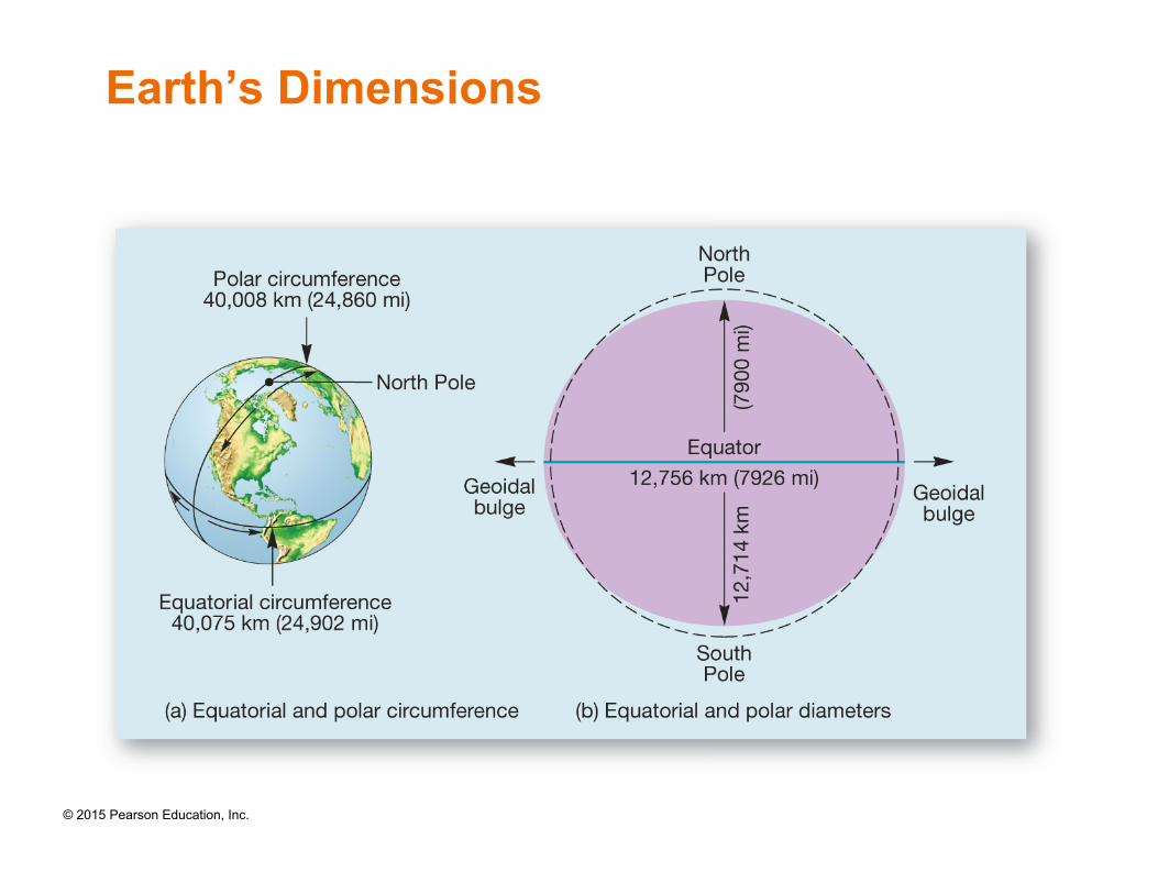
Earth’s Dimensions

© 2015 Pearson Education, Inc.
Latitude
• Latitude is an angular distance north or south of the equator, measured from the center of Earth (e.g., 49°N, 12°S).
• A line connecting all points along the same latitudinal angle is a parallel.
© 2015 Pearson Education, Inc.
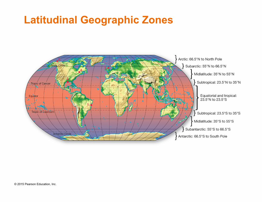
Latitudinal Geographic Zones
© 2015 Pearson Education, Inc.
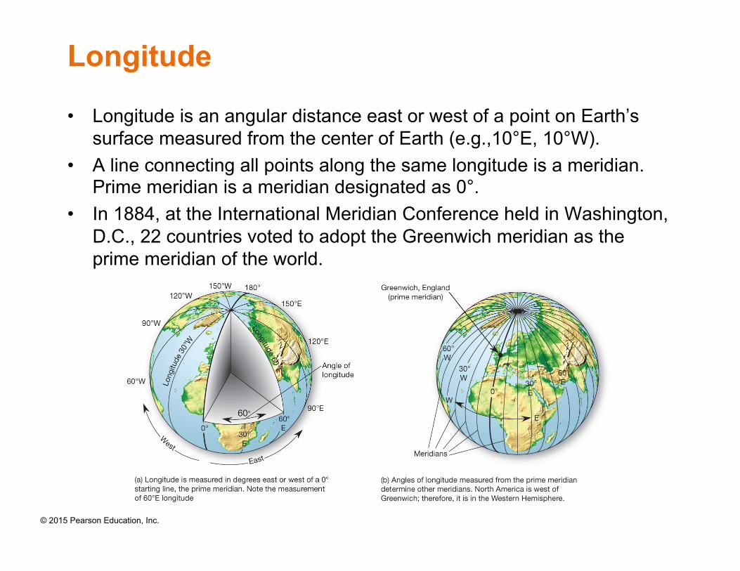
Longitude
• Longitude is an angular distance east or west of a point on Earth’s surface measured from the center of Earth (e.g.,10°E, 10°W).
• A line connecting all points along the same longitude is a meridian. Prime meridian is a meridian designated as 0°.
• In 1884, at the International Meridian Conference held in Washington, D.C., 22 countries voted to adopt the Greenwich meridian as the prime meridian of the world.
© 2015 Pearson Education, Inc.
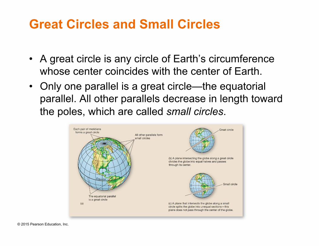
Great Circles and Small Circles
• A great circle is any circle of Earth’s circumference whose center coincides with the center of Earth.
• Only one parallel is a great circle—the equatorial parallel. All other parallels decrease in length toward the poles, which are called small circles.
© 2015 Pearson Education, Inc.
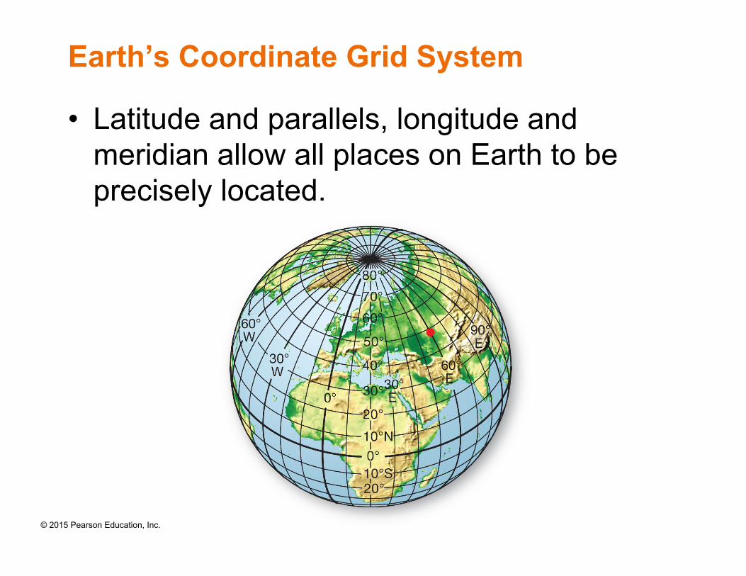
Earth’s Coordinate Grid System
• Latitude and parallels, longitude and meridian allow all places on Earth to be precisely located.
© 2015 Pearson Education, Inc.
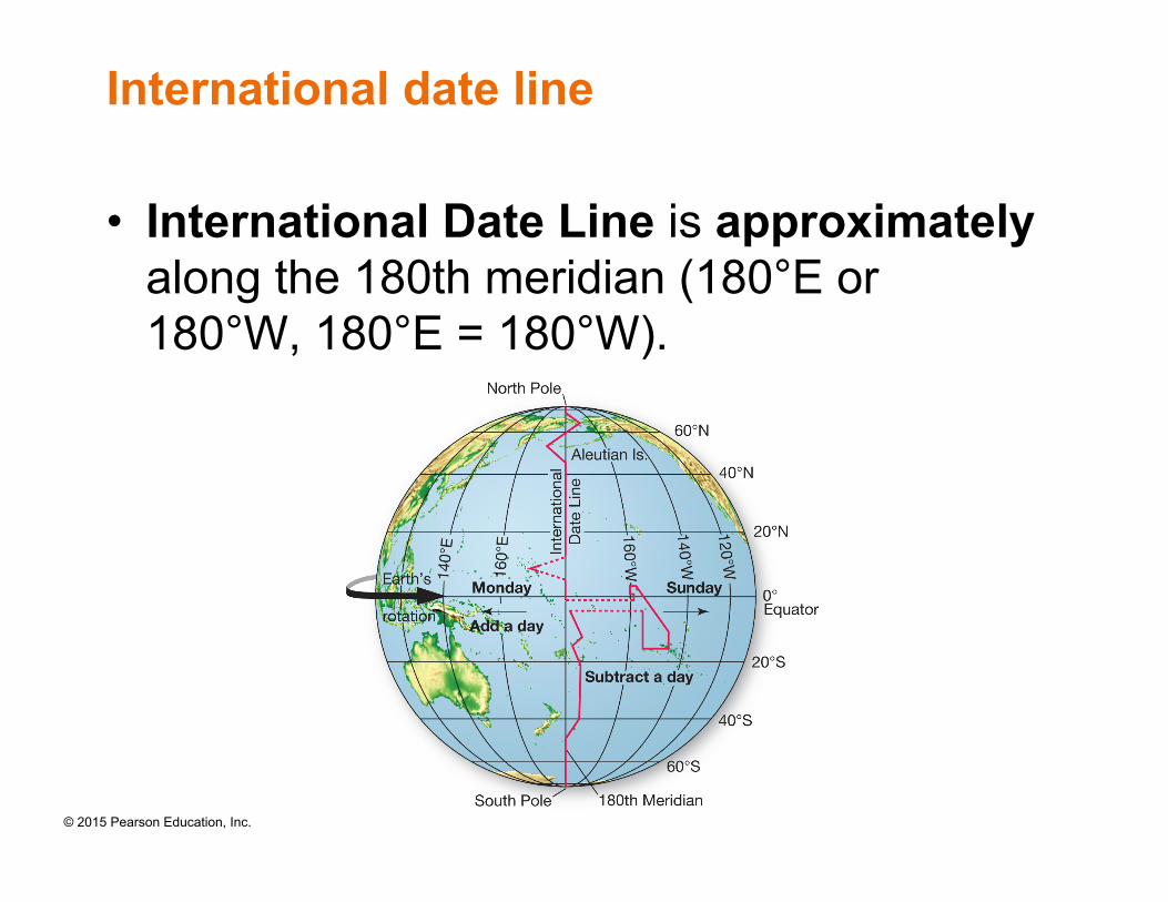
International date line
• International Date Line is approximately along the 180th meridian (180°E or 180°W, 180°E = 180°W).
© 2015 Pearson Education, Inc.
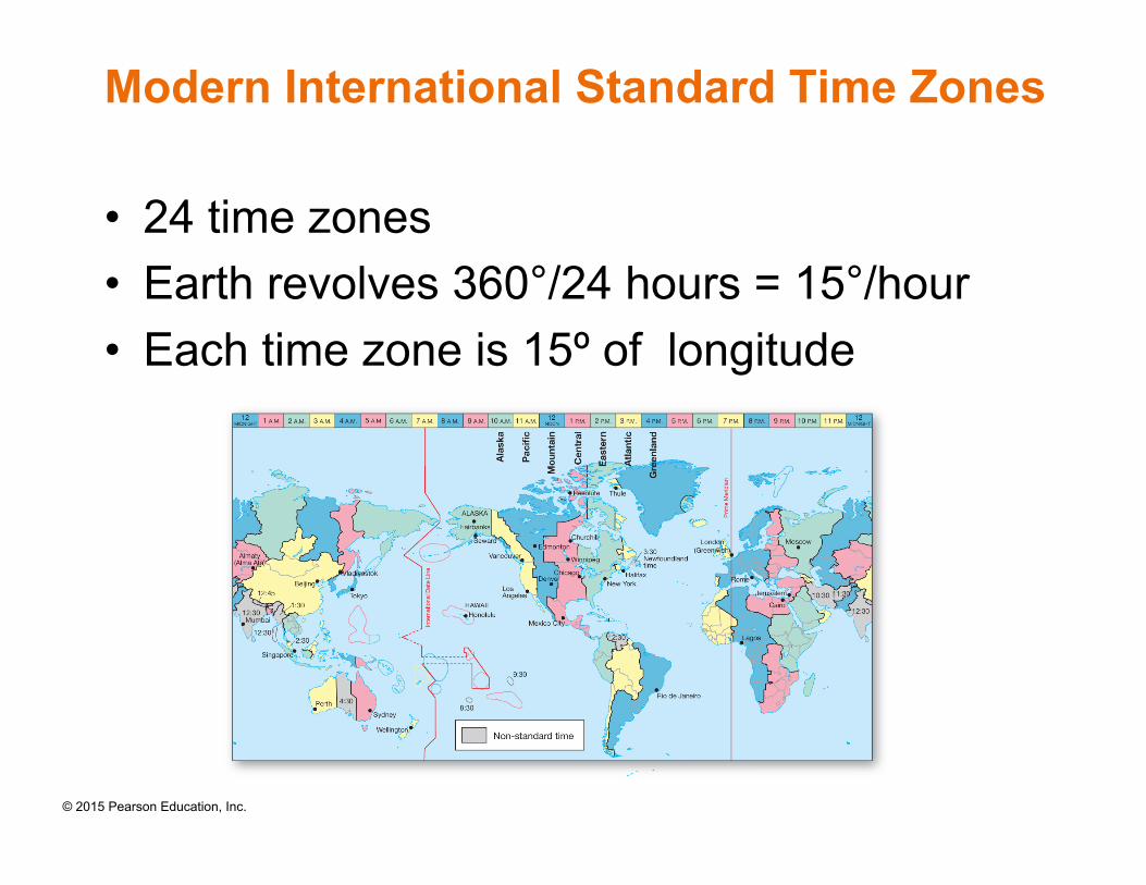
Modern International Standard Time Zones
• 24 time zones • Earth revolves 360°/24 hours = 15°/hour • Each time zone is 15º of longitude
© 2015 Pearson Education, Inc.
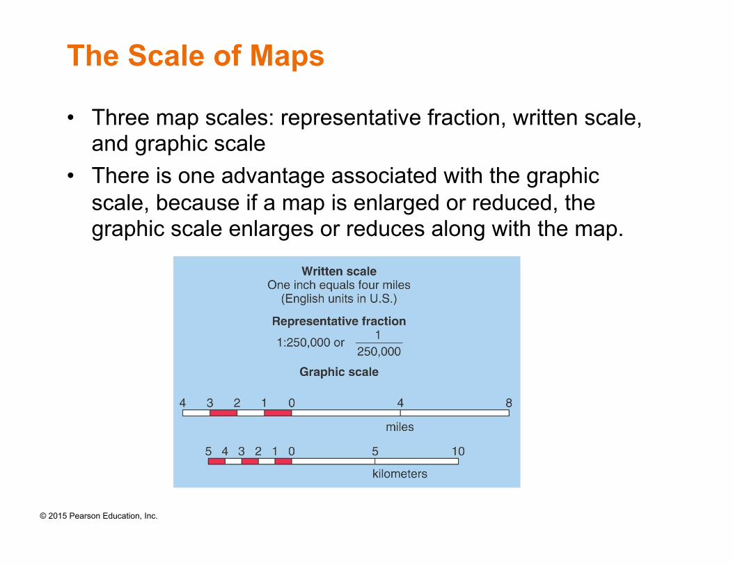
The Scale of Maps
• Three map scales: representative fraction, written scale, and graphic scale
• There is one advantage associated with the graphic scale, because if a map is enlarged or reduced, the graphic scale enlarges or reduces along with the map.
© 2015 Pearson Education, Inc.
Remote Sensing and GIS
• Geographers observe, analyze, and map Earth using remote sensing and geographic information systems (GIS).
• Remote sensing: observing Earth from space
• GIS is a computer-based, data processing tool for gathering, manipulating, analyzing, and displaying geographic information.
© 2015 Pearson Education, Inc.
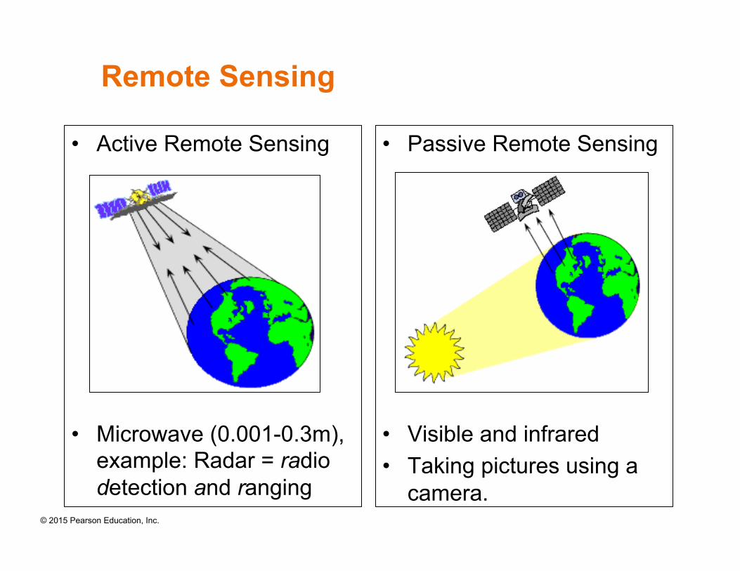
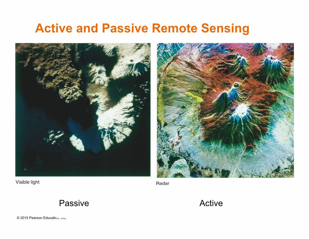
Active and Passive Remote Sensing
• Active remote-sensing systems direct a beam of energy at a surface and analyze the energy reflected back.
• Passive remote-sensing systems record wavelengths of energy radiated from a surface, particularly visible light and infrared.
© 2015 Pearson Education, Inc.
Remote Sensing
• Active Remote Sensing
• Microwave (0.001-0.3m), example: Radar = radio detection and ranging
• Passive Remote Sensing
• Visible and infrared • Taking pictures using a
camera.
© 2015 Pearson Education, Inc.
Active and Passive Remote Sensing
Passive Active
© 2015 Pearson Education, Inc.
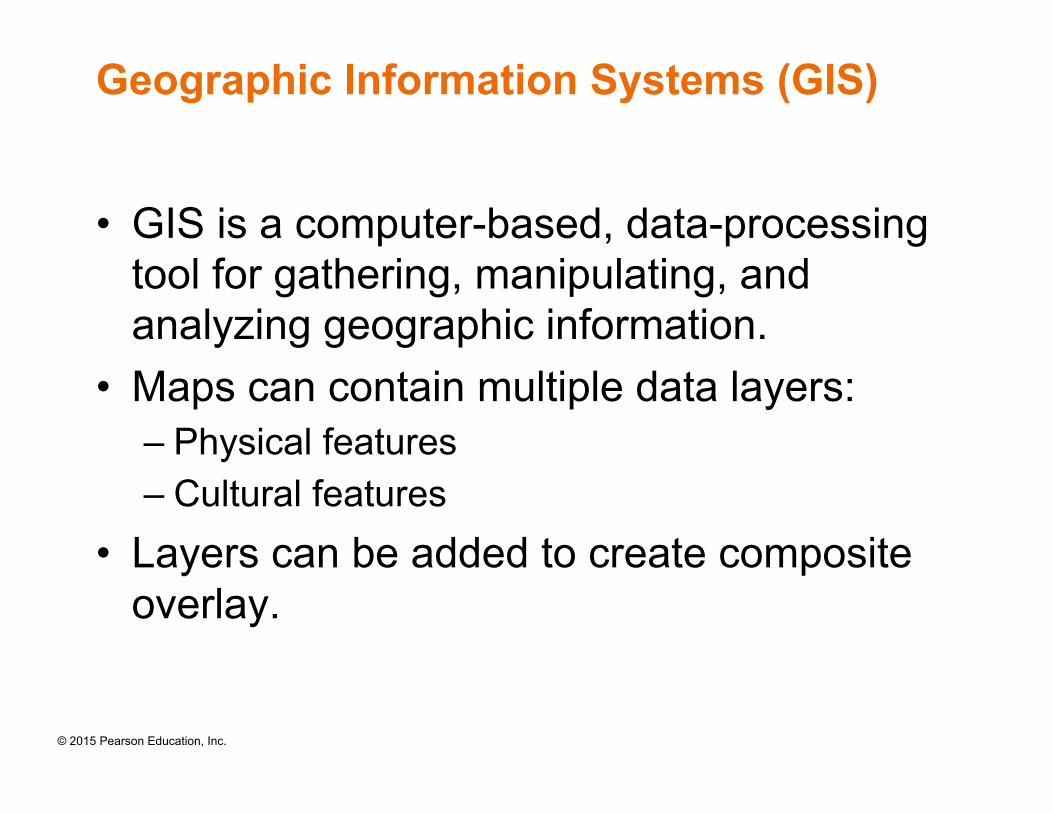
Geographic Information Systems (GIS)
• GIS is a computer-based, data-processing tool for gathering, manipulating, and analyzing geographic information.
• Maps can contain multiple data layers: – Physical features – Cultural features
• Layers can be added to create composite overlay.
© 2015 Pearson Education, Inc.
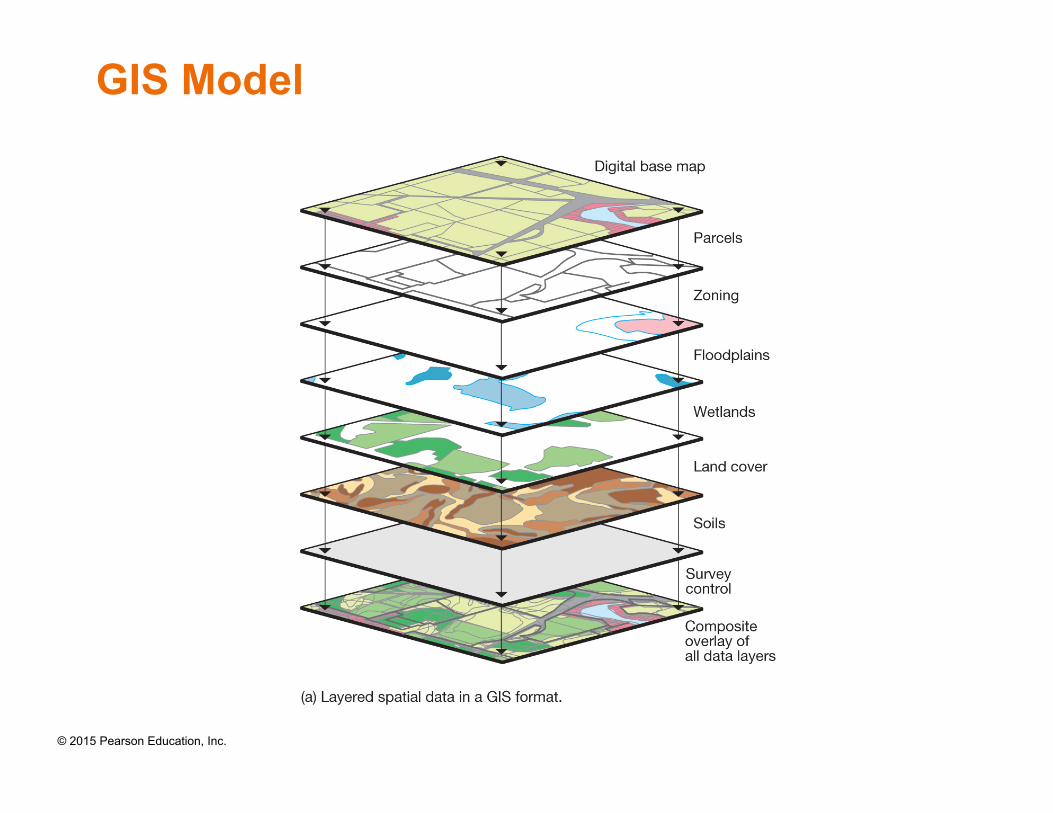
GIS Model
© 2015 Pearson Education, Inc.
Summary of Chapter 1 • Geography is the science that studies the relationships among
geographic areas, natural systems, society, cultural activities, and the interdependence of all of the above through space.
• The scientific method is essential to understanding Earth and the complex relations between Earth’s physical systems and human society.
• Earth consists of three abiotic, or nonliving, systems: the atmosphere, hydrosphere, and lithosphere. It has one biotic, or living, system—the biosphere.
• Latitude and parallels, longitude and meridian allow all places on Earth to be precisely located.
• A map is a generalized depiction of the layout of Earth’s surface area.
• Remote sensing obtains information about Earth systems from great distances without the need for physical contact.
• GIS is a computer-based, data-processing tool for gathering, manipulating, and analyzing geographic information.