certified hydrography courses in germany … · alfred wegener institute dr.-ing. hans werner...
TRANSCRIPT
13/12/2010
1
Certified Hydrography Courses in Germany
FIG/IHO/ICA Category A (HCU) and Category B (TECHAWI)
Volker BOEDER, Delf EGGE
HafenCity University Hamburg (HCU)y y g ( )
Hans Werner SCHENKE (TECHAWI)
Jochen SCHIEWE (HCU)
Lars SCHILLER (Zeidler, HCU)
Contents
• Introduction
• Hydrographic Education in Germany
• Category A at HCU
• Category B at TECHAWICategory B at TECHAWI
• Conclusions

13/12/2010
2
Hydrographic Education in Hamburg -Past-
• 1985: Consecutive Studies “Hydrography” – Hamburg University of Applied Sciences (HUAS) – Diploma in “Vermessungswesen und Hydrographie” (Surveying
Engineering and Hydrography)Engineering and Hydrography).
• 1990: Certification with the Highest Level Category-A (Academic) – Recertification in 2001 and 2010
• 2000: new curriculum – Geomatics (8 semesters) + Master “Hydrography” (4 semesters)
• January 2006: Department of Geomatics moved to the HafenCity University (HCU) Hamburg
– new founded by the Federal State of Hamburg– well-established departments (architecture, civil engineering, geomatics, urban
planning) from different universities• Technical University, University of Arts, University of Applied Sciences
HafenCity Hamburg (2012?)

13/12/2010
3
• October 2009 (winter semester)– Starting new M.Sc. Geomatics in Hamburg
Hydrographic Education in Hamburg
g g– Language: German and English – With Specialization in
• Engineering Surveying• GeoInformation Technologies• Hydrography
– similar to M.Sc. Hydrography program– Only English spoken
• M.Sc. Hydrography integrated in M.Sc. Geomatics– Certificated Program still exists– Re-Certification in 2010

13/12/2010
4
M.Sc. Geomatics (Specialization Hydrography) at HCU
Data AcquistionData Processing
5 CP
1st Sem. (winter)
Higher Geodesy5 CP
2nd Sem. (summer)
BasicsOceanography
5 CP
3rd Sem. (winter) 4th Sem. (summer)
compulsory compulsory optional
5 CP
Software Technology5 CP
Project ManagementQuality Management
5 CP
GIS-Hydrography5 CP
Navigation5 CP
5 CP
Marine Geology andGeophysics
5 CP
Practise10 CP
Master Thesis30 CP
Hydrography 110 CP
Marine Environment(Weather/Legal Aspects)
5 CP
Hydrography 210 CP
Base Technology(Remote Sensing, DTM,Applied Mathematics)
5 CP
Fundamental Studies10 CP
• Additionally: practical training in near-by institutions
Cooperations
– Federal Maritime and Hydrographic Agency of Germany (BSH)
– Alfred Wegener Institute (AWI, Bemerhaven)
– Hamburg Port Authority (HPA)
– Geomar
– various companies
13/12/2010
5
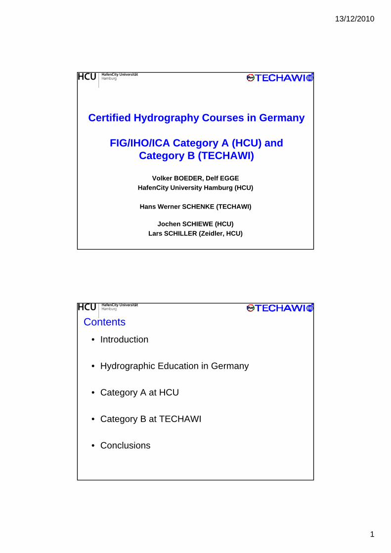
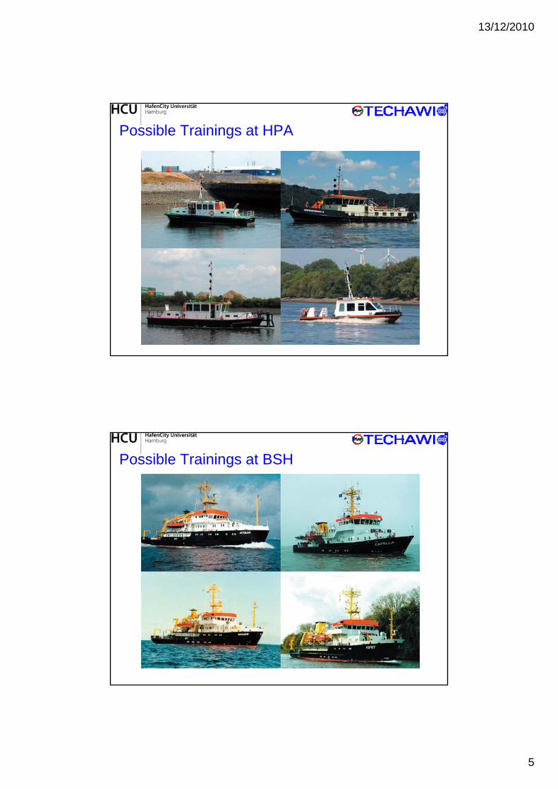
Possible Trainings at HPA
Possible Trainings at BSH

13/12/2010
6
• 2 survey craft – LEVEL-A (length 8 m, optimized to operate in extremely shallow
water, draught 0,3 m) – Level-L (length 3 m)
Equipment at the HCU
( g )– Located on the Ship and Buoy Yard in Wedel, belonging to the
Water and Shipping Authority (WSA) Hamburg.
• LEVEL-A – best conditions for practical exercises– RESON Multibeam SeaBat 8101– INNOMAR Parametric Sub-Bottom Profiler SES-2000 fan incl.
Side ScanSide-Scan– IxSEA motion sensor Octans III– GNSS-Javad-Gyro-4 (GPS, GLONASS)– Marine Magnetics Mini Explorer– RESON Sound Velocity Probe SVP 15
Equipment

13/12/2010
7
RT-GNSS• GNNET• Leica
Attitude DeterminationGNSS
Depth Measurement- Multi beam echo sounder- Single beam echo sounder- Side Scan Sonar- Sediment echo sounder
RTCM
GSM, Radio 2m
Data Processing- CARIS HIPS/SIPS
- GNSS- Motion sensor
Sediment echo sounder
Additional Sensors
Data Acquisition• QinSy QPS• RESON PDS200• WinProfil• ISE
Navigation
Laserscanner- QPS Qloud Gravimeter
Marine Magnetometer Acoustic Doppler Current Profiler (ADCP) Sound Velocity Probe RESON SVP 15 Tide Gauge Driessen+Kern
Data Visualisation- Fledermaus- Surfer- GMT
HCU–Hydrographic Multi Sensor System (HCU-HMSS)
Only a few students !
Unknown profession “Hydrography”?
No need for young Hydrographers?
Bottle neck GEOMATICS?
Certificates?
No funding?
We all have to work on it!
13/12/2010
8
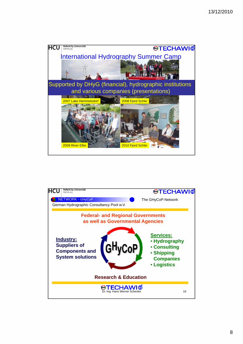
International Hydrography Summer Camp
2007 Lake Hemmelsdorf 2008 Fjord Schlei
Supported by DHyG (financial), hydrographic institutions and various companies (presentations)
2010 Fjord Schlei2009 River Elbe
NETWORK - GHyCoP
Federal- and Regional Governmentsas well as Governmental Agencies
German Hydrographic Consultancy Pool w.V.
The GHyCoP-Network
Industry:Suppliers of Components and System solutions
Services:• Hydrography• Consulting• Shipping
Companies
Dr.-Ing. Hans Werner Schenke 16
Research & Education
• Logistics

13/12/2010
9
NETWORK - GHyCoP
The GHyCoP-Networkis a registered association of
German Hydrographic Consultancy Pool w.V., Kiel – Germany
is a registered association of private companies and public institutions
is entitled to fulfil commercial and non-profit operations
• EEZ claims (UNCLOS Art. 76)
• safety and efficiency of navigation• off-shore activities
(e g laying pipes or cables)
• coastal protection (ICZM)
• geo-information and
• data acquisition services
• research and survey vessels
Dr.-Ing. Hans Werner Schenke 17
(e.g. laying pipes or cables)• science operation,
employs several hundred experts, engineers, and scientists
esea c a d su ey esse s
• PPP joint ventures
NETWORK - GHyCoP
We Map the Road of Success
Dr.-Ing. Hans Werner Schenke 18

13/12/2010
10
NETWORK - TECHAWI
Members:• GHyCoP Kiel
U i it f A li d S i B h• University for Applied Sciences Bremerhaven
• Alfred Wegener Institute Bremerhaven
• FIELAX Bremerhaven
• HydroAcoustics Scheeßel
Dr.-Ing. Hans Werner Schenke 19
• ATLAS Bremen
• EIVA Delmenhorst
NETWORK - TECHAWI
Alfred Wegener Institute
Dr.-Ing. Hans Werner Schenke 20

13/12/2010
11
CONCEPT - Philosophy
Training and Education in Hydrography
- Courses in advanced applied hydrography
Mission oriented
Dr.-Ing. Hans Werner Schenke 21
- Mission-oriented training at work
Survey Equipment• Multi-beam and single-beam echosounders• Sub-Bottom Profiler (par.)• MB and SBP Trainingsystems
CONCEPT - Equipment
• MB and SBP Trainingsystems• Side-Scan-Sonar• Navigation and Positioning Systems• Oceanographic and Geophysical Instruments
Software• Geographic Information Systems (commercial and OS)• Multibeam Post-Processing Software
Dr.-Ing. Hans Werner Schenke 22
• Side-Scan Post-Processing • Math and Statistics Programs • Image-Processing and Visualization• Public Domain S/W

13/12/2010
12
FS 'Heincke‘ (54.5 m)FK 'Uthörn‘ (30 5 m)
CONCEPT - Equipment
FK Uthörn (30.5 m)SV ‚Kiek ut‘ (14 m)
Dr.-Ing. Hans Werner Schenke 23
2007: Three Courses in GermanyInland Waterway Survey with MBHydrographic Surveying and Dredging
CONCEPT - Experiences
Shallow Water MB Practice
Two Courses in AustriaRiver and lake MB-survey
2008: Two International Courses in BremerhavenGIS Innundation Mapping Advanced Hydrographic Survey Training
Dr.-Ing. Hans Werner Schenke 24
Advanced Hydrographic Survey Training
2009: One refreshing GIS-Course in Bangkok

13/12/2010
13
Improving Emergency Response to Ocean-based Extreme Events through Coastal Mapping Capacity Building in the Indian Ocean
COAST-MAP-IO
CONCEPT - Experiences
Dr.-Ing. Hans Werner Schenke 25
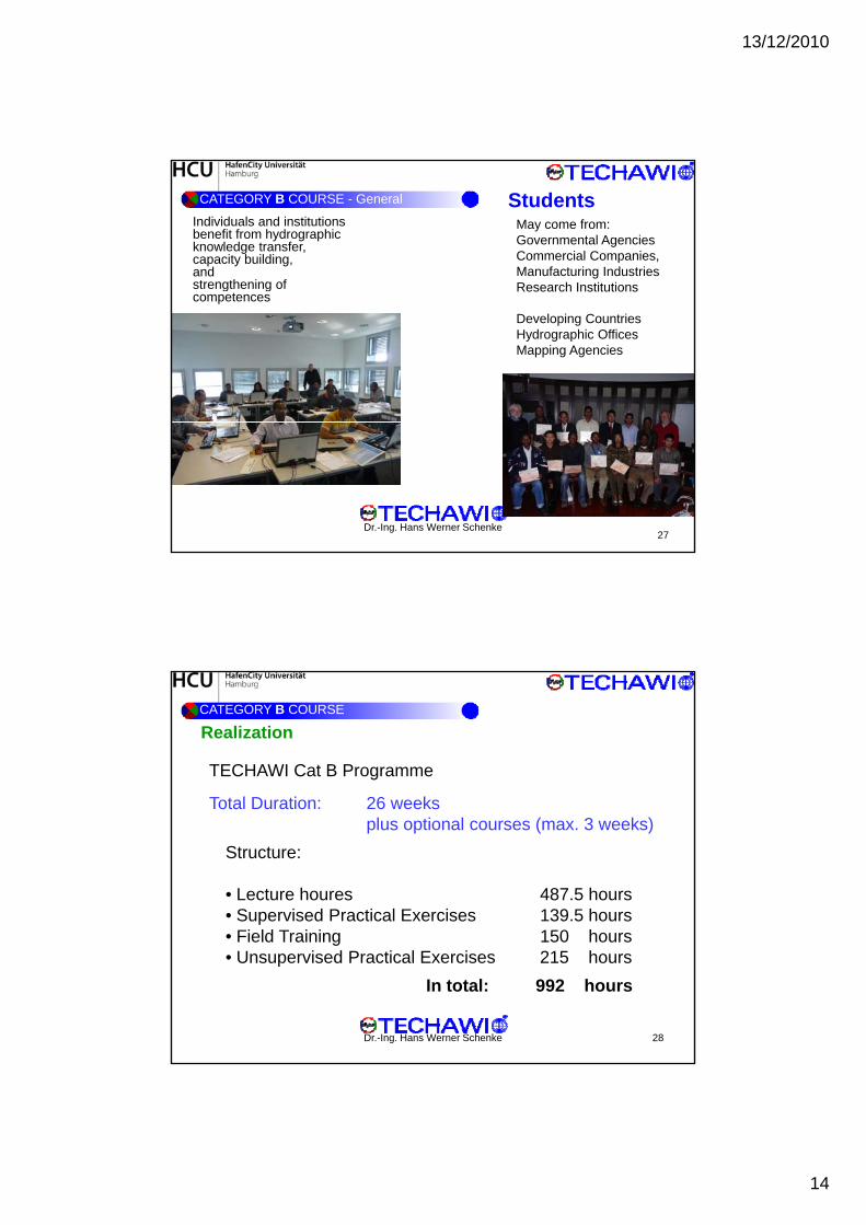
StructureCATEGORY B COURSE - General
Dr.-Ing. Hans Werner Schenke26
13/12/2010
14
StudentsIndividuals and institutions benefit from hydrographic knowledge transfer, capacity building, and strengthening of
May come from:Governmental AgenciesCommercial Companies,Manufacturing IndustriesResearch Institutions
CATEGORY B COURSE - General
g gcompetences
Research Institutions
Developing CountriesHydrographic OfficesMapping Agencies
Dr.-Ing. Hans Werner Schenke27
CATEGORY B COURSE
TECHAWI Cat B Programme
Total Duration: 26 weeks
Realization
Total Duration: 26 weeks plus optional courses (max. 3 weeks)
Structure:
• Lecture houres 487.5 hours• Supervised Practical Exercises 139.5 hours
Fi ld T i i 150 h
Dr.-Ing. Hans Werner Schenke 28
• Field Training 150 hours• Unsupervised Practical Exercises 215 hours
In total: 992 hours

13/12/2010
15
Conclusions• Category A course at HafenCity University Hamburg (HCU)
– Certified since 1990 • re-certification 2001, 2010
– University program, with assistant lecturer from other universities and y ghydrographic institutions
– Well equipped, english spoken
– 4 semester M.Sc. program
– Low student fees / funding possible
– Only a few students
• Category B course at TECHAWI
Improve funding Open for non-students Higher fees?
g y– Certified since 2010
– Well trained lecturer from universities, scientific institutions, companies
– Well equipped, english spoken
– Well experiences in international courses
– 26 + 3 weeks program
Until now a loose coupled cooperation ...
Prof. Dr.-Ing. V. BöderHafenCity University Hamburg
Department of [email protected]