cadastre2014 japan to osaka- alkis type cadastre · 2018-05-14 · cadastre2014 japan to osaka-...
TRANSCRIPT

Cadastre2014 Japan to Osaka- ALKIS type Cadastre (9390)Hiroyuki HASEGAWA and Marie SATO, Japan
GeoNet, Inc.,Osaka and Researcher : Ritsumeikan University, Kyoto
CAD-Globe - Osaka in 1880 Osaka UN-GGRF NetWorking
Presented at th
e FIG Congress 2018,
May 6-11, 2018 in
Ista
nbul, Turkey

Cadastre2014 Japan to Osaka- ALKIS type Cadastre: Map and CAD-Globe : Satellite Geodesy-Parameter Estimation
: FKP GNSS surveying : Satellite Photogrammetry
Cadastre2014 Japan to Osaka- ALKIS type Cadastre
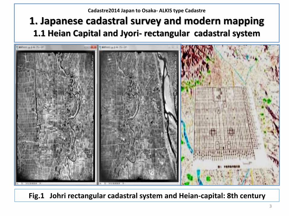
1. Japanese cadastral survey and modern mapping1.1 Heian Capital and Jyori- rectangular cadastral system
3
Fig.1 Johri rectangular cadastral system and Heian-capital: 8th century

CADASTRE2014 JAPAN to OSAKA- ALKIS TYPE CADASTRE
1.2 Taiko (Feudal Prime-minister) cadastre(16ce.) and Feudal-Shogun era country mappings (17-18-19 ce.)
Fig.2 Osaka - Feudal Shogun era mapping (1840)

CADASTRE2014 JAPAN to OSAKA- ALKIS TYPE CADASTRE
1.3 Taxation cadastral mapping in 1870-1910
, Japan-Okinawa-Taiwan-Korea; to 4D Image Map Archive
5
Fig.3 Japan 200K maps in 1880s on CAD-Globe and Korean cadastral triangulation net

CADASTRE2014 JAPAN to OSAKA- ALKIS TYPE CADASTRE
1.4 Osaka Cadastral Survey as 3D mapping
: 5 approaches for 1cm accuracy 3D mapping
1. GeoReferencing for UN-GGRF: IGS global geodetic networking for
„One step parcel cadastral mapping”; Japanese cadastral survey
“ 1sec 1cm accuracy PEGASUS – FKP “; on UN-GGRF initiative
2. Historical aerial photo bundle triangulation : 3D image modeling
„ 4D – Image Map Archive Designed Aerial Survey“
3. UAV / Helicopter photogrammetry : 1cm accuracy 3D image modeling
„ Precise ( 1cm accuracy ) 3D city modeling as Historical Reality“
4. Satellite photogrammetry : wide area 10cm accuracy 3D image modeling
„ 3D remote sensing for forestry and landscape applications“
5. LIDAR – TS ground 3D mapping : 3D city model for cadastral survey
„ complete 3D city model to be measured and registered“

CADASTRE2014 JAPAN to OSAKA- ALKIS TYPE CADASTRE
1.5 Proposals for Cadastral Survey Japan
4D Image Map Archive
7
Fukui city 4D Image Map Archive : 1948 Fukui earthquake4D-IMA means 4D- now in Japanese expression !!!

CADASTRE2014 JAPAN to OSAKA- ALKIS TYPE CADASTRE
1.6 Proposals for Cadastral Survey Japan
One step parcel cadastral mappingLIDAR – underground/ facility 3D mapping
8
LIDAR mapping, TS and GNSS – 3D CAD system

CADASTRE2014 JAPAN to OSAKA- ALKIS TYPE CADASTRE
2. Cadastral system as 3D GeoInformationsSysteme:
German style GIS : ALKIS2.1 Geodetic networking as the basis of cadastre
9
Geodetic networking (σ=1cm) is required both for earthquake prediction and cadastral survey. Especially land price; more than US$ 10,000/㎡and restoration/reconstruction projects after East Japan earthquake in 2011 push our government to reestablish precise cadastral system like in Germany.
German report in 2016 on geodetic network adjustment of 400 prime Electronic Control Points reached to the accuracy level of 2mm, after integrated ECP- Leveling-Gravimetric geodetic network adjustment.
GeoInfoDok of AdV has organized ALKIS cadastral survey system based on world standard GIS and CAD systems.
Parallel with documentary translations, we planned and tried nationwide and regional geodetic network adjustments, using German standard GEONAP- parameter estimation geodetic approach.

CADASTRE2014 JAPAN to OSAKA- ALKIS TYPE CADASTRE
2.2 GPS-GNSS Geodetic networking since 1995 Kobe earthquake to UN-GGRF initiative
10
Fig. 4 Japan and Osaka area geodetic networking
CADASTRE2014 JAPAN to OSAKA- ALKIS TYPE CADASTRE
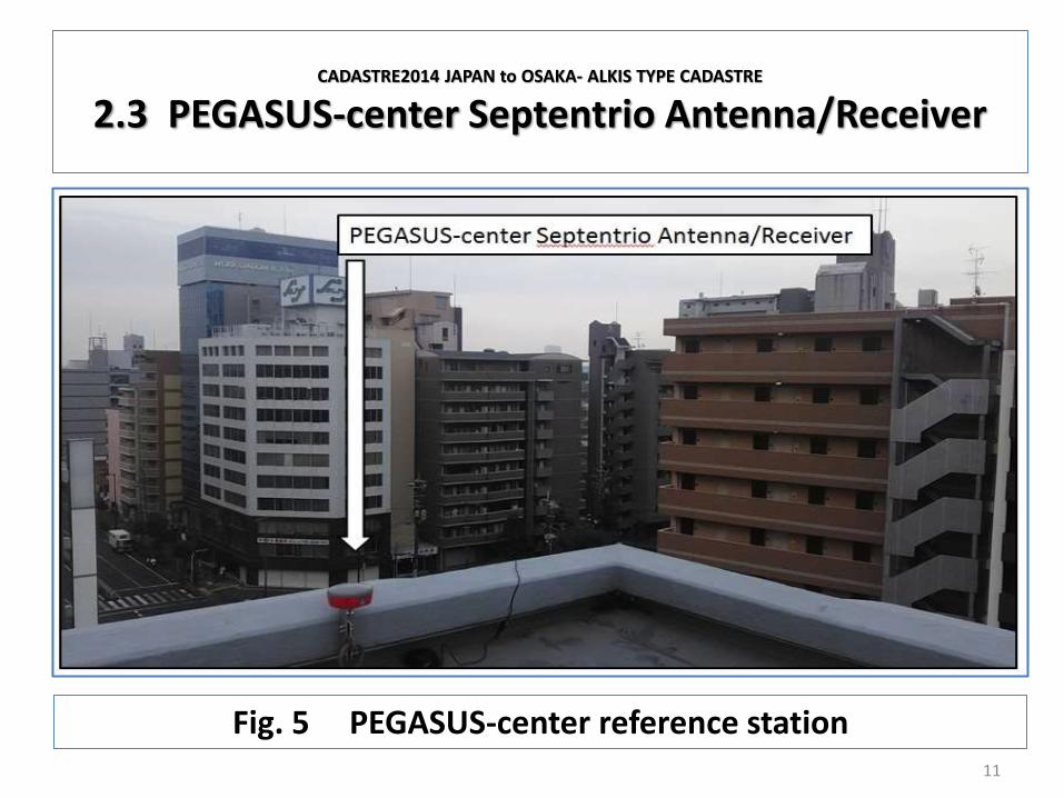
2.3 PEGASUS-center Septentrio Antenna/Receiver
11
Fig. 5 PEGASUS-center reference station
CADASTRE2014 JAPAN to OSAKA- ALKIS TYPE CADASTRE
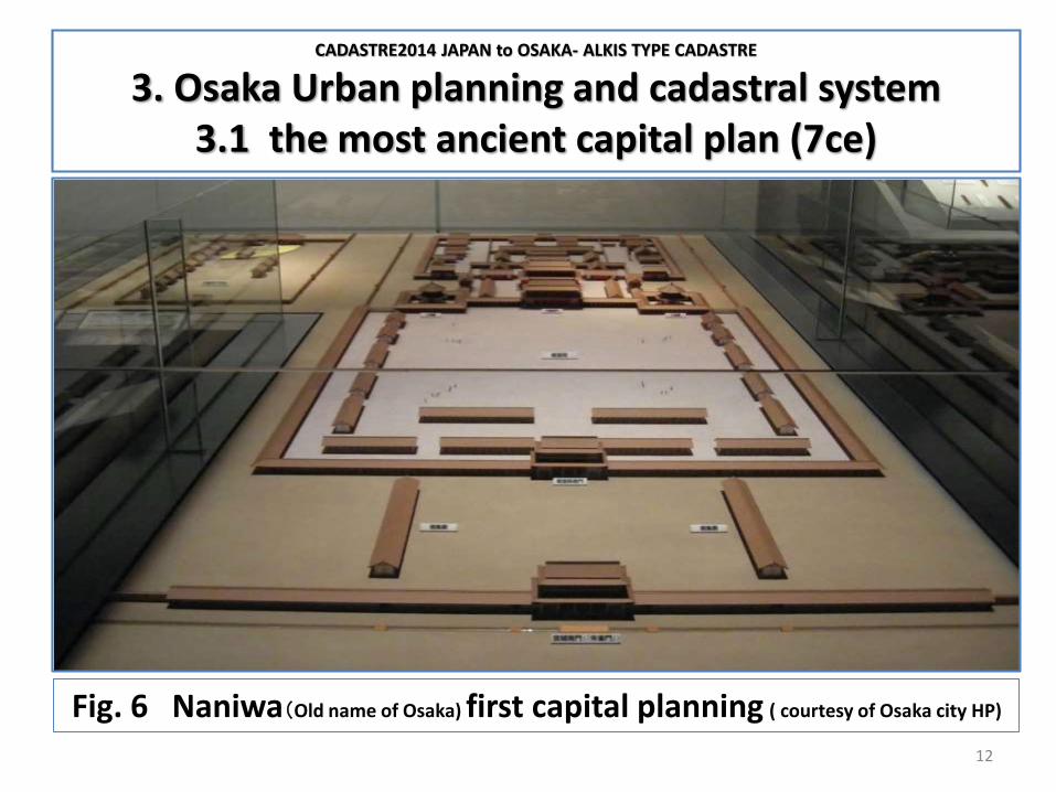
3. Osaka Urban planning and cadastral system3.1 the most ancient capital plan (7ce)
12
Fig. 6 Naniwa(Old name of Osaka) first capital planning ( courtesy of Osaka city HP)
CADASTRE2014 JAPAN to OSAKA- ALKIS TYPE CADASTRE
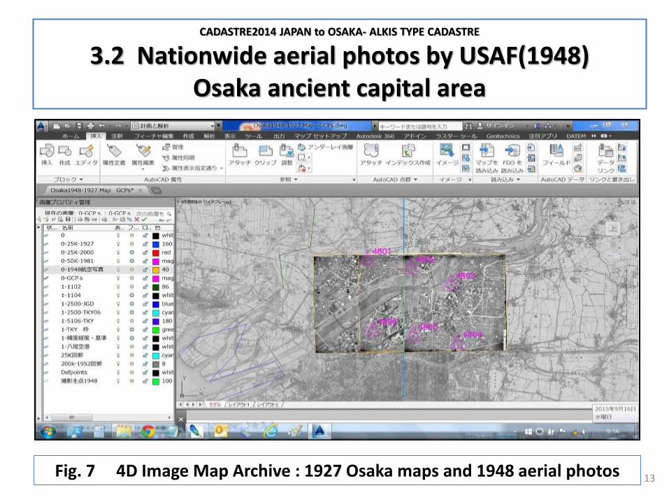
3.2 Nationwide aerial photos by USAF(1948)Osaka ancient capital area
13Fig. 7 4D Image Map Archive : 1927 Osaka maps and 1948 aerial photos

CADASTRE2014 JAPAN to OSAKA- ALKIS TYPE CADASTRE
4. Osaka ALKIS type cadaster4.0 GeoInfoDok : ALKIS : GeoInformationsSysteme
14
German GISe( GeoInformationsSysteme) is summarized in GeoInfoDokand cadastral system is regulated in ALKIS system. Aiming at 3D GIS, based on WGS84/GRS80, Global Geodetic Reference Frame could be applied through Parameter Estimation Geodesy and 4D-Image Map Archive Designed SUrveying System( IMADAS for short).CAD-Globe concept was created on AutoCAD in 1992 by me.

CADASTRE2014 JAPAN to OSAKA- ALKIS TYPE CADASTRE
4.1 Osaka GGRF: Global Geodetic Reference Frame
15
Fig.8 UN-GGRF- Osaka geodetic networking

CADASTRE2014 JAPAN to OSAKA- ALKIS TYPE CADASTRE
4.2 Osaka Historical Reality: First photogrammetric mappings
16
Fig. 9 Osaka 1971 stereo model after EXPO1970

CADASTRE2014 JAPAN to OSAKA- ALKIS TYPE CADASTRE
4.3 Osaka σ=1cm 3D City modeling: Helicopter digital camera bundle triangulation
17
Fig.10 Author; Hasegawa at Kyoto Heliport and 3D diorama-Kyoto University
CADASTRE2014 JAPAN to OSAKA- ALKIS TYPE CADASTRE
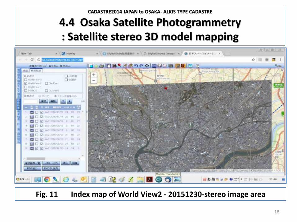
4.4 Osaka Satellite Photogrammetry: Satellite stereo 3D model mapping
18
Fig. 11 Index map of World View2 - 20151230-stereo image area

CADASTRE2014 JAPAN to OSAKA- ALKIS TYPE CADASTRE
4.5 Osaka 3D City modeling : Consensus making 3D display
19
Fig.12 3D city modeling with CityGMLFig.13 3D-displays without and with Glasses for consensus meeting

CADASTRE2014 JAPAN to OSAKA- ALKIS TYPE CADASTRE
References
20
Hasegawa, Hiroyuki (2013), 3D Image Map Archive Designed Area Studies (3D-IMADAS)Pacific Neighborhood Consortium :Annual Conference and Joint Meetings 2013
Kraus, Karl (2000), ”Photogrammetrie” Band III; Duemmler
Kummer et.al. (2015), “Das deutsche Vermessungs- und Geoinformationswesen 2015”; Wichmann
Luhmann, Thomas (2018), ”NahbereichsPhotogrammetrie”; Herbert Wichmann Verlag

CADASTRE2014 JAPAN to OSAKA- ALKIS TYPE CADASTRE
References
21
Niemeier, Wolfgang (2008), “Ausgleichungsrechnung”; Walter de Gruyter
Seeber, Guenter (2003), “Satellite Geodesy “; Walter de Gruyter
Snyder, John P. (1987), “Map Projections-A Working Manual “
U.S. Geological Survey Professional Paper 1395

FIG Congress 2018; Istanbul, Turkey,
CADASTRE2014 JAPAN to OSAKA- ALKIS TYPE CADASTRE
Thank you very much for your kind attention !!!
Hiroyuki HASEGAWA and Marie SATO, JapanGeoNet, Inc. and Researcher
of Ritsumeikan University, Kyoto