by alex weiss 35 1 30 46 30 - colorado college alex weiss impacts of energy ... introduction fossil...
TRANSCRIPT

98
The 2009 Colorado College State of the Rockies Report Card
By Alex Weiss
Impacts of Energy Development on WildlifeHighlighting the Unique Resources of the Rockies
35 1 30 46 30 98
The 2009 Colorado College State of the Rockies Report Card
Key Findings• The Powder River Basin of Montana and Wyoming produces more than 35 percent of the nation’s coal.
• The San Juan Basin of Colorado and New Mexico is the highest producing natural gas field in the coun-try.
• Since drilling began in the area in 2000, the town of Pinedale has grown by 30 percent.
• Between 2000 and 2004, mule deer populations on the Pinedale Anticline declined 46 percent.
• Sublette County contributes 30 percent to Wyoming’s total natural gas production.
© Porter Friedman ‘09
About the author: Alex Weiss (Colorado College ‘09) is a Student Researcher for the 2008/09 State of the Rockies Project
By Alex Weiss
Impacts of Energy Development on WildlifeHighlighting the Unique Resources of the Rockies

The 2009 Colorado College State of the Rockies Report Card 99Energy and Wildlife
Impacts of Energy Development on Wildlife
Introduction
Fossil fuel energy is one of the world’s most valuable resources. Every good and service has an energy cost, and even producing energy requires an initial input of some type of energy. Mining coal, for instance, requires large diesel-burning engines in bulldozers, excavators, and transport trains. Solar panels contain silicon, an abundant resource that must nonetheless be mined and processed before it can be used in photovoltaic cells. The energy for these tasks has typically come from fossil fuels.1 However, while fossil fuels are the most widely used, they are considered non-renewable resources because they take millions of years to form. Coal, petroleum, natural gas, and other fossil fuels are formed from the fossilized remains of organisms that lived hundreds of millions of years ago. Other sources of energy include hydroelectric, nuclear, and geothermal energy; combined, however, these sources constitute only 13 percent of world primary energy production.2 Worldwide, energy consumption has increased nearly two-fold since the early 1970’s,3 with most of the increase in India and China. From 1980 through 2005 China’s energy consumption increased by almost 400 percent, while India’s energy consumption increased
by more than 400 percent, and the United States’ energy consumption rose by slightly less than 30 percent.4 Together, China and India are projected to account for more than 45 percent of the worldwide increase in primary energy demand in the next twenty years.5 During that same time, the International Energy Agency reports that global demand for energy will increase by more than 50 percent (See Figure 1).6
The U.S. is an energy-thirsty nation. Although having only 4.5 percent of the world’s population,7 the U.S. consumes 21.3 percent of the world’s primary energy.8 Historically, the U.S. produced most of the energy it used nationally. It was not until the late 1950s that consumption outpaced domestic production. Wood supplied most of early settlers’ energy needs until 1885 when coal supplanted wood as the most burned fuel. By 1947, however, petroleum had rocketed past coal as the most consumed fossil fuel in the U.S. Seventy percent of all petroleum consumed in the U.S. is used for transportation, and gasoline is the petroleum industry’s principal refined product. The rise of suburbia and the subsequent reliance on personal vehicles for transportation have contributed significantly to the huge increase in petroleum consumption across the U.S.9 10 Despite the fact that the U.S. is the world’s third-largest oil producer, it imports around 60 percent of the petroleum it consumes. Ever since the U.S. hit peak production of oil in 1972, it has become increasingly reliant on foreign sources of oil. The Arab oil embargo of the 1970s that sent shocks through the American economy is a clear example of the U.S.’s vulnerability from heavy reliance on oil importation. Today, reducing dependence on foreign oil is one of the federal government’s top priorities. In June of 2008, President Bush called for an injunction on the executive ban
200
300
400
500
600
700
800
20302025
20202015
20102005
20001995
19901985
1980
Figure 1: World Marketed Energy Consumption
Source: Energy Information Administration, International Energy Outlook, 2008
Historical Consumption
Projected Consumption
Cons
umpt
ion
(Qua
drill
ion
BTU
)
LegendSelected Colorado Oil Shale Resources
Oil and Gas Resources
Coal and Coalbed Methane Resources
Coal Resources
Figure 2: Conventional Energy Resources in the Rockies
Note: Colorado oil shale resources include the Piceance Basin deposits in west central Colorado. GIS data for the Green River Formation oil shale deposits were not available.
Sources: oil shale - USGS, 2007; coalbed methane - Department of Energy, Energy Information Administration, 2007; coal resources - USGS, 2001; oil and gas resources - Department of Energy, Energy Information Administration, 2001
Impacts of Energy Development on Wildlife
The 2009 Colorado College State of the Rockies Report Card100 Energy and Wildlife
of offshore drilling on the Outer Continental Shelf, citing that it would increase energy independence. For now, however, interest has turned inland, to the Rockies’ energy-rich basins.
The Riches of the Rockies
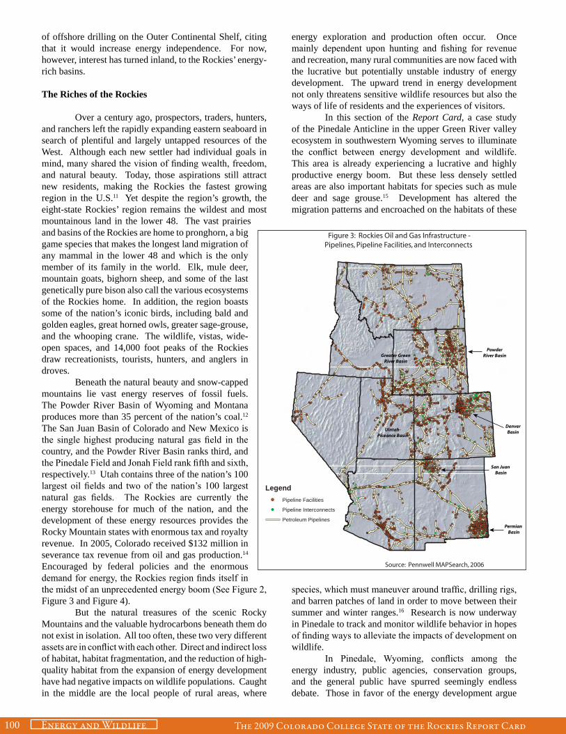
Over a century ago, prospectors, traders, hunters, and ranchers left the rapidly expanding eastern seaboard in search of plentiful and largely untapped resources of the West. Although each new settler had individual goals in mind, many shared the vision of finding wealth, freedom, and natural beauty. Today, those aspirations still attract new residents, making the Rockies the fastest growing region in the U.S.11 Yet despite the region’s growth, the eight-state Rockies’ region remains the wildest and most mountainous land in the lower 48. The vast prairies and basins of the Rockies are home to pronghorn, a big game species that makes the longest land migration of any mammal in the lower 48 and which is the only member of its family in the world. Elk, mule deer, mountain goats, bighorn sheep, and some of the last genetically pure bison also call the various ecosystems of the Rockies home. In addition, the region boasts some of the nation’s iconic birds, including bald and golden eagles, great horned owls, greater sage-grouse, and the whooping crane. The wildlife, vistas, wide-open spaces, and 14,000 foot peaks of the Rockies draw recreationists, tourists, hunters, and anglers in droves. Beneath the natural beauty and snow-capped mountains lie vast energy reserves of fossil fuels. The Powder River Basin of Wyoming and Montana produces more than 35 percent of the nation’s coal.12 The San Juan Basin of Colorado and New Mexico is the single highest producing natural gas field in the country, and the Powder River Basin ranks third, and the Pinedale Field and Jonah Field rank fifth and sixth, respectively.13 Utah contains three of the nation’s 100 largest oil fields and two of the nation’s 100 largest natural gas fields. The Rockies are currently the energy storehouse for much of the nation, and the development of these energy resources provides the Rocky Mountain states with enormous tax and royalty revenue. In 2005, Colorado received $132 million in severance tax revenue from oil and gas production.14 Encouraged by federal policies and the enormous demand for energy, the Rockies region finds itself in the midst of an unprecedented energy boom (See Figure 2, Figure 3 and Figure 4). But the natural treasures of the scenic Rocky Mountains and the valuable hydrocarbons beneath them do not exist in isolation. All too often, these two very different assets are in conflict with each other. Direct and indirect loss of habitat, habitat fragmentation, and the reduction of high-quality habitat from the expansion of energy development have had negative impacts on wildlife populations. Caught in the middle are the local people of rural areas, where
energy exploration and production often occur. Once mainly dependent upon hunting and fishing for revenue and recreation, many rural communities are now faced with the lucrative but potentially unstable industry of energy development. The upward trend in energy development not only threatens sensitive wildlife resources but also the ways of life of residents and the experiences of visitors. In this section of the Report Card, a case study of the Pinedale Anticline in the upper Green River valley ecosystem in southwestern Wyoming serves to illuminate the conflict between energy development and wildlife. This area is already experiencing a lucrative and highly productive energy boom. But these less densely settled areas are also important habitats for species such as mule deer and sage grouse.15 Development has altered the migration patterns and encroached on the habitats of these
species, which must maneuver around traffic, drilling rigs, and barren patches of land in order to move between their summer and winter ranges.16 Research is now underway in Pinedale to track and monitor wildlife behavior in hopes of finding ways to alleviate the impacts of development on wildlife. In Pinedale, Wyoming, conflicts among the energy industry, public agencies, conservation groups, and the general public have spurred seemingly endless debate. Those in favor of the energy development argue
LegendPipeline Facilities
Pipeline Interconnects
Petroleum Pipelines
Figure 3: Rockies Oil and Gas Infrastructure -Pipelines, Pipeline Facilities, and Interconnects
Source: Pennwell MAPSearch, 2006
PowderRiver Basin
DenverBasin
San Juan Basin
Permian Basin
Greater GreenRiver Basin
Uintah-Piceance Basin

The 2009 Colorado College State of the Rockies Report Card 101Energy and WildlifeThe 2009 Colorado College State of the Rockies Report Card
that leasing and royalty revenues are a boon to the people and economy of Pinedale. The natural gas revenue from the Pinedale Anticline, often considered to be the nation’s second largest natural gas field,17 has contributed to the construction of a new aquatic center and sports facility, and every fifth grader in Pinedale received a new laptop.18 But opponents voice concern that the large influx of workers and the quick pace of development have out-paced the abilities of Pinedale, the sagebrush valley, and wildlife to adapt. Between 2000 and 2004, mule deer populations on the Pinedale Anticline declined by 46 percent, due in part to natural gas development.19 In 2008, an air quality monitor in Boulder, WY, just south of Pinedale, recorded an ozone value, which averages the fourth-highest reading over an eight hour period per day, at 0.122 parts per million (ppm), higher than the Environmental Protection Agency’s limit of 0.08 ppm.20 Some residents have raised concerns about the health effects of poor air quality. In spite of these concerns, the energy boom continues. The Bureau of Land Management (BLM) is implementing a plan that would allow more than 4,000 more gas wells to be drilled on the Anticline.21
Outlook
At a time when energy production nationally is slowing, the Rockies Region has rapidly become America’s energy supplier. The Rockies not only contain abundant reserves of coal and natural gas, but 58 percent of the land in the eight-state region is owned by the federal government. Of that 58 percent, nearly half is administered by the BLM, the largest landlord of the federal government.22 The BLM is tasked with managing all land for “multiple use,” defined as the “management of the public lands and their various resource values so that they are utilized in the combination that will best meet the present and future needs of the American people.”23 This includes recreation, mineral extraction, grazing, timber harvesting, hunting, fishing, and wildlife and cultural resource preservation. Balancing these resources is no simple endeavor because they often overlap, and citizens, interest groups, and corporations often perceive the balance tipped against their favor. Thus, the BLM acts as a rule maker and mediator in the inevitable conflicts of interest that ensue (See Figure 5). All sides of the debate have legitimate interests and values at stake concerning their position on energy development in the biologically and resource-rich Rockies region. Organizations such as Trout Unlimited, the Theodore Roosevelt Conservation Partnership (TRCP), the National Wildlife Federation, and other hunting, fishing, and environmental groups have teamed up, joining their interests in conserving land and waterways with a reasonable understanding of the necessity and inevitability of energy development. Sportsmen for Responsible Energy Development, an organization that has united over 20 different conservation groups, has written a Sportsmen’s Bill of Rights that encourages hunters and anglers to commit themselves to habitat conservation and the preservation of
public land. While recognizing the need for responsible energy development, the TRCP, has been one of the most outspoken critics of the BLM’s handling of the Rockies’ energy boom. Often citing the BLM’s failure to uphold a balanced approach to resource extraction, the TRCP has played an important role in grassroots organizing of conservation-minded hunters and anglers, while also maintaining an active role in litigation in Washington, DC. Former BLM biologist and current TRCP Energy Initiative manager, Steve Belinda, has criticized the BLM for failing to implement best available science in land management decisions. Currently, the TRCP is involved in a lawsuit against the Department of Interior, of which the BLM is a part, concerning the mismanagement of energy development on the Pinedale Anticline. 24 Other conservation organizations active in the Rockies region, including the National Wildlife Federation (NWF), the Colorado Wildlife Federation (CWF), the Wilderness Society, and the Upper Green River Valley Coalition, have made influential requests to the federal government to slow down energy development in sensitive wildlife areas. Some areas, these groups argue, are too precious, too wild, or too valuable for wildlife to be subjected to energy development. Recently, there have been a few notable triumphs for conservation groups in Wyoming and Colorado. In Wyoming, the BLM has implemented new guidelines for coal bed methane development in the
LegendGenerating Stations
Hydroelectric Stations
Substations
Transmission Lines
Proposed Corridors
Figure 4: Electricity Infrastructure of the Rockies, Including Proposed Corridors Under the West-Wide Energy Corridor Program
Source: Pennwell MAPSearch, 2006

The 2009 Colorado College State of the Rockies Report Card102 Energy and Wildlife
Powder River Basin, in order to protect the greater sage-grouse, a species of upland bird potentially up for listing on the federal Endangered Species List. The Colorado Oil and Gas Conservation Commission has recently adopted more stringent rules on wastewater pits at drilling sites in an effort to curb water well contamination and encourage comprehensive drilling plans.25 The corporations involved in the exploration, extraction, and distribution of energy, in this case in the form of fossil fuels, have legitimate reasons to increase development of energy resources. Demands for natural gas, petroleum, and coal have steadily increased both globally and nationally. Failing to increase the supply of energy to meet the demand could prove catastrophic for local and regional economies of the U.S., as the recent hike in oil prices has suggested. As the Rockies region is a storehouse
of cleaner burning natural gas and vast reserves of cheap coal, much of the recent energy boom has been localized here. These energy booms are not only responsible for the continual supply of relatively cheap fossil fuels throughout the U.S. but also for the creation of thousands of jobs, many of which are located in less densely populated, rural areas. Wyoming, for example, receives 70 percent of its
income from energy production and related industries.26 The energy industry is enormously lucrative in the Rockies region, but not without vast technological advancements in drilling and extraction technologies. New technologies in natural gas drilling and extraction have allowed previously unavailable gas resources, such as those beneath the Pinedale Anticline in Wyoming, to be opened for energy development. At depths of more than 15,000 feet below the surface, Pinedale’s rich deposits of natural gas are locked in densely packed sand and shale beds. Hydraulic fracturing, a technique that fractures and then “props up” rock layers, allows an increased flow rate of natural gas to the well heads. Though this method was developed more than a half century ago, it was not until recently that hydraulic fracturing could be used at the great depths required for southwestern Wyoming’s gas reserves.
In the eastern U.S., energy companies hope to use hydraulic fracturing techniques to access the natural gas in the Marcellus Shale formation that stretches from New York to West Virginia. Still, under pressure from the government and the American people, a large portion of research and development in energy technologies has been directed towards cleaner, safer, and more environmentally friendly energy development. One such advancement that has revolutionized natural gas drilling in the Rockies region is directional drilling. Directional drilling makes it possible to drill horizontally and vertically from a single well site. Flexible and jointed drills can extend up to a mile from the drilling rig (in some places, up to four miles), allowing drilling companies to pinpoint specific areas of concentrated gas reserves from a single well pad. Fewer pads translate to a reduced surface footprint, a feature that is warmly welcomed by industry, environmental groups, and the BLM. Other technologies, such as liquids gathering systems (LGSs) have helped to reduce truck traffic, a major source of indirect habitat loss in and around gas fields. LGSs gather various incidental components of natural gas extraction including condensate, a type of light oil, and water. By consolidating the less desirable liquids and piping them to central facilities, a LGS can reduce emissions of condensate vapor and truck exhaust and eliminate the need for large holding tanks on every well pad, another factor in reducing the footprint of natural gas extraction. In 2008, Questar Corporation, the largest lease holder on the Pinedale Anticline, won the Department
of Interior’s Oil, Gas, and Geothermal Development Environmental Best Management Practices Award for their implementation of LGS on the Pinedale Anticline. In spite of these new technologies, the leasing of public lands for energy development has infringed upon prime hunting, fishing, and other recreation areas, encroaching upon the tourism and recreation economies
LegendAuthorized Leases
Authorized Agreements
BLM Land Ownership
Figure 5: Federal Oil and Gas Leases in the Rockies
Source: National Integrated Land System, Bureau of Land Management, 2008

The 2009 Colorado College State of the Rockies Report Card 103Energy and Wildlife
in the Rockies region. Ten percent of Colorado’s state economy is tourism based; 160,000 Colorado workers were employed in travel and recreation in 2005, nearly double the jobs in the oil and gas industry.27 In Utah, tourists spent nearly $6 billion in 2006.28 These activities provide a sustainable source of revenue for Rockies states because, if properly managed, the region’s stunning geology, world-class trout fisheries, and large big game herds can persist generation after generation. By contrast, oil, gas, and coal reserves are finite. Dollar for dollar, energy extraction often proves more lucrative for state economies in the short term. As long as the current boom in energy development continues, the Rockies region is poised to add billions of dollars to state coffers. In Colorado, during 2005, oil and gas generated more than double the revenue of recreation and tourism.29 But will it last? The lifetime of Wyoming’s second largest natural gas field, the Jonah Field, is expected to be 40 to 50 years.30 Wyoming’s recoverable coal reserves are the largest in the country, and yet with current mining technologies, these reserves are only expected to last approximately 124 years. 31 Until then the energy boom continues to provide much needed jobs and revenue for state and local governments. H i s t o r i c a l l y , however, the West has been plagued by the boom and bust cycles so often associated with energy development. Many residents of Garfield County in western Colorado, for example, recall the day in May of 1982 when Exxon pulled the plug on oil shale operations, leaving 2,000 people jobless. Before May 2, 1982, which has also become known as Black Sunday, the towns of Rifle, Grand Junction, Parachute, and others were in the midst of the largest energy boom in recent western Colorado history. High Country News editor Ray Ring has described the depression of a small town in south central Wyoming. Small towns in the Rockies, such as Wamsutter, WY, are often unable to foster a healthy community in part due to the transience of the workforce and the industry. Wamsutter, Ring wrote, is an “amenity-less place” that will witness the end of its last gas boom six years from now.32 For those workers who have traveled from as far away as Florida to work on well-paying rig crews, a pull out by the energy industry when the wells run dry is just another characteristic of life as a roughneck. But for others, relocating a family to follow the boom and bust cycle of energy work brings headaches and hardship. As long as the American people demand cheap and abundant fossil fuels, the cycle will continue.
1 Energy Information Administration. “International Energy Annual 2005.” http://www.eia.doe.gov/iea/overview.html. Accessed 12/11/08.2 Ibid.
3 International Energy Agency. “Key World Energy Statistics for 2007.” pg 28. http://www.iea.org/Textbase/nppdf/free/2007/key_stats_2007.pdf. Accessed 12/11/08.4 Energy Information Administration. “International Energy Annual 2005.” 5 Jane Wardell. “IEA: China, India Need To Curb Energy Demand.” 11/07/2007. http://www.manufacturing.net/IEA-Warns-Of-Energy-Danger.aspx?menuid. Accessed December 11, 2008.6 Ibid. 7 U.S. Census Bureau. “World Population Information.” International Database. http://www.census.gov/ipc/www/idb/worldpopinfo.html. Accessed 12/11/2008.8 Beyond Petroleum. BP Statistical Review of World Energy June 2008: p. 40. http://www.bp.com/liveassets/bp_internet/globalbp/globalbp_uk_english/reports_and_publications/statistical_energy_review_2008/STAGING/local_assets/downloads/pdf/statistical_review_of_world_energy_full_review_2008.pdf. Accessed 12/10/2008.9 Energy Information Administration. “History of Energy in the United States: 1635-2000.” http://www.eia.doe.gov/emeu/aer/eh/frame.html. Accessed 12/11/08.10 Energy Information Administration. http://www.eia.doe.gov/emeu/aer/pecss_diagram.html. 11 Kellogg, Julianne and Chris Jackson. “The Growing Rockies.” 2007 State of the Rockies Report Card. p. 87. 12 Powder River Basin Coal Production. Data from the Energy Information Administration. http://www.blm.gov/pgdata/etc/medialib/blm/wy/programs/energy/coal/prb.Par.5321.Image.-1.-1.1.gif. Accessed 12/11/08. 13 Energy Information Administration. “Table B2: Top 100 Oil and Gas Fields.” U.S. Crude Oil, Natural Gas, and Natural Gas Liquids Reserves 2006 Annual Report. http://www.eia.doe.gov/pub/oil_gas/natural_gas/data_publications/crude_oil_natural_gas_reserves/current/pdf/appb.pdf#page=7. Accessed 12/11/08.14 Colorado Environmental Coalition. “Billion Dollar Discounts on State Oil and Gas Reserves.” Press Release October 9, 2007. http://www.ourcolorado.org/media-center/press-releases/billion-dollar-discounts-on.html. Accessed 12/11/08. 15 Sawyer, Hall. Western EcoSystems Technologies, Inc.. “Sublette Mule Deer Study (Phase II).” 3. October 26, 2004.http://www.west-inc.com/reports/papa_2004_report.pdf (accessed July 1, 2008).
16 Ibid. 17 Rach, Nina M. Special Report: “Shell Optimizes New Pinedale Completions.” Oil & Gas Journal August 18, 2008. Volume 106, Issue 31. http://www.ogj.com/articles/save_screen.cfm?ARTICLE_ID=337167. Accessed 1/20/09.18 Grever, Mead. “Wyoming schools, flush with cash, go on spending binge.” Jackson Hole Star Tribune, June 17, 2006. http://www.jacksonholestartrib.com/articles/2006/06/17/news/wyoming/c636be8531b8967e8725718f006b6a7e.txt. Accessed 12/11/08.19 Sawyer, 2004. 20 Baker, Linda. Personal Correspondence. 1/20/09.21 Bureau of Land Management. Supplemental Environmental Impact Statement for the Pinedale Anticline Oil and Gas Exploration and Development Project, Sublette County, Wyoming. June 2008.22 Look, Carissa and Matthew Reuer. “Forest Health in the Rockies.” The 2007 State of the
Rockies Report Card. p. 5.123 “The BLM: The Agency and Its History.” February 1997. http://www.access.gpo.gov/blm/pls96/history.html. Accessed 12/11/08.24 McKalip, Katie. “TRCP Sues Interior Department Over Mismanaged Wyoming Energy Project.” TRCP Press Release, June 18, 2008. http://www.trcp.org/issues/energy/100.html. Accessed 12/11/08.25 Jaffe, Mark. “Oil, Gas Panel Passes Pit Rules.” The Denver Post, 10/28/2008. http://www.denverpost.com/news/ci_10831755. Accessed 12/11/08.26 Western, Samuel. “The Wyoming Petrocracy: The State’s Biggest Strength Also Vulnerability.” Wyofile.com, 10/27/2008. http://www.wyofile.com/the_wyoming_petrocracy.htm. Accessed 12/11/08.27 Jaffe, Mark. “Energy, Tourism Vie Over Western Slope.” The Denver Post, 8/10/2008. http://www.denverpost.com/ci_10146208. Accessed 12/11/08.28 Utah Office of Tourism. “State of Utah Tourism Profile 2006.” http://travel.utah.gov/research_and_planning/economic_planning/documents/StateofUtahTourismProfile-2006TravelIndicatorProfiles_000.pdf. Accessed 12/11/08.29 Kohler, Judith. “Oil and Gas Industry Pumps $22.9B into Colorado.” The Associated Press. 6/22/2007. http://cbs4denver.com/business/Colorado.news.denver.2.559726.html. Accessed 3/4/2009; and “Economic Activity Related to Outdoor Recreation, Section 4.” http://parks.state.co.us/NR/rdonlyres/D5D63E1F-53E3-43F9-945F-C4FA0BDD868B/0/Sec4Rec_Econ_Impacts_071108.pdf. Accessed 3/4/09.30 Upper Green River Valley Coalition. “Lessons from Jonah: The Big Fish that Swallowed the Upper Green?” April 10, 2006. http://www.uppergreen.org/library/docs/Jonah_factsheet.pdf. Accessed 12/11/08.31 Energy Information Administration. “Recoverable Coal Reserves and Average Recovery Percentage at Producing Mines by State.” September 2008. http://www.eia.doe.gov/cneaf/coal/page/acr/table14.html. Accessed 12/11/08; and Wyoming State Geologic Survey. “How Much Coal is in Wyoming?” http://www.wsgs.uwyo.edu/coal_brochure/How_Much_Coal.aspx. Accessed 12/11/08.32 Ring, Ray. “When a Boom is a Bust.” High Country News, September 13, 2004. http://www.hcn.org/issues/282/14984. Accessed 12/11/08.

The 2009 Colorado College State of the Rockies Report Card104 Energy and Wildlife
Case Study: Pinedale, WY
From atop a small rise among the rolling sagebrush hills of the Pinedale Anticline, a complex web of dirt roads stretches as far as the eye can see, connecting drilling pads, producing wells, and compressor stations. These roads comprise the arteries and veins of America’s second-largest natural gas field, handling tens of thousands of truck trips each year and linking 342 different well pads across nearly 200,000 acres of prime sagebrush habitat. In the winter months, rigs are often juxtaposed against thousands of pronghorn and mule deer that cross the Anticline along the longest land migration route in the lower 48 states. These animals, as well as moose, raptors, golden eagles, and bald eagles travel to the Anticline, its river corridor, and surrounding riparian areas.
Pinedale History
Before the drilling of the Jonah Field in 1995, Pinedale was a traditional ranching and outdoor recreation town. Situated between the idyllic Wind River Mountains to the east and the Wyoming Range to the west, Pinedale drew trappers and traders in the late nineteenth and early twentieth centuries. Ranchers followed, seeking cheap and plentiful land. Pinedale also became renowned among hunters for both its upland bird species and its vast herds of big game, such as pronghorn, and mule deer. The greater sage-grouse, the largest species of grouse and one of the West’s most emblematic birds, may have once numbered in the millions. Lewis and Clark described them as “the cock of the plains,” and early settlers claimed that when roused from the safety of the brush, the birds would darken the sky.1 The town of Pinedale, population 1,846, is small by most standards. Residents boast about the town’s absence of a traffic light. But since drilling for natural
gas on the Anticline began in 2000, the town has grown by 30 percent.2 Sublette County, where Pinedale is located, was the fifth-fastest growing county in the nation between 2006 and 2007.3 This growth, and the influx of a large, temporary workforce brought in to support the gas industry, has strained the town’s basic infrastructures such as housing, transportation, sewage, and water services. Processions of 4x4 pickups have created heavy traffic on Pine Street, and real estate values have jumped since the gas boom, with many studio apartments renting for $1,500 per month or more.4 For many people, Pinedale is still a small western town, where traditional values still exist. During the second weekend of July, Pinedale celebrates its yearly Rendezvous festival, commemorating its rich history of mountain men, Native Americans, and homesteaders. But there is no doubting that the gas boom has made this once remote and quiet town into an active boom town.
Energy Development
Wyoming is no stranger to energy development. The Powder River Basin in northeastern Wyoming is the country’s largest coal-producing region, producing more than twice as much as the second-largest producer, West Virginia.5 However, as cleaner fuels such as natural gas become America’s fossil fuel of choice, intense development and production makes sense for companies wanting to take advantage of the increasing demand for and skyrocketing prices of cleaner fuels. New drilling technologies have allowed the Pinedale Anticline’s reservoirs of gas to be developed and extracted. Together, the Pinedale Anticline and the neighboring Jonah Field contribute approximately 2.5 percent of annual natural gas production in the entire U.S. Sublette County, as a whole, is responsible for more than 30 percent of Wyoming’s total gas production.6
But Pinedale’s energy resources are buried deep below some of the West’s greatest reserves of wildlife. Southwestern Wyoming has one of the largest sage-grouse populations left in the state and is a stronghold for breeding individuals.7 In the winter, the grouse survive exclusively on the sagebrush’s nourishing summer growth. Throughout the year, around 100,000 big game animals also use the Upper Green River Valley ecosystem (See Figure 6). On their way from summer range, 3,500 mule deer and 4,000-5,000 pronghorn migrate through the Pinedale Anticline Project Area (PAPA) to crucial winter ranges on and around the PAPA.8 Some pronghorn summer in Grand Teton National Park and migrate 200 miles, across the PAPA, to their wintering grounds in the Upper Green River Basin. The vast herds of mule deer, elk, pronghorn, and sage-grouse that drew hunters and trappers to Pinedale a
Gre
ater
sage
gro
use ©
Jam
es O
wnb
y

The 2009 Colorado College State of the Rockies Report Card 105Energy and Wildlife
century ago continue to draw hunters and wildlife watchers to the area, helping the Upper Green live up to its pseudonym as America’s Serengeti. Today, however, the sagebrush hills are rapidly transforming into the roads, pipelines, and well pads that comprise the infrastructure of energy development. The juxtaposition of wildlife and energy resources on the Pinedale Anticline represents the central conflict inherent in the exploitation of America’s domestic energy supplies: How can domestic energy be produced while preventing dramatic degradation of the environment? The potential for energy development to impact wildlife has always been a concern of land managers, conservationists, and those who admire and respect the land’s natural heritage. The passage of the Federal Land Policy and Management Act of 1976 aims to ensure “multiple use and sustained yield” of all the lands’ resources. The BLM is mandated to maintain “balanced … uses that take into account the long term needs of future generations.”9 Any impacts on wildlife, water, air quality, and recreational opportunities rest ultimately on the shoulders of the BLM. Since its “rediscovery” in 1993, the Jonah Field has been aggressively developed for natural gas extraction; it is strewn with drill pads and gravel roads.Despite recent improvements in environmental mitigation, the Jonah Field, which lies directly on a big game migration corridor, is wanting of wildlife. Because of the Jonah Field’s dense well clustering and the vast network of roads, compressor stations, and other infrastructure, the Wyoming Outdoor Council likens the development of the Jonah Field to “planning an industrial sacrifice zone.”10 Blame has been placed on the BLM, and conservation groups are worried that the PAPA could follow a similar path, although so far development there has been less hurried (See Figure 7).
BLM Management Decisions
The BLM signed the first record of decision (ROD) outlining the future development of the PAPA in 2000, following the release of the first draft environmental impact statement (DEIS) in December 1999, In the ROD, the BLM opted for the “resource protection alternative” that allowed for drilling up to 900 wells in the next 10-15 years, but with guidelines to use “best management practices” and “adaptive environmental management” (AEM) to mitigate deleterious effects on wildlife, air quality, water quality, and the landscape. The ROD followed recommendations from the DEIS to establish development stipulations that would prohibit certain types
! (
! (
! ( ! (
£ ¤ 1 9 1
£ ¤ 1 9 1
U V 3 5 1
U V 3 5 3
B o u l d e r
P i n e d a l e
B i g S a n d y
L e g e n d J o n a h W e l l s , 2 0 0 8
P i n e d a l e A n t i c l i n e W e l l s , 2 0 0 8
J o n a h F i e l d P r o j e c t B o u n d a r y
P i n e d a l e A n t i c l i n e P r o j e c t B o u n d a r y
C ritical Species Polygons 1 species impacted
2 species impacted
3 species impacted
Figure 6: Pinedale Anticline and Jonah Field Oil and Gas Well Locations and Critical Wildlife Species Impact
The wildlife species considered include: moose, mule deer, antelope, elk, and sage grouse leks (two mile buffer)
Sources: Wyoming Oil and Gas Conservation Commission, 2008; Wyoming Fish and Game, 2008

The 2009 Colorado College State of the Rockies Report Card106 Energy and Wildlife
of activity during highly sensitive periods for many species. These included forbidding surface disturbance within 0.25 miles of a sage-grouse lek (display area), barring surface activity between midnight and 9:00 AM within a 0.5 mile radius of an active lek during strutting season, and prohibiting surface activities from November 15 through April 30 within certain crucial winter habitats for big game species. The ROD also outlined other seasonal stipulations aimed at mitigating potential impacts on raptors and bald eagles.11
To investigate the “movements patterns and population characteristics” of Sublette County’s mule deer herd, the Wyoming Cooperative Fish and Wildlife Research Unit initiated the Sublette Mule Deer Study in 1998.12 Funded largely by Questar Exploration and
Production Company and Ultra Petroleum, the study was an important step in assessing the environmental impacts of natural gas drilling on the Anticline, required by the National Environmental Policy Act (NEPA). Led by Hall Sawyer from Western EcoSystems Technology, Inc., the study documented a 46 percent decline in mule deer during the first four years of natural gas development on the PAPA mesa (long known to residents as “the Mesa”) from natural gas development and other causes.13 According to the study, mule deer changed their preferred habitat locations in response to increased human activity on the Mesa. In a paper published in the “Journal of Wildlife Management,” Sawyer et al. wrote, “that some areas categorized as high use (by the deer) before development, changed to low use as development
progressed, and other areas initially categorized as low use changed to high use.”14 In other words, as development increased, mule deer moved off their more favored high-use areas to less suitable habitat. This type of movement is the result of both direct and indirect habitat loss. Direct habitat loss, such as that resulting from building roads and well pads in habitat areas, has an immediate impact on the availability of productive feeding locations and can drastically affect the carrying capacity of a habitat area. Indirect habitat loss, though posing a less immediate threat, can impact a far greater area than direct habitat loss. Deer may avoid areas around human activity because of noise, light, or air pollution, causing them to avoid not just the well pads and drilling sites themselves, but also bordering land regardless of its productivity. More and more drilling will lead to further direct and indirect habitat loss for mule deer and other species. Indirect habitat loss poses an even greater threat for the greater sage-grouse. The grouse, unlike many big game species, use the PAPA year-round. This conspicuous bird, known for the males’ elaborate
!(
!(
!(!(
£¤191
£¤191
UV351
UV353
Boulder
Pinedale
Big Sandy
LegendJonah Wells, 2008
Pinedale Anticline Wells, 2008
Big Game Migration Corridors
Jonah Field Project Boundary
Pinedale Anticline Project Boundary
Figure 7: Pinedale Anticline and Jonah Field Oil and Gas Well Locations and Big Game Migration Corridors
Sources: Wyoming Oil and Gas Conservation Commission, 2008; Wyoming Fish and Game, 2008

The 2009 Colorado College State of the Rockies Report Card 107Energy and Wildlife
mating dance or “strut,” once lived in 16 states and three Canadian provinces. However, due to habitat disturbance and loss, the bird’s range has contracted to 11 states and two provinces.15 The grouse is particularly sensitive to disturbances around its strutting and mating grounds, called leks.16 Matt Holloran, a scientist with the University of Wyoming, found “the total maximum number of males declined 51% on heavily impacted leks from the year prior to impact to 2004 (control leks declined 3% during the same time period). Further, the total maximum number of males on three heavily impacted leks situated centrally within the developing field declined 89%, and two of the three leks were essentially inactive in 2004.”17 In Canada, three leks that were disturbed by oil and gas activity between 1983 and 1985 are still inactive today.18 Although Holloran found that adult females generally did not alter nesting habits in response to increased development, “subsequent generations avoided gas fields.”19 Furthermore, Holloran noted that “the results suggest that male and female greater sage-grouse displacement from developing natural gas fields contributes to breeding population declines.”20 In any case, the sharp decline in sage-grouse on the PAPA indicates that current stipulations on energy development activity “are inadequate in order to protect the greater sage-grouse.”21 Kellie Roadifer, planning coordinator for the BLM in Pinedale, noted that “we cannot effectively maintain sage-grouse habitat in a gas field, at least one with that intensity of development. The resources don’t go together; they can’t occupy the same space.”22
In 2004 the BLM granted Questar Exploration and Development Co.’s request to initiate year-round drilling in certain areas for a period of nine years.23 Some previously identified areas of crucial winter habitat for mule deer will experience year-round drilling, with no seasonal protections in place. Despite the fact that lifting seasonal restrictions on activity was supposed to be an exception to the rule outlined in the ROD, between 2000 and 2006, 80 percent of industry requests to lift seasonal stipulations were granted.24 Industry representatives have argued that allowing drilling all year will allow them to “get in and get out,” avoiding the “seasonal boom and bust” that is good for neither the town nor the rig workers. On the other hand, the BLM is frequently giving the go-ahead for new drilling projects and pipeline construction. Recently, the BLM approved a plan to allow drilling of up to 4,399 more wells on the Anticline. Furthermore, since August 2005, 26,302 permits to drill were received by the state of Wyoming, of which 98 percent were approved.25
The Final Supplemental Environmental Impact Statement (FSEIS) was finalized in June, 2008 to address the long-term environmental impacts of a number of proposed development alternatives. (The original EIS from
2000 did not anticipate both the extent of the hydrocarbon resources below the Anticline and the environmental impacts associated with the fast-paced development; thus a supplemental EIS was needed.) According to the FSEIS, the current development has already exceeded certain air-quality thresholds, and any further development would likely exceed the limits set by the 2000 ROD. In September of 2008, the new Record of Decision announced that Alternative D had been chosen. Alternative D allows for the construction of new well pads, expansion old well pads, and new roads and pipelines to continue though 2023.26 Drilling will continue through 2025 and wells are expected to produce through 2065. Using a process called “concentrated development,” the ROD expects to recover an estimated 25 trillion cubic feet of gas from no more than 600 well pads. 27 No Surface Occupancy (NSO) restrictions will remain in place, but seasonal restrictions will be lifted, allowing for year round development and
delineation activity with big game and greater sage grouse seasonal use areas.28 In June 2008, the TRCP filed suit against the Department of Interior, arguing that the BLM had failed to “implement effective ‘adaptive environmental management’ (AEM) and mitigation requirements established in a July 2000 record of decision (ROD).”29 Adaptive environmental management requires the BLM and industry to adopt the most current science in wildlife management, mitigation, and drilling practices to reduce negative environmental impact to the greatest possible extent. According to the TRCP, the BLM’s failure on behalf of the wildlife, recreationists, and citizens of Pinedale has amplified the harmful impacts of energy developments. While working in conjunction with the BLM, the TRCP has stated that the BLM has rejected many requests and recommendations on how to effectively balance development with wildlife resources. For instance, most sage-grouse scientists recommend increasing sage-grouse lek buffers from one-
Drilling R
ig, Pinedale © Liz K
olbe

The 2009 Colorado College State of the Rockies Report Card108 Energy and Wildlife
quarter mile to 3.1 miles.30 This suggestion has yet to be formally adopted by the BLM. The findings of Sawyer’s mule deer research and Holloran’s grouse studies indicate a clear lapse in AEM implementation. Rusty Kaiser, a wildlife biologist with the Pinedale BLM, noted that he is so entrenched working on “permit to drill” applications that he has a hard time keeping up with other wildlife projects.31 Steve Belinda, a biologist for the TRCP, quit his job with the Pinedale BLM because, as he told a National Public Radio correspondent, “we had literally prioritized oil and gas over everything else to the point where programs like wildlife and fisheries management were getting no attention.”32 Of even greater concern to the TRCP, however, is that the AEM for the PAPA is being touted as a model for development in the rest of Wyoming and the Rockies region. In Pinedale, the AEM process, to many, is clearly defective. According to “Pinedale Anticline Litigation FAQs” from the TRCP, “this model [AEM] has been proven not to work locally and therefore should not be pursued elsewhere without consideration of the deficiencies identified by the TRCP.”33 To quote Dr. Rollin Sparrowe of the TRCP, “we cannot afford what is happening here to happen elsewhere.”34 Furthermore, TRCP argues that because public land belongs to all Americans, energy developers should not be given a disproportionate right to manipulate the land for the singular purpose of extracting its resources. As new development is proposed and AEM is not effectively utilized, drastic consequences loom for the Anticline’s wildlife and recreational resources. However, not all agree that development has proceeded irresponsibly.
Mitigation
Liquid Gathering
Industry representatives have argued that environmental mitigation practices have been mostly successful. In 2005, the same year permanent year-round drilling requests were granted, Questar voluntarily implemented a liquids gathering system to collect and transport produced water and other chemicals by pipeline. This system reduces truck traffic by an estimated 25,000 trips per year.35 The decrease in year-round truck activity has helped lessen somewhat the stress placed on mule deer and pronghorn. To protect birds against the highly toxic produced-water holding ponds located on most drill pads, many companies stretch long strings of multicolored flags across the ponds to deter birds. Unfortunately, these flags are easily ripped from their fasteners and require regular maintenance. Eventually, the birds become accustomed to the flags and land in the ponds despite the colorful warning, causing a headache for the drilling companies and death for the birds.
Land Reclamation
Some companies have spent thousands of dollars on land reclamation and protection to reduce the amount of habitat lost in the drilling process. On the Jonah Field, instead of clearing off top soil, EnCana Corporation places 8 by 12 foot oak mats directly over vegetation (see photo on facing page). Because the top soil is not as disturbed or compacted from the wooden planks as it would be from the usual blading and removal of both soil and vegetation, plant reestablishment occurs more easily. This experimental method of reclamation has cost EnCana nearly $10 million
and can reduce disturbance by up to 60 percent compared with traditional techniques.36 However, because of cost, EnCana uses the mats for just 20 to 25 percent of the new wells drilled on the Jonah Field. Shell Oil, one of the larger lease holders on the Anticline, uses a specially developed seed mixture to reclaim drilling pads. Instead of laying down mats, Shell blades off the topsoil and moves it into large mounds at their PAPA drilling sites, essentially saving the topsoil from compaction. This ensures that the soil will be a better medium for seed growth once reclamation begins. Still, this process reduces the health of the topsoil significantly. Large mounds do not maintain ideal growing conditions for beneficial microorganisms such as bacteria and
Pin
edal
e © W
alt H
ecox

The 2009 Colorado College State of the Rockies Report Card 109Energy and Wildlife
fungi. Eventually the organisms in the soil die, and much of the nutrient value of that soil is lost. Nonetheless, Shell does make attempts to reclaim drilling sites after the drilling crews move off the pad. Shell praises the seed mixture that they use in surface reclamation, noting that it contains a variety of shrub, grass, and forb species. Even Kevin Williams, manager for Questar Exploration Co., is excited about Shell’s seed program. “It helps everyone out by sharing information. Shell’s seed mix is great, and it’s something that we will start implementing throughout our reclamation process.”37 Although Shell touts their reclamation efforts as highly effective, observation of a four-year-old reclamation site suggests it is not nearly as productive or diverse as the surrounding undisturbed habitats. Shell’s voluntary practices may help wildlife populations become accustomed to energy development, but ultimately small changes, such as “camo” painted well heads, are not replacements for slow-paced development and AEM. Part of the problem is that many of the environmental mitigation efforts are voluntary rather than mandated by the BLM. Although the BLM states in the 2000 ROD that “all reclamation is expected to be accomplished as soon as possible after the disturbance occurs,” it never outlines exactly how reclamation should occur. Nor does the BLM delineate to what specific quality the land should be returned. “Proper erosion and sediment control structures and techniques will be incorporated by the Operators into the design of well pads, roads, pipelines, and other facilities,” instructs the ROD. But to what extent should these “control structures and techniques” be incorporated?38 In other words, the operators are left to interpret the BLM’s vague guidelines to their own specifications, which may or may not be based on the best available science. For example, the BLM does not require the inclusion of sagebrush in a reseeding mixture even though nearly every organism on the PAPA from sage-grouse to mule deer depends on a healthy sagebrush ecosystem. The BLM recommends certain proportions of grasses and shrubs depending on the habitat, but does not require a specific vegetation density after reclamation. To its credit, Shell includes sagebrush seeds in their mixture in an attempt to return bare well pads to their previous conditions, but other operators may or may not. In some cases a fully reclaimed site looks like the side of the highway, with low vegetation density and an abundance of weedy species. The lack of requirements gives leeway for industry operators to proceed at their discretion. Aimee Davison, Natural Resources Advisor for Shell, says that
she wants to do her best, but at the same time she points out that “ultimately the goal is to get the gas out of the ground and make a profit, but there are a lot of steps in between that can be shared [with other operators].”39
Gas Production
Industry does profit. Every year, EnCana extracts 255 billion cubic feet of gas from the Jonah Field,40 41 and gas prices are set to increase as power plants switch from burning coal to burning cleaner natural gas.42 As prices continue to increase, so too will the drilling. The Pinedale gas boom is not going anywhere for the time being. On July 7, 2008, Questar updated its probable reserves estimate for the Pinedale Anticline to include a deeper, natural gas containing formation called the Rock Springs formation.43 To date, the Rock Springs formation, which extends downwards from 20,000 ft., has yet to be explored, which could mean that any plan to “get in and get out” will be postponed until this deeper reservoir is fully exploited. Shell and Questar expect a 40 to 60-year lifespan of their gas wells on the Pinedale Anticline.44 However, those wells are drilling into the shallower Lance Formation, not the Rock Springs Formation. Currently, the cost of drilling a 20,000 ft. deep well does not outweigh the economic benefits of the potential gas produced. If Questar’s estimates are correct, the Pinedale Anticline could be a producing field well into next century. The prospect of energy development continuing longer than first expected on the Pinedale Anticline may be exciting for industry, but poses a threat for the long-term well being of Pinedale’s wildlife. If the first four years of intense activity on the Anticline contributed to a 46 percent decrease in the mule deer herd that winters there, subsequent years of activity could further this already dramatic loss. The loss of sage-grouse habitat in one of the iconic bird’s last real strongholds in Wyoming could pose an indirect threat to the species all across the country.
Oak m
ats, Pinedale © Porter Friedm
an ‘09

The 2009 Colorado College State of the Rockies Report Card110 Energy and Wildlife
Further development might cause extirpation or warrant the listing of sage-grouse as an endangered species. If the grouse were listed as endangered, hunters, ranchers, energy developers, and anyone who uses land where sage-grouse live would be required by the Fish and Wildlife Service to drastically alter their actions and behavior. Hunters would be denied the rights they have had for centuries to hunt the magnificent upland bird. Hunting guides could be put out of business. Ranchers could be forced to alter their livestock grazing patterns. Energy developers might have to stop expanding drilling operations or relocate completely. The listing of the sage-grouse would demonstrate a major fault in planning, implementing, and adapting to changing science and management techniques by the BLM, the governing body for much of the West’s public lands. In addition, a listing of the grouse would indicate that energy resources and wildlife species were not kept in balance, a promise the BLM guaranteed to Americans more than 30 years ago with the passage of the Federal Lands Policy and Management Act of 1976.45 But perhaps most importantly is that a listing of the greater sage-grouse would be an admission by the federal government that the forces of habitat alteration and destruction, such as those caused by fast-paced energy development, were given a higher priority than the interests of other people, who own and have a stake in as much of the public land as anyone else. Of course, Sublette County’s mule deer, elk, pronghorn, and sage-grouse may bounce back. Returning to historic numbers is unlikely, especially given the modification development has had on the sagebrush environment. No one will argue that Americans do not need the gas. In the market-driven economy, it is America’s demand for natural gas to fuel power plants, vehicles, and gas burning stoves that ultimately creates the need for natural gas exploration and development. Throughout the years, federal and state governments have established a regulatory framework to control not only how energy is extracted and distributed, but also how recreationists can hunt and fish. It is up to the governing agencies to ensure that neither the supply of grouse and pronghorn for hunting nor the supply of gas falters or fails. In Pinedale, the difficulty in maintaining these multiple uses is a powerful example of how the West is a stronghold of so many valuable and treasured resources, both finite and renewable. The finite fossil fuel resources will one day vanish, but with careful management, wildlife may never meet that fate.
1 Wild Earth Guardians, “The Western Grouse Project.” http://www.wildearthguardians.org/Wildlife/ProtectingEndangeredSpecies/TheWesternGrouseProject/tabid/121/Default.aspx (accessed July 20, 2008). 2 Jacquet, Jeffrey. “Sublette County Socioeconomics: Population Estimates.” http://www.sublette-se.org/Population.html (accessed June 29, 2008).3 Ibid.4 Linda Baker. Personal Interview. 7/8/20085 The Center for Land Use Interpretation Newsletter, “Coal: Dig It Up, Move It, Burn It.” April 2005.http://www.clui.org/clui_4_1/lotl/v28/j.html (accessed July 18, 2008). 6 Sawyer, Hall. Western EcoSystems Technologies, Inc. “Sublette Mule Deer Study (Phase II).” 3. October 26, 2004.http://www.west-inc.com/reports/papa_2004_report.pdf (accessed July 1, 2008). 7 Holloran, Matthew J. “Greater Sage-grouse (Centrocercus urophasianus) Population Response to Natural Gas Field Development in Western Wyoming.” C-4. December
2005.http://www.uwyo.edu/wycoopunitsupport/docs/Holloran%202005.pdf (accessed July 7, 2008). 8 Hartman, Therese, Personal Correspondence. January 13, 2009. 9 Bureau of Land Management, “Federal Land Policy and Management Act.” 2. 1976. http://www.blm.gov/flpma/FLPMA.pdf (accessed July 10, 2008).10 Taylor, Meredith. “Wyoming Outdoor Council: Industry Stakes its Claim to the Upper Green’s Public Lands.” September 2003. http://www.wyomingoutdoorcouncil.org/news/newsletter/docs/2003d/uppergreen.php (accessed July 18, 2008).11 Bureau of Land Management, “Pinedale Anticline Record of Decision.” A-19. July 2000. http://www.blm.gov/wy/st/en/info/NEPA/pfodocs/anticline.html (accessed July 4, 2008).12 Sawyer, October 26, 2004. 13 Ibid. 14 Sawyer, Hall, et al. “Winter Habitat Selection of Mule Deer Before and During Development of a Natural Gas Field.” Journal of Wildlife Management 70, No. 2 (April 2006). 15 Audubon Society. “Greater Sage-grouse.” http://audubon2.org/watchlist/viewSpecies.jsp?id=182. (Accessed December 12, 2008). 16 Holloran, December 2005. 17 Ibid. 18 Aldridge, C. L., and R. M. Brigham. “Distribution, abundance, and status of the greater sage-grouse,Centrocercus urophasianus, in Canada.” Canadian Field-Naturalist, 117: (2003) 25-34.19 Holloran, December 2005. 20 Ibid. 21 Ibid. 22 Meeting with Kellie Roadifer, BLM, Pindale, WY, July 9, 2008.23 Questar Exploration and Production, “Operations.” 2008. http://www.questar.com/qmr/qep/operations-qep.html (accessed July 20, 2008).24 Merrill, Chris. «BLM Defends Granting Industry Requests on Pinedale Anticline.» July 17, 2008. http://www.trib.com/articles/2008/07/17/news/wyoming/e912ec3188b539e08725748900012769.txt (accessed July 18, 2008).25 Wyoming Oil and Gas Conservation Commission, «APD’s Statistics Permits.» http://wogcc.state.wy.us/apdstatistics.cfm (accessed July 29, 2008).26 Bureau of Land Management. “Record of Decision for the Supplemental Environmental Impact Statement, Pinedale Oil and Gas Exploration and Development.” Sublette County, Wyoming. September, 2008. http://www.blm.gov/pgdata/etc/medialib/blm/wy/information/NEPA/pfodocs/anticline/rod.Par.74912.File.dat/03chap2.pdf. Accessed 2/26/09.27 Ibid. 28 Ibid.29 Theodore Roosevelt Conservation Partnership, “Pinedale Anticline Litigation FAQs.” http://www.trcp.org/issues/2-energy/99-pinedale-anticline-litigation-faq.html (accessed June 15, 2008).30 Connely, JW., MA. Schroeder, AR. Sands, and CE. Braun. “Guidelines to Manage Sage-grouse Populations and Their Habitats.” Wildlife Society Bulletin 978, (accessed June 29, 2008), http://0-www.jstor.org.tiger.coloradocollege.edu/stable/3783856?seq=1231 Kaiser, Rusty. Personal Interview, 7/8/2008.32 PBS, “Natural Gas Boom Impacts Rural Wyoming Town.” August 22, 2006. http://www.pbs.org/newshour/bb/business/july-dec06/gas_08-22.html (accessed July 10, 2008).33 Theodore Roosevelt Conservation Partnership, “Pinedale Anticline Litigation FAQs.” http://www.trcp.org/issues/2-energy/99-pinedale-anticline-litigation-faq.html (accessed June 15, 2008).34 Meeting with Dr. Rollin Sparrowe, TRCP, at Rock Rabbit, July 09, 2008.35 Sawyer, October 26, 2004. 36 EnCana USA. “EnCana Uses Mats to Protect Wildlife Habitat.” December 6, 2005. http://www.pinedaleonline.com/news/2005/12/EnCanausesmatstoprot.htm (accessed June 15, 2008).37 Kevin Williams, Meeting with Shell and Questar. July 8, 2008.38 Bureau of Land Management, “Pinedale Anticline Record of Decision.” A-14. July 2000. http://www.blm.gov/wy/st/en/info/NEPA/pfodocs/anticline.html (accessed July 4, 2008).39 Shell/ Questar meeting. July 8, 2008.40 EnCana USA, “Jonah Field Fast Facts.” http://www.encana.com/operations/usa/wyoming/jonah/fastfacts/index.htm (accessed June 15, 2008). 41 EIA weekly update July 30, 2008 to August 6, 2008. http://tonto.eia.doe.gov/oog/info/ngw/ngupdate.asp.42 Scotton, Geoffrey, and Scott Simpson. “Natural Gas Prices Set to Soar.” August 5, 2008. http://www.canada.com/calgaryherald/news/story.html?id=5926f7f0-8693-41cc-8991-9b10d9c37638 (accessed August 10, 2008).43 Questar Exploration and Production. “Questar Updates Estimates of Probable and Possible Reserves and Petroleum Resource Potential at Questar E&P and Wexpro Subsidiaries.” July 7, 2008. http://www.tradingmarkets.com/.site/news/Stock%20News/1739872/ (accessed August 12, 2008).44 Shell and Questar, meeting July 8, 2008.45 Bureau of Land Management. “Federal Land Policy and Management Act.” 2 (1976). http://www.blm.gov/flpma/FLPMA.pdf (accessed July 10, 2008).

The 2009 Colorado College State of the Rockies Report Card 111Energy and Wildlife
Case Study: Powder River Basin A land of rolling hills, grasslands, and freshwater rivers and streams, the Powder River Basin of Montana and Wyoming is an iconic landscape of the West. Bordered by South Dakota’s Black Hills to the east and the Bighorn Uplift to the west, the basin’s grasslands and sagebrush support white-tailed deer, mule deer, sage grouse, and one of the few remaining herds of plains elk. The rivers and streams contain rainbow trout, shovelnose sturgeon, and catfish. In 2006, Montana received nearly $43 million from the sale of hunting and fishing licenses, or 53 percent of the revenue for Montana’s office of Fish, Wildlife and Parks, that year.1 These valuable wildlife resources and the people that hunt, fish, and enjoy them have been engaged in a long-standing conflict with another vast resource found in Montana: fossil fuels. Montana’s portion of the Powder River Basin comprises approximately 25 percent of the entire Powder River Basin, an area rich in coal and coalbed methane deposits that extends from southeastern Montana into northeastern Wyoming. Drilling for coalbed methane has been increasing rapidly in the Wyoming portion of the Powder River Basin since the 1990’s; however Montana has seen a much slower increase in drilling activity due to heavy litigation. Despite Montana’s slower development, the state is poised to begin drilling at an accelerated rate, a process that will threaten an iconic western landscape and the wildlife that it supports. The Bureau of Land Management (BLM) estimates that between 10,000 and 26,000 new wells will exist in Montana’s Powder River Basin by 2020.2 When included with the new-well predictions for Wyoming, the Powder River Basin could see as many as 76,000 wells by 2020. Coalbed methane stays trapped in coal seams due to the intense pressure of water found in underground aquifers surrounding the coal. When the water is pumped out of the aquifers, the gas can be extracted. As such, water is an inevitable and unavoidable byproduct of producing coalbed methane, and it must be disposed of responsibly. Moving north through the basin, the water quality in the aquifers becomes increasingly saline, making disposal more problematic. In Montana, the water that must be removed prior to gas production is mostly of more marginal quality than that in neighboring Wyoming, due to high salinity and sodium content. Highly sodic water can damage soils, plants, and the organisms that depend on them. Scientists Brett Walker and David Naugle have studied the effects of coalbed methane development on the sage grouse of the Powder River Basin in Montana and Wyoming. According to their report published in the Journal of Wildlife Management, sage grouse “leks [display areas] in coalbed natural gas fields had 46% fewer males per active lek than leks outside of coalbed natural gas fields.”3 Oil and gas wells require vast networks of roads and pipelines that can often destroy or fragment areas of previously suitable habitat. Furthermore, Naugle, in another study, found that across four populations of greater sage grouse in Montana, Wyoming, and Alberta, Canada, West Nile virus had decreased female sage grouse survival rates by 25 percent.4 Wastewater ponds from coalbed methane development can harbor mosquito larva and may account for the increase in West Nile virus. Sage grouse are considered a good indicator species for the health of the sagebrush habitat. The decline in number of this symbolic bird, which may soon be placed on the endangered species list, indicates that development and destruction of sage brush habitat is taking a toll on the species. Naugle and Walker found that the current lease specifications for coalbed methane well sites are inadequate for ensuring the viability of leks and the sage grouse breeding populations, and recommended that the industry “rapidly implement more effective mitigation measures”5 to protect the sage grouse. Seasonal stipulations in drilling activity aim to protect the grouse during crucial strutting periods between March 1 and June 15. In the summer of 2008 federal lawmakers took the protection even further by preventing most coalbed methane activity in one million acres of sage grouse “core areas.” The new protections came in response to the hastening decline of sage grouse and the threat of the being listed on the endangered species list. Were the sage grouse to be listed under the Endangered Species Act, continued energy development in the Powder River Basin, and elsewhere across the West, would be seriously hampered. While the debate continues, so does drilling.
1 Montana Fish, Wildlife and Parks, “2006 Revenue Sources.” http://fwp.mt.gov/insidefwp/goals/revenue.html (accessed December 1, 2008).2 From Northern Plains Resource Council, “Coal Bed Methane: Doing it Right.” http://www.northernplains.org/ourwork/doingitright (accessed August 2, 2008).3 Walker, Brett L., David E. Naugle, and Kevin E. Doherty. “Greater Sage Grouse to Energy Development and Habitat Loss.” Journal of Wildlife Management 2644, no. 71, 1, (November 2007). http://0-www.bioone.org.tiger.coloradocollege.edu/perlserv/?request=get-document&issn=0022-541X&volume=71&issue=8&page=2644 (accessed July 3, 2008). 4 Naugle, D.E., et al. “West Nile Virus: Pending Crisis For Greater Sage-Grouse.” Ecology Letters 1 (2004) 704–713.5 Walker, Brett L., David E. Naugle, and Kevin E. Doherty, 2007.
Powder R
iver Basin, U.S. G
eological Survey