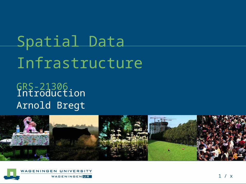
1 / x spatial data infrastructure grs-21306 introduction arnold bregt
TRANSCRIPT
1 / x
Spatial Data InfrastructureGRS-21306
Introduction Arnold Bregt
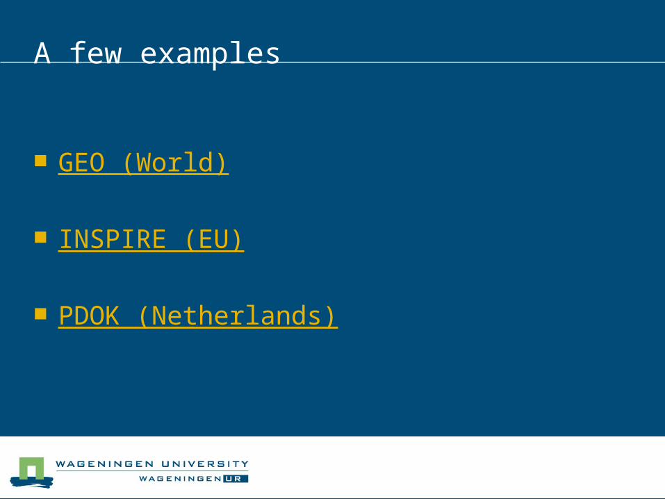
A few examples
GEO (World)
INSPIRE (EU)
PDOK (Netherlands)
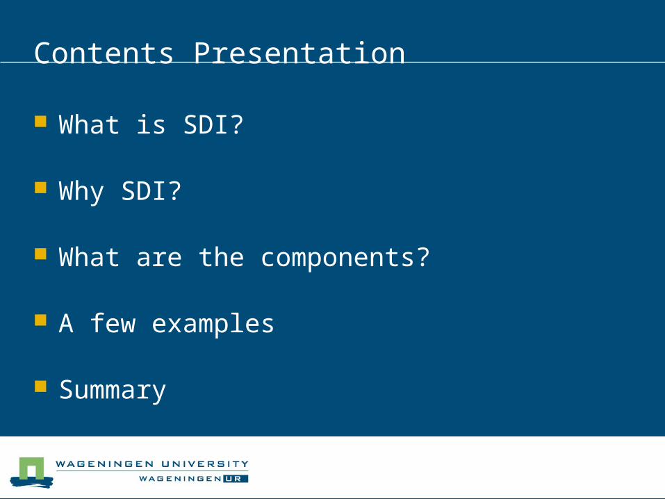
Contents Presentation
What is SDI?
Why SDI?
What are the components?
A few examples
Summary
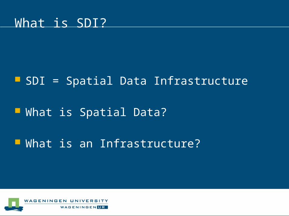
What is SDI?
SDI = Spatial Data Infrastructure
What is Spatial Data?
What is an Infrastructure?
Definition (Oxford dictionary)
“The basic systems and services that are necessary for a country or organization”
Infrastructure
Infrastructure facilitates the production of goods and services
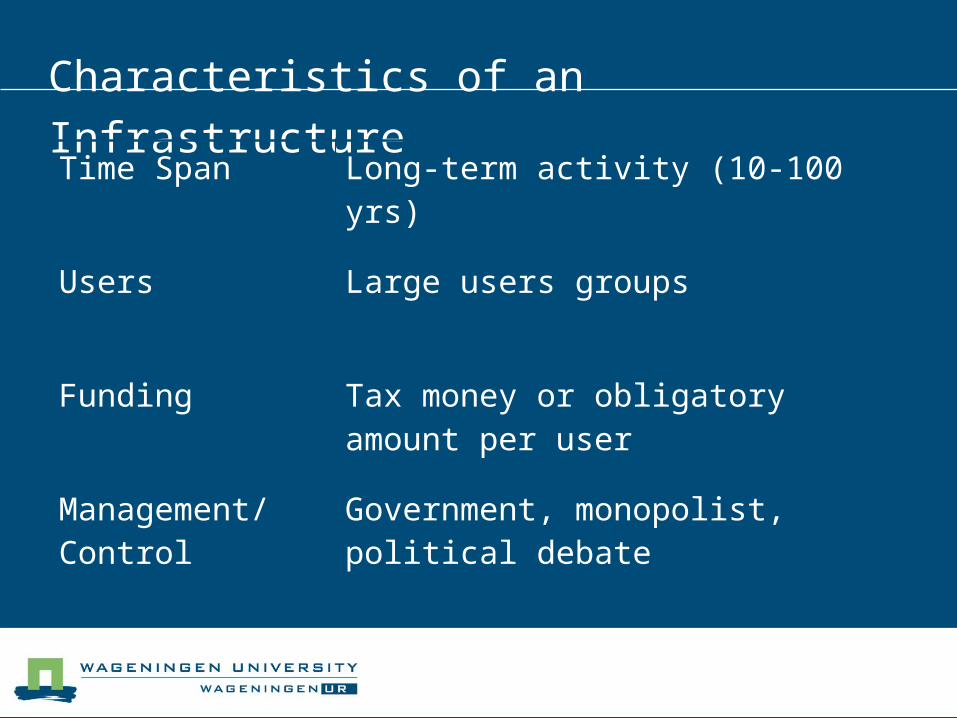
Characteristics of an Infrastructure
Time Span Long-term activity (10-100 yrs)
Users Large users groups
Funding Tax money or obligatory amount per user
Management/ Control
Government, monopolist, political debate
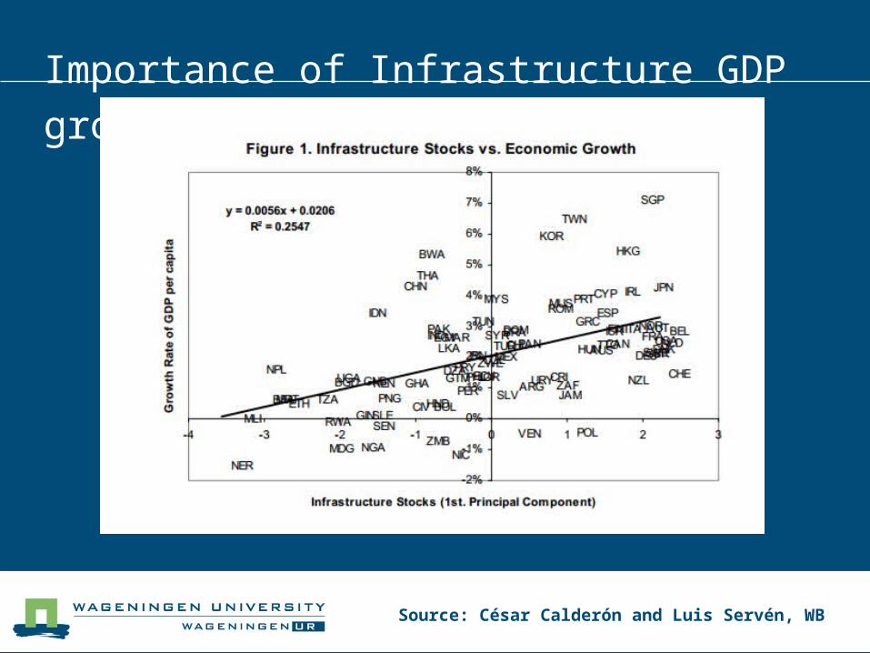
Importance of Infrastructure GDP growth
Source: César Calderón and Luis Servén, WB
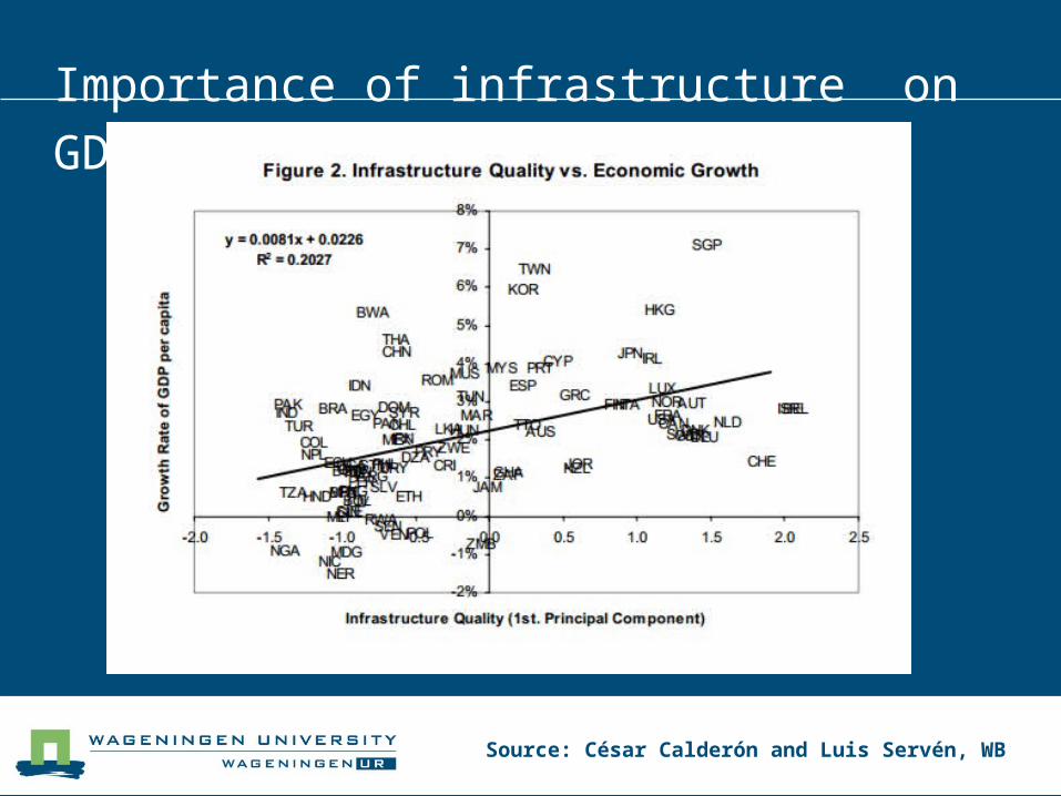
Importance of infrastructure on GDP growth
Source: César Calderón and Luis Servén, WB
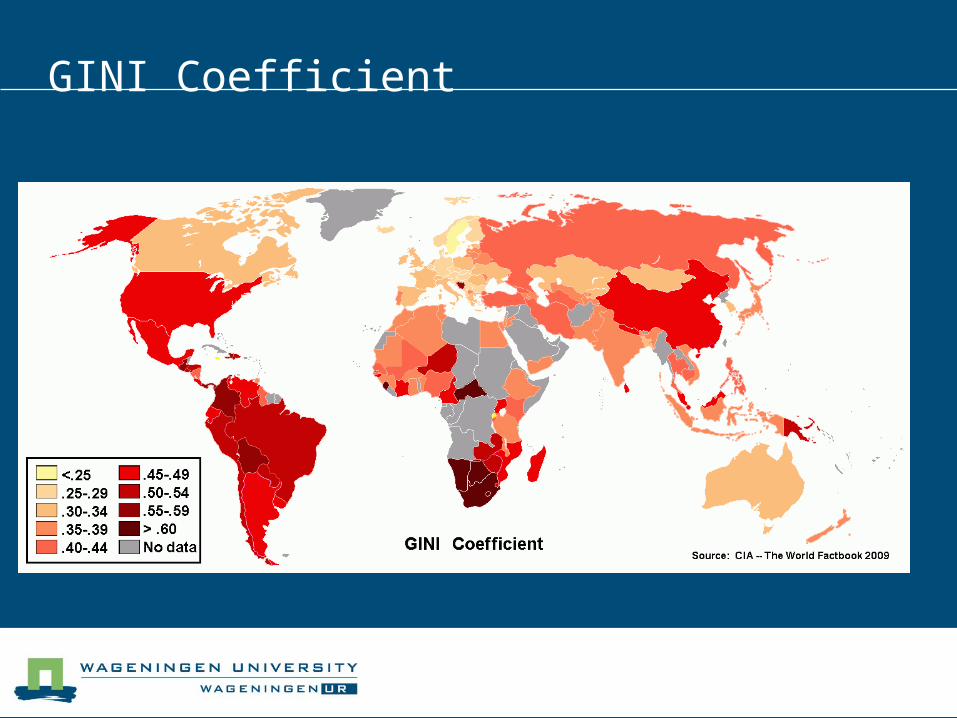
GINI Coefficient
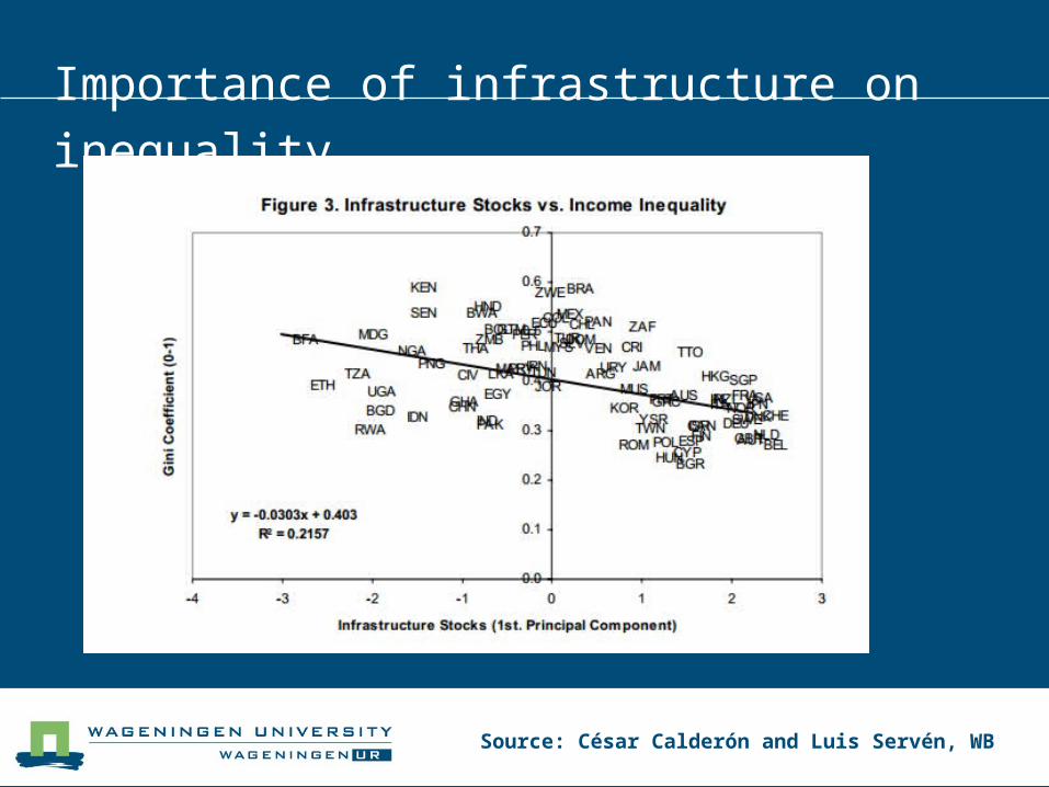
Importance of infrastructure on inequality
Source: César Calderón and Luis Servén, WB
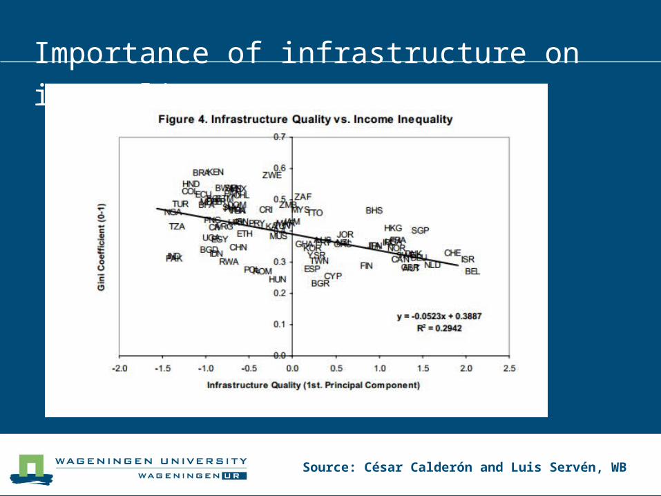
Importance of infrastructure on inequality
Source: César Calderón and Luis Servén, WB
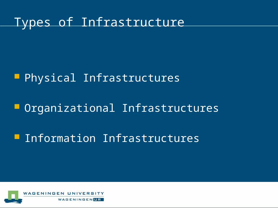
Types of Infrastructure
Physical Infrastructures
Organizational Infrastructures
Information Infrastructures
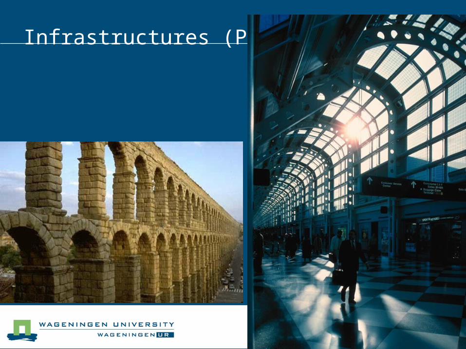
Infrastructures (Physical)

Infrastructures (organizational)
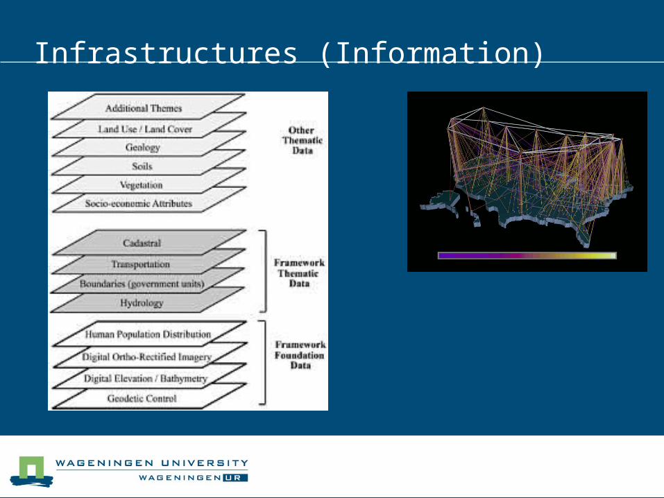
Infrastructures (Information)
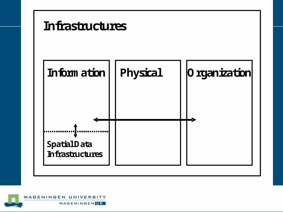
Infrastructures
Information OrganizationPhysical
Spatial Data Infrastructures
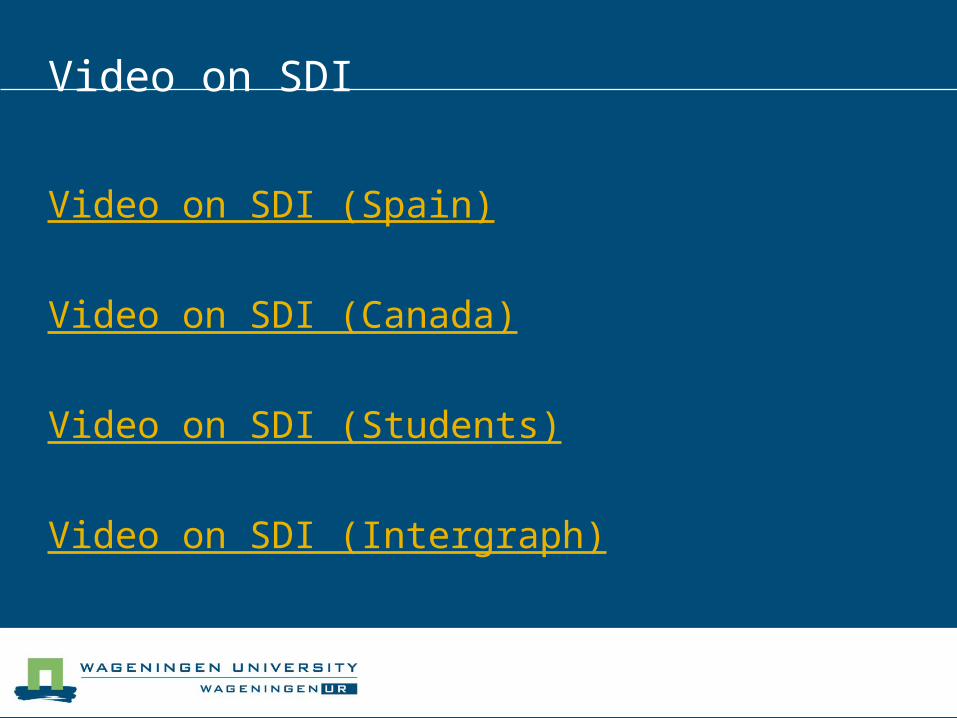
Video on SDI
Video on SDI (Spain)
Video on SDI (Canada)
Video on SDI (Students)
Video on SDI (Intergraph)
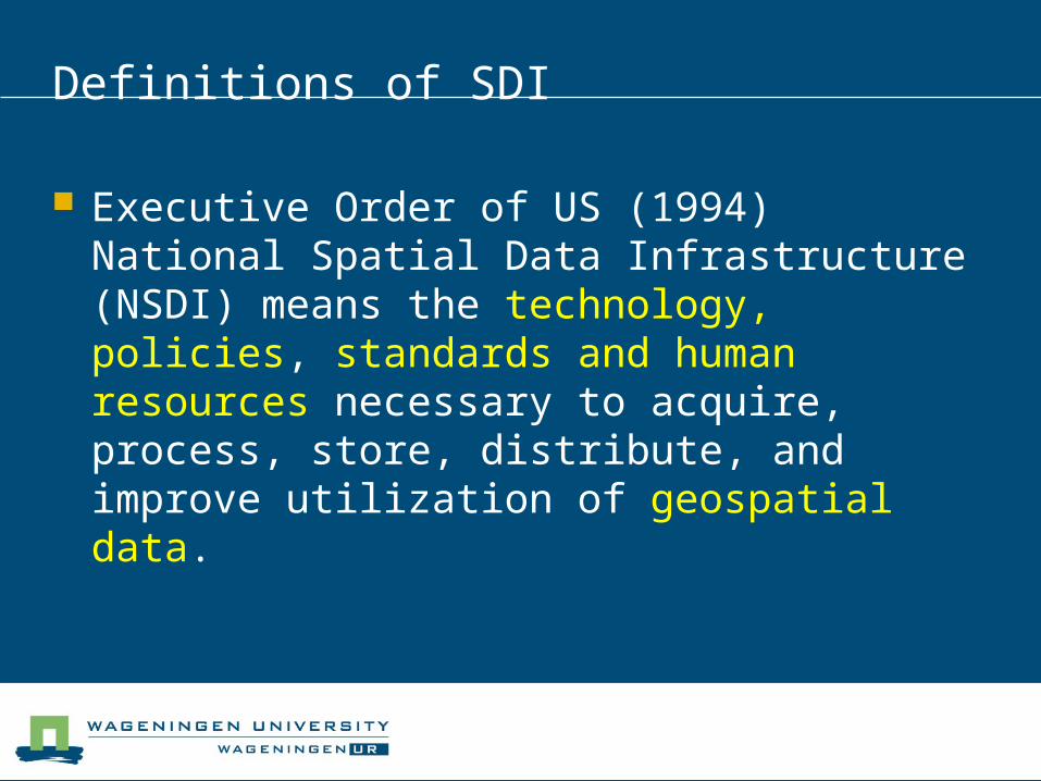
Definitions of SDI
Executive Order of US (1994) National Spatial Data Infrastructure (NSDI) means the technology, policies, standards and human resources necessary to acquire, process, store, distribute, and improve utilization of geospatial data.
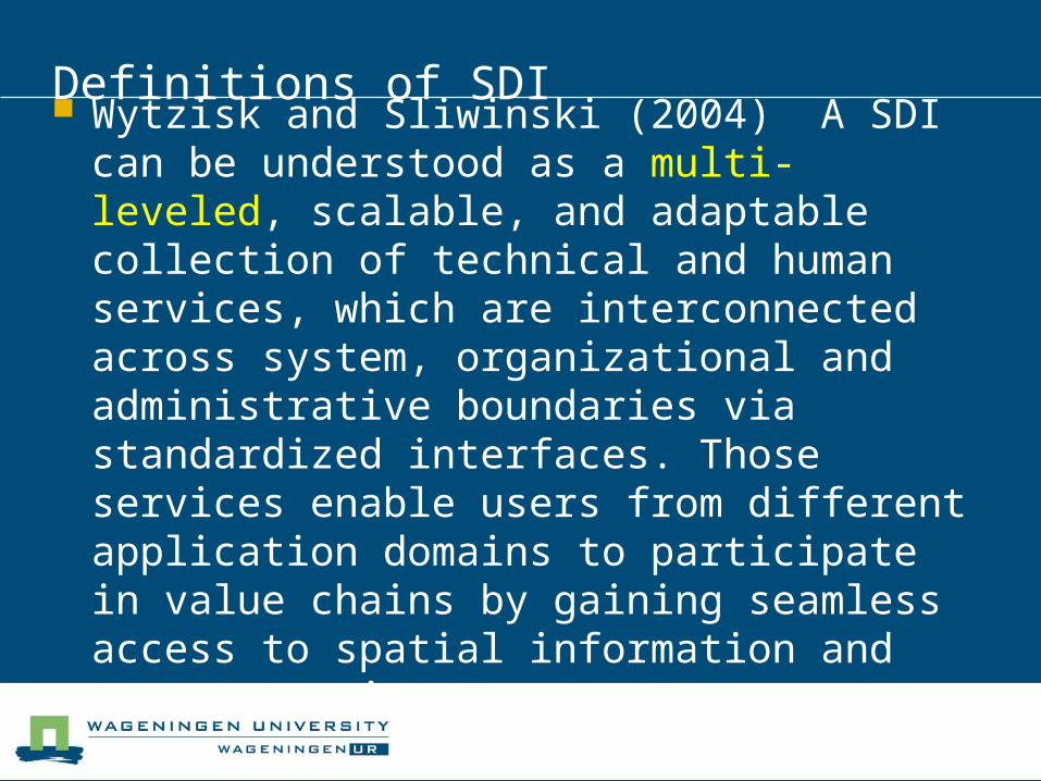
Definitions of SDI
Wytzisk and Sliwinski (2004) A SDI can be understood as a multi-leveled, scalable, and adaptable collection of technical and human services, which are interconnected across system, organizational and administrative boundaries via standardized interfaces. Those services enable users from different application domains to participate in value chains by gaining seamless access to spatial information and geo-processing resources.
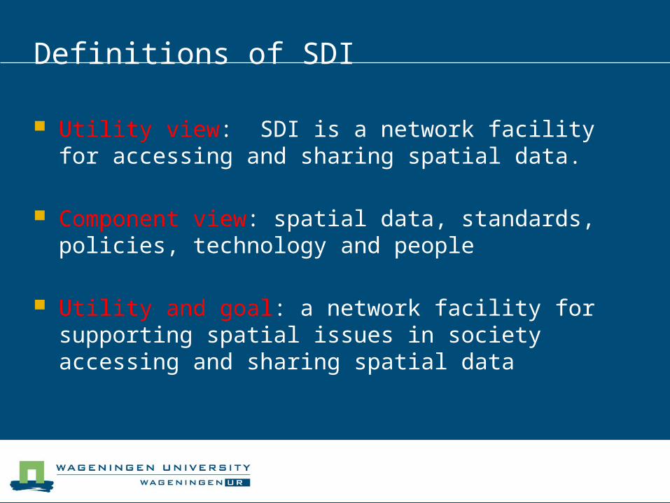
Definitions of SDI
Utility view: SDI is a network facility for accessing and sharing spatial data.
Component view: spatial data, standards, policies, technology and people
Utility and goal: a network facility for supporting spatial issues in society accessing and sharing spatial data
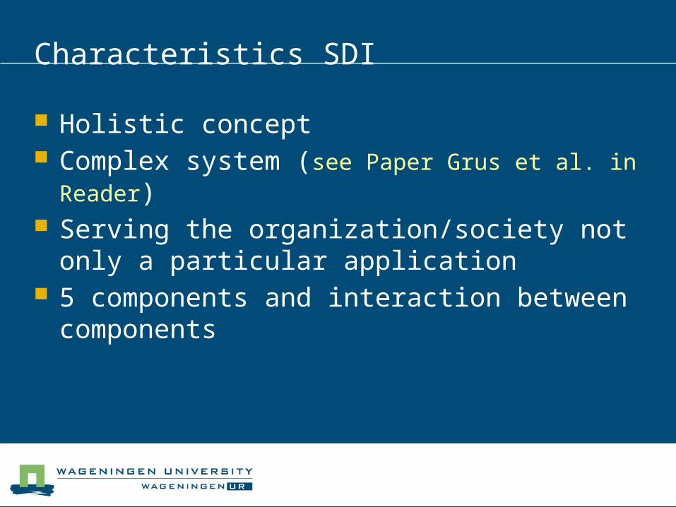
Characteristics SDI
Holistic concept Complex system (see Paper Grus et al. in
Reader) Serving the organization/society not only a
particular application 5 components and interaction between
components
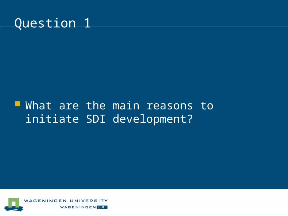
Question 1
What are the main reasons to initiate SDI development?
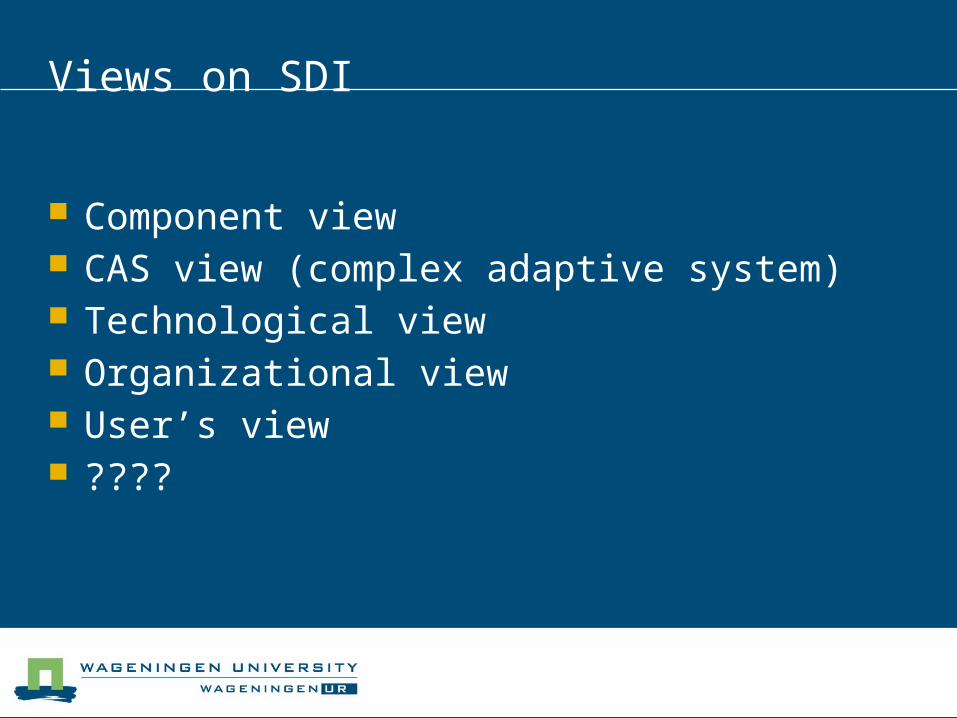
Views on SDI
Component view CAS view (complex adaptive system) Technological view Organizational view User’s view ????
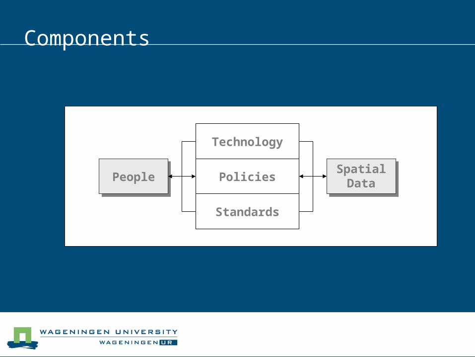
Components
PeoplePeople
Technology
Policies
Standards
Spatial Data
Spatial Data
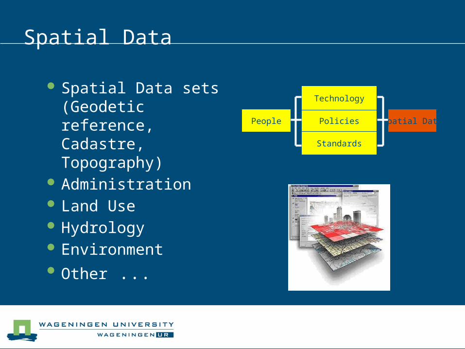
Spatial Data
Spatial Data sets (Geodetic reference, Cadastre, Topography)
Administration Land Use Hydrology Environment Other ...
People Policies Spatial Data
Standards
Technology
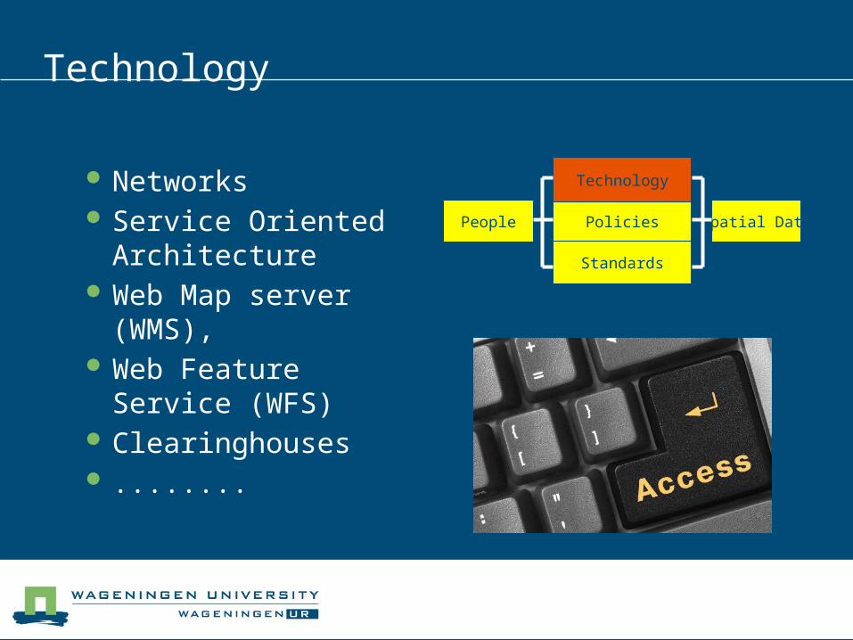
Technology
Networks Service Oriented
Architecture Web Map server
(WMS), Web Feature Service
(WFS) Clearinghouses ........
People Policies Spatial Data
Standards
Technology
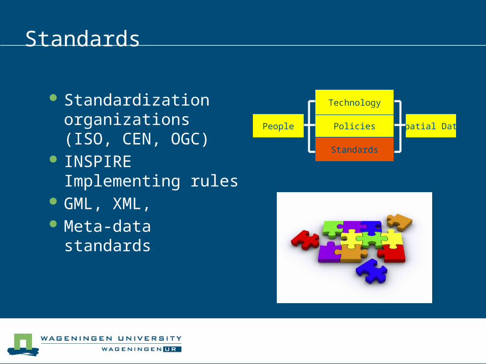
Standards
Standardization organizations (ISO, CEN, OGC)
INSPIRE Implementing rules
GML, XML, Meta-data standards
People Policies Spatial Data
Standards
Technology
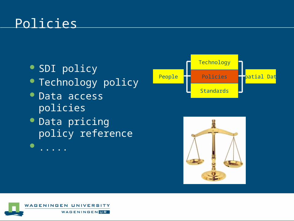
Policies
SDI policy Technology policy Data access policies Data pricing policy
reference .....
People Policies Spatial Data
Standards
Technology
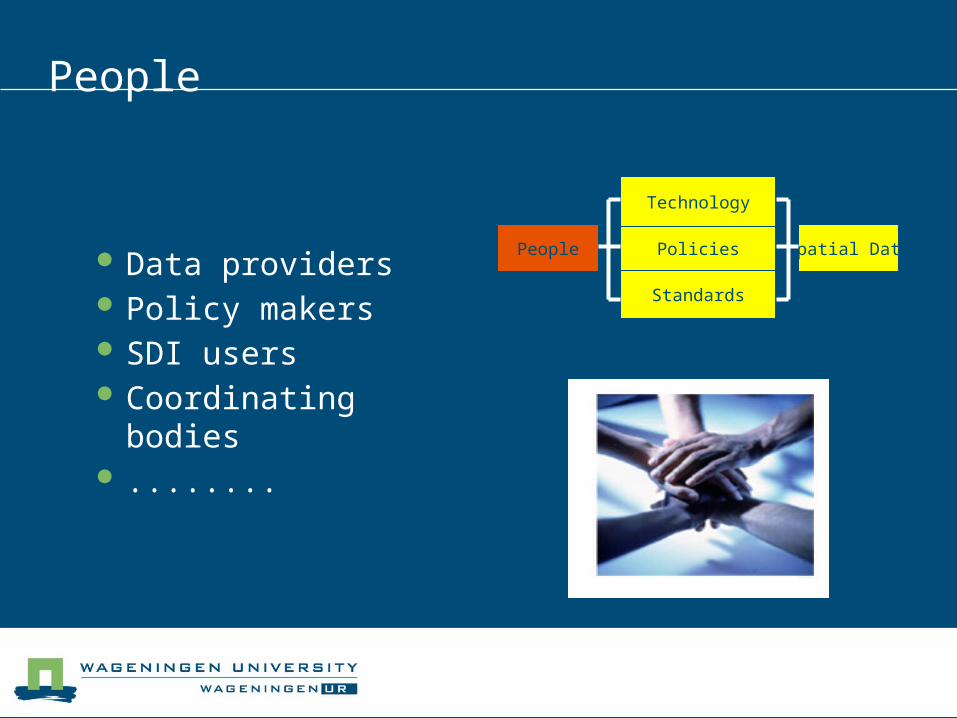
People
Data providers Policy makers SDI users Coordinating bodies ........
People Policies Spatial Data
Standards
Technology
Question 2
Provide examples of the mutual interaction between the 5 components of SDI.
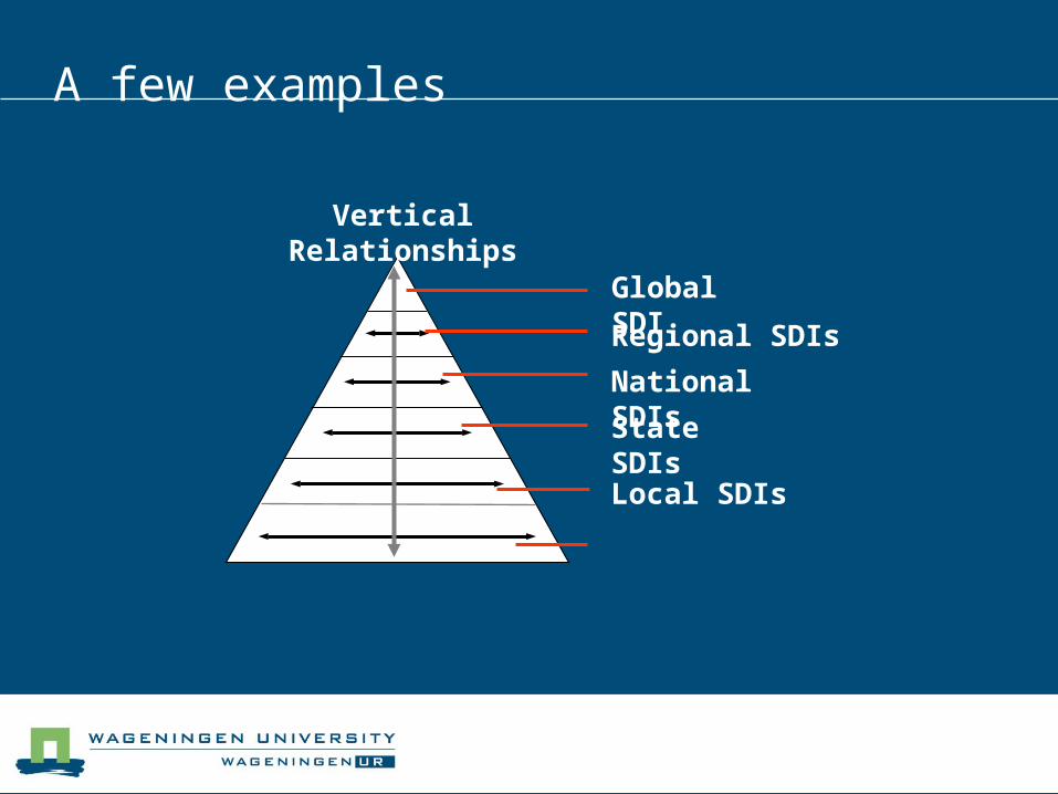
A few examples
Regional SDIs
National SDIs
Global SDI
State SDIs
Local SDIs
Vertical Relationships
Exercise
Try to find at least 3 geo portals on the web
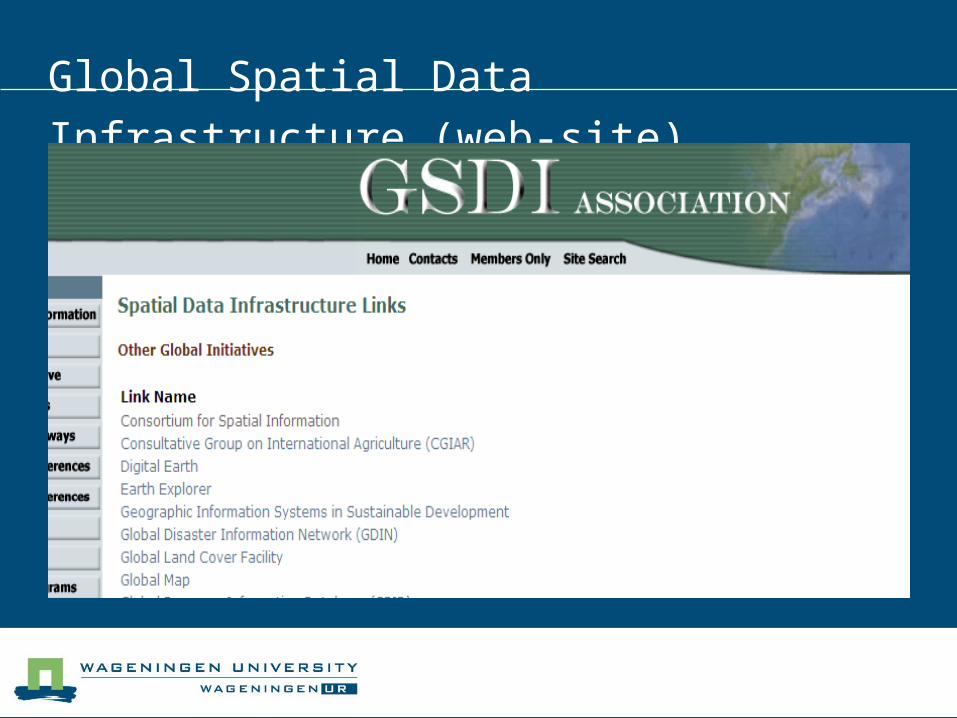
Global Spatial Data Infrastructure (web-site)
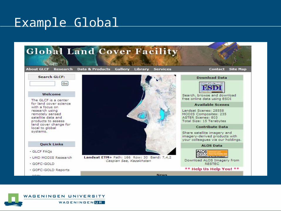
Example Global
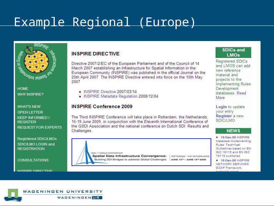
Example Regional (Europe)
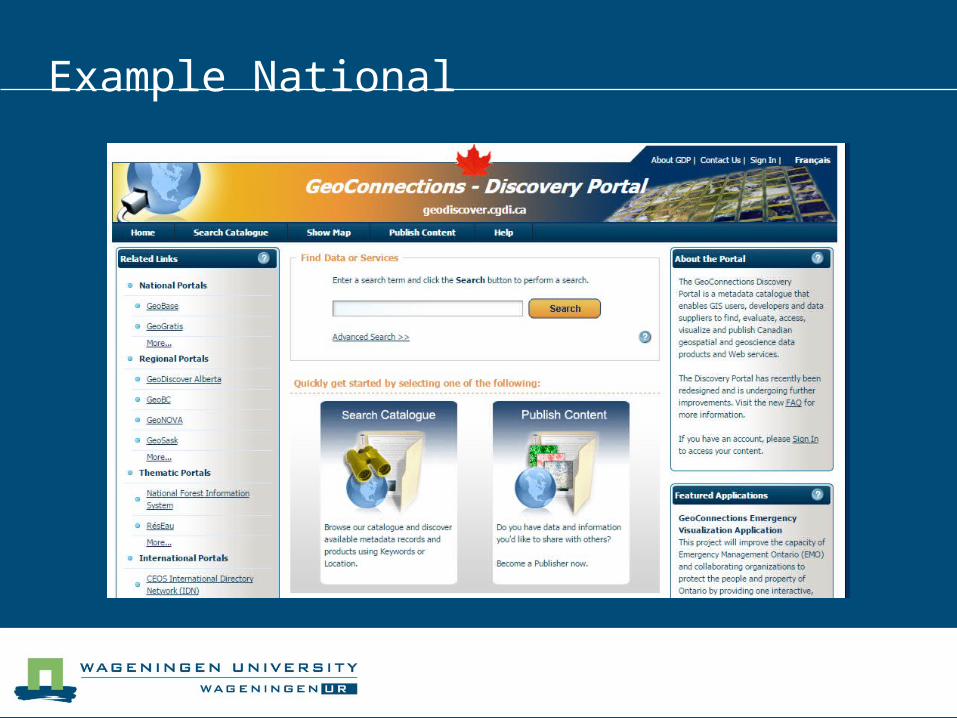
Example National
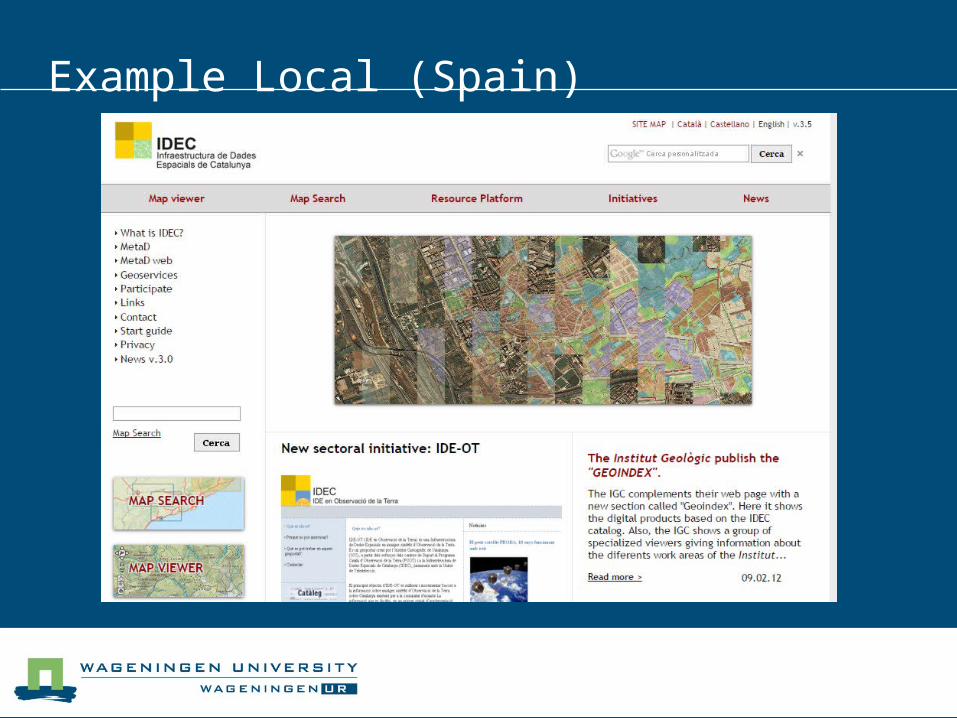
Example Local (Spain)

A short history of SDI
1991 Term SDI from Canada 1994 Clinton Executive Order 12906 (SDI) 1996 GSDI organization 2007 INSPIRE directive
1998 SDI course in Wageningen
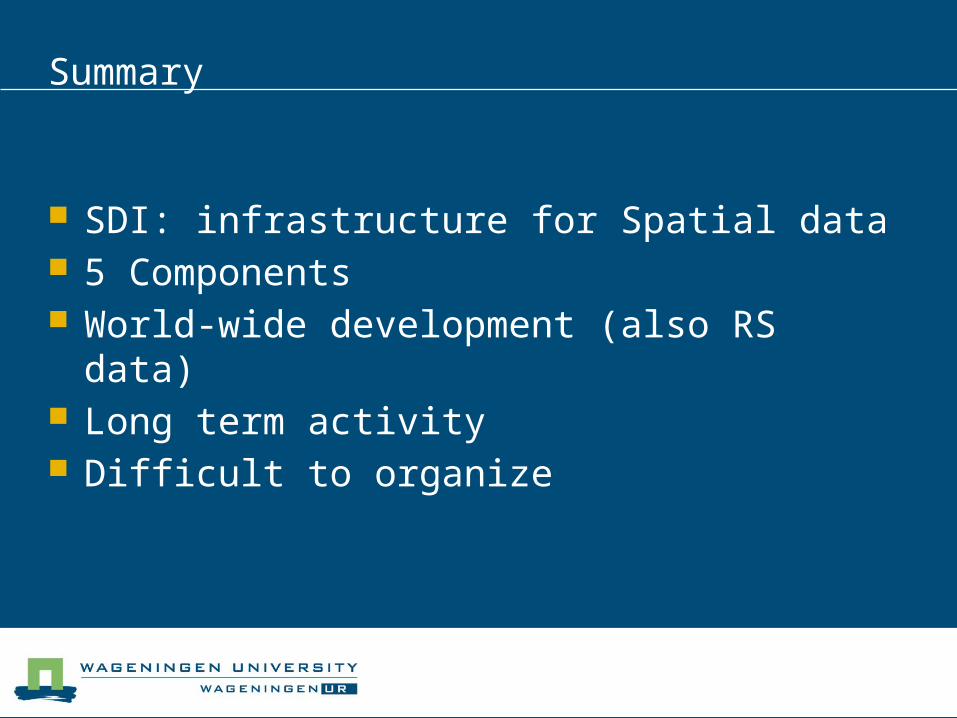
Summary
SDI: infrastructure for Spatial data 5 Components World-wide development (also RS data) Long term activity Difficult to organize

Final Remark
We (Lukasz, Vicky and Arnold wish you a good 2015 and fruitful SDI course!
Questions?