1 geography what is geography? combination of two greek words geo-earth and graphy- to write or...
TRANSCRIPT

1
Geography What is Geography?
Combination of two Greek words
Geo-Earth
And Graphy- to write or scribe
Geography= To study or describe the earth
2
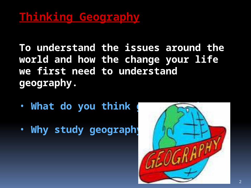
Thinking Geography
To understand the issues around the world and how the change your life we first need to understand geography.
• What do you think geography is?
• Why study geography?

3
Geography is the study of people, their environments, and their resources. A geographer looks at how the natural environment affects the way we live. A geographer also looks at the way we live and how we change the environment in which we live in. A geographer looks at the natural resources people use.
A natural resource is a material that humans can take from the environment to survive and satisfy their needs. For example a mountain range may contain reserves of coal or iron, while a nearby river or ocean may supply fish. The iron, coal, and fish are examples of natural resources.
What do you think is a natural resource?

4
Maps and Globes To locate places, geographers used maps and globes. A map is a drawing of the Earth’s surface.
A globe is a round object shaped like a ball (sphere) that has a map of the world on it.

5
A drawing of a map on a flat surface is called a map projection.
A person that makes a map is called a cartographer.
Today they use sophisticated technology to make maps.

6
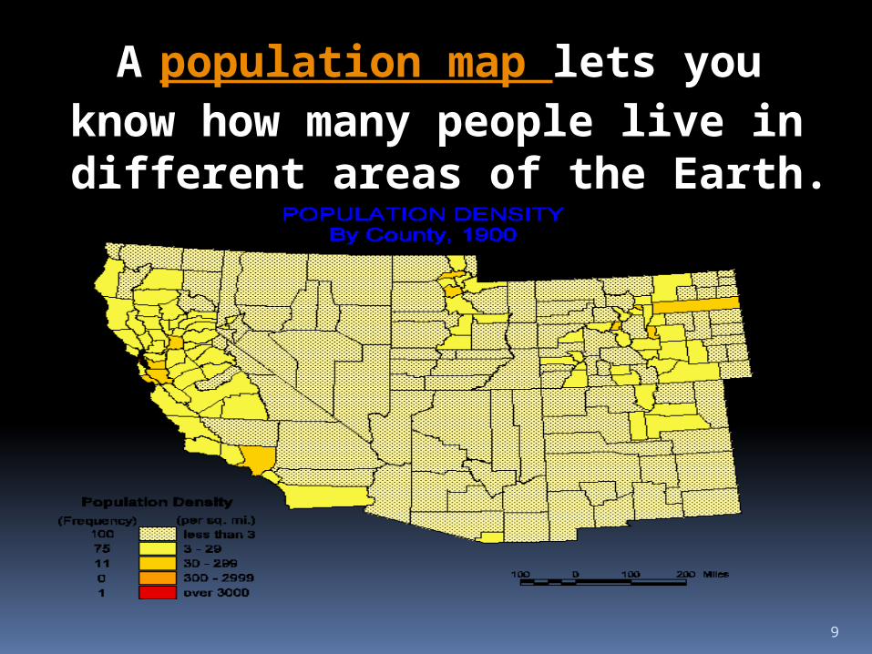
Five Kinds of MapsHere are four types of maps that we use in our everyday lives. They are political, physical, population, and natural resource maps. Each type of map serves a specific purpose.

7
The political map shows the boundaries (or lines) that people use to divide their world into countries and states.

8
A physical map shows natural features, such as, mountains, deserts, rivers and oceans.
9
A population map lets you know how many people live in different areas of the Earth.

10
A natural resource map shows the natural resources in an area. A natural resource is the raw materials, such as minerals, found on the land areas.

11
Latitude and LongitudeMost maps have lines on it that look like lines on a sheet of graph paper. These graph lines make it easier for us to locate the exact location of a place. These lines on the graph are measured in degrees °.
Latitude Longitude

12
We use a compass rose to determine directions on a map. A compass rose shows the directions of North, South, East and West on a map.
The lines that that run north to south (or up and down) are call longitude.

13
The lines that that run east to west (or left to right) are call latitude.

14
If The Equator divides the Earth into two halves called hemispheres.
We divide the Earth in half with an imaginary line at 0° latitude is called the Equator.
15
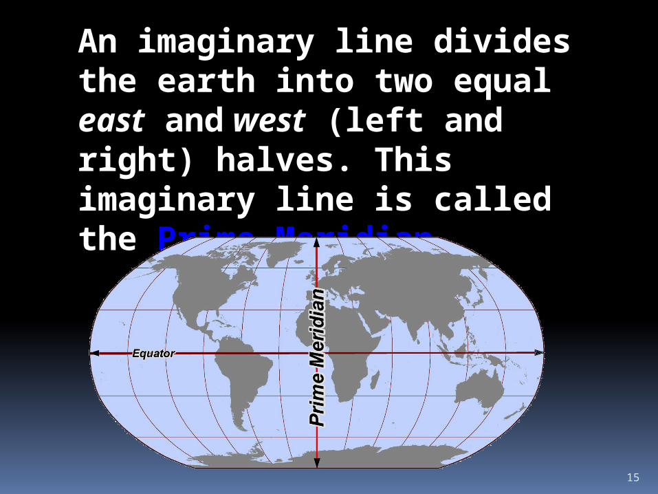
An imaginary line divides the earth into two equal east and west (left and right) halves. This imaginary line is called the Prime Meridian.

16
Time Zones
Lines of longitude and latitude also help us tell what time it is all over the world. Why does time differ on the earth from place to place? The answer is that the Earth rotates on its axis. As the Earth moves, the sun appears to rise in some places and set in other places. Throughout the world people use the rising and setting of the sun to set their clocks.

17
To make this easier the world was divided into 24 time zones. Each time zone represents 1 hour in time on a clock. As you move from time zone to time zone you increase or decrease you clock by 1 hour for each time zone you cross when traveling. If you head West, you lose an hour for each time zone you cross. If you head East, you add an hour for each time zone you cross. Each zone you cross is called a Standard Time Zone.
18
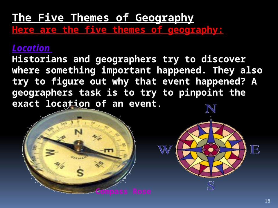
The Five Themes of GeographyHere are the five themes of geography:
Location Historians and geographers try to discover where something important happened. They also try to figure out why that event happened? A geographers task is to try to pinpoint the exact location of an event.
Compass Rose

19
Place A geographer looks at the physical features of a place. They look at the climate (weather), plant life, animal life and bodies of water. People often help to shape the way a place looks by their ideas and actions.

20
Interaction Between People and Their Environment
Throughout history, people have adapted and changed their natural environment. For example, ancient hunters learned to grow food crops in the Americas. Later, Native Americans in the Southwest found ways to, or bring water to the desert so they could farm the land. Ancient American hunters learned to plant seeds and grow crops.
Later Americans in the Southwest developed methods of irrigation, or bringing water to dry lands. Today, advances in technology allow people to alter their environment dramatically.
People have invented ways to take oil from the ocean floor. They have cut down thick forests to build highways.

21
To get resources they had to move place to place. As they met other people, they exchanged their ideas and technology. Technology is any new idea or invention used to improve the life style of people. Examples of technology are automobiles, televisions and radios. These advances in technology led to the world we live in today
Movement People move around to different places throughout the world because their resources (raw materials) are spread unevenly around the world.Resources are things that we get from the Earth to help us survive, such as trees, water and fish. People need these resources to build their houses and survive.

22
RegionGeographers study regions. A region is an area of the world with similar characteristics. For example, The Great Plains is a region because it has fairly level land, very hot summers, very cold winters and little rainfall.

23
2. Lands and Climates of the United States
Geographers divide the United States into several different physical regions with contrasting landforms. The Hawaiian Islands located in the North Pacific Ocean, consist of a chain of islands. The Pacific Coast is the mainland’s westernmost region, with high mountain ranges stretching from Alaska to Mexico.
24
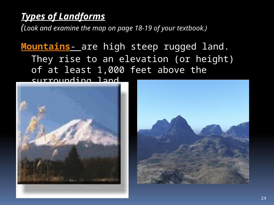
Types of Landforms(Look and examine the map on page 18-19 of your textbook.)
Mountains- are high steep rugged land. They rise to an elevation (or height) of at least 1,000 feet above the surrounding land.

25
Hill- Hills are areas of raised land, but they are lower, less steep and more rounded than mountains.
26
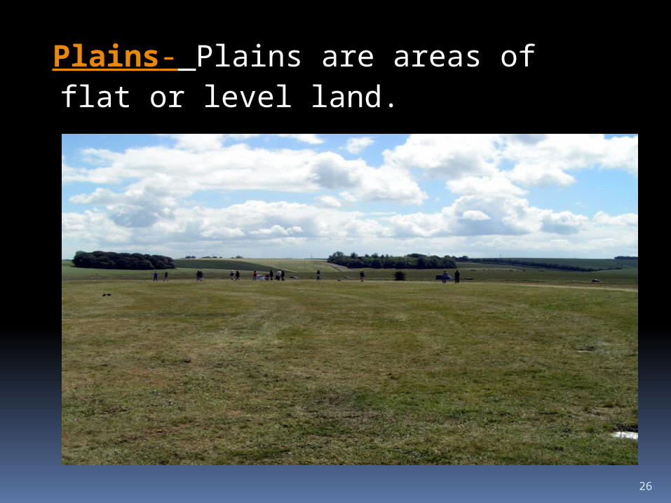
Plains- Plains are areas of flat or level land.

27
Plateaus- Plateaus are large raised areas of flat land.

28
A narrow strip of land that joins two large areas is called an isthmus.

29
A tributary is a stream or smaller river that flows into a larger one. These rivers provide transportation by boats. They also provide moisture (or water) for most part of the plains of the United States. The rivers of the United States crisscross the country linking different physicals regions.
The Mississippi RiverMissouri River
Rivers and Lakes
There are many great river systems in North America. They collect water from melting snows and rain and carry it to the oceans.The Mississippi River and the Missouri River and their tributaries make up the largest and most important river system in the United States.

30
The Great Lakes- Five Great Lakes border the United States and Canada. The Great Lakes are Superior, Michigan, Huron, Erie and Ontario.

31
Factors that Affect Climate
Weather is the condition of the Earth’s atmosphere (or air.) It could be hot or cold, rainy or dry or something in between.
The United States has 10 different types of climates. Climate is the average weather of a place over a period of 20-30 years. Two features define the climate. They are temperature and precipitation. What do you think is temperature?Precipitation is the water that falls from the sky in the form of rain or snow. The location and altitude, or height of the land above sea level, of a region also influences climate.