your place matters - community planning toolkit for … · your place matters: community planning...
TRANSCRIPT

Your Place Matters:
Community Planning Toolkit for the Future of Rural Buildings and their Setting

Authorship and CopyrightThis toolkit has been written by Emily Hathaway of Worcestershire County Council Archive and Archaeology Service and Jeremy Lake of Historic England.
Copy editing and graphic designThis toolkit has been copy edited and designed by Sarah Austin MSc.
AcknowledgementsMany thanks to the following individuals and organisations for their constructive comments and suggestions in support of this publication: Lara Bishop, Steve Bloomfield, Pete Boland, Clifton upon Teme Neighbourhood Planning Steering Group, Jack Hanson, Leigh and Bransford Neighbourhood Planning Steering Group, Cody Levine, Adam Mindykowski, Aisling Nash, Maggi Noke, Tom Rogers, John France and Carol Wood.
Thanks also goes to Damian Grady from Historic England’s Aerial Reconnaissance, for his beautiful aerial photographs which capture the diverse character of the county’s settlements and landscapes.
Cover image This photograph of Manor Road in Little Comberton, records buildings in the historic core of the village, dating from the 16th century to the 19th century. The buildings reflect both local vernacular traditions and national trends in architectural style and are set close to the road within narrow building plots that back directly onto farmland creating a sense of connectivity to the rural landscape. Little Comberton, like many small, nucleated villages in Worcestershire, is characterised by a compact and well defined core with clusters of wayside cottages and larger, detached houses and farmsteads, which form a linear building line, interspersed with green space, including traditional orchard. The strong building line contributes significantly to the attractive visual character of the village, which is designated as a Conservation Area. 20th century infill and expansion has developed to the north of the Conservation Area, occurring between the denser area of settlement, around the medieval church, and more scattered settlement to the north, along Wick Road. Photograph © Worcestershire Archive and Archaeology Service.

Section 1
Introducing the Toolkit for your Community-led PlanOverview ......................................................................................................... 1Planning background .................................................................................... 4Research background ................................................................................... 5Constructive conservation and new housing .............................................. 5Living in local landscapes .............................................................................. 7Rural life: putting people into historic places .............................................. 8 Ways of working and living in rural Worcestershire ...................................... 10
Section 2
A step-by step toolkit to understanding your area and producing a community-led planOverview ......................................................................................................... 12Stage 1: Getting started ................................................................................ 14
Exercise A: First impressions ............................................................ 14 Exercise B: Use maps to identify how your area has changed .. 15 Exercise C: Adding the detail ........................................................ 19
Stage 2: Buildings in their setting .................................................................. 23 Exercise D: Buildings in their setting: what are the defining characteristics of your local area? ............................................... 23 Exercise E: Use field survey to further deepen your understanding of the buildings within your local area ......................................... 26
Stage 3: Your place, your choice ................................................................. 29 Exercise F: Create a landscape character assessment for your community-led plan .............................................................. 31 Exercise G: Create policies for your community-led plan .......... 33
ResourcesInformation services ....................................................................................... 37Glossary of terms ............................................................................................ 40Reading List ..................................................................................................... 43Appendix 1. Designation checklist ............................................................... 45Appendix 2. Landscape Character Assessment: Area case study ........... 47Appendix 3. Examples of policies from Neighbourhood Plans .................. 57Appendix 4. Assessing development proposals .......................................... 61
Section 3

Section 1
Introducing the Toolkit for your Community-led Plan
1
Overview
All rural places and buildings are a reflection of how people have lived, worked, thought and related to each other throughout history. Rural settlement is at the core of our everyday lives and provides a base from which we view and experience the wider landscape. The villages, hamlets, farmsteads, and houses that we call home, connect us to each other and to our shared sense of history.
Understanding the series of changes that have created a place over time, can inspire and guide future changes, including the scale, style, form and location of new development, as well as opportunities presented by the natural and historic environment.
This toolkit is aimed at community planning groups and the professional advisors who support them, and can also be used by those undertaking research into individual areas. It responds to a need identified in workshops and national research (Locus Consulting, 2013), for guidance which helps communities and researchers to understand place as the result of past change, and the opportunities that this offers for the future.
It will help you step back and see your area in its broad context, and by following the step-by-step exercises, will enable you to identify the historic character and distinctive qualities of your area. Through assessing the character of your local landscape you will gain a deeper understanding that
will enable you to identify, evaluate and guide opportunities for change. This new understanding can then be used to develop locally tailored and informed policies within a community-led plan that can be referred to when planning applications are submitted in response to development opportunities.
Using a new understanding‘Your Place Matters: Community Planning Toolkit for the Future of Rural Buildings and their Setting’ has been designed by Worcestershire Archive and Archaeology Service and Historic England, in collaboration with community groups to help you:
Identify and then champion the • distinctive characteristics of your area, focusing on how all buildings of different dates are sited and experienced within the landscape.
Identify and assess the forms of • settlement, buildings and other landscape features that make up the whole environment, afford habitats for wildlife and make it special for people.
Use this fresh understanding to • inspire and guide your Community-led Plan and help ensure that new development responds to local character and distinctiveness, in line with national and local planning policy.
Trouble understanding the terminology?The roles of different organisations, and the language used by heritage professionals, is often specialised. A glossary in Section 3 of this toolkit provides definitions of terms which may be newly introduced or unknown to you.
2

Using the Toolkit and Guidance documentsThis Toolkit document is supported by a Guidance document ‘Your Place Matters: A Guide to Understanding Buildings and their Setting in Rural Worcestershire’. This complementary document provides detailed information on the broad range of rural building types and their settings within their settlement and wider landscape.
These two documents are designed to work together through linking relevant information found within the supporting Guidance, with the Exercises found in Section 2 of this Toolkit.
This Toolkit document is also provided with hyperlinked tabs, that when selected will conveniently take you to relevant information found within another page of the document.
ExercisesAppendix
Toolkit document, hyperlink tabs
3
Resources

Planning background
The Localism Act (2011) gave new rights and powers to local communities over planning and setting the priorities for their own areas. The Neighbourhood Development Plan (NDP) is, at present, the primary mechanism for community-led planning. NDPs should support the strategic development needs set out in the Local Plan and plan positively to support local development (as outlined in paragraph 16 of the National Planning Policy Framework).
Neighbourhood Development Plans can empower local communities to:
Set planning policies that can be • used in determining planning applications.
Grant planning permission through • Neighbourhood Development Orders and Community Right to Build Orders for specific development which complies with the order.
The National Planning Policy Framework (NPPF) places good design, local character, and conservation of the historic and natural environment at the heart of sustainable development and good planning.
It stresses the importance of:
New development making a • positive contribution to local character and distinctiveness, drawing on ‘the contribution made by the historic environment to the character of place’ (2012, 30). The historic environment is defined as resulting from ‘the interaction of people and places through time’ (2012, 52).
Conserving heritage assets in a • manner appropriate to their significance and putting them to viable uses consistent with their conservation. Heritage assets include listed buildings, and other places and archaeological sites which are considered to have national or local heritage interest. The more important the heritage asset, the greater the weight that should be given to its conservation and the impact of any development on its setting.
Achieving sustainable development • whereby economic, social and environmental gains are all delivered through the planning system.
4

Historic England (formerly English Heritage) has also developed Constructive Conservation as the overall term for its positive and collaborative approach to conservation that focuses on actively managing change. The aims of this approach are to recognise and reinforce the historic significance of places, while accommodating the changes necessary to ensure their continued use and enjoyment. The recent Farrell Review of Architecture and the Built Environment (also called ‘Our Future in Place’) has also concluded that protection of the heritage that we most value, should not be at odds with making the ordinary better, through seeing, ‘the potential of what is already there, the value of place, identity and sustainability’ (2015, 108).
Research background
‘Your Place Matters’ provides a framework for deepening an understanding of a whole place and discovering and enjoying what makes one place different from another. It supports new approaches to considering the benefits offered by our environment, as exemplified by Ecosystem Services. This fresh approach,
which takes into account the interdependent relationships between the historic environment, natural environment, economy, health and well-being, offers a strong foundation for understanding how culture has shaped England’s rich array of landscapes, which in turn will help strengthen the recognition, assessment and protection of those buildings, monuments and areas considered to be most special.
Constructive conservation and new housing
The scale, form and setting of new development can pose different risks and opportunities to the historic environment of your area. The intensification of large scale development pressures on Worcestershire’s, often fragile, rural landscapes is driving the need to understand the whole historic environment so that the historic character of places can be used as a framework against which proposed changes can be measured. This approach is not intended to fossilise places or encourage imitation, but rather nurture opportunities following the principles of constructive conservation.
5

The different types of new housing development that occurs within England are explained below. Further information can be found in, ‘Evaluating the impact of housing development on the historic environment’ (LUC and Haynes, 2014).
Conversion / restoration of non-residential historic buildings for new housing, these schemes form a significant element of new housing development within the rural landscape, for example, the re-use of industrial buildings and traditional farm buildings.
In-fill development, is the insertion of new development within the form / grain of historic settlements (nucleated, hamlets, isolated houses and farmsteads).
Insertion of new housing in historic areas of heritage value, such as historic gardens and designed landscapes, can potentially act as enabling development to fund restoration of an associated building. Development of this type within areas of sensitive historic landscape character, has significant potential for adverse effects, for example, upon relic field patterns and settings of historic town/
villages. Yet there is also potential for substantial conservation gain through the resulting restoration project.
Settlement expansion / urban extension, these are key options for Local Planning Authorities (LPAs) in delivering projected housing growth where there is no capacity for substantial infill or redevelopment within existing settlement boundaries. Such development has significant potential for impacts on the setting of historic towns and heritage assets in the urban fringe. Once allocated in the development plan, the principle of development in that location is established, it is therefore critical that a strategic assessment is made of these potential impacts on the historic environment.
New settlement is the establishment of new, discrete communities outside established settlement boundaries, for example, ‘eco-villages’ and ‘garden suburbs’. These pose the additional challenges of infrastructure, service and amenity provision.
‘Enabling development’ is development that would be unacceptable in planning terms but for the fact that it would bring public benefits sufficient
6

to justify it being carried out, and which could not otherwise be achieved. Housing within the curtilage of historic buildings and designated landscapes are often an attractive prospect for developers seeking a ‘unique selling point’ and have potential value in addressing conservation deficits for assets that have no other viable prospect of a sustainable future. Close monitoring of delivery against conservation objectives is a significant challenge in such cases.
Living in local landscapes
The character of our everyday landscapes, and what makes them locally distinctive, results from how people have lived, worked and thought over time. This is captured in a useful definition of landscape provided by the European Landscape Convention as, ‘An area, as perceived by people, whose character is the result of the action and interaction of natural and/or human factors’ (2007, Art. 1). This international treaty seeks to promote landscape protection, management and planning across Europe, and to organise European-wide co-operation on landscape issues.Seeing the landscape as a whole,
and understanding how its component parts fit together, is important in order to manage and design landscapes that are as rich and diverse as they can possibly be. Appreciation of what makes an area distinctive will benefit from stepping back and considering how its patterns of settlement, its landscape and its buildings mix together.
The basic patterns of settlement in rural areas have developed from before the medieval period, varying from areas with large villages and few farmsteads to areas with scattered farmsteads, houses and hamlets. Fields, open land, woodland and industrial sites developed in close relationship with these patterns of settlement and are crossed by routeways to enable local land use or access to more distant places including markets. A diversity of crafts and trading patterns, changes in religious practice, and increasingly a desire to simply enjoy the benefits of living in the countryside, have also shaped rural England. Which in turn, have provided the setting for buildings of different dates, styles and materials, as well as the fauna and flora, traditions, food and dialect, loved by their residents and visitors.
7

The two photographs below, show contrasts in settled landscapes in Worcestershire.
The east and south east is dominated by large nucleated villages with few isolated farmsteads, that mostly date from after the enclosure of open fields. Photograph © Historic England NMR29433_013
8
The remainder of the county has fewer, smaller, villages and higher densities of isolated farmsteads and hamlets, which have developed along an intricate network of roads, in areas with a complex mix of woodland, common and heath.Photograph © Historic England NMR29434_009
Rural life: putting people into historic places
Continuing and new ways of living and working require housing and other facilities that form the building blocks of settlement growth. Besides reflecting the skills and lifestyles of local people, these have all developed in response to changing ideas and developments at a national and even international level. This is evidenced by:
Farming in Worcestershire, as in the • rest of England, has affected more than 70% of the land area, requiring fields for the efficient management of crops and livestock and farmsteads to house farming families, finish products for market and produce manure to fertilise the fields.
Farmers and rural communities • have also made use of common land for fuel and livestock, the small proportion that now survives being often held in high regard as places for recreation and wildlife. The management of woodland for fuel and timber has declined since the late 19th century, but is now set to expand. Hedgerow trees are

also a significant element of landscape in many parts of the county, and were an important source of building timber.
Mining, quarrying, manufacture • and trade have been enormously important in England’s development from the medieval period in the form of mines, quarries, workshops, shops and road, rail and canal networks.
Households in areas with the highest • densities of rural settlement often practised a variety of trades and crafts.
Demand for houses with their • gardens has generally changed in response to smaller household sizes, more living space and the desire of many to live in rural areas.This has become increasingly possible by faster means of transport and access to digital communications.
Places of Worship, community • buildings and spaces have also developed in response to the needs and character of communities.
9
A 17th century farmstead (top photograph) and 20th century development (bottom photograph) on Rye Street in Birtsmorton. Photographs © Worcestershire Archive and Archaeology Service.
Ways of working and living in rural Worcestershire
FarmingEnclosed land worked by farms covers more than 70% of the county’s landscape. The largest farms developed in the east of Worcestershire, where production of corn was concentrated. The remainder of the county is characterised by an underpinning pattern of small to medium scale farms and smallholdings.
Farmland has expanded into areas covered by woodland and heathland, but large blocks of both, (especially in the north and west of the county), remained into the 18th century. Many of the smallest farms and smallholders benefitted from by-employment in small-scale industry and trades, access to common land for their animals, and harvesting fuel. Only fragments of heathland have survived, due to their enclosure in the late 18th and 19th centuries. Woodland remained an important source of building material and fuel, right up until the 19th century, and large blocks continue to dominate industrial landscapes, with less productive soils, such as the Wyre Forest.
HorticultureOrchards, market gardening and hop gardens developed from the 17th century, increasing as the use of common land declined and reaching a peak in the early 20th century, to meet increasing demands for fresh produce in developing rural and urban markets. Thereafter followed a gradual decline as markets looked increasingly to cheaper imports from countries such as the United States, Australia and New Zealand.
Crafts, Trade and IndustryA large proportion of the rural population made a living in various trades, industries and the transportation of goods. Significant rural industries included coal and ironstone mining, salt production, quarrying, textiles, glove making and the manufacture of glass, nails, agricultural implements, needles, fish hooks and fishing tackle. Most rural communities also engaged in standard trades such as shoe making, tailoring, carpentry, building trades and the import or export of products for local farms. Also a significant percentage of the rural population, and in-particular women, were employed in domestic service.
10

11
Heavy horses, helping with the harvest, in the fields opposite the Park Gate Inn, Stourbridge Road, Kidderminster. 1928. Worcestershire Photographic Society 899:156, catalogue number 77601 © Worcestershire County Council.
The hop harvest, circa 1912. Worcestershire Photographic Society 899:156, catalogue number 78400. Copyright unknown.
Section 2
A step-by-step toolkit to understanding your area and producing a community-led plan
12
Overview
The Toolkit is divided into three stages, each comprising exercises that build upon the question-led approach advocated in Building for Life 12 (2015), Knowing Your Place (2011), and Placecheck (1998), (see reading list).
In partnership with the supporting Guidance ‘Your Place Matters: A Guide to Understanding Buildings and their Setting in Rural Worcestershire’, this step-by-step Toolkit is designed to help you:
1. Consider what makes your area distinctive by:
Using maps and other information • to appraise your whole area and identify how it has changed.
Identifying and assessing the • buildings and other features that contribute to local character.
2. Evaluate the issues and opportunities for change this historic character offers.
3. Champion your local landscape within the context of community-led plan policies.
4. Guide development proposals to ensure that they respond to local character and distinctiveness, in line with national and local planning policy.

As you work through the exercises, make good use of the ‘Your Place Matters: A Guide to Rural Buildings and their Setting’ document, for essential information on the broad range of rural building types, settlement patterns and landscape features in Worcestershire.
The stages and their outcomes are comprised as follows:
Stage 1: Getting StartedExercise A: First Impressions.Exercise B: Use maps to identify how your area has changed.Exercise C: Adding the detail.
Stage 1: OutcomesThese exercises will enable you to gain a good understanding of the character of the landscape and settlement in your parish. The exercises are research led and will generate evidence that will inform Exercises F and G.
Stage 2: Buildings in their SettingExercise D: Buildings in their setting: what are the defining characteristics of your local area?Exercise E: Use field survey to further deepen your understanding of the buildings within your local area.
Stage 2: OutcomesExercises D and E, focus in on the built environment of your parish. They encourage you to identify the character of buildings and their settings, and critically assess their value. These exercises will generate further evidence that will inform Exercises F and G.
Stage 3: Your place, your choiceExercise F: Create a landscape character assessment for your community-led plan.Exercise G: Create policies for your community-led plan.
Stage 3: OutcomesThe information and evidence that you have gathered in the previous exercises will now inform your landscape character assessment. This in turn provides the context for the policies within your community-led plan.
13
Stage 1: Getting started
Exercise A: First impressions
OverviewThis is a warm-up exercise and can be done inside in one or more groups.
With heritage and landscape in mind, work in groups and discuss the following:
1. What makes the place where you live, special to you and your community?
Think about how you feel when you approach home, and about which features are familiar to you. ‘Features’ could be anything; winding, sunken lanes, the use of a particular type of building material, or a specificview or landmark. Consider which features make your place distinct from another. It is the combination of these features which form the landscape character of your local area.
2. How do buildings contribute to making your place special?
3. What do you think your local area would have looked like 20 years, 50 years and 100 years ago?
4. What would you like it to look like in 50 years time?
Top TipsThis exercise works best if a range of individuals, with a variety of experiences, are represented. If you are concerned that different groups are not represented go out and ask them!
Collate key words and thoughts on paper. This does not have to be a lengthy piece of text, broad statements and even bullet points are fine!
A spokesperson, from each group, can be elected to report back their group’s thoughts and ideas.
14

Exercise B: Use maps to identify how your area has changed
OverviewThe 18th and 19th centuries saw the formation of most of the English landscape as we see it today. The main sources of information for these changes are maps documenting the details of enclosure in the late 18th and early 19th centuries, and the mid 19th century assessment of holdings during the survey of the Tithe Commissioners.
Changes to the landscape can be understood by looking at, and comparing, historic and modern maps. The extent of later growth, within a historic settlement area (modern infill) or on its edge (modern expansion), can be determined by overlying a modern Ordnance Survey map on late 19th century or early 20th century Ordnance Survey maps. Modern development can either disregard or complement earlier patterns of landscape and settlement.
Resources:The • National Library of Scotland has produced a free resource which includes a range of digitised, historic maps (dated 1842-1952), that can be overlaid on a modern map or satellite image, covering the entire United Kingdom.
• old-maps.co.uk is another excellent online archive of maps, dating from the late 19th century to the late 20th century.
Historic Environment Records and • local Archive Services will have copies of historic Ordnance Survey maps and earlier maps, such as Tithe maps, which you can arrange to see.
Worcestershire Historic Environment • Record retains a complete collection of transcribed tithe maps, along with their associated schedules. A number of maps have been digitised and are available to view at The Worcestershire Tithe and Inclosure Map Project . This website also includes some digitised estate maps.
15

Comparing maps showing a dispersed settlement pattern
Map © Crown copyright and database rights Worcs XXXIII NW, 1905. Ordnance Survey 100024230.
Map © Crown copyright and database rights Ordnance Survey 100024230.
The historic map above shows the parish of Broadheath, with two dominant areas of settlement surrounded by clusters of farmsteads, and the fields beyond. The first dominant area of settlement, in the centre of the map, from ‘Peachley’ in the north west, to ‘The Knoll’ in the south east, has developed along the main Worcester to Martley Road and to a lesser extent along Bell Lane to the south west. This interrupted row is characterised by clusters of farmsteads and dwellings with no individual core or focal point and it appears likely that settlement here developed around several manorial holdings or farmsteads. The map indicates that at the turn of the 20th century, the ‘village’ was reasonably serviced with
a Christ Church (this was a Chapel of Ease, which later became part of the school), a school, a chapel, The Bell Hotel and a smithy. The second dominant area is concentrated around a remnant of unenclosed common land to the south west. When comparing with the modern map above, the settlement around the common appears to have retained its inherited character, despite there being moderate infill and expansion along the common edge. However, change to the northern settlement has been more dramatic, with significant loss of traditional farmsteads and development of large blocks of uniform 20th century housing north of the main road, thus substantially modifying its earlier, scattered character.
16
Pre 20th century building

Comparing maps showing a nucleated settlement pattern
Map © Landmark digital mapping based on Ordnance Survey 2nd Edition, 1904. (Landmark reference number 39so9350 Original scale: 25” (1:2500)).
Map © Crown copyright and database rights 2016 Ordnance Survey 100024230.
The historic core of a nucleated settlement is easy to identify on historic mapping by looking at the pattern and form of buildings and their plots. In most cases the historic core represents the extent of a settlement by the beginning of the 19th century, it may have a high concentration of listed buildings or be a designated Conservation Area.
The historic map above shows Peopleton as it was recorded on the Second Edition Ordnance Survey map, dated 1904. By comparing this map with the modern map of 2016, it is possible to easily identify changes in the landscape that have occurred
from the beginning of the 20th century to the present day. It is clear there has been a loss of traditional orchard, as well as a loss of mature parkland trees to the west of Peopleton, also an increase in woodland, and transformation of the large farmsteads that developed on the village edges. It is also possible to identify the early 20th century field pattern and note the later amalgamation of fields, and like many other loosely nucleated settlements, there has been a growth of development, as evidenced by the open areas within the village having been infilled with later housing.
17
Pre 20th century building

Now identify how your area has changed over the last century by comparing modern to historic Ordnance Survey maps
1. Use your maps to identify the broad character of your area and examine how it has changed into its present form. Are there any areas which have remained unchanged over the last 150 years? Which areas have changed the most?
2. Consider change or continuity of the following features:
Landscape• To what extent have inherited
patterns of landscape changed, or remained constant, since the end of the 19th century? For example, fields, woodland, unenclosed land, water courses and designed landscape.
Settlement and layout• Do houses and other buildings in
your area mostly cluster in a village (nucleated settlement type), or are they scattered across smaller settlements and farmsteads (dispersed settlement type)?
Are houses and other buildings placed close together or more spread out, with defined private or public spaces in-between?
Access and routeways• What are the patterns of movement
through, in and around the area? Are there any significant connections and nodes? How is the settlement pattern connected by routeways for vehicles and pedestrians? Can you tell if buildings were intended to face towards or away from routeways?
Top TipsIt’s easy to get overwhelmed by too many maps. There is no need to examine every map of your parish. Some will be more useful than others and you may wish to narrow down your list of maps to those that will be the most help in answering your questions.
Remember maps can use different scales and different symbols to show the same feature. Map regression can be made simpler if all the maps have been reduced or enlarged to the same scale.
18

Resources
Exercise C: Adding the detail (desk based)
Overview Deepen your understanding of the landscape by using other available resources including Landscape Characterisation, Historic environment and biological record resources, and aerial photographs.
Aerial photographs, like maps, can provide an overview of buildings within their wider landscape and settlement context. They can reveal current land use practices and disclose stories of earlier landscapes, in the form of archaeological remains. These can be identified on aerial photographs as earthworks (standing remains, visible on the surface of the ground) and as crop marks, soil marks and parch marks (buried or levelled remains, hidden under the ground). Medieval building remains, e.g. crofts and tofts and moated sites, survive as both above and below ground archaeology, reflecting different phases in the development and pattern of settlement, particularly between the 12th and 17th centuries.
This aerial photograph depicts a large scale, isolated farmstead, located to the west of the village of Naunton Beauchamp. The farmstead is on the site of a small medieval manor, and the earthwork remains of a late 15th or early 16th century moated site are recorded to the east (the right). The surrounding landscape is dominated by long, linear earthworks (ridge and furrow) under pasture. These are the result of ploughing when the land around the settlement was open and intensively farmed. Photograph © Historic England NMR 27792/019.
Aerial photography Resources: (also see Resources link above)
• Google Earth and Bing Maps are web mapping services which allow you to explore your area with an aerial, bird’s eye and street view.
• Historic England, Historic Environment Records and Archive Services have access to a wide range of historic and modern aerial photographs.
19

Landscape Characterisation methodologies are used to assessbroad patterns of landscape. They willhelp you to assess your local landscapewithin its wider strategic context.
Did you know? A landscape character assessment can provide a useful narrative of a landscape; how it has developed over time and how it may change in the future. It can be used to describe specific character areas which have been identified through their combination of characteristic features.
Landscape character assessments can be undertaken at a range of scales, from national to local, and provide a useful planning tool which will enable you to assess your local landscape within its wider strategic context and plan positively for the future.
Since late 2014 a partnership project, funded by the Historic England West Midlands Regional Capacity Building Grant scheme has provided workshops in ‘planning for the historic environment’ and guidance on ‘Producing a Landscape Character Statement for your Neighbourhood Plan’ for communities undertaking their own Neighbourhood Plans (see Reading List in Resources link above).
Landscape Characterisation Resources: (also see Resources link above)
Resources
• National Character Area Profiles (NCAs) provide a broad understanding of the historic development and natural history of a landscape.
Landscape Character Assessment • (LCA) is a methodology used for identifying and describing the variation in the character of the landscape. It also sets out strategies and guidelines for the protection, management and development of individual landscape types. You can explore the Worcestershire Landscape Character Assessment data here.
Farmstead Characterisation • considers the reuse of traditional farm buildings and the sustainable development of farmsteads, through identifying their historic character, significance and potential for change. The Worcestershire Farmsteads Assessment Framework is available here and is fully integrated within the Worcestershire Historic Environment Record.
20

Historic environment and biological record resources:(also see Resources link above)
Resources
The National Heritage List for • England is an online searchable database of designated heritage assets.
Conservation Areas are areas, • identified by local authorities, which are considered to have special architectural or historic interest. Most Conservation Areas have a ‘statement’ or ‘area appraisal’.
Areas of Outstanding Natural • Beauty (AONBs) are nationally designated landscapes. Most AONBs have a management plan which sets out its vision for future conservation and management.
Local Historic Environment Records • (HERs) and Biological Records support a database of known records, which are often mapped on an integrated Geographical Information System (GIS). Local records are an essential source of information for local community projects, special interest groups, as well as individual researchers
and professionals seeking to understand and manage the environment through planning and development control and in agri-environment. As well as providing you with information, local records can act as a depositary for your research. Sharing your work will help to cultivate and enrich the resource for the benefit of all.
Many areas also have local • organisations to support geoconversation.
Top TipMapping broad landscape patterns and characteristics will help you to better consider the issues and opportunities for change.
21

These Historic Environment Record maps show the distribution of listed buildings and non-listed buildings, recorded on late 19th century Ordnance Survey maps, in both the nucleated settlement (top) and dispersed settlement, (bottom) considered in Exercise B.
The maps clearly show that listed buildings, and pre 20th century buildings, are heavily concentrated within the historic core of the nucleated settlement (which is a designated Conservation Area), whereas they are scattered across the wider area of dispersed settlement, reflecting development along main routeways and on the common edge.
22
Conservation areaListed buildingPre 20th century building
Key
Map © Crown copyright and database rights Ordnance Survey 100024230.
Map © Crown copyright and database rights Ordnance Survey 100024230.

Exercise D: Buildings in their setting: what are the defining characteristics of your local area?
Stage 2: Buildings in their setting
OverviewBuildings form the backdrop of our rural landscape and are central to our lives; they are also incredibly diverse. Some buildings and spaces, whether they are nationally designated or not, are perceived by local communities and visitors to have special value. ‘Your Place Matters’ will help you to identify what makes your area locally distinctive through consideration of all buildings, within their wider settlement and landscape context, and not just listed buildings, which are already given great consideration in the planning process.
The setting of buildings - the surroundings in which they were designed to be seen and experienced - can have an enormous impact on the desirability of a place. Setting is not fixed and may change as a building and its surroundings develop over time. Harm to a designated heritage asset, through development within its setting, is assessed against the same policies in the National Planning Policy Framework (2012, 31) as for physical harm to the significance of designated heritage assets generally.
23
What are the defining characteristics of buildings and their settings in your local area?This is a desk-based exercise which will help you identify broad patterns of buildings in their landscape setting which, in turn, may inform individual character areas within your parish.
Using the information collated in Stage 1 and the supplementary guidance ‘Your Place Matters: A Guide to Understanding Buildings and their Setting in Rural Worcestershire’, consider change or continuity of the following features listed on page 24:

1. Domestic Buildings.
As well as houses with their gardens, there will be a wide variety of other buildings with their own private, functional and community areas, including farmsteads and farmyards, churches and churchyards and industrial sites with their own working areas. How do different buildings relate to different spaces in and around settlement, and to wider patterns of land beyond?
Are domestic buildings of different dates clustered together in distinctive areas? or more spread out?
2. The functions of building and spaces.
3. Public open spaces.
Are any buildings sited around or within public open spaces such as greens, recreation land or commonland used by the public?
Can you tell if buildings were intended to face towards or away from public open space or historic open land?
Are buildings open to public view set along, or within, their property boundaries?
4. Buildings with an important community function.
Apart from churches and chapels, what other buildings have an important community function?
Village halls, sports pavilions and other buildings may have a significant role in their local communities. Are they located in the centre of the settlement, on its edge, or distant from it?
5. Landmark buildings.
Are there any landmark buildings? Churches and other buildings may have significance as prominent landmarks in the landscape, or be regarded as particularly significant in local stories.
6. Buildings and Habitat.
Are any buildings or structures known to provide valuable habitat for wildlife?
7. Designations.
How do listed buildings and other designated sites fit within the wider historic character of the area?
24
Appendix 1

25
Top Tip Why not annotate one or two A3 maps with key words and thoughts, as illustrated below for the parish of Lower Broadheath.
Pre 20th century building
Exercise E: Use field survey to further deepen your understanding of the buildings within your local area.
OverviewNow that you’ve assessed the broad patterns and characteristics of your settlement using your maps, aerial photographs and other available resources, this exercise uses field survey to further deepen your understanding.
Use field survey to further deepen your understanding of the buildings within your local area.Go out and walk, cycle or drive around your parish with the same question ‘Focusing on buildings, what are the defining characteristics of my local area?’ in mind.
Take a modern and historic Ordnance Survey map with you. As you move around, take a selection of photographs of key buildings / groups of buildings / building types, in their setting, which reflect the character and local distinctiveness of your parish. Make a note on your map, of where the photographs were taken and the direction you were looking. Also use your map to record key views, to and from, and within settlements.
Top TipFor greater detail consider undertaking a ‘notation-based’ characterisation exercise, as illustrated on pages 29 and 30. Notation mapping is an effective method to systematically record the features and key characteristics that you believe make your area distinctive. This mapping technique and the symbols used, have been developed by the Bristol Historic Environment Record, for their ‘Our Place’, neighbourhood planning project (2013).
26
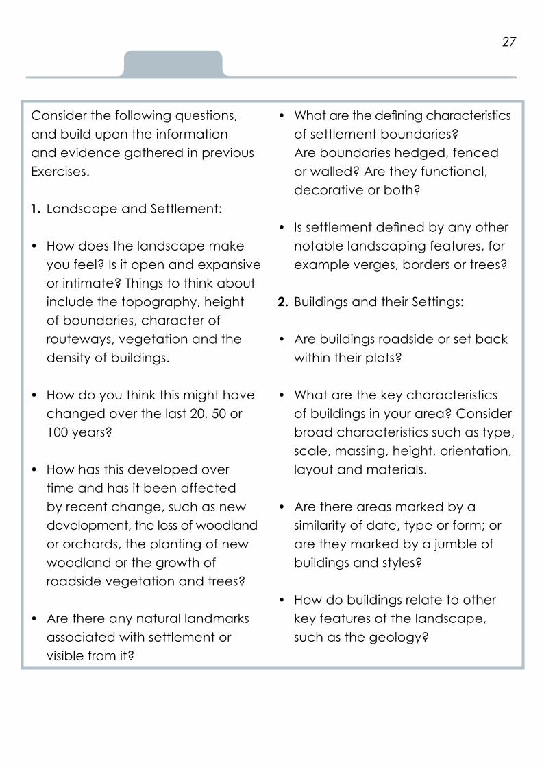
Consider the following questions, and build upon the information and evidence gathered in previous Exercises.
1. Landscape and Settlement:
How does the landscape make • you feel? Is it open and expansive or intimate? Things to think about include the topography, height of boundaries, character of routeways, vegetation and the density of buildings.
How do you think this might have • changed over the last 20, 50 or 100 years?
How has this developed over • time and has it been affected by recent change, such as new development, the loss of woodland or orchards, the planting of new woodland or the growth of roadside vegetation and trees?
Are there any natural landmarks • associated with settlement or visible from it?
What are the defining characteristics • of settlement boundaries? Are boundaries hedged, fenced or walled? Are they functional, decorative or both?
Is settlement defined by any other • notable landscaping features, for example verges, borders or trees?
2. Buildings and their Settings:
Are buildings roadside or set back • within their plots?
What are the key characteristics • of buildings in your area? Consider broad characteristics such as type, scale, massing, height, orientation, layout and materials.
Are there areas marked by a • similarity of date, type or form; or are they marked by a jumble of buildings and styles?
How do buildings relate to other • key features of the landscape, such as the geology?
27

How do buildings/groups of buildings • make you feel? Do they make a positive, neutral or negative contribution to the character and distinctiveness of the parish?
Are any buildings/groups of buildings • considered to have special significance and why?
Are there any landmark buildings • associated with settlement, or visible from it?
How do streetscape features • contribute to the character of the area? For example, letter boxes, telephone boxes, wells, memorials, signage.
Are there any special views looking • into, out of or through settlement? Think about how a building or a group of buildings was designed to be seen and experienced.
Photograph key buildings/groups of buildings/building types in their setting.
28
Photographs © Worcestershire County Council.
29
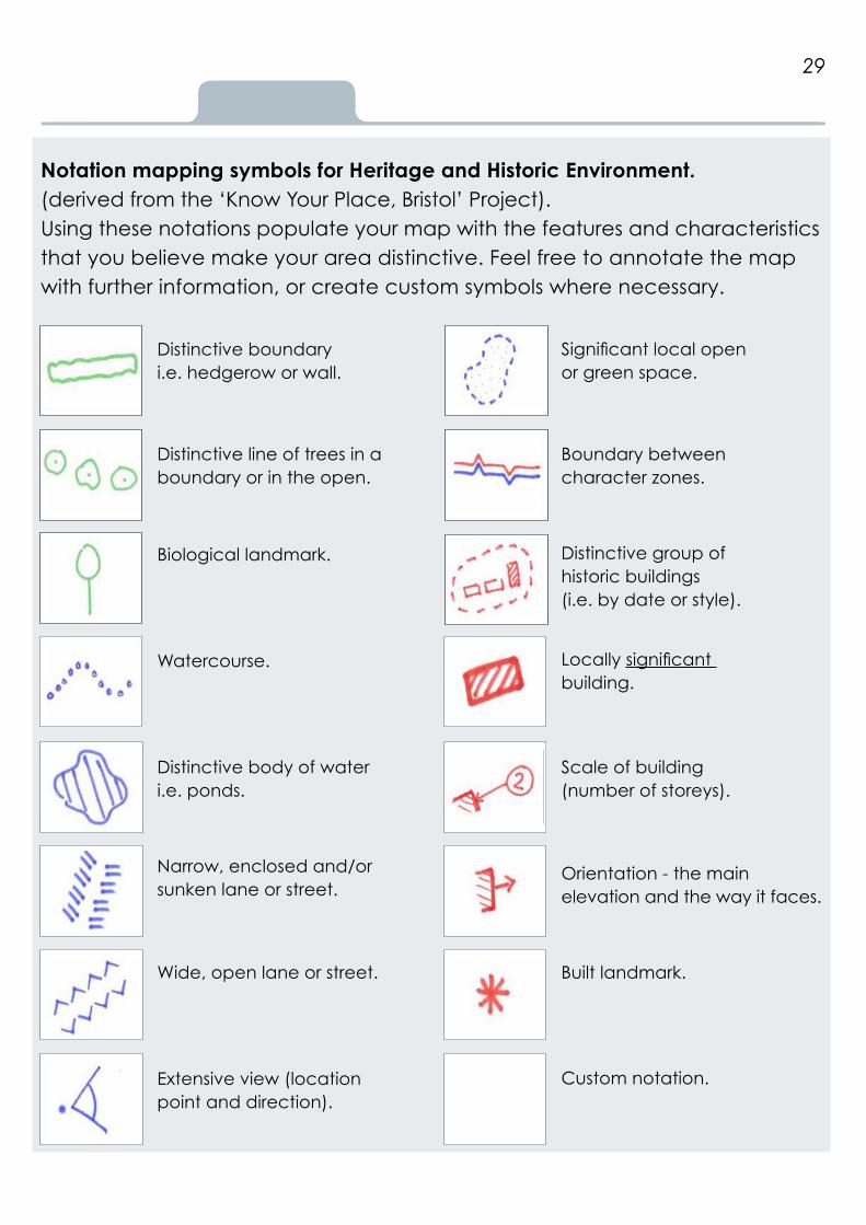
Notation mapping symbols for Heritage and Historic Environment.(derived from the ‘Know Your Place, Bristol’ Project).Using these notations populate your map with the features and characteristics that you believe make your area distinctive. Feel free to annotate the map with further information, or create custom symbols where necessary.
Distinctive boundaryi.e. hedgerow or wall.
Distinctive line of trees in a boundary or in the open.
Biological landmark.
Watercourse.
Distinctive body of water i.e. ponds.
Narrow, enclosed and/or sunken lane or street.
Wide, open lane or street.
Extensive view (location point and direction).
Significant local open or green space.
Boundary between character zones.
Distinctive group of historic buildings(i.e. by date or style).
Locally significant building.
Scale of building(number of storeys).
Orientation - the main elevation and the way it faces.
Built landmark.
Custom notation.
30
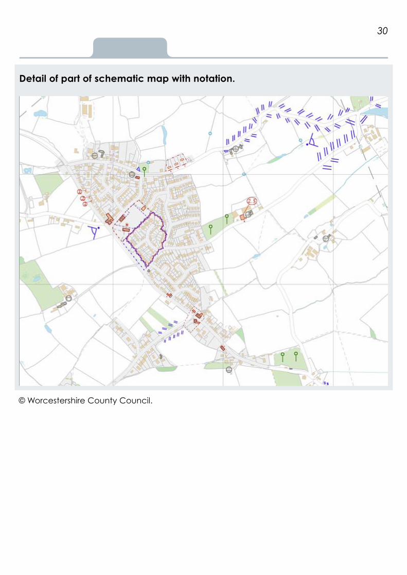
Detail of part of schematic map with notation.
© Worcestershire County Council.

31
Stage 3: Your place, your choice
Exercise F: Create a landscape character assessment for your community-led plan
OverviewThe character and form of different areas presents different constraints and opportunities for development. Identifying and championing the distinctive characteristics of your area through strong locally-tailored policy can inspire and guide development to more effectively respond to individual place, in line with national and local planning policy. Assessing issues and opportunities for change, and deciding whether development proposals respect local character and distinctiveness, is not easy and should always be considered with the following questions in mind:
‘What makes this place special to you and your community?’
‘What would you like it to look like in 50 years time?’
Character Statements should:
Be concise with a clear structure • that details key characteristics and the future vision and objectives for your area. It is a planning document and not an academic exercise.
Aim to build better understanding • between developers, local authority planners, The Parish Council and the local community. It should be engaging and accessible to all.
Reflect the relationships and inter-• actions between different features. This is fundamentally important to describing the character of the area and designing landscapes that are the richest and most diverse as they can be.
Aim to reflect the views of different • groups within the community.
Consider the social, economic and • cultural benefits of retention or change.

Now go ahead and identify, map, and describe the broad character of your parish; including any individual character areas.
Do not make generic statements. A character statement should reflect your local landscape and describe the qualities and characteristics that are valued by local people and visitors. This does not mean that your character statement must provide a hugely detailed explanation of different features.
You should use all of the information gathered in the previous exercises, and focus on how all buildings are sited and experienced. Use maps and photographs to illustrate key features and characteristics.
Take a look at the Reading List, and the Landscape Character Assessment: Area Case Study, in Appendix 2, of the Resources Section, for examples and further guidance.
Resources Appendix 2
32
Maps © Crown copyright and database rights Ordnance Survey 100024230.Photographs © Worcestershire County Council.

Resources
Exercise G: Create policies for your community-led plan
OverviewYour landscape character assessment is now going to be used to set out policy requirements for new development in your parish. Remember your policy, along with national and local planning policy, will be central to the planning decisions in your area.
Creating your policiesPolicies should be clear, positive and capable of being delivered. Working through the following questions may help:
Where has development occurred • up to this date?
Where can you see new • development going in the future?
Can new development respect • and re-inforce existing patterns of settlement and landscape? Think about the scale, form, massing and orientation (relationship to roads and green spaces) of buildings and the use of building materials and significant architectural details.
How sensitive is an area to changes • in those patterns?
Could new development harm/• enhance the setting of a historic building/group of buildings? In what ways could harm be minimised?
Could new development harm/ • enhance a significant view, to or from settlement?
Can new development offer an • opportunity to meet local needs and aspirations?
Can new development explore • opportunities to retain/enhance redundant historic buildings and their setting through the principles of constructive conservation?
33

Can new public spaces respect • broad landscape character? Will they require suitable management arrangements in place to maintain their use and good conservation long term.
Can new development conserve • or enhance existing open spaces?
Can opportunities to restore or • re-establish significant landscape features, such as traditional orchard or a village pond, be explored?
Can opportunities to re-link • hedgerow corridors with blocks of ancient semi-natural woodland, wood pasture and parkland be explored?
34
Top TipsLooking at the Statements of Environmental Opportunities from your local National Character Area Profile may help you to step back and consider the opportunities offered by your local landscape.
Take a look at pages 35 and 36 to see how observations recorded within character statements, feed into and inform, the construction of policies for community-led plans.
See the Reading List, and Appendix 3 in the Resources Section of this toolkit, for examples of policies from Neighbourhood Plans
Appendix 3
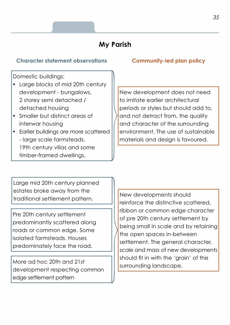
My Parish
Character statement observations
Domestic buildings:Large blocks of mid 20th century • development - bungalows, 2 storey semi detached / detached housingSmaller but distinct areas of • interwar housing Earlier buildings are more scattered • - large scale farmsteads, 19th century villas and some timber-framed dwellings.
Large mid 20th century planned estates broke away from the traditional settlement pattern.
Pre 20th century settlement predominantly scattered along roads or common edge. Some isolated farmsteads. Houses predominately face the road.
More ad hoc 20th and 21st development respecting common edge settlement pattern
Community-led plan policy
New development does not need to imitate earlier architectural periods or styles but should add to, and not detract from, the quality and character of the surrounding environment. The use of sustainable materials and design is favoured.
New developments should reinforce the distinctive scattered, ribbon or common edge character of pre 20th century settlement by being small in scale and by retaining the open spaces in-between settlement. The general character, scale and mass of new developments should fit in with the ‘grain’ of the surrounding landscape.
35

Character statement observations
Traditional farmsteads historically isolated or in clusters, set within medium scale fields with hedged boundaries and surviving traditional orchard. Many lost as a result of mid 20th century expansion. Surviving farmsteads on settlement edge under pressure from development.
No individual village centre but focal areas of community activity around:1. village hall, green, church and school2. The Pub, post office, allotments 3. the Common.
Narrow lanes with mature hedged boundaries give a sense of enclosed tranquillity. Good access around settlement via PRoW network. Retains atmosphere of a rural settlement despite close proximity to urban centre.
Community-led plan policy
Opportunities to convert redundant farm buildings using the Worcestershire Farmsteads Assessment Framework for guidance.
Preservation of surviving traditional orchard as community space
Developments should support and enhance existing community spaces.
36
New development should protect and enhance the natural and historic environment by retaining and enhancing features of high historic, nature or landscape value, including mature trees, hedgerow boundaries, archaeological earthworks, water-bodies , woodland, traditional orchard, community green space and key views.

Exercise C
Section 3
Resources
37
Information services
Historic Environment The National Heritage List for England Is an online searchable database of designated heritage assets (excluding conservation areas).
Heritage Gateway Links and addresses for every Historic Environment Record in England.
Worcestershire Historic Environment Record The county’s primary source for archaeological and historic environment information.Address: The Hive, Sawmill Walk, The Butts, Worcester. WR1 3PD Telephone: 01905 822866
Pastscape Historic England’s PastScape, provides a quick and easy way to search over 420,000 records on the architectural and archaeological heritage of England, held in the National Record of the Historic Environment (NRHE).
Landscape National Character Area Profiles (NCAs) NCA Profiles provide a broad under-standing of the historic development and natural history of a landscape. NCAs divide England into 159 distinct areas, each defined by a unique combination of landscape, biodiversity, geodiversity, history, and cultural and economic activity. Their boundaries follow natural lines in the landscape rather than administrative boundaries.

Exercise C
Landscape Character Assessments (LCAs) LCAs identify and describe local variations in the character of the landscape, including how the landscape is perceived, experienced and valued by people.
Historic Landscape Characterisation (HLC) HLC delivers a historical element to landscape character assessment by recording change or continuity to the landscape; providing a sense of time-depth, and context for its archaeological sites and monuments. The above link takes you to the Worcestershire HLC, which is accessible via an interactive map browser and is fully integrated within the Worcestershire Historic Environment Record.
Farmsteads and Landscapes Characterisation The West Midlands Farmsteads and Landscapes Project recorded the distribution, scale, plan form, date, and the degree of change of all farmsteads and outfarms shown on the Ordnance Survey 2nd Edition 25” mapping of circa 1900. Through this project, it was possible to gain a better understanding of farmstead character, survival and current use at a landscape scale. This supported
the development of an assessment framework aimed at informing and achieving the sustainable development of traditional farmsteads, including their conservation and enhancement, through identifying their historic character, significance and potential for change. The above link takes you to the Worcestershire Farmsteads Assessment Framework, which is accessible via an interactive map browser and is fully integrated within the Worcestershire Historic Environment Record.
Characterisation has also been applied to the sea (Historic Seascapes) and towns and cities (Extensive Urban Survey, Urban Archaeological Databases and Metropolitan Historic Landscape Characterisation).
Heritage and Wildlife MAGIC The MAGIC website provides Natural England’s geographic information about the ‘natural’ environment. The information covers rural, urban, coastal and marine environments across Great Britain.
38

The Earth Heritage Trust The Herefordshire and Worcestershire Earth Heritage Trust is a charity that aims to record, protect and promote geology and landscape. The Trust is currently undertaking an important new project, ‘A Thousand Years of Building with Stone’, which aims to record, catalogue and untangle the history of stone use in heritage buildings across Herefordshire and Worcestershire
Worcestershire Biological Records Centre (WBRC) The Worcestershire Biological Records Centre, an independent ‘not for profit’ wildlife charity, acts as the data storehouse for a wide range of biological data including plant and animal records as well as habitat information. They collect and collate data from a wide range of sources including local naturalists, professional ecologists, statutory bodies and other wildlife charities and organisations.
Worcestershire Wildlife TrustThe Royal Society of Wildlife Trusts (RSWT) is an independent charity, formed of 47 local trusts. As well as managing over 75 nature reserves, Worcestershire Wildlife Trust is the county’s leading local charity working to conserve and restore wildlife and wild places across the county.
County Gardens Trusts (CGTs)County Gardens Trusts are locallybased charities caring for designed landscapes. They operate across England and are linked through the Gardens Trust (created in 2015 by the merger of The Garden History Society with the Association of Gardens Trusts).
Other sources of interest ViewfinderAn online database of photographs held in the Historic England Archive. They date from the 1850s and document England’s social, industrial, architectural and archaeological history.
Images of EnglandA ‘point in time’ photographic library of England’s listed buildings, recorded at the turn of the 21st century.
Pevsner Architectural GuidesA series of architectural guide books describing notable historic buildings.
Victoria County HistoryAn encyclopedic record, founded in 1899, of England’s places and people. Historic England Aerofilms collection Over 4 million aerial photographs, covering the whole of England and dating from the early 20th century to the present day.
39

Glossary of terms
CABE Chartered Association of Building Engineers.
Common Edge settlement Detached or small groups of houses, dispersed between fields or small paddocks, encroaching onto open common, heath or waste.
Cropmark/Parch mark Archaeological remains that become visible within standing crops, due to the subsurface differential growing conditions. Thus, buried ditches and walls can reveal themselves as crop or parch marks, especially during periods of drought.
Croft An enclosed piece of land adjoining a house.
Dispersed Settlement Settlement dominated by high densities of scattered farmsteads, hamlets and smaller villages. Typically associated with small and irregular fields, and the creation of farms within wood, marsh and moorland, during the medieval and earlier periods.
Earthwork Archaeological remains that exist above ground, as an upstanding feature, ditch or artificial watercourse.
EcoSystem Services An ecosystems approach provides a framework for looking at whole ecosystems in decision making, and for valuing the ecosystem services they provide, to ensure that society can maintain a healthy and resilient natural environment now and for future generations.
Geographical Information System (GIS) A computer software system designed to capture, store, manipulate, analyse, manage, and present all types of spatial or geographical data.
Heritage AssetA building, monument, site, place, area or landscape identified as being of significant value to merit consideration in planning decisions. Heritage assets include designated heritage assets and assets identified by the local planning authority (including local listing). The more significant the heritage asset, the greater the weight given to its conservation, and to the impact of any development on its setting.
40

Historic England A Central Government service, championing England’s heritage and providing expert, constructive advice.
Historic Environment All aspects of the environment resulting from the interaction between people and places through time. This includes all surviving physical remains of past human activity, whether visible, buriedor submerged, and landscaped and planted or managed flora.
Piecemeal Enclosure Field systems that have been created out of the gradual, piecemeal enclosure of medieval open fields, woodland and wasteland. They can be of variable size and form, but typically lack any overall planning.
PROW Public Right of Way.
Medieval Open Fields/Strip Fields Medieval open fields were once arable land, held in common. This was traditionally farmed in strips on a rotational system, with multi-ownership or tenancy. It is usually associated with nucleated settlements and is suggested by the presence of ridge and furrow earthworks and / or piecemeal enclosure. The relicts of
this type of cultivation are principally the long ridges and furrows often formed in a reversed ‘S’ shape, which can also be observed in curving hedge lines. Large areas of post- medieval and modern field systems will have open fields recorded as an antecedent type. Parish Boundaries may also echo former field strips.
Moated Site A wide ditch surrounding a building, usually filled with water.
Nucleated Settlement A settlement pattern dominated by villages with relatively few isolated farmsteads or hamlets.
Ridge and Furrow A series of long, raised ridges separated by furrows that have resulted from the process of ploughing. These earthworks are characteristic of pre-industrial farming techniques.
Setting of a heritage asset The surroundings in which a heritage asset is located. Its extent is not fixed and may change as the asset and its surroundings evolve. Elements of a setting may make a positive or negative contribution to the significance of an asset; and thus may affect the ability to appreciate that significance.
41

Soil mark An archaeological feature made visible, due to its soil fill being of a different colour and matrix to the surrounding subsoil. Soil marks show up well in ploughed fields or areas where the topsoil has been stripped.
Survey Planned Enclosure Survey Planned Enclosure (including Parliamentary enclosure) is characterised by regular, small and large, rectangular fields, with ‘ruler straight’ boundaries, and often contemporaneous tracks and roadways. Planned enclosure was undertaken by surveyors during the 18th and 19th centuries, and will have overlain any prior landscape enclosure pattern.
Sustainable urban drainage systems(SUDS) A natural approach to managing drainage in and around properties and other developments. SUDS work by slowing and holding back the water that runs off from a site, allowing natural processes to break down pollutants.
Tithe and Enclosure Maps 19th century Tithe Maps represent the first strategic mapping survey of most of England and Wales. These maps
were created as part of the Tithe Commutation Act of 1836; most were completed in the 1840s. As well as recording mid -19th century field systems they also provide details of land use and land ownership and occupation.
Toft The place where a house stood or had once stood, often adjoining a garth or croft.
Veteran Tree A tree which, because of its great age, size or condition, is of exceptional cultural, landscape or nature conservation value.
42

Exercise F
Reading list
Key Guidance for Landscape Character Assessment in Neighbourhood Planning
Birkbeck, D and Kruczkowski, S (2015) Building for Life 12 Nottingham Trent University: CADBE for the Building for Life Partnership. Historic England (2016) Caring for Heritage.
Worcestershire County Council and Locus Consulting (2015) Producing a ‘Landscape Character Statement’ for your Neighbourhood Plan. (Available on request).
Planning Aid England (2015) Putting the Pieces Together.
Others interesting sources of guidance for Landscape Character Assessment
City Design Group (2011) Know Your Place.
Cowan, R, Bone, D and Huxford, R (1998) Placecheck Urban Design Alliance.
Local Government Association (2013) Our Place.
Oxford City Council (2015) The Oxford Character Assessment Toolkit.
Walsh, D (2012) The Lincoln Townscape Assessment The City of Lincoln Council. Worcestershire County Council (2013) Worcestershire Villages Historic Environment Research Assessment.
43

Exercise G
Good examples of Neighbourhood Plans Chaddesley Corbett Parish Council (2014) Chaddesley Corbett Neighbourhood Plan 2014 – 2026.
Colwich Parish Council (2015) Colwich Neighbourhood Development Plan 2011 - 2031.
Key Guidance for Heritage and the Historic Environment
English Heritage (2015) The Setting of Heritage Assets.
English Heritage (2011) Understanding Place: Character and Context in Local Planning.
English Heritage (2010) Understanding Place: Historic Area Assessments Principles and Practice.
English Heritage (2008) Constructive Conservation in Practice.
English Heritage (2008) Conservation Principles, Policies and Guidance.
English Heritage and CABE (2001) Building in context: New development in historic areas.
Locus Consulting (2014) Expanding the Neighbourhood Plan Evidence Base - Museums, Record Offices, Archives and HERs. LUC in association with Nick Haynes (2014) Evaluating the impact of housing development on the historic environment.
Russell H, Smith, A and P Leverton (2011) Sustaining cultural identity and a sense of place - new wine in old bottles or old wine in new bottles? College of Estate Management Occasional Paper Series.
Farrell T, (2015) The Farrell Review of Architecture and the Built Environment. “Our Future In Place”.
44

Exercise D
Appendix 1
Designation checklist
Designated heritage assetsDetails of nationally designated heritage assets can be found on the National Heritage List for England Designated heritage assets mostly comprise of the following:
Listed buildings which have been • designated because of their special architectural or historic interest.
Conservation Areas designated • by local authorities, and generally covering settlements. Demolition of unlisted buildings in conservation areas requires planning permission, and a similar process of justification as for a listed building.
Scheduled Monuments are • archaeological sites considered to be of national importance. Consent must be sought from Historic England for any works affecting a Scheduled Monument.
Registered Parks and Gardens, • World Heritage Sites, and Registered Battlefields, are all landscapes
considered to be of special historic interest. While no consents specific to these designations are required, conservation of these places is given ‘great weight’ in the planning process.
Undesignated heritage assets Undesignated heritage assets are buildings, sites and landscapes, identified by local planning authorities as having value. Undesignated heritage assets may be, but are not always, recorded on the local Historic Environment Record.
Local lists provide an opportunity • for communities to have their views on local heritage considered. They can be used to identify significant local heritage assets, strengthening their role as a material consideration in the planning process.
Sites of national archaeological • significance. Where archaeological sites of national significance have not been scheduled, and they are of the same significance as scheduled monuments, they are
45

treated in the planning system as if they were designated assets (see NPPF paragraph 139).
Areas of Outstanding Natural • Beauty and National Parks. Within Worcestershire, the Malvern Hills and the Cotwolds are designated Areas of Outstanding Natural Beauty (AONB), for their special qualities or character. Conserving and enhancing the qualities of such landscapes are a material consideration in planning applications that are proposed, either within or adjacent to them. The Countryside and Rights of Way Act 2000 (CROW Act) places on local authorities a requirement to produce an AONB Management Plan and a ‘duty of regard’ to conserve and enhance AONBs (Section 85).
Green Belt. The fundamental aim • of Green Belt policy is to prevent urban sprawl, and new buildings are generally regarded as inappropriate. Exceptions are specified in NPPF paragraphs 79-92.
Wildlife, Habitat and Geology The Wildlife and Countryside Act • (1981) is the principal law protecting wildlife, habitats and species in Great Britain, and was strengthened and updated by the Countryside and Rights of Way Act (2000). It is necessary to obtain expert advice when ascertaining if any protected species are present within or adjacent to a site.
Sites of Special Scientific Interest • (SSSI) are areas of land notified under the Wildlife and Countryside Act 1981 as being of special nature conservation interest.
Sites of Importance to Nature • Conservation (SINC) are sites of non-statutory designation recognised by local planning policies.
Hedgerows Regulations 1997 are to • protect important hedgerows from being grubbed-out.
Regionally Important Geological • and Geomorphological Sites (RIGS) are locally designated sites of local, national and regional importance for geodiversity. The significance of RIGS is a material consideration in determining an application.
46

Exercise F
Appendix 2
Landscape Character Assessment: Area case study
Elmley Castle and Netherton are located on the north side of Bredon Hill to the south east of Pershore, in the district of Wychavon.
Netherton Free draining, fertile soils and a rolling topography, on the foothills of Bredon Hill, support a predominantly arable land use characterised by large, irregular fields, fragmented semi- natural habitats and little tree cover. A series of sinuous routeways (including an ancient salt way) link settlements with the landscape beyond. As a consequence of field amalgamation, hedgerow boundaries have been in decline since the early 20th century. Traditional orchard, associated with settlement, has also largely disappeared.
The small nucleated village of Netherton is the main settlement of the parish. Today it is comprised of just a handful of farms and cottages set along a through road which leads out to fields to the north, and Netherton Lane to the south.
The village retains a sense of intimacy with the facades of buildings and mature hedgerows restricting views; yet beyond the village, the landscape is more open and views more extensive.
47
Chapel Farm. Photograph © Worcestershire Archive and Archaeology Service.
Photograph © Worcestershire Archive and Archaeology Service.

The dominating feature of the village is Chapel Farm. The farm was already large in scale before it was re-planned in the mid 19th century; then extended and remodelled again in the 20th century to showcase the wealth and standing of its then owners, the Steven’s family. The towering grain silos, at both Chapel Farm and the outfarm to the north east, dominate views across much of the parish. The remains of an ornamental garden, with potential mature trees, is recognisable to the south of the farmhouse.
Archaeological evidence indicates that this agricultural landscape was farmed from at least the late prehistoric period and a series of isolated, late Iron Age and Romano-British farmsteads have been revealed as cropmarks within the parish. The remains of a 12th century chapel, which in 1738 was converted into a barn, survives to the east of the farmhouse at Chapel Farm. Earthworks associated with settlement and farming, south of Chapel Farm, indicate that, during the medieval period, the village was more densely populated than it is today; at least a dozen cottage sites have been traced as earthworks under permanent pasture.
Away from the village, settlement is sparse. A large scale, isolated farmstead (Elms Farm) to the south of the village has now been largely converted into residential dwellings, while two isolated outfarms, one with a set of large 20th century grain silos which echo those at Chapel Farm, remain in agricultural use.
Comparisons of modern with historic maps, (see page 49), indicate that settlement at Netherton has changed little, since the turn of the 20th century. In contrast, the Elmley Castle settlement has experienced far greater 20th century expansion which is concentrated in a planned estate to the east of the main street, away from the historic core of the village, which is a Conservation Area.
48

Map © Crown copyright and database rights Ordnance Survey 100024230.
Map © Crown copyright and database rights Worcs XLIX SW, 1891, Ordnance Survey 100024230.
19th century tithe map Map © Crown copyright and database rights Ordnance Survey 100024230.
19th century tithe map Map © Crown copyright and database rights Ordnance Survey 100024230.
49
ArableNon-agriculturalPastureWood
Col. Thomas Henry Hastings DaviesRobert Clavering SavageThomas BlackfordThomas HeathThomas SeverneWilliam HatchWilliam Moore
Pre 20th century building

Netherton - Key Features
Landscape:Large scale, irregular fields, • enclosed by hedgerow boundaries. Loss of boundaries over the 20th century as a consequence of field amalgamation.
Little tree cover and fragmented • semi-natural habitats.
Loss of small-scale traditional • orchard associated with settlement.
Remnants of ornamental garden, • with potential mature trees, to the south west of Chapel Farm.
Netherton village retains a sense • of intimacy with buildings and hedgerows restricting views of the landscape beyond. Views from Netherton Lane are also restricted by mature hedgerows.
An extensive network of historic • pathways, many of which are modern PRoWs, with open views across the landscape.
Approximately 50% loss of farm • ponds.
Settlement:Wayside settlement, concentrated • in the small, nucleated village of Netherton. Dwellings are moderately spaced and the settlement has little depth with dwellings set close to the road within individual, generous sized plots, which back directly onto farmland.
Chapel farmhouse is enclosed • by a ha-ha within its own private space, and set away from the road, and from working areas of the farm, facing ornamental gardens to the south west. The remains of a 12th century chapel are adjacent to the farmhouse, within the private sphere of the garden. The 1st Edition Ordnance Survey map (1885) records a pathway, over fields, linking the farmhouse to Netherton Lane, in the south. The southern half of this pathway remains a PRoW. Views from Netherton Lane to the farmhouse are today obscured by mature hedgerows.
Settlement beyond the village is • limited to one large scale, regular planned, isolated farmstead, now largely converted to residential, and an adjacent 20th century dwelling, south of Netherton Lane.
50

The farmhouse at Elm’s Farm is • slightly set away from the working area of the farm. It is enclosed by a wall thus creating its own private space, and faces away from the farm, out towards the open landscape to the south west.
Buildings:Chapel Farm retains a significant • assemblage of traditional farm buildings dating from the 19th and 20th century, including two distinctive, 20th century grain silos. These along with a related pair of silos at Herrisfare, to the north east, dominate views from the surrounding landscape.
Large 20th century agricultural • sheds of corrugated iron.
Large scale outfarms (Herrisfare • and Rise) with surviving 19th and 20th century buildings.
Buildings predominately constructed • of brick, with tile roofs. Also some timber-framing on earlier dwellings (The Blizzards, The End Cottage) and use of local stone for plinths and boundary walls.
Remains of 12th century chapel, • constructed of local stone.
Elmley Castle Elmley Castle is located on the northern slopes of Bredon Hill, (a Site of Special Scientific Interest) within the Cotswold Area of Outstanding Natural Beauty. Bredon Hill, an outlier of the Cotswold Hills, is composed of Jurassic, sedimentary rock. It supports a range of habitats with significant biodiversity, from ancient semi-natural woodland and parkland, to calcareous (limestone) ‘unimproved’ and neutral grassland, and calcareous scrub. Old quarry workings also support a number of locally uncommon plants. The north of the parish is characterised by a larger scale, cultivated landscape, with free draining, fertile soils. Semi-natural habitats are fragmented and tree cover is minimal.
The historic core of the village is a designated Conservation Area, that has witnessed little change over the past 200 years. It is characterised by a nucleated cluster of medium and large scale, regular farmsteads, with converted agricultural buildings, cottages and non-domestic buildings, which become more dispersed along Hill Lane, Netherton Lane and Mill Lane.
51
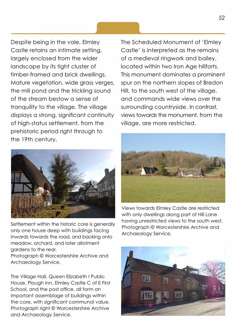
Despite being in the vale, Elmley Castle retains an intimate setting, largely enclosed from the wider landscape by its tight cluster of timber-framed and brick dwellings. Mature vegetation, wide grass verges, the mill pond and the trickling sound of the stream bestow a sense of tranquility to the village. The village displays a strong, significant continuity of high-status settlement, from the prehistoric period right through to the 19th century.
The Scheduled Monument of ‘Elmley Castle’ is interpreted as the remains of a medieval ringwork and bailey, located within two Iron Age hillforts. This monument dominates a prominent spur on the northern slopes of Bredon Hill, to the south west of the village, and commands wide views over the surrounding countryside. In contrast, views towards the monument, from the village, are more restricted.
Settlement within the historic core is generally only one house deep with buildings facing inwards towards the road, and backing onto meadow, orchard, and later allotment gardens to the rear.Photograph © Worcestershire Archive and Archaeology Service.
Views towards Elmley Castle are restricted with only dwellings along part of Hill Lane having unrestricted views to the south west.Photograph © Worcestershire Archive and Archaeology Service.
52
The Village Hall, Queen Elizabeth I Public House, Plough Inn, Elmley Castle C of E First School, and the post office, all form an important assemblage of buildings within the core, with significant communal value.Photograph right © Worcestershire Archive and Archaeology Service.

The 11th century church of St. Mary the Virgin is enclosed within its own ecclesiastical space and encircled by a dry stone wall. It dominates the southern periphery of the village and retains views to Elmley Castle and the ‘medieval’ deerpark, which runs from the southern edge of the village to the remains of the castle. The deerpark is a Site of Special Scientific Interest and site of National Significance considered for scheduling.
A large Elizabethan House is recorded on historic mapping, to the south west of the Church. ‘Park House’, which like the church would have enjoyed privileged views of the park and castle site, was demolished in the early 1960s to make way for the construction of the Parkland Estate. The remains of a ha-ha define the boundary between the site of the house and the deerpark.
53
The children’s playing field, in Elmley Castle, dedicated in 1929 in loving memory of Ernst Victor Stevens of Chapel Farm, Netherton, reflects changing social attitudes to health, welfare and children during the early 20th century and is an early example of a recreational area dedicated to children. Photograph © Worcestershire Archive and Archaeology Service.
The Parkland Estate is comprised of detached, executive houses, set within generous sized plots and constructed of a grey/brown brick, similar in colour to the stone rubble of the church. Within the estate there is established greenery; much of which is a relic of the formal garden associated with the earlier house. This small estate shares many characteristics with earlier generations of suburban ‘garden’ estates, despite its moderne 1960s architecture and smaller plots of land.Photograph © Worcestershire Archive and Archaeology Service.

The majority of 20th century development is concentrated, in a planned estate, to the east of the historic core, in-between Mill Lane (to the south) and Netherton Lane (to the north). The estate has continued to grow throughout the course of the 20th and 21st centuries and has a mixture of former local authority housing, and post 1970s private developments, which are increasingly influenced by more vernacular styles. The estate now extends to the brook to the east, and the boundaries of Elmley Castle C of E First School to the west, with the most recent houses adjacent to, and influenced by, The Old Mill House.
Outside of the main village, settlement is confined to the small nucleated hamlet of Kersoe, known as Criddesho, during the Anglo-Saxon period. Kersoe is comprised of a cluster of dwellings, including a number of large scale traditional farmsteads. Ridge and furrow survives in earthwork form, indicating how, from the medieval period, the land around settlement was open and communally farmed.
Protected and notable species in the locality include, the great crested newt, the common lizard and slow-worm, the lesser horseshoe bat, badgers and brown hares, and the red kite.
The village has also experienced some small scale development on its northern periphery, and infill development along Hill Lane, Mill Lane and Netherton Lane.Photograph © Worcestershire Archive and Archaeology Service.
54
Former local authority housing with its simple, standardised design and generous sized plots, is becoming increasingly sought after.Photograph © Worcestershire Archive and Archaeology Service.

Elmley Castle - Key Features
Landscape:Located within the Cotswold Area • of Outstanding Natural Beauty.
Located on the northern slopes • of Bredon Hill (a Site of Special Scientific Interest) and overlooked by the Scheduled Monument ‘Elmley Castle’.
Views towards ‘Elmley Castle’ • are restricted.
Mosaic of habitats with high • biodiversity, cultural and historic interest.
Mature vegetation, wide grass • verges and standing and running water bodies bestow a sense of tranquility to the village.
More intensively farmed landscape • to the north of the village with amalgamated field pattern and fragmented semi-natural habitats.
Loss of small-scale traditional • orchard associated with settlement.
Well established network of historic • pathways, many of which are modern PRoWs.
Archaeology associated with high • status settlement and medieval farming.
Settlement:Continuity of high-status settlement • from the prehistoric period to the 19th century.
An inherited nucleated settlement • pattern with traditional farmsteads, cottages and non-domestic buildings concentrated within core settlements.
Settlement in the historic core of • Elmley Castle is linear with minimal depth. Buildings face inwards towards the main thoroughfare and back onto farmland. Settlement becomes more scattered on the boundaries of the village but retains its linear, wayside character.
20th century development is • dominated by a planned estate, with a mixture of detached, semi-detached, bungalows and two-storey flats, east of the historic core. There has been limited modern expansion to the north of the historic core and east of the church (Parkhall Estate). There is some modern infill on the periphery of the village where settlement was historically more scattered.
55

An intimate setting, with buildings • and hedgerows restricting more wide-ranging views.
Communal buildings and spaces, • including the children’s playing field, school, church, village hall, public house and post office, with high significance.
Buildings:Large scale traditional farmsteads • located within core settlements.
Earlier buildings are timber-framed • or stone. Thatch is a feature of many older properties. Later buildings predominately of red brick and tile.
20th century development set • within smaller plots, with less emphasis placed on green space the later the development.
Mixture of former local authority • housing and private development.Mixture of detached, semi-detached, • bungalows and two-storey flats.
20th century infill, characterised by • executive style detached houses in areas with historically more scattered settlement.
The Parkland Estate shares • characteristics with earlier generations of suburban ‘garden’ estates, despite its moderne 1960s architecture and smaller plots of land.
56

Exercise G
Appendix 3
Examples of policies from Neighbourhood Plans(also see Reading List)
Chaddesley Corbett Neighbourhood Plan 2014 – 2026 (2014)Policy - Landscape Design Principles
In order to be considered favourably all new development proposals willneed to satisfy the following landscape design principles:
1. The pattern of open spaces surrounding settlements should be retained in any future developments. Of particular importance is the open space either side of Hockley Brook between Stewards Cottage (Briar Hill) and Hemming Way. The additional and important open spaces identified in the Chaddesley Corbett Conservation Area Character Appraisal are particularly significant (see Map 3 below).
2. Strategic views across the Parish shown on Map 5 in Appendix III and the Proposals Map, and defined below, will be protected by ensuring that the visual impact of development on these views is carefully controlled. The views are: (i) The view across the Parish looking towards St Cassian’s Church 62 spire and Harvington from the edge of Chaddesley Woods and footpath 640. (ii) The view of the Conservation Area of Harvington Hall and its environs from Harvington Hall Lane and footpaths 614 and 615. (iii) The views east from footpath 620 across fields towards Chaddesley Village. (iv) The view of Barrow Hill from footpath 599 at Tanwood Lane. (v) The views towards Chaddesley Corbett and St Cassian’s Church spire across fields, trees and hedgerows from footpath 599 at Tanwood Lane. (vi) The view of the medieval fishponds looking towards Brockencote from footpath 674 in St Cassian’s churchyard and the view into the Conservation Area looking towards St Cassian’s church from the pavement alongside the A448.
57

3. Development proposals should seek to preserve or enhance the character of the village and hamlets both within and outside the Conservation Areas, especially those with buildings dating from the nineteenth and early twentieth century. The demolition of buildings and structures that contribute to the character and appearance of these areas including those identified in the proposed Local Heritage List will be resisted.
4. Local habitats and wildlife biodiversity particularly relating to Chaddesley Woods NNR should be preserved. Linking wildlife corridors, including brooks and watercourses, should be enhanced.
5. Minimal and discreet signage will be supported to promote compliance with rules and regulations in respect of access to paths for walkers and the control of dogs and horses.
6. Mature and established trees of amenity value should be protected and incorporated into landscaping schemes wherever possible. The planting of local species will be encouraged. Species should be appropriate to the location and setting in terms of type, height, density and the need for ongoing management. When constructing boundaries native tree species should be used in preference to building walls or the planting of “Leylandii / conifer”. Existing hedgerows should be retained and the establishment of new native hedges is encouraged.
58
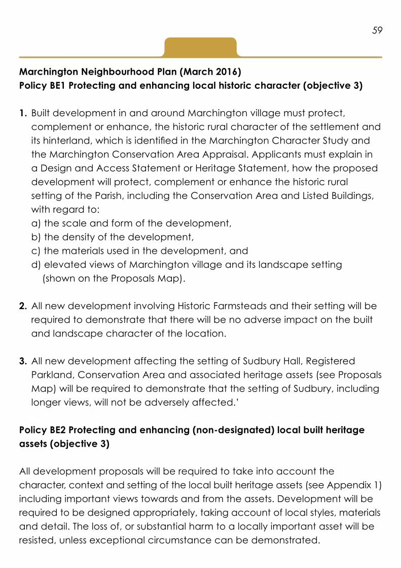
Marchington Neighbourhood Plan (March 2016)Policy BE1 Protecting and enhancing local historic character (objective 3)
1. Built development in and around Marchington village must protect, complement or enhance, the historic rural character of the settlement and its hinterland, which is identified in the Marchington Character Study and the Marchington Conservation Area Appraisal. Applicants must explain in a Design and Access Statement or Heritage Statement, how the proposed development will protect, complement or enhance the historic rural setting of the Parish, including the Conservation Area and Listed Buildings, with regard to:
a) the scale and form of the development, b) the density of the development, c) the materials used in the development, and d) elevated views of Marchington village and its landscape setting
(shown on the Proposals Map).
2. All new development involving Historic Farmsteads and their setting will be required to demonstrate that there will be no adverse impact on the built and landscape character of the location.
3. All new development affecting the setting of Sudbury Hall, Registered Parkland, Conservation Area and associated heritage assets (see Proposals Map) will be required to demonstrate that the setting of Sudbury, including longer views, will not be adversely affected.’
Policy BE2 Protecting and enhancing (non-designated) local built heritage assets (objective 3)
All development proposals will be required to take into account the character, context and setting of the local built heritage assets (see Appendix 1) including important views towards and from the assets. Development will be required to be designed appropriately, taking account of local styles, materials and detail. The loss of, or substantial harm to a locally important asset will be resisted, unless exceptional circumstance can be demonstrated.
59

Policy NE1 Protecting the Countryside and Landscape (objective 3)
Any proposals for development in the rural areas should recognise and seek to protect and enhance the historic landscape and local character of the Parish. Field patterns and elements of the landscape heritage of the area, including ridge and furrow, field ponds, mature trees and historic hedgerows should be protected and incorporated into any landscape design schemes and their long term maintenance ensured.
Proposals for development should include consideration of the above factors through an appropriate landscape analysis either as a freestanding report or as part of a design and access statement.
60

Appendix 4
Assessing development proposals: A hypothetical case study
The development proposal below is hypothetical, yet typical of the type and scale of planning application, that is increasingly likely for residential development in rural areas, particularly in and around villages.
Proposal Outline application for the erection of 50 residential dwellings (40% affordable housing) with vehicular access, parking provision and landscaping works.
61
Masterplan of the hypothetical, proposed residential development.© Worcestershire Archive and Archaeology Service.

62
Front elevations of detached and semi-detached properties, from the hypothetical, proposed residential development.© Worcestershire Archive and Archaeology Service.
Front elevations of terraced properties, from the hypothetical, proposed residential development.© Worcestershire Archive and Archaeology Service.

Landscape Character Assessment The physical landscape is characterised by a low lying, rolling topography comprised of mixed mudstones and sandstones with free draining soils that have support mixed farming with scattered farmsteads and other wayside dwellings that have occasionally clustered together. During the 20th century in-fill development has created a less scattered settlement character together with a diverse mixture of housing styles. Small scale enclosure survives in places but overall the irregular and sub regular fields, characteristic of the area, are large in scale as a consequence of 20th century field amalgamation. Small blocks of ancient semi-natural woodland and relic orchard, associated with settlement, are also a feature of the area. More recently horticulture and recreation, in particular a nursery and a golf course, has had an increasing impact on the landscape.
Where development is going to occur? The linear settlement along this road retains its dispersed, intimate, wayside feel despite 20th century infill, along the main routeway and the development of a larger scale, 20th century block south of the road. Historic properties are set close to, and face the road, while more recent, wayside development is set back within their plots and often hidden from view by mature hedgerow or walled boundaries. Development along the main routeway is only a single house deep, with plots backing directly onto farmland beyond and relic orchard dominating the spaces in-between buildings. The open countryside and Malvern Hills dominate views to the south west, at the eastern end of the road, gradually becoming more filtered as you move westwards. Housing is diverse with a mixture of public and private development of two-storey detached, semi-detached and terraced houses and bungalows. Pre 20th century properties are predominately constructed of brick and tile with timber-framing restricted to the oldest properties.
63
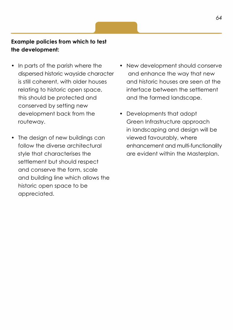
Example policies from which to test the development:
In parts of the parish where the • dispersed historic wayside character is still coherent, with older houses relating to historic open space, this should be protected and conserved by setting new development back from the routeway.
The design of new buildings can • follow the diverse architectural style that characterises the settlement but should respect and conserve the form, scale and building line which allows the historic open space to be appreciated.
New development should conserve • and enhance the way that new and historic houses are seen at the interface between the settlement and the farmed landscape.
Developments that adopt • Green Infrastructure approach in landscaping and design will be viewed favourably, where enhancement and multi-functionality are evident within the Masterplan.
64
