y es or n o ?? look at the following pictures. do you know what east asia looks like? decide if the...
TRANSCRIPT

YES OR NO??
Look at the following pictures. Do you know what East Asia looks like? Decide if the picture was taken in China,
Mongolia, or Taiwan or somewhere else in the world.
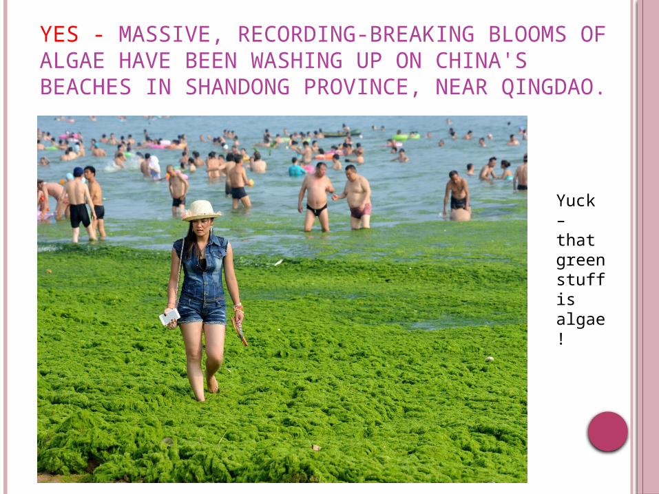
YES - MASSIVE, RECORDING-BREAKING BLOOMS OF ALGAE HAVE BEEN WASHING UP ON CHINA'S BEACHES IN SHANDONG PROVINCE, NEAR QINGDAO.
Yuck – that green stuff is algae!

NO! THIS IS DISNEY WORLD!

NO! THIS IS SAN FRANCISCO.
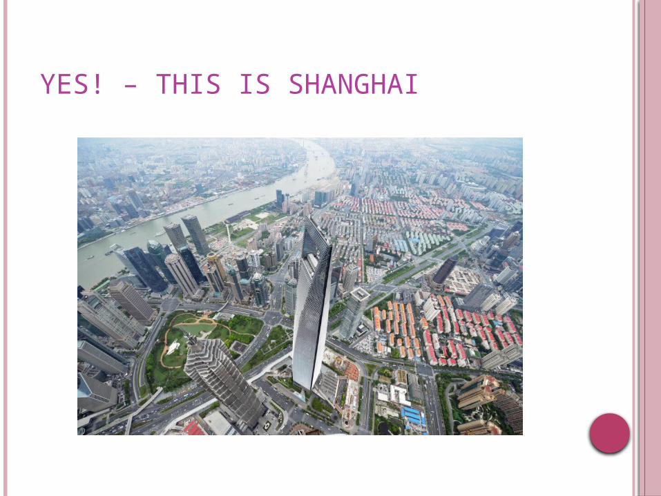
YES! – THIS IS SHANGHAI

YES! MONGOLIA.
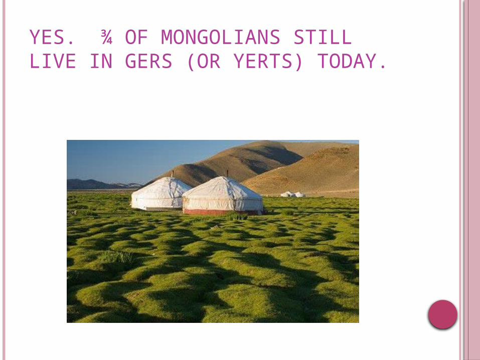
YES. ¾ OF MONGOLIANS STILL LIVE IN GERS (OR YERTS) TODAY.
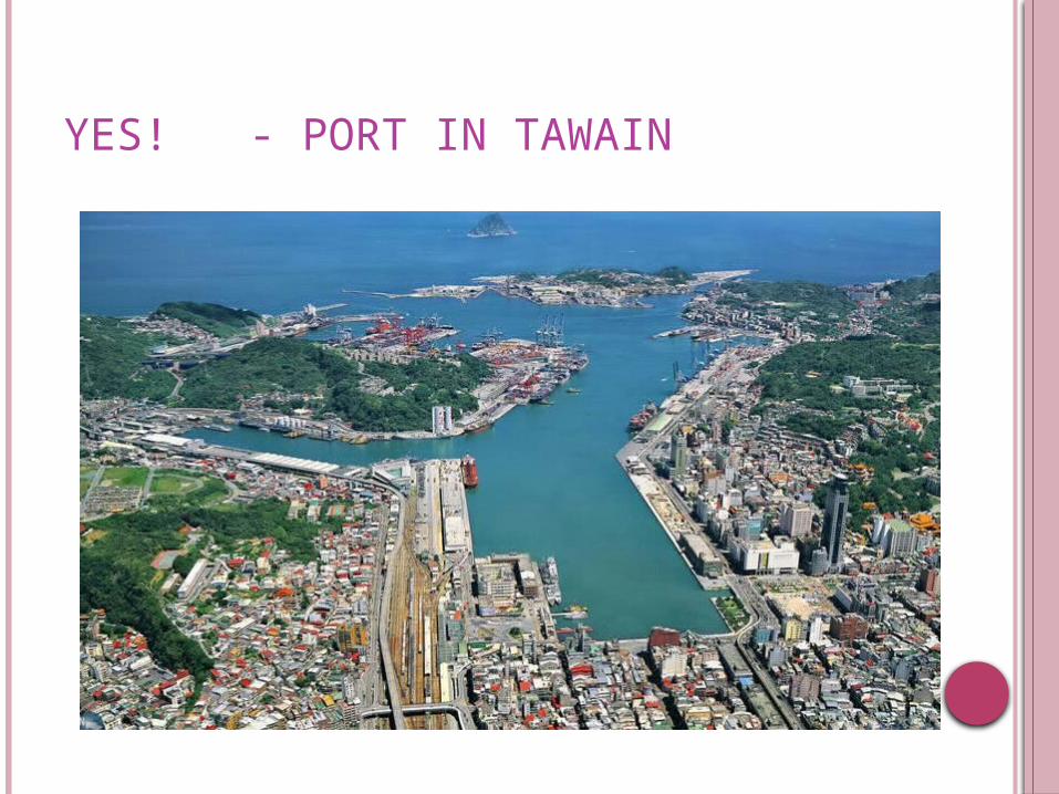
YES! - PORT IN TAWAIN

YES! SUMO WRESTLING IS BIG IN MONGOLIA TOO!
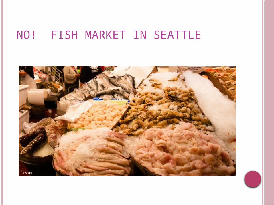
NO! FISH MARKET IN SEATTLE

NOPE. CHINATOWN IN LONDON!
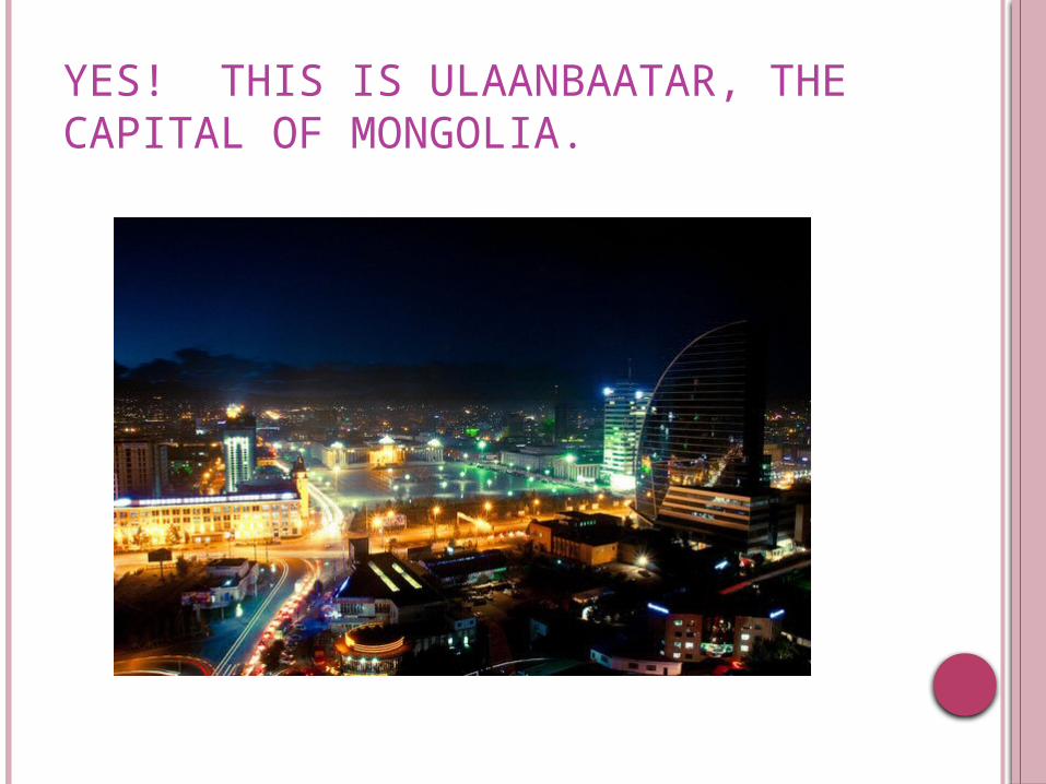
YES! THIS IS ULAANBAATAR, THE CAPITAL OF MONGOLIA.
CHINA, MONGOLIA, & TAIWAN: PHYSICAL GEOGRAPHY

CHINA’S PHYSICAL GEOGRAPHY
China makes up roughly 4 million sq. mi. (similar to the USA)
China is the third largest country in the world,
What two countries are larger?
Russia and Canada.

CHINA’S PHYSICAL GEOGRAPHY
Two-thirds of its total land area covered by mountains, hills and plateaus.
Based on it’s physical features, where do you think most people live?

CHINA’S PHYSICAL GEOGRAPHY

NATURAL BORDERS AND LANDFORMS The Gobi desert in
northern China separates the country from its neighbors.
Eastern China has low-lying plains which form one of the largest farming regions.
The Pacific Ocean makes up the eastern border.
Rugged mountains make up western China.

MOUNTAINS
The Highest peak in the world, Mount Everest (8,828m) stands on the border between China and Nepal.
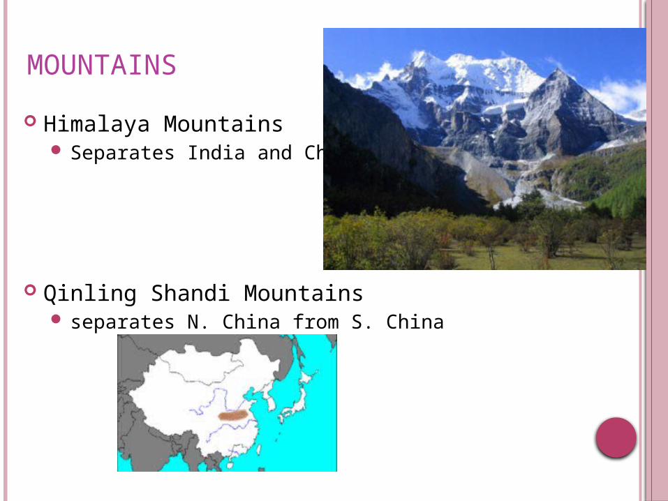
MOUNTAINS
Himalaya Mountains Separates India and China
Qinling Shandi Mountains separates N. China from S. China

GOBI DESERT
500,000 square miles
a cold desert few important
cities for traders to stop and rest while traveling the Silk Road
Gobi means “waterless Place”
http://app.discoveryeducation.com/search?Ntt=Gobi

RIVERS OF CHINA Rivers also play a major role in China, both for transportation and for
irrigation. Major rivers flow west to east.
Huang He or Yellow RiverStretches 3000 mi across N. ChinaRiver often floods and leaves layers of siltNicknamed “China’s Sorrow” because these floods can be very
destructivehttps://www.youtube.com/watch?v=VkD4lKWS0ro
Chang Jiang or Yangzi RiverCuts through central ChinaThree Gorges Dam (more on
that later!)Third longest river in the world
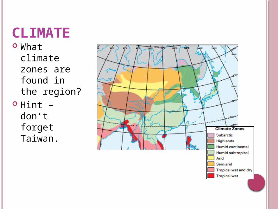
CLIMATE What climate
zones are found in the region?
Hint – don’t forget Taiwan.

HIGH LATITUDE CLIMATE ZONES Severely cold, dry climates Subarctic-occur in small area along
Mongolia’s and China’s northern borders w/ Russia Cool to cold summers Brutally cold winters
Highland-found mostly in western China Temp varies with latitude and elevation
The higher north the lat. & the higher the elev., the colder the climate
MID-LATITUDE ZONES Moderate climates make this area more
comfortable to live in Humid Continental- NE China, N Korea, N.
South Korea and N Japan Coniferous forests Temperate grasslands (good for grazing)
Humid Subtropical-SE China, S South Korea, S Japan, & N Taiwan Deciduous and coniferous forests

DRY ZONES Not well suited for agriculture Not much settled by people Semiarid- made up of parts of the Mongolian
Plateau Short grasses-good for grazing
Arid- mostly found in west central area of the mainland. Taklimakan Desert- located in W China between
the Tian Shan and Kunlun Mts Gobi Desert- located in N China and SE Mongolia
Prime area for finding dinosaur fossils.

IS A DESERT ALWAYS HOT? SEE THE CLIMOGRAPH FOR THE GOBI DESERT BELOW.

RESOURCES Most people in China still work as farmers or
herders. Major crops include wheat and rice. Fishing is also a major industry along the coasts. River systems provide crop irrigation, hydroelectric
power and transportation China has considerable natural resources
Coal Lead Zinc Copper Tungsten Gold. Oil

TAIWAN
island off the southeastern coast of China Separated by the Taiwan Strait. rugged mountain ranges parallel to the east
coast flat to gently rolling plains of the western
third Where would most people live?
MONGOLIA OVERVIEW
As you watch the video, take a few notes regarding Mongolia.
https://www.youtube.com/watch?v=Pi6pmdOYGXk

RESOURCES Traditionally Mongolia has been dependent on
herding and agriculture. Natural resources
copper, gold, coal, tungsten

CHINA, MONGOLIA, & TAIWAN: Pick one place in the region to visit. Use
absolute and relative location to describe where you are visiting.
Write a journal entry describing how you believe the people there would live.
Make sure to include important physical features, climate, and population density in relation to physical features.
The journal entry should be in first person as if you were visiting and seeing these things.
It should be close to a page. Draw one picture at the bottom that will be a
“photograph” of where you are.