who says political geography is not important?. political geography nations, states and stateless...
TRANSCRIPT

Who says political geography is not important?

Political Geography
• Nations, States and Stateless Nations• 4 Pillars of a state• Stateless Nations• Are there any real Nation-States?• What about states like Arkansas?• Peace of Westphalia • Mini-states and micro-states
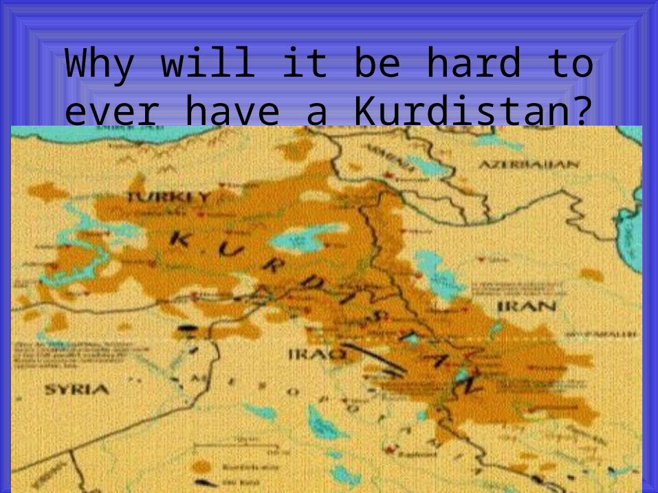
Why will it be hard to ever have a Kurdistan?

Most modern-day boundaries were drawn
by whom? Conference of Berlin Balfour Declaration

http://www.globalhumandynamics.com/africahr.jpg

Tribal/ethnolinguistic & political boundaries

Borders do matter – even between friendly neighbors
Rellmann, Getis and Getis – 6th Edition, page 462

All Roads Lead to ParisMurphy, A. B.; Jordan-Bychkov, Terry G.; and Jordan, Bella Bychdova. The European Culture Area: A Systematic Geography, 5th ed. (Lanham, MD and Boulder, CO:
Rowman & Littlefield, 2009), p. 168
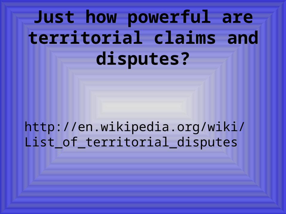
Just how powerful are territorial claims and disputes?
http://en.wikipedia.org/wiki/List_of_territorial_disputes

Irredentism – unredeemed territoryBolivian irredentism over territorial losses in the War of the Pacific with Chile
(1879-1884). "What once was ours, will be ours once again", and "Hold fast rotos (Chileans), for here come the Colorados of Bolivia“
http://en.wikipedia.org/wiki/Irredentism

Constitutional Territorial Claims of the Republic of China (Taiwan)
http://en.wikipedia.org/wiki/File:ROC_Administrative_and_Claims.svg

China’s claims in the South China Sea
http://chinadigitaltimes.net/china/south-china-sea-islands/
http://printable-maps.blogspot.com/2009_11_01_archive.html

Colonialism
• Claiming of territory and establishment, exploitation, maintenance, acquisition of territory by people from another state.
• State claims sovereignty over all social, government and economic structures
• Unequal relationship• English/French vs Portuguese/Dutch colonialism• Neocolonialism

ImperialismJohnston, Ronald John (2000). The Dictionary of Human Geography (4th ed.). Wiley-Blackwell. p. 375.
• Imperialism - creation and/or maintenance of an unequal economic, cultural, and territorial relationship, usually between states and often in the form of an empire, based on domination and subordination that employs and expansionist, mercantilist policies

Mercantilismhttp://en.wikipedia.org/wiki/Mercantilism
• Building a network of overseas colonies
• Forbidding colonies to trade with other nations
• Monopolizing markets with exclusive rights to markets
• Banning the export of gold and silver, even for payments;
• Forbidding trade to be carried in foreign ships
• Export subsidies
• Promoting manufacturing with research or direct subsidies
• Limiting wages
• Maximizing the use of domestic resources
• Restricting domestic consumption

The sun never sets on the British Empire
http://en.wikipedia.org/wiki/File:The_British_Empire.png

Berlin Conferencehttp://westernciv2.umwblogs.org/2010/09/23/scramble-for-africa/
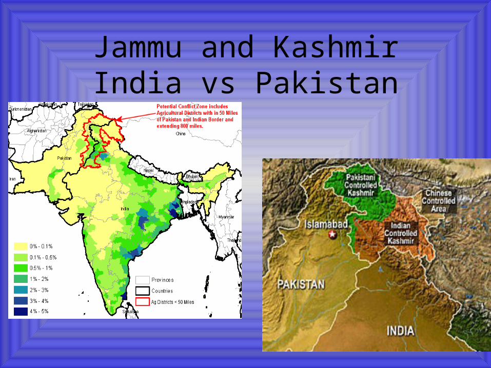
Jammu and KashmirIndia vs Pakistan

Forward Capitalmoving capital to a “forward” place to make a statement of
intention – present or futurehttp://www.altiusdirectory.com/Travel/pakistan-maps-pictures.php & http://www.infoplease.com/atlas/country/brazil.html

Even Antarctica is claimed

TheocracyState ruled by religious leaders and holy texts
http://en.wikipedia.org/wiki/Theocracy
• Yemen, Afghanistan, Oman, Iran, Somalia, Sudan, Saudi Arabia, Mauritania, Vatican, Central Tibetan Administration
• Iran has the most characteristics of a true theocracy as their leaders are considered to be divinely guided
• Saudi Arabia has a monarchy, but follows strict Sharia Law
• Nigeria – Sharia may be used, but non-Muslims do not have to use it in Court

Political Boundaries can be very important…and amusing
• http://www.youtube.com/user/CGPGrey

Territory• States cannot exist without territory• Territorial Morphology – geographers
study the size, shape and relative location of states?
• How does the size and shape of a state give advantages or disadvantages?
• 5 types of territorial morphologies

COMPACTWhat are the advantages &
disadvantages?

FRAGMENTEDWhat are the advantages &
disadvantages?

ELONGATEDWhat are the advantages &
disadvantages?

PRORUPT or PROTRUDED
What are the advantages & disadvantages?
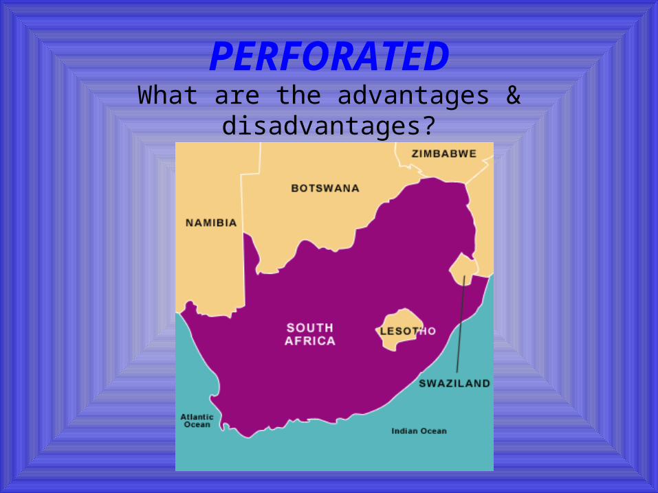
PERFORATEDWhat are the advantages &
disadvantages?

What territorial morphology is ITALY?

Exclaves & Enclaves
• Exclave – bounded (non-island) piece of territory that is part of a state but lies separated from it by territory of another state.
• Enclave – piece of territory that is surrounded by another political unit of which it is not a part (landlocked within the country which surrounds them.
• See page 211 in your text• To understand, it is all about
perspective

‘Google’ Azerbaijan and Armenia maps and look what
you get…

Talk about a strangely shaped
states

Shape is not a constant for political/economic stability
or instability
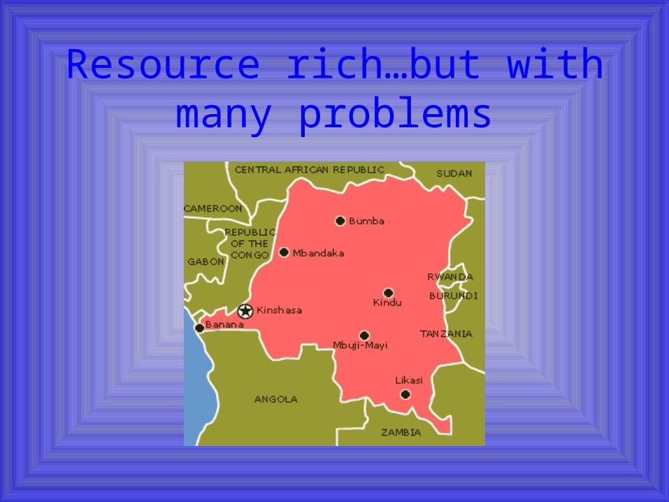
Resource rich…but with many problems

Very few natural resources…but wealthy and stable

LANDLOCKEDCOUNTRIES
• Isolation• At the mercy of neighbors• Need communication linkages
(highways, airports, rivers, etc.)• Have formed alliances with other
countries to lessen isolation• Only Liechtenstein & Uzbekistan
are landlocked & surrounded by landlocked countries
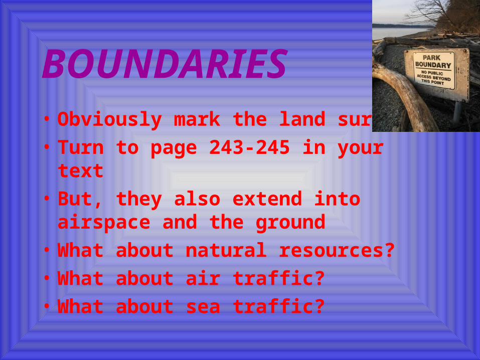
BOUNDARIES• Obviously mark the land surface• Turn to page 243-245 in your
text• But, they also extend into
airspace and the ground• What about natural resources?• What about air traffic?• What about sea traffic?
Setting BoundariesStage One
• DEFINITION – defines exact location established through legal agreement, treaty, etc. Can describe terrain feature or be measured by longitude and latitude.
Setting BoundariesStage Two
• DELIMITATION – putting the boundary on a map officially.

Setting BoundariesStage Three
• DEMARCATION – The final stage. Marking a boundary with fences, walls, posts, pillars, or other markers. Most of the world’s boundaries are not demarcated.

Copy this into your notebook where you have room near Chapter 8 journals.
Four Types of Boundary Disputes
• Definitional – center on legal issues• Locational – definitions not
disputed – the interpretation is• Operational – parties differ on how
boundary should function (how migration should occur)
• Allocational – conflict over “stuff” – oil, gas, seafloor riches, water
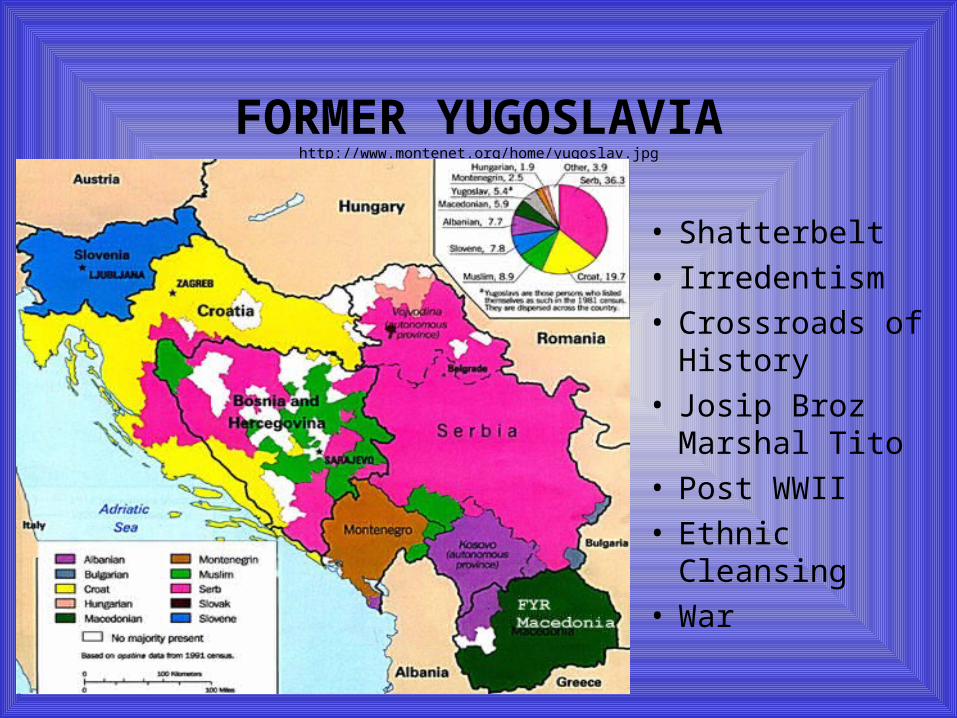
FORMER YUGOSLAVIAhttp://www.montenet.org/home/yugoslav.jpg
• Shatterbelt• Irredentism• Crossroads of
History• Josip Broz
Marshal Tito• Post WWII• Ethnic Cleansing• War

FEDERAL STATES
• Political framework where the central government represents its political sub-units where they have common interests – defense, foreign affairs, etc.
• But these sub-units retain their own identities, laws, policies, customs, etc.
• Accommodates regional differences and enables diversity and unity to coexist
FEDERAL STATES
• Geographer K.W. Robinson said, “The federal state is the most expressive of all political systems.”
• What did he mean by this?

UNITARY STATES• State which has a centralized
government that exercises power equally over all parts of the state.
• Highly centralized• Political sub-units not as important• Appeasing minorities maybe not
important• Government frameworks are set up to
reinforce the central government’s power

Unitary States of the World in blue – Federal States in gray
http://commons.wikimedia.org/wiki/Image:Unitary_states.png