white river basin technical committee meeting · bend, carnation, seattle and bellevue ... criteria...
TRANSCRIPT

White BTC Mtg #2 Agenda (2) revised.doc 6/13/2007
White River Basin Technical Committee Meeting
Wednesday, May 23, 2007
9:00am – 11:00am
Les Gove Multipurpose Building 11th & Auburn Way North
Auburn, WA
A G E N D A
Purpose: Review and discuss FCZD CIP prioritization criteria, basin specific issues, project list, project summary template and project prioritization.
1. Introductions Jeanne Stypula
9:00 -9:10
2. Update – King County Flood Control Zone District (KCFCZD) formation and Advisory Committee Meeting
Brian Murray
9:10 - 9:25
3. Basin Technical Committee Work Program, Timeline
and general ground rules
Brian Murray
9:25 – 9:35
4. Criteria for KCFCZD Project Selection and Sequencing
Steve Bleifuhs
9:35 – 9:45
5. Draft KCFCZD White River Basin project list
• Overview of flood hazard issues in basin
• Discussion of identified project list for Basin
• Questions and answers
Jeanne Stypula
9:45 – 10:20
6. Priority List Discussion
Jeanne Stypula
10:20 – 10:50
7. Next Steps and Wrap Up
Project summary sheets due June 1, 2007
Consensus Recommendation June 5, 2007
Brian Murray
10:50– 11:00
Summary of May 23, 2007 White River BTC Attendees (See scanned sign-in sheet) Brian provided overview of the district formation and advisory committee meeting. He provided copies of the ordinance (15728) forming the District and a listing of the Advisory Committee (AC) membership and governance structure. As an explanation about the AC’s upcoming task to recommend a levy rate based in part on project needs, a discussion ensued regarding what constitutes regional, sub-regional or local projects. Brian requested input and ideas from the group to help bring in information to define these categories. Brian reviewed the timeline for the White River BTC’s workplan, and specifically noted the tight schedule needed to support the June 8th AC meeting. Due to this schedule, groundrules have not been proposed for the BTC, but will be developed after this first round of project prioritization is completed. In the interim, the group agreed to a collaborative and consensus-based approach to decision-making. A question was raised about how cities that do not have a seat on the AC could connect directly to the AC. It was noted the AC meetings are open meetings, and the specific AC members –such as Auburn and Federal Way—would be representing south county areas, i.e. cities. Also, being the District Coordinator for the AC, Brian Murray is directly available to take city questions and concerns. He can be reached at 206-296-1906, or [email protected]. Steve provided a handout on the KCFCZD project selection and sequencing approach. As this information was described, a comment was raised regarding how cost-benefits and multi-benefits components were not included in the selection criteria. It was noted that the selection criteria was policy-level screening, used to formulate the body of projects in the adopted 2007 FHMP, with project summary information used to develop a funding approach. More detailed ranking of projects utilizes other, more specific set of criteria. Jeanne provided a powerpoint presentation containing an overview of the current list of White River basin projects. Each project was described, then Jeanne explained the project ranking criteria. The ranking of the White River projects was presented to the group for discussion. A question was raised about consistent application of ranking criteria across the county. Staff have compared the prioritized project lists from each of the 5 basins to ensure consistent application of the ranking criteria. Lastly, the meeting wrapped up with a request for the cities to submit additional regional projects that meet policies G-2: Flood Risks and PROJ-1: Prioritizing Flood Hazard Risks as identified in the adopted 2006 King County Flood Hazard Management Plan . A project summary sheet was provided with the request that submittals be sent to Brian and Jeanne no later than June 1st. Any submitted projects will be reviewed by the county staff and the total list of ranked projects will be discussed to achieve a consensus recommendation at the June 5th White River BTC meeting. All White River BTC members will be notified about the location for the June 5th as soon as a meeting room can be reserved. The meeting will be scheduled for the afternoon

KING COUNTY FLOOD CONTROL ZONE DISTRICT ADVISORY COMMITTEE MEMBERSHIP The advisory committee is composed of both permanent and rotating (two-year) members. The ten permanent seats on the committee are held by each mayor, or council member alternate designated by the mayor, of Tukwila, Auburn, Kent, Renton, Snoqualmie, North Bend, Carnation, Seattle and Bellevue. The King County Executive is also a permanent member of the committee. Four of the rotating seats are held by mayors or city council members as nominated by the Suburban Cities Association. One of the two-year seats is held by an individual selected by the King County Council who represents one of King County’s Unincorporated Area Councils. Each member of the committee is allowed one alternate, who will fill in for the member as needed. If the committee member is an elected official, the alternate must also be an elected official from the same jurisdiction. For the first term of the committee, beginning in 2007, the advisory committee members are: Mayor Pete Lewis Mayor Suzette Cooke City of Auburn City of Kent Mayor Steve Mullet Mayor Kathy Keolker City of Tukwila City of Renton Mayor Grant Degginger Mayor Greg Nickels City of Bellevue City of Seattle Councilmember Mike Flowers Mayor Kenneth Hearing City of Carnation City of North Bend Mayor Matt Larson County Executive Ron Sims City of Snoqualmie King County Dick Bonewits King County Unincorporated Area Councils Councilmember Ron Hansen Deputy Mayor Joan McBride City of Shoreline City of Kirkland Mayor Michael Park Mayor Laure Iddings City of Federal Way City of Maple Valley The committee facilitator for 2007 is Margaret Norton-Arnold.

King County Flood Control Zone District Overview and Advisory Committee Update Ordinance 15728 was adopted by the King County Council on April 16, 2007. The ordinance had full bipartisan support of the Council. Key points included: Transfer of the assets of the previously-existing ten individual flood control zone districts
in King County to the new countywide district. Establishment of a fifteen-member Advisory Committee made up of:
Elected official from the cities of Carnation, Snoqualmie, North Bend, Bellevue, Seattle, Renton, Tukwila, Kent and Auburn (permanent seats);
The King County Executive (permanent seat); Four rotating seats to be recommended by the Suburban Cities Association (2-year
rotating seats); One seat to be recommended by the county’s six Unincorporated Areas Councils.
Since some of the UACs are rural and others are urban, this position will rotate between rural and urban areas (2-year rotating seats).
The ordinance did not establish a levy rate to fund the new countywide flood control zone district. This should happen in conjunction with the budget process during the fall of 2007.
An earlier ordinance (15673, passed January 16, 2007) which adopted the 2006 King County Flood Hazard Management Plan, identified the need to have the countywide flood control zone district address subregional flood risk and infrastructure needs on tributaries and in local jurisdictions.
A first step being taken by King County toward the implementation of the KCFCZD is the creation of Basin Technical Committees (BTCs) for each of the major river basins in King County. These Basin Technical Committees have been formed for the South Fork Skykomish, Snoqualmie, Cedar/Sammamish, Green/Duwamish, and White River basins.
Links to ordinances 15673 and 15728 can be found at:
http://www.metrokc.gov/mkcc/floodplan/index.htm May 17 Advisory Committee Meeting Update
Committee member introductions and expectations for the KCFCZD. Governance structure Advisory Committee Work Plan Key Discussion Issues:
Regional vs. Sub-Regional Projects Levy Rate Uniform vs. Tiered Levy Rate Coordination: Achieving flood hazard reduction objectives while supporting
other regional objectives (salmon, regional trails, affordable housing, etc) Coordination: permitting and funding Communication: Website to provide info about on-going work in each basin
Next Meetings: June 8th, June 22nd, July 20, August 17th (if necessary)

6/13/2007
King County Flood Control Zone District Criteria and Policies to Guide Project Selection and Sequencing
All projects contained within the Draft KC FCZD CIP list were identified within the adopted 2006 King County Flood Hazard Management Plan. King County uses severity, consequence, urgency, opportunity and readiness as general categories of criteria for selecting, prioritizing and sequencing projects actions to address flood and channel migration risks.
CRITERIA
Flood Risks – Severity (Policy G-2) The natural processes of flooding and channel migration become risks when human development is located within flood hazard areas. The level of risk is evaluated on a case by case basis using the predicted likelihood of flooding and channel migration and the consequences that would result if no action is taken. Flood risks, and the resulting consequences that would result if no action is taken, are generally prioritized in the following order:
a. Threats to public safety.
b. Damage to public infrastructure.
c. Impacts on the regional economy.
d. Damage to private structures.
Consequence, Urgency, Opportunity (Policy PROJ-1: Prioritizing Flood Hazard Risk)
Listed in order of importance:
a. The consequences that will result if no action is taken. Consequences should be prioritized as identified in Policy G-2.
b. Urgency, where urgency is a measure of how quickly an action needs to be taken in order to prevent a risk from growing worse.
c. Legal responsibility and authority, where legal responsibility and authority is a contractual relationship between King County and another person or agency to maintain a flood protection facility.
d. Funding or partnership opportunities.
Readiness All flood CIP recommendations contained within the adopted 2006 King County Flood Hazard Management Plan were additionally screened according to the following criteria pertinent to readiness and potential scheduling.
a. Is the project identified within an adopted local hazard mitigation plan?
b. Do property interests need to be acquired (fee simple or easement) for this project?
c. If property interests need to be acquired, is the landowner willing to sell or sign a voluntary letter of agreement, expressing an interest in selling necessary property interests?
d. What is the anticipated project start date (reflecting feasibility, opportunity, and readiness of project proposal)?
Note: The above criteria have been used for identified flood capital projects. These criteria will be used for any newly identified projects. This criteria may also be used as starting point to select project criteria for proposed District Sub-regional Opportunity Fund.

6/13/2007

King County FCZD Preliminary Project Prioritization CriteriaThe following prioritization scheme is intended to help prioritize KCFCZD projects based on the imperative to complete each project from a flood risk/vulnerability perspective only. The basis for these criteria is the 2006 King County Flood Hazard Management Plan policies related to flood risk hierarchy (G-2) and project prioritization (PROJ-1). Legal responsibility, environmental impacts or benefits, benefit-cost analyses, and funding or other opportunistic criteria, are not included in this prioritization scheme, but may be added at a later date.
1) What is the current land use? (Consequences)This criterion is intended to give different weights to different types of land uses. If more than one type of land use is at risk, select the applicable land use with the highest score. Use the score range provided to give more or less weight base on site specific conditions. For example a sole access road would be given a higher score than one for which a reasonable alternative route exists.Description ScoreCritical Facilities (See list on page 2) 11-12Residential 9-10Commercial (Some commercial structures are critical facilities - see list) 7-8Agricultural (FPP land should be given higher score than non FPP lands) 5-6Developed Recreational (Those with regional importance should receive higher scores.) 3-4Undeveloped land in floodplain or Moderate CMZ 1-2Undeveloped land in floodway or Severe CMZ 0
2) How serious is the potential impact? (Consequences and Severity)This criterion is intended to evaluate the nature and severity of the impacts irrespective of the scale at which the impact will occur. The scoring range can be used to differentiate between similar types of impact that have different liklihoods of occuring. Description ScoreHuman injury or death could result from deep fast flows or sudden changes in flood conditions. (e.g. levee or road failure.)
9-12
Total loss of developed land use (e.g. developed land is converted to river channel.) 7-8Severe flood or erosion damage that will heavily impact those affected. 5-6Moderate flood or erosion damage which will not likely have a long term impact on those affected.
3-4
Flooding that interrupts human activity or will result in some clean up needs but which will results in little or no damage that will need to be repaired.
1-2
3) How extensive will the impact be? (Consequences and Severity)This criterion describes the scale of the problem. Is the problem manifest over a large area or in a manner that will affect a large number of people, or is it largely localized. In instance were the physical impact is over a small area, but a larger number of people will be affected, apply score based on the impact rather that just the physical area. Scoring range can be used to differentiate between different degrees of extensivness within the listed catagories.
Description ScoreRegional (Impacts will be felt well outside the area in which the flooding or erosion occurred.) 7-8Severe (City centers, larger neighborhood) 5-6Moderate (Several structures, roads et impacted) 3-4Localized (Affects a few homes or business) 1-2
4) How soon will the impact occur? (Urgency)
Project Prioritization 5/10/07

This criterion is used to describes how soon the flood risk needs to be addressed to avoid its occurrence or reoccurrence.
Description ScoreSome or all of the damages described will likely occur or recur during the next major high flow event.
5-6
Damages may occur during the next high water event, or the potential for them to occur is rapidly increasing.
3-4
Damages will eventually occur, but the risk of them occuring is not increasing rapidly 1-2
Critical Facilities DefinedThe following list is intended to help understand what constitutes a "Critical Facility". This list has been compiled from the KC Critical Areas Ordinance and the International Building Code.
1. Facilities in which > 300 people congregate2. Daycares, elementary schools and secondary schools with > 250 people3. College and adult education facilities with > 50 people4. Hospitals and Healthcare facilities with > 50 resident patients5. Jails and detention facilities6. Facilities with > 5000 occupants 7. Power, Wastewater and potable water treatment facilities8. Fire, rescue and police facilities9. Designated emergency shelters
10. Power generation and public utility faculties11. Aviation facilities12. Critical national defense facilities13. Nursing and personal care facilities14. Senior citizen assisted housing15. Public roadways and bridges16. Sites that produce, use or store hazardous substances or hazardous waste (not including sites
that temporarily store household products intended of sale on the site)
Ordinance 15051 (CAO), lines 605 - 614Critical facility: a facility necessary to protect the public health, safety and welfare including, but not limited to, a facility defined under the occupancy categories of "essential facilities," "hazardous facilities" and "special occupancy structures" in the structural forces chapter or succeeding chapter in the K.C.C. Title 16. Critical facilities also include nursing and personal care facilities, schools, senior citizen assisted housing, public roadway bridges and sites that produce, use or store hazardous substances or hazardous waste, not including the temporary storage of consumer products containing hazardous substances or hazardous waste intended for household use or for retail sale on the site.
Section 1602 International Building CodeEsseintial Facilities. Buildings and other structures that are intended to remain operational in the event of extreme environmental loadingfrom flood, wind, snow or earthquakes.
Project Prioritization 5/10/07

DRAFT WhiteRisk Prioritized Project List
Project Name
What is the current
land use?
How serious is
the potential impact?
How extensive will the
impact be?
How soon will the impact occur?
Total Score Total Cost
Red Creek Acquisitions 9 12 2 4 27 $735,000
White-Greenwater Acquisition 9 11 2 3 25 $785,000
County line to A-Street Flood Conveyance Improvement
10 5 5 2 22 $1,193,000
3rd Place and Pacific City Park Revetment Retrofit
10 5 5 1 21 $6,447,000
White River Flood Damage Repair at Pacific Park Levee
9 3 2 3 17 $75,000 (construction est.)
White River Flood Damage Repair at Stuck River Drive
4 4 3 3 14 $300,000 (construction est.)
TransCanada Levee Modification 4 3 2 4 13 $1,421,000 Pacific City Park Revetment Repair
4 3 1 3 11 $183,000

Chapter 5 Page 93
County Line to A-Street Flood Conveyance Improvement
Location Information Water Resource Inventory Area 10, White River River Mile 5.5 to 6.20, both banks Council District 7 Jurisdiction: Pacific Public and Private lands No Agricultural Production District or Farmland Preservation Program lands
Estimated Cost $1,193,000
Problem Statement Flows in this reach are constricted by concrete revetment banks and are partially contained by a short length of left bank levee, the Union Pacific levee, downstream of the A-Street and BNSF Railway bridges. Currently, the active channel is disconnected from its floodplain by the left bank levee, prohibiting sediments from being deposited and flood waters from entering the left, undeveloped, overbank. Flood flows are directed toward the right bank revetment, where residential development is located along the top of the riverbank. During the 1995 and 1996 floods, the lower end of the left bank flood protection facility near the King and Pierce county line was flooded, connecting the river and wetland flows. The White River carries a high sediment load and this reach is a depositional area. River gravels in this area and the downstream reaches had been dredged periodically prior to the mid-1980s. Severe flood conditions combined with increased deposition could exacerbate flood flow impingement into the right bank, resulting in damage to the Pacific City Park concrete revetment and placing the adjacent residential community at-risk of flooding.
What Is at Risk Risks identified in the 2006 King County Flood Hazard Management Plan Policy G-2 that this project is intended to reduce or eliminate include:
• Risk to public safety if residents are caught unaware of flood conditions or attempt to enter or reenter flooded areas;
• Risk to public safety if fire and rescue personnel are called upon to aid those unable or unwilling to evacuate flooded homes;
• Damage to public infrastructure, primarily drainage systems and streets and a flood protection facility;
• Damage to private structures.
Proposed Project or Action Acquire the remaining private property via fee simple or flood easement purchase to implement this levee modification project. Conduct a floodplain hydraulic analysis and determine current-day base flood elevations to verify the extent of potential flood risk to the right bank residential and park developments. Complete channel migration zone mapping to determine the extent of potential erosion risk. Reconnect the active channel to its left overbank floodplain by breaching the Union Pacific levee, allowing for improved flood flow conveyance into the existing floodplain area and for the restoration of river channel processes through the reach. Replace an existing concrete culvert with a shallow box culvert for flow

2006 King County Flood Hazard Management Plan January 2007
Chapter 5 94
reentry into the river channel within Pierce County. This project is also a recommended Water Resource Inventory Area 10 salmon habitat recovery project.
Project Benefits Acquisition of the three parcels allows for the implementation of a flood protection facility modification that will result in a reduction of the potential flooding of the existing development on the right bank. Flood conveyance and storage of water and sediment in the reach will be improved by accommodating flood flows in the left overbank floodplain area through the reconnection of the active channel to its floodplain. This action will reduce flood risks to the residential and park properties located along the right bank floodplain. This project site is the only remaining significantly sized overbank area available to enhance flood storage and improve conveyance in the lower White River within the Cities of Pacific and Auburn.
Coordination Although much of the project area is already owned by King County, three private parcels in King County and portions of other parcels in Pierce County are needed under fee simple acquisition or flood easement for project implementation. Property owner willingness is essential to the project’s implementation. Coordination with Pierce County via the Inter-County River Improvement Agreement is required. The Muckleshoot and Puyallup Indian Tribal fishery resources staff have been supportive of this proposal. It is a Water Resource Inventory Area 10 salmon habitat recovery project site.
Other Information or Needs As-built condition should be used to revise the effective FEMA flood insurance rate maps for this reach.
This project is included in the Water Resource Inventory Area 10 Ecosystem Restoration Feasibility Study with the U.S. Army Corps of Engineers and is strongly supported by the Puyallup Tribe of Indians.
Project Area Map A map of the project area may be found at: http://dnr.metrokc.gov/wlr/flood/fhmp/pdf/Countyline.pdf
2006 King County Flood Hazard Management Plan January 2007
Chapter 5 95
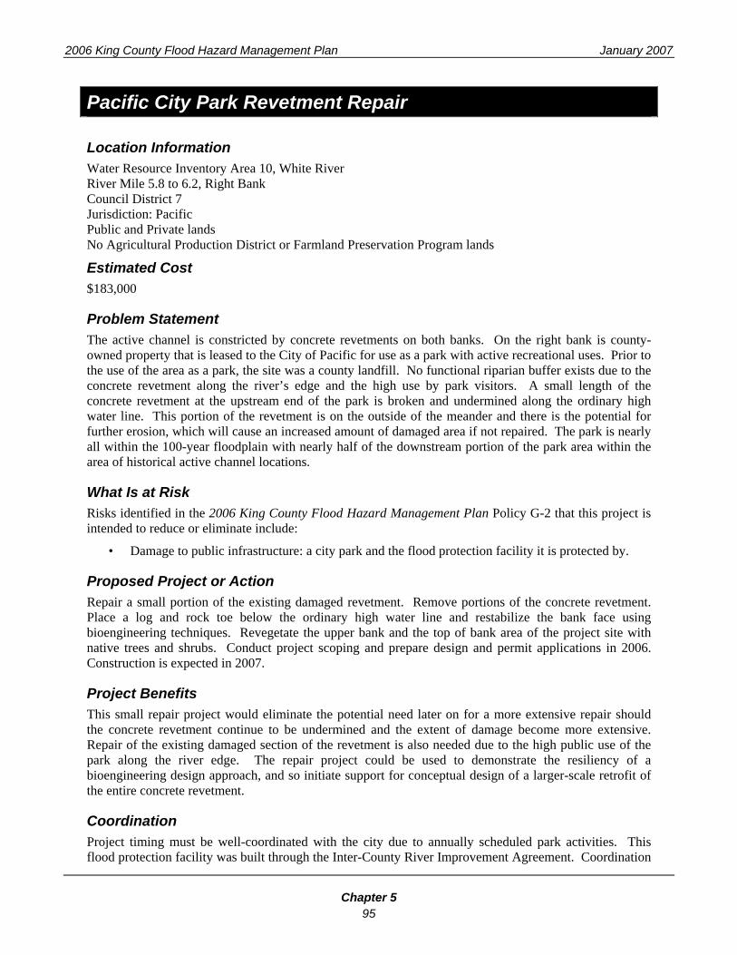
Pacific City Park Revetment Repair
Location Information Water Resource Inventory Area 10, White River River Mile 5.8 to 6.2, Right Bank Council District 7 Jurisdiction: Pacific Public and Private lands No Agricultural Production District or Farmland Preservation Program lands
Estimated Cost $183,000
Problem Statement The active channel is constricted by concrete revetments on both banks. On the right bank is county-owned property that is leased to the City of Pacific for use as a park with active recreational uses. Prior to the use of the area as a park, the site was a county landfill. No functional riparian buffer exists due to the concrete revetment along the river’s edge and the high use by park visitors. A small length of the concrete revetment at the upstream end of the park is broken and undermined along the ordinary high water line. This portion of the revetment is on the outside of the meander and there is the potential for further erosion, which will cause an increased amount of damaged area if not repaired. The park is nearly all within the 100-year floodplain with nearly half of the downstream portion of the park area within the area of historical active channel locations.
What Is at Risk Risks identified in the 2006 King County Flood Hazard Management Plan Policy G-2 that this project is intended to reduce or eliminate include:
• Damage to public infrastructure: a city park and the flood protection facility it is protected by.
Proposed Project or Action Repair a small portion of the existing damaged revetment. Remove portions of the concrete revetment. Place a log and rock toe below the ordinary high water line and restabilize the bank face using bioengineering techniques. Revegetate the upper bank and the top of bank area of the project site with native trees and shrubs. Conduct project scoping and prepare design and permit applications in 2006. Construction is expected in 2007.
Project Benefits This small repair project would eliminate the potential need later on for a more extensive repair should the concrete revetment continue to be undermined and the extent of damage become more extensive. Repair of the existing damaged section of the revetment is also needed due to the high public use of the park along the river edge. The repair project could be used to demonstrate the resiliency of a bioengineering design approach, and so initiate support for conceptual design of a larger-scale retrofit of the entire concrete revetment.
Coordination Project timing must be well-coordinated with the city due to annually scheduled park activities. This flood protection facility was built through the Inter-County River Improvement Agreement. Coordination

2006 King County Flood Hazard Management Plan January 2007
Chapter 5 96
of the project design and implementation with Pierce County is therefore needed. Integrate design with future revetment retrofit as described in the 3rd place and Pacific City Park Revetment project.
Other Information or Needs: Historical information about the King County landfill is needed to determine the specific location and types of landfill materials within the project site.
Project Area Map A map of the project area may be found at: http://dnr.metrokc.gov/wlr/flood/fhmp/pdf/Pacific.pdf

2006 King County Flood Hazard Management Plan January 2007
Chapter 5 97
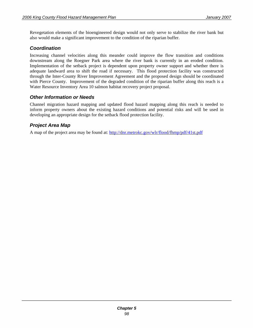
41st Street Setback Feasibility Analysis and Design
Location Information Water Resource Inventory Area 10, White River River Mile 7.00 to 7.70, Right Bank Council District 7 Jurisdiction: Auburn Private lands No Agricultural Production District or Farmland Preservation Program lands
Estimated Cost $25,000
Problem Statement The river channel is directed toward the right bank by the valley wall projecting from the southern, left bank. Given this physical feature, the river and flood flows have the potential for lateral migration into the right bank, which contains the City of Auburn’s Mt. Baker Junior High School, sixteen single-family residences, a multi-family development and 41st Street, a private road. The existing revetment is composed of sporadically placed concrete rubble and has some minimal vegetation, mainly a single line of maturing cottonwoods with no understory shrubs or saplings. The composition of the revetment materials underneath the concrete rumble is unknown, adding to the uncertainty of the structural integrity to provide erosion protection.
What Is at Risk Risks identified in the 2006 King County Flood Hazard Management Plan Policy G-2 that this project is intended to reduce or eliminate include:
• Damage to public infrastructure, including a school, drainage systems and streets;
• Damage to private structures.
Proposed Project or Action Conduct a feasibility analysis and develop the design for a setback of the existing revetted river bank. Verify whether a flood easement exists for the flood protection facility. Conduct a field investigation to determine the revetment materials, assess the revetment for its level of erosion protection and measure the available landward area that could accommodate a setback while maintaining an adequate width for the private road. Develop a project design that can be used to discuss the proposed setback with the private property owner and the school district. With property owner support, modify the flood protection facility by setting it back farther from the active river channel.
Project Benefits Repositioning the right bank revetment will provide increased flood flow capacity in this portion of the river, which is highly constrained by the position of the southern valley wall. Added flow area would reduce erosion velocities in the river channel. Retrofitting the flood protection facility by removing unconsolidated rumble and installing a more resilient, bioengineered revetment will increase the level of erosion protection along this outside meander bend. This improved flood protection facility would offer increased erosion protection for the existing residential area, school property and private road.
2006 King County Flood Hazard Management Plan January 2007
Chapter 5 98
Revegetation elements of the bioengineered design would not only serve to stabilize the river bank but also would make a significant improvement to the condition of the riparian buffer.
Coordination Increasing channel velocities along this meander could improve the flow transition and conditions downstream along the Roegner Park area where the river bank is currently in an eroded condition. Implementation of the setback project is dependent upon property owner support and whether there is adequate landward area to shift the road if necessary. This flood protection facility was constructed through the Inter-County River Improvement Agreement and the proposed design should be coordinated with Pierce County. Improvement of the degraded condition of the riparian buffer along this reach is a Water Resource Inventory Area 10 salmon habitat recovery project proposal.
Other Information or Needs Channel migration hazard mapping and updated flood hazard mapping along this reach is needed to inform property owners about the existing hazard conditions and potential risks and will be used in developing an appropriate design for the setback flood protection facility.
Project Area Map A map of the project area may be found at: http://dnr.metrokc.gov/wlr/flood/fhmp/pdf/41st.pdf

2006 King County Flood Hazard Management Plan January 2007
Chapter 5 99
Red Creek Acquisitions
Location Information Water Resource Inventory Area 10, White River and Red Creek River Mile 25.7 to 27.1, Right Bank Council District 9 Unincorporated King County Private lands No Agricultural Production District or Farmland Preservation Program lands
Estimated Cost $735,000
Problem Statement This area is located two river miles downstream of Mud Mountain Dam. The river along this reach experiences periodic and rapid river channel migration. In addition, deep fast flows occur in various paths in the right bank floodplain. The extent of inundation and bank erosion can quickly change, threatening several existing residential structures. The Red Creek channel and its confluence are overwhelmed by White River flood flows along this 1.25-mile reach. One home is surrounded by multiple-channel flow paths in the floodplain; another home is immediately adjacent to the mainstem and within the riparian buffer area; a third home is on a low terrace of floodplain, but is in the direct flow path of the right bank mainstem meander; two other homes are positioned on a somewhat higher terrace and may not be directly affected by current flood flows but may lie within a channel migration hazard area and could be at risk in the future.
What Is at Risk Risks identified in the 2006 King County Flood Hazard Management Plan Policy G-2 that this project is intended to reduce or eliminate include:
• Risk to public safety if residents are caught unaware of flood conditions or attempt to enter or reenter flooded areas;
• Risk to public safety if fire and rescue personnel are called upon to aid those unable or unwilling to evacuate flooded homes;
• Damage to private structures.
Proposed Project or Action In this high hazard area, at-risk residential homes should be acquired and removed. Land areas disturbed during removal of structures should be restored to a natural grade and replanting with native plants. Future development should be prohibited from flood and channel migration hazard zones. A floodplain analysis should be completed to determine current-day base flood elevations to verify the extent of potential flood hazard areas. A channel migration study and mapping should be completed to determine the extent of potential erosion risk. Outreach to property owners is needed to provide information about the existing flood and erosion hazards and to assess the willingness of current property owners to sell at-risk homes.

2006 King County Flood Hazard Management Plan January 2007
Chapter 5 100
Project Benefits Acquisition of the at-risk homes would permanently eliminate the risk to public safety along this reach. Up-to-date flood and channel migration hazard mapping would prevent future at-risk development and direct development to appropriate low risk areas.
Coordination Property owner willingness to sell the flood-prone homes is essential to implementing this action to permanently eliminate the public safety risk.
Other Information or Needs The U.S. Army Corps of Engineers has increased its coordination with the Red Creek residents, which has resulted in an improved level of understanding regarding water levels along the Red Creek reach and flow releases from Mud Mountain Dam.
Project Area Map A map of the project area may be found at: http://dnr.metrokc.gov/wlr/flood/fhmp/pdf/Red.pdf

2006 King County Flood Hazard Management Plan January 2007
Chapter 5 101
3rd Place and Pacific City Park Revetment Retrofit
Location Information Water Resource Inventory Area 10, White River River Mile 5.8 to 6.4, Right Bank Council District 7 Jurisdiction: City of Pacific Public and Private lands No Agricultural Production District or Farmland Preservation Program lands
Estimated Cost $6,447,000
Problem Statement A subdivision is immediately adjoining the top of the aging and degraded concrete revetment. The homes in this subdivision are very close to flood waters and homeowners have encroached into the 20-foot-wide river protection easement area. Channel constriction in this reach and the location of the homes on the outside of a meander create the potential for flooding to impact these residences. No equipment access to the top of the revetment is available due to the position of the homes on the river bank. No riparian buffer exists due to the concrete revetment and the riverside residences. 16 homes are within the area of the historical active channel location.
What Is at Risk Risks identified in the 2006 King County Flood Hazard Management Plan Policy G-2 that this project is intended to reduce or eliminate include:
• Risk to public safety if residents are caught unaware of flood conditions or attempt to enter or reenter flooded areas;
• Damage to public infrastructure, primarily drainage systems, streets and a flood protection facility;
• Damage to private structures.
Proposed Project or Action Notify homeowners about the established easement and provide flood preparedness information. Develop a revetment retrofit design to remove degraded concrete slabs, and install a benched, biostabilized riverbank from the A-Street and BNSF Railway bridges down to the existing vegetated bank at the downstream end of the city park. Remove homes located between the top of bank and 3rd Place SE. Re-establish and connect riparian buffer with the adjacent, similar buffer restoration along the city park. See also Pacific City Park Revetment Repair.
Project Benefits Removing the homes and installing a biostabilized benched riverbank, will permanently eliminate flood risks to the existing top of bank homes and the river channel will have increased capacity to convey flood waters. The newly installed biostabilized bank will link to the existing riparian buffer, providing an improved buffer along the entire reach of the right bank from A-Street to the King and Pierce county line. The project design and installation should be developed to accommodate public recreation needs within

2006 King County Flood Hazard Management Plan January 2007
Chapter 5 102
the city park. This site would also provide an excellent opportunity for public education and outreach on flood hazards and natural river systems.
Coordination The willingness of the property owners to sell their homes and City of Pacific collaboration for work on the revetment within the park area are needed. Improvement of this non-existent riparian buffer is an action recommended in the salmon habitat recovery plan for Water Resource Inventory Area 10. This project should be coordinated with flood hazard management projects proposed for this area.
Project Area Map A map of the project area may be found at: http://dnr.metrokc.gov/wlr/flood/fhmp/pdf/3rd Place.pdf

2006 King County Flood Hazard Management Plan January 2007
Chapter 5 103
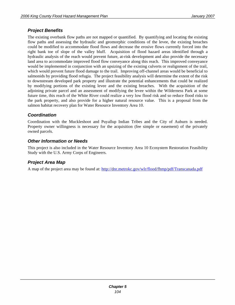
TransCanada Flood Conveyance Improvement
Location Information Water Resource Inventory Area 10, White River River Mile 8.2 to 10.7, Left Bank Council District 7 Jurisdiction Auburn and Muckleshoot Indian Tribe Public and Private lands No Agricultural Production District or Farmland Preservation Program lands
Estimated Cost $1,421,000
Problem Statement The TransCanada levee located immediately upstream of the City of Auburn's Wilderness Park extends into the Muckleshoot Indian Tribe Reservation up to the Williams Natural Gas Pipeline crossing at River Mile 10.7. The levee forces the river channel into the northern bluff of the valley wall. The levee was breached in the 1975 flood event and experienced additional erosion in flood events in 1990 and 1995-96. Flood waters now can reoccupy some of the historical floodplain channels that were cutoff from the active channel when the levee was constructed. A portion of the flow path is illustrated in the existing FEMA flood hazard mapping from the western portion of the Muckleshoot Indian Tribe Reservation boundary. Although breached, much of the levee prism remains, constricting portions of the river reach and continuing to force flows into the toe of slope of the right bank valley wall. The overbank flows spread out and travel downstream into the Wilderness Park area, where they funnel into an off-channel to reenter the river through a previously return-flow breached area of the levee. The City of Auburn has constructed the trail over a return-flow breach in the levee and placed two 12-inch culverts, although the off-channel is a quite large trapezoidal flow path with at least a 15-foot bottom width. Overbank flows are expected to continue to enter this off-channel path and may overwhelm the dual-culvert capacity, potentially resulting in damage to the trail embankment or the adjoining trail paths and park land.
What Is at Risk Risks identified in the 2006 King County Flood Hazard Management Plan Policy G-2 that this project is intended to reduce or eliminate include:
• Damage to public infrastructure, primarily a park trail.
Proposed Project or Action Acquire the off-channel floodplain portions of the adjoining undeveloped private parcels and modify the breached portions of the levee to improve flood flow conveyance in the overbank areas of the floodplain. Use existing cross-section data and map the breach locations with global positioning system equipment to initially determine the extent of the existing overbank flow paths. Conduct a project feasibility analysis by developing a hydraulic model and performing a geomorphic assessment of the levee, the breach locations and flow paths. Develop a new trail alignment that eliminates the need for an off-channel crossing. If the trail alignment is not feasible, assess the culvert capacity and replace the culverts to accommodate the expected overbank flow. Enhancing off-channel habitat along this area is a Water Resource Inventory Area 10 salmon habitat recovery plan proposal.
2006 King County Flood Hazard Management Plan January 2007
Chapter 5 104
Project Benefits The existing overbank flow paths are not mapped or quantified. By quantifying and locating the existing flow paths and assessing the hydraulic and geomorphic conditions of the levee, the existing breaches could be modified to accommodate flood flows and decrease the erosive flows currently forced into the right bank toe of slope of the valley bluff. Acquisition of flood hazard areas identified through a hydraulic analysis of the reach would prevent future, at-risk development and also provide the necessary land area to accommodate improved flood flow conveyance along this reach. This improved conveyance would be implemented in conjunction with an upsizing of the existing culverts or realignment of the trail, which would prevent future flood damage to the trail. Improving off-channel areas would be beneficial to salmonids by providing flood refugia. The project feasibility analysis will determine the extent of the risk to downstream developed park property and illustrate the potential enhancements that could be realized by modifying portions of the existing levee and the existing breaches. With the acquisition of the adjoining private parcel and an assessment of modifying the levee within the Wilderness Park at some future time, this reach of the White River could realize a very low flood risk and so reduce flood risks to the park property, and also provide for a higher natural resource value. This is a proposal from the salmon habitat recovery plan for Water Resource Inventory Area 10.
Coordination Coordination with the Muckleshoot and Puyallup Indian Tribes and the City of Auburn is needed. Property owner willingness is necessary for the acquisition (fee simple or easement) of the privately owned parcels.
Other Information or Needs This project is also included in the Water Resource Inventory Area 10 Ecosystem Restoration Feasibility Study with the U.S. Army Corps of Engineers.
Project Area Map A map of the project area may be found at: http://dnr.metrokc.gov/wlr/flood/fhmp/pdf/Transcanada.pdf

2006 King County Flood Hazard Management Plan January 2007
Chapter 5 105
White-Greenwater Acquisition
Location Information Water Resource Inventory Area 10, White and Greenwater Rivers River Mile 45.85 to 45.9, Right Bank Council District 9 Unincorporated Private Land No Agricultural Production District or Farmland Preservation Program lands
Estimated Cost $785,000
Problem Statement On the right bank of the White River at its confluence with the Greenwater River is a residential complex (private home and rental apartments) that has experienced significant flooding and damages in the 1995 flood event. The White River channel eroded into the right bank, allowing flood waters to pass through the property and three structures. The home owner obtained a small business loan of $130,000 to make repairs and construct a flood wall of concrete “ecology blocks” along the river bank. The residential site remains vulnerable to the highly erosive flows along this reach, which could undermine the flood wall. Also, the site could be flooded from the Greenwater River if the State Route 410 bridge pier accumulates significant debris and results in flood waters overtopping the highway.
What Is at Risk Risks identified in the 2006 King County Flood Hazard Management Plan Policy G-2 that this project is intended to reduce or eliminate include:
• Risk to public safety if residents are caught unaware of flood conditions or attempt to enter or reenter flooded areas;
• Risk to public safety if fire and rescue personnel are called upon to aid those unable or unwilling to evacuate flooded homes;
• Damage to private structures.
Proposed Project or Action Acquire the property and remove the at-risk residential and rental structures. Remove the concrete flood wall and restore the riverbank to a natural floodplain condition.
Project Benefits Removal of the at-risk structures permanently eliminates the risk to public safety. After the structures are removed, the river bank and floodplain area can be restored to a natural condition, improving the riparian habitat at this confluence site.
Coordination Property owner willingness to sell the property is essential to implementation of this project.

2006 King County Flood Hazard Management Plan January 2007
Chapter 5 106
Other Information or Needs Implementation of this project may facilitate action by Washington State Department of Transportation to replace the State Route 410 bridge over the Greenwater River. A floodplain analysis and channel migration zone mapping for the White and Greenwater Rivers is needed to determine the current-day base flood elevations and flood velocities and to verify the extent of potential flooding and bank erosion.
Project Area Map A map of the project area may be found at: http://dnr.metrokc.gov/wlr/flood/fhmp/pdf/Greenwater.pdf

King County Flood Control Zone District Project Summary Sheet
** This project summary sheet contains planning level information and preliminary cost estimates; final cost estimates will be developed as more detailed project level information is generated.
GENERAL INFORMATION 1. Project Name: 2. Project Proponent (Name and Agency): 3. Basin/Watershed: 4. Project Type: check all that apply. See Criteria/Policy Handout for additional project type
description. ____ Proposed supplement to an existing project, identified as part of the Draft KC FCZD CIP list ____ Newly identified major river flood CIP, not currently on the Draft KC FCZD CIP list ____ Sub-regional project proposal, not currently on the draft KC FCZD CIP list,
5. Total Estimated Project Cost (all phases): $
6. Proposed Local Share (if sub-regional project). Provide other actual local share if known or
proposed, if not known: ____ $ ________________ ____ $ 0
LOCATION INFORMATION 7. Downstream River Mile # to Upstream RM #: 8. Right bank, Left bank, or Both banks: 9. Jurisdiction(s): 10. Public or Private lands: 11. Agriculture Production District or Farmland Preservation Program lands: yes/no/do not know PROJECT INFORMATION 12. What’s At Risk:
13. Problem Statement:
14. Proposed Project or Action:

King County Flood Control Zone District Project Summary Sheet
** This project summary sheet contains planning level information and preliminary cost estimates; final cost estimates will be developed as more detailed project level information is generated.
15. Project Benefits:
16. Coordination Needs: 17. Other Information or Needs: PROJECT PROPOSAL CRITERIA AND POLICY BASIS (See policy/criteria handout for expanded policy text and criteria, used to generate draft KC FCZD CIP lists) 18. Policy G-2 Flood Risks: please check all that apply, as to be addressed by the proposed project and
include a brief description of the risk.
____ Threats to public safety: ____ Damage to public infrastructure: ____ Impacts on the regional economy: ____ Damage to private structures:
19. Policy PROJ-1 Prioritizing Flood Risks: please check all that apply, associated with proposed project and include a brief description of the risk.
____ The consequences that will result if no action is taken. Consequences should be prioritized as identified in Policy G-2:
____ Urgency, where urgency is a measure of how quickly an action needs to be taken in order to prevent a risk from growing worse:
____ Legal responsibility and authority, where legal responsibility and authority is a contractual relationship between King County and another person or agency to maintain a flood protection facility:
____ Funding or partnership opportunities:
20. Anticipated Project Start Date (to reflect feasibility, opportunity, and ‘ripeness’ of project proposal)
____ 0-2 years ____ 3-6 years ____ 6+ years
21. Is the project identified within an adopted local hazard mitigation plan?
____ Yes ____ No
22. Do property interests need to be acquired (fee simple or easement) for this project?
____ Yes ____ No
23. If property interests need to be acquired, is the landowner willing to sell or sign a voluntary letter of agreement, expressing an interest in selling necessary property interests?
____ Yes ____ No