urban safety in residential areas: spatial variables in...
TRANSCRIPT
1
URBAN SAFETY IN RESIDENTIAL AREAS:
Spatial variables in crime and feeling of (in)security
Margarita Greene
Abstract
This paper reports some preliminary data, analysis and results that have arisen from the first year of a three-year research project aimed at identifying spatial characteristics involved in urban safety and feeling of (in) security in residential areas. This complex subject is been approached from a multidisciplinary perspective, involving social science techniques, econometric methods and categories from urbanism, combined with a space syntax approach including configurational modelling, space use observation and statistical analysis. The first phase of the project involves the collection of data from six settlements located in an old district of the city of Santiago de Chile with similar social characteristics but with different spatial characteristics The preliminary results deal with the identification of variables involved in the feeling of insecurity, the contrasting of places that were considered unsafe by the population and those where mugging had actually taken place and the analysis of space use patterns. Rather than provide answers, the results at the moment have helped to clarify the problem, and raise new fine tuned questions Some first results show that the areas identified as unsafe by the respondents do not coincide with the places where crime concentrates, but seem to relate to unconstituted (where there is little or no access to private buildings), poorly identified areas that have no clear inhabitants. Nevertheless, the most intriguing results relate to cultural particularities that are showing that pedestrian flow fulfils a different role in crime location and feeling of security in a Latin American catholic culture than it does in protestant cultures. The latter have the capacity of facing a stranger as such, and associating for a common goal, while in Latin America the concept of stranger hardly exists. He is either friend or foe. This means that although the pedestrian flow enhances safety, the movement has to be by ‘acquaintances’, since the stranger is seen with distrust.
Abstract ......................................................................................................................................... 1
Introduction.................................................................................................................................... 2
The spatial approach...................................................................................................................... 3
Space Syntax ................................................................................................................................ 4
Coexistence and socializing in urban space ................................................................................... 5
Sociability and associativity ........................................................................................................... 6
Variables involved in feeling of (in)security .................................................................................... 8
Delphi Survey ......................................................................................................................... 8
Focus Groups ......................................................................................................................... 9
Subjective perception of (in)security ............................................................................................ 10
Identification of ‘unsafe’ places and mugging ............................................................................... 11
Space use patterns ...................................................................................................................... 12
Syntactic modelling...................................................................................................................... 14
Preliminary conclusions ............................................................................................................... 14
Acknowledgements...................................................................................................................... 15
References .................................................................................................................................. 16
2
Introduction
Violence and crime are social problems present in most –if not all– societies, and have always
attracted much public attention. Today is no exception. Much has been argued regarding its origins
–it has been associated with inequality, poverty and sometimes genetics– but the general
consensus is that it is a social problem of great complexity and of significant importance in the
quality of urban life.
Aware of the difficulties in understanding the roots of the phenomena and in offering solutions at
that level (overcoming poverty, diminishing inequality or manipulating genetics), the research
presented in this paper approached the subject in a way that has been insufficiently explored: the
spatial perspective. The choice of this point of view is due to two important considerations. The first
is that all social phenomena, and certainly crime and the feeling of safety in residential space,
have an important spatial component (Hillier and Hanson, 1984). The second is that the
seriousness and complexity of the problem requires answers at an operative level, and the
residential habitat offers this possibility as it can be manipulated at a relatively low cost offering
results in a relatively short term (compared to social variables).
The spatial approach to urban safety is not new. In fact most of the current discussion, although
with very different interpretations, can be traced back to the writings of Jane Jacobs in the 60s
(Jacobs, 1961). The ongoing research reported in this paper aims at consolidating a new stage in
the spatial approach to residential safety based on a multidisciplinary framework with a threefold
entry to the subject. The first is the construction of a sociological understanding on the perception
of security in Latin American society, the second is the use of econometric models for identifying
variables involved in the feeling of (in)security and the third is using space syntax methods (Shu,
1999; Hillier and Shu, 2000; Space Syntax, 2001) for understanding spatial vulnerability.
The paper presented here reports some preliminary data, analysis and results that have arisen
from the first of a three-year research project. Six social housing settlements located in the same
local authority in Santiago de Chile, with similar social characteristics but with different spatial
characteristics, were selected, and the location of assault and robbery, and the feeling of
(in)security were studied using social science techniques, econometric methods and categories
from urbanism, combined with a space syntax approach including configurational modelling, space
use observation and statistical analysis. Rather than provide answers, the results at the moment
have helped to clarify the problem, and raise new fine tuned questions.
3
The spatial approach
Although delinquency and security in urban space have taken the front pages in recent years, it is
surprising how non-comprehensively the subject has been approached. In this research we aim at
overcoming three basic difficulties to begin a process of generating new knowledge in the spatial
variables involved in crime and in the feeling of insecurity.
The first difficulty to overcome is to go beyond the police or penal approach, and accept the
relevance of the spatial variable, specially regarding the feeling of insecurity. With the exception of
preventive programmes oriented to vulnerable population, most proposals in the urban security
field –especially when oriented to concrete actions– aim at the improvement of police corps (either
at national or local authority level up to the hiring of private guards by groups of neighbours) or at a
better corrective system for those that commit crimes (either through exemplary punishments or
programmes of education). The equivalent to these from the spatial approach is to fence space,
aiming at preventing access to potential aggressors. These types of action are not only inefficient
but also produce feeling of insecurity, which in many senses is more relevant for the quality of life
than actual crime occurrence. The fact is that most of the time the spatial dimension is overlooked,
forgetting that some of the crime that affects more strongly the security perception –mugging and
robbery– has a strong spatial component: it does not occur anywhere, nor does the feeling of
insecurity is a-spatial.
The second difficulty, directly linked to the previous, is that the few studies that have tried to
approach the spatial dimension of crime are based on ideologies such as “defensible space” or
“territoriality” (Newman, 1972; Coleman, 1985) and not on the specific spatial aspects of the crime.
In fact, they tend to look for crime concentration which most of the time has a strong social
intervening variable (eg. high levels of poverty, segregated or discriminated communities)
overlooking spatial characteristics that are disperse in urban space (eg. areas with low visibility
from well used space). On the other hand most crime data does not include precise location but
only locates crime in a very general way. The lack of theoretical references that would orient the
search and the fact that precise data on the occurrence of crime is seldom recorded, has produced
insufficiently rigorous enquire on the phenomenon. In this way, rather than advancing in the
comprehension of the phenomenon, there is a tendency to rely on the “common sense” strategies
and propose physical actions of certain simplicity: more lighting, a sentry box, a new fencing.
Thirdly, there is a misuse of the community, in as much as there is no serious intention of seriously
interrogating it regarding feelings of security and insecurity (at the most they do it in a way that only
recollects “common knowledge” which is often misleading) nor an orientation towards what has
been denominated community empowerment (that is to give back to the community a degree of

4
responsibility and capacity to tackle the problem). The work done on this line demonstrates that to
promote urban security it is of vital importance to have community commitment (see for example
Aguirre I Ferrer at al, 1993).
The research presented in this paper aims at moving from the first level of common sense and
common knowledge spatial approach to urban security in residential space. The study situates
itself in a perspective that considers the architectural and urban structure of the city, and the social
and cultural structure of the population are intimately linked. It is understood that the city is not only
a physical space but above all a place that concentrates human activity in a territory. In this way,
as Aguirre i Ferrer et al (1993) state: “if the physical framework and the form of the city are
intervened, the conditions of coexistence are influenced and, inversely, if the conditions of
coexistence are modified, the use of the city is altered”.
Although this perspective accepts the possibility of intervening space to achieve social benefits, it
also states that a study on urban safety should inevitably consider both aspects simultaneously: the
social background of the population and the physical characteristics of the city.
Space Syntax
Space Syntax1 is a scientific research programme that studies the role of spatial configuration as
an independent variable in social systems. Configuration is understood as a set of inter-depending
relations where each one of them affects the relations with the rest. Just like the word “pattern”,
which is rather not used because it is associated with more regularity than normally found in the
majority of spatial systems, configuration is a concept that appeals to the total system, more than
to its parts.
Syntax analysis is based on the premise that space, spatial configuration, is important and affects
the type of life that will develop in a place. It is not a deterministic approach –it does not postulate
that certain spatial configurations produce a certain type of behaviour– but probabilistic.
Specifically it postulates that spatial configuration provides a field of potential encounter and co-
presence where a social action can take place, the rest is effect of the culture.
One of the main instruments put forward by Space Syntax as a representation and modelling
method of urban space, and that is used in this research, is the “axial map”. This represents all
1 Many texts have been written on Space Syntax, nevertheless the fundamental are two: Hillier and Hanson (1984) and Hillier (1996)

5
public space and streets of a city as a grid of axial lines. The idea is to cover the whole grid with
the minimum and longest straight lines (Hillier and Hanson, 1984). This grid is then analysed by
computers, considering each line as a node in a graph and calculating the complexity of travelling
from each line to the rest of the system. In this way accessibility values called “global integration”
are generated. The strength of this measure lies in that although it is a local measure, since it is
located in a precise segment of the system, it refers to its relation with the whole system (in the
case of Santiago, to its configurational relation with over 32 thousand lines). That is, in the
measurement of any of the segments of the system, the axial relations with all the other segments
of the grid are involved. Apart from the global integration measurement, there are several other
syntactic measurements that are calculated in a similar way. For example “local integration” is
measured by modelling the axial map considering only three axis away from each line of the
system, and for “connectivity” only the lines that are connected directly are considered (see Hillier,
1996).
The main importance of the configurational measurements resides in the close link that they have
demonstrated with pedestrian and vehicular flow, without reference to other factors such as land
use or population density. Many studies in different urban systems have shown that there is a
tendency for places with higher integration to have more movement2. The configuration of the grid
has an impact on the movement flows because the streets “that you pass through” in any trip will
tend to be those that provide the most direct routes in the grid. At the same time, the patterns of
movement have a vital influence in generating co-presence between people and thus in stimulating
social interchange. Therefore, it is postulated that the structure of space, and not the attractors or
land use, will promote encounter. In effect, integrated spaces attract land use that is sensible to
movement flows, such as commerce, that will in turn attract more movement.
Coexistence and socializing in urban space
Directly linked to movement flows and with the patterns of space use is one of the concepts
developed by Hillier (1996) that relates closely to urban security: the “virtual community”. The
concept refers to that feeling of security and belonging, where one is conscious of the presence of
other inhabitants of the neighbourhood and the city that can be characteristic of urban space. It is
“virtual” because it has not yet been manifested as a community, since co-presence does not imply
community, but it is the first ingredient for its formation. In Space Syntax terms virtual community
2 See for example the Proceedings of the four international Space Syntax Conferences: London April 16th to 18th, 1997; Brasilia March 29th to April 2nd, 1999; Atlanta May 7th to 11th, 2001; and London, June 17th to 19th, 2003. In each one of them over forty papers were presented, most of which involve correlations between movement and syntactic measurements.

6
is understood as the potential field of encounter and co-presence product of the spatial
configuration.
On this area, Hillier proposes that the generation of the virtual community is one of the greatest
contributions that architecture or spatial design makes to social well being. In fact, through the
manipulation of configurational variables it would be possible to promote the encounter and
integration of multiple and varied people. From this perspective public space and the virtual
community are considered the basis of urban life because of their capacity of congregating the
most diverse categories of people, and even of democracy, as no special adscription is required to
be a member. You are a member of the virtual community in virtue of the your presence in space.
This perspective is in many senses contradictory to the traditional approach to vulnerability of
residential space and which has permeated the design of housing estates since the sixties: the
“defensible space” theory promoted by Newman (1972) and later continued by Coleman (1985) and
many others. Just like Hillier, Newman establishes his model in the control of public space, but
while the first privileges encounter and co-presence, the flow, as the way of building a healthy
community, Newman develops the territoriality theory and promotes the construction of defensible
space.
Although both Hillier and Newman base their work on Jane Jacobs postulates, and thus understand
urban security as a manifestation of social control by the inhabitants themselves, they reach very
different conclusions. While Newman emphasizes the defence of space and the control of the
stranger, and in fact aim at minimizing the presence of people passing by near the houses. The
idea behind it seems to be that strangers are potentially dangerous as a criminal may be hiding
among them. The point of view of space syntax is quite inverse, postulating that the natural
presence of people is the best way of controlling public pace. In as much as the flow of people
diminishes, natural control is lost and it becomes more dangerous as a potential criminal appears.
Although it recognises that people will behave more territorial in segregated places, and that in
these places it is more probable that the presence of a stranger be questioned, this attitude is
associated with feeling nervous. On the contrary it is stated that the natural presence of unknown
passers-by enhances the feeling of security.
Sociability and associativity
The different approaches toward the stranger in residential space, can be related to a sociological
thesis which aims at understanding the different ways in which Latin and North Americans deal with
the stranger: the “sociability and asociativity thesis” postulated by Cousiño and Valenzuela (2000).
The authors analyze the differences in the trust rate as measured in specially designed surveys of

7
Chilean and USA’s inhabitants, understanding that the disposition to trust others is in the origins of
the typical North American attitude to establish social relations with strangers. In fact the authors
cite a study where 45% of the North Americans declared that it is possible to trust strangers, while
in Chile only 15% thought so3.
Cousiño and Valenzuela (2000) understand that the higher trust rate of the North Americans is a
product of their colonization process, where a group of immigrants, that were strangers to each
other, needed mutual help to build a new society. Asociativity was understood as the capacity that
equals have to freely associate to solve a common problem. Contrary to the relations among
people that know each other, that are founded in experience, the relations among strangers are
founded in trust.
Apart from this functional need of trusting the stranger when colonizing a new continent, the
strength of trust in the North American culture can be traced to the protestant ethics: that relies on
trusting a God that is unknown and out of this world. Catholicism and specially its Latin American
expression, strongly relies on the Virgin Mary figure, which is characterised by being an ever
present and ever forgiving mother.
On the other hand, trust can be related with the capacity to elaborate and to fulfil promises. The
Latin American culture allows for apologizing and expects forgiveness, which in turn produces low
trust rates. Thus, Latin American and Chilean societies are characterised by having very low levels
of trust that resent the structure of relations with strangers. Nevertheless this associative weakness
–to form a group for the fulfilment of a common goal, independent of the level of sympathy,
friendship or knowledge of the members among themselves– is compensated with the strength and
density of the relations among known people that are founded in the space of the family relations.
These differences between both societies help explain the different structures of the relations with
strangers. In North America the stranger is faced as such: a neutral person with whom it is possible
to associate to fulfil a common goal. On the contrary the stranger as a figure does not exist in Latin
America: he is either friend or foe. The high hospitality offered to the stranger can be understood
as a mechanism to “know” him, to bring him in the family, in the home; while in North America
friendship is out doors of the home and does not require much internal validation. In fact, special
3 According to this study, the North Americans declared to have more friends than the Chilean (40% declared having 6 to 7 friends and only 5% to have no friends; while 16% of the Chilean declared having 6 to 7 friends, and 30% none); and a higher rate of belonging to associations (70% of North Americans declared that they were members of a political, sports, solidarity or another type of institution, while in Chile only 47% declared so and the religious association was the predominant, which is the less associative since it only requires the assistance to ceremonies and not so much the interaction among equals).

8
figures have been created in Latin America to incorporate the friends in the family structure; for
example the god-parenthood.
The authors postulate that the capacity of relating to strangers responds to an ethos: the prime
value in North America is honesty, consisting in not taking unduly advantage from others, while in
Latin America the ethos privileges loyalty, where all mistakes can be understood. A mistake or
misdemeanour can be committed and even justified on the grounds of loyalty towards another.
This is reflected in the judicial Chilean system, where a mother is not expected to declare against
an offspring; while in North America, it is the spouse that can abstain of declaring against the
couple. While honesty puts the accent in the stranger, loyalty puts it in the person you know or in
the acquaintance.
This same effect can be seen in that Latin American culture emphasises the maternal filiation,
while North American culture emphasises relations through marriage. These are inverse structures,
as marriage can be considered the figure of the stranger by excellence, it implies the establishing
of a relation of absolute trust between families unknown to each other. Another example of this
difference can be seen in the neighbourhood relationships. In North America it is common to know
the neighbours by name and to visit them frequently. The strength of the neighbourhood relation is
another sign of the capacity of relation with strangers.
These interpretations of the relations between strangers, family relations and neighbours according
to the particular ethos of a group of people are important to keep in mind as they will vary
significantly the feeling of (in)security in open public space.
Variables involved in feeling of (in)security
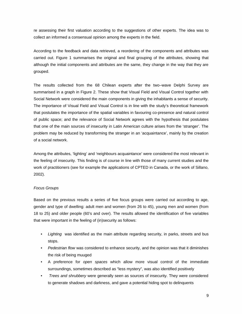
The variables involved in the feeling of (in)security were initially identified through a two-wave
Delphi survey applied to a group of academics, public officers, municipal employees, international
consultants and other experts in the field. Based on those first preliminary results a set of focus
groups with the inhabitants of four selected settlements, were carried out.
Delphi Survey
Based in the literature on the field, a survey questionnaire was designed where 23 attributes of the
feeling of (in)security were grouped in six components: (i) Visual Field (how much I can see), (ii)
Visual Control (how much I am seen), (iii) Social Network, (iv) Space Use, (v) Potential Help, and
(vi) Danger Factors. This instrument was sent to a selected group of experts, analysed
incorporating the attributes suggested by them and re-send to them. This gave them the chance of
9
re assessing their first valuation according to the suggestions of other experts. The idea was to
collect an informed a consensual opinion among the experts in the field.
According to the feedback and data retrieved, a reordering of the components and attributes was
carried out. Figure 1 summarises the original and final grouping of the attributes, showing that
although the initial components and attributes are the same, they change in the way that they are
grouped.
The results collected from the 68 Chilean experts after the two–wave Delphi Survey are
summarised in a graph in Figure 2. These show that Visual Field and Visual Control together with
Social Network were considered the main components in giving the inhabitants a sense of security.
The importance of Visual Field and Visual Control is in line with the study’s theoretical framework
that postulates the importance of the spatial variables in favouring co-presence and natural control
of public space; and the relevance of Social Network agrees with the hypothesis that postulates
that one of the main sources of insecurity in Latin American culture arises from the ‘stranger’. The
problem may be reduced by transforming the stranger in an ‘acquaintance’, mainly by the creation
of a social network.
Among the attributes, ‘lighting’ and ‘neighbours acquaintance’ were considered the most relevant in
the feeling of insecurity. This finding is of course in line with those of many current studies and the
work of practitioners (see for example the applications of CPTED in Canada, or the work of Sillano,
2002).
Focus Groups
Based on the previous results a series of five focus groups were carried out according to age,
gender and type of dwelling: adult men and women (from 26 to 45), young men and women (from
18 to 25) and older people (60’s and over). The results allowed the identification of five variables
that were important in the feeling of (in)security as follows:
• Lighting was identified as the main attribute regarding security, in parks, streets and bus
stops.
• Pedestrian flow was considered to enhance security, and the opinion was that it diminishes
the risk of being muuged
• A preference for open spaces which allow more visual control of the immediate
surroundings, sometimes described as “less mystery”, was also identified positively
• Trees and shrubbery were generally seen as sources of insecurity. They were considered
to generate shadows and darkness, and gave a potential hiding spot to delinquents

10
• There were different opinions regarding fences: it was felt that in streets they enhance
security, while in alleyways the opinions diverged from some that perceived them as
producing lack of freedom, others saw them as security.
The first variable –lighting– was disregarded in the next exercise because it refers to night time and
the main interest of the study was the daily, everyday life. The next four variables were
summarised in two: visual field (“how much I can see”) and visual control (“how much I am seen”).
Subjective perception of (in)security
To enquire about the subjective perception of the variables involved in the feeling of (in) security a
stated preferences exercise was carried out and analysed through several discrete choice models.
Based on the Delphi Survey and Focus Groups the two compound variables ‘visual control’ and
‘visual field’ were decomposed into three attributes each: visual field into (i) straight or curved road,
(ii) presence of a crossroad and (iii) presence of trees; and visual control into (i) transparency of
fences, (ii) presence of a kiosk and (iii) presence of other people. A stated preference experiment
with computer abstract representation combining the six attributes was designed and applied to 107
inhabitants of four selected estates. In Figure 3 an example of the type of option that was offered
to respondents is presented.
As shown in Figure 4, the results showed that the opaqueness of fences was by far the most
important variable in feeling of insecurity and that the curving of the street also acted as a negative
aspect. On the contrary the presence of people in the street was the most important aspect to
enhance security, followed closely by the presence of a kiosk and finally by the proximity to a street
intersection.
But the most interesting results proved to be when the population was disaggregated according to
age. As shown in Figure 5 where the priorisation of the attributes in security is shown graphically
separating the preferences of four age groups –those younger than 20, from to 40, 40 to 60, and
above 60 years old– there are considerable differences in the perception of security. The most
striking result is that the group under 20 years has a perception almost exactly opposite to the other
three groups: what the young ones consider safe is what the rest consider unsafe, and vice versa.
On the other hand, the other three groups follow a linear increase or decrease in that as they get
older they tend to feel stronger but following the direction they adopted once they were over 20
years.

11
In summary, the results show that the perception of security in public space suffers a complete
change from under 20 to over 20 years, but that once over 20 (what could be read as the
priorisation of adults) the perception tends to polarise increasingly with age. That means that there
is a significant gap in the difference of perception between those under 20 and those over 20, and
that the differences from that age onwards would follow a linear path, separating every time further
away from the very young.
Identification of ‘unsafe’ places and mugging
The second stage of the study involved collecting data from the selected settlements. A thorough
observation of the spatial characteristics of the settlements and their surroundings (commerce,
urban furniture, public transport, danger focus, type of building, public lighting and more) was
carried out and represented in geo-referenced maps. Also, the collection of direct data on crime
was considered a first priority as the high rate of unreported crime is one of the usual difficulties in
this type of study, together with the inaccuracy of police records regarding precise location of
crime. A survey4 was applied to the inhabitants inquiring on basic socio economic characteristics,
robberies and assaults during the last five years, feeling of insecurity and security measures taken
(setting of alarms, not going out at night, leaving lights on and others). The crime data collected
involved three types: house robbery, patio robbery (when robbers entered the patio but not the
house) and mugging.
The following figures show selected data regarding one of the settlements, Chacabuco. This is an
informal settlement that dates form the 1960’s, and is located in the poor northern sector of the
city. It was legalised through the Neighbourhood Upgrading Programme some twenty years ago,
and today presents a good level of consolidation; nevertheless is reputed to have a fairly high level
of delinquency. In this settlement, the survey showed that during the last five years 7.4% had been
robbed in their plot (without entering the house), 13,2% had been robbed with house entry, and in
8,8% of the cases a member of the household had been mugged in the neighbourhood.
Considering the three types of crime: 27,2% of the families of the settlement had suffered at least
one of these types of crime.
The next figures show the reported crime and the areas that were signalled as secure and insecure
by the inhabitants. Figure 6 shows the places reported as ‘secure’ and as ‘insecure’ by the
inhabitants of Chacabuco, and the reported mugging, which has been marked twice: in the
4 The results shown in this paper refer to the first settlement that was analysed: Chacabuco. This settlement has 312 plots, and 136 interviews were carried out; thus covering 43,5% of the population.

12
interviewed houses (signalling the number of muggings to any member of the household during the
last five years) and in the place that the mugging took place. Complementing this, Figure 7 shows
the reported robberies: those that occurred in the plot without entering the house and those where
there was house entry.
Some observations that can be made from the images are the following:
• Most of the mugging is happening in the main access road to the settlement, and it seems
to concentrate in one specific corner, at the bus stop, which is also signalled as ‘insecure’.
• The ‘insecure’ areas seem to refer to three types of area: (i) places dominated by
strangers, such as the park or the neighbouring main road; (ii) places functionally
vulnerable for being mugged, such as coming off the bus, at street corners; (iii) interior
alleyways or enclosed open space.
• On the contrary ‘secure areas’ seem to relate to constituted (that is, with entrances to
houses) and well used space, such as the border roads where there is a significant amount
of pedestrian and vehicular movement.
• With the exception of the corners, the perimeter of the settlement tends to be reported as
‘secure’.
• Most of the houses that reported mugging are located in the north west sector of the
settlement, which to a great extent coincides with the west sector, where robbery seems to
concentrate.
The survey also included several questions on the strength of social networks, such as ‘amount of
friends’ ‘desire to move from the settlement’, ‘participation in social organizations’ and others.
Based on these answers some social network maps were built coding social networks from stronger
to weaker. In line with the results of the Delphi study, the areas with stronger community ties tend
to coincide with those declared as most secure. Nevertheless these do not relate to the crime rates,
since the alleyway with the highest house and plot robbery is the one with the highest social
network and therefore with the highest security perception.
Space use patterns
Finally, moving and static people were recorded at different time periods during the day,
distinguishing between children, young women, young men, adult women and adult men. Moving
people were counted through the ‘gates’ technique in two intervals of five minutes each during six
hourly periods per day. That is, every place was observed for 60 minutes (distributed from 12:00
AM to 6:00 PM) a day, and the exercise was repeated for two consecutive days (Wednesday and

13
Thursday). Static people were observed through the ‘snapshot’ technique that involves the design
of routes that cover all convex spaces. The routes were repeated twice at six hourly periods, that is
taking two ‘snapshots’ at every hourly period, during two days.
Figure 8 shows both the moving and static observations. The left image shows vehicular
movement colour graded from more movement in red to less movement in blue; and the right
image shows static presence coded by gender and age5. The images show a densely used public
space, with a heavy movement flow in the perimeter complemented by a high density of static
people, that is using practically all open space6.
Nevertheless the most interesting aspects appear when analysing the patterns of movement flow
and static presence during the day, disaggregating the data by age and gender. Figure 9 shows
that pedestrian use of space differs considerably through the day, among different users and
according to movement or static activities. Two important differences arise at first observation. The
first is that movement and static use of space have almost opposite behaviour: while movement
flows start high, lower during mid day and tend to rise again in the afternoon, static use of space
starts low, rises at mid day and tends to lower towards the evening. The second is the great
difference in the movement flows between the ‘young men’ and the ‘adult women’ group. While the
first show the lowest movement rates during the first counting (starting at 12:00 AM) they rise to the
highest during the last counting of the day (at 17:30). Inversely, adult women show the highest
early presence (at 12:30) but a mid range presence in the late afternoon (at 17:30 PM). This is
important and should be studied further, as previous studies have shown that differential space use
by age groups can be a sign of social malaise7, while on the contrary the concept of ‘virtual
community’ postulated by Hillier (1996) implies the use of public space by all social groups.
Finally, Figure 10 shows the static presence in the settlement according to the time of the day. The
first image shows the whole daily presence of people in the public space, while the following show
seven hourly snapshots of the use of space. The following task to be carried out in the research will
involve further analysis of this data, correlating it with feeling of insecurity and mugging patterns.
5 The codes are as follows: young men=light blue; adult men=blue; young women=pink; adult women=red; green=children. 6 A special consideration must be made since the measurements were made during school holidays. 7 An example of this type of phenomena is described as the ‘L-shape’ effect in Hillier(1996), as it is the shape that a scattergram takes when two groups of inhabitants occupy space in opposite ways: where one is present the other is absent and vice-versa.
14
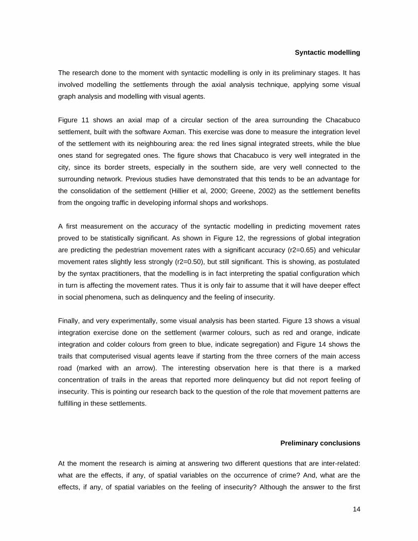
Syntactic modelling
The research done to the moment with syntactic modelling is only in its preliminary stages. It has
involved modelling the settlements through the axial analysis technique, applying some visual
graph analysis and modelling with visual agents.
Figure 11 shows an axial map of a circular section of the area surrounding the Chacabuco
settlement, built with the software Axman. This exercise was done to measure the integration level
of the settlement with its neighbouring area: the red lines signal integrated streets, while the blue
ones stand for segregated ones. The figure shows that Chacabuco is very well integrated in the
city, since its border streets, especially in the southern side, are very well connected to the
surrounding network. Previous studies have demonstrated that this tends to be an advantage for
the consolidation of the settlement (Hillier et al, 2000; Greene, 2002) as the settlement benefits
from the ongoing traffic in developing informal shops and workshops.
A first measurement on the accuracy of the syntactic modelling in predicting movement rates
proved to be statistically significant. As shown in Figure 12, the regressions of global integration
are predicting the pedestrian movement rates with a significant accuracy (r2=0.65) and vehicular
movement rates slightly less strongly (r2=0.50), but still significant. This is showing, as postulated
by the syntax practitioners, that the modelling is in fact interpreting the spatial configuration which
in turn is affecting the movement rates. Thus it is only fair to assume that it will have deeper effect
in social phenomena, such as delinquency and the feeling of insecurity.
Finally, and very experimentally, some visual analysis has been started. Figure 13 shows a visual
integration exercise done on the settlement (warmer colours, such as red and orange, indicate
integration and colder colours from green to blue, indicate segregation) and Figure 14 shows the
trails that computerised visual agents leave if starting from the three corners of the main access
road (marked with an arrow). The interesting observation here is that there is a marked
concentration of trails in the areas that reported more delinquency but did not report feeling of
insecurity. This is pointing our research back to the question of the role that movement patterns are
fulfilling in these settlements.
Preliminary conclusions
At the moment the research is aiming at answering two different questions that are inter-related:
what are the effects, if any, of spatial variables on the occurrence of crime? And, what are the
effects, if any, of spatial variables on the feeling of insecurity? Although the answer to the first

15
question would probably allow to lower delinquency rates on residential areas, the second would
most probably have a greater impact on the quality of life of urban dwellers, since it affects every
day life. Although the research is still in its first phases, the preliminary data shows some
interesting insight to these complex problems.
In the first place it must be noted that the areas identified as unsafe by the respondents have little
relation to the places where crime concentrates. This should be considered as a sign of alert to
revise our beliefs in the most objective possible way8. The preliminary analysis shows that crime
seems to relate to unconstituted, poorly identified areas that have no clear inhabitants.
Nevertheless the main point here is that the data shows that pedestrian flow fulfils a different role
in crime location and feeling of security in a Latin American catholic culture than it does in
protestant cultures. The latter have the capacity of facing a stranger as such, and associating for a
common goal, while in Latin America the concept of stranger hardly exists. He is either friend or
foe. This means that although the pedestrian flow enhances safety, the movement has to be by
‘acquaintances’, since the stranger is seen with distrust (for further details on this argument see
Greene, 2002, based on the writings of Cousiño and Valenzuela, 2000).
This then brings us to the traditional proposal shared by most researchers and practitioners in the
field, that to enhance security it is vital to reinforce community ties. The difference of this research
is that it postulates the reinforcement of community ties not as territorial relations in privatised
space, but as open relations between inhabitants that share the same residential space in a public
realm (without isolating themselves from the rest of the system). This idea is of course related to
the concept of ’virtual community’ and is quite at odds with concepts such as ‘defensible space’,
which propitiate ‘gated communities’, reinforcing local ties at the expense of the global relations.
Finally, in this project urban space is being modelled and analysed using space syntax software (at
present Axman, High Resolution Axman, Meanda, Depthmap and Evas, but Axwoman,
Isovistanalyst and Fathom are also planned to be included). This last perspective will hopefully
give the most vital clues in the understanding of spatial variables in crime and feeling of insecurity.
Acknowledgements
This paper is based on a first presentation on this research work: Greene, M. and Greene, R.
(2003). We wish to acknowledge the support of the Chilean fund for Scientific and Technological
8 It is important to stress here the difference between raw data on crime ocurrence and cirme risk, which considers the probability of suffering from crime by relativising the data with real movement flows

16
Development (FONDECYT) for having provided the funds to complete the research through project
12020886.
References
Aguirre i Ferrer, C., Pié i Ninot, R. y Sabaté i Bel, J. (1993) Seguridad Urbana y Urbanismo,
Ajuntament de Barcelona, Barcelona.
Coleman, A. (1985) Utopia on Trial. Hilary Shipman, Londres.
Cousiño, C. and Valenzuela, E (2000). “Sociabilidad y Asociatividad: Un ensayo de sociología
comparada”. In Estudios Públicos N° 77. Centro de Estudios Públicos, Santiago (in
Spanish).
Greene, M. (2002) From Informal Settlements to Sustainable Neighbourhoods: The role
of spatial configuration in the urban system, PhD Thesis, The Bartlett
School of Artchitecture, University College London, London, England.
Greene, M. y Greene, R. (2003) Urban safety in residential areas, Proceedings Space
Syntax 4th International Symposium, Junio 17-19, University College
London, Londres.
Hillier, B. (1988) Against enclosure. In N. Teymour, T. Markus and T. Wooley (eds.), Rehumanizing
Housing. Butterworths, Londres.
Hillier, B. (1996) Space is the Machine. Cambridge University Press, Cambridge.
Hillier, B. and Hanson, J. (1984) The Social Logic of Space. Cambridge University Press,
Cambridge
Hillier, B., Greene, M. and Desyllas, J. (2000) Self-Generated Neighbourhoods: the role
of urban form in the consolidation of informal settlements. In Urban Design
International No.5, 61-96, Stockton Press.
Jacobs, J. (1961) The Death and Life of Great American Cities Penguin Books, Singapore.
Jeffrey C.R. (1971) Crime Prevention Through Environmental Design (CPTED).

17
Newman, O (1972) Defensible Space: Crime Prevention Through Urban Design. Collier, New York.
Rodriguez, D. and Arnold, M (1999) Sociedad y Teoría de Sistemas. Editorial Universitaria,
Santiago (in Spanish).
Shu, S. (1999) Housing layout and crime vulnerability. Proceedings 2nd International Space Syntax
Symposium. Brasilia, Brasil.
Sillano, M. (2000) Incidencia de Variables Espaciales en la Percepción de Seguridad Ciudadana:
Estimación de Modelos Logit Mixtos con Información de Preferencias Declaradas.
MSc Thesis, Department of Transport Engineering, Pontificia Universidad Católica
de Chile, Santiago (in Spanish).

INSTRUMENT FINAL ANALYSISVISUAL FIELD (how much I can see) VISUAL FIELDLighting (quality and quantity of lamp posts) LightingTrees and shrubbery (as obstruction) Trees and shrubberyRoadwork (Streets and alleyways width) RoadworkUrban grid (long and straight roads versus labyrinth) Urban grid
Derelict or walled landVISUAL CONTROL (how much I am seen) VISUAL CONTROLWindows overlooking street Houses windowsPresence of kiosks and bus stops Kiosks or bus stopsTransparency of fencing Transparency of fencingPresence of other pedestrian Pedestrian presence
CommerceAccess doors to houses
SOCIAL NETWORK SOCIAL NETWORKDegree of acquaintance with neighbours Acquaintance with neighboursNeighbourhood organization Neighbourhood organizationNeighbourhood identification Neighbourhood identificationSPACE USE SPACE USEVehicular flow Vehicular flowBus routes Bus routesUrban furniture (seating, playgrounds, garbage bins) Urban furniture
Fencing of public space *POTENTIAL HELP POTENTIAL HELPPolice presence Police presenceDoor entrances to housesPresence of public telephone Presence of public telephoneCommerce (shop, informal selling)DANGER FACTORS DANGER FACTORSPresence of pubs or off-license Presence of pubs or off-licensePresence of derelict sites or walled plotsPoverty level Poverty levelGroups of youngsters Groups of youngstersNightime Nightime
Delinquency level *Season of the year *
(*) Attributes added by expertFigure 1: Components and attributes in (in)security feeling
Figure 2: Valuation of (in)security feeling by Delphi experts

Figure 3: Example of stated preference exercise
-2,0000
-1,5000
-1,0000
-0,5000
0,0000
0,5000
1,0000
tree
s in
side
wal
ks
stre
et c
urve
stre
etin
ters
ectio
n
peop
le in
str
eet
kios
k in
side
wal
k
sem
itran
spar
ent
fenc
e
opaq
ue fe
nce
VISUAL FIELD VISUAL CONTROL
Figure 4: Prioritisation of attributes in security(all population in stated preference exercise)
-6,000
-4,000
-2,000
0,000
2,000
4,000
6,000
8,000
tree
s in
side
wal
ks
stre
et c
urve
stre
etin
ters
ectio
n
peop
le in
str
eet
kios
k in
side
wal
k
sem
itran
spar
ent
fenc
e
opaq
ue fe
nce
VISUAL FIELD VISUAL CONTROL
<20yrs 20-40yrs 40-60yrs >60yrs
Figure 5: Prioritisation of attributes in security(by age gropus in stated preference exercise)

Figure 6: Reported mugging and insecure places
Figure 7: Reported robberies in plot and house

Figure 8: Pedestrian movement and static presence in public space
Figure 9: Daily movement patterns

Figure 10: Static presence of pedestrian during the day

Figure 11: Global Integration in surrounding area
Figure 12: Correlation of movement flows and global integration

Figure 13: Visual integration
Figure 14: Visual agent trails