tsunami quantifying tsunami risk submarine slides submarine slides 1881 mw=7.9 1941 mw=8.0 using...
Post on 21-Dec-2015
217 views
TRANSCRIPT
Tsunami
Tsunami
Tsunami
Tsunami
Tsunami
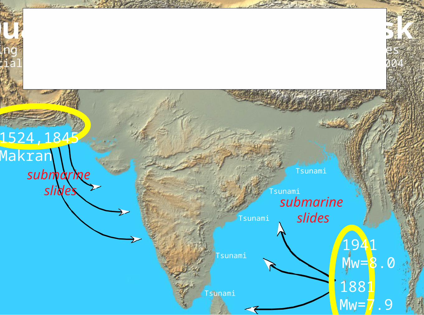
Quantifying tsunami risk
submarine slides
submarine slides
1881 Mw=7.9
1941 Mw=8.0
using SRTM digital elevation data and scenario earthquakesPartial text of a NASA sponsored talk given in Bangalore June 2004
View-->notes for narrative
1524,1845Makran
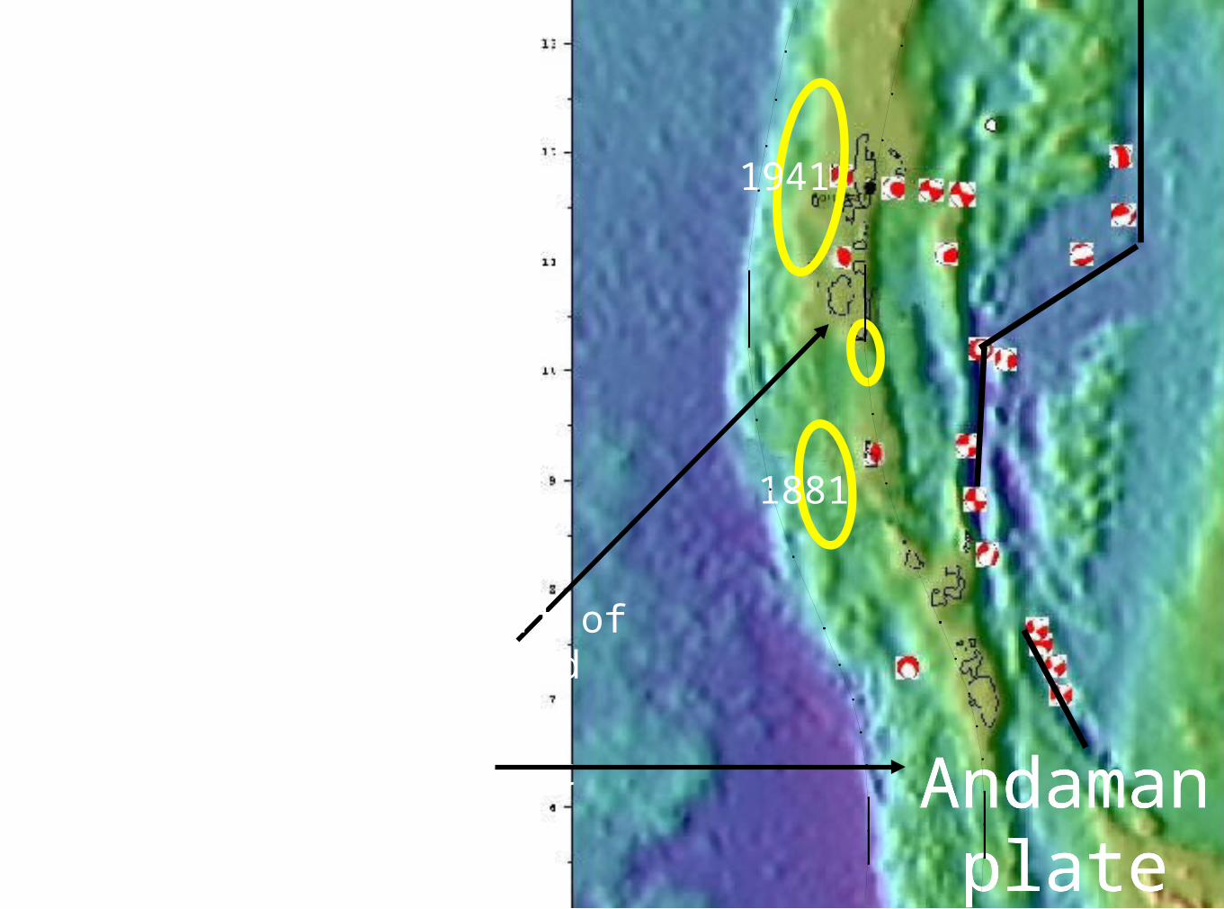
1881
1941
W. coasts of Andaman
& Nicobar Islands repeatedly uplift
by tsunamigenicearthquakes
W. coasts of Andaman
& Nicobar Islands repeatedly uplift
by tsunamigenicearthquakes
Andamanplate
Andamanplate
Next slide showsSRTM evidence
for incremental uplift ofNorth Sentinal Island
zone of coseismic uplift

10 m20 m30 m
Marine terraces suggest a history of great earthquakes
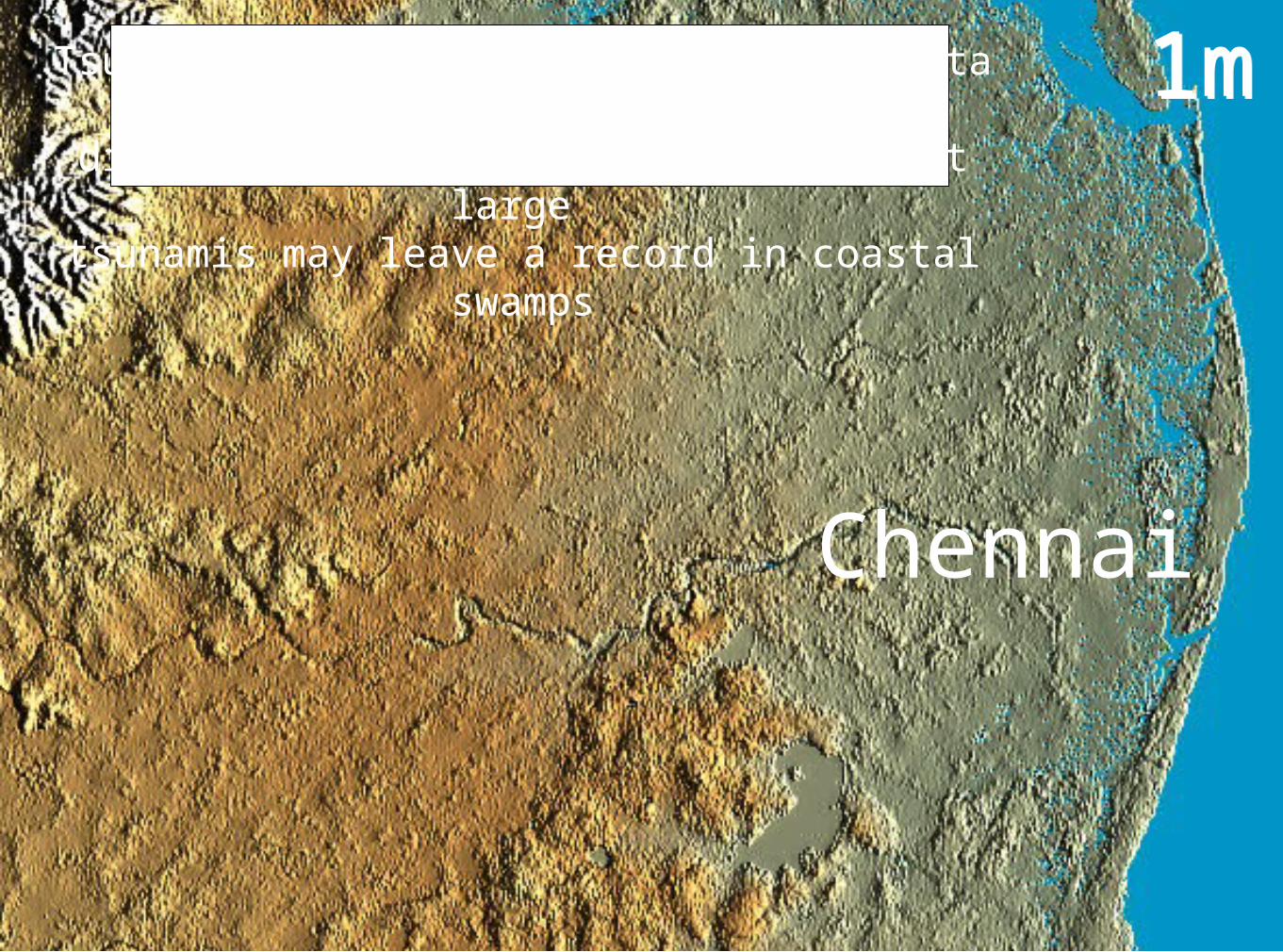
1m1m
Chennai
Tsunami run-up estimates from SRTM data for different tsunami maxima suggest that large
tsunamis may leave a record in coastal swamps

3m3m
Chennai
Tsunami run-up estimates from SRTM data for different tsunami maxima suggest that large
tsunamis may leave a record in coastal swamps

5 m5 m
Chennai
Tsunami run-up estimates from SRTM data for different tsunami maxima suggest that large
tsunamis may leave a record in coastal swamps
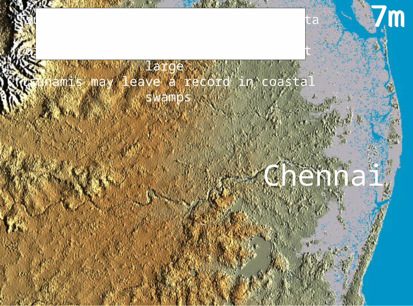
7m7m
Chennai
Tsunami run-up estimates from SRTM data for different tsunami maxima suggest that large
tsunamis may leave a record in coastal swamps
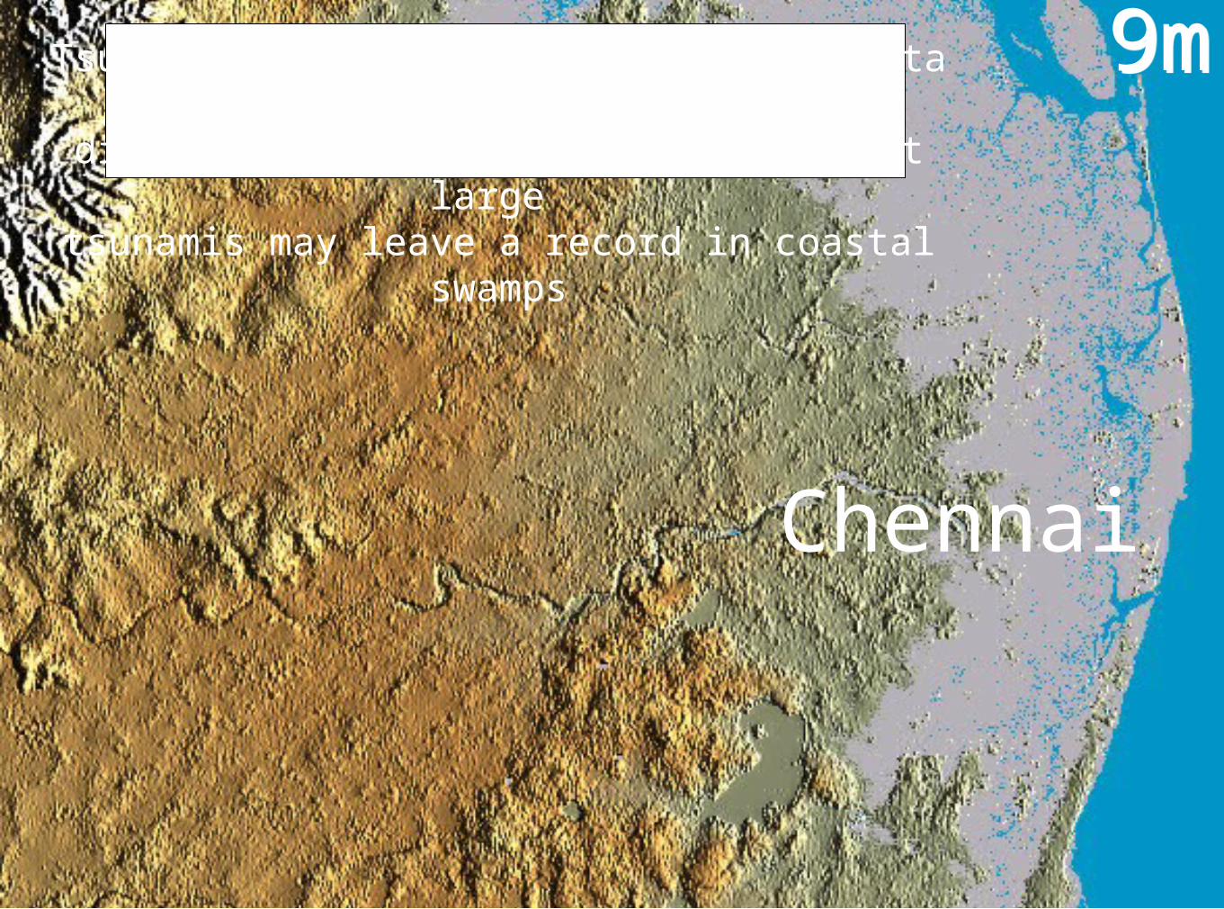
9m9m
Chennai
Tsunami run-up estimates from SRTM data for different tsunami maxima suggest that large
tsunamis may leave a record in coastal swamps

Summary: Remote sensing India's earthquakes
1. Monitoring mechanics of earthquakes 2. Quantifying India's earthquake history 3. Quantifying tsunami risk4. Predicting earthquakes not possible but identifying damage within minutes of an earthquake an important application.

-an incomplete600 year history