truck city sap - wa
TRANSCRIPT

Appendix C

SAMPLING AND ANALYSIS PLAN
TRUCK CITY SITE PROPERTY
Prepared for
SKAGIT COUNTY MOUNT VERNON, WASHINGTON
July 8, 2014 Project No. 0714.02.02
Prepared by
Maul Foster & Alongi, Inc. 1329 N State Street, Suite 301, Bellingham WA 98225
Appendix C, Page
SAMPLING AND ANALYSIS PLAN TRUCK CITY SITE PROPERTY
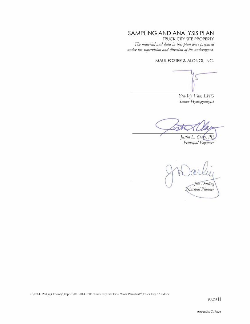
The material and data in this plan were prepared under the supervision and direction of the undersigned.
MAUL FOSTER & ALONGI, INC.
Yen-Vy Van, LHG Senior Hydrogeologist
Justin L. Clary, PE Principal Engineer
Jim Darling Principal Planner
R:\0714.02 Skagit County\Report\02_2014.07.08 Truck City Site Final Work Plan\SAP\Truck City SAP.docx
PAGE II
Appendix C, Page
R:\0714.02 Skagit County\Report\02_2014.07.08 Truck City Site Final Work Plan\SAP\Truck City SAP.docx
PAGE III
CONTENTS
TABLES AND ILLUSTRATIONS V
ACRONYMS AND ABBREVIATIONS VI
1 INTRODUCTION 1 1.1 INVESTIGATION OBJECTIVES 1
2 ACCESS AND SITE PREPARATION 2 2.1 ACCESS 2
2.2 SITE PREPARATION AND COORDINATION 2
3 SOIL AND GROUNDWATER ASSESSMENT 2
3.1 BORINGS 3 3.2 DOCUMENTATION 4
3.3 BORING DECOMMISSIONING 4
3.4 MONITORING WELLS 4
3.5 GROUNDWATER ELEVATIONS 5
3.6 SURVEYING 5
3.7 EQUIPMENT CLEANING AND DECONTAMINATION 5 3.8 MANAGEMENT OF INVESTIGATION-DERIVED WASTE 6
4 SOIL SAMPLING 6
4.1 PROCEDURE 6
4.2 NOMENCLATURE 7
4.3 COMPOSITE SOIL SAMPLING 8
5 GROUNDWATER SAMPLING 8
5.1 RECONNAISSANCE GROUNDWATER SAMPLING 8 5.2 MONITORING WELL GROUNDWATER SAMPLING 8
5.3 NOMENCLATURE 9
6 SOIL VAPOR SAMPLING 9 6.1 PROCEDURE 9
6.2 NOMENCLATURE 10
7 SUBSLAB SOIL VAPOR SAMPLING 10
7.1 PROCEDURE 10 7.2 NOMENCLATURE 11
8 INDOOR/BACKGROUND AIR SAMPLING 12 8.1 PROCEDURE 12
8.2 NOMENCLATURE 12
9 ANALYTICAL METHODS 13
9.1 CHEMICALS OF INTEREST 13 9.2 LABORATORY TEST METHODS AND REPORTING LIMITS 13
9.3 QA/QC SAMPLES GENERATED IN FIELD 14
9.4 LABORATORY OPERATIONS 15 9.5 SAMPLE CONTAINERS, PRESERVATION, AND HANDLING 15
9.6 SAMPLE CUSTODY 15
9.7 INSTRUMENTATION 16 9.8 LABORATORY QA/QC SAMPLES 18
Appendix C, Page
R:\0714.02 Skagit County\Report\02_2014.07.08 Truck City Site Final Work Plan\SAP\Truck City SAP.docx
PAGE IV
CONTENTS (CONTINUED)
9.9 FIELD QC 19
9.10 DATA REDUCTION, VALIDATION, AND REPORTING 19
10 REPORTING 22
LIMITATIONS
REFERENCES
TABLES
FIGURES
ATTACHMENT A
BORING LOG FORM
ATTACHMENT B
FIELD SAMPLING DATA SHEET FORMS
Appendix C, Page
R:\0714.02 Skagit County\Report\02_2014.07.08 Truck City Site Final Work Plan\SAP\Truck City SAP.docx
PAGE V
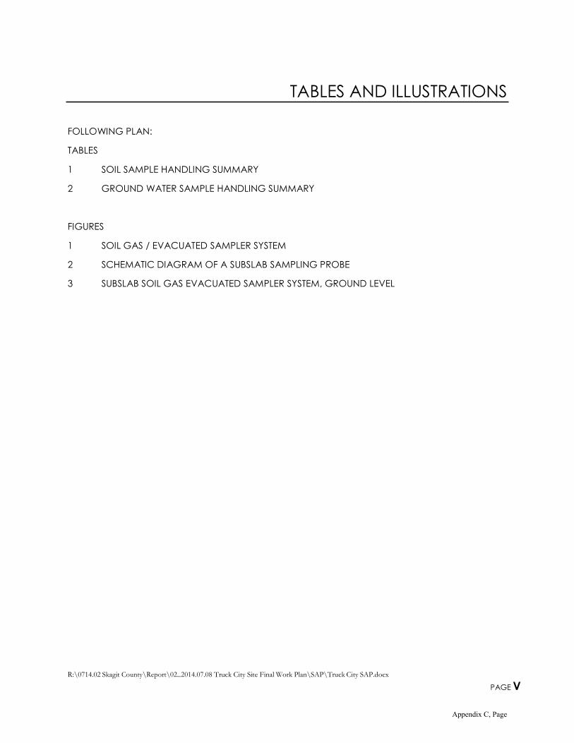
TABLES AND ILLUSTRATIONS
FOLLOWING PLAN:
TABLES
1 SOIL SAMPLE HANDLING SUMMARY
2 GROUND WATER SAMPLE HANDLING SUMMARY
FIGURES
1 SOIL GAS / EVACUATED SAMPLER SYSTEM
2 SCHEMATIC DIAGRAM OF A SUBSLAB SAMPLING PROBE
3 SUBSLAB SOIL GAS EVACUATED SAMPLER SYSTEM, GROUND LEVEL
Appendix C, Page
R:\0714.02 Skagit County\Report\02_2014.07.08 Truck City Site Final Work Plan\SAP\Truck City SAP.docx
PAGE VI
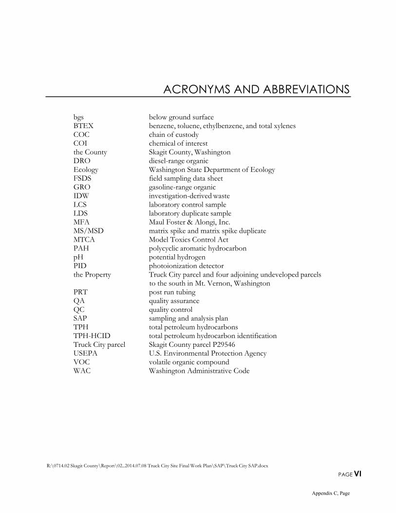
ACRONYMS AND ABBREVIATIONS
bgs below ground surface BTEX benzene, toluene, ethylbenzene, and total xylenes COC chain of custody COI chemical of interest the County Skagit County, Washington DRO diesel-range organic Ecology Washington State Department of Ecology FSDS field sampling data sheet GRO gasoline-range organic IDW investigation-derived waste LCS laboratory control sample LDS laboratory duplicate sample MFA Maul Foster & Alongi, Inc. MS/MSD matrix spike and matrix spike duplicate MTCA Model Toxics Control Act PAH polycyclic aromatic hydrocarbon pH potential hydrogen PID photoionization detector the Property Truck City parcel and four adjoining undeveloped parcels
to the south in Mt. Vernon, Washington PRT post run tubing QA quality assurance QC quality control SAP sampling and analysis plan TPH total petroleum hydrocarbons TPH-HCID total petroleum hydrocarbon identification Truck City parcel Skagit County parcel P29546 USEPA U.S. Environmental Protection Agency VOC volatile organic compound WAC Washington Administrative Code
Appendix C, Page

R:\0714.02 Skagit County\Report\02_2014.07.08 Truck City Site Final Work Plan\SAP\Truck City SAP.docx
PAGE 1
1 INTRODUCTION
Maul Foster & Alongi, Inc. (MFA) has prepared this sampling and analysis plan (SAP) consistent with the requirements of the Washington Administrative Code (WAC) 173-340-820 for Skagit County, Washington (the County) to guide the collection of samples during the focused site assessment investigation at parcels associated with the County’s proposed county jail property in Mount Vernon, Washington (Figure 1 of MFA, 2014). The proposed county jail property comprises the following five parcels (collectively referred to in this plan as the Property): Skagit County parcel P29546 (Truck City parcel) and four adjoining undeveloped parcels to the south: P119262, P119263, P119265, and P119267 (see Figure 1 of MFA, 2014). The parcels are owned by various parties, and the County is in negotiation to acquire them. The Property is the focus of the site assessment. The Truck City parcel (Site) is commercially occupied by a gas station, truck stop and truck wash, restaurant, and small retail store. The Truck City parcel comprises the entire Site based on data available at
this time. The remaining parcels on the Property are undeveloped rural grassland.
The procedures described in this SAP will be used for various phases and tasks of the project. The goal of the sampling is to obtain reliable data about physical, environmental, and chemical conditions at the Property in order to support the goals and objectives of the focused site assessment.
This SAP has been prepared consistent with the requirements of the Washington State Department of Ecology’s (Ecology) Guidance on Sampling and Data Analysis Methods (Ecology, 1995), Guidance for Preparing Quality Assurance Project Plans for Environmental Studies (Ecology, 2004), Guidance for Evaluating Soil Vapor Intrusion in Washington State: Investigation and Remedial Action (Ecology, 2009), and the 1993 Model Toxics Control Act (MTCA) (WAC Chapter 173-340).
1.1 Investigation Objectives
The primary objective of the SAP is to establish procedures for the collection of data of sufficient quality to evaluate the nature and extent of impacted soil and ground water at the Property. The site assessment work plan references the relevant procedures and protocols from this SAP; identifies specific media to be sampled; and identifies the locations, frequency, and types of field or laboratory analyses that will be conducted. The SAP is meant to ensure that reliable data are obtained in support of the development of remedial actions at the Property if such actions are necessary for the protection of human health and the environment. It provides a consistent set of procedures that will be used throughout the various work phases identified in the work plan (MFA, 2014).
Once the nature and extent of soil and ground water impacts have been determined, further investigation, which may involve the collection of other media (e.g., soil gas, indoor or ambient air, subslab vapor), may be proposed. The procedures for collection of samples of other media are summarized in this SAP, in case these are necessary in future scopes of work.
If a phase of work or an otherwise unforeseen change in methodology requires modification to this SAP, an addendum may be prepared that describes the specific revision(s), or the alternative
Appendix C, Page

R:\0714.02 Skagit County\Report\02_2014.07.08 Truck City Site Final Work Plan\SAP\Truck City SAP.docx
PAGE 2
procedures used will be documented in the site assessment report. Procedures are provided that will be used to direct the investigation process so that the following conditions are met:
Data collected are of high quality, representative, and verifiable.
Use of resources is cost effective.
Data can be used by the County and Ecology to support selection and implementation of remedial actions, if necessary.
This SAP describes methods that will be used for sampling environmental media, decontaminating equipment, and managing investigation-derived waste (IDW). It also includes procedures for collecting, analyzing, evaluating, and reporting useful data. This SAP includes quality assurance (QA) procedures for field activities, quality control (QC) procedures, and data validation.
2 ACCESS AND SITE PREPARATION
2.1 Access
The County has obtained signed agreements from all the current businesses at the Property, granting access for MFA to conduct environmental investigation activities. MFA will coordinate activities directly with the County, Ecology, and retail tenants at the Property and will notify the County and the Ecology project manager before beginning work at the Property.
2.2 Site Preparation and Coordination
Before subsurface field sampling programs begin at the Property, public and private utility-locating services will be used to check for underground utilities and pipelines near the proposed sample locations. MFA will coordinate fieldwork with the County to define the locations of possible on-site utilities and piping or other subsurface obstructions. Ecology will be notified a minimum of 48 hours before field activities begin.
3 SOIL AND GROUND WATER
ASSESSMENT
The proposed locations of soil and reconnaissance ground water borings are shown on Figures 3 and 4 of the focused site assessment work plan (MFA, 2014). Subsurface soil and reconnaissance ground water samples at the Property will be collected using a combination drilling rig capable of direct-push (i.e., Geoprobe™) and hollow-stem auger drilling techniques. Selected borings (TC-1
Appendix C, Page

R:\0714.02 Skagit County\Report\02_2014.07.08 Truck City Site Final Work Plan\SAP\Truck City SAP.docx
PAGE 3
through TC-6), which will be completed as established 2-inch-diameter monitoring wells, will be advanced using the direct-push drill method to enable continuous collection of soil cores to
Appendix C, Page

R:\0714.02 Skagit County\Report\02_2014.07.08 Truck City Site Final Work Plan\SAP\Truck City SAP.docx
PAGE 4
approximately 15 feet below ground surface (bgs) for vertical assessment at areas of known soil and/or ground water impacts and at locales hydraulically downgradient of potential sources of environmental concern. These borings will subsequently be overdrilled via hollow-stem augers and completed as monitoring wells. Remaining proposed borings at the Property and at off-site locales (which will not be completed as monitoring wells) will be advanced via direct-push drilling technique.
Field screening will include measuring soil headspace vapor using a photoionization detector (PID) or an organic vapor monitor and documenting visual and olfactory observations.
Soil and ground water samples will be analyzed following the program outlined in the work plan table (MFA, 2014). If there is evidence of impacts in the field, the sample depths may be altered in order to collect samples in and/or beneath the impacted areas. Additional analyses may be recommended based on field observations.
3.1 Borings
The borings will be advanced using a direct-push drill rig and a hollow-stem auger drill rig. Soil and ground water samples will be collected using industry-standard sampling techniques. In the event that refusal is met before the desired boring depth is reached (i.e., significant debris, cobbles, glacial till, or bedrock are encountered), a different type of drilling technology may be considered.
Reconnaissance ground water samples will be collected using a stainless steel (e.g., Geoprobe) water sampler at probe boring locations. The water sampler will be advanced to the desired depth. The casing around the water sampler will be pulled back, exposing the screen. If water does not flow into the screen within 15 minutes, the sampler will be removed and a temporary well will be installed. This will consist of placing 0.010-inch machine slot screen with polyvinyl chloride riser into the boring and allowing the boring to stay open overnight. This procedure will enable potential shallow ground water to collect in the boring. If no water is observed in the boring, then the boring will be abandoned. Permanent screen and risers will be installed at borings over-drilled by hollow-stem auger drilling technique to be completed as monitoring wells.
If practicable at borings not completed as monitoring wells, at least one casing volume of water will be purged before sample collection. Ground water will be purged using new polyethylene tubing or a stainless steel bailer, following procedures summarized in Section 5.1. If there is enough water, some will be used to measure water quality field parameters, including items such as potential hydrogen (pH), specific conductance, and temperature.
New, disposable tubing will be used at each location to collect water samples. Nondisposable equipment used for water sample collection will be decontaminated both before its use at the facility and after each sample is collected.
Samples will be labeled, preserved, and shipped to the analytical laboratory under standard chain-of- custody (COC) procedures.
Appendix C, Page
R:\0714.02 Skagit County\Report\02_2014.07.08 Truck City Site Final Work Plan\SAP\Truck City SAP.docx
PAGE 5
3.2 Documentation
A log of soil samples will be prepared by a geologist or hydrogeologist licensed by the State of Washington or a person working under the direct supervision of a geologist or hydrogeologist licensed by the State of Washington. Boring logs will include information such as the project name and location, the name of the drilling contractor, the drilling method, the sampling method, sample depths, blow counts (if applicable), a description of soil encountered, and screened intervals. Soils will be described using American Society for Testing and Materials designation D2488-00, Standard Practice for Description and Identification of Soils (Visual-Manual Procedures). The information will be recorded on the MFA boring log form shown in Attachment A or in field notes.
3.3 Boring Decommissioning
After a boring is no longer needed, it will be decommissioned with bentonite chips or with bentonite grout in accordance with the WAC for Minimum Standards for Construction and Maintenance of Wells (WAC 173-160, 1998).
3.4 Monitoring Wells
Six permanent monitoring wells are currently proposed in this plan. Monitoring wells will be constructed according to the Washington well construction standards (Chapter 173-160 WAC) and as described below:
Monitoring wells will be constructed with 2-inch-diameter polyvinyl chloride or stainless steel riser pipe and screened sections. The well screens will consist of 0.010-inch machine slots. The monitoring wells may be constructed with prepacked well screen with 10 x 20 washed silica sand or by placing materials downhole, following the WAC regulation listed above.
Additional filter pack may be placed around the prepacked screen (if used). The additional filter pack will consist of graded 10 x 20 washed silica sand and will extend a maximum of 1 foot below the bottom of the screen and 3 feet above the top of the screen. A weighted line will be used to monitor the level of the filter pack during installation. The filter pack may be surged during installation.
Bentonite grout or hydrated chips (e.g., 0.75-inch minus) will be used to seal the annulus above the filter pack. Potable water will be used. A weighted line will be used to measure the top of the bentonite chips as they are poured into place.
At least 24 hours after installation of a well, the well will be developed by surging, bailing, or pumping to remove sediment that may have accumulated during installation and to improve the hydraulic connection with the water-bearing zone.
Water quality field parameters such as specific conductance, pH, temperature, and turbidity will be measured during well development as deemed appropriate. The wells will be developed until the turbidity measurements are 10 nephelometric turbidity units or less, or until there is no noticeable decrease in turbidity. To the extent practical, water
Appendix C, Page

R:\0714.02 Skagit County\Report\02_2014.07.08 Truck City Site Final Work Plan\SAP\Truck City SAP.docx
PAGE 6
quality field parameters will be considered stable when the specific conductance is within 10 percent of the previous reading, pH is within 0.1 standard unit of the previous reading, and temperature is within 0.1 degree Celsius of the previous reading.
3.5 Ground Water
Elevations
Water level measurements to the nearest 0.01 foot will be taken, using an electronic water level indicator. If it is not known, the depth of the boring or the monitoring well will also be measured. The depth to water will be measured from the top of the casing (typically the polyvinyl chloride riser pipe) at the surveyed elevation point. This reference point will be marked so that future readings are taken from the same reference point. In addition, the well condition (if applicable), including the condition of the lock, monument integrity, and legibility of well labels, will be recorded for each location. Gauging equipment will be decontaminated between wells in accordance with the procedures outlined in Section 3.7.
3.6 Surveying
The location of the borings, surface samples, and other features of interest will be surveyed using a global positioning unit (e.g., Trimble™) capable of submeter accuracy. The installed monitoring wells will be surveyed by a licensed surveyor.
3.7 Equipment Cleaning and Decontamination
3.7.1 Drilling Equipment
The working area of the drill rig and downhole drilling equipment will be steam-cleaned or pressure- washed after arrival on the Property and after use in each boring or monitoring well. Decontamination fluids will be transferred to drums approved by the Washington State Department of Transportation, and will be managed according to the procedures outlined in Section 3.8.
3.7.2 Sampling Equipment
Nondisposable sampling equipment and reusable materials that contact the soil or water will be decontaminated before and after each sample and sampling location. Decontamination will consist of the following:
Tap-water rinse (may consist of an equivalent high-pressure or hot-water rinse). Visible soil to be removed by scrubbing.
Nonphosphate detergent wash, consisting of a dilute mixture of Liqui-Nox® (or equivalent) and tap water.
Distilled-water rinse.
Methanol solution rinse (1:1 solution of methanol with distilled water).
Appendix C, Page

R:\0714.02 Skagit County\Report\02_2014.07.08 Truck City Site Final Work Plan\SAP\Truck City SAP.docx
PAGE 7
Distilled-water rinse.
Appendix C, Page

R:\0714.02 Skagit County\Report\02_2014.07.08 Truck City Site Final Work Plan\SAP\Truck City SAP.docx
PAGE 8
Decontamination fluids will be transferred to drums for management.
3.8 Management of Investigation-Derived Waste
IDW may include items such as soil cuttings, purged ground water, decontamination fluids, sampling debris, and personal protective equipment. The IDW will be segregated into solids, liquids, and sampling debris (e.g., personal protective equipment, tubing, bailers). IDW will be stored in a designated area on the Property in drums approved by the Washington State Department of Transportation.
Drums will be labeled with their contents, the approximate volume of material, the date of collection, and the origin of the material. The drums will be sealed, secured, and transferred to a designated area on the Property, pending characterization.
Analytical data from the soil-sampling and ground water-sampling activities at borings advanced for investigation of potential impacts from total petroleum hydrocarbons (TPH) and associated volatile organic compounds (VOCs), previously described, will be used to characterize the soil cuttings, drilling fluids, purge water, and decontamination fluids generated during the drilling and sampling at these selected borings.
IDW associated with petroleum fuel contamination, at concentrations above Ecology MTCA Method A cleanup levels, will follow procedures and analytical tests set forth in WAC 173-303-090 and WAC 17-303-100 in accordance with Ecology MTCA cleanup regulations. The IDW will be disposed of at a regulated landfill.
4 SOIL SAMPLING
Soil samples will be collected for lithologic description, field screening, and chemical analyses, as described below. The sampling intervals, depths, and initial sample analysis schedule are specified in the work plan (MFA, 2014).
4.1 Procedure
Samples will be prepared, handled, and documented as follows:
Soil sampling equipment will be decontaminated before it is used at each sampling location (see Section 3.7).
Samples will be obtained using new, uncontaminated gloves or decontaminated, stainless steel spoon, trowel, or knife.
Soil will be field-screened by measuring soil vapor headspace and documenting visual and olfactory observations. If headspace measurements are collected, a representative
Appendix C, Page

R:\0714.02 Skagit County\Report\02_2014.07.08 Truck City Site Final Work Plan\SAP\Truck City SAP.docx
PAGE 9
amount of soil will be placed in a new, food-grade, zip-lock plastic bag. Samples will then be warmed and agitated before headspace analysis is conducted by carefully piercing the bag with the PID. Field-screen results will be documented in the field book or boring log.
Soil that will be analyzed for VOCs will be transferred directly from freshly exposed soil into laboratory-supplied containers, using the appropriate U.S. Environmental Protection Agency (USEPA) 5035A sampling procedures. The samples will be placed in 40-milliliter vials. Depending on the soil type, 5 milligrams of soil will be added to the prepared vials preserved with sodium bisulfate monohydrate or methanol. A soil sample will also be collected in an unpreserved glass jar to be analyzed for total petroleum hydrocarbon identification (TPH-HCID). The work plan table presents potential source areas and chemicals of interest (COIs) (MFA, 2014).
Large particles (i.e., larger than 0.25 inch) may be removed before the sample is placed in a laboratory-supplied container.
Soil samples will be transferred directly from the sampling device into laboratory- supplied glass jars, using a new, uncontaminated-gloved hand or decontaminated, stainless steel spoon, trowel, or knife.
Sample containers will be labeled, packed in iced shipping containers with COC documentation (see Section 9), and hand-delivered or shipped to the laboratory.
Sampling information will be recorded in a field notebook, on a field sampling data sheet (FSDS), and on the COC form.
Generally, duplicate soil samples should be collected at the frequency of one duplicate sample for every 20 samples collected.
4.2 Nomenclature Soil samples will be labeled with a prefix to describe the location identification number, an “S” to indicate a soil sample matrix, and the sample depth in feet. The depth interval should be specified as the middle of the sampling interval. For example, a soil sample collected from a boring at location 1 and at 15 feet bgs will have the sample nomenclature of B1-S-15.0.
Duplicate soil samples will replace the location number with “DUP,” and the sample will have the same sample time as the primary sample. A duplicate sample of the abovementioned sample would appear as BDUP-S-15.0. To avoid confusion, duplicate samples should not be collected from multiple locations at the same depth on the same day and time.
Relevant sample information will be documented on the exploratory boring log (see Attachment A) or an FSDS (see Attachment B).
Appendix C, Page

R:\0714.02 Skagit County\Report\02_2014.07.08 Truck City Site Final Work Plan\SAP\Truck City SAP.docx
PAGE 10
4.3 Composite Soil Sampling
Should soil stockpiles be created on site in the future, characterization of each stockpile will be completed through collection of representative composite soil samples. A clean shovel or hand auger will be used to dig up to 1.5 feet into the pile from at least three subsample locations. Each of the subsamples will be collected at least 0.5 foot bgs by hand with clean, disposable gloves. Subsample locations will be selected to obtain representative material, based on visual inspection and best professional judgment. To the extent possible, subsamples should consist of fine-particle- sized material, with larger rocks and debris removed. Subsamples will be combined and homogenized. The discrete samples will be placed into laboratory-supplied containers and submitted to the laboratory and held. The composite sample of the material source will be transferred to a laboratory-supplied glass container(s).
5 GROUND WATER
SAMPLING
During drilling, reconnaissance ground water samples may be collected for chemical analyses, as described below. If monitoring wells are installed, ground water samples may be collected following the procedure outlined below.
5.1 Reconnaissance Ground Water
Sampling
Reconnaissance ground water samples will be collected using conventional methods associated with the drilling method (e.g., inertia or peristaltic pump). Before ground water sampling, the boring will be purged to minimize solids and to ensure that a representative sample is collected.
Ground water will be transferred directly into laboratory-supplied containers specific to the analysis required, as outlined in Section 9. If there is enough water, water quality field parameters (e.g., temperature, specific conductance, pH, turbidity) will be measured.
5.2 Monitoring Well Ground Water
Sampling
A peristaltic pump will collect ground water samples, using standard low-flow sampling techniques, at installed monitoring wells. If possible, ground water samples should be collected from the middle of the screened interval or, if the water level is below the top of the screen, from the middle of the water column. New, disposable tubing will be used at each monitoring location.
Before collection of ground water samples, the water level will be measured and the well will be purged. If a peristaltic pump is used, the well should be purged at a USEPA-approved, low flow rate (e.g., 0.1 to 0.5 liter per minute). A minimum of one well volume will be purged before sample
Appendix C, Page

R:\0714.02 Skagit County\Report\02_2014.07.08 Truck City Site Final Work Plan\SAP\Truck City SAP.docx
PAGE 11
collection or until selected water quality field parameters (e.g., temperature, specific conductance, pH, turbidity) have stabilized. If the well goes dry during purging, a sample can be collected once the well recharges enough water. During purging, the flow rates, water levels, and water quality
Appendix C, Page
R:\0714.02 Skagit County\Report\02_2014.07.08 Truck City Site Final Work Plan\SAP\Truck City SAP.docx
PAGE 12
parameters will be recorded on an appropriate field form or in the field notes. Ground water will be transferred directly into laboratory-supplied containers specific to the analysis required.
5.3 Nomenclature
Ground water samples will be labeled with a prefix to describe the sampling location identification number, a “W” to indicate a water sample matrix, and the midpoint of the screened or open area sample depth in feet. For example, a reconnaissance ground water sample collected from a boring at location 4 and with a screen from 30 feet to 35 feet bgs will have the sample nomenclature of B4-W- 32.5.
Duplicate reconnaissance ground water samples will replace the location number with “DUP,” and the sample will have the same sample time as the primary sample. To avoid confusion, avoid collecting more than one a duplicate sample from the same depth at the same date and time. A duplicate sample of the abovementioned sample would appear as BDUP-W-32.5.
Relevant sample information will be documented on the exploratory boring log (see Attachment A) or an FSDS (see Attachment B); documentation may include items such as the screened interval or open space, equipment used, water quality field parameters, and the amount of water purged before sampling. The screened interval or open boring will be recorded on the boring log.
6 SOIL VAPOR SAMPLING
If soil vapor sampling is performed, it should be conducted as described below.
6.1 Procedure
Soil borings for soil vapor sample collection will be advanced using direct-push technology (e.g., Geoprobe). A “post run tubing” (PRT) system will be used to reduce problems that may occur with sampling directly through the steel rods. The PRT system uses an adapter and tubing to isolate the soil gas sample from the drill rods, thereby reducing possible leaks of ambient air from the rod joints into the sample. A PRT point holder and expendable point are attached to the leading end of a sampling screen. The drill rods will be advanced to the desired sample depth. The PRT adapter attached to the sample tubing is threaded into the reverse thread fitting in the top of the point holder. The rods are then retracted to release the expendable point, exposing the screen and creating an opening where soil gas can enter the PRT system.
The upper end of the tubing will be connected to the purging/sampling system (Figure 1). A flow controller may be attached to the sample setup to regulate the flow of soil vapor into the sample container. The line will be purged for one minute or a period of time sufficient to achieve a purge volume that equals at least three volumes of the PRT system and sampling train, and then the sample will be collected using a laboratory-supplied stainless steel canister (e.g., Summa canister), or other appropriate container.
Appendix C, Page
R:\0714.02 Skagit County\Report\02_2014.07.08 Truck City Site Final Work Plan\SAP\Truck City SAP.docx
PAGE 13
If a leak check is deemed necessary, helium will be contained around the sampling apparatus and sampling location, using a small, tent-like structure or shroud, to serve as a leak-check compound to verify the integrity of the sampling system before the sample is collected. See the attached Figure 1 for sample system configuration.
6.2 Nomenclature
Soil vapor samples will be labeled with a prefix to describe the sampling location identification number, “SV” to indicate the soil vapor sample matrix, and the midpoint of the screened or open area sample depth. For example, a soil vapor sample collected from a boring at location 4 and with an open screen from 5 feet to 7 feet bgs will have the sample number B4-SV-6.0.
Duplicate soil vapor samples will replace the location number with “DUP,” and the sample will have the same sample time as the primary sample. A duplicate sample of the abovementioned sample would appear as BDUP-SV-6.0.
Relevant sample information will be documented on the exploratory boring log (see Attachment A) or an FSDS (see Attachment B); documentation should include the screened interval or open space, equipment used, and helium meter readings.
7 SUBSLAB SOIL VAPOR SAMPLING
If subslab soil vapor sampling is performed, it should be conducted as described below.
7.1 Procedure
Subslab soil vapor sampling may be performed to evaluate vapors that collect under a building’s foundation. The following procedures may be followed to install subslab soil vapor sampling points.
Subslab utilities, such as water, sewer, and electrical, should be located and marked on the slab before drilling or cutting. If it is determined that a building has a moisture barrier and/or a tension slab, special care should be taken when drilling or cutting through the concrete slab. Subslab samples will not be collected if the slab is in contact with, or potentially could come into contact with, ground water.
After removal of the floor covering, a 1.0- to 1.25-inch-diameter hole will be drilled through the concrete slab (see Figure 2). A hammer drill can be used to drill the holes. A vacuum should be used to remove drill cuttings from the borehole.
Vapor probes will be constructed of 1/8-inch- or 1/4-inch-diameter, stainless steel tubing (e.g., Swagelok®) with a permeable probe tip. A Teflon™ sealing disk should be placed, as needed, between the probe tip and the blank riser pipe to prevent the downward migration of materials into the sand pack. Dry, granular bentonite should be used to fill the borehole annular space to above the
Appendix C, Page

R:\0714.02 Skagit County\Report\02_2014.07.08 Truck City Site Final Work Plan\SAP\Truck City SAP.docx
PAGE 14
base of the concrete foundation. Hydrated bentonite should then be placed above the dry granular bentonite. The bentonite for this portion of probe construction should be hydrated to ensure proper sealing. Care should be used in placement of the bentonite to prevent post-emplacement expansion, which might compromise both the probe and the cement seal. The remainder of the hole should be filled with bentonite grout if the probe installation is temporary, or with cement if the installation is permanent. Before the introduction of the bentonite grout or cement, the existing concrete surfaces in the borehole should be cleaned with a damp towel to increase the likelihood of a good seal. The vapor probe tip should be surrounded by a sand filter pack to ensure proper airflow to the probe tip.
Water used in the construction of the probe should be deionized, the bentonite grout should be contaminant-free and quick drying, and the metal probe components should be stainless steel and should be cleaned to remove manufacturer-applied cutting oils.
Before sampling, at least two hours should elapse following installation of a probe to allow the construction materials to cure and the subsurface to equilibrate (USEPA, 2006).
The upper end of the tubing will be connected to the purging/sampling system (Figure 3). A flow controller will be attached to the sample setup to regulate the flow of soil vapor into the sample container. Before sampling, the line will be purged for one minute or a period of time sufficient to achieve a purge volume that equals at least three volumes. Relevant sampling information, such as the sampling start and stop times, the initial and final canister vacuum readings, and weather conditions, should be recorded. If a stainless steel canister is used, the sample should be rejected or the data qualified if the initial canister pressure is not at least 28 inches of mercury or if the final canister pressure is greater than 5 inches of mercury.
Upon completion of the sampling events, the foundation probes will be decommissioned by overdrilling the probe tip, probe tubing, bentonite, and grout. The borehole will be filled with grout and concrete patch material.
7.2 Nomenclature Subslab soil vapor samples will be labeled with a prefix to describe the sampling location identification number, “BV” to indicate the subslab soil vapor sample matrix, and the midpoint of the screened or open area sample depth. For example, a subslab soil vapor sample collected from location 4 and with an open screen from 5 feet to 7 feet bgs will have the sample number L04-BV- 6.0.
Duplicate soil vapor samples will replace the location number with “DUP,” and the sample will have the same sample time as the primary sample. A duplicate sample of the abovementioned sample would appear as LDUP-SV.
Samples will be documented in field notes and will include the equipment used and the screened interval or open space.
Appendix C, Page

R:\0714.02 Skagit County\Report\02_2014.07.08 Truck City Site Final Work Plan\SAP\Truck City SAP.docx
PAGE 15
8 INDOOR/BACKGROUND AIR SAMPLING
If indoor or outdoor air sampling is performed, it should be conducted as described below.
8.1 Procedure
Indoor air samples should be collected from each level, if applicable, of each building included in the assessment. Indoor air samples will be collected approximately 3 to 5 feet above the floor. If outdoor ambient air samples are collected, they should be taken from locations upwind of the building at approximately the same time as the indoor air sample collection.
A flow controller should be attached to the sample setup to regulate the flow of air into the sample container. If a 6-liter, stainless steel canister is used, the valve will be opened to collect the sample over a 24-hour period. Field data will be recorded, including items such as a description of the sample location, sampling start and stop times, the initial and final canister vacuum readings, and weather conditions. The sample should be rejected or the data qualified if the initial canister pressure is not at least -28 inch of mercury or if the final canister pressure is greater than -5 inch of mercury.
8.2 Nomenclature
Indoor air samples will be labeled with a prefix to describe the sampling location identification number prefixed by L, “IA” to indicate the indoor air sample matrix, and a height above ground, in feet. Background air samples will be labeled with a prefix to describe the sampling location identification number prefixed by L, “BA” to indicate the background air sample matrix, and a height above ground, in feet. For example, an indoor air sample collected at location 4, 3 feet off the ground, will have the sample number L04-IA-4.0.
Duplicate air samples will replace the location number with “DUP,” and the sample will have the same sample time as the primary sample. A duplicate sample of the abovementioned sample would appear as LDUP-IA-4.0.
Relevant sample information may be documented on an FSDS (see Attachment B) and should include items such as a description of the sample location, the screened interval or open space, and equipment used. Record field data before and after the sampling, including items such as the sampling start and stop times, the initial and final canister vacuum readings, temperature, relative humidity, and observations of conditions that may influence sampling results (e.g., presence or use of products that may contain COIs; open windows/doors; ventilation systems).
Appendix C, Page

R:\0714.02 Skagit County\Report\02_2014.07.08 Truck City Site Final Work Plan\SAP\Truck City SAP.docx
PAGE 16
9 ANALYTICAL METHODS
9.1 Chemicals of Interest
Gasoline-range and diesel-range TPH and petroleum-fuel-associated VOCs, including benzene, toluene, ethylbenzene, and total xylenes (BTEX), were detected in subsurface soil and ground water at the Truck City parcel, at concentrations above Ecology MTCA Method A cleanup levels. The following chemicals may be associated with known or suspected former site activities and have been identified as COIs: TPH and associated petroleum hydrocarbons, VOCs, metals, and polycyclic aromatic hydrocarbons (PAHs). COIs will be analyzed as outlined in the work plan table (MFA, 2014).
9.2 Laboratory Test Methods and Reporting Limits
9.2.1 Soil and Ground Water In accordance with the QA/QC requirements set forth in this SAP, an accredited laboratory may perform the following analyses. Laboratory methods are summarized in the work plan table (MFA, 2014).
Diesel-range TPH and residual-range TPH by Northwest Method NWTPH-Dx Extended
Gasoline-range TPH by Northwest Method NWTPH-Gx
VOCs associated with petroleum fuel, specifically BTEX, by USEPA 8021B
VOCs associated with former automobile services by USEPA 8260C
TPH-HCID by Ecology Method NWTPH-HCID
Selected groundwater samples from areas with confirmed historical petroleum fuel releases, including areas in the vicinity of borings TC-1, TC-3, and TC-5, will be analyzed for COIs outlined in Ecology MTCA Cleanup Table 830-1, Required Testing for Petroleum Releases:
Table 830-1, Required Testing for Petroleum Releases, Gasoline Range Organics (GRO) suite, which includes gasoline-range TPH, BTEX, hexane, dibromoethane, 1-2 ethylene dibromide, dichloroethane, 1-2 ethylene dichloride, methyl tertiary-butyl ether, total lead, naphthalenes, and volatile petroleum hydrocarbons
Table 830-1, Required Testing for Petroleum Releases, Diesel Range Organics (DRO) suite, which includes diesel- and residual-oil-range TPH, BTEX, carcinogenic PAHs, naphthalenes, and extractable petroleum hydrocarbons
Appendix C, Page

R:\0714.02 Skagit County\Report\02_2014.07.08 Truck City Site Final Work Plan\SAP\Truck City SAP.docx
PAGE 17
RCRA (Resource Conservation and Recovery Act) metals (including arsenic, selenium, barium, cadmium, chromium, silver, mercury, and lead) by USEPA 6020 series
To evaluate the potential biodegradation process, selected groundwater samples from TC-1 and TC- 3 will also be analyzed for the following geochemical parameters to prescreen for the presence of electron acceptors:
Nitrate by USEPA 353.2
Manganese by USEPA 6020A
Ferrous iron by USEPA ApplEnvMic7-87-1536
Sulfate by ASTM D516-02
Methane by RSK 175
9.2.2 Soil Vapor/Subslab Vapor Sampling
In the event that soil vapor/subslab vapor sampling is recommended at the Property, chemical analyses will be determined based on chemical impacts observed in soil and/or groundwater. For example, samples may be analyzed for selected compounds by Modified USEPA Method TO-15 selective ion monitoring or USEPA Method TO-17. An accredited laboratory will provide a 1-liter, stainless steel canister (e.g., Summa canister) or sorbent tube for each sample to be analyzed for VOCs.
9.2.3 Indoor/Background Air Sampling
In the event that indoor air/background air sampling is recommended at the Property, chemical analyses will be determined based on chemical impacts observed in soil, groundwater, and/or vapor sampling. For example, samples may be analyzed for selected VOC compounds by Modified USEPA Method TO-15 selective ion monitoring to achieve low reporting limits. An accredited laboratory may provide a 6-liter, stainless steel canister (e.g., Summa canister) or sorbent tube for each sample.
9.3 QA/QC Samples Generated in Field
To ensure that field samples and quantitative field measurements are representative of the media collected and conditions being measured, sample collection and measurement methods will follow procedures documented in Section 4.1. QC samples collected in the field include field equipment rinsate blanks, trip blanks, and field duplicates. Field QC samples will be identified on the FSDSs. Field and trip blank results may indicate possible contamination introduced by field or laboratory procedures; field duplicates indicate precision in both field and laboratory procedures.
Appendix C, Page
R:\0714.02 Skagit County\Report\02_2014.07.08 Truck City Site Final Work Plan\SAP\Truck City SAP.docx
PAGE 18
9.4 Laboratory Operations In the laboratory, QC samples may include matrix spike and matrix spike duplicate (MS/MSD) samples, laboratory control samples (LCSs), surrogate spike samples, and method blanks, as well as other QC samples and procedures as required by the individual methods.
9.5 Sample Containers, Preservation, and Handling
9.5.1 Preservation Water samples will be collected in laboratory-supplied containers, as generally specified; see the summary in Table 2.
Soil samples for halogenated VOC and VOC analyses will be collected in 40-milliliter glass vials, using the USEPA 5035A method. Other soil samples will be collected in glass jars. The soil and groundwater samples will be stored in iced coolers at approximately 4 degrees Celsius. Sample containers will be supplied by the laboratory.
9.5.2 Sample Packaging and Shipping Soil and groundwater samples will be stored in iced shipping containers or a refrigerator designated for samples, and then transported to the analytical laboratory in containers. Air samples will be transported to the analytical laboratory in shipping containers or boxes.
9.6 Sample Custody Sample custody will be tracked from point of origin through analysis and disposal, using a COC form, which will be filled out with the appropriate sample and analytical information after samples are collected.
The following items will be recorded on the COC form:
Project name
Project number
MFA project manager
Sampler name(s)
Sample number, date and time collected, media, number of bottles submitted
Requested analyses for each sample
Type of data package required
Turnaround requirements
Appendix C, Page
R:\0714.02 Skagit County\Report\02_2014.07.08 Truck City Site Final Work Plan\SAP\Truck City SAP.docx
PAGE 19
Signature, printed name, and organization name of persons having custody of samples; date and time of transfer
Additional instructions or considerations that would affect analysis (nonaqueous layers, archiving, etc.)
Persons in possession of the samples will be required to sign and date the COC form whenever samples are transferred between individuals or organizations. The COC will be included in the shipping containers. The laboratory will implement its in-house custody procedures, which begin when sample custody is transferred to laboratory personnel.
If samples are shipped via air or ground transportation (by a third party), the following custody procedures will be followed. The COC will be signed and custody will be relinquished to the carrier. The signed COC(s) will be packed in shipping containers with the samples, and a custody seal will be placed on the container. The shipping documentation will be used by the carrier to document custody of the package while it is in transit to the laboratory.
At the analytical laboratory, a designated sample custodian will accept custody of the samples and will verify that the COC form matches the samples received. The shipping container or set of containers is given a laboratory identification number, and each sample is assigned a unique sequential identification number.
9.7 Instrumentation
9.7.1 Field Instrumentation Field instruments will be used during the investigations. The following field equipment may require calibration before use and periodically during sampling activities:
pH meter
Conductivity meter
Dissolved-oxygen meter
Oxygen/reduction potential meter
Turbidity meter
Thermometer
PID
Electronic water-level probe Field-instrument calibration and preventive maintenance will follow the manufacturers’ guidelines, and deviations from the established guidelines will be documented.
9.7.1.1 Field Calibration Generally, field instruments should be calibrated daily before work begins. Field personnel may decide to calibrate more than once a day if inconsistent or unusual readings occur, or if conditions
Appendix C, Page
R:\0714.02 Skagit County\Report\02_2014.07.08 Truck City Site Final Work Plan\SAP\Truck City SAP.docx
PAGE 20
warrant more frequent calibration. Calibration activities should be recorded in logbooks or field notebooks. To ensure that field instruments are properly calibrated and remain operable, the following procedures will be used, at a minimum:
Operation, maintenance, and calibration will be performed in accordance with the instrument manufacturers’ specifications.
Standards used to calibrate field instruments will meet the minimum requirements for source and purity recommended in the equipment operation manual. Standards will be checked for expiration dates that may be printed on the bottle. Standards that have expired should not be used.
Acceptable criteria for calibration will be based on the limits set in the operations manual.
Users of the equipment should be trained in the proper calibration and operation of the instrument.
Operation and maintenance manuals for each field instrument should be available to persons using the equipment.
Field instruments will be inspected before they are taken to the site.
Field instruments will be calibrated at the start of each workday. Meters will be recalibrated, as necessary, during the work period.
Calibration procedures (including items such as time, standards used, and calibration results) should be recorded in a field notebook. The information should be available if problems are encountered.
9.7.1.2 Preventive Maintenance
Preventive maintenance of field instruments and equipment will follow the operations manuals. A schedule of preventive-maintenance activities should be followed to minimize downtime and ensure the accuracy of measurement systems. Maintenance will be documented in the field notebook.
9.7.2 Laboratory Instrumentation
Specific laboratory instrument calibration procedures, frequency of calibration, and preparation of calibration standards will be according to the method requirements as developed by the USEPA, following procedures presented in SW-846 (USEPA, 1986).
9.7.2.1 Laboratory Calibration and Preventive Maintenance
The laboratory calibration ranges specified in SW-846 (USEPA, 1986) will be followed.
Preventive maintenance of laboratory equipment will be the responsibility of the laboratory personnel and analysts. This maintenance includes routine care and cleaning of instruments and
Appendix C, Page
R:\0714.02 Skagit County\Report\02_2014.07.08 Truck City Site Final Work Plan\SAP\Truck City SAP.docx
PAGE 21
inspection and monitoring of carrier gases, solvents, and glassware used in analyses. The preventive- maintenance approach for specific equipment should follow the manufacturers’ specifications, good laboratory practices, and industry standard techniques.
Precision and accuracy data will be examined for trends and excursions beyond control limits to determine evidence of instrument malfunction. Maintenance should be performed when an instrument begins to change, as indicated by the degradation of peak resolution, shift in calibration curves, decrease in sensitivity, or failure to meet any of the QC criteria.
9.8 Laboratory QA/QC Samples
The laboratory QC samples will be used to assess the accuracy and precision of the laboratory analysis. Each category of laboratory QA/QC will be performed by the laboratory as required by method-specific guidelines. The acceptance criteria presented in the guidelines will be adhered to, and samples that do not meet the criteria will be reanalyzed or qualified, as appropriate.
9.8.1 Calibration Verification
Instruments will initially be calibrated at the start of the project or sample run, as required, and when any ongoing calibration does not meet control criteria. The number of points used in the initial calibration is defined in the analytical method. Calibration will be continued as specified in the analytical method to track instrument performance. If a continuing calibration does not meet control limits, analysis of project samples will be suspended until the source of the control failure is either eliminated or reduced to within control specifications.
9.8.2 Matrix Spike/Matrix Spike Duplicate
MS samples are analyzed to assess the matrix effects on the accuracy of analytical measurements. MS/MSD samples will be prepared by spiking investigative samples with known amounts of analytes before extraction and preparation and analysis. The recoveries for the MS/MSD samples will be used to assess the accuracy and precision in the analytical method by measuring how well the analytical method recovers the target compounds in the investigative matrices. For each matrix type, at least one set of MS/MSD samples will be analyzed for each batch of samples of 20 (or fewer) samples received.
9.8.3 Method Blanks
Method blanks are prepared using analyte-free (reagent) water and are processed with the same methodology (e.g., extraction, digestion) as the associated investigative samples. Method blanks are used to document contamination resulting in the laboratory from the analytical process. A method blank shall be prepared and analyzed in every analytical batch. The method blank results are used to verify that reagents and preparation do not impart unacceptable bias to the investigative sample results. The presence of analytes in the method blank sample will be evaluated against method- specific thresholds. If analytes are present in the method blank above the method-specific threshold, corrective action will be taken to eliminate the source of contamination before proceeding with
Appendix C, Page

R:\0714.02 Skagit County\Report\02_2014.07.08 Truck City Site Final Work Plan\SAP\Truck City SAP.docx
PAGE 22
analysis. Investigative samples of an analytical batch associated with method blank results outside acceptance limits will be appropriately qualified by the data validation contractor.
9.8.4 Laboratory Control Samples LCSs are prepared by spiking laboratory-certified, reagent-grade water with the analytes of interest or a certified reference material that has been prepared and analyzed. The result for percent recovery of the LCS is a data quality indicator of the accuracy of the analytical method and laboratory performance.
9.8.5 Laboratory Duplicate Samples Laboratory duplicate samples (LDSs) are prepared by the laboratory by splitting an investigative sample into two separate aliquots and performing separate sample preparation and analysis on each aliquot. The results for relative percent difference of the primary investigative sample and the respective LDSs are used to measure precision in the analytical method and laboratory performance. For nonaqueous matrices, sample heterogeneity may affect the measured precision for the LDSs.
9.9 Field QC The following samples will be prepared by the sampling personnel in the field and submitted to the laboratory:
Equipment Rinsate Blanks—To ensure that decontamination procedures are sufficient, an equipment rinsate blank will be collected when nondedicated, nondisposable equipment is used. At least one equipment rinsate blank will be collected for every 20 samples collected. If more than 20 samples are collected with the same equipment, or if high concentrations of contaminants are encountered, additional equipment rinsate blanks may be collected. Equipment rinsate blanks will be collected by passing laboratory deionized/distilled water through or over nondisposable sampling equipment.
Trip Blanks—A trip blank monitors the potential for sample contamination during sample collection and transport. A trip blank consists of reagent-grade water in a new sample container, which is prepared at the same time as the sample containers. The trip blank will accompany the samples throughout collection, shipment, and storage. At least one trip blank should be included with each cooler in which samples for VOC analyses are stored.
Field Duplicates—Field duplicates are collected to measure sampling and laboratory precision. At least one duplicate sample will be collected for every 20 samples.
9.10 Data Reduction, Validation, and Reporting The analytical laboratory will submit analytical data packages that include laboratory QA/QC results to permit independent and conclusive determination of data quality. MFA will determine data
Appendix C, Page

R:\0714.02 Skagit County\Report\02_2014.07.08 Truck City Site Final Work Plan\SAP\Truck City SAP.docx
PAGE 23
quality, using the data evaluation procedures described in this section. The results of the MFA evaluation will be used to determine if the project data quality objectives are met.
9.10.1 Field Data Reduction
Daily internal QC checks will be performed for field activities. Checks will consist of reviewing field notes and field activity memoranda to confirm that the specified measurements, calibrations, and procedures are being followed. The need for corrective action will be assessed on an ongoing basis, in consultation with the project manager.
9.10.2 Laboratory Evaluation
Initial data reduction, evaluation, and reporting at the analytical laboratory will be carried out as described in USEPA SW-846 manuals for analyses (USEPA, 1986), as appropriate. Additional laboratory data qualifiers may be defined and reported to further explain the laboratory’s QC concerns about a particular sample result. Additional data qualifiers will be defined in the laboratory’s case narrative reports.
9.10.3 Data Deliverables
Laboratory data deliverables are listed below. Electronic deliverables will contain the same data that are presented in the hard-copy report.
Transmittal cover letter
Case narrative
Analytical results
COC
Surrogate recoveries
Method blank results
MS/MSD results
Laboratory duplicate results
9.10.4 MFA Evaluation
9.10.4.1 Data QA/QC Review
MFA will evaluate the laboratory data for precision, completeness, accuracy, and compliance with the analytical method. MFA will review data according to applicable sections of USEPA organics and inorganics procedures (USEPA, 2008, 2010), as well as appropriate laboratory method-specific guidelines (USEPA, 1986).
Data qualifiers, as defined by the USEPA, are used to classify sample data according to their conformance to QC requirements. Common qualifiers are listed below:
Appendix C, Page

R:\0714.02 Skagit County\Report\02_2014.07.08 Truck City Site Final Work Plan\SAP\Truck City SAP.docx
PAGE 24
J—Estimate, qualitatively correct but quantitatively suspect.
R—Reject, data not suitable for any purpose.
U—Not detected at a specified reporting limit. Poor surrogate recovery, blank contamination, or calibration problems, among other things, can require qualification of the sample data. When sample data are qualified, the reasons for the qualification should be stated in the data evaluation report.
QC criteria not defined in the guidelines for evaluating analytical data are adopted, where appropriate, from the analytical method.
The following information will be reviewed during data evaluation, as applicable:
Sampling locations and blind sample numbers
Sampling dates
Requested analysis
COC documentation
Sample preservation
Holding times
Method blanks
Surrogate recoveries
MS/MSD results
Laboratory duplicates (if analyzed)
Field duplicates
Field blanks
LCSs
Method reporting limits above requested levels
Additional comments or difficulties reported by the laboratory
Overall assessment The results of the data evaluation review will be summarized for each data package. Data qualifiers will be assigned to sample results on the basis of USEPA guidelines, as applicable.
9.10.4.2 Data Management and Reduction MFA uses a database (i.e.., EQuIS™) to manage laboratory data. The laboratory will provide the analytical results in electronic, EQuIS-compatible format. Following data evaluation, data qualifiers will be entered into the database.
Data may be reduced to summarize particular data sets and to aid interpretation of the results. Statistical analyses may also be applied to results. Data-reduction QC checks will be performed on hand-entered data, calculations, and data graphically displayed. Data may be further reduced and managed using one or more of the following computer software applications:
Appendix C, Page
R:\0714.02 Skagit County\Report\02_2014.07.08 Truck City Site Final Work Plan\SAP\Truck City SAP.docx
PAGE 25
Microsoft Excel (spreadsheet)
EQuIS (database)
Microsoft Access (database)
AutoCad and/or Arc GIS (graphics)
USEPA ProUCL (statistical software)
10 REPORTING
After the data are received, MFA will generate a data report, which will summarize and screen the data against the applicable criteria.
Appendix C, Page