training on roads for water and resilience. estimating drainage flows
TRANSCRIPT
Training on
Roads for Water and
Resilience
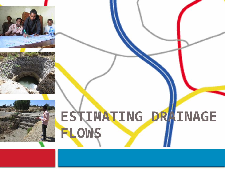
ESTIMATING DRAINAGE FLOWS

Estimating drainage flows

Information taken from ERA Road Manuals (Vol 2)
Further information and explanation is provided in these manuals
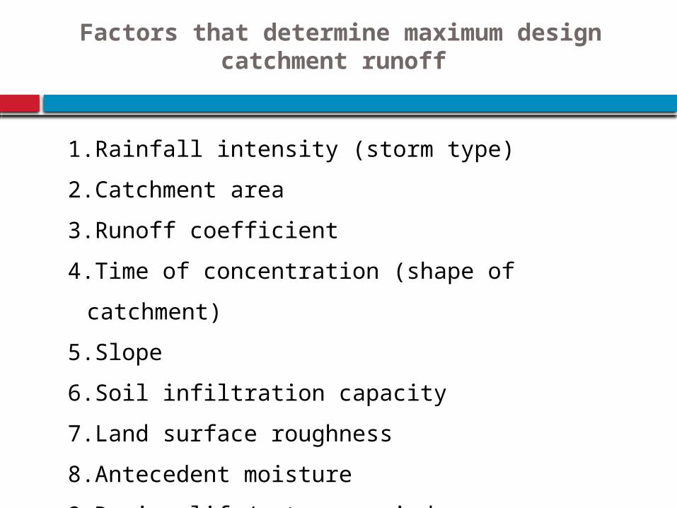
Factors that determine maximum design catchment runoff
1.Rainfall intensity (storm type)
2.Catchment area
3.Runoff coefficient
4.Time of concentration (shape of
catchment)
5.Slope
6.Soil infiltration capacity
7.Land surface roughness
8.Antecedent moisture
9.Design life/return period
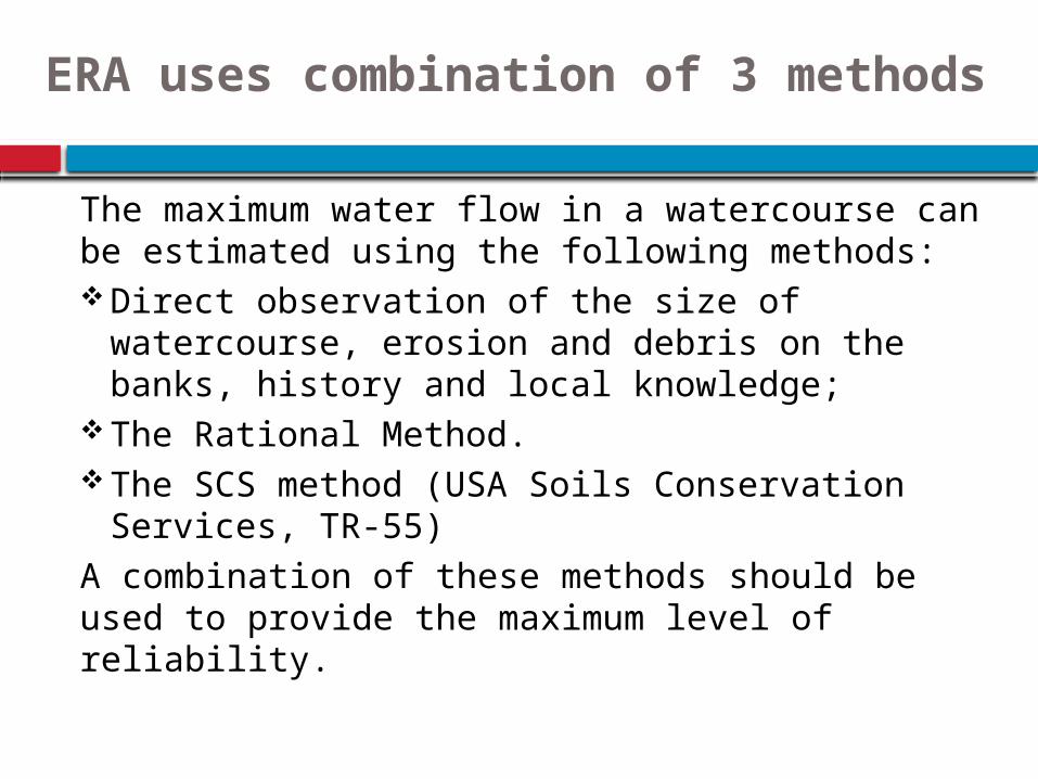
The maximum water flow in a watercourse can be estimated using the following methods:Direct observation of the size of watercourse,
erosion and debris on the banks, history and local knowledge;
The Rational Method.The SCS method (USA Soils Conservation
Services, TR-55)A combination of these methods should be used to provide the maximum level of reliability.
ERA uses combination of 3 methods
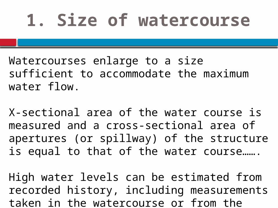
1. Size of watercourse
Watercourses enlarge to a size sufficient to accommodate the maximum water flow.
X-sectional area of the water course is measured and a cross-sectional area of apertures (or spillway) of the structure is equal to that of the water course…….
High water levels can be estimated from recorded history, including measurements taken in the watercourse or from the recollections of local residents.
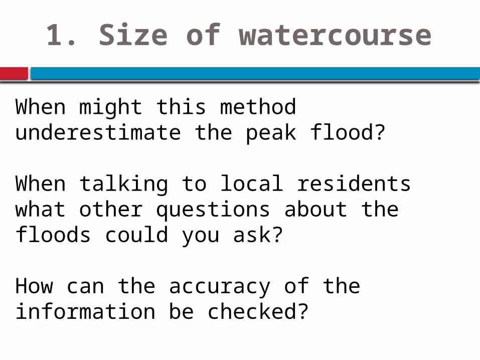
1. Size of watercourse
When might this method underestimate the peak flood?
When talking to local residents what other questions about the floods could you ask?
How can the accuracy of the information be checked?
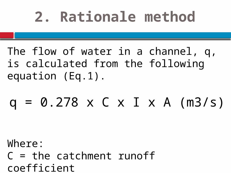
2. Rationale method
The flow of water in a channel, q, is calculated from the following equation (Eq.1).
q = 0.278 x C x I x A (m3/s)
Where:C = the catchment runoff coefficientI = the intensity of the rainfall (mm/hour)A = the area of the catchment (km2)
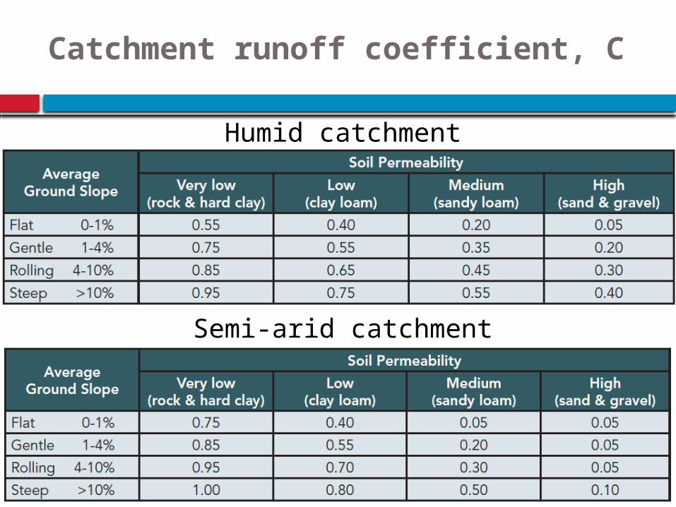
Catchment runoff coefficient, C
Humid catchment
Semi-arid catchment
Intensity of rainfall (I)
The intensity of rainfall (I) is obtained from the Intensity-Duration-Frequency charts
The storm duration is equal to the Time of Concentration (Tc).
Tc = Distance from farthest extremity (m) / Velocity of flow (m/s)
Velocity of flow depends on catchment characteristics and slope.
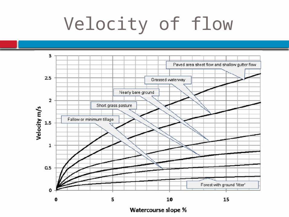
Velocity of flow
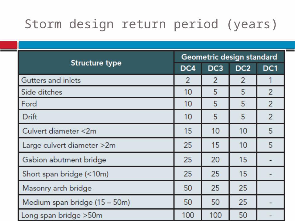
Storm design return period (years)
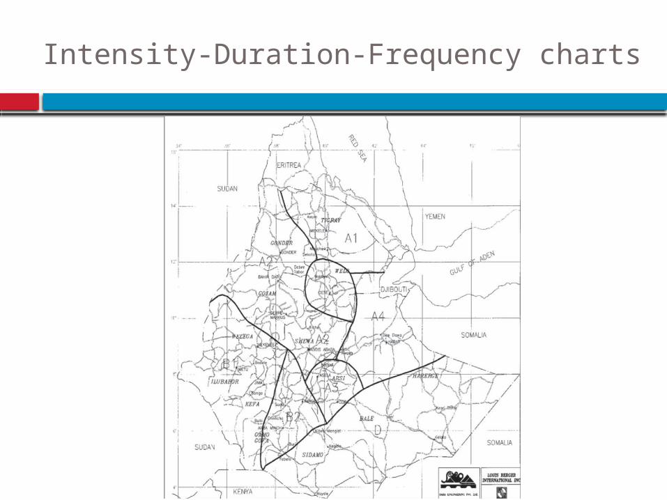
Intensity-Duration-Frequency charts
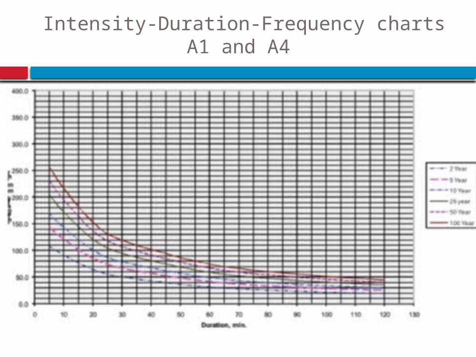
Intensity-Duration-Frequency chartsA1 and A4
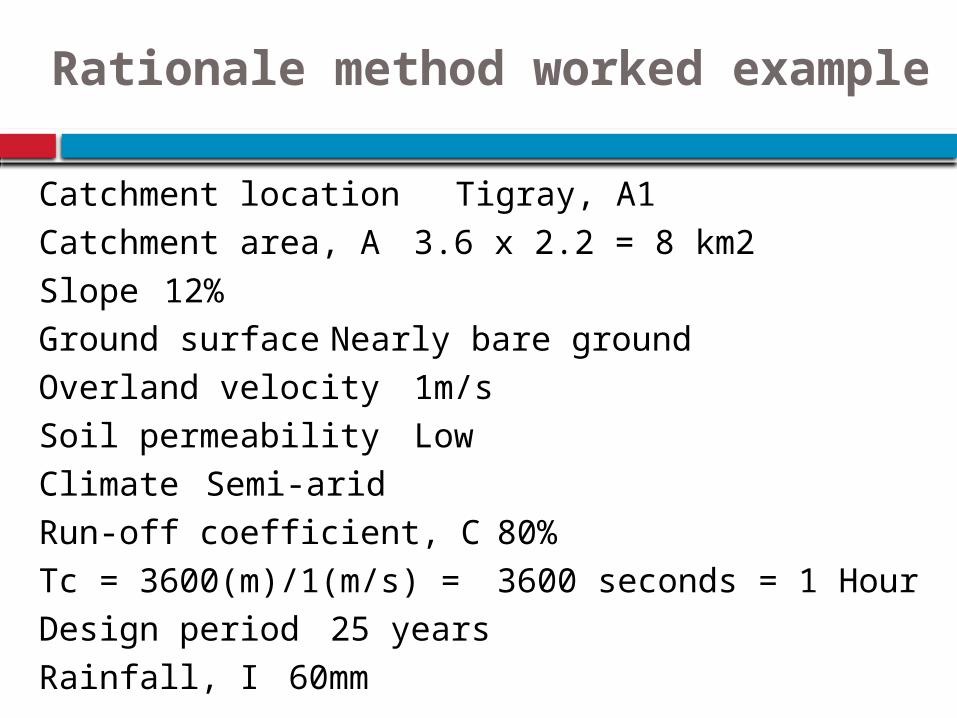
Catchment location Tigray, A1 Catchment area, A 3.6 x 2.2 = 8 km2 Slope 12% Ground surface Nearly bare ground Overland velocity 1m/s Soil permeability Low Climate Semi-arid Run-off coefficient, C 80% Tc = 3600(m)/1(m/s) = 3600 seconds = 1 Hour Design period 25 years Rainfall, I 60mm
Rationale method worked example

q = 0.278 x C x I x A (m3/s)
q = 0.278 x 0.8 x 60 x 8
q = 107 m3/sec
Rationale method worked example
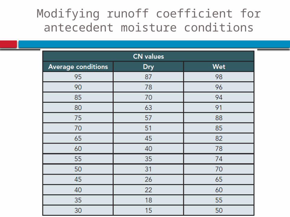
Modifying runoff coefficient for antecedent moisture conditions
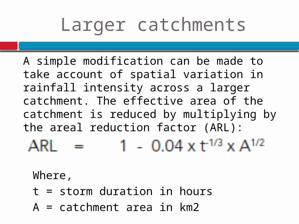
Larger catchments
A simple modification can be made to take account of spatial variation in rainfall intensity across a larger catchment. The effective area of the catchment is reduced by multiplying by the areal reduction factor (ARL):
Where, t = storm duration in hours A = catchment area in km2
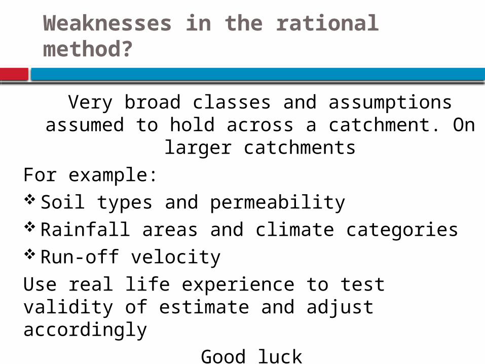
Weaknesses in the rational method?
Very broad classes and assumptions assumed to hold across a catchment. On larger
catchmentsFor example: Soil types and permeability Rainfall areas and climate categories Run-off velocityUse real life experience to test validity of estimate and adjust accordingly
Good luck

Supported by:
Developed by: