arcgismysite.science.uottawa.ca/bah/introduction to arcgis.pdfwithin arccatalog you can easily...
TRANSCRIPT


• ESRI’s Premiere GIS software
• A scalable GIS system which includes ArcView, ArcEditor, and ArcInfo
• Provides a wide range of GIS tools for needs which range from Desktop mapping to Geostatistical Analysis
ArcGIS

ArcGIS has a three part interface: ArcCatalog – for navigating spatial data
ArcMap – for creating presentation graphics, analysis,…
ArcToolbox – powerful geoprocessing tools

ArcGIS is a scalablesystem of software
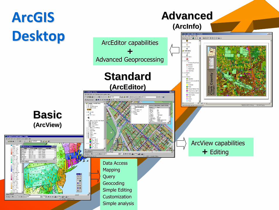
ArcGIS Desktop
Basic(ArcView)
Data Access
Mapping
Query
Geocoding
Simple Editing
Customization
Simple analysis
Standard(ArcEditor)
ArcView capabilities
+ Editing
Advanced(ArcInfo)
ArcEditor capabilities
+Advanced Geoprocessing

DBMS
ArcGIS
• Oracle Spatial
• SQL Server
• Informix
• IBM DB2
Coverage
Shapefile
Image
File based formats
CAD
Raster
TIN
Basic Standard Advanced
Spatially Enabled RDBMS
Internet
Web EnabledPersonal
Geodatabase
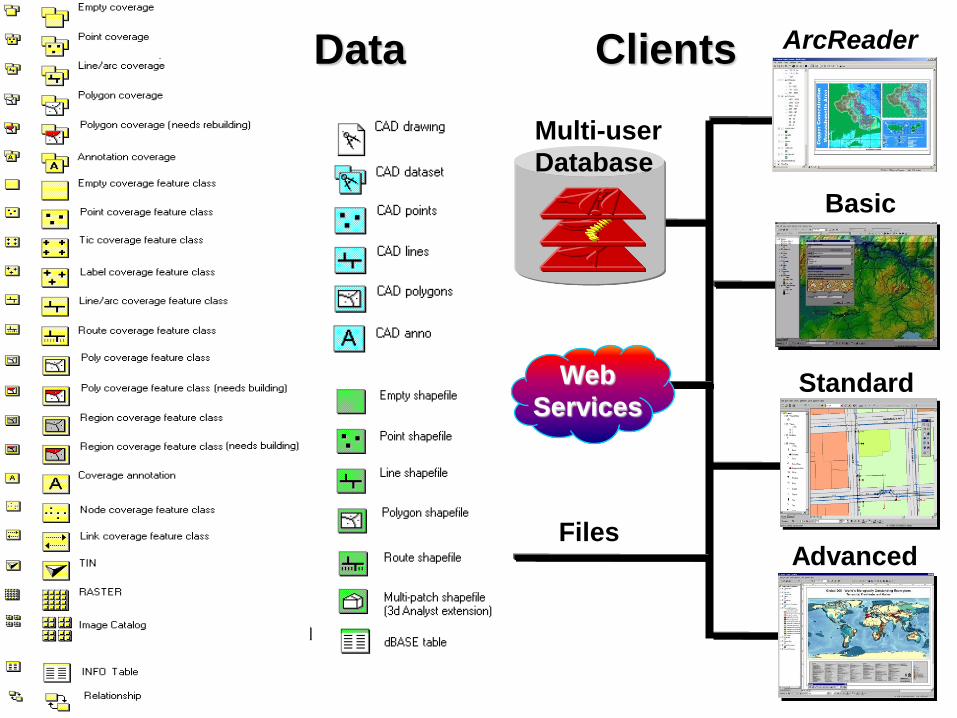
Data Clients ArcReader
Advanced
Standard
Basic
Files
Multi-user
Database
Web
Services

ArcCatalog ArcCatalog is similar to the Windows “explorer”, or the “My
Computer” icon on your windows desktop.
It is a tool for navigating through your GIS datasets.
The benefit of using ArcCatalog is that it has been specially designed for use with spatial data.
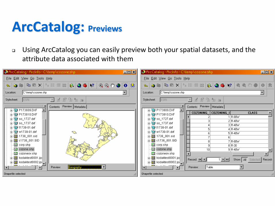
ArcCatalog: Previews
Using ArcCatalog you can easily preview both your spatial datasets, and the attribute data associated with them

Within ArcCatalog you can easily search for data based on location and attributes stored in its metadata
ArcCatalog: Spatial Search
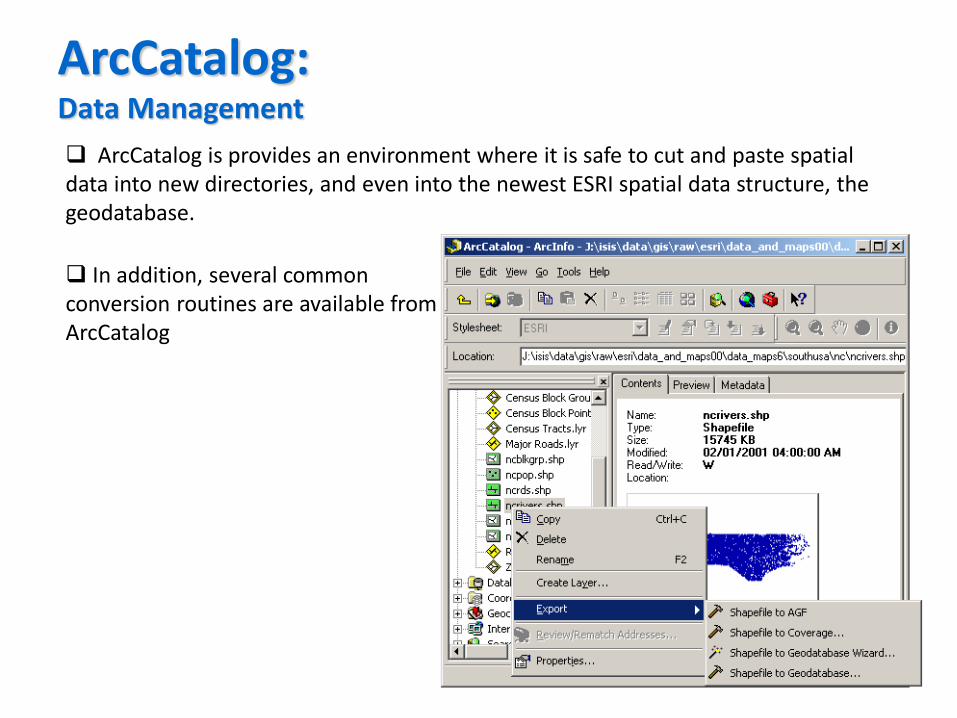
ArcCatalog: Data Management
ArcCatalog is provides an environment where it is safe to cut and paste spatial data into new directories, and even into the newest ESRI spatial data structure, the geodatabase.
In addition, several common conversion routines are available from ArcCatalog

ArcCatalog includes tools for viewing and editing Metadata.
It even has an option to automatically update some items in the metadata whenever a dataset is edited.
ArcCatalog: Metadata
ArcMap is like a virtual drafting table. It contains a canvas where GIS data layers are drawn, and a Table of Contents (TOC) which helps keep track of the data in the canvas. For desktop mapping, this is the interface which you will spend most of your time in. Almost any interactive analysis and visualization takes place in ArcMap. The canvas can be viewed in two states: Data viewis where most of the analysis is done. When you are ready to create a
presentation, switch to layout view and you gain access to cartographic tools.
There are several toolbars available in ArcMap. The standard toolbar contains basic file management tools (new, open, save, cut/paste, etc). The toolstoolbar contains simple navigation, identification, and selection tools. The draw toolbar is a basic windows style drawing toolbar. There are several other special need toolbars available from the View menu. Among other things, there is an edit toolbar and there are special toolbars for extensions available.
In addition to the toolbars, there are several menus available in ArcMap. The menus contain some of the commonly used items from the toolbars as well as a few common functions from ArcCatalog and ArcToolbox.
ArcMap

Table of Contents
Map Display Area
Tools Toolbar
Menu bar
Draw Toolbar
Standard Toolbar
ArcMap
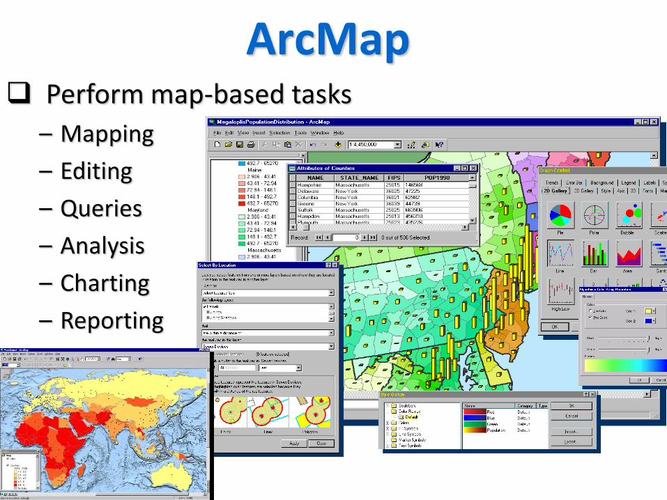
ArcMap Perform map-based tasks
– Mapping
– Editing
– Queries
– Analysis
– Charting
– Reporting
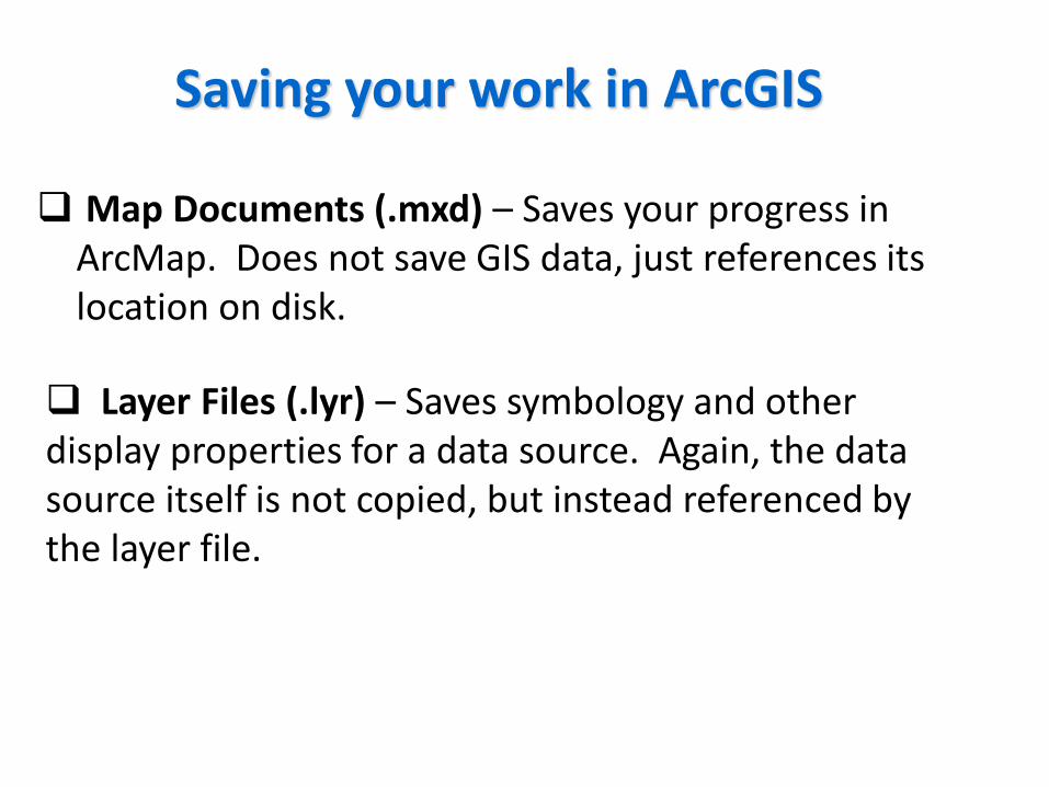
Map Documents (.mxd) – Saves your progress in ArcMap. Does not save GIS data, just references its location on disk.
Saving your work in ArcGIS
Layer Files (.lyr) – Saves symbology and other display properties for a data source. Again, the data source itself is not copied, but instead referenced by the layer file.
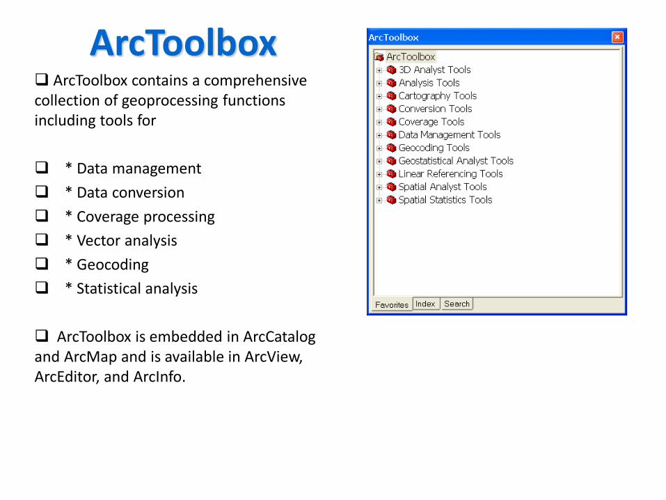
ArcToolbox ArcToolbox contains a comprehensive collection of geoprocessing functions including tools for
* Data management
* Data conversion
* Coverage processing
* Vector analysis
* Geocoding
* Statistical analysis
ArcToolbox is embedded in ArcCatalog and ArcMap and is available in ArcView, ArcEditor, and ArcInfo.
ArcGIS Extensions

The following ArcGIS Extension products add specialized tools and functionality to ArcGIS Desktop.
AnalysisArcGIS 3D Analyst (includes ArcGlobe) ArcGIS Geostatistical AnalystArcGIS Network AnalystArcGIS SchematicsArcGIS Spatial AnalystArcGIS Survey AnalystArcGIS Tracking AnalystProductivityArcGIS Data InteroperabilityArcGIS PublisherArcGIS StreetMapArcPress for ArcGISArcScan for ArcGISMaplex for ArcGIS
(from : www.ESRI.com)

CPU Speed 2.2 GHz minimum ; Hyper-threading (HHT) or Multi-core recommended
Platform x86 or x64 with SSE2 extensions
Memory/RAM 2 GB minimum
Display Properties 24-bit color depth
Screen Resolution 1024 x 768 recommended minimum at normal size (96 dpi)
Swap Space Determined by the operating system; 500 MB minimum.
Disk Space (For Runtime Only)
Windows: 2 GB Linux: 2 GB ArcGIS Engine will create cache files when used; additional disk space may be required.
Video/Graphics Adapter
64 MB RAM minimum, 256 MB RAM recommended. NVIDIA, ATI, and Intel chipsets supported. 24-bit capable graphics accelerator
ArcGIS 10.3 Hardware Requirements

ArcGIS Extensions:
3D Analyst
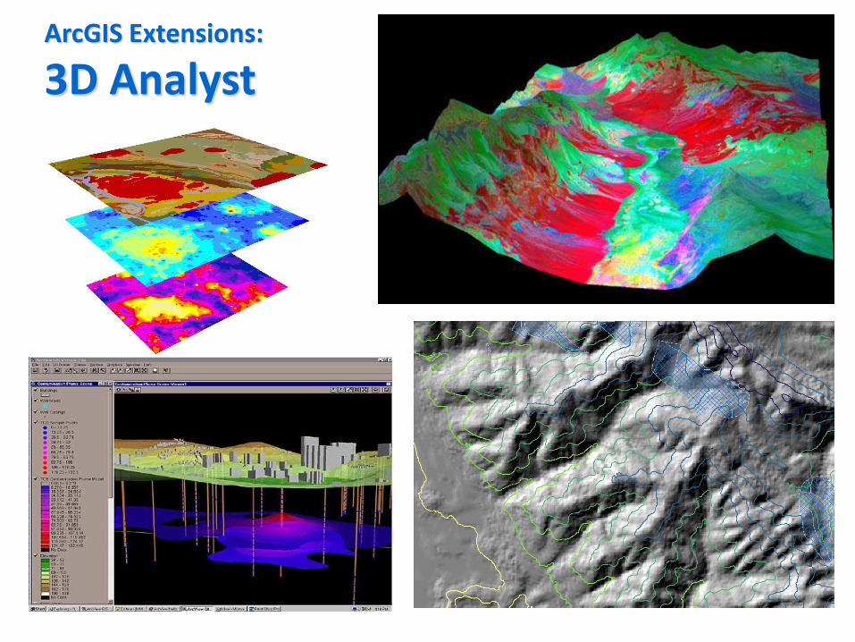
ArcGIS Extensions:
3D Analyst
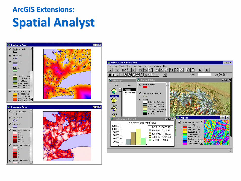
ArcGIS Extensions:
Spatial Analyst

ArcGIS Extensions:
Spatial Analyst