thermal remote sensing
TRANSCRIPT
ROHIT KUMARCUJ/I/2013/IGIO/026SEMESTER-5th
Contents:
• Introduction
• Thermal IR And Atmospheric Window
• Fundamental Radiation Laws
• Atmospheric Effects
• Thermal Data Acquisition
• Applications
• Advantages & Disadvantages

INTRODUCTION

REMOTE SENSING
• Remote sensing is an art and science of acquiring
info about an object of interest without coming in
physical contact with it.

THERMAL REMOTE SENSING
• Thermal remote sensing is the branch of remote sensing that
deals with the acquisition, processing and interpretation of data
acquired primarily in the thermal infrared (TIR) region of the
electromagnetic (EM) spectrum. In thermal remote sensing we
measure the radiations 'emitted' from the surface of the target, as
opposed to optical remote sensing where we measure the
radiations 'reflected' by the target under consideration.

Thermal remote sensing is based on
the measuring of EM radiation in the
infrared region of spectrum.
Most commonly used intervals are 3-
5 micro-meter and 8-14 micro-meter.

Thermal IR and atmospheric window:
Landsat 7
Band 7Landsat 7
Band 6

Thermal Infrared Spectrum:
Thermal IR: 3 – 14 μm
Near IR: 0.7-1.3 μm
Mid IR: 1.3 – 3.0 μm
Fundamental Radiation Laws:
The following laws are obeyed in this phenomenon:
Planck’ Radiation (Blackbody Law)
Wein’s Displacement Law
Stefan-Boltzman Law

Atmospheric Effects:
• The atmospheric intervention between the thermal sensor and the ground can modify the apparent level of radiations coming from ground depending on degree of atmospheric absorption, scattering and emission.
• Atmospheric absorption & scattering make the signal appear colder and atmospheric emission make the object to be detected as warmer.
• There are some factors on which both of these effects depend upon given by:

Atmospheric path length
Meteorological conditions
Site
Altitude
Local weather condition
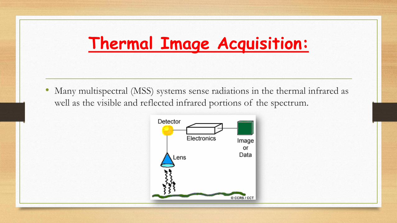
Thermal Image Acquisition:
• Many multispectral (MSS) systems sense radiations in the thermal infrared as
well as the visible and reflected infrared portions of the spectrum.

Thermal Sensors:
• Thermal sensors use photo detectors sensitive to the direct contact of
photons on their surface, to detect emitted thermal radiation.
• The detectors are cooled to temperatures close to absolute zero in order to
limit their own thermal emissions.
• Thermal sensors essentially measure the surface temperature and thermal
properties of targets.

THERMAL SENSORS:
TIROS (Television IR Operational Satellite), launched in 1960
GOES (Geostationary Operational Environmental Satellite), TIR at 8km spatial resolution, full-disk of Earth, day and night
HCMM (Heat Capacity Mapping Mission), launched in 1978- 600m spatial resolution, 10.5 – 12.6 micron range
CZCS (Coastal Zone Color Scanner) on Nimbus 7, launched in 1978, for SST (sea surface temperature).
AVHRR (Advanced Very High Resolution Radiometer), 1.1 and 4 km TIR bands
TIMS (Thermal Infrared Multispectral Scanner), Airborne, 6 bands
ATLAS (Airborne Terrestrial Applications Sensor), 15 bands
Landsat 4,5,7; Band 6- 10.4 – 12.5 m, 120 m (4,5), 60 m (7).
ASTER (Advanced Spaceborne Thermal Emission and Reflection Radiometer) on Terra, 5 bands 8.125-11.65 micron range (14 total).
Applications:
Surface temperature detection
Camouflage detection
Forest fire detection and fire risk mapping
Evapotranspiration and drought monitoring
Estimating air temperature
Oil spill monitoring
Water quality monitoring
Volcanic activity monitoring
Urban heat island analysis
Military purpuses

Thermal Remote Sensing Of Forest Fires:
Detection of active fires provides an
indicator of seasonal, regional and inter
annual variability in fire frequency and
shifts in geographic location and timing
of fire events.

NASA's Ikhana Unmanned Research Aircraft Recorded Image of Fire Near Lake in Southern California:
• The 3-D processed image is a colorized mosaic of
images draped over terrain, looking east.
• Active fire is seen in yellow, while hot, previously
burned areas are in shades of dark red and purple.
• Unburned areas are shown in green hues.
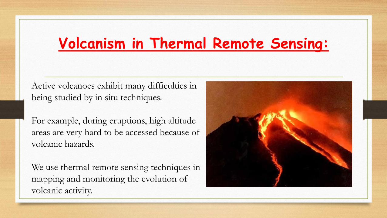
Volcanism in Thermal Remote Sensing:
Active volcanoes exhibit many difficulties in
being studied by in situ techniques.
For example, during eruptions, high altitude
areas are very hard to be accessed because of
volcanic hazards.
We use thermal remote sensing techniques in
mapping and monitoring the evolution of
volcanic activity.
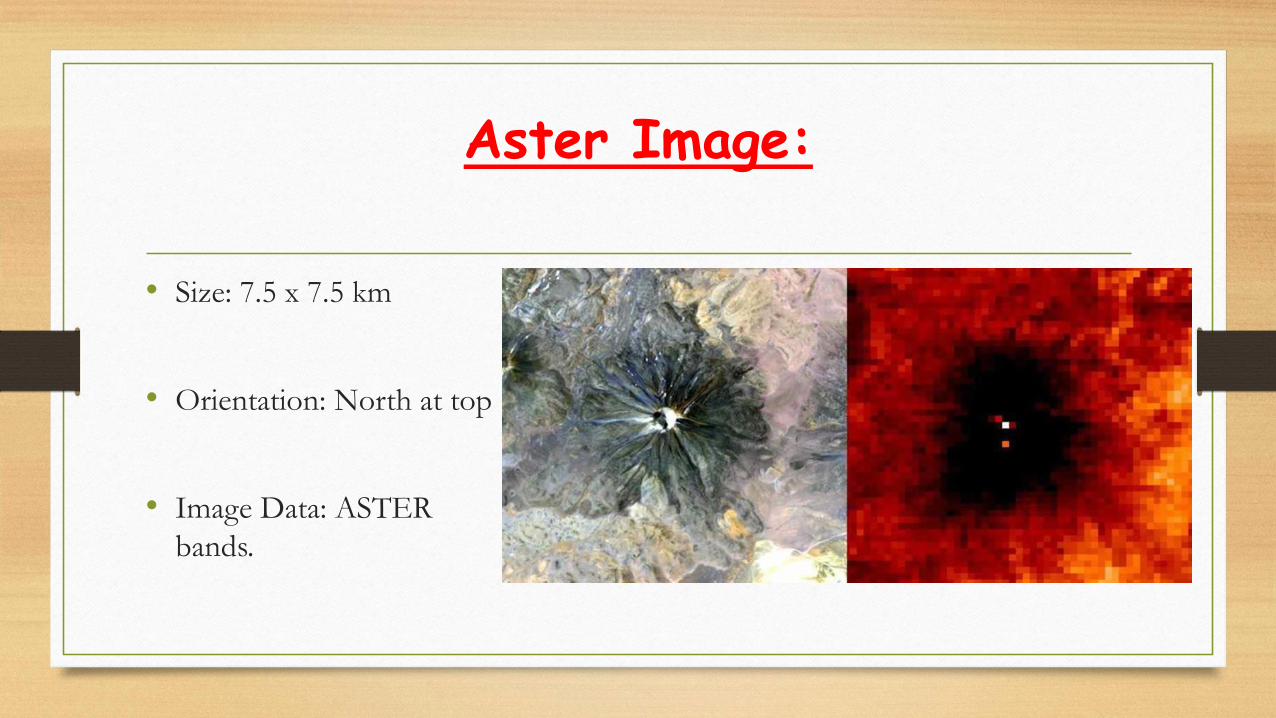
Aster Image:
• Size: 7.5 x 7.5 km
• Orientation: North at top
• Image Data: ASTER
bands.

Most Active Volcanoes:
• True Color Image Thermal Image

Thermal remote sensing in Military:

Due to their ability to detect man sized targets at extremely long
distances, in total darkness and in extreme weather conditions thermal
imaging cameras are extremely suited for boarder surveillance.
Generally, cooled cameras are used in border security applications as
they provide range performance than un-cooled detector.
If the terrain is e.g. mountainous and does not permit seeing over a
distance of 20 kilometers, un-cooled thermal imaging cameras can be
used for border security as well.
Thermal imaging cameras can be integrated with radar systems.

Advantages & Disadvantages:
Advantages
We can detect true temperature of
objects.
Feature cannot be detected by optical
RS may be detected with Thermal IR.
Disadvantages
It is pretty difficult to maintain the
sensors at required temperatures.
Image interpretation of thermal
image is difficult.

References:
“Remote Sensing of the Environment ” , John. R Jensen, Edition 6th.
“Remote Sensing and Image Interpretation ” , Thomas M. Lillisand, Ralph W. Kiefer, Jonathan W. Chipman, Edition 6th.
www.geog.ucsb.edu/~jeff/.../remote sensing/thermal/thermalirinfo.html
earth.esa.int/landtraining09/D1Lb3_Su_SEBBasics.pdf
en.wikipedia.org/wiki/Remote_sensing