the truckee canal - nevada legislature › session › 77th2013 › ... · the truckee canal: water...
TRANSCRIPT
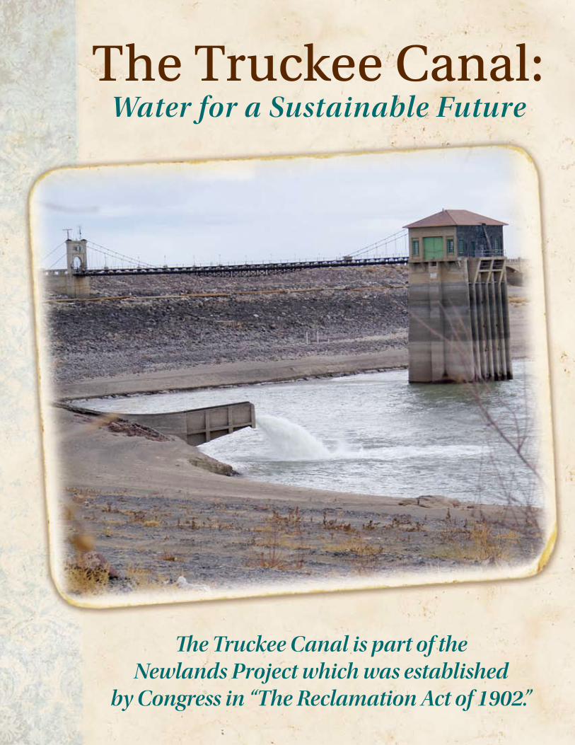
The Truckee Canal:
Water for a Sustainable Future
The Truckee Canal is part of the Newlands Project which was established
by Congress in “The Reclamation Act of 1902.”
2 The Truckee Canal
Table of ContentsTHE PURPOSE | • • • • • • • • • • • • • • • • • • • • • • • • 3
THE PROBLEM | •• • • • • • • • • • • • • • • • • • • • • • • 3
HOW DOES THIS AFFECT YOU? |• • • • • • • • • • • • • • • 3
BENEFITS OF THE TRUCKEE CANAL | • • • • • • • • • • • • 4
Truckee Canal Water |• • • • • • • • • • • • • • • • • • • • 5
City of Fernley |• • • • • • • • • • • • • • • • • • • • • 5
Hazen |• • • • • • • • • • • • • • • • • • • • • • • • • • 5
Lahontan Reservoir Water |• • • • • • • • • • • • • • • • • 6
Churchill County |• • • • • • • • • • • • • • • • • • • • 6
Lahontan State Recreation Area |• • • • • • • • • • • • • 6
City of Fallon |• • • • • • • • • • • • • • • • • • • • • • 6
Fallon Paiute-Shoshone Tribe |• • • • • • • • • • • • • • 6
Naval Air Station Fallon |•• • • • • • • • • • • • • • • • 7
Lahontan Wetlands |• • • • • • • • • • • • • • • • • • • 7
The Wetlands – Agriculture Relationship |•• • • • • • • • 7
Agriculture |•• • • • • • • • • • • • • • • • • • • • • • • 8
Sustainable Clean ”Green” Power |• • • • • • • • • • • • 8
HISTORICAL TIMELINE |•• • • • • • • • • • • • • • • • • • • 9
WATER RIgHTS AS REAL PROPERTY |•• • • • • • • • • • • • 9
RECOMMENDED SOLUTIONS |• • • • • • • • • • • • • • • 10
Community Residents and Organizations |• • • • • • • • 10
Elected Officials |•• • • • • • • • • • • • • • • • • • • • • 10
government Agencies |• • • • • • • • • • • • • • • • • • 10
Repair the Truckee Canal |•• • • • • • • • • • • • • • • • 11
SUMMARY |• • • • • • • • • • • • • • • • • • • • • • • • • 11
ENDNOTES |•• • • • • • • • • • • • • • • • • • • • • • • • 13
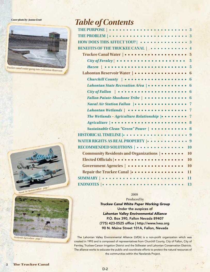
Truckee canal water going into Lahontan Reservoir.
2009
Produced by
Truckee Canal White Paper Working GroupUnder the auspices of
Lahontan Valley Environmental Alliance P.O. Box 390, Fallon Nevada 89407
(775) 423-0525 office | http://www.lvea.org 90 N. Maine Street 101A, Fallon, Nevada
The Lahontan Valley Environmental Alliance (LVEA) is a non-profit organization which was
created in 1993 and is composed of representatives from Churchill County, City of Fallon, City of
Fernley, Truckee-Carson Irrigation District and the Stillwater and Lahontan Conservation Districts.
The alliance works to educate the public and coordinate efforts to protect the natural resources of
the communities within the Newlands Project.
Cover photo by: Jeanne Evatt
Wetlands-Agriculture - page 7
Naval Air Station Fallon - page 7
D-2
Water for a Sustainable Future 3
The Truckee Canal: Water for a Sustainable Future
The Truckee Canal is part of the Newlands Project which was established by Congress in “The Reclamation Act of 1902”. This was the first reclamation project in the United States and was enacted during Theodore Roosevelt’s administration to stimulate settlement in the West.
THE PURPOSEThe purpose of this paper is to facilitate the repair of the Truckee Canal and return the
flow to pre-flood levels as well as to gain the support of the community and the elected
officials, through education, in this endeavor.
THE PROBLEMIn January 2008, the Truckee Canal, an integral part of the Newlands Project, breached its
banks in Fernley, Nevada, flooding homes. This disaster resulted in a court order1 to reduce
Truckee Canal flows to less than half the normal flow.2 This resulted in a shortage of water to
Lahontan Reservoir, not only causing economic damage to farmers but impacting everyone
within the Newlands Project. In order to protect the people of Fernley against flooding and
avoid the devastating economic and environmental effects of prolonged artificial drought,
state-of-the-art repairs must be promptly and permanently implemented in the Truckee
Canal, the lifeblood of the Newlands Project.
HOW DOES THIS AFFECT YOU?This paper gives an overview of how Newlands water affects you. You can make a difference
by encouraging and supporting your elected representatives as they work to protect your
assets and your way of life. Today’s decisions will affect future well water supplies, your local
economies, and could affect future geothermal power production.
The Nevada State Legislature recognized the importance of repairing the Truckee Canal in
passing Assembly Concurrent Resolution No. 32 during the recent 75th legislative session:
“…the Truckee Canal must be repaired to prevent future flooding and to restore the
full flow of water because the court-ordered drastically reduced flow, which is well
below capacity, is creating an artificial drought which places in jeopardy the welfare
and livelihood of farmers, homeowners, Native American tribes, state and federal
governmental entities, municipal and industrial interests, the military facility and
wildlife within the boundaries of the Newlands Project; and WHEREAS, A planned
governmental or environmental study that would delay repairs for 3 to 5 years is not a
viable option because the farmers cannot farm with years of reduced water delivery…”3
Further, the Congress of the United Sates mandates in Public Law (PL) 101-618:
“In addition to the existing [agricultural] irrigation purpose of the Newlands
Reclamation Project, the Secretary [of the Interior] is authorized to operate and
maintain the project for the purposes of:
(A) fish and wildlife, including endangered and threatened species;
(B) municipal and industrial water supply in Lyon and Churchill
counties, Nevada, including the Fallon [Paiute-Shoshone] Indian
Reservation;
(C) recreation;
Ph
oto
by
: Jea
nn
e E
va
tt
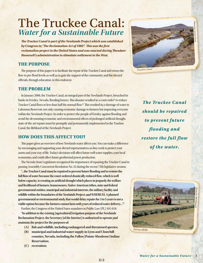
Truckee Canal .
The Truckee Canal
should be repaired
to prevent future
flooding and
restore the full flow
of the water.
Ph
oto
by
: Bill S
he
pa
rd
Baling alfalfa.
D-3
4 The Truckee Canal
(D) water quality, and
(E) any other purposes recognized as beneficial under the law of the State
of Nevada”.4
The Truckee Canal, on land set aside by the Reclamation Act for use by the Bureau Of
Reclamation (BOR), truly makes the Newlands Project the Green Machine. It contributes
to our local economy, produces green power, and makes the Lahontan Valley “the Oasis of
Nevada” which in turn protects the air quality needed by Naval Air Station Fallon (NASF).
The Truckee Canal:
Helps maintain aquifer recharge for over 5,000 documented wells.•• 5
Helps sustain the third-most visited Nevada park, Lahontan State Recreation ••
Area.6
Provides irrigation for approximately 52,000 privately owned acres of ••
agriculture lands in the Newlands Project
Transports water to the wetlands, part of the Pacific Flyway, as required by ••
international treaties.
BEnEFITS OF THE TRUCkEE CAnALThe water carried through the Truckee Canal directly and indirectly supported $330
million in 2007 local economic activity.7 The establishment of the Newlands Project,
including the Truckee Canal, encouraged and allowed for the growth and industry that
developed within its boundaries, including:
The City of Fernley••
Hazen••
Churchill County••
Lahontan Reservoir••
The City of Fallon••
The Fallon Paiute-Shoshone Tribe••
Naval Air Station Fallon••
Lahontan Wetlands••
Agriculture••
Sustainable green power generation••
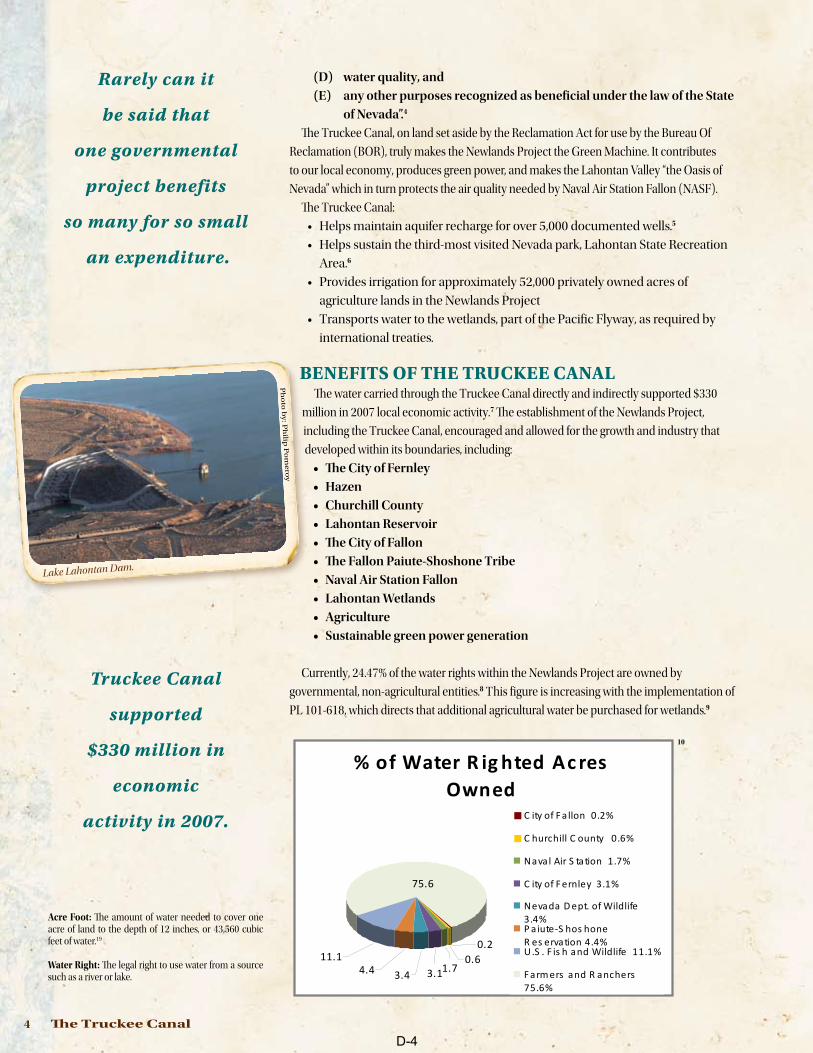
Currently, 24.47% of the water rights within the Newlands Project are owned by
governmental, non-agricultural entities.8 This figure is increasing with the implementation of
PL 101-618, which directs that additional agricultural water be purchased for wetlands.9
% of Water R ig hted Ac res Owned
75.6
11.14.4 3.4 3.11.7
0.60.2
C ity of F a llon 0.2%
C hurchill C ounty 0.6%
Naval Air S tation 1.7%
C ity of F ernley 3.1%
Nevada D ept. of Wildlife 3.4%P aiute-S hos honeR es ervation 4.4%U.S . F is h and Wildlife 11.1%
F arm ers and R anchers 75.6%
10
Rarely can it
be said that
one governmental
project benefits
so many for so small
an expenditure.
Ph
oto
by
: Ph
ilip P
om
ero
y
Lake Lahontan Dam.
Acre Foot: The amount of water needed to cover one acre of land to the depth of 12 inches, or 43,560 cubic feet of water.19
Water Right: The legal right to use water from a source such as a river or lake.
Truckee Canal
supported
$330 million in
economic
activity in 2007.
D-4
Water for a Sustainable Future 5
The Truckee Canal carries water from the Truckee River to the Lahontan Reservoir
where it is joined with the Carson River water. The amount of water in the Truckee Canal
is monitored by the Federal Water Master and balanced with Carson River water to meet
the water rights of all down stream users. The amount of water diverted from the Truckee
River varies widely according to the snow pack at the headwaters of both rivers. Access to
mountain snow pack run-off is crucial to Lahontan Reservoir. Newlands Project valleys
average only five inches of rain per year.11
According to the Desert Research Institute (DRI), if the Truckee Canal were to stop
flowing, the wells in Fernley, Hazen, and Swingle Bench would be unusable within five
years. The wells need the groundwater recharge from the Truckee Canal to maintain not
only the quantity, but also the quality of their water supply. Surface water right owners in
Fernley, Hazen, and Swingle Bench are entirely served by the Truckee Canal.12
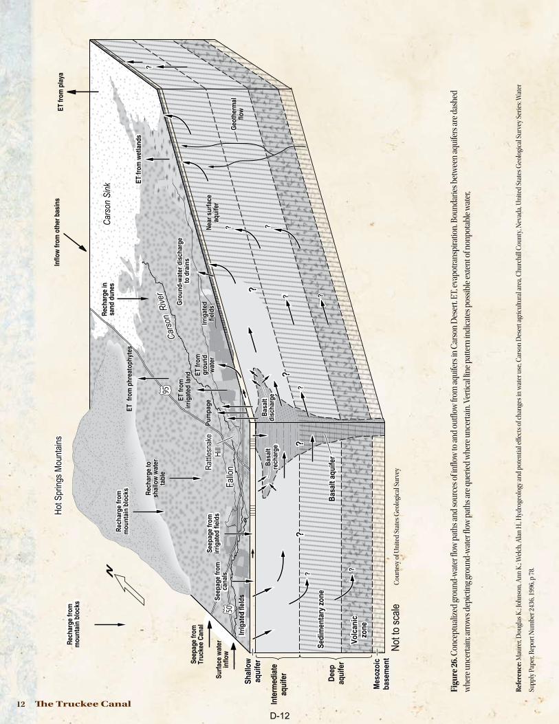
All Lahontan Valley aquifers are interconnected and rely on water from irrigation
and the irrigation system of canals to recharge and maintain local water supplies
and local water quality.13 (See diagram page 12.) Reduced irrigation water from the
Truckee Canal that causes water shortages will significantly impact the water table.
Increased efficiency measures (e.g. reducing seepage from ditches and irrigation
canals) will also have the unintended consequence of lowering water aquifer
levels. In the Lahontan Valley, a 25,000 to 50,000 acre-feet per year decrease could
cause water levels to decline from four to seventeen feet, potentially drying up
many household wells.14
Truckee Canal Water
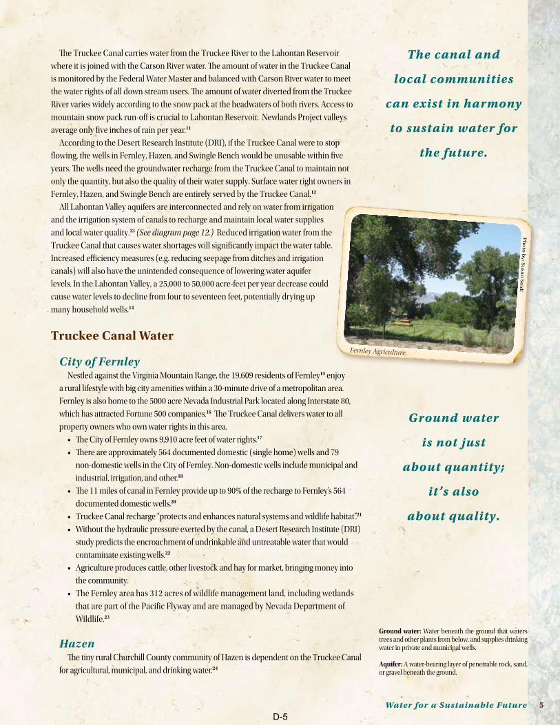
City of Fernley Nestled against the Virginia Mountain Range, the 19,609 residents of Fernley15 enjoy
a rural lifestyle with big city amenities within a 30-minute drive of a metropolitan area.
Fernley is also home to the 5000 acre Nevada Industrial Park located along Interstate 80,
which has attracted Fortune 500 companies.16 The Truckee Canal delivers water to all
property owners who own water rights in this area.
The City of Fernley owns 9,910 acre feet of water rights.•• 17
There are approximately 564 documented domestic (single home) wells and 79 ••
non-domestic wells in the City of Fernley. Non-domestic wells include municipal and
industrial, irrigation, and other.18
The 11 miles of canal in Fernley provide up to 90% of the recharge to Fernley’s 564 ••
documented domestic wells.20
Truckee Canal recharge “protects and enhances natural systems and wildlife habitat”.•• 21
Without the hydraulic pressure exerted by the canal, a Desert Research Institute (DRI) ••
study predicts the encroachment of undrinkable and untreatable water that would
contaminate existing wells.22
Agriculture produces cattle, other livestock and hay for market, bringing money into ••
the community.
The Fernley area has 312 acres of wildlife management land, including wetlands ••
that are part of the Pacific Flyway and are managed by Nevada Department of
Wildlife.23
HazenThe tiny rural Churchill County community of Hazen is dependent on the Truckee Canal
for agricultural, municipal, and drinking water.24
The canal and
local communities
can exist in harmony
to sustain water for
the future.
Ground water
is not just
about quantity;
it’s also
about quality.
Ground water: Water beneath the ground that waters trees and other plants from below, and supplies drinking water in private and municipal wells.
Aquifer: A water-bearing layer of penetrable rock, sand, or gravel beneath the ground.
Ph
oto
by
: Su
san
Se
idl
Fernley Agriculture.
D-5
6 The Truckee Canal
Lahontan Reservoir Water (Carson River Water plus Truckee Canal Water)
Churchill County The direct economic contributions of NASF, combined agricultural sectors, and
power production and distribution, pour $330 million per year into Churchill County
and the local communities of the Lahontan Valley.25 Numerous other local businesses
contribute directly and indirectly through economic linkages as money is spent
locally.
Churchill County enjoys a stable economy thanks to the diversity of agriculture,26
NASF, geothermal, and other industries. The agricultural sector in Churchill County
is a crucial, stable, tax-producing part of the economy. Any reduction in the amount of
water to be delivered under Nevada law would diminish these advantages.
Churchill County has a population of 26,981•• 27
A conservation easement program has been implemented to protect agriculture, ••
open spaces and water recharge to the aquifer.28
Churchill County owns 1490 acre feet of water rights.•• 29
In Churchill County there are 4130 documented domestic wells and 344 non-••
domestic wells, which include municipal and industrial, irrigation, and other, all
permitted through the state water engineer.30
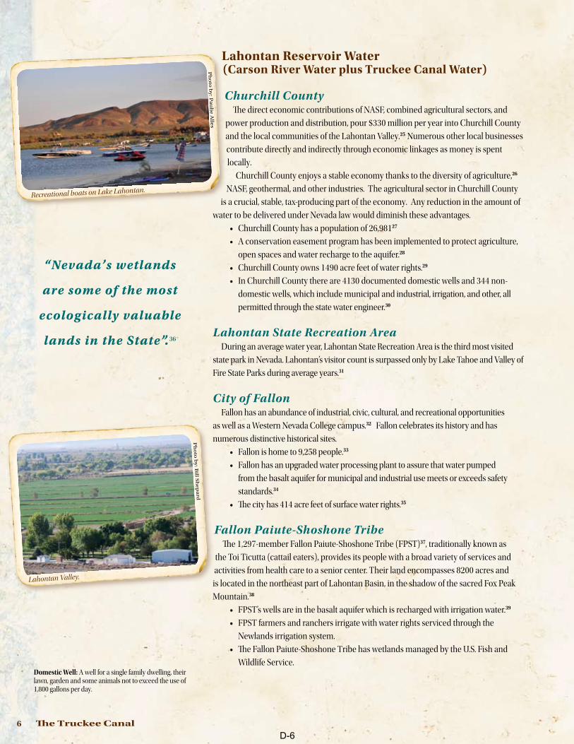
Lahontan State Recreation AreaDuring an average water year, Lahontan State Recreation Area is the third most visited
state park in Nevada. Lahontan’s visitor count is surpassed only by Lake Tahoe and Valley of
Fire State Parks during average years.31
City of FallonFallon has an abundance of industrial, civic, cultural, and recreational opportunities
as well as a Western Nevada College campus.32 Fallon celebrates its history and has
numerous distinctive historical sites.
Fallon is home to 9,258 people.•• 33
Fallon has an upgraded water processing plant to assure that water pumped ••
from the basalt aquifer for municipal and industrial use meets or exceeds safety
standards.34
The city has 414 acre feet of surface water rights.•• 35
Fallon Paiute-Shoshone TribeThe 1,297-member Fallon Paiute-Shoshone Tribe (FPST)37, traditionally known as
the Toi Ticutta (cattail eaters), provides its people with a broad variety of services and
activities from health care to a senior center. Their land encompasses 8200 acres and
is located in the northeast part of Lahontan Basin, in the shadow of the sacred Fox Peak
Mountain.38
FPST’s wells are in the basalt aquifer which is recharged with irrigation water.•• 39
FPST farmers and ranchers irrigate with water rights serviced through the ••
Newlands irrigation system.
The Fallon Paiute-Shoshone Tribe has wetlands managed by the U.S. Fish and ••
Wildlife Service.
“Nevada’s wetlands
are some of the most
ecologically valuable
lands in the State”.36
Domestic Well: A well for a single family dwelling, their lawn, garden and some animals not to exceed the use of 1,800 gallons per day.
Ph
oto
by
: Pa
ulie
Alle
s
Recreational boats on Lake Lahontan.
Ph
oto
by
: Bill S
he
pa
rd
Lahontan Valley.
D-6
Water for a Sustainable Future 7
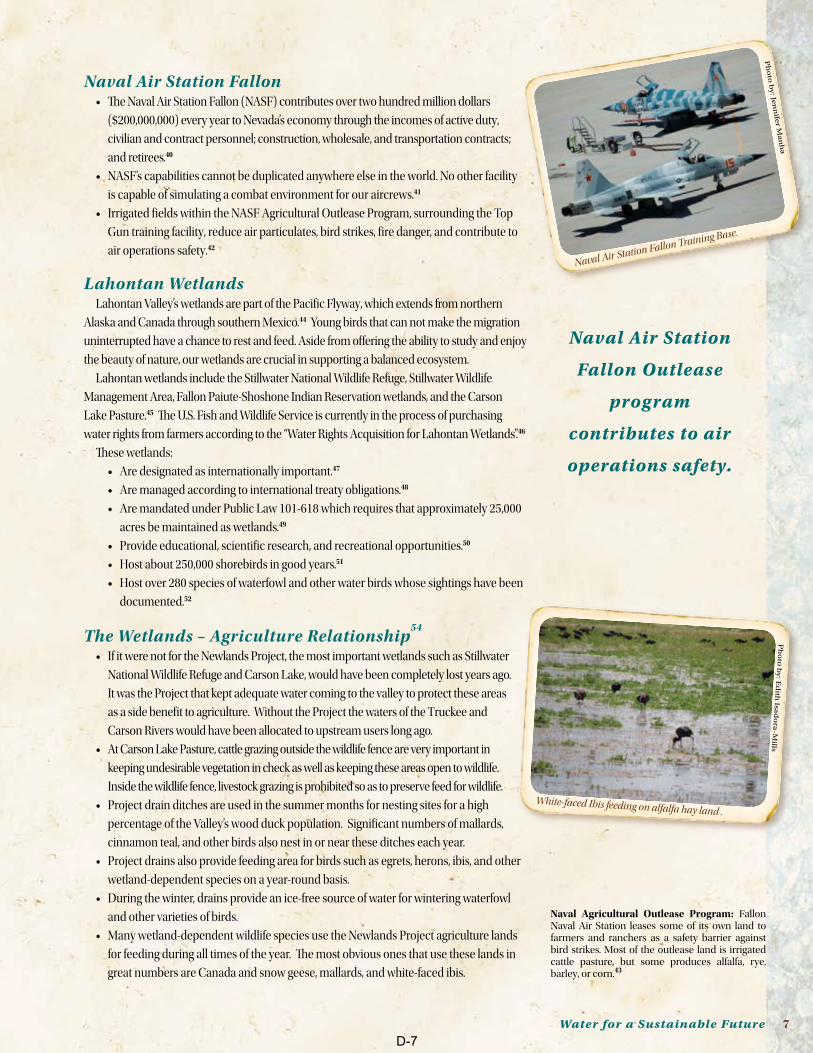
Naval Air Station FallonThe Naval Air Station Fallon (NASF) contributes over two hundred million dollars ••
($200,000,000) every year to Nevada’s economy through the incomes of active duty,
civilian and contract personnel; construction, wholesale, and transportation contracts;
and retirees.40
NASF’s capabilities cannot be duplicated anywhere else in the world. No other facility ••
is capable of simulating a combat environment for our aircrews.41
Irrigated fields within the NASF Agricultural Outlease Program, surrounding the Top ••
Gun training facility, reduce air particulates, bird strikes, fire danger, and contribute to
air operations safety.42
Lahontan WetlandsLahontan Valley’s wetlands are part of the Pacific Flyway, which extends from northern
Alaska and Canada through southern Mexico.44 Young birds that can not make the migration
uninterrupted have a chance to rest and feed. Aside from offering the ability to study and enjoy
the beauty of nature, our wetlands are crucial in supporting a balanced ecosystem.
Lahontan wetlands include the Stillwater National Wildlife Refuge, Stillwater Wildlife
Management Area, Fallon Paiute-Shoshone Indian Reservation wetlands, and the Carson
Lake Pasture.45 The U.S. Fish and Wildlife Service is currently in the process of purchasing
water rights from farmers according to the “Water Rights Acquisition for Lahontan Wetlands”.46
These wetlands:
Are designated as internationally important.•• 47
Are managed according to international treaty obligations.•• 48
Are mandated under Public Law 101-618 which requires that approximately 25,000 ••
acres be maintained as wetlands.49
Provide educational, scientific research, and recreational opportunities.•• 50
Host about 250,000 shorebirds in good years.•• 51
Host over 280 species of waterfowl and other water birds whose sightings have been ••
documented.52
The Wetlands – Agriculture Relationship54
If it were not for the Newlands Project, the most important wetlands such as Stillwater ••
National Wildlife Refuge and Carson Lake, would have been completely lost years ago.
It was the Project that kept adequate water coming to the valley to protect these areas
as a side benefit to agriculture. Without the Project the waters of the Truckee and
Carson Rivers would have been allocated to upstream users long ago.
At Carson Lake Pasture, cattle grazing outside the wildlife fence are very important in ••
keeping undesirable vegetation in check as well as keeping these areas open to wildlife.
Inside the wildlife fence, livestock grazing is prohibited so as to preserve feed for wildlife.
Project drain ditches are used in the summer months for nesting sites for a high ••
percentage of the Valley’s wood duck population. Significant numbers of mallards,
cinnamon teal, and other birds also nest in or near these ditches each year.
Project drains also provide feeding area for birds such as egrets, herons, ibis, and other ••
wetland-dependent species on a year-round basis.
During the winter, drains provide an ice-free source of water for wintering waterfowl ••
and other varieties of birds.
Many wetland-dependent wildlife species use the Newlands Project agriculture lands ••
for feeding during all times of the year. The most obvious ones that use these lands in
great numbers are Canada and snow geese, mallards, and white-faced ibis.
Naval Agricultural Outlease Program: Fallon Naval Air Station leases some of its own land to farmers and ranchers as a safety barrier against bird strikes. Most of the outlease land is irrigated cattle pasture, but some produces alfalfa, rye, barley, or corn.43
Naval Air Station
Fallon Outlease
program
contributes to air
operations safety.
Ph
oto
by
: Jen
nife
r Ma
nh
a
Naval Air Station Fallon Training Base.
Ph
oto
by
: Ed
ith Isa
do
ra-M
ills
White-faced Ibis feeding on alfalfa hay land .
D-7
8 The Truckee Canal
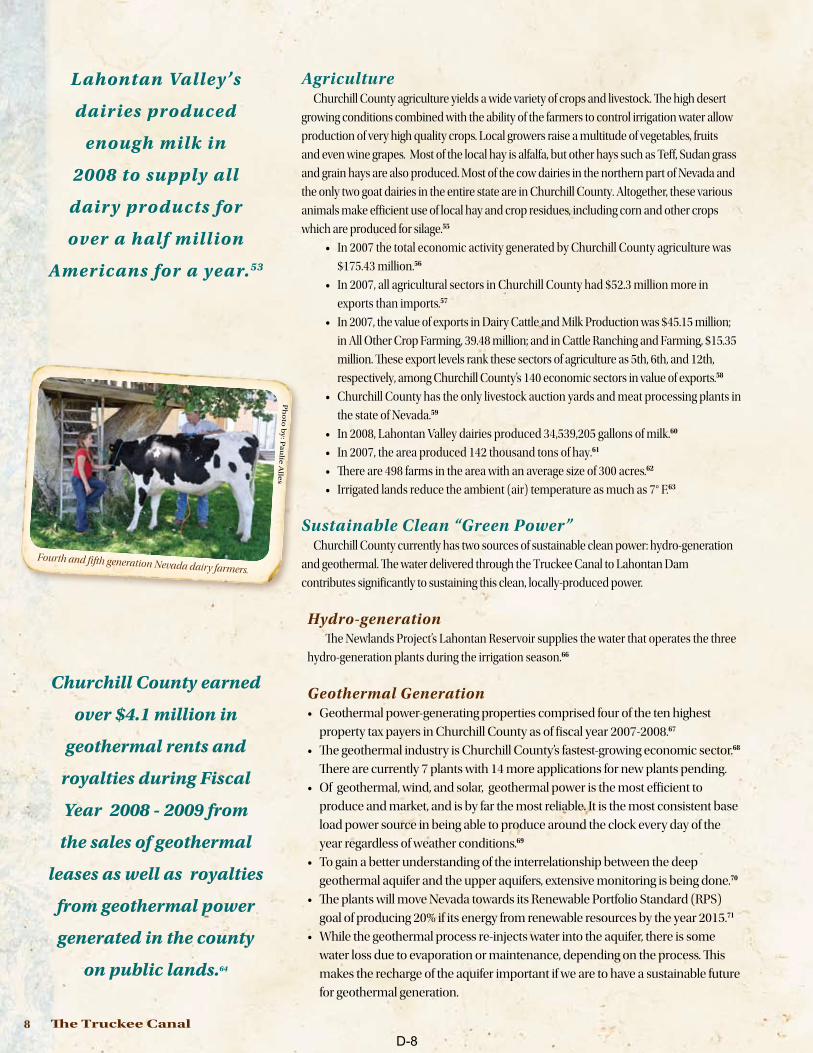
AgricultureChurchill County agriculture yields a wide variety of crops and livestock. The high desert
growing conditions combined with the ability of the farmers to control irrigation water allow
production of very high quality crops. Local growers raise a multitude of vegetables, fruits
and even wine grapes. Most of the local hay is alfalfa, but other hays such as Teff, Sudan grass
and grain hays are also produced. Most of the cow dairies in the northern part of Nevada and
the only two goat dairies in the entire state are in Churchill County. Altogether, these various
animals make efficient use of local hay and crop residues, including corn and other crops
which are produced for silage.55
In 2007 the total economic activity generated by Churchill County agriculture was ••
$175.43 million.56
In 2007, all agricultural sectors in Churchill County had $52.3 million more in ••
exports than imports.57
In 2007, the value of exports in Dairy Cattle and Milk Production was $45.15 million; ••
in All Other Crop Farming, 39.48 million; and in Cattle Ranching and Farming, $15.35
million. These export levels rank these sectors of agriculture as 5th, 6th, and 12th,
respectively, among Churchill County’s 140 economic sectors in value of exports.58
Churchill County has the only livestock auction yards and meat processing plants in ••
the state of Nevada.59
In 2008, Lahontan Valley dairies produced 34,539,205 gallons of milk.•• 60
In 2007, the area produced 142 thousand tons of hay.•• 61
There are 498 farms in the area with an average size of 300 acres.•• 62
Irrigated lands reduce the ambient (air) temperature as much as 7° F.•• 63
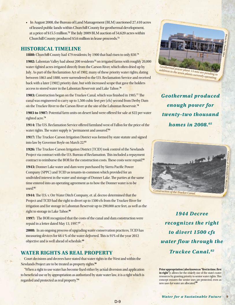
Sustainable Clean “Green Power”Churchill County currently has two sources of sustainable clean power: hydro-generation
and geothermal. The water delivered through the Truckee Canal to Lahontan Dam
contributes significantly to sustaining this clean, locally-produced power.
Hydro-generationThe Newlands Project’s Lahontan Reservoir supplies the water that operates the three
hydro-generation plants during the irrigation season.66
Geothermal GenerationGeothermal power-generating properties comprised four of the ten highest ••
property tax payers in Churchill County as of fiscal year 2007-2008.67
The geothermal industry is Churchill County’s fastest-growing economic sector.•• 68
There are currently 7 plants with 14 more applications for new plants pending.
Of geothermal, wind, and solar, geothermal power is the most efficient to ••
produce and market, and is by far the most reliable. It is the most consistent base
load power source in being able to produce around the clock every day of the
year regardless of weather conditions.69
To gain a better understanding of the interrelationship between the deep ••
geothermal aquifer and the upper aquifers, extensive monitoring is being done.70
The plants will move Nevada towards its Renewable Portfolio Standard (RPS) ••
goal of producing 20% if its energy from renewable resources by the year 2015.71
While the geothermal process re-injects water into the aquifer, there is some ••
water loss due to evaporation or maintenance, depending on the process. This
makes the recharge of the aquifer important if we are to have a sustainable future
for geothermal generation.
Ph
oto
by
: Pa
ulie
Alle
s
Fourth and fifth generation Nevada dairy farmers.
Churchill County earned
over $4.1 million in
geothermal rents and
royalties during Fiscal
Year 2008 - 2009 from
the sales of geothermal
leases as well as royalties
from geothermal power
generated in the county
on public lands.64
Lahontan Valley’s
dairies produced
enough milk in
2008 to supply all
dairy products for
over a half million
Americans for a year.53
D-8
Water for a Sustainable Future 9
In August 2008, the Bureau of Land Management (BLM) auctioned 27,410 acres ••
of leased public lands within Churchill County for geothermal development,
at a price of $15.5 million.72 The July 2009 BLM auction of 54,620 acres within
Churchill County produced $5.6 million in lease proceeds.73
HISTORICAL TIMELInE1880: Churchill County had 479 residents; by 1900 that had risen to only 830.74
1902: Lahontan Valley had about 200 residents75 on irrigated farms with roughly 20,000
water righted acres irrigated directly from the Carson River, which often dried up by
July. As part of the Reclamation Act of 1902, many of these priority water rights, dating
between 1863 and 1880, were surrendered to the U.S. Reclamation Service and received
back with a later (1902) priority date, but with increased scope that gave the holders
access to stored water in the Lahontan Reservoir and Lake Tahoe.76
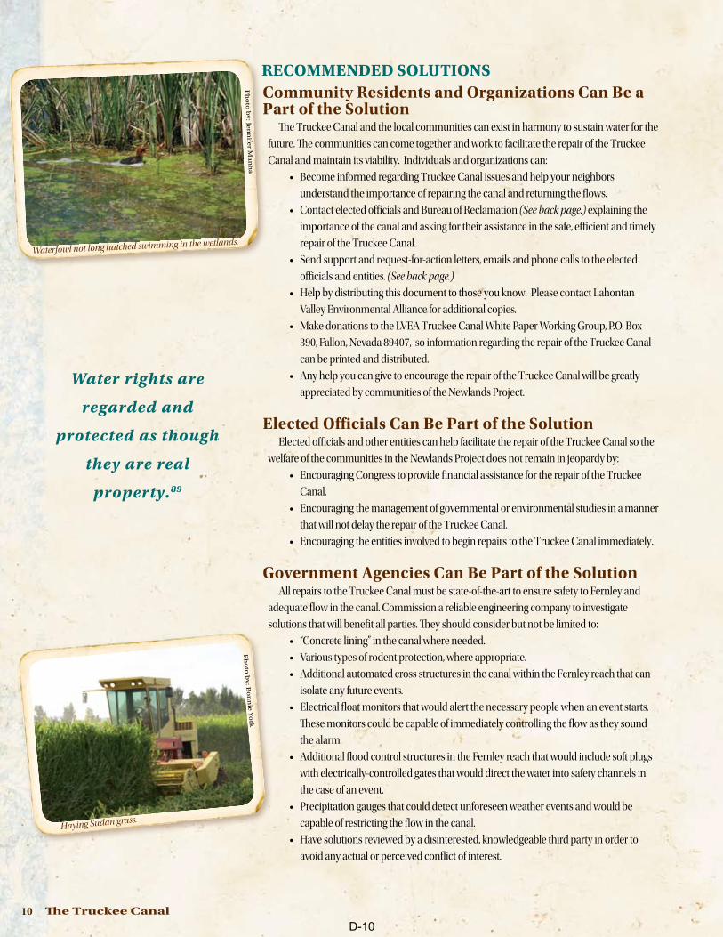
1903: Construction began on the Truckee Canal, which was finished in 1905.77 The
canal was engineered to carry up to 1,500 cubic feet per (cfs) second from Derby Dam
on the Truckee River to the Carson River at the site of the Lahontan Reservoir.78
1903 to 1907: Potential farm units on desert land were offered for sale at $22 per water
righted acre.79
1914: The U.S. Reclamation Service offered farmland west of Fallon for the price of the
water rights. The water supply is “permanent and assured”.81
1917: The Truckee-Carson Irrigation District was formed by state statute and signed
into law by Governor Boyle on March 22.83
1926: The Truckee-Carson Irrigation District (TCID) took control of the Newlands
Project via contract with the U.S. Bureau of Reclamation. This included a repayment
contract to reimburse the BOR for the construction costs. These costs were repaid.84
1943: Donner Lake water and dam were purchased by Sierra Pacific Power
Company (SPPC) and TCID as tenants-in-common which provided for an
undivided interest in the water and storage of Donner Lake. The parties at the same
time entered into an operating agreement as to how the Donner water is to be
used.85
1944: The U.S. v. Orr Water Ditch Company, et. al. decree determined that the
Project and TCID had the right to divert up to 1500 cfs from the Truckee River for
irrigation and for storage in Lahontan Reservoir up to 290,000 acre feet, as well as the
right to storage in Lake Tahoe.86
1997: The BOR recognized that the costs of the canal and dam construction were
repaid in a letter dated May 13, 1997.87
2008: In an ongoing process of upgrading water conservation practices, TCID has
measuring devices for 68.4 % of the water delivered. This is 91% of the year 2012
objective and is well ahead of schedule.88
WATER RIgHTS AS REAL PROPERTYCourt decisions and decrees have stated that water rights in the West and within the
Newlands Project are to be treated as property rights.90
“When a right to use water has become fixed either by actual diversion and application
to beneficial use or by appropriation as authorized by state water law, it is a right which is
regarded and protected as real property”.91
Geothermal produced
enough power for
twenty-two thousand
homes in 2008.65
1944 Decree
recognizes the right
to divert 1500 cfs
water flow through the
Truckee Canal.82
Co
urte
sy o
f: Ch
urc
hill C
o. M
use
um
Construction of the Truckee Canal.
Ph
oto
by
: Pa
ulie
Alle
s
Geothermal power plant: 14 new are pending in
addition to the seven plants currently operating.
Prior appropriation (also known as “first in time, first in right”): allows for the orderly use of the state’s water resources by granting priority to senior water rights. This concept ensures the senior uses are protected, even as new uses for water are allocated.80
D-9
10 The Truckee Canal
RECOMMEnDED SOLUTIOnS Community Residents and Organizations Can Be a Part of the Solution
The Truckee Canal and the local communities can exist in harmony to sustain water for the
future. The communities can come together and work to facilitate the repair of the Truckee
Canal and maintain its viability. Individuals and organizations can:
Become informed regarding Truckee Canal issues and help your neighbors ••
understand the importance of repairing the canal and returning the flows.
Contact elected officials and Bureau of Reclamation •• (See back page.) explaining the
importance of the canal and asking for their assistance in the safe, efficient and timely
repair of the Truckee Canal.
Send support and request-for-action letters, emails and phone calls to the elected ••
officials and entities. (See back page.)
Help by distributing this document to those you know. Please contact Lahontan ••
Valley Environmental Alliance for additional copies.
Make donations to the LVEA Truckee Canal White Paper Working Group, P.O. Box ••
390, Fallon, Nevada 89407, so information regarding the repair of the Truckee Canal
can be printed and distributed.
Any help you can give to encourage the repair of the Truckee Canal will be greatly ••
appreciated by communities of the Newlands Project.
Elected Officials Can Be Part of the SolutionElected officials and other entities can help facilitate the repair of the Truckee Canal so the
welfare of the communities in the Newlands Project does not remain in jeopardy by:
Encouraging Congress to provide financial assistance for the repair of the Truckee ••
Canal.
Encouraging the management of governmental or environmental studies in a manner ••
that will not delay the repair of the Truckee Canal.
Encouraging the entities involved to begin repairs to the Truckee Canal immediately•• .
Government Agencies Can Be Part of the SolutionAll repairs to the Truckee Canal must be state-of-the-art to ensure safety to Fernley and
adequate flow in the canal. Commission a reliable engineering company to investigate
solutions that will benefit all parties. They should consider but not be limited to:
“Concrete lining” in the canal where needed.••
Various types of rodent protection, where appropriate.••
Additional automated cross structures in the canal within the Fernley reach that can ••
isolate any future events.
Electrical float monitors that would alert the necessary people when an event starts. ••
These monitors could be capable of immediately controlling the flow as they sound
the alarm.
Additional flood control structures in the Fernley reach that would include soft plugs ••
with electrically-controlled gates that would direct the water into safety channels in
the case of an event.
Precipitation gauges that could detect unforeseen weather events and would be ••
capable of restricting the flow in the canal.
Have solutions reviewed by a disinterested, knowledgeable third party in order to ••
avoid any actual or perceived conflict of interest.
Ph
oto
by
: Jen
nife
r Ma
nh
a
Waterfowl not long hatched swimming in the wetlands.
Water rights are
regarded and
protected as though
they are real
property.89 P
ho
to b
y: B
on
nie
Yo
rk
Haying Sudan grass.
D-10
Water for a Sustainable Future 11
Repair the Truckee Canal:to protect the people of Fernley from flooding. •to maintain the recharge of aquifers and protect both water quality and •quantity of domestic wells.to protect the farms in the Newlands Project that need that water to survive.•to ensure the area’s stable economy.•to move our county, our state, and our country towards green energy and •away from dependence on foreign oil.to continue to provide NASF with the best possible environment in which •to train our military people.to protect migratory birds.•
SUMMARY The Truckee Canal provides an average of 26% of the water in the Newlands Project.•• 92
Economically, the agriculture, military, local business and power generation ••
activities within the Newlands Project are a very positive contributor to the
economic health of the state and nation.
The Newlands Project is home to the very strategic training base, NASF.••
The wetlands are of international importance.••
Water that seeps from the irrigation ditch system and/or irrigation water not ••
utilized by the plants goes into the aquifers. This water provides the main source of
the water available in local wells and also maintains the quality of the well water.
The water flow through the Truckee Canal into the Lahontan Reservoir has been ••
reduced significantly.93
In the Lahontan Valley all aquifers are interconnected. •• (See diagram page 12)
The people who live within the Newlands Project depend on the incoming water ••
from the Truckee Canal to recharge the aquifers to provide Municipal and Industrial
water along with all domestic wells and quasi-municipal wells within the region.
Churchill County is an exporter of economically sound, green power with its ••
consistent base load. Further, there is the potential for a great deal more.
Churchill County is one of the top producers of geothermal power in the ◊
nation. There are currently 7 plants with 14 more applications for plants
in addition to new leases just sold by BOR.
Even though the geothermal process pumps very old and deep water and re-◊
injects the water somewhere near where it originated, there is some water loss.
Although there is a great deal to be learned, to maintain a sustainable ◊
future in clean power, it seems reasonable to do what we can to protect
the ability to produce it.
The Newlands Project and the total amount of water entering the Project, including ••
the Truckee Canal, are important not only to every person who lives or works in the
Newlands Project area but also to the state and nation as a whole.
The water carried through the Truckee Canal directly and indirectly supports ••
$330 million of Churchill County’s economic activity.94
As in any desert community, all activities are predicated upon water. For a sustainable future the current water rights owned within the Newlands Project need to be maintained and the delivery of water, as provided by law, insured. To insure this, the repair of the Truckee Canal is critical.
Ph
oto
co
urte
sy o
f NA
S F
allo
n
Naval Outlease Program to reduce bird strikes.
For a sustainable
future we need to
maintain the
current level of
water rights within
the Newlands Project.
Ph
oto
by
: So
ny
a Jo
hn
son
Selecting a Lahontan Valley melon.
D-11
12 The Truckee Canal
Not
to s
cale
95
50Irr
igat
ed fi
elds
ET f
rom
phr
eato
phyt
es
?
??
? ?
??
?
Rec
harg
e fr
omm
ount
ain
bloc
ks
Seep
age
from
irrig
ated
fiel
dsSe
epag
e fr
omca
nals
Surf
ace
wat
erin
flow
Bas
alt
rech
arge
Bas
alt
disc
harg
e
?
??
? ?
?
??? ?
??
???
?
ET fr
om w
etla
nds
ET fr
om w
etla
nds
ET f
rom
phr
eato
phyt
es
Rec
harg
e fr
omm
ount
ain
bloc
ks
Seep
age
from
irrig
ated
fiel
ds
Irrig
ated
fiel
dsSeep
age
from
cana
ls
Bas
alt
rech
arge
Bas
alt
disc
harg
e
Car
son
Sink
Hot
Spr
ings
Mou
ntai
ns
Cars
on R
iver
Fallo
nRat
tlesn
ake
Hill
Shal
low
aqui
fer
Sedi
men
tary
zon
e
Volc
anic
zone
Mes
ozoi
cba
sem
ent
Bas
alt a
quife
r
Car
son
Sink
Hot
Spr
ings
Mou
ntai
ns
Cars
on R
iver
Fallo
nRat
tlesn
ake
Hill
Shal
low
aqui
fer
Inte
rmed
iate
aqui
fer
Sedi
men
tary
zon
e
Volc
anic
zone
Mes
ozoi
cba
sem
ent
Bas
alt a
quife
rD
eep
aqui
fer
Gro
und-
wat
er d
isch
arge
to
dra
ins
Gro
und-
wat
er d
isch
arge
to
dra
ins
Irrig
ated
fiel
ds
Irrig
ated
field
sIrr
igat
edfie
lds
Seep
age
from
Truc
kee
Can
al
ET fr
om p
laya
Inflo
w fr
om o
ther
bas
ins
Rec
harg
e in
sand
dun
es
Nea
r sur
face
aqui
fer
Nea
r sur
face
aqui
fer
Rec
harg
e fr
omm
ount
ain
bloc
ksR
echa
rge
from
mou
ntai
n bl
ocks
Geo
ther
mal
flow
Geo
ther
mal
flow
Rec
harg
e to
shal
low
wat
erta
ble
Rec
harg
e to
shal
low
wat
erta
ble
Pum
page
Pum
page
ET fr
omirr
igat
ed la
nd ET fr
omgr
ound
wat
er
Figu
re 2
6. C
once
ptua
lized
gro
und-
wat
er fl
ow p
aths
and
sour
ces o
f infl
ow to
and
out
flow
from
aqu
ifers
in C
arso
n D
eser
t. ET
, eva
potra
nspi
ratio
n. B
ound
arie
s bet
wee
n aq
uife
rs a
re d
ashe
d
whe
re u
ncer
tain
; arr
ows d
epic
ting
grou
nd-w
ater
flow
pat
hs a
re q
uerie
d w
here
unc
erta
in. V
ertic
al li
ne p
atte
rn in
dica
tes p
ossi
ble
exte
nt o
f non
pota
ble
wat
er,
Refe
renc
e: M
aure
r, D
ougl
as K
.; Joh
nson
, Ann
K.; W
elch
, Ala
n H
., Hyd
roge
olog
y an
d po
tent
ial e
ffect
s of c
hang
es in
wat
er u
se, C
arso
n D
eser
t agr
icul
tura
l are
a, C
hurc
hill
Cou
nty,
Nev
ada,
Uni
ted
Stat
es G
eolo
gica
l Sur
vey
Serie
s: W
ater
Supp
ly P
aper
, Rep
ort N
umbe
r 243
6, 1
996,
p 7
8.
Cou
rtes
y of
Uni
ted
Stat
es G
eolo
gica
l Sur
vey
D-12
Water for a Sustainable Future 13
EnDnOTES1 U.S. District Court Lloyd George. 03:08-cv-00246-LDG-RAM, 03:08-cv-00621-LDG-RAM. 03:08-cv-00825-LDG-RAM,
Interim Temporary restraining Order entered May 28, 2008, U.S. District Court, Reno, Nevada.
2 U.S. Bureau of Reclamation press release, “Reclamation Increasing Flows in the Truckee Canal to 350 Cubic Feet per Second,” released on May 16, 2008.
3 Assembly Concurrent Resolution No. 32, 75th Regular Session, 2009, Assemblymen Buckley, Aizlet, Anderson, Arburry, Atkinson, Bobzien, Carpenter, Christensen, Claborn, Cobb, Conklin, Denis, Dondero, Loop, Gansert, Goedhart, Goicoechea, Grady, Gustavson, Hambrick, Hardy, Hogan, Horne, Kihurn, Kirkpatrick, Koivisto, Leslie, Manendo, Mastroluca, McCarthur, McClain, Mortensen, Mumford, Oceguera, Ohrenschall, Parnell, Pierce, Segerblom, Settlemeyer, Smith, Spiegel, Stewart, and Woodbury.
4 P.L 101-618, Sec. 209. (a) (1) (A)(B)(C)(D)(E).
5 State of Nevada, Division of Water Resources, Well Log Database.
6 State of Nevada, Division of State Parks, “Summary of Visitation Calendar Year January 2000 through December 2009”.
7 Harris, Thomas R. Harris and Ashley Kerna, An Economic Description of the Agricultural Sectors in Churchill County, Technical Report UCED 2009/10-01, (University of Nevada, Reno: University Center for Economic Development, Department of Resource Economics, June 2009.), p 10-11.and Ed Rybold, CIV NAVFAC SW, PW Fallon, email May 9, 2009, 7:41 A.M.
8 Truckee-Carson Irrigation District, letter dated April 1, 2009.
9 P.L. 101-618, Sec. 206 (a)(A).
10 Truckee-Carson Irrigation District, letter dated April 1, 2009.
11 Maurer, Douglas K.; Johnson, Ann K.; Welch, Alan H., Hydrogeology and potential effects of changes in water use, Carson Desert agricultural area, Churchill County, Nevada, United States Geological Survey Series: Water Supply Paper, Report Number 2436, 1996, p 4, and Epstein, Brian, Gregg Pohll, Daniel Bansah, Anna Makowski, Regional Groundwater Model Development for the Fernley/Wadsworth Hydrographic Basins, Nevada, Department Health Services Publication No. 41229, Prepared by Desert Research Institute, Nevada System of Higher Learning, Prepared for U.S. Bureau of Reclamation, February 2007.
12 David Overvold, Project Manager, TCID. Interview TCID office April 1, 2009.
13 Maurer, Douglas K.; Johnson, Ann K.; Welch, Alan H., Hydrogeology and potential effects of changes in water use, Carson Desert agricultural area, Churchill County, Nevada, United States Geological Survey Series: Water Supply Paper, Report Number 2436, 1996, p. 73.
14 Maurer, Douglas K.; Johnson, Ann K.; Welch, Alan H., Hydrogeology and potential effects of changes in water use, Carson Desert agricultural area, Churchill County, Nevada, United States Geological Survey Series: Water Supply Paper, Report Number 2436, 1996, p. 2.
15 Nevada State Demographer 2008.
16 Fernley Chamber of Commerce website: www.fernleychamber.org.
17 Greg Evangelatos, City Manager, Fernley. Interview April 2009.
18 State of Nevada, Division of Water Resources, June 26, 2009.
19 http://www.western-water.com/Acre-Foot_formula.htm
20 “Why Fernley Needs the Truckee Canal. http://www.cityoffernley.org/index.asp?NID=342.
21 ibid.
22 Epstein, Brian, Gregg Pohll, Daniel Bansah, Anna Makowski, Regional Groundwater Model Development for the Fernley/Wadsworth Hydrographic Basins, Nevada, Department Health Services Publication No. 41229, Prepared by Desert Research Institute, Nevada System of Higher Learning, Prepared for U.S. Bureau of Reclamation, February 2007.
23 United States Geological Survey, Water-Supply Paper 2425, “National Water Summary on Wetland Resources,” p. 269.
24 Vogel, Ed, “Fernley Disaster: Flooding dissolves dreams,” Las Vegas Review-Journal, January 20, 2008, retrieved July 2, 2009.
25 Harris, Thomas R., and Ashley Kerna, An Economic Description of the Agricultural Sectors in Churchill County, Technical Report UCED 2009/10-01, (University of Nevada, Reno: University Center for Economic Development, Department of Resource Economics, June 2009.), p 10-11and Ed Rybold, CIV NAVFAC SW, PW Fallon, email May 9, 2009, 7:41 A.M.
26 Harris, Thomas R., and Ashley Kerna, An Economic Description of the Agricultural Sectors in Churchill County, Technical Report UCED 2009/10-01, (University of Nevada, Reno: University Center for Economic Development, Department of Resource Economics, June 2009.), p. 19-20.
27 Nevada State Demographer 2008.
28 Churchill County, “Developing a Balanced Sustainable Economy Based on Renewable Natural Resources: Churchill County Performance Report 2008-2009,” p. 5.
29 State of Nevada, Division of Water Resources, Water Rights Database.
30 State of Nevada, Division of Water Resources, Well Log Database.
31 State of Nevada, Division of State Parks, “Summary of Visitation Calendar Year January 2000 through December 2009”.
32 Western Nevada College, Fall 2009 Schedule, p. 1.
33 Nevada State Demographer 2008.
34 www.epa.gov/OGWDW/arsenic/casestudies/nv_fallon.html
35 Truckee-Carson Irrigation District, interview with Diane Baley, July 2009.
36 United States Geological Survey, Water-Supply Paper 2425, “National Water Summary on Wetland Resources,” p. 267.
37 Fallon Paiute-Shoshone Tribe, http://blog.fpst.org/?cat=7.
38 http://www.fpst.org/aboutus/index.php
39 Maurer, Douglas K., Fact Sheet 048-02, (U.S. Geological Survey: June 2002), p. 1.
40 Ed Rybold, CIV NAVFAC SW, PW Fallon, email May 9, 2009, 7:41 A.M.
41 ibid.
42 ibid.
43 Klope. Matthew, Department of the Navy Bird/Animal Strike Hazard (BASH) Program, PowerPoint, May 6, 2009.
44 www.pacificflyway.gov/Documents/Pacific_map.pdf.
45 www.manomet.org
46 Public Law 101-618, and Final Environmental Impact Statement, “Water Rights Acquisition for Lahontan Valley Wetlands” Churchill County, Nevada, U.S. Department of the Interior, Fish and Wildlife Service Region 1, Portland, Oregon, September 1996.
Ph
oto
co
urte
sy o
f Ch
urc
hill C
o. M
use
um
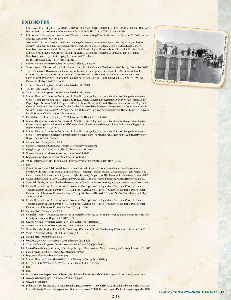
Opening of Derby Dam.
D-13
14 The Truckee Canal
47 http://www.fws.gov/stillwater/stillwater.html
48 www.manomet.org
49 Public Law 101-618; Sec. 206.
50 http://www.fws.gov/stillwater/stillwater.html
51 http://www.fws.gov/stillwater/stillwater.html
52 http://www.fws.gov/stillwater/stillwater.html
53 Nevada State Dairy Commission.
54 Norm Saake, retired waterfowl biologist, Nevada Department of Wildlife (35 years); wetlands consultant, email 7/28/2009.
55 Tony Lesperance, Director, Nevada Department of Agriculture, email 6/23/2099.
56 Harris, Thomas R. and Ashley Kerna, An Economic Description of the Agricultural Sectors in Churchill County, Technical Report UCED 2009/10-01, (University of Nevada, Reno: University Center for Economic Development, Department of Resource Economics, June 2009.), p. 17.
57 Harris, Thomas R. and Ashley Kerna, An Economic Description of the Agricultural Sectors in Churchill County, Technical Report UCED 2009/10-01, (University of Nevada, Reno: University Center for Economic Development, Department of Resource Economics, June 2009.), p. 2.
58 Harris, Thomas R. and Ashley Kerna, An Economic Description of the Agricultural Sectors in Churchill County, Technical Report UCED 2009/10-01, (University of Nevada, Reno: University Center for Economic Development, Department of Resource Economics, June 2009.), p. 1.
59 USDA Inspected (Custom-exempt processing); not a USDA Full Service plant.
60 Michael Hutiens, University of Illinois extension dairy specialist, “U.S. Dairy Consumption,” University of Illinois, Urbana, June 8, 2005.
61 Nevada Agricultural Statistics 2008, p. 22.
62 ibid, p. 8.
63 McPherson, E. Gregory, James R. Simpson, and Margaret Livingston, Effects of Three Landscape Treatments on Residential Energy and Water Use in Tucson, Arizona, “Energy and Buildings” 13(1989), 127-138.
64 Churchill County Comprehensive Annual Financial Report for year ended June 30, 2009.
65 http://minerals.state.nv.us/ogg_nvgeorespro.htm#ngr
66 David Overvold, Project Manager, TCID Office interview April 1, 2009.
67 Churchill County Tax Assessor’s Office. “Churchill County, Nevada Principal Property Tax Payers”.
68 Brad Goetsch, Churchill County Manager, interview April 2009.
69 Stephanie Tavares, “Full Steam Ahead,” Las Vegas Sun, April 17, 2009.
70 Daren Daters, Enel Stillwater, LLC, “Groundwater Monitoring Plan Associated With Churchill County SUP,” recorded by the Churchill County Recorder November 5, 2008.
71 NRS 704.7821 Establishment of portfolio standard; requirements; treatment of certain solar energy systems; portfolio energy credits; renewable energy contracts and energy efficiency contracts; exemptions; regulations.
72 http://www.blm.gov/pgdata/etc/medialib/blm/nv/minerals/geothermal.Par.75484.File.dat/200808_Geo_Sale_Results.pdf; http://www.blm.gov/pgdata/etc/medialib/blm/nv/minerals/geothermal.Par.31038.File.dat/090714_Geo_Sale_Notice.pdf
73 Bureau of Land Management, Nevada State Office, Geothermal Sale Results July 14, 2009
74 Hulse, James W., The Silver State: Nevada’s History Reinterpreted, (Reno: University of Nevada Press, 2004), p. 227.
75 Townley, John M., Turn This Water Into Gold: The Story of the Newlands Project. (Michigan: Braun-Brumfield, 1998), p. 11.
76 Churchill County Records, Miscellaneous, Book 9, page 291 - 292, Josiah J. Cushman and Elizabeth Cushman and the United States and its assignee.
77 Townley, John M., Turn This Water Into Gold: The Story of the Newlands Project, (Michigan: Braun-Brumfield, 1998), p. 24-26.
78 Townley, John M., Turn This Water Into Gold: The Story of the Newlands Project, (Michigan: Braun-Brumfield, 1998), p. 24.
79 Ibid., p. 28.
80 Division of Water Resources, “Nevada Water Law An overview” Tracy Taylor, P.E., State Engineer, http://water.nv.gov/.
81 Reproduction of poster; Townley, John M., Turn This Water Into Gold: The Story of the Newlands Project, (Michigan: Braun-Brumfield, 1998), p. 24.
82 United States of America v. Orr Water ditch Company, et al., 391 F.3d 1077, p. 10, (“1944 Orr Ditch Decree”).
83 Townley, John M., Turn This Water Into Gold: The Story of the Newlands Project, (Michigan: Braun-Brumfield, 1998), p. 46-47.
84 Townley, John M., Turn This Water Into Gold: The Story of the Newlands Reclamation Project, (Michigan: Braun-Brumfield, 1998), p. 48 and Truckee-Carson Irrigation Project.
85 Deed from the Donner Lake Company to SPPC and TCID as tenants-in-common, May 5, 1943 and Operating Agreement between SPPC and TCID May 5, 1943.
86 United States of America v. Orr Water Ditch Company, et al., 391 F.3d 1077, p. 10, 89.
87 Letter from United States Department of the Interior, Bureau of Reclamation to Lyman F. McConnell, Project Manager, Truckee-Carson Irrigation District, dated May 15, 1997.
88 Dave Overvold, TCID Project manager, interview September 30, 2009.
89 Davenport, James H., Nevada Water Law, (Las Vegas, Nevada: Colorado River Commission of Nevada, 2003), p. 41, citing Adams-McGill Co. v. Hendrix, 22 F. Supp. 789, 791 (D Nev. 1938).
90 NEVADA v. UNITED STATES, 463 U.S. 110 (1983) 463 U.S. 110 NEVADA .v. U.S.ET AL.CERTIORARI TO THE UNITED STATES COURT OF APPEALS FOR THE NINTH CURCUIT and Davenport, James H. Nevada Water Law, (Las Vegas, Nevada: Colorado River Commission of Nevada, 2003), p. 41, citing Adams-McGill Co. v. Hendrix, 22 F. Supp. 789, 791 (D Nev. 1938).
91 Davenport, James H., Nevada Water Law, (Las Vegas, Nevada: Colorado River Commission of Nevada, 2003), p. 41, citing Adams-McGill Co. v. Hendrix, 22 F. Supp. 789, 791 (D Nev. 1938).
92 United State Geological Survey Water Data charted by Truckee Carson Irrigation District.
93 U.S. District Court Lloyd George. 03:08-cv-00246-LDG-RAM, 03:08-cv-00621-LDG-RAM. 03:08-cv-00825-LDG-RAM, Interim Temporary restraining Order entered May 28, 2008, U.S. District Court, Reno, Nevada.
94 Harris, Thomas R., and Ashley Kerna, An Economic Description of the Agricultural Sectors in Churchill County, Technical Report UCED 2009/10-01, (University of Nevada, Reno: University Center for Economic Development, Department of Resource Economics, June 2009.), p. 10-11and Ed Rybold, CIV NAVFAC SW, PW Fallon, email May 9, 2009, 7:41 A.M.
95 United State Geological Survey Water Data charted by Truckee Carson Irrigation District.
Beef cattle.
Ph
oto
by
: So
ny
a Jo
hn
son
D-14
Water for a Sustainable Future 15
Truckee
Canal
Fernley
recharge
Hazen
recharge
Irrigation
Fernley
Wetlands
Fallon Churchill County
Paiute Shoshone
Tribe
NAS Fallon
Wetlands Power
Generation
Recreation
Agriculture
Aquifer recharge
Surface Water
Carson
River
Lahontan
Reservoir
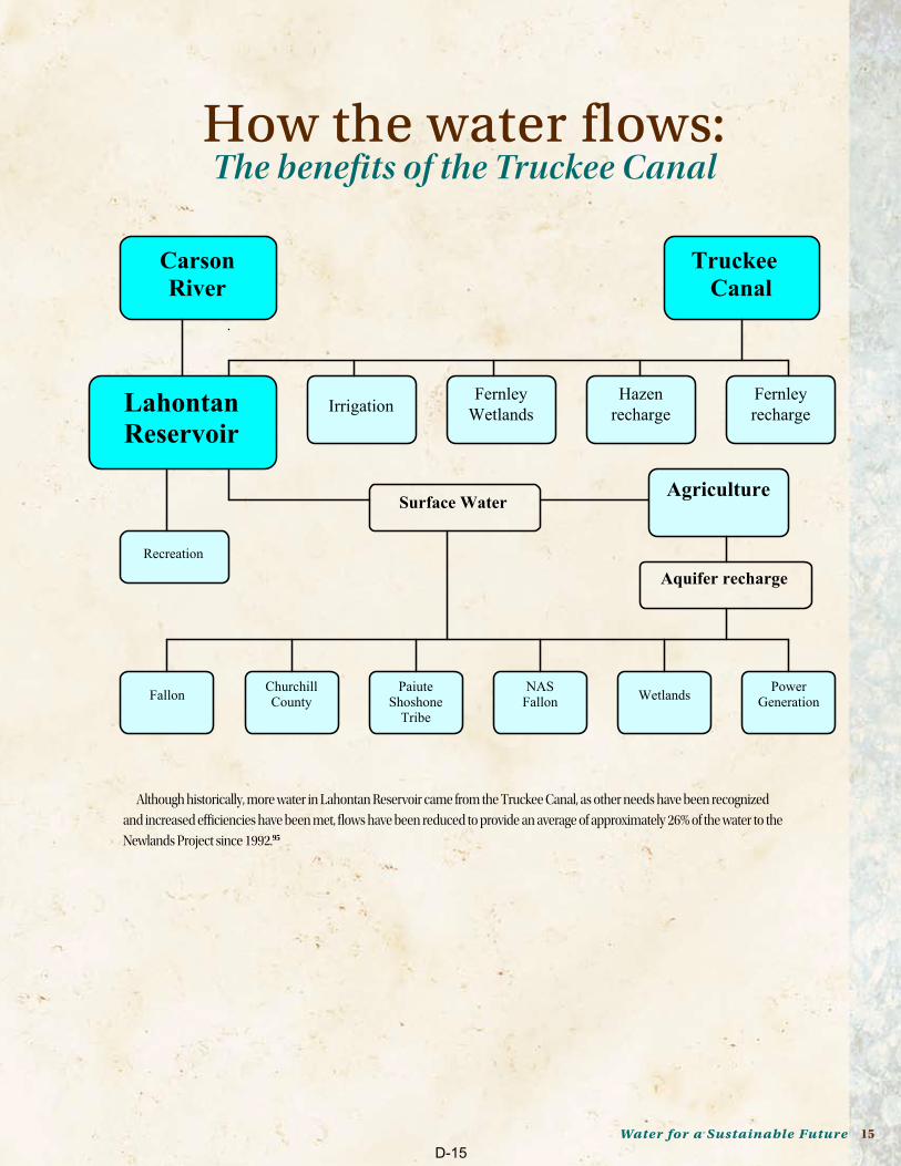
How the water flows:The benefits of the Truckee Canal
Although historically, more water in Lahontan Reservoir came from the Truckee Canal, as other needs have been recognized
and increased efficiencies have been met, flows have been reduced to provide an average of approximately 26% of the water to the
Newlands Project since 1992.95
D-15
ELECTED OFFICIALS AnD BUREAU OF RECLAMATIOn COnTACTSSenator Harry Reid522 Hart Senate Office BldgWashington, D.C. 20510202-224-3542Toll Free for Nevadans:1 866-SEN-REID (736-7343)
Senator John Ensign119 Russell Senate Bldg Washington DC, 20510 877-894-7711 or202-224-6244
Congressman Dean Heller400 S. Virginia St., Suite 502Reno, NV 89501775-686-5760202-225-6155
Donald R. GlaserBureau of Reclamation Regional DirectorMid Pacific Regional OfficeFederal Office Building2800 Cottage WaySacramento, CA 95825-1898916-978-5005
Kenneth ParrBureau of Reclamation Area ManagerLahontan Basin Area Office705 North Plaza StreetCarson City, NV 89701-4015775 -882-3436
Governor Jim GibbonsState Capitol101 N. Carson StreetCarson City, NV 89701775-684-5670
Gwen WashburnChairmanChurchill County Board of Commissioners155 N. Taylor Street, Ste 110Fallon, Nevada 89406775-423-4092
Mayor Ken Tedford55 W. Williams StreetFallon, Nevada 89406775-423-5104
Mayor LeRoy Goodman595 Silver Lace Blvd.Fernley, NV 89408775-784-9800
Phyllis HunewellChairmanLyon County Board of Commissioners27 So. Main StreetYerington, NV 89447775-463-6531
D-16