the palimpsest of parma - taubman college of...
TRANSCRIPT

THE PALIMPSEST OF PARMA

2 3
pa·limp·sestPronunciation: ‘pa-l&m(p)-”sest, p&-’lim(p)-Function: nounEtymology: Latin palimpsestus, from Greek palimpsEstos scraped again, from palin + psEn to rub, scrape; akin to Sanskrit psAti, babhasti he chewsDate: 18251 : writing material (as a parchment or tablet) used one or more times after earlier writing has been erased2 : something having usually diverse layers or aspects apparent beneath the surface
Parmigianno Regianno
2 3
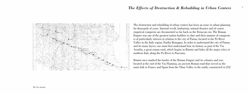
The destruction and rebuilding of urban centers has been an issue in urban planning for thousands of years. Internal revolt, barbarism, natural disaster and of course empirical conquests are documented as far back as the Etruscan era. The Roman Empire was one of the greatest nation builders to date and their manner of conquests is of particularly interest in relation to the city of Parma, located in the Po River Valley in the Italy region, Emilia Romagna. In order to understand the city of Parma and its many layers, one must first understand how its history as part of the Via Aemilia, a great roman road, which begins in Rimini and links all the major cities in northern Italy along the Po River to Piacenza.
Rimini once marked the border of the Roman Empire and its colonies and was located at the end of the Via Flaminia, an ancient Roman road that served as the main link to France and Spain from the Tibur Valley to the north, constructed in 212
The Via Aemilia
The Effects of Destruction & Rebuilding in Urban Centers
4 5
b.C. by Gaius Flaminius. An ancient tunnel, constructed in 70 A.D. to improve traffic to the north is still in use today.
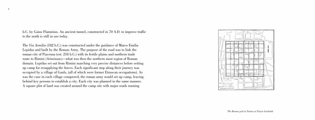
The Via Aemilia (182 b.C.) was constructed under the guidance of Marco Emilia Lepidus and built by the Roman Army. The purpose of the road was to link the roman city of Piacenza (est. 218 b.C.) with its fertile plains and northern trade route to Rimini (Ariminum)—what was then the northern most region of Roman domain. Lepidus set out from Rimini marching very precise distances before setting up camp for resupplying the forces. Each significant stop along their journey was occupied by a village of Gauls, (all of which were former Etruscan occupations). As was the case in each village conquered, the roman army would set up camp, leaving behind key persons to establish a city. Each city was planned in the same manner. A square plot of land was created around the camp site with major roads running
The Roman grid in Parma at Piazza Garibaldi
4 5
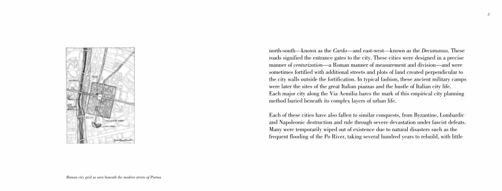
Roman city grid as seen beneath the modern streets of Parma
north-south—known as the Cardo—and east-west—known as the Decumanus. These roads signified the entrance gates to the city. These cities were designed in a precise manner of centurization—a Roman manner of measurement and division—and were sometimes fortified with additional streets and plots of land created perpendicular to the city walls outside the fortification. In typical fashion, these ancient military camps were later the sites of the great Italian piazzas and the hustle of Italian city life. Each major city along the Via Aemilia bares the mark of this empirical city planning method buried beneath its complex layers of urban life.
Each of these cities have also fallen to similar conquests, from Byzantine, Lombardic and Napoleonic destruction and rule through severe devastation under fascist defeats. Many were temporarily wiped out of existence due to natural disasters such as the frequent flooding of the Po River, taking several hundred years to rebuild, with little
6 7
or not trace of their history remaining except upon archaeological extraction.
Unlike the ancient cities of Pompeii and Ostia Antica (and perhaps Villa Adriana) all of these cities are thriving metropolis' currently contributing to Italian culture and commerce and are therefore of greater importance to modern research by the simple fact that we interact with their historical fabric on a daily basis.
The modern condition of these cities are a wealth of knowledge to archaeologists, architects, historians and planners. These cities are a layered manuscript of historical proportions. The manner in which cities have evolved over time due to destruction and rebuilding are very important to a better understanding of how people and cities react to tragedy and change and how the layers built up by the destructive and constructive process—the palimpsest—inform the current status of those cities.

6 7
Ostia Antica, near Lanzia Roman Baths at Villa Adriana, near Tivoli
8 9
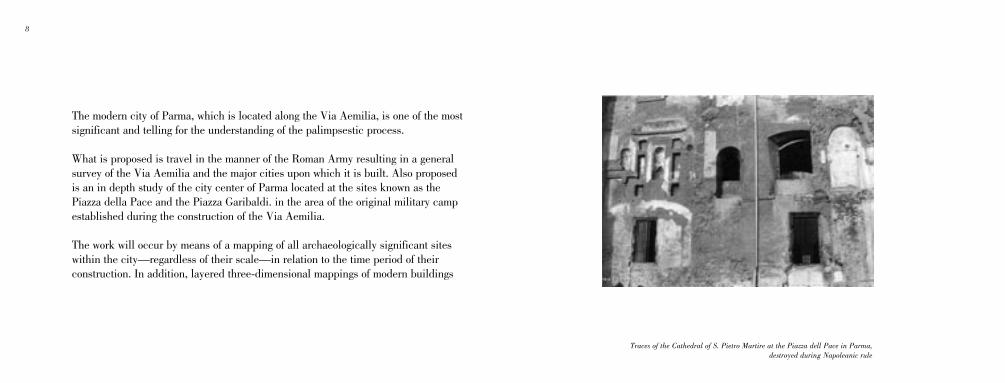
The modern city of Parma, which is located along the Via Aemilia, is one of the most significant and telling for the understanding of the palimpsestic process.
What is proposed is travel in the manner of the Roman Army resulting in a general survey of the Via Aemilia and the major cities upon which it is built. Also proposed is an in depth study of the city center of Parma located at the sites known as the Piazza della Pace and the Piazza Garibaldi. in the area of the original military camp established during the construction of the Via Aemilia.
The work will occur by means of a mapping of all archaeologically significant sites within the city—regardless of their scale—in relation to the time period of their construction. In addition, layered three-dimensional mappings of modern buildings
Traces of the Cathedral of S. Pietro Martire at the Piazza dell Pace in Parma, destroyed during Napoleanic rule

8 9
and their adjacencies to the archeological sites will be produced. Anthropological studies (i.e. discussions with citizens having daily interaction with the sites) and interviews with municipal and institutional officials will occur as well, to ascertain the relative importance and or awareness of the citizens on how the constant interaction with the overlapping modern and historical architecture and urban planning has shaped the city into what it is today.
10 11
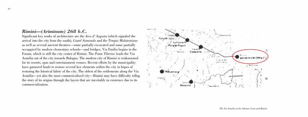
The Via Aemilia at the Adriatic Coast and Rimini
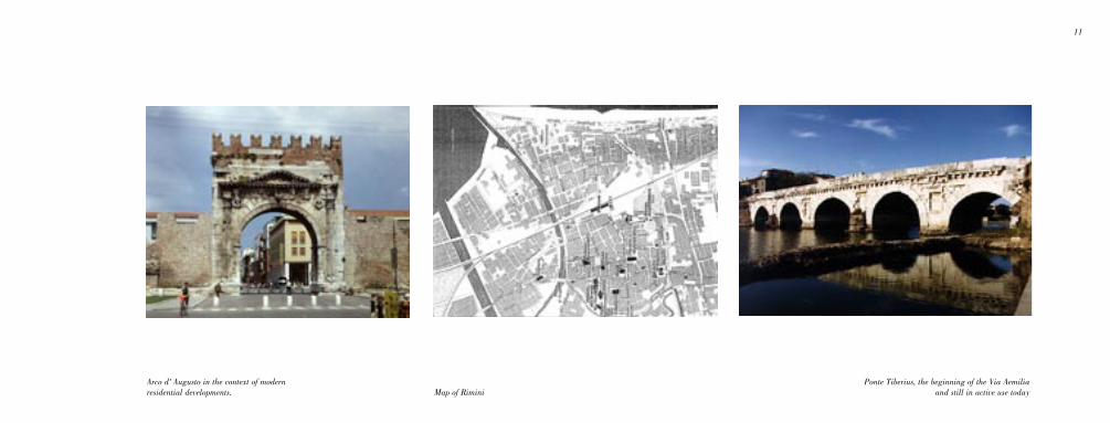
Rimini—(Ariminum) 268 b.C.Significant key works of architecture are the Arco d' Augusto (which signaled the arrival into the city from the south), Castel Sismondo and the Tempio Malatestiano as well as several ancient theatres—some partially excavated and some partially occuppied by modern elementary schools—and bridges. Via Emilia begins in the Forum, which is still the city center of Rimini. The Ponte Tiberius leads the Via Aemilia out of the city towards Bologna. The modern city of Rimini is renknowned for its resorts, spas and entertainment venues. Recent efforts by the municipality have garnered funds to restore several key elements within the city in hopes of restoring the hitorical fabric of the city. The oldest of the settlements along the Via Aemilia—yet also the most commericalised city—Rimini may have difficulty tellng the story of its origins through the layers that are inevitably in existence due to its commercialization.
10 11
Arco d' Augusto in the context of modern residential developments.
Ponte Tiberius, the beginning of the Via Aemilia and still in active use todayMap of Rimini
12 13
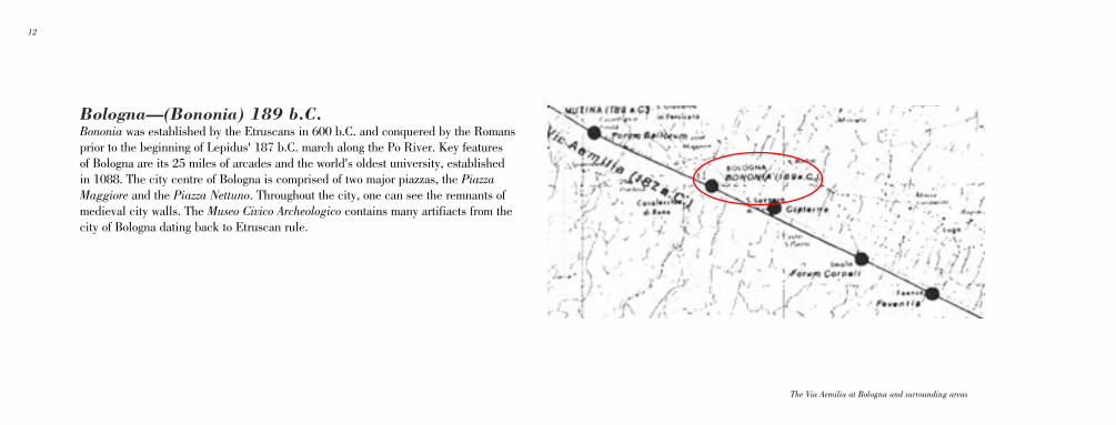
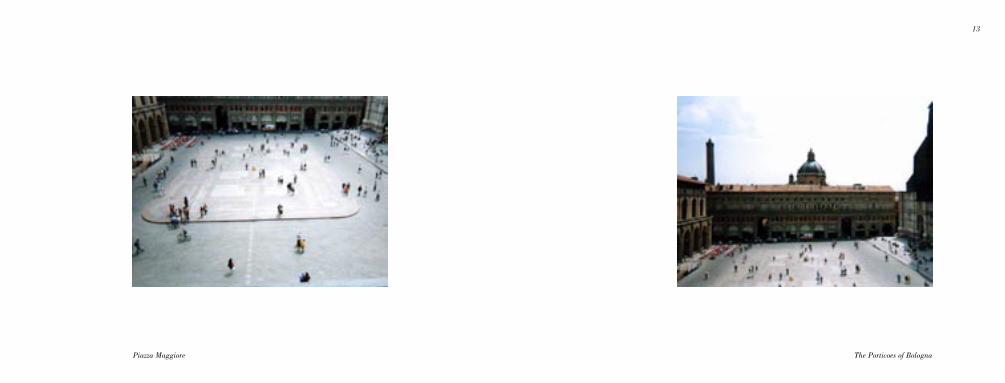
Bologna—(Bononia) 189 b.C.Bononia was established by the Etruscans in 600 b.C. and conquered by the Romans prior to the beginning of Lepidus' 187 b.C. march along the Po River. Key features of Bologna are its 25 miles of arcades and the world's oldest university, established in 1088. The city centre of Bologna is comprised of two major piazzas, the Piazza Maggiore and the Piazza Nettuno. Throughout the city, one can see the remnants of medieval city walls. The Museo Civico Archeologico contains many artifiacts from the city of Bologna dating back to Etruscan rule.
The Via Aemilia at Bologna and surrounding areas
12 13
The Porticoes of BolognaPiazza Maggiore
14 15
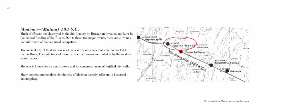
The Via Aemilia at Modena and surrounding areas
Modena—(Mutina) 183 b.C.Much of Mutina was destroyed in the 8th Century by Hungarian invasion and later by the natural flooding of the Rivers. Due to these two major events, there are currently no built traces of the empirical occupation.
The ancient city of Modena was made of a series of canals that were connected to the Po River, The only trace of these canals that remain are hinted at by the modern street names.
Modena is known for its many towers and its numerous layers of fortified city walls.
Many modern interventions dot the city of Modena directly adjacent to historical outcroppings.

14 15
Palazzo Ducale Porto St. Agostino, Frank O Gehry & Associates

16 17
Reggio Emilia—(Regium) 181 b.C.In 225, the city of Regium was destroyed by barbarian invasions. The main squares of the city are Piazza Prampolini and Piazza San Prospero.
The Via Aemilia at Erggio Emilia and surrounding cities

16 17
Piazza Prampolini Piazza San Prospero
18 19
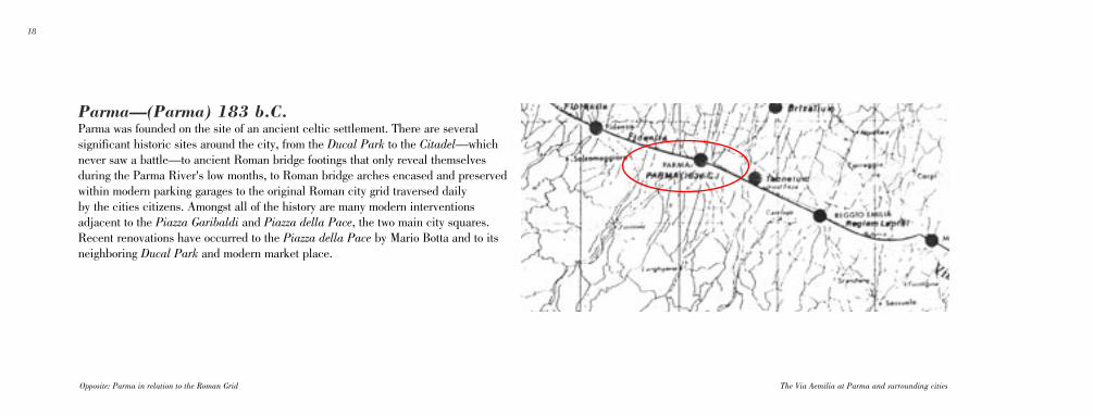
The Via Aemilia at Parma and surrounding cities
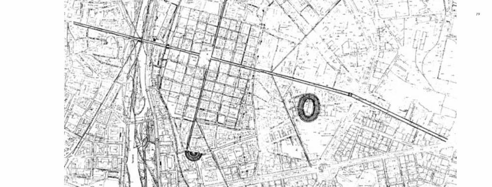
Parma—(Parma) 183 b.C.Parma was founded on the site of an ancient celtic settlement. There are several significant historic sites around the city, from the Ducal Park to the Citadel—which never saw a battle—to ancient Roman bridge footings that only reveal themselves during the Parma River's low months, to Roman bridge arches encased and preserved within modern parking garages to the original Roman city grid traversed daily by the cities citizens. Amongst all of the history are many modern interventions adjacent to the Piazza Garibaldi and Piazza della Pace, the two main city squares. Recent renovations have occurred to the Piazza della Pace by Mario Botta and to its neighboring Ducal Park and modern market place.
Opposite: Parma in relation to the Roman Grid
18 19
20 21
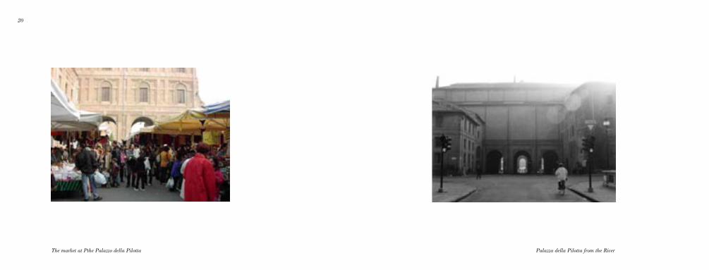
Palazza della Pilotta from the RiverThe market at Pthe Palazzo della Pilotta
20 21
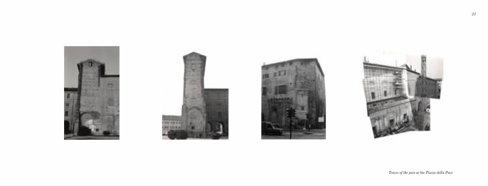
Traces of the past at hte Piazza della Pace
22 23
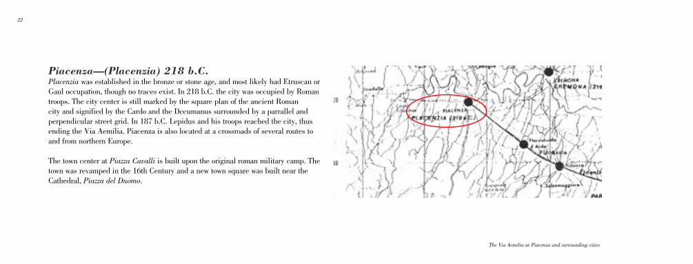
Piacenza—(Placenzia) 218 b.C.Placenzia was established in the bronze or stone age, and most likely had Etruscan or Gaul occupation, though no traces exist. In 218 b.C. the city was occupied by Roman troops. The city center is still marked by the square plan of the ancient Roman city and signified by the Cardo and the Decumanus surrounded by a parrallel and perpendicular street grid. In 187 b.C. Lepidus and his troops reached the city, thus ending the Via Aemilia. Piacenza is also located at a crossroads of several routes to and from northern Europe.
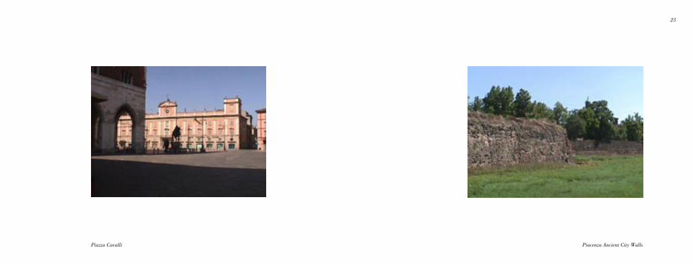
The town center at Piazza Cavalli is built upon the original roman military camp. The town was revamped in the 16th Century and a new town square was built near the Cathedral, Piazza del Duomo.
The Via Aemilia at Piacenza and surrounding cities
22 23
Piacenza Ancient City WallsPiazza Cavalli