the jones payne groupnoise mitigation consultants using dynamic websites for improved public...
Post on 20-Dec-2015
213 views
TRANSCRIPT

The Jones Payne GroupNoise Mitigation Consultants
Using Dynamic Websites for Improved Public Information
John DonoghueGIS Program Manager
AAAE Airport Noise Mitigation SymposiumOctober 10, 2007San Diego, CA

RSIP Public Information
Communities have little knowledge of Sound Insulation programs and process
Project coordinators are charged with Informing… Educating… Guiding and… Collaborating… with community members
throughout the project lifecycle

Information Dissemination
Traditional Methods Letters Postcards Phone calls Community meetings Newsletters Press releases

Information Dissemination
Project websites Provides an easy to update medium for
disseminating information Less costly than mailing and phone calls Provides room to explore more topics than
you can with print materials Typical home improvements Product choices Details on the process Up-to-date news Respond to ineligible community members

Typical Website Contents
Program Description Benefits Maps of affected areas Eligibility criteria Selection protocol Reports Sample documents Frequently Asked Questions (FAQs) Program news or announcements Noise terminology glossary
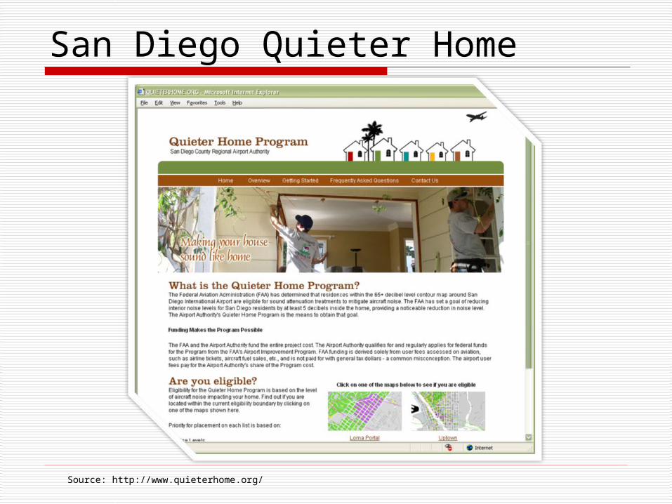
Source: http://www.quieterhome.org/
San Diego Quieter Home

Source: http://www.lawa.org/ResSoundproof.cfm
Los Angeles World Airports

Source: http://www.jonespayne.com/riac/index.html
Rhode Island Airport Commission

Metropolitan Airports Commission

Source: http://www.ohare.com/cnrc/ohare/ohareresidential.htm
Chicago O Hare

Making your site more useful to communities and homeowners

Have Specific FAQ Pages
Involve your consultant and community in building your FAQ pages Use your consultant’s experience to help
you craft answers to the most common RSIP related questions
Add specific community-related questions gathered from your initial meetings Reduces calls from homeowners who could not
attend the meeting Focuses on community concerns Ensures use of common terminology

Describe and Show Eligibility
Avoid using only language to describe eligibility It’s difficult for homeowners to visualize Homeowners will not know what or where a
65 dNL contour is, or how it affects them
Include maps to show which homes are located within each contour Homeowners don’t like filling out application
paperwork only to be told they are ineligible Ineligible homeowners are excluded from
mailings. If they can’t determine their eligibility on their own, they will call to ask

Employ Useful Maps
When publishing maps ensure that they are clearly understandable to a non-map oriented audience Not all people like or know how to use maps Consider combining the maps with a list of
addresses This also helps visually impaired viewers since
screen reading software cannot interpret maps
Use a simple map interface commonly known (most homeowners don’t know a what a parcel map is or how to read one)

Consider All Audiences
Consider impaired site visitors who are Color blind Completely or partially blind Suffering from dyslexia May not be able to read small text
Website content should be easily readable with a text to speech reader
Eligibility maps should compliment descriptive information not replace it
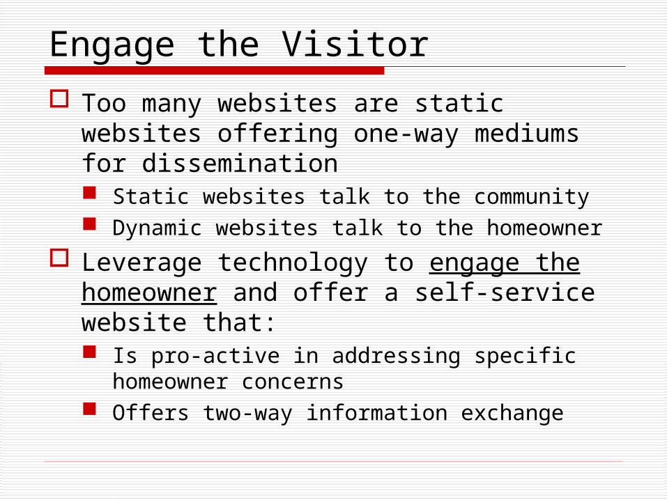
Engage the Visitor
Too many websites are static websites offering one-way mediums for dissemination Static websites talk to the community Dynamic websites talk to the homeowner
Leverage technology to engage the homeowner and offer a self-service website that: Is pro-active in addressing specific
homeowner concerns Offers two-way information exchange

Homeowner Self-Service
RSIP projects are long-term projects Homeowners get frustrated
Need to be reminded of the schedule Need to know what’s happening Need to be prepared for the next step
Frequent questions Am I eligible? Where am I in the process? What’s my status? What’s going to happen next? When?

Case Study: Bradley Intl. Airport
Airport surveyed many RSIP websites Collected the best of what they saw into
their request list that included: Detailed program information Mapping and dynamic eligibility lookup
Airport is handling homeowner calls and was very concerned about call volume
Excited about dynamic abilities but budget was limited Dynamic programming and mapping can be
expensive FAA was not willing to fund dynamic functions for
public use
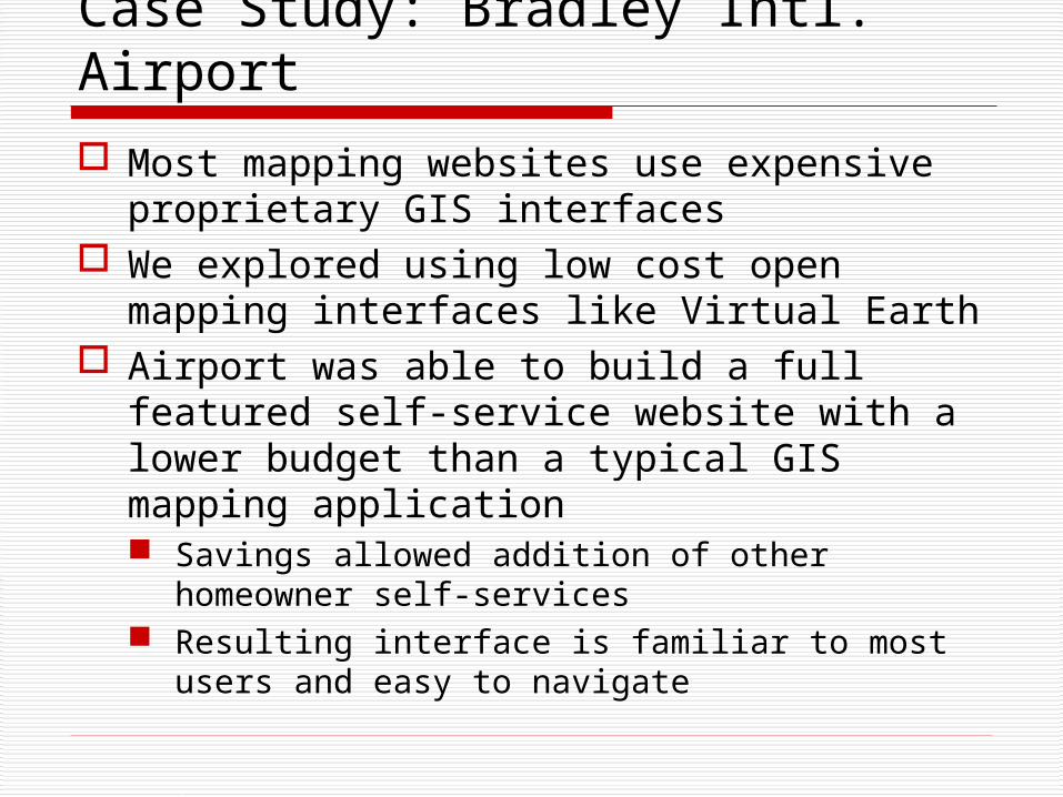
Case Study: Bradley Intl. Airport
Most mapping websites use expensive proprietary GIS interfaces
We explored using low cost open mapping interfaces like Virtual Earth
Airport was able to build a full featured self-service website with a lower budget than a typical GIS mapping application Savings allowed addition of other
homeowner self-services Resulting interface is familiar to most users
and easy to navigate

Case Study: Bradley Intl. Airport
Open mapping interface enables better homeowner response from airport Staff can quickly lookup an address and see
its location with respect to noise contours Provides detailed information for addresses
in the airport’s program database Provides location with respect to the noise
contours for addresses not in their database Allows homeowner to request verification if they
believe they are eligible Empowers the airport by reducing their need to call
consultants for clarification of address locations not in the system

Bradley Website Features
Website allows homeowners to Check their eligibility Obtain up-to-date status information for
each program milestone View a live map of their property location
with respect to noise contours Review and submit updated information on
their home Schedule appointments with project staff Ask questions, submit comments and rank
the suitability/helpfulness of page content

Bradley Website

Home Information
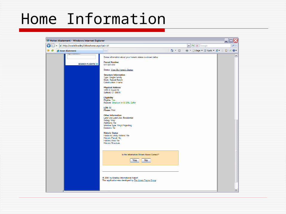
Home Information

Scheduling

Overview Map for Airport Staff

Other Interactive Features It is important to
engage homeowners and help them make the program website more useful
Add mechanisms for homeowners to provide feedback and suggest website improvements

Using Open Mapping Services
Criticism Aerial photography in open services is old:
Typical cut-off date for eligibility is 1998 Online services may miss new construction or land
use conversions, but they would be ineligible Lower data costs allows more homes to be treated
Custom aerial photography may cost $50K to $120K Proprietary GIS web services may cost $40k and up National average sound insulation cost is $24K
Address locations are not very accurate Geocoding of these services is improving Use GIS applications to create your own data and
use open source mapping services for visualization

Interactive Web Sites
Concerns Security
Making homeowners register and log in can turn them away and creates administrative work
Decide what information should be available publicly (i.e. address and eligibility)
More sensitive information can be sent by automated email for immediate answers, e-mail addresses can be requested during the application process
My community is not technology friendly Investigate your community’s ability to take
advantage of the Internet and tailor your investment accordingly

The Jones Payne GroupNoise Mitigation Consultants
Questions?
John DonoghueGIS Program ManagerThe Jones Payne Group - Geospatial Services Office
520.269.6601 x10 [email protected] www.jonespayne.com