the influence of sea-level changes on sea-bottom
TRANSCRIPT

65BULLETIN OF THE MARINE GEOLOGYVolume 26 No. 2, December 2011
THE INFLUENCE OF SEA-LEVEL CHANGES ON SEA-BOT TOM MORPHOLOGY OF SINGKAWANG WATERS WEST KALIMANTAN BASED ON ANALYSES OF BATHYMETRIC AND SEISMIC DATA
By:
Hananto Kurnio 1, Noor Cahyo Dwi Aryanto1 and Kumala Hardjawidjaksana 1
(Manuscript received 24-June-2010)
A B S T R A C T
In the history of Quaternary geology, global climate changes influenced worldwide sea-levelvariations. On this study, these phenomena are tried to be assessed through sea-bottommorphology changes using bathymetric and seismic strata box data obtained during field surveyin Singkawang Waters, West Kalimantan. Sea-level changes in this area are referred to globalvariations that had been studied by many researchers. Maximal depth attained duringbathymetry mapping was -52 meters which take place as a depression between Lemukutan andPenata Besar Islands. General depths are - 30 m; thus, morphology reconstruction was done forsea-level positions - 10 m, - 20 m, and - 30 m from mean sea level. At the study area, sea-leveldropped more than -30 m was only occurred in sea bottom morphology of isolated depressions.These isolated depressions are assumed as paleo-lakes which occurred throughout Sunda Land bysome authors.
The study also shows that sea-level history in Singkawang’s area span from approximately10,000 years ago or Holocene time to Recent. During low sea-levels, the sea-bottom morphologywas characterized by more extension of Singkawang land, formations of narrow straits betweenislands and developments of paleo-lakes assumed as fresh water lakes in the past. These events,based on Voris’s Diagram, occurred about 10,200 up to 8,300 years ago. On the other hand,marine clays appeared on coastal area of Singkawang. These might be evidence of sea-level rise inthis area. About + 5m sea-level rise flooded this area approximately 4,200 years ago.
Influences of sea-level changes to subbottom geological conditions were also assessed. Theassessment was carried out by analyzing shallow seismic reflection records by using strata box.The records demonstrated that subsurface geology were characterized by truncation reflectorconfigurations interpreted as fluvial environments.
Keywords : sea-level changes, sea-bottom morphology, bathymetry, strata box, SingkawangWaters, West Kalimantan.
1. Marine Geological Institute of Indonesia, Jl. Dr. Junjunan No.236 Bandung 40174

66 BULLETIN OF THE MARINE GEOLOGYVolume 26 No. 2, December 2011
S A R I
Dalam sejarah geologi Kuarter, perubahan iklim global mempengaruhi variasi permukaanlaut di seluruh dunia. Pada kajian ini fenomena tersebut dicoba dipelajari melalui perubahanmorfologi dasar laut menggunakan data batimetri dan seismik pantul dangkal yang diperolehselama survei lapangan di Perairan Singkawang, Kalimantan Barat. Perubahan muka laut didaerah ini mengacu pada variasi global yang telah dikaji oleh beberapa peneliti. Kedalamantertinggi yang diperoleh selama pemetaan batimetri adalah 52 meter, yaitu berupa suatu daerahdepresi antara Pulau Lemukutan dan Penata Besar. Umumnya kedalaman adalah -30 m;sehingga, rekonstruksi morfologi dilakukan pada posisi muka laut - 10 m, - 20 m, dan -30 m darimuka laut rata-rata. Di daerah kajian, muka laut turun lebih dari - 30 m hanya terjadi dalammorfologi dasar laut yang berupa daerah-daerah depresi yang terisolasi. Morfologi depresiterisolasi ini diduga sebagai danau purba oleh beberapa penulis yang terdapat pada DaratanSunda.
Kajian ini juga menunjukkan bahwa sejarah muka laut di daerah Singkawang mulai darisekitar 10.000 tahun lalu (Holosen) hingga saat ini (Resen). Selama turunnya muka laut,morfologi dasar laut dicirikan oleh semakin meluasnya daratan Singkawang, terbentuknyabeberapa selat sempit dan berkembangnya danau-danau purba yang diduga sebagai danau airtawar di masa lalu. Peristiwa tersebut, berdasarkan diagram umur terhadap muka laut Voris,terjadi sekitar 10.200 hingga 8.300 tahun lalu. Sementara itu, keterdapatan lempung endapanlaut dari data pemboran pantai di Singkawang merupakan bukti naiknya muka laut di daerahini. Kenaikan muka laut sekitar + 5 m telah menggenangi daerah ini kira-kira 4.200 tahun lalu.
Tulisan ini juga membahas tentang pengaruh perubahan muka laut terhadap kondisi geologibawah dasar laut. Kajian dilaksanakan dengan menganalisa rekaman seismik pantul dangkal.Rekaman menunjukkan bahwa geologi bawah dasar laut dicirikan oleh konfigurasi reflektor ’torehdan isi’ atau truncation yang ditafsirkan sebagai lingkungan fluvial.
Kata kunci : perubahan muka laut, morfologi dasar laut, batimetri, strata box, PerairanSingkawang, Kalimantan Barat.
INTRODUCTIONIssue on sea-level rise and fall related to
global climate change has been widelydiscussed currently due to its influence tocoastal zones, where most people lives. Studyon local scale of this issue had been conductedin Singkawang Waters, West Kalimantan.Detailed bathymetry and shallow seismicreflection data were used to examine sea-bottom morphology and subbottom geologicalconditions of this area, especially during seafalls.
Maximal bathymetry depth obtainedduring field survey was -52 meters. Thebathymetric contour pattern of this depth showas a depression area occured betweenLemukutan and Penata Besar islands. Ingeneral, maximum depth in the study area is
less than -30 m from mean sea level; whilemorphology reconstruction was done for sea-level positions -10m, -20m, and -30m.Overview of regional bathymetric data wasalso confirmed sea depth of the study area lessthan -30 m. Sea water depths more than 30 mat Singkawang Waters occurred in isolated andclosed bathymetric patterns interpreted asmorphology of depressions. These isolateddepressions are assumed by some authors aspaleo-lakes. According to Sathyamurthi andVoris (2006), this phenomenon occurredthroughout Sunda Land. Under sea bottom,recognition of sea-level changes was donethrough identifications of Quaternary marinesediment deposition and erosional truncationpatterns observed on shallow seismicreflection records.

67BULLETIN OF THE MARINE GEOLOGYVolume 26 No. 2, December 2011
According to Voris (2000), Quaternarysea-level changes, especially Pleistocene,resulted from study of retreat coastline. Thisevidence is recorded from coral reef terracesmigrations on tropical coasts or deviations ofisotope oxygen records. It is based on thestandard ratio 18O/16O in foraminifera shellsobtained from deep sea core samples. The sea-level changes were presented in a sea-levelestimation graph plotted against time in ka BPunits or thousand years before present (Figure1).
Many authors in Indonesia had alsoconducted research on the past sea-levelchanges. Yulianto and Sukapti (1998) studiedsea-level variations generated by climatechange through palynological data. Theyassumed that every climate alteration will giveimpact either directly or indirectly to flora orvegetation. Pollen fossils preserved insediments could be used to reconstruct paleo-vegetation community. While palynology
assessment in complete sedimentsequence could give records ofpaleo-vegetation community. Ithas various fluctuations at certaintime interval, which then this datais used to predict climate changethat occurred. Their results showthat before Holocene, earthtemperature immediately wasdecreasing as the last maximumglacial period. In Indian OceanQuaternary sediments of thisperiod is characterized byproportion abundances ofGraminae and Cyperaceaepollens. The abundances ofGraminae occured around 35,000up to 16,000 years ago, whichrelated to dry climate andextension of Sunda Shelf. Thisextension was arisen due tolowering of sea-level, causingSunda Land exposed. Palynology
study at paleo-delta of Mahakam was alsoconfirmed obvious increased of Graminaepollen approximately 18,000 years ago.Graminae domination, beside Cyperaceae andprairie taxa, is the most observablepalynological phenomena during the lastmaximum glacial period; especially formarine, transition and low land sedimentstudy.
Premonowati (1998) used reef elevationchanges to study sea-level fluctuations fromPaciran Formation at north coast of East Java.The assessment was based on ‘caliche’elevations and slope breaks of carbonate faciesof Paciran Formation, which reached highestelevation 157 m and lowest 12,5 m aboveRecent sea-level. Unfortunately, the age rangewas quite wide, 940,000 up to 5.4 millionyears ago. The age range is difficult to beapplied at the present study area ofSingkawang which only in thousand years.
Figure 1. Curve of sea-surface rise from 21,000 up to 4,200years ago used in this study. (Voris, 2000)

68 BULLETIN OF THE MARINE GEOLOGYVolume 26 No. 2, December 2011
Sea-level change which started at the lastmaximum glacial, approximately 21,000 yearsago, influenced to an area extension ofemerged Sunda Shelf. Figure 2 illustrates landarea changes at each sea-level -40m, - 30 m, -20 m and –10 m below present sea surface. Itis obvious that Sunda Land area and its paleo-river pattern adjusted to sea-level rise. Whilepaleo-coastline changes appeared as
termination of paleo-rivers. At sea level - 40m, most paleo-channels were drawn; while at -30 up to -10m Kalimantan, Sumatra and Javalands were already separated. Offshore area ofWest Kalimantan was characterized by twodistributary channels of paleo-North Sundariver, where the south distributary as acontinuation of present Kapuas River and the
Tambah gambar - 40 m (agar tata letaknyasimetris
Figure 2. Land mass condition of Sunda Shelfat sea-surfaces -30, -20 and -10 mbelow present sea-level (Voris, 2000).

69BULLETIN OF THE MARINE GEOLOGYVolume 26 No. 2, December 2011
other north assumed as a prolongation ofSingkawang River.
Hanebuth, et al (2000, in Sathiamurthyand Voris, 2006) gave descriptions of sea-levelrise stages between 21,000 up to 11,000 yearsago: Lowest Glacial Maximum (LGM)occurred at 21,000 years ago. Then, at 19,000years ago sea-level slowly rise from -116 mwith average velocity 0.10 m / 100 years until -114 m from present sea-level. Between 19,000and 14,600 years ago, sea-surface increasedfrom -114m able to -96 m at velocity 0,41 m /100 years. Sea-surface rise accelerated from14,600 until 14,300 years ago, started from -96up to -80 m at velocity 5.33 m / 100 years.This acceleration was associated with rapidpolar ice melt or polar melt water pulses.
In between 14,300 and 13,100 years ago,sea-surface increased from -80 until -64 mwith rate 1.33 m / 100 years. While between13,100 and 11,000 years ago, sea-levelincreased about 8 m in 700 years.
Sea-level rise at Holocene Epoch tookplace between 10,000 years ago until moderntime. Among 10,000 and 6,000 years ago, sea-level was rise from -51 until 0 m. Between6,000 and 4,200 years ago, sea-surfaceincreased from 0 to +5 m, known as a highsea-level of Mid-Holocene. At this level lowcoastal plains and deltas were drawn. Afterthis level, sea-surface gradually decrease andreached the modern surface about 1,000 yearsago.
In relation to tectonic activity, the SundaShelf generally is a stable tectonic area sinceEarly Tertiary. Nevertheless, Tjia, et al (1983in Sathyamurti and Voris, 2006) indicated thatsea-level rise in this area could be correlated toa combination of real sea-level rise andvertical plate movement.
The decreased Holocene sea-level inSunda Shelf gave impact to climate change,formation of land bridge between big islandsin Sunda land, major reconfigurations ofSunda river system, and greater separation of
Indian Ocean and South China Sea (Voris,2000; Sathiamurthy and Voris, 2006).
According to Steinke, et al (2003), basedon their study in South China Sea (SCS), theexposure of the Sunda Shelf at the last glacialmaximum (LGM) led to an increasedterrigenous input to the basin of up to 10 timeswhen sea level was -120 m lower. This wascaused by erosional processes on the emergedshelf and by centralized discharge of fluvialsediment via major river systems of NorthSunda River, onto the slopes and the deep sea.On the other hand, the subsequent rise of sealevel during LGM was paralleled by a markeddecrease of sediment supply to the continentalmargin and the deep sea due to a shift of thedepositional centers from shelf break andslope to proximal shelf seas. This kind ofproximal deposition take place in northernarea of Singkawang Waters, as this place is thelocation of sediment deposited fromKalimantan hinterland.
They also pointed out that temporal andspatial variations in the flux of terrigenoussediment from shelf margin down to the lowercontinental slope of the southern SCS inresponse to the morphological evolution on theSunda Shelf.
The study area, off Singkawang, belongsto Northern part of Sunda Shelf. This area wascharacterized by a paleo-river system of NorthSunda, the largest paleo-river system in theshelf, flowed to the north from northeasterncoasts of Sumatra (Indragiri, Batanghari andMusi rivers) to combine with big KapuasRiver from Kalimantan before entering thesea, at northeast of Natuna Island. Mostauthors agree with this North Sunda riversystem. At sea-level below 75 m from presentsea-surface (Figure 2), this river mixed somerivers of Kalimantan and Sumatra and largelyinfluenced the distribution of fresh waterfishes (Voris, 2000).
Each sea-level position at a certainlocation below present sea-surface, had its

70 BULLETIN OF THE MARINE GEOLOGYVolume 26 No. 2, December 2011
Figure 3. Research area in Sunda Shelf paleo-river map of Molengraff.
Table 1. Estimation of time amount for each sea-level interval at Pleistocene until Holocene started17,000 years ago (Voris, 2000).
Sea-level at or below cur-rent sea-level (m)
Estimation of year amount in each sea-level time period at or below present sea-surface (year)
Estimation of year amount percent-age at every time period (%)
120 1.000 6100 4.000 2475 5.500 3250 7.000 4140 7.500 4430 8.400 4920 9.200 5410 11.000 65

71BULLETIN OF THE MARINE GEOLOGYVolume 26 No. 2, December 2011
own time period, which differ its time durationfor every level. Voris (2000) made estimationof time amount started from 17,000 years agobased on changes of oxygen isotopesdeviations as shown in Table 1. It is clear thatthe largest percentage of year amount tookplace at sea-level -10 m from Recent sea-surface; while at maximum glacial -120 m, thepercentage of amount year is the lowest; thus,it is interpreted that time period for each levelis longer for sea-levels closed to present sea-surface.
METHODResearch method used in general was
marine geology and geophysics. Foursediment cores were collected by hand augerdrilling in order to recognize any evidence ofmarine deposits in coastal areas ofSingkawang. On the other hand, geophysicalmethod applied was a shallow seismicreflection system of strata box to assesssubsurface geological conditions.
For the purpose of sea-level change study,about 300 km length of seismic lines wasmade. This seismic was done in parallel withbathymetric mapping at an area of 1400 squarekilometers where two-third or approximately900 square kilometers is open sea.
Strata box is a water resistant underseabed high resolution seismic equipment,using low power and portable. This tool iscapable to identify sediment layers resolutionup to 6 cm with penetration reached 40 mbelow seabed and specially designed forcoastal survey up to 150 m sea depth whichoperating at 10 kHz frequency (Ocean DataEquipment Corporation, 2002).
Bathymetric map was used forreconstruction of sea-bottom morphology atsea-level dropped -10 m, - 20 m and – 30 m.Each level was determined its age in thousandyears before present (ka BP) using diagram ofFigure 1. This method was first developed bySathyamurthi and Voris (2006) to study sea-
bottom morphological change affected by sea-level variation in Sunda Land in age rangebetween 21,000 up to 4,200 years ago. Theseauthors used the curve to estimate the age ofeach sea-level position either above or belowRecent sea-level. Some assumptions weremade for the analyses; it is assumed thatpresent topographical and bathymetriccondition nearly closed to physiographiccondition 21,000 years ago. But, due tosedimentation and erosion had alreadyinfluence bathymetry of Sunda Shelf; thismethod is an only estimation. Thus, it shouldbe pointed out here that depths and geometryof Sunda Shelf and other submarinedepressions were not accurately described thepast.
RESULTSTopographical contour 5 m above present
mean sea-level was used as a based contour toshow the influence of sea-level rise atSingkawang’s coastal area (Figure 4). Coastalelevation was obtained from earthgoogleelevation data, at about 15 feet height or 5 mover Recent mean sea-level. At this level, mostof coastal area north of Singkawang City wasinundated; due to its physiographic conditionas an alluvial plain. On the other hand, theinfluence of sea-level rise at the middle coastalarea of study area was not so significant due tohigh relief morphology. This part wasconstructed by old, massive and resistancelithology of Raya Volcanics of UpperCretaceous and Sintang Intrusives of Oligo-Miocene age. At south of study area, theinundation area was quite significantobserving its alluvial plain extension. Suwarnaand Langford (1993) named lithology unitoccupied this sea-level rise inundation area asLittoral Deposit which consisted of mud, sand,gravel, locally calcareous and vegetationremnants.
Sea level rise was recorded by Yoshikawa(1987) based on 14 carbon dating of dead

72 BULLETIN OF THE MARINE GEOLOGYVolume 26 No. 2, December 2011
Figure 4. Singkawang's area at sea-level + 5 m from present sea-surface, approximately 4,200 yearsago. At that time Singkawang City was drawn. BT20, BT21, BT22 and BT23 are hand augerdrilling locations.

73BULLETIN OF THE MARINE GEOLOGYVolume 26 No. 2, December 2011
Figure 5. Hand auger data of the north and south of study area, locations on Figure 4, demonstratedmarine clay, as an evidence of sea-level rise in this area.
74 BULLETIN OF THE MARINE GEOLOGYVolume 26 No. 2, December 2011
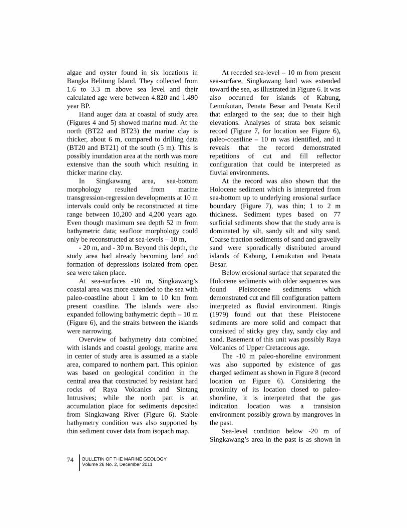
algae and oyster found in six locations inBangka Belitung Island. They collected from1.6 to 3.3 m above sea level and theircalculated age were between 4.820 and 1.490year BP.
Hand auger data at coastal of study area(Figures 4 and 5) showed marine mud. At thenorth (BT22 and BT23) the marine clay isthicker, about 6 m, compared to drilling data(BT20 and BT21) of the south (5 m). This ispossibly inundation area at the north was moreextensive than the south which resulting inthicker marine clay.
In Singkawang area, sea-bottommorphology resulted from marinetransgression-regression developments at 10 mintervals could only be reconstructed at timerange between 10,200 and 4,200 years ago.Even though maximum sea depth 52 m frombathymetric data; seafloor morphology couldonly be reconstructed at sea-levels – 10 m,
- 20 m, and - 30 m. Beyond this depth, thestudy area had already becoming land andformation of depressions isolated from opensea were taken place.
At sea-surfaces -10 m, Singkawang’scoastal area was more extended to the sea withpaleo-coastline about 1 km to 10 km frompresent coastline. The islands were alsoexpanded following bathymetric depth – 10 m(Figure 6), and the straits between the islandswere narrowing.
Overview of bathymetry data combinedwith islands and coastal geology, marine areain center of study area is assumed as a stablearea, compared to northern part. This opinionwas based on geological condition in thecentral area that constructed by resistant hardrocks of Raya Volcanics and SintangIntrusives; while the north part is anaccumulation place for sediments depositedfrom Singkawang River (Figure 6). Stablebathymetry condition was also supported bythin sediment cover data from isopach map.
At receded sea-level – 10 m from presentsea-surface, Singkawang land was extendedtoward the sea, as illustrated in Figure 6. It wasalso occurred for islands of Kabung,Lemukutan, Penata Besar and Penata Kecilthat enlarged to the sea; due to their highelevations. Analyses of strata box seismicrecord (Figure 7, for location see Figure 6),paleo-coastline – 10 m was identified, and itreveals that the record demonstratedrepetitions of cut and fill reflectorconfiguration that could be interpreted asfluvial environments.
At the record was also shown that theHolocene sediment which is interpreted fromsea-bottom up to underlying erosional surfaceboundary (Figure 7), was thin; 1 to 2 mthickness. Sediment types based on 77surficial sediments show that the study area isdominated by silt, sandy silt and silty sand.Coarse fraction sediments of sand and gravellysand were sporadically distributed aroundislands of Kabung, Lemukutan and PenataBesar.
Below erosional surface that separated theHolocene sediments with older sequences wasfound Pleistocene sediments whichdemonstrated cut and fill configuration patterninterpreted as fluvial environment. Ringis(1979) found out that these Pleistocenesediments are more solid and compact thatconsisted of sticky grey clay, sandy clay andsand. Basement of this unit was possibly RayaVolcanics of Upper Cretaceous age.
The -10 m paleo-shoreline environmentwas also supported by existence of gascharged sediment as shown in Figure 8 (recordlocation on Figure 6). Considering theproximity of its location closed to paleo-shoreline, it is interpreted that the gasindication location was a transisionenvironment possibly grown by mangroves inthe past.
Sea-level condition below -20 m ofSingkawang’s area in the past is as shown in

75BULLETIN OF THE MARINE GEOLOGYVolume 26 No. 2, December 2011
Figure 6. Singkawang area at sea-level below 10 m from present sea surface. Thick red contour wasassumed as paleo-shorelines which occurred approxi-mately 8,300 years ago. Area of stablegeology consisted of Upper Cretace-ous Raya Volcanics and Oligo-Miocene SintangIntrusives was delineated.

76 BULLETIN OF THE MARINE GEOLOGYVolume 26 No. 2, December 2011
Figure 8. Gas charged sediment indication around Batubelah Cape (record location on Figure 5). It isobvious that the indication is existed in Holocene sediment. It gave ‘pulling down effect’where the underlay sediments were not properly recorded due to reduce acoustic signalvelocity by gas absorp-tion. This environment was possibly a mangrove coastal area in thepast.
Figure 7. Repetition of distinct cut and fill reflector patterns of strata box seismic profile at the southof study area (see Figure 6 above for location) which reflects very intense fluvialsedimentation during Pleistocene. It seems that this phenome-non was taken place as aresponse of dropped sea-level many times. The -10 m paleo-shoreline is identified.

77BULLETIN OF THE MARINE GEOLOGYVolume 26 No. 2, December 2011
Figure 9. Singkawang’s area at sea-level -20 m from current sea-level. Paleo-coastlines formed closedbathymetry contours east and southeast of Kabung Island occurred as depressionsinterpreted as paleo-lakes; while Singkawang’s -20 m coastline relatively parallel to currentcoastline was moving further west. Narrower strait was also formed between Singkawang’spaleo-coastline and Penata Besar Island coastline which was also extended seawardfollowing sea-level dropped.

78 BULLETIN OF THE MARINE GEOLOGYVolume 26 No. 2, December 2011
Figure 9. The thick red lines in the east ofKabung and Penata Kecil islands form closedcontours which are interpreted as depressionsof maximum depths -28 m at the north and -30m at the south. These two depressions werepossibly fresh water lakes in the past(Sathyamurthi and Voris, 2006). On the otherhand, narrow straits were formed betweenpaleo-coastline of Singkawang’s land (SE partof Figure 10) and Penata Besar Island (NWpart of Figure 10). Between Lemukutan andPenata Besar islands, the strait reached -52 mdepth which is the deepest spot of study area.These straits were formed due to extension ofland and islands generated by -20 m seadropped, and this event was taken place about9,500 years ago.
The strata box record of Figure 10 alsoshows more intense erosional activity thansedimentation, especially at paleo-river valleysbelow sea-bottom. This phenomenon was alsosupported by thinner surficial sediments. Atthe figure, multiple of sea-bottom belowshows hard rock interpreted as part of RayaVolcanics of Upper Cretaceous.
Researchers at Exxon CompanyProduction Research (EPR) had done arevolutionary breakthrough using reflectionseismic profiles to identify sequences and thenused these sequences to estimate age andmagnitude of sea-level change in the past.Although continental margin stratigraphicrecords are complicated due to subsidencechanges, it is still possible to evaluatesubsidence history using method known as‘backstripping’. This method progressivelydisposed of influences of compaction,sediment loading, and thermal reduction; andleft behind an estimation of eustatic sea-level.Backstripping method also requiresinformation on age estimation, sediment type(for decompaction), and paleo – bathymetry(Kenneth, 2005) which usually are obtainedfrom benthic foraminifera and lithology data.These two data are great sources ofuncertainty. Thus, it is pointed out here thatalthough seismic record data was used bymany researchers to estimate sea-levelchanges in the past; it remains that itsuncertainty still huge as mentioned above. Theauthors try to discuss seismic record data as it
Figure 10. Strata box record show narrow strait between Singkawang’s land (SE) and Penata BesarIsland (NW) which reached sea depth more than 30 m. More active erosi-onal process thansedimentation was demonstrated by thin surficial sediment. The sea-bottom and its sub-surface geological conditions were not changed much during the past -20 m sea-leveldropped due to high resistance lithology of Raya Volcanics. The high resistance rock wasalso demonstrated by multiple feature of the strata box record. Record location at Figure 9.

79BULLETIN OF THE MARINE GEOLOGYVolume 26 No. 2, December 2011
Figu
re 1
1. T
wo
dim
ensi
onal
sea-
botto
m m
orph
olog
y of
a d
epre
ssio
n lo
cate
d ea
st o
f Kab
ung
Isla
nd fr
om st
rata
box
reco
rd (r
ecor
d lo
catio
n in
Fig
ure
9). A
gain
, thi
s re
cord
sho
ws
resi
stan
ce h
ard
rock
of
Sint
ang
Volc
anic
s of
Upp
er C
reta
ceou
s; n
o H
oloc
ene
sedi
men
t cou
ld b
e ob
serv
edhe
re; a
nd th
is c
ondi
tion
seem
s th
e sa
me
whe
n se
a-le
vel d
ropp
ed -2
0 m
abo
ut 9
,500
yea
rs a
go. S
ub-s
eabo
ttom
geo
logi
cal s
truct
ure
was
show
n by
rock
def
orm
atio
n an
d fo
ldin
g; h
ard
sea-
botto
m w
as a
lso
supp
orte
d by
mul
tiple
feat
ure
of st
rata
box
reco
rd.

80 BULLETIN OF THE MARINE GEOLOGYVolume 26 No. 2, December 2011
Figure 12. Singkawang’s area at sea-level dropped -30 m from current sea-level (about 10,200 years ago)which only left two depressions that possibly fresh water lakes located between Lemukutanand Penata Besar islands and between Penata Besar and Penata Kecil islands.

81BULLETIN OF THE MARINE GEOLOGYVolume 26 No. 2, December 2011
is, without further related it with sea-levelchanges.
Velocity of acoustic signal propagationused at strata box seismic system for media ofsea water and under sea bottom sediments arediffer. At sea water, assumption of the velocityused is 1,500 m/second; while for under seabottom sediments 1,600 m/second. Depthvalues displayed at right side of strata boxrecords are meant for water column, forsediments due to velocity difference; at waterdepth 10 m, calculated sediment thickness is9.375 m. For sea depth 20 m is comparablewith sediment thickness 18.750 m. Hard rockrequire another different acoustic signalvelocity greater than 1,600 m/second. Budhi etal (2001) used acoustic velocity 1,750 m/second to calculate thickness of coal-bearingsediments in South Kalimantan Waters. Byusing this value to calculate thickness of hardrocks of Raya Volcanics and Sintang Intrusivesin the study area, was obtained 8.571 m rockthickness comparable with 10 m water depth;and 17.143 m comparable to 20 m sea depth.Thus, it is obvious that depth values on theright side of strata box records were not
accurate to determine neither sediment norhard rock thicknesses; due to acoustic velocityof different media.
At sea-level decreased up to -30 m (Figure12), all the study area had became vast land,except a depression located betweenLemukutan and Penata Besar islands. Thisdepression morphology is assumed as a paleo-lake possibly filled with fresh water. Furthersea-level dropped until -50 m would not effectSingkawang’s area that already had becomepart of Kalimantan main land; only the paleo-lakes remained.
DISCUSSION Assumption used for delineations of
paleo-coastlines from bathymetry data ofSingkawang’s Waters at sea-levels dropped -10 m, -20 m and -30 m from current sea-surface seems only appropriate for middle partof the study area. This is based onconsideration that this part more stable due togeologically composed of compact and rigidold rocks of Upper Cretaceous Raya Volcanicsand Oligo-Miocene Sintang Intrusives.Another consideration is that in this part
Figure 13. Strata box record of a seismic line passing through north part of a depression formed betweenLemukutan and Penata Besar islands. Lowering sea-level up to -30 m was causing thedepression, assumed as a paleo- fresh water lake consi-Dering its closed bathymetry contourpattern, to become narrow. Hard rock sea-bottom condition of Raya Volcanics would come tointerpretation that morphology in the past remain the same as it is today.

82 BULLETIN OF THE MARINE GEOLOGYVolume 26 No. 2, December 2011
sedimentation is almost neglected, comparedto the northern part of Singkawang Rivermouth area. At the north due to very activesedimentation, morphological conditionsalways changed from 10,200 years ago.
Existence of depressions in the study areawithout outlet to open sea is interpreted asfresh water paleo-lakes. Sea-level changestudy by Sathyamurthi and Voris (2006) atSunda Shelf found out many depressions thatpossibly in the past were fresh water lakes,when Sunda Shelf becoming land.
Question on weather in the past theselakes filled with fresh water or salt waterdepend on what kind of sea-level changesaffected them. Is it generated by a sea-levelrise? If it is the case, then the lake in the pastpossibly filled with fresh water, because thedepressions belong to fluvial system of landenvironment. On the other hand, if the lakeswere resulted from sea-level retreat, then thebasins might be filled with salt water becauseit acted like trap. The authors believe that thedepressions were resulted from sea-level rise.
Analyses of strata box seismic records ofthe study area for sea-level change could notbe applied back-stripping method due to lacksupportive data such as compaction, sedimentloading, and thermal decrease. Otherparameters such as age estimation, sedimenttype (for decompaction) and paleo-water depthwere also could not be available.
Our study, valuable offshore mineralssuch as tin and gold were much trapped inunder seabed paleo-channels. These mostlyburied paleo-channels were controlled by sea-level changes. Thus, study of sea-levelvariation would be useful to understandoffshore mineral distribution especially placerminerals. It is already reported that offshore tinsurround Bangka, Belitung and Singkepislands were trapped in paleo-channels closedto granitic intrusive bodies.
CONCLUSIONS The reconstruction of sea-level change
from bathymetry data was done at positions -10 m, -20 m, and -30 m. Even thoughmaximum sea depth is 52 m; at more than -30m, almost all parts of the study area wasbecoming land and depressions isolated fromopen sea were also formed. These lower sea-level events, based on Sathiamurthy and Voris(2006) diagram, were taken place around8,300 up to 10,200 years ago. Therefore, sea-level changes affected the study area onlyduring Holocene time, approximately 10,000years ago until now. Reconstruction resultsfound out Singkawang’s land extension,formation of narrow straits between islands,and formation of depressions possibly freshwater lakes in the past.
Analyses of strata box records found outmany ‘cut and fill’ reflector configurationsinterpreted as fluvial environment when sea-level dropped from Recent position. On theother hand, sea-level rise above 5 m frompresent sea-level, occurred about 4,200 yearsago, is recorded as marine clay from handauger sample in the coastal area ofSingkawang which was inundated during thattime.
ACKNOWLEDGEMENTSThe authors would like to thank to Marine
Geological Institute management that trustedus to conduct mineral prospect research inSingkawang’s area West Kalimantan. Thankswere also given to all persons involve in thisstudy that could not all be mentioned.Discussions were appreciated and muchincreased our knowledge.
REFERENCES Budhi, A.S., Kusnida, D., Kurnio, H.,
Hardjawidjaksana, K., Sarmili, L.,Sukmana, N., Suhayat, Y.P. andPriohandono, Y.A., 2001, Offshore

83BULLETIN OF THE MARINE GEOLOGYVolume 26 No. 2, December 2011
Minerals and Aggregates of Indonesia.ESCAP. Guidelines and Practices inEvaluation and Development ofIndustrial Minerals and OffshoreAggregates in Asia. MineralConcentrations and HydrocarbonAccumulations in the ESCAP Region,Volume 12, United Nations, pp. 181-194.
Kenneth, K.G., 2005, Sea Level Change, Last250 Million Years, www.springer.com.
Ocean Data Equipment Corporation, 2002, amanual.
Premonowati, 1998, Identifikasi PerubahanTerumbu terhadap Fluktuasi Muka LautFormasi Paciran Daerah Jawa TimurUtara. Prosiding Pertemuan IlmiahXXVII, IAGI, Yogyakarta, 8-9Desember 1998, h. 2.37 – 2-44.
Ringis, J.C., 1979, Offshore GeophysicalSurveys for Tin in Southeast Asia.CCOP XVI/25, PP. 129-133.
Sathiamurthy, E. and Voris, H.K., 2006, Mapsof Holocene Sea Level Transgressionand Submerged Lakes on the SundaShelf. The Natural History Journal ofChulalongkorn University, Supplement2: 1-44, August 2006 Ó2006 byChulalongkorn University
Steinke, S., Kienast, M., Hanebuth, T., 2003,On the significance of sea-levelvariations and shelf paleo-morphology
in governing sedimentation in thesouthern South China Sea during thelast deglaciation. Marine Geology 201(2003), pp. 179-206.
Suwarna, N. dan Langford, R.P., 1993, PetaGeologi Lembar Singkawang,Kalimantan. Pusat Penelitian danPengembangan Geologi, terbit
Tim Mineral Singkawang, 2008, PenelitianKeterdapatan Kasiterit dan MineralIkutannya Perairan Singkawang danSekitarnya, Kalimantan Barat. LaporanPenelitian. Puslitbang GeologiKelautan, tidak terbit.
Voris, H.K., 2000, Maps of Pleistocene sealevels in Southeast Asia: shorelines,river systems and time durations.Journal of Biogeography, vol.27,pp.1153-1167.
Yoshikawa, T. (ed), 1987, Inventory ofQuarternary Shorelines : Pacific andIndian Oceans Region. Nodai ResearchInstitute – Tokyo University ofAgriculture. Tokyo, 130 p.
Yulianto, E., dan Sukapti, W.S., 1998,Perubahan Iklim selama RentangPlistosen Atas hingga Holosen diIndonesia berdasarkan Rekaman DataPalinologi. Prosiding Pertemuan IlmiahXXVII, IAGI, Yogyakarta, 8-9Desember 1998, h. 2.66 – 2-71.

84 BULLETIN OF THE MARINE GEOLOGYVolume 26 No. 2, December 2011