the flathead project - bureau of reclamation projects... · the flathead project ... bureau of...
TRANSCRIPT
The Flathead ProjectThe Indian Projects
Garrit VoggesserBureau of Reclamation
2001
1
Table of Contents
The Flathead Project . . . . . . . . . . . . . . . . . . . . . . . . . . . . . . . . . . . . . . . . . . . . . . . . . . . . . . . . . . . 2Introduction . . . . . . . . . . . . . . . . . . . . . . . . . . . . . . . . . . . . . . . . . . . . . . . . . . . . . . . . . . . . 2Project Location . . . . . . . . . . . . . . . . . . . . . . . . . . . . . . . . . . . . . . . . . . . . . . . . . . . . . . . . . 2Historic Setting . . . . . . . . . . . . . . . . . . . . . . . . . . . . . . . . . . . . . . . . . . . . . . . . . . . . . . . . . 4
Pre-Contact . . . . . . . . . . . . . . . . . . . . . . . . . . . . . . . . . . . . . . . . . . . . . . . . . . . . . . 4Post-Contact . . . . . . . . . . . . . . . . . . . . . . . . . . . . . . . . . . . . . . . . . . . . . . . . . . . . . . 6
Project Authorization . . . . . . . . . . . . . . . . . . . . . . . . . . . . . . . . . . . . . . . . . . . . . . . . . . . . . 9Construction History . . . . . . . . . . . . . . . . . . . . . . . . . . . . . . . . . . . . . . . . . . . . . . . . . . . . . 9
Reclamation Construction . . . . . . . . . . . . . . . . . . . . . . . . . . . . . . . . . . . . . . . . . . 10Jocko Division . . . . . . . . . . . . . . . . . . . . . . . . . . . . . . . . . . . . . . . . . . . . . . . . . . . 11Mission Division . . . . . . . . . . . . . . . . . . . . . . . . . . . . . . . . . . . . . . . . . . . . . . . . . 12Pablo Division . . . . . . . . . . . . . . . . . . . . . . . . . . . . . . . . . . . . . . . . . . . . . . . . . . . 13Post Division . . . . . . . . . . . . . . . . . . . . . . . . . . . . . . . . . . . . . . . . . . . . . . . . . . . . 16Polson Division . . . . . . . . . . . . . . . . . . . . . . . . . . . . . . . . . . . . . . . . . . . . . . . . . . 17Camas Division . . . . . . . . . . . . . . . . . . . . . . . . . . . . . . . . . . . . . . . . . . . . . . . . . . 19Irrigation and Crops . . . . . . . . . . . . . . . . . . . . . . . . . . . . . . . . . . . . . . . . . . . . . . . 21Summary Evaluation . . . . . . . . . . . . . . . . . . . . . . . . . . . . . . . . . . . . . . . . . . . . . . 23
Post-Construction . . . . . . . . . . . . . . . . . . . . . . . . . . . . . . . . . . . . . . . . . . . . . . . . . . . . . . . 23Construction By Indian Service and Completion . . . . . . . . . . . . . . . . . . . . . . . . 23
Settlement of Project Lands . . . . . . . . . . . . . . . . . . . . . . . . . . . . . . . . . . . . . . . . . . . . . . . 32Project Benefits and Use of Project Water . . . . . . . . . . . . . . . . . . . . . . . . . . . . . . . . . . . 33Conclusion . . . . . . . . . . . . . . . . . . . . . . . . . . . . . . . . . . . . . . . . . . . . . . . . . . . . . . . . . . . . 34
About the Author . . . . . . . . . . . . . . . . . . . . . . . . . . . . . . . . . . . . . . . . . . . . . . . . . . . . . . . . . . . . . 35
Bibliography . . . . . . . . . . . . . . . . . . . . . . . . . . . . . . . . . . . . . . . . . . . . . . . . . . . . . . . . . . . . . . . . 36Archival Collections . . . . . . . . . . . . . . . . . . . . . . . . . . . . . . . . . . . . . . . . . . . . . . . . . . . . 36Government Documents . . . . . . . . . . . . . . . . . . . . . . . . . . . . . . . . . . . . . . . . . . . . . . . . . 36Books . . . . . . . . . . . . . . . . . . . . . . . . . . . . . . . . . . . . . . . . . . . . . . . . . . . . . . . . . . . . . . . . 36Journal Articles and Websites . . . . . . . . . . . . . . . . . . . . . . . . . . . . . . . . . . . . . . . . . . . . . 37Unpublished Materials . . . . . . . . . . . . . . . . . . . . . . . . . . . . . . . . . . . . . . . . . . . . . . . . . . . 37
Index . . . . . . . . . . . . . . . . . . . . . . . . . . . . . . . . . . . . . . . . . . . . . . . . . . . . . . . . . . . . . . . . . . . . . . 38

1. For more information on the Indian Projects, see Garrit Voggesser, The Indian Projects Bureau ofReclamation History Program, Research on Historic Reclamation Projects (Denver, Colorado, 2001) and the otherindividual histories on the Blackfeet, Crow, Fort Peck, and San Carlos Projects.2. For the sake of simplicity, I will refer to the region of the Flathead Project as Montana prior to its becominga territory and a state.
2
The Flathead Project
Introduction
One of the most expansive and intricate of the Indian irrigation efforts, the Flathead
Project symbolizes the commitment of the Federal Government to bring water to reservation
lands.1 The region around Flathead Lake in northwest Montana had long-served as a locale
resplendent with natural resources, including fish, wildlife, forests, and the natural waterways
that served those features. A wide variety and number of peoples – Indian tribes, European and
Euro-American trappers and explorers – found the area to be a prime location for making a
living and as a place to call home. Yet, like so many other places in the arid West, it did not
always offer the absolute security needed for survival. The Flathead, Pend d’Oreille, and
Kootenai Indians migrated in, out, and around a wide stretch of Northern Montana and southern
Canada, gathering a variety of subsistence resources in different places at different times.2 By
their very nature, trappers and explorers moved through the area, constantly searching for new
opportunities. Once the federal government designated the Flathead Reservation as a permanent
settlement for the Indians of those environs, it also began to envision the need for a consistent
and controlled water supply to aid the tribes’ farming and ranching enterprises. In turn, Anglo-
American settlers quickly needed the same assurance. Accomplishing that feat would prove to
be a beneficial, though difficult and drawn-out process.
Project Location
Located in Flathead, Missoula, Lake, and Sanders counties of northwestern Montana, the
3. Original plans called for the irrigation of 150,000 acres.4. Department of the Interior, Bureau of Indian Affairs (BIA), Appendix to Flathead Irrigation ProjectCompletion Report: Agricultural Economy and Economic and Financial Analysis, February 1963, Records of theBureau of Indian Affairs, Record Group 75, National Archives and Records Administration–Rocky MountainRegion (Denver, Colorado), 1, hereafter all BIA material denoted as RG 75; Department of the Interior, UnitedStates Bureau of Reclamation, Flathead Project, Montana: Project History 1910, vol. 1, Records of the Bureau ofReclamation, Record Group 115, National Archives and Records Administration–Rocky Mountain Region (Denver,Colorado), 4, 27-33, 37, hereafter all project histories denoted by year and volume only; “Testimony of SharonBlackwell, Acting Deputy Commissioner of Indian Affairs, At the Hearing Before the Senate on Energy and NaturalResources, Subcomittee on Water and Power, Operation of the Flathead Irrigation Project in Montana, May 17,2000,” http://www.doi.gov/ocl/2000/flat.htm, accessed July 9, 2001.
3
Flathead Project supplies irrigation to approximately 127,000 acres of agricultural land.3
Reclamation officials classified the location as a semi-arid region based on the average of
fourteen inches of precipitation, which at the time of construction was the sixth lowest for any
state and nearly eighteen inches below the national average. The project area has an average
elevation of 2,950 feet and consists of five primary divisions: Camas, serving an area southeast
of Flathead Lake and including the communities of Lone Pine and Hot Springs; Mission,
comprised of land bound by mountains on the east, Post Creek on the north, a ridge of hills
separating it from the Jocko Valley on the south, and serving the community of St. Ignatius;
Jocko, including land lying along the Jocko River and servicing the towns of Arlee and Dixon;
Post, embodying an area between Post and Crow Creeks and the Flathead River, south of
Flathead Lake and north of the Jocko and Mission divisions, and serving the communities of
Charlo and Moise; and, Pablo, southwest of Flathead Lake, including a region lying west of Mud
Creek and east of the Flathead River, and providing water to the towns of Pablo, Ronan, and
Polson.4
The project now includes fifteen reservoirs and dams, over 1,300 miles of canal and
lateral systems, and over 10,000 minor structures for the diversion and control of the water
supply. The sources of water supply come primarily from: the Flathead, Jocko, and Little
Bitterroot Rivers; Mud, Crow, Post, Mission, Dry, Finley, Agency, Big Knife, Valley, and Fall

5. The information on water supply can be found in virtually every Reclamation annual report from the 7th tothe 21st, and in every project history. United States Department of the Interior, United States Bureau of Reclamation(United States Bureau of Reclamation), Eighth Annual Report of the Reclamation Service, 1908-1910 (Washington,D.C.: United States Government Printing Office , 1910), 92; Flathead Project History, 1911, vol. 6, 1; “Testimonyof Sharon Blackwell.”6. Flathead Project History, 1910, vol. 1, 2.
4
Creeks; and, as many as sixty other small streams. These waterways cover a drainage basin area
of approximately 8,000 square miles.5
Historic Setting
Pre-Contact
Indigenous peoples have inhabited a wide region surrounding Flathead Lake for
hundreds, if not thousands, of years. An abundance of streams, rivers, and lakes formed by
glacial moraines dotted the landscape. The water resources, combined with mountains, forests,
and vegetation offered abundant habitat for fish and a plentitude of wildlife. Three related, but
distinct, groups of native peoples inhabited this thriving environment. The historical experiences
of the Flathead, Pend d’Oreille, and Kootenai Indians merged and intertwined, but also diverged
based on specific cultural practices and migrational patterns.6
The course of the Kootenai (or Kootenay) River defined the territory of the Kootenai
Indians, determined their routes of travel, and dictated their subsistence practices. The
Kootenai’s “orientation to the river,” in essence, was the foundation of their culture. The river
valley, and thus the tribe’s environs, extended from the Columbia River in British Columbia,
Canada on the north, to the Kootenai Falls area north of Flathead Lake on the south, and
straddling the Rocky Mountains of Canada and Montana in the United States. For the tribe, the
river environment divided the year into just two seasons: winter and summer. The winter
climate determined a period of village occupancy, hunting and fishing at upriver locations, and
bison hunting east of the Rockies. Intensified fishing, communal deer drives, netting waterfowl,
7. Bill B. Brunton, “Kootenai,” in Deward E. Walker, Jr., ed., Plateau, vol. 12, in William C. Sturtevant, ed.,Handbook of North American Indians (Washington, D.C.: Smithsonian Institution, 1998), 223.8. Ibid., 224-5; John C. Ewers, Indian Life on the Upper Missouri (Norman: University of Oklahoma Press,1968), 4, 12, 159.
5
and the gathering of plant foods characterized summertime activities.7
The Kootenai most likely had their roots in the northern regions of what became Canada
and then gradually spread southward along the Rocky Mountain Trench and the Kootenai River.
Interestingly, as anthropologist Bill B. Brunton notes, one of the tribes’s origin myths described
them “paddling down the river” as the means of their entrance to the natural world. At one time,
another small band, the Plains Kootenai, inhabited the region west of the Rockies, but around
1730 fled the plains to escape bouts of smallpox and attacks by the Blackfeet. The Kootenai had
a characteristically “distant and hostile” relationship with other tribes, and their enemies
included the neighboring Salish (Flathead and Pend d’Oreille) and the Blackfeet. The
introduction of the horse dramatically exacerbated hostilities and precipitated intertribal conflicts
over bison.8
The domain of the Flathead and Pend d’Oreille overlapped to a wide extent. The
Flathead occupied an area north of the Yellowstone from the Bitterroot Mountain range to the
east side of the Rockies as far as present-day Billings, Montana. The Pend d’Oreille resided in an
area mostly west of the continental divide and along the Clark Fork River, a tributary of the
Columbia, in Montana, and their most important region of activity centered on the Flathead Lake
area. However, the environments of the two tribes were not fixed; they both ranged on both
sides of the divide and onto the adjoining Plains. The portions of the two tribes that lived east of
the Rockies utilized an “elaborate system” of drives, jumps, and corrals to hunt bison. The
introduction of the horse in the 1730s minimized the complexity of the system and rendered
communal drives over cliffs almost obsolete. Both tribes also hunted deer, moose, antelope,
9. Some Flatheads dispute their historical use of buffalo jumps, see Ewers, 159-60. Also, for a more in-depthhistorical discussion of the Flathead from pre-history through the allotment period, see John Fahey, The FlatheadIndians (Norman: University of Oklahoma Press, 1974). Carling I. Malouf, “Flathead and Pend d’Oreille,” inDeward E. Walker, Jr., ed., Plateau, vol. 12, in William C. Sturtevant, ed., 297-8; Michael P. Malone and Richard B.Roeder, Montana: A History of Two Centuries (Seattle: University of Washington Press, 1976), 11-2.10. Brunton, 232-3; Malouf, 305-6.
6
mountain goats, small game, and water fowl. Fish played a key role in Pend d’Oreille
subsistence practices, but had less significance for the Flathead. Plant foods played a substantial
role in the subsistence activities of the two tribes.9
Post-Contact
The lives of the Kootenai, Flathead and Pend d’Oreille began to converge on a more
frequent basis in the late-eighteenth century. All three tribes encountered Euro-Americans at
roughly the same time. The Kootenai first met with explorers around 1792, while the Flathead
and Pend d’Oreille ran across members of the Lewis and Clark expedition in 1805. More than
likely, the two tribes had come into contact with other Euro-Americans about the same time as
the Kootenai. However, as anthropologist Carling I. Malouf aptly remarks, other products of
Euro-American culture beat explorers to the Indians. Smallpox ravaged all three tribes between
1770 and 1805, reducing their populations by as much as 45 percent. The beginning of the
nineteenth century also witnessed the advent of the fur trade. The Hudson’s Bay and Northwest
companies brought new material goods to the tribes, but the Flathead and Pend d’Oreille, in
particular, showed little interest in the fur trade. The combination of disease, the fur trade, and
the increase in horses contributed to growing regional hostilities among the tribes, especially
with the dominant Blackfeet.10
The coming of the “white man” brought innumerable changes to the tribes. The impact
of diseases increased Indian contempt for whites, but the three tribes also looked to them as
allies against the Blackfeet. In the 1820s, an Indian named Shining Shirt prophesied that

7
“strange men in black robes” would soon arrive to teach the tribes a new religion. Fur traders
most likely carried Christianity, along with the other manifestations of Euro-American culture, to
the tribes prior to this time, encouraging a value system that would support the trading practices.
Between 1831 and 1839, the Flathead sent four delegations to St. Louis, Missouri in search of
the “Blackrobes,” believing that they could help to combat the effects of disease and warfare. In
1840, Father Pierre Jean de Smet, a Jesuit missionary, arrived and established the Saint Mary’s
Mission south of Fort Missoula along the Bitterroot River. His efforts conflicted with the needs
and goals of the Indians. The Flathead, specifically, wanted to broaden their spiritual power to
fight the Blackfeet, while the missionaries desired a complete conversion to Christianity and the
elimination of tribal religious practices. Due to its limited influence, the Blackrobes quickly
abandoned St. Mary’s. But in 1854, priests returned again to establish the St. Ignatius Mission,
which proved to have a lasting influence and place in the community. The Indians and the
missionaries cooperated to undertake the first irrigation efforts on the reservation. They diverted
water from Mission Creek to irrigate fruit trees and other crops, and to operate a saw and grist
mill.
Shortly thereafter, in 1855, Isaac Stevens, the governor and superintendent of Indian
Affairs for Washington Territory, convened negotiations for the Hell’s Gate Treaty with the
three tribes near present-day Missoula. Stevens primarily aspired to concentrate the Flathead,
Pend d’Oreille, and Kootenai on a single reservation of 1.28 million acres surrounding the St.
Ignatius Mission, and open the remaining lands to whites. Chief Victor refused to submit to the
demand for Flathead abandonment of the Bitterroot Valley. To combat that denial, Stevens
inserted “complex language” into the treaty to determine a place “better suited” to the Flathead
needs, but mainly confused the negotiations. The subsequent Judith River Treaty of October
11. For a more extensive discussion of Indian removal and the initial white settlement of of the region, seeMalone and Roeder. Brunton, 233; Malouf, 306; Flathead Project History, 1910, vol. 1, 6-7; Malone and Roeder,87-9.12. Malouf, 307-8; Flathead Project History, 1910, vol. 1, 7-8; Malone and Roeder, 92-3.
8
1855 defined the buffalo hunting grounds for the tribes east of the mountains. The complexity
and ambiguity of the treaties that seemed like shady dealings to the tribes established an
enduring animosity with whites over the land in and surrounding the Bitterroot Valley.11
During the first gold rushes to Montana in 1864, whites began to settle lands in the region
and began to farm in order to take part in the lucrative business of supplying mining camps with
goods. The tribes took issue with the settlement and Chief Victor demanded the removal of the
whites, but federal officials ignored their wishes and forcibly moved many of the last Flathead
holdouts to the reservation in 1871. From there, the relationship only worsened. In 1872, an
official delegation led by James Garfield went to the Bitterroot Valley to remove the remaining
Indians, but they continued to refuse. According to many accounts, the federal party then forged
Chief Charlot’s (Flathead), the successor of Victor, mark on the treaties, and Congress ratified
them, appropriating a payment of $50,000 for “improvements” made by the Indians in the valley.
In 1883, despite the exposure of the counterfeit signature, two sub-chiefs (Arlee and Ninepipes)
signed the treaties, and over the protest of Charlot, designated Arlee as the federally recognized
head chief. In the proceeding years, the virtual demise of the buffalo, the coming of the
Northern Pacific Railroad and its branches that passed through the reservation bringing a flood
of settlers, and disagreements over appropriations for removal weakened the resolve of Charlot
’s band. In October 1891, federal troops force-marched the Indians north to the reservation.
Between 1895 and 1901, Charlot, Chief Isaac (Kootenai), and their followers continued to resist
white encroachment and the efforts of the state of Montana and the Federal Government to cede
reservation lands, but ultimately to little avail.12
13. Brunton, 234; Malouf, 308-9.14. Department of the Interior, United States Bureau of Reclamation, Seventh Annual Report of theReclamation Service, 1907-1908 (Washington, D.C.: Government Printing Office, 1908), 7-8, 100; Department ofthe Interior, “Irrigation of Indian Lands,” in Federal Reclamation and Related Laws, vol. 1 (Washington, D.C.:Government Printing Office, 1972), 128.
9
In the meantime, the tribes managed to maintain religious and cultural practices,
language, and establish family farms and cattle operations, but the Flathead Allotment Act of
1904 dealt a serious blow to the “hard-won stability.” Even though the Indians resisted
allotment, federal pressure gradually managed to break up communities and scattered tribal
members across the reservation on individual plots of land. The Flathead Irrigation Act of 1908
added considerable strain to communal ties, and with its provisions for settlement, whites poured
into the Jocko, Mission, and other valleys of the reservation. In 1909, the federal government
expropriated 18,000 acres of the reservation for the National Bison Range. The protection of the
animals served as a lingering tribute to the tribes’ past, but the bison reservation also signaled the
limitations of the future.13
Project Authorization
Two separate acts authorized construction of the Flathead Project. The act of April 23,
1904, supplied the foundation for the project, providing for the distribution and irrigation of
Indian allotments, and the sale of all “surplus” lands. By act of April 30, 1908, Congress
authorized $50,000 for the survey, plans, cost estimates, and construction of irrigation systems
on all lands of the reservation. In essence, the second act added irrigation for white settlers on
unallotted lands to the plans for Indians. Although the act of 1908 provided that “no lien or
charge for construction, operation, or maintenance shall thereby be created against any such
reserved lands [allotments],” the act of 1904 stipulated that reimbursement for the entire project
would come from the sale of reservation, and thus Indian, land.14
Construction History
15. The information on the project is often duplicated in Reclamation annual reports and the project histories,however, the histories provide more extensive analysis. Seventh Annual Report, 100-1; Eighth Annual Report, 92-3;Flathead Project History, 1910, vol. 1, 1-2.
10
Reclamation Construction
A long and contested history characterized the construction of the Flathead Irrigation
Project (Flathead). Although Reclamation began reconnaissance surveys in 1907 and actual
work commenced in the summer of 1908, the project lasted a span of almost fifty-six years until
the time of completion in the early-1960s. Several factors contributed to this drawn-out process.
Congress, fairly consistently, appropriated substantial sums for Flathead, but sometimes the level
simply did not match the expansive amounts needed to make quick progress on the large project.
Its immense size also required a considerable labor force that did not always meet with
expectations. The 130,000 acres, or 150,000 depending on the source, that federal officials
intended to irrigate was not extraordinarily huge, but the topographic features of the area–rugged
mountains and valleys, numerous waterways diverse in size, and a large amount of natural
lakes–made the project a reclamation challenge.15
The challenges did not stop there. Even though work on the project started with
agreements of cooperation between Reclamation and the Indian Service, troubles quickly arose
While the arrangement simply called for the Indian Service to handle the money and
Reclamation the plans and construction, both roles supplied a large enough measure of control to
make the relationship a dangerous one. The two bureaus continuously bickered about the scope
of Flathead and who it was being built for–Indians or whites. The inter-bureau rivalry did not
always hamper construction, but often cast a negative shadow over the project. The attitude
generated by this conflict exasperated successive Interior Secretaries and muddled the decision-
making process. In 1924, the problems came to a head when Hubert Work transferred the
16. Flathead Project History, 1910, vol. 1, 13; “Operation of Projects Transferred,” Reclamation Record 15,no. 1 (1924), 131.17. See page 9 for a description of the areas these divisions encompassed. Polson became a part of the Pablodivision, Big Arm a part of Mission, the Little Bitterroot a part of Camas, and the Crow a part of the Post. However,over the years, the names and number of divisions fluctuated.18. Flathead Project History, 1910, vol. 1, 14-6, 21, 27-37; Flathead Project History, 1911, vol. 6, 1-3;Flathead Project History, 1910, vol. 4, 67-82.
11
project back to the Indian Service. In spite of the tensions, between 1908 and 1924, Reclamation
made considerable progress on the Flathead Project that ultimately benefitted a sizable number
of farmers and ranchers.16
In 1907, project engineers surmised that the project could irrigate 57,000 acres by two
pumping plants on the Flathead River, 53,000 acres in the Mission Valley by gravity canals, and
11,500 acres in the Jocko Valley by gravity canals at total cost of close to $3 million. Following
that advice, Congress appropriated $50,000 for surveys and the commencement of work.
Reclamation made investigations for fifteen reservoirs and sixteen dams–two on Flathead
Lake–with a total capacity of 153,584 acre-feet and divided the project into nine divisions:
Jocko, Mission, Post, Crow, Pablo, Polson, Little Bitterroot, Big Arm, and Camas. The Polson,
Little Bitterroot, Big Arm, and Crow divisions were later absorbed into the other divisions.17
Plans also included a power plant at Newell Dam situated on the south side of Flathead Lake and
at the head of Rocky Canyon. Between October 1909 and November 1910, Reclamation made
ninety-three separate water filings on lakes, rivers, creeks, and streams for utilization in the
project.18
Jocko Division
Reclamation selected tracts of land in the Jocko Division for the first areas of
development. The system diverted all water from rivers and streams and thus the division
required no major features. In 1908, work began by government force on canals and laterals for
diverting water from the Jocko River, and by early 1910, they supplied water to nearly 8,000

19. Eighth Annual Report, 93; Department of the Interior, United States Bureau of Reclamation, Ninth AnnualReport of the Reclamation Service, 1909-1910 (Washington, D.C.: Government Printing Office, 1911), 144;Department of the Interior, United States Bureau of Reclamation, Tenth Annual Report of the Reclamation Service,1910-1911 (Washington, D.C.: Government Printing Office, 1912), 124-5; Department of the Interior, United StatesBureau of Reclamation, Eleventh Annual Report of the Reclamation Service, 1911-1912 (Washington, D.C.:Government Printing Office, 1913), 96; Department of the Interior, United States Bureau of Reclamation, FifteenthAnnual Report of the Reclamation Service, 1915-1916 (Washington, D.C.: Government Printing Office, 1916), 560.20. The Mission Division absorbed Big Arm Division.21. Eighth Annual Report, 93; Ninth Annual Report, 144; Tenth Annual Report, 122; Department of theInterior, United States Bureau of Reclamation, Sixteenth Annual Report of the Reclamation Service, 1916-1917(Washington, D.C.: Government Printing Office, 1917), 372; Department of the Interior, United States Bureau of
(continued...)
12
acres of irrigable land. That summer work was completed on a new canal from Big Knife Creek
and work began on further extensions of the canal system from Valley and Revais Creeks. In
1911, government forces built the Finley Creek System, including twenty miles of ditches to
cover an additional 4,500 acres on the south side of Jocko River and taking water from Finley
Creek. Five years later, Reclamation contracted work for building additional minor structures
and covering another 5,000 acres. Reclamation conducted no further work on the division.19
Mission Division
In 1908, work also began in the Mission Division on the construction of a canal heading
on Mission Creek and other canals that were completed in 1909 to irrigate 5,000 acres.20
Reclamation planned the construction of four reservoirs for the division: McConnell, with an
area of 100 acres and a capacity of 2,000 acre-feet; Mission, with an area of 300 acres and a
capacity of 3,300 acre-feet; Tabor (St. Mary) with an area of 300 acres and a 16,000 acre-feet
capacity; and, Crow (Lower Crow Creek), a 300-acre reservoir with a capacity of 6,000 acre-
feet. Due to work in other divisions, the Mission reservoirs received little attention for several
years. In August 1916, work began on Tabor Reservoir and in the next two years Reclamation
and contract workers completed a 1,400 foot tunnel and the reservoir for 12,500 acre-feet
capacity. During its tenure on the project, Reclamation never worked on McConnell, Mission, or
Crow dams and reservoirs.21
21. (...continued)Reclamation, Seventeenth Annual Report of the Reclamation Service, 1917-1918 (Washington, D.C.: GovernmentPrinting Office, 1918), 421.22. Ninth Annual Report, 144-5; Tenth Annual Report, 123-5; Flathead Project History, 1911, vol. 6, 18.
13
Pablo Division
In 1909, construction began on the Pablo division. Initial plans for the division included
the Pablo Reservoir with an area of 2,100 acres and a capacity of 29,600 acre-feet impounded by
an earthfill dam. Workers used a steam shovel to begin the excavation of the Pablo Feeder
Canal, a twelve-mile, 300-second-foot canal from Crow Creek to supply Pablo Reservoir with
plans to extend the canal another twelve miles to draw water for storage from Post Creek. After
extensive pit testing, engineers concluded that a deep bed of gravel underlay the original line for
the Pablo Reservoir and Dam, making the proposed location unsafe for the storage of water.
Further testing revealed that dense material existed below the southern portion of the original
storage basin. They decided that a storage capacity nearly equal to the original plan could be
obtained by constructing three reservoirs connected by stretches of canal. By 1910, Reclamation
had completed 10 ½ miles of the feeder canal, including a system of laterals covering 4,500 acres
of land below the sites of the Pablo reservoirs.22
In light of the new complexities and the volume of work on other divisions, Reclamation
decided to contract work on North Pablo Dam and on portions of the middle and south dams.
Bids opened on August 25, 1911, and Reclamation awarded the work to Nelson Rich Company
of Prosser, Washington. The company’s crews and subcontractors began work on the dams on
October 1, 1911. In the first half of 1912, government crews completed 28 of the proposed 29
miles of the Pablo Feeder canal, including the final stretch from Post Creek to North Pablo
Reservoir and concrete headgates and wasteways at Mud, North, Crow, South Crow, and Post
Creeks. Nelson Rich built the controlling works for North and South Pablo Dams, portions of
23. Eleventh Annual Report, 95-6; Flathead Project History, 1911, 18, 53; Flathead Project History, 1912, 67-9.
14
the supply canals between the reservoirs, and over eight miles of laterals. Despite the advances
made, not everything ran smoothly. Reclamation officials remarked that the company’s choices
had not exhibited good judgement in planning for work and lacked balance between work on
excavation and the transportation of quarried materials. C.B. Long, the head Reclamation
engineer for that portion of the project, accused Nelson Rich of “repeated attempts to slight
work.” He criticized the company for a lack of experience and foresight in constructing dams
that resulted in an ignorance of the results “necessary and of the means to secure them.”
Unfortunately, because Reclamation officials had made the decision to award the contract to
Nelson Rich they could not lay the full blame on the contractor.23
The problems did not end there. In April 1913, Nelson Rich placed 21,376 cubic yards of
paving on the South Pablo Dam “in gross violation of the specifications” defined by Reclamation
engineers. Reclamation required the company to remove the “rejected work,” later complaining
that “great care was necessary to prevent the contractor from serious violation of the
specifications and he [Nelson Rich] continued his erratic attempts until the last hour’s work...on
the dam.” The unfortunate choice of contractor, the resulting subterfuge, and the removal and
correction of the faulty paving cost a large amount of time and $8,200.76, not a small sum for
project of that time. Despite the difficulties, Reclamation crews and the contractors completed
distribution systems covering 4,000 acres below (south) the dams, and 1,000 acres under the
Pablo Feeder Canal and Polson Slope. On November 3, 1913, Reclamation awarded work on the
paving of South Pablo Dam and portions of the work on canals and laterals to Wilson Brothers of
Vandalia, Montana. During the winter of 1913-1914, workers placed 5,700 square feet of paving
24. Department of the Interior, United States Bureau of Reclamation, Twelfth Annual Report of the ReclamationService, 1912-1913 (Washington, D.C.: Government Printing Office, 1914), 114; Flathead Project History, 1913,vol. 13, 123-5, 128.25. Department of the Interior, United States Bureau of Reclamation, Thirteenth Annual Report of theReclamation Service, 1913-1914 (Washington, D.C.: Government Printing Office, 1915), 136; Flathead ProjectHistory, 1915, vol. 16, 10, 61-2.
15
on the Pablo dams and finished them to hold 5,000 acre-feet of storage.24
Reclamation had big plans for the Pablo Division, but time was not on their side. In
1914, contractors and government forces managed to complete additional paving on South Pablo
Dam to increase its capacity to 2,000 acre-feet. Regrettably, they only managed to finish a small
amount of the canal and sublateral distribution systems. By early-1915, Wilson Brothers
dispatched the rest of the paving on the south dam.. On March 22, tired of waiting for water,
residents west of the Pablo Reservoirs requested permission to build canals to irrigate their “farm
units.” Resigned to the slow pace of work to that point, chief engineer Long granted permission.
Reclamation engineers provided the settlers with designs, and that spring and summer the
farmers built canals to irrigate 1,000 acres of their land.25
In response to the demand for water, Reclamation added Horte Dam, seven miles west of
Ronan, with a capacity of 250 acre-feet to the Division. Government forces quickly commenced
work and finished the dam on January 22, 1916. In that year, Reclamation decided to contract
the majority of the division’s distribution system in order to speed up the process. It awarded
contracts for the construction of canals, tunnels, and sublaterals to four companies: Percy M.
Ross of Polson; J. E. Hilton of Billings; Mendenhall, Bird and Company of Springville, Utah;
and, Pearson Construction Company of Seattle, Washington. This diligence could not solve all
the problems outside of Reclamation’s control. Officials cited three main causes for the
problems with delivering water. First, the frequent development of sink holes required that
workers devote more time to repairs than new construction. Also, the porous condition of the
26. Department of the Interior, United States Bureau of Reclamation, Fourteenth Annual Report of theReclamation Service, 1914-1915 (Washington, D.C.: Government Printing Office, 1915), 121; Flathead ProjectHistory, 1915, vol. 16, 53-4; Flathead Project History, 1916, vol. 18, 10, 14-5; Flathead Project History, 1917, vol.21, 206; Flathead Project History, 1919, vol. 26, 8.27. Ninth Annual Report, 145; Tenth Annual Report, 122-3; Eleventh Annual Report, 93-4; Flathead ProjectHistory, 1910, vol. 4, 19; Flathead Project History, 1911, vol. 6, 2-3.
16
Pablo Feeder Canal resulted in loss of water needed by farmers. Finally, lack of precipitation
created sudden and heavy demand for water and “greatly handicapped operation forces in
making deliveries through ditches which had never been used and through ditches not
constructed to full capacity.” Reclamation did not finish the Pablo Dams until April 25, 1919,
almost ten years after it began the division.26
Post Division
Reclamation planned the construction of three reservoirs and dams for water storage in
the Post Division: Ninepipe, McDonald, and Kickinghorse. Designs for Ninepipe included an
earthfill dam to hold a 1,630 acre reservoir with a 15,100 acre-feet capacity. The plans for
McDonald included a loose rock and earthfill dam to impound a 220 acre reservoir with 10,600
acre-feet of capacity, and a 200-foot spillway built around an existing natural lake. Officials
projected Kickinghorse as a 675-acre reservoir with a capacity of 6,800 acre-feet with an
earthfill dam. Reclamation began the Post division in April, 1910 with the commencement of
construction on the main canal projected to irrigate 10,000 acres. Government forces started
building the controlling works for Ninepipe Dam using gravel from Crow Creek three miles
south of the reservoir. These prompt and auspicious beginnings did not wholly foreshadow the
progress on the division.27
In 1911, Reclamation constructed canals below Ninepipe Dam to irrigate 5,500 acres and
finished one-third of the work on the dam. Within a year, government forces completed the dam
and a distribution system covering an additional 16,000 acres of land, including sixty miles of
28. Tenth Annual Report, 125; Eleventh Annual Report, 96; Twelfth Annual Report, 113; Thirteenth AnnualReport, 137; Fourteenth Annual Report, 121.29. The project history for 1919 stated that McDonald was completed to 8,500 acre-feet capacity, but thehistory for 1920 indicated that the capacity was only 2,400.30. Flathead Project History, 1916, vol. 18, 14-5, 138; Flathead Project History, 1917, vol. 21, 12, 16;Flathead Project History, 1919, vol. 26, 8, 11; Flathead Project History, 1920, vol. 28, ix, 2-3; Tenth AnnualReport, 125; Department of the Interior, United States Bureau of Reclamation and Bureau of Indian Affairs, 1999Intermediate Seed Examination Report, Ninepipe Dam, Flathead Indian Reservation, Montana (Denver, CO., May2000), 1.
17
small ditch lying under Ninepipe and excavated a supply canal between it and Kickinghorse
Reservoir. They also built the Kickinghorse Feeder Canal with a length of 2 ½ miles and a 400
second-foot capacity. In 1912-1913, Reclamation constructed a canal from Kickinghorse to the
lands below the lake and placed structures hypothetically “ready for serving” 2,600 acres, but
had not yet built the dam. The dam would not be built until 1930. Between 1914 and 1915,
Reclamation finished the Moise Valley System, diverting water from Crow Creek to water 2,000
acres.28
Due to the immensity of the entire project and the slow pace of construction, Reclamation
contracted work on the Post distribution system. In 1916, it awarded contracts to Percy M. Ross
for earthwork and structures, and to Welch Brothers and Hannaman of Kalispell for laterals.
Finally, on October 7, 1916, government forces began the McDonald Lake Reservoir and Dam,
completing the “sub-surface storage developments” and work on the reservoir at the end of
December 1917. On December 31, 1919, Reclamation finished the work on the dam
embankment, providing the reservoir with a capacity of 2,400 acre-feet.29 In August, 1919,
completion of the dam increased its capacity to 8,200 acre-feet, 2,400 acre-feet below initial
projections. In 1923, government forces enlarged Ninepipe Dam to, increasing its capacity from
5,000 to 15,150 acre-feet. The division had taken more than thirteen years to that point, and
Reclamation never finished Post to the designs of their proposed plans.30
Polson Division

31. Flathead Project History, 1910, vol. 1, 33; Flathead Project History, 1911, vol. 6, 2-3; Eighth AnnualReport, 93; Eleventh Annual Report, 93-4.32. Ninth Annual Report, 144-5; Flathead Project History, 1911, vol. 6, 64-5, 68-70.
18
Reclamation designed the Polson division as a “pumping proposition” to service the town
of Polson and land east of Flathead Lake via storage in Polson and Twin Reservoirs and
supplemental pumping from the Flathead River. The designs for Polson included a seventy acre
reservoir with a capacity of 1,700 acre-feet impounded by an earthfill dam. Plans for Twin
involved an earthfill dam holding a seventy acre reservoir with a capacity of 937 acre-feet. The
proposal for the 107,000-acre existing Flathead Lake called for the Newell Dam constructed of
concrete with a capacity of 1.8 million acre-feet and a 1,000-foot spillway. In 1908, surveyors
located canals to irrigate 3,000 acres of land near Polson. Engineers proposed the use of water
power, developed on Flathead River, for pumping water to the division and drew up plans for a
power plant on the south side of Flathead Lake at the Newell dam location.31
From June to December, 1909, Reclamation sunk a shaft near the intake end of the
Newell Tunnel, and then commenced the work on the tunnel. In the next six months, work only
progressed a distance of 418 linear feet. Work proceeded slowly due in large part to the
ineffectiveness of using hand drills to drive through the hard limestone, metamorphic shale, and
“quartizitic” sandstone. According to project histories, Reclamation completed the tunnel on
December 27, 1911, with a length from the west portal to shaft center of 1,703 feet. Driving of
the tunnel progressed at a pace of 2.25 feet per day, required 8,462 miner days of work, and used
up 262,325 drill bits. In reality, to fully complete the tunnel, crews still needed to drill 100 feet
from the shaft to the Flathead River.32
In 1912, government crews constructed a two-mile canal from the Pablo Feeder Canal to
connect with the Polson Canals and 1.33 miles of sublaterals, including structures to irrigate
33. Twelfth Annual Report, 114; Flathead Project History, 1915, vol. 16, 118-24; Fifteenth Annual Report,560; Sixteenth Annual Report, 373.34. Because the Hell Roaring Dam was a private enterprise, no historical data exists on its construction either inthe Reclamation annual reports or the project histories. Department of the Interior, United States Bureau ofReclamation and BIA, Seed Report on Hell Roaring Dam, Flathead Agency Irrigation Division, Montana (Denver,CO., July 1992). Section A, 1 and Section C-1, 1.
19
1,000 acres. After that time, work stalled on the Polson Division until problems erupted in 1915.
When Reclamation put the North Pablo Reservoir into use, sink holes developed with a
subsequent loss of stored water. The reservoir water seeped into the ground and precipitated
rises in the water level at the town of Polson. The seepage, combined with heavy precipitation,
caused water to issue from the ground and cover an area of forty acres inside and on the outskirts
of town. The water froze during the winter, then melted in the spring and flooded city streets.
Due to the problems, the chief of Construction allotted funds to construct a drainage system. In
1916, government forces completed a 7,100-foot timber drainage system. Reclamation did not
conduct any other work on the reservoirs and dams for the Polson unit while they controlled the
Flathead Project.33
From 1914 to 1916, a “local entrepreneur” constructed Hell Roaring Dam, located six
miles east of Polson, as an earth and rockfill timber crib dam. The dam controlled a drainage area
of 5.3 square miles and had a capacity of forty acre-feet. A local man built the thirty-foot high
and 249-foot long dam to provide power for his flour mill operation. Reclamation had no
involvement in the project.34
Camas Division
The Camas division was the last section of the Flathead Project undertaken by
Reclamation. Plans for Camas included the initial proposals for the Little Bitterroot division.
Reclamation officials envisioned five major reservoirs and accompanying features for Camas.
The first would be an earthfill dam on the existing 3,000-acre Little Bitterroot Lake with a

35. Tenth Annual Report, 122; Eleventh Annual Report, 93-4; Flathead Project History, 1911, vol. 6, 1-3.36. Flathead Project History, 1916, vol. 18, 60, 126, 135; Sixteenth Annual Report, 372.
20
capacity of 6,000 acre-feet and a spillway twenty-feet long. The plans for the 480-acre Hubbart
Reservoir included a loose rock and earthfill dam, a fifty-foot spillway, and a capacity of 20,000
acre-feet. Designs for Dry Fork involved a 250-acre reservoir with an earthfill dam, a100-foot
spillway, and a capacity of 1,918 acre-feet. Reclamation planned an earthfill dam for the 901-
acre Big Draw Reservoir with a 100-foot spillway and a capacity of 9,330 acre-feet. Finally, the
conception of the Camas division included the 160-acre Dog Lake Reservoir with a loose rock
and earthfill dam and a capacity of 3,200 acre-feet. Similar to the delay in starting work on the
division, the goals for the area took a long time to materialize.35
Reclamation began work on the Camas division in 1916, eight years after the
commencement of the Flathead Project. On October 12, government forces started the Little
Bitterroot Dam, located twenty-five miles west of Kalispell. The lake had an area of 3,000 acres
and a drainage of twenty-seven square miles. The outlet on the south side of the lake marked the
beginning of the Little Bitterroot River. The construction consisted of an earth dike 800 feet
long, containing 6,000 cubic yards of embankment and impounding the lake with a capacity of
9,000 acre-feet. Government crews also began the Camas A canal with a diversion dam, the
Camas Dam, of curved masonry construction with a radius of 100 feet in the Little Bitterroot
Canyon about 20 miles south of main dam.36
In 1917, Reclamation completed the Camas A diversion dam (Camas Dam), lined tunnel,
flumes, lined section, laterals, and earthwork on the canals. Government forces began work on
Hubbart Dam, located on the proposed Hubbart Reservoir about fifteen miles south of Little
Bitterroot Lake, but a lack of sufficient appropriations forced them to quickly suspend
operations. In 1918, workers raised the crest of Little Bitterroot Dam and enlarged the river
37. Seventeenth Annual Report, 421; Flathead Project History, 1917, vol. 21, 16; Department of the Interior,United States Bureau of Reclamation, Eighteenth Annual Report of the Reclamation Service, 1918-1919(Washington, D.C.: Government Printing Office, 1919), 442-3; Flathead Project History, 1918, vol. 24, 18.38. Department of the Interior, United States Bureau of Reclamation, Nineteenth Annual Report of theReclamation Service, 1919-1920 (Washington, D.C.: Government Printing Office, 1920), 446; Flathead ProjectHistory, 1920, vol. 28, 48-9, 56-7; Flathead Project History, 1921, vol. 29, vii; Department of the Interior, UnitedStates Bureau of Reclamation, Twentieth Annual Report of the Reclamation Service (Washington, D.C.: GovernmentPrinting Office, 1921), 463-4.39. Flathead Project History, 1922, vol. 30, 2, 33-4; Department of the Interior, United States Bureau ofReclamation, Twenty-Second Annual Report of the Reclamation Service, 1922-1923 (Washington, D.C.: GovernmentPrinting Office, 1923), 144-5.
21
channel, increasing the reservoir capacity from 9,000 to 18,000 acre-feet.37 The next year, most
of the work focused on the construction of canals and laterals for irrigating a total of 9,000 acres.
In 1920, Reclamation began Dry Fork Dam and Reservoir, for containing runoff from Dry Fork
Creek, to supplement storage for the Camas division. Reclamation completed Dry Fork, located
about ten miles south of the diversion dam and 2 miles west of the town of Lonepine, in 1921.
Immediately thereafter, engineers made plans to raise the dam five feet to increase the storage
capacity to 3,375 acre-feet, but never accomplished the proposal.38
In 1922, Reclamation commenced Hubbart Reservoir and Dam once again, after a six
year layoff. The following year, government forces completed construction of a variable radius
arch concrete dam, replacing the initial proposal for a loose rock and earthfill type. Revisions
also altered the capacity to 12,000 acre-feet with a 265-foot spillway. The construction of
Hubbart, in many ways, typified construction on the Flathead Project; it took many years from
design to completion, included adjustments to the specifications, and suffered from slowness of
funding. During its tenure on the project, Reclamation never conducted any work on Big Draw
or Dog Lake reservoirs and dams.39
Irrigation and Crops
The process of irrigation and crop production is a rather dry topic, but it reveals the
extent of progress made on a project. Throughout the term of Reclamation control, irrigation

40. Ninth Annual Report, 143; Flathead Project History, 1911, vol. 6, 99; Twelfth Annual Report, 113;Flathead Project History, 1915, vol. 16, 109; Flathead Project History, 1916, vol. 8, 159; Flathead Project History,1918, vol. 24, 175; Twenty-Second Annual Report, 144; Flathead Project History, 1922, vol. 30, 3.
22
water went primarily to wheat, alfalfa, hay, oats, and pasture, indicating a trend toward
production for the high prices of grain and livestock forage during the war. In 1910, farmers
began irrigation in the Jocko, Mission, and Post divisions, covering an area of 1,500 acres with a
possible irrigable area of 10,000 acres. The area for which water was available and the acres
irrigated grew gradually from that point. In 1913, irrigation began in Polson and Pablo divisions,
and by 1915 project farmers irrigated a total of 3,241 acres. By the end of Reclamation’s work,
the Flathead Project provided water to over 30,000 acres. The trends in irrigation indicated some
major complications with the project. In spite of the admirable increase in area irrigated, the
project could have actually irrigated 105,000 acres.40
The alarming disparity between possible irrigation and acres provided with water
characterized the Flathead Project. The question is why? Project officials suggested one reason,
contending that the farmers knew “very little about the value of irrigation or the kind of crops
necessary to produce [the] best results.” In other words, the farmers were simply not requesting
water because they did not know how to utilize it, or because they depended on dryland farming
techniques that years of brutal work in the arid West had taught them well. Another possible
reason arose from the fact that the number of farmers and ranchers that settled on project land
remained low in comparison to the amount of water. Year after year, project officials
complained that the one thing Flathead needed to be successful was “real farmers.” The
situation prompted one official to conclude, “The land is here and, to a greater extent each year,
water is available, but the farmers as a whole have not yet grasped the fact that the latter is
essential to the maximum development of the former.” Depressed markets after the war also

41. For example, in 1921 Indians only owned 56 of the 1,105 farms. Flathead Project History, 1918, vol. 24,20-2; Flathead Project History, 1920, vol. 28, 5-6; Flathead Project History, 1921, vol. 29, 1, 61-2, 155-6, 159;Flathead Project History, 1919, vol. 26, 137.42. Flathead Project History, 1923, vol. 31, 1-3, 19, 110; Flathead Project History, 1920, vol. 28, 4.
23
inhibited water usage. But, perhaps the most significant issue, at least in terms of original intent,
was that Indians simply had not refashioned themselves into the model farmer envisioned by the
Indian Service. Many Indians simply sold or leased their land to whites, and lived off the fees.
Others simply did not use the water based on the claim that they had a priority to all the water on
the reservation and should not have to bear the burden of financing a project for non-Indian
users. They argued that Indian Service funds intended to benefit Indians should have not instead
gone to provide irrigation for Anglo settlers. For them, whether tribal members used water for
irrigation or any other purpose was a moot point; treaties established that the water was Indian
water.41
Summary Evaluation
Between 1908 and 1924, Reclamation constructed eight reservoirs and dams, eight
diversion dams, 56 canals, and over 9,154 canal structures (bridges, culverts, pipes, and flumes).
This included 863 miles of canals, 15 miles of drains, 75,957 feet of pipe, 24 miles of roads,
6,446,881 cubic yards of material excavated, and the placement of over 132,000 yards of riprap,
paving, and concrete. Reclamation accomplished a considerable amount of work with a final
construction price tag of $5.53 million dollars, and an operation and maintenance cost of
$534,430. By an act of Congress on February 14, 1920, Reclamation imposed the first
construction charge on project land, totaling $0.50 per acre irrigated. At the end of Reclamation
control, it had collected $253,273 in construction repayments.42
Post-Construction
Construction By Indian Service and Completion
43. Appendix to Flathead Irrigation Project Completion Report, 1-3; Department of the Interior, Office ofIndian Affairs, Report On the Conditions Found To Exist On the Flathead Irrigation Project, Montana, vol. 1, June1946, 3-4.44. United States Bureau of Reclamation and BIA, 1999 Intermediate Seed Examination Report, NinepipeDam, Flathead Indian Reservation, Montana (Denver, CO., May 2000), 1.
24
The Indian Service gained control of the Flathead Project in 1924 and conducted
construction and improvements until its completion in 1963. Unfortunately, the Indian Service
did not continue the tradition of writing project histories, providing, in many cases, for an
obscure picture of those years. When completed, the project included 110,500 irrigable acres,
1,184 miles of canals, laterals, and distribution systems, 3 pumping plants, 15 storage reservoirs,
and a power plant on the dam at Flathead Lake.43
Ninepipe Dam, completed in 1923 by Reclamation, is a homogenous earthfill dam with a
structural height of 38 feet, a crest length of 2,800 feet, a crest width of sixteen feet, and a crest
elevation of 3,018 feet. Located offstream, five miles south of Ronan, the dam and four dikes
along the reservoir rim impound a reservoir with 15,150 acre-feet. The only release facility is
the outlet works with a discharge capacity of 740 cfs. In 1999, the Bureau of Indian Affairs
(BIA) classified it as a “high hazard” due to a lack of emergency preparedness in case of dam
failure during flood conditions.44
Hell Roaring Dam is located on Hell Roaring Creek six miles east of Polson. Hell
Roaring Dam was originally constructed from 1914-1916 as an earth and rockfill timber crib
dam, and in 1964, the Indian Service buttressed it with earthfill slopes. The original timber crib
dam had a crest length of 249 feet, width of 16 feet, a crest elevation of 100 feet, and a structural
height of 30 feet. The current dam has a crest length of 313 feet and an elevation of 103.5 feet.
The spillway consists of an excavated channel along the north rim of the reservoir and has a
discharge capacity of 480 cfs. The outlet works include a two-foot diameter pipe with a capacity
45. Sources on the time frame of the modifications are missing. United States Bureau of Reclamation andBureau of Indian Affairs, Seed Report On Hell Roaring Dam, Flathead Agency Irrigation Division, Montana(Denver, CO., July 1992), 1.46. United States Bureau of Reclamation and Bureau of Indian Affairs, Seed Report On McDonald Dam,Flathead Irrigation and Power Project, Montana (Denver, CO., July 1985), 1, 9.
25
of 43 cfs, and an eighteen-inch diameter pipe that delivers water to a powerplant located
downstream.45
McDonald Dam is located on Post Creek ten miles northeast of St. Ignatius.
Reclamation constructed the dam from 1917 to 1920. The reservoir has a capacity of 8,200 acre-
feet. McDonald Dam is an earthfill embankment with a maximum height of 48 feet, crest width
of 21 feet, crest length of 1,480 feet, and crest elevation of 3,604 feet. The dam includes a
concrete lined, open-channel spillway and a concrete-lined outlet works conduit. The spillway
has a discharge capacity of 75 cfs, and the outlet works has a discharge capacity of 175 cfs.46
Little Bitterroot Dam is located at the south end of Little Bitterroot Lake, thirty miles
west of Kalispell and north of the northern border of the Flathead Reservation. Reclamation
built the dam in 1916-17 and enlarged it in 1918. The dam is an 800-foot long zoned earthfill
embankment with a crest width of 31 feet and a height of 17 feet. Upon original construction,
the dam was twenty feet wide with a crest elevation of 3,912 feet, and the enlargement in 1918
raised the crest 1 foot and widened the crest from 20 to 31 feet. The reservoir serves as the
origin for the Little Bitterroot River and has a capacity of 26,400 acre-feet. The release capacity
of the concrete outlet works is 105 cfs. In 1993, engineers classified the dam as “conditionally
poor” because of uncertainties in dam strength, plasticity, and density. They also regarded it as a
high hazard because failure of the dam would jeopardize the lives of people who live below the
47. United States Bureau of Reclamation and Bureau of Indian Affairs, Seed Report on Little Bitterroot Dam,Flathead Agency Irrigation Division, Montana (Denver, CO., June 1993), 1.48. United States Bureau of Reclamation and Bureau of Indian Affairs, 1999 Intermediate Seed ExaminationReport, Lower Dry Fork Dam, Flathead Indian Reservation, Montana (Denver, CO., January 2000), 1-2.49. United States Bureau of Reclamation and Bureau of Indian Affairs, 1998 Intermediate Seed ExaminationReport, Hubbart Dam, Flathead Indian Reservation, Montana (Denver, CO., May 1999), 1-2.
26
dam and the lives of people traveling along roads. The 1999 Intermediate Seed Report
maintained the high hazard rating.47
Lower Dry Fork Dam (originally Dry Fork Dam) is on Dry Creek, a tributary of the Little
Bitterroot River, about one mile west of Lonepine, Montana. Reclamation built the dam in 1921,
and the Indian Service raised it 11.5 feet in 1933-1934 and widened the crest in 1964. The
reservoir has a storage capacity of 3,860 acre-feet and supplies irrigation water to the Camas
Canal. The dam is a earthfill structure with a structural height of 29.5 feet, crest width of 34
feet, and a crest length of 2,700 feet. Lower Dry Fork Dam has an excavated spillway about 3.5
feet below the dam crest with a length of 600 feet, but an access road passes through this area
initially designated as the spillway. The outlet works has a discharge capacity of 100 cfs. The
dam is classified as a high hazard due to potential inundation of residences downstream if the
dam were to fail.48
Built by Reclamation in 1923, Hubbart Dam is a variable-radius, concrete arch dam
constructed across the Little Bitterroot River, about 25 miles southwest of Kalispell, Montana
and 15 miles downstream from Little Bitterroot Dam. Hubbart Reservoir has a storage capacity
of 12,000 acre-feet, a structural height of 130 feet, a crest length of 503 feet, and a width of five
feet. Possible spillway discharge is 5,000 cfs and a maximum outlet works capacity of 260 cfs.49
Kicking Horse Dam, Dikes, and Reservoir are located on the Flathead Reservation, in
Lake County, 5 miles southeast of Ronan, Montana. The reservoir is an offstream storage
facility and is situated in the Mission Valley on the west side of the Mission Mountains. The
50. United States Bureau of Reclamation and Bureau of Indian Affairs, 1999 Intermediate SEED ExaminationReport, Kicking Horse Dam, Flathead Indian Reservation, Montana (Denver, CO., April 2000), 1; United StatesBureau of Reclamation and Bureau of Indian Affairs, Seed Report on Kicking Horse Dam, Flathead Irrigation andPower Project, Montana (Denver, CO., April 1989), 1.
27
Indian Service constructed the dam in 1930. The reservoir is fed by the Kicking Horse Feeder
Canal and the South Crow Feeder Canal. The storage capacity of the reservoir is 8,400 acre-feet
at an elevation of 3,062 feet. The dam is a homogenous earthfill structure with a crest length of
5,220 feet, crest width of 16 feet, and a height of 29 feet. Two dikes flank the main embankment
on the west and north and have a combined length of 2,225 feet and a crest width of 10 feet. The
overall safety classification for the dam is “conditionally poor” because of the “inadequacy of
the facility during extreme hydrological events.” At this time, the problems have not been
corrected.50
Tabor Dam and Reservoir (originally a natural lake named St. Mary’s Lake) is in Lake
County and serves as one of the principal features of the Mission Division. The dam and
reservoir impound flows from Dry Creek and diverted flows from the Jocko River. Tabor Dam
and North Dike are homogenous earthfill embankments comprised of gravel, clay, and rock. The
embankments were constructed to crest elevation 4,011 feet in 1930 and to their present
elevation of 4,033 feet in 1940. Crest lengths of the dam and dike are approximately 535 and
1,700 feet, respectively. The maximum height of the dam above stream is approximately 53 feet,
and the height of North Dike is 35 feet. The crest width of the embankments is 20 feet.
Structures include a spillway through the left abutment of the dam and a river outlet works
through the ridge separating the dam and the North Dike. The maximum discharge capacity
ranges from 400 to 1,200 cfs. Inflow to the reservoir is provided by runoff from an 11.5-square
mile drainage basin, and supplemental inflow is conveyed from the Jocko River via the Tabor
Feeder Canal designed for a capacity of 400 cfs. Storage capacity of the reservoir is 23,090

51. Department of the Interior, United States Bureau of Reclamation and Bureau of Indian Affairs, Seed Reporton Tabor Dam, Flathead Irrigation Project, Montana (Denver, CO., July 1984), 1; Tabor Dam Modification (SafetyOf Dams–SOD Report), Flathead Indian Reservation, Montana (Denver, CO., February 2001), 1. 52. United States Bureau of Reclamation and Bureau of Indian Affairs, 1999 Intermediate Seed ExaminationReport, Twin Lake (Turtle) Dam, Flathead Indian Reservation, Montana (Denver, CO., May 2000), 1-2.
28
acre-feet, an increase of 10,970 acre-feet above the original capacity of the natural lake. BIA
recently proposed work to enlarge and improve the dam, including new outlet works, because the
dam size has become inadequate to provide enough irrigation for downstream property and
portions of the dam structures have deteriorated to a dangerous level.51
Twin Lake (Turtle) Dam is a homogenous earthfill embankment structure located about 4
miles southeast of Polson. The dam was constructed in 1931-1932 to provide additional storage
in the existing Twin Reservoir. The reservoir is located offstream and is supplied by Hell
Roaring Creek via the Twin Feeder Canal. The embankment consists of two major sections, the
dam and dike, with each having a height of twenty feet and a crest elevation of 3,100 feet. The
embankment has a crest width of 30 feet and a crest length of 2,340 feet. The reservoir has a
capacity of 899 acre-feet and is utilized for irrigation storage. The only release facility is a cut-
and-cover concrete outlet works pipe constructed beneath the dike section with a discharge
capacity of 23 cfs. The dam is rated as a “significant hazard” due to limitations in emergency
preparedness plans.52
Crow Dam is a homogenous earthfill structure with a structural height of 99 feet, a crest
length of 900 feet, and a crest elevation of 2,882 feet. The dam is located on Crow Creek seven
miles southwest of Ronan. The reservoir impounds 10,350 acre-feet and is principally used for
irrigation storage. The dam was originally constructed in 1933 and modified in 1940 to correct
seepage and stability problems. The spillway consists of a 180-foot long uncontrolled side-
channel, a 210-foot long, 13-foot diameter concrete-lined tunnel underneath a road that crosses
the crest of the dam, and a concrete-lined chute and stilling pool. The discharge capacity of the
53. United States Bureau of Reclamation and Bureau of Indian Affairs, 1996 Intermediate Seed ExaminationReport, Crow Dam, Flathead Indian Reservation, Montana (Denver, CO., 1996), 1-2.54. United States Bureau of Reclamation and Bureau of Indian Affairs, 1998 Intermediate Seed ExaminationReport, Mission Dam, Flathead Indian Reservation, Montana (Denver, CO., May 1999), 1-2; United States Bureauof Reclamation and Bureau of Indian Affairs, Seed Report on Mission Dam, Flathead Irrigation and Power Project,Montana (Denver, CO., September 1985), 1.
29
spillway is approximately 4,500 cfs via the tunnel section. The outlet works has a possible
discharge capacity from 400 to 1,000 cfs. In 1996, engineers classified the dam as a “high
hazard” due to the possibility of placing 200 lives in danger at residences along the Flathead
River and in downstream communities at Agency and Dixon if the dam failed.53
Mission Dam was constructed in 1935 across Mission Creek, about four miles east of St.
Ignatius, Montana. Mission Reservoir has a storage capacity of 8,300 acre-feet. The dam is a
homogenous earthfill embankment with a structural height of 83 feet, a length of 1,850 feet, a
width of 20 feet, and a crest elevation of 3,418.7 feet. The spillway is an uncontrolled,
reinforced concrete section with spillway discharge dissipated in a stilling basin before release
into Mission Creek. In 1968, the crest was raised by constructing a concrete wall across the
spillway to serve as a weir. The spillway chute is concrete lined and has an elevated portion that
crosses the Pablo Feeder Canal upstream from the concrete-lined stilling basin. The spillway
discharge capacity is approximately 12,000 cfs. The outlet works has a capacity of about 1,000
cfs. Reservoir storage capacity is about 7,400 acre-feet. Inflow to the reservoir is provided by a
14.5-square mile drainage basin on the western slope of the Mission Mountain Range.54
Constructed by the Indian Irrigation Service in 1937, Jocko Dam is located on Jocko
River. The lake at Jocko Dam is partially formed by a natural barrier consisting of a glacial
moraine and landslide debris. The man-made portion is an earthfill embankment with a crest
elevation of 4,360 feet, is 310 feet long, twenty feet wide, and has a structural height of twenty
feet. The reservoir stores between 6,380 and 8,869 acre-feet of water and is fed by releases from

55. United States Bureau of Reclamation and Bureau of Indian Affairs, Seed Report On Jocko Dam, FlatheadIrrigation and Power Project, Montana (Denver, CO., June 1988), 1-3.56. United States Bureau of Reclamation and Bureau of Indian Affairs, 1998 Intermediate Seed ExaminationReport, Upper Dry Fork Dam, Flathead Indian Reservation, Montana (Denver, CO., August 1990), 1-2.
30
Black Lake Dam, located one mile upstream on the Jocko River. The main appurtenant structure
is the reinforced concrete outlet works located 93 feet below the crest of the dam. The overall
safety classification of the dam is poor because of the possibility of embankment failure in a
probable maximum flood, and engineers assigned it a “high hazard” rating because of the
potential for loss of life in the flood plain below the dam if it failed.55
Upper Dry Fork Dam is located on Dry Fork Creek, a tributary of the Little Bitterroot
River, about four miles northwest of Lonepine, Montana. The Indian Service constructed the
dam in 1940. The reservoir has a storage capacity of 2,815 acre-feet and the dam is an earthfill
embankment with a structural height of 40 feet, hydraulic height of 29 feet, crest length of 2,000
feet, crest width of 20 feet, and a crest elevation of 2,935 feet. Two parallel earthfill dikes (East
Dike and Parallel Dike) are located in a saddle area at the left rim of the reservoir. The East
Dike, the upstream dike, normally impounds water while the Parallel Dike would only impound
water in the event of the East Dike’s failure. The dam contains an “ungated,” grass-lined
spillway channel about eighty feet wide with a discharge capacity of 1,650 cfs. The outlet works
extend through the middle of the dam and has a maximum discharge capacity of 160 cfs.56
Black Lake Dam is located on the Jocko River twenty miles east of Arlee, Montana. The
dam was constructed in 1967 as a replacement for Upper Jocko Dam which failed on May 20,
1956. The dam has a storage capacity of 5,200 acre-feet. Black Lake Dam is a zoned earthfill
structure with a hydraulic height of 46 feet, a structural height of 76 feet, a crest width of 20 feet,
and a crest length of 544 feet. In 1986, Reclamation officials classified the dam as a high-hazard
facility because the failure of the dam could potentially cause Jocko Dam, 1.5 miles downstream,
57. United States Bureau of Reclamation and Bureau of Indian Affairs, Seed Report on Black Lake Dam,Flathead Irrigation and Power Project, Montana (Denver, CO., May 1986), 1.58. Report On the Conditions Found To Exist On the Flathead Irrigation Project, Montana, 3-4; Appendix toFlathead Irrigation Project Completion Report, 3.
31
to overtop and fail, inundating a variety of public recreation facilities and most of the community
of Ravalli, Montana.57
In 1909, Reclamation began work on the Newell Tunnel at Kerr (Flathead) Dam and
continued for approximately two years before, delaying it until the project needed power for
pumping water. In 1926, Congress appropriated funds for the Indian Service to draw up plans
for the construction of a small power plant. However, the Indian Service authorized a license for
the Rocky Mountain Power Company to build Kerr Dam and generating station. The terms of
the license stipulated that the power company pay the Confederated Salish and Kootenai Tribes
approximately $180,000 per year for use of the site. The power company also agreed to supply
the project with approximately 9,000 to 15,000 horsepower of electrical energy for pumping and
other purposes at rates varying from one to 2 ½ mills per kilowatt hour. The Flathead Power and
Pumping Plant, taking water from the Flathead River in the Mission division, is one of three on
the project, lifts water 335 feet from the Flathead River, and includes three pumping units with a
capacity of 216 cfs. The Crow Creek Pumping Plant, located along Crow Creek in the southern
end of the Mission division, lifts water 43 feet from Crow Creek, generates 150 horsepower of
energy, and has a capacity of 24 cfs. Revais Pumping Plant lifts water 79 feet from a supply
canal in the Jocko division at the southern end of the reservation, generates 115 horsepower of
energy, and has a capacity of 10 cfs.58
Since 1992, BIA has invested $22 million in the rehabilitation and betterment of the
Flathead Project, particularly through its Safety of Dams Program which is designed to assess
problematic dam structures and identify future project improvements. The main concern of these
59. “Testimony of Sharon Blackwell.”60. Flathead Project History, 1910, vol. 1, 10; Flathead Project History, 1910, vol. 4, 65; Flathead ProjectHistory, 1914, vol. 14, 81; Flathead Project History, 1916, vol. 18, 177.
32
studies focuses on the deterioration of structures caused by aging. In May, 2000, Sharon
Blackwell, the Acting Deputy Commissioner of Indian Affairs, testified that “efficient
management of BIA irrigation operations continues to be a formidable challenge” because of the
“antiquated” nature of equipment and structures. Thus, in many ways, the Flathead Project can
be considered an ongoing and continually evolving exercise in reclamation work.59
Settlement of Project Lands
In 1904, Congress approved allotment in severalty for the Flathead Indian Reservation,
providing for surveying, distribution of land to tribal members, and the “disposal” of surplus
lands to white settlers. The same act provided for the surveys and construction of the irrigation
works of the Flathead Project for benefit of both Indians and whites. As early as 1910, project
officials reported that settlers had rapidly taken up land and a “general land hunger [had] caused
many attempted filings on lands not officially open, including forest lands, reservoir land, etc.”
Slow progress on certain portions of projects hampered settlement. In 1914, the project historian
indicated, “Where the prospects for water in the near future are poor [the settlers] are
considerably discouraged and many have left their homesteads. Statistics furnished by the
Resident Commissioner indicate that in the Little Bitter Root Valley four-fifths of the entrymen
are reported to have left their claims.” However, by 1916, the rapid sale of 56 allotments of
“deceased and incompetent Indians” evidenced an increasing desire for land ownership by white
settlers.60
However, for the time being the majority of the land remained in Indians hands. Allotted
land accounted for 93,500 acres, white settlers had filed on 47,000 acres, and the state of

61. Tracking the transfer of land from Indians to non-Indians is a difficult task. Information for the final statusof ownership of all land on the project in 1923 was unavailable in the sources. Flathead Project History, 1916, vol.18, 179; Flathead Project History, 1917, vol. 21, 225; Flathead Project History, 1919, vol. 26, 136-7; FlatheadProject History, 1918, vol. 24, 218; Flathead Project History, 1923, vol. 31, 180-1; Department of the Interior,Bureau of Indian Affairs, Appendix to Flathead Irrigation Project Completion Report: Agricultural Economy andEconomic and Financial Analysis, February 1963, 7.
33
Montana owned 11,000 acres. During World War I, the completion of railroad lines and the
demand for grain to feed the “doughboys” overseas impelled a large number of white farmers to
rent land on short terms leases hoping to make a quick fortune. Flathead officials also used an
interesting method of record keeping on the status of inhabitants that revealed their attempts to
measure progress and efficiency. In a typical project history, they listed the number of people
under four categories: “farmers inexperienced in farming”; “farmers experienced in farming”;
“farmers experienced in humid farming”; and, “farmers experienced in irrigation farming.”
Unfortunately, the fewest number consistently filled the experienced in irrigated agriculture
section. Despite these fluctuations, hurdles, and peculiarities, in 1923 the irrigation status of
lands on the Flathead Project reached the state that would characterize them to the present
time–predominantly white. In that year, whites owned 786 farms with 18,495 acres, and Indians
owned 27 totaling 1,200 acres with half of that rented to white tenants. In 1963, when the BIA
completed the project, non-Indians owned over 95 percent of the 110,000 irrigable acres.61
Project Benefits and Use of Project Water
Reclamation and the Indian Service initially designed the Flathead Project as fully
dedicated to irrigation purposes, but the project now serves as a multi-purpose water resource
development. Currently, all existing reservoirs provide irrigation water for the project. Flathead
Lake and Tabor, Jocko, Upper Dry Fork, Kicking Horse, Mission and Black Lake Reservoirs
also provide a wide array of recreational activities, including fishing, boating, camping, and
picnicking. The National Bison Range, at the southern end of the Flathead Reservation, and
62. The only current source found that mentioned the uses of project water were the Seed Reports on thevarious dams and reservoirs, see endnotes 43-56. “Testimony of Sharon Blackwell.”
34
Flathead Lake draw thousands of visitors each year for wildlife viewing and sightseeing
activities.
In 1988, BIA authorized a contract with the Confederated Salish and Kootenai Tribes to
operate the power division in accordance with the Indian Self-Determination and Education
Assistance Act (Public Law 93-638). The tribes are responsible for the operation and
maintenance of 1,473 miles of distribution lines, 172 miles of high voltage transmission lines,
and twenty electrical substations that serve 23,000 people on the reservation. On October 1,
1991, based on tribes’ ongoing success with managing the power division, the Federal
Government renewed the contract for an indefinite term.62
Conclusion
On the final map drawn up by Reclamation for the Flathead Project, a warning tucked
into the bottom corner stated, “The canals and reservoirs shown on this map as proposed may or
may not be constructed and their location or construction is subject to change or abandonment.”
In many ways, nothing was more true. The Flathead Project included an immense amount of
work that posed a challenging task for Reclamation. The grand scope of the project not only
beleaguered engineers, workers, and residents, but, as an Indian Project, forced them to face the
difficulty of reconciling the goals of different cultures and different federal bureaus.
Passing judgement on the success and benefits of the Flathead Irrigation Project is a
difficult task, and perhaps an impossible one. Caught in the trap between the intentions and
beliefs of past generations and contemporary views, it may be best to let Reclamation speak for
itself. Nearing the end of its term on the project, one Reclamation official concluded, “The
project as a whole is far from prosperous...[and] the majority [of farmers] are much in debt and

63. Flathead Project History, 1922, vol. 30, 5-6.
35
are paying high rates of interest on mortgages and loans.” In one sense, a more striking
indictment could not be leveled against the project. However, hindsight permits us to see the
endeavor for what it was and partially allay the harshness of this analysis. The long-delayed
completion of the Flathead Project by the Indian Service reveals that Reclamation simply did not
have the adequate time or funds to accomplish its goals. In a similar fashion, the time that has
passed since Reclamation’s involvement allows us to understand how formidable a task it was to
bring water to Indian lands.63
About the Author
Garrit Voggesser was born and raised in Colorado. He spent much of histime outdoors, hiking, camping, and with a fishing rod and a box of flies along themany rivers of the Rocky Mountain West. He received a BA in history fromColorado College in 1996, an MA in history from Utah State University in 2000,and is currently working on a Ph.D. in environmental and Native Americanhistory with a focus on the American West at the University of Oklahoma.

36
Bibliography
Archival Collections
National Archives and Records Administration, Rocky Mountain Region. Records of the Bureauof Reclamation. Record Group 115 (Denver, Colorado).
“Project History: Flathead Project, Montana,” 1910-23, volumes 1-31.
National Archives and Records Administration, Rocky Mountain Region. Records of the BIA(Indian Service). Record Group 75 (Denver, Colorado).
“Flathead Irrigation Project Documents.”
Government Documents
Federal Reclamation and Related Laws, vol. 1. Washington, D.C.: Government Printing Office,1972.
Preston, Porter J., and Charles A. Engle. “Report of the Advisors on Irrigation on IndianReservations.” In Survey of Conditions of Indians in the United States. Hearings before aSubcommittee of the Committee on Indian Affairs, U.S. Senate. Washington, D.C.:United States Government Printing Office, 1930.
United States Department of the Interior. Annual Reports of the Reclamation Service, 1907-23.Washington, D.C.: United States Government Printing Office.
United States Department of the Interior, United States Bureau of Reclamation and the Bureau ofIndian Affairs. Seed Reports, Flathead Project, Montana. Denver, Colorado.
Books
Brunton, Bill R. “Kootenai.” In Deward E. Walker, Jr., ed., Plateau, vol. 12. In William C.Sturtevant, ed., Handbook of North American Indians. Washington, D.C.: SmithsonianInstitution, 1998, 223-37.
Ewers, John C. Indian Life on the Upper Missouri. Norman: University of Oklahoma Press,1968.
Fahey, John. The Flathead Indians. Norman: University of Oklahoma Press, 1974.
Malone, Michael P., and Richard B. Roeder. Montana: A History of Two Centuries. Seattle:University of Washington Press, 1976.

37
Malouf, Carling I. “Flathead and Pend d’Oreille.” In Deward E. Walker, Jr., ed., Plateau, vol.12. In William C. Sturtevant, ed., 297-312.
McCool, Daniel. Command of the Waters: Iron Triangles, Federal Water Development, andIndian Water. Tucson: University of Arizona Press, 1994.
McDonnell, Janet A. The Dispossession of the American Indian, 1887-1934. Bloomington:Indian University Press, 1991.
Journal Articles and Websites
“Testimony of Sharon Blackwell, Acting Deputy Commissioner of Indian Affairs, At theHearing Before the Senate on Energy and Natural Resources, Subcomittee on Water andPower, Operation of the Flathead Irrigation Project in Montana, May 17, 2000,”http://www.doi.gov/ocl/2000/flat.htm.
Wathen, Albert L. “Indian Irrigation.” Reclamation Record, 13, no.12 (1941): 322-3.
Unpublished Materials
Pisani, Donald J. “Uneasy Allies: The Reclamation Service and the Indian Office.” Unpublishedchapter of a manuscript, copy in author’s possession.
All project histories reside in the Records of the Bureau of Reclamation, Record Group115, and all BIA records reside in the Records of the BIA, Record Group 75, at the NationalArchives and Records Administration–Rocky Mountain Region (Denver, Colorado). After thefirst citation, all subsequent references to Reclamation histories will be referred to by title andyear only, and BIA sources will be denoted by title and RG 75 only.
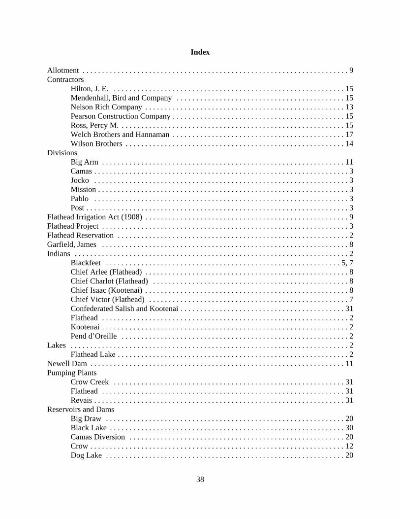
38
Index
Allotment . . . . . . . . . . . . . . . . . . . . . . . . . . . . . . . . . . . . . . . . . . . . . . . . . . . . . . . . . . . . . . . . . . . . 9Contractors
Hilton, J. E. . . . . . . . . . . . . . . . . . . . . . . . . . . . . . . . . . . . . . . . . . . . . . . . . . . . . . . . . . . . 15Mendenhall, Bird and Company . . . . . . . . . . . . . . . . . . . . . . . . . . . . . . . . . . . . . . . . . . . 15Nelson Rich Company . . . . . . . . . . . . . . . . . . . . . . . . . . . . . . . . . . . . . . . . . . . . . . . . . . . 13Pearson Construction Company . . . . . . . . . . . . . . . . . . . . . . . . . . . . . . . . . . . . . . . . . . . . 15Ross, Percy M. . . . . . . . . . . . . . . . . . . . . . . . . . . . . . . . . . . . . . . . . . . . . . . . . . . . . . . . . . 15Welch Brothers and Hannaman . . . . . . . . . . . . . . . . . . . . . . . . . . . . . . . . . . . . . . . . . . . . 17Wilson Brothers . . . . . . . . . . . . . . . . . . . . . . . . . . . . . . . . . . . . . . . . . . . . . . . . . . . . . . . . 14
DivisionsBig Arm . . . . . . . . . . . . . . . . . . . . . . . . . . . . . . . . . . . . . . . . . . . . . . . . . . . . . . . . . . . . . . 11Camas . . . . . . . . . . . . . . . . . . . . . . . . . . . . . . . . . . . . . . . . . . . . . . . . . . . . . . . . . . . . . . . . . 3Jocko . . . . . . . . . . . . . . . . . . . . . . . . . . . . . . . . . . . . . . . . . . . . . . . . . . . . . . . . . . . . . . . . . 3Mission . . . . . . . . . . . . . . . . . . . . . . . . . . . . . . . . . . . . . . . . . . . . . . . . . . . . . . . . . . . . . . . . 3Pablo . . . . . . . . . . . . . . . . . . . . . . . . . . . . . . . . . . . . . . . . . . . . . . . . . . . . . . . . . . . . . . . . . 3Post . . . . . . . . . . . . . . . . . . . . . . . . . . . . . . . . . . . . . . . . . . . . . . . . . . . . . . . . . . . . . . . . . . . 3
Flathead Irrigation Act (1908) . . . . . . . . . . . . . . . . . . . . . . . . . . . . . . . . . . . . . . . . . . . . . . . . . . . . 9Flathead Project . . . . . . . . . . . . . . . . . . . . . . . . . . . . . . . . . . . . . . . . . . . . . . . . . . . . . . . . . . . . . . . 3Flathead Reservation . . . . . . . . . . . . . . . . . . . . . . . . . . . . . . . . . . . . . . . . . . . . . . . . . . . . . . . . . . . 2Garfield, James . . . . . . . . . . . . . . . . . . . . . . . . . . . . . . . . . . . . . . . . . . . . . . . . . . . . . . . . . . . . . . . 8Indians . . . . . . . . . . . . . . . . . . . . . . . . . . . . . . . . . . . . . . . . . . . . . . . . . . . . . . . . . . . . . . . . . . . . . . 2
Blackfeet . . . . . . . . . . . . . . . . . . . . . . . . . . . . . . . . . . . . . . . . . . . . . . . . . . . . . . . . . . . . 5, 7Chief Arlee (Flathead) . . . . . . . . . . . . . . . . . . . . . . . . . . . . . . . . . . . . . . . . . . . . . . . . . . . . 8Chief Charlot (Flathead) . . . . . . . . . . . . . . . . . . . . . . . . . . . . . . . . . . . . . . . . . . . . . . . . . . 8Chief Isaac (Kootenai) . . . . . . . . . . . . . . . . . . . . . . . . . . . . . . . . . . . . . . . . . . . . . . . . . . . . 8Chief Victor (Flathead) . . . . . . . . . . . . . . . . . . . . . . . . . . . . . . . . . . . . . . . . . . . . . . . . . . . 7Confederated Salish and Kootenai . . . . . . . . . . . . . . . . . . . . . . . . . . . . . . . . . . . . . . . . . . 31Flathead . . . . . . . . . . . . . . . . . . . . . . . . . . . . . . . . . . . . . . . . . . . . . . . . . . . . . . . . . . . . . . . 2Kootenai . . . . . . . . . . . . . . . . . . . . . . . . . . . . . . . . . . . . . . . . . . . . . . . . . . . . . . . . . . . . . . . 2Pend d’Oreille . . . . . . . . . . . . . . . . . . . . . . . . . . . . . . . . . . . . . . . . . . . . . . . . . . . . . . . . . . 2
Lakes . . . . . . . . . . . . . . . . . . . . . . . . . . . . . . . . . . . . . . . . . . . . . . . . . . . . . . . . . . . . . . . . . . . . . . . 2Flathead Lake . . . . . . . . . . . . . . . . . . . . . . . . . . . . . . . . . . . . . . . . . . . . . . . . . . . . . . . . . . . 2
Newell Dam . . . . . . . . . . . . . . . . . . . . . . . . . . . . . . . . . . . . . . . . . . . . . . . . . . . . . . . . . . . . . . . . . 11Pumping Plants
Crow Creek . . . . . . . . . . . . . . . . . . . . . . . . . . . . . . . . . . . . . . . . . . . . . . . . . . . . . . . . . . . 31Flathead . . . . . . . . . . . . . . . . . . . . . . . . . . . . . . . . . . . . . . . . . . . . . . . . . . . . . . . . . . . . . . 31Revais . . . . . . . . . . . . . . . . . . . . . . . . . . . . . . . . . . . . . . . . . . . . . . . . . . . . . . . . . . . . . . . . 31
Reservoirs and DamsBig Draw . . . . . . . . . . . . . . . . . . . . . . . . . . . . . . . . . . . . . . . . . . . . . . . . . . . . . . . . . . . . . 20Black Lake . . . . . . . . . . . . . . . . . . . . . . . . . . . . . . . . . . . . . . . . . . . . . . . . . . . . . . . . . . . . 30Camas Diversion . . . . . . . . . . . . . . . . . . . . . . . . . . . . . . . . . . . . . . . . . . . . . . . . . . . . . . . 20Crow . . . . . . . . . . . . . . . . . . . . . . . . . . . . . . . . . . . . . . . . . . . . . . . . . . . . . . . . . . . . . . . . . 12Dog Lake . . . . . . . . . . . . . . . . . . . . . . . . . . . . . . . . . . . . . . . . . . . . . . . . . . . . . . . . . . . . . 20
39
Dry Fork . . . . . . . . . . . . . . . . . . . . . . . . . . . . . . . . . . . . . . . . . . . . . . . . . . . . . . . . . . . . . . 20Hell Roaring . . . . . . . . . . . . . . . . . . . . . . . . . . . . . . . . . . . . . . . . . . . . . . . . . . . . . . . . . . . 19Horte . . . . . . . . . . . . . . . . . . . . . . . . . . . . . . . . . . . . . . . . . . . . . . . . . . . . . . . . . . . . . . . . 15Hubbart . . . . . . . . . . . . . . . . . . . . . . . . . . . . . . . . . . . . . . . . . . . . . . . . . . . . . . . . . . . . . . 20Jocko . . . . . . . . . . . . . . . . . . . . . . . . . . . . . . . . . . . . . . . . . . . . . . . . . . . . . . . . . . . . . . . . 29Kerr (Flathead) Dam . . . . . . . . . . . . . . . . . . . . . . . . . . . . . . . . . . . . . . . . . . . . . . . . . . . . 31Kickinghorse . . . . . . . . . . . . . . . . . . . . . . . . . . . . . . . . . . . . . . . . . . . . . . . . . . . . . . . . . . 16Little Bitterroot . . . . . . . . . . . . . . . . . . . . . . . . . . . . . . . . . . . . . . . . . . . . . . . . . . . . . . . . 19McConnell . . . . . . . . . . . . . . . . . . . . . . . . . . . . . . . . . . . . . . . . . . . . . . . . . . . . . . . . . . . . 12McDonald . . . . . . . . . . . . . . . . . . . . . . . . . . . . . . . . . . . . . . . . . . . . . . . . . . . . . . . . . . . . 16Mission . . . . . . . . . . . . . . . . . . . . . . . . . . . . . . . . . . . . . . . . . . . . . . . . . . . . . . . . . . . . . . . 12Newell Dam . . . . . . . . . . . . . . . . . . . . . . . . . . . . . . . . . . . . . . . . . . . . . . . . . . . . . . . . . . . 18Ninepipe . . . . . . . . . . . . . . . . . . . . . . . . . . . . . . . . . . . . . . . . . . . . . . . . . . . . . . . . . . . . . . 16Pablo . . . . . . . . . . . . . . . . . . . . . . . . . . . . . . . . . . . . . . . . . . . . . . . . . . . . . . . . . . . . . . . . 13Tabor (St. Mary) . . . . . . . . . . . . . . . . . . . . . . . . . . . . . . . . . . . . . . . . . . . . . . . . . . . . . . . 12Twin . . . . . . . . . . . . . . . . . . . . . . . . . . . . . . . . . . . . . . . . . . . . . . . . . . . . . . . . . . . . . . . . . 18
Rivers, Creeks, and StreamsAgency . . . . . . . . . . . . . . . . . . . . . . . . . . . . . . . . . . . . . . . . . . . . . . . . . . . . . . . . . . . . . . . . 3Big Knife . . . . . . . . . . . . . . . . . . . . . . . . . . . . . . . . . . . . . . . . . . . . . . . . . . . . . . . . . . . 3, 12Bitterroot . . . . . . . . . . . . . . . . . . . . . . . . . . . . . . . . . . . . . . . . . . . . . . . . . . . . . . . . . . . . . . 7Columbia . . . . . . . . . . . . . . . . . . . . . . . . . . . . . . . . . . . . . . . . . . . . . . . . . . . . . . . . . . . . . . 4Crow . . . . . . . . . . . . . . . . . . . . . . . . . . . . . . . . . . . . . . . . . . . . . . . . . . . . . . . . . . . . . . . . . . 3Dry . . . . . . . . . . . . . . . . . . . . . . . . . . . . . . . . . . . . . . . . . . . . . . . . . . . . . . . . . . . . . . . . . . . 3Fall . . . . . . . . . . . . . . . . . . . . . . . . . . . . . . . . . . . . . . . . . . . . . . . . . . . . . . . . . . . . . . . . . . . 3Finley . . . . . . . . . . . . . . . . . . . . . . . . . . . . . . . . . . . . . . . . . . . . . . . . . . . . . . . . . . . . . . 3, 12Flathead . . . . . . . . . . . . . . . . . . . . . . . . . . . . . . . . . . . . . . . . . . . . . . . . . . . . . . . . . . . . . . . 3Jocko . . . . . . . . . . . . . . . . . . . . . . . . . . . . . . . . . . . . . . . . . . . . . . . . . . . . . . . . . . . . . . . . . 3Kootenai . . . . . . . . . . . . . . . . . . . . . . . . . . . . . . . . . . . . . . . . . . . . . . . . . . . . . . . . . . . . . . 5Little Bitterroot . . . . . . . . . . . . . . . . . . . . . . . . . . . . . . . . . . . . . . . . . . . . . . . . . . . . . . . . . 3Mission . . . . . . . . . . . . . . . . . . . . . . . . . . . . . . . . . . . . . . . . . . . . . . . . . . . . . . . . . . . . . . 3, 7Mud . . . . . . . . . . . . . . . . . . . . . . . . . . . . . . . . . . . . . . . . . . . . . . . . . . . . . . . . . . . . . . . . . . 3Post . . . . . . . . . . . . . . . . . . . . . . . . . . . . . . . . . . . . . . . . . . . . . . . . . . . . . . . . . . . . . . . . . . . 3Revais . . . . . . . . . . . . . . . . . . . . . . . . . . . . . . . . . . . . . . . . . . . . . . . . . . . . . . . . . . . . . . . . 12Valley . . . . . . . . . . . . . . . . . . . . . . . . . . . . . . . . . . . . . . . . . . . . . . . . . . . . . . . . . . . . . . . . . 3
Stevens, Isaac . . . . . . . . . . . . . . . . . . . . . . . . . . . . . . . . . . . . . . . . . . . . . . . . . . . . . . . . . . . . . . . . . 7Towns
Arlee . . . . . . . . . . . . . . . . . . . . . . . . . . . . . . . . . . . . . . . . . . . . . . . . . . . . . . . . . . . . . . . . . . 3Billings . . . . . . . . . . . . . . . . . . . . . . . . . . . . . . . . . . . . . . . . . . . . . . . . . . . . . . . . . . . . . . . . 5Charlo . . . . . . . . . . . . . . . . . . . . . . . . . . . . . . . . . . . . . . . . . . . . . . . . . . . . . . . . . . . . . . . . . 3Dixon . . . . . . . . . . . . . . . . . . . . . . . . . . . . . . . . . . . . . . . . . . . . . . . . . . . . . . . . . . . . . . . . . 3Hot Springs . . . . . . . . . . . . . . . . . . . . . . . . . . . . . . . . . . . . . . . . . . . . . . . . . . . . . . . . . . . . 3Kalispell . . . . . . . . . . . . . . . . . . . . . . . . . . . . . . . . . . . . . . . . . . . . . . . . . . . . . . . . . . . . . . 20Lone Pine . . . . . . . . . . . . . . . . . . . . . . . . . . . . . . . . . . . . . . . . . . . . . . . . . . . . . . . . . . . . . . 3Moise . . . . . . . . . . . . . . . . . . . . . . . . . . . . . . . . . . . . . . . . . . . . . . . . . . . . . . . . . . . . . . . . . 3Pablo . . . . . . . . . . . . . . . . . . . . . . . . . . . . . . . . . . . . . . . . . . . . . . . . . . . . . . . . . . . . . . . . . 3

40
Polson . . . . . . . . . . . . . . . . . . . . . . . . . . . . . . . . . . . . . . . . . . . . . . . . . . . . . . . . . . . . . . . . . 3Ravalli . . . . . . . . . . . . . . . . . . . . . . . . . . . . . . . . . . . . . . . . . . . . . . . . . . . . . . . . . . . . . . . 31Ronan . . . . . . . . . . . . . . . . . . . . . . . . . . . . . . . . . . . . . . . . . . . . . . . . . . . . . . . . . . . . . . . . . 3St. Ignatius . . . . . . . . . . . . . . . . . . . . . . . . . . . . . . . . . . . . . . . . . . . . . . . . . . . . . . . . . . . . . 3
TreatiesJudith River Treaty . . . . . . . . . . . . . . . . . . . . . . . . . . . . . . . . . . . . . . . . . . . . . . . . . . . . . . 7
Work, Hubert . . . . . . . . . . . . . . . . . . . . . . . . . . . . . . . . . . . . . . . . . . . . . . . . . . . . . . . . . . . . . . . . 10