the british museum expedition to kom firin firin 2005 low res copy.pdf · the british museum...
TRANSCRIPT

The British Museum Expedition to Kom Firin
September-October 2005 seasonReport to the Supreme Council of Antiquities
by Neal Spencer
The fourth season of fieldwork at the extensive settlement site of Kom Firin, in Beheira(pl.1), was undertaken in September and October 2005.1 The magnetometry survey was continuedand excavations were undertaken in the south-eastern temple area, and around the north-easterncorner of the fortified enclosure. Previously discovered door-jamb fragments from the temple werere-excavated and studied. In addition, a project was initiated to record local memories and historiesrelating to the site, and an education programme was instigated.
The south-east temple
Selective trenching continued in the south-eastern temple area, with the aim of finalising elements ofthe temple plan. An area of 235 sq.m was excavated and cleaned this season, bringing the total arearevealed in three seasons, within the temple area, to 527.25 sq.m (pl.11). Levels are given relativeto STN 2=12.00m; the excavations were laid out on a local grid set in 2003.
The central area of the south-eastern temple is a low-lying area, with a distinctly rectangular shapecreated by previous excavations in the temple centre and the subsequent dumping of spoil to the north,east and west (pl.23). As a result, little remains of the temple other than a series of well built mud-brickwalls, founded onto sand (pls.26-7). The eroded remains of these walls, including areas of well-articulatedwall collapse, were subsequently covered by deposits of wind-blown sand, and alluvial silt, in some areasbadly disturbed by grass roots. Restrictions in time and resources have led the project to concentrateon revealing segments of these walls only to confirm the results of the magnetometry survey in2003, accompanied by several tests to check for underlying features, though this was hampered bythe high level of the water table, reached at 0.58 and 0.24 in 2004 and 2005, respectively. Structurespre-dating the temple walls have not been found, and no clearly pre-Ramesside ceramics have beenencountered in the three years of excavations. Initially, the clean sand layers encountered werethought to be part of the temple foundations, but the fact that this same sand layer has beenencountered throughout the temple (this season in TQ, 0375 and 0290, pls.13, 14, 33; in TW, 0369and 0378, pl.16; in TX, 0388, pl.17), outside the temple to the south (UB, 0376, pl.18) and alsoaround the fortified enclosure (in 2004), suggests it is probably natural. A very similar sand layer isvisible in the cemetery at Silvagou. As one would expect, the level of this sand varies; sondagesthrough it have yielded almost no cultural material, other than a small number of intrusive sherdsfrom the deposits immediately above. This sand is to be distinguished from a finer-grained wind-blown deposit encountered in some parts of the temple, for example 0253 in TX (pl.17).
The nature of the walls encountered this season is identical to that in previous seasons (withthe notable exception of 0293 in UB): the walls are well-built from bricks of c. 36-40x16-17x11-12cm (pl.26), in a mix of clay types, principally light yellow-grey sandy clay, dark grey-black clayand a distinctive mix of the two types within individual bricks. The mortar used to bond the bricksalso displays some variation in colour, with both a sandy-yellow colour, and a darker mortar used.Unlike Late Period temples, which were constructed upon a sand-box sometimes bounded by abrick revetment, the foundation levels here echo the outline of the walls of the temple’s superstructure,as can clearly be seen from the plan (pl.10). This method of temple foundation is typical for theRamesside era. The complete lack of any doorway emplacements encountered in the temple area,

especially along the temple axis, indicates that many of these walls are foundation walls. For examplethe whole length of wall 0241 has been revealed in TX and UA (pls.11, 17, 27 and TN in 2004) butno evidence of a doorway was discovered.
Initially, it was assumed that all of the preserved walls were parts of the temple’s substructure, butthis is not actually the case. Deposits clearly consisting of well-articulated wall-collapse are encountered inmany areas. This season, good examples of such collapse were encountered in TX (collapse 0247 fromwall 0244; 0245 from 0395; pl.17), UA (0276 from 0278; pl.17), TQ (270 from 0267, pls.12-14, 25)and TV (0283 from 0282, pl.13). Overall, such deposits are more apparent in the southern andwestern parts of the temple, being absent in trenches TA, TB and UC, but this may reflect thedistribution of excavation trenches rather than any pattern of collapse. Such well-articulated collapseallows one to estimate a minimum original height for the wall, through counting the fallen coursesand adding the height of these to the existing wall remains. Thus wall 0267, a north-south wallforming the western boundary of a ‘court’ before the columned hall, consisted originally of at least19 courses of mud-brick, i.e. at least 2.09m in height (pl.14). Thus it is clear that parts of the templewalls were built largely, or solely, of mud-brick. The recovery of inscribed blocks from the templearea, by Shafiq Farid between 1949-51 (Cairo JE 89281-8), and the column base fragments discoveredin 2003 (KF03/F036, F53-4, F56, F58), indicate that some stone was used in the temple. Many ofthese are parts of doorways (jambs, lintels) or columns, and it is possible that the remaining wallswere all of mud-brick, perhaps originally plastered and painted, or even lined with carved reliefblocks, though no remains of either type of decoration have been discovered yet.
As only small limestone chippings have been discovered in the previous two seasons of work in thetemple area, and in no great concentration, it was somewhat surprising to encounter two large blocks ofworked limestone, both within trench TQ (pl.33); these blocks provide evidence of doorways within thetemple. The first block revealed, 0272, was discovered amongst a deep deposit of wall rubble (0261, seepls.13, 28). Measuring 184x60x26cm, the block was smoothed on one surface, which lay face down, anda circular socket had been cut into it (pl.29). This socket was evidently to allow a door to pivot, as is clearfrom the arc of scratch marks, which indicate that the door-leaf was originally 102cm wide. Subsequently,a second block was discovered (0280, pl.30), again in a deposit of wall collapse (0286). Of almostidentical form, also lying socket-face down and indicating a door-leaf of the same size, this block measured188x78x24cm. These two doorway blocks clearly come from either a door lintel or threshold. The latterseems less likely on account of the lack of wear marks on the door. The most likely doorway from whichthey come is probably that providing access into the columned hall, presumably located axially, some 7meast of their eventual findspot (in TD, see pl.11), though a doorway somewhere in the western rooms ofthe temple may also be possible.
The focus of excavations this season was the southern part of the temple, now realised to be the rearof the ancient building. The complex of walls revealed suggests a plan with a degree of parallel withcontemporary structures known from elsewhere in Egypt, but due to the lack of doorway remains, thefollowing comments are partly hypothetical (this rear part of the temple is preserved to a much lower levelthan the other areas, pl.23). A suite of four rooms make up the back of the temple, abutting directly ontothe wall 0243 (for following, see pls.11, 15, 17, 18, 24, 27). One of these rooms is centred upon theaxis of the temple (walls 0242, 0243, 0244, 0352); presumably the central cult chapel, 2.75x4.5min size (foreground of pl.24). Small Ramesside temples are often provided with a tripartite sanctuary,including those in the frontier sites of Amara West, Aksha and Zawyet Umm el-Rakham, and it isreasonable to see this as being the case at Kom Firin, taking into account the previously mentionedroom and those flanking it on either side: to the east, that formed by 0242, 0243, 0244 and 0395(2.75x4.5m), on the west, that bounded by 0243, 0352, 0360 (3.5x4.5m). This leaves a fourth room,the narrowest of the three on the eastern edge of this group, formed by walls 0242, 0243, 0278 and0395. While this could be another sanctuary, or auxiliary room, an intruiging possibility is raisedthrough comparison with other temples, where a staircase is featured in a similar position: at Akshaon the same side of the axis, and at Amara West on the opposite side of the tripartite sanctuary.
One unresolved propblem with the Kom Firin sanctuary area is the nature of the space immediately

north of these rooms. At first this appears to be a transverse chamber between the columned halland the chapels (left of pl.24), but the extension of wall 0352 (pl.15, 17) north of the east-west wall0242 probably implies it did not fully span the width of the chapels. Two solutions are possible:access to the westernmost chapel may have been from the central one, or this chapel may have beenpreceded by an antechamber of its own. Interestingly, a similarly extended wall is found in Akshatemple, in front of the stairway emplacement.
Through magnetometry survey and excavation, the hall of six columns is well defined (pls.3, 23).Excavations in 2004, the walls recovered in trenches TQ and TR (pl.12, 13, 33) and traces on theground (which indicate a similar range of walls on the eastern side of the temple) suggest the frontof the temple consisted of a space of 19x9m. Walls 0262, 0267, 0157 and 0135 define this space.Another wall (0364) inside this ‘court’ suggests it may have been embellished with other features:is this the foundation for the columns of a peristyle? Peristyle courts are found in contemporarytemples at Aksha (instead of a hypostyle hall), Amara West (preceding the hypostyle hall), and in asmall temple south-west of the Ptah enclosure at Memphis.
The temple proper, 15.8x15m, is of modest size, but a series of east-west cross walls further dividethe space on the west of the temple’s axial rooms (pl.11); the eastern side has not been excavated to thesame extent. The function of such spaces, for example that south-west of the ‘court’, indicated by walls0279 and 0265 in TQ (pls.13, 33), is difficult to identify, particularly without doorway positionsbeing known. However, parallels from other sites suggest one can expect a series of subsidiarychapels and/or storerooms in this area. Two small features built up against walls and founded at avery low level (0294-0295 in UC, pl.19 and 0380 in TW, pl.16) cannot have been foundations forsignificant structures, as they are partly formed of walls only one brick thick. Could these havebeen storage bins of some form?
The limits of the temple itself seem to have been defined by a monumental brick wall, 3.80m wide,partly revealed as 0293 in UC (pls.19, 31, 32), and further to the south in 2003 (pl.11). Identifying thiswall on the northern and western sides of the temple is made difficult by the accumulated spoil, and notraces were revealed in the 11m south of the rear wall of the temple (trench UB, pl.18). Strikingly, themethod of construction differs markedly from all of the other temple-phase walls in this area of Kom Firin,being built of bricks of one clay type only (a dark grey), and with the core formed of bricks laid on edge(pl.32). While this could indicate it belongs to a different phase of activity at the site, its alignment,scale and position suggests it was considered a different type of wall, envisaged as delineating thesacred temple space from what lay outside. The successive placing of two round-bottomed storagejars into a cut in this wall (pl.32), presumably after it had been reduced to not much higher than itspresent height, supports this interpretation, as this type of vessel, usually provided with cylindricalnecks, seems to fall out of favour at the end of the New Kingdom. Along with the domestic re-useof the north-west corner of the temple (trench TK in 2004), this provides further evidence that partsof the temple were no longer operational in the Third Intermediate Period.
The ceramics recovered from the temple area in the 2005 season provide further examples offorms and fabrics found in the previous two seasons; study of all three seasons’ ceramics continues. Asbefore, much of the ceramics were badly eroded. A significant number of sherds from Canaanite amphoraewere found throughout the temple area, as well as some small fragments of painted pottery typical of theRamesside era. Bowls and dishes with modelled rims and cord decoration are also prevalent, though theseremained in use long after the New Kingdom. Other pottery of the first millennium BC and later wasencountered, unsurprising in the much-disturbed deposits accumulated around the ruins of the temple.
Few finds were discovered in the temple area, as in previous seasons, though there were furtherexamples of unfired clay cobra figurines (F250 [pl.40], F251 from wall rubble 0363 in TW; F233 [pl.58]in UB topsoil 0350). A fine granodiorite gaming piece (F240, pl.41) was found in the wall collapse layers0268-0269-0270 in TQ; a partly corroded chisel-head (F248, pl.39) was recovered from the topsoil(0298) in adjacent trench TS.

An unexpected development this season was the re-discovery of the other half of the doorjambfragment which rests outside the SCA resthouse/magazine at the centre of the site. Prompted by photographsof Kom Firin taken by Dietrich Raue in 1993, showing not one but two decorated doorjambs lying by theresthouse, we cleaned the surface deposit around what appeared to be a small piece of limestone. Thisturned out to be the upper half of the already visible door-jamb (pls.34-5, 37-8). In collaboration with ourSCA inspector, it was decided to remove both halves from the moist ground (the surface of the alreadyvisible block had deteriorated badly since 2002), and place them on wooden blocks raised off the cementfloor of the walkway around the SCA building. The doorjamb is in need of conservation, which we intendto undertake in the coming season, and are important in that they indicate the scale of the original doorways,along with those blocks in the Cairo Museum (JE 89284 shows that door lintels bore horizontal royalcartouches, with a single line of inscription beneath on each jamb, starting with the royal titulary).
The finely cut sunk relief inscription on one face reads ‘Dual king, lord of the Two Lands,Usermaatra-setepenra, son of Ra, lord of appearances, Ramses beloved-of-Amun, providing peace (?)through fighting at the head of troops’ (pls.34-5) while the other face bears the text ‘Dual king, lord of theTwo Lands, Usermaatra-setepenra, son of Ra, lord of appearances, Ramses beloved-of-Amun, strongruler, strong of forearm, powerful of might’ (pls.37-8). Such statements fit well within the context of KomFirin, evidently one of the fortified installations erected in the Ramesside period in response to the threatfrom Libyan peoples. The repetition of the hieroglyph showing an arm brandishing a weapon on one faceof the jamb (pl.38) reflects a desire to emphasise the the military prowess of the king at this site.
One of the inscriptions has been recut. Firstly, the prenomen cartouche has been modified, with abroad rectangular sign cut across the top of the figure of Maat and the adjacent wzr-sign (pl.36).The nomen has not been changed. One intriguing possibility is that nomen was now to be read asImn-mz-zw mry-Ra (Amenmesse) rather than the original Ra-mz-zw mry-Imn (Ramses II). If thiswas the case, one would expect the prenomen to read Mn-mi-Ra ztp-n-Ra. While the broad rectangularsign could represent the mn, one would still have to assume the Maat and wzr-signs had beenreplaced with mi + i, for which no evidence survives (perhaps executed in plaster?). This is a verytentative suggestion, and one which would have significant consequences as Amenmesse is thus farunattested in Lower Egypt. The prenomens of Ramses XI (Mn-mAat-ra ztp-n-PtH), Pimay (Wzr-mAat-ra ztp-n-(I)mn or Wzr-mAat-ra ztp-n-Ra) and Pedubastis II Sa-bastet (Wzr-mAat-ra ztp-n-(I)mn) werealso considered, but the prenomen of Ramses XI always includes an internal epithet of Ptah, andthere is no place for a second sun-disc in the cartouches of Pedubastis or Pimay. All three wouldrequire signifcant changes to the nomen cartouche, for which there is no evidence on this doorjamb.
Finally, a further 52cm of inscription has been added to the end of this column of text(pl.35), not matched on the other face; the original texts both ended at the same level. Thesehieroglyphs are much shallower and less fine in this area, and the width of the text column issignificantly less (28 rather than 34cm). Whether this addition is contemporary with the re-cuttingof the prenomen cartouche is unknown, though a reasonable possibility. Conservation and cleaningof the block should enable this part of the inscription to be better read.
The fortified enclosure: north-east corner
Magnetometry survey undertaken in 2004 revealed the temple is set within an extensive fortifiedenclosure, c.231m east-west, and c.200/218m north-south, with walls over 4m thick (pl.3). Small sectionsof the southern stretch of this wall are visible in the area decimated by sebakhin, and the northern gate waspartly investigated in 2004. While the form of construction and its alignment to the temple suggest theenclosure is also Ramesside, a large trench (EA, total area 193 sq.m, pls.20, 42) was opened aroundthe north-east corner to seek further dating evidence, and to ascertain if the exterior buttress iscontemporary with the enclosure wall.
Excavation was rendered difficult by the massive amounts of overburden that completely obscuredthe wall in this area. This deposit (0300) consisted of moderately compacted grey-brown silt, with sandy
lenses, and badly disrupted by deep-lying halfa-roots. Much of it derived from weathered and root-disturbed mud-bricks of structures beneath, but also the fill of later pitting into the surface (see pl.21).Initially, the removal of this layer seemed to reveal an extent of brickwork which did not correspond to theexpected structure, but careful excavation, combined with the use of a high-resolution survey overthe area (pl.9), eventually made it clear that a later, equally monumental structure (0304) had beenbuilt against and partly over the eroded remains of the enclosure wall (0306-0307) and the adjoiningbuttress (0311) (pls.42, 44, 45).
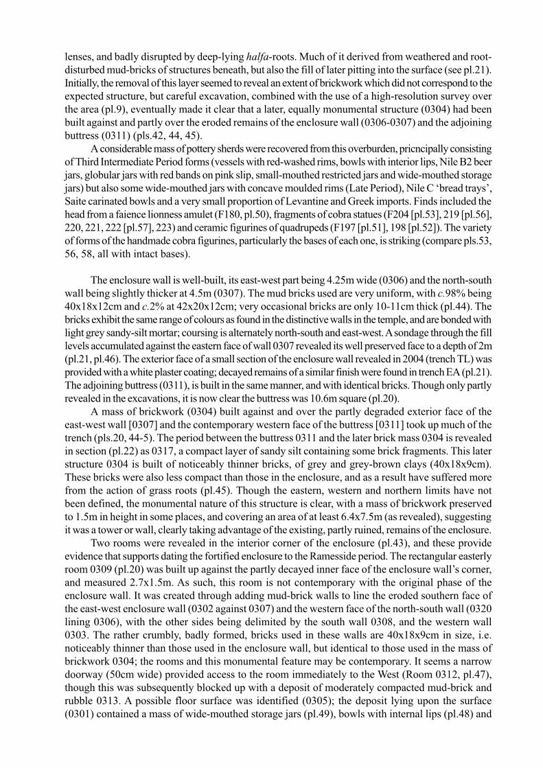
A considerable mass of pottery sherds were recovered from this overburden, pricncipally consistingof Third Intermediate Period forms (vessels with red-washed rims, bowls with interior lips, Nile B2 beerjars, globular jars with red bands on pink slip, small-mouthed restricted jars and wide-mouthed storagejars) but also some wide-mouthed jars with concave moulded rims (Late Period), Nile C ‘bread trays’,Saite carinated bowls and a very small proportion of Levantine and Greek imports. Finds included thehead from a faience lionness amulet (F180, pl.50), fragments of cobra statues (F204 [pl.53], 219 [pl.56],220, 221, 222 [pl.57], 223) and ceramic figurines of quadrupeds (F197 [pl.51], 198 [pl.52]). The varietyof forms of the handmade cobra figurines, particularly the bases of each one, is striking (compare pls.53,56, 58, all with intact bases).
The enclosure wall is well-built, its east-west part being 4.25m wide (0306) and the north-southwall being slightly thicker at 4.5m (0307). The mud bricks used are very uniform, with c.98% being40x18x12cm and c.2% at 42x20x12cm; very occasional bricks are only 10-11cm thick (pl.44). Thebricks exhibit the same range of colours as found in the distinctive walls in the temple, and are bonded withlight grey sandy-silt mortar; coursing is alternately north-south and east-west. A sondage through the filllevels accumulated against the eastern face of wall 0307 revealed its well preserved face to a depth of 2m(pl.21, pl.46). The exterior face of a small section of the enclosure wall revealed in 2004 (trench TL) wasprovided with a white plaster coating; decayed remains of a similar finish were found in trench EA (pl.21).The adjoining buttress (0311), is built in the same manner, and with identical bricks. Though only partlyrevealed in the excavations, it is now clear the buttress was 10.6m square (pl.20).
A mass of brickwork (0304) built against and over the partly degraded exterior face of theeast-west wall [0307] and the contemporary western face of the buttress [0311] took up much of thetrench (pls.20, 44-5). The period between the buttress 0311 and the later brick mass 0304 is revealedin section (pl.22) as 0317, a compact layer of sandy silt containing some brick fragments. This laterstructure 0304 is built of noticeably thinner bricks, of grey and grey-brown clays (40x18x9cm).These bricks were also less compact than those in the enclosure, and as a result have suffered morefrom the action of grass roots (pl.45). Though the eastern, western and northern limits have notbeen defined, the monumental nature of this structure is clear, with a mass of brickwork preservedto 1.5m in height in some places, and covering an area of at least 6.4x7.5m (as revealed), suggestingit was a tower or wall, clearly taking advantage of the existing, partly ruined, remains of the enclosure.
Two rooms were revealed in the interior corner of the enclosure (pl.43), and these provideevidence that supports dating the fortified enclosure to the Ramesside period. The rectangular easterlyroom 0309 (pl.20) was built up against the partly decayed inner face of the enclosure wall’s corner,and measured 2.7x1.5m. As such, this room is not contemporary with the original phase of theenclosure wall. It was created through adding mud-brick walls to line the eroded southern face ofthe east-west enclosure wall (0302 against 0307) and the western face of the north-south wall (0320lining 0306), with the other sides being delimited by the south wall 0308, and the western wall0303. The rather crumbly, badly formed, bricks used in these walls are 40x18x9cm in size, i.e.noticeably thinner than those used in the enclosure wall, but identical to those used in the mass ofbrickwork 0304; the rooms and this monumental feature may be contemporary. It seems a narrowdoorway (50cm wide) provided access to the room immediately to the West (Room 0312, pl.47),though this was subsequently blocked up with a deposit of moderately compacted mud-brick andrubble 0313. A possible floor surface was identified (0305); the deposit lying upon the surface(0301) contained a mass of wide-mouthed storage jars (pl.49), bowls with internal lips (pl.48) and

Nile B2 beer jars, which may hint at the original function of this room. This deposit also yielded afine four-part kohl-tube (F217, pl.55) and the lower part of a faience amulet (F210, pl.44), foundresting on the floor surface in the extreme north-western corner of the room. Though there was asmall amount of later material, the pottery here dated almost entirely to the Third IntermediatePeriod, giving a date for the occupation of the room, and indicating the original phase of the enclosurewall dates to the early Third Intermediate Period or before.
Room 0312, immediately to the west and presumably contemporary, was formed of walls 0302,0303 and 0321 (pl.47). Built of the same poor quality brick, areas of the mud-plaster which coated theinternal walls were preserved (pl.20). The southerly limit of this room was not revealed, but a small extensionto the trench revealed the room’s dimensions are of at least 4.8x2.4m. Deposits within the rooms includedmore Third Intermediate Period forms.
Geophysical survey
A GeoScan Fluxgate FM-36 magnetic gradiometer was used to survey grids of 20x20m, which werewalked in 1m transects to obtain readings at a density of 8 samples per meter and a resolution of 0.1nT.The data, once processed, can indicate the position and form of ancient structures and other featureswhich cause anomalies to the earth’s magnetic field.
During the 2005 season, 141 squares were surveyed at this resolution, resulting in magnetometrydata (from three seasons) for an area of 140,000m˝ (pl.3). The principal focus was the area north of thefortified enclosure. A large segment of enclosure wall stands in the north-eastern part of the site (pl.59),and is clearly not associated with the fortified enclosure discussed above; it was hoped that extending themagnetometry survey northwards might reveal further parts of this enclosure, not visible on the surface.Long rectilinear features which appear on the processed data can be interpreted as brick enclosure walls,one roughly east-west stretch runs for 140m towards the standing segment of enclosure wall (whichwas not surveyed due to its height). Presumably these two elements were part of the one enclosurewall (pl.10 [blue]). A possible western part of this enclosure may be represented by the featurerunning north-south and ‘cutting’ through the north wall of the fortified enclosure, around STN 24on pl.2. It is worth noting that high pedestals of deposits immediately south of here have a large‘wall-shaped’ cut through them (pl.61), consistent with the removal of a substantial wall by sebakhin,as found with much of the south wall of the fortified enclosure. Tracking the wall south of thispoint, to identify the south segment of the proposed enclosure, is difficult, partly because of thelow-lying nature of the terrain here: the standing segment if sounded at a high level (pl.59). A largesection of mud-brick wall, 4.3m thick with a later thickening (much like the standing segment inthe north-east of the site) was noted at the south of the site (west of STN 19), and seems to followthe same alignment (pls.2, 60). Finally, a further feature in the magnetometry data appears to beanother substantial wall, running east-west for 80m to the north of the 140m stretch mentionedabove, though on a slightly different alignment (pl.10 [red]); if this is part of the same enclosure asthe segment to the south, this enclosure would then be c. 425m long.
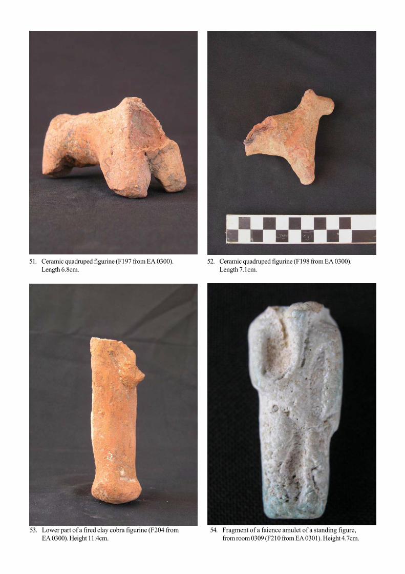
At a site with as long an occupation history as Kom Firin (the ceramic evidence extendsdown until the 7th cenury AD), one would expect a series of enclosure walls to have been built atdifferent periods. Petrie noted two enclosures on the north-east side, ‘beyond the great walls of thetown’ (by which he means the Citadel area), while Griffith noted a ‘double enclosure’ separatedfrom one 200 yards away, ‘entirely on the desert’ (the latter again being the Citadel). Thesedescriptions correlate well with the new magnetometry data. It is also possible that two or moreenclosure were contemporary, as found at other sites. The discovery of Aegean and Phoeniciansherds from transport amphorae (Chian, Clazomenian and Samian wares have been identified,pl.62), in and around some visible segments of monumental walls in this north-eastern part of thesite hint that one of these enclosure may date to the Late Period. Saite priests are buried in thenecropolis at Silvagou, and two 26th dynasty objects in the British Museum (EA 16037, 16041)

must derive from a temple context at the site, thus a sizeable temple enclosure of this era is likely tohave existed at Kom Firin.
Seventeen 20x20m squares were also surveyed in the central part of the north of the site, aroundSTN 11, where some sections of significant walls were visible in open sections. The resulting data (pl.4)did reveal features which presumably correspond to walls, though they do not appear to be of themonumental nature seen in the eastern part of Kom Firin. The alignment of these walls may echo that ofsome of the enclosure walls noted in the east of the site: the alignment and layout of buildings outsideenclosures often approximates to that of the enclosures themselves.
In addition, nine 20x20m squares surveyed in 2004 were re-surveyed at a higher resolution, in50cm traverses with readings taken at 25cm intervals (pl.6). Though the data collection takes twice aslong, this resolution enables clearer identification of subsurface features, particularly walls of under 1mthick (compare with pl.5). The new data, in the north-western area of the Ramesside enclosure, suggestthe presence of small rectilinear rooms and buildings built against the inside of the enclosure, and a possiblelater-phase structure built above the north-western bastion, as it follows a different alignment.
An even higher resolution (50cm traverses, 12.5 cm intervals between readings; pl.9) was employedimmediately to the south of the excavation trench EA, with the aim of providing information which mightdictate which areas to excavate. This proved very successful, as the width and layout of the enclosure walland the exterior bastion were very clearly defined, facilitating onsite interpretation of difficult issues ofphasing between the enclosure and a mass of later brickwork built up against it.
For the first time at Kom Firin, resistivity was employed as a method of geophysical survey, usinga Geoscan RM-15 machine. The machine measures the resistance of the subsurface deposits to a 1mAcurrent run between two probes set into the ground at regular intervals. As with magnetometry, afterprocessing and displaying in a map format, subsurface archaeological features can become apparent. One20x20m grid, previously surveyed by magnetometry (pl.5), was surveyed at a resolution of 50x25cm(pl.7). While the results confirmed some of the data retrieved through magnetic survey, achieving contactbetween the probes and the dry soil was often difficult. When one also considers the longer time neededfor this type of survey, it seems that resistivity is not the most time- and cost-efficient method of geophysicalsurvey in the topographical and climactic conditions of Kom Firin, particularly in the autumn.
Local histories and traditions at Kom Firin
A village adjacent to the site is attested in Petrie’s description of the site; this season a project wasinitiated to record the memories of the local inhabitants, particularly in relation to their attitudes to, andinterpretations of, the ancient site. The 20th century history of the site mirrors that of many archaeologicalsites in Egypt: organised sebakh-removal (facilitated with a light railway line which led from the centre ofthe kom), illegal excavations and two authorised projects (Shafiq Farid on behalf of the EAO between1949 and 1951, and the work of the Naukratis Project at Kom Firin between 1977 and 1980), theencroachment of agriculture and the gradual process of decay and erosion to exposed features. Egyptologistshave rarely recorded the evidence from the inhabitants who have lived within or nearby ancient sites,despite the evident value of such sources in terms of archaeology, anthropology and the history of Egyptology.
Forty-one interviews were conducted by Mennat Allah el-Dorry during the season, recorded onMini-Disc in those cases where the interviewee consented. The interviewees were all inhabitants of thepresent-day village of Kom Firin, many having lived in the area all their life, and ranged in age from 15 to70 (the majority being over 40). While some questions and themes were kept in mind, the interviewsgenerally took the form of unstructured conversations. The process of transcribing and studying the contentof these interviews is ongoing, but the following preliminary remarks can be made on recurrent themes:
− Widespread recognition of the reduction in size of the kom over time, and its original locationat the edge of the desert.− Memories of the railway constructed for sebakh-removal, known as the troll, include refer-

ences to the probing of the ground with metal spikes to assess the best locations for digging, theyear-round nature of the work, the ultimate destination of much of the sebakh being nearbyvillages, and a fatal injury sustained to one interviewee’s relative.− Previous excavation projects at the site are well-remembered; some of the interviewees actu-ally participated in the Naukratis Project excavations, and recall deep trenches (evidently thesounding in the Citadel area), ladders, the sieving of spoil and the use of a helium balloon foraerial photography. Memories of EAO excavations emphasise work in the cemetery at Silvagou,rather than the excavations of Shafiq Farid.− Interpretations of the ancient remains: recognition that it was a settlement, with residentialareas, temples and markets, though the age of the site is placed at anywhere between 9000 yearsand 1400 years old.− Forbidding nature of kom: many of the older interviewees describe the mound as an unwel-coming place, and there are local traditions relating to the Tawahah, a dangerous goat-footedwoman who roams the kom at night, and another figure who can blind or burn people. Some ofthe limestone blocks lying on the surface are associated with fertility.− The name of the ancient site is as yet unknown, but various etymologies for the name KomFirin are described by the interviewees: Kom Kiffary (mound of the heathens); Firin as thename of a mythical king, or Firin as derived from the Arabic word for kilns or ovens, several ofwhich were excavated by the Naukratis Project.
Schools outreach: London and Kom Firin
In collaboration with the Department of Learning & Information at the British Museum, a projectwas initiated to engage with children from a school near Kom Firin, in parallel with an initiative to facilitatethe teaching of Egypt in a cross-curricular manner at a school in north London. Fifty-seven children (8-12year olds) from Nesim School visited Kom Firin on October 3rd, 2005, accompanied by their teachers.Several project members gave short presentations on the nature of the project’s research at Kom Firin(pl.63), and what we now know about the ancient city near which the children live, through survey,excavation and study of material culture. In addition, Nick Badcott and Mennat Allah el-Dorryvisited Nesim School the following day, to give short presentations on the work, and to conduct aquestion-and-answer session, with four classes amounting to 120 pupils.
In London, the British Museum collaborated with Torriano Junior School to facilitate learning aboutEgypt in a cross-curricular manner. Two classes of children (7-8 year old) learnt about ancient, medievaland modern Egypt, aided by photographs and films from the Kom Firin project, of the archaeologicalwork but also the modern landscape and rural environment. Visits to the British Museum were complementedwith class sessions and work on hieroglyphs and Arabic calligraphy.
Finally, a 4-page colour leaflet was produced in Arabic, explaining the results of the project’sresearch and excavations at Kom Firin (pl.64) for the benefit of the local community and schools.
Conclusion
Four seasons of survey and excavation at the extensive settlement site of Kom Firin have ledto the recovery of much of a temple plan of the Ramesside Period, set within a large fortifiedenclosure, which must be one of the series of installations built in the early Ramesside period tothwart the threat from Libya, well known from inscriptions. Further magnetometry survey seems toindicate the remains of later enclosure walls. It is intended that a study season in autumn 2006 willallow subsequent publication of the first volume on the excavations, to cover the history of research,excavations in the temple and geophysical survey (to be published by British Museum Press).

Thereafter, the project wishes to undertake further excavations to elucidate the nature of buildingswithin the enclosure, and the nature of post-New Kingdom activity at the site.
Dr. Neal SpencerAssistant Keeper (Curator)The British [email protected] January 31st, 2006
1 The season took place between September 7th and October 6th, 2005. The team consisted of Neal Spencer (director,archaeologist), Ann Donkin (magnetometry surveyor), Paul Murray (archaeologist), Liam McNamara (illustrator), KvetaSmolarikova (ceramicist) and Jim Sutter (surveyor assistant). A debt of gratitude is due to the Supreme Council ofAntiquities, for permitting the work to be undertaken, and for their support throughout. Thanks are due to the SecretaryGeneral, Dr. Zahi Hawass, and the General Director of Foreign and Egyptian Mission Affairs, Dr. Magdy el-Ghandour.Fawzi el-Khoulani, chief inspector in the Damanhur inspectorate, facilitated our work; our inspector, Ibrahim SobyIbrahim, accompanied the mission throughout the season. Rawya Ismail, in the Cairo office of the Egypt ExplorationSociety, provided invaluable assistance while in Egypt. The core funding was provided through the Townley Group(part of the British Museum Friends), with logistical assistance from Vodafone UK. Thanks are also due to the CzechInstitute of Egyptology in Prague. The magnetometry survey was further supported by funds from the University ofAkron (Ohio, USA), Dr. Timothy Matney deserves credit for facilitating this collaboration.
1. Map of Nile Delta, showing location of Kom Firin.

2.M
ap o
f Kom
Fir
in, s
how
ing
area
s of
mag
neto
met
ry s
urve
y (2
003-
5).

3. Magnetometry survey data, eastern zone (2003-2005).

5. Magnetometry survey data, eastern zone detail (2004). Resolution 1x0.125m.
4. Magnetometry survey data, central zone (2005).

7. Left: Magnetometry survey data, eastern zone detail (2004). Resolution 1x0.125m. Right: Resistivity survey data, easternmost square from magnetometry survey shown left (2005). Resolution
0.5x0.25cm.
6. Magnetometry survey data, eastern zone detail (2005). Resolution 0.5x0.25m.

8. Magnetometry survey data, north-east corner of fortified enclosure. Resolution 1x0.125m. Location of trench EAindicated.

9. Magnetometry survey data, north-east corner of fortified enclosure, with inset of high resolution survey (0.5x0.125m).Location of trench EA indicated.

10. Map of eastern Kom Firin, showing possible position of post-New Kingdom enclosures.

11.
Com
posi
te p
lan
of e
xcav
atio
ns in
sou
th-e
ast t
empl
e (2
003-
2005
),
w
ith p
ropo
sed
reco
nstr
uctio
n of
pla
n.

12. Trenches TQ and TR, before removal of wall rubble from TQ. Plan scale 1:50.

13. Trenches TQ, TS and TV, after removal of wall rubble from TQ.

14.
Tre
nche
s TQ
, sou
th-f
acin
g se
ctio
n A
B. L
ocat
ion
mar
ked
on p
ls.1
2-13
. Sec
tion
scal
e 1:
20.

15.
Tre
nch
TW
, bef
ore
rem
oval
of w
all r
ubbl
e. P
lan
scal
e 1:
50.
16.
Tre
nch
TW
, aft
er re
mov
al o
f wal
l rub
ble.
Pla
n sc
ale
1:50
.

17.
Tre
nche
s T
X a
nd U
A.

18.
Tre
nch
UB
. Pla
n sc
ale
1:50
.

19.
Tre
nch
UC
. Pla
n sc
ale
1:50
.

20.
Tre
nch
EA
. Pla
n sc
ale
1:10
0.

21.
Tre
nch
EA
, nor
th-f
acin
g se
ctio
n G
H. L
ocat
ion
mar
ked
on p
l.20.
Sec
tion
scal
e 1:
20.

22. Trench EA, south-facing section EF and profile of brickwork structure 0304 and buttress 0311. Locationmarked on pl.20. Section scale 1:20.

23. General view of temple area, with columned hall in foreground. Looking south.
24. View east across rear of temple (wall 0242 at left).

25. Trench TQ: South-facing section AB (see pl.14).
26. Detail of the south face of wall 0241.

27. Trench TX: View south-east across rear of temple (wall 0242 in centre).
28. Trench TQ: limestone door element (0272) during excavation, still partly covered by wall collapse 0261. View south.

29. Limestone door element (0272) with socket and scratch marks.
30. Limestone door element (0280) with socket and scratch marks.

31. View south-east across eastern edge of temple; large wall 0293 visible in trench UC.
32. Trench UC: wall 0293 looking north, with in situ pot sunk into wall.

33. Trench TQ: walls built on virgin sand. Limestone blocks 0272 and 0280 have been lifted to reveal worked face butotherwise in position.
34. Limestone doorjamb, upper fragment, face 1. 35. Limestone doorjamb, lower fragment, face 1.

36. Limestone doorjamb, upper fragment, face 1. Detailof prenomen cartouche.
37. Limestone doorjamb, upper fragment, face 2.
38. Limestone doorjamb, lower fragment, face 2. 39. Copper alloy chisel(?)-head (F248 from TS 0298).Length 9.0cm.

40. Fragment of fired clay cobra figurine (F250 from TW0363). Height 8.3cm.
41. Granodiorite gaming piece (F240 from TQ 0268-0269-0270). Height 2.7cm.
42. Trench EA: general view, showing later structure 0304 built against and over north-east corner of enclosure.

43. Trench EA: rooms 0309 and 0312 built against inner face of enclosure wall.
44. Trench EA: structure 0304 (top right) built over and against north-east corner of enclosure.

45. Trench EA: structure 0304 (top) above buttress 0311. View west.
46. Trench EA: exterior face of north-south enclosurewall 0306. View north-west.
47. Trench EA: room 0312 and doorway to room 0309.View east.

48. Large siltware bowl found in room 0309 (context EA 0301).
49. Partly reconstructed siltware storage jar, upper partbuff slipped, found in room 0309 (context EA 0301).
50. Head from a faience lionness-headed amulet (F180from EA 0300).
51. Ceramic quadruped figurine (F197 from EA 0300).Length 6.8cm.
52. Ceramic quadruped figurine (F198 from EA 0300).Length 7.1cm.
53. Lower part of a fired clay cobra figurine (F204 fromEA 0300). Height 11.4cm.
54. Fragment of a faience amulet of a standing figure,from room 0309 (F210 from EA 0301). Height 4.7cm.

55. Four-part faience kohl-tube, from room 0309 (F217from EA 0301). Height 9.6cm.
56. Fired clay cobra figurine, head missing (F219 fromEA 0300). Height 14.2cm.
57. Fragment of fired clay cobra figurine (F222 from EA0300). Height 7.3cm.
58. Fragment (base) of fired clay cobra figurine (F233from UB 0350). Height 5.8cm.

61. Pedestals of stratified deposits, accumulated against a now-lost feature (enclosure wall?), south of STB 24 (see pl.2).View North.
59. Standing segment of enclosure wall near north-eastern edge of site (see pl.2). View North.
60. Monumental mud-brick wall visible in section, westof STN 19 (see pl.2). View West.
64. Four-page Arabic leaflet outlining results ofproject’s research and excavations.
63. Presentation to Nesim School children at KomFirin.
62. Selection of sherds from imported amphorae, collected in surface survey east of STN 13 (see pl.2).