subdivision regulations dartmouth, massachusetts
TRANSCRIPT
Subdivision Regulations
Dartmouth, Massachusetts
DARTMOUTH PLANNING BOARD 400 SLOCUM ROAD
DARTMOUTH, MA 02747
Telephone: (508) 910-1816
Effective Date: JULY 2, 2021
ii
TABLE OF CONTENTS
GUIDE TO THESE REGULATIONS ..................................................................................................... IV INTRODUCTION ......................................................................................................................... V DEFINITIONS ....................................................................................................................... VII 1.00 PLANS BELIEVED NOT TO REQUIRE APPROVAL ............................................................. 1-1 1.100 Criteria ...................................................................................................................... 1-1 1.200 Plan Submission ........................................................................................................ 1-1 1.300 Plan Contents ............................................................................................................ 1-2 1.400 Decision of the Planning Board ................................................................................. 1-4
2.00 PRELIMINARY PLANS .......................................................................................................... 2-1 2.100 Purpose ..................................................................................................................... 2-1
2.200 Pre-application Appointment and Review with Planning Board ................................ 2-1 2.300 Plan Submission ........................................................................................................ 2-1 2.400 Plan Contents ............................................................................................................ 2-1 2.500 Review by Other Municipal and Local Agencies ....................................................... 2-4 2.600 Decision of the Planning Board ................................................................................. 2-4 3.00 DEFINITIVE PLANS ............................................................................................................... 3-1 3.100 Plan Submission ........................................................................................................ 3-1 3.200 Plan Contents ............................................................................................................ 3-1 3.300 Design Standards and Required Improvements ....................................................... 3-9 3.302 Directory to Design Standards & Required Improvements ..................................... 3-11 3.400 Review by Other Municipal or Local Agencies ........................................................ 3-32 3.500 Public Hearing ......................................................................................................... 3.33 3.600 Decision of the Planning Board ............................................................................... 3-33 4.00 SUBSEQUENT ACTIONS TO A DEFINITIVE PLAN ............................................................. 4-1 4.100 Resubmission of a Disapproved Definitive Plan........................................................ 4-1 4.200 Amendment to or Rescission of a Previously Approved Definitive Plan ................... 4-1 4.300 Performance Guarantee ............................................................................................ 4-1 4.400 Endorsement of an Approved Plan ........................................................................... 4-2 4.500 Release of Lots for Sale or Building .......................................................................... 4-3 4.600 Inspections and Finishing Requirements .................................................................. 4-4 4.700 Release of Performance Covenant ........................................................................... 4-5

iii
APPENDIX A
Forms A through M ............................................................................................................................. A-1
Form A - Application for Endorsement of an Approval Not Required (ANR) Plan
Form B - Application for a Preliminary Subdivision Plan
Form C - Application for a Definitive Subdivision Plan
Form C-1 - Time Extension Request on a Definitive Plan
Form D - Application for Approval of a Revised Disapproved Definitive Subdivision Plan
Form E - Application to Amend an Approved Definitive Subdivision Plan
Form F - Performance Covenant
Form F-1 - Release of Lots from Performance Covenant
Form G - Restrictive Covenant
Form H - Open Space Covenant
Form I - Release of Surety
Form J (Conveyance of Easements and Utilities)
Form K - Estate Lot Covenant
Form L - Declaration of Trust Document
Form M - Grant of Easement
APPENDIX B
Procedural Flowcharts on Plan Submittals .............................................................................................. B-1
Notice Regarding Information Submittal ........................................................................................ B-2
Approval Not Required Plans Flowchart ........................................................................................ B-3
Preliminary Subdivision Plans Flowchart ....................................................................................... B-4
Definitive Subdivision Plans Flowchart .......................................................................................... B-5
Endorsement of a Definitive Plan Flowchart .................................................................................. B-6
Posting Surety and Lot Releases Flowchart .................................................................................. B-7
Completion of Subdivision Improvements and Release of Posted Surety Flowchart ................... B-8

iv
GUIDE TO THESE REGULATIONS
A copy of these Subdivision Regulations is essential if you plan to divide land in the Town of Dartmouth. They contain the standards and procedures to follow in order to secure Planning Board endorsement or approval for plans which show divisions of land. To use these regulations effectively, a determination must be made as to what type of land division is proposed and then which section of the regulations apply. In general, land divisions are of two types. The first and most common is division which does not require approval under the Subdivision Control Law. The second type is division which does require approval under the Subdivision Control Law. Usually plans which do not require approval show land divisions which create lots having frontage on existing improved, public or private streets. Certain plans which create parcels to be conveyed from part of one lot to another lot also do not require approval. In either case, all lots or proposed combinations of lots must have proper frontage on an existing built street. The specific criteria for which approval is not required, is listed in Section 1.000 of these Regulations. It should be noted that although these divisions are called Approval Not Required, the Planning Board must make that determination according to the criteria referenced in Section 1.100. Further, the authorized signature of the Planning Board, after it has made that determination, must appear on the plan before the plan can be recorded at the Registry of Deeds. If you have a plan showing a division of land which you believe does not require approval under the Subdivision Control Law, proceed to Section 1.000, PLANS BELIEVED TO NOT REQUIRE APPROVAL. Divisions of land which do require approval under the Subdivision Control Law normally include all land divisions not excluded in Section 1.100 of these Regulations. In general, plans which do require approval usually show divisions which create lots on proposed streets since sufficient frontage is not available on existing built streets. These proposed streets must be provided by the applicant, and either built or a Performance Guarantee posted before lots can be sold or built upon. All lots must have the proper amount of frontage as required by the Zoning Bylaw. Land divisions which require approval under the Subdivision Control Law are called "Definitive Subdivision Plans," or as referred to in these regulations "Definitive Plans." Definitive Plans require approval by the Planning Board after a duly held public hearing, including the Board's authorized signature on the plan, and additional documents, before the plan can be recorded at the Registry of Deeds. If you have a plan showing a division of land which does require approval under the Subdivision Control Law, proceed to Section 3.000, DEFINITIVE PLANS. Please note, it may be to your advantage to file a Preliminary Plan, Section 2.000 prior to submission of a Definitive Plan. Once the Definitive Plan has been acted upon by the Planning Board, Section 4.000, SUBSEQUENT ACTIONS TO A DEFINITIVE PLAN describes the required procedures necessary to finalize approval of the Definitive Plan, amend a plan, or resubmit disapproved plans. An applicant cannot record an approved plan at the Registry of Deeds, sell or build on lots until requirements outlined in this section are satisfied. These regulations also provide for the preliminary review of a proposed Definitive Plan by the Planning Board. Submittal of a Preliminary Plan, as it is called, is highly recommended for residential division and always required for land division for non-residential uses. Not only does a Preliminary Plan familiarize the Planning Board and reviewing agencies with the proposed subdivision, but because a Preliminary Plan requires relatively minor engineering, any changes to the Preliminary Plan will be less costly than if changes were made to the Definitive Plan. If you need or would like to submit a Preliminary Plan refer to Section 2.000, PRELIMINARY PLANS. If you wish to know more about the legal aspects of these Regulations you should read the INTRODUCTION. It is also advisable to read the section on DEFINITIONS, since many words have different legal meanings than common usage would suggest. APPENDIX A includes the official forms which accompany plan submittals as well as additional documents necessary to allow an individual to finalize a division of land. APPENDIX B includes procedural flowcharts adopted by the Planning Board for Approval Not Required Plans, Preliminary Subdivision Plans, and Definitive Subdivision Plans.
v
INTRODUCTION 1. Authority Under the authority vested in the Dartmouth Planning Board by Massachusetts General Laws
(MGL), Chapter 41, Section 81-Q, said Board hereby adopts these Subdivision Regulations governing the subdivision of land in the Town of Dartmouth.
2. Purpose In accordance with MGL, Chapter 41, Section 81-M, the purpose of these Regulations is to
protect the safety, convenience, and welfare of present and future inhabitants of the Town of Dartmouth by regulating the laying out and construction of ways which are not public ways and which provide access to the lots within a subdivision. In addition, these Regulations provide standards and define procedures to follow in order to secure approval from the Planning Board for a proposed subdivision or other approvals under the Subdivision Control Law.
3. Reference & Severability Reference is made to MGL, Chapter 41, Sections 81-K through 81-GG, inclusive, as amended,
which include additional requirements and provisions with respect to the subdivision of land. To the extent that any provision of these Regulations is inconsistent with any provision of the Subdivision Control Law, the provision of the Subdivision Control Law shall govern. If any provision of these Regulations is found to be invalid or void, it shall not affect any other provision of these Regulations.
4. Intent & Provision for Waivers It is the intent of the Subdivision Control Law that any Subdivision Plan filed with the Planning
Board shall receive the Board's approval if said plan conforms to these Regulations. However, strict compliance with the requirements of these Regulations may be waived (as provided for in MGL, Chapter 41, Section 81-R) when, in the judgment of the Planning Board, such action is in the public interest and not inconsistent with the intent and purpose of the Subdivision Control Law.
5. Unapproved Subdivision Prohibited No owner of land shall make a subdivision of any land or proceed with the improvement or sale of
lots in a subdivision, or the construction of ways, or the installation of municipal services therein, unless and until a Definitive Plan of such subdivision has been submitted to and approved by the Planning Board, as hereinafter provided, except by two-thirds vote of Town Meeting (MGL, Chapter 41, Section 81-Y).
6. Issuance of Building Permits No building permit shall be issued for a lot within a subdivision unless a Definitive Plan for such
subdivision has been recorded and all improvements as shown on the approved plan have been installed or a Performance Guarantee posted for their completion. The Board of Appeals may, by vote, grant exception and allow a building permit to be issued, if the circumstances of the case do not require that a building be related to a way shown on a subdivision plan, and would entail practical difficulty or unnecessary hardship.
7. Compliance with Zoning
Lots shown on the plan shall comply with the area, frontage and other requirements of the Dartmouth Zoning Bylaw.

vi
8. One Dwelling per Lot Not more than one building designed or available for use for dwelling purposes shall be erected,
placed or converted to use as such on any lot in a subdivision or elsewhere in the Town without the consent of the Planning Board. Such consent will be conditional upon the providing of adequate ways furnishing access to each building site in the same manner as otherwise required for lots in a subdivision.
Plans for such access ways shall be furnished in the same manner as for ways in a subdivision. 9. Private Consultant Review The Planning Board's authority to impose fees to engage consultants to review plans regulated by
these Regulations is derived from M.G.L., Chapter 44, Section 53G. If the applicant is of the opinion the consultant selected by the Planning Board has a conflict of interest or does not possess either an educational degree in or related field at issue, or three or more years of practice in the field at issue or a related field, the applicant can file an Administrative Appeal to the Board of Selectmen questioning the choice of consultant. If the Administrative Appeal is not decided upon by the Board of Selectmen within one month after filing the appeal, the consultant selected by the Planning Board shall stand.
The required time limits for Planning Board action upon an application filed under these
Regulations shall be extended by the duration of the Administrative Appeal. The applicant shall notify the Planning Board of an Administrative Appeal on the same date the appeal is filed with the Board of Selectmen.
10. Appeals Appeals may be taken from the determination of the Planning Board in accordance with the
provisions of MGL, Chapter 41, Sections 81-BB or 81-Y. 11. Effective Date These Subdivision Regulations shall be effective upon filing with the Bristol County (Southern
District) Registry of Deeds and the Land Court in accordance with MGL, Chapter 41, Section 81-Q.
Filed with the Registry of Deeds on: July 2, 2021 The Subdivision Control Law was first accepted by the Town of Dartmouth on April 7, 1953.

vii
DEFINITIONS
1. Applicant The owner of the land to be divided or the owner's agent, representative, or assignee as stated in
the application. In regards to the applicant referred to in a covenant or performance guarantee, only the owner of the land in question or his power of attorney.
2. Dead-end Street Any street or series of streets which must be entered and exited from the same point, said point
being the junction with the nearest connector or through street. A dead-end street will also include continuous streets which have points of entry and exit within eight hundred (800) feet of each other on the same street.
3. Definitive Plan The plan of a subdivision consisting of a Subdivision Plan and a Street & Utilities Plan properly
submitted with accompanying data to the Planning Board for approval in accordance with Section 3.000 and 4.000 of these Regulations. A Definitive Plan usually shows how frontage and required improvements for lots will be provided on a street which must be built by the applicant.
4. Department of Public Works or D.P.W. The Department of Public Works for the Town of Dartmouth. 5. DPW Specifications Town of Dartmouth Department of Public Works Construction Specifications, adopted by the
Board of Public Works on November 28, 1968 as amended (latest revision), to the date of plan submission. Where there are inconsistencies between DPW Specifications and these Regulations, the Regulations will apply.
6. Engineer A person registered or legally permitted to practice professional engineering in the Commonwealth
of Massachusetts. 7. Index Sheet A plan showing the entire subdivision and including a key to the individual multiple sheets which
collectively compose either a Subdivision Plan or a Street & Utilities Plan. 8. Lot An area of contiguous land in one ownership, with definite boundaries, used, or available for
use, as the site of one or more buildings. 9. MGL Massachusetts General Laws

viii
10. Overall Layout Plan A plan showing the entire subdivision and important information which must be seen as part of
the whole. This plan is required when multiple sheets are used for either a Subdivision Plan or a Street & Utilities Plan.
11. Parcel An area of contiguous land in one ownership, with definite boundaries, not used, nor available
for use, as the site of one or more buildings, usually land reserved as open space. 12. Performance Covenant A contract between the applicant and Planning Board, which guarantees that the applicant will
provide for the construction of ways and the installation of municipal services in accordance with the approved Definitive Plan, subject however to the rights and limitations specified in MGL, Chapter 41, Section 81-U.
13. Performance Guarantee Surety provided by the applicant to guarantee the construction of ways and the installation of
municipal services in accordance with the approved Definitive Plan. The Performance Guarantee can consist of bank passbooks, cash, bonds, letters of credit, etc., subject however to the rights and limitations specified in MGL, Chapter 41, Section 81-U.
14. Restrictive Covenant A contract between the applicant and Planning Board which describes any long term conditions
of approval or restrictions placed upon the subdivision in order to receive Planning Board approval.
15. Right-of-Way (R.O.W.) The full strip of land designated as a street or way, and providing space for the roadway, curbs,
shoulders, tree planting strips, sidewalks, and other improvements. 16. Roadway That portion of the street or way which is designed and improved to allow vehicular travel
(including parking lanes where applicable). 17. Special Account An account established in accordance with MGL, Chapter 44, Section 53G which allows the
Planning Board to engage consultants to review plans regulated by these Regulations. 18. Street or Way A street, way, or road open and dedicated to public use, a way the Town Clerk certifies is
maintained and used as a public way; a way approved and constructed under the provisions of the Subdivision Control Law; or a private way in existence prior to April 7, 1953, which in the opinion of the Planning Board is of sufficient width, suitable grades, and adequate construction to provide for the needs of vehicular traffic and the installation of municipal services to serve the land abutting on such way, and the buildings erected, or to be erected, thereon.
ix
19. Street & Utilities Plan A portion of a Definitive Plan, submitted in accordance with Section 3.000 of these
Regulations, which shows streets, utilities and required improvements which are to be constructed to service newly-created lots; a copy of which is kept by the Planning Board and the Department of Public Works.
20. Subdivision The division of a tract of land into two or more lots including re-subdivision, except under those
conditions specified in Section 1.100 of these Regulations. A subdivision is normally the means whereby frontage and utilities for lots are provided on a street which must be built by the applicant.
21. Subdivision Control Law Sections 81K through 81-GG of Chapter 41 of the General Laws of Massachusetts. 22. Subdivision Plan A portion of a Definitive Plan, submitted in accordance with Section 3.000 of these
Regulations, which accurately represents the newly-created lots or parcels and street lines of the subdivision, and which will be recorded at the Registry of Deeds.
23. Surveyor A person registered or legally permitted to practice land surveying in the Commonwealth of
Massachusetts.
1-1
1.000 PLANS BELIEVED TO NOT REQUIRE APPROVAL 1.100 Criteria
Planning Board approval is not required for a division of land under one or more of the following conditions:
1.101 Every lot to be created has frontage of the distance required by the Zoning Bylaw, on:
a. A public street, or a street the Town Clerk certifies is maintained and used as a public street;
b. A street (improved to Town standards) shown on a plan previously approved and endorsed in accordance with the Subdivision Control Law;
c. A private street in existence before April 7, 1953 which, in the opinion of the Planning Board, is of sufficient width, suitable grade and construction to provide adequate access and municipal services to every lot in accordance with M.G.L., Chapter 41, Section 81-L.
d. In all cases, the Planning Board will refuse endorsement if access from the required frontage to the buildable portion of the lot is “illusory.” The Planning Board may refer the question to other Town departments for technical information where there is doubt concerning access from the frontage to the building portion of the lot.
1.102 Conveyances changing the size and shape of lots, provided that every lot so changed, or
affected by such change, has frontage as required by the Zoning Bylaw or maintains existing non-conforming frontage.
1.103 Creation of parcels without the required frontage, as long as the parcels created are labeled “non-buildable” and the reason the lot is non-buildable is noted on the plan.
1.104 The division of a tract of land on which two or more buildings were standing prior to April 7, 1953, into separate lots on each of which one such building remains standing.
1.200 Plan Submission
Any person who believes that his plan does not require approval under the Subdivision Control Law shall submit a Form A application, which can be found in Appendix A.
1.201 Submission shall be by DELIVERY TO THE PLANNING BOARD OFFICE or by registered
mail to the Planning Board in care of the Town Clerk. An application is NOT DEEMED SUBMITTED if it does not comply with the requirements of Sections 1.200 and 1.300 of these Regulations.
Upon determination by the planning staff that the application is in compliance with the applicable areas of sections 1.200 and 1.300 of these Regulations, the planning staff or the applicant shall give written notice (one of the two copies of Form A) to the Town Clerk of the applicant’s formal submission of a plan to the Planning Board. The attention of the applicant is directed to Section 6, Open Space Residential Development (OSRD), in the Dartmouth Zoning Bylaw which allows reduced area and frontage requirements for lots shown on Approval Not Required Plans if open space is preserved. The applicant is encouraged to utilize Section 6 when submitting a plan believed to not require approval.

1-2
1.300 Plan Contents
The plan submitted shall be suitable for recording in the Bristol County (S.D.) Registry of Deeds, and shall include at least the following: 1.301 The title: “Approval Not Required Plan drawn for (name of owner).”
1.302 Date, scale, and north point. 1.303 A locus at a scale of 1”=1000’ (or scale acceptable to the planning staff) sufficient to identify
where in the Town of Dartmouth the property is located and indicating the boundary lines of proposed lots.
1.304 Sheet size shall not exceed 24” by 36” but shall be at least 8½” by 11”. 1.305 The name, seal, and signature of the Registered Professional Land Surveyor who prepared
the plan. 1.306 The inscription: DARTMOUTH PLANNING BOARD
Approval Under the Subdivision Control Law Not Required DATE:
1.307 Boundaries of the entire original tract in a shaded heavy line, if the lots or parcels to be
recorded were divided from a larger tract. If it is not practical to show the boundaries of the original tract on the plan, the area and frontage of all remaining land shall be stated on the plan.
1.308 The name(s) of the abutting street(s) shall be identified on the plan, and the following shall appear for each lot: a. Frontage in feet b. Total lot area in square feet c. Total area, in square feet, for each wetland resource as defined in Section 1.313
below d. Total area, in square feet, for each non-wetland area. e. Lot number. All lots and parcels shall be designated numerically or alphabetically in
sequential order.
1.309 If the plan submitted has been exempted from certain zoning requirements by a decision of the Board of Appeals, the following notation shall appear on the plan: “Subject to a variance granted by the Dartmouth Board of Appeals recorded in the Bristol County (S.D.) Registry of Deeds in Book _____, Page _____.”
1.310 Lots which do not appear to conform to requirements of the Zoning Bylaw may have the following notation placed on the plan by the Planning Board: “The above endorsement is not a determination as to conformance with zoning regulations.”
1.311 For plans showing lots created in accordance with the estate lot provisions of the zoning
bylaw, the following must appear on the plan:

1-3
a. Each estate lot shall be labeled “ESTATE LOT”. b. Common driveway easements shall be shown. c. The note “Lot(s) ____ shown on this plan shall not be further subdivided.” d. The note “No building permit shall be issued for lot(s) ____ until a copy of the
recorded Estate lot Covenant is delivered to the Director of Inspectional Services and Planning Board.”
e. The note “Subject to an Estate Lot Covenant dated ____ running with the land to be recorded with this plan by or for the owner of record.”
f. The zoning by-law building setback from streets shall be shown on the plan. 1.312 For plans showing lots created in accordance with the provisions of Open Space Residential
Development in the Zoning Bylaw, the following shall appear on the plan:
a. The note “This plan is approved in accordance with, and is subject to, the requirements for Open Space Residential Development as described in the Zoning Bylaw.”
b. The note “No further increase in the number of lots shown on this plan shall be allowed through subsequent land division or subdivision.”
c. The note “Parcel(s) ____ shown on this plan shall be permanent open space subject to an Open Space Covenant dated ____, running with the land, to be recorded with this plan by or for the owner of record.”
d. The note “The Director of Inspectional Services shall not issue any building permits relative to the buildable lots shown on this plan until a copy of the properly executed and recorded Open Space Covenant and a copy of the recorded plan has been delivered to the Director of Inspectional Services and the Planning Board.”
e. The location of water and sewer lines, if any, along the frontage of the entire original parcel. If no such utilities exist along the frontage, a note to that effect shall be placed on the plan.
f. A simple conventional (ANR) plan showing lots which could be created without the Open Space Residential Development option.
g. The location of existing site features such as woodlands, fields, agricultural land, stonewalls, specimen trees, historic structures, and other areas of interest.
h. Any and all easements, such as common driveway easements, pedestrian easements, etc.
1.313 The delineated boundaries of freshwater or coastal swamps, bogs, marshes, and wet meadows, land below mean high water on land subject to tidal action, land under any water body for more than five months of the year (all as classified under the Wetlands Protection Act, M.G.L., Chapter 131, Section 40), and drainage easements shall be shown wherever they appear on all lots. The date the Conservation Commission confirmed the delineation shall be shown on the plan. This requirement does not prohibit the applicant from showing additional resource areas governed by the Wetlands Protection Act or the one hundred foot jurisdictional buffer zone defined therein.
1.314 The location of all historic structures and archaeological sites (i.e. buildings, foundations, stonewalls, burial grounds, campsites, etc.). Any sites identified in the Dartmouth Historic Resources Survey or information provided by the Dartmouth Historic Commission.
1.315 Whenever the plan involves either the creation of more than fifty lots, or the creation of any
number of lots with a combined total size of greater than 5 acres, and in either situation any of the lots is located within the Town’s floodplain as determined, delineated and described by § 375-27.2 of the Zoning Bylaw, then the plan must show the base flood elevations for each developable parcel, and the plan must be accompanied by the technical data from which those base flood elevations were determined.

1-4
1.400 Decision of the Planning Board
1.401 If the Planning Board determines that the plan, submitted in accordance with Sections 1.200
and 1.300 above, does not require approval, it shall endorse the plan. If the plan is also being submitted under the Estate Lot or OSRD provisions of the Zoning By-law, the Planning Board shall only endorse the plan as Approval Not Required, if in the opinion of the Planning Board, the plan meets the requirements of the Zoning By-law for Estate Lots and OSRD ANR plans. The original endorsed plan will be returned to the applicant, who is responsible for its recording at the Registry of Deeds. The Planning Board will notify the Town Clerk of its action and will distribute six of the seven contact prints to the Town Clerk, Director of Inspectional Services, Department of Public Works, Conservation Commission, Board of Health, and Assessors, while keeping the seventh copy for its files.
1.402 If the Planning Board determines that the plan does require approval under the Subdivision Control Law, it shall so inform the Town Clerk and applicant in writing.
1.403 The Planning Board must decide on the status of the plan within twenty-one (21) days of its date of submittal.
2-1
2.000 PRELIMINARY PLANS 2.100 Purpose Any person who wishes to file a Preliminary Subdivision Plan application shall submit a Form B
application, which can be found in Appendix A. 2.200 Pre-application Appointment and Review with Planning Board Prior to filing a formal application, the applicant should request a pre-application appointment with
the Planning Board and staff at a regularly scheduled Planning Board meeting to discuss concepts and issues related to the proposed subdivision. For the pre-application review, the applicant should submit one copy of the plan (which meets the requirements of Section 2.400) to the Planning Staff before meeting with the Planning Board.
2.300 Plan Submission
At the option of the applicant, a filing fee of three hundred dollars ($300) to establish a special account for the general review by an outside consultant of the Planning Board's choice any highly technical features shown on the Preliminary Plan. The applicant shall deposit with the Town Treasurer such additional funds as are required to restore the account to an amount satisfactory to cover the cost of consultant review after receiving notice from the Planning Board by certified mail. Any unused funds will be returned to the applicant. Upon filing the Preliminary Plan Certificate of Action with the Town Clerk, any remaining funds will be returned to the applicant within 30 days.
Submission shall be by delivery to the Planning Board Office, or by registered mail to the
Planning Board. An application is not deemed submitted if it does not comply with the requirements of Sections 2.200, 2.300, and 2.400 of these Regulations.
Upon determination by the Planning Staff that the application is in compliance with Sections
2.200, 2.300, and 2.400 of these Regulations, the planning staff shall give written notice (a copy of the Form B) to the Town Clerk of the applicant's formal submission of a plan to the Planning Board.
2.400 Plan Contents The Preliminary Plan shall show clearly at least the following:
2.401 The title: "Preliminary Plan of (name of subdivision)."
2.402 Date, scale, north point, and if appropriate, a legend to explain any graphic representations or symbols on the plan.
2.403 The names of the record owner and the applicant expressed as: "owner: " "applicant: ". 2.404 The name of the designer, engineer or surveyor who prepared the plan.
2.405 The subdivision outer boundaries in heavy shaded line. 2.406 The names, location and width of existing adjacent streets or easements. 2.407 Lines of proposed streets or easements in a general manner.

2-2
2.408 The following shall be included for each proposed lot:
a. Approximate boundary Lines b. Boundary line dimensions, including frontage c. Total lot areas
2.409 The topography of the land in a general manner. 2.410 The proposed system of drainage in a general manner, including any retention ponds or
swales. 2.411 Any existing or proposed public areas within the subdivision. 2.412 If the Preliminary Subdivision Plan is also an Open Space Residential Subdivision Plan
filed under the provisions of Section 6 of the Zoning Bylaw, the following information is required for the two plans submitted. For the OSRD Preliminary Plan which shall be laid out in accordance with the design process and standards of the OSRD By-Law: a. The subdivision name, boundaries, north point, date, locus, scale and title
“Conceptual OSRD Subdivision Plan.” b. The location of existing and proposed streets including width of right of way (r-o-w)
and proposed width of improved roads. c. The topography of the land in a general manner, water bodies, wetlands as
approved by the Dartmouth Conservation Commission, the 100’ buffer to wetlands, also floodplain and Aquifer Protection District boundaries.
d. Proposed lots, including approximate proposed frontage, area and upland for each lot.
e. Proposed open space parcels. f. The location of existing site features; such as, woodlands, fields, agricultural land,
stonewalls, existing structures, specimen trees (trees with a minimum diameter of 24” at 4’ above the ground), archeological sites, historic structures or other areas of interest. The above features shall also be shown if located on abutting property within 100 feet of the site.
g. Existing and proposed easements. h. General drainage improvements. i. General location of existing and proposed utilities. j. The total centerline linear feet of road being constructed. k. Identify abutting restricted open space and the open space administrator. For the Conventional Plan to show the lot yield:
l. The subdivision name, boundaries, north point, date, locus, scale and title
“Conceptual Conventional Plan.”
m. Items b, c, d, f, g, h, i, and j under OSRD Plan above. m. For the purpose of determining the number of lots a conventional plan can yield,
total alterations of bordering vegetated wetlands shall be limited to no more than 5,000 square feet. No alteration of coastal marshes will be allowed. The plan may show bordering vegetated wetlands altered in excess of 5,000 square feet only where the excess alteration is needed to provide the only available access into the site.
o. Existing or proposed utility easements or other easements shall not be included in buildable area calculation.

2-3
p. Identify abutting restricted open space and the open space administrator. q. The number of lots shown shall not exceed that which would be permitted under
the Town’s Zoning By-Law and the Planning Board’s Subdivision Regulations, Board of Health requirements and any other applicable laws and regulations of the Town or the State.
The Conventional Plan shall be designed in full compliance with the Subdivision
Regulations with no waivers shown.
The applicant shall have the burden of proof with regard to the maximum number of dwelling units. The applicant may be required to submit additional site information as requested by the Planning Board to satisfy the prescribed burden of proof.
The Planning Board shall have the final authority in determining the maximum
number of lots the Conventional Plan shows.
2.413 If the applicant establishes a Special Account to allow review of the drainage system by a consultant, the following plan information must be provided:
a. A general water catchment plan. b. A schematic of the piped drainage system showing catch basins, manholes, pipe
locations, and discharge points. c. Location of attenuation facilities. d. Direction of road grades (use arrows to show direction of water flow along streets).
2.414 The following are not required on the plan, but would be useful for the Planning Board to
make a more complete review and to provide more comprehensive guidance to the applicant prior to the submission of a Definitive Plan:
a. A locus showing the boundaries and streets of the proposed subdivision in
relationship to existing streets. For commercial or industrial subdivisions, all streets within one mile of the subdivision shall be shown.
b. The width of proposed roadways, common driveways, and easements. c. General indication as to intended method of water supply and sewage disposal. d. Proposed alterations in topography if significant. e. General location of any existing buildings, wetland areas, zoning district boundary
lines or any other items which may affect the layout of the subdivision. f. Any items required for a Definitive Plan for which the applicant would like Planning
Board input in a preliminary manner. g. Location of all historic structures and archaeological sites (such as buildings,
foundations, stonewalls, burial grounds, campsites, etc.). The identification of said structures and/or sites shall be based on the Dartmouth Historic Resources Survey or information provided by the Dartmouth Historic Commission.
h. If applicable, the label “ESTATE LOT” for each estate lot to be created. i The delineated boundaries of freshwater or coastal swamps, bogs, marshes, and
wet meadows, land below mean high water on land subject to tidal action, land under any water body for more than five months of the year (all as classified under the Wetlands Protection Act, M.G.L., Chapter 131, Section 40), and drainage easements shall be shown wherever they appear on all lots. The date the Conservation Commission confirmed the delineation shall be shown on the plan. This requirement does not prohibit the applicant from showing additional resource areas governed by the Wetlands Protection Act or the one hundred foot (100’) jurisdictional buffer zone defined therein.

2-4
2.500 Review by Municipal and Local Agencies
2.501 Once the Preliminary Plan has been properly submitted to the Planning Office, the plan will
be reviewed by the following: a. The Planning Staff for general compliance with the design standards for a
Definitive Subdivision Plan as applicable to a Preliminary Plan and for compliance with M.G.L., Chapter 41, Section 81-M.
b. The Board of Health for its recommendation whether the plan should be approved, approved with modifications or disapproved in accordance with MGL, Chapter 41, Section 81-S. Failure of the Board of Health to report, in writing, within forty-five (45) days after the date of submittal shall be deemed approval of the Plan by said Board.
c. The Department of Public Works for general design review of proposed streets, utilities, and the drainage system.
d. The Conservation Commission for review as to the general affect of the proposed subdivision on Wetlands.
e. The Chief of the fire district where the plan is proposed, for general review of proposed access to individual lots.
f. If a Special Account is established, the Planning Board's drainage consultant for review of the drainage system.
2.502 After receipt of the Planning Board's letter requesting its input, failure of the other municipal
or local agencies, with the exception of the Board of Health, to submit written reports with recommendations within thirty (30) days shall mean it has no problem with the Plan.
2.503 The results of the technical reviews will be summarized by the Planning Board Staff and
presented to the applicant and Planning Board only at a regularly scheduled Planning Board meeting. The applicant is encouraged to attend said meeting.
2.600 Decision of the Planning Board
2.601 Within forty-five (45) days after submission of the Preliminary Plan, the Planning Board
shall notify the applicant and Town Clerk whether such submission has been approved, approved with modifications, or disapproved.
2.602 Approval of the Preliminary Plan does not constitute approval of the proposed subdivision.

3-1
3.000 DEFINITIVE PLANS 3.100 Plan Submission
Any person who wishes to record at the Registry of Deeds or file with the Land Court a plan which requires approval under the Subdivision Control Law, shall submit a Form C application, which can be found in Appendix A.
Submission shall be by DELIVERY TO THE PLANNING BOARD OFFICE or by registered
mail to the Planning Board in care of the Town Clerk. An application is NOT DEEMED SUBMITTED if it does not comply with the requirements
on the Form C application, unless specific written waivers have been granted by the Planning Board prior to plan submission. The applicant may want to submit only one set of plans with all supporting information so Planning Staff can check for compliance in order to minimize reprints because plan information is inadequate for acceptance.
Upon determination by the Planning Staff that the application is in compliance with the
applicable areas (as determined by Planning Staff) of the Form C application, the planning staff or the applicant shall give written notice (a copy of the Form C) to the Town Clerk of the application's formal submission to the Planning Board.
Failure to comply with the application shall be grounds for disapproval of the plan.
3.200 Plan Contents The SUBDIVISION PLAN and STREET & UTILITIES PLAN shall meet the following requirements:
3.201 Sheet size for all plans shall not exceed 24" by 36", but shall be a minimum of 8.5" by 11". 3.202 Subdivision Plans and Street & Utilities Plans, respectively, shall be on separate sheets of
the same size. 3.203 The contact prints are to be dark-line on white background. 3.204 The title of all plans, date, scale, etc. shall appear in the same place on the right side of the
plan.
3.205 An Index Plan shall be required if multiple sheets are used for the Subdivision Plan or Street & Utilities Plan. The Index Plan shall precede each set of multiple plans and shall clearly identify the multiple sections of the plan by the use of polygons. Index plans are required for all plans which must be on multiple sheets.
3.206 An Overall Layout Plan shall be required for the Subdivision Plan if multiple sheets are
used. The Overall Layout Plan shall precede the Subdivision Index Plan. The Overall Layout Plan for the Subdivision Plan shall show the following:
a. The Title "Overall Subdivision Layout Plan for (subdivision name)". b. Date, scale, north point, and if appropriate, a legend to explain any graphic
representations or symbols on the plan. c. The locations of all abutting properties, including Assessor's plat and lot numbers,
name of owner, and property lines within thirty (30) feet of the subdivision boundary line. For a cluster subdivision, the plan or a separate locus must show all abutters to the subdivision, owners of land directly opposite on any public or private street, and abutters to the direct abutters within three hundred (300) feet of the subdivision.

3-2
d. A note referring to which lots will be served by either: public water supply, private wells, public sewer mains, or private septic systems.
e. Zoning district boundaries and zoning overlay districts. f. The subdivision outer boundaries in shaded heavy line (the entire original tract). g. The boundary lines of all lots or parcels with approximate dimensions given for
property lines. h. The total frontage on each street and area of all lots or parcels. i. All lots or parcels designated numerically or alphabetically in sequence. j. The names and locations of existing and proposed streets.
3.207 An Overall Layout Plan shall be required for the Street & Utilities Plan if multiple sheets are
used. The Overall Layout Plan shall precede the Street & Utilities Index Plan. The Overall Layout Plan for the Street and Utilities Plan shall show the following:
a. The Title "Overall Street & Utilities Layout Plan for (subdivision name)". b. Date, scale, north point, and if appropriate, a legend to explain any graphic
representation or symbols on the plan. c. Proposed street right-of-way lines, and identification of street hierarchy type
(connector, service, lane, etc.). d. Proposed street centerlines with 50-foot stations. e. The left and right sidelines of existing and proposed roadways, as well as sidewalks
with the area between lightly shaded in order to identify the improved surface area. f. Existing and proposed topography of the entire site with two (2) foot contour
intervals. g. The location and type of proposed street trees. h. The location and identity of all street lights, street signs, utility poles (if permitted),
hydrants, etc. i. The boundary lines of all proposed lots or parcels with approximate dimensions
given for property lines. j. The total frontage on each street and area of all lots or parcels. k. All lots or parcels designated numerically or alphabetically in sequence. l. The names and locations of existing and proposed streets. m. The subdivision outer boundaries in shaded heavy line (the entire original tract). n. Major site features such as existing buildings, water bodies, ledge, etc. on site and
within one hundred (100) feet of the subdivision boundaries. o. The type and location of existing and proposed utilities. p. Test pit locations identified by number & indicating type of test and reference to data
collected.
3.208 Definitive subdivision plans shall be arranged in the following order:
a. Title sheet (if any). b. Overall Subdivision Layout Plan (if any). c. Subdivision Plan Index (if any). d. Subdivision Plan. e. Overall Street and Utilities Plan (if any). f. Street and Utilities Plan Index (if any). g. Street and Utilities Plan. h. Detail Plans (if any). i. Other supporting plans not required but submitted by the applicant for informational
purposes.
The SUBDIVISION PLAN shall be suitable for recording in the Bristol County (S.D.) Registry of Deeds and every subdivision plan shall contain at least the following:
3.209 The Title: "Subdivision Plan of (subdivision name)."

3-3
3.210 Date, if multiple plans, all dates shall be the same, and space should be allowed to add revision dates, if necessary. Revised dates shall be the date of anticipated resubmittal to the Planning Board office and all dates shall be the same on all plans, scale (1" = 40'), north point, and if appropriate, a legend to explain any graphic representations or symbols on the plan.
3.211 The names and addresses of present owner, the applicant and engineer expressed as "owner: " "applicant: " "engineer: ."
3.212 The name, seal, and signature of the surveyor who prepared the plan. An original stamp
and signature must appear on all original and copies of plans.
3.213 The locations of all abutting properties, including Assessor's plat and lot numbers, name of owner, and property lines within thirty (30) feet of the subdivision boundary line.
For an OSRD subdivision, the plan or a separate locus must show all abutters to the
subdivision, owners of land directly opposite on any public or private street, and abutters to the direct abutters within three hundred (300) feet of the subdivision.
3.214 The following inscriptions on each sheet of the Subdivision Plan (inscriptions a, b, c, and d
shall always appear in the same location and order on the right side of the plan):
a. DARTMOUTH PLANNING BOARD Approved Under the Subdivision Control Law APPROVED (date):_________________ ENDORSED (date):_________________ _________________________________ _________________________________ _________________________________ b. "I hereby certify that the notice of approval of this plan by the Dartmouth Planning
Board was received and recorded (date) at this office, and no appeal was received during the twenty (20) days next after such receipt of recording of said notice."
______________________ __________ Town Clerk, Dartmouth, MA Date c. "Subject to a Performance Covenant dated (date) running with the land,
to be duly recorded with this plan by or for the owner of record." d. If applicable, "Subject to a Restrictive Covenant dated (date) , running
with the land to be recorded with this plan by or for the owner of record." e. "A Street & Utilities Plan of this Subdivision, showing required improvements, is on
file with the Dartmouth Planning Board and the Dartmouth Department of Public Works."
f. "In preparing the plan entitled ( title ) and dated (date) , I hereby certify that the above named plan and accompanying data is true and correct to the accuracy required by the current Subdivision Regulations for the Town of Dartmouth, Massachusetts, and as required by the Rules of the Bristol County (S.D.) Registry of Deeds."
_________________________________________________________ (Signature of surveyor who Date Professional Seal prepared the plan) g. Item 3.214.f. above must be signed and sealed by the appropriate professional. h. If applicable, “Subject to a Trust Document entitled (title) and dated (date), running
with the land, to be recorded with this plan by or for the owner of record.” i. A note referring to which lots will be served by either: public water supply, private
wells, public sewer mains, or private septic systems.

3-4
j. Prior to release of lots for building or sale, drainage facilities shall be functionally operating.
k. It is the responsibility of the owner of lots for sale to notify prospective purchasers of drainage facilities located on the lot.
l. Community mailbox locations shall be approved by the Planning Board.
3.215 If estate lots are proposed, the following shall appear on the plan:
a. “Subject to an Estate Lot Covenant dated , running with the land, to be recorded with this plan by or for the owner of record.”
b. “Lot(s) shown on this plan shall not be further subdivided.” c. “No building permit shall be issued for lot(s) until a copy of the recorded
Estate Lot Covenant is delivered to the Director of Inspectional Services and the Planning Board.”
d. All estate lots shall be labeled “ESTATE LOT” and the common driveway(s) and easement(s) shall be shown.
e. The zoning by-law building setback from streets shall be shown on the plan.
3.216 If an OSRD Plan is proposed, the following is required:
a. The subdivision title shall include “OSRD Subdivision Plan.” b. Proposed open space parcels. c. Identify abutting restricted open space and the open space administrator. d. The location of existing site features; such as, woodlands, fields, agricultural land,
stonewalls, existing structures, specimen trees (trees with a minimum diameter of 24” at 4’ above the ground), archeological sites, historic structures or other areas of interest. The above features shall also be shown if located on abutting property within 100 feet of the site.
e. The following notes shall appear on the plan: “This plan is approved in accordance with, and is subject to, the requirements for
Open Space Residential Development as described in the Zoning Bylaw.” “No further increase in the number of lots shown on this plan shall be allowed
through subsequent land division or subdivision.” “Parcel(s) ____ shown on this plan shall be permanent open space subject to an
Open Space Covenant dated ____, running with the land, to be recorded with this plan by or for the owner of record.”
“The Director of Inspectional Services shall not issue any building permits relative to
the buildable lots shown on this plan until a copy of the properly executed and recorded Open Space Covenant and a copy of the recorded plan has been delivered to the Director of Inspectional Services and the Planning Board.”
f. The plan shall be laid out in accordance with the design process and standards of
the OSRD By-Law.
For the Conventional Plan to show the lot yield:
g. The subdivision name, boundaries, north point, date, locus, scale and title “Conceptual Subdivision Plan.”
h. The location of existing and proposed streets including width of right of way (r-o-w) and proposed width of improved roads.
i. The topography of the land in a general manner, water bodies, wetlands as approved by the Dartmouth Conservation Commission, the 100’ buffer to wetlands, also floodplain and Aquifer Protection District boundaries.

3-5
j. Proposed lots, including approximate proposed frontage, area and upland for each lot.
k. The location of existing site features; such as, woodlands, fields, agricultural land, stonewalls, existing structures, specimen trees (trees with a minimum diameter of 24” at 4’ above the ground), archeological sites, historic structures or other areas of interest. The above features shall also be shown if located on abutting property within 100 feet of the site.
l. Existing and proposed easements. m. General drainage improvements. n. General location of existing and proposed utilities. o. The total centerline in linear feet of road being constructed. p. For the purpose of determining the number of lots a conventional plan can yield,
total alterations of bordering vegetated wetlands shall be limited to no more than 5,000 square feet. No alteration of coastal marshes will be allowed. The plan may show bordering vegetated wetlands altered in excess of 5,000 square feet only where the excess alteration is needed to provide the only available access into the site.
q. Existing or proposed utility easements or other easements shall not be included in buildable area calculation.
r. Identify abutting restricted open space and the open space administrator. s. The number of lots shown shall not exceed that which would be permitted under the
Town’s Zoning By-Law and the Planning Board’s Subdivision Regulations, Board of Health requirements and any other applicable laws and regulations of the Town or the State.
The Conventional Plan shall be designed in full compliance with the Subdivision
Regulations with no waivers shown.
The applicant shall have the burden of proof with regard to the maximum number of dwelling units. The applicant may be required to submit additional site information as requested by the Planning Board to satisfy the prescribed burden of proof.
The Planning Board shall have the final authority in determining the maximum
number of lots the Conventional Plan shows.
3.217 A locus at the scale of 1" = 1,000' sufficient to identify where in the Town of Dartmouth the property is located and showing the boundaries of the proposed subdivision and location of proposed streets. For commercial and industrial subdivisions, the locus shall show all roads within one mile of the site.
3.218 Applicable zoning district boundaries as shown on the most current version of the following
maps: a. Dartmouth Zoning Map – Zoning Districts b. Dartmouth Zoning Map – Aquifer Protection Districts c. Dartmouth Zoning Map – Flood Hazard Areas d. Dartmouth Zoning Map – Faunce Corner Overlay District e. Dartmouth Zoning Map – Growth Management Areas f. Dartmouth Zoning Map - Waterfront Overlay District
3.219 The subdivision outer boundaries in shaded heavy line (the entire original tract).
3.220 Boundary lines of all lots or parcels including their lengths, bearings, or radii necessary to
determine their exact location.
3.221 All frontages in linear feet for each proposed lot or parcel, in addition, a table of total frontage meeting legal frontage requirements given for every street the lot or parcel may abut.

3-6
3.222 Areas in square feet of all proposed lots or parcels. This shall include total area for the lot,
total area for each wetland resource area as defined in Section 3.224 below, and total for each non-wetland area, to satisfy the lot area requirements of the Zoning Bylaw.
3.223 All lots or parcels designated numerically or alphabetically in sequence.
3.224 The delineated boundaries of freshwater or coastal swamps, bogs, marshes and wet
meadows, land below mean high water on land subject to tidal action, land under any water body for more than five months of the year (all as classified under the Wetlands Protection Act, M.G.L., Chapter 131, Section 40), and drainage easements shall be shown wherever they appear on all lots. The date the Dartmouth Conservation Commission confirmed the delineation shall be shown on the plan. This requirement does not prohibit the applicant from showing additional resource areas governed by the Wetlands Protection Act or the one hundred foot (100’) jurisdictional buffer zone defined therein. In the event the minimum upland lot area required by zoning can be shown, the delineation requirement need not be shown for lots over five (5) acres in area.
a. Whenever the plan involves either the creation of more than fifty lots, or the
subdivision of more than 5 acres of land, and in either situation any of the land to be subdivided is located within the Town’s floodplain as determined, delineated and described by § 375-27.2 of the Zoning Bylaw, then the plan must show the base flood elevations for each developable parcel, and the plan must be accompanied by the technical data from which those base flood elevations were determined.
3.225 Any existing or proposed public or common areas within the subdivision.
3.226 The names, location, and right-of-way lines of existing streets or easements bordering or
approaching the subdivision.
3.227 Proposed right-of-way lines of streets or easements with sufficient data including lengths, bearings, or radii necessary to determine their exact location.
3.228 Sufficient data referring to existing permanent monuments, so that proposed right-of-way
lines of streets or easements may be readily established on the ground.
3.229 Location of permanent monuments at changes in direction of the proposed street right-of-way lines including points of curvature or where designated by the Planning Board.
3.230 Proposed street names, which must be approved by the Planning Board. The applicant
should contact the Planning Board office to determine that proposed street names do not duplicate or sound like existing street names.
The STREET & UTILITIES PLAN shall contain at least the following:
3.231 The title: "Street & Utilities Plan for (proposed street name) located in (subdivision name). 3.232 Date (if multiple plans, all dates shall be the same, and space should be allowed to add
revision dates, if necessary), scale (1" = 40'), north point, and if appropriate, a legend to explain any graphic representations or symbols on the plan.
3.233 The name, seal, and signature of the engineer who prepared the plan. The original and all
copies of plans must have an original stamp and signature with the specialization of the engineer shown. The address of the engineer must be provided.
3.234 The following inscription (which must be signed and sealed by the appropriate professional):

3-7
"I hereby certify that I have read the current Subdivision Regulations for the Town of Dartmouth, Massachusetts, and the plan entitled
(title) dated (date) including accompanying data are true and correct to the accuracy required by said Subdivision Regulations and as required by the Rules of the Bristol County (S.D.) Registry of Deeds. In addition, all drainage systems have been designed so that abutting properties and ways will not be adversely affected. The presence or failure of any Detention or Filtration Systems as designed will not threaten life or property."
___________________________________________________ Signature of the engineer Date Professional who prepared the plan Seal
3.235 Proposed street right-of-way lines. 3.236 A centerline with labeled fifty (50) foot stations. 3.237 Left and right sidelines of the proposed roadway, with the area between lightly shaded in
order to identify the improved surface area. 3.238 Left and right sidelines of existing intersecting roadways with the area between lightly
shaded in order to identify the improved surface area. 3.239 Location of permanent monuments at changes in direction of the proposed street
right-of-way lines including points of curvature or where required by the Planning Board. 3.240 Existing and proposed topography with two (2) foot contour intervals related to an existing
permanent benchmark for any areas to be altered in order to complete the required improvements of these Rules and Regulations.
3.241 The location and dimensions of all sidewalks. Sidewalks shall be lightly shaded in order to
identify the improved surface area. 3.242 The location and type of proposed street trees. To gain credit for existing trees to be
preserved within the r-o-w that meet street tree requirements, existing trees shall be identified, located and diameter given.
3.243 The location and identity of all street lights, street signs, utility poles (if permitted), hydrants,
etc.
3.244 Within the proposed street right-of-way lines and one hundred (100) feet beyond said lines, major features such as water bodies, stonewalls, residences, buildings, etc. shall be shown. Dimensions shall be given between any existing buildings identified above and the proposed right-of-way lines. In addition, existing or proposed lot lines shall be shown within one hundred (100) feet of the proposed street right-of-way lines.
3.245 The type, location, and size of any existing utilities. 3.246 The type, location, and size of proposed utilities.
3.247 Directly above or below the street plan, a profile of the proposed roadway which shall include
at least the following:
a. The title: "Profile of (proposed street name)." b. A horizontal scale of 1" = 40' and a vertical scale of 1" = 4'. c. The existing roadway centerline grades in fine, solid line. a. The proposed roadway centerline grades in heavy, solid line

3-8
e. Provide 3.246.f. and 3.246.g. below only if topography is highly varied in the area of the road.
f. The existing right exterior sideline in fine, long dash-line. g. The existing left exterior sideline in fine, short dash-line. h. Proposed grade elevations shown by figures at the beginning and end of the
roadway and at fifty (50) foot station intervals. i. Proposed grade elevations shown by figures at the beginning and end of all vertical
curves. j. Rates of gradient in percent. k. The location of any intersecting public or private roadways. l. The type, location, and size of existing utilities within the street. m. The type, location, and size of proposed utilities within the street.
3.248 A typical cross section of all classifications of streets within the subdivision (ie. service, connector, etc.). The cross section shall provide the following:
a. The title: "Typical Cross Section of a (type of street)". b. A suitable scale which clearly shows all parts and dimensions of each cross section. c. The locations and widths of the street right-of-way, roadway, curbs, sidewalks, and
shoulders. d. The treatment of the proposed roadway, gravel base and pavement, and specific
information as to the thickness of each layer of material to be used in the construction of the roadway.
e. The treatment of proposed sidewalks and shoulders, gravel base, surface paving, depth of loam, and specific information as to the thickness of each layer of material to be used in their construction.
f. The crown of the roadway, pitch of sidewalks, grade of slopes, etc. g. The design and dimensions of proposed curbing. h. The type and size of any utilities, as well as their minimum and maximum depths
and dimensions, in order to determine their exact locations. i. The typical location of street trees, street lights, utility poles (if permitted), hydrants
etc. within the R.O.W. j. Specific Cross Sections referenced to the plan of proposed streets shall be provided
where the street cross section varies significantly from the typical cross section or where there are special design considerations. The Street & Utilities Plan shall identify where each specific cross section was taken. The specific cross sections should have the following title "Specific Cross Section Number( ) of (proposed street name). All applicable informational requirements for a typical cross section apply to a specific cross section.
3.249 Construction details for any bridges, guardrails, headwalls, manholes, or other
appurtenances necessary for the completion of required improvements.
3.250 Groundwater elevation or percolation test pit locations as required for leaching catch basins or detention ponds. In addition, information shall be provided on the plan stating the date of testing, the water level elevation, percolation rate, and name of Board of Health inspector who witnessed the test.
3.251 Location of all historic structures and archaeological sites (such as buildings, foundations,
stonewalls, burial grounds, campsites, etc.). The identification of said structures and/or sites shall be based on the Dartmouth Historic Resources Survey or information provided by the Dartmouth Historic Commission.
3.252 The following notes shall appear on the plan:

3-9
a. “The developer will be responsible for filing an “Application for Inspectional Services” with the Dartmouth Department of Public Works and pay the required fees before construction of the development begins.”
b. “As built plans are required prior to 80% of lots sold in the development.” c. “Handicapped ramps for sidewalks shall be cement concrete meeting Mass Highway
Department construction standards and Massachusetts Architectural Barrier Board regulations.”
d. “Two (2) sets of Shop Drawings for construction materials shall be submitted to the
Department of Public Works prior to the start of the development.” e. Any excavation of existing Town roadways for the installation of utilities shall be done in
accordance with Department of Public Works standards including compaction and the installation of twelve (12”) inches of processed gravel as a base for trench paving. Cross trenches for service connections or main extensions shall require the installation of flowable fill in place of backfilled material and gravel. A temporary pavement patch shall be installed with two (2”) inches of bituminous concrete binder course. A permanent trench shall be installed equal to the existing pavement thickness, but not less than three (3”) inches nor greater than six (6”) inches, placed in a maximum of two (2”) inch lifts. Cold planing of cross trenches from curb line to curb line, 1 ½” deep and 2 feet wide on each side of the trench, shall be done before the permanent 1 ½” top course of bituminous concrete is installed. Main extensions along existing Town roadways shall be overlaid from edge of pavement to edge of pavement with a 1 ½” top course of bituminous concrete after allowing for trench settlement over one winter season. In order to maintain existing curb reveal, the Town may require cold planing of roadways before overlaying with pavement. The developer shall be responsible for raising all structures to the proper grade.
3.300 Design Standards and Required Improvements
3.301 Preface The design of the subdivision shall be such that it preserves the scenic and environmental
character of the Town. Due regard shall be made to enhance views and preserve wetlands, as well as preserve large trees, stonewalls, historic spots and similar community assets which, if preserved, will add attractiveness and value to the subdivision and Town.
All subdivisions shall be designed to blend harmoniously into and alongside existing
neighborhoods. No change shall be made in existing topography, as a result of the proposed subdivision, which adversely affects any land abutting the proposed subdivision. Pervious areas disturbed by construction of the subdivision shall be loamed and revegetated to prevent erosion upon completion of subdivision improvements.
If not already filed, a PRELIMINARY SUBDIVISION PLAN is strongly recommended in order
to finalize the basic design of the subdivision and acquaint the applicant with Town policy. In the case of a non- residential subdivision, a Preliminary Plan is required prior to submission of a Definitive Plan.
The attention of the applicant is directed to the following regulations and standards which
may affect the design of the subdivision in whole or in part: DARTMOUTH ZONING BYLAWS, as currently amended. The text of the Zoning Bylaws is
available through the Town Clerk's office, as are all maps mentioned in the Zoning Bylaws. It is also available on the Town of Dartmouth’s Official Website. The Zoning Bylaws include information on minimum lot area and frontage requirements for different zoning districts, as

3-10
well as for OSRD Development. It also includes the Town's policies related to growth. Also included are development standards for Aquifer Protection Districts, Flood Hazard Areas, and Growth Management Zones. For these districts a determination of applicability is made by the Director of Inspectional Services.
DEPARTMENT OF PUBLIC WORKS CONSTRUCTION SPECIFICATIONS, latest revision,
is available through the D.P.W. office. It includes materials and specifications for items in 3.300 of these Regulations.
THE WETLANDS PROTECTION ACT, MGL, Chapter 131, Section 40, as currently
amended; Code of Massachusetts Regulations 310 CMR 10:00 promulgated April 1, 1983, and Dartmouth Wetlands By-Law, as currently amended; all of which are administered by the Dartmouth Conservation Commission.
THE U.S. ENVIRONMENTAL PROTECTION AGENCY, National Pollutant Discharge
Elimination system (NPDES). For applicable permits regarding stormwater discharge. 3.302 DIRECTORY TO DESIGN STANDARDS AND REQUIRED IMPROVEMENTS
3.303 Streets ................................................ 3-13
a. Classification ...................................... 3-13
b. Street Hierarchy ................................. 3-13
c. General Location ............................... 3-14
d. Accessibility ....................................... 3-14
e. Intersections ....................................... 3-14
f. Speed Control .................................... 3-15
g. Alignment ........................................... 3-16

3-11
h. Gradients ........................................... 3-16
i. Pavement & ROW Width .................. 3-17
j. Improved Roadway Surface.............. 3-18
k. Turnarounds ...................................... 3-18
l. Excavation of Existing Town Road ... 3-19
3.304 Curbing .............................................. 3-19
a. General Requirement ........................ 3-19
3.305 Shoulders ........................................... 3-19
a. General Requirements ...................... 3-19
b. Side Slopes........................................ 3-20
c. Guardrails .......................................... 3-20
3.306 Pedestrian Circulation ....................... 3-20
a. General Requirement ........................ 3-20
b. Location ............................................. 3-20
c. Intersection w/Streets ........................ 3-21
d. Gradients ........................................... 3-21
e. Width .................................................. 3-21
f. Construction....................................... 3-21
g. Sidewalk/Bike Path R-O-W ............... 3-21
h. Identification ....................................... 3-21
3.307 Street Trees ....................................... 3-21
a. General Requirements ...................... 3-21
b. Acceptable Species ........................... 3-22
c. Planting Requirements ...................... 3-22
3.308 Street Signs ....................................... 3-22
3.309 Monuments ........................................ 3-22
3.310 Drainage............................................. 3-23
a. General Requirement ........................ 3-23
b. Design Criteria ................................... 3-23
c. Conduits, Structures & Appurt. .......... 3-24
d. Cellar and Footing Drains .................. 3-25
e. Mitigation Facilities ............................ 3-25
f. Provision for Mitigation . .................... 3-27 Facilities Maintenance
g. Mitigation Basin Buffers ..................... 3-28
h. Drainage Easements ......................... 3-28
3.311 Water Service .................................... 3-28
a. General Requirement ........................ 3-28
b. Water Mains ....................................... 3-29
c. Gate Valves ....................................... 3-29
d. Hydrants ............................................. 3-29
e. Service Connections .......................... 3-30
f. Dead-end Service .............................. 3-30
g. Water Main Easements ..................... 3-30
h. Water Service Infrastructure.............. 3-30
3.312 Sewer Service .................................... 3-30
a. General Requirement ........................ 3-30
b. Sewer Mains ...................................... 3-31
c. Manholes ........................................... 3-31
d. Service Connections .......................... 3-31
e. Sewer Easements ............................. 3-31
f. Sewer Service Infrastructure ............. 3-31
3.313 Additional Services ............................ 3-31
a. General Requirement ........................ 3-31
b. Service Easements ............................ 3-31
c. Community Mailboxes ....................... 3-32
3.314 Parks, Greenbelts & Open Space ..... 3-32
3.315 Stonewall Protection .......................... 3-32
3.316 Specimen Tree Protection ................. 3-32
3.317 Improvements Outside Subdivision ... 3-32
3.318 Homeowners’ Association…………...3.33

3-12
3.303 Streets
a. Classification
Subdivision streets shall be classified for the purpose of establishing the applicable design and construction standards according to the definitions below. The Planning Board shall determine the classification in all doubtful cases. Residential Service Street - A street which is used solely for access to abutting lots, and serves as legal frontage and access to not more than twenty (20) residential units. A residential street is not intended for nor does it have the potential for use by through traffic. Further, no additional residential units can gain legal frontage or access on said street. Private Residential Lane - A street which will remain private and serve as legal frontage and access for not more than six (6) residential units. Further, no additional residential units can gain legal frontage or access on said lane. The maintenance of the roadway and utilities shall be the sole responsibility of the owner(s) of the land and provision for private maintenance of said lane shall be established by the applicant. Residential Connector Street - A street which connects two (2) or more residential service streets or lanes in a subdivision to the Town's primary and secondary road system. A Connector Street shall not serve more than 150 lots located on adjoining residential service streets or lanes. Vehicular access will not be allowed from land abutting a Connector Street. Either reserve strips or deed restrictions will be required to prevent such vehicular access. Residential Through Street - A street which will become part of the Town's primary or secondary road system, and has the potential to serve a substantial amount of through traffic. A Through Street shall also serve as a Connector Street when lots from adjoining residential service streets and lanes exceed 150 lots. Vehicular access will not be allowed from land abutting a Through Street. Either reserve strips, open space, or deed restrictions will be required to prevent such vehicular access. Commercial/Industrial Street - A street which will be used as legal frontage and access to abutting commercial or industrially zoned lots. Common Driveway – A driveway allowing access to two (2) single-family houses, which cannot be considered legal frontage.
b. Street Hierarchy
The Residential Service Street and Lane are the only residential subdivision streets from which new lots can gain frontage and access. The total maximum number of lots served by combinations of Residential Service Streets or Lanes cannot exceed twenty (20). If it is desired to provide frontage and access for more than twenty (20) lots, street systems of no more than twenty (20) lots must connect directly into either the Town's existing primary or secondary streets or into new Residential Connector or Through Streets. However, in order to limit congestion and new intersections on existing primary or secondary streets, proposed streets cannot be located within one thousand (1000) feet of each other along existing primary or secondary streets. Residential Connector or Through Streets have no limitation on length, and may serve the number of Residential Service Streets or Lanes which can be supported, in accordance with
3-13
capacities as described under street classifications and other standards described in these regulations.
3.303 Streets (Continued)
A Commercial/Industrial Street has no limitation on its length and may serve any number of lots or Commercial/Industrial Streets. However, in order to limit congestion and new intersections on existing primary or secondary streets, proposed Commercial/Industrial streets cannot be located within five hundred (500) feet of each other along existing primary or secondary streets.
c. General Location
Streets in the subdivision shall be coordinated with each other and with the existing street system in a manner satisfactory to the Planning Board, with due regard to securing safety, and emphasizing the attractiveness of the street layout. A curvilinear road layout is generally required to achieve this goal since curves tend to slow traffic speeds and provide varied views within the subdivision. Long straight lengths of road in excess of 300 feet are prohibited. In order to provide greater privacy for residents and to discourage traffic entering into side streets, subdivision streets shall start a curve within 150 feet of an intersection. The location of Residential Streets within the subdivision shall be such that their use by through traffic will be discouraged. The Planning Board encourages dead-end streets to eliminate through traffic and foster a sense of neighborhood. Loop streets are recommended only in very large subdivisions. Where a Residential Connector or Through Street can be designed to relieve traffic congestion on existing streets, Connector and Through Streets shall be designed to handle through traffic. The Planning Board may require the construction of streets to abutting land as part of an overall plan to enhance traffic circulation in the Town. Proposed subdivision streets shall not be located along the subdivision boundary. If a boundary location is the only acceptable point of access, the road must turn away as soon as practical from the boundary line in order to mitigate any negative impact to abutters. New street intersections should avoid being located directly opposite existing dwellings and driveways in order to protect the residents from headlight glare, noise, and traffic.
d. Accessibility
Streets in the subdivision shall connect to and be accessible from a public way or an existing private way both of which must be deemed adequate in the opinion of the Planning Board to provide access. If the streets in the subdivision connect to a private way, the applicant must have rights to the private way for the purpose ways are intended and commonly used. Reserve strips prohibiting access to streets or adjoining property are allowed only where required by the Planning Board along Connector or Through Streets; and where, in the opinion of the Board, such strips are in the public interest. The Planning Board shall be satisfied that adequate access for emergency vehicles is provided to all of the lots in the subdivision.
e. Intersections
Intersections with existing streets will not be allowed where visibility is restricted, such as on or just below steep hillcrests or on sharp curves. Streets shall be laid out to intersect at right angles.

3-14
3.303 Streets (Continued) Property lines at street intersections may intersect at ninety (90) degrees or be rounded. In any case, adequate area shall be provided in the right-of-way to accommodate proposed improvements such as the road, sidewalks, and setbacks. Roadway pavements at intersections or where roadways intersect circular pavements shall be rounded with a minimum radius required for the larger classified street at the intersection. The minimum pavement radii for all classifications of streets are shown in Table 1.
TABLE 1. Street Radii and Centerline Offsets
Street Classification Pavement Radii Street Centerline Offsets
Residential Service Street 20' 150’ Private Residential Lane 15' 150’ Residential Connector 20' 300’ Residential Through 20' 500’ Commercial/Industrial Street 30' 500’
Three-way intersections, especially within the subdivision, will be encouraged in order to slow traffic and minimize the possibility of collisions. Four-way intersections are not permitted unless in the opinion of the Planning Board public safety will not be compromised. Street jogs shall have minimum centerline offsets from the larger classified street as shown in Table 1. Where Residential Through Streets or Commercial/Industrial Streets intersect existing or proposed roadways, an unpaved median island and separate turning lanes shall be required. This requirement may be waived by the Planning Board, if in its opinion, a median island and/or separate turning lanes are unnecessary. If required, the median island shall extend at least sixty (60) feet back from the intersection and be at least eight (8) feet in width for Residential Streets and twelve (12) feet in width for Commercial/Industrial Streets for the first thirty (30) feet, then tapered to two (2) feet in width (unless a continuous median island is required). Said median island shall be identified by signage and designed to be highly visible to oncoming traffic. Median islands shall have granite or concrete curbing. The unpaved median island shall consist of pervious cover such as grass, gravel, or wood chips and be planted with a sufficient number of shrubs to present a year-round visual mass. However, to maintain visibility at the intersection, all shrubs shall not be planted closer than ten (10) feet to the intersection. Shrubs shall be at least one and one-half (1 1/2) feet high but not greater than three (3) feet high, such as spreading juniper or yew. The number of turning lanes and consequently the pavement width on each side of the median island shall be determined by the Planning Board, see Section 3.303(i) - Pavement and Right-of-Way Width.
f. Speed Control
Subdivision roadways shall be designed to encourage compliance with the speed specified in Table 2 below.
TABLE 2. Design Speed for Streets
Residential Street Classification Design Speed Residential Service 25 mph Private Residential Lane 20 mph Residential Connector 30 mph Residential Through 40 mph Commercial/Industrial Street 40 mph

3-15
3.303 Streets (Continued)
In order to foster compliance with the specified design speeds, discernable and effective curvilinear street design shall be introduced as part of the road layout so that the maximum straight length of any portion of the proposed roadway shall not exceed three hundred (300) feet in length. The centerline radii of the curve shall be as close to the minimum required by Section 3.303(g) - Alignment, as is practical. Larger radii will be discouraged.
g. Alignment
Since street alignment has a direct relationship to speed traveled and since it is the policy of the
Planning Board to reduce speed in subdivisions; it is recommended that centerline radii be close to the minimum for all curves. Larger radii will be discouraged.
Reverse curves for all streets except Residential Lanes shall be separated by a tangent of at least that distance shown in Table 3. No curve in the street can begin within the minimum distance as shown in Table 3 to an intersection. The minimum centerline radii of curved streets shall be as shown below in Table 3:
TABLE 3. Street Tangents and Radii (in feet)
Street Classification
Reverse Curves Tangent
Curve to Intersection Tangent
Centerline Radii
Residential Service Street 0' 50' 150' Private Residential Lane 0' 25' 100' Residential Connector 0' 75' 250' Residential Through 75' 100' 300' Commercial/Industrial Street 75' 100' 300'
h. Gradients
The minimum grade for all streets shall be one-half (1/2) percent. The maximum grade within fifty (50) feet of an intersection, within fifty (50) feet of a turnaround, and within turnarounds shall be three (3) percent. Elsewhere, the maximum grade for residential streets shall be eight (8) percent. The maximum grade for commercial and industrial streets shall be six (6) percent. Where changes in grade exceed 0.8 percent, vertical curves of the lengths noted in Table 4 shall be required.
TABLE 4. Relationship of Street Grade to Vertical Curve Change in Grade Length of Vertical Curve
0% - 0.8% no vertical curve required 0.8% - 1.5% 60 ft. 1.5% - 4.0% 80 ft. Greater than 4% 20 ft. per 1% grade change
Where grades and curves combine to create potentially dangerous driving conditions, the Board may require a suitable amount of super-elevation of the curves, or some other form of protection.

3-16
3.303 Streets (Continued)
i. Pavement and Right-of-Way Width
Pavement and right-of-way widths for each classification of streets shall be in accordance with Table 5.
TABLE 5. Minimum Street Pavement & R.O.W. Widths
Street Classification Pavement Width+
Right-of-Way Width
Abutting Lots Allowed
Residential Service Street (minimum 15,000 s.f. lots)
22 ft.+ 40 ft. 1-20
Residential Service Street (less than 15,000 s.f. lots, some on-street parking expected)
26 ft. 50 ft. 1-20
Private Residential Lane (1 lot, lane less than 800’)
12 ft.+ 30 ft. 1
Private Residential Lane 20 ft.+ 40 ft. 2-6 Residential Connector Street 20 ft.+ 50 ft. 0 Residential Through Street 30 ft. 60 ft. 0 Commercial/Industrial Streets 30 ft. 60 ft. No Limit + Pavement width around a cul-de-sac, minimum 24 feet
Where pavement widths on a stretch of roadway change from one classification of street to another, the change in width shall be gradual; a minimum taper length of one hundred (100) feet between different widths is required, unless a greater taper length is required by the Planning Board to provide for a smooth roadway transition.
Roadway pavements shall be centered in the r-o-w; except that offset roadway pavements will be required where a sidewalk is required on one side of the street. In which case, the roadway pavement shall be offset to within six (6) feet of one side of the r-o-w edge in order to allow the maximum separation of roadway and sidewalk on the other side of the r-o-w. Roadway pavements may also meander within the r-o-w in order to enhance curvilinear street design and as approved by the Planning Board. Where median islands are required at certain intersections the number of turning lanes and consequently the pavement width on each side of the median island shall be determined by the Planning Board. The number of turning lanes shall have a direct relationship to anticipated traffic movements and volume. For residential streets, pavement width on either side of the median island shall be at least twelve (12) feet for one lane and nine (9) feet for each additional lane. For commercial/industrial streets pavement width on each side of the median island shall be at least twelve (12) feet for all travel lanes. Where median islands and the maximum number of turning lanes are required, the right-of-way width at the intersection may need to be wider.

3-17
3.303 Streets (Continued)
j. Improved Roadway Surface
All roadways shall be designed and constructed in accordance with DPW Specifications. Construction shall consist of clearing and grubbing, excavation, subgrade preparation, and paving. Paving shall include a twelve (12) inch minimum thickness gravel base course, and one three (3”) inch binder course and one, one and one-half (1 ½”) top course, which shall be applied after 75% of the lots within the subdivision have dwellings with Certificates of Occupancy. Non-paved roads, such as gravel, will only be allowed by the Planning Board in Open Space Residential Subdivision Plans in accordance with the Dartmouth Zoning By-Laws, Section 6. Whether gravel roads are allowed is at the sole discretion of the Planning Board. If a gravel road is used, the gravel road shall have a minimum thickness of 12”; the width of the gravel road shall be determined by the Planning Board. Where gravel roads intersect paved roads, a paved twenty (20) foot apron back from the paved road will be required. Ongoing maintenance provisions for the gravel road will be required as part of the OSRD Subdivision Plan.
k. Turnarounds
All dead-end streets shall be provided with a turnaround at the closed end. Turnarounds shall be centered on the approaching street or offset only to the left of the approaching street. Dead-end streets are encouraged in residential subdivisions in order to reduce through traffic, to foster a sense of neighborhood, and to provide a social situation to enforce driver responsibility. Dead-end streets shall be at least fifty (50) feet in length before a turnaround. Dead-end residential streets shall have a circular turnaround at their ends with a minimum right-of-way radius of seventy (70) feet and a minimum centerline pavement radius of forty-five (45) feet. A dead-end commercial/industrial street shall have a circular turnaround at its end with a minimum right-of-way radius of ninety (90) feet and a minimum centerline pavement radius of seventy (70) feet. All circular turnarounds shall have an unpaved center island which is curbed in sloped granite. The pavement width around the unpaved center island shall be twenty-four (24) feet for residential turnarounds and thirty (30) feet for commercial/industrial streets. The unpaved center island shall occupy the entire area not used by the roadway. Turnarounds shall be identified with signage so as to be clearly visible to oncoming traffic. Existing native trees shall be preserved in the center of the island if at all possible, with grading and seeding of grass limited to areas disturbed by the construction of the roadway. If the center island is devoid of a substantial stand of native trees, the island shall be planted with at least five (5) trees of a size and type specified in Section 3.307 - Street Trees. A dead-end private residential lane serving no more than six (6) lots may have a "T" or "Y" shaped turnaround having at least thirty (30) feet of improved roadway for each of the extensions. The improved roadway within the extensions shall intersect the improved roadway within the stem of the "Y" or the "T" with a minimum radius of twenty (20) feet on the outside edge of pavement. In certain low-traffic, uncongested situations as determined by the Planning Board, dead-end private residential lanes will not require a turnaround if the lane is under seventy-five (75) feet in length.

3-18
Turnarounds may be designated by the Planning Board as "temporary" and placed against abutting property if the street is proposed to be extended in the future or to provide access to existing right-of-ways. The design of temporary turnarounds shall be the same as permanent turnarounds. Temporary turnarounds shall be designed such that extensions of the street will meet acceptable design standards and will not adversely affect abutting lot frontages or areas.
l. Excavation of Existing Town Roadways Any excavation of existing Town roadways for the installation of utilities shall be done in
accordance with Department of Public Works standards including compaction and the installation of twelve (12”) inches of processed gravel as a base for trench paving. Cross trenches for service connections or main extensions shall require the installation of flowable fill in place of backfilled material and gravel. A temporary pavement patch shall be installed with two (2”) inches of bituminous concrete binder course. A permanent trench shall be installed equal to the existing pavement thickness, but not less than three (3”) inches nor greater than six (6”) inches, placed in a maximum of two (2”) inch lifts. Cold planing of cross trenches from curb line to curb line, 1 ½” deep and 2 feet wider on each side of the trench, shall be done before the permanent 1 ½” top course of bituminous concrete is installed. Main extensions along existing Town roadways shall be overlaid from edge of pavement to edge of pavement with a 1 ½” top course of bituminous concrete after allowing for trench settlement over one winter season. In order to maintain existing curb reveal, the Town may require cold planing of roadways before overlaying with pavement. The developer shall be responsible for raising all structures to the proper grade.
3.304 Curbing
a. General Requirement
Along all residential streets curbing shall be either sloped granite or Cape Cod berm. For commercial/industrial streets curbing shall be either granite (vertical or sloped) or Cape Cod berm. Rolled bituminous berm may be used only at driveway entrances.
Curbing shall be installed along both edges of the roadway and along the full perimeter of all islands as shown on the Definitive Plan. Granite (vertical or sloped) curbs shall be used around all median islands, around all turnaround islands, and as headers for all catch basins. All of the above mentioned curbing shall be of a type approved by the Department of Public Works.
3.305 Shoulders
a. General Requirement
The area four (4) feet beyond the outer edge of curbing shall be graded with a horizontal pitch of 3/8 inch per foot, loamed and then seeded with a fine bladed lawn grass. The shoulder shall be kept free of all trees or shrubbery. Light standards, hydrants, and street signs shall be placed at least three (3) feet beyond the outer edge of curbing so that an obstacle-free shoulder of three (3) foot width is provided along the entire roadway. Private residential lanes shall have a shoulder provided with a twelve (12) inch gravel base and a three (3) inch surface mixture of two-thirds gravel and one-third loam before seeding.

3-19
b. Side Slopes
Existing grades within the right-of-way shall be preserved as much as possible, except that grading shall be required to blend the existing topography and the newly-graded areas used for roadways, shoulders, and sidewalks. All newly created slopes or disturbed areas shall be permanently stabilized or vegetated to prevent erosion or movement and shall have a maximum slope of two (2) feet horizontal to one (1) foot vertical. Slope easements shall be provided where slopes extend beyond the right-of-way to ensure lateral support and to protect streets and other construction features. Retention walls in certain situations may be permitted by the Planning Board.
c. Guardrails
Guardrails shall be required where, in the opinion of the Planning Board, there are hazards such as drop-offs, steep grades (greater than 25 percent), or waterbodies beyond the shoulder.
3.306 Pedestrian Circulation
a. General Requirement
The Planning Board will require sidewalks or bikeways to provide circulation within the subdivision for access to schools, playgrounds, parks, open space, other neighborhoods, shopping, transportation, etc.
Sidewalks shall be required on both sides of the street if the subdivision is designed for other than single-family lots. Sidewalks shall be required on both sides of the street if the subdivision is located in a business district and one side of the street if in an industrial district. Otherwise, sidewalks shall be provided on one side of the street for residential subdivisions within 1/2 mile of an elementary school, and 1 1/2 miles from the middle or high school. Distance shall also be measured from potential school sites.
Where OSRD subdivisions have frontage generally reduced below 100 feet per lot, sidewalks will be required on both sides of the street. Lanes do not require sidewalks. In subdivisions that include connector and/or through streets in their design, sidewalks shall be provided on one side of these streets. All sidewalks shall be designed to provide efficient, direct pedestrian circulation.
b. Location
Sidewalks shall be set back at least four (4) feet from the back of curb.
Where sidewalks are required on only one side of the street, the roadway pavement shall be offset within the right-of-way to allow the greatest possible separation between sidewalk and curb. The roadway on the opposite side of the sidewalk shall not be offset closer than six (6) feet to the edge of the r-o-w. Meandering sidewalks are encouraged by the Board to accommodate specific site conditions, such as uneven topography or large trees. The location of all sidewalks shall be clearly shown on the Definitive Plan.

3-20
c. Intersection with Streets
All sidewalks/bike paths shall have extensions to the streets at an intersection. Wherever there is such an extension, the opposite side of the street shall also have an extension if a sidewalk/bike path exists on the opposite side. Handicapped ramps shall be provided where the sidewalk/bike path extensions meet the roadway to allow wheeled access. Handicapped ramps shall be cement concrete meeting Mass Highway Department Construction Standards and Massachusetts Architectural Barrier Board Regulations.
d. Gradients
Sidewalks and bike paths shall not have a gradient less than 0.5% or more than 10%.
e. Width
Where required, sidewalks shall be at least five (5) feet wide. The five (5) foot width of paved sidewalks shall be kept obstacle free of such items as electrical/telephone boxes, poles, signs, etc. Bike paths shall be at least eight (8) feet wide.
f. Construction
Sidewalks and bike paths shall be constructed with proper subgrade preparation in accordance with D.P.W. Specifications and include a twelve (12) inch gravel base course. Sidewalks shall be a minimum of 4” of concrete. Bike paths shall have a three (3) inch bituminous concrete surface installed in two (2) 1 ½ inch courses (base and top). The finished surface of sidewalks and bike paths shall have a horizontal pitch of 3/8" per foot.
g. Sidewalk/Bike Path Right-of-Ways
Sidewalks/bike paths are required to be located in the dedicated street right-of-way or a right-of-way specifically designated for pedestrian/bike use only. Pedestrian use only right-of-ways shall be at least ten (10) feet wide. Bike path right-of-ways shall be at least twenty (20) feet.
h. Identification
Sidewalks, bike paths, or other paths that do not generally parallel roads, especially those that pass between lots, shall have signs to identify them as walkways/bike paths. Signs shall be permanent stone markers with the words “Walkway Access” and/or “Bike Access” engraved thereon, letters to be at least 4” high.
3.307 Street Trees
a. General Requirement Trees shall be required along both sides of all roadways and common driveways, and spaced not further than fifty (50) feet apart on each side. Trees shall be located three (3) feet from the abutting property line. However, where a grass strip of eight (8) feet or more is provided between a sidewalk and the curb, trees shall be centered in the grass strip. Trees shall not be placed within ten (10) feet of existing or proposed sewer connections. Trees to be planted shall have a minimum diameter of two (2) inches at a point four (4) feet above the ground. All stock shall be nursery grown, balled, and burlapped.
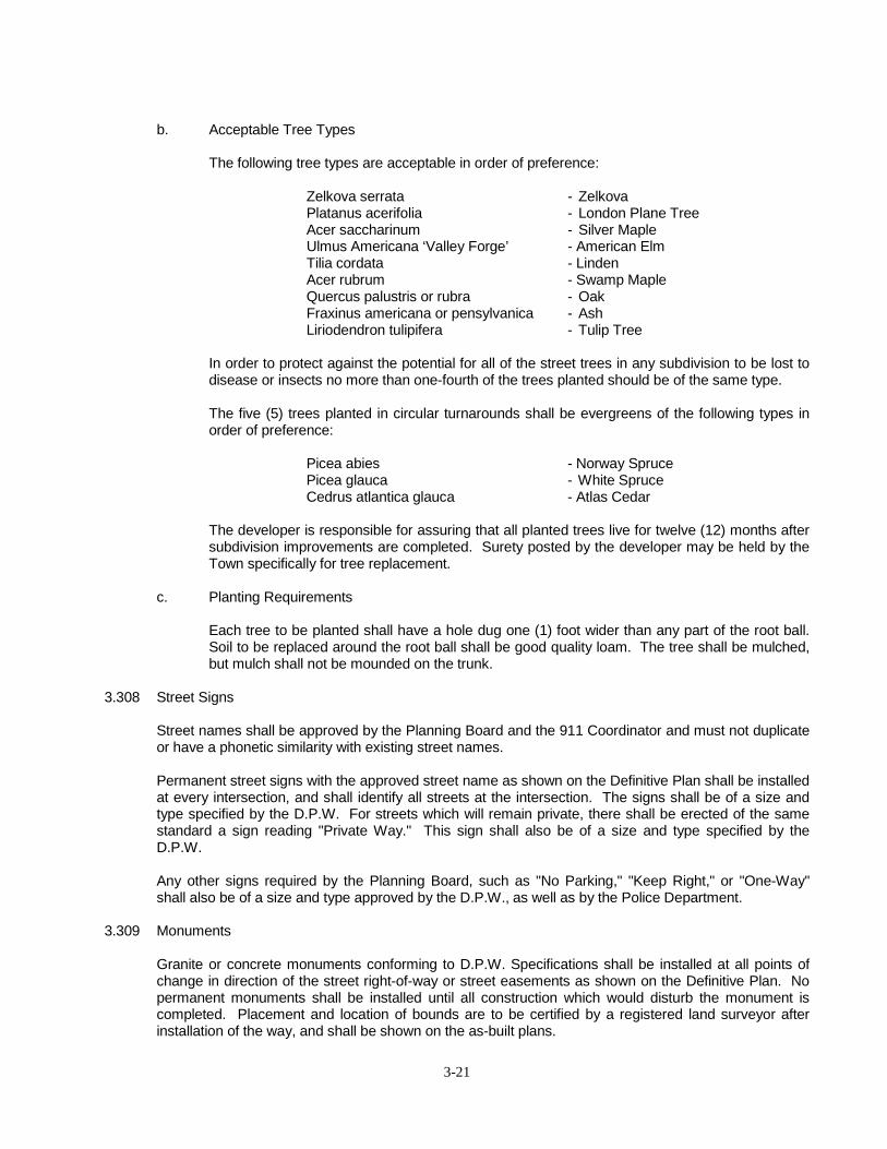
3-21
b. Acceptable Tree Types
The following tree types are acceptable in order of preference:
Zelkova serrata - Zelkova Platanus acerifolia - London Plane Tree Acer saccharinum - Silver Maple Ulmus Americana ‘Valley Forge’ - American Elm Tilia cordata - Linden Acer rubrum - Swamp Maple Quercus palustris or rubra - Oak Fraxinus americana or pensylvanica - Ash Liriodendron tulipifera - Tulip Tree
In order to protect against the potential for all of the street trees in any subdivision to be lost to disease or insects no more than one-fourth of the trees planted should be of the same type. The five (5) trees planted in circular turnarounds shall be evergreens of the following types in order of preference:
Picea abies - Norway Spruce Picea glauca - White Spruce Cedrus atlantica glauca - Atlas Cedar
The developer is responsible for assuring that all planted trees live for twelve (12) months after subdivision improvements are completed. Surety posted by the developer may be held by the Town specifically for tree replacement.
c. Planting Requirements
Each tree to be planted shall have a hole dug one (1) foot wider than any part of the root ball. Soil to be replaced around the root ball shall be good quality loam. The tree shall be mulched, but mulch shall not be mounded on the trunk.
3.308 Street Signs Street names shall be approved by the Planning Board and the 911 Coordinator and must not duplicate or have a phonetic similarity with existing street names. Permanent street signs with the approved street name as shown on the Definitive Plan shall be installed at every intersection, and shall identify all streets at the intersection. The signs shall be of a size and type specified by the D.P.W. For streets which will remain private, there shall be erected of the same standard a sign reading "Private Way." This sign shall also be of a size and type specified by the D.P.W. Any other signs required by the Planning Board, such as "No Parking," "Keep Right," or "One-Way" shall also be of a size and type approved by the D.P.W., as well as by the Police Department.
3.309 Monuments Granite or concrete monuments conforming to D.P.W. Specifications shall be installed at all points of change in direction of the street right-of-way or street easements as shown on the Definitive Plan. No permanent monuments shall be installed until all construction which would disturb the monument is completed. Placement and location of bounds are to be certified by a registered land surveyor after installation of the way, and shall be shown on the as-built plans.

3-22
3.310 Drainage
a. General Requirement
Stormwater management shall be designed and constructed to:
• Remove storm water from roadways to permit safe and convenient travel during storms of moderate severity, and
• Control the direction of flow of storm runoff in a manner that is not detrimental to
abutting lots, properties or ways, and
• Mitigate the discharge of stormwater in order to avoid increasing the occurrence of downstream flooding or degradation of water quality.
Stormwater shall be recharged to groundwater in accordance with DEP standards except in aquifer protection zones where the Town of Dartmouth Aquifer Protection District requirements shall apply. Direct discharge from the drainage system into any waterbody such as a stream, pond, or estuary shall be prohibited. All drainage from paved surfaces shall first be mitigated for rate and quality as specified in Section 3.310(g) - Mitigation Facilities. The design of drainage systems and mitigation facilities shall be considered for approval by the Planning Board after technical review and comment by the Department of Public Works, the Conservation Commission or a private consultant hired by the Planning Board and registered as a professional engineer in Massachusetts. Mitigation facilities shall be designed and located in such a manner that their presence shall not threaten life or property. Certification of the above, by the engineer responsible for the design shall appear on the construction drawing. All details, materials and construction of drainage facilities shall be in accordance with the latest edition of the DPW specifications except as may be specifically modified or added to herein. Drainage facilities located on or adjacent to private lots shall be substantially constructed in accordance with the design shown on the approved Definitive Subdivision Plans prior to release of the affected lots for sale or building.
b. Design Criteria
Storm drainage systems shall be designed to collect runoff from the tributary watershed during the design events. The Rational Formula may be used to determine quantities of run-off for the piped drainage system. The U.S.N.R.C.S. TR-20 or TR-55 Method, where applicable shall be used for determining existing runoff and proposed discharge rates. The Manning Formula shall be used to determine the capacity of pipe drains, smooth earth ditches and channels. The roughness coefficient "n" to be used in this formula shall be 0.010 for PVC, 0.013 for reinforced concrete pipe, 0.021 for corrugated metal pipe with bituminous coating/paved invert and 0.035 for smooth earth ditches or channels. The storm frequency to be used in designing storm drains shall be ten (10) years. Inlet spacing and capacities shall be sufficient to limit gutter flow depth to two and one-half (2 1/2) inches.

3-23
Inlet bypass shall not exceed 20 percent of gutter flow or 0.5 cubic feet per second, whichever is less. Swales with lawn inlets should be used to intercept large concentrated flows from off-pavement areas. Design of culverts shall be based on a twenty-five (25) year frequency storm, unless designed to detain storm-water on-site; however, such design must be consistent with the need to minimize over-the-road flooding. Where not apparent, the drainage plans shall indicate the routing of the runoff from a one hundred (100) year frequency storm throughout the site. This routing shall demonstrate that no threats to life and property have been created. Pipes discharging into swales or channels shall be designed to carry the design flow at a velocity not greater than ten (10) f.p.s. The maximum design velocity in swales or channels shall be eight (8) f.p.s. Rip-rap may be required along ditches or channels to control erosion of the channel bank at critical locations. Design consideration shall be given to erosion control during storms of greater intensity.
c. Conduits, Structures and Appurtenances.
All details, materials and construction of drainage facilities shall be in accordance with the latest edition of the DPW specifications or of such alternatives acceptable to the DPW - except as may be specifically modified herein. The minimum diameter of conduits conveying surface runoff shall be twelve (12) inches. Drains serving only cellar drains may be eight (8) inches in diameter. All pipes shall be laid on straight line and grade between structures. Pipes shall be designed so that they will operate without building up a hydraulic pressure head under design flow conditions. The minimum allowable full flow pipe velocity shall be three (3) feet per second (f.p.s.). The maximum allowable full flow pipe velocity shall be fifteen (15) feet per second (f.p.s.). In general, catch basins will be required on both sides of the roadway at low points in the roadway, at intervals not more than four hundred (400) feet apart along a downward gradient and no more than four hundred (400) feet down gradient from the peak of a high point in the road. Catch basins are also required at intersections in order to prevent gutter flow from crossing intersections. Catch basin leads shall have at least two (2) feet of cover. Main drains shall be installed up to eight feet deep to provide for gravity cellar drain connections. Greater depth is allowable if required to satisfy other site and profile conditions. Generally, curb opening inlets with grates shall be used on all streets. Grating inlets shall be used only where existing conditions preclude the construction of curb opening inlets. All grate openings shall be of a design and placement that will not trap or divert bicycle wheels. Catch basins shall require granite curb inlets with granite transitions to meet Cape Cod berm. A catch basin to manhole configuration shall be used. Multiple catch basins must tie into manholes. Manholes shall be required at the upstream termination of any drainage pipe.

3-24
Direct leaching catch basins are not permitted. When existing conditions reasonably preclude the provision of positive outlet, and if approved by the D.P.W. and drainage consultant, catch basins may be designed to discharge to subsurface leaching facilities that can adequately accommodate drainage water flowing into the catch basin. Subject to the following:
• Leaching facilities shall not be located under or within five (5) feet of the roadway pavement. Future replacement of the facility must be a design consideration.
• Determination of groundwater elevation and a percolation test, as required by the
Board of Health for a septic system, shall be taken in the center of each leaching field. The D.P.W. or the drainage consultant will evaluate, based on Board of Health percolation tests, the adequacy of a leaching field.
• The leaching fields shall be elevated at least two (2) feet above the groundwater
elevation as determined by the groundwater elevation test.
Depending on topographic conditions and existing drainage patterns, and subject to the concurrence of the DPW or drainage consultant, it may be permissible to design the leaching facility to overflow during events of less than annual frequency. Headwalls, flared pipe ends, or special catch basins shall be used to intercept the flow of natural streams. Headwalls, or flared pipe ends shall also be required at the downstream termination of all pipe systems. A rip-rapped channel of suitable length shall be extended beyond the downstream discharge point of all pipes.
d. Cellar and Footing Drains
Drain stubs shall be installed from storm drain pipes to the front property line of each buildable lot in the subdivision to allow connection of cellar and footing drains. Cellar drains shall have a minimum pipe size of four (4) inches and a slope of two (2) percent. Cellar drains may discharge to grade by gravity on building lots which are situated at an elevation too low to connect to standard depth storm drains. The termination of such drains shall be no less than 30’ from any side or rear lot line. In no case shall any cellar drain terminate at a location or in a manner that might lead to icing of a sidewalk or pavement. In situations where building lot topography is extreme, the Planning Board may permit sump pump discharge to grade – provided that such discharge is located in a manner that will not create nuisance conditions on the lot or abutting lots. In subdivisions which have sanitary sewer service, sump pumps, if approved for use, shall not discharge into the sanitary sewer system. Waivers from the cellar drain requirement will not be permitted in subdivisions which have sewer service.
e. Mitigation Facilities Storm runoff from all areas tributary to the drainage system shall be routed through one or more facilities commonly referred to as Best Management Practices (BMP) to achieve rate and quality mitigation before discharge from the site.

3-25
Rate mitigation facilities shall be engineered so that aggregate peak discharge rates during a two (2), ten (10) or one hundred (100) year frequency storm, shall be no greater following development than 65 percent of the estimated rate prior to development. The point of analysis for confirmation of compliance normally shall be coincident with the lower limit of the area to be disturbed by development. Areas which will not be disturbed by development and which do not drain toward areas that will be disturbed shall not be included in the analyses.
The analyses performed for establishment of predevelopment runoff rates and for confirmation of compliance with discharge rate limits shall include all areas tributary to the point of analysis.
Runoff from areas which will not be modified by development activity need not be limited to the 65% value. Determination of allowable discharge rates for combinations of modified and unmodified areas shall be based on unit runoff values (CFS/acre) derived from analyses of predevelopment conditions. Rate mitigation is not required for projects which discharge to tidal waters except as may be required for environmental consideration as determined by the Conservation Commission. Quality mitigation shall be accomplished in accordance with the latest revision of the Dartmouth Conservation Commission requirements. For the purpose of avoiding redundancy, the Planning Board will defer to the Conservation Commission the review and approval of quality mitigation design for projects that fall within its jurisdiction. The applicant shall provide calculations that support the estimation of existing runoff rates and to confirm the proposed discharge rates. All mitigation basins shall be designed so that the bottom of any such facility is at or above groundwater. Groundwater elevation tests, as conducted by the Board of Health for a septic system, shall be undertaken in the area of the basin to determine such groundwater elevation. Adequate separation from groundwater is a necessary design consideration for facilities which rely on exfiltration during the design event. Basins shall be no greater than 30,000 square feet in area (measured at interior top of berm). The maximum storm-water depth of such basins shall be four (4) feet for a 10-year frequency storm. Basin depth at forebays may exceed the depth limitation by as much as two (2) feet, provided that it is separated from the toe of slope by a nominally level bench at least five (5) feet wide.
Micropools at basin outlet structures may exceed the depth limitation by as much as one (1) foot. Basins shall be designed so that 90 percent of total volume shall be drained within 48 hours after cessation of rainfall that generates runoff. Discharge rate control shall be accomplished with orifices in non-corrosive metal plates in order to facilitate future adjustment. The use of rectangular weirs for rate control is discouraged. Conduits or triangular weirs are not permitted as control devices. The outlet control device shall be preceded by a plate baffle to prevent blockage and the discharge of oils or floating debris.
Basin design shall include suitably sized overflow provisions.
3-26
All berm areas shall be completely cleared of organic matter. Berms shall consist of compacted clean, low permeability, inorganic fill, loamed (6" minimum) and seeded with grass. Trees shall not be planted on the sideslopes or top of berms. The interior slope of basin berms or cuts shall be no steeper than 3:1 (three feet horizontal to one foot vertical).
The top of any berm shall be flat for a width of five (5) feet, with one (1) foot of freeboard above the overflow water level.
Exterior berm slopes may be as steep as 2:1.
In the case of cut slopes where the elevation difference between the toe of slope and natural grade exceeds eight (8) feet, a nominally level five (5) foot wide bench shall be provided at the level of the top of berm. The slope above the bench may be as steep as 2:1.
The interior side of manmade filled embankments from the toe of slope to its top cannot exceed eight (8) feet in height. All manmade embankments shall have a compacted core of low permeability material. The engineer is encouraged to design basins and embankments which utilize existing topographic features. Adequate physical access for maintenance purposes shall be provided to mitigation facilities. Mitigation basins shall be located on their own lot.
f. Provision for Mitigation Facility Maintenance
The developer shall, by appropriate legal instrument, provide for the permanent maintenance of all mitigation facilities within the subdivision. Said maintenance agreements shall be enforceable by the Department of Public Works and so noted in the agreement. In the event that the organization (which shall consist of all owners of lots within the subdivision) established to maintain such facilities fails to maintain them in reasonable order and condition, the Select Board upon recommendation of the Department of Public Works may serve written notice of such failure upon such organization of owners of lots within the development and shall include a demand for correction within 30 days; and shall state the date, time and place of a hearing thereof which shall be held within 14 days of the notice. If the deficiencies are not corrected or the Board's demand modified, the Town, acting through the Select Board, may enter upon the land containing such mitigation facilities and maintain the same for a period of one year. Before the expiration of the year, a second public hearing shall be called by the Board, at which time the organization or the owners of lots within the subdivision shall show cause why such maintenance should not continue for a succeeding year. If the Board determines that the need for Town maintenance no longer exists, the Board shall cease to maintain the mitigation facilities. All costs incurred by the Town shall be assessed against the properties within the subdivision and shall become a lien on those properties which may be collected and enforced in the manner fixed by law for the collection of taxes. Notice of lien shall be recorded in the Registry of Deeds. In addition, the above referenced "legal instrument" shall include:
• A maintenance plan and schedule developed by the engineer
3-27
• A requirement that the top of all basin berms shall be kept free of trees and shrubs and shall be mowed at least once a year.
• Provisions to allow Town regulators the authority to review records and inspect the
premises to verify that maintenance functions have been carried out; and if applicable, an accessible legal right-of-way to mitigation facilities be provided over private property for the parties responsible for maintenance of such facilities.
g. Mitigation Basin Buffers
Mitigation basins shall have buffer plantings to provide screening from adjacent properties and streets. Buffer plantings shall be 50% evergreen and of a type plant that grows to at least six (6) feet high.
h. Drainage Easements
All storm drains located outside of the r-o-w either within or beyond the subdivision shall require that there be conveyed to the Town and the organization responsible for the maintenance of the mitigation facilities, without cost, a stormwater or drainage right-of-way easement of adequate width to conform substantially to the lines of such storm drains before streets in the subdivision will be accepted by the Town. Drainage easements shall be at least twenty (20) feet wide, and extend no more than fifty (50) feet beyond the drainage discharge pipe unless greater dimensions are requested by the Department of Public Works. The width of drainage easements which are parallel to the ROW line may be less than twenty (20) feet.
i. Special Features
In order to comply with regulatory requirements, it is common practice to design swales to direct stormwater runoff to rate and quality mitigation facilities. In some cases special grading features are called for to allow and direct runoff which exceeds conduit capacity toward those facilities. Occasionally, it even becomes necessary for the designer to assume specific, non-standard building placement and/or features such as walk-out basements in order to meet regulatory objectives. Those assumptions become part of the approved design and must be implemented. Whenever the integrity of a stormwater management system relies on specific grading or placement or features of structures, the drawings shall so indicate with sufficient clarity as to provide reasonable assurance that the design intent will be noticed to and complied with by all parties in all actions involved with the development project and eventual building construction – from land clearing through issuance of certificates of occupancy and release of performance bonds. Easements for drainage swales across lots shall be referenced in the deeds to such lots with notation that regrading cannot be done without securing approval from the DPW and/or the Conservation Commission.
3.311 Water Service
a. General Requirement
Public infrastructure extensions for water are discouraged unless necessitated by public health concerns. In areas (identified in the Town's Growth Management Master Plan) where both water and sewer lines exist, minor water service extensions are permitted, or in areas where circumstances promote fiscal/economic policy objectives (reference the Growth Management Master Plan).

3-28
In areas where only water lines exist but not sewer lines, or where both water and sewer lines do not exist, extensions to public water service lines are discouraged except in situations necessitated by public health concerns, or in circumstances which promote fiscal/economic policy objectives (refer to the Town's Growth Management Master Plan). In these areas, private individual wells will be required. These wells must be located in appropriate areas and must meet State criteria. Where water service extensions are promoted by the Town's Growth Management Master Plan, the construction and installation of pipes for subdivisions by private developers should be sized to suit the new development or subdivision only. Under no circumstances shall pipes or equipment be installed that are larger than absolutely necessary to service the new development. This includes only pipes that enter and leave the development. In subdivisions where water service is to be extended, water distribution pipes shall be required to serve all lots on each street. The Planning Board may require the installation of such a system, if according to the Town's Growth Management Master Plan, Town water will be extended to the proposed subdivision in the near future. All materials, construction, and connections shall be in accordance with the Department of Public Works Specifications.
b. Water Mains
Water mains shall be eight (8) inch pipe of a type specified in the Department of Public Works Specifications. Water mains shall have a minimum cover of four (4) feet six (6) inches above the top of pipe to finished grade level. Where the water main crosses over or under any other utility, the minimum clearance between outside of pipes shall be twelve (12) inches unless a smaller clearance is approved, in writing by the Planning Board. Water main crossings of sewer lines shall have a minimum clearance of eighteen (18) inches or shall be sleeved with a casing approved by the Department of Public Works for a distance of at least ten (10) feet in each direction of the crossing. Water mains shall be installed within the right-of-way on the south side of any street running east and west, and on the west side of streets running north and south. The necessary pipe bends shall be installed if pipe deflection is to exceed five (5) percent at a joint.
c. Gate Valves In general, gate valves shall be located in accordance with the following conditions: Tapping gate valves shall be utilized when making the initial connection to an existing water main unless otherwise approved by the Department of Public Works. At intersections, gate valves shall be set in line with the extension of the street sidelines, with a minimum distance of five hundred (500) feet and a maximum distance of one thousand (1000) feet between gate valves. On long runs of mains, gate valves shall be set not more than one thousand (1000) feet apart, and not more than twelve (12) feet, nor less than eight (8) feet beyond every second hydrant installed. Gate valves shall be required in each direction of new intersecting water main extensions. Gate valves shall be required on all fire hydrant leads and shall be located three (3) feet from the centerline of the tee. Anchor tee connections to hydrant gate valves shall be required unless otherwise approved by the Department of Public Works.

3-29
Where future water main extensions are possible, dead-end gate valves shall have a full length of pipe installed and braced with a suitable thrust block on the end of the pipe.
d. Hydrants
Hydrants shall be installed not more than five hundred (500) feet apart and as close to the dividing lot lines as possible. At intersections of streets, hydrants shall be located five (5) feet from the end of the rounding or cutback of the property lines. Hydrants shall be set within the road right-of-way at a point at least three (3) feet back from the outer edge of the curb. Hydrants shall be located at the end of all dead-end water mains. Where existing ponds are located on-site, and which because of their depth, size and location could lend themselves to fire fighting purposes, a dry hydrant connected to the pond may be required by the Planning Board, and if requested, by the Fire Chief of the district.
e. Service Connections
Water service connections shall be provided to the property line of every buildable lot and located at the middle of the lot frontage. All tubing shall be at least three-quarter (3/4) inch diameter unless otherwise specified by the Water Division and shall have a minimum cover of four (4) feet. Curb stops shall be located one (1) foot from the property line. The water service connection shall be installed in a straight line, at a ninety (90) degree angle to the street, and at least ten (10) feet from any sewer service connection, septic system or cellar drain.
f. Dead-end Service
Wherever feasible, water mains shall be designed to avoid deadend mains. The Planning Board may require that mains serving deadend streets be connected to other mains via easements. Where watermains deadend and a hydrant is not provided at the end, a blow-off will be required.
g. Water Main Easements Easements for water mains shall be at least twenty (20) feet wide.
h. All water service infrastructure shall be designed, located and constructed so as to minimize flood damage.
3.312 Sewer Service
a. General Requirement
Public infrastructure extensions for sewer are discouraged except where there is large scale septic system failure; or where fiscal/economic policy objectives are promoted. In areas (identified in the Town's Growth Management Master Plan) where both water and sewer lines exist, minor sewer service extensions are permitted, or in circumstances which promote fiscal/economic policy objectives (reference the Growth Management Master Plan). In areas where only sewer lines exist but not water lines, or where both water and sewer lines do not exist, extensions to public sewer service lines are discouraged except in situations necessitated by public health concerns, or in circumstances which promote fiscal/economic policy objectives (refer to the Town's Growth Management Master Plan). In these areas, individual systems will be required. These systems must be located in appropriate areas and must meet State criteria for such systems. Where sewer service extensions are promoted by the Town's Growth Management Master Plan, the construction and installation of pipes for subdivisions by private developers should be

3-30
sized to suit the new development or subdivision only except where the Comprehensive Sewer Plan of the Town specifies otherwise. The Planning Board may require the installation of such a system if according to the Town's Growth Management Master Plan, Town sewer service will be extended to the proposed subdivision in the near future. If required, sanitary sewer connectors and related installations including lift stations, pumps and force mains, if necessary, shall be installed within the subdivision. Size and location of all sewerage facilities shall be designed in accordance with the Town of Dartmouth Comprehensive Sewer Plan where applicable. No pumping stations, lift stations, pneumatic ejectors, or other devices requiring a force main will be permitted unless specifically authorized, in writing, by the D.P.W. In no case will surface water, roof drainage, drainage water in cellars, or subsoil drainage be allowed to discharge into the sanitary sewer system. All materials and construction shall be in accordance with the D.P.W. Specifications. Throughout these Subdivision Regulations, reference to sewers shall mean sanitary sewers whether identified as sewer or sanitary sewer.
b. Sewer Mains
Sanitary sewers shall have a minimum pipe size of eight (8) inches and shall be of a type specified in the D.P.W. Specifications. Sewer mains shall be built to a sufficient depth to serve existing and proposed basements. The grade of the service connections shall be a minimum of 2 percent, unless special permission is given, in writing, by the Planning Board. In such cases, the minimum grade shall be 1 percent. All pipes shall be laid on straight lines and grades between manholes. Where the sewer main crosses over or under any other utility, the minimum clearance between outsides of pipes shall be twelve (12) inches, unless a smaller clearance is approved, in writing, by the Planning Board. To maintain self-cleansing velocities of two and one-half (2 1/2) feet per second, the minimum grades in Table 7 shall apply.
TABLE 7. Sewer Design for Self-Cleansing Velocities
Sewer Size Minimum Slope 8" (terminal sewers only)* .008
8" .006 10" .0025 12" .002 15" .0015
* Terminal sewers require greater minimum slopes because of the low flows and velocities at the head of a terminal line.
c. Manholes
Manholes shall be constructed at breaks in the grade of the sewer or changes in alignment and at intervals not exceeding three hundred (300) feet. Manholes shall have shaped channels connecting all lines.
d. Service Connections
A sewer service connection, consisting of a wye and six (6) inch pipe of a type specified in the Department of Public Works Specifications, or of a type otherwise specified by the Department of Public Works, shall be constructed from the sewer main to the property line at every buildable lot.
e. Sewer Easements Easements for sewers shall be provided where necessary and shall be at least twenty (20) feet wide.

3-31
f. All sewer service infrastructure shall be designed, located and constructed so as to minimize flood damage.
3.313 Additional Services
a. General Requirement
Electric, telephone, gas, cable television, and all other services, except transformers and junction boxes, shall be placed underground in all subdivisions. Service connections shall be provided to the property line of every lot. Except for service connections, underground utilities shall be placed in the right-of-way. All such services and utilities shall be designed, located and constructed so as to minimize flood damage.
b. Service Easements
Easements for services shall be at least twenty (20) feet wide.
c. Community Mailboxes
Community mailboxes are not required by the Planning Board, but should the developer choose to install them, community mailbox locations shall be approved by the Planning Board. A community mailbox location is defined as five or more mailboxes grouped in one area. Community mailbox locations shall be located at least 100 feet from intersections in order to minimize traffic congestion and promote safety. An area for a minimum of 3 vehicles to pull off to the side of the road shall be provided at the community mailbox location.
d. Streetlights
The Planning Board may require streetlights where subdivision streets intersect existing streets, in order to improve night time visibility at the intersection. The developer or an association of homeowners shall be responsible for the cost of operating said streetlights.
3.314 Parks, Greenbelts and Open Space
Before approval of a plan, the Board may in proper cases require the plan to show a park, green belt or open space suitably located within the subdivision. The area of these spaces shall not be unreasonable in relation to the land being subdivided and to the prospective uses of such land. The Board may, by appropriate endorsement on the plan, require that no building be erected on such spaces without its approval for a period of three (3) years from the date of approval of a subdivision.
3.315 Stonewall Protection Existing stonewalls shall be preserved as much as is practical. It is strongly encouraged that
new lot lines should follow existing stonewalls if possible. Where stonewalls have to be removed for such purposes as road, utilities, or house construction, stonewalls shall be rebuilt onsite at a ratio of two (2) linear feet of rebuilt wall for every one (1) linear feet of wall removed. Rebuilt walls shall be a minimum of three (3) feet high and of a style similar to the wall removed. The Planning Board shall have the final authority as to which stonewalls are removed and where they shall be rebuilt. The plans shall note stonewalls to be preserved and rebuilt. A restrictive covenant protecting the stonewalls against removal shall be required.
3-32
3.316 Specimen Tree Protection It is strongly encouraged that any existing, healthy tree which is greater than 30 inches in
diameter at a point three (3) feet above the ground shall be protected as a specimen tree. The Planning Board will request, where practical, a designated “Do Not Disturb” zone twenty (20) feet away from the trunk. Fencing, prior to construction, shall be installed around the “Do Not Disturb” zone. The fencing may be removed once the construction is completed. The plan shall note specimen trees and the protective fencing. A restrictive covenant protecting specimen trees against removal will be required.
3.317 Improvements Outside Subdivision If it is determined by the Planning Board that the subdivision will have negative impacts outside
of the subdivision, particularly to adjacent public ways, improvements may be required to mitigate such impacts. Such mitigation could include but is not limited to traffic, drainage, or pedestrian improvements, reasonably related to the subdivision.
3.318 Homeowners’ Associations
The applicant shall create and record, prior to the Definitive Subdivision Plan being recorded, a Homeowner’s Association Agreement, approved by the Planning Board, for the Subdivision, which instrument (see Declaration of Trust in the Appendix) shall provide that the homeowners’ association has the authority and duty to construct, repair, replace, extend, operate, use and forever maintain all private streets, common driveways and open space, if part of an Open Space Residential Design development of the Subdivision as shown on the Definitive Plan, as well as all surface and subsurface storm water drains in, through, around or under said streets, driveways, or open space, of the Subdivision as shown on the Definitive Plan, and which authority and duty shall be triggered by the first of either the sale of the last lot of the Subdivision or the abandonment of the Subdivision by the applicant (whether due to bankruptcy, dissolution as a legal entity or otherwise). The applicant shall convey to said homeowners’ association a right and easement (see Form M, which can be found in the appendix) to construct, repair, replace, extend, operate, use and forever maintain all private streets, common driveways and open space, if part of an Open Space Residential Design development, of the Subdivision as shown on the Definitive Plan, as well as all, surface and subsurface storm water drains in, through, around, or under said streets, driveways, and open space and shall record said conveyance; provided, that this easement must state expressly that the homeowners’ association may transfer this easement notwithstanding the lack of a dominant parcel.
3.400 Review by Other Municipal or Local Agencies
Once the Definitive Plan has been properly submitted to the Planning Office, the plan will be reviewed by the following: 3.401 The Planning Staff for compliance with these Subdivision Rules and Regulations, particularly
the design standards for a Definitive Subdivision Plan, and for compliance with M.G.L., Chapter 41, Section 81-M.
3.402 The Board of Health for its recommendation whether the Plan shall be approved, approved with
modifications, or disapproved in accordance with MGL, Chapter 41, Section 81-U. 3.403 The Department of Public Works for design review of proposed streets, utilities, and a general
review of the drainage system.

3-33
3.404 The Conservation Commission for review as to the effect of the proposed subdivision on wetlands and the drainage system.
3.405 The Chief of the respective Fire District for review of proposed access to individual lots. 3.406 The Planning Board's drainage consultant for detailed review of the drainage system. 3.407 At the option of the Planning Board, any specialized professional for review of issues raised in
determining compliance with these Rules & Regulations and the Subdivision Control Law. 3.408 After receipt of the Planning Board's letter requesting its input, failure of the other municipal or
local agencies to submit written reports with recommendations within twenty-one (21) days shall mean it has no problem with the Plan unless the Planning Board accepts a late report. The results of these initial technical reviews will be presented to the applicant only during a regularly scheduled Planning Board meeting.
3.500 Public Hearing
3.501 Before acting on the Definitive Plan, a public hearing shall be held by the Planning Board.
3.502 The Planning Board shall give notice of the time and place of the hearing by advertisement in a newspaper of general circulation in the Town of Dartmouth, once in each of two successive weeks, the first publication being not less than fourteen days before the hearing. A copy of said notice shall be mailed to the applicant and to all owners of land abutting the subdivision as they appear on the most recent tax list.
3.503 Pertinent information received regarding the proposed subdivision will be read into the record at
the public hearing. The applicant or a representative is encouraged to be present and available to describe the proposed Definitive Subdivision Plan to the Planning Board and public.
3.600 Decision of the Planning Board
3.601 After the public hearing and during a regularly scheduled Planning Board meeting, the Planning
Staff will summarize the results of the initial technical reviews. The Planning Board will act on or recommend changes to the plan after this initial technical review. The applicant or a representative is encouraged to attend the regularly scheduled Planning Board meeting for this discussion.
3.602 If the plan requires additional changes or modifications to the original submittal, the applicant
will have the opportunity to make the changes and submit revised plans to the Planning Board office. If revised plans are not received within the time period specified by the Planning Board, the Board will act at a regularly scheduled Planning Board meeting based on the original submission.
3.603 If revised plans are submitted in a timely manner, the revised plans will be forwarded to the
Planning Board's reviewing agencies and staff for a final technical review. 3.604 The results of these final technical reviews will be summarized by the Planning Board staff and
presented to the applicant and Planning Board only at a regularly scheduled Planning Board meeting. The Planning Board will then act to approve, approve with conditions and modifications, or disapprove the plan. Whenever any of the land to be subdivided is located within the Town’s floodplain as determined, delineated and described by § 375-27.2 of the Zoning Bylaw, the Planning Board shall condition any approval so as to ensure that the plan minimizes flood damage.

3-34
3.605 The Planning Board must act on the plan within ninety (90) days (if the submitted Definitive Plan evolved from a Preliminary Plan acted upon by the Planning Board) or one hundred and thirty five (135) days (if the submitted Definitive Plan did not evolve from a Preliminary Plan acted upon by the Planning Board). Except that an extension of the time limit is permitted, if agreed upon by the Planning Board and applicant, in writing, (Form C-1, see Appendix A).
3.606 A certificate of Planning Board action regarding the Definitive Plan, including any conditions of
approval, waivers granted from the requirements of these Regulations or specific reasons for disapproval shall be filed with the Town Clerk. A copy of the certificate shall be sent by certified mail to the applicant.
3.607 Once a plan is approved, it must be endorsed (see Section 4.400) within six (6) months of filing
the certificate of approval with the Town Clerk. In the event the approval is appealed, said six months shall be extended by an amount of time equal to the amount of time required for the appeal to be favorably resolved.
3.608 Final approval of a Definitive Plan does not constitute a laying out or acceptance by the Town of
the streets within the subdivision as town or public ways.

4-1
4.000 SUBSEQUENT ACTIONS TO A DEFINITIVE PLAN 4.100 Resubmission of Disapproved Definitive Plan
A revised disapproved Definitive Plan may be resubmitted for reconsideration by the Planning Board and must follow all the requirements under Section 3.000 of these Subdivision Regulations.
4.200 Amendment to or Rescission of a Previously Approved Definitive Plan
An amendment to a previously approved plan may be submitted to the Planning Board if the applicant chooses to modify lot lines, street lines, or required improvements prior to completion of the subdivision in accordance with the Certificate of Approval. An amendment will only be accepted if the proposed modifications are relatively minor in scope; major modifications will require a new submittal under Section 3.000 - Definitive Plans. All amendments to a previously approved Definitive Subdivision Plan or a rescission of an approved Definitive Subdivision Plan will require a public hearing. To amend a Definitive Plan, submit a Form E application, which can be found in Appendix A.
4.201 Any plans submitted as an amendment shall comply with all the plan content requirements
for a Definitive Plan (Section 3.200) as applicable. In addition, the following shall be provided on all amended plans:
4.202 The titles of all plans shall start with the word "Amended." 4.203 The note: Being an amendment to an approved Definitive Subdivision Plan entitled “(title)”
dated (date) and recorded in the Bristol County (S.D.) Registry of Deeds, Book (Book No.), Page (Page No.) .
4.204 Submission of the plans shall be by delivery to the Planning Board or by registered mail to
the Planning Board in care of the Town Clerk. An application for an amendment is not deemed submitted if it does not comply with the
requirements of Section 4.200 of these Regulations; unless specific written waivers have been granted by the Planning Board.
Upon determination by the Planning Staff that the application is in compliance with Section
4.200 of these Regulations, the Planning Staff or applicant shall give written notice (a copy of the Form E) to the Town Clerk of the application's formal submittal to the Planning Board.
The Planning Board will act on the amended plan in the same manner as for a Definitive
Subdivision Plan, as applicable. 4.300 Performance Guarantee
Before endorsement of its approval on the Definitive Plan, the Planning Board shall require a Performance Covenant from the applicant to ensure construction of ways and/or common driveways, and the installation of municipal services, in accordance with the applicable Subdivision Regulations of the Board. The Performance Covenant and endorsed Definitive Subdivision Plan shall be recorded at the Bristol County (S.D.) Registry of Deeds. Once the Performance Covenant has been recorded, lots will be released to allow sale or building only if performance is secured by any of the two (2) methods described below, which method or combination of methods may be selected and varied by the applicant.
4.301 Completion of all required improvements to the satisfaction of the Planning Board.
4-2
4.302 By a Letter of Credit, tri-party agreement, or deposit of money approved as to form by the
Town Treasurer in an amount determined by the Planning Board to be sufficient to secure the construction of ways and the installation of municipal services, subject however, to the rights and limitations specified in MGL, Chapter 41, Section 81-U.
If method 4.301 is chosen, the applicant shall contact the Dartmouth Department of Public Works at the start of construction and notify the Planning Board office when construction is completed.
If method 4.302 is chosen, the sum of any such Performance Guarantee shall be calculated by the
Department of Public Works at the request of the applicant made through the Planning Board. The Department of Public Works shall notify the Planning Board of said sum in writing, and the Planning Board shall notify the applicant. The applicant shall then contact the Town Treasurer, who will hold the financial portion of the Performance Guarantee. The Town Treasurer shall notify the Planning Office, in writing of receipt of the financial portion of the Performance Guarantee.
No Performance Guarantee shall automatically expire before construction is completed. All
construction covered by a Performance Guarantee under methods 4.302 shall be completed within eighteen (18) months after the Planning Board endorses the Release of Lots Form. If a Letter of Credit is chosen as a Performance Guarantee, it shall expire no sooner than nineteen (19) months from the date of release of lots.
The sum of any Performance Guarantee held under method 4.302 may be reduced so that the
amount held by the Town Treasurer continues to reflect the actual expected cost of work not yet completed. Once surety has been calculated and posted with the Town Treasurer, subsequent requests for surety reduction will require an inspection fee paid to the Department of Public Works.
4.400 Endorsement Of An Approved Plan
Once the Definitive Plan has been approved, the Planning Board shall endorse the Plan, if the following requirements have been met:
4.401 The Planning Office has possession of the original Subdivision Plan (the recordable plans),
two (2) prints of the Subdivision Plan and two (2) prints of the Street & Utilities Plan, all of which accurately represent the approved plan or modifications required as a condition of approval.
4.402 The Town Clerk has certified on the Plan that no appeal has been taken or reference is
made on the Plan to a final court decree sustaining the approval of the Plan. 4.403 A Performance Covenant has been executed by the applicant/owner and two (2) original
executed copies accompany the Definitive Plan. 4.404 The Planning Board is in possession of two (2) original executed copies of the following
documents as may be applicable to the project: a. A Restrictive Covenant (Form G). The Restrictive Covenant shall contain any
conditions of approval as noted to be included in such a covenant by the Planning Board in the Certificate of Action.
b. Open Space Covenant (Form H) c. Estate Lot Covenant (Form K) d. Trust Document (Form L or approved equivalent) e. Any other document(s) required by the Planning Board in the Certificate of Action.
4.405 All fees related to the review of the plans have been paid in full by the applicant.

4-3
After the Planning Board has endorsed the Definitive Plan, the original plan, one executed copy of the Performance Covenant, and, if applicable, any other required document submitted in accordance with section 4.404 above, will be returned to the applicant. The applicant is responsible for recording the plan and document(s) at the Bristol County (S.D.) Registry of Deeds. The applicant shall furnish the Planning Board with copies of all recorded plans and documents clearly showing the Registry Book and Page numbers on each page.
4.500 Release of Lots for Sale or Building
A Release of Lots form to allow the sale or issuance of building permits for individual lots in the subdivision will be signed by the Planning Board if the following have been received by the Board and certain conditions met: 4.501 A copy of the recorded Definitive Plan. 4.502 A copy of the recorded Performance Covenant.
4.503 Recorded copies of any other document as may have been required by the Planning Board
in its approval of the plan: a. Restrictive Covenant (Form G) b. Open Space Covenant (Form H) c. Estate Lot Covenant (Form K d. Trust Document (Form L or approved equivalent) e. For streets which will be proposed for acceptance by the Town, an easement(s)
referred to in Section 4.603.
4.504 A letter from the Department of Public Works (as requested by the applicant) that drainage facilities are installed on any lots that are being requested for release.
4.505 Special conditions of approval, if any, that were required to be met prior to release of lots
have been addressed.
4.506 A number of lots will not be released for building or sale until all improvements are completed in the subdivision or a non-expiring form of surety is established. The actual lots not released shall be identified by the Planning Board and will be in accordance with the following table:
Total # of lots # of lots not in subdivision released 1- 3 0 4- 7 1 8-11 2 12-15 3 16-19 4 20 or more ¼* total of lots shown on plan *fractions to be rounded up 4.507 The construction of ways and the installation of municipal services have been secured by
one or more of the methods described in Section 4.300.
4.508 If more than one year has passed since the last certification, written certification from the Town Collector that the applicant and/or recipient have paid all taxes, assessments, betterments, and other municipal charges due, pursuant to the Town Collector chapter of

4-4
the Dartmouth General Bylaw, Section 3, as authorized by M.G.L., Chapter 40, Section 57 and accepted by Town Meeting on October 20, 1986.
4.509 The applicant shall record the Release of Lots form at the Bristol County (S.D.) Registry of
Deeds.
4.510 The Director of Inspectional Services shall not issue any permit for the construction of a building on any lot within a subdivision without receipt from the Planning Board of a copy of the Release of Lots Form, listing the lots for which a permit is requested.
4.600 Inspections and Finishing Requirements
4.601 Responsibility
The applicant is responsible for requesting inspections, at the proper stages in the process of installation of improvements, as specified by the Department of Public Works. Should an inspection not be performed because of failure of the applicant to notify the inspector, the applicant shall be required to uncover the improvements for inspection. No work will be accepted that has been covered before inspection.
4.602 Testing
Pressure tests shall be performed by the applicant's contractor on all water and sewer facilities in accordance with the Department of Public Works Specifications.
4.603 Site Cleanup
The entire area of the subdivision shall be cleaned so as to leave a neat and orderly appearance free from debris and construction materials. The entire drainage system, including catch basins, manholes, and pipes, shall be properly cleaned out. The Planning Board may hold a portion of the Performance Guarantee to cover the cost of work which is necessary to satisfy this requirement.
4.604 As-Built Plans
The applicant shall provide to the Department of Public Works at no cost to the Town a
layout plan of each street in the subdivision, as built. Accompanying the paper as-built plan, include a digital CD in AutoCAD 2000 format. The As-Built Plan shall show the precise location and sizes, as built, of water services, sewer services, storm drains, monuments, utilities, water valves, shutoffs, manholes, hydrants, and other appurtenances. The plan shall contain a certification by an engineer and land surveyor that the locations shown on the plan represent the locations as constructed. The Planning Board may hold a portion of the Performance Guarantee to cover the cost of work which is necessary to satisfy this requirement.
4.605 Maintenance of Streets and Utilities
As a condition of approval of a subdivision, the applicant or his successor in title shall
maintain all infrastructure, including, but not limited to, streets and utilities within a subdivision until such time, if ever, that the infrastructure is accepted by the Town. The Town may assess betterments for any work needed to make such streets conform to Town standards prior to acceptance thereof as Town ways.

4-5
4.700 Release of Performance Guarantee
Upon completion of improvements, in accordance with the applicable Regulations of the Planning Board, the applicant shall request in writing the release of the Performance Guarantee. If the subdivision road is to be accepted by the Town, 5% of the initial performance guarantee shall be held until a completed application for street acceptance is submitted to the Select Board.
If the Planning Board determines, after receiving a written report from the Department of Public Works that improvements have been completed, it shall release the interest of the Town in such Performance Guarantee. The Planning Board shall notify the Town Treasurer to release any surety to the person who furnished the same.
Should the Planning Board determine, after receiving a written report from the Department of Public Works, that specific improvements have not been completed, it shall in accordance with MGL, Chapter 41, Section 81-U, notify in writing, the applicant, the Town Treasurer, and Town Clerk, specifying in detail wherein said improvements fail to comply with the applicable Regulations of the Planning Board. Sufficient surety shall be held by the Town to cover the cost of any unfinished improvements. Any surety held by the Town as a Performance Guarantee may be applied by the Planning Board for the benefit of the Town, as provided for in MGL, Chapter 41, Section 81-Y, upon failure of performance for which such surety was given, to the extent of the reasonable cost of the Town to complete the necessary improvements in accordance with the approved Definitive Plan and the applicable Subdivision Regulations. If the amount of surety posted with the Town does not sufficiently cover the costs to the Town for the improvements, the Town may pursue any and all recourse to secure such funds from appropriate parties.

A-1
APPENDIX A Forms A through M
The attached forms and applications were approved by the Planning Board on September 25, 2017
Forms and Applications are available on the Town of Dartmouth’s Official Website
- Planning Department

Form A 1 of 2
FORM A DARTMOUTH PLANNING BOARD 400 Slocum Road Dartmouth, MA 02747 (508) 910-1816
TIME STAMP HERE
APPLICATION FOR ENDORSEMENT OF ANR (Approval Not Required) PLAN (Please Print or Type)
Date: ________________________ Applicant’s Name: ________________________________ Phone No.:__________________ Applicant’s Address: ___________________________________________________________ Property Owner Name: ______________________________________________ (if different than applicant) Address: ____________________________________________ Contact Person : ________________________________ Phone No.:___________________ (if questions regarding plan) Email: _________________________________________ ANR Plan entitled: ____________________________________________________________ Plan Dated: _________________________ Location of Subject Property: ____________________________________________________ ____________________________________________________________________________ Assessor’s Map/Lot(s): _________________________________________________________ All Applicable Zoning Districts: ___________________________________________________

Form A 2 of 2
The applicant believes approval is not required for the following reasons: (Check as appropriate)
1. □ Every lot created has frontage on (check one):
□ a public street; name of public street ____________________________________________
□ a street (improved to Town Standards) shown on a plan approved and endorsed under Subdivision Control Law; name of street __________________________________________
□ a private street which existed before April 7, 1953; name of street __________________________________________
2. □ The plan changes the size and shape of lots, while maintaining frontage required by zoning.
3. □ The plan creates parcels without required frontage, with such parcels labeled “non-buildable”.
4. □ The plan shows a division of land, where two or more buildings were standing before April 7, 1953, into separate lots on each of which one such building remains standing. The applicant is responsible for proving the age of buildings.
5. □ The plan submitted is in accordance with a Board of Appeals decision recorded at the Bristol County (S.D.) Registry of Deeds, Book __________ Page __________.
____________________________________________________________________________ I have diligently researched the property, including walking the property, to determine whether any burial grounds or human skeletal remains are located on or near the proposed lot. To the best of my knowledge and belief, no burial grounds or human remains, except those shown on the plan, lie on the proposed lot or would be affected by the proposed plan. The Town will rely on this statement in determining whether to issue permits. A false or mistaken statement will be grounds for denying permits and, if issued, for revoking it. Applicant’s Signature: _____________________________ Print Name: _______________________ Owner’s Signature: ________________________________ Print Name: _______________________ (if other than applicant)
SUBMITTAL CHECKLIST
□ Application Form (2x) – Please note both copies must be originals, 1 copy for Planning and 1 copy for Town Clerk
□ Application Fee is $100.00 plus $100.00 for each lot to be affected payable to Town of Dartmouth.
□ Two (2) full-sized sets of plans and Seven (7) 11” x 17” copies and an electronic set of plans forwarded to Planning Director (CAD & PDF).

Form B 1 of 2
FORM B DARTMOUTH PLANNING BOARD 400 Slocum Road Dartmouth, MA 02747 (508) 910-1816
TIME STAMP HERE
APPLICATION FOR APPROVAL OF A PRELIMINARY SUBDIVISION PLAN (Please Print or Type)
Date: ________________________ Applicant’s Name: ________________________________ Phone No.:__________________ Applicant’s Address: ___________________________________________________________ Applicant’s Email: _____________________________________ Property Owner Name: ______________________________________________ (if different than applicant) Address: ____________________________________________ Engineer: __________________________________ Email: ____________________________ Attorney: __________________________________ Email: ____________________________ Contact Person: ________________________________ Phone No.:___________________ (if questions regarding plan) Email: _________________________________________ Preliminary Subdivision Plan entitled: ______________________________________________ consisting of ______ sheets, which shows ______ lots(s) and ______ parcel(s) proposed to be divided from a ____________ tract of land located ____________________________________ Assessor’s Map/Lot(s) __________________________________________________________ Plan Dated: _________________________

Form B 2 of 2
The undersigned hereby makes application to the Planning Board for approval of said Definitive Subdivision Plan in accordance with the Subdivision Regulations of the Dartmouth Planning Board. Where the plan does not comply, an attached list of waivers specifically notes each section requested to be waived and what is proposed instead. Applicant’s Signature: _____________________________ Print Name: _______________________ Owner’s Signature: ________________________________ Print Name: _______________________ (if other than applicant)
SUBMITTAL CHECKLIST
□ Application Form (2x) – Please note both copies must be originals, 1 copy for Planning and 1 copy for Town Clerk
□ Application Fee is $500.00 plus $100.00 for each buildable lot payable to Town of Dartmouth. The cost for an outside consultant review shall be borne by the Applicant
□ Receipt from Town Collector that there are no tax issues with the subject parcel(s)
□ Two (2) full-sized sets of plans and Seven (7) 11” x 17” copies.
□ Electronic set of plans forwarded to Planning Director (CAD & PDF)
□ Drainage Plan/Calculations

Form C 1 of 2
FORM C DARTMOUTH PLANNING BOARD 400 Slocum Road Dartmouth, MA 02747 (508) 910-1816
TIME STAMP HERE
APPLICATION FOR APPROVAL OF A DEFINITIVE SUBDIVISION PLAN (Please Print or Type)
Date: ________________________ Applicant’s Name: ________________________________ Phone No.:__________________ Applicant’s Address: ___________________________________________________________ Property Owner Name: ______________________________________________ (if different than applicant) Address: ____________________________________________ Contact Person : ________________________________ Phone No.:___________________ (if questions regarding plan) Email: _________________________________________ Definitive Subdivision Plan entitled: _______________________________________________ consisting of ______ sheets, which shows ______ lots(s) and ______ parcel(s) proposed to be divided from a ____________ tract of land located ____________________________________ Assessor’s Map/Lot(s) __________________________________________________________ Plan Dated: _________________________ Did the above-referenced Definitive Subdivision Plan evolve from a Preliminary Plan? ________

Form C 2 of 2
The undersigned hereby makes application to the Planning Board for approval of said Definitive Subdivision Plan in accordance with the Subdivision Regulations of the Dartmouth Planning Board. Where the plan does not comply, an attached list of waivers specifically notes each section requested to be waived and what is proposed instead. Applicant’s Signature: _____________________________ Print Name: _______________________ Owner’s Signature: ________________________________ Print Name: _______________________ (if other than applicant)
SUBMITTAL CHECKLIST
□ Application Form (2x) – Please note both copies must be originals, 1 copy for Planning and 1 copy for Town Clerk
□ Application Fee is $1,000.00 plus $100.00 for each buildable lot payable to Town of Dartmouth. The cost for an outside consultant review shall be borne by the Applicant
□ A separate check for legal advertising. Amount to be determined prior to publication
□ Receipt from Town Collector that there are no tax issues with the subject parcel(s)
□ Two (2) full-sized sets of plans and Seven (7) 11” x 17” copies.
□ Electronic set of plans forwarded to Planning Director (CAD & PDF)
□ Drainage Plan/Calculations
□ Certified abutters list and pre-addressed, self-sticking labels

Form C-1 1 of 1
FORM C-1 DARTMOUTH PLANNING BOARD 400 Slocum Road Dartmouth, MA 02747 (508) 910-1816 TIME STAMP HERE
AGREEMENT TO EXTEND STATUTORY DEADLINES UNDER MGL c.40A
(Please Print or Type) Date: ________________________ Applicant’s Name: ________________________________ Phone No.:__________________ Application Time-Stamp Date: ________________________ Subject Property Address: ______________________________________________________ Assessor’s Map/Lot(s): _________________________________________________________ PLAN IDENTIFICATION Title of Plan: _________________________________________________________________ Plan Dated: ________________________ Date Submitted: __________________________ Applicant hereby waives its right to enforce any and all deadlines imposed under MGL c. 40A or MGL c. 41 sec. 81 for required action on the above-referenced application. Pursuant to MGL c.40A or MGL c. 41 sec. 81, the Applicant and the Planning Board hereby agree that all deadlines imposed under MGL c.40A or MGL c. 41 sec. 81, including but not limited to the deadlines for the commencement of a public hearing, the Planning Board’s vote, and filing of its decision shall be extended to: __________________________________. Applicant’s Signature: ____________________________ Date: _______________________ (or authorized representative) Accepted by the Dartmouth Planning Board, Signed: ________________________________ Dated: ______________________________ (Signature of Chairman or Acting Chairman)

FORM D DARTMOUTH PLANNING BOARD 400 Slocum Road Dartmouth, MA 02747 (508) 910-1816
TIME STAMP HERE
APPLICATION FOR APPROVAL OF A REVISED DISAPPROVED DEFINITIVE SUBDIVISION PLAN
(Please Print or Type) Date: ________________________ Applicant’s Name: ________________________________ Phone No.:__________________ Applicant’s Address: ___________________________________________________________ Applicant’s Email: _______________________________________ Property Owner: Name: ______________________________________________ (if different than applicant) Address: ____________________________________________ Email: _______________________________________________ Engineer: ______________________________ Email: ________________________________ Attorney: ______________________________ Email: ________________________________ Contact Person : ________________________________ Phone No.:___________________ (if questions regarding plan) Email: _________________________________________
Disapproved Definitive Subdivision Plan entitled: ____________________________ Plan Dated: _________________________________ Is this an Open Space Residential Design (OSRD) Subdivision Plan? _____ If yes, an OSRD Special Permit application must be submitted along with this application.

Revised Subdivision Plan entitled: ______________________________________ Plan Dated: ____________________ Definitive subdivision plan consists of ______ sheets, which shows ______ lots(s) proposed to be divided from a __________________ tract of land located ___________________________ ________________________________________________________________________________________________________________________________________________________ ____________________________________________________________________________ Assessor’s Map ______ Assessor’s Lot(s) ______ ______ ______ ______ ______ ______ Assessor’s Map ______ Assessor’s Lot(s) ______ ______ ______ ______ ______ ______ Total linear feet of road ___________________ All applicable zoning districts: ___________________________________________________ Is this property located in any overlay district? ______ If yes, which overlay district? ____________________________________________________ Is this property located in a flood zone? ________ Is the subject property located on a Town designated Scenic Road? ______ If applicable, a Request for Permission to Remove Trees/Stonewalls Application is required prior to the cutting or removal of trees, or the tearing down or destruction of stone walls. Revised plan shows the following modifications to the Disapproved Definitive Plan:

The undersigned applies for approval of said Definitive Plan in accordance with the Rules and Regulations of the Dartmouth Planning Board in the belief that the revised plan corrects the deficiencies of the previously submitted Definitive Plan as outlined in the Certificate of Disapproval dated ___________________________. (Submit a copy of the Certificate of Disapproval along with this application)
The undersigned hereby makes application to the Planning Board for approval of said Definitive Subdivision Plan in accordance with the Subdivision Regulations of the Dartmouth Planning Board. Where the plan does not comply, an attached list of waivers specifically notes each section requested to be waived and what is proposed instead. Applicant’s Signature: _____________________________ Print Name: _______________________ (Must be original signature) Owner’s Signature: ________________________________ Print Name: _______________________ (Must be original signature

Form E 1 of 2
FORM E DARTMOUTH PLANNING BOARD 400 Slocum Road Dartmouth, MA 02747 (508) 910-1816
TIME STAMP HERE
APPLICATION TO AMEND AN APPROVED DEFINITIVE SUBDIVISION PLAN (Please Print or Type)
Date: ________________________ Applicant’s Name: ________________________________ Phone No.:__________________ Applicant’s Address: ___________________________________________________________ Property Owner Name: ______________________________________________ (if different than applicant) Address: ____________________________________________ Contact Person : ________________________________ Phone No.:___________________ (if questions regarding plan) Email: _________________________________________ Approved Definitive Subdivision Plan entitled: _______________________________________ Plan Dated: _________________________________ Amended Definitive Subdivision Plan entitled: _______________________________________ for Property Located at: ________________________________________________________ Assessor’s Map/Lot(s) __________________________________________________________ Plan Dated: _________________________

Form E 2 of 2
Amended plan shows the following modifications to the previously approved Definitive Plan: The undersigned being the applicant as defined by MGL c.41, § 81L, hereby submits an amended Definitive Subdivision Plan in accordance with the Subdivision Regulations of the Dartmouth Planning Board. Applicant’s Signature: _____________________________ Print Name: _______________________ Owner’s Signature: ________________________________ Print Name: _______________________ (if other than applicant)
SUBMITTAL CHECKLIST
□ Application Form (2x) – Please note both copies must be originals, 1 copy for Planning and 1 copy for Town Clerk
□ Application Fee is $200.00 plus $10.00 for each affected lot payable to Town of Dartmouth. The cost for an outside consultant review shall be borne by the Applicant
□ A separate check for legal advertising. Amount to be determined prior to publication
□ Receipt from Town Collector that there are no tax issues with the subject parcel(s)
□ Two (2) full-sized sets of plans and Seven (7) 11” x 17” copies.
□ Electronic set of plans forwarded to Planning Director (CAD & PDF)
□ Drainage Plan/Calculations (if applicable)
□ Certified abutters list and pre-addressed, self-sticking labels

Form F 1 of 4
FORM F DARTMOUTH PLANNING BOARD 400 Slocum Road Dartmouth, MA 02747 (508) 910-1816
PERFORMANCE COVENANT
After the applicant has completed construction of the required subdivision improvements or provided a Performance Covenant, the applicant shall prepare a copy of this form and submit it to the Planning Office. If conditions are met, the Planning Board will by majority vote endorse this release and it will be returned to the applicant, who shall record it at the Bristol County (S.D.) Registry of Deeds. A copy will be retained by the Planning Office and another given to the Director of Inspectional Services. I/We, the undersigned, ________________________________________________________[individual or entity] of _________________________________________________________________[address] _________________________ County, Massachusetts (the “Covenanter”), having submitted to the Dartmouth Planning Board a Definitive Plan of a subdivision Plan entitled: _______________________________________________________________ Dated: ______________________________________ Prepared by: ____________________________________ registered as an engineer or surveyor in Massachusetts, do hereby covenant and agree with said Board and the successors in office of said Board, pursuant to M.G.L. Chapter 41, §81-U that:
1. The covenanter is the OWNER* in fee simple absolute of all the land included in the subdivision and as shown on said Definitive Plan. (* If there is more than one owner, all must sign)
2. This covenant shall run with the land and be binding upon the executors, administrators, heirs, assigns of the covenanter, and their successors in title to land included in the subdivision and shown on said definitive subdivision plan.
3. The construction of ways and installation of subdivision improvements shall be provided to serve any lot before such lot may be built upon or conveyed, other than by mortgage deed; provided that a mortgagee who acquires title to the mortgaged
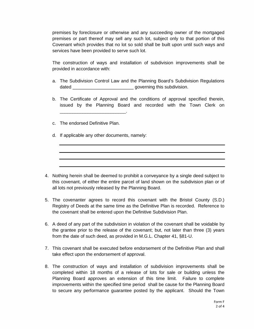
Form F 2 of 4
premises by foreclosure or otherwise and any succeeding owner of the mortgaged premises or part thereof may sell any such lot, subject only to that portion of this Covenant which provides that no lot so sold shall be built upon until such ways and services have been provided to serve such lot.
The construction of ways and installation of subdivision improvements shall be provided in accordance with: a. The Subdivision Control Law and the Planning Board’s Subdivision Regulations
dated ________________________ governing this subdivision.
b. The Certificate of Approval and the conditions of approval specified therein, issued by the Planning Board and recorded with the Town Clerk on __________________________.
c. The endorsed Definitive Plan.
d. If applicable any other documents, namely:
4. Nothing herein shall be deemed to prohibit a conveyance by a single deed subject to
this covenant, of either the entire parcel of land shown on the subdivision plan or of all lots not previously released by the Planning Board.
5. The covenanter agrees to record this covenant with the Bristol County (S.D.) Registry of Deeds at the same time as the Definitive Plan is recorded. Reference to the covenant shall be entered upon the Definitive Subdivision Plan.
6. A deed of any part of the subdivision in violation of the covenant shall be voidable by
the grantee prior to the release of the covenant; but, not later than three (3) years from the date of such deed, as provided in M.G.L. Chapter 41, §81-U.
7. This covenant shall be executed before endorsement of the Definitive Plan and shall
take effect upon the endorsement of approval.
8. The construction of ways and installation of subdivision improvements shall be completed within 18 months of a release of lots for sale or building unless the Planning Board approves an extension of this time limit. Failure to complete improvements within the specified time period shall be cause for the Planning Board to secure any performance guarantee posted by the applicant. Should the Town

Form F 3 of 4
have to secure the performance guarantee and complete improvements, the owner hereby gives permission to the Town to enter the property to complete improvements.
9. Upon completion of ways and subdivision improvements to the satisfaction of the
Planning Board, or upon the provision of a performance guarantee in accordance with the Planning Board’s Subdivision Regulations, lots within the subdivision shall be released from prohibitions regarding conveyances and issuance of building permits for individual lots. This shall be accomplished by a Release of Lots form executed by the majority of the Planning Board and enumerating the specific lots to be released. The Release of Lots form shall be recorded by the applicant at the Bristol County (S.D.) Registry of Deeds.
For title in the property, see deed from _________________________dated ____________
and recorded in the Bristol County (S.D.) Registry of Deeds
Book _____________________ Page _____________________ or registered in the
Bristol County (S.D.) Land Court as Document No. ________________________, and
noted on Certificate of Title No. _____________________________ in Registration
Book _____________________ Page _____________________ , IN WITNESS WHEREOF we have hereunto set our hands and seals below:
_________________________________
_________________________________
_________________________________ SIGNATURE OF COVENANTER [Owner(s)]
Then personally appeared before me the above named Covenanter(s) and acknowledged the foregoing instrument to be (his/her) free act and deed. Commonwealth of Massachusetts, Notary Public: ___________________________________ Date: ___________________________________ My Commission expires:
Form F 4 of 4
WITNESS the execution hereof as a sealed instrument as of ___________________________ Date Majority of the Planning Board ___________________________________ ___________________________________ ___________________________________ ___________________________________ ___________________________________
COMMONWEALTH OF MASSACHUSETTS BRISTOL, ss. On this ______ day of _______________________, before me, the undersigned Notary Public, personally appeared ____________________________________________________________________________, as members of the Dartmouth Planning Board and together constituting a majority of the members of the Dartmouth Planning Board, each being personally known to me to be a member of the Dartmouth Planning Board, and acknowledged that they signed the foregoing document voluntarily on behalf of the Dartmouth Planning Board for its stated purpose.
________________________________________
Notary Public
My Commission expires:
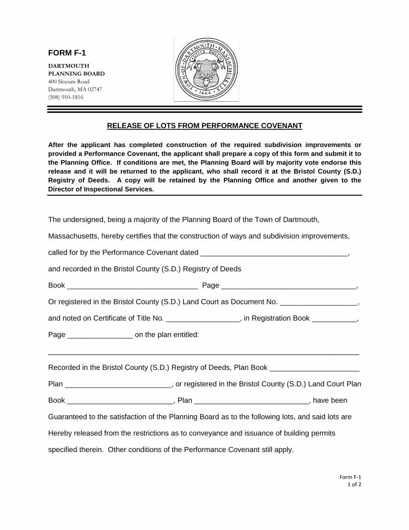
Form F-1 1 of 2
FORM F-1 DARTMOUTH PLANNING BOARD 400 Slocum Road Dartmouth, MA 02747 (508) 910-1816
RELEASE OF LOTS FROM PERFORMANCE COVENANT
After the applicant has completed construction of the required subdivision improvements or provided a Performance Covenant, the applicant shall prepare a copy of this form and submit it to the Planning Office. If conditions are met, the Planning Board will by majority vote endorse this release and it will be returned to the applicant, who shall record it at the Bristol County (S.D.) Registry of Deeds. A copy will be retained by the Planning Office and another given to the Director of Inspectional Services. The undersigned, being a majority of the Planning Board of the Town of Dartmouth,
Massachusetts, hereby certifies that the construction of ways and subdivision improvements,
called for by the Performance Covenant dated ____________________________________,
and recorded in the Bristol County (S.D.) Registry of Deeds
Book ________________________________ Page _________________________________,
Or registered in the Bristol County (S.D.) Land Court as Document No. ___________________,
and noted on Certificate of Title No. __________________, in Registration Book ___________,
Page ________________ on the plan entitled:
____________________________________________________________________________
Recorded in the Bristol County (S.D.) Registry of Deeds, Plan Book ______________________
Plan __________________________, or registered in the Bristol County (S.D.) Land Court Plan
Book __________________________, Plan ____________________________, have been
Guaranteed to the satisfaction of the Planning Board as to the following lots, and said lots are
Hereby released from the restrictions as to conveyance and issuance of building permits
specified therein. Other conditions of the Performance Covenant still apply.
Form F-1 2 of 2
The lots designated on said plan and released are as follows:
____________________________________________________________________________
Total lots released: _________
WITNESS the execution hereof as a sealed instrument as of ___________________________ Date Majority of the Planning Board ___________________________________ ___________________________________ ___________________________________ ___________________________________ ___________________________________
COMMONWEALTH OF MASSACHUSETTS BRISTOL, ss. On this ______ day of _______________________, before me, the undersigned Notary Public, personally appeared ____________________________________________________________________________, as members of the Dartmouth Planning Board and together constituting a majority of the members of the Dartmouth Planning Board, each being personally known to me to be a member of the Dartmouth Planning Board, and acknowledged that they signed the foregoing document voluntarily on behalf of the Dartmouth Planning Board for its stated purpose.
________________________________________
Notary Public My Commission expires:

Form G 1 of 3
FORM G DARTMOUTH PLANNING BOARD 400 Slocum Road Dartmouth, MA 02747 (508) 910-1816
RESTRICTIVE COVENANT
Should the Planning Board place restrictions on the subdivision as a condition of its approval, file two forms with the Dartmouth Planning Office. After endorsement of the Definitive Plan, one copy will be kept by the Planning Board and the other will be returned to the applicant who shall record it at the Bristol County (S.D.) Registry of Deeds. I/We, the undersigned, ________________________________________________________[individual or entity] of _________________________________________________________________[address] _________________________ County, Massachusetts (the “Covenanter”), having submitted to the Dartmouth Planning Board a Definitive Plan of a subdivision Plan entitled: _______________________________________________________________ Dated: ______________________________________ Prepared by: ____________________________________ registered as an engineer or surveyor in Massachusetts, do hereby covenant and agree with said Board and the successors in office of said Board, pursuant to M.G.L. Chapter 41, §81-U that:
1. The covenantor is the OWNER* in fee simple absolute of all the land included in the subdivision and as shown on said Definitive Plan. (* If there is more than one owner, all must sign.)
2. This covenant shall run with the land and be binding upon the executors, administrators, heirs, assigns of the covenantor, and their successors in title to land included in the subdivision and shown on said definitive subdivision plan.
3. This covenant shall be executed before endorsement of the Definitive Plan and shall take effect upon the endorsement of approval.

Form G 2 of 3
4. The covenantor agrees to record this covenant with the Bristol County (S.D.) Registry of Deeds at the same time as the Definitive Plan is recorded. Reference to this covenant shall be entered upon the Definitive Subdivision Plan.
5. Nothing shall prohibit the covenantor or his/her executors, administrators, divisees,
heirs, successors or assigns, and the Planning Board of the Town of Dartmouth to mutually agree to modify the conditions listed below:
Conditions of Approval are listed below:
______________________________________________________________________
______________________________________________________________________
______________________________________________________________________
______________________________________________________________________
______________________________________________________________________
For title in the property, see deed from _________________________dated ____________
and recorded in the Bristol County (S.D.) Registry of Deeds
Book _____________________ Page _____________________ or registered in the
Bristol County (S.D.) Land Court as Document No. ________________________, and
noted on Certificate of Title No. _____________________________ in Registration
Book _____________________ Page _____________________ , IN WITNESS WHEREOF we have hereunto set our hands and seals below:
_________________________________
_________________________________
_________________________________ SIGNATURE OF COVENANTER [Owner(s)]
Then personally appeared before me the above named Covenanter(s) and acknowledged the foregoing instrument to be (his/her) free act and deed. Commonwealth of Massachusetts, Notary Public: ___________________________________ Date: ___________________________________ My Commission expires:

Form G 3 of 3
WITNESS the execution hereof as a sealed instrument as of ___________________________ Date Majority of the Planning Board ___________________________________ ___________________________________ ___________________________________ ___________________________________ ___________________________________
COMMONWEALTH OF MASSACHUSETTS BRISTOL, ss. On this ______ day of _______________________, before me, the undersigned Notary Public, personally appeared ____________________________________________________________________________, as members of the Dartmouth Planning Board and together constituting a majority of the members of the Dartmouth Planning Board, each being personally known to me to be a member of the Dartmouth Planning Board, and acknowledged that they signed the foregoing document voluntarily on behalf of the Dartmouth Planning Board for its stated purpose.
________________________________________
Notary Public My Commission expires:

Form H 1 of 3
FORM H DARTMOUTH PLANNING BOARD 400 Slocum Road Dartmouth, MA 02747 (508) 910-1816
OPEN SPACE COVENANT
File two forms with the Dartmouth Planning Board if applying for approval under Section 6, Open Space Residential Design, of the Dartmouth Zoning Bylaws I/We, the undersigned, ________________________________________________________[individual or entity] of _________________________________________________________________[address] _________________________ County, Massachusetts (the “Covenanter”), having submitted to the Dartmouth Planning Board a plan which does not require approval under the Subdivision Control Law, hereinafter called the “plan”: Plan entitled: _______________________________________________________________ Dated: ______________________________________ Prepared by: ____________________________________ registered as an engineer or surveyor in Massachusetts, said plan qualifying for approval under Open Space Residential Design of the Dartmouth Zoning Bylaw, do hereby covenant and agree with said Board and the successors in office of said Board:
1. The covenanter is the OWNER* in fee simple absolute of all the land included in the parcel. (*If there is more than one owner, all must sign. The “applicant” may be an owner or his agent or representative, or his assigns, but the owner of record must sign the covenant)
2. This covenant shall run with the land and be binding upon the executors, administrators, heirs, assigns of the covenanter, and their successors in title to parcel(s)__________________________________________ shown on said plan
3. Parcel(s) _______________________________________________________

Form H 2 of 3
shall be maintained in perpetuity, for conservation, agricultural, recreational, or park uses and subject to a conservation restriction whereby the following activities are prohibited:
a. The dumping or placing of trash, waste, unsightly, or offensive materials
b. The excavation, dredging, or removal of loam, peat, gravel, soil, rock, or other mineral substance in such a manner as to adversely affect the surface
c. Surface use except for agricultural, farming, forest, or outdoor recreational
purposes permitting the land and water area to remain predominately in its natural condition
d. Activities detrimental to drainage, flood control, water conservation, and soil
conservation
e. The erection of any building or structure other than those devoted to: underground utilities, recreational uses such as tennis courts or swimming pools, and structures necessary for the storage of recreational, agricultural, or ground-keeping equipment directly related to agricultural and recreational uses. The aggregate floor area of all structures shall not exceed five (5%) percent of the Open Area and any such structures to be approved by the Planning Board
4. This covenant shall take effect upon approval of said plan and shall be recorded at
the Bristol County (S.D.) Registry of Deeds when said plan is recorded.
5. Reference of this covenant shall be noted on the plan and recorded in the chain of title of parcel(s): _________________________________________________________________
6. The Director of Inspectional Services shall not issue any building permits relative to
the buildable lots shown on the plan until a copy of this properly executed and recorded covenant, as well as a recorded copy of the plan, has been delivered to the Director of Inspectional Services and Planning Board.
IN WITNESS WHEREOF we have hereunto set our hands and seals below:
_________________________________
_________________________________
_________________________________ SIGNATURE OF COVENANTER [Owner(s)]

Form H 3 of 3
Then personally appeared before me the above named Covenanter(s) and acknowledged the foregoing instrument to be of (his/her) free act and deed. Commonwealth of Massachusetts, Notary Public: ___________________________________ Date: ___________________________________ My Commission expires: WITNESS the execution hereof as a sealed instrument as of ___________________________ Date Majority of the Planning Board ___________________________________ ___________________________________ ___________________________________ ___________________________________ ___________________________________
COMMONWEALTH OF MASSACHUSETTS BRISTOL, ss. On this ______ day of _______________________, before me, the undersigned Notary Public, personally appeared ____________________________________________________________________________, as members of the Dartmouth Planning Board and together constituting a majority of the members of the Dartmouth Planning Board, each being personally known to me to be a member of the Dartmouth Planning Board, and acknowledged that they signed the foregoing document voluntarily on behalf of the Dartmouth Planning Board for its stated purpose.
________________________________________ Notary Public
My Commission expires:

Form I
FORM I DARTMOUTH PLANNING BOARD 400 Slocum Road Dartmouth, MA 02747 (508) 910-1816
RELEASE OF SURETY
The Planning Office shall prepare two copies of this form. One copy will be kept by the Planning Board, and the other copy shall be sent to the Town Treasurer. The Town Treasurer will not reduce the surety until a new Performance Guarantee Form has been executed by all parties with the new surety amount. Town Treasurer Town Office Building 400 Slocum Road Dartmouth, MA 02747 This is to certify that at a meeting of the Dartmouth Planning Board held on ___________________________, it was voted to release ____________________ of the Performance Guarantee held by the Town of Dartmouth and posted for the Subdivision entitled: ___________________________________________________________________ leaving a balance of ___________________________________ to be held by the Town. In accordance with the above vote, please release the specified amount of said surety to the person who posted the existing Performance Guarantee. Dartmouth Planning Board ___________________________________ ___________________________________ ___________________________________ ___________________________________ ___________________________________

9/25/2017 Form J Page 1 of 3
FORM J DARTMOUTH PLANNING BOARD 400 Slocum Road Dartmouth, MA 02747 (508) 910-1816
CONVEYANCE OF EASEMENTS AND UTILITIES
File 3 copies with the Dartmouth Select Board’s Office. After approval by Town Counsel, 1 copy will be kept by the Select Board, 1 copy will be sent to the Planning Board, and 1 copy will be sent to the Department of Public Works I/We, the undersigned, ________________________________________________________[individual or entity] of _________________________________________________________________[address] _________________________ County, Massachusetts (the “Grantor”), in consideration of
_____________________________________________________hereby grants, transfers and
delivers unto the Town of Dartmouth, Massachusetts, a municipal corporation in Bristol County,
(the “Grantee”), the following:
A. The perpetual rights and easements to lay out, construct, inspect, repair, remove, replace,
operate, use and forever maintain (1) a sanitary sewer or sewers with any manholes,
pipes, conduits and other appurtenances, (2) pipes, conduits and their appurtenances for
the conveyance of water, and (3) a covered surface and ground water drain or drains with
any manholes, pipes, conduits and their appurtenances, and to do all other acts incidental
to the foregoing, including the right to pass and repass along and over land for the
aforesaid purposes, in, through, and under the whole of:
[name of way(s)] ________________________________________________________
_____________________________________________________________________
as shown on a plan entitled “_______________________________________________”
dated ____________________________

9/25/2017 Form J Page 2 of 3
prepared by _________________________________________
of _____________________________________, Massachusetts, and recorded with the Bristol County (S.D.) Registry of Deeds in
Plan Book ___________________ Page ___________________ Said plan is made and said plan is incorporated herein for a complete and detailed description of said roads.
B. The perpetual rights and easement to use for (describe use or purpose)
______________________________________________________________________ ______________________________________________________________________
the following parcel(s) of land situated on ______________________________________________________________________ in said Town and bounded and described as follows: ______________________________________________________________________ ______________________________________________________________________ ______________________________________________________________________ ______________________________________________________________________ ______________________________________________________________________ ______________________________________________________________________
TO HAVE AND TO HOLD the above-described rights and easements unto the Grantee and its successors and assigns forever. And the Grantor hereby covenants with the Grantee that the undersigned is the lawful owner of the above-described land; that the above-described Easement is free from all encumbrances; that the Grantor has good right to grant said Easement; and that the Grantor will warrant and defend said covenants and the Grantee against the claims and demands of all persons seeking to challenge, invalidate or undermine Grantor’s title to the above-described land or right to grant said Easement free and clear of all encumbrances.

9/25/2017 Form J Page 3 of 3
Also for the aforesaid consideration, the Grantor does hereby, for [himself/herself or itself] and [his/her/its] heirs, legal representatives, personal representatives, agents, administrators, executors, successors and assigns, covenant and agree with the Grantee and its successors and assigns that [he/she/it] will not and those claiming under [him/her/it] shall not make any claim for damages to [his/her/its] property, real or personal, by reason of any use, digging or other acts and things done by this Grantee, or its employees, independent contractors, designees, successors, assigns, agents, servants, or licensees, in and to the above-described land, pursuant to the rights granted hereby, and that [he/she/it] will not and those claiming under [him/her/it] shall not, in any way or manner, interfere with the maintaining, repairing, replacing, and inspecting of any or all said works or any part thereof. ____________________________________ __________________________________ Grantor Date ____________________________________ __________________________________ Grantee Date

Form K 1 of 3
FORM K DARTMOUTH PLANNING BOARD 400 Slocum Road Dartmouth, MA 02747 (508) 910-1816
ESTATE LOT COVENANT
File 2 forms with the Dartmouth Planning Board. After endorsement of the Plan, 1 copy will be kept by the Planning Board and the other will be returned to the applicant, who shall record it at the Bristol County (S.D.) Registry of Deeds. I/We, the undersigned, ________________________________________________________[individual or entity] of _________________________________________________________________[address] _________________________ County, Massachusetts (the “Covenanter”), having submitted to the Dartmouth Planning Board a Definitive or ANR Subdivision Plan Plan entitled: _______________________________________________________________ Dated: ______________________________________ Prepared by: ____________________________________ registered as an engineer or surveyor in Massachusetts, do hereby covenant and agree with said Board and the successors in office of said Board, pursuant to M.G.L. Chapter 41, §81-U that:
1. The covenanter is the OWNER* in fee simple absolute of all the land included in the Lot(s) ___________________________________________________________. (* If there is more than one owner, all must sign)
2. This covenant shall run with the land and be binding upon the executors,
administrators, heirs, assigns of the covenanter, and their successors in title to lot(s) ________________________________________________________________.
3. Lot(s) ___________________________________________________________
shall not be further subdivided.
4. This covenant shall take effect upon endorsement of said plan and shall be recorded at the Bristol County (S.D.) Registry of Deeds when said plan is recorded.

Form K 2 of 3
5. Reference to this Covenant shall be noted on the plan and recorded in the chain of title of Lot(s) _____________________________________________________
6. The Director of Inspectional Services shall not issue any building permits relative to
the buildable lots shown on the plan until a copy of the properly executed and recorded covenant has been delivered to the Director of Inspectional Services and Planning Board.
For title in the property, see deed from _________________________dated ____________
and recorded in the Bristol County (S.D.) Registry of Deeds
Book _____________________ Page _____________________ or registered in the
Bristol County (S.D.) Land Court as Document No. ________________________, and
noted on Certificate of Title No. _____________________________ in Registration
Book _____________________ Page _____________________ , IN WITNESS WHEREOF we have hereunto set our hands and seals below:
_________________________________
_________________________________
_________________________________ SIGNATURE OF COVENANTER [Owner(s)]
Then personally appeared before me the above named Covenanter(s) and acknowledged the foregoing instrument to be (his/her) free act and deed. Commonwealth of Massachusetts, Notary Public: ___________________________________ Date: ___________________________________ My Commission expires:

Form K 3 of 3
WITNESS the execution hereof as a sealed instrument as of ___________________________ Date Majority of the Planning Board ___________________________________ ___________________________________ ___________________________________ ___________________________________ ___________________________________
COMMONWEALTH OF MASSACHUSETTS BRISTOL, ss. On this ______ day of _______________________, before me, the undersigned Notary Public, personally appeared ____________________________________________________________________________, as members of the Dartmouth Planning Board and together constituting a majority of the members of the Dartmouth Planning Board, each being personally known to me to be a member of the Dartmouth Planning Board, and acknowledged that they signed the foregoing document voluntarily on behalf of the Dartmouth Planning Board for its stated purpose.
________________________________________
Notary Public
My Commission expires:

Form L 1 of 13
FORM L DARTMOUTH PLANNING BOARD 400 Slocum Road Dartmouth, MA 02747 (508) 910-1816
DECLARATION OF TRUST
File 2 forms with the Dartmouth Planning Board. After endorsement of the Plan, the Planning Board will keep one copy and the other will be returned to the applicant, who shall record it at the Bristol County (S.D.) Registry of Deeds
“_________________________________________________TRUST” I/We, the undersigned, of ______________________________________________________________________ (hereinafter the “Declarant”), hereby declares that he and his successors in trust will hold the drainage pond and appurtenant structures, including swales and easements, to be called “Stormwater Management Facilities; the Open Areas, and the walkways as shown on the Plan hereinafter described and to be conveyed to him as Trustee hereunder by deed to be recorded immediately following the recording of this instrument, as Trustee subject to and upon the terms and conditions hereinafter set forth and the perpetual conservation restrictions hereinafter set forth, for the sole benefit of the Beneficiaries, as hereinafter defined.
ARTICLE I Name of Trust
The Trust hereby created shall be known as the “______________________________________________________________ Trust” and under that name shall all business carried on by the Trustee be conducted and shall all instruments in writing by the Trustee be executed.
ARTICLE II Definitions
As used herein, unless otherwise provided, or unless the context otherwise requires, the following terms shall be defined as in this Article provided:
Form L 2 of 13
“Assessment” shall mean that portion of the Common Expenses which is to be paid by each Lot Owner. “Beneficiaries” have the meaning set forth in Article VI hereof. “Common Expenses” shall mean the actual and estimated expenses and costs of the administration of the Trust, real estate taxes, fire district taxes, insurance, and the maintenance, management, and operation of the “Stormwater Management Ponds” on the Plan. “Lot” shall mean each lot designated and delineated upon the Plan; provided, however, that in the event that a Lot Owner shall combine all or some portion of two or more Lots as designated on the Plan, the combined land shall together constitute a single Lot for the purposes hereof. “Lot Owner” shall mean the record owner, whether one or more persons or entities, of a Lot. “Lot Owner” shall include the purchaser of a Lot under an executory contract for the sale of real property. “Lot Owner” shall not include persons or entities who hold an interest in any Lot merely as collateral security for the payment or performance of an obligation. “Open Area” shall mean the parcel or parcels of land, if any, designated as “Open Space Parcels” in, and the boundaries of which are specifically described on, the Plan hereinafter referenced. “Plan” shall mean the subdivision plan of land:
Entitled “_____________________________________________________________”
Dated _______________________________
Prepared by ___________________________________________________________
of _________________________________________ as amended or supplemented from time to time.
“Pro Rata” shall mean or refer to that proportionate share, fractional share, or percentage share calculated as the equivalent of a fraction, the numerator of which is one, and the denominator of which is the number of Lots. “Town” shall mean the Town of Dartmouth, Massachusetts. “Transition Date” shall mean the date which occurs eighteen (18) months after the first lot is released from the Performance Covenant by the Planning Board or fifty-one percent (51%) of the Lots have been conveyed, whichever shall first occur. “Trustee” shall mean the original Trustee and any successor Trustees.

Form L 3 of 13
ARTICLE III The Trust and Its Purpose
Section 1. This trust is established for the perpetual preservation and the maintenance (per
attached Maintenance Schedule marked Exhibit A) of the Open Areas, the Stormwater Management Facilities, and the walkways shown on the Plan (hereinafter the “Trust Property”) and is the organization of the Lot Owners. All of the rights and powers in and with respect to the management of the use of the Trust Property are conferred upon and exercisable by the Trustee and all property, real and personal, constituting or situated upon the Trust Property, are conveyed to the Trustee of the Trustee of this Trust, IN TRUST, to manage, administer, and dispose of the same for the benefit of the Lot Owners from time to time of record.
Section 2. It is hereby expressly declared that a Trust and not a partnership has been
created hereby, and that the Lot Owners are beneficiaries and not partners or associates or any other relation whatever among themselves with respect to the Trust Property, and hold no relation to the Trustees other than as beneficiaries hereunder.
ARTICLE IV
Conservation Restrictions
The Open Areas, Stormwater Management Facilities, and walkways of the Trust Property shall be maintained in perpetuity, subject to the provisions of ARTICLE XI hereof, for conservation, agricultural, recreational, and park uses and subject to a conservation restriction, whereby the following activities are prohibited:
1. The dumping and placing of trash, waste, or unsightly or offensive materials 2. The excavation, dredging, or removal of loam, peat, gravel, soil, rock, or other
mineral substance in such a manner as to adversely affect the surface. This shall not apply to activities necessary for the construction and maintenance of the Stormwater Management Facilities.
3. Surface use other than agricultural, farming, forest, or outdoor recreational purposes permitting the land and water areas to remain predominantly in its natural condition.
4. Activities detrimental to drainage, flood control, water conservation, and soil conservation.
5. The erection of any building or structure other than those devoted to underground utilities, recreational uses, and structures necessary for the storage of recreational, agricultural, or grounds-keeping equipment directly related to the agricultural and recreational uses on the Open Area. The aggregate floor area for all such structures shall not exceed two percent (2%)
Form L 4 of 13
of the Open Area. In no event shall a structure be erected which interferes with the design and operation of the Stormwater Management Facilities.
6. All structures shall be approved as to location and design by the Planning Board.
ARTICLE V The Trustee
Section 1. Until the Transition Date, there shall be one (1) Trustee hereunder chosen by the
Declarant. The initial Trustee so chosen is ______________________________________________________________. Section 2. Commencing on the Transition Date, there shall be three (3) Trustees elected by
majority vote of the Lot Owners. Each Lot Owner, designated pursuant to Section 3 below, shall be entitled to one (1) vote. If the required subdivision improvements have not been completed on the Transition Date, the original Trustee shall remain in office. From and after the Transition Date, the terms of office of the Trustees shall, except as hereinafter provided, be three (3) years, and such terms shall be staggered so that the terms of one-third of the Trustees expires each year; provided that, in order to establish and maintain such staggering of terms, the terms of the persons first elected or appointed as Trustees after the Transition Date shall be one (1) year, two (2) years, and three (3) years respectively. If the original Trustee is to remain in office, the Trustees elected by the Lot Owners shall serve the three (3) year and two (2) year terms. Otherwise, the Trustees shall all be elected by majority vote of the Lot Owners, and said Trustees’ terms of one (1), two (2), or three (3) years shall be determined by lot. The Trustees shall notify the Planning Board of the Town of Dartmouth in writing of changes in Office (name and mailing address of the new Trustee) at any time such a change in Office occurs.
Section 3. Whenever any of said Lots is owned of record by more than one person, the
several owners of such Lot shall determine and designate which one of such owners shall be authorized and entitled to cast votes and otherwise exercise the rights appertaining to such Lot hereunder; and notify the Trustee of such designation by a written notice signed by all of the record owners of such Lot. Any such designation shall take effect immediately upon receipt of the Trustee of such notice, and may be changed at any time and from time to time by notice as aforesaid. In the absence of any such notice of designation, the Trustee may by majority vote either designate any one of such owners for such purposes or disqualify all of such owners from voting until a notice of designation is received from such owners in the required form.

Form L 5 of 13
ARTICLE VI Beneficiaries and the Beneficial Interest in the Trust
Section 1. The Beneficiaries of this Trust shall be the Lot Owners, each of whom shall have
a Pro Rata undivided interest in the Trust property. Section 2. The beneficial interest of each Lot Owner in the Trust Property shall be
inseparable from the ownership of the Lot and may not be conveyed or in any way alienated or separated from said Lot.
Section 3. The Lot Owners and the Town are the beneficiaries of the conservation
restriction imposed upon the Open Areas, Stormwater Management Facilities, and walkways by ARTICLE IV hereof, and as such individually and jointly shall have the right to enforce said restrictions by injunction or other proceeding.
Section 4. In the event the Trustee fails to own and maintain any portion of the Trust
Property in reasonable order and condition, or fails to adhere to the conditions of approval, the Select Board of the Town of Dartmouth may serve written notice of such failure upon the Trustee or Lot Owners and shall include a demand for correction within thirty (30) days of such notice and shall state the date, time, and place, of a hearing thereof which shall be held within fourteen (14) days of such notice. If the deficiencies are not corrected, or the Town’s demand modified, the Town, acting through its Select Board, may enter upon the Trust Property and maintain the same for a period of one (1) year or correct the non-compliances. Before the expiration of one year, a second public hearing shall be called by the Select Board, at which time the Trustee of the Lot Owners shall show cause why such maintenance should not continue for a succeeding year. If the Select Board determined that the need for Town maintenance no longer exists, the Select Board shall cease to maintain the Trust Property. All costs incurred by the Town for maintenance or correction of non-compliances shall be assessed against the Lot Owners and shall become a lien on those properties which may be collected and enforced in the manner fixed by the law for the collection of taxes. Notice of the lien shall be recorded in the Registry of Deeds.
ARTICLE VII
Assessments
Assessments against the Lot Owners shall be made or approved by the Trustee and paid by the Lot Owners to the Trust in accordance with the following provisions: Section 1. Each Lot Owner shall be liable for his Pro Rata share of the Common Expenses. Section 2. Assessments for Common Expenses shall be made for the fiscal year annually in
advance on or before the first day of November immediately preceding the year
Form L 6 of 13
for which the Assessments are made and at such other and additional times as in the judgment of the Trustee additional Common Expenses and Assessments are required for the proper management, maintenance, and operation of the Trust Property. The Trustee shall promptly render statements to the Lot Owners for their respective shares of such Assessments. Such annual Assessment statements shall be due and payable on the first day of January of the year in question. The Assessments shall be in the amount of the estimated Common Expenses for the fiscal year, including a reasonable allowance established by the Trustee for contingencies and reserves, less the amounts of unneeded Common Expenses account balances. If an annual Assessment shall be due upon the Assessment payment date until changed by a new Assessment.
Section 3. Each Lot Owner shall be jointly and severally liable for all unpaid Assessments
due and payable at the time of a conveyance but without prejudice to the rights of the grantee therefore. Such liability may not be avoided by a waiver of the use or enjoyment of the Trust Property. A purchaser of a Lot at a judicial or foreclosure sale or a first mortgagee who accepts a deed I lieu of foreclosure shall be liable for Assessments coming due after such sale and for that portion due Assessments prorated to the period after the date of such sale. Such a purchaser as aforesaid shall be entitled to the benefit of all pre-paid Assessments paid beyond the date such purchaser acquired title.
Section 4. The unpaid portion of a Lot Owner’s Assessment which is due shall be secured
by lien upon his Lot and all appurtenances thereto, and shall be enforced in the manner provided in M.G.L. Chapter 254, §5. Such lien shall have priority over all other liens except municipal liens and first mortgages of record held by an institutional lender. Such a claim of lien shall also secure all Assessments which come due thereafter until the claim of lien is satisfied.
Section 5. Assessments and installments thereof paid on or before ten (10) days after the
date when due shall not bear interest, but all sums not paid on or before ten (10) days after the date due shall, to the extent permitted by law, bear interest at the rate of one and one-half percent (1 ½%) per month, or at a rate established by the Trustee, from the date due until paid. All payments upon account shall be applied first to interest and then to the Assessment payment first due. All interest collected shall be credited to the Common Expenses account.
Section 6. The Trust at its option may enforce collection of delinquent Assessments by suit
at law or by foreclosure of the liens securing the Assessments or by any other competent proceeding and in any event, the Trust shall be entitled to recover the same action, suit, or proceeding the payments which are delinquent at the time of judgment or decree together with interest thereon at the rate established by Section 5 for this Article, and all costs incident to the collection and the action, suit, or proceeding, including, without limitation, reasonable attorney’s fees.

Form L 7 of 13
ARTICLE VIII Compliance and Default
Each Lot Owner shall have the right to use the Open Areas and walkways of the Trust Property In common with all the other Lot Owners but such use shall be in strict compliance with the terms and conditions of the Trust and the rules and regulations promulgated from time to time by the Trustee. A default shall entitle the Trustee and Lot Owner to the following: Section 1. Failure to comply with any of the terms and conditions of the Trust or the rules
and regulations promulgated from time to time by the Trustee shall be grounds for relief which may include, without limitation, an action to recover sums due for damages, injunctive relief, foreclosure of lien, or any combination thereof, and which relief may be sought by the Trustee, or, if appropriate, by an aggrieved Lot Owner.
Section 2. Each Lot Owner shall be liable for the expense of any maintenance, repair, or
replacement rendered necessary by his act, neglect, or carelessness or by that of his agents, servants, employees, or invitees.
Section 3. In any proceeding arising because of an alleged fault by a Lot Owner, the
prevailing party shall be entitled to recover the costs of the proceeding and such reasonable attorney’s fees as may be determined by court.
Section 4. All rights, remedies, and privileges granted herein to the Trustee or a Lot Owner
shall be deemed to be cumulative, and the exercise of any one or more shall not be deemed to constitute an election of remedies nor shall it preclude the party thus exercising the same from exercising such other and additional rights, remedies, or privileges as may be granted to such party by the terms herein or at law in equity.
ARTICLE IX
Bylaws
Section 1. Powers and Duties of Trustee The Trustee/Board of Trustees shall have the following powers and duties and all
other powers necessary for the maintenance and administration of the Trust Property:
A. To hold, operate, care for, and maintain the Open Areas, Stormwater
Management Facilities, walkways, and any other Trust Property. B. To determine the amount of the Common Expenses, and determine and
collect Assessments from Lot Owners.

Form L 8 of 13
C. To notify new lot owners of the existence of this Trust, and their rights and responsibilities herein.
D. To employ and dismiss the personnel necessary or advisable for the maintenance and operation of the Trust Property.
E. To adopt and amend rules and regulations covering the details of the use of the Open Areas.
F. To open, maintain, and close, bank accounts on behalf of the Trust. G. To obtain any insurance which may be needed or desired for the Trust
Property. H. To make improvements to the Trust Property, subject to the limitations placed
on the Trust Property by law and the approval of the subdivision by the Planning Board.
I. To borrow money and execute contracts and instruments to which the Trust may at any time be a party and to delegate to any person or persons (including, without limitation, any other Trustee) authority to execute any and all contracts and instruments or to do any and all acts which the Trustee is authorized and empowered to do.
J. To do any such other action as the Trustee may be specifically authorized or directed to do by the terms of this instrument.
K. To take such action with respect to Trust Property as from time to time specifically directed by not less than seventy-fiver percent (75%) of the Lot Owners.
L. No Trustee shall be required to furnish bond or to take any action which will, in the reasonable opinion of such Trustee, subject him to, or involve him in any personal liability unless first indemnified to his satisfaction.
Section 2. Expenditures The Trustee shall expend common funds only for Common Expenses. Section 3. Meetings
A. Commencing on the Transition Date, the Lot Owners shall meet annually at a time and place to be designated by the Board of Trustees by written notice given to the Lot Owners at least seven (7) days prior to the date of said annual meeting. At such meeting, the Lot Owners shall elect the Trustees from their number, and shall designate which of said Trustees shall serve President, Treasurer, and as Secretary, and ratify such matters as listed in Section 4 below. Fifty percent (50%) of the Lot Owners of record shall constitute a quorum at said annual meeting, and a simple majority vote of those present shall be sufficient for the transaction of business.
B. Other meetings of the Lot Owners may be called by the President, or ten percent (10%) of the lot owners of record, provided, however, that written notice stating the date, time, and location of such meeting shall be given at least seven (7) days before such meeting of each of the Lot Owners.

Form L 9 of 13
C. The Trustees shall meet not less than quarterly at such times as the Trustees shall determine. Special meetings of the Trustees may be called by the President or any two (2) Trustees, provided, however, that written notice stating the date, time, and location of each meeting shall be given to each Trustee at least seven (7) days prior to the meeting.
Section 4. Voting
The provisions of Section 3A above shall govern voting at the Annual Meeting of the Lot Owners. The affirmative majority vote of the Trustees at any duly constituted meeting shall be sufficient for the transaction of business. A Trustee shall be present to vote. Any matters relating to Common Expenses, rules and regulations regarding the use of Trust Property, improvements to Trust Property, or borrowing money in the name of the Trust shall require not only a majority vote of the Trustees, but also a ratification vote of the Lot Owners at a duly constituted meeting of the Lot Owners.
Section 5. Inspection of Books; Reports to Lot Owners
Current copies of this Trust and rules and regulations for the Trust Property shall be made available and all books, accounts, records, and financial statements of the Trustees shall be open to inspection to any one or more of the Trustees, Lot Owners, and the Dartmouth Select Board or their duly authorized representative at all reasonable times during normal business hours or under reasonable circumstances.
Section 6. Checks, Notes, Drafts and Other Instruments
Checks, notes, drafts, and other instruments for the payment of money drawn or endorsed in the names of the Trustees or of the Trust shall be signed by the Trustee so designated by a majority of the Trustees.
Section 7. Fiscal Year The fiscal year of the Trust shall be the calendar year. Section 8. Removal, Resignation, and Replacement of Trustees
A. Any Trustee hereunder may resign by written instrument signed and acknowledged by such Trustee and delivered to the remaining Trustee.
B. Commencing on the Transition Date, any Trustee may be removed by an instrument in writing signed by not less than seventy-five percent (75%) of the Lot Owners and delivered to the Trustees.
C. The remaining Trustees shall be empowered to appoint a replacement Trustee for the remainder of the unexpired term of any Trustee who resigns pursuant to Section 8A, is removed pursuant to Section 8B, or dies.
D. Upon the appointment or election of any succeeding Trustee, the title to the Trust Property shall, thereupon and without the necessity of conveyance, be vested in said succeeding Trustee jointly with the remaining Trustees, if any.

Form L 10 of 13
Each succeeding Trustee shall have all the rights, powers, authority, and privileges as if named an original Trustee hereunder.
E. The Trustee shall notify the Dartmouth Planning Board of any change in the membership of the Board of Trustees within thirty (30) days of such change.
ARTICLE X
Rights and Obligations of Third Parties Dealing With Trustee Limitation of Liability
Section 1. No person dealing with the Trustees as they then appear of record in the Registry of Deeds shall be bound to ascertain or inquire further as to the persons who are then Trustees hereunder, and such record shall be conclusive evidence of the identities of said Trustees and of any changes therein. The receipts of the Trustees, or any one or more of them, shall be effectual discharged there from to the persons paying or delivering the same, and no person from whom the Trustees, or any one or more of them, shall receive any money, property or other credit, shall be required to see the application thereof.
Section 2. This Declaration of Trust and any amendments thereto and any certificate herein
required to be recorded, and any other certificates of the Trust and any amendments thereto and any other certificates or papers signed by said Trustee which it may be deemed desirable to record, shall be recorded with the Registry of Deeds and such record shall be deemed conclusive evidence of the contents and effectiveness thereof according to the tenor thereof; and all persons dealing in any manner whatsoever with the Trustee, the Trust Property, or any Beneficiary hereunder shall be held to have notice of any alteration or amendment of this Declaration of Trust, or change of Trustee, when the same shall be recorded with said Registry of Deeds, except that the Dartmouth Planning Board shall receive separate notice of any change of Trustee or change in this Declaration of Trust. Any certificate signed by a Trustee in office at the time, setting forth as facts any matters affecting the Trust and as to matters determining the authority of the Trustee to do any act, when duly acknowledged and recorded with said Registry of Deeds, shall be conclusive evidence as to the existence of such alleged facts in favor of all third persons.
Section 3. No Trustee hereunder shall be liable for any error of judgment or for any loss,
damage, or liability resulting from or arising out of any act or omission in good faith, but shall be responsible only for his own willful breach of trust. No Lot Owner hereunder shall be liable for any loss, injury, damage, or liability resulting from or arising out of any use of Trust Property which may coexist in an easement across his lot, but shall be responsible for his own willful breach of trust or deliberate act which interferes with use of the Trust Property without permission of the Trustees.

Form L 11 of 13
ARTICLE XI Amendments and Alterations to this Declaration of Trust
Section 1. No amendment or alteration of any type may be made to this Declaration of Trust
until after the Transition Date set forth in ARTICLE II above. Thereafter, the affirmative vote of a majority of the Trustees and not less than seventy-five percent (75%) of the Lot Owners shall be sufficient to amend, alter, add to, or change this Declaration of Trust, including, without limitation, the bylaws set forth in ARTICLE IX hereof. Nothwithstanding the foregoing, none of the Conservation Restrictions set forth in ARTICLE IV or the rights in the Trust Property granted to the Town of Dartmouth in this Declaration of Trust may be abridged or in any way modified without the approval of a majority vote of the Select Board and a four-fifths affirmative vote of the Planning Board of the Town of Dartmouth. No amendment or alteration may result in a violation of any law, bylaw, or regulation, nor any condition of approval or covenant executed as a result of the approval of this subdivision, as that approval may be amended. Any amendment, alteration, addition, or change pursuant to the foregoing provisions of this Section shall become effective upon the recording with said Registry of Deeds of an instrument of amendment, alteration, addition, or change, as the case may be signed, sealed, and acknowledged by the Trustee, or by the Trustee, Select Board, and Planning Board, as the case may be, in the manner required in the Commonwealth of Massachusetts for the acknowledgement of deeds. Such instrument, so executed and recorded, shall be conclusive evidence of the existence of all facts and of compliance with all prerequisites to the validity of such amendment, alteration, addition, or change, and a copy of this recorded instrument shall be delivered to the office of the Planning Board within two (2) weeks of its being recorded at said Registry of Deeds.
Section 2. The Trust hereby created shall terminate only upon the affirmative vote of all
Trustees and the affirmative vote of the Dartmouth Select Board after public hearing pursuant to Massachusetts General Laws, Chapter 184, §32, as amended. The Planning Board shall be notified at least two (2) weeks prior to said public hearing so that it may have opportunity to participate in the proceeding. Termination does not take effect until notice of such termination, signed, sealed, and acknowledged by the Trustees and the Select Board has been recorded at said Registry of Deeds, and a copy of the recorded document is delivered to the office of the Planning Board.
Section 3. Upon the termination of this Trust, each Lot Owner shall own a Pro Rata
undivided interest in the Trust Property in common with the other Lot Owners, free of this Trust.
Form L 12 of 13
ARTICLE XII Construction, Interpretation, and Severability
This Trust shall take effect and be constructed according to the laws of the Commonwealth of Massachusetts, and the invalidity of any provision of this Declaration of Trust shall not be deemed to impair or affect the validity of the remainder of this Declaration of Trust and in such event, all other provisions of this Declaration of Trust shall continue in full force and effect as if such invalid provisions had never been included herein. IN WITNESS WHEREOF we have hereunto set our hands and seals below:
_________________________________
_________________________________
_________________________________
_________________________________
_________________________________ SIGNATURE OF DECLARANT(S)
Then personally appeared before me the above named Covenanter(s) and acknowledged the foregoing instrument to be (his/her) free act and deed. Commonwealth of Massachusetts, Notary Public: ___________________________________ Date: ___________________________________ My Commission expires:

Form L 13 of 13
Accepted by the Dartmouth Planning Board on: _____________________________________ Date Majority of the Planning Board ___________________________________ ___________________________________ ___________________________________ ___________________________________ ___________________________________
COMMONWEALTH OF MASSACHUSETTS BRISTOL, ss. On this ______ day of _______________________, before me, the undersigned Notary Public, personally appeared ____________________________________________________________________________, as members of the Dartmouth Planning Board and together constituting a majority of the members of the Dartmouth Planning Board, each being personally known to me to be a member of the Dartmouth Planning Board, and acknowledged that they signed the foregoing document voluntarily on behalf of the Dartmouth Planning Board for its stated purpose.
________________________________________
Notary Public
My Commission expires:

Form M Page 1 of 2
FORM M DARTMOUTH PLANNING BOARD 400 Slocum Road Dartmouth, MA 02747 (508) 910-1816
GRANT OF EASEMENT (STREET)
File 2 forms with the Dartmouth Planning Board. After endorsement of the plan, the Planning Board will keep one copy and the other will be returned to the applicant, who shall record it at the Bristol County (S.D.) Registry of Deeds. I/We, the undersigned, ________________________________________________________[individual or entity] of _________________________________________________________________[address] _________________________ County, Massachusetts (the “Grantor”), in consideration of $1.00 and other valuable consideration, receipt whereof is hereby acknowledged, does hereby give and grant unto the Homeowner’s Association (the “Grantee”), with QUITCLAIM COVENANTS, the perpetual right and easement to lay out, construct, inspect, repair, remove, replace, extend, operate, use and forever maintain _____________________________________________________________ [name of way(s)] as well as all surface and subsurface storm water drains, in, through or under said named way(s), and to do all other acts incidental to the forgoing, including the right to pass and repass along and over said named way(s) for the aforesaid purposes, and the right to license others to do the same, said named ways being on the land in Dartmouth more particularly described as “___________________________________________________________________________” as shown on a plan entitled “____________________________________________________” dated ____________________________ prepared by _________________________________________ of _____________________________________, Massachusetts, and recorded with the Bristol County (S.D.) Registry of Deeds in Plan Book ___________________ Page ___________________

Form M Page 2 of 2
TO HAVE AND TO HOLD the above-described rights and easements unto the Grantee and its successors and assigns forever. And the Grantor hereby covenants with the Grantee that the undersigned is the lawful owner of the above-described land; that the above-described Easement is free from all encumbrances; that the Grantor has good right to grant said Easement; and that the Grantor will warrant and defend said covenants and the Grantee against the claims and demands of all persons seeking to challenge, invalidate or undermine Grantor’s title to the above-described land or right to grant said Easement free and clear of all encumbrances. Also for the aforesaid consideration, the Grantor does hereby, for [himself/herself or itself] and [his/her/its] heirs, legal representatives, personal representatives, agents, administrators, executors, successors and assigns, covenant and agree with the Grantee and its successors and assigns that [he/she/it] will not and those claiming under [him/her/it] shall not make any claim for damages to [his/her/its] property, real or personal, by reason of any use, digging or other acts and things done by this Grantee, or its employees, independent contractors, designees, successors, assigns, agents, servants, or licensees, in and to the above-described land, pursuant to the rights granted hereby, and that [he/she/it] will not and those claiming under [him/her/it] shall not, in any way or manner, interfere with the maintaining, repairing, replacing, and inspecting of any or all said works or any part thereof. ____________________________________ __________________________________ Grantor Date ____________________________________ __________________________________ Grantee Date

B-1
APPENDIX B Procedural Flowcharts on Plan Submittals

B-2
NOTICE REGARDING INFORMATION SUBMITTAL
DARTMOUTH PLANNING DEPARTMENT
In order for Planning Staff to properly review and comment on information to be presented to the Planning Board, all such information shall be received in the Planning Office one week prior to the meeting at which it is to be presented to the Planning Board. Information which needs comment from other departments such as, but not limited to, the Department of Public Works, Board of Health, Building Department, Drainage Consultant, Conservation Commission, etc. must be received in the Planning Office four weeks prior to the meeting at which it is to be presented to the Planning Board. Required written comment reports from these other departments must be received in the Planning Office one week prior to the meeting at which it is to be presented to the Planning Board. A meeting will not be scheduled prior to the end of that comment period. Failure to meet these deadlines may result in a staff recommendation to delay Planning Board action on the information submitted.

B-3
Procedure for Approval Not Required (ANR) Plans
Application Filed With Planning Department Step 1 Application Complete? No Return Application To the Applicant Step 2 Yes
Staff Technical Review Step 3 Qualifies for Endorsement? No Plan Requires Approval From Planning Board or Step 4 Yes Zoning Board of Appeals Applicant Records the Plan At the Registry of Deeds Step 5 Director of Inspectional Services Can Issues Building Permit

B-4
Procedure for Preliminary Subdivision Plans Pre-Application Appointment With the Planning Department Step 1 Application Filed With Planning Department Application Complete? No Return Application Step 2 to the Applicant
Yes Interdepartmental Technical Review (Planning Dept., Building Dept., DPW, Conservation Commission, Health Dept., & Town’s Drainage Consultant (optional) Planning Department Evaluation And Professional Recommendation Step 4 Planning Board Action Decision Filed with Town Clerk
Applicant also sent a copy Step 5 Within Submittal of a Definitive Plan in 7 Months Accordance with the Planning
Board’s Certificate of Action?
Step 6 Refer to Definitive Plan Chart

B-5
Procedure for Definitive Subdivision Plans
Pre-application Appointment With Step 1 The Planning Department Application filed with the Planning Department Application Complete? No Return Application Step 2 to the Applicant Yes Public Hearing Notices Interdepartmental Technical Review Period Mailed to Abutters (Planning, Building, DPW, Fire Chief, Health, Conservation, Outside Professional Consultant) Public Comment Planning Department Evaluation & Professional Recommendation Planning Board Holds Public Hearing And makes its initial recommendations Step 3 Changes Required? No
Yes Revised Plans Submitted For Further Action No Step 4 Revised Package Complete? Advise Applicant Yes Interdepartmental Technical Review Period (Same Departments as in Step 3 Above) Planning Department Evaluaation and Final Professional Recommendation No Step 5 Planning Board Approval? Yes No Certificate of Action Filed Resubmittal of Revised Plans? No Further Action With Town Clerk’s Office And the Applicant Yes Step 6 Refer to Flowchart for Follow same procedure as if submitting a Post-Action Steps new Subdivision Plan

B-6
Procedure for Endorsement of a Definitive Plan Planning Board Approves Step 1 Definitive Subdivision Plan Step 2 20 Day Appeal Period Applicant Submits Endorsement Package (Original Plan, Seven (11 x 17) Prints of Plans,
Digital Plans (CAD & PDF), 2 Performance Covenants, 2 Copies of all other applicable legal documents)
Application Complete? No Return Application Yes to the Applicant Step 3 Step 4 Planning Board Takes Action to Endorse Plans Distribution of Endorsement Package Interdepartmental Distribution (Planning, DPW, Assessor, Town Clerk Building, Health, and Conservation) One Original Set Returned to the Applicant (Plan, Performance Covenant, and Legal Documents) Step 5 Applicant Records Entire Package at the Bristol County (S.D) Registry of Deeds (Plan, Performance Covenant, all legal documents) Applicant Provides Planning Department Step 6 With Copies of Recorded Documents

B-7
Procedure for Posting Surety and Lot Releases
Definitive Plan is Endorsed by the Planning Board & Recorded Step 1 by the Applicant at the Registry of Deeds. Applicant provides Planning Dept. with copies of all recorded plans & documents. -------------------------------------------------------------------------------------------------------------------------------- Applicant Requests Surety Estimate for the Step 2 Completion of Improvements and Ways Planning Department Notifies Applicant of Surety Amount as Determined by DPW Step 3 Applicant Posts Surety with
Town Treasurer’s Office
Treasurer Notifies Planning Dept. of Receipt of Proper Surety
Step 4 Planning Board Releases Lots Step 5 The Original Release Form is given to Applicant with a Copy to the Director of Inspectional Services. Applicant has 18 months from date of release to Complete all required improvements. .
Step 6 The Applicant Records the Release of Lot Document at the Bristol County Registry of Deeds
Applicant installs drainage improvements on buildable lots per plan developed with D.P.W. and ConCom. (if applicable)
Planning Dept. Requests Letter from DPW if Drainage Facilities are installed on Buildable Lots. (if applicable) Planning Department sends DPW a request for a Surety Estimate if copies of all Recorded Plans & Documents in Planning Office.
Planning Dept. receives letter from D.P.W. that drainage facilities functioning
Planning Office prepares Release of Lot Form for Board Meeting

B-8
Procedure for Completion of Subdivision Improvements and Release of Posted Surety
Planning Board votes to Release Lots. The applicant must Complete subdivision construction in 18 months from lot release date. The applicant is responsible to contact Step 1 the D.P.W. before starting construction and for scheduling Inspections by the D.P.W. during construction. Twelve (12) months from release of lot date, Planning Staff requests itemized list from DPW of all remaining Step 2 improvements, in writing. Planning Staff forwards DPW memo with list of outstanding
Improvements to applicant. Reminds applicant all work must be completed in next 6 months unless a time
Step 3 extension is granted by Planning Board. Planning Staff schedules joint final inspection with Step 4 DPW and Planning Director. (end of 18 months) DPW sends Planning Office written memo Step 5 Are all improvements complete? no yes Planning Board votes to release Planning Board votes to authorize Town Step 6 surety posted with Town Treasurer Treasurer to secure surety in the and so notifies Town Treasurer. amount identified by DPW to complete improvements (cash may substituted if agreed by Town Treasurer). Responsibility of applicant to coordinate completion of work with DPW. If not done in a timely manner, DPW will use Step 7 held surety to complete improvements. When all work is complete, DPW will notify Town Treasurer Step 8 to release the remaining surety to the applicant.
The Town Treasurer returns surety to individual who posted surety.