state of connecticut demhs geographic emergency … · geographic emergency management...
TRANSCRIPT
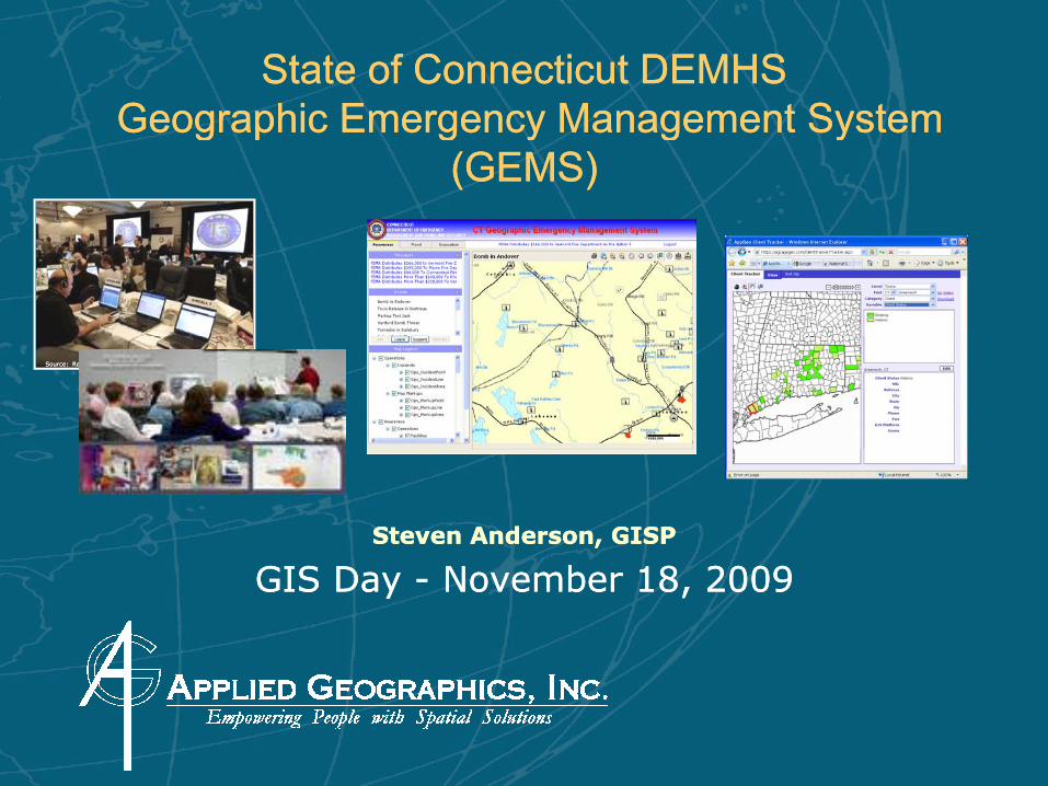
State of Connecticut DEMHSState of Connecticut DEMHSGeographic Emergency Management SystemGeographic Emergency Management SystemGeographic Emergency Management System Geographic Emergency Management System
(GEMS)(GEMS)
Source: ReutersSource: Reuters
Steven Anderson, GISPSteven Anderson, GISP
GIS Day GIS Day -- November 18, 2009November 18, 2009

Overview Overview –– Questions to be answeredQuestions to be answered•• What is GEMS?What is GEMS?
•• What’s the history of it being created?What’s the history of it being created?What s the history of it being created?What s the history of it being created?
•• How was it decided to build which pieces?How was it decided to build which pieces?
•• Who was involved in the process?Who was involved in the process?•• Who was involved in the process?Who was involved in the process?
•• What does it do?What does it do?
•• What are the benefits of the system?What are the benefits of the system?
•• QuestionsQuestions
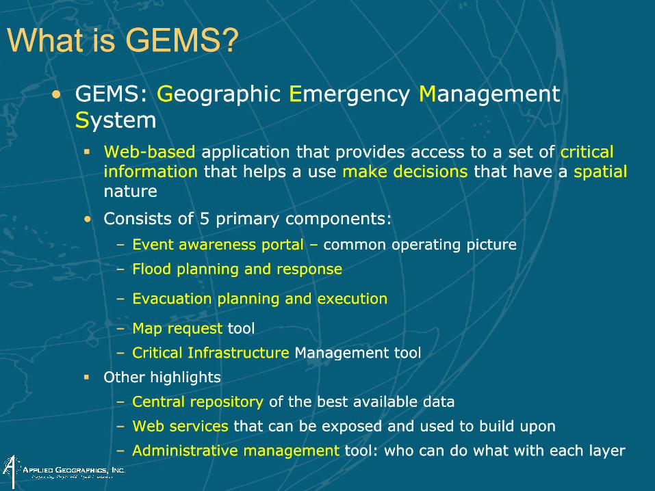
What is GEMS?What is GEMS?•• GEMS: GEMS: GGeographic eographic EEmergency mergency MManagement anagement
SSystemystemWebWeb--basedbased application that provides access to a set of application that provides access to a set of critical critical information information that helps a use that helps a use makemake decisionsdecisions that have a that have a spatialspatialnaturenature
•• Consists of 5 primary components:Consists of 5 primary components:
–– Event awareness portal Event awareness portal –– common operating picturecommon operating picture
–– Flood planning and response Flood planning and response
–– Evacuation planning and executionEvacuation planning and execution
–– Map request Map request tooltool
Critical Infrastructure Critical Infrastructure Management toolManagement tool–– Critical Infrastructure Critical Infrastructure Management toolManagement tool
Other highlightsOther highlights
–– Central repository Central repository of the best available dataof the best available data
W b i W b i h b d d d b ild h b d d d b ild –– Web services Web services that can be exposed and used to build uponthat can be exposed and used to build upon
–– Administrative management Administrative management tool: who can do what with each layertool: who can do what with each layer
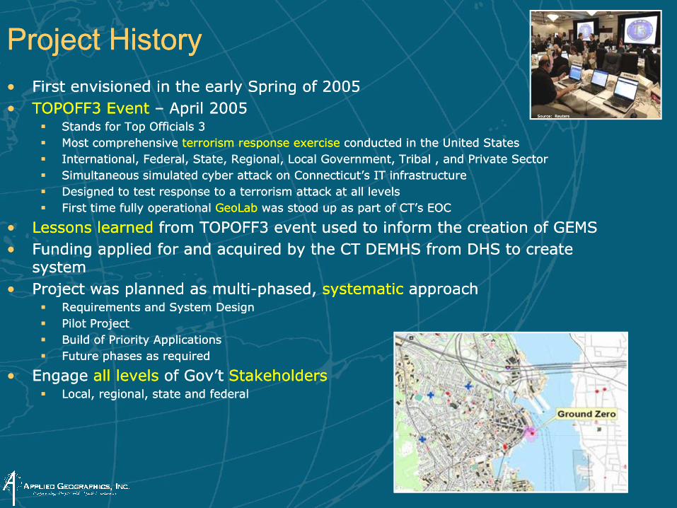
Project Project HistoryHistory•• First envisioned in the early Spring of 2005 First envisioned in the early Spring of 2005 •• TOPOFF3 TOPOFF3 Event Event –– April April 20052005
Stands for Top Officials 3Stands for Top Officials 3Most comprehensive Most comprehensive terrorism response exercise terrorism response exercise conducted in the United Statesconducted in the United States
Source: ReutersSource: Reuters
Most comprehensive Most comprehensive terrorism response exercise terrorism response exercise conducted in the United Statesconducted in the United StatesInternational, Federal, State, Regional, Local Government, Tribal , and Private SectorInternational, Federal, State, Regional, Local Government, Tribal , and Private SectorSimultaneous simulated cyber attack on Connecticut’s IT infrastructureSimultaneous simulated cyber attack on Connecticut’s IT infrastructureDesigned to test response to a terrorism attack at all levelsDesigned to test response to a terrorism attack at all levelsFirst time fully operational First time fully operational GeoLabGeoLab was stood up as part of CT’s EOCwas stood up as part of CT’s EOC
•• Lessons Lessons learned learned from TOPOFF3 event used from TOPOFF3 event used to to inform the creation of inform the creation of GEMSGEMS•• Funding applied for and acquired Funding applied for and acquired by the CT DEMHS from by the CT DEMHS from DHS DHS to create to create
systemsystem•• Project was planned as multiProject was planned as multi--phased phased systematicsystematic approachapproach•• Project was planned as multiProject was planned as multi phased, phased, systematicsystematic approachapproach
Requirements and System DesignRequirements and System DesignPilot ProjectPilot ProjectBuild of Priority ApplicationsBuild of Priority ApplicationsFuture phases as requiredFuture phases as required
•• Engage Engage all levels all levels of of Gov’tGov’t Stakeholders Stakeholders Local, regional, state and federalLocal, regional, state and federal
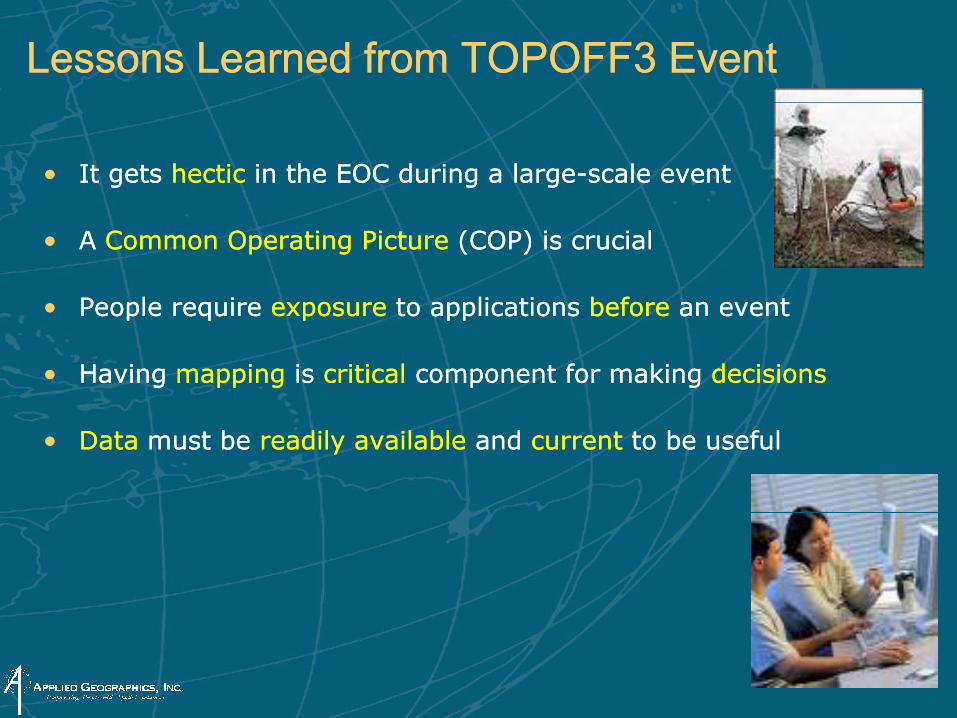
Lessons Learned from TOPOFF3 EventLessons Learned from TOPOFF3 Event
•• It gets It gets hectichectic in the EOC during a in the EOC during a largelarge--scale scale event event
•• A A Common Operating Picture Common Operating Picture (COP) is crucial(COP) is crucial
•• People People require require exposureexposure to applications to applications beforebefore an eventan event•• People People require require exposureexposure to applications to applications beforebefore an eventan event
•• Having Having mappingmapping is is criticalcritical component for making component for making decisionsdecisions
•• DataData must be must be readily available readily available and and currentcurrent to be usefulto be useful
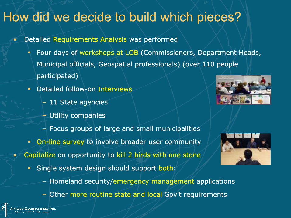
How did we decide to build which pieces?How did we decide to build which pieces?•• Detailed Detailed Requirements Analysis Requirements Analysis was performedwas performed
Four days of Four days of workshops at LOBworkshops at LOB (Commissioners, Department Heads, (Commissioners, Department Heads,
M i i l ffi i l G ti l f i l ) ( 110 l M i i l ffi i l G ti l f i l ) ( 110 l Municipal officials, Geospatial professionals) (over 110 people Municipal officials, Geospatial professionals) (over 110 people
participated)participated)
Detailed followDetailed follow--on on InterviewsInterviews
–– 11 State agencies11 State agencies
–– Utility companiesUtility companies
–– Focus groups of large and small municipalitiesFocus groups of large and small municipalities
OnOn--line survey line survey to involve broader user communityto involve broader user community
•• CapitalizeCapitalize on opportunity to on opportunity to kill 2 birds with one stonekill 2 birds with one stone•• CapitalizeCapitalize on opportunity to on opportunity to kill 2 birds with one stonekill 2 birds with one stone
Single Single system design should support system design should support bothboth::
–– Homeland security/Homeland security/emergency management emergency management applicationsapplications
–– Other Other more routine state and local more routine state and local Gov’tGov’t requirementsrequirements
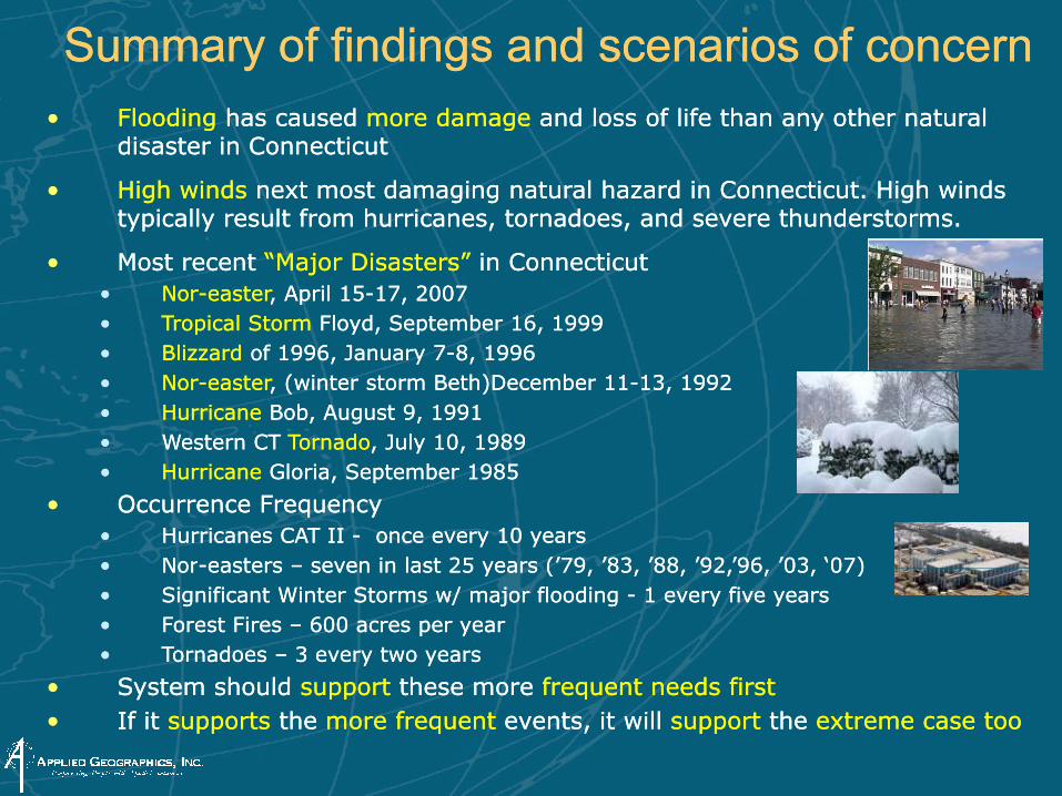
Summary of findings and scenarios of concernSummary of findings and scenarios of concernFloodingFlooding has caused has caused more damage more damage and loss of life than any other natural and loss of life than any other natural •• FloodingFlooding has caused has caused more damage more damage and loss of life than any other natural and loss of life than any other natural disaster in disaster in ConnecticutConnecticut
•• High winds High winds next most damaging natural hazard in Connecticut. High winds next most damaging natural hazard in Connecticut. High winds typically result from hurricanes, tornadoes, and severe thunderstorms. typically result from hurricanes, tornadoes, and severe thunderstorms. yp y , ,yp y , ,
•• Most Most recent recent “Major Disasters” “Major Disasters” in Connecticutin Connecticut•• NorNor--eastereaster, April 15, April 15--17, 200717, 2007•• Tropical Storm Tropical Storm Floyd, September 16, 1999Floyd, September 16, 1999•• BlizzardBlizzard of 1996, January 7of 1996, January 7--8, 19968, 1996•• NorNor--eastereaster, (winter storm Beth)December 11, (winter storm Beth)December 11--13, 199213, 1992•• HurricaneHurricane Bob, August 9, 1991Bob, August 9, 1991•• Western Western CT CT TornadoTornado, July 10, , July 10, 19891989•• HurricaneHurricane Gloria, September 1985Gloria, September 1985
•• Occurrence Occurrence FrequencyFrequency•• Hurricanes CAT II Hurricanes CAT II -- once every 10 yearsonce every 10 years•• NorNor--easterseasters –– seven in seven in last 25 years (’79 ’83 ’88 ’92 ’96 last 25 years (’79 ’83 ’88 ’92 ’96 ’03 ‘07)’03 ‘07)•• NorNor easterseasters seven in seven in last 25 years ( 79, 83, 88, 92, 96, last 25 years ( 79, 83, 88, 92, 96, 03, 07)03, 07)•• Significant Winter Storms w/ major flooding Significant Winter Storms w/ major flooding -- 1 every five years1 every five years•• Forest Fires Forest Fires –– 600 acres per year600 acres per year•• Tornadoes Tornadoes –– 3 every two 3 every two yearsyears
S stem sho ld S stem sho ld s ppo ts ppo t these mo e these mo e f eq entf eq ent needs fi stneeds fi st•• System should System should supportsupport these more these more frequentfrequent needs firstneeds first•• If it If it supportssupports the the more frequent more frequent events, it will events, it will supportsupport the the extreme case too extreme case too
Who was involved as part of the project?Who was involved as part of the project?•• Inventoried Inventoried all known data from all known data from many agenciesmany agencies
CT DEMHSCT DEMHS: including Regional Offices Evacuation and Shelter Plans: including Regional Offices Evacuation and Shelter Plans
CT DEPCT DEP: including all Geospatial Base Map Data, permitted facilities: including all Geospatial Base Map Data, permitted facilities
CT DOTCT DOT: including bridges, facilities, airports, railroad, commuter parking: including bridges, facilities, airports, railroad, commuter parking
CT MMRCT MMR: sensitive population data that is available to be released: sensitive population data that is available to be released
CT DPHCT DPH: Shelter locations, permitted facilities, sensitive populations, : Shelter locations, permitted facilities, sensitive populations, hospitalshospitalshospitalshospitals
CT OPMCT OPM: State owned facilities: State owned facilities
CT DPSCT DPS: 911 PSAP regions, police stations, fire stations, sensitive : 911 PSAP regions, police stations, fire stations, sensitive populationpopulationp pp p
CT Consumer ProtCT Consumer Prot: Major suppliers, water, food, pharmacies, industrial: Major suppliers, water, food, pharmacies, industrial
Red CrossRed Cross: Federal Shelter Management System: Federal Shelter Management System
United WayUnited Way: Elder care facilities: Elder care facilities
FederalFederal: Census, FEMA, USGS, : Census, FEMA, USGS, NOAANOAA
•• 5 Workshops 5 Workshops held around the state for held around the state for municipalmunicipal & & regionalregional entitiesentitiesMore than More than 130 people 130 people attended the workshopsattended the workshops

Data Needs Data Needs -- identified identified for priority applicationsfor priority applications
•• Administrative & Political BoundariesAdministrative & Political BoundariesState, county, municipal, independent city, State, county, municipal, independent city, borough, villageborough, villageConnecticut regional planning organizationsConnecticut regional planning organizationsA i I di ti d t t l dA i I di ti d t t l d
•• Ortho imageryOrtho imagery2004 Digital 2004 Digital OrthoimageryOrthoimageryCoastal (leaf on) ImageryCoastal (leaf on) ImagerySatellite ImagerySatellite Imagery
American Indian reservations and trust landsAmerican Indian reservations and trust landsFire districtsFire districtsPolice districtsPolice districts
•• Critical InfrastructureCritical InfrastructureAirportsAirportsBridges and tunnelsBridges and tunnels
•• HydrographyHydrographySurface water features such as lakes and ponds, Surface water features such as lakes and ponds, streams and rivers, canals, bays, harbors, oceans, streams and rivers, canals, bays, harbors, oceans, and shorelines.and shorelines.Dams, waterfalls, canalsDams, waterfalls, canalsUSGS stream monitoring stationsUSGS stream monitoring stationsBridges and tunnelsBridges and tunnels
Cultural TreasuresCultural TreasuresDams and reservoirsDams and reservoirsEmergency equipment and supply warehousesEmergency equipment and supply warehousesEmergency SheltersEmergency SheltersHarbors and portsHarbors and ports
USGS s ea o o g s a o sUSGS s ea o o g s a o sStream linear network (Stream linear network (flowlinesflowlines) ) -- flow direction, flow direction, stream order, gradientstream order, gradientShoreline linear network (coastlines)Shoreline linear network (coastlines)Historic, mean high, mean low water shorelinesHistoric, mean high, mean low water shorelinesDrainage basin, watershed boundariesDrainage basin, watershed boundaries
Hazardous Materials storage facilitiesHazardous Materials storage facilitiesHospitals, EMS, relief organizationsHospitals, EMS, relief organizationsMilitary and National Guard BasesMilitary and National Guard BasesMunicipal OfficesMunicipal OfficesPetrochemical industry plants and storagePetrochemical industry plants and storageP li d Fi t tiP li d Fi t ti
•• TransportationTransportationAll public, local and private roadways in All public, local and private roadways in Connecticut.Connecticut.Bridges and TunnelsBridges and TunnelsStreet address rangesStreet address rangesRailroads Railroads Police and Fire stationsPolice and Fire stations
Power plants and electrical distribution systemsPower plants and electrical distribution systemsSchools and UniversitiesSchools and UniversitiesStadiums and conference centersStadiums and conference centersState and federal facilitiesState and federal facilitiesTelecommunication facilitiesTelecommunication facilities
Railroads Railroads Airports & HeliportsAirports & HeliportsHarbors and portsHarbors and portsFerries Ferries Bus and Bus and parapara--transit servicetransit service
•• AddressingAddressingTelecommunication facilitiesTelecommunication facilitiesTransportation facilities (roads, rail, ferry)Transportation facilities (roads, rail, ferry)Water/wastewater facilitiesWater/wastewater facilities
Street centerline networkStreet centerline networkStreet names and address rangesStreet names and address ranges
What does GEMS do and what does it look like?What does GEMS do and what does it look like?
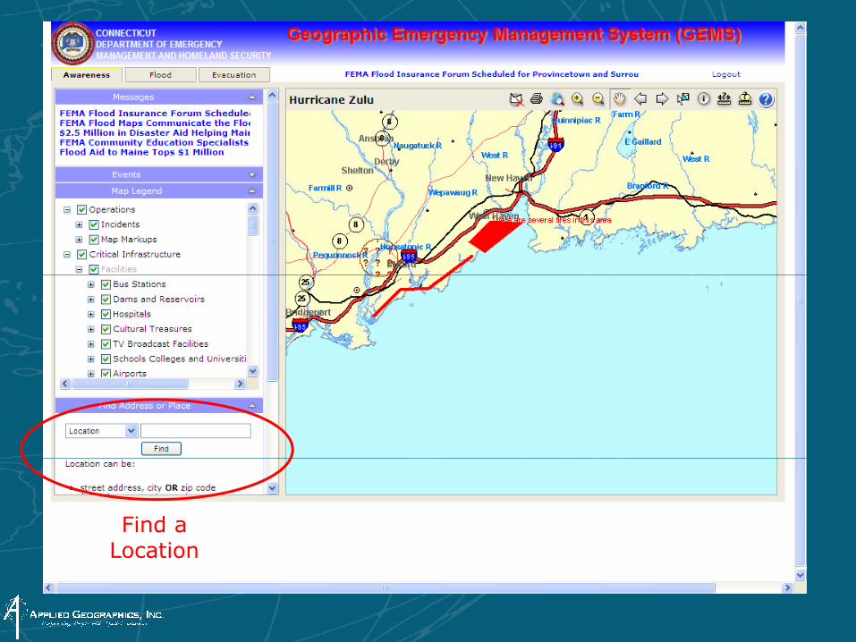
Find a LocationLocation
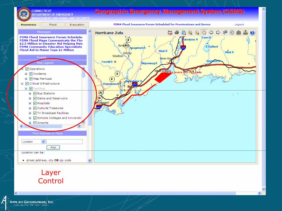
Layer ControlControl
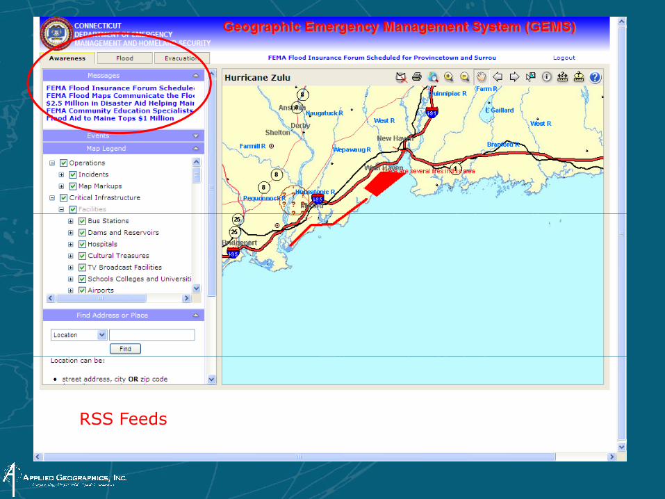
RSS Feeds
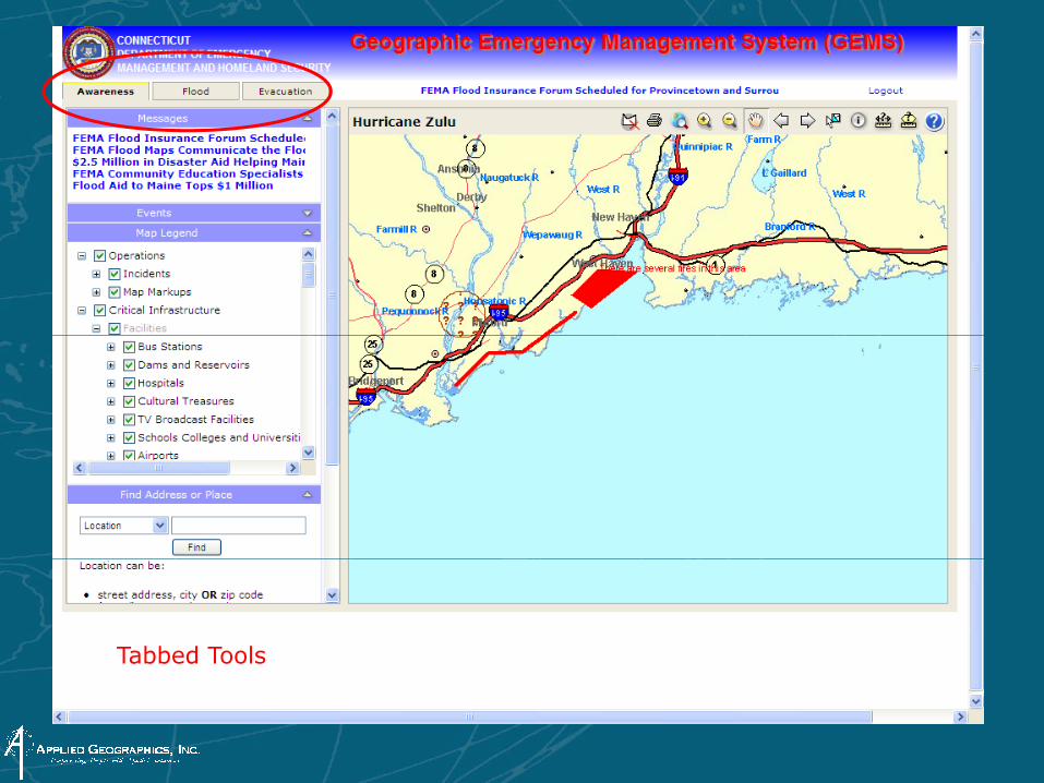
Tabbed Tools
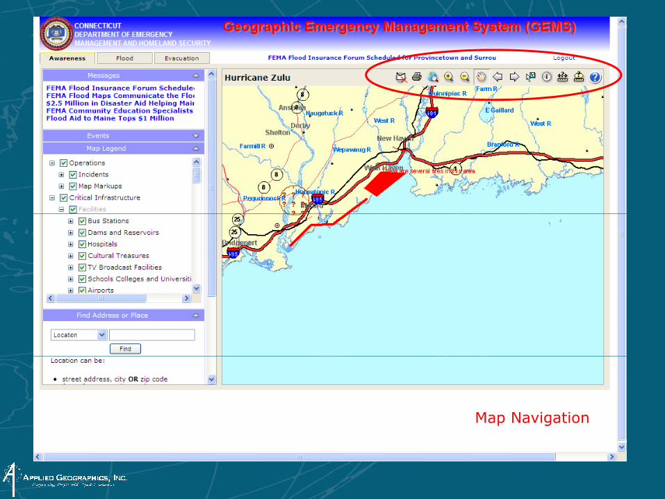
Map Navigation

Incident Management

Mark-up Tools
Now that we collected all of this data, how is it kept currentNow that we collected all of this data, how is it kept current??
Many many data Many many data sourcessourcesMany, many data Many, many data sourcessources
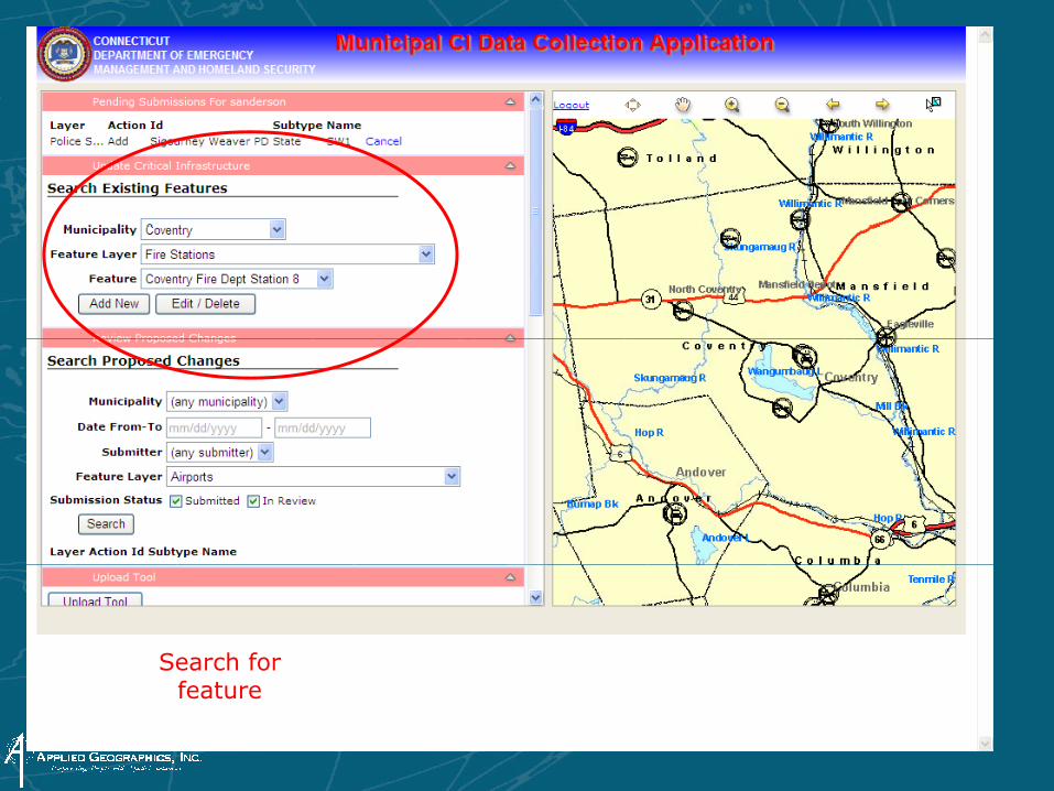
Search for feature

Propose changes
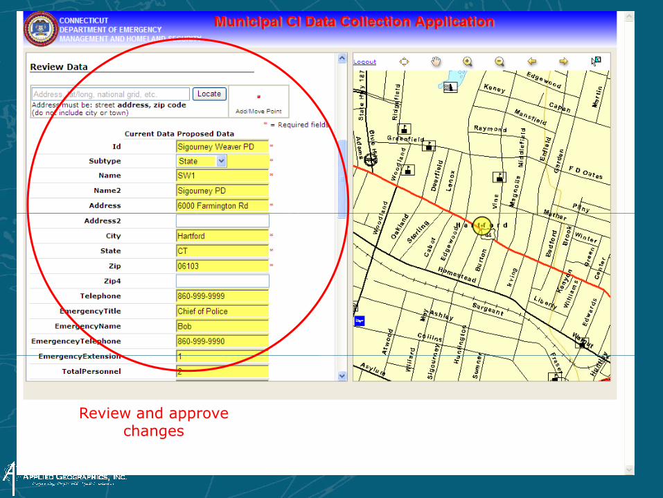
Review and approve hchanges
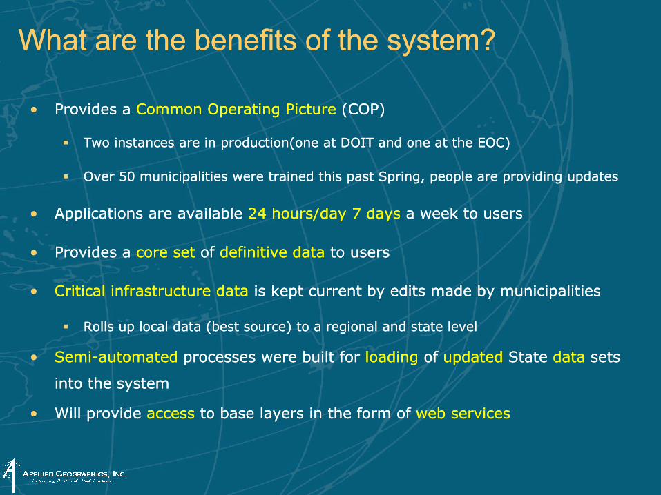
What are the benefits of the system?What are the benefits of the system?
•• Provides a Provides a Common Common Operating Picture Operating Picture (COP(COP))
Two instances are in production(one at DOIT and one at the EOC)Two instances are in production(one at DOIT and one at the EOC)Two instances are in production(one at DOIT and one at the EOC)Two instances are in production(one at DOIT and one at the EOC)
Over 50 municipalities were trained this past Spring, people are providing updatesOver 50 municipalities were trained this past Spring, people are providing updates
•• Applications are available Applications are available 24 hours/day 7 days 24 hours/day 7 days a week to usersa week to users•• Applications are available Applications are available 24 hours/day 7 days 24 hours/day 7 days a week to usersa week to users
•• Provides a Provides a core set core set of of definitive data definitive data to usersto users
•• Critical infrastructure dataCritical infrastructure data is kept current by edits made by municipalitiesis kept current by edits made by municipalities
Rolls up local data (best source) to a regional and state levelRolls up local data (best source) to a regional and state level
S iS i t t dt t d b ilt f b ilt f l dil di f f d t dd t d St t St t d td t t t •• SemiSemi--automatedautomated processes were built for processes were built for loadingloading of of updatedupdated State State datadata sets sets
into the systeminto the system
•• Will provide Will provide accessaccess to base layers in the form of to base layers in the form of web servicesweb services
ThankThank--you and any questions?you and any questions?
Steve Anderson, GISPSteve Anderson, GISPApplied Geographics IncApplied Geographics IncApplied Geographics IncApplied Geographics Inc