souvenir tour guide - the alaska...
TRANSCRIPT

Souvenir tour guidePOUCE COUPE
DAWSON CREEKTUMBLER RIDGE
CHETWYNDHUDSON’S HOPE FORT ST JOHN
TAYLORFORT NELSON
TAKE A JOURNEY THROUGH

welcomeWelcome to Northeastern BC and the Alaska Highway Corridor! We are so pleased you have decided to join us to celebrate the 75th birthday of the Alaska Highway and the 150th of Canada. Whether starting your trip in the north or in the south, this trip is sure to check off some bucket list items. Plan to take your time as you are entering an amazing wilderness frontier. What exactly does this mean? It means you will see amazing vistas, natural beauty, sunrises, sunsets, geo formations, following water, stars, and of course animals. It also means that you will have areas of no cell service, potential for inclement weather, and you will be sharing the road with many furry friends. Plan to take your time as you climb up and down the Rocky Mountains, view the expansive vistas, dip your toes into the many beautiful lakes and rivers, and safely view the natural wilderness that we call home.

HUDSON’S HOPE
Groundbirch
Progress
POUCE COUPE
Farmington
Tomslake
Charlie Lake
Kobes
Wonowon
Pink Mountain
SikanniChief
Buckinghorse River
Prophet River
Muskwa
Arras
CHETWYND
TUMBLERRIDGE
TAYLOR
FORT ST. JOHN
DAWSON CREEK
FORT NELSON
29
97
2952
52
97
97
97
97
97
97
2
The souvenir tour guide provides you with an exciting Alaska Highway 75th Anniversary journey
through eight beautiful towns and surrounding areas. As you visit each community, make sure you collect
the 75th Anniversary town stickers.
Each community and surrounding area will provide an Alaska Highway experience that gives you access
to its history, nature and the people that make this a beautiful destination.
Explore the 75th Alaska Highway Annivesary through
POUCE COUPEDAWSON CREEKTUMBLER RIDGE
CHETWYNDHUDSON’S HOPE
FORT ST JOHNTAYLOR
FORT NELSON
Souvenir tour Guide

Pouce Coupe
You are starting your Alaska Highway and northeastern BC adventures right here in Pouce Coupe. This little village although small - with less than 800 residents - has a surprising amount to offer. Although the locals have heard their community pronounced in a few, sometimes interesting ways, the original name came from the Chief of the Beaver Nation, “Pooscapee”.
Pouce Coupe is an honorary Alaska Highway community! Just 10km off the Alaska Highway, this community was just as involved in the construction as the ones directly on it. In 1942 the population swelled, as the US Army unloaded thousands of men and construction materials nearby to begin the construction.
POUCE COUPE MUSEUMThe Pouce Coupe Museum is proud to display its long and diverse history by incorporating four buildings into its tour! Go on a journey through time as you weave through the Heritage House, Trapper’s Cabin, Caboose and the original NAR Train Station.
COLLECT YOUR SOUVENIR STICKER AT THE VISITOR CENTRE5006 49th Ave.Pouce Coupe, BC V0C 2C0(250) 786-5555www.poucecoupe.ca
POUCE COUPE WOODEN TRAIL TRESTLEYou will not be disappointed if you visit the impressive wooden trestle located just south-west of town. Built in 1930 for the Northern Alberta Railway, this is an impressive showcase of craftsman’s ship and engineering.

Dawson Creek is the official starting point of the Alaska Highway and home to the Mile 0 sign. This once small farming community grew in 1932 with the arrival of the Northern Alberta Railway and again in 1942 when the US Army used that very railway as a shipping point for construction equipment and crews to build the Alaska Highway. The city has been called the “Capital of the Peace” and is also known as “Mile 0 City” referring to its location at the southern end of the Alaska Highway.
Make sure you stop to stretch your legs and get proof of your visit with a photo in front of the Alaska Highway Mile Zero sign.
ALASKA HIGHWAY HOUSEExplore Yesterday, Today and Experience your own adventure along one of the most famous roads in history! Discover the story behind the building of the monumental Alaska Highway. 30,000 US Army soldiers and civilians completed this astounding engineering feat in just nine months.
KISKATINAW BRIDGEThe task of the United Stated Army Corps of Engineers was to build a pioneer road for military traffic from Dawson City to Big Delta, Alaska. Though there were many timber bridges built by these civilian workers, the Kiskatinaw Bridge is the only one still in use. It is also one of the most unusual, curving nine degrees along its 162.5 metre (534 foot) length.
COLLECT YOUR SOUVENIR STICKER AT THE VISITOR CENTRE900 Alaska AveDawson Creek, BC V1G 4T6(250) 782-9595www.tourismdawsoncreek.com
Dawson Creek

tumbler Ridge
Taking a minor detour from your Alaska Highway trip, you will go approximately 120km south east to visit the community of Tumbler Ridge. This community is a dream destination for the outdoor enthusiast, made up of waterfalls, unique rock formations, alpine meadows and lakes, canyons, mountain summits, caves and more. Tumbler Ridge was originally created as a mining community in the 1980’s but has since redeveloped for eco-tourism.
The biggest shift to eco-tourism came after the discovery of dinosaur footprints, fossils, and bones. This lead to the creation of the Tumbler Ridge Unesco Global Geopark. It has an amazing diversity of outstanding and accessible mountain geology, extraordinary waterfalls, breath taking scenery and dinosaur fossils.
KINUSEO FALLSOne of the true gems of the Tumbler Ridge area is Kinuseo Falls. Featured in the 2015 fantasy hit The Seventh Son, Kinuseo Falls is a spectacular 70m cascade. Taller than Niagara Falls it showers over 40m3 of water a second at its peak seaon into the valley below!
COLLECT YOUR SOUVENIR STICKER AT THE VISITOR CENTRE265 Southgate St.Tumbler Ridge, BC V0C 2W0(250) 242-3123www.tumblerridge.ca
DINOSAUR DISCOVERY GALLERY The ONLY 2 Tyrannosaurus trackways in the world were found here! While the actual trackways cannot be seen, due to ongoing research, a replica can be seen at the Dinosaur Discovery Gallery.They also offer Guided Dinosaur Trackway Tours – nothing like this is offered anywhere else in the world!
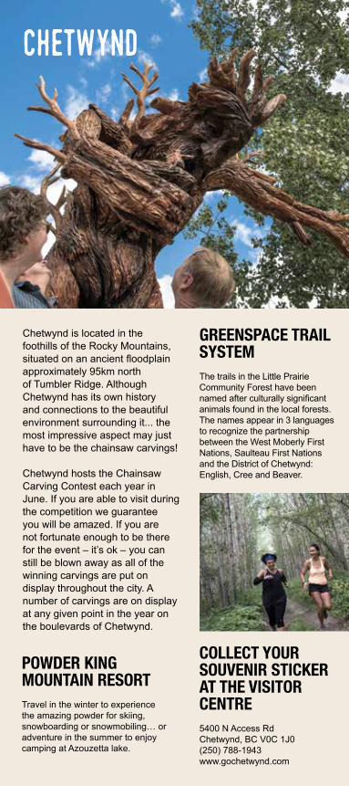
Chetwynd is located in the foothills of the Rocky Mountains, situated on an ancient floodplain approximately 95km north of Tumbler Ridge. Although Chetwynd has its own history and connections to the beautiful environment surrounding it... the most impressive aspect may just have to be the chainsaw carvings!
Chetwynd hosts the Chainsaw Carving Contest each year in June. If you are able to visit during the competition we guarantee you will be amazed. If you are not fortunate enough to be there for the event – it’s ok – you can still be blown away as all of the winning carvings are put on display throughout the city. A number of carvings are on display at any given point in the year on the boulevards of Chetwynd.
POWDER KING MOUNTAIN RESORTTravel in the winter to experience the amazing powder for skiing, snowboarding or snowmobiling… or adventure in the summer to enjoy camping at Azouzetta lake.
GREENSPACE TRAIL SYSTEMThe trails in the Little Prairie Community Forest have been named after culturally significant animals found in the local forests. The names appear in 3 languages to recognize the partnership between the West Moberly First Nations, Saulteau First Nations and the District of Chetwynd: English, Cree and Beaver.
COLLECT YOUR SOUVENIR STICKER AT THE VISITOR CENTRE5400 N Access RdChetwynd, BC V0C 1J0(250) 788-1943www.gochetwynd.com
Chetwynd

Hudson's hope
Hudson’s hope is situated on the banks of the Peace River, approximately 66 kms north of Chetwynd. Hudson’s hope is a small rural town of 1100 people. This community as with many of the northeastern BC communities was originally established as a fur trading post in 1805. Having been settled in 1805, it is the third oldest community in the province.
Known as the “Playground of the Peace”, it is blessed with incredible natural beauty, prairie farmland, wooded crown lands and the Peace River with the Rocky Mountains as its backdrop. These natural assets provide a wide range of outdoor recreational activities including excellent fishing, boating, ATV’ing, water skiing, canoeing, hunting, camping, hiking, swimming, sailing, and wildlife viewing.
HUDSON’S HOPE MUSEUMIf you are into dinosaur this is a great place to visit. The Museum houses an amazing collection of fossils and pre-history artifacts from the region with particular emphasis on the world renowned Peace Canyon dinosaur tracks.
COLLECT YOUR SOUVENIR STICKER AT VISITOR CENTRE9555 Beattie Dr.Hudson’s Hope, BC V0C 1V0(250) 783-9154www.hudsonshope.ca
PEACE CANYON DAMHudson’s hope is home to one of the world’s largest earthen dams, the W.A.C. Bennett Dam and G.M. Shrum Generating Station. This dam stretches 2 kms across the Peace River creating B.C.’s largest reservoir, Williston Lake, covering 410,000 acres. Enjoy driving across the dam for a view of the reservoir and then stop into the Museum to learn all about electricity. Fun for all ages, the museum explains how the dam works and has lots of interactive stations for you to create your own energy.
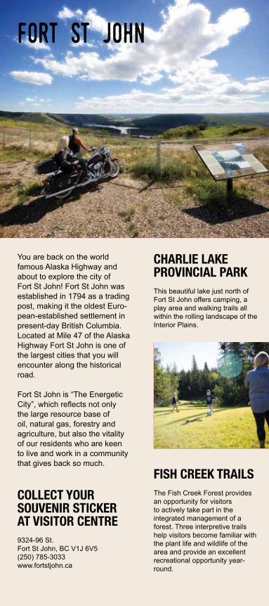
You are back on the world famous Alaska Highway and about to explore the city of Fort St John! Fort St John was established in 1794 as a trading post, making it the oldest Euro-pean-established settlement in present-day British Columbia. Located at Mile 47 of the Alaska Highway Fort St John is one of the largest cities that you will encounter along the historical road.
Fort St John is “The Energetic City”, which reflects not only the large resource base of oil, natural gas, forestry and agriculture, but also the vitality of our residents who are keen to live and work in a community that gives back so much.
FISH CREEK TRAILS The Fish Creek Forest provides an opportunity for visitors to actively take part in the integrated management of a forest. Three interpretive trails help visitors become familiar with the plant life and wildlife of the area and provide an excellent recreational opportunity year-round.
CHARLIE LAKE PROVINCIAL PARKThis beautiful lake just north of Fort St John offers camping, a play area and walking trails all within the rolling landscape of the Interior Plains.
COLLECT YOUR SOUVENIR STICKER AT VISITOR CENTRE9324-96 St.Fort St John, BC V1J 6V5(250) 785-3033www.fortstjohn.ca
Fort St John

taylor
The picturesque community of Taylor is located on Mile 36 of the Alaska Highway near the mighty Peace River. In 1912, Donald “Herbie” Taylor, who was a ferryman and fur trader, became one of the first settlers. The town kept his namesake and eventually incorporated in 1958 with businesses and industry relocating to Taylor. While Taylor has remained a small town of 1500 residents, it is a hub of activity for skating, camping, golfing and the annual World’s Invitational Gold Panning Championship. The peaceful quality of life is desirable to young families and seniors alike as Taylor continues to demonstrate community pride and exemplary quality of life.
COLLECT YOUR SOUVENIR STICKER AT VISITOR CENTRE10316 100 St.Taylor, BC V0C 2K0(250) 789-9015www.districtoftaylor.com
Photo Credit:D Shawchek Photography
World’s Invitational GOLD PANNING CHAMPIONSHIPStarting in 1972, Taylor has hosted the annual Worlds Invitational Gold Panning Championship each year on August Long Weekend, attracting participants from all over the world. The Championship features many different competitions from beginners and kids to professional Class ‘A’.
PEACE ISLAND PARKPeace Island Park offers visitors a peaceful escape to nature while still offering comfortable amenities and activities for all to enjoy. Open in May and offering 39 island sites and 60 additional serviced sites, Peace Island Park promises an enjoyable experience for all with Walking Trails, Horseshoe Pits, Historic Rocky Mountain Forts, Playgrounds, Shelter with Cook-house, Water Pump, Firewood, and Boat Launch available for the entire family’s enjoyment.

Although the stretch of Highway was long to get here, it will have been totally worth it. Fort Nelson is located at historical Mile 300 of the Alaska Highway and is the gateway to the beautiful Northern Rocky mountains. With the world famous Alaska Highway as its main street and thousands of square miles of mountain wilderness as its backyard, Fort Nelson is a fantastic place to recharge, reconnect and restock on your trip north or south. Fort Nelson offers all the amenities essential to your trip including quality accommodations, fun and unique shopping, services to meet all of your needs, friendly people and a range of cultural and recreational facilities.
COLLECT YOUR SOUVENIR STICKER AT THE VISITOR CENTRE5500 Alaska HighwayFort Nelson, BC V0C 1R0(250) 774-6400www.tourismnorthernrockies.ca
Fort Nelson & the northern Rockies
RECREATION CENTREThe visitor information and recreation centre are conveniently located in the same beautiful facility. Stop in to use the brand new swimming facilities, indoor walking track, rock climbing wall or squash and racket ball courts.
FORT NELSON HERITAGE MUSEUMThis spectacular museum is a walking adventure and a must see in Fort Nelson. Tour the extensive indoor and outdoor displays, experience the wildlife of the Alaska Highway (including an albino moose), and browse through the exciting history of the area. Any automobile lovers, must stop to see the impressive collection of antique cars.

Collect your 75th anniversary
stickers