schedule a revised: september 16, 2016 - ccdc · pdf fileschedule a revised: september 16,...
TRANSCRIPT
File Number: 15262350
TitleOne Corporation
SCHEDULE A Revised: September 16, 2016Changes Highlighted in Yellow
1. Effective Date: September 2, 2016 at 07:30 AM
2. Policy or Policies to be issued:
Preliminary Research Report Report Amount: $500.00
For the Benefit of:Capital City Development Corporationc/o Shellan Rodriguez
3. The estate or interest in the land described or referred to in this Report and covered herein is:Fee Simple
4. Title to the estate or interest in said land is at the effective date hereof vested in:The Urban Renewal Agency of Boise City, Idaho, aka Capital City Development Corporation, a public body, corporate and politic
5. The land referred to in this Report is described as follows:See Attached Schedule C
DISCLAIMER
The information provided in this report is for informational purposes only. This report contains information about real property and interests in real property. This report is based on a search of our tract indexes of the county records. This is not a title or ownership report and no examination of the title to the property described has been made. For this reason, no liability beyond the amount paid for this report is assumed hereunder and the company is not responsible beyond the amount paid for any errors and omissions contained herein. This report in no way creates any obligation by TitleOne Corporation or its underwriters to insure any party now or in the future. Any insurance will be separate from this report and subject to usual and customary underwriting standards.
1

File Number: 15262350
SCHEDULE B-IRequirements
The following are to be complied with:
1. TitleOne Corporation reserves the right to add additional requirements and/or exceptions upon receipt of the details of the forthcoming transaction.
2. The Company will require delivery of and approval by the Company of an Indemnity and Affidavit as to Debts, Liens and Possession, prior to the issuance of the policy.
3. NOTE: The only deed(s) affecting said land, which recorded within 24 months of the date of this report, or the last recorded vesting deed, is (are) as follows:
Document: Warranty DeedGrantor: Lonnie Noble, a married man as his sole and separate property and Alfred R. Bowens, Jr., a married man as his sole and separate propertyGrantee: Capital City Development Corporation, an Idaho public corporationRecorded: August 31, 2006Instrument No.: 106141522, records of Ada County, Idaho.
Document: Warranty DeedGrantor: Boise City, an Idaho municipal corporationGrantee: The Urban Renewal Agency of Boise City, Idaho, aka Capital City Development Corporation, a public body, corporate and politic, as to Parcel II.Recorded: June 7, 2007Instrument No.: 107081428, records of Ada County, Idaho.
Document: Warranty DeedGrantor: John Alder, an unmarried man, and Dale Glaesman, an unmarried manGrantee: Capital City Development CorporationRecorded: August 8, 2011Instrument No.: 111063889, records of Ada County, Idaho.
Document: Warranty DeedGrantor: Ellen T.R. Smith, a married woman as her sole & separate property and Morgan Richard Smith, an unmarried personGrantee: Capital City Development CorporationRecorded: June 28, 2013Instrument No.: 113072937, records of Ada County, Idaho.
Document: Warranty DeedGrantor: Ellen T.R. Smith, a married woman as her sole & separate property and Sydney James Smith, an unmarried personGrantee: Capital City Development CorporationRecorded: June 28, 2013Instrument No.: 113072941, records of Ada County, Idaho.
Document: Personal Representative's DeedGrantor: Richard P. Madry, as Personal Representative of the Estate of Erma L. Hayman, deceasedGrantee: Capital City Development CorporationRecorded: January 31, 2011Instrument No.: 111009888, records of Ada County, Idaho.
2

File Number: 15262350
Document: Quitclaim DeedGrantor: Capital City Development Corporation, a public body, corporate and politicGrantee: Capital City Development Corporation, a public body, corporate and politicRecorded: August 17, 2016Instrument No.: 2016-075485, records of Ada County, Idaho.
4. NOTE: According to the available records, the purported address of said land is:
503 S Ash StreetBoise, Idaho 83702(As to Parcel I)
509 S Ash StreetBoise, Idaho 83702(As to Parcel II)
511 S Ash StreetBoise, Idaho 83702(As to Parcel III)
623 and 647 S Ash StreetBoise, Idaho 83702(As to Parcel IV)
Intentionally Deleted
5. NOTE: Additional Underlying Documents.
To view the MAP(s) click here.
To view the VESTING DEED(s) click here.
3
File Number: 15262350
SCHEDULE B-IIExceptions From Coverage
Note: This is a Preliminary Research Report and not a title insurance policy. If it were a policy, it would have the following Exceptions unless they are taken care of to our satisfaction. If the Company’s requirements are satisfied, Exceptions 1 through 6 would be removed on Enhanced/Extended coverage policies.
Exceptions:
1. Rights or claims of parties in possession not shown by the public records.
2. Any encroachment, encumbrance, violation, variation, or adverse circumstance affecting the Title that would be disclosed by an accurate and complete land survey of the Land, and that is not shown by the Public Records.
3. Easements, or claims of easements, not shown by the public records.
4. Any lien, or right to a lien, for services, labor, or materials heretofore or hereafter furnished, imposed by law and not shown by the public records.
5. (a) Unpatented mining claims; (b) reservations or exceptions in patents or in Acts authorizing the issuance thereof; (c) water rights, claims to title to water, whether or not the matters excepted under (a), (b), or (c) are shown by the public records.
6. Taxes or special assessments which are not shown as existing liens by the records of any taxing authority that levies taxes or assessments on real property or by the public records. Proceedings by a public agency which may result in taxes or assessments, or notices to such proceedings whether or not shown by the records of such agency, or by the public records.
7. Taxes, including any assessments collected therewith, for the year 2016 which are a lien not yet due and payable.
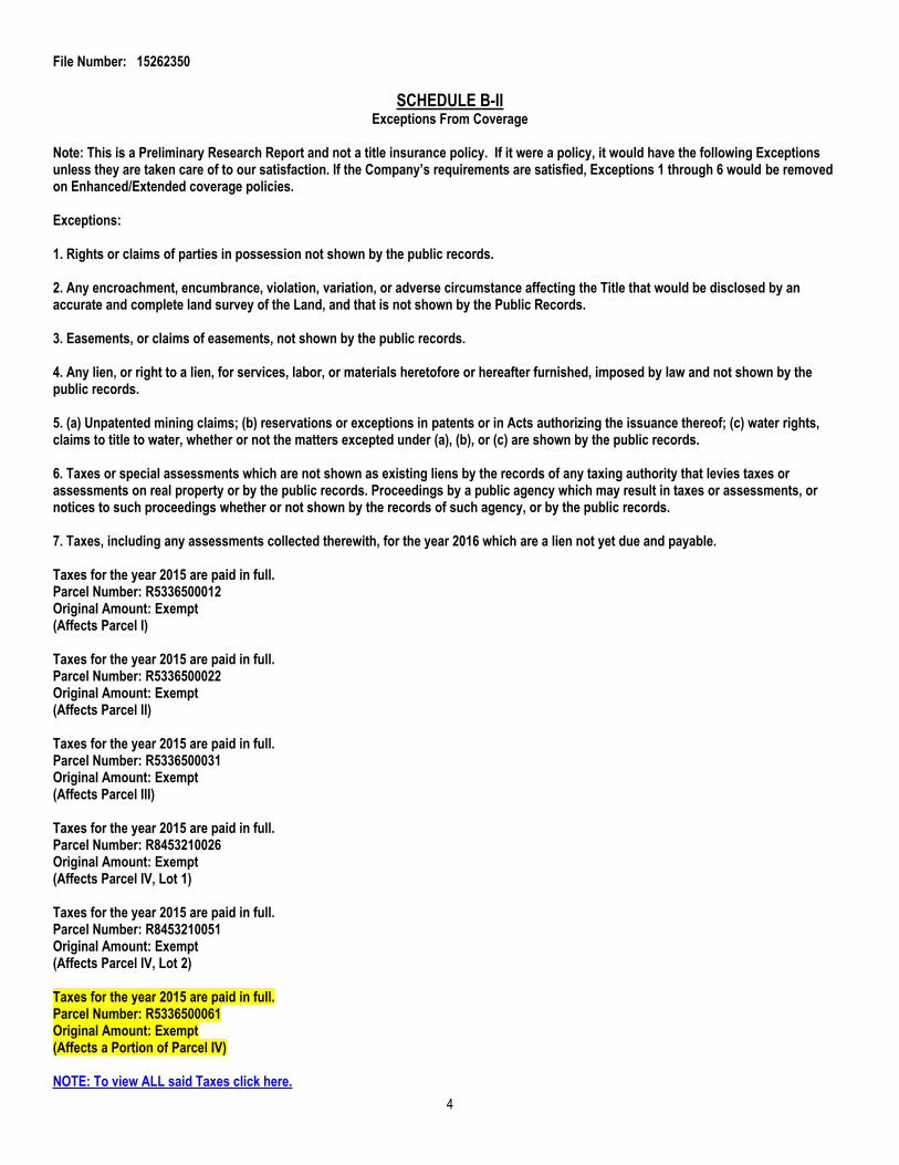
Taxes for the year 2015 are paid in full.Parcel Number: R5336500012Original Amount: Exempt(Affects Parcel I)
Taxes for the year 2015 are paid in full.Parcel Number: R5336500022Original Amount: Exempt(Affects Parcel II)
Taxes for the year 2015 are paid in full.Parcel Number: R5336500031Original Amount: Exempt(Affects Parcel III)
Taxes for the year 2015 are paid in full.Parcel Number: R8453210026Original Amount: Exempt(Affects Parcel IV, Lot 1)
Taxes for the year 2015 are paid in full.Parcel Number: R8453210051Original Amount: Exempt(Affects Parcel IV, Lot 2)
Taxes for the year 2015 are paid in full.Parcel Number: R5336500061Original Amount: Exempt(Affects a Portion of Parcel IV)
NOTE: To view ALL said Taxes click here.4

File Number: 15262350
8. The land described herein is located within the boundaries of Boise City (208-384-3735) and is subject to any assessments levied thereby.
9. The land described herein is located within the boundaries of Boise City Canal Company and is subject to any assessments levied thereby.
10. Right of way for ditches, tunnels, telephone, and distribution lines constructed by authority of the United States, as granted to the United States under the provisions of Section 58-604 Idaho Code.
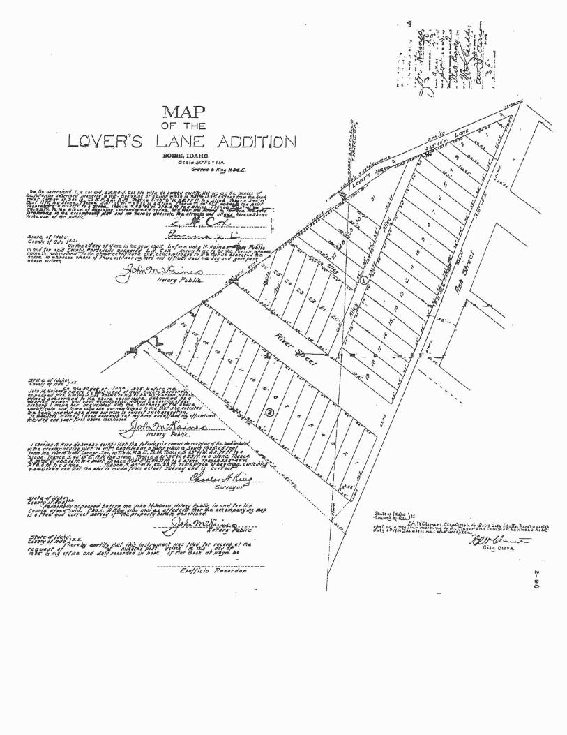
11. Easements, reservations, restrictions, and dedications as shown on the official plat of Lover's Lane Subdivision filed in Book 2 of Plats at Page 90, records of Ada County, Idaho.
NOTE: To view said document(s) click here.
12. Easements, reservations, restrictions, and dedications as shown on the official plat of Tiffany Subdivison filed in Book 53 of Plats at Page 4586, records of Ada County, Idaho.
NOTE: To view said document(s) click here.
13. Terms and provisions contained in an Ordinance No. 6362.Recorded: December 21, 2004Instrument No.: 104161592, records of Ada County, Idaho.
NOTE: To view said document(s) click here.
14. Terms and provisions contained in a License Agreement by and between Capital City Development Corp., a corporation and Ada County Highway District.Recorded: May 3, 2012Instrument No.: 112041833, records of Ada County, Idaho.
NOTE: To view said document(s) click here.
15. Rights of tenants in possession, as tenants only, under prior unrecorded leases.
16. All matters, and any rights, easements, interests or claims as disclosed by Record of Survey No. 10598 recorded August 17, 2016 as Instrument No. 2016-075482, records of Ada County, Idaho.
NOTE: To view said document(s) click here.
(End of Exceptions)
5
File Number: 15262350
SCHEDULE C
Legal Description:
Parcel I:
Lots 1 and 2 in Block 1 of Lover’s Lane Addition, according to the official plat thereof, filed in Book 2 of Plats at Page 90, official records of Ada County, Idaho.
Except a triangular strip of Lot 2 in Block 1 of Lover’s Lane Addition, described as follows:
Beginning at the Southeast corner of Lot 2; thence 6 feet in a Northerly direction along the East boundary; thence Northwesterly (formerly shown as Southwesterly) to a point 37 feet 9 inches from East boundary and connecting with South boundary line at this point; thence 38 feet 6 inches Southeasterly to Southeast corner of Lot 2 in Block 1 to the Point of Beginning.
Parcel II:
Lots 3 and 4 in Block 1 of Lover’s Lane Addition, according to the official plat thereof, filed in Book 2 of Plats at Page 90, official records of Ada County, Idaho.
Together with a triangular strip of Lot 2 in Block 1 of Lover’s Lane Addition, according to the official plat thereof, filed in Book 2 of Plats at Page 90, records of Ada County, Idaho, being more particularly described as follows:
Beginning at the Southeast corner of Lot 2 in Block 1 of Lover’s Lane Addition; thence 6 feet in a Northerly direction along the East boundary; thence Northwesterly (formerly shown as Southwesterly) to a point 37 feet 9 inches from East boundary and connecting with South boundary line at this point; thence 38 feet 6 inches Southeasterly to Southeast corner of Lot 2 in Block 1 to the Point of Beginning.
Parcel III:
Lots 5 and 6 in Block 1 of Lover's Lane Addition to Boise City, Idaho, and that portion of Lot 7 in Block 1 of Lover's Lane Addition to Boise City, according to the official plat thereof, filed in Book 2 of Plats at Page 90, official records of Ada County, Idaho, and more particularly described as follows:
Commencing at the Northwest corner of said Lot 7; running thence in a Southerly direction along the alley line a distance of 20 feet; running thence in an Easterly direction to a point on the boundary line between said Lots 6 and 7, which point is 93 feet and 9 inches distant from the Place of Beginning; running thence Westerly along said boundary line between Lots 6 and 7 to the Place of Beginning.
Excepting from said Lot 6 all that portion thereof described as follows:
Commencing at the Southeast corner of said Lot 6; running thence Northerly along the Westerly line of Ash Street a distance of 6 feet; running thence Westerly to a point on the boundary line between said Lots 6 and 7 which point is 93 feet and 9 inches distance from the Northwest corner of said Lot 7 and the Southwest corner of said Lot 6; running thence Easterly along the boundary line between said Lots 6 and 7 to the Place of Beginning.
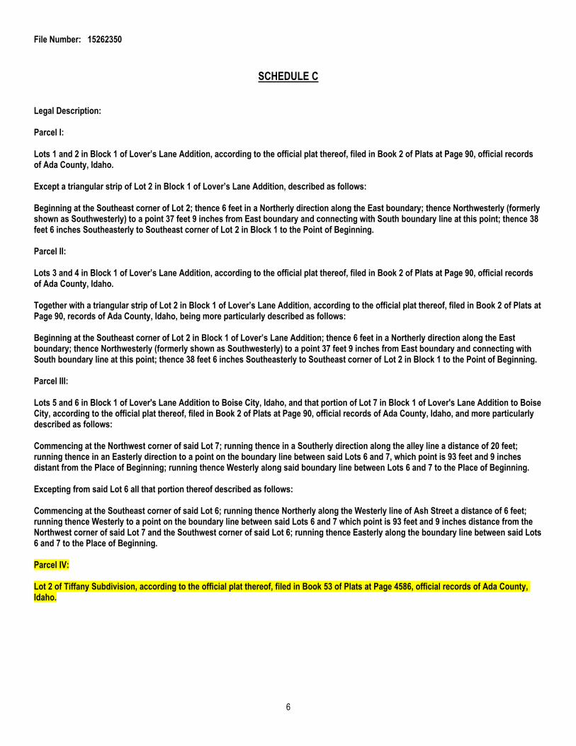
Parcel IV:
Lot 2 of Tiffany Subdivision, according to the official plat thereof, filed in Book 53 of Plats at Page 4586, official records of Ada County, Idaho.
6

File Number: 15262350
Parcel V:
A parcel of land being a portion of Lot 12 in Block 1 of Lover's Lane Addition, recorded in Book 2 of Plats at Page 90 of Ada County Records, and a portion of Lot 1 in Block 1 of Tiffany Subdivision, recorded in Book 83 of Plats at Page 4586 of Ada County Records, located in the Northwest quarter of Section 10, Township 3 North, Range 2 East, Boise Meridian, City of Boise, Ada County, Idaho, being more particularly described as follows:
Commencing at the Southeast corner of Lot 12 in Block 1 of said Lover's Lane Addition (from which point the West quarter corner of said Section 10 bears South 16°05'19" West, 563.32 feet distant), said point being common with the Westerly right-of-way line of South Ash Street, and being the Point of Beginning; thenceNorth 67°21'14" West, a distance of 118.01 feet; thence North 20°07'50" East, a distance of 77.15 feet on the Westerly lot line of Lot 1 in Block 1 of said Tiffany Subdivision to the Northwest corner of said Lot 1 in Block 1; thence South 69°51'54" East, a distance of 26.00 feet on the Northerly line of said Lot 1 in Block 1; thence South 64°50'45" East, a distance of 52.13 feet on the Northerly line of said Lot 1 in Block 1; thence South 67°18'53" East, a distance of 40.00 feet on the Northerly line of said Lot 1 in Block 1 to the Northeast corner of said Lot 1 in Block 1; thenceSouth 20°07'50" West, a distance of 75.98 feet on the Easterly line of said Lot 1 in Block 1 to the Point of Beginning.
7