schedule 1 exempt development - warringah urban fringe
TRANSCRIPT

Warringah Local Environmental Plan 2000
Schedule 1 Exempt development
Page 55
Schedule 1 Exempt development (Clause 7 (a))
1. What development is exempt development? Development of the types listed in the table below and complying with any associated conditions in that table is exempt development, unless the proposed development:
(a) is in an area identified within a Locality Statement as an area where development of that type is designated development, or
(b) would be carried out on the site of a heritage item or within a heritage conservation area (except where the development is maintenance work or the consent authority advises in writing that it is satisfied that development consent is not required because the development proposed is of such a minor nature), or
(c) is on land that is bushfire, slip or flood prone as shown on a map deposited in the office of the Council, or
(d) is on land reserved for a public purpose or being acquired or required to be acquired by a public authority for a public purpose, or
(e) would be contrary to a condition of any existing development consent, or
(f) is to be carried out over an easement for sewer, drainage, water, or the like, or in contravention of any requirements made by Sydney Water Corporation or any other public authority for building over sewers or drains, or
(g) is within a crosshatched area shown on the map, or
(h) is on land identified as Class 1, 2, 3, 4 or 5 on the Acid Sulfate Soils Hazard Map, where the development involves works specified for that land in clause 49A.
2. Conditions All development of the types listed in the table below is to comply with:
(a) Any relevant deemedtosatisfy requirements of the Building Code of Australia, and
(b) Landscaped open space and private open space requirements outlined in the relevant Locality Statement.

Warringah Local Environmental Plan 2000
Schedule 1 Exempt development
Page 56
Table
DEVELOPMENT TYPE The erection, installation or carrying out of any of the following and their subsequent use:
CONDITIONS
ERECTION OF A BUILDING OR STRUCTURE ACCESS RAMPS (not over public land)
Height of less than 1m (above ground level). To comply with the minimum front setback and be a minimum of 900mm from the side boundary. Grade to be a maximum of 1:14 and otherwise in accordance with AS 1428.11998
AIR CONDITIONING UNITS FOR DWELLING
Either attached to an external wall or mounted on the ground. Located a minimum of 3m off any property boundary and located behind required street setback to any street frontage. The building work must not reduce the structural integrity of the section of the building affected by the installation of the unit. Any opening created by the installation is to be adequately weatherproofed and the required fire rating is not reduced. The noise level of any air conditioning unit does not exceed 5dB (A) above the ambient background level measured at the nearest property boundary.
BARBECUE Located at least 900mm from any property boundary. Located behind front building setback area. Maximum height 2.1m above natural ground level. Maximum area of base 4m 2
BROADBAND AERIAL CABLING Carried out by a holder of a carrier licence issued under the Telecommunications Act 1997 of the Commonwealth and in accordance with the Telecommunications Code of Practice 1997 of the Commonwealth
CANOPIES, AWNINGS AND STORM BLINDS
Attached to a dwelling. Maximum area 10m 2.
Located behind front building setback area. Located a least 900mm from any property boundary. Installed to manufacturer’s specifications.
CHILDREN’S PLAY EQUIPMENT Maximum height 2.4m. Maximum area occupied 20m 2.
Located behind front building setback to any street frontage. Located at least 900mm from any property boundary.

Warringah Local Environmental Plan 2000
Schedule 1 Exempt development
Page 57
DEVELOPMENT TYPE The erection, installation or carrying out of any of the following and their subsequent use:
CONDITIONS
CLOTHES LINE Located behind front building setback to any street frontage. Installed to manufacturer’s specification.
DECK Maximum area of deck 20 m 2 . Located behind front building setback to any street frontage. Located at least 3 m from property boundary. Deck is not roofed. Maximum height 600 mm above ground level to top of deck with balustrade height not exceeding 1.2 m above top of deck. Compliance with the Council’s On Site Stormwater Policy.
DRIVEWAYS AND PATHWAYS Not over public land. To be structurally sound and of stable construction with adequate reinforcement. May not be elevated or suspended above natural ground level. Stormwater not to be redirected onto adjoining property. An appropriate fall and grated drain is to be provided to prevent the entry of stormwater onto the footpath, and to any dwelling or garage. Providers of any utility services to be affected must have been given opportunity to comment regarding underground infrastructure and easements. Road opening permit required for any connection of stormwater, gas or other utilities to the Council’s system. Compliance with the Council’s On Site Stormwater Policy.
EARTHWORKS/LANDFILL Maximum depth of 200mm of clean fill from natural ground level maximum 200 metres square area. Stormwater not to be directed into adjoining property.

Warringah Local Environmental Plan 2000
Schedule 1 Exempt development
Page 58
DEVELOPMENT TYPE The erection, installation or carrying out of any of the following and their subsequent use:
CONDITIONS
FENCE Maximum height 1.2m above natural ground level, if it is located within the street setback area. Masonry fences are to be structurally adequate for the intended purpose and to comply with AS 37001998 and AS 1170.11989, AS 1170.21989 and AS 1170.41993. Maximum height 1.8m above natural ground level, if it is located behind the street setback area and is of timber construction. Not to contain barbed wire or broken glass.
FLAG POLE Maximum height 6m above existing ground level and located at least 7m from any boundaries. One only for each allotment. To be structurally adequate.
GARBAGE ENCLOSURES Maximum height 1.4m above natural ground level. HEATING APPLIANCES Must comply with relevant sections of the Building
Code of Australia and relevant Australian Standards. HOARDINGS Any hoarding erected must meet with WorkCover
Authority requirements. All care must be taken to safeguard the general public. The least horizontal distance between the common boundary of the site and a footpath or public thoroughfare and the nearest parts of the structure is to be greater than twice the height of any structure within the hoarding being erected or demolished The vertical height above footpath level of any structure within the hoarding being demolished or erected must be less than 4m. A hoarding is to be constructed of solid materials to a height not less than 2.4m above the level of the footpath or thoroughfare. Not to encroach onto public footway or thoroughfare. Appropriate signage is to be provided in accordance with AS 13191994. The hoarding is to be structurally adequate. In instances where any building within the hoarding is situated away from the boundary by twice the measurement of the height of the building, other non solid hoardings may be provided subject to appropriate signage being provided.

Warringah Local Environmental Plan 2000
Schedule 1 Exempt development
Page 59
DEVELOPMENT TYPE The erection, installation or carrying out of any of the following and their subsequent use:
CONDITIONS
These structures must be of a temporary nature and their use is exempt development for a maximum of 12 months after installation. For hoardings that would encroach onto a public footway or thoroughfare, an approval must be obtained beforehand in accordance with section 126 (1) of the Roads Act 1993.
LETTER BOX Maximum height of 1.2m above ground level. Structurally stable with adequate footings.
MINOR INTERNAL ALTERATIONS TO BUILDINGS
Work to comply with the Building Code of Australia. Work not to affect the structural integrity of the building. Must be nonstructural work such as replacement of doors, wall/ceiling or floor linings or deteriorated frame members, and renovations of bathrooms, kitchens, inclusions of builtin fixtures such as vanities, cupboards and wardrobes. Applies only to renovations or alterations of previously completed buildings Works must not change room configurations, reduce window arrangements for light/ventilation needs, reduce doorways for egress or enclose open areas.
OUTBUILDINGS USED EXCLUSIVELY FOR THE FOLLOWING: • GARDEN SHED
• CUBBY HOUSE
• GREENHOUSE
• BIRD AVIARY
• GAZEBO
• CABANA
Other than of masonry construction. Detached from main dwelling. Maximum gross floor area 12m 2 . Located behind front building setback to any street frontage. Maximum height 2.1m. Located at least 900mm from any property boundary. One only for each dwelling. Use of coated materials to reduce glare. Safety glazing to any glass doors conforming to AS/NZS 2208:1996.

Warringah Local Environmental Plan 2000
Schedule 1 Exempt development
Page 60
DEVELOPMENT TYPE The erection, installation or carrying out of any of the following and their subsequent use:
CONDITIONS
PATIO At existing ground level. Not to exceed an area of 20m 2 per allotment. Located at least 3m from the rear boundary and 900mm from side boundary. Stormwater not to be redirected onto adjoining property. Sufficient step down is to be provided to prevent the entry of water into the dwelling. Compliance with the Council’s On Site Stormwater Policy.
PERGOLA Not enclosed. Maximum area 20m 2 per allotment. Maximum height 2.4m above natural ground level. Attached to a dwelling or free standing. Located behind the front setback line to any street frontage. Located at least 900mm from any property boundary. Compliance with the Council’s On Site Stormwater Policy.
PORTABLE CLASSROOMS AND PORTABLE SCHOOL BUILDINGS
Must be structurally adequate. Minimum front setback of 20m to any street. Location must only be in school grounds and not contravene any condition of a consent. Stormwater to be connected to an adequate stormwater system. Must not exceed 1 storey in height. These buildings must be of a temporary nature and their use is exempt development for a maximum of 5 years after installation. A section 73 compliance certificate must have been obtained from Sydney Water Corporation.
PORTABLE SPA POOL Located at least 900mm from side boundaries. Cover is provided in accordance with the requirements of the Swimming Pools Act 1992 and Swimming Pools Regulation 1998.
PRIVATE ELECTRICITY SERVICE POLE/POST
Not to exceed specifications of electricity distributor (Electricity Association of NSW’s Code of Practice NSW Service and Installation Rules, published 4 December 1997).

Warringah Local Environmental Plan 2000
Schedule 1 Exempt development
Page 61
DEVELOPMENT TYPE The erection, installation or carrying out of any of the following and their subsequent use:
CONDITIONS
REPLACEMENT OR REPAIR OF EXISTING ROOF AND WALLS TO DWELLING/CARPORT/GARAGE
No alteration to existing window or door openings or their location and size. Materials other than masonry with a low reflectivity index. No structural alterations involved. No change to the roof height, pitch or profile. All stormwater is to be directed to a suitable system. All work involving asbestos cement must comply with the WorkCover Authority’s “Short Guide to Working with Asbestos”.
RETAINING WALL Maximum height 900mm above, or below, ground level and located at least 900mm off any property boundary. Retaining walls are to be structurally adequate for the intended purpose and to comply with AS 37001998, AS 36001994, AS 1170.11989, AS 1170.21989 and AS 1170.41993 and timber walls must comply with AS 1720.11997, AS 1720.21990, AS 1720.41990, AS 1170.11989, AS 1170.21989 and AS 1170.4 1993.
ROOF VENTILATORS AND SKYLIGHT ROOF VENTILATORS
Maximum area of installation not to exceed 3m 2 . The building work must neither reduce the structural integrity of the building nor involve structural alterations and must be structurally adequate. Located a minimum of 900mm from property boundary or 900mm from a separating wall between two dwellings. Must comply with the Building Code of Australia. Installed to manufacturer’s specifications. Must not reduce weatherproofing of roof or wall in which it is located or fire resistance.
SATELLITE DISH Roof or rear yard mounted. Maximum diameter 1.5m. The building work must neither reduce the structural integrity of the building nor involve structural alterations and must be structurally adequate. One only for each lot. Maximum height 1.8m as measured from the roof level on which it is mounted. The dish must not interfere with the views from surrounding properties. Installed to manufacturer’s specifications.

Warringah Local Environmental Plan 2000
Schedule 1 Exempt development
Page 62
DEVELOPMENT TYPE The erection, installation or carrying out of any of the following and their subsequent use:
CONDITIONS
SCAFFOLDING To meet with all of the WorkCover Authority’s requirements. Not to encroach onto footpath or public thoroughfare. To have sufficient structural strength to withstand and be impenetrable to the impact of falling rubble. Must enclose the work area. Must comply with AS/NZS 1576.1:1995, AS 1576.2 1991, AS/NZS 1576.3:1995, AS 1576.41991, AS/NZS 1576.5:1995 and AS/NZS 1576.6:2000. Use is exempt development only until the purpose for which it was initially provided has concluded. For scaffolding that would encroach onto a public footway or thoroughfare, an approval must be obtained beforehand in accordance with section 126 (1) of the Roads Act 1993.
TELEVISION AERIAL Maximum height 6m above roof. Must be structurally adequate.
TEMPORARY STRUCTURES AND TEMPORARY BUILDINGS • BUILDERS’ SHEDS
• PORTALOOS
• MARQUEES
• MINI STAGES
Use is exempt development only until construction of associated building work or 5 months expires after its erection, whichever occurs first. Maximum height of one storey. Located within property boundaries and not over public land unless in accordance with terms and conditions of a lease or licence obtained from the Council. Use of marquees/mini stages is exempt development only for a maximum of 1 week after installation. Maximum gross floor area of 30m 2 for marquees/mini stages.
WATER HEATERS, INCLUDING SOLAR WATER HEATERS
Installation must neither reduce the structural integrity of the building nor involve structural alterations. The structure must not interfere with views from surrounding properties. Installed to manufacturer’s specifications and by a licensed electrician.
WATER TANKS The capacity of the tank to be installed (or the total capacity of tanks to be installed) does not exceed the maximum capacity and each tank: • is designed to collect roof water only, but can be
topped up from a water supply service pipe, and • is fitted with a firstflush device, and

Warringah Local Environmental Plan 2000
Schedule 1 Exempt development
Page 63
DEVELOPMENT TYPE The erection, installation or carrying out of any of the following and their subsequent use:
CONDITIONS
• is prefabricated, is enclosed and has any inlet screened, is structurally sound and is installed in accordance with its manufacturer’s instructions, and
• complies with any requirements of the local water supply authority (as does any stand for the tank), and does not require excavation or filling of more than 1m from natural ground level in order for it to be installed, and
• does not exceed a height of 2.4m from ground level(including any stand for the tank), and
• is located behind the front building alignment (and also the side alignment for corner blocks), and
• is located at least 450mm from any property boundary, and
• does not rest (in full or in part) on the footing of any building or structure or on a retaining wall, and
• has a sign affixed stating ‘rainwater’, and • has overflow directed into an existing stormwater
system, and • is maintained to prevent mosquito breeding and
overflow, and • has had any plumbing work required to connect the
tank to a water supply service pipe or water main done by a licensed plumber, in accordance with the New South Wales Code of Practice—Plumbing and Drainage, where that plumbing work has the consent of the public authority responsible for the water supply service pipe or water main and meet any requirements of that authority, and
• has had any motorised or electric pumps installed by a licensed electrician, and
• does not have motorised or electric pumps that create an offensive noise
In this item: maximum capacitymeans: (a) for a tank installed on a lot used for a child care
centre, a primary school or further education – 25,000 litres, or
(b) in any other case – 10,000 litres

Warringah Local Environmental Plan 2000
Schedule 1 Exempt development
Page 64
DEVELOPMENT TYPE The erection, installation or carrying out of any of the following and their subsequent use:
CONDITIONS
WINDOWS, GLAZED AREAS, AND EXTERNAL DOORS
Replacement in residential premises with materials that comply with: a) AS 12881994 – Glass in buildings – Selection
and installation, and b) AS/NZS 2208:1996 – Safety glazing material in
buildings, And to be of the same size and in the same location as that replaced. No reduction in the area provided for light and ventilation and structural support members must not be removed.
DEMOLITION OF A BUILDING DEMOLITION OF A BUILDING THAT WOULD NOT REQUIRE CONSENT IF IT WERE TO BE ERECTED
Demolition to be carried out in accordance with AS 26011991 – The demolition of structures. All works involving asbestos cement must comply with the WorkCover Authority’s Short Guide to Working with Asbestos. All work involving lead paint removal must not cause lead contamination of air or ground.
SIGNS (Note. Certain signs are prohibited – refer to Schedule 4 (Prohibited signs)) IDENTIFICATION, INTERPRETIVE, DIRECTIONAL AND ADVANCE WARNING SIGNS
Constructed and installed by or on behalf of the Council, the Roads and Traffic Authority or any other government department or public authority.
SIGNS ON MOTOR VEHICLES Vehicle is able to be driven with the sign displayed and the vehicle is used principally for the conveyance of passengers or goods (or both).
SIGNS NOT VISIBLE FROM A PUBLIC PLACE
Note. The structure associated with a sign may require consent.
SIGNS LESS THAN 1.5M 2 ASSOCIATED WITH BUSINESS AND INDUSTRIAL USES
The total area of signage on the site does not exceed the maximum area shown in the relevant Table in clause 53.
TEMPORARY SIGNS Note. Refer to definition of temporary sign in the Dictionary.
HOME BUSINESS SIGNS No more than 1 sign with a maximum area of 600cm 2 (ie approximately the area of an A4 piece of paper). Attached to the ground floor façade of a dwelling. If the land is located on a main road, the sign may be attached to a front fence instead.
REAL ESTATE SIGNS No more than 1 sign per site. Maximum area of 1.1m 2 .

Warringah Local Environmental Plan 2000
Schedule 1 Exempt development
Page 65
DEVELOPMENT TYPE The erection, installation or carrying out of any of the following and their subsequent use:
CONDITIONS
UNDER AWNING SIGN Associated with a business or industrial use. No more than 1 sign per site which is a minimum of 2.7m above ground level and does not extend beyond the width of the awning.
WINDOW SIGNS Occupy less than 50% of the window area and located below the awning level.
SUBDIVISION SUBDIVISION Only if to:
• widen a pubic road
• create a public reserve
• consolidate allotments
• excise land which is or is intended to be used for public purposes or public convenience.
• Make an adjustment to a boundary between allotments, being an adjustment that does no create another allotment and where each allotment may be developed consistent with this plan.
Must obtain a section 73 compliance certificate from Sydney Water Corporation.
STRATA SUBDIVISION In accordance with any previous consent with regard to allocation of carparking, open space, access, storage, services and any other allocation that may be relevant and described in that consent. In accordance with the relevant provisions of the Building Code of Australia. Except where Part 3 of State Environmental Planning Policy (Affordable Rental Housing) 2009 requires the lodgement of a development application.

Warringah Local Environmental Plan 2000
Schedule 1 Exempt development
Page 66
DEVELOPMENT TYPE The erection, installation or carrying out of any of the following and their subsequent use:
CONDITIONS
USE OF LAND DIFFERENT USE OF A BUILDING RESULTING FROM CHANGE OF USE (Not involving a change of Class of Building as defined in the Building Code of Australia) • FROM SHOP TO ANOTHER
SHOP
• FROM OFFICE TO ANOTHER OFFICE
• FROM SOCIAL OR SPORTING CLUB TO SPORTING OR SOCIAL CLUB
• FROM COMMUNITY OR CULTURAL CENTRE TO CULTRUAL OR COMMUNITY CENTRE
• FROM INDUSTRY TO ANOTHER INDUSTY
Use must be an existing legal use. No extension to hours outside of existing hours of operation. No display or sale of publications classified Category 1 restricted, Category 2 restricted or RC under the Classification (Publications, Films and Computer Games) Act 1995 of the Commonwealth or display of objects primarily concerned with sexual behaviour. The curtilage of any shop or office must not be used for storage or display purposes. Social and sporting clubs do not include clubs registered under the Registered Clubs Act 1976. Any difference use must comply with any current conditions of a development consent relating to the use of the building or land. The new use must not require additional carparking. Changes of use from industry to another industry must not involve the use of more than 500m 2 of gross floor area, must have rear access or offstreet loading facilities and will not operation before 6 am or after 6 pm. Not to reduce travel distances or widths as required in the Building Code of Australia.
COMMERCIAL USE OF FOOTPATH OR ROAD (INCLUDING CLOSED ROAD) FOR THE PURPOSE OF OUTDOOR DINING AND IN ASSOCIATION WITH AN APPROVED RESTAURANT
On Councilowned land and in accordance with terms and conditions of a lease obtained from the Council prior to use. Provision of additional parking as required by lease or consent.
USE OF PUBLIC OPEN SPACE FOR PARKS, GARDENS OR SPORTSGROUNDS
Is consistent with a plan of management for the land.
USE OF PUBLIC OPEN SPACE FOR COMMUNITY, CULTURAL OR COMMERCIAL PURPOSES
Must be in accordance with a temporary licence or hire agreement issued by the Council.
HOME BUSINESSES HOME BUSINESS Note. Refer to definition of home business in the
Dictionary.

Warringah Local Environmental Plan 2000
Schedule 1 Exempt development
Page 67
DEVELOPMENT TYPE The erection, installation or carrying out of any of the following and their subsequent use:
CONDITIONS
BUSHFIRE HAZARD REDUCTION BUSHFIRE HAZARD REDUCTION Work to be carried out in accordance with a bush fire
management plan under the Rural Fires Act 1997. PUBLIC WORKS Note. A public authority must not disturb bushland on any public open space without first having regard to the State policy in Schedule 5 dealing with bushland in urban areas. STAIRCASES INSTALLED IN PUBLIC PARKS AND RECREATION SPACES
Construction to be by or for the Council. Designed, fabricated and installed in accordance with the Building Code of Australia (Section B), AS 41001998 (for steel structures), AS 1170.11989, AS 1170.21989, AS 1170.41993 and AS 1720.1 1997 (for timber structures) and AS 36001994 (for concrete structures) and AS 2156.1 and AS 2156.2 (for walking tracks).
BUS SHELTERS Must be suitably designed and constructed by or for the Council. Must conform to character and not reduce amenity of the area. Structurally adequate construction. Not to obstruct the line of sight of vehicular traffic. A maximum height of 2.7m above the footpath. Area of less than 10m 2 . Nonreflective surface finishes.
GOAL POSTS, SIGHT SCREENS AND SIMILARY ANCILLARY SPORTING STRUCTURES (EXCLUDING LIGHTING)
Construction by or for the Council and installed in accordance with relevant Australian Standards or the Building Code of Australia (or both). Located in public parks or recreation areas. Not installed in buildings which accommodate people.
PARK AND STREET FURNITURE, SUCH AS: • SEATS,
• BINS,
• PICNIC TABLES,
• COMMUNITY NOTICEBOARDS,
• MINOR SHELTERS.
If a bus shelter, must meet conditions for bus shelters. Construction by or for the Council and designed, fabricated and installed in accordance with relevant Australian Standards or the Building Code of Australia (or both). Located on land under control of the Council.
Warringah Local Environmental Plan 2000
Schedule 2 Other development not requiring consent
Page 68
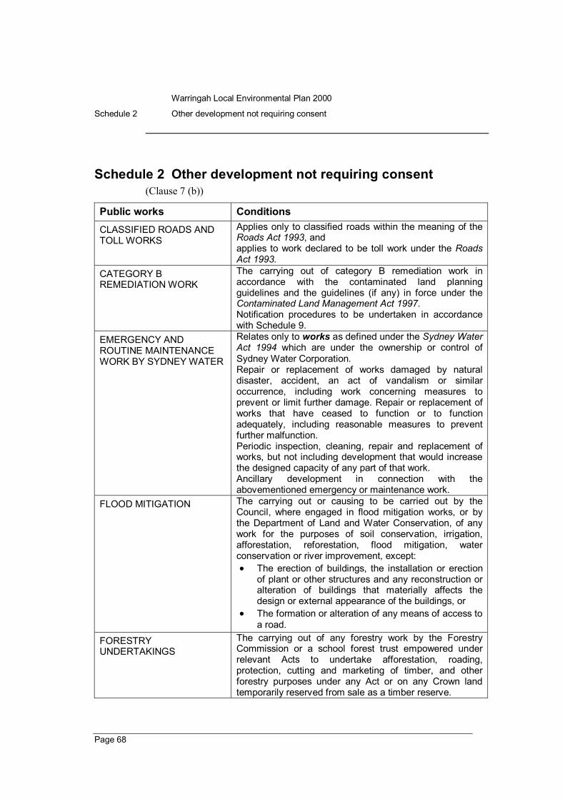
Schedule 2 Other development not requiring consent (Clause 7 (b))
Public works Conditions CLASSIFIED ROADS AND TOLL WORKS
Applies only to classified roads within the meaning of the Roads Act 1993, and applies to work declared to be toll work under the Roads Act 1993.
CATEGORY B REMEDIATION WORK
The carrying out of category B remediation work in accordance with the contaminated land planning guidelines and the guidelines (if any) in force under the Contaminated Land Management Act 1997. Notification procedures to be undertaken in accordance with Schedule 9.
EMERGENCY AND ROUTINE MAINTENANCE WORK BY SYDNEY WATER
Relates only to works as defined under the Sydney Water Act 1994 which are under the ownership or control of Sydney Water Corporation. Repair or replacement of works damaged by natural disaster, accident, an act of vandalism or similar occurrence, including work concerning measures to prevent or limit further damage. Repair or replacement of works that have ceased to function or to function adequately, including reasonable measures to prevent further malfunction. Periodic inspection, cleaning, repair and replacement of works, but not including development that would increase the designed capacity of any part of that work. Ancillary development in connection with the abovementioned emergency or maintenance work.
FLOOD MITIGATION The carrying out or causing to be carried out by the Council, where engaged in flood mitigation works, or by the Department of Land and Water Conservation, of any work for the purposes of soil conservation, irrigation, afforestation, reforestation, flood mitigation, water conservation or river improvement, except: • The erection of buildings, the installation or erection
of plant or other structures and any reconstruction or alteration of buildings that materially affects the design or external appearance of the buildings, or
• The formation or alteration of any means of access to a road.
FORESTRY UNDERTAKINGS
The carrying out of any forestry work by the Forestry Commission or a school forest trust empowered under relevant Acts to undertake afforestation, roading, protection, cutting and marketing of timber, and other forestry purposes under any Act or on any Crown land temporarily reserved from sale as a timber reserve.

Warringah Local Environmental Plan 2000
Schedule 2 Other development not requiring consent
Page 69
Public works Conditions MAINTENANCE DREDGING Must be carried out by a public authority after the following
bodies are consulted: a) the Council, and b) other affected councils, and c) any of the following bodies that may have an interest
in the proposed maintenance dredging: • Department of Land and Water Conservation, • Dept of Public Works and Services, • NSW Fisheries, • Dept of Mineral Resources, • Waterways Authority, • Environmental Protection Authority, • National Parks and Wildlife Service, • Sydney Water Corporation, • Heritage Council, • Environmental Australia.
Note. It is strongly recommended that public authorities intending to undertake maintenance dredging do so only after preparing an estuary management plan under the State Government’s Estuary Management Program for coastal lagoons.
PUBLIC UTILITY UNDERTAKINGS being water, sewerage, drainage or telecommunications services, or electricity or gas undertakings
Development of any description at or below the surface of the ground. The installation of any plant inside an existing building or the installation or erection within the premises of an existing generating station or substation of any plant or other structures or erections required in connection with the station or substation. Additions, extensions or replacement of structures already installed or erected including the installation in an electrical transmission line of substations, feeder pillars or transformer housing, but not including the erection of overhead power lines for the supply of electricity or pipes above the surface of the ground for the supply of water, or the installation of substations, feeder pillars or transformer housings of stone, concrete or brickworks. Provision of overhead service lines in pursuance of any statutory power to provide a supply of electricity, or to provide telecommunications services. Erection of service reservoirs on land acquired for that purpose provided reasonable notice is given to the Council.
ROAD UNDERTAKINGS The carrying out of any development required in connection with the construction, reconstruction, improvement, maintenance or repair of any road, except the widening, realignment or relocation of the road.

Warringah Local Environmental Plan 2000
Schedule 2 Other development not requiring consent
Page 70
Public works Conditions WATER TRANSPORT UNDERTAKINGS
The carrying out by persons carrying on a utility undertaking, being a water transport undertaking of any development required in connection with the movement of traffic by water, including the construction, reconstruction, alteration, maintenance and repair by ways, buildings, wharves, works and plant required for that purpose, except: • The erection of the buildings and any reconstruction
or alteration that materially affects the design of the buildings, or
• The formation or alteration of any means of access to a road.
WHARF OR RIVER UNDERTAKINGS (except in localities A1A7)
The carrying out by persons carrying on a utility undertaking, being a wharf or river undertaking, of any development required for the purposes of shipping, or in connection with the embarking, loading, discharging or transporting of passengers, livestock or goods at a wharf or the movement of traffic by a railway forming part of the undertaking, including the construction, reconstruction, alterations, maintenance and repair of ways, buildings, works and plant for those purpose, except: • The construction of bridges, the erection of any other
buildings and any reconstruction or alteration that materially affects the design or external appearance of the bridges or buildings, or
• The formation or alteration of any means of access to a road.
NATIONAL PARKS DEVELOPMENT AUTHORISED BY OR UNDER THE NATIONAL PARKS AND WILDLIFE ACT 1974
Where the development is likely to impact significantly on the local road system, or otherwise significantly affect other land in the locality, the DirectorGeneral of National Parks and Wildlife must notify the Council in writing of its intention to carry out the development. The Council should respond within 30 days of receiving notification and the DirectorGeneral must give consideration to any relevant matters requested by the Council.

Warringah Local Environmental Plan 2000
Schedule 3 Conditions of complying development certificates
Page 71
Schedule 3 Conditions of complying development certificates
(Clause 9)
Before you begin work 1) Two days before any site works, building, or demolition begins, the applicant
must:
• forward a Notice of Commencement of Work and Appointment of Principal Certifying Authority (Form 7 of Schedule 5 to the Environmental Planning and Assessment Regulation 1994) to the Council, and
• inform the adjoining owners in writing that work will commence. 2) Before any site works, building or demolition is started, the applicant or
builder must:
• notify the Council of the name, address, phone number and license number of the builder
• erect a sign at the front of the property with the builder’s name, license number , site address and consent number
• provide a temporary onsite toilet • protect any public place from obstruction or inconvenience due to the
carrying out of the proposed development • prevent any substance from falling onto a public place • follow any other conditions prescribed in the Environmental Planning
and Assessment Regulation 1994
Site management 3) In the absence of a soil and water management plan approved by the Council,
runoff and erosion controls must be provided to prevent soil erosion, water pollution or the discharge of loose sediment on surrounding land, as follows:
• divert uncontaminated runoff around cleared or disturbed areas • erect a silt fence to prevent debris escaping into drainage systems or
waterways • prevent tracking of sediment by vehicles onto roads • stockpile topsoil, excavated material, construction and landscaping
supplies and debris within the site. 4) Removal or disturbance of vegetation and topsoil must be confined to within
3 metres of the approved building area.

Warringah Local Environmental Plan 2000
Schedule 3 Conditions of complying development certificates
Page 72
Drainage 5) The land surrounding any structure must be graded to diver surface water to
the street and clear of existing and proposed structures and adjoining premises.
6) Where the water falls to the rear of the property, it must be collected and drained via a gravity system to a Council stormwater line or disposed of in a manner consistent with the Council’s Soil and Water Management Policy.
Inspections during construction 7) Notify either the Council or an accredited certifier in advance – 48 hours in
writing or 24 hours by phone, to make the following inspections:
• preliminary • building envelope/floor plan and elevation • final
Hours of work 8) Where the construction or work interferes with the amenity of the
neighbourhood by the emission of noise, chemical or physical pollutants or otherwise, the hours of construction and/or demolition on the site are restricted to Monday to Friday 7 am to 5 pm, Saturday 7am to 1pm, no work on Sunday or public holiday.
Noise 9) In respect of noise, the L10 level (average maximum noise levels) measured
over a period of 15 minutes when the construction site is in operation must not exceed background noise level by more than 10dB (A).
Building Code of Australia 10) All building work must be carried out in accordance with the provisions of
the Building Code of Australia.
Site access 11) Where kerb and gutter is provided:
• Driveways are to be a minimum of 500mm clear of all drainage structures on the kerb and gutter and are not to interfere with the existing public utility infrastructure, including Council drainage structures, unless prior approval is obtained from the relevant authority.
12) Where kerb and gutter is not provided:
• A gravel vehicular entrance incorporating a 375mm diameter stormwater pipe and concrete headwalls or a 6 metre by 6 metre

Warringah Local Environmental Plan 2000
Schedule 3 Conditions of complying development certificates
Page 73
concrete slab dish drain shall be constructed to provide access to the lot
13) Driveways are to be minimum of 6 metres from a road intersection.
14) Driveways are to be constructed in accordance with any relevant requirements of AS 2890.11993Parking facilitiesOffstreet car parking, with appropriate transition zones.
15) Driveway levels are to be obtained from the Council and complied with where access is gained across the Council’s road reserve.
Utilities 16) Road opening permit required for connection to a utility or the Council’s
stormwater system.

Warringah Local Environmental Plan 2000
Schedule 4 Prohibited signs
Page 74
Schedule 4 Prohibited signs (Clause 10)
The following signs are prohibited by clause 10:
• signs above the awning level of a building which project more than 0.3 metre out from the wall of that building,
• flashing or moving signs on land other than the carriageway of a public road,
• pole or pylon signs, unless there is no building on the site or the building is not visible from the street, other than identification, interpretive, directional and advance warning signs included in Schedule 1 (Exempt development) or a sign erected by the Council for the display of community information,
• signs on or above the roof or parapet of a building, • signs which do not directly relate to the predominant land use, business
or activity carried on, or proposed to be carried on, within the site or building on which the sign is to be placed, except signs on public amenities such as street furniture, bus shelters and the like,
• Aframe and temporary signs located on public land including roads (but not including the carriageway of a public road),
• signs on motor vehicles which are not able to be driven with the sign displayed,
• balloons used for the purpose of advertising which are placed on or above roof level.

Warringah Local Environmental Plan 2000
Schedule 5 State policies
Page 75
Schedule 5 State policies (Clause 12 (1) (b))
Housing for older people or people with a disability It is State policy to encourage the provision of housing that will:
(a) increase the supply and diversity of housing that meets the needs of older people or people with a disability, and
(b) make efficient use of existing infrastructure and services, and
(c) be of good design.
Group homes It is State policy:
(a) to facilitate the establishment of permanent group homes in which disabled persons or socially disadvantaged persons may lead as normal a life as possible by living permanently in an ordinary residential household environment, instead of in an institutional environment, and
(b) to facilitate the establishment of transitional group homes which provide temporary accommodation for disabled persons or socially disadvantaged persons in an ordinary residential household environment instead of in an institutional environment for purposes such as alcohol or drug rehabilitation, “halfway” rehabilitation for persons formerly living in institutions and refuges for men, women or young people, and
(c) to ensue that application for group homes are not refused by councils unless there has been an assessment made of the community need for the group home.
Bushland in urban areas It is State policy to protect and preserve bushland within urban areas because of:
(a) its value to the community as part of the natural heritage, and
(b) its aesthetic value, and
(c) its value as a recreational, educational and scientific resource and, specifically:
(i) to protect the remnants of plant communities which were once characteristic of land now within an urban area, and
(ii) to retain bushland in parcels of a size and configuration which will enable the existing plant and animal communities to survive in the longterm, and

Warringah Local Environmental Plan 2000
Schedule 5 State policies
Page 76
(iii) to protect rare and endangered flora and fauna species, and
(iv) to protect habitats for native flora and fauna, and
(v) to protect wildlife corridors and vegetation links with other nearby bushland, and
(vi) to protect bushland as a natural stabiliser of the soil surface, and
(vii) to protect bushland for its scenic values, and to retain the unique visual identity of the landscape, and
(viii) to protect significant geological features, and
(ix) to protect existing landforms, such as natural drainage lines, watercourses and foreshores, and
(x) to protect archaeological relics, and
(xi) to protect the recreational potential of bushland, and
(xii) to protect the educational potential of bushland, and
(xiii) to maintain bushland in locations which are readily accessible to the community, and
(xiv) to promote the management of bushland in a manner which protects and enhances the quality of the bushland and facilitates public enjoyment of the bushland compatible with its conservation.
Caravan parks 1) It is State policy to encourage:
(a) the orderly and economic use and development of land used or intended to be used as a caravan park catering exclusively or predominantly for shortterm residents (such as tourists) or for long term residents, or catering for both, and
(b) the proper management and development of land so used, for the purpose of promoting the social and economic welfare of the community, and
(c) the provision of community facilities for land so used, and
(d) the protection of the environment of, and in the vicinity of, land so used
2) It is also State policy to ensure that, before granting consent to the use of land for the purpose of a caravan park:
(a) Councils have considered:
(i) whether, because of its location or character, the land concerned is particularly suitable for use as a caravan park for tourists or for longterm residence, and

Warringah Local Environmental Plan 2000
Schedule 5 State policies
Page 77
(ii) whether there is adequate provision for tourist accommodation in the locality of that land, and whether existing or potential tourist accommodation will be displayed by the use of sites for longterm residence, and
(iii)whether there is adequate lowcost housing, or land available for lowcost housing, in that locality, and
(iv) whether necessary community facilities and services are available within the caravan park to which the development application relates or in the locality (or both), and whether those facilities and services are reasonably accessible to the occupants of the caravan park, and
(v) any relevant guidelines issued by the Director, and
(b) Councils are satisfied that the development would comply with the Local Government (Caravan Parks, Camping Grounds and Moveable Dwellings) Regulation 1995.
Hazardous and offensive development It is State Policy:
(a) to ensure that in determining whether a development is a hazardous or offensive industry, any measures proposed to be employed to reduce the impact of the development are taken into account, and
(b) to ensure that in considering any application to carry out potentially hazardous or offensive development, the consent authority has sufficient information to assess whether the development is hazardous or offensive and to impose conditions to reduce or minimise any adverse impact, and
(c) to require the advertising of applications to carry out any such development.
Maintenance dredging of tidal waterways It is State policy to enable the maintenance dredging of tidal waterways by public authorities to be carried out in a timely, cost effective and environmentally responsible manner in response to changing conditions in those waterways.
Koala habitat protection It is State policy to encourage the proper conservation and management of areas of natural vegetation that provide habitat for koalas to ensure a permanent freeliving population over their present range and reverse the current trend of koala population decline.

Warringah Local Environmental Plan 2000
Schedule 5 State policies
Page 78
Permissibility of mining It is a State policy, in relation to mining:
(a) to promote the economic development of the State, and
(b) to facilitate the development of the State’s natural resources, and
(c) to facilitate the development of significant exportearnings industries for the State, and
(d) to create significant employment opportunities within the State.
Extractive industries It is State policy:
(a) to facilitate the development of extractive resources in proximity to the population of the Sydney Metropolitan Area by identifying land which contains extractive material of regional significance, and
(b) to permit, with development consent, development for the purpose of extractive industries on such land, and
(c) to ensure consideration is given to the impact of encroaching development on the ability of extractive industries to realise their full potential, and
(d) to promote the carrying out of development for the purpose of extractive industries in an environmentally acceptable manner.
Traffic Generating Development It is State policy to ensure that the Roads and Traffic Authority:
(a) is made aware of, and
(b) is given opportunity to make representations in respect of,
development referred to in Schedule 10.

Warringah Local Environmental Plan 2000
Schedule 6 Preservation of bushland
Page 79
Schedule 6 Preservation of bushland
(Clauses 17 (5) and 36 (3))
The need to preserve and protect bushland should be considered in the context of:
• its value to the community as part of the natural heritage, and • its aesthetic value, and • its value as a recreational, educational and scientific resource, and • the following specific aims: (a) to protect the remnants of the plant communities which were once
characteristic of land now within an urban area,
(b) to retain bushland in parcels of a size and configuration which will enable the existing plant and animal communities to survive in the longterm,
(c) to protect rare and endangered flora and fauna species,
(d) to protect habitats for native flora and fauna,
(e) to protect wildlife corridors and vegetation links with other nearby bushland,
(f) to protect bushland as a natural stabiliser of the soil surface,
(g) to protect bushland for its scenic values, and to retain the unique visual identity of the landscape,
(h) to protect significant geological features,
(i) to protect existing landforms, such as natural drainage lines, watercourses and foreshores,
(j) to protect archaeological relics,
(k) to protect the recreational potential of bushland,
(l) to protect the educational potential of bushland,
(m) to maintain bushland in locations which are readily accessible to the community,
(n) to promote the management of bushland in a manner which protects and enhances the quality of the bushland and facilitates public enjoyment of the bushland compatible with its conservation.
Warringah Local Environmental Plan 2000
Schedule 7 Matters for consideration in a subdivision of land
Page 80
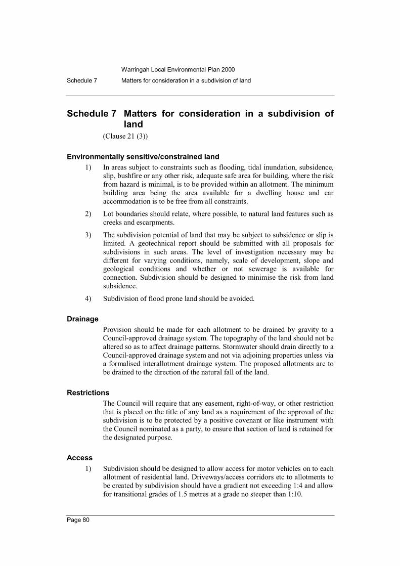
Schedule 7 Matters for consideration in a subdivision of land
(Clause 21 (3))
Environmentally sensitive/constrained land 1) In areas subject to constraints such as flooding, tidal inundation, subsidence,
slip, bushfire or any other risk, adequate safe area for building, where the risk from hazard is minimal, is to be provided within an allotment. The minimum building area being the area available for a dwelling house and car accommodation is to be free from all constraints.
2) Lot boundaries should relate, where possible, to natural land features such as creeks and escarpments.
3) The subdivision potential of land that may be subject to subsidence or slip is limited. A geotechnical report should be submitted with all proposals for subdivisions in such areas. The level of investigation necessary may be different for varying conditions, namely, scale of development, slope and geological conditions and whether or not sewerage is available for connection. Subdivision should be designed to minimise the risk from land subsidence.
4) Subdivision of flood prone land should be avoided.
Drainage Provision should be made for each allotment to be drained by gravity to a Councilapproved drainage system. The topography of the land should not be altered so as to affect drainage patterns. Stormwater should drain directly to a Councilapproved drainage system and not via adjoining properties unless via a formalised interallotment drainage system. The proposed allotments are to be drained to the direction of the natural fall of the land.
Restrictions The Council will require that any easement, rightofway, or other restriction that is placed on the title of any land as a requirement of the approval of the subdivision is to be protected by a positive covenant or like instrument with the Council nominated as a party, to ensure that section of land is retained for the designated purpose.
Access1) Subdivision should be designed to allow access for motor vehicles on to each
allotment of residential land. Driveways/access corridors etc to allotments to be created by subdivision should have a gradient not exceeding 1:4 and allow for transitional grades of 1.5 metres at a grade no steeper than 1:10.

Warringah Local Environmental Plan 2000
Schedule 7 Matters for consideration in a subdivision of land
Page 81
2) Access should be provided from a constructed and dedicated public road. Where access is proposed to a section of unconstructed public road, then the subdivision will need to provide legal constructed access to the Council’s satisfaction, to a constructed public road.
3) The following table should be observed as to the width of accessways. The width is exclusive of any area for the provision of services to the lots.
Number of lots to be serviced Width of clear constructed accessway (m)*
15 3.5
610 5.0
in excess of 10 access should be provided by a private or public road constructed with a width that is in accordance with Council standard specifications for engineering works (AUSPEC 1)
*Note. Clear widths exclude fencing and other obstructions.
• Driveways less than 5.0m wide should be widened to 5.0m for a distance of 10m at intervals of not more than 30m.
• Vehicular ingress/egress points to internal lots may be used as passing/turning bays, subject to the extension of the rightof carriageway.
• As the widths quoted are for straights, this widening should be exclusive of the widening for curves. Any widening for curves should suit the minimum sweep path of the 98 th percentile sedan vehicle based on Figure B1 in Australian Standards AS 2890.11993.
• An additional width shall be provided within the rightof carriageway for services: up to 3 lots0.5
over 3 lots1.0m
• Passing bays should be provided in addition to the driveway as determined, having regard to sight conditions and to minimise vehicular conflict.
• Rightsofcarriageway should be located so as to accommodate all vehicle turning facilities.
• Driveways in excess of 200 metres will not be accepted in localities where erection of housing is Category One development.
4) Subdivisions must provide access for Council service vehicles, emergency vehicles and garbage collection vehicles.

Warringah Local Environmental Plan 2000
Schedule 7 Matters for consideration in a subdivision of land
Page 82
Bushfire New subdivision should be designed to minimise the risk from potential bushfire.
Asset protection zones identified in a bush fire risk management plan in force under the Rural Fires Act 1997 should be contained within the property boundaries of the new subdivision.
Design and construction All design and construction is to be in accordance with the Council’s Specification for Engineering Works and On site stormwater detention policy and technical specification.
Lot dimensions In localities where erection of housing is Category One development, the following standards apply to proposed new allotments (other than new allotments proposed pursuant to clause 21 (1)(b)):
(a) Minimum width of 13 metres and a minimum depth of 27 metres. This does not apply to development that is not subject to a maximum density standard as outlined in the relevant Locality Statement or development occurring on the Brookvale Brickworks site in Locality F4Brookvale Valley.
(b) Minimum building area of 150m 2 . Building area excludes driveways.
(c) In calculating housing density, the area of any access corridor (including any rightofcarriageway, access handle, accessway or that provides for vehicular access) is to be excluded, whether such access corridor is to be created or is in existence at the time of application for subdivision.

Warringah Local Environmental Plan 2000
Schedule 8 Site analysis
Page 83
Schedule 8 Site analysis (Clause 22 (2) (a))
The purpose of a site analysis is to identify and explain graphically:
• the key influences on the design, and • the site planning for the proposal and how the development will relate
to the immediate locality. A site analysis must be to scale and should identify development opportunities and constraints. It should influence the design to minimise negative impacts on the amenity of adjoining development and to complement the desired character of the locality.
The extent of information included in a site analysis should reflect the issues that need to be considered in assessing the development proposal.
At its most exhaustive, a site analysis would document the site in terms of:
• contours and existing vegetation, • buildings (including any which could be retained), • views to and from the site, • location of windows and private open space within adjoining
properties, • access and connection points, • drainage and utility services, • orientation, microclimate and noise sources, • where relevant, any contaminated soils and filled areas, • fences, boundaries and easements, • soil and geological characteristics, • rock outcrops, • flood affectation, • bushfire hazard, and • any other notable features, and the surrounds in terms of:
• the location and use of adjacent and opposite buildings and out buildings,
• abutting secluded private open space and habitable room windows which have outlooks towards the site, particularly those within 9m of the site,
• views and solar access enjoyed by adjacent residents, • major trees on adjacent properties, particularly those within 9m of the
site, • location and height of walls built to the boundary of the site,

Warringah Local Environmental Plan 2000
Schedule 8 Site analysis
Page 84
• characteristics of any adjacent public open space, • identification of sensitive downslope/downstream ecosystems requiring
protection, • streetfrontage features, such as poles, street trees, kerb crossovers, bus
stops and services infrastructure, • the built form and character of adjacent and nearby buildings and
works, including characteristic fencing and garden styles, • direction and distances to local shops, schools, public transport, parks
and community facilities, and • the difference in levels between the subject land and adjacent
properties. The site analysis must be accompanied by a written statement explaining how the development’s design relates to the analysis.
If a site analysis relates to a proposed subdivision, it should demonstrate how future development proposals would satisfy the general principles of development control in Part 4 and the relevant Locality Statement.
Warringah Local Environmental Plan 2000
Schedule 9 Notification requirements for remediation work
Page 85
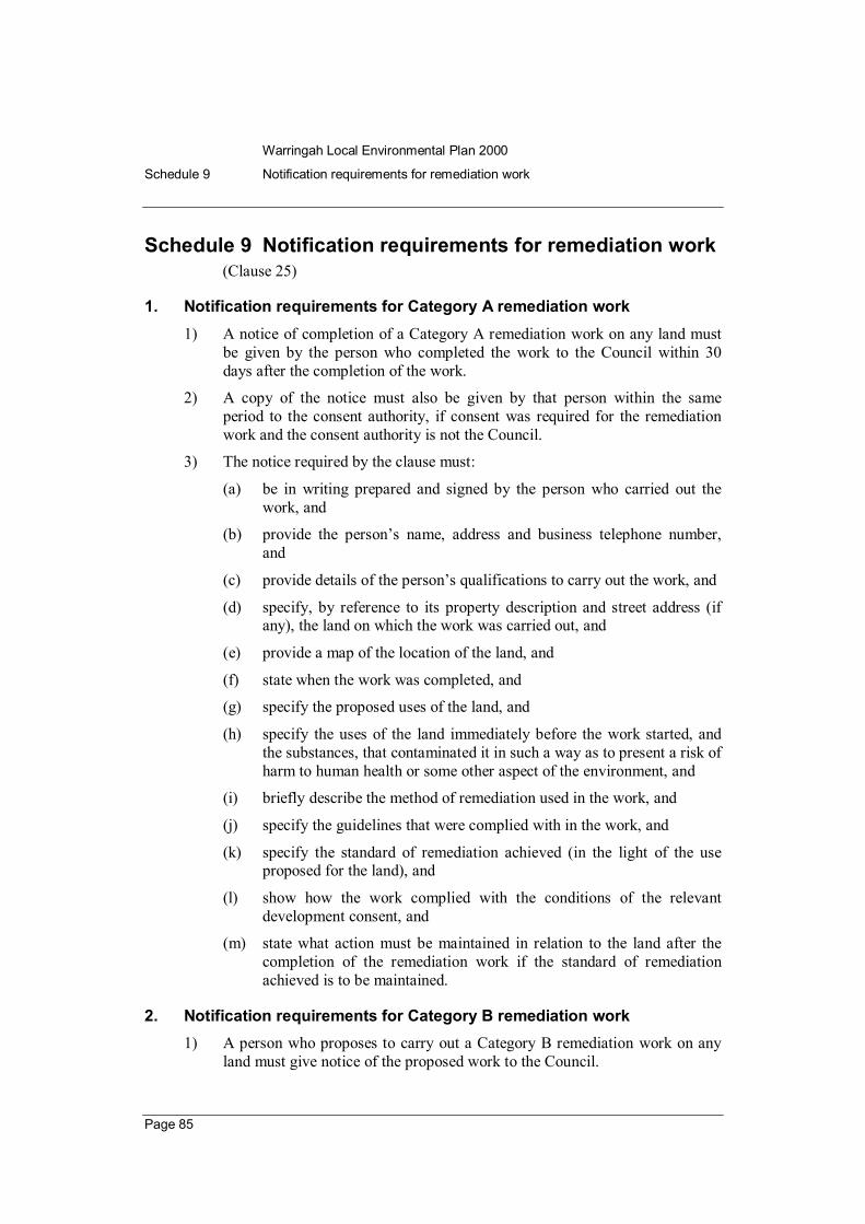
Schedule 9 Notification requirements for remediation work (Clause 25)
1. Notification requirements for Category A remediation work 1) A notice of completion of a Category A remediation work on any land must
be given by the person who completed the work to the Council within 30 days after the completion of the work.
2) A copy of the notice must also be given by that person within the same period to the consent authority, if consent was required for the remediation work and the consent authority is not the Council.
3) The notice required by the clause must:
(a) be in writing prepared and signed by the person who carried out the work, and
(b) provide the person’s name, address and business telephone number, and
(c) provide details of the person’s qualifications to carry out the work, and
(d) specify, by reference to its property description and street address (if any), the land on which the work was carried out, and
(e) provide a map of the location of the land, and
(f) state when the work was completed, and
(g) specify the proposed uses of the land, and
(h) specify the uses of the land immediately before the work started, and the substances, that contaminated it in such a way as to present a risk of harm to human health or some other aspect of the environment, and
(i) briefly describe the method of remediation used in the work, and
(j) specify the guidelines that were complied with in the work, and
(k) specify the standard of remediation achieved (in the light of the use proposed for the land), and
(l) show how the work complied with the conditions of the relevant development consent, and
(m) state what action must be maintained in relation to the land after the completion of the remediation work if the standard of remediation achieved is to be maintained.
2. Notification requirements for Category B remediation work 1) A person who proposes to carry out a Category B remediation work on any
land must give notice of the proposed work to the Council.

Warringah Local Environmental Plan 2000
Schedule 9 Notification requirements for remediation work
Page 86
2) The notice must be given at least 30 days before the commencement of the work except, in the case of a remediation work that, by the terms of a management order, is required to be commenced before the expiry of the usual period under the Contaminated Land Management Act 1997 for lodgement of an appeal against the order (whether or not the remediation work is designated development or carried out, or to be carried out, on any land in a manner that does not comply with a policy made under the contaminated land planning guidelines of the Council), where the notice must be given no later than on the day before the commencement of the work.
3) The notice must:
(a) be in writing, and
(b) provide the name, address and telephone number of the person who has the duty of ensuring that the notice is given, and
(c) briefly describe the remediation work, and
(d) show why the person considers that the work is Category B remediation work, and
(e) specify, by reference to its property description and street address (if any), the land on which the work is to be carried out, and
(f) provide a map of the location of the land, and
(g) provide estimates of the dates for the commencement and completion of the work.

Warringah Local Environmental Plan 2000
Schedule 10 Traffic generating development
Page 87
Schedule 10 Traffic generating development (Clause 30 (1) and (3))
(1) Development for the purpose of, or being:
(a) the erection of, or conversion of a building into, a residential flat building comprising 300 or more dwellings or the enlargement or extension of a residential flat building by the addition of 300 or more dwellings, or
(b) the erection of a building for the purposes of shops, where the gross floor area of the building is or exceeds 2,000 square metres or the enlargement or extension of a building used for the purpose of shops, where the gross floor area of that enlargement or extension is or exceeds 2,000 square metres, or
(c) the erection of a building for the purposes of shops and commercial premises, where the gross floor area of the building is or exceeds 4,000 square metres or the enlargement or extension of a building used for the purposes of shops and commercial premises, where the gross floor area of that enlargement or extension is or exceeds 4,000 square metres, or
(d) the erection of a building for the purposes of commercial premises, where the gross floor area of the building is or exceeds 10,000 square metres or the enlargement or extension of a building used for the purposes of commercial premises, where the gross floor area of that enlargement or extension is or exceeds 10,000 square metres, or
(e) the erection of a building for the purposes of commercial premises and industry, where the gross floor area of the building is or exceeds 15,000 square metres or the enlargement or extension of a building used for the purposes of commercial premises and industry, where the gross floor area of that enlargement or extension is or exceeds 15,000 square metres, or
f) the erection of a building for the purposes of industry, where the gross floor area of the building is or exceeds 20,000 square metres or the enlargement or extension of a building used for the purposes of industry, where the gross floor area of that enlargement or extension is or exceeds 20,000 square metres, or
(g) subdivision of land into 200 or more allotments, where the subdivision includes the opening of a public road, or
(h) drivein theatres or the enlargement or extension of existing drivein theatres so as to enable the accommodation of more than 200 motor vehicles, or
(i) educational establishments accommodating 50 or more students or the enlargement or extension of existing educational establishments to accommodate an additional 50 or more students, or

Warringah Local Environmental Plan 2000
Schedule 10 Traffic generating development
Page 88
(j) transport terminals, bulk stores, container depots or liquid fuel depots or the enlargement or extension of any existing transport terminal, bulk store, container depot or liquid fuel depot by increasing by more than 8,000 square metres the area of land or the gross floor area of buildings used for that purpose, or
(k) junk yards (within the meaning of the Environmental Planning and Assessment Model Provisions 1980) or waste facilities (within the meaning of the Waste Recycling and Processing Corporation Act 2001), or
(l) heliports, airports or aerodromes, or
(m) extractive industry or mining, or
(n) areas used exclusively for parking or any other development having ancillary accommodation for 200 or more motor vehicles, or the enlargement or extension of a parking area, where the enlargement or extension accommodates 200 or more motor vehicles.
(2) The following development, if the site of the development has direct vehicular or pedestrian access to an arterial road (or a road connecting with an arterial road, where the access is within 90 metres, measured along the road alignment of the connecting road, of the arterial road):
(a) the erection of, or the conversion of a building into, a residential flat building comprising 75 or more dwellings or the enlargement or extension of a residential flat building by the addition of 75 or more dwellings,
(b) the erection of a building for the purposes of shops, where the gross floor area of the building is or exceeds 500 square metres or the enlargement or extension of a building used for the purposes of shops, where the gross floor area of that enlargement or extension is or exceeds 500 square metres,
(c) the erection of a building for the purposes of shops and commercial premises, where the gross floor area of the building is or exceeds 1,000 square metres or the enlargement or extension of a building used for the purposes of shops and commercial premises, where the gross floor area of that enlargement or extension is or exceeds 1,000 square metres,
(d) the erection of a building for the purposes of commercial premises, where the gross floor area of the building is or exceeds 2,500 square metres or the enlargement or extension of a building used for the purposes of commercial premises, where the gross floor area of that enlargement or extension is or exceeds 2,500 square metres,
(e) the erection of a building for the purposes of commercial premises and industry, where the gross floor area of the building is or exceeds 4,000 square metres or the enlargement or extension of a building used for the purposes of commercial premises and industry, where the gross floor area of that enlargement or extension is or exceeds 4,000 square metres,

Warringah Local Environmental Plan 2000
Schedule 10 Traffic generating development
Page 89
(f) the erection of a building for the purposes of industry, where the gross floor area of the building is or exceeds 5,000 square metres or the enlargement or extension of a building used for the purposes of industry, where the gross floor area of that enlargement or extension is or exceeds 5,000 square metres,
(g) subdivision of land into 50 or more allotments,
(h) tourist facilities, recreation facilities, showgrounds or sportsgrounds, in each case having accommodation for 50 or more motor vehicles or the enlargement or extension of any existing tourist facilities, recreation facilities, showgrounds or sportsgrounds, where that enlargement or extension includes accommodation for 50 or more motor vehicles,
(i) premises licensed under the Liquor Act 1982 or the Registered Clubs Act 1976, in each case having accommodation for 50 or more motor vehicles, or the enlargement or extension of such premises where that enlargement or extension includes accommodation for 50 or more motor vehicles,
(j) places of assembly or places of worship, in each case having accommodation for 50 or more motor vehicles or the enlargement or extension of any existing places of assembly or places of worship, where that enlargement or extension includes accommodation for 50 or more vehicles,
(k) the erection of a building for the purposes of refreshment rooms, where the gross floor area of that building is or exceeds 300 square metres or the enlargement or extension of a building used for the purposes of refreshment rooms, where the gross floor area of that enlargement or extension is or exceeds 300 square metres,
(l) drivein takeaway food outlets,
(m) service stations (including service stations which have retail outlets),
(n) motor showrooms having accommodation for 50 or more motor vehicles or the enlargement or extension of any existing motor showrooms, where that enlargement or extension includes accommodation for 50 or more motor vehicles,
(o) the erection of a building for the purposes of a hospital having accommodation for 100 or more beds or the enlargement or extension of a building for the purposes of a hospital, where the enlargement or extension includes accommodation for 100 or more beds.
(3) Development:
(a) for the purpose of roadside stalls, or
(b) within areas used exclusively for parking or any other development, in each case having ancillary accommodation for 50 or more motor vehicles.

Warringah Local Environmental Plan 2000
Schedule 10 Traffic generating development
Page 90
(4) The enlargement or extension of a parking area, where the enlargement or extension includes accommodation for 50 or more motor vehicles.
Note: For the purposes of this Schedule definitions of development are as defined under the Environmental Planning and Assessment model Provisions 1980 (except for definitions of ‘arterial road’, ‘main road’ and ‘road side stall’ that are defined in the State Environmental Planning Policy No. 11 – Traffic Generating Developments).

Warringah Local Environmental Plan 2000
Schedule 11 Koala feed tree species and plans of management
Page 91
Schedule 11 Koala feed tree species and plans of management
(Clause 59)
Feed tree species
Scientific name Common name Eucalyptus tereticornis Forest red gum
Eucalyptus microcorys Tallowwood
Eucalyptus punctata Grey gum
Eucalyptus viminalis Ribbon or manna gum
Eucalyptus camaldulensis River red gum
Eucalyptus haemastoma Broad leaved scribbly gum
Eucalyptus signata Scribbly gum
Eucalyptus albens White box
Eucalyptus populnea Bimble box or poplar box
Eucalyptus robusta Swamp mahogany
Plans of management
Preparation of plan of management 1) A plan of management may be prepared for:
(a) the whole of the local government area, or
(b) a part of the local government area (including an area of land that is the subject of a development application).
2) Anyone (including the Council) may prepare a plan of management.
3) A plan of management is to be prepared in accordance with the guidelines, as in force from time to time, made for the purpose of preparing koala habitat plans of management, by the Director.
4) A person who prepares a plan of management for the whole of the Warringah local government area is to consult the DirectorGeneral of National Parks and Wildlife about the content of the plan.
Approval of plan of management 5) A plan of management prepared by the Council has no effect unless it is
approved by the Director.
6) A plan of management prepared by a person other than the Council has no effect unless it is approved by the Council and subsequently by the Director.

Warringah Local Environmental Plan 2000
Schedule 11 Koala feed tree species and plans of management
Page 92
7) A plan of management takes effect on the day it is approved by the Director or on a later day specified in it for the purpose.
Amendment or repeal of plan of management 8) A plan of management may be amended or repealed by a subsequent plan of
management prepared and approved in accordance with this Schedule.

Warringah Local Environmental Plan 2000
Schedule 12 Requirements for complying development
Page 93
Schedule 12 Requirements for complying development (Appendices AH)
Part A Housing and ancillary structures
General • The development complies with all the objective built form controls
outlined in the relevant Locality Statement, except where a built form control referred to in the Locality Statement is more restrictive. In that case, the requirements outlined in this Schedule prevail.
Streetscape • Carports and garages occupy no more than 50% of the frontage width
or have a maximum width of 6 metres. • The original height of the building is unaltered. • The street elevation of the dwelling has a front door or living room
window facing the street. • Front fence is not to exceed 1.2 metres above natural ground level.
Bulk and scale • The distance between the floor level and the underside of the eaves is
no more than 2.7 metres. • The ground floor level of the structure at any point is no more than
600mm above natural ground level. • The roof pitch is no more than 24 degrees. • The external wall of any structure is at least 900mm from a side
boundary. • The eaves and roof gutter of any structure are a minimum distance
from the boundary of 0.675m.
Site access and circulation • The finished level of the driveway is to be within a maximum of
250mm from the existing ground level. • Driveways are a minimum of 500mm from the side boundary. • Driveways are a minimum 500mm clear of all drainage structures on
the kerb and gutter and do not interfere with the existing public utility infrastructure, unless prior approval is obtained from the relevant authority.
• There is a maximum of one driveway crossing per allotment. • Driveways are a minimum distance of 6m from a road intersection.

Warringah Local Environmental Plan 2000
Schedule 12 Requirements for complying development
Page 94
Water and soil management • Development must collect stormwater and dispose of it to an existing
approved drainage system. • No construction over any registered easement without the approval of
the party benefiting from the easement. • No structure is constructed within 3m of a sewer/water main without
the prior approval of the relevant service authority. • The total impervious area after development is less than 35% of the
total site area or the total impervious area of a proposed addition is less than 50m 2 .
Total impervious area means existing and proposed roofed areas, paved surfaces and hardstand areas.
Tree preservation • No trees, which are the subject of the Council’s Tree Preservation
Order, are to be removed without consent. • No structure is to be constructed within the drip line of a tree that is the
subject of the Council’s Tree Preservation Order.
Carparking • Existing approved carparking spaces, including garages and carports,
remain available for carparking as approved. • Any increase in carparking demand, resulting from additions or
alterations is met with the corresponding additional carparking provided on site in accordance with clause 74 (Provision of carparking).
Compliance with general principles Development will comply with the objective requirements in the following general principles outlined in Part 4:
• Clause 62 – Access to sunlight • Clause 64 – Private open space • Clause 68 – Conservation of energy and water • Clause 74 – Provision of carparking • Clause 75 – Design of carparking areas (table only) • Clause 76 – Management of stormwater
Warringah Local Environmental Plan 2000
Schedule 12 Requirements for complying development
Page 95
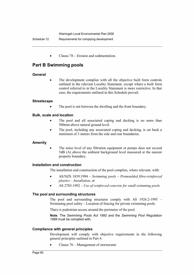
• Clause 78 – Erosion and sedimentation.
Part B Swimming pools
General • The development complies with all the objective built form controls
outlined in the relevant Locality Statement, except where a built form control referred to in the Locality Statement is more restrictive. In that case, the requirements outlined in this Schedule prevail.
Streetscape • The pool is not between the dwelling and the front boundary.
Bulk, scale and location • The pool and all associated coping and decking is no more than
500mm above natural ground level. • The pool, including any associated coping and decking, is set back a
minimum of 3 meters from the side and rear boundaries.
Amenity • The noise level of any filtration equipment or pumps does not exceed
5dB (A) above the ambient background level measured at the nearest property boundary.
Installation and construction The installation and construction of the pool complies, where relevant, with:
• AS/NZS 1839:1994 – Swimming pools – Premoulded fibrereinforced plastics – Installation, or
• AS 27831992 – Use of reinforced concrete for small swimming pools.
The pool and surrounding structures The pool and surrounding structures comply with AS 1926.21995 – Swimming pool safety – Location of fencing for private swimming pools.
There is pedestrian access around the perimeter of the pool. Note. The Swimming Pools Act 1992 and the Swimming Pool Regulation 1998 must be complied with.
Compliance with general principles Development will comply with objective requirements in the following general principles outlined in Part 4:
• Clause 76 – Management of stormwater
Warringah Local Environmental Plan 2000
Schedule 12 Requirements for complying development
Page 96
• Clause 78 – Erosion and sedimentation.
Part C Industrial/Warehouse
General The development complies with all the objective built form controls outlined in the relevant Localities Statement, except where a built form control referred to in the Locality Statement is more restrictive. In that case, the requirements outlined in this Schedule prevail.
Streetscape • All required carparking is provided on site behind the required front
setback. • Existing landscaping is not reduced. • All works are within the existing envelope of the building. • No alterations to the external cladding of the building. • No increase in the number or the width of vehicle footpath crossings.
Floor space • There is no increase in the gross floor area of the currently approved
building. • There is no decrease to the gross floor area used for pedestrian access
paths or access to fire exits. • No reduction in the fire safety measures for the building required to be
provided in accordance with the Building Code of Australia and relevant Australian Standards.
Carparking • Existing approved carparking spaces, including garages and carports,
remain available for carparking as approved. • Any increase in carparking demand, resulting from change of use, is
met with the corresponding additional carparking provided on site in accordance with the general principle in clause 74 (Provision of carparking).
• Adequate manoeuvring area is provided to ensure that vehicles are able to enter and exit the site in a forward direction.
• Design of carparking areas is in accordance with the most recent Guide to Traffic Generating Developments (NSW Roads and Traffic Authority)
Compliance with general principles Development will comply with the objective requirements in the following general principles outlined in Part 4

Warringah Local Environmental Plan 2000
Schedule 12 Requirements for complying development
Page 97
• Clause 43 – Noise • Clause 44 – Pollutants • Clause 45 – Hazardous uses • Clause 74 – Provision of carparking
Part D Businesses, offices and shops
Streetscape • Compliance with the objective standards outlined in the relevant
Locality Statement. • All work is contained within the previously approved envelope of the
building. • New entrances directly face the street or pedestrian thoroughfares.
Floor space • There is no increase in the gross floor area of the currently approved
building. • There is no decrease to the gross floor areas used for pedestrian access
paths or for access to fire exits. • No reduction in the fire safety measures for the building required to be
provided in accordance with the Building Code of Australia and relevant Australian Standards.
Carparking • Existing approved carparking spaces, including garages and carports,
remain available for carparking as approved. • Any increase in carparking demand, resulting from change of use, is
met with the corresponding additional carparking provided on site in accordance with the general principle in clause 74 (Provision of carparking)
• Design of carparking areas is in accordance with the most recent Guide to Traffic Generating Developments (NSW Roads and Traffic Authority).
Food shops • If the new shop is a food shop, then it must comply with all objective
standards imposed on the proposed development by the Food Act 1989 and associated Regulations.
Compliance with general principles Development will comply with the objective requirements in the following general principles outlined in Part 4:

Warringah Local Environmental Plan 2000
Schedule 12 Requirements for complying development
Page 98
• Clause 43 – Noise • Clause 74 – Provision of carparking.
Warringah Local Environmental Plan 2000
Schedule 13 Development guidelines for Collaroy/Narrabeen Beach
Page 99
Schedule 13 Development guidelines for Collaroy/Narrabeen Beach
(Appendix D – Locality D1)
1. Land to which these guidelines apply These development guidelines for Collaroy/Narrabeen Beach apply to all properties marked on the Council’s Collaroy/Narrabeen/Fishermans Beach Hazard Line Maps – A1 8634, Sheets 13, having any part within the zones of Wave Impact, Slope Adjustment or Reduced Foundation Capacity, as shown on those maps.
2. Policy statement
Development guidelines for Collaroy/Narrabeen Beach, policy statement: The Council is to control and regulate development along Collaroy/Narrabeen beachfront to reduce the risk of damage to beachfront trees, buildings, works and places from coastal processes.
The risk of damage is to be reduced through having appropriate setbacks and foundation criteria for structures, as detailed in the Criteria for the Siting and Design of Foundations for Residential Development, February 1991, Geomarine Pty Ltd and Coffey Partners International Pty Ltd, Report No 69021 R02 (prepared for Warringah Shire Council).
When assessing an application for consent to any such development, the Council must take into account the Collaroy/Narrabeen Coastline Management Plan 1997 (WC 1997), available at the office of the Council, and the State Government’s Coastline Management Manual (1990).
The development guidelines for Collaroy/Narrabeen Beach include the Council’s Maps A1 8634 Sheets 13. Note. General advice is to be included by the consent authority with all consents and approvals to assist in informing residents and owners of the potential threat to property from coastal processes.
Aims of these guidelines The aims of these guidelines are as follows:
(a) to preserve and protect the Collaroy/Narrabeen Beach as a national asset for public recreation and amenity,
(b) to ensure that building and development along the Collaroy and Narrabeen Beaches have regard to the current and future hazards of wave impact and coastal erosion,

Warringah Local Environmental Plan 2000
Schedule 13 Development guidelines for Collaroy/Narrabeen Beach
Page 100
(c) to be consistent with the aims and objectives of the State Government’s Coastline Hazard Policy and Coastline Management Manual,
(d) to be within the reasonable and practical financial capacity of the Council to implement with financially equitable impacts across the Warringah community.
In addition, these guidelines specifically aim:
• to provide protection from coastal processes for proposed buildings and works along the Collaroy/Narrabeen beachfront,
• to enable assessment of development applications for the Collaroy/Narrabeen beachfront in accordance with this policy and in accordance with the principles of the State Government’s Coastline Management Manual, published in September 1990,
• to be consistent with other management strategies and actions detailed in the Collaroy/Narrabeen Coastline Management Plan 1997, and
• to exempt the Council from liability in respect of advice furnished and conduct of the Council in accordance with principles contained in the State Government’s Coastline Management Manual, published in September 1990.
Note. For further information related to the development guidelines policy see:
• Criteria for the Siting and Design of Foundations for Residential Development, February 1991, Geomarine Pty Ltd and Coffey Partners International Pty Ltd, Report No 69021 R02 (for Warringah Shire Council)
• Coastline Management Manual, New South Wales Government, September 1990.
3. Principles The Council will take the following principles into account when it assesses development:
(a) Minor development (i) In this paragraph, minor development means works identified as
exempt development in Schedule 1.
(ii) Minor development should be appropriately sited having regard to the Hazard Zones marked on the Council’s Maps A1 8634 Sheets 13 and the aims of these guidelines.
(iii) In the Zone of Wave Impact, consent may be granted for minor development and landscaping works, having regard to the aims of these guidelines.
(iv) The Zone of Wave Impact is the area identified as such on the map.

Warringah Local Environmental Plan 2000
Schedule 13 Development guidelines for Collaroy/Narrabeen Beach
Page 101
(b) Major development
(i) In this paragraph, major development means all other development for which consent under the Act is required, but does not include engineered structures built or commissioned by a public authority for the purpose of erosion protection and mitigation.
(ii) Major development should be appropriately sited on allotments west (landward) of the Zone of Wave Impact and having regard to the Zones of Slope Adjustment and Reduced Foundation Capacity, as identified on a map available from the office of the Council.
(iii) The Hazard Zones are to be marked on all plans submitted to the Council.
(iv) In the Zone of Wave Impact, major development will not be permitted. This includes structures which extend out over the Zone of Wave Impact or into the air space above the Zone of Wave Impact.
(v) In the Zone of Slope Adjustment, structures are to be supported on piles to withstand loads which may be induced in the pile by slumping of the soil face.
(vi) In the Zone of Reduced Foundation Capacity, structures are to be supported on piles to withstand loads which may be induced in the pile by slumping of the soil face.
(vii) In the Zone of Stable Foundation, as identified on a map available from the office of the Council, conventional foundation design may be permissible, depending on proximity to Hazard Zones.
(viii) Criteria for structural pile design for residential development is detailed in Criteria for the Siting and Design of Foundations for Residential Development, February 1991, Geomarine Pty Ltd and Coffey Partners International Pty Ltd, Report No 69021 R02. This report is a design guide only and detailed design of piling should be undertaken in accordance with these guidelines.
(ix) A suitably qualified engineer must undertake the geotechnical/structural design of the foundations in accordance with the report referred to in subparagraph (viii) and these guidelines.
(x) Unless demonstrated as being adequate to the Council’s satisfaction, piling must extend to a depth below 1 metre AHD in the Zones of Slope Adjustment and Reduced Foundation Capacity.

Warringah Local Environmental Plan 2000
Schedule 13 Development guidelines for Collaroy/Narrabeen Beach
Page 102
(xi) Piling requirements for major development extend to the whole structure, with any part of the structure located east (seaward) of the Zone of Stable Foundation.
4. Conditions of approval or consent Any approval or consent will include the following condition:
“The applicant/owner is to minimise the amount of sand removed from the property during construction. If sand is removed from the site during construction, it may be placed on the beach reserve in accordance with the direction of the Council’s Environmental Officers.”
5. Advice to be included with approvals or consents The following advice is to be included with all consents and approvals:
“This property is on land located in an area where there is likely to be a risk of coastal erosion and wave impact during severe storms. The risk to the property may increase with time due to longterm beach recession caused by greenhouse induced sea level rise or natural coastal processes.
To reduce the potential impact to your property, the Council strongly recommends that effective precautions be taken to ensure adequate volumes of sand are maintained within the eastern (seaward) boundary of your property. The Council required that only freedraining, clean, yellow sand be used to fill allotments.”
6. Special conditions For nonresidential major development, the applicant is to have regard to the requirements for major development given in item 3 (b) of these guidelines and, in addition, is to provide advice from a suitably qualified engineer, detailing piling design for the structure, capable of withstanding coastal processes such as wave impact and coastal erosion, affecting the Collaroy/Narrabeen Beach.

Warringah Local Environmental Plan 2000
Schedule 14 Guiding principles for development near Middle Harbour
Page 103
Schedule 14 Guiding principles for development near Middle Harbour
(Appendix C – Locality C1)
The following matters must be taken into consideration:
(a) the desirability of increasing public access to, and use of, land on the foreshore,
(b) the retention, management and use of land made available for the public access or the use of other appropriate tenure mechanisms where public ownership is not possible,
(c) the retention and enhancement of public access links between existing foreshore open space areas,
(d) the conservation of significant bushland and other natural features along the foreshore, where consistent with conservation principles, and their availability for public use and enjoyment,
(e) the suitability of the site or part of the site for significant open space that will enhance the open space network existing along the Harbour foreshores,
(f) the protection of significant natural and cultural heritage values, including marine ecological values,
(g) the protection and improvement of unique visual qualities of the Harbour, its foreshores and tributaries,
(h) the relationship between use of the water and foreshore activities,
(i) the conservation of items of heritage significance identified in an environmental planning instrument or subject to an order under the Heritage Act 1977,
(j) the scale and character of any development, derived from an analysis of the context of the site,
(k) the character of any development as viewed from the water and its compatibility and sympathy with the character of the surrounding foreshores,
(l) the application of ecologically sustainable development principles,
(m) the maintenance of a workingharbour character and functions by the retention of key waterfront industrial sites or, at a minimum, the integration of facilities for maritime activities into development and, wherever possible, the provision of public access through these sites to the foreshore,
(n) the feasibility and compatibility of uses and, if necessary, appropriate measures to ensure coexistence of different land uses,

Warringah Local Environmental Plan 2000
Schedule 14 Guiding principles for development near Middle Harbour
Page 104
(o) Increasing opportunities for waterbased public transport.

Warringah Local Environmental Plan 2000
Schedule 15 Statement of environmental effects
Page 105
Schedule 15 Statement of environmental effects
(Clause 15 (1))
1) A summary of the statement of environmental effects,
2) A statement indicating how the proposed development is consistent with the relevant desired future character statement and general principles of development control established by this plan.
3) A statement of the objectives of the proposed development.
4) An analysis of any feasible alternatives to the carrying out of the development, having regard to its objectives, including:
(a) the consequences of not carrying out the development, and
(b) the reasons justifying the carrying out of the development.
5) An analysis of the development, including:
(a) a full description of the development, and
(b) a general description of the environment likely to be affected by the development, together with a detailed description of those aspects of the environment that are likely to be significantly affected, and
(c) a description of the likely impact on the environmental of the development, having regard to:
(i) the nature and extent of the development, and
(ii) the nature and extent of any building or work associated with the development, and
(iii) the way in which any such building will be erected in connection with the development, and
(iv) any rehabilitation measures to be undertaken in connection with the development, and
(d) a full description of the measures proposed to mitigate any adverse effects of the development on the environment.
6) The reasons justifying the carrying out of the development in the manner proposed, having regard to biophysical, economic and social considerations and the principles of ecologically sustainable development.
7) The statement is to include a compilation (in a single section of the statement) of the measures proposed to mitigate any adverse effects of the development on the environment.
8) A list of any approvals that must be obtained under any other Act or law before the development may lawfully be carried out.

Warringah Local Environmental Plan 2000
Schedule 15 Statement of environmental effects
Page 106
Definition For the purposes of this Schedule, “ the principles of ecologically sustainable development” are as follows:
(a) The precautionary principle – namely, that if there are threats of serious or irreversible environmental damage, lack of full scientific certainty should not be used as a reason for postponing measures to prevent environmental degradation.
(b) Intergenerational equity – namely, that the present generation should ensure that the health, diversity and productivity of the environment is maintained or enhanced for the benefit of future generations.
(c) Conservation of biological diversity and ecological integrity.
(d) Improved valuation and pricing of environmental resources. Note. The matters to be included in item 5 (c) might include such of the following as are relevant to the proposed development:
(a) the likelihood of soil contamination arising from the development,
(b) the impact of the development on flora and fauna,
(c) the likelihood of air, noise or water pollution arising from the development,
(d) the impact of the development on the health of people in the neighbourhood of the development,
(e) any hazards arising from the development,
(f) the impact of the development on traffic in the neighbourhood of the development,
(g) the effect of the development on local climate,
(h) the social and economic impact of the development,
(i) the visual impact of the development on the scenic quality of land in the neighbourhood of the development,
(j) the effect of the development on soil erosion and the silting up of rivers or lakes,
(k) the effect of the development on the cultural and heritage significance of the land on which it is proposed to be carried out.
Warringah Local Environmental Plan 2000
Schedule 16 Principles and standards for housing for older people or people with disabilities
Page 107
Schedule 16 Principles and standards for housing for older people or people with disabilities
(Clause 40)
1) Identification
If the site includes more than one street, street signage incorporating house numbers must be provided at each intersection.
2) Security
Pathway lighting:
(a) must be positioned at low height to avoid glare, and
(b) must provide at least 50 lux at ground level.
3) Letterboxes in multidwelling developments
Letterboxes for multidwelling developments:
(a) must be lockable, and
(b) must be located together in a central location adjacent to the street entry, and
(c) must be situated on a hard standing area and have wheelchair access by a continuous path of travel (within the meaning of AS 1428).
4) Private car accommodation
If carparking (not being car parking for employees) is provided:
(a) each car parking space must not be less than 6 metres x 3.2 metres or the design of the development must be such as to enable the size of the car parking space to be increased to an area of not less than 6 m x 3.2 metres, and
(b) any garage or carport must have an internal clearance of at least 2.5 metres as measured from the finished floor level of the garage or carport, and
(c) any garage must have a poweroperated roller door, or there must be a power point and an area for motor or control rods to enable a power operated door to be installed at a later date.
5) Accessible entry Every entry (whether a front entry or not) to a hostel, residential care facility or dwelling, not being an entry for employees:
(a) must not have a slope that exceeds 1:40, and
(b) must comply with clauses 4.3.1 and 4.3.2 of AS 4299, and

Warringah Local Environmental Plan 2000
Schedule 16 Principles and standards for housing for older people or people with disabilities
Page 108
(c) must have an entry door handle and other hardware that complies with AS 1428.
6) Exterior: general All external doors to any one dwelling must be keyed alike.
7) Interior: general
Internal doors must have a clearance of at least 820 millimetres.
Internal corridors must have a width of at least 1000 millimetres.
The width at internal door approaches must be at least 1200 millimetres.
8) Living room and dining room A living room in a selfcontained dwelling must have:
(a) a circulation space:
(i) of at least 2250 millimetres in diameter, and
(ii) as set out in clause 4.7 of AS 4299, and
(b) a telephone adjacent to a general power outlet.
A living room and dining room must have a potential illumination level of at least 300 lux.
9) Kitchen
A kitchen in a selfcontained dwelling must have:
(a) a width of at least 2.7 metres and a clear space between benches of a least 1450 millimetres, and
(b) a width at door approaches of a least 1200 millimetres, and
(c) benches that include at least one work surface:
(i) that is at least 800 millimetres in length, and
(ii) the height of which can be adjusted from 750 millimetres to 850 millimetres, and
(d) a tap set:
(i) that is located within 300 millimetres of the front of the sink, and
(ii) that is a capstan tap set or that comprises lever handles or a lever mixer, and
(e) a thermostatic mixing valve for the hot water outlet, and
(f) cook tops:
(i) with either front or side controls, and
(ii) with controls that have raised cross bars for ease of grip, and
(iii) that include an isolating switch, and

Warringah Local Environmental Plan 2000
Schedule 16 Principles and standards for housing for older people or people with disabilities
Page 109
(g) a worksurface adjacent to the cook top and at the same height and that is at least 800 millimetres in length, and
(h) an oven that is located adjacent to a worksurface the height of which can be adjusted, and
(i) “D” pull cupboard handles that are located towards the top of below bench cupboards and toward the bottom of overhead cupboards, and
(j) general power outlets:
(i) at least one of which is a double general power outlet within 300 millimetres of the front of a worksurface, and
(ii) one of which is provided for a refrigerator in such a position as to be easily accessible after the refrigerator is installed.
10) Main bedroom
At least one bedroom within a selfcontained dwelling must have:
(a) an area sufficient to accommodate a wardrobe and a queensize bed with a clear area at least 1200 millimetres wide at the foot of the bed, and
(b) 2 double general power outlets on the wall where the head of the bed is likely to be, and
(c) at least one general power outlet on the wall opposite the wall where the head of the bed is likely to be, and
(d) a telephone outlet next to the bed on the side closest to the door and a general power outlet beside the telephone outlet, and
(e) a potential illumination level of at least 300 lux.
11) Bathroom
A bathroom must have:
(a) an area that complies with AS 1428, and
(b) a slipresistant floor surface, and
(c) a shower:
(i) the recess of which is at least 1160 millimetres x 1100 millimetres, or that complies with AS 1428, or that complies with clause 4.4.4 and Figures 4.6 and 4.7 of AS 4299, and
(ii) the recess of which does not have a hob, and
(iii) that is waterproofed in accordance with AS 3740, and
(iv) the floor of which falls to a floor waste, and
(v) that can accommodate a grab rail that complies with Figure 4.6 of AS 4299 and AS 1428, and

Warringah Local Environmental Plan 2000
Schedule 16 Principles and standards for housing for older people or people with disabilities
Page 110
(vi) that has a tap set that is a capstan tap set or that comprises lever handles and that has a single outlet, and
(vii) that has the tap set positioned so as to be easily reached from the entry to the shower, and
(viii) that can accommodate an adjustable, detachable handheld shower rose mounted on a slider grab rail or a fixed hook, and
(ix) that can accommodate a folding seat that complies with Figure 4.6 of AS 4299, and
(d) thermostatic mixing valves for all hot water outlets, and
(e) a washbasin with clearances that comply with Figure 4.4 of AS 4299, and
(f) a wall cabinet that is sufficiently illuminated to be able to read the labels of items stored in it, and
(g) a mirror, and
(h) a double general power outlet beside the mirror.
12) Toilet A dwelling must have a toilet:
(a) that is a visitable toilet within the meaning of clause 1.4.12 of AS 4299, and
(b) that is installed in compliance with AS 1428, and
(c) that has a slipresistant floor surface, and
(d) the WC pan of which is located from the fixed walls in accordance with AS 1428, and
(e) that can accommodate a grab rail that complies with Figure 4.5 of AS 4299 and AS 1428.
13) Access to kitchen, main bedroom, bathroom and toilet In a multistorey selfcontained dwelling:
(a) the kitchen, main bedroom, bathroom and toilet must be located on the ground floor, or
(b) if the kitchen, main bedroom, bathroom and toilet are not located on the ground floor, the ground floor living space must be able to be altered so as to accommodate them, or
(c) if the kitchen, main bedroom, bathroom and toilet are located on a floor above the ground floor, the stairs to the higher floor:
(i) must be equipped with a stair climber that is capable of being used by a person in a wheelchair, or

Warringah Local Environmental Plan 2000
Schedule 16 Principles and standards for housing for older people or people with disabilities
Page 111
(ii) must be sufficiently wide to enable the installation of a stair climber that is capable of being used by a person in a wheel chair.
14) Laundry
A selfcontained dwelling must have a laundry:
(a) that has provision for the installation of an automatic washing machine, and
(b) that has provision for the installation of a clothes dryer, and
(c) that has a clear space in front of appliances of at least 1300 millimetres, and
(d) that has thermostatic mixing valves for all hot water outlets, and
(e) that has a slipresistant floor surface, and
(f) that has an accessible path of travel to any clothesline provided in relation to the dwelling.
15) Storage
A selfcontained dwelling must be provided with a linen cupboard:
(a) that is at least 600 millimetres wide, and
(b) that has adjustable shelving.
16) Doors
Door hardware provided as the means for opening doors must be:
(a) able to be operated with one hand, and
(b) located between 900 millimetres and 1100 millimetres above floor level.
17) Surface finishes
Balconies and external paved areas must have slipresistant surfaces.
18) Ancillary items Switches must be located between 900 millimetres and 1100 millimetres above floor level.
General purpose outlets must be located at least 600 millimetres above floor level.
19) Garbage
An outside garbage storage area must be provided in an accessible location.
20) Applications by certain housing providers Despite the provisions of clause 40 relating to wheelchair access and of clauses (7)(19) above, a dwelling, or part of a dwelling, that is located above the ground floor in a multistorey building does not have to comply with the

Warringah Local Environmental Plan 2000
Schedule 16 Principles and standards for housing for older people or people with disabilities
Page 112
requirements of those provisions if the development application is made by, or by a person jointly with, the Department of Housing or a local government or community housing provider.
21) Neighbourhood amenity and streetscape
The proposed development should:
(a) contribute to an attractive residential environment with clear character and identity, and
(b) where possible, retain, complement and sensitively harmonise with any heritage conservation areas in the vicinity and any relevant heritage items that are identified in a local environmental plan, and
(c) where possible, maintain reasonable neighbour amenity and appropriate residential character by providing building setbacks that progressively increase as wall heights increase to reduce bulk and overshadowing, and
(d) where possible, maintain reasonable neighbour amenity and appropriate residential character by using building form and siting that relates to the site’s land form, and
(e) where possible, maintain reasonable neighbour amenity and appropriate residential character by adopting building heights at the street frontage that are compatible in scale with adjacent development, and
(f) where possible, maintain reasonable neighbour amenity and appropriate residential character by considering, where buildings are located on the boundary, the impact of the boundary walls on neighbours, and
(g) be designed so that the front building of the development is set back in sympathy with, but not necessarily the same as, the existing building line, and
(h) embody planting that is in sympathy with, but not necessarily the same as, other planting in the streetscape.

Warringah Local Environmental Plan 2000
Schedule 17 Carparking Provision
Page 113
Schedule 17 Carparking Provision (Clause 74)
Land Use Minimum Parking
Accommodation Detached style housing 2 spaces per dwelling
No additional carparking required for a granny flat
Apartment style housing 1 space per 1 bedroom unit 1.2 spaces per 2 bedroom unit 1.5 spaces per 3 bedroom unit 1 visitor space per 5 units or part of units
Motel 1 space per unit plus 1 space per 2 employees plus if a restaurant is included, add the greater of: (a) 15 spaces per 100 m 2 GFA of restaurant or function
room, or (b) 1 space per 3 seats
Hotel Comparisons must be drawn with developments for a similar purpose, noting the existing supply of, and demand for, parking in the area and the peak parking periods of individual facilities within the hotel When the proposed hotel development includes a function room for live music performances or a nightclub, particular attention must be paid to parking requirements to meet peak demands
Caravan park 1 space per caravan site
Housing for older people or people with a disability
Note that clause 29 imposes the following requirements as to parking:
Hostel or residential care facility: 1 space per 10 beds plus 1 space per 2 employees on duty at any one time plus 1 ambulance space
AND 0.5 spaces per bedroom where the application is made by a person other than the Department of Housing or a local government or community housing provider, or
1 space per 5 dwellings where the application is made by,
Warringah Local Environmental Plan 2000
Schedule 17 Carparking Provision
Page 114
Land Use Minimum Parking or is made by a person jointly with, the Department of Housing or a local government or community housing provider Visitor parking: In the case of development that comprises less than 8 dwellings and is not situated on a clearway, no visitor parking is required In the case of development that comprises 8 or more dwellings or is situated on a clearway, visitor parking is required
Nursing home 1 space per 10 beds (visitors) plus 1 space per 2 employees plus 1 space per ambulance
Shortterm accommodation (includes serviced apartment, motel, holiday flat, backpackers hostel but does not include a dwelling or a hotel)
Serviced apartments and holiday flats: to be assessed at the same rate as apartment style housing Backpackers hostel: comparisons must be drawn with developments for a similar purpose to a backpackers hostel (Note that the requirements for motels are separately listed)
Commercial, retail, business
Office 1 space per 40 m 2 GFA
Business premises 1 space per 40 m 2 GFA excluding customer service/access areas plus for customer service/access areas 1 space per 16.4 m 2 GFA
Shop 1 space per 16.4 m 2 GLFA (6.1 spaces per 100 m 2 GLFA) The above rate may be varied in shopping centre complexes, such as shopping malls, where multipurpose trips predominate, in accordance with the following:
(a) for 010,000 m 2 GLFA 6.1 spaces per 100 m 2 GLFA
(b) for 10,00020,000 m 2 GLFA 5.6 spaces per 100 m 2 GLFA
(c) for 20,00030,000 m 2 GLFA 4.3 spaces per 100 m 2 GLFA
(d) for more than 30,000 m 2 GLFA 4.1 spaces per 100 m 2 GLFA
Video store 6.1 spaces per 100 m 2 GFA

Warringah Local Environmental Plan 2000
Schedule 17 Carparking Provision
Page 115
Land Use Minimum Parking Bulky goods shop Comparisons must be drawn with developments for a
similar purpose Provision to be made for car/trailer combinations and adequate onsite parking spaces for service/delivery vehicles at a convenient location, separated from customer parking
Markets 2.5 spaces per stall (customers only) plus separate provision for stall holders vehicles
Roadside stall 4 spaces
Drivein liquor store Refer to design principles for Drivein liquor stores in the Roads and Traffic Authority’s Guide to Traffic Generating Developments (Issue 2.1a, February 2000)
Retail plant nursery Whichever is greater of: 15 spaces, or 0.5 spaces per 100 m 2 of site area
Builders’ supply and hardware establishment
Comparisons must be drawn with developments for a similar purpose Provision to be made for car/trailer combinations and adequate onsite parking spaces for service/delivery vehicles at a convenient location, separated from customer parking
Hire establishment Comparisons must be drawn with developments for a similar purpose Adequate parking for staff is required, as well as customer parking, including provision for cars with trailers and vehicle manoeuvring space appropriate to the use
Service station 6 spaces per service bay plus 5 spaces per 100 m 2 GFA of convenience store (If restaurant present, then greater of 15 spaces per 100 m 2 GFA, or 1 space per 3 seats)
Motor showroom 0.75 spaces per 100 m 2 site area plus 6 spaces per work bay for vehicle servicing facilities
Car tyre retail outlet Whichever is greater of: 3 spaces per 100 m 2 GFA, or 3 spaces per work bay

Warringah Local Environmental Plan 2000
Schedule 17 Carparking Provision
Page 116
Land Use Minimum Parking Brothel 1 space per 2 suites for employees plus
1 space per 2 suites for clients Additional car parking spaces must be provided where other discrete uses (such as function rooms etc) are provided in the premises, at a rate appropriate to the particular use
Animal boarding or training establishment
Adequate parking provision for staff and customers, Adequate provision for parking and turning of vehicles with trailers if appropriate to use
Refreshment
Drivein takeaway food outlet
Drivein takeaway food outlet with no onsite seating: 12 spaces per 100 m 2 GFA
Drivein takeaway food outlet with onsite seating: 12 spaces per 100 m 2 GFA or greater of: 1 space per 5 seats (internal and external), or 1 space per 2 seats (internal)
Drivein takeaway food outlet with onsite seating and drive through facilities: greater of: 1 space per 2 seats (internal), or 1 space per 3 seats (internal and external)
plus queuing area for 5 to 12 cars
Restaurant Whichever is the greater of: 15 spaces per 100 m 2 GFA, or 1 space per 3 seats
The above rate may be reduced if there is, in the consent authority’s opinion, suitable available parking in the vicinity during the operating hours of the proposed development
Registered club Comparisons must be drawn with developments for a similar purpose

Warringah Local Environmental Plan 2000
Schedule 17 Carparking Provision
Page 117
Land Use Minimum Parking Recreation
Recreation facility: Squash court Tennis court Bowling alley Bowling green Gymnasium
3 spaces per court 3 spaces per court 3 spaces per alley 30 spaces per green plus 15 spaces per additional green 4.5 spaces per 100 m 2 GFA
Marina If a survey of similar existing developments has not been undertaken, the following figures may serve as a general guide: 0.6 spaces per wet berth 0.2 spaces per dry storage berth 0.2 spaces per swing mooring 0.5 spaces per marina employee
If a survey of similar existing developments has been undertaken, regard must be had to the survey
Entertainment facility Comparisons must be drawn with developments for a similar purpose
Industry, warehouse, vehicular
Industry 1.3 spaces per 100 m 2 GFA (including up to 20% of floor area as office space component. Office space component above 20% determined at office rate)
Warehouse 1.3 spaces per 100 m 2 GFA (including up to 20% of floor area as office space component. Office space component above 20% determined at office rate)
Business park Apply rates for component uses, ie factory/warehouse at industry rate: office/showroom at office rate (Where office/showroom is a component of a factory/warehouse development, the first 20% of office/showroom floor area is calculated at the industry rate)
Vehicle repair station, vehicle body repair workshop
1.3 spaces per 100m 2 GFA
Road transport terminal Surveys must be taken of developments for a similar purpose

Warringah Local Environmental Plan 2000
Schedule 17 Carparking Provision
Page 118
Land Use Minimum Parking Container depot Surveys must be taken of developments for a similar
purpose
Truck stop 1 truck parking space per motel unit plus 1 car space per 2 employees plus for restaurant facilities, the greater of: 15 spaces per 100 m 2 GFA, or 1 space per 3 seats
Health and community services
Medical centre 4 spaces per 100 m 2 GFA
Health consulting room 3 spaces per room used to see patients This may be reduced if not all rooms will be in concurrent operation, or if convenient onstreet parking is available, providing that the use of such parking does not adversely affect the amenity of the adjacent area
Hospital Comparisons must be drawn with developments for a similar purpose
Child care centre 1 space for every 4 children, having regard to the maximum number of children authorised to be cared for at any particular time
Primary schools, further education
1 space per staff member in attendance, plus as relevant, adequate pickup/setdown area on site plus adequate provision of bicycle racks plus adequate provision for student parking plus provision of bus standing and turning area
Place of worship Comparisons must be drawn with developments for a similar purpose The need for additional parking for church halls must also be addressed in relation to proposed uses and hours of use
Community facility Comparisons must be drawn with developments for a similar purpose
Veterinary hospital Comparisons must be drawn with developments for a similar purpose Adequate parking provision for staff and customers

Warringah Local Environmental Plan 2000
Dictionary
Page 119
Dictionary (Clause 6 (1))
For the purposes of this plan:
Aboriginal cultural heritage significance means cultural significance to indigenous inhabitants of New South Wales.
Aboriginal places means natural Aboriginal sacred sites. They include natural features such as creeks or mountains of cultural significance, as well as initiation, ceremonial or story places or areas of more contemporary cultural significance, such as Aboriginal missions and postcontact sites.
Aboriginal site means any place which has the physical remains of prehistoric occupation by, or is of contemporary significance to, Aboriginal people. It may include items and remnants of the occupation of the land by Aboriginal people, such as burial places, engraving sites, rock art, midden deposits, scarred and carved trees and sharpening grooves.
acid sulphate soils means actual or potential acid sulfate soils, as defined in the Acid Sulfate Soils Assessment and Management Guidelines.
Acid Sulfate Soils Hazard Map means the map marked “Warringah Local Environmental Plan 2000 – Hazard Map 1 – Acid Sulfate Soils”.
Acid Sulfate Soils Assessment Guidelines means the Acid Sulfate Soils Assessment and Management Guidelines as published from time to time by the NSW Acid Sulfate Soils Management Advisory Committee and adopted for the time being by the Director.
agriculture means horticulture and the cultivation of crops, including cereals, fruit, nuts, vegetable and flower crops, and includes horticultural, irrigation and farming practices such as:
(a) the keeping or breeding of livestock, bees and poultry or other birds, or (b) aquaculture, or (c) the cultivation of plants in a wholesale plant nursery for commercial
purposes, but does not include intensive agriculture.
animal boarding or training establishment means a place used for the commercial boarding, breeding, keeping or training of animals, and includes a riding school.
archaeological site means a site shown as such on the map and includes a site known to the consent authority to have archaeological significance even if it is not so shown.
arterial road means a road classified under Part 5 of the Roads Act 1993 and includes Forest Way, Warringah Road, Wakehurst Parkway, Pittwater Road, Mona Vale Road and Condamine Street.

Warringah Local Environmental Plan 2000
Dictionary
Page 120
AS 1428 means Australian Standard 1428.11998 Design for access and mobility – Part 1: General requirements for access – New building work, as amended from time to time.
AS 3740 means Australian Standard 37401994 Waterproofing of wet areas within residential buildings, as amended from time to time.
AS 4299 means Australian Standard 42991995 Adaptable housing, as amended from time to time.
boarding house:
(a) means any premises that:
(i) are wholly or partly let as a lodging for the purposes of providing the occupants with a principal place of residence, and
(ii) are used and occupied by at least 4 long term unrelated residents, and
(iii) include a communal living space used for eating and recreation, and
(iv) are not licensed to sell liquor, and
(b) does not include premises that have been subdivided or in which there is separate ownership of parts of the premises
brothel means a building or place habitually used for the purposes of prostitution within the meaning of the Summary Offences Act 1988.
builders’ supply and hardware establishment means a building or place used for the sale of goods and materials used for the purpose of construction, such as timber, cement, paint, tools and the like.
bulky goods shop means a building or place used for the sale by retail or auction of goods or materials which are of such a size, shape or weight as to require:
(a) a large area for handling, storage or display, or (b) direct vehicular access to the site of the building or place by members
of the public, for the purpose of loading items into the their vehicles after purchase,
but does not include a building or place used for the sale of foodstuffs or clothing.
bushfire hazard reduction means the reduction or modification (by controlled burning or by mechanical, chemical or manual means) of material that constitutes a bushfire hazard.
bushland means land on which there is vegetation which is either a remainder of the natural vegetation of the land or, if altered, is still representative of the structure and floristics of the natural vegetation.
business premises means a building or place in which an occupation, profession, banking activities or similar activities is or are carried on

Warringah Local Environmental Plan 2000
Dictionary
Page 121
providing a service directly and regularly to the public, but does not include a building or place elsewhere defined in this Dictionary.
canal estate development means development that:
(a) incorporates wholly or in part a constructed canal, or other waterway or waterbody, that is inundated by or drains to a natural waterway or natural waterbody by surface water or groundwater movement (not being works of drainage, or for the supply or treatment of water, that are constructed by or with the authority of a person or body responsible for those functions and that are limited to the minimal reasonable size and capacity to meet a demonstrated need for the works), and
(b) includes the construction of dwellings (which may include tourist accommodation) of a kind other than, or in addition to:
(i) dwellings that are permitted on rural land, and
(ii) dwellings that are used for caretaker or staff purposes, and
(c) requires the use of a sufficient depth of fill material to raise the level of all or part of that land on which the dwellings are (or are proposed to be) located in order to comply with requirements relating to residential development on floodprone land.
category A remediation work is a remediation work relating to contaminated land that is:
(a) designated development, or
(b) carried out or to be carried out on land declared to be a critical habitat, or
(c) likely to have a significant effect on a critical habitat or a threatened species, population or ecological community, or
(d) development for which a State environmental planning policy or a regional environmental plan requires development consent, or
(e) carried out or to be carried out in an area or locality shown cross hatched on the map or to which any classification to the following effect applies:
(i) coastal protection,
(ii) conservation or heritage conservation,
(iii) habitat area, habitat protection area, habitat or wildlife corridor,
(iv) environment protection,
(v) escarpment, escarpment protection or escarpment preservation,
(vi) floodway,
(vii) nature reserve,
(viii) scenic area or scenic protection,
Warringah Local Environmental Plan 2000
Dictionary
Page 122
(ix) wetland, or
(f) carried out or to be carried out on any land in a manner that does not comply with a policy made under the contaminated land planning guidelines by the Council,
but does not include a remediation work, that by the terms of a management order, is required to be commenced before the expiry of the usual period under the Contaminated Land Management Act 1997 for lodgement of an appeal against the order (whether or not the remediation work is designated development or carried out, or to be carried out, on any land in a manner that does not comply with a policy made under the contaminated land planning guidelines by the Council).
category B remediation work is a remediation work relating to contaminated land that is not a category A remediation work.
child care centre means a building or place used (whether or not for profit) for the purpose of educating, minding or caring for children (whether or not any of the children are related to the owner or operator), but only if the following conditions are satisfied:
(a) the children number 6 or more, are under 6 years of age, and do not attend a government school, or a registered nongovernment school, within the meaning of the Education Act 1990,
(b) the building or place does not provide residential care for any of the children (other than those related to the owner or operator).
community facility means a building or place owned or controlled by a public authority which may provide for the physical, social, cultural or intellectual development or welfare of the local community, but does not include a building or place elsewhere defined in this Dictionary.
complementary and compatible use means an activity:
(a) that maintains and, where possible, enhances the amenity of a locality, and
(b) that does not compromise the role of any nearby local retail centre irrespective of locality, and
(c) that meets any of the following criteria:
(i) the scale and intensity of the activity are such that it predominantly serves only the needs of residents of the local area,
(ii) the activity is for the purpose of housing for older people or people with disabilities,
(iii) the activity is for the purpose of low intensity and low impact temporary accommodation for travellers or students, or both.
conservation management plan means a document prepared in accordance with the requirements of the NSW Heritage Office that establishes the

Warringah Local Environmental Plan 2000
Dictionary
Page 123
heritage significance of an item, place or heritage conservation area and identifies conservation policies and management mechanisms that are appropriate to enable that significance to be retained.
contaminated land has the same meaning as it has in Part 7A of the Act.
contaminated land planning guidelines means guidelines under section 145C of the Act.
core koala habitat means an area of land with a resident population of koalas, evidenced by attributes such as breeding females (that is, females with young) and recent sightings and historical records of a population.
council means the Council of Warringah.
demolish a heritage item or a building, work, tree or place within a heritage conservation area means wholly or partly destroy or dismantle the heritage item or the building, work, relic, tree or place.
development has the meaning given to it in the Act.
development relating to a heritage item means:
(a) demolishing, defacing or damaging the heritage item, or
(b) altering the heritage item by making structural changes to its exterior, or
(c) altering the heritage item by making nonstructural changes to the detail, fabric, finish or appearance of its exterior, except changes resulting from any maintenance necessary for its ongoing protective care which does not adversely affect its heritage significance, or
(d) moving the heritage item, or
(e) erecting a building on, or subdividing, land on which the heritage item is located, or
(f) the carrying out of development on land adjacent to the heritage item.
disabled person means a person of any age who, as a result of having a mental, physical or sensory impairment, either permanently or for an extended period, has substantially limited opportunities to enjoy a full and active life.
dwelling means a room or a suite of rooms occupied or used or so constructed or adapted as to be capable of being occupied or used as a separate domicile.
entertainment facility means a building or place used for the purpose of sport, entertainment, exhibitions, displays or cultural events, and includes:
(a) sports stadiums, showgrounds, racecourses and the like, and
(b) theatres, cinemas, music halls, concert halls, open air theatres, drivein theatres and the like

Warringah Local Environmental Plan 2000
Dictionary
Page 124
existing allotment means an allotment which was in existence on the day this plan took effect.
existing building means a building which existed on the day this plan took effect, but does not include a building proposed to be substantially reconstructed.
extractive industry means:
(a) the winning of extractive material, or
(b) an undertaking, not being a mine, which depends for its operations on the winning of extractive material from the land on which it is carried on, and includes any washing, crushing, grinding, milling, sawing or separating into different sizes of that extractive material on that land.
extractive material means sand, gravel, clay, turf, soil, rock, stone, sandstone or any similar substance.
floor space ratio, in relation to a building, means the ratio of the gross floor area of the building (exclusive of the area of any carport or garage) to the area of the allotment on which the building is or is proposed to be erected.
further education means an educational establishment other than a primary school. It includes a secondary school, teaching college, TAFE establishment, university, and workers’, trade or adult educational and other vocational establishments and the like.
granny flat means a dwelling:
(a) that has selfcontained cooking facilities and a gross floor area not exceeding 60 square metres, and
(b) that is part of, and has shared access with, a building which has the appearance of, and contains, a single larger dwelling, and
(c) that does not have a land title separate from that for the rest of the building.
gross floor area means the sum of the areas of each floor of a building, where the area of each floor is taken to be the area within the outer face of the external enclosing walls (as measured at a height of 1,400 millimetres above each floor), excluding:
(a) columns, fin walls, sun control devices and any elements, projections or works outside the general lines of the outer face of the external walls, and
(b) lift towers, cooling towers, machinery and plant rooms, ancillary storage space and vertical air conditioning ducts, and
(c) carparking needed to meet any requirements of the Council and any internal access to the carparking, and
(d) space for the loading and unloading of goods.

Warringah Local Environmental Plan 2000
Dictionary
Page 125
group home means:
(a) a dwelling:
(i) used to provide a household environment for disabled persons or socially disadvantaged persons, whether those persons are related or not, and
(ii) occupied by the persons referred to in subparagraph (i) as a single household, either with or without paid or unpaid supervision or care and with or without payment for board and lodging being required, and
(iii) containing 5 or less bedrooms and occupied at the same time by no more residents (including resident staff, if any)than is equal to the number of bedrooms in that home multiplied by 2, or
(b) a dwelling:
(i) used to provide temporary accommodation, for the purposes of relief or rehabilitation, for disabled persons or socially disadvantaged persons, whether those persons are related or not, and
(ii) occupied by the persons referred to in subparagraph (i) as a single household, either with or without paid or unpaid supervision or care and with or without payment for board and lodging being required, and
(iii) containing 5 or less bedrooms and occupied at the same time by no more residents (including resident staff, if any) than is equal to the number of bedrooms in that home multiplied by 2, and
(iv) development for the purpose of which is carried out by the Department of Housing or another person jointly with the Department of Housing.
health care professional means a person who provides professional health services to members of the public.
health consulting room means a room, or a number of rooms, within a building used by not more than 3 legally qualified medical practitioners, or by not more than 3 dentists, but does not include a hospital or a medical centre.
heliport means an area or place which is set apart for the taking off and landing of helicopters, whether as a commercial use or otherwise.
heritage conservation area means land shown on the map marked in orange outline and includes buildings, works, relics, trees or places situated on or within that land.
heritage item means a building, work, relic, tree or place identified as a heritage item in the relevant Locality Statement.

Warringah Local Environmental Plan 2000
Dictionary
Page 126
heritage significance means historic, scientific, cultural, social, archaeological, architectural, natural or aesthetic significance.
hire establishment means a building or place used for the hire of vehicles, boats, caravans, equipment, machinery or the like.
home business means the use of a dwelling for the purpose of an office or business, including a bed and breakfast establishment, where:
(a) the use is ancillary to the residential use of the dwelling, and
(b) the use is undertaken by the permanent residents of the dwelling, and
(c) the use does not involve the employment of more than one person in addition to those residents, and
(d) the use does not cause any unacceptable impact on the environment or interference with the amenity of the surrounding area, and
(e) the use does not involve the exhibition of any notice, advertisement or sign (other than a nonilluminated notice or sign which has an area of not more than 600cm2 and indicates the name and occupation of the resident), and
(f) the use does not involve the selling of any items from the premises,
but does not include use for a brothel.
hospital means a building or place (other than an institution) used for providing professional health care services (such as preventative or rehabilitative care, diagnosis, medical or surgical treatment, care for people with disabilities, psychiatric care or counselling and services provided by health care professionals) to people whether or not they are admitted as in patients, including any:
(a) ancillary facilities for the accommodation of nurses or other health care workers, ancillary shops or restaurants and ancillary accommodation for persons receiving health care or for their visitors, and
(b) facilities situated in the building or at the place and used for educational or research purposes, whether or not they are used only by hospital staff or health care workers and whether or not any such use is a commercial use, and includes a building or place that is used exclusively as a day surgery or day procedure centre,
but does not include health consulting rooms or a medical centre.
hostel means residential accommodation housing for older people or people with disabilities where cooking and dining, laundering, cleaning and other facilities are provided on a shared basis and where a person having nursing or social work experience or other similar experience provides services.
hotel means premises for the lawful operation of which a hotelier’s licence is required under the Liquor Act 1982.

Warringah Local Environmental Plan 2000
Dictionary
Page 127
housing means development involving the creation of one or more dwellings whether or not used as a group home.
housing for older people or people with disabilities means residential accommodation which is or is intended to be used permanently as housing for the accommodation of older people or people with disabilities, whether or not it is also used to accommodate people who live with older people or people with disabilities, or staff who are employed to assist in the administration of and provision of services to such housing. Housing for older people or people with disabilities may consist of a residential care facility, a hostel or a grouping of 2 or more selfcontained dwellings, or a combination of these, but does not include a hospital or a group home.
industry means:
(a) the manufacturing, assembling, altering, formulating, repairing, renovating, ornamenting, finishing, dismantling, transforming, processing or adapting of any goods or articles for commercial gain, or
(b) the storing, handling or displaying of items (whether goods or material) which have been produced or manufactured for sale, other than retail sale to the public from the building or place,
but does not include an extractive industry, potentially hazardous industry or potentially offensive industry.
landfill means the filling of land, including submerged aquatic land, by raising the ground level through disposal of spoil from any landfill method (such as mining, dredging or refuse dumping), other than to enable the construction of a road, the erection of lawfully approved buildings, the rehabilitation of beaches, lagoons or estuaries or the construction of a sportsfield.
Landslip Hazard Map means the map marked “Warringah Local Environmental Plan 2000 – Hazard Map 2 – Landslip”
Locality means a discrete area of land (or water) listed as a locality in an Appendix to this plan and identified on the map.
Locality Statement means a Locality Statement set out in an Appendix to this plan.
maintenance means ongoing protective care of a heritage item or a building, work relic, tree or place within a heritage conservation area. It does not include alterations, such as carrying out extensions or additions, or the introduction of new materials or technology, such as use of injectable damp proof courses.
maintenance dredging means the winning or removal and disposal of extractive material from the bed of a tidal waterway to enable the waterway:
(a) to continue to function as a tidal waterway, or
Warringah Local Environmental Plan 2000
Dictionary
Page 128
(b) to resume its function as a tidal waterway.
major putrescible landfill site means a landfill site that is or is intended to be used for the purpose of disposing of putrescible waste, or waste including putrescible waste, brought to the site from more than one local government area and that has a capacity to receive:
(a) more than 75,000 tonnes per year of waste, or
(b) more than 650,000 tonnes of waste over the life of the site,
whether or not it results from the extension of, or addition of land to, a landfill site of less capacity.
Map E means the map marked “Map E” as in force when this plan takes effect.
medical centre means a building or place used for the purpose of providing professional health services (such as preventative care, diagnosis, medical or surgical treatment, or counselling) to outpatients only, but does not include a health consulting room.
motor showroom means a building or place used for the display or sale of motor vehicles, caravans or boats, whether or not accessories are also sold or displayed at the building or place.
natural ground level, in relation to a site, means the level of the site as if the land comprising the site were undeveloped.
office means a building or place used for administration, or for clerical, technical, professional or like activities, but does not include a building or place elsewhere defined in this Dictionary.
older people means people aged 55 years or over.
people with a disability means people of any age who, as a result of having an intellectual, physical, psychiatric or sensory impairment, either permanently or for an extended period, have substantially limited opportunities to enjoy a full and active life.
place of worship means a building or place used for religious worship, whether or not the building or place is also used for counselling, social events or religious training by a congregation or religious group.
plan of management means a plan of management prepared and approved in accordance with the Local Government Act 1993, the National Parks and Wildlife Act 1974 or the Crown Lands Act 1989.
pole or pylon sign means an advertisement erected on a pole or pylon that is independent of any building or other structure, but does not include a tenancy board.

Warringah Local Environmental Plan 2000
Dictionary
Page 129
potential archaeological site means a site known to the consent authority to have potential archaeological significance even if it is not shown on the map as such.
potential koala habitat means areas of native vegetation where the trees of types listed in Schedule 11 constitute at least 15% of the total number of trees in the upper or lower strata of the tree component.
potentially hazardous industry means an industry which, when in operation without employing any measure (including, for example, isolation from existing or likely future development on other land) to reduce or minimise its impact in the locality or on the existing or likely future development on other land, would pose a significant risk in relation to the locality:
(a) to human health, life or property, or
(b) to the biophysical environment,
and includes a hazardous industry or a hazardous storage establishment.
potentially offensive industry means an industry which, when in operation without employing any measures (including, for example, isolation from existing or likely future development on other land) to reduce or minimise its impact in the locality or on the existing or likely future development on other land, would emit a polluting discharge (including, in particular, noise) in a manner which would have a significant adverse impact in the locality or on the existing or likely future development on other land, and includes a hazardous industry or a hazardous storage establishment.
preliminary investigation, in relation to land, means a preliminary investigation referred to in the contaminated land planning guidelines.
primary school means a building or place used for primary education for children from Kindergarten up to Year 6, as referred to in the Education Act 1990.
public hearing means a public hearing conducted by the Council as referred to in clause 15, but does not include a public hearing referred to in section 68 of the Act.
public open space means land shown as public open space on the map.
recreation facility means a building or place used for indoor or outdoor sporting activities, recreation or leisure activities, whether or not operated for the purpose of gain, but does not include a building or place elsewhere defined in this Dictionary.
regional waste plan has the same meaning as in the Waste Minimisation and Management Act 1995.
registered club means a building or place which is used by persons associated, or by a body incorporated, for social, literary, political, sporting, athletic or other lawful purposes and which is, or is intended to be, registered under the Registered Clubs Act 1976.

Warringah Local Environmental Plan 2000
Dictionary
Page 130
relic means:
(a) any deposit, object or material evidence (which may consist of human remains) relating to the use or settlement of the Warringah local government area, not being Aboriginal habitation, which is 50 or more years old, or
(b) any deposit, object or material evidence (which may consist of human remains) relating to Aboriginal habitation of the Warringah local government area whether before or after its occupation by persons of European extraction.
remediation means:
(a) removing, dispersing, destroying, reducing ,mitigating or containing the contamination of any land, or
(b) eliminating or reducing any hazard arising from the contamination of any land including by preventing the entry of persons or animals on the land,
whether carried out or to be carried out in, over or under the land concerned.
remediation site means land declared to be a remediation site by a declaration in force under Division 3 of Part 3 of the Contaminated Land Management Act 1997.
residential care facility means accommodation for older people that includes:
(a) meals and cleaning services, and
(b) personal care or nursing care, or both, and
(c) appropriate staffing, furniture, furnishings and equipment for the provision of that accommodation and care,
but does not include a dwelling, hospital or psychiatric facility.
restaurant means a building or place, the principal purpose of which is the provision of food to paying customers for consumption on the premises.
retail plant nursery means a building or place used for growing plants and selling plants by retail, whether or not landscape supplies (including earth products) or other landscape and horticultural products are also sold at the building or place.
roadside stall means a building or place where only primary products produced on the property on which the building or place is situated are exposed or offered for sale.
service station means a building or place used for the fuelling of motor vehicles involving the sale by retail of petrol, oil or other petroleum products, whether or not the building or place is also used for one or more of the following:
Warringah Local Environmental Plan 2000
Dictionary
Page 131
(a) the hiring of trailers,
(b) the retail selling or the installing of spare parts and accessories for motor vehicles,
(c) the washing and greasing of motor vehicles,
(d) the repairing or servicing of motor vehicles (not involving body building, panel beating or spray painting).
shop means a building or place used for the purpose of display or sale, whether by retail or by auction, of items (whether goods, materials or services), but does not include a building or place elsewhere defined in this Dictionary.
shortterm accommodation means the use of land for the temporary accommodation of the travelling public and includes a serviced apartment, a motel, a holiday flat and a backpackers hostel, but does not include a dwelling or a hotel.
sign means the display of symbols, messages or other devices for promotional purposes or for conveying information, instructions, directions or the like, which is visible from a public place, but does not include a window display.
statement of heritage impact means a document establishing the significance of a heritage item and the impact of proposed development on that significance.
temporary sign means a sign of a temporary natures which:
(a) announces any local event of a religious, educational, cultural, political, social, or recreational character or relates to any temporary matter in connection with such an event, and
(b) does not include advertising of a commercial nature (except for the names of the event’s sponsors), and
(c) is not displayed earlier than 28 days prior to the day on which the event is to take place and is removed within 7 days after the event.
the Act means the Environmental Planning and Assessment Act 1979.
the map means the maps marked “Warringah Local Environmental Plan 2000”, as amended by the maps (or specified sheets of the maps) marked as follows:
Warringah Local Environmental Plan 2000 (Amendment No. 1) Warringah Local Environmental Plan 2000 (Amendment No. 2) Warringah Local Environmental Plan 2000 (Amendment No. 4) Sheets 1 and 2 Warringah Local Environmental Plan 2000 (Amendment No. 5) Warringah Local Environmental Plan 2000 (Amendment No. 6) Warringah Local Environmental Plan 2000 (Amendment No. 8) – Sheet 1

Warringah Local Environmental Plan 2000
Dictionary
Page 132
Warringah Local Environmental Plan 2000 (Amendment No. 10) Warringah Local Environmental Plan 2000 (Amendment No. 11) Warringah Local Environmental Plan 2000 (Amendment No. 14) Warringah Local Environmental Plan 2000 (Amendment No. 16) Sheets 13 Warringah Local Environmental Plan 2000 (Amendment No.13) Warringah Local Environmental Plan 2000 (Amendment No. 17) Warringah Local Environmental Plan 2000 (Amendment No. 20)
tidal waterway means a channel or passage within a body of water, where the tide ebbs and flows and where there is sufficient width and depth for:
(a) tidal flow, or
(b) travel or transport by a safe navigation route.
Traffic Authority means the Roads and Traffic Authority.
vehicle body repair workshop means a building or place used for the repair of vehicles or agricultural machinery, being repairs involving body building, panel beating or spray painting.
vehicle repair station means a building or place used for the purpose of carrying out repairs to vehicles or the selling and fitting of accessories to vehicles or agricultural machinery.
veterinary hospital means a building or place used for diagnosing or surgically or medically treating animals, whether or not animals are kept on the premises for the purpose of treatment.
warehouse means a building or place used for the storage of goods, merchandise or materials pending their sale and distribution to persons engaged in the retail trade.
waste management means a building or place used for the management of waste, including the transfer, disposal, recycling and processing of waste.