santa barbara county urban runoff treatment control project
TRANSCRIPT
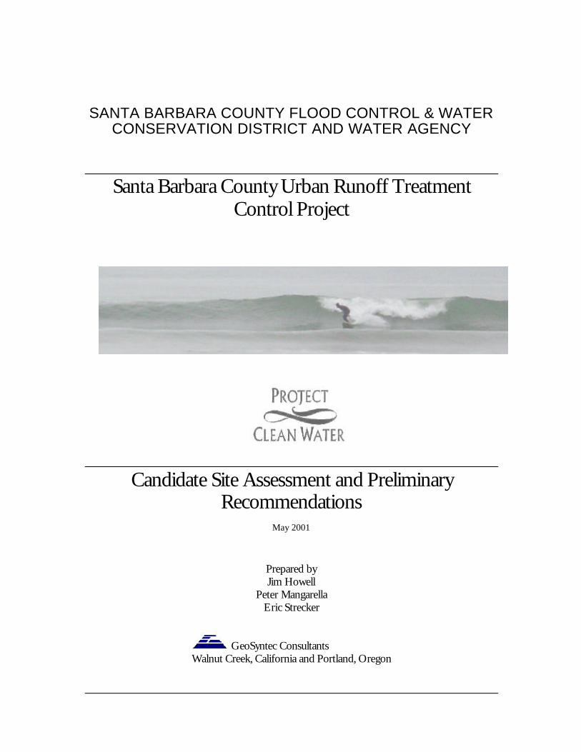
SANTA BARBARA COUNTY FLOOD CONTROL & WATERCONSERVATION DISTRICT AND WATER AGENCY
Santa Barbara County Urban Runoff TreatmentControl Project
Candidate Site Assessment and PreliminaryRecommendations
May 2001
Prepared byJim Howell
Peter MangarellaEric Strecker
GeoSyntec ConsultantsWalnut Creek, California and Portland, Oregon

Table of Contents
S E C T I O N 1
Introduction
S E C T I O N 2
Identification of Candidate Sites
S E C T I O N 3
Constituents of Concern
S E C T I O N 4
Preliminary Site Investigation
S E C T I O N 5
Prioritization of Facilities and Sites
S E C T I O N 6
Next Steps
A P P E N D I X A
Site Photos and Descriptions

1
Introductionroject Clean Water (PCW) is a coalition of government agencies, community groups, andindividuals that have come together to investigate and implement solutions to thepollution of local creeks. This pollution is contributing to water quality problems and
closures of local beaches. PCW is also working to provide guidance to local developers onidentifying stormwater quality enhancement opportunities and incorporating stormwatermanagement practices into new projects and redevelopment. In addition, PCW has been makingefforts to address existing land use areas, including urban, industrial, and agricultural. As part ofits effort to address existing pollution sources, PCW was the recipient of a grant from the State ofCalifornia to develop a project to install and monitor stormwater treatment and control bestmanagement practices (BMPs) throughout the County as a pilot program to begin addressingthese water quality concerns. This project, titled The Santa Barbara County Urban RunoffTreatment Control Project (Project), will focus on existing water quality problems in urbanizedareas and implement traditional as well as innovative BMPs to address these problems. Success ofthese efforts will be tracked though regular inspections of the BMPs that are implemented, as wellas though a continuing water quality monitoring program.
The Scope of the Urban Runoff Treatment Control Project includes:
o Phase 1-Site Evaluation and Preliminary Design
o Phase 2-CEQA Compliance and Permitting
o Phase 3-Final Engineering Design
o Phase 4-Installation of Controls
The details of each phase of the project are described in several documents which can beaccessed through the Project Clean Water website (http://www.co.santa-barbara.ca.us/project_cleanwater/) or obtained from The Santa Barbara County Flood Control& Water Conservation District and Water Agency. This document, prepared by GeosyntecConsultants (Consultant), is a part of Phase 1 of the project and provides a list of candidate sitesfor BMP implementation. Criteria for candidate site selection were based on the availability ofvarious treatment controls that address the project’s water quality objectives and can beimplemented within the structural, hydraulic, and operational constraints of the proposed sites.
Section
1P

I D E N T I F I C A T I O N O F C A N D I D A T E S I T E S
2
Identification of Candidate Siteshe Project Clean Water (PCW) Team consist of members of various county and cityagencies that are familiar with the water quality concerns, the local infrastructure andutilities, public health issues, recreational opportunities, and watershed restoration efforts
within the drainage areas of interest. A stakeholders group meets regularly to discuss the projectand based on the group’s knowledge, expertise, and community input, a list of initial candidateproject sites was developed. Some of the initial candidate sites were identified by examining stormdrainage maps for treatment opportunities where large diameter pipes were located near publiclyowned open space or where large diameter outfalls discharged to creeks. Others were sitesrecommended by county personnel who regularly sample stormwater runoff and are familiar withthe watersheds, creeks, and outfalls within the project area. . The potential sites ranged the lengthof the South County from Goleta to Rincon Point and encompassed both incorporated andunincorporated areas. The focus was on the more highly urbanized areas, which would contributemore significantly to runoff and water quality degradation. However, areas with concentratedagriculture and industrial areas were also considered. This list of potential sites was provided tothe project Consultant and each site was investigated for water quality enhancementopportunities.
In addition to the candidate sites identified by PCW, the Consultant identified some additionalsites during multiple field investigations, examination of drainage system drawings, and review ofaerial photographs.
Each candidate site was assigned an index number and a site name. Descriptive information wasalso provided by PCW that identified the type and size of the drainage structure at the sites beingconsidered for retrofit with a treatment control facility. Table 1 and Figures 1-3 provide potentialBMP site locations and descriptions.
Section
2
T

I D E N T I F I C A T I O N O F C A N D I D A T E S I T E S
3
ID Site NameCity orArea
Site Description Map #LatLon
34.26.111 Bradford Goleta Large diameter stormdrainnear Winchester OpenSpace
993-F2119.53.54
34.26.282 Placer/Bella VistaPark
Goleta Stormdrain daylightsthrough Bella Vista OpenSpace
993-G2119.52.59
34.25.163 Coronado Goleta Large diameter outfallCoronado at DevereauxCk.
993-G3119.53.18
34.24.434 Anisq'oyo' Park Isla Vista Pond in park onEmbarcadero St. has waterquality problems
993-A5119.51.26
34.26.445 Lake Los Carneros Goleta Stormdrain outfall fromresidential area dischargesinto lake
984-B7119.50.59
34.25.566 Robin Hill Road Goleta Box culvert daylightssouth of Hollister
994-C2119.50.4034.26.007 Carson Street-Old
Town GoletaGoleta Large parking lot could
potentially be retrofit witha treatment swale
994-D2119.49.49
34.26.398 Princeton/N.Kellogg
Goleta Upper San Jose Ck.Outfall
984-F7119.48.5934.26.489 Huntington
Drive/Toltec/BerkGoleta Upper San Jose Ck.
Outfall984-F7
119.48.5434.27.0710 Cam.Campana/N.
KelloggGoleta Upper San Jose Ck.
Outfall984-F7
119.48.5034.27.2411 Kellogg Loop N. Goleta Upper San Jose Ck.
Outfall984-F7
119.48.4934.26.4012 Parejo/Agana Goleta Upper San Jose Ck.
Outfall984-F7
119.48.5534.26.4313 University/Ribera Goleta Upper San Jose Ck.
Outfall984-F7
119.48.1234.26.0614 Hollister Avenue Goleta Outfall draining Hollister
Ave. discharges beneathbridge
994-G2119.48.25
15 Burtis Street Goleta Large diameter pipe nearopen space
994-H3 34.25.43
ID Site NameCity orArea
Site Description Map #LatLon
15 Burtis Street Goleta Large diameter pipe nearopen space
994-H3
119.47.4534.25.5516 South Turnpike Goleta Large diameter pipe with
public land alongalignment near dischargepoint.
994-J2119.47.23
34.26.2517 La Cumbre/State SantaBarbara
Large diameter outfall atcreek
995-E1119.44.4434.26.1818 Hope Ave. Santa
BarbaraLarge diameter outfall atcreek
995-E1119.44.4734.25.4019 Oak Park Santa
BarbaraCreek runs through OakPark
995-G2119.43.3834.25.0320 Bohnett Park Santa
BarbaraBohnett Park on MissionCk.
995-J5119.42.4334.25.1921 Bird Refuge Santa
BarbaraInlet to Refuge between101 and RxR
996-F3119.39.2934.24.2122 Butterfly Beach
OutfallSantaBarbara
Beach outfall nearFairway and Channel
996-G6119.32.1834.24.1423 Kim’s Drain Carpinteria Flood control
sedimentation basin couldbe retrofit with waterquality outlet
998-B6119.32.13
34.24.2424 Franklin Park Carpinteria Possible diversion ofgreenhouse effluentthrough Franklin Parktreatment swale
998-D5119.31.04
34.23.3425 6th Street Outfall Carpinteria Large diameter pipedischarges into creek at 6th
Street
998-E734.31.02
34.23.4126 State Park Carpinteria Large open spaceavailable for treatmentsystem at Linden St.between park and RxR
998-D7119.31.17
34.24.1427 Watershed EdCenter
SantaBarbara
Parking area andstormdrain outfall atArroyo Burro Beach
995-E6119.44.35

4
ID Site NameCity orArea
Site Description Map #LatLon
34.25.3928 Unknown Park Goleta Stormdrain daylightsthrough park at Rhodesnear Walnut
994-G3119.48.01
34.25.3829 Bonneville Goleta Surface drainage fromwrecking yard drains fromSouth St. dead end to OldSan Jose Creek
994-E4119.49.39
34.25.3230 Drive Inn Goleta Surface drainage fromindustrial/commercial areadrains from Fairview deadend to Old San Jose Creek
994-E4119.49.46
34.24.3431 EmbarcaderoOutfall
Isla Vista Two ocean oufalls locatedat Embarcadero St. deadend could be fitted withrelease nets
994-A5119.51.23
34.25.3532 Showgrounds SantaBarbara
Empty lot between Modocand 101 could be used toaccommodate treatmentsystem for Showground’srunoff
995-F3119.44.12
34.24.5333 Laguna Channel SantaBarbara
Yanonali near WWTP 996-C4119.41.2834.23.5334 Shoreline Park Santa
BarbaraOcean outfall at ShorelinePark
996-A7119.42.1034.24.1535 City College Santa
BarbaraOutfall at C.C. lowerparking lot
996-B6119.41.5234.24.0536 Clover Leaf Carpinteria 101 and Nipomo could be
used to treat residentialrunoff
119.30.55
34.24.1637 Kim's Drain at 101 Carpinteria Storm drain daylightssouth of 101 from Kim’sDrain site
998-B6119.32.07
34.26.3238 Fairview at CalleReal
Goleta Clover Leaf could be usedto treatcommercial/transportationrunoff
994-D1119.49.50
ID Site NameCity orArea
Site Description Map #LatLon
34.23.1939 Carp Creek/101 Carpinteria 101 near Carp Ck. Dr. 998-E7119.29.4934.26.1440 Padova Dr. Goleta Small open space at
Padova Dr. dead endcould be used to treatresidential runoff
993-G2119.49.50

I D E N T I F I C A T I O N O F C A N D I D A T E S I T E S
5

I D E N T I F I C A T I O N O F C A N D I D A T E S I T E S
6

I D E N T I F I C A T I O N O F C A N D I D A T E S I T E S
7

I D E N T I F I C A T I O N O F C A N D I D A T E S I T E S
8

I D E N T I F I C A T I O N O F C A N D I D A T E S I T E S
9

C O N S T I T U E N T S O F C O N C E R N
10
Constituents of Concerneveral of the candidate sites are in watersheds that discharge to receiving waters that have beenidentified as impaired for one or more of its designated beneficial uses by the Regional WaterQuality Control Board, Central Coast Region. Local monitoring data also indicate that stormwater
discharge may exceed water quality standards in some of these basins. Each of the receiving waters in theproject area was evaluated in light of the applicable water quality standards, the State’s 303(d) list, andstakeholder interests and concerns. From this analysis a proposed list of constituents of concern wasgenerated for each waterbody in the project area. The methodology for selecting the constituents ofconcern is described in detail in a Memorandum to PCW dated March 27, 2001, titled Santa BarbaraCounty Urban Runoff Treatment Project, Constituents of Concern. Though the target constituents forlisted waterbodies vary from creek-to-creek depending on land uses in the tributary area and thedesignated beneficial uses of the waterbody, the constituents of concern (left column are generally on303(d) list) and are therefore higher are priority. It should be noted that the State 303 (d) list reflects someof the more serious problems that have been identified within the various watershed but is by no means acomprehensive inventory of all of the existing water quality impairments.
o Pathogens o Suspended Solids
o Nutrients o Oil/Grease
o Dissolved Oxygen o Pesticides
o Priority Organics o Trace Metals
o Sedimentation/Siltation o Trash
Appropriate technology options were screened based on the ability of the technology to effectively treatconstituents of concern.
Section
3
S

P R E L I M I N A R Y S I T E I N V E S T I G A T I O N
11
Preliminary Site Investigation
he specifics of each of the preliminary sites identified by PCW were discussed in detailwith the Consultant during a series of meetings which occurred at the County WaterBoard office and at some of the site locations. Representatives from the City and County
of Santa Barbara’s Flood Control, Parks, Roads, Public Health, and Public Works departmentsprovided input into these discussions. Topics of these discussions included existing capacitylimitations of the drainage systems near the sites, future system expansion and renovation plans,and proposed creek restoration plans among others. It was agreed that the Consultant would visiteach of the sites and several of the meeting attendees offered to assist in this effort. Prior to sitevisits, the Consultant examined stormwater system maps, aerial photos, and other documents tobecome familiar with the proposed project site characteristics. Other documents included, soilsreports and maps, topographic maps, water quality sampling data and monitoring reports,watershed maps, and planning documents from various state and local agencies.
Each of these sites was investigated by the Consultant and a pre-feasibility assessment wasconducted. One key objective of the initial investigation was to identify any site factors that wouldpreclude these sites from further consideration These site factors (Phase 1 screening criteria)include:
1. Lack of hydraulic head for diversion of runoff to a treatment facility by gravity flow.
2. Installation of a facility could pose a potential flooding problem.
3. Upstream land uses unlikely to contribute sufficient pollutant loads to warrant treatment.
4. Future development plans conflict with proposed project.
5. Site conditions could make maintenance extremely difficult.
Section
4
T
P R E L I M I N A R Y S I T E I N V E S T I G A T I O N
12
6. Construction would have to occur within the stream channel or other environmentallysensitive area.
7. Insufficient land available to locate an appropriate treatment facility.
A second objective of the preliminary feasibility assessment was to investigate opportunities toincorporate stormwater treatment BMPs at each of the candidate sites. This was necessary forfatal flaw analysis and was also an opportunity to initiate discussion about treatment alternativeswith PCW stakeholders.
A database was developed to store notes, photographs, and other information from the siteinvestigations. Some evaluation tools were also developed to assist in comparing the designconstraints of various treatment options against site conditions and water quality objectivesduring later phases of the project.
The following table presents the initial findings of the preliminary feasibility investigation of the40 sites that were identified and provides some potentially feasible treatment alternatives.

P R E L I M I N A R Y S I T E I N V E S T I G A T I O N
13
ID Site NamePhase 1
ScreeningCriteria
Potential Treatment Options
1 Bradford 1,3 X
2 Placer/Bella Vista OpenSpace Park Wetland and Riparian Enhancement
3 Coronado 1 X
4 Anisq'oyo' Park Retrofit pond to provide more aquaticvegetation and aeration
5 Lake Los Carneros 3,6 X6 Robin Hill Road 1,2 X
7 Carson Street-OldTown Goleta
Construct parking lot vegetated swalein existing setback
8 Princeton/N. Kellogg 3,6 X
9 HuntingtonDrive/Toltec/Berk 3,6 X
10 Cam.Campana/N.Kellogg 3,6 X
11 Kellogg Loop N. 3,6 X12 Parejo/Agana 3,6 X13 Universtity/Ribera 3,6 X
14 Hollister AvenueInstall trash baskets/oil adsorbents on
outfalls along running trail belowHollister Ave
15 Burtis Street 1,3 X
16 South TurnpikeCDS/swale/pond along 600 foot
easement upstream of bike path alongAtascadero Creek
17 La Cumbre/State 6,7 X18 Hope Ave. 6,7 X19 Oak Park 6 X20 Bohnett Park 4 X
21 Bird Refuge 1,2 X
22 Butterfly Beach Outfall 1 X
23 Kim’s Drain Outlet modification to provideextended detention for small storms
ID Site NamePhase 1
ScreeningCriteria
Potential Treatment Options
24 Franklin Park Bio-swale
25 6th Street Outfall CDS unit26 State Beach Park Constructed wetland
27 Watershed Ed Center Parking lot swale/Sand filter
28 Unknown Park Riparian/wetlandenhancement
29 Bonneville 7Constructed linear wetland (possibly
as part of proposed new roadconstruction)
30 Drive Inn 7Constructed extended detention
wetland on county land (possiblealternative to Site 29)
31 Embarcadero Outfall Release net
32 Earl WarrenShowgrounds by 101
Riparian/wetlandenhancement
33 Laguna Channel pending UV34 Shoreline Park 1,3 X35 City College 1,3 X36 Clover Leaf 1,3 X37 Kim's Drain at 101 1,7 X38 Fairview at Calle Real Constructed wetland/pond39 Carp Creek/101 4 X40 Padova Dr. Bio-swale
Key to Phase 1 Screening Criteria1. Hydraulic difficulties would prevent treatment by gravity flow.2. Installation of a facility could pose a potential flooding problem.3. Upstream land uses unlikely to contribute sufficient pollutant loads to warrant
treatment.4. Future development plans conflict with proposed project5. Site conditions could make maintenance extremely difficult.6. Construction would have to occur within the stream channel or other
environmentally sensitive area.7. Insufficient land available to locate an appropriate treatment facility.X Eliminated from further consideration

P R I O R I T I Z A T I O N O F F A C I L I T I E S A N D S I T E S
14
Prioritization of Facilities and Sitest is unlikely that PCW will be able to address all of the water quality improvementopportunities that have been identified with the grant resources that are currently available tothe Project. Additionally, some of the opportunities identified may achieve greater water
quality benefits than others requiring similar resource commitment. To optimize the effectivenessof the Project, it is important to prioritize the sites being considered as well as the types offacilities recommended relative to resource and design constraints and the water qualityobjectives. In addition to optimizing the benefits to water quality, other objectives includedemonstrating and assessing a variety of retrofit approaches as well as providing natural resourceenhancements. The following criteria have been agreed upon for prioritizing facilities.
o Capital Cost: At the preliminary feasibility level, order-of-magnitude estimates (OME) aregenerally effective for comparison of alternatives. These costs are based on nationalaverages, published information in technical journals, or vendor supplied information.Cost estimates of this type are generally accurate to within + 50% to –30%, that is thefinal cost may as much as 50% more or 30% less than the estimated amount.
o Operation and Maintenance (O&M) Costs: As with capital cost, the order of magnitudeestimates will be used for operation and maintenance cost estimates.
o Water Quality and Other Environmental Benefits: Improvements in water quality, wildlifeand aquatic habitat, recreational opportunities, aesthetics, and stream channel stability.
o Land Ownership: The grant that is supporting PCW does not provide any funds for landacquisition. Facilities that can be located on public lands or easements are preferred overthose that require acquisition of private property or landowner permission.
o TMDL Considerations: BMPs and sites located in watersheds that discharge intoreceiving waters that are on the 303(d) list of impaired waters.
Section
5
I

P R I O R I T I Z A T I O N O F F A C I L I T I E S A N D S I T E S
15
o Ease of Permitting: The construction and O&M of the facility can be easily permitted.Some of the facilities proposed may be more difficult to permit for construction or O&Mthan others. For example, establishment of wetland for stormwater treatment may resultin the area becoming a jurisdictional wetland, which could require that a 404 permit beobtained from the USACE before accumulated sediments could be removed.
o Constructibility: Considerations that affect the feasibility and ease of construction,including access, available space, adequate hydraulic head, soil conditions, andunderground infrastructure.
o Neighborhood Support: The site and BMP would be supported by the localneighborhood and other citizens.
o Proven Technology: The technology is relatively proven based on: applicability to semi-arid conditions, and adequate testing data that indicate that the BMP is effective intreating constituents of concern.
o Compliance Requirements: BMPs and sites that would support compliance with theupcoming Phase II NPDES requirements.
o Relationship to Existing Infrastructure/Flood Control: Construction and operation offacility will not impair existing flood control ability or conflict with other infrastructure.
o Source Reduction: Water quality problems at the site cannot be effectively addressed bysource control measures.
o Testing a variety of treatment approaches.
These criteria will be applied to each alternative treatment facility at each site and a relative ranking(high/medium/low) will be developed based on how well each proposed alternative meets theabove criteria.

N E X T S T E P S
16
Next Stepspon completion of the pre-feasibility investigation of the candidate sites, conceptualdesigns will be developed for each facility at a planning level of detail. Based on theconceptual designs, preliminary costs will be estimated. A decision matrix will be
developed to rate how well each proposed combination of site/treatment alternative will meetthe selection criteria. At those sites where there are treatment options, each option will becompared against the selection criteria. The most feasible alternatives at each site will then becompared to those at the other sites and a list of potential projects will be developed.
These feasible projects will then be investigated in greater detail. Catchment areas will bedelineated and characterized, runoff flows and volumes will be estimated, infrastructure andutility conflicts will be investigated, and capital and O&M costs will be refined. More detailedconceptual designs will be developed for the high priority sites. The projects will then bepresented to PCW and stakeholders for discussion and further direction in the selection process.
Section
6
U

A P P E N D I X A
17
Appendix A
Site Photos and Descriptions
1. Site 2-Map2. Site 2-Aerial Photo3. Site 2-Photos4. Site 2-Riparian Enhancement5. Site 4-Map6. Site 4-Aerial Photo7. Site 4-Photos8. Site 4-Treatment Options9. Site 7-Map10. Site 7-Aerial Photo11. Site 7-Photos12. Site 7-Treatment Options13. Site 14-Map14. Site 14-Photos15. Site 14-Treatment Options16. Site 16-Map17. Site 16-Photos18. Site 16-Treatment Options19. Site 23-Map20. Site 23-Aerial Photo21. Site 23-Photos and Treatment
Options22. Site 24-Map23. Site 24-Aerial Photo24. Site 24-Photos25. Site 24-Treatment Options26. Site 25-Map27. Site 25-Aerial Photo28. Site 25-Photos29. Site 25-Treatment Options
30. Site 25-CDS Unit Schematic31. Site 26-Map32. Site 26-Aerial Photo and
Treatment Option 133. Site 26- Aerial Photo and
Treatment Option 234. Site 27-Map35. Site 27-Aerial Photo36. Site 27-Photos37. Site 27-Treatment Options38. Site 28-Map39. Site 28-Pending Investigation40. Sites 31-Map41. Site 31-Aerial Photo42. Site 31-Photos and Treatment
Options43. Site 32 Map44. Site 32-Aerial Photo45. Site 32-Photos46. Site 32-Low Flow Retention47. Site 38-Map48. Site 38-Aerial Photo49. Site 38 Photos50. Site 38-Treatment Option51. Sites 40-Map52. Site 40-Aerial Photo53. Site 40-Photos54. Site 40-Detention Pond55. Site 40-Bio-Swale

N O T E S
18
Notes

N O T E S
19
Notes