rother core strategy habitat regulations assessment ... · habitat regulations assessment –...
TRANSCRIPT
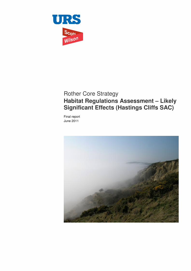
Rother Core Strategy Habitat Regulations Assessment – Likely Significant Effects (Hastings Cliffs SAC) Final report June 2011

Rother District Council Rother Core Strategy
URS/Scott Wilson Scott House Alencon Link Basingstoke Hampshire RG21 7PP Tel: 01256 310200 Fax: 01256 310201
Revision Schedule Habitat Regulations Assessment - Likely Significant Effects (Hastings Cliffs SAC) June 2011
Rev Date Details Prepared by Reviewed by Approved by
01 June 2011 Final report Dr James Riley Principal Ecologist
Dr Jo Hughes Technical Director (Ecology)
Dr Jo Hughes Technical Director (Ecology)
Rother District Council Rother Core Strategy
Limitations
URS Scott Wilson Ltd (“URS Scott Wilson”) has prepared this Report for the sole use of Rother District Council (“Client”) in accordance with the Agreement under which our services were performed. No other warranty, expressed or implied, is made as to the professional advice included in this Report or any other services provided by URS Scott Wilson. This Report is confidential and may not be disclosed by the Client nor relied upon by any other party without the prior and express written agreement of URS Scott Wilson.
The conclusions and recommendations contained in this Report are based upon information provided by others and upon the assumption that all relevant information has been provided by those parties from whom it has been requested and that such information is accurate. Information obtained by URS Scott Wilson has not been independently verified by URS Scott Wilson, unless otherwise stated in the Report.
The methodology adopted and the sources of information used by URS Scott Wilson in providing its services are outlined in this Report. The work described in this Report was undertaken during May 2011 and is based on the conditions encountered and the information available during the said period of time. The scope of this Report and the services are accordingly factually limited by these circumstances.
Where assessments of works or costs identified in this Report are made, such assessments are based upon the information available at the time and where appropriate are subject to further investigations or information which may become available.
URS Scott Wilson disclaim any undertaking or obligation to advise any person of any change in any matter affecting the Report, which may come or be brought to URS Scott Wilson’s attention after the date of the Report.
Certain statements made in the Report that are not historical facts may constitute estimates, projections or other forward-looking statements and even though they are based on reasonable assumptions as of the date of the Report, such forward-looking statements by their nature involve risks and uncertainties that could cause actual results to differ materially from the results predicted. URS Scott Wilson specifically does not guarantee or warrant any estimate or projections contained in this Report.
Copyright
© This Report is the copyright of URS Scott Wilson Ltd. Any unauthorised reproduction or usage by any person other than the addressee is strictly prohibited.
Client Name Project Title
Table of Contents
1 Introduction ..................................................................................... 1 1.1 Legislation ...................................................................................................................... 1 1.2 Scope and objectives...................................................................................................... 2
2 Methodology.................................................................................... 3 2.1 Key principles ................................................................................................................. 3 2.2 Process .......................................................................................................................... 3 2.3 Confirming other plans and projects that may act in combination.................................... 4
3 Likely Significant Effects on Hastings Cliffs SAC......................... 5 3.1 Introduction..................................................................................................................... 5 3.2 Features of European Interest ........................................................................................ 6 3.3 Condition Assessment .................................................................................................... 6 3.4 Key Environmental Conditions........................................................................................ 6 3.5 Recreational pressure..................................................................................................... 6 3.6 Likely Significant Effects of the Core Strategy................................................................. 8
4 Conclusion..................................................................................... 10

Rother District Council Rother Core Strategy
Habitat Regulations Assessment (Hastings Cliffs SAC) June 2011
1
1 Introduction
1.1 Legislation 1.1.1 The need for Appropriate Assessment is set out within Article 6 of the EC Habitats Directive
1992, and interpreted into British law by Regulation 48 of the Conservation (Natural Habitats &c) Regulations 1994 (as amended in 2007). Under these Regulations, land use plans must be subject to Appropriate Assessment if they are likely to have a significant [adverse] effect on a Natura 2000 site (Special Areas of Conservation, SACs and Special Protection Areas, SPAs). It is Government policy (as described in Planning Policy Statement 9: Biodiversity & Geological Conservation) for sites designated under the Convention on Wetlands of International Importance (Ramsar sites) to be treated as having equivalent status to Natura 2000 sites. As such, Appropriate Assessments should also cover these sites.
1.1.2 The Habitats Directive applies the precautionary principle to protected areas; plans and projects can only be permitted having ascertained that there will be no adverse effect on the integrity of the site(s) in question. In the case of the Habitats Directive, plans and projects may still be permitted if there are no alternatives to them and there are Imperative Reasons of Overriding Public Interest (IROPI) as to why they should go ahead. In such cases, compensation would be necessary to ensure the overall integrity of the site network.
1.1.3 In recent years the term ‘Habitat Regulations Assessment’ (HRA) has come into common currency to describe the entire assessment process set out in the Regulations, while the phrase ‘Appropriate Assessment’ is referred to that particular stage. The terms are therefore used in that manner in this report.
1.1.4 In order to ascertain whether or not site integrity will be affected, an HRA should be undertaken of the plan or project in question.

Rother District Council Rother Core Strategy
Habitat Regulations Assessment (Hastings Cliffs SAC) June 2011
2
1.2 Scope and objectives 1.2.1 Scott Wilson has been appointed by Rother District Council to assist in undertaking an HRA of
the potential effects of the Core Strategy on three specific European sites – Hastings Cliffs SAC, Dungeness SAC and Dungeness to Pett Level SPA. An initial screening exercise was undertaken by the Council in 2008. This concluded that only adverse effects on these sites could not be screened out as unlikely to result from the Core Strategy development. The assessments of the three sites are presented in two separate documents. This document concerns itself exclusively with Hastings Cliffs SAC.
1.2.2 Chapter 2 of this report explains the process by which the HRA has been carried out. Chapter 3 described the pathways of impact considered in this document. Chapter 4 is then dedicated to an exploration of adverse effects on the European site. The chapter begins with a consideration of the interest features and ecological condition of the site and environmental process essential to maintain site integrity. An assessment of the Core Strategy is then carried out.

Rother District Council Rother Core Strategy
Habitat Regulations Assessment (Hastings Cliffs SAC) June 2011
3
2 Methodology
2.1 Key principles 2.1.1 This section sets out the basis of the methodology for the Appropriate Assessment. Scott
Wilson has adhered to several key principles in developing the methodology – see Table 1.
Table 1 - Key principles underpinning the proposed methodology
Principle Rationale
Use existing information
We will use existing information to inform the assessment. This will include information gathered as part of the Sustainability Appraisal (SA) of the emerging Core Strategy and information held by Natural England, the Environment Agency and others.
Consult with Natural England
We will ensure consultation with Natural England on the assessment. We will ensure that we utilise information held by them and others and take on board their comments on the assessment process and findings.
Ensure a proportionate assessment
We will ensure that the level of detail addressed in the assessment reflects the level of detail in the Local Development Framework (LDF) (i.e. that the assessment is proportionate). With this in mind, the assessment will focus on information and impacts considered appropriate to the local level.
Keep the process simple as possible
We will endeavour to keep the process as simple as possible while ensuring an objective and rigorous assessment in compliance with the Habitats Directive and emerging best practice.
Ensure a clear audit trail
We will ensure that the AA process and findings are clearly documented in order to ensure a clearly discernible audit trail.
2.2 Process 2.2.1 The Appropriate Assessment has been carried out in the absence of formal Government
guidance. Communities and Local Government released a consultation paper on Appropriate Assessment of Plans in 20061. As yet, no further formal guidance has emerged.
2.2.2 Figure 1 below outlines the stages of HRA according to current draft CLG guidance. The stages are essentially iterative, being revisited as necessary in response to more detailed information, recommendations and any relevant changes to the plan until no significant adverse effects remain.
1 CLG (2006) Planning for the Protection of European Sites, Consultation Paper

Rother District Council Rother Core Strategy
Habitat Regulations Assessment (Hastings Cliffs SAC) June 2011
4
2.3 Confirming other plans and projects that may act in combination
2.3.1 It is neither practical nor necessary to assess the ‘in combination’ effects of the Core Strategy within the context of all other plans and projects within East Sussex and Kent. For the purposes of this assessment, we have determined that, due to the nature of the identified impacts, the key other plans and projects relate to the additional housing, transportation and commercial/industrial allocations proposed for neighbouring authorities over the lifetime of the Plan. Potential impacts of the LDF have been identified according to this knowledge in order to determine any likely significant effects that may result in combination with the Core Strategy, especially those not previously considered to pose significant risk individually.
2.3.2 There are no County-wide plans affecting Rother of relevance to Hastings Cliffs. The only plan for an area outside Rother which is of importance to in combination assessment is the Hastings Core Strategy, the HRA for which has been consulted during the course of this assessment.

Rother District Council Rother Core Strategy
Habitat Regulations Assessment (Hastings Cliffs SAC) June 2011
5
3 Likely Significant Effects on Hastings Cliffs SAC
3.1 Introduction 3.1.1 Hastings Cliffs are one of the finest examples of vegetated soft rock cliffs in the UK. It is
relatively unaffected by coastal protection and is dependent upon physical processes. The soft rock maritime cliff is composed of a mixture of sand and clays. A combination of toe, precipitation and groundwater erosion has created a diversity of cliff-face habitats. These include landslip debris and shale, exposed rock, detached cliff-top blocks of scrub and grassland, cliff-face and undercliff pioneer communities, trickles, seepages and secondary woodland on large stable areas of undercliff. The SAC is further characterised by three steeply incised ancient wooded glens. The streams of the three glens cut steep sided valleys which are covered in parts by mature woodland dominated by pedunculate oak Quercus robur, with beech Fagus sylvatica, ash Fraxinus excelsior and hazel Corylus avellana, and occasional specimens of yew Taxus baccata, holly Ilex aquifolium and field maple Acer campestre. The ground flora varies from communities dominated by bracken Pteridium aquilinum on the sands to those dominated by dogs mercury Mercurialis perennis and pendulous sedge Carex pendula on the clays where the local violet helleborine Epipactis purpurata is found.
3.1.2 Alder Alnus glutinosa is common along the streams and on wet flushes along with tussock sedge Carex paniculata, opposite-leaved golden saxifrage Chrysosplenium oppositifolium and ramsons Allium ursinum. These wooded streams are sheltered from frosts and support Atlantic bryophytes such as the moss Fissidens rivularis, and the liverwort Dumortiera hirsuta at its only locality east of Devon, and a number of lichens which are associated with ancient woodland such as Dimerella lutea. The woodlands support a range of uncommon and rare beetles, while the Fairlight Glen stream has yielded the only modern records of the rare beetle Hydraena pygmaea in south east England.
3.1.3 Near the coast the trees become progressively more affected by salt spray from the sea and at Covehurst Wood there are extremely stunted trees growing on acidic sandstone boulders. Here there is an important bryophyte flora including the liverwort Lophocolea fragans at its only locality in south east England.
3.1.4 The woodlands grade into a coastal scrub along the cliff edges, consisting of windpruned thickets of privet Ligustrum vulgare and blackthorn Prunus spinosa. Within the scrubby areas there are patches of grassland dominated by yellow oat-grass Trisetum flavescens and red fescue Festuca rubra, common centaury Centaurium erythraea and scarlet pimpernel Anagallis arvensis. Thrift Armeria maritima is common along the cliff edge with the scarce loose silky-bent Aspera spica-venti.
3.1.5 Cliff top acid grassland and lowland coastal heathland are two of the UK priority habitats that are of special importance in the SAC. Lowland acid grassland occurs on the nutrient-poor free draining soils overlaying acid rocks or superficial deposits such as sands and gravels. Lowland heathland is characterised by the dominance of dwarf scrub species communities which includes heather, Calluna vulgaris, bell heather, Erica cinerea, dwarf gorse, Ulex minor, and in wetter areas, cross leaved heath, Erica tetralix. These two habitats occur together within a mosaic of bracken and scrub, mainly at Warren Glen and the Firehills areas of the SAC.
3.1.6 A few dozen pairs of fulmar, Fulmarus glacialis, and herring gull, Larus agentatus, nest on cliff ledges as well as smaller numbers of lesser black-backed gull, Larus fuscus. Peregrines, Falco peregrinus, and kestrels, Falco tinnuculus, breed as well as up to three pairs of black

Rother District Council Rother Core Strategy
Habitat Regulations Assessment (Hastings Cliffs SAC) June 2011
6
redstart, Pheonicurus ochruros. Cormorants, Phalacrocorax carbo, are breeding on the cliffs and ravens, Corvus corax, frequent the cliffs.
3.2 Features of European Interest 3.2.1 The site is designated as an SAC for its:
• Vegetated sea cliffs - Hastings Cliffs are an area of actively eroding soft cliff on the south coast of England. They include the most southerly exposures of the lower Hastings Beds. The site contains three valleys cut into the strata, which support woodland and scrub habitats with an unusual ‘Atlantic’ bryophyte flora. Closer to the sea the maritime influence stunts the trees, but other bryophytes become important here, with one species, Lophocolea fragrans, at its only south-east England locality. Maritime scrub and coastal heathland are found closer to the cliff edge, with grassland supporting maritime species such as thrift Armeria maritima. The clay cliff slopes are eroding and support a range of habitats from bare ground and flushes to maritime grassland and scrub, reflecting the successional development of vegetation following cliff-falls.
3.3 Condition Assessment 3.3.1 During the 2007 Condition Assessment Process the SAC was found to be in favourable
condition.
3.4 Key Environmental Conditions • Balanced grazing regime;
• Minimal trampling;
• Good air quality;
• No direct fertilisation;
• Well-drained soils.
3.5 Recreational pressure
Background
3.5.2 The Hastings Cliffs SAC is part of Hastings Country Park Nature Reserve. The Country Park, SAC, SSSI and an additional area of farmland were consolidated under the designation of the Local Nature Reserve in 2006. The Reserve is heavily used for recreational activity (receiving an estimated 500,000 visits per year2, of which a large proportion derive from tourists) and contains many footpaths and trails. The JNCC citation for the SAC does note that “The SAC includes part of a country park where there are pressures to manage visitors.” However, that comment was made several years ago and since that time a carefully managed network of footpaths, trails and viewing areas has been developed by Hastings Council. These are actively managed by Hastings Council Ranger service and an active group of volunteers.
2 http://www.lnr.naturalengland.org.uk/Special/lnr/lnr_details.asp?C=0&N=&ID=1189

Rother District Council Rother Core Strategy
Habitat Regulations Assessment (Hastings Cliffs SAC) June 2011
7
3.5.3 It can be seen from the plan at the end of this document that there are 4 main access points to the Country Park. These are off Rock-a-Nore road at the western-most end of the site, Barley Lane (near Shearbarn Holiday Park), the lodge off Fairlight Road and the junction between Fairlight Road and Coast Guard Lane. There are also 18 minor entry points. Only the two minor entry points in the Firehills area lead directly into the SAC.
3.5.4 All types of terrestrial European site can be affected by trampling, which in turn causes soil compaction and erosion. Walkers with dogs contribute to pressure on sites through nutrient enrichment via dog fouling and also have potential to cause greater disturbance to fauna as dogs are less likely to keep to marked footpaths. Motorcycle scrambling and off-road vehicle use can cause more serious erosion, as well as disturbance to sensitive species.
3.5.5 There have been several papers published that empirically demonstrate that damage to vegetation in woodlands and other habitats can be caused by vehicles, walkers, horses and cyclists:
• Wilson & Seney (1994)3 examined the degree of track erosion caused by hikers, motorcycles, horses and cyclists from 108 plots along tracks in the Gallatin National Forest, Montana. Although the results proved difficult to interpret, It was concluded that horses and hikers disturbed more sediment on wet tracks, and therefore caused more erosion, than motorcycles and bicycles.
• Cole et al (1995a, b)4 conducted experimental off-track trampling in 18 closed forest, dwarf scrub and meadow & grassland communities (each tramped between 0 – 500 times) over five mountain regions in the US. Vegetation cover was assessed two weeks and one year after trampling, and an inverse relationship with trampling intensity was discovered, although this relationship was weaker after one year than two weeks indicating some recovery of the vegetation. Differences in plant morphological characteristics were found to explain more variation in response between different vegetation types than soil and topographic factors. Low-growing, mat-forming grasses regained their cover best after two weeks and were considered most resistant to trampling, while tall forbs (non-woody vascular plants other than grasses, sedges, rushes and ferns) were considered least resistant. Cover of hemicryptophytes and geophytes (plants with buds below the soil surface) was heavily reduced after two weeks, but had recovered well after one year and as such these were considered most resilient to trampling. Chamaephytes (plants with buds above the soil surface) were least resilient to trampling. It was concluded that these would be the least tolerant of a regular cycle of disturbance.
• Cole (1995c)5 conducted a follow-up study (in 4 vegetation types) in which shoe type (trainers or walking boots) and trampler weight were varied. Although immediate damage was greater with walking boots, there was no significant difference after one year. Heavier tramplers caused a greater reduction in vegetation height than lighter tramplers, but there was no difference in effect on cover.
3 Wilson, J.P. & J.P. Seney. 1994. Erosional impact of hikers, horses, motorcycles and off road bicycles on mountain trails in Montana. Mountain Research and Development 14:77-88 4 Cole, D.N. 1995a. Experimental trampling of vegetation. I. Relationship between trampling intensity and vegetation response. Journal of Applied Ecology 32: 203-214 Cole, D.N. 1995b. Experimental trampling of vegetation. II. Predictors of resistance and resilience. Journal of Applied Ecology 32: 215-224 5 Cole, D.N. 1995c. Recreational trampling experiments: effects of trampler weight and shoe type. Research Note INT-RN-425. U.S. Forest Service, Intermountain Research Station, Utah.
Rother District Council Rother Core Strategy
Habitat Regulations Assessment (Hastings Cliffs SAC) June 2011
8
• Cole & Spildie (1998)6 experimentally compared the effects of off-track trampling by hiker and horse (at two intensities – 25 and 150 passes) in two woodland vegetation types (one with an erect forb understorey and one with a low shrub understorey). Horse traffic was found to cause the largest reduction in vegetation cover. The forb-dominated vegetation suffered greatest disturbance, but recovered rapidly. Higher trampling intensities caused more disturbance.
3.5.6 Visitor pressure is one of the issues can theoretically could have an impact upon these interest features mainly through trampling or other mechanical damage of vegetation.
3.6 Likely Significant Effects of the Core Strategy 3.6.1 The cliff face vegetation itself is not vulnerable to recreational trampling and indeed erosion is
an essential feature to expose new areas of substrate for colonisation. However, the SAC includes a range of additional habitats other than the cliffs themselves and these are sensitive. While the vegetation is sensitive to excessive trampling, the footpaths within the SAC already direct recreational activity in such a way as to minimise damage to these features. Much of the footpath network within the Country Park is actually outside the SAC. The SAC forms the most inaccessible parts of the site thereby naturally protecting the special features of the SAC. The main features within the SAC that are used for recreation are Ecclesbourne Glen, Fairlight Glen, Warren Glen and Firehills.
3.6.2 Each of these areas is crossed by numerous clear and well-signed footpaths. There are strategically placed directional bollards to keep people informed of the footpaths as well as large and instructive map boards around the site showing the entire footpath network of the Reserve. Moreover, three of these areas are woodland which is generally less vulnerable to trampling erosion. Also, due to the restricted access points for the site, illegal use by 4-wheel drive vehicles and motorbikes is not currently a problem. Most access to the SAC is on foot, since there is only 1 cycle route in Hastings (along the Seafront), and there is no cycling allowed anywhere in the Country Park (including the SAC). There is however, an aspiration to bring the National Cycle Network along the northern part of the Reserve, away from the SAC to link cycling from Hastings to Fairlight.
3.6.3 Sensitive habitats such as the main coastal heathland have now been fenced and are actively managed through grazing and mechanical habitat restoration techniques; public access to those areas are now limited or prevented. These investments are aimed at clarifying the footpath network for visitors and to keep people away from the sensitive areas. Further, by taking back the management of 130 hectares of tenanted farmland elsewhere within the Reserve, the Council has been able to increase the access to areas of the Reserve away from the SAC.
3.6.4 The Council employs a Nature Reserve Officer to work with local communities throughout the borough, especially focused on the suite of LNRs (including the Community Park) to encourage access to sites on peoples own doorstep without encouraging further access to the SAC. The Wildhastings web site aims to raise awareness and understanding of the need to safeguard the unique environment of the entire Borough, again deflecting too much visitor pressure to the SAC.
6 Cole, D.N., Spildie, D.R. 1998. Hiker, horse and llama trampling effects on native vegetation in Montana, USA. Journal of Environmental Management 53: 61-71

Rother District Council Rother Core Strategy
Habitat Regulations Assessment (Hastings Cliffs SAC) June 2011
9
3.6.5 Annual monitoring surveys are already undertaken to inform management and record enhanced biodiversity of site, including breeding and migrant birds, reptiles, dormice, invertebrates, vascular plants. In addition, a footpath condition survey of the entire footpath network of the Reserve was undertaken in 2001 and this identified priorities for footpath restoration. As such, there is already a system in place that would identify any impact of footpath deterioration or excessive erosion in its early stages if this did occur as a result of increased recreational visits to the SAC. Moreover, the following access management measures are already in place:
• National NCN2 cycle routes (subject to funds) will be constructed across the East Hill and then from Barley Lane across to Fairlight – this will provide a surface route for cyclists and pedestrians, keeping them away from the SAC.
• Major investment of over one million pounds in site to reclaim public ownership of farm, restore fencing and farm buildings, implement habitat management, undertake biodiversity surveys, install new information boards (clearly identifying existing footpaths)
• Rangers monitor the condition of the footpaths/fences and entire infrastructure
• Major footpath restoration is being undertaken on the main coastal footpath at Ecclesbourne Glen; and
• New way-marker bollards and map boards installed throughout site to denote footpath network on the ground.
3.6.6 Rother itself will seek to deliver approximately 4,100 dwellings over a similar time period. Of these, 1,177 already have planning permission such that the actual number of currently unpermitted dwellings they are planning for is 2,923. If one assumes an average occupancy of 2.3/dwelling this could result in an additional 6,723 new residents in the district.
3.6.7 The HRA for the Hastings Core Strategy considered the potential impact of delivery of 4,200 dwellings in Hastings, in combination with the 30,000 + to be delivered in surrounding districts (such as Rother) and which may also result in increased visits to the Country Park. It was concluded that due to the access management which already occurs within the Country Park and SAC it could be screened out.
3.6.8 At the time of writing there are no indications that the Country Park is at or close to visitor capacity or that any future increase in visitors cannot be managed. Recreational activity in the Reserve (and SAC) is well-managed. Moreover, there is sufficient scope to control recreational access to the SAC without preventing people from accessing and enjoying the remainder of the Reserve to enable management of any increase in recreational visitors and a detailed framework and mechanism already exists to ensure that any necessary access management can be delivered.

Rother District Council Rother Core Strategy
Habitat Regulations Assessment (Hastings Cliffs SAC) June 2011
10
4 Conclusion
4.1.1 While Rother is likely to make a contribution to visitors within the Country Park and SAC, it is considered that impacts on this site can be screened out of the Rother Core Strategy HRA, as they have been for Hastings itself.

Rother District Council Rother Core Strategy
Habitat Regulations Assessment (Hastings Cliffs SAC) June 2011
11