reliable end-to-end sensing in disruptive environments
TRANSCRIPT
Computer Engineering and Networks Technische Informatik und Kommunikationsnetze
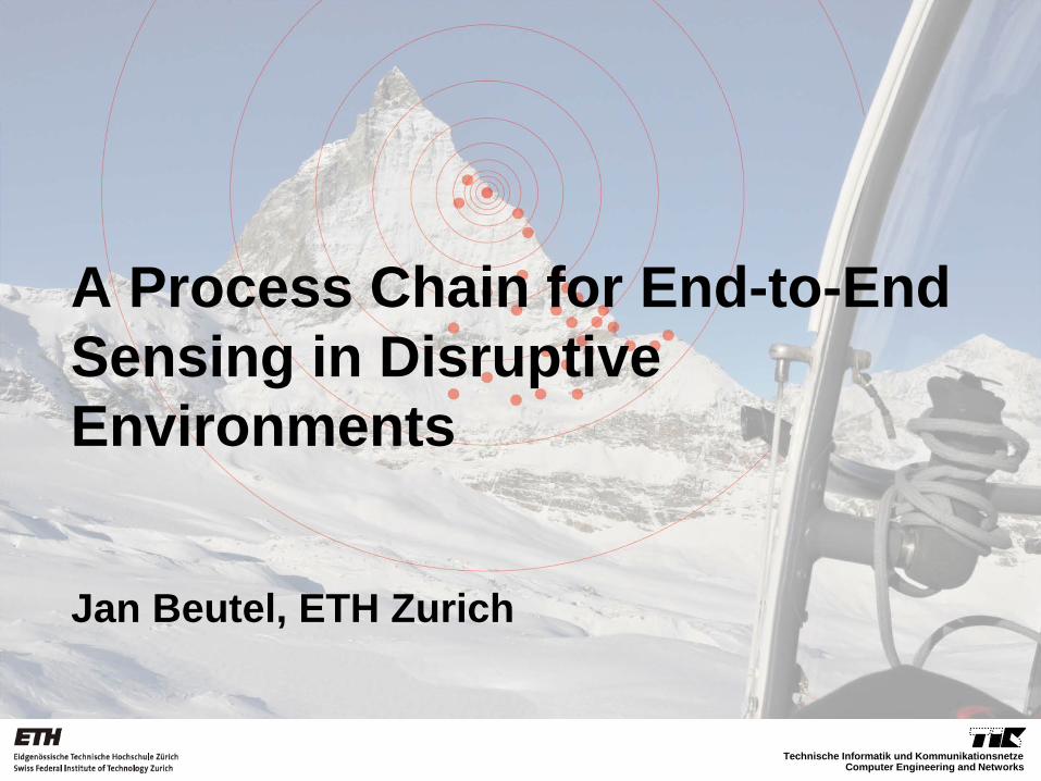
A Process Chain for End-to-End Sensing in Disruptive Environments
Jan Beutel, ETH Zurich

The Issue
• WSNs as a new tool for distributed sensing • E.g. in environmental science
– High spatial coverage through many sensors – Good temporal resolution/coverage (high rates, long-
term observations) – Autonomous (disconnected) operation
• Initially it was thought that imperfections in the
data are eliminated by heavy oversampling and use of aggregates [c.f. Smart Dust, Pister et al., 1999 and others]
• However this is only theory (so far)
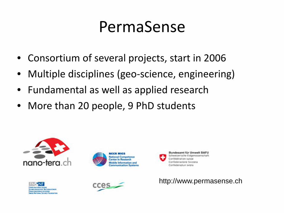
PermaSense
• Consortium of several projects, start in 2006 • Multiple disciplines (geo-science, engineering) • Fundamental as well as applied research • More than 20 people, 9 PhD students
• http://www.permasense.ch
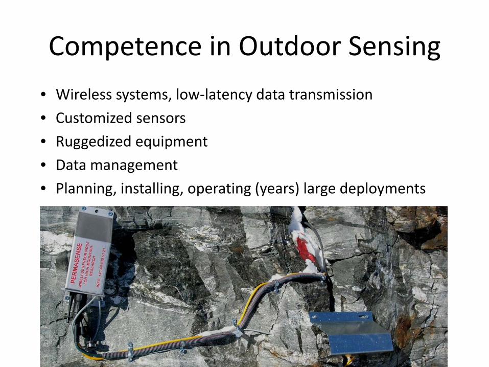
Competence in Outdoor Sensing • Wireless systems, low-latency data transmission • Customized sensors • Ruggedized equipment • Data management • Planning, installing, operating (years) large deployments
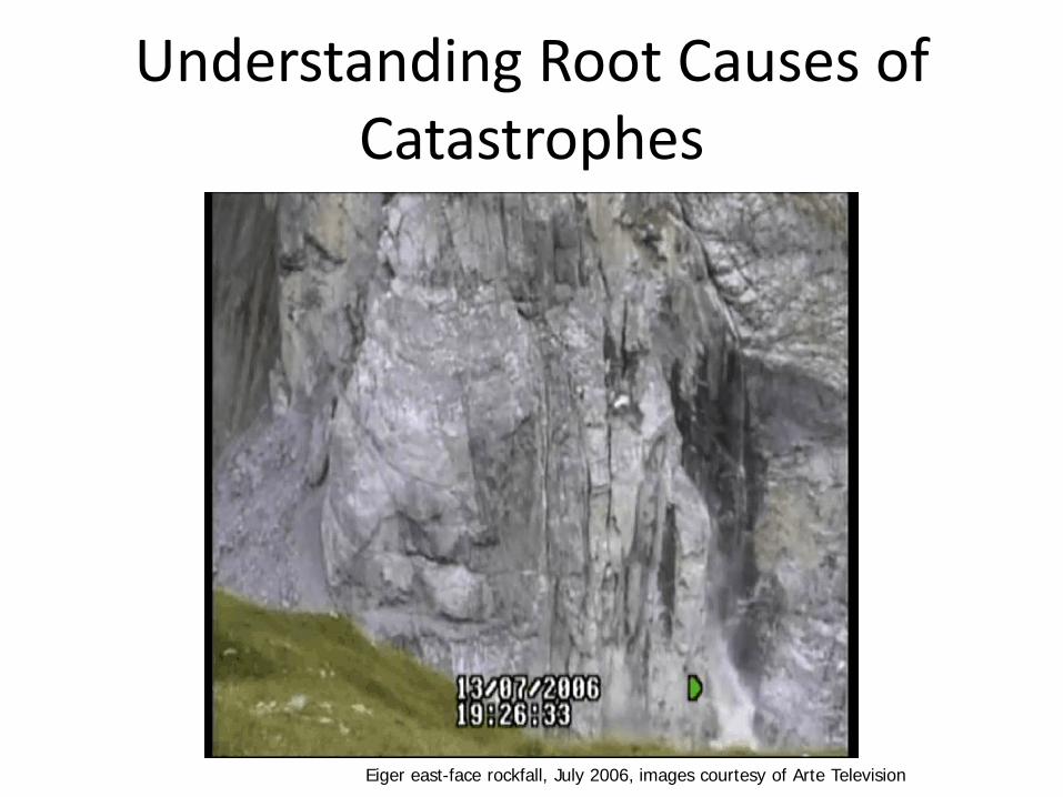
Understanding Root Causes of Catastrophes
•Eiger east-face rockfall, July 2006, images courtesy of Arte Television
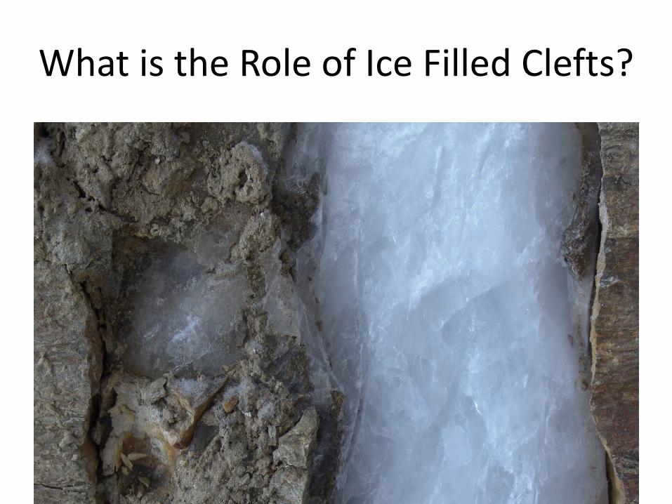
What is the Role of Ice Filled Clefts?
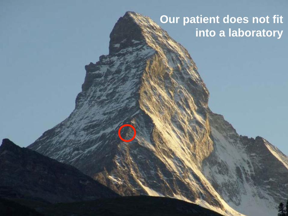
Our patient does not fit into a laboratory

So the laboratory has to go on the mountain

Example: The X-Sense Platform Data processing, fusion, storage
Reference GPS
Moving debris moving rock slope
Current Practice • A single sensing point is still expensive despite high
integration and high-volume, lower-cost hardware – Customization/heterogeneity – Low volume (of customized units) – Infrastructure requirements – Considerable end-to-end system complexity – Adequate protection (enclosures, connectors) – Installation/maintenance effort
• Substantial contribution of installation/maintenance
effort to the TCO of WSNs [c.f. Stankovic, Vetterli, Welsh, Culler]
– Installation = 1 man-day/sensor – In most cases much more

Simple Low-Power Wireless Sensors
• Static, low-rate sensing (120 sec) • Simple scalar values: temperature, resistivity • 3 years operation (~200 μA avg. power) • < 0.1 Mbyte/node/day 3+ years experience, ~200’000’000 data points
In relation to other WSN projects • Comparable to many environmental monitoring apps
• GDI [Szewczyk], Glacsweb [Martinez], Volcanoes [Welsh], SensorScope [Vetterli], Redwoods [Culler]
• Lower data rate • Harsher environment, longer lifetime • Higher yield requirement • Focus on data quality/integrity
[Beutel, IPSN2009]
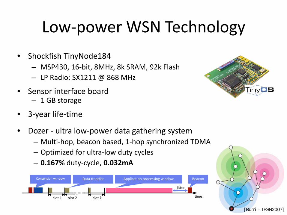
Low-power WSN Technology • Shockfish TinyNode184
– MSP430, 16-bit, 8MHz, 8k SRAM, 92k Flash – LP Radio: SX1211 @ 868 MHz
• Sensor interface board – 1 GB storage
• 3-year life-time
• Dozer - ultra low-power data gathering system – Multi-hop, beacon based, 1-hop synchronized TDMA – Optimized for ultra-low duty cycles – 0.167% duty-cycle, 0.032mA
jitter
time slot 1 slot 2 slot k
Application processing window Beacon Data transfer Contention window
[Burri – IPSN2007]
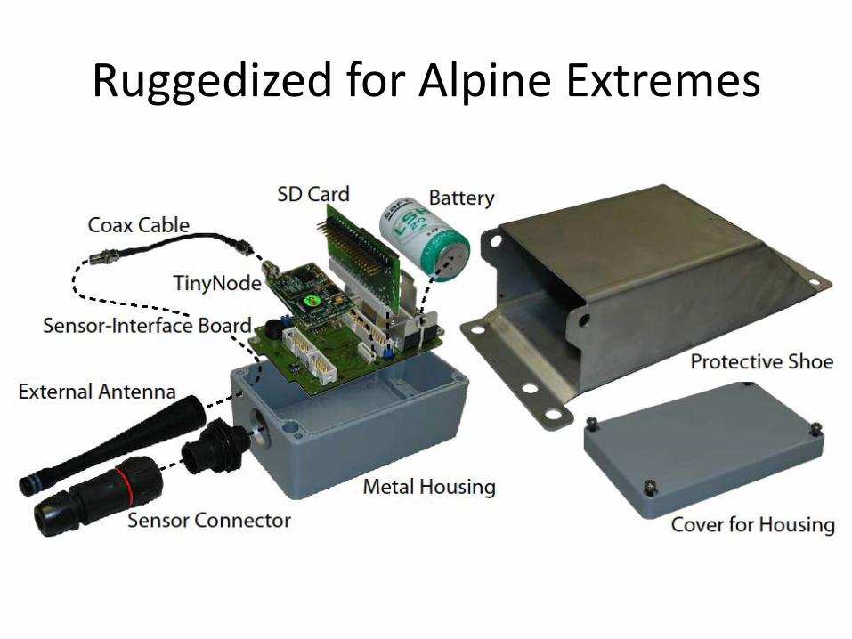
Ruggedized for Alpine Extremes
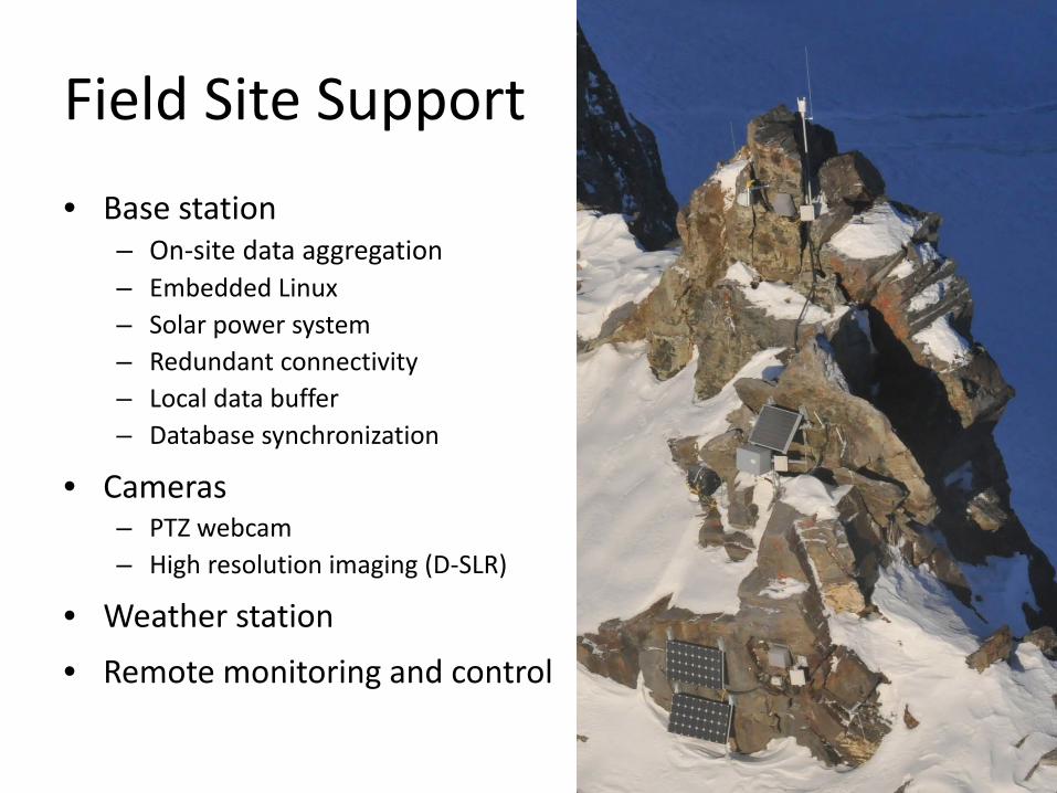
Field Site Support • Base station
– On-site data aggregation – Embedded Linux – Solar power system – Redundant connectivity – Local data buffer – Database synchronization
• Cameras – PTZ webcam – High resolution imaging (D-SLR)
• Weather station
• Remote monitoring and control

Installation/Maintenance Effort
Towards Higher Reliability • Many applications require “accuracy”
– Accuracy at the sample level (calibration, repeatability) – Accuracy at the ensemble level (deterministic behavior) – Specific knowledge of the sensing “location”
• Users require homogeneous data quality, e.g. uniform
rate primary data without holes – It’s a long time from theory to practice for ideas like stochastic
sampling to be accepted by domain users – Accurate timing is a must have – It is next to impossible to quantify performance & maintain
quality operation if failures are acceptable behavior
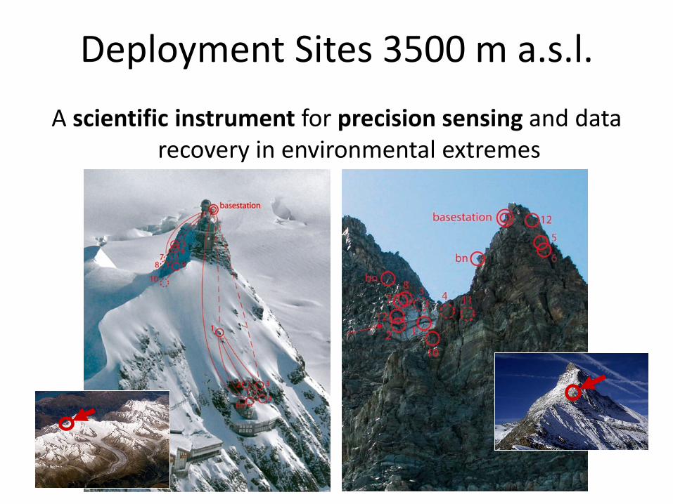
Deployment Sites 3500 m a.s.l. A scientific instrument for precision sensing and data
recovery in environmental extremes

Established: Rock/ice Temperature Aim: Understand temperatures in heterogeneous rock and ice • Measurements at several depths • Two-minute interval, autonomous for several years • Survive, buffer and flush periods without connectivity
[Hasler 2011]

Established: Crack Dilatation Aim: To understand temperature/ice-conditioned rock kinematics • Temperature-compensated, commercial instrument • Auxiliary measurements (temperature, additional axes,…) • Two-minute interval, autonomous for several years • Protection against snow-load and rock fall

Results: Rock Kinematics
•[Hasler, A., Gruber, S. & Beutel, J. Kinematics of steep bedrock permafrost, Journal of Geophysical Research]

Observation: Acceleration Behavior
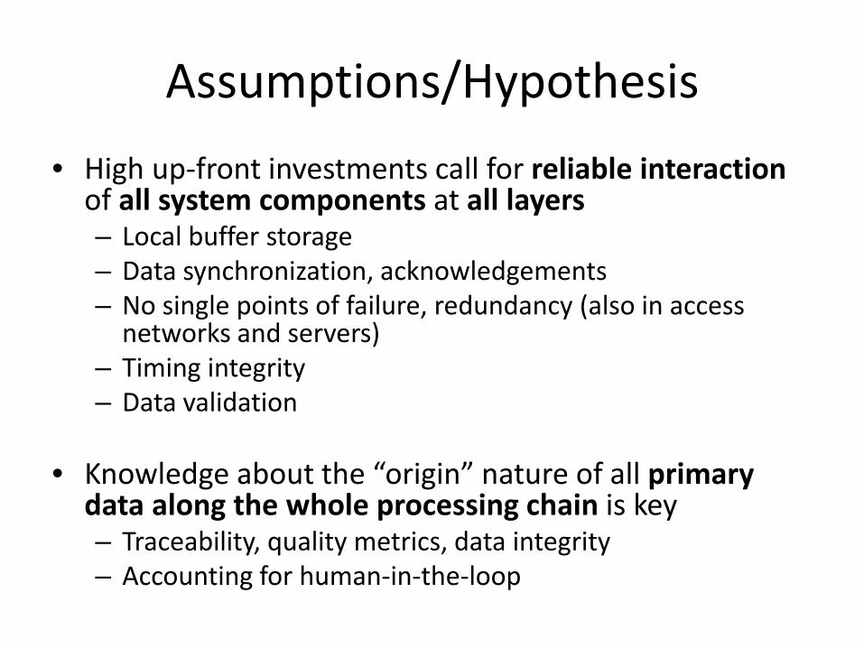
Assumptions/Hypothesis • High up-front investments call for reliable interaction
of all system components at all layers – Local buffer storage – Data synchronization, acknowledgements – No single points of failure, redundancy (also in access
networks and servers) – Timing integrity – Data validation
• Knowledge about the “origin” nature of all primary
data along the whole processing chain is key – Traceability, quality metrics, data integrity – Accounting for human-in-the-loop
Implications on Sensor Network Architecture

PermaSense System Architecture
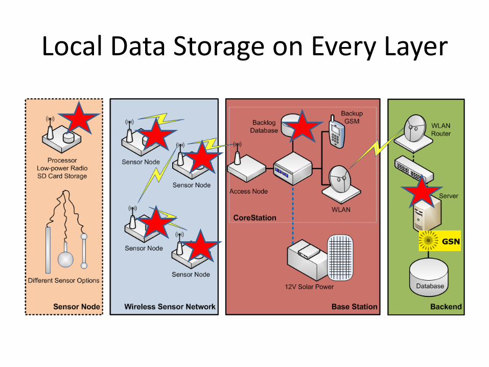
Local Data Storage on Every Layer

WSN On-Node Storage Layer
• On-node flash based storage (SD-Card) – Integrated with Dozer queuing mechanism (beacon traces
& per-link ack’s with backpressure) – All generated packets are stored on local flash memory – Packets not yet sent are flagged for sending later – Bulk access optimized for flash memory (no single packet
transfers)
• Enables both delayed sending (disruptions) and post-deployment validation
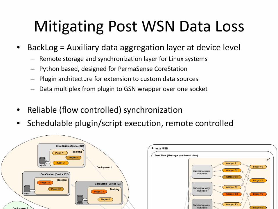
Mitigating Post WSN Data Loss • BackLog = Auxiliary data aggregation layer at device level
– Remote storage and synchronization layer for Linux systems – Python based, designed for PermaSense CoreStation – Plugin architecture for extension to custom data sources – Data multiplex from plugin to GSN wrapper over one socket
• Reliable (flow controlled) synchronization • Schedulable plugin/script execution, remote controlled

WLAN Long-haul Communication
• Data access from weather radar on
Klein Matterhorn (P. Burlando, ETHZ) • Leased fiber/DSL from Zermatt
Bergbahnen AG • Commercial components (Mikrotik) • Weatherproofed

• Dual WLAN & 3G access network
• Redundant base stations (DH/GG/RD)
• Distributed monitoring infrastructure
Redundant Access & Monitoring

Hierarchical Online Data Processing • Global Sensor Network (GSN)
– Data streaming framework from EPFL (K. Aberer) – Organized in “virtual sensors”, i.e. data types/semantics – Hierarchies and concatenation of virtual sensors enable on-line processing – Dual architecture translates data from machine representation to SI values,
adds metadata
Public
Import from field GSN Web export
Private
GSN
Metadata ============ Position Sensor type Validity period …

Multi-Site, Multi-Station, Multi-Revision Data…

Metadata Mapping Architecture
• Based on 2 GSN instances – Separation of load/concern across two machines – “Private” GSN instance, raw data, protected, high availability – “Public” GSN instance, mapped and converted data, open, non-critical
• Metadata stored in version control system (CSV, SVN) • Mapping of
– Positions, coordinates, sensor types, conversion functions, sensor calibration…
• Conversion of – Time formats, raw to SI values…
• Replay of metadata/mapping possible, e.g. on errors • Change management
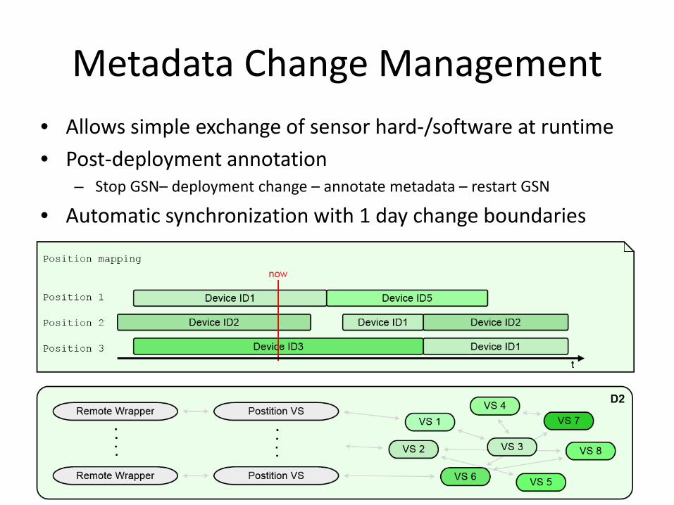
Metadata Change Management • Allows simple exchange of sensor hard-/software at runtime • Post-deployment annotation
– Stop GSN– deployment change – annotate metadata – restart GSN
• Automatic synchronization with 1 day change boundaries
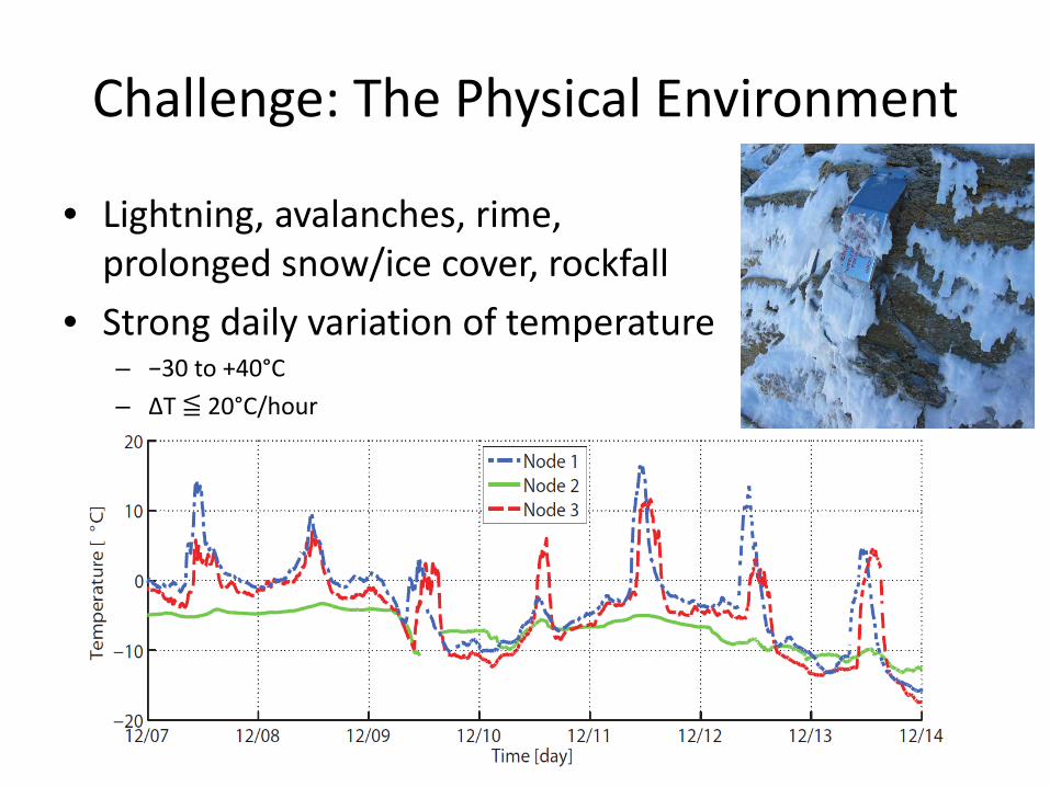
Challenge: The Physical Environment
• Lightning, avalanches, rime, prolonged snow/ice cover, rockfall
• Strong daily variation of temperature – −30 to +40°C – ΔT ≦ 20°C/hour

Impact of Environmental Extremes
[Beutel, DATE 2011]
• Tighter guard times increase energy efficiency • Software testing in a climate chamber
– Clock drift compensation yields ± 5ppm
• Validation of correct function
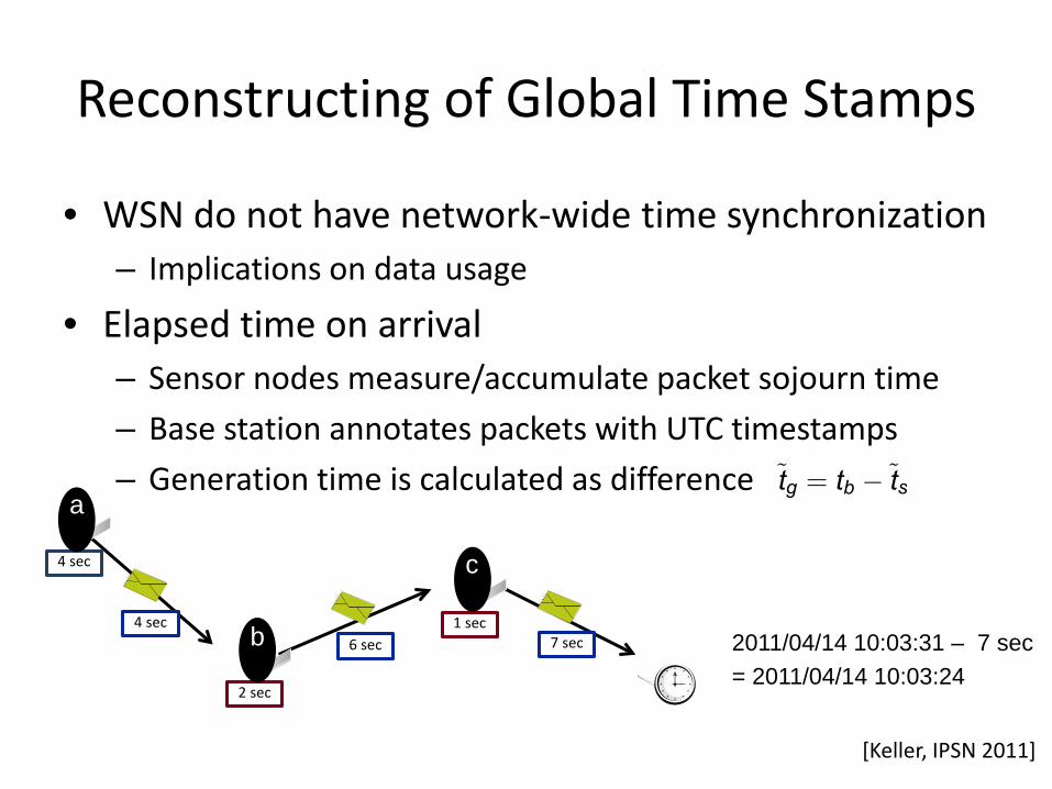
Reconstructing of Global Time Stamps
• WSN do not have network-wide time synchronization – Implications on data usage
• Elapsed time on arrival – Sensor nodes measure/accumulate packet sojourn time – Base station annotates packets with UTC timestamps – Generation time is calculated as difference
•2011/04/14 10:03:31 – 7 sec •= 2011/04/14 10:03:24
4 sec
1 sec
2 sec
4 sec 6 sec 7 sec
a
b
c
[Keller, IPSN 2011]
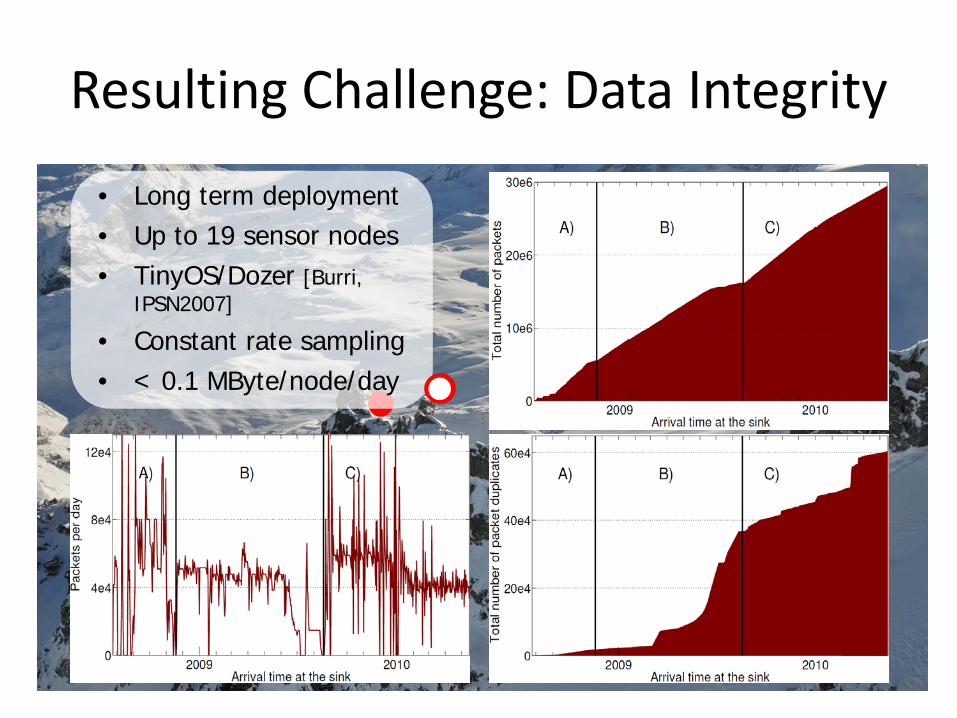
Resulting Challenge: Data Integrity
• Long term deployment • Up to 19 sensor nodes • TinyOS/Dozer [Burri,
IPSN2007]
• Constant rate sampling • < 0.1 MByte/node/day
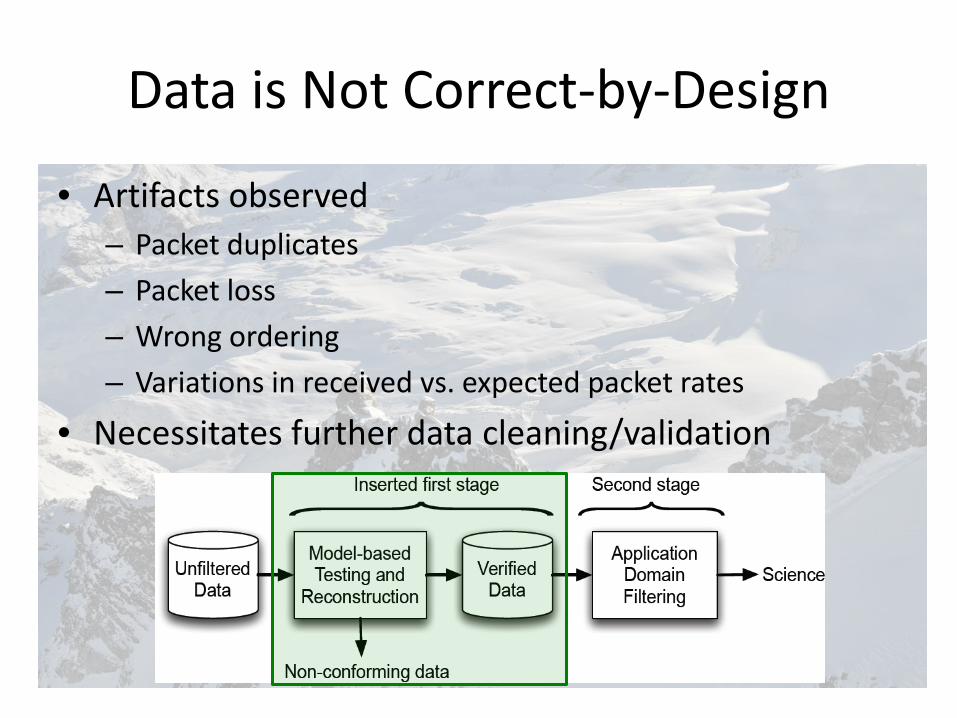
Data is Not Correct-by-Design
• Artifacts observed – Packet duplicates – Packet loss – Wrong ordering – Variations in received vs. expected packet rates
• Necessitates further data cleaning/validation

Sources of Errors Included in Model Data Loss
Packet Duplicates Node Restarts • Cold restart: Power cycle • Warm restart: Watchdog reset
• Shortens packet period • Resets/rolls over certain counters
✗
Retransmission
2
1
3
Lost 1-hop ACK
Waiting packets
✗ ✗ ✗
Node reboot
Queue reset Empty queue
Clock Drift ρ∈ [ -ρ; +ρ] Directly affects measurement of
• Sampling period T • Contribution to elapsed time te
Indirectly leading to inconsistencies • Time stamp order tp vs. order of
packet generation s
<T T
^
^

• Validation of correct system function
• Long-term comparison of three field sites
Model-based Data Validation Case Studies
[Keller, SenseApp 2011, IPSN 2011]
Computer Engineering and Networks Technische Informatik und Kommunikationsnetze
An Example of Fusing Sensor Data

Example: The X-Sense Platform Data processing, fusion, storage
Reference GPS
Moving debris moving rock slope

GPS Measurement Devices Low-cost L1 GPS Devices • Dual strategy: Logging units &
wireless sensors • High temporal resolution • Accurate displacement-rate of a
boulder (mm-cm accuracy for daily position)
•GPS sensor & inclinometer
solar panel
battery
[Wirz, WLF 2011, Buchli SGM 2011]
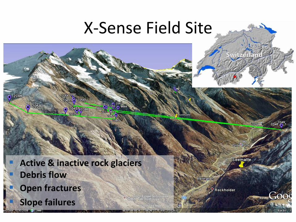
Active & inactive rock glaciers Debris flow Open fractures Slope failures
X-Sense Field Site

GPS Data Analysis • Post-processing of GPS time series
– Correction to coordinates at ground level – Derivation of differing measures of velocity
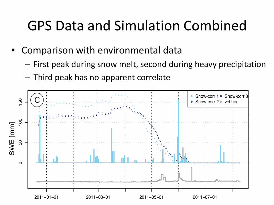
GPS Data and Simulation Combined • Comparison with environmental data
– First peak during snow melt, second during heavy precipitation – Third peak has no apparent correlate
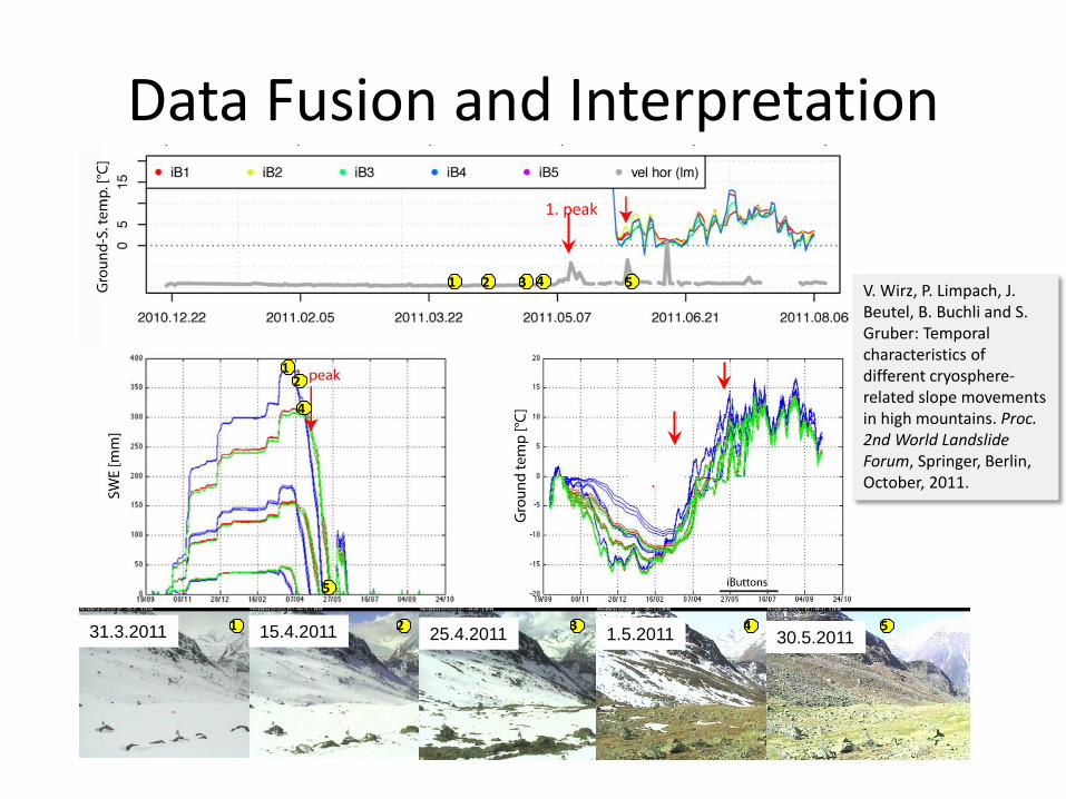
Data Fusion and Interpretation
31.3.2011 15.4.2011 25.4.2011 1.5.2011 30.5.2011 4 1 5 2 3
1 2
5
4
1 2 3 4 5
1. peak
V. Wirz, P. Limpach, J. Beutel, B. Buchli and S. Gruber: Temporal characteristics of different cryosphere-related slope movements in high mountains. Proc. 2nd World Landslide Forum, Springer, Berlin, October, 2011.

Interested in more?
http://www.permasense.ch
• ETH Zurich – Computer Engineering and Networks Lab – Geodesy and Geodynamics Lab
• University of Zurich – Department of Geography
• EPFL – Distributed Information Systems Laboratory
• University of Basel – Department Computer Science