public notice - mvk.usace.army.mil
TRANSCRIPT

____________________________________________________________________________
4155 Clay Street Vicksburg, MS 39183-3435 www.mvk.usace.army.mil
APPLICATION NO.: MVK-2020-858EVALUATOR: Ms. Tarmiko Graham PHONE NO.: (601) 631-5540E-MAIL: [email protected] DATE: July 13, 2021 EXPIRATION DATE: August 3, 2021
Interested parties are hereby notified that the U.S. Army Corps of Engineers, Vicksburg District is considering an application for a Department of the Armypermit for the work described herein. Comments should be forwarded to the Vicksburg District, Attention: CEMVK-RD, 4155 Clay Street, Vicksburg, Mississippi 39183-3435.
The Clean Water Act (CWA) Section 401 Certification Rule (Certification Rule, 40 CFR 121), effective September 11, 2020, requires certification for any license or permit that authorizes an activity that may result in a discharge. The scope of a CWA Section 401 certification is limited to assuring that a discharge from a Federally licensed or permitted activity will comply with water quality requirements. The applicant is responsible for requesting certification and providing required information to the certifying agency. As of the date of this public notice, the applicant has not submitted a certification request to the Louisiana Department of Environmental Quality (certifying authority). In accordance with Certification Rule part 121.6, once the applicant submits a certification request, the Corps of Engineers will notify the certifying agency of the reasonable period of time for them to act upon the certification.
Law Requiring a Permit: Section 10 of the Rivers and Harbors Act of 1899 and Section 404 of the Clean Water Act (33 U.S.C. 1344), which applies to discharges of dredged and/or fill material into waters of the United States.
Name of Applicant: Name of Agent: Mr. Bill Bowdon Mr. Taylor Simoneaux Sunny Point Aggregates, LLC Providence 4803 Benton Road 1201 Main Street Bossier City, Louisiana 71111 Baton Rouge, Louisiana 70802
Location of Work: Sections 1, 6, and 31, Townships 1 and 16 North, Ranges 12 and 13 West, Latitude 32.391182°; Longitude -93.637646°, within the Red River Drainage Basin (8-digit USGS HUC 11140202), Bossier and Caddo Parishes, Louisiana.
Public Notice

2
Description of Work: (See enclosed map and drawings.) The following descriptions of the proposed project and associated impacts are based upon information provided by the applicant. The applicant is applying for a Department of the Army permit to conduct regulated activities in jurisdictional wetlands for the purpose of constructing and operating an industrial sand production facility which will sell material for use in construction aggregate. The proposed project includes dredging the bottom of Port Lake, located east of the Red River, and constructing a new industrial sand processing plant at the Port of Caddo-Bossier, west of the Red River. The proposed dredge area for Port Lake is approximately 725 acres. Approximately 44,000,000 cubic yards of native material would be dredged from the lake bottom to a target depth of approximately 100’ NAVD 88. This material would be pumped via dredge pipe to a booster pump between the Red River and Port Lake. The booster pump would then pump the dredge material beneath the Red River to a wet plant within the new processing plant where it would be washed and sorted by size. No hydrofluoric acid would be used in sand processing. A water lift station is proposed to withdraw water from the Red River to provide sufficient water (approximately 13,000 gallons per minute) to wash and sort the sand at the wet plant. The process water would be recirculated to minimize the amount of water required to be withdrawn. Desirable material would then be stacked on site until being loaded and sold. Waste product not meeting the required characteristics (tailings) would be returned to the previously dredged sections of the lake. Silt curtains would be used with the discharge of the tailings to control their settling location and minimize potential impacts of total suspended sediments on the surrounding environment such as reduced dissolved oxygen or increased turbidity. The applicant is estimating that approximately 25-30% of the material dredged from the lake would be returned as tailings. Dredge material and tailings would be transported between the processing plant and the booster pump via a new 30”-diameter casing pipe which would be installed via horizontal directional drill (HDD) under the Red River. A pipeline for dredge material, a pipeline for tailings, and an electric cable to power the booster pump would be installed within the casing pipe. The casing pipe would be drilled to a depth of at least 30’ below the thalweg of the Red River. HDD entrance and exit locations would be within the same footprint as the booster pump and the processing plant. The industrial sand production facility would be located in uplands. The applicant has designed the project to avoid impacts to jurisdictional wetlands. Dominant vegetation includes Cottonwood, Eastern red cedar and American sycamore, Soil within the project area is Severn, occasionally flooded.

3
Upon reviewing this notice, you should write to this office to provide your opinion of the impacts this work will have on the natural and human environment and address any mitigation you believe is necessary to offset these impacts. Other comments are welcome, but the above information will further our review of the applicant's plan as proposed. Comments of a general nature are not as helpful as those specific to the impacts of the subject project. State Water Quality Permit: The State Pollution Control Agency must certify that the described work will comply with the State's water quality standards and effluent limitations before a Corps permit is issued. Cultural Resources: The Project Manager has reviewed the latest published version of the National Register of Historic Places KMZ file and other sources of information. The following is current knowledge of the presence or absence of historic properties and the effects of the proposed undertaking upon these properties: a historic properties investigation has been conducted within the permit area; no sites determined eligible for or listed on the National Register of Historic Places are within the permit area or affected area. Endangered Species: Threatened and Endangered Species for this area include the Northern long-eared bat, Earth fruit and the Red-cockaded Woodpecker. Utilizing the Information and Planning Consultation for Endangered Species in Louisiana (as per Memorandum of Agreement, signed on January 14, 2020, between the U.S. Army Corps of Engineers, Vicksburg District and the U.S. Fish and Wildlife Service, Louisiana Ecological Services Office), the Corps has determined that the proposed activity would have no effect on these species. Floodplain: In accordance with 44 CFR Part 60 (Floodplain Management and Use), participating communities are required to review all proposed development to determine if a floodplain development permit is required. Floodplain administrators should review the proposed development described in this public notice and apprise this office of any flood plain development permit requirements. The project is not located within the 100-year floodplain. Evaluation Factors: The decision whether or not to issue a permit will be based upon an evaluation of the probable impact of the proposed activity on the public interest. That decision will reflect the national concern for both protection and utilization of important resources. The benefits which may be expected to accrue from the proposal must be balanced against its expected adverse effects. All factors which may be relevant to the proposal will be considered; among these are conservation, economics, aesthetics, general environmental concerns, historic values, fish and wildlife values, flood damage prevention, land use classification, navigation, recreation, water supply, water quality, energy needs, safety, food requirements and, in general, the needs and welfare of the people.

4
Evaluation of the proposed activity will include application of the guidelines published by the Environmental Protection Agency under authority of Section 404(b) of the Clean Water Act. Public Involvement: The purpose of this notice is to solicit comments from the public; Federal, State, and local agencies and officials; Indian Tribes; and other interested parties. These comments will be used to evaluate the impacts of this project. All comments will be considered and used to help determine whether to issue the permit, deny the permit, or issue the permit with conditions, and to help us determine the amount and type of mitigation necessary. This information will be used in our Environmental Assessment or Impact Statement. Comments are also used to determine the need for a public hearing. Opportunity for a Public Hearing: Any person may make a written request for a public hearing to consider this permit application. This request must be submitted by the public notice expiration date and must clearly state why a hearing is necessary. Failure of any agency or individual to comment on this notice will be interpreted to mean that there is no objection to the proposed work. Please bring this announcement to the attention of anyone you know who might be interested in this matter. Notification of Final Permit Actions: Each month, the final permit actions from the preceding month are published on the Vicksburg District Regulatory web page. To access this information, you may follow the link from the Regulatory web page, http://www.mvk.usace.army.mil/Missions/Regulatory.aspx. Bryan Williamson Team Lead, Permit and Evaluation Branch Regulatory Division

@A
@A
HDD Entry PointLatitude: 32.39466°Longitude: -93.63693°
HDD Exit PointLatitude: 32.38671°Longitude: -93.64768°
Project Number
Drawn ByChecked ByApproved By
Drawing NumberBase map comprised of ESRI's World Imagery exported 03/24/2020.
Aerial PhotographUSACE Regulatory Permit ApplicationBossier and Caddo Parishes, Louisiana
Sunny Point Aggregates, LLCProposed Port Lake Dredge Project
1148-006 3Figure
SRM
TS
TS
6/3/2021
6/3/2021
6/3/2021
1148-006-A053
Project Boundary (757.92 Acres)
Proposed Processing Plant (32.21 Acres)
Proposed Dredge Area (725.37 Acres)
Impacted Jurisdictional Waters of the U.S. (725.37 Acres)
Proposed 30" Pipeline Casing
@A HDD Entry/ Exit PointReference
Prov
iden
ce E
ngin
eerin
g an
d En
viro
nmen
tal G
roup
LLC
1,500 0 1,500750Feet
Legend
A
A'
See Figure 4b
See Figure 4a
RedRiver

@A
HDD Entry
Project Number
Drawn ByChecked ByApproved By
Drawing NumberBase map comprised of ESRI's World Imagery exported 03/24/2020.
Site PlanUSACE Regulatory Permit ApplicationBossier and Caddo Parishes, Louisiana
Sunny Point Aggregates, LLCProposed Port Lake Dredge Project
1148-006 4aFigure
SRM
TS
TS
6/3/2021
6/3/2021
6/3/2021
1148-006-A054
Project Boundary (757.92 Acres)
Dredge Area (725.37 Acres)
Impacted Jurisdictional Waters of the U.S. (725.37 Acres)
Proposed 30" Pipeline Casing
@A HDD Entry/ Exit Point
Reference
Prov
iden
ce E
ngin
eerin
g an
d En
viro
nmen
tal G
roup
LLC
100 0 10050Feet
Legend
Temporary Workspace(100' x 150')
Booster Pump(20' x 20')

@A
DredgeOutfeed
Pipe
(2) ~230' Ø PilesUnwashed Sand
(4) ~200' Ø PilesWashed Sand
Proposed Access Road (30'W)
See Water Lift Station Details
Subsurface Pipeline
Wet Plant
HDDExit
Project Number
Drawn ByChecked ByApproved By
Drawing NumberBase map comprised of ESRI's World Imagery exported 03/24/2020.
Site PlanUSACE Regulatory Permit ApplicationBossier and Caddo Parishes, Louisiana
Sunny Point Aggregates, LLCProposed Port Lake Dredge Project
1148-006 4bFigure
SRM
TS
TS
6/3/2021
6/3/2021
6/3/2021
1148-006-A055
Project Boundary (757.92 Acres)
Dredge Area (725.37 Acres)
Impacted Jurisdictional Waters of the U.S. (725.37 Acres)
Proposed 30" Pipeline Casing
@A HDD Entry/ Exit Point
Reference
Prov
iden
ce E
ngin
eerin
g an
d En
viro
nmen
tal G
roup
LLC
300 0 300150Feet
Legend
Red River


PRELIMINARY - FOR PERMIT PURPOSES ONLY
LANIER & ASSOCIATESCONSULTING ENGINEERS
1 6
SUNNY POINT AGGREGATES, LLCWATER INTAKE
PROPOSED SITE PLAN
PROVIDENCEBOSSIER AND CADDO PARISHES LOUISIANA
A

PRELIMINARY - FOR PERMIT PURPOSES ONLY
LANIER & ASSOCIATESCONSULTING ENGINEERS
2 6
SUNNY POINT AGGREGATES, LLCWATER INTAKE
ENLARGED SITE PLAN
PROVIDENCEBOSSIER AND CADDO PARISHES LOUISIANA
A

PRELIMINARY - FOR PERMIT PURPOSES ONLY
LANIER & ASSOCIATESCONSULTING ENGINEERS
3 6
WATER INTAKE SUNNY POINT AGGREGATESPUMP PLATFORM
PROVIDENCEBOSSIER AND CADDO PARISHES LOUISIANA
A

PRELIMINARY - FOR PERMIT PURPOSES ONLY
LANIER & ASSOCIATESCONSULTING ENGINEERS
4 6
SUNNY POINT AGGREGATES, LLCWATER INTAKE
PUMP PLATFORM
PROVIDENCEBOSSIER AND CADDO PARISHES LOUISIANA
A

PRELIMINARY - FOR PERMIT PURPOSES ONLY
LANIER & ASSOCIATESCONSULTING ENGINEERS
5 6
SUNNY POINT AGGREGATES, LLCWATER INTAKE
PROTECTION PILE DETAIL
PROVIDENCEBOSSIER AND CADDO PARISHES LOUISIANA
A
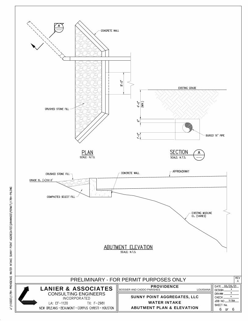
PRELIMINARY - FOR PERMIT PURPOSES ONLY
LANIER & ASSOCIATESCONSULTING ENGINEERS
6 6
SUNNY POINT AGGREGATES, LLCWATER INTAKE
ABUTMENT PLAN & ELEVATION
PROVIDENCEBOSSIER AND CADDO PARISHES LOUISIANA
A