preliminary engineering report - lake county, … · the objective of this preliminary engineering...
TRANSCRIPT

PRELIMINARY ENGINEERING REPORT
EAST REVELS ROAD IN LAKE COUNTY AND
SOUTH LAKESHORE BOULEVARD IN HOWEY-IN-THE-HILLS
Prepared For:
August 10, 2009
Prepared By: 1201 19th Place Suite A-100 Vero Beach, Florida 32960
2
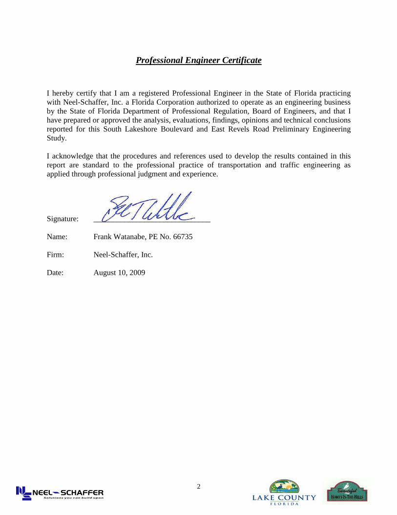
Professional Engineer Certificate
I hereby certify that I am a registered Professional Engineer in the State of Florida practicing with Neel-Schaffer, Inc. a Florida Corporation authorized to operate as an engineering business by the State of Florida Department of Professional Regulation, Board of Engineers, and that I have prepared or approved the analysis, evaluations, findings, opinions and technical conclusions reported for this South Lakeshore Boulevard and East Revels Road Preliminary Engineering Study. I acknowledge that the procedures and references used to develop the results contained in this report are standard to the professional practice of transportation and traffic engineering as applied through professional judgment and experience. Signature: ______________________________ Name: Frank Watanabe, PE No. 66735 Firm: Neel-Schaffer, Inc. Date: August 10, 2009
East Revels Road and South Lakeshore Boulevard Preliminary Engineering Report
3
Table of Contents
Professional Engineer Certificate ............................................................................................................. 2 Table of Contents ....................................................................................................................................... 3
Executive Summary ................................................................................................................................... 6 1.0 Introduction ...................................................................................................................................... 8
1.1 Purpose ...................................................................................................................................... 8 1.2 Project Description .................................................................................................................... 8
2.0 Need For Improvement ................................................................................................................... 11
2.1 Capacity Deficiencies .............................................................................................................. 11
2.2 Safety ....................................................................................................................................... 11
2.3 Consistency with Transportation Plans ................................................................................... 12
2.4 Social/Economic Demands ...................................................................................................... 12
3.0 Existing Conditions ........................................................................................................................ 13
3.1 Existing Roadway Characteristics ............................................................................................ 13
3.1.1 East Revels Road ............................................................................................................ 13 Functional Classification
Typical Section Right-Of-Way
Utilities and Drainage Intersections & Signalization Crash Data Bicycle and Truck/Bus Service
3.1.2 South Lakeshore Boulevard ............................................................................................ 14 Functional Classification
Typical Section Right-Of-Way
Utilities and Drainage Intersections and Signalization Crash Data Bicycle and Truck/Bus Service
3.2 Lake Hills School ..................................................................................................................... 16 3.3 Environmental Characteristics .................................................................................................. 17
4.0 Traffic Impact Analysis .................................................................................................................. 19
4.1 Purpose ..................................................................................................................................... 19
4.2 Existing Streets, Intersections and Study Area ......................................................................... 20
4.2.1 Site Location and Study Area ........................................................................................... 20
4.2.2 Land Use .......................................................................................................................... 20
East Revels Road and South Lakeshore Boulevard Preliminary Engineering Report
4
4.2.3 Field Reviews ................................................................................................................... 21
4.3 Bike Lane Implementation ....................................................................................................... 22
4.3.1 Bike Lane Facility ............................................................................................................ 23
4.3.2 Safety of a Bike Lane ....................................................................................................... 23
4.3.3 School and Other Development Traffic ........................................................................... 24
4.4 Traffic Analysis ........................................................................................................................ 25
4.4.1 Existing Roadways and Intersections ............................................................................... 25 4.4.2 Level-Of-Service .............................................................................................................. 25 4.4.3 Future Traffic Analysis .................................................................................................... 31
5.0 Design Criteria ................................................................................................................................ 33
5.1 Proposed Alternative and Roadway Improvements ................................................................. 34
5.1.1 6-foot widening on both sides ........................................................................................ 34
5.1.2 2-foot widening on both sides ......................................................................................... 35
5.1.3 1-foot widening with 6 inch concrete ribbon on both sides ............................................. 35
5.2 Drainage Improvements ........................................................................................................... 36
5.3 Realignment of East Revels Road at State Route 19 ................................................................ 37
5.4 Left Turn Lane at North Buckhill Road ................................................................................... 37
6.0 Public Comments and Community Input .................................................................................... 38
7.0 Recommendations and Conclusions ............................................................................................. 39

East Revels Road and South Lakeshore Boulevard Preliminary Engineering Report
5
List of Figures
Figure 1 – Project Location Map ..................................................................................................... 6 & 10
Figure 2 – Existing Howey Land Use Map ............................................................................................ 21
Figure 3 – Intersection Geometry ........................................................................................................... 28
Figure 4 – Intesection Peak Hour Counts ............................................................................................... 29
Figure 5 – Existing AADT ..................................................................................................................... 30
Figure 6 – Future Intersection Peak Hour Counts .................................................................................. 32
Figure 7 – Alternative Cross-Sections ....................................................................................... 7, 33 & 39
List of Tables Table 1 – Existing Utility Companies .................................................................................................... 16
Table 2 – Lake Hills School Data .......................................................................................................... 17
Table 3 – Level of Service Criteria for Un-signalized and Signalized Intersections ............................. 26
Table 4 – Base Year (2009) Intersection Level of Service Peak Hour Times ........................................ 26
Table 5 – Existing Peak Hour Traffic Utilization By Others ................................................................. 27
Table 6 – Average Daily Traffic ............................................................................................................ 27
Table 7 – Annual Average Daily Traffic (Vehicles and Trucks) ........................................................... 27
Table 8 – Future Year (2010/2020) Intersection Level of Service Peak Hour Times ............................ 31
Table 9 – Average Daily Traffic/Concurrency ....................................................................................... 31
Table 10 – Design Criteria ..................................................................................................................... 34
Table 11 – Evaluation Matrix ................................................................................................................. 35
Table 12 – Drainage Basin Data for Alternative A ................................................................................ 36
Appendix See Technical Appendix Binder

East Revels Road and South Lakeshore Boulevard Preliminary Engineering Report
6
EXECUTIVE SUMMARY The objective of this Preliminary Engineering Report is to document the findings of the engineering assessment and to provide a summary of certain elements of the environmental and traffic evaluation for the proposed capacity widening improvements of East Revels Road in Lake County and South Lakeshore Boulevard in Howey-in-the-Hills. These proposed improvements are necessary to accommodate the future traffic demand, roadway capacity and efficiently improve traffic safety within the corridors.
Figure 1 – Project Location Map The engineering assessments of the widening alternatives are included in this report, such as: the environmental screening, traffic analysis, preliminary engineering, drainage and the design criteria for the roadway cross section options. In addition, an alternatives evaluation matrix was also prepared. From the evaluation matrix, roadway widening alternatives were identified for which a preliminary design analysis and conceptual plans for the possible alternatives were prepared. Several alternatives have been studied based on input from the County, Town, and residents including the possible addition of bike lanes to the existing roadway, which is heavily used by bicyclists. The following existing conditions and categories take an important part in the development of the proposed alternatives. Evaluation Categories All Alternatives
• Existing Traffic No impacts • Roadway Capacity Deficiencies No impacts – improvement • Safety No impact – improvement • Consistency with Existing Transportation Plans No impacts • Social/Economic Demands No impacts • Venezia Residential Development No impacts • Lake Hills School/Busing No impacts – safety improvement • Environmental Characteristics Minor mitigation • Drainage Minor mitigation • Tree removal (mature trees) No impacts • Public Comments and Community Input Concerns on the street width
Based on these existing conditions and categories, three alternatives are proposed. A no-build alternative was also identified as part of the options. It was determined that due to the needed safety, capacity and overall resurfacing for the existing roadways requires one of the following widening options. Each of these alternatives is discussed in detail in Section 5 of this report.

East Revels Road and South Lakeshore Boulevard Preliminary Engineering Report
7
Figure 7 – Alternative Cross-Sections
6-foot widening on both sides (30 ft total pavement width): This alternative incorporates a 4 ft bike lane on both sides of the road and 11 ft travel lanes in both directions. 2-foot widening on both sides (24 ft total pavement width): This alternative provides for 10 ft travel lanes in both directions as well as a 2 ft paved shoulder. 1-foot widening with 6 inch concrete ribbon on both sides (20 ft total pavement width): This alternative provides 1 ft widening of travel lanes with a 6 in concrete ribbon in both directions. Based on the alternative evaluation, there are no fatal flaws identified with the three options from an environmental screening, traffic, drainage, preliminary design and right-of-way criteria. In addition, Lake County Engineering has identified that all three roadway alternatives are of acceptable pavement width and will suffice for roadway capacity improvements. The only difference identified in the alternative matrix evaluation is in the construction cost. The three alternatives are valid and meet all Lake County and local requirements for rural roadway corridors.

East Revels Road and South Lakeshore Boulevard Preliminary Engineering Report
8
1.0 Introduction The Town of Howey-in-the-Hills has been working on the planning, engineering and funding for the East Revels Road and S. Lakeshore Boulevard roadway improvements since early 2007. This roadway is actually within two jurisdictions: the S. Lakeshore Boulevard section is within the Town of Howey-in-the-Hills and the East Revels Road portion is within Lake County. The need for the preliminary engineering report is to determine, if any impact exists with the possible widening of East Revels Road and S. Lakeshore Boulevard. The initial design configuration is to widen the roadway with possible bike lanes while still maintaining the rural features of these collector roadways. The following subsections provide a description of the purpose of this report and a brief description of the project.
1.1. Purpose The purpose of this Preliminary Engineering Report (PER), is to document the findings of the engineering assessment and to provide a summary of certain elements of the environmental and traffic evaluation for the proposed capacity widening improvements of:
• East Revels Road in Lake County • S. Lakeshore Boulevard in Howey-in-the-Hills
This report presents the data collection, field reviews, surveying and engineering analysis to define the proposed roadway widening improvements. It also documents the existing physical features of the roadways and the existing environmental characteristics of the project corridor. In addition, this report identifies the possible alternatives (cross sections for widening) for the proposed improvements which will include the analysis of existing and projected traffic conditions. The engineering assessments of the widening alternatives are included in this report, such as: the environmental screening, traffic analysis, preliminary engineering, drainage and the design criteria for the roadway cross section options. In addition, an alternatives evaluation matrix that provides the framework for comparing the relative strengths and weaknesses of the individual widening alternatives for this study was also prepared. From this evaluation matrix, roadway widening alternatives were identified for which a preliminary design analysis and conceptual plans for the possible alternatives were prepared as part of this study. As well as the social, economic and environmental impacts were evaluated.
This report will serve as the initial document of record to move this project forward into
the engineering design and to support the subsequent engineering decisions as the project advances through design and into the construction phases.
1.2. Project Description
The project consists of two roadway corridors; East Revels Road and S. Lakeshore Boulevard which are approximately two miles long in total roadway length. Both

East Revels Road and South Lakeshore Boulevard Preliminary Engineering Report
9
roadways are considered as rural collector roadways with S. Lakeshore Boulevard located within the Town of Howey-in-the-Hills and E. Revels Road in Lake County. As rural roadways, there are no curb and gutters along the pavement edge and large set-backs to the existing public right-of-way lines. East Revels Road is a two lane rural collector roadway which is bordered West by State Route 19 and East by North Buckhill Road within the Lake County boundary, one mile long. East Revels Road is located within Lake County with a posted speed limit up to 35 mph. The roadway is striped and varies in pavement width from 17-18 feet. Utility poles are predominate along the South side of the roadway. From the southern section, there is a sprawling Orange Orchard on the South side near the intersection of State Route 19 and on the North side there is a newly graded and staked residential development with new roadways and home pads. This new residential development is known as the Venezia site. This development of approximately 172 single family units and 113 town homes will not have a public access road onto E. Revels Road as identified in the approved development conditions for this project. At the cross street of 6th Avenue and East Revels Road there are several existing residences fronting the roadway. As the roadway continues, there are several connecting roadways. Palm Avenue is prior to the curve in the roadway. The second connecting roadway is North Buckhill Road. North Buckhill Road is a dirt road and entrance to Sara Maude Mason Nature Preserve.
S. Lakeshore Boulevard is also a two lane rural collector roadway which is bordered South by North Buckhill Road and North by East Central Avenue in the Town of Howey-in-the-Hills. The road is striped until the entrance of the new Lake Hills School facility. S. Lakeshore Boulevard has a posted speed limit of 25 mph. As mentioned, on the West side is some undeveloped property up to the new Lake Hills School site. Along the east side, it is mainly all wetland open space which extends to Little Lake Harris and the Town Park. At the school site, the property recently constructed the school facility with set-back, sidewalks, and fencing to designate the school right-of-way. Across from the school; on the East side is Griffin Stormwater Park. There is one school pedestrian crosswalk at a midblock location to enter the Griffin Park site. As you travel North on S. Lakeshore Boulevard past the school property, there are a few residences with Oak trees on the west side. Across from the residences is Little Lake Harris shoreline a newly reopened restaurant and boat ramp.

East Revels Road and South Lakeshore Boulevard Preliminary Engineering Report
10
S. Lakeshore Boulevard is approximately 17’-18’ feet wide and has a sidewalk starting at the Lake Hills School property and crossing over to the east side at Lakeview Avenue and continuing on the east side along the Town shoreline park way. Utility poles, light poles and boxes are predominate on the east side.
Figure 1 – Project Location Map An important feature of this project (See Figure 1) is the possible addition of bike lanes to the existing roadway, which is heavily used by bicyclists. The addition of bike lanes will promote and facilitate the current use of non-motorized transportation (biking) throughout the corridor. The Town of Howey-in-the-Hills and Lake County strongly endorse the concept of future bicycle facilities within the Towns roadways and identifies the need for implementing bike enhancements along East Revels Road and S. Lakeshore Boulevard. As part of this report, both East Revels Road and S. Lakeshore Boulevard were analyzed to accommodate bike lanes as part of the widening options.

East Revels Road and South Lakeshore Boulevard Preliminary Engineering Report
11
2.0 Need for Improvement East Revels Road and S. Lakeshore Boulevard are consistent within both the Town of Howey-in-the-Hills and Lake County as two lane collector roadways. Both roadways are deficient in meeting current County roadway standards for pavement width, turn lanes at intersections and the resurfacing of the pavement condition. These roadway deficiencies have created concerns from the Town regarding the future use and condition of the roadway. East Revels Road was resurfaced a few years ago, but the roadway still requires the additional pavement widths and left-turn lane. The Town has identified that both roadways are need of improvements to accommodate for future traffic as projected in the Lake-Sumter MPO Year 2030 Long Range Transportation Plan. This MPO Year 2030 Transportation Plan is at the initial stage of being compiled for the region.
The need for improvement to East Revels Road and S. Lakeshore Boulevard is based on several factors. The first of these factors is to provide for additional roadway width to meet standards and capacity for projected increase in traffic volumes in the area. The second factor is the need to improve safety on East Revels Road and S. Lakeshore Boulevard. The new Lake Hills school site uses East Revels Road and S. Lakeshore Boulevard as part of its bus route to access the school. The limited pavement width of the roadway requires the buses to pull over when passing. Finally, the roadway is substandard to current Lake County roadway standards and needs major pavement repairs and resurfacing. There are major sections along S. Lakeshore Boulevard just before the Lake Hills School boundaries that need to be repaved and striped.
In addition, widening improvements to East Revels Road and S. Lakeshore Boulevard will provide for future pedestrian and bicycle usage which will further enhance the safety of the pedestrians and bicyclists using these roadways. Improvements to East Revels Road and S. Lakeshore Boulevard will help meet the social/economic demand of the area given that State Route 19 is a heavily traveled State highway, with high truck volume and restricted to two lanes per Howey-in-the-Hills. This section of the report presents the findings relative to each of these areas and a review of the recommendations presented by local comprehensive planning efforts.
2.1 Capacity Deficiencies Existing traffic conditions were evaluated using the latest approved procedures outlined
in the Transportation Research Board’s Special Report 209 –Highway Capacity Manual 2000 (HCM). Intersections were analyzed using Highway Capacity Software (HCS) version 5.2, which utilizes the un-signalized and signalized intersection techniques described in (HCM). Analyses of links were evaluated by using the 2002 Florida Department of Transportation (FDOT) Quality/Level of Service (LOS) Handbook tables.
2.2 Safety
One of the primary purposes of the preliminary engineering report is to provide an interim and/or longer term solution for the safe movement of vehicles, pedestrians and bicyclists through the East Revels Road and S. Lakeshore Boulevard Corridors. Safety issues can be derived from a preliminary engineering report, such as the existing pavement width is substandard to current Lake County roadway width. Surveys conducted and along the roadway, identify the usage of the roadway to accommodate the needs of drivers, pedestrians and bicyclists. Close attention is given to safety for the

East Revels Road and South Lakeshore Boulevard Preliminary Engineering Report
12
pedestrian and bicyclists due to the limited pavement width, limited sidewalks and poor roadway surface condition. For the purpose of this study, crash history was evaluated within the study area to assist in determining the area wide safety concerns.
2.3 Consistency with Transportation Plans
The proposed improvements to East Revels Road and S. Lakeshore Boulevard are consistent with State and Local Government transportation plans. Both are identified in the Towns local comprehensive plan as regional rural collector roadways. The future improvements of these two collector roadways will be identified in the current update to the regional MPO 2030 Transportation Plan as well as any future updates to the local comprehensive plan for the Town of Howey-in-the-Hills.
2.4 Social/Economic Demands The Preliminary Engineering Report will identify the various widening options for the
improvements to both East Revels Road and S. Lakeshore Boulevard. The design criteria for the widening of East Revels Road and S. Lakeshore Boulevard are critical components in the preliminary engineering. The identified improvement will provide for the traffic capacity, safety and pavement resurfacing as well as enhance the attractive nature of these roadways for continued biking and walking usage. As noted, the Town has been working with the regional Lake/Sumter MPO to identify these two roadways as a regional bikeway corridor. In July 2008, the MPO Board acknowledged the work by the Town of Howey-in-the-Hills for taking the lead role in completing the Central Lake Area bike route map and identifying both East Revels Road and S. Lakeshore Boulevard as bike corridors.
As the area continues to grow, an acceptable LOS must be provided on East Revels Road and S. Lakeshore Boulevard for police, fire and other emergency services. Access, via roadways with acceptable LOS to businesses, schools, churches and other community centers must be maintained in the future. The quality of service provided by East Revels Road and S. Lakeshore Boulevard has a social and economic impact on the people who live and work in Howey-in-the-Hills, located in Central Lake County. The proposed roadway improvements need to serve to protect the community cohesion that is present in the area today. The community is served by a small rural roadways system that allows them to travel freely throughout the area without providing the rural feel including trucking operations, commuter operations and the traffic that is present with the growth in the area.

East Revels Road and South Lakeshore Boulevard Preliminary Engineering Report
13
3.0 Existing Conditions
3.1 Existing Roadway Characteristics East Revels Road is considered a rural two lane collector roadway located in Lake
County. The roadway begins at the intersection of State Route 19, which runs northeast until it intersects with North Buckhill Road. Just north of the intersection of North Buckhill Road is where the County line ends and the Town of Howey-in-the-Hills begins. This section of the roadway is S. Lakeshore Boulevard. It begins at the intersection of North Buckhill Road and runs north along the Little Lake Harris shore line. S. Lakeshore Boulevard is also considered a rural collector roadway with two travel lanes within the Town of Howey-in-the-Hills. The characteristics of these two roadways are described in detail in this section.
3.1.1 East Revels Road Functional Classification
East Revels Road is classified as a rural collector from the intersection at State Road 19 to approximately 500 feet north of North Buckhill Road.
Typical Section
East Revels Road is a two lane collector roadway. The roadway section consists of two 10-foot or 11-foot lanes in both directions. There are no turn lanes at the intersections along East Revels Road.
Right-of-Way
East Revels Road has a total Right-of-Way (ROW) length of 66 feet continuous from approximately 320 feet from the intersection at State Road 19. From the intersection at State Road 19 to approximately 320 feet East, East Revels Road has a ROW length of 73 feet.
Utilities and Drainage
In addition to serving vehicular traffic, pedestrians, and other users, the road right-of-way also accommodates a variety of underground and aboveground utilities, which are owned by private and public entities. Since the horizontal and vertical locations of these utilities must be coordinated with the road improvements during the design and construction, it is important to identify these existing and proposed utilities in the early stages of the project development. Table 1 provides contact information for utility companies that may have utilities within the corridor as identified by the Sunshine One Call locator service. Storm water runoff from the roadway is collected in roadside swales and ditches that discharge into stormwater treatment facilities, wetlands, depression areas or Little Lake Harris.
Intersections and Signalization
There are several unnamed roads that intersect at East Revels Road. The named unsignalized intersections along East Revels Road are the following:

East Revels Road and South Lakeshore Boulevard Preliminary Engineering Report
14
• 6th Avenue • Sunset Drive • Palm Avenue • Buckhill Road
Crash Data
For the project area, accident statistics were researched from the local Police and County Sheriff Department. These statistics were verified through Lake Counties Annual Crash Reports for 2006 and 2007. E. Revels Rd to N. Buckhill Rd – 0 traffic incidents and crashes
There were traffic crashes that occurred at SR 19 and E. Revels Rd. intersection. They were as follows: 2006 - 2 Traffic crashes, 2007 - 1 Traffic crashed, 2008 - 0 Traffic crashes and 2009 (to date) - 0 traffic crashes
Bicycle and Truck/Bus Service From field visits it was observed that this segment is utilized by resident vehicles, bicyclists, school buses and delivery trucks (FEDEX, UPS, etc.). The narrow width of the road made it uncomfortable for two vehicles to be on the segment at the same time. Bus and truck services are provided for the school and residents, respectively.
3.1.2 South Lakeshore Boulevard Functional Classification
South Lakeshore Boulevard is a classified as a rural collector from the intersection at of N. Buckhill Road to the intersection of Central Avenue.
Typical Section
South Lakeshore Boulevard is generally a two lane roadway. The roadway section consists of two 10-foot or 11-foot lanes in both directions. There are no turn lanes at the intersections along E. Revels Road.
Right-of-Way
Right-of-Way length across South Lakeshore Boulevard varies from 80 – 89 feet as you travel from Buckhill Road to Lakeview Avenue. From Lakeview Avenue to Central Avenue it has a consistent length of 112 feet.
Utilities and Drainage
In addition to serving vehicular traffic, pedestrians, and other users, most road right-of-ways also accommodate a variety of underground and aboveground utilities, which are owned by private and public entities. Since the horizontal and vertical location of these utilities must be coordinated with the road improvements during design and construction, it is important to identify and consult with the existing and proposed utilities in the early stages of the project development. Table 1 provides contact information for utility companies that may have utilities within the corridor as identified by the Sunshine One Call locator service.

East Revels Road and South Lakeshore Boulevard Preliminary Engineering Report
15
Stormwater runoff from the roadway is collected in roadside ditches that discharge into stormwater treatment facilities, wetlands, depression areas or Little Lake Harris. The description of the typical section is generalized: there are slight deviations throughout.
Intersections and Signalization
The named unsignalized intersections at South Lakeshore Boulevard are the following:
• Island Drive • Lakeview Avenue • Gardenia Place • Myrtle Street • Holly Street
Crash Data
For the project area, accident statistics were researched from the local Police and County Sheriff Department. These statistics were verified through Lake Counties Annual Crash Reports for 2006 to 2008. For the last three years, there has not been a report accident or incident on report. There was one crash/incident that was reported to the local Howey Police during the 2008-2009 year that occurred at South lakeshore and Island Drive which is on the north side of the new Lake Hills School.
Bicycle and Truck/Bus Service
Based on field observation, this segment is utilized by resident vehicles, bicyclists, school buses and delivery trucks (FEDEX, UPS, etc.) for the school. The narrow width of the road makes it nonstandard for two vehicles to be on the segment to pass. The Lake Hills School entrance is located on this segment. At peak hour (2:00 – 3:00 PM) approximately 14 buses exit the school toward State Road 19. It was also observed that several delivery trucks (FEDEX and UPS) enter the segment at peak hour time. With the existing road conditions (pavement width between 8 to 9 feet) these trucks and buses invade the grass sections adjacent to the edge of pavement.

East Revels Road and South Lakeshore Boulevard Preliminary Engineering Report
16
Table 1: Existing Utility Companies
Bright House Networks 1670 E. Highway 50
Clermont, Florida 34711 352-394-5541
Comcast 8130 County Road 44
Leg – A Leesburg, Florida 34788
888-809-7875
Florida Cable, Inc P.O. Box 536518 Orlando FL 32853
352-759-2788
Fire Protection 315 W. Main Street
P.O. Box 7800 Tavares, FL 32778
Sumter Electric Co-Operative, Inc 15720 U.S. Highway 441
Eustis, Florida 32726 352-357-5600
Sumter – Groveland Office 850 Howey Road
Groveland, FL 34736 352-429-2195
MCI Telecommunications 2400 N. Glenville Drive
Dept. 42864-107 Richardson, TX 75082
972-729-6322
Bellsouth 450 N. Goldenrod Road
Orlando, FL 32807 407-273-5084
Sumter Electric Cooperative 330 South US 301
Sumterville, FL 33585 352-793-3801 ext 1198
Progress Energy 3300 Exchange Place Lake Mary, FL 32746
407-942-9243
3.2 Lake Hills School Lake Hills School is located off of S. Lakeshore Boulevard in Howey-in-the-Hills and serves students with moderate to profound disabilities. The students range from three years of age to twenty-two years of age. This school facility is part of the Lake County Schools. Please refer to Table 2 (Lake Hills School Data) for student and bus schedule information. This information was collected from Lake Hills School website, field observations and Lake County School staff input.
East Revels Road and South Lakeshore Boulevard Preliminary Engineering Report
17
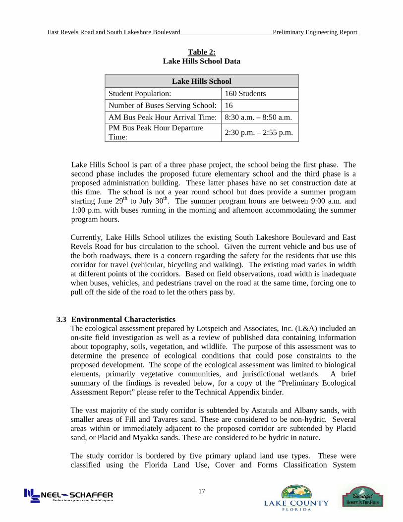
Table 2: Lake Hills School Data
Lake Hills School
Student Population: 160 Students Number of Buses Serving School: 16 AM Bus Peak Hour Arrival Time: 8:30 a.m. – 8:50 a.m. PM Bus Peak Hour Departure Time: 2:30 p.m. – 2:55 p.m.
Lake Hills School is part of a three phase project, the school being the first phase. The second phase includes the proposed future elementary school and the third phase is a proposed administration building. These latter phases have no set construction date at this time. The school is not a year round school but does provide a summer program starting June 29th to July 30th. The summer program hours are between 9:00 a.m. and 1:00 p.m. with buses running in the morning and afternoon accommodating the summer program hours.
Currently, Lake Hills School utilizes the existing South Lakeshore Boulevard and East Revels Road for bus circulation to the school. Given the current vehicle and bus use of the both roadways, there is a concern regarding the safety for the residents that use this corridor for travel (vehicular, bicycling and walking). The existing road varies in width at different points of the corridors. Based on field observations, road width is inadequate when buses, vehicles, and pedestrians travel on the road at the same time, forcing one to pull off the side of the road to let the others pass by.
3.3 Environmental Characteristics The ecological assessment prepared by Lotspeich and Associates, Inc. (L&A) included an on-site field investigation as well as a review of published data containing information about topography, soils, vegetation, and wildlife. The purpose of this assessment was to determine the presence of ecological conditions that could pose constraints to the proposed development. The scope of the ecological assessment was limited to biological elements, primarily vegetative communities, and jurisdictional wetlands. A brief summary of the findings is revealed below, for a copy of the “Preliminary Ecological Assessment Report” please refer to the Technical Appendix binder. The vast majority of the study corridor is subtended by Astatula and Albany sands, with smaller areas of Fill and Tavares sand. These are considered to be non-hydric. Several areas within or immediately adjacent to the proposed corridor are subtended by Placid sand, or Placid and Myakka sands. These are considered to be hydric in nature. The study corridor is bordered by five primary upland land use types. These were classified using the Florida Land Use, Cover and Forms Classification System
East Revels Road and South Lakeshore Boulevard Preliminary Engineering Report
18
(FLUCCS). Refer to the Ecological Assessment report for detailed descriptions of each. These consist of:
• Residential Development (FLUCCS 111, 121, and 129) • Educational Facilities (FLUCCS 171) • Citrus Groves (FLUCCS 221) • Temperate Hardwood Forest (FLUCCS 425) • Coniferous Plantation
Other upland uses and covers adjacent to the corridor include:
• Retail Sales and Service (FLUCCS 141) • Marinas (FLUCCS 184) • Parks (FLUCCS 185)
The corridor is also bordered or adjacent to:
• Freshwater Marshes (FLUCCS 641) • Forested Wetland Mixed (FLUCCS 630) • Surface Water (Little Lake Harris – FLUCCS 521)
Several gopher tortoise burrows were observed during the field investigation conducted by L&A, particularly in the coniferous plantation areas and within and adjacent to the ROW along East Revels Road and the vicinity of the Venezia South development. Approximate locations are depicted in Figure 4 of the Preliminary Ecological Assessment Report. Wetlands associated with the Venezia South development along East Revels Road have been placed under a Conservation Easement as part of the mitigation for the referenced development. The following can be concluded from the L&A Preliminary Ecological Assessment Report:
• The site assessment did not reveal any state or federally listed plants or animals that would affect any development plans for the area.
• Additional surveys for gopher tortoises are recommended to verify the potential occupancy of the burrows observed with the coniferous Plantation and near the ROW adjacent to the Venezia South Development.
• No coordination with the FDACS, the FWC, or ACOE should be required prior to the development of bike lane plans within the study corridor.

East Revels Road and South Lakeshore Boulevard Preliminary Engineering Report
19
4.0 Traffic Impact Analysis This section summarizes the Traffic Impact Analysis performed for the East Revels Road and S. Lakeshore Boulevard widening improvements. For the traffic analysis, two scenarios were considered for the study. The two scenarios included the existing traffic condition and the future build-out year of 2030.
The Build-out for the year, 2030 will include additional trips (vehicle and school bus) produced by the construction and expansion of Lake Hills School and the new Venezia Residential Development. With the projected additional trips, the project area roadways will be required to maintain an acceptable level-of-service. For the roadways and intersections to be up to par per traffic volume increase this may require implementation of measures such as traffic signals, modifications and left-turn lanes. In addition, the Bike Lane Improvement Project is part of the adopted Metropolitan Planning Organization (MPO) Regional Bike Map for Sumter and Lake Counties. Project Roadways The two roadways are the following:
• East Revels Road within Lake County. • S. Lakeshore Boulevard within the Town of Howey-in-the-Hills.
Project Boundary Area The project is located within Section 35, Township 20, Range 25 and Section 36, Township 20, Range 25 and Section 26, Township 20 and Range 25. This analysis was prepared to present an understanding of the existing traffic conditions, proposed improvements and analyze and identify any impacts associated with the proposed Bike Lane along East Revels Road and S. Lakeshore Boulevard.
Widening Alternatives There are 3 alternatives for the proposed project:
1. Alternative A – 6 foot Symmetrical Widening (30’ total pavement width). 2. Alternative B – 2 foot Symmetrical Widening (24’ total pavement width). 3. Alternative C –1 foot plus 6 inch concrete Symmetrical Widening (20’ total
pavement width) with Optional 8’ Bike Path.
For the traffic analysis, a no-build alternative was also reviewed to document the need for capacity and safety improvement along East Revels Road and S. Lakeshore Boulevard. Accident information has been gathered from the 2006-2007 Lake County Crash Data Report from the Lake County website. Furthermore, the feasibility of realigning East Revels Road at SR 19 was analyzed per FDOT and Lake County requirements.
4.1 Purpose The purpose of this analysis is to evaluate the traffic impacts of the improvements on East Revels Road and S. Lakeshore Boulevard. This analysis will focus on the roadway capacity, level of service (LOS) and any traffic safety deficiencies along East Revels Road and S. Lakeshore Boulevard. In addition, the traffic analysis will identify the existing conditions (existing traffic counts) and the build-out year 2030 forecast traffic

East Revels Road and South Lakeshore Boulevard Preliminary Engineering Report
20
volumes for the roadway level-of-service (LOS), which will comply with the regional MPO guidelines for transportation concurrency. Furthermore, the traffic analysis will review the proposed design cross sections for the widening and identify any potential lane additions, (left-turn lanes) and any realignment of the roadway to avoid impacts and to improve and enhance traffic access. The intersection of East Revels Road at State Route 19 is an example of an existing alignment that the agencies are aware of the need to improve this connection with a better realignment.
4.2 Existing Streets, Intersections and Study Area
4.2.1 Site Location and Study Area
The study area is composed of two collector roadways: East Revels Road This segment is within Lake County. It is considered a two-travel lane roadway, one (1) mile long and an average pavement width of eighteen (18’) feet from edge of pavement to edge of pavement. The project boundaries for this road are: (West) State Route 19/Palm Avenue and (East) North Buckhill Road. The roadway serves as a collector to the fronting single family residential on both sides and to several connecting collector roadways. These connector roadways are Palm Avenue and North Buckhill Road. There is a proposed emergency exit from the new Venezia Residential Subdivision which will connect to this road. Currently East Revels Road at State Route 19 is skewed at the intersection. This intersection has been identified by the agencies to be realigned and signalized to accommodate existing traffic and for future traffic per the future developments within the Town and County. It is noted that currently vehicles are utilizing the dirt path at the intersection with State Route 19 to turn northbound right onto State Route 19. S. Lakeshore Boulevard This segment is within the Town of Howey-in-the-Hills. It is a considered a two-travel lane roadway, one (1) mile long with pavement widths that varies from sixteen (16’) to eighteen (18’) feet wide. Project boundaries are from the South at North Buckhill Road to the North end at East Central Avenue. The roadway mainly serves the fronting residential homes with a few side streets on the west side. In addition, the Little Lake Harris shore line is adjacent to the eastside along a town parkway. There is also a restaurant on the eastside between the shoreline park and the open space wetland area. There is also a new Lake Hills school site on the west side past the school facility site. On the northern end of S. Lakeshore Boulevard at East Central Avenue there are businesses and West of that location, there are businesses as well.
4.2.2 Land Use
The study area is approximately 2 miles in total length. The study area consists of East Revel Road and S. Lakeshore Boulevard. Please see Figure 2 which identifies the Land Use. Along East Revels Road, the surrounding area is zoned primarily for residential use. On the Southside of E. Revels Road from the intersection of State Route 19, there is approximately 400 feet of agricultural use. On the North side there is an approved Venezia Residential Development (172 single family units and 113 town houses) that

East Revels Road and South Lakeshore Boulevard Preliminary Engineering Report
21
spans along East Revels Road. This new residential development site has been approved for construction. The area adjacent to E. Revels Road is mainly single family residential. There are a few open space wetland at the intersection of North Buckhill Road. From North Buckhill Road, the roadway becomes S. Lakeshore in the Town of Howey-in-the-Hills. The land use varies from industrial for the school site along the west side to wetlands along the east side. The surrounding area to the West is mainly wetlands and the Griffin Stormwater Park. Across from Griffin Stormwater Park is the Lake Hills School.
Figure 2 – Existing Howey Land Use Map The school site is proposed to continue a master plan for two other facilities. Build out of these two projects is planned to be completed in the future pending school funding. There is also commercial usage pass the wetland open space along the eastside between the roadway and little Lake Harris. North of East Lakeview Road, S. Lakeshore Boulevard is primarily zoned for Residential use. North of this area on the East side is Little Lake Harris which is shouldered by grassy area and toward East Central Boulevard is a public park.
4.2.3 Field Reviews
Field investigation for East Revels Road and S. Lakeshore Boulevard was conducted on several occasions to verify the surrounding land use, conditions of the project roads, traffic and current land usage. Photographs, utility location, verification of adjacent roads and measurements were taken. The project area was visited several times during the months of December 2008 to May 2009. It was observed that the study area was heavily traveled often by bicyclists, school buses and local vehicular traffic.

East Revels Road and South Lakeshore Boulevard Preliminary Engineering Report
22
On East Revels Road from State Route 19 to North Buckhill Road there is a solid yellow double line. There are no sidewalks or ADA ramps. The posted speed limit is 35 mph. Utilities are predominant on the South side. There is a sprawling orange orchard and few residences on the South side. On the North Side, there is vegetation and the new Venezia Residential Development. No swales, curbs, gutters or sidewalks were observed. It was noted that East Revels Road East of SR 19 approximately 300 feet from the intersection, is skewed and has an average lane width of 18 feet. On S. Lakeshore Boulevard, there is a solid yellow double striping from North Buckhill Road to Lake Hills School which is located on the West side of S. Lakeshore Boulevard just North of Island Drive. There is sidewalk along the park, then crosses to the west side along the school property. There are no ADA ramps. The school crosswalk is striped diagonally, located between the exit and entrance to the school. S. Lakeshore Boulevard has an average lane width varying from 16.8 feet to 18 feet making deficient conditions for bicyclists and other motorists along this segment. With the proposed expansion to Lake Hills School, S. Lakeshore Boulevard currently handles approximately 16 schools buses in the morning and then leaving the school around 2 p.m. The posted speed limit is 25 mph. No swales, curbs or gutters were observed.
4.3 Bike Lane Implementation
Bicycling is a mode of transportation that is available to people of all ages and socio-economic levels. It is particularly efficient and a convenient mode of transportation which is becoming more popular with communities looking into Green energy concepts. Like the automobile, bicycling provides a high degree of independence, flexibility and freedom of choice relative to schedule and destinations. In addition, bicycling is considered good exercise, health benefits and a form of non-polluting mode of transportation. The regional MPO, Lake County and the Town of Howey-in-the-Hills all encourage local citizens to ride bicycles. Bicycling is also a popular recreational activity. To enhance and promote bicycling, the regional Lake/Sumter MPO created a Bike Master Plan in 2006. The Bike Master Plan includes the following:
• Identifies a network of Bike routes • Links Bike routes to important destinations such as Greenway Trails, employment
center, commercial areas and schools • Recommends road improvements such as signing or striping • Creates Bike facility guidelines for use by traffic engineers • Recommends changes in City policies to increase safety and encourage bicycling • Recommends educational programs for Bike and vehicle safety • Explores creative funding opportunities to establish the Bike network

East Revels Road and South Lakeshore Boulevard Preliminary Engineering Report
23
4.3.1 Bike Lane Facility The Lake/ Sumter MPO have adapted certain features to improve and enhance the safety of the existing roadways to promote bike routes and bike lanes. A Bike Lane is an additional travel lane which is dedicated for bicycle use only and is clearly delineated as a separate travel lane for bicycles. Bike lanes are one-way facilities that carry Bike traffic in the same direction as adjacent vehicular traffic. Per Lake County Transportation Planning, Design and construction standards the following are requirements for a Bike Lane:
• Design Standards per the latest edition of the Florida Department of Transportation Bikes Facilities Planning and Design Manual.
• Designed as one-way facilities and shall flow in the same direction as the adjacent vehicular traffic.
• Bike Lanes shall be a minimum of four to five feet (4’ to 5’) wide.
4.3.2 Safety of a Bike Lane Bike lanes help define road space, decrease the stress level of bicyclists riding in traffic, encourage bicyclists to ride adjacent to the flow of traffic and visually signal motorists to the Bike Lane. Bike lanes help organize the flow of traffic and reduce the chance that motorists will stray into the cyclist’s path of travel. In addition, several real-time studies (where cyclists of varying abilities and backgrounds ride and assess actual routes and street conditions) have found that cyclists are more comfortable and access a street providing a better level of service for them where Bike lanes are marked. Bike lanes reduce traffic speeds by narrowing the perceived space available on road. Studies by the U.S. Federal Highway Administration and other local road authorities in the U.S. have found that Bike lanes discourage sidewalk riding and riding against the flow of traffic. These behaviors have been found to be significant Bike accident generators. Provisions of Bike lanes recruit new riders. Surveys established that more than 20% of cyclists using the new Bike lanes were new cyclists, not simply riders shifting from other routes because of the Bike lanes.
S. Lakeshore Boulevard severely lacks the efficiency to handle two-way traffic and bicyclists on the roadways. Keeping the safety of bicyclists in mind, Lake/Sumter MPO has recommended a Bike Lane through this area, to assist in improving roadway conditions for future development and increase of volume in vehicles, school buses and pedestrians. Please see Figure 3 and Figure 4 regarding the new school site, students, busing and future expansion. Additional vehicle and school bus trips establish a need for

East Revels Road and South Lakeshore Boulevard Preliminary Engineering Report
24
implementation of a Bike Lane, a necessity for future developments along East Revels Road and S. Lakeshore Boulevard. In addition Bike Lanes:
• Support and encourage bicycling as a means of transportation; • Help define road space; • Promote a more orderly flow of traffic; • Encourage bicyclists to ride in the correct direction, with the flow of traffic; • Give bicyclists a clear place to be so they are not tempted to ride on the sidewalk; • Remind motorists to look for cyclists when turning or opening car doors; • Signal motorists that cyclists have a right to the road; • Reduce the chance that motorists will stray into cyclists’ path of travel; • Make it less likely that passing motorists swerve toward opposing traffic; • Decrease the stress level of bicyclists riding in traffic
Well-designed facilities encourage proper behavior and decrease the likelihood of crashes. Numerous studies have shown that Bike lanes improve safety and promote proper riding behavior. Given the above advantages and the existing conditions of East Revels Road and S. Lakeshore Boulevard a Bike Lane facility is an optimal added choice for improvements along the project roadway corridor.
4.3.3 School and Other Development Traffic
Lake Hills School currently has an enrollment of 163 students. The school serves special needs students with grade ranges of Pre-Kindergarten thru 12th grade school. Student’s ages are 3 thru 22 years of age. The parameters of students are identified as Profoundly Mentally Disabled or Trainable Mentally Disabled. Students living throughout the Lake County School District are able to be bused to and from the Lake Hills school site. Based on the current attendance and traffic, the majority of the students are transported using the school bus system. There are approximately 16 school buses that provide transportation for this school. Lake Hills School is planning to expand the site as part of the overall master plan and therefore additional vehicular and school bus trips will be added as the site expands in the future. In addition to the school site, there is a proposed residential development being planned on North Buckhill Road which will use S. Lakeshore Boulevard and E. Revels Road. It will add vehicle trips to the surrounding roadway system. In addition to designing appropriate access for the proposed future school and residential developments, a satisfactory level of transportation service and safety for all roadway users must be maintained.

East Revels Road and South Lakeshore Boulevard Preliminary Engineering Report
25
4.4 Traffic Analysis
4.4.1 Existing Roadways and Intersections Roadways serving the project site for East Revels Road include:
• State Route 19 • 7th Avenue • 6th Avenue • Sunset Drive • Palm Avenue • North Buckhill Road
East Revels Road is an eighteen (18’) foot wide, two lane collector roadway. The roadway is west to East then curves up to the North meeting its northern border, of North Buckhill Road. East Revels Road is bordered to the North, by S. Lakeshore Boulevard, to the South by SR 19, to the East by North Buckhill Road, sprawling Orange Orchards and few residences and to the West, by the new Venezia Residential Development, vast vegetation and few residences. Roadways serving the project site for S. Lakeshore Boulevard include:
• North Buckhill Road • Island Drive • East Lakeview Avenue • East Gardenia Street • East Myrtle Street • East Holly Street • East Central Avenue
S. Lakeshore Boulevard is an eighteen (18’) foot wide, two lane collector roadway. The roadway runs north to South with the northern border at East Central Avenue and the southern border at North Buckhill Road. Along the east side is the Griffin Stormwater Park and Little Lake Harris, and the west side by Lake School and residences along the northern section.
4.4.2 Level-Of-Service
The traffic analysis was based on the 2000 edition of the Highway Capacity Manual (HCM). The HCM provides levels of service (LOS) for varying roadway segments, intersections and geometric conditions. The level of service is reported as a letter designation of A through F. The measure of effectiveness used to determine the level of service at signalized and unsignalized intersections is the average control of delay per vehicle in seconds. The vehicular delays relate directly to the control devices, turning movement volumes, traffic composition and roadway geometrics at an intersection. A LOS A grade represents the least amount of control delay (seconds/vehicle) and the best attainable evaluation for capacity. A LOS F grade represents the most amount of control delay (seconds/vehicle) and the worst attainable evaluation for capacity.
Table 3 presents the levels of service for unsignalized intersections, and the levels of service for signalized intersections. For the unsignalized intersections where the major

East Revels Road and South Lakeshore Boulevard Preliminary Engineering Report
26
street does not stop, an overall intersection level of service is not available. However, the level of service for the minor street and left turns from the major streets are available individually using the same control delay listed in Table 3. The following sections provide a discussion of the traffic analysis methodology and findings.
Table 3:
Level of Service Criteria for Un-signalized and Signalized Intersections
Unsignalized Intersections Signalized Intersections
LOS Control Delay per Vehicle (s/veh)
Average Control Delay (s/veh)
A 0 – 10 0 -10 B > 10 – 15 > 10 – 20 C > 15 – 25 > 20 – 35 D > 25 – 35 > 35 – 55 E > 35 – 50 > 55 – 80 F > 50
> 80
Note: LOS F applies whenever the flow rate exceeds the segment capacity. Source: HCM 2000
There are two existing intersections along East Revels Road and S. Lakeshore Boulevard to be analyzed for level of service. They are: 1) E. Revels Road at State Route 19 and 2) S. Lakeshore Boulevard at East Central Avenue. The intersection counts were conducted during the following times:
• AM Peak (6:00 - 8:00 AM) • Noon (12:00 – 1:00 PM) • School (2:00 – 3:00 PM) • PM Peak (4:00 – 6:00 PM)
The AM and PM Peak Hour Times for E. Revels Road at State Route 19 is from 7:00 to 8:00 a.m. and from 4:15 to 5:15 p.m. respectively. The peak hour times for S. Lakeshore at Central Avenue are from 7:00 a.m. to 8:00 a.m. and from 4:45 to 5:45 p.m. Please refer to Figure 3 and 4 for Intersection Count Depiction.
Table 4: Base Year (2009) Intersection Level of Service
Peak Hour Times
Intersections
(2009)
Existing Conditions
AM Noon School PM Delay LOS Delay LOS Delay LOS Delay LOS
East Revels Road at SR19 13.5 B 11.0 B 11.8 B 13.8 B
S. Lakeshore Blvd at E. Central Ave 9.4 A 9.1 A 8.9 A 9.0 A

East Revels Road and South Lakeshore Boulevard Preliminary Engineering Report
27
The following Table 5 depicts the other traffic utilization that was observed at the intersection of East Revels Road at State Route 19.
Table 5: Existing Peak Hour Traffic Utilization
By Others Traffic Utilization Number During Peak Hour Time East Revels Road at State Road 19
AM Noon School PM Trucks 39 28 27 26
School Buses 6 0 9 0 Bicycles 1 0 0 2
It is noted, that at the intersection of South Lakeshore Boulevard at Central Avenue no trucks, school buses and bicycles were observed during the peak hour times. It was observed that a significant number of traffic during the peak times was from trucks. The Average Daily Traffic (ADT) for E. Revels Road and S. Lakeshore Boulevard is shown on Table 6. The counts were taken back in 2007 and recently in 2009.
Table 6: Average Daily Traffic
Segment 2007 2009 E. Revels Road 260 319
S. Lakeshore Boulevard 560 688
The following AADT (Annual Average Daily Traffic) data Table 7 for vehicle and truck traffic for SR 19 was collected from the Florida Department of Transportation Traffic Online (2008) website. It is depicted from this data that an average of 16.4% is truck traffic for the SR19 corridor between US27 and CR48. Figure 5 depicts the location for these AADT Counts.
Table 7: Annual Average Daily Traffic (Vehicles and Trucks)
Segment Vehicles Trucks
US 27 – O’Brien Road 8,100 1,325 O’Brien Road – CR48 8,200 1,342

East Revels Road and South Lakeshore Boulevard Preliminary Engineering Report
28
Figure 3 – Intersection Geometry

East Revels Road and South Lakeshore Boulevard Preliminary Engineering Report
29
Figure 4 – Intersection Peak Hour Counts

East Revels Road and South Lakeshore Boulevard Preliminary Engineering Report
30
Figure 5 – Existing AADT

East Revels Road and South Lakeshore Boulevard Preliminary Engineering Report
31
4.4.3 Future Traffic Analysis The future traffic analysis for E. Revels Road and S. Lakeshore Boulevard has limited future build out traffic conditions. The existing land use projection for the area has only three identified and approved projects for future traffic. The future conditions would be 2010 and 2020. These three sites are the following: 1. Venezia Development with 172 single family and 113 townhomes 2. Lake County School – future elementary school and administration facility 3. Whispering Pines Development – 107 single family units Two of the three future projects will have limited or no traffic impacts. The Venezia project will not have public access onto E. Revels Road per the approved development plan. There is only an emergency access driveway that connects to E. Revels Road from the site. The Lake County School site has identified in their future 2010-2020 Master Plan to add an elementary school and expand the existing administration facility. The school district has identified that the new school facilities will have access from State Route 19. The Whispering Hills project is the only project that will add trips onto both E. Revels Road and S. Lakeshore Blvd. However, the number of trips for the future condition is minimal in traffic impact.
Table 8:
Future Year (2010/2020) Intersection Level of Service Peak Hour Times
Table 9:
Average Daily Traffic/Concurrency
Intersections
(2010/2020)
Future Conditions
AM Noon School PM Delay LOS Delay LOS Delay LOS Delay LOS
East Revels Road at SR19 19.1 C n/a n/a n/a n/a 21.7 C
S. Lakeshore Blvd at E. Central Ave 9.4 A n/a n/a n/a n/a 9.5 A
Segment 2009 1% Growth
Factor 2020
Projected PM Peak (Whispering
Pines) Total Concurrency/
Meets Concurrency
E. Revels Road (SR 19 to
Lakeshore Blvd) 260 286 11 297 760/YES
S. Lakeshore Boulevard
(Revels Road to Central Ave)
560 616 59 675 760/YES

East Revels Road and South Lakeshore Boulevard Preliminary Engineering Report
32
Figure 6 – Future Intersection Peak Hour Counts

East Revels Road and South Lakeshore Boulevard Preliminary Engineering Report
33
5.0 Design Criteria The engineering design of this project will be governed by the criteria of Lake County’s Engineering Standards Manual and/or by the criteria of the FDOT Plans Preparation Manual, the FDOT Roadway and Traffic Design Standards, and the AASHTO “A Policy on Geometric Design of Highways and Streets”. Based on discussions with Figure 7 – Alternative Cross-Sections Lake County Engineering, the need to develop alternative cross section options for the width of the roadway were considered for this project due to the unique features of the roadway condition and community concerns regarding widening the roadway. The proposed alternatives would be less than the standard roadway width for County travel lanes of 11 feet. Since these rural roadways carry less traffic volumes than a typical collector, the need to meet State or County design standard width would be over conservative in the design and need for roadway width. The need to design rural roadway to accommodate the surrounding communities, enhance the travel way, ensure safety and provide the needed adequate roadway capacity can be achieved with less roadway width. Shown are the proposed three cross section options. Also shown is the “no build” option with the existing roadway width. Alternative A: shows a 6 foot widening on both sides with a total

East Revels Road and South Lakeshore Boulevard Preliminary Engineering Report
34
pavement width of 30 feet. Alternative B: shows a 2 foot widening of both sides with a total pavement width of 24 feet. Alternative C shows a one foot widening and the installation of a 6” concrete ribbon on both sides with a total pavement width of 20 feet.
All three of the proposed widening options have been reviewed by the Lake County Engineering Department as alternatives to the original proposed 11 foot travel lanes and 6 foot bike lanes. As a design option, the bike lane alternative does provide the standard County design criteria with the additional pavement width for four foot bike lanes on both sides. Based on the need to provide alternative design width, the following is the detail engineering design criteria for all three alternative options.
Table 10: Design Criteria Design Element Alternative A Alternative B Alternative C
Design Speed 35 mph / 25 mph 35 mph / 25 mph 35 mph / 25 mph Posted Speed 35 mph / 25 mph 35 mph / 25 mph 35 mph / 25 mph Lane Widths 11 feet 10 feet 10 feet Bike Lanes 4 feet None None Shoulder Width 4 feet (Grass) 2 feet (Paved) None Minimum Median Width None None None Cross Slope 0.02 0.02 0.02 Curb and Gutter Concrete Ribbon None None 6 inch
Sidewalk 5 feet 5 feet 5 feet Border (width) 10 feet 10 feet 10 feet
Vertical Grade 9% Maximum 0.8 Change w/o Curve
9% Maximum 0.8 Change w/o Curve
9% Maximum 0.8 Change w/o Curve
Minimum Length (ft) of Horizontal Curves
15 x V (Design Speed) or 400 ft and at
least 100 ft of full superelevation
15 x V (Design Speed) or 400 ft and at least
100 ft of full superelevation
15 x V (Design Speed) or 400 ft and at least
100 ft of full superelevation
5.1 Proposed Alternatives and Roadway Improvements
Given the existing road conditions as the no-build option, there are three possible alternatives for roadway improvements. They are: • Alternative A: 6 foot widening on both sides (30 foot total pavement width) • Alternative B: 2 foot widening on both sides (24 foot total pavement width) • Alternative C: 1 foot widening and 6 inch concrete ribbon on both sides (20 foot
total pavement width)
5.1.1 6-foot of widening on both sides (30-foot total pavement width) This alternative provides a 4-foot bike lane on both sides of the road as well as 11 foot travel lanes in both directions. This option will comfortably allow two vehicles to cross each other without intruding into the existing grass segments. Drainage improvements will be accommodated by roadside swales with a discharge pipe onto Little Lake Harris from the existing Boathouse Restaurant.

East Revels Road and South Lakeshore Boulevard Preliminary Engineering Report
35
5.1.2 2-foot of widening on both sides (24-foot total pavement width) This alternative provides for 10-foot travel lanes in both directions as well as a 2-foot paved shoulder. This option will comfortably allow two vehicles to cross each other without intruding into the existing grass segments. In addition, it will add safety to bicyclists and walkers with the 2-foot paved shoulder. Drainage will be accommodated by roadside swales with a discharge pipe onto Little Lake Harris from the existing Boathouse Restaurant.
5.1.3 1-foot of widening with 6 inch concrete ribbon on both sides (20-foot total
pavement width) This alternative provides for a 1-foot widening with a 6 inch concrete ribbon on each side of the road. This prevents the asphalt from breaking at the edge and it serves as a preventive measure for vehicles, trucks and buses to slow down. This option provides a 10-foot travel lane on both directions as well as an Optional 8-foot Bike Path separated from the road. This option will comfortably allow two vehicles to cross each other without intruding into the existing grass segments and it provides for bicyclists utilizing the road with a separate lane. Drainage will be accommodated by roadside swales with a discharge pipe onto Little Lake Harris from the existing Boathouse Restaurant.
Table 11: Evaluation Matrix
Evaluation Factor Alternative A
Alternative B
Alternative C No-Build
Residential and Business Impacts 1 1 1 0
Number of Parcels Impacted 0 0 0 0
Area of Public Right-of Way Required (acres) 7.32 5.81 5.09 0
Drainage 1 1 1 0 Traffic Impact 0 0 0 0
Cultural Impacts None None None None
Wetland Impacts (acres) 0 0 0 0
Floodplain Impacts (acre-feet) 0 0 0 0
Wildlife/ Habitat Impacts Low Low Low Low
Tree Removal (Mature) 0 0 0 0 Potential Contamination
Sites Impacted 0 0 0 0
Construction Cost $1,200,000 $940,000 $920,000 $0
East Revels Road and South Lakeshore Boulevard Preliminary Engineering Report
36
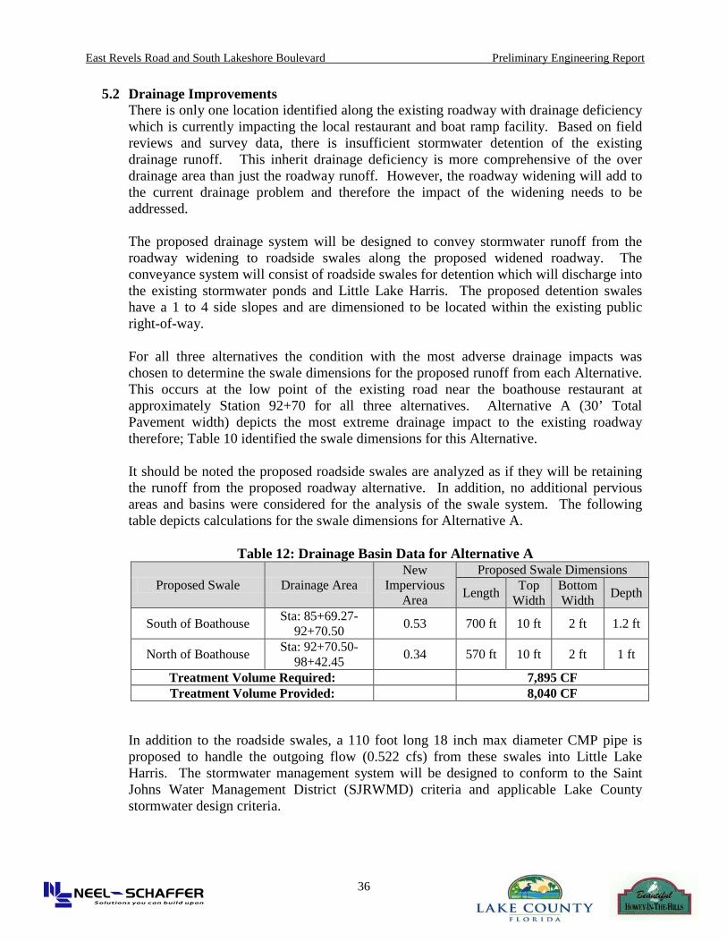
5.2 Drainage Improvements There is only one location identified along the existing roadway with drainage deficiency which is currently impacting the local restaurant and boat ramp facility. Based on field reviews and survey data, there is insufficient stormwater detention of the existing drainage runoff. This inherit drainage deficiency is more comprehensive of the over drainage area than just the roadway runoff. However, the roadway widening will add to the current drainage problem and therefore the impact of the widening needs to be addressed.
The proposed drainage system will be designed to convey stormwater runoff from the roadway widening to roadside swales along the proposed widened roadway. The conveyance system will consist of roadside swales for detention which will discharge into the existing stormwater ponds and Little Lake Harris. The proposed detention swales have a 1 to 4 side slopes and are dimensioned to be located within the existing public right-of-way.
For all three alternatives the condition with the most adverse drainage impacts was chosen to determine the swale dimensions for the proposed runoff from each Alternative. This occurs at the low point of the existing road near the boathouse restaurant at approximately Station 92+70 for all three alternatives. Alternative A (30’ Total Pavement width) depicts the most extreme drainage impact to the existing roadway therefore; Table 10 identified the swale dimensions for this Alternative.
It should be noted the proposed roadside swales are analyzed as if they will be retaining the runoff from the proposed roadway alternative. In addition, no additional pervious areas and basins were considered for the analysis of the swale system. The following table depicts calculations for the swale dimensions for Alternative A.
Table 12: Drainage Basin Data for Alternative A
Proposed Swale Drainage Area New
Impervious Area
Proposed Swale Dimensions
Length Top Width
Bottom Width Depth
South of Boathouse Sta: 85+69.27- 92+70.50 0.53 700 ft 10 ft 2 ft 1.2 ft
North of Boathouse Sta: 92+70.50- 98+42.45 0.34 570 ft 10 ft 2 ft 1 ft
Treatment Volume Required: 7,895 CF Treatment Volume Provided: 8,040 CF
In addition to the roadside swales, a 110 foot long 18 inch max diameter CMP pipe is proposed to handle the outgoing flow (0.522 cfs) from these swales into Little Lake Harris. The stormwater management system will be designed to conform to the Saint Johns Water Management District (SJRWMD) criteria and applicable Lake County stormwater design criteria.
East Revels Road and South Lakeshore Boulevard Preliminary Engineering Report
37
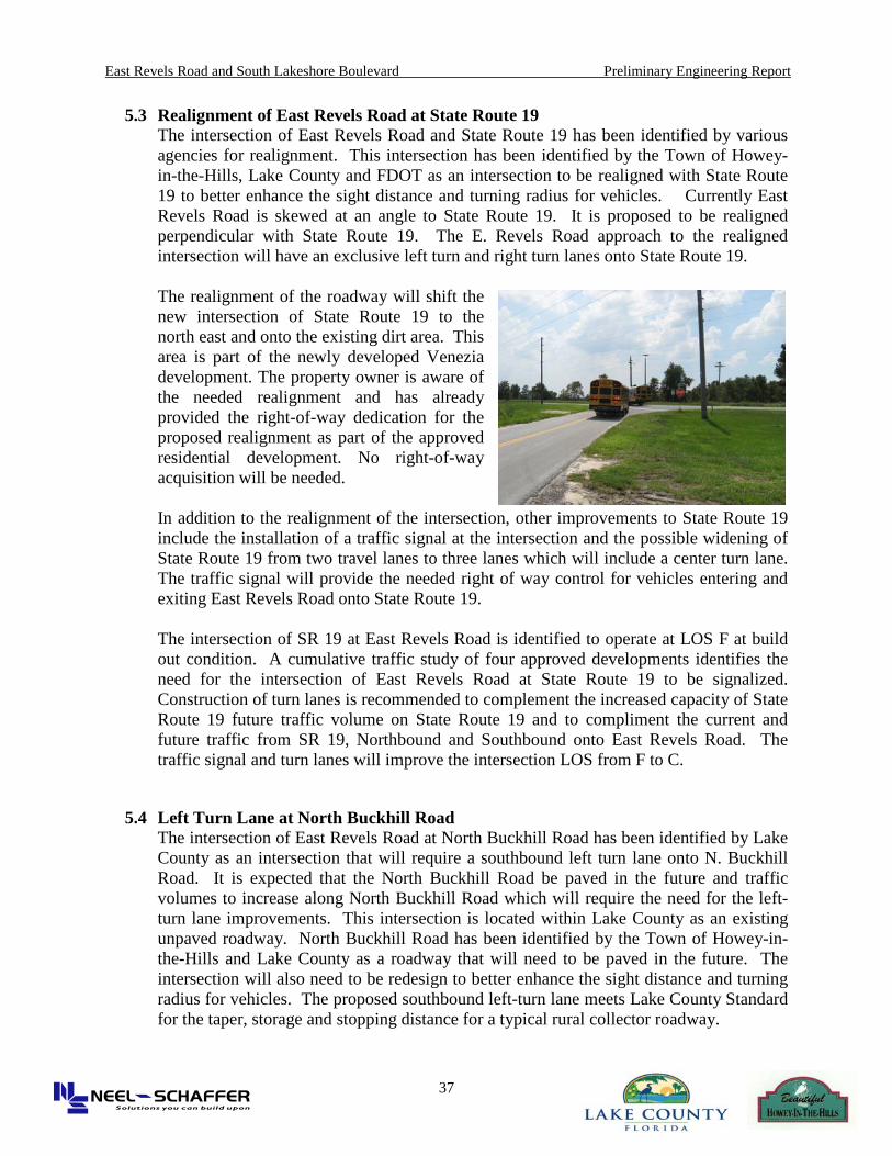
5.3 Realignment of East Revels Road at State Route 19 The intersection of East Revels Road and State Route 19 has been identified by various agencies for realignment. This intersection has been identified by the Town of Howey-in-the-Hills, Lake County and FDOT as an intersection to be realigned with State Route 19 to better enhance the sight distance and turning radius for vehicles. Currently East Revels Road is skewed at an angle to State Route 19. It is proposed to be realigned perpendicular with State Route 19. The E. Revels Road approach to the realigned intersection will have an exclusive left turn and right turn lanes onto State Route 19. The realignment of the roadway will shift the new intersection of State Route 19 to the north east and onto the existing dirt area. This area is part of the newly developed Venezia development. The property owner is aware of the needed realignment and has already provided the right-of-way dedication for the proposed realignment as part of the approved residential development. No right-of-way acquisition will be needed. In addition to the realignment of the intersection, other improvements to State Route 19 include the installation of a traffic signal at the intersection and the possible widening of State Route 19 from two travel lanes to three lanes which will include a center turn lane. The traffic signal will provide the needed right of way control for vehicles entering and exiting East Revels Road onto State Route 19. The intersection of SR 19 at East Revels Road is identified to operate at LOS F at build out condition. A cumulative traffic study of four approved developments identifies the need for the intersection of East Revels Road at State Route 19 to be signalized. Construction of turn lanes is recommended to complement the increased capacity of State Route 19 future traffic volume on State Route 19 and to compliment the current and future traffic from SR 19, Northbound and Southbound onto East Revels Road. The traffic signal and turn lanes will improve the intersection LOS from F to C.
5.4 Left Turn Lane at North Buckhill Road The intersection of East Revels Road at North Buckhill Road has been identified by Lake County as an intersection that will require a southbound left turn lane onto N. Buckhill Road. It is expected that the North Buckhill Road be paved in the future and traffic volumes to increase along North Buckhill Road which will require the need for the left-turn lane improvements. This intersection is located within Lake County as an existing unpaved roadway. North Buckhill Road has been identified by the Town of Howey-in-the-Hills and Lake County as a roadway that will need to be paved in the future. The intersection will also need to be redesign to better enhance the sight distance and turning radius for vehicles. The proposed southbound left-turn lane meets Lake County Standard for the taper, storage and stopping distance for a typical rural collector roadway.

East Revels Road and South Lakeshore Boulevard Preliminary Engineering Report
38
6.0 Public Comments and Community Input The Town consultant held two public meetings during the preparation of the preliminary engineering report. The first public meeting was held on February 12, 2009 at the Howey-in-the-Hills Town Hall. This initial meeting was to present the draft concept of the roadway widening improvements. At this time, the conceptual plans identify only one option with the proposed widening and bike lanes. There was a brief presentation about the preliminary engineering process with some preliminary sketches to illustrate the widening concept and then meeting was open to the general public for comments. There were approximately 40-50 people that attend this initial meeting. Comment cards were collected at the end of the meeting. The following is a summary of comments collected.
• 27 attendees provided verbal comments • Collected 14 comments cards
On April 28, 2009, the second public meeting was held at the Lake Hills School. The Town sent mailers of all of the residents with the Town and along E Revels Road. The attendance at the second meeting was over 100 residents and interested attendees. At this second meeting, the preliminary engineering alignment was available for public review as well as the proposed design options for widening the roadways. At this second meeting, the following public input was received:
• Number of sign-in attendees: 125 • Number of comment cards: 90 • Additional Items handed in:
1. Scot Hartle Lake Sumter MPO Typed Speech 2. Janice McLain Typed Petitioner Comments 3. RH Olsen – Cover Letter provided to neighbors of Howey 4. Pam Hunt – Typed Comment 5. Rolled up Petition (signed by residents) – Handed by Janice McLain
All of the submitted public comments have been attached to this report in the technical appendix section.
Throughout the study process the Town has provided opportunities for the residents and public to commit on the technical report, preliminary widening options and the need for bike lanes. As noted above, all of the submitted comments are attached to this report in the technical appendix.
The Town of Howey-in-the-Hills and Lake County are committed to working with the community, residents and property owners along E. Revels Road and S. Lakeshore Boulevard in dealing with the design options for the widening and associated improvements to the drainage, access, safety and other concerns.

East Revels Road and South Lakeshore Boulevard Preliminary Engineering Report
39
7.0 Recommendations and Conclusions This section summarizes the design options for the widening of both E. Revels Road and S. Lakeshore Boulevard as identified in the preliminary engineering report. Given the existing road conditions of both roadways there are three possible alternatives for the widening improvements. They are:
• Alternative A: 6 foot widening on both sides (30 foot pavement width) • Alternative B: 2 foot widening on both sides (24 foot pavement width) • Alternative C: 1 foot widening and 6” concrete ribbon on both sides (20 foot
pavement width) Figure 7 – Alternative Cross-Sections
A no-build alternative was also identified as part of the options during the review of the widening. It was identified that the needed safety, capacity and overall resurfacing of the existing roadways required one of the other three widening options.
Lake County Engineering has identified that all three roadway cross sections are acceptable widening and capacity improvements options. The proposed alternatives would be less than the standard roadway width for County travel lanes of 11 feet. All three options provide for a better pavement width than the existing condition. Based on the alternative evaluation, there are no fatal flaws identified with the three options from an environmental screening, traffic, drainage, preliminary design and right-of-way. The only impact identified is the community concerns on the width of the widening. The proposed roadway is intended to be a rural collector roadway. In general, the three proposed cross section options are valid and meet the County engineering requirements for a rural section with two-travel lanes with a minimum of 10 foot travel lanes. All three options will not impact the existing wetlands, take any mature trees and require any right-of-way acquisitions.