pre-symposium excursion: mediterranean landscapes · pre-symposium excursion: mediterranean...
TRANSCRIPT

Pre-Symposium Excursion: Mediterranean landscapes
12th -18th June 2011
The objective of the field trip is to introduce you to some of the most typical ecosystems of
Southeastern France, from species-rich dry grasslands to forests and salt-marshes and from the sea
level to the low-alpine level.
Field trip map

Avignon, the pope’s palace and the bridge – Renaud Jaunatre
This itinerant field trip will begin in Avignon along the Rhone river, will tour throughout the Luberon
matorrals (garrigue shrublands) and forests, the Camargue wetlands, temporary pounds and salt
marshes, the Crau steppe, the Bonnieu littoral species-rich dry grasslands, the sea cliffs of the
Calanques, the north forest and the exposed crests of the Sainte-Baume and mountain grasslands of
the Ecrins National Park and will end in Bourg d’Oisans in the Alps.
The program:
Sunday 12th: Avignon
Monday 13th: Luberon (Daniel Pavon – Arne Saatkamp)
Tuesday 14th: Camargue (Patrick Grillas – François Mesléard – Nicole Yasercovski)
Wednesday 15th: Crau (Elise Buisson – Thierry Dutoit - Renaud Jaunatre – Axel Wolf)
Bonnieu (Daniel Pavon – Arne Saatkamp)
Thursday 16th: Calanques (Daniel Pavon – Arne Saatkamp)
Sainte Baume (Daniel Pavon – Arne Saatkamp)
Friday 17th: Ecrins National Park (Cédric Dentant)

Day 1: Luberon
Location of Excursion

1-Short description of the area
Name Plateaux de Vaucluse, Luberon
Municipality Lagarde d’Apt
Département (county) Vaucluse
Ecosystem type Traditionally managed cereal fields, dry calcareous grasslands, beech forests (Fagus sylvatica) and downy oak forests (Quercus pubescens)
Management authority Parc Naturel du Luberon, CEEP
Protection status None
2-Ecological characteristics
The Luberon mountain ridge is a representative of the vast surfaces of limestone mountain ridges in
Southern France, North Eastern Spain and Northern Italy all with similar bedrock types, climate and
agricultural landscapes.
Luberon woodland and ridges – Renaud Jaunatre
Climate of the Luberon area
This area is characterised by Mediterranean climate (Salon: mean rainfall1971-2000: 623 mm, with maxima in
April and October, data: Météofrance, 2009). There is one climatic gradient in the study area, i.e. a
combined temperature and rainfall gradient due to the higher altitude of the Northern part of the study
area. Figure 2 indicates details on rainfall and for temperatures. The rainfall pattern shows marked
differences among years, notably a long dry period in summer 2007, a year when effective rainfalls did
not occur until November.
The ecology of cereal weeds is closely bound to the agricultural practices of cereal cultivation (Schneider,
Sukopp, & Sukopp 1994). In traditional systems in the Western Mediterranean, cereals are sown when the
field has been prepared by ploughing in September and October just after the first autumn rains. Over
winter, there is no treatment of the fields, in modern more intensive systems herbicides and chemical
fertilizers are applied during autumn or spring. In some cases, the field is rolled over to break primary

Papaver rhoeas and Centaurea cyanus – Daniel Pavon
shoots of cereals in order to produce several shoots per individual. In traditional systems, weeds,
especially when they become apparent during flowering, were sometimes pulled out by hand and used as
forage. Cereals are harvested between end of June and July, when they completed ripening and grains
became tough. Cereals are stored dry in the storehouses. In autumn, cereal fields are used as pastures,
Gerbaud et al. (2001) showed that cereal weeds constitute a high quality nutriment complement for
sheep.
mm
0
50
100
150
200
Monthly rainfall sum and mean temperatures per month 2005-2008
5
10
15
20
25
°C
1 2 3 4 5 6 7 8 9 10 11 12 1 2 3 4 5 6 7 8 9 10 11 12 1 2 3 4 5 6 7 8 9 10 11 12 1 2 3 4 5 6 7 8 9 10 11 12
2005 2006 2007 2008
Figure 2: Monthly rainfall sum (black bars, scale at the left) and mean temperatures per month (grey line,
scale at the right) for the study period, rainfall at La Roque d’Antheron, temperature at Manosque (data:
www.infoclimat.fr).
There are considerable differences among practices in
farms in the Luberon area (see map below). Gasc (2005)
identified three actual types of farms that cultivate
cereals: cereal dominated farms, cereal culture with
sheep flock and organic farmers with cereals. In cereal-
dominated farms, herbicides are intensively used, seed
material is not re-sown but bought every year and there is
only a short fallow period or a rotation with another crop.
In the remaining farms, herbicide use is an exception
and rotation alternate one to five years of cereals with a
period of fallow-pasture or legumes. In the Luberon area the legume phase of the crop rotation is often
three years of Onobrychis sativa (figure 3). According to the farmers experience this reduces considerably
the soil seed bank of weedy species.

Legousia speculum-veneris
Daniel Pavon
Sainfoin
(Onobrychis sativa)
Durum wheat
(Triticum durum)
Durum wheat
(Triticum durum) Durum wheat
(Triticum durum)
Durum wheat
(Triticum durum)
Durum wheat
(Triticum durum)
Sainfoin
(Onobrychis sativa)
Sainfoin
(Onobrychis sativa)
1-2 cuts in summer
Ploughing and
seeding in autumn
Harvest in
summer
Harvest in
summer
1
2
3
4
5
6
7
8
v
v
Figure 3: Eight years of traditional crop
rotation in the Luberon area with intercrop;
disturbances as inner circle, black: open bare
soil, dark grey: standing crop, light grey: cut
crop, white: stubbles.
Farm produced seed material is frequently re-sown, in some cases, especially small farms with sheep
flocks. Weed seeds are even not sorted out before reseeding (Gasc 2005). Jäger (2002) counted seeds in
four replicates of 1 kg seeding material and could identify 43 different cereal weed species with a mean of
over 12000 weed seeds per kg seeding material. We counted weed seeds from a cereal sample from
traditional cereal agriculture in Algeria, where we identified only eight species and much less seeds per kg
cereals (Saatkamp, unpublished data). This illustrates that ‘speirochory’ i.e. the transport and reseeding of
weed seeds into cereal field is a general and important factor for dispersal of cereal weeds, which has
probably an impact on weed population dynamics. According to Jäger’s (2002) and our own sample from
Algeria there is no strict selection of species with particular seed sizes, however a tendency to greater
plant height. Both wheat samples contain small species (Aegilops sp., Anagallis arvensis) as well as small
seeded species (Papaver rhoeas, Legousia speculum-veneris, Silene sp.). In the light of the very simple
techniques of some small farms, the evolution of agricultural practices in the area from first appearance
of agriculture in the Neolithic to today are the mechanisation of working steps, larger cultivated surfaces,
deeper ploughing and different cultivated crops together with probably a shorter field rotation. For the
more intensive farms, synthetic herbicides and fertilizers, high performance crops and intensive field
preparation are in sharp contrast with this traditional farming. In the
study period (1983-2006), there was a shift to more winter wheat
cultivation and abandonment of marginal fields and pastures (Gasc
2005).
3-Excursion Area history /context
Several processes have been identified that trigger(ed) the regression
of cereal weeds in present day landscapes and at the same time
favoured other often more ruderal species. (i) The use of herbicides
impacts both plant establishment and soil seed banks, favouring
resistant lines (Ball 1992; Schneider et al. 1994; Fried et al. 2009). (ii)
Change in characters, identity and density of crop plants yields a higher
competition on weed species (Schneider et al. 1994), however Roche
et al. (2002) clearly showed that higher cereal density favours cereal
weeds with respect to other ruderal plants. (iii) The use of chemical
fertilizers instead of organic manure triggered regression mediated by

Agrostemma githago
Daniel Pavon
a changed nutrient status of soils (Schneider et al. 1994). (iv) Cleaning of
seeding material before sowing leads to a lower seed input and enhanced
isolation of populations among different fields (Schneider et al. 1994;
Ellenberg 1996; Olivereau 1996; Jäger 2002). In general, arable weeds are
known to form often long time persistent seed banks, but some cereal
weeds like for example Agrostemma githago lack any dormancy or
darkness inhibition of germination and do not form a persistent soil seed
bank (Schneider et al. 1994; this work). In areas with traditional cereal
agriculture, where these species still persist, it could be shown that cereal
weed communities quickly lose the most interesting species after
abandonment, and their regeneration from the soil seed bank is
impossible (Jäger 2002; Dutoit et al. 2003). This can at least partly be
explained by the striking differences in the longevity of soil seed banks,
but also by the changes in dispersal processes at the landscape scale
(Schneider et al. 1994; Saatkamp et al. 2009; llenberg 199E6; Bonn & Poschlod 1998; Jäger 2002; Dutoit et
al. 2003). Because of its high diversity in rare cereal weeds and the traditional agriculture the Luberon
area is of high conservation interest on a European scale for these plants (Aboucaya et al. 2000).
3-Points of interest
We will have a look on some very species rich cereal fields, to then have time to do a small hike in an area
composed of cereal fields, dry calcareous grasslands, downy oak and beech forests. This will give the
opportunity to have a deep insight into the vegetation complexes of a traditionally managed limestone
upland area of South Eastern France.
5-References
(the papers of Gerbaud et al, Dutoit et al and Saatkamp et al are related/realised in the area visited,
they can be requested for at the following e-mail adresses : [email protected],
Aboucaya, A., Jauzein, P., Vinciguerra, L., & Virevaire, M. (2000) Plan National d'Action pour la conservation des plantes
messicoles. PhD thesis, Direction de la Nature et des Paysages, Ministère de l'Aménagement du territoire et de
l'environnement.
Ball, D.A. (1992) Weed seedbank response to tillage, herbicides and crop rotation sequence. Weed Science, 40, 654-659.
Bonn,S. & Poschlod,P. (1998) Ausbreitungsbiologie der Blütenpflanzen Mitteleuropas. Quelle & Meyer, Wiesbaden.
Dutoit, T., Gerbaud, E., Buisson, E., & Roche, P. (2003) Dynamics of a weed community in a cereal field created after
ploughing a seminatural meadow: Roles of the permanent seed bank. Ecoscience, 10, 225-235.
Ellenberg,H. (1996) Vegetation Mitteleuropas mit den Alpen. Ulmer, Stuttgart.
Fried, G., Petit, S., Dessaint, F., & Reboud, X. (2009) Arable weed decline in Northern France: Crop edges as refugia for weed
conservation? Biological Conservation, 142, 238-243.
Gasc, D. (2005) Concilier biodiversité et pratiques agricoles - usage de semences fermières et plantes messicoles en
Luberon. PhD thesis, INRA Avignon.
Gerbaud, E., Dutoit, T., Barroit, A., & Toussaint, B. (2001) Teneurs en minéraux des fourrages de chaume et de leurs
adventices: l'exemple d'une exploitation agricole du sud-est de la France (Vaucluse). Animal Research, 50, 495-505.

Jäger, M. (2002) The relevance of grazing sheep and harvested seeds for the dispersal of segetal species – a case study from
south-eastern France. PhD thesis, University of Marburg.
Olivereau, F. (1996) Les plantes messicoles des plaines françaises. Courrier de l'Environnement de l'INRA, 28, 5-18.
Roche, P., Hill, B., & Mahieu, P. (2002) Suivie scientifique de l'opération locale agriculture-environnement – « Protection in
situ des agrosystèmes à messicoles ». PhD thesis, IMEP, Université d'Aix-Marseille III.
Saatkamp, A., Affre, L., Dutoit, T., & Poschlod, P. (2009) The seed bank longevity index revisited: limited reliability evident
from a burial experiment and database analyses. Annals of Botany, 104, 715-724.
Schneider,C., Sukopp,U., & Sukopp,H. (1994) Biologisch-ökologische Grundlagen des Schutzes gefährdeter Segetalpflanzen.
Bundesamt für Naturschutz, Bonn-Bad Godesberg.
Centaurea cyanus - Daniel Pavon

Day 2: Wetlands in Camargue
Location of Tour du Valat area and excursion point
Detail of Excursion route

Damasonium polyspermum (temporary pool) – Patrick
Grillas Tour du valat
1-Short description of the area
Name Tour du Valat : Camargue delta
Municipality Arles
Département (county) Bouches-du-Rhône (13)
Ecosystem type Wetland
Management authority Fondation Tour du Valat
Protection status Nature Reserve, Natura 2000,
Ramsar, MAB, Regional Natural Park
2-Ecological characteristics
The Camargue is large deltaic plain
(145 000ha), built in the last thousands
years by the Rhône river which presents
at present only 2 branches almost
completely embanked. The sediment is
mainly from lagoon and marine origin,
thus including salts. The mean slope is
very small (0.17%) with local variation of
elevation related to former lagoon or the
bed river arms, alluvial levees, coastal
dunes (including old dune systems). The
riverine sediment which locally overtops
the saline sediment creates contrasted
salinities at short distance.
The climate is “Mediterranean sub-humid
with cold winters” where the summer
drought is exacerbated by the frequent strong day winds (Mistral). The large
evapotranspiration enhances in summer period the salinity of the soils.
The ecology of the vegetation in the Camargue is mainly controlled by 2 factors:
flood/drought and salinity. Both factors are to a large extent related to land
elevation but the granulometry of the sediment plays also a role in the soil
salinity.

Cressa cretica (temporary pool) –
Patrick Grillas Tour du Valat
Tour du Valat estate contains a former meander of the Rhône
River which leads to contrasted soil and land elevation
characteristics. Thus, on short distance a wide array of Camargue
inland vegetation types can be seen ranging from:
* wetland dominated by helophytes (Scirpus
tabernaemontani, Sc. litoralis, Bolboschoenus maritmus) or
submerged macrophytes (Potamogeton pectinatus, P.
pusillus, Zannichellia pedunculata, Z. obtusifolia, Callitriche
truncata, Ruppia maritima, etc including many species of
charophytes (Chara aspera, C. galioides, C. globularis, C.
vulgaris, C. contraria, C. canescens, …).
* Mediterranean salt meadows dominated by Juncus
maritimus and J. acutus
* Salt steppes dominated by Arthrocnemum macrostachyum
or Sarcocornia fruticosa
* Hydromorphic halophyte grasslands dominated by
Halimione portulacoides with annual grasses (Parapholis
spp, Hordeum marinum, Polypogon maritimus)
* Meso-Mediterranean xerophilous annual grasslands
dominated by Brachypodium distachyon, many species of
annual Trifolium and Medicago, Linum strictum, Crepis spp, Evax pygmaea, Filago vulgaris,
Asteriscus aquaticus, Scorpiurus muricatus, Vulpia ciliata, Limonium narbonense, L. virgatum,
…
* Perennial grasslands dominated by Brachypodium phoenicoides, often colonized by Phillyrea
angustifolia
* Riverine forest (remnants) (Populus alba, Ulmus minor, Fraxinus angustfolia, Salix alba, Laurus
nobilis, Crataegus monogyna, Cornus sanguinea, Brachypodium sylvaticum) along the former
river beds and at present developing along freshwater canals.
Zannichellia obtusifolia (St Seren) – Patrick Grillas Tour du Valat

Lythrum tribracteatum (temporary
pool) – Jean Roché
These vegetation types are grazed by the local breed of cattle and horses. Grazing is an important
management tool for the management of wetlands, allowing the development of submerged
vegetation in the wetlands contributing thus to their important role for the hundreds of thousands of
ducks wintering and migrating throughout the Camargue.
Until recently rabbits were numerous on grasslands; it was a keystone species for controlling the
encroachment of shrubs (P. angustifolia). Rabbit is at present at the verge of extinction in Tour du
Valat estate and more globally in the Camargue as a result of the recent introduction (1986) of the
Viral Hemorrhagic Disease.
Flooded ‘Cerisieres’ temporary pool - Aline Waterkeyn – Tour du Valat
3-Excursion itinerary
The excursion will start from the edges of the former river bed where irrigation
canals maintain corridors of riverine forest. The itinerary will then cross various
herbaceous vegetation along a topographic (not obvious!) and salinity (soil)
gradient leading to large stand of Salt steppe vegetation where Athrocnemum
and Sarcocornia dominated along alternate strips corresponding to differential
deposits of sediment in the oxbow. This vegetation often flooded in winter
exhibits sharp gradients in the distribution of plant species at very local scale
related to contrasted conditions in summer (drought and salinity) and in winter
(flood frequency and duration).
The next stop will be temporary pools remaining from the filling in of an old arm
of the oxbow (4000yrs BP). The water of the pool (in winter!) is almost fresh and
the species richness of the pool is high including several protected species
in France (Damasonium polyspermum, Pulicaria sicula, Cressa cretica,
Lythrum tribracteatum). Remnants of the riverine forest (in poor condition)
and of the natural fluvial levee can still be seen.
The itinerary will then go through several types of halophyte grasslands with a large diversity of
species. Different stages of colonization by Phillyrea angustifolia will be seen along our way

(according to topographic gradients). A large levee will show both the diversity of the vegetation
along topographic gradient and the effects of domestic and rabbit grazing on a suite of exclosures
built 35 years ago.
A visit in the nearby marsh (St Seren) will allow us to see the halo-nitrophilous vegetation that develp
after the drawdown of the water, notably with Crypsis aculeata, Chenopodium chenopodioides, and
Suaeda splendens. For the most water-motivated (and/or best equipped) a visit can be made to the
water body to look for Potamogeton, Zannichellia and Chara species.
4-Scientific themes which could be addressed:
The importance of grazing on the structure and the dynamics of the vegetation is studied for more than
30 years on the estate on both aquatic and terrestrial habitats. The current lines of research are on the
control of ungrazed species in the context of extensive grazing and more specifically on the dynamics of P.
angustifolia. The on-going monitoring of the terrestrial vegetation allows the assessment of the impact of
inter-annual fluctuation in rainfall. These themes could be discussed and illustrated during the walk.
5-Flora which could be used:
Fournier, P., 1936 - 1961 – 1990 Les quatre flores de France , Lechevalier, Paris, 1090 p
Mouronval J.B., Baudouin S. 2010. Plantes aquatiques de Camargue et de Crau. Office National de la
Chasse et de la Faune Sauvage - Paris - 120 p
6-Selected References
Mesléard, F., P. Grillas & J. Lepart, 1991. Plant community succession in a coastal wetland after
abandonment of cultivation: the example of the Rhône delta. Vegetatio, 94 : 35-45.
Mesleard F., Mauchamp A. , Pineau O. & Dutoit T. 2011. Rabbit is more effective than cattle to limit shrub colonization in Mediterranean xero-halophitic meadows Ecoscience 18(1): 37-41
Molinier, R.& G. Tallon, 1968. Etudes botaniques en Camargue. II vers la forêt en Camargue. Revue d’Ecologie (Terre Vie), 19: 3-197
Muller S.D., H. Bruneton , P. Grillas, T. Rey, I. Soulié-Märsche, P. Schevin, A. Thiéry, A. Waterkeyn & N. Yavercovski, 2008. Long-term dynamics of a Mediterranean alkaline vernal pool (Rhône delta, southern France). Wetlands 28(4):951-966.
Otero C. & A. D. Bailey, 2003. Europe’s natural and cultural heritage. The european estate: La tour du Valat, France. Friends of the countryside, Brussels.
Gagea mauritanica – Patrick Grillas Tour du Valat

Day 2: Vegetation in the Camargue delta
2. Dune vegetation of Grau de la comtesse area
Detail of Excursion route

1-Short description of the area
Name Rhone Delta, Camargue
Municipality Saintes Maries de la Mer
Département (county) Bouches-du-Rhône (13)
Ecosystem type Coastal dunes
Management authority Conservatoire du Littoral and Société
nationale de protection de la nature
Protection status Natura 2000,, Regional Natural Park , National reserve of
Camargue, Ramsar, MAB
from : Molinier, R. & Tallon G., 1965. Etudes botaniques en Camargue. I La Camargue pays de dunes. II Vers la
forêt en Camargue. Revue d’Histoire Naturelle, n°s 1-2 : 1-192
2-Ecological characteristics
The littoral dunes of the Camargue lie from the Grau-du-Roi to Port-Saint Louis du Rhône. They form
the last dune complex representative of the French Mediterranean sand coast. They reach
respectively 7 and 9 m high at the heads of the Espiguette and Beauduc sites. Despite their small size
they strongly contribute to the Camargue flora, by their specificity and species richness; the
vegetation is constituted by psammophilous and littoral species, none or little halophilous, and for
some adapted to burying. At the foot of the dunes and between them, the vegetation is mainly salt
and/or flood tolerant.
On a large part of the delta, coastal dunes are threatened by marine erosion. The profile of the
littoral zone is unbalanced by the strong reduction of coarse sediments inflows from the Rhône river

(dams) ; it tends to reach a new equilibrium of the coastline thus exhibiting areas with fast
regression and others, less abundant, unchanged or showing some accretion. In the recession zones,
winter storms hardly damage the dunes. Other important threats for the dunes are the uncontrolled
touristic use (beach of Arles at Piémanson, beach of Saintes-Marie de la Mer) and the local
development of invasive species (Carpobrotus spp, Senecio inaequidens).
Since 1975 the littoral dunes situated on the ‘’réserve de Carmague’’ are subjected to a statutory
protection and to a sedimentary statement rather favorable.
Fixed dune with Helychrysum stoechas, Jean Roché
The Camargue dune systems are exposed to violent winds during most of the year (mistral and winds
from the sea) and to an intense summer drought which both limit vegetation cover. In autumn and
winter, storms lead to a strong increase of the sea level (it can reach 2 m!), and the outer dunes are
then strongly beaten by waves. The plants of Oyatare are then often uprooted, prefiguring the
regression of the dune. “Ganivelles” (local name for windscreen) favor the sand recharge of the
outer dune and of the white dune ; however the sand of the beach , hardened by salt, is not easily
mobilized by wind.
The coastal dune system of the’’ Réserve’’ reaches 4 m high and is only 20 m wide but it lays on 12
km long. It is composed of nine discontinuous massifs on the West of the’’ Poste des douanes’’, and
of a lower one almost continuous between the ‘’ Poste des douanes’’ and the ‘’ Grau de la
Comtesse’’. The inner dunes are bordered by “sansouires” (local name for scrub vegetation
dominated by Arthrocnemum spp and Sarcocornia spp) which fringe the lagoons close to the sea. The
dune system is organized from the sea to inland:

Eryngium maritimum
Marc Thibault - Tour du valat
- In the upper beach are found the pioneer stages of the edification of the dunes: (embryonic
shifting dunes) with Arthrocnemum macrostachyum and Elymus farctus. They are replaced locally
by Sporobolus arenarius on salty encrusted sands, and on the upper beach vegetation dominated
by Echinophora spinosa and Elymus farctus with Mathiola sinuata, Euphorbia peplis (very rare).
- the Shifting dune (white Dune) characterized by a vegetation
adapted to burying and dominated by Ammophila arenaria
subsp. australis and Echinophora spinosa, ,with Medicago
marina, Anthemis maritima, Eryngium maritimum, Euphorbia
paralias, Medicago littoralis, Pancratium maritimum, etc
- the fixed coastal dunes with herbaceous vegetation (Grey
Dune), grows since the top of the slopes, the vegetation of the
Grey dune, with several vegetations groups :
. Crucianalla maritima and Malcomia littorea group (rare in
the Western Camargue)
. Helychrysum stoechas and Malcomia littorea group
. Artemisia glutinosa and Teucrium polium group (only
present at the West of the Grand Rhône river )
. the Scirpoides romanus group
The main other species found are Scabiosa matitima, Scirpoides romanus, Centaurea aspera,
Vulpia membranacea, , Bromus diandrus subsp. diandrus. On few littoral dunes situated at the
West of the ‘’poste des douanes’’ and in Beauduc, can be observed thermo-Mediterranean
bushes with Juniperus turbinata, Pistacia lentiscus, Asparagus acutifolius, Phillyrea angustifolia,
Clematis flammula, Cutandia maritima. In the ‘’petite Camargue’’ (Western part of the
Camargue), these bushes are often surmounted by a tree stratum of Pinus pinea and shelter
species as Smilax aspera or Rubia peregrina .
-In dune slacks, the low marshes vegetation is supplied by the fresh water table of the dune.
Different types of vegetation are found corresponding to small differences in elevation and soil
characteristics:
- the Humid dune slack: is characterized by the presence of the hygrophilous and likely
halophilous species Schoenus nigricans , associated in the dunes of ‘’Beauduc’’ to Erianthus
ravennae, Imperata cylindrical and Phragmites australis.
- the halo-psammophile meadows are located below Schoenus nigricans communities and often
mixed with them, at the interface between the lagoon brackish water table and the fresh water
table of the dune; it is characterized by Juncus acutus and J. maritimus, Plantago crassifolia, Carex
extensa, Spartina versicolor.
The glasswort communities (Mediterranean salt steppes) are located between the dunes and the
lagoons, on low sandy shelves stemmed from the dune erosion and enriched with silts. They are
submitted to frequent winter floods, and to a severe summer drought enhancing salinity. On the

Limonium girardianum
Marc Thibault -Tour du valat)
Pancratium maritimum - Jean Roché
shelves dominate Limonium virgatum and
Artemisisa caerulea often associated with
Limonium echioides, Parapholis spp, Blackstonia
imperfoliata. On the edges in contact with
Arthrocnemum spp scrub vegetation (‘’sansouire’’)
or with the lagoon is found a community
dominated by Limonium virgatum and Limonium
girardianum (a nationally protected species,
endemic of Catalonia and Provençe).
Lower in the topographic gradient, halophytic is
found with different dominant species according
to salinity and flood conditions (from high to low
locations):
- Sarcocornia fruticosa and Limonium bellidifolium comunities, with patches dominated by
Sarcocornia perenne (Mediterranean halophilous scrubs)
- Arthrocnemum macrostachyum community, often with Althenia filiformis when flooded in
spring
- Annual Salicornia communities (Salicornia patula and Salicornia emerici),
3-Excursion itinerary
The walking tour will start at the parking ‘’de la Comtesse’’. In the direction of the sea along the ‘’ la
Comtesse’’ dike, we shall observe the diverse types of sansouire edging the lagoons, the different
Limonium species of the Camargue, as also fragment of fixed dunes crossed by the track (with
Crucianella maritima, Echinophora spinosa, Bromus diandrus, Vulpia spp, Alysssum maritimum). At
the ‘’ Grau de la Comtesse’’, we shall observe the vegetations of
the upper beach, embryonic and white dunes.
4-Scientific themes which could be addressed:
The conservation and management of the dune systems depends on a
sound management of the coastline and the protection against
disturbance. It requires thus a consistent policy at a large scale and
enforcement of the existing regulation. Beside policy, the main
scientific issues are the development and test of management
techniques which will limit the disturbance by (summer) users.
Considering the high human pressure, the combination of strictly
protected areas and raised awareness of policy makers and visitors are
of paramount importance. On the technical side, the restoration of
degraded vegetation is a challenge under the dry Mediterranean
climate.
5-Flora which could be used:
MOLINA J. 1996. Flore de Camargue. Parc Naturel Régional de Camargue
FOURNIER, P., 1936 - 1961 – 1990 Les quatre flores de France , Lechevalier, Paris, 1090 p
6-Bibliography
Molinier R., Devaux J.-P., 1978 – Carte phytosociologique de la Camargue au 1/50 000e. Biol. et
Écol. Médit., 5(4) : p. 159-195. Gap
Molinier R. Tallon G., 1976. Documents pour un inventaire des plantes vasculaires de la
Camargue. Bulletin de Muséum d’Histoire Naturelle de Marseille 34, 7-165.
Molinier R., Tallon G., 1965. Etudes botaniques en Camargue. I. la Camargue pays de dunes. La
Terre et la Vie 1-2 : 3-131.
Molinier R., Tallon G., 1970. Prodrome des unités phytosociologiques observées en Camargue.
Bull. Mus. Hist. Nat. Marseille 30 : 5-110.
Paskoff R., 1991: La défense de la côte de la Camargue contre la mer, rapport d'évaluation – Parc
naturel régional de Camargue
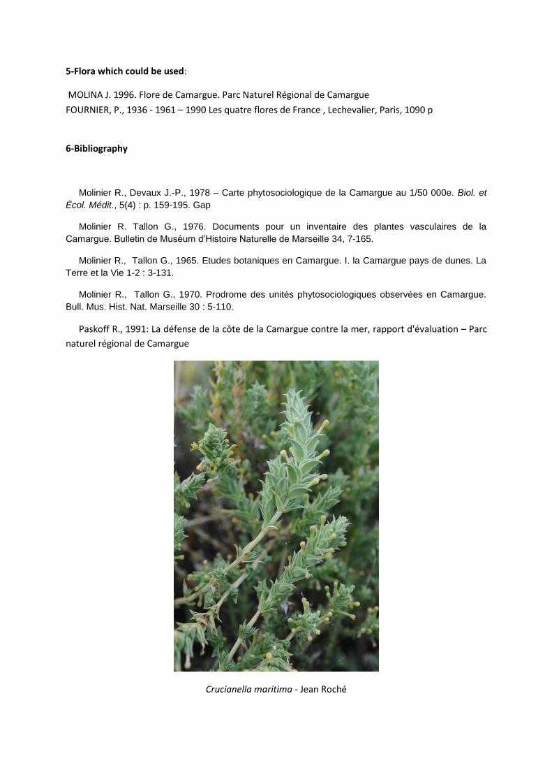
Crucianella maritima - Jean Roché

Day 3: Mediterranean steppe vegetation in La Crau area
Location of La Crau area and excursion point
Detail of Excursion route

1-Short description of the area
Name Plaine de Crau: Crau steppe area
Municipality St Martin de Crau, Arles, Miramas.
Département (county)
Bouches-du-Rhônes (13)
Ecosystem type
Mediterranean steppe
Management authority
CEEP (Conservatoire Etudes Ecosystèmes de Provence : Association for Nature Conservation in Provence)
Protection status
Special Protection Area, Special Conservation Area, Natura 2000, Nature Reserve
2-Ecological characteristics
The plain of La Crau is in southern Provence and extends over some 60,000 ha
in what was once the delta of the Durance river. This steppe-like region is
bordered to the west by the Rhône delta, to the east by the Berre lagoon, to the
north by the Alpilles (a small mountain range), and to the south by the
Mediterranean Sea. It was called the campus lapideus (the stone field) by the
Romans while several authors of the 19th century referred to it as monotonous
and uninteresting. Not surprisingly, it therefore attracted little scientific interest
and was poorly understood by ecologists and naturalists. Before the 20th
century, the steppe supported mainly shepherds and their flocks and was
visited only by the occasional geographer and/or naturalist. It was not until the
1950s that biologists began to investigate the La Crau exceptional habitats .
The plain of La Crau is of great biological importance. Its vegetation has been
shaped over centuries by :
-(1) a dry and windy Mediterranean climate (mean annual temperature 14°C;
mean annual precipitation ~500 mm; >3,000 hours of sunshine per year and
strong winds that blow on average 334 days annually);
-(2) most unusual soil conditions: soil is only about 40 cm deep and overlies a 5
to 25m thick impermeable bedrock that makes the watertable inaccessible to
plant roots. The topography is extremely flat and about 50% of the ground is
covered by large stones; and,
-(3) at least two thousand years of itinerant or mobile sheep grazing.
The vegetation of the steppe is dominated by Brachypodium retusum and
includes species, such as Asphodelus ayardii, Thymus vulgaris and the Poacea,
Merinos d’Arles sheep – the steppe -
Renaud Jaunatre

Stipa capillata. It is relatively homogeneous with patches of low-growing
vegetation consisting of the stonecrop, Crassula tillaea, lichens, liverworts,
mosses and cyanobacteria. There are no woody plants taller than 50 cm and
almost 50% are annual plant species that germinate mainly in autumn, spend
winter as seedlings, grow in the spring and flower from March to May or in
September. Most of the plant biomass is produced in spring and autumn. The
primary productivity of this steppe vegetation is estimated to be 2.1 tons of
dry matter/ha/year, which is similar to other steppe formations, such as in the
Sahel, Africa.
The uniqueness of the steppe is attributable to its overall floristic composition
and structure compared with other Brachypodium retusum plant communities
(e.g. garrigues which include Rosmarinus officinalis or Smilax aspera). Itinerant
sheep grazing has been the traditional land-use for several centuries and it is
the only vegetation management advocated to ensure the durability of the
steppe.
The steppe is a haven to several interesting birds including: the only French
population of breeding Pterocles alchata (pin-tailed sandgrouse), the largest
French population of Tetrax tetrax (little bustard) and one of the two French
populations of the globally threatened Falco naumanni (lesser kestrel). The
steppe also provides a habitat for Lacerta lepida (jeweled lizard), several
arthropod species among which an endemic apterous grasshopper,
Prionotropis rhodanica (hedgehog grasshopper), and an endemic Coleoptera,
Acmaeoderella perroti (Crau jewel beetle).
3-Excursion itinerary The excursion will go through the natural steppe areas and former arable
fields. Natural steppe communities will be dominated by characteristic
perennials: Brachypodium retusum, Thymus vulgaris, Stipa capillata and
Asphodelus ayardii. Species like Vulpia ciliata, Botryochloa ischaemum,
Convolvulus cantabrica, Reichardia picroides or Eryngium campestre will also
be well represented. Even in June, it will be possible to see some earlier
Spring annuals (Evax pygmaea,
Brachypodium distachyon, Salvia
verbenaca, etc.) Renaud Jaunatre
Asphodelus ayardii
Renaud Jaunatre
Prionotropis hystrix rhodanica
Renaud Jaunatre

annuals like Evax pygmaea, Sideritis romana, Plantago lagopus, Brachypodium
distachyon or Cynosurus echinatus. Some areas of the natural steppe have been
cultivated for melon production in the 70’s. Even after 40 years, plant communities are
still slightly different, dominated by other species: Bromus madritensis, Aegilops ovata,
Lobularia maritima, Calamintha nepeta or Euphorbia cyparicias. The route will join a
sheepfold, which will be surrounded by a characteristic belt of more nitrophilous
vegetation : Silybum marianum or Ecballium elaterium and then by Hordeum murinum
and Onopordum Illyricum (host of the endemic Coleoptera : Crau jewel beetle). To
complete the loop, we will walk next to the irrigation channel which sometimes floods
the steppe in winter and leads to a community dominated by Brachypodium
phoenicoides and Verbascum sinuatum. In the old well some ferns communities can
be present with species such as Scolopendrium sagittatum which is a protected
species in France. A look at the foundations of a former Roman sheepfold can give
an idea about the history of the traditional sheep grazing system which has been
used in this area for 2000 years.
4-Scientific themes which could be adressed:
From 2000 so far, important research programs were led to (i) identify the original ecosystems which
were present in the La Crau plain before the Neolithic, (ii) identify long-term changes in the
vegetation of ecosystems which are characterized by recurrent disturbance (here sheep grazing for
around 5000 to 6000 years, (iii) identify the impacts of land-use changes (intensification of
agricultural practices) on biodiversity, (iv) identify the original and reference ecosystems, (v) set up
operations of ecological restoration. These themes could be discussed and illustrated during the
walk.
6-Flora which could be used : Jauzein, 1995. Flore des Champs cultivés, INRA, France, 898p.
6-Selected References
Text and photos : Buisson Elise, Jaunatre Renaud, Daniel Pavon &
Dutoit Thierry.
UMR CNRS IRD université d’Avignon IMEP (Mediterranean Institute
of Ecology and Paleoecology).
IUT, Site agroparc, BP 1207, 84911 Avignon Cedex 9 – France
You can ask for following papers at this address :
Coiffait-Gombault C., Buisson E., Dutoit T. 2011. Hay transfer promotes
establishment of Mediterranean steppe vegetation on soils disturbed by
pipeline construction. Restoration Ecology 19, 214-222.
Henry F., Talon B. & Dutoit T., 2010. The age and the history of the French
Mediterranean steppe revisited by soil wood charcoal analysis. The
Holocene 20 : 25-34.
Evax pygmaea
Renaud Jaunatre
Onopordum illyricum next to an old
sheepfold
Renaud Jaunatre

Fadda S., Orgeas J., Ponel P., Buisson E. & Dutoit T., 2008. Conservation of remnant patches of steppe
did not enhance colonisation processes of ground beetles communities at their margins with former
cultivated plots. Environmental Conservation 35 : 109-116.
Fadda S., Henry F, Orgeas J., Ponel P., Buisson E. & Dutoit T., 2008. Consequences of the cessation of
3000 years of grazing on dry Mediterranean grassland ground-active beetle communities. Comptes
Rendus de Biologie 331 : 532-546.
Fadda S., Orgeas J., Ponel P., Buisson E. & Dutoit T., 2007 Past cultivation as a driving factor for the
organisation of dry grassland beetle communities (plain of La Crau, Bouches-du-Rhône, France).
Environmental Conservation 34 : 132-139.
Buisson E. & Dutoit T., 2006. Creation of the Natural Reserve of La Crau: implications for the creation
and management of protected areas. Journal of Environmental Management 80 : 318-326.
Buisson E., Dutoit T., Torre F., Römermann C., Poschlod P., 2006. The implications of seed rain and
seed bank patterns for plant succession at the edges of abandoned fields in Mediterranean
landscapes. Agriculture, Ecosystems & Environment 115 : 6-14.
Römermann C., Dutoit T., Poschlod P. & Buisson E. 2005. Influence of former cultivation on the unique Mediterranean steppe of France: Relationships between land-use history, soil and present-day vegetation. Biological Conservation 121:21-33. Buisson E. & Dutoit T. 2004. Colonisation by native species of abandoned farmland adjacent to a remnant patch of Mediterranean steppe. Plant Ecology, 174:371-384.
The steppe landscape -Renaud Jaunatre

Day 3: Bonnieu
Location of Bonnieu area
Name Plaine de Bonnieu – Bonnieu area
Municipality Martigues
Département (county) Bouches-du-Rhônes (13) Ecosystem type
Mediterranean annuals grassland
Protection status
Special Protection Area, Special Conservation Area, Natura 2000, Nature Reserve

Bellis annua grassland – Renaud Jaunatre
The Bonnieu area is a sandy miocenic molasse coastal plain exposed to a cool marine breeze which
thus benefits from cool temperatures in winter and exhibit a very original vegetation with many
annuals and bulbous plants like Allium chamaemoly, Gagea mauritanica, Merendera filifolia or
Hyoseris scabra.
The walk will go through typical Mediterranean shrublands and pinewoods, species-rich annuals and
bulbous grasslands and embryonic sand dunes. The difficulty of conservation of such ecosystems
which are in the center of many anthropogenic pressures (tourist overcrowding, industrial buildings
and pollution, etc.) will be discussed and very well illustrated during the walk, especially with the
presence of the nationally protected Convolvulus lineatus of which the distribution is almost limited
to parking areas.
Convolvulus lineatus – Renaud Jaunatre

Day 4: Calanques
Location of Calanques
Detail of excursion route
Sormiou Calanques – Daniel Pavon

1-Short description of the area
Name Calanques de Marseille
Municipality Marseille - Luminy
Département (county) Bouches-du-Rhône (13)
Ecosystem type Calcareous mattoral and sea cliff
Management authority National Forest Office (ONF) – Littoral conservatory
Protection status National Park Project
2-Ecological characteristics
Located almost entirely in Marseille area, Calanques cliffs stand on the Mediterranean sea. This
wildlife sanctuary close to the center of Marseille hosts a unique flora and fauna which are often
unknown from the numerous visitors. The Calanques is a huge limestone massif facing the sea. This
sedimentary rock was formed on the ancient sea bed by an accumulation of fragments of various
origins. Thus, you will find a flora adapted to a calcareous soil with basic pH. In addition, rain water
quickly drains down to the subsoil through a deep fault system, further accentuating soil aridity.
Average annual rainfall for the city of Marseille is usually around 600 to 700 mm. However, much of
the coast of Marseille and more specifically Cape Croisette, is located under a Mediterranean semi-
arid climate with 400-500 mm of annual rainfall. The Mistral, which blows from the north-west is the
prevailing wind in western Provence and increases the dryness of the Calanques.
3- Vegetation
Six large phytoecologic areas can be distinguished in the Calanques :
Seaside vegetation: halophile communities
These communities are composed of plants capable of undergoing high concentrations of salt and
are mainly found on rocks and cliffs overlooking the sea. Some of these communities can be found
further inland where the coast is gently sloping. The amount of salt in soils depends heavily on the
wind during storms and the spray which carries salt inland. The salinity is not favorable to settlement
of a diverse flora but leads to the presence of an original and adapted one.
Halophytic and halo-resistant communities are found close to the sea and host remarkable species
now critically endangered, such as Astragalus tragacantha, Plantago subulata, Silene sedoides,
Thymelaea tartonraira, etc..
Plantago subulata – Daniel Pavon Astragalus tragacantha – Daniel Pavon

Ophrys aranifera subsp.
massiliensis Daniel
Pavon
Sub-littoral communities
When soil salt is no longer a dominant factor, we observe the
settlement of a flora more representative of the entire area. These
Pistacia lentiscus communities constitute an homogeneous coastal belt
which is embedded in the schrubland. In the valleys with a temperate
coastal ambience they are associated with some rare Myrtus communis
and Ophrys aranifera subsp. massiliensis. Euphorbia dendroides is also
characteristic of these sub-littoral communities.
From dry grassland to schrubland to pinewood
The schrubland is a legacy of several millenaries of fire use. All species
that we observe are therefore fire resistant. Fires are not an ecological
disaster for these environments and plant species, if the fire regime
remains moderate (one ever 100 years or so). The Mediterranean
schrubland is a more or less dense and small form of vegetation which is constituted by a flora with
various colors and scents. It can be very spaced and leads to natural dry grasslands or very dense
with a tree layer of Pinus halepensis. Usually, there is a massive expanse of Brachypodium retusum,
mixed with Quercus coccifera, Rosmarinus officinalis, Cistus spp. and Erica multiflora. The older pines
are seen today in the immediate vicinity of the city, from the Roy d’Espagne to Luminy. Deep valley
bottoms and northern flanks host here and there hardwoods such as Quercus pubescens or Acer
monspessulanus.
Screes
Calcareous screes are omnipresent in the Calanques and host a particuliar vegetation including the
Marseille areas endemic Caryophyllaceae : Gouffeia arenarioides = Arenaria provincialis.
Crests and summits
Most of Provence small mountain ridges reveal their wealth to the braves who reach their peak.
Puget Mount, close to Luminy, provides a unique scenic viewpoint on the coastline from Marseille to
Cassis. Harsh local climatic conditions (regular strong winds and large temperature amplitude) favor
typical hedgehog-like schrubland with some Provence endemic species like Genista lobelii or
Santolina decumbens.
Gouffeia arenarioides = Arenaria provincialis – Daniel Pavon Erica multiflora – Daniel Pavon

Fauna:
The very open landscape provides a habitat for numerous animal species, from invertebrate to
mammals. During the excursion we certainly will hear famous cicadas. Among them, Cicada orni
which has 11 black points on the wings and which lives in pinewood and Tibicina garricola which has
6 yellow circle spots on the thorax and lives in schrublands. Some remarkable butterflies should be
observable, Zerynthia rumina, which is protected and which lives on Aristolochia pistolochia or
Charaxes jasius whose larvae feeds on Arbutus unedo. The Calanques host also a rare mollusk:
Tudorella sulcata. Some reptiles like the gecko Hemidactylus turcicus, the lizard Timon Lepidus or the
snake Malpolon monspessulanus. Many birds are found in the Calanques optimal habitats to nest or
to hunt: some cliff birds like the Peregrine falcon Falco peregrinus, the blue rock thrush Monticola
solitarius or the endangered Bonnelli’s eagle Hieraaetus fasciatus; some schrubland birds like the
Sardinian warbler Sylvia melanocephala, Dartforb warbler Sylvia undata, the Black eared wheatear
Oenanthe hispanica or the European stonechat Saxicola torquata. Some bat species lives on the
cliffs, including the largest bat of France: Tadarida teniotis and the smallest European mammal:
Suncus etruscus.
Hemidactylus turcicus – Daniel Pavon Cicada orni – Daniel Pavon
More than 60 bird species which live in the Calanques are
protected, five mammals and all reptiles and amphibians are also
protected on the site. It contains about 50 plant species of
interest and about 30 are protected by law. Other prospecting
work should be conducted to assess more precisely the
Calanques richness. Although the naturalistic importance of the
site is obvious and while human activities are still increasing
(overcrowding of coastal areas, etc.), there is no protection
status regulating the Calanques with the exception of the lands
of the Littoral Conservatory and National Forest Office. A Public
Interest Group (GIP Calanques Marseille Cassis) was established
in order to change this situation and to create the first peri-
urban National Park.
Morgiou Calanques
Renaud Jaunatre

Day 4: Sainte Baume
Location of Excursion
1-Short description of the area
Name Sainte Baume
Département (county) Bouches-du-Rhône (13) – Var (83)
Ecosystem type Beech forest and Provence ridges
Genista lobelii – Daniel Pavon

Beech forest
Saxifraga callosa subsp. catalaunica
Daniel Pavon
2-Ecological characteristics
The Sainte-Baume massif, which straddles the departments of Bouches-du-Rhône and Var is an important forested mountainous entity. It is located just 30 km east of Marseille and 22 km from the sea and culminates at 1,178m. It includes a large unfragmented forest patch with a high diversity of flora and fauna.
On the shady side of the mountain at the bottom of the cliffs, there is a deciduous forest (Quercus pubescens, Acer spp., etc.) dominated in some places by beech (Fagus sylvatica). Trees are also represented by holly (Ilex aquifolium) and the yew (Taxus baccata). Some herbaceous species such as the Lilium martagon
are very original for the region. This plant community is not uncommon in mid-European region, but exceptional in south Provence coasts. Its stability seems guaranted by its location (north-facing side of the mountain), and by the local microclimate maintained in part by the presence of the forest. While this area of south Provence receives an average of almost 700 mm of rainfall per year, the forest of Sainte Baume receives about 1,000 mm.
Another point of interest is in the summit ridge. These sectors, which have played a role as a refuge during periods of climate change, host original plant species. There is a habitat of "hedgehog-like heath" dominated mainly by two species endemic from Provence, Genista lobelii and Santolina decumbens, and by the Juniperus phoenicea, a rupicolous shrub of wider distribution in the Mediterranean area. On these ridges, ledges and cliffs facing north also house original features such as Saxifraga callosa subsp. catalaunica, an endemic of the Alps and SW of Catalonia, or even Silene saxifraga, orophytes from southeastern Europe.
Southern slopes are constituted by more typical pinewoods and shrublands, surrounded by some very species-rich dry grasslands or pastures (Jurinea humilis, Fritillaria involucrata, Gagea spp., Tulipa australis, etc.).

Santolina decumbens
Daniel Pavon
Jurinea humilis
Daniel Pavon
.
Sainte-Baume ridge – Daniel Pavon
The route will go through the fresh and shaddy beech forest of the north face in order to join the ridge by the Saint Pilon pass (962m). Here, we will see many plant species, but don’t forget to have a look to the very scenic view, from the Mediterranean sea to the Ecrins.

Day 5 : Ecrins National Park
Location of Ecrins National Park and points of interest
1-Short description of the area
Name Ecrins National park
Département (county) Isère (38) and Hautes-Alpes (05)
Management authority French National Park
Protection status National Park

2-The Park Situated between Gap, Grenoble and Briançon, the Ecrins National Park is bounded by the watersheds of the Romanche to the north, the Guisane and Durance to the east and south, and the Drac to the west. The high mountain area is structured around the chain of major peaks, and the complex massif culminates in the Barre des Ecrins at 4,102 m. More than 150 peaks are over 3,000 m high, and the valley floors are at around 1,000 m above sea level.
Lautaret pass – Ecrins National Park Pulsatilla montana – Ecins National Park
Ecrins National Park has been created in 1973 and, like other French National Parks, is made up of a core and partnership zone. The core zone is a protected and unspoiled area which is subject to special rules, whereas the partnership zone is governed by a convention adopted by the relevant communes. The park status is reviewed every 15 years, and each park represents an ecological partnership between the core zone and surrounding areas whereby the economic value of the natural resources is promoted along with sustainable development in the communes. Each national park is managed by a public body affiliated to the Ministry for Ecology and Sustainable Development.
2-Ecological characteristics
As in all mountain landscapes, vegetation is
distributed along an altitudinal gradient. This
distribution comes from temperature
variations with altitude. The thermal
gradient, about 0.5°C by 100m of elevation,
causes an indirect zonation of water, soil
and rural utilization. Altitude alone is not a
good predictor of biological conditions.
Boundaries between zones are higher in
north faces (ubacs) than in south faces
(adrets) and higher in intern Alps (Durance
valley) than in the middle Alps (Drac or
Romanche valleys).

Eryngium alpinum – Ecrins National Park
Lilium martagon Renaud Jaunatre
Dryas octopetala Renaud Jaunatre
Potentilla delphinensis Ecrins National Park
Each altitudinal zone corresponds to a 4°C difference in average annual temperature. The vertical succession of zones, from the supra-Mediterranean conditions to alpine and nival conditions, reproduces the climatic variations which are approximately the same between temperate Europe areas and Arctic areas. Growth of most plants requires a night temperature above 0°C. The physiological activity is effective for an average daily temperature above 5°C. The growing season decreases from 6 to 7 days by 100m of elevation. From 8 months at 1,000m, it is only 2 ½ months at 2,400m.
The number of species remains high up to 2,000m and then decreases. Species richness becomes very low above 3,000 m. Cosmopolitan and Eurasian species are present on Ecrins areas, but they are particularly dominant in the forests (Lilium martagon, Cypripedium calceolus) and in wetlands. Mediterranean species, like Cotinus coggygria or Aristolochia pistolochia, spread through the low elevation valleys. For example, the Durance is an axis of penetration of Mediterranean species into the area. A steppe-like vegetation is most common from Embrun to L'Argentière-la-Bessée (Astragalus alopecurus, Pulsatilla montana). The Mediterraneo-montane species (Astragalus
sempervirens) are more abundant on the southern slopes. Endemics of the Western Alps are represented by few species (Berardia subacaulis or Potentilla delphinensis). Orophytes, which are species restricted to mountain areas, represents the most characteristic group of the

Carex bicolor – Ecrins National Park
Carex bicolor – Ecrins National Park
National Park (Leontopodium alpinum, Campanula thyrsoides). Arctico-alpine species were widespread distributed in plains during the last ice age and then took refuge in the Arctic and the Alps during the postglacial warming of the last ten millennia: Silene acaulis, Dryas octopetala or Salix herbacea. Over 1,800 different plants have been identified in the National Park. Around 168 plant species are of particular value, from protected species (Eryngium alpinum) to species classified in the French red list of rare and endangered species (Cotoneaster atlanticus, Prunus brigantica).
Lichens are found everywhere, and are often the last outposts of the plant world, tinting the screes and giving every site its own personalized color scheme. The plant life is evolving as the climate changes. We are seeing a dramatic decline in species dating back to the Ice Ages (Betula pubescens, Carex bicolor) whilst the aspen, which traditionally grows on the plains, is taking over the heaths and rocky ground. The Ecrins National Park therefore needs proactive conservation policies, and relies on flower registers and a map of the natural environments. 3-Excursion itinerary
First, we will stop on the Durance-made sub-steppic grasslands. This environment is influenced by a
continental-type climate in the inner Alps and by a particular geology of the Durance river former
alluvial terraces. Then, we will focus on the grazed alpine grasslands of the Lautaret and Galibier
passes where some artico-alpine species still occur. Discussions will tackle land-uses and crowding
issues, speciation of plant species and particularities of alpine plant species.
Durance steppe-like grasslands – Ecrins National
Park
Durance Valley – Ecrins National Park
5-Flora which could be used:
Aeschimann D, Burdet H, Arnoux A, Palese R, Perret P. 1994 Flore de la Suisse et des territoires
limitrophes: le nouveau Binz. 2nd ed. Neuchatel: Editions du Griffon lxxi, 603p.
Lauber, K., and G. Wagner. 2000. Flora helvetica: flore illustrée de Suisse. [E. Gfeller, translator.] Belin, Paris, France.
6-Bibliography
http://www.ecrins-parcnational.fr/

Organizer:
Renaud Jaunatre (University of Avignon) [email protected]
Nadège Botia (University of Lyon) [email protected]
People in charge:
Elise Buisson (University of Avignon & IMEP)
Cédric Dentant (Ecrins National Park, Gap)
Thierry Dutoit (University of Avignon & IMEP)
Patrick Grillas (Tour du Valat, Arles)
François Mesléard (University of Avignon & Tour du Valat)
Daniel Pavon (University Paul Cézanne, Marseille & IMEP)
Arne Saatkamp (University Paul Cézanne, Marseille & IMEP)
Axel Wolff (Association for Nature Conservation in Provence: CEEP, Saint Martin de Crau)
Nicole Yasercovski (Tour du Valat, Arles)
www.imep-cnrs.com