phase 1 archaeological impact assessment report: proposed...
TRANSCRIPT
Phase 1 Archaeological Impact Assessment Report:
Proposed 132kV Power Line and Substation Infrastructure,
Melkhout-Patensie,
Kouga Local Municipality,
Cacadu District,
Eastern Cape Province, South Africa
Prepared for
GIBB Engineering & Science 2nd Floor, Greyville House, Cnr Greyville & Cape Roads,
Greenacres, Port Elizabeth 6001 Box 63703, Greenacres 6057
Telephone Walter Fyvie 041 392 7510 Fax 086 608 2522 [email protected]
Prepared by
ETHEMBENI
CULTURAL
HERITAGE Elizabeth Wahl and Len van Schalkwyk
Box 20057 Ashburton 3213 Pietermaritzburg Telephone 033 326 1136 / 082 655 9077 / 082 529 3656
Facsimile 086 672 8557 [email protected]
8 May 2013
Phase 1 AIA of Melkhout-Patensie 132kV Power Line and Substation, Cacadu District, Eastern Cape Province, South Africa
eThembeni Cultural Heritage for GIBB Engineering & Science Page 2
MANAGEMENT SUMMARY
eThembeni Cultural Heritage was appointed by GIBB Engineering & Science to undertake a Phase 1
Archaeological Impact Assessment of a proposed transmission power line and substation site in the Eastern
Cape Province, in terms of the National Environmental Management Act 107 of 1998 as amended, in
compliance with Section 38 of the National Heritage Resources Act 25 of 1999, as amended.
LOCATION AND ENVIRONMENT
The proposed power line extends from north of the town of Humansdorp to the town of Patensie in the
Kouga Local Municipality, Cacadu District. In general the proposed power line route traverses level to gently
undulating topography in the southern portion, becoming hilly and mountainous towards Hankey along the
Gamtoos River, before passing into the broad Gamtoos River floodplain. The northern and southern portions
of the proposed power line route have been transformed by agricultural activities, while the central section is
dominated by a hilly environment that would have been inhospitable to past human settlement.
ARCHAEOLOGICAL HERITAGE
The general area around the towns of Hankey and Patensie has been a focus point of KhoiSan activity in
historical times, and today is a centre of the Gamtkwa KhoiSan Council. Important Later Stone Age
archaeological sites are present in the general study area.
ARCHAEOLOGICAL SURVEY RESULTS
We assessed the proposed tower positions and new/upgraded access roads at numerous points along
the proposed power line route, but identified no archaeological remains whatsoever. This observation is
congruent with the findings of other impact assessments in the area and reflects the transformed vegetation
and land uses.
ASSESSMENT OF DEVELOPMENT IMPACTS
The definitions of archaeological sites and remains and many archaeological terms imply an emphasis on
their technological, scientific and historical values. However, credible heritage practitioners globally
recognise the value and importance of this heritage to extant communities. In this context archaeological
sites and remains with low significance for their scientific value might be imbued with high significance for
specific communities or interest groups for their spiritual, social and cultural values.
However, since we observed no archaeological remains of any nature, and the archaeological sensitivity
of the study area is relatively low, the potential overall impact of the proposed project on archaeological sites
is low.
PUBLIC PARTICIPATION
The Gamtkwa KhoiSan Council reviewed the Phase 1 Heritage Impact Assessment report for this project
and supported the recommendation that a heritage practitioner inspect areas of construction for the
presence of archaeological and palaeontological sites. GIBB Engineering & Science will submit this report to
the Council who will submit their written comments directly to GIBB.
CONCLUSION
We recommend that the development proceed with no further archaeological mitigation and have
submitted this report to SAHRA in fulfilment of the requirements of the NHRA.
If permission is granted for development to proceed, the client is reminded that the NHRA requires that a
developer cease all work immediately and follow the protocol contained in Section 8 of this report should any
heritage resources, as defined in the Act, be discovered during the course of development activities.

Phase 1 AIA of Melkhout-Patensie 132kV Power Line and Substation, Cacadu District, Eastern Cape Province, South Africa
eThembeni Cultural Heritage for GIBB Engineering & Science Page 3
CONTENTS MANAGEMENT SUMMARY...................................................................................................................................... 2
1 INTRODUCTION ............................................................................................................................................ 4
2 TERMS OF REFERENCE ................................................................................................................................ 4
3 PROJECT DESCRIPTION ................................................................................................................................ 5
4 PROJECT LOCATION AND ENVIRONMENTAL DESCRIPTION ............................................................................... 6
5 ARCHAEOLOGICAL BACKGROUND ............................................................................................................... 11
6 ARCHAEOLOGICAL SURVEY RESULTS .......................................................................................................... 15
7 ASSESSMENT OF DEVELOPMENT IMPACTS ................................................................................................... 17
8 PROTOCOL FOR THE IDENTIFICATION, PROTECTION AND RECOVERY OF HERITAGE RESOURCES DURING
CONSTRUCTION AND OPERATION ......................................................................................................................... 18
9 CONCLUSION ............................................................................................................................................ 19
10 BIBLIOGRAPHY .......................................................................................................................................... 19
APPENDIX A STATUTORY REQUIREMENTS ...................................................................................................... 21
APPENDIX B METHODOLOGY .......................................................................................................................... 23
APPENDIX C SPECIALIST COMPETENCY AND DECLARATION OF INDEPENDENCE ................................................ 34
LIST OF FIGURES FIGURE 1 LOCATION OF THE PROPOSED PROJECT IN REGIONAL CONTEXT, WITH THE MELKHOUT-PATENSIE
SECTION INDICATED IN RED (SOURCE: GIBB). ........................................................................................................ 6 FIGURE 2 THE START OF THE PROPOSED POWER LINE AT THE PROPOSED PATENSIE SUBSTATION. ...................... 7 FIGURE 3 THE PROPOSED POWER LINE ROUTE SOUTH-WEST OF HANKEY. .......................................................... 8 FIGURE 4 THE LOCATION OF THE PROPOSED POWER LINE NORTH-WEST OF HUMANSDORP. ................................. 9 FIGURE 5 THE FINAL SECTION OF THE PROPOSED POWER LINE TO MELKHOUT SUBSTATION. ............................. 10 FIGURES 6 & 7 INTENSIVE AGRICULTURE IN THE GAMTOOS RIVER VALLEY. ....................................................... 15 FIGURE 8 LOCATION OF TOWER 85 IN THE GAMTOOS VALLEY. ......................................................................... 15 FIGURE 9 AGRICULTURE AND FYNBOS SOUTH OF WESTON. ............................................................................. 15 FIGURE 10 LOCATION OF TOWER 56. ............................................................................................................... 16 FIGURE 11 FACING NORTH FROM TOWER 52. ................................................................................................... 16 FIGURE 12 FACING SOUTH FROM TOWER 52..................................................................................................... 16 FIGURE 13 FACING NORTH FROM TOWER 51. ................................................................................................... 16 FIGURE 14 FACING SOUTH FROM TOWER 51..................................................................................................... 16 FIGURE 15 AGRICULTURE AT TOWER 16. ......................................................................................................... 16 FIGURE 16 TRANSFORMED LANDSCAPE AT TOWER 8......................................................................................... 17 FIGURE 17 MELKHOUT SUBSTATION. ................................................................................................................ 17 FIGURE 18 SURVEY ROUTE: TOWERS 100-84. .................................................................................................. 24 FIGURE 19 SURVEY ROUTE: TOWERS 85-68. .................................................................................................... 24 FIGURE 20 SURVEY ROUTE: TOWERS 84-72. .................................................................................................... 25 FIGURE 21 SURVEY ROUTE: TOWERS 78-65. .................................................................................................... 25 FIGURE 22 SURVEY ROUTE: TOWERS 64-51. .................................................................................................... 26 FIGURE 23 SURVEY ROUTE: TOWERS 53-43. .................................................................................................... 26 FIGURE 24 SURVEY ROUTE: TOWERS 43-31. .................................................................................................... 27 FIGURE 25 SURVEY ROUTE: TOWERS 31-20. .................................................................................................... 27 FIGURE 26 SURVEY ROUTE: TOWERS 20-7. ...................................................................................................... 28 FIGURE 27 SURVEY ROUTE: TOWERS 9-1. ........................................................................................................ 28
LIST OF TABLES TABLE 1 POTENTIAL IMPACT ON ARCHAEOLOGICAL SITES. .............................................................................. 17 TABLE 2 SUMMARY OF INSPECTION OF PROPOSED TOWER LOCATIONS. .......................................................... 23

Phase 1 AIA of Melkhout-Patensie 132kV Power Line and Substation, Cacadu District, Eastern Cape Province, South Africa
eThembeni Cultural Heritage for GIBB Engineering & Science Page 4
1 INTRODUCTION
eThembeni Cultural Heritage was appointed by GIBB Engineering & Science to undertake a Phase 1
Archaeological Impact Assessment (AIA) of a proposed transmission power line and substation site in the
Eastern Cape Province, in terms of the National Environmental Management Act 107 of 1998 as amended
(NEMA), in compliance with Section 38 of the National Heritage Resources Act 25 of 1999, as amended
(NHRA; refer to Appendix A).
South Africa’s heritage resources are both rich and widely diverse, encompassing sites from all periods
of human history. Resources may be tangible, such as buildings and archaeological artefacts, or intangible,
such as landscapes and living heritage. Their significance is based upon their aesthetic, architectural,
historical, scientific, social, spiritual, linguistic, economic or technological values; their representivity of a
particular time period; their rarity; and their sphere of influence.
The integrity and significance of heritage resources can be jeopardized by natural (e.g. erosion) and
human (e.g. development) activities. In the case of human activities, a range of legislation exists to ensure
the timeous identification and effective management of heritage resources for present and future
generations.
This report represents compliance with a full Phase 1 AIA for the proposed development, for submission
to the Eastern Cape Provincial Heritage Resources Authority (ECPHRA) for review.
2 TERMS OF REFERENCE
An AIA must address the following key aspects:
the identification and mapping of all archaeological sites in the area affected;
an assessment of the significance of such sites in terms of heritage assessment criteria set out in
regulations;
an assessment of the impact of the development on archaeological sites;
an evaluation of the impact of the development on archaeological sites relative to the sustainable social
and economic benefits to be derived from the development;
the results of consultation with communities affected by the proposed development and other interested
parties regarding the impact of the development on archaeological sites;
if archaeological sites will be adversely affected by the proposed development, the consideration of
alternatives; and
plans for mitigation of any adverse effects during and after completion of the proposed development.
In addition, the AIA should comply with the requirements of NEMA, including providing the assumptions
and limitations associated with the study; the details, qualifications and expertise of the person who prepared
the report; and a statement of independence.

Phase 1 AIA of Melkhout-Patensie 132kV Power Line and Substation, Cacadu District, Eastern Cape Province, South Africa
eThembeni Cultural Heritage for GIBB Engineering & Science Page 5
3 PROJECT DESCRIPTION1
New 132 kV overhead transmission power lines are proposed to strengthen and upgrade the grid supply
in the Patensie, Humansdorp and Kareedouw area of the Eastern Cape in order to support the recent and
planned growth and development in the area. An upgrade of the existing electrical distribution network is
therefore required to accommodate the new supply. This involves the construction of new 132 kV
infrastructure, new substations and the decommissioning of certain facilities. The construction of new and
upgrading of existing substations will further aid in strengthening of the local network. The total length of the
proposed power lines amounts to approximately 90km. This project entails the following:
Construction of approximately 28 km of overhead 132kV power line from Melkhout to Patensie
Substations.
Construction of a new 2x20MVA 132/22 kV substation.
Decommissioning of redundant infrastructure once new infrastructure has been commissioned.
Construction of new or maintenance of existing minor roads.
Potential need for minor bridge/s across a water course.
1 Information obtained from Background Information Document prepared by the client.

Phase 1 AIA of Melkhout-Patensie 132kV Power Line and Substation, Cacadu District, Eastern Cape Province, South Africa
eThembeni Cultural Heritage for GIBB Engineering & Science Page 6
4 PROJECT LOCATION AND ENVIRONMENTAL DESCRIPTION
The proposed power line extends from north of the town of Humansdorp to the town of Patensie in the
Kouga Local Municipality (EC108), Cacadu District (DC10) in the Eastern Cape Province (Figure 1). The
relevant Surveyor-General 1:50 000 maps are 3324DD Hankey and 3424BB Humansdorp (Figures 2-5;
melkhout-patensie 132kv final design.kmz).
FIGURE 1 LOCATION OF THE PROPOSED PROJECT IN REGIONAL CONTEXT, WITH THE MELKHOUT-PATENSIE SECTION INDICATED IN RED
(SOURCE: GIBB).
Topography2
In general the proposed power line route traverses level to gently undulating topography in the southern
portion, becoming hilly and mountainous towards Hankey along the Gamtoos River, before passing into the
broad Gamtoos River floodplain.
2 Source: Pote (2012).

3324DD Hankey
ProposedPatensie Substation
FIGURE 2 THE START OF THE PROPOSED POWER LINE AT THE PROPOSED PATENSIE SUBSTATION.
Vegetation3
The perceived reference state of the vegetation along the route is intact natural vegetation. The dominant
vegetation type present along the southern portion is Kouga Grassy Sandstone Fynbos (Least Threatened).
Towards the north, the route passes through bands of Humansdorp Shale Renosterveld (Endangered),
Loerie Conglomerate Fynbos (Least Threatened) and drainage lines with Gamtoos Thicket (Least
Threatened). Within the Gamtoos River Valley, the route traverses the Gamtoos River floodplain within
predominantly transformed Albany Alluvial Vegetation (Endangered) as well as transformed and degraded
Gamtoos Thicket.
An assessment of the present ecological state of these key vegetation types indicates that historical
agriculture related land-uses have resulted in degradation of portions of the route, most notably as a result of
crops, pastures and orchards in flat lower lying areas especially in the Gamtoos River Valley, and to some
extent from regular burning of grazing areas on mountain and hill slopes and in the southern areas with
Kouga Grassy Sandstone Fynbos.
3 Source: Pote (2012).

Phase 1 AIA of Melkhout-Patensie 132kV Power Line and Substation, Cacadu District, Eastern Cape Province, South Africa
eThembeni Cultural Heritage for GIBB Engineering & Science Page 8
3324DD Hankey
FIGURE 3 THE PROPOSED POWER LINE ROUTE SOUTH-WEST OF HANKEY.
A summary of the present ecological state of the key vegetation types is provided below.
Kouga Grassy Sandstone Fynbos
This is the predominant vegetation unit along the southern portion of the servitude, somewhat degraded
and with an abundance of grasses as a result of frequent burning to promote grazing lands on farms.
Regular burning has altered the species composition in some areas that could be described as near-
natural, but large parts are still relatively natural and intact.
Scattered ephemeral wetlands and seeps are present throughout the landscape.
Alien vegetation invasion tends to be scattered and at low densities.
Humansdorp Shale Renosterveld
No intact Humansdorp Shale Renosterveld is present along the route as a result of agricultural cultivation.
Loerie Conglomerate Fynbos
A band is present on the mountainous and hilly areas south of the Gamtoos River, but only affected by
the proposed power line for a short, but hilly section mostly disturbed and adjacent to the road.
Incised drainage lines fragment the hilly terrain periodically with Gamtoos Thicket often becoming
established.
In some areas, composition has been altered through farm management practices which could be
described as near-natural, but large parts still relatively natural and intact.
Exotic invasives tend to be scattered and at low densities. Some isolated dense clumps of exotic trees
(such as Prickly Pear) are present along the proposed route and may require removal before the power
line can be installed.
Phase 1 AIA of Melkhout-Patensie 132kV Power Line and Substation, Cacadu District, Eastern Cape Province, South Africa
eThembeni Cultural Heritage for GIBB Engineering & Science Page 9
3324DD Hankey
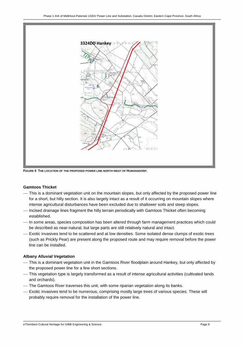
FIGURE 4 THE LOCATION OF THE PROPOSED POWER LINE NORTH-WEST OF HUMANSDORP.
Gamtoos Thicket
This is a dominant vegetation unit on the mountain slopes, but only affected by the proposed power line
for a short, but hilly section. It is also largely intact as a result of it occurring on mountain slopes where
intense agricultural disturbances have been excluded due to shallower soils and steep slopes.
Incised drainage lines fragment the hilly terrain periodically with Gamtoos Thicket often becoming
established.
In some areas, species composition has been altered through farm management practices which could
be described as near-natural, but large parts are still relatively natural and intact.
Exotic invasives tend to be scattered and at low densities. Some isolated dense clumps of exotic trees
(such as Prickly Pear) are present along the proposed route and may require removal before the power
line can be installed.
Albany Alluvial Vegetation
This is a dominant vegetation unit in the Gamtoos River floodplain around Hankey, but only affected by
the proposed power line for a few short sections.
This vegetation type is largely transformed as a result of intense agricultural activities (cultivated lands
and orchards).
The Gamtoos River traverses this unit, with some riparian vegetation along its banks.
Exotic invasives tend to be numerous, comprising mostly large trees of various species. These will
probably require removal for the installation of the power line.

Phase 1 AIA of Melkhout-Patensie 132kV Power Line and Substation, Cacadu District, Eastern Cape Province, South Africa
eThembeni Cultural Heritage for GIBB Engineering & Science Page 10
MelkhoutSubstation
3424BB Humansdorp
3324DD Hankey
FIGURE 5 THE FINAL SECTION OF THE PROPOSED POWER LINE TO MELKHOUT SUBSTATION.

Phase 1 AIA of Melkhout-Patensie 132kV Power Line and Substation, Cacadu District, Eastern Cape Province, South Africa
eThembeni Cultural Heritage for GIBB Engineering & Science Page 11
5 ARCHAEOLOGICAL BACKGROUND
The NHRA defines the term ‘archaeological’ as follows:
material remains resulting from human activity which are in a state of disuse and are in or on land and
are older than 100 years, including artefacts, human and hominid remains and artificial features and
structures;
rock art, being any form of painting, engraving or other graphic representation on a fixed rock surface or
loose rock or stone, which was executed by human agency and is older than 100 years including any
area within 10 m of such representation;
wrecks, being any vessel or aircraft, or any part thereof, which was wrecked in South Africa, whether on
land, in the internal waters, the territorial waters or in the culture zone of the Republic, as defined
respectively in sections 3, 4 and 6 of the Maritime Zones Act 15 of 1994, and any cargo, debris or
artefacts found or associated therewith, which is older than 60 years or which SAHRA considers to be
worthy of conservation;
features, structures and artefacts associated with military history which are older than 75 years and the
sites on which they are found.
In archaeological terms South Africa’s prehistory has been divided into a series of phases based on
broad patterns of technology. The primary distinction is between a reliance on chipped and flaked stone
implements (the Stone Age), the ability to work iron (the Iron Age) and the Colonial Period, characterised by
the advent of writing and in southern Africa primarily associated with the first European travellers (Mitchell
2002). Spanning a large proportion of human history, the Stone Age in Southern Africa is further divided into
the Early Stone Age, or Paleolithic Period (about 2 500 000–150 000 years ago), the Middle Stone Age, or
Mesolithic Period (about 500 000–30 000 years ago), and the Late Stone Age, or Neolithic Period (about 30
000–2 000 years ago). The simple stone tools found with australopithecine fossil bones fall into the earliest
part of the Early Stone Age.
To understand the archaeological context of the study area it is important to recognise the geographical
division between the drier western third of southernmost Africa and the more humid, entirely summer rainfall
region to its east (Mitchell & Whitelaw 2005). Because they farmed with summer rainfall crops such as
sorghum and millet, Iron Age people were limited to the Miombo and Savannah biomes east of the 500mm
isohyet; therefore excluded from much of the continent’s western third by aridity (Maggs 1994). Accordingly
a description of the Iron Age is omitted from this report.
The Stone Age
Early Stone Age (ESA)
Most Early Stone Age sites in South Africa are probably associated with the hominin species Homo
erectus. Simply modified stones, hand axes, scraping tools, and other bifacial artifacts had a wide variety of
purposes, including butchering animal carcasses, scraping hides, and digging for plant foods. Most South
African archaeological sites from this period are the remains of open camps, often by the sides of rivers and
lakes, although some are located in rock shelters, such as Montagu Cave in the Cape.
ESA archaeological sites in the general study area are found in the river gravels that cap hill slopes in the
Humansdorp and Kareedouw regions and on the calcrete floors exposed in the dune systems along the
coast towards Cape St Francis (Binneman 2004/5 & 2006/7). The large stone artefacts are classified by
archaeologists as belonging to the Acheulean Industry dating to between 1.5 million and 250 000 years ago.
Phase 1 AIA of Melkhout-Patensie 132kV Power Line and Substation, Cacadu District, Eastern Cape Province, South Africa
eThembeni Cultural Heritage for GIBB Engineering & Science Page 12
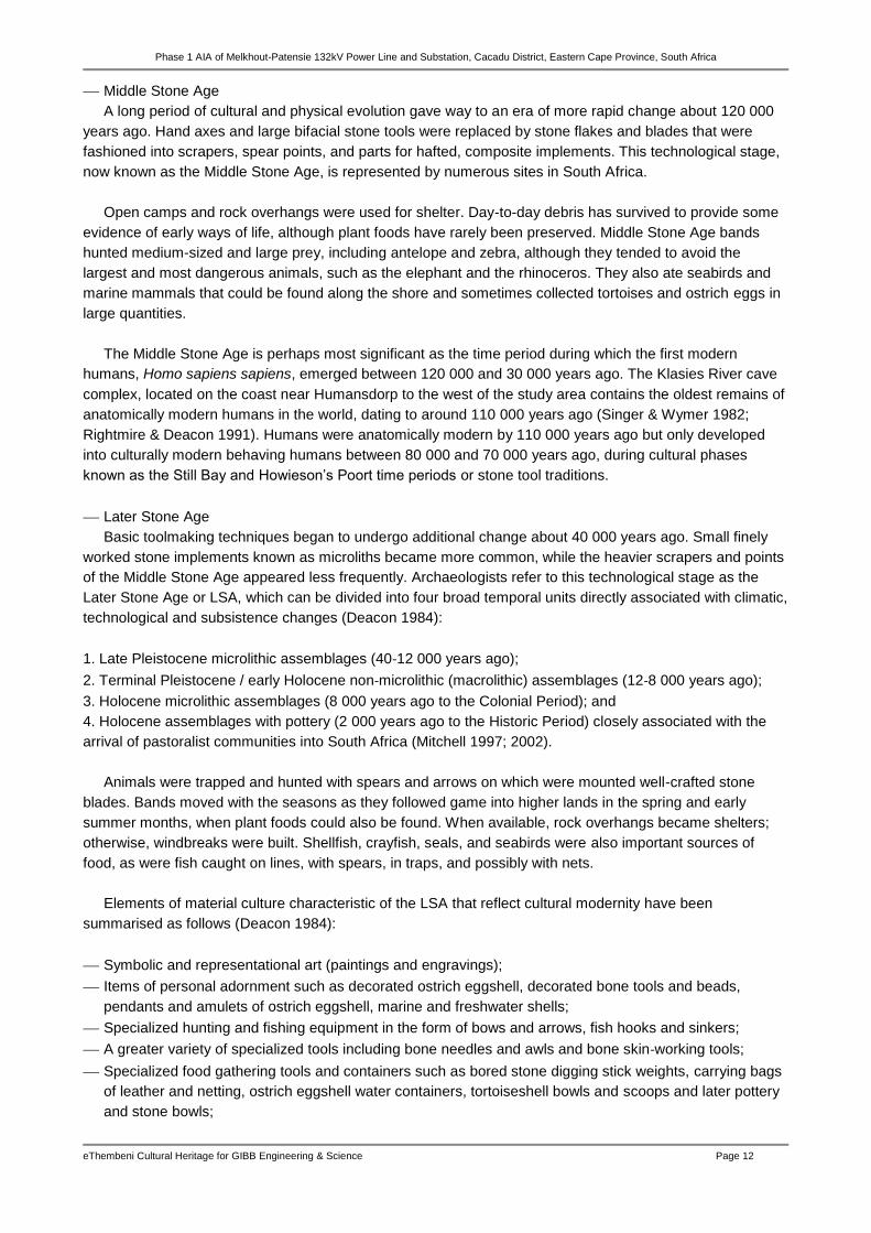
Middle Stone Age
A long period of cultural and physical evolution gave way to an era of more rapid change about 120 000
years ago. Hand axes and large bifacial stone tools were replaced by stone flakes and blades that were
fashioned into scrapers, spear points, and parts for hafted, composite implements. This technological stage,
now known as the Middle Stone Age, is represented by numerous sites in South Africa.
Open camps and rock overhangs were used for shelter. Day-to-day debris has survived to provide some
evidence of early ways of life, although plant foods have rarely been preserved. Middle Stone Age bands
hunted medium-sized and large prey, including antelope and zebra, although they tended to avoid the
largest and most dangerous animals, such as the elephant and the rhinoceros. They also ate seabirds and
marine mammals that could be found along the shore and sometimes collected tortoises and ostrich eggs in
large quantities.
The Middle Stone Age is perhaps most significant as the time period during which the first modern
humans, Homo sapiens sapiens, emerged between 120 000 and 30 000 years ago. The Klasies River cave
complex, located on the coast near Humansdorp to the west of the study area contains the oldest remains of
anatomically modern humans in the world, dating to around 110 000 years ago (Singer & Wymer 1982;
Rightmire & Deacon 1991). Humans were anatomically modern by 110 000 years ago but only developed
into culturally modern behaving humans between 80 000 and 70 000 years ago, during cultural phases
known as the Still Bay and Howieson’s Poort time periods or stone tool traditions.
Later Stone Age
Basic toolmaking techniques began to undergo additional change about 40 000 years ago. Small finely
worked stone implements known as microliths became more common, while the heavier scrapers and points
of the Middle Stone Age appeared less frequently. Archaeologists refer to this technological stage as the
Later Stone Age or LSA, which can be divided into four broad temporal units directly associated with climatic,
technological and subsistence changes (Deacon 1984):
1. Late Pleistocene microlithic assemblages (40‐12 000 years ago);
2. Terminal Pleistocene / early Holocene non‐microlithic (macrolithic) assemblages (12‐8 000 years ago);
3. Holocene microlithic assemblages (8 000 years ago to the Colonial Period); and
4. Holocene assemblages with pottery (2 000 years ago to the Historic Period) closely associated with the
arrival of pastoralist communities into South Africa (Mitchell 1997; 2002).
Animals were trapped and hunted with spears and arrows on which were mounted well-crafted stone
blades. Bands moved with the seasons as they followed game into higher lands in the spring and early
summer months, when plant foods could also be found. When available, rock overhangs became shelters;
otherwise, windbreaks were built. Shellfish, crayfish, seals, and seabirds were also important sources of
food, as were fish caught on lines, with spears, in traps, and possibly with nets.
Elements of material culture characteristic of the LSA that reflect cultural modernity have been
summarised as follows (Deacon 1984):
Symbolic and representational art (paintings and engravings);
Items of personal adornment such as decorated ostrich eggshell, decorated bone tools and beads,
pendants and amulets of ostrich eggshell, marine and freshwater shells;
Specialized hunting and fishing equipment in the form of bows and arrows, fish hooks and sinkers;
A greater variety of specialized tools including bone needles and awls and bone skin‐working tools;
Specialized food gathering tools and containers such as bored stone digging stick weights, carrying bags
of leather and netting, ostrich eggshell water containers, tortoiseshell bowls and scoops and later pottery
and stone bowls;
Phase 1 AIA of Melkhout-Patensie 132kV Power Line and Substation, Cacadu District, Eastern Cape Province, South Africa
eThembeni Cultural Heritage for GIBB Engineering & Science Page 13
Formal burial of the dead in graves, sometimes covered with painted stones or grindstones and
accompanied by grave goods;
The miniaturization of selected stone tools linked to the practice of hafting for composite tools production;
and
A characteristic range of specialized tools designed for making some of the items listed above.
During the Later Stone Age people were sometimes buried in caves and shelters, and these burials are
often associated with grave goods and marked by painted stones. Archaeological deposits in some caves
and shelters had remarkable preservation of organic material and yielded artefacts such as ‘digging sticks (4
500 years old), fire sticks (5 800), decorated wooden sticks (9 200) and almost complete mummified human
remains dating to some 2 000 years ago. Other interesting features are ‘storage pits’ (hollows lined with plant
material) which were used to store seeds for later use, and 'postholes' (often with post still in situ)’
(Binneman 2010: 3). Sometimes it appeared that shelters were divided into small family living areas
(Binneman 1997, 1998, 1999a & b, 2000).
Paintings on the walls of rock shelters in the region are generally ‘not well-preserved and appear to be of
a similar ‘style’ throughout the region with the dominant colours being red and maroon, and red with black,
with yellow and white being present to a lesser degree. The paintings do not, for example, represent only a
hunting scene or some or other daily activity, but each painting had a particular symbolic meaning for the
painters’ (Binneman 2010: 3).
A significant change in the Later Stone Age socio-economic landscape came some 2 000 years ago
when Khoi pastoralists moved into the region, introducing domesticated animals (sheep, goats and cattle)
and ceramic vessels. A few centuries after their arrival the first Europeans rounded the Cape, heralding the
fundamental and irreversible alteration of the southern African prehistoric socio-economic landscape.
The first sheep in South Africa, dating to 1190 years ago, was identified in the 1960s from an
archaeological Khoi pastoralist site near Patensie (Deacon 1967; Klein & Scott 1974). Plant remains were
well-preserved and were the subject of the first archaeobotanical study in South Africa (Wells 1965). Also
during the 1960s a large number of archaeological artefacts and human remains were found near
Andrieskraal during the construction of irrigation canals in the Gamtoos Valley (Deacon 1965; De Villiers
1965).
Colonial Period4
By the closing decades of the 18th century during the Colonial Period South Africa had fallen into two
broad regions: west and east. Colonial settlement dominated the west, including the winter rainfall region
around the Cape of Good Hope, the coastal hinterland northward toward the present-day border with
Namibia, and the dry lands of the interior. Trekboers took increasingly more land from the Khoekhoe and
from remnant hunter-gatherer communities, who were killed, were forced into marginal areas, or became
labourers tied to the farms of their new overlords. Indigenous farmers controlled both the coastal and valley
lowlands and the Highveld of the interior in the east, where summer rainfall and good grazing made mixed
farming economies possible.
A large group of British settlers arrived in the eastern Cape in 1820; this, together with a high European
birth rate and wasteful land usage, produced an acute land shortage, which was alleviated only when the
British acquired more land through massive military intervention against Africans on the eastern frontier. Until
the 1840s the British vision of the colony did not include African citizens, so, as Africans lost their land, they
were expelled across the Great Fish River, the unilaterally proclaimed eastern border of the colony.
4 http://www.britannica.com; article authored by Colin J. Bundy, Julian R. D. Cobbing, Martin Hall and Leonard Monteath Thompson. See also Milton
(1983).
Phase 1 AIA of Melkhout-Patensie 132kV Power Line and Substation, Cacadu District, Eastern Cape Province, South Africa
eThembeni Cultural Heritage for GIBB Engineering & Science Page 14
Between 1811 and 1858 colonial aggression deprived Africans of most of their land between the Sundays
and Great Kei Rivers and produced poverty and despair. From the mid-1850s British magistrates held
political power in the region, destroying the power of the Xhosa chiefs. Following a severe lung sickness
epidemic among their cattle in 1854–56, the Xhosa killed many of their remaining cattle and in 1857–58 grew
few crops in response to a millenarian prophecy that this would cause their ancestors to rise from the dead
and destroy the whites. Many thousands of Xhosa starved to death, and large numbers of survivors were
driven into the Cape Colony to work. The region fused with the Cape Colony in 1865, and thousands of
Africans newly defined as Fingo resettled east of the Great Kei, thereby creating Fingoland. The Transkei, as
this region came to be known, consisted of the hilly country between the Cape and Natal. It became a large
African reserve and grew in size when those parts that were still independent were annexed in the 1880s
and ’90s (Pondoland lost its independence in 1894).
The general area around the towns of Hankey and Patensie has been a focus point of KhoiSan activity in
historical times. ‘The Stuurman family received land on the Kleinrivier (between the golf course and
Phillipsville) in the early 1800's, where the present day Hankey and Phillipville is situated. During 1822 Dr
John Phillips of the London Missionary Society started work in the area and also built a church (seen on the
west bank of the river)’ (Binneman 2006, 2007: 1).

Phase 1 AIA of Melkhout-Patensie 132kV Power Line and Substation, Cacadu District, Eastern Cape Province, South Africa
eThembeni Cultural Heritage for GIBB Engineering & Science Page 15
6 ARCHAEOLOGICAL SURVEY RESULTS
We assessed the proposed tower positions and new/upgraded access roads at numerous points along
the proposed power line route, but identified no archaeological remains whatsoever. This observation is
congruent with the findings of other impact assessments in the area (refer to Appendix B for a list of the
relevant reports) and reflects the land uses described in the vegetation summary in Section 4.
In short, the northern and southern portions of the power line route have been transformed by
agricultural activities, while the central section is dominated by an environment that would have been
inhospitable to past human settlement. Much of the proposed power line route runs parallel to an existing
power line, thus sharing access roads and minimising the need for new infrastructure. The following figures
illustrate the study environment.
FIGURES 6 & 7 INTENSIVE AGRICULTURE IN THE GAMTOOS RIVER VALLEY.
FIGURE 8 LOCATION OF TOWER 85 IN THE GAMTOOS VALLEY.
FIGURE 9 AGRICULTURE AND FYNBOS SOUTH OF WESTON.

Phase 1 AIA of Melkhout-Patensie 132kV Power Line and Substation, Cacadu District, Eastern Cape Province, South Africa
eThembeni Cultural Heritage for GIBB Engineering & Science Page 16
FIGURE 10 LOCATION OF TOWER 56.
FIGURE 11 FACING NORTH FROM TOWER 52.
FIGURE 12 FACING SOUTH FROM TOWER 52.
FIGURE 13 FACING NORTH FROM TOWER 51.
FIGURE 14 FACING SOUTH FROM TOWER 51.
FIGURE 15 AGRICULTURE AT TOWER 16.

Phase 1 AIA of Melkhout-Patensie 132kV Power Line and Substation, Cacadu District, Eastern Cape Province, South Africa
eThembeni Cultural Heritage for GIBB Engineering & Science Page 17
FIGURE 16 TRANSFORMED LANDSCAPE AT TOWER 8.
FIGURE 17 MELKHOUT SUBSTATION.
7 ASSESSMENT OF DEVELOPMENT IMPACTS The definitions of archaeological sites and remains and many archaeological terms imply an emphasis on
their technological, scientific and historical values. However, credible heritage practitioners globally
recognise the value and importance of this heritage to extant communities. In this context archaeological
sites and remains with low significance for their scientific value might be imbued with high significance for
specific communities or interest groups for their spiritual, social and cultural values.
However, since we observed no archaeological remains of any nature, and the archaeological sensitivity
of the study area is relatively low, the potential overall impact of the proposed project on archaeological sites
is low (Table 1).
TABLE 1 POTENTIAL IMPACT ON ARCHAEOLOGICAL SITES.
Nature Extent Duration Intensity Impact on irreplaceable resources
Consequence Probability Significance
Negative Low High Low Low Low Low Low
Phase 1 AIA of Melkhout-Patensie 132kV Power Line and Substation, Cacadu District, Eastern Cape Province, South Africa
eThembeni Cultural Heritage for GIBB Engineering & Science Page 18
8 PROTOCOL FOR THE IDENTIFICATION, PROTECTION AND RECOVERY OF
HERITAGE RESOURCES DURING CONSTRUCTION AND OPERATION
It is possible that sub-surface heritage resources will be encountered during the construction phase of this
project. The Project Engineer, Environmental Control Officer and all other persons responsible for site
management and excavation should be aware that indicators of sub-surface sites could include:
Ash deposits (unnaturally grey appearance of soil compared to the surrounding substrate);
Bone concentrations, either animal or human;
Ceramic fragments, including potsherds;
Stone concentrations that appear to be formally arranged (may indicate the presence of an underlying
burial); and
Fossilised remains of fauna and flora, including trees.
In the event that such indicator(s) of heritage resources are identified, the following actions should be
taken immediately:
All construction within a radius of at least 20m of the indicator should cease. This distance should be
increased at the discretion of supervisory staff if heavy machinery or explosives could cause further
disturbance to the suspected heritage resource.
This area must be marked using clearly visible means, such as barrier tape, and all personnel should be
informed that it is a no-go area.
A guard should be appointed to enforce this no-go area if there is any possibility that it could be violated,
whether intentionally or inadvertently, by construction staff or members of the public.
No measures should be taken to cover up the suspected heritage resource with soil, or to collect any
remains such as bone or stone.
If a heritage practitioner has been appointed to monitor the project, s/he should be contacted and a site
inspection arranged as soon as possible.
If no heritage practitioner has been appointed to monitor the project, Mr Sello Mokhanya must be
contacted at the SAHRA Eastern Cape office; [email protected].
The South African Police Services should be notified by a SAHRA staff member or an independent
heritage practitioner if human remains are identified. No SAPS official may disturb or exhume such
remains, whether of recent origin or not.
All parties concerned should respect the potentially sensitive and confidential nature of the heritage
resources, particularly human remains, and refrain from making public statements until a mutually
agreed time.
Any extension of the project beyond its current footprint involving vegetation and/or earth clearance
should be subject to prior assessment by a qualified heritage practitioner, taking into account all
information gathered during this initial heritage impact assessment.

Phase 1 AIA of Melkhout-Patensie 132kV Power Line and Substation, Cacadu District, Eastern Cape Province, South Africa
eThembeni Cultural Heritage for GIBB Engineering & Science Page 19
9 CONCLUSION
We recommend that the development proceed with no further archaeological mitigation and have
submitted this report to the ECPHRA in fulfilment of the requirements of the NHRA. According to Section
38(4) of the Act the report shall be considered timeously by the ECPHRA which shall, after consultation with
the person proposing the development, decide –
whether or not the development may proceed;
any limitations or conditions are to be applied to the development;
what general protections in terms of this Act apply, and what formal protections may be applied to such
heritage resources;
whether compensatory action shall be required in respect of any heritage resources damaged or
destroyed as a result of the development; and
whether the appointment of specialists is required as a condition of approval of the proposal.
Mr Sello Mokhanya may be contacted at the ECPHRA (74 Alexander Road, King Williams Town 5600;
If permission is granted for development to proceed, the client is reminded that the NHRA requires that a
developer cease all work immediately and follow the protocol contained in Section 8 of this report should any
heritage resources, as defined in the Act, be discovered during the course of development activities.
10 BIBLIOGRAPHY
Binneman, J.N.F. 1997. Results from a test excavation at The Havens Cave, Cambria, south- eastern Cape.
Southern African Field Archaeology 6:93-105.
Binneman, J.N.F. 1998. Results from a test excavation at Kleinpoort Shelter in the Baviaanskloof, Eastern
Cape Province. Southern African Field Archaeology 7:90-97.
Binneman, J.N.F. 1999a. Results from a test excavation at Groot Kommandokloof Shelter in the
Baviaanskloof/Kouga region, Eastern Cape Province. Southern African Field Archaeology 8:100-
107.
Binneman, J.N.F. 1999b. Mummified human remains from the Kouga Mountains, Eastern Cape. The Digging
Stick 16:1-2.
Binneman, J.N.F. 2000. Results from two test excavations in the Baviaanskloof Mountains, Eastern Cape
Province. Southern African Field Archaeology 9:81-92.
Binneman, J.N.F. 2001. An introduction to the Later Stone Age research project along the southeastern
Cape coast. Southern African Field Archaeology 10: 75‐87.
Binneman, J.N.F. 2004/2005. Archaeological research along the south‐eastern Cape coast. Part 1 –
Open‐air shell middens. Southern African Field Archaeology 13 & 14: 49‐77.
Binneman, J.N.F. 2006/2007. Archaeological research along the south‐eastern Cape coast. Part 2 – Caves
and Shelters: Kabeljous River Shelter 1 and associated stone tool industries. Southern African Field
Archaeology 13 & 14: 49‐77.
Binneman, J. 2006. Letter of Recommendation (With Conditions) for the Exemption of a full Phase 1
Archaeological Heritage Impact Assessment for the Hankey Sewer Pipeline, Hankey (Kouga
Municipality).
Binneman, J. 2007. Letter of Recommendation (With Conditions) for the Exemption of a Full Phase 1
Archaeological Heritage Impact Assessment for the Proposed Hankey Golf Estate Development on
Erf 1435, Hankey, Kouga Municipality, Eastern Cape.

Phase 1 AIA of Melkhout-Patensie 132kV Power Line and Substation, Cacadu District, Eastern Cape Province, South Africa
eThembeni Cultural Heritage for GIBB Engineering & Science Page 20
Binneman, J. 2010. A Phase 1 Archaeological Heritage Impact Assessment of the Proposed Residential and
Mixed Use Development of Erf 17 and Erf 1480, Weston Residential Area, Hankey, Kouga
Municipality, Eastern Cape Province.
Deacon, H.J. 1967. Two radiocarbon dates from Scott's Cave, Gamtoos Valley. South African Archaeological
Bulletin 22:51-52.
Deacon, H.J. & Geleijnse, V. 1988. The stratigraphy and sedimentology of the Main Site sequence at Klasies
River, South Africa. South African Archaeological Bulletin 43: 5-14.
Deacon, J. 1965. Cultural material from the Gamtoos River Valley shelters (Andrieskraal). South African
Archaeological Bulletin 20:139-200.
Deacon, J. 1984. Later Stone Age people and their descendants in southern Africa. In Klein, R.G. (ed).
Southern Africa prehistory and paleoenvironments. Rotterdam: A.A. Balkema.
De Villiers, H. 1965. Skeletal remains from the Gamtoos Valley. South African Archaeological Bulletin
20:201-213.
Klein, R.G. & Scott, K. 1974. The fauna of Scott's Cave, Gamtoos Valley, Southeastern Cape Province.
South African Journal of Science 70:186-187.
Maggs, T.M.O’C. 1994. The Early Iron Age in the extreme south: some patterns and problems. Azania
29/30: 171‐178.
Milton, J. 1983. The Edges of War. A history of Frontier Wars (1702‐1878). Kenwyn: Juta & Co.
Mitchell, P.J. 1997. Holocene Later Stone Age Hunter-Gatherers South of the Limpopo River, Ca. 10,000–
2000 B.P. Journal of World Prehistory 11 (4): 359-424.
Mitchell, P. 2002. The archaeology of southern Africa. Cambridge: Cambridge University Press.
Mitchell, P. & Whitelaw, G. 2005. The Archaeology of Southernmost Africa from c. 2000 BP to the Early
1800s: A Review of Recent Research. The Journal of African History 46(2): 209-241.
Pote, J. 2012. Botanical Assessment for Proposed Melkhout (Humansdorp) to Hankey Eskom 132 kV
Powerline.
Rightmire, G.P. & Deacon, H.J. 1991. Comparative studies of Late Pleistocene human remains from Klasies
River Mouth, South Africa. Journal of Human Evolution 20: 131-156.
Singer, R. & Wymer, J. 1982. The Middle Stone Age at Klasies River Mouth in South Africa. Chicago:
University of Chicago Press.
Wells, M.J. 1965. An analysis of plant remains from Scott's Cave in the Gamtoos Valley. South African
Archaeological Bulletin 20:79-84.
Appendix C (Methodology)
Deacon, J. 1996. Archaeology for Planners, Developers and Local Authorities. National Monuments Council.
Publication No. PO21E.
Deacon, J. 1997. Report: Workshop on Standards for the Assessment of Significance and Research
Priorities for Contract Archaeology. In: Newsletter No. 49, September 1998. South African
Association of Archaeology.
Dunnell, R.C. and Dancey, W.S. 1983. The Siteless Survey: A Regional Scale Data Collection Strategy. In:
Advances in Archaeological Method and Theory 6: 267-287. M.B. Schiffer, ed. Academic Press, New
York.
King, T.F. 1978. The Archaeological Survey: Its Methods and Uses. Interagency Archaeological Services,
Department of the Interior, Washington, D.C.
McManamon, F.P. 1984. Discovering Sites Unseen. In Advances in Archaeological Method and Theory 8:
223-292, M.B. Schiffer, ed. Academic Press, New York.
Schiffer, M. B., Sullivan A.P. and Klinger T.C. 1978. The Design of Archaeological Surveys. World
Archaeology 10: 1-28.
Phase 1 AIA of Melkhout-Patensie 132kV Power Line and Substation, Cacadu District, Eastern Cape Province, South Africa
eThembeni Cultural Heritage for GIBB Engineering & Science Page 21
APPENDIX A STATUTORY REQUIREMENTS
General
The Constitution of the Republic of South Africa Act 108 of 1996 is the source of all legislation. Within the
Constitution the Bill of Rights is fundamental, with the principle that the environment should be protected for
present and future generations by preventing pollution, promoting conservation and practising ecologically
sustainable development. With regard to spatial planning and related legislation at national and provincial
levels the following legislation may be relevant:
Physical Planning Act 125 of 1991
Municipal Structures Act 117 of 1998
Municipal Systems Act 32 of 2000
Development Facilitation Act 67 of 1995 (DFA)
The identification, evaluation and management of heritage resources in South Africa is required and
governed by the following legislation:
National Environmental Management Act 107 of 1998 (NEMA)
KwaZulu-Natal Heritage Act 4 of 2008 (KZNHA)
National Heritage Resources Act 25 of 1999 (NHRA)
Minerals and Petroleum Resources Development Act 28 of 2002 (MPRDA)
National Heritage Resources Act 25 of 1999
The NHRA established the South African Heritage Resources Agency (SAHRA) together with its Council
to fulfil the following functions:
co-ordinate and promote the management of heritage resources at national level;
set norms and maintain essential national standards for the management of heritage resources in the
Republic and to protect heritage resources of national significance;
control the export of nationally significant heritage objects and the import into the Republic of cultural
property illegally exported from foreign countries;
enable the provinces to establish heritage authorities which must adopt powers to protect and manage
certain categories of heritage resources; and
provide for the protection and management of conservation-worthy places and areas by local authorities.
Heritage Impact Assessments
Section 38(1) of the NHRA of 1999 requires the responsible heritage resources authority to notify the
person who intends to undertake a development that fulfils the following criteria to submit an impact
assessment report if there is reason to believe that heritage resources will be affected by such development:
the construction of a road, wall, power line, pipeline, canal or other similar form of linear development or
barrier exceeding 300m in length;
the construction of a bridge or similar structure exceeding 50m in length;
any development or other activity which will change the character of a site—
(i) exceeding 5 000m² in extent; or
(ii) involving three or more existing erven or subdivisions thereof; or
(iii) involving three or more erven or divisions thereof which have been consolidated within the past five
years; or

Phase 1 AIA of Melkhout-Patensie 132kV Power Line and Substation, Cacadu District, Eastern Cape Province, South Africa
eThembeni Cultural Heritage for GIBB Engineering & Science Page 22
(iv) the costs of which will exceed a sum set in terms of regulations by SAHRA or a provincial heritage
resources authority;
the re-zoning of a site exceeding 10 000m² in extent; or
any other category of development provided for in regulations by SAHRA or a provincial heritage
resources authority.
Reports in fulfilment of Section 38(3) of the Act must include the following information:
the identification and mapping of all heritage resources in the area affected;
an assessment of the significance of such resources in terms of the heritage assessment criteria set out
in regulations;
an assessment of the impact of the development on such heritage resources;
an evaluation of the impact of the development on heritage resources relative to the sustainable social
and economic benefits to be derived from the development;
the results of consultation with communities affected by the proposed development and other interested
parties regarding the impact of the development on heritage resources;
if heritage resources will be adversely affected by the proposed development, the consideration of
alternatives; and
plans for mitigation of any adverse effects during and after completion of the proposed development.

Phase 1 AIA of Melkhout-Patensie 132kV Power Line and Substation, Cacadu District, Eastern Cape Province, South Africa
eThembeni Cultural Heritage for GIBB Engineering & Science Page 23
APPENDIX B METHODOLOGY
Site survey
eThembeni staff members inspected the proposed activity area on 23 and 25 April 2013 and a controlled-
exclusive surface survey, where ‘sufficient information exists on an area to make solid and defensible
assumptions and judgements about where [heritage resource] sites may and may not be’ and ‘an inspection
of the surface of the ground, wherever this surface is visible, is made, with no substantial attempt to clear
brush, turf, deadfall, leaves or other material that may cover the surface and with no attempt to look beneath
the surface beyond the inspection of rodent burrows, cut banks and other exposures that are observed by
accident’ (King 1978; see bibliography for other references informing methodological approach).
The site survey comprised drives and walks along the proposed servitude to inspect as many tower
positions and access roads as possible. Photographs were taken with a Nikon D200 camera and a
representative selection is included in this report. Geographic coordinates were obtained using two handheld
Garmin global positioning units (WGS 84).
Tower locations accessed
Staff members made every effort to inspect as many proposed tower positions and access roads as
possible. Where physical access was not possible due to dense vegetation, or where widespread
environmental disturbance clearly indicated that archaeological remains could not be present, we inspected
tower locations visually. Table 2 summarises the tower positions inspected, while Figures 21-26 provide
maps of the areas surveyed, with survey routes indicated in red and black lines.
In short, staff members physically inspected tower positions in both disturbed and undisturbed areas,
amounting to 57% of the study area.
TABLE 2 SUMMARY OF INSPECTION OF PROPOSED TOWER LOCATIONS.
Tower number
Physical inspection
100 and substation site (orchards)
96-94
89
85 (orchards and fields in Gamtoos River floodplain)
64-54 (fields and fynbos around Weston)
49-45
41-39 (grazing)
38-34 (fields)
21-15 (pastures, camps, periphery of farmstead)
14-8 (overgrazed fields, pig swill dump)
2,1
Visual inspection
99-97 (orchards)
93-90 (orchards and fields)
88-86 (orchards and fields)
84-79 (orchards and fields)
78-64 (agricultural fields in floodplain)
53-49 (impenetrable thicket on steep slopes in watercourse)
44-42 (grazing)
33-22 (overgrazed fields)
7-3 (overgrazed fields)

Phase 1 AIA of Melkhout-Patensie 132kV Power Line and Substation, Cacadu District, Eastern Cape Province, South Africa
eThembeni Cultural Heritage for GIBB Engineering & Science Page 24
FIGURE 18 SURVEY ROUTE: TOWERS 100-84.
FIGURE 19 SURVEY ROUTE: TOWERS 85-68.

Phase 1 AIA of Melkhout-Patensie 132kV Power Line and Substation, Cacadu District, Eastern Cape Province, South Africa
eThembeni Cultural Heritage for GIBB Engineering & Science Page 25
FIGURE 20 SURVEY ROUTE: TOWERS 84-72.
FIGURE 21 SURVEY ROUTE: TOWERS 78-65.

Phase 1 AIA of Melkhout-Patensie 132kV Power Line and Substation, Cacadu District, Eastern Cape Province, South Africa
eThembeni Cultural Heritage for GIBB Engineering & Science Page 26
FIGURE 22 SURVEY ROUTE: TOWERS 64-51.
FIGURE 23 SURVEY ROUTE: TOWERS 53-43.

Phase 1 AIA of Melkhout-Patensie 132kV Power Line and Substation, Cacadu District, Eastern Cape Province, South Africa
eThembeni Cultural Heritage for GIBB Engineering & Science Page 27
FIGURE 24 SURVEY ROUTE: TOWERS 43-31.
FIGURE 25 SURVEY ROUTE: TOWERS 31-20.

Phase 1 AIA of Melkhout-Patensie 132kV Power Line and Substation, Cacadu District, Eastern Cape Province, South Africa
eThembeni Cultural Heritage for GIBB Engineering & Science Page 28
FIGURE 26 SURVEY ROUTE: TOWERS 20-7.
FIGURE 27 SURVEY ROUTE: TOWERS 9-1.

Phase 1 AIA of Melkhout-Patensie 132kV Power Line and Substation, Cacadu District, Eastern Cape Province, South Africa
eThembeni Cultural Heritage for GIBB Engineering & Science Page 29
Database and literature review
Archaeological site data for the project area was obtained from HIA reports and is incorporated in Section
5. A concise account of the archaeology and history of the broader study area was compiled from sources
including those listed in the bibliography.
Relevant impact assessment reports
The following reports were identified on the SAHRIS database as relevant to this project due to their
proximity (within 5 km) of the study area:
Binneman, J. n.d. Archaeological heritage sensitivity investigation of the proposed burial site of Sarah
Baartman at Hankey, Kouga Municipality, Eastern Cape Province.
Binneman, J. 2006. Letter of Recommendation (With Conditions) for the Exemption of a full Phase 1
Archaeological Heritage Impact Assessment for the Hankey Sewer Pipeline, Hankey (Kouga
Municipality).
Binneman, J. 2006. Letter of recommendation (with conditions) for the exemption of a full Phase 1
Archaeological Heritage Impact Assessment for the Rezoning and Subdivision of Portion 32 of the
Farm Rheeboksfontein No. 346, Humansdorp District, Kouga Municipality, from Agricultural Use to
Special Rural Residential Purposes and to divide it into 21 Units.
Binneman, J. 2006. Letter of recommendation (with conditions) for the exemption of a full Phase 1
Archaeological Heritage Impact Assessment for the Rezoning of Erven 3279, 3280 and 3281 in
Humansdorp (Kouga Municipality) from Agricultural to Residential Zone III and Subdivision of the
Erven into eight units, each of ±1ha, where group housing will be developed.
Binneman, J. 2006. Letter of recommendation (with conditions) for the exemption of a full Phase 1
Archaeological Heritage Impact Assessment for the rezoning of Portion 4 of the Farm “Keurkloof” No
56, in the Patensie District, (Kouga Municipality) from Agricultural Use to Open Space Zone III and
the Development of ±40 footprints of Resort Zone II on the Property.
Binneman, J. 2006. Letter of recommendation (with conditions) for the exemption of a full Phase 1
Archaeological Heritage Impact Assessment on Portion 60 (part of Portion 57) of the Farm Klein
Zeekoe Rivier No. 335, Humansdorp District (Kouga Municipality), concerning the Application and
Approval of Mining Rights.
Binneman, J. 2007. Letter of Recommendation (With Conditions) for the Exemption of a Full Phase 1
Archaeological Heritage Impact Assessment for the Proposed Hankey Golf Estate Development on
Erf 1435, Hankey, Kouga Municipality, Eastern Cape.
Binneman, J. 2008. A Phase 1 Archaeological Heritage Impact Assessment of the Proposed Sarah
Bartmann Project, Hankey, Kouga Municipality, Eastern Cape Province.
Binneman, J. 2009. A Phase 1 Archaeological Impact Assessment for the Proposed Residential
Development on the Farm Zeekoei River No 793, Kouga Municipality, Humansdorp District, Eastern
Cape.
Binneman, J. 2010. A Letter of Recommendation (With Conditions) for the Exemption of a full Phase 1
Archaeological Heritage Impact Assessment for the Proposed Construction of the Waste Water
Treatment Works at the Weston Residential Area, Hankey, Kouga Municipality, Eastern Cape
Province.
Binneman, J. 2010. A Phase 1 Archaeological Heritage Impact Assessment of the Proposed Residential and
Mixed Use Development of Erf 17 and Erf 1480, Weston Residential Area, Hankey, Kouga
Municipality, Eastern Cape Province.
Public participation
Consultation was undertaken with the Gamtkwa KhoiSan Council regarding the historical, social, cultural
and spiritual values of their cultural heritage. The Council reviewed the Phase 1 HIA report for this project
and supported the recommendation that a heritage practitioner inspect areas of construction for the
presence of archaeological and palaeontological sites. GIBB Engineering & Science will submit this report to
the Council who will submit their written comments directly to GIBB.

Phase 1 AIA of Melkhout-Patensie 132kV Power Line and Substation, Cacadu District, Eastern Cape Province, South Africa
eThembeni Cultural Heritage for GIBB Engineering & Science Page 30
Assessment of heritage resource value and significance
Heritage resources are significant only to the extent that they have public value, as demonstrated by the
following guidelines for determining site significance developed by Heritage Western Cape in 2007 and
utilised during this assessment.
Grade I Sites (National Heritage Sites)
Regulation 43 Government Gazette no 6820. 8 No. 24893 30 May 2003, Notice No. 694 states that:
Grade I heritage resources are heritage resources with qualities so exceptional that they are of special
national significance should be applied to any heritage resource which is
a) Of outstanding significance in terms of one or more of the criteria set out in section 3(3) of the
NHRA;
b) Authentic in terms of design, materials, workmanship or setting; and is of such universal value and
symbolic importance that it can promote human understanding and contribute to nation building, and
its loss would significantly diminish the national heritage.
1. Is the site of outstanding national significance?
2. Is the site the best possible representative of a national issue, event or group or person of national
historical importance?
3. Does it fall within the proposed themes that are to be represented by National Heritage Sites?
4. Does the site contribute to nation building and reconciliation?
5. Does the site illustrate an issue or theme, or the side of an issue already represented by an existing
National Heritage Site – or would the issue be better represented by another site?
6. Is the site authentic and intact?
7. Should the declaration be part of a serial declaration?
8. Is it appropriate that this site be managed at a national level?
9. What are the implications of not managing the site at national level?
Grade II Sites (Provincial Heritage Sites)
Regulation 43 Government Gazette no 6820. 8 No. 24893 30 May 2003, Notice No. 694 states that:
Grade II heritage resources are those with special qualities which make them significant in the context of a
province or region and should be applied to any heritage resource which -
a) is of great significance in terms of one or more of the criteria set out in section 3(3) of the NHRA; and
(b) enriches the understanding of cultural, historical, social and scientific development in the province or
region in which it is situated, but that does not fulfil the criteria for Grade 1 status.
Grade II sites may include, but are not limited to –
(a) places, buildings, structures and immovable equipment of cultural significance;
(b) places to which oral traditions are attached or which are associated with living heritage;
(c) historical settlements and townscapes;
(d) landscapes and natural features of cultural significance;
(e) geological sites of scientific or cultural importance;
(f) archaeological and palaeontological sites; and
(g) graves and burial grounds.
The cultural significance or other special value that Grade II sites may have, could include, but are not
limited to –
(a) its importance in the community or pattern of the history of the province;
(b) the uncommon, rare or endangered aspects that it possess reflecting the province’s natural or cultural
heritage
(c) the potential that the site may yield information that will contribute to an understanding of the
province’s natural or cultural heritage;

Phase 1 AIA of Melkhout-Patensie 132kV Power Line and Substation, Cacadu District, Eastern Cape Province, South Africa
eThembeni Cultural Heritage for GIBB Engineering & Science Page 31
(d) its importance in demonstrating the principal characteristics of a particular class of the province’s
natural or cultural places or objects;
(e) its importance in exhibiting particular aesthetic characteristics valued by a community or cultural group
in the province;
(f) its importance in demonstrating a high degree of creative or technical achievement at a particular
period in the development or history of the province;
(g) its strong or special association with a particular community or cultural group for social, cultural or
spiritual reasons; and
(h) its strong or special association with the life or work of a person, group or organization of importance in
the history of the province.
Grade III (Local Heritage Resources)
Regulation 43 Government Gazette no 6820. 8 No. 24893 30 May 2003, Notice No. 694 states that:
Grade III heritage status should be applied to any heritage resource which
(a) fulfils one or more of the criteria set out in section 3(3) of the NHRA; or
(b) in the case of a site contributes to the environmental quality or cultural significance of a larger area
which fulfils one of the above criteria, but that does not fulfill the criteria for Grade 2 status.
Grade IIIA
This grading is applied to buildings and sites that have sufficient intrinsic significance to be regarded as local
heritage resources; and are significant enough to warrant any alteration being regulated. The significances of these
buildings and/or sites should include at least some of the following characteristics:
Highly significant association with a
o historic person
o social grouping
o historic events
o historical activities or roles
o public memory
Historical and/or visual-spatial landmark within a place
High architectural quality, well-constructed and of fine materials
Historical fabric is mostly intact (this fabric may be layered historically and/or past damage should be
easily reversible)
Fabric dates to the early origins of a place
Fabric clearly illustrates an historical period in the evolution of a place
Fabric clearly illustrates the key uses and roles of a place over time
Contributes significantly to the environmental quality of a Grade I or Grade II heritage resource or a
conservation/heritage area
Such buildings and sites may be representative, being excellent examples of their kind, or may be rare:
as such they should receive maximum protection at local level.
Grade IIIB
This grading is applied to buildings and/or sites of a marginally lesser significance than grade IIIA; and
such marginally lesser significance argues against the regulation of internal alterations. Such buildings and
sites may have similar significances to those of a grade IIIA building or site, but to a lesser degree. Like
grade IIIA buildings and sites, such buildings and sites may be representative, being excellent examples of
their kind, or may be rare, but less so than grade IIIA examples: as such they should receive less stringent
protection than grade IIIA buildings and sites at local level and internal alterations should not be regulated (in
this context).

Phase 1 AIA of Melkhout-Patensie 132kV Power Line and Substation, Cacadu District, Eastern Cape Province, South Africa
eThembeni Cultural Heritage for GIBB Engineering & Science Page 32
Grade IIIC
This grading is applied to buildings and/or sites whose significance is, in large part, a significance that
contributes to the character or significance of the environs. These buildings and sites should, as a
consequence, only be protected and regulated if the significance of the environs is sufficient to warrant
protective measures. In other words, these buildings and/or sites will only be protected if they are within
declared conservation or heritage areas.
Assessment of development impacts
A heritage resource impact may be defined broadly as the net change, either beneficial or adverse,
between the integrity of a heritage site with and without the proposed development. Beneficial impacts occur
wherever a proposed development actively protects, preserves or enhances a heritage resource, by
minimising natural site erosion or facilitating non-destructive public use, for example. More commonly,
development impacts are of an adverse nature and can include:
destruction or alteration of all or part of a heritage site;
isolation of a site from its natural setting; and / or
introduction of physical, chemical or visual elements that are out of character with the heritage resource
and its setting.
Beneficial and adverse impacts can be direct or indirect, as well as cumulative, as implied by the
aforementioned examples. Although indirect impacts may be more difficult to foresee, assess and quantify,
they must form part of the assessment process. The following assessment criteria have been used to assess
the impacts of the proposed development on identified heritage resources:
Criteria Rating Scales Notes
Nature
Positive An evaluation of the type of effect the construction, operation and management of the proposed development would have on the heritage resource.
Negative
Neutral
Extent
Low Site-specific, affects only the development footprint.
Medium Local (limited to the site and its immediate surroundings, including the surrounding towns and settlements within a 10 km radius);
High Regional (beyond a 10 km radius) to national.
Duration
Low 0-4 years (i.e. duration of construction phase).
Medium 5-10 years.
High More than 10 years to permanent.
Intensity
Low Where the impact affects the heritage resource in such a way that its significance and value are minimally affected.
Medium Where the heritage resource is altered and its significance and value are measurably reduced.
High Where the heritage resource is altered or destroyed to the extent that its significance and value cease to exist.
Potential for impact on irreplaceable resources
Low No irreplaceable resources will be impacted.
Medium Resources that will be impacted can be replaced, with effort.
High There is no potential for replacing a particular vulnerable resource that will be impacted.
Consequence a combination of extent, duration, intensity and the potential for impact on irreplaceable resources).
Low
A combination of any of the following: - Intensity, duration, extent and impact on irreplaceable resources are all rated low. - Intensity is low and up to two of the other criteria are rated medium. - Intensity is medium and all three other criteria are rated low.
Medium Intensity is medium and at least two of the other criteria are rated medium.
High
Intensity and impact on irreplaceable resources are rated high, with any combination of extent and duration. Intensity is rated high, with all of the other criteria being rated medium or higher.
Probability (the likelihood of the impact occurring)
Low It is highly unlikely or less than 50 % likely that an impact will occur.
Medium It is between 50 and 70 % certain that the impact will occur.
High It is more than 75 % certain that the impact will occur or it is definite that the impact will occur.

Phase 1 AIA of Melkhout-Patensie 132kV Power Line and Substation, Cacadu District, Eastern Cape Province, South Africa
eThembeni Cultural Heritage for GIBB Engineering & Science Page 33
Significance (all impacts including potential cumulative impacts)
Low Low consequence and low probability. Low consequence and medium probability. Low consequence and high probability.
Medium
Medium consequence and low probability. Medium consequence and medium probability. Medium consequence and high probability. High consequence and low probability.
High High consequence and medium probability. High consequence and high probability.
Assumptions and limitations of this HIA
The description of the proposed project, provided by the client, is accurate.
Soil surface visibility was moderate to non-existent. Heritage resources might be present below the
surface and we remind the client that the NHRA requires that a developer cease all work immediately
and observe the protocol in Section 8 should any heritage resources, as defined in the Act, be
discovered during the course of development activities.
No subsurface investigation (including excavations or sampling) were undertaken, since a permit from
SAHRA is required to disturb a heritage resource.
A key concept in the management of heritage resources is that of non-renewability: damage to or
destruction of most resources, including that caused by bona fide research endeavours, cannot be
reversed or undone. Accordingly, management recommendations for heritage resources in the context of
development are as conservative as possible.
Human sciences are necessarily both subjective and objective in nature. eThembeni staff members
strive to manage heritage resources to the highest standards in accordance with national and
international best practice, but recognise that their opinions might differ from those of other heritage
practitioners.
Staff members involved in this project have no vested interest in it; are qualified to undertake the tasks
as described in the terms of reference (refer to Appendix C); and comply at all times with the Codes of
Ethics and Conduct of the Association of Southern African Professional Archaeologists.
eThembeni staff members take no personal or professional responsibility for the misuse of the
information contained in this report, although they will take all reasonable precautions against such
misuse.

Phase 1 AIA of Melkhout-Patensie 132kV Power Line and Substation, Cacadu District, Eastern Cape Province, South Africa
eThembeni Cultural Heritage for GIBB Engineering & Science Page 34
APPENDIX C SPECIALIST COMPETENCY AND DECLARATION OF INDEPENDENCE
Specialist competency
Len van Schalkwyk is accredited by the Cultural Resources Management section of the Association of
Southern African Professional Archaeologists (ASAPA) to undertake HIAs in South Africa. He is also a
member of the ASAPA Cultural Resources Management Committee for 2011 and 2012. Mr van Schalkwyk
has a master’s degree in archaeology (specialising in the history of early farmers in southern Africa) from the
University of Cape Town and 25 years’ experience in heritage management. He has worked on projects as
diverse as the establishment of the Ondini Cultural Museum in Ulundi, the cultural management of Chobe
National Park in Botswana and various archaeological excavations and oral history recording projects. He
was part of the writing team that produced the KwaZulu-Natal Heritage Act 1997. He has worked with many
rural communities to establish integrated heritage and land use plans and speaks good Zulu.
Mr van Schalkwyk left his position as assistant director of Amafa aKwaZulu-Natali, the provincial heritage
management authority, to start eThembeni in partnership with Elizabeth Wahl, who was head of archaeology
at Amafa at the time. Over the past decade they have undertaken almost 1000 heritage impact assessments
throughout South Africa, as well as in Mozambique.
Elizabeth Wahl has a BA Honours in African Studies from the University of Cape Town and has
completed various Masters courses in Heritage and Tourism at the University of KwaZulu-Natal. She is
currently studying for an MPhil in the Conservation of the Built Environment at UCT. She is also a member of
ASAPA.
Ms Wahl was an excavator and logistical coordinator for Glasgow University Archaeological Research
Division’s heritage programme at Isandlwana Battlefield; has undertaken numerous rock painting surveys in
the uKhahlamba/Drakensberg Mountains, northern KwaZulu-Natal, the Cederberg and the Koue Bokkeveld
in the Cape Province; and was the principal excavator of Scorpion Shelter in the Cape Province, and
Lenjane and Crystal Shelters in KwaZulu-Natal. Ms Wahl compiled the first cultural landscape management
plan for the Mnweni Valley, northern uKhahlamba/Drakensberg, and undertook an assessment of and made
recommendations for cultural heritage databases and organisational capacity in parts of Lesotho and South
Africa for the Global Environment Facility of the World Bank for the Maloti Drakensberg Transfrontier
Conservation and Development Area. She developed the first cultural heritage management plan for the
uKhahlamba Drakensberg Park World Heritage Site, following UNESCO recommendations for rock art
management in southern Africa.
Declaration of independence
We declare that Len van Schalkwyk, Elizabeth Wahl and eThembeni Cultural Heritage have no financial
or personal interest in the proposed development, nor its developers or any of its subsidiaries, apart from in
the provision of heritage impact assessment and management consulting services.