pennsylvania geology, v. 42, no. 2, summer 2012 · summer at the survey ... vol. 42, no. 2...
TRANSCRIPT

GeoFORCE students from Houston, Tex., and southwestTexas take a photo break while learning about Pennsylva-nian stratigraphy and sedimentology, and water power, atMcConnells Mill State Park (see article on page 13).
—Photograph by Gary M. Fleeger
Table of Contents
Editorial—From Conyngham toJapanPage 2
The Marcellus ShaleGas Play—Geologyand Production andWater Management,Oh My!Page 3
Earth Science Teachers’ Corner—GeoFORCE Texas Visits PennsylvaniaPage 13
Summer at the SurveyPage 14
New Release—Conyngham Maps, ALong-Awaited ArrivalPage 17
Announcement—Field Conference of Pennsylvania Geologists, 2012Page 19
Recent PublicationsPage 19
Staff ListingPage 20
Vol. 42, No. 2 Pennsylvania Geology
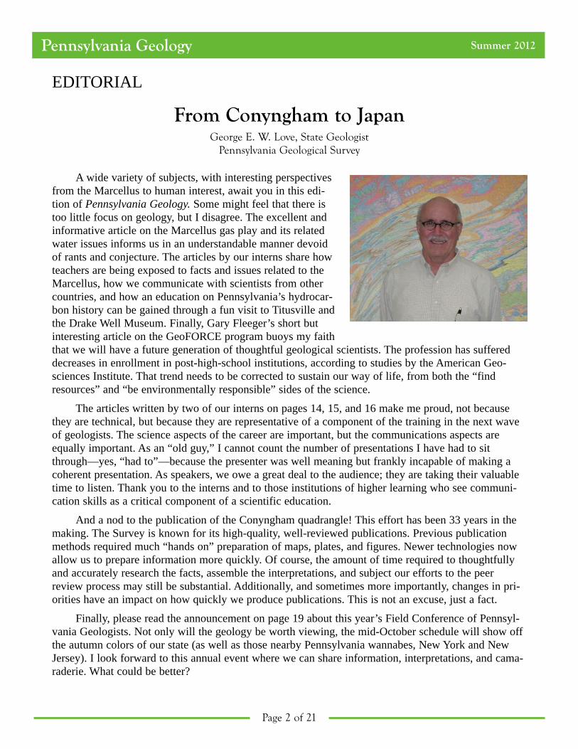
EDITORIAL
From Conyngham to JapanGeorge E. W. Love, State Geologist
Pennsylvania Geological Survey
A wide variety of subjects, with interesting perspectivesfrom the Marcellus to human interest, await you in this edi-tion of Pennsylvania Geology. Some might feel that there istoo little focus on geology, but I disagree. The excellent andinformative article on the Marcellus gas play and its relatedwater issues informs us in an understandable manner devoidof rants and conjecture. The articles by our interns share howteachers are being exposed to facts and issues related to theMarcellus, how we communicate with scientists from othercountries, and how an education on Pennsylvania’s hydrocar-bon history can be gained through a fun visit to Titusville andthe Drake Well Museum. Finally, Gary Fleeger’s short butinteresting article on the GeoFORCE program buoys my faiththat we will have a future generation of thoughtful geological scientists. The profession has suffereddecreases in enrollment in post-high-school institutions, according to studies by the American Geo-sciences Institute. That trend needs to be corrected to sustain our way of life, from both the “findresources” and “be environmentally responsible” sides of the science.
The articles written by two of our interns on pages 14, 15, and 16 make me proud, not becausethey are technical, but because they are representative of a component of the training in the next waveof geologists. The science aspects of the career are important, but the communications aspects areequally important. As an “old guy,” I cannot count the number of presentations I have had to sitthrough—yes, “had to”—because the presenter was well meaning but frankly incapable of making acoherent presentation. As speakers, we owe a great deal to the audience; they are taking their valuabletime to listen. Thank you to the interns and to those institutions of higher learning who see communi-cation skills as a critical component of a scientific education.
And a nod to the publication of the Conyngham quadrangle! This effort has been 33 years in themaking. The Survey is known for its high-quality, well-reviewed publications. Previous publicationmethods required much “hands on” preparation of maps, plates, and figures. Newer technologies nowallow us to prepare information more quickly. Of course, the amount of time required to thoughtfullyand accurately research the facts, assemble the interpretations, and subject our efforts to the peerreview process may still be substantial. Additionally, and sometimes more importantly, changes in pri-orities have an impact on how quickly we produce publications. This is not an excuse, just a fact.
Finally, please read the announcement on page 19 about this year’s Field Conference of Pennsyl-vania Geologists. Not only will the geology be worth viewing, the mid-October schedule will show offthe autumn colors of our state (as well as those nearby Pennsylvania wannabes, New York and NewJersey). I look forward to this annual event where we can share information, interpretations, and cama-raderie. What could be better?
Pennsylvania Geology Summer 2012
Page 2 of 21

The Marcellus Shale Gas Play—Geology and Production and Water Management, Oh My!
Katherine W. SchmidPennsylvania Geological Survey
Introduction
The Middle Devonian Marcellus shale underlies much of Pennsylvania, and many gas wells arebeing completed to produce from it. Some wells produce lots of natural gas (millions to billions ofcubic feet or MMcf to Bcf), but others don’t produce as much (thousands of cubic feet or Mcf). Howmuch gas is produced from each well depends on geologic, engineering, and anthropogenic factors andconstraints. Thousands to millions of gallons of water are used to drill these wells. Although some ofthis water does not return to the surface, a certain amount does “flow back” and requires safe disposal.In addition, all of the well drilling, completion, and stimulation techniques are constantly evolving.This paper contains information about where Marcellus shale gas wells are being drilled, what affectstheir production, how water is utilized in these wells, and the fate of that water.
Some of the information has been obtained from the Pennsylvania Internet Record Imaging Sys-tem (PA*IRIS) (a database of oil and gas records reported to the commonwealth). PA*IRIS combinesscanned images of oil and gas documents with the Survey’s Wells Information System (WIS), a com-prehensive database in which details associated with drilled oil and gas wells, as well as details forundrilled, canceled, void, or expired drilling permits, are stored and organized. More information aboutPA*IRIS can be found at www.dcnr.state.pa.us/topogeo/econresource/oilandgas/pa_iris_home/index.htm.
Marcellus Drilling Activity and Production
The Marcellus shale is a very productive shale gas reservoir, and many wells have been drilled init during the past decade. In June 2002, Range Resources Appalachia LLC (Range) drilled the RenzNo. 1 well down to the Lower Silurian Rochester Shale in Washington County (Pennsylvania Geologi-cal Survey, 2012). They originally hydraulically fractured (or “fraced”) the well in three deeper forma-tions in 2003: the Lower Devonian Oriskany Sandstone, dolostone beds in the Upper Silurian SalinaGroup, and the Lower Silurian Lockport Dolomite. The Marcellus interval was then fraced in 2004using a method found to be effective in the Mississippian Barnett Shale in Texas. After completing theMarcellus, the well produced an average of 81 Mcf/day over 1,856 days (Pennsylvania Department ofEnvironmental Protection, 2011). Other operators saw these results and began testing the Marcellusthemselves. Growth was slow at first, and only a couple of vertical wells were drilled per year in theMarcellus in various counties until 2006. Range drilled a horizontal Marcellus well in 2007 (Pennsyl-vania Geological Survey, 2012), which produced an average of 513 Mcf/day for 791 days (Pennsylva-nia Department of Environmental Protection, 2011). After that, drilling Marcellus wells took off (Fig-ure 1). Fifteen percent of the Marcellus wells completed in 2007 were horizontal. By 2011, 96 percentof the Marcellus wells were horizontal. As of the end of 2011, 1,034 Marcellus wells had been com-pleted in 27 Pennsylvania counties by a total of 54 operators (Pennsylvania Geological Survey, 2012).In this context, a well is not considered completed until it has been prepared for production (i.e., it hasbeen perforated or fraced) or has reported natural production.
Marcellus production is not uniform across the state. Even though Washington County is home tothe discovery well of the Marcellus play and, according to our database (Pennsylvania Geological Sur-
Page 3 of 21
Pennsylvania Geology Summer 2012

vey, 2012), has the most Marcellus wells of any county in the commonwealth, Bradford and Susque-hanna Counties have produced more gas from this organic-rich shale. The first Marcellus wells inBradford and Susquehanna Counties were drilled in 2006 (Pennsylvania Geological Survey, 2012), butmost of the wells completed there were drilled in 2009 or later.
Looking at the county-specific average daily production numbers provides a better comparisonthan simply counting the numbers of wells. Figure 2 shows the average daily Marcellus production ineach county and the range between the highest and lowest producers in each. Bradford and Susque-hanna Counties both produce more than the statewide daily average, while Washington County pro-duces a little less. All the counties with more than just a couple of wells drilled show a broad range inproduction. Susquehanna County wells exhibit the largest variation, ranging from 3 Mcf per day(Mcf/d) to 22,726 Mcf/d. Cambria County has the lowest average daily production, 33 Mcf/d, but thisrepresents only a single well.
Reservoir Geology and Engineering Characteristics
What causes these variations in production? First, the subsurface geology associated with a wellsite affects how much gas can be produced. This includes numerous physical and chemical factors thathave affected the rock since it first formed, internal changes that occurred over time, and structuraldeformation. Second, how that well is drilled and completed also influences gas production.
The first geologic factor that affects natural gas production is the geochemistry of the rock.Hydrocarbons cannot be generated if the total organic content (TOC) of the rock is less than 1 percentof its mass (Laughrey, 2009). TOC measurements in the Marcellus range from 0.3 percent to 7.2 per-cent in Pennsylvania (Laughrey and others, 2011). Higher TOC concentrations generally mean thatmore hydrocarbons can be generated. Although we don’t know what the TOC values of the Marcelluswere at the time most of the state’s oil and gas was generated about 300 million years ago, they had tobe significantly higher than they are today.
A second important geologic factor is the depth and thickness of the shale. Heat and pressureincrease with increasing depth, and these work together to generate hydrocarbons in the source rock.This generation and expulsion of fluids then raises the rock pressure even higher (Lash and Blood,2007). Because of these increasing pressures in the shale, seals are necessary to prevent the gas from
Pennsylvania Geology Summer 2012
Page 4 of 21
0
50
100
150
200
250
300
350
400
2002
2003
2004
2005
2006
2007
2008
2009
2010
2011
Numberofwells
Year
vertical
horizontal
Figure 1. Annual Marcellus well completions through the end of 2011 (Pennsylvania Geological Survey, 2012).

escaping (Lash, 2006). Organic shales can act both as a source of the natural gas and a seal that traps it(Engelder, 2008). Thicker shales make better seals and have the potential to generate more hydrocar-bons. The thickness of the organic-rich portion of the Marcellus shale varies across the state (Figure 3),as does its depth (Figure 4).
Geologic structure also affects natural gas production. Joints and fractures are important forenhancing gas production in low-permeability shales (Engelder and others, 2009). They provide spaceto store the gas and flow paths for the gas to travel along. On the other hand, the existence of faultsmay compromise the integrity of the reservoir’s seal or otherwise cause adverse effects on production.Faulting in the Marcellus has led to low production in some wells (Jonathon Brady, personal communi-cation, 2007). Faults have been mapped in the Marcellus or underlying Onondaga Limestone overmuch of the western and northeastern part of the state (Figure 4).
In addition to these and other geologic factors, reservoir engineering methods also impact gas pro-duction. These include, among other things, the type or orientation of the well (whether it is vertical,slanted, or horizontal), what drilling fluid is used to drill the well, the fracing method used, the numberof stages (sections of the well that have been isolated for fracing) stimulated, and the length of eachstage. Horizontal wells produce more gas than vertical wells because more of the wellbore (the
Page 5 of 21
Pennsylvania Geology Summer 2012
0
5000
10000
15000
20000
25000
Mcf/d
County
County wide average production per day
lowest average production per day
highest average production per day
Statewide average well production
Figure 2. Average daily Marcellus gas production per well in Pennsylvania counties through June 2011. The highest andlowest daily values for each county are also shown.

horizontal part, or lateral) is in contact with the source rock. The equipment and fluid used duringdrilling are also important considerations. Wells can be drilled with various rigs, drill bits, and fluids.As an example, although wells can typically be drilled faster using air as the drilling fluid, these wellstend to have more hole-stability problems than wells drilled with muds. Conversely, drilling a wellusing a drilling mud that is too thick may inhibit fracture creation when that well is completed. So ulti-mately, the choice of drilling fluids and techniques may vary regionally. Finally, the number and lengthof the well stages fraced depends on the length of the wellbore and/or lateral as well as engineeringconsiderations.
Water Usage and Natural Gas Production
Drilling and completing Marcellus wells typically uses millions of gallons of water. As of 2010,obtaining this water had not been a barrier for gas companies in the Marcellus region (Veil, 2010). Theamount of water used while drilling the well depends on how the well is drilled and the total depth ofthe well. Veil (2010) estimated that an average of 80,000 gallons of water is used per Marcellus wellduring the drilling process.
Pennsylvania Geology Summer 2012
Page 6 of 21
Figure 3. Net thickness of the organic-rich facies of the Middle Devonian Marcellus shale (modified from Piotrowski andHarper, 1979).

The hydraulic fracturing of wells uses even more water. Just under 1 million gallons of waterwere used to frac the Marcellus discovery well in 2004, and the first horizontal Marcellus well in Penn-sylvania was fraced with 3.7 million gallons of water (Pennsylvania Geological Survey, 2012). Basedon data obtained from PA*IRIS/WIS through the end of 2010, the amount of water used in frac jobsdefinitely varies depending on the type of completion. For vertical Marcellus wells, water usage hasranged from less than 40,000 gallons to as much as 8.2 million gallons, with an average of 1.0 milliongallons of water per frac job. Horizontal Marcellus wells used an average of 3.8 million gallons ofwater per frac job, with numbers ranging from about 60,000 gallons to 12.4 million gallons (Pennsyl-vania Geological Survey, 2012).
Why is so much water being used to complete Marcellus wells? One of the main reasons is frac-tures. Injecting water increases the complexity of fracture networks (Warpinski, 2006), which are thekey components in the production of natural gas from shales. Marcellus wells typically produce moregas when more water is used in the frac job (Figure 5). As several factors impact gas production (aboveand beyond the volume of water used), a statistical correlation between production and water usage hasnot been attempted here.
Page 7 of 21
Pennsylvania Geology Summer 2012
Figure 4. Structure map on the top of the Middle Devonian Onondaga Limestone. This map shows the elevation below sealevel of the base of the Marcellus shale (modified from Piotrowski and Harper, 1979).

Ground Water Protection Council and ALL Consulting (2009) predicted that as technology andmethods improve, less water will be needed per foot of completed wellbore. So far, we have notobserved this trend in the Marcellus in Pennsylvania. The amount of water used per foot of wellbore tocomplete vertical wells is gradually increasing. In contrast, the amount of water used per foot of well-bore in horizontal completions has more than tripled since 2007 (Pennsylvania Geological Survey,2012). Also, the average total measured depth of both horizontal and vertical wells is increasing (Penn-sylvania Geological Survey, 2012) (Figure 6). With this combination of higher average water use perfoot and deeper (longer) wells, one can see water usage increasing in the Marcellus shale gas play.
Wastewaters
After drilling and during gas production, Marcellus wells produce water. Initially, some of the fracwater flows back to the surface. This flowback water produces high discharge rates (greater than 1,575gallons per day) for a short period of time (Schramm, 2011). Total dissolved solids (TDS) in flowbackwater ranges from 30 grams per liter (g/L) to 200 g/L (Vidic, 2010). Not all of the frac water flowsback, however. Some remains in the rock formation at depth. Recovery estimates for flowback waterrange from 9 percent to 70 percent (Ground Water Protection Council and ALL Consulting, 2009;Carter, 2010; Hoffman, 2010; and Jiang and others, 2011).
Pennsylvania Geology Summer 2012
Page 8 of 21
0
2000
4000
6000
8000
10000
12000
14000
0 2 4 6 8 10 12 14
ProductioninMCF/D
ay
Millions of Gallons of Water
horizontal
vertical
Figure 5. Average Marcellus gas production per million gallons of water used for horizontal (blue diamonds) and vertical(orange circles) well stimulations.

Eventually, flowback water discharge is replaced by that of produced water, also known as forma-tion brines. Brines are naturally present in the pore spaces of subsurface rocks and as moistureadsorbed onto grains of the rock (Poth, 1962). Produced water flow rates tend to be lower than those offlowback water (i.e., 63 to 945 gallons per day), and tend to discharge for the life of the well (Vidic,2010). TDS ranges are much higher in produced waters (100 to 300 g/L) (Vidic, 2010).
All returned waters from gas-well sites are considered to be industrial wastewaters and need to bedisposed of accordingly (Pennsylvania Department of Environmental Protection, 2012). To understandthe potential fate of these waters, wastewater reports for Marcellus wells completed between June 2009and June 2011 were obtained from the Department of Environmental Protection (DEP) (PennsylvaniaDepartment of Environmental Protection, 2011). Figure 7 shows the total amount of wastewaterreported for each county. The totals include fluids reported as drilling fluids, frac flowback water, andproduced water. These have not been differentiated because the criteria used by the companies to reporttheir data are unknown.
After flowback water and brines are recovered, they need to be properly disposed of in some way.Six disposal methods have been reported to the state to date: industrial waste treatment plants, reuseother than road spreading, injection disposal wells, municipal sewage treatment, landfills, and roadspreading (Pennsylvania Department of Environmental Protection, 2011). Figures 8 and 9 illustrate therelative extent to which these methods have been used by oil and gas operators during the periods June
Pennsylvania Geology Summer 2012
Page 9 of 21
0
50
100
150
200
250
300
350
400
450
500
0
2000
4000
6000
8000
10000
12000
2004
2005
2006
2007
2008
2009
2010
2011
Gallons/Foot
Feet
Year
Horizontal well average MD
Vertical well average MD
Average gallons per foot
drilled/vertical
Average gallons per foot
drilled/horizontal
Figure 6. The average water volume used per foot drilled (dashed line) compared with the average measured Marcelluswell depth by year (solid line). Measured Depth (MD) is the total depth/length of the drilled well. Horizontal wells areshown using boxes and vertical wells are illustrated with triangles.

2009 through December 2010 and January through June 2011, respectively. Note that landfills and roadspreading are not shown in these pie charts because so little Marcellus wastewater had been disposedof using these methods during the 2009–2011 time frame. In addition, these figures are based specifi-cally on data from Marcellus wells that included not only the volume of brine recovered but also thedisposal method used.
Prior to 2011, a majority of brines were reported as being disposed of in industrial waste treat-ment plants. While most of these plants are situated in Pennsylvania, a few are located in West Vir-ginia, Ohio, Maryland, New Jersey, and Texas. The Marcellus is the only major shale play in theUnited States that has utilized industrial wastewater treatment plants or municipal sewage plants totreat flowback and produced waters (Ground Water Protection Council and ALL Consulting, 2009).Because most treatment plants are not equipped to treat TDS, the Pennsylvania Governor’s MarcellusShale Advisory Commission called for operators to cease disposal at wastewater plants that do notremove high concentrations of TDS and constituents such as bromide (Governor’s Marcellus ShaleAdvisory Commission, 2011). Now, much more water is being recycled and reused, and more water isbeing sent to injection wells. A smaller percentage of water is being sent to industrial waste treatmentplants and almost none is being sent to municipal sewage treatment plants (Figure 9).
Pennsylvania Geology Summer 2012
Page 10 of 21
12.26
19.51
28.46
53.66
143.48
0.30
2.04
11.36
28.25
30.18
0.62
5.54
31.69
2.53
48.25
4.01
0.18
7.37
0.56
0.90
1.60
0.04
8.63
81.82
0.07
2.92
0.45
0 20 40 60 80 100 120 140 160
Wyoming
Westmoreland
Washington
Tioga
Susquehanna
Sullivan
Somerset
Potter
McKean
Lycoming
Jefferson
Indiana
Greene
Forest
Fayette
Elk
Clinton
Clearfield
Clarion
Centre
Cameron
Cambria
Butler
Bradford
Blair
Armstrong
Allegheny
Millions of gallons
Figure 7. Total amount of wastewater reported from Marcellus wells for Pennsylvania counties from June 2009 throughJune 2011 (Pennsylvania Department of Environmental Protection, 2011).

Based on well stimulation details provided by operators on official well completion reports, 12 percent of all the water used to complete Marcellus wells in Pennsylvania during the first half of2011 was recycled from other wells (Pennsylvania Geological Survey, 2012). Recycling and reusingwater has both advantages and disadvantages. Concentrations of several chemical constituents need tobe brought to low levels or gas production will be inhibited. Even so, service providers are learninghow to use waters with higher TDS concentrations (ProchemTech International, Inc., 2011). Reusingflowback water is a good way to cut back on freshwater usage and reduce water transportation costsand risks. Early results from using recycled waters in well completions look promising (Veil, 2010),and, in fact, at least three other United States shale plays also use recycled water (Ground Water Pro-tection Council and ALL Consulting, 2009).
Conclusions
Marcellus shale gas wells are being drilled in a considerable number of Pennsylvania counties. Asproduction ultimately depends on many geologic and human-influenced factors, some areas of thecommonwealth are more productive than others. The drilling and completion of Marcellus wells usesthousands to millions of gallons of water. After a well is completed, some of that water flows back tothe surface, only to be replaced, ultimately, by the discharge of formation brines. These wastewatersmust be handled and disposed of appropriately. Of the six disposal methods oil and gas operators havereported to the DEP to date, a majority of Marcellus wastewaters are being disposed of in industrialwastewater treatment plants or are being recycled and reused at well sites. Recent data gathered for theperiod of January through June 2011 indicated that disposal in wastewater treatment plants is waning inpopularity as more water is being reused in the drilling and fracing processes.
ReferencesCarter, K. M., 2010, The Marcellus shale gas play—Geology and water management issues, in Zero discharge water man-
agement for Marcellus shale play development: Petroleum Technology Transfer Council Workshop, October 6–7,2010, West Virginia Water Conference, Morgantown, W. Va.
Engelder, Terry, 2008, Structural geology of the Marcellus and other Devonian gas shales—Geological conundrums involv-ing joints, layer-parallel shortening strain, and the contemporary tectonic stress field: Pittsburgh Association of Petro-leum Geologists Field Trip, September 12–13, 2008, and American Association of Petroleum Geologists—Society ofEconomic Geologists Eastern Section Meeting Field Trip, October 11–12, 2008, Guidebook, 91 p.
Engelder, Terry, Lash, G. G., and Uzcategui, R. S., 2009, Joint sets that enhance production from Middle and Upper Devo-nian gas shales of the Appalachian Basin: AAPG Bulletin, v. 93, p. 857–889.
Pennsylvania Geology Summer 2012
Page 11 of 21
70%
22%
4% 4%
Industrial waste
treatment plant
Reuse
Municipal sewage
treatment
Injection
Figure 8. Ratio of brine disposal methods reported tothe Pennsylvania Department of Environmental Protection from June 2009 through December 2010.
43%
52%
0.4%
5% Industrial waste
treatment plant
Reuse
Municipal sewage
treatment
Injection
Figure 9. Ratio of brine disposal methods reported tothe Pennsylvania Department of Environmental Protection from January 2011 through June 2011.

Governor’s Marcellus Shale Advisory Commission, 2011, Governor’s Marcellus Shale Advisory Commission report:http://files.dep.state.pa.us/PublicParticipation/MarcellusShaleAdvisoryCommission/MarcellusShaleAdvisoryPortalFiles/MSAC_Final_Report.pdf, 137 p. (accessed August 2012).
Ground Water Protection Council and ALL Consulting, 2009, Modern shale gas development in the United States—Aprimer: U.S. Department of Energy and National Energy Technology Laboratory, www.gwpc.org/sites/default/files/Shale%20Gas%20Primer%202009.pdf (accessed August 2012).
Hoffman Jennifer, 2010, Susquehanna River Basin Commission—Natural gas development: Susquehanna River BasinCommission, www.srbc.net/programs/docs/SRBC%20Science%20of%20the%20marcellus%20012910.pdf (accessedAugust 2012).
Jiang, Mohan, Griffin, W. M., Hendrickson, Chris, and others, 2011, Life cycle greenhouse gas emissions of Marcellusshale gas: Environmental Research Letters, v. 6, no. 3, http://iopscience.iop.org/1748-9326/6/3/034014/fulltext(accessed August 2012).
Lash, G. G., 2006, Top seal development in the shale-dominated Upper Devonian Catskill Delta complex, western New YorkState: Marine and Petroleum Geology, v. 23, no. 3, p. 317–335.
Lash, G. G., and Blood, D. R., 2007, Origin of early overpressure in the Upper Devonian Catskill Delta complex, westernNew York State: Basin Research, v. 19, no. 1, p. 51–66.
Laughrey, C. D., 2009, Applied petroleum geology and geochemistry for thermogenic shale-gas evaluation—A primerfocused on Marcellus exploration and development in the Appalachian Basin: Petroleum Technology Transfer Councilworkshop, Pittsburgh, Pa., December 8, 2009, 170 p.
Laughrey, C. D., Kostelnik, Jaime, Harper, J. A., and Carter, K. M., 2011, The Pennsylvania petroleum source rock geo-chemistry database: Pennsylvania Geological Survey, 4th ser., www.dcnr.state.pa.us/topogeo/econresource/oilandgas/marcellus/sourcerock_index/index.htm (accessed August 2012).
Pennsylvania Department of Environmental Protection, 2011, Pennsylvania Department of Environmental Protection Oiland Gas Reporting website: https://www.paoilandgasreporting.state.pa.us/publicreports/Modules/Welcome/Welcome.aspx (accessed August 2012).
________ 2012, Pennsylvania Department of Environmental Protection Marcellus Shale Page:www.elibrary.dep.state.pa.us/dsweb/Get/Document-85899/0100-FS-DEP4217.pdf (accessed August 2012).
Pennsylvania Geological Survey, 2012, Pennsylvania Internet Record Imaging System/Wells Information System databasewebsite: http://www.pairis.state.pa.us (accessed January 2012).
Piotrowski, R. G., and Harper, J. A., 1979, Black shale and sandstone facies of the Devonian “Catskill” clastic wedge in thesubsurface of western Pennsylvania: U.S. Department of Energy, Eastern Gas Shales Project, EGSP Series 13, 40 p.
Poth, C. W., 1962, The occurrence of brine in western Pennsylvania: Pennsylvania Geological Survey, 4th ser., MineralResource Report 47, 53 p.
ProChemTech International, Inc., 2011, Marcellus gas well hydrofracture wastewater disposal by recycle treatment process:ProChemTech International, Inc., Technical Application Bulletin, www.prochemtech.com/Literature/TAB/PDF_TAB_Marcellus_Hydrofracture_Disposal_by_Recycle_1009.pdf (accessed August 2012).
Schramm, Erich., 2011, What is flowback and how does it differ from produced water?: The Institute for Energy and Envi-ronmental Research of Northeastern Pennsylvania Clearinghouse, http://energy.wilkes.edu/pages/205.asp (accessedAugust 2012).
Veil J. A., 2010, Water management technologies used by Marcellus shale gas producers: U.S. Department of Energy,National Energy Technology Laboratory, www.evs.anl.gov/pub/doc/Water%20Mgmt%20in%20Marcellus-final-jul10.pdf (accessed August 2012).
Vidic, R. D., 2010, Sustainable water management for Marcellus shale development: Department of Civil and Environmen-tal Engineering, University of Pittsburgh, www.temple.edu/environment/NRDP_pics/shale/presentations_TUsummit/Vidic-Temple-2010.pdf (accessed August 2012).
Warpinski, N. R., 2006, Geologic and rock mechanic controls on fracturing, in Maximizing the effectiveness of hydraulicfractures, from Devonian sandstones to Barnett shale: Petroleum Technology Transfer Council Workshop, Pittsburgh,Pa., September 13, 2006, 11 p.
Page 12 of 21
Pennsylvania Geology Summer 2012

Page 13 of 21
Pennsylvania Geology Summer 2012
EARTH SCIENCE TEACHERS’ CORNER
GeoFORCE Texas Visits PennsylvaniaGary M. Fleeger
Pennsylvania Geological Survey
Eighty high school students from Houston, Tex., and southwest Texas (southwest of San Antonio)visited Pennsylvania this summer as part of a week-long geology field trip across the Appalachians(see cover photograph).
GeoFORCE Texas (www.jsg.utexas.edu/geoforce/) is a selective outreach program of the JacksonSchool of Geosciences at the University of Texas at Austin. The goal is to target inner-city Houston andrural southwest Texas schools (specifically minority populations), to encourage more students to finishhigh school and go to college, and to spark their interest in science and math. Thus far, the program hassucceeded admirably, with almost 300 graduates, a 100 percent high school graduation rate, and a 98percent enrollment in college, mostly in science and math programs. Each year, about 40 students areselected from each of the two areas to participate in the program. Those students participate in a week-long field trip to a different part of the United States each summer during their four years of highschool. The program culminates with the field trip across the Appalachians, where they can relate muchof what they have learned in the trips of the previous three years to the complex geology of theAppalachians. GeoFORCE is provided at no cost to the students through generous donations of severaldozen industry, foundation, government, and individual sponsors.
This year’s trip, which took place from July 8 through July 15, 2012, started in Pittsburgh, andproceeded to five stops in Pennsylvania before moving on to Maryland, West Virginia, Virginia, andWashington, D.C. At the Pennsylvania stops, the students saw various aspects of the glaciation ofnorthwestern Pennsylvania in the Moraine and McConnells Mill State Parks area, the bedrock andstructure of the Appalachian Plateaus physiographic province, and various sources of energy. As theycontinued on to the Ridge and Valley province, they started with a spectacular view from the ShipHotel overlook on U.S. Route 30 in Bedford County before traveling to Maryland to look at moredetails of the Ridge and Valley structures, as well as the geology of the Blue Ridge, Piedmont, andAtlantic Coastal Plain provinces. Tours of museums of the Smithsonian Institution and the U.S. Geo-logical Survey headquarters were included in the trip.
This is the eighth year of the GeoFORCE Texas program, and the second visit to Pennsylvania.However, they are currently planning to return to Pennsylvania as part of their 12th Grade SummerAcademy to the Appalachians each summer. GeoFORCE relies heavily on assistance from local geolo-gists. The Pennsylvania Geological Survey, especially geologists Gary Fleeger and James Shaulis,worked with GeoFORCE to select sites and help develop the Appalachian trip, to write the guidebook,and to provide staff to serve as instructors.
The students are very appreciative of the effort put in by the staff, as evidenced by the thank-youcard that Fleeger received. A comment on the card from one of the students sums it quite well: “Thankyou for making even a boring rock cliff very interesting.”

Pennsylvania Geological Survey Hosts Teacher Workshop
Melissa R. Sullivan1 and Kristin M. CarterPennsylvania Geological Survey
On July 11 and 12, 2012, the Pittsburgh Geological Society sponsored an outreach program forK–12 teachers at the Pittsburgh office of the Pennsylvania Geological Survey. The goal of the programwas to inform teachers about current natural gas plays in Pennsylvania. Various professionals werebrought in to talk to the teachers about the history, process, concerns, and benefits of natural gasdrilling and hydraulic fracturing (abbreviated as “fracing” and pronounced “fracking”). John Harperand Kristin Carter, Survey staff geologists, gave presentations on oil and gas geology, the history of thepetroleum industry in Pennsylvania, and water management during drilling and completion of shale gaswells. Albert Kollar and Raymond Follador, both members of the Pittsburgh Geological Society, spokeon how the future of energy is taking shape and details of the shale gas fracing process, respectively,presenting the teachers with both the pros and cons of domestic energy development. The last group ofspeakers included Jill Kriesky from the Center for Healthy Environments and Communities and RainaRippel from the Southwest Pennsylvania Environmental Health Project. They focused on possiblehealth concerns associatedwith Marcellus shale develop-ment, and the need for a long-term study of health neardrilling sites. During the two-day workshop, much attentionwas focused on the media’sview and treatment of theMarcellus shale play, some ofwhich has misinformed thepublic. Teachers left with abetter understanding of oiland gas drilling and hydraulicfracturing and with ideas onhow to pass this knowledgeon to their students.
Page 14 of 21
Pennsylvania Geology Summer 2012
SUMMER AT THE SURVEYAh, summer! It’s the time for picnics, swimming, and vacationing in far-off places. It’s also the
time when geologists go outdoors to look at rocks and make maps. It’s true that some geologists prefercooler days, but much work is accomplished in summer. In addition, our halls and offices are crammedwith summer students, who provide support for our work at the bureau and who obtain valuable experi-ence and knowledge. Below are summaries of three activities that took place at the Pittsburgh officethis season.
Teachers spent part of their summer learning about the oil and gas industry.
1Summer intern.

The Open University of Japan Visits thePennsylvania Geological Survey
Michele L. Cooney1
Pennsylvania Geological Survey
Researchers from The Open University of Japan paid a visit to the Pittsburgh office of the Penn-sylvania Geological Survey on July 5, 2012. The University of Japan, which has about 80,000 studentsnationwide, is preparing an educational film on drilling in the United States, shale gas, and how energyis being developed, which will be shown on Japan’s national educational television channel. After visit-ing a drilling rig site in Greene County, Professor Kazuo Takahashi and his colleagues sat down withKristin Carter, Chief of the Petroleum and Subsurface Geology Section, to discuss the production of oiland natural gas in the region. Even though the focal point of conversation was the emergence of theMarcellus shale gas play in the Appalachian basin, Carter briefed Takahashi on the rich history of oiland gas production in Pennsylvania so that he could understand the backdrop of the state’s currentactivity relative to its decades of petro-leum activity and experience. Takahashiwas given insight into the Appalachianbasin’s favorable geologic resources andhow technical advances and economicincentives have brought many oil andgas operators to the region. While manyview gas production as a benefit to boththe commonwealth and its residents,Carter explained that there are stillopponents to natural gas drilling froman environmental perspective.
Carter also discussed how the Survey focuses on outreach, working toeducate the public about oil and gasgeology, drilling, and industry activity.The Survey’s website hosts organic-rich-shale data, maps, and presentations,as well as lesson plans for educatorsand a “Kid’s Corner” for young stu-dents. In addition, the Survey’s libraries are open to the public and feature maps, Survey publications,aerial photographs, and additional printed texts and journals. Professor Takahashi and his colleagueswere both interested and excited to hear about oil and gas production in Pennsylvania, as well as theimmense amount of outreach that the Survey offers to the public. In fact, Professor Takahashi’s partingcomment was that he was glad to see Pennsylvania’s oil and gas industry “back on the map.”
Page 15 of 21
Pennsylvania Geology Summer 2012
From left, the three visitors from Japan are Yuji Takeya, Tomoko Kawasumi, and Kazuo Takahashi. On the right is Kristin Carter.
1Summer intern.

Survey Interns Visit Historic TitusvilleMelissa R. Sullivan1 and Kristin M. Carter
Pennsylvania Geological Survey
On Friday the 13th (July 13, 2012),interns from the Survey’s Pittsburghoffice visited the Drake Well Museumand grounds in Titusville, Pa. (Figure 1).Much fun was had hunting for fossilsfrom the “Drake Well Formation” out-crop near the railroad tracks oppositethe parking lot. After having searched(with no success) for an elusive Penn-sylvanian-age sponge (Titusvillia) andhaving seen many bivalves and tracefossils, the interns toured the museum,which has been undergoing major con-struction and remodeling in preparationfor a grand reopening in August 2012.Although only a limited portion of themuseum was accessible due to this con-struction, the interns were able to makesilly putty (an oil-based creation), play
with interactive exhibits, and learn about past and current uses of petroleum. They also explored theoutdoor section of the museum, interacting with historical drilling equipment and nitroglycerin trucks,some of which were still working. Impressive attractions included working rigs, a barker, and a replicaof Drake’s oil well. A barker is an auditorydevice that attaches to an engine house toproduce a distinctive noise, allowing rigoperators to monitor their wells from faraway.
The grand opening of the Drake Well’snewest exhibit, called “There’s a Drop ofOil and Gas in Your Life Every Day,”occurred on August 26 (Figure 2). From thesneak peek the interns received, it is clearthat there are many fun things for kids to doand parents to appreciate. Oil’s integral rolein our lives, as well as the history and evo-lution of the oil industry, can be learnedfrom the exhibits. The museum is a must-see, and its newest exhibit will be a greataddition.
Page 16 of 21
Pennsylvania Geology Summer 2012
Figure 1. A replica of the Drake well.
Figure 2. “Save the Date” card for the grand opening of the newexhibit at the Drake Well Museum.
1Summer intern.

Pennsylvania Geology Summer 2012
Page 17 of 21
NEW RELEASE
Conyngham Maps, A Long-Awaited ArrivalCaron E. O’Neil and Jon D. Inners1
Pennsylvania Geological Survey
In 1979, Pennsylvania Geological Survey geologist Henry W. Schasse was given the assignmentto map the geology of the Conyngham 7.5-minute quadrangle. He spent two seasons in the field beforehe left Pennsylvania and subsequently took a job at the Washington Geological Survey. Five yearslater, staff geologists David B. MacLachlan and Jon D. Inners continued the project, and in 1987, theysubmitted a bedrock geologic map (scale 1:24,000) and a coal resource map (scale 1:12,000) forreview. Three years later, the Conyngham job was approved for formal publication.
The former Editing Section of the Survey then began preparing the maps for printed publication.A cartographer scribed coated mylars that would be used to produce the peelcoat negatives needed tocreate the map colors. An editor reviewed the maps for consistency and laid out the map plates, editingand setting type for the unit descriptions, tables, and explanation of symbols. As the job progressed,printing specifications were given to the commercial printer, who then supplied a cost estimate. It was
to be one of the Survey’s more expensive jobs.
It was at this point that the job came to anindefinite halt. The state budget had becometight, and other jobs in the queue were givenpriority over Conyngham. The years passed,but the job was not forgotten. Occasionally, wewould get requests from people aware of thework, and the third author (Inners) wouldremind those in authority of the importance ofthese maps.
In 1998, staff geologist Thomas G. Whitfield used GIS software in an effort toproduce a no-cost digital version of the Conyngham job. The complexity of the geology and density of the linework on thecompilation maps made this a time-consumingand difficult task, and once again the job wasset aside.
This year, Conyngham was finally pushedback to the top of the list. With the benefit of ahigher resolution scanner and improved GISsoftware, the maps were prepared as PDF filesby staff geologist Caron E. O’Neil andreleased on the Survey’s website as Atlas 175b,Bedrock Geology and Coal Resources of the
DE
LA
WA
RE
RIV
ER
N. Y.N.
J.
N. Y.
TIOGA
LYCOMING
UNION
DAUPHIN
LEBANON
NORTHUMBERLAND
MO
NTO
UR
LANCASTER
CHESTER
DELA-WARE
MONTGOMERY
BUCKS
BERKS
SCHUYLKILL
LEHIGH
NORTHAMPTON
CARBON
MONROE
COLUMBIA
LUZERNE
PHILADELPHIA
SULLIVAN
LACKAWANNA
PIKEWYOMING
WAYNE
BRADFORD SUSQUEHANNA
77° 76°
75°
75°
77° 76°
40°40°
75°
75°
42°42°
41°41°
SCALE0 20 40 MI
0 20 40 60 KM
WESTERNMIDDLE
WESTERNNORTHERN
EASTERNMIDDLE
SOUTHERN ANTHRACITE
NORTHERN
ANTH
RA
CIT
E
Report
Area
Location of the Conyngham quadrangle in the Pennsylvaniaanthracite fields.
1Retired.

Pennsylvania Geology Summer 2012
Page 18 of 21
Conyngham Quadrangle, Luzerne and Schuylkill Counties, Pennsylvania. The GIS dataset that wasused for this job is also available on the same site.
The Conyngham 7.5-minute quadrangle is located almost entirely in the medial part of the EasternMiddle Anthracite field, but it does include a small part of the Silver Brook basin at the extreme eastern end of the Western Middle field. The stratigraphic section extends from the Mississippian-Pennsylvanian Mauch Chunk Formation, through the Pennsylvanian Pottsville Formation, and up intothe coal measures of the Pennsylvanian Llewellyn Formation. The largest coal basins are the Honeybrook and Cranberry in the eastern part of the quadrangle, the Green Mountain and Oneida inthe western part, and the Tomhicken in the northern part. Minable coal beds range from the Alpha inthe Pottsville Formation to the Orchard in the upper part of the exposed 750 feet of the Llewellyn Formation. The most important coal beds are the Buck Mountain, Gamma, Wharton, and Mammoth, allof which are in the Llewellyn Formation. When the map data was compiled, approximately 69 millionshort tons of anthracite was still in place, all of it within 1,000 feet of the surface. Since that time, therehave been no large-scale mining operations in the Conyngham quadrangle, and it is unlikely that suchoperations will ever again be undertaken.
Along the eastern edge of the quadrangle, roadcuts on Interstate Route 81 provide a very instruc-tive north-south cross section of the Conyngham area. The cuts extend from the south, where there is aspectacular cut through a thrust-faulted syncline in the Mauch Chunk-Pottsville Formations at SpringMountain, west of McAdoo, to 6.5 miles away to the north, where there are several cuts (again in theMauch Chunk-Pottsville Formations) through Butler Mountain at Interchange 145, northwest of WestHazleton. Between these two points are cuts through an anticline in the Mauch Chunk at Pismire Ridge(Interchange 141), a long cut through the Llewellyn Formation at Harwood, and cuts through two anticlines in the Pottsville conglomerate west of West Hazleton, the northern of which is particularlyphotogenic. The scenic “crown jewel” of the quadrangle, however, is the view from the Top of the 80’srestaurant shown below.
Northwest-facing view of theConyngham Valley from Topof the 80’s restaurant at theintersection of InterstateRoutes 80 and 81. SugarloafMountain is prominent in theback center part of the photo-graph, and Nescopeck Moun-tain forms the long ridgebehind it.

ANNOUNCEMENT
Field Conference of Pennsylvania Geologists, 2012It’s time to be thinking about this year’s Field Conference of Pennsylvania Geologists, which will
be held on October 19 and 20, 2012, and which will include four optional pre-conference field tripsand activities. This year’s topic is “Journey Along the Taconic Unconformity, Northeastern Pennsylva-nia, New Jersey, Southeastern New York.”
The Field Conference has visited many sites along the Ordovician-Silurian boundary. The “transi-tional” contact between Silurian and Ordovician rocks in central Pennsylvania becomes unconformablein eastern Pennsylvania to southeastern New York as the hiatus widens. Following the northeastwarddecrease in intensity of deformation in the Ridge and Valley physiographic province through New Jersey, this trip will begin at the high-angle contact between the Tuscarora and Hamburg sequence atthe Schuylkill River and proceed for 120 miles along the very low-angle unconformable contactbetween Lehigh Gap, Pa., and Ellenville, N.Y. Predominant Alleghanian deformation along the contactwill be suggested, and, in New Jersey and New York, zones of increasing southeastward Taconic defor-mation away from the contact will be proposed. We will demonstrate the relative intensities and trendsof Taconic and Alleghanian deformation in New York, and we will comment on the northeastwarddying-out of Alleghanian structures in the Shawangunk Mountains. The perplexing story of events dur-ing the Taconic hiatus, lasting perhaps 10 to 20 million years, will be illuminated by an unusualdiamictite in southeastern New York. For more information and registration materials, please consultthe Field Conference’s website at http://fcopg.org/.
RECENT PUBLICATIONS
Surficial geology open-file reports (July 2012)
Surficial geology of the Benton 7.5-minute quadrangle, Columbia and Lycoming Counties, Pennsylvania
Surficial geology of the Stillwater 7.5-minute quadrangle, Columbia and Luzerne Counties,Pennsylvania
Bedrock geology open-file report: (June 2012)
Bedrock geologic map of the Blossburg quadrangle, Tioga County, Pennsylvania
Atlas Report 175b (June 2012)
Bedrock geology and coal resources of the Conyngham quadrangle, Luzerne and SchuylkillCounties, Pennsylvania
�
�
�
�
Pennsylvania Geology Summer 2012
Page 19 of 21

Page 20 of 21
Department of Conservation and Natural ResourcesBureau of Topographic and Geologic Survey
Main Headquarters3240 Schoolhouse Road
Middletown, PA 17057–3534Phone: 717–702–2017 | FAX: 717–702–2065
Pittsburgh Office400 Waterfront Drive
Pittsburgh, PA 15222–4745Phone: 412–442–4235 | FAX: 412–442–4298
Director and State GeologistGeorge E. W. Love, P. G. 717–702–2017
Administrative ServicesConnie F. Cross 717–702–2054Elizabeth C. Lyon 717–702–2063Jody L. Rebuck 717–702–2073
GEOLOGIC AND GEOGRAPHIC INFORMATION SERVICESMichael E. Moore, P.G. 717–702–2024
PAMAP and Public OutreachHelen L. Delano, P.G. 717–702–2031GIS ServicesMark A. Brown 717–702–2077Caron E. O’Neil, P.G. 717–702–2042Carrie L. Tropasso 717–702–2053Thomas G. Whitfield, P.G. 717–702–2023
IT and Database ServicesSandipkumar P. Patel 717–702–4277Mark A. Dornes 717–702–4278Pedro A. Forero 412–442–5826Library ServicesJody L. Smale 717–702–2020
GEOLOGIC MAPPINGGale C. Blackmer, P.G. 717–702–2032
Stratigraphic StudiesGary M. Fleeger, P.G. 717–702–2045Rose-Anna Behr, P.G. 717–702–2035Clifford H. Dodge, P.G. 717–702–2036Antonette K. Markowski, P.G. 717–702–2038James R. Shaulis, P.G. 717–702–2037
Groundwater and Environmental GeologyStuart O. Reese, P.G. 717–702–2028Aaron D. Bierly 717–702–2034Kristen L. Hand 717–702–2046William E. Kochanov, P.G. 717–702–2033Victoria V. Neboga 717–702–2026
MINERAL RESOURCESJohn A. Harper, P.G. 412–442–4230
Mineral Resource AnalysisJohn H. Barnes, P.G. 717–702–2025Leonard J. Lentz, P.G. 717–702–2040John C. Neubaum 717–702–2039Stephen G. Shank, P.G. 717–702–2021
Petroleum and Subsurface GeologyKristin M. Carter, P.G. 412–442–4234Joseph E. Kunz, Jr. 412–442–4236Lynn J. Levino 412–442–4299Katherine W. Schmid 412–442–4232
DIRECTOR’S OFFICE
Pennsylvania Geology Summer 2012

Page 21 of 21
Pennsylvania Geology Summer 2012
PENNSYLVANIA GEOLOGY is published quarterly by theBureau of Topographic and Geologic Survey
Department of Conservation and Natural Resources3240 Schoolhouse Road, Middletown, PA 17057–3534.
This edition’s editor: Anne Lutz.
Links to websites were valid as of the date of release of this issue.
Contributed articles are welcome.Guidelines for manuscript preparation may be obtained at
www.dcnr.state.pa.us/topogeo/pub/pageolmag/pageolguide.aspx.
To subscribe, send an email to [email protected].
PEN
NS
YLVAN
IAGEOLOGICA
LS
UR
VEY
E S T. 1 8 3 6
COMMONWEALTH OF PENNSYLVANIATom Corbett, Governor
DEPARTMENT OF CONSERVATION AND NATURAL RESOURCESRichard J. Allan, Secretary
OFFICE OF CONSERVATION AND TECHNICAL SERVICESCindy Adams Dunn, Deputy Secretary
BUREAU OF TOPOGRAPHIC AND GEOLOGIC SURVEYGeorge E. W. Love, Director
Bureau website: www.dcnr.state.pa.us/topogeo/index.aspxDCNR website: www.dcnr.state.pa.us/index.aspx
Pennsylvania home page: www.pa.gov