pennsylvania geology, vol. 38, no. 1
TRANSCRIPT


CONTENTS
Shale we look for gas?............................................................................. 1The Marcellus shale—An old “new” gas reservoir in Pennsylvania ............ 2Meet the staff—Part 6 .............................................................................. 13New releases—Sixteen new open-file reports now online........................ 17In memoriam—Donald T. Hoff.................................................................. 19Announcement—73rd Field Conference of Pennsylvania Geologists ...... 20
ON THE COVER
An outcrop of the Marcellus shale (see article on page 2), located about 1.8miles southeast of Milton, Pa. The scale is about 6 inches long. Photographby Jon D. Inners (Inners, J. D., 1997, Geology and Mineral Resources of theAllenwood and Milton Quadrangles, Union and Northumberland Counties,Pennsylvania: Pennsylvania Geological Survey, 4th ser., Atlas 144cd, p. 37).
PENNSYLVANIA GEOLOGY
PENNSYLVANIA GEOLOGY is published quarterly by the Bureau of Topographic andGeologic Survey, Pennsylvania Department of Conservation and Natural Resources, 3240Schoolhouse Road, Middletown, PA 17057–3534.Editors: Anne B. Lutz and Caron E. O’Neil.Contributed articles are welcome. Guidelines for manuscript preparation may be obtainedat www.dcnr.state.pa.us/topogeo/pub/pageolmag/pageolguide.aspx or by contacting theeditors at the address listed above.
VOL. 38, NO. 1 SPRING 2008
DEPARTMENT OF CONSERVATION AND NATURAL RESOURCESBUREAU OF TOPOGRAPHIC AND GEOLOGIC SURVEY
Main Headquarters3240 Schoolhouse RoadMiddletown, PA 17057–3534717–702–2017FAX: 717–702–2065
Pittsburgh Office500 Waterfront DrivePittsburgh, PA 15222–4745412–442–4235FAX: 412–442–4298
BUREAU STAFF AND TELEPHONE NUMBERS
COMMONWEALTH OF PENNSYLVANIAEdward G. Rendell, Governor
DEPARTMENT OF CONSERVATION AND NATURAL RESOURCESMichael DiBerardinis, Secretary
OFFICE OF CONSERVATION AND TECHNICAL SERVICESCindy Adams Dunn, Deputy Secretary
BUREAU OF TOPOGRAPHIC AND GEOLOGIC SURVEYJay B. Parrish, Director
Bureau web site: www.dcnr.state.pa.us/topogeoDCNR web site: www.dcnr.state.pa.us
Pennsylvania home page: www.state.pa.us
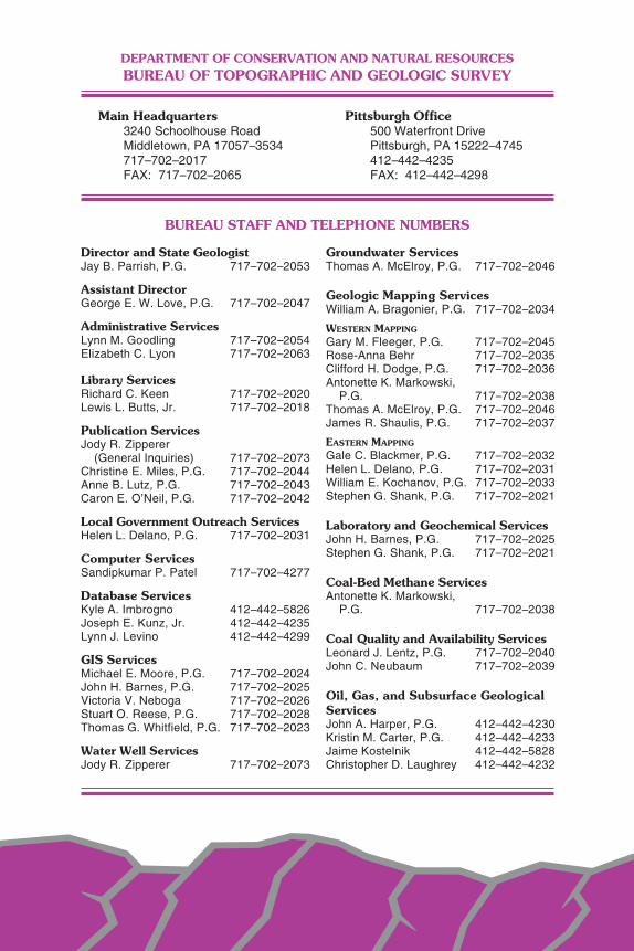
Director and State GeologistJay B. Parrish, P.G. 717–702–2053
Assistant DirectorGeorge E. W. Love, P.G. 717–702–2047
Administrative ServicesLynn M. Goodling 717–702–2054Elizabeth C. Lyon 717–702–2063
Library ServicesRichard C. Keen 717–702–2020Lewis L. Butts, Jr. 717–702–2018
Publication ServicesJody R. Zipperer
(General Inquiries) 717–702–2073Christine E. Miles, P.G. 717–702–2044Anne B. Lutz, P.G. 717–702–2043Caron E. O’Neil, P.G. 717–702–2042
Local Government Outreach ServicesHelen L. Delano, P.G. 717–702–2031
Computer ServicesSandipkumar P. Patel 717–702–4277
Database ServicesKyle A. Imbrogno 412–442–5826Joseph E. Kunz, Jr. 412–442–4235Lynn J. Levino 412–442–4299
GIS ServicesMichael E. Moore, P.G. 717–702–2024John H. Barnes, P.G. 717–702–2025Victoria V. Neboga 717–702–2026Stuart O. Reese, P.G. 717–702–2028Thomas G. Whitfield, P.G. 717–702–2023
Water Well ServicesJody R. Zipperer 717–702–2073
Groundwater ServicesThomas A. McElroy, P.G. 717–702–2046
Geologic Mapping ServicesWilliam A. Bragonier, P.G. 717–702–2034
WESTERN MAPPING
Gary M. Fleeger, P.G. 717–702–2045Rose-Anna Behr 717–702–2035Clifford H. Dodge, P.G. 717–702–2036Antonette K. Markowski,
P.G. 717–702–2038Thomas A. McElroy, P.G. 717–702–2046James R. Shaulis, P.G. 717–702–2037
EASTERN MAPPING
Gale C. Blackmer, P.G. 717–702–2032Helen L. Delano, P.G. 717–702–2031William E. Kochanov, P.G. 717–702–2033Stephen G. Shank, P.G. 717–702–2021
Laboratory and Geochemical ServicesJohn H. Barnes, P.G. 717–702–2025Stephen G. Shank, P.G. 717–702–2021
Coal-Bed Methane ServicesAntonette K. Markowski,
P.G. 717–702–2038
Coal Quality and Availability ServicesLeonard J. Lentz, P.G. 717–702–2040John C. Neubaum 717–702–2039
Oil, Gas, and Subsurface GeologicalServicesJohn A. Harper, P.G. 412–442–4230Kristin M. Carter, P.G. 412–442–4233Jaime Kostelnik 412–442–5828Christopher D. Laughrey 412–442–4232
ERRATUM: On page 7 of the previous issue (Pennsylvania Geology, v. 37, no. 3/4), in thefirst entry of the explanation for Figure 3, the contour interval should be 6 inches.

STATE GEOLOGIST’S EDITORIAL
Shale We Look For Gas?
Recently, you may have noticed articles in the popular press aboutthe abundant riches of gas beneath our feet in Pennsylvania, thanksto the Marcellus shale. Although the Marcellus will probably not bequite as productive as the hype suggests, there is not enough avail-able information to fully evaluate its potential. We often are told thatthe United States has plenty of oil and gas if only pesky environmen-tal restrictions could be removed and we could drill in Alaska. Butpeak petroleum production for the United States is past. We can findand produce more, but we are on the downward curve. Even coal,which we have always been taught could keep us warm for hundredsof years, is in shorter supply than we previously thought. The easystuff (thick beds of Pittsburgh coal) is quickly being mined. In addi-tion, international demand is increasing.
Pennsylvania is, however, faced with another, different kind of op-portunity. Rather than producing fossil fuels, we might be able to dis-pose of waste CO2 (the process of carbon sequestration), because wehave even more capacity for storing waste gases than we do for pro-viding the coal that produces the waste gases. The topic of carbonsequestration was addressed in a previous issue of this magazine(Pennsylvania Geology, v. 34, no. 2, p. 2–9). Here at the Survey wehope to focus much of our energy in the next few years mapping the
carbon sequestration potential of the east-ern portion of the state, as well as lookingat those all-important water resources. Allin all, it should be a busy time for us. Andwith oil at more than $100 per barrel andgold at around $1,000 per ounce, it is anexciting time to be a geologist.
Jay B. ParrishState Geologist

2
The Marcellus Shale—An Old “New”Gas Reservoir in Pennsylvania
by John A. HarperBureau of Topographic and Geologic Survey
WHAT’S ALL THE FUSS? Black, organic-rich shales are common con-stituents of sedimentary deposits formed throughout geologic time.In Pennsylvania, black, organic-rich shales can be found in almost allof the Paleozoic systems, as well as in the Triassic rocks of the New-ark and Gettysburg basins in the southeast. Some of these shalesare the sources of the crude oil and natural gas found in Pennsylva-nia’s sandstone and carbonate reservoirs. One shale unit in particu-lar, the Middle Devonian Marcellus Formation (see front cover), hasrecently become a hot item with the nation’s oil and gas industry, aswell as with the news media. One would think, from all the fuss aboutthe Marcellus, that it was a newly discovered gas reservoir contain-ing enough gas to sustain America’s needs for decades. In reality, theMarcellus has been a known gas reservoir for more than 75 years.What has made it newsworthy, besides much hyperbole, is that theoil and gas industry has both new technology and price incentives thatmake this otherwise difficult gas play economical.
FIRST, SOME HISTORY. Natural gas has been part of our heritagefor more than 200 years. Gas, along with crude oil, was found in nu-merous wells dug or drilled for salt water in colonial times. The firstwell drilled specifically to produce natural gas in North America wascompleted in Devonian shales. Citizens of Fredonia, N. Y., noticedgas bubbling up through the bed of Canadaway Creek, and some-one had the foresight to sink a well to collect the gas and use it tolight the town in 1821, 38 years before Drake drilled his famous oilwell at Titusville, Pa. The Fredonia well was only 27 feet deep, but itproduced enough gas to provide the light equivalent of “two goodcandles.” In 1850, the well was deepened to 70 feet and producedenough gas to light 200 burners. In 1858, a second well was drilledto more than 200 feet, and the gas lasted another 30 to 35 years.
As a result of the Fredonia wells, a flurry of drilling activity com-menced along the Lake Erie shoreline, eventually reaching at least asfar as Sandusky, Ohio. The gas came from black, organic-rich shales
3
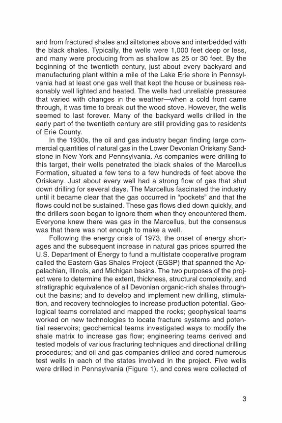
and from fractured shales and siltstones above and interbedded withthe black shales. Typically, the wells were 1,000 feet deep or less,and many were producing from as shallow as 25 or 30 feet. By thebeginning of the twentieth century, just about every backyard andmanufacturing plant within a mile of the Lake Erie shore in Pennsyl-vania had at least one gas well that kept the house or business rea-sonably well lighted and heated. The wells had unreliable pressuresthat varied with changes in the weather—when a cold front camethrough, it was time to break out the wood stove. However, the wellsseemed to last forever. Many of the backyard wells drilled in theearly part of the twentieth century are still providing gas to residentsof Erie County.
In the 1930s, the oil and gas industry began finding large com-mercial quantities of natural gas in the Lower Devonian Oriskany Sand-stone in New York and Pennsylvania. As companies were drilling tothis target, their wells penetrated the black shales of the MarcellusFormation, situated a few tens to a few hundreds of feet above theOriskany. Just about every well had a strong flow of gas that shutdown drilling for several days. The Marcellus fascinated the industryuntil it became clear that the gas occurred in “pockets” and that theflows could not be sustained. These gas flows died down quickly, andthe drillers soon began to ignore them when they encountered them.Everyone knew there was gas in the Marcellus, but the consensuswas that there was not enough to make a well.
Following the energy crisis of 1973, the onset of energy short-ages and the subsequent increase in natural gas prices spurred theU.S. Department of Energy to fund a multistate cooperative programcalled the Eastern Gas Shales Project (EGSP) that spanned the Ap-palachian, Illinois, and Michigan basins. The two purposes of the proj-ect were to determine the extent, thickness, structural complexity, andstratigraphic equivalence of all Devonian organic-rich shales through-out the basins; and to develop and implement new drilling, stimula-tion, and recovery technologies to increase production potential. Geo-logical teams correlated and mapped the rocks; geophysical teamsworked on new technologies to locate fracture systems and poten-tial reservoirs; geochemical teams investigated ways to modify theshale matrix to increase gas flow; engineering teams derived andtested models of various fracturing techniques and directional drillingprocedures; and oil and gas companies drilled and cored numeroustest wells in each of the states involved in the project. Five wellswere drilled in Pennsylvania (Figure 1), and cores were collected of

4
the Devonian shales in each that provided a wealth of data about bed-ding, mineralogy, fracture systems, and so forth.
I was part of the Pennsylvania Geological Survey team that spentseveral years doing basic mapping and correlation. The end prod-ucts included numerous cross sections, maps, and technical reports(e.g., Piotrowski and Harper, 1979) showing formation thickness, netfeet of organic-rich shales, and net feet of clean sandstone through-out the entire Middle and Upper Devonian sequence in western andnorth-central Pennsylvania. We determined that the Devonian organic-rich shales could be important gas reservoirs, at least in northwest-ern Pennsylvania where they were both thick and close to the sur-face. These shales were thought to have excellent potential to fill theneeds of users, especially if the expected development of better tech-nology for inducing and enhancing fracture systems that is so impor-tant to sustain production in shale came about. The deeper shales,
Figure 1. Map showing the general distribution of the Marcellus Formation inPennsylvania. Also shown are the locations of five wells drilled and cored dur-ing the Eastern Gas Shales Project (EGSP) study of the 1970s and 1980s. Ori-entations of measured fractures are shown (fracture data from Evans, 1994).

5
particularly the Marcellus Formation, were considered to be muchless attractive targets and would remain so until gas prices increasedand technology advanced enough to make drilling and completioncompetitive with more conventional targets. Neither occurred untilrecently.
The furor over the Devonian shales faded during the early 1980sdue to low gas prices and lack of sufficiently useful technologies forextracting the gas. The complete EGSP library, which has remainedrelatively obscure because of the lack of interest, is quite extensiveand includes a wealth of physical, chemical, geological, and engi-neering information. Much of it can be found in the National EnergyTechnology Laboratory’s compendium of natural gas archives (Na-tional Energy Technology Laboratory, 2007), which is available at nocost from the U.S. Department of Energy. In addition, summaries havebeen published over the years, such as that by Roen and Kepferle(1993), which provide very useful information on the shales. Anyoneinterested in finding out more about Devonian shales as gas reser-voirs should consult these publications.
Within the last three to four years, as a result of a combinationof higher prices, recent technological advances, and the develop-ment of large gas resources from black shales in other parts of thecountry, the interest in Pennsylvania’s organic-rich shales has risenonce again to a fever pitch within the state’s oil and gas industry.This is particularly true for the Marcellus Formation, which lies be-neath much of Pennsylvania (Figure 1). Some companies are pay-ing incredible fees for leases, while others are spending enormousamounts of money to drill Marcellus gas wells across the state, fromGreene County in the southwest to Wayne County in the northeast.All of this activity has been exciting the press, landowners, and stateand municipal authorities, who look upon the Marcellus as a majoreconomic boon for Pennsylvania.
RADIOACTIVITY = ORGANIC RICHNESS = GAS. The oil and gasindustry uses a number of geophysical logging tools to characterizethe subsurface rocks. The most commonly run logging tool in the Ap-palachian basin, the gamma-ray log, is a very sensitive Geiger counterthat measures the natural low-level radioactivity inherent in almostall sedimentary rocks. Most of the radiation emitted by these rocksis due to the radioactive potassium isotope (potassium-40) found infeldspars, micas, clay minerals, and other common and abundantsilicate minerals. On gamma-ray logs, shales can be differentiated

6
from other rocks such as clean sandstones and limestones becauseshales have higher concentrations of potassium-40-bearing minerals.
Organic-rich shales have higher radioactivity responses than typi-cal shales because the organic matter tends to concentrate uraniumions that otherwise would be scattered throughout the sediment (Adamsand Weaver, 1958; Schmoker, 1981). As a result, many organic-richshales have uranium and thorium contents that are greater than 10parts per million and that may approach 100 parts per million, whichwill show up on a gamma-ray log as higher-than-normal gamma-rayresponses (Figure 2). Comparisons of gamma-ray logs with drill cut-tings show a fairly strong correlation between higher-than-normal ra-dioactivity and black color in shales, derived from the organic content.To put it simply, black coloration generally correlates with organic rich-ness, which correlates with high gamma-ray response.
The icing on the cake, so to speak, was the number of studiesdone during and after EGSP that indicated an empirical relationshipbetween high gamma-ray response and both gas production and to-tal gas content in organic-rich shales. In other words, higher-than-normal gamma-ray response also equates to gas-production poten-tial. The correlation might not be 100 percent, but it is very high. Thisis a very important concept for those looking to produce shale gas.Many companies would look for places where the entire formation isthick, but they should actually be looking for where it is most rich inorganic matter. When we mapped the Devonian formations duringEGSP, we created maps showing the net feet of shale having higher-than-normal radioactive signatures on gamma-ray logs (equivalent tonet feet of organic-rich shale) (e.g., see back cover). It is my beliefthat these maps are far more accurate for finding good sources ofnatural gas than just mapping formation thickness.
THE MEEK SHALE INHERIT THE EARTH. The Devonian shales inPennsylvania occur at and near the base of a thick sequence of in-tercalated marine, transitional, and continental rocks known as theCatskill clastic wedge. This sequence is more than 10,000 feet thickin eastern Pennsylvania but thins to about 2,000 feet along the LakeErie shoreline (Colton, 1970). Pennsylvania’s thick sequence of De-vonian shales can be divided into organic-rich black shale facies andnot-so-organic-rich gray shale and siltstone facies (Figure 2). Thissequence is capped by the sandstone-rich portion of the Upper De-vonian that has been the “bread and butter” of the oil and gas indus-try in this state for 150 years.

7
The three most important organic-rich shales include the blackshale facies of the Middle Devonian Marcellus Formation and of theUpper Devonian West Falls Formation and Ohio Shale (the Rhine-street and Huron facies, respectively) (Figures 2 and 3). All have beenexplored at one time or another as natural gas reservoirs. Three less
Figure 2. Correlation of Middle and Upper Devonian organic-rich shale faciesand interbedded strata in three wells in Pennsylvania, based on gamma-ray logsignatures (the jagged purple lines) and descriptions of well cuttings. Note thatthe black shales correspond in large part to higher-than-normal gamma-rayreadings (radioactivity increases to the right in all log signatures).

8
important units include the Upper Devonian Harrell (and partiallyequivalent Genesee), Sonyea, and Java Formations (Figure 2). Allof the organic-rich shales, plus the associated gray shales and silt-stones that overlie and intercalate with them, participate as the res-ervoir for the shale-gas production along the margin of Lake Erie. Asystem of fractures in these shales constitutes the most important partof the reservoir by providing porosity and permeability that allows thegas to leak slowly from the rock.
QUO VADIS, MARCELLUS? The Marcellus Formation underlies mostof Pennsylvania (Figure 1), but the organic-rich portion reaches itsmaximum development in the northeastern part of the state (see backcover). Despite the long history of gas shows in the Marcellus, it tookuntil recently for its potential as a commercial gas target to attract at-tention.
By standard definition for mapping purposes, the Marcellus For-mation in Pennsylvania typically is defined as the black shales at the
Figure 3. Distribution of the thickest sequences of organic-rich shale in theOhio Shale, West Falls Formation, and Hamilton Group (Huron, Rhinestreet, andMarcellus facies, respectively) (based on Piotrowski and Harper, 1979, andHarper and Abel, 1980).

9
base of the Middle Devonian Hamilton Group; the upper part of thegroup is occupied by gray and dark-gray shales, siltstones, and (tothe east) sandstones of the Mahantango Formation (Figure 2). Theorganic richness (i.e., the black coloration) within the Hamilton Groupin the subsurface varies from place to place so that the Marcellus/Mahantango boundary fluctuates. Piotrowski and Harper (1979, Plate3) showed that the Hamilton Group as a whole thickens fairly regu-larly from northwest to southeast. However, the net feet of higher-than-normal radioactive shale in the Hamilton Group—the Marcellusfacies—has an interesting configuration (Piotrowski and Harper, 1979,Plate 4). The Marcellus generally thickens to the east, as expected,but throughout the eastern half of the Appalachian Plateaus physio-graphic province as far north as Tioga County, it also develops intoa series of linear thick areas situated on the crests of anticlines (seeback cover). Some of this thickening can be explained by repetitionof the section through faulting, but close correlation of logs alongand across the anticlines also indicates that, for some reason, moreof the Hamilton Group rock section becomes organic rich over thesestructures.
Pennsylvania’s Marcellus shale play began in 2003, when RangeResources–Appalachia, LLC (formerly Great Lakes Energy Partners,LLC) drilled a well to the Lower Silurian Rochester Shale in Washing-ton County. The deep formations (such as the Oriskany Sandstoneand the Lockport Dolomite) did not look favorable, but the Marcellusshale had some promise. Range drilled some additional wells, andthrough experimentation with drilling and hydraulic fracturing tech-niques borrowed and revised from those used on the MississippianBarnett Shale gas play in Texas, began producing Marcellus gas in2005. Since then, the company has permitted more than 150 Marcel-lus wells in Washington County alone. Other companies have joinedthe fray with permitting and drilling in many areas of the AppalachianPlateaus in Pennsylvania. As of the end of 2007, more than 375 sus-pected Marcellus wells had been permitted in Pennsylvania. An ad-ditional 78 had been permitted as of this writing (end of February,2008). Therefore, it appears that the Marcellus gas play will continueuntil and unless gas prices fall dramatically.
IT’S ALL ABOUT THE FRACTURES. Conventional gas reservoirs,such as the Lower Devonian Oriskany Sandstone, contain gas in porespaces between the sand grains. The gas migrated into the rock fromone or more source rocks during the Alleghanian orogeny about 250million years ago. Organic-rich shales, however, are their own sourcerocks, and gas molecules generated from the organic matter adsorb

10
onto the organic matrix of the rock. Over time, with the developmentof fractures of all sizes and orientations (Figure 1) due to a varietyof tectonic and hydraulic stresses, some of the gas desorbed fromthe matrix and migrated into these fractures. It was these pockets ofgas that the early drillers tapped. Because desorption takes placerelatively slowly, the fractures could not be refilled quickly enough tomaintain a constant flow, so drilling continued past this potential res-ervoir and commercial quantities were found in deeper conventionalreservoirs. The natural fractures are neither numerous nor extensiveenough to maintain production except in certain areas of Kentucky,West Virginia, Ohio, and along the Lake Erie shore.
Since the early 1960s, Pennsylvania’s oil and gas industry hasused hydraulic fracturing (fracing, pronounced “fracking”) to enhancethe recovery of oil and natural gas. This involves pumping a fluidsuch as water or kerosene and, usually, sand or some other granu-lar material into the producing formation under high pressure untilthe rock cracks. The process enhances the porosity and permeabil-ity of the rock, and the granular material (the propant) serves to propopen the newly created fractures. As a result, the surface area of therock increases, allowing gas to travel more readily from the pores tothe well bore.
Shales are different than conventional hydrocarbon reservoirs.They have extremely low permeabilities and do not accept frac jobsas readily. During EGSP, petroleum engineers modeled many typesof frac jobs trying to find the right combination of fluids, propants, andpressures to maximize production in shales. But it was not until de-velopment of the Barnett Shale play in the 1990s that a techniquesuitable for fracing shales was developed. This technique is called a“slick-water frac” and consists of sand and very large volumes offreshwater that has been treated with a friction reducer such as a gel.Slick-water fracs maximize the length of the fractures horizontallywhile minimizing the vertical fracture height, resulting in greater gasmobility and more efficient recovery of a larger volume of the gas.
Another technique that has become useful in producing Marcel-lus gas is horizontal drilling. The first horizontal well was drilled inTexas in 1929, but it took until the 1980s for the technology to be im-proved enough to become a standard industry practice. The technol-ogy involves drilling a vertical hole to several hundred feet above thetarget reservoir, then directing the drill bit through an arc until it is lit-erally drilling sideways instead of downward (Figure 4). This has sev-eral advantages: (1) it increases the amount of reservoir penetrated

11
from perhaps a few tens of feet to as much as 3,000 or 4,000 feet;(2) it increases the number of fractures penetrated; and (3) it can beused to develop hydrocarbon resources beneath sensitive areas suchas wetlands and cities where a drilling rig cannot be set up. A slick-water frac in a vertical Marcellus well uses from 500,000 to more than1,000,000 gallons of water (a typical sandstone frac job uses only about
Figure 4. A comparison between a horizontal well and a typical vertical welldrilled to the Marcellus organic-rich shales. The horizontal well has the advan-tages of turning a relatively thin reservoir into a very thick one, and of being cer-tain to intersect a larger number of fractures. The inset map shows a hypotheti-cal lease and the two wells. Note that this map shows the locations of both thetop and bottom of the horizontal well and the course and distance between them.

5,000 to 50,000 gallons). A slick-water frac in a horizontal Marcelluswell will probably use several million gallons of water. Based on in-formation from the Barnett Shale play, a horizontal well completionmight use more than 3 million gallons (so far, I have not seen a wellrecord involving a horizontal shale completion in Pennsylvania).
BUT IS IT REALLY WORTH IT? During EGSP, the U.S. GeologicalSurvey estimated that the Marcellus contains about 295 trillion cubicfeet (Tcf) of gas-in-place in the Appalachian basin (Charpentier andothers, 1993). Figuring a recovery of 3 to 5 percent, that means 9 to15 Tcf is recoverable throughout the basin. Briggs and Tatlock (1999)assessed Pennsylvania’s natural gas resources and estimated thatthe Devonian shales could potentially produce 8.4 Tcf within the state,which is in line with the lower estimate of Charpentier and others(1993). A more recent assessment of the Devonian shales in the Ap-palachian basin (Milici and Swezey, 2006) determined that theseshales contain 31.4 Tcf of recoverable gas. Of course, none of theseestimates took into consideration today’s prices and technologies.One very recent estimate indicates that the Marcellus has more than500 Tcf of gas in place with about 50 Tcf recoverable (Smeltz, 2008).Whether any of these estimates is reasonable remains to be seen.
The true value of the Marcellus organic-rich shale as a gas reser-voir has yet to be determined. Cabot Oil and Gas Corporation, whichis leasing and drilling in northeastern Pennsylvania, has been quotedas saying its wells are testing between 800,000 and 1,000,000 cubicfeet per day (IHS, 2008, p. 1). Based on the limited production infor-mation that has been received by the state so far, the average dailyproduction from a Marcellus well in Pennsylvania is about 45 thou-sand cubic feet of gas per day, which is considered marginal at best.It should be noted that this average is based on only two years’ datafrom relatively few vertical wells. We still do not have any details fromhorizontal shale wells. Only time (and more data) will determine justhow productive and lucrative the Marcellus play is. It is possible thatthe Marcellus will ultimately turn out to be the great gas reservoir every-one is fussing about.
REFERENCES CITED
Adams, J. A. S., and Weaver, C. E., 1958, Thorium-to-uranium ratios as indicatorsof sedimentary processes—example of concept of geochemical facies: AAPG Bul-letin, v. 42, p. 387–430.
Briggs, R. P., and Tatlock, D. B., 1999, Petroleum—Guide to undiscovered recover-able natural gas resources, chap. 38C of Shultz, C. H., ed., The Geology of Penn-sylvania: Pennsylvania Geological Survey, 4th ser., Special Publication 1, p. 530–547. [Co-published with Pittsburgh Geological Society.]
12
13
Charpentier, R. R., de Witt, Wallace, Jr., Claypool, G. E., and others, 1993, Estimatesof unconventional natural gas resources of the Devonian shales of the Appalachianbasin, in Roen, J. B., and Kepferle, R. C., eds., Petroleum geology of the Devonianand Mississippian black shale of eastern North America: U.S. Geological SurveyBulletin 1909, p. N1–N20.
Colton, G. W., 1970, The Appalachian basin—its depositional sequences and theirgeologic relationships, in Fisher, G. W., and others, eds., Studies of AppalachianGeology—Central and Southern: New York, Interscience Publishers, p. 5–47.
Evans, M. A., 1994, Joints and décollement zones in Middle Devonian shales—Evi-dence for multiple deformation events in the central Appalachian Plateau: Geolo-gical Society of America Bulletin, v. 106, p. 447–460.
Harper, J. A., and Abel, K. D., 1980, Net feet of radioactive shale in Perrysburg For-mation and Huron Shale (Dunkirk facies), northwestern Pennsylvania: U.S. Depart-ment of Energy, Eastern Gas Shales Project, EGSP Series 25, scale 1:250,000.
IHS, 2008, Drilling Wire—Northeastern U.S.: IHS, Inc., Appalachian Basin Edition,February 20, 2008, v. 47, no. 8.
Milici, R. C., and Swezey, C. S., 2006, Assessment of Appalachian basin oil and gasresources; Devonian shale—Middle and Upper Paleozoic total petroleum system:U.S. Geological Survey Open-File Report 2006–1237, 70 p., with additional fig-ures and tables, pubs.usgs.gov/of/2006/1237 (accessed on March 18, 2008).
National Energy Technology Laboratory, 2007, Natural gas program archive: U.S.Department of Energy, Office of Fossil Energy, NETL 2007/1285, CD–ROM.
Piotrowski, R. G., and Harper, J. A., 1979, Black shale and sandstone facies of theDevonian “Catskill” clastic wedge in the subsurface of western Pennsylvania: U.S.Department of Energy, Eastern Gas Shales Project, EGSP Series 13, 40 p.
Roen, J. B., and Kepferle, R. C., eds., 1993, Petroleum geology of the Devonian andMississippian black shale of eastern North America: U.S. Geological Survey, Bul-letin 1909, 14 chapters individually paginated.
Schmoker, J. W., 1981, Determination of organic-matter content of Appalachian De-vonian shales from gamma-ray logs: AAPG Bulletin, v. 65, p. 1285–1298.
Smeltz, Adam, 2008, Massive gas field detected: State College, Pa., Centre DailyTimes, January 18, 2008.
Meet the Staff—Part 6
In Part 6 of “Meet the Staff,” we learn about the GIS Servicesarea of the Survey. One of the staff members, John Barnes, alsoworks in Laboratory and Geochemical Services and was previouslyintroduced in Part 4 of this series (see Pennsylvania Geology, v. 37,no. 2, p. 16–18). The other staff are introduced below.
GIS SERVICES. The GIS Services section was created in 2001 tointegrate the expanding capabilities of geographic information sys-tems (GIS) and companion digital technologies, such as global po-
14
sitioning systems (GPS), into the daily operations of the agency. Inaddition to providing cartographic support to other geologic staff, theGIS Services staff also use the analytical capabilities of GIS technol-ogy to present complex geologic relationships more clearly. Studieswithin the state have included such topics as the occurrence of acid-producing minerals, density of karst features, and delineation of phys-iographic units.
Looking to the future, the statewide imagery and lidar-derivedelevation data being generated by the PAMAP program will be usedin GIS projects to better define the topography and geology of Penn-sylvania. Initially, the level of detail in these data will require that GISServices staff redefine many fundamental datasets, such as water-shed boundaries and stream reaches across the state.
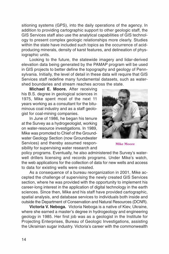
Michael E. Moore. After receivinghis B.S. degree in geological sciences in1975, Mike spent most of the next 11years working as a consultant for the bitu-minous coal industry and as a staff geolo-gist for coal-mining companies.
In June of 1986, he began his tenureat the Survey as a hydrogeologist, workingon water-resource investigations. In 1989,Mike was promoted to Chief of the Ground-water Geology Section (now GroundwaterServices) and thereby assumed respon-sibility for supervising water research andpolicy programs. Eventually, he also administered the Survey’s water-well drillers licensing and records programs. Under Mike’s watch,the web applications for the collection of data for new wells and accessto data for existing wells were created.
As a consequence of a bureau reorganization in 2001, Mike ac-cepted the challenge of supervising the newly created GIS Servicessection, where he was provided with the opportunity to implement hiscareer-long interest in the application of digital technology in the earthsciences. Since then, Mike and his staff have provided cartographic,spatial analysis, and database services to individuals both inside andoutside the Department of Conservation and Natural Resources (DCNR).
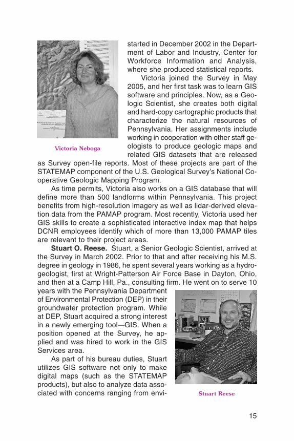
Victoria V. Neboga. Victoria Neboga is a native of Kiev, Ukraine,where she earned a master’s degree in hydrogeology and engineeringgeology in 1985. Her first job was as a geologist in the Institute forProjecting Enterprises, Bureau of Geologic Investigations, assistingthe Ukrainian sugar industry. Victoria’s career with the commonwealth
Mike Moore
15
started in December 2002 in the Depart-ment of Labor and Industry, Center forWorkforce Information and Analysis,where she produced statistical reports.
Victoria joined the Survey in May2005, and her first task was to learn GISsoftware and principles. Now, as a Geo-logic Scientist, she creates both digitaland hard-copy cartographic products thatcharacterize the natural resources ofPennsylvania. Her assignments includeworking in cooperation with other staff ge-ologists to produce geologic maps andrelated GIS datasets that are released
as Survey open-file reports. Most of these projects are part of theSTATEMAP component of the U.S. Geological Survey’s National Co-operative Geologic Mapping Program.
As time permits, Victoria also works on a GIS database that willdefine more than 500 landforms within Pennsylvania. This projectbenefits from high-resolution imagery as well as lidar-derived eleva-tion data from the PAMAP program. Most recently, Victoria used herGIS skills to create a sophisticated interactive index map that helpsDCNR employees identify which of more than 13,000 PAMAP tilesare relevant to their project areas.
Stuart O. Reese. Stuart, a Senior Geologic Scientist, arrived atthe Survey in March 2002. Prior to that and after receiving his M.S.degree in geology in 1986, he spent several years working as a hydro-geologist, first at Wright-Patterson Air Force Base in Dayton, Ohio,and then at a Camp Hill, Pa., consulting firm. He went on to serve 10years with the Pennsylvania Departmentof Environmental Protection (DEP) in theirgroundwater protection program. Whileat DEP, Stuart acquired a strong interestin a newly emerging tool—GIS. When aposition opened at the Survey, he ap-plied and was hired to work in the GISServices area.
As part of his bureau duties, Stuartutilizes GIS software not only to makedigital maps (such as the STATEMAPproducts), but also to analyze data asso-ciated with concerns ranging from envi-
Victoria Neboga
Stuart Reese

ronmental hazards to the DCNR TreeVitalize programs. Some of hiswork on environmental hazards resulted in the online reports Map 68and Map 70, which he coauthored with fellow staff geologist BillKochanov. These maps use gradational colors to show the concen-tration of karst features (mostly sinkholes and closed depressions).
Part of Stuart’s time is spent on work outside of GIS Services.He was responsible for the Survey’s web site for a few years and stillmaintains several web pages. And although he is not formally assignedto Groundwater Services, Stuart often assists in that area.
Thomas G. Whitfield. Tom has a B.S. in geology and did gradu-ate work in mining technology and borehole geophysics. He startedhis career as a well-log analyst and completion consultant for two geo-physical well-logging companies in the oil and gas fields of westernPennsylvania. He then worked for U.S. Steel Corporation as coman-ager of their midwestern field office, doing coal-exploration projectsfor nearly 6 years. In 1986, Tom joined the DEP Bureau of Oil andGas Management, where he helped implement the program to plugorphaned and abandoned wells.
Tom started with the Geologic Mapping Division of the Survey inMarch 1991. After about a year, he volunteered to try a new technologycalled “GIS.” In the fall of 1992, Tom became the first full-time GISperson in the Survey and soon after set to work as a key member ofthe team digitizing the 1:250,000-scale Geologic Map of Pennsylva-nia and compiling the Bedrock Geology of Pennsylvania dataset. Asa Senior Geologic Scientist in GIS Services, Tom works on variousGIS projects, including the previously mentioned STATEMAP prod-ucts. He also works with the technical aspects of PAMAP imageryand lidar-derived digital elevation models. He recently developed araster-seam conflation tool that repairs seam lines in raster mosaics.
Tom also has an unusualhobby. He is a certified emer-gency medical technician(EMT) with 28 years of expe-rience, and he volunteers witha local ambulance service. TheSurvey benefits from Tom’sexpertise in this area, as hechairs our “Fire and PanicCommittee” and educates thestaff on how best to handlelife-threatening emergencies.
16
Tom Whitfield

17
NEW RELEASES
Sixteen New Open-FileReports Now Online
The Bureau of Topographic andGeologic Survey recently releasedsixteen online open-file reports,all of which are available on theSurvey’s web site at www.dcnr.state.pa.us/topogeo/openfile/ofloc.aspx. A list of these reportsand their authors is shown in thetable on the next page.
Two of the reports are in thebedrock map series and elevenare in the surficial map series.These 13 studies were funded bythe STATEMAP component of theU.S. Geological Survey’s NationalCooperative Geologic MappingProgram. Each report includesone 1:24,000-scale, full-color geo-logic map, text, and data tables.The maps are presented in por-table document format (PDF).Relevant geographic-information-system (GIS) data and ArcMapdocuments are also provided asseparate downloads.
Another guide to the geologyof the Gettysburg Battlefield hasbeen made available in the gen-eral geology series. This report isa 16-page field-guide article thatwas condensed from the 105-pageguidebook used at the 2006 an-nual meeting of the GeologicalSociety of America and also pub-
lished by the Survey as OF 06–02. The article was written espe-cially to be used by a solitary ge-ologist driving around the battle-field, although it can be used byanyone visiting Gettysburg.
Two new coal availability stud-ies are now available online asmineral resource reports. Thesereports are the fourth and fifth ina series of coal availability stud-ies for the Main Bituminous coalfield of Pennsylvania to be pub-lished in recent months (seePennsylvania Geology, v. 35, no.3/4, p. 13, and v. 36, no. 1, p. 20).Coal available for extraction isthat which is accessible withinvarious regulatory, land-use, andtechnologic constraints. As in theearlier reports, the authors usedGIS technology to compare areasof original coal to areas wherecoal had been mined and wheremining is restricted. The Clymerstudy indicates that about 208million short tons is available formining, or about 42 percent ofthe total original resources. TheWaynesburg study shows thatabout 897 million short tons ofcoal is available for mining, whichis about 77 percent of the origi-nal resources.

18
BEDROCK GEOLOGY REPORTSOFBM 08–01.0 Bedrock geologic map of the New Holland quadrangle, Lancas-
ter County, Pennsylvania, by Carolyn H. Brown, STATEMAP co-operator, Pennsylvania Geological Survey.
OFBM 08–02.0 Bedrock geologic map of the McAlevys Fort quadrangle, Hunt-ingdon, Centre, and Mifflin Counties, Pennsylvania, by Arnold G.Doden and David P. Gold, GMRE, Inc., State College, Pa.
GENERAL GEOLOGY REPORTOFGG 08–01.0 Geology of the Gettysburg Battlefield—How Mesozoic Events
and Processes Impacted American History, by Roger J. Cuffey,Pennsylvania State University; Jon D.Inners and Gary M. Fleeger,Pennsylvania Geological Survey; and others.
MINERAL RESOURCE REPORTSOFMR 08–01.0 A Study of Coal Availability in the Clymer 7.5-Minute Quadrangle,
Indiana County, Pennsylvania, by Viktoras W. Skema, Leonard J.Lentz, John C. Neubaum, and Rose-Anna Behr, PennsylvaniaGeological Survey.
OFMR 08–02.0 A Study of Coal Availability in the Waynesburg 7.5-minute Quad-rangle, Greene and Washington Counties, Pennsylvania, byViktoras W. Skema, James R. Shaulis, and Rose-Anna Behr,Pennsylvania Geological Survey, and others.
SURFICIAL GEOLOGY REPORTSby Duane D. Braun, Bloomsburg University
OFSM 08–01.0 Surficial geology of the Waymart 7.5-minute quadrangle, Wayneand Lackawanna Counties, Pennsylvania.
OFSM 08–02.0 Surficial geology of the Forest City 7.5-minute quadrangle, Wayne,Susquehanna, and Lackawanna Counties, Pennsylvania.
OFSM 08–03.0 Surficial geology of the Clifford 7.5-minute quadrangle, Susque-hanna and Lackawanna Counties, Pennsylvania.
OFSM 08–04.0 Surficial geology of the Honesdale 7.5-minute quadrangle, WayneCounty, Pennsylvania.
OFSM 08–05.0 Surficial geology of the Wayne County portion of the White Mills7.5-minute quadrangle, Wayne County, Pennsylvania.
OFSM 08–06.0 Surficial geology of the Wayne County portion of the Narrows-burg 7.5-minute quadrangle, Wayne County, Pennsylvania.
OFSM 08–07.0 Surficial geology of the Sterling 7.5-minute quadrangle, Wayneand Lackawanna Counties, Pennsylvania.
OFSM 08–08.0 Surficial geology of the Wayne County portion of the Newfound-land 7.5-minute quadrangle, Wayne County, Pennsylvania.
OFSM 08–09.0 Surficial geology of the Aldenville 7.5-minute quadrangle, WayneCounty, Pennsylvania.
OFSM 08–10.0 Surficial geology of the Galilee 7.5-minute quadrangle, WayneCounty, Pennsylvania.
OFSM 08–15.0 Surficial geology of the Damascus 7.5-minute quadrangle, WayneCounty, Pennsylvania.

19
Donald T. Hoff, the curator forEarth Science at the State Mu-seum of Pennsylvania (formerlythe William Penn Memorial Mu-seum) from 1963 until 1991, diedon December 4, 2007. During hislengthy tenure, he organized out-standing geology displays as wellas an extensive and well-refer-enced collection of minerals fromPennsylvania. Don was equally athome working in the field of pa-leontology and is well known forhis excavation of a Pleistocenemastodon from a peat bog in Mon-roe County and giant amphibiansfrom Triassic sediments in YorkCounty.
Don was a geology graduateof Waynesburg College, Pa., buthis interest in geology began muchearlier on mineral-collecting tripsin Pennsylvania and Ontario withhis family. He was especially inter-ested in the native copper and pie-montite occurrences in the SouthMountain region of Adams Countyand in uranium minerals fromthroughout Pennsylvania. In 1984,he and Bob Smith (now retiredfrom the Survey) coauthored Ge-
ology and Mineralogy of Copper-Uranium Occurrences in the Pic-ture Rocks and Sonestown Quad-rangles, Lycoming and SullivanCounties, Pennsylvania, publishedby the Survey. In the report, Donwas able to combine his interestsby describing the fish and plantfossils that were found in the area,as well as the copper and ura-nium minerals that had replacedthem. Don also wrote the chapteron minor mineral resources suchas talc, serpentine, feldspar, graph-ite, mica, phyllite, beryl, phosphate,and metabasalt for the Survey’sbook, The Geology of Pennsylva-nia. Don probably most enjoyedwriting his article about the Teeterquarry in Gettysburg, which waspublished by Rocks and Miner-als, in which he was one of thefirst to recognize a small copper-rich zone akin to a Cornwall-type
IN MEMORIAM
Donald T. HoffMineralogist, Earth Scientist, Curator, and Friend
1930–2007
Don Hoff and mastodon femur in 1968.Photograph courtesy of The State Mu-seum of Pennsylvania (PennsylvaniaHistorical and Museum Commission).
20
deposit complete with trace nativegold-electrum. As far as is known,Don was the first person to haveever recognized such in bedrockin the Commonwealth, a fitting trib-ute to his powers of observation.
Don did everything he couldto support the interests of rock,mineral, and fossil collectors inPennsylvania. There are count-less people who benefited fromDon’s assistance and tireless en-thusiasm for all things geologic.An engaging conversationalist, hiszeal in assisting the museum wascontagious and typically resulted
in remarkable cooperation. Onelandowner gave up a collection ofdinosaur footprints from his homepatio for the museum as a resultof simply chatting with Don, whohad stopped to make a purchaseof cider at a roadside stand.
Don always seemed happywhen discovering something new,but he would become happier stillwhen sharing what he discoveredwith others. His enthusiasm andeagerness to share both storiesand specimens will be missed.
—Robert C. Smith, II, andG. Robert Ganis
ANNOUNCEMENT
73rd Field Conference ofPennsylvania Geologists
The 73rd Field Conference ofPennsylvania Geologists will ad-dress the physiographic, strati-graphic, structural, and militarygeology of the Gettysburg area.It is being hosted by the Penn-sylvania Geological Survey, ThePennsylvania State University,Gettysburg National Military Park,Pennsylvania Department of En-vironmental Protection, and Val-ley Quarries, Inc. The conferencewill be held September 25–27,2008, and will be headquarteredat the Wyndham Resort Hotel inGettysburg, Pa. One day of themeeting will be devoted to stopsrelated to the stratigraphy and
structure of the Gettysburg basin(one of numerous Mesozoic riftbasins in eastern North America),and the other day will be focusedon the role geology played dur-ing the Gettysburg campaign. Twolarge quarries will be visited, eachhaving peculiar geologic histories.
Current information can befound at http://fcopg.org. Futureupdates will include registrationmaterial. Registration forms mayalso be obtained in August andSeptember from Field Confer-ence of Pennsylvania Geologists,c/o Pennsylvania Geological Sur-vey, 3240 Schoolhouse Road,Middletown, PA 17057–3534.
CONTENTS
Shale we look for gas?............................................................................. 1The Marcellus shale—An old “new” gas reservoir in Pennsylvania ............ 2Meet the staff—Part 6 .............................................................................. 13New releases—Sixteen new open-file reports now online........................ 17In memoriam—Donald T. Hoff.................................................................. 19Announcement—73rd Field Conference of Pennsylvania Geologists ...... 20
ON THE COVER
An outcrop of the Marcellus shale (see article on page 2), located about 1.8miles southeast of Milton, Pa. The scale is about 6 inches long. Photographby Jon D. Inners (Inners, J. D., 1997, Geology and Mineral Resources of theAllenwood and Milton Quadrangles, Union and Northumberland Counties,Pennsylvania: Pennsylvania Geological Survey, 4th ser., Atlas 144cd, p. 37).
PENNSYLVANIA GEOLOGY
PENNSYLVANIA GEOLOGY is published quarterly by the Bureau of Topographic andGeologic Survey, Pennsylvania Department of Conservation and Natural Resources, 3240Schoolhouse Road, Middletown, PA 17057–3534.Editors: Anne B. Lutz and Caron E. O’Neil.Contributed articles are welcome. Guidelines for manuscript preparation may be obtainedat www.dcnr.state.pa.us/topogeo/pub/pageolmag/pageolguide.aspx or by contacting theeditors at the address listed above.
VOL. 38, NO. 1 SPRING 2008
DEPARTMENT OF CONSERVATION AND NATURAL RESOURCESBUREAU OF TOPOGRAPHIC AND GEOLOGIC SURVEY
Main Headquarters3240 Schoolhouse RoadMiddletown, PA 17057–3534717–702–2017FAX: 717–702–2065
Pittsburgh Office500 Waterfront DrivePittsburgh, PA 15222–4745412–442–4235FAX: 412–442–4298
BUREAU STAFF AND TELEPHONE NUMBERS
COMMONWEALTH OF PENNSYLVANIAEdward G. Rendell, Governor
DEPARTMENT OF CONSERVATION AND NATURAL RESOURCESMichael DiBerardinis, Secretary
OFFICE OF CONSERVATION AND TECHNICAL SERVICESCindy Adams Dunn, Deputy Secretary
BUREAU OF TOPOGRAPHIC AND GEOLOGIC SURVEYJay B. Parrish, Director
Bureau web site: www.dcnr.state.pa.us/topogeoDCNR web site: www.dcnr.state.pa.us
Pennsylvania home page: www.state.pa.us
Director and State GeologistJay B. Parrish, P.G. 717–702–2053
Assistant DirectorGeorge E. W. Love, P.G. 717–702–2047
Administrative ServicesLynn M. Goodling 717–702–2054Elizabeth C. Lyon 717–702–2063
Library ServicesRichard C. Keen 717–702–2020Lewis L. Butts, Jr. 717–702–2018
Publication ServicesJody R. Zipperer
(General Inquiries) 717–702–2073Christine E. Miles, P.G. 717–702–2044Anne B. Lutz, P.G. 717–702–2043Caron E. O’Neil, P.G. 717–702–2042
Local Government Outreach ServicesHelen L. Delano, P.G. 717–702–2031
Computer ServicesSandipkumar P. Patel 717–702–4277
Database ServicesKyle A. Imbrogno 412–442–5826Joseph E. Kunz, Jr. 412–442–4235Lynn J. Levino 412–442–4299
GIS ServicesMichael E. Moore, P.G. 717–702–2024John H. Barnes, P.G. 717–702–2025Victoria V. Neboga 717–702–2026Stuart O. Reese, P.G. 717–702–2028Thomas G. Whitfield, P.G. 717–702–2023
Water Well ServicesJody R. Zipperer 717–702–2073
Groundwater ServicesThomas A. McElroy, P.G. 717–702–2046
Geologic Mapping ServicesWilliam A. Bragonier, P.G. 717–702–2034
WESTERN MAPPING
Gary M. Fleeger, P.G. 717–702–2045Rose-Anna Behr 717–702–2035Clifford H. Dodge, P.G. 717–702–2036Antonette K. Markowski,
P.G. 717–702–2038Thomas A. McElroy, P.G. 717–702–2046James R. Shaulis, P.G. 717–702–2037
EASTERN MAPPING
Gale C. Blackmer, P.G. 717–702–2032Helen L. Delano, P.G. 717–702–2031William E. Kochanov, P.G. 717–702–2033Stephen G. Shank, P.G. 717–702–2021
Laboratory and Geochemical ServicesJohn H. Barnes, P.G. 717–702–2025Stephen G. Shank, P.G. 717–702–2021
Coal-Bed Methane ServicesAntonette K. Markowski,
P.G. 717–702–2038
Coal Quality and Availability ServicesLeonard J. Lentz, P.G. 717–702–2040John C. Neubaum 717–702–2039
Oil, Gas, and Subsurface GeologicalServicesJohn A. Harper, P.G. 412–442–4230Kristin M. Carter, P.G. 412–442–4233Jaime Kostelnik 412–442–5828Christopher D. Laughrey 412–442–4232
ERRATUM: On page 7 of the previous issue (Pennsylvania Geology, v. 37, no. 3/4), in thefirst entry of the explanation for Figure 3, the contour interval should be 6 inches.

Bureau of Topographic and Geologic SurveyDepartment of Conservation and Natural Resources3240 Schoolhouse RoadMiddletown, PA 17057–3534
Address Service Requested
An Equal Opportunity Employer 2200–BK–DCNR0103Recycled Paper
NET FEET OF ORGANIC-RICH SHALE IN THE MARCELLUS FORMATION
(Modified from Piotrowski and Harper, 1979, Plate 4)(See article on page 2.)
Presorted StandardU.S. Postage
PaidHarrisburg, PAPermit No. 747