paleoenvironmental history of the west baray, angkor...
TRANSCRIPT
Paleoenvironmental history of theWest Baray, Angkor (Cambodia)Mary Beth Daya,1, David A. Hodellb, Mark Brennerc, Hazel J. Chapmana, Jason H. Curtisd, William F. Kenneyc,Alan L. Kolatae, and Larry C. Petersonf
aDepartment of Earth Sciences, Downing Street, University of Cambridge, Cambridge, UK, CB2 3EQ; bDepartment of Earth Sciences and GodwinLaboratory for Palaeoclimate Research, Downing Street, University of Cambridge, Cambridge, UK, CB2 3EQ; cDepartment of Geological Sciences and LandUse and Environmental Change Institute, P.O. Box 112120, University of Florida, Gainesville, FL, 32611; dDepartment of Geological Sciences, P.O. Box112120, University of Florida, Gainesville, FL, 32611; eDepartment of Anthropology, 1126 East 59th Street, University of Chicago, Chicago, IL, 60637; andfRosenstiel School of Marine and Atmospheric Science, 4600 Rickenbacker Causeway, University of Miami, Miami, FL, 33149
Edited by Mark H Thiemens, University of California San Diego, La Jolla, CA, and approved November 22, 2011 (received for review July 15, 2011)
Angkor (Cambodia) was the seat of the Khmer Empire from the 9thto 15th century AD. The site is noted for its monumental architec-ture and complex hydro-engineering systems, comprised of canals,moats, embankments, and large reservoirs, known as barays. Weinfer a 1,000-y, 14C-dated paleoenvironmental record from study ofan approximately 2-m sediment core taken in the largest Khmerreservoir, the West Baray. The baray was utilized and managedfrom the time of construction in the early 11th century, throughthe 13th century. During that time, the West Baray received rela-tively high rates of detrital input. In the 14th century, linear sedi-mentation rates diminished by an order of magnitude, yieldinga condensed section that correlates temporally with episodes ofregional monsoon failure during the late 14th and early 15thcentury, recorded in tree ring records from Vietnam. Our resultsdemonstrate that changes in the water management system wereassociated with the decline of the Angkorian kingdom during thatperiod. By the 17th century, the West Baray again functioned as alimnetic system. Ecologic and sedimentologic changes over the lastmillennium, detected in the baray deposits, are attributed to shiftsin regional-scale Khmer water management, evolving land usepractices in the catchment, and regional climate change.
isotope geochemistry ∣ paleolimnology ∣ collapse
Angkor was established as the capital of the Khmer Empire inthe ninth century and became the most extensive preindus-
trial urban complex in the world (Fig. 1) (1, 2). Although bestknown for its monumental architecture, particularly the AngkorWat temple, one of Angkor’s most impressive features is itselaborate water management system. A network of reservoirs,channels, moats, and embankments extended over approximately1;000 km2. The city’s location in lowland Southeast Asia (Cam-bodia) meant the Khmer had to contend with seasonal monsoonrainfall. The complex water management network enabled theKhmer to collect, store, and release water as needed (2–5). Bar-ays, in particular, were used to store excess water delivered duringthe summer monsoon. This water could later be distributed topaddy fields between the main temple area around Angkor Watand Tonle Sap Lake, in the event of a water shortage caused byinsufficient rainfall (2). Some scholars have argued that the watermanagement system was purely symbolic (6, 7), but it was prob-ably used for a combination of flood control, irrigation, and ritualpurposes (1, 2, 8–10). The water management network was likelya multipurpose architectonic feature serving different functionsat different times (3).
The decline of the Khmer Empire in the 14th to 15th centurieshas been attributed to several factors, including war, conversionto Theravada Buddhism, changing regional trade patterns, over-population, and environmental stress (11). Recent evidencesuggests that the water management system may have been insuf-ficient to cope with changing hydrological conditions (1, 3, 5, 12).Alterations, breaches, and failures within the network have beendocumented and hint at deterioration of the hydraulic infrastruc-
ture (1, 2, 12, 13). Tree ring records from Vietnam indicateextended periods of severe drought punctuated by unusually rainyintervals during the late 14th and early 15th centuries (12)(Fig. 2B). Such intense variability in multidecadal precipitationmay have overwhelmed the capabilities of the water managementnetwork. Intense droughts occurred during the transition fromthe relatively wet Medieval Climate Anomaly (MCA) to the drierLittle Ice Age (LIA) and were associated with a southward shiftof the Intertropical Convergence Zone (ITCZ) as well as inten-sified El-Niño-like warming of the tropical Pacific Ocean (12, 14).Monsoon intensity in Southeast Asia, including megadroughts,has been linked to tropical Pacific sea surface temperatures(SSTs) throughout the last millennium (15). Failure of the hy-draulic network during a period of extreme rainfall variation mayhave been a factor in the decline of Angkor.
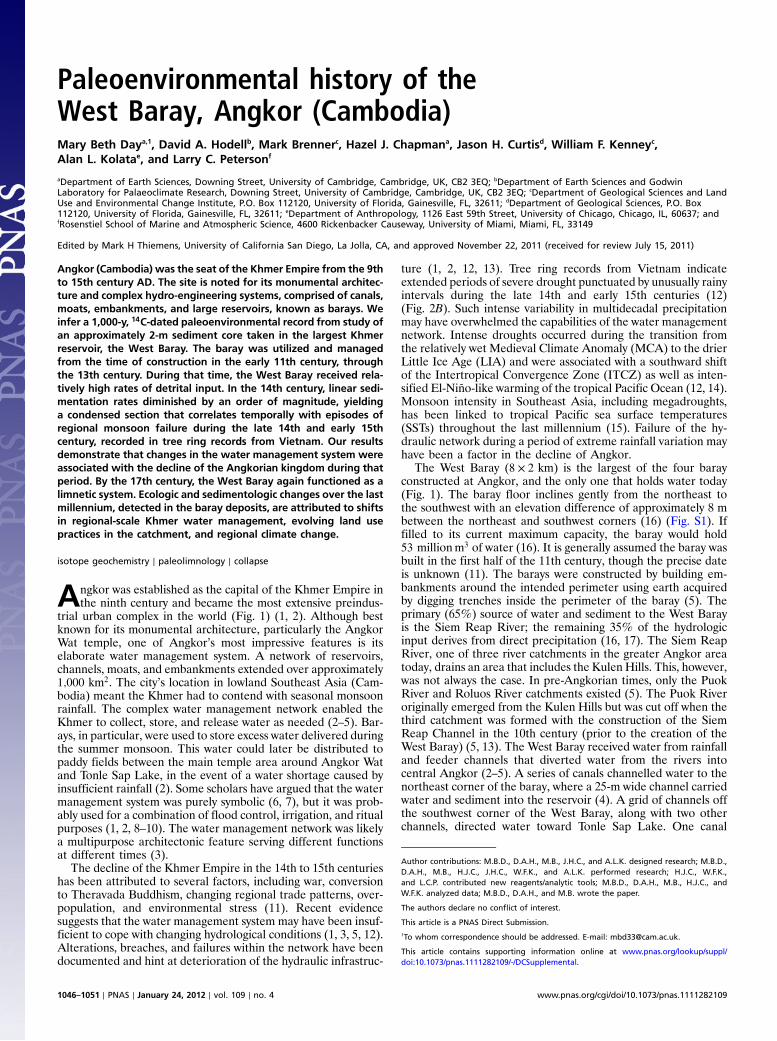
The West Baray (8 × 2 km) is the largest of the four barayconstructed at Angkor, and the only one that holds water today(Fig. 1). The baray floor inclines gently from the northeast tothe southwest with an elevation difference of approximately 8 mbetween the northeast and southwest corners (16) (Fig. S1). Iffilled to its current maximum capacity, the baray would hold53 millionm3 of water (16). It is generally assumed the baray wasbuilt in the first half of the 11th century, though the precise dateis unknown (11). The barays were constructed by building em-bankments around the intended perimeter using earth acquiredby digging trenches inside the perimeter of the baray (5). Theprimary (65%) source of water and sediment to the West Barayis the Siem Reap River; the remaining 35% of the hydrologicinput derives from direct precipitation (16, 17). The Siem ReapRiver, one of three river catchments in the greater Angkor areatoday, drains an area that includes the Kulen Hills. This, however,was not always the case. In pre-Angkorian times, only the PuokRiver and Roluos River catchments existed (5). The Puok Riveroriginally emerged from the Kulen Hills but was cut off when thethird catchment was formed with the construction of the SiemReap Channel in the 10th century (prior to the creation of theWest Baray) (5, 13). The West Baray received water from rainfalland feeder channels that diverted water from the rivers intocentral Angkor (2–5). A series of canals channelled water to thenortheast corner of the baray, where a 25-m wide channel carriedwater and sediment into the reservoir (4). A grid of channels offthe southwest corner of the West Baray, along with two otherchannels, directed water toward Tonle Sap Lake. One canal
Author contributions: M.B.D., D.A.H., M.B., J.H.C., and A.L.K. designed research; M.B.D.,D.A.H., M.B., H.J.C., J.H.C., W.F.K., and A.L.K. performed research; H.J.C., W.F.K.,and L.C.P. contributed new reagents/analytic tools; M.B.D., D.A.H., M.B., H.J.C., andW.F.K. analyzed data; M.B.D., D.A.H., and M.B. wrote the paper.
The authors declare no conflict of interest.
This article is a PNAS Direct Submission.1To whom correspondence should be addressed. E-mail: [email protected].
This article contains supporting information online at www.pnas.org/lookup/suppl/doi:10.1073/pnas.1111282109/-/DCSupplemental.
1046–1051 ∣ PNAS ∣ January 24, 2012 ∣ vol. 109 ∣ no. 4 www.pnas.org/cgi/doi/10.1073/pnas.1111282109
flowed southwest on a direct route to the lake and the other flo-wed southeast. The various channels were likely used to dispersewater from the reservoir to the paddy fields south of the WestBaray and the main temple area. Sediments that accumulated inthe West Baray since its construction record variations in naturalhydrologic conditions and Khmer water management practices.
Here we report elemental and isotopic data from an approxi-mately 2-m core taken in the deep, southwest corner of the baray(Fig. 1C) and infer local paleoenvironmental changes in responseto both natural and anthropogenic forcing. Changes in sedimentgeochemistry and the rate of sediment accumulation were usedto infer the sources and amounts of sediment delivered to thebaray, which changed in response to climate variations andKhmer water management strategies. C and N isotopes andelemental ratios (C, N, P) were used to reconstruct changes inthe ecology of the baray. Our sedimentologic and geochemicalapproach elucidates how changes in water and sediment inputto the West Baray varied through time and illustrates how theecology of the system responded to these shifts.
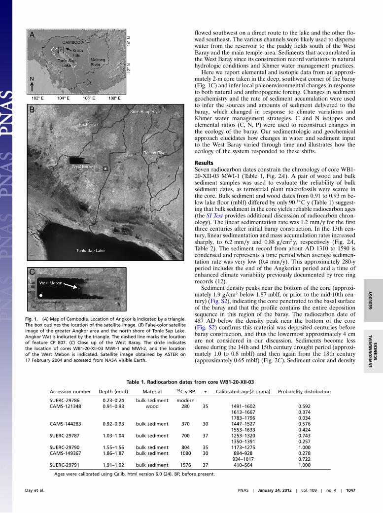
ResultsSeven radiocarbon dates constrain the chronology of core WB1-20-XII-03 MWI-1 (Table 1, Fig. 2A). A pair of wood and bulksediment samples was used to evaluate the reliability of bulksediment dates, as terrestrial plant macrofossils were scarce inthe core. Bulk sediment and wood dates from 0.91 to 0.93 m be-low lake floor (mblf) differed by only 90 14C y (Table 1) suggest-ing that bulk sediment in the core yields reliable radiocarbon ages(the SI Text provides additional discussion of radiocarbon chron-ology). The linear sedimentation rate was 1.2 mm∕y for the firstthree centuries after initial baray construction. In the 13th cen-tury, linear sedimentation and mass accumulation rates increasedsharply, to 6.2 mm∕y and 0.88 g∕cm2 y, respectively (Fig. 2A,Table 2). The sediment record from about AD 1310 to 1590 iscondensed and represents a time period when average sedimen-tation rate was very low (0.4 mm∕y). This approximately 280-yperiod includes the end of the Angkorian period and a time ofenhanced climate variability previously documented by tree ringrecords (12).
Sediment density peaks near the bottom of the core (approxi-mately 1.9 g∕cm3 below 1.87 mblf, or prior to the mid-10th cen-tury) (Fig. S2), indicating the core penetrated to the basal surfaceof the baray and that the profile contains the entire depositionsequence in this region of the baray. The radiocarbon date of487 AD below the density peak near the bottom of the core(Fig. S2) confirms this material was deposited centuries beforebaray construction, and thus the lowermost approximately 4 cmare not considered in our discussion. Sediments become lessdense during the 14th and 15th century drought period (approxi-mately 1.0 to 0.8 mblf) and then again from the 18th century(approximately 0.65 mblf) (Fig. 2C). Sediment color and density
Fig. 1. (A) Map of Cambodia. Location of Angkor is indicated by a triangle.The box outlines the location of the satellite image. (B) False-color satelliteimage of the greater Angkor area and the north shore of Tonle Sap Lake.Angkor Wat is indicated by the triangle. The dashed line marks the locationof feature CP 807. (C) Close up of the West Baray. The circle indicatesthe location of cores WB1-20-XII-03 MWI-1 and MWI-2, and the locationof the West Mebon is indicated. Satellite image obtained by ASTER on17 February 2004 and accessed from NASA Visible Earth.
Table 1. Radiocarbon dates from core WB1-20-XII-03
Accession number Depth (mblf) Material 14C y BP ± Calibrated age(2 sigma) Probability distribution
SUERC-29786 0.23–0.24 bulk sediment modernCAMS-121348 0.91–0.93 wood 280 35 1491–1602 0.592
1613–1667 0.3741783–1796 0.034
CAMS-144283 0.92–0.93 bulk sediment 370 30 1447–1527 0.5761553–1633 0.424
SUERC-29787 1.03–1.04 bulk sediment 700 37 1253–1320 0.7431350–1391 0.257
SUERC-29790 1.55–1.56 bulk sediment 804 35 1173–1275 1.000CAMS-149367 1.86–1.87 bulk sediment 1080 30 894–928 0.278
934–1017 0.722SUERC-29791 1.91–1.92 bulk sediment 1576 37 410–564 1.000
Ages were calibrated using Calib, html version 6.0 (24). BP, before present.
Day et al. PNAS ∣ January 24, 2012 ∣ vol. 109 ∣ no. 4 ∣ 1047
GEO
LOGY
ENVIRONMEN
TAL
SCIENCE
S

vary according to organic C content (Fig. S2). Carbonate wasundetectable in theWest Baray sediments, thus weight %C repre-sents organic C (Fig. 2D). Sediment color and organic C content
change abruptly in the early 14th century (approximately 1.03mblf). In general, sediments deposited during the 10th to 14thcenturies (below approximately 1.03 mblf) are light in color andlow in organic C, whereas sediments dating from the 15th to 20thcenturies (above approximately 1.03 mblf) are darker and higherin organic C content. Superimposed on this general trend arethree horizons of darker, higher organic content sediments thatwere deposited during the early to middle 13th century (approxi-mately 1.60 to 1.50 mblf), between approximately 1320 and1625 AD (approximately 1.03 to 0.85 mblf), and the mid- to late18th century (approximately 0.6 to 0.5 mblf) (Fig. 2D). Eachof these horizons corresponds to drought episodes recorded inthe Vietnam tree ring record and other regional paleohydrologyrecords (12, 15) (Fig. 2B). C/N atom ratios, which are generallyhigher from the 17th century on, peak during all three droughtperiods (Fig. 2E). The weight % sand fraction (>63 μm byweight) is less than 1% for most of the profile, indicating the finesediment grain size. During the period of the Angkor droughts,in the 14th and 15th centuries, weight % sand fraction increasesto a maximum value of 6.5% in the early 15th century whenAngkor collapsed (Fig. 2F). The first factor extracted from factoranalysis of Al-normalized scanning X-ray fluorescence (XRF)elemental data indicates a geochemical response during the firsttwo drought episodes, marked by elevated Zr/Al, Ti/Al, Sr/Al,and Rb/Al (Fig. 2G).
Factor 2 indicates that K/Al, Rb/Al, and Fe/Al values all in-crease in the upper portion of the core (1500 AD to the end ofthe scanning XRF record, approximately 1700 AD), whereas Si/Al values decrease (Fig. 2H). Sr isotope ratios (87Sr∕86Sr) show asimilar pattern, becoming more radiogenic, i.e., greater, after1500 AD (Fig. 2I, Table S1). Prior to the mid-14th century,87Sr∕86Sr values range from 0.71552 to 0.71616, whereas valuesfrom the 16th century onward increase from 0.71672 to 0.71866.Sr isotopes were also measured in surface and river sedimentscollected from the Puok, Siem Reap, and Roluos River basins.The Puok and Roluos Rivers have significantly less radiogenic87Sr∕86Sr values than those of the Siem Reap River or the WestBaray (Fig. S3). Carbon and nitrogen stable isotope values be-come more negative from the 14th century on (Fig. 3 A and B),whereas total phosphorus (TP) concentrations increase from amean value of 0.23 mgP∕g in the 11th to 13th centuries to0.40 mgP∕g since the 16th century (Fig. 3C).
DiscussionSedimentation in the West Baray. We, and others (17–19) have ob-served that total sediment accumulation in the West and EastBarays is generally low (<0.5 m). For example, Penny et al (17)estimate approximately 43 cm of sediment accumulated in thecentral part of the East Baray (18), whereas Pottier (19) notesthat West Baray sediments are no more than 30 cm thick at KohTa Meas (1.3 km west of the West Mebon). It would thus appearthat, in comparison, the nearly 2-m long core recovered in thesouthwest part of the West Baray is quite thick. Typical sedimentaccumulation patterns in reservoirs, however, are consistent withthe observed pattern of sediment deposition in the West Baray,and our core was recovered from the region of the baray in whichthe thickest sediment deposits are expected (see SI Text fordiscussion of reservoir sedimentation patterns).
Table 2. Linear sedimentation rates and mass accumulation ratesfor core WB1-20-XII-03 MWI-1
Depth (mblf) Years (AD)Linear sedimentation
rate (mm/y)Mass accumulation
rate (g∕cm2 y)
0.235–0.92 1590–1950 1.9 0.230.92–1.035 1308–1590 0.4 0.051.035–1.555 1224–1308 6.2 0.881.555–1.865 958–1224 1.2 0.19
Fig. 2. Summary diagram comparing geochemical and physical variables inCore WB1-20-XII-03 MWI-1 with Palmer Drought Severity Index (PDSI) recon-struction from the Vietnam tree ring record (B) (12). Interval mean linear se-dimentation rates (mm yr−1) (based on calibrated 14C ages) are noted on theage-depth plot (A). Squares represent weighted mean of calibrated bulk se-diment dates and the circle signifies the weighted mean of a calibrated wooddate. Error bars indicate full range of possible calendar year solutions foreach radiocarbon date. The shaded boxes highlight the different time per-iods for which linear sedimentation and mass accumulation rates were cal-culated. Light gray shading in panels B–I indicate the Angkor Droughts(1345–1365, 1401–1425) as defined by Buckley et al. (12), and darker grayshading indicates other drought episodes, including the 13th centurydrought (12) and the Strange Parallels (1756–1768) and East India (1792–1796) droughts, as defined by Cook et al. (15). Data points acquired withinthe condensed section of the core (indicated in top panel) are shown as in-dividual points. wt% C and C/N for the last approximately 300 y of the recordwere measured on core WB1-20-XII-03 MWI-2 (D, E). For scanning XRF factoranalysis, element ratios represented are listed from strongest to weakestloading, with parentheses denoting a negative loading. The percent totalvariance explained by each factor is indicated (G, H). The approximate rangesof the MCA and LIA are marked by gray bars.
1048 ∣ www.pnas.org/cgi/doi/10.1073/pnas.1111282109 Day et al.

There is evidence for rapid infill of channels at several loca-tions throughout Angkor, indicating widespread siltation of thewater management system during the 13th and 14th centuriesjust prior to the Angkor Droughts (1, 3, 11, 12). Channel infill isconcurrent with a considerable increase in linear sedimentationand mass accumulation rates in the West Baray, which may sug-gest enhanced sediment delivery to the barays at that time as well(Fig. 2A, Table 2). Overall, sediment delivery to the West Baraywas greatest during Angkorian times, particularly in the 13th cen-tury, and declined during the post-Angkorian period. Reducedsediment delivery may have been a consequence of drier climateduring the LIA or anthropogenic factors, such as cessation ofwater management, less intense land use, and greater soil stabi-lization associated with abandonment of the urban area. Higherorganic C content in the post-Angkorian portion of the core isconsistent with the interpretation of reduced detrital sedimenttransport to the West Baray.
In addition to diminished sediment delivery, the shift to moreradiogenic Sr isotope values in the post-Angkorian period maysuggest a change in sediment source (Fig. 2I). The 87Sr∕86Sr in-crease, however, probably does not reflect a new geographicsource of sediments to the baray. Instead, the shift in the Sr iso-tope ratio in the West Baray core probably indicates deliveryof less chemically altered sediments in post-Angkorian times(Fig. S3 and SI Text). Reduced weathering could have been theresult of less intense land use and greater soil stabilization. Alter-natively, wetter conditions during the MCA could have contrib-uted to enhanced weathering during the Angkorian period,followed by less intense weathering during the drier LIA. Overall,the baray sediments suggest a decrease in both erosion andchemical weathering in the watershed postcollapse.
Response to Drought. The West Baray sediment record displayschanges in response to three known drought intervals: the early13th century, the 14th and 15th century Angkor Droughts, andthe middle to late 18th century, including the Strange Parallelsand East India Droughts (12, 15). During these three periods,both organic C content and C/N ratios increase (Fig. 2 D and E).West Baray sediments deposited during drought episodes arelikely richer in organic matter because of reduced input ofdetrital sediment and water to the baray. Sediment composition,color, and density are controlled by the relative contribution ofauthochthonous (limnetic) and allochthonous (detrital) sedi-ments (Fig. S2). Unfortunately, the radiocarbon chronology ofthe core does not provide the resolution needed to determinewhether sedimentation rate decreased during each of the threedrought intervals. The linear sedimentation and mass accumula-tion rates for the relatively organic-rich horizon during and afterthe Angkor Droughts, however, is much lower than rates duringthe remainder of the record, suggesting a large reduction in sedi-ment delivery to the baray at that time (Fig. 2A). Increased C/Nratios may signal the proliferation of aquatic macrophytes, anexpected response to lower water levels and habitat expansion.Floating vegetation was present in the West Mebon basin startingin the 14th century, demonstrating that aquatic macrophytesexisted within the baray at that time (17). Although C/N valuesincrease, they do not reach levels indicative of a macrophyte-dominated system (>15). This suggests that at least the deep,southwest corner of the West Baray sustained phytoplankton pro-duction throughout the history of the baray. Factor 1 reveals high-er abundance of Zr, Ti, Sr, and Rb during at least the first twodrought intervals. The scanning XRF data terminate in the 17thcentury due to poor sediment consolidation and postretrieval dis-turbance of more recent deposits (Fig. 2 G and H). Sedimentsbecame more coarse grained in the southwest part of the barayduring the low stands associated with the period of the AngkorDroughts (Fig. 2 F and G). This is likely due to decreased inputof fines and lowered water levels in the baray that increased tur-bulence and bottom resuspension. Sediment coarsening is consis-tent with processes observed in reservoirs during periods ofdrawdown (20, 21).
Ecological Evolution of the Baray.Higher C/N values after approxi-mately 1300 AD may reflect proliferation of aquatic macrophytesafter the collapse of Angkor. Elevated water levels during early,wetter times may have precluded the spread of higher plants intodeep-water areas of the baray, where submersed and rootedspecies would have been light limited, and where depths may havebeen too great for floating-leaved taxa. The drier climate of theLIAmay have lowered water levels in the baray and expanded thehabitat available to aquatic macrophytes. Additionally, macro-phytes may have been manually removed from the baray duringthe Angkorian period. Evidence for cessation of vegetationclearance is observed in the West Mebon, where floating vegeta-tion has persisted since the 14th century (17). Biogenic silica
Fig. 3. Carbon (A) and nitrogen (B) stable isotopes, total P (C), and biogenicsilica (D) from core WB1-20-XII-03 MWI-1, and Palmer Drought Severity Index(PDSI) record (E) from Buckley et al. (12). Drought periods are indicated byshading. LIA and MCA are indicated by gray bars.
Day et al. PNAS ∣ January 24, 2012 ∣ vol. 109 ∣ no. 4 ∣ 1049
GEO
LOGY
ENVIRONMEN
TAL
SCIENCE
S
measurements indicate a greater abundance of diatoms fromthe 16th century onward, whereas sponge spicule abundance de-creased (Fig. 3D). This finding is confirmed by microscopic ana-lysis of sediments using smear slides (Fig. S4). The increasedabundance of diatoms postcollapse is partly attributed to the ap-pearance of several pennate species (Fig. S4). Many pennate dia-toms occupy benthic habitats, suggesting an expansion of suchhabitats postcollapse. Benthic algae tend to thrive when sedimentsuspension is infrequent, implying relatively lower turbidity in thepost-Angkorian West Baray. An inference for more turbid con-ditions in the West Baray during the Angkorian period is consis-tent with evidence for relatively high sediment and water deliveryto the reservoir at that time. Turbidity may have decreased post-collapse as a consequence of reduced sediment transport to thebaray or because the expanded macrophyte community trappedincoming sediments and suppressed sediment resuspension in thesouthwestern part of the baray. Extensive benthic algae growthmay be the cause of higher TP values from the 17th century.Benthic algae can promote oxygenation of the sediment-waterinterface, which in turn enhances iron-mediated sequestrationof P in sediments (22).
The shift to more negative δ13C and δ15N values (Fig. 3 A,and B) postcollapse can be attributed to the change in vegetationwithin the baray that resulted from lower water levels and cessa-tion of water management. It is also possible the West Baray hasbecome N-limited since the 18th century, as δ15N values approach0‰, implying a strong contribution of N-fixing cyanobacteriato sediment organic matter (Fig. 3B). Benthic algae growth caninhibit the release of N from the sediments to the water column,which may amplify N limitation in the water column (22). Someaquatic higher plants, however, can have δ15N values close to0‰ (23), but the C/N values (<15) of the baray deposits implythat higher plants were not the primary contributor to sedimentorganic matter.
Comparison to the West Mebon. The West Mebon is a temple lo-cated on an artificial island in the center of the West Baray(Fig. 1C). Penny et al. (17) recovered a sediment core from abasin enclosed by the temple. Our core has two advantages overthe West Mebon record (17) in providing paleoenvironmentinformation about the baray. First, although the West Mebonbasin is certainly influenced by the West Baray, it is, as discussedby Penny et al (17), buffered from conditions within the barayand thus would not necessarily record all the fluctuations thatmay have occurred in the baray itself. Second, the West Meboncore (17) only contains 27.5 cm of material and begins in the 12thcentury. Our core spans the entire limnetic history of the barayover nearly 190 cm of sediment. These differences in location andresolution are likely the reason for some of the apparent discre-pancies between the two records. For example, the West Mebonrecord (17) indicates a considerable drop in water levels in thebaray at the end of the 12th century, likely related to the construc-tion of features such as the Jayatataka baray and the AngkorThom moat (4) and CP807 (24) (Fig. 1B). In contrast, we do notobserve any significant variations in conditions in the West Barayuntil the 13th century when sedimentation rates increase andseveral parameters respond to a period of drought (Fig. 2 A–G).Furthermore, in the West Mebon basin, the water depth appearsto have risen again in the 14th century. It seems unlikely thatwater levels in the southwest part of the baray rose during the14th century given that the increase in % sand fraction duringthe Angkor Droughts period implies lower water levels (Fig. 2F).
ConclusionsThis sediment record from the West Baray provides a uniqueperspective on environmental change at Angkor. Sr isotopes,sedimentation rates, sediment density, composition, and color(reflecting organic matter content), all illustrate that the baray
received greater sediment and water input prior to the 14thand 15th century megadroughts and contemporaneous collapseof Angkor. A condensed section with increased sand fractionindicates decreased sediment input and lower water levels in thebaray during the Angkor Droughts in the 14th and 15th centuries.Since the 16th century, the baray records a decrease in bothphysical and chemical weathering within the drainage basin. Theecology of the baray has also changed in post-Angkorian times, asthere has been a proliferation of benthic taxa related to reducedwater-column turbidity and increased macrophyte growth.Changes in sedimentation and ecology were brought about bycomplex interactions between natural (climate) and anthropo-genic (water management and land use) factors. Our data areunable to distinguish between climatic and anthropogenic for-cings, but it is likely these two factors often acted in tandem,as environmental changes would lead to human action regardingthe water management network. Nonetheless, the Khmer watermanagement system is a vivid example of a sophisticated humantechnology that failed in the face of extreme (threshold) environ-mental conditions.
MethodsTwo cores were collected with a piston corer from the southwest corner ofthe West Baray (13° 25′ 38′′ N, 103° 45′ 58′′ E) in 6.2 m of water on December20, 2003. The first, 1.92-m long core WB1-20-XII-03 MWI-1, was obtainedusing a double 5.7-cm (o.d.) clear polycarbonate tube and transported, intact,to the laboratory. The second, 87-cm long core WB1-20-XII-03 MWI-2, wassampled at 1-cm intervals in the field prior to being transported to thelaboratory. All analyses were performed on core WB1-20-XII-03 MWI-1 unlessotherwise noted. Sediment density of the first core was measured at 0.5-cmintervals using a GEOTEK Multisensor Core Logger. The core was split length-wise and imaged using a GEOTEK digital color line-scan camera.
The split core from 0.70 to 1.91 mblf was analyzed with an Avaatech XRFcore scanner at 1-cm resolution to provide close-interval elemental data.Measurements of elements Al to Ba were made using a slit size of 1 × 1 cmand generator settings of 10, 30, and 50 kV over 30 s of counting time. Theupper 0.70 m of the archive half of the core were poorly consolidated anddisturbed and could not be analyzed (the working half of the core was notaffected). Elements were normalized to Al. Normalization to a conservativeelement such as Al removes inconsistencies in elemental data resulting fromchanges in sedimentation rates, grain size, and organic matter content (25).The XRF dataset was reduced by factor analysis using Predictive AnalyticsSoftWare Statistics 18.0. Three factors that explain 82.6% of the variancein the data were extracted using principal components analysis with Varimaxrotation.
Sr was separated using cation exchange resin and Sr isotope ratios weremeasured on a VG Sector 54 TIMS using a triple collector dynamic algorithm,normalized to 87Sr∕86Sr 0.1194, with an exponential fractionation correction(26). The 90 analyses of National Bureau of Standards reference material 987during the 2-y period of these analyses gave a mean value of0.710266� 0.000008 (1 sigma). The Sr blanks were negligible in comparisonto the Sr content of the samples.
Weight percent C and N of bulk sediment from core WB1-20-XII-03 MWI-2were measured on a Carlo Erba NA1500 CNS Elemental Analyzer. C/N ratiosare expressed as atomic ratios. Stable C and N isotopes were measured on aCostech Elemental Analyser attached to a Thermo Delta Vmass spectrometer.Analytical precision for δ13C was better than �0.10‰, and for δ15N betterthan �0.15‰. Samples analyzed for total P were digested in 5.0% H2SO4
and 5.0% K2SO8 in an autoclave and measured using a Bran–Luebbe Auto-analyzer (27). Biogenic Si (diatoms and sponge) was determined usingtime-course leaching (28). Weight percent coarse fraction (>63 μm) wasdetermined by wet sieving and weighing the dried >63 μm fraction.
Radiocarbon dates were obtained on chemically pretreated wood anddecarbonated bulk sediment samples at the Center for Accelerator MassSpectrometry (CAMS) at Lawrence Livermore National Laboratories and theNatural Environment Research Council (NERC) Radiocarbon Facility (Environ-ment) and Scottish Universities Environmental Research Centre (SUERC) Ac-celerator Mass Spectrometry Laboratory. Bulk sediment samples processed atCAMS were decarbonated using 1 N·HCl with vortexing to prevent clumping,spun down, decanted, and rinsed three times with Milli-Q water. The sedi-ment was then dried overnight on a heating block and converted to carbondioxide (CO2) in individual quartz tubes using copper oxide (CuO) as anoxygen source. Wood samples received a modified “deVries” chemical
1050 ∣ www.pnas.org/cgi/doi/10.1073/pnas.1111282109 Day et al.
pretreatment and an acid–base–acid treatment at 90 °C, followed by copiousrinsing with Milli-Q water. Bulk sediment samples processed at the NERCRadiocarbon Facility (Environment) were digested in 2 M HCl at 80 °C for8 h, then washed with deionized water and dried and homogenized. Sampleswere converted to CO2 by heating with CuO in sealed quartz tubes and thegas was converted to graphite by Fe/Zn reduction. Dates were calibrated tocalendar years before present using Calib html version 6.0 (29) that uses theIntCal09 radiocarbon calibration curve (30).
ACKNOWLEDGMENTS. We thank Thomas P. Guilderson for his generousassistance with radiocarbon dates. Sarah Metcalfe kindly provided help with
diatom identification. Two anonymous reviewers provided constructive com-ments that greatly improved the clarity of this paper. We are also indebted toChristophe Pottier and Dominique Soutif for discussions that strengthenedthe manuscript. We thank the Authority for the Protection andManagementof Angkor and the Region of Siem Reap for permission to work in the AngkorArchaeological Park, and we appreciate support from l’École Françaised’Extrême-Orient. We are grateful for funding from the Gates CambridgeTrust (M.B.D.), Natural Environment Research Council Radiocarbon Award1452.1009 (D.A.H.), and the Adolph andMarion Lichstern Fund of the Depart-ment of Anthropology, University of Chicago that supported fieldwork andadditional radiocarbon dates (A.L.K.).
1. Evans D, et al. (2007) A comprehensive archaeological map of the world’s largestpreindustrial settlement complex at Angkor, Cambodia. Proc Natl Acad Sci USA104:14277–14282.
2. Fletcher RJ, et al. (2003) Redefining Angkor: structure and environment in the largest,low density urban complex of the pre-industrial world. Udaya 4:107–121.
3. Fletcher R, et al. (2008) The water management network of Angkor, Cambodia.Antiquity 82:658–670.
4. Fletcher R, Pottier C, Evans D, Kummu M (2008) The development of the watermanagement system of Angkor: A provisional model. IPPA Bull 28:57–66.
5. Kummu M (2009) Water management in Angkor: Human impacts on hydrology andsediment transport. J Environ Manage 90:1413–1421.
6. Acker R (1998) New geographical tests of the hydraulic thesis at Angkor. South EastAsia Research 6:5–47.
7. van Liere WJ (1980) Traditional water management in the lower Mekong Basin.WorldArchaeol 11:265–280.
8. Groslier BP (1979) La cité hydraulique angkorienne: exploitation ou surexploitationdu sol? Bulletin de l’École française d’Extrême-Orient 66:161–202.
9. Pottier C (1999) Carte archéologique de la région d’Angkor Zone sud. PhD thesis(Universite Paris III Sorbonne Nouvelle, Paris).
10. Pottier C (2000) Some evidence of an Inter-relationship between hydraulic featuresand rice field patterns at Angkor during ancient times. The Journal of Sophia AsianStudies 18:99–119.
11. Coe MD (2003) Angkor and the Khmer Civilization (Thames and Hudson, London).12. Buckley BM, et al. (2010) Climate as a contributing factor in the demise of Angkor,
Cambodia. Proc Natl Acad Sci USA 107:6748–6752.13. Lustig T, Fletcher R, Kummu M, Pottier C, Penny D (2008) Modern Myths of the
Mekong: A critical review of water and development concepts, principles and policies,eds M Kummu, M Keskinen, and O Varis (Helsinki University of Technology Water andDevelopment Publications, Espoo, Finland), pp 81–94.
14. Yan H, et al. (2011) South China Sea hydrological changes and Pacific Walker Circula-tion variations over the last millennium. Nat Commun 2:293.
15. Cook ER, et al. (2010) Asian monsoon failure and megadrought during the lastmillennium. Science 328:486–489.
16. Someth P, Kubo N, Tanji H (2007) A combined technique of floodplain storage andirrigation for paddy rice cultivation. Paddy Water Environ 5:101–112.
17. Penny D, et al. (2007) Hydrological history of the West Baray, Angkor, revealedthrough palynological analysis of sediments from the West Mebon. Bulletin de l’ÉcoleFrançaise d’Extrême-Orient 92:497–521.
18. Tsukawaki S, Okuno M, Okawara M, Kato M, Nakamura T (1998) Undergroundstructures of the site of East Baray Reservoir in the Angkor district, central Cambodia.Summaries of researchers using AMS at Nagoya University 9:272–280.
19. Pottier C, et al. (2004) Koh Ta Méas, un site préhistorique dans le baray occidentalrapport préliminaire. Udaya 5:167–191.
20. Morris GL, Fan J (1998) Reservoir Sedimentation Handbook (McGraw-Hill Book Co,New York).
21. Shotbolt LA, Thomas AD, Hutchinson SM (2005) The use of reservoir sediments asenvironmental archives of catchment inputs and atmospheric pollution. Prog PhysGeog 29:337–361.
22. Scheffer M (1998) Ecology of Shallow Lakes (Kluwer Academic Publishers, London).23. Brenner M, et al. (2006) Mechanisms for organic matter and phosphorus burial in
sediments of a shallow, subtropical, macrophyte-dominated lake. J Paleolimnol35:129–148.
24. Pottier C (2006) Searching for Goloupura. Proceedings of the Phnom Bakheng Work-shop on Public Interpretation (Center for Khmer Studies, Siem Reap, Cambodia), pp41–72.
25. Löwemark L, et al. (2011) Normalizing XRF-scanner data: A cautionary note on theinterpretation of high-resolution records from organic-rich lakes. J Asian Earth Sci40:1250–1256.
26. Bickle MJ, et al. (2003) Fluxes of Sr into the headwaters of the Ganges. GeochimCosmochim Acta 67:2567–2584.
27. Kenney WF, Schelske CL, Chapman AD (2001) Changes in polyphosphate sedimenta-tion: a response to excessive phosphorus enrichment in a hypereutrophic lake. Can JFish Aquat Sci 58:879–887.
28. Conley DJ, Schelske CL (1993) Potential role of sponge spicules in influencing thesilicon biogeochemistry of Florida lakes. Can J Fish Aquat Sci 50:296–302.
29. Stuiver M, Reimer PJ (1993) Extended 14C database and revised CALIB radiocarboncalibration program. Radiocarbon 35:215–230.
30. Reimer PJ, et al. (2009) IntCal09 and Marine09 radiocarbon age calibration curves,0–50,000 years cal BP. Radiocarbon 51:1111–1150.
Day et al. PNAS ∣ January 24, 2012 ∣ vol. 109 ∣ no. 4 ∣ 1051
GEO
LOGY
ENVIRONMEN
TAL
SCIENCE
S