oil and gas possibilities of the hatchetigbee anticline
TRANSCRIPT

OIL AND GAS POSSIBILITIES OF THE HATCHETIGBEE ANTICLINE, ALABAMA.
By OLIVEE B. HOPKINS.
INTRODUCTION.
During 1884-85, 16 years before the discovery of .oil at Beaumont, Tex., a well was drilled near Bladon Springs, Ala. (See description of Cullom Springs well, p. 310.) This was one of the earliest deep wells drilled for oil in the Gulf Coastal Plain. The reasons that led to the selection of this area as a possible oil field are not known, although it is interesting to note that this well was drilled near the crest of the Hatchetigbee anticline at a time when the anticlinal theory of oil and gas accumulation was being much discussed. A small showing of gas was found in this well, but the results were not regarded as sufficiently promising to encourage further exploration, and the region seems not to have attracted any further attention until after the discovery of oil at Beaumont, in 1901.
The discovery of oil in the famous Lucas "gusher" at Beaumont and the recognition of the association of oil with salt domes in the Gulf coastal region led to extensive drilling in areas where the pres ence of salt domes was suspected. As salt springs "and salt wells in the area of the Hatchetigbee anticline had been known since before the Civil War, this area came immediately into prominence as a pos sible oil and gas field. From 1902 to 1905 or 1906, six fairly deep wells were drilled here. Although Smith 1 and others had published in 1894 a description and a generalized map of the Hatchetigbee anti cline, these wells were poorly located with reference to the structure, and all were drilled near old salt wells or springs. Since 1906 little drilling has been done in this area, although interest in the possible occurrence of oil and gas here has survived, and from time to tune leases have been taken and development work projected. At the time the field work on this report was being done geologists employed by several oil companies were making a reconnaissance examination of the area, and soon after the Survey's field work was completed leasing was begun near Bladon Springs.
1 Smith, E. A., Johnson, L. C., and Langdon, D. W., jr., On the geology of the Coastal Plain of Alabama, Alabama Geol. Survey, 1894.
69812° Bull, 661 18 19 281
282 CONTRIBUTIONS TO ECONOMIC GEOLOGY, 1917, PART II.
Most of the wells referred to above yielded small quantities of gas, but it is not definitely known whether any of them yielded even a trace of oil. Many of the residents of the country assert that they saw oil coming from some of these wells. It is also reported that while a channel was being blasted out in Tombigbee River at McGrews Shoals, near St. Stephens, oil in considerable quantities seeped from the rocks in the river bottom.
The present interest in the oil and gas possibilities of this area, however, is not due to the occurrence of salt or gas in shallow wells or to the results of the drilling operations described above, but to the work of E. A. Smith and others,, who outlined a large, well-defined anticline in this area, and to the knowledge that the most favorable areas in which to look for commercial pools of oil and gas are along the crests of such folds. The object of the present work is to show more in detail the location and extent of this anticline, to point out in a general way the areas that are most deserving of tests with the drill, and to give those interested in exploratory drilling for oil and gas information regarding the geology of the area, the character of this fold, and the occurrence and depth of possible productive oil sands.
SUMMARY.
The geologic examination of the area shows that a broad, low anti cline, the Hatchetigbee anticline, extends from a point north of Jackson, Ala., northwestward across Tombigbee River to the Ala bama-Mississippi State line and beyond; that the disturbance of the earth's crust which produced this fold also produced a fault, the Jackson fault, which extends from the southeast end of the antichne in a southeasterly and southerly direction past Jackson and the Central Salt Works to the Lower Salt Works near Oven Bluff, on Tombigbee River; that the Hatchetigbee anticline has in general stronger dips on its southwestern slope than on its northeastern; that two areas along the crest of the fold are particularly favorable, structurally, for the accumulation of oil and gas, and other areas along the crest of the fold and along the east side of the Jackson fault are also favorable; that the best chances for accumulations of oil are probably in the sands above and below the Selma chalk, which lies from 780 to 2,700 feet below the surface along the crest of the anticline; and finally that there are doubtless other areas of favor able structure in the adjoining region where oil and gas may have accumulated if they are present in commercial quantities anywhere in the region.
FIELD WORK.
The field studies on which this report is based were made by the writer, without assistance, in seven weeks during November .and

HATCHETTGBEE ANTICLINE, ALA. 283
December, 1916. The report by E. A. Smith/ State geologist, on work in this and adjoining areas was used as a guide to the general geology and structure of the region. The most detailed studies were made of the areas described by Smith under the .headings "Hatche- tigbee anticline" and "Other Buhrstone displacements." 2 In order to ascertain somewhat in detail the structure of these areas, the gen eral distribution of the rock formations was outlined, the direction and rate of dip of the rock beds were determined wherever possible, and as much other information relating to the general geology and structure was obtained as was possible during a reconnaissance survey.
The progress of the work was much hampered by the lack of sufficiently detailed maps on which to plot the field observations, by the difficulty in making correct locations on the available maps, and by the scarcity of bench marks or points of known altitude in the area. Wherever possible the locations made on the maps were veri fied by inquiry among the residents as to the position of section lines, section corners, and land lines. In this way many exact locations were made with regard to land and section lines, and some of the most conspicuous errors in the maps were corrected. The applica tion of this method of location was not satisfactory in many parts of the area that are sparsely settled, because much of the land is farmed by renters, many of whom are not cognizant of the position of property and section lines.
Altitudes were determined with an aneroid barometer from bench marks established by Army engineers along Tombigbee River over the area studied and were corrected from barograph records. As there are a number of easily recognized beds in the area, the most satisfactory method of determining the direction and rate of dip was by comparing altitudes on these beds at different points. Dips were also determined directly with a clinometer and, where the exposures were long enough, by a direct measurement of the difference in alti tude of a bed at two points and the distance and direction of one of these points from the other.
Satisfactory key rocks are most easily recognized in the Vicksburg and Jackson formations, which crop out on the flank of the fold, whereas it is difficult to recognize individual beds in the Hatchetig- bee, Tallahatta, and Lisbon formations, which crop out near the center of the uplift. Within the Tallahatta formation, however, there are many hard ledges from which the dip of the beds may be determined.
iQp. cit. » Op. cit, pp. 211-226.
284 COFTBIBUTIONS TO ECONOMIC GEOLOGY, 1917, PART II.
ACKNOWLEDGMENTS.
The writer is indebted primarily to Dr. E. A. Smith, who was the first to study this area and to outline its general structure, both for the information contained in his published reports 1 and for his help ful suggestions during the course of the field studies. Dr. Smith fur nished an unpublished sketch map of the area near Jackson, made under his direction by Mr. S. A. Hobson, which shows the general distribution and relations of the different formations. Although the
.writer disagrees with Dr. Smith and Mr. Hobson in their interpreta tion of .the structure of the area, this map was of great service.
He is indebted also to Mr. C. W. Cooke, of the United States Geo logical Survey, for the results of his studies of the Vicksburg and Jackson formations in southwestern Alabama, to which he had access before they were published, for information given informally regard ing the characteristic fossils of the different formations, and for the identification of a number of small collections of fossils that were used to check the results given herein. The separation of the "St. Stephens limestone" into the Vicksburg and Jackson formations is based on the paleontologic studies of Mr. Cooke.
The writer also wishes to express his appreciation to Mr. L. W. Stephenson, who has made a special study of the Cretaceous of the Gulf coastal region, for suggestions regarding the buried Cretaceous deposits of this area; to Mr. W. B. Bolinger for a blue-print map of southern Choctaw County; and to many citizens of the area for numerous courtesies and assistance in showing him section and land lines and obscure rock exposures.
LOCATION OF THE AREA.
The area described in this report lies in southwestern Alabama. It extends from the Alabama-Mississippi State line southeastward to and beyond Jackson, on Tombigbee River, including the southern part of Choctaw County, the northeastern part of Washington County, and the southwestern part of Clarke County. The exact location and extent of the area examined is shown on Plate XXVI. It is about 40 miles long from northwest to southeast and 12 to 15 miles wide from northeast to southwest. The largest towns within the area are Jackson, Salitpa, Bladon Springs, and Silas. It is most easily reached over the Mobile-Sehna branch of the Southern Railway, which runs through Jackson, or over the Mobile-York branch of the Alabama, Tennessee & Northern Railway, which runs through Silas. Birming ham, Montgomery, Mobile, and New Orleans are the nearest large cities.
1 Smith, E. A., Johnson, L. C., and Langdon, D. W., jr., On the geology of the Coastal Plain of Alabama, Alabama Geol. Survey, 1894. Smith, E. A., The underground water resources of Alabama, Alabama Geol. Survey, 1907.

^
fyjU
-Go
spo
rtsa
nd
a
nd
Lis
bo
n f
orm
atio
n
i fo
rma
tio
n
South
-Fork
Ulk
inash
, C
reek
O
H
O
tr1
O
O hH
O t> h
j
> * O
02 & o H
i i
O * QC O *j H
W tei W
t> H
O W
W H.
HH O w w K t> a o tr
1H
H
^ H ^ ^>
t-«
>> W t>'
t>

' HATCHETIGBEE ANTTCLTNE, ALA'. 285
TOPOGRAPHY.
Viewed broadly, the area of the Hatchetigbee anticline is a some what dissected plain, with a general altitude of 150 to 250 feet above sea level, dipping gently seaward. Few prominent hills rise above this widespread plain, and in it the streams have cut their valleys. One-half to three-fourths of the area is timber covered, long-leaf pine predominating in the uplands and hardwood trees in the lowlands. Viewed more narrowly, this area is seen to exhibit three distinct types of topography the broad, flat valleys of Tombigbee River and its tributaries; the high, flat, terrace lands; and the rough, much dis sected hilly areas.
The lowlands along Tombigbee River, which traverses the central part of the area, range in altitude from 30 to 50 feet above sea level and in width from 2 to.5 or 6 miles. Large areas of these lowlands are subject to overflow, are uncultivated, and are covered with swamps and forests of hardwood trees. The streams that flow into the Tombigbee also have broad, flat valleys, whose gradients are so low that few of them attain an altitude of 80 feet within 5 miles of the river. Near their sources these streams are actively sinking their channels, but in the lower parts they meander through broad valleys. Near the mouths of many of these streams there are open palmetto flats, but in general they, are bordered by thickets of underbrush and hardwood forests.
From the lowlands along the Tombigbee and its tributaries the hills rise steeply to altitudes of 150 to 250 feet. Much of this upland in the southern and particularly in the southeastern part of the area is flat or gently undulating. North of Jackson there is a well-devel oped plain at an altitude of 230 to 250 feet above sea level. This plain was developed over the entire area, but north of Stave Creek and west of the Tombigbee it is so much dissected that the country is very rough and hilly. The hills are particularly rough and steep- sided in much of the area along Satilpa Creek, on the east side of the river, and between Santa Bogue and Turkey creeks, on the west side. (See explanation under description of Tallahatta buhrstone.) North and west of these areas the country is also hilly, but in gen eral the slopes are more gentle, with here and there flat rolling lands and even small areas of prairie land.
A list of altitudes may be of value to oil companies or others who may do more detailed work in the area. The . following precise altitudes were determined by the United States Corps of Engineers and refer to "mean low tide" of the Gulf of Mexico, being 1.256 feet lower than "average tide level" at Mobile, the .datum on which the level line was originally run.
286 CONTRIBUTIONS TO ECONOMIC GEOLOGY, 1917, PART II.
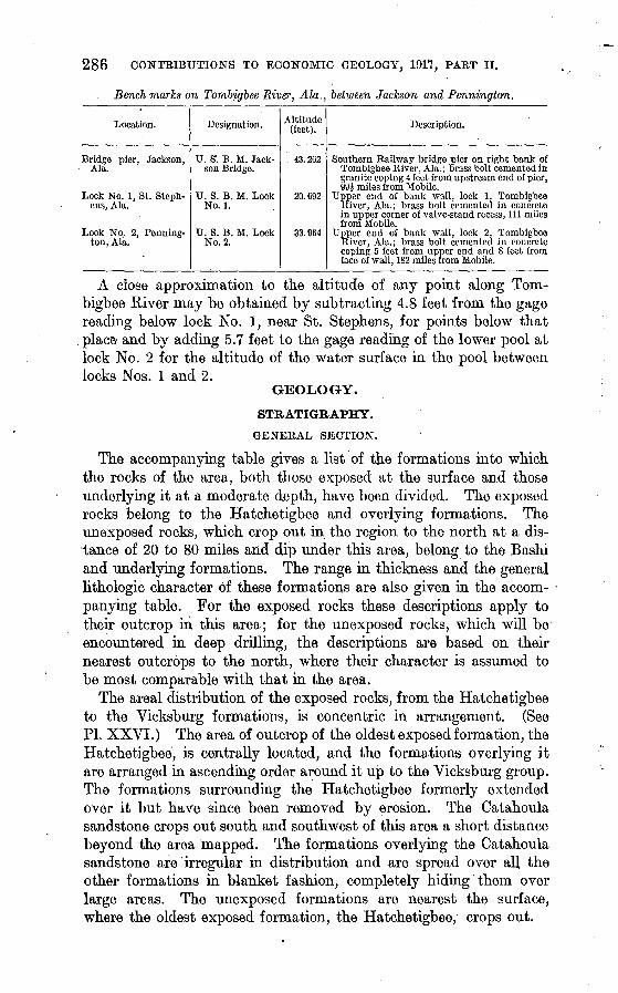
Bench marks on Tombigbee River, Ala., between Jackson and Pennington.
Location.
Bridge pier, Jackson, Ala.
Lock No. 1, St. Steph ens, Ala.
Lock No. 2, Pennington, Ala.
Designation.
U. S1. B. M. Jack son Bridge.
U. S. B. M. Lock No. 1.
U. S. B. M. LockNo. 2.
Altitude (feet).
43.262
20. 692
33.964
Description.
Southern Railway bridge pier on right bank of Tombigbee River, Ala.; brass bolt cemented ingranite coping 4 feet from upstream end of pier,994 miles from Mobile.
Upper end of bank wall, lock 1, Tombigbee Kiver, Ala.; brass bolt cemented in concretein upper corner of valve-stand recess, 111 milesfrom Mobile.
Upper end of bank wall, lock 2, TombigbeeRiver, Ala.; brass bolt cemented in concretecoping 5 feet from upper end and 8 feet fromface of wall, 182 miles from Mobile.
A close approximation to the altitude of any point along Tom bigbee River may be obtained by subtracting 4.8 feet from the gage reading below lock No. I, near St. Stephens, for points below that
. place and by adding 5.7 feet to the gage reading of the lower pool at lock No. 2 for the altitude of the water surface in the pool betweenlocks Nos. 1 and 2.
GEOLOGY.
STRATIGRAPHY.
GENERAL SECTION.
The accompanying table gives a list of the formations into which the rocks of the area, both those exposed at the surface and those underlying it at a moderate depth, have been divided. The exposed rocks belong to the Hatchetigbee and overlying formations. The unexposed rocks, which crop out in the region to the north at a dis tance of 20 to 80 miles and dip under this area, belong to the Bashi and underlying formations. The range in thickness and the general lithologic character of these formations are also given in the accom panying table. For the exposed rocks these descriptions apply to their outcrop in this area; for the unexposed rocks, which will be encountered in deep drilling, the descriptions are based on their nearest outcrops to the north, where their character is assumed to be most comparable with that in the area.
The areal distribution of the exposed rocks, from the Hatchetigbee to the Vicksburg formations, is concentric in arrangement. (See PI. XXVI.) The area of outcrop of the oldest exposed formation, the Hatchetigbee, is centrally located, and the formations overlying it are arranged in ascending order around it up to the Vicksburg group. The formations surrounding the Hatchetigbee formerly extended over it but have since been removed by erosion. The Catahoula sandstone crops out south and southwest of this area a short distance beyond the area mapped. The formations overlying the Catahoula sandstone are'irregular in distribution and are spread over all the other formations in blanket fashion, completely hiding them over large areas. The unexposed formations are nearest the surface, where the oldest exposed formation, the Hatchetigbee, crops out.

HATCHETIGBEE ANTICLINE, ALA. 287
Section of formations involved in the Hatchetigbee anticline, Ala.
System.
Quaternary.
Teitiary.
Series.
Recent.
P 1 e i s t o- cene.
Pliocene.
Oligocene.
Eocene.
Group.
Vicksburg.
/
Claiborne.
Wilcox.
Formation.
Alluvium.
Alluvial ter race deposits.
Citronelle for mation. '
Catahoula sandstone.
"Coral lime stone."
Marianna limestone.
Red Bluff clay.
Jackson for mation.
Gosport sand.
Lisbon forma tion.
Tallahatta buhrstone.
Hatchetigbee formation.
Bashi forma tion.
Tuscahoma formation.
Nanafalia for mation.
Thick ness in
feet.
0-100
0-200
0-90
0-90
20-40
80-115
40-200
20-200
200-300
80-125
140-200
200-250
Lithologic character.
Clay, silt, and sand along present streams.
Sand, gravel, and clay.
Terrace sand and gravel.
Light-gray sands, sandstones, and greenish-gray siliceous clays.
Limestone, hard and soft beds alternat ing, composed in part largely of corals.
Limestone, light gray to white, soft, chalky ("chimney rock") below, and hard, semicrystalline, cavernous (Glendon limestone member, locally termed "horsebone") above.
Glauconitic clay, marl, and marly lime stone below and plastic greenish-gray clay and gypsiferous and in places car bonaceous clay above.
Clay, sand, and indurated marl; plastic bluish-green clay at base, followed above by medium fine-grained sand, light-gray indurated marl, and plastic gray or greenish-gray clay at top.
Greensand and indurated glauconitic sandy marl and subordinate beds of glauconitic clay; replete with shells, especially the greensand.
Sand, clay, indurated marl, sandstones, and oyster beds; the sands are highly glauconitic and weather red. Almost entirely marine; in large part highly fossiliferous.
Claystone, sandstone, and argillaceous sandstone, light gray, greenish gray, or green, glauconitic, medium to thin bedded, noncalcareous, highly sili ceous, sparingly fossiliferous except in few beds.
Sand, laminated sand and clay, sandy clay, and plastic clay; these materials are light to dark gray or greenish gray when fresh, but weather to yellow or brown. A large part of the formation is lignitic, but it also contains numer ous beds of marine shells.
Greensand marl, sandy clay, and beds of lignite; in upper part this formation contains marine shells in abundance and in lower part numerous thin beds of lignite.
Sandy clays, sands, and greensands, gray in color and containing several shell beds.
Clays and sandy clays, indurated and in Eart glauconitic, followed below by
ght-gray sands, greensands, and sandy clays; lignite is present at base
. of formation in some places, and marine shells are abundant in upper part.
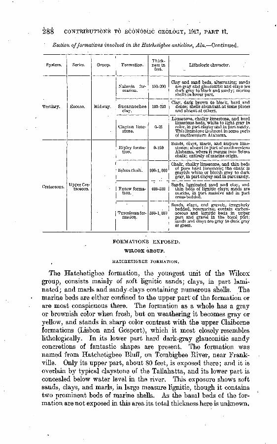
288 CONTRIBUTIONS TO ECONOMIC GEOLOGY, Itifo, PART 11.
Section of formations involved in the Hatchetigbee anticline, Ala. Continued.
System.
Tertiary.
Cretaceous.
Series.
Eocene.
Upper Cre taceous.
Group.
Midway.
Formation.
Naheola for mation.
Sucarnochee clay.
Clayton lime stone.
Ripley forma tion.
Selma chalk.
Eutaw forma tion.
Tuscaloosa for mation.
Thick ness in
feet.
150-200
100-200
0-25
0-150
900-1,000
400-500
300-1,000
Lithologic character.
Clay and sand beds, alternating; sands are gray and glauconitic and clays are dark gray to black and sandy; marine shells in lower part.
Clay, dark brown to black, hard and dense; shells abundant at some places and absent at others.
Limestone, chalky limestone, and hard limestone beds, white to light gray in color, in part clayey and in part sandy. This limestone is absent in some parts of southwestern Alabama.
Sands, clays, marls, and impure lime stones; absent in part of southwestern Alabama, where it merges into Selma chalk; entirely of marine origin.
Chalk , chalky limestone, and thin beds of pure hard limestone; the chalk is grayish white or bluish gray to dark gray, in part clayey and in part sandy.
Sands, laminated sand and clay, and thin beds of lignitic clays; sands are marine, in part massive and in part cross-bedded.
Sands, clays, and gravels,- irregularly bedded, nonmarine; contain carbon aceous and lignitic beds in upber part and gravel in the basal part; sands and clays are gray to dark gray or green.
FORMATIONS EXPOSED.
WILCOX GROUP.
HATCHETIGBEE FORMATION.
The Hatchetigbee formation, the youngest unit of the Wilcox group, consists mainly of soft lignitic sands; clays, in part lami nated; and marls and sandy clays containing numerous shells. The marine beds are either confined to the upper part of the formation or are most conspicuous there. The formation as a whole has a gray or brownish color when fresh, but on weathering it becomes gray or yellow, and stands in sharp color contrast with the upper Claiborne formations (Lisbon and Gosport), which it most closely resembles lithologically. In its lower part hard dark-gray glauconitic sandy concretions of fantastic shapes are present. The formation was named from Hatchetigbee Bluff, on Tombigbee River, near Frank- ville. Only its upper part, about 80 feet, is exposed there; and it is overlain by typical claystone of the Tallahatta, and its lower part is concealed below water level in the river. This exposure shows soft sands, clays, and marls, in large measure lignitic, though it contains two prominent beds of marine shells. As the basal beds of the for mation are not exposed in this area its total thickness here is unknown.

SATCHETIGBEE ANTICLINE, ALA. 289
The maximum exposed thickness at this place is probably 150 feet, whereas its total thickness farther north is estimated by Smith to be 175 feet.
The Hatchetigbee weathers readily into plastic clay and sandy clay; fresh exposures are rare. The formation contains no easily recognizable beds, and detailed structural studies are difficult within the area of its outcrop because of the lack of distinctive beds and because the bedding is uneven and measurements of local dips are difficult to obtain and of little value.
A conspicuous bed of clay pebbles and boulders is exposed 1 mile northwest of Bladon Springs, on the road to Barrytown, near or at the top of the Hatchetigbee. Small clay pebbles are present in the lower part of a 6-foot bed of glauconitic sand, and within 10 to 15 feet to the southeast the'layer of pebbles thickens from a fraction of a foot to 2 feet and the pebbles become larger. Still farther along the bedding the clay pebbles and boulders compose almost the entire bed, but the clay is broken into irregular-shaped masses of different sizes and has a worm-eaten appearance. The "worm holes" are about half an inch in diameter and are filled with fine glauconitic sand, the matrix of the pebbles. Similar conditions are seen for 100 feet to the south and for a quarter of a mile to the northeast. It is signifi cant that these clay pebbles and boulders occur at or near the contact of the Hatchetigbee with the Tallahatta buhrstone and, although there is no convincing evidence of an unconformity between them, shallow water with shifting currents, must have prevailed here near the end of Hatchetigbee time.
The outcrops of the Hatchetigbee are confined to two areas. (See PI. XXVI.) One extends from a point a short distance south of Jackson Creek northwestward almost to Silas; this area of out crop lies along the crest of the Hatchetigbee anticline. The other area extends.from a point near Bassett Creek, 3 miles southeast of Jackson, southward nearly to Oven Bluff, on Tombigbee Biver; this area lies along the east side of the Jackson fault. Were it not for this fold and fault, the Hatchetigbee formation would be normally from 400 to 500 feet below the surface.
CLAIBORNE GROUP.
TALLAHATTA BUHRSTONE.
The Tallahatta buhrstone immediately overlies the Hatchetigbee formation and when unweathered is in sharp lithologic contrast with the Hatchetigbee as well as with the upper Claiborne formations (Lisbon and Gosport) above. It consists of a fairly uniform series of claystones, glauconitic sandstones, and subordinate beds of clay and sand. Its most conspicuous features are its color and induration.

290 CONTRIBUTIONS TO ECONOMIC GEOLOGY, 1917, PART II.S
The unweathered Tallahatta is light gray, greenish gray, or rarely, where the beds are highly glauconitic, bright green; it weathers to form deep-red or orange-colored clay and sandy clay, which are practically indistinguishable from the weathered clays of the Lisbon above. The formation is separated from those overlying and under lying, it on the basis of its lithology, particularly its degree of indura tion, which is much greater than that of the beds above and below it, causing its beds to stand up prominently.
In detail this formation consists of medium to thin bedded light- gray, greenish-gray, or green indurated clay or claystone alternating with medium to coarse grained glauconitic, in part highly argilla ceous sandstone and indurated sandy clays. It is in general highly siliceous, noncalcareous, and without conspicuous carbonaceous beds. The claystones are in the main hard, dense> micaceous, and greenish gray when fresh; they ring when struck with a hammer and break with a conchoidal fracture. On weathering they become softer and gray or light gray and finally form red plastic clay. Fresh beds of claystone commonly show at right angles to the bedding two sets of conspicuous joints which cause them to break up into irregular rec tangular fragments. There are all gradations from claystones to sandstones of coarse grain. Many of the sandstones are highly glau conitic, clayey, and exceptionally fossiliferous. In many of the rocks sand and clay are irregularly distributed; thus there are small masses of pure sand and masses of pure clay in the same rock. Clay galls, or indurated pebbles of clay, are common in the sandstones. On weath ering the slabby layers of sandstone, particularly in the upper part of the formation, develop on their under sides irregularly branching tubular markings that are probably of concretionary origin, although some of them have the appearance of organic remains.
An interesting feature of this formation is the amount of silifica- tion that it has undergone. This is seen not only in the induration of the original clays and sands to claystones and sandstones but also in the formation of veins of laminated agate and quartzitic dikes. The laminated agate is abundant on the Jackson-Coffeeville road near J. A. Bolen's house and on the old Bladon Springs-Cullomburg road about halfway between those towns. Dikes of quartzite were found on Souwilpa Creek at White Bluff, a few miles below Silas, where they trend due north and dip about 85° E. The material on the two sides of the dikes is essentially the same, and along the strike the quartzite of the dikes grades into the country rock. It is evident that the dikelike bodies of quartzite were formed from the silification of the material inclosed between two parallel joints. To judge from the piles of scraps of this material near by and the number of arrow heads made of it, the Indians used it extensively. Similar dikes were seen in a deep branch flowing into Bassett Creek from the south about
HATCHETIGBEE ANTICLINE, ALA. 291
3 miles southeast of Jackson. Here the dikes are'almost vertical and trend N. 70°-80° E.
North and northwest of Jackson the outcrops of the Tallahatta entirely surround those of the Hatchetigbee arid extend from a point south of Jackson Creek northwestward almost to Silas; a small dis connected, area of the Tallahatta is found near the head of Stave Creek, and a narrow belt of it extends from a point 2 miles east of Jackson southward to the Lower Salt Works. (See PI. XXVI.) Owing to the superior hardness of this formation, the area of its out crop is exceptionally rough and hilly, particularly between Santa Bogue and Turkey creeks, west of Tombigbee River, and along Jackson Creek on the south.
Smith gives 300 feet as the minimum thickness of this formation, an estimate which the writer considers too large for this area. No locality was found where the total thickness of the Tallahatta could be directly measured, but from the width of its outcrop and its rate of dip it is believed to have a maximum thickness of not more than 200 feet in the northern part of this area and about 20 feet in the southern part, near the Lower Salt Works. Although this formation would be expected to thin to the south, away from the source of the sediments, the marked amount of thinning may be in part due to the absence of induration in the lower beds, which causes them to be grouped with the underlying formation, the Hatchetigbee.-
The Tallahatta conformably overlies the Hatchetigbee, and there is generally a gradual transition from one to the other, as shown in the Hatchetigbee Bluff, although shallow-water conditions with shifting currents prevailed at some places during the transition epoch. (See p. 289.) The relation of the Tallahatta to the over lying Lisbon is not clearly revealed, and at one place, at least, there is evidence of an unconformity between them or of marked irregu larities in deposition, which have not been observed within the Talla hatta. In the south bluff of Souwilpa Creek, in the SW. J NW. J sec. 32, T. 10 N., R. 3 W., 2 miles northeast of Silas, is a well- exposed section of the top of the Tallahatta and the base of the Lis bon. The beds of claystones and sandstone in the lower part of. the bluff are cut by at least three faults (?), which cause the beds on the two sides to dip in opposite directions at different angles. These faults(?) and associated joints do not appear to traverse a hard mas sive bed above, which overlies horizontally beds that appear to dip as much as 18°. The differences in the dip of the beds near the base of the bluff afford the most conspicuous evidence of faults of con siderable magnitude, but these differences may be explained as extreme cases of cross-bedding, although numerous joints and one or two small faults are clearly recognizable.
292 CONTRIBUTIONS TO ECONOMIC GEOLOGY, 1917, PART II.
LISBON FORMATION AND GOSPORT SAND.
In this report the Lisbon formation and Gosport sand are not sepa rately mapped because they are lithologically so similar that in the absence of good exposures they are separated with difficulty and because the Gosport is too thin to be shown on the scale of the accompanying map. As a whole these formations consist of glau- conitic sands, clays, and sandy clays containing a rich fauna of marine shells. The highly glauconitic character of the materials causes them to weather to a bright yellow or red color, which is one of their characteristics. This weathered material is at places distinguished with difficulty from the red terrace sands that commonly overlie it. The softness of these formations and the ease with which they weather leads to the development of a hilly country with gentle slopes over the area of its outcrop.
The Lisbon formation in the northwestern part of the area consists of glauconitic sand and clay, with prominent beds of oysters in its upper part and scattered beds of light-gray indurated marl, calca reous sandstone, gray to yellow micaceous spongy clay, and medium to coarse grained glauconitic sands replete with shells. In a few localities the upper beds are carbonaceous and contain scattered crystals of gypsum. The beds of Ostrea .settaeformis, the highly glau conitic character, and the deep-red color on the weathered surfaces are the chief characteristics of the formation. Ostrea sellaeformis, shown on Plate XXVII, is the common diagnostic fossil by which the formation may be recognized and traced from place to place. The general character of the Lisbon in the northwestern part of the area is shown in the following section:
Partial section of Lisbon formation and overlying sand 4 miles west of Gilbertown, nearcenter of sec. 83, T. 11 N., R. 4 W.
Top of bill. Feet. Terrace sand (probably Citronelle): Sand, bright yellow to red,
argillaceous ... r ............................................ 60Lisbon formation:
Sand and clay laminated, gray to brown, in part carbonaceous, weathering red........................................... 15
Clay, spongy, grayish yellow, sandy......................... 12Sand, highly glauconitic.................................... 6Marl, more or less indurated, gray, glauconitic; oysters and
pectens abundant in certain layers........................ 10Sand, calcareous;, oysters abundant.......................... 2Sand, indurated, calcareous, packed with Ostrea sellaeformis
and other fossils......................................... 2
107
At a number of places in the northwestern part of the area beds of carbonaceous clay and sand are present in the upper part of the formation, above some of the prominent beds of oysters, as in the foregoing section.

U. S. GEOLOGICAL SURVEY BULLETIN 661 PLATE XXVII
CHARACTERISTIC FOSSILS OF THE JACKSON FORMATION AND CLAIBORNE AND VICKSBURG
GROUPS.
1, Aturia alabamensis Morton; 2, Ostroa vicksburgensis Conrad; 3, 3a, Pecten poulsoni Morton; 4, 4a, Pecten perplanus Morton; 5, Spondylus dumosus Morton; 6, 6a, Ostrea sellaeformis Conrad.

HATCHETIGBEE ANTICLINE, ALA. 293
The Lisbon, which is typically developed in the northwestern part of the area, thins conspicuously toward the southeast; it main tains its lithologic characteristics to a point a short distance south of Bassetts Creek, near Jackson,, but beyond that it is not separable, on the basis of the present work, from the overlying Gosport, both formations having become much thinner and more calcareous. The following composite section shows the greater part of the Lisbon and Gosport formations in the extreme southeastern part of the area:
Partial section of Hatchetigbee, Tallahatta, Lisbon, and Gosport (?) formations at Lower Salt Works, near Oven Bluff, Clarice County, Ala.
Section measured on hill slope above Lower Salt Works.
Top of hill.Gosport (?) and Lisbon formations: Feet.
Marl, sandy, highly calcareous............................. 8Clay marl, sandy, gray to yellow........................... 5Limestone, hard, impure; casts of shells abundant........... 1Marl, sandy, in part indurated............................. 7Sand, highly glauconitic, much weathered...............:.. 7Sandstone, hard, calcareous................................. 1Marl, gray, indurated, glauconitic; contains pectens and
Orbitoides .............................................. 4Tallahatta buhrstone: Claystone or indurated clay, typical of
Tallahatta....................................... 1....... 15-20
Section measured on old road one-fourth mile north-northeast of Lower Salt Works.
Hatchetigbee formation: Sand and clay, lignitic................ 45Limestone Creek flat.
\The conspicuous beds of oysters found farther north are absent
here. Plastic clay, which looks like the weathered clay member of the lower Jackson, is poorly exposed a short distance above the top of this section.
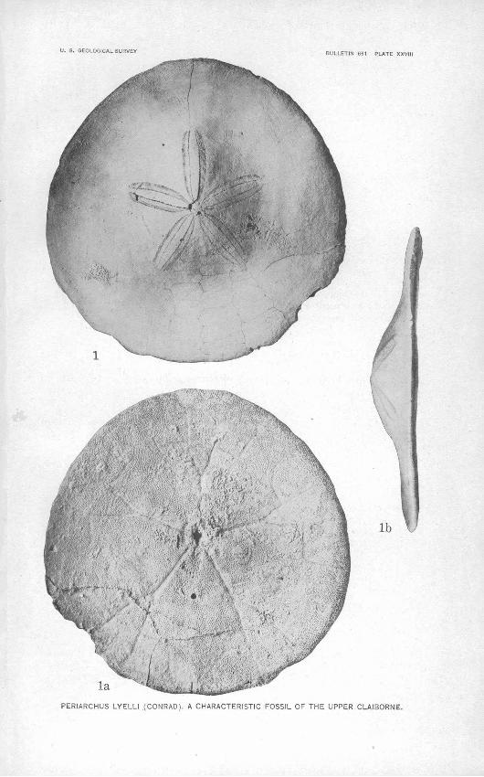
The Gosport sand consists of 10 to 15 feet of medium to fairly coarse-grained, highly glauconitic sand with subordinate layers of clay below and from a few feet to 10 or 15 feet of light-gray indurated glauconitic sandy marl and marly limestone above. This sandy marl may properly belong to the Jackson formation. The glauconitic sand is characteristic of the beds from the northwestern part of the area southeast as far as Jackson, but farther south it is not definitely recognized. The indurated marl has a thickness of only 1 or 2 feet in the northwestern part of the area but increases to a maximum of 12 to 15 feet near Jackson to the southeast. This marl, because of its lithology, its position between greensand below and greenish-gray plastic clay above, and its peculiar fossils, is a valuable key bed which can be easily traced over the entire area. The Gosport sand is characterized by a profusion of fossil shells among which may be mentioned Perio/rchus lyelli. (See PL XXVIII.)

294 CONTRIBUTIONS TO ECONOMIC GEOLOGY, 191*7, PART II.
Frxesh.exposures of the indurated marl are found on Willow Branch, 3 miles southwest of Silas; 1 on the main branch of the Choctaw Lum ber Co.'s railroad 4 miles west of Silas, three-fourths of a mile west of Elias Creek; on the road between Pevey's Landing and Bigbee, 2^ miles north-northeast of Jackson, near the NE. £ SW. f SW. I sec. 28, T. 7 N., R. 2 E.; and at many other places.
One of the most southerly sections that shows typical Gosport sand is given below:
Partial section of Jackson and Gosport formations, 3 miles southeast of Jackson, near J. J. Chestine's house, in the center of the SE. $ NW. \ sec. 14, T. 6 N., R. 2 E.
Jackson formation:Clay, grayish yellow. Feet. Sand, indurated, calcareous, clayey below.................. 6Clay, bluish green, micaceous, sandy, containing shells and .
becoming plastic below.................................... 30Clay, bluish green, plastic, calcareous...................... 15
Gosport sand:Limestone, hard 2 .......................................... 2Marl or marly limestone, gray, indurated. ................... 13Sand, green, highly glauconitic; fairly coarse grained; Peri-
archus lyelli very abundant.............................. 8Sand, green, glauconitic, argillaceous, fine grained.......... 4
Base of small waterfalls. 78
In the hills near by thin layers of Ostrea settaeformis were found in the beds below the base of this section and above typical exposures of Tallahatta.
The following section shows the character of the beds at the horizon of the Gosport sand farther south, where they have lost their distinc tive character.
Section in east bank of small branch 2 miles southwest of Rockville, in the NW. J NW. %sec. 14, T. 5 N., R. 2 E.
Jackson formation: Clay, bluish green, plastic.Gosport and Lisbon (?) formations : 3 Feet.
Marl, indurated, sandy.................................... 5Sandstone, hard, calcareous................................. 1 Marl, hard, sandy....................:..................... 12Clay, greenish gray, fine grained, plastic.................... 5£Marl, hard, sandy, or marly limestone; casts of shells......... 3Marl, sandy, bluish green when-fresh, weathering yellow, fol
lowed below by hard marl and highly glauconitic sand with shells in creek bed below................................. 5
31*
1 See section on Willow Branch, p. 297, also section given by C. W. Cooke (The age of the Ocala limestone: U. S. Geol. Survey Prof. Paper 95, p. 115,1915). . 2 This limestone and the underlying marl may properly belong to the Jackson formation.
3 The upper part of this section may be properly referred to the Jackson formation.
U. S. GEOLOGICAL SURVEY
laPERIARCHUS LYELLI (CONRAD), A CHARACTERISTIC FOSSIL OF THE UPPER CLAIBORNE.

HATCHETIGBEE ANTICLINE, ALA. 295
The Lisbon and Gosport formations practically encircle the Hatche- tigbee uplift (see PL XXVI); at its northwest end they form a broad belt that extends from a point near Silas almost to the Mississippi State line; and on the southeast they continue on the east side x>f the Jackson fault to the Lower Salt Works but with much diminished thickness. The thickness of these formations decreases from a maximum of probably 200 feet near Silas to about 125 or 150 feet near Pevey's Landing, on. Tombigbee River; about 80 or 100 feet 3 miles southeast of Jackson; and about 40 to 50 feet at the Lower Salt Works.- Dr. Smith* has suggested that this pronounced thin ning of the Tallahatta and higher Claiborne formations is due to the uplifting of the southern part of this area during part of the time that beds were being deposited elsewhere in the area. The writer believes that this was not the case, but that all the formations are present in the southern part of the area with diminished thickness.
No unconformities have been recognized either at the top or at the base of the Lisbon and Gosport. The transition between these formations is gradual and complete. A marked change in the lithol- ogy appears at the base of the Lisbon, where it rests on the non- calcareous indurated claystones and sandstones of the Tallahatta. Likewise, there is a sharp change in the lithology from the indurated marl at the top of the Gosport to the plastic greenish-gray clay of the lower Jackson.
JACKSON FORMATION.
The name "St. Stephens limestone" was formerly applied to the dominantly calcareous marine deposits of Alabama, which imme diately overlie the Claiborne group, and were considered the equiva lent of the Jackson and Vicksburg formations of Mississippi. Vaughan 2 an$, later, Cooke 3 suggested that these Mississippi for mations could be recognized in Alabama; and Cooke,4 as the result of his f aunal and stratigraphic studies, has definitely recognized those formations in this area. In western Alabama the name Jackson for mation is applied to the lower 100 to 125 feet of the "St. Stephens," which has a total thickness of 325 to 350 feet, and the name Vicks burg group to the overlying 100 to 130 feet. The upper 80 to 90 feet'is represented by the/'Coral limestone" at Salt Mountain. The original name, "St. Stephens limestone," has therefore been aban doned.
i Smith, E. A., informal communication.3 Vaughan, T. W., in Willis, Bailey, Index to the stratigraphy of North America: U. S. Gcol. Survey
Prof. Paper 71, pp. 738, 739,1912.a Cooke, C. W., The age of the Ocala limestone: U. S. Geol. Survey Prof. Paper 95, pp. 108 (footnote), 115,
1915.«Cooke, C. W., unpublished notes.
296 CONTRIBUTIONS TO ECONOMIC GEOLOGY, 1917, PART II.
The Jackson, as here recognized, consists of four well-defined and easily recognized lithologic units, as follows:
Subdivisions of Jackson formation.
4. Clay, light greenish gray, calcareous, plastic, with small white Feet, chalky limestone concretions.............................. 8-20
3. "Zeuglodon bed": Marl, light gray, indurated, sandy, glauco- nitic, weathering yellow, characterized by large Zeuglodon bones, Aturio alabamensis (commonly called "knees"), Pecten perplanus, echinoids, shark teeth, and fish vertebrae......... 8-15
2. Sand, medium fine grained, calcareous, in part argillaceous, grading into clay below, greenish gray .when fresh and weath ering grayish yellow to brownish yellow................... 20-30
1. Clay, bluish green or greenish gray, plastic, lumpy, calcareous, in part micaceous and sandy; weathers olive-green or gray ish yellow and finally to black sticky prairie soil; contains in places small chalky limestone concretions.................. 30-50
The lower clay (No. 1 of the section) is massive and, in its upper part, micaceous and sandy, grading into the sand above; when wet and fresh it is exceedingly slippery. In appearance it resembles the clay at the ,top of the Jackson (No. 4 in above section), but the two clays may be distinguished by slight differences in lithology, by the difference in thickness, and particularly by the difference in the underlying and overlying beds. This clay has a maximum thickness of about 50 feet in the northwestern part of the area and thins toward the southeast to about 20 or 30 feet south of Jackson.
No. 2 of the section consists of micaceous, clayey sand. Its uni form medium-fine gram, its brownish rather than bright-yellow or orange color, and its calcareous nature make it readily distinguish able, even on weathered surfaces, from the more recent terrace sands.
The "Zeuglodon bed," No. 3 of the section, is easily recognized because of its uniform character over the area, its position above beds of sand and below beds of plastic greenish-gray clay, and the presence of the characteristic fossils Aturia alabamensis, Pecten per- plamts, and Zeuglodon vertebrae. (See PI. XXVII.) This marl has a fairly uniform thickness of 8 to 15 feet over the entire area. Being harder than the associated beds, it is fairly well exposed and serves well as a key rock. Its outcrop is marked at many places by a belt of cedars. It contains at a few places thin lenticular masses of bituminous material, which closely resembles inspissated petroleum.
The clay at the top of the Jackson (No. 4 of the section) is lithologically similar to that at the base, but is thinner and more sandy and limy. It is not known to contain any characteristic fossils, but its surface is commonly strewn with shells of Ostrea vickslurgensis (see PI. XXVII), which weather out of the beds near the base of the Red Bluff clay above. The presence of these shells scattered over its surface, of the indurated marl below, and

HATCHETIGBEE ANTICLINE, ALA. " 297
of the characteristic Red Bluff beds above makes this clay -easily recognized over the entire area. It thins from about 20 feet in the northwestern part of the area to about 8 or 10 feet southeast of Jackson.
Although these lithologic divisions of the Jackson are partly exposed at many places in this area, there are few places where practically the entire section is as well exposed as on Willow Branch.
Section on Willow Branch 4 miles southwest of Silas, on road to Fail. 1
Section measured on southwest side of branch.
Hilltop. Feet. Citronelle formation: Sand, orange-colored, argillaceous in part; -
some beds of slabby ferruginous sandstone.................... 60Jackson formation: -
Clay, light greenish gray, highly calcareous, plastic, sandy and glauconitic in lower part, weathering red............... 20
Marl, light gray, indurated, sandy, glauconitic, containing hard ledges below and becoming clayey above............. 15
Sand, medium grained, argillaceous, weathering bright yel low to orange-colored and leaching gray................... 20
Sandy marl, grayish yellow, grading to plastic green clay below 10 Clay, light grayish green, plastic, with numerous small con
cretions of chalky limestone.............................. 48
Section measured on northeast side of branch.
Gosport sand (possibly includes part of the Lisbon formation below):
Marl, grayish yellow, indurated, glauconitic, sandy, forming prominent ledge 2 ... '. ................................... 1$
Marl, brownish yellow, weathered, glauconitic, sandy, con taining casts of shells.................................... 7
Greensand marl, dark greenish gray......................... 3$Sand and clay, laminated, glauconitic in upper part......... 7Sand, greenish black, replete with shells.................... 2Clay, dark, carbonaceous, hackly... ̂ ...................... 5Sand, weathered, argillaceous, glauconitic.................. 1Sand, medium grained, bright brownish yellow, weathered
glauconitic............'.................................. 8Bottom of Willow Branch a few feet below.
208
The outcrops of the Jackson formation completely encircle the Hatchetigbee uplift, like those of the Gosport, Lisbon, and Talla- hatta, and extend from a point near Salt Creek, north of Jackson, northwestward into Mississippi. To the southeast the outcrop is considerably narrower than to the northwest, and at the south east end of this uplift it is offset by the Jackson fault. (See p. 305.) On the east side of the fault the beds continue to the southeastern part of the area, whereas on the west side only one small area of
1 See also section by Cookc, C. W., op. cit., p. 115.3 This bed may properly belong to the Jackson formation.
69812° Bull. 661 18 20

298 CONTRIBUTIONS TO ECONOMIC GEOLOGY, 1917, PAET II.
outcrop is known, near Bassetts Creek, southeast of Jackson. In these areas underlain by the Jackson formation the exposures are fairly numerous along stream channels but are concealed at most places in the uplands. The best exposures are found (1) at Willow Branch (see section, p. 297); (2) along the road leading from Pevey's Landing to Bigbee; (3) in the bluffs at the road crossing of both branches of Ulkinask Creek, 3 to 4 miles north of Coffeeville; (4) on J. A. Bolen's place in sec. 31, T. 8 N., R. 2 E., 1£ miles northwest of McVey; and (5) 2£ miles north of Jackson. Other exposures are marked by a cross on Plate XXVI.
The Jackson formation becomes more calcareous from the western part of the area eastward; near the Lower Salt Works, south of Jack son, the upper part of the formation is dominently calcareous, and still farther east, in Florida, the beds of Jackson age are named Ocala limestone.1 The beds of Jackson age in the southeastern part of this area are intermediate in character between the typical Jackson of the section described above and the typical Ocala.
Within this area the Jackson rests conformably upon the Gosport sand and is overlain conformably by the Vicksburg group.
VICKSBTTRG GROUP.
SUBDIVISIONS.
The Vicksburg group in this,area comprises 100 to 130 feet of what was formerly called the "St. Stephens limestone" and includes the following divisions:
Marianna limestone:Glendon limestone member.Soft chalky limestone called "chimney rock."
Red Bluff clay.
The whole of this group is dominantly calcareous with the excep tion of its basal formation, the Red Bluff clay. Its upper limit is not well marked, as it is in contact with alternating soft and hard layers of limestone, the "Coral limestone"; its base is equally indis tinct, as it is underlain by similar marine deposits. Studied in de tail, however, this group is easily separated in this area from the underlying Jackson, which composes the lower part of the "St. Stephens limestone."
RED BLUFF CLAY.
The Red Bluff clay, so named from its exposure in the bluffs of Chickasawhay River near Hiawannee, Miss.,2 is the most variable formation of the Vicksburg group, both in thickness and in lithology. In general it consists in its lower part of 10 to 20 feet of glauconitic
i Cooke, C. W., The age of the Ocala limestone: U. S. Geol. Survey Prof. Paper 95, pp. 107-117,1915. 3 Lowe, E. N., Mississippi: its geology, geography, soils, and mineral resources: Mississippi Geol. Survey
Bull. 12, p. 86,1915.
HATCHETIGBEE ANTICLINE, ALA. 299
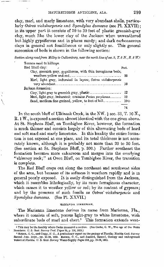
clay, marl, and marly limestone, with very abundant shells, particu larly Ostrea vicksburgensis and Spondylus dumosus (see PI. XXVII); in its upper part it consists of 20 to 30 feet of plastic greenish-gray clay, much like the lower clay of the Jackson when unweathered but highly gypsiferous and in places sandy; and dark carbonaceous clays in general not fossiliferous or only slightly so. This general succession of beds is shown in the following section:
Section along road from Millry to Cullomburg, near the north line of sec. 9, T. 8 N., R. 3 W.*
Terrace sand to hilltops.Red Bluff clay: , Feet.
Clay, greenish gray, gypsiferous, with thin ferruginous beds; weathers yellow and red................................ 30
Marl, light gray, indurated in layers; Ostrea vicksburgensis very abundant......................................... 10
Jackson formation:Clay, light gray to greenish gray, plastic.................... 12Marl, light gray, indurated; contains Pecten perplanus. ....... 12Sand, medium fine grained, yellow, to foot of hill........... 10+
74
In the south bluff of Ulkinask Creek, in the NW. J sec. 33, T. 10 N., R. 1 W., is exposed a section almost' identical with the one given above. At St. Stephens Bluff, on Tombigbee River, however, the formation is much thinner and consists largely of thin alternating beds of hard and soft marl and marly limestone. In this locality the entire forma tion is not exposed at one place, and its total thickness is not accu rately known, although it is probably not more than 20 to 30 feet. (See section at St. Stephens Bluff, p. 300.) Farther southeast the formation becomes more calcareous and merges into the overlying "chimney rock;" at Oven Bluff, on Tombigbee River, the transition is complete.
The Red Bluff crops out along the northeast and southwest sides of the area, but because of its softness it weathers rapidly and is in general poorly exposed. It is easily distinguished from the Jackson, which it resembles lithologically, by its more ferruginous character, which causes it to weather yellow or red; by its content of gypsum; and by the presence of such fossils as Ostrea" vicksburgensis and Spondylus dumosus. (See PL XXVII.)
MARIANNA LIMESTONE.
The Marianna limestone derives its name from Marianna, Fla., where it consists of soft, porous light-gray to white limestone, with subordinate beds of marl and chert.2 This formation extends west-
1 This may be the locality where Cooke measured a section. (See Coofce, C. W., The age of the Ocala limestone: U. S. Geol. Survey Prof. Paper 95, p. 116,1915.)
2 Matson, G. C., and Clapp, F. G., A preliminary report on the geology of .Florida; Florida Gool. Survey Second Ann. Kept., pp. 51-59, 1909. Matson, G. C., and Sanford, Samuel, Geology and underground waters of Florida: U. S. Geol. Survey Water-Supply Paper 319, pp. 73-79,1913.

300 CONTRIBUTIONS TO ECONOMIC GEOLOGY, 1917, PART II.
ward across Alabama into Mississippi, but in its western area the upper part of the formation contains beds of hard, cavernous lime stone which have been named the Glendon limestone member.1 The Marianna limestone of this area includes 55 to 75 feet of soft, porous light-gray to white chalky limestone, locally called the "chimney rock," overlain by 12 to 15 feet of hard, semicrystalline, rough, cav ernous limestone (Glendon limestone member), locally termed "horsebone." These two divisions contain the most easily recog nized beds of the area. The " chimney rock" has been widely quar ried for building stone; when damp it is soft and easily cut with a saw, but on drying it hardens so as to make a fairly durable rock for chimneys and foundations.
The upper part of the "chimney rock" and the Glendon member are well exposed at Glendon, a flag station on the Southern Railway east of Jackson, the type locality of the Glendon member. Here about 15 feet of Glendon limestone, of typical "horsebone" appear ance, overlies an equal thickness of soft chalky limestone, composed in some beds of masses of Orbitoides (thin, round, flat shells from three- fourths to 1 inch or more in diameter). The most extensive expo sures of the Marianna are found in St. Stephens Bluff and neighboring bluffs on Tombigbee River.
Partial section of Vicksburg group and Jackson formation at St. Stephens Bluff (LoversLeap), Tombigbee River.
Marianna limestone: . Ft. in. Limestone, grayish yellow, hard, cavernous (Glendon lime
stone member or "horsebone' } ). ........................ 13 6Limestone, light gray to white, soft, porous, chalky, with
Pecten poulsoni, Clypeaster rogersi, and Orbitoides ("chim ney rock")-..-.....-.-........-........................ 55 0
Concealed interval....................................... 15 6Red Bluff clay:
Marl and h'mestone, gray, hard and soft beds, glauconitic... 6 4 Limestone, hard......................................... l '0Olay, greenish gray, glauconitic........................... 9 8Marl, light gray, indurated, glauconitic................... 1 0
Jackson formation: .Clay, greenish grey; Pecten perplanus abundant............ 11 0Marl, light gray, indurated, hard nodular layers; Pecten per
planus very abundant ("Zeuglodon bed'')................ 10 0Water level in Tombigbee River. -
123 0
The "chimney rock" contains in the northeastern part of the area hard limestone ledges 1 foot or less thick at intervals of 6 to 8 feet throughout its thickness, as in a roadside exposure near the center of the NW. I sec. 18, T. 8 N., R. 2 E., 1J miles north of Winn.
i Cooke, C. W., manuscript awaiting publication by the Mississippi Geol. Survey.

HATCHETIGBEE ANTICLINE; ALA. 301
The Marianna limestone crops out at intervals along the north eastern and eastern parts of the area from Oven Bluff, on Tombigbee River, to Womack Hill, and along the southwestern and western parts from Paynes to the Mississippi State line. (See PL XXVI.) The two divisions of this formation are so striking lithologically that they can be clearly recognized in this area without the aid of fossils; confusion arises only in its southeastern part, near Oven Bluff, where the Red Bluff and upper Jackson are similar in appear ance to the "chimney rock." The most easily recognized character istic fossils of the Marianna axePectenpoulsoni, Olypeaster rogersi, and Orbitoides.
"CORAL LIMESTONE."
The name "Coral limestone" was applied by Smith and Johnson 1 ~ to the uppermost beds of what they termed the " White limestone" as exposed at Salt Mountain, Clarke County, including the Glendon limestone member, as described above, and the overlying limestone, a total of about 150 feet of strata. As the Glendon has been found to be of Marianna age and also to be unlike the beds above it, the term "Coral limestone" as tentatively used in this report is applied to the limestone beds overlying the Glendon.
At Salt Mountain the "Coral limestone" has a thickness of 80 to 90 feet and consists of alternating hard and soft beds of white limestone, part of which is composed largely of corals. The exposures there are not good and no detailed section was made of this formation. Salt Mountain is the only locality in this area at which so great a thickness of this formation is exposed.
CATAHOULA SANDSTONE.
The Catahoula sandstone is not exposed within the area mapped (PI. XXVI), but for completeness it is briefly described, as it crops out a short distance beyond the southwestern limit of this area, beyond the outcrop of the Vicksburg group and the "Coral limestone."
This formation is well exposed in the vicinity of Healing Springs, Washington County, where it consists of gray to yellow sands, gray to bluish-gray clay, and indurated clay, and in the neighboring region, where it contains fine conglomerate, sandstone, and quartzite in addition. In this region, according to Matson,2 the Catahoula
' has a thickness of probably less than 200 feet. It is nonmarine and unfossiliferous, except for a few fresh-water shells and plant remains, and is easily separable from the marine beds of the Vicksburg group below.
i Smith, E. A., and Johnson, L. C., Tertiary and Cretaceous strata of the Tuscaloosa, Tombigbee, and Alabama rivers: IT. S. Geol. Survey Bull. 43, pp. 18-20,1887.
8 Matson, G. C., The Catahoula sandstone: U. S. Geol. Survey Prof. Paper 98, p. 220,1916.

302 CONTRIBUTIONS TO ECONOMIC GEOLOGY, 1917, PART II.
PLIOCENE (CITRONELLE FORMATION) AND PLEISTOCENE SANDS AND GRAVELS.
After the deposition of the Catahoula sandstone there was a period during which no sediments were laid down in this region, and those that had been formed were uplifted, gently folded, and exten sively eroded. Upon the eroded surface thus produced, which was relatively much lower than the present surface, terrace sands and gravels were deposited, covering in large measure the older formations of the area. In general the uplands are covered with this terrace formation, and only in the stream bottoms and along their bluffs, where active erosion has been taking place, are the underlying forma tions exposed. South of the latitude of Jackson the sands and gravels cover progressively more of the area until they pass below still more recent deposits, whereas to the north they cover progressively smaller areas until only small remnants are left and finally disappear entirely.
These deposits were formerly named "Orange sand" and later "Lafayette." Recently the name Citronelle formation 1 has been applied to those terrace deposits of Pliocene age which range in alti tude in this area from about 230 to 450 feet. The Citronelle forma tion includes most but not all of the terrace sands of the area. The highest terrace deposit in this area reaches an altitude of 440 feet and is represented by a few scattered remnants of sand, gravel, and fer ruginous sandstone capping high hills. The most extensive terrace deposit has an altitude ranging from 230 feet near Jackson to 280 or 290 feet near the Mississippi State line. A still lower but con spicuous terrace deposit occurs at about 170 to 180 feet.
The materials that constitute these terrace deposits are very sim ilar, consisting of coarse sand and gravel below and fine sand, sandy clay, or loam above. In general the sands are bright red or orange colored and in many places where they are much weathered are with difficulty distinguished from the sands of the Claiborne group. The deposits of sand and gravel are more extensively developed near Jackson than elsewhere in the area.
ALLUVIUM.
The valley of the Tombigbee and its major tributaries is broad and flat, and much of the lowland along the river and within 5 miles of it is between 30 and 60 or 80 feet above sea level. The streams that meander through these lowlands are sluggish and during periods of- overflow deposit a large percentage of the silt which they have carried down from their upper courses, where the gradient is higher. The bearing of such conditions on the study of the underlying rocks is evident: Exposures are to be looked for in the bottoms of the small streams near their heads, or along the bluffs of the larger streams
i Matson, G. C., The Pliocene Citronelle formation of the Gulf Coastal Plain: U. S. Geol. Survey Prof. Paper 98, pp. 168-169,1916.

fiATCHETIGBEE ANTICLINE, ALA. $03
either where'smaller streams have cut through the bluffs or where the main streams themselves in meandering flow against them.
STRUCTURE.
GENERAL FEATURES.
The formations of the Coastal Plain of .southern Alabama dip normally to the south or southwest at a gentle rate and pass progres sively beneath younger formations toward the coast. This simple structure is interrupted in the area near Silas, Bladon Springs, and Jackson by an uplift and fault the Hatchetigbee anticline and Jackson fault which disturb the normal dip and succession of the rocks and bring to the surface formations elsewhere deeply buried. The Hatchetigbee anticline exposes the Hatchetigbee formation, which would be normally about 400 to 500 feet below the surface and causes the dip on its northeast side to be reversed in direction and on its southwest side to be increased in amount. Had this upward fold not been worn down by long-continued erosion it would appear on the surface as a relatively high but well-rounded ridge, extending from a point 3 miles north of Jackson northwest past Bladon Springs and Silas into Mississippi. The crest of this ridge would be in the position marked on the accompanying map (PL XXVI) "Crest of the Hatchetigbee anticline.'' Erosion has reduced this upfold or anti clinal ridge to the level of the surrounding country and has exposed the underlying strata down to the Hatchetigbee formation, which represents the center of the uplift.
The uplift is continued beyond the southeast end of the Hatche tigbee anticline by the Jackson fault, which brings to the surface along its east side the same formation that crops out along the crest of the anticline. Other folds and faults that are subordinate to the major anticline and fault have been recognized but they have not been outlined in detail.
HATCHETIGBEE ANTICLINE.
The Hatchetigbee anticline is a broad, gentle rock fold, approxi mately 50 miles long and 20 miles broad, which extends from a point 2 miles north of Jackson in a N. 55° W. direction past Salitpa, Bladon Springs, and Silas into Mississippi. (See PI. XXVI.) The center of the uplift is outlined by the outcrop of the Hatchetigbee formation, the oldest exposed formation in the area; the approximate axis of the anticline is shown on the accompanying map. The general shape and size of the anticline are indicated by the outcrops of the Tallahatta, Lisbon, Gosport, Jackson, and Vicksburg formations, which encircle the outcrop of the Hatchetigbee formation and for merly arched over it. (See cross section B-B' on PI. XXVI.)
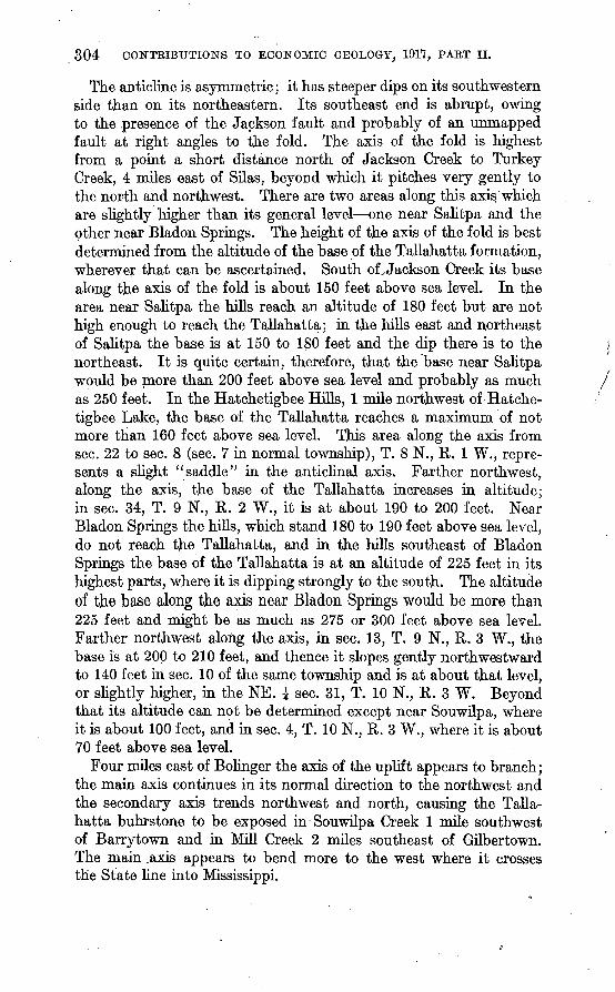
304 CONTRIBUTIONS TO ECONOMIC GEOLOGY, 1917, PART II.
The anticline is asymmetric; it has steeper dips on its southwestern side than on its northeastern. Its southeast end is abrupt, owing to the presence of the Jackson fault and probably of an unmapped fault at right angles to the fold. The axis of the fold is highest from a point a short distance north of Jackson Creek to Turkey Creek, 4 miles east of Silas, beyond which it pitches very gently to the north and northwest. There are two areas along this axis'which are slightly higher than its general level one near Salitpa and the other near Bladon Springs. The height of the axis of the fold is best determined from the altitude of the base of the Tallahatta formation, wherever that can be ascertained. South oLJackson Creek its base along the axis of the fold is about 150 feet above sea level. In the area near Salitpa the hills reach an altitude of 180 feet but are not high enough to reach the Tallahatta; in the hills east and northeast of Salitpa the base is at 150 to 180 feet and the dip there is to the northeast. It is quite certain, therefore, that the base near Salitpa would be more than 200 feet above sea level and probably as much as 250 feet. In the Hatchetigbee Hills, 1 mile northwest of Hatche- tigbee Lake, the base of the Tallahatta reaches a maximum of not more than 160 feet above sea level. This area along the axis from sec. 22 to sec. 8 (sec. 7 in normal township), T. 8 N., R. 1 W., repre sents a slight " saddle" in the anticlinal axis. Farther northwest, along the axis, the base of the Tallahatta increases in altitude; hi sec. 34, T. 9 N., R. 2 W., it is at about 190 to 200 feet. Near Bladon Springs the hills, which stand 180 to 190 feet above sea level, do not reach the Tallahatta, and in the hills southeast of Bladon Springs the base of the Tallahatta is at an altitude of 225 feet.in its highest parts, where it is dipping strongly to the south. The altitude of the base along the axis near Bladon Springs would be more than 225 feet and might be as much as 275 or 300 feet above sea level. Farther northwest along the axis, in sec. 13, T. 9 N., R. 3 W., the base is at 200 to 210 feet, and thence it slopes gently northwestward to 140 feet in sec. 10 of the same township and is at about that level, or slightly higher, in the NE. \ sec. 31, T. 10 N., R. 3 W. Beyond that its altitude can not be determined except near Souwilpa, where it is about 100 feet, and in sec. 4, T. 10 N., R. 3 W., where it is about 70 feet above sea level.
Four miles east of Bolinger the axis of the uplift appears to branch; the main axis continues in its normal direction to the northwest and the secondary axis trends northwest and north, causing the Talla hatta buhrstone to be exposed in Souwilpa Creek 1 mile southwest of Barrytown and in Mill Creek 2 miles southeast of Gilbertown. The main .axis appears to bend more to the west where it crosses the State line into Mississippi.

HATCHETIGBEE ANTICLINE, ALA. 305
According to Cooke * the Vicksburg group has an abnormally wide outcrop along Chickasawhay River between Hiwannee and Waynesboro, a condition which suggests that there is in that area, which lies south of the normal continuation of the Hatchetigbee anticline, a lower but parallel fold, or possibly a structural terrace.
The axis of the Hatchetigbee anticline is not accurately determin- able, as -the anticline is broad and comparatively flat-topped and shows no well-defined axis. The dips on the flank of the anticline reach a maximum of 1° or 2° at a distance of 2 to 4 miles from the approximate axis. The beds on the southwest side of the fold prob ably continue to dip to the south at a variable angle beyond the limits of this fold all the way to the Gulf, probably without any pro nounced folding; on the northeast side the beds dip from a fraction of a degree to 1° to the north, within 10 to 12 miles become approxi mately horizontal, and farther north gradually assume the normal southerly dip.
JACKSON FAULT.
The Jackson fault extends from a point near Stave Creek, 3 miles north of Jackson, southeast to Bassett Creek, south to Central Salt Works, and southwest to Tombigbee River near Oven Bluff. (See PL XXVI.) Its throw ranges from about 300 feet near its north end to at least 450 feet near its south end. The upthrow is on its east side, and near its central and southern parts the Hatchetigbee forma tion is brought into contact with the lower part of the Marianna limestone ("chimney rock").
The Jackson fault is well shown in the south bank of Stave Creek a quarter of a mile north of the center of sec. 19, T. 7 N., R. 2 E. The fault plane is not exposed but a bluff consisting of 40 to 50 feet of the Tallahatta buhrstone is within 225 feet of an exposure of 25 feet of "chimney rock" on the same level. The upthrow is on the east side and the displacement, which brings what is believed to be the upper part of the Tallahatta into contact with the "chimney rock," amounts to at least 300 feet and possibly as much as 400 feet. Half a mile northwest of this locality the "chimney, rock" appears to be in contact with the Lisbon formation, but beyond that no definite evidence of the fault was found. To the southeast evidence of the fault is present at a number of places. One mile north of Jackson on the road to Parkers Chapel there is a broad sink hole on the west side of the road, suggesting the presence of limestone of Vicksburg age, whereas a short distance farther north the lowest beds of the Jackson formation are exposed on the west side of the road near Erasmus Taylor's house. The upper beds of indurated marl of the Claiborne and the lower clay beds of the Jackson formation
i Cooke, C. W., informal communication.
306 CONTRIBUTIONS TO ECONOMIC GEOLOGY, 1917, PART II.
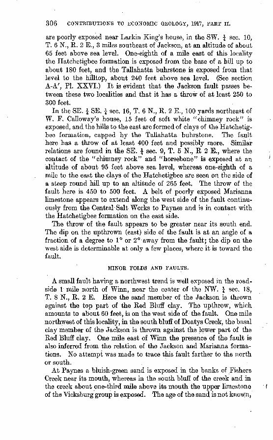
are poorly exposed near Larkin King's house, in the SW. I sec. 10, T. 6 N., R. 2 E., 3 miles southeast of Jackson, at an altitude of about 65 feet above sea level. One-eighth of a mile east of this locality the Hatchetigbee formation is exposed from the base of a hill up to about 180 feet, and the Tallahatta buhrstone is exposed from that level to the hilltop, about 240 feet above sea level. (See section A-A', PL XXVI.) It is evident that the Jackson fault passes be tween these two localities and that it has a throw of at least 250 to 300 feet.
In the SE. i SE. \ sec. 16, T. 6 N., R. 2 E., 100 yards northeast of W. F. Galloway's house, 15 feet of soft white "chimney rock" is exposed, and the hills to the east are formed of clays of the Hatchetig bee formation, capped by the Tallahatta buhrstone. The fault here has a throw of at least 400 feet and possibly more. Similar relations are found in the SE. \ sec. 9, T. 5 N., R 2 E., where the contact of the "chimney rock" and "horsebone" is exposed at an altitude of about 95 feet above sea level, whereas one-eighth of a mile to the east the clays of the Hatchetigbee are seen on the side of a steep round hill up to an altitude of 265 feet. The throw of the fault here is 450 to 500 feet. A belt of poorly exposed Marianna limestone appears to extend along the west side of the fault continu ously from the Central Salt Works to Paynes and is in contact with the Hatchetigbee formation on the east side.
The throw of the fault appears to be greater near its south end. The dip on the upthrown (east) side of the fault is at an angle of a fraction of a degree to 1° or 2° away from the fault; the dip on the west side is determinable at only a few places, where it is toward the fault.
MINOR FOLDS AND FAULTS.
A small fault having a northwest trend is well exposed in the road side 1 mile north of Winn, near the center of the NW. \ sec. 18, T. 8 N., R. 2 E. Here the sand member of the Jackson is thrown against the top part of the Red Bluff clay. The upthrow, which amounts to about 60 feet, is on the west side of the fault. One mile northwest of this locality, ha the south bluff of Doatys Creek, the basal clay member of the Jackson is thrown against the lower part of the Red Bluff clay. One mile east of Winn the presence of the fault is also inferred from the relation of the Jackson and Marianna forma tions. No attempt was made to trace this fault farther to the north or south.
At Paynes a bluish-green sand is exposed in the banks of Fishers Creek near its mouth, whereas in the south bluff of the creek and in the creek about one-third mile above its mouth the upper limestone of the Vicksburg group is exposed. The age of the sand is not known.,

HATCHETIGBEE ANTICLINE, ALA. 307
but it is not in its normal position; it is believed to be of Red Bluff age and to be faulted into its present position. If this inference is true, the fault trends north or slightly northeast and has its upthrow on the west side.
The presence of the Jackson formation in the center of sec. 2, T. 10 N., R. 3 W., near the center of sec. 6 of the same township, and in sees. 2 and 3, T. 10 N., R. 4 W., and the presence of the Tallahatta buhrstone in the bottom of Mil and Okatuppa creeks immediately south of a line connecting these three areas of the Jackson indicate a strongly flexed syncline or a fault with a downthrow on the north side. This area was not studied in sufficient detail to determine the exact structural relations.
POSSIBILITIES OF OIL AND GAS.
GENERAL CONSIDERATIONS.
The study of productive oil fields has yielded much information concerning the occurrence of oil, particularly concerning the age and nature of the containing and associated rocks and of the structural conditions under which it occurs. Little definite information has been obtained, however, as to the processes which give rise to the formation of petroleum and the factors which *. ifluence its migration and collection in commercial pools. The application of the knowl edge which has been gained to new and unexplored areas sheds some light on the possible occurrence of oil.
There are two problems to be considered. Does oil exist in the region; and if so, where has it accumulated in commercial pools? In some areas, particularly near productive pools, the presence of oil is highly probable provided well-developed anticlines occur and the productive sands of the neighboring fields are present within reach of the drill. Thus, in parts of Oklahoma and on the Sabine uplift in northwestern Louisiana the existence of an anticline is strong evi dence of the presence of oil in the underlying rocks. This area in Alabama, however, is so far removed from productive oil fields that the presence or absence of oil in it is the prime consideration and the location of the most promising areas for the accumulation of oil is secondary. Unfortunately geologic evidence here, as in many other places, sheds more light on the probable location of oil, if any is present, than on its presence or absence. Although the drill must prove whether or not oil occurs in the area of the Hatchetigbee anticline, the evidence of its presence and especially of its probable location is worthy of consideration.
EVIDENCE OF OIL.
In this area the best evidence of the presence of oil which may have collected in commercial quantities under favorable structural condi-
308 CONTRIBUTIONS TO ECONOMIC GEOLOGY, 1917, PART II.
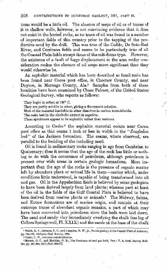
tions would be a little oil. The absence of seeps of oil or of traces of jt in shallow wells, however, is not convincing evidence that it does not exist in the buried rocks, as no trace of oil was found in a number of important fields of this country prior to the tapping of the pro ductive sand by the drill. This was true of the Caddo, De Soto-Ked River, and Corsicana fields and seems to be particularly true of all the Coastal Plain fields except those of the salt-dome type. However, the existence of a fault of large displacement in the area under con sideration makes the absence of oil seeps more significant than they would otherwise be.
An asphaltic material which has been described as fossil resin has been found near Cocoa post office, in Choctaw County, and near Dayton, in Marengo County, Ala.1 Samples from both of these localities have been exam hied by Chase Palmer, of the United States Geological Survey, who reports as follows:
They begin to soften at 130° C.They are partly soluble in ether, giving a fluorescent solution.Most of the material insoluble in ether dissolves in carbon tetrachloride.The resin test in the alcoholic extract is negative.These specimens appear to be asphaltic rather than resinous.
According to Cooke 2 the asphaltic material occurs near Cocoa post office as thin seams 1 inch or less in width in the " Zeuglodon bed" of the Jackson formation. The seams, where observed, are parallel to the bedding of the including marl.
Oil is found in sedimentary rocks ranging in age from Cambrian to Quaternary; thus it seems that the age of the rock has little or noth ing to do with the occurrence of petroleum, although petroleum is present over wide areas in certain geologic formations. More im portant than the age of the rocks is the presence of organic matter left by abundant plant or animal life in them matter which, under conditions little understood, is capable of being transformed into oil and gas. Oil in the Appalachian fields is believed by some geologists to have been derived largely from land plants; whereas part at least of the oil in the fields of the Gulf Coastal Plain is believed to have been derived from marine plants or animals.3 The Midway, Selma, and Eutaw formations are of marine origin, and contain at their outcrops traces of abundant organic remains, a part of which may have been converted into petroleum since the beds were laid down. The sand and sandy clay immediately overlying the chalk (see log of Cullom Springs well, PI. XXIX) and the sands at the base of the chalk
i Smith, E. A., Johnson, L. C., and Langdon, D. W., jr., On the geology of the Coastal Plain of Alabama, pp. 196-198, Alabama Geol. Survey, 1894.
8 Cooke, C. W., informal communication.8 Matson, 0. C., and Hopkins, O. B., The Corsicana oil and gas field, Tex.: U. S. Geol. Survey Bull
661, pp. 241-244,1917 (Bull. 661-F)*.
HATCHETTGBEE ANTICLINE, ALA. 309
are considered to be the most favorable beds for the concentration of oil and gas, if they exist in this area.
The Tuscaloosa formation, which lies below the Eutaw, contains both subaerial and semimarine deposits, and in the area of its out crop some of its beds carry vegetable remains. The possibilities of the occurrence of oil in this formation are twofold the oil may have been derived from the transformation of the organic material con tained in it, or it may have been derived from the Paleozoic rocks which doubtless underlie it 1 and which in the area to the north are in part carbonaceous and bituminous. The fact that this formation is so thick and so dominantly sandy detracts from its possibilities of yielding oil and gas, as fairly thin but persistent sand beds in the midst of thick deposits of clay or shale seem to -present the most favorable condition for their accumulation. Oil is more likely to occur in the overlying formations than in this formation.
The deformation of an area has in several ways an important bearing on the possible occurrence of oil it may aid the transforma tion of organic debris into petroleum, it may aid in the transfer of the petroleum from fine-grained to coarser-grained beds and in the migration in those beds, and it may produce folds suitable for the trapping of commercial pools of oil and gas. The wide (distribution of petroleum in Louisiana and Texas and its general absence, so far as known, in the States east of Mississippi River where beds of the same age and general character have been deposited may be due in part to the greater deformation of the same strata in those States. However, so far as known, the deformation has been greater and more pronounced folds and faults have been developed in the area here discussed than in any other area of the Coastal Plain east of the Mississippi. Therefore, so far as the deformation is concerned this area is particularly favorable for the occurrence of oil and gas.
The Hatchetigbee uplift is so far removed from productive fields where the geologic conditions are similar that a comparison between them is of little value. The nearest comparable fields are those of northwestern Louisiana, the Caddo and De Soto-Red River fields. In both regions the beds of Wilcox age crop out at the surface and are underlain by beds of the same age; the structure here is more strongly developed than there; the general succession of beds in the upper part of the section, including the Midway, Ripley, and Selma, is somewhat similar in the two areas, but the lower formations are widely different.
The following data regarding deep drillings in this area are given because of their bearing on the possible occurrence of oil and gas.
i The Tuscaloosa may bo separated in this area from the Paleozoic rocks by deposits of Lower Cretaceous age, such as are found to the east and west.
310 CONTRIBUTIONS TO ECONOMIC GEOLOGY, 1911, PART II.
This information was taken largely from a report by Smith l supple mented by the meager information obtained during the field studies.
Cullom Springs well, three-fourths mile west of Bladon Springs, Choctaw County; drilled in 1884-85 by Capt. Trowbridge; depth, 1,345 feet; starts in Hatchetigbee for mation and reaches the upper part of the Selma chalk (see log, PI. XXIX); yields strong flow of salt water and some gas. (See analysis, p. 311.)
St. Stephens Oil Co.'s well, in sec. 27, T. 7 N., R. 1W., in the northwest corner of the old Spanish grant known as the John McGrew tract, about 1,600 feet from Oil Well Landing on Tombigbee River, above St. Stephens Landing, Washington County, drilled in 1902 by James Keoughan, contractor; depth, 2,006 feet; starts in upper part of Claiborne group (probably Lisbon formation) and may reach the Selma chalk.
Well at Beckhams Landing, near Salitpa, Clarke County; drilled 1903-4; depth 2,600 feet.
Well at lock No. 1, Tombigbee River, Clarke County; drilled by Maj. Hill; depth reported to be about 2,700 feet; yields flow of salt water and some gas.
Bolen well, in the northeast corner of the SE. i SE. £ sec. 17, T. 7 N., R. 1E., north west of Jackson, Clarke County; drilled in 1902-3 under direction of S. A. Hobson; depth, 740 feet; yields salt water and some gas. (See analysis, p. 311.)
Edgar Oil Co.'s well, in the NW. £ SW. J sec. 26, T. 7 N., R. 1 E., northwest of Jackson, Clarke County; drilled in 1903-4 by W. R. Osborne; depth, 1,201 feet; started in Marianna limestone.
Bush well, on State land near center of sec. 27, T. 7 N., R. 1 E., northwest of Jack son, Clarke County; drilled in 1902 by George D. and W. R. Osborne for T. G. Bush & Co.; depth not known, but reported to be more than 800 feet; near outcrop of base of Jackson formation.
Salt Mountain well, in the southwest corner of the NW. i SW. J sec. 34, T. 6 N., R. 2 E., 6 miles south of Jackson, Clarke County; drilled in 1904-5 under the direction of S. A. Hobson; depth 921 feet; near outcrop of Marianna limestone.
Of these eight wells the one most favorably located structurally is that at Cullom Springs, which probably reaches the upper part of the Selma chalk. All the other wells are unfavorably located structurally and yield little or no information regarding the possible occurrence of oil and gas in the upper part of the Hatchetigbee anticline. The Cullom Springs well is disappointing in that it did not make a better showing. However, the lack of information regarding the depths at which casings were set makes it impossible to draw any positive deductions as to the content of the sands penetrated. (See analysis of gas from this well, p. 311.)
With the exception of the Cullom Springs well (see PL XXVI), all the wells drilled in this area in search for oil were located near salt water seeps and shallow salt-water wells, because it was believed that salt water indicated the presence of a salt dome, with which oil is commonly associated in the Gulf coastal region. The results of the drilling of these wells and the study of the area show conclusively that no salt domes are present here, although it is unusual to find salt water within a few feet of the surface in the Gulf 'coastal region where salt domes are not present. The salt water which is associated with a small quantity of inflammable gas, is found in four areas, generally
i Smith, E. A., Underground water resources of Alabama, Alabama Geol. Survey, 1907,

HATCHETIGBEE ANTICLINE, ALA. 311
more or less closely associated with the outcrop of the Hatchetigbee, formation, as follows: At the Lower Salt Works, in sees. 21 and 28, T. 5 N., R. 2 E., 12 miles south of Jackson; at the Central Salt Works, in sees. 33 and 34, T. 6 N., R. 2 E., 6 miles south of Jackson; at the Upper Salt Works, in sees. 16, 17, and 21, T. 7 N., R. 1 E., 6 miles northwest of Jackson; and in Washington County, 4 to 6 miles north of St. Stephens, mainly on Tauler Creek. The general association of the salt water with the Hatchetigbee suggests that it may be derived from that formation, which would be normally about 400 to 500 feet below the surface in this area if it were not for the folding and uplift- ing of the rocks. However, the salt water may be derived from deeply buried formations and reach the surface along the fault, which is described on page 305.
It was thought that if the salt water has escaped from underlying formations along faults the associated gas might shed some light on the possible occurrence of oil in the deeply buried rocks. Conse quently samples were collected from a shallow salt-water well and from two wells drilled in search for oil, and they have been analyzed with the following results:
Analyses of gas from wells near Bladon Springs and Jackson, Ala.
[F. M. Seibert, Bureau of Mines, analyst.]
COj.. ..............................o,... ..............................CH«. ..............................Nj...... ............................
Heating value per cubic foot at 0° C and 760 millimeters pressure. . .B. t. u. .
8485
1.1.5
70.128.3
100.0 0.68
773
8488
1.3.2
6.7
100.0 0.60990
8487
1.2.0
91 07.8
100.0O CQ
969
8485. Cullom Springs well, near Bladon Springs, Ala.8488. Bolen well, SE. 1SE. J sec. 17, T. 7 N.. E. 1 E., 9 miles northwest of Jackson, Ala.8487. Shallow salt well 100 yards north of Bolen well.
To judge from these analyses, the gases may be of either surface or deep-seated origin, as they fall within the range in composition of both types and have none of the diagnostic characters of either. It is significant that they do not leave an oily film on the water and they do not contain any ethane, which is characteristic of many but not all deep-seated gases. These analyses shed no light on the presence or absence of oil and deep-rock gas in the underlying formations.
The presence of salt water in the underlying formations is a some what favorable indication, for oil and gas are commonly associated with salt water. It suggests that there has not been a vigorous circulation of the fluids in the underlying rocks, which might have led to the loss of any petroleum contained in them, as the free movement of the water aids the movement of the petroleum. If the circulation had been vigorous fresh water and not brines would have been found in the underlying beds.

312 CONTRIBUTIONS TO ECONOMIC GEOLOGY, 1917, PAET II.
MOST FAVORABLE AREAS FOR PROSPECTING:
Where water, oil, and gas fill a folded porous bed, they tend to separate according to their relative gravity; the gas, which is lightest, fills the crests of the upfolds, the oil comes next, and the water is below that. The areas occupied by each of these materials depend on their relative amounts. If much gas is present in proportion to the size of the fold, the oil will be found down on its flank; if little or no gas is present the oil may occupy the crest of the fold. In general, the crest of a fold and particularly high areas along the crest are most promising and should be tested first. Oil is found also on the flanks of a fold where there are minor folds or where the rate of dip changes or in areas of porous sands.
The Hatchetigbee anticline has a more favorable structure for the accumulation of oil and gas than the Jackson fault, although the most favorable areas along both are worthy of tests. The Hatchetig bee anticline is capable of effecting the accumulation of oil and gas migrating up or down the dip, either from the northeast or from the southwest, and there seems to be little or no opportunity for its escape to the surface, as the fold is believed not to be extensively faulted. The Jackson fault, on the other hand, seems to present favorable conditions for oil accumulation only on its east side, and oil could have accumulated there only by migrating up the dip from the east. There is also the possibility that any oil accumulating thus may have escaped along the fault plane, although no evidence of such an escape exists.
The most favorable areas on the Hatchetigbee anticline for testing are along the crest of the anticline from Jackson Creek to Turkey Creek and particularly near Salitpa, from sec. 5, T. 7 N., R. 1 E., to sec. 22, T. 8 N., R. 1 W., and hear Bladon Springs from sec. 19 to sec. 34, T. 9 N., R. 2 W. Other favorable areas for testing are along Mill Creek in sees. 4, 9,16, and 21, T. 10 N., R. 3 W.
The most favorable area along the Jackson fault for testing is a belt about 1 mile wide along its east side, stretching from sec. 21, T. 5 N., R. 2 E., to sec. 10, T. 6 N., R. 2 E. The underground condi tions along this belt are essentially the same as those along the crest of the Hatchetigbee anticline; the Hatchetigbee formation is at the surface, and the underlying sands will be encountered at about the same depth as along the crest of the anticline. The beds are some what higher in the southern half of this belt, and the conditions there are somewhat more favorable for the accumulation of oil and gas.
If the areas described above as the most promising in the region covered by this report are found to be productive of oil or gas, there are other areas in the neighboring region which are worthy of investi gation. This is particularly true of the area along Chickasawhay
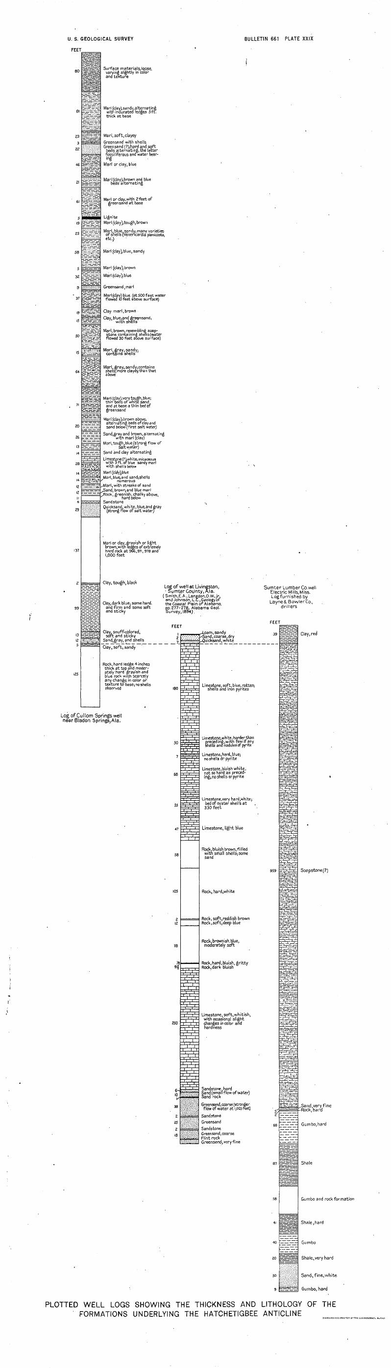
U. S. GEOLOGICAL SURVEY
FEET
BULLETIN 661 PLATE XXIX
80
46
99
125
Surface materials,loose, varying slightly in color and texture
Marl (clay),sandy,alternating with indurated ledges 5ft. thick at base
Marl, soft, clayey
Greensand with shells Greensand (?),hard and soft
beds alternating,the latter fossiliferous and water bear ing
Marl or clay, blue
Marl (clay), brown and blue beds alternating
Marl or clay, with 2 feet of greensand at base
LigniteMarl (clay),tough, brown
Marl, blue.sandy; many varieties of shells (Venericardia planicosta, etc.)
Marl (clay),blue, sandy
Marl (clay), brown
Marl (clay), blue
Greensand ,marl
Marl (clay) blue (at 500 feet water flowed 10 feet above surface)
Clay marl,brown
Clay, blue.and gre^nsand, with shells
Marl,brown, resembling soap- stone containing shells (water flowed 30 feet above surface)
Marl, gray, sandy: contains shells
Marl, gray,sandy;contains shells; more clayey, than that above
Marl (clay), very tough,blue; thin beds of white sand and at base a thin bed of greensand
Marl (clay),brown above, alternating beds of clay and sand below (first salt water)
Sand,grayand brown,alternatingwith marl (clay)
Marl,tough,blue (strong flow ofsaltwater)
Sand and clay alternating
Limestone (?),white, micaceous with 3 ft. of blue sandy marl with shells below
Marl(clciy),blue Marl,blue,and sand;shells
' numerous Marl, with streaks of sand 5and, brown,and blue marl ,Rock, greenish, chalky above,
hard below SandstoneQuicksand, white, blue,and gray
(strong flow of salt waterj
Marl or clay, grayish or light brown, with ledges of extremely hard rock at 966,971,978 and 1,000 feet
Clay, tough, black
Clay,dark blue: some hard, and firm and some soft and sticky
Clay, snuff-colored,soft and sticky
Sandjgray, and shells
Clay, soft, sandy
Rock, hard ledge 4 inches thick at top and moder- atelyhard grayish and blue rock with scarcely any change in color or texture to base) no shells observed
Log of well at Livinfiston, Sumter County, Ala.
(Smith, E.A.,Langdon,D.W., jr., and Johnson, L.C.,Geology of the Coastal Plain of Alabama, pp.277-278, Alabama Geol. Survey, 1894).
FEET
Sumter Lumber Co. wellElectric Mi I Is, Miss.Log furnished by
Layne& Bowler Co.,drillers
Log of Cullom Springs well near Bladon Springs,Ala.
12
_7_
180
50
7
68
55
47
58
105
2 12
78
/* ^
250
fi-10
38
2
25
2 18
.. rvrji.. 1 -^-oam. sandy : : '. '. : '/. :^i'"'"!'''
-LnJ-rLY-rV
i iVn1-i i
i i
^
.̂i iW^-Hi-1-±tt
^b^='.'' '.' .
i ii, --U ,
=*^
.I..-.-I,1 ., i/-, ii i
ggi i11
j^
i . ii ii . i. i-V-V-
i ii >i. . i.i ii i i
i ii ii i ,i ii i.
i i.«&***'®i$$$
xtiw
- Sand, coarse, dry ^Quicksand, white
Limestone, soft, blue, rotten; shells and iron pyrites
Limestone, white, harder than 1 preceding, with few if any
shells antf nodules' of pyrite
Limestone, hard, blue; noshellsdr pyrite
Limestone, bluish white, not so hard as preced ing;, no shells or pyrite
Limestone.very hard,white; bed of oyster shells at 330 feet
Limestone, light blue
Rock bluish brown, filled with small shells; some sand
Rock, hard,white
Rock, soft, reddish brown Rock, soft, deep blue
Rock.brownish.blue, moderately soft
Rock, hard, bluish, gritty- Rock, dark bluish
Limestone, soft,whitish; with occasional slight changes in color and hardness
Sandstone, hard Sand (small flow of water) Sand rock
Greensand, coarse (stronger flow of water at 1,005 feet)
Sandstone Greensand
Sandstone Greensand, coarse Flint rock Greensand, very fine
959
Clay, red
Soapstone(?)
Sand,very fine -Rock, hard
Gumbo,hard
Shale
Gumbo and rock formation
Shale,hard
Gumbo
Shale,very hard
Sand, fine,white
Gumbo, hard
PLOTTED WELL LOGS SHOWING THE THICKNESS AND LITHOLOGY OF THE FORMATIONS UNDERLYING THE HATCHETIGBEE ANTICLINE
HATCHETIGBEE ANTICLINE, ALA. 313
River between Waynesboro and Hiwannee, referred to on page 305, and the area along the Lower Peach Tree anticline, as described by Smith and others.1
DEPTHS TO PROBABLE PRODUCTIVE FORMATIONS.
The nearest sands above and below the Selma chalk are considered the most favorable for oil and gas. The position and thickness of the sands above the chalk are shown in the plotted log of the Cullom Springs well in Plate XXIX. This log shows the presence of three sands within about 400 feet above the Selma. The sands that occur at 780, 900, and 1,200 feet in this well will be found, if present, at about the same depths along the crest .of the Hatchetigbee anticline from Bladon Springs to Salitpa. Although these sands were pene trated in the Cullom Springs well and found to be unproductive, they may be productive on other parts of the anticline.
The base of the Selma, "which is about 1,000 feet thick at its nearest measured locality, will be reached here at about 2,200 feet. The Eutaw formation, which lies below the Selma, contains at its outcrop much sand and-sandy clay, as shown in Plate XXIX. The thickness of this formation in this area is not known; at its outcrop to the north it is 400 to 500 feet thick,2 and it is probably not thicker than that here. If this is the correct thickness the base of the Eutaw will be reached here at about 2,700 feet. This formation should be care fully tested for oil and gas, as it has not been penetrated in this area. The maximum thickness of the Tuscaloosa is given at 1,000 feet,2 but it is doubtful whether the formation attains that thickness in this area. The maximum depth at which the base of the Tuscaloosa should be reached is thus about 3,700 feet. It is quite likely that the Lower Cretaceous beds will be found below the Tuscaloosa, as they crop out in east-central Alabama and appear to be overlapped to the west. Their thickness and character here are matters of speculation.
1 Smith, E. A., Johnson, L. C., and Langdon, D. W.,jr., On the geplogy of the Coastal Plain of Alabama: pp. 207-211, Alabama Geol. Survey, 1894.
3 Stephenson, L. W., Cretaceous deposits of the eastern Gulf region: U. S. Geol. Survey Prof. Paper 81, p. 20,1914. . .
69812° Bull. 661 18 21