national weather service 2016 hurricane season by …1).pdf · into a tropical cyclone. once it did...
TRANSCRIPT
National Weather ServiceLake Charles, Louisiana
2016 Hurricane Season By Roger Erickson, Warning Coordination Meteorologist
NWSLakeCharles @NWSLakeCharles NWSLakeCharlesweather.gov/lch
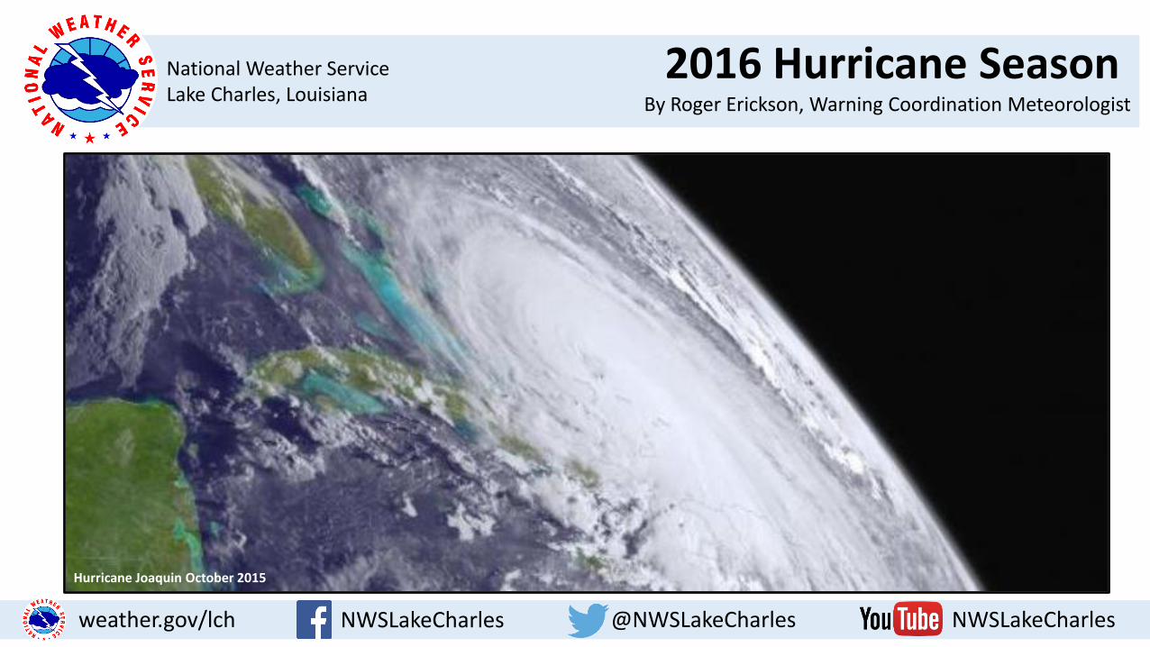
Hurricane Joaquin October 2015
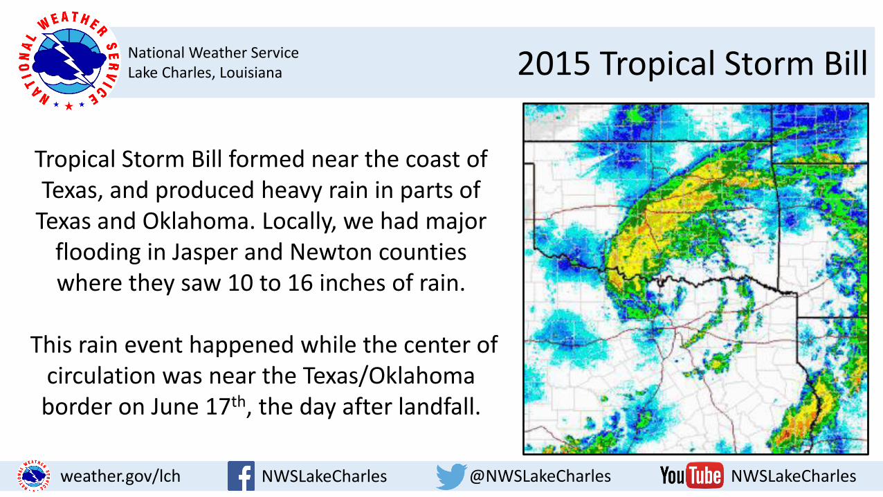
National Weather ServiceLake Charles, Louisiana 2015 Tropical Storm Bill
NWSLakeCharles @NWSLakeCharles NWSLakeCharlesweather.gov/lch
Tropical Storm Bill formed near the coast of Texas, and produced heavy rain in parts of
Texas and Oklahoma. Locally, we had major flooding in Jasper and Newton counties where they saw 10 to 16 inches of rain.
This rain event happened while the center of circulation was near the Texas/Oklahoma border on June 17th, the day after landfall.

National Weather ServiceLake Charles, Louisiana 2015 Tropical Storm Claudette
NWSLakeCharles @NWSLakeCharles NWSLakeCharlesweather.gov/lch
Tropical Storm Claudette was a short-lived storm off the east coast of the US in July 2015. Its genesis
was poorly forecast. 24 hours before it formed, NHC gave this system a low chance (<40%) of developing into a tropical cyclone. Once it did develop, short range forecasts had larger than normal errors, which is not uncommon for weak systems.
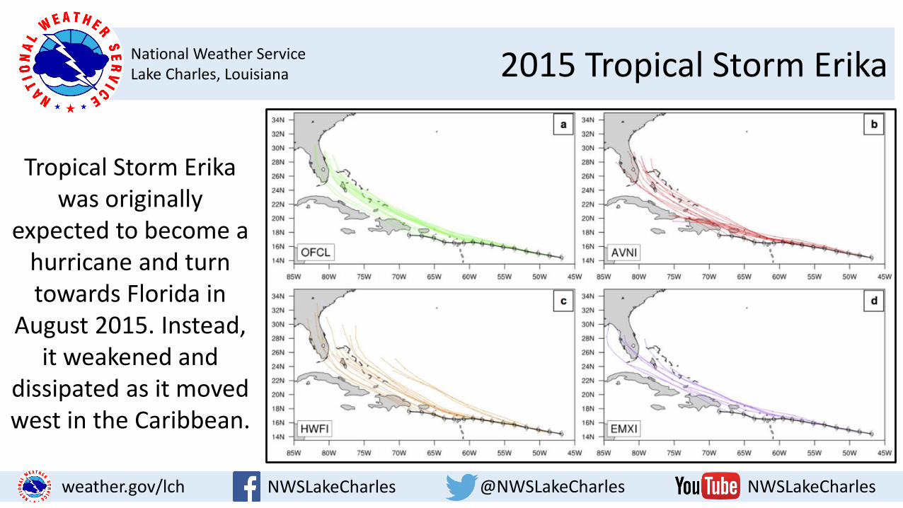
National Weather ServiceLake Charles, Louisiana 2015 Tropical Storm Erika
NWSLakeCharles @NWSLakeCharles NWSLakeCharlesweather.gov/lch
Tropical Storm Erika was originally
expected to become a hurricane and turn towards Florida in
August 2015. Instead, it weakened and
dissipated as it moved west in the Caribbean.
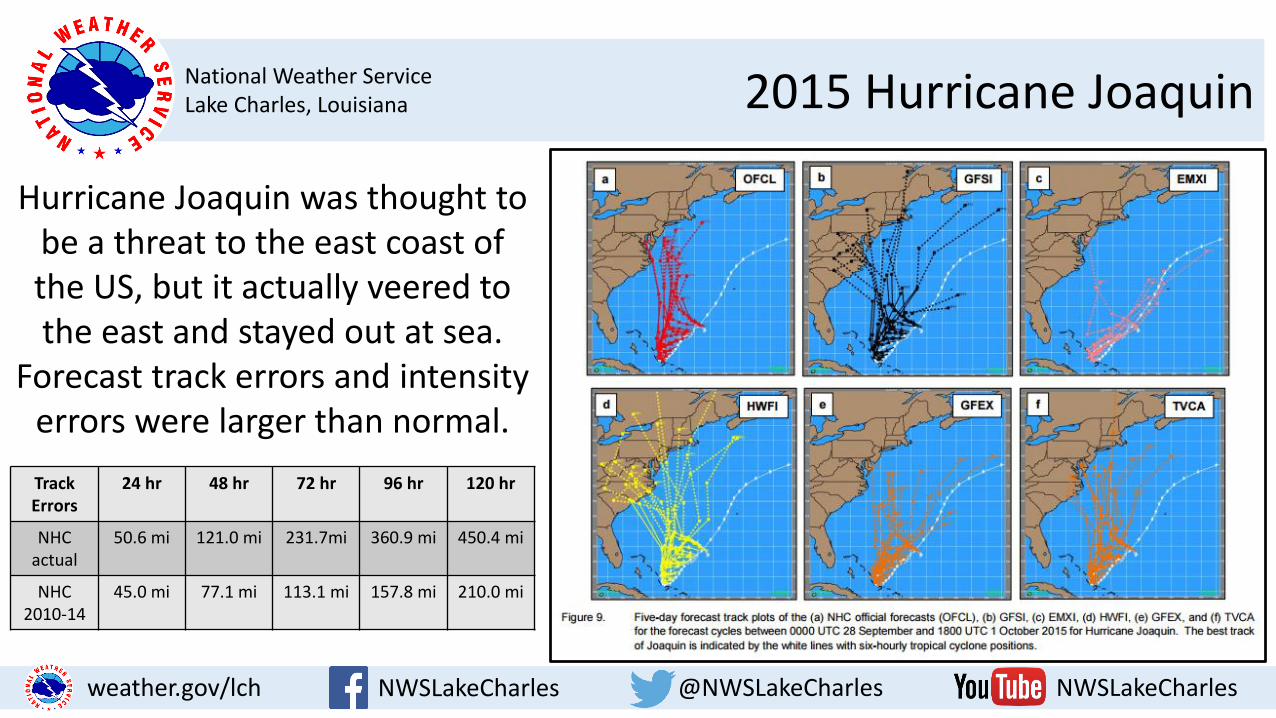
National Weather ServiceLake Charles, Louisiana 2015 Hurricane Joaquin
NWSLakeCharles @NWSLakeCharles NWSLakeCharlesweather.gov/lch
Hurricane Joaquin was thought to be a threat to the east coast of the US, but it actually veered to the east and stayed out at sea.
Forecast track errors and intensity errors were larger than normal.
Track Errors
24 hr 48 hr 72 hr 96 hr 120 hr
NHC actual
50.6 mi 121.0 mi 231.7mi 360.9 mi 450.4 mi
NHC 2010-14
45.0 mi 77.1 mi 113.1 mi 157.8 mi 210.0 mi
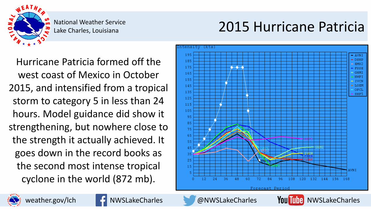
National Weather ServiceLake Charles, Louisiana 2015 Hurricane Patricia
NWSLakeCharles @NWSLakeCharles NWSLakeCharlesweather.gov/lch
Hurricane Patricia formed off the west coast of Mexico in October
2015, and intensified from a tropical storm to category 5 in less than 24 hours. Model guidance did show it
strengthening, but nowhere close to the strength it actually achieved. It goes down in the record books as the second most intense tropical cyclone in the world (872 mb).
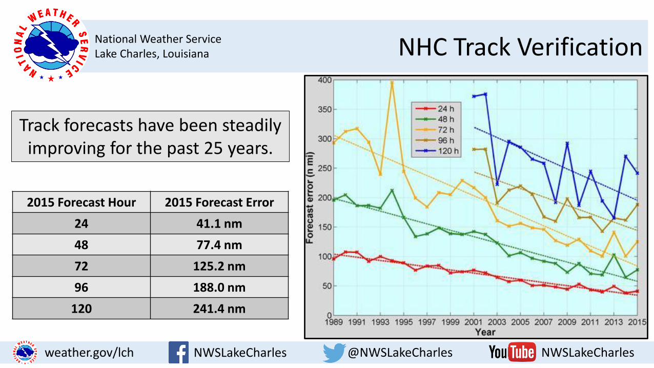
National Weather ServiceLake Charles, Louisiana NHC Track Verification
NWSLakeCharles @NWSLakeCharles NWSLakeCharlesweather.gov/lch
Track forecasts have been steadily improving for the past 25 years.
2015 Forecast Hour 2015 Forecast Error
24 41.1 nm
48 77.4 nm
72 125.2 nm
96 188.0 nm
120 241.4 nm
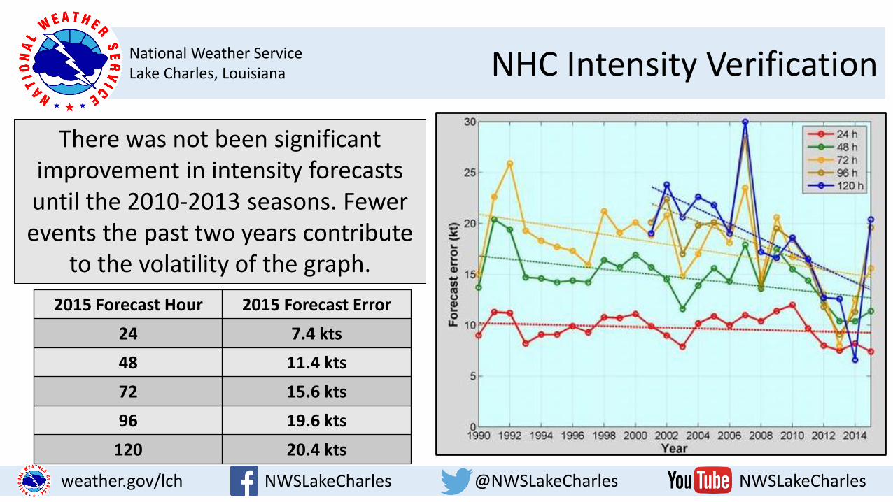
National Weather ServiceLake Charles, Louisiana NHC Intensity Verification
NWSLakeCharles @NWSLakeCharles NWSLakeCharlesweather.gov/lch
There was not been significant improvement in intensity forecasts until the 2010-2013 seasons. Fewer events the past two years contribute
to the volatility of the graph.
2015 Forecast Hour 2015 Forecast Error
24 7.4 kts
48 11.4 kts
72 15.6 kts
96 19.6 kts
120 20.4 kts
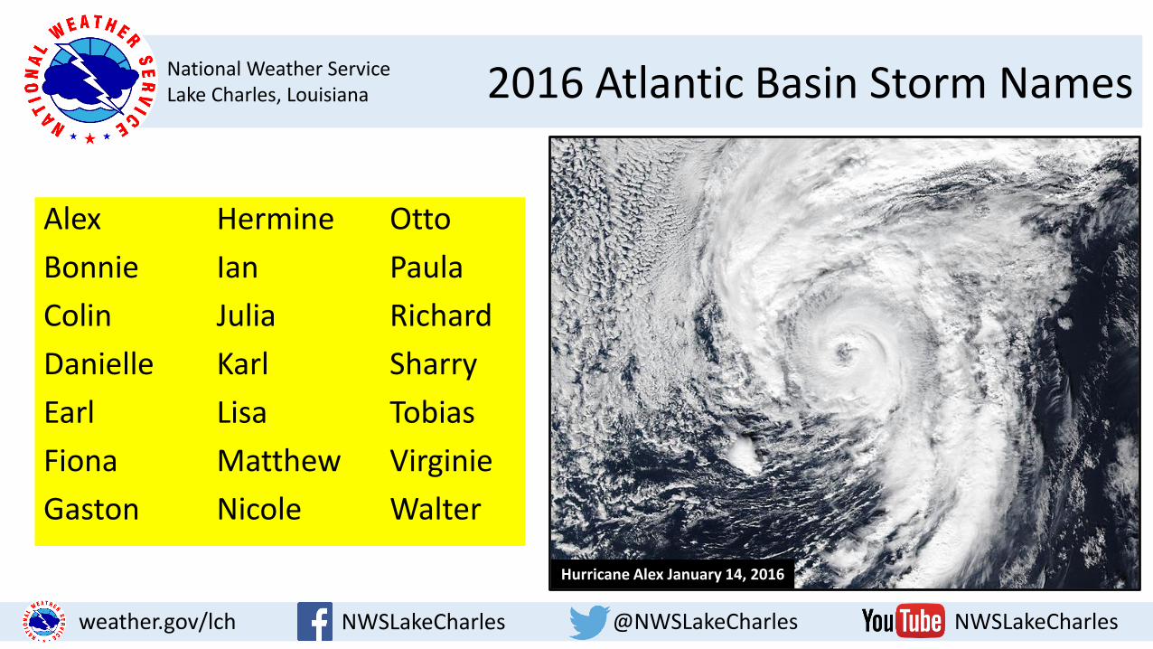
National Weather ServiceLake Charles, Louisiana 2016 Atlantic Basin Storm Names
NWSLakeCharles @NWSLakeCharles NWSLakeCharlesweather.gov/lch
Alex Hermine Otto
Bonnie Ian Paula
Colin Julia Richard
Danielle Karl Sharry
Earl Lisa Tobias
Fiona Matthew Virginie
Gaston Nicole Walter
Hurricane Alex January 14, 2016

National Weather ServiceLake Charles, Louisiana Weather Hazards of Tropical Cyclones
NWSLakeCharles @NWSLakeCharles NWSLakeCharlesweather.gov/lch
1. Storm Surge
2. Heavy Rain/Inland Flooding
3. Damaging Winds
4. Tornadoes
Cameron, LA September 2005
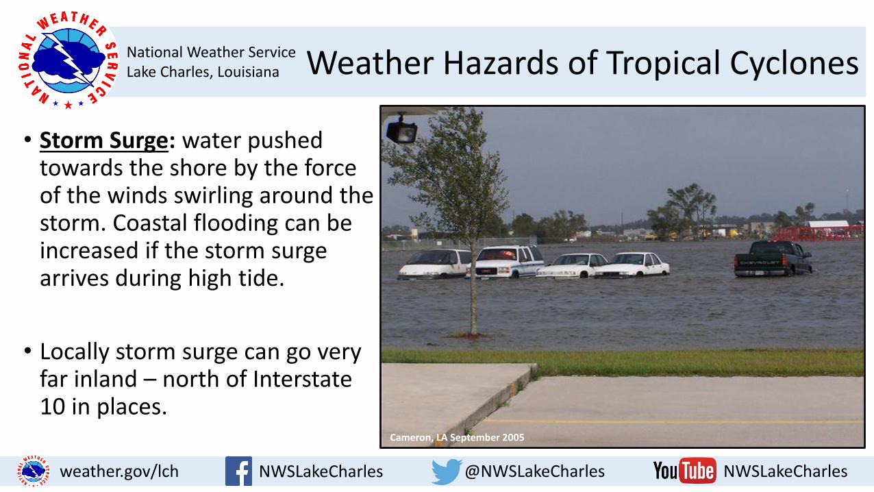
National Weather ServiceLake Charles, Louisiana Weather Hazards of Tropical Cyclones
NWSLakeCharles @NWSLakeCharles NWSLakeCharlesweather.gov/lch
• Storm Surge: water pushed towards the shore by the force of the winds swirling around the storm. Coastal flooding can be increased if the storm surge arrives during high tide.
• Locally storm surge can go very far inland – north of Interstate 10 in places.
Cameron, LA September 2005

National Weather ServiceLake Charles, Louisiana Storm Surge Threat
NWSLakeCharles @NWSLakeCharles NWSLakeCharlesweather.gov/lch
Category 1 Storm Surge Threat Blue=up to 3 ft AGL
Yellow=greater than 3 ft AGL Orange=greater than 6 ft AGL
Red=greater than 9 ft AGL

National Weather ServiceLake Charles, Louisiana Storm Surge Threat
NWSLakeCharles @NWSLakeCharles NWSLakeCharlesweather.gov/lch
Category 2 Storm Surge Threat Blue=up to 3 ft AGL
Yellow=greater than 3 ft AGL Orange=greater than 6 ft AGL
Red=greater than 9 ft AGL
National Weather ServiceLake Charles, Louisiana Storm Surge Threat
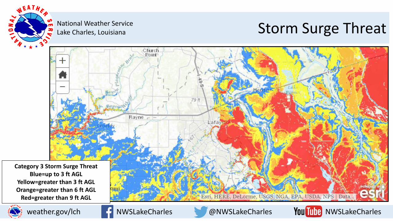
NWSLakeCharles @NWSLakeCharles NWSLakeCharlesweather.gov/lch
Category 3 Storm Surge Threat Blue=up to 3 ft AGL
Yellow=greater than 3 ft AGL Orange=greater than 6 ft AGL
Red=greater than 9 ft AGL
National Weather ServiceLake Charles, Louisiana Storm Surge Threat
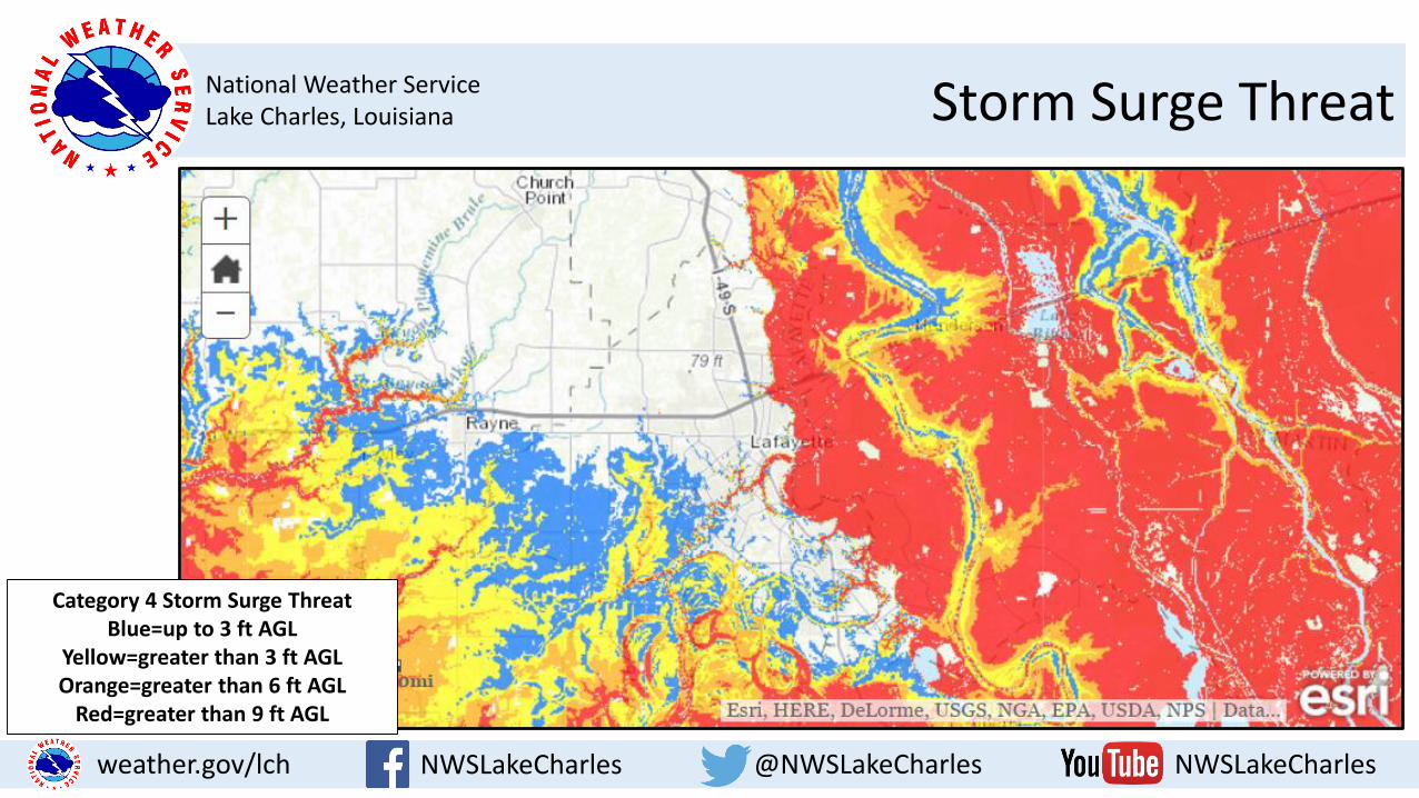
NWSLakeCharles @NWSLakeCharles NWSLakeCharlesweather.gov/lch
Category 4 Storm Surge Threat Blue=up to 3 ft AGL
Yellow=greater than 3 ft AGL Orange=greater than 6 ft AGL
Red=greater than 9 ft AGL
National Weather ServiceLake Charles, Louisiana Storm Surge Threat
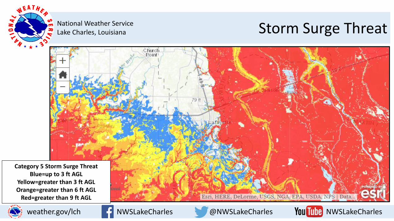
NWSLakeCharles @NWSLakeCharles NWSLakeCharlesweather.gov/lch
Category 5 Storm Surge Threat Blue=up to 3 ft AGL
Yellow=greater than 3 ft AGL Orange=greater than 6 ft AGL
Red=greater than 9 ft AGL
National Weather ServiceLake Charles, Louisiana Weather Hazards of Tropical Cyclones
NWSLakeCharles @NWSLakeCharles NWSLakeCharlesweather.gov/lch
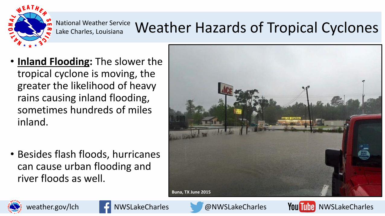
• Inland Flooding: The slower the tropical cyclone is moving, the greater the likelihood of heavy rains causing inland flooding, sometimes hundreds of miles inland.
• Besides flash floods, hurricanes can cause urban flooding and river floods as well.
Buna, TX June 2015
National Weather ServiceLake Charles, Louisiana Weather Hazards of Tropical Cyclones
NWSLakeCharles @NWSLakeCharles NWSLakeCharlesweather.gov/lch
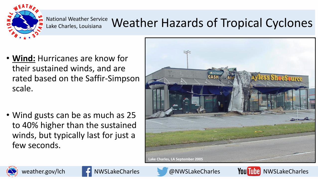
• Wind: Hurricanes are know for their sustained winds, and are rated based on the Saffir-Simpson scale.
• Wind gusts can be as much as 25 to 40% higher than the sustained winds, but typically last for just a few seconds.
Lake Charles, LA September 2005

National Weather ServiceLake Charles, Louisiana Weather Hazards of Tropical Cyclones
NWSLakeCharles @NWSLakeCharles NWSLakeCharlesweather.gov/lch
• Tornadoes: An added dimension to the wind threat of tropical cyclones, tornadoes can cause localized areas of extreme damage.
• They are most common in the right front quadrant of the system, in relation to its storm motion.

National Weather ServiceLake Charles, Louisiana Important NHC Products
NWSLakeCharles @NWSLakeCharles NWSLakeCharlesweather.gov/lch
The Graphical Tropical Weather Outlook has the probabilities
tweaked for colors of the risk areas for a tropical cyclone to develop in
the next 5 days.
It is issued at 1 am, 7 am, 1 pm, and 7 pm during hurricane season and
can be found on our website.
National Weather ServiceLake Charles, Louisiana Important NHC Products
NWSLakeCharles @NWSLakeCharles NWSLakeCharlesweather.gov/lch
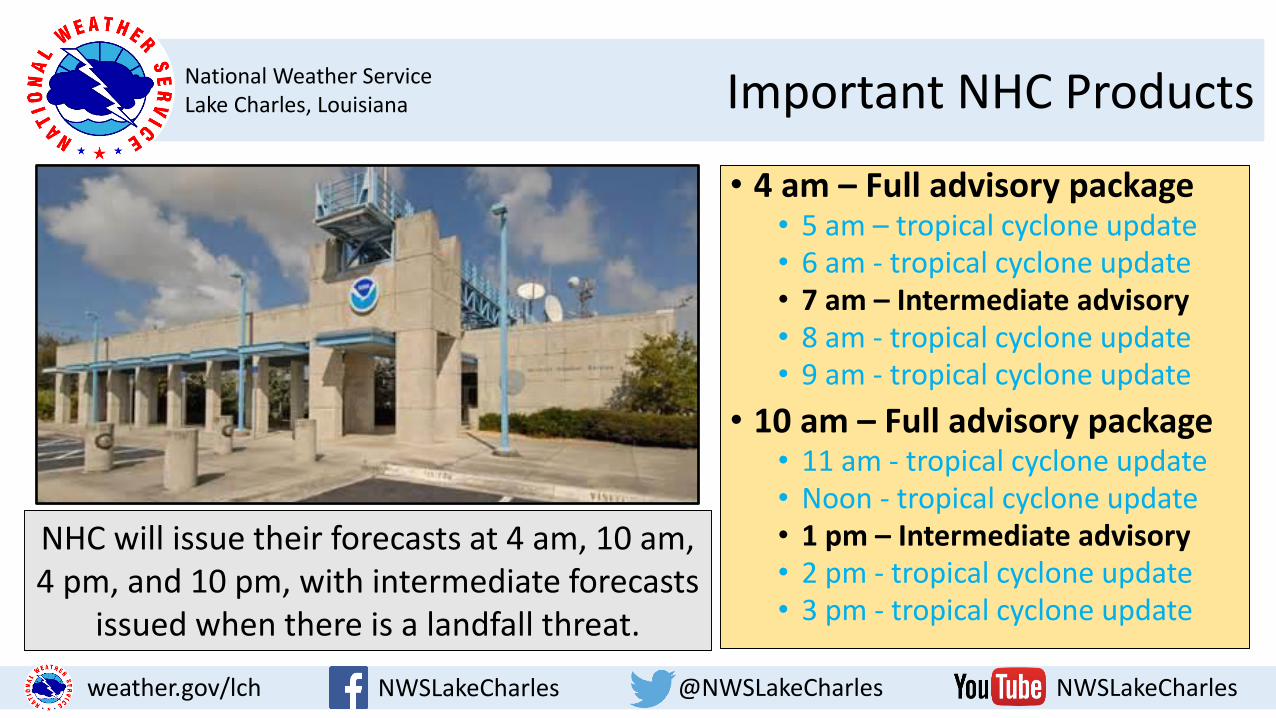
NHC will issue their forecasts at 4 am, 10 am, 4 pm, and 10 pm, with intermediate forecasts
issued when there is a landfall threat.
• 4 am – Full advisory package• 5 am – tropical cyclone update• 6 am - tropical cyclone update• 7 am – Intermediate advisory• 8 am - tropical cyclone update• 9 am - tropical cyclone update
• 10 am – Full advisory package• 11 am - tropical cyclone update• Noon - tropical cyclone update• 1 pm – Intermediate advisory• 2 pm - tropical cyclone update• 3 pm - tropical cyclone update
National Weather ServiceLake Charles, Louisiana Experimental NHC Products
NWSLakeCharles @NWSLakeCharles NWSLakeCharlesweather.gov/lch
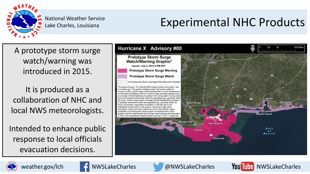
A prototype storm surge watch/warning was introduced in 2015.
It is produced as a collaboration of NHC and
local NWS meteorologists.
Intended to enhance public response to local officials
evacuation decisions.

National Weather ServiceLake Charles, Louisiana Experimental NHC Products
NWSLakeCharles @NWSLakeCharles NWSLakeCharlesweather.gov/lch
The potential storm surge flooding map will show the height above ground level
that water could reach.
It will be issued 60-90 minutes after the NHC
advisories.
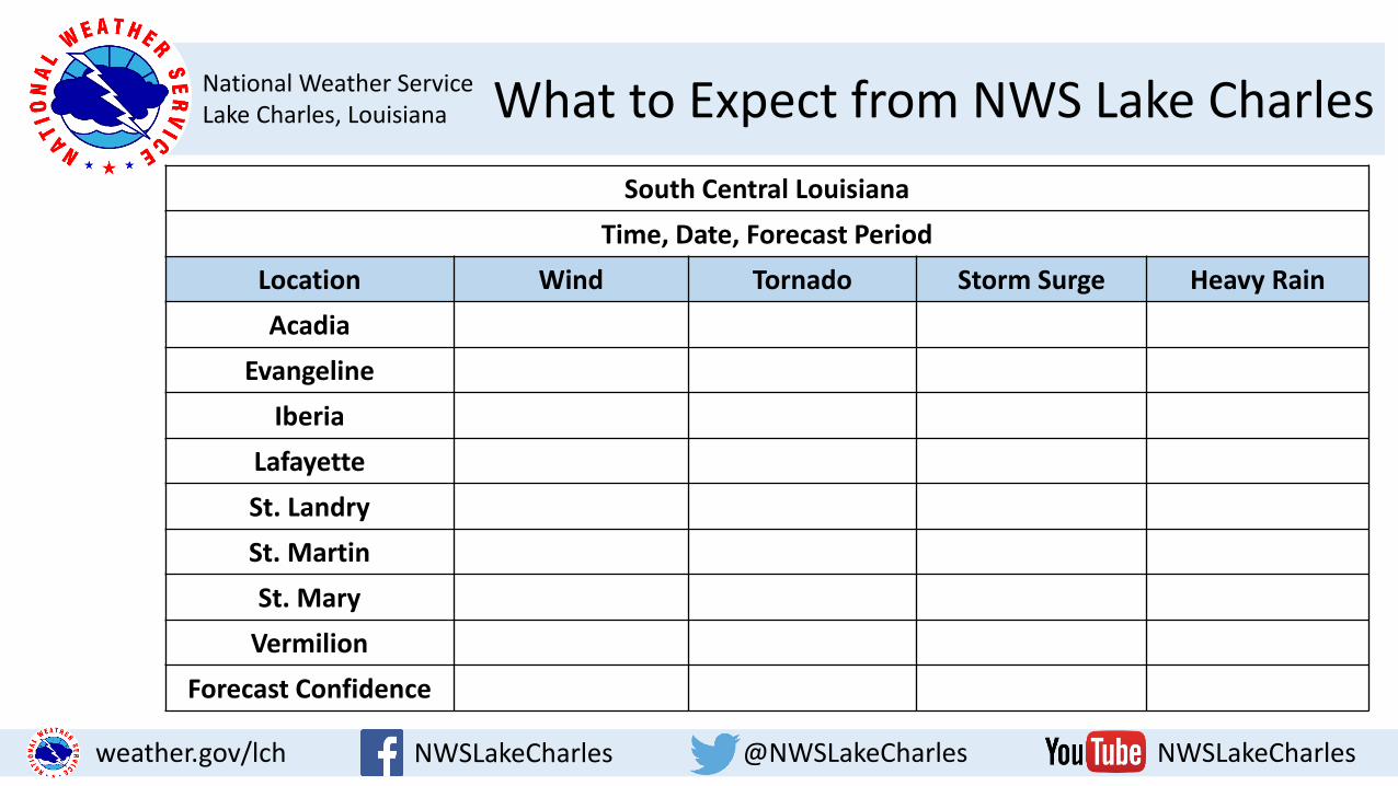
National Weather ServiceLake Charles, Louisiana What to Expect from NWS Lake Charles
NWSLakeCharles @NWSLakeCharles NWSLakeCharlesweather.gov/lch
South Central Louisiana
Time, Date, Forecast Period
Location Wind Tornado Storm Surge Heavy Rain
Acadia
Evangeline
Iberia
Lafayette
St. Landry
St. Martin
St. Mary
Vermilion
Forecast Confidence

National Weather ServiceLake Charles, Louisiana 2016 Atlantic Basin Forecast
NWSLakeCharles @NWSLakeCharles NWSLakeCharlesweather.gov/lch
We typically see a hurricane within 50 miles of us every 9 to 14 years. The last one to hit Texas was Hurricane Ike in 2008. The last one in
Louisiana was Hurricane Isaac in 2012.
National Weather ServiceLake Charles, Louisiana 2016 Atlantic Basin Forecast
NWSLakeCharles @NWSLakeCharles NWSLakeCharlesweather.gov/lch
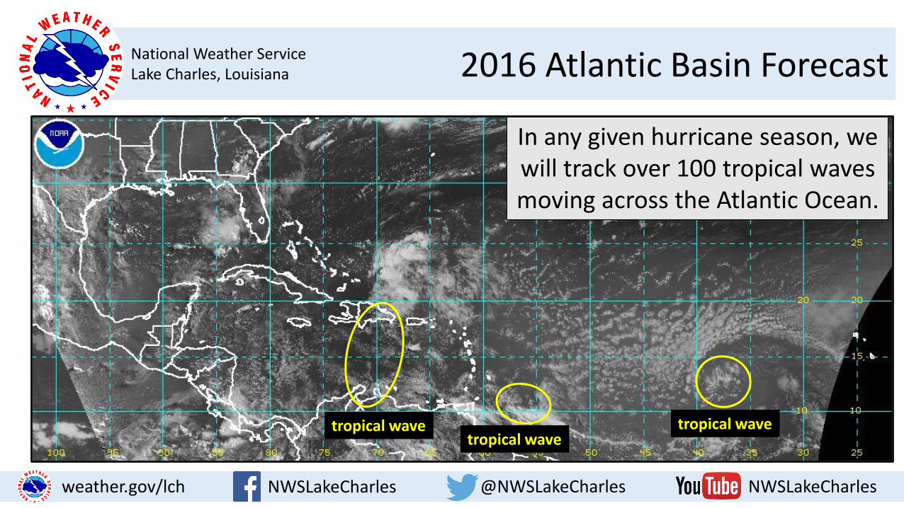
In any given hurricane season, we will track over 100 tropical waves moving across the Atlantic Ocean.
tropical wavetropical wave
tropical wave
National Weather ServiceLake Charles, Louisiana 2016 Atlantic Basin Forecast
NWSLakeCharles @NWSLakeCharles NWSLakeCharlesweather.gov/lch
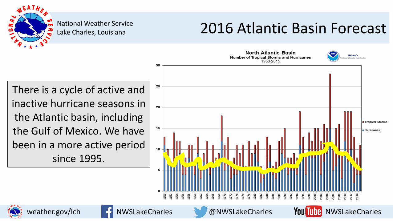
There is a cycle of active and inactive hurricane seasons in the Atlantic basin, including the Gulf of Mexico. We have been in a more active period
since 1995. 10
National Weather ServiceLake Charles, Louisiana 2016 Atlantic Basin Forecast
NWSLakeCharles @NWSLakeCharles NWSLakeCharlesweather.gov/lch
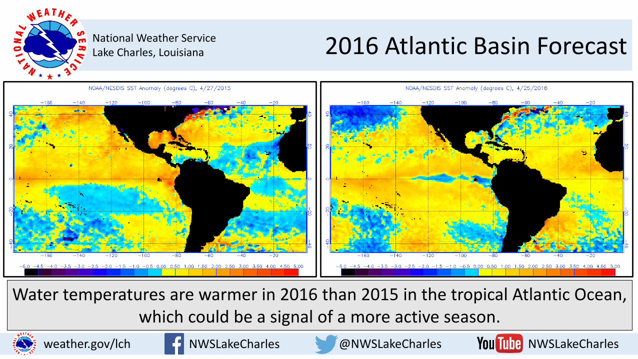
Water temperatures are warmer in 2016 than 2015 in the tropical Atlantic Ocean, which could be a signal of a more active season.
National Weather ServiceLake Charles, Louisiana 2016 Atlantic Basin Forecast
NWSLakeCharles @NWSLakeCharles NWSLakeCharlesweather.gov/lch
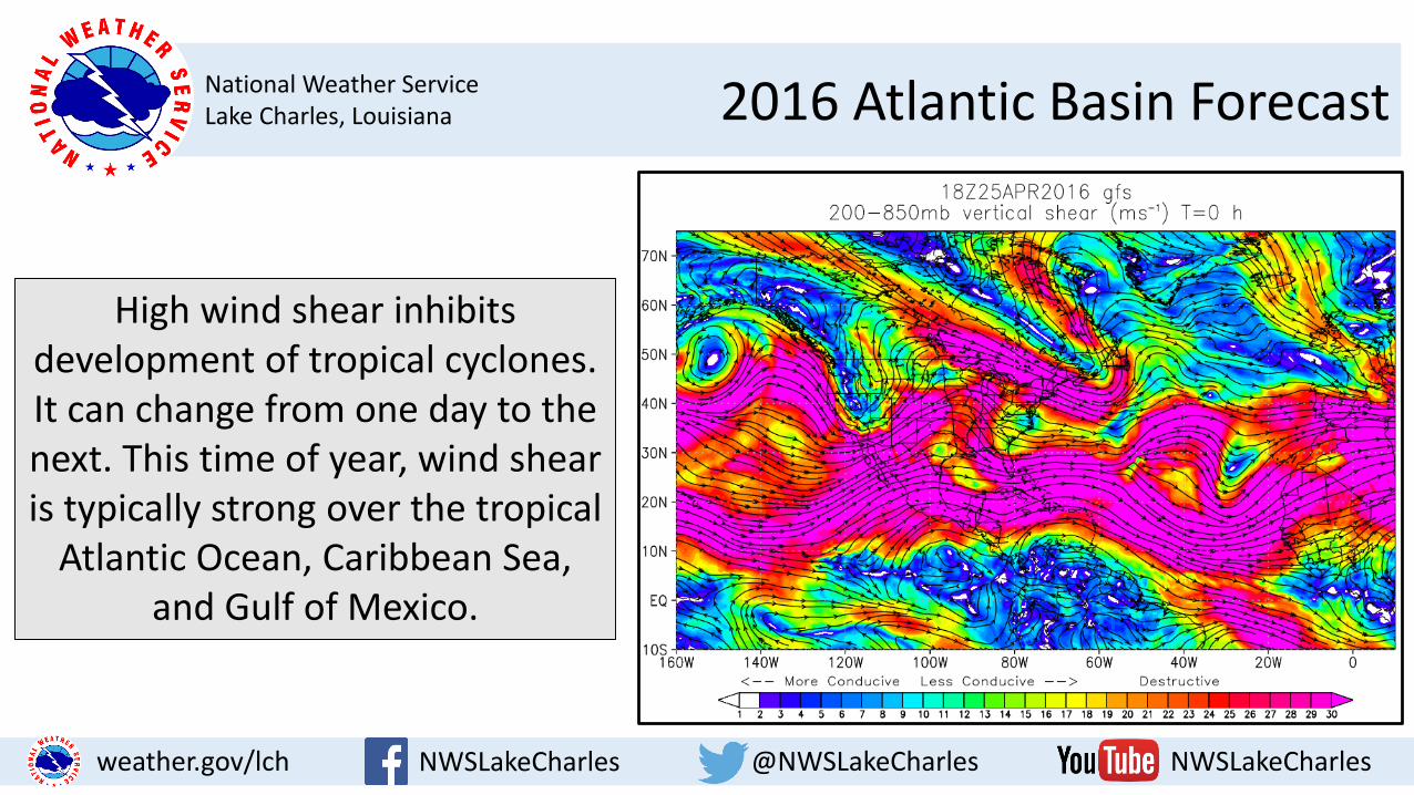
High wind shear inhibits development of tropical cyclones. It can change from one day to the next. This time of year, wind shear is typically strong over the tropical
Atlantic Ocean, Caribbean Sea, and Gulf of Mexico.
National Weather ServiceLake Charles, Louisiana 2016 Atlantic Basin Forecast
NWSLakeCharles @NWSLakeCharles NWSLakeCharlesweather.gov/lch
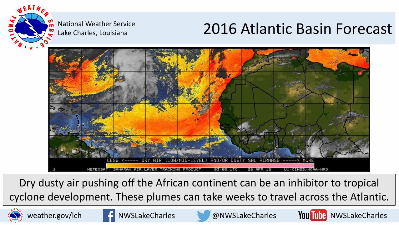
Dry dusty air pushing off the African continent can be an inhibitor to tropical cyclone development. These plumes can take weeks to travel across the Atlantic.
National Weather ServiceLake Charles, Louisiana 2016 Atlantic Basin Forecast
NWSLakeCharles @NWSLakeCharles NWSLakeCharlesweather.gov/lch
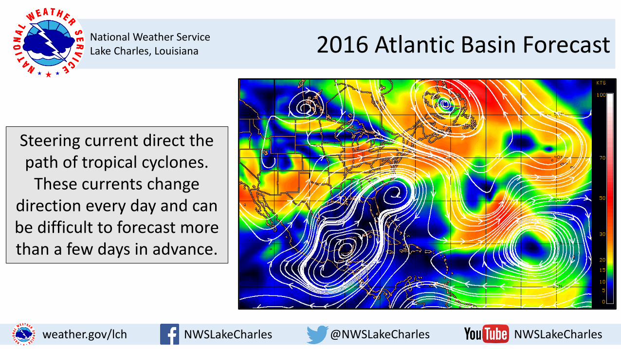
Steering current direct the path of tropical cyclones.
These currents change direction every day and can be difficult to forecast more than a few days in advance.

National Weather ServiceLake Charles, Louisiana
NWSLakeCharles @NWSLakeCharles NWSLakeCharlesweather.gov/lch
2016 Hurricane SeasonBy Roger Erickson, Warning Coordination Meteorologist
Keep up with NWS Lake Charles through the links listed below…
Or call me at 337.477.5285 x223.