national parks from u.s.a
TRANSCRIPT

7/31/2019 National Parks From U.S.A
http://slidepdf.com/reader/full/national-parks-from-usa 1/28
1
COLEGIUL TEHNIC “ A. SALIGNY” ROSIORII DE VEDE
LUCRARE DE ATESTAT
LIMBA ENGLEZA
2012
Profesor coordonator: Realizator:

7/31/2019 National Parks From U.S.A
http://slidepdf.com/reader/full/national-parks-from-usa 2/28
2
Contents
I.Yellowstone National Park: …………………pag.4
1.1 History……………….. pag.5
1.2 Park creation…………… pag.6
1.3 Heritage and Research Center…………….
1.4 Geography…………………. pag.7
1.5 Geology…………………. pag.8
1.6 Biology and Ecology……………… pag.
1.7 Flora………………… pag.10
1.8 Fauna………………… pag.11
II.Great Smoky Mountains National Park : …………….. pag.12
2.1 History………… pag.13
2.2 Natural Features………..
2.3 Attractions and Activities…………. pag.14
III.Grand Canyon National Park : ……………….. pag.15
3.1 History……………
IV.Yosemite National Park : ………………. pag.16
4.1 History…………. pag.17
4.2 Geography………… pag.18
4.3 Popular features…………. pag.19
4.4 Water and Ice………… pag.20
4.5 Climate…………..

7/31/2019 National Parks From U.S.A
http://slidepdf.com/reader/full/national-parks-from-usa 3/28
3
V.Acadia National Park : ………….. pag.21
5.1 History………… pag.22
5.2 Beginnings………..
5.3 Terrain and Features………….
VI.Everglades National Park :…………. pag.23
6.1. Park History………
6.2 Geography………… pag.25
6.3 Geology…………..
6.4 Climate…………
VII. Arches National Park : ……………. pag.26
7.1 History…………
7.2 Geology…………. pag.27
7/31/2019 National Parks From U.S.A
http://slidepdf.com/reader/full/national-parks-from-usa 4/28
4
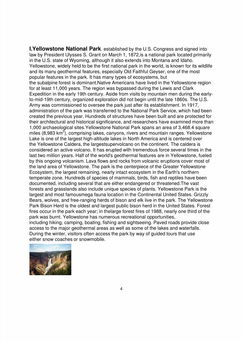
I.Yellowstone National Park, established by the U.S. Congress and signed intolaw by President Ulysses S. Grant on March 1, 1872,is a national park located primarily
in the U.S. state of Wyoming, although it also extends into Montana and Idaho. Yellowstone, widely held to be the first national park in the world, is known for its wildlifeand its many geothermal features, especially Old Faithful Geyser, one of the mostpopular features in the park. It has many types of ecosystems, butthe subalpine forest is dominant.Native Americans have lived in the Yellowstone regionfor at least 11,000 years. The region was bypassed during the Lewis and ClarkExpedition in the early 19th century. Aside from visits by mountain men during the early-to-mid-19th century, organized exploration did not begin until the late 1860s. The U.S.Army was commissioned to oversee the park just after its establishment. In 1917,administration of the park was transferred to the National Park Service, which had beencreated the previous year. Hundreds of structures have been built and are protected fortheir architectural and historical significance, and researchers have examined more than1,000 archaeological sites.Yellowstone National Park spans an area of 3,468.4 squaremiles (8,983 km2), comprising lakes, canyons, rivers and mountain ranges. YellowstoneLake is one of the largest high-altitude lakes in North America and is centered overthe Yellowstone Caldera, the largestsupervolcano on the continent. The caldera isconsidered an active volcano. It has erupted with tremendous force several times in thelast two million years. Half of the world's geothermal features are in Yellowstone, fueledby this ongoing volcanism. Lava flows and rocks from volcanic eruptions cover most ofthe land area of Yellowstone. The park is the centerpiece of the Greater YellowstoneEcosystem, the largest remaining, nearly intact ecosystem in the Earth's northern
temperate zone. Hundreds of species of mammals, birds, fish and reptiles have beendocumented, including several that are either endangered or threatened.The vastforests and grasslands also include unique species of plants. Yellowstone Park is thelargest and most famousmega fauna location in the Continental United States. GrizzlyBears, wolves, and free-ranging herds of bison and elk live in the park. The YellowstonePark Bison Herd is the oldest and largest public bison herd in the United States. Forestfires occur in the park each year; in thelarge forest fires of 1988, nearly one third of thepark was burnt. Yellowstone has numerous recreational opportunities,including hiking, camping, boating, fishing and sightseeing. Paved roads provide closeaccess to the major geothermal areas as well as some of the lakes and waterfalls.During the winter, visitors often access the park by way of guided tours that use
either snow coaches or snowmobile.
7/31/2019 National Parks From U.S.A
http://slidepdf.com/reader/full/national-parks-from-usa 5/28
5
1.1 History
The park is located at the headwaters of theYellowstone River, from which it takes itshistorical name. Near the end of the 18th century, French trappers named the river"Roche Jaune," which is probably a translation of the Minnetaree name "Mi tsi a-da-zi "(Rock Yellow River). Later, American trappers rendered the French name in English as"Yellow Stone." Although it is commonly believed that the river was named for theyellow rocks seen in the Grand Canyon of the Yellowstone, the Native American namesource is not clear. The human history of the park begins at least 11,000 years agowhen aboriginal Americans first began to hunt and fish in the region. During theconstruction of the post office in Gardiner, Montana, in the 1950s, an obsidian projectilepoint of Clovis origin was found that dated from approximately 11,000 years ago.These Paleo-Indians, of the Clovis culture, used the significant amountsof obsidian found in the park to make such cuttingtools and weapons.Arrowheads made of Yellowstone obsidian have been found as faraway as the Mississippi Valley, indicating that a regular obsidian trade existed between
local tribes and tribes farther east. By the time white explorers first entered the regionduring the Lewis and Clark Expedition in 1805, they encountered the NezPerce, Crow and Shoshone tribes. While passing through present day Montana, theexpedition members were informed of the Yellowstone region to the south, but they didnot investigate it. In 1806, John Colter, a member of the Lewis and Clark Expedition, leftto join a group of fur trappers. After splitting up with the other trappers in 1807, Colterpassed through a portion of what later became the park, during the winter of 1807 –1808. He observed at least one geothermalarea in the northeastern section of the park,near Tower Fall. After surviving wounds he suffered in a battle with members of theCrow and Blackfoot tribes in 1809, he gave a description of a place of "fire andbrimstone" that was dismissed by most people as delirium. The supposedly imaginary
place was nicknamed "Colter's Hell". Over the next forty years, numerous reports frommountain men and trappers told of boiling mud, steaming rivers and petrified trees, yetmost of these reports were believed at the time to be myth. After an 1856 exploration,mountain man Jim Bridger (also believed to be the first or second European Americanto have seen the Great Salt Lake) reported observing boiling springs, spouting water,and a mountain of glass and yellow rock. These reports were largely ignored becauseBridger was known for being a "spinner of yarns". In 1859, Captain William F. Raynolds, U.S. Army surveyor embarked on a two year survey of the northern Rockies. Afterwintering in Wyoming, in May 1860, Raynolds and his party which includednaturalist Ferdinand Vandeveer Hayden and guide Jim Bridger attempted to crossthe Continental Divide over Two Ocean Plateau from the Wind River drainage in
northwest Wyoming. Heavy spring snows prevented their passage but had they beenable to traverse the divide, the party would have been the first organized survey to enterthe Yellowstone region. The American Civil War hampered further organizedexplorations until the late 1860s. The first detailed expedition to the Yellowstone areawas the Cook –Folsom –Peterson Expedition of 1869, which consisted of three privatelyfunded explorers. The Folsom party followed the Yellowstone River to YellowstoneLake. The members of the Folsom party kept a journal and based on the information it
7/31/2019 National Parks From U.S.A
http://slidepdf.com/reader/full/national-parks-from-usa 6/28
6
reported, a party of Montana residents organized the Washburn-Langford-DoaneExpedition in 1870. It was headed by the surveyor-general of Montana HenryWashburn, and included Nathaniel P. Langford (who later became known as "NationalPark" Langford) and a U.S. Army detachment commanded by Lt. Gustavus Doane.Theexpedition spent about a month exploring the region, collecting specimens, and naming
sites of interest. A Montana writer and lawyer named Cornelius Hedges, who had beena member of the Washburn expedition, proposed that the region should be set asideand protected as a National Park; he wrote a number of detailed articles about hisobservations for the Helena Herald newspaper between 1870 and 1871. Hedgesessentially restated comments made in October 1865 by acting Montana TerritorialGovernor Thomas Francis Meagher, who had previously commented that the regionshould be protected. Others made similar suggestions. In an 1871 letter from JayCooke to Ferdinand Hayden, Cooke wrote that his friend, Congressman William D.Kelley had also suggested "Congress pass a bill reserving the Great Geyser Basin as apublic park forever".
1.2 Park creationIn 1871, eleven years after his failed first effort, F.V. Hayden was finally able to makeanother attempt to explore the region. With government sponsorship, Hayden returnedto Yellowstone region with a second, larger expedition, the Hayden Geological Surveyof 1871. He compiled a comprehensive report on Yellowstone, which included large-format photographs by William Henry Jackson, as well as paintings by Thomas Moran. His report helped to convince the U.S. Congress to withdraw this region from publicauction. On March 1, 1872, President Ulysses S. Grant signedThe Act of Dedication lawthat created Yellowstone National Park.Ferdinand V. Hayden, while not the only personto have thought of creating a park in the Yellowstone region, was the park's first andmost enthusiastic advocate. He believed in ―setting aside the area as a pleasure ground
for the benefit and enjoyment of the people‖ and warned that there were those whowould come and ―make merchandise of these beautiful specimens‖. Worrying the areacould face the same fate as Niagara Falls, he concluded the site should ―be as free as
the air or Water.‖ In his report to the Committee on Public Lands, he concluded that ifthe bill failed to become law, ―the vandals who are now waiting to enter into this wonder -land, will in a single season despoil, beyond recovery, these remarkable curiosities,which have requited all the cunning skill of nature thousands of years toprepare‖. Hayden and his 1871 party recognized that Yellowstone was a pricelesstreasure, which would become rarer with time. He wished for others to see andexperience it as well. Eventually the railroads and, some time after that, the automobilewould make that possible. The Park was not set aside strictly for ecological purposes;however, the designation ―pleasure ground‖ was not an invitation to create an
amusement park. Hayden imagined something akin to the scenic resorts and baths inEngland, Germany and Switzerland.
1.3 Heritage and Research Center
The Heritage and Research Center is located at Gardiner, Montana, near the northentrance to the park. The center is home to the Yellowstone National Park’s museum

7/31/2019 National Parks From U.S.A
http://slidepdf.com/reader/full/national-parks-from-usa 7/28
7
collection, archives, research library, historian, archeology lab, and herbarium. TheYellowstone National Park Archives maintain collections of historical records ofYellowstone and the National Park Service. The collection includes the administrativerecords of Yellowstone, as well as resource management records, records from majorprojects, and donated manuscripts and personal papers. The archives are affiliated with
the National Archives and Records Administration.
1.4 Geography
Approximately 96 percent of the land area of Yellowstone National Park is located withinthe state of Wyoming. Another 3 percent is within Montana, with the remaining 1
percent in Idaho. The park is 63 miles (101 km) north to south, and 54 miles (87 km)west to east by air. Yellowstone is 2,219,789 acres (898,317 ha; 3,468.420 sq mi) inarea, larger than the states of Rhode Island or Delaware. Rivers and lakes cover 5percent of the land area, with the largest water body being Yellowstone Lake at 87,040acres (35,220 ha; 136.00 sq mi). Yellowstone Lake is up to 400 feet (120 m) deep andhas 110 miles (180 km) of shoreline. At an elevation of 7,733 feet (2,357 m) above sealevel, Yellowstone Lake is the largest high altitude lake in North America. Forestscomprise 80 percent of the land area of the park; most of the rest is grassland. The Continental Divide of North America runs diagonally through the southwestern partof the park. The divide is a topographic feature that separates PacificOcean and Atlantic Ocean water drainages. About one third of the park lies on the westside of the divide. The origins of the Yellowstone and Snake Rivers are near each otherbut on opposite sides of the divide. As a result, the waters of the Snake River flow to thePacific Ocean, while those of the Yellowstone find their way to the Atlantic Ocean viathe Gulf of Mexico.
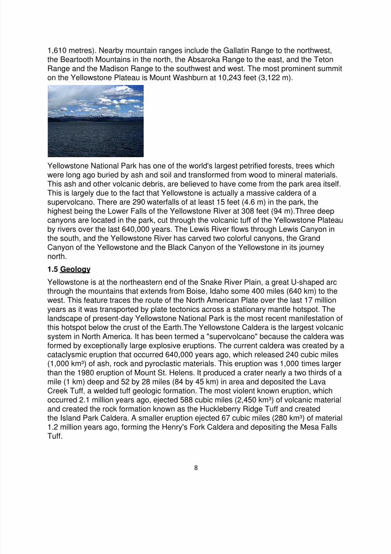
The park sits on the Yellowstone Plateau, at an average elevation of8,000 feet (2,400 m) above sea level. The plateau is bounded on nearly all sidesby mountain ranges of the Middle Rocky Mountains, which range from 9,000 to 11,000feet (2,700 to 3,400 m) in elevation. The highest point in the park is atop EaglePeak (11,358 feet / 3,462 metres) and the lowest is along Reese Creek (5,282 feet /
7/31/2019 National Parks From U.S.A
http://slidepdf.com/reader/full/national-parks-from-usa 8/28
8
1,610 metres). Nearby mountain ranges include the Gallatin Range to the northwest,the Beartooth Mountains in the north, the Absaroka Range to the east, and the TetonRange and the Madison Range to the southwest and west. The most prominent summiton the Yellowstone Plateau is Mount Washburn at 10,243 feet (3,122 m).
Yellowstone National Park has one of the world's largest petrified forests, trees whichwere long ago buried by ash and soil and transformed from wood to mineral materials.This ash and other volcanic debris, are believed to have come from the park area itself.
This is largely due to the fact that Yellowstone is actually a massive caldera of asupervolcano. There are 290 waterfalls of at least 15 feet (4.6 m) in the park, thehighest being the Lower Falls of the Yellowstone River at 308 feet (94 m).Three deepcanyons are located in the park, cut through the volcanic tuff of the Yellowstone Plateauby rivers over the last 640,000 years. The Lewis River flows through Lewis Canyon inthe south, and the Yellowstone River has carved two colorful canyons, the GrandCanyon of the Yellowstone and the Black Canyon of the Yellowstone in its journeynorth.
1.5 Geology
Yellowstone is at the northeastern end of the Snake River Plain, a great U-shaped arc
through the mountains that extends from Boise, Idaho some 400 miles (640 km) to thewest. This feature traces the route of the North American Plate over the last 17 millionyears as it was transported by plate tectonics across a stationary mantle hotspot. Thelandscape of present-day Yellowstone National Park is the most recent manifestation ofthis hotspot below the crust of the Earth.The Yellowstone Caldera is the largest volcanicsystem in North America. It has been termed a "supervolcano" because the caldera wasformed by exceptionally large explosive eruptions. The current caldera was created by acataclysmic eruption that occurred 640,000 years ago, which released 240 cubic miles(1,000 km³) of ash, rock and pyroclastic materials. This eruption was 1,000 times largerthan the 1980 eruption of Mount St. Helens. It produced a crater nearly a two thirds of amile (1 km) deep and 52 by 28 miles (84 by 45 km) in area and deposited the Lava
Creek Tuff, a welded tuff geologic formation. The most violent known eruption, whichoccurred 2.1 million years ago, ejected 588 cubic miles (2,450 km³) of volcanic materialand created the rock formation known as the Huckleberry Ridge Tuff and createdthe Island Park Caldera. A smaller eruption ejected 67 cubic miles (280 km³) of material1.2 million years ago, forming the Henry's Fork Caldera and depositing the Mesa FallsTuff.
7/31/2019 National Parks From U.S.A
http://slidepdf.com/reader/full/national-parks-from-usa 9/28
9
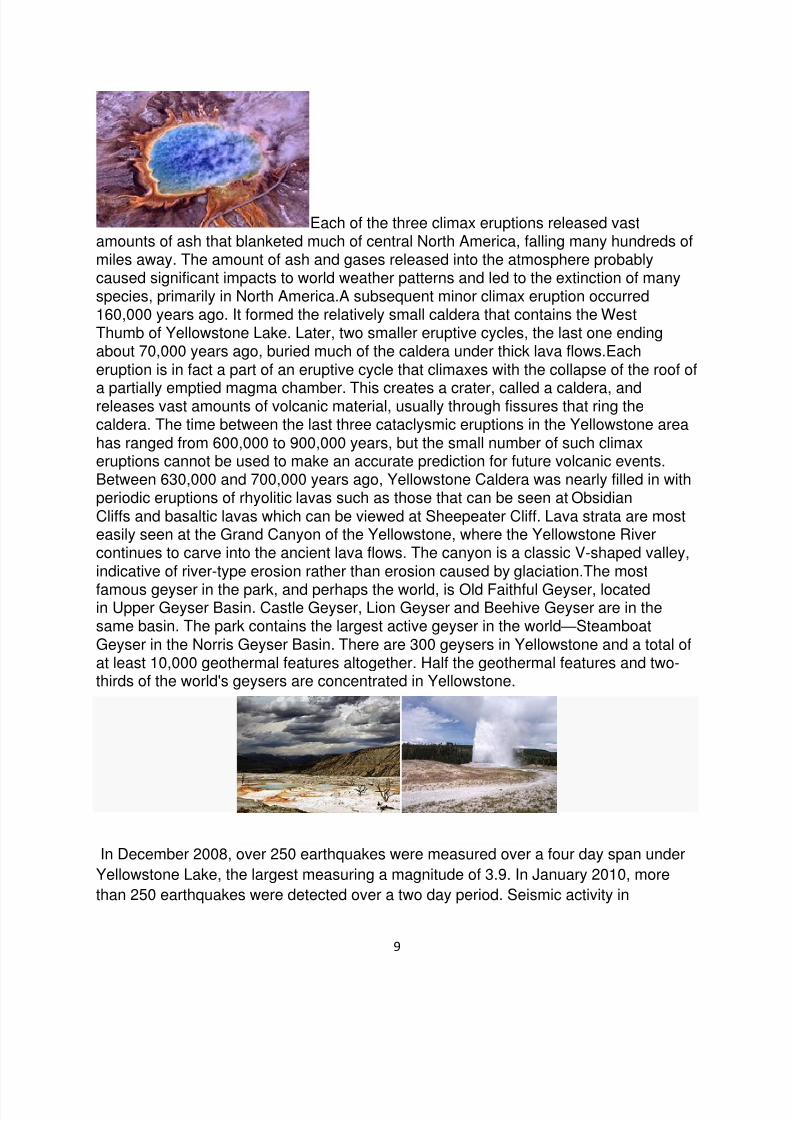
Each of the three climax eruptions released vastamounts of ash that blanketed much of central North America, falling many hundreds ofmiles away. The amount of ash and gases released into the atmosphere probablycaused significant impacts to world weather patterns and led to the extinction of manyspecies, primarily in North America.A subsequent minor climax eruption occurred160,000 years ago. It formed the relatively small caldera that contains the WestThumb of Yellowstone Lake. Later, two smaller eruptive cycles, the last one endingabout 70,000 years ago, buried much of the caldera under thick lava flows.Eacheruption is in fact a part of an eruptive cycle that climaxes with the collapse of the roof of
a partially emptied magma chamber. This creates a crater, called a caldera, andreleases vast amounts of volcanic material, usually through fissures that ring thecaldera. The time between the last three cataclysmic eruptions in the Yellowstone areahas ranged from 600,000 to 900,000 years, but the small number of such climaxeruptions cannot be used to make an accurate prediction for future volcanic events.Between 630,000 and 700,000 years ago, Yellowstone Caldera was nearly filled in withperiodic eruptions of rhyolitic lavas such as those that can be seen at ObsidianCliffs and basaltic lavas which can be viewed at Sheepeater Cliff. Lava strata are mosteasily seen at the Grand Canyon of the Yellowstone, where the Yellowstone Rivercontinues to carve into the ancient lava flows. The canyon is a classic V-shaped valley, indicative of river-type erosion rather than erosion caused by glaciation.The most
famous geyser in the park, and perhaps the world, is Old Faithful Geyser, locatedin Upper Geyser Basin. Castle Geyser, Lion Geyser and Beehive Geyser are in thesame basin. The park contains the largest active geyser in the world—SteamboatGeyser in the Norris Geyser Basin. There are 300 geysers in Yellowstone and a total ofat least 10,000 geothermal features altogether. Half the geothermal features and two-thirds of the world's geysers are concentrated in Yellowstone.
In December 2008, over 250 earthquakes were measured over a four day span under
Yellowstone Lake, the largest measuring a magnitude of 3.9. In January 2010, more
than 250 earthquakes were detected over a two day period. Seismic activity in
7/31/2019 National Parks From U.S.A
http://slidepdf.com/reader/full/national-parks-from-usa 10/28
10
Yellowstone National Park continues and is reported hourly by the Earthquake Hazards
Program of the U.S. Geological Survey.
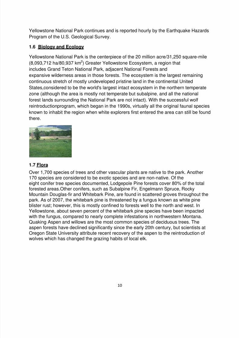
1.6 Biology and Ecology
Yellowstone National Park is the centerpiece of the 20 million acre/31,250 square-mile(8,093,712 ha/80,937 km2) Greater Yellowstone Ecosystem, a region that
includes Grand Teton National Park, adjacent National Forests and
expansive wilderness areas in those forests. The ecosystem is the largest remaining
continuous stretch of mostly undeveloped pristine land in the continental United
States,considered to be the world's largest intact ecosystem in the northern temperate
zone (although the area is mostly not temperate but subalpine, and all the national
forest lands surrounding the National Park are not intact). With the successful wolf
reintroductionprogram, which began in the 1990s, virtually all the original faunal species
known to inhabit the region when white explorers first entered the area can still be found
there.
1.7 Flora
Over 1,700 species of trees and other vascular plants are native to the park. Another
170 species are considered to be exotic species and are non-native. Of theeight conifer tree species documented, Lodgepole Pine forests cover 80% of the totalforested areas.Other conifers, such as Subalpine Fir, Engelmann Spruce, RockyMountain Douglas-fir and Whitebark Pine, are found in scattered groves throughout thepark. As of 2007, the whitebark pine is threatened by a fungus known as white pineblister rust; however, this is mostly confined to forests well to the north and west. InYellowstone, about seven percent of the whitebark pine species have been impactedwith the fungus, compared to nearly complete infestations in northwestern Montana.Quaking Aspen and willows are the most common species of deciduous trees. Theaspen forests have declined significantly since the early 20th century, but scientists atOregon State University attribute recent recovery of the aspen to the reintroduction of
wolves which has changed the grazing habits of local elk.

7/31/2019 National Parks From U.S.A
http://slidepdf.com/reader/full/national-parks-from-usa 11/28
11
There are dozens of species of flowering plants that havebeen identified, most of which bloom between the months of May and September.The Yellowstone Sand Verbena is a rare flowering plant found only in Yellowstone. It isclosely related to species usually found in much warmer climates, making the sandverbena an enigma. The estimated 8,000 examples of this rare flowering plant all maketheir home in the sandy soils on the shores of Yellowstone Lake, well above thewaterline. In Yellowstone's hot waters, bacteria form mats of bizarre shapes consistingof trillions of individuals. These bacteria are some of the most primitive life forms onearth. Flies and otherarthropods live on the mats, even in the middle of the bitterly coldwinters. Initially, scientists thought that microbes there gained sustenance only
from sulfur. In 2005, researchers from theUniversity of Colorado at Boulder discoveredthat the sustenance for at least some of the diversehyperthermophilic speciesis molecular hydrogen. Thermus aquaticus is a bacterium found in the Yellowstone hotsprings that produces an important enzyme that is easily replicated in the lab and isuseful in replicating DNA as part of the polymerase chain reaction (PCR) process. Theretrieval of these bacteria can be achieved with no impact to the ecosystem. Otherbacteria in the Yellowstone hot springs may also prove useful to scientists who aresearching for cures for various diseases. Non-native plants sometimes threaten nativespecies by using up nutrient resources. Though exotic species are most commonlyfound in areas with the greatest human visitation, such as near roads and at majortourist areas, they have also spread into the backcountry. Generally, most exotic
species are controlled by pulling the plants out of the soil or by spraying, both of whichare time consuming and expensive.
1.8 Fauna
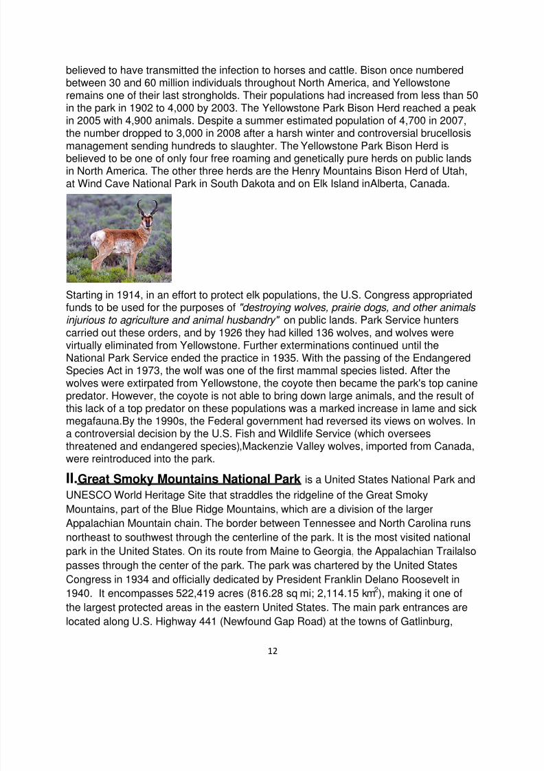
Yellowstone is widely considered to be the finest megafauna wildlife habitat in the lower48 states. There are almost 60 species of mammals in the park, including the gray wolf, the threatened lynx, and grizzly bears. Other large mammals includethe bison (buffalo), black bear, elk, moose,mule deer, white-tailed deer, mountaingoat, pronghorn, bighorn sheep and mountain lion.The Yellowstone Park Bison Herd isthe largest public herd of American Bison in the United States. The relatively large bisonpopulations are a concern for ranchers, who fear that the species can
transmit bovine diseases to their domesticated cousins. In fact, about half ofYellowstone's bison have been exposed to brucellosis, a bacterial disease that came toNorth America with European cattle that may cause cattle to miscarry. The disease haslittle effect on park bison, and no reported case of transmission from wild bison todomestic livestock has been filed. However, the Animal and Plant Health InspectionService (APHIS) has stated that Bison are the "likely source" of the spread of thedisease in cattle in Wyoming and North Dakota. Elk also carry the disease and are
7/31/2019 National Parks From U.S.A
http://slidepdf.com/reader/full/national-parks-from-usa 12/28
12
believed to have transmitted the infection to horses and cattle. Bison once numberedbetween 30 and 60 million individuals throughout North America, and Yellowstoneremains one of their last strongholds. Their populations had increased from less than 50in the park in 1902 to 4,000 by 2003. The Yellowstone Park Bison Herd reached a peakin 2005 with 4,900 animals. Despite a summer estimated population of 4,700 in 2007,
the number dropped to 3,000 in 2008 after a harsh winter and controversial brucellosismanagement sending hundreds to slaughter. The Yellowstone Park Bison Herd isbelieved to be one of only four free roaming and genetically pure herds on public landsin North America. The other three herds are the Henry Mountains Bison Herd of Utah, at Wind Cave National Park in South Dakota and on Elk Island inAlberta, Canada.
Starting in 1914, in an effort to protect elk populations, the U.S. Congress appropriatedfunds to be used for the purposes of "destroying wolves, prairie dogs, and other animals injurious to agriculture and animal husbandry" on public lands. Park Service hunterscarried out these orders, and by 1926 they had killed 136 wolves, and wolves werevirtually eliminated from Yellowstone. Further exterminations continued until theNational Park Service ended the practice in 1935. With the passing of the EndangeredSpecies Act in 1973, the wolf was one of the first mammal species listed. After thewolves were extirpated from Yellowstone, the coyote then became the park's top caninepredator. However, the coyote is not able to bring down large animals, and the result of
this lack of a top predator on these populations was a marked increase in lame and sickmegafauna.By the 1990s, the Federal government had reversed its views on wolves. Ina controversial decision by the U.S. Fish and Wildlife Service (which overseesthreatened and endangered species),Mackenzie Valley wolves, imported from Canada,were reintroduced into the park.
II.Great Smoky Mountains National Park is a United States National Park and
UNESCO World Heritage Site that straddles the ridgeline of the Great Smoky
Mountains, part of the Blue Ridge Mountains, which are a division of the larger
Appalachian Mountain chain. The border between Tennessee and North Carolina runs
northeast to southwest through the centerline of the park. It is the most visited nationalpark in the United States. On its route from Maine to Georgia, the Appalachian Trailalso
passes through the center of the park. The park was chartered by the United States
Congress in 1934 and officially dedicated by President Franklin Delano Roosevelt in
1940. It encompasses 522,419 acres (816.28 sq mi; 2,114.15 km2), making it one of
the largest protected areas in the eastern United States. The main park entrances are
located along U.S. Highway 441 (Newfound Gap Road) at the towns of Gatlinburg,
7/31/2019 National Parks From U.S.A
http://slidepdf.com/reader/full/national-parks-from-usa 13/28
13
Tennessee, and Cherokee, North Carolina. It was the first national park whose land and
other costs were paid for in part with federal funds; previous parks were funded wholly
with state money or private funds.
2.1History
Before the arrival of European settlers, the region was part of the homeland oftheCherokee Indians. Frontiers people began settling the land in the 18th and early 19thcentury. In 1830 President Andrew Jackson signed the Indian Removal Act, beginningthe process that eventually resulted in the forced removal of all Indian tribes east of theMississippi River to what is now Oklahoma. Many of the Cherokee left, but some, led byrenegade warrior Tsali, hid out in the area that is now the Great Smoky MountainsNational Park. Some of their descendants now live in the Qualla Reservation south ofthe park.
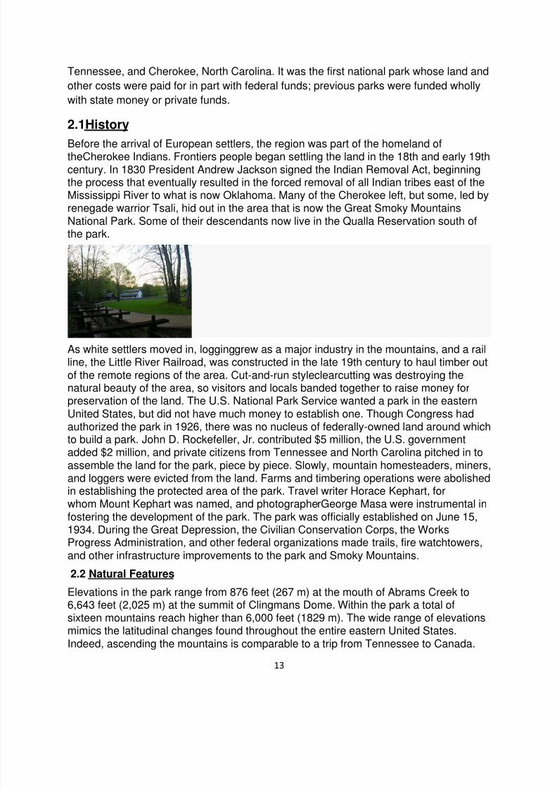
As white settlers moved in, logginggrew as a major industry in the mountains, and a railline, the Little River Railroad, was constructed in the late 19th century to haul timber outof the remote regions of the area. Cut-and-run styleclearcutting was destroying thenatural beauty of the area, so visitors and locals banded together to raise money forpreservation of the land. The U.S. National Park Service wanted a park in the eastern
United States, but did not have much money to establish one. Though Congress hadauthorized the park in 1926, there was no nucleus of federally-owned land around whichto build a park. John D. Rockefeller, Jr. contributed $5 million, the U.S. governmentadded $2 million, and private citizens from Tennessee and North Carolina pitched in toassemble the land for the park, piece by piece. Slowly, mountain homesteaders, miners,and loggers were evicted from the land. Farms and timbering operations were abolishedin establishing the protected area of the park. Travel writer Horace Kephart, forwhom Mount Kephart was named, and photographerGeorge Masa were instrumental infostering the development of the park. The park was officially established on June 15,1934. During the Great Depression, the Civilian Conservation Corps, the WorksProgress Administration, and other federal organizations made trails, fire watchtowers,
and other infrastructure improvements to the park and Smoky Mountains.
2.2 Natural Features
Elevations in the park range from 876 feet (267 m) at the mouth of Abrams Creek to6,643 feet (2,025 m) at the summit of Clingmans Dome. Within the park a total ofsixteen mountains reach higher than 6,000 feet (1829 m). The wide range of elevationsmimics the latitudinal changes found throughout the entire eastern United States.Indeed, ascending the mountains is comparable to a trip from Tennessee to Canada.
7/31/2019 National Parks From U.S.A
http://slidepdf.com/reader/full/national-parks-from-usa 14/28
14
Plants and animals common in the country's Northeast have found suitableecologicalniches in the park's higher elevations, while southern species find homes in the balmierlower reaches.
During the most recent ice age, the northeast-to-southwest orientation of theAppalachian mountains allowed species to migrate southward along the slopes ratherthan finding the mountains to be a barrier. As climate warms, many northern speciesare now retreating upward along the slopes and withdrawing northward, while southernspecies are expanding. The park normally has very high humidity and precipitation,
averaging from 55 inches (1,400 mm) per year in the valleys to 85 inches (2,200 mm)per year on the peaks. This is more annual rainfall than anywhere in the United Statesoutside the Pacific Northwest and parts of Alaska. It is also generally cooler than thelower elevations below, and most of the park has a humid continental climate morecomparable to locations much farther north, as opposed to the humid subtropicalclimate in the lowlands. The park is almost 95 percentforested, and almost 36 percent ofit, 187,000 acres (760 km2), is estimated by the Park Service to be old growthforest with many trees that predate European settlement of the area. It is one of thelargest blocks of deciduous, temperate, old growth forest in North America.The varietyof elevations, the abundant rainfall, and the presence of old growth forests give the park
an unusual richness of biota. About 10,000 species of plants and animals are known tolive in the park, and estimates as high as an additional 90,000 undocumented speciesmay also be present.
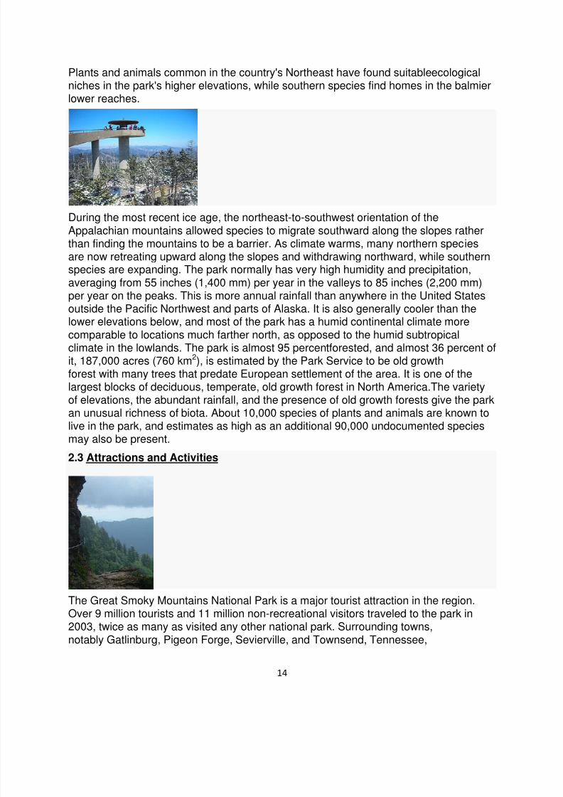
2.3 Attractions and Activities
The Great Smoky Mountains National Park is a major tourist attraction in the region.Over 9 million tourists and 11 million non-recreational visitors traveled to the park in2003, twice as many as visited any other national park. Surrounding towns,notably Gatlinburg, Pigeon Forge, Sevierville, and Townsend, Tennessee,

7/31/2019 National Parks From U.S.A
http://slidepdf.com/reader/full/national-parks-from-usa 15/28
15
and Cherokee, Sylva, Maggie Valley, and Bryson City, North Carolina receive asignificant portion of their income from tourism associated with the park.The two mainvisitors' centers inside the park are Sugarlands Visitors' Center near the Gatlinburgentrance to the park and Oconaluftee Visitors' Center near Cherokee, North Carolina atthe eastern entrance to the park. These ranger stations provide exhibits
on wildlife, geology, and the history of the park. They also sell books, maps, andsouvenirs. Unlike most other national parks, there is no entry fee to the park.U.S.Highway 441 (known in the park as Newfound Gap Road) bisects the park, providingautomobile access to many trailheads and overlooks, most notably that of NewfoundGap. At an elevation of 5,048 feet (1,539 m), it is the lowest gap in the mountains and issituated near the center of the park, on the Tennessee/North Carolina state line,halfway between the border towns of Gatlinburg and Cherokee. It was here that in 1940,from the Rockefeller Memorial, Franklin Delano Roosevelt dedicated the national park.On clear days Newfound Gap offers arguably the most spectacular scenes accessiblevia highway in the park.The park has a number of historical attractions. The most well-preserved of these (and most popular) is Cades Cove, a valley with a number of
preserved historic buildings including log cabins, barns, and churches. Cades Cove isthe single most frequented destination in the national park. Self-guided automobile andbicycle tours offer the many sightseers a glimpse into the way of life of old-timesouthern Appalachia. Other historical areas within the park include RoaringFork,Cataloochee, Elkmont, and the Mountain Farm Museum and Mingus Millat Oconaluftee.
III.Grand Canyon National Park is the United States' 15th oldest national
park and is located in Arizona. Within the park lies the Grand Canyon, a gorge ofthe Colorado River, considered to be one of the Wonders of the World. The park covers1,217,262 acres (1,902 sq mi; 4,926 km2) of unincorporated
area in Coconino and Mohave counties.Most visitors to the park come to the South Rim,arriving on Arizona State Route 64. The Highway enters the park through the SouthEntrance, near Tusayan, Arizona, and heads eastward, leaving the park through theEast Entrance. All park accommodations are operated by the Xanterra corporation. Parkheadquarters are atGrand Canyon Village, a short distance from the South Entrance,being also the location of the most popular viewpoints. Some thirty miles of the SouthRim are accessible by road. A much smaller venue for tourists is found on the NorthRim, accessed by Arizona State Route 67. There is no road connection between thetwo within Arizona except via the Navajo Bridge, near Page, Arizona, entailing a five-hour drive. Otherwise, the two rims of the Canyon are connected via Las Vegas,Nevada, and the Hoover Dam.

7/31/2019 National Parks From U.S.A
http://slidepdf.com/reader/full/national-parks-from-usa 16/28
16
3.1 History
Grand Canyon National Park became a national park in 1919. So famous is thislandmark to modern Americans that it seems surprising that it took more than thirtyyears for it to become a national park. President Theodore Roosevelt visited the rim in1903 and exclaimed: "The Grand Canyon fills me with awe. It is beyond comparison—
beyond description; absolutely unparalleled throughout the wide world. ... Let this greatwonder of nature remain as it now is. Do nothing to mar its grandeur, sublimity andloveliness. You cannot improve on it. But what you can do is to keep it for your children,your children's children, and all who come after you, as the one great sight which everyAmerican should see."Despite Roosevelt's enthusiasm and his strong interest inpreserving land for public use, the Grand Canyon was not immediately designated as anational park. The first bill to create Grand Canyon National Park was introduced in1882 and again in 1883 and 1886 by Senator Benjamin Harrison. As President,Harrison established the Grand Canyon Forest Reserve in 1893. Theodore Rooseveltcreated the Grand Canyon Game Preserve by proclamation in 1906 and Grand
Canyon National Monument in 1908. Senate bills to establish a national park wereintroduced and defeated in 1910 and 1911. The Grand Canyon National Park Act wasfinally signed by President Woodrow Wilson in 1919. The National Park Service, established in 1916, assumed administration of the park.The creation of the park wasan early success of the environmental conservation movement. Its National Park statusmay have helped thwart proposals to dam the Colorado River within its boundaries.(Lack of this fame may have enabled Glen Canyon Dam to be built upriver, floodingGlen Canyon and creating Lake Powell.) In 1975, the former Marble Canyon NationalMonument, which followed the Colorado River northeast from the Grand Canyonto Lee's Ferry, was made part of Grand Canyon National Park. In1979, UNESCO declared it as a World Heritage Site.The Grand Canyon, including its
extensive system of tributary canyons, is valued for its combination of large size, depth,and the exposed layering of colorful rocks dating back to Precambrian times. It wascreated through the incision of the Colorado River and its tributaries after the ColoradoPlateau was uplifted and the Colorado River system developed along its present path.
IV.Yosemite National Park is a United States National Park spanning eastern
portions of Tuolumne, Mariposa and Madera counties in east central California, UnitedStates. The park covers an area of 761,268 acres (3,080.74 km2) and reaches acrossthe western slopes of the Sierra Nevadamountain chain. Over 3.7 million people visitYosemite each year: most spend their time in the seven square miles (18 km2)of Yosemite Valley.[5] Designated a World Heritage Site in 1984, Yosemite is
internationally recognized for its spectacular granitecliffs, waterfalls, clear streams, Giant Sequoia groves, and biological diversity. Almost 95% of the park isdesignated wilderness. Although not the first designatednational park, Yosemite wascentral to the development of the national park idea, largely owing to the work of peoplelike Galen Clark and John Muir.Yosemite is one of the largest and leastfragmented habitat blocks in the Sierra Nevada, and the park supports a diversityof plants and animals. The park has an elevation range from 2,127 to 13,114 feet (648to 3,997 m) and contains five majorvegetation zones: chaparral /oak woodland,

7/31/2019 National Parks From U.S.A
http://slidepdf.com/reader/full/national-parks-from-usa 17/28
17
lower montane, upper montane, subalpine, and alpine. Of California's 7,000 plantspecies, about 50% occur in the Sierra Nevada and more than 20% within Yosemite.There is suitable habitat or documentation for more than 160 rare plants in the park,with rare local geologic formations and uniquesoils characterizing the restricted rangesmany of these plants occupy. The geology of the Yosemite area is characterized by
granitic rocks and remnants of older rock. About 10 million years ago, the SierraNevada was uplifted and then tilted to form its relatively gentle western slopes and themore dramatic eastern slopes. The uplift increased the steepness of stream and riverbeds, resulting in formation of deep, narrow canyons. About 1 million yearsago, snow and ice accumulated, formingglaciers at the higher alpine meadows thatmoved down the river valleys. Ice thickness in Yosemite Valley may have reached4,000 feet (1,200 m) during the early glacial episode. The downslope movement of theice masses cut and sculpted the U-shaped valley that attracts so many visitors to itsscenic vistas today.
4.1 History
Ahwahneechee and the Mariposa Wars
Paiute and Sierra Miwok peoples lived in the area for a long time before the first whiteexplorations into the region. A band of Native Americans calledthe Ahwahneechee lived in Yosemite Valley when the first non-indigenous peopleentered it. The California Gold Rush in the mid-19th century dramatically increasedwhite travel in the area. United States Army Major Jim Savage led the MariposaBattalion into the west end of Yosemite Valley in 1851 while in pursuit of around 200Ahwahneechees led by Chief Tenaya as part of the Mariposa Wars.

7/31/2019 National Parks From U.S.A
http://slidepdf.com/reader/full/national-parks-from-usa 18/28
18
Accounts from this battalion were the first well-documented cases of Caucasiansentering Yosemite Valley. Attached to Savage's unit was Dr.Lafayette Bunnell, thecompany physician, who later wrote about his awestruck impressions of the valleyin The Discovery of the Yosemite . Bunnell is credited with naming Yosemite Valley fromhis interviews with Chief Tenaya. Bunnell wrote that Chief Tenaya was the founder ofthe Pai-Ute Colony of Ah-wah-nee. The Miwoks (and most white settlers) considered
the Ahwahneechee to be especially violent because of their frequent territorial disputes,and the Miwok word "yohhe'meti" literally means "they are killers".Correspondence andarticles written by members of the battalion helped to popularize Yosemite Valley andsurrounding area.Tenaya and the rest of the Ahwahneechee were eventually capturedand their village burned; they were removed to a reservation near Fresno, California. Some were later allowed to return to Yosemite Valley, but got in trouble after attacking agroup of eight gold miners in the spring of 1852. The band fled eastward to Mono Lake, and took refuge with the nearby Mono tribe; but after stealing some horses from theirhosts, the Ahwahneechees were tracked down and killed by the Mono Paiutes in 1853.In the attack Chief Tenaya was killed and the survivors were taken back to Mono Lakeand absorbed into the Mono Lake Paiute tribe. A reconstructed "Indian Village of
Ahwahnee" is now located behind the Yosemite Museum, which is next to the YosemiteValley Visitor Center.
4.2Geography
Yosemite National Park is located in the central Sierra Nevada of California. It takesapproximately 4 hours to drive to the park from San Francisco, approximately 6 hoursfrom Los Angeles, and 7 hours from San Bernardino. Three wilderness areas areadjacent to Yosemite: the Ansel Adams Wilderness to the southeast, the HooverWilderness to the northeast, and the Emigrant Wilderness to the north.The 1,189 sq mi(3,080 km2) park is roughly the size of the U.S. state of Rhode Island and contains
thousands of lakes and ponds, 1,600 miles (2,600 km) of streams, 800 miles (1,300 km)of hiking trails, and 350 miles (560 km) of roads. Two federally designated Wild andScenic Rivers, the Merced and the Tuolumne, begin within Yosemite's borders and flowwestward through the Sierra foothills, into the Central Valley of California. Annual parkvisitation exceeds 3.5 million, with most visitor use concentrated in the seven-squaremile (18 km2) area of Yosemite Valley
7/31/2019 National Parks From U.S.A
http://slidepdf.com/reader/full/national-parks-from-usa 19/28
19
Rocks and erosion
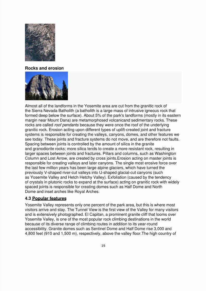
Almost all of the landforms in the Yosemite area are cut from the granitic rock ofthe Sierra Nevada Batholith (a batholith is a large mass of intrusive igneous rock thatformed deep below the surface). About 5% of the park's landforms (mostly in its easternmargin near Mount Dana) are metamorphosed volcanicand sedimentary rocks. Theserocks are called roof pendants because they were once the roof of the underlyinggranitic rock. Erosion acting upon different types of uplift-created joint and fracturesystems is responsible for creating the valleys, canyons, domes, and other features wesee today. These joints and fracture systems do not move, and are therefore not faults. Spacing between joints is controlled by the amount of silica in the graniteand granodiorite rocks; more silica tends to create a more resistant rock, resulting in
larger spaces between joints and fractures. Pillars and columns, such as WashingtonColumn and Lost Arrow, are created by cross joints.Erosion acting on master joints isresponsible for creating valleys and later canyons. The single most erosive force overthe last few million years has been large alpine glaciers, which have turned thepreviously V-shaped river-cut valleys into U-shaped glacial-cut canyons (suchas Yosemite Valley and Hetch Hetchy Valley). Exfoliation (caused by the tendencyof crystals in plutonic rocks to expand at the surface) acting on granitic rock with widelyspaced joints is responsible for creating domes such as Half Dome and NorthDome and inset arches like Royal Arches.
4.3 Popular features
Yosemite Valley represents only one percent of the park area, but this is where mostvisitors arrive and stay. The Tunnel View is the first view of the Valley for many visitorsand is extensively photographed. El Capitan, a prominent granite cliff that looms overYosemite Valley, is one of the most popular rock climbing destinations in the worldbecause of its diverse range of climbing routes in addition to its year-roundaccessibility. Granite domes such as Sentinel Dome and Half Dome rise 3,000 and4,800 feet (910 and 1,500 m), respectively, above the valley floor.The high country of
7/31/2019 National Parks From U.S.A
http://slidepdf.com/reader/full/national-parks-from-usa 20/28
20
Yosemite contains beautiful areas such as Tuolumne Meadows, Dana Meadows, the Clark Range, the Cathedral Range, and the Kuna Crest. The Sierra crest andthe Pacific Crest Trail run through Yosemite, with peaks of red metamorphic rock, suchas Mount Dana and Mount Gibbs, and granite peaks, such as Mount Conness. MountLyell is the highest point in the park, standing at 13,120 ft. The Lyell Glacier is the
largest glacier in Yosemite National Park and is one of the few remaining in the SierraNevada today.The park has three groves of ancient Giant Sequoia (Sequoiadendron giganteum ) trees; the Mariposa Grove (200 trees), the Tuolumne Grove(25 trees), andthe Merced Grove (20 trees). This species grows larger in volume than any other and isone of the tallest and longest-lived.
4.4 Water and Ice
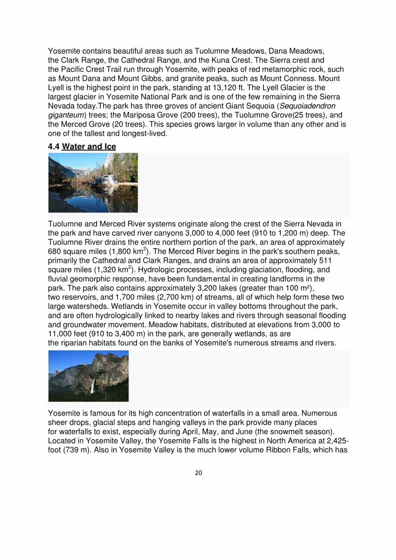
Tuolumne and Merced River systems originate along the crest of the Sierra Nevada inthe park and have carved river canyons 3,000 to 4,000 feet (910 to 1,200 m) deep. TheTuolumne River drains the entire northern portion of the park, an area of approximately680 square miles (1,800 km2). The Merced River begins in the park's southern peaks,primarily the Cathedral and Clark Ranges, and drains an area of approximately 511square miles (1,320 km2). Hydrologic processes, including glaciation, flooding, andfluvial geomorphic response, have been fundamental in creating landforms in thepark. The park also contains approximately 3,200 lakes (greater than 100 m²),
two reservoirs, and 1,700 miles (2,700 km) of streams, all of which help form these twolarge watersheds. Wetlands in Yosemite occur in valley bottoms throughout the park,and are often hydrologically linked to nearby lakes and rivers through seasonal floodingand groundwater movement. Meadow habitats, distributed at elevations from 3,000 to11,000 feet (910 to 3,400 m) in the park, are generally wetlands, as arethe riparian habitats found on the banks of Yosemite's numerous streams and rivers.
Yosemite is famous for its high concentration of waterfalls in a small area. Numeroussheer drops, glacial steps and hanging valleys in the park provide many placesfor waterfalls to exist, especially during April, May, and June (the snowmelt season).Located in Yosemite Valley, the Yosemite Falls is the highest in North America at 2,425-foot (739 m). Also in Yosemite Valley is the much lower volume Ribbon Falls, which has

7/31/2019 National Parks From U.S.A
http://slidepdf.com/reader/full/national-parks-from-usa 21/28
21
the highest single vertical drop, 1,612 feet (491 m). Perhaps the most prominent of theYosemite Valley waterfalls is Bridalveil Fall, which is the waterfall seen from the TunnelView viewpoint at the east end of the Wawona Tunnel. Wapama Falls in Hetch HetchyValley is another notable waterfall. Hundreds of ephemeral waterfalls also exist in thepark.
4.5 Climate
Yosemite has a Mediterranean climate, meaning most precipitation falls during the mildwinter, and the other seasons are nearly dry (less than 3% of precipitation falls duringthe long, hot summers). Because of orographic lift, precipitation increases with elevationup to 8,000 feet (2,400 m) where it slowly decreases to the crest. Precipitation amountsvary from 36 inches (910 mm) at 4,000 feet (1,200 m) elevation to 50 inches(1,300 mm) at 8,600 feet (2,600 m). Snow does not typically persist on the ground untilNovember in the high country. It accumulates all winter and into March or early April.
Mean daily temperatures range from 25 to 53 °F (-3.9 to 11.5 °C) at TuolumneMeadows at 8,600 feet (2,600 m). At the Wawona Entrance (elevation 5,130 feet / 1,560metres), mean daily temperature ranges from 36 to 67 °F (2 to 19 °C). At the lowerelevations below 5,000 feet (1,500 m), temperatures are hotter; the mean daily hightemperature at Yosemite Valley (elevation 3,966 feet / 1,209 metres) varies from 46 to90 °F (8 to 32 °C). At elevations above 8,000 feet (2,400 m), the hot, dry summertemperatures are moderated by frequent summer thunder storms, along with snow that
can persist into July. The combination of dry vegetation, low relative humidity, andthunderstorms results in frequent lightning-caused fires as well.
V.Acadia National Park is a National Park located in the U.S. state of Maine. It
reserves much of Mount Desert Island, and associated smaller islands, off the Atlanticcoast. Originally created as Lafayette National Park in 1919, the first National Park Eastof the Mississippi, it was renamed Acadia in 1929

7/31/2019 National Parks From U.S.A
http://slidepdf.com/reader/full/national-parks-from-usa 22/28
22
5.1 History
The area first was inhabited by the Wabanaki people. In the fall of 1604, Samuel deChamplain observed a high-notched island composed of seven or eight mountains
rising to bare-rock summits from slopes of birch, fir, and pine. Over four centuries later,the area remains essentially the same.
5.2 Beginnings
The landscape architect Charles Elliot is credited with the idea for the park. It firstattained federal status when President Woodrow Wilson, established it as Sieur deMonts National Monument on July 8, 1916, administered by the National Park Service.On February 26, 1919, it became a national park, with the name Lafayette National Parkin honor of the Marquis de Lafayette, an influential French supporter of the AmericanRevolution. The park's name was changed to Acadia National Park onJanuary 19, 1929.
From 1915 to 1933, the wealthy philanthropist John D. Rockefeller, Jr. financed,designed, and directed the construction of a network of carriage trails throughout thepark. He sponsored the landscape architect Beatrix Farrand, with the nearby familysummer home Reef Point Estate, to design the planting plans for the subtle carriageroads at the Park (c.1930).The network encompassed over 50 miles (80 km) of gravelcarriage trails, 17 granite bridges, and two gate lodges, almost all of which are stillmaintained and in use today. Cut granite stones placed along the edges of the carriageroads act as guard rails of sort and are locally known as "coping stones" to help visitorscope with the steep edges. They are also fondly called "Rockefeller's teeth".
5.3 Terrain and Features
The park includes mountains, an ocean shoreline, woodlands, and lakes. In addition toMount Desert Island, the park comprises much of theIsle au Haut, parts of Baker Island, and a portion of the Schoodic Peninsula on the mainland.In total, Acadia National Parkconsists of more than 47,000 acres (73 square miles, 190 km2), including 30,300 acres(47 sq mi., 123 km2) on Mount Desert Island, 2,728 acres (4.6 sq mi., 11 km2) on Isle auHaut and 2,366 acres (3.5 sq mi., 9.2 km2) on the Schoodic Peninsula.CadillacMountain, named after the French Explorer of the same name, is on the eastern side of
7/31/2019 National Parks From U.S.A
http://slidepdf.com/reader/full/national-parks-from-usa 23/28
23
the island. Its green, lichen-covered, pink granite summit is, because of a combinationof its eastern location and height, one of the first places in the United States to see thesunrise. Miles of carriage roads were originally built by John D. Rockefeller, Jr. Themountains of Acadia National Park offer hikers and bicycle riders views of the ocean,island lakes, and pine forests.The inlet Somes Sound, often described as the
"only fjord on the East Coast",is now called a fjard by officials
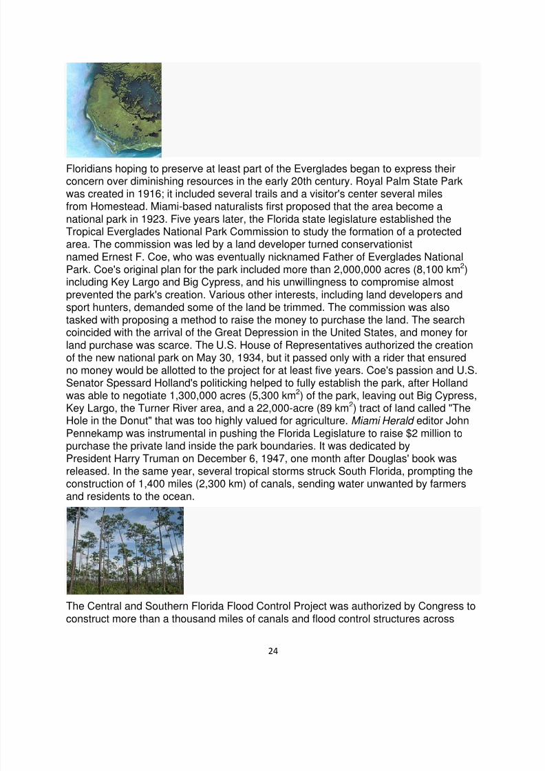
VI.Everglades National Park is a national park in the U.S. state of Florida that
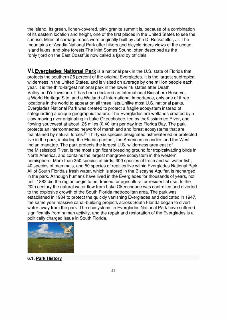
protects the southern 25 percent of the original Everglades. It is the largest subtropicalwilderness in the United States, and is visited on average by one million people eachyear. It is the third-largest national park in the lower 48 states after DeathValley andYellowstone. It has been declared an International Biosphere Reserve, a World Heritage Site, and a Wetland of International Importance, only one of threelocations in the world to appear on all three lists.Unlike most U.S. national parks,Everglades National Park was created to protect a fragile ecosystem instead of
safeguarding a unique geographic feature. The Everglades are wetlands created by aslow-moving river originating in Lake Okeechobee, fed by theKissimmee River, andflowing southwest at about .25 miles (0.40 km) per day into Florida Bay. The parkprotects an interconnected network of marshland and forest ecosystems that aremaintained by natural forces.[5] Thirty-six species designated asthreatened or protectedlive in the park, including the Florida panther, the American crocodile, and the WestIndian manatee. The park protects the largest U.S. wilderness area east ofthe Mississippi River, is the most significant breeding ground for tropicalwading birds inNorth America, and contains the largest mangrove ecosystem in the westernhemisphere. More than 350 species of birds, 300 species of fresh and saltwater fish,
40 species of mammals, and 50 species of reptiles live within Everglades National Park.All of South Florida's fresh water, which is stored in the Biscayne Aquifer, is rechargedin the park. Although humans have lived in the Everglades for thousands of years, notuntil 1882 did the region begin to be drained for agricultural or residential use. In the20th century the natural water flow from Lake Okeechobee was controlled and divertedto the explosive growth of the South Florida metropolitan area. The park wasestablished in 1934 to protect the quickly vanishing Everglades and dedicated in 1947,the same year massive canal-building projects across South Florida began to divertwater away from the park. The ecosystems in Everglades National Park have sufferedsignificantly from human activity, and the repair and restoration of the Everglades is apolitically charged issue in South Florida.
6.1. Park History
7/31/2019 National Parks From U.S.A
http://slidepdf.com/reader/full/national-parks-from-usa 24/28
24
Floridians hoping to preserve at least part of the Everglades began to express theirconcern over diminishing resources in the early 20th century. Royal Palm State Parkwas created in 1916; it included several trails and a visitor's center several milesfrom Homestead. Miami-based naturalists first proposed that the area become anational park in 1923. Five years later, the Florida state legislature established theTropical Everglades National Park Commission to study the formation of a protectedarea. The commission was led by a land developer turned conservationistnamed Ernest F. Coe, who was eventually nicknamed Father of Everglades National
Park. Coe's original plan for the park included more than 2,000,000 acres (8,100 km2
)including Key Largo and Big Cypress, and his unwillingness to compromise almostprevented the park's creation. Various other interests, including land developers andsport hunters, demanded some of the land be trimmed. The commission was alsotasked with proposing a method to raise the money to purchase the land. The searchcoincided with the arrival of the Great Depression in the United States, and money forland purchase was scarce. The U.S. House of Representatives authorized the creationof the new national park on May 30, 1934, but it passed only with a rider that ensuredno money would be allotted to the project for at least five years. Coe's passion and U.S.Senator Spessard Holland's politicking helped to fully establish the park, after Hollandwas able to negotiate 1,300,000 acres (5,300 km2) of the park, leaving out Big Cypress,
Key Largo, the Turner River area, and a 22,000-acre (89 km2) tract of land called "TheHole in the Donut" that was too highly valued for agriculture. Miami Herald editor JohnPennekamp was instrumental in pushing the Florida Legislature to raise $2 million topurchase the private land inside the park boundaries. It was dedicated byPresident Harry Truman on December 6, 1947, one month after Douglas' book wasreleased. In the same year, several tropical storms struck South Florida, prompting theconstruction of 1,400 miles (2,300 km) of canals, sending water unwanted by farmersand residents to the ocean.
The Central and Southern Florida Flood Control Project was authorized by Congress toconstruct more than a thousand miles of canals and flood control structures across

7/31/2019 National Parks From U.S.A
http://slidepdf.com/reader/full/national-parks-from-usa 25/28
25
South Florida. The C&SF, run by the U.S. Army Corps of Engineers, established anagricultural area directly south of Lake Okeechobee, and three water conservationareas, all bordered by canals that diverted excess water either to urban areas or into theAtlantic Ocean, Gulf of Mexico or Florida Bay. South of these manmade regions wasEverglades National Park, which had been effectively cut off from its water supply. By
the 1960s, the park was visibly suffering. Although the C&SF was directed to provideenough water to sustain the park, it did not follow through. A proposed airport that wouldhave dire environment effects on Everglades National Park became the center of abattle that helped to initiate the environmental movement into local and national politics.The airport proposal was eventually abandoned and in 1972 a bill was introduced tocurb development in South Florida and ensure the national park would receive theamount of water it needed. Efforts turned to repairing the damage wrought by decadesof mismanagement: the Army Corps of Engineers changed its focus in 1990 fromconstructing dams and canals to constructing "purely environmental projects".
6.2 Geography
Everglades National Park covers 1,509,000 acres (6,110 km2),
throughout Dade, Monroe, and Collier counties in Florida. The elevation typically rangesfrom 0 to 8 feet (2.4 m) above sea level, but aCalusa-built shell mound on the GulfCoast rises 20 feet (6.1 m) above sea level.
6.3 Geology
The terrain of South Florida is relatively and consistently flat. Although rock formationsare not a central draw to Everglades National Park, the limestone that underlies theEverglades is integral to the formation of the diverse ecosystems within the park. Floridawas once part of the African portion of the supercontinent Gondwana. After it separated,conditions allowed a shallow marine environment to deposit calcium carbonate in sand,shells, and coral to be converted into limestone. Tiny bits of shell, sand,
and bryozoans compressed over multiple layers forming unique structures in thelimestone called ooids which created porous and permeable conditions to hold water.The Florida peninsula appeared above sea level between 100,000 and 15,000 yearsago. As sea levels at the end of the Wisconsin ice age rose, the water table appearedcloser to land. Lake Okeechobee began to flood and convection thunderstorms werecreated. Vast peat deposits south of Lake Okeechobee indicate that regular floodinghad occurred about 5,000 years ago. Plants began to migrate, subtropical ones from thenorthern part of Florida, and tropicals carried as seeds by birds from islands in the

7/31/2019 National Parks From U.S.A
http://slidepdf.com/reader/full/national-parks-from-usa 26/28
26
Caribbean.Although the limestone shelf appears to be flat, there are slight rises—calledpinnacles—and depressions caused by the erosion of limestone by the acidic propertiesof the water.
6.4 Climate
Unlike in the northern portion of Florida, no underground springs feed water into theEverglades system. An underground reservoir called the Floridan Aquifer lies about1,000 feet (300 m) below the surface of South Florida. However, the Everglades has animmense capacity for water storage, due to the sponge-like permeable limestoneunderneath the exposed land. Most of the water arrives in the form of rainfall, and asignificant amount is stored in the limestone. Water evaporating from the Evergladesbecomes rain over metropolitan areas, providing the fresh water supply for the region.Water also flows into the park after falling as rain on Lake Okeechobee and theKissimmee River, to appear in the Everglades days later. Water overflows LakeOkeechobee into a river 40 to 70 miles (110 km) wide, which moves almostimperceptibly. Most of the Everglades see only two seasons: wet and dry. The
park's dry season lasts from December to April, when temperatures vary from 53 °F(12 °C) to 77 °F (25 °C) and humidity is low. Since water levels are low at that time,animals congregate at central water locations, providing popular opportunities forviewing the wildlife.
VII. Arches National Park is a U.S. National Park in eastern Utah. It is known forpreserving over 2000 natural sandstone arches, including the world-famous DelicateArch, in addition to a variety of unique geological resources and formations.The park islocated just outside of Moab, Utah, and is 76,679 acres (31,031 ha) in area. Its highestelevation is 5,653 feet (1,723 m) at Elephant Butte, and its lowest elevation is 4,085 feet(1,245 m) at the visitor center. Forty-three arches have collapsed due toerosion since
1970. The park receives 10 inches (250 mm) of rain a year on average.Administered bythe National Park Service, the area was originally created as aNational Monument onApril 12, 1929. It was redesignated as a National Park on November 12, 1971.
7.1 History

7/31/2019 National Parks From U.S.A
http://slidepdf.com/reader/full/national-parks-from-usa 27/28
27
Humans have occupied the region since the last ice age 10,000 years ago. Fremontpeople and Ancient Pueblo People lived in the area up until about 700 years ago.Spanish missionaries encountered Ute and Paiute tribes in the area when they firstcame through in 1775, but the first European-Americans to attempt settlement in thearea were the Mormon Elk Mountain Mission in 1855, who soon abandoned the area.Ranchers, farmers, and prospectors later settled Moab in the neighboring RiverineValley in the 1880s. Word of the beauty in the surrounding rock formationsspreadbeyond the settlement as a possible tourist destination.The Arches area was first
brought to the attention of the National Park Service by Frank A. Wadleigh, passengertraffic manager of the Denver and Rio Grande Western Railroad. Wadleigh,accompanied by railroad photographer George L. Beam, visited the area in September1923 at the invitation of Alexander Ringhoffer, a Hungarian-born prospector living in SaltValley. Ringhoffer had written to the railroad in an effort to interest them in the touristpotential of a scenic area he had discovered the previous year with his two sons and ason-in-law, which he called the "Devil's Garden" (known today as the "Klondike Bluffs").Wadleigh was impressed by what Ringhoffer showed him, and suggested to ParkService director Stephen T. Mather that the area be made a national monument.
7.2 Geology

7/31/2019 National Parks From U.S.A
http://slidepdf.com/reader/full/national-parks-from-usa 28/28
The national park lies atop an underground evaporitelayer or salt bed, which is the maincause of the formation of the arches, spires, balanced rocks,sandstone fins, and erodedmonoliths in the area. This salt bed is thousands of feet thick in places, and wasdeposited in the Paradox Basin of the Colorado Plateausome 300 million years agowhen a sea flowed into the region and eventually evaporated. Over millions of years,
the salt bed was covered with debris eroded from the Uncompahgre Uplift to thenortheast. During the Early Jurassic (about 210 Ma) desert conditions prevailed in theregion and the vast Navajo Sandstone was deposited. An additional sequence ofstream laid and windblown sediments, the Entrada Sandstone(about 140 Ma), wasdeposited on top of the Navajo. Over 5000 feet (1500 m) of younger sediments weredeposited and have been mostly eroded away. Remnants of the cover exist in the areaincluding exposures of the Cretaceous Mancos Shale. The arches of the area aredeveloped mostly within the Entrada formation.