nasa earth science senior review subcommittee … · the 2017 senior review evaluated thirteen nasa...
TRANSCRIPT

NASA Earth Science Senior Review Subcommittee Report - 2017
Submitted to the NASA Earth Science Advisory Committee
Douglas Vandemark (Chair), Mark Bourassa, Shu-Hua Chen, Heidi Dierssen, Paul Houser, Lyatt Jaegle, Carol Johnson, Guosheng Liu, George Mount, David Mitchell, Jun Wang, Diane Wickland, Curtis Woodcock
June 22, 2017

1
Contents
INTRODUCTION .............................................................................................................. 2 REVIEW PROCESS ........................................................................................................... 2 GENERAL FINDINGS ...................................................................................................... 3 SUMMARY OF MISSION SPECIFIC FINDINGS .......................................................... 6
Aqua ................................................................................................................................ 6 Aura ................................................................................................................................. 7 CALIPSO ........................................................................................................................ 8 CATS .............................................................................................................................. 9 CloudSat ........................................................................................................................ 10 DSCOVR ...................................................................................................................... 11 GPM .............................................................................................................................. 12 OCO-2 ........................................................................................................................... 12 QuikSCAT .................................................................................................................... 13 SMAP ............................................................................................................................ 14 SORCE .......................................................................................................................... 14 TCTE ............................................................................................................................. 15 Terra .............................................................................................................................. 16
APPENDIX 1. TECHNICAL SUBPANEL REPORT ..................................................... 18 APPENDIX 2. NATIONAL INTERESTS SUBPANEL REPORT ................................. 28 APPENDIX 3. COST PANEL REPORT ......................................................................... 42 APPENDIX 4. DETAILED SCIENCE SUBCOMMITTEE MISSION REVIEWS ........ 66 APPENDIX 5. SUBCOMMITTEE FEEDBACK ON ALGORITHM PROPOSALS ... 119

2
INTRODUCTION The 2017 Senior Review evaluated thirteen NASA Earth Science Division (ESD) satellite missions and their plans for continuing operations beyond FY17. Long-running ESD missions seeking extension were Aqua, Aura, Cloud-Aerosol Lidar and Infrared Pathfinder Satellite Observations (CALIPSO), CloudSat, Quick Scatterometer (QuikSCAT), Solar Radiation and Climate Experiment (SORCE), and Terra. Three new ESD missions proposing their first mission extensions were Global Precipitation Mission (GPM), Orbiting Carbon Observatory-2 (OCO-2), and Soil Moisture Active-Passive (SMAP). Additional missions reviewed were Cloud-Aerosol Transport System (CATS), Total Solar Irradiance Calibration Transfer Experiment (TCTE), and Deep Space Climate ObserVatoRy (DSCOVR). Missions still in their primary phase operations period were excluded from this Senior Review, in addition to missions scheduled for termination and missions with partners who are responsible for mission operations and have committed separately to mission extension. The Senior Review was tasked with reviewing proposals submitted by each mission team for extended operations and funding for FY18-20, as well as for FY21-23. The evaluations considered the scientific value, technical performance, proposed costs, and broader national interests associated with extending each mission. Science Subcommittee focus was foremost on the science value supported by each mission in terms of scientific merit, data product quality, and relevance to NASA Earth science goals and strategic plans. Subpanels were convened to provide in-depth evaluations of technical and cost issues as well to assess non-research use of these data by other federal agencies via a national interest subpanel. The Senior Review’s overall funding recommendations for each mission extension are categorized as: Baseline, Augment, Reduce or Close-out. Specific suggestions and justifications are provided for non-baseline cases.
REVIEW PROCESS This review process began in Dec. 2016 when the Earth Science Division released a call letter inviting NASA missions to submit proposals for continuation or for their first mission extension (see Figure 1). The Senior Review Science Subcommittee first convened in a planning telecon on March 2, 2017 via teleconference to discuss procedures and review assignments. A lead reviewer and at least two secondary reviewers were assigned to review each proposal. Over the next one and half months, four teleconferences were held to exchange information, assess progress, and address any issues. In parallel with this process, subpanels on mission National Interest, Technical, and Cost risks were convened to review proposal content in these areas. These subpanels were also able to address questions to the missions before their respective plenary meetings, in collaboration with the science Subcommittee and Chair. These activities preceded an all-day plenary meeting teleconference on April 18 of the full Senior Review Subcommittee, in which all aspects of each mission were discussed, and follow-up questions and requests for clarifications were identified for each mission. These questions were sent to each mission team on April 21, along with expectations for their presentation before the Senior Review Subcommittee Meeting to be held on May 9-11 in Washington DC. During that meeting, each mission was allotted a time slot of 60-70 minutes (depending on mission scope and material to be

3
covered) to address Subcommittee questions and any outstanding concerns. Following these presentations and discussions, the Subcommittee developed and documented a collective evaluation of each mission.
Figure 1 Working flow chart of the 2017 ESD Senior Review
GENERAL FINDINGS The Subcommittee was unanimously impressed with the technical and scientific achievements produced by each mission, and by the unique and important contributions these platforms provide in furthering NASA and U.S. Earth science objectives. Collectively, these missions constitute an unprecedented Earth observation capability that continues to transform our scientific understanding of the Earth system, and their data also support a broad range of additional applications that greatly benefit other U.S. interests. The Subcommittee was also impressed that many of these missions continue to operate well beyond their designed lifetime, a fact that is a testament to high quality engineering, and exceptional on-going management and mission execution teams. The number of science and broader operational applications continues to expand, in part due to the reliability and longevity of these missions. They commended the hard work of the science and data product teams on each mission for their efforts to create, maintain and extend this large and increasingly valuable suite of earth observation measurement data records. The Subcommittee also wished to applaud the concept and implementation of pre-launch outreach to recruit and acquaint potential data users with upcoming missions. This “early adopter” approach, one example being the SMAP mission, is one that is encouraged for future mission developments. Finally, we were also pleased to see the forward-looking

4
work by the A-Train mission teams to adjust to the upcoming orbit-adjustment needs of each platform and to fully consider the interplay amongst mission and science needs. Our overall mission evaluations found that all thirteen missions merited summary science scores of very good to excellent. Breakdown of these scores is provided in Table 1. The largest score variation occurs in data product quality. Long-running missions with very mature data reduction algorithms have generally achieved high levels of data quality, whereas new missions are working hard to improve the accuracy, maturity and delivery of the mission datasets to achieve full science potential and meet their science goals. The highest quality data products are those fully refined and validated with a level of maturity that requires algorithm maintenance only. Regarding scientific merit, missions in orbit for substantial time have devoted significant effort to publishing a coherent and valuable validation and interpretation of their data, whereas new missions are just beginning that effort and so have generally lower scientific merit scores.
Table 1 Mission-specific findings
* All science scores are on a 1-5 scale with 1 being the lowest ranking of “poor” and 5 being the highest ranking of “excellent”. Additional commentary or conditions on the Subcommittee’s scores and/or conclusions are noted in the mission-specific findings summary provided below. The missions received a broader national interest data utility score that ranged from “Some” (3 missions), “High” (7 missions), to “Very High” (3 missions). Technical risk

5
ratings were distributed more broadly between “Low” (5 missions), “Medium-Low” (3 missions), “Medium” (5 missions), and “Medium-High” (1 mission), with no mission receiving “High” risk. For the technical risks, the 2017 Senior Review found a generally low risk for the newer missions, and some increase in the risk since 2015 for several of the aging platforms. Cost risk for 12 of 13 missions was rated “Low” and only 1 mission had “Medium-Low”, an indication that the hardware, downlink communications, and management of these projects is generally adhering to expectations. Based on these findings, the Subcommittee concluded that all missions would make critical contributions to enabling NASA to continue to meet its science objectives and generally concurred with mission requests to continue their mission under baseline or augmented funding. Specific conclusions are provided in Table 2.
Table 2 Mission extension recommendations
Notes on augmentation: Augment without an asterisk recommends sustaining operations beyond a currently planned termination date. Augmentations with an asterisk recommends funds for new and specific additional scope. In addition, the Subcommittee has several specific findings in relation to the missions:
(1) The only suggested reduction in activity was sensor, rather than mission related; this being to terminate efforts to revive the severely compromised TES sensor on Aura.
(2) As noted above, suggested augmentations were often recommendations to continue the mission rather than terminate as was the guideline for several aging missions (e.g. SORCE, QuikSCAT).
(3) International Space Station Earth Science missions are a relatively new addition to ESD and to this mission extension review process. We concur that this platform offers benefits and opportunities including cost efficiencies as well as data collection in the low-inclination ISS orbit that offers valuable new data sampling
MissionFY18-20 FY21-23 SuggestedChangeinScope
Aqua Continue ContinueAura Continue/Reduce Continue/Reduce StopTESOperations/FinalizeDatasetCATS Continue N/A
CALIPSO Continue ContinueCloudSat Continue/Augment* Continue/Augment Cross-calibrationforclimaterecord
DSCOVREPIC&NISTAR Continue/Augment* Continue/Augment* AdditionalCompetedScienceNeededGPM Continue ContinueOCO2 ContinueAugment* Continue RefineXCO2algorithmforfluxreq'ts
QuikSCAT
SMAP Continue ContinueSORCE Continue/Augment Continue/AugmentTCTE Continue/Augment N/ATerra Continue/Augment* Continue MISRalgorithmupdate
Conclusion
Continue/Augmentfor1year/2yearsdependingonScatSatStability

6
in time/space. But we also wish to relay that it may be difficult to judge these ISS-sensor missions in comparison to more standard dedicated ES missions. Among several key distinctions noted by the Subcommittee was the shorter lifetime of these missions, which makes it difficult to assess the science merit and core data maturity, to expect them to directly contribute to climate data record generation and to attract and develop operational users. Thus, we recommend attention be given to defining future merit review criterion accordingly.
(4) The addition of Aqua and Terra science algorithm team evaluations (mini-proposals) into this review process was viewed as a workable means of facilitating the desired transition, but NASA is encouraged to fully integrate these activities into the Terra and Aqua (or other mission) proposals in future senior reviews.
SUMMARY OF MISSION-SPECIFIC FINDINGS
Aqua: Continue as baselined.
Aqua is one of NASA’s flagship missions for Earth Science operating in the A-Train constellation. It was launched on May 4, 2002, and since that time the mission has demonstrated a very high level of precision in measurement of the primary long-term measurements made by the mission. These highly calibrated climate quality measurements of radiance, reflectance, and backscatter have been used to cross-calibrate past and present sensors launched by NASA, as well as a variety of sensors launched from other agencies and the international community. The fifteen years of Aqua data have provided critical Earth observation capabilities that become even more valuable by extending the mission. Thousands of scientists and operational users from around the world are making use of the Aqua data to address NASA’s six interdisciplinary Earth science focus areas: Atmospheric Composition, Weather, Carbon Cycle and Ecosystems, Water and Energy Cycle, Climate Variability and Change, and Earth Surface and Interior. The Aqua time series of observations becomes increasingly valuable as the length of the dataset is extended and episodic fluctuations can be differentiated from secular trends to better assess environmental processes. Such long-term data records can be used to address a variety of interdisciplinary science topics including understanding how changes in earth’s oceanic and terrestrial ecosystem structure and biodiversity inform improved management practices, quantifying the feedbacks between clouds, aerosols and climate change, assessing mechanisms for changing polar temperatures and sea ice over time, improving forecasting and mitigation of natural disasters and extreme weather, and evaluating the geographical distribution of terrestrial and aquatic habitats. The Aqua spacecraft is still going strong after 15 years, and four of its instruments (AIRS, AMSU, CERES, and MODIS) continue to collect valuable data about the atmosphere, oceans, land, and ice. Based upon Aqua’s high quality climate data records, the continuity of this time series is critical for the scientific community, governmental agencies and the international operational user community. Therefore, the Subcommittee found that Aqua mission should be continued as currently baselined.

7
A further recommendation concerns the MODIS sensor. Some degradation of channels in the MODIS short wave visible bands has been observed by the Ocean Biology Processing Group (OBPG). This requires extra corrections moving into the extended mission for ocean applications. At present, the impact on most other Aqua data products is considered negligible, but the issue should be communicated more prominently to the broad community of external science users. Moreover, because of the differences between the MODIS Characterization Support Team (MCST) and OBPG calibration approaches, it is recommended that the OBPG be included in future senior reviews to be able to directly address questions and uncertainties on the mission. Twenty six three-page proposals for continued algorithm maintenance work (referred to hereafter as mini-proposals) were presented in Appendix F to begin a transition of the Aqua science algorithms/data products traditionally competed in ROSES program elements to the NASA Earth Science Senior Review. Each of these mini-proposals provides a work plan for algorithm maintenance activities that adequately justifies continued support of the algorithms/data products at roughly the level of funding requested. The mini-proposals focus on critical activities essential to the maintenance of data product quality and a seamless time series, and extending this work will be essential to the continued success of the Aqua mission. All of the impressive scientific accomplishments and several of the project-related achievements reported for Aqua derive directly from the past algorithm development and maintenance work, and related contributions, of the team of researchers that submitted these mini-proposals. Continued support of these algorithms and standard data products for the next 3 years is recommended. Aura: Continue with reduction (extend Aura with MLS and OMI as baselined, but cease TES operations). Aura is in its 13th year of operation and was launched in July 2004 as part of the A-Train. Aura provides comprehensive observations that are central to understanding core NASA research objectives, including responses of the ozone layer, air quality, and radiation balance to changes in atmospheric composition. The suite of measurements includes profiles and columns of trace gases from the lower troposphere to the mesosphere as well as climate-relevant parameters. There is now a long and productive data set from Aura showing global and national trends that are extremely valuable and useful from air quality, modeling, and composition perspectives. Aura air quality data have played a key role in understanding trends in tropospheric air pollution and mitigation assessments. Aura’s accomplishments over the past two years since the last Senior Review are very impressive, including four notable high impact contributions in the areas of 1) long term global air quality trends and transport, 2) human health effects through the use of OMI O3 to assess health impacts of UV exposure, OMI NO2 for pollution exposure, and OMI HCHO for cancer risks; 3) improved understanding of tropospheric ozone changes through better constraints on the relative roles of stratosphere-troposphere-exchange versus changing anthropogenic and biomass burning emissions of NOx; and 4) observations of the anomalous quasi-biennial oscillation in 2016.

8
Although there is an excellent chance of extending the Aura measurements for both the MLS and OMI sensors, the TES sensor has been severely compromised by both the FTS mirror stalls (stalled for 55 days, as of May 11, 2017) and determination of mirror motion via laser A which ceased operation in 2007 but has been recently resurrected to replace laser B which ceased operation in December 2016. Laser A is currently operating at only 10% power. If laser A dies a second time, success of the SIMCLK method of retrieving interferometer control is at best moderate. Clearly the TES observational duty cycle has been low since shifting to special operations mode in 2011. Additionally, there has been limited scientific usage of TES data in special operations mode with only six research papers published with data collected since 2011. The National Interests subpanel rates TES observations as high (NOAA, EPA, NGA, USGS and NPS), but the datastream has been interrupted with increasing frequency. After due consideration, the Subcommittee recommends termination of TES data acquisition. The Subcommittee finds that Aura will still be a high priority mission with only MLS and OMI, but had very strong concerns related to the ability of the TES sensor to continue operations. The Subcommittee recommendation is therefore continuation of Aura baseline MLS and OMI measurements, but to cease TES operations and finalize an archival TES dataset. CALIPSO: Continue as baselined. The Subcommittee recommends continuation of the CALIPSO mission under its current baseline, with the expectation that the team can deliver on its plan to continue successful operations with a switch back to the primary laser. CALIPSO mission is entering its 11th year of very successful operation providing high-resolution atmospheric profiles of aerosols and clouds. CALIPSO has 3 instruments: a two-wavelength polarization-sensitive lidar (CALIOP), a three-channel infrared imaging radiometer (IIR), and a single channel wide field-of-view camera. The unique aerosol and cloud global profiling generated by CALIPSO have allowed improved understanding of the spatial distribution and optical properties of clouds and aerosols. CALIPSO data have help to provide unique constraints on aerosol direct radiative effect, cloud feedbacks, and a comprehensive database for the detailed evaluation of climate, air quality, and weather models. The scientific accomplishments supported by CALIPSO observations have been remarkable, with more than 500 peer-reviewed papers published since the last Senior Review. All three instruments have operated very well so far. The backup laser for the lidar (which was switched on in March 2009 after the primary laser was taken out of service) is expected to be inoperable sometime within the next 6 months. At that time, the primary lidar will be restarted. After the end of 2019, the fuel reserves will not be sufficient to maintain its inclination within the A-train. At that time, the equatorial crossing time will start drifting, but should not affect data quality.

9
The benefits of extending the mission for another 3 years are numerous. These include: - The ability to extend and exploit passive and active A-Train sensor data to produce
combined 10-15 year data records critical to earth radiation budget estimation and climate model improvements
- Improvements in the characterization of the seasonal and interannual variability in clouds and aerosols
- Maintaining and developing synergies with new sensors such as OCO-2 (validation of OCO-2 cloud screening, CO2 bias correction), geostationary instruments (validation of GOES-16 and Himawari-8), the CATS lidar on the International Space Station.
- Connecting long-term aerosol and cloud data with future ESA spaceborne lidar missions (ADM-Aeolus, later 2017; EarthCARE, early 2019), as well as valuable data overlap with the new SAGE III radiation budget instrument to begin operations on the International Space Station in spring 2017.
- Continued provision of near-real time cloud information used in data assimilation systems by U.S. and international agencies used to improve weather and cloud forecasting
CATS: Continue as baselined. The Cloud-Aerosol Transport System (CATS) is an elastic backscatter lidar designed to measure the vertical structure and properties of atmospheric aerosol and cloud layers, similar to the CALIOP lidar aboard CALIPSO. The specific aerosol products from CATS include layer height, layer thickness, backscatter, optical depth, extinction, and depolarization-based discrimination of aerosol particle type. Similar products are available for clouds, depending on whether the lidar backscatter is fully attenuated by cloud cover. CATS has been in operation since February 2015. Data are available for about 65% of its operational lifespan and the 1064 nm laser has yet to show signs of degradation. Note that CATS originally had two functional lasers. Laser 1’s electronics failed after collecting data for six weeks. The 532 nm component of laser 2 has issues with frequency stabilization. Thus, only the 1064 nm laser functions properly at this point. In addition to stable and consistent data production, the CATS project should be continued for four major reasons. First, CATS provides useful profile observations that complement those of CALIOP in time and space over the mid-latitudes and tropics because of its low-inclination ISS orbit. Second, CATS reduces the risk of a data gap in the space-based lidar climate data record should CALIPSO and/or CALIOP fail. Third, unlike CALIPSO which has at least 24-h data latency, CATS is unique in providing near-real time data (available within 3-6 hours of data collection), critical for hazardous-event monitoring and forecasting. Lastly, CATS is a relatively low-cost mission for NASA since it is an ISS-based instrument. NASA’s Earth Science Division (ESD) is only responsible for supporting project management, algorithm development and maintenance, and data processing and archiving.
For these reasons, the Subcommittee recommends continuation of the CATS mission using current baseline funding guideline.

10
The Subcommittee commends and encourages ongoing collaborations between CATS and CALIPSO missions and recommends that both teams further strengthen their collaboration to include possible merged data products and promotion of new and improved science and operational applications. Since CATS is an ISS-instrument, however, it has no dedicated science team like other NASA satellite missions do. As a result, data quality assurance remains sub-optimal. Thus, the Subcommittee is supportive for the mission team to request additional validation flights to improve data quality. CloudSat: Continue with augmentation to sustain operations beyond currently planned termination. CloudSat’s primary instrument is the Cloud Profiling Radar (CPR), a radar operating at 94 GHz to sense cloud-sized particles (i.e. cloud ice, snow, cloud droplets and light rain). CloudSat continues to be only satellite data source for combined vertical profiles of global cloud liquid and ice water content. Although it produces a radar-only cloud water product (both liquid and ice), CloudSat has been strategically leveraged in combination with other A-Train satellite sensors to yield higher quality cloud properties than would be possible with CloudSat alone. By combining Aqua/MODIS visible optical depth, CALIPSO lidar and/or Aqua/AMSR microwave measurements, different particle-size regions of the particle size distribution (PSD) are resolved, allowing additional cloud properties to be retrieved that correspond to these PSD regions. Excellent progress has been demonstrated in validating sensor retrievals against (1) similar satellite retrieval products (from different observations and physics) and (2) validation of CloudSat retrievals against aircraft or ground-based measurements. Based on our review, the probability for technical and scientific success of an extended mission appears very high. The Subcommittee recommends approving the proposed FY22 CloudSat budget (continued with augmentation) since the NASA budget guideline of $4.4M would be insufficient to sustain operations, based on the actual cost history in previous years, and on Sect. 2.4 of the CloudSat proposal, which states that without the requested amount for FY22, mission termination would begin in FY21. In addition, the Subcommittee collectively agreed that additional funds should be allocated to finance cross-calibration activities between CloudSat and EarthCARE and moving the CloudSat data to a climate quality record. Cross-calibration requires a non-trivial amount of work to account for absolute calibration, instrument sensitivity, measurement resolution, and sampling time differences. It is possible to produce merged cloud products in the future but it will take significant work, as the instruments are fairly different in various ways. Simultaneous orbit-intersections for cross-calibration are limited – rare circumstances (once in 3 days) and only at 12 degrees latitude. So this is not going to be a source of calibration per se, but the overlap will provide estimates of the impact of the diurnal cycle on the data record, since there are differences in sampling time (though only 30 minutes off). CloudSat can calibrate on ocean surface targets. Producing a climate quality data record is of high importance for NASA science and should be done while the operations team is functional and the mission is active.

11
The mission indicated that mechanisms exist to fund a US science team, but currently there are no plans to develop an EarthCARE-ROSES call. The Senior Review Subcommittee recommends such a call before the time of the EarthCARE launch in 2019. DSCOVR: continue with augmentation to sustain operations beyond currently planned end date, and to increase competed science activities. The Deep Space Climate Observatory (DSCOVR) was launched on 11 February 2015 to the Sun-Earth first Lagrange (L1) point, 1.5 million kilometers from Earth towards the Sun. Since beginning operation on 15 June 2015, DSCOVR provides a new and unique vantage point for observing the full, sunlit disk of Earth at multiple times per day. As a joint mission between NOAA, NASA and the U.S. Air Force, DSCOVR carries two Earth science instruments that NASA operates: the Earth Polychromatic Imaging Camera (EPIC) and the NIST Advanced Radiometer (NISTAR). EPIC measures back-scattered radiation at 10 wavelengths ranging from ultraviolet (UV) to solar near infrared, enabling the retrieval of diurnal variation of O3 amount, clouds, aerosols, volcanic SO2 plumes, vegetation, and surface UV radiation over the sunlit portion of Earth every 1-2 hours. NISTAR measures the total irradiance from the Earth in four spectral ranges (shortwave, longwave, near infrared, and all wavelengths), thereby recording the diurnal variation of Earth’s radiative energy balance over time. The NISTAR data provide new and temporally more continuous information that supplements the existing climate data record (1-2 times per day) primarily from satellites in LEO orbit. Research in the past 2 years has revealed high potential of these data for scientific discoveries and applications. With observations at multiple local times from sunrise to sunset, EPIC’s color images have also been extremely popular with the public, providing an unprecedented view of Earth for the public and outreach opportunity to emphasize the fragility of our planet. The Subcommittee was split in rating DSCOVR scientific merit between excellent and very good. While the Subcommittee has the consensus that EPIC and NISTAR data product developments have shown excellent progress and are on a fast uprising trajectory towards support of new scientific discoveries and applications, the Subcommittee nevertheless also found that a full and thorough assessment of DSCOVR’s scientific merits is nearly impossible at this early stage of the DSCOVR mission. Reasoning for this included i) both EPIC and NISTAR are the first-of-its-kind instruments, and yet, there was no funding for pre-flight research, nor preparation to develop level-1 data products. The Subcommittee understands that more time is needed to learn about and mitigate the measurement characteristics of these two new sensor measurements and is highly encouraged by the rapid progress already demonstrated by the small instrument team; ii) The budget for the level-1 product development (~$1.5M/per year) is too small for the DSCOVR team to develop a mature product; iii) The science team for DSCOVR is formed through ROSES competition and its primary purpose is to develop level-2 products, which is different from other satellite mission science teams that often have a dedicated in-house team developing the L1-to-L2 algorithm. Finally, the Subcommittee has significant reservations concerning the ability of NISTAR to achieve the accuracy needed to meaningfully study the Earth’s energy budget.

12
The Subcommittee strongly recommends NASA give more time and support to allow the DSCOVR mission so it can fulfill its full potential for advancing our research in Earth sciences, especially through its unique potential to characterize the diurnal variation of O3, volcanic SO2, cloud effective pressure, dust/smoke plume height, dust/smoke aerosol optical depth above clouds, surface phenology, erythemal irradiance at the surface, and radiative energy balance. The Subcommittee thus recommends augmented support for both EPIC’s core data products as well as for level-2 product developments (through ROSES competitions).
GPM: continue as baselined. Since launch on February 27, 2014, the Global Precipitation Measurement (GPM) has produced a series of high quality precipitation (rain and snow) datasets for scientific investigations as well as operational applications. The GPM Core Observatory (CO) satellite carries two instruments: the Dual-frequency Precipitation Radar (DPR, Ku- and Ka-band, provided by JAXA, Japan) and the GPM Microwave Imager (GMI, 13 channels, with frequencies ranging from 10 to 183 GHz), which make observations between 65°S and 65°N. In addition to producing high-quality precipitation datasets using its own DPR and GMI instruments, an important role of the GPM-CO is to provide a reliable transfer standard for 10 other constellation partner precipitation sensors to generate global next-generation, merged precipitation estimates with high temporal (30 minutes) and spatial (10 km) resolutions. The GPM products have met the Level 1 Mission Requirements. The GPM-CO spacecraft and precipitation sensors have been operating in excellent condition since launch; the GPM-CO station-keeping fuel could last until 2035 based on current estimates. The extended mission will maximize scientific and societal benefits by conducting the following activities: (1) lengthen the temporal record by inter-calibrating datasets back to 1998 (for a complete Tropical Rainfall Measuring Mission record), (2) extend GPM merged constellation algorithms pole to pole, and (3) improve the estimates of falling snow and light rain retrievals. The Subcommittee concludes that the value of continued GPM data collection is unequivocal to the scientific community and operational users, and the requested mission extension is well justified and highly recommended. OCO-2: continue with augmentation for the first 3 years to further refine determination of XCO2 to produce data of sufficient quality for quantification of regional CO2 fluxes. The primary objective of the OCO-2 mission is to measure atmospheric column CO2 “with the precision, accuracy, resolution, and coverage needed to quantify CO2 fluxes (sources and sinks) on regional scales over the globe and identify the processes controlling their variability”. The required accuracy and precision is 1ppm in column (0.3%) on regional scales. A secondary objective is to measure solar induced fluorescence (SIF) of vegetation

13
in the reflected Earth spectrum near the O2 A-band to give insight into CO2 uptake by the land biosphere. OCO-2 was launched in July 2014 into the A-Train and now has a high quality 2.5 year record of XCO2 (column-averaged CO2 dry air fraction) and SIF observations. OCO-2 consists of a single instrument on a stabilized spacecraft. Both the spacecraft and the instrument have been healthy since launch. An initial polarization problem was completely solved in October 2014, soon after its discovery. Determination of XCO2 biases for accurate flux determination is well underway with global median difference to ground truth now less than 0.4ppm. Improved correction of remaining XCO2 biases is expected as the various physical mechanisms responsible are investigated more closely and incorporated into the retrieval algorithm. Inflight validation of XCO2 has been comprehensive and critical to the success of the mission. There have been no uncorrectable, time-dependent changes in instrument or spacecraft performance that compromise CO2 or SIF data quality or threaten the quality over the proposed extended mission. This is the first senior review for OCO-2; their proposal to the 2017 Senior Review was excellent. OCO-2 mission objectives have clear relevance to NASA and NRC science goals: improve ability to predict climate changes, detect and predict changes in Earth’s ecological and chemical cycles including land cover and the global carbon cycle. The benefits of this mission are great and we strongly recommend that it be extended with the proposed augmented budget so that the project has the very best chance of achieving a dataset capable of regional CO2 flux determination. We summarize our justification of this augmentation as follows: the OCO-2 mission is required to produce the highest accuracy/precision measurement of any measured satellite trace gas specie, and needs all the resources necessary to reliably meet its goal of producing data of sufficient quality for regional flux determination as well as for performing cross calibration with OCO-3. QuikSCAT: continue with augmentation to sustain operations for at least one more year. The Subcommittee summary score for this mission is excellent and we recommend continuation of the QuikSCAT mission through Sept. 2018, with consideration of another year if the ISRO ScatSat-1 internal radar calibration is unsteady. This is provided that QuikSCAT remains capable for this activity. This recommendation is based on (1) the need of intercalibration for the long-term ocean vector wind data record, and (2) the demonstrated ability to provide this intercalibration with continued QuikSCAT measurements. Trends in QuikSCAT radar calibration are shown to be very small, and the uncertainty in QuikSCAT’s backscatter is very small relative to the requirements. This effort is expected to extend the QuikSCAT calibration well into the future, which will benefit studies of ocean winds, ice and upper canopy vegetation. These observations will also benefit improved wind climatologies that are important for the design of structures exposed to the ocean as well as coastal properties. QuikSCAT observations are the gold standard for backscatter and ocean surface wind calibration. QuikSCAT proved that the proposed intercalibration mission objective worked

14
very well with ISRO’s OceanSat-2 scatterometer, which operated from Nov. 2009 to Feb. 2014. The intercalibration with QuikSCAT proved to be very important because the OSCAT’s internal radar calibration was unstable. A high quality global ocean wind data set based on the recalibrated OSCAT data resulted, as produced by the QuikSCAT science team. Similar techniques were used to improve the calibration of ISS RapidSCAT data. It is important to note that this intercalibration is needed for the radar backscatter measurement, which is the fundamental data record, and needed to produce a consistent record for numerous geophysical variables: ice and upper canopy moisture as well as wind. It is expected that the intercalibrated ISRO ScatSat data will be used to make similar global ocean wind products, and that ScatSat will be used to extend the calibration to future Ku-band scatterometers. Error characteristics of this backscatter calibration as characterized by the non-spinning QuikSCAT radar are remarkably small: they are fit for the purpose, and it is also worth noting that they are more accurate than could be achieved if the radar antenna was rotating. SMAP: Continue as baselined. Since its 31 January 2015 launch, the Soil Moisture Active Passive (SMAP) mission has produced global maps of soil moisture and freeze/thaw state for both science and application uses. SMAP originally used L-band microwave instruments that combine a radar and a radiometer, which share a rotating 6-meter reflector that scans a wide 1000-km swath to make global measurements every 3 days. SMAP began producing science data in April 2015 and will conclude its 3-year prime mission in June 2018. The SMAP radar failed in July of 2015, and the mission has been effectively re-baselined as a radiometer-only mission, with reduced capabilities of producing high-resolution science returns. SMAP’s Phase-E reconfiguration plan was approved in March 2016, to include several new products: 1) an enhanced 9km radiometer data product taking advantage of radiometer oversampling, and 2) a 3-km soil moisture product using combined SMAP L-band radiometer and ESA Sentinel-1 C-band radar observations. The re-baselined mission is in excellent health with low technical and cost risk, and no major risks and ample subsystem consumables available for mission extension. SMAP validated science products have been released, and two important calibration/validation airborne campaigns have been completed. SMAP observations are enabling the science community to make important contributions to improve hydrologic modeling, water cycling, vegetation productivity and carbon cycling, flood prediction, drought monitoring, crop monitoring, and weather prediction. Of particular note is SMAP’s high science return, very high national interests ranking, low cost risk, and low technical risk in extended operations. The extended mission will maximize the scientific and societal benefits of SMAP by producing a longer time series. Improvements in products are planned and highly likely to be achieved. The Subcommittee found that the value of continued SMAP data collection is unequivocal to the scientific community and operational users, and thus justifies mission extension. SORCE: continue with augmentation to sustain operations beyond currently planned end date.

15
SORCE, launched in 2003, carries a Total Irradiance Monitor (TIM), a Spectral Irradiance Monitor (SIM), a SOLar Stellar Irradiance Comparison Experiment (SOLSTICE), and an XUV Photometer System (XPS) for measurements of total solar irradiance (TSI) and spectral solar irradiance (SSI) in the soft x-ray, at Ly a, and from 115 nm to 2400 nm. The uncertainties are low and subjected to careful analysis, and the long-term repeatability (on orbit degradation) is assessed using redundant instruments or channels. SORCE is recommended for continuation with augmentation in order to extend the Total Solar Irradiance (TSI) and Solar Spectral Irradiance (SSI) data products and to provide overlap with the TSIS-1 TSI and SSI data products. The augmentation is to extend the SORCE Mission Operations and Science Team activities past the current timeframe of FY18 and provide a minimum of six months overlap with TSI and 12 months overlap with SSI data products from TSIS-1. It is recommended that if there are unanticipated problems with TSIS-1 data products, due to, for example, launch delay of TSIS-1 beyond June 2018 or issues resulting from operations on ISS, that NASA would consider extending the SORCE mission beyond the end date proposed here. It is noted that the high priority given to the TDRSS data link access for the SORCE mission is of upmost importance, and should be maintained throughout extended mission. Otherwise, there is danger, if brownout mode becomes a frequent occurrence, of excess battery heating and/or loss of spacecraft pointing (see the Technical Review appendix for more information). The Senior Review Subcommittee was very pleased to learn of the work of the ROSES Solar Irradiance Science Teams (SIST), including the new, composite SSI record to be produced using SORCE, TSIS, and OMI SSI data set. TCTE: Continuation with augmentation. TCTE, launched in 2013, carries a Total Irradiance Monitor (TIM) that is serving as a bridge (and back-up) between the TIM on the older SORCE spacecraft and the TIM on the future Total and Spectral Solar Irradiance Sensor (TSIS-1) on the International Space Station (ISS). TCTE is on the Air Force STPSat-3, whose goal was a short high technology demonstration. NOAA funded the Air Force to extend the STPSat-3 mission, with NASA assuming responsibility going forward. TCTE is recommended for continuation with augmentation in order to assure a continuous collective total solar irradiance time series. Although the TIM instruments are calibrated or well-characterized and truly state of the art, TIM measurement uncertainties are still too large to discern absolute differences between solar minima at the required 0.01% level without cross-calibration between missions. The panel thus concludes that it is imperative that there be no gaps in the TSI data record. The benefits of extending TCTE/TIM are to assure TSI observations between now and the arrival of commissioned TSIS-1/TIM TSI data, as well as to more fully sample TSI given that SORCE/TIM measurements are affected by data telemetry gaps and a spacecraft that is becoming dysfunctional. The TCTE augmentation is to extend the TCTE Mission Operations and Science Team activities past the current timeframe of FY18 and provide, at minimum, six months of data collection overlap with TSI measurements from TSIS-1. It is recommended that if there

16
are unanticipated problems with TSIS-1 data products, due to, for example, launch delay of TSIS-1 beyond June 2018 or issues resulting from operations on ISS, that NASA would consider extending the TCTE mission beyond the end date proposed here. The TSI data product is incorporated into climate and solar models, and the science value is very good to excellent. SORCE/TIM and TCTE data products agree to within their combined uncertainties, a major achievement. TCTE/TIM is in good health. The future data products will include new TSI values with improved corrections for the TCTE thermal environment and reduced uncertainties. The data continuity is excellent, although the measurement cadence has been variable. Terra: Continue with augmentation for MISR algorithm upgrades. The combined data and science produced using the five sensors operating on Terra continue to define and extend an incredibly unique and valuable NASA data record and a diverse set of earth science products. Our review concludes that this mission is contributing to virtually all the science priorities within the NASA Earth Science program. Terra’s impact on progress in many earth science disciplines has been staggering and well-supported by evidence provided within this review process. Several subcommittee members convincingly argued that Terra is perhaps the single most important NASA Earth Science Mission ever. Overall, the satellite and sensors are still functioning at a high level and extending mission measurements forward in time is highly recommended. The release of Collection 6 data products for MODIS is a significant recent accomplishment, as is the substantial increase in ASTER data usage due to decisions to make these data freely available. The Version 3 Global Digital Elevation Model that was released in spring of 2017 is also viewed as a big accomplishment. One of the most significant MODIS data product changes is an improvement in cloud identification, which removes artifacts that influenced the land products. As time progresses, datasets from MODIS are increasingly being used to assess ecosystem responses to changes in climate. Thus, continuing the MODIS observation record remains a top priority. The panel recognizes and supports the augmented budget request to develop and test software changes associated with the Multi-angle Imaging SpectroRadiometer (MISR) sensor. These changes are needed to deal with the changes in Terra orbit altitude for the planned constellation exit in 2022. MISR geolocation algorithms work well at the current orbital altitude but will become obsolete when constellation exit occurs. Without these updates, MISR data processing will not be possible. Twenty-one 3-page proposals for continued science data product maintenance work (referred to hereafter as mini-proposals) were presented in Appendix G to begin a transition of the Terra science algorithms/data products traditionally competed in ROSES program elements to the NASA Earth Science Senior Review. Each of these mini-proposals provided a work plan for algorithm maintenance activities that adequately justifies continued support of the algorithm(s)/data product(s) at roughly the level of funding requested. The mini-proposals focus on critical activities essential to the maintenance of

17
data product quality and a seamless time series, and extending this work will be essential to the continued success of the Terra mission. The impressive scientific accomplishments, as well as several of the project-related achievements reported for Terra, derive directly from the past algorithm development and maintenance work of the team of researchers that submitted these mini-proposals. Continued support of these algorithms and standard data products for the next 3 years is recommended.

18
APPENDIX 1. TECHNICAL SUBPANEL REPORT
Results from the Technical Review of the Senior Review 2017 for Extension of Earth Science Operating Missions
Washito Sasamoto NASA Science Office for Mission Assessments

19
Introduction The NASA Earth Science Division (ESD) of the Science Mission Directorate (SMD) is supporting a number of Earth observing missions that are operating beyond their prime missions. Extended operations and associated data analysis activities require a significant fraction of the ESD annual budget. NASA and ESD periodically evaluate the allocation of Mission Operation and Data Analysis (MO&DA) funds with the aim of maximizing, within finite resources, the missions’ contributions to NASA’s and the nation’s goals. This periodic NASA comparative review of missions in extended operations is known as the “Senior Review.” The following thirteen missions (in alphabetical order) were invited to propose to the Senior Review 2017: Aqua, Aura, Cloud-Aerosol Lidar and Infrared Pathfinder Satellite Observations (CALIPSO), Cloud-Aerosol Transport System (CATS) on the International Space Station (ISS), CloudSat, Deep Space Climate ObserVatoRy (DSCOVR), Global Precipitation Measurement (GPM), Orbiting Carbon Observatory-2 (OCO-2), Quick Scatterometer (QuikSCAT), Soil Moisture Active Passive (SMAP), Solar Radiation and Climate Experiment (SORCE), Total Solar Irradiance (TSI) Calibration Transfer Experiment (TCTE), and Terra. Performance factors included quality and demonstrated scientific utility of the mission datasets, contributions to national objectives, technical status, and budget efficiency. The objective of the ESD Senior Review is to identify those missions beyond their prime mission whose continued operation contributes cost-effectively to both NASA’s goals and the nation’s operational needs. The primary evaluation criterion for extension of a mission is its contribution to NASA’s research science objectives, but the Senior Review also explicitly acknowledges (1) the importance of long term data sets and overall data continuity for Earth science research; and (2) the direct contributions of mission data to national objectives, such as the routine use of near-real-time products from NASA research missions for applied and operational purposes by U.S. public or private organizations. The Senior Review is performed by a Science Subcommittee and a National Interests Panel. The Science Subcommittee is the primary panel. It is an independent group with sole responsibility for evaluation of the scientific merit of each mission’s datasets with respect to NASA’s Earth science strategic plans and objectives. The Science Subcommittee is drawn from recognized expert members of the Earth Science research community, and is supported by technical (Technical Subpanel) and cost experts from within and outside NASA who assess the health and viability of the operating satellites and the proposed MO&DA budgets. The National Interests Panel assesses the utility and applicability of the mission’s data products to satisfy national objectives by public (non-NASA) and private organizations. The Senior Review Subcommittee considers the results from the National Interest Panel and the Technical Subpanel in its final review findings and ratings.

20
ESD has requested that the NASA Science Office for Mission Assessments (SOMA) perform a Technical Review that partially mirrors the Technical, Management, and Cost (TMC) evaluations that SOMA performs on Pre-Phase A mission concepts. As the Senior Review proposals are for extensions on the Operations and Sustainment phase (Phase E), the review emphasizes hardware status, performance and reliability projections, and mission operations plans. Figure 1 traces the role of the Technical Subpanel in the Senior Review flow.
Figure 1. Senior Review Flow
Proposers were instructed in the “Call for Proposals – Senior Review 2017 for Extension of Earth Science Operating Missions” to:
Discuss the overall technical status of the elements of the mission, and the team’s approach to managing operations to optimize health and vitality of the elements. Include the spacecraft, instruments, and ground systems including spacecraft control center and science center(s). Summarize actions taken to improve the effectiveness of the mission operations tasks and describe what improvements have been accomplished. Summarize the health of the elements and point out limitations as a result of degradation, aging, use of consumables, obsolescence, failures, etc. Include an estimate and rationale of mission life expectancy, including an estimate of post-mission lifetime (assuming the initial 3 year extension) and an updated estimate of the reliability to accomplish your planned end-of-mission passivation procedure (also assuming the 3 year extension). Provide supporting data in the form of engineering data tables and figures in Appendix E.
Technical Review

21
Technical Review Criteria Each proposed mission extension is reviewed in detail for feasibility of mission implementation, as reflected in the perceived risk of accomplishing the extended mission as proposed. The Technical Subpanel is assigned the task to assess each mission’s performance and reliability projections for the satellite and instrument(s), the mission operations implementation plan, and the likelihood of accomplishment within the proposed cost. The technical experts will consider factors including the status of consumables and predicted utilization; spacecraft and instrument status, performance degradation, and failure risk; proposed mission operations approach for effective and safe management of an aging satellite; and mission and data management. The Technical Review will result in narrative text as well as a Risk Rating for the feasibility of the extended mission implementation. Technical Review Principles The basic assumption is that each mission will be extended unless significant technical weaknesses raise concerns about the proposed extension. The proposer is regarded as the expert on his/her proposal. Given the question and answer process, the proposer is accorded limited benefit of the doubt. The proposer’s task is to provide evidence of the viability of the mission extension. During the review, the Technical Subpanel’s task is to attempt to validate the proposer’s assertion of risk. All Proposals are reviewed to identical standards, receive the same evaluation treatment in all areas and, are not compared to each other. The Technical Subpanel is made up of non-conflicted reviewers who are experts in the areas that they review. Proposed mission extensions are reviewed using only the review factors that apply. The proposals are only reviewed on the risks that are under the control of the proposer. Inherent risks for space-based missions (e.g., space environments) are not considered in the review. Programmatic risks associated with mission extensions (e.g., budgetary uncertainty) are not considered in the review. Risks that the mission team can address (e.g., adequacy of resource management) are considered. Technical Risk Ratings The Technical Review determines, for each proposed mission extension, the level of risk of implementing the mission extension as proposed. An integral part of the Technical Review is the review of resources available to the proposer to address problems. Resources can be redundant hardware, consumables, reserves, and margins on physical resources such as power and propellant; planned solutions; and personnel.

22
Technical Risk Ratings are defined as: • Low Risk: There are no problems evident in the mission that cannot be normally
solved well within the resources available. Problems are not of sufficient magnitude to doubt the Proposer’s capability to continue the proposed investigation well within the available resources.
• Medium-Low: Problems have been identified, but are considered well within the proposal team’s capabilities to correct within available resources with good management and application of effective engineering resources. Mission design may be complex.
• Medium Risk: Problems have been identified, but are considered within the proposal team’s capabilities to correct within available resources with good management and application of effective engineering resources. Mission design may be complex and resources tight.
• Medium-High: One or more problems of sufficient magnitude and complexity have been identified that are unlikely to be solved within the available resources.
• High Risk: One or more problems are of sufficient magnitude and complexity as to be deemed unsolvable within the available resources.
Technical Review: Definitions of Findings Each finding is categorized as one of the following: • Major Strength: A facet of the response that is judged to be well above expectations
and can substantially contribute to the ability to meet the proposed technical objectives well within the available resources.
• Major Weakness: A deficiency or set of deficiencies taken together that are judged to substantially impair the ability to meet the proposed technical objectives within the available resources.
• Minor Strength: A facet of the response that is judged to be above expectations and can contribute to the ability to meet the proposed technical objectives within the available resources.
• Minor Weakness: A deficiency that is judged to impair the ability to meet the proposed technical objectives within the available resources.
For the Senior Review all findings (major and minor) are considered to determine the Technical Review Risk Rating for each proposed mission extension. Technical Review Process The Technical Subpanel is composed of non-conflicted reviewers who are experts in the area(s) that they review. These areas include Instruments, Flight Systems, Systems Engineering, and Mission Design and Operations. The Technical Subpanel is asked to consider technical factors such as: Instruments – status of the instrument(s) and components, redundancies, projected lifetime, and instrument resource management;

23
Flight Systems – flight systems status and health, redundancies, consumables, margins, and spacecraft resource management; Mission Design and Operations – mission operations approach, ground facilities – new/existing, and telecommunications. The Technical Subpanel is led by two Form Leads who are responsible for guiding the discussions and for the Technical Findings Form development. The Technical Subpanel develops individual comments and then findings for each proposal that reflect the general agreement of the entire subpanel. Comments form the basis of findings as follows: “above expectations” translate into “strengths”, “below expectations” translate into “weaknesses”, and “as expected” do not result in findings. Subpanel teleconferences are held for each proposal to discuss comments and findings. During the discussions, individual comments are kept, merged with other similar individual findings, or dismissed where appropriate. A Technical Subpanel Meeting is held to refine and finalize the forms and determine the Risk Rating. Findings are refined, merged with other similar findings, or dismissed. The Technical Findings Form is reviewed three times and polling is held to determine the Risk Rating for each proposed mission extension. Technical Review Product The Technical Review of the Senior Review 2017 resulted in a Technical Findings Form for each proposal. This form is labeled with the appropriate Mission name and Principal Investigator; it contains the Risk Rating and a rationale paragraph explaining the rating; and it documents Major Strengths, Major Weaknesses, Minor Strengths, and Minor Weaknesses, as well as questions sent to the proposing mission team and comments. This form is the product of the Technical Review process described above; for each proposal it is regarded as the report from the Technical Subpanel to the Senior Review Panel. Technical Review Summary Results Table 1 shows the Risk Ratings for each proposed mission extension. The Technical Findings Form for each proposal is summarized below with Risk Ratings and rationales, organized in alphabetical order with major findings shown in bold text. If more detail on the results of the Technical Subpanel is required, the Technical Review Findings Forms are stored in the SOMA archive
Table 1. Summary results of the Technical Review for the Senior Review 2017 Risk Rating Mission
Low Medium-Low
Medium Medium-High
High
Aqua X GPM X
OCO-2 X SMAP X
CloudSat X

24
QuikSCAT X* Terra X Aura X
CALIPSO X CATS-ISS X
SORCE X TCTE X**
DSCOVR X *Risk Rating for a two-year extension; **Risk Rating for an eighteen-month extension.
Aqua The Aqua proposed investigation is rated as Low Risk. The Technical Subpanel evaluation has identified one Major Strength and no Major Weaknesses. The Aqua spacecraft is fully redundant in all components needed to continue its mission and to meet the future constellation exit and orbit-lowering requirements. It is worth noting the following findings. The proposal shows good likelihood that the MODerate resolution Imaging Spectrometer (MODIS) instrument can remain operational for the extended mission to September 2023. The two Clouds and the Earth Radiant Energy System (CERES) instruments (Flight Model [FM]-3 and FM 4) continue to provide science data meeting all radiometric requirements, and are expected to remain in the current state of health for the extended mission. The proposal shows that the Atmospheric InfraRed Sounder (AIRS) instrument is likely to provide good data for the next three years, with potential for much longer operations. Aura The Aura proposed investigation is rated as Medium Risk. The Technical Subpanel evaluation has identified no Major Strengths and one Major Weakness. The Thermal Emission Spectrometer's (TES’s) metrology Laser B of the Interferometry Control System (ICS) has failed, and the reliability for the recently revived Laser A is highly uncertain to support the extended mission. It is worth noting the following findings. With five-year design life and operational since 2004, the Microwave Limb Sounder (MLS) has continued to provide good measurements in the configuration reported in the 2015 Senior Review with no significant changes. The Earth Observing System (EOS) Aura bus is likely to support operations through 2022, albeit with a reduced instrument suite. However, the TES Interferometer Control System (ICS) mirror drive is experiencing stalling events in a steady degradation towards total loss of functionality. The Ozone Monitoring Instrument (OMI) is operating at a reduced level of performance because of several subsystems whose performance shows progressive degradation due to aging. CALIPSO The CALIPSO proposed investigation is rated Medium Risk. The Technical Subpanel has identified one Major Strength and one Major Weakness. The Infrared Imaging Radiometer (IIR) and the Wide Field Camera (WFC) have operated as designed for

25
11 years and should have no difficulty operating for the proposed additional three years. However, the proposal does not demonstrate the capability of the Cloud-Aerosol LIdar with Orthogonal Polarization (CALIOP) to maintain science data requirements for the full duration of the extended mission. It is worth noting the following finding. There is a good chance that the primary laser will restart. CATS-ISS The CATS proposed investigation is rated as Medium Risk. The Technical Subpanel evaluation has identified one Major Strength and one Major Weakness. The proposal provides confidence that the CATS laser scatterometer is in good condition to support Level 1B (L1B) and Level 2 Operational (L2O) science data products for the extended mission. However, no sufficient ISS payload slot is available in the current ISS manifest to host CATS beyond the first half of Fiscal Year 2019 (FY19). CloudSat The CloudSat proposed investigation is rated as Medium-Low Risk. The Technical Subpanel evaluation has identified one Major Strength and no Major Weaknesses. The proposal demonstrates good likelihood that the Cloud Profiling Radar (CPR) can continue to achieve the required sensitivity for science through the start of the extended mission, and the backup Extended Interaction Klystron (EIK) is available. It is worth noting the following finding. Flight system components are expected to support a mission lifetime through 2020, and the proposal presents an analysis showing a very favorable probability of 96.8% for successful completion of decommissioning and disposal if they were performed at that time. However, CloudSat has lost transponder redundancy. DSCOVR The DISCOVR proposed investigation is rated as Medium-High Risk. The Technical Subpanel has identified no Major Strengths and two Major Weaknesses. The Earth Polychromatic Imaging Camera (EPIC) instrument is challenged by several instrument effects that must be removed in instrument calibration that are not yet fully corrected, and the current calibration plan may be insufficient to achieve radiometric requirements. The National Institute for Science Technology (NIST) Advanced Radiometer (NISTAR) instrument on-orbit calibration has not yet demonstrated the objective of 1.5% accuracy for the total irradiance channel. It is worth noting the following findings. EPIC and NISTAR are both operationally sound. However, there is insufficient evidence presented in the proposal regarding the likelihood that spacecraft components will continue to function for the extension. GPM The GPM proposed investigation is rated as Low Risk. The Technical Subpanel evaluation has identified two Major Strengths and no Major Weaknesses. The GPM

26
instruments are both operating well, and exhibit little performance degradation. GPM was loaded with sufficient propellant to accommodate its high-drag (407 km) operational orbit with substantial margin. It is worth noting the following finding. Flight data indicates that the battery capacity is trending better than designed, and will support a mission extension with substantial margin. OCO-2 The OCO-2 proposed investigation is rated as Low Risk. The Technical Subpanel evaluation has identified two Major Strengths and no Major Weaknesses. The proposal conveys high confidence that the three channel imaging spectrometer on OCO-2 will continue providing high-quality science data for the proposed extended mission to overlap operations with the OCO-3 instrument scheduled to fly aboard the ISS in late 2018. All spacecraft bus subsystems are performing nominally and are expected to survive the proposed three-year mission extension. QuikSCAT The QuikSCAT proposed two-year investigation is rated as Medium-Low Risk. The Technical Subpanel has identified one Major Strength and no Major Weaknesses. However, it is worth noting the following finding. Battery cell losses have significantly reduced battery capacity, require that the scatterometer be powered off entirely during eclipse season, and will result in triggering of Emergency mode in the event of an additional cell failure. SMAP The SMAP proposed investigation is rated as Low Risk. The Technical Subpanel evaluation has identified three Major Strengths and no Major Weaknesses. It is likely that the SMAP radiometers will support the proposed science operations for extension of the current mission to 2023. There is no indication of any problems with the SMAP flight systems that would threaten continued operation through September 2023. The SMAP Instrument’s Spin Subsystem (SPIN) is performing nominally, meeting spin rate control stability requirements with healthy margins. It is worth noting the following finding. Automation of numerous operations processes has resulted in greater mission operations efficiency with no apparent adverse impact to the data return. SORCE The SORCE proposed investigation is rated as Medium Risk. The Technical Subpanel has identified one Major Strength and one Major Weakness. Daylight Only Operations (DO-Op) Mode has proven to be effective. However, as continuing battery degradation and/or a cell failure result in routine “brown-outs” during eclipse, as recently experienced from 22 April to 2 May 2017, a successful “safety contact” becomes virtually mission-critical.

27
It is worth noting the following findings. The SORCE Spectral Irradiance Monitor (SIM) instrument is performing as designed, and is able to meet the requirements of the extended mission. The X-ray Photometer System (XPS) is meeting accuracy and long-term repeatability requirements, retains channel redundancy, and is expected to continue providing solar X-ray irradiance from 0.1 nm to 27 nm wavelengths at its expected cadence of 65 seconds and the duty cycle modified by SORCE’s DO-Op mode. The Total Irradiance Monitor’s (TIM’s) four Electrical Substitution Radiometers (ESRs) are performing as designed, and are expected to meet the requirements of the extended mission. However, of the original 22 battery cells, 13 are still functioning properly, two are marginal, and seven have failed. TCTE The TCTE proposed 18-month investigation is rated as Medium Risk. The Technical Subpanel evaluation has identified no Major Strengths and no Major Weaknesses. It is worth noting the following finding. The TCTE thermal design currently limits the duration of quality science generation, and the planned activities to mitigate this limitation will not occur until after start of the extended mission. Terra The Terra proposed investigation is rated as Medium-Low Risk. The Technical Subpanel evaluation has identified one Major Strength and no Major Weaknesses. Since the Multi-angle Imaging SpectroRadiometer (MISR) retains its full design redundancy and has only been operated on the A-side during its 17-year life, there is a high likelihood that it will deliver quality science data during the extended mission. It is worth noting the following findings. The MODerate-resolution Imaging Spectroradiometer (MODIS) instrument has had no changes in performance since the 2015 Senior Review, and is expected to continue producing good data through the extended mission with a three-year level of confidence of 92%. The Measurements Of Pollution in The Troposphere (MOPITT) instrument is performing well and is expected to continue producing good data throughout the extended mission. The proposal conveys confidence that the 17-year-old Terra spacecraft will achieve the three-year extension, and the spacecraft bus retains full redundancy. The project mission extension plan is based on an extensive quantitative trade analysis, addressing multiple mission extension options against end-of-mission orbital debris risk and mitigation requirements. However, analysis of data provided in the proposal indicates an unfavorable (35% in three years) likelihood that the full ensemble of five instruments will continue operating at current capabilities for the duration of the extended mission.

28
APPENDIX 2. NATIONAL INTERESTS SUBPANEL REPORT
Report of the 2017 National Interests Sub-panel of the NASA Senior Review Chair: John Haynes, NASA Applied Sciences Program
The 2017 National Interests Panel assessed the contributions of the core data products of the 13 missions under review to national objectives by assigning a utility value to each product or group of products. Overall, this panel conveyed to the Science Panel the value of the data sets for “applied and operational uses” that serve national interests -- including operational uses, public services, business and economic uses, military operations, government management, and policy making. Essentially, this panel represented all Federal users of the data for primarily non-research purposes. The following organizations were represented on the panel: the National Oceanic and Atmospheric Administration (NOAA)/National Weather Service (NWS); NOAA/National Ocean Service (NOS) ; the Federal Aviation Administration (FAA); the US Department of Agriculture (USDA); the US Army Corps of Engineers (USACE); the Environmental Protection Agency (EPA); the Department of the Interior/US Geological Survey (USGS); the Department of Defense/US Air Force (USAF); the Department of the Interior/National Park Service (NPS); and the National Geospatial-Intelligence Agency (NGA). The Centers for Disease Control and Prevention (CDC) provided advisory comments but did not sit on the panel. The panel met April 11-13, 2017, in Arlington, VA. Pre-panel Activities Each organization represented on the panel pre-assessed three primary factors and one overall rating for each mission during March/April 2017. The assessed factors included:
1) Value: Overall value of the data products to the range of applied and operational uses within the organization. Value for those times the data is used, independent of frequency of use, latency of receipt, etc. Value was qualitatively assessed as high, medium, or low.
2) Frequency of Use: Frequency the organization currently uses the data products in the range of applied and operational applications. Frequency of use was qualitatively assessed as routine, occasional, rarely, or never.
3) Latency: Current timeliness in which the organization accesses and/or receives delivery of the data products to meet the range of applied and operational uses. Latency was qualitatively assessed as near real time, within one to two days, weekly/monthly, or archival.

29
4) Overall rating: Utility: Overall utility of mission and data products to national interests. Overall utility was qualitatively assessed as very high, high, some, or not applicable.
Panel Activities Following the pre-assessments, the organization representatives met in a formal panel session over three days in April 2017. During this panel, 45 minutes of discussion time were allocated for each mission; however, 75 minutes were allocated for the flagship missions of Terra, Aqua, and Aura. At the start of each discussion, an assigned Primary Reviewer introduced the mission and his organization’s ratings. The chair also showed a table with all the organizations’ pre-panel ratings. A round-table panel discussion then commenced. By the end of each discussion, the panel reached agreement on an overall utility rating for the mission and/or sensor. The panel also determined any questions to forward to mission teams via the Science Panel. Each mission team answered these questions during the full Science Panel in May 2017. Following discussions of all the missions, each organization separately ranked each mission quantitatively according to its post-panel view of national interests. Each representative was asked to assign 13 points to the mission of highest priority and one point to the mission of lowest priority. The Primary Reviewers then prepared panel summaries for each mission.

30
Panel Overall Summary The following table summarizes the qualitative utility ratings determined by the panel: NASA 2017 Earth Science Senior Review National Interests Panel
Rating Definition Missions
Very High Utility
These missions have one or more very relevant and highly valued data products which are routinely used by one or more of the participating organizations for important activities. Loss of the data product(s) would have a significant negative impact on national agencies and organizations.
Aqua, SMAP, Terra
High Utility
These missions have one or more data products which are routinely used by one or more of the participating organizations for their activities. Loss of the data product(s) would have a measurable negative impact on national agencies and organizations.
Aura, CALIPSO, CloudSAT, GPM, OCO-2, SORCE, TCTE
Some Utility
These missions have one or more data products which are used by one or more of the participating organizations. Loss of the data product(s) would have a small but measurable negative impact on national agencies and organizations.
ISS-CATS, DSCOVR, QuikSCAT
Not Applicable (aka, Minor / Negligible)
These missions had no identified or significant applied or operational utility to the participating organizations. Loss of the data product(s) would have no or negligible negative impact on national agencies and organizations.
None

31
The following chart summarizes the quantitative rank of each mission according to the panel’s view of national interests. A higher score indicates greater utility.
Mission A B C D E H I J K L Overall Score
NOAA NWS NOAA NOS FAA USDA USGS EPA NPS USACE USAF NGA
Terra 11 12 12 13 12 13 13 13 12 13 124
Aqua 12 13 11 12 13 12 12 12 13 12 122
GPM 13 3 13 10 7 9 5 9 10 11 90
Aura 10 8 8 8 11 10 11 7 7 7 87
SMAP 9 10 2 11 8 8 6 11 11 10 86
CALIPSO 5 11 9 7 10 11 7 6 8 8 82
CloudSAT 7 6 10 5 9 4 10 4 6 6 67
QuikSCAT 4 7 6 3 5 5 9 10 9 4 62
OCO-2 2 1 4 9 6 7 3 8 5 9 54
DSCOVR 3 5 7 6 4 6 4 3 2 3 43
ISS-CATS 1 2 5 1 3 3 8 5 1 5 34
SORCE 8 9 1 2 2 1 1 2 4 2 32
TCTE 6 4 3 4 1 2 2 1 3 1 27
Civil Agencies Military / Intelligence Community

32
A detailed chart presenting each organizations’ utility ranking can be found below:
PANEL SUMMARIES OF EACH MISSION Terra (Very High Utility) The panel easily reached a consensus rating of very high utility, primarily due to the great practical utility of MODIS for a wide range of applications. The value of other sensors, particularly ASTER, added to utility rating. Uses included:
1) FAA uses MISR to distinguish sulfate/water vapor from ash-dominated plumes which can be used in volcanic air hazard mitigation.
2) CERES value was noted for general climate applications and assimilation in global weather forecast models, similar to Aqua.
3) USGS Mineral Resources Program uses ASTER data to map altered minerals.
4) NGA uses ASTER data to generate digital elevation models (DEM) in Polar Regions.
5) CDC uses MOPITT for carbon monoxide profiles in major cities and long term trends.
NOAA NWS NOAA NOS FAA USDA USGS EPA NPS USACE USAF NGA
Aqua Very High Utility Very High Utility Very High Utility Very High Utility Very High Utility Very High Utility Very High Utility Very High Utility Very High Utility High Utility Very High Utility
AIRS High Utility High Utility High Utility High Utility Not Applicable High Utility Very High Utility Some Utility Not Applicable High Utility Some Utility
AMSR-E High Utility Not Applicable Not Applicable Not Applicable Not Applicable Some Utility Not Applicable Some Utility High Utility High Utility Very High Utility
CERES High Utility High Utility High Utility Not Applicable Not Applicable Some Utility Not Applicable Some Utility Not Applicable High Utility Some Utility
MODIS Very High Utility Very High Utility Very High Utility Very High Utility Very High Utility Very High Utility Very High Utility Very High Utility Very High Utility High Utility Very High Utility
Aura High Utility Very High Utility Very High Utility High Utility Not Applicable High Utility Very High Utility High Utility Not Applicable Not Applicable Some Utility
HIRDLS Some Utility High Utility Very High Utility Not Applicable Not Applicable Not Applicable Not Applicable Not Applicable Not Applicable Not Applicable Some Utility
MLS Some Utility High Utility Not Applicable Not Applicable Not Applicable Not Applicable Not Applicable Not Applicable Not Applicable Not Applicable Some Utility
OMI High Utility Very High Utility Not Applicable High Utility Not Applicable High Utility Very High Utility High Utility Not Applicable Not Applicable Some Utility
TES High Utility Not Applicable Very High Utility Not Applicable Not Applicable Some Utility High Utility High Utility Not Applicable Not Applicable Some Utility
CALIPSO High Utility High Utility High Utility High Utility Not Applicable High Utility Very High Utility Some Utility Not Applicable Not Applicable High Utility
ISS-CATS Some Utility Not Applicable Not Applicable Not Applicable Not Applicable Not Applicable Not Applicable Some Utility Not Applicable Not Applicable Some Utility
CloudSat High Utility High Utility High Utility Very High Utility Not Applicable High Utility Not Applicable Some Utility Not Applicable Not Applicable Some Utility
DSCOVR Some Utility Not Applicable Not Applicable Some Utility Not Applicable Not Applicable Not Applicable Not Applicable Not Applicable Not Applicable Some Utility
EPIC Some Utility Not Applicable Not Applicable Some Utility Not Applicable Not Applicable Not Applicable Not Applicable Not Applicable Not Applicable Some Utility
NISTAAR Not Applicable Not Applicable Not Applicable Not Applicable Not Applicable Not Applicable Not Applicable Not Applicable Not Applicable Not Applicable Not Applicable
GPM High Utility Very High Utility Not Applicable Very High Utility High Utility High Utility Some Utility Some Utility Very High Utility High Utility Very High Utility
OCO-2 High Utility Not Applicable Not Applicable Not Applicable Not Applicable Some Utility Not Applicable Not Applicable Very High Utility Not Applicable High Utility
QuikSCAT Some Utility Some Utility High Utility Not Applicable Not Applicable Some Utility Not Applicable Some Utility Very High Utility Some Utility Some Utility
SMAP Very High Utility Very High Utility Very High Utility Not Applicable Very High Utility Some Utility Not Applicable Some Utility Very High Utility High Utility Very High Utility
SORCE High Utility High Utility Very High Utility Not Applicable Not Applicable Not Applicable Not Applicable Not Applicable Not Applicable Not Applicable Not Applicable
TCTE High Utility High Utility High Utility Not Applicable Not Applicable Not Applicable Not Applicable Not Applicable Not Applicable Not Applicable Not Applicable
Terra Very High Utility Very High Utility Very High Utility Very High Utility Very High Utility Very High Utility Very High Utility Very High Utility Very High Utility High Utility Very High Utility
ASTER Very High Utility Not Applicable High Utility Some Utility Not Applicable Very High Utility Very High Utility Not Applicable Very High Utility Not Applicable Very High Utility
CERES High Utility High Utility High Utility Not Applicable Not Applicable Some Utility Not Applicable Not Applicable Not Applicable High Utility Some Utility
MISR Some Utility Not Applicable Not Applicable Some Utility Not Applicable Some Utility High Utility Some Utility Not Applicable Not Applicable Some Utility
MODIS Very High Utility Very High Utility Very High Utility Very High Utility Very High Utility Very High Utility High Utility Very High Utility Very High Utility High Utility Very High Utility
MOPITT Some Utility Not Applicable Not Applicable Not Applicable Not Applicable Not Applicable High Utility Not Applicable Not Applicable Not Applicable Some Utility
Mission / Sensor Overall Rating
Military / Intelligence CommunityCivil Agencies

33
6) The EPA uses MODIS for aerosols (as does CDC) and change detection algorithms, including production of daily surfaces of nationwide PM 2.5 (AirNow).
7) NGA uses MODIS data to address environmental and agricultural issues, commonly through NDVI products.
8) NOAA/NOS and NWS stated MODIS is the primary data source for sea ice analysis.
9) USDA uses MODIS in monitoring fire growth, hot spots, and new fire detection. MODIS is also used to support numerous decision support tools, such as Smartfire.
Aqua (Very High Utility) Again, the panel easily reached a consensus of very high utility. This is due to use by all groups represented on the panel and covering a broad spectrum of interdisciplinary areas. Loss of data from Aqua would have a significant negative impact on all organizations in the panel. Widespread use of MODIS alone ensured the highest rating. Uses included:
1) The importance and utility of AIRS/AMSU was widely noted. Data are of significant importance to FAA and the aviation community (sulfur dioxide, volcanic plumes). AIRS data are utilized in volcanic ash detection for the NOAA Rapid Update Cycle Rapid Refresh Model. AIRS profiles are assimilated in NOAA Numerical Weather Prediction (NWP) and are considered to be one of their most critical NASA data sets.
2) MODIS supports diverse atmospheric, oceanic, and terrestrial applications. The NDVI product is used by USGS in FEWS NET to monitor drought conditions. MODIS data remain the most widely and broadly used NASA data set in NOAA. MODIS images have become one of the primary data sources for NOAA ice analyses. USACE uses MODIS Snow Cover products in support of military operations in CENTCOM’s Areas of Responsibility (AR) -- specifically Afghanistan and Pakistan. USDA uses MODIS products to monitor global croplands for food security, cropland water use assessments, drought studies, and other natural resources assessments.
3) AMSR-E received a “high” utility rating due to its continued archival use.
GPM (High Utility) The advanced successor to TRMM, with higher frequency channels added to both the Dual-frequency Precipitation Radar (DPR) and the GPM Microwave Imager (GMI), providing capabilities to sense light rain and falling snow. Unifies the data from a constellation of 10 partner sensors to generate the global next-generation merged

34
precipitation estimates. Widespread applications in precipitation structure and intensity; tropical cyclone observations; hazard assessment for floods, landslides, and droughts; inputs to improve weather and climate models; and insights into agricultural productivity, famine, and public health. Uses included:
1) NGA uses GPM data for baseline mapping for predictive hydrologic analysis.
2) NOAA uses GPM data for operational tropical cyclone analysis and forecast applications, including center location and identification and structural analysis, as well as the identification of eyewall formation and eyewall replacement cycles.
3) FAA research partners use the dual-band radar as an independent data set in a comparison of ground-based radar mosaics, in the evaluation of a radar-like diagnostic covering the Caribbean, and has been identified as a truth set for an upcoming evaluation of a global convective forecast product.
4) DOD/USAF assimilates GPM data into weather analysis tools and numerical weather prediction models to characterize and exploit the military operational environment.
Aura (High Utility) Aura data are useful for improving our understanding for how various molecular species contribute to changes in the atmosphere and to atmospheric forcing. In recognition of this fact, and the widespread operational benefits from the mission, the panel rated the value of this mission as high. OMI observations appeared to be the most utilized. Uses included:
1) The NOAA Climate Prediction Center (CPC) uses OMI in near real time to
calculate total column ozone, which is currently assimilated into the NCEP GFS.
2) USGS Volcano Hazards programs uses OMI NRT data for eruption detection, forecasting and eruption modeling.
3) CDC has partnered with researchers at Emory University and the University of Iowa to conduct a health study exploring associations between UV exposures (derived from OMI) and melanoma.
4) FAA delivers information derived from OMI regarding the presence of sulfur dioxide and airborne volcanic ash during eruptions. OMI near real time sulfur dioxide and Aerosol Index (AI) data have been integrated into the decision support system at the NOAA/NESDIS Washington Volcanic Ash Advisory Center (VAAC) and the Anchorage VAAC.

35
5) EPA uses the TES sensor to retrieve ammonia profiles so as to adjust seasonal ammonia profiles. OMI data are also utilized by the EPA for assessment of pollutants, and the input is assimilated into other climate models.
6) NGA uses MLS to monitor atmospheric conditions that may impact image acquisition. Some of the other parameters (e.g. CO, N2O) can be used as proxies of industrial and urban activity.
SMAP (Very High Utility) SMAP serves the community well in forecasting flash floods in agricultural watersheds, parameterizing the strength of the relationship between surface soil moisture and evapotranspiration with land surface models, monitoring the extent and severity of global agricultural drought, closing the terrestrial water balance over medium-scale agricultural basins, and effectively monitoring cropland evapotranspiration. The mission was rated very positively, especially for a recent launch, despite the limiting factor of losing the Active part of the mission. Uses included:
1) NOAA NESDIS has updated the Soil Moisture Operational Product System (SMOPS) to ingest SMAP radiometer data to provide the best available satellite global soil moisture data products for NWS NWP and other uses. NASA has even made efforts specifically for NOAA to reduce SMAP data latency by speeding up L1 data processing. NOAA CPC uses SMAP data operationally to determine where drought areas exist, and where drought conditions are improving or getting worse.
2) USDA National Agricultural Statistics Service (NASS) has implemented a prototype interactive SMAP-based soil moisture monitoring sub-system, which is an add-on component to the current operational MODIS data based vegetation monitoring system – VegScape. SMAP data products have demonstrated great potential to improve NASS’s operational weekly Crop Progress and Condition Report, which has over 13,000 weekly subscribers.
3) USACE Cold Regions Research & Engineer Laboratory has used SMAP data to extend capabilities for applied research toward the development of soil moisture products in support of terrain characterization and land surface modeling groups.
It was noted that the SMAP Early Adopter program served as an effective model for operational agencies to dedicate resources to prepare earlier for missions that potentially benefit their monitoring programs. The Early Adopter program focused Agency mission activities and resources to prepare for the operational three year mission, thereby creating mission awareness, preparedness, and enabling research and monitoring actions at an earlier than normal rate. The panel stated that the SMAP Early adopter program should be considered the gold standard for all future missions.
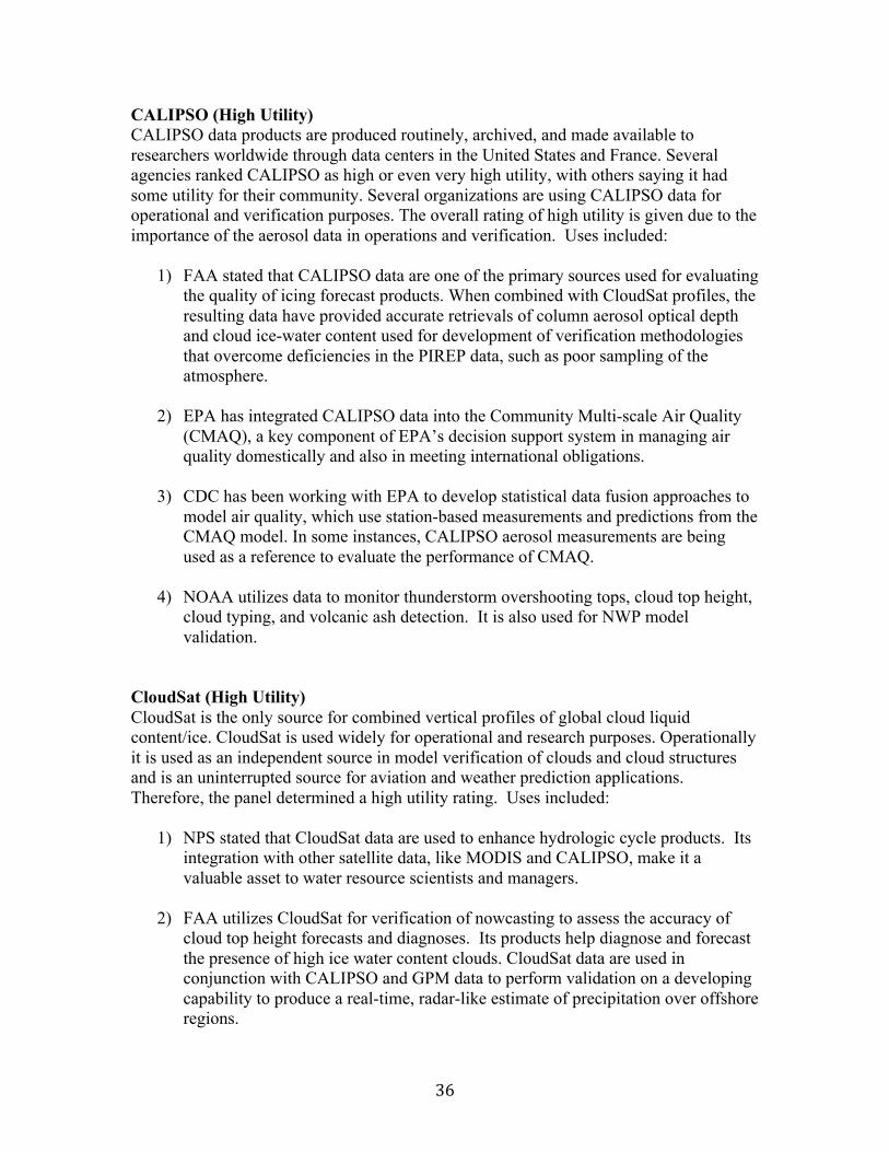
36
CALIPSO (High Utility) CALIPSO data products are produced routinely, archived, and made available to researchers worldwide through data centers in the United States and France. Several agencies ranked CALIPSO as high or even very high utility, with others saying it had some utility for their community. Several organizations are using CALIPSO data for operational and verification purposes. The overall rating of high utility is given due to the importance of the aerosol data in operations and verification. Uses included:
1) FAA stated that CALIPSO data are one of the primary sources used for evaluating the quality of icing forecast products. When combined with CloudSat profiles, the resulting data have provided accurate retrievals of column aerosol optical depth and cloud ice-water content used for development of verification methodologies that overcome deficiencies in the PIREP data, such as poor sampling of the atmosphere.
2) EPA has integrated CALIPSO data into the Community Multi-scale Air Quality (CMAQ), a key component of EPA’s decision support system in managing air quality domestically and also in meeting international obligations.
3) CDC has been working with EPA to develop statistical data fusion approaches to model air quality, which use station-based measurements and predictions from the CMAQ model. In some instances, CALIPSO aerosol measurements are being used as a reference to evaluate the performance of CMAQ.
4) NOAA utilizes data to monitor thunderstorm overshooting tops, cloud top height, cloud typing, and volcanic ash detection. It is also used for NWP model validation.
CloudSat (High Utility) CloudSat is the only source for combined vertical profiles of global cloud liquid content/ice. CloudSat is used widely for operational and research purposes. Operationally it is used as an independent source in model verification of clouds and cloud structures and is an uninterrupted source for aviation and weather prediction applications. Therefore, the panel determined a high utility rating. Uses included:
1) NPS stated that CloudSat data are used to enhance hydrologic cycle products. Its integration with other satellite data, like MODIS and CALIPSO, make it a valuable asset to water resource scientists and managers.
2) FAA utilizes CloudSat for verification of nowcasting to assess the accuracy of cloud top height forecasts and diagnoses. Its products help diagnose and forecast the presence of high ice water content clouds. CloudSat data are used in conjunction with CALIPSO and GPM data to perform validation on a developing capability to produce a real-time, radar-like estimate of precipitation over offshore regions.

37
3) NOAA Earth System Research Laboratory uses CloudSat as one of their primary
data sources for evaluating the quality of aviation icing forecast products. They combine CloudSat data with CALIPSO data and other weather information for development of verification methodologies. The Climate Prediction Center uses CloudSat observations to validate and evaluate the vertical cloud structure in climate forecast models.
QuikSCAT (Some Utility) QuikSCAT was a specialized microwave radar that measured near-surface wind speed and direction under all weather and cloud conditions over Earth's oceans. However, today the instrument only produces wind speed from its non-spinning antenna and average backscatter cross-section to build products for rain, sea ice, sea surface temperatures, and water vapor. Even in this reduced state, QuikSCAT was viewed as having utility by several agencies – mainly for calibration purposes. Uses included:
1) USACE stated that QuikSCAT provides data for annual surface melting in Arctic and Antarctica.
2) NOAA NOS uses it primarily for model validation and verification, especially wind profiles for coastal models. NOAA NWS uses it primarily for calibration with Oceansat-2.
3) USGS uses the data for calibration of shoreline restoration models and studies on historical beach status.
4) NGA uses the data for evaluation of coastal erosion and storm surge.
OCO-2 (High Utility) OCO-2 is a first-of-its-kind mission, monitoring CO2 with enough precision to identify sources and sinks at a regional scale. OCO-2 is also capable of monitoring solar-induced chlorophyll florescence, a measure of early plant stress. OCO-2 currently provides value for a few agencies; however, this mission has the potential to positively impact additional agency programs. The panel anticipated expanded uses to be documented in future National Interest Panels, particularly if the mission improves communication and outreach opportunities with potential end users and organizations. Uses included:
1) USACE is conducting research and developing methodologies that derive multiple geospatial products from OCO-2 to support initiatives related to land use/land cover change, environmental security monitoring, and spatial epidemiology.
2) NGA utilizes the raw and calibrated radiance to provide an increased understanding and accuracy of estimates concerning food, water, and

38
environmental issues. The CO2 products provide trends in urban and industrial areas in support of addressing economic national security issues.
3) USGS aims to use OCO-2 data in a National Water Quality Program study on hydrology and climate change in the interior of Alaska.
DSCOVR (Some Utility) DSCOVR provides a new and unique Earth Observation data set from the L1 vantage point. There are two Earth observation instruments: the EPIC Earth Polychromatic Imaging Camera and the NISTAR NIST Advanced Radiometer. Two agencies currently found utility in observations from EPIC; however, others remarked that their organizations were unaware of the mission and its capabilities, so lack of communication/outreach is an issue. The coarse resolution of the data products may also limit applications. Uses included:
1) The FAA acknowledged EPIC’s potential role in volcanic ash detection and monitoring, which is important for aviation operations.
2) NGA noted that EPIC’s continuous observation of the Earth allows for the examination of influence of bidirectional reflectance factors on intelligence matters; however, the spatial resolution of EPIC limits these to general trends.
ISS-CATS (Some Utility) CATS is primarily a technology demonstration designed to provide vertical profiles of clouds and aerosols that are similar to those provided by CALIPSO. One benefit of CATS is that ISS orbital characteristics enable measurements that are often hours apart from CALIPSO, providing additional data that, when combined with CALIPSO, can provide better temporal and spatial coverage over the tropics and mid-latitudes. Only two agencies acknowledged limited use of CATS at this time, resulting in a rating of some utility. Uses included:
1) The NPS has utilized CATS to enhance current air quality models based on near ground sensing systems currently stationed in parks.
2) NGA noted some value in addressing socio-economic and environmental issues.
The panel felt it would be difficult to substitute CATS data for CALIPSO due to differences in orbital altitude, inclination, and sensor resolution. Also, the panel noted that the data collection period does not provide continuous coverage, which impacts its ability to be integrated into operational production models.

39
SORCE (High Utility) The overall rating for SORCE was high utility. This overall rating reflects the usefulness of SORCE data within agencies’ applications for monitoring solar radiation and climate change. SORCE data products are utilized for space weather forecasting, near-real-time monitoring of solar flare events, and as inputs to climate modeling applications. While many constituencies on the panel do not use SORCE data, the ones which do (NOAA NWS and NOAA NOS) believe it is critical and necessary to continue as it provides a unique data set for understanding solar impact on climate change. NOAA stated that SORCE TIM observations are the most important reason for extending the mission. These observations form a critical component of the long-term total solar irradiance data set. UV and EUV solar energy is a primary variable input for space weather and is critical in the formation and development of upper atmosphere models (above 100 km). The data from SORCE has been, and will continue to be, used in space weather research and model development especially in the thermosphere/ionosphere models. Additionally, SORCE data are critical in maintaining the long-term climate record. TCTE (High Utility) The overall rating for TCTE was high utility. TCTE is a Total Solar Irradiance (TSI) transfer calibration mission based on SORCE, and it was deployed to deal with the SORCE battery issue. It is based on the same software system as SORCE/TIM and consists of all necessary components to generate, manage, and distribute derived data products. This overall ranking reflects the usefulness of TCTE data within agencies’ applications for monitoring solar radiation and climate change. TCTE data products are utilized for space weather forecasting and as inputs to climate modeling applications. While many constituencies on the panel do not use TCTE data, the ones which do (NOAA NWS and NOAA NOS) believe it is critical and necessary to continue, as it provides a unique data set for understanding solar impact on climate change. NOAA stated that TCTE data are essential for comparison of the modeled TSI with other observations and for validation. TSI is a NOAA Reference Environmental Data Record (REDR), formerly known as Climate Data Record (CDR). Continuity of the TSI record from TCTE is critical to NOAA climate science. The panel noted that if this mission is ended, the continuity of the TSI data record would be in jeopardy, and models using this data may not be able to integrate future data products from the TSIS program due to lack of calibration between sensors.

40
APPENDIX 3. COST PANEL REPORT
COST PANEL REPORT Mission Operations and Data Analysis Cost Team Report
May 2017 The 2017 Senior Review cost analysis team was led by Richard Law, NASA Langley Research Center, Earth System Science Pathfinder Program Office. He was assisted by Mark Jacobs, Sherill Platt, and Takenya Roberts. INTRODUCTION
The cost team conducted their analyses from Feb-Apr 2017. The team met with the Science Panel in April 2017 to discuss their analysis method, rating criteria, and areas that require clarifications. The final meeting in May 2017 included presentations from each of the mission project teams including responses to the review panel’s questions. The cost analysis process followed was derived from the approach used to evaluate Announcement of Opportunity proposals, with necessary adjustments to incorporate unique aspects of the Senior Review. This process, represented by the “pyramid” (shown in the Figure 3-1), relies on detailed analysis of many items within each proposal to form the foundation of the analysis. Findings from the proposal cost review and inputs from the full review panel are used to identify risk items, assess viability of risk mitigation plans, and define threats that could lead to cost growth. Given these missions are beyond the end of their primary mission, reserves are generally limited, and operating missions tend to rely on un-costed carryover from the prior year as reserve.
Figure3-1

41
The overall risks, mitigation plans, and cost threats all contribute to the overall cost risk rating. Five categories were used and definitions for each are provided in Figure 3-2. This cost risk rating is based on the proposed costs and plans during the period of performance. As secondary rating, the cost evaluation then looked at project request and compared to the funding target as provided as part of the 2017 Senior Review call letter. This portion of assessment considered prior years, FY 2015 to FY2017, project’s expenditures or cost accruals and compared it to the funding requested value as well as the available uncosted carryover. A green rating is given is the request is consistent with the funding target. Although not used in this review, a “low with blue” rating means the project is requesting for more funding that it really needs. It will otherwise follow a similar rating shown above. HIGH-LEVEL COMPARISONS Comparisons of the proposed funding levels for combined MO&DA, mission operations, and the science team are summarized in Figure 3-3. Most of the projects are near or below primary mission funding levels except CloudSat and SMAP, which are only slightly above 100%. The plot on the right shows the ratio of science team funding to mission operations. Projects with higher mission operations costs (above the dashed line) may be trading science data product efforts to support mission operations to maintain science data collection (with some deferred science analysis).
Figure3-2

42
SUMMARY COST RATINGS The final cost risk ratings are shown in Figure 3-4. Compliance with the budget target is also included noted. Details for each project are provided in the next section of this report.
Fig. 3-3 Mission FY18 costs compared to previous expenditures (left), and ratio of mission to science dollars (right).
Fig. 3-4 Mission extension cost risk assessments for each mission as well as a column that reflects the proposed budget vs. that baselined prior to the proposal.

43
INDIVIDUAL PROJECT COST ANALYSIS SUMMARIES Summary details of the cost analyses for each project are included in this section, which comprises of • Project-specific cost assessment summary. • Findings: Includes significant items that may affect cost performance. These are
based on details from the cost assessments covering various aspects of each proposal. • Evaluation Criteria Assessment: Summarizes lower-level findings regarding selection
criteria derived from the Call for Proposals. • Project Cost/Expenditure History and Request: Shows funding and workforce by
fiscal year for FY 2014 / 2015 through the proposed operating time. Data includes funding guidelines and uncosted carryover.
• Cost Analysis Comparisons: This analysis compares costs to the nominal operations level, MOS vs. Science, and costs by organization.
• In-Kind Support/Funding: This area covers all significant contributions toward each project’s Mission Operations (MO) & Science (DA) requirements.
Additional supporting details covering all cost analysis areas were provided to the panel and are covered in a separate presentation (“2017 Senior Review - Cost Analysis Final Assessment Rating (4.30.17).ppt”).
MISSION SUMMARIES
Aqua Aqua Summary: Aqua received a Cost Risk Rating of Low and was compliant with their budget target. The Aqua project has been performing well, although the HSB, AMSR, AMSU instruments are not operating. Associated risks appear to be within the project’s ability to cover within its available funding before the next Senior Review. Aqua Findings:
• Request meets the mission planning, and it is within the targeted baseline budget • Proposed cost and proposed workforce number are well correlated with each other • Labor rate significantly lower than GPM (similar to Aura) • Funding level for FY23 comparable to FY22, but fuel life likely only into early
2022 • No cost reduction in FY23, although flight system life only expected into Mar'22 • Recommend approval at the requested funding level

44
Aqua Evaluation Criteria Assessment:
Aqua Cost History and Request:
Aqua Cost Analysis Comparisons:
Aqua In-Kind Support/Funding Summary:

45
• AMSR-E from JAXA • MODIS funded via ROSES • MODIS – Terra 16.7 FTE, SDT and Science Team leader • EOS project science office thru ESD Science Office • AIRS – algorithm refinement provided by investigator funded thru ROSES or other
NASA/non-NASA funds. • AIRS Science team member funded thru ROSES
Aura Aura Summary: Aura received a Cost Risk Rating of Medium/Low, driven by TES laser concerns, and was compliant with their budget target. The Aura project has been performing well. Associated risks appear to be within the project’s ability to cover within its available funding before the next Senior Review. Aura Findings: • Request meets the mission planning, and it is within its targeted budget • Cost estimate and workforce numbers are well correlated to each other as well as to
other similar operating missions • FTE labor rate is somewhat low, significantly lower than GPM (similar to Aqua), and
appears to have gone down and # of FTEs increased in FY 18/19. • Request appears reasonable, consistent with historical expenditure and about the same
funding level as similar/like operating missions, Terra and Aqua • Recommend approval at the requested funding level
Aura Evaluation Criteria Assessment:

46
Aura Cost History and Request:
Aura Cost Analysis Comparisons:
Aura In-Kind Support/Funding Summary: • OMI and TES SIPS for processing all US OMI and KNMI data products • ROSES funding for all US developed products except TOMS heritage products • OMI flight operations, L1B algorithm maintenance, monitoring is being provided by
KNMI and FMI
CALIPSO CALIPSO Summary: CALIPSO received a Cost Risk Rating of Low but is above their budget target to allow 3 years of extended operations. The CALIPSO primary laser has been non-operational (since Feb '09) and the backup laser has a pressure leak. Expected life is within 6mo, but the team is planning to attempt restart of primary laser. Associated risks appear to be within the project’s ability to cover within its available funding before the next Senior Review. CALIPSO Findings: • Request meets the mission planning, and it is within its targeted budget

47
• Cost estimate and workforce numbers are well correlated to each other as well as to other similar operating missions
• FTE labor rates appear reasonable • With only 6mo until primary laser restart attempt, the need for full funding through
FY23 is very uncertain • FY18/19 budgets are lower than what was shown for 2015 Sr Rev • EOM (FY22/23) request seems high compared to nominal ops (activities during this
period not well defined) • Recommend approval at the requested funding level
CALIPSO Evaluation Criteria Assessment:
CALIPSO Cost History and Request:

48
CALIPSO Cost Analysis Comparisons:
CALIPSO In-Kind Support/Funding Summary: • ROSES • CNES (S/C, IIR, Ops, Data)
CATS CATS Summary: CATS received a Cost Risk Rating of Low and was compliant with their budget target. The CATS project has been performing well. Associated risks appear to be within the project’s ability to cover within its available funding before the next Senior Review. CATS Findings: • Request meets the mission planning, and it is within its targeted budget • FTE labor rate is extremely low (lower than all other submittals except OCO-2) • Request appears reasonable • Recommend approval at the requested funding level

49
CATS Evaluation Criteria Assessment:
CATS Cost History and Request:
CATS Cost Analysis Comparisons:

50
CATS In-Kind Support/Funding Summary: ISS for s/c and GDS
CloudSat CloudSat Summary: CloudSat received a Cost Risk Rating of Low but over their budget target to accommodate extension through FY23. The CloudSat project has been performing well. Associated risks appear to be within the project’s ability to cover within its available funding before the next Senior Review. CloudSat Findings: • Request meets the mission planning • The request is above the budget target to allow for extension through FY23, when
Cloudsat proposes to return to the A-Train following CALIPSO’s expected decommissioning
• Cost estimate and workforce numbers are well correlated to each other as well as to other similar operating missions
• FTE labor rate appears very low • Recommend approval at the requested funding level
CloudSat Evaluation Criteria Assessment:

51
CloudSat Cost History and Request:
CloudSat Cost Analysis Comparisons:
CloudSat In-Kind Support/Funding Summary: • ROSES • GPM
DSCOVR

52
DSCOVR Summary: DSCOVR received a Cost Risk Rating of Low but above their budget target to extend ops to FY23. The DSCOVR project has been performing well. Associated risks appear to be within the project’s ability to cover within its available funding before the next Senior Review. DSCOVR Findings: • Request meets the mission planning but above its budget target • Cost estimate and workforce numbers are well correlated to each other as well as to
other similar operating missions • FTE labor rate is higher than for Aura/Aqua/Terra • Request appears reasonable • Recommend approval at the requested funding level DSCOVR Evaluation Criteria Assessment:
DSCOVR Cost History and Request:
DSCOVR Cost Analysis Comparisons:

53
DSCOVR In-Kind Support/Funding Summary: • ROSES • NOAA for S/C, MOC, & Ground System
GPM GPM Summary: GPM received a Cost Risk Rating of Low and was compliant with their budget target. The GPM project has been performing well. The only failure has been 1 of 5 GMI MR temperature sensors. Associated risks appear to be within the project’s ability to cover within its available funding before the next Senior Review. GPM Findings: • Request meets the mission planning, and it is within its targeted budget • Cost estimate and workforce numbers are well correlated to each other as well as to
other similar operating missions • FTE labor rate is higher than for Aura/Aqua/Terra • Request appears reasonable • Recommend approval at the requested funding level GPM Evaluation Criteria Assessment:

54
GPM Cost History and Request:
GPM Cost Analysis Comparisons:
GPM In-Kind Support/Funding Summary:

55
• ROSES funding for all US developed products • JAXA for DPR
OCO-2 OCO-2 Summary: OCO-2 received a Cost Risk Rating of Low but over their budget target to accommodate improvements for data product/algorithms. The OCO-2 project has been performing well. Associated risks appear to be within the project’s ability to cover within its available funding before the next Senior Review. OCO-2 Findings: • Request meets the mission planning, and it is within its targeted budget • Cost estimate and workforce numbers are well correlated to each other as well as to
other similar operating missions • FTE labor rate appears very low • Over-guide request is $1M/yr (FY18-20) for procurements that are not clearly
described • Recommend approval at the requested funding level
OCO-2 Evaluation Criteria Assessment:
OCO-2 Cost History and Request:

56
OCO-2 Cost Analysis Comparisons:
OCO-2 In-Kind Support/Funding Summary: • ROSES • TCCON
QuikSCAT QuikSCAT Summary: QuikSCAT received a Cost Risk Rating of Low but over their budget target. The QuikSCAT SeaWinds instrument suffered an antenna spin mechanism failure (Nov ’09) and the s/c has experience power subsystem issues. Associated risks appear to be within the project’s ability to cover within its available funding before the next Senior Review. QuikSCAT Findings: • Request meets the mission planning, and it is over the budget target • Two cost estimates were provided, one for one-year extension and one for two-year
extension. • Cost estimate and workforce numbers are well correlated to each other as well as to
other similar operating missions

57
• FTE labor rate is high • Recommend approval at the requested funding level
QuikSCAT Evaluation Criteria Assessment:
QuikSCAT Cost History and Request:
QuikSCAT Cost Analysis Comparisons:

58
QuikSCAT In-Kind Support/Funding Summary: • none
SMAP SMAP Summary: SMAP received a Cost Risk Rating of Low and was compliant with their budget target. The SMAP SAR failed in July 2015, but the RAD instrument is operating. Associated risks appear to be within the project’s ability to cover within its available funding before the next Senior Review. SMAP Findings: • Request meets the mission planning, and it is within its targeted budget • Cost estimate and workforce numbers are well correlated to each other as well as to
other similar operating missions • FTE labor rate is somewhat low (comparable to Aura/Aqua) • Recommend approval at the requested funding level SMAP Evaluation Criteria Assessment:

59
SMAP Cost History and Request:
SMAP Cost Analysis Comparisons:
SMAP In-Kind Support/Funding Summary:

60
• ROSES • Sentinel 1 (ESA)
SORCE SORCE Summary: SORCE received a Cost Risk Rating of Low, but over their budget target to accommodate a 12 month overlap with TSIS-1. Battery degradation has led to implementing ‘Daylight Only Ops’. Associated risks appear to be within the project’s ability to cover within its available funding before the next Senior Review. SORCE Findings: • Request meets the mission planning • The request is above the budget target to allow for a 12 month overlap with TSIS-1 • FTE labor rate appears high relative to other submittals • TSI ops planned through Dec'18 but FY19/20 request not significantly less than FY18 • MOS has significant funding in FY20/21 but ops looks like it is finished by FY19 • ISS-TSIS launch delay requires additional ops for 12mo overlap w/ TSIS-1 • Request appears reasonable • Recommend approval at the requested funding level
SORCE Evaluation Criteria Assessment:
SORCE Cost History and Request:

61
SORCE Cost Analysis Comparisons:
SORCE In-Kind Support/Funding Summary: • Minor support from ROSES (not for routine products)
Terra Terra Summary: Terra received a Cost Risk Rating of Low but was over their budget target due to issues with MISR. The Terra project has been performing well. Associated risks appear to be within the project’s ability to cover within its available funding before the next Senior Review. Terra Findings: • Request meets the mission planning but above budget target • The request is above the budget target to accommodate MISR algorithm
modifications • Proposed cost and workforce number correlate pretty well with each other as well as
to other operating missions • Labor rates are somewhat low (comparable to Aura/Aqua) • Recommend approval at the requested funding level Terra Evaluation Criteria Assessment:

62
Terra Cost History and Request:
Terra Cost Analysis Comparisons:

63
Terra In-Kind Support/Funding Summary: • Processing at SIPS and DAACs - part of ES Data System Program’s Multi-Mission
Operations o LP DAAC for ASTER o MODAPSLANCE, and ODPS for MODIS o LaRC Atmospheric Science Center DAAC for CERES and MISR o NCAR SIP for MOPITT
• CERES DA • Cost sharing between Aqua and Terra for MODIS and CERES processing facilities
TSIS-TCTE TSIS-TCTE Summary: TSIS-TCTE received a Cost Risk Rating of Low, but over their budget target to accommodate a 12 month overlap with TSIS-1. The TSIS instrument is operating nominally. Associated risks appear to be within the project’s ability to cover within its available funding before the next Senior Review. TSIS-TCTE Findings: • Request meets the mission planning • The request is above the budget target to allow for a 12 month overlap with TSIS-1 • FTE labor rate appears high relative to other submittals • TSI ops planned through Dec'18 but FY19/20 request not significantly less than FY18 • MOS has significant funding in FY20/21 but ops looks like it is finished by FY19 • ISS-TSIS launch delay requires additional ops for 12mo overlap w/ TSIS-1 • Request appears reasonable • Recommend approval at the requested funding level
TSIS-TCTE Evaluation Criteria Assessment:

64
TSIS-TCTE Cost History and Request:
TSIS-TCTE Cost Analysis Comparisons:
TSIS-TCTE In-Kind Support/Funding Summary: AF for STPSat-3 Minor support from ROSES (not for routine products)

65
APPENDIX 4. DETAILED SCIENCE PANEL MISSION REVIEWS Mission: Aqua Recommendation: Continuation of projects as currently baselined Aqua is nine years beyond its design life and four sensors (MODIS, AIRS, CERES, and AMSU) continue to operate well and should continue to meet science data objectives through the extended mission. Collectively these sensors provide high quality and diverse data products covering Earth’s oceans, land, ice and atmosphere. The core focus areas include Carbon Cycle and Ecosystems, Water and Energy Cycle, Atmospheric Composition, Weather, Climate Variability and Change, and Earth Surface and Interior. This mission has a large and interdisciplinary user community that requests prodigious amounts of data and is publishing an impressive number of important scientific papers addressing NASA science goals/questions relevant to all Earth Science focus areas. File distributions, numbers of users of the data, and publications per year are at or near peak levels. The mission has many diverse and societally important applied uses as well. These applications users have come to depend upon Aqua data for day-to-day operational and important decision-making uses and the societal impacts of terminating the data stream, especially for those products with no other data sources, would be enormous. Additional time to seamlessly transition those products that can be continued with VIIRS and other new sensors will be extremely beneficial in minimizing impacts to applications users. The Aqua time series of observations becomes increasingly valuable as the length of the dataset is extended – detecting any new climate change signals (e.g., separating episodic fluctuations from secular trends) and understanding slower environmental processes will be greatly enabled by a longer time series of consistent, high-quality measurements. The spacecraft bus is in excellent shape and has adequate fuel at least until 2022, and the Aqua battery and Solar Array both appear capable of operating nominally for at least several years beyond that. Twenty-six three page proposals for continued algorithm maintenance work (referred to hereafter as mini-proposals) were presented in Appendix F to begin a transition of the Aqua science algorithms/data products traditionally competed in ROSES program elements to the NASA Earth Science Senior Review. Each and every one of these mini-proposals provides a work plan for algorithm maintenance activities that adequately justifies continued support of the algorithms/data products at roughly the level of funding requested. The mini-proposals focus on critical activities essential to the maintenance of data product quality and a seamless time series, and extending this work will be essential to the continued success of the Aqua mission. All of the impressive scientific accomplishments and several of the project-related achievements reported for Aqua derive directly from the past algorithm development and maintenance work, and related contributions, of the team

66
of researchers that submitted these mini-proposals. Continued support of these algorithms and standard data products for the next 3 years is recommended. Scientific merits: Excellent Strengths Continuing the Aqua time series data provides cross-calibration capabilities with newer sensors such as Suomi NPP that enables consistent long-term time series. Such long-term data records can be used to address a variety of interdisciplinary science questions such as:
• How and why are clouds changing with climate? Conversely, how do clouds affect climate change (cloud-climate feedback)?
• What processes drive change in ecosystem structure and biodiversity and how do changes in earth’s oceanic and terrestrial ecosystems inform improved management practices, predictions of change, and stewardship?
• How can knowledge of the frequency, duration and extent of extreme weather, transient hazards and natural disasters improve forecasting and mitigation?
• How and why are polar temperatures changing with climate? • How are the diversity, function, and geographical distribution of habitats changing? • How do elements such as carbon transition between the atmosphere, ocean, and
land? This subset and the many other questions cannot be addressed without continuation of calibrated high resolution datasets that Aqua will extend. The huge volume of papers reporting many science advancements from a wide variety of disciplines, as well as the high usage of data products by operational agencies from military/intelligence applications to agencies that forecast weather and assess food security clearly indicate the valuable nature of this mission. Weaknesses None. Core mission data product quality and maturity: Excellent The Aqua mission has demonstrated a very high level of precision in measurement of the primary long-term measurements made by the mission. These highly calibrated climate quality measurements of radiance, reflectance, and backscatter have been used to cross-calibrate past and present sensors launched by NASA, as well as a variety of sensors launched from other agencies and the international community. The fifteen years of Aqua data have provided critical Earth observation capabilities that become even more valuable by extending the mission. Global satellite data products are extremely challenging to validate within the spatial and temporal limits of available ground-truth data. Hence, estimating uncertainties via independent measurements in a systematic and statistically robust way may not be possible with global data products. The Aqua proposal, significantly augmented by the mini-

67
proposals in Appendix F, demonstrates strong and continuous attention to satellite data calibration and data product quality monitoring, evaluation, and validation. As a group, the mini-proposals made an extremely compelling case for the overriding importance of ongoing monitoring of algorithm performance and data product quality assessment. While the methods for doing so may be mature, the need to continue and to improve them is absolutely necessitated by challenges that arise with satellite measurements from new calibrations as the sensors age. Moreover, algorithms need to be maintained as the science communities mature and validation information arises from new data collections and synergies with other satellite measurements. Some degradation of channels in the MODIS short wave visible bands is observed by the Ocean Biology Processing Group (OBPG) that require extra corrections moving into the extended mission for ocean applications. The impact on other data products is believed to be negligible, but this artifact should be communicated more prominently to the broad community of external science users. Moreover, because of the differences between ESMO and OBPG calibration approaches, it is recommended that the OBPG be included in future senior panel reviews to be able to directly address questions and uncertainties on the mission. Relevance to NASA Science Goals: Excellent The scientific accomplishments and research productivity from Aqua are very impressive. The numbers presented regarding distribution statistics, numbers of users, and publications indicate this mission has succeeded, and continues to succeed (looking at only the past 2-3 years). Goals and science questions highly pertinent to all NASA focus areas have been and are being addressed by this mission – and nowhere within the NASA Earth science portfolio is work in support of NASA’s objective of providing high-quality, sustained measurements more prominent than in the EOS program, with Aqua making a major contribution. Weaknesses None. Technical and Cost The panel concurs with the cost and technical subpanels in terms of a low-cost risk rating and low technical risk rating. The spacecraft bus is in excellent shape and has adequate fuel at least until 2022, and the Aqua battery and Solar Array both appear capable of operating nominally for at least several years beyond that. Regular audits of IT security discussed by the mission team provide confidence that there are low IT security risks to the mission. National Needs

68
The subpanel form indicates that this is a highly valuable mission for diverse agencies and the data are routinely used to advance national interests. The panel concurs with National Interests subpanel’s findings. Evaluation of Algorithm Mini-proposals (for both Terra and Aqua combined) Each mini-proposal provides a work plan for algorithm maintenance activities that adequately justifies continued support of the algorithm(s)/data product(s) at roughly the level of funding requested. The mini-proposals focus on critical activities essential to the maintenance of data product quality and a seamless time series, and extending this work will be essential to the continued success of the Terra and Aqua missions. All of the impressive scientific accomplishments and several of the project-related achievements reported in the core Terra and Aqua proposals derive directly from the past algorithm maintenance work, and related contributions, of the team of researchers that submitted these mini-proposals. Together, the algorithm maintenance work plans offer to:
• Continue working closely with Terra and/or Aqua project personnel to monitor, maintain, and improve sensor calibration, keeping up with changes in sensor performance as it ages and degrades
• Continue to monitor algorithm performance and data product quality in terms of changes in sensor performance, input and upstream data products, and the data production system
• Refine algorithms (minor improvements) in response to changes in sensor performance, input and upstream data products, and the data production system and in response to any new knowledge of problems/issues discovered in the data products through interactions with the community or through new validation information
• Make minor improvements to data quality analysis tools and discipline/product Web sites and services to more efficiently conduct algorithm/data product assessment work, reduce support effort within the Terra and/or Aqua projects, and better meet user community needs (only a few mini-proposals offer this type of work as minor elements of their overall effort)
• Continue existing, ongoing field data collection (in situ, land and ocean) and laboratory analyses for calibration, validation, and/or ongoing product evaluation (only a few mini-proposals offer this essential work)
• Interact with the user community directly and/or indirectly through the data archive (DAAC) to answer questions, provide guidance on data product use, and communicate information regarding the nature, quality, and any issues/limitations of the data products
As a group, the mini-proposals made an extremely compelling case for the overriding importance of ongoing monitoring of algorithm performance and data product quality assessment. The need to continue and to improve the algorithms is absolutely necessitated by changes and problems that arise with satellite measurements from aging and degrading sensors. So this work often must become more intensive and rigorous as the mission ages!

69
This underscores the importance of continuing existing calibration work and field data collection for data product evaluation and validation. Each mini-proposal adequately justified continued support of their algorithm(s)/data product(s) at roughly the level of funding requested. The proposals and additional materials presented during the subcommittee meeting were sufficient to evaluate the scientific value and relevance of the data product(s), the work plans for the next 3 years, and the overall merits of continuing to support the algorithm maintenance work. Continued support of these algorithms and standard data products for the next 3 years is recommended.
Mission: Aura Recommendation: Continuation of MLS and OMI measurements with reduction. The panel finds that Aura will still be a high priority mission with only MLS and OMI. TES has been severely compromised by both the FTS mirror stalls (currently stalled for 56 days) and determination of mirror motion via laser A which ceased operation in 2007 and has been recently resurrected to replace laser B which ceased operation in December 2016. Laser A is currently operating at 10% power. If laser A dies a second time, success of the SIMCLK method of retrieving interferometer control is at best moderate. Clearly the TES observational duty rate has been low since shifting to special operations mode in 2011. Additionally, from the oral presentation to the panel, there has been limited scientific usage of TES data in special operations mode with only 6 research papers published with data collected since 2011. The National Interests panel rates TES observations as high (NOAA, EPA, NGA, USGS and NPS). After due consideration, the panel recommends termination of TES data acquisition. The Aura proposal to the Senior Review panel was excellent as was the oral response to the panel questions. Aura is in its 13th year of operation and was launched in July 2004 as part of the A-Train. Aura provides comprehensive observations that are central to understanding core NASA research objectives, including responses of the ozone layer, air quality, and radiation balance to changes in atmospheric composition. The suite of measurements includes profiles and columns of stratospheric and tropospheric trace gases, esp. ozone, as well as climate-relevant parameters such as cloud properties, aerosols, water vapor, and N2O. Aura data continue to have high value for scientific research, applied sciences, societal benefit, and national interests as evidenced by a strong publication record, increasing downloads from data centers, and emergence of recent new applications for Aura data, esp. as regards air pollution and human health, a rapidly evolving field of study. Three instruments are currently operational on Aura: Microwave Limb Sounder (MLS) measures daily global profiles, from the upper troposphere to mesosphere, of a large number of trace gases and other properties such as water vapor. The Ozone Monitoring Instrument (OMI) measures ozone and other atmospheric constituents for tropospheric chemistry, air quality, stratospheric chemistry and climate. The Tropospheric Emission Spectrometer (TES) measures vertical profiles of ozone and a broad suite of species relevant to atmospheric chemistry over megacities, E. China, and W. US. The science capability of Aura has been steady and productive since the 2015 Senior Review. However, TES ceased global measurements in 2011 and has been running in reduced

70
special observation mode mainly focused on megacities and specie sampling over E. China and W. US. The problems with the TES spectrometer have magnified significantly since the 2015 SR with laser B dead and laser A only operating at less than 10% power making determination of the interferogram/spectrum difficult. These problems have severely reduced the measurement capabilities of TES. OMI experienced observational problems caused by a spacecraft anomaly that reduced data collection quantity, but not data quality, since 2008, and there has been little change since the 2015 SR. There is a slow degradation in number of detector dead pixels (as expected), but the detector will certainly operate well into the future. Temperature problems with the OMI optical bench will slowly increase detector noise. MLS continues mature observations with only small losses since launch. The Aura project makes a convincing argument that OMI observations are of superior quality to NPP OMPS with regards to footprint size and especially measurement of NO2 and that the continuation of near/uv solar spectral irradiance by OMI cannot be done by OMPS. Additionally, a solid case is made for continuing the mission to overlap with TROPOMI (now scheduled for launch in September 2017) for cross calibration of data products. Statement of benefits in continuing the mission: There is now a long and productive data set from Aura showing global and national trends that are extremely valuable and useful from air quality, modeling, and composition perspectives and from the lower troposphere to mesosphere. The air quality data have played a key role in understanding trends in tropospheric air pollution and mitigation assessments. Aura has developed significant operational partners and has supported a number of field campaigns since the last review. New and improved data products are proposed for this next extension period. There is an excellent chance of extending measurements beyond the current cycle for MLS and OMI. Benefits to an extended Aura mission for quantification of the atmospheric composition response to human and natural phenomena: • extending the unique 13-year record of tropospheric/stratospheric/mesospheric
composition, trends, and variability, especially for ozone recovery in polar zones, to assess impact on society and climate;
• continuing to measure and monitor rapidly changing air quality globally and regionally to determine the effectiveness of air quality regulation, assess pollutant effects on human health, and understand the effects of long-range transport of pollution, esp. from SE Asia. Noteworthy are trend studies using OMI NO2 and SO2, and their combined use with the other A-train data (such as aerosol optical depth) toward decadal assessment of aerosol emission (including the emission of aerosol precursors);
• New proposed capabilities over the next two years toward incorporating OMI SO2 and NO2 observations in development of new emissions inventories to be tested in a data simulation framework;
• Develop Aura and multi-satellite based products for surface air quality and surface UV irradiance with useful capability which will lay the foundation for near real time air quality index and UV index from upcoming geo satellites such as TEMPO;
• Examine the impacts of unusual events (El Nino, volcanic, etc); • Extending the use of Aura data in evaluation of global and regional chemistry and

71
climate models; • Extending the data record to overlap Suomi NPP, TROPOMI, and SAGE-III data
collection; • Continue to support ground based field campaigns; • Support new data end-users such as through participation in NASA Health and Air
Quality Applied Sciences Team; • Delivering operational products including aviation safety, volcano activity, ozone
assimilation at NOAA for weather and UV forecasting, and aerosol index and NO2 and SO2 products for air quality forecasting;
• Extending and reducing uncertainties in the valuable solar spectral irradiance observations in the near UV and visible spectral ranges into a period that overlaps SORCE SIM/SOLSTICE, TCTE, and TSIS.
Scientific merit: EXCELLENT STRENGTHS: The accomplishments over the past 2 years are very impressive. The proposal highlights four notable high impact contributions in the areas of 1) long term global air quality trends and transport, 2) human health effects through the use of OMI O3 to assess health impacts of UV exposure, OMI NO2 for pollution exposure, and OMI HCHO for cancer risks; 3) improved understanding of tropospheric ozone changes through better constraints on the relative roles of stratosphere-troposphere-exchange versus changing anthropogenic and biomass burning emissions of NOx; 4) observations of the anomalous quasi-biennial oscillation in 2016. Since the last senior review:
• Continued the long-term ozone data record from the TOMS-type instruments including polar ozone and affects on stratospheric composition, variability and trends. The MLS specie data in the stratosphere is unique following loss of ESA Envisat in 2012;
• Measurements of tropospheric air pollution have been significant (track plumes, estimate emissions, monitor pollutant levels) and include well-documented national and global trends in air quality over a 12-year period. These measurements have proved effective in documenting the effects of regulation on species such as SO2 and NO2;
• Use of Aura data by the human health community has grown dramatically. This application will become of increased importance in the next few years;
• Large number of new and improved Aura products have been developed and these have resulted in new science and applications, including the detailed mapping of SO2 and NOx sources (OMI), OMI column of water vapor and glyoxyl, as well as optical depth of absorbing aerosols over clouds;
• Use of Aura data to evaluate atmospheric chemistry, climate, and air quality models and improve the processes and emissions in these models;
• Long-range transport of pollution from E. China was shown to have offset 43% of the decrease in mid-troposphere ozone over W. US;
• Data assimilation of MLS and OMI observations is a very powerful tool in

72
constructing long-term records of the variability of total O3 column and O3 profiles, which in turn can improve simulations of dynamics in the stratosphere and mesosphere.
• Extend observations of short and long term solar variability overlapping with SORCE/TCTE; data of such quality was not anticipated in the original Aura proposal, but through diligent work has produced a very important independent data set;
• Unique 13-year record of stratospheric and tropospheric composition, variability, and trends;
• Use of Aura data for chemical data assimilation and inverse modeling; • Major list of new and improved data products/data applications since the 2015 SR; • 2300 peer reviewed publications, 700 since the 2015 SR; • Large number of outside users; • Increasing downloads from data centers; • Comprehensive set of objectives for the period until the next SR – e.g. human health
and air quality; • Number of near real-time/operational data products; • Algorithm development:
o emission sources missing from inventories quantified by OMI; o MLS v4 brought marked improvements in MLS upper troposphere/lower
stratosphere measurements in cloudy regions with deep convection at low latitudes.
Instruments:
• MLS o Only somewhat compromised since launch and no changes and no
anomalies resulting in lost days of operation since the 2015 SR; o Ozone data record showing decadal stability within a few percent in
stratosphere and mesosphere allowing detection of small trends; o Reliable daily global observations of upper troposphere, stratosphere, and
mesosphere water vapor; o Recent studies enabled by the long-term MLS data record have revised
understanding of the mechanism by which the QBO affects polar ozone destruction;
o Unique and highly reliable water vapor record from upper troposphere to mesosphere;
o The high-quality MLS observations in the stratosphere and upper troposphere continue to yield new insights in processes controlling variations of stratospheric H2O as well as documenting trends in stratospheric chlorine, O3, and temperature over the Aura period;
o Quantified systematic error budget for V4 products o Since launch MLS has been the main contributor of HCL to GOZCARDS;
• OMI o No significant changes since 2015 SR; two transient anomalies in 2016 with
loss of 2 weeks of data; o V9 ozone product; tropospheric ozone data product very useful;

73
o Major science activity for urban air pollution chemistry, esp. ozone, pollution plumes, and specie trends since launch. The specie trends show global and regional trends in air pollution that are critical to understand air pollution regulation and mitigation;
o Observations continue to be used in regional air quality modeling and forecasting;
o Major support for various field campaigns (e.g. CINDI, DISCOVER AQ); o Number of operational users of OMI data (e.g. volcanic SO2 plume tracking
for aircraft); o Vastly improved NO2 algorithm implemented; o Delivery of OMI-MODIS aerosol collection product; o Delivery of OMI-GEOS5 collocated product for modelers; o Merged satellite based SO2 emission inventory for volcanic eruptions an
degassing; o Improved retrieval of aerosol optical depth and single scattering albedo,
including new product of absorbing aerosol optical depth above the cloud; o New spatially and temporally collocated data between OMI and MODIS; o Trending solar spectral irradiance measurements in the near UV/visible of
excellent quality; o “minor” constituent retrievals (e.g. HCHO) have improved significantly
since the last SR with realistic error bars; o Suomi NPP data evaluation;
• TES o Retrievals of both OMI/TES radiances provide enhanced sensitivity to
ozone near surface; o V007 data product to account for changes in instrumental characteristics; o Better understanding of greenhouse gases; o TES has provided special observations of ozone and critical other species
in megacities and pollution trends over E. China and W. US. showing rapidly changing regional chemical composition and megacity air quality;
WEAKNESSES:
• TES ICS stalled for past 55 days (as of May 11, 2017); • TES data collection has been severely compromised by periodic loss of
interferometric control of the FTS moving mirror, so retrieval of data has been difficult;
• Methods for retrieving TES data with these control problems are in progress, but with only “moderate” (~50%) expectation of success and are extremely difficult
o Use of the s/c clock and a mirror velocity profile to determine mirror movement (SIMCLK) has ~50% chance of success and assumes that the mirror velocity profile does not change;
o Technical Subpanel states “from the perspective that the laser A is more than 3 times past its expected lifetime, has experienced failure under nominal operating conditions and has been revived only through high pump diode drive, it is unlikely that it will continue to provide adequate output power to support the multi-year extended mission;”

74
• Over the last 6 years, TES has continued to collect data limited in space, however the usage of these observations by the scientific community is quite limited, with only 6 papers published using data collected since 2011;
• In 2007 OMI lost about ~40% of its 2600km swath due to a s/c anomaly, but data quality was unaffected and observations of all species continue to date in global mode on about a 50% duty cycle forcing global coverage to a several day cycle;
• The CCD detector on OMI continues to degrade in number of useable pixels; • Thermal stability of the OMI optical bench will result in noisier CCD pixels into
the extended operations period. CURRENT SCIENCE OBJECTIVES The Aura project proposes to:
• Extend observations to further capture atmospheric composition response to changes in human and natural emissions and dynamic variability in order to assess their impact on climate and society. Track pollutant plumes, estimate emissions, and monitor pollutant levels;
• Expand the use of Aura data by the human health community; • Expand science use of “minor” specie measurements (e.g. HCHO) for atmospheric
chemistry; • Further integrate an understanding of tropospheric ozone changes. Long range
transport of pollution from China, combination of AURA measurements to enable data assimilation;
• Advance and expand the suite of Aura data products to enable new science and applications including improvements to existing data products;
• Support climate and chemistry model validation; • Provide up to date emissions estimates (e.g. SO2, NO2 and aerosol emissions; • Complex heterogeneity of anthropogenic emission changes
o Continued observations of emission variations essential to understanding changes in atmospheric composition;
o Use of Aura data for the applied sciences, including especially air quality and human health;
• Polar ozone o Ozone hole monitoring; o Impact of chemical ozone loss of year-to-year variations in stratospheric
temperature and planetary wave driving; o QBO-induced interannual variability – chlorine and ozone destruction;
• Stratospheric circulation and couplings to climate and tropospheric composition (MLS);
• Extend the current high quality solar spectral irradiance (OMI); • Algorithm improvements
o MLS: v5 dataset and new level 3 data products; o OMI: v9 TOMS-like total ozone, raman cloud product stray light
mitigation, collocated meteorological data for each OMI footprint; o TES: 3 new data products (acetone, hydrogen cyanide, ethylene);
incorporation of new RT algorithms to improve speed; validation of new v7

75
products; development, test, and deployment of SIMCLK for interferometer control;
• Synergistic applications o TES/MLS joint ozone; o TES/OMI ozone; o OMI/AIRS ozone; o AIRS HDO; o TES/AIRS/SCIAMACHY/GOSAT methane; o TROPOMI, NPP/JPSS, SAGE III o OMI NO2 relationships with OCO-2 CO2;
• New field mission support; Science Merit Summary The 13-year data record of Aura clearly needs to be extended. The data record is of excellent quality and, with the exception of TES, continues with little impediment since the 2015 SR. The science from Aura has been outstanding and is extensively used in the scientific community with 700 new publications since the 2015 SR. Since the 2015 SR, significant progress has been made in understanding air quality and human health with Aura data widely used by the air quality community to track pollutants, estimate emissions and monitor pollutant levels; human health and air pollution levels will be a major science theme for the years ahead. Minor constituents measured will provide new tests for atmospheric models and in the troposphere provide new information concerning air pollution and health outcomes. Long-range transport effects will be measured effectively by Aura. The MLS data record will allow continued exceptional work on water vapor and other constituents in the UT, stratosphere, and mesosphere. Value of data record and overall data continuity: The Aura data record of tropospheric, stratospheric and mesospheric composition is unique in its longevity and high quality and continuity. In particular, the MLS ozone data product is of exceptional quality and provides definitive detection of small trends. MLS additionally provides the most reliable daily global observations of upper tropospheric, stratospheric, and mesospheric water vapor. MLS measurements are unique following loss of the ESA Envisat in 2012. OMI provides a long term data record of ozone column for tracking polar ozone and pollutant ozone trends as well as a unique data set for air pollutants such as NO2 and aerosols to measure trends and reactions of the atmosphere to mitigation strategies. These measurements are of increasing value to the human health community in interpreting the effect of air pollution on health. TES provides unique measurements of megacities and E. China and W. US transport. The Aura data set has been used extensively for atmospheric model evaluation. Continuation of MLS and OMI measurements are viewed as essential. Core mission data product quality and maturity: EXCELLENT Aura core mission products are well established, mature, and well validated, and continue to improve. Use of these long-term data products by the scientific community is well documented by the 2300 papers published using Aura data, 700 of those since the 2015

76
SR. Although algorithm improvement continues, the algorithms are robust and comprehensive. The science team has been very active in continuing to improve the quality of existing products, and generating new products. With algorithm tune-up, the quality of the data products, already at a high level, is improving (e.g. OMI minor specie measurements, MLS v5, TES v6 tune-up). MLS data products remain at high quality, much as at the 2015 SR review, with daily observations for all species except OH and HCl and with only minor degradation of a small subset of products (N2O, OH, HCl).; OMI data product quality remains high, but with somewhat decreased detector performance, temperature problems on the optical bench which affect noise, and reduced swath coverage due to row anomaly affecting global survey timing; these changes are well understood and have not affected data quality. TES observational coverage is much reduced with less data collected and now covering only megacities and E. China and W. US, but data quality for those areas remains high. The severity of TES spectrometer problems is sufficiently high that continued operation may not be recommended. New data products are planned for all instruments. MLS: new level 3 data products 3-D gridded with zonal mean fields, OMI: TOMS-like total ozone focus on extended validation and v9 documentation, Raman cloud algorithm updates, collocated met data; TES: 3 new trace products. Aura will participate in various new field campaigns: StratoClim (MLS), FIREX/FIREchem (TES), ACT-America (TES), ORACLES (TES). Non-A-Train mission collaborations include TROPOMI (OMI), NPP (OMI/TES), and SAGE-III. A-Train collaborations include TES/MLS joint tropospheric ozone product, TES/OMI lower troposphere ozone, OMI/AIRS ozone from multispectral analysis to fill in the global surveys, AIRS HDO retrievals will use the TES retrieval algorithm to produce HDO along the TES global survey, TES/AIRS/SCHIAMACHY/GOSAT methane to calculate a 12-year record of lower tropospheric and free troposphere/stratospheric using the TES algorithm, and OMI NO2 synergies with OCO-2 CO2 will explore utility of OMI NO2 data to aid interpretation of OCO-2 CO2 as both gases are emitted from anthropogenic sources. The budgets for GSFC and JPL appear reasonable for continuation of core data product production. Relevance to NASA Science Goals: EXCELLENT Strengths - Aura mission directly addresses the first research objective in the Earth science discussion in the NASA 2014 Science Plan: advance the understanding of changes in the Earth’s radiation balance, air quality, and the ozone layer that result from changes in atmospheric composition. • measurements of the size and depth of the polar ozone hole; • understanding complex heterogeneity of human emissions changes; • understanding the radiative forcing and the cloud microphysical effect of aerosols,
especially absorbing aerosols; • atmospheric constituent measurements are transformative for
o air quality/pollution trends and mitigation strategies to inform mitigation strategies and demonstrate efficacy of emission control efforts;
o validating atmospheric chemistry and climate models;

77
o megacity pollutant trends; o applied science such as NASA Health and AQ Applied Sciences Team
(HAQAST); • unique MLS measurements of UT to mesosphere of 16 trace gases (including source,
reservoir, and active forms of species associated with stratospheric ozone destruction), temperature, geopotential height, relative humidity and cloud ice water content and path;
• measurements of stratospheric circulation and couplings to climate and tropospheric composition;
• determination of solar spectral irradiance 204-504nm; Technical and Cost TSP rates Aura as medium risk with no major strengths and one major weakness (TES metrology failure with impaired reliability and high uncertainty to support the extended mission). Concur with Technical and Cost subPanels National Needs Concur with National Needs subpanel
Mission: CALIPSO Recommendation:
□ Continuation of project as currently baselined; The CALIPSO mission is entering its 11th year of very successful operation providing high-resolution atmospheric profiles of aerosols and clouds. CALIPSO has 3 instruments: a two-wavelength polarization-sensitive lidar (CALIOP), a three-channel infrared imaging radiometer (IIR), and a single channel wide field-of-view camera. The unique aerosol and cloud global profiling generated by CALIPSO have allowed improved understanding of the spatial distribution and optical properties of clouds and aerosols. The wealth of observations collected by CALIPSO observations have provided new constraints on aerosol direct radiative effect, cloud feedbacks, and a comprehensive database for the detailed evaluation of climate, air quality, and weather models. All three instruments have operated very well so far. The backup laser for the lidar (which was switched on in March 2009 after the primary laser was taken out of service) is expected to be inoperable sometime within the next 6 months. At that time the primary lidar will be restarted. If this is successful, the mission can continue nominal operation for another few years. After the end of 2019, the fuel reserves will not be sufficient to maintain its inclination within the A-train. At that time, the equatorial crossing time will start drifting, but should not affect data quality. The benefits of extending the mission for another 3 years are numerous. These include:

78
- The ability to extend and exploit passive and active A-Train sensor data to produce combined 10-15 year data records critical to earth radiation budget estimation and climate model improvements
- Improvements in the characterization of the seasonal and interannual variability in clouds and aerosols
- Maintaining and developing synergies with new sensors such as OCO-2 (validation of OCO-2 cloud screening, CO2 bias correction), geostationary instruments (validation of GOES-16 and Himawari-8), the CATS lidar on the International Space Station.
- Connecting long-term aerosol and cloud data with future ESA spaceborne lidar missions (ADM-Aeolus, later 2017; EarthCARE, early 2019), as well as valuable data overlap with the new SAGE III radiation budget instrument to begin operations on the International Space Station in spring 2017.
- Continued provision of near-real time cloud information used in data assimilation systems by U.S. and international agencies used to improve weather and cloud forecasting
- Near-real time aerosol information to improve air quality forecasts Scientific merits
□ Excellent The four science objectives of the CALIPSO mission together with the A-Train are to provide 1) estimates of aerosol direct radiative forcing, 2) assessment of the aerosol indirect radiative forcing, 3) improved estimates of longwave radiative fluxes, 4) assessment of cloud-radiation feedbacks. Beyond these original science objectives, CALIPSO observations have been used to extensively evaluate aerosol and clouds in global and regional models and to also evaluate passive satellite retrievals (e.g. MODIS and aerosol cloud products). Ongoing CALIPSO mission successes indicate that the science gap filled by continuous global high vertical resolution profile measurements of aerosols and clouds is of critical importance to climate, weather, and air quality advances. Data processing and delivery of the long-term CALIOP lidar datasets has matured significantly, and the mission delivered improved and updated data products (V4) in 2016. The breadth of scientific applications, users, and new studies involving CALIPSO data since 2015 is truly impressive. Equally impressive is the continued improvement and utility of combined A-Train cloud and aerosol measurements that merge CALIPSO data with Cloudsat, Aqua, OCO-2 measurements to yield data products that represent unique satellite data contributions to the Earth Science program. The project mission extension plans include numerous product and reprocessing improvements and development of several new L3 products (including a product for stratospheric aerosol climatology). They also suggest that a new approach to data analysis might lead to a significantly improved aerosol optical depth measurements in clear air. The project plans are ambitious but achievable given their demonstrated data product management successes to date. Strengths:

79
The scientific accomplishments achieved with CALIPSO observations have been remarkable, with more than 500 peer-reviewed papers published since the last Senior Review. The mission has shown us continued advances in addressing the four original mission objectives that have been achieved over the past 2 years, with unique contributions on aerosol effects on ice and mixed-phase clouds, new constraints of surface and atmospheric radiation budget by combining CALIPSO and CloudSat, evaluations of cloud-radiation-climate feedbacks in climate models, climatology and type of polar stratospheric clouds, and new subsurface information on phytoplankton among others. The breadth of the 100 publications cited in the mission extension material show that the CALIPSO team has been very effective at generating an enthusiastic base of science user groups across several science topics. The mission has provided thorough detail and citations related to their L1-L1.5-L2 data product evaluations and/or validation. The lidar L1 data are validated directly using the aircraft HSRL measurements and the results of these activities have helped to quantify and correct CALIOP backscatter biases. Bias assessment has improved substantially with time and with the number of satellite underflights that have been accumulated. The accuracy of L2 derived aerosol and cloud-level products continue to be assessed using a number of model-data and ground truth (e.g. Aeronet sun photometer) approaches. There is a substantial record of L2 product uncertainty quantification provided via peer-reviewed studies. The panel also commends the CALIPSO and CATS projects for their demonstrated teamwork and their work to jointly improve both missions.
Weaknesses: One minor proposal, but not mission, weakness is the lack of a high-level summary of what insights that CALIPSO brings for smoke injection and dust lofting processes that have been added to improve modeling of aerosol transport. Data assimilation is a great way to improve the short-term forecast, but does not bring the fundamental improvement in modeling the processes. Similarly, a small weakness is limited attention paid to benefits gained from extended synergies with the A-Train missions, particularly MODIS and CloudSAT. These synergies might be among the strongest reasons for mission extension. The proposal instead focused primarily on new frontiers (GOES, OCO-2, etc…). Value of data record and overall data continuity: The CALIOP lidar L1, L2, and L3 data represent a unique sampling of the vertical profile of the atmosphere at very high resolution. These data provide a measurement perspective of great value in cloud and aerosol investigations that are further strengthened by continued A-Train operation with CloudSat and Aqua. Widespread use and adoption of these data across the atmospheric science community suggests that continuing these data would provide many benefits. The proposal provides a good accounting of climate modeling uses for an extended data record (2006-2019) as well as new applications that include work with ocean scientists, arctic applications, and new satellite sensors. Core mission data product quality and maturity

80
□ Excellent The core mission data products are mature and of high quality. They have been extensively validated with ground-based lidars, aircraft-borne lidars, aircraft profiling with in situ instruments and sun photometers. There is substantial documentation of the measurement methodologies and uncertainties provided via peer-reviewed publications. The latest product release is version 4 of the CALIPSO lidar level 2 data products, which includes major improvements in surface detection, cloud-aerosol-detection algorithm, multiple scattering within opaque water clouds and cirrus clouds. Improvements in the stratospheric calibration have reduced nighttime CALIOP biases from 2% in version 3 to -0.2% in version 4.1. This latest product release was a key emphasis in the last two year extension period. Older, legacy datasets are still archived and available at ASDC, but hidden in a logical way on the website from active users to promote work with latest and best data. L3 and L4 data that combine other A-Train datasets including CloudSat are widely used and an additional strength of mission data. The data from the CNES-directed IIR sensor are less mature, but these data are also expecting a near-future V4 reprocessing using the V2 recalibration results. Further improvements are proposed to the level 2 standard products, planned for release in fall 2019. These improvements include more accurate estimates of total column aerosol optical depths, which are currently biased low because of layer detection deficiencies. New datasets to be released also include the new ocean subsurface data products, a blowing snow data product, as well as a multi-sensor product combining collocated parameters from CALIPSO, AMSR-E, MODIS, CloudSat and CERES. New gridded monthly level 3 cloud products will also be released in the next year and a half. These products are targeted at the modeling community and will include cloud occurrence as well as thermodynamic phase. It also appears that gridded level-2 stratospheric aerosol products are also under the way. Minor weaknesses: The location and access to L2/L3/L4 data products that merge CALIPSO with other data is not clear on the ASDC web site. Perhaps data users could be more easily guided and informed as to the full possible CALIPSO data product options. Relevance to NASA Science Goals: q Excellent CALIPSO is highly relevant to NASA Science goals and its observations help address questions in four of NASA’s Science Mission Directorate Focus Areas: atmospheric composition, climate variability and change, water and energy cycle, weather. Extension of the CALIPSO mission will provide valuable new data to support NASA’s key role in providing measurements for testing, validating, and improving global climate models. As one example, extending the data record of CALIOP lidar cirrus cloud and multi-level cloud and aerosol data are expected to fold directly into near-future work of the IPCC and next climate assessments. Synergistic work with the other A-Train satellites, now including OCO-2 will be improved with continued CALIPSO data as will the

81
development of new science tied to Arctic remote sensing in both the atmosphere and ocean. New CALIPSO studies showing cirrus impacts on satellite IR-based ocean SST measurement biases is another example of further relevant and expanded science value coming from this mission. CALIPSO represents a mature, valuable, and well run earth science mission. Given the mature data products, data processing chain, and the evident large and broad scientific user community, it is clear that a mission extension will benefit NASA and its Earth Science program goals. Technical and Cost We concur with the technical and cost subpanels. National Needs We concur with the national needs subpanel assessment.
Mission: CATS Recommendation: Continuation of projects as currently baselined
The Cloud-Aerosol Transport System (CATS) is an elastic backscatter lidar designed to measure the vertical structure and properties of atmospheric aerosol and cloud layers, similar to the CALIOP lidar aboard CALIPSO. The specific aerosol products from CATS include layer height, layer thickness, backscatter, optical depth, extinction, and depolarization-based discrimination of aerosol particle type. Similar products are available for clouds, depending on whether the lidar backscatter is fully attenuated by cloud cover. CATS has been in operation since February 2015. Data are available for about 65% of its operational lifespan and the 1064 nm laser has yet to show signs of degradation. Note that CATS originally had two functional lasers. Laser 1’s electronics failed after collecting data for six weeks. The 532 nm component of laser 2 has issues with frequency stabilization. Thus, only the 1064 nm laser functions properly at this point. In addition to stable and consistent data production, the CATS project should be continued for four major reasons. First, CATS provides useful profile observations that complement those of CALIOP in time and space over the mid-latitudes and tropics because of its low-inclination ISS orbit. Second, CATS reduces the risk of a data gap in the space-based lidar climate data record should CALIPSO and/or CALIOP fail. Third, unlike CALIPSO which has at least 24-h data latency, CATS is unique in providing near-real time data (available within 3-6 hours of data collection), critical for hazardous-event monitoring and forecasting. Lastly, CATS is a relatively low-cost mission for NASA since it is an ISS-based instrument. NASA’s Earth Science Division (ESD) is only responsible for supporting project management, algorithm development and maintenance, and data processing and archiving. The panel encourages ongoing collaborations between CATS and CALIPSO missions and recommends that both teams strengthen their collaboration to include possible merged data

82
products and promotion of new and improved science and operational applications. Since CATS is an ISS-instrument, however, it has no dedicated science team like other NASA satellite missions do. As a result, data quality assurance remains sub-optimal. Thus, the panel is supportive for the mission team to request additional validation flights to improve data quality. Scientific merits: Very Good Strengths - CATS has four major scientific merits: • CATS extends the aerosol and cloud data record for climate impact studies. In addition,
CATS reduces the risk of a data gap in the climate lidar-data record should CALIPSO and/or CALIOP fail before the European Space Agency’s (ESA) Earth Clouds, Aerosols and Radiation Explorer (EarthCARE) satellite is launched in 2019.
• Since the ISS is a satellite with a non-sun-synchronous, low-inclination orbit, CATS provides valuable observations over the mid-latitudes and tropics that complement those of CALIOP. In addition, because this orbit causes the ISS to pass over the same area on the Earth at different times on different dates, CATS data can be used to study diurnal variations of clouds and aerosols.
• CATS can detect absorbing aerosols (e.g., dust) above cloud layers using the 1064 nm attenuated scattering ratio, which may improve the estimation of aerosol and cloud radiative effects and reduce the bias in passive satellite retrievals in clouds beneath aerosols. Improving the ability to monitor dust in the upper troposphere may also help assess potential dust-induced changes to cirrus clouds and their radiative forcing.
• Through the ISS’s near-continuous real-time data link, CATS has been providing near-real time (NRT) data (within 3-6 hours of data collection) for hazardous-event monitoring and forecasting. Continuing to provide such data to operational centers is important to ensure the successful monitoring and forecasting of future hazardous events.
Weaknesses - While CATS has the potential to provide valuable data to the community, its associated algorithms are not in the state of high maturity. In addition, although the use of CATS data by the research community is increasing, there are relatively few publications and funded proposals that use CATS data and which could be used to evaluate the data products more thoroughly. Moreover, the user community does not appear to include the atmospheric correction over ocean and coastal water, possibly because of limited outreach to a broader range of applications. The panel recommends the mission team to form a better outreach plan. Value of data record and overall data continuity The instrument has produced data consistently and reliably. There is no sign of degradation of the data from the 1064 nm laser. The full mission dataset spans a relatively short time-period as it was launched in February 2015. However, the dataset has great potential to advance science and improve operational forecasting for hazardous events.

83
Core mission data product quality and maturity rating: Very Good The quality and maturity of CATS data products might not be as good as they are for other satellite instrument data. This is because 1) CATS is a relatively new mission, which was launched in February 2015 and 2) CATS is operated on the ISS and as a result there is no CATS science team to help evaluate the data products. While it is a relatively low-cost, proof-of-concept system, NASA should take advantage of this valuable data and encourage it to be used more widely by facilitating additional improvements, particularly since the data has great coverage over the tropics and mid-latitudes, complementing the data from CALIOP. The integration of CALIOP and CATS data to produce a L3 dataset should be encouraged. Relevance to NASA Science Goals: Excellent Strengths - CATS collects valuable cloud and aerosol information, which is important for assessing the impacts of climate change. Unlike CALIPSO which has at least 24-h data latency, CATS data are provided in near-real time, making it an all-new and potentially important source of timely information for disaster monitoring. Keeping CATS operational at least until EarthCARE’s launch in 2019 and potentially beyond will help to ensure continuity in the space-based Lidar data record and is essential to NASA’s on-going efforts to understand cloud/aerosol impacts on climate and air quality as well as improve understanding of hazardous events and air quality episodes. Weaknesses - None Technical and Cost Cost panel comment: CATS is an ISS-based instrument and thus the hardware was funded by the ISS program. In addition, propellant usage, end-of-life disposal, and mission operation functions (e.g., ground station) are also handled by the ISS program. NASA’s Earth Science Division (ESD) supports project management, algorithm development and maintenance, and data processing and archiving, making the cost of continuing the project relatively low. National Needs Although the national need seems low compared to other satellites under review, CATS has been providing near-real time data to operational centers, including NCEP, ECMWF, and UK-Met, which serves as an important tool for hazardous-event monitoring and forecasting.
Mission: CloudSat Recommendation:

84
X Continuation with budget augmentation to the current baseline First, the panel recommends approving the proposed FY22 budget (continued with augmentation) since the NASA budget guideline of 4.4M is not sustainable based on previous years and Sect. 2.4 of the CloudSat proposal. Without the requested amount for FY22, mission termination would begin in FY21. In addition, the Earth Science Senior Review Panel collectively agreed that additional funds should be appropriated to finance cross-calibration activities between CloudSat and EarthCARE and moving the CloudSat data to a climate quality record. Cross-calibration requires a non-trivial amount of work to account for absolute calibration, instrument sensitivity, measurement resolution, and sampling time differences. It is possible to produce merged cloud products in the future but it will take significant work, the instruments are fairly different in various ways. Simultaneous orbit-intersections for cross-calibration are limited – rare circumstances (once in 3 days) and only at 12 degrees latitude. So this is not going to be a source of calibration per se, but the overlap will provide estimates of the impact of the diurnal cycle on the data record, since there are differences in sampling time (though only 30 minutes off). CloudSat can calibrate on ocean surface targets. Producing a climate quality data record is of high importance for NASA science and should be done while the operations team is functional and the mission is active. The proposers indicate that mechanisms exist to fund a US science team but currently there are no plans to develop an EarthCARE-ROSES call. The Senior Review Panel recommends such a call before the time of the EarthCARE launch in 2019.
CloudSat’s primary instrument is the Cloud Profiling Radar (CPR), a radar operating at 94 GHz to sense cloud-sized particles (i.e. cloud ice, snow, cloud droplets and light rain). CloudSat continues to be only satellite data source for combined vertical profiles of global cloud liquid and ice water content. Although it produces a radar-only cloud water product (both liquid and ice), CloudSat has been strategically leveraged in combination with other A-Train satellite sensors to yield higher quality cloud properties than would be possible with CloudSat alone. By combining Aqua/MODIS visible optical depth, CALIPSO lidar and/or Aqua/AMSR microwave measurements, different particle-size regions of the particle size distribution (PSD) are resolved, allowing additional cloud properties to be retrieved that correspond to these PSD regions. Good progress has been demonstrated over the years in validating retrievals against (1) similar satellite retrieval products (from different observations and physics) and (2) validation of CloudSat retrievals against aircraft or ground-based measurements. A primary benefit to mission extension is a longer data record of CloudSat products that can indicate changes in the climate system. For example, understood drift in CPR sensitivity in the 2B-GEOPROF product will be corrected to form the new 2B-GEOPROF-CLIM product, which can detect whether clouds are shifting in altitude as predicted by

85
climate models responding to increases in greenhouse gases (GHGs). In addition, CloudSat data products will continue to be evaluated against field observations. A new data product derived from intersections of the CloudSat-GPM (Global Precipitation Mission satellite) orbits renders “pseudo three-frequency” radar profiles along with 13-channel passive microwave measurements via the GMI (GPM microwave imager) radiometer aboard GPM. These intersecting data are useful for many scientific purposes. As we mentioned earlier, we recommend that funds be appropriated for cross-calibration activities between CloudSat and the new EarthCARE satellite to be launched in 2019, which will enable EarthCARE to effectively extend the CloudSat data record, with the collective data record spanning decades. This could lead to important discoveries in how clouds are responding to increased GHGs. CloudSat data have been and continue to be used for applied and operational applications by the U.S. Air Force, the European Center for Medium-range Weather Forecasting or ECMWF (e.g. for improvement of moist physics parameterizations by comparisons with retrieved ice water content profiles, etc.), the aviation industry (e.g. evaluation of cloud icing nowcasts and the spatial extent of convective precipitation cells), the Naval Research Laboratory (NRL), and NOAA (improving the cloud base height algorithm developed by NOAA’s Joint Polar-orbiting Satellite System (JPSS)). The probability for technical success of an extended mission appears very high. The Technical Subpanel states: “Reliability analysis through 2020 shows a very favorable probability of 96.8% of reaching that milestone, with the trend of the curve suggesting the probability will be very close to 90% after 2022. The timeframe to 2020 covers formation flying with CALIPSO (as propellant constraints dictate CALIPSO’s exit from the A-train) while maintaining CloudSat within the Aqua MODIS swath. The project plans to continue CloudSat operations after 2020, maintaining CloudSat within the Aqua MODIS swath.” Moreover, a battery problem in November of 2011 forced CloudSat into a daylight-only operations (DO-Op) mode, which powers off all non-essential components during eclipse. This results in sampling 56% of the time prior to the battery problem. Much of the redundancy of the spacecraft is intact. The Solar Array Drive Assemblies do not show degradation, all array strings are operating nominally with no sign of degradation, and the Solid State Recorder is fully redundant. The thermal subsystem, transponders, and receivers are expected to support the extended mission. The battery, although it has experienced loss of performance, has shown stable performance over the last six months. The spacecraft has adequate reserves and margins to provide for operations through at least 2020. CloudSat lost transponder redundancy due to a low voltage transient caused by the battery anomaly. The spacecraft has been operating on the second transponder since November of 2011. The backup Extended Interaction Klystron is available. Scientific merits : X Excellent q Very Good q Good q Fair q Poor Strengths -

86
The overarching approach of the extended mission is to study critical hydrological processes in the context of weather and climate variability by examining jointly cloud and precipitation property changes associated with the major multi-annual modes of climate variability and to continue to advance operational and applied applications of the data. As a step toward the goal of understanding and quantifying cloud-climate feedbacks, the extended mission objectives seek to:
(i) examine cloud processes within the context of the major modes of climate variability, including intra-seasonal, inter-annual and decadal time scales;
(ii) provide in-depth studies of the relationship between the variations of cloud and precipitation properties with changes in environmental parameters; and
(iii) evaluate existing multi-decadal cloud climatologies using the profile information of CloudSat and
(iv) promote new research areas and new Level 1 and 2 data product opportunities with other satellite observations, including GCOM-W, the Orbiting Carbon Observatory (OCO-2), and GPM.
The scientific accomplishments over the last two years, detailed in Sect. 1.4 of the proposal, are impressive and demonstrate that CloudSat research has been very productive. These trends in scientific discovery and service to both basic and applied research activities and operations are likely to continue during an extended mission as CloudSat research exploits the longer period of observations. Specifically, extended CloudSat observations should yield new perspectives on (1) on the relationship among and between storm systems, (2) the radiative heating of the atmosphere and its impact on global circulation, (3) insights into microphysical processes that produce precipitation, and (4) insights into the pathways by which aerosols affect clouds. The primary CloudSat products that lead to these new insights are the 2B-GEOPROF and 2B-GEOPROF-LIDAR products, the latter derived by combining CloudSat CPR measurements with CALIPSO-CALIOP lidar measurements. We support proposed extended mission activities that include:
a. Continue the evaluation of CloudSat data products using data already collected from field programs. Cross-mission comparisons will be conducted with similar products developed by other A-Train mission teams. For example, the CALIPSO ice water content and radiative fluxes will be compared with the CloudSat 2C-ICE and 2B-FLXHR-LIDAR products.
b. Generate the new CloudSat-GPM data product as described above by working with the GPM science team; evaluate core GPM precipitation (rain and snow) products from both radar and passive microwave.
c. Long-term passive data records are beginning to show indications that clouds are shifting in altitude in a manner expected with increased greenhouse effect. A new CloudSat cloud profiling reflectivity product will be created that can test for this effect over CloudSat’s climatological record.
d. The development of a new OCO-2/CloudSat/CALIPSO cloud product continue (significant progress has already occurred). The initial effort focused on low, stratiform clouds. This new product provides the first physically-based observations of cloud thickness for shallow marine boundary layer clouds. In combination with cloud water path observations from 2B-CWC-RVOD and

87
MODIS, this will provide an opportunity to estimate of the column integrated cloud-droplet number concentration, which, in combination with aerosol optical depth information, is useful for evaluating the aerosol indirect effect.
Other panel-supported future science priorities:
• Finalize release of the version 5 products • Evaluate/validate new R05 data products especially CWC-RVOD, 2C-
RAIN-PROFILE, 2C-SNOW-PROFILE, FLXHR-LIDAR. • Evaluate the new CloudSat 94 GHz brightness temperature observation
through product intercomparison. • Continued focus on radiative effects of polar clouds and coupling with
surface processes. • Continued focus on constraining cloud processes and evaluating models
using A-Train measurement synergies. Weaknesses - The CPR algorithm prior to the R05 release assumed spherical ice particles at bulk density and Mie theory, but the new algorithm (used in R05) assumes hexagonal columns for ice crystals and treats their scattering properties using the discrete dipole approximation (DDA), which is more realistic and state-of-the-science. About a factor of two uncertainty in retrieved effective ice particle size remains (Deng et al., 2010, JGR) which might be lowered by using an ice particle mass-dimension relationship representative of the size-dependent mixture of ice crystal shapes typically found in cirrus clouds. Value of data record and overall data continuity The Cloudat data products and their value and continuity are rated highly as was addressed above. Core mission data product quality and maturity; X Excellent q Very Good q Good q Fair q Poor The CloudSat data processing algorithms use the Optimal Estimation matrix methodology described in Benedetti et al. (2003, JGR) and Austin et al. (2009, JGR), which yields robust uncertainties based on both a priori relationships (related to measured properties; used in the forward model) and the measurements themselves. As of 17 February 2017, the Cooperative Institute for Research in the Atmosphere (CIRA), located at Colorado State University in Fort Collins, has distributed over 51,000,000 R04 (release number 4) product files to users in 65 countries. This represents a nearly 65% increase over the number of files distributed by January 1, 2015, at the time of the previous Senior Review. The CloudSat Core Data Products listed in Table A2 rely strongly on CPR measurements/products. These are considered “mature” and are part of the R04 collection. As described in Appendix A, there are 12 CloudSat Core Data Products, 11 CloudSat

88
Auxiliary Data Products, 5 CloudSat enhanced data products, 4 special CloudSat data products, and 7 ancillary data products acquired from other data centers (used as input to the processing stream). Most of these products combine CloudSat’s Cloud Profiling Radar (CPR) measurements with measurements from the MODIS, AMSR-E and CERES instruments aboard Aqua, measurements from the CALIOP lidar aboard CALIPSO, and/or ECMWF data. A recently developed CloudSat/GPM Coincidence Dataset is also available, consisting of co-located subsets of Dual-frequency Precipitation Radar (DPR) and GPM Microwave Imager (GMI) data on the Global Precipitation Mission (GPM) satellite with the CloudSat CPR. This dataset may assist the GPM in estimating total precipitation during snowfall and light rain conditions. The radar-lidar 2C-ICE product compares well when tested against coincident in situ observations (e.g. Deng et al., 2010, JGR; Deng et al., 2013, JGR); it profiles number concentration, particle size and ice water content. In practice 2C-ICE will become the default cloud ice retrieval in the R05 collection, and it will be consistent with the CWC liquid water retrieval. R05 reprocessing marks a significant upgrade to the CWC-RVOD algorithm. The new approach uses 2C-ICE as input and retrieves the liquid water content below the ice using the RVOD (radar-visual optical depth) constraints. The main CloudSat CPR algorithm was recently improved, now using DDA (the descrete dipole approximation) to interpret radar reflectivities, where assuming hexagonal columns are assumed as the ice particle shape (rather than ice spheres as assumed previously). Several published studies compare CloudSat retrievals of ice water content (IWC), effective ice particle size and ice cloud optical depth with corresponding, spatially and temporally co-located aircraft measurements of these ice cloud properties (e.g. Mace et al., 2010, JGR; Deng et al., 2010, JGR; Deng et al., 2013, JGR). Favorable agreement was found for all cloud properties. Collaborations between CloudSat and the other A-Train missions (CALIPSO, Aqua, Aura, and OCO-2) are ongoing, as well as the GPM. A much stronger collaboration with the future EarthCARE mission is strongly encouraged as noted at the beginning of this review. The level of science financial support requested in the CloudSat proposal appears appropriate, but this level should be augmented to enable a stronger collaboration with EarthCARE. Relevance to NASA Science Goals: X Excellent q Very Good q Good q Fair q Poor Strengths - The mission is highly relevant to many focus areas of NASA Earth Science. The ESD Science Plan states NASA’s objective for Earth Science is to “Advance knowledge of the Earth as a system to meet the challenges of environmental change, and to improve life on our planet.” CloudSat advances our understanding in the following ways: 1. Atmospheric Composition: CloudSat observations combine with other A-Train observations to provide a deeper understanding of the effects of convection on constituent

89
transport. For example, deep convection is a major source of water vapor and carbon monoxide in the upper troposphere. 2. Weather: CloudSat works closely with the weather prediction community. CloudSat is being used to correct cloud precipitation biases in weather models through ongoing quantitative assessment of parameterizations in the models (Section 1.7.1). New insights from CloudSat on tropical convective clouds and storms have significant implications to inter-seasonal atmospheric predictability. 3. Water and Energy: CloudSat provides unique and important observations of clouds and precipitation essential for studying the cycling of water in the atmosphere and the effects of clouds on Earth’s energy balance. The atmospheric radiative heating is the principal global control of the Earth’s water cycle. CloudSat provides measurements to allow a more direct estimate of atmospheric radiative heating by clouds. 4. Climate Variability and Change: Climate variability is ultimately established by variability of the atmospheric circulation and its influence on the hydrological cycle and Earth’s energy balance. The major limitation to climate prediction is the poor representation of clouds and their effects on both the Earth radiation balance and on the water cycle. CloudSat provides a way to quantify systematic errors in cloud/precipitation predictions, provides entirely new insights into key processes that govern the development of precipitation in clouds that will eventually improve predictive models of precipitation, and is now beginning to offer information about clouds in the context on multi-annual variability.
Weaknesses No weaknesses were found. Technical and Cost We concur with the technical subpanel findings. On costs, see our “Recommendation for augmentation” near beginning of this review. National Needs We concur with subpanel findings. The National Interests panel ranked Cloudsat of high utility. CloudSat is the only source for combined vertical profiles of global cloud liquid/ice water content. CloudSat is used widely for operational and research purposes. Operationally it is used as an independent source for model verification of cloud structures and processes, and is an uninterrupted source for aviation and weather prediction applications.
Mission: DSCOVR Recommendation: Continuation of projects with augmentations to the current baseline. The Deep Space Climate Observatory (DSCOVR) was launched on 11 February 2015 to the Sun-Earth first Lagrange (L1) point, 1.5 million kilometers from Earth towards the Sun. Since its operation on 15 June 2015, DSCOVR has become a new and unique

90
vantage point for observing the full, sunlit disk of Earth at multiple times a day. As a joint mission between NOAA, NASA and the U.S. Air Force, DSCOVR carries two Earth science instruments that NASA operates: the Earth Polychromatic Imaging Camera (EPIC) and the NIST Advanced Radiometer (NISTAR). EPIC measures back-scattered radiation at 10 wavelengths ranging from ultraviolet (UV) to solar near infrared, enabling the retrieval of diurnal variation of O3 amount, clouds, aerosols, volcanic SO2 plumes, vegetation, and surface UV radiation over the sunlit portion of Earth every 1-2 hours. NISTAR measures the total irradiances from the Earth in four spectral ranges (shortwave, longwave, near infrared, and all spectrums), thereby recording the diurnal variation of Earth’s radiative energy balance over time. The NISTAR data provide new and temporally more continuous information that supplements the existing climate data record (1-2 times per day) primarily from satellites in LEO orbit. Research in the past 2 years has revealed high potential of these data for scientific discoveries and applications. With observations at multiple local times from sunrise to sunset, EPIC’s color images have also been extremely popular, providing unprecedented view of Earth for the public and outreach opportunity to emphasize the fragility of our planet. Scientific merits: Very Good (4.4/5.0). NOTE. The panel is split in rating DSCOVR scientific merit between excellent and very good. While the panel has the consensus that EPIC and NISTAR data product development has made excellent progress on a fast uprising trajectory that already revealed various ground-breaking opportunities for scientific discoveries and applications, the panel nevertheless also find that a full and thorough assessment of DSCOVR’s scientific merits is nearly impossible at this early stage of the DSCOVR mission for the following reasons:
• Both EPIC and NISTAR are the first-of-its-kind instruments, and yet, there was no funding for pre-flight research preparation to developing their level-1 products. The panel understands that more time is needed to learn and mitigate the error characteristics of these two new sensors and is highly encouraged by the rapid progress made by the instrument team
• The budget for the level-1 product development (~$1.5M/per year) is too small for the DSCOVR team to develop a mature product from scratch in two years.
• The science team for DSCOVR is formed through ROSES completion and its primary purpose is to develop level-2 products, which is different from other satellite mission science teams that have a focus of using data products for scientific research
It is with these elaborations that the panel strongly recommends NASA to give more time and support to allow the DSCOVR mission to reveal and fulfill its full potential for advancing our research in Earth sciences, especially through its unique capability in characterizing the diurnal variation of O3, volcanic SO2, cloud effective pressure, dust/smoke plume height, dust/smoke aerosol optical depth above clouds, surface phenology, erythemal irradiance at the surface, and radiative energy balance. It is

91
recommended to augment of support for EPIC’s both baseline product and level-2 product (through ROSES competition), but the panel has reservation for NISTAR data product in terms of meeting the accuracy needed for studying Earth’s energy budget. The evaluation below is solely based on the proposal and presentation that were given to the panel, although the senior review panel is unanimous in its finding that assessing the scientific merit and data quality for DSCOVR at this stage is pre-mature.
Strengths
Since DSCOVR started its operation nearly two years ago, extensive on-orbit adjustments and calibrations were performed that included geo-locating EPIC data for each filter (band), correcting for irregularities (flat-fielding) of the camera, correcting for stray light effects, and establishing calibration factors to convert counts/second to absolute radiances. Through NASA ROSES funded projects, various level-2 products were also developed, including columnar O3 products, UV aerosol data (e.g., aerosol index, aerosol optical depth, single scattering albedo, aerosol optical depth above cloud, aerosol height), SO2 amount from volcanic eruptions, cloud products such as cloud mask, cloud effective pressure, cloud optical depth, and cloud phase), and surface products such as Lambert equivalent reflectivity, surface reflectance, leaf area index, and erythemal irradiance estimates. While EPIC has the heritage from TOMS, it is understood that EPIC is a new, the-first-of-its kind instrument (with much more focus on aerosols and clouds), especially considering the following: (a) challenges to stabilize and calibrate such instrument that is 1.5M kilometers from Earth, (b) movement of the Earth while EPIC is taking the observation sequentially band by band, (c) multiple observations per day for a fixed location from sunrise to sunset (with large change of solar zenith angles and variation of view angles at the same time), and (d) unique measurements of the radiances within and outside both O2 A and B bands, which enable the retrieval of aerosol height and cloud height. Hence, the panel compliments the EPIC team for their excellent progress in developing their level-1 and level-2 products, albeit more validation is needed (see the weakness section below). The scientific community is looking forward to seeing the public release of these reprocessed L1 and L2 products planned for distribution by the NASA Langley Atmospheric Science Data Center (ASDC) in summer/fall 2017.
Good progress is also made to understand the error characteristics of NISTAR measurements of irradiances reflected and emitted from the Earth in four spectral ranges: the total channel (0.2 -100 µm), the total solar reflected channel (0.2 to 4 µm), the near infrared solar reflected channel (0.7 to 4 µm), and the silicon-sensitive near infrared spectrum (0.2 to 1.1 µm). Various efforts have focused on analyzing and correcting the measurement errors from signal noise, thermal stability, and dark offset. In the current NISTAR level-1 products, the signal noises for these three radiometers (measuring total, solar, and near infrared spectrum) are estimated at 0.4%, 1.2%, and 3%. These noises are found to be random, and are deemed not to lead to any systematic errors in the data analysis. NISTAR’s level-2 products include the EPIC composite cloud products and daytime shortwave and longwave fluxes from NISTAR. Its algorithm has the heritage from ERBE and CERES, essentially regarding the use of cloud product from EPIC, ancillary information of surface properties and atmospheric profiles, as well as the

92
angular dependence model (ADM) to derive shortwave and longwave fluxes.
Overall, the DSCOVR science data products are just beginning to reach the calibration level necessary for science research. Hence, the panel strongly recommends continuing the mission to allow it to achieve its full potential over the coming few years. Indeed, research in the past 2 years has revealed the tremendous potential of the EPIC data for scientific research and applications such as:
• diurnal variation of ozone, clouds and aerosols as well as the global diurnal courses of sunlit leaf area and fraction of photosynthetically active radiation absorbed by vegetation,
• retrieval of (dust and smoke) plume heights and their diurnal variations, • monitoring and estimate of volcanic SO2 plume movement, • a new way to monitor vegetation greenness even under cloudy conditions, • estimate of day-time total erythemal irradiance (with observation-based treatment
of diurnal variation) that is now in the process to be used operationally by NOAA National Weather Service.
Furthermore, EPIC’s color images have been extremely popular, providing unprecedented view of Earth for the public and outreach opportunity to emphasize the fragility of our planet.
Weakness
While the panel is excited about the great potential to achieve new science with DSCOVR, we found that the DSCOVR team did not provide sufficient evidence for this. For example, how important it is to represent diurnal variation of aerosol and cloud properties in climate prediction models? And how DSCOVR data is uniquely positioned to address this question and improve climate and air quality predictions? Overall, the demonstration of DISCOVR products for scientific research in the peer-reviewed literature is significantly lacking at this early stage, but is understandable given the mitigating factors listed above
The panel applauds the efforts that DSCOVR team put for developing level-1 products and working with the ROSES-funded teams to develop level-2 products. But, the panel also find that the proposal lacks in-depth description of product algorithm and validation plans (see the section for core mission data product quality and maturity). In several cases (such as NISTAR’s level-2 spatially-resolved flux products), only preliminary results are shown, and it is not clear how the algorithms are implemented, especially how NISTAR’s data is used to convolve with EPIC’s cloud fields. Value of data record and overall data continuity EPIC and NISTAR provide the global measurements of diurnal variation of many important geophysical parameters from a single platform (DSCOVR satellite); these parameters include O3, aerosol optical depth, single scattering albedo, aerosol height, cloud optical depth, cloud effective pressure, aerosol optical depth above clouds, volcanic

93
SO2, vegetation index, leaf area index, and erythemal irradiance. The panel concurs that all these parameters are essential for NASA’s climate data record, and their diurnal variation as seen by DSCOVR can have a wide range of applications ranging from air quality forecast and human health studies to climate modeling and aviation planning. The high temporal resolution provided by DSCOVR products will allow to put in context the observations of longer data records from other space-based platforms (Terra, Aqua, Aura for example). The DSCOVR data record has only been collected for ~ 2 years and should be continued.
Core mission data product quality and maturity: Good (3.4/5). The panel is split in rating the data product quality and maturity between good and very good. EPIC level-1 products (e.g., georeferenced and calibrated reflectance and radiance data) are just reaching sufficient calibration levels to allow science research; they are in the provisional stage at best. The NISTAR level-1 data is listed as being “mature with further development”, but some questions remain especially regarding its stability and precision for long-term climate studies (see technical subpanel report). More calibration/validation are needed to establish EPIC and NISTAR’s data quality and maturity in the peer-reviewed literature. The “quality” of data product labels are difficult to understand (e.g. ozone – mature further development, others listed just as “needs substantial improvement”). We strongly encourage the DSCOVR science team to continue their efforts in comparing their level-1 products with the counterparts from MODIS, MISR, CERES, and OMI.
All of the DSCOVR level-2 science data products are generated by competitively selected teams under the NASA ESD ROSES opportunity. Its level-2 products, which are not part of the baseline for the mission, should be funded through ROSES re-compete, which is planned. Comparison of these level-2 products with the counterparts from MODIS, MISR, OMI, CALIPSO, CloudSat, CERES, and scientific-grade modeling data should be a central part of these competed teams plans.
Relevance to NASA Science Goals: Excellent. Strengths
The objectives of DSCOVR are very clearly aligned with NASA science goals to understand the role of aerosols, clouds, O3, vegetation and volcanic eruptions in the Earth System. Weaknesses Technical and Cost We concur with the subpanel forms.

94
National Needs We concur with the subpanel forms.
Mission: GPM Recommendation: Continuation of projects as currently baselined
Since launch on February 27, 2014, the Global Precipitation Measurement (GPM) has produced a series of high quality precipitation (rain and snow) datasets for scientific investigations as well as operational applications. The GPM Core Observatory (CO) satellite carries two instruments: the Dual-frequency Precipitation Radar (DPR, Ku- and Ka-band, provided by JAXA, Japan) and the GPM Microwave Imager (GMI, 13 channels, with frequencies ranging from 10 to 183 GHz), which make observations between 65°S and 65°N. In addition to producing high-quality precipitation datasets using its own DPR and GMI instruments, an important role of the GPM-CO is to provide a reliable transfer standard for 10 other constellation partner precipitation sensors to generate global next-generation, merged precipitation estimates with high temporal (30 minutes) and spatial (10 km) resolutions. The GPM products have met the Level 1 Mission Requirements. The GPM-CO spacecraft and precipitation sensors have been operating in excellent condition since launch; the GPM-CO station-keeping fuel could last until 2035 based on current estimates. The extended mission will maximize scientific and societal benefits by conducting the following activities: (1) lengthen the temporal record by inter-calibrating datasets back to 1998 (for a complete Tropical Rainfall Measuring Mission record), (2) extend GPM merged constellation algorithms pole to pole, and (3) improve the estimates of falling snow and light rain retrievals. The panel found that the value of continued GPM data collection is unequivocal to the scientific community and operational users, and the requested mission extension is well justified. Scientific merits: Excellent Strengths
GPM’s science goals include: advancing precipitation observations from space, improving knowledge of precipitation systems, water cycle variability and freshwater availability, and providing valuable data for improving hydrological, climate and weather modeling and prediction. Precipitation is closely related to hydrological cycle, fresh water resource, atmospheric latent heating, and every day’s weather. Knowing when, where and how heavy it precipitates is of great importance to scientific research and the wellbeing of society. The GPM mission addresses these issues by producing high quality precipitation products at high temporal and spatial resolutions from a constellation of satellites. In the constellation, the precipitation estimates from the GPM-CO are used as a transfer standard to calibrate partner satellite observations due to its superior instrument suite (DPR and GMI). The GPM-CO instrument suite is the only precipitation radar, i.e., DPR, currently in space, which provides the most direct observation of precipitation and its vertical

95
distribution. The GPM-CO is an improved successor to the Tropical Rainfall Measuring Mission (TRMM), with higher frequency channels added to both the DPR and GMI, providing capabilities to sense light rain and falling snow. The GPM-CO operates in a non-sun-synchronous orbit with an inclination angle of 65°. The inclined orbit allows the GPM-CO to sample precipitation across all hours of the day from the Tropics to the Arctic and Antarctic Circles. GPM expands TRMM’s reach not only in terms of global coverage, but also through more sophisticated satellite instrumentation, systematic inter-calibration of datasets from other microwave radiometers, refined precipitation datasets, reduced latency for delivering data products, simplified data access, expanded global ground-validation efforts, and integrated user applications. Because of the applications focus of GPM, the public release of GPM-CO precipitation products is made in near-real-time (1-5 hours after the observations are downlinked to the ground stations).
The panel was impressed with the many GPM accomplishments achieved during the prime mission phase (March 2014 – May 2017). These include: 1) High Accuracy in Instrument Calibration: The DPR, with Ku- and Ka-band channels, provides 3D precipitation particle vertical structure. The DPR was extensively calibrated pre-launch and its performance meets mission requirements. The post-launch period has provided additional opportunities for DPR calibration adjustment using the external active radar calibration site in Tsukuba, Japan. The GMI is a 13-channel conically scanning microwave radiometer. Design requirements for GMI were driven both by requirements to build a priori databases to support Bayesian microwave precipitation retrieval algorithms as well as to provide a reference radiance calibration standard for the GPM constellation. The GMI instrument is meeting its performance requirements and GMI has been credited as being the best-calibrated conically scanning microwave radiometer in space so far, with a brightness temperature accuracy for all channels within 0.4 K and stability within 0.2 K. It is been used to calibrate radiometers on other satellites in the constellation. 2) Refining Retrieval Algorithms: A long heritage of highly accurate precipitation retrievals from spaceborne active and passive instrumentation has been provided by TRMM; however, the instruments on GPM have new capabilities, which do not allow TRMM’s precipitation algorithms to simply be adopted. Thus, much effort has been expended in developing GPM retrieval algorithms for the DPR, GMI, combined DPR+GMI, and merged satellite estimates. The combined DPR and GMI estimates on the GPM-CO provide a common a priori cloud/radiance database for passive microwave sensor Bayesian retrievals and are key to uniting the GPM constellation radiometers into one consistent framework to produce uniform global precipitation products. 3) Meeting Level 1 Mission Requirements: In terms of advancing precipitation measurements, the GPM has met its Level 1 Mission Requirements by assessing accuracy of rain rates, lowering the minimum estimated rain rate (down to 0.2 mm h-1), detecting falling snow, and reducing the errors associated with the median mass diameter.
4) Microphysics and Storm Structure: Knowledge of microphysical properties has improved (especially with use of the DPR). It is indicated that DPR increases observed

96
precipitation occurrence and volume by 20% and 2%, respectively, between 40°S and 40°N with respect to TRMM observations. Global distributions of deep convection reaching the tropopause have been studied; with the GPM-CO’s higher latitude coverage, DPR reveals that precipitating storm systems in the Great Plains of the U.S. and Argentina are among the most intense on Earth. A better understanding of the microphysics of falling snow is evolving and the results show that non-spherical particles are essential for radiative transfer modeling simulations in order to match observations taken during field campaigns across all GMI channels. 5) Climate and Weather Prediction Models: Climate and other models require parameterizations for convection and cloud microphysics, often developed within cloud resolving models linked to GPM research. GPM’s IMERG product at 0.1° by 0.1° spatial resolution and 30-minute temporal resolution provides precipitation accumulations for precipitation initialization. 6) Data Assimilations: GPM data have been used by the European Centre for Medium-Range Weather Forecasts (ECMWF) operationally. The Joint Center for Satellite Data Assimilation (JCSDA/NOAA) is utilizing GMI data in its Global Data Assimilation System (GDAS). Assimilating GMI radiance data improves GEOS-5 5-day forecasts of lower tropospheric humidity and temperature. An ensemble data assimilation system has been developed for the NASA Unified Weather Research and Forecasting (NU-WRF) model, which can optimally integrate the information from high-resolution numerical models and GPM satellite data. 7) Hydrology: Multiple-level GPM data have been used to further improve quantitative precipitation estimation over land within the U.S. and internationally. GPM’s instantaneous precipitation products are being used as input into hydrological and land surface models. Weaknesses No weaknesses were identified. Value of data record and overall data continuity
As its predecessor, TRMM, the GPM provides a suite of unique precipitation data
products that are highly valued by both scientific community and operational users. Compared to TRMM, GPM products have better accuracy and spatial coverage. At Version 04 released in 2016, GPM-CO products have already met the Level 1 Mission Requirements; further improvements are made in Version 05 (released May 8, 2017) on DPR calibration and GMI’s light-rain/snow retrievals. During the extended mission, a reprocessing of 17 years of TRMM data using GPM-CO as a transfer standard is scheduled, which should greatly increase the length of an accurate precipitation data record, and with an expected huge positive impact on climate studies. Core mission data product quality and maturity: Excellent

97
The GPM core data products have reached their maturity, with version 4 (released in 2016) meeting Level 1 Mission Requirements. Datasets are well documented; Algorithm Theoretical Basis Documents (ATBDs) are easily accessible via internet web pages. Continued improvements include more accurate estimation of light-rain and falling snow as well as particle size distribution in version 5 released in May 2017. During the extended mission, version 6 is scheduled to release (18 to 24 months after version 5 release), which will allow for further reduction of known precipitation algorithm deficiencies (for example, improve light rain and falling snow rate retrieval by introducing knowledge learned from CloudSat cloud radar observations) and for reprocessing of TRMM data (and other constellation members) back through the entire TRMM era using GPM-based calibrations. GPM data products are grouped into 4 levels: Level 1: Calibrated DPR powers and GMI brightness temperatures; Level 2: Precipitation retrievals from DPR, GMI, DPR+GMI combined, and partner
radiometers; Level 3: Gridded (0.25 degree x 0.25 degree), monthly precipitation DPR, GMI,
DPR+GMI combined, partner radiometers; Gridded (0.1 degree x 0.1 degree) 30-minute precipitation from combined GMI, partner radiometers and IR data; Gridded (0.25 degree x 0.25 degree) monthly latent heating from GMI, DPR and GMI+DPR combined;
Level 4: Model-assimilated precipitation forecast and analysis at model resolution.
GPM instruments are highly stable and performing exceptionally well. There is no degradation noted; therefore, the core data products are expected to continue for many more years (GPM could last 15-24 years based on fuel projection). GPM’s instruments are based, but improved, upon the TRMM instruments that have lasted for the full 17-year TRMM lifetime. The DPR and GMI instruments are significant upgrades from TRMM’s counterparts of PR and TMI, including added Ku-band radar, increased radar sensitivity, and additions of GMI high-frequency channels. Both DPR and GMI are stable and accurately calibrated; GMI has been credited as being the best-calibrated microwave radiometer in space and has been used to calibrate radiometers on their satellite platforms. The increased sensitivity of the DPR relative to the TRMM radar, together with the high-frequency channels on the GMI, give the GPM-CO new capabilities to take on the challenge of measuring light rain and falling snow. Relevance to NASA Science Goals: Excellent Strengths
GPM directly contributes to NASA’s Strategic Objective for Earth Science to “Advance knowledge of Earth as a system to meet the challenges of environmental change, and to improve life on our planet” with a focus on NASA’s overarching question of “How and why are Earth’s climate and environment changing?” GPM addresses NASA’s Strategic Goal to “Advance our understanding of Earth and develop technologies to improve the quality of life on our home planet” through the sophisticated technologies on the GPM-CO and global measurements of precipitation for science and societal benefit.

98
The water cycle, climate variability, land cover change, weather and extreme weather events are key areas of interest in the NASA SMD 2014 Science Plan. GPM observes precipitation, which is essential to these areas of interest. Water is fundamental to life on Earth and its gaseous, liquid, and solid states dominate the behavior of the weather, climate, and ecological systems. The transition of water across all three phases is a powerful mechanism for redistributing energy within the Earth system. As climate forcing varies, precipitation can profoundly alter the global energy balance through its coupling with clouds, water vapor, atmospheric circulation (through latent heat release), ocean circulation (by modulating ocean salinity), soil moisture, and surface albedo (via snow cover). GPM-observed precipitation characteristics are widely used for improved prediction of floods, droughts, landslides, tropical cyclones, extratropical cyclones, blizzards, and convective systems, and for better monitoring of water resources and vector-borne disease (e.g. malaria) outbreaks. Weaknesses No weaknesses were identified. Technical and Cost The mission is doing an outstanding job with maintenance and monitoring of technical performance. The technical and cost subpanels both rated GPM mission low risk. We concur with technical and cost subpanels’ findings. National Needs The national interests subpanel rated GPM mission high utility; we concur with national interests subpanel’s findings.
Mission: OCO-2 Recommendation: Continuation of OCO-2 at the current baseline with augmented budget The mission is required to produce the highest accuracy/precision measurement of any satellite trace gas specie, and needs all the resources necessary to reliably meet its goal of producing data of sufficient quality for regional flux determination and also performing cross calibration with OCO-3. Brief Summary: The OCO-2 proposal to the 2017 Senior Review was excellent. This is the first senior review for OCO-2. The primary objective of OCO-2 is to measure atmospheric column CO2 “with the precision, accuracy, resolution, and coverage needed to quantify CO2 fluxes (sources and sinks) on regional scales over the globe and identify the processes controlling their variability”. The required accuracy and precision is 1ppm in column (0.3%) on regional scales. A secondary objective is to measure solar induced fluorescence (SIF) of vegetation in the reflected Earth spectrum near the O2 A-band to give

99
insight into CO2 uptake by the land biosphere. OCO-2 was launched in July 2014 into the A-Train and now has a high quality 2.5-year record of XCO2, column-averaged CO2 dry air fraction, and SIF observations. OCO-2 consists of a single instrument on a stabilized spacecraft. Both the spacecraft and the instrument have been healthy since launch. An initial polarization problem was completely solved in October 2014, soon after its discovery. Determination of XCO2 biases for accurate flux determination is well underway with global median difference to ground truth now less than 0.4ppm. Solution of remaining bias challenges is expected as the various physical mechanisms responsible are investigated more closely. Inflight validation has been comprehensive and critical. There have been no uncorrectable, time-dependent changes in instrument or spacecraft performance that compromise CO2 or SIF data quality or threaten the quality over the proposed extended mission. OCO-2 objectives have clear relevance to NASA and NRC science goals: improve ability to predict climate changes, detect and predict changes in Earth’s ecological and chemical cycles including land cover and the global carbon cycle. The benefits of this mission are great and we strongly recommend that it be extended with the proposed augmented budget so that the project has the very best chance of achieving a dataset capable of regional flux determination. OCO-2 completed its 2-year prime mission in October 2016 with a healthy spacecraft and instrument, and a well-optimized data acquisition, analysis, validation, and delivery strategy. Spectra are analyzed to produce column averaged CO2 dry air mole fraction, XCO2, with extremely high precision and accuracy. Three bore-sighted diffraction grating spectrographs measuring the O2 A-band in the near IR, CO2 1.5µm “weak” band, and the 2.1µm “strong” CO2 band with resolving power ~20,000 observe the Earth with a nadir footprint size about 2km with a 10km swath. L2 primary data product is XCO2 column in ppm determined globally on a 10km footprint from the ~106 spectral soundings taken each day. The instruments operate in “nadir”, “glint”, and “target” observational modes. Glint mode is used for reflected sunlight off land or water and is designed to increase the signal to noise for the low albedo ocean measurements, while target mode focuses on one/several targets of special interest in an orbit overflight (e.g. a validation site). The instrument is new and to meet its extreme requirements of precision and accuracy has required a substantial devotion of project resources since launch to inflight validation. The OCO-2 team has made breakthroughs in instrument sensitivity, calibration methods, gas absorption spectroscopy, remote sensing retrieval algorithms, and validation methods to achieve its requirements. Prelaunch calibration has included a required 5% radiometric calibration, 0.1% relative spectral calibration of the channels, critical determination of instrument line shape for each channel for each detector pixel for proper convolution with ground based measurements and accurate algorithm representation of the spectrum, polarization, field of view alignments, dark offset, and other critical measurements. Continued fundamental advances in O2 and CO2 laboratory gas absorption spectroscopy are required to achieve the XCO2 column goal of 0.3%. An advanced physical retrieval algorithm, now in V7, is required to convert the radiance spectra of O2 and CO2 into an XCO2 column determination. Inflight validation has been comprehensive and critical. On a global basis, validation requirements have been met by comparison to the TCCON (Total

100
Carbon Column Observing Network) XCO2 ground network, the network of 21 Fourier Transform Spectrometers that observe direct sunlight passing through the atmosphere at various global locations with extreme precision and which are calibrated via aircraft and other measurements to the WMO carbon standards. All XCO2 determinations require a “bias” adjustment made using (mainly) the TCCON validation measurements and a mixture of “feature” parameters. On a global basis, the median difference between co-located OCO-2 and TCCON XCO2 estimates is < 0.4ppm (0.1%) and the RMS differences are typically less than 1.5ppm. Single sounding random errors at solar zenith angles <70° are near 0.5ppm. The project is working hard to determine and solve the leading sources of spurious variance in XCO2 bias determination: uncertainties in the amount, distribution and/or optical properties of large aerosol particles; significant vertical structure in the retrieved XCO2 profile; large differences between retrieved surface pressure and the prior; and effects of topography/albedo. This will be a major effort for the extended mission to achieve their goal of regional flux determination. The OCO-2 project proposes in the extended mission to:
• observe the extended response of the carbon cycle to El Nino driven changes in tropical climate with clear resolution of variations in tropical ocean outgassing and changes in the CO2 uptake and release by tropical forests;
• observe the recovery of the global carbon cycle from the 2015-2016 El Nino and to characterize the carbon cycle response to a wide range of seasonal and interannual variations in temperature, precipitation, global circulation, and other climate variables on a range of spatial scales (OCO-2 has only observed two years of variations);
• provide the context needed to characterize the processes governing the present-day carbon climate system and predict how these processes may evolve in response to a changing climate;
• overlap with the OCO-3 mission scheduled to launch in late 2018, which would provide a valuable baseline for GeoCarb;
• extend the SIF measurements for determination of global/regional gross primary production.
This panel supports these objectives and highly recommends providing the OCO-2 project with the resources necessary for full success. We expect benefits of this extension include:
• Continuation of a new long-term record of CO2 to document the seasonal and interannual variations in the carbon cycle, with emphasis on responses of CO2 uptake and release by the land biosphere and tropical ocean outgassing;
• A long-term record that will allow characterization of the processes through which varying precipitation, temperature, and fires affect the carbon cycle, which will in turn improve coupled carbon-climate models;
• Improvement in bias determination for flux determination; • Provision of overlap with the OCO-3 mission scheduled to be deployed on the
international space station in 2018, and with the GeoCarb geostationary mission expected to launch no earlier than 2021;

101
• The solar induced fluorescence data product from OCO-2 is the most precise measurement of SIF ever obtained from space. The carbon cycle community is now using this data product along with XCO2 to quantify net ecosystem exchange and to characterize the spatial distribution and intensity of land carbon sinks.
Scientific merit: VERY GOOD OCO-2 has only been operational for 2.5 years. The data record to date has been excellent, but a much longer data record is required to achieve full science potential. Much effort in this operational period has been required to be devoted to required calibration/validation activities. STRENGTHS:
• Very successful effort at calibration and validation both pre-launch and inflight with the TCCON network and Railroad valley;
• After correction for known biases, the retrieval algorithm returns a median difference between co-located OCO-2 and TCCON XCO2 estimates at less than 0.4ppm (0.1%) and RMS differences are less than 1.5ppm, better than the goal of 0.3% (1ppm);
• Significant progress has been achieved on determining XCO2 bias corrections and their causes;
• XCO2 single sounding random errors are near 0.5ppm at solar zenith angles < 70°; • An extremely fast and robust v7 radiative transfer model that converts the L1b data
product to XCO2 values/sounding requiring e.g. detailed understanding of polarization properties of reflected sunlight and multiple scattering by surface and aerosols;
• Data clearly shows negative XCO2 anomalies associated with carbon sinks and positive XCO2 anomalies associated with fossil fuel combustion and biomass burning;
• Significant improvement to laboratory spectroscopic absorption coefficients for O2 and XCO2;
• Clear indication to the database user of data quality (warn levels), based on TCCON comparisons, assessment of data uniformity in small areas away from large sources, comparison with models, and used to screen retrieved values that are “out of family” with nearby values and determine bias corrections;
• Identification of the leading sources of spurious variance in XCO2: aerosols, vertical structure in the retrieved CO2 profile, large differences between retrieved surface pressure and prior, and low radiances in the strong band;
• Long and productive collaboration with the Japanese GOSAT team; • Since the launch of OCO-2 in 2014, 52 papers have been published by the science
team. In the years leading to the launch of OCO-2, 80 papers were published. Over the last few months, 16 additional papers were in review;
• science accomplishments: o detailed measurements of the impacts the 2015 El Nino, including: 1)
suppressed upwelling of nutrient and carbon-rich waters in the eastern

102
equatorial Pacific, which lead to a 0.5 ppmv reduction in CO2, followed by enhanced CO2 as a result of increases fires and reduced land uptake; 2) regional quantification of biogenic land sources and sinks in the tropics indicating large variability in dominating mechanisms for each;
o Used the carbon Monitoring System flux analysis system to analyze GOSAT and OCO-2 observations to compare recent El Nino results with the 2011 La Nina and found enhanced CO2 emissions throughout the tropics during the 2015-2016 El Nino and made regional tropical flux estimates in gT carbon;
o OCO-2 data have been combined with MOPPIT CO and OMI NO2 observations to provide high resolution maps of CO2 anomalies associated with CO2 sources including biomass burning and fossil fuel combustion;
o new quantification of CO2 emissions from biomass burning during the 2015 Indonesian fires, which indicate lower overall CO2 emissions than other estimates based on CO observations from MOPITT and fire radiative power from Terra and Aqua;
o estimates of anthropogenic CO2 enhancements at the level of megacities o new constraints on gross primary productivity and land carbon sinks with
the solar induced fluorescence retrieval. o Precise estimates of total water vapor column; o MODIS and CALIPSO data used to validate OCO-2 cloud screening and
characterize occurrence of thin clouds and their impact on radiation budget. Instruments:
• the three spectrometers have performed as expected since launch and no problems are anticipated for an extended mission;
• instruments have been extremely stable since launch as determined from lunar measurements. The diffuser/lamps have degraded somewhat, and occasional heating of the detectors removes ices that form on the detector surfaces;
• Technical sub-panel states that OCO-2 is a low risk, high confidence mission that will continue providing high quality science data
WEAKNESSES:
• Further development of XCO2 bias is required to allow determination of regional flux. This is not unexpected at this stage of the mission development
Value of data record and overall data continuity: The OCO-2 project has produced data of very high quality since it became operational in October 2014. The 2.5-year data record of OCO-2 is of clear and unique scientific value. The data record is expected to continue at that quality into the foreseeable future since there are no instrument or spacecraft issues. Given the relative newness of the mission, it is still too early to assess the full potential of the OCO-2 dataset. The coming years will no doubt see great advances in carbon cycle science spurred by the availability of a longer record of CO2 by OCO-2. Core mission data product quality and maturity;

103
VERY GOOD OCO-2 has only been operational for 2.5 years. The data record to date has been excellent, but a much longer data record is required to achieve full science potential. Much effort in this operational period has been required to be devoted to calibration/validation activities to verify the data record. The past 2.5 years have focused on developing OCO-2 data products of high quality meeting the precision/accuracy objectives. A large effort has focused on calibration, cloud-screening strategies, validation against the ground-based TCCON network and quantification of XCO2 biases. Further improvements and refinements are proposed by the OCO-2 team in the extended mission phase focusing on updated calibration through laboratory measurements and algorithm modifications via better representation of the interference from stratospheric aerosol, better treatment of land surface reflectance, and improved CO2 and O2 spectroscopic data. The project has achieved an extremely high level of precision and accuracy and validated that against the TCCON network and other ground based systems. Comparisons to TCCON indicate the biases are associated with known shortcomings in gas absorption cross sections and uncertainties in other properties such as the surface-atmosphere state. The extended mission, especially with augmented budget funding, will address and hopefully solve these issues. The OCO-2 core mission products are well established and well validated, but will change somewhat as algorithm improvements occur. At this stage of the mission, 2.5 years since launch, and given the extreme accuracy/precision requirements, this is not surprising and the project is to be complimented on the level of their achievements to date. Justification of level of science support to maintain quality of core data products: The project needs to further expand on the physical determination of XCO2 biases and that will require significant resources, including an augmented budget. The augmented budget scenario accelerates support needed to develop and implement improvements in the retrieval algorithm as well as improved radiometric calibration tables, updated gas absorption coefficients, inclusion of stratospheric aerosols, and an updated surface model for land. Collaboration between missions: OCO-2 will maintain alignment with the MODIS and AIRS instruments (loose formation with Aqua) and maintain alignment for the time being with the CALIPSO lidar and CloudSat profiling radar. Collaboration with the Japanese GOSAT mission will continue. Clearly further use of the TCCON validation network is a critical element for continued validation of OCO-2. Relevance to NASA Science Goals: EXCELLENT
STRENGTHS - The 2007 NRC Earth Science Decadal Survey recognized that global measurements of column integrated atmospheric CO2 with sufficient precision and sample density for accurately recovering surface fluxes are feasible only from satellite platforms. OCO-2 supports two key goals in the NASA SMD Plan (2014): improve the ability to predict climate changes by better understanding the roles and interactions of the ocean,

104
atmosphere, land and ice in the climate system, and detect and predict changes in Earth’s ecological and chemical cycles, including land cover and global carbon cycle. The OCO-2 XCO2 and SIF data directly address these goals. Technical and Cost The TSP rates OCO-2 mission as low risk with two major strengths and no major or minor weaknesses and states there is high confidence that OCO-2 will continue providing high quality science data for the proposed extended mission. Concur with Technical and Cost sub-Panel evaluations. National Needs Concur with the National Needs subpanel evaluation
Mission: QuikSCAT QuikSCAT was launched in 1999 to measure ocean vector winds. In 2009 the spin mechanism for the radar failed. The mission goals were retargeted towards intercalibration because QuikSCAT’s radar was remarkably stable. NASA decided to postpone the decommissioning of QuikSCAT, formerly scheduled for fall of 2015, to mitigate for anomalous performance by the RapidSCAT scatterometer on the International Space Station (ISS). The fears about RapidSCAT proved well founded. The instrument was unstable during its last year of operations and had a mission-ending anomaly during September 2016. NASA’s plan for a continuous Ku-band climate data record was based on QuikSCAT transferring the Ku-band calibration standard to RapidSCAT, and then RapidSCAT transferring it to the Indian Space Research Organization’s (ISRO’s) ScatSat-1 mission. Given RapidSCAT’s early demise, which occurred before ScatSat-1 was launched in late September 2016, this transfer of calibration standard could not be achieved as planned. Consequently, QuikSCAT is currently the only direct means for transferring the Ku-calibration standard to the ScatSat-1 mission. The flight time required to achieve different levels of uncertainty in radar intercalibration are known from these past experiences. These times are now increased because of QuikSCAT’s poor battery health, which requires putting the instrument in hibernation when it is in eclipse. Consequently, QuikSCAT needs to extend one or two additional years depending on the level of ambition for reducing uncertainty in intercalibration biases and the stability of the ScatSat calibration. The proposal describes three funding scenarios that lead to decommissioning and removal from orbit. Fuel is available to create a suitably decaying orbit for all options – it is far from a limiting condition. The options are:
1) Decommission by Sept. 2017 as currently planned. There is no additional cost, but the intercalibration is relatively poorly done (wind speed biases <1 ms-1) and the stability of the Scatsat-1 radar would not be assessed.

105
2) Continue baseline mission until Sept. 2018. Allows the assessment of Scatsat-1 drift through the first two years of operation, and provides a good assessment of the Scatsat-1 radar backscatter calibration (0.1dB) and geophysical retrievals (0.1 ms-
1). The disadvantage is that QuikSCAT will not be available to correct ScatSat-1 drift if that drift occurs in later years, and that there is augmented cost associated with this option. Note that there are other ways to reduce the calibration differences, but they won’t be as effective for the fundamental climate record. There is an additional cost of $2.9M for this option. 3) Continue baseline funding for two years, ending in Aug. 2019. This further mitigates the risk mentioned above, but adds greater cost to NASA. There is an additional cost of $5.5M for this option.
Recommendation:
□ Continuation of projects as currently baselined; □ X Continuation of projects with augmentations to the current baseline □ Continuation of projects with reductions to the current baseline □ Close-out and finalize dataset
Recommendation:
The panel summary score for this mission is Excellent and we recommend continuation of the QuikSCAT mission through Sept. 2018, with consideration of another year if the ISRO ScatSat-1 internal radar calibration is unsteady. This is provided that QuikSCAT remains capable for this activity. This recommendation is based on (1) the need of intercalibration for the long-term ocean vector wind data record, and (2) the demonstrated ability to provide this intercalibration with continued QuikSCAT measurements. Trends in QuikSCAT calibration are shown to be very small, and the uncertainty in QuikSCAT’s backscatter is very small relative to the requirements. This effort is expected to extend the QuikSCAT calibration well into the future, which will benefit studies of ocean winds, ice and upper canopy vegetation. These observations will also benefit improved wind climatologies that are important for the design of structures exposed to the ocean as well as coastal properties. QuikSCAT observations are the gold standard for backscatter and wind calibration. QuikSCAT proved that the proposed intercalibration worked very well with ISRO’s OceanSat-2 scatterometer, which operated from Nov. 2009 to Feb. 2014. The intercalibration with QuikSCAT proved to be very important because the OSCAT’s internal calibration was unstable. A high quality ocean wind data set based on the recalibrated OSCAT data is available through the PO.DAAC. Similar techniques were used to improve the calibration of RapidSCAT. It is important to note that this intercalibration is needed for the backscatter, which is the fundamental data record, and needed to produce a consistent record for the geophysical variables: ice and upper canopy moisture as well as wind. It is expected that the intercalibrated ScatSat data will be used to make similar global ocean wind products, and that ScatSat will be used to extend the calibration to future Ku-band scatterometers. Error characteristics of this backscatter calibration as characterized by the non-spinning

106
QuikSCAT radar are remarkably small: they are fit for the purpose, and it is also worth noting that they are more accurate than could be achieved if the radar antenna was rotating. Scientific merit : Excellent/Very Good Strengths- The goals and the method for achieving them have been clearly identified. The methodology has been demonstrated by be highly effective with RapidSCAT and the OceanSat-1 Scatterometer. The time needed to achieve the goals is well explained and highly likely to be achieved within the time frame of the extended mission. The applications for meteorology, oceanography, cryology, and vegetation are highly beneficial. Minor weaknesses The only weakness is minor and accounted for in the planned activities. This weakness is that the observations cannot be taken during the eclipse period, when the battery could not retain sufficient charge if the radar was in operation.
Value of data record and overall data continuity Local trends in winds have relatively large impact on science questions across multiple disciplines and societal impacts, therefore there is quite a positive impact from this intercalibration. The Arctic ice has been changing in the recent decades, and the additional characterization would be useful. With changing moisture conditions on interseasonal and longer time scales, monitoring of upper canopy moisture content is highly useful in characterizing the availability of moisture and the consequences of a lack of availability. The upper canopy moisture content observations provide additional information that compliments L-band observations of soil moisture. Core mission data product quality and maturity: Excellent The core product is backscatter for intercalibration and for science applications related to backscatter. The backscatter product has been repeatedly demonstrated to be the gold standard for calibration. These have been shown to be very effective. The products that are enabled by this intercalibration are very useful. Relevance to NASA Science Goals: Excellent Strengths - The wind-related observations contribute to many NASA science goals, as do ice and upper canopy observations. The data quality is extremely high and incidence angles can be easily adjusted to match those of other Ku-band instruments. Thus, QuikSCAT can be useful for calibrating other missions, which can be used to extend the gold standard calibration well beyond the lifetime of QuikSCAT. This data record is highly useful for meteorology, oceanography, ice sciences, and vegetation; all of which contribute to multiple NASA goals.

107
Weaknesses - Direct community use of the non-spinning data is quite limited; however these observations enable a wide range of indirect uses. Technical and Cost We concur with technical panel assessment of Medium/Low risk. Costs are reasonable and well justified. The extension would cost $2.9M for one year, and $5.5M for two years. Science and additional product development are funded through ROSES, consequently they are not requested in the mission proposal, and would be competed for in the usual manner. National Needs We concur with the National Interests panel assessment of some utility. We note that products enabled by this mission are likely to be of much more use than the direct observations.
Mission: SMAP Recommendation: Continuation of projects as currently baselined Since its 31 January 2015 launch, the Soil Moisture Active Passive (SMAP) mission has produced global maps of soil moisture and freeze/thaw state for both science and application uses. SMAP originally used L-band microwave instruments that combine a radar and a radiometer, which share a rotating 6-meter reflector that scans a wide 1000-km swath to make global measurements every 3 days. SMAP began producing science data in April 2015 and will conclude its 3-year prime mission in June 2018. In July 2015 the SMAP radar failed, and the mission has been effectively re-baselined as a radiometer-only mission, with reduced capabilities of producing high-resolution science returns. SMAP’s Phase-E reconfiguration plan was approved in March 2016, to include several new products: 1) an enhanced 9km radiometer data product taking advantage of radiometer oversampling, and 2) a 3-km soil moisture product using combined SMAP L-band radiometer and ESA Sentinel-1 C-band radar observations. The re-baselined mission is in excellent health with low technical and cost risk, and no major risks and ample subsystem consumables available for mission extension. SMAP validated science products have been released, and two important calibration/validation airborne campaigns have been completed. SMAP observations are enabling the science community to make important contributions to improve hydrologic modeling, water cycling, vegetation productivity and carbon cycling, flood prediction, drought monitoring, crop monitoring, and weather prediction. Of particular note is SMAP’s high science return, very high national interests ranking, low cost risk, and low technical risk in extended operations. The extended mission will maximize the scientific and societal benefits of SMAP by producing a longer time series, but no new products are planned. Improvements in products are expected. The panel

108
found that the value of continued SMAP data collection is unequivocal to the scientific community and operational users, and the requested mission extension is well justified. Scientific merits: Excellent Strengths - SMAP’s measurement objective is to produce global mapping of surface soil moisture, including its state as frozen or thawed, every 2-3 days. The SMAP radiometer has been calibrated to meet the required accuracy and stability, and built-in mechanisms for mitigation of radio-frequency interference (RFI) have been effective in reducing data loss and measurement error.
The SMAP mission has five science goals: (1) estimate global water and energy fluxes at the land surface, (2) understand the processes that link the terrestrial water, energy and carbon cycles, (3) quantify net carbon flux in boreal landscapes, (4) develop improved flood prediction and drought monitoring capability, and (5) enhance weather and climate forecast skill. SMAP mission has made multiple accomplishments during the first two years of its Prime Mission. These include:
1) The first observation-driven mapping of the closure relation between land surface water and energy balance. This is based on the first annual cycle of SMAP radiometer measurements and independent estimation of evaporative flux using station observations over the continental United States (Gianotti et al., 2017). The map shows that U.S. landscapes experience the full range of soil moisture control on evaporation. The form of this closure function and its linkages to vegetation type, soil texture, and local climate are influential factors in climate and weather models.
2) SMAP L-band brightness temperatures were used to retrieve sea surface salinity over open water by the science community (Fore et al. 2016). The maps show wet land surface conditions following the flood during May 2015 in eastern Texas. By the end of the season, the soil moisture has dissipated and the rivers had discharged fresh water into the Gulf, showing up as plumes of freshwater extending to the middle of the Gulf of Mexico.
3) SMAP’s radiometer penetrates to sufficient depths in the Greenland ice sheet to make firn aquifers easily visible through time-series analysis. Differences in SMAP horizontally polarized brightness temperatures show excellent correlation with firn aquifer locations mapped using the Accumulation Radar aboard NASA's Operation IceBridge campaign. SMAP’s continuous coverage allows larger scale mapping of firn aquifers and their changes in time.
4) SMAP data are used to diagnose a critical characteristic of plants that results from evolutionary adaptations to climate and episodic water stress. A global map of which biomes are isohydric and nonisohydric was produced using SMAP brightness temperature measurements that are adjacent in time (Konings et al. 2016).

109
5) SMAP has demonstrated a large climate excursion on the carbon budget over Alaska and Northwest Canada during the 2015/2016 climate anomalies. Early spring thawing resulted in higher-than-normal productivity (GPP), followed by GPP decline and enhanced ecosystem respiration due to abnormally warm spring and summer temperatures, leading to a strong net ecosystem exchange carbon source (Kimball et al. 2016).
6) SMAP demonstrated improved flood and drought hydrologic prediction skill when using SMAP surface soil moisture in comparison to European Space Agency (ESA) Soil Moisture and Ocean Salinity surface soil moisture, and an older (1997–2002) surface soil moisture product generated from the Tropical Rainfall Measurement Mission Microwave Imager (Crow et al. 2005; 2017). A clear progression is observed, with the SMAP products outperforming the earlier TMI and SMOS products. The SMAP Level 4 soil moisture product, in particular, provides an unprecedented ability to anticipate the land surface response to intense rainfall.
7) SMAP soil moisture products have been used to map and monitor soil moisture deficits and drought globally. The National Drought Mitigation Center (NDMC) is being supplied diagnostics of soil moisture change based on SMAP science products that are available as a tool for the authors of the U.S. Drought Monitor.
8) McColl et al. (2017) used SMAP soil moisture products to develop a measure of soil moisture memory that is not affected by the seasonal cycle. In the important climate transition zones, the surface soil moisture half-life can be around two days which is significant for understanding extended land-atmosphere interactions and extending weather prediction skill. In the tropics and moist climates the half-life can be a day or less because moist soils have a high hydraulic conductivity and pulses of rainfall dissipate quickly.
9) SMAP has shown how a more realistic soil moisture initialization can improve Canadian weather forecasting. When SMAP measurements are used to initialize the forecast models the 30-hour Summertime evening precipitation skill over North America consistently exceeds the case without the benefit of SMAP data (Belair et al. 2017).
Weaknesses None identified. Value of data record and overall data continuity With a 2-year timeseries, SMAP data have generated excellent scientific results and progress to address the mission’s scientific goals, as well as many unanticipated innovative applications. SMAP validated science products were released in April 2016 as planned. The re-baselined mission radiometer-enhanced products have been made available since December 2016, and the SMAP/Sentinel-1 data products are planned for an April 2017 release. The mission has processed more than 400 TB of science-related data, and distributed more than 11-million validated data files via the National Snow and Ice Data Center (NSIDC). Its user community extends to 120 countries.

110
Core mission data product quality and maturity: Good The SMAP mission is 2 years into its 3 year primary mission, after which it will be reviewed for meeting its core mission data product quality and maturity requirements. Therefore, it is premature to review SMAP core mission data products in the context of fully matured products that are refined and validated and have reached a level of maturity that requires algorithm maintenance only. None-the-less, SMAP has developed an impressive suite of products and product Cal/Val assessments using a set of globally distributed in situ core validation sites (CVS). In an effort to ensure the geographic distribution and diversity of conditions captured by the CVS, SMAP partnered with investigators across the globe, and carefully considered SMAP data products that have different spatial scales. RFI was also a major concern of the SMAP team based on significant RFI issues experienced by the ESA SMOS L-band radiometer mission. The SMAP team has been successful in largely mitigating RFI issues, resulting in far superior products. The technical and science panels are extremely concerned about the lack of quantification of bias in the SMAP data products, and the fact that these were not reported in the proposal (they were reported to the panel after they were specifically requested); however, the regional and temporal variability in the biases was not addressed. The SMAP mission requirement calls for a surface volumetric soil moisture accuracy of 0.04 cm3/cm3. However, the mission team has redefined this requirement as a 0.04 cm3/cm3 unbiased RMSE (ubRMSE). This effectively means that they expect the SMAP product time/space variability to be within 0.04 cm3/cm3 of the validation data, but without a constraint on the systematic SMAP product differences with respect to the validation data. The average RMSE exceeds 0.05 cm3/cm3 for the L2SMP product, and for some sites is close to 0.1 cm3/cm3. The ubRMSE for L2SMP also exceeds 0.04 cm3/cm3 for four of the cal/val sites. The RMSE seems to be around 5-8 percent volumetric for most of the SMAP products, with about 1/3 of this being bias. The SMAP science requirement for surface volumetric soil moisture accuracy of 0.04 cm3/cm3 includes both bias and error. The community would not accept a systematic bias for other geophysical variables such as precipitation from GPM or surface temperatures from MODIS, so such a systematic bias on SMAP products is similarly not acceptable. The SMAP team acknowledged that mitigating bias is a major challenge for the primary mission, and outlined some actions to address it including enhanced field missions, characterization of in situ validation data, and including observation-driven estimates of vegetation/roughness algorithm parameters in the retrieval algorithms. The panel applauds these efforts, but our data quality rating does enfold these concerns. Relevance to NASA Science Goals: Excellent Strengths - Soil moisture and freeze/thaw are critical constraints on the Earth’s water, energy and carbon cycles, therefore SMAP’s mission to provide frequent global mapping of these states addresses a wide range of NASA Earth science objectives. SMAP addresses five of

111
the seven NASA 2014 Science Plan’s Overarching Science Goals, ranging from fundamental Earth system science understanding to supporting decisions that provide benefits to society. By providing frequent soil moisture and freeze thaw maps, SMAP is directly contributing to NASA’s Earth science mission and goals. Weaknesses None identified. Technical and Cost The technical subpanel concluded that the SMAP proposed extension is rated as low risk, with three major strengths and no major weaknesses. It is likely that the SMAP radiometers will support the proposed science operations for extension of the current mission to 2023. There is no indication of any problems with the SMAP flight systems that would threaten continued operation through September 2023. The cost subpanel rates SMAP’s cost risk as low, and that the stated costs for mission extension appear reasonable for nominal operations. However, mission extension funds are above primary mission levels showing no efficiency gains. National Needs The National Needs subpanel gave SMAP a rating of Very High based on Agency responses. This was a very positive rating for a recent launch, despite the limiting factor of losing the Active part of the mission. The National Needs subpanel praised SMAP’s Early Adopter program as it served as an effective model for operational agencies to dedicate resources to prepare earlier for missions that potentially benefit their monitoring programs. The Early Adopter program focused Agency mission activities and resources to prepare for the operational three year mission, thereby creating mission awareness, preparedness and enabling research and monitoring actions at an earlier than normal rate. SMAP serves the agricultural industry well for forecasting flash floods in agricultural watersheds, parameterizing the strength of the relationship between surface soil moisture and evapotranspiration with land surface models, monitoring the extent and severity of global agricultural drought, closes the terrestrial water balance over medium-scale agricultural basins, and to effectively monitor cropland evapotranspiration.
Mission: SORCE Recommendation:
□ Continuation of projects as currently baselined; X Continuation of projects with augmentations to the current baseline □ Continuation of projects with reductions to the current baseline.

112
□ Close-out and finalize dataset SORCE is recommended for continuation with augmentation in order to extend the Total Solar Irradiance (TSI) and Solar Spectral Irradiance (SSI) data product and to provide overlap with the TSIS-1 TSI and SSI data products. The augmentation is to extend the SORCE Mission Operations and Science Team activities past the current timeframe of FY18 and provide a minimum of six months overlap with TSI and 12 months overlap with SSI data products from TSIS-1. It is recommended that if there are unanticipated problems with TSIS-1 data products, due to, for example, launch delay of TSIS-1 beyond June 2018 or issues resulting from operations on ISS, that NASA would consider extending the SORCE mission beyond the end date proposed here. It is noted that the high priority given to the TDRSS data link access for the SORCE mission is of upmost importance, and should be maintained throughout extended mission. Otherwise, there is danger, if brownout mode becomes a frequent occurrence, of excess battery heating and/or loss of spacecraft pointing (see the Technical Review appendix for more information). The Senior Review panel was very pleased to learn of the work of the ROSES Solar Irradiance Science Teams (SIST), including the new, composite SSI record to be produced using SORCE, TSIS, and OMI SSI data set. SORCE, launched in 2003, carries a Total Irradiance Monitor (TIM), a Spectral Irradiance Monitor (SIM), a SOLar Stellar Irradiance Comparison Experiment (SOLSTICE), and an XUV Photometer System (XPS) for measurements of total solar irradiance (TSI) and spectral solar irradiance (SSI) in the soft x-ray, at Ly a, and from 115 nm to 2400 nm. The uncertainties are low and subjected to careful analysis, and the long-term repeatability (on orbit degradation) is assessed using redundant instruments or channels. TIM: Although the TIM instrument is accurate, well-characterized and truly state of the art, the uncertainties are still too large to discern absolute differences between consecutive solar minima at the required 0.01% level. The main benefit of extending SORCE/TIM is to measure TSI until TSIS-1/TIM is launched and the TSIS data are commissioned. Although TCTE/TIM is in orbit, that instrument is more affected by thermal variations than SORCE/TIM which also samples TSI at a more rapid rate. The TSI data product is incorporated into climate models, energy balance studies, and solar models. The science capability is very good to excellent, and the longer TSI record will help to resolve differences in the trends between the NRLTSI-2 and the SATIRE TSI solar models. The TIM data product is TSI, reported at L3 as a daily and 6-h average. There is great value in extending the data record, which began before solar maximum 23, continued through solar maximum 24, and now, in the extended mission would capture the next solar minimum in 2018 to 2019. Hence it is imperative there be no data gaps in SORCE TSI measurements. The TIM data continuity is excellent, except for a 7 month interval, between July 2013 and February 2014, due to battery issues that were solved by implementing a daylight only operating mode (DO-Op). The instrument health is good, with one reported anomaly of a diagnostic photodiode. However, the thermal environment is more variable in the DO-Op mode, and dark measurements can no longer be acquired.

113
SIM, SOLSTICE, and XPS: The objective of these three instruments on SORCE is to determine the solar spectral irradiance (SSI) as a function of time and wavelength with measurement accuracy and frequency determined by the spectral region under study. These data are critical to understanding of the photochemistry of the upper atmosphere and impact on satellite communications, satellite drag, and the Earth’s climate; as input to solar models; and to monitor and understand solar activity. The primary reason to extend SORCE SSI measurements is to have overlap with the TSIS-1 SIM instrument in the spectral region critical for climate studies – 200 nm to 2400 nm. SIM has provided the first SSI time series for daily measurements for the wavelength region from 240 nm to 2400 nm with a spectral resolution of 1/30 and an estimated uncertainty of 1 % to 2 %. SOLSTICE, with measurements from 115 nm to 320 nm with 0.1 nm resolution and estimated uncertainty of 3 %, continues the solar record in this spectral that began in 1981 with the Solar Mesosphere Explorer. XPS, with measurements between 0.1 nm to 26 nm, Ly a at 121.6 nm, and estimated uncertainty of 12 % to 24 %, continues the on-orbit record of soft x-ray UV (XUV) and far UV that began with SOHO and SNOE, and continues today with the SEE instrument on TIMED and EVE on SDO. The SIM data are combined into a merged, daily L3 average. SIM has experienced large UV degradation, and wavelength shifts after cold events. The accurate determination of the SIM wavelength dependent degradation has been a major on-going effort by the SIM team. SOLSTICE data are also merged into daily, L3 average products. L2 SOLSTICE products are produced several times a day for Ly a irradiance and the Mg II core/wing index. SOLSTICE’s grating drive reports errors at cold temperatures, but this has not affected the science products. More importantly, operation in the DO-Op mode meant the stellar observations were unavailable until a new method was devised to observe the standard stars, at a reduced frequency, during the daylight portion of the orbit. SOLSTICE A, the primary of the two SOLSTICE’s, experienced an aperture anomaly and it can no longer observe stars. The XPS XUV L3 data products are provided for the photometer bands averaged over 6 h and a daily average. L4 products, covering 0.1 m to 40 nm, are produced daily and at 5 min intervals at spectral resolutions of 0.1 nm and 1.0 nm by including GOES data and the CHIANTI solar spectral model. XPS is in good health, reporting only one filter wheel anomaly. There is some degradation at Ly a, but the XUV channels appear stable. Finally, a composite SSI product, from 0.1 nm to 40 nm and 115 nm to 2416 nm, is reported as a daily average using the L3 SIM and SOLSTICE products and the L4 XPS product. At 310 nm, the results switch from SOLSTICE to SIM. Scientific merits X Excellent q Very Good q Good q Fair q Poor TSI and SSI are fundamental quantities of interest, as the sun is the primary source of energy for the Earth. Photosynthesis, temperature, atmospheric and ocean dynamics, and the extent of the protective stratospheric ozone layer all are a function of the exo-atmospheric total solar irradiance and spectral irradiance. It is necessary to measure TSI over the solar cycle to better quantify the Sun’s role in climate, since climate is also affected

114
by anthropogenic gases, volcanos, and oceanic temperature oscillations. The space-borne TSI record began in 1978, with the SORCE/TIM values lower by 4.5 W/m2, well outside the estimated uncertainty of the various satellite measurements. The discrepancy was reconciled by establishing a TSI Radiometric Facility (TRF) at the Laboratory for Atmospheric and Space Physics (LASP), where representative sensors from previous and on-going TSI missions were characterized and calibrated. The improved accuracy over previous TSI missions established a new, lower, value for TSI that is now accepted by the science community, with results for VIRGO, ACRIM3, PREMOS, and TCTE/TIM in good agreement. The degradation of SORCE/TIM is 3.5 to 20 times lower than previous TSI missions, providing improved confidence in the determination of long term solar variability as well as establishing an instrument design that works. Three Mercury transits have been observed, relevant to establishing detectability limits for exosolar planetary transits. SORCE/TIM data in the extended mission will be incorporated into this composite record. Planned activities include the overlap with TSIS-1/TIM starting in 2018, measurements of the solar minima in 2018 and 2019, incorporation of the SORCE/TIM data in a new TSI composite, and to help resolve trends between solar models NRLTSI-2 and SATIRE. The picture with SSI is more complex, in that SIM reports larger differences between the active and quiet sun compared to modeled results at several spectral regions, and in the visible and NIR the changes are out of phase with the TSI changes. In addition, there are discrepancies between SIM, SOLTICE and Aura OMI solar spectral irradiance in the overlap region (Marchenko et al. 2016), which coincides with the critically important region between 220 nm to 400 nm. The scientific problem posed is: Are the instrument models of degradation and uncertainty valid, so that spectral trends can be accurately attributed to revised solar physics and not instrument problems? To be useful, the measurement uncertainties must be smaller than solar variability in that spectral region. This is true in the XUV where the variability can be a factor of 10 while the uncertainty is <20 %, but at longer wavelengths the variability is significantly less, stressing the instrument performance and concomitant uncertainty budget. The stated objectives for SIM and SOLSTICE are to continue the study of SSI variability through cycle 24 and the next solar minimum, provide overlap with TSIS-1/SIM, execute comparisons between SORCE and SOLSPEC on ISS, and to continue to support development of SSI reference spectra for different phases of the solar cycle. In the proposed extended mission, the instrument models will continue to be improved, with the next version of SIM products (V23) and XPS (V11) in 2017.
Strengths: o Three instruments for SSI in the XUV, Ly a, and 115 nm to 2400 nm; o Each instrument has methodology to correct for on orbit responsivity
changes; o All instruments function in the DO-Op mode; o Stellar observations now possible for SOLSTICE on orbit day side; o Pre-flight characterization and calibration; o Can be validated by comparing integrated SSI to TSI.

115
Weaknesses: o Degradation is complex and difficult to model; o Unclear to Senior Review if the September 2014 SSI panel recommendation
to “bring the SIM and SOLSTICE near ultraviolet results into agreement” was accomplished;
o It is difficult to assess, from the reported web sites, how SORCE/SSI compare with the many other available results in the near UV and visible spectral regions (e.g. Aura OMI).
Value of data record and overall data continuity:
o Data of great value for improvements in solar models; o Delivers a critically important parameter for understanding impact of solar
variability on the Earth’s atmosphere, including progress for operational weather products;
o Ability to compare with other mission results; o XUV data is providing a benchmark for how the upper atmosphere responds
to changes in solar radiation; o Cycle 24 SSI variability difficult to reconcile with model predictions
(Marchenko et al. 2016); o SSI variability disagrees with that observed by OMI on Aura.
Core mission data product quality and maturity; q Excellent X Very Good q Good q Fair q Poor For SORCE, the requested mission science budget for instrument science is justified. It critical that the instrument models, including degradation, be well understood, and this requires substantial effort. It is observed that collaboration between SORCE and Aura/OMI for SSI appears lacking and the lack of comparison to OMI data in the proposal is noted. There are no redundant or complementary products not noted in the proposal. There is no ROSES component for the routinely produced SORCE data products, but the TSI and SSI data will be utilized by a ROSES effort to create a composite SSI product. There are no recommended changes to this data product. Relevance to NASA Science Goals: X Excellent q Very Good q Good q Fair q Poor The TSI and SSI records are an essential element of national Earth Observing program. The uncertainty in radiative forcing due to changes in solar irradiance is about the same value as the effect itself, where one assesses changes in solar irradiance by evaluating the repeatability of TSI at solar minima. Measurements of TSI and SSI are necessary for NASA SMD Science Questions on how is the global Earth system changing, what is the cause of this change, and how will the Earth respond to this change. Continuation of SORCE/SSI into the TSIS-1/SIM era will lead to improved understanding of SSI variability, and possibly shed light on the SIM instrument model.
Strengths:

116
For TSI, very low degradation, good instrument health. For SSI, extraordinary time series for 240 nm to 2400 nm Weaknesses: Non-ideal thermal environment, limited number of daily observations, remaining reconciliation of SIM and SOLSTICE SSI
Technical and Cost The Senior Review Panel strongly encourages the continuation of ROSES type awards to improve the L2 and above data products. Also, we concur with the Technical Sub Panel. National Needs We concur with the National Needs Sub Panel findings.
Mission: TCTE (TSI Calibration Transfer Experiment) Recommendation:
□ Continuation of projects as currently baselined; X Continuation of projects with augmentations to the current baseline; list them □ Continuation of projects with reductions to the current baseline. List them □ Close-out and finalize dataset
TCTE is recommended for continuation with augmentation in order to extend the Total Solar Irradiance (TSI) to provide overlap with the SORCE and TSIS-1 TSI data product. The augmentation is to extend the TCTE Mission Operations and Science Team activities past the current timeframe of FY18 and provide, at minimum, six months of data collection overlap with TSI measurements from TSIS-1. It is recommended that if there are unanticipated problems with TSIS-1 data products, due to, for example, launch delay of TSIS-1 beyond June 2018 or issues resulting from operations on ISS, that NASA would consider extending the TCTE mission beyond the end date proposed here. TCTE, launched in 2013, carries a Total Irradiance Monitor (TIM) that is serving as a bridge (and back-up) between the TIM on the older SORCE spacecraft and the TIM on the future Total and Spectral Solar Irradiance Sensor (TSIS-1) on the International Space Station (ISS). TCTE is on the Air Force STPSat-3, whose goal was a short high technology demonstration. NOAA funded the Air Force to extend the STPSat-3 mission, with NASA assuming responsibility going forward. Although the TIM instruments are calibrated or well-characterized and truly state of the art, the uncertainties are still too large to discern absolute differences between solar minima

117
at the required 0.01% level. Hence, it is imperative there be no data gaps in the TSI data record. The benefit of extending TCTE/TIM is to fill any data gaps between now and the arrival of commissioned TSIS-1/TIM TSI data, as well as to more completely sample TSI, as SORCE/TIM is affected by telemetry gaps and a spacecraft that is becoming dysfunctional. The TSI data product is incorporated into climate and solar models, and the science value is very good to excellent. SORCE/TIM and TCTE data products agree to within their combined uncertainties, a major achievement. TCTE/TIM is in good health. The future data products will include new TSI values with improved corrections for the TCTE thermal environment and reduced uncertainties. The data continuity is excellent, although the measurement cadence has been variable. Scientific merits X Excellent q Very Good q Good q Fair q Poor TSI is a fundamental quantity of interest to Earth science, as the sun is the primary source of energy for the Earth. Photosynthesis, temperature, atmospheric and ocean dynamics, and the extent of the protective stratospheric ozone layer all are a function of the exo-atmospheric solar irradiance. It is necessary to continuously measure TSI to better quantify the Sun’s role in climate, since climate is also affected by anthropogenic gases, volcanos, and oceanic temperature oscillations. The space-borne TSI record began in 1978, with the SORCE/TIM values lower by 4.5 W/m2, well outside the estimated uncertainty. The discrepancy was reconciled by establishing a TSI Radiometric Facility (TRF) at the Laboratory for Atmospheric and Space Physics (LASP), where the TCTE/TIM and other TSI instruments have since been calibrated. The TCTE/TIM and the PREMOS (Picard, 2010 to 2014) instrument with its TRF-derived corrections validate the TRF facility as well as the SORCE/TIM TSI data set. The last two years of TCTE/TIM have seen the data product Version 2 (V2) released (March 2015) and the beginning of routine daily operations (January 2015). The V2 data have improved corrections for temperature sensitivity, an improved model for dark corrections, a more accurate instrument model, and refined cavity reflectance values.
Strengths: o Agreement with SORCE/TIM – the observed difference of
0.0360 % ± 0.0065 % is within the combined uncertainties of TCTE/TIM of <0.10 % and SORCE/TIM of 0.0440 %;
o TCTE/TIM was calibrated pre-flight on TRF; o Excellent heritage with SORCE/TIM – same data processing, team of
investigators, instrument design. Weaknesses:
o The cadence of three equally spaced orbits in one day under samples the short term solar variability;
o This cadence also makes it harder to measure degradation rates;

118
o The TCTE thermal design is deficient, so TCTE/TIM is too cold, requiring a “warm up” orbit to get the instrument closer to desired operating conditions.
Value of data record and overall data continuity: Very good, and expected to become excellent as the instrument model is improved during the extended mission.
Core mission data product quality and maturity; X Excellent q Very Good q Good q Fair q Poor For TCTE/TIM, mission science budget for instrument science is justified. It is critical that the instrument model, including degradation, be well understood, and this requires effort. The LASP team has demonstrated collaborations between synergistic TSI missions, participating in workshops, calibrating TSI sensors at the TRF facility, and participating in the community effort to adopt the new, lower, TSI value. There is only one core data product for TCTE/TIM, TSI. It is reported at L3 as a daily average and as four averages of 6 h intervals. There is no ROSES component for the TCTE/TIM TSI product, but the TCTE/TIM data will be utilized by a ROSES effort to create a composite TSI product. There are no recommended changes to this data product. Relevance to NASA Science Goals: X Excellent q Very Good q Good q Fair q Poor The TSI record is an essential element of national climate program. The uncertainty in radiative forcing due to changes in solar irradiance is about the same value as the effect itself, where one assesses changes in solar irradiance by evaluating the repeatability of TSI at solar minima. Measurements of TSI are necessary for NASA SMD Science Questions on how is the global Earth system changing, what is the cause of this change, and how will the Earth respond to this change.
Strengths: Very low degradation, pre-flight calibration, good instrument health Weaknesses: Non-ideal thermal environment, limited number of daily observations
Technical and Cost Concur with Technical Sub Panel. National Needs Concur with National Needs Sub Panel.

119
Mission: Terra Recommendation:
Continuation of projects with augmentations to the current baseline The suite of sensors on Terra have already produced an incredibly valuable data record and a diverse set of products over a long-time period. Overall, the sensors are still functioning at a high level and extending the data records in time is tremendously valuable. We recommend the augmentation to the current baseline as part of the process of preparing for leaving its current orbit. The augmentation is to support the development and testing of the new geolocation algorithm required for continuing MISR data production after leaving the current orbit. Twenty-one 3-page proposals for continued algorithm maintenance work (referred to hereafter as mini-proposals) were presented in Appendix G to begin a transition of the Terra science algorithms/data products traditionally competed in ROSES program elements to the NASA Earth Science Senior Review. Each and every one of these mini-proposals provides a work plan for algorithm maintenance activities that adequately justifies continued support of the algorithm(s)/data product(s) at roughly the level of funding requested. The mini-proposals focus on critical activities essential to the maintenance of data product quality and a seamless time series, and extending this work will be essential to the continued success of the Terra mission. The impressive scientific accomplishments, as well as several of the project-related achievements reported for Terra, derive directly from the past algorithm development and maintenance work of the team of researchers that submitted these mini-proposals. Continued support of these algorithms and standard data products for the next 3 years is recommended. Scientific merits ü Excellent q Very Good q Good q Fair q Poor
Strengths - When you combine the 5 sensors on Terra, it is readily apparent that this mission is contributing to virtually all the science priorities of NASA Earth Science. The impact on the ability for science to progress has been staggering and is supported by many kinds of evidence and is well documented in the proposal. It can be argued that Terra is the single most important NASA Earth Science Mission ever. One exciting development since the last Senior Review is that ASTER data have been made freely available and there has been a substantial increase in usage. Additionally, the Version 3 Global Digital Elevation Model that was released in spring of 2017 is a big accomplishment.

120
The release of Collection 6 data products for MODIS is a significant accomplishment since the last Senior Review. One of the most significant changes is an improvement in cloud identification, which removes artifacts that influenced the land products. As time progresses, datasets from MODIS are being used to assess ecosystem responses to changes in climate. Continuing to extend the MODIS observation record is a top priority.
Weaknesses -
None. Value of data record and overall data continuity -
The data record is enormously valuable and becomes more valuable with every year added to the data records – it is irreplaceable! The panel recognizes and supports the budget request to develop and test MISR software changes needed to deal with the changes in Terra orbit altitude for the planned constellation exit in 2022. For the last 17+ years, Terra has been in a “repeat” orbit with 233 geographically-fixed orbit paths making up the 16-day cycle. For maximum efficiency, the original algorithms to geolocate and co-register MISR’s multiangular images rely on path-based processing. These algorithms work well at the current orbital altitude but will become obsolete when constellation exit occurs. Without this new algorithm and its testing in advance of constellation exit, MISR processing will not be possible once the orbit altitude changes. Core mission data product quality and maturity; ü Excellent q Very Good q Good q Fair q Poor There are many products from the full suite of sensors on Terra and it is not possible to provide a single answer that applies equally well to all of these products. What can be said is that the data records and products from these sensors have been game changers in the science community. At least for the land community, prior to Terra (and MODIS in particular), only the original data were generally distributed and it was left to individual investigators to derive their own products. Having access to validated products whose algorithms have been heavily scrutinized and vetted has led to incredibly high levels of usage for wide ranging purposes, from operational to scientific. Recent evidence on data downloads only confirms a broad base of users in the science and applications communities for a large number of products. There are still improvements being made to some of the products, mostly as a result of the continued improvement in the understanding of the sensors performance and change through time. This process will continue even after the end of the mission as improvements in the data products will continue to enable new science. It is worth noting that many of the definitions for levels of validation and uncertainty characterization have emerged from the efforts associated with the sensors on Terra.

121
The suite of products from Terra has a long history and the individual products are well-established and not likely to change much. The benefit of extending the time series of these products is enormous. It should be noted the great scientific benefit resulting from the long time series of the Terra data products. The long time series is of extreme value in producing CDRs. This is a result of many factors, from instrument design, redundancy, and the availability of resources to maintain Terra in extended mission. Relevance to NASA Science Goals: ü Excellent q Very Good q Good q Fair q Poor
Strengths - The scientific accomplishments and research productivity described in the Terra proposal are impressive. The numbers presented regarding distribution statistics, numbers of users, and publications indicate this mission has succeeded, and continues to succeed (looking at only the past 2-3 years), well beyond our wildest expectations. Looking back, it is amazing to realize that this nearly 18-year record of scientific, applications, and technical accomplishment has been achieved by a single satellite! The proposal does a good job of illustrating the remarkably broad contributions of the sensors on Terra to ESD research objectives. Significant contributions are made to all SMD focus areas.
Weaknesses -
It would have been interesting to see a more complete treatment of the science benefits of having both morning and afternoon observations from MODIS, as there could be implications for planning future missions. Technical and Cost We concur with the findings from these subpanels. National Needs The National Interests panel gave a consensus “very high utility” rating to Terra and the entire review group agreed was critical to continue. Different parts of the mission touched almost every group represented on the panel. The digital elevation models (DEMs), fire monitoring products, and natural hazards-related products were prominently used. For evaluation of Terra Mini-proposals – see Aqua summary above
APPENDIX 5. PANEL FEEDBACK ON ALGORITHM PROPOSALS Assessment of the Aqua/Terra algorithm mini-proposal process (Lessons Learned)

122
NASA’s decision to call for a set of three-page, mini-proposals to initiate the transition of the Terra and Aqua algorithm maintenance activities into the Senior Review process was reasonable and workable as a transition activity. This process allowed the individual algorithm maintenance Principal Investigators (PIs) to present their work plans for the next 3 years in a fashion similar to what they have done in the past, but without the major effort of a full proposal and a full peer review process. This included content on the scientific research and applications importance of their algorithm(s)/data product(s) and why the proposed work, including any minor improvements, was essential for maintaining the quality and utility of their data product(s). The individual budgets and budget justifications provided ensured NASA had the information necessary to evaluate the reasonableness and appropriateness of cost and implement funding through the separate research (ROSES) funding line. The brevity and NASA-specified content of the mini-proposals made it possible for them to be relatively easily incorporated into the Terra and Aqua proposals and then be evaluated as a group within the 2017 Earth Science Senior Review. However, it was a bit difficult to integrate the mini-proposal review into the normal business of the Senior Review Subcommittee. Subcommittee members who were not familiar with the history of competing the algorithm(s)/data product(s) for the Terra and Aqua facility instruments separately through a ROSES funding line were confused as to why these algorithm(s)/data product(s) were being emphasized and treated differently from those for most other missions. Questions were asked as to why the algorithm maintenance was included in a Senior Review process that was focused on primarily on satellite operations. It was necessary to discuss the mini-proposals as a group, rather than individually, within the overall subcommittee assessment of the Terra and Aqua proposals. This resulted in rather general findings. These findings did not attempt to detail the merits of each individual algorithm/data product, but rather focused on the strengths and weaknesses they had in common and the overriding importance of continuing the maintenance and minor improvement of these critical Earth system data records. Also, preparing preliminary individual evaluations as inputs to the Senior Review Subcommittee’s deliberations for the 27 mini-proposals placed a rather large burden on the Senior Review Subcommittee members assigned to them. Now that the transition has been successfully initiated, NASA should strive to more fully integrate these activities into the Terra and Aqua proposals for future Senior Reviews. The NASA Call Letter for the mini-proposals probably asked for too much information given the requested the 1-page limit for a Statement of Work (SOW). Most proposers were not able to respond fully in one page and chose to only provide/emphasize subsets of the requested information. This resulted in a lot of diversity in the content of the mini-proposals. However, without exception, they all presented an adequate plan of work for the next 3 years. The Senior Review Subcommittee has made several observations that may be useful to NASA in devising the path forward in terms of further integrating and preparing for a next Senior Review process. These are:

123
• It is possible to adequately present a three-year work plan (an enumeration of understandable tasks) for algorithm maintenance and minor improvement of mature algorithms in ¼ - ½ page of text. (assuming it is accompanied by a proper budget and budget justification)
• One (or possibly two) short paragraphs can be adequate to convey substantive information about algorithm/product relevance, types of research and applied uses, use statistics, numbers of publications, status (maturity, validation, uncertainties), and documentation. It is possible to gain a reasonable understanding of the utility and perceived value of the data product(s) from a well-crafted paragraph of this nature, but equally compelling, if not more so, are full publication citations that substantiate a few key scientific accomplishments. The Senior Review Subcommittee requested supplemental material, five such paper citations that demonstrated use of each algorithm/product provided by the Terra and Aqua projects, and this was extremely helpful in finalizing the assessment of scientific value and utility of the products.
• The Senior Review is probably not the optimum review process to assess whether these algorithms are state-of-the-art. Such an evaluation really requires a larger group of subject matter experts with greater depth of expertise on the particular algorithmic approaches and much more information about the algorithm (e.g., an up-to-date ATBD).
• It was not very helpful for evaluation purposes to ask each mini-proposal to demonstrate relevance to NASA science. It would have been better to leave this to the main sections of Terra and Aqua proposals to address and assume that if the individual algorithm(s)/product(s) are a previously selected NASA EOS standard product, they are relevant to NASA science.
• It was not made clear in the Terra and Aqua proposals how the transition would proceed and what the end point of the transition might be, and the mini-proposals clearly indicated little understanding of how the transition would proceed. They did not describe any changes in their approach, activities, or relationship to their respective project(s).
Based on this Senior Review’s experience and impressions, it would seem fairly straight-forward to integrate information from the algorithm maintenance work plans (most have similar activities) into the main sections of future Terra and Aqua proposals – or if not that, into a proposal Appendix A that has been expanded in scope to include plans for work in the next 3-year period. Scientific accomplishments more reflective of the full diversity of standard products could be included in the accomplishments section of the Terra and Aqua proposals, and perhaps some clever way of mapping specific products to those specific accomplishments could be devised. The budget may be a more difficult item to integrate, given the funding for algorithm maintenance comes from a very different budget line than the mission support. But it would seem possible that NASA program science and project management personnel could devise a way to plan for two separate budgets in support of one extended mission proposal.